

Prehistoric Avenues and Alignments - English Heritage
Prehistoric Avenues and Alignments - English Heritage
Prehistoric Avenues and Alignments - English Heritage

You also want an ePaper? Increase the reach of your titles
YUMPU automatically turns print PDFs into web optimized ePapers that Google loves.
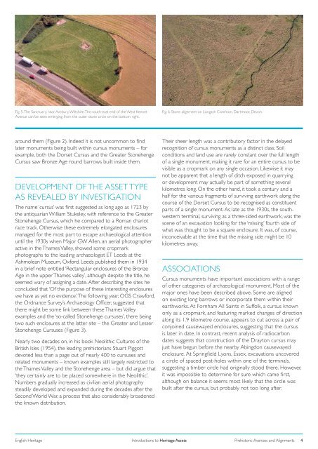
Fig. 5. The Sanctuary, near Avebury, Wiltshire. The south-east end of the West Kennet<br />
Avenue can be seen emerging from the outer stone circle on the bottom right.<br />
Fig. 6. Stone alignment on Longash Common, Dartmoor, Devon.<br />
around them (Figure 2). Indeed it is not uncommon to find<br />
later monuments being built within cursus monuments – for<br />
example, both the Dorset Cursus <strong>and</strong> the Greater Stonehenge<br />
Cursus saw Bronze Age round barrows built inside them.<br />
DEVELOPMENT OF THE ASSET TYPE<br />
AS REVEALED BY INVESTIGATION<br />
The name ‘cursus’ was first suggested as long ago as 1723 by<br />
the antiquarian William Stukeley, with reference to the Greater<br />
Stonehenge Cursus, which he compared to a Roman chariot<br />
race track. Otherwise these extremely elongated enclosures<br />
managed for the most part to escape archaeological attention<br />
until the 1930s when Major GW Allen, an aerial photographer<br />
active in the Thames Valley, showed some cropmark<br />
photographs to the leading archaeologist ET Leeds at the<br />
Ashmolean Museum, Oxford. Leeds published them in 1934<br />
in a brief note entitled ‘Rectangular enclosures of the Bronze<br />
Age in the upper Thames valley’, although despite the title, he<br />
seemed wary of assigning a date. After describing the sites he<br />
concluded that ‘Of the purpose of these interesting enclosures<br />
we have as yet no evidence.’ The following year, OGS Crawford,<br />
the Ordnance Survey’s Archaeology Officer, suggested that<br />
there might be some link between these Thames Valley<br />
examples <strong>and</strong> the ‘so-called Stonehenge cursuses’, there being<br />
two such enclosures at the latter site – the Greater <strong>and</strong> Lesser<br />
Stonehenge Cursuses (Figure 3).<br />
Nearly two decades on, in his book Neolithic Cultures of the<br />
British Isles (1954), the leading prehistorians Stuart Piggott<br />
devoted less than a page out of nearly 400 to cursuses <strong>and</strong><br />
related monuments – known examples still largely restricted to<br />
the Thames Valley <strong>and</strong> the Stonehenge area – but did argue that<br />
‘they certainly are to be placed somewhere in the Neolithic’.<br />
Numbers gradually increased as civilian aerial photography<br />
steadily developed <strong>and</strong> exp<strong>and</strong>ed during the decades after the<br />
Second World War, a process that also considerably broadened<br />
the known distribution.<br />
Their sheer length was a contributory factor in the delayed<br />
recognition of cursus monuments as a distinct class. Soil<br />
conditions <strong>and</strong> l<strong>and</strong> use are rarely constant over the full length<br />
of a single monument, making it rare for an entire cursus to be<br />
visible as a cropmark on any single occasion. Likewise it may<br />
not be apparent that a length of ditch exposed in quarrying<br />
or development may actually be part of something several<br />
kilometres long. On the other h<strong>and</strong>, it took a century <strong>and</strong> a<br />
half for the various fragments of surviving earthwork along the<br />
course of the Dorset Cursus to be recognised as constituent<br />
parts of a single monument. As late as the 1930s, the southwestern<br />
terminal, surviving as a three-sided earthwork, was the<br />
scene of an excavation looking for the ‘missing’ fourth side of<br />
what was thought to be a square enclosure. It was, of course,<br />
inconceivable at the time that the missing side might be 10<br />
kilometres away.<br />
ASSOCIATIONS<br />
Cursus monuments have important associations with a range<br />
of other categories of archaeological monument. Most of the<br />
major ones have been described above. Some are aligned<br />
on existing long barrows or incorporate them within their<br />
earthworks. At Fornham All Saints in Suffolk, a cursus known<br />
only as a cropmark, <strong>and</strong> featuring marked changes of direction<br />
along its 1.9 kilometre course, appears to cut across a pair of<br />
conjoined causewayed enclosures, suggesting that the cursus<br />
is later in date. In contrast, recent analysis of radiocarbon<br />
dates suggests that construction of the Drayton cursus may<br />
just have begun before the nearby Abingdon causewayed<br />
enclosure. At Springfield Lyons, Essex, excavations uncovered<br />
a circle of spaced post-holes within one of the terminals,<br />
suggesting a timber circle had originally stood there. However,<br />
it was impossible to determine for sure which came first,<br />
although on balance it seems most likely that the circle was<br />
built after the cursus, but probably not too long after.<br />
<strong>English</strong> <strong>Heritage</strong> Introductions to <strong>Heritage</strong> Assets<br />
<strong>Prehistoric</strong> <strong>Avenues</strong> <strong>and</strong> <strong>Alignments</strong> 4


