watauga river basin - North Carolina Floodplain Mapping Program
watauga river basin - North Carolina Floodplain Mapping Program
watauga river basin - North Carolina Floodplain Mapping Program

You also want an ePaper? Increase the reach of your titles
YUMPU automatically turns print PDFs into web optimized ePapers that Google loves.
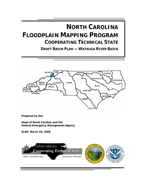
NORTH CAROLINA<br />
FLOODPLAIN MAPPING PROGRAM<br />
COOPERATING TECHNICAL STATE<br />
DRAFT BASIN PLAN — WATAUGA RIVER BASIN<br />
Prepared by the:<br />
State of <strong>North</strong> <strong>Carolina</strong> and the<br />
Federal Emergency Management Agency<br />
Draft: March 10, 2006
<strong>North</strong> <strong>Carolina</strong> <strong>Floodplain</strong> <strong>Mapping</strong> <strong>Program</strong><br />
Cooperating Technical State<br />
TABLE OF CONTENTS<br />
PAGE<br />
Contact Information.................................................................................................. iv<br />
Abbreviations and Acronyms ...................................................................................... v<br />
I. Introduction ...................................................................................................1<br />
Why the State of <strong>North</strong> <strong>Carolina</strong> Created the <strong>Floodplain</strong> <strong>Mapping</strong> <strong>Program</strong>.........2<br />
Components of the <strong>North</strong> <strong>Carolina</strong> <strong>Floodplain</strong> <strong>Mapping</strong> <strong>Program</strong>........................2<br />
<strong>Floodplain</strong> <strong>Mapping</strong> <strong>Program</strong> Funding and Work Plan........................................3<br />
<strong>Program</strong> Benefits............................................................................................4<br />
II. Watauga River Basin Description .....................................................................5<br />
III.<br />
IV.<br />
Scoping Phase for the Watauga River Basin......................................................9<br />
Step 1—Initial Research and Community Coordination .................................... 11<br />
Step 2—Initial Scoping Meetings.................................................................... 12<br />
Step 3—Draft Basin Plan ............................................................................... 14<br />
Step 4—Final Scoping Meetings ..................................................................... 14<br />
Step 5—Final Basin Plan................................................................................ 15<br />
Elevation and Flood Data Development and Digital FIRM Production for<br />
the Watauga River Basin.......................................................................... 16<br />
Base Map..................................................................................................... 16<br />
Topographic Data ......................................................................................... 16<br />
Flood Hazard Data........................................................................................ 17<br />
1. Detailed Study—Riverine............................................................... 17<br />
2. Limited Detailed Study.................................................................. 19<br />
3. Redelineation ............................................................................... 19<br />
4. Use of Effective Information.......................................................... 20<br />
5. Variations from Community-Identified Needs and Priorities ............. 21<br />
Digital FIRMs................................................................................................ 21<br />
V. Community Review and Due Process.............................................................. 22<br />
Draft Basin Plan — Watauga River Basin<br />
Date: March 10, 2006<br />
Page i
<strong>North</strong> <strong>Carolina</strong> <strong>Floodplain</strong> <strong>Mapping</strong> <strong>Program</strong><br />
Cooperating Technical State<br />
TABLE OF CONTENTS<br />
PAGE<br />
List of Figures<br />
Figure 1. Total Flood Claims and Repetitive Loss Policies...................................1<br />
Figure 2. Three Phases of Development and Production....................................3<br />
Figure 3. Phases of the <strong>North</strong> <strong>Carolina</strong> Statewide <strong>Floodplain</strong> <strong>Mapping</strong> <strong>Program</strong>...3<br />
Figure 4. Watauga River Basin Vicinity Map......................................................5<br />
Figure 5. Watauga General Basin Map .............................................................7<br />
Figure 6. Process for Scoping the Watauga River Basin ................................... 10<br />
Figure 7. Components of a Digital FIRM ......................................................... 16<br />
List of Tables<br />
Table 1. Community Information .....................................................................8<br />
Table 2. USGS Gage Information ................................................................... 12<br />
Table 3. Initial Scoping Meetings for the Watauga River Basin......................... 13<br />
Table 4. Summary of Riverine Flooding Sources to be Studied in Detail............ 18<br />
Table 5. Summary of Technical Methods for the Watauga River Basin.............. 20<br />
Table 6. Summary of Digital FIRMs for the<br />
Watauga River Basin ....................................................................... 22<br />
Appendices<br />
Appendix A. Attendance Sheets from Initial Scoping Meetings ........................A-1<br />
Appendix B. Summaries of Community-Identified<br />
Flood <strong>Mapping</strong> Needs................................................................B-1<br />
Appendix C. Attendance Sheet(s) from Final Scoping Meeting(s)(to be added to<br />
the final <strong>basin</strong> plan)…………………………………………………………………..…………….C-1<br />
Appendix D. Summary of Flooding Sources to be Studied by<br />
Limited Detailed Methods………………………………………………..…....D-1<br />
Appendix E. Summary of Flooding Sources to be Studied by Redelineation......E-1<br />
Appendix F. Summary of Variations from Community-Identified<br />
Needs and Priorities……………………………………………………………….F-1<br />
Draft Basin Plan — Watauga River Basin<br />
Date: March 10, 2006<br />
Page ii
<strong>North</strong> <strong>Carolina</strong> <strong>Floodplain</strong> <strong>Mapping</strong> <strong>Program</strong><br />
Cooperating Technical State<br />
TABLE OF CONTENTS<br />
Attachments<br />
1. Community Recommendations – Watauga River Basin<br />
a. Avery County, <strong>North</strong> <strong>Carolina</strong><br />
b. Watauga County, <strong>North</strong> <strong>Carolina</strong><br />
2. Draft Basin Plan – Watauga River Basin<br />
a. Avery County, <strong>North</strong> <strong>Carolina</strong><br />
b. Watauga County, <strong>North</strong> <strong>Carolina</strong><br />
Draft Basin Plan — Watauga River Basin<br />
Date: March 10, 2006<br />
Page iii
<strong>North</strong> <strong>Carolina</strong> <strong>Floodplain</strong> <strong>Mapping</strong> <strong>Program</strong><br />
Cooperating Technical State<br />
CONTACT INFORMATION<br />
Questions or comments about this Basin Plan can be directed to:<br />
Steve Garrett, Community Development Planner II<br />
<strong>North</strong> <strong>Carolina</strong> <strong>Floodplain</strong> <strong>Mapping</strong> <strong>Program</strong><br />
(919)715-5711 x118 or sgarrett@ncem.org<br />
Questions about the National Flood Insurance <strong>Program</strong> (NFIP) and NFIP mapping can be<br />
directed to the Federal Emergency Management Agency’ s Map Assistance Center toll<br />
free information line at 1-877 FEMA MAP (1-877-336-2627) or<br />
map.specialist@dewberry.com.<br />
Draft Basin Plan — Watauga River Basin<br />
Date: March 10, 2006<br />
Page iv
<strong>North</strong> <strong>Carolina</strong> <strong>Floodplain</strong> <strong>Mapping</strong> <strong>Program</strong><br />
Cooperating Technical State<br />
ABBREVIATIONS AND ACRONYMS<br />
The following abbreviations and/or acronyms are used throughout this Basin Plan.<br />
Abbreviation/Acronym Description<br />
BFE Base Flood Elevation<br />
CGIA Center for Geographic Information and Analysis<br />
CTS Cooperating Technical State<br />
DEMs Digital Elevation Models<br />
DFIRM Digital Flood Insurance Rate Map<br />
DOQs Digital Orthophoto Quadrangles<br />
FEMA Federal Emergency Management Agency<br />
FEMA-MCC FEMA’s <strong>Mapping</strong> Coordination Contractor (Dewberry)<br />
FIS Flood Insurance Study<br />
FIRM Flood Insurance Rate Map<br />
FMIS <strong>Floodplain</strong> <strong>Mapping</strong> Information System<br />
GIS Geographic Information Systems<br />
LIDAR Light Detection and Ranging<br />
MENCA <strong>Mapping</strong> and Engineering Needs Community Assessment<br />
NAVD 88 <strong>North</strong> American Vertical Datum of 1988<br />
NCEM <strong>North</strong> <strong>Carolina</strong> Division of Emergency Management<br />
NCDENR <strong>North</strong> <strong>Carolina</strong> Department of Environment and Natural<br />
Resources<br />
NCFMP <strong>North</strong> <strong>Carolina</strong> <strong>Floodplain</strong> <strong>Mapping</strong> <strong>Program</strong><br />
NFIP National Flood Insurance <strong>Program</strong><br />
NGVD 29 National Geodetic Vertical Datum of 1929<br />
TIN Triangulated Irregular Network<br />
USGS U. S. Geological Survey<br />
UT Unnamed Tributary<br />
Draft Basin Plan — Watauga River Basin<br />
Date: March 10, 2006<br />
Page v
<strong>North</strong> <strong>Carolina</strong> <strong>Floodplain</strong> <strong>Mapping</strong> <strong>Program</strong><br />
Cooperating Technical State<br />
I. INTRODUCTION<br />
The State of <strong>North</strong> <strong>Carolina</strong>, through the Federal Emergency Management Agency’s<br />
(FEMA’s) Cooperating Technical Community partnership initiative, has been designated<br />
as the nation’s first Cooperating Technical State (CTS). As a CTS, the State has<br />
assumed primary ownership and responsibility of the National Flood Insurance<br />
<strong>Program</strong>’s (NFIP) Flood Insurance Rate Maps (FIRMs) for all <strong>North</strong> <strong>Carolina</strong><br />
communities. This role has traditionally been fulfilled by FEMA.<br />
<strong>North</strong> <strong>Carolina</strong> faces extreme hazards and consequence from hurricanes and flooding.<br />
Since 1989, there have been at least 21 federally declared disasters in <strong>North</strong> <strong>Carolina</strong>.<br />
Damages from Hurricane Floyd alone have reached $3.5 billion. As a result of Hurricane<br />
Floyd, 4,117 uninsured and under-insured homes were destroyed. Figure 1 below<br />
shows the number of flood claims and repetitive loss policies in the Watauga River Basin<br />
between the years of 1978 and 2004. The State’s vulnerability to hurricanes and<br />
flooding make it crucial that communities and property owners have accurate, up-todate<br />
information about the flood risk. The updated digital FIRMs produced through this<br />
<strong>Program</strong> will help to protect the lives and property, and contribute to the general well<br />
being, of <strong>North</strong> <strong>Carolina</strong> citizens.<br />
County<br />
No. of Policies / Claims<br />
since 1978<br />
Repetitive Loss Structures<br />
/ Claims<br />
Avery 141 / 84 7 / 15<br />
Watauga 274 / 95 5 / 13<br />
Figure 1. Total Flood Claims and Repetitive Loss Policies<br />
Draft Basin Plan — Watauga River Basin<br />
Date: March 10, 2006 Page 1
<strong>North</strong> <strong>Carolina</strong> <strong>Floodplain</strong> <strong>Mapping</strong> <strong>Program</strong><br />
Cooperating Technical State<br />
Why the State <strong>North</strong> <strong>Carolina</strong> Created the <strong>Floodplain</strong> <strong>Mapping</strong> <strong>Program</strong><br />
There are several reasons why the State has initiated this <strong>Program</strong>; these include the<br />
following:<br />
• Approximately 55% of <strong>North</strong> <strong>Carolina</strong> FIRMs were at least 10 years old.<br />
• Approximately 75% of <strong>North</strong> <strong>Carolina</strong> FIRMs were at least 5 years old.<br />
• FEMA’s mapping budget is finite; on average, <strong>North</strong> <strong>Carolina</strong> received only one<br />
updated flood study for one county per year.<br />
• Many counties and communities have indicated that they do not have the<br />
resources to take on this responsibility.<br />
Components of the <strong>North</strong> <strong>Carolina</strong> <strong>Floodplain</strong> <strong>Mapping</strong> <strong>Program</strong><br />
The <strong>North</strong> <strong>Carolina</strong> <strong>Floodplain</strong> <strong>Mapping</strong> <strong>Program</strong> involves the following:<br />
• Acquisition of high-resolution topographic data and development of accurate DEMs.<br />
• Development of up-to-date, accurate flood hazard data and floodplain mapping.<br />
• Production of seamless digital FIRM coverage statewide:<br />
- Digital FIRMs will be produced on a statewide basis where all counties and<br />
incorporated communities are seamlessly shown across one set of state maps.<br />
- Digital Orthophoto Quadrangles (DOQs), produced in partnership by the State<br />
of <strong>North</strong> <strong>Carolina</strong> and the U.S. Geological Survey (USGS), will be used as the<br />
primary base map. In areas where there is a locally produced base map that is<br />
more current or accurate than the DOQs, the locally developed map may be<br />
used to supplement or in place of the DOQs as the base.<br />
- Flood Elevations on the DFIRMs will be converted to the <strong>North</strong> American<br />
Vertical Datum of 1988 (NAVD 88).<br />
The <strong>North</strong> <strong>Carolina</strong> <strong>Floodplain</strong> <strong>Mapping</strong> <strong>Program</strong>, administratively located in the <strong>North</strong><br />
<strong>Carolina</strong> Division of Emergency Management (NCEM) oversees and manages the<br />
<strong>Program</strong>. NCFMP will work closely with several other state agency partner (<strong>North</strong><br />
<strong>Carolina</strong> Geodetic Survey [NCGS], Center for Geographic Information and Analysis<br />
[CGIA], and the <strong>Floodplain</strong> Management Branch) to ensure quality map production. In<br />
the production of the Basin Plan, NCFMP has worked in close cooperation with the<br />
<strong>Floodplain</strong> Management Branch of the NCEM to ensure that all flood hazards and NFIP<br />
issues are addressed. Additionally, after the updated flood data and maps are<br />
produced, NCFMP coordinates with <strong>Floodplain</strong> Management to conduct training and<br />
outreach to assist communities in utilizing the new data and maps to implement<br />
floodplain management and hazard mitigation activities.<br />
The <strong>North</strong> <strong>Carolina</strong> <strong>Floodplain</strong> <strong>Mapping</strong> <strong>Program</strong> has also implemented a state-of-theart,<br />
dynamic <strong>Floodplain</strong> <strong>Mapping</strong> Information System (FMIS) to analyze, maintain, and<br />
archive maps and associated flood hazard data. The FMIS also serves to present and<br />
Draft Basin Plan — Watauga River Basin<br />
Date: March 10, 2006 Page 2
<strong>North</strong> <strong>Carolina</strong> <strong>Floodplain</strong> <strong>Mapping</strong> <strong>Program</strong><br />
Cooperating Technical State<br />
distribute the mapping data and associated reports to the public via the Internet without<br />
the user needing to have sophisticated Geographic Information System (GIS) software.<br />
An additional component of the <strong>Program</strong> is a real-time flood forecasting and inundation<br />
mapping capability. The <strong>North</strong> <strong>Carolina</strong> Flood Warning System is currently being piloted<br />
in the Tar-Pamlico and Neuse River Basins.<br />
The development of topographic and flood data and production of statewide digital<br />
FIRM panels will have three phases (Figure 2): (1) scoping, (2) flood map production,<br />
and (3) Community Review and Due Process (post-preliminary process).<br />
Scoping<br />
Flood Map<br />
Production<br />
Community<br />
Review and<br />
Due Process<br />
Figure 2. Three Phases of Development and Production<br />
Flood <strong>Mapping</strong> <strong>Program</strong> Funding and Work Plan<br />
In August 2000, the <strong>North</strong> <strong>Carolina</strong> General Assembly allocated $42.8 million to the<br />
<strong>Floodplain</strong> <strong>Mapping</strong> <strong>Program</strong>. FEMA has contributed an additional $30.65 million toward<br />
the <strong>Program</strong> as well as in-kind contribution of engineering, mapping, and program<br />
management services. The State has also worked with other Federal partners to secure<br />
additional needed funding. Based on the General Assembly’s directive, work began on<br />
the six eastern <strong>river</strong> <strong>basin</strong>s as shown in Figure 3 (Phase I—Cape Fear, Lumber, Neuse,<br />
Pasquotank, Tar-Pamlico, and White Oak). Work was initiated on six additional <strong>river</strong><br />
<strong>basin</strong>s in 2003 (Phase II—Chowan, Roanoke, Yadkin, Catawba, Watauga, and New).<br />
Work on the remaining five <strong>basin</strong>s (Phase III—Broad, French Broad, Little Tennessee,<br />
Hiawassee, and Savannah) started in the summer of 2005 and the General Assembly of<br />
<strong>North</strong> <strong>Carolina</strong> provided an additional $10 million.<br />
Draft Basin Plan — Watauga River Basin<br />
Date: March 10, 2006 Page 3
<strong>North</strong> <strong>Carolina</strong> <strong>Floodplain</strong> <strong>Mapping</strong> <strong>Program</strong><br />
Cooperating Technical State<br />
Figure 3. Phases of the <strong>North</strong> <strong>Carolina</strong> <strong>Floodplain</strong> <strong>Mapping</strong> <strong>Program</strong><br />
<strong>Program</strong> Benefits<br />
The <strong>North</strong> <strong>Carolina</strong> Statewide <strong>Floodplain</strong> <strong>Mapping</strong> <strong>Program</strong> will provide many benefits to<br />
<strong>North</strong> <strong>Carolina</strong> communities, property owners, and citizens. These include:<br />
• The updated flood hazard data will provide current, accurate information for<br />
<strong>North</strong> <strong>Carolina</strong> communities and property owners to make safe siting and design<br />
decisions when rebuilding from flooding disasters, building new structures and<br />
infrastructure, and retrofitting existing structures.<br />
• The use of the updated data by communities for floodplain management will<br />
dramatically reduce long-term flood losses to the State of <strong>North</strong> <strong>Carolina</strong>, its<br />
communities, and its citizens.<br />
• Updated flood hazard data will alert those at risk of flooding of the need to<br />
purchase flood insurance protection.<br />
• It will be faster and more cost effective to update digital FIRMs.<br />
• Current, updated base maps and the digital format of the FIRMs will allow users<br />
to make more efficient, precise flood risk determinations.<br />
• The resultant digital FIRMs will be the official NFIP maps; these digital FIRMs will<br />
also be used by communities for floodplain management purposes.<br />
• The digital format of the digital FIRMs will allow use with GIS for analysis and<br />
planning.<br />
• The digital <strong>Floodplain</strong> <strong>Mapping</strong> Information System will allow online access to all<br />
map users 24 hours a day without requiring sophisticated GIS software.<br />
• The DEMs being developed will be useful for almost any engineering or planning<br />
application, such as site design, storm-water management, transportation<br />
planning and design, and spill response.<br />
This report summarizes and provides details about the scoping phase that was<br />
completed for the Watauga River Basin and how the results of this scoping effort were<br />
used to develop a plan for developing updated flood data and statewide digital FIRMs<br />
for counties and communities located within the Watauga River Basin. This report also<br />
describes the process and schedule for completing the map production and community<br />
review phases.<br />
Draft Basin Plan — Watauga River Basin<br />
Date: March 10, 2006 Page 4
<strong>North</strong> <strong>Carolina</strong> <strong>Floodplain</strong> <strong>Mapping</strong> <strong>Program</strong><br />
Cooperating Technical State<br />
II. Watauga River Basin Description<br />
The Watauga River Basin, is located within the Blue Ridge Province of the Appalachian<br />
Mountains of western <strong>North</strong> <strong>Carolina</strong>. This <strong>basin</strong> is nestled between the French Broad<br />
and Catawba River Basins to the south and the New River <strong>basin</strong> to the north. The<br />
watershed drains north to northwest from <strong>North</strong> <strong>Carolina</strong> to Tennessee.<br />
Figure 4. Watauga River Basin Vicinity Map<br />
The Watauga River Basin is composed of the headwaters and tributaries of the Elk River<br />
and the Watauga River. The Elk River, the principal tributary of the Watauga River, and<br />
the Watauga River flow into Watauga Lake in Tennessee. The Watauga River and Elk<br />
River are headwater tributaries of the Holston River system and flow northwest from<br />
<strong>North</strong> <strong>Carolina</strong> to Tennessee and has approximately 303 streams. These waters flow<br />
into the Tennessee River and eventually into the Mississippi River and the Gulf of<br />
Mexico. Elk Falls, located in Avery County on the Elk River, is 65 feet in height and is<br />
known to have one of the largest and deepest plunge pools of any waterfall in the State.<br />
This is a well known swimming, sunbathing and gathering place for students from the<br />
local colleges.<br />
Draft Basin Plan — Watauga River Basin<br />
Date: March 10, 2006 Page 5
<strong>North</strong> <strong>Carolina</strong> <strong>Floodplain</strong> <strong>Mapping</strong> <strong>Program</strong><br />
Cooperating Technical State<br />
The <strong>basin</strong> is the second smallest in the state, encompassing only 184 square miles of<br />
watershed. The <strong>basin</strong> contains approximately 270 miles of freshwater streams and<br />
<strong>river</strong>s. The upper portion of the Watauga River and most tributaries support a good<br />
trout fishery; this intergrades with a “cool-water” fishery (smallmouth bass) in the<br />
middle and lower section of the <strong>river</strong>. Most tributaries are trout streams, although<br />
sedimentation may reduce the quality of the fisheries in some of these streams. The<br />
<strong>basin</strong> contains approximately 283 miles of freshwater streams and <strong>river</strong>s.<br />
The topography of the Watauga River Basin is mountainous and rural. Steep slopes<br />
limit developable land for construction and agricultural uses, which are concentrated in<br />
the valleys. Roads are commonly situated along the flooding sources. According to the<br />
USDA-NRCS National Resources Inventory of 1992 the land cover is approximately 56%<br />
forested, 24% pasture, 8% urban, 8% other (rural transportation & associated rights-ofway,<br />
small water areas [water bodies less than 40 acres in size and streams less than ½<br />
mile wide] and census waters [large water bodies consisting of lakes and estuaries<br />
greater than 40 acres and <strong>river</strong>s greater than ½ mile in width] and 4% uncultivated<br />
cropland or agriculture. Land cover in the <strong>basin</strong> is dominated by forest and pasture<br />
lands. Between 1982 and 1997, land-use identification shows urban and developed land<br />
increased by 8,200 acres and forestlands decreased by 8,000 acres.<br />
Draft Basin Plan — Watauga River Basin<br />
Date: March 10, 2006 Page 6
<strong>North</strong> <strong>Carolina</strong> <strong>Floodplain</strong> <strong>Mapping</strong> <strong>Program</strong><br />
Cooperating Technical State<br />
Figure 5. Watauga General Basin Map<br />
The Watauga River Basin is home to many natural resources including various rock<br />
types, unusual wetlands, and a range of elevations. The two more significant sites in<br />
the Southern Appalachian Mountains are Grandfather Mountain and Roan Mountain<br />
Massif, where rare plants and animals dwell. This <strong>basin</strong> contains several high quality<br />
mountain bogs. Bogs are defined as wet spongy ground areas or poorly drained, usually<br />
acid, areas rich in accumulated plant material, frequently surrounding a body of open<br />
water, and having a characteristic flora. Mountain bogs are saturated with water most<br />
Draft Basin Plan — Watauga River Basin<br />
Date: March 10, 2006 Page 7
<strong>North</strong> <strong>Carolina</strong> <strong>Floodplain</strong> <strong>Mapping</strong> <strong>Program</strong><br />
Cooperating Technical State<br />
of the year and may have thick layers of moss underlain by peat moss and are acidic.<br />
These bogs are often small and do not make up a significant portion of the landscape;<br />
however they support many atypical plants and animals, including bog turtles.<br />
Consequently about 90% of mountain bogs in <strong>North</strong> <strong>Carolina</strong> have been destroyed.<br />
The economy of the Watauga River Basin is largely supported by the presence of a<br />
major state university (Appalachian State University), thriving year-round tourism,<br />
broad-based retail, agricultural and forest products, and transportation-related<br />
businesses. Watauga County has one of the lowest annual unemployment rates in the<br />
State and 45% of the properties are absentee-owned. 1/3 of all new building permits in<br />
the county are attributed to seasonal housing. Boone and Watauga County are home to<br />
at least 35 manufacturing firms which employ up to 300 employees per firm. These<br />
“home-grown” companies manufacture and distribute items such as: leather products,<br />
wood furniture components, indoor metal furniture, candies and mints, log homes, and<br />
specialty paint systems. Avery County, too, has a low unemployment rate (4.3% as<br />
recorded in 2003) and is an agricultural-based county where over 80% of the lands are<br />
farmed. 11% of the County residents work in manufacturing, while 25% are<br />
professionals, 16% work in production, and 20% work in sales.<br />
Flooding in the Watauga River Basin occurs as a result of poorly constructed roads and<br />
flash-flooding caused by the steep terrain.<br />
Avery and Watauga Counties are partially located within the Watauga River Basin and<br />
are summarized in Table 1 below.<br />
Community Name County Participation Status<br />
Date of Current NFIP<br />
Map<br />
AVERY COUNTY AVERY Regular/Participating 9/28/1990<br />
BANNER ELK, TOWN OF AVERY Regular/Participating 1/15/1988<br />
ELK PARK, TOWN OF AVERY Regular/Participating 4/15/1986<br />
LINVILLE AVERY Non-Participating<br />
CROSSNORE AVERY Regular/Participating 8/19/1986<br />
SUGAR MOUNTAIN AVERY Non-Participating<br />
NEWLAND AVERY Regular/Participating 12/4/1984<br />
GRANDFATHER VILLAGE AVERY Non-Participating<br />
BLOWING ROCK WATAUGA Regular/Participating 1/17/1997<br />
BEECH MOUNTAIN, TOWN WATAUGA Regular/Participating 1/17/1997<br />
OF<br />
BOONE, TOWN OF WATAUGA Regular/Participating 1/17/1997<br />
SEVEN DEVILS, TOWN OF WATAUGA Regular/Participating 1/17/1997<br />
WATAUGA COUNTY WATAUGA Regular/Participating 9/21/1998<br />
Table 1. Community Information<br />
Draft Basin Plan — Watauga River Basin<br />
Date: March 10, 2006 Page 8
<strong>North</strong> <strong>Carolina</strong> <strong>Floodplain</strong> <strong>Mapping</strong> <strong>Program</strong><br />
Cooperating Technical State<br />
III.<br />
SCOPING PHASE FOR THE WATAUGA RIVER BASIN<br />
The State worked closely with FEMA and Dewberry, to complete the scoping phase for<br />
the Watauga River Basin counties and communities in the winter of 2003-2004. Stated<br />
simply, “scoping” is determining what areas are floodprone and need to have flood<br />
hazard data developed, what methods will be used to generate that hazard data, and<br />
how the data will be presented on the DFIRMs. For the Watauga River Basin, the<br />
comprehensive scoping phase entailed:<br />
• Researching and inventorying available elevation, flood hazard, and digital base<br />
map data that may be useful for preparing updated digital FIRMs;<br />
• Assessing existing flood hazard data (for example: flood elevation profiles,<br />
floodplain boundaries, floodways, coastal hazard zones) on effective FIRMs for<br />
adequacy;<br />
• Providing outreach to, and receiving input from, counties and communities<br />
regarding their needs for updated DFIRMs;<br />
• Identifying data that needs to be developed or acquired, such as digital base<br />
maps, DEMs, or field surveys of stream channels, hydraulic structures, and<br />
coastal transects;<br />
• Determining the proposed scales and paneling scheme for statewide digital FIRM<br />
production; and<br />
• Developing a schedule for completion of updated flood hazard data and digital<br />
FIRM production.<br />
For flooding sources within the <strong>basin</strong>, the flood hazard data from the effective FIRMs<br />
were assessed for adequacy in consultation with the impacted counties and<br />
communities. For areas where the existing flood hazard data was deemed to be<br />
inadequate or outdated, a priority level was established and the most appropriate<br />
method of developing updated data was selected based on the:<br />
• Type and extent of manmade and natural changes within the floodplain and/or<br />
watershed;<br />
• Quality of data available; and<br />
• Existing and/or proposed levels of development affected by the flooding source.<br />
The process followed for completing the scoping is shown in Figure 6 and is described<br />
further below.<br />
Draft Basin Plan — Watauga River Basin<br />
Date: March 10, 2006 Page 9
<strong>North</strong> <strong>Carolina</strong> <strong>Floodplain</strong> <strong>Mapping</strong> <strong>Program</strong><br />
Cooperating Technical State<br />
Scoping<br />
Flood Map<br />
Production<br />
Step 1 Step 2 Step 3 Step 4 Step 5<br />
Initial<br />
Research &<br />
Community<br />
Coordination<br />
Initial<br />
Scoping<br />
Meeting<br />
Draft<br />
Basin<br />
Plan<br />
Final<br />
Scoping<br />
Meeting<br />
Revise<br />
Draft<br />
Basin<br />
Plan<br />
Technical<br />
& Cost<br />
Proposals<br />
for<br />
Contractors<br />
Finalize<br />
Basin<br />
Plan<br />
Figure 6. Process for Scoping the Watauga River Basin<br />
Distribute<br />
Final Basin<br />
Plan to<br />
Communities<br />
Analysis<br />
and<br />
<strong>Mapping</strong><br />
Draft Basin Plan — Watauga River Basin<br />
Date: March 10, 2006 Page 10
<strong>North</strong> <strong>Carolina</strong> <strong>Floodplain</strong> <strong>Mapping</strong> <strong>Program</strong><br />
Cooperating Technical State<br />
Step 1—Initial Research and Community Coordination<br />
The State held two central “kickoff” meetings in 2003 with county and community<br />
floodplain administrators, engineers, and planners on June 30, 2003 in Weldon and on<br />
July 8, 2003 in Statesville. The objectives of the meetings were to overview the State’s<br />
CTS Agreement with FEMA and the <strong>North</strong> <strong>Carolina</strong> <strong>Floodplain</strong> <strong>Mapping</strong> <strong>Program</strong>, inform<br />
the floodplain administrators of the process that will be followed to develop updated<br />
mapping, and encourage them to be an active participant in the process. A<br />
questionnaire regarding the communities’ mapping needs was mailed prior to the<br />
meeting and distributed to those community representatives in attendance. This<br />
questionnaire contained pointed questions designed to help each community<br />
systematically ascertain its flood mapping needs. The county and community officials<br />
were encouraged to complete the questionnaire and submit it either digitally via e-mail<br />
or in a hardcopy delivered by the US Postal Service. Technical support was available for<br />
completion of the questionnaire through the State.<br />
Completed questionnaires were received by the State from the following counties and<br />
communities in the Watauga River Basin: Elk Park and Watauga County<br />
Additionally, the State completed research of community mapping needs as per its<br />
September 2000 Cooperating Technical Community agreement with FEMA, “Assessment<br />
of Community <strong>Mapping</strong> Needs.” Further, FEMA and Dewberry conducted research of<br />
effective Flood Insurance Study (FIS) and FIRM information and other relevant data<br />
available for each community in the FEMA Flood <strong>Mapping</strong> Archives and FEMA’s <strong>Mapping</strong><br />
Needs Update Support System database. This database contains information on<br />
community mapping needs collected over the past few years through community<br />
surveys.<br />
As part of the initial research, the State and Dewberry also evaluated post-Hurricane<br />
Floyd data, such as gage information, high-water marks, and inundation mapping,<br />
obtained from FEMA, the U.S. Army Corps of Engineers, and the USGS. The purpose of<br />
this evaluation was to identify areas where actual flooding elevations and inundation<br />
limits experienced did not match the flood hazard data in the effective FIS and FIRM,<br />
thereby indicating a mapping need.<br />
Draft Basin Plan — Watauga River Basin<br />
Date: March 10, 2006 Page 11
<strong>North</strong> <strong>Carolina</strong> <strong>Floodplain</strong> <strong>Mapping</strong> <strong>Program</strong><br />
Cooperating Technical State<br />
Up-to-date analyses for 5 stream gages located in the Watauga River Basin were<br />
obtained from the USGS for Detailed and Approximate Zone A studied flooding sources.<br />
The revised gage analyses were compared with effective FIRM information to determine<br />
the need for restudy of the flooding sources on which these gages are located. As part<br />
of this assessment, the 1% annual chance (100-year) discharge and 1% annual chance<br />
water-surface elevation were compared. Tables 2a and 2b outline this information for 5<br />
stream gages in the Watauga River Basin.<br />
Table 2a. USGS Gage Information<br />
USGS<br />
Detailed Studied Flooding Sources<br />
100-year Discharge (cfs) 100-year WSEL (ft)<br />
Gage Flooding Source Effective Gage Effective Gage<br />
03478910 Cove Creek 5,200 5,722 2,684 N/A<br />
03479000 Watauga River 36,051 39,160 2,632 2,634<br />
N/A – not applicable because stream is currently not studied by detailed methods<br />
*All elevations are referenced to the <strong>North</strong> American Vertical Datum of 1988 (NAVD 88)<br />
USGS<br />
Gage<br />
Table 2b. USGS Gage Information<br />
Approximate Zone A Flooding Sources<br />
100-year Discharge<br />
(cfs)<br />
100-year Elevation<br />
(NGVD)<br />
Effective Zone<br />
Flooding<br />
Source Effective Gage Zone A<br />
03480500 Elk River Insufficient Data N/A Zone A<br />
03480540 Peavine Branch 50 N/A Zone A<br />
03481000 Elk River 20,380 2,825 Zone A<br />
N/A – not applicable because stream is currently not studied by detailed methods<br />
*All elevations are referenced to the National Geodetic Vertical Datum of 1929 (NGVD 29)<br />
The results of the initial research and responses to the community questionnaires were<br />
entered into a GIS-enabled scoping database: <strong>Mapping</strong> and Engineering Needs<br />
Community Assessment (MENCA). This database was used to generate “Initial Scoping<br />
Projects” for each community; these projects were used to conduct the Initial Scoping<br />
Meetings (Step 2).<br />
Step 2—Initial Scoping Meetings<br />
The State held meetings in each county in the Watauga River Basin to present the<br />
results of the initial research to the county and its communities and to discuss their flood<br />
mapping needs. Elected officials, planners, floodplain administrators, emergency<br />
managers, engineers, surveyors and GIS staff were invited from the county and each<br />
Draft Basin Plan — Watauga River Basin<br />
Date: March 10, 2006 Page 12
<strong>North</strong> <strong>Carolina</strong> <strong>Floodplain</strong> <strong>Mapping</strong> <strong>Program</strong><br />
Cooperating Technical State<br />
incorporated community, including those communities that do not participate in the<br />
NFIP. The meetings were held at the County Seat or other readily accessible locations.<br />
FEMA and Dewberry staff attended to provide program and technical support during the<br />
meetings. NCEM <strong>Floodplain</strong> Management Branch staff attended the meetings to<br />
exchange contact information with community <strong>Floodplain</strong> Administrators, establish<br />
contact with non-participating communities, and distribute copies of the current <strong>North</strong><br />
<strong>Carolina</strong> model Flood Damage Prevention Ordinance. Table 3 summarizes the initial<br />
scoping meeting dates with each community. Meeting attendance sheets are included<br />
as Appendix A.<br />
Please note that portions of some counties in the Watauga River Basin are contained in<br />
other <strong>river</strong> <strong>basin</strong>s. The initial scoping meetings were conducted on a countywide basis<br />
and covered all areas of each county and community in the county irrespective of the<br />
<strong>basin</strong>. Table 3 contains a list of communities with the location and date of initial scoping<br />
meetings held for each community. Only those communities located entirely or partially<br />
within the Watauga River Basin are listed in Table 3.<br />
Table 3. Initial Scoping Meetings for the Watauga River Basin<br />
Community Meeting Location Meeting Date (s)<br />
Avery County – Banner Elk, Elk<br />
Park, Village of Sugar<br />
Mountain, Avery County<br />
Watauga County – Seven<br />
Devils, Blowing Rock, Boone,<br />
Watauga County<br />
175 Linville Street<br />
Newland, NC<br />
971 West King Street<br />
Boone, NC<br />
November 20, 2003<br />
November 19, 2003<br />
At the initial scoping meetings, the State, NCEM <strong>Floodplain</strong> Management Branch, and<br />
Dewberry representatives met individually, or in groups, with the county and its<br />
incorporated communities’ representatives to:<br />
• Provide a brief overview of the <strong>Floodplain</strong> <strong>Mapping</strong> <strong>Program</strong> purpose, objectives,<br />
and goals;<br />
• Review the research results for each community using the Initial Scoping<br />
Package;<br />
• Discuss the community’s mapping needs and response to the questionnaire; and<br />
• Identify available local data such as base maps, topographic data, ongoing<br />
studies, etc.<br />
In assessing the communities’ flood mapping needs, emphasis was placed on:<br />
• Areas of future development;<br />
• New or proposed crossings, encroachments, and flood controls;<br />
• Historically flooded areas;<br />
• Out-of-date or inadequate data on current FIRMs;<br />
Draft Basin Plan — Watauga River Basin<br />
Date: March 10, 2006 Page 13
<strong>North</strong> <strong>Carolina</strong> <strong>Floodplain</strong> <strong>Mapping</strong> <strong>Program</strong><br />
Cooperating Technical State<br />
• Existing data mismatches with contiguous communities; and<br />
• Out-of-date FEMA analyses (detailed or approximate).<br />
For flooding sources identified in the meeting as having a flood mapping need, the<br />
community was asked to provide input on proposed study priorities and analysis<br />
methods.<br />
Appendix B contains tables summarizing the community-identified flood mapping needs,<br />
suggested type of study, and priorities for each community within the Watauga River<br />
Basin. Attachments A and B depict these community-identified needs and priorities.<br />
Also, as part of the initial scoping effort, CGIA met with county GIS staff to inventory the<br />
availability of local GIS data to identify potential base map data resources for the<br />
<strong>Floodplain</strong> <strong>Mapping</strong> <strong>Program</strong>. Information collected from the survey form was entered<br />
into MENCA for Elk Park in Avery County and Watauga County for the Watauga Basin.<br />
Step 3—Draft Basin Plan<br />
Based on the results of the Initial Scoping Meetings, the State synthesized the research<br />
and the community input. These results were used to develop this Draft Basin Plan for<br />
developing updated flood hazard data for the <strong>basin</strong> and for producing statewide DFIRM<br />
panels for the affected counties and communities within the Watauga River Basin.<br />
Section IV of this Draft Basin Plan includes a list of flooding sources to be updated<br />
within the <strong>basin</strong>, including the technical method of update (detailed, limited detailed and<br />
redelineation) and reach limits and stream miles to be updated. Section IV also includes<br />
a comprehensive list of counties for which statewide DFIRM panels will be produced<br />
including digital base map source to be used and proposed DFIRM paneling and tiling<br />
scheme. Lastly, Section IV also includes a projected schedule for completing the <strong>basin</strong><br />
studies and statewide preliminary DFIRMs.<br />
Step 4—Final Scoping Meetings<br />
The draft Watauga River Basin Plan is scheduled to be sent to Avery & Watauga<br />
Counties and the communities and posted on the State’s website on or about March 1,<br />
2006. Subsequently, the State will hold a Final Scoping meeting for the Watauga River<br />
Basin counties and communities.<br />
The communities’ Chief Elected Officer, <strong>Floodplain</strong> Administrators, Planners, Engineers,<br />
GIS staff, Building and Zoning Officials will be invited from each county and incorporated<br />
community in the <strong>basin</strong> for the Final Scoping Meetings.<br />
The objective of the final scoping meeting is for the State to overview the Draft Basin<br />
Plan, including the proposed scope, schedule for the project, and provide an opportunity<br />
for additional county and community input or suggested changes to the Draft Basin<br />
Draft Basin Plan — Watauga River Basin<br />
Date: March 10, 2006 Page 14
<strong>North</strong> <strong>Carolina</strong> <strong>Floodplain</strong> <strong>Mapping</strong> <strong>Program</strong><br />
Cooperating Technical State<br />
Plan. Individual meetings, for Avery and Watauga Counties, will be scheduled for<br />
community leaders to meet with representatives from the State and Dewberry.<br />
The Final Basin Plan will summarize the comments and/or feedback received during the<br />
Final Scoping Meetings and will include the Final Scoping Meeting Attendance Sheet(s)<br />
in Appendix C.<br />
Step 5—Final Basin Plan<br />
After the Final Scoping Meetings have been held, the Draft Basin Plan will be revised, as<br />
necessary, to produce a Final Basin Plan. The Final Basin Plan will contain specific<br />
information regarding comments that were received and how the Draft Basin Plan was<br />
revised and why.<br />
The State will then request that its Flood <strong>Mapping</strong> Contractor prepare a technical and<br />
cost proposal to execute the components of the revised draft Watauga River Basin Plan.<br />
After negotiations between the State and the Flood <strong>Mapping</strong> Contractor if the cost<br />
estimate indicates that the Basin Plan can be executed within the State’s available<br />
budget for the Watauga River Basin, the Basin Plan will be finalized. However, if the<br />
negotiated cost estimate indicates that the Basin Plan cannot be executed within the<br />
State’s available budget, the State may have to modify the scope of the project.<br />
Once the Watauga River Basin Plan is finalized, the Final Basin Plan will be posted on<br />
the State website, www.ncfloodmaps.com, with a description and explanation of any<br />
changes made from the Draft Basin Plan for the public to view and download.<br />
Draft Basin Plan — Watauga River Basin<br />
Date: March 10, 2006 Page 15
<strong>North</strong> <strong>Carolina</strong> <strong>Floodplain</strong> <strong>Mapping</strong> <strong>Program</strong><br />
Cooperating Technical State<br />
IV.<br />
ELEVATION AND FLOOD DATA DEVELOPMENT AND DIGITAL FIRM<br />
PRODUCTION FOR THE WATAUGA RIVER BASIN<br />
The State’s flood mapping contractor will develop digital elevation data, conduct<br />
engineering flood hazard analyses, and prepare floodplain delineations for the flooding<br />
sources in the Watauga River Basin and produce statewide preliminary DFIRMs for the<br />
affected communities within the Watauga River Basin.<br />
Figure 6 shows how the base map, topographic data, and flood data will be used to<br />
“build” a DFIRM. Each component is discussed further in the following sections.<br />
+ +<br />
Base<br />
Topography<br />
Flood Data<br />
=<br />
Digital FIRM<br />
Figure 7. Components of a Digital FIRM<br />
Base Map<br />
Locally produced digital orthophotography will be used as the base map for statewide<br />
DFIRM production, provided that it meets FEMA’s base map standards. If local imagery<br />
is not available, the U.S. Geological Survey (USGS) Digital Orthophoto Quadrangles<br />
(DOQs), based on 1998 aerial photography, will be used. The base maps will be<br />
supplemented with stream and <strong>river</strong> centerlines, shoreline, political boundaries, and road<br />
name data from other sources; this may include locally available GIS data. The specific<br />
local GIS data to be used to supplement the DOQs will be determined on completion and<br />
assessment of the CGIA’s GIS surveys as discussed in Section III of this Draft Basin<br />
Plan.<br />
Topographic Data<br />
Watershed Concepts, under contract with the State, acquired digital topographic data of<br />
the Watauga River Basin using airborne Light Detection and Ranging (LIDAR). This<br />
LIDAR data was acquired during the Spring 2002-2003 flying season.<br />
The topographic data satisfies a vertical root-mean-square error (RMSE) accuracy<br />
standard of ±25 cm (±1.8) feet accuracy at the 95% confidence limit (or roughly<br />
Draft Basin Plan — Watauga River Basin<br />
Date: March 10, 2006 Page 16
<strong>North</strong> <strong>Carolina</strong> <strong>Floodplain</strong> <strong>Mapping</strong> <strong>Program</strong><br />
Cooperating Technical State<br />
“equivalent” to a 2.2 foot contour interval map) in floodplain areas. All elevations are<br />
referenced to the NAVD 88 and reflect orthometric heights. Variably spaced, bare-earth<br />
digital topographic data in ASCII point file format is combined with imagery (either flown<br />
concurrently with the LIDAR data or using existing digital orthophotos) to establish a<br />
Triangulated Irregular Network (TIN) to include selected breaklines used for hydraulic<br />
modeling. Furthermore, uniformly spaced Digital Elevation Models (DEMs), with 20 ft. x<br />
20 ft. or 50 ft. x 50 ft. post spacing, are generated in multiple file formats.<br />
These topographic data will be primarily used for floodplain modeling and mapping for<br />
counties and communities in the Watauga River Basin (described below). However, the<br />
data will also be useful for other State and county engineering and planning applications<br />
using ARC/INFO and other GIS software and will be available through the State’s online<br />
Information Management System described earlier in this plan. It is planned for these<br />
data to be available online in the fall of 2007.<br />
Flood Hazard Data<br />
In developing flood hazard data for each of the flooding sources in the Watauga River<br />
Basin the State’s Flood <strong>Mapping</strong> Contractor will utilize one of four options available.<br />
These are described below. All flood elevations will be referenced to the NAVD 88. All<br />
analyses and mapping will comply with FEMA’s regulations, guidelines, and specifications<br />
for NFIP mapping.<br />
1. Detailed Study—Riverine<br />
This method entails using the TINs, supplements them with field surveys for channel<br />
bathymetry, bridge/culvert opening geometry, and channel and floodplain<br />
characteristics, to conduct fully detailed hydrologic and hydraulic analyses and floodplain<br />
mapping. This will include analyses of the 10%, 2%, 1%, and 0.2% annual chance<br />
flood peak discharges, water-surface elevations, profiles, and determination of a<br />
floodway. Riverine areas studied in detail will be designated as Zone AE on the updated<br />
digital FIRMs. Flood profiles and base flood elevations will be referenced to NAVD 88.<br />
Tables 4 summarizes the <strong>river</strong>ine flooding sources and reach descriptions within the<br />
Watauga River Basin that will be studied using detailed methods. The estimated<br />
number of hydraulic structures is an approximation of the number of culverts, bridges,<br />
dams, and weirs along the reach to be studied in detail. These estimates were made<br />
based on the number of major road crossings using CGIA data and from the flood<br />
profiles in the current FIS report. Attachments C and D depict the specific reaches to be<br />
studied in detail.<br />
Draft Basin Plan — Watauga River Basin<br />
Date: March 10, 2006 Page 17
<strong>North</strong> <strong>Carolina</strong> <strong>Floodplain</strong> <strong>Mapping</strong> <strong>Program</strong><br />
Cooperating Technical State<br />
Table 4. Summary of Riverine Flooding Sources to be Studied in Detail<br />
County/Community Flooding Source Downstream Limit Upstream Limit<br />
Avery County (Banner<br />
Elk)<br />
Avery County<br />
Avery County<br />
Avery County<br />
Avery County (Banner<br />
Elk)<br />
Avery County (Banner<br />
Elk)<br />
Watauga County<br />
Elk River<br />
Shawneehaw Creek<br />
Hanging Rock Creek<br />
Horse Bottom Creek<br />
Sugar Creek<br />
Whitehead Creek<br />
Brushy Fork<br />
Approximately 330 feet<br />
upstream of Elk River<br />
Parkway<br />
The confluence with Elk<br />
Creek<br />
The confluence with Elk<br />
River<br />
The confluence with<br />
Hanging Rock Creek<br />
The confluence with Elk<br />
River<br />
From the confluence with<br />
the Elk River<br />
Approximately 600 feet<br />
downstream of NC HWY<br />
421<br />
At the confluence with<br />
Hanging Rock Creek<br />
Approximately 164 feet<br />
upstream of Villa Cas<br />
Avenue<br />
To Dobbins Road (SR<br />
1337)<br />
Approximately .43 mile<br />
upstream<br />
Approximately .40 mile of<br />
Hardee’s Lane<br />
Approximately 1 mile<br />
upstream of Banner Elk<br />
Highway (NC-194)<br />
Approximately 750 miles<br />
of Adams Cemetary Road<br />
(SR 1375)<br />
Approx.<br />
Reach<br />
Length<br />
(miles)<br />
Estimated<br />
Number of<br />
Hydraulic<br />
Structures<br />
2.09 1<br />
1 10<br />
.97 3<br />
.43 0<br />
.50 2<br />
1.28 7<br />
2.06 7<br />
TOTAL 8.33 30<br />
Note: Flooding Source name in parenthesis is the local name.<br />
Draft Basin Plan — Watauga River Basin<br />
Date: March 10, 2006 Page 18
<strong>North</strong> <strong>Carolina</strong> <strong>Floodplain</strong> <strong>Mapping</strong> <strong>Program</strong><br />
Cooperating Technical State<br />
2. Limited Detailed Study<br />
This method entails using the TINs being produced as part of the <strong>North</strong> <strong>Carolina</strong><br />
<strong>Floodplain</strong> <strong>Mapping</strong> <strong>Program</strong>, without adding field-surveyed bathymetric or<br />
bridge/culvert opening geometric data, to conduct hydrologic and hydraulic analyses. In<br />
addition, this method does not include field surveys that determine specifics on channel<br />
and floodplain characteristics. However, bridge and culvert opening data from <strong>North</strong><br />
<strong>Carolina</strong> Department of Transportation maintenance records is incorporated into the<br />
hydraulic analysis models. Limited detailed study will result in the delineation of the 1%<br />
annual chance floodplain boundaries and base flood elevations. These will be<br />
designated as Zone AE on the newly generated DFIRMs. Limited detailed study will also<br />
determine widths of the non-encroachment area at all studied cross sections. The nonencroachment<br />
widths given at modeled cross sections can be used by communities to<br />
enforce floodplain management ordinances that meet the requirement defined in 44 CFR<br />
60.3(c)(10). This information will be provided in the Flood Insurance Study report to<br />
facilitate local floodplain management.<br />
The limited detailed study is a “buildable” product with a supporting engineering model<br />
that can be upgraded to full detailed study at a later date by adding field-surveyed <strong>river</strong><br />
or stream channel and bridge/culvert opening geometric data.<br />
All flooding sources currently designated as Zone A on the effective FIRMs that are not<br />
being studied by detailed study methods will be reanalyzed using this limited detailed<br />
study method. In most cases, currently unmapped areas identified by communities as<br />
being a priority will be studied by the limited detailed study method unless they are<br />
otherwise being studied by detailed methods. Attachments C and D depict the specific<br />
reaches to be studied using limited detailed methods.<br />
Additionally, limited detailed study will be considered for unmapped flooding sources,<br />
with an emphasis on those in developed areas with a drainage area larger than 1-square<br />
mile. However, some floodprone areas with lesser drainage areas may also be mapped<br />
based on known hazards, level of development, and community-identified needs.<br />
Appendix D summarizes the flooding sources and descriptions within the Watauga Basin<br />
that will be studied using limited detailed methods.<br />
3. Redelineation<br />
This method involves no new analyses; rather, the effective FIS and FIRM data will be<br />
fitted to the updated base map using the new LIDAR-derived topographic data.<br />
Floodways and cross section locations are digitized from the effective FIRMs and Flood<br />
Boundary and Floodway Map. Flood profiles and base flood elevations are converted<br />
from NGVD 29 to NAVD 88. For coastal areas, the inland limit of the 1% annual chance<br />
Draft Basin Plan — Watauga River Basin<br />
Date: March 10, 2006 Page 19
<strong>North</strong> <strong>Carolina</strong> <strong>Floodplain</strong> <strong>Mapping</strong> <strong>Program</strong><br />
Cooperating Technical State<br />
floodplain will be redelineated using the TINs; intermediate coastal zones will only be<br />
adjusted to convert the mapping to NAVD 88. The inland limit of the VE Zone may be<br />
adjusted based on the location of the inland limit of the primary frontal dune as shown<br />
in the TINs.<br />
Areas where this technique is used will be designated as Zone AE or VE on the updated<br />
DFIRMs. This technique is useful for <strong>river</strong>ine, lacustrine, and coastal flooding sources<br />
where the effective FIS engineering analyses are adequate but the topographic data<br />
used to delineate the floodplain boundaries is not sufficiently detailed or up-to-date.<br />
The redelineation method will be used for all flooding sources within the Watauga River<br />
Basin that are currently studied in detail on current FIRMs and that are not being<br />
restudied in detail as part of this Basin Plan.<br />
Appendix E summarizes the flooding sources and descriptions within the Watauga Basin<br />
that will be redelineated.<br />
4. Use of Effective Information<br />
This method involves no new analyses or floodplain mapping; rather, the effective FIS<br />
and FIRM data will be digitized “as is” and fitted to the updated DFIRM. Use of this<br />
method is normally limited to areas of known flooding not associated with a coastal or<br />
<strong>river</strong>ine flooding source (isolated ponding and swamp areas, for example) that are<br />
designated as Zone A on the effective FIRM where conventional hydrologic and/or<br />
hydraulic modeling methods could not be used to determine a 1% annual chance water<br />
surface elevation. Table 6 lists the specific communities within the Watauga River Basin<br />
that will be depicted on the updated DFIRM using the effective 1% annual chance<br />
floodplain boundaries from the effective FIRM. This method will not be used in the<br />
Watauga Basin Plan mapping.<br />
Table 5 summarizes the estimated number of linear miles for each method to be applied<br />
in the Watauga River Basin. Attachments C and D depict the technical methods to be<br />
applied to each flooding source within the Watauga River Basin based a combination of<br />
Community Requests and State Recommendations.<br />
Table 5. Summary of Technical Methods for the Watauga River Basin<br />
Technical Method<br />
Detailed Study—Riverine<br />
Limited Detailed Study*<br />
Redelineation<br />
Total<br />
Estimated Linear<br />
Miles<br />
8.05 miles<br />
48.23 miles<br />
30.57 miles<br />
86.85 miles<br />
*There may be additional studies conducted to perform limited detailed studies on effective approximate<br />
studies.<br />
Draft Basin Plan — Watauga River Basin<br />
Date: March 10, 2006 Page 20
<strong>North</strong> <strong>Carolina</strong> <strong>Floodplain</strong> <strong>Mapping</strong> <strong>Program</strong><br />
Cooperating Technical State<br />
The Watauga River Basin Study, which will include completion of the DEMs and<br />
preparation of updated flood hazard data, is scheduled to be completed by in 2006<br />
Variations from Community-Identified Needs and Priorities<br />
In some Basin Plans, it was necessary to deviate from the needs and technical methods<br />
identified by a county or community. The State used a quantitative ranking system to<br />
address all community needs identified for detailed study based on several factors.<br />
These factors included:<br />
• The age of the effective FIRM analyses (studies based on older analyses receive a<br />
higher ranking)<br />
• Likely flood mapping impacts (the greater the anticipated change to the flood<br />
elevation and/or floodplain boundary, the higher the ranking)<br />
• Level of development (areas of more dense existing or anticipated development<br />
receive a higher ranking)<br />
• Historical flood information (if gage data, high-water marks, inundation mapping,<br />
or community experience indicate a mapping problem, the higher the ranking)<br />
• Mismatches with contiguous communities (significant mismatches in flood<br />
elevations and/or floodplain boundaries between adjacent communities receive a<br />
higher ranking)<br />
• Whether any mitigation planning has been developed or is in the process of being<br />
developed (if so, the community receives a higher ranking)<br />
Appendix F summarizes the areas where the flood data development described above as<br />
part of this Draft Basin Plan differs from the community-identified needs and priorities.<br />
Digital FIRMs<br />
Using the base maps and flood hazard data described above, DFIRMs will be produced<br />
in seamless statewide format, including the unincorporated areas of each county in the<br />
Watauga River Basin and its incorporated communities on one set of DFIRM panels.<br />
The DFIRMs will depict flood hazard and related data (floodplain and floodway<br />
boundaries, base flood elevations, cross sections, and flood insurance zone<br />
designations) and non-engineering reference features (road names and locations,<br />
stream and <strong>river</strong> centerlines, shorelines, corporate boundaries, airports, schools, and<br />
bench marks).<br />
Because the counties within the Watauga River Basin are partially located in adjacent<br />
<strong>river</strong> <strong>basin</strong>s (French Broad and New), completion of the final effective statewide DFIRMs<br />
will be dependent on completion of the <strong>basin</strong> studies for the adjacent <strong>basin</strong>s. However,<br />
when the Watauga River Basin Study is completed, statewide preliminary DFIRMs will be<br />
issued for the portions of counties and communities within the Watauga River Basin.<br />
(The community review and due process phases are discussed in more detail in<br />
Section V of this Draft Basin Plan.)<br />
Draft Basin Plan — Watauga River Basin<br />
Date: March 10, 2006 Page 21
<strong>North</strong> <strong>Carolina</strong> <strong>Floodplain</strong> <strong>Mapping</strong> <strong>Program</strong><br />
Cooperating Technical State<br />
DFIRM panels will be tiled using the NCFMP tiling scheme and will be produced at either<br />
1”=500’ (for panels with detailed study or urban areas) or 1”=1,000’ (for panels with<br />
only limited detailed study or rural areas). Table 6 summarizes the number and scale of<br />
DFIRM panels, the proposed schedule, and other <strong>basin</strong>s affecting each county (Panel<br />
Information will be provided in the Final Basin Plan).<br />
Table 6. Summary of Digital FIRM Panels for the Watauga River Basin<br />
County<br />
Avery<br />
Watauga<br />
Total<br />
DFIRM<br />
Panels<br />
*<br />
Panels<br />
@ 1”=<br />
500’*<br />
Panels<br />
@ 1”=<br />
1,000’<br />
*<br />
Projected<br />
Preliminary<br />
Date for<br />
Watauga<br />
Portion<br />
Other Basin(s)<br />
Projected<br />
Preliminary<br />
Date<br />
*Includes total estimated DFIRM panels in county, not including adjacent <strong>basin</strong>s. Also includes multi-county<br />
panels that are also counted for contiguous counties.<br />
V. COMMUNITY REVIEW AND DUE PROCESS<br />
As discussed in Section IV of this Basin Plan, when the Watauga River Basin Study is<br />
completed, statewide preliminary DFIRMs will be issued to the impacted counties and<br />
communities for the portion of the county within the Watauga River Basin. As shown in<br />
Table 6 in Section IV, the statewide preliminary DFIRM panels for the Watauga River<br />
Basin are anticipated to be issued by the fall of 2007. Subsequently, a preliminary<br />
DFIRM meeting will be held for county and community officials to present the results of<br />
the Watauga River Basin Study and statewide preliminary DFIRM panels, answer<br />
questions, and explain administrative procedures. Shortly after the preliminary DFIRM<br />
panels are issued, a statutory 90-day appeal period will be initiated to allow counties,<br />
communities, and/or citizens to submit technical or scientific data to FEMA and the State<br />
to refute or contest new or revised base flood elevations and base map data shown on<br />
the preliminary DFIRMs and otherwise provide comments on the preliminary DFIRMs.<br />
Any and all appeals will be evaluated and resolved by FEMA in close coordination with<br />
the State, Dewberry, and the State’s Flood <strong>Mapping</strong> Contractor.<br />
As the contiguous <strong>basin</strong> studies impacting a split-<strong>basin</strong> county are completed, statewide<br />
preliminary DFIRM panels will be issued for the remaining portion(s) of the county. A<br />
preliminary DFIRM meeting will be held for those <strong>basin</strong>s and the statutory 90-day appeal<br />
period will be provided and all appeals will be evaluated and resolved.<br />
After issuing preliminary DFIRM panels for all areas of a county and evaluating and<br />
resolving all appeals and community comments, the statewide preliminary DFIRM panels<br />
will be finalized. FEMA’s Map Service Center will print and distribute the official DFIRMs<br />
to be used for flood insurance rating purposes. Additionally, the State will post the final<br />
Draft Basin Plan — Watauga River Basin<br />
Date: March 10, 2006 Page 22
<strong>North</strong> <strong>Carolina</strong> <strong>Floodplain</strong> <strong>Mapping</strong> <strong>Program</strong><br />
Cooperating Technical State<br />
statewide DFIRMs on its <strong>Floodplain</strong> <strong>Mapping</strong> Information System for distribution and<br />
access to communities and the public via the Internet.<br />
During the community review and due process phase, many counties and communities<br />
will need to update their floodplain management ordinances; the communities will be<br />
given a 6-month period to adopt the updated DFIRMs and incorporate the DFIRMs into<br />
their ordinances. The NCEM <strong>Floodplain</strong> Management Branch and FEMA will coordinate<br />
this effort with the counties and communities that need to update their ordinances.<br />
Draft Basin Plan — Watauga River Basin<br />
Date: March 10, 2006 Page 23
<strong>North</strong> <strong>Carolina</strong> <strong>Floodplain</strong> <strong>Mapping</strong> <strong>Program</strong><br />
Cooperating Technical State<br />
APPENDIX A<br />
ATTENDANCE SHEETS FROM INITIAL SCOPING MEETINGS<br />
Avery County – November 20, 2003<br />
Name Title/Agency Phone<br />
David Vance<br />
Avery County Emergency<br />
Management Coordinator<br />
(828) 733-8210<br />
Robert Wiseman Avery County Manager (828) 733-8204<br />
Gary Benfield<br />
Jason Vance<br />
Bill Cook<br />
David Webb<br />
Butch Sholar<br />
Ordinance Administrator/Planning &<br />
Zoning, Avery County<br />
High Country Council of<br />
Governments<br />
Town Administrator, Town of<br />
Banner Elk<br />
Public Works Director, Village of<br />
Sugar Mountain<br />
Assistant Emergency Management<br />
Coordinator, Avery County<br />
(828) 733-8204<br />
(828) 265-5434<br />
(828) 898-5398<br />
(828) 898-5822<br />
(828) 733-8210<br />
James Seaberg GIS Director, Avery County (828) 733-7001<br />
Connie Guinn Town Clerk, Town of Elk Park (828) 733-9573<br />
Mary M. Shaw<br />
NFIP Planner, NCDEM<br />
(919) 733-8000<br />
x226<br />
Joan Craft Dewberry (703) 849-0511<br />
Ed Curtis<br />
Scoping & Outreach Coordinator<br />
NCFMP<br />
(919) 715-8000<br />
x369<br />
Draft Basin Plan — Watauga River Basin<br />
Date: March 10, 2006 Page A-1
<strong>North</strong> <strong>Carolina</strong> <strong>Floodplain</strong> <strong>Mapping</strong> <strong>Program</strong><br />
Cooperating Technical State<br />
Watauga County – November 20, 2003<br />
Name Title/Agency Phone<br />
David Law Town Manager, Town of Seven Devils (828) 963-5343<br />
Kevin Rothrock<br />
Planning Director, Town of Blowing<br />
Rock<br />
(828) 295-5240<br />
Frank Hayes Land Surveyor, Appalachian PLS & C (828) 264-0290<br />
George Cole Planning Supervisor, Town of Boone (828) 262-4540<br />
James Perry<br />
Environmental Planner, Town of<br />
Boone Planning & Inspections<br />
(828) 262-4540<br />
Jimmy Warren Planning & Inspections, Watauga Co. (828) 265-8043<br />
Randy Woodrow Planning & Inspections, Watauga Co. (828) 265-8043<br />
Rick Sacbibit Dewberry (703) 849-0414<br />
Mary M. Shaw NFIP Planner, NCDEM (919) 733-8000 x226<br />
Joan Craft Dewberry (703) 849-0511<br />
Ed Curtis<br />
Scoping & Outreach Coordinator,<br />
NCFMP<br />
(919) 715-8000 x369<br />
Draft Basin Plan — Watauga River Basin<br />
Date: March 10, 2006 Page A-2
<strong>North</strong> <strong>Carolina</strong> <strong>Floodplain</strong> <strong>Mapping</strong> <strong>Program</strong><br />
Cooperating Technical State<br />
Appendix B<br />
SUMMARIES OF COMMUNITY-IDENTIFIED FLOOD MAPPING NEEDS<br />
The tables on the following pages provide summaries of flood mapping needs that have been identified by the counties and/or<br />
communities.<br />
Avery County and Incorporated Areas—Community-Identified <strong>Mapping</strong> Needs<br />
Identifier Flooding Source Community Type of Study Priority Ranking Effective Zone<br />
Avery County and Town of<br />
A<br />
Elk River<br />
Detailed Study High 1 A<br />
Banner Elk<br />
B<br />
Hanging Rock Creek Town of Banner Elk Detailed Study High 2 AE with Floodway<br />
C Shawneehaw Creek Avery County Detailed Study High 3 AE without Floodway<br />
D Whitehead Creek Town of Banner Elk Detailed Study High 4 X<br />
E Sugar Creek Town of Banner Elk Detailed Study High 5 AE with Floodway<br />
F Linville River Avery County Detailed Study High 6 AE with Floodway<br />
G UT Town of Crossnore Limited Detailed Study Medium 7 X<br />
H Clark Branch Town of Crossnore Limited Detailed Study Medium 8 X<br />
I Little Elk Creek Trib 6 Town of Elk Park Limited Detailed Study High 9 X<br />
J Little Elk Creek Trib 6.1 Town of Elk Park Limited Detailed Study High 10 X<br />
Draft Basin Plan — Watauga River Basin<br />
Date: March 10, 2006 Page B-1
<strong>North</strong> <strong>Carolina</strong> <strong>Floodplain</strong> <strong>Mapping</strong> <strong>Program</strong><br />
Cooperating Technical State<br />
Watauga County and Incorporated Areas—Community-Identified <strong>Mapping</strong> Needs<br />
Identifier Flooding Source Community Type of Study Priority Ranking Effective Zone<br />
B Brushy Fork Watauga County Detailed Study High 1 AE without Floodway<br />
*All other requests in this county are in contiguous River Basins and will be listed in their respective Basin Plans.<br />
**Requests are ranked and listed in their respective <strong>basin</strong> plans (See New, Yakin or French Broad Basin Plans for additional requests<br />
in Avery and Watauga Counties)<br />
Draft Basin Plan — Watauga River Basin<br />
Date: March 10, 2006 Page B-2
<strong>North</strong> <strong>Carolina</strong> <strong>Floodplain</strong> <strong>Mapping</strong> <strong>Program</strong><br />
Cooperating Technical State<br />
County or<br />
Municipality<br />
AVERY<br />
Appendix D<br />
SUMMARY OF FLOODING SOURCES TO BE STUDIED BY LIMITED DETAILED METHODS<br />
Flooding Source Downstream Limit Upstream Limit<br />
Beech Creek<br />
The confluence with the Watauga<br />
River<br />
AVERY Buckeye Creek The confluence with Beech Creek<br />
WATAUGA<br />
Cove Creek<br />
Approximately 1.2 miles<br />
downstream of Silverstone Rd<br />
(SR 1306)<br />
The confluence with Buckeye<br />
Creek<br />
Approximately 0.9 mile upstream<br />
of the confluence with Beech<br />
Creek<br />
Approximately 1 mile upstream of<br />
Mabel School Road<br />
Approx.<br />
Reach<br />
Length<br />
(miles)<br />
Estimated<br />
Number of<br />
Hydraulic<br />
Structures<br />
2.54 1<br />
0.86 2<br />
4.80 9<br />
AVERY Cranberry Creek The confluence with Elk River<br />
Approximately .49 mile upstream<br />
of SR 1169<br />
2.10 4<br />
AVERY Curtis Creek The confluence with Elk River Alton Palmer Road 1.12 1<br />
AVERY Fall Creek The confluence with Elk River<br />
Approximately 0.78 mile<br />
upstream of the confluence with<br />
Elk River<br />
0.78 0<br />
AVERY<br />
Avery County<br />
Elk River<br />
Elk River<br />
The Avery/Carter County (TN)<br />
boundary<br />
Approximately .30 mile<br />
downstream of Marlen Lane<br />
AVERY Hanging Rock Creek Dobbins Road (SR 1337)<br />
The Banner Elk municipal<br />
boundary<br />
Upstream to the Sugar Mountain<br />
municipal boundary<br />
Approximately 1 mile upstream of<br />
Dobbins Road<br />
10.60 15<br />
.40 2<br />
1.4 5<br />
Draft Basin Plan — Watauga River Basin<br />
Date: March 10, 2006 D-1
<strong>North</strong> <strong>Carolina</strong> <strong>Floodplain</strong> <strong>Mapping</strong> <strong>Program</strong><br />
Cooperating Technical State<br />
County or<br />
Municipalit<br />
y<br />
Appendix D<br />
SUMMARY OF FLOODING SOURCES TO BE STUDIED BY LIMITED DETAILED METHODS (CONTINUED)<br />
Flooding Source Downstream Limit Upstream Limit<br />
AVERY Horney Branch The confluence with Elk River<br />
AVERY<br />
Horse Bottom Creek<br />
Approximately 65 feet<br />
downstream of Guignard Lane<br />
AVERY Little Elk Creek The confluence with the Elk River<br />
AVERY Little Elk Creek Trib 3<br />
AVERY Little Elk Creek Trib 6<br />
AVERY (Elk<br />
Park)<br />
AVERY<br />
AVERY<br />
AVERY<br />
AVERY<br />
AVERY<br />
Little Elk Creek Trib 6.1<br />
Puckett Branch<br />
Shawneehaw Creek<br />
Shawneehaw Creek<br />
Trib 2<br />
Shawneehaw Creek<br />
Trib 3<br />
Trivett Branch<br />
The confluence with Little Elk<br />
Creek<br />
The confluence with Little Elk<br />
Creek<br />
The confluence with Little Elk<br />
Creek 6<br />
The confluence with Horney<br />
Creek<br />
Approximately 528 feet upstream<br />
of Shawneehaw Heights<br />
The confluence with<br />
Shawneehaw Creek<br />
The confluence with<br />
Shawneehaw Creek<br />
The Avery/Carter County (TN)<br />
boundary<br />
Approximately .29 mile upstream<br />
of Banner Elk Highway (194)<br />
Approximately .20 mile upstream<br />
of SR 1355<br />
Approximately 1.2 miles<br />
upstream of US-19 East<br />
Approximately .20 mile upstream<br />
of US-19E<br />
Approximately .80 mile upstream<br />
the Elk Park municipal boundary<br />
Approximately 233 feet upstream<br />
of Woodland Hills Drive (SR<br />
11711)<br />
Approximately .20 mile upstream<br />
of Edgar Tufts Road (SR 1328)<br />
Approximately .25 mile upstream<br />
of Balm Hwy (NC 194)<br />
Approximately 236 feet upstream<br />
of SR 1334<br />
Approximately 254 feet upstream<br />
of Shoemaker Road (SR 1333)<br />
Approximately 1.2 mile upstream<br />
of Dark Ridge Road (SR 1310)<br />
Approx.<br />
Reach<br />
Length<br />
(miles)<br />
Estimated<br />
Number of<br />
Hydraulic<br />
Structures<br />
0.57 2<br />
1.2 5<br />
2.7 8<br />
.70 3<br />
1.7 5<br />
0.90 5<br />
1.1 3<br />
0.90 5<br />
0.20 2<br />
0.24 2<br />
1.30 6<br />
Draft Basin Plan — Watauga River Basin<br />
Date: March 10, 2006 D-2
<strong>North</strong> <strong>Carolina</strong> <strong>Floodplain</strong> <strong>Mapping</strong> <strong>Program</strong><br />
Cooperating Technical State<br />
County or<br />
Municipality<br />
Appendix D<br />
SUMMARY OF FLOODING SOURCES TO BE STUDIED BY LIMITED DETAILED METHODS (CONTINUED)<br />
Flooding Source Downstream Limit Upstream Limit<br />
AVERY Trivett Branch Trib 2<br />
AVERY Trivett Branch Trib 5<br />
AVERY<br />
AVERY<br />
AVERY<br />
Ut1<br />
Ut2<br />
Ut<br />
The confluence with Trivett<br />
Branch<br />
The confluence with Trivett<br />
Branch<br />
The Avery/Carter County (TN)<br />
boundary<br />
The Avery/Carter County (TN)<br />
boundary<br />
The Avery/Carter County (TN)<br />
boundary<br />
Approximately .40 mile upstream<br />
of Joe Parlier Road (SR 1379)<br />
Approximately .50 mile upstream<br />
of the confluence with Trivett<br />
Branch<br />
Approximately 0.60 mile<br />
upstream of the Avery/Carter<br />
County (TN) boundary<br />
Approximately 0.60 mile<br />
upstream of the Avery/Carter<br />
County (TN) boundary<br />
Approximately .60 mile upstream<br />
of the Avery/Carter County (TN)<br />
boundary<br />
Approx.<br />
Reach<br />
Length<br />
(miles)<br />
Estimated<br />
Number of<br />
Hydraulic<br />
Structures<br />
.50 2<br />
.50 0<br />
.61 1<br />
.61 1<br />
.60 1<br />
AVERY Whitehead Creek The confluence with Elk River The Banner Elk Hwy (NC 194) .28 2<br />
WATAUGA<br />
Laurel Fork<br />
Approximately 1.1 mile upstream<br />
of Baird's Creek Road (SR 1114)<br />
WATAUGA Laurel Fork Trib 8 The confluence with Laurel Fork<br />
WATAUGA Watauga River The NC/TN State boundary<br />
Approximately 0.40 miles<br />
upstream of Baird’s Creek Road<br />
(SR 1114)<br />
Approximately 1.22 miles<br />
upstream of the confluence with<br />
Laurel Fork<br />
Approximately 0.40 miles<br />
upstream of US 321<br />
0.40 0<br />
1.22 5<br />
7.4 4<br />
Draft Basin Plan — Watauga River Basin<br />
Date: March 10, 2006 D-3
<strong>North</strong> <strong>Carolina</strong> <strong>Floodplain</strong> <strong>Mapping</strong> <strong>Program</strong><br />
Cooperating Technical State<br />
Appendix D<br />
SUMMARY OF FLOODING SOURCES TO BE STUDIED BY LIMITED DETAILED METHODS<br />
TOTAL 47.95 97<br />
Draft Basin Plan — Watauga River Basin<br />
Date: March 10, 2006 D-4
<strong>North</strong> <strong>Carolina</strong> <strong>Floodplain</strong> <strong>Mapping</strong> <strong>Program</strong><br />
Cooperating Technical State<br />
County or<br />
Municipality<br />
AVERY County<br />
Watauga County<br />
Watauga County<br />
Watauga County<br />
Watauga County<br />
Watauga County<br />
Flooding<br />
Source<br />
Elk River<br />
Brushy Fork<br />
Cove Creek<br />
Dutch Creek<br />
Laurel Fork<br />
Watauga<br />
River<br />
Appendix E<br />
SUMMARY OF FLOODING SOURCES TO BE STUDIED BY REDELINEATION<br />
Downstream Limit<br />
Approximately 1 mile downstream<br />
of Hardee’s Lane<br />
From the confluence with Cove<br />
Creek<br />
The confluence with the Watauga<br />
River<br />
The confluence with the Watauga<br />
River<br />
The confluence with the Watauga<br />
River<br />
Approximately .95 mile upstream<br />
of Laurel Creek Road (SR 1123)<br />
Upstream Limit<br />
Approximately .50 mile<br />
upstream of Glover Factory<br />
Lane<br />
Approximately 600 feet<br />
downstream of NC HWY 421<br />
Approximately 1.2 miles<br />
upstream of Silverstone Road<br />
(ST 1306)<br />
Approximately 433 feet<br />
upstream of Dutch Creek<br />
Road (SR 1134)<br />
Approximately 1.2 mile<br />
upstream of Baird’s Creek<br />
Road (SR 1114)<br />
The Watauga/Avery County<br />
boundary<br />
Approx.<br />
Reach<br />
Length<br />
(miles)<br />
Estimated<br />
Number of<br />
Hydraulic<br />
Structures<br />
1.1 1<br />
1.36 2<br />
5.58 13<br />
2.48 3<br />
2.10 3<br />
17.95 18<br />
Total 30.57 40<br />
Draft Basin Plan — Watauga River Basin<br />
Date: March 10, 2006 E-1
<strong>North</strong> <strong>Carolina</strong> <strong>Floodplain</strong> <strong>Mapping</strong> <strong>Program</strong><br />
Cooperating Technical State<br />
APPENDIX F<br />
SUMMARY OF VARIATIONS FROM COMMUNITY-IDENTIFIED NEEDS AND PRIORITIES<br />
Community<br />
County<br />
Flooding<br />
Source<br />
Reach Description<br />
Community<br />
Need and<br />
Priority<br />
Community<br />
Recommendation<br />
Technical<br />
Method in<br />
Basin Plan*<br />
Reason for<br />
Variation<br />
Unincorporated<br />
Areas & Banner<br />
Elk<br />
Avery<br />
Whitehead<br />
Creek<br />
From the Banner Elk<br />
Highway to a point<br />
approximately .5 mile<br />
upstream of Banner Elk<br />
Highway<br />
None<br />
None<br />
Detailed<br />
Study<br />
Sound<br />
engineering<br />
practice/solution<br />
to possible tie-in<br />
problem<br />
Unincorporated<br />
Areas<br />
Avery<br />
Whitehead<br />
Creek<br />
From the confluence<br />
with the Elk River to a<br />
point approximately .3<br />
mile upstream of the<br />
confluence with the Elk<br />
River<br />
None<br />
None<br />
Detailed<br />
Study<br />
Reach would not<br />
meet the drainage<br />
area distance<br />
requirement/<br />
combined with<br />
upstream portion<br />
scoped for new<br />
detailed study<br />
Unincorporated<br />
Areas<br />
Avery<br />
Sugar Creek<br />
From the Banner Elk<br />
municipal boundary to a<br />
point upstream<br />
approximately .3 mile<br />
upstream of the Banner<br />
Elk municipal boundary<br />
None<br />
None<br />
Detailed<br />
Study<br />
Reach would not<br />
meet the drainage<br />
area distance<br />
requirement/<br />
combined with<br />
upstream portion<br />
scoped for new<br />
detailed study<br />
Draft Basin Plan — Watauga River Basin<br />
Date: March 10, 2006 F-1
<strong>North</strong> <strong>Carolina</strong> <strong>Floodplain</strong> <strong>Mapping</strong> <strong>Program</strong><br />
Cooperating Technical State<br />
APPENDIX F<br />
SUMMARY OF VARIATIONS FROM COMMUNITY-IDENTIFIED NEEDS AND PRIORITIES (CONTINUED)<br />
Community<br />
County<br />
Flooding<br />
Source<br />
Reach Description<br />
Community<br />
Need and<br />
Priority<br />
Community<br />
Recommendation<br />
Technical<br />
Method in<br />
Basin Plan*<br />
Reason for<br />
Variation<br />
Unincorporated<br />
Areas<br />
Avery<br />
Horse Bottom<br />
Creek<br />
From the confluence<br />
with Hanging Rock<br />
Creek to a point<br />
upstream approximately<br />
.4 mile upstream of the<br />
confluence with<br />
Hanging Rock Creek<br />
None<br />
None<br />
Detailed<br />
Study<br />
Sound<br />
engineering<br />
practice/solution<br />
to possible tie-in<br />
problem<br />
Unincorporated<br />
Areas<br />
Avery<br />
Horse Bottom<br />
Creek<br />
Approximately 75 feet<br />
downstream of<br />
Guignard Lane to a<br />
point approximately<br />
775 feet upstream of<br />
Guignard Lane<br />
None<br />
None<br />
Limited<br />
Detailed<br />
Study<br />
Reach would not<br />
meet the<br />
drainage area<br />
distance<br />
requirement;<br />
reach extended<br />
Unincorporated<br />
Areas<br />
Avery<br />
Hanging Rock<br />
Creek<br />
From Dobbins Road to<br />
a point approximately<br />
1,000 feet upstream of<br />
Dobbins Road<br />
None<br />
* State’s Recommendation and the method that will be used to study the reach<br />
None<br />
Limited<br />
Detailed<br />
Study<br />
Reach would not<br />
meet the<br />
drainage area<br />
distance<br />
requirement;<br />
reach extended<br />
Draft Basin Plan — Watauga River Basin<br />
Date: March 10, 2006 F-2