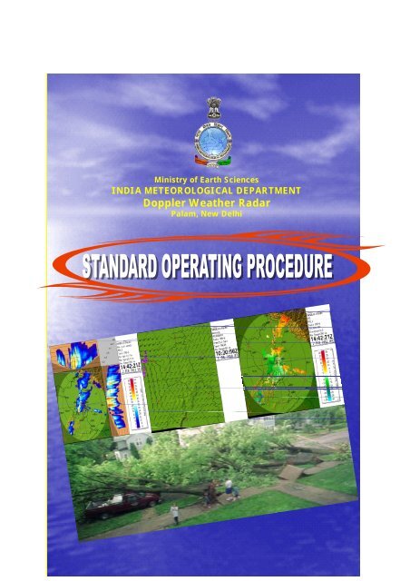
Doppler Weather Radar - METNET - India Meteorological Department
Doppler Weather Radar - METNET - India Meteorological Department
Doppler Weather Radar - METNET - India Meteorological Department

You also want an ePaper? Increase the reach of your titles
YUMPU automatically turns print PDFs into web optimized ePapers that Google loves.
Ministry of Earth Sciences<br />
INDIA METEOROLOGICAL DEPARTMENT<br />
<strong>Doppler</strong> <strong>Weather</strong> <strong>Radar</strong><br />
Palam, New Delhi
STANDARD OPERATING PROCEDURE<br />
FOR<br />
DOPPLER WEATHER RADAR-98D/S<br />
INDIA METEOROLOGICAL DEPARTMENT (IMD)<br />
DOPPLER WEATHER RADAR, PALAM NEW DELHI-61<br />
GOVT. OF INDIA<br />
MINISTRY OF EARTH SCIENCES,<br />
INDIA METEOROLOGICAL DEPARTMENT,<br />
WEATHER RADAR DIVISION<br />
04 AUGUST 2011<br />
Compiled by<br />
Shri Manik Chandra<br />
Shri Rakesh Kumar<br />
Shri B. A. M. Kannan<br />
Dr. Y. K. Reddy<br />
Shri P. S. Sastry<br />
O/o DDGM (UI), Lodi Road, New Delhi – 110 003, <strong>India</strong><br />
Telefax: 24611451<br />
Website: http://ddgmui.imd.gov.in<br />
b
Preface<br />
Introduction<br />
Definitions<br />
Purpose<br />
Objectives<br />
Scope<br />
Table of Contents<br />
Pages<br />
i<br />
ii<br />
iii<br />
iii<br />
iv<br />
iv<br />
CHAPTER 1 MONITORING OF DWR SYSTEM 1-25<br />
1.0 Safety of personnel and equipment and first aid and emergency rescue 1<br />
1.0.1 Safety Precautions for all the A/C Plants 1<br />
1.0.2 Safety Precautions for UPS 1<br />
1.0.3 Safety Precautions for Generator 2<br />
1.1 <strong>Radar</strong> and its equipment switch on procedure 2<br />
1.2 <strong>Radar</strong> and its equipment switch off procedures 4<br />
1.3 Bringing <strong>Radar</strong> to “STANDBY” & REVERTING (for few minutes 6<br />
1.4 Monitoring DWR system and checking radar status 6<br />
1.5 Precautions for VPN connectivity 8<br />
1.6 Connection among modem, router and switch box 8<br />
1.6.1 Lighting Status of Modem, Router and Switch Box in Working 8<br />
Condition<br />
1.6.2 Connections of vpn circuit 9<br />
1.6.3 Checking VPN connectivity 10<br />
1.6.3.1 If products not getting updated on IMD website only 10<br />
1.6.3.2 If the products are not getting updated on FTP-server and IMD website 10<br />
1.6.4 Logical flow diagram for checking VPN connectivity 12<br />
1.7 To get back the products received at ftp server 13<br />
1.8 Copying of raw product from a server 14<br />
1.9 Configuring and scheduling of a scan strategy 14<br />
1.9.1 Checking whether new scan strategy is working 17<br />
1.10 Procedure for generation of dwr products 18<br />
1.10.1 Adding, removing scheduled products 22<br />
1.10.2 Editing the product configuration of the schedule products 22<br />
1.10.3 Scheduling and stopping product generation 23<br />
1.11 How to see other radar site archival raw data at your local computer 23<br />
1.12 Uploading products on <strong>India</strong> <strong>Meteorological</strong> <strong>Department</strong>’s Website 23<br />
1.13 Sequence of actions in case of radar breakdown 24<br />
1.14 Standardizing a product 25<br />
Table 1.1 Connection of Switch Box 9<br />
Figure 1.1 <strong>Radar</strong> operating panels 2<br />
Figure 1.2 Picture of Tx panel showing indicators when radar is in function 4<br />
Figure 1.3 Emergency stop 5<br />
Figure 1.4 Creating real time display on desktop of server 7<br />
Figure 1.5 Modem, router front side and switch box back side view 8<br />
Figure 1.6 Modem, router back side and switch box front side view 9<br />
c
Figure 1.7 Logical steps for checking vpn connectivity 12<br />
Figure 1.8 Connecting to MAIN Server 15<br />
Figure 1.9 Clicking pull-down Menus 15<br />
Figure 1.10 Window after connecting with RCP8 15<br />
Figure 1.11 Window of Task configuration 16<br />
Figure 1.12 Scheduling task 16<br />
Figure 1.13 Opening iris and configuring a new product 19<br />
Figure 1.14 Saving new product with a name 19<br />
Figure 1.15 Scheduling the configured product 20<br />
Figure 1.16 Skipping the processing 21<br />
Figure 1.17 Processing all selected tasks 21<br />
Figure 1.18 Generated new product 22<br />
CHAPTER 2 DOPPLER WEATHER RADAR DOCUMENTATION 26-31<br />
2.1 Routine documentation work 26<br />
2.2 List of Documents 27<br />
2.2.1 RADAR STATUS Register 27<br />
2.2.2 Fault log book 27<br />
2.2.3 Complaint Book 28<br />
2.2.4 T-log book 28<br />
2.2.5 A-log book 28<br />
2.2.6 Spare parts inventory 29<br />
2.2.7 Event log book 29<br />
2.2.8 Notam-information to NTC 30<br />
2.2.9 VPN Connectivity Status 30<br />
2.2.10 E-Mail Register 30<br />
2.2.11 Other important works related with DWR operation 31<br />
Table 2.1 Names of tables 26<br />
Table.2.2 <strong>Radar</strong> status register 27<br />
Table 2.3 Fault log book 28<br />
Table 2.4 Complaint book 28<br />
Table 2.5 Spare parts register 29<br />
Table 2.6 Event log book 29<br />
Table 2.7 Notam register 30<br />
Table 2.8 VPN Connectivity Status 30<br />
Table 2.9 E-mail register 31<br />
CHAPTER 3 ADDITIONAL OPERATIONAL INFORMATION 32-42<br />
3.1 How to send latest products direct to IMD website manually, when 32<br />
VPN fails<br />
3.2 Checking radiation of radar 33<br />
3.3 Checking the current directory 34<br />
3.4 To copy into pen drive 34<br />
3.5 To check whether the given file was copied into pen drive 35<br />
3.6 To delete all files from the directory 35<br />
3.7 To search for a file 35<br />
d
3.8 To copy RAW DATA 35<br />
3.9 Procedure for archiving raw data 35<br />
3.10 Procedure for finding the size of a folder 35<br />
3.11 To check availability of raw data 36<br />
3.12 How to find the sweep angles of a given product 36<br />
3.13 Script for sending the .gif images to ftp server 37<br />
3.14 To send a configured product from main to destination 38<br />
3.15 To mount a pen drive 38<br />
3.16 Script for transgif (to send the configured products to destination in ftp 39<br />
server)<br />
3.17 How to copy the products from iris server into pen drive 40<br />
3.18 How to copy the error log files from rcp8 40<br />
3.19 Responsibilities of Station In-Charge 41<br />
3.20 Responsibilities of operator 41<br />
Figure 3.1 Checking radiation of radar 34<br />
CHAPTER 4 DWR MAINTENANCE APPROACH 43-53<br />
4.1 General Information 43<br />
4.2 Maintenance 43<br />
4.2.1 Preventive Maintenance 43<br />
4.2.2 Corrective Maintenance 45<br />
4.2.2.1 Electro-mechanical Assemblies 46<br />
4.2.2.2 Printed Circuit Cards 46<br />
4.2.2.3 Peripheral Communication Devices 46<br />
4.3 Bitex utility 46<br />
4.3.1 Bitex configuration 47<br />
4.3.2 Bitex units and their parameters 47<br />
4.3.3 Bitex data point configuration 52<br />
Screenshot 1 Opening BITEX window 47<br />
Screenshot 2 Cal Control &Results, Op. Control & RF Gen. Status 48<br />
Screenshot 3 DCU AZ & EL Status 49<br />
Screenshot 4 DCU General & Self test Status 49<br />
Screenshot 5 DAU Bytes 0-3 and 4-7 50<br />
Screenshot 6 DAU Bytes 8-11 and 12-13 50<br />
Screenshot 7 DAU Analog Status 51<br />
Screenshot 8 Histogram of Tx RF Avg. Power 51<br />
Figure 4.1 Bitex main panel when fault came 53<br />
APPENDIX A AN OVERVIEW OF DOPPLER WEATHER RADARS 54-59<br />
A.1 <strong>Doppler</strong> weather radar system overview 54<br />
A.1.1 Future IMD <strong>Radar</strong> Network plan under Modernization 55<br />
A.2 Brief introduction of WSR-98D/S <strong>Doppler</strong> <strong>Weather</strong> <strong>Radar</strong> 56<br />
A.2.1 <strong>Radar</strong> Data Acquisition (RDA) Group 56<br />
A.2.2 RVP8 Group 56<br />
A.2.3 RCP8 Group 57<br />
A.2.4 IRIS Group 57<br />
e
A.3 Base products received from <strong>Doppler</strong> weather radars 57<br />
A.3.1 Reflectivity factor (Z) 57<br />
A.3.2 <strong>Doppler</strong> velocity (V) 58<br />
A.3.3 Spectral Width(W) 59<br />
Figure A.1 Cyclone Detection <strong>Radar</strong> Network 54<br />
Figure A.2 Strom Detection And Multimet 54<br />
Figure A.3 General Signal Flow Chart of <strong>Radar</strong> System 55<br />
Figure A.4 Basic Block Diagram of <strong>Radar</strong> 55<br />
Figure A.5 Reflectivity factor 58<br />
Figure A.6 <strong>Doppler</strong> velocity 58<br />
Figure A.7 Spectral width 58<br />
APPENDIX B WSR 98D/S DWR SYSTEM CHARACTERISTICS AND 60-72<br />
CAPABILITIES<br />
B.1 WSR 98D/S System characteristics 60<br />
B.1.1 General 60<br />
B.1.2 Transmitter 60<br />
B.1.3 Receiver 60<br />
B.1.4 Antenna system 61<br />
B.1.5 Antenna Scan Details 61<br />
B.1.6 Radome 62<br />
B.1.7 Displays 63<br />
B.1.8 RVP8, the best and latest <strong>Radar</strong> Signal Processor 63<br />
B.1.9 Calibrations And Health Monitoring 64<br />
B.1.10 Built In Test Equipment (BITE) Processor 64<br />
B.2 Capabilities of <strong>Doppler</strong> weather radars 65<br />
B.2.1 Modes of Operation 65<br />
B.2.2 Parameters to be measured 65<br />
B.2.3 Observation Range 65<br />
B.2.4 Spatial Resolutions 65<br />
B.2.5 Measurement Accuracy 65<br />
B.2.6 Unambiguous Range 66<br />
B.2.6.1 Ambiguity resolution 66<br />
B.2.7 Product Generation 66<br />
B.2.7.1 Product range 66<br />
B.2.8 Operating Environmental Conditions 66<br />
B.2.9 Modes Of Operation 67<br />
B.3 Product generation control and display capabilities 68<br />
B.3.1 Base Products 68<br />
B.3.2 Primary Products 68<br />
B.3.2.1 Maximum Display 68<br />
B.3.2.2 CAPPI (Constant Altitude Plan Position Indicator) 68<br />
B.3.2.3 PCAPPI (PSEUDO CAPPI) 68<br />
B.3.2.4 VCUT (Vertical Cut) 68<br />
B.3.2.5 EBASE (ECHO BASE) 68<br />
B.3.2.6 ETOP (ECHO TOP) 69<br />
f
B.3.3 Velocity Products 69<br />
B.3.4 Hydrological Products 69<br />
B.3.5 Aviation Products 69<br />
B.3.6 Warning And Forecasting Products For Tropical Regions 70<br />
B.3.7 Alphanumeric Products 70<br />
B.4 Workstations and Display capabilities of the system 70<br />
B.4.1 Workstations 70<br />
B.4.2 Display capabilities of the system 71<br />
B.5 <strong>Radar</strong> data archival capability 71<br />
B.6 Operational limitation 72<br />
APPENDIX C CALLIBRATION PROCEDURES 73-80<br />
C.1 Callibration procedures of panel meters 73<br />
C.2 Callibration procedure for dynamic range 76<br />
C.3 Arc detector test 79<br />
Figure C.1 Tx Control Panel A1, Panel Meters, Location of Controls and 73<br />
Indicators<br />
Figure C.2 Configuration of Dynamic Range Test 76<br />
Figure C.3 An Example of Dynamic Range Test Results 77<br />
Figure C.4 MDDS Test Configuration 77<br />
Figure C.5 Testing Antenna RF Output Power 79<br />
Table C.1 Location and calibration of Panel Meters 74<br />
Table C.2 Location and calibration of Panel Meters contd. 75<br />
APPENDIX D SCAN STRATEGY IN DOPPLER WEATHER RADAR 81-88<br />
D.1 Basics about scanning strategies employed in DWR operation 81<br />
D.2 Scanning strategies 82<br />
D.2.1 Cone of Silence 83<br />
D.2.2 Operation of <strong>Doppler</strong> <strong>Weather</strong> <strong>Radar</strong>s in IMD 84<br />
D.2.3 Present IMD DWR Scan strategy (DWR-Palam) 84<br />
D.2.4 Advantages of Present IMD DWR Scan strategy 85<br />
D.2.5 Scan strategies being followed by IMD for <strong>Doppler</strong> weather radars 88<br />
Figure D.1 Azimuth Angle 81<br />
Figure D.2 Distance to the Target 81<br />
Figure D.3 Elevation Angle 81<br />
Figure D.4 Plan Position Indicator 82<br />
Figure D.5 Range Height Indicator 82<br />
Figure D.6 Cone of Silence 83<br />
Figure D.7 Present Scan strategy in operation at (DWR-Palam) DWR 84<br />
Figure D.8 Cone of Silence 50.0 km around the radar center 85<br />
Figure D.9 Scan implemented in most of the IMD DWRs 85<br />
Figure D.10 Cone of Silence in Palam-<strong>Radar</strong> 86<br />
Figure D.11. Cone of silence - Palam <strong>Radar</strong> Enlarged view 86<br />
Table D.1. PPI and RHI Scanning types 82<br />
Table D.2. Present Scan Strategy at Palam <strong>Radar</strong> 87<br />
Table D.3. Volume Scan IMD_C 88<br />
g
Table D.3. Volume Scan IMD_B 88<br />
APPENDIX E SAFETY AND PRECAUTION SUMMARY 89-94<br />
E.1. General Safety Requirements 89<br />
E.2. Specific Safety Requirements 92<br />
E.3. Antenna /Pedestal Safety 94<br />
95<br />
ANNEXURE 1<br />
Acknowledgements<br />
References<br />
95<br />
h
PREFACE<br />
<strong>India</strong> <strong>Meteorological</strong> <strong>Department</strong> is national weather service provider and is mandated<br />
with taking several of meteorological observations, providing forecast and current<br />
meteorological information for optimum operation of weather-sensitive activities. To accomplish<br />
the above activity, department has a vast array of meteorological equipments for observing<br />
meteorological parameters, their analysis and issuing forecast and warnings. <strong>Radar</strong> network of<br />
IMD is one of the components of observing system which consists of about 40 radars of various<br />
types and vintage. To keep pace with the emerging technologies, department upgrades the<br />
network with instruments of latest technology. IMD has recently procured 12 sophisticated<br />
digital <strong>Doppler</strong> <strong>Weather</strong> <strong>Radar</strong>s from M/s Metstar <strong>Radar</strong> Co. Ltd. China, the first was installed at<br />
DWR Palam, and consequently five more have already been installed at Hyderabad, Agartala,<br />
Nagpur, Mohanbari and Patna and remaining radars are in the process of installation at other<br />
locations.<br />
The <strong>Doppler</strong> <strong>Weather</strong> <strong>Radar</strong>s provide information not only on location, intensity<br />
(reflectivity) and movement of the routine and hazardous weather systems, but also on wind<br />
velocity and turbulence associated with them. This information play very important role in<br />
detecting, tracking and monitoring the severe weather phenomenon and issue forecasts and<br />
warning which help the administration in taking timely remedial action.<br />
In Chapter 1, procedure for operation of <strong>Doppler</strong> <strong>Weather</strong> <strong>Radar</strong>, checking of health of<br />
system, configuring and scheduling of scan strategies, generating of various products, checking<br />
various connectivity for data / product, reception and transmission of data / products to central<br />
server and FTP server etc. are described in detail. The maintenance of inventory of spares, log<br />
registers related to fault and action for their rectification and status register are of great help for<br />
maintenance of <strong>Doppler</strong> <strong>Weather</strong> <strong>Radar</strong>s in future. The detailed procedure for maintaining these<br />
details in a systematic way has been described in Chapter 2.<br />
Chapter 3 describes miscellaneous activities like sending latest data / products to FTP<br />
server manually in the event of failure of automatic mode of transmission, copying of data /<br />
products on a storage device, searching files, checking of availability of a particular data file and<br />
various other software commands, which are very often required to be performed at the station.<br />
Also the responsibilities of station in-charge and radar operators are given in Chapter 3.<br />
Servicing related to corrective maintenance of the system with the help of Bitex facility is<br />
described in Chapter 4.<br />
To make the document more informative, various figures and tables have been included in<br />
appendices along with the text. Appendices on Overview of <strong>Doppler</strong> <strong>Weather</strong> <strong>Radar</strong>, System<br />
Characteristics of DWR 98 D/S, Calibration procedures, scan strategies in <strong>Doppler</strong> <strong>Weather</strong><br />
<strong>Radar</strong>s and Safety and Precaution Summary have been included for giving a basic idea of the<br />
system for benefit of the readers.<br />
The document has been prepared as maiden attempt in this direction and may require<br />
further up-gradation / modifications as and when suggestions of operating personnel and other<br />
readers are received to make the SOP document more exhaustive and useful.<br />
i
INTRODUCTION<br />
The <strong>India</strong> <strong>Meteorological</strong> <strong>Department</strong> (IMD) is catering <strong>Meteorological</strong> Services and<br />
supporting Research in weather related activities, therefore IMD has the responsibility to<br />
maintain its meteorological instrument network to provide fast and best quality of weather data.<br />
To maintain best quality of meteorological data, a Standard Operating Procedure (SOP) for<br />
operation of each and every meteorological instrument is required. As an attempt in this<br />
direction, this SOP has been prepared for the operation of <strong>Doppler</strong> <strong>Weather</strong> <strong>Radar</strong> WSR 98 D/S<br />
network of <strong>India</strong> <strong>Meteorological</strong> <strong>Department</strong>. SOPs provide consistency in the guidance and so<br />
uniformity in the operations. A number of new radars being installed at various locations in <strong>India</strong><br />
by IMD under modernization plan necessitate the formulation of a uniform standard rules and<br />
procedures for operation of DWRs.<br />
This document provides standards and procedures to facilitate the whole process from<br />
switch-ON the <strong>Doppler</strong> <strong>Weather</strong> <strong>Radar</strong> system to generation and transmission of the <strong>Doppler</strong><br />
<strong>Weather</strong> <strong>Radar</strong> products up to various stake holders. This document was prepared and published<br />
under the auspices of the Office of the DDGM (UI) New Delhi-110003. The purpose of this SOP<br />
is to standardize, as far as practical, the operation of the <strong>Weather</strong> Surveillance <strong>Radar</strong>-1998,<br />
<strong>Doppler</strong> (WSR-98D/S) systems. Some flexibility, under certain meteorological, radar sites, or<br />
mission circumstances is permitted to enhance the quality and utility of some WSR-98D/S<br />
products. The revision process is dependent on the evolution of WSR-98D/S. There are four<br />
numbers of chapters in the document that describe monitoring and documentation of DWR,<br />
additional operational information and maintenance approach of DWR<br />
To supplement this manual five Appendices are also added containing DWR Operational<br />
Information, an overview of <strong>Radar</strong>, WSR 98D/S characteristics and its capabilities, Calibration<br />
Procedures, scan strategy in <strong>Doppler</strong> weather radar, safety and precaution summary. The latest<br />
form of this document will also be published in electronic format, and made available on the<br />
website of the office of DDGM (UI), IMD New Delhi-110003, namely,<br />
http://ddgmui.imd.gov.in/ . The SOP will be reviewed and updated periodically based on inputs<br />
from the user and other readers’ group.<br />
ii
DEFINITION<br />
An important aspect of a quality system is to work according to unambiguous Standard<br />
Operating Procedures s. In fact the whole process from switch on the <strong>Weather</strong> <strong>Radar</strong> system to<br />
generation, transmission of the <strong>Doppler</strong> <strong>Weather</strong> <strong>Radar</strong> products up to various stake holders,<br />
monitoring of the system and maintain proper documentation are described in this document.<br />
“This Standard Operating Procedure is the document which describes the regularly<br />
recurring operations relevant to the quality of DWR products and further requirement of<br />
improvements and investigation. The purpose of an SOP is to carry out the operations correctly<br />
and always in the same manner. The SOP must be available at the place where the work is being<br />
done”<br />
The Standard Operating Procedure (SOP) is a valuable tool and worth the preparation<br />
time. An SOP is a guideline that clearly spells out what is expected and required of radar<br />
operators during radar operations or other day-to-day maintenance activities. SOP contains basic<br />
procedural description about methods and also provides details about the appropriate precautions<br />
and safety for operation of radars. The SOPs force a person to think through a procedure step by<br />
step and to standardize the methods. It is also a good training tool and reminder to the staff of the<br />
correct procedure. In some manner SOPs may be required for compliance with regulations.<br />
PURPOSE<br />
The purpose of SOP is to carry out the operations correctly and always in the same<br />
manner. The original SOP should be kept with Deputy Director General of Meteorology (Upper<br />
Air Instruments), New Delhi at a secured place while working copies should be authenticated<br />
with stamps and signature of authorized person must be available at the each <strong>Radar</strong> Station. SOP<br />
document is a set of compulsory instructions; The competent authority for seeking approval of<br />
any deviations from the given set of instructions or new procedures is Deputy Director General<br />
of Meteorology (Upper Air Instruments), <strong>India</strong> <strong>Meteorological</strong> <strong>Department</strong>, Lodi Road New<br />
Delhi-110 003.<br />
The <strong>Doppler</strong> <strong>Meteorological</strong> <strong>Radar</strong> is a standalone system which detects processes,<br />
distributes, and displays radar weather data. The <strong>Doppler</strong> <strong>Weather</strong> <strong>Radar</strong> uses technology to<br />
acquire particle velocity data in addition to range, direction, and reflectivity data. The <strong>Doppler</strong><br />
<strong>Weather</strong> <strong>Radar</strong> is a software-driven system. Software processing is used to control the radar<br />
operation according to its characteristics, to produce the optimum radar volume coverage<br />
patterns and to optimize the radar returns. The resulting base weather data is then processed<br />
through the application of meteorological algorithms to generate base and derived weather <strong>Radar</strong><br />
products. These products are further processed using graphics algorithms to produce immediate<br />
interpretable weather data displays on color monitors. The <strong>Doppler</strong> <strong>Weather</strong> <strong>Radar</strong> is giving<br />
information on the location, intensity and movement of both routine and hazardous weather<br />
phenomena.<br />
iii
OBJECTIVES<br />
This document provides a ready reference source for determining the purpose,<br />
physical and functional characteristics, operational capabilities, operating procedures and<br />
limitations of the <strong>Doppler</strong> <strong>Weather</strong> <strong>Radar</strong> equipment. The objectives of this SOP are as follows:<br />
1. To carry out the operations correctly for entire <strong>Radar</strong> Network of <strong>India</strong> <strong>Meteorological</strong><br />
<strong>Department</strong>.<br />
2. To set the standards that operators and users will perform under.<br />
3. To provide a good training tool for a new radar operator.<br />
4. To build up a well disciplined environment for a radar operator to work.<br />
SCOPE<br />
What areas of work are to be covered by the procedure?<br />
The areas of the work to be covered by this SOP are operation and maintenance of WSR 98D/S<br />
DW R network of <strong>India</strong> <strong>Meteorological</strong> <strong>Department</strong>. This SOP applies to all radar personnel<br />
throughout <strong>India</strong> working in WSR 98D/S <strong>Doppler</strong> <strong>Weather</strong> <strong>Radar</strong> network of IMD.<br />
iv
MONITORING OF DWR SYSTEM<br />
CHAPTER 1<br />
In the process of operation of <strong>Doppler</strong> <strong>Weather</strong> <strong>Radar</strong>, the operator must be familiar with both<br />
hardware and software functions. These two functions could not be exclusively presented<br />
separately in two separate chapters. But, most of the functions regarding hardware are presented<br />
in chapter 1 and software in chapter 3. Initially, safety of personnel and equipment is discussed<br />
in this chapter.<br />
1.0 Safety of personnel, equipment, first aid and emergency rescue<br />
While going to Radome:<br />
Antenna Servo Power and TX Radiation Power are to be put OFF through IRIS MENU<br />
As a safety precaution, the MCB (QF9) & HV in Tx Cabinet is to be switched OFF.<br />
While going to Terrace:<br />
RF Radiation is to be switched OFF through IRIS MENU<br />
1.0.1 Safety Precautions for all the A/C Plants<br />
1. While Switching OFF AC plants trip all associated components of radar which needs<br />
to be operated under optimum temperature.<br />
2. Switch OFF the AC plants/devices.<br />
3. Switch OFF the cooling fan units if not an integrated system with AC compressor.<br />
4. While switching ON the AC plants, the cooling fans will immediately start, wait till the<br />
timer sequence completes in bringing on the Compressor. This indicates the proper<br />
powering ON of AC.<br />
5. Only when <strong>Radar</strong> room temperature is maintained at optimum values (Around 20 deg<br />
C) radar sub-systems are to be switched ON.<br />
1.0.2 Safety precautions for UPS<br />
1. Ensure Battery voltage is full.<br />
2. Check for battery conditions and sufficient airflow.<br />
3. Have a check on the cabinet and room temperature.<br />
4. During Servicing/ Maintenance of UPS-shut down all loads and gradually increase the<br />
load during startup.<br />
1
1.0.3 Safety Precautions for Generator<br />
1. Ensure Fuel Level and pressure for optimum values.<br />
2. Check cooling systems (Water / Air).<br />
3. Always see the startup battery is kept charged and available to start the Generator.<br />
4. Trip down the entire load before bringing up the generator.<br />
5. After optimum speed achieved by the Generator gradually, go on adding the loads. The<br />
thresholds and other settings to above shall be referred to the manufacturer<br />
instructions/ brochure.<br />
1.1. <strong>Radar</strong> and its equipment switch on procedure<br />
Figure 1.1 <strong>Radar</strong> Operating Panels<br />
Switching “ON” the radar from cold state for remote operation<br />
2
Before controlling radar operations on remote mode using RCP8, radar is to be initially switched<br />
on physically, by the procedural steps in the sequence given below. After performing these steps,<br />
control can be taken by RCP8 with the help of LOCAL/REMOTE button on control panel of Tx<br />
cabinet, to avoid any minor / major breakdown of the system. Power Distribution, RDA and<br />
Transmitter Cabinets can be seen in the above Figure 1.1.<br />
RDA Group Startup Procedure<br />
Keep the "AIR COMPRESSOR" (QF10), the "AIRCRAFT WARNING LIGHT"(QF3)<br />
and RADOME LIGHT (QF2) power on at all times.<br />
Power on the equipment according to the following sequence:<br />
1. Power cabinet: "MAIN POWER SWITCH" (QF1) ON.<br />
2. Power cabinet: Push "Green Button" ON.<br />
3. Power cabinet: “Receiver” (QF7) ON.<br />
4. Power cabinet: "TRANSMITTER" (QF8) ON.<br />
5. Power cabinet: "RDA CABINET" (QF 6) ON.<br />
6. RDA status and control cabinet: "UPS" (A26) ON.<br />
7. RDA Status and Control Cabinet: RVP8 computer ON.<br />
8. RDA Status and Control Cabinet: RCP8 computer ON.<br />
9. RDA status and control cabinet: "DAU POWER" (A2S4) ON.<br />
10. RDA status and control cabinet: "PEDESTAL ELECTRONICS POWER" ON.<br />
11. Transmitter cabinet: "AUXILIARY POWER" and "CABINET LIGHTS POWER"<br />
ON.<br />
12. Monitor the transmitter. After about 13 minutes of pre-heat the "PRE-HEAT" light<br />
will go off and the "airflow" fault lights will illuminate.<br />
13. Transmitter cabinet: “HV POWER” ON.<br />
14. Transmitter cabinet: Push both "MANUAL RESET" and "FAULT DISPLAY<br />
RESET" buttons, observe that the transmitter "AVAILABLE" light is on and the<br />
"Fault" light is off.<br />
15. Power cabinet: “SERVO POWER AMPLIFIER (QF9) ON.<br />
3
16. Power cabinet: "RADOME VENTILATION" (QF 5) ON.<br />
17. Run the IRIS/<strong>Radar</strong> program or IRIS Utilities programs.<br />
Transmitter Cabinet – STATUS LEDs<br />
Figure 1.2 Picture of TX panel showing indicators when radar is in function<br />
NOW the radar is ‘ON’ for operations. All these steps take roughly twenty minutes. Remote<br />
control/operation of radar if required from other servers can be customized to get connected to<br />
RCP8 a job to be performed by network administrator using IRIS / LINUX utilities. As a<br />
general practice it is advised that such provisions shall be avoided unless and otherwise an<br />
absolute necessity. Details can be found in the supplied manuals and is not described here.<br />
1.2. <strong>Radar</strong> and its equipment switch off procedures<br />
RDA Group Shutdown Procedures<br />
A. Switching “OFF” the radar<br />
1. Run iris in terminal.<br />
MENUSTSC MONITOR Then select task IMD-B, then Select STOP<br />
RIGHT NOW<br />
Select task IMD-C and right click then select STOP RIGHT NOW<br />
MENUSRADAR STATUSnext select appropriate buttons viz.,<br />
(A) RADIATE –OFF (B) T/R POWER-OFF (C) SERVO POWER-<br />
OFF<br />
2. Transmitter Cabinet: "AUXILIARY POWER" OFF.<br />
3. Transmitter Cabinet: "CABINET LIGHTS POWER" OFF.<br />
4. Power Cabinet: "RECEIVER" (QF7) OFF.<br />
4
5. Power Cabinet: “SERVO POWER AMPLIFIER” (QF9) OFF<br />
6. RDA Status and Control Cabinet:<br />
RCP8 and RVP8 computers: Exit the operating system and then turn off the power.<br />
7. RDA Status and Control Cabinet: "UPS" (A26) OFF.<br />
8. RDA Status and Control Cabinet: "PEDESTAL ELECTRONICS POWER" OFF.<br />
9. RDA Status and Control Cabinet: "DAU POWER" (A2S4) OFF.<br />
10. Power Cabinet: "RDA CABINET" (QF6) OFF.<br />
11. Transmitter Cabinet: After the transmitter has cooled off (the focus coil is no longer<br />
hot to the touch), Transmitter "HV POWER" OFF.<br />
12. Power Cabinet: "TRANSMITTER" (QF8) OFF.<br />
13. Power Cabinet: Push "Red Button" OFF.<br />
Note:Keep the "AIR COMPRESSOR" (QF10), the "AIRCRAFT WARNING LIGHT"<br />
(QF3) and RADOME LIGHT (QF2) power on at all times.<br />
B. Switching “OFF” the radar during an Emergency<br />
Emergency stop is a mandatory safety measure, for radar operation. This is a switch to stop the<br />
radar suddenly as a life saving measure during sudden accident associated with the radar system<br />
or in case of FIRE. Emergency stop switch is placed in an easily accessible location. Hence, in<br />
case of emergency, such as smoke or visible fire, turn power cabinet “Main power switch” (QF1)<br />
OFF. IF QF1 is unapproachable, the Emergency switch (Diagram shown below Figure 1.3),<br />
fixed in <strong>Radar</strong> Room at closer approach, shall be depressed in TRIPPING OFF the entire radar<br />
operation<br />
Figure 1.3 Emergency Stop<br />
1.3. Bringing radar to “standby” & reverting (for few minutes)<br />
5
STEP I : For stopping the radar up to thirty minutes, HV need not be switched off from the<br />
Tx cabinet, the radar can be taken into local control by pressing the<br />
LOCAL/REMOTE button available in the Tx control panel. Ensure the green LED<br />
at “LOCAL” should glow. Login to RCP8 system, open iris window and connect to<br />
RCP8. Observe the portion of RCP8 read yellow colored highlight after getting<br />
connected.<br />
STEP II : To switch OFF Tasks running:<br />
Run iris in terminal. Select MENUS in iris window.<br />
MENUSTSC MONITOR Then select task IMD-B, then Select STOP RIGHT<br />
NOW<br />
Select task IMD-C and right click then select STOP RIGHT NOW<br />
MENUSRADAR STATUSnext select appropriate buttons viz.,<br />
RADIATE –OFF (B) T/R POWER-OFF (C) SERVO POWER-OFF<br />
1.4. Monitoring DWR system and checking radar status<br />
Ensure the following functionalities.<br />
1. Both of the tasks IMD-C and IMD-B are running properly, clouds and winds are<br />
being shown in real time windows.<br />
2. Check Latest-image folder in operator’s home of IRIS Internet Server whether it is<br />
containing latest images.<br />
3. Ensure power available to the modem and serial router with local lead (line 1) of<br />
MTNL glowing in green color.<br />
4. Products on FTP-server at H.Q and IMD Web-Server (www.imd.gov.in) are getting<br />
updated in time.<br />
5. Check all the A.Cs are functioning o.k. and then alternately switch on the A.Cs which<br />
were shutdown. Also, shutdown the A.Cs which have been functioning till then. By<br />
this way the load will be equally distributed on each A.C.<br />
6. Check whether there are any fault lights glowing on the A1 Panel of UD3 Transmitter<br />
(display panel) and also on the 5A6 Digital Control Unit.<br />
7. Check whether radome light-LEDs are glowing in the Power Control Equipment<br />
cabinet UD98 or not. Also, check whether any abnormal sounds in the Tx system or<br />
antenna assembly.<br />
8. Check UPS system and it’s respective A.Cs.<br />
6
9. Checking real time displays:-There are three Icons on Iris Remote Server, “RTD Z”,<br />
“RTD V”, RTD W” double click the icons and their respective windows will open.<br />
If the windows are not opening with double clicking the icons then open ‘terminal’<br />
and type<br />
a.$/usr/sigmet/bin/rtdisp –file RTD_Z&<br />
b.$/usr/sigmet/bin/rtdisp –file RTD_V&<br />
c.$/usr/sigmet/bin/rtdisp –file RTD_W&, (put the window in RHI mode)<br />
Check on RCP-8 in TSC-monitor and ensured both the tasks are running properly.<br />
If the latest images are not available in IRIS Internet Server at<br />
/home/operator/latestimages (or the one which has been configured for such activity),<br />
Go to main server run iris menus product output device product type Headers<br />
onlyselect the productright click under sendselect Station Name in the opened<br />
window. The same procedure should be followed for any product which is not updated in<br />
the latest images.<br />
Whenever any changes are done in the main server, same changes are to be applied in the<br />
standby server.<br />
Example with Screenshot : An example of the above mentioned procedure along with<br />
screenshot is described here. The first window in Figure 1.4 is the real time display of radar<br />
antenna at DWR PALAM with a range of 150 Kms. This range can be selected as 50 kms, 150<br />
kms, 250 kms and 500 kms. This display also gives the information about the name of radar<br />
station, date and time in hours minutes and seconds with two decimal places, elevation and<br />
bearing of the antenna at that particular instant and reflectivity in dBz according to the given<br />
color scale. Color Scale can be selected among the configured color scales. Railroad Overlay is<br />
selected among available overlays for display in real time. The second window in the screenshot<br />
shows practically how to create real time display in the desktop of any server (as given above).<br />
1.5. Precautions for VPN connectivity<br />
Figure 1.4 Creating real time display on desktop of server<br />
7
1. Modem, converter and router are to be kept switched on (24X7) all days. UPS or<br />
generator supply must be connected to power these units.<br />
2. Glowing green LED at the modem (line) indicates VPN line is ‘OK”; at any time<br />
either this green blinking or PMA indicator glows ‘red’, then appropriate action<br />
should be taken with VPN service provider to activate the VPN line at the earliest.<br />
3. During data transmission through VPN, if there is any problem in the VPN line l, call<br />
the principal service provider i.e. M/s Trimax/DataCraft Engineer for earliest<br />
rectification of the fault.<br />
4. For uninterrupted data transmission time to time following observations should be<br />
made, round the clock every now and then<br />
(i) VPN Modem power and line indicator must glow green.<br />
(ii) Network serial router, switch, computer server (Transmission), must be kept<br />
ensured to be working OK.<br />
1.6. Connection among modem ,router and switch box<br />
All these three untis are interconnected as follows: (Indicative in nature varies with make and<br />
type).<br />
1.6.1. L.E.D. illumination status of Modem, Router and Switch box in working condition<br />
Note:<br />
Figure 1.5 Modem, router front side and switch box back side view<br />
1. When VPN connection is o.k, the connected link LEDs i.e No 1 to 7 in the above<br />
picture must always be blinking green. These blinking LEDs are shown in green<br />
background for the sake of clarity, and continuous glowing orange LEDs are show in<br />
orange background.<br />
8
2. In Modem, PMA always shows off when VPN is working in condition. If PMA glows<br />
red, an indication of link problem, power OFF & ON the modem to rule out the<br />
misbehavior of the unit. If problem still persists lodge a complaint with the service<br />
provider and follow up till rectification is done. On case of delay contact to IMD<br />
Telecom section and DDGM(UI) giving the docket number and status for further<br />
action.<br />
1.6.2. Connections of VPN circuit (Example)<br />
Figure 1.6 Modem, Router back Side and switch box front side view<br />
1.6.3. Checking vpn connectivity<br />
Whenever products are not updated in the IMD website, there are two intermediate cases. In the<br />
first case, the products reach up to FTP server, but not up to IMD website.<br />
1.6.3.1. If the products are not getting updated on IMD website only<br />
Case (A): Product Imageries available on ftp server:<br />
make phone call to the Duty officer of DGM Telecom at 011-24693186 or to the one notified.<br />
Meanwhile send the required latest imageries from internet web server to IMD web site,<br />
I.P 125.21.185.11 (or to the one notified) through local scripts (CLI) and continue sending hourly<br />
till VPN is restored.<br />
Case (B): product is not reaching the FTP server<br />
At the <strong>Radar</strong> main server perform the following<br />
Run iris connect to mainmenus product output window device TRANS_GIF product<br />
type product to be sentselect headers onlyright click under request columnselect Station<br />
name in the opened window and exit. Same to be repeated in standby server also.<br />
Connect it with main, open product output window from the menu and select “headers only”<br />
check which product is not tagged DLH under request column and tag that product as DLH by<br />
9
ight clicking and selecting the Station name with a wild card (Viz for Delhi DLH*, then EXIT,<br />
then FILE and save as DEFAULT. If the RAW data is not being transmitted to the central server<br />
then, go to main server,<br />
Run iris connect to mainmenusopen product output windowselect device as“to<br />
central “select product type as RAWselect product as IMD-Bselect headers onlyright<br />
click under request columnselect DLH in the opened window and exit. Same is to be repeated<br />
for IMD-C, if IMD-C data is not being transmitted.<br />
1.6.3.2. If the products are not getting updated on FTP-server and IMD website<br />
Check whether VPN is OK or NOT physically as mentioned above, VPN connectivity can also<br />
be check with the servers connected with the system through the computer commands i.e.<br />
$traceroute and telnet command. This procedure is given below.<br />
(a)$traceroute xxx.xxx.x.xx (for central server)<br />
(b)$traceroute xxx.xxx.x.xx (for FTP server)<br />
This command can give 30 hops but we have only 6 hops. By checking this command we will<br />
able to know in which junction problem is existing. If VPN is OK, the six hops come as follows:<br />
1. xxx.xxx.xxx.x I.P Address of LAN Gateway (time statistics will be displayed)<br />
2. xxx.xxx.xx.xx I,P Address of Router (time statistics will be displayed)<br />
3. xxx.xx.xx.xxx I.P Address of <strong>Radar</strong> side VPN MTNL server(time statistics will be<br />
displayed)<br />
4. xxx.xx.xx.xxx I.P Addess of Central server Side VPN MTNL Server (time statistics will<br />
be displayed)<br />
5. xxx.xx.xx.xxx I.P Address of LAN Gateway of Central Server (time statistics will be<br />
displayed)<br />
6. xxx.xxx.x.xx I.P Address of Central server or (time statistics will be displayed ftp server<br />
IPs)<br />
If * * is coming for any I.P. then check each individual IP link with ping command to find<br />
out at what junction the problem is existing.<br />
Note:<br />
Case 1 : if the problem is existing at LAN Gateway, then * * will come after first hop, it means<br />
then there is disconnection at switch. Check all leads of the switch and if there is any loose<br />
contact, it should be fixed properly and the fault may be rectified.<br />
Case 2 : if the problem is existing with ROUTER, then * * will come after ROUTER I.P<br />
Address, then there is discontinuity at router. Check all leads of the router. We can check router<br />
as follows.<br />
10
This can be done by “telnet” command. This command will take us into the root of VPN Circuit<br />
of TRIMAX who is principal service provider of VPN. The company has provided us the id and<br />
password to check the router at our end by User Access Verification procedure as follows. This<br />
is done by giving the command<br />
$telnet xxx.xxx.xxx.x (enter I.P Address of LAN)<br />
When prompted for a password, enter the one associated. Then enable modification by entering<br />
command ‘en’. Again it will be prompted for enable password: enter the root/enable password.<br />
Now it will be in root folder. Issue the command “sh ip int brief” (for seeing the IP protocol<br />
information in brief).<br />
The following exercise is given on the basis of actual commands or information and the<br />
operators are required to verify the status of the router. If Fast Ethernet 0/0 down then check<br />
MODEM lead or If serial router 0/1/0 is down then check all leads of the router also.<br />
EXAMPLE No. 1<br />
operator@DELHI-INTERNET ~]$ telnet router-ip [example: 192.168.50.1]<br />
Trying router ip...<br />
Connected to router-ip.<br />
Escape character is '^]'.<br />
User Access Verification<br />
Password: passwd<br />
IMD_<strong>Radar</strong>_NDLS>en<br />
Password: enable-passwd<br />
IMD_<strong>Radar</strong>_NDLS>sh ip int brief<br />
Interface IP-Address OK? Method Status Protocol<br />
FastEthernet 0/0 router- ip YES NVRAM up up<br />
FastEthernet 0/1 unassigned YES NVRAM administratively down down<br />
Serial 0/0/0 WAN-ip YES NVRAM up up<br />
Case 3 : If the problem is existing at WAN then * * will come after WAN-ip (MTNL Server at the<br />
end of radar side) then book the case with 1506 (Local MTNL/Service provider).<br />
Case 4 : If the problem existing on Other side of the WAN (MTNL server at the end of H.Q then<br />
** will be displayed after HQ-WAN-ip in such a case book the complaint with Mumbai Trimax<br />
(022-4068). Provide them the I P address of central server or ftp server (which is not pinging due<br />
to VPN connectivity problem) and the station contact phone number. Mumbai VPN office<br />
(phone No’s: 022-040680001,022-406813339) shall also be approached obtain the complaint no.<br />
from them and record the complaint No., Date and time in complaint –book.<br />
1.6.4. Logical flow diagram for cheking vpn connectivity<br />
11
CHECKING VPN CONNECTIVITY<br />
YES<br />
Ping 192.168.2.75<br />
and 192.168.2.76<br />
NO<br />
DATA<br />
LOSS<br />
>20%<br />
YES<br />
Call<br />
MTNL/TRIMAX<br />
exchange to check<br />
MLDN ID of VPN<br />
( DWR PALAM VPN-9081)<br />
PINGING<br />
Ping local<br />
LAN and<br />
router IPs<br />
NOT PINGING<br />
PMA light will be<br />
“RED”<br />
Traceroute<br />
192.168.2.75/76<br />
Serial status is<br />
“down”<br />
Check with<br />
“telnet”<br />
Fast ETHERNET<br />
status is<br />
“down”<br />
NO<br />
VPN<br />
‘OK’<br />
MLDN Of<br />
VPN is<br />
“OK”<br />
NO<br />
CALL “HQ” TO<br />
CHECK THEIR<br />
SIDE<br />
YES<br />
Route is<br />
clear upto<br />
172.50.16.174<br />
“HQ” side is “ok”<br />
Check all cables of<br />
MODEM and<br />
OFF/ON power<br />
switch<br />
Book the<br />
complaint at<br />
TRIMAX<br />
/MTNL(1918) by<br />
giving the circuit<br />
no. 027177) and<br />
take the Com.No.<br />
Check all cables of<br />
ROUTER and<br />
OFF/ON power<br />
switch<br />
PMA<br />
red light gone<br />
NO<br />
YES<br />
Figure 1.7 Logical steps for checking VPN connectivity<br />
EXAMPLE No. 2 : This example is to check whether products are transmitting to ftp<br />
server at DGM (TELECOM) or not ?<br />
[operator@DELHI-REMOTE ~]$ ftp 192.168.2.75 (remote-ip)<br />
Connected to 192.168.2.75 (192.168.2.75).<br />
220 (vsFTPd 1.2.0)<br />
Name (192.168.2.75:operator): username [Refer to the username supplied to the station]<br />
331 Please specify the password.<br />
Password:password [Refer to the password supplied to the station]<br />
230 Login successful.<br />
Remote system type is UNIX.<br />
Using binary mode to transfer files.<br />
ftp>bin<br />
ftp> ls<br />
227 Entering Passive Mode (remote-ip)<br />
150 Here comes the directory listing.<br />
-rw-r--r-- 1 0 0 84091 Jul 12 02:33 caz_dlh.gif<br />
drwxrwxrwx 14 530 508 258048 Jul 01 05:02 chn<br />
12
drwxr-xr-x 3 501 500 4096 Aug 10 02:39 del<br />
drwxrwxrwx 4 529 529 90112 Jul 01 05:02 kol<br />
drwxrwxrwx 4 500 530 380928 Jun 27 2009 mpt<br />
-rw-r--r-- 1 501 500 110259 Aug 13 13:13 pac_dlh.gif<br />
drwxrwxrwx 12 502 505 4096 Feb 16 03:45 srk<br />
drwxrwxrwx 4 531 531 4096 Jun 23 04:17 vsk<br />
226 Directory send OK.<br />
ftp> cd del<br />
250 Directory successfully changed.<br />
ftp> ls<br />
227 Entering Passive Mode (remote-ip)<br />
150 Here comes the directory listing.<br />
-rw-r--r-- 1 501 500 73052 Aug 14 17:59 caz_dlh.gif<br />
-rw-r--r-- 1 501 500 109532 Aug 14 02:39 pac_dlh.gif<br />
-rw-r--r-- 1 501 500 141523 Aug 14 18:00 ppv_dlh.gif<br />
-rw-r--r-- 1 501 500 140087 Aug 14 17:53 ppz_dlh.gif<br />
drwxr-xr-x 2 0 0 4096 Jul 02 02:40 previous<br />
-rw-r--r-- 1 501 500 110685 Aug 14 18:01 sri_dlh.gif<br />
-rw-r--r-- 1 501 500 111973 Aug 14 18:01 vil_dlh.gif<br />
-rw-r--r-- 1 501 500 11629 Aug 14 18:01 vp2_dlh.gif<br />
226 Directory send OK.<br />
1.7. To get back the products which are received at ftp server<br />
After getting connected to ftp server, proceed as given below with the following commands.<br />
ftp> mget *.*<br />
mget caz_dlh.gif? y<br />
227 Entering Passive Mode (remote-ip)<br />
150 Opening BINARY mode data connection for caz_dlh.gif (73052 bytes).<br />
226 File send OK.<br />
73052 bytes received in 2.46 secs (29 Kbytes/sec)<br />
mget pac_dlh.gif? y<br />
227 Entering Passive Mode (remote-ip)<br />
150 Opening BINARY mode data connection for pac_dlh.gif (109532 bytes).<br />
y226 File send OK.<br />
109532 bytes received in 3.77 secs (28 Kbytes/sec)<br />
mget ppv_dlh.gif? y<br />
227 Entering Passive Mode (remote-ip)<br />
150 Opening BINARY mode data connection for ppv_dlh.gif (141523 bytes).<br />
226 File send OK.<br />
141523 bytes received in 4.69 secs (29 Kbytes/sec)<br />
mget ppz_dlh.gif? y<br />
227 Entering Passive Mode (remote-ip)<br />
150 Opening BINARY mode data connection for ppz_dlh.gif (140159 bytes).<br />
226 File send OK.<br />
140159 bytes received in 4.66 secs (29 Kbytes/sec)<br />
mget sri_dlh.gif? y<br />
13
227 Entering Passive Mode (remote-ip)<br />
150 Opening BINARY mode data connection for sri_dlh.gif (110685 bytes).<br />
226 File send OK.<br />
110685 bytes received in 3.93 secs (28 Kbytes/sec)<br />
mget vil_dlh.gif? y<br />
227 Entering Passive Mode (remote-ip)<br />
150 Opening BINARY mode data connection for vil_dlh.gif (111973 bytes).<br />
226 File send OK.<br />
111973 bytes received in 3.75 secs (29 Kbytes/sec)<br />
mget vp2_dlh.gif? y<br />
227 Entering Passive Mode (remote-ip)<br />
150 Opening BINARY mode data connection for vp2_dlh.gif (11629 bytes).<br />
226 File send OK.<br />
11629 bytes received in 0.575 secs (20 Kbytes/sec)<br />
ftp> bye<br />
1.8. Copying raw data from a server to any workstation of any date<br />
[operator@DELHI-REMOTE~]$scp -r main:/usr/iris_data/product_raw/XXX(i.e<br />
DLH)YYMMDD*.* workstation-name:/usr/iris_data/any-folder<br />
1.9. Configuring and scheduling of a scan strategy<br />
A radar task is the scan configuring procedure, by giving appropriate specifications of PW, PRF,<br />
Phase coding, etc as well as signal qualifiers, clutter filters etc. IRIS radar license is a must<br />
before configuring a radar task. Normally Analysis system (Main & Standby) has most of the<br />
licenses incorporated. As per the orders of <strong>Radar</strong> Lab, DDGM(UI), at present, two common<br />
tasks are performed by all IMD radars, viz., IMD-B and IMD-C. IMD-C is a surveillance scan<br />
with two elevation angles 0.5degree and 1.0degree with a lower PRF (300Hz) with a scan range<br />
of 500 km. The basic moments are restricted to Reflectivity as multiple folding may occur in<br />
other moment fields. IMD-B is the volume data scan with ten elevation sweeps, operated at Dual<br />
PRF mode of 600/450Hz. The following steps enables one to create an initial scan strategy/Task.<br />
STEP 1 : Invoke “iris” though terminal to get the IRIS window<br />
14
Figure 1.8 Connecting to MAIN server<br />
STEP 2 : Select rcp8 [to connect to the RADAR system]<br />
Figure 1.9 Clicking pull-down Menus<br />
Figure 1.10 Window after connecting with RCP8<br />
15
STEP 3 : Click Task configuration in Menus<br />
Figure 1.11 Window of task configuration<br />
STEP 4 : After completion of the task configuration, select Task monitor, schedule the<br />
appropriate repeat time and conFigure the time to start this task. Then one can select it<br />
to be scheduled for continuous running (As shown below). During the process at any<br />
time if doubt exists, the Help option in the window, can be accessed, which opens the<br />
appropriate related PDF documents.<br />
Figure 1.12 Scheduling task<br />
16
Thus now the tasks are configured and scheduled. Any time a scheduled task can be<br />
stopped by right clicking over command area and selecting Stop. Actual scan<br />
strategies followed at DWR PALAM can be seen in D.2.4.5 of APPENDIX D.<br />
1.9.1. Checking whether new scan strategy is working<br />
The newly scheduled scan strategy can be checked by a simple command “productx product<br />
name”. This command when applied to a raw/basic/derived product, it will show all details of<br />
that product, e.g., the server from which it is derived, from which task it is generated, what is<br />
THE PRF,FREQ., and wavelength, at that time, melting level height, power, band width, and<br />
noise of the transmitter, Rx bandwidth, Scan type, Scan speed, Height of radar a.m.s.l: F.,<br />
Processing Mode FFT, Thresholds of different parameters, no. of sweeps, each having 360 rays<br />
and no. of bins and Angle list.<br />
Example for new scan strategy :<br />
[operator@DELHI-STANDBY ~]$ productx DLH100819073440.RAWPRTY<br />
------------- Product Summary for DLH100819073440.RAWPRTY -------------<br />
Ingest site name : 'DWRDELHI(PALAM)', Version: 8.12<br />
Ingest hardware name: 'DWRDELHI(PALAM)'<br />
Product site name : 'DLH-STBY-PLM', Version: 8.12<br />
File size: 3735552 bytes (Disk space: 3735552 bytes)<br />
Product type is: Raw Data<br />
PCO name: IMD-B, TCO name: IMD-B<br />
PRF: 600/450Hz, Wavelength: 10.62cm, Nyquist: 47.79m/s(V), 15.93m/s(W)<br />
XMT Polarization: Horizontal, Wind:???<br />
Constant:67.42 dB, I0:-113.20 dBm, Cal Noise:-81.99 dBm, Bandwidth:0 kHz.<br />
ZFlags: SP_T, block_zc, attn_zc, target_zc, dpatten_zc, dpatten_z<br />
VFlags: SP_V, 3lag_w, ship_v, unfold_vc, fall_vc, storm_vc<br />
Heights: <strong>Radar</strong>: 235m, Ground: 216m, Melting: 5400m MSL<br />
Maximum range: 249.8 km<br />
Ingest time: 07:34:40 19 AUG 2010 UTC (0 minutes west) DST:0/0<br />
Volume scan time: 07:34:40 19 AUG 2010 UTC (LT: IST -330 minutes)<br />
Oldest Ing time: 07:34:40 19 AUG 2010 UTC<br />
Product Gen time: 07:41:35 19 AUG 2010 UTC<br />
Input count: 1<br />
Product is not composted.<br />
Full volume scan, Force 8-bit, Selected data recorded<br />
Information from INGEST Header<br />
------------------------------<br />
17
Site name: 'DWRDELHI(PALAM)', Task name: 'IMD-B'<br />
Scan: PPI, Speed: 12.00 deg/sec, Resolution:1.00 deg<br />
Description: 'Copy of IMD_B scan performed on Gematronik radars'<br />
Location: 28 33.6'N 77 4.3'E, Altitude: 235 meters, Melting height:5400 meters<br />
Dpolapp config:<br />
Volume Time: 07:34:40.754 19 AUG 2010 UTC (0 min. west) (LT: IST -330 min.)<br />
ZFlags: SP_T, block_zc, attn_zc, target_zc, dpatten_zc, dpatten_z<br />
VFlags: SP_V, 3lag_w, ship_v, unfold_vc, fall_vc, storm_vc<br />
PRF: 600/450Hz, PulseWidth: 1.00 usec (0)<br />
BeamWidth: 0.93/0.93 deg.<br />
<strong>Radar</strong> constant: 67.42/67.42 dB, Receiver bandwidth 0 kHz.<br />
Calibration I0: -113.20/-111.45 dBm, with noise -81.99/-75.34 dBm.<br />
LOG-Noise: 0.2158, Lin-Noise: 0.2158, I-Off: 0.0000, Q-Off: 0.0000<br />
SOPRM Flags: 0x04a7, LOG Slope: 0.480, Z-Cal: -45.81dBZ, H/V: 0.00 dB<br />
Filters: Dop:6, Log:0; PntClt: 2, Thresh: 6.0 dB; Samples: 70<br />
Processing Mode: FFT, Xmt Phase: Random<br />
Zdr Threshold: LOG<br />
GDR = 0.00 dB, XDR = 0.00 dB<br />
T Threshold: LOG LOG = 2.0 dB<br />
Z Threshold: SQI & LOG & CSR SIG = 5.0 dB<br />
V Threshold: SQI & CSR CSR = 20.0 dB<br />
W Threshold: SIG & SQI & LOG SQI = 0.35<br />
Available moments are: dBZ V W<br />
Original moments were: dBT dBZ V W Vc<br />
Starting range 2.000 km, range bin spacing 250 meters<br />
There are 12 sweeps, each having 360 rays and 992 bins<br />
Angle list: 0.5 1.4 2.3 3.3 4.2 5.5 7.0 9.5 12.5 17.5 24.5 35.0<br />
1.10. Procedure for generation of DWR products<br />
Configuring IRIS products<br />
Configuration of IRIS <strong>Meteorological</strong> Products using the product configuration menu: IRIS lets<br />
create products for a wide variety of applications, e.g., base and derived products, aviation<br />
products, rainfall products (hydrological products), warning products, etc. This product provides<br />
information that can be used by weather forecaster for weather now-Casting and forecasting.<br />
Most product configuration menus have the same general format, though some of them are<br />
different. Generally Product Configuration procedure can be divided into Four Parts as follows:<br />
18
STEP 1 : Invoke “iris” though terminal to get the IRIS window.<br />
Figure 1.13 Opening iris and configuring a new product<br />
STEP 2 : Select Main/Standby. Go in Menus for Product configuration as shown above.<br />
STEP 3 : Product configuration : In this window as shown above, there are many products that<br />
can be generated in the button Type, select the appropriate product under Type and do the<br />
configuration settings. Help option in the window can be accessed which opens appropriate<br />
related PDF documents enabling configuring a product of your choice. Give the parameters of<br />
your choice and save that product with a name which can be recalled when product scheduler is<br />
opened later, as given below. If this saving is done with a name that can enable in identifying by<br />
its use or by settings, it is helpful in recalling. This entire procedure is shown in a flow diagram<br />
on next page.<br />
Figure 1.14 Saving new product with a name<br />
19
irisConnectmenusProduct Configurationselect parameterssave the file<br />
STEP 4 : Product Scheduler Menu : Once a product is configured , the appropriate product file<br />
is to be scheduled for generating outputs. Hence, the product scheduler menu is opened, and as<br />
it contains a list of several saved products available on the system, the required product to be<br />
scheduled is to be selected from the list of the pop-up window that appears by right-clicking on<br />
the product header line below ‘site’. As we add products (already configured in Product<br />
configuration and saved) to the Scheduler, they are placed under the appropriate header<br />
according to the type of product. Hence, they can be recalled from the same header (line).<br />
Hence, the window with the header file Max products is selected initially as shown in the above<br />
diagram. Then, the particular product, V_250KM (in our case) is to be selected. Later, select the<br />
date and time from which the product is to be scheduled.<br />
Figure 1.15 Scheduling the configured product<br />
STEP 5 : Time Scheduling operates under the concept NEXT-DATA-TIME : NEXT<br />
corresponds to the time in hours, minutes, date, month and year from which our generated<br />
product should start collecting data. To set the time, position the mouse cursor over the Next-<br />
Data-Time field and right click to get pop up time menu. Use the plus and minus buttons to<br />
increase and decrease the hours, minutes, day, month or year as per the requirement, than press<br />
OK to exit from the window. The time we specify here is the time from which the product is to<br />
be generated. This time is recorded in the field as given in the Figure above.<br />
20
STEP 6 : Skip time : This is the time for which the task should skip processing the data. This<br />
skip time is used only particular type of products like pac, which collects accumulated rainfall<br />
for only a particular period. For all other products, the default value of the Skip field is “00:00”<br />
indicating no TASKs should be skipped as shown below.<br />
Figure 1.16 Skipping the processing<br />
Next is Request FieldAll, all associated TASK data collected after the next data time are<br />
processed.<br />
21
Figure 1.17 Processing all selected tasks<br />
This procedure is shown in the flow diagram below.<br />
irisConnectmenusProduct SchedulerNext-Data-TimeSkip TimeSelect All<br />
starts running Wait<br />
Figure 1.18 Generated new product<br />
The product is generated on an on-going basis Whenever the TASK collects data, subject to the<br />
skip time. The status field shows the current status of each product. The Running shows<br />
product is being generated. After product has completed, the status changes from Running to<br />
Wait. Now, scheduling is completed.<br />
1.10.1. Adding, removing scheduled products<br />
Irisconnectmenusproduct schedulerRight click headerselect newly configured<br />
product addfilesave as<br />
To add /Remove a product to the Schedule:<br />
1. Select the header for the type of product you want enter or any product of that type.<br />
2. Position the mouse cursor over the product field and choose Add/Remove from the<br />
pop – up menu. IRIS then displays a list of Product of that type. (already configured<br />
in Product configuration and saved). Select a product, and it is added to the schedule.<br />
If you do not want to add any of the products in the list click on the cancel button.<br />
1.10.2. Editing the product configuration of the schedule products<br />
1. Select the product you want to edit.<br />
2. Position the mouse cursor over the product field and choose edit from the pop-up<br />
menu. IRIS opens the product configuration menu with the selected product loaded<br />
into it.<br />
22
3. Edit the Product as needed , then Choose File Save as to Save changes.<br />
4. Exit from the product configuration menu. IRIS returns you to the product Scheduler<br />
menu. Your changes (changed file name) should be reflected in the product schedule<br />
fields.<br />
5. Add edited product in scheduler.<br />
Irisconnectmenusproduct scheduler select scheduled producteditfilesave<br />
as<br />
1.10.3. Scheduling and stopping PRODUCT GENERATION<br />
1. Select the product that you want to schedule for generation<br />
2. Set the Next-Data-Time and Skip Fields. These Two fields determine when TASK<br />
begins and how frequently the product is generated.<br />
3. Position the mouse cursor over the request field and choose “All” from the pop-up<br />
menu.<br />
4. We can generate products from either future or past TASKS by adjusting the Next-<br />
Data-Time.<br />
Operator ] $ iris ->Connect->menus->Product Schedulerselect edited productNext-<br />
Data-TimeSkip TimeSelect All starts runningWait<br />
1.11. How to see other radar site archival raw data at your local computer<br />
Copy other <strong>Radar</strong> site Raw data to local computer /usr/iris_data/product_raw use productx<br />
command to open the raw data, get the site name information setup General “List of<br />
<strong>Radar</strong> Site Names and Site Codes” add a new site name use the name you get from raw data <br />
give the Code save &exit ; (If not do up configure, default will use XXX as site Code) <br />
qiris siris Product Outputfind the raw data reingest Product ConfigSelect product<br />
type and task name to configure your product Save Product Scheduler Display Add<br />
for Right Click the product type header add your configure product name Right Click the<br />
new come line(your configure product) on the “Next-Data-Time” column Select the before<br />
time Right Click the “Rqst” column select All To Quick Look window you can select<br />
your product to see/confirmation.<br />
1.12. Uploading of products on <strong>India</strong> Met. <strong>Department</strong>’s website<br />
The <strong>Doppler</strong> <strong>Weather</strong> <strong>Radar</strong> products in image form (gif format) are uploaded to IMD website,<br />
the original product image files are re-named as follows before uploading to IMD website.<br />
Plan Position Indicator – Reflectivity (PPZ)<br />
Plan Position Indicator – Velocity (PPV)<br />
as ppz_stn.gif<br />
as ppv_stn.gif<br />
23
Plan Position Indicator – Close range (PPI)<br />
Plan Position Indicator – Surface Rainfall Intensity (SRI)<br />
Plan Position Indicator – 24 Hr Preci. Accumulation<br />
Maximum Reflectivity (MaxZ)<br />
Vertical Wind Profile (VVP2)<br />
Stn = station name (ex : dlh for NEW DELHI)<br />
as ppi_stn.gif<br />
as sri_stn.gif<br />
as pac_stn.gif<br />
as caz_stn.gif<br />
as vp2_stn.gif<br />
1. The renamed images are uploaded to FTP server at DGM (TELECOM), New Delhi<br />
I.P 192.168.2.75, working on latest and faster Virtual Private Network (VPN).<br />
2. The same images are THEN uploaded from FTP server to IMD website server with<br />
I.P 125.21.185.11 at DGM (TELECOM) RTH New Delhi, using a local network<br />
connection.<br />
3. The uploading is done automatically every 10 minutes using VPN and FTP script<br />
files.<br />
1.13. Sequence of actions in case of radar breakdown<br />
Action to be taken by duty asstt. before radar being stopped for maintenance or whenever radar<br />
breakdown occours, or whenever <strong>Radar</strong> is to be stopped TEMPORARILY.<br />
IMPORTANT :<br />
(A). After Shutting down the <strong>Radar</strong> following Procedure has to followed<br />
(i)<br />
Request to Issue “NOTAM” from concerned ATC Duty Officer.<br />
(ii) Put the appropriate <strong>Radar</strong> Stop message on the ftp server (IMD-HQ) which will display this<br />
message in place of <strong>Radar</strong> products on IMD website.<br />
(iii) Regarding the shutting down of radar with TIME, DATE and CAUSE for shutting down the<br />
<strong>Radar</strong>, Immediately, E-mail should be issued to the following concerned authorities/officials.<br />
(i) DDGM(UI)<br />
(ii) SC. (E) In-Charge <strong>Radar</strong> Lab, DDGM (UI)<br />
(iii) DWR In-Charge<br />
(iv) M/s SGS <strong>Weather</strong>, if necessary<br />
(v) Put a note in T- Log regarding the shutting down of radar by mentioning TIME,<br />
DATE and expected time of restarting.<br />
(B). After starting the radar following Procedure has to be followed<br />
(i)<br />
Request to cancel the “ NOTAM” from concerned ATC Duty Officer<br />
(ii) Regarding the starting of radar with TIME and DATE immediate E-mail should be issued to<br />
the following concerned authorities/officials.<br />
(i) DDGM(UI)<br />
24
(ii) SC. (E) In-Charge <strong>Radar</strong> Lab, DDGM (UI)<br />
(iii) DWR In-Charge or any other concerned In-Charge of <strong>Doppler</strong> <strong>Radar</strong> Station<br />
(v) M/s SGS <strong>Weather</strong>, if necessary<br />
(vi) Put a note in T- Log regarding the starting of radar by Mentioning time and date.<br />
1.14. Standardizing a product<br />
Archiving old data corresponding to a past special weather event and generating new<br />
products for validating the radar products.<br />
Suppose we need to get raw data of the period 03-07-2010 to 08-07-2010.The raw data product<br />
generates a compressed product file containing all of the signal processor data parameters<br />
collected during the selected task. As the raw product cannot be displayed, but it can be archived<br />
to tape or sent to another IRIS analysis system in network. Once these raw products<br />
corresponding to the above period is selected and reingested, ingest files are created, so that<br />
products images can be generated in the other server for analysis or testing for standardization.<br />
Procedure:<br />
Irisconnectlocal host (remote or internet server)menusdeviceldasite type raw<br />
give wild timegive date month and yearfiles wildmountcommandretrivewatch files<br />
being retrivedcommandreingestsee files being reingested<br />
Configure the required product, say, TS-100, for the same period, i.e., 03-07-2010 to 08-07-<br />
2010, and schedule it. The TS-100 products can now be seen in quick look window. Now, if the<br />
TS-100 is not reflecting the warning time correctly, change one or three parameters of TS-100<br />
and generate again with another name till it represents the thunderstorm time and intensity<br />
perfectly. Then the product TS-100 is said to be validated with the new name.<br />
25
DOPPLER WEATHER RADAR DOCUMENTATION<br />
2.1. Routine documentation work<br />
CHAPTER 2<br />
IMPORTANCE: For smooth operation and maintenance of <strong>Doppler</strong> <strong>Weather</strong> <strong>Radar</strong> at the site,<br />
it is necessary to maintain proper detailed documentation encompassing all aspects, such as<br />
procedures to be followed for diagnosis of faults, step-wise procedures for rectification, details<br />
of significant weather events to be recorded from nearby surface observatory and actual realised<br />
features in the products. This also accounts for continuous performance of the system. The<br />
documentation will provide the history of a particular problem being repeatedly encountered, and<br />
indicate the best possible solution to solve the problem. Following detailed documentation are to<br />
be maintained at each radar site as part of operational practices.<br />
(i) Working status of DWR systems as a whole: This should be checked daily in the early<br />
morning at (0830 IST) and the status is to be updated online in the designated web pages. If any<br />
problem is reported, the action taken by the duty assistant of the DWR Station should also be<br />
indicated in the status report. This information should be delivered to the Office of DDGM (UI),<br />
New Delhi, which is the Technical and Operational Coordinator for the observational RADAR<br />
network of IMD. If problem persists, appropriate action to be taken by the officer In-Charge of<br />
the station with the consent of DDGM (UI), New Delhi.<br />
(ii) Mission summaries for future course of action : The In-charge of <strong>Radar</strong> Lab, DDGM (UI),<br />
NEW DELHI along with In-Charge of respective <strong>Radar</strong> Station, who is the Coordinator and<br />
responsible for smooth functioning of IMD <strong>Radar</strong> Network all over the country, will prepare a<br />
consolidated report / summary and approved by DGM, for further course of action. This may be<br />
done fortnightly/monthly on the basis of daily status reports. <strong>Radar</strong> scientists/experts must<br />
contribute their valuable suggestions to help or to solve the problems for smooth function of<br />
IMD <strong>Weather</strong> <strong>Radar</strong> network. There are ten Registers/Logs to be maintained by each and every<br />
<strong>Radar</strong> station. The list and period of updation of each register is given in the following Table 2.1.<br />
S. No. Name of the Document Period of updation<br />
01 <strong>Radar</strong> status register To be updated hourly<br />
02 Fault log book To be check daily and updated accordingly<br />
03 Communication<br />
Complaint Book<br />
To be checked daily and if any complaint is there, follow up<br />
action is to be taken till rectification of problem.<br />
04 T-log book To be checked daily and logs to be written<br />
05 A-log book To be checked daily and logs to be written<br />
06 Spare parts register To be filled if any spare of <strong>Radar</strong> is replaced/consumed.<br />
07 Event log book To be filled in case of significant weather exists<br />
08 Notam-information to To be filled whenever radar is stopped and restarted.<br />
the designated office<br />
09 VPN Connectivity To be filled whenever VPN complaint is booked<br />
Status<br />
10 E-Mail Register To be filled whenever any mail is sent by the respective radar<br />
26
Station and print-out (except Daily Status Report) to be taken<br />
and put it in E-mail printout Register<br />
2.2. Lists of the documents<br />
2.2.1. <strong>Radar</strong> status register<br />
All entries in this register are to be updated hourly. Real time display of DBZ, V, W, Antenna<br />
Sweep,AZ, and EL to be monitored for any abnormalities. Appropriate entries in the respective<br />
columns of the Logbook to be made. Clouds and wind observed in the DWR products also are to<br />
be reported hourly in this register. If ground clutter is not observed, suitable entries in column<br />
no.9 of table 2.2 to be made. The latest products available in the ftp server should also check.<br />
The time of the products observed in the ftp server and the time in IST at which these latest<br />
products are checked should mentioned in the 8 th column.<br />
Table 2.2. <strong>Radar</strong> status register<br />
Date /<br />
Time<br />
(UTC)<br />
DBZ<br />
V<br />
W<br />
Clouds<br />
Wind<br />
Ant.<br />
Sweep<br />
and EL<br />
updated images time in<br />
website/Latest time<br />
of generated products<br />
in QLW in UTC<br />
Ground<br />
Clutter<br />
Checked<br />
VPN<br />
Connectivity<br />
Contacted<br />
DGM (Tel.)<br />
If ftp is not<br />
Connected<br />
Products<br />
Sent thro.<br />
CLI mode<br />
(if VPN<br />
Failed )<br />
Remarks<br />
Sign<br />
of<br />
D.O<br />
Sign.<br />
of<br />
I/C<br />
1<br />
2<br />
3<br />
4<br />
5<br />
6<br />
7<br />
8<br />
9<br />
10<br />
11<br />
12<br />
13<br />
14<br />
15<br />
If ftp server is not connecting, Duty Officer, DGM (telecom) to be contacted over phone (phone<br />
NO.24693186) for intimating about ftp server not connecting / pinging. Check the VPN<br />
Connection through trace route command for concerned server I.P Address, (172.xxx.xxx.xxx).<br />
If data is being transmitted in 3 hops, i.e., modem I.P, Router I.P, and MTNL I.P., it can be<br />
concluded that connectivity exists from DWR PALAM side for VPN (kindly REFER 1.6.3<br />
of CHAPTER 1). The result is to be entered in column no.10. Also, enquire whether there is any<br />
problem associated with ftp server or the VPN Connectivity i.e. from DGM (TELECOM) side of<br />
VPN circuit. Entry may be made in column no.11 and all seven products are to be copied into a<br />
pen drive and pasted in C: drive of INTERNET PC (in workstation room) from<br />
/home/operator/latest images of INTERNET SERVER (WEB-SERVER). These seven pictures<br />
are to be sent to IMD website (125.21.185.11) through internet connection using CLI mode, as<br />
given in 3.1 of CHAPTER 3 and entry should be made in column no.12.<br />
27
2.2.2. Fault log book<br />
In this logbook, entries are to be made as per Table 2.3 whenever the radar is stopped due to any<br />
fault in the <strong>Radar</strong>. The time of stopping and the reason for stopping is to be mentioned.<br />
Whenever radar operation is restored, the time of restoration and period of stoppage. The<br />
information about the NOTAM issued or not, is to be recorded in the column no.8. Software<br />
problems need not to be reported in this book unless the radar is stopped.<br />
Table 2.3 Fault log book<br />
S.<br />
No.<br />
Date<br />
Nature of<br />
Fault<br />
Indication in<br />
the system<br />
Reported<br />
at (UTC)<br />
Informed<br />
to SGS at<br />
(UTC)<br />
Fault<br />
rectified<br />
at (UTC)<br />
Fault period<br />
If NOTAM<br />
issued<br />
Spare<br />
Used<br />
Sign.<br />
of SGS<br />
official<br />
Sign.<br />
of<br />
D.A<br />
Sign. Of<br />
A.M.<br />
DWR<br />
Sign.<br />
of<br />
Dir. DWR<br />
Remarks<br />
2.2.3. Communication complaint book<br />
In this register, the respective Duty Asstt. should make entries of the complaints regarding the<br />
communication problem associated with MTNL local line and Internet problems. They have to<br />
specify the time and date of lodging of the complaint along with other details as per following<br />
Table 2.4.<br />
Table 2.4 Complaint book<br />
S.NO. DATE COMPLAINT No. PROBLEM IN DETAIL SIGN OF D.A. SIGN OF AM<br />
2.2.4. T-log book<br />
This T-logbook is to be maintained for Technical information. It has details of every technical<br />
problem encountered, with the purpose of recording the history of each hardware and software<br />
problems. This can be used as a source for guidance during fault identification/rectification and<br />
also for preparation of statistics of specific problems which are encountered repeatedly. Entries<br />
in detail should be made in T-LOG BOOK, whenever any software or hardware servicing is<br />
done. This logbook must contain the full details i.e. the name of the panels in which servicing<br />
was carried out, the PCBs that were checked by the service engineer, either by resetting or<br />
replacing by new PCBs from stores, the test and measuring instruments that were used, the<br />
measurements that were taken with its magnitude and units of the parameter, the adjustments that<br />
were carried out either in the panel meters, or in any PCBs, the faults that were traced out and the<br />
line of action taken by the service engineer for rectification of the problem. The date and time<br />
while servicing was done is also to be mentioned. As a whole, this report must comprehensive &<br />
self sufficient to explain the technical changes that were undertaken during the duty time. It is<br />
mentioned here that after rectification of problem all the outputs of radar should be checked, if<br />
any discrepancy found, it is to be recorded with further course of action.<br />
28
2.2.5. A-log book<br />
Details of all administrative problems / information regarding leave, duty arrangement or any<br />
instruction issued over phone by higher officials which are to be communicated to all concerned<br />
officials, for smooth functioning of administration.<br />
2.2.6. Spare parts inventory<br />
Whenever any spare part of <strong>Radar</strong> is replaced/ consumed from the existing stock by M/s SGS or<br />
M/s METSTAR Service Engineers or any other official, information should be recorded in this<br />
register as shown in Table 2.5 along with proper receipt of U/S item which should be taken from<br />
concerned engineer, mentioning the name of the item, Serial. No., Part No. etc. Spares are to be<br />
replenished with new spare by them within 15 Days of replacement time and to be recorded in<br />
the Logbook with all relevant information. An official letter must be issued to concerned party/<br />
firm/ supplier. This register must be checked once in a month i.e. on the first day of every month.<br />
Table 2.5. Spare parts register<br />
S.<br />
No.<br />
Date<br />
Spare<br />
used<br />
With<br />
S.no.<br />
Defective<br />
spare<br />
Received with<br />
S.no.<br />
Replacement received<br />
from SGS with<br />
S.no. and<br />
Date<br />
Opening stock<br />
Balance<br />
Current<br />
Stock<br />
Position<br />
Sign<br />
of<br />
A.M<br />
Sign.<br />
of Dir. DWR<br />
Remarks<br />
2.2.7. Event log book<br />
Whenever any significant event occurred around the station like SQ, DS, TS/TSRA, Hail etc, the<br />
time of commencement, cessation and the period of persistence should be recorded in the<br />
following Table 2.6. Details can also be taken from concerned forecasting office or from<br />
<strong>Department</strong>al Website.<br />
Table 2.6 Event log book<br />
S.<br />
No.<br />
Date<br />
Time<br />
From-To<br />
(UTC)<br />
Type of<br />
<strong>Weather</strong><br />
event<br />
Period<br />
(In<br />
hrs:min)<br />
Folder of events for all types<br />
Of product pictures and<br />
details if any<br />
Sign. Of<br />
D.A<br />
Sign. Of<br />
A.M DWR<br />
Sign. of Dir.<br />
DWR<br />
Remarks<br />
(1). Various related products generated for the above event, time period, date and time of the<br />
event are to be collected and kept in a folder with proper identification. This is to be brought to<br />
the notice of all operators and In charge.<br />
(2). Suppose, the event is TSRA. The concerned product is a WARN product named TS-250 or<br />
TS-150 or TS-100 or THUNDERSTORM or MICROBURST and the raw data used in the<br />
product generation, the product files for these warnings should be archived with backup. The<br />
operator should varify the date and time of the warning and assess the reflectivity values vis a vis<br />
intensity of thunderstorm occurred at the station.<br />
29
(3). Also, if any of the above warn products do not correctly represent the occurred<br />
phenomenon, a new WARN product is to be configured with variation of parameters to<br />
correctly represent the event and see that the newly configured product is representing all<br />
features of the event.<br />
(4). In spite of configuring and generating the new product, if the occurred event was not fully<br />
represented by it, explanation is to be given in detail as to what features are matching in that<br />
product, and what features are not matching along with the reason for not matching.<br />
(5). Suggestions may be given to modify the parameters of the respective product to fully<br />
reflect the features of the weather event with full discussion of the earlier and new product<br />
with variation of parameters and the acceptability of the resulting product.<br />
(6). Another product i.e. WIND / MAX Z / SRI / PPV may also be taken for validation for the<br />
same event while following the above five steps, and final report of each event-study should be<br />
submitted to the in-charge of the station.<br />
(7). Every month, a consolidated report of all Significant <strong>Weather</strong> Event Study-Report is to be<br />
prepared for record, future reference and for DWR product evolution also.<br />
2.2.8. Notam-Information to NTC : The massage of “<strong>Radar</strong> under maintenance” in the JPG<br />
format of to be transmitted on ftp server for display on IMD Website immediately and intimate<br />
to DDGM (UI) and DGM (TELECOM) through e-mail as well as telephonically. Permission is<br />
to be taken from the Director I/C before issuing the NOTAM (Please refer 1.12 of Chapter 1) for<br />
all occassions when radar was stopped for a period of more than 1 hour, due to any reason i.e.<br />
technical breakdown/ other reasons like civil or electrical related work. Information to issue the<br />
Notam must be given to NTC (to Batch in-charge at ATC) and all respective entries should be<br />
made in the Table 2.7 of NOTAM REGISTER.<br />
Table 2.7 Notam register<br />
S.<br />
No.<br />
Time of<br />
DWR<br />
Breakdown<br />
Specific<br />
Tech.<br />
Reason<br />
DWR Time of DWR<br />
stopped except became ok<br />
technical<br />
resons<br />
NOTAM<br />
Issued for<br />
the period<br />
From To<br />
Name of Batch<br />
Incharge at<br />
NTC<br />
Name<br />
of<br />
D.A<br />
Sign.<br />
of<br />
D.A<br />
Sign.<br />
of A.M<br />
DWR<br />
Sign. of Dir.<br />
2.2.9. VPN connectivity status<br />
This Logbook in the following tabulated format is to be maintained whenever VPN complaint is<br />
booked. The details of VPN connectivity problem must be mentioned in VPN connectivity<br />
status report & VPN Connectivity Status Table 2.8 given below mentioning the cause of<br />
problem also. VPN status can be checked by the procedure mentioned in the Logical flow<br />
diagram. Please Ref. 1.6.3.2 of chapter 1.<br />
30
Table 2.8 VPN connectivity status<br />
S.<br />
No.<br />
Dated<br />
Time of VPN<br />
Connectivity<br />
failure(UTC)<br />
Time of VPN<br />
Connectivity<br />
Restored(UTC)<br />
reason for<br />
failure<br />
Complaint<br />
No.<br />
Name of<br />
TRIMAX<br />
Personnel<br />
Action for<br />
early<br />
restoration of<br />
Sign.<br />
of<br />
D.A<br />
Sign of<br />
AM<br />
<strong>Radar</strong><br />
2.2.10. E-Mail register<br />
This is to be maintained whenever mail is sent through DWR Palam e-mail ID<br />
palam.radar@yahoo.co.in or dwrpalam@gmail.com, and print-out (except Daily Status Report)<br />
is to be taken and kept in E-mail folder after recording the details in the following E-mail<br />
Register Table 2.9.<br />
Table 2.9 E-mail register<br />
S. Date Subject Sent to Received from Action Remarks<br />
No.<br />
2.2.11. Other important works related with DWR operation<br />
<strong>Radar</strong> Status Report is to be sent on routine basis, every day in the morning, by Duty<br />
Assistant at 0900hrs IST, through emails radarstatus@gmail.com to In-charge of <strong>Radar</strong> Lab,<br />
DDGM (UI) New Delhi and to respective In-charge of DWR station and other concerned<br />
officials. This should be updated on DDGM (UI) websites (http://ddgmui.imd.gov.in) also. For<br />
display of maintenance of radar and servicing information over website, “shell program”<br />
designed in the Iris Main Server is to be double clicked. Whenever <strong>Radar</strong> is to be stopped for<br />
servicing or otherwise for duration more than one hour, AM (<strong>Radar</strong>) and Director I/C of the<br />
Station. are to be informed along with concerned duty officer of the respective <strong>Meteorological</strong><br />
Office, to issue the NOTAM.<br />
31
ADDITIONAL OPERATIONAL INFORMATION<br />
CHAPTER 3<br />
3.1. Procedure to send latest products direct to IMD website manually, whenever VPN<br />
connectivity fails<br />
The procedure to be followed whenever VPN is totally or partially down with packet loss more<br />
than 50%.<br />
1 Copy the seven products from/home/operator/latestimages folder<br />
2 Paste them in C: drive of windows XP computer connected with internet facility.<br />
3 Send them to I.P address 192.168.2.75 through command line by giving proper IP address<br />
of IMD website.<br />
Step-I. Copy the seven products from IRIS INTERNET WEBSERVER<br />
Products which are regularly getting updated are:<br />
2. caz_dlh.gif,<br />
3. pac_dlh.gif,<br />
4. ppz_dlh.gif,<br />
5. ppi_dlh.gif,<br />
6. ppv_dlh.gif,<br />
7. sri_dlh.gif,<br />
8. vp2_dlh.gif,<br />
Procedure to copy these images on to a pen drive from the latest images folder of operator's<br />
home of INTERNET SERVER are as follows:<br />
(1) Login as super user by giving command: su - and password as xxxxxxxx<br />
(2) Insert the pen drive and give command fdisk -l and then the vacant mount point will be<br />
shown as /dev/sdb1 or /dev/sdb2 or dev/sdb3.<br />
(3) The given mount point is to be selected and the pen drive is to be mounted with the<br />
command: mount /dev/sdb1 /media<br />
(4) Later, the required seven image files are to be copied with the following command:<br />
cp -rf /home/operator/latestimages/*.gif /media<br />
(5) After copying the latest gif images into the pen drive unmount it by issuing the command:<br />
umount /media<br />
32
Step-II.<br />
connected<br />
Copy image files from pen drive into C: drive of windows XP computer<br />
with internet facility.<br />
(1) Pen drive is to be inserted in the above windows computer and the seven gif images<br />
which were copied in pen drive are to be copied/pasted into C: drive directly.<br />
(2) It is to be verified whether the above images have gif extension or not. If they do have gif<br />
extension no furhter action is required else each of the above six files are to be renamed<br />
with file extension changed as gif.<br />
Step-III. Transfering files to ftp server (i.p. address 125.21.185.11) via internet.<br />
(1) Click on START to open start menu and click on “run” command. A new window will be<br />
opened. Now type the command : ftp xxx.xxx.xxx.xxx (xxx.xxx.xxx.xxx is the IP address<br />
of IMD website).<br />
(2) On prompting for user name enter dopler as user id and for password enter dopler2005 as<br />
password.<br />
(3) Change to binary mode by command bin .<br />
1 To transfer multiple files enter command: mput c:\*.gif<br />
2 System will prompt with question whether file<br />
caz_dlh.gif to be sent? y<br />
pac_dlh.gif to be sent? y<br />
ppz_dlh.gif to be sent? y<br />
ppi_dlh.gif to be sent? y<br />
ppv_dlh.gif to be sent? y<br />
sri_dlh.gif to be sent? y<br />
vp2_dlh.gif to be sent? y<br />
On confirming by command y the seven gif images will be transferred. To end the file transfers<br />
enter the command :bye<br />
3.2.Checking radiation of radar<br />
To ascertain that the radar is radiating following procedure needs to be adopted.<br />
At the command prompt issue the following command to view the status, log in as the operator<br />
in the RCP8 computer and issue the command.<br />
scp –rf /usr/iris_data/log/IRIS_ERROR.LOG<br />
internet:/home/operator/Desktop<br />
33
If this IRIS_ERROR.LOG file does not contain any burst pulse missing error message, it can be<br />
concluded that the radar is radiating. By examining the vvp product also it can be concluded<br />
whether the radar is actually radiating. This is an indirect method as it is practically observed that<br />
if radiation is switched off the vvp product will not be showing the velocity barbs. Hence it can<br />
be safely concluded that radar is radiating if barbs are observed in a vvp product.<br />
There is another method, as explained in the Figure 7 to confirm about the presence of<br />
transmitter’s radiation. The “bitex” command is given in a new window of RCP8 after iris is<br />
started and connected to RCP8. A window opens when bitex command is given as shown in the<br />
following photograph. The button on the extreme right is to be clicked to get the details of<br />
transmitter's average RF power output.<br />
Figure 3.1 Checking radiation of radar<br />
Some important software commands used in dwr operation:<br />
3.3. Checking the current directory<br />
[root@DELHI-REMOTE ~]# pwd<br />
3.4. To copy into pen drive<br />
[root@DELHI-REMOTE ~]# cp -rf /home/operator/Desktop/Event /media<br />
3.5. To check weather the given file was copied into pendrive<br />
[root@DELHI-REMOTE ~]# cd /media<br />
[root@DELHI-REMOTE media]# ls<br />
3.6. To delete all files from the directory<br />
[root@DELHI-REMOTE ~]# rm –rf *.*<br />
34
3.7. To search for a file<br />
[operator@DELHI-INTERNET ~]$ su –<br />
(enter the root password)<br />
[root@DELHI-INTERNET ~]# find / -<br />
3.8. Copy of raw data<br />
RAW data is available in the Main & Standby servers in their /usr/iris_data/<br />
product_ raw folder and lda (archive data) folders. This data can be copied to any local server<br />
(or in any other folder which has ample space to store the data) for use with the following<br />
procedures:<br />
Enter the following commands;<br />
[operator@DELHI-INTERNET ~]$ scp –r main:/usr/iris_data/product_raw/DLH<br />
YYMMDD*.* localserver:/usr/iris_data/weekly folder/(or any folder)<br />
Whenever any raw data is missing in main server then it may be available in the standby<br />
server. If missing data is available then it can also be copied from the standby server. The folder<br />
containing the raw data is to be zipped and saved, as the raw data is voluminous.<br />
3.9. Procedure for archiving raw data<br />
It is mandatory that each DWR Station should copy the raw data weekly whenever the<br />
accumulated data reached the size of 4.7 GB. The data is to be compressed by zipping and then<br />
save it in one DVD of 4.7G.B at a time, as the DVD drive provided does not allow multi session.<br />
Normally, one week’s raw data occupies 8 to 9 GB and after compressing to tar.bz2 format, it<br />
occupies around 4GB. Also, monthly data is to be separately zipped and archived in hard disk at<br />
the end of each month for archival of DWR data for future use. 5 years data occupies in 1 TB<br />
hard disk. Detailed information is provided in B.5 of APPENDIX B.<br />
3.10. Procedure for finding the size of a folder<br />
[operator@DELHI-INTERNET ~]$ df -h /usr/iris_data/product_raw/<br />
Filesystem<br />
/dev/sda3<br />
Size Used Avail Use% Mounted on<br />
211G 97G 103G 49% /usr/iris_data<br />
[operator@DELHI-INTERNET ~]$ df -h /home/operator/<br />
Filesystem Size Used Avail Use% Mounted on<br />
/dev/sda1 6.7G 2.8G 3.6G 44% /<br />
[operator@DELHI-INTERNET ~]$ df -h /home/operator/LatestImages/<br />
Filesystem<br />
Size Used Avail Use% Mounted on<br />
35
dev/sda1 6.7G 2.8G 3.6G 44% /<br />
[operator@DELHI-INTERNET ~]$ cd /media<br />
[operator@DELHI-INTERNET media]$ ls<br />
DLH100429202024.RAW71AE KINGSTON<br />
[operator@DELHI-INTERNET media]$ df -h /media<br />
Filesystem Size Used Avail Use% Mounted on<br />
/dev/sda1 6.7G 2.8G 3.6G 44% /<br />
3.11. To check availability of raw data<br />
First, go to the required folder, i.e., LDA or product_raw. Then give the following<br />
commands to know the details of availability and the number of raw data available in the server.<br />
[operator@DELHI-REMOTE]$ cd /usr/iris_data/<br />
[operator@DELHI-REMOTE]$ ls<br />
List of raw data available is displayed. The raw data corresponding to the particular year,<br />
month, date, and time in hours and seconds can be checked. This command can be used to check<br />
the amount of raw data that is being accumulating in the folder.<br />
[operator@DELHI-REMOTE]$ ls -l DLH100101*.* | wc –l<br />
576<br />
The displayed number example 576, indicates the number of raw data files available with<br />
DLH100101. This way the availability of raw data in the folder can be checked.<br />
3.12. How to find out the sweep angles of a given product<br />
The utility productx used to display the details of the product file with the following example:<br />
[operator@DELHI-STANDBY ~]$ productx DLH100819073440.RAWPRTY<br />
------------- Product Summary for DLH100819073440.RAWPRTY -------------<br />
Ingest site name : 'DWRDELHI(PALAM)', Version: 8.12<br />
Ingest hardware name: 'DWRDELHI(PALAM)'<br />
Product site name : 'DLH-STBY-PLM', Version: 8.12<br />
File size: 3735552 bytes (Disk space: 3735552 bytes)<br />
Product type is: Raw Data<br />
36
PCO name: IMD-B, TCO name: IMD-B<br />
PRF: 600/450Hz, Wavelength: 10.62cm, Nyquist: 47.79m/s(V), 15.93m/s(W)<br />
XMT Polarization: Horizontal, Wind:???<br />
Constant:67.42 dB, I0:-113.20 dBm, Cal Noise:-81.99 dBm, Bandwidth:0 kHz.<br />
ZFlags: SP_T, block_zc, attn_zc, target_zc, dpatten_zc, dpatten_z<br />
VFlags: SP_V, 3lag_w, ship_v, unfold_vc, fall_vc, storm_vc<br />
Heights: <strong>Radar</strong>: 235m, Ground: 216m, Melting: 5400m MSL<br />
Maximum range: 249.8 km<br />
Ingest time: 07:34:40 19 AUG 2010 UTC (0 minutes west) DST:0/0<br />
Volume scan time: 07:34:40 19 AUG 2010 UTC (LT: IST -330 minutes)<br />
Oldest Ing time: 07:34:40 19 AUG 2010 UTC<br />
Product Gen time: 07:41:35 19 AUG 2010 UTC<br />
Input count: 1<br />
Product is not composites.<br />
Full volume scan, Force 8-bit, Selected data recorded<br />
3.13. Script for sending the .gif images to ftp server<br />
#!/bin/sh<br />
# Filename: transmet_gif<br />
# Sends files via ftp, syntax:<br />
# sig_ftp SourcePath DestPath DestHost User Password<br />
trap "" HUP<br />
SourcePath=$1<br />
SourceDir=${SourcePath%/*}<br />
SourceFile=${SourcePath##*/}<br />
DestPath=$2<br />
DestDir=${DestPath%/*}<br />
DestFile=${DestPath##*/}<br />
DestHost=$3<br />
# For security purposes you can always hard code the user name and/or<br />
# password here.<br />
User=$4<br />
Password=$5<br />
# Error checking: Make sure each string has a value.<br />
if [ "${SourceDir}" = "" ]; then exit 1; fi<br />
if [ "${SourceFile}" = "" ]; then exit 1; fi<br />
if [ "${DestDir}" = "" ]; then exit 1; fi<br />
if [ "${DestFile}" = "" ]; then exit 1; fi<br />
if [ "${DestHost}" = "" ]; then exit 1; fi<br />
if [ "${User}" = "" ]; then exit 1; fi<br />
if [ "${Password}" = "" ]; then exit 1; fi<br />
cd $SourceDir<br />
INTYPE=`echo $DestFile|cut -c1-3`<br />
INPPITYPE=`echo $DestFile|cut -c1-5`<br />
37
INHOUR=`echo $DestFile|cut -c24-25`<br />
OUTTYPE=${INTYPE}<br />
if [ "${INPPITYPE}" = "PPI_Z" ]; then OUTTYPE="ppz"; fi<br />
if [ "${INPPITYPE}" = "PPI_V" ]; then OUTTYPE="ppv"; fi<br />
if [ "${INTYPE}" = "MAX" ]; then OUTTYPE="caz"; fi<br />
if [ "${INTYPE}" = "VVP" ]; then OUTTYPE="vp2"; fi<br />
if [ "${INTYPE}" = "SRI" ]; then OUTTYPE="sri"; fi<br />
if [ "${INTYPE}" = "RNN" ]; then OUTTYPE="pac"; fi<br />
if [ "${INTYPE}" = "SHE" ]; then OUTTYPE="3Dshear"; fi<br />
if [ "${INTYPE}" = "VIL" ]; then OUTTYPE="vil"; fi<br />
if [ "${INTYPE}" = "WRN" ]; then OUTTYPE="duststormwarning";<br />
if [ "${INTYPE}" = "RNN" -a "${INHOUR}" != "03" ]; then exit $?;<br />
OUTNAME=${OUTTYPE}"_dlh.gif"<br />
scp $SourceFile "internet:/home/operator/LatestImages/"$OUTNAME<br />
# For debugging, consider adding the -v option, and running<br />
# manually from a shell.<br />
ftp -n -g -v
# Filename: transmet_gif<br />
# Sends files via ftp, syntax:<br />
# sig_ftp SourcePath DestPath DestHost User Password<br />
trap "" HUP<br />
SourcePath=$1<br />
SourceDir=${SourcePath%/*}<br />
SourceFile=${SourcePath##*/}<br />
DestPath=$2<br />
DestDir=${DestPath%/*}<br />
DestFile=${DestPath##*/}<br />
DestHost=$3<br />
# For security, you can always hard code in the username and/or<br />
# password here.<br />
User=$4<br />
Password=$5<br />
# Error checking: Make sure each string has a value.<br />
if [ "${SourceDir}" = "" ]; then exit 1; fi<br />
if [ "${SourceFile}" = "" ]; then exit 1; fi<br />
if [ "${DestDir}" = "" ]; then exit 1; fi<br />
if [ "${DestFile}" = "" ]; then exit 1; fi<br />
if [ "${DestHost}" = "" ]; then exit 1; fi<br />
if [ "${User}" = "" ]; then exit 1; fi<br />
if [ "${Password}" = "" ]; then exit 1; fi<br />
cd $SourceDir<br />
INTYPE=`echo $DestFile|cut -c1-3`<br />
INPPITYPE=`echo $DestFile|cut -c1-5`<br />
INHOUR=`echo $DestFile|cut -c24-25`<br />
OUTTYPE=${INTYPE}<br />
if [ "${INPPITYPE}" = "PPI_Z" ]; then OUTTYPE="ppz"; fi<br />
if [ "${INPPITYPE}" = "PPI_V" ]; then OUTTYPE="ppv"; fi<br />
if [ "${INTYPE}" = "MAX" ]; then OUTTYPE="caz"; fi<br />
if [ "${INTYPE}" = "VVP" ]; then OUTTYPE="vp2"; fi<br />
if [ "${INTYPE}" = "SRI" ]; then OUTTYPE="sri"; fi<br />
if [ "${INTYPE}" = "RNN" ]; then OUTTYPE="pac"; fi<br />
if [ "${INTYPE}" = "SHE" ]; then OUTTYPE="3Dshear"; fi<br />
if [ "${INTYPE}" = "VIL" ]; then OUTTYPE="vil"; fi<br />
if [ "${INTYPE}" = "WRN" ]; then OUTTYPE="duststormwarning";<br />
if [ "${INTYPE}" = "RNN" -a "${INHOUR}" != "03" ]; then exit $?;<br />
OUTNAME=${OUTTYPE}"_dlh.gif"<br />
scp $SourceFile "internet:/home/operator/LatestImages/"$OUTNAME<br />
# For debugging, consider adding the -v option, and running<br />
# manually from a shell.<br />
ftp -n -g -v
3.17. How to copy the products from iris server into pen-drive<br />
Mount the pen drive as per the procedure indicared in 3.1 followed by command:<br />
[root@DELHI-WS ~]# cp -rf /home/operator/Desktop/<br />
3.18. How to copy the error log files from rcp8<br />
After getting connected to RCP8 using ssh command, use the following commands.<br />
[operator@DELHI-RCP8]$ cd /usr/iris_data/log<br />
[operator@DELHI-RCP8]$ ls<br />
Listing of log files is displayed. the following copy command is to be given for getting secured<br />
copy of ERROR files into the Desktop folder of the internet computer.<br />
[operator@DELHI-RCP8]$ scp–r /usr/iris_data/log/IRIS_ERROR.LOG internet:<br />
/home/operator/Desktop<br />
3.19. Responsibilities of station in-charge<br />
1 Overall supervision of DWR station.<br />
2 To ensure discipline, punctuality and performance at station. To optimize output from<br />
staff, efficiently manage the available staff in view of severe shortage of staff faced by the<br />
office. He may devise new schemes, rosters, methodologies, and adaptive roles to be<br />
played by officers of various cadres to manage efficiently the operation and maintenance<br />
of radar. He should ensure that proper log books are maintained at the station.<br />
3 To repair minor problems of radar within 2 hours and to report to radar lab in O/o<br />
DDGM(UI) or any other nodal office assigned by them to be responsible for providing<br />
technical support for WSR-98D/S radars.<br />
4 If the Time Of Restoration (TOR), hereafter called as TOR, is expected to be beyond 2<br />
hours, message is to be displayed in the IMD website that radar is under maintenance.<br />
5 To seek the help of other DWR Stations and H.Q in case of difficulty in radar maintenance<br />
due to severity of the problem or non-availability of spares.<br />
6. To prepare various flow charts at block-diagram level for various signal paths like servo<br />
control, Video Generation, various interlocks, etc., using technical manuals and personal<br />
observation of wiring during maintenance. This greatly enhances the speed of servicing<br />
and also helps a newly posted staff members at the station.<br />
7. To liaise with various forecasting offices to increase the utility of DWR Products.<br />
8. To conduct seminars/workshops in order to enhance the working knowledge of staff at the<br />
station and to impart training to forecasters in understanding DWR Products.<br />
40
9. To liaise with other DWR stations to share the knowledge in radar maintenance and<br />
spares.<br />
10. To find the alternate long-term solutions for recurring technical problems.<br />
3.20. Responsibilities of operator<br />
1. He should know the overall functioning of DWR at block diagram level. He must be able<br />
to explain the role of each and every sub-unit in radar operation.<br />
2. He should make proper and timely entries in the log books.<br />
2. He should be thorough with the procedures to switch ON and switch OFF radar with full<br />
confidence and ease.<br />
3. He should be thorough with the operation of UPS and different connectivity switches like<br />
INPUT/ OUTPUT/ BYPASS/BATTERY INPUTS/ STATUS DISPLAYS etc.<br />
1. He should know the various controls and settings of AC units at the station. He must have<br />
an understating of the principles of the AC in operation at the station and their<br />
maintenance schedules/techniques.<br />
5. Minimum knowledge of standby generator operation, it’s functioning.<br />
6. Thorough knowledge of safety features of RADAR.<br />
7. Thorough knowledge of various communication networks inside and outside radar like<br />
VPN, Broadband, <strong>Radar</strong> internal communication networks etc.<br />
8. He should have complete information on user names and passwords for the operation and<br />
restoring various radar sub-units, computer systems communications etc.<br />
9. He must be thorough with various products generation in real time and off-line from<br />
achieved data to be supplied to various users in short notice.<br />
10. General supervision of subordinate staff like Chowkidar, Met. Attendants, Safaiwala,<br />
Generator operator s AC operators etc.<br />
11. Generation and dissemination of RADAR products regularly for routine transmission.<br />
12. Briefing visitors on radar technology and products.<br />
13. Generating a brief for use by forecasters based on various radar products during bad<br />
weather, depressions, cyclones, storms etc.<br />
14. To assist senior officers in now-casting by giving inputs as and when required.<br />
41
CHAPTER 4<br />
4.1 General information<br />
DWR MAINTENANCE APPROACH<br />
This chapter provides a brief on system-level orientation to WSR-98D/S maintenance<br />
functions and procedures. For details kindly refer “Maintenance Instructions <strong>Radar</strong> Data<br />
Acquisition (RDA) (MEHB 10-510): PART-1 and PART-2”. The WSR-98D/S Maintenance<br />
approach entails centrally monitoring systems performance at the RCP8 and IRIS level to<br />
localize the failures through the use of software and hardware maintenance features and to<br />
replace the failed line replaceable unit (LRU) from on-site or depot spares. Diagnostic software<br />
and maintenance features are designed to rapidly detect and isolate malfunctions so that<br />
LRU(Line Replaceable Unit) fault isolation, removal, and replacement can all take place within<br />
one half hour of failure detection with subsystem maximum downtime of less than one hour (2<br />
hours for the RDA). An LRU is defined as a self-contained unit/module/assembly to which a<br />
fault can be isolated and does not require disassembly of the Next Higher Assembly (NHA) other<br />
than disconnecting cables.<br />
4.2 Maintenance<br />
The WSR-98D/S maintenance is based on minimizing system down time in support of the<br />
operational requirement for the radar system. The maintenance approach makes, maximum use<br />
of Built-In-Test Equipment (BITE), on-line status and performance monitoring and off-line<br />
diagnostic programs. Basically in broad way we can divide the maintenance into two types.<br />
1. Preventive Maintenance<br />
2. Corrective Maintenance<br />
The first one is most important and should be followed strictly to avoid any major breakdown of<br />
the radar. It may be noted here, if any minor fault/ problem occurred related with smooth<br />
operation of the system, it should be attended immediately and avoid to linger on it, otherwise<br />
major fault/problem will occur and may cause damages of various part/components or even<br />
modules of the whole system. Both the above types of maintenance are being discussed here in<br />
brief.<br />
4.2.1 Preventive maintenance<br />
Introduction<br />
Preventive maintenance (PM) for the WSR-98D/S consists of scheduled inspections,<br />
replacements and servicing procedures designed to ensure continuous operational availability of<br />
the WSR-98D/S Unit. The inspection and servicing procedures are performed to accomplish one<br />
or more of the following objectives:<br />
42
• Detection of deterioration caused by exposure to the elements (corrosion, sand, dust,<br />
moisture, fungus, salt, etc.)<br />
• Detection of excessive wear of mechanical parts<br />
• Cleaning or replacement of filters and general housekeeping tasks<br />
• Cleaning, replacement or topping-off of essential fluids and greases<br />
• Performing operational checks under test and inspection conditions.<br />
These procedures are contained in the other WSR-98D/S Manuals. The equipment maintenance<br />
manuals also provide specific reference to selected commercial manuals for additional PM<br />
procedures.<br />
Why we need for Preventive maintenance?<br />
- Prevention is better than cure - Needed for system reliability<br />
- Help to correct grey faults - Build familiarity & confidence<br />
The following Table showing periodic preventive maintenance is required for various subsystems<br />
of <strong>Radar</strong><br />
Month<br />
Sub-System<br />
Antenna<br />
Servo<br />
Nature of<br />
Préventive<br />
maintenance<br />
& Monthly<br />
Visual Check<br />
Sound Check<br />
3-monthly<br />
Lubricant Check<br />
Slip ring Cleaning<br />
6-monthly<br />
Lubricant Quantity<br />
Leakage Check<br />
Angle setting and<br />
error check<br />
Yearly<br />
Grease Supply<br />
Lubricant Change<br />
Friction Torque<br />
Check Slip ring, Brushes<br />
Check<br />
Limit Switch<br />
Function Check<br />
Servo Voltage,<br />
Frequency Check<br />
1 2 3 4 5 6 7 8 9 10 11 1 2<br />
o o o o o o o o o o o o<br />
o<br />
o o o o<br />
o<br />
o<br />
43
Month<br />
Sub-System<br />
Transmitter<br />
Receiver<br />
\<br />
Nature of<br />
Préventive<br />
maintenance 1 2 3 4 5 6 7 8 9 10 11 1 2<br />
Monthly<br />
Visual Check<br />
Meter Readings<br />
Air Filter Cleaning<br />
6-monthly<br />
Klystron Rotation<br />
Performance Check<br />
Transmitter calibration<br />
Yearly<br />
HV Circuit Cleaning<br />
Interlock Function Check<br />
Voltage<br />
Power<br />
measurements<br />
HV components<br />
visual check<br />
Monthly<br />
Visual Check<br />
6-monthly<br />
Zauto / SP<br />
calibration<br />
Yearly<br />
Gain Check<br />
STALO, COHO<br />
Level Check<br />
Linearity Validation<br />
Dynamic range<br />
check<br />
Noise<br />
Figure<br />
measurement<br />
o o o o o o o o o o o o<br />
o<br />
o<br />
o o o o o o o o o o o o<br />
o<br />
o<br />
o<br />
o<br />
4.2.2 Corrective maintenance<br />
Component Replacement and Setup Procedures<br />
This section provides an overview of the replacement of those WSR-98D/S Line<br />
Replaceable Units (LRUs) which required special handling or set-up procedures. The procedures<br />
are contained in Maintenance Instructions <strong>Radar</strong> Data Acquisition (RDA) (MEHB 10-510):<br />
PART-1 and PART-2. The great majority of WSR-98D/S LRUs are either standalone, plug-in, or<br />
44
ack-mounted modules which do not require special replacement instructions. Visual inspection<br />
and reference to cabinet layout/interconnection drawings to determine access requirements, cable<br />
connections and fastening hardware suffice for most LRUs. There are three types of LRUs,<br />
however, for which special procedures are required. These include certain electromechanical<br />
assemblies, printed circuit cards, and peripheral communication devices. Each of these types is<br />
defined in the following paragraphs.<br />
4.2.2.1 Electro-mechanical Assemblies: The major electro-mechanical assemblies in the WSR-<br />
98D/S equipment which require special handling instructions are located in the Transmitter<br />
(UD3), and the Antenna Pedestal (UD2). Other LRUs in this category are radome, tower, or<br />
shelter-mounted devices.<br />
4.2.2.2 Printed Circuit Cards: Some of the printed circuit cards in the WSR-98D/S require<br />
removal or installation of jumpers (straps) before they are installed into the WSR-98D/S<br />
equipment. Some cards require the proper setting of miniature built-in switches before they are<br />
installed. These switches are usually Dual-In-line Package (DIP) style switches. The reason for<br />
this requirement is that some of the cards can function in several different modes or<br />
configurations. They must be configured for their specific WSR-98D/S application at the time of<br />
installation. The equipment group maintenance manuals provide Tables for determining the<br />
proper strap/switch setting for each unique card location and include card layout Figures for<br />
positive identification of all straps/switches which require technician action.<br />
4.2.2.3 Peripheral Communication Devices: Most of the communication devices used in the<br />
WSR-98D/S equipment are universal RS-232 and Ethernet devices capable of operating in a<br />
wide variety of applications. Instructions to accomplish the correct setup for the WSR-98D/S<br />
applications are referenced in the applicable setup procedure.<br />
4.3 Bitex utility<br />
Introduction: The bitex utility provides a maintenance facility at the primary level through<br />
graphical user interface for the display of status information of associated sub-systems reported<br />
by Built-In Test Equipment (BITE) integrated into the radar. Hence, at the primary level,<br />
servicing can be started through software commands and the problem can be explicitly<br />
understood as to its location and this awareness creates a confidence that the problem can be<br />
solved in such and such period of time depending on the availability of spares.<br />
Bitex also allows for operator’s initiated commands to be sent to these BITE units (through<br />
the RCP8). These features are very useful in that through the graphical user interface of bitex, an<br />
operator can cause physical functions to take place at the remote radar (i.e. reset faults, start<br />
equipment, switch power systems, etc). Also, electronic button pushes can be decoded by the<br />
RCP8 into control variables which can be further utilized by the RCP8 in logic equations to<br />
make complex functions to take place.<br />
4.3.1 BITEX configuration<br />
Bitex can handle as many as 256 pieces of data from up to 16 separate BITE units. For<br />
example, the antenna sub-assembly many be one BITE unit, the transmitter a 2 nd , the radar<br />
45
controller a 3 rd etc. But, our RCP8 is customized to display 13 BITE units, which can be seen in<br />
the screen shot1.<br />
Screenshot 1 : Opening BITEX window<br />
All BITE units are connected electrically to the <strong>Radar</strong> Control Processor (RCP) via<br />
interfaces such as contact closures, analog voltages, or serial communications. For maintenance<br />
purposes time variations of these units can be customized for display in graphical user interface.<br />
The RCP8 integrates all of this information and sends it via multicast networking to IRIS for<br />
ultimate display in the bitex utility. These packets are mingled with the RCP8 antenna controller<br />
commands on the same network port.<br />
Invoking Bitex: Bitex is invoked graphically either from irisnet, utils or from the <strong>Radar</strong> Status<br />
Menu. However, bitex can also be invoked from the command line with the following command:<br />
$bitex&<br />
4.3.2 BITEX Units and their parameters<br />
All the BITE units are shown in 13 sub-panels and parameters contained by each unit are<br />
given below in detail for clarity. Each parameter is an active button.<br />
(1) Calibration Control: This control contains the status of 4-Position switches of Klystron,<br />
Tx RF, continuous wave, noise source and status of COHO modulation and receiver protector.<br />
All these units from 1 to 4 can be seen in the four panels of screenshot 2.<br />
46
Screenshot 2 : Calibration Control & Results, Operator Control & RF Gen. status<br />
(2) Calibration Results: This unit contains the parameters: zcal, zcal delta, dynamic range,<br />
pulse width, noise Figure, velocity measured and velocity delta, results of the calibration done on<br />
any earlier date.<br />
(3) Operator Controls: Controls setup earlier in the case of antenna waveguide command<br />
and audible alarm can be seen in this display. This unit contains the parameters: status of audible<br />
alarm enable, audible alarm1 and 2, antenna waveguide command and doublet.<br />
(4) RF Generator Status: This unit contains the parameters: Status of receiver protector and<br />
four fail signals.<br />
(5) DCU AZ Status : This unit contains the parameters: Status of all units of AZ Servo, AZ<br />
encoder LED, gearbox oil level, bull gear oil level, AZ hand wheel engage, AZ motor over<br />
temperature, Az STOW pin engage, AZ Servo amplifier power supply are seen in the display.<br />
These units from 5 and 6 can be seen in the panels of Screenshot 3.<br />
47
Screenshot 3 : DCU AZ & EL Status<br />
(6) DCU EL Status : This unit contains the parameters: Status of EL dead limit, EL +/- limit,<br />
El encoder light, EL gearbox oil level, EL servo AMP inhibit, short and over temperature, El<br />
motor over temperature. Whether EL stow pin and hand wheel are engaged, EL servo power<br />
supply is, on or not, can be seen in the display.<br />
(7) DCU General Status: This unit contains the parameters: 150V over voltage, 150V under<br />
voltage, Pedestal interlock. The units 7 and 8 can be seen in the sub-panels of Screenshot 4.<br />
(8) DCU Self Test Status: El and AZ Commands, corresponding BITS, El and AZ Servo<br />
speeds (These were not configured)<br />
Screenshot 4: DCU General & Self test Status<br />
(9) DAU Bytes 0-3 : This unit contains the parameters: Filament Power Supply, Klystron<br />
Preheat, Transmit not avail, Waveguide/PFN Interlock, System Control Mode, Maintenance<br />
Work Status, PFN Pulse Length, Spect Filter Low Pressure, Waveguide Arc, VSWR Fault,<br />
48
Antenna Waveguide Switch, Circulator Temperature, Cabinet Interlock, Cabinet Air<br />
Temperature, Cabinet Air Flow, Tx +/-15VDC, Tx 5VDC, Tx 28VDC, Tx 45VDC, Filament<br />
Power Supply Voltage, Vacuum Pump Power Supply Voltage, Focus Coil Power Supply<br />
Voltage, Mod overload, Mod Inver current, Mod Switch Failure, Main Power High Voltage,<br />
Flyback Charge, Inverse Diode, Trigger Amp. These units 9 to 10 can be seen in the sub-panels<br />
of Screenshot 5.<br />
Screenshot 5 : DAU Bytes 0-3 and 4-7<br />
(10) DAU Bytes 4-7 : This unit contains the parameters: Tx Over Voltage, Tx Over Current,<br />
Focus Coil Current, Focus Coil Air Flow, Tx Oil Temperature, PRF Limit Summary, Tx Oil<br />
Level, Tx Summary, ‘one’ test bits 0-7, Klystron Over Current, Klystron Over Current,<br />
Klystron Filament Current, Klystron Vacuum Current, Klystron Air Temperature, Klystron<br />
Air Flow, Mod Switch Maintenance, Post Charge Regulator Maintenance, Waveguide<br />
Pressure/Humidity.<br />
(11) DAU Bytes 8-11: This unit contains the parameters: HV on/off, DAU UART, DAU<br />
Communication. These units 11 and 12 are shown in sub-panel of Screenshot 6.<br />
Screenshot 6: DAU Bytes 8-11 and 12-13<br />
(12) DAU Bytes 12-13: This unit contains the parameter: Radom Access Hatch open/closed.<br />
49
(13) DAU Analog Status: This unit contains the parameters: Shelter Temperature, Tx Exhaust<br />
Temperature, Radome Temperature, Tx RF Avg. Power, Antenna Avg. Power, DAU Test0,<br />
DAU Test1, DAU Test2, Pedestal 15V PS, Pedestal 5V PS, Pedestal -15V PS, DAU 15V PS,<br />
DAU 5V PS, DAU 28V PS, DAU -15V PS. This unit can be seen in Screenshot 7.<br />
Screenshot 7: DAU Analog Status<br />
Screenshot 8: Histogram of Tx RF Avg Power<br />
All the BITE units and corresponding parameters are active buttons. On right-clicking any<br />
of these buttons in the sub-panels, its corresponding histogram (as shown in the above<br />
screenshot 8) is displayed, as a time series for ten minutes duration till that particular minute, in a<br />
new window. The graphical display can be a valuable tool when assessing the frequency and<br />
endurance of faults. The time scale for viewing the histogram is adjustable from 10 minutes to 96<br />
hours using the Time Span slider. The y-axis scale for analog output is also adjustable with the<br />
Vertical Span slider. Each circle represents the time a status packet was received. The graphical<br />
display may be printed to a printer or file. A new log file is generated each day at midnight and<br />
saved in a file. An IRIS setup question allows the operator to choose how many days of antenna<br />
log files to retain at any given time. Keeping old log files preserved is helpful for post analysis of<br />
problems.<br />
50
4.3.3 Bitex data point configuration<br />
Bitex supports 3 types of data points (or unit). There are status data points (information<br />
received from the RCP), status QBITE point (from the RCP), and control data points<br />
(information sent to the RCP). Graphically, the status data point looks like the following:<br />
Graphically, the control data point looks like the following:<br />
Graphically, the status QBITE data point looks like the following:<br />
Status points are passive (accept no user input). They graphically display status<br />
information as reported by the RCP control data points are active. They provide the operator with<br />
a button that can be pressed or toggled. The status of the button is sent to the RCP. The RCP<br />
decodes this and uses this state to affect electrical outputs.<br />
Control data point (here control fault generation) can be set to either “None,” “Low,” or<br />
“High.” “None” means not to generate a fault based on this bit; otherwise the warning flag<br />
indicates the level considered a fault. If a fault is possible, the fault can be further conditioned<br />
with the Disable Warning field. If the warning flag is set (value other than none), then if the data<br />
point is in the unfaulted state, it the LED indicator will be displayed as green. If the data point is<br />
in the faulted state, the data point will be displayed as either yellow (non–critical), or red<br />
(critical) depending on the state of the Critical button (next to the Warning Flag selection).<br />
For example, in a practical case, radar breakdown occurred due to a cable cut in the path<br />
from receiver protector driver module to receiver protector. When bitex was opened, rf status,<br />
DAU 0-3, DCU general are displaying red and DAU 4-7 is displaying yellow, as shown in the<br />
following photo.<br />
51
Figure 4.1. Bitex main panel when fault came<br />
At the time when servicing started, the reason why these were displaying red and yellow<br />
were not known. So, the trouble–shooting was done in a systematic way as follows:<br />
(1) Zauto was opened and checked autocal. The calibration was ok.<br />
(2) Antenna and ascope were opened.<br />
(3) DCU general is displaying red and so, on right-clicking it, RF generator status is displayed<br />
with fault at receiver protect.<br />
(4) Then all the orange cable wiring and cable to receiver protector (J4) was checked. It was<br />
found ok.<br />
(5) Later, connected to rvp8 by ssh command and rebooted the rvp8.<br />
(6) As DAU bytes 0-3 was red, it was opened, and it was showing fault in Klystron preheat.<br />
Hence, it was concluded that preheat was not available due to receiver protect signal not<br />
available. So, it was concluded that the cables connecting to receiver protector should be<br />
checked physically.<br />
(7) Hence, all cables connected to receiver protector were checked with CRO and also<br />
physically. It was finally found that one cable no.4 connecting to receiver protector was<br />
found cut and it was soldered. <strong>Radar</strong> was turned on and then preheat became available.<br />
(8) Then HV was switched on and then radar started working ok.<br />
52
APPENDIX A<br />
AN OVERVIEW OF DOPPLER WEATHER RADARS<br />
A.1. DOPPLER WEATHER RADAR SYSTEM OVERVIEW<br />
<strong>Doppler</strong> <strong>Weather</strong> <strong>Radar</strong>s are used to detect, process, distribute and display meteorological data<br />
OVER a large area. <strong>Doppler</strong> technology opened new trends in the field of the radar meteorology<br />
and increased the performance of weather radars significantly. <strong>Doppler</strong> weather radars are<br />
capable of acquiring particle velocity data in addition to echo range, direction, and reflectivity<br />
data. Software processing is used to control the radar operating characteristics to produce the<br />
optimum radar volume coverage patterns and to optimize the radar returns. The base weather<br />
data is then processed through the application of meteorological algorithms to generate base and<br />
derived weather products. These products are further processed using graphics algorithms to<br />
produce interpretable weather data displays on color monitors in the form of images. After<br />
receipt of the reflected echo from target, the signal passes from processing stages for product<br />
generation. These stages include many complex processes and algorithms carried out by various<br />
weather radar software. This SOP is prepared to operate <strong>Weather</strong> <strong>Radar</strong> network of <strong>India</strong><br />
<strong>Meteorological</strong> <strong>Department</strong> with the uniform operations for better understanding and to create<br />
mosaic-ing for whole DWRs network, under IMD <strong>Radar</strong> Network around the country. The<br />
existing Cyclone Detection <strong>Radar</strong> Network in IMD shown in following Fig. A.1 and Storm<br />
Detection & Multi-met <strong>Radar</strong> network is shown in Fig. A.2<br />
Figure A.1 Cyclone Detection <strong>Radar</strong> Network<br />
Network<br />
Figure A.2 Strom Detection and Multimet <strong>Radar</strong><br />
<strong>Doppler</strong> <strong>Weather</strong> <strong>Radar</strong>s employs high dynamic-range linear receiver and DSPs (digital signal<br />
processors) to extract information from the received echo power. Linear receiver output in<br />
intermediate frequency (IF) and analog form is converted to digital form in the analog-to-digital<br />
53
converter and fed to digital filters to split the power into two channels i.e., for (i) in-phase (I) and<br />
(ii) quadrature phase(Q) components. Digital Signal Processor (DSP) chips process the raw I and<br />
Q data and perform phase and amplitude correction, clutter filtering, covariance computation and<br />
produce normalized results. These normalized results are tagged with angle information, headers<br />
and given out as a data set. Covariance computation is based on pulse pair processing. Intensity<br />
estimation consists simply of integrating the power in the linear channel (I* 2 + Q* 2 ) over range<br />
and azimuth. The resulting power estimate is corrected for system noise, atmospheric attenuation<br />
and transmitter power variations. The signal processing of the linear channel ends with the<br />
estimation of reflectivity, mean radial velocity and velocity spectrum width.<br />
Figure A.3. General signal flow chart of radar system<br />
Figure A.4. Basic block diagram of radar<br />
54
A.1.1. Future IMD <strong>Radar</strong> Network plan under modernization<br />
Under IMD modernization, in Phase-I, IMD has procured 12 numbers of S-Band <strong>Doppler</strong><br />
<strong>Weather</strong> <strong>Radar</strong>s (WSR-98D/S) from M/s Metstar Beijing CHINA. Out of these 12 DWRs<br />
presently three DWRs have already been installed and functioning at IGI Airport Palam, New<br />
Delhi, M. C. Hyderabad and M. C. Nagpur and installation for remaining nine DWRs at M. C.<br />
Agartala, Mohanbari, M. C. Patna, M. C. Lucknow, M. O. Patiala, M. C. Bhopal, CDR<br />
Paradeep,, CDR Karaikal, R. M. C. Mumbai, CDR Goa and at CDR Bhuj, besides the above<br />
mentioned DWRs installation IMD is going to Installed two more C-band imported DWRs at M.<br />
C. Jaipur and IMD HQ Mausam Bhawan New Delhi in near future and installation and<br />
commissioning of two indigenous S-band DWRs are also in progress. Further under<br />
modernization phase-II, IMD will be installed 34 or 35 more S-band and C-band radars to<br />
enhance weather radar network for better coverage of all the areas of the country and to improve<br />
weather now-casting and forecasting. .<br />
A.2.A. brief introduction of WSR-98D/S <strong>Doppler</strong> <strong>Weather</strong> <strong>Radar</strong><br />
The basic WSR-98D/S system mainly consisting following four equipment groups, which are<br />
interconnected to provide the WSR-98D/S operational requirements.<br />
► RDA Group<br />
► RVP8 Group<br />
► RCP8 Group<br />
► IRIS Group<br />
A.2.1. <strong>Radar</strong> Data Acquisition (RDA) Group. The RDA comprises the <strong>Doppler</strong> radar and<br />
provides base weather data. The RDA is the <strong>Doppler</strong> radar subsystem which generates and<br />
radiates RF pulses, then acquires and processes reflected RF signals to obtain base data. The base<br />
data consists of measurements of reflectivity, mean radial velocity, and velocity spectrum width.<br />
Base data is available in digital format for archiving and for onward transmission to the RPG<br />
Group i.e., RVP8 Group. The RDA is a self-contained unit designed for continuous, unattended<br />
operation. The RDA includes the <strong>Radar</strong> Transmitter, Antenna/Pedestal, <strong>Radar</strong> Receiver, and<br />
Data Processor Cabinet.<br />
A.2.2. RVP8 Group. The RVP8 Group consists of the RVP8 Digital receiver/signal processor,<br />
which is implemented using an open hardware and software architecture on standard PC<br />
hardware under the Linux operating system as compared to previous processors those were<br />
mainly built on proprietary DSP chips basis, the most innovative aspect of the RVP8 is that it is<br />
implemented on standard PC hardware and software that can be purchased from a wide variety<br />
of sources. The Intel Pentium/PCI approach promises continued improvement in processor<br />
speed, bus bandwidth and the availability of low-cost compatible hardware and peripherals. The<br />
performance of an entry level RVP8 (currently dual 2.4 GHz Pentium processors) is 6 times<br />
faster than the earlier one RVP7 ever produced (with two RVP7/AUX boards).<br />
Besides the open hardware approach, the RVP8 has an open software approach also. The RVP8<br />
runs in the context of the Linux operating system. The code is structured and public API’s are<br />
55
provided so that research customers can modify/replace existing SIGMET algorithms, or write<br />
their own software from scratch using the RVP8 software structure as a foundation on which to<br />
build.<br />
The advantage of the open hardware and software PCI approach is reduced cost and the ability<br />
for customers to maintain, upgrade and expand the processor in the future by purchasing<br />
standard, low cost PC components from local sources.<br />
A.2.3. RCP8 Group. The RCP8 Group provides position and velocity servo control for both the<br />
AZ and the EL axes of the antenna, the status monitoring of the Transmitter /Receiver/Antenna<br />
servo systems and the control functions such as Radiate On/Off and Servo On/Off. An Ethernet<br />
interface can be connected virtually to any workstation or PC and is fully compatible with<br />
SIGMET’s RVP8 signal processor and IRIS software system.<br />
A.2.4. IRIS Group. The IRIS Group is a set of advanced software products for use with either<br />
<strong>Doppler</strong> or non-<strong>Doppler</strong> weather radar applications. IRIS was developed by SIGMET, Inc., to<br />
provide virtually all of the features required for the operation of a radar network and distribution<br />
of radar products, including:<br />
• Local and remote radar control.<br />
• Real time display for the local or networked workstations.<br />
• PPI, RHI and interactive, manual scanning.<br />
• Advanced radar signal processing and control features for data acquisition.<br />
• Advanced radar product generation — CAPPI, PPI, RHI, vertically integrated, liquid, echo<br />
tops, cross section, maximum reflectivity, wind shear, and rainfall accumulation with<br />
full interpolation in polar coordinates.<br />
• Generation of automatic warnings for sever weather events like Dust Storm, Thunder<br />
Storm, Hail and Microburst etc.<br />
• Forecaster features like loop, geographic cursor, storm tracking and forecasting, and<br />
interactive cross section modes.<br />
• Archiving and playback of products and raw data.<br />
• Comprehensive alignment and calibration.<br />
• Comprehensive diagnostic and system monitoring.<br />
• Product generation from both real time and archived data.<br />
IRIS Group has main three following configurations of the IRIS system are used in the WSR-<br />
98D<br />
IRIS/<strong>Radar</strong> Installed at the radar site on the RCP8 computer, the IRIS/<strong>Radar</strong> system runs the<br />
radar and signal processing hardware and generates ingest files (input data) and raw data for<br />
other IRIS sites. It can support either the basic or the full product set.<br />
IRIS/Analysis Installed at a central office, the IRIS/Analysis system receives raw data products<br />
from the radar site over the network or from an archive device, such as a tape or disk. It supports<br />
the full product set. Remote control and monitoring are also supported.<br />
56
IRIS/Display Installed at remote workstations, the IRIS/Display system receives processed<br />
product files or raw data over the network or from an archive, and uses them for display<br />
purposes. It supports the basic product set. Remote control and monitoring are also supported.<br />
A.3. Base Products received from <strong>Doppler</strong> <strong>Weather</strong> <strong>Radar</strong>s<br />
A.3.1. Reflectivity factor (Z)<br />
This is the integral over the backscatter cross-section of the particles in a pulse volume. As per<br />
the empirical relation, the reflectivity for the particles those are small as compared to the<br />
wavelength the scatter cross-section will be D6, where D is the diameter of the particle. <strong>Radar</strong>s<br />
are calibrated in the way to give directly (assuming the dielectric constant of water) the<br />
reflectivity factor from the received backscattered energy. The units for the reflectivity factor are<br />
mm6 m-3 or in the logarithmic value it is denoted in dBZ, as indicated in the color scale in<br />
following Figure A.5<br />
Figure A.5. Reflectivity factor (Z)<br />
A.3.2. <strong>Doppler</strong> velocity (V)<br />
<strong>Doppler</strong> velocity is reflectivity-weighted average velocity of targets in the pulse volume and<br />
determined by phase measurements from a large number of successive pulses. This is also called<br />
radial velocity and gives only the radial component of the velocity vector. It is generally assumed<br />
that raindrops and other particles are advected with the wind and have no own motion except<br />
their falling velocity. A PPI picture of radial velocity is shown below in Figure A.6.<br />
57
Figure A.6. <strong>Doppler</strong> velocity (V)<br />
Figure A.7. Spectral width<br />
A.3.3. Spectral width (W)<br />
Spectral measure is a measure of the dispersion of velocities within the pulse volume and<br />
standard deviation of the velocity spectrum. Spectral width depends among others from the<br />
turbulence within the pulse volume. As shown in Figure A.7.<br />
58
APPENDIX B<br />
WSR 98D/S DWR SYSTEM CHARACTERISTICS AND CAPABILITIES<br />
B.1. WSR 98D/S SYSTEM CHARACTERISTICS<br />
B.1.1. General<br />
a. Frequency range - 2700-2900 MHz.<br />
b. Peak power- Higher than 500 KW at the antenna feed.<br />
c. Pulse width<br />
Low PRF mode- 2 µ sec.<br />
Velocity mode- 1 µ sec.<br />
d. Primary Power requirement.- 230V/25 Amp. in each phase & phase to phase 440 V, 3<br />
Phases, 50 Hz.<br />
B.1.2. Transmitter<br />
a. Power device- Klystron.<br />
b. Tunability - Manually tunable over the range of 2700-2900 MHz.<br />
c. Spectral purity- RMS phase error, pulse jitter consistent with desired accuracy.<br />
d. Pulse Repetition- 250 to 1200 PPS, variable, computer controlled Pulse Repetition<br />
Frequency (PRF) consistent with requirements.<br />
e. T.R. Switching- Ferrite duplexer with 5 µ sec or less recovery time; total isolation of 60<br />
dBm minimum.<br />
f. Sector blanking- Transmission should be automatically switched off between any two<br />
selectable angle intervals in Azimuth & Elevation respectively.<br />
B.1.3. Receiver<br />
a. Frequency range- 2700-2900 MHz.<br />
b. System noise Figure Better than 2 dB and consistent with the measurement accuracy<br />
requirements.<br />
c. Type of Receiver- -Fully coherent digital receive Linear channel shall have dynamic range<br />
of 95 dB or better and dynamic range sufficient to ensure required sensitivity and prevent<br />
saturation for all the meteorological phenomena within operating range.<br />
59
B.1.4. Antenna system<br />
a. Type - Feed Horn mounted on parabolic solid surface reflector.<br />
b. Diameter - 8.6 meters i.e., 28 feet (nominal).<br />
c. Beam Width- 0.95 degree pencil beam at 2800 MHz measured at 3 dB points.<br />
d. Polarization- Linear Horizontal.<br />
e. Side lobes 28 dB or better down from the main lobe to 12 degrees, 30 dB or lower<br />
thereafter.<br />
f. VSWR (Voltage Standing Wave Ratio) 1.15 : 1 maximum (with radome).<br />
g. Safety Switch provided on antenna pedestal and at servo amplifier assembly.<br />
h. Wave guide - Material – Aluminum.<br />
The entire R. F plumbing shall be capable of operating satisfactorily at the prevailing<br />
environmental conditions.<br />
i. Type of pedestal -Elevation over azimuth.<br />
B.1.5. Antenna scan details<br />
B.1.5.1. Azimuth movements<br />
a. Automatic mode 360 degrees continuous.<br />
b. Manual mode -- Manually settable to any azimuth angle.<br />
c. Azimuth rate Variable from 0 to 6 RPM.<br />
d. Azimuth Accuracy 0.2 degrees or better.<br />
e. Azimuth Resolution 0.1 degrees.<br />
B.1.5.2. Elevation movement<br />
a. Automatic mode - 1 degree to + 70 degrees.<br />
b. Manual mode - 1 degree to +92 degrees.<br />
c. Elevation speed in automatic mode Variable up to 5 scans per minute.<br />
d. Elevation Speed in Manual mode Variable from 1 to 6 degrees per second.<br />
60
e. Elevation limits -- Upper and lower limit-switches for elevation limit protection with hard<br />
stops.<br />
f. Elevation Accuracy - 0.2 degrees or better.<br />
g. Elevation resolution - 0.1 degrees.<br />
1.5.3. Scan Modes<br />
1.5.3.1. PPI Mode<br />
a. Continuous : Continuous azimuth rotation at any Selectable elevation angle.<br />
b. Sector : Sector scan with selectable width and centre angle.<br />
c. Volume : Volume scan at selected elevation steps.<br />
1.5.3.2. RHI Mode<br />
a. Automatic : Automatic RHI Scanning at selected azimuth angle.<br />
b. Manual : Manual control of any azimuth and elevation angle at selected elevation PPI<br />
Scan and at selected azimuth RHI Scan.<br />
B.1.6 Radome<br />
a. Type Foam sandwich rigid spherical curved panel.<br />
b. Color White<br />
c. Size Compatible with the dish supplied. Shall have adequate space for<br />
maintenance personnel to enter and work conveniently.<br />
d. Wind load Average 200 km /hr and gusty 300 km/hr<br />
e. Transmission loss less than 0.15 dB (one way)<br />
f. Lightening Protection Lightning rod with dual ground wires<br />
g. Obstruction lights Twin Light System with solar powered auto switch<br />
h. Entry one door and entry from bottom<br />
i. Ventilation Three ventilators protected from entry of rain water, Insects and<br />
rodents.<br />
j. Ladder Approachable to Obstruction lights.<br />
61
B.1.7. Displays<br />
All displays are flicker free, memory backed, fast refresh type for viewing in normal ambient<br />
light and<br />
having the following features:<br />
(i)<br />
(ii)<br />
(iii)<br />
Provision of electronic cursor synchronizing with antenna position for PPI/RHI<br />
presentation in real time display monitor.<br />
Provision of soft overlay in GIS format with 1 km resolution with user selectable colors<br />
for coastline, State/ district boundary, rivers, town/ city names and latitude/ longitude grids<br />
in all displays.<br />
Provision of markers for range and height with user selectable values.<br />
1.7.1. General features<br />
a. Size 29” - 1 No<br />
36’ × 24’ Plasma - 1 No<br />
53cm (21’’) or larger - 5 Nos.<br />
b. Type super VGA LCD color monitor<br />
c. Display resolution 1600 × 1280 or better<br />
d. Color levels selectable from palettes of minimum 256 colors<br />
B.1.8. RVP8, the best and latest <strong>Radar</strong> Signal Processor<br />
a. Processor type: based on pulse pair algorithm.<br />
b. Averaging: compatible with accuracy and scan rate requirements and optionally selectable<br />
from 4 to 256 pulses as per operational requirement.<br />
c. Clutter rejection : compatible with clutter rejection requirements of the system as per<br />
accuracy limits, standard IIR (Infinite Impulse Response) filtering (minimum 5 poles)<br />
with 30 dB and 50 dB (nominal values) rejection and selectable width with facilities<br />
for site optimization.<br />
d. Output: 12 bit.<br />
e. Design: Provision shall exist for user programming with easy to use assembly language<br />
and standard C & C++ language.<br />
f. Data quality: The processor to have thresholds values on clutter and signal quality index<br />
etc to discard questionable data.<br />
62
B.1.9. Calibrations and health monitoring<br />
1.9.1. Internal calibration<br />
The system shall perform automatic internal calibration at least once every volume scan cycle<br />
and display the current values.<br />
Parameters are being calibrated -Linear receiver calibration<br />
-phase calibration<br />
-transmitter peak power<br />
-system noise Figure<br />
1.9.2. External Calibration<br />
Provision is also been made for absolute external calibration using standard coherent source.<br />
1.9.3. Sun Calibration and Pseudo tracking of Sun is provided<br />
1.9.4. Management / Monitoring Utilities.<br />
The system is having at least the following management / monitoring utilities:<br />
1. Power up device for quick GO/ NO GO decision<br />
2. Full- fledged diagnostics for radar signal processor.<br />
3. Utility for system installation and configuration<br />
4. Utilities to assist in overlay generation<br />
5. Trigger timing calibration utility.<br />
6. Utility for alignment of color displays.<br />
B.1.10. Built In Test Equipment (BITE) Processor<br />
1.10.1. A modern system making use of latest technology for continuous monitoring of the<br />
operational status of functions and utilities of the radar system are incorporated in the said<br />
system.<br />
1.10.2. BITE Processor is measure and process a number of real time analog and digital<br />
parameters in the radar system and accordingly generate and display an error message whenever<br />
their value falls up/down then specified permissible range. BITE processor is continuously<br />
monitoring input and output signals of every module/PCB for any deviation from the standard<br />
value. Whenever any error message is generated, BITE Processor will also indicate failure of the<br />
equipment, at the level of PCB and sub-module level. The BITE information will be available<br />
online on any workstation as well as on radar system monitoring unit.<br />
63
1.10.3. BITE Processor will cause the malfunctioning units to be switched off automatically. An<br />
acoustical alarm will also be generated for warning the operator.<br />
B.2. Capabilities of <strong>Doppler</strong> weather radars<br />
The Duty Asstt. /<strong>Radar</strong> Operator (the one who is) operating the <strong>Doppler</strong> <strong>Weather</strong> <strong>Radar</strong> must<br />
have the knowledge of following general information about capabilities of <strong>Doppler</strong> <strong>Weather</strong><br />
<strong>Radar</strong> systems. The state of art WSR-98D/S, S-band Pulsed <strong>Doppler</strong> <strong>Weather</strong> <strong>Radar</strong> systems<br />
have the following capabilities:<br />
B.2.1. Modes of operation<br />
The system has capabilities of operation in computer controlled mode for round the clock<br />
observations and archive of raw data and radar images in GIF format:<br />
B.2.2. Parameters to be measured<br />
a. Reflectivity<br />
b. Radial velocity (radial velocity).<br />
c. Spectrum Width<br />
B.2.3. Observation range<br />
a. Reflectivity- 500 km<br />
b. Velocity- 250 km<br />
B.2.4. Spatial resolutions<br />
a. Reflectivity- 300m or better<br />
b. Velocity- 150m or better<br />
B.2.5. Measurement accuracy<br />
a. Reflectivity - Minimum 2 dB absolute accuracy at 250 km for rainfall equivalent to 23<br />
dBZ (1 mm/hr) at antenna rotation of 2 revolutions per minute (RPM)<br />
b. Velocity - Minimum 1 m/sec at 250 km for rainfall equivalent to 23 dBZ reflectivity at<br />
antenna rotation of 2 RPM.<br />
c. Spectrum Width - Minimum 1 m/sec at 250 km for rainfall equivalent to 23 dBZ<br />
reflectivity at antenna rotation of 2 RPM.<br />
64
B.2.6. Unambiguous range<br />
a. Reflectivity mode - 500 km or better.<br />
b. <strong>Doppler</strong> mode - 125 km (subject to Para 2.6.1 b)<br />
B.2.6.1. Ambiguity resolution<br />
a. In the <strong>Doppler</strong> mode, the System has facility for unfolding velocities four times the<br />
nyquist velocity to overcome the restriction imposed by range-velocity dilemma (<strong>Doppler</strong><br />
dilemma). The algorithm proposed and used is having capability of unfolding velocities in<br />
cases of non-overlaid echoes as well as for overlaid echoes.<br />
b. Ambiguity resolution techniques for automatic generation of unambiguous velocity at least<br />
up to ±60 m/sec at 250 km range and 2 RPM scan rate is provided.<br />
B.2.7. Product generation<br />
The DWR system is capable of generating the following types of products:<br />
a. Base products<br />
b. Primary products<br />
c. Derived products<br />
The System has provision for display and archival of the products also.<br />
B.2.7.1. Product range:<br />
i. Reflectivity - 0 - 500 km or better<br />
ii.<br />
iii.<br />
Velocity - 0 - 250 km or better<br />
Spectrum Width - 0 - 250 km or better<br />
B.2.8. Operating environmental conditions<br />
For optimum operation of <strong>Doppler</strong> weather radars, the following Environmental conditions<br />
should be maintained for 24 × 7 operational.<br />
The system must have the capabilities of operation in a tropical coastal environment under<br />
following environmental conditions specified below:<br />
1. For DWR Antenna, Pedestal and Radome:<br />
a. Temperature 0 to 55° C<br />
65
. Relative Humidity up to 100%<br />
2. For DWR Transmitter, Receiver and Servo unit :<br />
a. Temperature 0 to 50° C<br />
b. Relative humidity up to 90%<br />
3. For all Computer systems:<br />
a. Temperature 25 C ± 10° C<br />
b. Relative humidity up to 90%<br />
B.2.9. MODES OF OPERATION<br />
The system has the following operational capabilities:<br />
1. In Auto Mode Operation:<br />
a. Fully computer controlled operation with selectable scan strategies by user defined and<br />
other variable parameters settable by operator through standard user interfaces of Main<br />
workstation.<br />
b. Operator console interaction for control of radar parameters and display parameters and<br />
selection of products.<br />
c. Provision for Scheduling and Command Sequence Execution.<br />
2. Manual Mode/Maintenance Modes<br />
The System has the following capabilities:<br />
a. Manual operation using the maintenance workstation, independent of the Main workstation<br />
and moving antenna at a single scan level for PPI and at a selectable azimuth for RHI.<br />
b. Antenna position, reflectivity and velocity data shall be displayed on an independent color<br />
monitor in a format stimulating conventional PPI / RHI.<br />
B.3. Product generation control and display capabilities<br />
Product Generation Capabilities<br />
66
The System is capable of generating the following products from the initial raw data output of<br />
the radar processor.<br />
B.3.1. Base Products<br />
B.3.1.1. The system is capable of generating PPI, RHI of base data obtained from the radar<br />
processed after applying different corrections to the data (e.g. beam blockage, incomplete beam<br />
filling, attenuation effects, earth curvature, range normalized etc.)<br />
B.3.1.2. Products are generated online based on PDF parameters of the products already selected<br />
and stored in workstation against the various scan schedule programmed.<br />
B.3.1.3. Provision is also there to generate products offline using the archived raw data.<br />
B.3.2. Primary Products<br />
B.3.2.1. Maximum Display<br />
The System computes maximum values of base data elements (Z, V, σ) in horizontal (East west)<br />
and vertical columns (North South) between user defined heights and displays the partial images<br />
in a single frame.<br />
B.3.2.2. CAPPI (Constant Altitude Plan Position Indicator)<br />
The System is interpolate each primary data from the volume scan data set for a horizontal plane<br />
at user vertical height and display same for user selectable data form Z, V and σ.<br />
B.3.2.3. PCAPPI (PSEUDO CAPPI)<br />
The system is incorporating data form the highest elevation scan near the radar and from lowest<br />
elevation scan for areas at far away from the radar for which radar beams are not intersected by<br />
user defined plane for CAPPI and display same pertaining to data selected by user.<br />
B.3.2.4. VCUT (Vertical Cut)<br />
The system is interpolating all the basic parameters (Z, V, σ) in any vertical plane passing<br />
through user defined two points and display the same for the user selectable parameters.<br />
B.3.2.5. EBASE (ECHO BASE)<br />
From the volume scan data, the system is identifying the minimum height up to which the user<br />
defined threshold value for each base data exists and displays them for user selectable data.<br />
B.3.2.6. ETOP (ECHO TOP)<br />
From the volume scan data, the system shall identify the maximum height up to which the user<br />
defined threshold value for each base data exists and display them for user selectable data.<br />
67
B.3.3. Velocity products<br />
The system generates and display following velocity products:<br />
i. Radial velocity versus the azimuth for a fixed elevation and a fixed slant range (VAD).<br />
ii.<br />
iii.<br />
iv.<br />
Radial velocity at a fixed user defined range on height and azimuth angles (Radial velocity<br />
display for fixed range, azimuth angles for various height and azimuth.<br />
Horizontal wind velocity and wind direction using barbs in a vertical column above the<br />
radar site for different heights including divergence & convergence product.<br />
Horizontal wind vectors (UWT) using barbs at user defined layer height with or without<br />
underlay of reflectivity or velocity in PPI / CAPPI format.<br />
B.3.4. Hydrological products<br />
The DWR system generates and display following hydrological products:<br />
i. Rainfall intensity using Z-R relationship in a user selectable surface layer with constant<br />
height above ground Instantaneous estimation of Vertically Integrated Liquid water<br />
content (VIL) residing in a user defined atmosphere layer in the atmosphere to be<br />
displayed in PPI type of display.<br />
ii.<br />
iii.<br />
iv.<br />
Rainfall intensity histogram at selectable locations within radar coverage during a user<br />
defined time period (this facility is not configured in the M/s Metstar DWRs).<br />
Precipitation accumulation (PAC) in a user definable time period.<br />
Rainfall amount in user defined basins for user defined time span (this facility is not<br />
configured in the M/s Metstar DWRs).<br />
v. Rainfall amount for any user defined period in the past (past number of hours) prior to<br />
product generation.<br />
B.3.5. Aviation products<br />
i. The system has evaluate derivatives of wind velocity in radial, azimuth, elevation, North<br />
South, East West directions and derive horizontal, vertical and three dimensional shears.<br />
ii.<br />
iii.<br />
The system is also able to generate warning product on microburst.<br />
The system is evaluate maximum turbulence within user defined atmospheric layer and<br />
display in top view.<br />
B.3.6. Warning and forecasting products for tropical regions<br />
68
1. System generates hail, thunderstorm and dust storm warning symbols at the places likely to<br />
get affected by hailstorm, thunderstorm, and dust storm using reliable warning<br />
algorithms.<br />
2. System is having capabilities of evaluating speed and direction of movement of weather<br />
systems (track forecasting products).<br />
3. System is also having capabilities of warning, if any, of the conditions defined by the user<br />
are reached or fulfilled on reflectivity, velocity, VIL and wind shear.<br />
4. System is having ability to detect tornado and gust fronts associated with storms and issue<br />
visual and text warning message.<br />
5. The system is able to generate a storm relative velocity product e.g. PPI, PCAPPI removing<br />
the bias of storm motion velocity.<br />
6. The system is capable of providing interactive method for locating storm centre,<br />
superimposing 5°, 10° or 15° soft spiral overlay as per operator’s choice over the<br />
reflectivity image containing spiral bands of the storm. The system is also able to measure<br />
the radius of maximum wind within user defined grid of 5 – 60 km around the storm centre.<br />
B.3.7. Alphanumeric products<br />
The system is also be able to provide data on Reflectivity (Z), Radial velocity (V) and Horizontal<br />
wind velocity, Rain rate in terms of latitude and longitude and heights at user defined height grid<br />
point up to 200 km from radar site in tabular form for ingesting these data into numerical models<br />
for weather predictions, however this facility does not configured in the M/s Metstar DWRs.<br />
B.4. Workstations and display capabilities of the system<br />
B.4.1. Workstations<br />
The WSR98-D/S system is having seven nos. of workstations, as detailed giving below to<br />
perform various tasks of data acquisition, product generation, archival, display and house<br />
keeping. Workstation is based on same hardware platform.<br />
i. Two workstations with identical features having 21″ LCD color monitor (one main and the<br />
other as hot standby) for control and operations involved in data acquisition, product<br />
generation, product display and archival.<br />
ii.<br />
iii.<br />
iv.<br />
One workstation with 21″ LCD color monitor for maintenance, calibration and house<br />
keeping tasks.<br />
One workstation with 29″ LCD color monitor for simultaneous real time display of Z, V, σ<br />
and BITE parameters<br />
One workstation with 21″ LCD color monitor for collecting products, networking and<br />
dissemination of products over internet.<br />
69
v. One workstation with 21″ LCD color monitor for remote display and monitoring of<br />
system performance.<br />
vi.<br />
One workstation with 36″ × 24″ plasma monitor for display and demonstration of various<br />
products with provision of user selectable six display windows at a time .<br />
B.4.2. Display capabilities of the system<br />
2.1. The system is able to display for full radar field up to the maximum range or short ranges<br />
as selected by the operator.<br />
2.2. The system is also provided with facilities for sector display and freedom to locate the<br />
origin of display field corresponding to the radar location at any point on the active part of<br />
the display.<br />
2.3. The system is capable of displaying in real time all or any of the three parameters (Z, V, σ)<br />
in synchronized mode.<br />
2.4. The system is also capable of displaying products generated from archived data in the play<br />
back mode.<br />
2.5. Suitable controls for freeze and animation using time lapse display are also provided.<br />
2.6. System is having facilities for color coding of reflectivity, velocity, and spectrum width<br />
fields up to 32 users selectable levels with user selectable color Tables are provided.<br />
Preset default options of 2, 4,8,16 and 32 levels are available.<br />
B.5. <strong>Radar</strong> data archival capability<br />
1. Data storage capacity<br />
RADAR DATA ARCHIVAL<br />
1.1. The base data (output of radar processor) is being stored automatically on hard disk in<br />
compressed form 120 GB data or more shall be available on the disc at a time.<br />
1.2. Selective transfer of compressed data from on-line storage (hard disc) to off-line storage<br />
(cartridge / optical disc juke box / magnetic tape) and vice versa is provided. The transfer<br />
will not require more than 10 minute for 1 GB data.<br />
1.3. Plain paper high-resolution color laser printer and color inkjet printer (size A4) for taking<br />
hard copies of images and products shall be provided. The hard copy will generate with in<br />
one minute.<br />
1.4. Laser black and white printer (size A4) for system and data management is provided.<br />
70
1.5. There is provision of DVD Writer in all workstations.<br />
2. Data format<br />
2.1. System is capable of archiving and transferring I and Q data in any universal binary and<br />
ASCII format.<br />
2.2. System is capable of archiving and transferring raw data (base data i.e. reflectivity,<br />
velocity and spectrum width) in universal format like HDF5 / NETCDF / ASCII and<br />
LEVEL-II format.<br />
2.3. System is capable of generating <strong>Doppler</strong> <strong>Weather</strong> <strong>Radar</strong> products in BUFR format.<br />
2.4. Platform and software independent software utility for converting binary and universal<br />
formatted raw data in readable ASCII format is provided.<br />
Note: Regarding procedure of archiving data, please see 3.8, at page No.29.<br />
B.6. Operational limitation<br />
Elevation Limit<br />
OPERATIONAL LIMITATION<br />
There are two pre-limit switches and two final limit switches on the elevation housing. When the<br />
limit switch cam presses on one of the pre-limit switch’s plunger tip, the pre-limit switch sends a<br />
logic signal to the DCU. The DCU prevents the motor from turning forward, but does not<br />
prevent it from turning in the opposite direction. Once the limit switch cam presses on one of the<br />
final limit switch’s plunger tip, the final limit switch sends a logic signal to the DCU, which<br />
inhibits the elevation drive power amplifier output, to further stop the motor. Once the antenna<br />
elevation exceeds the up or down final limit, the two mechanical shock absorbing stops, mounted<br />
on the two sides of the elevation housing, gradually absorb the antenna motion kinetic energy to<br />
ensure the safety of the pedestal system.<br />
Elevation Limit Angles<br />
The elevation limit settings and tolerances (in degrees) are factory set and are as follows:<br />
Pre-limit (+): 90.2º±0.2º Pre-limit (-): -1.2º±0.2º<br />
Final limit (+): 94.0º±0.2º Final limit (-): -2.0º±0.2º<br />
Mechanical stop (+): 95.0º Mechanical stop (-): -3.0º<br />
71
APPENDIX C<br />
C.1. Calibration procedures of panel meters<br />
Control panel meters are to be calibrated. Meter A1P1 indicates filament current. Similar meter<br />
is used for focus coil current. Meter P3 is for indication of Ion pump current.P5 indicates the<br />
charging voltage. Meter P4 is used for series of 15 parameters by means of a selection switch.<br />
The following procedure is to be followed to calibrate the above meters as given in C.1 below.<br />
Figure C.1. Tx Control Panel A1, Panel Meters, Location of Controls and Indicators<br />
1. Set the H.V.Power Circuit breaker Q1, Auxiliary circuit breaker Q2, and cabinet light<br />
power circuit breaker Q3 off.<br />
2. Open the cabinet doors.<br />
3. Remove the charging switch module, A10 from TX bay.<br />
4. Close the right-bay inner door. Set the cabinet light power circuit breaker Q3 and Auxiliary<br />
circuit breaker Q2, and Auxiliary circuit breaker Q2 on and place the Tx in maintenance<br />
mode.<br />
5. Calibrate the +5VDC, +15VDC, -15VDC, +28VDC, and 40 VDC AND Ion pump voltage<br />
according to meter calibration procedures No.5 to No.9 as described in 6.3 of MEHB 10-<br />
511.<br />
72
6. Wait for ten minutes. Calibrate the Filament Power Supply Inverse Voltage and meter<br />
voltage according to meter calibration procedures No.11 No.12 as described in 6.3 of<br />
MEHB 10-511.<br />
Table C.1. Location and Calibration of panel meters<br />
No. Position Parameter<br />
1 A1P1 Filament<br />
Current<br />
Calibration method<br />
Adjust PS1A1RP10 to make the reading of A1P1 equal to the filament<br />
current value on the nameplate of klystron V1. Then, use a multi-meter<br />
to measure TP2 of A1A2 and obtain a value X. The values Y, Z and M<br />
are obtained from the formulas Y=(25X)/27.8, Z=32X/27.8 and<br />
M=50X/27.8. Adjust potentiometer A1A2R8 while monitoring pin 5 of<br />
A1A2U8 with the multi-meter and set the voltage equal to Y. Adjust<br />
potentiometer A1A2R20 while monitoring pin 9 of A1A2U8 with the<br />
multi-meter and set the voltage equal to Z. Adjust potentiometer<br />
A1A2R5 while monitoring pin<br />
13 of A1A2U8 with the multi-meter and set the voltage equal to M. With<br />
these steps, the calibration of the Filament current protection is<br />
completed. The over-current value of the Filament is typically 32A and<br />
the under-current value is typically 25A.<br />
2 A1P2 Focus Coil<br />
Current<br />
3 A1P3 Ion Pump<br />
Current<br />
4 A1P4 Charge<br />
Voltage<br />
Adjust PS2A1RP7 to make the reading of A1P2 equal to the focus coil<br />
current value on the nameplate of klystron V1. Then, measure TP3 and<br />
obtain a value X. similar to the calibration method for Filament Current<br />
protection. Y and Z can be obtained according to the formulas Y= (20X)<br />
/22 and Z= 24X /22. Adjust potentiometer A1A2R6 while monitoring<br />
pin 5 of A1A2U6 with the multi-meter and set the voltage equal to Y.<br />
Then, adjust potentiometer A1A2R7 while monitoring pin 2 of A1A2U6<br />
with the multi-meter and set the voltage equal to Z. With these steps, the<br />
protection circuits for Focus Coil Current are now calibrated. The overcurrent<br />
value of Focus Coil Current is typically 24A and the undercurrent<br />
value is typically 20A.<br />
No calibration is necessary.<br />
Measure the PFN Charge voltage at A12XS6 using an oscilloscope and<br />
read the value. Adjust A1A2R3 to make the reading of A1P4 equal to<br />
the value.<br />
5 A1P5/<br />
SA9-1<br />
6 A1P5/<br />
SA9-2<br />
+5 VDC Adjust A1A2R27 to make the reading of A1P5 equal to 5 volts at<br />
position 1 of A1SA9.<br />
+15 VDC Adjust A1A2R28 to make the reading of A1P5 equal to 15 volts at<br />
position 2 of A1SA9.<br />
7 A1P5/ -15 VDC Adjust A1A2R29 to make the reading of A1P5 equal to 15 volts at<br />
73
SA9-3<br />
position 3 of A1SA9.<br />
No. Position Parameter<br />
8 A1P5/<br />
SA9-4<br />
Table C.2. Location and Calibration of panel meters<br />
Calibration method<br />
+28 VDC Adjust A1A2R30 to make the reading of A1P5 equal to 28 volts at<br />
position 4 of A1SA9.<br />
9 A1P5/<br />
SA9-5<br />
10 A1P5/<br />
SA9-6<br />
+40 VDC Adjust A1A2R31 to make the reading of A1P5 equal to 40 volts at<br />
position 5 of A1SA9.<br />
+510 VDC Adjust A1A2R23 to make the reading of A1P5 equal to 510 volts at<br />
position 6 of A1SA9.<br />
11 A1P5/<br />
SA9-7<br />
12 A1P5/<br />
SA9-8<br />
13 A1P5/<br />
SA9-9<br />
14 A1P5/<br />
SA9-10<br />
15 A1P5/<br />
SA9-11<br />
16 A1P5/<br />
SA9-12<br />
Filament<br />
Power<br />
Supply<br />
Inverse<br />
Voltage<br />
Filament<br />
Voltage<br />
Focus Coil<br />
Voltage<br />
Ion Pump<br />
Voltage<br />
Beam<br />
Current<br />
Electron-<br />
Beam<br />
voltage<br />
Measure the peak-to-peak voltage between terminals 1 and 2 of the<br />
terminal board A7A1XT1 using an oscilloscope and read the value.<br />
Adjust A1A2R24 to make the reading of A1P5 equal to the value at<br />
position 7 of A1SA9<br />
Adjust A1A2R32 to make the reading of A1P5 equal to the nameplate<br />
filament voltage value of klystron V1 at position 8 of A1SA9.<br />
Measure the voltage value between terminals 1 and 2 of the terminal<br />
board L1XT1 using a multi-meter. Adjust A1A2R25 to make the<br />
reading of A1P5 equal to the value at position 9 of A1SA9<br />
Adjust A1A2R26 to make the reading of A1P5 equal to 3KV at position<br />
10 of A1SA9.<br />
Adjust A1A2R19 to make the reading of the A1P5 equal to 24<br />
milliamperes at position 11 of A1SA9 with the PRF 322Hz and narrow<br />
pulse.<br />
Adjust A1A2R16 and A1A2R16B to make the reading of A1P5 equal to<br />
60KV at position 12 of A1SA9.<br />
17 A1P5/<br />
SA9-13<br />
Inverse Peak Adjust A1A2R18 to make the reading of the A1P5 equal to 11<br />
Current milliamperes at position 13 of A1SA9 with the PRF 322Hz and narrow<br />
pulse.<br />
18 A1P5/<br />
SA9-14<br />
Charge<br />
Current<br />
Adjust A1A2R17 to make the reading of A1P5 equal to 0.65 amperes at<br />
position 14 of A1SA9 with the PRF 322Hz and narrow pulse.<br />
19 A1P5/ Regulating Adjust A1A2R11 to make the reading of A1P5 equal to 5 milliamperes<br />
74
SA9-15 Current at position 15 of A1SA9 with the PRF 322Hz and narrow pulse.<br />
C.2 Calibration procedure for dynamic range<br />
ZAUTO<br />
This is a command used in the RCP8 to find the dynamic range value. In this method, we first<br />
measure the total noise level of the Signal processor by measuring the equivalent dBZ input with<br />
no test Signal inserted. We will then insert the internal CW test Signal into the input of the<br />
Receiver Protector. The test Signal amplitude will be sequentially adjusted in 1 dB steps over<br />
the full 103 dB Range of the test attenuator. The received equivalent dBZ level for each<br />
attenuator step is recorded to hard disk. The dynamic Range from 1 dB above the noise level to<br />
1 dB above the 1 dB compression level is then calculated automatically and the Dynamic Range<br />
value is displayed on the screen.<br />
Configuration for measuring dynamic range is shown below. The internal RF Generator along<br />
with the 7 Bit Attenuator will generate a set of 104 Signal level steps at 1dB per step. This<br />
stepped Signal is input to the directional coupler on the Receiver Protector, passes through the<br />
normal receive channel and is measured by the RVP8 Signal Processor.<br />
4.3. Test procedure<br />
(1) Type the “zauto” command<br />
Figure C.2. Configuration of Dynamic Range test<br />
(2) Select Pulse Width 2.0 as shown below in Figure 3.<br />
(3) Click the “AutoCal” button to start calibration automatically from the Zauto menu.<br />
The zauto utility steps through a series of signal values and plots the points. Finally the<br />
Dynamic Range is shown in the Results area of the zauto display. Enter the result on the<br />
data sheet and include a screenshot as Attachment 7, Figure 9.<br />
75
MDDS and Noise Figure Test<br />
Figure C.3. An Example Dynamic Range Test Results<br />
To verify the MDDS (Minimum Digital DetecTable Signal) over the Complete Receiver<br />
Chain, the receiver noise level power will be tested first. After that, an external signal will be<br />
injected to the LNA. The receiver output noise level (actually, in this case, test signal plus noise)<br />
will be measured using Zauto while the input signal level is increased. When the receiver output<br />
signal plus noise level is 3 dB higher than the noise only level, the input signal power from the<br />
external signal generator is equal to the MDDS.<br />
Configuration<br />
Connect an external signal generator to the input of the LNA. Set the frequency of the<br />
generator to the site operating frequency. Use a cable with a calibrated loss at the site operating<br />
frequency and account for this cable loss in calculating the input power to the LNA. The signal<br />
will go through the normal Receiver Channel including the RVP8 Digital IF and RVP8 down<br />
conversion process. The Zauto utility will be used to measure the power in the I and Q received<br />
digital samples (see Figure C.4).<br />
Ratio of Reverse and Forward Power (dB)<br />
External signal Generator<br />
Low Noise<br />
Amplifier<br />
Receiver Output on<br />
Zauto<br />
Receiver Channel<br />
Figure C.4. MDDS Test Configuration<br />
76
Test procedure<br />
(1) Type the “zauto” command<br />
(2) Select Pulse Width 2.0 as shown above in Figure 3.<br />
(3) Turn off the external generator output. Click the “Noise” button to take a measurement of<br />
the noise level without signal present. The value is displayed in the “Noise dBm” readout.<br />
Enter the result in the data sheet and include a screen shot as Attachment 7 Figure 4.<br />
(4) Calculate the target output by adding 3 dB to the value measured in step 3 and enter this in<br />
the data sheet.<br />
(5) Set the external generator so the input to the LNA is -117 dBm. Click the “Noise” button<br />
to make a measurement of signal plus noise. Increase the external generator level and<br />
make another measurement of signal plus noise using the “Noise” button. Repeat this until<br />
the “Noise dBm” reading is equal to the Noise plus 3 dB target, 0.03 dB. Enter the<br />
LNA input power at this point in the data sheet and attach a screenshot as Attachment 7,<br />
Figure 5. This is the MDDS.<br />
(6) Calculate the system noise Figure from the equation:<br />
NF = MDDS(dBm) + 114 - 10*Log(.526)<br />
Where :<br />
MDDS = The value measured in step 5.<br />
“.526” = The measured noise bandwidth of the digital matched filter.<br />
Enter the result on the data sheet.<br />
Antenna peak power test procedure<br />
The zcal utility is an alternative to the zauto utility for entering and displaying the The zcal<br />
utility is an alternative to the zauto utility for entering and displaying the LOG receiver<br />
calibration numbers in the calibration file. Zcal can be useful when first setting up a system,<br />
before final calibration. It is also the only way to reset reference calibration information.<br />
Reference information is applicable only on systems that automatically run calibration. (See<br />
chapter 12 on zauto) If a new calibration deviates too much from the reference, it is not used.<br />
This prevents loss of data if the signal generator fails. Zcal requires no graphics interface. You<br />
enter the calibration numbers which have been determined in some other manner. For an RVP6,<br />
these numbers consist of a slope and an intercept in the linear mapping between averaged A/D<br />
converter values and dBZ. For the RVP7 and later, just the intercept is required. There are<br />
separate calibrations for each pulse width and polarization as applicable. A thorough discussion<br />
of the LOG receiver channel calculations is covered in the Signal Processor User’s Manual.<br />
77
2. Summary of the test method<br />
The antenna peak power will be observed at the forward power 30 dB coupler on the top of<br />
the pedestal, which feeds the Antenna. A test cable with calibrated loss will be used along with a<br />
calibrated Power Meter. A special test program will be used in the RCP8 computer to create<br />
constant Transmitter Triggers. The Peak power out will be measured.<br />
3. Test procedure<br />
Antenna Peak Power<br />
(1) Start the system and run the system in the normal operating state.<br />
Elevation<br />
Rotary Joint<br />
Directional<br />
Coupler<br />
Fixed Attenuator<br />
(30dB)<br />
RF<br />
Power Meter<br />
Figure C.5<br />
(2) Run the signal processor testing program, Set pulse width and PRF.<br />
(3) Press the “High voltage On” button to switch on high voltage.<br />
(4) Connect the RF power meter, Agilent N1921A, through a 30dB fixed attenuator to the<br />
forward power connector of the directional coupler as shown in the above Figure 17.<br />
(5) Measure the Peak RF Power.<br />
(6) Press the “High voltage Off” button to switch off high voltage.<br />
4. Test result<br />
PRF and peak power are to be measured for both long pulse and short pulse and recorded.<br />
C.3. ARC Detector Test<br />
This test is conducted to check the detector circuitry functionality.<br />
1. Perform RDA power-down procedures given in 6.52 of manual 510 (given below)<br />
2. Press the LOCAL/REMOTE CTRL switch on the Tx Control panel so that the local<br />
control indicator lights..<br />
3. Press the ARC TEST switch on the TX control panel.<br />
78
4. Observe that the PFN voltage goes to zero, focus coil current goes to zero and high<br />
voltage goes off.<br />
5. Observe that the waveguide arc indicator is illuminated at the fault display panel.<br />
6. Observe that the FAULT and MANUAL RESET indicators at the cabinet top are<br />
illuminated.<br />
7. Press MANUAL RESET switch and FAULT DISPLAY RESET switch.<br />
8. Observe that the three indicators listed in step No.5 goes off.<br />
9. Press the LOCAL/REMOTE CTRL switch on the Tx Control panel so that the remote<br />
control indicator lights up. Restore the system to normal operation by performing the RDA<br />
power-on procedures given in 6.5.3 of manual 510.<br />
79
SCAN STRATEGY IN DOPPLER WEATHER RADAR<br />
APPENDIX D<br />
D.1. BASICS ABOUT SCANNING STRATEGIES EMPLOYED IN DWR OPERATION<br />
With the using of radar to find a target of interest (e.g., a cloud), three pieces of information are<br />
needed:<br />
(1) Azimuth angle (direction relative to north)<br />
(2) Distance to the target of interest<br />
(3) Elevation angle (angle above the ground)<br />
Figure D.1. Azimuth Angle<br />
Figure D.2. Distance to the Target<br />
Figure D.3. Elevation Angle<br />
80
Table D.1. PPI and RHI scanning types<br />
NOTE: Generally in meteorology, radars usually employ one of two or both following scanning<br />
techniques:<br />
Figure D.4. Plan Position Indicator<br />
Figure D.5. Range Height Indicator<br />
<strong>Radar</strong> Scanning in two orientations<br />
Plan Position Indicator (PPI): The radar holds it elevation angle constant but varies its<br />
azimuth angle. If the radar rotates through 360 degrees, the scan is called a “surveillance scan”.<br />
If the radar rotates through less than 360 degrees, the scan is called a “sector scan”. It’s good<br />
surveillance scan in operational setting. Plan Position Indicator scanning is shown in Figure.D.4<br />
Range Height Indicator (RHI): The radar holds its azimuth angle constant, but varies its<br />
elevation angle. The elevation normally is rotated from near the horizon to near the zenith (the<br />
point in the sky directly overhead). It’s good for determining the vertical structure of the storm.<br />
Range Height Indicator scanning is shown in Figure.D.5<br />
D.2. Scanning Strategies<br />
<strong>Doppler</strong> <strong>Weather</strong> <strong>Radar</strong>, being new generation radar incorporating digital, modular<br />
sophisticated technology, is capable of working in full automatic and continuous mode, 24 hours<br />
for 365 days. It probes the atmosphere according to the schedules/parameters defined to it. The<br />
parameters for scan are defined in its controlling workstation and are loaded in to the onboard<br />
computer of radar. The radar runs the same schedules and scans until it is stopped or modified.<br />
The DWRs network data in IMD is being used by forecasters to issue more accurate and<br />
effective weather forecast especially in Nowcasting.<br />
DWR scans are designed so as to suit the prevailing weather situations and data<br />
requirements. The scans done by radars should satisfy following needs in general:<br />
1. No important event/phenomena/happening in the atmosphere is missed<br />
81
2. Range and Velocity ambiguities do no occur<br />
3. Clutters are minimal if not totally eliminated.<br />
4. High Data Resolution in Range/Velocity/Reflectivity values<br />
5. Minimal noise<br />
6. Scan to scan interval should be such that even the shortest lived phenomena like<br />
Tornado/Thunderstorm are not missed by radar scans.<br />
Ideally, very close-temporal spaced scans (even closer than 5 minutes) enable continuity of<br />
data especially for better rainfall accumulation estimations, volume scans with closely spaced<br />
elevation angles provide better data sets. But both result in high/voluminous data sets causing<br />
data handling/storage problems.<br />
When no weather is expected, far-temporal spaced scans will be enough to monitor the<br />
changes in the atmosphere and to provide nearby clear-air-return based velocity data. Scan<br />
strategy should therefore be different to suit different situations/locations of radar/seasons etc.<br />
The scan schedule for weather seasons like Pre-monsoon season, Monsoon season and Post<br />
monsoon season generally designed as follows:<br />
1. A long range single elevation scan, generally up to 500 km range, with lowest elevation<br />
angle possible is done to have general observation of the atmosphere around the radar site.<br />
2. A medium range (upto 250 km) multiple elevations scan, called a volume scan is done for<br />
detailed probing of atmosphere.<br />
3. RHI scan is set in WSR-98D/S as a real-time display continually or occasionally as<br />
required. This scan is generally done to probe the vertical extent of severe/tall clouds<br />
which is usually seen is Thunderstorms/Cyclones/Norwesters.<br />
D.2.1. Cone of silence<br />
Close to the radar, data are not available due to the radar’s maximum tilt elevation. This<br />
area is commonly referred to as the radar’s "Cone of Silence".<br />
Figure D.6. Cone of Silence<br />
D.2.2. Operation of <strong>Doppler</strong> <strong>Weather</strong> <strong>Radar</strong>s in IMD<br />
1. Scientific objectives<br />
82
According to the need of IMD, purpose of Installation and operation of DWR network is to<br />
investigate severe weather, heavy precipitation events with special emphasis on thunderstorm,<br />
squall, microburst, tornado etc. and to generate Nowcasting to the stack holders.<br />
2. Location details of <strong>Doppler</strong> <strong>Weather</strong> <strong>Radar</strong> Palam:<br />
DWR PALAM Location : COORDINATES : 28° 33′ 34″ N, 77 o 04′ 33″ E,<br />
ELEVATION : 226.83m AMSL<br />
The DWR operations and products transmission to the IMD-Central server and FTP server<br />
installed in Mausam Bhawan,Lodi Road, New Delhi are fixed.<br />
The DWR Palam obtains a volume scan consisting 360 degree azimuth sweeps with the<br />
antenna speed 6 rpm. Basically there are two main scan strategy employed for operation of IMD<br />
DWRs, named as IMD-B and IMC C. IMD-B consisting a set of 10 nos of elevation angles<br />
(0.5,1.0,2.0,3.0,4.5,6.0,9.0,12.0, 16.0,21.0) while IMD-C consisting a set of 3 nos of elevation<br />
angles(0.5,1.0,2.0). The scan time for IMD-B is 6.0 min. while for IMD-C is 2.0 min. and total<br />
time for IMD-B & IMD-C, means set of one observation (for both tasks) is 10.0 min. including<br />
2.0 min sleeping time.<br />
D.2.3. Present IMD DWR Scan strategy (DWR-Palam)<br />
Figure D.7. Present Scan strategy in operation at (DWR-Palam) DWR<br />
83
D.2.4. Advantages of Present IMD DWR Scan strategy<br />
1. Overlapping at the lower elevation scan to give a better derived product of Rainfall and<br />
low level wind shear.<br />
2. Closer to VCP21 of NexRad Network, used to detect shallow precipitation It has ten<br />
elevation cuts enabling to perform scan within ten minutes.<br />
3. Cone of silence minimized and less sparse to that of VCP21.<br />
4. High temporal & spatial cover at lower levels – tracing widespread system better.<br />
5. Suitable for generating a mosaic product (especially precipitation) if another radar is<br />
present within 200 – 400 km.<br />
Figure D.8. Cone of Silence 50.0 km around the radar center<br />
Figure D.9. Scan implemented in most of the IMD DWRs<br />
84
Chennai@8min,<br />
Machilipatnam, Vishakapatnam@8min,<br />
Kolkata@13min<br />
Exceptions: DWR Delhi-Palam and DWR Hyderabad@10min<br />
Figure D.10. Cone of Silence in Palam-<strong>Radar</strong><br />
Figure D.11. Cone of silence - Palam <strong>Radar</strong> Enlarged view<br />
85
1. Bins till 2km (configurable) from radar not processed<br />
– Transient time /near field /Receiver sensitivity<br />
2. Data truncated at 20km (configurable) height<br />
– Data volume minimizing/ faster processing<br />
3. Cone of silence below the beam<br />
- increase in lower elevation of beam blockage /Ground returns from side lobe 40%<br />
of crucial/volume of interest not scanned by the radar<br />
Table D.2. Present Scan Strategy at Palam <strong>Radar</strong><br />
Parameter<br />
Present<br />
No of scans 10<br />
Number of overlapping 1<br />
Time for one complete volume scan 6<br />
Minimum elevation<br />
Maximum elevation<br />
0.5 deg<br />
21.0 deg<br />
Elevation angles 0.5, 1.0, 2.0, 3.0, 4.5, 6.0, 9.0, 12.0, 16.0, 21.0<br />
PRF<br />
Scan rate<br />
PW<br />
300-600 Hz<br />
12 deg per sec.<br />
1 and 2 micro sec<br />
Increased radar strain ---<br />
Cone of silence ---<br />
Derived product needs<br />
fair<br />
86
D.2.5. Scan strategies being followed by IMD for <strong>Doppler</strong> weather radars<br />
Table D.3. Volume Scan: IMD_C<br />
Scan Angle<br />
(Elev angle)<br />
(°)<br />
AZ Rate<br />
(°/sec)<br />
(Antenna<br />
Speed)<br />
Period<br />
(sec)<br />
(Auto)<br />
Pulse<br />
Width<br />
Micro Sec<br />
PRF-high<br />
Hz<br />
PRF-low<br />
Hz<br />
No of<br />
Pulses<br />
(Auto)<br />
Max<br />
Range<br />
km<br />
Range Step<br />
km<br />
Vmax<br />
Mps<br />
(Auto)<br />
0.2 18 20 2 300 - 16 500 0.5 7.8<br />
1.0 18 20 2 300 - 16 500 0.5 7.8<br />
Table D.3. Volume Scan: IMD_B<br />
Scan Angle<br />
(Elev Angle)<br />
(°)<br />
AZ Rate<br />
(°/sec)<br />
(Antenna<br />
Speed)<br />
Period<br />
(sec)<br />
(Auto)<br />
Pulse<br />
Width<br />
Micro Sec<br />
PRF-high<br />
Hz<br />
PRF-low<br />
Hz<br />
No of Pulses<br />
(Auto)<br />
Max Range<br />
km<br />
Range Step<br />
km<br />
Vmax<br />
Mps<br />
(Auto)<br />
0.2 8.5 42.35 1 600 450 70 250 0.5 46.9<br />
1.0 8.5 42.35 1 600 450 70 250 0.5 46.9<br />
2.0 8.5 42.35 1 600 450 70 250 0.5 46.9<br />
3.0 8.5 42.35 1 600 450 70 250 0.5 46.9<br />
4.5 8.5 42.35 1 600 450 70 250 0.5 46.9<br />
6.0 8.5 42.35 1 600 450 70 250 0.5 46.9<br />
9.0 8.5 42.35 1 600 450 70 250 0.5 46.9<br />
12.0 8.5 42.35 1 600 450 70 250 0.5 46.9<br />
16.0 8.5 42.35 1 600 450 70 250 0.5 46.9<br />
21.0 8.5 42.35 1 600 450 70 250 0.5 46.9<br />
87
APPENDIX E<br />
E.1. General Safety Requirements<br />
SAFETY AND PRECAUTION SUMMARY<br />
The following are general safety precautions that are not related to any specific<br />
procedures and therefore do not appear elsewhere in this publication. These are<br />
recommended precautions that personnel must understand and apply during many phases of<br />
operation and maintenance.<br />
Keep away from live circuits<br />
Maintenance personnel must at all times observe all safety regulations. Do not replace<br />
components or make adjustments inside the equipment with the high voltage supply turned on.<br />
Under certain conditions, dangerous potentials may exist when the power control is in the off<br />
position due to charges retained by capacitors. To avoid casualties, always remove power and<br />
discharge and ground the circuit before touching it.<br />
Do not service or adjust alone<br />
Under no circumstances should any person reach into or enter an enclosure for the purpose of<br />
servicing or adjusting the equipment except in the presence of someone who is capable of<br />
rendering aid.<br />
Resuscitation<br />
Personnel working with or near high voltage should be familiar with modern methods of CPR.<br />
Such information may be obtained from the local Medical Aid Association. This knowledge may<br />
save a life.<br />
Do not wear jewelry<br />
Personnel performing maintenance on equipment are not to wear watches, rings,<br />
necklaces, bracelets or other jewelry at any time. Electrical arcing can occur when metallic<br />
objects are in the proximity of voltage potentials. Jewelry can become entangled or otherwise<br />
restrict movement causing severe personal injury.<br />
Electrical/Electronic (General)<br />
Voltages used in this equipment can cause arcing and may result in severe burns. Avoid contact<br />
and remove rings, watches, and other jewelry, which may cause personal injury from electrical<br />
shock.<br />
88
High Voltage (Power On)<br />
Avoid contact with high voltage in the equipment, and do not remove safety guards, panels, or<br />
covers in the high voltage area. Severe injury or DEATH may occur upon contact with or in the<br />
proximity of high voltages due to electrical shock.<br />
High Voltage (Power Off)<br />
Avoid contact with the high voltage circuit area. Properly discharge all high voltage capacitors<br />
with the grounding rod. Dangerous high voltages exist when power is turned off and will remain<br />
until discharged. Severe injury or DEATH may occur upon contact with or in the proximity of<br />
high voltages due to electrical shock.<br />
Rotating Equipment<br />
Stay clear of the antenna dish during rotation. Severe injury or DEATH may occur from being<br />
crushed by the antenna dish.<br />
Elevated Work Platform<br />
Use all handrails, safety chains, safety harnesses, safety rails, and ladders properly while<br />
servicing the antenna pedestal and tower. Install all safety equipment and ladders prior to<br />
maintenance tasks. Severe injury or DEATH may occur from impacting the surface below.<br />
Hot Surfaces<br />
Avoid contact with the diesel engine and exhaust pipes during and after engine operation.<br />
Contact with hot surfaces can cause skin burns and other injuries relating to hot surfaces.<br />
Explosive Gas (Fuel)<br />
Clean and remove all fuel spills during engine servicing with absorbent materials or cloths.<br />
Ventilate the area of fuel spills and cleanup. Avoid sparks and open flames in the area. Fumes<br />
may accumulate and explode causing severe burns or DEATH.<br />
Explosive Gas (Batteries)<br />
Always service batteries only in a well-ventilated area. Hydrogen and Oxygen gases may<br />
accumulate during the charging process. Avoid sparks or open flames near batteries. Severe<br />
burns or DEATH may occur due to explosion.<br />
Sulfuric Acid<br />
Wear protective clothing, face shields, gloves, and aprons when servicing batteries. Severe skin<br />
and eye injury may occur upon contact with battery acid. Flush skin and eyes with water<br />
immediately and get medical attention.<br />
89
Cleaning Solvents (General)<br />
Wear protective clothing, safety goggles, and gloves when using toxic cleaning solvents.<br />
Repeated and prolonged contact may cause skin and eye irritation. Flush skin and eyes with<br />
water. Remove clothing saturated with cleaning solvent.<br />
Cleaning Solvents (Inhalation)<br />
Use cleaning solvents only in a well-ventilated area. Avoid inhalation of cleaning solvents.<br />
Asphyxiation or DEATH may occur from prolonged exposure to fumes.<br />
Refrigerant (General)<br />
Wear protective clothing and gloves when servicing the refrigerant of air conditioning<br />
equipment. Contact with refrigerant-filled pipes and fittings may cause severe skin burn.<br />
Refrigerant (Inhalation)<br />
Avoid inhalation of refrigerant. Breathing refrigerant is hazardous to personnel.<br />
Hearing Loss<br />
Wear ear protection near the diesel generator set while in operation. Hearing loss can occur from<br />
prolonged exposure to high noise.<br />
Perform Work Efficiently<br />
When working in areas designated as hazardous, perform work using the proper safety<br />
procedures. Be thoroughly familiar with the procedures required for the task before entering the<br />
area.<br />
Microwave Radiation Precautions<br />
The WSR-98D/S generates and detects electromagnetic energy at a transmitted frequency<br />
between 2.7 GHz and 3.0 GHz. This non-ionizing radiation is concentrated in the antenna beam.<br />
The potential hazard of this radiation to personnel is biological heating. Intense microwave<br />
radiation (power densities greater than 300 mW/cm2) can result in biological damage such as the<br />
formation of cataracts or other opacities in the eyes.<br />
Service personnel must comply with the guidelines given in American Standards Institute<br />
C.95.1-1982 which states that for unrestrictive exposure to microwave radiation the body energy<br />
deposition averaged over the entire body mass for any 0.1 hour period must be kept to less than<br />
144 joules per kilogram (J/kg). This is equivalent to a specific absorption rate (SAR) of 0.4 watts<br />
per kilogram. For the WSR-98D/S frequency band, this corresponds to a power density of 5<br />
mW/cm2.<br />
90
Average power densities less than 5 mW/cm 2 are regarded as safe for indefinite exposure. Power<br />
densities greater than 5 mW/cm 2 should be regarded as potentially hazardous.<br />
Direct Antenna Into Open Area When Transmitting<br />
When it is necessary to perform maintenance with power radiating from the antenna, take the<br />
necessary steps to keep the antenna directed into an open area whenever possible.<br />
Secure All Material When Not In Use<br />
Secure all tools, chassis, and covers before operating equipment.<br />
Restore All Interlocks<br />
Restore all interlock switches to normal operating condition immediately upon completion of<br />
work on the unit involved.<br />
Do Not Use Metal Tools near Exposed Parts<br />
Do not use brushes, brooms, or other tools that have exposed metal parts within 1.2 meter of any<br />
electrical equipment having exposed current-carrying parts.<br />
Do Not Use Ferrous Tools Or Instruments Near Klystrons<br />
Do not use steel or iron tools near klystrons. Such tools may be pulled from the technicians<br />
grasp and may cause damage to the tube.<br />
E.2. Specific Safety Requirements<br />
Tower Safety<br />
To prevent death or severe injury in falling from the tower, the following procedures must be<br />
followed:<br />
• Use hand rails and rest platforms when using the stairs for access to/from Antenna area.<br />
• Ensure that the Antenna floor hatch is closed and secured at all times when not in use.<br />
Electrical Shock Hazards<br />
Prime power voltages and high voltages within cabinets can cause death or severe injury. These<br />
voltages are contained in the generator area, the <strong>Radar</strong> Data Acquisition (RDA) area and the<br />
Antenna area. Warning signs and labels are located on the guards and barriers to alert personnel<br />
of the potential hazard. DO NOT DISREGARD THESE WARNINGS. Ensure that safety<br />
interlocks, barriers and guards are not bypassed.<br />
In the RDA, the CRT has extremely high voltages present that can cause death or severe injury.<br />
The transmitter high voltage can also cause death or severe injury. Warning labels and interlocks<br />
are present to prevent electrical shock.<br />
91
Radiation Hazard<br />
DO NOT BYPASS INTERLOCKS<br />
Microwave (electromagnetic) radiation exists during the operation of the WSR-98D/S. During all<br />
operational modes, the antenna is scanned continuously. Consequently, the ANSI-designated<br />
power density safety level of 5 mW/cm2 is not exceeded anywhere. However, if the scanning is<br />
stopped for any reason with the transmitter energized, this level may be exceeded within a<br />
cylindrical volume 12.2 meters in diameter and 183 meters long in front of the antenna<br />
reflector, as indicated by the illustration at the end of this safety summary. Maintenance<br />
personnel must not enter this zone when this condition exists, nor should the antenna be pointed<br />
in a direction where there are any people within this zone. Refer to Figure SS-1.<br />
Major Equipment Damage<br />
Mismatching electrical connectors on the RDA can cause major equipment damage. Therefore,<br />
ensure that the connector keys/color coding is followed when reconnecting connectors during<br />
maintenance.<br />
Loss of oil (lubricant) or glycol (coolant) from the generator engine could result in equipment<br />
damage. When performing maintenance, inspect for leaks and tighten fittings as needed. An<br />
automatic over temperature shut-off switch is used to prevent damage.<br />
Removal of Tools<br />
Remove all tools and dropped hardware such as locknuts, washers, screws, etc., from equipment<br />
prior to restoring power to any WSR-98D/S equipment.<br />
Hoist Safety<br />
Before operating the hoist, the operator must be familiar with all operating controls of the hoist,<br />
and must be instructed as to warnings on the hoist and the safe hoisting practices listed in the<br />
operator's portion of the manual provided by the hoist manufacturer.<br />
92
E.3. Antenna/Pedestal Safety<br />
WARNING<br />
Do not attempt to climb or service the pedestal assembly while the antenna is rotating and/or<br />
while the antenna servos are operating. Severe injury from moving elements may result<br />
unless all maintenance instructions and safety procedures are followed.<br />
The antenna/pedestal is provided with safety features and procedures to protect<br />
maintenance personnel from hazards associated with moving masses, dangerous heights, and<br />
awkward equipment access/handling positions. The safety features provided on the<br />
antenna/pedestal assembly include the following:<br />
Safety interlock switch<br />
• Grab bars<br />
• Non-skid surface(s)<br />
• Ladder hooks<br />
• Stow pins<br />
NOTE<br />
The Radome hatch is equipped with safety interlocks. When the hatch (interlock) is opened,<br />
servo power is removed from the Antenna Pedestal and the Transmitter high-power RF<br />
output is switched into the dummy load.<br />
To ensure personnel safety, the following precautions must always be observed:<br />
1. Turn off pedestal power at the RDA Data Processor Maintenance Panel.<br />
2. Place SAFETY WARNING tags on the pedestal electronic ON/OFF switch on the<br />
maintenance panel.<br />
3. Ensure the transmitter is in STANDBY.<br />
4. Place the pedestal "Safe/Operate" switch to OFF.<br />
5. Engage azimuth and elevation stow pins.<br />
6. Use the riser ladder properly secured with quick-release pins when climbing the pedestal to<br />
work inside the azimuth portion of the pedestal.<br />
7. Always use grab bars when climbing the antenna pedestal.<br />
8. Use the appropriate ladder hooks for the ladder for each work area on the antenna<br />
pedestal.<br />
93
ANNEXURE 1<br />
ABBREVIATIONS USED<br />
PRF : Pulse Repetition Frequency<br />
PRT : Pulse Repetition Time<br />
IF : Intermediate Frequency<br />
RF : Radio Frequency<br />
I : In-phase<br />
Q : Quadrature<br />
FT : Fast Transform<br />
FFT : Fast Fourier Transform<br />
DSP : Digital Signal Processor<br />
V : Velocity<br />
Z : Reflectivity<br />
W : Spectral Width<br />
IFD : Intermediate Frequency Digitizer<br />
RX : Receiver<br />
TX : Transmitter<br />
W/G : Waveguide<br />
LNA : Low Noise Amplifier<br />
D : Diameter of Particle<br />
dB : Decibel<br />
dBm : Decibel milli watt<br />
dBZ : Logarithmic Scale for Measuring <strong>Radar</strong> Reflectivity Factor<br />
V : Antenna Speed<br />
Hz : Hertz<br />
KHz : Kilohertz<br />
MHz : Megahertz<br />
GHz : Gigahertz<br />
LOG : Logarithmic<br />
LIN : Linear<br />
IIR : Infinite Impulse Response<br />
PE : Photo-Electron<br />
CPU : Central Processing Unit<br />
AC : Alternating Current<br />
DC : Direct Current<br />
Rmax : Maximum Unambiguous Range<br />
Vr : Radial Velocity<br />
STALO : Stable Local Oscillator<br />
COHO : Coherent Oscillator<br />
94
ACKNOWLEDGEMENTS<br />
Several experts have been instrumental in allowing this project to be completed. We would like<br />
to express our deepest thanks especially to AVM (Dr.) AJIT TYAGI, Director General of<br />
Meteorology, <strong>India</strong> <strong>Meteorological</strong> <strong>Department</strong>, New Delhi, for his encouragement and patience<br />
throughout the duration of this project. We express our thanks to SH S.K.KUNDU, DDGM (UI),<br />
New Delhi for extending his moral support in fulfilling the given project. Our deep sense of<br />
gratitude to Dr. O.P.SINGH, DDGM, R.M.C. New Delhi, for his support & encouragement. We<br />
would also thank our colleagues S/Shri R. P. Singh A.M.II, Anoop Kandari S.A. & K. K. Sharma<br />
S.A. of <strong>Doppler</strong> <strong>Weather</strong> <strong>Radar</strong>, Palam, New Delhi without whom this project would have been<br />
a distant reality. More suggestions are welcome for improvement on the DWR Palam E-mail ID<br />
dwrpalam@gmail.com from meteorological experts who go through this Standard Operating<br />
Procedure Manual, 2011.<br />
95
REFERENCES<br />
(1). Metstar WSR-98D/S Technical Manuals N0s.500,501,510,511,514.<br />
(2). SIGMET Manuals-7<br />
(3). Module e-radar maintenance and calibration techniques<br />
(4). <strong>Radar</strong> for Meteorologists,<br />
Ronald E. Rinehart August 199<br />
(5). <strong>Radar</strong> Handbook,<br />
Merill I. Skolnik<br />
(6). <strong>Doppler</strong> <strong>Radar</strong> and <strong>Weather</strong> Observations,<br />
Doviak R.J. and Zrnic D.S.<br />
(7). <strong>Weather</strong> <strong>Radar</strong> Calibration,<br />
R. Jeffrey Keeler January, 2001<br />
(8). <strong>Radar</strong> Meteorology-<br />
Jürg Joss July.2004<br />
(9). <strong>Radar</strong> Range Folding and The <strong>Doppler</strong> Dilemma,<br />
Jeff Haby<br />
(10). <strong>Radar</strong> Meteorology <strong>Doppler</strong>,<br />
Heikki Pohjoa, FMI<br />
(11). Principles of <strong>Meteorological</strong> <strong>Doppler</strong> <strong>Radar</strong>,<br />
Distance Learning Operations Course,Instructional<br />
Component 5.3. Ver: 0307<br />
(12). Notes on <strong>Radar</strong> Basics,<br />
Serkan Eminoglu, TSMS,2004<br />
(13). <strong>Weather</strong> <strong>Radar</strong> Maintenance Procedures and Measurements,<br />
TSMS, Aytac Hazer, Cihan Gozubuyuk, 2005<br />
96