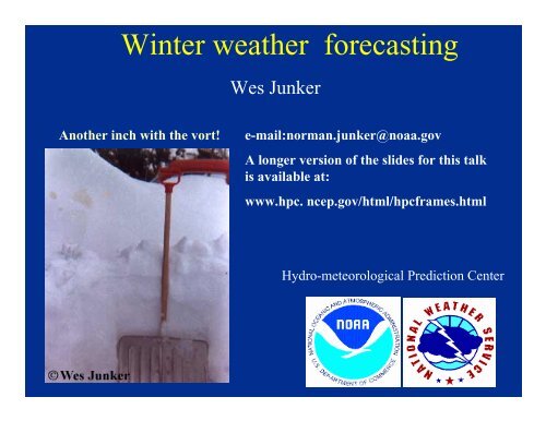
Wes Junker - Hydrometeorological Prediction Center - NOAA
Wes Junker - Hydrometeorological Prediction Center - NOAA
Wes Junker - Hydrometeorological Prediction Center - NOAA

You also want an ePaper? Increase the reach of your titles
YUMPU automatically turns print PDFs into web optimized ePapers that Google loves.
Winter weather forecasting<br />
<strong>Wes</strong> <strong>Junker</strong><br />
Another inch with the vort!<br />
e-mail:norman.junker@noaa.gov<br />
A longer version of the slides for this talk<br />
is available at:<br />
www.hpc. ncep.gov/html/hpcframes.html<br />
Hydro-meteorological <strong>Prediction</strong> <strong>Center</strong>
Snow Forecasting<br />
• Things to think about when forecasting<br />
snow and snowfall amounts<br />
• How to forecast precipitation type<br />
• snowfall accumulations<br />
• Synoptic and mesoscale aspects of heavy<br />
snow<br />
– The heaviest snow usually falls within a<br />
mesoscale band.
Forecasting snow requires<br />
• knowledge of the numerical models<br />
– must resolve which model has best storm track<br />
• knowledge of whether the pattern the model is<br />
forecasting favors a major snowstorm or a minor<br />
one.<br />
• an assessment of whether the model is handling<br />
the mesoscale structure correctly.<br />
• knowledge of the model low-level temperature<br />
biases.<br />
– For example, the models often warm the low level<br />
temps too quickly across northern Maine
To forecast snowfall amounts<br />
1 -- Need to forecast liquid equivalent (qpf)<br />
2 -- Determine rain/snow line, precipitation<br />
type<br />
3 -- Then determine whether surface<br />
temperature will allow snow to<br />
accumulate<br />
4 -- Finally, if you are predicting all snow, you<br />
need to estimate the liquid equivalent ratio
The physical reasons that<br />
determine the amount of snow<br />
that falls over any location are<br />
• The vertical transport of moisture into the system<br />
– vertical motion and moisture<br />
• The efficiency of the precipitation processes<br />
(cloud physics)<br />
– how much evaporation will take place<br />
– how fast will crystals grow?<br />
• Size of the area of precipitating clouds<br />
• Propagation, are new snow producing clouds<br />
developing upstream
Precipitation type<br />
• is dependent on the vertical temperature<br />
structure<br />
– mechanisms that can change the vertical<br />
structure include:<br />
• evaporation<br />
• melting<br />
• thermal advection<br />
• vertical motion<br />
• solar radiation (especially during spring)<br />
• Is dependent cloud physics (freezing rain vs<br />
snow)
Traditional ways to forecast<br />
• 1000-500 thickness<br />
precipitation type<br />
– will not resolve thin warm layers<br />
– warm boundary layer temperature or a warm layer above<br />
the surface<br />
• 1000-850 and 850-700 mb partial thickness<br />
methods<br />
– better, but still may miss a very thin warm layer<br />
• soundings and forecast soundings<br />
– the best method
1000-500 mb thickness<br />
Figure adapted from Glahn et al., 1975<br />
50 % values of 1000-500 mb thickness as a function of station elevation<br />
1000-500 THICKNESS (dm)<br />
559<br />
554<br />
549<br />
544<br />
539<br />
534<br />
529<br />
524<br />
519<br />
514<br />
Strong marine influence<br />
6 12 18 24 30 36 42 48 54 60 66 72 78<br />
STATION ELEVATION (HUNDREDS OF FEET)<br />
The critical thickness varies with elevation and with the<br />
dominant weather regime (stability of the airmass) that<br />
affects the station
Partial Thickness<br />
Adapted from Cantin et al. 1990<br />
Used for southeastern Canada<br />
Thickness (dm)<br />
Precipitation Types<br />
850-700 1000-850<br />
Significant UVV or<br />
low-level cold<br />
advection<br />
Weak UVV and near<br />
zero low-level cold<br />
advection<br />
154<br />
>131<br />
Rain<br />
Rain
Precipitation type from soundings<br />
This is the best way to determine precipitation type<br />
• Summary of important factors to look at on<br />
sounding<br />
– how warm is warm layer<br />
– what is the depth of the layer with wet bulb<br />
temperatures above zero<br />
– wet bulb temperature of cold layer<br />
– depth of cold layer (not as important as other factors)
If there is a cold layer below the inversion, the<br />
question of precipitation type is determined by how<br />
much of the snowflake melted<br />
The degree of snowflake melting<br />
as a function of maximum<br />
inversion temperature. The<br />
curves correspond to particle size<br />
expressed in terms of diameter of<br />
raindrop having an equivalent<br />
mass. Two initial snowflake<br />
densities were used in the<br />
calculations<br />
From Stewart and King, 1987
Precipitation type?<br />
• The warm layer<br />
– If T w of warm layer exceeds 3 to 4 o C, snow melts completely<br />
resulting in rain or freezing rain.<br />
– If T w is less than 1 o C, only partial melting occurs and snow will<br />
usually refreeze.<br />
– If T w is 1-3 o C usually results in partial melting of snowflakes but<br />
then usually refreezes into sleet (or a mixture of sleet and freezing<br />
rain depending on the depth of the warm layer.<br />
• The cold layer<br />
– If temperature is less than --8 o C, and freezing nuclei are<br />
sufficiently abundant and enough time is spent in the cold layer,<br />
either snow or sleet can occur.<br />
– If cold layer is warmer than -8 o C, droplets remain super cooled if<br />
the snow was completely melted (favors freezing rain).<br />
– Depth of cold layer is not nearly as important as the temperature of<br />
the cold layer.<br />
From Stewart and King, 1987
PRECIPITATION TYPE?<br />
A freezing rain sounding (left)<br />
Note that temperature of the warm layer is<br />
above 4 o C.<br />
Unfortunately, a shallow warm layer may not show<br />
up on a forecast sounding. Use a combination of<br />
forecast soundings and MOS guidance to help predict<br />
the most likely precipitation type.<br />
An ice pellet sounding<br />
Note temperature of warm layer is 1-3 o C<br />
0 o temperature<br />
10 o 0 o 10 o<br />
temperature
FREEZING RAIN OR SLEET<br />
THE TAU TECHNIQUE - Cys et al., 1996<br />
10<br />
FROM SOUNDING<br />
MEAN LAYER TEMP (C O )<br />
9<br />
8<br />
7<br />
6<br />
5<br />
4<br />
3<br />
2<br />
1<br />
ICE<br />
PELLETS<br />
FREEZING RAIN<br />
1000 2000 3000 4000 5000<br />
LAYER DEPTH (M)<br />
1. IDENTIFY DEPTH OF WARM LAYER (ABOVE 0 O C)<br />
2. IDENTIFY THE MEAN TEMPERATURE OF THE WARM LAYER<br />
3. THEN , FIND COORDINATE ON THE CHART ABOVE,<br />
THE YELLOW AREA USUALLY GIVES FREEZING RAIN<br />
WHILE THE WHITE AREA GIVES SLEET
CLOUD PHYSICS PLAYS AN IMPORTANT ROLE IN DETERMINING<br />
PRECIPITATION TYPE<br />
Ice forms on various nuclei at various temperatures<br />
Substance<br />
Symmetry<br />
Threshold<br />
temperature ( o C)<br />
Silver Iodide Hex -4<br />
Covellite Hex -5<br />
Kaolinite Triclinic -9<br />
(a clay)<br />
Illite Monoclinic -9<br />
Vermiculite<br />
(clay)<br />
Monoclinic -15<br />
Note that very few (some organic compounds) have activation<br />
temperatures that are below -4oC<br />
From Mason, 1971
FREQUENCY (%) OF SUPERCOOLED<br />
WATER CLOUDS<br />
100<br />
80<br />
60<br />
40<br />
20<br />
0<br />
0<br />
1<br />
2<br />
3 4<br />
-4 -8 -12 -16 -20 -24 -28 -32 -36<br />
TEMPERATURE o C<br />
100<br />
80<br />
60<br />
40<br />
20<br />
0<br />
FREQUENCY (%) OF CLOUDS<br />
CONTAINING ICE PARTICLES<br />
Variation of frequency of supercooled clouds containing ice crystals.<br />
Curves 1 and 2 (all water clouds) pertain to ordinate at left. Curves 3<br />
and 4 (mixed cloud studies) pertain to the ordinate at right.<br />
From Pruppacher and Klett, 1978
At what minimum cloud temperatures do crystals<br />
usually form?<br />
• At -4oC or warmer<br />
– Ice formation is almost impossible without seeding<br />
from above.<br />
• At -9 o C<br />
– The majority of clouds (over 50%) will be all<br />
supercooled water providing there is no cloud seeding<br />
from above<br />
• At -14 o C<br />
– about 75% off all clouds will contain some ice<br />
• At -18 o C or colder<br />
– almost all clouds have ice nuceii
Freezing drizzle<br />
Pressure (mb)<br />
500<br />
600<br />
700<br />
800<br />
900<br />
dry layer<br />
dry layer<br />
-20 -10<br />
Temperature ( o C)<br />
0<br />
• Bocchieri (1980) and Young (1978)<br />
found that 30% and 40% of freezing<br />
rain (usually drizzle) did not have a<br />
layer that was above freezing on the<br />
sounding.<br />
• Huffman and Norman (1988) notes<br />
for this type of freezing rain event<br />
cloud top temperatures within the<br />
low- level cloud deck should be in<br />
the 0 o to -10 o C range and that there<br />
should be a pronounced dry layer<br />
just above the cloud top. A typical<br />
sounding for freezing drizzle is<br />
shown.<br />
Sounding from Rapid City, SD at 00 UTC 12 March<br />
1976. Temperature (red line), dewpoint (dashed), frost<br />
point (blue dots).
NCEP ETA PRECIPITATION TYPE ALGORITHM, AT<br />
HPC WE NOW ALSO USE ALGORITHMS DEVELOPED<br />
BY RAMER AND CYS<br />
If model has problems<br />
handling mass, wind or<br />
temperature fields, then its<br />
forecast of precipitation<br />
type will be wrong<br />
BLUE SHADED AREA IS WHERE MODEL SOUNDING SUGGESTS SNOW,<br />
VIOLET WHERE IT INDICATES SLEET AND RED FREEZING RAIN, DARKER<br />
BLUE LINES INDICATE RH, WHITE LINES INDICATE VERTICAL MOTION.
Snowfall intensity<br />
• The rate that snow falls is a function of<br />
– rate of growth of a single crystal<br />
• which peaks around -15 o C<br />
– and the number of crystals per unit volume,<br />
• the number can be increased<br />
– by fragile crystals (dendrites and needles) fracturing<br />
– by ice splintering during riming<br />
– fragmentation of large super-cooled drops during freezing<br />
When cloud top temperatures are -25 o C or colder the<br />
concentration of ice particles is usually sufficient to use up all<br />
the condensate in stratiform and orographic clouds
ICE CRYSTALS GROW BY<br />
--Deposition, because e sw >e , si vapor is transported from<br />
droplets to ice crystals<br />
--By collisions between super-cooled cloud drops and ice crystals<br />
250<br />
MASS (10 -9 g)<br />
200<br />
150<br />
100<br />
150 sec<br />
50<br />
100 sec<br />
50 sec<br />
0 -2 -4 -6 -8 -10 -12 -14 -16 -18 -20 -22<br />
TEMPERATURE (C o )<br />
Experimentally determined variation of the mass of ice crystals growing by<br />
diffusion of vapor in a water saturated environment, as a function of growth time<br />
and temperature. (From Ryan et al., 1976; by courtesy of the American<br />
Meteorological Society, and the authors.)
The variation of crystal habit with temperature and supersaturation<br />
according to the experiments of Mason et al.<br />
PLATES<br />
HOLLOW PRISMS<br />
FAST GROWING DENDRITES<br />
50<br />
Water-saturation<br />
HOLLOW<br />
NEEDLES<br />
SECTOR PLATES<br />
SECTOR PLATES<br />
DENDRITES<br />
40<br />
PRISMS<br />
30<br />
SECTOR PLATES<br />
20<br />
THICK PLATES<br />
10<br />
0<br />
-10 -20 -30 -40<br />
Temperature<br />
Supersaturation with respect to ice (percent)<br />
SOLID PRISMS<br />
CUPS<br />
SOLID VERY THICK<br />
PLATES<br />
SOLID PRISM
SNOWFLAKE SIZE IS ALSO DEPENDENT<br />
ON AGGREGATION<br />
*MULTIPLE ICE PARTICLES FORM MAIN SNOWFLAKE<br />
*AGGRAGATION PROCESS IS MAXIMIZED AS TEMPERATURE APPROACHES 0 o C<br />
Maximum snowflake diameter (mm)<br />
70<br />
60<br />
50<br />
40<br />
30<br />
20<br />
10<br />
DOMINANT CRYSTAL TYPE<br />
PLANAR DENDRITIC<br />
RADIATING ASSEMBLAGE<br />
-15 -10 -5 0<br />
Temperature ( o C)<br />
Maximum observed snowflake diameters as a function of air temperature<br />
for two types of snowflake compositions. (From Rogers, 1974, 1974b)
SNOWFLAKE DENSITY<br />
WET<br />
DRY<br />
SNOWFLAKE DIAMETER, mm<br />
DENSITY OF SNOWFLAKES, gm cm -3
WHY SHOULD I CARE ABOUT THE PHYSICAL<br />
CHARACTERISTICS OF THE SNOWFLAKES<br />
• The dominant crystal type may affect the snow to liquid<br />
equivalent ratio (how fluffy the snow is).<br />
– Unrimed Dendritic and plate crystals have a lacy structures that<br />
usually produce the highest snow to liquid ratios (best<br />
accumulators)<br />
– The make-up of the cloud may affect the snow to liquid ratio.<br />
When there is abundant liquid water in cloud causing crystals to<br />
grow by riming, snow to liquid ratios are lower (may be 10 to 1 or<br />
lower)<br />
• Cloud physics effect how efficient the system is at<br />
producing snowflakes. Dendrites crystals grow fastest.<br />
• The size and composition of the snowflake may help<br />
determine how quickly it sticks on the ground when<br />
temperatures are marginal for snowfall accumulations.<br />
– Large aggragates may take longer to melt than smaller single<br />
crystals.
Forecasting snow to liquid ratio<br />
Summary<br />
• Warm ground and boundary layer temperatures can keep snow-water<br />
ratios down<br />
• a warm layer that approaches zero o C also will usually keep the ratios<br />
low.<br />
• Storms having clouds with a large amounts of supercooled droplets<br />
will not have as high a ratio as storms in which most crystal growth is<br />
by deposition.<br />
• Soundings that are almost isothermal with a large portion of the<br />
sounding near zero o C will usually have a ratio of 8 or 10 to 1.<br />
• High winds will keep snow ratios down because snowflakes will<br />
fracture and lose their lacy structure<br />
• Deep cold air promotes higher ratios but if the temperatures are too<br />
cold the crystal type may not be conducive to high ratios. .<br />
• Storm tracks often provide keys to forecasting the snow to water ratio<br />
– tracks near oceans have more liquid water in clouds which usually<br />
produces lower snow-liquid ratios
For example<br />
Southern storm tracks typically are associated lower<br />
snow to liquid ratios than clipper type systems<br />
20-1 SNOW-WATER RATIO<br />
8-1 SNOW-WATER<br />
RATIO<br />
6-1 SNOW-WATER RATIO,<br />
SNOW MAY MIX WITH RAIN<br />
OR SLEET<br />
AVERAGE SNOW-WATER RATIOS FOR<br />
FOR SOUTHEASTERN WISCONSIN WITH<br />
VARIOUS STORM TRACKS<br />
1) Northern storm tracks that favor<br />
snow crystal growth by deposition<br />
favor high snow-water ratios.<br />
2) When ice crystals grow by riming or<br />
crystals colliding with supercooled<br />
droplets, the snow-water ratios are<br />
lower.<br />
3) Southern storm tracks and tracks<br />
that tap moisture and warm air from<br />
oceans rarely have snow to water<br />
ratios that are greater than 10-1 except<br />
well west of the storm track. Look for<br />
low ratios where precipitation becomes<br />
mixed with sleet.<br />
Adapted from Harms, 1970
Snow to liquid ratios vary significantly by geographic region.<br />
In Colorado the snow to liquid ratio is usually much higher<br />
than 10 to 1 ( or snow density less than .10).<br />
30<br />
16<br />
PERCENT OBSERVATIONS<br />
25<br />
20<br />
15<br />
10<br />
5<br />
Albany, NY hourly<br />
observations = 2328<br />
0<br />
.00 .06 .12 .18 .24 .30<br />
SNOW DENSITY<br />
PERCENT OBSERVATIONS<br />
14<br />
12<br />
10<br />
8<br />
6<br />
4<br />
2<br />
0<br />
.00<br />
Lakewood, CO<br />
hourly observations<br />
= 62<br />
Temperatures<br />
.03 .06 .09 .12 .15 .18<br />
SNOW DENSITY<br />
Near 32 o<br />
Percent distribution of snow<br />
density based on 2328 hourly<br />
observations from 73 sites<br />
near Albany<br />
Percent distribution of snow density<br />
based on 62 hourly observations from<br />
73 sites near Lakewood, CO<br />
Adapted from Super and Holroyd, 1997
SNOW RATIO TABLE FOR THE EASTERN HALF<br />
OF COUNTRY (not mountain locations)<br />
SURFACE TO 500 MB THICKNESS<br />
546<br />
540<br />
534<br />
528<br />
522<br />
516<br />
5 10 15 20 25<br />
SNOW/LIQUID RATIO<br />
At around 540 thickness<br />
the ratio was 10-1 or<br />
lower. At 528 the ratio<br />
was around 17-1.<br />
However there was<br />
considerable spread..<br />
From Scofield and Spayd, 1984
Upper level aspects of snowstorms that can<br />
change the strength of the vertical motion or<br />
moisture transport into a system<br />
• large changes in amplitudes between trough and downstream ridge<br />
accompanied cyclogenesis (this increases south to north moisture<br />
transport<br />
• all marked decrease in half-wavelength between the trough axis and<br />
downstream ridge indicative of self-development process (increases<br />
vorticity, upper level divergence and promotes cyclogenesis)<br />
• a trough that becomes diffluence and takes on a negative tilt.<br />
(increases upper level divergence and promotes cyclogenesis)<br />
• phasing of multiple vorticity maxima observed in about half the cases<br />
• a vorticity max that is moving east-northeast. (such movements<br />
suggests that the system will have more moisture available than a vort<br />
that is moving to the east southeast (this is especially true in the Plains)<br />
Adapted from Kocin and Uccellini, 1990
THE IMPORTANCE OF THE EASTERN CANADA<br />
UPPER LOW AND CONFLUENCE FOR EAST<br />
COAST SNOWSTORMS<br />
From Kocin and Uccellini, 1990<br />
HIGH<br />
LOW<br />
THE UPPER LOW NEAR THE MARITIMES<br />
HELPS TO HOLD THE UPPER LEVEL<br />
RIDGE AXIS NEAR THE GREAT LAKES<br />
REGION. THIS CONFIGURATION HOLDS<br />
CONFLUENT FLOW OVER THE<br />
NORTHEAST AND LOCKS THE SURFACE<br />
HIGH OVER THE NORTHEAST.<br />
THE TRANSVERSE CIRCULATION<br />
ASSOCIATED WITH THE ENTRANCE<br />
REGION OF THE JET STREAK KEEPS LOW<br />
LEVEL NORTHERLY FLOW ALONG THE<br />
EAST COAST AND PROMOTES DAMMING<br />
SURFACE ISOBARS<br />
JET STREAK<br />
500 MB HEIGHTS<br />
SHIFT THIS PATTERN TO THE WEST AND<br />
THE SAME PATTERN IS FAVORABLE FOR<br />
HEAVY SNOW OVER THE UPPER<br />
MIDWEST.
THE SELF-DEVELOPMENT<br />
PROCESS<br />
JET<br />
JET<br />
JET<br />
JET<br />
NOTE THE SHORTENING OF THE HALF-WAVELENGTH BETWEEN THE TROUGH<br />
AND DOWNSTREAM RIDGE AXIS. THIS HELPS TO STRENGTHEN THE VORTICITY,<br />
VORTICITY ADVECTION AND THE UPPER LEVEL DIVERGENCE. THE SURFACE<br />
LOW DEEPENS, PRODUCING INCREASED WARM ADVECTION WHICH BUILDS THE<br />
SHORTWAVE RIDGE AHEAD OF THE TROUGH. THIS INCREASES THE AMPLITUDE<br />
OF THE SYSTEM.<br />
From Kocin and Uccellini, 1990
The most common upper level jet pattern<br />
with snowstorms that produce a large<br />
area of 10”+.<br />
The lower branch of the direction<br />
circulation associated with the<br />
northern jet streak helps to provide<br />
an northerly component to the low<br />
level ageostrophic winds<br />
The lower branch of the indirect<br />
circulation supplies a southerly<br />
component that helps enhance the<br />
low level jet.<br />
The two branches act together to<br />
enhance low-level frontogenesis and<br />
upper level divergence<br />
From Kocin and Uccellini,<br />
1990
Remember, heavy snow usually<br />
occurs in mesoscale bands.<br />
And can be focused by a variety of factors, for example:<br />
• frontogenetic forcing along a boundary<br />
• a convergence zone, i.e. the Puget Sound convergence<br />
zone.<br />
• By convective plumes induced to the lee of large open<br />
expanses of water<br />
• upper-level jet streaks<br />
• terrain<br />
• gravity waves<br />
• conditional symmetric instability?<br />
Synoptic, mesoscale and local effects need to be considered when<br />
forecasting snow
What about using empirical techniques or<br />
composites?<br />
• The Garcia technique<br />
– Fairly subjective, does not take into account the slope of the isentrope or<br />
the movement of the system<br />
• The Cook Method<br />
– Probably works because the warm advection at upper levels can be<br />
correlated with cyclogenesis.<br />
– Does not measure moisture available for the system or vertical motion.<br />
• The Magic Chart<br />
– Uses net vertical displacement and 850 temperature (-3 to -5oC ribbon).<br />
– Does not take into account available moisture or whether there might be a<br />
warm layer.<br />
• Composites (Goree and Younkin), Browne and Younkin, etc.<br />
– Some cases do not fit the mean patterns. If you rely strickly on<br />
composites you’ll miss the outliers.
References and related articles<br />
• Bocchieri, J. R., 1980: The objective use of upper air soundings to specify precipitation<br />
type. Mon. Wea. Rev. 108, 596-603.<br />
• Browne, R. F. and R. J Younkin, 1970: Some relationships between 850-millibar lows<br />
and heavy snow over the Central and Eastern United States, Mon. Wea. Rev., 98<br />
• Chaston, P.R., 1989: The Magic Chart for forecasting snow amounts. National<br />
Weather Digest, 14, 20-22.<br />
• Cook, B. J., 1966: The Lubbock Snowstorm of February 20, 1961. U.S. Dept. of<br />
Commerce, ESSA, Weather Bureau Southern Region, Tech. Memorandum No. 12. 10<br />
pp.<br />
• Czys, R. R., R. W. Scott, K.C. Tang, R. W. Przybylinski, and M. E. Sarbones, 1996: A<br />
Physically based, Nondimensional Parameter for Discriminating between locations of<br />
freezing rain and ice pellets. Wea. Forecasting, 11, 591-598.<br />
• Doesken, N.J. and A. Judson, 1996: The Snow Booklet, A guide to the Science.<br />
Climatology and Measurement of Snow in the United States. Colorado Climate <strong>Center</strong>,<br />
Colorado State University. 84 pp.<br />
• Garcia, C. Jr., 1994: Forecasting snowfall using mixing ratios on an isentropic surface.<br />
<strong>NOAA</strong> Tech. Memo., NWS CR-105, U.S. Dept. of Commerce/<strong>NOAA</strong>/NWS. 31 pp.<br />
• Goree, P.A. and R. J. Younkin, 1966: Synoptic Climatology of Heavy Snowstorms<br />
over the Central and Eastern United States, Mon. Wea. Rev., 94, 663-668.<br />
• Harms, R. H., 1970: Snow Forecasting for Southeastern Wisconsin. <strong>NOAA</strong> Technical<br />
Memorandum NWSTM CR-38, U. S. Dept. of Commerce, <strong>NOAA</strong>, NWS, 17 pp.
References Continued<br />
• Huffman, G.J. and G. A. Norman, Jr., 1988: The Supercooled Warm Rain Process and<br />
the Specification of Freezing Precipitation. Mon. Wea. Rev., 116, 2172-2182.<br />
• Kocin, P. J. and L. W. Uccellini, 1990: Snowstorms along the Northeastern United<br />
States Coast, 1955 to 1985. American Meteorological Society, Meteorological<br />
Monograph No. 44, 280 pp.<br />
• Moore, J. T. and T. E. Lambert, 1993: the use of equivalent potential vorticity to<br />
diagnose regions of conditional symmetric instability. Wea. and Forecasting, 7 , 430-<br />
439.<br />
• Mote, T.L., 1991: A statistical investigation of atmospheric thermodynamics and<br />
kinematics associated with intensity of snowfall at Omaha, Nebraska. Masters Thesis,<br />
University of Nebraska<br />
• Ryan, B. F. , E. R. Wiehart and D. E. Shaw, 1976: The growth rates and densities of ice<br />
crystals between -3 o C and -21 o C. J. Atmos. Sci., 33, 842-850.<br />
• Scofield, R. A. and L. E. Spayd, 1984: A technique that uses satellite, radar, and<br />
conventional data for analyzing and short-range forecasting of precipitation from<br />
extratropical cyclones. <strong>NOAA</strong> Technical Memorandum NESDIS 8, 51 pp.<br />
• Stewart. R.E. and P. King, 1987: Rain/snow boundaries over southern Ontario. Mon.<br />
Wea. Rev., 115, 1270-1279.<br />
• Super, A. B. and E. W. Holroyd III, 1997: Snow Accumululation Algorithm for the<br />
WSR-88D Radar: Second Annual Report. Bureau of Reclamation Report R-97-05,<br />
Denver, Co, June, 70 pp.<br />
• Young, W. H., 1978: Freezing precipitation in the southeastern United States. M. S.<br />
thesis, Texas A7M University, 123 pp.