City of Methuen Master Plan
City of Methuen Master Plan
City of Methuen Master Plan

You also want an ePaper? Increase the reach of your titles
YUMPU automatically turns print PDFs into web optimized ePapers that Google loves.
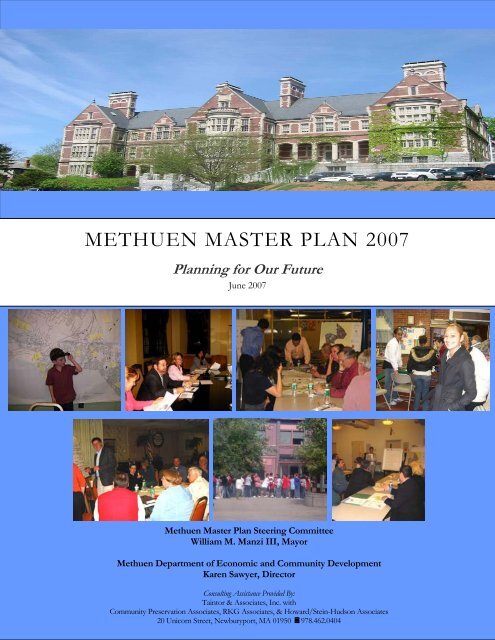
METHUEN MASTER PLAN 2007<br />
<strong>Plan</strong>ning for Our Future<br />
June 2007<br />
<strong>Methuen</strong> <strong>Master</strong> <strong>Plan</strong> Steering Committee<br />
William M. Manzi III, Mayor<br />
<strong>Methuen</strong> Department <strong>of</strong> Economic and Community Development<br />
Karen Sawyer, Director<br />
Consulting Assistance Provided By:<br />
Taintor & Associates, Inc. with<br />
Community Preservation Associates, RKG Associates, & Howard/Stein-Hudson Associates<br />
20 Unicorn Street, Newburyport, MA 01950 978.462.0404
A CKNOWLEDGEMENTS<br />
The Steering Committee would like to thank all those who participated in the <strong>Master</strong> <strong>Plan</strong> process.<br />
Steering Committee:<br />
Elected Officials –<br />
Robert A. Andrew, <strong>City</strong> Councilor<br />
Joseph M. Cosgrove, School Committee<br />
Joseph A. Leone III, <strong>City</strong> Councilor<br />
William M. Manzi III, Mayor<br />
Appointed Officials -<br />
Matthew J. D’Agostino, Zoning Board <strong>of</strong> Appeals Chair<br />
Stephen F. DeFeo, Jr., Community Development Board Chair<br />
Suzanne M. Lamoureux, Conservation Commission Chair<br />
Business Community Representative -<br />
William Buckley, Business Community<br />
Special Thanks to:<br />
Kathleen Colwell<br />
Karen Sawyer<br />
Nancy Hudson<br />
Lynn Smiledge<br />
John Cena<br />
Gerald Deschene<br />
Raymond DiFiore<br />
Clifford Gallant<br />
Joseph Giarrusso<br />
Matthew Kraunelis<br />
Frank Russo<br />
Joseph Solomon<br />
Tina Touma-Conway<br />
Dr. Jeanne Whitten<br />
Assistant Director <strong>of</strong> <strong>Plan</strong>ning<br />
Director <strong>of</strong> Economic & Community Development<br />
Secretary<br />
Historic <strong>Plan</strong>ner<br />
Municipal Appraiser<br />
Building Commissioner<br />
Director <strong>of</strong> Public Works<br />
Fire Chief<br />
Conservation Officer<br />
Mayor’s Chief <strong>of</strong> Staff<br />
Director <strong>of</strong> Engineering<br />
Chief <strong>of</strong> Police<br />
<strong>City</strong> Clerk<br />
Superintendent <strong>of</strong> Schools
Acknowledgements<br />
Finally, the Steering Committee extends its appreciation to all those <strong>Methuen</strong> organizations and<br />
businesses who supported the visioning workshops through their generous donations:<br />
Applebee's<br />
105 Pleasant Valley Street<br />
Borrelli's<br />
322 Merrimack Street<br />
Mann's Orchard<br />
65 Pleasant Valley St.<br />
<strong>Methuen</strong> Historical Society<br />
37 Pleasant Street<br />
Romano's Pizzeria<br />
301 Merrimack Street<br />
Romano's Macaroni Grill<br />
90 Pleasant Valley Street<br />
Rosario’s 1859 House<br />
12 Hampshire Street<br />
Shadi's<br />
58 Osgood Street<br />
Stop & Shop<br />
90 Pleasant Valley Street<br />
Summit Place<br />
142 Pleasant Valley Street<br />
and the Santa Parade.
TABLE OF C ONTENTS<br />
Introduction – <strong>Plan</strong>ning For Our Future..............................................................................................................1<br />
Vision Statement.......................................................................................................................................................3<br />
Priorities for Action..................................................................................................................................................5<br />
Land Use ....................................................................................................................................................................9<br />
Land Use Changes............................................................................................................................................. 11<br />
Distribution and Density <strong>of</strong> Land Uses......................................................................................................... 11<br />
<strong>Methuen</strong>’s Neighborhoods .............................................................................................................................. 20<br />
Regulatory Analysis........................................................................................................................................... 22<br />
Smart Growth and Sustainable Land Use...................................................................................................... 24<br />
Summary <strong>of</strong> Findings........................................................................................................................................ 24<br />
Land Use Goals, Objectives, and Strategies.................................................................................................. 25<br />
Population and Housing ....................................................................................................................................... 29<br />
Population .......................................................................................................................................................... 29<br />
Households......................................................................................................................................................... 30<br />
Household Income............................................................................................................................................ 30<br />
Housing Supply.................................................................................................................................................. 30<br />
Housing Sales and Apartment Rental Trends............................................................................................... 32<br />
Housing Affordability....................................................................................................................................... 33<br />
Households Size, Tenures & Age Characteristics......................................................................................... 34<br />
Households in Poverty ..................................................................................................................................... 35<br />
Quantifying Low Income Households........................................................................................................... 35<br />
Homeownership and Renter Affordability.................................................................................................... 37<br />
Summary <strong>of</strong> Findings........................................................................................................................................ 39<br />
Housing Goals, Objectives, and Strategies.................................................................................................... 41<br />
Economic Development....................................................................................................................................... 49<br />
Labor Force and Unemployment.................................................................................................................... 49<br />
Industry Employment and Wages .................................................................................................................. 50<br />
Employment Forecasts..................................................................................................................................... 52<br />
Business Establishments .................................................................................................................................. 53<br />
Major Employers............................................................................................................................................... 55<br />
Tax Base and Tax Rate ..................................................................................................................................... 55<br />
Commuting Patterns......................................................................................................................................... 60<br />
Regional Economic Development <strong>Plan</strong>ning Context..................................................................................60<br />
Summary <strong>of</strong> Findings........................................................................................................................................ 64<br />
Economic Development Goals, Objectives, and Strategies ....................................................................... 64<br />
Fiscal Analysis......................................................................................................................................................... 67<br />
Municipal Revenue Trends .............................................................................................................................. 67<br />
Municipal Expenditure Trends........................................................................................................................ 68<br />
Municipal Service Costs.................................................................................................................................... 68<br />
Residential Revenue and Cost Comparison .................................................................................................. 69<br />
Non-Residential Revenue and Cost Comparison......................................................................................... 70<br />
Summary <strong>of</strong> Findings........................................................................................................................................ 71<br />
Fiscal Analysis Goals, Objectives, and Strategies ......................................................................................... 72<br />
Transportation and Circulation............................................................................................................................ 73<br />
Miles <strong>of</strong> Roadway .............................................................................................................................................. 73
Auto Ownership.................................................................................................................................................73<br />
Travel Patterns....................................................................................................................................................74<br />
Where <strong>Methuen</strong> Residents Work.....................................................................................................................75<br />
Traffic Volumes..................................................................................................................................................76<br />
Key Corridors .....................................................................................................................................................78<br />
Key Intersections ...............................................................................................................................................78<br />
Pedestrian and Bicycle Facilities.......................................................................................................................79<br />
Transit Services/Park-and-Ride Facilities.......................................................................................................80<br />
Transportation and Parking Issues in the Zoning By-laws and Subdivision Regulations.......................81<br />
Summary <strong>of</strong> Findings.........................................................................................................................................82<br />
Transportation and Circulation Goals, Objectives, and Strategies.............................................................83<br />
Public Facilities and Services.................................................................................................................................87<br />
<strong>City</strong> Administrative Offices ..............................................................................................................................88<br />
Schools.................................................................................................................................................................89<br />
Public Safety........................................................................................................................................................97<br />
Other Municipal Facilities.............................................................................................................................. 101<br />
Nevins Memorial Library............................................................................................................................... 101<br />
Council on Aging ............................................................................................................................................ 103<br />
Public Meeting Spaces.................................................................................................................................... 108<br />
Utilities and Infrastructure............................................................................................................................. 109<br />
<strong>Methuen</strong> Water System .................................................................................................................................. 110<br />
The <strong>Methuen</strong> Sewer System .......................................................................................................................... 111<br />
Summary <strong>of</strong> Findings...................................................................................................................................... 112<br />
Public Facilities and Services Goals, Objectives, and Strategies .............................................................. 115<br />
Natural Resources, Open Space, and Recreation............................................................................................ 119<br />
Geology, Topography, and Soils................................................................................................................... 119<br />
Water Resources.............................................................................................................................................. 123<br />
Wildlife Resources <strong>of</strong> <strong>Methuen</strong>..................................................................................................................... 127<br />
Summary <strong>of</strong> Natural Resource Findings...................................................................................................... 132<br />
Open Space and Recreation........................................................................................................................... 132<br />
Recreation......................................................................................................................................................... 135<br />
Summary <strong>of</strong> Findings...................................................................................................................................... 137<br />
Open Space <strong>Plan</strong> ............................................................................................................................................. 138<br />
Natural Resources, Open Space, and Recreation Goals, Objectives, and Strategies ............................ 142<br />
Historic and Cultural Resources........................................................................................................................ 144<br />
Cultural Resources .......................................................................................................................................... 144<br />
Historic Resources .......................................................................................................................................... 145<br />
Summary <strong>of</strong> Findings...................................................................................................................................... 154<br />
Historic and Cultural Resources Goals, Objectives, and Strategies......................................................... 155<br />
Implementation <strong>Plan</strong>........................................................................................................................................... 157<br />
Action Table..................................................................................................................................................... 157<br />
Priorities & Time Table.................................................................................................................................. 157
I NTRODUCTION – PLANNING F OR O UR F UTURE<br />
Led by Mayor William M. Manzi III, the <strong>City</strong> <strong>of</strong> <strong>Methuen</strong> embarked upon this master planning process<br />
with the goal <strong>of</strong> bringing the community together to establish a comprehensive vision for <strong>Methuen</strong>’s<br />
future, and to evaluate how its staff, elected and appointed<br />
<strong>of</strong>ficials, various plans, policies, and regulations might best be<br />
employed to achieve this vision.<br />
The need for a <strong>Master</strong> <strong>Plan</strong>, in part, was also identified as<br />
members throughout the community expressed concerns that<br />
<strong>Methuen</strong> is changing in ways that threatened its character:<br />
traffic congestion is increasing; environmentally-sensitive<br />
lands and rural areas are being proposed for residential<br />
developments; housing growth without balanced economic<br />
development is shifting property tax burdens on residents;<br />
housing is becoming less affordable; and the maintenance<br />
and upgrading <strong>of</strong> public facilities is increasingly difficult to<br />
finance amid very restricted budget climates.<br />
<strong>Methuen</strong>’s last <strong>Master</strong> <strong>Plan</strong> was prepared in 1986. At that<br />
time, the impact <strong>of</strong> residential growth on <strong>Methuen</strong>’s<br />
character, its tax base, and it natural resources was at the<br />
forefront <strong>of</strong> land use discussions. Though <strong>Methuen</strong> has<br />
witnessed substantial changes in population and land use<br />
over the past twenty years, the 1986 <strong>Plan</strong>’s statement <strong>of</strong><br />
intent largely remains true – and will be updated herein to<br />
respond to the <strong>City</strong>’s current conditions.<br />
In 1997, the Community Development Board updated the<br />
Land Use portion <strong>of</strong> the <strong>Master</strong> <strong>Plan</strong>, and took a close look<br />
at how land use choices affected the <strong>City</strong>’s tax base. This<br />
analysis was especially timely, in light <strong>of</strong> the fact that the <strong>City</strong><br />
was constructing 3 new elementary schools, expanding the<br />
Nevins Memorial Library, and improving various parks and<br />
recreational facilities. The 1997 plan included a growth<br />
“The primary intent <strong>of</strong> the land use plan is to<br />
retain the predominantly residential character <strong>of</strong><br />
the town while allowing ample opportunity for<br />
appropriate business and industrial development.<br />
An integral part <strong>of</strong> the plan is the establishment <strong>of</strong><br />
an open space network which will serve as a<br />
buffer between development, provide flood<br />
protection, help retain the rural character <strong>of</strong><br />
outlying portions <strong>of</strong> the town, and protect natural<br />
resources.”<br />
<strong>Methuen</strong> 1986 <strong>Master</strong> <strong>Plan</strong><br />
1986 Time Capsule:<br />
• Reagan was President<br />
• Space Shuttle Challenger exploded<br />
• Top Gun was the biggest grossing film<br />
• Nintendo was introduced in the U.S.<br />
• Nuclear disaster occurred at Chernobyl<br />
1997 Land Use <strong>Plan</strong> Strategies:<br />
1. Set the stage for – and foster expansion <strong>of</strong><br />
– <strong>Methuen</strong>’s economic base.<br />
2. Emphasize open space and natural/cultural<br />
resource preservation as major growth<br />
management tools.<br />
3. Carefully monitor and enforce the concept<br />
<strong>of</strong> diverse residential settings with<br />
distinctive characters that each support a<br />
sense <strong>of</strong> neighborhood pride.<br />
Page 1
<strong>Methuen</strong> <strong>Master</strong> <strong>Plan</strong> 2007<br />
analysis that, coincidentally, projected that <strong>Methuen</strong> would reach residential buildout in 2006. 1<br />
While the <strong>City</strong> has not reached residential buildout, it has reached many <strong>of</strong> the benchmarks as predicted<br />
in its nearly 10-year old growth projection: total population, number <strong>of</strong> housing units, and public school<br />
students are all at levels remarkably close to where <strong>of</strong>ficials thought they would be. Discussed further<br />
in the Land Use chapter, it would seem that <strong>Methuen</strong> has grown in a different manner and at a slower<br />
rate than forecasted, for both residential and commercial/industrial uses. There appears to be a<br />
correlation between the <strong>City</strong>’s action to implement the 1997 recommendations and its pattern <strong>of</strong><br />
development over the course <strong>of</strong> the past nine years.<br />
In addition to the 1986 <strong>Master</strong> <strong>Plan</strong> and its 1997 Land Use element update, <strong>Methuen</strong> has prepared<br />
several specialized studies that will be referenced herein. These include a 2005 Community<br />
Development <strong>Plan</strong> (CDP), a 2004 Downtown Development <strong>Plan</strong>, and a 2001 Open Space and<br />
Recreation <strong>Plan</strong>.<br />
This <strong>Master</strong> <strong>Plan</strong> acknowledges and incorporates elements <strong>of</strong> these past plans as they relate to<br />
<strong>Methuen</strong>’s future vision. In most instances, these limited-focus plans will contain greater detail on<br />
particular issues than the <strong>Master</strong> <strong>Plan</strong> will. Likewise, the amount <strong>of</strong> detailed input we received during<br />
the planning process is summarized herein – as a comprehensive look at all aspects <strong>of</strong> the <strong>City</strong>, the<br />
<strong>Master</strong> <strong>Plan</strong> attempts to find consensus among multiple constituencies, and makes specific<br />
recommendations with regard to priorities. While it can’t possibly contain the breadth <strong>of</strong> all the<br />
comments made, we hope it has captured the essence <strong>of</strong> the conversations.<br />
The Implementation <strong>Plan</strong> outlines tasks that will forward the vision <strong>of</strong> this <strong>Master</strong> <strong>Plan</strong>, and those most<br />
directly responsible for carrying forward the recommendations <strong>of</strong> this <strong>Plan</strong>. In a broader sense,<br />
however, all members <strong>of</strong> the <strong>Methuen</strong> community share in the responsibility in seeing this <strong>Plan</strong> realized.<br />
Elected <strong>of</strong>ficials should use the plan to guide their policy-making; Boards and Commissions should<br />
consider the <strong>Plan</strong> when making regulatory decisions; businesses should consult the plan (and be referred<br />
to it) when choosing to locate or expand their operations; and neighbors should be informed by the <strong>Plan</strong><br />
when giving their input on land use decisions.<br />
When responsibility for the <strong>Plan</strong>’s implementation is borne by many, the greater the likelihood this will<br />
be a “living document,” and the greater the odds <strong>of</strong> success.<br />
1 According to <strong>Methuen</strong>’s current assessing database, there are 453 developable acres <strong>of</strong> residential land remaining, and<br />
530 acres <strong>of</strong> potentially developable residential land.<br />
Page 2
V ISION S TATEMENT<br />
While <strong>Methuen</strong> has welcomed 6,000 additional residents to its community over the past 20 years,<br />
newcomers and natives alike share a vision for the community’s future that in large part remains<br />
consistent with the one articulated in 1986: to ensure that the <strong>City</strong> continues to be a “nice place to live,”<br />
by protecting its natural and cultural resources, maintaining <strong>Methuen</strong> as a reasonably affordable<br />
place for residents, providing a high level <strong>of</strong> public services and facilities to serve its families and<br />
businesses, and fostering a vibrant downtown.<br />
<strong>Methuen</strong> is hardly alone among Massachusetts cities and towns in wanting to preserve its quality <strong>of</strong> life<br />
for future generations. The Commonwealth <strong>of</strong> Massachusetts is promoting the concept <strong>of</strong> sustainable<br />
development and Smart Growth throughout the state as it tries to assist city and towns with similar<br />
objectives. As this <strong>Master</strong> <strong>Plan</strong> outlines, adherence to Smart Growth principles will help the <strong>City</strong> in<br />
preserving and improving its quality <strong>of</strong> life. <strong>Methuen</strong> is distinctive, however, in the details <strong>of</strong> its intrinsic<br />
community character, and what steps the <strong>City</strong> might best take in ensuring that <strong>Methuen</strong> retains its local<br />
flavor.<br />
Over the course <strong>of</strong> several public workshops, community members were asked to name their “top 3”<br />
favorite things about <strong>Methuen</strong>, and the “top 3” biggest obstacles that prevent the <strong>City</strong> from achieving its<br />
goals. Their answers form the core <strong>of</strong> this vision statement.<br />
Many residents list <strong>Methuen</strong>’s location, with easy proximity to Interstates 93 and 495, as one <strong>of</strong> its prime<br />
assets, but what people seem to value most about the <strong>City</strong> is its “small town feel.” The remaining farm<br />
land, riverfront, open spaces, parks, and forested lands are important pieces <strong>of</strong> the community’s selfimage.<br />
While outsiders may characterize the <strong>City</strong>’s land development pattern are largely suburban,<br />
<strong>Methuen</strong> residents frequently use the term “rural” when referencing outer-lying neighborhoods, and<br />
there is a general sense that this character is being lost as housing developments are being located on<br />
former farm lands and/or historic open spaces. Future development should be managed with the goal<br />
<strong>of</strong> conserving large tracts <strong>of</strong> open space wherever feasible, and taking scenic viewsheds into<br />
consideration.<br />
With over 8 miles <strong>of</strong> frontage along the Merrimack and Spicket Rivers, <strong>Methuen</strong>’s residents envision a<br />
future in which the <strong>City</strong> takes better advantage <strong>of</strong> riverfronts for recreation and public use<br />
purposes. People appreciate the passive and active recreational opportunities the <strong>City</strong> currently <strong>of</strong>fers,<br />
including Forest Lake, the Town Forest, Riverside Park, the Bird Sanctuary, etc., and would like to see<br />
additional trails, athletic fields, and outdoor gathering places developed. To the extent that businesses<br />
are located near these resources, they should encompass uses that serve the public, such as restaurants,<br />
cafes, and/or other types <strong>of</strong> uses that support public use.<br />
<strong>Methuen</strong> residents take their heritage seriously. An enthusiastic appreciation for the <strong>City</strong>’s historic<br />
buildings, landscapes, and records knits the community together. The storied legacy <strong>of</strong> the Searles,<br />
Tenney, and Nevins families can be seen and felt throughout the <strong>City</strong>’s walled neighborhoods, turreted<br />
bridges, grand public buildings, and formal parks and gardens. At least three formal groups steward<br />
historic resources in <strong>Methuen</strong>: the Historic District Commission, the Historical Commission, and the<br />
Historical Society. The Festival <strong>of</strong> Trees dedicates its annual pr<strong>of</strong>its to support historic preservation<br />
efforts in the <strong>City</strong>. A frequently repeated and passionately articulated theme from the <strong>Master</strong> <strong>Plan</strong><br />
workshops was to continue to promote historic preservation in <strong>Methuen</strong>.<br />
Page 3
<strong>Methuen</strong> <strong>Master</strong> <strong>Plan</strong> 2007<br />
<strong>Methuen</strong> residents have long desired to have a downtown that serves as a community gathering<br />
place. They would love to be able to fulfill errands, have a meal, and shop for gifts in a downtown that<br />
is easily accessible by foot or by car. Solving issues such as parking supply, allowing for mixed-use in the<br />
Zoning ordinance, and attracting a good variety <strong>of</strong> tenants for existing buildings are among the issues<br />
that need to be addressed by the <strong>City</strong>.<br />
<strong>Methuen</strong>’s outstanding school facilities are a mainstay <strong>of</strong> families and a primary attraction for those<br />
looking to move into the community. On a related note, many people expressed a high degree <strong>of</strong><br />
satisfaction with the public services <strong>Methuen</strong> government <strong>of</strong>fers – from reliable road maintenance and<br />
trash removal to the exceptional Public Library and the ever-popular Senior Center. People conveyed a<br />
sense <strong>of</strong> comfort with the relative stability in fiscal affairs, responsive public <strong>of</strong>ficials, and a feeling that<br />
local government was well-managed. Identifying ways to maintain this level <strong>of</strong> public services and<br />
facilities, while keeping property taxes manageable, is <strong>of</strong> high priority. Increasing economic<br />
development activities is critical to keeping <strong>Methuen</strong>’s tax base stable.<br />
Supporting a variety <strong>of</strong> housing options for residents <strong>of</strong> all ages, incomes, and ethnicities is also at the<br />
forefront <strong>of</strong> the community’s mindset. “Decent, unpretentious folk” account for <strong>Methuen</strong>’s cherished<br />
community spirit, and their housing needs must be addressed to preserve the heart <strong>of</strong> the <strong>City</strong>. Amid a<br />
housing climate <strong>of</strong> increasingly unaffordable prices, residents stated their concerns for those whom the<br />
typical new subdivision home was not a good fit. Seniors and young families in particular are not wellsuited<br />
to the majority <strong>of</strong> <strong>Methuen</strong>’s housing options. Finding ways to provide affordable alternatives<br />
to expensive single-family homes is essential to this future vision.<br />
Traffic and congestion are byproducts <strong>of</strong> growth. Increases <strong>of</strong> any amount <strong>of</strong> traffic are noticeable to<br />
long-term residents. Although a number <strong>of</strong> factors contribute to traffic growth, <strong>Methuen</strong>’s traffic is still<br />
for the most part on the collector and arterial streets and not invading neighborhood streets, looking for<br />
a cut-through street to avoid congestion.<br />
<strong>Methuen</strong>’s changing demographics factor into transportation issues. Households have more vehicles per<br />
person than in years past, and the number <strong>of</strong> cars traveling local roadways has likewise grown.<br />
Commutes are longer, as are many weekend trips to popular destinations. Residents have expressed a<br />
strong desire to both reduce the amount <strong>of</strong> time spent getting around town, and the amount <strong>of</strong> stress<br />
involved in negotiating traffic. A key point for <strong>Methuen</strong>, however, is that traffic has not grown at the<br />
same rate as household growth.<br />
Many new developments employ cul de sacs in lieu <strong>of</strong> connecting to a larger street network, which<br />
strains existing collector streets. Frequently, solutions that would improve traffic flow are difficult to<br />
implement when multiple property owners are involved, and may prove expensive in the short term.<br />
While some modifications have been made to increase capacity <strong>of</strong> existing streets and intersection<br />
operations, there have been relatively few efforts made to provide for other ways <strong>of</strong> circulation.<br />
<strong>Methuen</strong>’s future should involve a concerted effort to think about long term improvements to its<br />
transportation network, including residents’ use <strong>of</strong> sidewalks, bikeways, and transit (buses, trains, car<br />
pools) as a means towards this goal.<br />
Page 4
P RIORITIES FOR A CTION<br />
<strong>Methuen</strong>’s 2007 <strong>Master</strong> <strong>Plan</strong> is comprehensive, covering nine distinct elements and having a horizon <strong>of</strong><br />
roughly 5-20 years. From discussions with the <strong>Master</strong> <strong>Plan</strong> Steering Committee, members <strong>of</strong> the<br />
public, and leaders in the business community, it is clear that <strong>Methuen</strong>’s future quality <strong>of</strong> life is largely<br />
dependent upon its response to a few key issues it is facing. A brief analysis <strong>of</strong> these topics follows, at<br />
the outset <strong>of</strong> the plan, to orient readers’ minds to these major themes as they proceed to review the plan<br />
in its entirety.<br />
Keep <strong>Methuen</strong> in Business & Foster A Vibrant Downtown<br />
Economic development <strong>of</strong>fers numerous benefits to the quality <strong>of</strong> life in <strong>Methuen</strong>. By providing local<br />
places to work, residents have job opportunities close to their homes, thereby lessening commute times<br />
and fostering re-investment in the local economy. The opportunity to purchase locally-produced goods<br />
and services likewise supports a commonly-held goal <strong>of</strong> preserving <strong>Methuen</strong>’s “small town feel.” And,<br />
most importantly, the positive contribution <strong>Methuen</strong> businesses make to its tax base is critical to how<br />
the <strong>City</strong> can continue to provide excellent services without introducing undue financial burdens on its<br />
residents.<br />
Nowhere is this goal better seen than in the <strong>City</strong>’s <strong>of</strong>t-articulated desire to have a vibrant downtown.<br />
Whether it be enhancement <strong>of</strong> the existing downtown (roughly defined as the Gaunt Square area,<br />
stretching along Broadway, Hampshire and Osgood Streets) or the creation <strong>of</strong> a new district, residents<br />
clearly want to gather in a place that <strong>of</strong>fers smaller-scale, more unique stores and restaurants than the<br />
Loop provides. A 2004 Downtown Development <strong>Plan</strong> reviews all past planning efforts that focus on<br />
the downtown area and proposes a multifaceted action agenda that seeks to accomplish this goal.<br />
In 2006, the Harvard University Graduate School <strong>of</strong> Design’s Advanced Management Development<br />
Program selected downtown <strong>Methuen</strong> as its case study focus. Four teams comprised <strong>of</strong> executive-level<br />
members with varied disciplines competed in a business plan presentation held in February 2007. The<br />
four presentations provide the <strong>City</strong> with some compelling suggestions and “food for thought” as the<br />
<strong>Master</strong> <strong>Plan</strong> seeks to help guide the future development <strong>of</strong> this critical part <strong>of</strong> the <strong>City</strong>.<br />
The <strong>Master</strong> <strong>Plan</strong> affirms <strong>Methuen</strong>’s efforts to revive its downtown – replete with historic structures, the<br />
success <strong>of</strong> downtown businesses could serve as a foundation for the public’s renewed interest in historic<br />
preservation, volunteerism, and community pride.<br />
Protect <strong>Methuen</strong>’s Remaining Rural Areas and Open Spaces, and Preserve Its Historic Character and Small Town Feel<br />
<strong>Methuen</strong> continues to wrestle with how to best manage applications for development on its last<br />
remaining areas <strong>of</strong> open space. Residential growth competes with economic development planning on a<br />
regular basis, requiring the <strong>City</strong> to think carefully about the implications <strong>of</strong> long-term land use decisions.<br />
The Community Development Board and the Zoning Board increasingly must seriously consider issues<br />
<strong>of</strong> impact assessment and mitigation as environmentally sensitive and/or otherwise marginal lands are<br />
being proposed for development.<br />
The <strong>City</strong>’s remaining agricultural land is being converted to other uses. The loss <strong>of</strong> farms is manifested<br />
in two key ways: scenic, open space is removed from the landscape, and community members lose the<br />
Page 5
<strong>Methuen</strong> <strong>Master</strong> <strong>Plan</strong> 2007<br />
ability to purchase locally-grown produce. The most recent example <strong>of</strong> this is the approved conversion<br />
<strong>of</strong> Mann’s Orchards to a Target retail store and small residential subdivision. Although the <strong>City</strong> cannot,<br />
through regulation, prevent farms from being converted to other uses, it can tailor its regulations to<br />
encourage continued farm use and, in the event <strong>of</strong> a conversion, take measures to shape future uses that<br />
will not prevent an eventual return to agriculture by the alteration <strong>of</strong> topography, degradation <strong>of</strong> soils,<br />
etc. The <strong>City</strong> can also actively promote the use <strong>of</strong> tax incentives (Chapters 61A, 61B), purchase<br />
agricultural preservation restrictions (APRs) 2 , and ease permitting procedures for accessory uses to assist<br />
farmers in continuing to prosper in <strong>Methuen</strong>.<br />
To stem the loss <strong>of</strong> open spaces, <strong>Methuen</strong> should be vigilant in tracking proposed conversions <strong>of</strong><br />
Chapter 61 land and consider acting on the right <strong>of</strong> first refusal option to purchase land that is highly<br />
valued for its contribution to “rural, scenic, small-town <strong>Methuen</strong>.” In addition, the <strong>City</strong> should join the<br />
majority <strong>of</strong> the Commonwealth’s communities in adopting a zoning provision for “open space<br />
residential developments (OSRDs),” which require the preservation <strong>of</strong> open space in exchange for<br />
flexibility in lot/home arrangement in a subdivision. The last time the <strong>City</strong> debated the merits <strong>of</strong> a<br />
similar idea called “cluster zoning,” it decided against adoption for fear that an overall increase in<br />
housing density would ensue. By contrast, the OSRD will not increase density beyond what is already<br />
permitted in the district; rather, it will preserve large tracts <strong>of</strong> open space by allowing the same number<br />
house lots to be laid out in a more efficient pattern.<br />
<strong>Methuen</strong>’s historical legacy is critically important to its self-image, and is a unifying force among<br />
community members. The <strong>City</strong> recently added a historic preservation specialist to its Community and<br />
Economic Development staff, which has exponentially increased its capacity to implement<br />
recommendations made in its Historic Preservation and Historic Landscape plans. Increasing<br />
awareness <strong>of</strong> the <strong>City</strong>’s historical structures and records through the completion <strong>of</strong> visible restoration<br />
work (such as the Library, Grey Court, the stone walls, etc.), event sponsorship and promotion (Festival<br />
<strong>of</strong> Trees, Music Hall concerts, Grey Court concerts), and via educational forums will help to ensure that<br />
these resources remain at the forefront <strong>of</strong> people’s minds. To further buoy support, the <strong>City</strong> should<br />
consider how it might create incentives for preservation that could complement its regulatory efforts –<br />
small matching grants programs, promotion <strong>of</strong> the State’s rehabilitation tax credit, and provision <strong>of</strong><br />
zoning relief for historic structures (by special permit) are some examples <strong>of</strong> efforts that might help<br />
<strong>Methuen</strong> achieve even greater success in historic preservation.<br />
<strong>Plan</strong> for Public Facilities, Including Strong Schools and Recreational Facilities<br />
As it continues to add an average <strong>of</strong> about 180 housing units annually, the <strong>City</strong> must contend with the<br />
increased demand placed upon its public facilities and services. Historically, <strong>Methuen</strong> has planned well<br />
for impending growth – its new grammar (K-8) schools, renovated Library, and new parks and<br />
recreational facilities pay testimony to past efforts. Each administration has kept the taxpayer in mind<br />
as it balances residential growth by encouraging commercial and industrial development to <strong>of</strong>fset<br />
increases in homeowner tax bills.<br />
At this moment in time, <strong>Methuen</strong> has at least three primary community facilities needing substantial<br />
renovation or replacement: the High School, the Police Station, and the Central Fire Station.<br />
Preliminary estimates for these projects are well over the $100 million mark. And while these projects<br />
are recognized as critical, numerous other needs will need to be addressed in the relatively short term,<br />
2 <strong>Methuen</strong> has a few APRs such as the one which exists on the former DeLucia farm in Pleasant Valley.<br />
Page 6
Priorities for Action<br />
including elementary school overcrowding, fire department upgrades, and a variety <strong>of</strong> youth and elderly<br />
program demands.<br />
The 1997 Land Use plan recommended <strong>Methuen</strong> manage its public facility and infrastructure needs by<br />
moderating residential growth through the use <strong>of</strong> a growth rate cap combined with an aggressive<br />
economic development policy. Policies that attract high-value commercial development, preserve open<br />
space, promote affordable housing, and budget for long-term capital expenditures are all important to<br />
maintaining the level <strong>of</strong> services residents have come to expect from local government.<br />
Preparation <strong>of</strong> a formal Capital Improvement Program (CIP) would give structure to the financial<br />
management activities each administration has been undertaking, and would sustain a transition in<br />
management. Many Massachusetts communities have adopted such plans, but the State <strong>of</strong> New<br />
Hampshire mandates its preparation by local <strong>Plan</strong>ning Boards. An excellent explanation <strong>of</strong> the merits <strong>of</strong><br />
a CIP can be found in Windham, NH’s plan, and is excerpted below:<br />
From the Windham, NH CIP - Advantages <strong>of</strong> a Capital Improvement Program:<br />
• Stabilizes year-to-year variations in capital outlays<br />
• Makes pre-emptive acquisitions more feasible and defensible (e.g., land for water supply, waste<br />
disposal, recreation)<br />
• If used in conjunction with a pooled investment reserve fund, can <strong>of</strong>fset a fraction <strong>of</strong> capital<br />
expenditures by reducing interest payments<br />
• Enables the town to establish growth control measures (in conjunction with a master plan).<br />
• Facilitates implementation <strong>of</strong> the master plan by scheduling proposed projects over a period <strong>of</strong><br />
time. The program can eliminate duplication and a random approach to expenditures.<br />
• Furnishes a total picture <strong>of</strong> the municipality’s major needs, discourages piecemeal expenditures,<br />
and serves to coordinate the activities <strong>of</strong> various departments.<br />
• Establishes priorities for projects on the basis <strong>of</strong> needs and cost, and permits anticipation <strong>of</strong><br />
income and expenditures.<br />
• Serves as a public information tool, explaining to the public the Town’s plans for major<br />
expenditures.<br />
Reduce Vehicular Congestion and Traffic by Increasing other Methods <strong>of</strong> Circulation and<br />
Through Land Use Management<br />
<strong>Methuen</strong>’s continued prosperity will depend in part upon the <strong>City</strong>’s response to transportation-related<br />
issues that are central to the quality <strong>of</strong> life enjoyed by residents, employees, and visitors. Regional<br />
growth, coupled with an increase in the number <strong>of</strong> trips on local arterials, has caused circulation and<br />
traffic problems that negatively impact neighborhood life and business development alike.<br />
<strong>Methuen</strong> residents named traffic congestion as the top threat to their quality <strong>of</strong> lives. As single-family<br />
subdivisions and Chapter 40B development projects have increased in the <strong>City</strong>’s more remote locations<br />
in the east and west ends, its collector streets such as Routes 110, 113, Howe Street, Tyler Street, and<br />
Pelham Street are clogged. The Community Development Board frequently reviews plans that feature<br />
cul de sacs, which tend to exacerbate problems.<br />
There are several potential avenues <strong>Methuen</strong> can consider to address this issue.<br />
Page 7
<strong>Methuen</strong> <strong>Master</strong> <strong>Plan</strong> 2007<br />
Through its regulatory/approvals procedures, the <strong>City</strong> can ensure that the full complement <strong>of</strong><br />
transportation infrastructure (roads, intersections, signals, sidewalks, bike lanes, drop-<strong>of</strong>f areas, etc.) is<br />
adequate to service proposed developments. Frequently, the interpretation <strong>of</strong> what is “adequate” is at<br />
the heart <strong>of</strong> the struggle to improve the status quo. Traffic engineers present findings that indicate their<br />
particular project will not substantially worsen an already failing condition. But, especially in the case <strong>of</strong><br />
projects allowed only via special permit, the <strong>City</strong> can legitimately demand that projects contribute to a<br />
solution, without placing an undue burden on a single developer/proposal 3 . To a large degree, the <strong>City</strong>’s<br />
regulations already call for these measures to be included in proposals that are projected to have an<br />
impact on the surrounding transportation systems; the <strong>City</strong> merely needs to renew its practice <strong>of</strong><br />
consistently requiring improvements. Specific recommendations follow in the transportation and<br />
circulation element <strong>of</strong> the plan.<br />
The <strong>City</strong> itself can implement transportation management measures such as: including sidewalks and<br />
bike lanes in roadway maintenance projects wherever possible; supporting the use <strong>of</strong> transit for its<br />
employees; sponsoring walking and/or biking programs to increase awareness and participation in these<br />
modes <strong>of</strong> travel; working with regional providers to fine-tune bus routes to maximize the number <strong>of</strong><br />
riders; and cooperating closely with the Merrimack Valley Regional <strong>Plan</strong>ning Agency in developing<br />
improvements to regional roadways and systems.<br />
3 Massachusetts prohibits the assessment <strong>of</strong> “impact fees” by municipalities, a land use management tool that is allowed<br />
in many other states. Through case law, the Commonwealth has been clear in making sure that municipalities strictly<br />
confine their mitigation requests to the impacts directly caused by the project; as a result, municipal boards and<br />
commissions <strong>of</strong>ten feel limited in their power to shape issues that are external to the project site, as transportation<br />
improvements <strong>of</strong>ten are. Nevertheless, special permit and site plan reviews are authorized to impose reasonable<br />
conditions in mitigating impacts.<br />
Page 8
L AND U SE<br />
Preservation <strong>of</strong> <strong>Methuen</strong>’s high quality <strong>of</strong> life amid several growth-related challenges is a central<br />
consideration in preparing a future land use scenario. To date, the <strong>City</strong> has managed to carefully direct<br />
residential growth in a manner that respects the natural environment and makes <strong>Methuen</strong> a desirable<br />
place to live. Future land use proposals should look to balance preservation with sustainable growth.<br />
<strong>Methuen</strong> is a mature city with only limited amounts <strong>of</strong> land available for future development. Table 1<br />
shows that just 5.3% <strong>of</strong> the town is vacant. 35.6% <strong>of</strong> <strong>Methuen</strong>’s land is undeveloped but used for open<br />
activities such as pasture, crops, and forest resources. Some <strong>of</strong> this land is available for development but<br />
the remainder has development constraints, such as wetlands, steep slope, and unsuitable soil<br />
conditions. Some <strong>of</strong> this open land is protected, to various degrees, from development by legal<br />
restrictions, such as conservation easements. These are discussed in the natural resources and open<br />
space chapters. Residential uses account for 43.9% <strong>of</strong> land uses. Commercial and industrial uses,<br />
including gravel extraction, account for 6.1% <strong>of</strong> the town’s area. Active agriculture accounts for only<br />
3.1% <strong>of</strong> the city’s area. Water accounts for only 0.6% <strong>of</strong> the city’s area. Figure 1 depicts this<br />
information.<br />
Table 1: Land Use in <strong>Methuen</strong>: 1985, 1999 and 2005<br />
1985 1999 2005<br />
Land Use Acreage % Acreage % Acreage %<br />
Cropland 564.2 4.2 429.2 3.2 319.7 2.4<br />
Pasture 197.1 1.5 121.7 0.9 33.3 0.2<br />
Forest 4,408.0 33.0 3,890.2 29.1 3,554.1 26.6<br />
Unforested Wetlands 738.0 5.5 797.0 6.0 782.5 5.9<br />
Gravel Pit 102.0 0.8 80.1 0.6 75.2 0.6<br />
Vacant Land 647.2 4.8 604.6 4.5 715.2 5.3<br />
Participation Recreation 324.0 2.4 311.2 2.3 347.1 2.6<br />
Water-Based Recreation 0 0 0 0 3.5 0.0<br />
Multi-Family Residential 143.9 1.1 190.1 1.4 204.3 1.5<br />
Residential under ¼ Acre 1,189.7 8.9 1,209.4 9.0 1,236.4 9.2<br />
Residential ¼ to ½ Acre 2,397.6 17.9 2,657.8 19.9 2,749.8 20.6<br />
Residential over ½ Acre 1,021.6 7.6 1,452.2 10.9 1,684.8 12.6<br />
Commercial 347.7 2.6 314.3 2.3 379.9 2.8<br />
Industrial 247.0 1.8 325.9 2.4 358.7 2.7<br />
Urban Open/Park 397.8 3.0 391.3 2.9 339.9 2.5<br />
Transportation 393.1 2.9 429.9 3.2 426.0 3.2<br />
Landfill/Waste Disposal 72.1 0.5 18.5 0.1 24.4 0.2<br />
Water 77.8 0.6 79.1 0.6 76.3 0.6<br />
Nursery/Orchard 105.7 0.8 72.3 0.5 63.5 0.5<br />
TOTALS 13,374.5 99.9 13,374.8 99.8 13,374.6 100<br />
Source: MassGIS<br />
Page 9
<strong>Methuen</strong> <strong>Master</strong> <strong>Plan</strong> 2007<br />
Figure 1: 2005 Land Use Map<br />
Page 10
Land Use<br />
LAND USE CHANGES<br />
1220.3 acres <strong>of</strong> land were converted from undeveloped categories to developed categories between 1985<br />
and 2005. Most <strong>of</strong> these lands (1122.5 acres) were converted to residential uses. The developed land<br />
category that grew fastest was residential over ½ acre (low density). It grew from 7.6% <strong>of</strong> all land in<br />
<strong>Methuen</strong> to 12.6%, a gain <strong>of</strong> 5%. The second fastest growing category was residential between ¼ and<br />
½ acre (moderate density). It grew from 17.9% to 20.6%, an increase <strong>of</strong> 2.7%. The undeveloped land<br />
category that lost the most land during this period was forested land. It dropped from 33.0% <strong>of</strong> all land<br />
in <strong>Methuen</strong> to 26.6%, a loss <strong>of</strong> 6.4% or 853.9 acres.<br />
Other developed land use categories are growing slowly. Commercial land actually showed a decline<br />
between 1985 and 1999, but picked back up by 2005 to show a slight increase over 1985 from 2.6% to<br />
2.8%. This was largely due to commercial development in The Loop area. Industrial land grew from its<br />
1985 level <strong>of</strong> 1.8% <strong>of</strong> all <strong>Methuen</strong> land to 2.7% by 2005. This is attributed to growth on new industrial<br />
areas in several parts <strong>of</strong> the <strong>City</strong>. Land for agriculture in 1985 accounted for 867 acres or 6.5% <strong>of</strong> all<br />
land. By 2005 this figure had been reduced to 416.5 acres or 3.1% <strong>of</strong> all land. Almost all development<br />
over the past 20 years has come at the expense <strong>of</strong> agricultural and forest lands. There are still substantial<br />
forest lands remaining (3,554.1 acres) much <strong>of</strong> which is not developable.<br />
DISTRIBUTION AND DENSITY OF LAND USES<br />
Figure 1 shows the distribution <strong>of</strong> land uses and shows residential densities. 73.4% <strong>of</strong> residential<br />
development is on lots <strong>of</strong> ½ acre or less in size. <strong>Methuen</strong>’s residential zoning has 13 types <strong>of</strong> districts.<br />
There is an agricultural-conservation zoning district that requires a minimum lot <strong>of</strong> 80,000 sq. ft. for a<br />
single-family home use. There are 5 single-family zoning districts with minimum lot sizes ranging from<br />
8,000 sq. ft. to 40,000 sq. ft. There is a 2-family zoning district with a minimum lot size <strong>of</strong> 12,000 sq. ft.<br />
There is another 1 and 2-family district requiring 20,000 sq. ft. lots. There are 6 multi-family zones<br />
requiring from 8,000 sq. ft. to 130,680 sq. ft. (3 acre) lots. In 4 <strong>of</strong> the multi-family districts density<br />
bonuses for affordable housing are available that can increase densities up to 100%, at the discretion <strong>of</strong><br />
the special permit granting authority. There is some question whether <strong>Methuen</strong> needs 13 residential<br />
zones. The Zoning Board <strong>of</strong> Appeals deals with many issues that could be simplified if there were fewer<br />
numbers <strong>of</strong> residential zones. Figure 2 shows zoning districts.<br />
Most <strong>of</strong> <strong>Methuen</strong> is zoned for residential uses. The largest amount <strong>of</strong> land (32%) is designated AG-<br />
CON (Agriculture-Conservation) which allows single-family homes on minimum sized 80,000 sq. ft. lots<br />
(almost 2 acres). The second and third most extensive zoning districts are R-A and R-B (10%) each,<br />
single-family residential zones requiring 40,000 sq. ft. and 25,000 sq. ft. minimum lot sizes respectively.<br />
These lower density residential zones are located in the West and North Ends furthest from<br />
Downtown <strong>Methuen</strong> and outside the ring or beltway formed by the limited access highways I-93 – State<br />
Route 213 – and I-495. Inside this ring are found the higher density residential zones R-C and R-D (3%<br />
and 14%) requiring 15,000 sq. ft. and 10,000 sq. ft. minimum lot sizes respectively. There is one R-D<br />
zone in the West End outside the ring toward the north. There are several RG (General Residence)<br />
zones in Central <strong>Methuen</strong> inside the ring, which account for 6% <strong>of</strong> <strong>Methuen</strong>’s land area. General<br />
Residence zones require 8,000 sq. ft. minimum lots for a single-family dwelling and 12,000 sq. ft.<br />
minimum lots for two-family dwellings.<br />
There are two multi-family zoning districts in <strong>Methuen</strong> (MA and MB). The MA zone requires a 3 acres<br />
minimum lot size and a maximum density <strong>of</strong> 2 dwelling units per acre. The MB zoning district requires<br />
1 acre as a minimum lot size and allows a maximum density <strong>of</strong> 4 dwelling units per acre. The MA and<br />
MB zones account for about 1% each <strong>of</strong> <strong>Methuen</strong>’s land area. Almost all multi-family zones are located<br />
Page 11
<strong>Methuen</strong> <strong>Master</strong> <strong>Plan</strong> 2007<br />
inside the ring with the exception being one RA zone located along Washington Street just north <strong>of</strong><br />
Route 213 and the Loop commercial area. There is another multi-family development (Spicket<br />
Commons) located in a Limited Business Zone (BL) along Hampshire Road on the New Hampshire<br />
border.<br />
Downtown <strong>Methuen</strong> is zoned Central Business District (CBD) which requires 4,000 sq. ft. minimum lot<br />
sizes and allows retail and <strong>of</strong>fices uses. It encompasses only 83 acres and accounts for less than 1% <strong>of</strong><br />
<strong>Methuen</strong>’s land area. <strong>Methuen</strong> does not have an extensive downtown area. Much <strong>of</strong> <strong>Methuen</strong>’s<br />
business activities are located along arterial roadways and in the regional shopping plaza called The<br />
Loop, located along Route 213. Arterial roads with small business concentrations along them are<br />
Broadway north and south <strong>of</strong> the downtown area, Lowell Street in the West End and Merrimack Street<br />
in the East End. These businesses are in BN (Neighborhood Business, less than 1% <strong>of</strong> land area), BH<br />
(Highway Business, 4% <strong>of</strong> land area) and BL (Limited Business, 2% <strong>of</strong> land area) zones.<br />
Page 12
Land Use<br />
Figure 2: Zoning Map<br />
Page 13
Land Use<br />
<strong>Methuen</strong> has extensive IL (Limited Industry) zoning. 1,287 acres (or about 9% <strong>of</strong> the <strong>City</strong>) are zoned<br />
IL. As shown in Table 2 only 351 acres are used for industry, indicating there is lots <strong>of</strong> land zoned for<br />
industry but used for other purposes, such as the golf course in the West End along the Dracut border.<br />
Quite a bit <strong>of</strong> land zoned for industry is wet, limiting its development. Wetlands impose a serious<br />
limitation on quite a bit <strong>of</strong> vacant land, especially outside the ring. About 780 acres (6%) <strong>of</strong> <strong>Methuen</strong>’s<br />
total land area is wetlands and some <strong>of</strong> the 3,554 acres <strong>of</strong> vacant forested land is wet (this land is<br />
however, identified only as forested in the land use survey).<br />
There are two other types <strong>of</strong> zoning districts in <strong>Methuen</strong>. These are conservancy land (CN) and a<br />
Hospital District (HD). Conservancy land accounts for 7% <strong>of</strong> the <strong>City</strong>’s land area and contains many <strong>of</strong><br />
the <strong>City</strong>’s schools and other public buildings and land such as parks and playgrounds. The HD zone<br />
contains the Caritas Holy Family Hospital and its grounds, located along East and Brooks Street. The<br />
HD zone accounts for less than 1% <strong>of</strong> <strong>Methuen</strong>’s land.<br />
Table 2 below shows <strong>Methuen</strong>’s zoning districts, their acreages and % <strong>of</strong> total land area.<br />
Table 2: <strong>Methuen</strong> Zoning Districts and Areas<br />
Zoning District Name and Minimum Lot Size<br />
Official<br />
Map<br />
Designation<br />
Acres <strong>of</strong><br />
Land<br />
% <strong>of</strong><br />
Total<br />
Agriculture/Conservation (80,000 sq. ft. min. lot) AG-CON 4738 32<br />
Highway Business (10,000 sq. ft. minimum lot) BH 598 4<br />
Limited Business (20,000 sq. ft. minimum lot) BL 335 2<br />
Neighborhood Business (10,000 sq. ft. min. lot) BN 33 0.2<br />
Central Business District (20,000 sq. ft. min. lot) CBD 83 0.6<br />
Conservancy CN 1091 7<br />
Hospital District (80,000 sq. ft. minimum lot) HD 75 0.5<br />
Limited Industry (40,000 sq. ft. minimum lot) IL 1287 9<br />
Multi-Family Residence A (3 acre min. lot) MA 186 1<br />
Multi-Family Residence B (3 acre min. lot) MB 149 1<br />
Residence A (40,000 sq. ft. minimum lot) RA 1469 10<br />
Residence B (25,000 sq. ft. minimum lot) RB 1403 10<br />
Residence C (15,000 sq. ft. minimum lot) RC 364 3<br />
Residence D (10,000 sq. ft. minimum lot) RD 2011 14<br />
General Residence (8,000 sq. ft. min. lot) RG 832 6<br />
Totals 14654 100<br />
Source: MassGIS<br />
Both the land use and zoning maps show a pattern <strong>of</strong> mixed uses. Within zoning districts there are<br />
mixed land uses also. Roadside development in BH zones is characterized by low density one-floor<br />
businesses with some housing interspersed between the businesses. There are also some small<br />
businesses scattered about in residential districts. Industrial development tends to be scattered<br />
about also. There are older traditional industries along the Spicket River which is where industry got<br />
its start in <strong>Methuen</strong>, and there are more modern industrial facilities along the limited access highway<br />
corridors. The question <strong>of</strong> mixed uses brings up the issue <strong>of</strong> impacts <strong>of</strong> land uses on each other.<br />
There are provisions in <strong>Methuen</strong>’s Zoning Ordinance to provide buffers between land uses, but<br />
these need to be re-examined in light <strong>of</strong> projected further residential and business growth. 30 foot<br />
landscaped buffer areas are now required between industrial/commercial zones and adjacent<br />
Page 15
<strong>Methuen</strong> <strong>Master</strong> <strong>Plan</strong> 2007<br />
residential zones, but no buffer areas are required between industrial and commercial zones, or<br />
between industrial/commercial zones and mixed use zones that may contain residential uses. Major<br />
Industrial Overlay Districts are permitted in the <strong>Methuen</strong> Zoning Ordinance, which are subject to<br />
Site <strong>Plan</strong> Approval, under which additional buffer provisions may be required, but this is at the<br />
discretion <strong>of</strong> the Site <strong>Plan</strong> Approval Granting Agency.<br />
Table 3: Assessed Value by Major Land Use Categories - Fiscal Year 2006<br />
% <strong>of</strong><br />
Major Land Use Assessed Value Total<br />
Residential $4,267,426,852 87.5<br />
Commercial 353,520,884 7.3<br />
Industrial 153,055,220 3.1<br />
Personal Property 100,709,550 2.1<br />
Total $4,874,712,506 100.0<br />
Source: Massachusetts Department <strong>of</strong> Revenue<br />
Residential Land Uses<br />
Table 4 shows the types <strong>of</strong> residential land uses in <strong>Methuen</strong> and the number <strong>of</strong> parcels, their acreages,<br />
floor area <strong>of</strong> the housing, and total and average valuation <strong>of</strong> the properties.<br />
Table 4: Types, Areas and Valuations <strong>of</strong> Residential Properties in <strong>Methuen</strong>; FY 2006<br />
Number<br />
<strong>of</strong><br />
Acreage<br />
Floor Area<br />
(s.f.) in<br />
Total Assessed<br />
Average<br />
Assessed<br />
Type <strong>of</strong> Use<br />
Parcels <strong>of</strong> Parcels Buildings Value<br />
Value<br />
Single Family 10,491 5,725 34,651,576 $ 3,262,342,365 $ 310,966<br />
Condominium 1,933 0 2,708,237 $ 358,313,500 $ 185,367<br />
Two Family 1,043 283 4,871,358 $ 342,448,780 $ 328,331<br />
Three Family 228 44 1,267,028 $ 83,413,300 $ 365,848<br />
Multiple Housing on One Parcel 58 105 400,940 $ 26,210,200 $ 451,900<br />
Apartments: 4 to 8 units 90 23 639,887 $ 37,890,900 $ 421,010<br />
Apartments: More than 8 units 34 87 1,429,657 $ 103,060,800 $ 3,031,200<br />
Primarily Residential Mixed with Some Commercial<br />
Use 65 194 449,845 27,726,267 $ 426,558<br />
Miscellaneous Residential 64 23 12,181 4,735,600 $ 73,994<br />
Vacant Developable & Potentially Developable<br />
Residential Land 430 983 - 52,563,900 $ 122,242<br />
Vacant Undevelopable Residential Land 927 832 - $ 17,945,700 $ 19,359<br />
Total Residential Properties 15,298 8,105 46,430,709 $ 4,289,118,745 $ 280,371<br />
Source: <strong>Methuen</strong> Assessing Database<br />
<strong>Methuen</strong> is largely a single-family residential community. Single-family acreage accounts for 71% <strong>of</strong> all<br />
residential acreage, including vacant land zoned for residences; and 69% <strong>of</strong> the number <strong>of</strong> land parcels<br />
devoted to residential use (including again, vacant parcels). Single-family homes pay 76% <strong>of</strong> the<br />
property taxes collected from residential uses. Seventy-five percent (75%) <strong>of</strong> all residential floor area is<br />
used by single-family homes.<br />
Higher density residential uses including all non-single-family and condominium uses account for only<br />
542 acres <strong>of</strong> land and 1,453 parcels <strong>of</strong> land. Condominiums account for 1,933 parcels and an<br />
unreported number <strong>of</strong> acres (because the Assessing Database doesn’t assign any land to condominium<br />
Page 16
Land Use<br />
properties). Condominiums have the lowest average valuation, making them an attractive purchase for<br />
lower income buyers.<br />
Residential Build-out Analysis<br />
The assessor’s data show 983 acres in 430 parcels <strong>of</strong> vacant developable residential land. Most <strong>of</strong> this<br />
land is located in the West and North Ends outside the ring roads. This land would support almost<br />
1,700 new dwelling units, assuming an average density <strong>of</strong> about ½ acre per unit, and 15% <strong>of</strong> the land<br />
used for new roads and utilities. Assuming a future population per housing unit figure <strong>of</strong> 2.6, the total<br />
number <strong>of</strong> additional people that could reside in <strong>Methuen</strong> when all the developable vacant residential is<br />
developed is 4,420. If the remaining developable residential land is developed at higher densities the<br />
future additional population figure would be higher.<br />
Commercial Land Uses<br />
Table 5 shows the same information as Table 4, only for commercial uses.<br />
Table 5: Types, Areas and Valuations <strong>of</strong> Commercial Properties in <strong>Methuen</strong>; FY 2006<br />
Number<br />
<strong>of</strong> Acreage<br />
Floor Area<br />
(s.f.) in Total Assessed<br />
Average<br />
Assessed<br />
Type <strong>of</strong> Use<br />
Parcels <strong>of</strong> Parcels Buildings Value<br />
Value<br />
Motels 2 7 101,016 $ 4,536,200 $ 2,268,100<br />
Nursing Home 4 9 70,978 $ 3,230,500 $ 807,625<br />
Storage, Warehouses 26 78 367,919 $ 21,235,800 $ 816,762<br />
Shopping Centers/ Malls 12 116 1,030,276 $ 103,114,500 $ 8,592,875<br />
Small Retail & Service (
<strong>Methuen</strong> <strong>Master</strong> <strong>Plan</strong> 2007<br />
remaining in <strong>Methuen</strong>, about 40 acres, which is 9% <strong>of</strong> the total developed commercial acreage. Most <strong>of</strong><br />
the vacant developable commercial land lies outside the road ring.<br />
Industrial and Utilities Land Uses<br />
Table 6 shows the amounts <strong>of</strong> land and buildings and their assessed values for detailed categories <strong>of</strong><br />
industrial and utilities property.<br />
Table 6: Types, Areas and Valuations <strong>of</strong> Industrial and Utilities Properties in <strong>Methuen</strong>; FY 2006<br />
Number<br />
<strong>of</strong><br />
Acreage<br />
Floor Area<br />
(s.f.) in<br />
Total Assessed<br />
Average<br />
Assessed<br />
Type <strong>of</strong> Use<br />
Parcels <strong>of</strong> Parcels Buildings Value<br />
Value<br />
Buildings for Manufacturing 22 101 1,879,091 $ 67,880,600 $ 3,085,482<br />
Warehouses to Store Manufactured Products 10 71 750,007 $ 28,817,400 $ 2,881,740<br />
Office Bldgs for Manufacturing 1 6 32,638 $ 3,180,200 $ 3,180,200<br />
Land Used for Manufacturing 6 21 - $ 2,412,400 $ 402,067<br />
Research & Development Facilities 5 51 305,309 $ 19,992,600 $ 3,998,520<br />
Sand and Gravel 3 85 11,094 $ 2,123,900 $ 707,967<br />
Electric Transmission Right <strong>of</strong> Way 11 35 - $ 1,666,600 $ 151,509<br />
Electricity Regulating Stations 4 20 3,579 $ 2,152,600 $ 538,150<br />
Gas Pressure Control Stations 3 1 1,797 $ 236,800 $ 78,933<br />
Water Tower 1 3 28,358 $ 1,648,700 $ 1,648,700<br />
Industrial Developable & Potentially Developable<br />
Land 27 288 - 10,302,100 $ 381,559<br />
Undevelopable Industrial Land 15 91 - $ 1,426,000 $ 95,067<br />
Unknown Industrial 41 - 216,387 $ 9,637,300 $ 235,056<br />
Total Industrial Property 149 772 3,228,260 $ 151,477,200 $ 1,016,626<br />
Source: <strong>Methuen</strong> Assessing Database<br />
In terms <strong>of</strong> assessed values manufacturing is the largest category <strong>of</strong> industrial uses, followed by<br />
warehouses for manufactured products, then research and development facilities. In terms <strong>of</strong> acreages<br />
manufacturing is still the largest, followed by sand and gravel operations. There are extensive vacant<br />
lands zoned for industry located mostly outside the road ring. Extensive vacant industrial lands are<br />
located along both interstate highways I-93 and I-495. The golf course and surrounding vacant lands<br />
located in the southern part <strong>of</strong> the West End is zoned for industry. <strong>Methuen</strong>’s industrial zoning is<br />
labeled “limited industrial” which excludes the most noxious industrial uses. <strong>Methuen</strong>’s zoning defines a<br />
“Major Industrial Overlay District” (MIO) which is contained within a Limited Industrial (IL) Zone.<br />
Provisions <strong>of</strong> the MIO district allow for flexibility in dimensional requirements not contained in the IL<br />
zone.<br />
Agricultural Land Uses<br />
Table 7 shows the four types <strong>of</strong> agricultural uses found in <strong>Methuen</strong>.<br />
Table 7: Types, Areas and Valuations <strong>of</strong> Agricultural Land Uses in <strong>Methuen</strong>; FY 2006<br />
Number<br />
<strong>of</strong> Acreage<br />
Floor Area<br />
(s.f.) in Total Assessed<br />
Average<br />
Assessed<br />
Type <strong>of</strong> Use<br />
Parcels <strong>of</strong> Parcels Buildings Value<br />
Value<br />
Truck Farms, Vegetables 27 243 3,600 $ 578,658 $ 21,432<br />
Orchards (pears, apples) 1 9 - $ 6,926 $ 6,926<br />
Pasture 5 23 - $ 2,700 $ 540<br />
Ag areas wetlands, scrub, rockland 3 23 - $ 879 $ 293<br />
Total Agricultural Property 36 298 3,600 $ 589,163 $ 16,366<br />
Source: <strong>Methuen</strong> Assessing Database<br />
Page 18
Land Use<br />
The truck farms are located primarily in the East End and West End. Some are located on the flood<br />
plain <strong>of</strong> the Merrimack River. Those located in the West End are along the New Hampshire and Dracut<br />
borders, in the vicinity <strong>of</strong> Hampshire Road and Wheeler Street and Lowell Boulevard. Land used for<br />
pastures is located primarily in the North End along Hampstead Street. There is also some small scale<br />
truck farming in this area. There are only 298 acres used for agricultural purposes, while there are 4,738<br />
acres zoned for agricultural and conservation uses (AG-CON). Much <strong>of</strong> the AG-CON zoned land in<br />
the North and West Ends has been used for large-lot (2 acre) homes. The exurban character <strong>of</strong> these<br />
areas is quite different from the suburban character <strong>of</strong> the smaller lot areas in the West, North and East<br />
Ends, and the denser urban character <strong>of</strong> the Center and area inside the ring roads.<br />
Public and Institutional Land Uses<br />
Table 7 shows the land and property values <strong>of</strong> public and institutional land uses in <strong>Methuen</strong>.<br />
Table 8: Types, Areas and Valuations <strong>of</strong> Public and Institutional Land Uses in <strong>Methuen</strong>;<br />
FY 2006<br />
Number<br />
<strong>of</strong> Acreage<br />
Floor Area<br />
(s.f.) in Total Assessed<br />
Average<br />
Assessed<br />
Type <strong>of</strong> Use<br />
Parcels <strong>of</strong> Parcels Buildings Value<br />
Value<br />
State-Owned Property 14 106 25,600 $ 4,370,700 $ 312,193<br />
Municipally-Owned Property 529 1,275 1,293,783 $ 147,620,700 $ 279,056<br />
Charitable Organizations 39 74 284,171 $ 67,720,100 $ 1,736,413<br />
Religious Organizations 74 268 642,415 $ 43,948,900 $ 593,904<br />
121A Corporations 3 34 392,520 $ 19,966,400 $ 6,655,467<br />
Housing Authority 17 27 344,713 $ 23,261,000 $ 1,368,294<br />
Nonpr<strong>of</strong>it 1 24 46,335 $ 4,106,300 $ 4,106,300<br />
Total Public Properties 677 1,808 3,029,537 310,994,100 $ 459,371<br />
Source: <strong>Methuen</strong> Assessor’s Office<br />
These properties are tax exempt. They account for 1,807 acres or 15% <strong>of</strong> the area <strong>of</strong> the <strong>City</strong> recorded<br />
in the Tax Assessor’s Office. The largest amount <strong>of</strong> land is owned by the <strong>City</strong> <strong>of</strong> <strong>Methuen</strong> for its<br />
operations such as schools, public works, general government and public safety. The average assessed<br />
value <strong>of</strong> individual properties owned by 121A corporations and non-pr<strong>of</strong>it organizations is quite high,<br />
averaging about $5,000,000.<br />
It is important to assure that institutional lands (and recreational lands such as golf courses) are properly<br />
zoned. Golf courses, like private educational land could be sold <strong>of</strong>f. The Hickory Hills Golf Club in<br />
the West End is currently zoned IL (Limited Industrial), which precludes residential uses and allows<br />
commercial uses only with a special permit. The Merrimack Golf Course on Howe Street in the North<br />
End and Emerald Pines, a residential development on golf course property is currently being developed<br />
under the provisions <strong>of</strong> the Golf Course/Residential Zone in the Zoning Ordinance, which limits the<br />
number <strong>of</strong> residential units that may be built.<br />
<strong>Methuen</strong> has four special overlay zoning districts, one for major industry, as mentioned above, one for<br />
flood plain protection, one for the Ashford School reuse and one for the Forest Lake Area. The<br />
Ashford School and Forest Lake zoning overlays are special provisions designed to control residential<br />
development on specific properties. The major industry overlay allows for variations in dimensional<br />
controls on industrial development. There is also a special section in the zoning ordinance governing<br />
the placement and use <strong>of</strong> telecommunications towers and equipment.<br />
Page 19
<strong>Methuen</strong> <strong>Master</strong> <strong>Plan</strong> 2007<br />
<strong>City</strong> Owned Vacant Land<br />
According to a manual review <strong>of</strong> tax assessor’s records the <strong>City</strong> <strong>of</strong> <strong>Methuen</strong> owns 529 parcels <strong>of</strong> land.<br />
A computer tally by the assessor’s <strong>of</strong>fice staff shows 516 parcels <strong>of</strong> city owned land. These contain the<br />
city’s buildings and facilities, parks, schools, utilities, cemeteries and public safety buildings identified<br />
and described in the Chapter on Community Facilities and Services. The assessor’s records show that<br />
424 city owned parcels are vacant. Many <strong>of</strong> these are adjacent to parcels that contain city buildings and<br />
facilities and are ancillary to them for such purposes as parking, materials storage, access and land for<br />
future city needs. Some other vacant parcels are identified for open space and conservation use.<br />
Many parcels are undevelopable owing to physical conditions such as wetlands, steep slope, small size<br />
and odd shape. However, a good number are developable and could contribute to city objectives such<br />
as providing land for affordable housing, recreation facilities, additional committed open space,<br />
economic development, neighborhood beautification and local access. <strong>Methuen</strong> has a program for<br />
disposing <strong>of</strong> surplus land via periodic reviews and auctions by city agencies <strong>of</strong> their needs for land. The<br />
<strong>City</strong> uses the figure <strong>of</strong> $16,000 in assessed value to distinguish high value land from low value land. Low<br />
value land is <strong>of</strong>ten sought by abutters to expand or buffer their property. A review <strong>of</strong> city owned land,<br />
as related to the goals and objectives <strong>of</strong> the <strong>Master</strong> <strong>Plan</strong>, should be done as part <strong>of</strong> the implementation<br />
<strong>of</strong> the actions proposed in the <strong>Master</strong> <strong>Plan</strong>. Before auctioning <strong>City</strong>-owned property, conditions<br />
established as deed restrictions, should be imposed for any property in which there is a <strong>City</strong> interest in<br />
controlling use and dimensional restrictions beyond those imposed by current zoning. These deed<br />
restrictions may affect the value <strong>of</strong> the property. This is a trade-<strong>of</strong>f the <strong>City</strong> should make on a case-bycase<br />
basis as part <strong>of</strong> its review. Examples <strong>of</strong> deed restrictions the <strong>City</strong> may want to impose are keeping<br />
the property open, permitting only recreational or gardening uses; limiting the amount and type <strong>of</strong><br />
materials that can be stored on property that is acquired by an adjacent commercial/industrial use; and<br />
requiring additional buffers such as sound and light attenuation devices and measures, beyond those<br />
required in zoning.<br />
METHUEN’S NEIGHBORHOODS<br />
In the broadest sense there are five sections or neighborhoods <strong>of</strong> <strong>Methuen</strong>; the Center, the Arlington<br />
Neighborhood which is a continuation <strong>of</strong> the Arlington Neighborhood in Lawrence, and the North,<br />
East and West Ends. There are smaller more localized areas such as Marsh’s Corner in the West End,<br />
and Pleasant Valley in the East End, however, most local identity is associated with the five major<br />
sections <strong>of</strong> the <strong>City</strong>. In terms <strong>of</strong> land use the five sections <strong>of</strong> the <strong>City</strong> can be described as follows.<br />
The Downtown/<strong>Methuen</strong> Center<br />
<strong>Methuen</strong>’s central business district and city <strong>of</strong>fices and services headquarters are located in the Center.<br />
It is an area <strong>of</strong> small retail shops, <strong>of</strong>fices and older institutional buildings and homes. It is a relatively<br />
dense part <strong>of</strong> <strong>Methuen</strong> and is entirely built-up. The central core area along Broadway and Charles and<br />
Osgood Streets has 3 and 4 story older buildings that are used for <strong>of</strong>fices. Some <strong>of</strong> the buildings are<br />
historically significant. Homes surrounding the retail and <strong>of</strong>fice core are mostly single-family residences<br />
built on small lots. There are a few multi-family residential buildings on small lots. A narrow industrial<br />
corridor extends south along the Spicket River into the Arlington Neighborhood and on into the <strong>City</strong> <strong>of</strong><br />
Lawrence. An institutional corridor extends from the center southeastward along Lawrence Street. The<br />
Center is bounded by Routes I-93 and State Route 213 on the east and north, by the Caritas Holy<br />
Family Hospital on the east and by the Arlington Neighborhood and the <strong>City</strong> <strong>of</strong> Lawrence boundary on<br />
the south. The Center is essentially urban in character.<br />
Page 20
Land Use<br />
On the far southwestern edge <strong>of</strong> the <strong>Methuen</strong> Center area is the Rotary Interchange<br />
FUTURE<br />
area where State Routes 110 and 113 meet at Interstate Route 93. The Mass.<br />
Highway Department is conducting a study <strong>of</strong> the rotary for the purposes <strong>of</strong><br />
improving traffic flow and traffic safety. The improvements there will increase the accessibility <strong>of</strong><br />
connecting roads and will lead to more commercial development in the area. It will be important to<br />
manage this development so it does not result in unsightly and dysfunctional commercial strips which<br />
degrade the character <strong>of</strong> surrounding suburban residential development and defeat the purposes <strong>of</strong><br />
improving traffic safety, flow and capacity. Creation <strong>of</strong> commercial corridor zoning overlays should be<br />
considered to manage the future development <strong>of</strong> the area.<br />
PLANS/NEEDS:<br />
The Arlington Neighborhood<br />
This, as mentioned, is an extension <strong>of</strong> the Arlington Neighborhood in Lawrence. In <strong>Methuen</strong> the<br />
Arlington Neighborhood is characterized by dense 2 and 3 story multi-family homes on small lots, small<br />
shops on Broadway, and commercial/industrial development between Broadway and French Street.<br />
There are few recreational areas. It is bounded by the Center on the north, the Lawrence <strong>City</strong> Line on<br />
the south, French Street on the west and Lawrence Street on the east (using the <strong>Methuen</strong> Neighborhood<br />
Community Development Block Grant Program definition). It is the smallest <strong>of</strong> <strong>Methuen</strong>’s neighborhoods in<br />
area and has the highest concentration <strong>of</strong> ethnic minorities in the <strong>City</strong>. The area is highly urban in<br />
character. In an Arlington Neighborhood master plan public workshop it was revealed that by far the<br />
number one issue the area’s residents are concerned with is the need for additional activities – for<br />
children, youth and adults – a “third place” to go (besides home and school for children and the streets<br />
for adults). They requested this in the form <strong>of</strong> a Community Center and/or an Indoor Sports and<br />
Cultural Complex. In addition to housing a homework center and community center, the residents<br />
asked for a space to do sports, dance and cultural activities as well as restaurants and shops.<br />
They were also very concerned with affordable housing, safety (especially gang and drug-related<br />
violence) and access to convenient public transportation. They cited several concerns with the<br />
streetscape including trash, vacant buildings and lots as well as the existence <strong>of</strong> too many auto body<br />
shops (14 on 12 streets) which some suggested be converted to housing units.<br />
The East End<br />
The East End is bounded by State Route 213 and I-495 on the north, by the Merrimack River on the<br />
east, by the <strong>City</strong> <strong>of</strong> Lawrence on the south and the Center on the west. It is primarily an area <strong>of</strong> modest<br />
homes built at moderate densities with a few multi-family developments, and scattered highway oriented<br />
businesses along Merrimack Street. It has an area <strong>of</strong> higher density multi-family homes on small lots<br />
along Swan Street, which are similar in character to development in the adjoining Arlington<br />
Neighborhood. There are a few small truck farms along the Merrimack River and in the center <strong>of</strong> the<br />
neighborhood along Baremeadow Street. The East End contains some major destinations in <strong>Methuen</strong>,<br />
including The Loop, and the High School complex. The East End is essentially suburban in character.<br />
The North End<br />
Boundaries for the North End are formed by the New Hampshire State Line on the west, the <strong>City</strong> <strong>of</strong><br />
Haverhill on the east, and I-495 and State Route 213 on the south. There is no northern boundary<br />
because the area is a triangle. A small stretch <strong>of</strong> the Merrimack River north <strong>of</strong> the I-495 crossing<br />
completes the eastern boundary <strong>of</strong> the North End. The area is heavily forested with some small patches<br />
<strong>of</strong> crop and pasture land. Low density fairly high-end homes have been built in the southern part <strong>of</strong> the<br />
North End and in its north along the few streets that traverse the area. The area contains extensive<br />
wetlands that limit development. There are two large areas and two smaller areas that have Chapter 61B<br />
Page 21
<strong>Methuen</strong> <strong>Master</strong> <strong>Plan</strong> 2007<br />
recreational restrictions limiting development on them. The southern part <strong>of</strong> the neighborhood is more<br />
developed than the north, having some industry and multi-family homes. The northern part <strong>of</strong> the area<br />
is essentially exurban while the southern part is suburban.<br />
The West End<br />
The West End is bounded by New Hampshire, Dracut, the Merrimack River and the Center. It has<br />
some industrial land and moderate density residential areas just west <strong>of</strong> I-93. It also has extensive<br />
wetlands that limit development. Along the Dracut Town Line are areas <strong>of</strong> low density higher-end<br />
homes. This area is forested also. Forest Lake, an important recreational resource, is located in the<br />
northwest part <strong>of</strong> the West End, abutting the Town Forest. Most <strong>of</strong> the development in the West End<br />
is fairly recent. One area <strong>of</strong> older development is along the Merrimack River bordering Lowell<br />
Boulevard and Lowell Street. This is an area <strong>of</strong> smaller older homes mixed with roadside businesses and<br />
industry. The western half <strong>of</strong> the West End is exurban in character while the eastern half is suburban.<br />
Apart from Forest Lake, which is somewhat inaccessible, and the Hickory Hills golf course, the West<br />
End lacks recreational facilities. There is a private boat ramp on the Merrimack River, but no public<br />
parks. There are soccer fields belonging to the <strong>Methuen</strong> Soccer Association <strong>of</strong>f Hampshire Road but<br />
access to them is limited by the association. There is also an unused small ski area in the northwest<br />
corner <strong>of</strong> the West End bordering Pelham and Salem, New Hampshire, with access from Hampshire<br />
Road. The property is owned by the <strong>City</strong>.<br />
The southern part <strong>of</strong> the West End along North Lowell Street and Wheeler<br />
FUTURE<br />
Street will be subject to pressures for higher density residential development if<br />
PLANS/NEEDS: the proposed sewer service hookup with the Town <strong>of</strong> Dracut is completed.<br />
Dracut and <strong>Methuen</strong> have agreed in principle to implement this project and it is currently in negotiation.<br />
One impact <strong>of</strong> the project will be to allow higher density residential development because septic systems<br />
would no longer be needed. Currently the land in the area is zoned Agriculture-Conservation which<br />
allows residential uses and requires a minimum lot size <strong>of</strong> 80,000 sq. ft. Sewer service will accommodate<br />
smaller lots. Rezoning would have to occur to permit denser residential development. The market for<br />
housing would likely support smaller homes on smaller lots than now exist in the area. The area is a<br />
very desirable neighborhood because <strong>of</strong> the high quality <strong>of</strong> homes and open exurban character <strong>of</strong> the<br />
land. Preserving this character while allowing higher density homes would be a challenge that could be<br />
met through use <strong>of</strong> open space residential zoning and selective conservation <strong>of</strong> key open space parcels<br />
in the area. There are about 60 developed and vacant parcels <strong>of</strong> land in the area which includes 5 large<br />
parcels that could be subdivided into multiple lots. Many <strong>of</strong> the smaller parcels could also be subdivided<br />
but only into one or two additional lots. Once negotiations are completed the sewer connector to<br />
Dracut on North Lowell Street could be operating within 1 or 2 years. This project could therefore<br />
impact the area in the short term.<br />
The actively used Hickory Hills golf course is located in the area which, as noted, is currently zoned for<br />
industry. It is served by an existing sewer line in Lowell Boulevard. That line, if extended, could serve<br />
industry if it were developed on the golf course. In order to preserve the character <strong>of</strong> the area any<br />
industry would have to be carefully screened and buffered from surrounding land uses. Open campusstyle<br />
carefully landscaped and adequately buffered industrial development could be compatible with the<br />
existing character <strong>of</strong> the area.<br />
REGULATORY ANALYSIS<br />
One <strong>of</strong> the primary questions for a <strong>Master</strong> <strong>Plan</strong>ning effort is how the community’s goals, articulated in<br />
the public workshops and resulting vision statement, can be achieved through the <strong>City</strong>’s public policy.<br />
Page 22
Land Use<br />
Zoning and subdivision regulations, to a large degree, are the main tools elected and appointed <strong>of</strong>ficials<br />
have in managing land development patterns,<br />
How effectively a community’s zoning ordinance reflects its desired land use pattern can be measured,<br />
to some degree, by looking at the number <strong>of</strong> variances that are sought and granted by the Zoning Board<br />
<strong>of</strong> Appeals (ZBA). If variances are frequently granted for a particular request, this can reflect a<br />
warranted zoning change. As part <strong>of</strong> this planning effort, we reviewed all Zoning Board Decisions<br />
from August 2003 to December 2006. Analysis <strong>of</strong> approximately 250 cases reveals the following:<br />
• Residential use account for 90% <strong>of</strong> the cases before the ZBA;<br />
• Almost 40% <strong>of</strong> the cases brought before the ZBA are in the RD or AGCON zones;<br />
• Nearly 23% <strong>of</strong> the cases involve a lot split request that will leave one or more lots without the<br />
required lot area, frontage, and/or dimensional setbacks;<br />
• The Board reviews on average 9 accessory apartment petitions each year, and has always granted<br />
these requests;<br />
• Overall, an applicant has close to a 90% chance <strong>of</strong> being successful before the ZBA (the most<br />
frequently denied petitions is for a lot split, which the ZBA has denied in 30% <strong>of</strong> instances).<br />
During the public workshops a member <strong>of</strong> the public noted that in 2000, Section X-H <strong>of</strong> the Zoning<br />
Ordinance was amended to reflect additional direction for ZBA decisions that request lot splits:<br />
“Provided however, that the Board <strong>of</strong> Appeals shall not grant a dimensional variance on the<br />
basis on a hardship to any parcel in the following districts: AG/CON, RA, RB, RC, RD, or RG<br />
where such dimensional variance is granted for the purpose <strong>of</strong> creating from that lot two or<br />
more lots if the only existent basis for the hardship is a condition <strong>of</strong> the land which was readily<br />
observable at or before the time <strong>of</strong> purchase by the current owner. Provided further that the<br />
Board <strong>of</strong> Appeals shall not grant a dimensional variance, which would result in the creation <strong>of</strong><br />
two or more lots where the original lot is smaller in size than the current lot size requirement for<br />
the district it is located within.”<br />
Using the <strong>City</strong>’s Geographic Information System (GIS), a calculation <strong>of</strong> existing lot areas in <strong>Methuen</strong>’s<br />
residential zones illustrates the context within the ZBA’s decision-making takes place: the majority <strong>of</strong><br />
lots in nearly every residential zone do not meet the minimum area requirements <strong>of</strong> the zone. Coupled<br />
with the Zoning Board’s tendency to grant dimensional variances, this indicates that <strong>Methuen</strong> should<br />
closely examine dimensional requirements in each zone and confirm whether they are in concert with<br />
the <strong>Master</strong> <strong>Plan</strong> vision.<br />
Commercial development in <strong>Methuen</strong> is largely regulated through the Site <strong>Plan</strong> Review provision <strong>of</strong> the<br />
ordinance in Section X-II. In response to an application, the Community Development Board must<br />
determine “that the proposed placement <strong>of</strong> buildings, provision <strong>of</strong> waste disposal, surface drainage and<br />
parking areas, driveways, location <strong>of</strong> buffers and the location <strong>of</strong> intersections <strong>of</strong> driveways and streets<br />
will constitute a suitable development and will not result in substantial detriment to the neighborhood.”<br />
The Board has ample latitude to negotiate the terms <strong>of</strong> an appropriate site plan, but the lack <strong>of</strong><br />
standards or guidelines that illustrate the expectations <strong>of</strong> the Board can result in misunderstanding as to<br />
what might be perceived as “acceptable.” The <strong>City</strong> might think about creating a set <strong>of</strong> guidelines that<br />
will help achieve development that carries forth the <strong>Master</strong> <strong>Plan</strong> vision. These may include minimum<br />
landscaping requirements, pedestrian-connectivity, traffic and circulation management, etc.<br />
Page 23
<strong>Methuen</strong> <strong>Master</strong> <strong>Plan</strong> 2007<br />
The Community Development Board’s Subdivision Rules and Regulations, revised through 1988, are<br />
outdated and need substantial amendment. The Board has already prepared a comprehensive draft<br />
amendment that addresses this need. Among the more critical areas requiring attention are: the<br />
treatment <strong>of</strong> stormwater to require best management practices (BMPs); requirement <strong>of</strong> a Community<br />
Impact Analysis and mitigation <strong>of</strong> identified impacts; and street design standards.<br />
The Historic District Commission and the Conservation Commission also have important roles in<br />
regulating land use development. Their regulations are referenced in the Natural Resource and Historic<br />
Resource elements <strong>of</strong> the <strong>Plan</strong>. Further analysis <strong>of</strong> regulation affecting Housing, Economic<br />
Development, and Transportation can be found in those chapters as well.<br />
SMART GROWTH AND SUSTAINABLE LAND USE<br />
<strong>Methuen</strong> has made incremental progress over the past several years in adopting several policies,<br />
regulations, and practices that adhere to the Commonwealth <strong>of</strong> Massachusetts’ “Smart Growth”<br />
principles. Generally upholding the tenets <strong>of</strong> economic prosperity, environmental justice, and social<br />
equity, the goal <strong>of</strong> sustainability seeks to ensure that the current population is able to meet its needs<br />
without compromising future generations’ ability to meet theirs.<br />
Preservation and reuse <strong>of</strong> historic structures, promotion <strong>of</strong> mixed use and compact development,<br />
employing low impact development methods, fostering job growth, and providing transportation<br />
options are all means <strong>of</strong> achieving sustainability. Examples <strong>of</strong> smart growth in <strong>Methuen</strong> include reuse<br />
and sale <strong>of</strong> unused school buildings, promotion <strong>of</strong> rental housing and the housing rehabilitation<br />
program, using innovative economic development tools to attract and grow businesses, promoting<br />
downtown revitalization, and amending zoning regulations to reduce sprawl and support responsible<br />
housing growth.<br />
This <strong>Master</strong> <strong>Plan</strong> makes numerous recommendations to build upon the <strong>City</strong>’s strengths in this area. In<br />
so doing, the <strong>City</strong> will be positioning itself well to complement the State’s goals, which will assist in<br />
expanding opportunities for State-<strong>City</strong> partnerships (via grant programs, transportation planning, etc.).<br />
SUMMARY OF FINDINGS<br />
Specific land use goals identified by <strong>Methuen</strong> residents in public workshops on the <strong>Master</strong> <strong>Plan</strong> were to<br />
prevent the further loss <strong>of</strong> open rural and agricultural areas by purchasing development rights <strong>of</strong> existing<br />
farms, limiting the clear cutting <strong>of</strong> vegetation, especially trees, preserving and better maintaining<br />
conservation lands and designating more parklands. Preservation <strong>of</strong> <strong>Methuen</strong>’s existing character was<br />
mentioned frequently and favorably in the public workshops in terms <strong>of</strong> keeping the wide diversity <strong>of</strong><br />
land uses, combining the small town feel with big city advantages, maintaining and enhancing historic<br />
buildings, walls and landscapes, and preserving and improving the access to open spaces, the Merrimack<br />
River and Forest Lake. Another preservation goal expressed at the workshops was keeping and<br />
improving the character <strong>of</strong> different neighborhoods through selective adjustments in the Zoning<br />
Ordinance, such as changing some dimensional requirements such as lot frontages and building<br />
setbacks, and requiring that more open space be set aside in new residential development.<br />
The public workshops also mentioned the desirability <strong>of</strong> improving the downtown area by increasing<br />
the number <strong>of</strong> well designed civic spaces and preserving the historic elements <strong>of</strong> the area. The 2004<br />
Downtown <strong>Methuen</strong> Development <strong>Plan</strong> proposes several important initiatives that would substantially<br />
improve downtown and attract more people to it. One is creation <strong>of</strong> two “gateways” that would better<br />
delineate the downtown area and increase pedestrian and traffic safety. Another is creation <strong>of</strong> a better<br />
Page 24
Land Use<br />
and more attractive pedestrian circulation network including a “riverwalk” to feature the Spicket River<br />
and its falls. A third initiative is a series <strong>of</strong> redevelopment projects that would preserve important<br />
historic structures, demolish or adapt other existing structures to improve their marketability to<br />
businesses and rationalize parking and pedestrian access, and promote more mixed uses in the<br />
downtown to increase the numbers <strong>of</strong> people who reside there.<br />
Finally, as detailed in the Economic Development chapter, <strong>Methuen</strong> needs to be vigilant in providing<br />
for expansion <strong>of</strong> commercial and industrial uses in order to maintain fiscal stability and affordability for<br />
<strong>Methuen</strong> residents.<br />
LAND USE GOALS, OBJECTIVES, AND STRATEGIES<br />
Goal LU-1: Create better, easier to administer residential zoning and subdivision regulations<br />
Objectives:<br />
• Reduce the burden to review and approve variances for residential zoning.<br />
• Ensure equal treatment for similarly situated land owners<br />
• Allow desired residential development “by right”<br />
Strategies:<br />
LU-1.1: Conduct a detailed review <strong>of</strong> residential zoning districts. <strong>Methuen</strong> has a complex land use<br />
pattern, developed over several centuries <strong>of</strong> growth. The <strong>City</strong>’s GIS system can help<br />
highlight where zones diverge from dimensional requirements and may result in some<br />
consolidation/ simplification <strong>of</strong> the number <strong>of</strong> residential zones.<br />
LU-1.2: Redefine zoning and subdivision rules and regulations via a comprehensive revision, and<br />
involve private consultants as necessary. As part <strong>of</strong> this effort, incorporate Smart Growth<br />
principles where appropriate, including adoption <strong>of</strong> Low Impact Development (LID) in the<br />
subdivision and site plan regulations, consider the use <strong>of</strong> 40R and 43D districts in<br />
downtown and elsewhere, open space residential development, inclusionary zoning, and<br />
historic preservation and redevelopment incentives (special permits, density bonuses, “by<br />
right” zoning for transit-oriented development).<br />
Goal LU-2: Preserve the remaining rural character <strong>of</strong> <strong>Methuen</strong>.<br />
Objectives:<br />
• Protect existing agriculture and forested areas<br />
• Encourage development that preserves large tracts <strong>of</strong> open space and discourage sprawl.<br />
Strategies:<br />
LU-2.1: Identify parcels and potential investors for key agricultural and forested areas. Create a plan<br />
to identify and purchase areas. Take advantage <strong>of</strong> the right <strong>of</strong> first refusal on retiring<br />
Chapter 61A and 61B properties.<br />
Page 25
<strong>Methuen</strong> <strong>Master</strong> <strong>Plan</strong> 2007<br />
LU-2.2: Adopt an Open Space Residential Development (OSRD) ordinance that would protect<br />
large tracts <strong>of</strong> open space while maintaining existing densities. Use the Commonwealth’s<br />
Model OSRD ordinance (part <strong>of</strong> the Smart Growth Toolkit) as a starting point, and refer to<br />
other municipalities that have experienced successes (Ipswich, Amesbury, Newbury,<br />
Hopkinton etc.).<br />
LU-2.3: Limit clear cutting <strong>of</strong> vegetation including trees. Adopt a “no net loss” ordinance that<br />
would require replacement in caliper <strong>of</strong> mature tree removal associated with all new<br />
development.<br />
Goal LU-3: Preserve important historic structures and landscapes.<br />
Objectives:<br />
• Require more public review <strong>of</strong> proposals to alter historic structures and landscapes.<br />
Strategies:<br />
LU-3.1 Pass a Demolition Delay law.<br />
LU-3.2: Designate rural roads as “Scenic.”<br />
LU-3.3: Find economic uses for historic structures in commercial areas. Acquire easements or<br />
development rights from owners <strong>of</strong> important scenic and historic landscape properties.<br />
Goal LU-4: Encourage the development and redevelopment <strong>of</strong> river frontage for public<br />
recreation and enjoyment.<br />
Objectives:<br />
• Create outdoor and indoor viewing and access points to the Merrimack and Spicket Rivers<br />
Strategies:<br />
LU-4.1: Carry out the recommendations <strong>of</strong> the Downtown Development <strong>Plan</strong> to create a complete<br />
riverwalk along the Spicket River and to provide a small boat ramp on it. Carry out that<br />
plan’s further recommendations to redevelop property along the Spicket River to open up<br />
the backs <strong>of</strong> buildings to the Spicket River and to create indoor views from redeveloped<br />
buildings.<br />
LU-4.2: In conjunction with implementation <strong>of</strong> the Downtown Development <strong>Plan</strong>, conduct a Flood<br />
Mitigation Hazard Study to determine how to best protect existing and proposed pubic and<br />
private investments as part <strong>of</strong> the Downtown <strong>Plan</strong>.<br />
LU-4.3: Complete public access/park improvements to the former Bea’s Sandwiches site along the<br />
Merrimack Riverfront (near the I-93/Rte. 113/110 interchange) using a $450,000 state<br />
grant.<br />
LU-4.2: Amend Site <strong>Plan</strong> Review ordinance to address all non-residential and multifamily residential<br />
development along the rivers to provide public access and scenic views to the rivers.<br />
Page 26
Land Use<br />
LU-5: Identify opportunities for additional economic development growth<br />
LU-5.1: Explore areas such as Lindbergh Ave, Merrimack Street and Broadway with an eye for<br />
economic development. Develop site-specific goals for economic development/<br />
maximization <strong>of</strong> industrially zoned land, downtown development, and commercial corridor<br />
redevelopment.<br />
Goal LU-6: Manage land uses in a manner that will incrementally improve transportation flow.<br />
Objectives:<br />
• Reduce the amount <strong>of</strong> projected future increases in vehicle trip generation from proposed projects and increase traffic<br />
safety.<br />
Strategies:<br />
LU-6.1: Include vehicle trip generation reducing requirements in commercial and industrial zoning,<br />
e.g., require new commercial and industrial development to include bicycle racks and<br />
lockers and showers for bicycle users, in concert with the Merrimack Valley Transportation<br />
Management Association (TMA).<br />
LU-6.2: Require employers to provide priority parking (most favorably located) for car and van<br />
pools. Encourage new commercial and industrial development to provide low interest<br />
loans for employees to purchase vans for carpooling. Require new commercial and<br />
industrial development to pay for <strong>of</strong>f-site traffic safety and flow improvements if new traffic<br />
they will generate is expected to lower the level-<strong>of</strong>-service on adjacent roadways, or<br />
otherwise adversely impact the transportation network.<br />
Goal LU-7: Reduce the unfavorable aspects and impacts <strong>of</strong> strip commercial development<br />
Objectives:<br />
• Increase flexibility in zoning to create more attractive and better functioning single and mixed use commercial areas.<br />
Strategies:<br />
LU-7.1: Create a mixed use commercial corridor zoning overlay that permits smaller lots and<br />
reduces building setbacks so that mixed use shopping villages can be created along arterial<br />
roadways with parking to the rear and side. Set overall design principles in the overlay zone,<br />
but leave details <strong>of</strong> design to be determined and approved in the site plan and special permit<br />
approval process. Specifically consider the following areas: Broadway from Rosewood to<br />
NH State Line, Haverhill Street from 93/110 Rotary to Lawrence line, Merrimack Street in<br />
the Valley, Pleasant Street from <strong>Methuen</strong> Executive Park to lights at Jackson Street<br />
Page 27
P OPULATION AND H OUSING<br />
With a convenient location, new elementary schools, and an overall high quality <strong>of</strong> life, <strong>Methuen</strong><br />
continues to be an attractive community for residential development. Some recent 40B developments<br />
and other subdivisions located on marginal lands have been cause for concern among residents. In<br />
addition, the increased number <strong>of</strong> units restricted to those over 55 years <strong>of</strong> age has raised the question as<br />
to what types <strong>of</strong> housing should the <strong>City</strong> be supporting, what densities are appropriate for which areas,<br />
and how can the <strong>City</strong> be in a better position to fulfill its housing needs.<br />
The following summarizes demographic and housing characteristics within the <strong>City</strong> <strong>of</strong> <strong>Methuen</strong> and<br />
represents an update <strong>of</strong> data and information contained within the <strong>City</strong> <strong>of</strong> <strong>Methuen</strong> Community Development<br />
<strong>Plan</strong> (2004). In order to complete this analysis, information was obtained from DemographicsNow<br />
(based on the 2000 U.S. Census), the <strong>City</strong> <strong>of</strong> <strong>Methuen</strong>, and the U.S. Department <strong>of</strong> Housing and Urban<br />
Development (HUD). The information presented pr<strong>of</strong>iles the <strong>City</strong>’s population and household base as<br />
well as housing supply by type, tenure, age, value and related characteristics.<br />
POPULATION<br />
<strong>Methuen</strong> had an estimated 2005 population base <strong>of</strong> 45,476 which represents an increase <strong>of</strong> 1,687 (3.9%)<br />
since 2000. Between 2000 and 2005, the 55 to 64 (1,022 residents or 29%), 15 to 24 (816 residents or<br />
17%), and 45 to 54 (649 residents or 11%) age cohorts experienced the largest growth in <strong>Methuen</strong>.<br />
As shown in Table 1, <strong>Methuen</strong>’s population is projected to increase by 1,561 residents by 2010<br />
representing an increase <strong>of</strong> 3.4% (or approximately the same rate as between 2000 to 2005). <strong>Methuen</strong>’s<br />
near senior (age 55 to 64) and senior (65 to 74) age cohorts are projected to experience the largest<br />
percentage increase over the 2005 to 2010 time period.<br />
Table 9: Population by Age Trends & Forecasts<br />
Percent Change<br />
Age Cohort 2000 2005 2010 2000-2005 2005-2010<br />
Less than 15 9,078 9,092 9,170 0.2% 0.9%<br />
15 to 24 4,950 5,766 6,224 16.5% 7.9%<br />
25 to 34 5,962 5,605 5,751 -6.0% 2.6%<br />
35 to 44 7,625 7,077 6,216 -7.2% -12.2%<br />
45 to 54 5,908 6,557 6,934 11.0% 5.7%<br />
55 to 64 3,547 4,569 5,578 28.8% 22.1%<br />
65 to 74 3,089 3,025 3,548 -2.1% 17.3%<br />
75 & up 3,630 3,785 3,616 4.3% -4.5%<br />
Total 43,789 45,476 47,037 3.9% 3.4%<br />
Source: DemographicNow & RKG Associates, Inc.<br />
<strong>Methuen</strong>’s racial and ethnic composition is changing. As shown in Table 10, between 2000 and 2005,<br />
the number <strong>of</strong> African American residents almost doubled (93%), the number <strong>of</strong> Native American<br />
residents more than doubled (133%), and the number <strong>of</strong> Asians increased by almost one-third (29%).<br />
Projections indicate continued growth in <strong>Methuen</strong>’s racial and ethnic population groups between 2005<br />
and 2010.<br />
Page 29
<strong>Methuen</strong> <strong>Master</strong> <strong>Plan</strong> 2007<br />
Table 10: Racial and Ethnicity Trends & Forecasts<br />
Percent Change<br />
Race/Ethnicity 2000 2005 2010 2000-2005 2005-2010<br />
White 39,126 39,387 39,595 0.7% 0.5%<br />
African American 591 1,138 1,760 92.6% 54.7%<br />
Native American 97 226 305 133.0% 35.0%<br />
Asian 1,045 1,345 1,632 28.7% 21.3%<br />
Other Race 2,131 2,412 2,683 13.2% 11.2%<br />
Two or More Races 799 1,004 1,111 25.7% 10.7%<br />
Hispanic 4,221 5,903 7,546 39.8% 27.8%<br />
Non Hispanic 39,568 39,609 39,540 0.1% -0.2%<br />
Source: DemographicNow & RKG Associates, Inc.<br />
HOUSEHOLDS<br />
<strong>Methuen</strong> had an estimated 2005 household base <strong>of</strong> 45,476 which represents an increase <strong>of</strong> 16,732<br />
(1.2%) since 2000. Projections between 2005 and 2010 indicate that <strong>Methuen</strong>’s household base should<br />
increase by 159 representing an increase <strong>of</strong> 1% (a slightly slower growth rate than experienced between<br />
2000 and 2005).<br />
HOUSEHOLD INCOME<br />
Median household income in <strong>Methuen</strong> in 2005 was estimated at $54,035 representing an increase <strong>of</strong><br />
8.9% since 2000. This rate <strong>of</strong> income growth was approximately half <strong>of</strong> the growth in the Consumer<br />
Price Index (18%) over the same time period indicating that household incomes in <strong>Methuen</strong> were not<br />
keeping pace with the rate <strong>of</strong> inflation. Projections from 2005 to 2010 indicate that median household<br />
income should increase to $59,468, an increase <strong>of</strong> 10%.<br />
As shown in Table 11, nearly all the growth in households between 2000 and 2005 was attributed to<br />
households earning $100,000 or more. In 2005, households earning $100,000 or more accounted for<br />
18.3% <strong>of</strong> <strong>Methuen</strong>’s household base. Projections from 2005 to 2010 indicate households earning<br />
$100,000 or more will account for all the growth over the next five years in <strong>Methuen</strong>.<br />
Table 11: Households by Income Trends & Forecasts<br />
Percent Change<br />
Income Cohort 2000 2005 2010 2000-2005 2005-2010<br />
$0 - $15,000 2,310 2,209 2,102 -4.4% -4.8%<br />
$15,000 - $24,999 1,620 1,493 1,381 -7.8% -7.5%<br />
$25,000 - $34,999 1,741 1,529 1,461 -12.2% -4.4%<br />
$35,000 - $49,999 2,658 2,498 2,129 -6.0% -14.8%<br />
$50,000 - $74,999 3,610 3,381 2,997 -6.3% -11.4%<br />
$75,000 - $99,999 2,382 2,557 2,451 7.3% -4.1%<br />
$100,000 - $149,999 1,627 2,229 3,037 37.0% 36.2%<br />
$150,000 + 584 827 1,324 41.6% 60.1%<br />
Total 16,532 16,723 16,882 1.2% 1.0%<br />
Median H’hold Income $49,611 $54,035 $59,468 8.9% 10.1%<br />
HOUSING SUPPLY<br />
<strong>Methuen</strong> had a housing unit base <strong>of</strong> 16,885 in 2000, <strong>of</strong> which 16,532 were occupied. Of the occupied<br />
housing base, 72% (11,881) were owner-occupied units.<br />
Page 30
Population and Housing<br />
Based on building permit data provided by the <strong>City</strong> <strong>of</strong> <strong>Methuen</strong>, between 2000 and 2005 building<br />
permits were issued for 1,089 housing units bringing the current estimated total base to 17,974 units. As<br />
shown in Table 12, between 2000 and 2005 approximately 48% (517 units) <strong>of</strong> the units permitted were<br />
single family structures, with another 48% (518 units) being multi-family units and 5% (54 units)<br />
duplexes. It should be noted that the <strong>City</strong> has permitted an average <strong>of</strong> 86 single family and multi-family<br />
units each year over the time period. However, while the number <strong>of</strong> single family units permitted each<br />
year has ranged between 61 and 127 units, multi-family unit development was primarily concentrated in<br />
2001 (193 units 4 ) and 2005 (302 units 5 ).<br />
Table 12: New Housing Production from Building Permit Activity<br />
Year<br />
Single<br />
Family Two Family Multi-Unit Total<br />
2000 127 6 19 152<br />
2001 79 24 193 296<br />
2002 89 10 0 99<br />
2003 82 0 0 82<br />
2004 79 4 4 87<br />
2005 61 10 302 373<br />
Total 517 54 518 1,089<br />
Source: <strong>City</strong> <strong>of</strong> <strong>Methuen</strong><br />
<strong>Methuen</strong>’s rental vacancy rate declined from 8.6% in 1990 to 3.9% in 2000. The home ownership<br />
vacancy rate declined from 1.7% to 0.8% in the same period. The vacancy rate includes those units<br />
which were vacant and for sale or for rent at the time <strong>of</strong> the Census, but does not include units that<br />
have been rented or sold and awaiting occupancy, seasonal units, or other vacant units that were being<br />
held <strong>of</strong>f market or retained for other purposes.<br />
Generally, housing vacancy rates <strong>of</strong> 5% for rental units and 2% for ownership stock are thought to be<br />
sufficient for accommodating reasonable housing choice. Throughout the region, the ownership and<br />
rental vacancy rates were below the desired averages (see Table 13). Factors that would account for this<br />
trend include regional employment growth, increased housing demand and a lag in housing production<br />
as well as the increased housing costs that result from a tight housing market.<br />
Table 13: Regional Comparison <strong>of</strong> Occupied Housing Stock and Vacancy Rates in 2000<br />
Occupied Housing 2000 Rental Vacancy Rate 2000<br />
Owner Renter Total Tenure % Owner Renter<br />
<strong>Methuen</strong> 11,892 4,640 16,532 28.1% 0.8% 3.9%<br />
Haverhill 13,838 9,138 22,976 39.8% 1.0% 2.9%<br />
Lawrence 7,869 16,594 24,463 67.8% 2.2% 3.7%<br />
Dracut 8,208 2,243 10,451 21.5% 0.5% 2.9%<br />
Andover 8,891 2,414 11,305 21.4% 0.7% 2.7%<br />
North Andover 7,073 2,651 9,724 27.3% 0.8% 2.7%<br />
Salem, NH 8,125 2,277 10,402 21.9% 0.6% 3.0%<br />
Massachusetts 1,508,248 935,332 2,443,580 38.3% 1.0% 3.7%<br />
Source: U. S. Census and RKG Associates, Inc.<br />
4 Spicket Commons development.<br />
5 Summit Place development.<br />
Page 31
<strong>Methuen</strong> <strong>Master</strong> <strong>Plan</strong> 2007<br />
HOUSING SALES AND APARTMENT RENTAL TRENDS<br />
In terms <strong>of</strong> single family homes, 476 single family units changed hands in 2005 representing an increase<br />
<strong>of</strong> 185 (64%) units since 2000. Over 90% <strong>of</strong> the single family units that changed hands in 2005 were<br />
existing units representing an increase <strong>of</strong> fourteen percentage points since 2000. Through the first five<br />
months <strong>of</strong> 2006, 125 single family units were sold in <strong>Methuen</strong> suggesting a 35% decrease from the same<br />
time period in 2005 (see Table 14).<br />
The average sale price for all single family units sold in <strong>Methuen</strong> in 2005 was $353,286 representing an<br />
increase <strong>of</strong> $134,127 (61% or about 10% per year) since 2000. Based on sales activity through the first<br />
five months <strong>of</strong> 2006, the average sale price for all single family units dipped modestly compared to 2005<br />
by approximately $10,000. Based on 2005 and 2006 sales activity, the average price for an existing single<br />
family unit in <strong>Methuen</strong> was in the $325,000 to $340,000 range, with new units at the $500,000 price<br />
point.<br />
In terms <strong>of</strong> condominiums, 245 units changed hands in 2005 representing an increase <strong>of</strong> 170 (227%)<br />
units since 2000. Almost all (98%) <strong>of</strong> the condominiums that changed hands in 2005 were existing units<br />
representing an increase <strong>of</strong> twenty-eight percentage points since 2000. Through the first five months <strong>of</strong><br />
2006, 75 condominium units were sold in <strong>Methuen</strong> suggesting a 27% decrease from the same time<br />
period in 2005.<br />
The average sale price for all condominiums sold in <strong>Methuen</strong> in 2005 was $222,112 representing an<br />
increase <strong>of</strong> $89,000 (67% or about 11% per year) since 2000. Based on sales activity through the first<br />
five months <strong>of</strong> 2006, the average sale price for all condominiums increased compared to 2005 by<br />
approximately $17,000. Based on 2005 and 2006 sales activity, the average price for an existing<br />
condominium unit in <strong>Methuen</strong> was in the $210,000 to $220,000 range, with new units at the $500,000<br />
price point.<br />
Page 32
Population and Housing<br />
Table 14: Single Family & Condominium Trends in Sales Activity & Average Pricing<br />
Single Family Homes<br />
Average Sale Price<br />
Volume <strong>of</strong> Sales<br />
All Sales<br />
Existing<br />
Homes<br />
New<br />
Homes<br />
All Sales<br />
Existing<br />
Homes<br />
New Homes<br />
2000 291 224 67 $219,159 $190,685 $314,355<br />
2001 294 241 53 $249,489 $230,066 $337,812<br />
2002 331 281 50 $266,772 $248,873 $367,363<br />
2003 421 370 51 $303,298 $285,141 $435,026<br />
2004 403 375 28 $315,801 $304,234 $470,726<br />
2005 476 433 43 $353,286 $337,331 $513,948<br />
2006 [1] 125 112 13 $343,434 $324,912 $503,011<br />
All Sales<br />
Volume <strong>of</strong> Sales<br />
Existing<br />
Homes<br />
New<br />
Homes<br />
Condominiums<br />
All Sales<br />
Average Sale Price<br />
Existing<br />
Homes<br />
New Homes<br />
2000 75 53 22 $133,128 $119,694 $165,493<br />
2001 66 52 14 $160,409 $143,597 $222,853<br />
2002 105 77 28 $177,584 $159,826 $226,418<br />
2003 94 92 2 $198,009 $198,009 $233,000<br />
2004 179 171 8 $305,068 $306,606 $272,200<br />
2005 245 241 4 $222,112 $216,887 $536,925<br />
2006 [1] 75 67 8 $238,927 $208,033 $497,663<br />
[1] Through May 2006<br />
Source: <strong>City</strong> <strong>of</strong> <strong>Methuen</strong> and RKG Associates, Inc.<br />
Based on rent data provided by the U.S. Department <strong>of</strong> Housing and Urban Development (HUD),<br />
current (2005) fair market monthly rents in <strong>Methuen</strong> range from $699 (studio unit) to $1,323 (fourbedroom<br />
unit). Since 2000, fair market rents for apartment units in <strong>Methuen</strong> have increased annually<br />
between 3% and 10% depending on unit sizes. Table 15 shows fair market rent trends for <strong>Methuen</strong><br />
between 2000 and 2005.<br />
Table 15: Trends in Fair Market Rents [1]<br />
Apartment Type 2000 2005 % Change<br />
Studio $484 $699 44.4%<br />
One-bedroom $584 $878 50.3%<br />
Two-bedroom $735 $1,075 46.3%<br />
Three-bedroom $919 $1,284 39.7%<br />
Four-bedroom $1,130 $1,323 17.1%<br />
[1] Lawrence PMSA (50 percentile)<br />
Source: US Dept <strong>of</strong> HUD & RKG Associates, Inc.<br />
HOUSING AFFORDABILITY<br />
This section estimates the demand for low-income housing in the <strong>City</strong> <strong>of</strong> <strong>Methuen</strong>. The methodology<br />
utilized in estimating the amount <strong>of</strong> low-income households that could qualify for rental assistance<br />
under the income guidelines <strong>of</strong> the Lawrence Primary Metropolitan Statistical Area (PMSA) was<br />
multifaceted. It included extrapolating various factors from Census 2000 data, such as household size,<br />
age, income and tenure characteristics. These factors were then applied to household estimates for<br />
2005, so that the number <strong>of</strong> eligible households could be quantified between elderly (65 years and older)<br />
and family (ages 15 to 64) and by housing tenure (owner and renter).<br />
Page 33
<strong>Methuen</strong> <strong>Master</strong> <strong>Plan</strong> 2007<br />
Low-income eligibility is calculated as a percentage <strong>of</strong> the median family income (MFI) for a larger<br />
region and varies by the size <strong>of</strong> a household. HUD uses the MFI <strong>of</strong> the Lawrence PMSA as the region<br />
for determining income eligibility for households in the <strong>City</strong> <strong>of</strong> <strong>Methuen</strong>. These income limits are<br />
exhibited in Table 16.<br />
Table 16: Income Eligibility Thresholds For Affordable Housing<br />
Area Median<br />
Family Income [1]<br />
$75,700<br />
Household Size<br />
Extremely<br />
Low (30%)<br />
Income Thresholds<br />
Very Low<br />
(50%)<br />
Low<br />
(80%)<br />
1-person $15,900 $26,500 $40,600<br />
2-person $18,200 $30,300 $46,400<br />
3-person $20,450 $34,100 $52,200<br />
4-person $22,750 $37,900 $58,000<br />
5-person $24,550 $40,900 $62,650<br />
6-person $26,400 $43,950 $67,300<br />
7-person $28,200 $46,950 $71,900<br />
8-person $30,000 $50,000 $76,550<br />
[1] for the Lawrence MA-NH PMSA<br />
Source: US Dept <strong>of</strong> HUD<br />
As shown in Table 16, three classifications for low-income households are used, based on the area MFI<br />
($75,700) for 2005, and include extremely low (0-30%); very low (31% to 50%); and low (51% to 80%).<br />
Income limits are also based on family size.<br />
HOUSEHOLDS SIZE, TENURES & AGE CHARACTERISTICS<br />
The distribution <strong>of</strong> households by size in <strong>Methuen</strong>, adjusted for 2005, is presented in Table 17. Also<br />
exhibited are the percentages <strong>of</strong> different household sizes that were owners or elderly. As shown, 25.3%<br />
<strong>of</strong> households in <strong>Methuen</strong> were single-person households, another 30.6% contained two persons and<br />
another 17.3% were three-person households. The remaining 26.8% <strong>of</strong> <strong>Methuen</strong> households had four<br />
persons or more. About 53.2% <strong>of</strong> the one-person households were owners and approximately 13% <strong>of</strong><br />
one-person households were elderly. Between 75% and 85% <strong>of</strong> the 2-person or larger households were<br />
owners, and 9% were elderly with most <strong>of</strong> these elderly households having only 2-persons.<br />
Page 34
Population and Housing<br />
Table 17: Households Size, Tenure & Age Characteristics (2005)<br />
Household Size<br />
Number <strong>of</strong><br />
Households<br />
% <strong>of</strong><br />
Total<br />
%<br />
Owners<br />
%<br />
Elderly<br />
1-person 4,235 25.3% 53.2% 12.7%<br />
2-person 5,114 30.6% 77.9% 9.2%<br />
3-person 2,893 17.3% 75.2% 3.0%<br />
4-person 2,628 15.7% 80.9% 1.0%<br />
5-person 1,292 7.7% 78.9% 0.0%<br />
6-person 374 2.2% 85.9% 0.0%<br />
7-person or more 186 1.1% 81.5% 0.0%<br />
Total 16,723 100.0% 74.7% 25.8%<br />
Source: US Census; DemographicsNow; & RKG Associates, Inc.<br />
HOUSEHOLDS IN POVERTY<br />
Another statistic that quantifies the most needy households in the <strong>City</strong> is the number <strong>of</strong> households that<br />
are below the poverty level. 6 While detailed estimates for 2005 are not available, a review <strong>of</strong> Census 2000<br />
data provides some insight into the amount <strong>of</strong> impoverished households residing in the <strong>City</strong>.<br />
As shown in Table 18, there were nearly 1,310 households in <strong>Methuen</strong> with incomes below the poverty<br />
level. This figure equates to 7.9% <strong>of</strong> total households, and was slightly higher than the population<br />
poverty rate <strong>of</strong> 7.4%, as 3,200 persons were below the poverty level in 2000. As shown below,<br />
approximately 26% <strong>of</strong> the households in poverty were elderly (65 years and older) and another 9% were<br />
under the age <strong>of</strong> 25.<br />
Table 18: Households by Type in Poverty (2000)<br />
Age Group<br />
Family<br />
Hholds<br />
Non-Family<br />
Hholds<br />
Total %<br />
Under 25 years 83 41 124 9%<br />
25 to 44 years 383 169 552 42%<br />
45 to 64 years 111 177 288 22%<br />
65 years & older 98 246 344 26%<br />
Total 675 633 1,308 100%<br />
Source: US Census & RKG Associates, Inc.<br />
QUANTIFYING LOW INCOME HOUSEHOLDS<br />
Using households by age and income estimates for 2005, coupled with tenure characteristics<br />
extrapolated from Census 2000, an approximation <strong>of</strong> those households that could qualify for rental<br />
assistance under the low-income thresholds can be estimated. Unfortunately, the income distributions<br />
are not strictly comparable to the income limits set by HUD. This same income information is not<br />
available by household size, so it is not possible to precisely determine how many households within<br />
various income groups would actually be income eligible for affordable housing.<br />
6 The U.S. Census uses a set <strong>of</strong> income thresholds that vary by family size to detect those who are poor. Poverty<br />
thresholds do not vary geographically, but are updated annually for inflation. The weighted average income threshold in<br />
2000 (and 2005) for one person was $8,787 ($9,570 in 2005); for a two-person family - $11,234 ($12,830); three<br />
persons-$13,737 ($16,090), four persons-$17,600 ($19,350); five persons-$20,804 ($22,610), and so on.<br />
Page 35
<strong>Methuen</strong> <strong>Master</strong> <strong>Plan</strong> 2007<br />
Despite these limitations, the age distribution <strong>of</strong> households within the lower income brackets provides<br />
a basis for estimating the distribution <strong>of</strong> households with affordable housing needs. From the<br />
household age-by-income data, it is possible to further segment and estimate a range <strong>of</strong> the number <strong>of</strong><br />
elderly (65 years or older) and non-elderly households (age 15 to 64), as well as by tenure (owner and<br />
renter). Table 19 shows the percentage <strong>of</strong> households in each group depending on income level, age<br />
and tenure in order to quantify the amount <strong>of</strong> households that could potentially qualify for rental<br />
assistance.<br />
Table 19: Estimated Low Income Households by Age & Tenure (2005)<br />
Households<br />
% Allocation <strong>of</strong><br />
Eligibility<br />
Estimated Low-Income<br />
Households<br />
Age/Income Cohort Total Owner Renter Owner Renter Owner Renter Total<br />
% <strong>of</strong><br />
Group<br />
Non-Elderly/Family<br />
Less than $15,000 [1] 1,273 351 922 30% 100% 105 922 1,027 81%<br />
$15,000 to $24,999 [1,2] 861 560 301 20% 75% 112 226 338 39%<br />
$25,000 to $40,000 [2] 1,658 1,250 408 10% 50% 125 204 329 20%<br />
$40,000 to $59,999 [2,3] 2,454 1,458 996 5% 25% 73 249 322 13%<br />
$60,000 to $74,999 [3,4] 1,715 1,389 326 1% 5% 14 16 30 2%<br />
Subtotal 7,961 5,008 2,953 9% 55% 429 1,617 2,046 26%<br />
Elderly<br />
Less than $15,000 [1] 914 665 249 20% 75% 133 187 320 35%<br />
$15,000 to $24,999 [1,2] 658 515 143 10% 50% 52 71 123 19%<br />
$25,000 to $40,000 [2] 706 494 212 5% 15% 25 32 57 8%<br />
$40,000 to $59,999 [2,3] 603 483 120 1% 5% 5 6 11 2%<br />
$60,000 to $74,999 [3,4] 280 278 2 0% 0% 0 0 0 0%<br />
Subtotal 3,161 2,436 725 9% 41% 214 296 510 16%<br />
All Income Groups<br />
Non-Elderly 12,855 9,195 3,660 5% 44% 429 1,617 2,046 16%<br />
Elderly 4,017 3,292 725 7% 41% 214 296 510 13%<br />
Total Households 16,872 12,487 4,385 5% 44% 643 1,912 2,556 15%<br />
Income Levels are equivalent to:<br />
[1] Extremely Low (30%)<br />
[2] Very Low (50%)<br />
[3] Low Income (80%)<br />
[4] Moderate Income (120%)<br />
Source: US Census, DemographicsNow RKG Associates, Inc.<br />
As shown in Table 19, a total <strong>of</strong> approximately 2,560 households in 2005 would be income eligible for<br />
rental assistance based on the income criteria <strong>of</strong> the Lawrence PMSA representing about 15% <strong>of</strong> all<br />
households in <strong>Methuen</strong>. An estimated 2,050 households would qualify for family, or non-elderly (less<br />
than 65 years) housing, while the remaining 510 would be elderly (65 years or older). This amount <strong>of</strong><br />
eligible elderly represents 13% <strong>of</strong> that cohort in the <strong>City</strong>, whereas the eligible non-elderly households<br />
reflect about 16% <strong>of</strong> the under-65 cohort.<br />
Of the 2,560 qualifying households, 1,800 households with incomes <strong>of</strong> less than $25,000 would be<br />
classified in the extremely low-income range. These households are more heavily distributed to the nonelderly<br />
(1,365) rather than the elderly (443), and combined, equate to 61.5% <strong>of</strong> all low-income<br />
households. Included in this group are 1,350 households with incomes less than $15,000. These<br />
households equate to 52.7% <strong>of</strong> all low-income households. <strong>Methuen</strong>’s households in poverty (1,310)<br />
represent 97.0% <strong>of</strong> the <strong>City</strong>’s households with incomes under $15,000.<br />
Page 36
Population and Housing<br />
Another 390 <strong>of</strong> the 2,560 qualifying households would be considered as very low income ($25,000 to<br />
$39,999), and these represent about 15.1% <strong>of</strong> the low-income households. About 85% <strong>of</strong> this group are<br />
families (330) with the remainder being elderly (60) households. The remaining 370 <strong>of</strong> the 2,560<br />
qualifying households would be considered within the low to moderate income level, and represent<br />
another 14.5% <strong>of</strong> low-income households.<br />
HOMEOWNERSHIP AND RENTER AFFORDABILITY<br />
<strong>Methuen</strong>’s Community Development <strong>Plan</strong> (2004) completed an analysis <strong>of</strong> homeownership and renter<br />
affordability based on Census 2000 data. The analysis determined the minimum income needed to<br />
afford a home or rent an apartment based on home price ranges reported, dwelling costs and incomes<br />
reported in the Census. Due to the lack <strong>of</strong> updated available comparable housing cost Census data, this<br />
type <strong>of</strong> analysis has not been included in this plan.<br />
However, as home values and rental rates increased by about 10% per year over the last five years,<br />
income levels have increased by less than 2% on average. This finding suggests that the lack <strong>of</strong> housing<br />
affordability in 2005 has become a problem for more households as compared to the previous estimate<br />
based on Census 2000 data.<br />
Assuming an average single-family home value <strong>of</strong> $300,000, household income would have to be in the<br />
$80,000 to $100,000 range to support this level, depending on the downpayment and typical financial<br />
criteria (see Table 20) – $26,000 to $46,000 more than the 2005 median household income estimate in<br />
<strong>Methuen</strong>. An income <strong>of</strong> between $50,000 and $70,000 would be required for a condominium with an<br />
average value <strong>of</strong> $200,000.<br />
Annual income <strong>of</strong> $50,000 would be needed for a $1,250 per month rental rate (the fair market rent for<br />
a two to three-bedroom unit) to be considered “affordable”, while annual income <strong>of</strong> $36,000 would be<br />
required for a $900 monthly rent (the fair market rent for a one-bedroom unit in <strong>Methuen</strong>) in 2005.<br />
Table 20: Affordability <strong>of</strong> Owning and Renting (2006)<br />
Ownership [1] Rental [2]<br />
Unit Value Low Income High Income Monthly Rent Income<br />
$100,000 $25,656 $36,547 $625 $25,000<br />
$150,000 $38,484 $54,821 $900 $36,000<br />
$200,000 $51,312 $73,094 $1,250 $50,000<br />
$250,000 $64,140 $91,368 $1,500 $60,000<br />
$300,000 $76,968 $109,641 $1,875 $75,000<br />
$400,000 $102,624 $146,188 $2,100 $84,000<br />
$500,000 $128,280 $182,735 $2,500 $100,000<br />
$600,000 $153,936 $219,282 $3,125 $125,000<br />
[1] Ownership Assumptions Low High<br />
Interest Rate 6.0% 8.0%<br />
Term 30 30<br />
Downpayment 20% 5%<br />
RE TAXES/$1,000 $9.28 $9.28<br />
Insurance /$1,000 $5 $5<br />
Cost as % <strong>of</strong> Income 28% 28%<br />
[2] Rental Cost factored at 30% <strong>of</strong> gross income<br />
Source: RKG Associates, Inc,<br />
Therefore, it is likely that the 35% <strong>of</strong> renter households and 24% <strong>of</strong> owner households identified as<br />
paying more than 30% <strong>of</strong> their income for housing in 2000 would be greater in 2005, since incomes<br />
Page 37
<strong>Methuen</strong> <strong>Master</strong> <strong>Plan</strong> 2007<br />
have not kept pace with appreciating rents or values. It is likely that between 30% and 35% <strong>of</strong><br />
<strong>Methuen</strong> households would be incurring housing costs in excess <strong>of</strong> 30% in 2005. This would equate to<br />
between 5,000 and 5,900 households.<br />
Subsidized Housing<br />
The Massachusetts Department <strong>of</strong> Housing and Community Development (DHCD) maintains<br />
documentation <strong>of</strong> individual communities’ progress toward meeting the State’s 10% goal for the<br />
provision <strong>of</strong> affordable housing under M.G.L. Chapter 40B 7 . Although there are units in <strong>Methuen</strong><br />
which are affordable without subsidies, only the units which receive direct subsidies from the State or<br />
Federal government are counted toward the 10% goal. According to DHCD and the <strong>City</strong> <strong>of</strong> <strong>Methuen</strong><br />
Community Development Department, <strong>Methuen</strong> has 1,546 Chapter 40B units, representing 9.2% <strong>of</strong> the<br />
city’s total housing stock.<br />
Table 21 presents comparative information for <strong>Methuen</strong> and selected nearby communities relative to the<br />
number <strong>of</strong> existing affordable units and the progress each community has made toward reaching the<br />
State’s 10% housing goal. Among the six nearby communities, two (Lawrence and Andover) have<br />
attained the 10% goal. According to DHCD, <strong>Methuen</strong> has over 90% <strong>of</strong> the required affordable units it<br />
needs to meet the 10% threshold. The towns <strong>of</strong> North Andover and Dracut have about half <strong>of</strong> the<br />
required units to meet the 10% threshold. The Town <strong>of</strong> Boxford has very little affordable housing.<br />
Table 21: Chapter 40B Inventory: 2006/2007<br />
Community<br />
2000<br />
Census<br />
Year<br />
Round<br />
Units<br />
Chapter<br />
40B Units<br />
%<br />
Subsidized<br />
Lawrence 25,540 3,775 14.8%<br />
Andover 11,513 1,363 11.8%<br />
<strong>Methuen</strong> 16,848 1,546 9.2%<br />
Haverhill 23,675 2,047 8.6%<br />
North Andover 9,896 584 5.9%<br />
Dracut 10,597 586 5.5%<br />
Boxford 2,602 19 0.7%<br />
Sources: Mass. Department <strong>of</strong> Housing and Community<br />
Development & Community Development Department<br />
Based on the above information, <strong>Methuen</strong> is approximately 139 units short <strong>of</strong> the required 1,685 units<br />
needed to satisfy the 10% goal, based on the existing housing supply in the year 2000. With future<br />
residential growth, the ratio <strong>of</strong> subsidized units needed will increase as well 8 .<br />
7 A unit qualifies as affordable under Chapter 40B if it has (a) received a subsidy approval from the federal or state<br />
government, (b) the subsidy enables the unit to be affordable to people or families with incomes no higher than 80% <strong>of</strong><br />
the PMSA, MSA or County in which the unit is located, and (c) restrictions or resale controls guarantee preservation <strong>of</strong><br />
the subsidy beyond the minimum established time requirements.<br />
8 Under current 40B regulations, all <strong>of</strong> the units constructed in mixed-income apartment (not condominium) housing<br />
developments qualify towards the 10% limit. Thus, for example, for a 200 unit rental project with 25% <strong>of</strong> units<br />
qualifying as affordable, all 200 units would count towards the 10% goal, not just the 50 affordable units.<br />
Page 38
Population and Housing<br />
Development Constraints/Carrying Capacity for Affordable Housing<br />
Conditions that constrain development include local regulations, municipal services and infrastructure,<br />
and physical or topographic limitations. In terms <strong>of</strong> land use regulations, the <strong>City</strong> made minor revisions<br />
to its Zoning Ordinance in October 2006 in order to achieve the desired land use patterns. Revising the<br />
Ordinance will likely be required in the future in order to dovetail with this master plan. Other potential<br />
constraint areas include:<br />
• Drinking Water Supplies – <strong>Methuen</strong>’s water distribution system consists <strong>of</strong> a water treatment<br />
division, a water registrar, and a maintenance division in order to serve its 13,600 customers<br />
and 216 miles <strong>of</strong> pipe. Currently, the treatment plant has a capacity <strong>of</strong> 10 million gallons per<br />
day with current demand varying between 5 and 9 million gallons per day. There is currently a<br />
two to three year plan in place to increase capacity to 15 million gallons per day.<br />
• Municipal Sewerage – <strong>Methuen</strong> is a member <strong>of</strong> the Greater Lawrence Sanitary District which<br />
includes Lawrence, Andover, North Andover and Salem, New Hampshire. The current<br />
system treats 30 million gallons <strong>of</strong> wastewater per day, and has a capacity to treat up to 52<br />
million gallons <strong>of</strong> wastewater per day. Dracut is seeking to join the GLSD through <strong>Methuen</strong>.<br />
• Police and Fire Services – The <strong>Methuen</strong> Fire Department is housed in four stations and<br />
consists <strong>of</strong> ninety-seven paid staff. The Police Department consists <strong>of</strong> 106 <strong>of</strong>ficers and<br />
support staff contained in the Quinn Building. Due to aging facilities with both the Police<br />
and Fire Departments, it is anticipated that new public safety facility will be needed to house<br />
both departments.<br />
• School Department - Increasing enrollments are placing pressure on the existing elementary<br />
schools. While some <strong>of</strong> the students are not <strong>Methuen</strong> residents and are being asked to<br />
withdraw, population and demographic projections clearly indicate that a large percentage <strong>of</strong><br />
the increasing students are and will continue to be <strong>Methuen</strong> residents. The School<br />
Department will have to review a number <strong>of</strong> options in order to increase capacity including:<br />
o build a new K- Grade 8 school<br />
o reorganize the existing schools so that there is a city-wide K- Grade 1 accommodated<br />
somewhere (if the option <strong>of</strong> clustering just Kindergartners is chosen, this has the<br />
advantage <strong>of</strong> being low cost because there are far fewer requirements, e.g. no need for<br />
a library, gym or auditorium and only need small cafeteria), freeing up the space taken<br />
up for these grades for Grades 2 - 8 at each <strong>of</strong> the four existing schools<br />
o re-introduce a middle school into the system taking grades 6-8 out <strong>of</strong> the four existing<br />
schools and building a new school elsewhere or<br />
o add portable classrooms on the sites <strong>of</strong> the existing schools (not all sites have the<br />
capacity accommodate portables)<br />
• Available Land - <strong>Methuen</strong> is a mature city with only limited amounts <strong>of</strong> land available for<br />
future development. As show in the Land Use Chapter <strong>of</strong> this plan, about 40% <strong>of</strong> <strong>Methuen</strong>’s<br />
land base is undeveloped equating to about 5,400 acres. Although some <strong>of</strong> this land could be<br />
used for new development, portions may not be viable due to development constraints, such<br />
as wetlands, steep slopes, and unsuitable soil conditions. Also, some <strong>of</strong> this open land is<br />
protected to various degrees, from development by legal restrictions, such as conservation<br />
easements.<br />
SUMMARY OF FINDINGS<br />
The following points summarize the relevant population and housing findings:<br />
Page 39
<strong>Methuen</strong> <strong>Master</strong> <strong>Plan</strong> 2007<br />
• <strong>Methuen</strong> had an estimated 2005 population base <strong>of</strong> 45,476 which represents an increase <strong>of</strong> 1,687<br />
(3.9%) since 2000;<br />
• Between 2000 and 2005, the 55 to 64 (1,022 residents or 29%), 15 to 24 (816 residents or 17%),<br />
and 45 to 54 (649 residents or 11%) age cohorts experienced the largest growth;<br />
• Median household income in <strong>Methuen</strong> in 2005 was estimated at $54,035 representing an increase<br />
<strong>of</strong> 8.9% since 2000 - approximately half <strong>of</strong> the growth in the Consumer Price Index (18%) over<br />
the same time period indicating that household incomes in <strong>Methuen</strong> were not keeping pace with<br />
the rate <strong>of</strong> inflation;<br />
• <strong>Methuen</strong> had a housing unit base <strong>of</strong> 16,885 in 2000, <strong>of</strong> which 16,532 were occupied. Of the<br />
occupied housing base, 72% (11,881) were owner-occupied units;<br />
• Between 2000 and 2005 building permits were issued for 1,089 housing units bringing the<br />
current estimated total base to 17,974 units. Approximately 48% (517 units) <strong>of</strong> the units<br />
permitted were single family structures, with another 48% (518 units) being multi-family units<br />
and 2% (54 units) duplexes;<br />
• Approximately 2,560 households in 2005 would be income eligible for rental assistance based on<br />
the income criteria <strong>of</strong> the Lawrence PMSA representing about 15% <strong>of</strong> all households in<br />
<strong>Methuen</strong>. An estimated 2,050 households would qualify for family, or non-elderly (less than 65<br />
years) housing, while the remaining 510 would be elderly (65 years or older);<br />
• Assuming an average single-family home value <strong>of</strong> $300,000, household income would have to be<br />
in the $80,000 to $100,000 range to support this level, depending on the downpayment and<br />
typical financial criteria – $26,000 to $46,000 more than the 2005 median household income<br />
estimate in <strong>Methuen</strong>.<br />
• Based on the findings presented in this chapter, a number <strong>of</strong> conclusions can be drawn relative<br />
to <strong>Methuen</strong>’s housing position:<br />
o Based on the number <strong>of</strong> households most in need <strong>of</strong> housing (estimated at 1,310 or<br />
7.9% <strong>of</strong> <strong>Methuen</strong>’s household base), <strong>Methuen</strong>’s supply <strong>of</strong> affordable housing (at 1,546<br />
units) is meeting the need;<br />
o The Massachusetts Department <strong>of</strong> Housing and Community Development (DHCD)<br />
maintains documentation <strong>of</strong> individual communities’ progress toward meeting the State’s<br />
10% goal for the provision <strong>of</strong> affordable housing under M.G.L. Chapter 40B. Although<br />
there are units in <strong>Methuen</strong> which are affordable without subsidies, only the units which<br />
receive direct subsidies from the State or Federal government are counted toward the<br />
10% goal. According to DHCD and the <strong>City</strong> <strong>of</strong> <strong>Methuen</strong> Community Development<br />
Department, <strong>Methuen</strong> has 1,546 Chapter 40B units, representing 9.2% <strong>of</strong> the city’s total<br />
housing stock. By the State government’s measure, the <strong>City</strong> is close, but is not meeting<br />
its share <strong>of</strong> affordable housing and should add another 139 units to meet the 10% goal.<br />
It should be noted that this 10% target and/or the base <strong>of</strong> housing units (currently<br />
measured by the number <strong>of</strong> year round units in 2000) may change in the future;<br />
• Based on the estimated 2,560 households that could be income eligible for housing rental<br />
assistance, at least another 1,000 units may need to be added <strong>Methuen</strong>’s housing stock in order<br />
to satisfy demand.<br />
Page 40
Population and Housing<br />
HOUSING GOALS, OBJECTIVES, AND STRATEGIES<br />
Goal H-1: Work to increase <strong>Methuen</strong>’s inventory <strong>of</strong> affordable housing units which qualify<br />
under Chapter 40B.<br />
Strategies:<br />
H-1.1: Evaluate the feasibility <strong>of</strong> encouraging (through the negotiation <strong>of</strong> a development<br />
agreement) the use <strong>of</strong> any undeveloped parcels in <strong>Methuen</strong> as part <strong>of</strong> an affordable housing<br />
strategy.<br />
The location <strong>of</strong> a moderate density, mixed-income, multi-family housing development with a high<br />
percentage <strong>of</strong> affordable apartment units will be an important strategy to help achieve the 10%<br />
Chapter 40B mandate (equating to the addition <strong>of</strong> another 139 units to the <strong>City</strong>’s current affordable<br />
inventory). The <strong>City</strong> should consider actively working with qualified owners and/or developers <strong>of</strong><br />
any available large sites for mixed-income (primarily) rental residential developments geared<br />
primarily towards low income families (non-elderly residents) and secondarily towards elderly<br />
residents.<br />
In terms <strong>of</strong> an initial approach, the <strong>City</strong> should initiate one or all <strong>of</strong> the following:<br />
o Open discussions with current property owner(s) relative to their future intentions for<br />
the site;<br />
o Secure the services <strong>of</strong> a pr<strong>of</strong>essional engineer or surveyor to survey sites to determine<br />
the amount <strong>of</strong> developable acreage;<br />
o Secure the services <strong>of</strong> real estate, development and design consultants as needed to<br />
determine the fair market value and development potential <strong>of</strong> sites and provide advice to<br />
the <strong>City</strong> on suitable development options; and,<br />
o If agreeable to the owner(s) and assuming a significant portion <strong>of</strong> sites could be used for<br />
development, negotiate and/or facilitate a development agreement for a mixed-income<br />
or affordable residential development.<br />
H-1.2<br />
Mandate affordable housing as part <strong>of</strong> new residential developments<br />
One way <strong>of</strong> reinforcing the <strong>City</strong>’s commitment to affordable housing (and achievement <strong>of</strong><br />
the 10% affordable housing goal) is to require that new residential subdivisions, particularly<br />
those located in rural areas, contribute to the provision <strong>of</strong> affordable housing. The<br />
suggested system would require that new market-rate subdivisions or multi-family projects<br />
set aside a number <strong>of</strong> lots or units that meet the Commonwealth’s definition <strong>of</strong> “affordable<br />
housing.”<br />
The proposed system is as follows:<br />
Total Lots/Units<br />
Required Set Aside for Affordable<br />
0-4 1<br />
5-14 2<br />
15-24 3<br />
25-34 4<br />
35-44 5<br />
45+ 6<br />
Page 41
<strong>Methuen</strong> <strong>Master</strong> <strong>Plan</strong> 2007<br />
H-1.3:<br />
All lots or units set aside for affordable housing shall be maintained as affordable housing<br />
for at least twenty-five (25) years after their initial occupation date. If such a unit is sold<br />
within that twenty-five year period, it must be sold at a price that meets the<br />
Commonwealth’s definition <strong>of</strong> affordable housing. The only type <strong>of</strong> development that<br />
would be exempted from this mandate would be assisted, supportive or other special needs<br />
housing.<br />
Create an Affordable Housing <strong>Plan</strong> in accordance with the <strong>Plan</strong>ned Production regulation<br />
promulgated by the Massachusetts Department <strong>of</strong> Housing and Community Development<br />
(DHCD).<br />
Based on the information and data contained within the housing chapter <strong>of</strong> this master<br />
plan, as well as previous planning efforts (such as the <strong>City</strong>’s Community Development<br />
<strong>Plan</strong>), the <strong>City</strong> should develop and adopt an Affordable Housing <strong>Plan</strong> for approval by<br />
DHCD. The information within an Affordable Housing <strong>Plan</strong> is contained within this<br />
chapter. The Affordable Housing <strong>Plan</strong> should contain three sections:<br />
1) Comprehensive housing needs assessment;<br />
2) Affordable housing goals and strategies; and,<br />
3) Description <strong>of</strong> use restrictions.<br />
Once the plan has been developed and adopted, the <strong>City</strong> can request certification <strong>of</strong><br />
compliance from DHCD by demonstrating an increase <strong>of</strong> units that are eligible to be<br />
counted on the State Subsidized Housing Inventory <strong>of</strong> at least 126 units – equating to 0.75%<br />
<strong>of</strong> <strong>Methuen</strong>’s year round housing units (based on the 2000 Census) pursuant to the plan.<br />
However, due to the <strong>City</strong> needing 139 units in order to satisfy the Commonwealth’s 10%<br />
affordable threshold, the <strong>City</strong> should strive to prepare a plan to develop at least 139 units<br />
comprised <strong>of</strong> owner and renter units primarily geared toward non-elderly low income<br />
households. It is likely that this goal could be achieved in one year. In a certified<br />
community, decisions by the Zoning Board <strong>of</strong> Appeals, to deny or approve comprehensive<br />
permit applications will be deemed “consistent with local needs” (meaning that the decision<br />
will likely be upheld by the Housing Appeals Committee).<br />
The goal <strong>of</strong> the affordable housing plan should be to develop 139 affordable housing units<br />
over the next year which will bring the total number <strong>of</strong> affordable units in <strong>Methuen</strong> to 1,685<br />
units equaling 10% <strong>of</strong> <strong>Methuen</strong>’s (2000) year-round housing stock.<br />
In order to develop 139 affordable units over the next year, the <strong>City</strong> should implement the<br />
following strategies;<br />
1) Work with private developers and land owners to develop a “friendly” Chapter 40-B<br />
affordable housing development <strong>of</strong> at least 120 units comprised <strong>of</strong> rental units with a<br />
mixture <strong>of</strong> one to three bedrooms (see Strategy H-1.1).<br />
2) Revise the <strong>City</strong>’s land use regulations to require that new residential subdivisions,<br />
particularly those located in rural areas, contribute to the provision <strong>of</strong> affordable housing<br />
(see Strategy H-1.2). It is anticipated that up to ten units <strong>of</strong> affordable housing could be<br />
added to the <strong>City</strong>’s supply using this method.<br />
3) As per Strategy H-3.1, the <strong>City</strong> should amend the current accessory apartment regulation<br />
to encourage the development <strong>of</strong> affordable accessory units. In order to encourage<br />
Page 42
Population and Housing<br />
affordable accessory units, the <strong>City</strong> may want to <strong>of</strong>fer incentives to property owners<br />
interested in developing these units. Incentives might include:<br />
• Reduction or elimination <strong>of</strong> building permit and/or associated development fees;<br />
and/or,<br />
• Reduced assessment or property tax abatement (for a limited period) for<br />
accessory dwelling units.<br />
All <strong>City</strong>-owned undeveloped parcels <strong>of</strong> ten or more acres should be identified and considered<br />
(see Strategy H-2.1) for the construction <strong>of</strong> an affordable housing development. The most<br />
preferable location would be nearest to the retail and service amenities <strong>of</strong> the downtown unto<br />
which the <strong>City</strong>’s land use regulations may need to be amended to encourage mixed-uses<br />
including residential uses.<br />
Other sites 9 may include:<br />
• Copley Drive;<br />
• Sable Run Lane;<br />
• Olympic Village Drive;<br />
• Pelham Street; and,<br />
• Danton Drive.<br />
Any new affordable units created in <strong>Methuen</strong> will require a description statement <strong>of</strong> the longterm<br />
use restrictions that will be place on the affordable units. Depending on the types <strong>of</strong><br />
units created, such a statement may read:<br />
Affordable units must serve households with incomes no greater than 80% <strong>of</strong> the area median income in which<br />
the unit is located. Units must be subject to use restrictions or re-sale controls to preserve their affordability as<br />
follows:<br />
• For new construction, a minimum <strong>of</strong> thirty years or longer from the date <strong>of</strong> subsidy approval or<br />
commencement <strong>of</strong> construction;<br />
• For rehabilitation, for a minimum <strong>of</strong> fifteen years or longer from the data <strong>of</strong> subsidy approval or completion<br />
<strong>of</strong> the rehabilitation;<br />
• Alternatively, a term <strong>of</strong> perpetuity is encouraged for both new construction and rehabilitation.<br />
Units are or will be subject to an executed Regulatory Agreement between the developer and the subsidizing<br />
agency unless the subsidy program does not require such an agreement. The units have been, or will be<br />
marketed in a fair and open process consistent with state and federal fair housing laws.<br />
Goal H-2: Identify both municipally and privately owned undeveloped and underdeveloped<br />
parcels which could be considered suitable sites for the development <strong>of</strong> affordable residential<br />
units.<br />
Strategies:<br />
H-2.1: Make appropriate use <strong>of</strong> municipally-owned land for affordable housing<br />
9 It should be noted that any or all <strong>of</strong> the sites listed will need to be assessed for potential development constraints and<br />
potentially be rezoned for multi-family residential development.<br />
Page 43
<strong>Methuen</strong> <strong>Master</strong> <strong>Plan</strong> 2007<br />
Two barriers to increasing the supply <strong>of</strong> affordable housing in <strong>Methuen</strong> are the escalating value<br />
and limited supply <strong>of</strong> developable land. To reinforce its commitment to providing housing<br />
opportunities for individuals and families <strong>of</strong> all ages, incomes and needs, the <strong>City</strong> can make use<br />
<strong>of</strong> public land to address the affordable housing situation. As <strong>of</strong> 2006, the <strong>City</strong> and <strong>Methuen</strong><br />
Housing Authority owned 458 acres <strong>of</strong> undeveloped land on 201 parcels. Some <strong>of</strong> these<br />
parcels may have development restrictions, however, with an average parcel size <strong>of</strong> 2.2 acres,<br />
there may be some that are suitable for development <strong>of</strong> affordable units. Ideally, a parcel <strong>of</strong><br />
ten-acres or more may be most suited for affordable housing, <strong>of</strong> which the <strong>City</strong> currently has<br />
thirty parcels (see Figure 3). The <strong>City</strong> should develop a strategic plan to identify and develop<br />
the most suitable municipally-owned parcels for affordable housing. Particular emphasis<br />
should be placed identifying parcels located near the downtown, near existing water and sewer<br />
infrastructure, or along public transportation corridors. Once a suitable site is identified, the<br />
<strong>City</strong> could initiate an RFP process to solicit development concepts for an affordable housing<br />
development on the site and eventually transfer the site to a prospective affordable housing<br />
developer<br />
Another issue to consider is the use <strong>of</strong> future tax-acquired property for affordable housing. If<br />
such properties already contain suitable dwelling units, they could be transferred at reduced<br />
costs to prospective homeowners meeting income qualifications. If tax-acquired lots are<br />
unimproved, the <strong>City</strong> could team with private or non-pr<strong>of</strong>it homebuilders to build affordable<br />
units on them.<br />
If there are suitable city sites for affordable housing development that have infrastructure<br />
needs, the <strong>City</strong> could consider designating an Urban Center Housing Tax Increment Financing<br />
(UCH-TIF) district.<br />
Page 44
Population and Housing<br />
Figure 3: Municipally-Owned Undeveloped Parcels <strong>of</strong> Ten Acres or More<br />
Goal H-3: Encourage a mix <strong>of</strong> housing types, densities, prices, and ownership patterns that<br />
help to maintain a stable demographic base within the <strong>City</strong> and serve the needs <strong>of</strong> low and<br />
moderate income households, while preserving those characteristics <strong>of</strong> the community that are<br />
desired by most residents.<br />
Strategies:<br />
H-3.1 Expand Opportunities for Affordable Accessory Dwelling Units<br />
A common way to increase the supply <strong>of</strong> affordable housing in rural areas (and work<br />
towards meeting the 10% affordable housing goal) is to ease the standards for accessory<br />
dwelling units. Doing this allows for the creation <strong>of</strong> additional dwelling units without<br />
developing new lots and <strong>of</strong>ten, without even altering the exterior <strong>of</strong> existing homes.<br />
Currently the <strong>City</strong>’s accessory apartment regulation reads as follows:<br />
The conversion, renovation or addition <strong>of</strong> not more than seven hundred (700) square feet in an existing<br />
dwelling for use as a separate housekeeping unit for a member <strong>of</strong> the family is allowable by special permit in<br />
certain districts provided:<br />
1. Such apartment does not have a separate outdoor entrance, except as may be required by the Building<br />
Commissioner for safety;<br />
2. No such apartment shall be for rental; and<br />
3. An accessory apartment, on original construction may be allowed by Special Permit on the same terms<br />
and conditions as listed above, excluding those references to existing dwelling.<br />
Page 45
<strong>Methuen</strong> <strong>Master</strong> <strong>Plan</strong> 2007<br />
The above two stipulations are subject to inspection by the Building Commissioner on a yearly basis.<br />
The <strong>City</strong> should consider amending the current accessory apartment regulation with the<br />
following proposed changes:<br />
‣ Removing the restriction that limits accessory apartments to immediate relatives;<br />
‣ Removing the restriction that restricts rental accessory units;<br />
‣ Increasing the maximum unit size to 800 square feet or 40% <strong>of</strong> the primary<br />
residence’s floor area;<br />
‣ Requiring that accessory units meet the Commonwealth’s definition <strong>of</strong> affordable<br />
housing units;<br />
‣ Subjecting the addition <strong>of</strong> accessory dwellings to site plan review to ensure that they<br />
are respectful <strong>of</strong> the surrounding area.<br />
According to the Massachusetts Department <strong>of</strong> Housing and Community Development’s<br />
(DHCD) Local Initiative Program Guidelines – November 2006, in order to have accessory units<br />
added to <strong>Methuen</strong>’s Subsidized Housing Inventory, the units must receive Local Action Unit<br />
(LAU) approval and meet the following basic requirements:<br />
• Units require municipal approval;<br />
• Units must be rented on a fair and open basis and will be subject to an affirmative<br />
fair marketing plan approved by DHCD;<br />
• Units must be affordable to households at or below 80% <strong>of</strong> the area median income<br />
(up to $40,600 for a one-person household in <strong>Methuen</strong>);<br />
• Units must have their affordability secured by deeded use restrictions (between<br />
fifteen and thirty years) approved by DHCD.<br />
Although the application process for municipalities interested in adding accessory units to<br />
their subsidized inventory is available in the DHCD’s Local Initiative Program Guidelines,, the<br />
following two points are required:<br />
• Application for approval <strong>of</strong> accessory apartments by the municipality (available from<br />
DHCD) including the development <strong>of</strong> an affirmative fair marketing plan; and,<br />
• Enact a zoning bylaw by the municipality that allows accessory apartments for low<br />
and moderate income households.<br />
The benefits associated with increasing the affordable housing supply with accessory<br />
dwelling units include:<br />
• Creation <strong>of</strong> housing units on existing improved parcels without the need to develop<br />
vacant land (smart growth);<br />
• Units are more likely to be respectful <strong>of</strong> a neighborhood or surrounding area’s design<br />
characteristics and scale;<br />
• Added income stream to homeowners; and,<br />
• Increase the supply <strong>of</strong> affordable units to meet the <strong>City</strong>’s 10% threshold.<br />
Page 46
Population and Housing<br />
The challenges associated with increasing the affordable housing supply with accessory<br />
dwelling units include:<br />
• Added administrative and enforcement burden for municipal <strong>of</strong>ficials; and,<br />
• Increased financial risk (from deeded use restrictions), time investment and<br />
administrative burden for accessory unit owners.<br />
In order to encourage affordable accessory units, the <strong>City</strong> may want to <strong>of</strong>fer incentives<br />
to property owners interested in developing these units. Incentives might include:<br />
• Reduction or elimination <strong>of</strong> building permit and/or associated development fees;<br />
and/or,<br />
• Reduced assessment or property tax abatement (for a limited period) for<br />
accessory dwelling units.<br />
The <strong>City</strong>’s Zoning Board <strong>of</strong> Appeals (ZBA) currently approves about 9 permits for<br />
accessory apartments annually. Based on the recommended changes, it may be possible<br />
to increase the <strong>City</strong>’s affordable housing inventory by up to ten units per year with<br />
qualified accessory apartments.<br />
H-3.2<br />
Explore the creation <strong>of</strong> 40R districts wherever affordable housing needs can be fulfilled.<br />
MA Chapter 40R, also known as “Smart Growth Zoning,” provides an avenue whereby<br />
<strong>Methuen</strong> can receive state funds if it encourages the development <strong>of</strong> housing at<br />
particular densities.<br />
Page 47
E CONOMIC D EVELOPMENT<br />
Attracting and retaining economic development within the <strong>City</strong> is a strong strategy to provide the <strong>City</strong><br />
with additional fiscal resources without increasing residential taxes. The <strong>City</strong>’s efforts to maximize the<br />
use <strong>of</strong> limited land area to support employment and taxable value while achieving a balance between<br />
residential costs and the taxable value <strong>of</strong> commercial and industrial uses will be examined herein.<br />
The following section summarizes economic and fiscal characteristics <strong>of</strong> the <strong>City</strong> <strong>of</strong> <strong>Methuen</strong> and<br />
represents an update <strong>of</strong> data and information contained within the <strong>City</strong> <strong>of</strong> <strong>Methuen</strong> Community Development<br />
<strong>Plan</strong> (2004). The information provided includes labor force and employment trends, characteristics <strong>of</strong><br />
the local and regional economies and a pr<strong>of</strong>ile <strong>of</strong> existing non-residential land uses in the town. The<br />
majority <strong>of</strong> this information is taken from published secondary sources, including the Massachusetts<br />
Department <strong>of</strong> Employment and Training, the 2000 U.S. Census and the Metropolitan Area <strong>Plan</strong>ning<br />
Council.<br />
LABOR FORCE AND UNEMPLOYMENT<br />
Growth in the size <strong>of</strong> the labor force is an important indicator <strong>of</strong> job creation needs in a community.<br />
<strong>Methuen</strong> had a labor force <strong>of</strong> 22,992 in 2005 representing an increase <strong>of</strong> 564 workers (2.5%) between<br />
2000 and 2005. Over the same time period the number <strong>of</strong> employed residents (resident employment)<br />
declined modestly by 99 (less than one percent) from 2000 to a 2005 base <strong>of</strong> 21,690. Figure 4 shows<br />
labor force and employment trends in <strong>Methuen</strong> between 2000 and 2005.<br />
Figure 4: Labor Force and Resident Unemployment, 2000-2005<br />
23,500<br />
23,000<br />
22,500<br />
22,000<br />
21,500<br />
21,000<br />
20,500<br />
2000 2001 2002 2003 2004 2005<br />
Source: Massachusetts Department <strong>of</strong> Workforce Development<br />
Labor Force Employed<br />
Page 49
<strong>Methuen</strong> <strong>Master</strong> <strong>Plan</strong> 2007<br />
Overall, the total number <strong>of</strong> jobs available within the <strong>City</strong> are not sufficient in number to employ the<br />
number <strong>of</strong> workers that reside in <strong>Methuen</strong>. This correlates with <strong>Methuen</strong>’s primarily residential<br />
character. In 2005, <strong>Methuen</strong> contained 0.64 jobs for every worker, a factor which has remained<br />
unchanged over the past fifteen years.<br />
Figure 5 shows that the local and statewide unemployment rates peaked in 2003 and have modestly<br />
declined through 2005. Since 2000, <strong>Methuen</strong>’s unemployment rate has been averaging 1.4 percentage<br />
points above the statewide. The most recent resident unemployment rate in <strong>Methuen</strong> (5.9%) was above<br />
the statewide average (4.7%) in August <strong>of</strong> 2006.<br />
Figure 5: Unemployment Rate Trends<br />
8%<br />
7%<br />
6%<br />
5%<br />
4%<br />
3%<br />
2%<br />
1%<br />
0%<br />
2000 2001 2002 2003 2004 2005<br />
Source: Massachusetts Department <strong>of</strong> Workforce Development<br />
<strong>Methuen</strong> Mass.<br />
INDUSTRY EMPLOYMENT AND WAGES<br />
In terms <strong>of</strong> the total regional employment base, <strong>Methuen</strong> is a significant employment center within the<br />
Region (Lawrence Metropolitan Statistical Area – MSA) containing about 15% percent <strong>of</strong> the total<br />
regional employment in 2004. This percentage <strong>of</strong> regional employment represents an increase <strong>of</strong> over<br />
two percentage points since 2001. The private employment base in <strong>Methuen</strong> in 2004 was 13,279 jobs<br />
representing an increase <strong>of</strong> 528 jobs (4.1%) since 2001. The increase in local jobs was opposite to the<br />
regional trend <strong>of</strong> a decrease <strong>of</strong> about 9,500 jobs (9.3%) over the same time period. Although <strong>Methuen</strong><br />
has experienced solid job growth between 2000 and 2004, <strong>Methuen</strong> remains a net exporter <strong>of</strong> employees<br />
to other regional communities.<br />
Employment change by industry group for <strong>Methuen</strong> and the Region is presented in Table 22.<br />
<strong>Methuen</strong>’s job losses between 2001 and 2004 were concentrated in the manufacturing (224 jobs) and<br />
administrative and waste service (189 jobs) sectors. These job losses were <strong>of</strong>fset by the creation <strong>of</strong> jobs<br />
primarily in the accommodation and food service (324 jobs), health care and social assistance (98 jobs),<br />
and pr<strong>of</strong>essional and technical service (98 jobs) sectors. Over the same period, the Region experienced<br />
Page 50
Economic Development<br />
employment gains in only half <strong>of</strong> its sectors with health care and social assistance (1,349 jobs), and<br />
pr<strong>of</strong>essional and technical service (708 jobs) sectors experiencing the most growth.<br />
Table 22: At-Place Employment Trends by Industry: 2001-2004<br />
<strong>Methuen</strong><br />
Lawrence MSA<br />
# %<br />
# %<br />
2001 2004 Change Change 2001 2004 Change Change<br />
Agriculture, Forestry, Fishing & Hunting 59 44 -15 -25.4% 173 98 -75 -43.4%<br />
Construction 665 686 21 3.2% 4,354 4,181 -173 -4.0%<br />
Manufacturing 1,981 1,757 -224 -11.3% 30,515 22,032 -8,483 -27.8%<br />
Wholesale Trade 470 486 16 3.4% 4,126 4,110 -16 -0.4%<br />
Retail Trade 2,374 2,452 78 3.3% 9,225 8,649 -576 -6.2%<br />
Transportation and Warehousing 383 418 35 9.1% 1,385 1,241 -144 -10.4%<br />
Information 211 277 66 31.3% 4,530 3,263 -1,267 -28.0%<br />
Finance and Insurance 338 399 61 18.0% 2,529 2,840 311 12.3%<br />
Real Estate and Rental and Leasing 131 163 32 24.4% 1,029 1,285 256 24.9%<br />
Pr<strong>of</strong>essional and Technical Services 245 343 98 40.0% 6,568 7,276 708 10.8%<br />
Administrative and Waste Services 1,054 865 -189 -17.9% 7,307 6,119 -1,188 -16.3%<br />
Educational Services 73 103 30 41.1% 1,840 1,920 80 4.3%<br />
Health Care and Social Assistance 2,922 3,020 98 3.4% 14,413 15,762 1,349 9.4%<br />
Arts, Entertainment, and Recreation 134 145 11 8.2% 1,191 1,299 108 9.1%<br />
Accommodation and Food Services 1,278 1,602 324 25.4% 6,024 6,476 452 7.5%<br />
Other Services, Ex. Public Admin 360 446 86 23.9% 3,309 3,390 81 2.4%<br />
Total 12,751 13,279 528 4.1% 101,845 92,349 -9,496 -9.3%<br />
Source: Massachusetts Department <strong>of</strong> Workforce Development<br />
Figure 6 shows that <strong>Methuen</strong>’s largest employment sectors were the health care and social service (3,020<br />
jobs or 23%), retail trade (2,452 jobs or 19%) and manufacturing (1,757 jobs or 13) sectors in 2004.<br />
Similarly, these three sectors represented the largest components <strong>of</strong> the Region’s employment base. In<br />
its three largest employment sectors, the Region had a larger proportion <strong>of</strong> jobs in the manufacturing<br />
(24%) sector, it had a smaller proportion <strong>of</strong> jobs in the health care and social assistance (17%) and retail<br />
(9%) sectors as compared to <strong>Methuen</strong>.<br />
Figure 6: At Place Employment Distribution 2004<br />
Accommodation & Food<br />
12.1%<br />
Arts/Entertainment/Rec<br />
1.1%<br />
Other Services<br />
3.4%<br />
Construction<br />
5.2% Manufacturing<br />
13.3%<br />
Whole. Trade<br />
3.7%<br />
Health Care<br />
22.9%<br />
Ed. Services<br />
0.8%<br />
Admin. & Waste<br />
6.6%<br />
Pr<strong>of</strong>. & Tech.<br />
2.6%<br />
Source: Massachusetts Department <strong>of</strong> Workforce Development<br />
Real Estate<br />
1.2%<br />
Retail Trade<br />
18.6%<br />
Trans. & Warehousing<br />
3.2%<br />
Information<br />
2.1%<br />
Finance & Insurance<br />
3.0%<br />
Page 51
<strong>Methuen</strong> <strong>Master</strong> <strong>Plan</strong> 2007<br />
<strong>Methuen</strong>’s business establishment base paid over $448 million in wages in 2004. The average weekly<br />
wage ($650) paid by <strong>Methuen</strong> firms was 25% lower than the average wage <strong>of</strong> the surrounding Region<br />
($864) but reflected a 5% gain from 2001. Selected industries including construction, information and<br />
arts, entertainment and recreation experienced a decline in wages during this period, but gains were<br />
evident in the other sectors such as administrative and waste services, agriculture, and health care and<br />
social services. A detailed distribution <strong>of</strong> <strong>Methuen</strong>’s employment and wage base is provided in Table 23.<br />
Table 23: Weekly Wage Trends by Industry: 2001-2004<br />
<strong>Methuen</strong><br />
$<br />
2001 2004<br />
Change<br />
%<br />
Change<br />
Lawrence MSA<br />
$<br />
2001 2004<br />
Change<br />
%<br />
Change<br />
Agriculture, Forestry, Fishing & Hunting $383 $445 $62 16.2% $330 $388 $58 17.6%<br />
Construction $934 $924 -$10 -1.1% $948 $945 -$3 -0.3%<br />
Manufacturing $885 $949 $64 7.2% $1,045 $1,152 $107 10.2%<br />
Wholesale Trade $904 $916 $12 1.3% $1,258 $1,248 -$10 -0.8%<br />
Retail Trade $414 $442 $28 6.8% $480 $481 $1 0.2%<br />
Transportation and Warehousing $662 $643 -$19 -2.9% $668 $663 -$5 -0.7%<br />
Information $1,044 $841 -$203 -19.4% $1,227 $1,182 -$45 -3.7%<br />
Finance and Insurance $913 $912 -$1 -0.1% $945 $1,091 $146 15.4%<br />
Real Estate and Rental and Leasing $527 $565 $38 7.2% $664 $793 $129 19.4%<br />
Pr<strong>of</strong>essional and Technical Services $803 $848 $45 5.6% $1,312 $1,325 $13 1.0%<br />
Administrative and Waste Services $523 $622 $99 18.9% $526 $641 $115 21.9%<br />
Educational Services $232 $285 $53 22.8% $684 $721 $37 5.4%<br />
Health Care and Social Assistance $643 $732 $89 13.8% $614 $703 $89 14.5%<br />
Arts, Entertainment, and Recreation $463 $392 -$71 -15.3% $346 $357 $11 3.2%<br />
Accommodation and Food Services $245 $263 $18 7.3% $283 $301 $18 6.4%<br />
Other Services, Ex. Public Admin $429 $443 $14 3.3% $425 $433 $8 1.9%<br />
Total $619 $650 $31 5.0% $832 $864 $32 3.8%<br />
Source: Massachusetts Department <strong>of</strong> Workforce Development<br />
In 2004, the average weekly wage in the manufacturing sector ($949) was the highest followed by that in<br />
construction ($924). The average weekly wage in accommodation and food Services ($263) and<br />
education services ($285) were among the lowest, most likely reflecting the relative number <strong>of</strong> part time<br />
jobs in these sectors.<br />
The average weekly wage <strong>of</strong> $650 in <strong>Methuen</strong> equates to annual earnings <strong>of</strong> nearly $34,000. This<br />
income would support a monthly rent <strong>of</strong> $845 in order to be “affordable”, assuming 30% <strong>of</strong> income for<br />
housing costs. However, more than 47% <strong>of</strong> the private sector employment base in <strong>Methuen</strong> earn<br />
average weekly wages below this benchmark.<br />
EMPLOYMENT FORECASTS<br />
Methodologies for estimating long-range demand for future commercial, industrial or <strong>of</strong>fice space in a<br />
community or region generally rely on the use <strong>of</strong> employment projections. For the purposes <strong>of</strong> this<br />
analysis, employment projections to 2030, prepared by the Metropolitan Area <strong>Plan</strong>ning Council (MAPC)<br />
in January 2006, for the <strong>City</strong> <strong>of</strong> <strong>Methuen</strong> were utilized.<br />
The MAPC projects that the number <strong>of</strong> jobs in <strong>Methuen</strong> could increase by approximately 2,161 from<br />
13,663 in 2000 to 15,824 in 2030 – representing an increase <strong>of</strong> about 16%. <strong>Methuen</strong> should experience<br />
job increases in all sectors with the exception <strong>of</strong> the manufacturing sector (318 jobs or 15%). The<br />
education and health service sector is projected to increase by over 899 jobs representing about 42% <strong>of</strong><br />
the total jobs added to the community’s employment base. However, employment projections such as<br />
Page 52
Economic Development<br />
these do not take into account community-specific constraints on non-residential development and as a<br />
result, may overstate the true growth potential. Figure 7 shows employment projections by industry<br />
sector for <strong>Methuen</strong> to 2030.<br />
Figure 7: Employment Projections 2000-2030<br />
6,000<br />
5,000<br />
4,000<br />
3,000<br />
2,000<br />
1,000<br />
0<br />
2000 2010 2020 2030<br />
Natural Resoruce, Mining, Construction Manufacturing Trade, Transport, Utilities<br />
Information Financial Activities Pr<strong>of</strong>essional & Business Services<br />
Education & Health Services Leisure & Hospitality Other Services<br />
Government<br />
Source: Metropolitan Area <strong>Plan</strong>ning Council<br />
BUSINESS ESTABLISHMENTS<br />
In 2004, <strong>Methuen</strong> had a business establishment base <strong>of</strong> 986 firms, an increase <strong>of</strong> 109 firms (12.4%) since<br />
2001. The percentage growth in <strong>Methuen</strong>’s business establishment base was 1.4 percentage points more<br />
than the Region over the same time period. Growth in the number <strong>of</strong> businesses in the other services,<br />
construction, pr<strong>of</strong>essional services, and retail trade sectors accounted for 67% <strong>of</strong> this increase. Table 24<br />
shows business establishment growth trends in <strong>Methuen</strong> and the Region between 2001 and 2004.<br />
Page 53
<strong>Methuen</strong> <strong>Master</strong> <strong>Plan</strong> 2007<br />
Table 24: Business Establishment Trends by Industry: 2001-2004<br />
<strong>Methuen</strong><br />
Lawrence MSA<br />
# %<br />
# %<br />
2001 2004 Change Change 2001 2004 Change Change<br />
Agriculture, Forestry, Fishing & Hunting 4 4 0 0.0% 23 16 -7 -30.4%<br />
Construction 124 145 21 16.9% 589 708 119 20.2%<br />
Manufacturing 43 45 2 4.7% 422 391 -31 -7.3%<br />
Wholesale Trade 37 42 5 13.5% 371 384 13 3.5%<br />
Retail Trade 100 110 10 10.0% 607 663 56 9.2%<br />
Transportation and Warehousing 24 29 5 20.8% 117 116 -1 -0.9%<br />
Information 7 9 2 28.6% 127 107 -20 -15.7%<br />
Finance and Insurance 43 46 3 7.0% 276 309 33 12.0%<br />
Real Estate and Rental and Leasing 37 42 5 13.5% 187 229 42 22.5%<br />
Pr<strong>of</strong>essional and Technical Services 68 84 16 23.5% 774 851 77 9.9%<br />
Administrative and Waste Services 68 73 5 7.4% 353 376 23 6.5%<br />
Educational Services 9 8 -1 -11.1% 65 70 5 7.7%<br />
Health Care and Social Assistance 106 114 8 7.5% 590 635 45 7.6%<br />
Arts, Entertainment, and Recreation 11 10 -1 -9.1% 70 85 15 21.4%<br />
Accommodation and Food Services 83 87 4 4.8% 416 468 52 12.5%<br />
Other Services, Ex. Public Admin 109 135 26 23.9% 737 948 211 28.6%<br />
Total 877 986 109 12.4% 5,760 6,395 635 11.0%<br />
Source: Massachusetts Department <strong>of</strong> Workforce Development<br />
In 2004, manufacturing businesses accounted for less than 5% <strong>of</strong> the base, while construction firms<br />
accounted for 15%, other services 14%, retail businesses accounted for 11%, and health care business<br />
accounted for another 12% <strong>of</strong> the businesses in <strong>Methuen</strong> (see Figure 8).<br />
Figure 8: Distribution <strong>of</strong> Firms by Sector <strong>Methuen</strong> 2004<br />
Accommodation and Food<br />
Services<br />
8.9%<br />
Arts, Entertainment, and<br />
Recreation<br />
1.0%<br />
Other Services, Ex. Public<br />
Admin<br />
13.7%<br />
Agriculture, Forestry, Fishing<br />
& Hunting<br />
0.4%<br />
Construction<br />
14.8% Manufacturing<br />
4.6%<br />
Wholesale Trade<br />
4.3%<br />
Health Care and Social<br />
Assistance<br />
11.6%<br />
Educational Services<br />
0.8%<br />
Administrative and Waste<br />
Services<br />
7.4%<br />
Pr<strong>of</strong>essional and Technical<br />
Services<br />
8.5%<br />
Retail Trade<br />
11.2%<br />
Transportation and<br />
Warehousing<br />
3.0%<br />
Information<br />
0.9%<br />
Finance and Insurance<br />
4.7%<br />
Real Estate and Rental and<br />
Leasing<br />
4.3%<br />
Page 54
Economic Development<br />
MAJOR EMPLOYERS<br />
<strong>Methuen</strong>’s largest private employer in <strong>Methuen</strong> is Holy Family Hospital, with approximately 1,800<br />
employees (see Table 25). 10 The <strong>City</strong> <strong>of</strong> <strong>Methuen</strong>, including its school department, employs<br />
approximately 1,200 people. 11<br />
Table 25: Largest Private Employers<br />
Employer Name Establishment Type Estimated # Employees<br />
Holy Family Hospital & Med Ctr Hospitals 1,000 to 4,999<br />
3M Touch Systems<br />
Computer Supplies &<br />
Parts-Manufacturers<br />
250 to 499<br />
Aulson Co Ro<strong>of</strong>ing Contractors 250 to 499<br />
Parlex Corp<br />
Printed & Etched Circuits-<br />
350<br />
Mfrs<br />
Shaws Perishable Distribution Wholesale 250 to 499<br />
General Mills, Inc./Yoplait-Colombo Food Manufacturer 200 +<br />
Bugaboo Creek Steak House Restaurants 100 to 249<br />
Collins Building Svc Laundries-Self Service 100 to 249<br />
DeMoulas Supermarket Grocers-Retail 100 to 249<br />
Genesys S<strong>of</strong>tware Systems Inc Computer S<strong>of</strong>tware 100 to 249<br />
Home Depot Home Centers 100 to 249<br />
Mariner Healthcare Group Inc<br />
Nursing & Convalescent<br />
100 to 249<br />
Homes<br />
Market Basket Grocers-Retail 100 to 249<br />
Nevins Nursing & Rehab Ctr<br />
Nursing & Convalescent<br />
100 to 249<br />
Homes<br />
St Ann's Home Non-Pr<strong>of</strong>it Organizations 100 to 249<br />
Valley Medical Assoc Physicians & Surgeons 100 to 249<br />
Source: Reference USA<br />
TAX BASE AND TAX RATE<br />
The 2006 total assessed valuation in <strong>Methuen</strong> was approximately $4.87 billion. Table 26 summarizes the<br />
existing distribution <strong>of</strong> assessed property valuation among taxable classifications. Based on property<br />
assessment data provided by the Massachusetts Department <strong>of</strong> Revenue, Division <strong>of</strong> Local Services,<br />
<strong>Methuen</strong>’s tax base is heavily reliant upon its residential properties with 88% <strong>of</strong> its total value attributed<br />
to residential properties. As shown, commercial, industrial, and personal property valuations contribute<br />
12% to the total valuation.<br />
Table 26: Assessed Value by Class: 2006<br />
Classification Assessed Value % <strong>of</strong> Total<br />
Residential $4,267,426,852 88%<br />
Open Space $0 0%<br />
Commercial $353,520,884 7%<br />
Industrial $153,055,220 3%<br />
Personal Property $100,709,550 2%<br />
Total $4,874,712,506 100%<br />
Source: Mass. Department <strong>of</strong> Revenue, Division <strong>of</strong> Local<br />
Services<br />
10 Per phone discussion with Human Resource <strong>of</strong>fice.<br />
11 Estimate given by Human Resource department, roughly 400 employed with the <strong>City</strong>, and 800 with its School<br />
Department.<br />
Page 55
<strong>Methuen</strong> <strong>Master</strong> <strong>Plan</strong> 2007<br />
As shown in Figure 6, <strong>Methuen</strong>’s residential proportion <strong>of</strong> its tax base (88%) has increased by six<br />
percentage points since 1990 representing an annual increase <strong>of</strong> about one-third <strong>of</strong> one percentage point<br />
over the time period.<br />
Figure 9: Residential and Non-Residential as a Percent <strong>of</strong> Total Assessment Base<br />
100%<br />
90%<br />
18% 19% 20% 19% 19% 19% 19% 18% 17% 17% 16% 18% 17% 14% 14% 13% 12%<br />
80%<br />
70%<br />
60%<br />
50%<br />
40%<br />
82% 81% 80% 81% 81% 81% 81% 82% 83% 83% 84% 82% 83% 86% 86% 87% 88%<br />
30%<br />
20%<br />
10%<br />
0%<br />
1990 1991 1992 1993 1994 1995 1996 1997 1998 1999 2000 2001 2002 2003 2004 2005 2006<br />
Source: Massachusetts Department <strong>of</strong> Workforce Development<br />
Residential<br />
Commercial/Industrial/Personal Property<br />
Although the community’s equalized valuation (EQV) per capita rank compared to all other<br />
Massachusetts communities has risen ninety-nine places from 280 th in 2002 to 181 st in 2004, it is near the<br />
bottom <strong>of</strong> the list when compared to other communities in the region (see Figure 9). According to the<br />
Department <strong>of</strong> Revenue:<br />
The EQV is a measure <strong>of</strong> the relative property wealth in each municipality. Its purpose is to allow for<br />
comparisons <strong>of</strong> municipal property values at one point in time, adjusting for differences in local<br />
assessing practices and revaluation schedules.<br />
EQVs have historically been used as a variable in the allocation <strong>of</strong> certain state aid distributions, the<br />
calculation <strong>of</strong> various state and county assessments to municipalities, and the determination <strong>of</strong><br />
municipal debt limits. EQVs are used in some distribution formulas so that communities with lower<br />
property values receive proportionately more aid than those with higher property values. In some<br />
assessment formulas they are used so that those with lower property values assume proportionately less<br />
<strong>of</strong> the cost than communities with higher property values.<br />
Comparing EQV’s on a per capita basis measures the community’s fiscal ability to provide services for<br />
its population.<br />
Page 56
Economic Development<br />
Figure 10: Equalized Valuation per Capita: 2004<br />
Andover<br />
Boxford<br />
$203,038<br />
$199,107<br />
West Newbury<br />
Newbury<br />
Newburyport<br />
$166,636<br />
$164,508<br />
$176,746<br />
Rowley<br />
Georgetown<br />
Salisbury<br />
Groveland<br />
Amesbury<br />
<strong>Methuen</strong><br />
Haverhill<br />
$139,041<br />
$132,333<br />
$131,041<br />
$118,549<br />
$103,449<br />
$91,175<br />
$84,840<br />
Lawrence<br />
$40,079<br />
$0 $50,000 $100,000 $150,000 $200,000 $250,000<br />
Source: Massachusetts Department <strong>of</strong> Revenue<br />
Like the nearby communities <strong>of</strong> Haverhill, Lawrence, and Andover, <strong>Methuen</strong> has long implemented a<br />
split tax rate to help moderate the tax burden placed on residential land uses. For the fiscal year 2006,<br />
<strong>Methuen</strong>’s tax rate for commercial, industrial, and personal property was $16.87 per $1,000 <strong>of</strong> valuation,<br />
while residential use was taxed at a rate <strong>of</strong> $9.28. As shown in Figure 11, <strong>Methuen</strong> ranks fourth<br />
compared to other Merrimack Valley communities relative to commercial, industrial and personal<br />
property tax rates.<br />
Page 57
<strong>Methuen</strong> <strong>Master</strong> <strong>Plan</strong> 2007<br />
Figure 11: Commercial, Industrial and Personal Property Tax Rate 2006<br />
$25<br />
$20<br />
$16.87<br />
$17.95<br />
$18.48<br />
$19.89<br />
$20.31<br />
$15<br />
$13.47 $13.59<br />
$10<br />
$10.26<br />
$5<br />
$0<br />
Newburyport North Andover Amesbury <strong>Methuen</strong> Andover Haverhill Lowell Lawrence<br />
Source: Mass. Department <strong>of</strong> Revenue<br />
As a result <strong>of</strong> the split property tax rate, in 2006, tax revenue from commercial, industrial and personal<br />
property accounted for 20.6% <strong>of</strong> the <strong>City</strong>’s total tax levy (or about $10.2 million). This proportion <strong>of</strong><br />
the total tax levy is the second lowest share <strong>of</strong> the <strong>City</strong>’s total tax levy since 1986 where commercial,<br />
industrial and personal property tax levy has ranged between 20.1% and 24.7% <strong>of</strong> the total tax revenue<br />
stream. The $10.2 million collected in commercial, industrial and personal property taxes represents an<br />
increase <strong>of</strong> 178% ($6.6 million) since 1986 – about seven percentage points more than the amount <strong>of</strong><br />
residential tax levy collected over the same time period. Figure 12 shows the change in the amount <strong>of</strong><br />
residential and commercial, industrial and personal property tax revenue collected in <strong>Methuen</strong> since<br />
1986.<br />
As shown in Figure 13, at 20.6%, <strong>Methuen</strong> ranks in the middle compared to the other Merrimack Valley<br />
communities relative to the percentage <strong>of</strong> tax levy revenue derived from commercial, industrial and<br />
personal property, with Lawrence (30.3%), Andover (26.9%) and Lowell (23.1%) having higher<br />
proportions.<br />
Page 58
Economic Development<br />
Figure 12: Change in Tax Levy by Type from 1986<br />
200%<br />
180%<br />
160%<br />
140%<br />
120%<br />
100%<br />
80%<br />
60%<br />
40%<br />
20%<br />
0%<br />
1986 1988 1990 1992 1994 1996 1998 2000 2002 2004 2006<br />
Source: Mass. Department <strong>of</strong> Revenue<br />
Residential<br />
Commerical, Industrial & Personal Property<br />
Figure 13: Distribution <strong>of</strong> Total Tax Levy by Class - 2006<br />
100%<br />
90%<br />
30.3%<br />
26.9%<br />
23.1%<br />
20.6% 20.4%<br />
13.8% 13.0% 12.8%<br />
80%<br />
70%<br />
60%<br />
50%<br />
40%<br />
69.7%<br />
73.2%<br />
76.9%<br />
79.4% 79.6%<br />
86.2% 87.1% 87.2%<br />
30%<br />
20%<br />
10%<br />
0%<br />
Lawrence Andover Lowell <strong>Methuen</strong> Haverhill North Andover Newburyport Amesbury<br />
Source: Mass. Department <strong>of</strong> Revenue<br />
Residential<br />
Comm/Ind/PP<br />
Page 59
<strong>Methuen</strong> <strong>Master</strong> <strong>Plan</strong> 2007<br />
COMMUTING PATTERNS<br />
According to the 2000 US Census, approximately 81% <strong>of</strong> <strong>Methuen</strong> residents commute outside <strong>of</strong> the<br />
community to their place <strong>of</strong> employment (see Figure 14) with Lawrence and Andover being the two<br />
largest destinations for workers. Of those employed within <strong>Methuen</strong>, 30% also live in the <strong>City</strong>, with<br />
commuters from Lawrence comprising the next highest group (15% - see Figure 15).<br />
Figure 14: Place <strong>of</strong> Work for <strong>Methuen</strong><br />
Residents<br />
Figure 15: Place <strong>of</strong> Residence for Those<br />
Employed in <strong>Methuen</strong><br />
Other<br />
30%<br />
<strong>Methuen</strong><br />
19%<br />
Other<br />
31%<br />
<strong>Methuen</strong><br />
30%<br />
Woburn<br />
2%<br />
Wilmington<br />
3%<br />
Lowell<br />
3%<br />
Haverhill<br />
4%<br />
Boston<br />
5%<br />
Salem, NH<br />
5%<br />
North Andover<br />
7%<br />
Andover<br />
11%<br />
Lawrence<br />
11%<br />
Dracut<br />
1%<br />
Lynn<br />
2%<br />
North Andover<br />
2%<br />
Andover<br />
2% Derry, NH<br />
3%<br />
Lowell<br />
3%<br />
Salem, NH<br />
5%<br />
Haverhill<br />
6%<br />
Lawrence<br />
15%<br />
REGIONAL ECONOMIC DEVELOPMENT PLANNING CONTEXT<br />
The issue <strong>of</strong> economic development is one rooted in a larger context than the bounds <strong>of</strong> a municipality,<br />
particularly for a suburban locale like <strong>Methuen</strong>. While specific strategies are targeted for the city’s<br />
action, their relative success frequently, if not always, is tied to numerous factors that influence the<br />
region’s economy.<br />
<strong>Methuen</strong> is part <strong>of</strong> the Merrimack Valley <strong>Plan</strong>ning Commission (MVPC) regional planning area which<br />
includes 15 communities in northern Essex County (see Figure 16).<br />
Page 60
Economic Development<br />
Figure 16: MVPC Region<br />
Source: CEDS, MVPC, 2003<br />
In 2006 MVPC completed a Comprehensive Economic Development Strategy (CEDS). The CEDS, “assesses<br />
the region’s economic needs and prescribes a program to strengthen the economic base <strong>of</strong> the region”<br />
As its title indicates, the CEDS incorporates a comprehensive analysis <strong>of</strong> the area, containing detailed<br />
information on the regional economy as well as some <strong>Methuen</strong>-specific information. The following<br />
overview summarizes some <strong>of</strong> the central themes <strong>of</strong> the CEDS in order to establish a context for<br />
<strong>Methuen</strong>’s role and performance in the region.<br />
The region’s major economic development assets are the Merrimack River, skilled and employable labor<br />
pool, strong surface transportation network and proximity to airports, availability <strong>of</strong> undeveloped<br />
industrial park sites with infrastructure improvements, and old mill buildings that provide incubator<br />
space for emerging industries.<br />
The four regional economic development goals outlined in the CEDS are:<br />
• develop a strong, diversified and sustained regional economy;<br />
• create a balance between development and environmental interests;<br />
• improve transportation and communication systems; and<br />
• provide opportunity for economic advancement for low income populations 12<br />
The Merrimack Valley’s CED Strategy identifies the following as major regional economic concerns:<br />
• Difficulty in assimilating unemployed and underemployed minority groups and recent<br />
immigrants into the region's high skilled growth industries.<br />
• The incidence <strong>of</strong> excess manufacturing and commercial space in the region's central business<br />
districts, particularly old mill space and the difficulty in marketing such space for new economic<br />
activity.<br />
12 Merrimack Valley Comprehensive Economic Development Strategy, p. 81.<br />
Page 61
<strong>Methuen</strong> <strong>Master</strong> <strong>Plan</strong> 2007<br />
• The stabilization and retention <strong>of</strong> the region's declining non-high-tech manufacturing base.<br />
• The continued need for public investment in aging and new infrastructure to support continued<br />
economic growth.<br />
• The short supply <strong>of</strong> affordable housing for the regional labor force.<br />
• An uneven pattern <strong>of</strong> growth and development about the region.<br />
• The competitive disadvantage <strong>of</strong> Massachusetts border communities in attracting new businesses<br />
and industry, vis a vis New Hampshire, because <strong>of</strong> the unsubstantiated perception <strong>of</strong> the high<br />
cost <strong>of</strong> conducting business in Massachusetts.<br />
• Significant lay<strong>of</strong>fs in the telecommunications sector. 13<br />
The CEDS defines five key export industry clusters, identified through an industry cluster analysis. 14<br />
Table 27 lists the key export clusters and the industries that comprise that cluster. These industries have<br />
a high share <strong>of</strong> regional employment, a high growth in employment, a high average wage, and a location<br />
quotient greater than one (indicating a higher ratio <strong>of</strong> employment regionally than nationally). Table 28<br />
lists the emerging industries – those that have shown a high growth in share <strong>of</strong> the regional employment<br />
from 1997 to 2000.<br />
♦<br />
Table 27: Export Industry Clusters in the Merrimack Valley<br />
Key Export Clusters<br />
Computers and Communications Hardware and<br />
Defense<br />
♦<br />
♦<br />
Industries in that Cluster<br />
Communications Equipment<br />
Electronic Components<br />
♦ Diversified Industrial Support and Defense ♦ Miscellaneous Plastics Products<br />
♦ Industrial Machinery<br />
♦ S<strong>of</strong>tware and Communications Services ♦ Computer Programming and Data Processing<br />
♦ Knowledge Creation ♦ Commercial Printing<br />
♦ Research, Development and Testing Services<br />
Table 28: Emerging Industries<br />
♦<br />
♦<br />
♦<br />
Miscellaneous Manufacturing Industries<br />
♦<br />
♦<br />
♦<br />
Furniture and Fixtures<br />
Food and Kindred Products<br />
Rubber and Miscellaneous Plastic Products<br />
Stone, Clay and Glass Products<br />
Printing and Publishing<br />
Four action items for <strong>Methuen</strong> have been identified within CEDS relative to improving economic<br />
opportunities within the city. These include:<br />
Rotary Improvement Project<br />
Overview: A $26 million construction project to smooth out the bottlenecked and accident-prone I-93-<br />
Route 110-Route 113 intersection was included in the 2004 state transportation bond bill. This action<br />
has helped spur the process <strong>of</strong> developing a plan for the rotary. A consultant has been retained to study<br />
baseline environmental and traffic impacts relative to this intersection and (as <strong>of</strong> January 2007) has<br />
13 Ibid, p. 40.<br />
14 Merrimack Valley’s Industry Cluster Analysis prepared by the Merrimack Valley <strong>Plan</strong>ning Commission with technical<br />
assistance from Pr<strong>of</strong>essor Charles Tontar, Ph.D. Economics, June 2002.<br />
Page 62
Economic Development<br />
identified design alternatives. From these design alternatives, a preferred alternative will be selected and<br />
analyzed (June 2007). 15<br />
Importance: The <strong>Methuen</strong> Rotary is one <strong>of</strong> the most congested and dangerous intersections in the State. It<br />
is likely that realignment <strong>of</strong> this intersection will improve traffic flow in the area and may provide<br />
potential economic development opportunities in <strong>Methuen</strong> and surrounding communities.<br />
Improvements are needed not only for safety reasons, but also to free up local traffic, which would<br />
make the area more attractive for economic development.<br />
Danton Drive/Pelham Street Roadway Improvements<br />
Overview: In order to provide better access to an underutilized industrial area near I-93, <strong>Methuen</strong> should<br />
seek roadway improvements at the intersection <strong>of</strong> Danton Drive and Pelham Street. In addition, the<br />
<strong>City</strong> is working with MassHighway to provide a dedicated right-hand turning lane to allow eastbound<br />
Pelham Street traffic to directly enter the on-ramp for I-93 without having to approach the existing<br />
traffic signal.<br />
Importance: These projects would increase business and employment opportunities for <strong>Methuen</strong> and<br />
allow for greater ease <strong>of</strong> access and safety at the entrance to I-93.<br />
Downtown Development Near the Spicket River<br />
Overview: The <strong>City</strong> recently completed a Downtown Development <strong>Plan</strong> that envisions<br />
redevelopment <strong>of</strong> this area, spurred by public investment that takes advantage <strong>of</strong> the downtown’s<br />
historic architecture and the beauty and recreational potential <strong>of</strong> the Spicket River. The plan includes an<br />
analysis <strong>of</strong> market conditions, and concludes that the town center has a comparatively strong core <strong>of</strong><br />
services, particularly “high end” services such as business, pr<strong>of</strong>essional, legal, and FIRE (finance,<br />
insurance and real estate).<br />
Importance: <strong>Methuen</strong>’s town center has the potential to support additional businesses and<br />
pedestrian activity, which would increase employment opportunities. In addition, the plan<br />
promotes infill development and urban revitalization, and has strong local support.<br />
Extension <strong>of</strong> Sewer Infrastructure in Griffin Brook Industrial Park and Old Ferry<br />
Industrial Park<br />
Overview: Griffin Brook Park is located between Routes 110 and 113 approximately one mile<br />
west <strong>of</strong> I-93, while Old Ferry Industrial Park is located <strong>of</strong>f <strong>of</strong> Route 110 near the <strong>City</strong>’s eastern border<br />
with Haverhill. Both are conveniently located near major roadways and have the potential to attract<br />
additional employers. Furthermore, there is potential for existing industrial park users to expand<br />
(Griffin Brook) their business operations, as well as provide opportunities and increase the potential for<br />
currently underutilized sites (Old Ferry). <strong>Methuen</strong>’s Community Development <strong>Plan</strong> highlights the<br />
extension <strong>of</strong> public sewer as the biggest need in attracting additional private investment.<br />
Importance: <strong>Methuen</strong>’s industrial parks have enormous potential to create a wide range <strong>of</strong> new jobs for<br />
the region.<br />
15 Information on the study is available at www.methuenrotarystudy.org.<br />
Page 63
<strong>Methuen</strong> <strong>Master</strong> <strong>Plan</strong> 2007<br />
SUMMARY OF FINDINGS<br />
The following points summarize the relevant economic development findings:<br />
• The private employment base in <strong>Methuen</strong> in 2004 was 13,279 jobs representing an increase <strong>of</strong><br />
528 jobs (4.1%) since 2001. The increase in local jobs was opposite to the regional trend <strong>of</strong> a<br />
decrease <strong>of</strong> about 9,500 jobs (9.3%) over the same time period;<br />
• <strong>Methuen</strong>’s largest employment sectors were the health care and social service (3,020 jobs or<br />
23%), retail trade (2,452 jobs or 19%) and manufacturing (1,757 jobs or 13) sectors in 2004;<br />
• Between 200 and 2030, the education and health service sector is projected to increase by over<br />
899 jobs representing about 42% <strong>of</strong> the total jobs added to <strong>Methuen</strong>’s employment base;<br />
• In 2004, <strong>Methuen</strong> had a business establishment base <strong>of</strong> 986 firms, an increase <strong>of</strong> 109 firms<br />
(12.4%) since 2001;<br />
• <strong>Methuen</strong>’s tax base is heavily reliant upon its residential properties with 88% <strong>of</strong> its total value<br />
attributed to residential properties;<br />
• <strong>Methuen</strong>’s residential proportion <strong>of</strong> its tax base (88%) has increased by six percentage points<br />
since 1990 representing an annual increase <strong>of</strong> about one-third <strong>of</strong> one percentage point over the<br />
time period;<br />
• At 20.6%, <strong>Methuen</strong> ranks in the middle compared to the other Merrimack Valley communities<br />
relative to the percentage <strong>of</strong> tax levy revenue derived from commercial, industrial and personal<br />
property, with Lawrence (30.3%), Andover (26.9%) and Lowell (23.1%) having higher<br />
proportions.<br />
• Relative to the city’s overall economic health, <strong>Methuen</strong> has had strong economic growth relative<br />
to jobs and businesses since 2001 – growth which has outperformed the region. However, the<br />
<strong>City</strong> has become heavily reliant on its residential property tax base for revenue, and should strive<br />
to increase the proportion <strong>of</strong> its tax base derived from commercial, industrial and personal<br />
property.<br />
ECONOMIC DEVELOPMENT GOALS, OBJECTIVES, AND STRATEGIES<br />
Goal ED-1: Strengthen the <strong>City</strong>’s fiscal stability and stabilize its tax base through sustainable<br />
growth.<br />
Strategies:<br />
ED-1.1: Amend the <strong>City</strong>’s land use regulations to “expand” the downtown central business district<br />
as well as encouraging increased mixed use density (building height and intensity <strong>of</strong> use) in<br />
the downtown 16 . Encouraging increased density within the downtown central business<br />
district would have three main benefits:<br />
1) Fiscal benefits from the economies <strong>of</strong> scale as infrastructure (water, sewer and roads) are<br />
already in place rather than developing vacant land;<br />
2) <strong>Methuen</strong> has experienced residential and non-residential development over the past<br />
decade, which will inevitably continue over the next decade. A portion <strong>of</strong> this inevitable<br />
growth should be encouraged within an expanded downtown core;<br />
16 This concept is clearly defined in the Regulatory Actions section <strong>of</strong> the Action <strong>Plan</strong> chapter <strong>of</strong> the Downtown <strong>Methuen</strong><br />
Development <strong>Plan</strong> (2004).<br />
Page 64
Economic Development<br />
3) Encouraging densification within the downtown area will increase the critical mass <strong>of</strong><br />
customers, residents and workers within the area which may contribute to the area’s<br />
vibrancy and vitality.<br />
ED-1.2: Pursue redevelopment <strong>of</strong> underutilized sites along commercial corridors (Route 110<br />
[Haverhill Street], Route 113, 28, Pelham Street, and Pleasant Street at Jackson Street) and<br />
throughout commercially-zoned areas. Consider specific sites such as former Fox Nissan<br />
building on Pelham Street, the Gleason Street brownfield remediation site, Barrett<br />
Warehouse on Chase Street, Fram’s Auto on Merrimack Street.<br />
Goal ED-2: Provide strategies that will increase the potential for commercial, retail and<br />
industrial development to locate in <strong>Methuen</strong>.<br />
Strategies:<br />
ED-2.1: Consider acquiring or expanding an existing business park, or develop a new business park.<br />
Emphasis should be placed on developing “shovel-ready”, pre-permitted 17 sites as an<br />
incentive to attract light industrial, warehouse/distribution, <strong>of</strong>fice, and health service endusers.<br />
Although there is an extensive list <strong>of</strong> criteria used to select sites, the following basic<br />
criteria should be considered by the <strong>City</strong> in selecting a site (or sites) for an industrial or<br />
business park:<br />
• Zoned for industrial or commercial uses;<br />
• Limited wetland impact;<br />
• At least ten acres <strong>of</strong> undeveloped area;<br />
• Close proximity to an Interstate highway; and,<br />
• Limited impact on abutters.<br />
Potential industrial sites may include the redevelopment <strong>of</strong> the existing <strong>City</strong> DPW Yard<br />
garage on Lindbergh Avenue and parcels on or near Old Ferry Road.<br />
Should developing a new business park be prohibitive, the <strong>City</strong> should consider subsidies<br />
and/or resources to improve and/or extend water and sewer infrastructure at an existing<br />
park to increase the amount <strong>of</strong> developable land available to new users. The <strong>City</strong> may also<br />
want to consider tax increment financing (TIF) or district improvement financing (DIF) for<br />
one or more <strong>of</strong> the business parks to help support additional public improvements. Finally,<br />
the <strong>City</strong> should consider utilizing the Commonwealth’s MGL Ch43D (commonly known as<br />
Chapter 43D) program to provide an advantage to selected local sites as well as expedite the<br />
municipal permitting process 18 .<br />
17 “Shovel-ready” sites are those that have infrastructure in-place and are available for immediate development. As<br />
many end-users within business parks are time-sensitive, the <strong>City</strong> should “pre-permit” at least ten to twenty broad<br />
industry sector uses (based on the North American Industry Category System) along with desired performance standards<br />
to ensure quick and comprehensive development approval.<br />
18 Information on MGL Ch 43D available through the Massachusetts Economic Development Business Resource Team<br />
(www.mass.gov).<br />
Page 65
<strong>Methuen</strong> <strong>Master</strong> <strong>Plan</strong> 2007<br />
Goal ED-3: Encourage the <strong>City</strong>’s responsiveness to industry needs and foster expansion <strong>of</strong> the<br />
<strong>City</strong>’s established commercial and industrial base.<br />
Strategies:<br />
ED-3.1: Review and assess the <strong>City</strong>’s development review process, including organizational<br />
structure. Ensure that the process is clearly defined, guarantees flexibility, projects a<br />
business friendly attitude, and encourages high quality developments. Repeat at 3-5 year<br />
intervals.<br />
Goal ED-4: Provide economic opportunities for <strong>Methuen</strong>’s residents, not just in the short term<br />
but also well into the future.<br />
Strategies:<br />
ED-4.1: Implement a customized Business Retention & Expansion program to cultivate and<br />
strengthen relationships with existing businesses.<br />
ED-4.2: Leverage funds to encourage the repositioning <strong>of</strong> underperforming properties in the city.<br />
These include facilities that are not currently being operated at their highest and best use<br />
(for example underutilized upper floors in downtown buildings).<br />
ED-4.3: Develop a marketing and promotional campaign to support the locational quality <strong>of</strong> life and<br />
business-friendly attributes <strong>of</strong> the <strong>City</strong>.<br />
Page 66
F ISCAL A NALYSIS<br />
The following section summarizes fiscal conditions within the <strong>City</strong> <strong>of</strong> <strong>Methuen</strong> as well as provides a<br />
comparative analysis <strong>of</strong> average revenues and expenditures for residential and non-residential<br />
development. In order to complete this analysis, information was provided by the Massachusetts<br />
Department <strong>of</strong> Revenue and the <strong>City</strong> <strong>of</strong> <strong>Methuen</strong>’s property assessment database. The information<br />
presented pr<strong>of</strong>iles the <strong>City</strong>’s general fund revenue and expenditure trends, as well as a broad<br />
comparative fiscal “yardstick” which may be used to measure the basic fiscal conditions related to or<br />
derived from various residential and non-residential developments in the community 19 .<br />
MUNICIPAL REVENUE TRENDS<br />
The <strong>City</strong> <strong>of</strong> <strong>Methuen</strong> collects revenues for its general fund from a variety <strong>of</strong> sources including real<br />
estate and personal property taxes, intergovernmental transfers (from the State and Federal<br />
governments), as well as fees, fines, charges for services and other sources. According to fiscal data<br />
provided by the Massachusetts Department <strong>of</strong> Revenue, the <strong>City</strong> <strong>of</strong> <strong>Methuen</strong> had a total revenue<br />
base <strong>of</strong> $100.6 million in fiscal year (FY) 2005 representing an increase <strong>of</strong> $48.5 million (93%) since<br />
FY 2000. As shown in Table 29, taxes ($52.1 million or 52%) and State revenues ($39.2 million or<br />
39%) represented the largest components <strong>of</strong> the <strong>City</strong>’s revenue stream in FY 2005.<br />
Table 29: General Fund Revenue Trends 2000-2005<br />
Total Taxes<br />
(Net <strong>of</strong><br />
Refunds)<br />
Total Charges<br />
for Services<br />
Total Licenses,<br />
Permits & Fees<br />
Total Federal<br />
Revenue<br />
Total State<br />
Revenues<br />
Total<br />
Revenues from<br />
Other Govts.<br />
Total Special<br />
Assessments<br />
Total Fines &<br />
Forfeitures<br />
Total<br />
Miscellaneous<br />
Revenues<br />
Total Other<br />
Financing<br />
Sources<br />
Total Interfund<br />
Operating<br />
Transfers<br />
Total<br />
Revenues<br />
2000 2001 2002 2003 2004 2005<br />
$ Change<br />
00-05<br />
%<br />
Change<br />
00-05<br />
$40,511,259 $42,546,206 $46,151,667 $49,424,018 $48,998,478 $52,096,015 $11,584,756 28.6%<br />
$1,345,596 $1,504,421 $1,260,755 $1,544,332 $1,745,239 $1,892,864 $547,268 40.7%<br />
$845,853 $774,562 $1,033,095 $779,383 $1,064,133 $1,085,498 $239,645 28.3%<br />
$15,521 $0 $164,585 $166,922 $6,083 $0 -$15,521 -100.0%<br />
$6,239,378 $34,616,307 $36,540,121 $36,014,457 $36,709,784 $39,247,303 $33,007,925 529.0%<br />
$0 $0 $0 $0 $0 $0 $0 0.0%<br />
$108,126 $63,581 $59,555 $93,498 $93,903 $76,812 -$31,314 -29.0%<br />
$272,484 $247,930 $225,897 $277,479 $353,363 $364,627 $92,143 33.8%<br />
$702,209 $679,450 $201,764 $113,822 $786,946 $861,979 $159,770 22.8%<br />
$3,900 $561 $173,829 $375,529 $301,974 $2,426,180 $2,422,280 62109.7%<br />
$2,097,322 $2,218,519 $2,230,880 $2,576,321 $3,253,599 $2,589,381 $492,059 23.5%<br />
$52,141,648 $82,651,537 $88,042,148 $91,365,761 $93,313,502 $100,640,659 $48,499,011 93.0%<br />
19 It should be noted that this analysis should be considered as a generalized proxy for measuring the potential fiscal<br />
conditions related to various residential and non-residential land uses, and should not be substituted for a<br />
comprehensive fiscal impact analysis for a specific development program.<br />
Page 67
<strong>Methuen</strong> <strong>Master</strong> <strong>Plan</strong> 2007<br />
Source: Massachusetts Department <strong>of</strong> Revenue<br />
MUNICIPAL EXPENDITURE TRENDS<br />
The <strong>City</strong> <strong>of</strong> <strong>Methuen</strong> had expenditures <strong>of</strong> $97.6 million in fiscal year (FY) 2005 representing an<br />
increase <strong>of</strong> $30.3 million (45%) since FY 2000. As shown in Table 22, education ($50 million)<br />
comprised over half <strong>of</strong> the <strong>City</strong>’s budget in FY 2005 with fixed costs ($11.5 million) being the<br />
second largest component <strong>of</strong> the budget at about 12%. With the exception <strong>of</strong> other expenditures<br />
($835,000) and culture and recreation ($232,000), all expenditure categories experienced growth over<br />
the FY 2000 to FY 2005 timeframe, with education increasing by almost $19 million.<br />
.<br />
Table 30: General Fund Expenditure Trends 2000-2005<br />
2000 2001 2002 2003 2004 2005<br />
$ Change<br />
00-05<br />
%<br />
Change<br />
00-05<br />
General Government $2,043,590 $3,343,253 $3,401,607 $3,900,922 $2,998,876 $3,145,200 $1,101,610 53.9%<br />
Police $5,046,460 $5,579,491 $6,005,755 $6,141,224 $6,353,522 $6,753,728 $1,707,268 33.8%<br />
Fire $5,156,657 $5,405,460 $5,706,516 $5,875,914 $6,098,357 $6,257,556 $1,100,899 21.3%<br />
Other Public Safety $422,528 $599,309 $629,519 $666,344 $618,130 $630,115 $207,587 49.1%<br />
Education $31,362,538 $41,947,441 $44,511,727 $45,365,832 $48,074,220 $50,014,423 $18,651,885 59.5%<br />
Public Works $6,053,425 $7,403,976 $6,698,562 $7,677,933 $7,513,895 $8,768,178 $2,714,753 44.8%<br />
Human Services $376,331 $622,540 $724,911 $746,151 $764,435 $804,817 $428,486 113.9%<br />
Culture & Recreation $1,118,901 $533,197 $660,466 $950,439 $901,349 $886,760 -$232,141 -20.7%<br />
Debt Service $7,846,263 $8,063,617 $8,623,025 $8,622,028 $8,304,881 $8,001,358 $155,095 2.0%<br />
Fixed Costs $6,801,537 $7,633,841 $8,027,083 $10,942,140 $10,351,519 $11,471,313 $4,669,776 68.7%<br />
Intergovernmental $298,814 $353,618 $360,204 $409,809 $969,530 $898,268 $599,454 200.6%<br />
Other Expenditures $836,044 $1,375,936 $1,327,165 $144,785 $94,717 $972 -$835,072 -99.9%<br />
Total $67,363,088 $82,861,679 $86,676,540 $91,443,521 $93,043,431 $97,632,688 $30,269,600 44.9%<br />
Source: Massachusetts Department <strong>of</strong> Revenue<br />
MUNICIPAL SERVICE COSTS<br />
The following analysis provides an estimate <strong>of</strong> how different land use types (both residential and<br />
non-residential) could potentially affect the <strong>City</strong> <strong>of</strong> <strong>Methuen</strong>’s fiscal conditions. In order to calculate<br />
these affects and for the purposes <strong>of</strong> this analysis, three fiscal scenarios (low, medium and high)<br />
were developed. The low scenario does not include education costs but includes State aid and local<br />
non-tax revenue. This represents the minimum marginal cost derived from a development. The<br />
medium scenario includes education costs and State aid revenue, but does not include local non-tax<br />
revenue (representing a conservative cost estimate). The high scenario includes education costs but<br />
does not include State aid and local non-tax revenue. This scenario is one that represents the<br />
highest potential cost estimate.<br />
Municipal expenditures in FY 2005 for residential use range between $31.2 million and $94.0 million<br />
depending on what municipal costs and revenue sources are used. Municipal expenditures in FY<br />
2005 for non-residential use range between $2.55 million and $3.62 million, with a mid-point <strong>of</strong> $3.2<br />
million.<br />
As shown in Table 31 and based on the fiscal scenarios, residential costs range from $685 to $2,066<br />
per person, $1,864 to $5,622 per household, or $0.67 to $2.02 per residential building square foot<br />
(SF). Costs for non-residential development range between $186 to $264 per employee, $2,626 to<br />
$3,733 per business establishment, or $0.34 to $0.49 per non-residential building SF.<br />
Page 68
Fiscal Analysis<br />
Table 31: Ranges in Average Municipal Costs by Use (FY-2005)<br />
Residential<br />
Cost per Low [1] Medium [2] High [3]<br />
Person $685 $1,210 $2,066<br />
Household $1,864 $3,292 $5,622<br />
Building SF $0.67 $1.19 $2.02<br />
Non-Residential<br />
Cost per Low [1] Medium [2] High [3]<br />
Employee $186 $233 $264<br />
Business $2,626 $3,299 $3,733<br />
Building SF $0.34 $0.43 $0.49<br />
[1] W/O Education, adjusted for state aid & local revenue<br />
[2] W/Education; adjusted for state aid<br />
[3] Total Expenditures<br />
Source: RKG Associates, Inc.<br />
RESIDENTIAL REVENUE AND COST COMPARISON<br />
Based on property assessment data provided by the <strong>City</strong> <strong>of</strong> <strong>Methuen</strong>’s property assessment database<br />
and estimated average household costs (as shown in Table 32), the average single family tax bill was<br />
approximately $3,120, however, municipal costs ranged from $1,870 to nearly more than $6,700<br />
(depending whether households or building square footage was used as a unit <strong>of</strong> measurement),<br />
representing a gap <strong>of</strong> up to $6,500. As shown in Table 32, two and three-unit multi-family<br />
properties had an average tax bill <strong>of</strong> about $3,300 and $3,700, while municipal service costs for these<br />
properties ranged between $3,100 and $16,900. In nearly all cases, the medium and high average<br />
costs for municipal services exceed the average tax bill for that property type.<br />
Table 32: Comparison <strong>of</strong> Average Tax Bill for Select Residential Properties with Range in Average Costs<br />
Average<br />
# <strong>of</strong> Average Tax<br />
Municipal Service Costs [1]<br />
Type<br />
Assessment Households Bill (FY-2005) Low Medium High<br />
Single Family $310,966 1 $3,122 $1,864 $3,292 $5,622<br />
Condominium $185,367 1 $1,861 $1,864 $3,292 $5,622<br />
Mobile Home $193,700 1 $1,945 $1,864 $3,292 $5,622<br />
Two Family $328,331 2 $3,296 $3,727 $6,584 $11,243<br />
Three Family $365,848 3 $3,673 $5,591 $9,877 $16,865<br />
4 - 8 units $421,010 -- $4,227 -- -- --<br />
9 units or more $3,031,200 -- $30,433 -- -- --<br />
Average Average Average Tax<br />
Municipal Service Costs [2]<br />
Type<br />
Assessment Bldg SF Bill (FY-2005) Low Medium High<br />
Single Family $310,966 3,303 $3,122 $2,217 $3,916 $6,687<br />
Condominium $185,367 1,401 $1,861 $940 $1,661 $2,836<br />
Mobile Home $193,700 1,776 $1,945 $1,192 $2,105 $3,595<br />
Two Family $328,331 4,671 $3,296 $3,134 $5,537 $9,455<br />
Three Family $365,848 5,557 $3,673 $3,729 $6,588 $11,250<br />
4 - 8 units $421,010 7,110 $4,227 $4,771 $8,429 $14,393<br />
9 units or more $3,031,200 42,049 $30,433 $28,218 $49,850 $85,123<br />
[1] Factored at $1,864/household (low); $3,292 (medium) and $5,622 (high)<br />
[2] Factored at $0.67/building SF (low); $1.19 (medium) and $2.02 (high)<br />
Page 69
<strong>Methuen</strong> <strong>Master</strong> <strong>Plan</strong> 2007<br />
As it is shown that estimated average property tax revenue from a single family unit does not cover<br />
its associated municipal service costs, Figure 16 provides a forecast <strong>of</strong> property tax revenues and<br />
associated municipal service costs for new single family units in <strong>Methuen</strong> over the next ten years.<br />
Based on an average property tax bill <strong>of</strong> $3,120, municipal services cost <strong>of</strong> $3,500, and single family<br />
unit construction <strong>of</strong> 60 units in 2006 rising to 80 units in 2015 (70 units per year), Figure 16 shows<br />
the financial gap between revenues and costs for single family unit development in <strong>Methuen</strong>. The<br />
financial gap is projected to be approximately $23,000 in 2006 rising to about $30,000 by 2015.<br />
Figure 17: Projected Property Tax Revenue and Municipal Service Costs for Single Family Units in <strong>Methuen</strong><br />
$300,000<br />
$250,000<br />
$200,000<br />
$150,000<br />
$100,000<br />
Prop. Tax Rev.<br />
Mun. Cost<br />
$50,000<br />
$0<br />
2006 2007 2008 2009 2010 2011 2012 2013 2014 2015<br />
Note: Based on an average property tax bill <strong>of</strong> $3,120/unit and municipal service cost <strong>of</strong> $3,500/unit. Single family construction estimated<br />
at 60 units in 2006 rising to 70 units in 2010 and 80 units by 2015 (average <strong>of</strong> 70 units per year).<br />
NON-RESIDENTIAL REVENUE AND COST COMPARISON<br />
Similar to comparison <strong>of</strong> taxes generated versus the respective costs to service residential properties,<br />
this type <strong>of</strong> analysis was also completed for non-residential (retail, <strong>of</strong>fice and industrial) properties. As<br />
shown in<br />
Table 33, retail properties had an average tax bill <strong>of</strong> about $18,000, but had municipal service costs<br />
ranging between $3,700 and $5,600, a surplus <strong>of</strong> between $12,000 to $14,000 per property. Office<br />
properties had an average tax bill <strong>of</strong> about $13,800, but had municipal service costs ranging between<br />
$3,200 and $12,400 or a surplus <strong>of</strong> between $1,300 and $10,500 per property.. Finally, industrial<br />
properties generate approximately $23,600 in taxes, but cost the <strong>City</strong> between $7,300 and $15,500 in<br />
municipal services or a surplus <strong>of</strong> between $8,000 and $16,000 per property. In all cases, the<br />
revenue from the average tax bill exceeds the high municipal service costs, depending on the unit <strong>of</strong><br />
measurement (per SF or employee).<br />
Page 70
Fiscal Analysis<br />
Table 33: Comparison <strong>of</strong> Average Non-Residential Tax Bill with Municipal Service Costs<br />
Average Average Average Tax<br />
Municipal Service Costs [1]<br />
Type<br />
Assessment Building SF Bill (FY-2005) Low Medium High<br />
Retail $985,779 10,664 $18,059 $3,669 $4,610 $5,215<br />
Office $751,653 9,423 $13,770 $3,242 $4,073 $4,609<br />
Industrial $1,287,627 31,638 $23,589 $10,886 $13,677 $15,473<br />
Average Average # <strong>of</strong> Average Tax<br />
Municipal Service Costs [3]<br />
Type<br />
Assessment Employees [2] Bill (FY-2005) Low Medium High<br />
Retail $985,779 21 $18,059 $3,958 $4,972 $5,625<br />
Office $751,653 47 $13,770 $8,743 $10,984 $12,427<br />
Industrial $1,287,627 40 $23,589 $7,339 $9,220 $10,431<br />
[1] Factored at $0.34/SF (low); $0.43 (medium); and $0.49 (high)<br />
[2] One employee per 500 SF (retail); 200 SF (<strong>of</strong>fice); 800 SF (industrial)<br />
[3] Factored at $186/employee (low); $233 (medium); and $264 (high)<br />
SUMMARY OF FINDINGS<br />
The following points summarize the relevant fiscal findings:<br />
• <strong>Methuen</strong> had a total revenue base <strong>of</strong> $100.6 million in fiscal year (FY) 2005 representing an<br />
increase <strong>of</strong> $48.5 million (93%) since FY 2000. Property taxes ($52.1 million or 52%) and<br />
State revenues ($39.2 million or 39%) represented the largest components <strong>of</strong> the <strong>City</strong>’s<br />
revenue stream in FY 2005;<br />
• The <strong>City</strong> <strong>of</strong> <strong>Methuen</strong> had expenditures <strong>of</strong> $97.6 million in fiscal year (FY) 2005 representing<br />
an increase <strong>of</strong> $30.3 million (45%) since FY 2000. Education ($50 million) comprised over<br />
half <strong>of</strong> the <strong>City</strong>’s budget in FY 2005 with fixed costs ($11.5 million) being the second largest<br />
component <strong>of</strong> the budget at about 12%;<br />
• In most cases, the amount <strong>of</strong> property tax revenue generated from single family and multifamily<br />
residential dwellings does not cover the municipal costs to service the residents within<br />
those units. For single family units, this gap between the property tax generated and the cost<br />
to service the units may be up to $6,500 per unit;<br />
• In all cases, the amount <strong>of</strong> property tax revenue generated from non-residential (retail,<br />
<strong>of</strong>fice, and industrial) development, exceeds the municipal cost to service those properties.<br />
Depending on the type <strong>of</strong> property, the financial surplus ranges from $1,300 to $16,000 per<br />
property.<br />
• As <strong>Methuen</strong>’s tax base has become more and more reliant on residential properties, it is<br />
critical that land use decisions be made on a sustainable framework – that being on social,<br />
environmental, fiscal and economic factors. From a fiscal perspective, it is critical that the<br />
<strong>City</strong> move away from being heavily reliant on residential properties and therefore understand<br />
how potential future land use decisions impact the <strong>City</strong>’s fiscal health.<br />
Page 71
<strong>Methuen</strong> <strong>Master</strong> <strong>Plan</strong> 2007<br />
FISCAL ANALYSIS GOALS, OBJECTIVES, AND STRATEGIES<br />
Goal FA-1: Strengthen the <strong>City</strong>’s fiscal stability and stabilize its tax base through<br />
sustainable growth.<br />
Strategies:<br />
FA-1.1: Complete a comprehensive tax base analysis in order to determine and maximize the<br />
fiscal benefits <strong>of</strong> public and private tax base investments and stabilize the property<br />
tax rate. Sometimes communities concentrate their tax base investment focus on<br />
supporting new developments at the expense <strong>of</strong> its existing building stock. Targeted<br />
investment in existing neighborhoods and building stock is <strong>of</strong>ten more realistically<br />
achievable in stabilizing the property tax rate than encouraging new development<br />
alone. Based on the city’s tax base, development trends and current market<br />
conditions, a strategic investment plan should be developed.<br />
Page 72
T RANSPORTATION AND C IRCULATION<br />
Located in the upper Merrimack Valley, <strong>Methuen</strong> is approximately 26 miles from Boston and 5<br />
miles from Salem, New Hampshire. The city is bordered by the state <strong>of</strong> New Hampshire and the<br />
<strong>City</strong> <strong>of</strong> Haverhill to the north, the Town <strong>of</strong> Dracut to the west, and the <strong>City</strong> <strong>of</strong> Lawrence, the Town<br />
<strong>of</strong> North Andover, and the Town <strong>of</strong> Andover to the south and southeast. Residents <strong>of</strong> <strong>Methuen</strong><br />
have the benefit <strong>of</strong> convenient access to Route 28 and Interstates I-93 and I-495. Access to these<br />
major highway corridors enhances linkages between local routes as well as providing strategic<br />
connectivity between regional markets.<br />
MILES OF ROADWAY<br />
<strong>Methuen</strong> has approximately 200 total miles <strong>of</strong> roadway, with 165 miles <strong>of</strong> this total owned and<br />
maintained by the <strong>City</strong>. The extent <strong>of</strong> maintained roadway under the jurisdiction <strong>of</strong> <strong>Methuen</strong> is<br />
comparable to the other cities and towns <strong>of</strong> similar size in the region (see Table 34: Miles <strong>of</strong><br />
Roadway.)<br />
Table 34: Miles <strong>of</strong> Roadway<br />
Town Land Area Miles <strong>of</strong> Roadway<br />
Andover 32 Sq. Mi. 236.4 Mi.<br />
Dracut 21 Sq. Mi. 148 Mi.<br />
Haverhill 36 Sq. Mi. 370 Mi. (Est.)<br />
Lawrence 7 Sq. Mi. 140 Mi.<br />
Lowell 14 Sq. Mi. 260 Mi. (Est.)<br />
<strong>Methuen</strong> 23 Sq. Mi. 200 Mi.<br />
North Andover 28 Sq Mi. 150 Mi.<br />
AUTO OWNERSHIP<br />
An increase in vehicles per household is typically expected where household sizes are large.<br />
However, in <strong>Methuen</strong> over 55% <strong>of</strong> residents live in one- or two-person households, and the number<br />
<strong>of</strong> vehicles per household is still increasing significantly. Since 1980, the number <strong>of</strong> cars per<br />
household has increased by about 18%. The number <strong>of</strong> households with 2 cars increased the<br />
most—71%. The number <strong>of</strong> households with 3 cars increased by about 41% (see Figure 18). The<br />
average number <strong>of</strong> cars per household is close to 1.7<br />
Page 73
<strong>Methuen</strong> <strong>Master</strong> <strong>Plan</strong> 2007<br />
Figure 18: Vehicles per Household, 1980–2000<br />
2<br />
1.8<br />
Vehicles Per Household<br />
1.6<br />
1.4<br />
1.2<br />
1<br />
0.8<br />
0.6<br />
0.4<br />
0.2<br />
0<br />
1980 1990 2000<br />
TRAVEL PATTERNS<br />
Approximately 4,000 residents live and work in <strong>Methuen</strong>. The <strong>City</strong>’s most notable employers<br />
include Holy Family Hospital & Medical Center and the <strong>City</strong> <strong>of</strong> <strong>Methuen</strong>. The <strong>City</strong> <strong>of</strong> Lawrence<br />
and the Town <strong>of</strong> Andover succeed <strong>Methuen</strong> as primary employment localities for <strong>Methuen</strong><br />
residents.<br />
<strong>Methuen</strong> residents spend more time commuting now than in 1990. The number <strong>of</strong> residents with<br />
commutes under 20 minutes has decreased, while the number <strong>of</strong> residents with commutes over 20<br />
minutes in length has increased significantly.<br />
For <strong>Methuen</strong> residents, the location <strong>of</strong> their workplace is shifting (see Figure 19). Fewer residents<br />
work in <strong>Methuen</strong> now than in 1990, a decrease <strong>of</strong> over 3%, and more residents travel to Boston,<br />
Newburyport, Newbury, Salisbury, and other destinations 20+ miles away. The percentage <strong>of</strong><br />
residents commuting to Boston increased by close to 1.5% (300 more residents) between 1990 and<br />
2000, while other destinations decreased or stayed about the same. By the same token, more<br />
residents work nearby in Salem, New Hampshire, about 5 miles away, than in 1990 (327 more).<br />
Page 74
Transportation and Circulation<br />
Figure 19: Where <strong>Methuen</strong> Residents Work<br />
Salem, NH<br />
North Andover<br />
Town Where Residents Work<br />
<strong>Methuen</strong><br />
Lowell<br />
Lawrence<br />
Haverhill<br />
2000<br />
1990<br />
Boston<br />
Andover<br />
0 5 10 15 20 25<br />
Percentage <strong>of</strong> Total Workers<br />
WHERE METHUEN RESIDENTS WORK<br />
<strong>Methuen</strong> is an auto-oriented city. The excellent access to two interstate highways (I-93 and I-495)<br />
and several state highways provides easy access by automobile. Data from the 1990 and 2000 U.S.<br />
Census for <strong>Methuen</strong> demonstrate an increase in the number <strong>of</strong> residents switching from alternative<br />
modes <strong>of</strong> transportation to personal vehicles. The percentage <strong>of</strong> people driving to work has<br />
increased by almost 16% since 1980, while the percentage <strong>of</strong> people walking to work has decreased<br />
by almost one-half since 1980 (from 3% to 1.4%). Transit—Merrimack Valley Regional<br />
Transportation Authority and MBTA commuter rail in Andover and Lawrence—is not a major<br />
factor in mode to work. Transit use to work has stayed about the same since 1980—about 2% <strong>of</strong><br />
<strong>Methuen</strong> residents take transit to work. This is considerably less than the percentage <strong>of</strong> transit users<br />
statewide (8.7%).<br />
Local residents have raised the issue at the Visioning Sessions about the <strong>City</strong> being primarily autocentric.<br />
The limited and unpredictable placement <strong>of</strong> sidewalks and an inadequate public<br />
transportation system supporting intermodal travel are examples <strong>of</strong> some <strong>of</strong> the transit-related issues<br />
<strong>Methuen</strong> residents are thinking about. Finally, <strong>Methuen</strong> residents have longer commute times than<br />
in 1990. The number <strong>of</strong> residents with commutes under 20 minutes has decreased, while the<br />
number <strong>of</strong> residents with commutes over 20 minutes in length has increased significantly. The<br />
number <strong>of</strong> <strong>Methuen</strong> residents whose commute is between 30 to 34 minutes increased the most (see<br />
Figure 20).<br />
Page 75
<strong>Methuen</strong> <strong>Master</strong> <strong>Plan</strong> 2007<br />
Figure 20: Travel Time to Work<br />
4500<br />
4000<br />
3,937 3,878<br />
3,817<br />
3,727<br />
3500<br />
3000<br />
2,906<br />
Number <strong>of</strong> People<br />
2500<br />
2000<br />
1500<br />
2,291<br />
1,740<br />
2,593<br />
1,709<br />
2,559<br />
1,492<br />
1990<br />
2000<br />
1000<br />
500<br />
481<br />
392<br />
802<br />
817<br />
602<br />
509<br />
380 379<br />
1,105<br />
783<br />
1,086<br />
173<br />
459<br />
0<br />
0-4 5-9 10-14 15-19 20-24 25-29 30-34 35-39 40-44 45-59 60-89 90+<br />
Time (Minutes)<br />
TRAFFIC VOLUMES<br />
As is true in most suburban communities, traffic volumes in <strong>Methuen</strong> on major corridors and<br />
roadways have increased over the last 15 years as population has grown. Using the most current<br />
data available from the Massachusetts Highway Department, Merrimack Valley <strong>Plan</strong>ning<br />
Commission, and the <strong>City</strong>, traffic volumes on 19 roadway segments were compared to assess trends<br />
in traffic between the 1990s and 2005. Table 35 summarizes traffic count data along with the<br />
percentage increase or decrease. The data show that <strong>of</strong> the 19 roadways studied, 10 experienced<br />
increases in traffic <strong>of</strong> more than 10%, considered significant and outside daily fluctuations typically<br />
observed. Only about half <strong>of</strong> the roadways with significant increases are local roads—the remaining<br />
are collectors or arterials that are intended to carry higher volumes <strong>of</strong> traffic.<br />
One area in particular, the Route 110 and Route 113 intersection at I-93—the Rotary—is<br />
characterized by high levels <strong>of</strong> congestion, poor levels <strong>of</strong> service on the approaches, a high number<br />
<strong>of</strong> crashes, and significant levels <strong>of</strong> detouring traffic seeking to avoid Route 110. The Rotary was<br />
studied as part <strong>of</strong> the I-93 Corridor Study completed by the MVRPC in 2005, and seven<br />
improvement alternatives were examined. In 2006, the Executive Office <strong>of</strong> Transportation (EOT)<br />
began a study that is looking in detail at three alternatives to improve operations and safety at the<br />
Rotary. The impact <strong>of</strong> land use changes in <strong>Methuen</strong> and Dracut is part <strong>of</strong> the analysis. No<br />
recommendations have been developed by EOT to-date, but the recommendations will include both<br />
short- and long-term actions for the State and affected municipalities.<br />
FUTURE<br />
PLANS/NEEDS:<br />
The <strong>City</strong> should continue to work with EOT to develop a plan for the<br />
Rotary to make improvements that can be funded and implemented and will<br />
ultimately improve local roadway conditions.<br />
Page 76
Transportation and Circulation<br />
An analysis <strong>of</strong> household growth suggests that the increase in traffic volume throughout the <strong>City</strong><br />
would be higher than has actually been recorded. Since 1990, the number <strong>of</strong> households in <strong>Methuen</strong><br />
has increased about 17.5%, and this would be expected to be accompanied by a commensurate<br />
increase in daily vehicle trips (about 22,500 new vehicle trips). However, traffic on local roads has<br />
not increased by that much. A few local roads have seen large increases in traffic—Burnham Road<br />
and Railroad Street, for example, but these roads had a lower base volume to begin with so the<br />
percentage increase is overstated. For the most part, traffic volumes on local roads have increased at<br />
a slower rate than households have increased. Two key factors are in play: <strong>Methuen</strong>’s excellent<br />
highway access (routes I-93, I-495, 213, and 28) reduces the need for <strong>Methuen</strong> residents to wind<br />
through a lot <strong>of</strong> neighborhood streets to access the highway system which helps reduce the impact<br />
on local and neighborhood streets. In addition, smaller households drive significantly fewer miles<br />
per year than larger households (four or more persons). <strong>Methuen</strong> has a high percentage <strong>of</strong> singleand<br />
two-person households which translates into lower vehicle miles traveled than if the <strong>City</strong> were<br />
dominated by larger households.<br />
Table 35: Traffic Volumes<br />
Route or Street/Location 1990–99 2000–06<br />
Brown Street, east <strong>of</strong> Route 28 2,529 2,803<br />
Forest Street, over I-93 2,772 3,492<br />
110/Merrimack Street, east <strong>of</strong> I-495 16,592 17,195<br />
Oakland Avenue, east <strong>of</strong> 113 4,389 4,896<br />
Pelham Street, south <strong>of</strong> Hampshire Road 2,619 2,964<br />
110/Haverhill Street, east <strong>of</strong> Route 113/Lowell Street 21,501 23,653<br />
113/Pleasant Valley Street, east <strong>of</strong> Prospect Street 9,787 18,469<br />
28/Broadway, south <strong>of</strong> Route 213 18,311 18,715<br />
Burnham Road, north <strong>of</strong> Riverside Drive 2,529 5,477<br />
East Street, east <strong>of</strong> Milk Street 7,800 13,435<br />
Hampshire Street, north <strong>of</strong> Lowell Street 8,777 7,188<br />
Howe Street, south <strong>of</strong> Rte. 213 16,223 24,364<br />
Lawrence Street, north <strong>of</strong> East Street 16,245 16,167<br />
Pelham Street, east <strong>of</strong> I-93 12,008 11,926<br />
Prospect Street, north <strong>of</strong> Timber Lane 2,919 3,113<br />
Railroad Street, south <strong>of</strong> Gill Avenue 4,270 5,561<br />
Riverside Drive, east <strong>of</strong> Burnham Road 10,836 10,943<br />
Tyler Street N/A 1,328<br />
Woodland Street, Lawrence Line 6,247 6,994<br />
Source: MassHighway, MVRPC, <strong>City</strong> <strong>of</strong> <strong>Methuen</strong><br />
The Merrimack Valley Regional <strong>Plan</strong>ning Commission (MVRPC) identified 29 sections <strong>of</strong> roadway<br />
in the Regional Transportation <strong>Plan</strong> (2003) that experience congestion; <strong>of</strong> these, 7 are in <strong>Methuen</strong> (see<br />
Table 36).<br />
Table 36: Roadway Capacity and Congestion<br />
Severity Roadway a.m.<br />
Peak Hour<br />
p.m.<br />
Peak Hour<br />
*** I-93 northbound <br />
*** I-93 southbound <br />
*** Rte. 110/113 at I-93 <br />
** Rte. 28 south <strong>of</strong> Rte. 213 to<br />
<br />
<br />
Hampshire St.<br />
* I-495 southbound <br />
* Rte. 110/113 north <strong>of</strong> Rte. 113 <br />
Comments<br />
Page 77
<strong>Methuen</strong> <strong>Master</strong> <strong>Plan</strong> 2007<br />
***<br />
**<br />
Howe St. north <strong>of</strong> Marston Corner Potential problem.<br />
Most severe. * Problem<br />
Severe<br />
KEY CORRIDORS<br />
<strong>Methuen</strong> is strategically located near two interstate highways, I-495 and I-93, and is served by state<br />
Routes 28, 110, 113, and 213.<br />
Route 28 (Broadway), a principal arterial, runs north–south connecting to Salem, New Hampshire,<br />
and Lawrence, Massachusetts, and points south. In <strong>Methuen</strong>, Route 28 is generally a two-lane,<br />
undivided road with residential and commercial development at downtown <strong>Methuen</strong> and along most<br />
<strong>of</strong> its spine. Average daily traffic (ADT) volumes are about 18,700.<br />
Route 110 (Lowell Street), a principal arterial, connects to I-93 and I-495 and provides access to<br />
the southern parts <strong>of</strong> <strong>Methuen</strong>. The intersection <strong>of</strong> Route 110 and Route 113 at I-93 is listed as an<br />
area <strong>of</strong> “most severe highway congestion” by the Merrimack Valley Metropolitan <strong>Plan</strong>ning<br />
Organization and has one <strong>of</strong> the region’s highest crash rates. The intersection is currently being<br />
studied by the Executive Office <strong>of</strong> Transportation. ADT is 14,690. Route 110 at the Dracut line is<br />
known as Lowell Boulevard for 1.2 miles. It was converted in the late 1990s from a 4-lane roadway<br />
to a 2-lane roadway with an 8-foot shoulder. ADT is 12,800.<br />
Route 113 (North Lowell Street and Lowell Street west <strong>of</strong> Broadway; Pleasant Street and<br />
Pleasant Valley Street east <strong>of</strong> Broadway) runs northeast to southwest, providing access to I-93,<br />
Route 213 and The Loop, and Route I-495. The ADT on Route 113 east <strong>of</strong> Route 28 is 6,560<br />
(7,710 on Saturday).<br />
Route 213 (The Loop Connector) is a 4-mile, controlled-access highway connecting I-93 and<br />
I-495. Route 213 has 5 exits: I-93, Broadway, Route 113/Jackson Street, Route 113 (The Loop<br />
Mall), and I-495. It is called the Loop Connector because it connects I-93 and I-495. ADT is<br />
approximately 54,800.<br />
KEY INTERSECTIONS<br />
Accidents<br />
Data from the 2003 MVMPO Regional Transportation <strong>Plan</strong> and the 2004 Massachusetts Highway<br />
Department Web site report that the top 5 intersections in <strong>Methuen</strong> with high accident incidents are<br />
as shown in Table 37<br />
Table 37: Key Accident Locations<br />
Average # <strong>of</strong><br />
Rank Intersection<br />
Accidents<br />
1 Howe St./Rt. 213 (Jackson St. exit)/Rt. 113 (Pleasant Valley St.) 22<br />
2 Rt. 28 (Broadway)/Rosewood Road 22*<br />
3 Rt. 110 (Haverhill St.)/Rt. 113 (Lowell St.) 19*<br />
4 Rt. 113 (Lowell St.)/I-93 Rotary 12<br />
5 Burnham Road/Rt. 110 (Haverhill St.) 7<br />
6 Hampstead St./North St. 6<br />
6 Green St./Rt. 110 (Haverhill St.) 6<br />
7 East St./Lawrence St. 5<br />
8 Arlington St./East St. 4<br />
Page 78
Transportation and Circulation<br />
9 East St./Prospect St./Milk St. 3<br />
10 Rt. 213/Rt. 28 (Broadway) 2<br />
*Data from the 2003 MVMPO report used to supplement data 2004 MVMPO report.<br />
PEDESTRIAN AND BICYCLE FACILITIES<br />
Trails<br />
Layered data cells from the MassGov GIS inventory show that <strong>Methuen</strong> residents have limited<br />
access to pedestrian and bicycle corridors, whether for commuting or recreational usage.<br />
The <strong>City</strong> <strong>of</strong> <strong>Methuen</strong> has no existing town-wide trail network. Presently, there are two mapped <strong>of</strong>froad<br />
trails:<br />
• Town Forest Area, and<br />
• Uplands Area.<br />
In addition to the lack <strong>of</strong> <strong>of</strong>f-street bicycle trails, <strong>Methuen</strong>’s infrastructure is not particularly inviting<br />
to bicyclists. Few bicycle racks are provided in the city, and for the most part the <strong>Methuen</strong> grammar<br />
and high schools do not have bicycle racks. In fact, children are not allowed to ride bicycles to<br />
school. The <strong>City</strong> has no specific programs to encourage children to ride bikes to school despite the<br />
School Department’s Wellness Policy (June 2006) acknowledging that only 13% <strong>of</strong> schoolchildren<br />
walk or ride a bike to school and guidelines that encourage physical activity outside <strong>of</strong> the school<br />
day. <strong>Methuen</strong> has no designated bicycle lanes; only two roads—Route 28 and part <strong>of</strong> Route 110<br />
(Merrimack Street)—are identified on the Eastern Massachusetts Bicycle Map (Rubel BikeMaps) as a<br />
“secondary bicycle route on roadway.” None <strong>of</strong> <strong>Methuen</strong>’s roads is designated a “recommended<br />
bicycle route on roadway” on the Rubel BikeMap.<br />
The <strong>City</strong> has recently joined the Merrimack Valley Transportation Management<br />
FUTURE<br />
Agency (Merrimack Valley TMA), a group that promotes alternate means <strong>of</strong><br />
transportation in the region. This group is seeking funds through a<br />
Transportation Community Systems Preservation (TCSP) grant to develop a region wide bicycle and<br />
trail network map and identify future connections to encourage biking to work.<br />
PLANS/NEEDS:<br />
The <strong>City</strong> should continue to work with the MVPC and the Merrimack Valley TMA to identify and<br />
map areas for bike routes, bike lanes, and other non-motorized commuting options.<br />
Sidewalks<br />
Sidewalks are present in some older neighborhoods <strong>of</strong> the city, including the Arlington District, but<br />
are largely missing from many corridors that connect destinations. Many <strong>of</strong> <strong>Methuen</strong>’s roads are<br />
fairly narrow, forcing pedestrians to walk in the street or on a narrow berm or shoulder.<br />
Sidewalks five feet wide and compliant with the Americans with Disabilities Act are required on<br />
both sides <strong>of</strong> new roads in subdivisions. The Community Development Board may waive the<br />
requirement for two sidewalks and allow one sidewalk if no connection to two sidewalks is available.<br />
The Board generally seeks a donation to the <strong>City</strong>’s “sidewalk” fund in an amount equal to the cost <strong>of</strong><br />
constructing the sidewalk as an alternative to actual construction.<br />
Page 79
<strong>Methuen</strong> <strong>Master</strong> <strong>Plan</strong> 2007<br />
The <strong>City</strong> should create a policy outlining those situations under which the<br />
FUTURE<br />
Board will consider waiving the sidewalk requirements, specify the costs<br />
PLANS/NEEDS: associated with the construction <strong>of</strong> the sidewalks, and develop a list <strong>of</strong><br />
priority sites for new and/or upgraded sidewalks.<br />
TRANSIT SERVICES/PARK-AND-RIDE FACILITIES<br />
Bus Service<br />
Merrimack Valley Regional Transit Authority (MVRTA) provides fixed-route bus service to<br />
Amesbury, Andover, Haverhill, Lawrence, Merrimac, <strong>Methuen</strong>, Newburyport, and North Andover.<br />
The following fixed-route buses serve the <strong>City</strong> <strong>of</strong> <strong>Methuen</strong>:<br />
• Route 01 – Haverhill/<strong>Methuen</strong>/Lawrence;<br />
• Route 36 – Lawrence/Holy Family Hospital;<br />
• Route 38 – Hampshire Street;<br />
• Route 40 – <strong>Methuen</strong> Square; and<br />
• Route 41 – Lawrence/Lowell.<br />
These routes operate approximately every 25 minutes during the week and every 45 minutes on<br />
weekends during peak periods. MVRTA operates on a flag policy only—there are no designated<br />
stops. To board a bus, an individual must wave to the bus operator as the vehicle approaches and<br />
be standing on the same side <strong>of</strong> the street as the bus. One-way fares are $1.00; a 31-day pass<br />
available for $27.00<br />
MVRTA also provides an advanced phone request service called <strong>Methuen</strong> Ring and Ride. Ring and<br />
Ride provides service Monday through Saturday to the following locations:<br />
• Holy Family Hospital;<br />
• The Loop;<br />
• <strong>Methuen</strong> Plaza;<br />
• <strong>Methuen</strong> Square; and<br />
• Merrimack Plaza.<br />
Service to Salisbury Beach and Hampton Beach is available from The Loop during the months <strong>of</strong><br />
July and August. Two buses are <strong>of</strong>fered in the morning and two in the evening.<br />
Boston Commuter Bus service is available from the Pelham Street Park-and-Ride Lot Monday<br />
through Friday. Three buses are available inbound and outbound daily. One-way fare is $5.00.<br />
The <strong>City</strong> should work with existing and new businesses, the MVRTA, the<br />
FUTURE<br />
Merrimack Valley TMA and the State to establish convenient and effective<br />
PLANS/NEEDS: connections between <strong>Methuen</strong> neighborhoods and the MBTA commuter<br />
rail stops in Lawrence and Haverhill, and to ensure that the bus routes are timed correctly and<br />
generally meet the needs <strong>of</strong> <strong>Methuen</strong> residents. The <strong>City</strong> should also insure that all public transit<br />
routes are well publicized on the city web site and all bus stops are clearly marked.<br />
Commuter Rail Service<br />
Commuter rail service to Boston is available in two neighboring communities:<br />
Page 80
Transportation and Circulation<br />
• Andover. Travel time: 47–51 minutes.<br />
Parking spaces available: 152.<br />
Parking: $2.00; one-way cash fare: $6.25; monthly pass, $210.<br />
• Lawrence. Travel time: 52–57 minutes.<br />
Parking spaces available: 400, in Senator Patricia McGovern Transportation Center Parking<br />
Garage.<br />
Parking: $3.00; one-way cash fare: $6.75; monthly pass, $223.<br />
<strong>Methuen</strong> has one Massachusetts Highway Department designated Park-and-Ride lot, located on<br />
Pelham Street, east <strong>of</strong> I-93. Built in 2000 with Congestion Mitigation and Air Quality funds, this lot<br />
has 180 parking spaces available to commuters. MVRTA <strong>of</strong>fers service from this lot to Lawrence,<br />
Andover, and Boston, with 3 trips per weekday.<br />
FUTURE<br />
PLANS/NEEDS:<br />
Several recent studies have recommended reestablishing commuter rail service<br />
to <strong>Methuen</strong> and reopening the downtown <strong>Methuen</strong> train station.<br />
TRANSPORTATION AND PARKING ISSUES IN THE ZONING BY-LAWS AND<br />
SUBDIVISION REGULATIONS<br />
<strong>Methuen</strong>’s Comprehensive Zoning Ordinance <strong>of</strong> 1989 allows for several parking and zoning<br />
strategies that provide flexibility and incentives for economic development by reducing parking<br />
requirements and encouraging uses that reduce the demand for transportation and parking:<br />
Parking Requirements<br />
Relatively low parking requirements for <strong>of</strong>fice uses (3.3 spaces per 1,000 square feet) in the Zoning<br />
Ordinance are appropriate to help prevent excess asphalt and land devoted to parking.<br />
Small businesses requiring fewer than 6 spaces are not required to provide any parking, a measure<br />
intended to promote flexibility and encourage small business where providing parking would be an<br />
impediment. The Zoning Ordinance allows for parking reductions in the Central Business District<br />
(CBD) via a special permit from the Community Development Board. This special permit allows up<br />
to a 20% reduction in the required number <strong>of</strong> spaces and allows for <strong>of</strong>f-site parking within 500 feet<br />
<strong>of</strong> the principal building or use. This permit acknowledges the denser nature <strong>of</strong> the CBD,<br />
availability <strong>of</strong> over 85 <strong>City</strong>-owned parking spaces in the CBD, and the ability to “park once” in one<br />
<strong>of</strong> the approximately 1,000 existing commercial parking spaces in the downtown area and move<br />
around on foot. However, as this shared parking is only allowed by special permit, the process <strong>of</strong><br />
obtaining the permit may be a deterrent to the development community.<br />
The <strong>City</strong> should conduct a parking study in the downtown area to determine the<br />
FUTURE<br />
parking needs <strong>of</strong> the existing businesses and use these results to revise the<br />
Zoning Ordinance accordingly. The <strong>Methuen</strong> Downtown Development <strong>Plan</strong><br />
contains more detail on the topic <strong>of</strong> downtown parking and land use, and its recommendations are<br />
incorporated into the <strong>Master</strong> <strong>Plan</strong> by reference.<br />
PLANS/NEEDS:<br />
On the flip side, however, parking requirements for non-CBD uses required in the Zoning<br />
Ordinance work against the provision <strong>of</strong> a balanced transportation options for <strong>Methuen</strong>. For<br />
Page 81
<strong>Methuen</strong> <strong>Master</strong> <strong>Plan</strong> 2007<br />
example, the parking requirements for retail are excessive at 4 spaces per 1,000 square feet plus 1<br />
space for every 2 employees. The result <strong>of</strong> this excessive requirement is excess pavement and<br />
disincentives to using alternative modes. The parking requirements for multi-family residential units<br />
are overly generous, as well, at 2 spaces per unit plus 1 guest space for every 5 regular spaces. This<br />
effectively is 2.2 spaces per unit, establishing no incentive to minimizing the number <strong>of</strong> cars per<br />
household.<br />
Obviously, methods to restrict parking must be accompanied by programs, incentives, regulations,<br />
and policies that encourage walking, biking, sharing rides, and transit in order to make any<br />
difference.<br />
Land Use and Transportation<br />
The relationship between land use and transportation is central to efficient, well-planned<br />
development that minimizes impacts to natural resources and provides desirable communities in<br />
which to live and work. The Commonwealth has recognized this link as it promotes an agenda <strong>of</strong><br />
“Smart Growth,” which seeks to help cities and towns responsibly manage development in ways will<br />
ensure a sustainable future. Among the State’s Sustainable Development principles are the goals to<br />
concentrate development and mix uses while expanding transportation choices.<br />
<strong>Methuen</strong>’s land use policies have typically prohibited mixed-use development, as mixed-use<br />
developments are not allowed by right anywhere. In the BL district only, mixed use is allowed with<br />
a special permit. No provision for mixed use in the CBD—the traditional location for housing and<br />
commercial development—is provided. Please see the Downtown Development <strong>Plan</strong> for more<br />
detail on this issue.<br />
More people living in the CBD can reduce parking demand and vehicle trips associated with<br />
commercial and retail establishments. The Zoning Ordinance provides some opportunity for<br />
increasing residential density in a mixed-use district, suggesting that density bonuses for affordable<br />
housing would allow up to 12 dwelling units per acre in the CBD.<br />
FUTURE<br />
PLANS/NEEDS:<br />
The <strong>City</strong> should analyze and update the Zoning Ordinance using the Smart<br />
Growth initiatives <strong>of</strong> the State to promote mixed use in the downtown and<br />
to create a live/work environment.<br />
Subdivision Regulations and Transportation Goals<br />
The <strong>City</strong>’s Rules and Regulations Governing the Subdivision <strong>of</strong> Land (revised 2/9/01) provide<br />
regulations to ensure safe and convenient travel, lessen congestion, allow access for emergency<br />
vehicles, and more. In light <strong>of</strong> comments from the public visioning sessions about the need for a<br />
balanced transportation system, the <strong>City</strong> should analyze and update the Subdivision Rules and<br />
Regulations using the Smart Growth and Low Impact Development initiatives <strong>of</strong> the State and the<br />
MassHighway 2006 project development and Design Guidebook.<br />
SUMMARY OF FINDINGS<br />
<strong>Methuen</strong> is an auto-oriented city. Factors contributing to this include easy highway access, lack <strong>of</strong><br />
alternatives, and land use policies and practices that segregate uses. Yet, despite the growth <strong>of</strong><br />
households over the last 10 years, vehicle traffic in <strong>Methuen</strong> has not exploded. Certain key corridors<br />
are more heavily traveled now, but neighborhood streets are not overloaded with traffic. The Rotary<br />
Page 82
Transportation and Circulation<br />
is a major point <strong>of</strong> congestion and safety concerns, and steps are being taken by the State to identify<br />
solutions there.<br />
Other factors helping make <strong>Methuen</strong> a “driving city” relate to demographic shifts over years. The<br />
number <strong>of</strong> households with two or more cars increased over 70% in the last 10 years, and three-car<br />
households are growing fast, too. More cars translate directly to more driving and less support for<br />
transit, walking, and cycling. Further, residents are driving to work more than in the past, in part<br />
because they are commuting longer distances. Fewer <strong>Methuen</strong> residents work in <strong>Methuen</strong> than did<br />
in 1990, and the number traveling to Boston daily has grown.<br />
Alternatives to driving are few. There is no coherent and useable sidewalk network and no trails or<br />
multi-use paths that could provide transportation alternatives. Transit is hard to use—buses have<br />
no presence on the street because they operate on a flag-stop basis. Using commuter rail requires<br />
most to drive and pay for parking and a one-way ticket that costs over $6.00.<br />
Comments at the visioning sessions identified problem intersections, corridors with congestion or<br />
high speeds, and safety issues. Larger issues for the longer-term <strong>Master</strong> <strong>Plan</strong>, on the other hand,<br />
focus on improving transit, sidewalks, establishing bike trails, improving the pedestrian environment<br />
through a variety <strong>of</strong> methods, and in general providing more and better ways to get around outside a<br />
car. The public also considered the role that segregating land uses has on traffic and congestion and<br />
the ability to do routine activities without using a car.<br />
TRANSPORTATION AND CIRCULATION GOALS, OBJECTIVES, AND STRATEGIES<br />
Goal T-1: Address congestion and safety issues on arterial streets to minimize traffic<br />
diverting to local streets.<br />
Objectives:<br />
• Work with the MVPC to monitor the impacts <strong>of</strong> regional traffic growth on local streets.<br />
• Work with developers and MassHighway to provide improvements on state and regional roads to minimize<br />
impacts to local streets.<br />
Strategies:<br />
T-1.1: Continue to work with EOT to develop a plan for Route 110/113 rotary improvements<br />
that can be funded and implemented and will improve local roadway conditions.<br />
T-1.2: Work with MassHighway and MVPA to design and implement signal and roadway<br />
improvements at Howe Street/Washington Street/Rte. 113<br />
T-1.3: Conduct a city-wide traffic study to identify capacity constraints, connectivity issues,<br />
deficient signals and pavement markings, pedestrian crossing problems, issues<br />
constraining transit vehicles, and impediments to cycling. Establish a Task Force to<br />
help guide the study.<br />
T-1.4: Establish a project priority list and prepare Project Need Forms for MassHighway.<br />
Page 83
<strong>Methuen</strong> <strong>Master</strong> <strong>Plan</strong> 2007<br />
Goal T-2: Promote an economically healthy and walkable downtown, in concert with the<br />
Downtown Development <strong>Plan</strong>.<br />
Objectives:<br />
• Encourage mixed-use development in the downtown and in emerging village districts.<br />
• Provide sufficient parking to meet demand while minimizing the impacts <strong>of</strong> parking.<br />
• Provide convenient and attractive pedestrian facilities.<br />
• Manage traffic to ensure efficient traffic flow and to provide access to abutting uses.<br />
Strategies:<br />
T-2.1: Conduct a parking study in the downtown to assess occupancy rates, by time <strong>of</strong> day,<br />
and turnover.<br />
T-2.2: Develop effective incentives to encourage mixed-use development to have a significant<br />
number <strong>of</strong> people living in the downtown through implementation <strong>of</strong> the Downtown<br />
Development <strong>Plan</strong> recommendations.<br />
T-2.3: Revise the zoning bylaw to allow shared parking in the downtown.<br />
T-2.4: Revise the zoning bylaw to allow a parking reduction in the CBD based upon the<br />
parking study conducted in Goal T-2.1.<br />
T-2.5: Revise Section XI-D, Special Permits, to increase the maximum density in the CBD.<br />
Consider densities up to 15 to 20 units per acre, as consistent with smart growth<br />
guidelines.<br />
T-2.6: Upgrade signage in the downtown and villages to improve wayfinding by motorists and<br />
cyclists and pedestrians.<br />
T-2.7: Work with Merrimack Valley <strong>Plan</strong>ning Commission and the Merrimack Valley TMA to<br />
identify and map potential streets for bike routes, bike lanes and sidewalks.<br />
T-2.8: Work with developers to build sidewalks and improve connectivity between existing<br />
sidewalks and proposed sidewalks. See Strategy 4.2 as well.<br />
Goal T-3: Provide more transit options for commuting and other trips.<br />
Objectives:<br />
• Improve access to MBTA commuter rail.<br />
• Reexamine MVRTA to increase and improve MVRTA service to expand access to work, recreation,<br />
shopping, and services.<br />
• Improve the efficiency and effectiveness <strong>of</strong> regional public transportation.<br />
• Support a mix <strong>of</strong> land uses to provide more options for residents to work and live in<br />
• Reduce commute time and reduce the need to drive.<br />
Strategies:<br />
T-3.1: Continue participating in the New Hampshire I-93 Transit Study to maximize long-term<br />
transit benefits for <strong>Methuen</strong> from the I-93 widening project.<br />
Page 84
Transportation and Circulation<br />
T-3.2:<br />
T-3.3:<br />
T-3.4:<br />
T-3.5:<br />
Work with businesses, MVRTA, the Merrimack Valley TMA, and the state to establish<br />
convenient and effective connections between <strong>Methuen</strong> neighborhoods and MBTA<br />
commuter rail stops in Lawrence and Haverhill.<br />
Work with MVRTA and the Merrimack Valley TMA to investigate restoring service to<br />
West <strong>Methuen</strong> and improving service throughout the <strong>City</strong>. Investigate options for rail<br />
or bus shuttle service to Lawrence commuter rail station from downtown area.<br />
Work with MVRTA to post signs at all bus stops in <strong>Methuen</strong> with information on the<br />
destination and frequency <strong>of</strong> the bus.<br />
Promote transit options through the <strong>City</strong> Web site, providing links to MVRTA and<br />
MBTA.<br />
Goal T-4: Promote bicycling and walking for transportation and recreation.<br />
Objectives:<br />
• Provide safe and convenient ways for residents and workers to bicycle and walk.<br />
• Provide education and incentives to encourage cycling and walking.<br />
Strategies:<br />
T-4.1: Develop a policy outlining those situations under which the Community Development<br />
Board will consider waiving sidewalk requirements in the Subdivision Rules and<br />
Regulations, specify the costs associated with the construction <strong>of</strong> the sidewalks, and<br />
develop a list <strong>of</strong> priority sites for new and/or upgraded sidewalks.<br />
T-4.2: Review site plan, zoning and subdivision ordinances to make them consistent with<br />
Smart Growth principles and low impact development. Promote more pedestrian and<br />
bicycle-friendly policies including bicycle parking requirements, roadway design<br />
standards, and easements/right-<strong>of</strong>-way for bicycle and pathway projects.<br />
T-4.3: Partner with the Commonwealth’s Safe Routes to Schools program to get technical<br />
assistance including education and infrastructure improvements that promote walking to<br />
school.<br />
T-4.4: Develop a Town-wide bicycle and pedestrian plan to create a system <strong>of</strong> <strong>of</strong>f-road paths,<br />
lanes, and trails that connect destinations and provide desirable recreation opportunities.<br />
The <strong>Plan</strong> should be the reference guide for discussions <strong>of</strong> mitigation by developers and<br />
other entities. It should:<br />
• identify bicycle and pedestrian needs and deficiencies,<br />
• develop standards for bicycle signage on roadways such as Share the Road,<br />
• provide estimated implementation costs and identify funding sources, responsibilities<br />
and phasing.<br />
• Identify education and support needed to promote cycling.<br />
• Teach cycling safety and skills in the public elementary schools.<br />
Page 85
P UBLIC FACILITIES AND S ERVICES<br />
The <strong>City</strong> has responsibly planned for the maintenance and creation <strong>of</strong> community facilities for several<br />
years. Construction <strong>of</strong> its new elementary schools, renovation <strong>of</strong> and addition to the Nevins Library, a<br />
variety <strong>of</strong> parks improvements, and projects such as the installation <strong>of</strong> period lighting along Broadway<br />
all point to the <strong>City</strong>’s conscious effort to provide on-going care for its facilities.<br />
<strong>Methuen</strong>’s growing population and emerging public demands require it to be proactive in its response to<br />
growth. Existing facilities and services may need to be adjusted and adapted to meet code, upgrades in<br />
technology, changes in available methods for increased efficiency and other improvements to the<br />
provision <strong>of</strong> services. New services and facilities may also be needed to accommodate a growing elderly<br />
population as well as other shifts in the demographics <strong>of</strong> the <strong>City</strong> including an increasingly ethnically<br />
diverse population. The elderly population <strong>of</strong> <strong>Methuen</strong> is not only greater than that <strong>of</strong> the surrounding<br />
communities, but is forecasted to grow, on a percent <strong>of</strong> total basis, more quickly than its neighbors.<br />
Additionally, almost 20% <strong>of</strong> <strong>Methuen</strong> residents reported speaking a language other than English at<br />
home and <strong>of</strong> the population five years and older, 11% are foreign-born 20 . Of these, more than one-third<br />
(38.1%) were born somewhere in Latin America, another third (31.3%) were born in Asia, and less than<br />
a third (21.1%) were born in Europe. Close to 10% <strong>of</strong> the population is now Latino and this percentage<br />
is expected to continue to increase. The number <strong>of</strong> low-income residents is also increasing. These<br />
trends in the population can be expected to affect services and facilities in a number <strong>of</strong> ways including<br />
the need for additional space at the schools, to the language(s) in which services are provided.<br />
Other services, such as police and fire may need updated facilities in the future. These changes will<br />
impact the way in which services are provided, the buildings which house them, as well as their capital<br />
needs, and therefore, their impact on the <strong>City</strong>’s budget.<br />
The information presented is a compilation <strong>of</strong> a review <strong>of</strong> relevant previous studies, documents and<br />
other sources. Additionally, for each facility and service, at least one “leadership interview” was<br />
conducted (e.g. Police Chief, Superintendent <strong>of</strong> Schools, Director <strong>of</strong> the Library, Director <strong>of</strong> the Senior<br />
Center, etc).<br />
According to the <strong>City</strong>’s Assessing database, the <strong>City</strong> owns approximately 1,275 acres <strong>of</strong> land (529<br />
parcels) which support public facilities, parks and conservation areas, and includes property taken<br />
pursuant to tax title proceedings. Table 38 lists all <strong>Methuen</strong>-owned property which features a structure<br />
on it.<br />
20 U.S. Census 2000<br />
Page 87
<strong>Methuen</strong> <strong>Master</strong> <strong>Plan</strong> 2007<br />
Table 38: <strong>City</strong>-Owned Buildings, Sorted by Gross Living Area<br />
#<br />
Street<br />
Number Location Street Name Building<br />
Year<br />
Built<br />
Living<br />
Area (s.f.)<br />
Total Assessed<br />
Value<br />
1 1 RANGER RD HIGH SCHOOL 1975 320,445 $ 26,571,700<br />
2 309 PELHAM ST MARSH GRAMMAR SCHOOL 1997 194,352 $ 26,073,000<br />
3 100 HOWE ST COMPREHENSIVE GRAMMAR SCHOOL 1989 172,396 $ 23,718,500<br />
4 75 PLEASANT ST TENNEY GRAMMAR SCHOOL 1955 127,134 $ 6,039,700<br />
5 45 PLEASANT VIEW ST TIMONY SCHOOL 1950 97,019 $ 7,424,000<br />
6 10 DITSON PL CENTRAL SCHOOL 1900 54,923 $ 4,429,000<br />
7 476 BROADWAY GREATER LAWRENCE EDUCATIONAL COLLABORATIVE 1960 51,820 $ 2,443,100<br />
8 41 PLEASANT ST CITY HALL - SEARLES BUILDING 1904 41,042 $ 1,930,200<br />
9 90 HAMPSHIRE ST MUNICIPAL BUILDING/ POLICE STATION 1950 35,432 $ 3,191,500<br />
10 129 HAVERHILL ST STEPHEN BARKER SCHOOL (YMCA) 1940 28,627 $ 1,426,100<br />
11 33 LINDBERG AVE HIGHWAY DEPARTMENT 1960 27,282 $ 1,358,900<br />
12 77 LOWELL ST SENIOR CENTER 1985 19,246 $ 1,124,200<br />
13 125 OAKLAND AVE OAKLAND AVE SCHOOL (ISLAMIC ACADEMY) 1930 18,540 $ 1,616,600<br />
14 180 PLEASANT VALLEY ST PLEASANT VALLEY ST SCHOOL 1930 14,226 $ 957,400<br />
15 24 LOWELL ST CENTRAL FIRE STATION 1930 14,078 $ 845,500<br />
16 11 HAMPSTEAD ST HOWE SCHOOL 1914 13,962 $ 777,600<br />
17 25 BURNHAM RD WATER TREATMENT PLANT 1983 13,209 $ 3,198,600<br />
18 480 BROADWAY GREATER LAWRENCE EDUCATIONAL COLLABORATIVE 1960 6,586 $ 645,800<br />
19 36 HUNTINGTON AVE HIGHWAY DEPT DEPT 1989 5,910 $ 351,700<br />
20 120 NORTH LOWELL ST ELMWOOD CEMETERY 1968 5,280 $ 389,200<br />
21 36 BOYLSTON ST CURRIER SCHOOL 1930 4,758 $ 394,900<br />
22 124 CROSS ST WATER DEPARTMENT 1893 4,514 $ 292,900<br />
23 464 BROADWAY GREATER LAWRENCE EDUCATIONAL COLLABORATIVE 1970 4,368 $ 519,800<br />
24 1 HAMPSTEAD ST HAMPSTEAD & HOWE ST FIRE STATION 1984 3,484 $ 559,300<br />
25 4 BEAN ST BEAN STREET FIRE STATION 1967 3,332 $ 451,500<br />
26 45 HUNTINGTON AVE JACKSON PARK PLAN 1950 2,522 $ 195,800<br />
27 299 BROADWAY NEVINS MEMORIAL LIBRARY 1900 2,439 $ 160,300<br />
28 154 SWAN ST SWAN ST FIRE STATION 1930 2,392 $ 184,300<br />
29 960 RIVERSIDE DR RAYMOND A MARTIN PARK 1983 1,800 $ 532,200<br />
30 LT B GROVE ST WALNUT GROVE CEMETERY 1950 1,341 $ 129,000<br />
31 3 GRANITE ST WATER DEPT 1960 1,324 $ 273,800<br />
Totals 1,293,783 $ 118,206,100<br />
Source: <strong>Methuen</strong> Assessing Database<br />
CITY ADMINISTRATIVE OFFICES<br />
Searles Building<br />
<strong>Methuen</strong>’s <strong>City</strong> Hall is located in the Searles Building at 41 Pleasant Street in a very striking historic<br />
building that until 1953 housed the city’s public high school. The building --one <strong>of</strong> <strong>Methuen</strong>’s most<br />
impressive --was constructed in 1904 and is a premier example <strong>of</strong> the English Renaissance Revival style;<br />
some defining features include: tall rectangular windows, projecting bays, prominent chimneys, pointed<br />
Tudor arches and limestone trim contrasting with the red brick. The building is very well maintained<br />
and in excellent condition. The <strong>City</strong> Hall is open from Monday through Thursday from 8:30 am to<br />
5:30 pm and on Friday from 8:30 am to 12 noon.<br />
The following city <strong>of</strong>fices are located in the Searles Building:<br />
• Mayor’s Office • <strong>City</strong> Council’s Office<br />
• Accounting • Assessor’s Office<br />
• Office <strong>of</strong> Economic & Community • Clerk’s Office<br />
Development<br />
• <strong>City</strong> Treasurer/Tax Collector • <strong>City</strong> Solicitor<br />
• Credit Union • Veterans Affairs<br />
• Customer Service • Engineering<br />
Page 88
Public Facilities and Services<br />
• Water/Sewer (administration only) • DPW (administration only)<br />
• Accounting/Payroll/Retirement • Recreation (administration<br />
only)<br />
• Human Resources)<br />
The Searles Building is now at capacity and while it is not crowded, it cannot accommodate any<br />
additional <strong>of</strong>fices. The <strong>of</strong>fices currently in the building have a need for additional storage.<br />
Tenney Gatehouse<br />
The Tenney Gatehouse, a relatively small historic building located next to the Searles Building, is owned<br />
by the State. It was renovated by students form the vocational technical high school and used by the<br />
Historical Society which has meetings in the building, holds events there, and uses it for displays <strong>of</strong><br />
some <strong>of</strong> their historical collection.<br />
There are no immediate plans for any changes to the Searles Building nor are there<br />
FUTURE<br />
any foreseeable future needs, with the exception <strong>of</strong> the need for additional storage.<br />
Converting the attic into storage for long-term archives could accommodate this.<br />
Part <strong>of</strong> the attic is currently used in this way. Safe walkways are needed between the bays.<br />
PLANS/NEEDS:<br />
Quinn Building<br />
The Quinn Building, also a city <strong>of</strong>fice building is located at 90 Hampshire Street. The following city<br />
functions are located in the building: Police, Health Department (including the <strong>City</strong>’s Nurse and Animal<br />
Control Offices) Inspection Department, and Conservation.<br />
The building was originally constructed in 1957. It is in need <strong>of</strong> repairs estimated at approximately<br />
$750,000 – 1,000,000, which would include window replacements, repairs to the HVAC systems, a new<br />
ro<strong>of</strong> and some interior repairs.<br />
Additionally, the building was not designed to house a police department and this causes some<br />
difficulties. The Police Department will be discussed separately under Public Safety.<br />
As discussed under the section on Public Safety, discussions are currently taking<br />
FUTURE<br />
place regarding the possibility <strong>of</strong> constructing a new Public Safety building on the<br />
site. The site is relatively large and could potentially accommodate a combined<br />
police and fire facility.<br />
PLANS/NEEDS:<br />
SCHOOLS<br />
Public Schools<br />
<strong>Methuen</strong> currently operates four large K-8 schools and one senior high school (grades 9 – 12) with a<br />
current total student enrollment <strong>of</strong> approximately 7,474. Approximately 88% <strong>of</strong> <strong>Methuen</strong>’s school<br />
aged population is enrolled in the city’s public school system (as compared to the statewide average <strong>of</strong><br />
88.6%). Since 1996, the <strong>City</strong> has issued an aggregate <strong>of</strong> $76.5 million school construction bonds with<br />
which all <strong>of</strong> the <strong>City</strong>’s primary school buildings have been renovated or reconstructed with 90% state<br />
reimbursement grants. As a result each <strong>of</strong> the four K-8 schools house approximately 1,200 to 1,500<br />
students and have been built and/or extensively renovated in the last 15 years. While the new school<br />
facilities are in very good condition they are quickly reaching or have reached their capacity.<br />
Page 89
<strong>Methuen</strong> <strong>Master</strong> <strong>Plan</strong> 2007<br />
<strong>Methuen</strong> High School houses approximately 2000 students and is the only one <strong>of</strong> the <strong>City</strong>’s schools that<br />
has not undergone renovation in recent years. The building is almost thirty years old and was designed<br />
with an open classroom plan, state <strong>of</strong> the art for its time, but no longer deemed optimal. In fact this<br />
feature was identified as a major accreditation concern. There are also some capacity issues.<br />
In the year 2005 <strong>Methuen</strong> expended $53,914,485 21 on education. <strong>Methuen</strong>’s school-aged children attend<br />
the following public schools:<br />
<strong>Methuen</strong> Comprehensive Grammar School, (CGS) is located at 100 Howe Street, and<br />
accommodates grades K- 8. The school is organized into grade level teams with 50 homerooms<br />
for approximately 1200 students. The school also houses significant system-wide programs for<br />
bilingual students, language delayed students and students with severe special needs.<br />
Marsh Grammar School is located at 309 Pelham Street, and accommodates grades K-8.<br />
Tenney Grammar School is located at 75 Pleasant Street, and accommodates grades K-8. In<br />
addition to English, students attending the Tenney speak several different languages at home.<br />
The school <strong>of</strong>fers an extended day program that provides additional academic support.<br />
Donald P. Timony Grammar School is located at 45 Pleasant View Road, and accommodates<br />
grades K-8. The school is home to the 21 st Century (after school) Program.<br />
<strong>Methuen</strong> High School is located at One Ranger Road, and accommodates grades 9 – 12.<br />
This building is more than 30 years old. It is the only one <strong>of</strong> the school buildings currently<br />
being used that was not renovated or newly constructed. The building was originally designed<br />
with an open classroom design that was cause for concern for accreditation <strong>of</strong> the school.<br />
Additionally there is a need for additional space resulting from new mandated programs, special<br />
education, science labs, computer labs and technology in general; these needs were not present<br />
at the time the building was constructed. Also, the police department would like to practice<br />
lock down procedures and the open space design makes safety and security especially<br />
challenging. Approximately 100 students per year complete Kindergarten through 8 th grade at<br />
the <strong>Methuen</strong> public schools and then go elsewhere to high school. School administrators have<br />
heard that some <strong>of</strong> this attrition is due to the fact that people do not like the facility.<br />
Community usage <strong>of</strong> the schools is high. Cafeteria and auditorium spaces are available for public use as<br />
are the athletic fields which are owned and maintained by the <strong>City</strong>. The community at large also uses<br />
the ice arena at the high school.<br />
Student Enrollment<br />
School enrollment in <strong>Methuen</strong> schools has been steadily increasing especially following the completion<br />
<strong>of</strong> the school improvement program and a concurrent increase in the <strong>City</strong>’s population. These two are<br />
not entirely unrelated as new schools probably made the <strong>City</strong> more attractive to young families.<br />
21 from The Municipal Department <strong>of</strong> Revenue, Division <strong>of</strong> Local Services, 2006.<br />
Page 90
Public Facilities and Services<br />
Table 39: Actual Student Enrollments<br />
School 2004 2005 2006<br />
CGS 1,154 1,123 1,138<br />
Marsh Grammar 1,427 1,391 1,397<br />
Timony Grammar 1,429 1,463 1,457<br />
Tenney Grammar 1,345 1,396 1,456<br />
High School 1,945 2,098 2,014<br />
Pleasant Valley 13 14 12<br />
TOTAL 7,313 7,485 7,474<br />
Source: <strong>Methuen</strong> School Department<br />
The following table provides student enrollment figures by grade level for the past few years as well as<br />
those projected to the year 2008 (as reported in the 2005 Annual Report <strong>of</strong> the <strong>City</strong> <strong>of</strong> <strong>Methuen</strong>). These<br />
projections predict a decrease in enrollments over the next few years; however, since actual enrollments<br />
have been consistently higher than projections over the last few years, there is every indication and<br />
expectation on the part <strong>of</strong> the School Department that the trend is for enrollments to continue to rise.<br />
Table 40: Public School Enrollment Figures (October 1)<br />
Grade<br />
Level<br />
2000 2001 2002 2003 2004 2005 2006<br />
Projected<br />
2007<br />
Projected<br />
2008<br />
Projected<br />
Preschool 98 112 84 105 104 96 96 112 112<br />
Grades 2,716 2,772 2,686 2,667 2,712 2,744 2,744 2,381 2,493<br />
K-4<br />
Grades 2,281 2,384 2,436 2,403 2,418 2,496 2,504 2,235 2,222<br />
5-8<br />
Grades 1,696 1,753 1,839 1,794 1,834 2,209 2,200 2,047 1,997<br />
9-12<br />
Special 112 102 107 128 122 102 102 87 87<br />
Education<br />
TOTAL 6,903 7,123 7,152 7,097 7,190 7,647 7,646 6,862 6,911<br />
Factors Affecting Future Enrollment and Facility Needs<br />
While the elementary schools have new facilities designed to accommodate state <strong>of</strong> the art pedagogical<br />
methods, they have for the most part reached capacity. They are now at the point <strong>of</strong> facing decisions<br />
regarding how to make trade-<strong>of</strong>fs in order to accommodate larger numbers <strong>of</strong> students. For example at<br />
the Tenney Grammar School enrollment is at almost 1,500, the highest it has ever been and there are no<br />
more available classrooms. The Principal is going to have to convert science labs and art rooms into<br />
classrooms in order to accommodate additional children. Class sizes are currently already exceeding the<br />
Department goals. The Tenney and Timony Schools are experiencing the most pressure. Some <strong>of</strong> the<br />
factors affecting future enrollment and facility needs include:<br />
Page 91
<strong>Methuen</strong> <strong>Master</strong> <strong>Plan</strong> 2007<br />
Population Projections<br />
The percentage <strong>of</strong> school –aged persons (less than 18 years old) living in <strong>Methuen</strong> (24.7%) is slightly<br />
higher than that <strong>of</strong> the state overall (23.6%) 22 . According to MISER population projections, school<br />
aged children in <strong>Methuen</strong> are expected to continue to grow in numbers. The majority <strong>of</strong> the increase is<br />
projected to be in the younger years that may result in facility needs system-wide. The only age cohort<br />
which is not expected to increase in the near future is the high school aged students, however, when the<br />
younger students come through the system, they will place additional pressure on the high school as<br />
well.<br />
Table 41: School-Aged Population<br />
School Age<br />
Group<br />
1980<br />
Census<br />
1990<br />
Census<br />
2000<br />
Census<br />
2010<br />
Projection<br />
2020<br />
Projection<br />
0-4 years old 2,188 2,759 2,749 2,873 3,055<br />
5-9 years old 2,496 2,646 3,137 2,872 3,053<br />
10–15 yrs. 3,026 2,573 3,192 3,181 3,325<br />
15-19 yrs. 3,296 2,534 2,718 3,232 2,960<br />
TOTAL 11,006 10,512 11,796 12,158 12,393<br />
Source: MISER Population Projections for Massachusetts Cities and Towns<br />
New Schools and Free Full Day Kindergarten Attracting Non-<strong>Methuen</strong> Residents<br />
The “new schools” phenomenon frequently attracts families, that is, when new school buildings are<br />
built, this sends a message that the <strong>City</strong> is paying attention to education and many families either move<br />
to that municipality, have their children stay with “aunts and uncles” during the week in order to attend<br />
the new schools, or break the rules and cross over from surrounding cities and towns. “Crossing over”<br />
is reportedly occurring in <strong>Methuen</strong> and is probably due to a number <strong>of</strong> factors including the new<br />
schools, the fact that there is free full day kindergarten in <strong>Methuen</strong> (and not in all <strong>of</strong> the surrounding<br />
communities) and that in Lawrence they are accommodating large enrollments by having children attend<br />
school either in the morning or in the afternoon, a schedule that is difficult for working parents. The<br />
School Department is tracking non-<strong>Methuen</strong> residents attending the school on a weekly basis and<br />
turning away such students on a daily basis. For example, during September and October <strong>of</strong> 2006,<br />
thirty-six families were questioned, and twelve <strong>of</strong> these turned out to be non-residents and had to<br />
withdraw from the school system. 23<br />
Class Size<br />
Over the past few years the <strong>Methuen</strong> Public Schools have made a concerted effort to adhere to<br />
principles <strong>of</strong> best practice and reduce class size especially in the early primary grades. Increased<br />
enrollments have already begun to adversely affect the effort to reach the goal <strong>of</strong> 20-+ children per<br />
classroom. (the low-20s for grades K-4 and upper 20s in grades 5-8).<br />
Ethnic Diversity<br />
As is evident in the table below, the number <strong>of</strong> students for whom English is not the primary language<br />
spoken at home and who have limited pr<strong>of</strong>iciency in English has been steadily increasing. In addition to<br />
Spanish there seems to be an increase in other languages spoken at the students’ home including<br />
22 From Massachusetts Department <strong>of</strong> Public Health, MassCHIP, Kids Count Pr<strong>of</strong>ile (incorporates Census<br />
2000 figures and later population estimates)<br />
23 from School Superintendent’s Office.<br />
Page 92
Public Facilities and Services<br />
Korean, Chinese, Italian, Portuguese, Arabic, Lao, Turkish, Gujarati, Hindi, Vietnamese and Haitian.<br />
These shifts in the city’s population as reflected in the schools impact the city as a whole, but also<br />
influence space needs. In addition to the absolute numbers <strong>of</strong> students increasing, children with limited<br />
English Pr<strong>of</strong>iciency and who are bi-lingual <strong>of</strong>ten need additional support. This can translate into<br />
additional space needs such as the need for extra classroom spaces.<br />
Table 42: Students with Limited English Pr<strong>of</strong>iciency (LEP) & Family Language Not English (FLNE) 24<br />
Year<br />
Limited English<br />
Pr<strong>of</strong>iciency<br />
(LEP)<br />
Family Language Not<br />
English (FLNE)<br />
2000 280 768<br />
2001 285 947<br />
2002 305 1,095<br />
2003 367 1,115<br />
2004 406 1,154<br />
2005 463 1,288<br />
2006 445 1,350<br />
Latino Student Enrollment<br />
The Latino population has increased from 5.2% <strong>of</strong> the city’s population in 1990 to 9.6% <strong>of</strong> the total<br />
city’s population at the time <strong>of</strong> the 2000 Census.<br />
The majority <strong>of</strong> minority students are <strong>of</strong> Latinos descent, and <strong>of</strong> these the majority are <strong>of</strong> Puerto Rican<br />
background (according to 2000 Census numbers 40% <strong>of</strong> <strong>Methuen</strong>’s Latino population is Puerto Rican).<br />
A large number <strong>of</strong> these individuals look for seasonal employment opportunities in their land <strong>of</strong> origin,<br />
<strong>of</strong>ten bringing their children back and forth with them. This results in a fluctuating school enrollment,<br />
that is difficult to track and even more difficult to plan for.<br />
24 from Massachusetts Department <strong>of</strong> Education data on LEP and FLINE: 2000 - 20006<br />
Page 93
<strong>Methuen</strong> <strong>Master</strong> <strong>Plan</strong> 2007<br />
Table 43: <strong>Methuen</strong> Latino Student Population 25<br />
Number <strong>of</strong><br />
Latino<br />
Students<br />
Number <strong>of</strong><br />
Total<br />
Students<br />
% Latino<br />
Students <strong>of</strong><br />
Total<br />
Enrollment<br />
Year<br />
1996 839 6337 13.2%<br />
1997 901 6465 13.9%<br />
1998 920 6539 14.1%<br />
1999 993 6728 14.7%<br />
2000 1059 5553 19.2<br />
2001 1152 7125 16.2%<br />
2002 1098 7134 15.4%<br />
2003 1130 7095 15.9%<br />
2004 1247 7262 17.2%<br />
2005 1307 7317 17.9%<br />
2006 1412 7441 18.9%<br />
Former Schools<br />
As previously mentioned, the <strong>City</strong> undertook a major school improvement program during the 1990’s,<br />
which included the construction and/or significant renovation <strong>of</strong> four out <strong>of</strong> the five currently, used<br />
schools. As part <strong>of</strong> this school improvement program the former schools were sold and/or reused in<br />
the following ways:<br />
• Ashford School: Sold and converted to over 55 senior housing units and managed by the Housing<br />
Authority. The city still owns the grounds, which are used as baseball fields.<br />
• Barker School: Leased to the Merrimack Valley YMCA; currently functions as a satellite YMCA to<br />
the main YMCA in Lawrence and is used for before and after school childcare. The <strong>City</strong> <strong>of</strong><br />
<strong>Methuen</strong> contracts with the Merrimack Valley YMCA to provide a variety <strong>of</strong> after-school,<br />
summer break, and Saturday activities for low and moderate-income households. During 2005<br />
the organization served 362 youths, 74% <strong>of</strong> which were from low and moderate-income<br />
households, and 14% <strong>of</strong> which were Latino. The activities <strong>of</strong>fered include arts and crafts, rock<br />
climbing, book clubs, etc. and are geared at building teamwork, confidence, leadership, skills and<br />
general well being.<br />
• Oakland School: Sold and converted to a private Islamic school and mosque.<br />
• Howe Street School: Sold and currently being converted to private use.<br />
• Seargent School: Sold and has been renovated into a medical <strong>of</strong>fice building<br />
The <strong>City</strong> continues to own the following former <strong>Methuen</strong> public school buildings:<br />
25 Based on information from Department <strong>of</strong> Education Table 3: Enrollment by Race: 1996 - 2006<br />
Page 94
Public Facilities and Services<br />
• Central School: Used by the <strong>Methuen</strong> School Department for the school administration <strong>of</strong>fices.<br />
Head Start programs operate out <strong>of</strong> the building’s basement.<br />
• Pleasant Valley School: Owned by the <strong>City</strong> and used as a before and after childcare facility and a<br />
full day pre-school. The school is open from Monday through Friday, 6:00 am to 6:00 pm, and<br />
operates twelve months a year. Parents pay for the before and after school care on a sliding<br />
scale (according to need) for pre-school. The building was recently renovated including<br />
installing air conditioning, but it still does not have an elevator. There is a waiting list for the<br />
programs <strong>of</strong>fered at Pleasant Valley School. The list is currently approximately 35 children and<br />
seems to be increasing as additional housing is being developed in the area. Possibilities for<br />
expansion include adding another “permanent portable” unit such as the one currently used for<br />
the pre-school or they could operate a satellite program out <strong>of</strong> another school facility.<br />
• Currier School: Converted to the <strong>Methuen</strong> Adult Learning Center. The building was renovated in<br />
1995 with a HUD grant for use for adult education. This is a School Department program<br />
(funded by the Massachusetts Department <strong>of</strong> Education) providing adult basic education (GED)<br />
and English as a Second Language classes. In 2005 there were students from 28 countries<br />
speaking 17 languages (the majority spoke Spanish, but there were many Asian and Middle<br />
Eastern languages as well). The <strong>City</strong> maintains the building and grounds and provides a small<br />
subsidy for operating costs. The Center is open from Monday through Thursday from 8:30 a.m.<br />
to 12:30 p.m. and Monday and Wednesday from 6:00 pm – 9:00 p.m. There are 150 state-funded<br />
slots (classrooms seats used day and night) and 300 individuals on the waiting list at any one<br />
time. There is a need for additional classroom space as well as a significant need for computers<br />
(currently students must go to the Timony School to use computers there). Three partnerships<br />
between the Center and other <strong>City</strong> and State programs further the Center’s services to a wider<br />
population:<br />
• Memorandum <strong>of</strong> Agreement with the Nevins Memorial Library and Literacy<br />
Volunteers who are trained to teach ESL classes to those who cannot be<br />
accommodated at the Adult Learning Center (currently there are 32 individuals<br />
benefiting from this partnership);<br />
• Memorandum <strong>of</strong> Agreement with Valley Works Career Center provides job search<br />
support and training to many <strong>of</strong> the Adult Learning Center students; and<br />
• Memorandum <strong>of</strong> Agreement with the <strong>Methuen</strong> Even Start Program run out <strong>of</strong> the<br />
YMCA provides ESL and early childhood intervention to parents and their younger<br />
than five year old children in a coordinated way. This program is funded by the State<br />
DOE.<br />
Page 95
<strong>Methuen</strong> <strong>Master</strong> <strong>Plan</strong> 2007<br />
Private and Parochial Schools<br />
Approximately 12% <strong>of</strong> <strong>Methuen</strong>’s children are enrolled in private and parochial schools (as compared to<br />
11.4% statewide). There are five private schools located within the city; as shown in Table 44.<br />
Table 44: Parochial and Private Schools<br />
School/Grades Address Enrollment<br />
Fellowship Christian Academy/ PK-12 1 Fellowship Way 91<br />
Presentation <strong>of</strong> Mary Academy/ 9-12, 209 Lawrence Street 278<br />
all girls<br />
St. Ann’s Hope/ Special Ed., 100a Haverhill Street 153<br />
unspecified grades<br />
St. Monica Elementary School/ K-8 212 Lawrence Street 231<br />
The Islamic Academy/ PK-8 125 Oakland Avenue 110<br />
Other Area Educational Institutions<br />
Greater Lawrence Regional Vocation Technical High School located at 57 River Road in Andover is a regional<br />
vocational high school (grades 9 – 12) with a current enrollment <strong>of</strong> 1,473 students. Approximately<br />
10% <strong>of</strong> these students are <strong>Methuen</strong> residents. The technical high school has recently completed a<br />
$51,000,000 renovation and expansion <strong>of</strong> its facilities.<br />
The Greater Lawrence Educational Collaborative High School located on Broadway near the State line is for<br />
students with learning and behavioral problems is also located in the city.<br />
As previously mentioned the <strong>Methuen</strong> Adult Learning Center (MALC) serves 150 adults with GED and<br />
ESL classes both during the day and in the evenings.<br />
The Northern Essex Community College also hosts community education programs in the evening at several<br />
<strong>Methuen</strong> schools. These are non-degree programs and include a variety <strong>of</strong> basic computer literacy, arts<br />
and crafts, life skills and other general adult education courses.<br />
While some projections predict a leveling <strong>of</strong>f or even decline in the school<br />
FUTURE<br />
enrollments, given the difference between projections and actual enrollments to<br />
PLANS/NEEDS date, it seems likely that the enrollments will continue to rise into the near<br />
future. At some point the increase will be self limiting as a result <strong>of</strong> the fact that <strong>Methuen</strong> will have<br />
reached build out capacity. The Superintendent has put together a Task Force that will look at school<br />
enrollment projections very carefully and will come out with the new numbers by the end <strong>of</strong> the year.<br />
The School Department has filed a Statement <strong>of</strong> Interest Form regarding the need for major renovation<br />
<strong>of</strong> the high school with the Massachusetts School Building Authority and its Executive Director. The<br />
moratorium on state assistance will end in July <strong>of</strong> 2007. The School Department feels reasonably<br />
certain that <strong>Methuen</strong> is well placed to be considered in the first round <strong>of</strong> funding.<br />
Increasing enrollments are placing pressure on the existing elementary schools. While some <strong>of</strong> the<br />
students are not <strong>Methuen</strong> residents and are being asked to withdraw, population and demographic<br />
projections clearly indicate that a large percent <strong>of</strong> the increasing student numbers are and will continue<br />
to be <strong>Methuen</strong> residents. The School Department will have to review a number <strong>of</strong> options including:<br />
• build a new K- Grade 8 school<br />
Page 96
Public Facilities and Services<br />
• reorganize the existing schools so that there is a city-wide K- Grade 1 accommodated<br />
somewhere (if the option <strong>of</strong> clustering just Kindergartners is chosen, this has the advantage<br />
<strong>of</strong> being low cost because there are far fewer requirements, e.g. no need for a library, gym or<br />
auditorium and only need small cafeteria), freeing up the space taken up for these grades for<br />
Grades 2 - 8 at each <strong>of</strong> the four existing schools<br />
• re-introduce a middle school into the system taking grades 6-8 out <strong>of</strong> the four existing<br />
schools and building a new school elsewhere or<br />
• add portable classrooms on the sites <strong>of</strong> the existing schools (not all sites have the capacity to<br />
accommodate portables)<br />
Increasing Enrollments Spill Over Effects. If there are additional students to accommodate in the future this<br />
will also mean that there will be additional pressure to accommodate preschoolers, before and after<br />
school programs (e.g. Pleasant Valley School) and the <strong>Methuen</strong> Arlington Neighborhood Inc.<br />
homework center.<br />
Adult Education. Given the waiting lists at the existing adult learning sites and the projected increase in<br />
low income and ethnically diverse populations, there is a need for additional adult education services<br />
including high school equivalence, English as a Second Language, computer literacy and other basic skill<br />
acquisition courses. The existing facility at the former Currier School will need computers and<br />
additional classroom space in the near future. Appropriate additional locations may need to be<br />
identified.<br />
PUBLIC SAFETY<br />
Fire Department<br />
<strong>Methuen</strong>’s Fire Department is housed in four stations, the Central Station and headquarters at Lowell<br />
and Pelham Streets (Five Corners), one in the North End at Howe and Hampstead Streets, one in the<br />
East End at East and Swan Streets, and one in the West End on North Lowell Street at Bean Street.<br />
The locations <strong>of</strong> the stations provide response times <strong>of</strong> under seven minutes to any part <strong>of</strong> the <strong>City</strong>.<br />
While three to five minute response times are considered ideal, seven minutes as a maximum is an<br />
accepted standard by the National Fire Protection Association.<br />
The Fire Department has only paid personnel and does not include volunteer fire fighters. <strong>Methuen</strong>’s<br />
Fire Department staff consists <strong>of</strong> ninety-seven people. There are seventy-two fire fighters, sixteen<br />
Lieutenants, four deputy commanders, two captains, one assistant chief, one chief and one full-time and<br />
one part-time administrative aide. All but six <strong>of</strong> these personnel are trained for emergency medical<br />
treatment (EMT). The department operates on four daily round-the-clock shifts, each directed by a<br />
deputy commander.<br />
Major equipment <strong>of</strong> the Fire Department consists <strong>of</strong> seven engine trucks equipped as pumpers, one<br />
ladder truck, a rescue truck, a brush fire vehicle, a boat truck and boat, five automobiles, and three<br />
ambulances. Some <strong>of</strong> the engine trucks are more than 20 years old. The rescue truck is also more than<br />
20 years old. All equipment gets very frequent use. There were 6,405 calls in 2005. 3,512 were<br />
emergency medical service calls and 2,893 were engine company calls. Emergency medical service calls<br />
are increasing because <strong>of</strong> the nursing homes in <strong>Methuen</strong>, an increasing number <strong>of</strong> vehicle accidents, and<br />
an increasing elderly population in the <strong>City</strong>.<br />
Page 97
<strong>Methuen</strong> <strong>Master</strong> <strong>Plan</strong> 2007<br />
There is a larger boat stationed on the Merrimack River that is shared by the Fire and Police<br />
Departments. It is used for rescue and fire fighting on the water. The smaller boat owned by the Fire<br />
Department and transported by truck is used for rescue on smaller bodies <strong>of</strong> water in the <strong>City</strong>, but is<br />
also used on the Merrimack River.<br />
Communications systems in the Fire Department are currently in transition, shifting to wireless<br />
technology. There is a data base maintained by the Department showing items like roads, buildings and<br />
fire hydrant locations. Each fire truck has a wireless tablet with a touch screen to communicate with the<br />
data base. In addition the Department uses conventional radios and dispatchers to communicate by<br />
voice when vehicles are on the road. In Fiscal Year 2006 <strong>Methuen</strong> expended $6,558,259 on the Fire<br />
Department and its services. 26 .<br />
The Fire Department’s most immediate needs are to replace the East End Fire<br />
FUTURE<br />
Station, to replace the older trucks, and to provide additional storage space for<br />
PLANS/NEEDS the records that accumulate year to year. Currently the Department is makingdo<br />
by storing files in bathroom space and in the attic <strong>of</strong> the Central Fire Station with a pull-down ladder.<br />
The Department keeps files for seven to nine years and keeps accumulating files, through the permitting<br />
operations for which it is responsible. The Department has a record scanning program in place to<br />
convert files from hard copy to electronic copy, but it still needs more storage space.<br />
Built in 1918, the East End Fire Station is in poor condition and is too small to house the larger vehicles<br />
<strong>of</strong> the Fire Department. It was flooded with raw sewage during the recent floods, which is the 6 th time<br />
the basement was flooded. The Central Fire Station was built in 1898 but is in better condition than the<br />
East End Station. However, the ladder truck is too heavy for the floor <strong>of</strong> the Central Station and the<br />
building’s electrical system is quite old and needs frequent maintenance. The Central Station is one <strong>of</strong><br />
<strong>Methuen</strong>’s historically important buildings, and with its tower is a well known landmark in the <strong>City</strong>. It<br />
does however, get heavy use as the headquarters and base for an engine company <strong>of</strong> the Department.<br />
In the longer term the Fire Department should move out, and it should be preserved as an historic asset<br />
in the <strong>City</strong>. There is a possibility that the Fire Department and Police Department will combine their<br />
headquarters in a new public safety building, to be built possibly at the site <strong>of</strong> the existing Police Station.<br />
Police Department<br />
The Police Department has eighty-eight full time police <strong>of</strong>ficers (sixty-three police <strong>of</strong>ficers, twelve<br />
sergeants, seven lieutenants, four captains, one deputy chief and one chief). The support staff by major<br />
category and vehicle inventory are as follows:<br />
26 from Massachusetts Department <strong>of</strong> Revenue, Division <strong>of</strong> Local Services, 2006 figures.<br />
Page 98
Public Facilities and Services<br />
Table 45: Police Department Support Staff<br />
Staff Category #<br />
Head dispatcher 1<br />
Dispatcher 9<br />
Principal clerk 1<br />
Senior clerk 1<br />
Head clerks 2<br />
Confidential secretary 1<br />
Administrative aide 1<br />
Parking control <strong>of</strong>ficer 1<br />
Total Support Staff 17<br />
Table 46: Police Department Vehicles<br />
Vehicle Type #<br />
Administrative vehicles 6<br />
Light trailer 1<br />
SSB vehicles 2<br />
Speed board/sign trailers 2<br />
Jet ski's 2<br />
Detective cars 4<br />
Boats 2<br />
Undercover vehicles 6<br />
All terrain vehicles (ATVs) 2<br />
M/c trailer 1<br />
Motorcycles 4<br />
Firearms range trailer 1<br />
Incident command vehicle 1<br />
NSB cars 13<br />
Patrol vehicles (including<br />
13<br />
(school/traffic/cp/supervisors)<br />
several equipped for K-9<br />
operations<br />
Total 60<br />
The Police Department is located in the Quinn Building on Hampshire Street just <strong>of</strong>f <strong>of</strong> Broadway<br />
south <strong>of</strong> its intersection with State Route 213. The Department consists <strong>of</strong>:<br />
1) The patrol division, located in the South Wing. This entails the Division Commander, the<br />
Commanding Officers <strong>of</strong>fice and the dispatch area and evidence retention area. Also located<br />
there are the squad room, locker room, and men’s room/shower, and the holding area, which<br />
encompasses the male holding cells, female and juvenile holding cells. It also includes the<br />
booking area as well as the fingerprinting photographing and breathalyzer room.<br />
2) The lower level has the evidence room and storage as well as police firearms room. The<br />
workout room is also on this level as well as a locker room. The first aid supplies are stored in a<br />
separate room. The garage is down stairs as well with storage areas built in. There is a room for<br />
the firearms maintenance as well as storage. The Special Operations Unit (SOU) occupies an<br />
area for equipment storage. There is an area for records storage in the garage area as well as in<br />
the hallway outside <strong>of</strong> the garage. There is also the alarm room and radio storage area on the<br />
ground floor.<br />
3) Across the foyer from the South Wing is the North Wing. The records room is located in this<br />
area as well as IT, support services, detectives, The Deputy Chief and the Chiefs administrative<br />
aide. The Chiefs <strong>of</strong>fice and Personal Secretary are located in this area.<br />
4) The neighborhood services <strong>of</strong>fice is on the second floor <strong>of</strong> the Quinn Building, which is<br />
approximately 500 sq. ft., as well as an <strong>of</strong>fice in the old engineering area that is approximately<br />
150 square ft.<br />
Page 99
<strong>Methuen</strong> <strong>Master</strong> <strong>Plan</strong> 2007<br />
5) The Health Department and Conservation <strong>of</strong>fice occupies two areas on the upper level <strong>of</strong> the<br />
Quinn Building. The IT Department maintains a server in an <strong>of</strong>fice outside <strong>of</strong> the Building<br />
Inspectors area. The <strong>City</strong> Nurse has an <strong>of</strong>fice located outside <strong>of</strong> Sanborn Hall.<br />
Over the last five years the number <strong>of</strong> calls handled by the Police Department has increased, although<br />
there was a drop in total calls from 2004 to 2005. Total calls and calls by major categories are shown on<br />
Table 47.<br />
Table 47: Police Calls by Major Type 2001-2005<br />
Type <strong>of</strong> Major Calls 2001 2002 2003 2004 2005<br />
Crime Related 3,297 3,003 2,970 2,370 2,831<br />
Medical 2,490 2,332 2,312 2,198 2,598<br />
Alarms 3,073 2,948 2,482 2,457 2,208<br />
911 Call Related 2,315 2,669 2,363 2,074 2,034<br />
Motor Vehicle Accident 1,698 1,802 1,899 1,578 1,753<br />
Total Major Calls 12,873 2,754 2,026 10,677 11,424<br />
Total All Police Calls 30,663 30,755 35,515 52,634 44,713<br />
The Police Department conducts special programs such as drug education and community outreach.<br />
The Department conducts several crime watch meetings throughout the <strong>City</strong> on a regular basis as well<br />
as having several public safety tables or booths at various events. The <strong>of</strong>ficers assigned to the schools<br />
also teach drug and alcohol awareness programs along with other safety programs such as winter safety,<br />
gun safety and how to handle dealing with strangers at the appropriate age levels.<br />
The Police Department is extremely overcrowded in its assigned space. The<br />
FUTURE<br />
Department should have at least twice the square footage it has now. The<br />
PLANS/NEEDS Quinn Building is extremely outdated, for example there are not enough phone<br />
and computer lines to set up needed equipment. The lower level North Wing contains the Detective<br />
Division as well as the IT and Support Services Division and the Court and Licensing, all in small<br />
spaces. In addition the space is not efficient. The Detectives occupy two areas with the supervision in a<br />
separate <strong>of</strong>fice from the investigators. These two areas should be joined together. The Evidence area<br />
comes under Support Services. The Evidence room is both upstairs in a safe in the IT area and<br />
downstairs in the basement area. This is not conducive to good security or continuity. Evidence is also<br />
stored in the Court Supervisors safe. The locker rooms are spread over two floors as well as in hallways.<br />
Security could be jeopardized with the number <strong>of</strong> doors into and out <strong>of</strong> the building as well as the<br />
condition <strong>of</strong> the doors. Bathrooms are small and in desperate need <strong>of</strong> renovations. There is still<br />
asbestos in the building though tests have been done on the air, the asbestos is still in view and could<br />
possibly become compromised. In general the Quinn building is in need <strong>of</strong> extensive renovations and<br />
repairs, such as the windows, ro<strong>of</strong>. The Neighborhood Services Bureau (NSB) on the second floor was<br />
the computer crimes unit and drug <strong>of</strong>ficers work space needs phone and computer lines installed. The<br />
roll call room needs updating. There is also a need for an interrogation room with audio and video<br />
capability as well as the other items noted. Any large meeting the Department holds, such as full staff<br />
meetings and community meetings must be held in another building such as the Nevins Library. The<br />
ro<strong>of</strong> has sprung several leaks over the past and the ceilings in the North Wing area are made <strong>of</strong> metal<br />
and continually fall down. The air-conditioning and heating systems are inadequate and make it nearly<br />
impossible to keep a consistent temperature in the building.<br />
Page 100
Public Facilities and Services<br />
The Police Department uses the two tier parking lot in the rear <strong>of</strong> the Quinn Building to accommodate<br />
all <strong>of</strong> its personal vehicles with the lower tier for cruiser parking to keep them out <strong>of</strong> the elements. A<br />
sally port is needed to bring prisoners in and out safely instead <strong>of</strong> through the upper booking area.<br />
Additionally the Department does not have any interview or interrogations rooms, has no waiting room,<br />
and as mentioned, has no space available to hold larger meetings. There have been attempts to use the<br />
Nevins Library for various meetings however, there is a heavy usage at the library and the Department<br />
has had difficulty obtaining a room during business hours. At the present time members <strong>of</strong> the public<br />
must wait in the front foyer area. There is no heat or air-conditioning and the area is unsuitable as a<br />
waiting area.<br />
In summary, the top priority for the Police Department is a new facility that would accommodate a<br />
department <strong>of</strong> the size needed by the <strong>City</strong> <strong>of</strong> <strong>Methuen</strong>. In Fiscal 2006 $7,285,317 was expended on the<br />
Police Department and its services. 27<br />
OTHER MUNICIPAL FACILITIES<br />
NEVINS MEMORIAL LIBRARY<br />
The Nevins Memorial Library is centrally located at 305 Broadway in a beautiful historic building. The<br />
library is an example <strong>of</strong> Romanesque Revival architecture and has been cited as “possibly one <strong>of</strong> the<br />
best-preserved examples <strong>of</strong> late-Victorian library architecture in this country.” 28 It is on the National<br />
Register <strong>of</strong> Historic Places and in the Searles Tenney Nevins Historic District. The building, the books<br />
and an endowment to run the library were donated by the Nevins Family as a gift to the Town in the<br />
late 1800s. Since then the library is one <strong>of</strong> 66 libraries statewide, which is run as a private non-pr<strong>of</strong>it,<br />
that is, through a public-private partnership between the <strong>City</strong> and the Library Trustees who manage the<br />
Trust.<br />
The Nevins Library runs on a diversified funding model with an overall budget <strong>of</strong> about $1.2 million per<br />
year. Support from the municipality is a single-line item in the <strong>City</strong> budget (FY06 appropriation was<br />
$800,000), which covers all utilities, some building maintenance, some materials expenditures, network<br />
member fees, <strong>of</strong>fice supplies and approximately 75% <strong>of</strong> staff salaries and benefits. Additional revenue<br />
for library operations comes from the State Aid to Public Libraries program, from library fines and fees,<br />
grants and gifts, and from the trust fund. <strong>Methuen</strong> residents have free access to the library, although it<br />
is not municipally owned and controlled, and the city can and does appropriate funds for its<br />
maintenance and enhancement.<br />
The library completed a $7 million addition and renovation project in 2002. In order to most efficiently<br />
raise funds for the library expansion the library building was leased to the <strong>City</strong> for a period <strong>of</strong> 25 years<br />
or until the bond is paid <strong>of</strong>f. A new public entity -- the <strong>Methuen</strong> Board <strong>of</strong> Library Commissioners<br />
(made up <strong>of</strong> the Library Trustees) -- was established to oversee the construction and other building<br />
matters.<br />
The renovations and new addition resulted in an additional 22,000 square feet to the original building<br />
(for a total <strong>of</strong> close to 40,000 square feet) including over 190 seats, 4 meeting rooms, 39 public<br />
27 From Massachusetts Department <strong>of</strong> Revenue, Division <strong>of</strong> Local Services, 2006 figures.<br />
28 from The Nevins Memorial Library, <strong>Plan</strong> for Services, Facilities and Resources: 2007 – 2011, p.10.<br />
Page 101
<strong>Methuen</strong> <strong>Master</strong> <strong>Plan</strong> 2007<br />
computers, private <strong>of</strong>fices for all managers, large work spaces for most departments, a silent study area,<br />
and areas for table seating and group study.<br />
Following the renovation, the number <strong>of</strong> library staff almost doubled, circulation doubled, foot traffic<br />
tripled and interlibrary loan increased more than one thousand percent. The library currently houses 65<br />
computers including 39 for public use, and 5 laptops for computer trainings. During 2005, 120,000<br />
people visited the library, a 350% increase in attendance over the numbers recorded in the library’s 1995<br />
Long Range <strong>Plan</strong>.<br />
The library is open Monday through Thursday from 9:00 am to 9:00 pm. Friday and Saturday from 9:00<br />
am to 5:00 pm; it is closed on Sundays and holidays. There is public seating for 190 people throughout<br />
the building, excluding the four meeting rooms.<br />
Meeting Rooms. The meeting rooms are the Hall, which has a full proscenium stage, a viewing balcony<br />
that holds 250 people, the Trustees Room on the Main Floor which is a conference room seating 10<br />
people, the Garden Room adjacent to the Children’s Room which seats a maximum <strong>of</strong> 60 persons and<br />
the Group Study Room in the Children’s Room which seats up to 15 people. During the year 2004<br />
more than 500 meetings and programs were held in the library’s meeting rooms.<br />
Collection<br />
The library collection includes books, periodicals, tapes, videos, CDs, and audio books, Print holdings<br />
total 85,224 books. The library owns 3,534 video/DVDs, and 2,947 audio music and book titles.<br />
Periodical subscriptions number over 200. Overall the collection is considered undersized when<br />
compared with collection size for libraries in communities over 40,0000 population. Most patrons do<br />
not realize or experience the small size <strong>of</strong> the collection due to the library’s ability to access materials<br />
efficiently and quickly through the inter-library delivery system. Membership in the Merrimack Valley<br />
Library Consortium gives patrons access via the public access catalog, to 3 million holdings in the 30<br />
libraries in the network.<br />
Circulation<br />
During the fiscal year ending in June <strong>of</strong> 2005 (NANCY: where is 06 data?), the Nevins Library<br />
circulated 256, 917 items. This represented a 94% increase in circulation since 2002 (the year the new<br />
library opened). Included in this number <strong>of</strong> items circulated are 51,638 items that were loaned to, and<br />
borrowed from, other libraries, and handled through the statewide regional delivery service as well as<br />
items circulated to New Hampshire residents. The Library is also a member <strong>of</strong> the Northeast<br />
Massachusetts Regional Library System and is a participant in all regional activities, most significantly the<br />
Inter-Library Loan & Delivery System upon which the library depends for much <strong>of</strong> what residents ask<br />
for in terms <strong>of</strong> materials. The following table demonstrates the increase in circulation over time.<br />
Table 48: Circulation Trends: Nevins Memorial Library<br />
Year 1954 1984 1994 2004<br />
Total # <strong>of</strong> Items 50,189 91,699 133,081 256,917<br />
Programs<br />
Adult programs include book clubs, writing workshops, knitting groups and lecture series. The library<br />
works with <strong>Methuen</strong> schools, local daycare providers, pre-schools and homeschoolers to provide a<br />
variety <strong>of</strong> children’s programs. In FY04 the Library sponsored 296 programs for children with a total<br />
Page 102
Public Facilities and Services<br />
attendance <strong>of</strong> 8,710. Children’s programs include story times, after school programming and summer<br />
reading programs, homework help and computer availability for teens.<br />
Staff<br />
Staff members are employed by the Board <strong>of</strong> Trustees and are not <strong>City</strong> employees. Forty-two people<br />
are now employed by the Library including the Library Director, Administrative Assistant, Facilities<br />
Manager, 4 Department Heads, 8 staff librarians, 13 Library Assistants/Aides, 11 Pages, and 3<br />
Maintenance Staff. Of the 42 staff members, 12 are full-time (35 hours per week).<br />
As a result <strong>of</strong> the major renovation and addition to the historic library, there is<br />
FUTURE<br />
currently enough space to house existing programming as well as additional<br />
collections and programs into the foreseeable future. There are however other<br />
service and facility needs as described in the Library’s Long Term <strong>Plan</strong>; these include:<br />
PLANS/NEEDS:<br />
Short Term Needs<br />
• the need for additional parking (up to double the existing for peak usage). Anywhere from 25-<br />
30 additional spaces are needed at least once a week and another 50-75 at peak usage.<br />
• The library administration is actively working on completing a construction close out, that is, on<br />
addressing the various items left on the punch list resulting from a default on the part <strong>of</strong> the<br />
original contractor. These items include ADA compliance, but should be completed in the short<br />
term.<br />
• The library administration is working on addressing concerns expressed in a community survey<br />
including the need for interior signage and the design <strong>of</strong> an exterior garden space.<br />
Long Term Needs<br />
• As the library is heavily dependent on a regional inter-library borrowing system and it is very<br />
likely that there will soon be restrictions especially on lending media and new materials, the<br />
library will need to acquire some <strong>of</strong> these materials in its own collection. It has the space to<br />
accommodate these in the foreseeable future.<br />
• One <strong>of</strong> the library’s long-term goals is to expand its collections and programs to represent the<br />
ethnic, linguistic and religious diversity <strong>of</strong> the community. Again the space is available.<br />
• The library also intends on expanding its arts programming and programs for teens.<br />
• The library is currently discussing with the Historic Commission the possibility <strong>of</strong> merging some<br />
<strong>of</strong> the more appropriate materials to display them at the library. This would require some<br />
specialty shelving, etc., but perhaps in the future a local history room could be added on to the<br />
existing building in order to house additional collections.<br />
• Additional space may be needed for computers in the future as more and more people want to<br />
download audio and soon, video materials; lines are already beginning to form in the library for<br />
this service.<br />
COUNCIL ON AGING<br />
The <strong>Methuen</strong> Department <strong>of</strong> Elder Affairs provides programs, services and activities for <strong>Methuen</strong>’s<br />
approximately 8,000 elders. The Council on Aging, a seven member board appointed by the Mayor, has<br />
among its main objectives to advocate on behalf <strong>of</strong> <strong>Methuen</strong>’s seniors, to set policy for the operation <strong>of</strong><br />
the Senior Center, to provide information and health services in cooperation with other <strong>City</strong><br />
Departments, and to enhance the quality <strong>of</strong> life for senior citizens. The <strong>of</strong>fice <strong>of</strong> the Council on Aging<br />
is located at the <strong>Methuen</strong> Senior Activity Center.<br />
Page 103
<strong>Methuen</strong> <strong>Master</strong> <strong>Plan</strong> 2007<br />
Senior Activity Center<br />
The Senior Activity Center is located at 77 Lowell Street in a one-story building constructed in 1974. It<br />
is one <strong>of</strong> the first such centers in the state designed as a senior center and has served as a model for<br />
many others. The building was privately financed and will eventually revert to <strong>City</strong> ownership. The <strong>City</strong><br />
appropriates funding and maintains the building, covering almost 98% <strong>of</strong> the Center’s costs; the<br />
remainder is covered through fundraising.<br />
The Senior Activity Center is extremely active and popular with <strong>Methuen</strong> seniors. Approximately 2,000<br />
seniors use the center – 250 – 400 people come by bus, drive or get dropped <strong>of</strong>f every day (code limits<br />
the number <strong>of</strong> people in the building at any one time to 250). The building’s spaces are laid out in such<br />
a manner so as to allow multiple activities to occur simultaneously:<br />
First Floor<br />
Basement<br />
Large auditorium with stage Lounge and kitchenette<br />
Kitchen<br />
Pool Room<br />
2 classrooms Shuffle Board/Computer Lab<br />
Clinic<br />
Woodworking shop<br />
Thrift Shop<br />
Ceramics/Kiln Studio<br />
Gift Shop<br />
Conference Room<br />
Staffing<br />
The Senior Center is managed by the Executive Director and three full time staff persons and two part<br />
time staff members (all paid by the <strong>City</strong>). In addition, more than 215 volunteers donate over 20,000<br />
hours to help provide a wide range <strong>of</strong> services including Meals on Wheels, rides to medical<br />
appointments and friendly visitor home visits to the homebound.<br />
Table 49: Volunteer Services: 2005<br />
Program<br />
Services Provided Annually<br />
Meals on Wheels<br />
41,411 meals<br />
Congregate Hot Lunches<br />
12,781 hot lunches<br />
Rides to Medical Appointments<br />
576 rides<br />
Visits to Homebound Seniors<br />
1884 visits<br />
In 2005 the Center organized 91 special events with 9,247 seniors in attendance. More than 14,241<br />
seniors participated in daily recreational activities such as shuffleboard, card playing, bingo and others.<br />
Funding<br />
Thirty-two senior volunteers are the Center’s Trustees and they are engaged in fundraising for the<br />
upkeep and maintenance <strong>of</strong> the Senior Center. Funding is from the Operation Able through Elder<br />
Services.<br />
Services<br />
The Council on Aging which runs the Senior Activity Center provides the following services: benefits<br />
counseling, daily hot lunch program and meals on wheels, transportation for medical appointments,<br />
senior/disabled property tax relief program, financial and retirement planning workshops, lending<br />
library, gift shop, thrift shop, educational and life enrichment programs, choral group, advocacy<br />
workshops, trips, weekly visits to homebound, grief counseling, free health aid equipment loans (e.g.<br />
Page 104
Public Facilities and Services<br />
wheelchairs, canes, walkers), information and referrals, exercise programs, outreach services, income tax<br />
assistance, intergenerational programs with <strong>Methuen</strong> schools, weekly health clinics, telephone outreach,<br />
and a range <strong>of</strong> social and recreational activities.<br />
Social and Recreation Activities<br />
The Council on Aging (COA) provides a wide range <strong>of</strong> social and recreational activities including an<br />
exercise program with a variety <strong>of</strong> <strong>of</strong>ferings such as aerobics, fitness, yoga, dance, weight training and tai<br />
chi. All classes are <strong>of</strong>fered on a first come, first served basis. The Center <strong>of</strong>fers twelve exercise classes;<br />
attendance in these classes has been increasing significantly.<br />
Health Care<br />
The Council on Aging partners with other town departments and agencies to provide additional services<br />
to <strong>Methuen</strong>’s seniors. The COA in conjunction with HomeCare VNA and the <strong>Methuen</strong> Health<br />
Department <strong>of</strong>fers a comprehensive health clinic Tuesday mornings (9:00 – 11:00 am). Elders are<br />
served on a first come, first served basis. Health clinic services include vitamin B12 injections,<br />
prescription drug counseling, blood pressure monitoring, and nutrition guidance. Psychological<br />
counseling is also available.<br />
Other health programs <strong>of</strong>fered throughout the year include: cholesterol screening, vision and hearing<br />
screenings, nutrition workshops, flu shots, weight management programs, and health fairs. The Council<br />
on Aging also coordinates with the Public Health Nurse on an as needed basis.<br />
The COA organizes volunteers to visit homebound <strong>Methuen</strong> elders. Volunteers also visit at nursing<br />
homes and assisted living facilities.<br />
Hot Lunch and Meals on Wheels<br />
The <strong>Methuen</strong> Senior Activity Center <strong>of</strong>fers a hot lunch program Monday through Friday at 11:30 am.<br />
The meals are prepared at the Greater Lawrence Regional Vocational Technical High School and<br />
delivered hot to the Center every morning (which is why reservations are required). The Meals on<br />
Wheels Project is designed to provide a hot meal five days a week to those <strong>Methuen</strong> elders who qualify.<br />
Volunteers deliver meals each day between 11:30 am and 1:00 pm. Some frozen meals are provided to<br />
qualifying elders for the weekends. The Merrimack Valley Nutrition Project is in part funded by the<br />
Older Americans Act as granted by Elder Services <strong>of</strong> the Merrimack Valley, Inc. Approximately 40 – 60<br />
people come daily for meals at the center and 195 meals are delivered every day to homebound seniors.<br />
Transportation<br />
Another important service provided by the COA is transportation for medical appointments. Rides are<br />
provided through the Northern Essex Elder Transportation (N.E.E.T.) Program. Drivers are<br />
volunteers who are reimbursed at a fixed rate per mile.<br />
The <strong>City</strong> <strong>of</strong> <strong>Methuen</strong> also contracts with the Merrimack Valley Regional Transit Authority (MVRTA) to<br />
provide busses and EZ Trans services (curb-to-curb services for citizens who cannot use the fixed route<br />
bus system due to disability). EZ Transit also <strong>of</strong>fers non-ADA services to residents over the age <strong>of</strong> 60.<br />
Due to a significant decline in state subsidies, the MVRTA doubled the cost <strong>of</strong> ride coupons during the<br />
fall <strong>of</strong> 2002. The <strong>City</strong> reimbursed the <strong>Methuen</strong> Council on Aging with state grant funds so that it may<br />
provide lower cost tickets to residents in need. This program serves over 150 low and moderate-income<br />
seniors and eligible disabled individuals.<br />
Page 105
<strong>Methuen</strong> <strong>Master</strong> <strong>Plan</strong> 2007<br />
Services for Minority Seniors<br />
The state <strong>of</strong>fice <strong>of</strong> Elder Affairs provided grant funding for a multi-lingual Outreach Worker. While<br />
the bilingual outreach staff member was contacted for help with citizen papers, for the most part<br />
minority seniors, especially Latino seniors attend the Lawrence Senior Center for social events. The<br />
Lawrence Center acts as a regional center for the Latino senior community and is where many <strong>of</strong><br />
<strong>Methuen</strong> Latino seniors’ friends are. Some minority seniors participate in programs at the <strong>Methuen</strong><br />
Center and at the Arlington Neighborhood Services Building located at One Broadway.<br />
Intergenerational Programming<br />
The Center collaborates with the CGS grammar school for Pen Pals and the <strong>Methuen</strong> High School for<br />
the Adopt-a-Grandparent Program. The number <strong>of</strong> high school students participating has been<br />
increasing significantly. The <strong>Methuen</strong> Council on Aging was awarded the state “Fran Pratt Award” for<br />
outstanding intergenerational programming.<br />
Shops<br />
Somewhat unusual for a senior center is the existence <strong>of</strong> two shops in the center. The Gift Shop sells all<br />
homemade items made by <strong>Methuen</strong> seniors, items such as baby sweaters, quilts, afghans, and homemade<br />
dolls. Participating seniors help defray the cost <strong>of</strong> upkeep and maintenance <strong>of</strong> the Gift Shop by<br />
contributing 10% <strong>of</strong> their total sales for each month. The Gift Shop is open to the public Monday<br />
through Friday from 9:30 am until 3:30 pm.<br />
The Senior Thrift Shop sells “gently worn” clothing, household items, books, etc. All items in the shop<br />
are donated and the proceeds are used to pay for maintenance, upkeep and utilities. The shop is staffed<br />
by a manager and more than 20 senior volunteers and is open from 9:30 am to 3:30 pm. The Thrift<br />
Shop generates $1,000 - $2,000 per month in income.<br />
Information Dissemination<br />
Information regarding activities at the Senior Center is posted on the web site and a monthly “What’s<br />
Up at the Senior Center” show that provides viewers with a detailed schedule <strong>of</strong> each month’s activities.<br />
FUTURE<br />
Short term<br />
There are currently approximately 60 parking spaces; the Center reports needing<br />
double that amount. They have tried to purchase a house on an adjacent lot that was recently<br />
for sale, but the cost was too high. There is some on-street parking available, but also seniors<br />
do not wish to/are unable to walk long distances to the reach the center.<br />
PLANS/NEEDS:<br />
The Thrift Shop is very successful and could use double its existing space.<br />
The Center will be remodeling the kitchen in the next couple <strong>of</strong> years and the downstairs air<br />
quality (including air conditioning) and plumbing need improving.<br />
Long term<br />
While the Center is extremely popular and well used, the new generation <strong>of</strong> aging baby boomers<br />
will have other expectations regarding aesthetics <strong>of</strong> the environment as well as programs.<br />
• The center will need to phase out activities according to the degree <strong>of</strong> participation<br />
(e.g. the current woodworking shop may soon need to be converted to a fitness<br />
space with gym equipment<br />
Page 106
Public Facilities and Services<br />
• In general fitness may be increasingly more in demand<br />
Health needs will increase and therefore the clinic will be used more and will most likely need to<br />
be larger. Alternatively, the Center Staff could use a satellite location on the other side <strong>of</strong> town<br />
(this is how flu shots are currently handled).<br />
<strong>Methuen</strong> Arlington Neighborhood, Inc.<br />
The <strong>Methuen</strong> Arlington Neighborhood Inc. (MAN, Inc.) is run by a non-pr<strong>of</strong>it Community<br />
Development Corporation that since 1995 has had as its sole focus programming for the children and<br />
youth <strong>of</strong> the Arlington neighborhood. MAN, Inc. responds to the problems many families in the<br />
neighborhood face as a result <strong>of</strong> their low incomes and other related circumstances by providing<br />
affordable childcare, a centrally located facility (most can walk to), activities, homework supervision, free<br />
meals and a safe haven for many children who otherwise would be alone while their parents are at work.<br />
For many children <strong>of</strong> the neighborhood their primary caretaker is a single working mother.<br />
The building in which the center is located is deficient in many ways including the fact that it is in need<br />
<strong>of</strong> significant repairs and that it is not large enough to serve the growing number <strong>of</strong> children who need<br />
the services provided at the center. More specifically the MAN, Inc. facility provides:<br />
Services<br />
After School Homework Center<br />
The facility operates as an after school homework center five days a week from 2:00 – 7:00 p.m.<br />
Approximately 70 school children attend the facility daily. Area college students, staff and volunteers<br />
<strong>of</strong>fer their supervision and help to high school students arriving at 2:00, middle school students arriving<br />
at 3:00 and elementary school children arriving at 3:30. In addition to providing help with homework<br />
in English and Spanish (40% <strong>of</strong> the children are Latino, 20% are other minority groups including<br />
Vietnamese, Indian and African American), MAN, Inc. is able through a number <strong>of</strong> grants and<br />
donations, to provide school supplies for school projects for all <strong>of</strong> these children (which their families<br />
might not otherwise be able to afford).<br />
Satellite Library<br />
MAN, Inc. also acts as a neighborhood/satellite library receiving approximately 100 books per month<br />
from the Nevins Public Library (which rotate on a monthly basis). Dunkin Donuts has donated<br />
computers and reference materials for the children to use as most <strong>of</strong> them do not have these at home.<br />
Saturday Activities<br />
On Saturdays, MAN, Inc. provides movies, crafts and lunch to approximately 45 children. Children<br />
must be 5 years and older to attend or otherwise be accompanied by an adult.<br />
Summer Recreation<br />
For nine weeks during the summer the Center provides recreational programming and free breakfast<br />
and lunch to over 100 kids daily. Five college age youth from the Recreation Department and<br />
volunteers and staff from the MAN, Inc. staff the program. Grant funding for this is available as the<br />
numbers <strong>of</strong> low and moderate-income people in the neighborhood are increasing.<br />
MAN, Inc. Center<br />
The building, ,located at 1 Broadway near the Lawrence line, is a former pumping station. The facility<br />
is approximately 700 square feet., and its maximum capacity is 70 children. Frequently children are<br />
turned away or rushed to finish their homework to make room for others waiting.<br />
Page 107
<strong>Methuen</strong> <strong>Master</strong> <strong>Plan</strong> 2007<br />
The <strong>City</strong> procured the architectural services <strong>of</strong> David L. King Architects in the fall <strong>of</strong> 2005 to design the<br />
renovation <strong>of</strong> the existing neighborhood center and the construction <strong>of</strong> an approximately 1,000 square<br />
foot addition in the rear <strong>of</strong> the building. This option was rejected because it was determined to be too<br />
expensive (approximately $600,000 for 1,000 s.f.).<br />
The Center is currently working with the Mayor’s <strong>of</strong>fice to construct a new<br />
FUTURE<br />
Community Center using modular construction at the Tenney Street Park<br />
PLANS/NEEDS located more centrally within the neighborhood, about 3 blocks from its<br />
current location. The Park has a number <strong>of</strong> recreational facilities including a handball and basketball<br />
court.<br />
The plan is to construct a 3,300 square foot facility with $500,000 in grant funds. Most <strong>of</strong> the building<br />
(2,300 square feet) will be used as a homework center, small library and kitchenette. In order to remain<br />
self sufficient, the plan is to rent out 1,000 <strong>of</strong> these square feet to a social service agency. The rent from<br />
this arrangement would then be used to pay for the utilities <strong>of</strong> the Community Center.<br />
PUBLIC MEETING SPACES<br />
The <strong>City</strong> <strong>of</strong> <strong>Methuen</strong> has a number <strong>of</strong> meeting spaces available for use by the public. They vary in<br />
capacity from small to medium to large.<br />
Approx.<br />
Capacity<br />
(# <strong>of</strong> people)<br />
Facility<br />
Searles Building<br />
• Great Hall<br />
100<br />
• 2 nd floor conference<br />
30<br />
Quinn Building, Sanborn Hall 80<br />
Nevins Memorial Library<br />
• Great Hall/auditorium<br />
250<br />
• Trustees conference room<br />
10<br />
60<br />
• Garden room<br />
15<br />
• Group Study Room<br />
Senior Center ??<br />
High School<br />
Cafeteria + auditorium<br />
Field House * 1,000<br />
4 elementary school cafeterias &<br />
varies<br />
auditoriums<br />
* The High School field house was set up by the Red Cross as a regional emergency shelter during the<br />
recent flooding (spring 2006) and it accommodated approximately 1000 people.<br />
Information Technology<br />
The Information Technology Department, housed in the Searles Building manages the information<br />
technology <strong>of</strong> the <strong>City</strong> <strong>of</strong> <strong>Methuen</strong>. They provide the resources, systems and services needed by the<br />
<strong>City</strong> and help city departments to identify new information technology strategies that will enable them to<br />
best serve the city’s residents.<br />
Page 108
Public Facilities and Services<br />
The <strong>City</strong> <strong>of</strong> <strong>Methuen</strong> is relatively state-<strong>of</strong>-the-art in terms <strong>of</strong> the technological infrastructure as well as<br />
the technological services it provides. In 2005, the Information Technology Department completed the<br />
following:<br />
• Updated the <strong>City</strong> website<br />
• Installed citywide telephone system (all phones and controllers are from the same vendor)<br />
• Upgraded infrastructure <strong>of</strong> municipal buildings to support new telephone and data requirements<br />
• Installed citywide fiber network allowing unlimited growth for data, voice and video<br />
• Maintenance and upgrades to city desktop personal computers<br />
• Installed with Treasury Department, a new Tax/Collections System<br />
• Provided new security from spyware<br />
• Maintenance upgrades to the control room for city cable channel<br />
• On-going performance upgrades <strong>of</strong> the network<br />
• Upgraded firewall s<strong>of</strong>tware<br />
• Increased city web site content and provide new links to give citizens easier access to services<br />
• Provided on-going improvement in Disaster Recover <strong>Plan</strong> for city’s critical data<br />
FUTURE<br />
PLANS/NEEDS<br />
Short Term<br />
The Information Technology Department has the following short-term goals:<br />
• Complete design and analysis for a cash receipts (point <strong>of</strong> sale) system<br />
• Add necessary hardware to citywide fiber optic infrastructure for video security<br />
• Improve s<strong>of</strong>tware for channel 8 broadcasts<br />
• Analysis <strong>of</strong> new building permits system for building, conservation and health<br />
• Maintenance and upgrades to network, city desktop PCs, city servers, <strong>City</strong> Recovery <strong>Plan</strong><br />
and make frequent database backups<br />
Long Term<br />
• Developing a plan on how to maximize usage <strong>of</strong> the citywide network and website could be<br />
a long-term goal.<br />
Home for Historical Collection<br />
The <strong>City</strong> has a large and varied collection <strong>of</strong> historical artifacts including artwork, statues, articles <strong>of</strong><br />
clothing, maps, etc. and needs a place to store and display these. In the spring <strong>of</strong> 2006, the Mayor<br />
appointed a Task Force to look for a home for the historical collection.<br />
FUTURE<br />
The Mayor’s Task Force has identified several potential sites and is in the process <strong>of</strong><br />
conducting a preliminary analysis <strong>of</strong> their appropriateness and feasibility for housing<br />
the <strong>City</strong>’s historical collection.<br />
PLANS/NEEDS:<br />
UTILITIES AND INFRASTRUCTURE<br />
The <strong>Methuen</strong> Department <strong>of</strong> Public Works is headquartered in the Searles <strong>City</strong> Hall Building and directs<br />
and coordinates the work <strong>of</strong> six divisions. It employs about 90 people. Under the Public Works<br />
Director are the <strong>City</strong> Engineer, the Superintendent <strong>of</strong> Water Distribution, the Superintendent <strong>of</strong> Water<br />
Page 109
<strong>Methuen</strong> <strong>Master</strong> <strong>Plan</strong> 2007<br />
Treatment, the Superintendent <strong>of</strong> Highways, the Superintendent <strong>of</strong> Fleet Maintenance and the<br />
Superintendent <strong>of</strong> Environmental Management. These divisions are responsible for the water and sewer<br />
systems, managing materials recycling, maintaining twenty-one parks and Forest Lake, maintaining the<br />
34 acre Elmwood Cemetery, maintaining the <strong>City</strong>’s vehicle fleet including police and fire vehicles,<br />
constructing, reconstructing and maintaining roadways and associated drainage under the jurisdiction <strong>of</strong><br />
the <strong>City</strong>, and maintaining ten <strong>City</strong> buildings. The School Department builds and maintains its own<br />
buildings, but the Public Works Department maintains its vehicles. The ten buildings maintained by the<br />
Department <strong>of</strong> Public Works are:<br />
The Searles (<strong>City</strong> Hall) Building<br />
The Quinn Building (Police Station)<br />
Four Fire Stations<br />
<strong>City</strong> Yard Buildings<br />
The Water Treatment <strong>Plan</strong>t<br />
The Water Distribution System Building<br />
Some <strong>of</strong> the issues currently facing the Public Works Department include the following:<br />
• The Osgood Street Park was destroyed during the May 2006 Flood. The <strong>City</strong> submitted<br />
renovation costs to the Federal Emergency Management Agency (FEMA) and is awaiting a<br />
decision. The <strong>City</strong> recently processed a large number <strong>of</strong> applications for emergency aid from<br />
private property owners who suffered flood damage.<br />
• 175 <strong>City</strong>-owned vehicles are maintained by the Department <strong>of</strong> Public Works. Many <strong>of</strong> these,<br />
especially Department <strong>of</strong> Public Works and Fire Department vehicles need to be replaced.<br />
• Contracts for trash and materials recycling have been secured through Fiscal Year 2009 with<br />
no adjustment for changes in fuel prices. There is no plan to relocate the transfer station or<br />
reuse the landfill, at least in the near term. Discussions have been held with Senator<br />
Baddour and MassHighway <strong>of</strong>ficials about possibly constructing ramps <strong>of</strong>f <strong>of</strong> Route 213 that<br />
directly lead to the transfer station. This would reduce truck traffic on Howe Street and<br />
create the possibility <strong>of</strong> inviting other communities to utilize <strong>Methuen</strong>’s transfer station (in<br />
an effort to regionalize this potential revenue-generating function).<br />
• Eighty-five percent <strong>of</strong> <strong>City</strong> roads have been resurfaced using one <strong>of</strong> the following processes:<br />
• Reclamation and Overlay<br />
• Hot Toping in Place and Microsurfacing<br />
<strong>Methuen</strong> recently passed a $10 million bond authorization to support the road and drainage<br />
maintenance program for the 180 miles <strong>of</strong> <strong>City</strong>-owned roadways. In Fiscal Year 2006 <strong>Methuen</strong><br />
expended $8,763,791 on its public works department and programs 29 .<br />
METHUEN WATER SYSTEM<br />
The Water Distribution System is headed by a Superintendent answering to the Director <strong>of</strong> Public<br />
Works. There are thirty-five authorized personnel dealing with water systems that answer to the<br />
Superintendent. The system has three major divisions; water treatment, the water registrar and a<br />
maintenance division. The water registrar is responsible for water metering. The system has 13,600<br />
customers served by 216 mile <strong>of</strong> water pipe. Virtually the entire <strong>City</strong> is served by the water system<br />
29 from Massachusetts Department <strong>of</strong> Revenue, Division <strong>of</strong> Local Services<br />
Page 110
Public Facilities and Services<br />
although there is a small area in the North End along the Haverhill border that does not have hydrants<br />
for fire fighting. It does have <strong>City</strong> water connected to homes in that area.<br />
The system has 1630 hydrants that are inspected and flushed at least once a year and twice a year near<br />
schools. The Department <strong>of</strong> Public Works is implementing an extensive program <strong>of</strong> hydrant/valve<br />
replacement and repair. There are three water storage tanks. There are no low pressure areas in the<br />
<strong>City</strong>. The newest tank in the East District cost about $4 million. This third tank increased water storage<br />
capacity by 4 million gallons. There are three active and one emergency pumping stations. There is an<br />
active maintenance program for replacement <strong>of</strong> water pipe. The <strong>City</strong> has spent $1.2 million on the<br />
distribution system recently. There is also an active program <strong>of</strong> leak detection undertaken every other<br />
year. Leaks are not a big problem.<br />
The Water Treatment System is headed by a Superintendent also answering to the Director <strong>of</strong> Public<br />
Works. The water source is the Merrimack River. Water is treated before being distributed. Currently<br />
the treatment plant has a capacity <strong>of</strong> 10 million gallons per day although current demand varies from 5<br />
to 9 million gallons per day. There is a two to three year plan and program to increase the pumping and<br />
treatment capacity to 15 million gallons per day.<br />
FUTURE<br />
PLANS/NEEDS:<br />
The water system will continue its current program <strong>of</strong> replacing, installing and<br />
repairing water lines and hydrants as needed, and testing for leaks in the system.<br />
THE METHUEN SEWER SYSTEM<br />
<strong>Methuen</strong> is a member <strong>of</strong> the Greater Lawrence Sanitary District which also includes Lawrence,<br />
Andover, North Andover and Salem, New Hampshire. The wastewater treatment plant for the District<br />
is located in North Andover, with discharges into the Merrimack River. The treatment capacity <strong>of</strong> the<br />
plant is 52 million gallons <strong>of</strong> wastewater per day. Currently it is treating about 30 million gallons per<br />
day. It also treats about 50,000 gallons <strong>of</strong> septage per day from its member communities and from other<br />
communities. In Fiscal Year 2006 <strong>Methuen</strong> paid $2,638,097 30 to the District for wastewater treatment<br />
and disposal. In that year the District charged 99 cents per thousand gallons to treat sewage. <strong>Methuen</strong><br />
has 105 miles <strong>of</strong> sewer lines to collect the wastewater and transport it to the treatment plant. <strong>Methuen</strong><br />
does not have a Superintendent <strong>of</strong> Sewer Systems or a Sewer Division. It relies on its engineering staff<br />
to deal with small sewage issues, and the staff <strong>of</strong> the Greater Lawrence Sanitary District to deal with<br />
larger sewage issues.<br />
The sewer system will continue to hook existing and new development into the<br />
FUTURE<br />
sewer network and to monitor inflow and infiltration <strong>of</strong> water into the pipes.<br />
Major maintenance will be done by the Greater Lawrence Sanitary District.<br />
Negotiations are underway with the Town <strong>of</strong> Dracut to extend a sewer line along North Lowell<br />
Street in the West End <strong>of</strong> <strong>Methuen</strong> to allow Dracut to send sewage to the wastewater treatment<br />
plant in North Andover. Both <strong>Methuen</strong> and Dracut are committed in principle to this arrangement.<br />
Negotiations might take several more months and design and construction completed within one or<br />
two years after that. The primary impact in <strong>Methuen</strong> would be to allow for the possibility <strong>of</strong> smaller<br />
lot sizes and induce some more residential development in the Wheeler Street and North Lowell<br />
PLANS/NEEDS:<br />
30 from the Greater Lawrence Sanitary District web site<br />
Page 111
<strong>Methuen</strong> <strong>Master</strong> <strong>Plan</strong> 2007<br />
Street area <strong>of</strong> the West End. However, this could only occur through rezoning as this area is now<br />
zoned Agriculture-Conservation, requiring an 80,000 sq. ft. minimum lot size.”<br />
SUMMARY OF FINDINGS<br />
The following are some key observations to take into account when developing recommendations for<br />
the master plan.<br />
Aging facilities will need to be renovated and/or newly constructed to support the provision <strong>of</strong> effective<br />
and efficient city services. Shifts in the demographics <strong>of</strong> the city, including a projected growth in the<br />
number <strong>of</strong> elderly residents as well as an increasingly ethnically diverse population will impact the types<br />
<strong>of</strong> services needed in the future.<br />
Residents, when asked if they could do one thing to improve public facilities and services in <strong>Methuen</strong><br />
gave the following top four answers:<br />
• Upgrade the high school<br />
• Public safety building and police sub-stations throughout the city<br />
• Create a Visitor center<br />
• Expand afternoon and summer programs for kids<br />
Analysis <strong>of</strong> existing conditions and trends along with discussions with <strong>Methuen</strong> <strong>City</strong> staff and<br />
Department heads confirm these needs.<br />
PRIORITY COMMUNITY FACILITIES AND SERVICES NEEDED<br />
• A renovated high school<br />
• A solution to alleviate overcrowding in the elementary schools<br />
• Improved police and fire facilities<br />
• A new Community Center for the Arlington neighborhood<br />
Schools<br />
While the each <strong>of</strong> the four K-8 schools have been built and/or extensive renovated in the last 15 years,<br />
school enrollment and other factors have resulted in the need for additional space. While the new<br />
school facilities are in very good condition they are quickly reaching their capacity in terms <strong>of</strong> student<br />
enrollments and in some cases have already exceeded it. The K-8 schools were cited repeatedly and<br />
consistently in public workshops as one <strong>of</strong> the aspects residents most appreciated about <strong>Methuen</strong>.<br />
Actual enrollments have consistently exceeded projections. This is due to a number <strong>of</strong> factors<br />
including the fact that the new schools have attracted young families, some non-<strong>Methuen</strong> children<br />
“illegally” attending the schools, and an increasing Latino population. The number <strong>of</strong> children attending<br />
the schools with Limited English Pr<strong>of</strong>iciency and whose Family Language is Not English has been<br />
steadily rising over the last decade. There is every indication that enrollments will continue to increase<br />
over the next few years. In addition to the rising enrollment figures, student numbers fluctuate<br />
significantly throughout the year. This makes it difficult to plan and determine facility needs. The<br />
School Department has formed a Task Force which is developing new enrollment projections to assist<br />
in more accurate planning for the future.<br />
Page 112
Public Facilities and Services<br />
The increasing number <strong>of</strong> school children and the growing diverse ethnic population places additional<br />
demands on space at the schools as well as creating a need for support services such as homework<br />
centers and other after school programs. The current <strong>Methuen</strong> Arlington Neighborhood Inc.<br />
facility is woefully inadequate to meet these needs; it is significantly undersized and requires more<br />
resources to serve the growing numbers <strong>of</strong> students who will need a safe haven and homework<br />
supervision after school. Residents participating in town-wide visioning workshops felt that this center<br />
provides an important service and should be expanded. At a workshop held with the residents <strong>of</strong> the<br />
Arlington neighborhood, participants unanimously felt that a new facility with expanded services was<br />
their number one priority.<br />
The increase in the number <strong>of</strong> students will also result in an increase in the need for before and after<br />
school care services. Facilities such as the Pleasant Valley School will need to be expanded (there is<br />
already a waiting list for placement), and additional programs will need to be provided.<br />
As the number <strong>of</strong> youth increase in the <strong>City</strong>, the need for a Youth Center may become more relevant.<br />
<strong>Methuen</strong> High School is the only one <strong>of</strong> the <strong>City</strong>’s schools that has not undergone renovation in<br />
recent years. In addition to capacity issues, the school’s open space plan has created problems for<br />
accreditation and even safety and security issues. Approximately 100 students each year graduate from<br />
eighth grade in the <strong>Methuen</strong> public school system and then go elsewhere for high school. The need for<br />
a new or renovated facility was brought up in the public workshops as one <strong>of</strong> the main ways <strong>of</strong><br />
improving the city overall and as the “number one thing” residents would do to improve community<br />
facilities in <strong>Methuen</strong>.<br />
An increase in ethnically diverse population will result in additional need for Adult Learning services<br />
such as English as a Second Language and adult basic education classes. The current <strong>Methuen</strong> Adult<br />
Learning Center will be not be able to accommodate the anticipated future increase as it already has<br />
approximately 300 individuals on the waiting list at any one time and no computers to train and test<br />
students. In public workshops held for the purpose <strong>of</strong> soliciting resident input into the master plan,<br />
residents supported expanding the Adult Learning Center.<br />
The Library was mentioned in town-wide visioning questionnaires as being among residents “favorite<br />
things in <strong>Methuen</strong>.” Since the library’s renovation in 2002, usage has increased dramatically (e.g. foot<br />
traffic tripled). The library will play an even larger role in the community in the future. It is in the<br />
process <strong>of</strong> making some changes to better reflect the changes in the ethnic, linguistic and religious<br />
make-up <strong>of</strong> <strong>Methuen</strong>’s population. These changes include adding Spanish and other languages to the<br />
library’s collection, conducting outreach to do programming for these newcomers and to provide<br />
English as A Second Language classes. The library may increasingly become the site for adult education<br />
and will therefore need more computers and related space. The change in these services will eventually<br />
impact the library’s space needs, but the foreseeable future, the building is in a position to accommodate<br />
an increase in programs, collection and services.<br />
With a significant increase in the Latino population <strong>of</strong> the <strong>City</strong>, it may be time to consider bi-lingual<br />
signage; perhaps this will be an opportunity for all to learn two languages.<br />
Police and Fire Facilities<br />
In a visioning workshop held to solicit resident input on Community Facilities and Services, when asked<br />
“If you could do one thing to improve the community facilities in <strong>Methuen</strong> what would it be?” -- “a new<br />
public safety building” was the number two response (after “a new high school”).<br />
Page 113
<strong>Methuen</strong> <strong>Master</strong> <strong>Plan</strong> 2007<br />
The existing Fire Stations, especially the East End, but also the main headquarters are inadequate in<br />
terms <strong>of</strong> space. The East End is in more immediate need <strong>of</strong> replacement as it is in poor condition and<br />
is too small to house the Fire Department’s larger vehicles. The Central (headquarters) Station does<br />
not have adequate storage space for records and is in frequent need <strong>of</strong> maintenance. Record keeping<br />
has become an increasingly important part <strong>of</strong> the Fire Department’s responsibilities because <strong>of</strong> its<br />
hazardous materials duties and emergency medical duties. The growing senior population in <strong>Methuen</strong><br />
has resulted in an increase in the calls for service, especially for medical assistance.<br />
The Police Station is located in the Quinn building, a building not designed to be a police station and one that<br />
does not readily support modern police functions, is overcrowded and is frequently in need <strong>of</strong> maintenance<br />
due to a leaky ro<strong>of</strong> and failing HVAC system. The Police Department uses the two tier parking lot in the rear<br />
<strong>of</strong> the Quinn Building to accommodate all <strong>of</strong> its personal vehicles with the lower tier for cruiser parking to<br />
keep them out <strong>of</strong> the elements. A sally port is needed to bring prisoners in and out safely instead <strong>of</strong> through<br />
the upper booking area. If the Credit Union comes to the Quinn Building it will compromise the parking in<br />
front as well as creating a less controlled access condition to the building during the day. It will exacerbate the<br />
parking problem for the Quinn. Additionally the Department does not have any interview or interrogations<br />
rooms, and has no waiting room, and no space available to hold larger meetings. There have been attempts to<br />
the use the Nevins Library for various meetings; however, there is a heavy usage at the library and the<br />
Department has had difficulty obtaining a room during business hours. At the present time members <strong>of</strong> the<br />
public must wait in the front foyer area. There is no heat or air-conditioning and the area is unsuitable as a<br />
waiting area.<br />
Seniors<br />
The growing senior population will necessarily place pressure on the types, locations and amounts <strong>of</strong><br />
services provided. While the current Senior Center facility is adequate to serve the needs <strong>of</strong> its<br />
current users, over time as the baby boomer population ages, services will need to be adapted to a<br />
different set <strong>of</strong> expectations. The center will have to retool itself in terms <strong>of</strong> the image, services and<br />
activities it <strong>of</strong>fers so that it becomes more attractive to this new kind <strong>of</strong> senior. Adding more exercise<br />
classes, additional health care services (perhaps in a satellite location) and nighttime programming<br />
represent some <strong>of</strong> these possible changes.<br />
<strong>Methuen</strong> will need to be more walkable, recreational facilities more accessible, and transportation<br />
services for handicapped elderly may need to be expanded.<br />
When asked at the public forum what they felt might be needed for the elderly in the future, residents<br />
<strong>of</strong>fered the following thoughts:<br />
• Improved transportation for elderly and handicapped<br />
• Assisted living facilities<br />
• Expanded food service (e.g. Meals on Wheels)<br />
• More intergenerational programming (e.g. work with the schools)<br />
• Enhanced medical facilities/services<br />
Public Utilities<br />
Water supply, treatment and distribution are in good shape with adequate capacity to serve a growing<br />
population. The newest (3 rd ) water tank has aided in maintaining water pressure and increasing storage<br />
capacity. Water conservation is encouraged by the pricing system which charges lower per unit costs for<br />
Page 114
Public Facilities and Services<br />
smaller consumption amounts. Water conservation is also aided by an active leak detection program<br />
throughout the system. There is a small area in the northeast part <strong>of</strong> town along the Haverhill border<br />
that lacks fire hydrants. With further development in this area this situation should be remedied by<br />
installation <strong>of</strong> hydrants by the <strong>City</strong>.<br />
The wastewater disposal system is also in good shape, as part <strong>of</strong> a regional system with adequate capacity<br />
for growth. The one issue concerning wastewater disposal is an extension <strong>of</strong> a sewer line along North<br />
Lowell Street into Dracut to allow the eastern part <strong>of</strong> that town to be served by sewer. This extension<br />
will allow hookups to occur in <strong>Methuen</strong> in an area now served by private septic systems with large lot<br />
zoning (80,000 sq. ft. minimum lot size). There will be development pressures to reduce lot sizes<br />
governed by zoning bylaws, thereby creating a potential for more population growth than is currently<br />
anticipated this very desirable West End area <strong>of</strong> <strong>Methuen</strong>.<br />
Solid waste disposal is currently handled by contract waste haulers taking trash to a regional waste-to-energy<br />
and recycling plant. Contracts have been secured for these services through Fiscal Year 2009 with no<br />
adjustment for changes in fuel prices. <strong>Methuen</strong> operates a transfer station for trash hauling at the old landfill<br />
on Huntington Avenue. There are no current plans to relocate the transfer station or reuse the landfill, at<br />
least in the near term. Discussions have been held with Senator Baddour and MassHighway <strong>of</strong>ficials about<br />
the possibility <strong>of</strong> constructing ramps <strong>of</strong>f <strong>of</strong> Route 213 that directly lead to the transfer station. This would<br />
reduce truck traffic on Howe Street as well as create the possibility <strong>of</strong> inviting other communities to utilize<br />
<strong>Methuen</strong>’s transfer station (in an effort to regionalize this potential revenue-generating function).<br />
PUBLIC FACILITIES AND SERVICES GOALS, OBJECTIVES, AND STRATEGIES<br />
GOAL PFS-1: Continue to provide high quality services, facilities and infrastructure while<br />
balancing this with efficient resource management.<br />
Objectives:<br />
• Upgrade and renovate aging facilities so that they support state-<strong>of</strong>-the-art provision <strong>of</strong> public safety services.<br />
Strategies:<br />
PFS-1.1: Develop and implement a 5-year Capital Improvement Program (CIP). Update it annually.<br />
PFS-1.2: Study various options for improving the police and fire stations including:<br />
• New public safety building (combined police and fire)<br />
• Renovate Quinn Building for Police Department<br />
• Renovate the East End Fire Station<br />
• Renovate the Central Fire Station<br />
• Build a new building on the Quinn property<br />
Page 115
<strong>Methuen</strong> <strong>Master</strong> <strong>Plan</strong> 2007<br />
GOAL PFS-2: Continue to provide excellence in education, accommodate increasing<br />
enrollments and support learning with an appropriately designed school environment.<br />
Objectives:<br />
• Ensure that the high school is an appropriately designed school that supports state-<strong>of</strong>-the-art learning.<br />
• Ensure that the public schools are able to accommodate growing enrollments while keeping to small class size goals.<br />
Strategies:<br />
PFS-2.1: Renovate or build a new high school.<br />
PFS-2.2: Support the Superintendent’s Task Force in their efforts to develop more accurate student<br />
enrollment projections. Study various options to determine how to alleviate perceived<br />
overcrowding at the elementary schools; options include:<br />
• New elementary school<br />
• Re-organize grades so that all Kindergarten is clustered together in a separate<br />
building<br />
• Re-organize grades to include a middle school<br />
GOAL PFS-3: Respond to accommodate a growing elderly population<br />
Objectives:<br />
• Support the Council on Aging in its efforts to accommodate growing numbers <strong>of</strong> seniors.<br />
• Meet the medical needs <strong>of</strong> the elderly population.<br />
• Support the provision <strong>of</strong> affordable senior housing<br />
• Expand affordable transportation options for seniors and handicapped individuals.<br />
• Support the Senior Center in its efforts to expand and transform the services it provides to meet the different needs <strong>of</strong><br />
baby boomer elders.<br />
Strategies:<br />
PFS-3.1: Identify potential sites for a satellite senior center to be used primarily for medical purposes<br />
(e.g. clinic).<br />
PFS-3.2: Consider developing town-owned/managed elderly housing.<br />
PFS-3.3: Work with the Merrimack Valley Regional Transit Authority and/or the Northern Essex<br />
Elder Transportation program<br />
PFS-3.4: Renovate the Senior Center in order to provide more programming in the areas <strong>of</strong> physical<br />
fitness and medical services and to project a different image through a more modern<br />
aesthetic.<br />
Page 116
Public Facilities and Services<br />
GOAL PFS-4: Respond to accommodate to an increasingly ethnically diverse population.<br />
Objectives:<br />
• Support the provision <strong>of</strong> English as a Second Language and other basic education courses.<br />
• Improve communication with ethnic minorities living in the <strong>City</strong>.<br />
• Determine alternative methods and strategies for the <strong>City</strong> to support. the integration <strong>of</strong> ethnically diverse residents<br />
into the community.<br />
Strategies:<br />
PFS-4.1: Support the expansion <strong>of</strong> the <strong>Methuen</strong> Adult Learning Center by identifying space and<br />
equipment needs and searching for alternative locations.<br />
PFS-4.2: Explore additional ways <strong>of</strong> making connections between the Library, the schools, the preschools<br />
and adult learning opportunities.<br />
PFS-4.3: Publish <strong>City</strong> materials describing facilities and services and other important messages in<br />
multiple languages. Consider bi-lingual signage in certain places in <strong>City</strong> buildings as well as<br />
throughout the <strong>City</strong>.<br />
PFS-4.5: Hold visioning session, focus groups, and/or other outreach activities to determine what<br />
residents in the Arlington neighborhood feel are their most important issues.<br />
GOAL PFS-5: Meet the needs <strong>of</strong> <strong>Methuen</strong>’s youth<br />
Objectives:<br />
• Support and enhance their education.<br />
• Provide opportunities for safe and supervised recreation and entertainment.<br />
Strategies:<br />
PFS-5.1: Expand homework support and other before and after school programs.<br />
PFS-5.2: Support the development <strong>of</strong> the new <strong>Methuen</strong> Arlington Neighborhood Center.<br />
PFS-5.3: Increase coordination with the YMCA and other youth organizations.<br />
PFS-5.4: Consider developing a Youth Center.<br />
PFS-5.5: Provide more after school activities at the schools.<br />
GOAL PFS-6: Improve communication between city departments as well as between the <strong>City</strong><br />
and its residents.<br />
Objectives:<br />
• Develop a Communications <strong>Plan</strong><br />
Strategies:<br />
PFS-6.1: Determine how to maximize usage <strong>of</strong> the citywide fiber optic network and web site to<br />
disseminate and make accessible information inter/intra-departmentally as well as from the<br />
city to residents.<br />
Page 117
<strong>Methuen</strong> <strong>Master</strong> <strong>Plan</strong> 2007<br />
PFS-6.3: Establish an annual “Visit the <strong>Master</strong> <strong>Plan</strong> Meeting” inviting relevant Department Heads,<br />
Boards and Committees to discuss city-wide issues <strong>of</strong> concern.<br />
Page 118
N ATURAL R ESOURCES, O PEN S PACE, AND R ECREATION<br />
One <strong>of</strong> the primary goals <strong>of</strong> the <strong>Master</strong> <strong>Plan</strong> is to determine ways to help preserve <strong>Methuen</strong>’s character.<br />
Natural resources and the wildlife found in the city’s open spaces and residential areas are defining<br />
aspects <strong>of</strong> that character and the quality <strong>of</strong> life <strong>of</strong> its citizens. <strong>Methuen</strong> is fortunate to have some<br />
remaining woodlands, a network <strong>of</strong> streams and wetlands and some other important remaining natural<br />
resource areas—including 3.4 miles <strong>of</strong> the Merrimack River along the East End and 4 miles along the<br />
West End, Forest Lake, Harris Brook, Bartlett Brook, Pine Island, Peat Meadow, the Spickett River,<br />
Reservoir Hill, Hawkes Brook, Bare Meadow Brook, Pie Hill, Lone Tree Hill, the Bird Sanctuary, several<br />
large forested areas, several wetland areas, and Daddy Frye Hill.<br />
GEOLOGY, TOPOGRAPHY, AND SOILS<br />
Surficial Geology<br />
Surficial geology is the underlying basis for both natural systems and human development and provides<br />
important information about an area’s environmental and economic potentials and vulnerabilities. The<br />
glaciers that covered New England more than 12,000 years ago left their mark on <strong>Methuen</strong>. The<br />
advance <strong>of</strong> the mile-thick layer <strong>of</strong> ice scraped some hills down to bedrock and its retreat left deposits <strong>of</strong><br />
till, a mixture <strong>of</strong> stones, clay, and other material. Glacial till tends to have moderately or poorly drained<br />
soils with many stones and rocks. Areas <strong>of</strong> sand and gravel, which were deposited as outwash as the<br />
glaciers melted and retreated, lie between most <strong>of</strong> these till deposits and areas <strong>of</strong> bedrock. Floodplain<br />
alluvium deposits settled out onto flat areas or wetlands, like areas along the Merrimack River and the<br />
wetlands north <strong>of</strong> Pelham Street and east <strong>of</strong> I-93, after the glaciers retreated. These low-lying, waterborne<br />
deposits are generally not suitable for development. Because <strong>of</strong> the area’s glacial legacy, many <strong>of</strong><br />
the soils in <strong>Methuen</strong> tend to be poorly drained or rocky with the exception <strong>of</strong> those soils that developed<br />
over the sand and gravel and some till deposits.<br />
Topography and Slope<br />
<strong>Methuen</strong> has a maximum elevation <strong>of</strong> 374 feet above mean sea level on Poplar Hill in the northwest<br />
corner <strong>of</strong> the city. The lowest point is about 9 feet on the Merrimack River as it flows into Haverhill.<br />
Elevations <strong>of</strong> about 115 feet above mean sea level are more common throughout the city. Slopes over<br />
15% are scattered around <strong>Methuen</strong>, especially the northern and western parts <strong>of</strong> the West End, and in<br />
various parts <strong>of</strong> the East End. Slopes over 15% (about 7.4% <strong>of</strong> the city’s total area) provide some<br />
limitation to many types <strong>of</strong> development but usually none that can not be overcome.<br />
Page 119
<strong>Methuen</strong> <strong>Master</strong> <strong>Plan</strong> 2007<br />
Figure 21: Surficial Geology Map<br />
Page 120
Natural Resources, Open Space, and Recreation<br />
Soils<br />
The following map indicates that most <strong>of</strong> <strong>Methuen</strong>’s unaltered soils fall into the Hollis-Canton and<br />
Hinckley-Merrimac-Windsor groupings. Soil types and their limitations are as follows (note the lighter<br />
colors on the map indicate less limitations for development):<br />
Soils altered by urbanization—These soils have been altered by different kinds <strong>of</strong> development and<br />
there limitations are subject to specific engineering investigations. 11.5% <strong>of</strong> <strong>Methuen</strong> is in this altered<br />
condition.<br />
Canton fine sandy loam and Canton fine sandy loam—These soils have severe limitations for septic<br />
systems because <strong>of</strong> poor filtration and slight limitations for roads, residential or commercial<br />
development except in areas with slopes greater than 8% indicated in progressively darker colors. 12.7%<br />
<strong>of</strong> <strong>Methuen</strong> is classified as Canton fine sandy loam and 3.0% is classified as Canton fine sandy loam,<br />
extremely stony.<br />
Swansea and Freetown mucks—These soils have severe limitations for all types <strong>of</strong> development because<br />
<strong>of</strong> wetness. 7.3% <strong>of</strong> <strong>Methuen</strong> is classified as Freetown or Swansea mucks.<br />
Windsor loamy sand—These soils have severe limitations for septic systems because <strong>of</strong> poor filtration<br />
and slight limitations for roads, residential or commercial development except in areas with slopes<br />
greater than 8% indicated in progressively darker colors. Droughtiness is also a limitation. 7.2% <strong>of</strong><br />
<strong>Methuen</strong> is classified as Windsor loamy sand.<br />
Hinckley loamy sand—These soils have severe limitations for septic systems because <strong>of</strong> poor filtration<br />
and few limitations for other development other than slope. The darker color has slopes more than<br />
15%. 4.7% <strong>of</strong> <strong>Methuen</strong> is classified as Hinkley loamy sand.<br />
Scituate fine sandy loam—These soils have severe limitations for septic systems because <strong>of</strong> wetness and<br />
moderate limitations for roads, residential or commercial development except in areas with slopes<br />
greater than 8% indicated in the darker color that have more severe limitations. 4.3% <strong>of</strong> <strong>Methuen</strong> is<br />
classified as Scituate fine sandy loam.<br />
Rock Outcrop-Charlton- Hollis complex—These soils have up to 90% rock outcrops and are generally<br />
unsuitable for most types <strong>of</strong> construction. 5% <strong>of</strong> <strong>Methuen</strong> is classified as Rock Outcrop-Charlton-<br />
Hollis complex.<br />
Sutton fine sandy loam—These soils have moderate to severe limitations for development because <strong>of</strong><br />
wetness. 4.1% <strong>of</strong> <strong>Methuen</strong> is classified as Sutton fine sandy loam<br />
Montauk fine sandy loam—These soils have severe limitation for septic systems because <strong>of</strong> wetness and<br />
slow percolation and moderate to severe limitations for roads, residential or commercial development.<br />
4% <strong>of</strong> <strong>Methuen</strong> is classified as Montauk fine sandy loam.<br />
Page 121
<strong>Methuen</strong> <strong>Master</strong> <strong>Plan</strong> 2007<br />
Figure 22: Soils Map<br />
Page 122
Natural Resources, Open Space, and Recreation<br />
Scituate fine sandy loam—These soils have severe limitations for septic systems because <strong>of</strong> wetness and<br />
moderate limitations for roads, residential or commercial development except in areas with slopes<br />
greater than 8% indicated in the darker color that have more severe limitations. 3.9% <strong>of</strong> <strong>Methuen</strong> is<br />
classified as Scituate fine sandy loam.<br />
Ridgebury and Leicester fine sandy loams—These soils have severe limitation for development because<br />
<strong>of</strong> wetness. 3.8% <strong>of</strong> <strong>Methuen</strong> is classified as Ridgebury and Leicester fine sandy loams.<br />
Deerfield loamy fine sand—These soils have moderate to severe limitations for development because <strong>of</strong><br />
high water table. 3.0% <strong>of</strong> <strong>Methuen</strong> is classified as Deerfield loamy fine sand.<br />
Paxton fine sandy loam—These soils have moderate to severe limitations for development because <strong>of</strong><br />
slow percolation and wetness. 2.0% <strong>of</strong> <strong>Methuen</strong> is classified as Paxton fine sandy loam.<br />
Scarboro mucky fine sandy loam—These soils have severe limitations for development because <strong>of</strong><br />
wetness. 1.7% <strong>of</strong> <strong>Methuen</strong> is classified as Scarboro mucky fine sandy loam.<br />
Severe to Moderate Limitations—These soils include Sudbury, Whitman, Winooski, Walpole,<br />
Woodbridge, and a few other soil types and have severe to moderate limitations for development<br />
because <strong>of</strong> wetness and slopes.<br />
The limitations include high ground water, which may limit the installation <strong>of</strong> septic systems and<br />
basements; stones or boulders, which may increase construction costs; steep slopes, or shallow soils<br />
over bedrock, which may limit construction and increase costs. There are very few undeveloped areas<br />
with few limitations. Slope is more <strong>of</strong> a limitation for commercial development than it is for residential<br />
development.<br />
WATER RESOURCES<br />
Merrimack River and Other Surface Water Resources<br />
One <strong>of</strong> <strong>Methuen</strong>’s prize natural resources is the Merrimack River. More than six miles <strong>of</strong> the river’s 7.4<br />
(?? 74? 128??) miles run through the city. Beginning at the West End boundary with Dracut, this river<br />
corridor <strong>of</strong>fers <strong>Methuen</strong> and other communities in the area opportunities for active and passive<br />
recreation, education, and habitat preservation. Importantly, it also serves as part <strong>of</strong> the city and<br />
region’s water supply. It supplies water to Lowell, Lawrence, Dracut, Tewksbury and many other<br />
communities along its course. For many rivers in Massachusetts, water withdrawals can result in a lowflow<br />
problem in summer and winter months. This has not been such a problem with the Merrimack<br />
because <strong>of</strong> its large watershed. Water quality is another concern. The river passes through urban areas<br />
where storm run-<strong>of</strong>f and other sources <strong>of</strong> pollution are important issues. The Department <strong>of</strong><br />
Environmental Protection (DEP), regulates the public use <strong>of</strong> this water resource in Massachusetts.<br />
Protection and conservation <strong>of</strong> the water resources <strong>of</strong> the Merrimack River requires regional<br />
cooperation.<br />
The Scenic and Recreational River Protection Act administered by the DEP establishes a protected two<br />
hundred feet wide corridor along each side <strong>of</strong> major rivers (limited to 50 feet in certain urban areas).<br />
This corridor limits certain activities and uses within the corridor in order to protect private and public<br />
Page 123
<strong>Methuen</strong> <strong>Master</strong> <strong>Plan</strong> 2007<br />
water supplies; to provide flood control; to prevent storm damage; to prevent pollution; to protect<br />
wildlife habitat; and to protect fisheries.<br />
Other surface water resources in <strong>Methuen</strong> include: Forest Lake, Mystic Pond, Mill Pond, Searles Pond,<br />
and Hills Pond. The Spicket River is <strong>Methuen</strong>’s other river and in heavy rains <strong>of</strong> May <strong>of</strong> 2006 it flooded<br />
its banks and did considerable damage. Streams include: Hawkes Brook, Bare Meadow Brook, Harris<br />
Brook, Bartlett Brook, Sawyer Brook, and Griffin Brook.<br />
Water Supply<br />
As noted above the <strong>Methuen</strong> Water Division withdraws water from the Merrimack River to supply<br />
drinking water to the community <strong>of</strong> <strong>Methuen</strong>, and provide some water to the town <strong>of</strong> Salem, New<br />
Hampshire, and the Kenwood Water District in Dracut. The <strong>Methuen</strong> water intake is located on the<br />
river <strong>of</strong>f Riverside Drive. The Massachusetts Surface Water Quality Standards classify the Merrimack<br />
River as a Class B waterway. That means that the water withdrawn for drinking water purposes must be<br />
treated.<br />
The Merrimack River flows for 78 miles through New Hampshire and for another 50 miles in<br />
Massachusetts, from Lowell to Newburyport and into the Atlantic Ocean. There are 1,200 square miles<br />
<strong>of</strong> watershed in Massachusetts in all or part <strong>of</strong> 24 communities. Upstream <strong>of</strong> the <strong>Methuen</strong> drinking<br />
water intake, the following communities are in the Merrimack River watershed: Andover, Tewksbury,<br />
Dracut; Lowell; Chelmsford; Tyngsborough; Westford; Dunstable; Groton; Ayer; Littleton; Harvard;<br />
Boxborough; Ashby; and, Ashburnham. Sixteen percent (16%) <strong>of</strong> the watershed in Massachusetts<br />
upstream <strong>of</strong> the <strong>Methuen</strong> intake is listed in DEP’s Geographic Information System (GIS) databases as<br />
protected open space. The other 84% contains a mix <strong>of</strong> land uses such as residential homes, shopping<br />
malls, businesses, industrial processes, transportation corridors, agriculture, utility lines and recreation<br />
facilities.<br />
Page 124
Natural Resources, Open Space, and Recreation<br />
Figure 23: Water Resources Map<br />
Page 125
<strong>Methuen</strong> <strong>Master</strong> <strong>Plan</strong> 2007<br />
As a Class B water source, the Merrimack River cannot have protection areas, as do Class A water<br />
sources. Instead, a 400-foot setback area along the river and all feeder streams, referred to as an<br />
“Emergency <strong>Plan</strong>ning Zone,” has been delineated. Land uses and activities within this zone are <strong>of</strong><br />
particular concern for water supply protection and emergency planning because <strong>of</strong> their proximity to the<br />
water source. It is important to understand that a release <strong>of</strong> a contaminant may never occur provided<br />
facilities are using best management practices (BMPs). Many potential sources <strong>of</strong> contamination are<br />
regulated at the federal, state, and/or local levels, to further reduce the risk.<br />
River drinking water sources are particularly susceptible to spills and accidental releases from public and<br />
private discharges; accidents related to vehicles, railroads, airports, boats; utility easements; fixed site<br />
releases at industrial and public facilities; inappropriate use <strong>of</strong> pesticides and fertilizers; improper<br />
disposal <strong>of</strong> hazardous household waste; and illegal dumping <strong>of</strong> a variety <strong>of</strong> substances. For these<br />
reasons, DEP monitors potential threats upstream <strong>of</strong> the <strong>Methuen</strong> intake including New Hampshire.<br />
There is also a non-community water supply regulated by DEP on the river at Jimmy’s Restaurant. A<br />
non-community water supply serves 25 or more persons at one location such as a school, factory or<br />
restaurant.<br />
Wetlands<br />
Wetlands, including both forested wetlands and non-forested wetlands, are an important water resource<br />
in <strong>Methuen</strong>. They play a critical role in flood control and in maintaining water quality. There are<br />
extensive areas <strong>of</strong> wetlands including the area between Forest Lake and Harris Brook, Peat Meadow, an<br />
area <strong>of</strong> wooded swamp at the head <strong>of</strong> Hawkes Brook, and smaller areas along Bare Meadow Brook.<br />
Smaller wetlands are found scattered about <strong>Methuen</strong>. These wetlands provide visual variety, wildlife<br />
habitat, and help maintain a healthy environment. Carefully orchestrated access to some <strong>of</strong> these<br />
wetlands will increase community awareness <strong>of</strong> their value and interest as natural habitat. A good<br />
example is the existing and potential trails at the Bird Sanctuary property. More information on<br />
wetlands will be provided in the section on vegetation.<br />
Hazardous Material and Underground Storage Tank Sites<br />
The Water Resources Map also shows sites <strong>of</strong> known concentrations <strong>of</strong> hazardous materials and<br />
underground storage tanks. These sites are potential sources <strong>of</strong> contamination for water supplies.<br />
There are thirteen oil or hazardous material sites mostly concentrated along Haverhill Street and along<br />
the Spickett River in <strong>Methuen</strong>. Four Tier 2 sites are located either on Haverhill Street, two are on Swan<br />
Street, and the other two are on Riverside Drive and Lowell Street. Other sites include another on Swan<br />
Street (Tier 1D), one on Osgood Street (Tier 1D), one on Center Street (Tier 1D), another on Haverhill<br />
Street (Tier 1D), and one <strong>of</strong>f Oakland Drive. All <strong>of</strong> these sites are under cleanup orders or their<br />
cleanup has been completed. Tier 1 sites require a state permit.<br />
There are eighty-six known underground storage tanks located in <strong>Methuen</strong>. They are scattered in<br />
various parts <strong>of</strong> city. There are also two companies that have DEP licenses to produce and/or use large<br />
quantities <strong>of</strong> hazardous materials. One is located at 145 Milk Street (Parlex Corporation) and the other<br />
is at 126 Merrimack Street ( Northstar Technologies).<br />
Floodplains<br />
Flooding in the floodplains along the Merrimack River, its tributaries, and their associated wetlands<br />
indicate the wisdom <strong>of</strong> keeping development out <strong>of</strong> wetlands and other low-lying areas. Many <strong>of</strong> these<br />
Page 126
Natural Resources, Open Space, and Recreation<br />
areas serve as giant sponges that can soak up enormous amounts <strong>of</strong> water and protect downstream areas<br />
more suitable for development from more severe flooding.<br />
WILDLIFE RESOURCES OF METHUEN<br />
Many would look at the <strong>City</strong> <strong>of</strong> <strong>Methuen</strong> and perceive its undeveloped land, the few existing and former<br />
agricultural areas, forests, and wetlands as being the dominant land uses. In fact, this undeveloped land<br />
now constitutes less than 41% <strong>of</strong> the city’s total area. In addition to being home to about 44,000 human<br />
residents, <strong>Methuen</strong> is home to a diversity <strong>of</strong> wildlife. Diverse wildlife is an indicator <strong>of</strong> the health <strong>of</strong> the<br />
environment and is a source <strong>of</strong> joy for children and grownups alike. As the forests <strong>of</strong> New England<br />
rebound after the abandonment <strong>of</strong> many farms in the 1800s, some species <strong>of</strong> wildlife have begun to<br />
move back into eastern Massachusetts. These include beaver, coyote, and fisher as well as others. The<br />
following describes the city’s major wildlife habitats, agricultural land, open land, forests, and wetlands,<br />
and some <strong>of</strong> the more common wildlife likely to be found in them.<br />
Agricultural Land<br />
In the 2005 land use map the 320 acres <strong>of</strong> land identified as cropland and 33.3 acres <strong>of</strong> pasture and 65<br />
acres identified as nursery or orchard (a total <strong>of</strong> 416 acres or 3.1% <strong>of</strong> the city's total area) are still<br />
important resources for the diversity <strong>of</strong> wildlife in <strong>Methuen</strong>. Most <strong>of</strong> the remaining agricultural land is<br />
located in the northern and eastern sections <strong>of</strong> <strong>Methuen</strong>—along Hampshire Street, the Merrimack<br />
River, and in the Grosvenor Corner area. There are also other small farm parcels scattered in other<br />
parts <strong>of</strong> city.<br />
Grassland birds, like eastern meadowlarks and bobolinks, may still use some hayfields, meadows, and<br />
pastures in <strong>Methuen</strong> or other nearby towns. In many eastern Massachusetts towns, once plentiful fields<br />
are now too small and scattered to attract all but a few passing examples <strong>of</strong><br />
Page 127
<strong>Methuen</strong> <strong>Master</strong> <strong>Plan</strong> 2007<br />
Figure 24: Major Habitats Map<br />
Page 128
Natural Resources, Open Space, and Recreation<br />
these once plentiful grassland specialists. Many other bird species nest near these fields and use them as<br />
well as other habitats for hunting and feeding on seeds, insects, and small mammals. Many migrant<br />
songbirds, those that move between northern and southern latitudes with the seasons, can still be found<br />
feeding in farm fields in <strong>Methuen</strong> and other nearby towns during migration. Many hawks and owls,<br />
such as American kestrels and northern harriers rely on grasslands for hunting small mammals, while<br />
other hawks and owls, such as red-tailed hawks and great horned owls, hunt in these fields as well as the<br />
city’s forested areas. In addition to birds, voles, white-tailed deer, woodchucks, coyotes, and eastern<br />
cottontail rabbits <strong>of</strong>ten use agricultural areas. Several snakes, such as the eastern hognose snake and the<br />
northern brown snake can also be found in fields and pastures.<br />
Open Land<br />
Power line corridors and unused open land, like agricultural fields that are no longer being cultivated, are<br />
also areas used by many <strong>of</strong> the same species <strong>of</strong> wildlife that use agricultural land and some species that<br />
specialize in using these areas. There are just over 715 acres <strong>of</strong> this type <strong>of</strong> habitat in <strong>Methuen</strong> (5.3% <strong>of</strong><br />
the total area). Power line corridors are also <strong>of</strong>ten used as movement corridors for wildlife, providing a<br />
means <strong>of</strong> getting from one habitat to another.<br />
The birds, mammals, and reptiles that use these open areas are likely to be the same as those that use<br />
agricultural areas in <strong>Methuen</strong>.<br />
Forest Land<br />
<strong>Methuen</strong> still has a considerable amount <strong>of</strong> forestland, but the effect <strong>of</strong> suburban development has<br />
begun to mask the visual impact <strong>of</strong> many <strong>of</strong> these remaining forested as large lots are developed along<br />
the city’s roadways. The habitat map shows 3,554 acres <strong>of</strong> forest in <strong>Methuen</strong> (27% <strong>of</strong> the city's total<br />
area), including primarily the Central Hardwoods-Hemlock-White Pine association and relatively small<br />
areas <strong>of</strong> the Red Maple Swamp association. The Central Hardwood Forest type is located on generally<br />
drier outwash soils and tills. The most common trees are red oak (with mixtures <strong>of</strong> other oaks) and<br />
hemlock as well as red maple, aspen, hickories, and gray birch. White pine is common on more sandy<br />
soils. Common shrubs and herbs include blueberries, wintergreen, clubmosses, and hazel. The Central<br />
Hardwood Forest type is found in all parts <strong>of</strong> <strong>Methuen</strong> while the Swamp Hardwood Forest type is<br />
concentrated along streams or around ponds. The Central Hardwood Forest habitat type is likely to be<br />
the most threatened because it is <strong>of</strong>ten generally suitable for development.<br />
Some <strong>of</strong> the common animals found in the Central Hardwood Forest include spotted salamander,<br />
redback salamander, wood frog, American toad, eastern milk snake, and eastern garter snake. Common<br />
birds include red-tailed hawk, Cooper’s hawk, mourning dove, downy woodpecker, great-horned owl,<br />
northern flicker, eastern wood pewee, eastern phoebe, blue jay, American crow, white-breasted<br />
nuthatch, brown creeper, gray catbird, scarlet tanager, ovenbird, American goldfinch, yellow-rumped<br />
warbler, and Baltimore oriole. Common mammals include Virginia opossum, eastern chipmunk,<br />
woodchuck, gray squirrel, red squirrel, white-footed mouse, red fox, eastern coyote, raccoon, river otter,<br />
white-tailed deer, and striped skunk.<br />
Swamp Hardwoods, found in the scattered wetland areas <strong>of</strong> <strong>Methuen</strong> and along streams, are so<br />
dominated by red maples that they are <strong>of</strong>ten referred to as Red Maple Swamps. Other common trees<br />
include American ash, cedars, and black gum. Wetland understory shrubs are common, including alder,<br />
viburnums, blueberries, and others. Herbs are abundant and include sedges, ferns, false hellebore, and<br />
skunk cabbage. These woodlands are an important component <strong>of</strong> the city’s remaining forested lands<br />
and wetland laws generally protect them.<br />
Page 129
<strong>Methuen</strong> <strong>Master</strong> <strong>Plan</strong> 2007<br />
Some <strong>of</strong> the common animals found in the Swamp Hardwood association and not in the Central<br />
Hardwood Forest include northern spring peeper, gray tree frog, bullfrog, common snapping turtle,<br />
painted turtle, northern water snake, and northern ringneck snake. Birds common to this habitat and<br />
not so likely encountered in Central Hardwood Forest include great blue heron, green heron, wood<br />
duck, eastern screech owl, barred owl, tufted titmouse, Carolina wren, black-capped chickadee,<br />
American robin, northern mockingbird, cedar waxwing, red-eyed vireo, yellow warbler, song sparrow,<br />
and common grackle. Many <strong>of</strong> the same mammals found in the Central Hardwood association are also<br />
likely to be found in Red Maple swamps.<br />
Forest Fragmentation<br />
Many ecologists agree that one <strong>of</strong> the biggest threats to natural communities and biodiversity in<br />
Massachusetts and much <strong>of</strong> the rest <strong>of</strong> New England is the fragmentation <strong>of</strong> large expanses <strong>of</strong><br />
uninterrupted forest habitats. Species <strong>of</strong> birds that are particularly threatened by forest fragmentation<br />
are underlined in the above lists. Many wildlife species, like these, depend on the interior <strong>of</strong> forests<br />
(areas far from an edge) for a significant portion <strong>of</strong> their life cycle and many biologists agree that the<br />
loss <strong>of</strong> large uninterrupted tracts <strong>of</strong> forest is contributing to the decline <strong>of</strong> many species <strong>of</strong> birds and<br />
mammals.<br />
As a result, the remaining uninterrupted forests in <strong>Methuen</strong> and surrounding towns are particularly<br />
valuable for a broad diversity <strong>of</strong> wildlife. Four relatively large forest areas remain. One is along the<br />
city’s western boundary, north <strong>of</strong> Rt. 113. Another is south <strong>of</strong> the Hickory Hills Golf Course runs along<br />
the western boundary <strong>of</strong> the city. The third is located on the steep slopes <strong>of</strong> Poplar Hill, north <strong>of</strong> Forest<br />
Lake. Much <strong>of</strong> this area is protected Town Forest. The fourth and largest area is located in the East<br />
End on either side <strong>of</strong> Hawkes Brook. These large uninterrupted forest areas are important habitat areas<br />
for wildlife.<br />
Non-forested Wetlands<br />
The habitat map identifies 783 acres <strong>of</strong> non-forested wetlands in <strong>Methuen</strong> (6% <strong>of</strong> the total area) and 76<br />
acres <strong>of</strong> open water. The majority <strong>of</strong> the city’s non-forested wetlands are found west <strong>of</strong> I-93 and around<br />
the intersection <strong>of</strong> I-93 and Rt. 213. These rich wildlife resources include meadows, shallow marshes,<br />
deep marshes, shrub swamps, and ponds. Other non-forested wetlands are located at scattered<br />
locations throughout <strong>Methuen</strong>.<br />
Meadows are characterized by sedges and cattails, surface water depths to 6 inches in winter and early<br />
spring, and exposed but saturated soil surface in summer, and typically provide habitat for the following<br />
wildlife species: Northern leopard frog, big brown bat, star-nosed mole, and short-tailed shrew.<br />
Shallow Marshes are characterized by persistent emergent vegetation such as cattails and water depths to<br />
1.5 feet, and provide preferred habitat for the following wildlife species: Northern spring peeper,<br />
painted turtle, and northern leopard frog. Common birds may include great blue heron, green heron,<br />
American black duck, mallard duck, eastern screech owl, tree swallow, red-winged blackbird, and<br />
American goldfinch. Common mammals may include Virginia opossum, little brown bat, muskrat,<br />
mink, and raccoon.<br />
Emergent vegetation and floating-leafed plants such as water lilies (Nymphaea and Nuphar), and water<br />
depths to 6 feet characterize Deep Marshes. They typically provide preferred habitats for the following<br />
species: Painted turtle, spotted turtle, and red-spotted newt. Common birds may include pied-billed<br />
grebe, and American coot. Common mammals include the same species found in Shallow Marshes.<br />
Page 130
Natural Resources, Open Space, and Recreation<br />
Woody shrubs such as buttonbush, alder, silky dogwood, and red maple, and white ash saplings<br />
characterize Shrub Swamps. They typically provide preferred habitat for the following species: Blackcrowned<br />
night heron, common snipe, glossy ibis, common yellowthroat, common grackle, song<br />
sparrow, swamp sparrow, and American goldfinch. Common mammals include Virginia opossum, little<br />
brown bat, eastern cottontail, and raccoon.<br />
Ponds are small bodies <strong>of</strong> water that are characterized by emergent vegetation such as cattails or<br />
floating-leafed plants, or both. Vernal pools are small ponds that are not connected to streams or other<br />
water bodies. Thus, they depend on snowmelt and rainwater and usually become dry by late summer.<br />
Twenty-five Certified Vernal Pools are identified on the Habitat Map. Vernal pools are critical habitats<br />
for salamanders, wood frogs, and a wide variety <strong>of</strong> other wildlife. Salamanders and wood frogs migrate<br />
from surrounding forested uplands to these pools in the spring to breed. Without these vernal pools we<br />
would lose these animals. Many more potential vernal pools may exist, but have not been documented.<br />
Ponds and vernal pools also provide preferred habitat for the following wildlife species: Bullfrog,<br />
pickerel frog, eastern painted turtles, little brown bat, big brown bat, mink, and beaver.<br />
Rare Species<br />
The most recent list published by the Massachusetts Natural Heritage and Endangered Species Program<br />
notes seven occurrences <strong>of</strong> rare or endangered plants and animals in <strong>Methuen</strong>. The two listed plants are<br />
alternate flowered milfoil (Myriophyllum alterniflorum 1883) and Andrews' bottle gentian (Gentiana andrewsii<br />
1951). The gentian and milfoil are both listed as Endangered. The date after each species name<br />
indicates the last time the species was seen in <strong>Methuen</strong>.<br />
The seven state-listed animal species that have been found in the city include: Endangered – bald eagle<br />
(Haliaeetus leucocephalus 1999); Threatened –Blanding's turtle (Emydoidea blandingii 2004) and a clubtail<br />
dragonfly (Stylurus spiniceps 2004); Species <strong>of</strong> Special Concern – wood turtle (Clemmys insculpta 2003), blue<br />
spotted salamander (Ambystoma laterale 2004), another clubtail dragonfly, called the cobra clubtail<br />
(Gomphus vastus 2004), and a dragonfly called the umber shadowdragon (Neurocordulia obsoleta 2004).<br />
An intensive natural history inventory may find additional rare species have not been noted within<br />
<strong>Methuen</strong>. It is likely that there are other important wildlife habitats and many more vernal pools in<br />
<strong>Methuen</strong>. Such an intensive natural history inventory would give <strong>Methuen</strong> better information about its<br />
natural resources and should be done. The Conservation Commission could host a “bio-blitz” where a<br />
team <strong>of</strong> volunteers spends a weekend canvassing the town looking for special habitats and inventorying<br />
species.<br />
Riparian Corridors<br />
The Massachusetts Resource Identification Project designated “natural land riparian” corridors along<br />
waterways and wetlands. These 100-meter natural corridors are thought to provide avenues <strong>of</strong><br />
movement for some wildlife species and fulfill other ecological functions.<br />
Given the soil limitations as outlined above, especially the steep slopes the <strong>City</strong><br />
FUTURE<br />
should consider adopting a slope protection bylaw to reduce impacts <strong>of</strong><br />
development on the remaining land in <strong>Methuen</strong>. A slope protection bylaw would<br />
also help to preserve the semi-rural quality <strong>of</strong> <strong>Methuen</strong> by reducing the visual impact <strong>of</strong> development on<br />
forested hills.<br />
PLANS/NEEDS:<br />
In order to preserve the natural resources <strong>of</strong> <strong>Methuen</strong>, the <strong>City</strong> should consider revising its Zoning<br />
Ordinance and Subdivision Regulations in accordance with the Low Impact Development (LID)<br />
Page 131
<strong>Methuen</strong> <strong>Master</strong> <strong>Plan</strong> 2007<br />
methods as outlined in the Smart Growth Toolkit as provided by the State <strong>of</strong> Massachusetts. As stated<br />
in the Toolkit, Low Impact Development is a more sustainable land development pattern that results<br />
from a site planning process that first identifies critical natural resources, then determines appropriate<br />
building envelopes. LID also incorporates a range <strong>of</strong> best management practices (BMPs) that preserve<br />
the natural hydrology <strong>of</strong> the land.<br />
SUMMARY OF NATURAL RESOURCE FINDINGS<br />
<strong>Methuen</strong> has a rich natural heritage worthy <strong>of</strong> recognition and pride. The following is a summary <strong>of</strong><br />
some <strong>of</strong> the most important considerations for the development <strong>of</strong> the master plan.<br />
Soil limitations, especially slope mean that many areas are poorly suited for development. Wetlands,<br />
streams, ponds and water supplies need to be carefully monitored to prevent contamination from<br />
contaminants.<br />
<strong>Methuen</strong> still has some important agricultural areas that have not been developed and are in need <strong>of</strong><br />
protection if the city wishes to preserve some <strong>of</strong> its agricultural heritage. These scattered agricultural<br />
areas are both important to wildlife and provide part <strong>of</strong> the distinctive character <strong>of</strong> the city.<br />
Several <strong>of</strong> the city’s ponds and streams <strong>of</strong>fer good fishing and serve as wildlife corridors. Access to<br />
these resources needs to be protected and in some cases improved.<br />
The protection <strong>of</strong> upland forests will help preserve some <strong>of</strong> the city’s character. Much <strong>of</strong> <strong>Methuen</strong>’s<br />
wildlife diversity is a result <strong>of</strong> its variety <strong>of</strong> habitat types. Maintenance <strong>of</strong> that diversity requires<br />
protection <strong>of</strong> both small and large areas <strong>of</strong> different habitats; non-forested wetlands, forested uplands,<br />
open/vacant areas, and open space corridors that make connections between areas.<br />
One vital aspect <strong>of</strong> retaining the city’s semi-rural quality lies in retaining some <strong>of</strong> the visual impact <strong>of</strong> the<br />
city’s forested land. Forests on hills are particularly desirable, since such land is both highly visible and<br />
highly vulnerable to development pressures and its concomitant erosion and run<strong>of</strong>f problems.<br />
<strong>Methuen</strong>’s steep slopes and changes in topography contribute to the importance <strong>of</strong> these hills.<br />
OPEN SPACE AND RECREATION<br />
<strong>Methuen</strong> completed an update <strong>of</strong> its Open Space and Recreation <strong>Plan</strong> in May 2001. The plan is briefly<br />
summarized below. A section on implications for the master plan will follow this summary <strong>of</strong> the open<br />
space plan.<br />
Open Space and Recreation <strong>Plan</strong> – 2000-2005 Update<br />
General Features<br />
The <strong>Methuen</strong> Open Space and Recreation <strong>Plan</strong> (Open Space <strong>Plan</strong>) was developed by an Open Space<br />
and Recreation <strong>Plan</strong>ning Committee with the participation <strong>of</strong> Community Development Department,<br />
the Conservation Commission, the Historic District Commission, the Merrimack Valley <strong>Plan</strong>ning<br />
Commission, the Recreation Department, the Forest Lake Association, the <strong>City</strong> Council, the mayor, and<br />
two representatives <strong>of</strong> concerned citizens. Protection <strong>of</strong> open space and historic resources was clearly<br />
viewed as an important means to maintain some <strong>of</strong> the character <strong>of</strong> the city’s past.<br />
The Open Space <strong>Plan</strong> reflects the residents’ strong desire for protecting natural resources as a means <strong>of</strong><br />
preserving some <strong>of</strong> the communities most recognizable open space assets, like wetlands, water bodies,<br />
forested areas, and meadows as wildlife habitats and areas for passive recreation and environmental<br />
Page 132
Natural Resources, Open Space, and Recreation<br />
education. It also recognizes the importance <strong>of</strong> protecting less apparent, but equally important<br />
resources such as surface and ground water quality, endangered species habitats, and opportunities for<br />
aesthetic enjoyment <strong>of</strong> a diverse landscape.<br />
Community Setting<br />
The Open Space <strong>Plan</strong> notes that parts <strong>of</strong> <strong>Methuen</strong> are experiencing fast growth. As a whole the city has<br />
had an increase <strong>of</strong> more than 16% in the number <strong>of</strong> households since 1980. There is a diversity <strong>of</strong><br />
housing types with about 30% <strong>of</strong> the housing units built before 1930. Dense 2 and 3-family homes are<br />
located in the Arlington Neighborhood and low-density single-family homes are located in the West<br />
End and East End. Growth has also varied with the area <strong>of</strong> the city, with decreases in population in<br />
central part <strong>of</strong> <strong>Methuen</strong> and increases in the West End and East End. There has also been an increase<br />
in the city’s Hispanic population and in the portion <strong>of</strong> the population living below the poverty line. The<br />
population has also grown older in the past two decade. The implications for open space and recreation<br />
planning include:<br />
• Increasing population means an increased demand for some recreation facilities.<br />
• Diversity <strong>of</strong> neighborhood types implies different types <strong>of</strong> open space and recreation to<br />
meet local needs.<br />
• An older population implies a need for more walking opportunities.<br />
Environmental Inventory and Analysis<br />
The Open Space <strong>Plan</strong> identifies <strong>Methuen</strong>’s most important natural resources as its rivers, streams,<br />
ponds, and associated wetlands and the remaining large patches <strong>of</strong> natural vegetation in the city. It<br />
notes that protecting and enhancing the quality <strong>of</strong> water and wetland resources also improves wildlife<br />
habitat and provides recreational amenities. The plan also notes the importance <strong>of</strong> upstream areas in<br />
New Hampshire, especially along the Spicket River. Despite the increasing fragmentation <strong>of</strong> the city’s<br />
natural areas, the existence <strong>of</strong> large patches gives <strong>Methuen</strong> the opportunity to plan now to create open<br />
space linkages and meet demands for recreational areas.<br />
Potential environmental protection strategies include:<br />
• Identification and protection <strong>of</strong> key remaining open space properties.<br />
• Creation <strong>of</strong> green networks by linking isolated and fragmented open space resources.<br />
• Protecting wetlands as a strategy for mitigating floods.<br />
• Management <strong>of</strong> existing protected open space as appropriate for conservation, passive<br />
recreation, or active recreation.<br />
• Mitigation <strong>of</strong> the environmental impacts <strong>of</strong> development on remaining natural resources<br />
through more detailed regulation.<br />
Goals, Objectives, and Five-Year Action <strong>Plan</strong><br />
Based on its goals and objectives the Open Space <strong>Plan</strong> recommended a Five-Year Action <strong>Plan</strong>. These<br />
actions were intended to occur between 2001 and 2006.<br />
Table 50: Summary <strong>of</strong> Open Space Action <strong>Plan</strong> from 2000-2006 Open Space and Recreation <strong>Plan</strong> Update<br />
Year<br />
GOAL 1: IMPROVE THE QUALITY OF EXISTING FACILITES AND PROGRAMS<br />
OBJECTIVE: Maintain and staff city recreation facilities in accordance with indicated<br />
needs and maintenance plan<br />
Update and improve skate park at Burnham Road. 2002<br />
Implement recommendations <strong>of</strong> Long-range Field <strong>Plan</strong>ning Committee to allow resting 2005<br />
<strong>of</strong> sports fields for maintenance.<br />
Page 133
<strong>Methuen</strong> <strong>Master</strong> <strong>Plan</strong> 2007<br />
Complete final phase <strong>of</strong> athletic field renovations. ?<br />
Develop new park in West End. ?<br />
Build indoor pool in community. 2005<br />
OBJECTIVE: ·Continue to make facilities more accessible to all persons including<br />
those with physical disabilities..<br />
Provide handicapped parking and curb cuts at neighborhood/community parks.<br />
On-going<br />
Provide bridges/ramps at curbed play areas and substitute wood chips for loose sand and On-going<br />
stone gravel surfaces.<br />
Make bathrooms, concession stand, picnic, beach, and shelter at Forest lake accessible. 2001<br />
Develop new park in West End. ?<br />
OBJECTIVE: ·Continue to restore/preserve historic sites and features and incorporate<br />
these facilities into the city’s open space and recreation network.<br />
Obtain easements as needed for repair <strong>of</strong> granite walls, turrets, gates, and fences in<br />
central area <strong>of</strong> the city, particularly at the following:<br />
Searles Bridge at Broadway near Organ Hall<br />
2001<br />
Tenney Estate Gates & Fences<br />
2000<br />
Pleasant Street<br />
2002<br />
Lawrence Street Cemetery area<br />
2001<br />
Tenney Wall (Behind Searles Building)<br />
2002<br />
East Street<br />
2002<br />
Restore Sands Stone Arch bridge <strong>of</strong>f Hampshire Road 2005<br />
Establish revolving fund for acquisition/preservation <strong>of</strong> threatened historic monuments 2003<br />
and art/architectural works.<br />
Develop passive recreation area at Tenney Estate Park. 2002<br />
Historic sites to be improved/maintained:<br />
Robert Rogers Birthplace<br />
?<br />
Lawrence Street Cemetery<br />
2001<br />
Searles Building<br />
2002<br />
Masonic Lodge<br />
2001<br />
Nevins Memorial Library<br />
2001<br />
Spicket River Falls Dam<br />
2001<br />
<strong>Methuen</strong> Mills Company<br />
2001<br />
Jute Mill<br />
2001<br />
Railroad Depot<br />
?<br />
St. Monica’s Rectory<br />
2001<br />
Riverwalk Project (Phase I/II)<br />
2001-2002<br />
Lowell Street Bridge<br />
2001<br />
Cotton Spinning Mill<br />
2001<br />
Establish new historic district boundaries 2001<br />
GOAL 2: PROTECT NATURAL AREAS THAT ARE OF UNIQUE ENVIRONMENTAL<br />
CHARACTER.<br />
OBJECTIVE: ·Create conservation areas to protect natural features, endangered<br />
species, habitat, and water supplies.<br />
Develop system <strong>of</strong> open space greenbelts along wildlife, river, and/or wetland corridors.<br />
Develop riverwalk along Spicket River connecting Organ Hall and lower Broadway area to Spicket Falls.<br />
Establish <strong>Methuen</strong> link to regional Merrimack River trail. 2002<br />
Acquire greenbelts and conservation land through direct or partial (easement)<br />
On-going<br />
acquisition.<br />
Encourage open space regulatory mechanism that provides alternatives for subdivisions<br />
without density bonuses and with specific open space standards. ?<br />
Preserve greenbelt along Hawkes Brook, <strong>Methuen</strong> upland <strong>of</strong>f Washington Street, and On-going<br />
Harris Brook.<br />
Work with public and quasi-public organization devoted to open space conservation to<br />
increase their ability to assist in land acquisition. (Merrimack River Watershed Council, On-going<br />
Essex County Greenbelt, etc.)<br />
Encourage protection <strong>of</strong> farmland through Chap. 61 agreements<br />
On-going<br />
Page 134
Natural Resources, Open Space, and Recreation<br />
Encourage preservation <strong>of</strong> the city’s 2 golf courses through zoning and/or acquisition. ?<br />
OBJECTIVE: ·Undertake public education to publicize the importance <strong>of</strong> <strong>Methuen</strong>’s<br />
unique areas and promote policy tools for protecting these areas.<br />
Prepare and distribute promotional material on historic district sites. ?<br />
Improve signage at historic district, city forest, and parks<br />
On-going<br />
Undertake informational campaign on conservation <strong>of</strong> natural resources and regulatory On-going<br />
options that encourage open space preservation<br />
Train regulatory board members in administration/negotiation for open space in<br />
On-going<br />
development reviews.<br />
Identify and map wetlands ?<br />
OBJECTIVE: ·Preserve views and provide public access to the Merrimack and Spicket<br />
Rivers by acquiring land and limiting development along the riverbanks.<br />
Provide public boat ramps at the Merrimack and Spicket Rivers 2001-2004<br />
Expand Schruender Park and provide amenities along the Merrimack River. 2001-2004<br />
GOAL 3: EXPAND RECREATIONAL FACILITIES TO MEET USAGE DEMANDS OF<br />
A GROWING POPULATION<br />
OBJECTIVE: ·Develop appropriate trail systems to make passive open space recreation<br />
areas accessible to the general public.<br />
Continue trail development, improvements, and maintenance at <strong>Methuen</strong> Uplands, Town<br />
Forest, and Merrimack River Trail.<br />
On-going<br />
Continue the expansion <strong>of</strong> the Riverwalk at Spicket River. 2003<br />
Acquire properties that would enhance and expand the town forest and other existing On-going<br />
open space areas.<br />
Develop passive recreation area at Tenney Estate Park. 2004<br />
Establish new historic district boundaries. 2001<br />
OBJECTIVE: ·Make provisions for bike paths and sidewalks in transportation plans.<br />
Work with utility companies (Tennessee Gas, MassElectric) on possibility <strong>of</strong> using<br />
easements for bike routes.<br />
Install sidewalks, particularly on major connector streets—Valley, Washington, and<br />
Forest Street.<br />
Widen shoulder areas for bike travel.<br />
OBJECTIVE: ·Expand youth programs and facilities.<br />
Establish a community facility with recreational opportunities for youth including<br />
training programs.<br />
Work in partnership with non-pr<strong>of</strong>it organizations to acquire and develop recreational<br />
facilities (churches, neighborhood groups, etc.).<br />
Continue implementation <strong>of</strong> recommendations <strong>of</strong> Long-range Field <strong>Plan</strong>ning Committee<br />
for the stadium irrigation, High School and Pop Warner Field renovations.<br />
On-going<br />
On-going<br />
On-going<br />
On-going<br />
RECREATION<br />
The <strong>Methuen</strong> Open Space and Recreation <strong>Plan</strong> noted that growing population would place more<br />
demand on existing recreation facilities. The plan included an inventory <strong>of</strong> existing playing fields and<br />
other recreational facilities.<br />
Recreation facilities include trails at several <strong>of</strong> the city’s conservation areas and parks, a handicapped<br />
accessible picnic area and town beach at Forest Lake; athletic fields and other facilities at Veterans<br />
Memorial Park, Sergeant Playground, Chase Street Playground, Chelmsford Street Playground, Ashford<br />
Field, Ranger Field/Nicholson Stadium, Neil Playstead, Shorty DeGaspe Park, Burnham Field, Tenney<br />
Street Playground, Potter Field, Gill Avenue Playground, Francis Morse Park, and at the various<br />
schools. There are also two private golf courses, the Merrimack Valley Golf Club and the Hickory Golf<br />
Club. The Methodist Church also provides three soccer fields on land they own <strong>of</strong>f Hampshire Road.<br />
And several residential complexes have tennis courts, swimming pools or other modest recreation<br />
facilities for residents. The Merrimack River is also a recreation asset although access to the river is<br />
2004<br />
Page 135
<strong>Methuen</strong> <strong>Master</strong> <strong>Plan</strong> 2007<br />
limited. Also surrounding towns <strong>of</strong>fer recreation opportunities that are used by many residents <strong>of</strong><br />
<strong>Methuen</strong>. The Open Space <strong>Plan</strong> does not include a detailed inventory or an analysis <strong>of</strong> the adequacy <strong>of</strong><br />
these facilities. Such an analysis compares the existing facilities’ areas and types to recognized standards.<br />
The accompanying chart is an very brief analysis <strong>of</strong> <strong>Methuen</strong>’s existing recreation facilities compared to<br />
the standards <strong>of</strong> the National Recreation and Park Association. The numbers for existing facilities are<br />
estimated from aerial photos and the inventory included in the Open Space <strong>Plan</strong>.<br />
Table 51: Recreation Standards<br />
Type Standard Suggested Existing<br />
Playgrounds<br />
Playfields<br />
Neighborhood<br />
Parks<br />
Community Park<br />
Min size 40 acres<br />
Regional Park<br />
Min size 500<br />
acres<br />
Baseball/S<strong>of</strong>tball<br />
Fields<br />
Trails<br />
Tennis Courts<br />
Soccer Fields<br />
Football Fields<br />
Picnic Areas<br />
Golf Course<br />
Indoor<br />
Recreation<br />
Center<br />
Water Sports<br />
Rowing, Fishing<br />
Needed to<br />
Meet Standard<br />
1.5 acres per<br />
1,000 persons<br />
68 acres 34.9 33.1<br />
1.5 acres per<br />
800 persons<br />
84 acres 182<br />
2 acres per<br />
1,000 persons<br />
90 acres 96.3<br />
3.5 acres per<br />
94.4<br />
158 acres<br />
1,000 persons<br />
Town Forest<br />
63.6<br />
15 acres per<br />
Nearby<br />
1,000 persons 675 acres<br />
State Forests<br />
1 per<br />
1,500 persons<br />
30 22 8<br />
3 mile per<br />
Nearby<br />
45miles<br />
3,000 persons<br />
State Forests<br />
1 per<br />
12<br />
30<br />
1,500 persons<br />
public<br />
18<br />
1 per<br />
8<br />
4,000 persons 11 incl. Church 3<br />
fields<br />
1 per<br />
4,000 persons<br />
11 2 9<br />
4 acres per<br />
State Forests<br />
180 acres<br />
1,000 persons<br />
Forest Lake<br />
1 per<br />
25,000 persons<br />
1.8 2<br />
1 per<br />
10,000 persons 4.5 Schools<br />
1 lake or river per<br />
2 2<br />
25,000 persons<br />
Standards suggested by National Recreation and Park Association.<br />
A more thorough inventory <strong>of</strong> recreation facilities is needed and recommended. But based on the<br />
above estimates, <strong>Methuen</strong> meets or exceeds some <strong>of</strong> these standards. The deficiencies noted for<br />
playgrounds and community parks may be due to the lack <strong>of</strong> land that is called “parkland” rather than to<br />
a lack <strong>of</strong> actual facilities. For example, conservation land may provide for some <strong>of</strong> the needs for<br />
community parks although they usually do not include active recreation facilities. The deficiencies for<br />
soccer fields, football fields, tennis courts, and other ball fields probably indicates a real need for<br />
additional athletic facilities. While the table shows that adequate trails may be available in nearby state<br />
forests, a local network <strong>of</strong> trails could promote healthy exercise and better access to other facilities. The<br />
Open Space <strong>Plan</strong> update showed strong support for additional recreation facilities, especially ball fields,<br />
hiking and bike paths, and playgrounds in poorly served neighborhoods. While national standards are<br />
Page 136
Natural Resources, Open Space, and Recreation<br />
useful they should not limit the desires <strong>of</strong> residents to improve their quality <strong>of</strong> life and they don’t always<br />
apply to the unique circumstances <strong>of</strong> any particular community. Adequate recreation facilities are<br />
important for good health and enjoyment, but it is also important to recognize the quality <strong>of</strong> the city’s<br />
facilities. Good maintenance and management are crucial.<br />
In order to preserve open space the <strong>City</strong> should identify, prioritize, and purchase<br />
FUTURE<br />
development rights from owners <strong>of</strong> key agricultural and forested areas. The <strong>City</strong> should<br />
take advantage <strong>of</strong> the right <strong>of</strong> first refusal granted to the <strong>City</strong> on retiring Chapter 61A<br />
and 61 B properties. In order to fund the purchase <strong>of</strong> these rights and properties the <strong>City</strong> should consider<br />
adopting the Community Preservation Act, which would give the <strong>City</strong> the resources to acquire priority open<br />
space as this land becomes available. Currently the <strong>City</strong> has no funding mechanism to prevent key areas <strong>of</strong><br />
open space from being purchased and built upon.<br />
PLANS/NEEDS<br />
The <strong>City</strong> should also consider adopting an Open Space Residential Design (OSRD) bylaw as outlined in<br />
the State <strong>of</strong> Massachusetts’s Smart Growth Toolkit. OSRD provides one <strong>of</strong> many tools that can help<br />
mitigate the impacts <strong>of</strong> urban sprawl. Focusing on open space preservation the technique is a form <strong>of</strong><br />
subdivision design that maximizes resource protection through targeted resource set-asides.<br />
SUMMARY OF FINDINGS<br />
The <strong>Methuen</strong> Open Space and Recreation <strong>Plan</strong> provides an excellent basis for developing the Open<br />
Space element <strong>of</strong> the <strong>Master</strong> <strong>Plan</strong>. It clearly articulates goals and objectives that will help shape the<br />
future <strong>of</strong> the city. It acknowledges the importance <strong>of</strong> improving access to and knowledge <strong>of</strong> the city’s<br />
natural resources and open space lands.<br />
<strong>Methuen</strong> has permanently protected 2.4% (345 acres) <strong>of</strong> its total area. The city owns an additional 871<br />
acres (6.1% <strong>of</strong> its total area). The Commonwealth <strong>of</strong> Massachusetts owns an additional 64 acres. In<br />
addition, the Massachusetts Wetlands Protection Act and the <strong>Methuen</strong> Conservation Commission<br />
regulations effectively protect wetlands and a small buffer area around them. Providing additional<br />
recreation facilities and the future <strong>of</strong> Chapter 61 lands are the major open space issues that the city will<br />
face in coming years.<br />
Ultimately, the environmental health <strong>of</strong> <strong>Methuen</strong> will depend on both local decisions and the landscape<br />
<strong>of</strong> surrounding towns. Each new development will reduce the remaining patches <strong>of</strong> natural vegetation<br />
and the area available for wildlife. Corridors that currently connect natural areas may disappear, further<br />
reducing the viability and population stability <strong>of</strong> both plants and animals. These impacts are cumulative<br />
and long-term. The city’s ecosystems change over time and many impacts may be delayed and not fully<br />
realized until years or decades from now. The best strategies for maintaining the city’s natural character<br />
and environmental health will be:<br />
• To protect rare landscape elements, such as wetlands, vernal pools, riparian zones (the areas<br />
along streams, rivers, and wetlands), state designated “priority habitats,” and large forested<br />
tracts.<br />
• To retain large contiguous or connected areas that provide habitat for a diversity <strong>of</strong> wildlife.<br />
Guidelines published by the Environmental Law Institute 31 call for at least 20% <strong>of</strong> a town to be<br />
protected natural habitat. They also recommend 140 acres (55 hectares) as a minimum<br />
31<br />
Environmental Law Institute, 2003, Conservation Thresholds for Land Use <strong>Plan</strong>ners, Washington,<br />
DC. www.eli.org.<br />
Page 137
<strong>Methuen</strong> <strong>Master</strong> <strong>Plan</strong> 2007<br />
contiguous size for a natural area. See the following discussion on corridors for improving<br />
connections between protected areas.<br />
• To preserve/improve water quality and wildlife habitat protect riparian buffers. The<br />
Environmental Law Institute recommends a 330-foot (100-meter) riparian buffer to provide for<br />
wildlife habitat functions. A 25-meter buffer will provide nutrient and pollutant removal and a<br />
50-meter buffer will provide bank stabilization.<br />
• To minimize the introduction and spread <strong>of</strong> invasive, non-native species. Many non-native<br />
species <strong>of</strong> plants and animals are known to disrupt the functioning <strong>of</strong> native ecosystems and<br />
contribute to a decrease in biodiversity.<br />
As noted above, <strong>Methuen</strong> falls short <strong>of</strong> national standards for recreation facilities in several categories.<br />
There is a lack <strong>of</strong> playgrounds, community parks, and several types <strong>of</strong> ball fields.<br />
One potential source <strong>of</strong> funding that could help protect open space and improve recreation facilities is<br />
provided under the provisions <strong>of</strong> the Community Preservation Act. This statewide enabling act<br />
provides state funding (currently a 100% match) for towns that vote to add up to a 3% additional<br />
property tax for the specific purpose <strong>of</strong> acquiring and preserving open space, creating and supporting<br />
affordable housing, and acquiring and preserving historic buildings and landscapes. Currently 119<br />
Massachusetts towns have passed local provisions and are qualified to receive the state match. A<br />
minimum <strong>of</strong> 10% <strong>of</strong> the annual revenues <strong>of</strong> the fund must be used for each <strong>of</strong> these three core<br />
community concerns. The remaining 70% can be allocated for any combination <strong>of</strong> the allowed uses, or<br />
for land or recreational use. This gives each community the opportunity to determine its priorities, plan<br />
for its future, and have the funds to make those plans happen. Property taxes traditionally fund the dayto-day<br />
operating needs <strong>of</strong> safety, health, schools, roads, maintenance – and more. But until the CPA,<br />
there was no steady funding source for preserving and improving a community’s infrastructure. The<br />
Community Preservation Act can give a community the funds needed to control its future<br />
OPEN SPACE PLAN<br />
The <strong>Methuen</strong> <strong>Master</strong> <strong>Plan</strong> endorses the recommendations <strong>of</strong> the 2000 <strong>Methuen</strong> Open Space and<br />
Recreation <strong>Plan</strong> (Open Space <strong>Plan</strong>). Additional development will continue to have major impacts on<br />
the city’s open space unless it is carefully managed. Many <strong>of</strong> the city’s protected open spaces could<br />
become isolated by future development <strong>of</strong> private lands. The <strong>Master</strong> <strong>Plan</strong> Open Space Map shows an<br />
open space system and potential corridor network. This map illustrates many opportunities and<br />
initiatives that were called for in the Open Space <strong>Plan</strong>. Many <strong>of</strong> the mapped opportunities and corridors<br />
will need further study and negotiation with private owners to become realities.<br />
Open Space System<br />
The proposed open space system shown on Map x-1 (??) includes all <strong>of</strong> the city’s existing protected<br />
open space and recreation areas, all but a few isolated wetlands, potential corridors through currently<br />
privately owned Chapter 61 lands, linkages to state-designated priority habitats, golf courses, and<br />
additions to already protected areas both inside <strong>Methuen</strong> and adjacent towns.<br />
Major Open Space and Recreation Opportunities<br />
Figure 25 identifies several major open space and recreation opportunities. These areas (circled in<br />
green) include Chapter 61 lands, other private lands, and some areas <strong>of</strong> public ownership that remain<br />
largely undeveloped. They represent opportunities for open space and habitat protection and for<br />
recreation.<br />
Page 138
Natural Resources, Open Space, and Recreation<br />
Chapter 61 lands have already been mentioned. These privately owned parcels are subject to future sale<br />
and development pressures. The city will be faced with challenges and opportunities as the current<br />
owners <strong>of</strong> each one <strong>of</strong> these properties consider their options. Preserving corridors and significant open<br />
space will be important considerations. New tools for guiding development <strong>of</strong> these lands will be<br />
proposed in the master plan’s section on land use and zoning.<br />
Acquiring additional riverfront land and improving access to the river were noted in the Open Space<br />
<strong>Plan</strong> as important goals and the city should continue to pursue opportunities to increase riverfront areas.<br />
Many communities have found public access and redevelopment along their waterfronts to be a key<br />
strategy for bringing new life to once neglected areas.<br />
The city’s two golf courses also contribute to the city’s character and opportunities for recreation. Like<br />
other privately owned lands, their future use is not guaranteed.<br />
Page 139
<strong>Methuen</strong> <strong>Master</strong> <strong>Plan</strong> 2007<br />
Figure 25: Open Space Map<br />
Page 140
Natural Resources, Open Space, and Recreation<br />
Natural Corridors<br />
Wetlands provide important “natural corridors” that can be enhanced by careful planning. <strong>Methuen</strong><br />
recognizes this potential by enforcing the 50-foot no-disturb buffer around its wetlands and reviews<br />
activities within an additional 50-foot area. The Open Space and Recreation <strong>Plan</strong> urges protection <strong>of</strong><br />
lands adjacent to already protected areas. Another strategy for improving the value <strong>of</strong> these natural<br />
corridors would be to provide developers with incentives for protecting areas adjacent to wetlands<br />
and/or providing trails along the wetlands that pass through their developments. This would be<br />
especially valuable in situations where the corridor would serve as a link between already protected<br />
parcels.<br />
<strong>Plan</strong>ning for Corridors<br />
One <strong>of</strong> the Open Space <strong>Plan</strong>’s main goals is to develop trails and greenways to link open spaces and<br />
provide access. Trails can provide a healthful alternative to driving to the market or to a nearby<br />
recreation site. Trails have also been acknowledged as an important means to help improve good health.<br />
The <strong>Master</strong> <strong>Plan</strong>’s Open Space <strong>Plan</strong> Map shows numerous potential corridors. Each <strong>of</strong> these potentials<br />
links existing open space resources with other protected land and in many cases with areas that have<br />
been designated as “priority habitats” by the state’s Natural Heritage and Endangered Species Program.<br />
Many <strong>of</strong> the proposed corridors follow already protected wetlands and stream corridors or transmission<br />
lines. Some <strong>of</strong> these corridors serve as natural linkages between larger upland and wetland areas. Not<br />
all <strong>of</strong> these corridors are suitable for trails, but many may easily provide a trail linkage if a right-<strong>of</strong>-way<br />
were negotiated with the private owners or if the dedication <strong>of</strong> a right-<strong>of</strong>-way were made a condition <strong>of</strong><br />
the properties’ development. In other cases trails can be routed along existing roads for part <strong>of</strong> their<br />
way. There may also be other potential corridors that are not identified.<br />
Many <strong>of</strong> the potential corridors connect to or cross over Chapter 61 lands. These lands have been given<br />
a reduction in their property taxes as an incentive for being used for agriculture, forest, or recreation. In<br />
addition, the city has a 120-day option to buy these lands if the current owner wishes to sell. The city<br />
should prioritize these lands in terms <strong>of</strong> their importance for inclusion in the future open space system.<br />
Their role in providing potential corridors can be one more reason for the permanent protection <strong>of</strong> at<br />
least a portion <strong>of</strong> these areas.<br />
Several <strong>of</strong> these potential corridors warrant special mention. The state and the Northern Middlesex<br />
Council <strong>of</strong> Governments have proposed a trail corridor along the northern bank <strong>of</strong> the Merrimack<br />
River. This trail would connect downstream to the ocean and upstream to the Pawtucket Boulevard<br />
greenway in Lowell and potentially along the river to Nashua. The river itself is one <strong>of</strong> the “priority<br />
habitats,” designated by the state’s Natural Heritage Program. The Spicket River <strong>of</strong>fers another<br />
potential that could connect the existing Spicket Riverwalk to the Merrimack River passing through<br />
Lawrence.<br />
Corridors and greenways are beginning to be more recognized both as a means <strong>of</strong> providing wildlife<br />
habitat and opportunities for exercise, thus contributing to both the health <strong>of</strong> the environment and to<br />
the health <strong>of</strong> people. Research is showing that when mixed with large protected areas, corridors can<br />
play an important role in preserving a diversity <strong>of</strong> wildlife. The following is a set <strong>of</strong> design guidelines to<br />
achieve these goals:<br />
• Wider is better. Corridors less than 150 feet wide do not provide meaningful wildlife<br />
habitat. Narrow corridors can be important for trail connections, but they may be<br />
inadequate for use by wildlife.<br />
Page 141
<strong>Methuen</strong> <strong>Master</strong> <strong>Plan</strong> 2007<br />
• Heavily used trails in corridors should be located along the edge rather than in the<br />
middle <strong>of</strong> the corridor. A wide trail in the middle <strong>of</strong> a 500-foot wide corridor can divide<br />
it into two narrow corridors and reduce its value for wildlife.<br />
• Maintain natural cover and dead trees in corridors.<br />
As noted by the Open Space <strong>Plan</strong>, the <strong>City</strong> should preserve views and provide<br />
FUTURE<br />
public access to the Merrimack and Spicket Rivers by acquiring land and<br />
PLANS/NEEDS limiting development along the riverbanks. Additionally the city should carry<br />
out the recommendations <strong>of</strong> the Downtown Development <strong>Plan</strong> to create a river walk along the Spicket<br />
River and to provide a small boat ramp on it. This <strong>Plan</strong> also recommends that any property to be<br />
redeveloped along the Spicket be required to open up the back <strong>of</strong> the building to the River and to create<br />
indoor views <strong>of</strong> the river to promote it as an asset to the community.<br />
The Zoning Ordinance should be revised to require all non-residential and multifamily residential<br />
development along the rivers to provide public access and scenic views to the river. The Land Use<br />
section <strong>of</strong> this plan discusses this further.<br />
In order to adequately protect natural corridors the <strong>City</strong> should clearly identify and prioritize those<br />
corridors to be protected and then work with the development community to preserve linkages or<br />
corridors between natural areas. Use <strong>of</strong> Open Space Residential Development ordinances, for example,<br />
(see LU-2.2), requires that these areas be identified during the subdivision process, and protected<br />
through more thoughtful site designs.<br />
NATURAL RESOURCES, OPEN SPACE, AND RECREATION GOALS, OBJECTIVES, AND<br />
STRATEGIES<br />
Goal NOR-1: Preserve the remaining rural character <strong>of</strong> <strong>Methuen</strong>.<br />
Objectives:<br />
• Protect existing agriculture and forested areas.<br />
• Encourage development that preserves large tracts <strong>of</strong> open space and discourage sprawl.<br />
Strategies:<br />
NOR 1.1: Identify parcels and potential investors for key agricultural and forested areas. Create a<br />
plan to identify purchase areas. Take advantage <strong>of</strong> the right <strong>of</strong> first refusal on retiring<br />
Chapter 61A and 61B properties. See also LU-2.1.<br />
NOR 1.2: Consider adopting an Open Space Residential Development ordinance that would<br />
protect large tracts <strong>of</strong> open space while maintaining existing densities.<br />
NOR 1.3: Limit clear cutting <strong>of</strong> vegetation including trees. Adopt a “no net loss” ordinance that<br />
would require replacement in caliper <strong>of</strong> mature tree removal associated with all new<br />
development.<br />
Page 142
Natural Resources, Open Space, and Recreation<br />
NOR 1.4 : Work with developers to preserve linkages or corridors between natural areas.<br />
The potential corridors shown on Figure 25 generally follow wetland and stream<br />
corridors and the Conservation Commission already regulates a setback from these<br />
features. As developers or landowners seek permission to alter their land they should be<br />
made aware <strong>of</strong> these features and their potential to link other natural areas. In some<br />
cases the <strong>City</strong> may want to explore <strong>of</strong>fering incentives in exchange for the landowner<br />
providing a trail easement along these corridors.<br />
NOR 1.5 : Pass the Community Preservation Act as a means <strong>of</strong> funding open space protection and<br />
improvements to recreation facilities.<br />
Goal NOR-2: Encourage the development and redevelopment <strong>of</strong> river frontage for public<br />
recreation and enjoyment.<br />
Objectives:<br />
• Create outdoor and indoor viewing and access points to the Merrimack and Spicket Rivers.<br />
Strategies:<br />
NOR 2.1:<br />
NOR 2.2:<br />
Carry out the recommendations <strong>of</strong> the Downtown Development <strong>Plan</strong> to create a<br />
complete riverwalk along the Spicket River and to provide a small boat ramp on it.<br />
Carry out that plan’s further recommendations to redevelop property along the Spicket<br />
River to open up the backs <strong>of</strong> buildings to the Spicket River and to create indoor views<br />
from redeveloped buildings.<br />
Increase public access to the Merrimack River by requiring all non-residential and<br />
multifamily residential development along the rivers to provide public access and scenic<br />
views to the rivers.<br />
Goal NOR-3: Expand recreation facilities to meet usage demands <strong>of</strong> a growing population.<br />
Objectives:<br />
• Develop appropriate trail systems to make passive open space recreation areas accessible to the<br />
general public.<br />
• Make provisions for bike paths and sidewalks in transportation plans.<br />
• Expand youth programs and facilities.<br />
Strategies:<br />
NOR 3.1: Carry out the recommendations <strong>of</strong> the <strong>Methuen</strong> Open Space and Recreation <strong>Plan</strong> to<br />
increase open space and recreation facilities.<br />
Page 143
H ISTORIC AND C ULTURAL R ESOURCES<br />
The <strong>City</strong> is involved in the preservation and promotion <strong>of</strong> cultural and historic resources in several ways:<br />
as a repository <strong>of</strong> information and artifacts, an owner, a funder/space provider, a regulator, an<br />
organizer, and a marketer/educator. <strong>Methuen</strong> is distinctive in its rich architectural legacy that stems<br />
from its agrarian and industrial past and from the Searles, Tenney and Nevins families and their<br />
contributions. Its historical collections are extensive, and in the <strong>City</strong>’s possession.<br />
The <strong>City</strong>’s ongoing and steady support <strong>of</strong> these resources is critical to their health and well being, and<br />
more importantly, to <strong>Methuen</strong>’s economic and cultural vitality. As articulated in this plan’s Vision<br />
Statement, appreciation for the <strong>City</strong>’s historic assets is a deeply felt and shared value that knits the<br />
community together. A continued commitment to historic preservation and an increased emphasis on<br />
“telling <strong>Methuen</strong>’s story” to broader audiences will protect and enhance the <strong>City</strong>’s quality <strong>of</strong> life.<br />
Not only is the <strong>City</strong>’s history important to its self-image, but thoughtful use <strong>of</strong> its historic resources will<br />
earn tangible economic rewards. Preservation can make a major contribution to efficient use <strong>of</strong><br />
infrastructure, downtown revitalization and sustainable (“green”) development. Historic neighborhoods<br />
today provide every principle upon which Smart Growth is based: mixed use, high density, community<br />
interaction, transportation choices, attractiveness, pedestrian friendliness, tree-lined spaces, diverse<br />
housing, open space, and reduced land consumption. Leveraging <strong>Methuen</strong>’s past can benefit its future.<br />
CULTURAL RESOURCES<br />
There are several non-pr<strong>of</strong>it groups in <strong>Methuen</strong> dedicated to the pursuit <strong>of</strong> the arts.<br />
• <strong>Methuen</strong> Memorial Music Hall<br />
<strong>Methuen</strong> Young People's Theatre is open to all students in grades 4-12. Throughout each<br />
summer, the group rehearses a Gilbert and Sullivan operetta twice per week and performs in<br />
a fully staged, costumed and decorated production in September.<br />
• <strong>Methuen</strong> Arts Council administers a grant program funded through the Mass Cultural<br />
Council. In 2006, the Council distributed 19 grants, ranging from $295 to $1,150, to local<br />
artists, non-pr<strong>of</strong>it organizations, and school groups.<br />
• North Regional Theatre Workshop: Founded in 1978, this non-for-pr<strong>of</strong>it group is<br />
dedicated to providing musical theatre to communities north <strong>of</strong> Boston. Originally based in<br />
North Reading, the group has been performing in the Great Hall <strong>of</strong> the Nevins Library since<br />
2004.<br />
• The Nevins Library: Renovated and expanded in 2002, the Nevins Library is at the center<br />
<strong>of</strong> <strong>Methuen</strong>’s cultural activities and is a major destination within its downtown. It <strong>of</strong>fers a<br />
wide range <strong>of</strong> lifelong learning opportunities, and <strong>of</strong>ten provides meeting and performance<br />
space for community groups. A private non-pr<strong>of</strong>it entity, the Library and its resources are<br />
further discussed in the Public Facilities and Services section <strong>of</strong> this plan.<br />
Public Art and Sculpture<br />
Four resources located within the <strong>City</strong> were inventoried in the early 1990’s as part <strong>of</strong> a nationwide effort<br />
by the group Save Outdoor Sculpture (SOS), numbered and are catalogued by the Smithsonian<br />
Page 144
Historic and Cultural Resources<br />
Institution’s Inventory <strong>of</strong> American Paintings and Sculpture. Following is a list <strong>of</strong> these with owner<br />
information; more detailed descriptions are available at http://www.siris.si.edu/<br />
Sculpture<br />
1 Lion's Head,<br />
(sculpture).<br />
2 Attending Angel,<br />
(sculpture).<br />
3 Marston Forge<br />
Monument<br />
(sculpture)<br />
4 <strong>Methuen</strong> Civil<br />
War Memorial,<br />
(sculpture).<br />
Soldiers and<br />
Sailors<br />
Monument,<br />
(sculpture).<br />
Artist<br />
Couper,<br />
William, 1853-<br />
1942, sculptor<br />
Couper,<br />
William, 1853-<br />
1942, sculptor<br />
Mann, Charles,<br />
sculptor<br />
Unknown<br />
sculptor<br />
Table 52: Public Sculpture in <strong>Methuen</strong><br />
Owner/<br />
Location<br />
Presentation <strong>of</strong><br />
Mary<br />
Academy/School<br />
campus<br />
Presentation <strong>of</strong><br />
Mary<br />
Academy/School<br />
campus – Clock<br />
Tower<br />
<strong>City</strong> <strong>of</strong><br />
<strong>Methuen</strong>/Howe<br />
Street, near 213<br />
<strong>City</strong> <strong>of</strong><br />
<strong>Methuen</strong>/Wardell<br />
Square, corner <strong>of</strong><br />
Pleasant and<br />
Charles Streets<br />
Description<br />
Marble Relief, Fountain, 1894.<br />
The reliefs are located on a fountain. The source<br />
does not specify whether the fountain was also<br />
created by William Couper<br />
Bronze, 1900.<br />
Female angel in flight with a large cloak billowing<br />
out behind her. 14’ tall.<br />
Sculpture: iron; Base; granite. An iron anvil is<br />
bolted to the top <strong>of</strong> a circular granite base which<br />
rests on a flat square base. This monument,<br />
erected by Edward F. Searles, marks the site <strong>of</strong> a<br />
forge owned by the Marston family in 1775.<br />
Hallowell and Quincy granite; Eagle: bronze. 1888.<br />
An elaborate Hallowell granite monument<br />
consisting <strong>of</strong> a square shaft adorned with low relief<br />
panels that depict flags, cannon balls, field bags,<br />
cannons and other battle gear. Two granite lions<br />
face out from the north and south sides <strong>of</strong> the<br />
shaft. The monument is topped by a bronze eagle<br />
with its wings spread atop a polished Quincy<br />
granite globe.<br />
The monument was commissioned by <strong>Methuen</strong><br />
entrepreneur Charles H. Tenney and was a gift to<br />
the town.<br />
HISTORIC RESOURCES<br />
<strong>Methuen</strong>’s historic resources are vast and include its architecture, its archives, and its museum collection;<br />
the <strong>City</strong>’s well-preserved architecture is a vital contributor to the community’s character and aesthetic<br />
appeal. The <strong>City</strong>’s Historic District Commission acts as the sole regulatory agency, with groups such as<br />
the Historical Commission, Historical Society, and Festival <strong>of</strong> Trees supporting preservation efforts<br />
through public education, promotion, funding, and other non-regulatory roles.<br />
Preservation activities can be categorized into two primary functions: first, the assessment, or inventory,<br />
<strong>of</strong> resources and second, the protection <strong>of</strong> those identified resources. Generally speaking, these<br />
functions are sequential – that is, the resource must first be identified in order to facilitate its<br />
preservation. <strong>Methuen</strong> has been diligent in both its inventorying and planning efforts, which are further<br />
described below.<br />
Inventory<br />
Several existing sources provide detail as to the breadth and nature <strong>of</strong> the <strong>City</strong>’s historic resources. With<br />
the assistance <strong>of</strong> grant funding, the <strong>City</strong> has been able to complete a number <strong>of</strong> inventory projects over<br />
the past three decades. These include:<br />
Page 145
<strong>Methuen</strong> <strong>Master</strong> <strong>Plan</strong> 2007<br />
• 1978: 240 Massachusetts Historical Commission (MHC) historic property inventory forms<br />
completed by Landscape Research Associates;<br />
o 1983: 98 forms updated.<br />
• 1992: 120 MHC forms completed (some update previously existing forms);<br />
• 1996: 103 new MHC forms completed (40 replace previously existing forms);<br />
• 2006: 90 new MHC forms completed.<br />
For the purpose <strong>of</strong> this report, the historic properties are categorized by the degree to which they are<br />
recognized by formal inventories and/or the level <strong>of</strong> protection they have been afforded.<br />
Inventoried properties that receive state or federal funding, licenses, or permits (e.g. the CDBG housing<br />
rehabilitation program client homes) must undergo M.G.L. Chapter 9, sections 26-27C and/or Section<br />
106 review to avoid any adverse impact on historic resources.<br />
National Register <strong>of</strong> Historic Places Properties<br />
Created pursuant to the National Historic Preservation Act <strong>of</strong> 1966, the National Register (NR) is a<br />
compilation <strong>of</strong> nearly 76,000 <strong>of</strong> the country’s most significant historic resources. The NR program<br />
works to identify, evaluate, and protect the nation’s historic and archaeological resources.<br />
According to information retrieved from the National Park Service, <strong>Methuen</strong> has 44 listings, including<br />
41 individual property listings and 3 historic districts (Arlington Mills, Pleasant-High Street and Spicket<br />
River) on the National Register <strong>of</strong> Historic Places.<br />
The practical effect <strong>of</strong> listing a property on the National Register is three-fold: 1) any changes to listed<br />
properties that involve federal funding or permitting undergo review pursuant to Section 106 <strong>of</strong> the<br />
National Historic Preservation Act, 2) listed structures may receive special consideration or exemption<br />
from certain other regulations (i.e. energy conservation rules, ADA compliance, etc.) and 3) listed<br />
properties are eligible to receive certain tax credits, and other grants. State funded, permitted, and<br />
otherwise “assisted” projects must undergo review to avoid any adverse impact on the historic resource<br />
(NH RSA Section 227-C:9). In addition, Register listing provides <strong>of</strong>ficial recognition <strong>of</strong> a property’s<br />
historic significance, and may lend it added value (monetary or otherwise).<br />
Following is a table <strong>of</strong> <strong>Methuen</strong>’s NR-listings – Refer to Figure 26 for a view <strong>of</strong> the local historic<br />
district as it relates to the National Register listings.<br />
Table 53: Properties Listed on the National Register <strong>of</strong> Historic Places<br />
# Resource Name Address<br />
Applicable<br />
Criterion<br />
Period <strong>of</strong><br />
Significance<br />
# <strong>of</strong><br />
Properties<br />
1 Arlington Mill Historic District Broadway 5<br />
2 Barker, Stephen, House 165 Haverhill St.<br />
Architecture/<br />
Engineering 1825-1849 1<br />
3 Buswell, J.E., House 535-537 Prospect St.<br />
Architecture/<br />
Engineering 1875-1899 1<br />
4 Daddy Frye's Hill Cemetery East and Arlington Sts. Event 1700-1749 1<br />
5 Dolan, Terence, House 478 Prospect St.<br />
Architecture/<br />
Engineering 1900-1924 1<br />
6 Double-arch Sandstone Bridge Hampshire Rd.<br />
Architecture/<br />
Engineering<br />
1825-1849;<br />
1850-1874 1<br />
Page 146
Historic and Cultural Resources<br />
# Resource Name Address<br />
Applicable<br />
Criterion<br />
Period <strong>of</strong><br />
Significance<br />
# <strong>of</strong><br />
Properties<br />
7 Emerson House 58 Ayers Village Rd.<br />
Architecture/<br />
Engineering 1750-1799 1<br />
8 Emerson, Capt. Oliver, Homestead 133 North St.<br />
Architecture/<br />
Engineering 1750-1799 1<br />
9 Emmons, G.B., House 283 Broadway<br />
Architecture/<br />
Engineering 1875-1899 1<br />
10 First Baptist Church 253 Lawrence St. 1<br />
11 First Church Congregational<br />
Pleasant and Stevens<br />
Sts.<br />
12 Hardy, Urias, House 50 Brown St.<br />
13 Henry Preston House 15--19 Park St.<br />
14 Elbridge A. Clark House 10 Park St.<br />
15 House at 113--115 Center Street 113--115 Center St.<br />
16 House at 13 Annis Street 13 Annis St.<br />
17 House at 136 Hampstead Street 136 Hampstead St.<br />
18 House at 23 East Street 23 East St.<br />
19 House at 262--264 Pelham Street 262--264 Pelham St.<br />
20 House at 306 Broadway 306 Broadway<br />
21 House at 4 Birch Avenue 4 Birch Ave.<br />
22 House at 491 Prospect Street 491 Prospect St.<br />
Architecture/<br />
Engineering<br />
1850-1874;<br />
1875-1899 1<br />
Architecture/<br />
Engineering 1900-1924 1<br />
Architecture/<br />
Engineering 1825-1849 1<br />
Architecture/<br />
Engineering 1875-1899 1<br />
Architecture/<br />
Engineering 1875-1899 1<br />
Architecture/<br />
Engineering 1875-1899 1<br />
Architecture/<br />
Engineering 1825-1849 1<br />
Architecture/<br />
Engineering 1825-1849 1<br />
Architecture/<br />
Engineering 1900-1924 1<br />
Architecture/<br />
Engineering;<br />
Event 1825-1849 1<br />
Architecture/<br />
Engineering 1900-1924 1<br />
Architecture/<br />
Engineering;<br />
Event 1900-1924 1<br />
23 House at 50 Pelham Street 50 Pelham St.<br />
Architecture/<br />
Engineering;<br />
Event 1875-1899 1<br />
24 House at 526 Prospect Street 526 Prospect St.<br />
Architecture/<br />
Engineering 1825-1849 1<br />
25 John W. Mann House 9 Park St.<br />
Architecture/<br />
Engineering 1875-1899 1<br />
26<br />
Carleton, Joseph Warren –<br />
Johnson, Edward F. House 8 Ditson Pl. 1<br />
27 Lawrence Street Cemetery Lawrence St. 1<br />
28 <strong>Methuen</strong> Memorial Music Hall 192 Broadway<br />
29 <strong>Methuen</strong> Water Works Cross St.<br />
Architecture/<br />
Engineering;<br />
Person 1900-1924 1<br />
Architecture/<br />
Engineering 1875-1899 1<br />
Page 147
<strong>Methuen</strong> <strong>Master</strong> <strong>Plan</strong> 2007<br />
# Resource Name Address<br />
30 Morse, Moses, House 311 Pelham St.<br />
31 Nevins Memorial Library 305 Broadway<br />
Nevins, Henry C., Home for Aged<br />
32 and Incurables<br />
110 Broadway<br />
33 Old Town Farm 430 Pelham St.<br />
34 Park Lodge 257 Lawrence St.<br />
35 Perkins, Joseph, House 297 Howe St.<br />
36 Pleasant-High Historic District<br />
Roughly bounded by<br />
Broadway, High, Vine,<br />
Charles, and Pleasant<br />
Sts.<br />
37 Searles High School 41 Pleasant St.<br />
38 Simpson, James E., House 606 Prospect St.<br />
Roughly bounded by<br />
Spicket River,<br />
Railroad, Pelham,<br />
Hampshire, Broadway<br />
39 Spicket Falls Historic District and Osgood Sts.<br />
Applicable<br />
Criterion<br />
Period <strong>of</strong><br />
Significance<br />
# <strong>of</strong><br />
Properties<br />
Architecture/<br />
Engineering 1750-1799 1<br />
Architecture/<br />
Engineering 1875-1899 1<br />
Architecture/<br />
Engineering 1900-1924 1<br />
Architecture/<br />
Engineering 1825-1849 1<br />
Architecture/<br />
Engineering 1900-1924 1<br />
Architecture/ 1750-1799;<br />
Engineering 1825-1849 1<br />
1800-1824;<br />
1825-1849;<br />
1850-1874;<br />
Architecture/ 1875-1899;<br />
Engineering 1900-1924 33<br />
Architecture/<br />
Engineering 1900-1924 1<br />
Architecture/<br />
Engineering 1900-1924 1<br />
1825-1849;<br />
1850-1874;<br />
1875-1899;<br />
1900-1924 18<br />
Architecture/<br />
Engineering<br />
Architecture/<br />
40 Swan, Asie, House 669 Prospect St. Engineering 1700-1749 1<br />
41 Tenney Castle Gatehouse 37 Pleasant St. 1<br />
Architecture/ 1750-1799;<br />
42 Turnpike House 314 Broadway Engineering 1800-1824 1<br />
1825-1849;<br />
1875-1899;<br />
1900-1924 1<br />
43 Waldo, George A., House 233 Lawrence St.<br />
Architecture/<br />
Engineering<br />
Grove and Railroad Architecture/ 1850-1874;<br />
44 Walnut Grove Cemetery<br />
Sts.<br />
Engineering 1925-1949 1<br />
Total Properties 97<br />
Sources: National Register Information System (NRIS) and the MA State Register <strong>of</strong> Historic Places<br />
State Register <strong>of</strong> Historic Places<br />
The Massachusetts Historical Commission (MHC) is the repository <strong>of</strong> the State Register <strong>of</strong> Historic<br />
Places. Currently listing 265 <strong>Methuen</strong> properties, the State Register is another method <strong>of</strong> recognizing a<br />
property’s historic value and promoting its preservation. Eligibility for listing is sometimes used as part<br />
<strong>of</strong> a pre-qualification process for grant programs, and criteria for listing are similar to those used for the<br />
National Register.<br />
In addition, the Massachusetts Historical Commission has survey forms for 1,517 <strong>Methuen</strong> properties<br />
which document their historic significance.<br />
Page 148
Historic and Cultural Resources<br />
<strong>Methuen</strong> Local Historic District<br />
The <strong>City</strong>’s most far-reaching historic designation involves those properties that fall within the<br />
boundaries <strong>of</strong> its local historic district. Adopted in 1991, the Searles Nevins Tenney Historic District is<br />
comprised <strong>of</strong> 169 properties. Exterior changes that are visible from a public way must receive Historic<br />
District Commission approval before being undertaken.<br />
The Commission is made up <strong>of</strong> seven members and three alternates, and conducts business on the<br />
fourth Thursday <strong>of</strong> each month.<br />
Page 149
<strong>Methuen</strong> <strong>Master</strong> <strong>Plan</strong> 2007<br />
Figure 26: <strong>Methuen</strong>’s Historic Districts<br />
Page 150
Historic and Cultural Resources<br />
Preservation Easements (Restrictions/Covenants)<br />
A preservation easement is the most effective regulatory measure used to preserve historic properties<br />
and structures. Recorded as part <strong>of</strong> the property deed, a preservation easement restricts present and<br />
future owners from making inappropriate alterations to the historic resource. An easement may be<br />
effective for a limited term or may be in perpetuity, and is enforced by the holder <strong>of</strong> the restriction –<br />
restrictions are <strong>of</strong>ten donated to or purchased by a government body or preservation organization and<br />
can be tax deductible.<br />
Historic preservation/restoration grant recipients <strong>of</strong> the Massachusetts Preservation Projects Fund<br />
(MPPF) are required to record a restriction on their properties, the length <strong>of</strong> which varies in relationship<br />
to the amount received.<br />
At present, the following 5 <strong>Methuen</strong> properties have 20 year preservation restrictions held by the <strong>City</strong>:<br />
1. 266 Broadway – Perrault House – 1997<br />
2. 5 Pleasant Street – Red Tavern – 1997<br />
3. 275 Broadway – Masonic Hall – 1997<br />
4. 30 Osgood Street – <strong>Methuen</strong> Co. Warehouse – 1997<br />
5. 90 Broadway – All Saints/St. Andrew’s Episcopal Church – 2000<br />
According to the State Register <strong>of</strong> Historic Places, the following properties also have preservation<br />
restrictions recorded on them:<br />
6. First Baptist Church & Parsonage – 1999<br />
7. First Congregational Church – 1998<br />
8. Lawrence St. Cemetery – 2001<br />
9. Music Hall – 1998<br />
10. Central Fire Station – 1997<br />
Archaeological Sites<br />
According to the <strong>Methuen</strong> Preservation <strong>Plan</strong>, 11 <strong>Methuen</strong> sites have been identified as having<br />
archaeological resources, and several artifacts that have been discovered in <strong>Methuen</strong> are kept as part <strong>of</strong><br />
the collection <strong>of</strong> the Robert S. Peabody Foundation in Andover. As the <strong>Plan</strong> notes, all these identified<br />
sites are near major bodies <strong>of</strong> water; in <strong>Methuen</strong>, most are along the banks <strong>of</strong> the Merrimack and<br />
Spicket Rivers and Mystic Pond.<br />
Additionally, the Preservation <strong>Plan</strong> notes: “The fact that a number <strong>of</strong> sites have already been identified<br />
in <strong>Methuen</strong> indicates that the area was well populated in prehistoric times and that there are likely to be<br />
a great many more sites that remain undiscovered.” Reports prepared for project sites reveal<br />
information about potential additional sites. Two other documents point to additional resources:<br />
• The Archaeological Reconnaissance Survey for the Northeast Settlement Project (UMass Archaeological<br />
Service); and<br />
• An Intensive Archaeological Survey <strong>of</strong> the Appleton Estates Project Area, <strong>Methuen</strong>, MA (Public<br />
Archaeological Lab, Inc., 1986).<br />
Heritage Landscapes<br />
In May 2005 the Essex National Heritage Commission and the Massachusetts Department <strong>of</strong><br />
Conservation and Recreation undertook an effort to inventory all heritage landscapes in Essex County.<br />
Page 151
<strong>Methuen</strong> <strong>Master</strong> <strong>Plan</strong> 2007<br />
According to the <strong>Methuen</strong> Reconnaissance Report, there are 7 “high priority” landscapes in <strong>Methuen</strong>,<br />
and numerous others that were identified as part <strong>of</strong> this inventory.<br />
Specific recommendations are made for each high priority landscape. Of these, several directly involve<br />
land use issues pertinent to the <strong>Master</strong> <strong>Plan</strong>, which are repeated here for consideration.<br />
From the <strong>Methuen</strong> Reconnaissance Report:<br />
1. Arlington Neighborhood<br />
• Consider Neighborhood Conservation District designation for this large neighborhood<br />
where size and scale are more critical than individual design features <strong>of</strong> each property.<br />
2. Merrimack River<br />
• Develop plan for river protection and use by analyzing present and potential land use along<br />
banks.<br />
• Identify designated access points and assume that public access does exist.<br />
• Consider landscape improvements at access points to enhance access and signage.<br />
3. Pleasant Valley Areas Farms<br />
Agricultural Landscapes<br />
Preservation <strong>of</strong> agricultural landscapes means preservation <strong>of</strong> the farming activities, particularly<br />
in <strong>Methuen</strong> where there are so few working farms remaining in a relatively densely developed<br />
area. It is important to know what the features <strong>of</strong> these agricultural landscapes are and which<br />
features the community treasures in order to make a case for preservation <strong>of</strong> these farms. Some<br />
preservation tools are available that can assist communities in preserving the actual farming<br />
activities. Although <strong>Methuen</strong>’s farmland is limited the city may want to consider the following<br />
options:<br />
• Adopt a cluster ordinance that requires a buffer between development and farmland.<br />
• Purchase development rights on farms.<br />
• Determine areas where denser development would be appropriate and develop a transfer <strong>of</strong><br />
development rights from the farms to certain areas that can sustain more density.<br />
• Foster public-private partnerships to preserve farm land through purchase, conservation<br />
restrictions.<br />
4. Spicket Falls Area including Osgood Bridge<br />
• In order to preserve the integrity <strong>of</strong> these unique features develop partnerships with State<br />
agencies such as Mass Highway and Massachusetts Riverways Program administered by<br />
Massachusetts Department <strong>of</strong> Fish and Game. Often the regulations are at odds with<br />
preservation <strong>of</strong> such infrastructure and it is important to maintain a dialogue to reach<br />
compromises that provide safety while honoring the historic fabric.<br />
5. Sands Bridge and Robert Rogers Homestead Site Area<br />
• Develop specifications for stabilization and preservation <strong>of</strong> this National Register property<br />
prior to seeking a contractor experienced with stone conservation and mortarless<br />
construction methods.<br />
Page 152
Historic and Cultural Resources<br />
• Interpretive signs in the area around the Sands Bridge may help to inform the public about<br />
the significance <strong>of</strong> Robert Rogers and the proximity <strong>of</strong> his birthplace site. A plan for<br />
stabilization should be prepared prior to embarking on such a project.<br />
6. Searles Bridge and Broadway Area<br />
• Develop master plans for the preservation <strong>of</strong> key properties such as the Music Hall and the<br />
Searles Bridge and Dam.<br />
7. Searles Estate/Sisters <strong>of</strong> Presentation <strong>of</strong> Mary<br />
• Maintain dialogue with owner <strong>of</strong> estate to plan for any potential change in use.<br />
• Investigate a Great Estates Ordinance that would permit alternative uses in order to prevent<br />
development into housing development if the present owner decides to sell.<br />
FUTURE<br />
Historic District Commission Oversight<br />
The local Historic District Commission is charged with overseeing the preservation<br />
<strong>of</strong> the Searles Tenney Nevins district and is credited with maintaining the historic character <strong>of</strong> the<br />
downtown. Issues faced recently by the Commission include the demolition <strong>of</strong> historic structures to<br />
make way for commercial redevelopment, building devaluation and loss <strong>of</strong> integrity through<br />
inappropriate replacement <strong>of</strong> historic building fabric (primarily windows and siding), and reconciling<br />
business owners’ marketing needs with historic district signage requirements.<br />
PLANS/NEEDS:<br />
Expansion <strong>of</strong> the Searles Tenney Nevins District<br />
The Massachusetts Historical Commission has accepted a preliminary study report for the addition <strong>of</strong> 68<br />
properties to the local historic district. District expansion has been a priority for the Commission as it<br />
seeks to extend protection to properties abutting the district and to historically significant properties that<br />
are at risk (including the Stephen Barker House, the Thomas Eaton House (1720), and St. George’s<br />
Ebenezer Primitive Methodist Church (1906). Particular attention is being given to ensuring that both<br />
sides <strong>of</strong> a street (specifically Broadway and Pleasant) are part <strong>of</strong> the district. Expansion <strong>of</strong> the historic<br />
district was prioritized in the <strong>Methuen</strong> Open Space and Recreation <strong>Plan</strong> (2001).<br />
Demolition Delay Ordinance<br />
With the repeal <strong>of</strong> the demolition delay ordinance in March 2007, protection for historic buildings<br />
outside the Searles Tenney Nevins Historic District has been lost. The ordinance, which is imposed at<br />
the discretion <strong>of</strong> a <strong>City</strong>-appointed board only on highly significant buildings, delays demolition for a<br />
limited period <strong>of</strong> time in which the property owner and the <strong>City</strong> collaborate to find alternate uses for the<br />
property. Without this preservation tool, the <strong>City</strong> risks losing historically significant buildings and<br />
compromising its historic character.<br />
Identification <strong>of</strong> Historically Significant Properties<br />
A 2004 Essex National Heritage Commission grant was used to complete 90 inventory forms for<br />
properties abutting the Searles Tenney Nevins Historic District and in the Nevins Park and Fair Oaks<br />
areas <strong>of</strong> <strong>Methuen</strong>. Discussion <strong>of</strong> the establishment <strong>of</strong> new local historic districts and/or National<br />
Register Districts is taking place, especially with regard to the Nevins Park neighborhood.<br />
Page 153
<strong>Methuen</strong> <strong>Master</strong> <strong>Plan</strong> 2007<br />
Figure 27: Fair Oaks Historic District (Recommended National Register District)<br />
Source: A Preservation <strong>Plan</strong> for <strong>Methuen</strong>, MA (p. 16)<br />
Individual nominations are also being considered for the following properties:<br />
• Searles Bridge on Broadway<br />
• St. George's Primitive Methodist Ebenezer Church - 3 Carleton St. (Henry Vaughn/Searles)<br />
Sands Bridge Restoration<br />
Located along Hampshire Road just west <strong>of</strong> the I-93 underpass, this dry stone double-arched bridge<br />
dates to 1835, when it carried travelers over the Spicket River. This National Register property is in need<br />
<strong>of</strong> stabilization and restoration. The <strong>City</strong> is pursuing recommendations made in the Heritage Landscape<br />
Reconnaissance Report and the <strong>Methuen</strong> Open Space and Recreation <strong>Plan</strong> by outlining a scope <strong>of</strong> work<br />
and identifying potential sources <strong>of</strong> financing and in-kind labor for the restoration <strong>of</strong> the bridge and<br />
creation <strong>of</strong> an interpretive site. The <strong>City</strong> secured a grant (Nov. 2006) from the National Trust for<br />
Historic Preservation to conduct a restoration feasibility study to be performed by the Dry Stone<br />
Conservancy.<br />
Historical Records Collection – Preservation and Storage<br />
In 2006, the <strong>City</strong> received a grant from the Essex National Heritage Corridor Commission to perform a<br />
preservation survey that identified environmental hazards to the collection and recommended strategies<br />
for preserving materials through preventive maintenance. The collection, which is temporarily being<br />
stored at the Masonic Hall, is under the stewardship <strong>of</strong> the Historical Commission. The Mayor<br />
established a Commission in 2006 to identify a new home for the collection, which is at high risk in its<br />
current environment.<br />
Expansion <strong>of</strong> Cultural Opportunities<br />
The Northeast Massachusetts Regional Library Systems Long Range <strong>Plan</strong>ning efforts have formulated<br />
several goals for the future <strong>of</strong> the Nevins Memorial Library that maintains and expands the library’s role<br />
as the “recognized leader for the cultural development <strong>of</strong> the community.” These include the<br />
promotion <strong>of</strong> life-long learning opportunities, enriching residents’ exposure to the arts, and enhancing<br />
the library’s collaboration with <strong>Methuen</strong> schools and other organizations.<br />
SUMMARY OF FINDINGS<br />
<strong>Methuen</strong> is rich in historic resources which are vital to the community’s sense <strong>of</strong> place. Compared with<br />
other area communities, it does a good job <strong>of</strong> planning around preservation issues, in large part thanks<br />
to the numerous organizations that share responsibility for these resources. Recently, the addition <strong>of</strong> a<br />
Historic <strong>Plan</strong>ner to the <strong>City</strong>’s Community and Economic Development Department has substantially<br />
added to the community’s ability to implement preservation-related initiatives and projects. And, most<br />
Page 154
Historic and Cultural Resources<br />
importantly, the <strong>City</strong> now has a capable grant writer to pursue funding opportunities to support these<br />
activities.<br />
Nevertheless, preservation goals and objectives occasionally are challenged despite their nearly universal<br />
support throughout <strong>Methuen</strong>. For example, during the <strong>Master</strong> <strong>Plan</strong> process the <strong>City</strong> Council acted to<br />
rescind the local Demolition Delay ordinance, which is among the few tools a municipality has in<br />
helping to preserve historic structures. In addition, although the <strong>City</strong> had a Preservation <strong>Plan</strong> completed<br />
in 1997, several <strong>of</strong> its recommendations continue to await implementation.<br />
Improved communication between preservation interests and other land use boards, commissions, and<br />
elected <strong>of</strong>ficials will serve to help <strong>Methuen</strong> remain near the forefront <strong>of</strong> municipal preservation<br />
planning. Continued funding <strong>of</strong> a staff position will be critical to achieving continued progress.<br />
HISTORIC AND CULTURAL RESOURCES GOALS, OBJECTIVES, AND STRATEGIES<br />
Goal HCR-1: Contribute to <strong>Methuen</strong>’s sustainable development, cultural revitalization, and<br />
quality <strong>of</strong> life goals through historic preservation.<br />
Objectives:<br />
• Fortify support for the <strong>City</strong>’s existing historic preservation programs<br />
• Adopt new preservation programs and tools that protect <strong>Methuen</strong>’s historic resources<br />
• Enhance preservation education for community leaders, residents, developers, real estate<br />
pr<strong>of</strong>essionals, and students<br />
• Identify and document historic properties through inventory activities and National Register<br />
nominations<br />
• <strong>Plan</strong> for and implement long-term preservation strategies for <strong>City</strong>-owned historic resources<br />
• Provide adequate funding and staff resources to carry out needed preservation and curatorial<br />
activities<br />
Strategies:<br />
HCR-1.1:<br />
HCR-1.2:<br />
HCR-1.3:<br />
HCR-1.4:<br />
HCR-1.5:<br />
HCR-1.5:<br />
HCR-1.6:<br />
HCR-1.7:<br />
HCR-1.8:<br />
HCR-1.9:<br />
Reinstate the demolition delay ordinance.<br />
Expand Searles Tenney Nevins Historic District.<br />
Establish new local historic districts (Nevins Park, Fair Oaks).<br />
Support Historical Commission educational initiatives in schools.<br />
Develop historic structures reports and preservation plans for the Searles Building and<br />
Central School<br />
Encourage developers to use State and federal rehabilitation tax credits.<br />
Target historic properties that could be adaptively reused (Howe School, Mt. Carmel<br />
Church, Central Fire Station).<br />
Rehouse the <strong>City</strong> Archives and collection in an appropriate, environmental controlled<br />
location.<br />
Consider adoption <strong>of</strong> Community Preservation Act as a means to boost funding for <strong>City</strong><br />
preservation, open space, and affordable housing projects.<br />
Explore financial incentives for owners to restore their historic properties<br />
Page 155
<strong>Methuen</strong> <strong>Master</strong> <strong>Plan</strong> 2007<br />
HCR-1.10: Provide historic property owners with research on their houses/buildings<br />
HCR-1.11: Conduct local architectural history and preservation workshops for real estate agents<br />
HCR-1.12: Educate residents and promote <strong>Methuen</strong>’s history through interpretive panels, historic<br />
markers, public installations, and publications<br />
HCR-1.13: Improve or address deferred maintenance at historic sites listed in <strong>Methuen</strong> Open Space<br />
<strong>Plan</strong>:<br />
.<br />
• Robert Rogers Birthplace<br />
• Lawrence St. Cemetery<br />
• Searles Building<br />
• Masonic Lodge<br />
• Spicket River Falls Dam<br />
• <strong>Methuen</strong> Mills Company<br />
• Jute Mill<br />
• Cotton Spinning Mill<br />
Goal HCR-2: Continue to support the Nevins Memorial Library as the <strong>City</strong>’s center for cultural<br />
resources.<br />
Page 156
Implementation <strong>Plan</strong><br />
I MPLEMENTATION P LAN<br />
The collective input and energy <strong>of</strong> the <strong>City</strong>’s constituents, staff, and <strong>of</strong>ficials which produced this <strong>Master</strong><br />
<strong>Plan</strong> is reflected in the ambitious agenda set forth in this chapter. Ensuring that the <strong>Plan</strong>’s extensive<br />
recommendations and vision are carried out will require vigilant attention, long-term commitment, and<br />
strong public-private partnerships.<br />
The <strong>Master</strong> <strong>Plan</strong> Steering Committee met over the course <strong>of</strong> 2 months to carefully consider how this<br />
<strong>Plan</strong> should be implemented; it endeavored to strike a balance between addressing the needs identified<br />
in the plan as efficiently and effectively as possible, while recognizing that the exercise <strong>of</strong> establishing<br />
priorities naturally means that some strategies must rank lower than others.<br />
ACTION TABLE<br />
As a means <strong>of</strong> organizing implementation efforts, this element is focused on a stand-alone table <strong>of</strong><br />
strategies, accompanied by further detailed actions (where applicable), assignments <strong>of</strong> responsibility, and<br />
additional notes indicating the status, funding, or any other information that may be relevant to the task.<br />
This table may be used as a checklist <strong>of</strong> sorts, an easy to use reference for monitoring progress on the<br />
plan. It should be regularly reviewed, revisited, and revised as accomplishments are made and new<br />
challenges identified.<br />
Some items contained in the <strong>Plan</strong> will be directly implemented through the Community Development<br />
Board – as a public entity, its meetings are all open to the public. Progress on items for which the Board<br />
is responsible can be easily tracked by interested parties.<br />
Items beyond the Community Development Board’s jurisdiction will likely be pursued through a variety<br />
<strong>of</strong> channels which are also open to the public. In many instances, progress may be linked to obtaining<br />
funding for a project, and venues such as the <strong>City</strong>’s annual budget deliberations, the creation <strong>of</strong> the<br />
Capital Improvement <strong>Plan</strong> (CIP), the forming <strong>of</strong> public-private partnerships, and a variety <strong>of</strong> grant<br />
making opportunities can all be places where <strong>Master</strong> <strong>Plan</strong> strategies are realized.<br />
PRIORITIES & TIME TABLE<br />
As public discussion on the <strong>Master</strong> <strong>Plan</strong> took place, a number <strong>of</strong> priorities clearly emerged – these are<br />
summarized in the “Priorities for Action” section <strong>of</strong> the <strong>Plan</strong>.<br />
The final public hearing on the draft plan asked participants to rank the 80+ proposed strategies in<br />
order <strong>of</strong> importance, both within the elements and across all categories. The <strong>Master</strong> <strong>Plan</strong> Steering<br />
Committee reviewed this input and divided the strategies into top, medium, and low priorities, and<br />
assigned each strategy a number from 1-3 accordingly. The Committee kept the principles <strong>of</strong> Smart<br />
Growth in mind as it weighed how the <strong>City</strong> might best go about implementing this plan – as a result,<br />
top priorities tend to address responsible and measured growth which promotes a sustainable <strong>Methuen</strong><br />
community into the future.<br />
In an effort to balance the workload this list presents, we attempted to limit top priorities to a<br />
manageable number and evenly distribute remaining strategies among the “medium and low” groups.<br />
Page 157
<strong>Methuen</strong> <strong>Master</strong> <strong>Plan</strong> 2007<br />
Among those in the top category are:<br />
PFS-1.1: Develop and implement a 5-year Capital Improvement Program (CIP). Update it<br />
annually.<br />
PFS-2.1: Renovate or build a new high school.<br />
LU-3.1: Carry out the recommendations <strong>of</strong> the Downtown Development <strong>Plan</strong> to create a<br />
complete riverwalk along the Spicket River and to provide a small boat ramp on it. Carry out<br />
that plan’s further recommendations to redevelop property along the Spicket River to open up<br />
the backs <strong>of</strong> buildings to the Spicket River and to create indoor views from redeveloped<br />
buildings.<br />
LU-1.2: Redefine zoning and subdivision rules and regulations via a comprehensive revision,<br />
and involve private consultants as necessary. As part <strong>of</strong> this effort, incorporate Smart Growth<br />
principles where appropriate, including adoption <strong>of</strong> Low Impact Development (LID) in the<br />
subdivision and site plan regulations, consider the use <strong>of</strong> 40R and 43D districts in downtown<br />
and elsewhere, open space residential development, inclusionary zoning, and historic<br />
preservation and redevelopment incentives (special permits, density bonuses, “by right” zoning<br />
for transit-oriented development).<br />
H-1.1: Evaluate the feasibility <strong>of</strong> encouraging (through the negotiation <strong>of</strong> a development<br />
agreement) the use <strong>of</strong> any undeveloped parcels in <strong>Methuen</strong> as part <strong>of</strong> an affordable housing<br />
strategy.<br />
ED-1.1: The <strong>City</strong> should consider acquiring or expanding an existing business park, or develop<br />
a new business park.<br />
ED-2.1: Review and assess the <strong>City</strong>’s development review process, including organizational<br />
structure. Ensure that the process is clearly defined, guarantees flexibility, projects a business<br />
friendly attitude, and encourages high quality developments.<br />
TC-2.2: Develop effective incentives to encourage mixed-use development to have a significant<br />
number <strong>of</strong> people living in the downtown.<br />
TC-1.1: Continue to work with EOT to develop a plan for Route 110/113 rotary improvements<br />
that can be funded and implemented and will improve local roadway conditions.<br />
HCR-1.7: Rehouse the <strong>City</strong> Archives and collection in an appropriate, environmental<br />
controlled location.<br />
Time table assignments reflect target start dates (within a 5-year horizon) for strategy implementation<br />
and are intended to correlate with the priority ranking, as follows:<br />
Priority 1 2007-2008<br />
Priority 2 2009-2010<br />
Priority 3 2010-2012<br />
Where multi-year efforts are anticipated, end dates are extended. Several <strong>of</strong> the recommendations are<br />
noted as on-going efforts. These include policies regularly promoted by the <strong>City</strong> (e.g. Regulatory Relief<br />
Task Force), and some recent initiatives begun during the <strong>Master</strong> <strong>Plan</strong> process (design <strong>of</strong> the Arlington<br />
Neighborhood Community Center).<br />
Page 158
Implementation <strong>Plan</strong><br />
This order <strong>of</strong> priority should be flexible to respond to changing conditions in the <strong>City</strong> – in other words,<br />
as opportunities arise (e.g. available grant funding, options to purchase land, etc.) ranked items can be<br />
moved up in priority. Ideally, a <strong>Master</strong> <strong>Plan</strong> Implementation <strong>Plan</strong> committee could be appointed to<br />
provide annual updates to the <strong>City</strong> administration on the <strong>Plan</strong>’s progress.<br />
Page 159
LAND USE<br />
Strategy #<br />
Strategy<br />
Description<br />
Priority<br />
(1–3)<br />
Goal LU-1: Create better, easier to administer residential zoning and subdivision regulations.<br />
Time<br />
Table<br />
Implementation <strong>Plan</strong><br />
Responsibility<br />
LU-1.1: Conduct a detailed review <strong>of</strong> residential zoning districts. <strong>Methuen</strong> has a<br />
complex land use pattern, developed over several centuries <strong>of</strong> growth. The <strong>City</strong>’s<br />
GIS system can help highlight where zones diverge from dimensional requirements<br />
and may result in some consolidation/ simplification <strong>of</strong> the number <strong>of</strong> residential<br />
zones.<br />
LU-1.2: Redefine zoning and subdivision rules and regulations via a comprehensive<br />
revision, and involve private consultants as necessary. Incorporate Smart Growth<br />
principles where appropriate, including adoption <strong>of</strong> Low Impact Development (LID)<br />
in the subdivision and site plan regulations, consider the use <strong>of</strong> 40R and 43D<br />
districts in downtown and elsewhere, open space residential development,<br />
inclusionary zoning, and historic preservation and redevelopment incentives (special<br />
permits, density bonuses, “by right” zoning for transit-oriented development).<br />
Goal LU-2: Preserve the remaining rural character <strong>of</strong> <strong>Methuen</strong>.<br />
• Request MVPC<br />
assistance (GIS)<br />
• Develop scope <strong>of</strong><br />
work for<br />
consulting<br />
assistance<br />
• Hire consultant<br />
3 2010-<br />
2012<br />
same as strategy 2 2009-<br />
2010<br />
Community<br />
Development Board;<br />
<strong>City</strong> Council<br />
Community<br />
Development Board;<br />
<strong>City</strong> Council<br />
LU-2.1: Identify parcels and potential investors for key agricultural and forested<br />
areas. Create a plan to identify and purchase areas. Take advantage <strong>of</strong> the right <strong>of</strong><br />
first refusal on retiring Chapter 61A and 61B properties.<br />
LU-2.2: Adopt an Open Space Residential Development ordinance that would<br />
protect large tracts <strong>of</strong> open space while maintaining existing densities. Use the<br />
Commonwealth’s Model OSRD ordinance (part <strong>of</strong> the Smart Growth Toolkit) as a<br />
starting point, and refer to other municipalities that have experienced successes<br />
(Ipswich, Amesbury, Newbury, Hopkinton etc.).<br />
LU-2.3: Limit clear cutting <strong>of</strong> vegetation including trees. Adopt a “no net loss”<br />
ordinance that would require replacement in caliper <strong>of</strong> mature tree removal<br />
associated with all new development.<br />
• Establish Open<br />
Space Committee<br />
• Rank priorities<br />
• Budget for<br />
purchases<br />
2 Ongoing<br />
same as strategy 1 2007-<br />
2009<br />
same as strategy 1 2010-<br />
2012<br />
Open Space<br />
Committee;<br />
<strong>Plan</strong>ner; Assessor;<br />
<strong>City</strong> Council<br />
Community<br />
Development Board;<br />
<strong>City</strong> Council<br />
Conservation<br />
Commission;<br />
Community<br />
Development Board;<br />
<strong>City</strong> Council<br />
Page 161
<strong>Methuen</strong> <strong>Master</strong> <strong>Plan</strong> 2007<br />
Strategy #<br />
Strategy<br />
Description<br />
Priority<br />
(1–3)<br />
Time<br />
Table<br />
Responsibility<br />
Goal LU-3: Preserve important historic structures and landscapes.<br />
LU-3.1: Reinstate the Demolition Delay ordinance. See also HCR-1.1 same as strategy 1 2007-<br />
2008<br />
LU-3.2: Designate rural roads as “Scenic.”<br />
• Inventory scenic<br />
roads<br />
• Submit to<br />
Council for<br />
designation<br />
2 2009-<br />
2010<br />
Historic <strong>Plan</strong>ner;<br />
<strong>City</strong> Council<br />
Engineering; Dept.<br />
<strong>of</strong> Econ. & Comm.<br />
Dev.; <strong>City</strong> Council<br />
LU-3.3: Find economic uses for historic structures in commercial areas. Acquire<br />
easements or development rights from owners <strong>of</strong> important scenic and historic<br />
landscape properties.<br />
• Within Capital<br />
Improvement<br />
<strong>Plan</strong>, budget for<br />
easement/rights<br />
purchases<br />
1 Ongoing<br />
Goal LU-4: Encourage the development and redevelopment <strong>of</strong> river frontage for public recreation and enjoyment.<br />
Dept. <strong>of</strong> Econ. &<br />
Comm. Dev.;<br />
Historical<br />
Commission; <strong>City</strong><br />
Council<br />
LU-4.1: Carry out the recommendations <strong>of</strong> the Downtown Development <strong>Plan</strong> to<br />
create a complete riverwalk along the Spicket River and to provide a small boat<br />
ramp on it. Carry out that plan’s further recommendations to redevelop property<br />
along the Spicket River to open up the backs <strong>of</strong> buildings to the Spicket River and to<br />
create indoor views from redeveloped buildings.<br />
LU-4.2: In conjunction with implementation <strong>of</strong> the Downtown Development <strong>Plan</strong>,<br />
conduct a Flood Mitigation Hazard Study to determine how to best protect existing<br />
and proposed pubic and private investments as part <strong>of</strong> the Downtown <strong>Plan</strong>.<br />
LU-4.3: Complete public access/park improvements to the former Bea’s<br />
Sandwiches site along the Merrimack Riverfront (near the I-93/Rte. 113/110<br />
interchange) using a $450,000 state grant.<br />
LU-4.4: Amend Site <strong>Plan</strong> Review ordinance to address all non-residential and<br />
multifamily residential development along the rivers to provide public access and<br />
scenic views to the rivers.<br />
• Consult<br />
Downtown <strong>Plan</strong><br />
for details<br />
• Identify funding<br />
source (FEMA,<br />
Chapter 43D,<br />
CDBG)<br />
• Hire consultant<br />
1 2007-<br />
2012<br />
1 2007-<br />
2012<br />
same as strategy 1 2007-<br />
2008<br />
same as strategy 2 2009-<br />
2010<br />
Dept. <strong>of</strong> Econ. &<br />
Comm. Dev.;<br />
Community<br />
Development Board;<br />
<strong>City</strong> Council<br />
Engineering<br />
Dept. <strong>of</strong> Econ. &<br />
Comm. Dev.<br />
Community<br />
Development Board;<br />
<strong>City</strong> Council<br />
Page 162
Implementation <strong>Plan</strong><br />
Strategy #<br />
Strategy<br />
Description<br />
Priority<br />
(1–3)<br />
Time<br />
Table<br />
Responsibility<br />
LU-5: Identify opportunities for additional economic development growth.<br />
LU-5.1: Explore areas such as Lindbergh Ave, Merrimack Street and Broadway<br />
with an eye for economic development. Develop site-specific goals for economic<br />
development/ maximization <strong>of</strong> industrially zoned land, downtown development, and<br />
commercial corridor redevelopment.<br />
• Implement via<br />
site plan review<br />
2 2009-<br />
2010<br />
Goal LU-6: Manage land uses in a manner that will incrementally improve transportation flow.<br />
LU-6.1: Include vehicle trip generation reducing requirements in commercial and<br />
industrial zoning, e.g., require new commercial and industrial development to<br />
include bicycle racks and lockers and showers for bicycle users, in concert with the<br />
Merrimack Valley Transportation Management Association (TMA).<br />
LU-6.2: Require employers to provide priority parking (most favorably located) for<br />
car and van pools. Encourage new commercial and industrial development to<br />
provide low interest loans for employees to purchase vans for carpooling. Require<br />
new commercial and industrial development to pay for <strong>of</strong>f-site traffic safety and<br />
flow improvements if new traffic they will generate is expected to lower the level<strong>of</strong>-service<br />
on adjacent roadways or otherwise adversely impact the transportation<br />
network.<br />
• Implement via<br />
site plan review<br />
2 2009-<br />
2010<br />
same as strategy 2 Ongoing<br />
Goal LU-7: Reduce the unfavorable aspects and impacts <strong>of</strong> strip commercial development.<br />
Community<br />
Development Board;<br />
<strong>City</strong> Council<br />
Community<br />
Development Board;<br />
TMA; <strong>City</strong> Council<br />
Dept. <strong>of</strong> Econ. &<br />
Comm. Dev.;<br />
Community<br />
Development Board;<br />
Engineering Dept.<br />
LU-7.1: Create a mixed use commercial corridor zoning overlay that permits<br />
smaller lots and reduces building setbacks so that mixed use shopping villages can<br />
be created along arterial roadways with parking to the rear and side. Set overall<br />
design principles in the overlay zone, but leave details <strong>of</strong> design to be determined<br />
and approved in the site plan and special permit approval process. Specifically<br />
consider the following areas: Broadway from Rosewood to NH State Line,<br />
Haverhill Street from 93/110 Rotary to Lawrence line, Merrimack Street in the<br />
Valley, Pleasant Street from <strong>Methuen</strong> Executive Park to lights at Jackson Street<br />
• Develop scope <strong>of</strong><br />
work for<br />
consulting<br />
assistance<br />
• Hire consultant<br />
1 2007-<br />
2008<br />
Community<br />
Development Board;<br />
<strong>City</strong> Council<br />
Page 163
<strong>Methuen</strong> <strong>Master</strong> <strong>Plan</strong> 2007<br />
HOUSING<br />
Goal H-1: Work to increase <strong>Methuen</strong>’s inventory <strong>of</strong> affordable housing units which qualify under Chapter 40B.<br />
H-1.1: Evaluate the feasibility <strong>of</strong> encouraging (through the negotiation <strong>of</strong> a<br />
development agreement) the use <strong>of</strong> any undeveloped parcels in <strong>Methuen</strong> as part <strong>of</strong><br />
an affordable housing strategy.<br />
• Engage current<br />
owner(s) in<br />
discussion<br />
• Survey sites<br />
• Determine the<br />
fair market value<br />
and development<br />
potential <strong>of</strong> sites<br />
• Identify suitable<br />
development<br />
options<br />
• Negotiate and/or<br />
facilitate a<br />
development<br />
agreement(s)<br />
1 2007-<br />
2012<br />
Dept. <strong>of</strong> Econ. &<br />
Comm. Dev.;<br />
Community<br />
Development Board;<br />
Housing Authority<br />
Board; Mayor; <strong>City</strong><br />
Council<br />
H-1.2: Mandate affordable housing as part <strong>of</strong> new residential developments. Use<br />
the Commonwealth’s Model Inclusionary ordinance as a start, and see how Melrose,<br />
Barnstable, Newton, and others have achieved success using this tool. Potential<br />
funding for assistance can be sought from the Priority Development Fund (PDF) or<br />
its replacement.<br />
H-1.3: Create an Affordable Housing <strong>Plan</strong> in accordance with the <strong>Plan</strong>ned<br />
Production regulation promulgated by the Massachusetts Department <strong>of</strong> Housing<br />
and Community Development (DHCD).<br />
• Adopt<br />
inclusionary<br />
zoning ordinance<br />
• Use <strong>Master</strong> <strong>Plan</strong><br />
to develop plan<br />
• Submit to DHCD<br />
for approval<br />
2 2009-<br />
2010<br />
2 2009-<br />
2010<br />
Goal H-2: Identify both municipally and privately owned undeveloped and underdeveloped parcels which could be<br />
considered suitable sites for the development <strong>of</strong> affordable residential units.<br />
Community<br />
Development Board;<br />
Zoning Board <strong>of</strong><br />
Appeals; Housing<br />
Authority Board;<br />
<strong>City</strong> Council<br />
Dept. <strong>of</strong> Econ. &<br />
Comm. Dev.;<br />
Zoning Board <strong>of</strong><br />
Appeals<br />
H-2.1: Make appropriate use <strong>of</strong> municipally-owned land for affordable housing.<br />
• Identify sites<br />
• Develop RFP<br />
• Solicit<br />
development<br />
proposals<br />
3 2010-<br />
2012<br />
Dept. <strong>of</strong> Econ. &<br />
Comm. Dev.;<br />
Housing Authority<br />
Board; Mayor; <strong>City</strong><br />
Council<br />
Page 164
• Consider<br />
development<br />
options,<br />
including UCH-<br />
TIF districts in<br />
the downtown<br />
area.<br />
Goal H-3: Encourage a mix <strong>of</strong> housing types, densities, prices, and ownership patterns that help to maintain a stable<br />
demographic base within the <strong>City</strong> and serve the needs <strong>of</strong> low and moderate income households, while preserving those<br />
characteristics <strong>of</strong> the community that are desired by most residents.<br />
Implementation <strong>Plan</strong><br />
H-3.1: Expand Opportunities for Affordable Accessory Dwelling Units<br />
H-3.2: Explore the creation <strong>of</strong> 40R district in the downtown and wherever<br />
affordable housing needs can be fulfilled.<br />
• Explore use <strong>of</strong><br />
Local Initiative<br />
Program in<br />
conjunction with<br />
accessory apt.<br />
permitting<br />
• Consider 40R<br />
when reviewing<br />
40B proposals<br />
2 2009-<br />
2010<br />
3 Ongoing<br />
Community<br />
Development Board;<br />
<strong>City</strong> Council<br />
Community<br />
Development Board;<br />
<strong>City</strong> Council<br />
Page 165
<strong>Methuen</strong> <strong>Master</strong> <strong>Plan</strong> 2007<br />
ECONOMIC DEVELOPMENT<br />
Goal ED-1: Strengthen the <strong>City</strong>’s fiscal stability and stabilize its tax base through sustainable growth.<br />
ED-4.1: Amend the <strong>City</strong>’s land use regulations to “expand” the downtown central<br />
business district as well as allowing increased mixed use density (building height<br />
and intensity <strong>of</strong> use) in the downtown.<br />
same as strategy 2 2009-<br />
2010<br />
Community<br />
Development Board;<br />
<strong>City</strong> Council<br />
ED-1.2: Pursue redevelopment <strong>of</strong> underutilized sites along commercial corridors<br />
(Route 110 [Haverhill Street], Route 113, 28, Pelham Street, and Pleasant Street at<br />
Jackson Street) and throughout commercially-zoned areas. Consider specific sites<br />
such as former Fox Nissan building on Pelham Street, the Gleason Street brownfield<br />
remediation site, Barrett Warehouse on Chase Street, Fram’s Auto on Merrimack<br />
Street.<br />
same as strategy 2 on-going Dept. <strong>of</strong> Econ. &<br />
Comm. Dev.<br />
Goal ED-2: Provide strategies that will increase the potential for commercial, retail and industrial development to locate in<br />
<strong>Methuen</strong>.<br />
ED-2.1: Consider acquiring or expanding an existing business park, or develop a<br />
new business park. Emphasis should be placed on developing “shovel-ready”, prepermitted<br />
sites as an incentive to attract light industrial, warehouse/distribution,<br />
<strong>of</strong>fice, and health service end-users.<br />
• Form business<br />
park working<br />
group<br />
• Establish site<br />
selection criteria<br />
• Consider tools<br />
like TIF, DIF,<br />
and 43D districts<br />
to foster<br />
development<br />
1 2007-<br />
2010<br />
Dept. <strong>of</strong> Econ. &<br />
Comm. Dev.; <strong>City</strong><br />
Council<br />
Page 166
Implementation <strong>Plan</strong><br />
Goal ED-3: Encourage the <strong>City</strong>’s responsiveness to industry needs and foster expansion <strong>of</strong> the <strong>City</strong>’s established commercial<br />
and industrial base.<br />
ED-3.1: Review and assess the <strong>City</strong>’s development review process, including<br />
organizational structure. Ensure that the process is clearly defined, guarantees<br />
flexibility, projects a business friendly attitude, and encourages high quality<br />
developments. Repeat at 3-5 year intervals.<br />
same as strategy 1 Ongoing<br />
<strong>Methuen</strong> Regulatory<br />
Relief Task Force,<br />
Community<br />
Development Board,<br />
Conservation<br />
Commission,<br />
Zoning Board <strong>of</strong><br />
Appeals, Dept. <strong>of</strong><br />
Econ. & Comm.<br />
Dev. and Code<br />
Enforcement<br />
Goal ED-4: Provide economic opportunities for <strong>Methuen</strong>’s residents, not just in the short term but also well into the future.<br />
ED-4.1: Implement a customized Business Retention & Expansion program to<br />
cultivate and strengthen relationships with existing businesses.<br />
same as strategy 3 2010-<br />
2012<br />
Dept. <strong>of</strong> Econ. &<br />
Comm. Dev.<br />
ED-4.2: Leverage funds to encourage the repositioning <strong>of</strong> underperforming<br />
properties in the city. These include facilities that are not currently being operated at<br />
their highest and best use (for example underutilized upper floors in downtown<br />
buildings).<br />
ED-4.3: Develop a marketing and promotional campaign to support the locational,<br />
quality <strong>of</strong> life and business-friendly attributes <strong>of</strong> the <strong>City</strong>.<br />
same as strategy 2 Ongoing<br />
same as strategy 3 2010-<br />
2012<br />
FISCAL ANALYSIS<br />
Goal FA-1: Strengthen the <strong>City</strong>’s fiscal stability and stabilize its tax base through sustainable growth.<br />
Dept. <strong>of</strong> Econ. &<br />
Comm. Dev.;<br />
Community<br />
Development Board;<br />
Mayor; <strong>City</strong> Council<br />
Dept. <strong>of</strong> Econ. &<br />
Comm. Dev.;<br />
Community<br />
Development Board;<br />
Chamber <strong>of</strong><br />
Commerce; Mayor<br />
and <strong>City</strong> Council<br />
FA-1.1: Complete a comprehensive tax base analysis in order to determine and<br />
maximize the fiscal benefits <strong>of</strong> public and private tax base investments and stabilize<br />
the property tax rate.<br />
• Identify funding<br />
& develop RFP<br />
• Hire consultant<br />
2 2009-<br />
2010<br />
Dept. <strong>of</strong> Econ. &<br />
Comm. Dev.;<br />
Assessor; Auditor<br />
Page 167
<strong>Methuen</strong> <strong>Master</strong> <strong>Plan</strong> 2007<br />
TRANSPORTATION & CIRCULATION<br />
Goal T-1: Address congestion and safety issues on arterial streets to minimize traffic diverting to local streets.<br />
TC-1.1: Continue to work with EOT to develop a plan for Route 110/113 rotary<br />
improvements that can be funded and implemented and will improve local roadway<br />
conditions.<br />
TC-1.2: Work with MassHighway and MVPC to design and implement signal and<br />
roadway improvements at Howe Street/Washington Street/Rte. 113.<br />
same as strategy 1 Ongoing<br />
same as strategy 1 2007-<br />
2008<br />
Dept. <strong>of</strong> Econ. &<br />
Comm. Dev.;<br />
Engineering Dept.<br />
Engineering Dept.<br />
TC-1.3: Conduct a city-wide traffic study to identify capacity constraints,<br />
connectivity issues, deficient signals and pavement markings, pedestrian crossing<br />
problems, issues constraining transit vehicles, and impediments to cycling.<br />
Establish a Task Force to help guide the study.<br />
• Mayor establish<br />
Task Force<br />
• Identify funding<br />
& develop RFP<br />
• Hire consultant<br />
2 2009-<br />
2010<br />
Mayor; Task Force;<br />
Engineering Dept.<br />
TC-1.4: Establish a project priority list and prepare Project Need Forms for<br />
MassHighway.<br />
:<br />
same as strategy 3 2010-<br />
2012<br />
Goal T-2: Promote an economically healthy and walkable downtown, in concert with the Downtown Development <strong>Plan</strong>.<br />
Engineering Dept.;<br />
MVPC<br />
TC-2.1: Conduct a parking study in the downtown to assess occupancy rates, by<br />
time <strong>of</strong> day, and turnover.<br />
TC-2.2: Develop effective incentives to encourage mixed-use development to have<br />
a significant number <strong>of</strong> people living in the downtown through implementation <strong>of</strong><br />
the Downtown Development <strong>Plan</strong> recommendations.<br />
• Develop work<br />
plan<br />
• Identify funding<br />
source (e.g.<br />
Chapter 43D<br />
grant)<br />
• Hire consultant<br />
or use MVPC or<br />
volunteers to<br />
conduct study<br />
3 2010-<br />
2012<br />
same as strategy 1 2007-<br />
2008<br />
Dept. <strong>of</strong> Econ. &<br />
Comm. Dev.<br />
Community<br />
Development Board;<br />
<strong>City</strong> Council<br />
TC-2.3: Revise the zoning ordinance to allow shared parking in the downtown. same as strategy 1 2007-<br />
2008<br />
Community<br />
Development Board;<br />
<strong>City</strong> Council<br />
Page 168
Implementation <strong>Plan</strong><br />
TC-2.4: Revise the zoning bylaw to allow a parking reduction in the CBD based<br />
upon the parking study conducted in Goal T-2.1.<br />
TC-2.5: Revise Section XI-D, Special Permits, to increase the maximum density in<br />
the CBD to 15 to 20 units per acre, as consistent with smart growth guidelines.<br />
TC-2.6: Upgrade signage in the downtown and villages to improve wayfinding by<br />
motorists and cyclists and pedestrians.<br />
TC-2.7: Work with Merrimack Valley <strong>Plan</strong>ning Commission and the Merrimack<br />
Valley TMA to identify and map potential streets for bike routes, bike lanes and<br />
sidewalks.<br />
TC-2.8: Work with developers to build sidewalks and improve connectivity<br />
between existing sidewalks and proposed sidewalks. See Strategy TC-4.2 as well.<br />
Goal T-3: Provide more transit options for commuting and other trips.<br />
same as strategy 3 2010-<br />
2012<br />
same as strategy 3 2010-<br />
2011<br />
• Develop<br />
wayfinding plan<br />
• Purchase and<br />
install upgraded<br />
signage<br />
• Prepare scope <strong>of</strong><br />
work<br />
• Submit technical<br />
assistance<br />
request<br />
• During<br />
subdivision and<br />
site plan review<br />
3 2010-<br />
2012<br />
2 2009-<br />
2010<br />
2 Ongoing<br />
Community<br />
Development Board;<br />
<strong>City</strong> Council<br />
Community<br />
Development Board;<br />
<strong>City</strong> Council<br />
Dept. <strong>of</strong> Econ. &<br />
Comm. Dev.;<br />
Engineering Dept.;<br />
DPW<br />
Dept. <strong>of</strong> Econ. &<br />
Comm. Dev.<br />
Community<br />
Development Board;<br />
TC-3.1: Continue participating in the New Hampshire I-93 Transit Study to<br />
maximize long-term transit benefits for <strong>Methuen</strong> from the I-93 widening project.<br />
The Mayor and Community Development staff have been coordinating efforts with<br />
NY consulting team.<br />
TC-3.2: Work with businesses, MVRTA, the Merrimack Valley TMA, and the state<br />
to establish convenient and effective connections between <strong>Methuen</strong> neighborhoods<br />
and MBTA commuter rail stops in Lawrence and Haverhill.<br />
TC-3.3: Work with MVRTA to investigate restoring service to West <strong>Methuen</strong> and<br />
improving service throughout the <strong>City</strong>. Investigate options for rail or bus shuttle<br />
service to Lawrence commuter rail station from downtown area.<br />
TC-3.4: Work with MVRTA to post signs at all bus stops in <strong>Methuen</strong> with<br />
information on the destination and frequency <strong>of</strong> the bus.<br />
same as strategy 2 Ongoing<br />
same as strategy 2 Ongoing<br />
same as strategy 3 Ongoing<br />
same as strategy 3 Ongoing<br />
Dept. <strong>of</strong> Econ. &<br />
Comm. Dev.; Mayor<br />
Engineering Dept.<br />
Mayor’s Office;<br />
Dept. <strong>of</strong> Econ. &<br />
Comm. Dev.<br />
Mayor’s Office;<br />
Dept. <strong>of</strong> Econ. &<br />
Comm. Dev.<br />
Dept. <strong>of</strong> Econ. &<br />
Comm. Dev.;<br />
Page 169
<strong>Methuen</strong> <strong>Master</strong> <strong>Plan</strong> 2007<br />
TC-3.5: Promote transit options through the <strong>City</strong> Web site, providing links to<br />
MVRTA and MBTA.<br />
same as strategy 2 2009-<br />
2010<br />
Mayor’s Office<br />
Goal T-4: Promote bicycling and walking for transportation and recreation.<br />
TC-4.1: Develop a policy outlining those situations under which the Community<br />
Development Board will consider waiving sidewalk requirements in the Subdivision<br />
Rules and Regulations, specify the costs associated with the construction <strong>of</strong> the<br />
sidewalks, and develop a list <strong>of</strong> priority sites for new and/or upgraded sidewalks.<br />
TC-4.2: Review site plan, zoning and subdivision ordinances to make them<br />
consistent with Smart Growth principles and low impact development. Promote<br />
more pedestrian and bicycle-friendly policies including bicycle parking<br />
requirements, roadway design standards, and easements/right-<strong>of</strong>-way for bicycle and<br />
pathway projects.<br />
• Use GIS to<br />
inventory<br />
existing sidewalk<br />
network and<br />
identify priorities<br />
• Draft policy for<br />
inclusion in<br />
subdivision<br />
regulations<br />
2 2009-<br />
2012<br />
same as strategy 2 2009-<br />
2010<br />
Dept. <strong>of</strong> Econ. &<br />
Comm. Dev.;<br />
Engineering;<br />
Community<br />
Development Board<br />
Community<br />
Development Board;<br />
<strong>City</strong> Council<br />
TC-4.3: Partner with the Commonwealth’s Safe Routes to Schools program to get<br />
technical assistance including education and infrastructure improvements that<br />
promote walking to school.<br />
TC-4.4: Develop a Town-wide bicycle and pedestrian plan to create a system <strong>of</strong><br />
<strong>of</strong>f-road paths, lanes, and trails that connect destinations and provide desirable<br />
recreation opportunities. The <strong>Plan</strong> should be the reference guide for discussions <strong>of</strong><br />
mitigation by developers and other entities.<br />
• Mayor establish<br />
Task Force<br />
• Develop<br />
Sidewalk <strong>Plan</strong><br />
• same as strategy<br />
• Consultant or<br />
volunteer group<br />
3 Ongoing<br />
3 2010-<br />
2012<br />
Mayor; Engineering<br />
Dept.; <strong>City</strong> Council<br />
Dept. <strong>of</strong> Econ. &<br />
Comm. Dev.;<br />
Conservation<br />
Commission<br />
Page 170
Implementation <strong>Plan</strong><br />
PUBLIC FACILITIES AND SERVICES<br />
GOAL PFS-1: Continue to provide high quality services, facilities and infrastructure while balancing this with efficient<br />
resource management.<br />
PFS-1.1: Develop and implement a 5-year Capital Improvement Program (CIP).<br />
Update it annually. Include Auditor, Assessor, key Dept. Heads, and Council<br />
representative on CIP Committee.<br />
PFS-1.2: Study various options for improving the police and fire stations.<br />
• Establish CIP<br />
Committee;<br />
• Create CIP<br />
• Identify funding<br />
• Develop scope pf<br />
work and RFP<br />
• Hire consultant<br />
1 2007-<br />
2009<br />
2 2009-<br />
2010<br />
Mayor; CIP<br />
Committee; <strong>City</strong><br />
Council<br />
Dept. <strong>of</strong> Econ. &<br />
Comm. Dev.;<br />
Police; Fire; DPW<br />
GOAL PFS-2: Continue to provide excellence in education, accommodate increasing enrollments and support learning with<br />
an appropriately designed school environment.<br />
PFS-2.1: Renovate or build a new high school.<br />
PFS-2.2: Support the Superintendent’s Task Force in their efforts to address<br />
student-teacher ratios. Study various options to determine how to alleviate<br />
perceived overcrowding at the elementary schools.<br />
• Identify funding<br />
• Develop scope pf<br />
work and RFP<br />
Hire consultant<br />
1 2007-<br />
2012<br />
same as strategy 2 Ongoing<br />
School Committee;<br />
School Dept.; <strong>City</strong><br />
Council<br />
School Committee;<br />
<strong>City</strong> Council<br />
GOAL PFS-3: Respond to accommodate a growing elderly population.<br />
PFS-3.1: Identify potential sites for a satellite senior center to be used primarily for<br />
medical purposes (e.g. clinic).<br />
PFS-3.2: Consider developing <strong>City</strong>-owned/managed elderly housing.<br />
PFS-3.3: Work with the Merrimack Valley Regional Transit Authority and/or the<br />
Northern Essex Elder Transportation program<br />
• For working site<br />
selection group<br />
• Form elderly<br />
housing work<br />
group<br />
3 2010-<br />
2012<br />
3 2010-<br />
2012<br />
same as strategy 3 Ongoing<br />
Dept. <strong>of</strong> Econ. &<br />
Comm. Dev.;<br />
Council on Aging<br />
Dept. <strong>of</strong> Econ. &<br />
Comm. Dev.;<br />
Housing Authority;<br />
<strong>City</strong> Council<br />
Dept. <strong>of</strong> Econ. &<br />
Comm. Dev.;<br />
Council on Aging<br />
Page 171
<strong>Methuen</strong> <strong>Master</strong> <strong>Plan</strong> 2007<br />
PFS-3.4: Renovate the Senior Center in order to provide more programming in the • <strong>Plan</strong> for<br />
areas <strong>of</strong> physical fitness and medical services and to project a different image<br />
renovation in<br />
through a more modern aesthetic.<br />
Capital<br />
Improvement<br />
Program<br />
GOAL PFS-4: Respond to accommodate to an increasingly ethnically diverse population.<br />
3 2010-<br />
2012<br />
Council on Aging;<br />
<strong>City</strong> Council<br />
PFS-4.1: Support the expansion <strong>of</strong> the <strong>Methuen</strong> Adult Learning Center by<br />
identifying space and equipment needs and searching for alternative locations.<br />
PFS-4.2: Explore additional ways <strong>of</strong> making connections between the Library, the<br />
schools, the pre-schools and adult learning opportunities.<br />
PFS-4.3: Publish <strong>City</strong> materials describing facilities and services and other<br />
important messages in multiple languages. Consider bi-lingual signage in certain<br />
places in <strong>City</strong> buildings as well as throughout the <strong>City</strong>.<br />
PFS-4.4: Hold visioning session, focus groups, and/or other outreach activities to<br />
determine what residents in the Arlington neighborhood feel are their most<br />
important issues.<br />
GOAL PFS-5: Meet the needs <strong>of</strong> <strong>Methuen</strong>’s youth.<br />
same as strategy 3 2010-<br />
2012<br />
same as strategy 2 2009-<br />
2010<br />
same as strategy 3 2010-<br />
2012<br />
same as strategy 2 2009-<br />
2010<br />
Dept. <strong>of</strong> Econ. &<br />
Comm. Dev.<br />
Library Trustees<br />
Mayor’s Office<br />
Dept. <strong>of</strong> Econ. &<br />
Comm. Dev.<br />
PFS-5.1: Expand homework support and other before and after school programs. same as strategy 3 on-going School Dept.;<br />
School Committee<br />
PFS-5.2: Support the development <strong>of</strong> the new <strong>Methuen</strong> Arlington Neighborhood<br />
Center.<br />
same as strategy 1 2007-<br />
2008<br />
Dept. <strong>of</strong> Econ. &<br />
Comm. Dev.<br />
PFS-5.3: Increase coordination with the YMCA and other youth organizations. same as strategy 3 2010-<br />
2012<br />
PFS-5.4: Consider developing a Youth Center. same as strategy 3 2010-<br />
2012<br />
PFS-5.5: Provide more after school activities at the schools. same as strategy 3 2010-<br />
2012<br />
Dept. <strong>of</strong> Econ. &<br />
Comm. Dev.<br />
Dept. <strong>of</strong> Econ. &<br />
Comm. Dev.<br />
School Dept; School<br />
Committee<br />
Page 172
Implementation <strong>Plan</strong><br />
GOAL PFS-6: Improve communication between city departments as well as between the <strong>City</strong> and its residents.<br />
PFS-6.1: Determine how to maximize usage <strong>of</strong> the citywide fiber optic network and<br />
web site to disseminate and make accessible information inter/intra-departmentally<br />
as well as from the city to residents.<br />
• Form<br />
interdepartmental<br />
work committee<br />
to implement<br />
1 2010-<br />
2012<br />
PFS-6.2: Develop multi-lingual materials. same as strategy 3 2010-<br />
2012<br />
PFS-6.3: Establish an annual “Visit the <strong>Master</strong> <strong>Plan</strong> Meeting” inviting relevant same as strategy 2 2008-<br />
Department Heads, Boards and Committees to discuss city-wide issues <strong>of</strong> concern<br />
2012<br />
Mayor’s Office;<br />
MIS<br />
Mayor’s Office<br />
Mayor’s Office;<br />
Dept. <strong>of</strong> Econ. &<br />
Comm. Dev.<br />
Page 173
<strong>Methuen</strong> <strong>Master</strong> <strong>Plan</strong> 2007<br />
NATURAL RESOURCES & OPEN SPACE<br />
Goal NOR-1: Preserve the remaining rural character <strong>of</strong> <strong>Methuen</strong>.<br />
NOR-1.1: Identify parcels and potential investors for key agricultural and forested<br />
areas. Create a plan to identify and purchase properties. Take advantage <strong>of</strong> the right<br />
<strong>of</strong> first refusal on retiring Chapter 61A and 61B properties.<br />
NOR-1.2: Consider adopting an Open Space Residential Development ordinance<br />
that would protect large tracts <strong>of</strong> open space while maintaining existing densities.<br />
NOR-1.3: Limit clear cutting <strong>of</strong> vegetation including trees. Adopt a “no net loss”<br />
ordinance that would require replacement in caliper <strong>of</strong> mature tree removal<br />
associated with all new development.<br />
NOR-1.4: Work with developers to preserve linkages or corridors between natural<br />
areas.<br />
NOR-1.5: Pass the Community Preservation Act as a means <strong>of</strong> funding open space<br />
protection and improvements to recreation facilities.<br />
• See L.U. 2.1<br />
• See L.U. 2.2<br />
• See L.U. 2.3<br />
• Use Open Space<br />
map to guide<br />
review<br />
• Via Subdivision<br />
and site plan<br />
review<br />
2 Ongoing<br />
Community<br />
Development Board<br />
See also HCR-1.9 3 2010 <strong>City</strong> Council<br />
Goal NOR-2: Encourage the development and redevelopment <strong>of</strong> river frontage for public recreation and enjoyment.<br />
NOR-2.1: Carry out the recommendations <strong>of</strong> the Downtown Development <strong>Plan</strong> to<br />
create a complete riverwalk along the Spicket River and to provide a small boat<br />
ramp on it. Carry out that plan’s further recommendations to redevelop property<br />
along the Spicket River to open up the backs <strong>of</strong> buildings to the Spicket River and to<br />
create indoor views from redeveloped buildings.<br />
NOR-2.2: Increase public access to the Merrimack River by requiring all nonresidential<br />
and multifamily residential development along the rivers to provide<br />
public access and scenic views to the rivers.<br />
same as strategy 1 2007-<br />
2012<br />
See also LU-4.4 2 2009-<br />
2010<br />
Dept. <strong>of</strong> Econ. &<br />
Comm. Dev.;<br />
Community<br />
Development Board;<br />
<strong>City</strong> Council<br />
Community<br />
Development Board;<br />
<strong>City</strong> Council<br />
Page 174
Implementation <strong>Plan</strong><br />
Goal NOR-3: Expand recreation facilities to meet usage demands <strong>of</strong> a growing population.<br />
NOR-3.1: Carry out the recommendations <strong>of</strong> the <strong>Methuen</strong> Open Space and<br />
Recreation <strong>Plan</strong> to increase open space and recreation facilities.<br />
HISTORIC & CULTURAL RESOURCES<br />
• See OSR <strong>Plan</strong> for<br />
details<br />
2 Ongoing<br />
Various<br />
(Conservation<br />
Commission,<br />
Community<br />
Development, DPW,<br />
<strong>City</strong> Council, etc.)<br />
Goal HCR-1: Contribute to <strong>Methuen</strong>’s sustainable development, cultural revitalization, and quality <strong>of</strong> life goals through<br />
historic preservation.<br />
HCR-1.1: Reinstate the Demolition Delay Ordinance. See also LU-3.1<br />
HCR-1.2: Expand the Searles Nevins Tenney Historic District same as strategy 2 2009-<br />
2010<br />
HCR-1.3: Establish new local historic districts (Nevins Park, Fair Oaks)<br />
• Appoint Study<br />
Committee (s)<br />
• Prepare District<br />
Study report<br />
• Shepard through<br />
40C process<br />
3 2010-<br />
2012<br />
HCR-1.4: Support Historical Commission educational initiatives in schools same as strategy 2 2008-<br />
2012<br />
HCR-1.5: Develop historic structures reports and preservation plans for the Searles<br />
Building and Central School.<br />
• Develop scope <strong>of</strong><br />
work;<br />
• Identify funding<br />
source;<br />
• Hire consultant<br />
to prepare<br />
3 2010-<br />
2012<br />
HCR-1.6: Encourage developers to use State and federal rehabilitation tax credits same as strategy 2 Ongoing<br />
HCR-1.7: Target historic properties that could be adaptively reused. same as strategy 2 2009-<br />
2010<br />
Historic District<br />
Commission; <strong>City</strong><br />
Council<br />
Mayor; Historical<br />
Commission; <strong>City</strong><br />
Council<br />
School Dept.;<br />
School Committee<br />
Historic <strong>Plan</strong>ner<br />
Community<br />
Development<br />
Department;<br />
Assessor<br />
Dept. <strong>of</strong> Econ. &<br />
Comm. Dev.<br />
Page 175
<strong>Methuen</strong> <strong>Master</strong> <strong>Plan</strong> 2007<br />
HCR-1.8: Rehouse the <strong>City</strong> Archives and collection in an appropriate,<br />
environmental controlled location<br />
HCR-1.9: Consider adoption <strong>of</strong> Community Preservation Act as a means to boost<br />
funding for <strong>City</strong> preservation initiatives, open space, and affordable housing<br />
projects.<br />
• Assess collection<br />
spatial needs<br />
• Create potential<br />
site list<br />
• Negotiate terms<br />
<strong>of</strong> relocation<br />
(lease, rent, etc.)<br />
• Form Committee<br />
to explore idea<br />
1 2007-<br />
2008<br />
Dept. <strong>of</strong> Econ. &<br />
Comm. Dev.;<br />
Historical<br />
Commission;<br />
Mayor’s Office<br />
3 2010 <strong>City</strong> Council<br />
HCR-1.10: Explore financial incentives for owners to restore their historic<br />
properties.<br />
HCR-1.11: Provide historic property owners with research on their<br />
houses/buildings.<br />
HCR-1.12: Educate residents and promote <strong>Methuen</strong>’s history through interpretive<br />
panels, historic markers, public installations, and publications.<br />
same as strategy 3 Ongoing<br />
same as strategy 3 Ongoing<br />
same as strategy 3 2007-<br />
2012<br />
Historic <strong>Plan</strong>ner<br />
Historic <strong>Plan</strong>ner;<br />
Historical<br />
Commission<br />
Historic <strong>Plan</strong>ner;<br />
Historical<br />
Commission<br />
Goal HCR-2: Continue to support the Nevins Memorial Library as the <strong>City</strong>’s center for cultural resources.<br />
Page 176