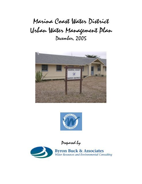
Marina Coast Water District Urban Water Management Plan
Marina Coast Water District Urban Water Management Plan
Marina Coast Water District Urban Water Management Plan

You also want an ePaper? Increase the reach of your titles
YUMPU automatically turns print PDFs into web optimized ePapers that Google loves.
<strong>Marina</strong> <strong>Coast</strong> <strong>Water</strong> <strong>District</strong><br />
<strong>Urban</strong> <strong>Water</strong> <strong>Management</strong> <strong>Plan</strong><br />
December, 2005<br />
Prepared by
<strong>Marina</strong> <strong>Coast</strong> <strong>Water</strong> <strong>District</strong><br />
2005 <strong>Urban</strong> <strong>Water</strong> <strong>Management</strong> <strong>Plan</strong><br />
Contents<br />
Section<br />
Page<br />
1.0 Introduction and Background 1-1<br />
1.1 Background 1-1<br />
1.2 <strong>District</strong> Location and <strong>Water</strong> Operations 1-3<br />
1.3 Climate 1-5<br />
1.4 Population 1-6<br />
1.5 Public Participation and <strong>Plan</strong> Development 1-7<br />
1.6 Agency Coordination 1-8<br />
2.0 <strong>Water</strong> Supplies 2-1<br />
2.1 Current and Historic Groundwater Supplies 2-1<br />
2.2 Groundwater Production 2-6<br />
2.3 Seawater Intrusion and Contamination Issues 2-7<br />
2.3.1 Aquifer Systems Supporting Existing MCWD and Ord<br />
Community Wells 2-7<br />
2.3.2 MCWD Wells for <strong>Marina</strong> and Ord Community Service<br />
Areas 2-9<br />
2.3.3 Groundwater Contamination and Control 2-14<br />
2.4 Salinas Valley <strong>Water</strong> Project 2-17<br />
2.5 <strong>Water</strong> Augmentation for Ord Community Supplies 2-21<br />
2.5.1 Recycled <strong>Water</strong> Alternative 2-22<br />
2.5.2 Current Desalination and Desalination 2-24<br />
Alternative<br />
2.5.3 Hybrid Alternative 2-26<br />
2.6 <strong>Water</strong> Quality 2-26<br />
2.7 <strong>Water</strong> Production System Reliability 2-28<br />
3.0 <strong>Water</strong> Demands and Supply Reliability 3-1<br />
3.1 Current <strong>Water</strong> Use 3-1<br />
3.2 Future <strong>Water</strong> Demands 3-3<br />
3.2.1 Central <strong>Marina</strong> Service Area 3-3<br />
3.2.2 Central <strong>Marina</strong> Service Area -Surrounding Lands 3-4<br />
3.2.3 Ord Community Service Area 3-5<br />
3.2.4 Demand Projection Methodology 3-6<br />
3.2.5 Summary Demand Projections 3-7<br />
3.2.6 Comparison of Land Use vs. Per Capita 3-10<br />
Demand Forecast<br />
3.2.7 Long Term Demand Issues 3-10<br />
3.3 Future <strong>Water</strong> Supply Assessments and Written<br />
Verifications of Supply 3-11
3.4 <strong>Water</strong> Supply Reliability – Single and Multiple Dry Year<br />
And Demand Comparison 3-12<br />
3.5 <strong>Water</strong> Quality Impacts on Reliability 3-13<br />
3.6 <strong>Water</strong> Transfer Opportunities 3-13<br />
3.7 Predicted <strong>Water</strong> Consumption by Sector 3-13<br />
4.0 Conservation and Demand <strong>Management</strong> 4-1<br />
4.1 Introduction 4-1<br />
4.2 Summary of Measures Currently Under Implementation 4-1<br />
4.3 Description and Status of Demand <strong>Management</strong> Measures 4-3<br />
4.4 Funding and Legal Authority 4-18<br />
4.5 Existing Conservation Savings, Savings Measurement 4-19<br />
And Effects on Ability to Further Reduce Demand<br />
5.0 Recycled <strong>Water</strong> Development 5-1<br />
5.1 Regional <strong>Plan</strong>s 5-1<br />
5.2 <strong>District</strong> Recycled <strong>Water</strong> <strong>Plan</strong>s 5-1<br />
6.0 <strong>Urban</strong> <strong>Water</strong> Shortage Contingency <strong>Plan</strong> 6-1<br />
6.1 Introduction and Background 6-1<br />
6.2 Stages of Action 6-2<br />
6.3 Triggering Mechanisms 6-6<br />
6.4 Mandatory Prohibitions on <strong>Water</strong> Use 6-11<br />
6.5 Penalties or Charges for Excessive Uses 6-13<br />
6.6 Revenue and Expenditure Impacts 6-13<br />
6.7 <strong>Water</strong> Shortage Contingency <strong>Plan</strong> Implementation 6-13<br />
6.8 <strong>Water</strong> Use Monitoring Procedures 6-14<br />
7.0 References 7-1<br />
Appendix 1 Resolution Adopting the <strong>Water</strong> Shortage Contingency<br />
Analysis and <strong>Plan</strong><br />
Appendix 2 Land Use Forecast and <strong>Water</strong> Demand Projections by Jurisdiction<br />
Appendix 3 Resolution Adopting the <strong>Urban</strong> <strong>Water</strong> <strong>Management</strong> <strong>Plan</strong> (pending)<br />
Appendix 4<br />
Comments by MCWD on the Salinas Valley <strong>Plan</strong> and MCWRA<br />
responses to those comments on the Draft Environmental Impact<br />
Report/Environmental Impact Statement for the Salinas Valley <strong>Plan</strong>
List of Figures<br />
Figure Number and Title<br />
Page<br />
1-1 <strong>Marina</strong> <strong>Coast</strong> <strong>Water</strong> <strong>District</strong> Vicinity Map and Well Locations 1-2<br />
1-2 Monterey Climate 1971-2000 Temperature and Precipitation 1-6<br />
2-1 Salinas Valley Groundwater Basins 2-2<br />
2-2 Seawater Intrusion Upper (180’) Aquifer, 2003 2-12<br />
2-3 Seawater Intrusion Middle (400’) Aquifer, 2003 2-13<br />
3-1 Projected <strong>Water</strong> Consumption by Sector 2010-2025 3-13<br />
List of Tables<br />
1-1 Evapotranspiration in Inches at Castroville 1-5<br />
1-2 MCWD and City of <strong>Marina</strong> Population Growth 1-7<br />
1-3 MCWD Population Projections – City of <strong>Marina</strong> and Ord Community 1-7<br />
2-1 <strong>Water</strong> Supply Currently Available to <strong>Marina</strong> <strong>Coast</strong> <strong>Water</strong> <strong>District</strong> 2-6<br />
2-2 MCWD Groundwater Production (AFY) 1999-2004 2-7<br />
2-3 Minimum Recycled <strong>Water</strong> Potential Within MCWD 2-25<br />
3-1 MCWD <strong>Water</strong> Demands by Customer Type- 2004 3-2<br />
3-2 Armstrong Ranch/RMC Lonestar 2005 Estimated Agricultural<br />
Demands (AF/Y) 3-2<br />
3-3 <strong>Water</strong> Demand Factors Applied in the UWMP 3-8<br />
3-4 Summary <strong>Urban</strong> <strong>Water</strong> Demands Based Upon Land Use Projections<br />
of Land Use Jurisdictions (AF/Y) 3-9<br />
4-1 Summary of Conservation and Demand <strong>Management</strong> Actions 4-2<br />
4-2 Example Centralized ET Controller Demonstration Program 4-10<br />
6-1 <strong>Water</strong> Conservation Stages and Reduction 6-2<br />
6-2 Conservation Level Triggering Mechanisms 6-8<br />
6-3 Revenue and Expenditure Impacts 6-14
Section 1 Introduction and Background<br />
1.0 Introduction and Background<br />
1.1. Background<br />
The California <strong>Water</strong> Code, Division 6, Part 2.6, Section 10610 et. seq.<br />
(California <strong>Urban</strong> <strong>Water</strong> <strong>Management</strong> <strong>Plan</strong>ning Act) requires any municipal water<br />
supplier serving over 3,000 connections or 3,000 acre-feet of water per year to<br />
prepare an urban water management plan. Each supplier is required to submit<br />
its plan to the State Department of <strong>Water</strong> Resources. In adopting the <strong>Urban</strong><br />
<strong>Water</strong> <strong>Management</strong> <strong>Plan</strong>ning Act, the state declared as policy that:<br />
a) The management of urban water demand and efficient use of water<br />
shall be actively pursued to protect both the people of the state and<br />
their water resources;<br />
b) The management of urban water demands and efficient use of urban<br />
water supplies shall be a guiding criterion in public decisions;<br />
c) <strong>Urban</strong> water suppliers shall be required to develop water management<br />
plans to actively pursue the efficient use of available supplies.<br />
Through the <strong>Urban</strong> <strong>Water</strong> <strong>Management</strong> <strong>Plan</strong>ning Act, the state recognizes that<br />
water is a limited, though renewable, resource and that a long-term reliable<br />
supply of water is essential to protect the economy. It also recognizes that, while<br />
conservation and efficient use of water is a statewide concern, planning for this<br />
use is best done at the local level.<br />
In preparing this 2005 UWMP, the <strong>Marina</strong> <strong>Coast</strong> <strong>Water</strong> <strong>District</strong> (MCWD)<br />
reviewed its 2000 UWMP and schedule of water conservation best management<br />
practices actions and other supply development actions. Actions contemplated<br />
in the 2000 UWMP were generally implemented in accordance within the<br />
timeframes projected.<br />
1-1
Well 12<br />
Well 11<br />
Well 10<br />
Well 30<br />
Well 29 Well 31<br />
Figure 1-1<br />
<strong>Marina</strong> <strong>Coast</strong> <strong>Water</strong> <strong>District</strong> Vicinity Map and Well<br />
Locations 1<br />
1 Base map source RBF, Inc.<br />
1-2
1.2 <strong>District</strong> Location and <strong>Water</strong> Operations<br />
The MCWD is located on the coast of Monterey Bay at the northwest end of the<br />
Salinas Valley (Figure 1-1). It occupies an area of about 4.5 square miles (2,881<br />
acres). MCWD was formed in 1960 and has provided potable water, wastewater<br />
treatment and collection, and reclaimed water services within the City of <strong>Marina</strong>.<br />
MCWD provides potable water and wastewater collection service to all<br />
residential, commercial, industrial, environmental and fire protection uses within<br />
the City of <strong>Marina</strong>.<br />
The MCWD also provides potable water delivery and wastewater transmission<br />
services within the boundaries of the former Fort Ord Army Base, known as the<br />
Ord Community. The former Fort Ord Army Base lies to the southeast of the City<br />
of <strong>Marina</strong> and the current <strong>District</strong> boundaries. In 1991 the former Army base was<br />
downsized and realigned pursuant to the Defense Base Closure and<br />
Realignment Act of 1990, with closure in 1994. The base is being converted to<br />
civilian use under the guidance of the Fort Ord Reuse Authority (FORA), a public<br />
agency created for this purpose by the state of California. FORA’s membership<br />
includes the land use jurisdictions encompassed by the former Fort Ord lands<br />
and others on the Monterey Peninsula. FORA is governed by a 13-member<br />
board with representatives from the following jurisdictions:<br />
• City of Carmel<br />
• City of Del Rey Oaks<br />
• City of <strong>Marina</strong><br />
• City of Sand City<br />
• City of Monterey<br />
• City of Pacific Grove<br />
• City of Salinas<br />
• City of Seaside<br />
• County of Monterey<br />
1-3
Base reuse plans also include provisions for facilities of two state universities,<br />
California State University, Monterey Bay (CSUMB) and University of California,<br />
Monterey Bay Environmental Science and Technology Center (UCMBEST).<br />
FORA has the statutory authority to provide for public capital facilities, including<br />
but not limited to, water and wastewater facilities on the former Fort Ord.<br />
However, FORA has a limited statutory life and thus needs a reliable, long-term<br />
entity to provide public services to the area. 2 In May 1997, the FORA Board<br />
approved the preparation of a Public Benefit Conveyance (PBC) application to<br />
the federal government for transfer of the water distribution and wastewater<br />
collection systems to MCWD. In June 1997, the U.S. Army and MCWD signed a<br />
caretaker agreement authorizing MCWD to operate the water and wastewater<br />
collection systems.<br />
After requesting statements of qualifications, FORA began negotiations with<br />
MCWD to acquire, operate and maintain the water development and delivery and<br />
wastewater transmission systems on the former Fort Ord for the benefit of FORA.<br />
In February 1998 MCWD and FORA executed an agreement for water and<br />
wastewater facilities. This agreement provides for the ownership and operation<br />
of water and wastewater facilities acquired from the federal government for the<br />
benefit of FORA. The <strong>Water</strong> and Wastewater Oversight Committee of the FORA<br />
Board oversees the operation of these facilities by MCWD. Title for these<br />
systems was transferred to MCWD in 2001.<br />
The FORA Board retains the authority to allocate Salinas Valley groundwater<br />
supplies as provided for under an agreement between the federal government<br />
and the Monterey County <strong>Water</strong> Resources Agency (MCWRA) dated September<br />
1993. This agreement provides for groundwater extraction rights of 6,600 acrefeet<br />
per year (AF/Y), an amount consistent with the former average groundwater<br />
use at Fort Ord while under military operation. Consistent with this agreement,<br />
2 Pursuant to Government Code 67700 FOR A will sunset on June 30, 2014. To the extent water<br />
allocation functions of FOR A need to be continued, additional legal arrangements among the<br />
land use jurisdictions on the former Fort Ord and the MCWD will be necessary.<br />
1-4
MCWD operates the former Fort Ord service area as a separate service area<br />
from a water allocation and financial perspective. That is, service costs and<br />
revenues in this area are maintained in separate accounts so that costs to serve<br />
this area are not subsidized by MCWD’s other customers, and vice versa.<br />
At some indeterminate date, MCWD, FORA and the Local Agency Formation<br />
Commission (LAFCO) may consider a formal annexation of the former Fort Ord<br />
lands to MCWD. Until such time, service will be provided exclusively under the<br />
1998 agreement with FORA.<br />
1.3 Climate<br />
<strong>Marina</strong> has a cool summer-type Mediterranean climate with precipitation falling<br />
exclusively as rain, predominantly between October and May. The nearest<br />
official weather station is seven miles away in Monterey, California. Average<br />
climate data from this station from 1970-2000 is depicted in Figure 1-2,<br />
Monterey Climate. The moderating effect of the Pacific Ocean and its relatively<br />
cold water allows for mild summertime temperatures in <strong>Marina</strong>. This effect<br />
suppresses summertime irrigation demands for landscaping as compared to<br />
inland locations, especially when advection fog moves in from the Pacific Ocean,<br />
enveloping the immediate coast in response to heating inland. Unlike inland<br />
locations, summertime temperatures generally peak in September rather than<br />
July. Peak summertime temperatures usually occur when high pressure is<br />
resident in the Great Basin (Santa Ana conditions), allowing for an offshore flow<br />
and compressional heating of the atmosphere. Precipitation averages about 20<br />
inches annually. Table 1-1 depicts monthly average evapotranspiration at the<br />
nearest California Irrigation <strong>Management</strong> Information System station (CIMIS).<br />
Table 1-1<br />
Average Monthly Evapotranspiration in Inches at Castroville<br />
Jan Feb Mar Apr May Jun Jul Aug Sep Oct Nov Dec Total<br />
1.44 1.71 2.96 4.19 4.63 4.81 4.03 3.81 2.98 2.63 1.62 1.39 36.2<br />
1-5
Figure 1-2<br />
Monterey Climate<br />
1971 - 2000 Temperature and Precipitation<br />
Avg. Daily Precipitation in inches<br />
Data is smoothed using a 29 day running average.<br />
- Max. Temp. is the average of all daily maximum temperatures recorded for the day of<br />
the year between the years 1971 and 2000.<br />
- Ave. Temp. is the average of all daily average temperatures recorded for the day of<br />
the year between the years 1971 and 2000.<br />
- Min. Temp. is the average of all daily minimum temperatures recorded for the day of<br />
the year between the years 1971 and 2000.<br />
- Precipitation is the average of all daily total precipitation recorded for the day of the<br />
year between the years 1971 and 2000.<br />
Source: NOAA, Western Regional Climate Center<br />
1.4 Population<br />
MCWD historically has served only the City of <strong>Marina</strong>, which incorporated in<br />
1975. Table 1-2 depicts <strong>Marina</strong>’s growth from 1960 to 2000. Between 1920<br />
and 1970, population increases for <strong>Marina</strong> were quite steady. From 1970 to<br />
1980 the population nearly tripled. Growth rates moderated in the 1980s, with<br />
the population reaching a near-term peak in 1990. With the closure of Fort Ord<br />
as a military base in 1994, the City and MCWD experienced a small decline in<br />
population.<br />
1-6
Table 1-2<br />
MCWD and City of <strong>Marina</strong> Population Growth<br />
1960 1970 1980 1990 2000<br />
3,310 8,343 20,647 26,436 25,101<br />
Source: California Department of Finance<br />
With redevelopment of the Fort Ord lands, population growth is expected to<br />
return, with population projections shown in Table 1-3. Additionally, MCWD will<br />
serve all of the Fort Ord area and thus portions of the cities of Seaside, Del Rey<br />
Oaks, and Monterey, Monterey campuses for the University of California and<br />
California State University systems, and lands remaining under the jurisdiction of<br />
the County of Monterey within the boundaries of the former Fort Ord.<br />
Table 1-3<br />
MCWD Population Projections – City of <strong>Marina</strong> and Ord Community<br />
2005 2010 2015 2020 2025<br />
Service Area<br />
Population<br />
27,941 45,880 63,830 81,770 98,700<br />
Source: California Department of Finance, and FE I R Fort Ord Reuse <strong>Plan</strong>, 1997<br />
1.5 Public Participation in <strong>Plan</strong> Development<br />
MCWD has encouraged public participation in the development of this <strong>Urban</strong><br />
<strong>Water</strong> <strong>Management</strong> <strong>Plan</strong>. Notice of plan development was placed on MCWD’s<br />
website in October of 2004. MCWD’s <strong>Water</strong> Conservation Commission, a public<br />
advisory group, which helps shape MCWD’s conservation programs, was also<br />
notified. MCWD also updated its water shortage contingency plan, which was<br />
reviewed in a public meeting of the Commission. Following Commission review,<br />
the water shortage contingency plan was reviewed in a public meeting of the<br />
MCWD Board of Directors and adopted on May 25, 2005.<br />
1-7
In August 2005 the draft UWMP was made available for public inspection at<br />
MCWD’s offices and at local libraries. Copies were sent to each affected land<br />
use jurisdiction and the Monterey County <strong>Water</strong> Resources Agency. A public<br />
hearing was held for the plan on August 24 as noted in the resolution reproduced<br />
in Appendix 3. Additional public workshops on the plan and issues relative to<br />
the <strong>Plan</strong> were held on September 28 and October 12, 2005. Over 30 people<br />
attended each workshop.<br />
1.6 Agency Coordination<br />
MCWD has coordinated with all the jurisdictions in which it serves including the<br />
cities of <strong>Marina</strong>, Monterey, Seaside, and Del Rey Oaks, UCMBEST, CSUMB and<br />
Monterey County in accordance with the modifications to the <strong>Urban</strong> <strong>Water</strong><br />
<strong>Management</strong> <strong>Plan</strong>ning Act made under SB 1518, effective January 1, 2003. SB<br />
1518 requires MCWD to notify affected land use jurisdictions of plan<br />
development and provide an opportunity to review the draft plan.<br />
A notice of hearing for the draft UWMP was sent to all applicable land use<br />
jurisdictions. MCWD has also coordinated with the MCWRA, through which<br />
MCWD jointly holds trust responsibility for groundwater resources MCWD uses to<br />
serve customer demands. Additionally, MCWD notified the Fort Ord Reuse<br />
Authority of the plan’s development and availability.<br />
MCWD will provide each of the land use jurisdictions above with a copy of the<br />
final plan. A final copy of the plan and appendices will be posted on the MCWD<br />
website: www.mcwd.org.<br />
1-8
Section 2 <strong>Water</strong> Supplies<br />
2.0 <strong>Water</strong> Supplies<br />
2.1 Current and Historic Groundwater Supplies and Basin <strong>Management</strong><br />
Potable water for MCWD’s <strong>Marina</strong> and Ord Community service areas comes<br />
primarily from wells developed in the Salinas Valley groundwater basin 1 . This<br />
groundwater basin underlies the Salinas Valley from San Ardo to the coast of<br />
Monterey Bay and is divided into five hydrologically linked subareas: Pressure,<br />
East Side, Forebay, Arroyo Seco and Upper Valley (Figure 2-1). The basin is<br />
further divided in the Pressure subarea by distinct aquifers, commonly referred to<br />
as the 180-foot, 400-foot and deep aquifer. Historically, the deep aquifer was<br />
thought to be geologically confined in the <strong>Marina</strong> area, meaning that groundwater<br />
did not move between the deep aquifer and the 400-foot and 180-foot aquifers.<br />
However, recent stratigraphic analyses have indicated that these aquifers are<br />
connected hydraulically, with water from the 180-foot and 400-foot aquifers<br />
recharging the deep aquifer. 2 Additionally, the deep, or 900-foot, aquifer is in<br />
reality a series of aquifers, not all of which are hydraulically connected.<br />
The Salinas Valley groundwater basin remains in an overdraft condition with<br />
seawater intrusion of about 9,000 acre-fee per year (AF/Y) at its coastal<br />
margins. 3 MCWD’s groundwater withdrawals, including the Ord Community<br />
lands, are about 4,670 AF/Y, or less than 1.0 percent of total annual basin<br />
withdrawals of about 500,000 AF/Y. Other than MCWD, only a small number of<br />
wells tap the deep aquifer, some of which also draw from the middle aquifer.<br />
Prior to receiving recycled water for crop irrigation, there were agricultural lands<br />
in the Castroville area that pumped water from the deep aquifer. These<br />
agricultural wells are currently used to meet supplemental needs during peak<br />
summer demands periods and also part of the monitoring network overseen by<br />
1 See Figure 1-1 for well surface locations<br />
2 Deep Aquifer Investigative Study. WRIME,2003<br />
3 Personal communication: Curtis Weeks, General Manager MCWRA, 10/04<br />
2-1
the MCWRA. Delivery of recycled water to this area has contributed to a recent<br />
recovery in groundwater levels in this area (MCWRA, 2005).<br />
Figure 2-1 Salinas Valley Groundwater Basins<br />
ZONE 2C BOUNDARY<br />
As a result of basin-wide pumping, levels in some basin subareas (Pressure and<br />
East Side) have declined over time. The other three basin subareas – the<br />
Forebay, Arroyo Seco and Upper Valley – tend to recharge rapidly and recover<br />
historic groundwater levels each year.<br />
In a healthy condition, Salinas Basin groundwater would move through the basin<br />
and into the Monterey Bay through subsurface freshwater outcrops. However,<br />
2-2
over time, the cumulative reductions of groundwater basin storage have<br />
contributed to a decrease in the amount of groundwater moving toward and into<br />
Monterey Bay. This imbalance is generally part of a definition of groundwater<br />
overdraft. The result has been a reversal of the seaward gradient. In its place<br />
the basin experiences a landward gradient of seawater (intrusion), where the<br />
seawater has contaminated coastal aquifers and wells. While historic<br />
groundwater pumping throughout the basin created the overdraft, only the<br />
basin’s coastal areas adjacent or near to the Bay suffer from seawater intrusion.<br />
Two regional water management agencies have jurisdiction over groundwater<br />
production in the vicinity of the MCWD. The MCWRA is responsible for<br />
regulation and supply of water from the Salinas groundwater basin. The<br />
Monterey Peninsula <strong>Water</strong> <strong>Management</strong> <strong>District</strong> (MPWMD) is responsible for<br />
regulation and supply of water from the Seaside groundwater basin. These two<br />
basins are adjacent to each other under Ord Community lands. MCWD<br />
recognizes the jurisdiction of the two regional groundwater management entities,<br />
and so has not independently developed a groundwater management plan<br />
pursuant to <strong>Water</strong> Code § 10750.<br />
Where groundwater basins are in or are projected to be in overdraft, the <strong>Water</strong><br />
Code requires UWMPs to provide detailed descriptions of efforts being<br />
undertaken by the urban water supplier to eliminate the long-term overdraft<br />
condition. In the Salinas Basin, an urban water supplier like MCWD that<br />
accounts for less than 1 percent of total basin pumping, cannot by itself eliminate<br />
or remedy a condition that results from basin-wide activities. MCWD can and<br />
does work cooperatively with MCWRA and MCWD has and is taking actions to<br />
protect and preserve its ability and right to access groundwater, and to augment<br />
groundwater supplies with new sources of supply.<br />
MCWRA is implementing a program to eliminate overdraft and intrusion known<br />
as the Salinas Valley <strong>Water</strong> Project (SVWP). The current program builds upon<br />
2-3
action taken in the 1940’s when MCWRA’s predecessor agency, the Monterey<br />
County Flood Control and <strong>Water</strong> Conservation <strong>District</strong> initiated development of<br />
the Nacimiento and San Antonio dams and reservoirs which augmented water<br />
resources within the County. Since the formation of the MCWD, MCWD has<br />
cooperated with the MCWRA in further water resources development within the<br />
Salinas Valley.<br />
In 1991 and 1992, MCWRA developed and approved the Monterey County<br />
<strong>Water</strong> recycling projects (MCWRP) to deliver recycled wastewater for irrigation<br />
use in the Castroville area, so that groundwater pumping could be reduced in<br />
that area. In the projects, recycled water is produced and used along the coast<br />
in lieu of pumping an amount of groundwater for agricultural irrigation. The<br />
projects have operated successfully for eight years, reducing basin overdraft and<br />
seawater intrusion. To fully eliminate these problems, MCWRA’s Salinas Valley<br />
<strong>Water</strong> Project has been developed. The first phase of this project is now in the<br />
permitting phase and is expected to begin construction in 2007. The SVWP will<br />
increase reservoir releases to the Salinas River. Some of that water will<br />
recharge basin aquifers. Some of that water will be impounded and diverted by a<br />
new, in-stream rubber dam near <strong>Marina</strong>, and be pumped out and added to the<br />
MCWRP water supply. In return for increasing the amount of water delivered<br />
through the MCWRP distribution system, the SVWP will require recipients of the<br />
additional water to reduce their coastal groundwater pumping. MCWRA<br />
modeling concludes that this component will eliminate basin overdraft and<br />
intrusion. A second phase of the SVWP, examined at a program level in the<br />
SVWP EIR, calls for an amount of that surface water to be made available to<br />
coastal urban water agencies in the future. MCWRA has recently secured new<br />
federal grants to begin analyzing this second phase.<br />
MCWD is within MCWRA Zones 2/2A, and has paid for and continues to pay for<br />
the first two components, will help pay for this third (SVWP) component, and has<br />
agreed to limit its pumping from the Salinas Basin for land in the <strong>Marina</strong> area and<br />
2-4
outside the former Fort Ord Military Reservation until implementation of a<br />
mitigation plan, thereby directly contributing to the elimination of basin overdraft<br />
and intrusion in the most effective way possible.<br />
As noted above, the potable water supply at the Ord Community is from the<br />
Pressure subarea of the Salinas groundwater basin. The southwestern portion of<br />
the Salinas basin underlies the northern and southeastern segments of the Ord<br />
Community. However, parts of the Ord Community area’s hydrogeologic<br />
relationship to the main groundwater basin have not yet been determined. 4<br />
Additional water for irrigation at the Bayonet and Black Horse golf courses on the<br />
Ord Community is drawn from the Seaside Groundwater Basin, which is not<br />
known to be hydraulically connected to the Salinas Groundwater basin.<br />
Both the Army and MCWD have agreements with MCWRA, which allows MCWD<br />
to participate in and benefit from MCWRA’s regional basin management planning<br />
process. Under the terms of the agreements, Ord Community lands and<br />
MCWD’s service area were annexed into MCWRA Zones 2 and 2A. The Army’s<br />
agreement allows for a combined annual withdrawal of up to 5,200 AF/Y from the<br />
180-foot and 400-foot aquifers, with an additional annual withdrawal of up to<br />
1,400 AF from the deep aquifer, totaling 6,600 AF/Y, or about equal to the<br />
historic demand from Army uses at Fort Ord. This groundwater supply is<br />
allocated by FORA among the land use or land owning jurisdictions on the Ord<br />
Community as shown in Table 2-1. This table also indicates available<br />
groundwater supply to MCWD via its own agreement with MCWRA, which<br />
provides for a maximum withdrawal of 3,020 AF/Y, currently limited to uses in the<br />
City of <strong>Marina</strong>, outside the Ord Community. Additionally, two adjacent major<br />
private properties within MCWD’s LAFCO sphere of influence, the Armstrong<br />
Ranch and the Lonestar property, have been approved for annexation to<br />
MCRWA’s zones 2 and 2A and have groundwater available for use on those<br />
properties as noted in Table 2-1.<br />
4 Salinas Valley <strong>Water</strong> Project Draft EIR/EIS, Section 5.3.1.<br />
2-5
Table 2-1<br />
<strong>Water</strong> Supply Currently Available to <strong>Marina</strong> <strong>Coast</strong> <strong>Water</strong> <strong>District</strong> 5<br />
Annual Acre-feet<br />
Fort Ord Reuse Authority Allocation – Groundwater allotment or supply<br />
Available to Ord Community<br />
City of <strong>Marina</strong> 1,175<br />
City of Seaside 862<br />
CSU Monterey Bay 1,035<br />
University of California MBEST Center 230<br />
City of Del Rey Oaks 92.5<br />
City of Monterey 65<br />
Monterey County 560<br />
US Army 1,577<br />
County/State Parks 45<br />
City of <strong>Marina</strong> (Sphere) 10<br />
Allowance for line losses (10%) 535<br />
FORA Strategic Reserve 413.5<br />
Rounded subtotal 6,600<br />
City of <strong>Marina</strong> – Groundwater Available within City<br />
of <strong>Marina</strong> Outside of Ord Community<br />
<strong>Marina</strong> <strong>Coast</strong> <strong>Water</strong> <strong>District</strong> by Agreement with<br />
3,020<br />
MCWRA (groundwater)<br />
Armstrong Ranch (groundwater) 920<br />
Lonestar Property (groundwater) 500<br />
Subtotal groundwater 11,040<br />
MCWD Desalination <strong>Plan</strong>t (temporarily idle) 6 300<br />
Total 11,340<br />
2.2 Groundwater Production<br />
Table 2-2 depicts recent groundwater production for the City of <strong>Marina</strong> and Ord<br />
Community service areas.<br />
5 Not including 150 AF/Y loans from FORA Strategic Reserve for Del Rey Oaks, <strong>Marina</strong>,.<br />
Monterey County and Seaside,<br />
6 Permitted supply that could be restored and considered available.<br />
2-6
Table 2-2<br />
MCWD Groundwater Production (AF/Y) 1999-2004<br />
Calendar Year City of <strong>Marina</strong> Ord Community*<br />
1999 2241 2396<br />
2000 2300 2371<br />
2001 2285 2228<br />
2002 2306 2137<br />
2003 2185 2146<br />
2004 2266 2420<br />
• Ord Community figures include water that was used in the City of <strong>Marina</strong>’s portion of the Ord<br />
Community.<br />
2.3 Seawater Intrusion and Contamination Issues<br />
While sufficient production capacity (versus water available) to meet the<br />
projected ultimate demand within MCWD’s service area can be provided, there is<br />
concern that seawater intrusion may eventually degrade water quality in the<br />
MCWD’s <strong>Marina</strong> and Ord Community service areas and render it unfit for<br />
domestic water supplies without further treatment, such as desalination.<br />
Similarly, there has been concern that hazardous substance contamination<br />
detected at the former Fort Ord might adversely affect the quality of water MCWD<br />
is serving within its <strong>Marina</strong> and Ord Community service areas. As discussed<br />
below, both concerns are being actively managed to ensure ongoing protection<br />
of the quality of MCWD’s groundwater sources of supply.<br />
2.3.1 Aquifer Systems Supporting Existing MCWD and Ord Community<br />
Wells<br />
MCWD’s wells for both its <strong>Marina</strong> and Ord Community service areas are located<br />
within the Pressure Subarea of the Salinas Valley Groundwater Basin (see<br />
Figure 1-1 [well locations]; Figure 2-1 [subareas]). Studies and investigations<br />
have allowed the delineation of three aquifer systems within the Pressure<br />
Subarea. These aquifers consist of aerially extensive, horizontally continuous,<br />
deposits of sand and gravel that exist at various depths below ground surface in<br />
2-7
the subarea. These aquifer systems have been designated as the 180-Foot, the<br />
400-Foot and the Deep Aquifer systems. The 180-Foot and 400-Foot aquifers<br />
derive their names from the average depth at which the water bearing sand and<br />
gravel deposits are encountered. The Deep Aquifer consists of an aggregation of<br />
all sand and gravel deposits that exist below the 400-Foot Aquifer.<br />
The 180-Foot Aquifer extends from Monterey Bay to Chualar beneath the Salinas<br />
Valley and westward from the valley under northern Ord Community and the<br />
central <strong>Marina</strong>. South of Chualar and in the Forebay area, the distinction<br />
between the 180- and 400- aquifer becomes less defined as the aquitards that<br />
separate the aquifers become more discontinuous.<br />
The 400-Foot Aquifer is comprised of geological materials assigned to older<br />
alluvium deposits and Aromas Sand. The aquifer system is present beneath the<br />
northern Salinas Valley and also extends westward beneath the northern<br />
portions of the former Fort Ord and central <strong>Marina</strong>. In the Forebay area, the 400-<br />
Foot Aquifer locally blends with the 180-Foot Aquifer receiving recharge from the<br />
Salinas River through the overlying deposits.<br />
Regionally, the Deep Aquifer is not used as extensively as the 180-Foot and 400-<br />
Foot Aquifers. The MCWD is the only current significant user of the Deep<br />
Aquifer system. MCWD utilizes three wells that extract water solely from the<br />
Deep Aquifer to supply the City of <strong>Marina</strong> distribution system. The wells serving<br />
the Ord Community do not extract water from the Deep Aquifer System. The<br />
Deep Aquifer System consists of two geologic formations – the Paso Robles and<br />
the underlying Purisma Formations. These formations are aerially extensive,<br />
stretching throughout the Salinas Basin and to the north and south. The<br />
lowermost unit extends to the north outcropping in Soquel and to the south where<br />
it grades into the Santa Margarita Formation, an important aquifer in the Seaside<br />
Basin. Although slightly arbitrary in definition, the Deep Aquifer is commonly<br />
believed to begin at depths of approximately 600 feet below sea level and extend<br />
to depths of 2,000 or more feet in some locations. Non-water bearing Monterey<br />
2-8
Shale that constitutes the bottom of the Salinas Groundwater Basin underlies the<br />
Deep Aquifer system.<br />
Because of the overlying clay layers that isolate the aquifer systems in the<br />
Pressure Subarea from potential surface water recharge, most importantly the<br />
Salinas River, the primary mechanism for recharge is from lateral flow that<br />
comes from the adjacent subareas. This means that most recharge for the<br />
aquifer systems in the Pressure Subarea comes from lateral flow from either the<br />
Eastside or Forebay Subareas. Additionally, the deeper aquifers are believed to<br />
be recharged in whole or in part by water that has moved through the overlying<br />
aquifers (i.e. flow from the 180-Foot Aquifer recharges the 400-Foot Aquifer that<br />
in turn recharges the deeper aquifers). Most of the recharge for the Pressure<br />
Subarea derives from the Forebay Subarea due to the presence of the Salinas<br />
River and the active management of Nacimiento and San Antonio reservoirs to<br />
maximize river recharge releases by MCWRA.<br />
2.3.2 MCWD Wells for <strong>Marina</strong> and Ord Community Service Areas<br />
Historically, MCWD served its <strong>Marina</strong> service area from 11 wells (MCWD-1<br />
through MCWD-9), and two replacement wells) screened in the 180-foot and<br />
400-foot Aquifers. Between 1960 and 1992, some of those wells indicated<br />
varying degrees of seawater intrusion, which is the gradual result of groundwater<br />
extraction exceeding local recharge documented since the 1940s. A chloride<br />
concentration of 500 milligrams per liter (mg/L) is the short-term California<br />
Department of Health Services Secondary Drinking <strong>Water</strong> Standard for chloride<br />
and is used as a measure of impairment of water. The line of chloride<br />
concentration (isohaline) of 500 mg/L water is therefore used as the basis for<br />
determining the seawater intrusion front as shown on Figures 2-2 and 2-3.<br />
In response to the closure of MCWD’s original wells in the shallow and middle<br />
aquifers near the coast, MCWD installed three new wells in the Deep Aquifer<br />
2-9
(MCWD-10, MCWD-11 and MCWD-12) in 1982, 1985 and 1989 respectively.<br />
These wells are depicted in Figure 1-1. Seawater intrusion has not been<br />
detected at any location in the Deep Aquifer system. MCWD operates a<br />
monitoring well installed between Monterey Bay and the MCWD’s new<br />
production wells. That monitoring well serves as an early warning system to<br />
identify any future seawater intrusion that might later affect MCWD’s production<br />
wells, located further inland. That early warning would provide advance notice to<br />
install or begin operating one or more back-up wells to replace any potential<br />
future loss of production capacity.<br />
The U.S. Army’s original wells serving The former Fort Ord were located in the<br />
Main Garrison area. Those wells indicated varying degrees of seawater<br />
intrusion. In response, the Army in 1985 installed three wells further inland.<br />
Located near the intersection of Reservation and Blanco Roads in <strong>Marina</strong> (Figure<br />
1-1), the three wells draw from the 180-Foot and 400-Foot Aquifers (well<br />
numbers FO-29, FO-30 and FO-31). These are the wells currently supplying<br />
MCWD’s Ord Community service area. Recent studies for MCWRA indicate that<br />
the seawater intrusion front continues to migrate inland in the vicinity of <strong>Marina</strong><br />
and the Ord Community. As a result, continued pumping from the 180-foot<br />
aquifer threatens the wells currently supplying the Ord Community. Additional<br />
data on the migration and extent of seawater contamination can be found in the<br />
Final Report Hydrogeologic Investigation of the Salinas Valley Basin in the<br />
Vicinity of Fort Ord and <strong>Marina</strong>, Salinas Valley California, April 2001.<br />
Recent preliminary findings regarding the deep aquifers in the Ord Community<br />
area indicate that pumping from the deep aquifer can affect the rate of seawater<br />
intrusion in the overlying middle and upper aquifers. This is because the deep<br />
aquifers’ sources of recharge include these overlying aquifers. Thus, pumping of<br />
the deep aquifer draws more water from the overlying aquifers and in turn, water<br />
is drawn into these middle and upper aquifers from a landward direction (from the<br />
sea). In other words, while abandonment of wells in the upper and middle<br />
2-10
aquifers and the completion of new wells in the deep aquifers can extend the<br />
assurance of potable supplies, they do not halt the landward progression of<br />
seawater intrusion. According to the Deep Aquifer Investigative Study, WRIME,<br />
May 2003, increased pumping of the deep aquifers is expected to increase the<br />
rate of seawater intrusion in the middle and upper aquifers. Among other issues,<br />
this study analyzed the increasing flow rate of landward movement of seawater<br />
into the freshwater aquifers (groundwater flow across the coast), or seawater<br />
intrusion. It found that as pumping in the deep aquifers increased, the landward<br />
flow of groundwater increased. The report assessed these increases based<br />
upon multipliers of pumping from baseline conditions. Total baseline pumping for<br />
the analysis was set at 4,800 AF/Y and multipliers of two to five times the<br />
baseline pumping were modeled. Based on demands only, rather than water<br />
allocations, the expected pumping increase over the baseline to the year 2025<br />
would be about 8,800 AF/Y for a total about 10,800 AF/Y, or about 2.25 times<br />
baseline modeled pumping. 7 Based on the outputs of the model, the landward<br />
flow of groundwater is estimated to increase by about 840 AF/Y by 2025 if<br />
expected UWMP demands are realized, absent adopted regional efforts to<br />
control seawater intrusion as discussed below in Section 2.4.<br />
Recent studies by the United States Geological Survey indicate that deep aquifer<br />
water in the vicinity of <strong>Marina</strong> is not of recent origin. Uncorrected Carbon 14<br />
dating of water from a test well in the vicinity of <strong>Marina</strong>’s deep aquifer wells<br />
indicates the water is between 22,000 and 31,000 years old. The ancient nature<br />
of this water heightens concern that recharge to this deep aquifer may be<br />
insufficient to sustain current pumping.<br />
7 Assumes new desalination or recycled water program generating a reduction in <strong>Marina</strong> area<br />
groundwater demand of 2,400 acre-feet per year.<br />
2-11
Figure 2-2<br />
Seawater Intrusion Upper (180’) Aquifer, 2003<br />
2-12
Figure 2-3<br />
Seawater Intrusion Middle (400’) Aquifer, 2003<br />
2-13
Although seawater intrusion is a threat to the future quality of water available to<br />
MCWD’s existing well systems serving the <strong>Marina</strong> and Ord Community service<br />
areas, MCWD is fully cooperating with the MCWRA’s program to actively<br />
manage and protect the long-term availability of the Salinas Valley groundwater<br />
resource. Existing management efforts, reviewed above, include the successful<br />
implementation of the Castroville Seawater Intrusion Project and implementation<br />
of the annexation agreements that limit groundwater pumping and provide<br />
assessment revenue supporting MCWRA’s activities to augment Basin water<br />
supplies. Those activities include ongoing operation of Nacimiento and San<br />
Antonio reservoirs to maximize groundwater recharge through dry-season<br />
storage releases that percolate through the Salinas River’s streambed. As<br />
described in more detail in Section 2.4 below, those activities also include the<br />
MCWRA’s development, approval and implementation of the Salinas Valley<br />
<strong>Water</strong> Project to permanently end seawater intrusion.<br />
2.3.3 Groundwater Contamination and Control<br />
The former Fort Ord was identified by the U.S. Environmental Protection Agency<br />
(EPA) as a National Priority List federal Superfund site on the basis of<br />
groundwater contamination discovered on the installation in 1990. The facility<br />
was listed "fenceline to fenceline," all 28,000 acres. Initial investigations<br />
pinpointed 39 sites of concern in addition to two Operable Units (the Fritzsche<br />
Army Airfield Fire Drill Pit and the Fort Ord landfill) which had been investigated<br />
during the 1980s. The sites of concern included motor pools, vehicle<br />
maintenance areas, dry cleaners, sewage treatment plants, firing ranges,<br />
hazardous waste storage areas, and unregulated disposal areas. An additional<br />
two sites were added during the investigation process: one, a defueling area<br />
located at Fritzsche Army Airfield; the other, a fire drill burn pit in East Garrison.<br />
In all, 43 sites were investigated. 8<br />
8 www. Fortordcleanup.com Mactec Engineering and Consulting, Inc.<br />
2-14
In June 2002, trichloroethylene (TCE), a cleaning solvent, was detected in one<br />
of the three water supply wells at the former Fort Ord. TCE levels detected are<br />
below the Maximum Contaminant Levels (MCL) above which water may not be<br />
served for potable uses. The contamination is coming from an abandoned<br />
landfill and a fire training pit that were formerly used by the Army, but are now<br />
closed. The Army has responded to the landfill contamination problem by<br />
installing extensive groundwater cleanup systems to remove the contamination<br />
and prevent its further migration. The Army has also been monitoring<br />
groundwater quality at the former Fort Ord for a number of years to better<br />
understand the location and movement of groundwater contamination caused by<br />
the closed landfills.<br />
The amount of TCE in one well was 0.53 to 0.81 parts per billion. State and<br />
federal safe drinking water MCL standards for TCE are set at 5.0 parts per<br />
billion, or approximately one full magnitude higher than detected. Detection of<br />
TCE, even at the low concentration levels, was reported by MCWD as required<br />
by law, to the California Department of Health Services (DHS). No additional<br />
action was deemed necessary by DHS because the concentration levels are well<br />
below the MCL of 5.0 parts per billion. Both MCWD and the Army regularly<br />
monitor the former Fort Ord wells to assess concentration changes.<br />
MCWD is continuing to monitor the affected well, and all other wells, for TCE<br />
and/or any other contaminants on a regular basis. Any changes in contaminant<br />
plume migration due to increased pumping levels in other parts of the aquifers<br />
from which the <strong>District</strong> draws its water will be monitored and appropriate actions<br />
taken. The <strong>District</strong> maintains close coordination with the U.S. Army Corps of<br />
Engineers, who manages groundwater cleanup efforts on the former Fort Ord.<br />
The Defense Department is required by law to clean up the contamination to<br />
below allowable contaminant levels designed to protect public health set by the<br />
State Department of Health Services. Groundwater samples are taken quarterly<br />
2-15
and compiled in annual status reports. Additionally, all data is summarized in<br />
documents known as five-year reviews. It is expected that final cleanup of<br />
groundwater may take as much as another thirty years. Additional information<br />
on groundwater cleanup and other base contamination remediation actions can<br />
be found at www.fortordcleanup.com.<br />
Because Fort Ord is on the National Priority List, section 9604(i) of the federal<br />
Superfund law (Comprehensive Environmental Response Compensation and<br />
Liability Act, or “CERCLA”) requires the federal Agency for Toxic Substances and<br />
Disease Registry (“ATSDR”) to complete an assessment of whether any<br />
hazardous substances at the site pose a threat to human health. ATSDR<br />
analyzed whether hazardous substances released at Fort Ord might threaten<br />
human health by contaminating drinking water wells serving <strong>Marina</strong> and Ord<br />
Community. ATSDR’s final health assessment concludes as follows:<br />
• There are no detections of groundwater contaminants<br />
at levels of health concern in the presently “active”<br />
drinking water wells on Ord Community. The water at<br />
Ord Community is safe to drink. Because the drinking<br />
water wells currently in use in the Ord Community are<br />
located far from sources of contamination, drilled to<br />
deep aquifers that are not likely to be contaminated,<br />
and monitored regularly, the Ord Community’s<br />
drinking water supply should be safe to drink in the<br />
future.<br />
• Because the concentration of groundwater<br />
contamination detected in the past in the Ord<br />
Community and <strong>Marina</strong> drinking water wells was low<br />
and the duration of exposure was short, adverse<br />
health effects will not likely result.<br />
2-16
• The water supplied by drinking water wells presently<br />
used by <strong>Marina</strong> is safe to drink. Further, because<br />
<strong>Marina</strong>’s drinking water wells are drilled to deep<br />
aquifers and the quality of the water is monitored<br />
regularly, <strong>Marina</strong>’s drinking water should be safe to<br />
drink in the future.<br />
See ATSDR Public Health Assessment, Fort Ord, <strong>Marina</strong>, Monterey County,<br />
California (Community Health Concerns and Potential Pathways of Exposure).<br />
The Salinas Basin has experienced nitrate contamination, a pollutant coming<br />
primarily from animal confinement activities (dairies, feedlots) and from irrigated<br />
agriculture, sewage treatment plant effluent and septic tanks. This contaminant is<br />
a concern, particularly in upper reaches of the 180-Foot aquifer. Although certain<br />
wells in the Salinas Valley have exceeded the state health standard of 45 mg/L of<br />
nitrate as NO 3, nitrate levels in the 400-foot aquifer are low due to intervening<br />
clay layers between the 180- and 400-foot aquifers. No nitrate problems are<br />
evident in, or in the vicinity of, any of the MCWD’s wells. Due to the location of<br />
the nitrate sources at or near the ground surface, remote from MCWD’s wells,<br />
with contamination in only the upper reaches of the shallowest, 180-Foot Aquifer,<br />
nitrate contamination does not pose a threat to MCWD’s sources of groundwater<br />
supply.<br />
2.4 Salinas Valley <strong>Water</strong> Project<br />
On June 4, 2002 the MCWRA adopted a basin-wide program, known as the<br />
Salinas Valley <strong>Water</strong> Project (SVWP or Project), to continue addressing water<br />
supply issues in the Salinas Valley groundwater basin. MCWRA’s adoption of<br />
the SVWP followed its certification of a Final Environmental Impact Report on<br />
June 4 2002. The Project’s documentation including the Final Engineers Report<br />
and complete Environmental Impact Report can be accessed at:<br />
http://www.mcwra.co.monterey.ca.us/welcome_svwp_n.htm.<br />
2-17
The objectives of the SVWP are:<br />
• Halting seawater intrusion;<br />
• Continuing conservation of winter flows for recharge of the<br />
Salinas Valley basin through summer releases;<br />
• Providing flood protection;<br />
• Improving long-term hydrologic balance between recharge<br />
and withdrawal; and<br />
• Providing a sufficient water supply to meet water needs through the<br />
year 2030<br />
The SVWP was specifically developed to provide for the long-term management<br />
and protection of groundwater resources in the Salinas Valley groundwater basin<br />
by: (1) providing a source of water to the Basin by reoperating Nacimiento and<br />
San Antonio reservoirs and capturing water via a seasonal surface diversion<br />
structure to provide water for agriculture; and (2) maintaining present<br />
conservation release practices to recharge the groundwater basin. To do that,<br />
the SVWP includes the following components:<br />
• Modification of Nacimiento Dam spillway;<br />
• Reoperation of Nacimiento and San Antonio reservoirs;<br />
• Salinas River recharge, conveyance and diversion;<br />
• Distribution/delivery of water; and<br />
• Delivery area pumping management.<br />
MCWRA has maintained and operated Nacimiento and San Antonio reservoirs<br />
since they became operational in 1957 and 1967, respectively. The operation of<br />
both reservoirs has been, and continues to be, for two primary hydrologic<br />
2-18
functions: flood control and conservation (i.e., storage and regulated release of<br />
runoff for Salinas Valley groundwater recharge through the Salinas River).<br />
The Project includes operation and maintenance of the Nacimiento and San<br />
Antonio reservoirs, modification of the spillway at Nacimiento Dam, and<br />
installation of a rubber inflatable dam on the Salinas River to allow for capture of<br />
about 10,000 acre-feet of dry weather flows to be made available for in lieu of<br />
groundwater pumping for irrigation.<br />
The Salinas Valley Project anticipates that current demands on the basin will<br />
decline by about 20,000 AF/Y by 2030 due to urban and agricultural conservation<br />
efforts, conversion of agricultural lands and some crop shifting. 9 This overall<br />
decline is expected to occur despite a near doubling of the population served by<br />
the Salinas Valley groundwater basin, from 188,949 in 1995 to 355,829 in 2030.<br />
This population growth will increase urban demands by about 40,000 AF/Y.<br />
Additional water to balance basin recharge with withdrawals will be provided<br />
through capture and diversion of reservoir releases down the Salinas River,<br />
otherwise lost to the ocean; additional recycled water from the Monterey County<br />
Recycled <strong>Water</strong> Projects; and modification of the spillway at Nacimiento<br />
Reservoir, which will allow reoperation of this reservoir and the San Antonio<br />
Reservoir, producing the additional system yield. In total, by 2030 an additional<br />
yield of 37,000 AF/Y is expected. Funding for the Salinas Valley <strong>Water</strong> Project<br />
under a special property assessment was subject to a vote of property owners by<br />
mail-in ballot in accordance with Proposition 218. Results of the vote were<br />
announced on April 8, 2003. Parcel ballots were returned with an 85 percent<br />
weighted voting of assessed valuation voting yes, far greater than the majority<br />
plus 1 percent required for approval. A final Environmental Impact<br />
Report/Environmental Impact Statement for the Project was certified in June of<br />
2002. The Project is proceeding through the permit and final design process with<br />
projections for completion of permitting by the end of 2005. Litigation of the<br />
9 Salinas Valley <strong>Plan</strong> 1998, p. 3-15<br />
2-19
project is pending relative to the impacts upon recreational use of Nacimiento<br />
and San Antonio reservoirs and the appropriateness of fee assessments. 10<br />
The Salinas Valley <strong>Water</strong> Project is projected to halt seawater intrusion in the<br />
Pressure subarea of the Salinas Basin based on a 1995 pumping baseline. 11<br />
However, given the lack of full understanding of the relationship between the<br />
Salinas Basin as a whole, and the Pressure subarea in the vicinity of the former<br />
Fort Ord, it is uncertain whether this outcome will be borne out at currently<br />
expected levels of pumping increases in the coastal margins of the Pressure<br />
subarea. MCWRA has also acknowledged that the Project as currently<br />
constituted may not halt intrusion in the long run and that additional surface water<br />
deliveries into the coastal region through a third phase of the <strong>Plan</strong> might be<br />
needed. MCWRA intends to monitor the effects of the implementation of the<br />
<strong>Plan</strong> and pursue additional remedies as needed if seawater intrusion is not<br />
arrested. The MCWD will participate in this monitoring and evaluation process to<br />
assure SVWP modifications are made as necessary to assure that its water<br />
supplies are protected from seawater intrusion. Appendix 4 contains comments<br />
by MCWD on the Salinas Valley <strong>Plan</strong> and the MCWRA responses to those<br />
comments on the Draft Environmental Impact Report/Environmental Impact<br />
Statement for the Salinas Valley <strong>Plan</strong>. The entire comment and response record<br />
may be found at:<br />
http://www.mcwra.co.monterey.ca.us/SVWP/Salinas%20RTC-Vol%201.pdf.<br />
The State <strong>Water</strong> Resources Control Board has also been closely monitoring the<br />
MCWRA’s ongoing efforts to stop seawater intrusion in the Salinas Valley<br />
Groundwater Basin and has provided $1.4 million in funding to the MCWRA for<br />
development of this seawater intrusion solution. After reviewing the technical<br />
documents assessing the beneficial effect of the Salinas Valley <strong>Water</strong> Project on<br />
10 <strong>Water</strong> World Resorts, Inc. v. MCWRA and County of Monterey; Lake San Antonio Resorts v.<br />
MCWRA and County of Monterey, and Salinas Valley Property Owners for Lawful Assessments<br />
v. MCWRA<br />
11 Salinas Valley <strong>Water</strong> Project Draft EIR/EIS, Section 5.3.2<br />
2-20
seawater intrusion, the SWRCB concluded “that seawater intrusion can be<br />
stopped.” (See Salinas Valley <strong>Water</strong> Project Final EIR at page 2-129).<br />
2.5 <strong>Water</strong> Augmentation for Ord Community Supplies<br />
MCWD’s water supply plans include utilizing recycled water or desalination to<br />
meet its future demands as identified in the Fort Ord Base Reuse <strong>Plan</strong>. These<br />
plans are further described in MCWD’s Environmental Impact Report for the<br />
Regional <strong>Urban</strong> <strong>Water</strong> Augmentation Project, September 2004, incorporated<br />
herein by reference. MCWD has identified a budget requirement through fiscal<br />
year 2007-08 of approximately $80 million to assure reliable, high quality water is<br />
delivered to its customers in <strong>Marina</strong> and the Ord Community. Part of this work<br />
assumes implementation of a future water augmentation alternative that will<br />
satisfy estimated needs of 2,400 AF/Y for redevelopment of the Ord Community<br />
and budget assistance from FORA for construction of the water augmentation<br />
project. A capital fund collected by FORA as part of its fees on Fort Ord<br />
redevelopment projects is estimated to generate about $33 million by 2015,<br />
which will be available to support a selected augmentation project.<br />
The <strong>Water</strong> Augmentation Project as evaluated in the EIR consists of two distinct<br />
alternatives and one hybrid alternative. One alternative considers wastewater<br />
recycling becoming the augmentation supply, another where desalination forms<br />
the supply, and a third alternative where equal amounts of recycled and<br />
desalinated water are produced (1,500 AF/Y desalination, including incorporation<br />
of the currently idle desalination plant producing 300 AF/Y and 1,500 AF/Y<br />
recycled supply). These alternatives are discussed in further detail below.<br />
On June 10, 2005, the MCWD and FORA boards of directors endorsed the<br />
“hybrid alternative” from the October 2004 Regional <strong>Urban</strong> <strong>Water</strong> Augmentation<br />
Project EIR and directed the staffs to begin scoping to develop specific plans for<br />
the additional 2,400 AF/Y of supply to MCWD, with 300 AF/Y available to the<br />
Monterey Penisula. The hybrid alternative includes a recycled water component<br />
2-21
and a desalinated water component. As permits for development of the supplies<br />
are secured and FORA allocates such supply among the jurisdictions in the Ord<br />
Community, MCWD will consider this supply to be “available” in its written<br />
verifications of supply under SB 221. For purposes of the this UWMP, and<br />
requirements of SB 610 and water supply assessments, this water is considered<br />
available for planning purposes within the 25 year time frame of the UWMP.<br />
The augmentation supply is expected to be on-line from between three and ten<br />
years from June of 2005. It is expected that when these supplies materialize,<br />
FOR A will allocate the supplies to the various land use jurisdictions.<br />
2.5.1 Recycled <strong>Water</strong> Alternative<br />
MCWD collects wastewater in its two wastewater collection systems serving the<br />
City of <strong>Marina</strong> and the Ord Community operated by MCWD. Wastewater is<br />
conveyed to an interceptor operated by the Monterey Regional <strong>Water</strong> Pollution<br />
Control Agency (MRWPCA). The wastewater is then conveyed to the MRWPCA<br />
regional treatment plant (RTP) northeast of <strong>Marina</strong>. Wastewater is treated to<br />
secondary treatment standards at the RTP facilities and that water not<br />
designated for further treatment and recycling is discharged via an ocean outfall.<br />
<strong>Water</strong> designated for further treatment is currently conveyed to the adjacent<br />
Salinas Valley Reclamation <strong>Plan</strong>t (SVRP) that produced about 13,000 acre-feet<br />
of recycled water in 2003. The recycled water is delivered to farmland in the<br />
greater Castroville area, reducing demands on Salinas Valley groundwater and<br />
retarding seawater intrusion in that area. While MCWD has senior rights to<br />
recycled water through its agreement with the MRWPCA, MCWD does not<br />
currently use recycled water within its two service areas. 12<br />
The <strong>Marina</strong> and Ord Community systems currently generate about 2,600 acrefeet<br />
of wastewater each year. The SVRP is capable of producing an average of<br />
12 Note: MCWD was the first agency to contract for recycled water with the MRWPCA, preceding<br />
subsequent contracts by others for recycled water supply.<br />
2-22
29.6 million gallons of recycled water per day or about 33,000 AF/Y. However,<br />
as agricultural demands are seasonal and until additional storage for recycled<br />
water is constructed, this capacity cannot be fully utilized year round.<br />
MCWD operated its own water reclamation facility from 1994 to 1997 under the<br />
California Regional <strong>Water</strong> Quality Control Board (RWQCB) Waste Discharge<br />
Requirement (WDR) No 91-95 and Monitoring Report No. 92-95. These water<br />
reclamation requirements specify the user sites, water quantity, water quality,<br />
and a monitoring and reporting program. In 1997 MCWD discontinued<br />
production at its water reclamation facility and directed the raw wastewater flow<br />
to the MRWPCA RTP.<br />
In 1989, MCWD entered into an annexation agreement with MRWPCA. This<br />
agreement established MCWD’s first right to receive tertiary treated wastewater<br />
from the SVRP. MCWD has the right to obtain treated wastewater from<br />
MRWPCA’s regional treatment plan equal in volume to that of the volume of<br />
MCWD wastewater treated by MRWPCA and additional quantities not otherwise<br />
committed to other uses.<br />
MCWD and MRWPCA have been jointly pursuing an urban recycled water<br />
project known as the Regional <strong>Urban</strong> Recycled <strong>Water</strong> Distribution Project<br />
(RURWDP), which forms the recycled water alternative in the <strong>Water</strong><br />
Augmentation Project. <strong>Plan</strong>ning for this project found that a total of 1,727 AF/Y<br />
could be made available in Phase 1 of the RURWDP, with about 1,485 AF/Y of<br />
recycled water demands within MCWD able to be served without having to<br />
construct seasonal recycled water storage. However, this level of recycled water<br />
supply, without having to provide seasonal storage, would only be available<br />
under terms and conditions of Amendment No. 3 to the 1992 MRWPCA/MCWRA<br />
Agreement. MCWD and MRWPCA have yet to complete negotiations for this<br />
project. The balance of the Phase 1 supply could be used in other jurisdictions on<br />
the Monterey Peninsula. Seasonal storage would allow recycled water, for which<br />
2-23
there would otherwise be little demand during the winter, to be made available for<br />
irrigation demands in warmer months, rather than simply be discharged to the<br />
ocean. Projected Phase II demands that could be served through additional<br />
distribution lines and seasonal storage facilities could bring the total recycled<br />
water demand to about 3,000 AF/Y, with 2,171 AF/Y of demand that could be<br />
served within MCWD. If recycled water is planned for a development area,<br />
MCWD will, subject to Monterey County Department of Environmental Health<br />
and State Department of Health Services approval, which may limit the use of<br />
recycled water in such areas, require its use for all recreational and common<br />
irrigated open space areas within the development in accordance with MCWD<br />
Code § 4.28.030, Recycled <strong>Water</strong> Service Availability. This requirement will<br />
assure the projected minimum amount of recycled water use as described in<br />
Table 2-3 below if recycled water plans are pursued.<br />
Table 2-3 depicts the minimum recycled water demands within MCWD that<br />
would be served by the recycled water alternative of the Regional <strong>Water</strong><br />
Augmentation Project within its two phases. This demand is based on maximum<br />
reasonable irrigation efficiency for non-potable uses.<br />
2.5.2 Current Desalination and Desalination Alternative<br />
MCWD owns a small seawater desalination plant located at its former<br />
wastewater treatment plant site on Reservation Road between Sand Dunes Drive<br />
and the Monterey Bay. Ratepayers in the Central <strong>Marina</strong> service area funded the<br />
desalination plant. Therefore, use of this supply in the Ord Community would<br />
require action by MCWD’s Board of Directors. This plant is currently idle.<br />
However, the supply from the plant could be restored to function in short order, if<br />
necessary. Thus, it is considered an available supply in the context of this<br />
UWMP, and SB 610 and 221.<br />
2-24
Table 2-3<br />
Minimum Recycled <strong>Water</strong> Potential Within MCWD<br />
Jurisdiction<br />
Phase I - 2010 AF/Yr<br />
Fort Ord <strong>Marina</strong> 380<br />
Fort Ord - MoCo/Seaside 141<br />
Fort Ord - Del Rey Oaks 320<br />
Fort Ord Monterey Co. 19<br />
Fort Ord CSUMB 100<br />
Fort Ord Seaside 525<br />
total 1,485<br />
Phase II - 2025<br />
Fort Ord <strong>Marina</strong> 127<br />
<strong>Marina</strong> - Armstrong Ranch 31<br />
City of <strong>Marina</strong> 176<br />
Fort Ord Monterey Co. 243<br />
Fort Ord CSUMB 238<br />
Fort Ord State Parks 5<br />
Fort Ord Army 38<br />
Fort Ord Seaside 204<br />
Fort Ord Del Rey Oaks 4<br />
total 2,171<br />
Source: Regional <strong>Urban</strong> <strong>Water</strong> Distribution Project, Table 3-5 RBF Consulting, 2003<br />
Under its Regional <strong>Urban</strong> <strong>Water</strong> Augmentation Project, MCWD is currently<br />
evaluating replacing this plant with a larger facility capable of producing up to<br />
3,000 AF/Y of potable water per year. Of the 3,000 AF/Y, 2,400 AF/Y is<br />
proposed to augment the future needs for Ord Community and 300 AF/Y is<br />
replacement for the current plant’s capacity; and an additional 300 AF/Y is being<br />
considered to satisfy demands on the Monterey Peninsula, outside of MCWD’s<br />
service area. If used in the Monterey Peninsula, there may need to be<br />
coordination with the MPWMD, California American <strong>Water</strong> Company (the water<br />
provider for the Peninsula) and/or the State <strong>Water</strong> Resources Control Board.<br />
If MCWD proceeds with the development of desalinated water, current plans<br />
include construction of an 8,000 square-foot facility housing reverse osmosis<br />
membranes and pump facilities. On-site operational water storage of 1 million<br />
2-25
gallons would also be constructed with one or two storage tanks. Two seawater<br />
intake wells drilled to 40 feet below sea level would be constructed nearby. A<br />
brine disposal system to convey the reverse osmosis reject water back to the<br />
ocean would be constructed utilizing two radial arm (Ranney-type) wells<br />
operating in reverse, discharging 3.66 million gallons per day. These wells would<br />
be located about 2000 feet north of the proposed plant on bluffs above the<br />
beach.<br />
2.5.3 Hybrid Alternative<br />
MCWD’s EIR for the Regional <strong>Urban</strong> <strong>Water</strong> Augmentation Project discusses as<br />
an alternative to either of the two above augmentation proposals a hybrid<br />
alternative encompassing both recycled and desalinated water 13 . The recycled<br />
portion would provide approximately 1,500 AF/Y of recycled water. The<br />
advantage being that for this amount of production and use, the expense and<br />
complexity of providing seasonal water storage of recycled water can be avoided.<br />
The desalination portion would also produce about 1,500 AF/Y of water,<br />
somewhat smaller than the desalination-only alternative with half the number of<br />
intake and discharge wells being required, a smaller plant footprint, smaller<br />
distribution system and lower power requirements. Total production for the<br />
hybrid alternative would be 3,000 AF/Y with 2,700 AF/Y available to MCWD as<br />
noted above. Under the hybrid alternative the remaining 300 AF/Y would be<br />
provided to the Monterey Peninsula is based on demand estimates by<br />
MRWPCA. The MCWD and MCWPCA may coordinate with the MPWMD,<br />
California American <strong>Water</strong> Company and/or the State <strong>Water</strong> Resources Control<br />
Board.<br />
2.6 <strong>Water</strong> Quality<br />
<strong>Water</strong> quality monitoring and lab analysis is performed by <strong>Marina</strong> <strong>Coast</strong> <strong>Water</strong><br />
<strong>District</strong> by its lab staff and under contract with state certified laboratories. <strong>Water</strong><br />
samples from wells, water treatment plants, and point-of-use locations are<br />
13 See RUWAP EIR at pages 6-7 through 6-19<br />
2-26
collected and tested to assure water delivered to customers meets both state and<br />
federal standards. Results from water quality testing are published annually in<br />
the MCWD Consumer Confidence Report which can be found at<br />
http://www.mcwd.org/html/water_quality.html. MCWD’s water supplies exceed<br />
the requirements of all current state and federal drinking water quality<br />
regulations.<br />
Groundwater from the <strong>Marina</strong> and Ord water supply wells is disinfected with<br />
chlorine as a safeguard against microorganisms. In <strong>Marina</strong>, chlorine is also used<br />
to treat the naturally occurring sulfides that can cause odor.<br />
MCWD’s state-certified laboratory performs extensive water quality monitoring of<br />
the <strong>Marina</strong> and Ord drinking water supply. Regulations require weekly monitoring<br />
for coliform bacteria in the distribution system. The presence of coliform bacteria<br />
may indicate the presence of disease-causing organisms. One water sample<br />
from each of five sampling sites in <strong>Marina</strong> and from each of five in Ord is<br />
collected and analyzed each week. A different set of five is analyzed each week<br />
in a month for each water system. There are a total of 20 different sample sites in<br />
<strong>Marina</strong> and 20 different sample sites in the Ord Community from which water<br />
samples are collected.<br />
To make sure that water quality is maintained from the source to delivery,<br />
MCWD’s laboratory also performs weekly monitoring of general physical and<br />
chemical parameters. Each week five water samples are collected from the<br />
<strong>Marina</strong> and Ord coliform sampling sites, from the <strong>Marina</strong> and Ord source wells<br />
and from the water reservoir in <strong>Marina</strong>. The water samples are tested for color,<br />
odor, turbidity, temperature, pH, conductivity, free chlorine residual and sulfides.<br />
In addition, the <strong>Marina</strong> and Ord source wells are also tested for chloride, fluoride,<br />
nitrate, bromide and sulfate. The purpose of this monitoring is to detect any<br />
abnormal concentrations that might indicate problems within the system.<br />
2-27
When in operation, the state requires the MCWD to monitor water quality at<br />
different stages of the <strong>Marina</strong> Desalination <strong>Plan</strong>t treatment processes. <strong>Water</strong><br />
samples are collected from the ocean (Monterey Bay), at the plant’s seawater<br />
intake well and from its finished product water on a daily, weekly, monthly and<br />
quarterly schedule. <strong>Water</strong> samples are tested for coliform organisms, free<br />
chlorine residual, pH, turbidity, conductivity, total dissolved solids, temperature,<br />
chloride, sulfate, alkalinity, hardness and corrosive index. This monitoring<br />
program ensures that the desalination plant is operating properly and is<br />
producing water that meets or exceeds state and federal standards.<br />
MCWD monitors for compliance over 110 constituents in drinking water in<br />
varying schedules. Many of these constituents are naturally occurring<br />
substances. The <strong>Marina</strong> and Ord source wells, <strong>Marina</strong>'s reservoir and the<br />
desalination plant are tested for general minerals such as calcium, magnesium,<br />
hardness; inorganic chemicals such as arsenic, chromium and other metals;<br />
organic chemicals such as solvents, pesticides and herbicides; radioactivity<br />
including radon; asbestos and other chemicals that are still not regulated and<br />
have no state or federal standards. Regulations also require that MCWD test for<br />
disinfection (chlorination) by-products such as total trihalomethanes and<br />
haloacetic acids in the distribution system. Lead and copper are tested from<br />
indoor water samples to check if materials used in home or building plumbing<br />
contribute to levels of lead and copper.<br />
2.7 <strong>Water</strong> Production System Reliability<br />
MCWD has undertaken specific measures to ensure its ability to supply water in<br />
the event that groundwater production is impaired by mechanical failure or any<br />
other potential problem, including water quality impairment.<br />
In the third quarter of 2005, MCWD completed installation of the Ord/<strong>Marina</strong><br />
intertie project connecting the Ord Community water production and distribution<br />
system to the <strong>Marina</strong> water production and distribution system. The interties<br />
2-28
permit the two water systems that have been operated separately (each with<br />
three wells) into a single, six-well system that can be operated in an integrated<br />
manner, if necessary. One benefit of this intertie is to ensure physical production<br />
reliability for the system as a whole. For example, in the event that a Ord<br />
Community well went out of production—for any reason—MCWD could, until<br />
repairs were complete, use the intertied system to maintain Ord Community<br />
water service levels by delivering increased production from one or more of the<br />
<strong>Marina</strong> wells – and vice-versa. This system redundancy is a basic emergencyresponse<br />
feature of MCWD’s overall water production and distribution system for<br />
the Ord Community and <strong>Marina</strong>.<br />
Each of the five interties connecting the Ord Community and <strong>Marina</strong> water<br />
systems is fitted with a bi-directional flow meter that continuously monitors and<br />
records the volume of water moving through each intertie, when it is being<br />
operated. Those meters, combined with the existing meters on the wells, ensure<br />
a full accounting for all water produced by MCWD. That accounting ensures that<br />
production of Salinas Valley groundwater delivered to the Ord Community<br />
remains within the 6,600 acre-foot-per year limitation imposed by the 1993<br />
annexation agreement with the MCWRA, and that production of Salinas Valley<br />
groundwater delivered to Central <strong>Marina</strong> remains within the 3,320 acre-foot-per<br />
year limitation imposed by the 1996 annexation agreement with the MCWRA.<br />
MCWD is now developing a project to design, and ultimately to install, a new<br />
well in the Ord Community. On July 27, 2005, MCWD approved a contract for<br />
the predesign of Well No. 33 located in the vicinity of the intersection of Highway<br />
68 and Reservation Road. That site is owned by the United States Bureau of<br />
Land <strong>Management</strong>. The new well would pump water into one or more proposed<br />
reservoirs that would operate in conjunction with a booster pump station(s). The<br />
predesign work includes installation of a test well to confirm capacity and final<br />
design parameters for the new Well No. 33. That work also includes the sizing<br />
and location of pipelines, reservoirs and booster stations, along with an<br />
identification of preliminary design issues that will support permitting and<br />
2-29
environmental review for the project. If test well results were unsatisfactory, a<br />
new test well location will be identified, designed and constructed. All of the<br />
preceding work is funded in MCWD’s adopted fiscal year 2005/2006 budget,<br />
which allocates $1.2 million to complete design and construction of the test well<br />
and related facilities<br />
2-30
Section 3 <strong>Water</strong> Demands and Supply Reliability<br />
3.0 <strong>Water</strong> Demands and Supply Reliability<br />
3.1 Current <strong>Water</strong> Use<br />
MCWD has two separate service areas: the City of <strong>Marina</strong>, referred to as Central<br />
<strong>Marina</strong>, and the Ord Community. Historically, MCWD served just Central <strong>Marina</strong><br />
(that portion not within the former Fort Ord). However, in 2001 MCWD was<br />
awarded ownership and operations of the Ord Community area. <strong>Water</strong><br />
Demands for MCWD’s historic service area encompassing Central <strong>Marina</strong> are<br />
well documented, as consumption has long been measured. <strong>Water</strong> use at Ord<br />
Community, however, has not been well-documented and individual land uses<br />
were not metered due to the nature of military use and operation. Additionally,<br />
the water delivery system operated by the military was not built to municipal<br />
standards and requires an intense operation and maintenance program to keep<br />
the system functioning. This system is undergoing complete rehabilitation and<br />
expansion as a result of redevelopment. System losses for Ord Community<br />
have been estimated to be about 10 percent (Fort Ord Reuse <strong>Plan</strong>, 1997).<br />
MCWD therefore inherited a system that requires much analysis, operational skill<br />
and intensive rehabilitation and replacement to achieve current municipal<br />
standards, including installation of water meters at customer’s locations so that<br />
water resources can be better planned and managed.<br />
<strong>Water</strong> use by customer type for the two MCWD service areas for calendar year<br />
2004 is shown in Table 3-1. Two significant undeveloped areas, adjacent to<br />
Central <strong>Marina</strong>, exist within MCWD’s sphere of influence: Armstrong Ranch and<br />
the RMC Lonestar Property.<br />
3-1
Table 3-1<br />
MCWD <strong>Water</strong> Use in Central <strong>Marina</strong> and Ord Community<br />
By Customer Type - 2004<br />
Customer Type<br />
Estimated Percent<br />
of Demand<br />
(rounded to nearest percent)<br />
2004<br />
Demand<br />
(AF/Y)<br />
Single Family Residential 24% 1,127<br />
Multi-Family Residential 20% 916<br />
Commercial/Institutional 18% 834<br />
Industrial
3.2 Future <strong>Water</strong> Demands<br />
3.2.1 Central <strong>Marina</strong> Service Area<br />
In October 2000 the City of <strong>Marina</strong> adopted a comprehensive General <strong>Plan</strong><br />
laying out future land use over a 20-year planning horizon to the year 2020. That<br />
<strong>Plan</strong> was amended in 2005. In this adopted General <strong>Plan</strong> the City’s projected<br />
population (anticipated to expand into current spheres of influence) is projected<br />
to be 38,800 by 2020 1 (<strong>Marina</strong> General <strong>Plan</strong> Draft UGB Edition, July 2001). The<br />
<strong>Marina</strong> General <strong>Plan</strong> Draft UGB Edition estimates water consumption for the City<br />
to average 7,720 AF/Y based upon the projected land uses and population. This<br />
results in a city-wide average per-capita demand factor of 0.15 acre-feet per<br />
year. Per capita demands for the City have been trending downward for the last<br />
ten years from about 0.155 in 1989 to 0.113 AF/Y in 2000. Per capita demands<br />
will continue to be affected by conservation efforts, future land use changes as<br />
well as increases in density of housing use (persons/unit). <strong>Marina</strong> has had a<br />
historically low job-to-housing balance ratio due, in part, to the fact that the City<br />
has been a bedroom community to the former Fort Ord, Monterey and San Jose<br />
areas. The General <strong>Plan</strong> will allow for greater balance in jobs-to-housing. This<br />
trend will tend to increase the average per capita water consumption, as more<br />
commercial and industrial activity will occur relative to population. If density of<br />
housing use increases, this would have an opposite influence, suppressing per<br />
capita demand.<br />
While per capita use has recently trended downward, average use of water per<br />
unit of housing has not. Typical annual usage for City of <strong>Marina</strong> residential<br />
accounts was 0.36 AF/Y in 2000 (<strong>Urban</strong> <strong>Water</strong> Conservation Feasibility Study,<br />
2003) Recent analysis by the MCWD of typical single-family home water use<br />
shows a range of 0.312 – 0.383 AF/Y, with large lot single-family use in excess of<br />
0.41AF/Y.<br />
1 This includes an estimated 3,400 residents of existing Fredericks-Schoonover Park, a housing<br />
area in <strong>Marina</strong>’s sphere of influence.<br />
3-3
In response to a 2004 request by MCWD to the land use jurisdictions in which it<br />
serves water, the City of <strong>Marina</strong> forecasted planned development through 2025.<br />
These plans within the City of <strong>Marina</strong> include 276 single-family homes, 1,050<br />
hotel rooms and 102,000 square feet of retail uses. Therefore, the General<br />
<strong>Plan</strong>’s recognition of moderately increased per capita water consumption<br />
appears valid. The resulting water demand will be affected by many factors<br />
related to the specific land uses ultimately developed that can only be generally<br />
forecasted at this time.<br />
<strong>Marina</strong>’s 2004 General <strong>Plan</strong> accounts for growth on portions of the Ord<br />
Community that are either within the City limits or within its adopted and<br />
proposed spheres of influence. These areas include portions of the UCMBEST<br />
Center and CSUMB, which have specific allocations of water under the FORA<br />
Reuse <strong>Plan</strong>.<br />
3.2.2 Central <strong>Marina</strong> Service Area - Surrounding Lands<br />
The unincorporated area of Armstrong Ranch is proposed for urbanization as<br />
part of the City of <strong>Marina</strong> beginning with the <strong>Marina</strong> Station Development Project,<br />
comprising 1,464 residential units and about 856,000 square feet of retail, office<br />
and light industrial space. Development density will be constrained by the<br />
available water supply as provided under the 1996 Annexation Agreement and<br />
Groundwater Mitigation Framework for <strong>Marina</strong> Area Lands, annexing the<br />
Armstrong Ranch lands to the MCWRA Zones 2 and 2A. According to that<br />
agreement, the Salinas Basin groundwater allocation for the Armstrong Ranch is<br />
920 AF/Y. Similarly, the RMC Lonestar Property, for which there are no nearterm<br />
development plans, has a groundwater allocation under the annexation<br />
agreement of 500 AF/Y, corresponding to current estimated use on the property.<br />
If RMC Lonestar were to be developed for visitor-serving or recreation uses, it<br />
could only occur after the year 2020 pursuant to the <strong>Urban</strong> Growth Boundary<br />
3-4
Initiative. <strong>Plan</strong>ned development in these areas is included in the subtotals<br />
discussed in Section 3.2.1.<br />
3.2.3 Ord Community Service Area<br />
Pursuant to federal law governing base closures and reuse, a variety of reuse<br />
plans have been considered by the U.S. Government and local authorities. In<br />
1996 FORA released a Draft Environmental Impact Report (DEIR) on the Fort<br />
Ord Reuse <strong>Plan</strong>. This plan and DEIR assessed the impacts of planned reuse on<br />
the environment, including demand for utility services. The DEIR noted that at<br />
full build out, some 40 to 60 years in the future, water demands for Ord<br />
Community lands would be 18,262 AF/Y, or 11,662 AF/Y in excess of current<br />
potable water supply now available to the lands under groundwater allocations<br />
from the Salinas Valley and Seaside groundwater basins. Recognizing that plans<br />
did not exist to accommodate this excess demand, it was concluded in the DEIR<br />
that the Reuse <strong>Plan</strong> had a significant unavoidable environmental impact. It was<br />
also stated that the 7,000 acre-foot water use on the former Fort Ord lands<br />
(6,600 Salinas Basin, 400 Seaside Basin) provided sufficient supplies to allow for<br />
expected redevelopment though 2015. In adopting a Final EIR, Reuse <strong>Plan</strong> and<br />
Master Resolution governing redevelopment of former Fort Ord lands to civilian<br />
uses, FORA agreed to constrain redevelopment on former Fort Ord lands by<br />
imposing a cap on the number of new residential housing units until the Reuse<br />
<strong>Plan</strong> is reassessed and by recognizing that the supply of Salinas Basin<br />
groundwater available to serve redevelopment, or reuse, projects is limited by a<br />
1993 agreement with the MCWRA. Under that 1993 Agreement, 6,600 afy of<br />
Salinas Basin groundwater is available for use on Ord Community lands. Since<br />
closure of Fort Ord, that total quantity of water has been allocated between<br />
FORA and the U.S. Army, with FORA suballocating its share of this Salinas<br />
Basin groundwater supply to its member land-use jurisdictions to support<br />
redevelopment projects within the Ord Community. FORA manages its<br />
groundwater allocation and suballocations through a Development and Resource<br />
<strong>Management</strong> <strong>Plan</strong> that annually tracks water use.<br />
3-5
In 2004 and 2005, as part of this UWMP update, MCWD surveyed land use<br />
jurisdictions responsible for development decisions within the Ord Community<br />
Service area for their development plans through the year 2025. Where used in<br />
this plan, individual responses from the Cities of Seaside, Del Rey Oaks and<br />
Monterey, the County of Monterey, CSUMB, UCMBEST, and the U.S. Army are<br />
detailed in Appendix 2. Projections from other analyses of water demand are<br />
used for CSUMB and the County of Monterey (East Garrison WSA) also as<br />
shown in Appendix 2. 2<br />
3.2.4 Demand Projection Methodology<br />
The primary method for developing future water demands in this <strong>Plan</strong> is through<br />
a land-use development forecast. The amount of additional anticipated land<br />
uses in various land use categories are calculated against water use factors for<br />
those uses. For non-residential uses, an additional 15 percent has been added<br />
to account for landscape uses. These factors are general in nature and ultimate<br />
actual use can vary significantly, especially among the broad categories of<br />
commercial and industrial uses. MCWD modified its <strong>District</strong> Code in August<br />
2005 to require additional conservation measures in the construction of new<br />
development and remodeling. These new requirements include incorporation of<br />
hot water recirculation systems and high efficiency clothes washers for<br />
residential units, and zero-use urinals for non-residential construction. New<br />
residential requirements may reduce average indoor per capita consumption by<br />
about 10 percent or about 4 percent overall for new residential construction.<br />
Such savings are within the error range assumed in these forecasts and as such<br />
have not been used to adjust projected use factors. As actual savings from<br />
these measures become verifiable in new construction, MCWD may adjust<br />
consumption factors in future UWMPs and will consider these savings in<br />
2 Estimates for use County of Monterey water use other than East Garrison Phase I are direct<br />
estimates provided by the County without corresponding land use data.<br />
3-6
disaggregated water demand projections where such actions can be explicitly<br />
accounted in the analysis.<br />
During the development process and in the preparation of water supply<br />
assessments and written verifications of supply, more sophisticated forecasts<br />
may be made by disaggregating indoor and outdoor uses when the proposed<br />
land use data is sufficient to support such analyses. In a long-term forecast such<br />
as provided here, the precise types of uses and plot plans that will be<br />
constructed and maintained over the long term cannot be precisely known. As<br />
development proceeds, market forces will dictate the specific land uses within<br />
non-residential zones and refined plans for residential uses will allow for more<br />
detailed consumption projections. The <strong>Urban</strong> <strong>Water</strong> <strong>Management</strong> <strong>Plan</strong>ning Act<br />
recognizes this fundamental nature of demand forecasting in requiring updated<br />
<strong>Urban</strong> <strong>Water</strong> <strong>Management</strong> <strong>Plan</strong>s every five years. In the case of the MCWD,<br />
where development in the next twenty years is expected to dramatically change<br />
the nature of the community and more than double its population and water<br />
demands, these periodic updates will be critical to the MCWD’s ability to plan for<br />
future demands as they transpire.<br />
3.2.5 Summary Demand Projections<br />
Table 3.4 depicts the total expected growth in demands from all currently<br />
expected development and population growth through 2025 and currently<br />
available water supplies (see Section 3.2.7 for discussion of projected demands<br />
from 2025-2030).<br />
3-7
Table 3.3 <strong>Water</strong> Demand Factors Applied in the UWMP<br />
Use Factor in<br />
Land Use<br />
AF/Y<br />
SF Residential - 15/acre 0.25<br />
Hotel/Motel and Timeshares/unit 0.17<br />
Retail<br />
0.00021/sf<br />
Restaurant (@9 sqft./seat *.7gsf)<br />
0.029/seat<br />
Office/R&D<br />
0.000135/sf<br />
Other Commercial<br />
0.0003/sf<br />
Light Industrial<br />
0.00015/sf<br />
Governmental (corporation yard 0.25 af/acre)<br />
0.0003/sf<br />
Institutional<br />
0.0003/sf<br />
Schools k-12<br />
0.0003/sf<br />
Higher Education<br />
0.0003/sf<br />
Improved Landscaping<br />
2.1/acre<br />
Turf<br />
2.5/acre<br />
Note: residential factors aggregate indoor and outdoor use; non-residential factors are indoor use only.<br />
Table 3.4 shows that sufficient available water exists within the <strong>Marina</strong> service<br />
area to meet expected demands through 2025 with a surplus of about 688 AF/Y.<br />
In the Ord Community the approved FORA Base Reuse <strong>Plan</strong> limits the amount of<br />
planned development by the land use jurisdictions. If that limitation were lifted,<br />
and the long-term development that is projected by the land use jurisdictions<br />
beyond the current limits now imposed by the Base Reuse <strong>Plan</strong> were permitted<br />
and constructed in the future, additional water supplies beyond the planned<br />
2,400 AF/Y Regional <strong>Urban</strong> <strong>Water</strong> Augmentation Project would be required. On<br />
June 10, 2005, the MCWD and FORA board of directors endorsed the “hybrid<br />
alternative” from the September 2004 Regional <strong>Urban</strong> <strong>Water</strong> Augmentation<br />
Project EIR. This Project need is consistent with water required by the existing<br />
3-8
Table 3.4<br />
Summary <strong>Urban</strong> <strong>Water</strong> Demands Based Upon Land Use Projections of<br />
Land Use Jurisdictions Currently Available Supply (AF/Y)<br />
2004 2005 2010 2015 2020 2025 FORA Allocation Surplus<br />
Jurisdiction 2015 (Shortage)<br />
Former Fort Ord at 2025<br />
CSUMB 602 677 920 1,081 1,150 1,192 1,035 (157)<br />
Del Rey Oaks 0 0 472 762 837 838 243 (596)<br />
City of Monterey 0 53 78 94 110 126 65 (61)<br />
Co. of Monterey 1 1 569 682 1,209 1,209 710 (499)<br />
UCMBEST 4 4 561 735 942 1,187 230 (957)<br />
City of Seaside 525 525 1,221 1,238 1,984 1,984 1,012 (972)<br />
U.S Army 529 529 1,102 1,659 1,659 1,659 1,577 (82)<br />
St. Parks and Rec. 45 45 45 0<br />
<strong>Marina</strong> Ord Comm. 302 302 2,309 2,773 2,773 2,773 1,325 (1,448)<br />
<strong>Marina</strong> Sphere 10 10<br />
FORA Strat.Res. (187) (187)<br />
Assumed line loss 457 578 578 578 578 578 578 0<br />
subtotal 2,420 2,669 7,810 9,602 11,286 11,591 (rounded) 6,600 (4,948)<br />
Available<br />
<strong>Marina</strong> Area<br />
Supply<br />
Armstrong Ranch 0 0 680 680 680 680 920 240<br />
RMC Lonestar 0 0 0 0 500 500 500 0<br />
<strong>Marina</strong> - Central 2,266 2,200 2,366 2,534 2,617 2,632 3,320 688<br />
subtotal 2,266 2,200 3,046 3,214 3,797 3,812<br />
Total Demands 4,686 4,869 10,856 12,816 15,083 15,403<br />
Notes: year in which current FORA allocation exceeded shown in bold/italics; includes FORA Strategic<br />
Reserve loans in 2015 allocation of 150 AF each to Del Rey Oaks, <strong>Marina</strong>, Monterey Co. and Seaside to be<br />
repaid from <strong>Water</strong> Augmentation Project. US Army projections preliminary pending 2007 Master <strong>Plan</strong> EIS.<br />
Army water allocation not part of FORA sub-allocation.<br />
Fort Ord Base Reuse <strong>Plan</strong>. The 2025 net supply imbalance after implementing<br />
the hybrid alternative, without consideration for the type of water, e.g.<br />
desalination or recycled water, would be approximately 2,548 acre-feet (4,948-<br />
2,400). Consideration of and results from the effect of the Regional <strong>Urban</strong> <strong>Water</strong><br />
Augmentation Project is very much dependent upon the land use jurisdictions’<br />
individual need for potable water (pumped groundwater and desalinated water)<br />
or irrigation water (recycled). The final form of the Regional <strong>Urban</strong> <strong>Water</strong><br />
Augmentation Project will be detailed in the forthcoming project-level scoping and<br />
design process. The 2,400 acre feet of water to be developed by the<br />
Augmentation Project will be allocated by FORA among its member land-use<br />
3-9
jurisdictions, just as FORA allocated its share of the 6,600 acre-feet of Salinas<br />
Valley groundwater among its member land-use jurisdictions. No assumption is<br />
made here regarding availability of reallocated <strong>Marina</strong> supplies to the Ord<br />
Community, as those supplies are restricted to use in the Central <strong>Marina</strong> service<br />
area. Nor is the allocation of any additional supply from the Regional<br />
Augmentation Project assumed, as this is a function of FORA. MCWD will<br />
continue to track actual development’s consumption of water against estimates in<br />
order to plan supplemental supplies as may be necessary.<br />
3.2.6 Comparison of Land Use vs. Per Capita Demand Forecast<br />
Another method to predict water demands is a simple per capita demand<br />
forecast against population growth. This method is most accurate when a<br />
community is growing slowly and land uses are not changing rapidly, unlike the<br />
current circumstances for the MCWD, and thus has not been used as the method<br />
to forecast future water demands herein. However, in this instance it can be<br />
used as a point of reference for the land use development based forecast as<br />
shown in Table 3.4. The City of <strong>Marina</strong>’s General <strong>Plan</strong> predicts a population of<br />
38,800 by 2020. The FORA Reuse <strong>Plan</strong> EIR predicted a 2020 population for that<br />
project, less the City of <strong>Marina</strong>’s portion, of 38,936, for a total estimated 2020<br />
population of 77,736. Utilizing the City of <strong>Marina</strong>’s General <strong>Plan</strong> per capita<br />
forecast (0.015 AF/Y) which appears reasonable for this entire population, yields<br />
a 2020 water demand of 11,660 acre-feet per year which is reasonably close to<br />
the 2020 water demand forecast of 15,083 AF/Y in Table 3.4 (sum of Ord<br />
Community, Central <strong>Marina</strong>, Lonestar and Armstrong Ranch) when recognizing<br />
that the scale of predicted development has significantly increased from the time<br />
of the Reuse <strong>Plan</strong> EIR to that forecasted by land use jurisdictions herein.<br />
3.2.7 Long-Term Demand Issues<br />
The Regional <strong>Urban</strong> <strong>Water</strong> Augmentation Project is designed to support build-out<br />
under the development restrictions imposed by the current Reuse <strong>Plan</strong> for former<br />
Fort Ord and is expected to become available by 2010. However,<br />
3-10
implementation of alternatives under consideration in the Regional <strong>Water</strong><br />
Augmentation Project fall short of sufficient water supplies to serve all currently<br />
expected needs through the planning period of 2030. A number of jurisdictions<br />
greatly exceed currently available water supply under current FORA allocations<br />
as early as 2010. MCWD will provide water service only within the limits of<br />
current and future allocations of Salinas Valley groundwater pursuant to<br />
agreement with MCWRA, and FORA allocations of currently available and future<br />
supply as it is available. FORA will need to address the allocation of potential<br />
supply from an Augmentation Project. Given the large scale of anticipated<br />
development versus existing uses and the imprecise ability to accurately predict<br />
specific end-uses of water within general land use categories such as “light<br />
industrial,” “commercial” and “service uses,” MCWD will need to discuss the<br />
tracked water use history with FORA and affected land use jurisdictions, assess<br />
the need for changes in demand forecasts and discuss ultimate supply and<br />
demand issues in subsequent <strong>Urban</strong> <strong>Water</strong> <strong>Management</strong> <strong>Plan</strong>s as predicted<br />
consumption evolves.<br />
The <strong>Urban</strong> <strong>Water</strong> <strong>Management</strong> <strong>Plan</strong>ning Act requires water projections for 20<br />
years in the future. To support future SB 610 water supply assessments and SB<br />
221 written verifications of supply between 2006-2010, which also require a 20<br />
year horizon, MCWD will utilize a growth factor of 2.1 percent in water demands<br />
(the currently predicted rate between 2020-2025) for the planning period from<br />
2025-2030 in order to cover any 20 year period prior to the next <strong>Urban</strong> <strong>Water</strong><br />
<strong>Management</strong> <strong>Plan</strong> update in 2010.<br />
3.3 Future <strong>Water</strong> Supply Assessments and Written Verifications of Supply<br />
MCWD will consider water from the selected hybrid alternative of the <strong>Water</strong><br />
Augmentation Project available to meet planned needs over the horizon of this<br />
UWMP and water supply assessments under the requirements of SB 610.<br />
However, the hybrid alternative does not meet legal requirements for MCWD to<br />
consider that supply currently available to support tract map approvals, building<br />
3-11
permits or will-serve letters from MCWD under the requirements of SB 221 (Cal.<br />
Govt. Code § 66473.7(d)). As such, MCWD will issue water supply verifications<br />
under the requirements of SB 221 and will-serve letters based on final<br />
subdivision map phases considering water then currently available (see Table<br />
2-1) until that supply has been exhausted for a given land use jurisdiction’s<br />
allocation and until such time as the hybrid alternative or other supply sources<br />
that may become available in the future have met the necessary criteria for<br />
MCWD to consider that water supply available in the context of SB 221, and<br />
where applicable, FORA has allocated that water.<br />
3.4 <strong>Water</strong> Supply Reliability - Single and Multiple Dry Year and Demand<br />
Comparison<br />
The <strong>Urban</strong> <strong>Water</strong> <strong>Management</strong> <strong>Plan</strong>ning Act requires a description of a water<br />
provider’s supply reliability and vulnerability to shortage for an average water<br />
year, a single dry year or multiple dry years. Such analysis is most clearly<br />
relevant to water systems that are supplied by surface water. Since the bulk of<br />
MCWD’s supply is groundwater and the remainder is from desalinated supply,<br />
short and medium-term hydrologic events over a period of less than five years<br />
usually have little bearing on water availability. Groundwater systems tend to<br />
have large recharge areas. The Salinas Basin is aided by two large storage<br />
reservoirs, Nacimiento and San Antonio, providing about 700,000 acre-feet of<br />
storage. These reservoirs regulate surface water inflow to the basin shifting<br />
winter flows into spring and summer releases for consumptive use, which also<br />
allows for increased basin recharge. The Salinas Valley <strong>Water</strong> Project is<br />
expected to increase the average level of groundwater storage, moving the basin<br />
from a situation where average storage is declining to a net increase in storage<br />
of about 6,000 AF annually. Provided groundwater is protected from<br />
contamination and long-term safe yields in the basin are respected, water is<br />
available annually without regard to short-term droughts. This is due to the large<br />
storage volume of the basin that can be utilized to offset annual variations in<br />
3-12
surface runoff. Therefore, MCWD’s groundwater supply is fully available in<br />
annual average, single dry year and multiple dry years.<br />
3.5 <strong>Water</strong> Quality Impacts on Reliability<br />
The reliability of MCWD’s water supplies relative to seawater intrusion and<br />
groundwater contamination are discussed at length in Section 2.3. <strong>Water</strong> quality<br />
and monitoring programs are generally discussed in Section 2.6. While neither<br />
seawater intrusion nor groundwater contamination pose an immediate threat to<br />
water supply reliability, MCWD maintains active monitoring of intrusion and<br />
contamination status and participates in the analytical and management efforts<br />
undertaken by the Monterey County <strong>Water</strong> Resources Agency with respect to<br />
seawater intrusion remediation actions and by the U. S. Army Corps of Engineers<br />
and Defense Department relative to groundwater cleanup on the Former Fort<br />
Ord.<br />
3.6 <strong>Water</strong> Transfer Opportunities<br />
MCWD’s two water systems are not interconnected with those of other retail or<br />
wholesale entities. As such, no current water transfer opportunities exist.<br />
Additionally, no nearby water purveyor is linked to any large regional or statewide<br />
water delivery system and thus prospects for transfers on the scale that occur in<br />
other parts of the state are unavailable. Transfer opportunities do exist within the<br />
Salinas Valley Groundwater Basin and MCWD could utilize existing water<br />
supplies used elsewhere in the Salinas Valley and transfer the water to MCWD.<br />
This would require curtailment or reduction in use of water on the donor land.<br />
Such transfers would have to be performed on a willing-seller, willing-buyer basis<br />
and with the cooperation of the Monterey County <strong>Water</strong> Resources Agency.<br />
3.7 Predicted <strong>Water</strong> Consumption by Sector<br />
Figure 3-1 predicts water consumption by use sector in the period 2010-2025.<br />
3-13
Figure 3-1 <strong>Water</strong> Consumption By Sector 2010-2025<br />
18000.0<br />
16000.0<br />
AF/Y<br />
14000.0<br />
12000.0<br />
10000.0<br />
8000.0<br />
Line loss<br />
Landscape<br />
Industrial<br />
Commercial/Inst<br />
6000.0<br />
MF Residential<br />
4000.0<br />
2000.0<br />
SF Residential<br />
0.0<br />
2010 2015 2020 2025<br />
SF Residential MF Residential Commercial/Inst Industrial Landscape Line loss<br />
3-14
Section 4 Conservation and Demand <strong>Management</strong><br />
4.0 Conservation and Demand <strong>Management</strong><br />
4.1 Introduction<br />
<strong>Water</strong> conservation is defined as any action taken to reduce water consumption<br />
or loss of available supply for use, such as leaks in the production and delivery<br />
system prior to the customer’s meter. Demand management refers to a subset<br />
of conservation methods a water supplier may undertake to reduce demand on<br />
the water system. The <strong>Urban</strong> <strong>Water</strong> <strong>Management</strong> <strong>Plan</strong>ning Act requires a<br />
description of 14 specified conservation and demand management measures<br />
that are described in the Memorandum of Understanding Regarding <strong>Urban</strong> <strong>Water</strong><br />
Conservation in California (MOU), known as the Best <strong>Management</strong> Practices or<br />
BMPs. For those measures not being currently implemented or planned for<br />
implementation, an evaluation of those measures and a comparison against<br />
expanded or additional water supplies must be made. Preference in the act is<br />
given to those measures offering lower incremental costs than expanded or<br />
additional supplies. The act also requires that economic and non-economic<br />
factors, including environmental, social, health, customer impact and<br />
technological, be considered in the evaluation. However no specific guidance on<br />
evaluation methodology is given.<br />
4.2 Summary of Measures Currently Under Implementation<br />
MCWD signed the MOU in 1991 and began implementing water conservation<br />
and demand management practices as part of its overall integrated water<br />
management program. Table 4-1 summarizes MCWD’s water conservation<br />
program and the status of implementation of each BMP.<br />
4-1
Table 4-1<br />
Summary of Conservation and Demand <strong>Management</strong> Actions<br />
Measure<br />
BMP 1 - <strong>Water</strong> Survey Programs for<br />
Residential <strong>Water</strong> Customers<br />
BMP 2 – Residential Plumbing<br />
Retrofits<br />
BMP 3 –System <strong>Water</strong> Audits, Leak<br />
Detection, Repair<br />
BMP 4 – Metering with Commodity<br />
Rates<br />
BMP 5 –Large Landscape<br />
Conservation<br />
BMP 6 - High-Efficiency Washing<br />
Machine Financial Incentives<br />
Currently<br />
Implemented<br />
Yes; on-requested<br />
basis<br />
Yes<br />
Yes<br />
Yes<br />
Partial through<br />
site visits and<br />
education<br />
handouts<br />
Yes<br />
Implementation Status<br />
<strong>Plan</strong>ned Actions<br />
MCWD will<br />
contact highest<br />
20% users<br />
Ord system audit<br />
upon completion<br />
of PRV<br />
replacement<br />
Evolution of Rate<br />
Structure<br />
Offer Audits and<br />
water budgets<br />
Proposal to<br />
require in new<br />
construction<br />
Recommendation<br />
Link to BMPs 1 &<br />
14; expand<br />
public awareness<br />
Further analysis<br />
of system<br />
Add additional<br />
tiers; link to<br />
BMPs 1 & 5<br />
Expand program<br />
BMP 7 – Public Information Yes Address underrepresented<br />
communities<br />
BMP 8 – School Education<br />
Yes<br />
BMP 9 – Commercial Industrial and<br />
Institutional <strong>Water</strong> Conservation<br />
Yes<br />
Setting up water<br />
use budgets for<br />
customers<br />
— — —<br />
BMP 10 - Wholesale Agency<br />
Assistance (not applicable to <strong>District</strong>)<br />
BMP 11 - Conservation Pricing Yes Conduct site<br />
surveys in<br />
conjunction with<br />
BMP 1<br />
BMP 12 - Conservation Coordinator Yes Adding staff –<br />
landscape expert<br />
BMP 13 - <strong>Water</strong> Waste Prohibition Yes Expand public<br />
information<br />
BMP 14 – Residential Ultra Low Flow<br />
Toilet Replacement<br />
Yes<br />
Set up database<br />
to track ULFT<br />
replacements.<br />
4-2
4.3 Description and Status of Demand <strong>Management</strong> Measures<br />
The <strong>Urban</strong> <strong>Water</strong> <strong>Management</strong> <strong>Plan</strong>ning Act under California <strong>Water</strong> Code<br />
Section 10631 (f)(1) requires a description of a water supplier’s water demand<br />
management measures that are being implemented or are scheduled for<br />
implementation. It also requires an evaluation of water demand management<br />
measures specified in the act that are not currently being implemented or<br />
scheduled for implementation. As noted above, preference is given to<br />
implementing measures that offer lower incremental costs than expanded or<br />
additional water supplies.<br />
MCWD is continually seeking to improve its conservation program and features<br />
that are cost-effective or otherwise are a wise investment in resource<br />
management. To this end, MCWD secured a $100,000 water conservation<br />
feasibility study grant from the State Department of <strong>Water</strong> Resources under<br />
Proposition 13, the Safe Drinking <strong>Water</strong>, Clean <strong>Water</strong>, <strong>Water</strong>shed Protection and<br />
Flood Protection Act. This study, known as the <strong>Urban</strong> <strong>Water</strong> Conservation<br />
Feasibility Study was completed in 2004.<br />
BMP 1 - <strong>Water</strong> Survey Programs for Single-Family and Multi-Family<br />
Residential Customers.<br />
Program Description: These programs generally involve sending a qualified<br />
water auditor to customer locations to audit water use. The survey includes both<br />
indoor and outdoor components. The indoor component includes checks for<br />
leaks, including toilets, faucets and meters; checking showerhead, toilet, aerator<br />
flow rates and offering/suggesting replacement of high-flow devices. The outdoor<br />
survey includes checks of the irrigation system and control timers, and review or<br />
development of a customer’s irrigation schedule. MCWD requires a survey to be<br />
conducted upon transfer of property ownership. MCWD provides residential<br />
customer surveys on an “as-requested” basis, in addition to directly contacting<br />
the top 20 percent of residential users and offering a survey. Any customer who<br />
is concerned about high water bills can request an on-site survey.<br />
4-3
Evaluation of Economic and Noneconomic Factors: Surveys of this type have<br />
become common among agencies with demand management programs.<br />
Research on cost-effectiveness has shown that the long-term savings from these<br />
programs is much less than originally anticipated. Savings achieved through<br />
these measures decay over time due to equipment failure, failure of the customer<br />
to consistently follow recommendations, and customer turnover. Savings decay<br />
rates average about 15 percent per year. Single-family surveys can be expected<br />
to initially save 15 gallons per day (gpd) per survey and multi-family about 6.5<br />
gpd. Surveys are estimated to cost $125 for a single-family residence and $330<br />
per multi-family residences covering an average of 10 units per survey ($33/unit)<br />
(CUWA 2000). Agencies generally target high use accounts for surveys and,<br />
while customers who feel their water use is unexplainably high often opt for<br />
surveys, many customers are reluctant to avail themselves of a survey.<br />
Cost-Benefit Analysis Results: A cost-benefit analysis is not required for the<br />
BMPs MCWD is implementing. However, since MCWD has just begun<br />
implementing this BMP, an analysis has been performed. Utilizing the average<br />
costs as noted above and the California <strong>Urban</strong> <strong>Water</strong> Conservation Council’s<br />
BMP cost-benefit evaluation tool for BMP 1, this BMP is cost effective from<br />
MCWD’s perspective with a benefit/cost ratio of 1.79, compared against an<br />
avoided cost of water for desalination of $1,600 per acre-foot 1 . Additional<br />
benefits will accrue to the MRWPCA in the form of reduced wastewater treatment<br />
expenses. Additionally, since water audits typically result in savings related to<br />
hot water use, customer energy savings can be substantial. Based on 28-40<br />
percent of metered water used for hot water in single-family and multi-family<br />
homes, the benefit cost ratio for customers is over 11 to 1.<br />
1 Appendix G, Regional <strong>Water</strong> Augmentation Project Environmental Impact Report, 2004.<br />
4-4
Recommendation, Implementation and Schedule: MCWD plans to change its<br />
implementation of this BMP by contacting residences, with the goal of performing<br />
200 audits per year.<br />
BMP 2 - Residential Plumbing Retrofit<br />
Program Description: Single and multi-family residences constructed prior to<br />
1992 are to be identified and retrofitted with high-efficiency water fixtures, such<br />
as showerheads, faucets and toilets, if needed. The BMP also recommends an<br />
ordinance requiring low-flow fixtures in new construction and retrofits.<br />
MCWD currently provides low-flow showerheads and installation assistance. An<br />
ordinance that requires low-flow showerheads in both new and retrofit<br />
construction was enacted in 1993. MCWD requires all residences to be<br />
retrofitted upon resale, with MCWD providing inspection for this requirement.<br />
Economic and Noneconomic Factors: Offering or installing retrofit kits to pre-<br />
1992 homes has been a common program among water agencies with active<br />
conservation programs. Issues that must be considered are relatively high<br />
natural replacement levels for fixtures such as showerheads, and recognition that<br />
replacements heads already meet the federal 2.5 gpm standard. Direct<br />
installation programs have a higher implementation rate than drop off –<br />
frequently called “hang and pray” -- distribution methods. However, direct<br />
installation programs are more costly and bring insurance and liability issues. It is<br />
estimated that these “hang and pray” types of retrofit programs provide average<br />
savings of 5.65 gpd per installation with a life expectancy of 10 years, even<br />
assuming that just over 50 percent of the kits are installed. Costs are relatively<br />
low at $13 per kit distributed. All other factors being equal, retrofit programs,<br />
which reduce demands, are environmentally preferable over development of<br />
additional supplies or delivery of more water.<br />
4-5
Cost-Benefit Analysis Results: Not required as this program is being<br />
implemented.<br />
Recommendation, Implementation and Schedule: MCWD can further<br />
implementation of this BMP by associating it with other BMPs, particularly BMPs<br />
1 and 3. This would reduce costs and increase participation. Increased outreach<br />
to expand public awareness of the program is also recommended.<br />
BMP 3 - System <strong>Water</strong> Audits, Leak Detection and Repair<br />
Program Description: The BMP requires conducting annual audits of the water<br />
distribution system to detect and correct any abnormalities, including leaks, faulty<br />
meters and unauthorized water users. A prescreening audit that covers metered<br />
water sales, other verifiable uses and total supply to the distribution system is<br />
used to determine the need for a full-scale audit. A full-scale audit is indicated if<br />
the uses divided by the supply is less than 0.9 (indicating a greater than 10<br />
percent loss rate). In addition to the audits, water suppliers should notify the<br />
customer when it is believed that the leak may exist on the customer’s side of the<br />
meter, and help the customer find and fix the leak. MCWD performs an annual<br />
prescreening system audit and responds to leaks or known trouble spots to make<br />
repairs and replacements as needed.<br />
Economic and Noneconomic Factors: Prescreening audits comparing gross<br />
system production vs. sales is an accepted industry practice generally done on<br />
an annual basis. If results from this prescreening note excessive unaccounted<br />
water then a more detailed audit focusing on loss possibilities (system leakage,<br />
undermetering, illegal connections, fire flow water, and system flushing, etc.) is<br />
conducted. No significant social, environmental or technological factors are<br />
relevant for this activity.<br />
Cost-Benefit Analysis Results: Not required as this program is being<br />
implemented.<br />
4-6
Recommendation, Implementation and Schedule: The <strong>Marina</strong> water system is<br />
audited annually. MCWD is in the process of replacing pressure regulatory<br />
valves throughout the Ord Community distribution system. This replacement<br />
project is expected to reduce leaks throughout the system. Upon completion of<br />
these replacements, a prescreening audit of the Ord Community distribution<br />
system will be conducted to determine if a detailed audit is required.<br />
BMP 4 - Metering with Commodity Rates for All New Connections and<br />
Retrofit of Existing Connections<br />
Program Description: This BMP requires metering of all water services.<br />
Currently, the <strong>Marina</strong> service area is fully metered. The Ord Community is not<br />
fully metered, however which results in 39 percent of MCWD deliveries going<br />
unmetered. As part of redevelopment of the former Fort Ord, and in compliance<br />
with state law, MCWD is proceeding toward full metering of its deliveries. <strong>Water</strong><br />
conservation is also promoted through a tiered pricing system. Based on a water<br />
use budget, customers know the amount of water use required by their property.<br />
MCWD has a two and a three-tiered residential pricing system in the Central<br />
<strong>Marina</strong> and Ord Community systems, respectively.<br />
Economic and Noneconomic Factors: Meters are now required as a matter of<br />
state law and urban water providers such as the MCWD have until January of<br />
2025 to be fully metered. Based on the pace of redevelopment and MCWD’s<br />
capital improvement plans, MCWD expects to have metering completed well<br />
prior to this date.<br />
Cost Benefit Analysis Results:<br />
implemented.<br />
Not required as this program is being<br />
Recommendation, Implementation and Schedule:<br />
MCWD may consider<br />
additional consumption price tiers in future ratemaking. Schedules for metering<br />
4-7
of Ord service area connections are driven by development proposals and<br />
individual negotiations with current uses not scheduled for redevelopment.<br />
BMP 5 - Large Landscape Conservation Programs and Incentives<br />
Program Description: The purpose of this BMP is to provide a customer with a<br />
determination of how much water should be used to irrigate the land<br />
appropriately while maintaining conservation practices. The BMP is oriented<br />
toward three groups of customers who irrigate landscapes: those with dedicated<br />
irrigation meters, those with meters who serve a mix of irrigation and nonlandscape<br />
uses, and new accounts with irrigation use. MCWD currently provides<br />
irrigation customers with education handouts and some site visits but has not<br />
systematically addressed this BMP to date.<br />
Economic and Noneconomic Factors: The general public often views large<br />
landscapes as water conservation targets. Generally, however, and especially<br />
where dedicated irrigation meters exist, large landscapes are more efficiently<br />
managed than landscapes that are part of a mixed use setting. Large landscapes<br />
usually benefit from professional management and the owner’s recognition of a<br />
direct correlation between the water bill and irrigation practices, which creates a<br />
financial incentive for conservation. Opportunity exists to improve irrigation<br />
efficiency. The California Irrigation <strong>Management</strong> Information System (CIMIS)<br />
operated by the California Department of <strong>Water</strong> Resources provides real-time<br />
evapotranspiration (ET) and other climatic data available on the Internet to help<br />
manage irrigation demands. CIMIS data can be combined with water budgets for<br />
each landscape to allow irrigation managers to apply only the amount of water<br />
needed. Newer irrigation controllers can either be programmed to modify<br />
irrigation schedules based on programmable ET factors, or query CIMIS stations<br />
for real-time data and be linked to soil moisture sensors and rain shut-off devices<br />
that can precisely provide only the amount of irrigation needed. These devices<br />
have been shown to produce from 25-45 percent in landscape water savings<br />
over traditional irrigation timers, which are often not reset to follow annual climate<br />
4-8
changes 2 . Savings also accrue from the system’s ability to automatically shut<br />
off irrigation zones when lines or sprinkler heads break or when there is<br />
significant rain. Such systems can also can provide commercial or institutional<br />
customers with tremendous labor savings as they do not require human<br />
intervention to reset irrigation schedules to follow climate patterns or adjust for<br />
variations in precipitation. Savings can also accrue from lower fertilizer cost as<br />
off site runoff can be eliminated.<br />
Cost-Benefit Analysis Results: A variety of program options exist for MCWD<br />
relative to this BMP. MCWD’s <strong>Water</strong> Conservation Feasibility Study<br />
recommended consideration of developing a direct installation program whereby<br />
MCWD would purchase and install ET based controllers for the 200 large public<br />
accounts consisting primarily of schools and parks. It also recommended<br />
development of a rebate program where customers would receive a $50 rebate<br />
for replacing standard irrigation controllers and/or installing ET based controllers.<br />
It was estimated that this rebate program could produce water savings at an<br />
initial cost of $641 per acre-foot in the first year down to $108 per acre-foot in the<br />
tenth year. The study also recommended adoption of an ordinance requiring ET<br />
based controllers for all new construction and residential remodels. The study<br />
did not provide a cost benefit to perform the direct installation program but an<br />
example analysis is provided here. Rather than stand-alone ET based<br />
controllers for each site, this analysis assumes use of a centralized ET controller<br />
system where irrigation controls at remote locations are linked to a centralized<br />
personal computer running system control software. These systems are readily<br />
available and offer hard-wire phone or wireless interfaces. A centralized location<br />
can handle over a hundred sites if necessary and each site is individually<br />
programmed. Normal operation only requires an operator to respond to<br />
exceptions, such as a system malfunction at a site. When such an exception is<br />
noted, these systems can often pinpoint the type of trouble, thus directing labor<br />
directly to the problem without time-consuming troubleshooting inherent in<br />
2 California <strong>Urban</strong> <strong>Water</strong> Conservation Council, July 2003<br />
4-9
manual systems. This example takes the nine largest irrigation demand nodes in<br />
the City of <strong>Marina</strong> as shown in Table 4-2 and assumes that centralized irrigation<br />
control can effect a 30% savings, within the range of 25-45 percent cited in<br />
literature.<br />
Table 4-2<br />
Example Centralized ET Controller Demonstration Program<br />
Irrigation Site/Customer<br />
Existing Demand<br />
AF/Yr<br />
Locke Paddon Park/Pond 24<br />
City Park 18<br />
<strong>Marina</strong> Landing Shopping 8<br />
Tate Park 15<br />
Del Monte Blvd. Medians 5<br />
Olson School 17<br />
Monterey Dunes Development 67<br />
Reservation Road Medians 5<br />
Monterey Estates Park 10<br />
Total Demand 169<br />
Source: Regional <strong>Urban</strong> Recycled <strong>Water</strong> Distribution Project<br />
This analysis also accounts for cost of installation of the equipment, labor costs<br />
(installation and programming) and labor savings (eliminated manual clock<br />
resets, system malfunction and manual rain shut-offs) and provides a $1,000<br />
allowance for each site to upgrade irrigation system equipment capitalized over<br />
ten years. Such upgrades are often necessary because efficient irrigation with<br />
an ET based controller depends on an efficiently designed irrigation system and<br />
proper irrigation distribution. If a system is poorly designed or unmaintained,<br />
implementation of ET based controllers can result in damaged landscapes as<br />
areas where the irrigation distribution is inefficient will tend to be under-irrigated.<br />
4-10
Annualized costs for such a system are estimated at about $7,200 per year with<br />
savings based upon the avoided cost of additional desalinated water of $82,000<br />
per year results in a benefit cost ratio of over 11 to 1, and is therefore highly costeffective.<br />
With this ratio, even if the costs to upgrade or repair irrigation systems<br />
to benefit from ET controllers are ten-fold higher ($10,000 vs. $1,000 per site) it<br />
would still have a positive benefit cost ratio of over 5 to 1.<br />
Recommendation, Implementation and Schedule: Expansion of this program is<br />
highly recommended as a large amount of water could be conserved through<br />
better management of irrigation systems, particularly for landscapes with<br />
dedicated irrigation meters. It is recommended that the MCWD identify a group<br />
of irrigation customers (such as <strong>Marina</strong> parks and/or schools) to participate in a<br />
centralized irrigation control system demonstration program where multiple sites<br />
are fitted to be controlled through one location, either run by the MCWD or one of<br />
the partners. The program need not include all large landscapes, but rather the<br />
logical and manageable subset that contains willing participants. Following<br />
evaluation to verify and refine water and labor savings, this program could be<br />
expanded to more dedicated landscapes either on a centralized or stand-alone<br />
ET controller basis. 3<br />
Consistent with the <strong>Urban</strong> <strong>Water</strong> Conservation Feasibility Study, the MCWD<br />
should further evaluate developing an ET controller rebate program for mixed<br />
meter users, providing an incentive for upgrading standard controllers of<br />
individual retail customers. This should be coupled with provision of ET based<br />
water budgets for those who retain standard automatic controllers to provide<br />
guidance on periodic adjustments these users should make to maximize<br />
irrigation efficiency, part of the basic BMP requirement. Finally, the MCWD<br />
should adopt a requirement that individual ET based irrigation controllers should<br />
3 The City of San Diego Schools has recently installed centralized irrigation control for 70 of its<br />
school sites and expects to save $156,000 on water costs annually.<br />
4-11
e required for all new single-family homes and centralized controls required for<br />
multi-family developments.<br />
BMP 6 - High-Efficiency Washing Machine Rebate Programs<br />
Program Description: Customers are provided with incentives to replace old<br />
washing machines with newer, more efficient models. MCWD provides a $50<br />
rebate to customers. In July 2002 the program was expanded to the Ord<br />
Community Service area. The goal is an annual average of 60 conversions and<br />
to have all new residential construction include high efficiency washing machines<br />
in each unit.<br />
Economic and Noneconomic Factors: The incremental cost of high efficiency<br />
washers (front loading, horizontal axis) has been about $400 per unit over that of<br />
traditional, top load models. Cost differentials are coming down over time.<br />
Typical customers can save between $43 to $106 per year in energy, water and<br />
waste water costs. <strong>Water</strong> savings range from 14 gallons per day in small singlefamily<br />
households up to over 100 gallons per day per unit in multi-family housing<br />
applications. 4<br />
Cost-Benefit Analysis Results: Not required as this BMP is under implementation.<br />
Recommendation, Implementation and Schedule: MCWD should consider<br />
developing a separate rebate program with higher incentive levels for multi-family<br />
units and mandating the provision of high-efficiency washers in new multi-family<br />
construction.<br />
BMP 7 - Public Information Programs<br />
Program Description: MCWD provides water conservation information to the<br />
public through a wide variety of public outreach tools: information booths at<br />
conferences, fairs and community events; flyers, newsletters and billing inserts;<br />
4 California <strong>Urban</strong> <strong>Water</strong> Conservation Council, 2003<br />
4-12
video; website; and printed material to the media. MCWD has also partnered with<br />
the <strong>Water</strong> Awareness Committee of Monterey and the Monterey Peninsula <strong>Water</strong><br />
<strong>Management</strong> <strong>District</strong> to develop and distribute outreach material.<br />
Economic and Noneconomic Factors: This BMP cannot be reduced to<br />
quantitative terms but is considered an essential complement to other BMP<br />
measures and developing a water conservation consciousness and ethic among<br />
urban water users such that it is considered an essential practice.<br />
Cost-Benefit Analysis Results: Not applicable.<br />
Recommendation, Implementation and Schedule: The public information<br />
program could be expanded through outreach to under-represented communities<br />
and by providing current program information in the major languages found within<br />
MCWD.<br />
BMP 8 - School Education Programs<br />
Program Description: This BMP is intended to promote water conservation within<br />
the local schools. MCWD has a part-time education consultant that assists in the<br />
development of the educational programs. Presentations and information – which<br />
include program handouts, Internet links and classroom activities – are provided<br />
directly to teachers for their use in the classroom. The program has been fully<br />
implemented in <strong>Marina</strong> and the Ord Community Service area. A water-art<br />
program provides instruction in the importance of water conservation to all fourth<br />
grade classes in the service areas.<br />
Economic and Noneconomic Factors: Like public information programs, school<br />
education programs are viewed as a basic element of a comprehensive urban<br />
conservation program.<br />
Cost-Benefit Analysis Results: Not applicable.<br />
4-13
Recommendation, Implementation and Schedule: Additional activities could be<br />
incorporated into the program. An example would be the establishment of an<br />
organic garden/outdoor classroom to teach students effective water management<br />
strategies as well as environmentally sound horticultural practices. The MCWD<br />
is developing water conserving (xeriscape) gardens which can provide a venue<br />
for such instruction.<br />
BMP 9 - Conservation Programs for Commercial, Industrial, and<br />
Institutional (CII) Accounts<br />
Program Description: Under this BMP, conservation programs are to be tailored<br />
to the needs of CII customers’ indoor and outdoor water uses. CII accounts often<br />
use water in ways and amounts substantially different than residential users. A<br />
water use survey is conducted and the customer is provided with an evaluation of<br />
water using apparatus and processes and recommended efficiency measures,<br />
expected payback period and available agency incentives. These customers are<br />
contacted within a year of the survey to discuss water use and water saving<br />
improvements based on the recommendations of the survey.<br />
Economic and Noneconomic Factors: Commercial and industrial audits in other<br />
regions have found most of the savings opportunity in the replacement of high<br />
flow toilets, as these toilets receive relatively high usage rates. The literature<br />
reveals that surveys for this sector have resulted in about 1.27 AF of savings per<br />
year against an average cost of $1,200 per survey. Industrial surveys are more<br />
complicated than commercial surveys.<br />
Cost-Benefit Analysis Results: Based upon the averages above and avoided<br />
costs for new supply to MCWD, typical CII surveys would have a benefit cost<br />
ratio of just over 5 to 1, assuming savings decay over a five year span.<br />
4-14
Recommendation, Implementation and Schedule: MCWD is working to expand<br />
this program to its full potential. MCWD is performing site surveys of CII accounts<br />
and setting up water use budgets for the customers. CII accounts are eligible for<br />
<strong>District</strong> programs/rebates relating to plumbing retrofits and ULFT replacements.<br />
However, the low number of CII accounts limits estimates of <strong>District</strong> water<br />
savings.<br />
BMP 11 - Conservation Pricing<br />
Program Description: <strong>Water</strong> conservation is encouraged through a pricing<br />
system that rewards customers who use less water with financial incentives,<br />
while high water users are charged a higher rate. MCWD is implementing this<br />
BMP through its two and three-tiered pricing system. The program rewards<br />
customers with lower use, but may not address conservation as effectively as<br />
possible.<br />
Economic and Noneconomic Factors: Conservation pricing is often cited as a<br />
way to use market mechanisms to provide incentives for conservation. <strong>Water</strong><br />
consumption, however, has a relatively inelastic demand relative to price,<br />
meaning as unit prices go up, unit demand does not correspond in a 1:1 linear<br />
fashion. This is due to a variety of factors. Only a portion of water use for a<br />
residence can be considered discretionary, generally a portion of landscape<br />
irrigation, excess showering periods and the like. Most use is simply a basic<br />
function of existence. At the point discretionary use has been wrung out of the<br />
system due to marginal costs of water, another rate tier is unlikely to reap much<br />
conservation savings. Further, such tiers can be considered discriminatory<br />
against larger families, which could have a low per capita use but a large<br />
individual consumption relative to another household. Additionally, California’s<br />
Proposition 218 requires water rates to be developed on a cost of service basis.<br />
In other words, the top tier of the water rate must have a reasonable relationship<br />
to the avoided cost of service for marginal supply. Since MCWD is<br />
4-15
contemplating relatively expensive marginal supplies to meet new demands,<br />
meeting this test is not a concern at this point.<br />
Cost-Benefit Analysis Results:<br />
implementation.<br />
Not required as this BMP is under<br />
Recommendation, Implementation and Schedule: To better implement this<br />
program, site surveys could be conducted in conjunction with BMP 1 to establish<br />
site specific water demands that could be used to develop a more refined rate<br />
structure, with additional tiers.<br />
BMP 12 - Conservation Coordinator<br />
Program Description: A water agency employee is assigned responsibility for<br />
oversight and implementation of water conservation practices. MCWD’s water<br />
conservation coordinator works closely with local, regional and state boards to<br />
implement the BMPs that are effective for the community as well as the<br />
neighboring water districts to foster an effective working relationship and provide<br />
continuity among the programs.<br />
Economic and Noneconomic Factors: Not applicable.<br />
Cost-Benefit Analysis Results: Not required as this BMP is under implementation.<br />
Recommendation, Implementation and Schedule: MCWD has recently hired<br />
additional staff to help implement conservation programs in addition to the<br />
current conservation coordinator.<br />
BMP 13 - <strong>Water</strong> Waste Prohibition<br />
Program Description: In 1993 MCWD enacted an ordinance addressing water<br />
waste and establishing limitations on how and when watering/irrigation can<br />
occur, and how water can be used outside.<br />
4-16
Economic and Noneconomic Factors: Not applicable.<br />
Cost-Benefit Analysis Results: Not required as this BMP is under implementation.<br />
Recommendation, Implementation and Schedule: The implementation of this<br />
BMP could be expanded through additional public information.<br />
BMP 14 - Residential Ultra-Low Flow Toilet (ULFT) Replacement Programs<br />
Program Description: MCWD’s toilet replacement program offers a $50 rebate for<br />
each toilet replaced in a residence. Over 3,000 toilets have been replaced under<br />
the program. Under the MCWD water waste ordinance, a residence must be<br />
completely retrofitted with ULFTs at the time of sale, and all new construction<br />
must install ULFTs. This program includes CII customers.<br />
Economic and Noneconomic Factors: ULFT replacement programs have<br />
generally been the most successful of demand management measures<br />
statewide. A number of issues exist, however. Program cost-effectiveness varies<br />
by program design. Retrofits on resale ordinances are very inexpensive from<br />
MCWD’s perspective as costs are shifted to the home buyers/sellers. This<br />
ordinance tends to be very unpopular with the real estate community and home<br />
sellers, however, as it can impede a sale due to timing and often requires<br />
replacing floor coverings around the toilet. Direct distribution programs have the<br />
highest cost-effectiveness but don’t necessarily reach all potential customers.<br />
Rebate programs are generally effective but have a higher incidence of “free<br />
ridership” where some customers would be replacing a toilet anyway and receive<br />
the rebate. Regardless, savings for these programs have been shown to be 35-<br />
45 gallon per replacement per day. Higher savings are found in higher density<br />
housing and commercial/industrial settings. Savings also persist as toilet life is<br />
generally about 25 years.<br />
4-17
Given that the revised plumbing code allows for only 1.6 gal/flush toilet models to<br />
be purchased, it should be recognized that natural turnover in the range of 3-4<br />
percent per year will eventually replace all of the older, high water use models.<br />
ULFT incentive programs accelerate these savings and can help defer or<br />
eliminate other capital investment needs.<br />
Customer acceptance issues often are raised with these programs. Complaints<br />
about the function of early models of ULFTs, bowl cleanliness, double flushing,<br />
etc., have been raised as reasons to avoid such programs. With the experience<br />
manufacturers have gained in recent years, however, such complaints have<br />
diminished and data shows that these toilets work as well or better than the older<br />
models<br />
Cost-Benefit Analysis Results:<br />
implementation.<br />
Not required as this BMP is under<br />
Recommendation, Implementation and Schedule: To assist with reporting<br />
requirements and grant applications, a database to track ULFT replacements<br />
could be developed. The database could show regions within MCWD where<br />
replacements are low, and thereby guide targeted public information to garner<br />
more retrofits.<br />
4.4 Funding and Legal Authority<br />
MCWD is committed to funding all cost-effective conservation programs.<br />
Additionally, MCWD will assess noneconomic issues in addressing its<br />
conservation program, such as direct and indirect environmental and economic<br />
effects of conservation on entities other than MCWD and its customers. As a<br />
county water district, MCWD has the legal authority to implement conservation<br />
programs of its choosing.<br />
4-18
4.5 Existing Conservation Savings, Savings Measurement, and Effects<br />
on Ability to Further Reduce Demand<br />
MCWD has been active in promoting conservation and taking action to assure its<br />
implementation. Review of per capita demands for water indicates these efforts<br />
and resulting behavior of MCWD customers is having an effect. Per capita<br />
demand rates since 1989 have been on a nearly consistent decline from a rate of<br />
0.155 to today’s rate of about 0.113, or about a 27 percent decline. Based upon<br />
an estimated population of 25,101, annual water savings are about 1,054 acrefeet.<br />
The MCWD will continue to track per capita demand rates to assess overall<br />
savings, in addition to comparing water consumption of new residential<br />
development against households which have been retrofitted with conservation<br />
devices and unretrofitted households. The MCWD may attempt to track savings<br />
from individual conservation BMPs if warranted but this is difficult and expensive<br />
to separate the effect of one tactic from another over time without large control<br />
groups, submetering of numerous accounts and reasonably long time spans.<br />
Conservation reductions have come primarily from improvements in water use<br />
technologies (low flow devices, irrigation controllers, etc.) and some from<br />
behavioral changes driven by increasing water rates and public education<br />
programs. These long-term savings reduce the ability of the MCWD to call upon<br />
water use reductions if necessary due to curtailment of supply from groundwater.<br />
This is known as demand hardening. Since long term improvements in<br />
efficiency have been effected, additional short-term savings would be harder to<br />
produce and would necessarily come from cutbacks in use that could have more<br />
pronounced economic and aesthetic effects, especially if shortages were<br />
pronounced. The MCWD recognizes this vulnerability and is therefore committed<br />
to acquiring additional supplies to insulate the community from such effects.<br />
4-19
Section 5.0 Recycled <strong>Water</strong> Development<br />
5.0 Recycled <strong>Water</strong> Development<br />
5.1 Regional <strong>Plan</strong>s<br />
MCWD is coordinating its recycled water plans with MCWRA and MCWD, in<br />
coordination with the MRWPCA as part of its <strong>Water</strong> Augmentation Project, is<br />
currently planning a transmission line through <strong>Marina</strong>, the Ord Community, and<br />
into the City of Monterey. MCWD would then build a recycled water distribution<br />
system to serve recycled water within the City of <strong>Marina</strong> and areas of the Ord<br />
Community. MRWPCA in coordination with MCWD will work with MPWMD and<br />
Cal-Am regarding recycled water deliveries for the Monterey Peninsula.<br />
5.2 <strong>District</strong> Recycled <strong>Water</strong> <strong>Plan</strong>s<br />
MCWD and MRPWCA have recently evaluated two recycled water projects. The<br />
first was a 300 AF/Y recycled water project to serve the proposed City of<br />
<strong>Marina</strong>’s Golf Course at the <strong>Marina</strong> Airport area and landscaping at the<br />
UCMBEST Center on a portion of the former Fort Ord. The remaining recycled<br />
water could be used for construction water use. This project was evaluated in a<br />
<strong>Marina</strong> Airport Area Recycled <strong>Water</strong> Pipeline Project Facilities <strong>Plan</strong> Report<br />
November 2003. MCWD certified an Environmental Impact Report to address<br />
the potential environmental effects of the construction of a pipeline to transmit<br />
recycled water from the SVRP to the <strong>Marina</strong> Airport area. Current projections<br />
by the City of <strong>Marina</strong> indicate that this project will not occur before 2010.<br />
The second project evaluated was the Regional <strong>Urban</strong> Recycled <strong>Water</strong><br />
Distribution Project (RUWWDP) (full scale recycled water alternative of the<br />
<strong>Water</strong> Augmentation Project). MCWD’s Regional <strong>Urban</strong> <strong>Water</strong> Augmentation<br />
Project EIR included 1,727 AF/Y as the amount of water that could be provided<br />
under Phase I of the recycled water project. However, to take advantage of<br />
5-1
ecycled water available in winter when irrigation demands are low, additional<br />
water storage would have to be constructed. The storage would allow this water<br />
to be then available when irrigation demands are in excess of daily recycled<br />
water production during peak irrigation months of summer. Potential recycled<br />
water demand for the City of <strong>Marina</strong> and the former Fort Ord is shown in Table 2-<br />
3. Total annual recycled water demand is now estimated to be about 3,656<br />
AF/Y by 2025. This is comparable to previous estimates in the 1996 <strong>Urban</strong><br />
<strong>Water</strong> <strong>Management</strong> <strong>Plan</strong> update of 2,810 acre-feet, at 2020, based upon former<br />
Fort Ord development plans and other land use plans known at the time.<br />
As directed by the FORA and MCWD Boards on June 10, 2005, MCWD will<br />
initiate scoping of the hybrid alternative, which includes a 1,500 AF/Y component<br />
of recycled water. This new source of water will augment limited supplies in<br />
<strong>Marina</strong> and the Ord Community and be an active component in the regional<br />
water augmentation project. This new source of water could also be used in the<br />
Monterey Peninsula, as identified in the RUWDUP and current planning<br />
documents by the California Public Utilities Commission. Extensive cooperation<br />
and coordination will be required among MCWD, MRWPCA, MCWRA, FORA,<br />
MPWMD and Cal-Am to address recycled water delivery issues on Ord<br />
Community lands and for the Monterey Peninsula in order to make the most<br />
efficient use of recycled water which may be made available.<br />
5-2
Adopted by MCWD Board of Directors 5-25-05<br />
Section 6.0 <strong>Urban</strong> <strong>Water</strong> Shortage Contingency <strong>Plan</strong><br />
6.0 Introduction and Background<br />
This <strong>Water</strong> Shortage Contingency <strong>Plan</strong> is developed in compliance with California <strong>Water</strong><br />
Code Section 10632. Requirements of subsections (a)-(i) are identified below and are<br />
accompanied by the required elements and information.<br />
The <strong>Marina</strong> <strong>Coast</strong> <strong>Water</strong> <strong>District</strong> (MCWD) obtains all its groundwater from the Salinas<br />
Valley Groundwater Basin (SVGB). The SVGB is not adjudicated and provides water for<br />
growers, municipalities and other municipal and industrial uses in the Salinas Valley.<br />
Due to cumulative basin pumping, coastal aquifers are experiencing seawater intrusion.<br />
MCWD continues working with Monterey County <strong>Water</strong> Resources Agency (MCWRA) in<br />
developing plans to coordinate and encourage preservation of the SVGB aquifers by all<br />
municipal and agricultural users.<br />
• Systems Interconnection. In 2005 MCWD will intertie its Central <strong>Marina</strong> and Ord<br />
Community water distribution systems. The intertie is driven by the immediate<br />
need to remove from service the Bayer Tank in Central <strong>Marina</strong> due to its poor<br />
structural condition. This intertie will enhance the robustness of both water<br />
distribution systems and provide each community an emergency, potable water<br />
source.<br />
• Regional <strong>Urban</strong> <strong>Water</strong> Supply <strong>Plan</strong>ning. MCWD is an active participant in the<br />
regional urban water supply planning effort being led by the MCWRA. One<br />
possible regional project is the proposed desalination plant at Moss Landing.<br />
Project proponents include California-American <strong>Water</strong> Company, Pajaro/Sunny<br />
Mesa <strong>Water</strong> <strong>District</strong>, and the MCWRA. As planning for this project proceeds,<br />
MCWD will consider becoming directly involved as a water recipient.<br />
Other coordinated efforts include the following:<br />
• <strong>Water</strong> Awareness Committee of Monterey County (WAC). Representatives from<br />
several agencies throughout Monterey County work together coordinating<br />
6-1
Adopted by MCWD Board of Directors 5-25-05<br />
conservation and other water awareness efforts including education programs,<br />
information booths for special events and public understanding of Monterey<br />
County water challenges and opportunities.<br />
California <strong>Water</strong> Code Section 10632( c ) Actions to be undertaken by the urban<br />
water supplier to prepare for, and implement during, a catastrophic interruption<br />
of water supplies, including but not limited to, a regional power outage, an<br />
earthquake or other disaster.<br />
The MCWD developed and adopted an Emergency Response <strong>Plan</strong> for emergency and<br />
disaster occurrences with guidelines and agreements for cooperative efforts with other<br />
State and local agencies, as required by the State Health Department.<br />
This <strong>Plan</strong><br />
contains actions MCWD would initiate in the event of a catastrophic reduction in its water<br />
supply.<br />
6.1 Stages of Action<br />
California <strong>Water</strong> Code Section 10632(a) Stages of action to be undertaken by the<br />
urban water supplier in response to water supply shortages, including up to a 50<br />
percent reduction in water supply and an outline of specific water supply<br />
conditions which are applicable to each stage.<br />
The MCWD developed a five-stage <strong>Water</strong> Conservation <strong>Plan</strong> that includes two voluntary<br />
and three mandatory stages.<br />
Table 6-1<br />
WATER CONSERVATION STAGES AND REDUCTION<br />
Stage Demand Reduction Goal Type Program<br />
Stage 1 10% reduction Voluntary<br />
Stage 2 15% reduction Voluntary<br />
Stage 3 25% reduction Mandatory<br />
Stage 4 35% reduction Mandatory<br />
Stage 5 50%+ reduction Mandatory<br />
Priorities for use of available water, based on California <strong>Water</strong> Code Chapter 3 are:<br />
1. Health and Safety - interior residential and fire fighting<br />
2. Commercial, Industrial, and Governmental - maintain jobs & economic base<br />
3. Existing Landscaping - especially trees and shrubs<br />
4. New Demand - projects without permits when shortage declared<br />
6-2
Adopted by MCWD Board of Directors 5-25-05<br />
California <strong>Water</strong> Code Section 10632(b) An estimate of the minimum water supply<br />
available during each of the next three water years based on the driest three-year<br />
historic sequence for the agency’s water supply.<br />
This requirement is oriented toward water supply systems that are primarily supplied via<br />
surface waters and therefore can be directly affected by short-term fluctuations in<br />
hydrology i.e., drought conditions. MCWD’s total current water supply is produced<br />
through groundwater pumping from the large SVGB. MCWD supply availability from this<br />
basin has not historically varied due to short-term hydrologic conditions.<br />
The minimum<br />
water supply available within the driest three-year sequence is expected to match<br />
demands as discussed in the <strong>Urban</strong> <strong>Water</strong> <strong>Management</strong> <strong>Plan</strong>.<br />
CONSERVATION REQUIREMENTS AND APPEAL PROCEDURES<br />
The following is MCWD’s conservation requirements by customer type and stage and<br />
the appeals procedures. These requirements and procedures are adopted as part of<br />
MCWD’s <strong>Water</strong> Shortage Contingency <strong>Plan</strong>.<br />
Stage 1<br />
Program<br />
Minimal Conservation Requirement: up to 10 percent -Voluntary<br />
MCWD shall:<br />
- notify all customers of the water shortage<br />
- mail information to every customer and reasonably available potential water user<br />
explaining the importance of significant water use reductions<br />
- provide technical information to customers on ways to improve water use efficiency<br />
- conduct media campaign to remind consumers of the need to save water<br />
- publicize the showerhead, toilet rebate and other efficiency programs<br />
- enforce mandatory restrictions on water waste as provided in MCWD Code, Chapter 3<br />
Stage 2<br />
Program<br />
Moderate Conservation Requirement: >10-25 percent - Voluntary<br />
In addition to the actions listed in Stage 1, MCWD shall call for voluntary reductions of<br />
up to 25% for each connection based on the average use during a base period proposed<br />
by the <strong>Water</strong> Conservation Commission and adopted by MCWD’s Board of Directors.<br />
Stage 3 Severe Conservation Requirement: >25 percent 35 percent -<br />
Mandatory Program<br />
6-3
Adopted by MCWD Board of Directors 5-25-05<br />
In addition to the actions listed in Stage 1 and 2, MCWD shall establish mandatory<br />
annual allotments for each connection based on the average use during a base period<br />
proposed by the <strong>Water</strong> Conservation Commission and adopted by MCWD’s Board of<br />
Directors. When stage three use reduction becomes necessary, administration and<br />
enforcement of water conservation rules becomes the major focus of MCWD. If<br />
necessary, additional temporary personnel may be hired and special meetings of the<br />
<strong>Water</strong> Conservation Commission and /or Board of Directors may be scheduled.<br />
1. Each water service connection shall receive an allotted quantity of water, typically<br />
specified in hundred cubic feet (hcf) units per billing cycle, as calculated by the <strong>Water</strong><br />
Conservation Coordinator.<br />
2. The Board of Directors may pass an emergency ordinance increasing the usage rate<br />
for potable water in order to ensure stable revenues for operation and maintenance of<br />
MCWD.<br />
3. As individual customers are notified of allotments, it is expected that many requests<br />
for special consideration will be received. These petitions must be processed rapidly,<br />
efficiently and fairly. Every application for waiver must be heard, evaluated and acted<br />
upon by the <strong>Water</strong> Conservation Commission as rapidly as possible. Every action by<br />
the <strong>Water</strong> Conservation Commission shall be referred to MCWD’s Board of Directors for<br />
consideration. The procedures for appeal are defined, below.<br />
4. No building permits will be issued or meters installed for new accounts that had not<br />
received building permits before the “Severe Shortage” was declared.<br />
Stage 4<br />
Program<br />
Critical Conservation Requirement: >35-50 percent - Mandatory<br />
In addition to the actions listed in the previous stages, MCWD shall establish allotments<br />
based upon a 35% -50% curtailment of water use. All new and previous appeals for<br />
waiver shall be evaluated by field audit and shall be reheard by the <strong>Water</strong> Conservation<br />
Commission, if necessary, upon recommendation of MCWD staff. <strong>Water</strong> rates may be<br />
increased by the Board of Directors.<br />
6-4
Adopted by MCWD Board of Directors 5-25-05<br />
Stage 5<br />
Program<br />
Emergency Conservation Requirement: >50 percent - Mandatory<br />
Appropriate 50% water shortage allotments shall be calculated and noticed to<br />
customers. Appropriate administration and enforcement of this stringent program shall<br />
be the highest priority of MCWD activity. All resources of MCWD will be directed toward<br />
improvement and increase of water supply to the system. <strong>Water</strong> rates may be further<br />
increased by the Board of Directors.<br />
Appeals Procedure<br />
1. Any person who wishes to appeal a customer classification or allotment shall do so in<br />
writing by using the forms provided by MCWD.<br />
2. Appeals will be reviewed by the <strong>Water</strong> Conservation Coordinator and staff. Site visits<br />
may be scheduled if required.<br />
3. A condition of granting an appeal shall be that all plumbing fixtures or irrigation<br />
systems be replaced or modified for maximum water conservation.<br />
4. Examples of appeals that may be considered are as follows:<br />
a. Substantial medical requirements.<br />
b. Commercial/Industrial/Institutional accounts where any additional water supply<br />
reductions will result in unemployment or inappropriate hardship, after<br />
confirmation by the MCWD staff that the account has instituted all applicable<br />
water efficiency improvements.<br />
5. In the event an appeal is requested for irrigation of trees or vegetation, MCWD staff<br />
may use the services of a qualified consultant in determining the validity of the request.<br />
Costs for such consulting services shall be paid by the party or parties making the<br />
request.<br />
6. The <strong>Water</strong> Conservation Coordinator shall refer all appeals to the <strong>Water</strong> Conservation<br />
Commission. The <strong>Water</strong> Conservation Commission may refer appeals to MCWD’s Board<br />
of Directors.<br />
6-5
Adopted by MCWD Board of Directors 5-25-05<br />
7. If the <strong>Water</strong> Conservation Commission and the applicant are unable to reach accord,<br />
then the appeal shall be heard by the MCWD Board of Directors, who will make the final<br />
determination.<br />
8. All appeals shall be reported monthly to the Board as a part of the <strong>Water</strong> Supply<br />
Report.<br />
6.2 Triggering Mechanisms<br />
The SVGB is currently the most important source of water for MCWD. In 2004, the<br />
MCWD's groundwater withdrawals of about 4,606 acre-feet accounted for less than one<br />
percent of the estimated basin-wide annual extractions of roughly 550,000 acre-feet.<br />
Given this, MCWD conservation and contingency management activities can play only a<br />
small part within the SVGB. The foremost concern in developing appropriate triggers is<br />
achieving the maximum practical protection of an adequate long-term water supply of<br />
acceptable quality for MCWD customers. To that end, triggering mechanisms should be<br />
tied to factors that, directly or indirectly, have the greatest potential effect on the quality<br />
and quantity of available groundwater.<br />
Two types of general threats could cause MCWD to reduce demands to its system:<br />
unanticipated catastrophic system failure due to an earthquake, terrorist attack or<br />
sudden contamination of water supply, or chronic system shortage due to seawater<br />
intrusion reaching water supply wells in concentrations such that those wells would have<br />
to be removed from service. In the case of a catastrophic failure, the MCWD would<br />
assess the nature and extent of the failure and the General Manager would identify the<br />
appropriate Conservation Stage in accordance with the expected level of water supply<br />
shortage. Should shortages be anticipated in amounts beyond fifty percent of normal<br />
demands, emergency actions will be taken in accordance with the MCWD’s Emergency<br />
Response <strong>Plan</strong>, including enacting emergency ordinances as may be required by<br />
MCWD Board of Directors.<br />
The chronic system threat to MCWD's present water supplies is seawater intrusion,<br />
which has occurred along the coastal margin of the Salinas Valley in response to historic<br />
overdrafting of the basin. Contamination from volatile organic compounds (VOCs) have<br />
also affected MCWD wells and could pose additional problems. Although seawater<br />
6-6
Adopted by MCWD Board of Directors 5-25-05<br />
intrusion has not yet affected the deep zone of the SVGB (which is the source of supply<br />
for <strong>Marina</strong>'s– Well No.10, No.11, and No.12), it is possible that continued extractions in<br />
the 400’ Aquifer could ultimately lead to contamination of these water supplies by<br />
seawater. MCWD monitors the rate of seawater intrusion and plans to develop<br />
alternative water resources, which would be insulated from intrusion. However, it is<br />
possible for intrusion to appear in a relatively short time span and reduce overall<br />
supplies available. Consequently, the MCWD structured its <strong>Water</strong> Shortage<br />
Contingency <strong>Plan</strong> with the primary goal of reducing water supply demands to allow time<br />
for alternative water supply measures, including the drilling of alternate wells in areas<br />
unaffected by intrusion and/or contamination. A specific triggering mechanism for<br />
various levels of conservation is tied to concentrations of chlorides in MCWD wells, and<br />
possibly concentrations of VOCs such as trichloroethylene (TCE) currently observed at<br />
low levels in Well No. 9 in Central <strong>Marina</strong> and Well No. 29 in the Ord Community.<br />
Chloride concentration is directly related to the seawater intrusion problem, and both<br />
parameters (chloride and VOCs) are related to the overall basin viability as a secure<br />
source of water supply.<br />
Chloride concentrations, which are the proposed trigger for the most advanced stages of<br />
conservation, are also a key indicator of water quality degradation due to seawater<br />
intrusion. Tests for statistically significant changes in chloride concentrations assist in<br />
the detection of the earliest stages of intrusion and are appropriate indicators of a water<br />
supply emergency. In addition, MCWD currently monitors its Ord Community wells for<br />
the presence of TCE and other organic compounds, and works with the US Army<br />
regarding the Army’s groundwater cleanup actions in the Ord Community. MCWD is<br />
currently retiring Well No. 9 in Central <strong>Marina</strong>.<br />
PROPOSED TRIGGERING MECHANISMS FOR CONSERVATION STAGES<br />
Triggering Mechanisms<br />
These Triggering mechanisms shall be interpreted as guidelines and are summarized in<br />
Table 6-2. The General Manager and/or Board of Directors may impose any of the<br />
following conservation stages based upon facts and circumstances which may not have<br />
been otherwise anticipated in this plan.<br />
6-7
Adopted by MCWD Board of Directors 5-25-05<br />
Table 6-2 Conservation Level Triggering Mechanisms<br />
Conservation Stage<br />
and Shortage Level<br />
Stage One – 0-10%<br />
- Voluntary<br />
Triggering Mechanism<br />
1) system malfunction resulting in up to 10% shortage<br />
2) increase in chlorides which do not threaten to exceed<br />
drinking water quality standard<br />
3) increase in VOC concentrations which do not threaten to<br />
exceed standards with blending<br />
Stage Two - >10-<br />
25% - Voluntary<br />
1) system malfunction resulting in greater than10% shortage<br />
2) increase in chlorides which may threaten to exceed drinking<br />
water quality standard<br />
3) increase in VOC concentrations which do not threaten to<br />
exceed standards with blending<br />
Stage Three – >25-<br />
35% - Mandatory<br />
1) system malfunction resulting in greater than25% shortage<br />
2) increase in chlorides which are expected to exceed drinking<br />
water quality standard<br />
3) increase in VOC concentrations which do not threaten to<br />
exceed standards with blending or when remaining capacity<br />
is reduced by up to 25%<br />
Stage Four >35-<br />
50% - Mandatory<br />
1) system malfunction resulting in greater than 35% shortage<br />
2) increase in chlorides which are expected to exceed drinking<br />
water quality standard<br />
3) increase in VOC concentrations which do not threaten to<br />
exceed standards with blending or when remaining capacity<br />
is reduced more than 35%<br />
Stage Five - >50% -<br />
Mandatory<br />
1) system malfunction resulting in greater than 50% shortage<br />
2) increase in chlorides which may threaten to exceed drinking<br />
water quality standard<br />
4) increase in VOC concentrations which do not threaten to<br />
exceed standards or when remaining capacity is reduced<br />
more than 50%<br />
STAGE 1: Up to 10% - Voluntary<br />
Stage 1 conservation savings may be called as a result of malfunction of all or portions<br />
6-8
Adopted by MCWD Board of Directors 5-25-05<br />
of the water system that reduces supplies by up to 10% on a daily, peak seasonal or<br />
annual basis. It also may be called due to prolonged drought conditions and a need to<br />
focus public attention on water conservation.<br />
Further triggering could also be based on:<br />
1) detection of a statistically significant increase in chloride concentrations<br />
but where such concentrations do not threaten to exceed the CA DHS<br />
“Upper Level” secondary (aesthetics) drinking water standard currently<br />
set at 500 mg/l at the well(s) in question.<br />
2) detection of a statistically significant increase in VOC concentrations but<br />
where such concentrations do not threaten to exceed the primary drinking<br />
water maximum contaminant level (MCL) for each VOC at the well(s) in<br />
question and/or blending of this supply with other well supplies cannot<br />
maintain a distribution system concentration(s) below these standards.<br />
STAGE 2: >10% - 25% -Voluntary<br />
Stage 2 conservation savings may be called upon due to malfunction or failure of all or<br />
portions of the water system that reduces supplies by greater than 10% on a daily, peak<br />
seasonal or annual basis.<br />
Further triggering could also be based on:<br />
1) detection of a statistically significant increase in chloride concentrations<br />
where such concentrations may threaten to exceed the CA DHS “Upper<br />
Level” secondary (aesthetics) drinking water standard currently set at 500<br />
mg/l at the well(s) in question, or<br />
2) detection of a statistically significant increase in VOC concentrations, but<br />
where such concentrations do not threaten to exceed the primary drinking<br />
water MCL for each VOC at the well(s) in question and/or blending of this<br />
supply with other well supplies cannot maintain a distribution system<br />
concentration(s) below these standards.<br />
6-9
Adopted by MCWD Board of Directors 5-25-05<br />
.<br />
STAGE 3: >25% - 35% - Mandatory<br />
Stage 3 conservation savings may be called for due to malfunction or failure of all or<br />
portions of the water system that reduces supplies by greater than 25% on a daily, peak<br />
seasonal or annual basis.<br />
Further triggering could also be based on:<br />
1) detection of an increase in chloride concentrations where such<br />
concentrations are expected to exceed the CA DHS “Upper Level”<br />
secondary (aesthetics) drinking water standard currently set at 500 mg/l<br />
at the well(s) in question, or<br />
2) detection of VOC concentrations, but where such concentrations do not<br />
threaten to exceed the primary drinking water MCL for each VOC, and/or<br />
blending of this supply with other well supplies cannot maintain a<br />
distribution system concentration(s) below these standards, and/or when<br />
gross reduced well production of up to 25% is necessary to maintain<br />
adequate water quality.<br />
STAGE 4: >35% - 50% - Mandatory<br />
Stage 4 conservation savings may be called for due to malfunction or failure of all or<br />
portions of the water system that reduces supplies by greater than 35% on a daily, peak<br />
seasonal or annual basis.<br />
Further triggering could also be based on:<br />
1) detection of an increase in chloride concentrations where such<br />
concentrations are expected to exceed the CA DHS “Upper Level”<br />
secondary (aesthetics) drinking water standard currently set at 500 mg/l<br />
6-10
Adopted by MCWD Board of Directors 5-25-05<br />
at the well(s) in question, or<br />
2) detection of VOC concentrations, but where such concentrations do not<br />
threaten to exceed the primary drinking water MCL for each VOC, and/or<br />
blending of this supply with other well supplies cannot maintain a supply<br />
within the applicable standard, and/or gross reduced well production of up<br />
to 35% is necessary to maintain adequate water quality.<br />
STAGE 5: >50% - Mandatory<br />
Stage 5 conservation savings may be called for due to in malfunction or failure of all or<br />
portions of the water system that reduces supplies by 50 % or more on a daily, peak<br />
seasonal or annual basis.<br />
Further triggering could also be based on:<br />
1) detection of an increase in chloride concentrations where such<br />
concentrations are expected to exceed the short term primary drinking<br />
water standard of 600 mg/l at the well(s) in question, or<br />
2) detection of VOC concentrations but where such concentrations do not<br />
threaten to exceed the primary drinking water MCL for each VOC, and<br />
blending of this supply with other well supplies cannot maintain a supply<br />
within the applicable standard, and/or gross reduced well production of<br />
over 50% is necessary to maintain adequate water quality.<br />
6.4 Mandatory Prohibitions on <strong>Water</strong> Use<br />
California <strong>Water</strong> Code Section 10632(d). Additional, mandatory prohibitions<br />
against specific water use practices during water shortages, including, but not<br />
limited to, prohibiting the use of potable water for street cleaning. Section<br />
10632(e) Consumption reduction methods in the most restrictive stages. Each<br />
urban water supplier may use any type of consumption reduction methods in its<br />
water shortage contingency analysis that would reduce water use, are appropriate<br />
for its area, and have the ability to achieve a water use reduction consistent with<br />
up to a 50 percent reduction in water supply.<br />
6-11
Adopted by MCWD Board of Directors 5-25-05<br />
The MCWD adopted a "<strong>Water</strong> Waste/<strong>Water</strong> Conservation" Ordinance (Ordinance No.<br />
20) in April 1990, which prohibits water waste and promotes water conservation. Since<br />
the initial adoption, revisions were adopted by the Board of Directors on 14 April 1992<br />
and 4 October 1993. The ordinance has most recently been revised on 25 May 2005<br />
and now appears as Chapter 3.36 of MCWD Code. Section 3.36.030, Mandatory<br />
Restrictions on <strong>Water</strong> Waste, details the applicable prohibitions of use. These<br />
prohibitions are in force at all times. Additional water use reduction methods available to<br />
water users or MCWD to adopt in order to comply with use reductions during the more<br />
restrictive stages of water shortages (Stages 4 and 5) include but are not limited to the<br />
following:<br />
a) elimination of turf irrigation with potable supplies<br />
b) restriction of landscape watering to shrubs and trees by hand or drip irrigation<br />
only<br />
c) elimination of vehicle washing except in car washes that have water<br />
recirculation systems<br />
d) prohibition on filling or topping off of swimming pools where damage to<br />
pumping equipment will not result<br />
e) elimination of water served in food service establishments unless requested<br />
f) elimination of the issuance of construction meters<br />
g) shut-off of dedicated landscape irrigation meters<br />
h) moratorium on provision of new supply meters<br />
If water use reductions called for in Stages 3-5 are not achieved, the MCWD may amend<br />
this <strong>Water</strong> Shortage Contingency <strong>Plan</strong> to make any of the above available conservation<br />
6-12
Adopted by MCWD Board of Directors 5-25-05<br />
tactics mandatory.<br />
6.5 Penalties or Charges For Excessive Uses<br />
California <strong>Water</strong> Code Section 10632(f) Penalties or charges/or excessive use.<br />
Section 3.36.050 of MCWD Code provides for a system of violations and notices.<br />
Violation of provisions of this <strong>Water</strong> Shortage Contingency <strong>Plan</strong> shall be enforced under<br />
Section 3.36.050 of MCWD Code.<br />
6.6 Revenue and Expenditure Impacts<br />
California <strong>Water</strong> Code Section 10632(g) – An analysis of the impacts of each of the<br />
actions and conditions described in subdivisions (a) to (f), inclusive, on the<br />
revenues and expenditures of the urban water supplier, and proposed measures<br />
to overcome those impacts, such as the development of reserves and rate<br />
adjustments.<br />
Enforcement of the water shortage contingency plan is assumed to be covered by<br />
enhance revenues due to application of excess use charges and penalties. MCWD<br />
reserves may be utilized temporarily should revenues remain below expectations.<br />
MCWD’s rate structure is based upon adopted rate ranges and allows for modification of<br />
rates on short notice within those ranges. MCWD retains the ability to modify rates to<br />
meet all legitimate MCWD needs. Revenue impacts from water sales losses are<br />
estimated as follows based upon marginal commodity rates of $2.81/hcf and recognizing<br />
approximately 40% of MCWD’s supplies are not metered as of 2005.<br />
6.7 <strong>Water</strong> Shortage Contingency <strong>Plan</strong> Implementation<br />
California <strong>Water</strong> Code Section 10632 (h) A draft water shortage contingency<br />
resolution or ordinance.<br />
MCWD Board of Directors adopted this <strong>Water</strong> Shortage Contingency <strong>Plan</strong> in Resolution<br />
No. 2005-31, which enables implementation of the <strong>Plan</strong> upon advice of staff based in<br />
part on the triggering mechanisms discussed herein.<br />
6-13
Adopted by MCWD Board of Directors 5-25-05<br />
Table 6-3<br />
Potential Revenue Impacts of Implementation of <strong>Water</strong> Shortage Contingency <strong>Plan</strong><br />
Stage 1 Stage 2 Stage 3 Stage 4 Stage 5<br />
Assumed Reduction 10 percent 20 percent 30 percent 40 percent 50 percent<br />
<strong>Water</strong> Sales Loss $ (321,135) $ (642,270) $ (963,404) $ (1,284,539) $(1,605,674)<br />
Revenue Source<br />
Pumping Savings<br />
at $135/af $ 35,411 $ 70,821 $ 106,232 $ 141,642 $ 177,053<br />
Net Revenue<br />
Reduction $ (285,724) $ (571,449) $ (857,173) $ (1,142,897) $(1,428,622)<br />
Percent of Total<br />
Annual water System<br />
Revenue Loss 5% 10% 16% 21% 26%<br />
6.8 <strong>Water</strong> Use Monitoring Procedures<br />
California <strong>Water</strong> Code Section 10632 (i) A mechanism for determining actual<br />
reductions in water use pursuant to the urban water shortage contingency plan.<br />
Normal Monitoring Procedure<br />
In normal water supply conditions, production figures are recorded daily by MCWD O&M<br />
personnel. Totals are reported monthly to the <strong>Water</strong> Conservation Coordinator and<br />
<strong>Water</strong> Quality Manager.<br />
Production figures are reported in the Annual Report to the<br />
Drinking <strong>Water</strong> Program, which is submitted to the California Department of Health<br />
Services each year.<br />
Stage 1 and 2 <strong>Water</strong> Shortages<br />
During a Stage 1 or 2 water shortage, daily production figures will be reported to the<br />
O&M Superintendent and <strong>Water</strong> Conservation Coordinator. The <strong>Water</strong> Conservation<br />
Coordinator compares the weekly production to the target weekly production to verify<br />
that the reduction goal is being met. Monthly reports are forwarded to the General<br />
Manager, the <strong>Water</strong> Conservation Commission and the MCWD Board of Directors. If<br />
6-14
Adopted by MCWD Board of Directors 5-25-05<br />
reduction goals are not met, the General Manager may notify the Board of Directors so<br />
that corrective action can be taken.<br />
Stage 3 and 4 <strong>Water</strong> Shortages<br />
During a Stage 3 or 4 water shortage, the procedure listed above will be followed, with<br />
the addition of a daily production report to the General Manager and weekly reports to<br />
the <strong>Water</strong> Conservation Commission and Board of Directors. Special meetings may be<br />
called for administration of the <strong>Water</strong> Shortage Contingency <strong>Plan</strong>.<br />
Stage 5<br />
During a Stage 5 shortage, production figures will be reported to the O&M<br />
Superintendent hourly, and to the General Manager and the <strong>Water</strong> Conservation<br />
Coordinator daily. Reports will also be provided to MCWD’s Board of Directors, the<br />
Monterey County Office of Emergency Services, and land use jurisdictions located within<br />
MCWD’s service territory.<br />
6-15
Section 7.0 References<br />
Agency for Toxic Substances and Disease Registry Division of Health<br />
Assessment and Consultation, Public Health Assessment Fort Ord <strong>Marina</strong>,<br />
Monterey County, California. September 24, 1996.<br />
California <strong>Urban</strong> <strong>Water</strong> Conservation Council. BMP Costs and Savings Study.<br />
2003<br />
Denise Duffy & Associates in association with RBF Consulting, Draft<br />
Environmental Impact Report Regional <strong>Urban</strong> <strong>Water</strong> Augmentation Project. June<br />
2004.<br />
Denise Duffy & Associates in association with RBF Consulting, Final<br />
Environmental Impact Report Regional <strong>Urban</strong> <strong>Water</strong> Augmentation Project.<br />
September, 2004.<br />
Denise Duff & Associates, et. al. , Final Draft Groundwater Inventory and Status<br />
Report, March 18, 2004.<br />
Fort Ord Reuse Authority. Reuse <strong>Plan</strong> EIR. 1997<br />
Mactec Engineering and Consulting Inc., Former Fort Ord Environmental<br />
Cleanup. Fortordcleanup.com. 2005<br />
Monterey County <strong>Water</strong> Resources Agency. Draft Environmental Impact<br />
Report/Environmental Impact Statement for the Salinas Valley <strong>Water</strong> Project,<br />
June 2001<br />
Monterey County <strong>Water</strong> Resources Agency. Responses to Comments on the<br />
Draft Environmental Impact Report/Environmental Impact Statement, Vols. 1&2.<br />
April, 2002<br />
Monterey County <strong>Water</strong> Resources Agency. Annexation Agreement and<br />
Groundwater Mitigation Framework For <strong>Marina</strong> Area Lands (1996), document<br />
recorded in the Office of the Monterey County Recorder on August 7, 1996, at<br />
Reel 3404 Page 749<br />
RBF Consulting, <strong>Water</strong> Conservation Feasibility Study Draft. September 2003<br />
RBF Consulting, Regional <strong>Urban</strong> Recycled <strong>Water</strong> Distribution Project. 2003<br />
7-1
Wrime, Deep Aquifer Investigative Study. May, 2003<br />
7-2