


You also want an ePaper? Increase the reach of your titles
YUMPU automatically turns print PDFs into web optimized ePapers that Google loves.
DATASHEET<br />
TRIMBLE <strong>GX</strong> <strong>3D</strong> SCANNER<br />
KEY FEATURES<br />
A total Spatial Imaging solution with<br />
an easy, seamless workflow<br />
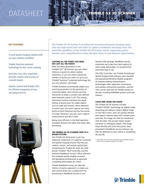
The <strong>Trimble</strong> <strong>GX</strong> 3d <strong>Scanner</strong> is an advanced surveying and spatial imaging sensor<br />
that uses high speed laser and video to capture coordinates and image data. The<br />
powerful capabilities of the <strong>Trimble</strong> <strong>GX</strong> 3d <strong>Scanner</strong> and its supporting system<br />
increase your competitiveness today and open doors to new business opportunities.<br />
<strong>Trimble</strong> SureScan patented<br />
technology for fast, smart scanning<br />
Real-time true-color acquisition<br />
provides realism and accuracy of<br />
scanned targets<br />
Remote control with <strong>Trimble</strong> TSC2<br />
for efficient integration of true<br />
surveying practices<br />
CAPTURE ALL THE POINTS YOU NEEd,<br />
NOT JUST ALL THE POINTS<br />
With the latest generation of the<br />
<strong>Trimble</strong> ® <strong>GX</strong> <strong>3D</strong> <strong>Scanner</strong>, you can collect<br />
millions of points for photo-realistic<br />
resolution, or you can collect exactly the<br />
number of points you need. It’s up to you:<br />
<strong>Trimble</strong> ® SureScan patented technology lets<br />
you scan smarter—and faster.<br />
<strong>Trimble</strong> SureScan automatically adapts your<br />
scanning parameters to the geometry of<br />
a scanned object, and controls scanning<br />
movement to keep a constant user-defined<br />
space between points in <strong>3D</strong>. This unique,<br />
innovative function maintains the equal<br />
density of points even for target objects<br />
such as roads and tunnels, where distances<br />
to points vary. You won’t capture too many<br />
points at short distances and too few points<br />
at longer distances—you also won’t capture<br />
measurements you don’t need.<br />
Being more efficient in the field operation<br />
translates directly into faster and easier data<br />
processing.<br />
THE TRIMBLE <strong>GX</strong> 3d SCANNER: PART OF A<br />
BIGGER PICTURE<br />
The <strong>Trimble</strong> <strong>GX</strong> <strong>3D</strong> <strong>Scanner</strong> is just one<br />
advanced component of a superior surveying<br />
and Spatial Imaging solution that lets you<br />
capture, extract, and analyze spatial data.<br />
Comprising the <strong>Trimble</strong> <strong>GX</strong> itself, the fieldproven<br />
<strong>Trimble</strong> ® TSC2 ® controller, and the<br />
powerful RealWorks Survey office software,<br />
the complete system enables surveyors<br />
and geospatial professionals to generate<br />
compelling deliverables for clients.<br />
<strong>Trimble</strong> RealWorks Survey can take the<br />
millions of points captured in a single scan<br />
and convert them into a usable form for<br />
processing in RealWorks Survey or your<br />
favorite CAD package. RealWorks Survey<br />
automates each step from data capture to<br />
client-ready deliverable—it’s powerful but<br />
extremely easy to use.<br />
The TSC2 Controller runs <strong>Trimble</strong> PocketScape<br />
Spatial Imaging field software, plus standard<br />
and specialized Windows Mobile programs 1 .<br />
Its industry-leading communication<br />
technologies offer cable-free convenience<br />
and wireless connectivity anywhere, and the<br />
TSC2 can be used with all <strong>Trimble</strong> sensors on<br />
the job, including GPS/GNSS systems and total<br />
stations.<br />
CATCH ANd SHARE THE VISION<br />
The <strong>Trimble</strong> <strong>GX</strong> <strong>3D</strong> <strong>Scanner</strong> includes<br />
<strong>Trimble</strong> ® VISION technology for digital image<br />
streaming and capture. Using a digital image<br />
on the TSC2 screen, users can quickly identify<br />
and capture relevant data with a simple pointand-click;<br />
the image can then be transferred<br />
with the data. This process makes project<br />
handover to colleagues simple—the image<br />
helps identify and orient the points. Data<br />
processed in RealWorks Survey software can<br />
then be delivered to your clients in compelling<br />
2D and <strong>3D</strong>.<br />
1 The <strong>Trimble</strong> <strong>GX</strong> can also be controlled using PointScape software,<br />
which runs on a laptop computer in the field.
TRIMBLE <strong>GX</strong> <strong>3D</strong> SCANNER<br />
PERFORMANCE<br />
Range (typically, under standard clear conditions 1,2 )<br />
350 m to 90% reflective surface 3 (w/ OverScan)<br />
200 m 4 to 35% reflective surface 3<br />
155 m to 18% reflective surface 3<br />
Scanning speed.. . . . . . . . . . . . . . . . . . . . . . . . . up to 5000 points per second<br />
Standard deviation 5 .. . . . . . . . . . . . . . . . .1.4 mm @ ≤50 m: 2.5 mm @ 100 m<br />
3.6 mm @ 150 m: 6.5 mm @ 200 m<br />
Single point accuracy.. . . . . . . . . . . . . . . . . . . . . . . . position = 12 mm @100 m:<br />
distance = 7 mm @ 100 m<br />
Hz angle = 12" (60 µrad): Vt angle = 14" (70 µrad)<br />
Target acquisition.. . . . . . . . . . . . . . . . . . . . std dev.