1t0SC7l
1t0SC7l
1t0SC7l

Create successful ePaper yourself
Turn your PDF publications into a flip-book with our unique Google optimized e-Paper software.
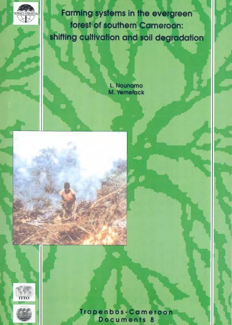
Farming systems in the evergreen forest of southern Cameroon:<br />
shifting cultivation and soil degradation
FARMING SYSTEMS IN THE EVERGREEN FOREST OF<br />
SOUTHERN CAMEROON:<br />
SHIFTING CULTIVATION AND SOIL DEGRADATION<br />
L. Nounamo and M. Yemefack<br />
Tropenbos-Cameroon Documents 8<br />
The Tropenbos-Cameroon Programme, Kribi (Cameroon)<br />
2001
ABSTRACT<br />
Nounamo, L. and Yemefack, M., 2001. Farming systems in the evergreen forest of southern<br />
Cameroon: shifting cultivation and soil degradation. The Tropenbos-Cameroon Programme,<br />
Kribi. Tropenbos-Cameroon Documents 8, xii + 62 pp.; 12 fig.; 29 tab.; 48 ref; 6 Annexes.<br />
The farming system of the Bantu population in south Cameroon is described in detail, with special<br />
emphasis on shifting cultivation and soil degradation. Trends in land use by the local population are<br />
analysed, and recommendations are made to stimulate sustainable use of forest land.<br />
Keywords: Shifting cultivation, farming systems, soil degradation, tropical rain forest, Cameroon.<br />
The Tropenbos-Cameroon Programme is a research programme executed under the joint<br />
responsibility of the Ministry of Environment and Forests of the Republic of Cameroon and<br />
Tropenbos International.<br />
© 2001 Tropenbos International<br />
P.O. Box 232, NL-6700 AE Wageningen (the Netherlands).<br />
Phone: +31 317 495500; fax +31 317 495520; e-mail: tropenbos@tropenbos.agro.nl<br />
ISSN 1566-2152<br />
No part of this publication may be reproduced or published in any form or by any means, or stored in a<br />
database or retrieval system, without the written permission of Tropenbos International.<br />
Tropenbos International assumes no liability for any losses resulting from the use of this document.
TABLE OF CONTENTS<br />
LIST OF TABLES ...................................................................................................................... vi<br />
LIST OF FIGURES..................................................................................................................... vi<br />
PREFACE .................................................................................................................................. vii<br />
SUMMARY .............................................................................................................................. viii<br />
RESUME.......................................................................................................................................x<br />
1 INTRODUCTION......................................................................................................................1<br />
1.1 Background and justification...............................................................................................1<br />
1.2 Objectives of the study ........................................................................................................1<br />
1.2.1 General objective ..........................................................................................................1<br />
1.2.2 Specific objectives ........................................................................................................1<br />
1.3 THE RESEARCH AREA....................................................................................................3<br />
1.3.1 Characteristics of the physical environment .................................................................3<br />
1.3.2 Socio-economic characteristics.....................................................................................6<br />
2 FARMING SYSTEMS AND PRACTICES ..............................................................................7<br />
2.1 Introduction .........................................................................................................................7<br />
2.2 Methodology........................................................................................................................7<br />
2.2.1 Site selection .................................................................................................................7<br />
2.2.2 Participatory approach for farming system surveys......................................................8<br />
2.2.3 Exploratory survey........................................................................................................8<br />
2.2.4 Measurement of the size, crop density and yield of agricultural fields.........................9<br />
2.2.5 Farmers’ priority setting ...............................................................................................9<br />
2.2.6 Farmers’ strategies for soil fertility management .........................................................9<br />
2.2.7 Household labour study ..............................................................................................10<br />
2.3 Results and discussions .....................................................................................................10<br />
2.3.1 Components of farms in the forest zone .....................................................................10<br />
2.3.2 Socio-economic characteristics...................................................................................10<br />
2.3.3 Cropping systems........................................................................................................13<br />
2.3.4 Animal system ............................................................................................................21<br />
2.3.5 Farmers' agricultural production priorities..................................................................23<br />
2.3.6 Agricultural priority production constraints................................................................25<br />
3 ASPECTS OF SOIL DEGRADATION UNDER VARIOUS LAND USE SYSTEMS..........28<br />
3.1 Introduction .......................................................................................................................28<br />
3.2 Methodology......................................................................................................................29<br />
3.2.1 Site selection ...............................................................................................................29<br />
3.2.2 Soil description and sampling.....................................................................................29<br />
3.2.3 Laboratory soil analyses..............................................................................................30<br />
3.3 Results and discussion.......................................................................................................30<br />
3.3.1 Food crop fields and soil property changes.................................................................30<br />
3.3.2 Fallow age and soil regeneration ................................................................................35<br />
3.3.3 Perennial crops and soil degradation ..........................................................................41<br />
3.3.4 Main causes of soil degradation and crop field abandonment in shifting cultivation<br />
systems of the forest zone. ...................................................................................................42<br />
4 TRENDS IN FIELD EXPANSION AND SOIL DEGRADATION, IN RELATION TO CROP<br />
YIELD AND POPULATION PRESSURE ................................................................................46<br />
4.1 Introduction .......................................................................................................................46<br />
4.2 Methodology......................................................................................................................46<br />
4.3 Results and discussions .....................................................................................................46<br />
4.3.1Trends in agricultural field expansion .........................................................................46<br />
4.3.2 Relationship between soil degradation and crop yield................................................48<br />
4.3.3 Soil degradation and agricultural field expansion.......................................................49<br />
iv
4.3.4 Relationship between commercial logging and shifting cultivation activities............49<br />
5 SOLUTIONS TO FARMERS’ PROBLEMS AND FOR SUSTAINABLE LAND USE .......50<br />
5.1 Solutions to farmers’ socio-economic and agronomic constraints ....................................50<br />
5.2 The sustainability of the present shifting cultivation system.............................................50<br />
5.3 Conclusions and recommendations for sustainable forest land use and management.......52<br />
REFERENCES............................................................................................................................54<br />
ANNEXES ..................................................................................................................................57<br />
Annex 1: Landscape ecological map of the research area: Bipindi-Akom II-Lolodorf region,<br />
southwest Cameroon (Source: van Gemerden and Hazeu, 1999). ..........................................57<br />
Annex 2: Checklist for the exploratory survey in the study area.............................................58<br />
Annex 3: Agricultural land expansion: the Ebimimbang area.................................................59<br />
Annex 4: Agricultural land expansion: the Mvié area.............................................................60<br />
Annex 5: Agricultural land expansion: the Ebom area............................................................61<br />
Annex 6: Agricultural land expansion: the Nyangong area.....................................................62<br />
v
LIST OF TABLES<br />
Table 1.1: Summary of climatic data from selected meteorological stations................................3<br />
Table 1.2. Characteristics of the different landform units in the research area.............................4<br />
Table 2.1. Characteristics of the four sample sites........................................................................8<br />
Table 2.2. Farmers’ priority activities.........................................................................................10<br />
Table 2.3. Farmers’ priority land uses in a farm .........................................................................10<br />
Table 2.4. Farmer’s priority expenditures...................................................................................13<br />
Table 2.5. Cropping calendar in the study area...........................................................................13<br />
Table 2.6. Food crops and trees grown in the TCP area .............................................................14<br />
Table 2.7. Density and yield of maize grown following natural fallow of different ages...........18<br />
Table 2.8. Density and yield of groundnut grown following natural fallow of different ages....18<br />
Table 2.9. Density and yield of cocoyam grown following natural fallow of different ages......18<br />
Table 2.10. Density and yield of cassava grown following natural fallow of different ages ......19<br />
Table 2.11. Yield of Cucumeropsis mannii grown following natural fallow of different ages...19<br />
Table 2.12. Some plant species used by farmers as indicators of fertile soil ..............................22<br />
Table 2.13. Some plant species used by farmers as indicators of infertile soil...........................22<br />
Table 2.14. Most solicited hunted animal species.......................................................................23<br />
Table 2.15. Farmers’ priority activities.......................................................................................23<br />
Table 2.16. Farmers’ priority crops.............................................................................................24<br />
Table 2.17. Priority socio-economic constraints for food crop production in the study area. ....26<br />
Table 2.18. Food crop production constraints in the forest zone ................................................26<br />
Table 2.19. Farmers’ priority agronomic production constraints................................................27<br />
Table 3.1. Soil property changes from fallow to food crop field after burning. .........................31<br />
Table 3.2. Soil property changes under perennial and sole annual crop .....................................42<br />
Table 4.1. Extent of the areas influenced by shifting cultivation in 1984 and 1997 ...................47<br />
Table 4.2. Population variation with landform units in the TCP area.........................................48<br />
Table 4.3. Multiple linear regression equations of various crop yields as functions of physicochemical<br />
soil properties in 0-20 cm soil slice (at p
PREFACE<br />
This report presents the findings of the study on farming systems in the evergreen forest of<br />
southern Cameroon with specific emphasis on shifting cultivation component and soil<br />
degradation. A preliminary version of this report was published in 2000 as Tropenbos-<br />
Cameroon Report 1 . The study was carried out within the framework of ITTO Project PD 26 /<br />
92, which is part of the Tropenbos-Cameroon Programme (TCP). TCP comprises fourteen<br />
interrelated sub-projects in the fields of ecology, forestry, economy, social science, agronomy<br />
and soil science. The main implementing agencies of the PD 26 / 92 Project are the ‘Institut de<br />
la Recherche Agricole pour le Développement’ (IRAD), ‘l’Office National de Développement<br />
des Forêts’ (ONADEF) and Wageningen University.<br />
The present study was financed by the International Tropical Timber Organisation (ITTO), the<br />
Common Fund for Commodities (CfC), the Tropenbos Foundation and the above-mentioned<br />
main implementing agencies. The authors thank these organisations for making this study<br />
possible.<br />
The authors wish to thank the General Managers of IRAD and ONADEF for selecting them to<br />
conduct this study.<br />
We also wish to express our sincere gratitude to the TCP team leaders, scientific coordinators,<br />
colleague researchers and administrative and financial personnel for their support during the<br />
study.<br />
We sincerely thank the students who contributed to the study through the development of their<br />
theses. We think particularly of Nlome Ekongo Emmanuel, Nama Alexandre and Nguegang<br />
Asaa Prosper from the University of Dschang, and Obam Félix-Marcel and Meyomesse Ongolo<br />
Calvin from the University of Yaoundé I.<br />
Our special thanks go to Ndombou Jean, former Delegate of Agriculture for the Océan Division,<br />
and his extension field staff for facilitating our introduction and contact in the villages of the<br />
TCP area.<br />
Last but not least, we are very grateful to all farmers and field assistants with whom we studied<br />
the farming systems practices and soil degradation in a friendly and participatory manner.<br />
Laurent Nounamo<br />
Martin Yemefack<br />
1 Nounamo, L. and Yemefack, M. (2000). Shifting cultivation in the evergreen forest of southern<br />
Cameroon: farming systems and soil degradation. Tropenbos-Cameroon Reports 00-2. The Tropenbos-<br />
Cameroon Programme, Kribi, Cameroon.<br />
vii
SUMMARY<br />
Slash and burn or shifting cultivation is a traditional farming system found in many parts of the<br />
humid tropics in general and in Cameroon in particular. Information on farming system in the<br />
moist evergreen forest of southern Cameroon is limited and very sparse. Although the<br />
Cameroon forest action plan did not foresee a significant agricultural pressure on forest land in<br />
southern Cameroon, the shifting cultivation component of the farming system practices may<br />
represent a greater threat to forest conservation than timber exploitation. Understanding the<br />
shifting cultivation practices and the trends and relationships between field expansion, soil<br />
degradation, crop yields and socio-economic factors may provide a basis for determining<br />
research and development strategies and priorities for the improvement of agricultural<br />
production and forest conservation and the achievement of sustainable use of the moist<br />
evergreen forest land. Between 1995 and 1997, a study on this agricultural system practised by<br />
the Bantu population was conducted in the research area of the Tropenbos-Cameroon<br />
Programme (TCP). The general objective was to reduce destructive effects of shifting<br />
cultivation on the forest by proposing to farmers complementary and / or alternative sedentary<br />
practices and by providing information to be utilised for the sustainable forest land use in<br />
southern Cameroon. The methodology followed in the farming system study consisted of site<br />
selection, collection of secondary data through consultation of existing documents, interviews of<br />
key informants and collection of primary data through participatory exploratory survey, case<br />
studies and on farm measurements. The methodology followed in soil degradation study<br />
consisted of site selection, soil description and sampling for laboratory analyses. Trends in<br />
agricultural field expansion were studied by over-laying maps of fields population sample<br />
opened between 1995 and 1997 on the 1984-1985 aerial photo interpretation landscape<br />
ecological map using arc-view software. Results of farming system study showed that a farm in<br />
the evergreen forest of Cameroon is composed of many subsystems interrelated and influenced<br />
by external biophysical and socio-economic parameters. According to 92% of the farmers<br />
interviewed, cropping subsystem remains the first priority activity. In this cropping subsystem,<br />
80% of the farmers considered shifting cultivation involving food crop fields and fallow as their<br />
first priority land use type. Four major crop associations highly linked to the preceding fallow<br />
type were identified in the food crop fields. Today, 76% of food crop fields in the area shift<br />
within fallow of different ages in a rotational system. Only 24% of agricultural fields expand<br />
towards undisturbed forest for cucumber (Cucumeropsis mannii) production and for<br />
establishment of semi-industrial farms by elite. Between 1984 and 1997, the land area under<br />
agricultural use expanded from 31 to 40.3%, for an average annual expansion of 0.71% of the<br />
total land area. The population pressure, the type and objective of crop production, the limited<br />
labour and access to new land have prompted more farmers to abandon the traditional expansive<br />
shifting cultivation to adopt the rotational system. The latter consists of shifting in a total area of<br />
less than 10 hectares, clearing short length fallow. This reduction in fallow length leads to<br />
degradation of topsoil morphology and physico-chemical soil properties. The study of soil<br />
degradation under shifting cultivation showed that the liming effect of ashes from burned<br />
vegetation biomass at the beginning of the cropping period increased significantly (p
stability and structure, and the decrease in soil porosity and water holding capacity. After about<br />
10 years of undisturbed natural fallow, the soil was able to recover its optimum equilibrium<br />
tending towards conditions under the virgin forest. Most of the changes in soil properties<br />
correlate with the changes in yield of major crop such as groundnut (Arachis hypogaea), maize<br />
(Zea mays) and cocoyam (Xanthosoma pubescens). To achieve sustainable management of the<br />
forest zone of southern Cameroon, solutions must be found to three main problems: (1) the<br />
farmer’s immediate socio-economic and agronomic production constraints, (2) the shortening of<br />
the fallow length leading to soil productivity degradation and (3) the unsustainable nonprosperous<br />
subsistence shifting cultivation destroying the forest ecosystem. These solutions in<br />
the form of recommendations deal with technology transfer actions, soil productivity<br />
improvement and conservation, and the move from subsistence to income generating farming.<br />
ix
RESUME<br />
En zone forestière tropicale en générale et au Cameroun en particulier, l’agriculture itinérante<br />
sur brûlis est une pratique principale du système de production agricole traditionnelle. Les<br />
informations sur le système de production agricole de la zone forestière humide du Sud<br />
Cameroun sont limitées et éparses. Quoique le plan d’action forestier national du Cameroun<br />
n’entrevoyait pas une pression sensible des activités agricoles sur la forêt, la composante<br />
agriculture itinérante sur brûlis du système de production agricole représenterait une plus grande<br />
menace de la conservation de la forêt que l’exploitation du bois. La compréhension des<br />
pratiques de l’agriculture itinérante sur brûlis, des tendances et relations entre l’expansion des<br />
terres, la dégradation du sol, les rendements, et les facteurs socio-économiques pourrait fournir<br />
une base pour la détermination (1) des stratégies de recherche et développement, (1) des<br />
priorités d’amélioration de la production agricole et de conservation de la forêt, et la garanti<br />
d’une utilisation durable des terres forestières. De 1995 à 1997, une étude avait été menée sur ce<br />
système agricole pratiqué par la population Bantou dans le site de recherche du Programme<br />
Tropenbos Cameroun (TCP). L’objectif général de cette étude était de réduire les effets<br />
destructeurs de l’agriculture itinérante sur la forêt en proposant aux agriculteurs des pratiques<br />
complémentaires et / ou alternatives de sédentarisation, ceci à travers la contribution aux<br />
informations utiles pour une utilisation durable des terres forestières du Sud Cameroun. L’étude<br />
du système de production avait suivi une méthodologie qui consistait en la sélection de site, la<br />
collecte des données existantes à travers la consultation des documents, l’interview des<br />
informateurs clés, la collecte des données sur le terrain à travers l’enquête exploratoire<br />
participative, les études de cas et les mesures en champs. La méthodologie de l’étude de la<br />
dégradation des sols avait consisté en la sélection de site, la description et l’échantillonnage de<br />
sol pour des analyses au laboratoire. La tendance de l’expansion des champs agricoles avait été<br />
déterminée grâce au logiciel Arc-view, en superposant des cartes des échantillons des champs<br />
ouverts entre 1995 et 1997 sur la carte d’interprétation de la photographie aérienne du paysage<br />
écologique de 1984 – 1985. Les résultats de l’étude sur les systèmes de production montraient<br />
qu’une exploitation agricole dans la zone forestière sempervirente du Cameroun était composée<br />
de plusieurs sous systèmes ayant entre eux des interrelations, et étaient influencés par des<br />
paramètres externes d’ordre socio-économique et biophysique. Pour 92% des agriculteurs<br />
interviewés, le sous système cultures végétales demeurait la première activité agricole. Dans ce<br />
sous système des cultures végétales, 80% des agriculteurs considéraient l’agriculture itinérante<br />
comprenant les champs de cultures vivrières et jachère naturelle comme leur type prioritaire<br />
d’utilisation des terres. Quatre principaux types d’associations culturales fortement liés au type<br />
de jachère précédante avaient été identifiés dans les champs vivriers. Aujourd’hui, 76% des<br />
champs vivriers dans la zone sont ouverts en se déplaçant dans des jachères d’âges différents<br />
suivant un système rotatif. Seulement 24% des champs agricoles utilisés pour la production du<br />
concombre (Cucumeropsis mannii) et pour l’installation des plantations semi - industrielles des<br />
élites extérieurs du village s’étendent dans les forêts non perturbées. Entre 1984 et 1997, la<br />
superficie sous production agricole s’était étendue de 31 à 40,3%, correspondant à une<br />
expansion annuelle moyenne de 0,71% de la surface totale des terres. La pression<br />
démographique, le type et l’objectif de la production agricole, la main d’œuvre limitée et l’accès<br />
difficile à de nouvelles terres avaient emmené la plus part des agriculteurs à abandonner<br />
l’agriculture itinérante traditionnelle plus expansive pour adopter le système rotatif. Ce système<br />
rotatif consistait à se déplacer sur une ère totale de moins de 10 hectares, défrichant une jachère<br />
de courte durée. Cette réduction de la durée de la jachère entraîne la dégradation de la<br />
morphologie de la couche superficielle A1 et des propriétés physico-chimiques du sol. L’étude<br />
de la dégradation des sols sous agriculture itinérante avait montré que l’effet de chaux des<br />
cendres issues du brûlis de la biomasse végétale au début de la période des cultures augmentait<br />
de façon significative (P < 0,05) les propriétés du sol telle que le pH, les bases échangeables<br />
x
(calcium), le pourcentage de saturation en bases, et réduisait l’acidité échangeable. Pendant les<br />
périodes de culture et de jachère, cet effet de chaux des cendres étaient rapidement réduite par<br />
l’érosion en nappe sur sol nu, le lessivage des cations, l’absorption par les cultures et la<br />
végétation de la jachère. L’étude avait aussi montré (i) une réduction presque irréversible de la<br />
teneur en argile de la couche superficielle du sol pendant la période des cultures et (ii) une<br />
reconstitution morphologique sous jachère arbustive (7-9 ans) de la couche superficielle A1,<br />
dominant sous forêt vierge et qui disparaissait pendant la période des cultures. Une corrélation<br />
existait entre la teneur en argile et certaines propriétés du sol : la réduction de la teneur en argile<br />
entraînait une augmentation irréversible de la densité apparente, la perte en stabilité structurelle<br />
des agrégats, et la réduction de la porosité du sol et de la capacité de rétention en eau. Après 10<br />
ans de jachère naturelle sans perturbation, le sol était capable de recouvrer son équilibre<br />
optimum tendant vers les conditions sous forêt non perturbée. La plus part des changements<br />
dans les propriétés du sol avait une corrélation avec les rendements des principales cultures<br />
telles que l’arachide (Arachis hypogaea), le maïs (Zea mays), et le macabo (Xanthosoma<br />
pubescens). La gestion durable de la zone forestière du Sud Cameroun nécessite que des<br />
solutions soient trouvées à trois problèmes majeurs, à savoir : (1) les contraintes socioéconomiques<br />
et agronomiques de production agricole, (2) la réduction de la durée de la jachère<br />
entraînant la dégradation de la productivité du sol, (3) la pratique de l’agriculture itinérante de<br />
subsistance, peu prospère et non durable, détruisant l’écosystème forestier. Des solutions sont<br />
ici proposées sous forme de recommandations ayant trait aux actions de transfert de technologie,<br />
à l’amélioration et conservation de la productivité du sol, et au passage de l’agriculture de<br />
subsistance à l’agriculture génératrice de revenus.<br />
xi
1 INTRODUCTION<br />
Between 1995 and 1997, a study on agricultural systems practised by the Bantu population was<br />
conducted in the research area of the Tropenbos-Cameroon Programme (TCP). The TCP<br />
research area is about 180 000 ha in size, and located 70 km East of Kribi between the villages<br />
Bipindi and Akom II (Figure 1.1). The study was to provide a comprehensive description on the<br />
farming systems applied in the TCP research area, with emphasis on shifting cultivation /<br />
natural fallow systems, and insight in soil (fertility) degradation related to such agricultural<br />
practices. Trends and relationships between agricultural field expansion, soil degradation, crop<br />
yields, fallow and population pressure were to be determined, this should lead to<br />
recommendations for sustainable forest land use.<br />
1.1 BACKGROUND AND JUSTIFICATION<br />
The objective of the Tropenbos-Cameroon Programme is to develop methods and strategies for<br />
natural forest management directed at sustainable production of timber and other products and<br />
services. These methods have to be ecologically sound, socially acceptable, technically feasible<br />
and economically viable, and to take other functions of the forest into consideration.<br />
Shifting cultivation is the dominant farming systems component practised in the tropical forest<br />
zone of Cameroon. Although a good deal of publications exist on shifting cultivation in other<br />
areas of the world, and although shifting cultivation has been described for semi-humid areas in<br />
Cameroon, information on this type of land use in the moist evergreen forest of south Cameroon<br />
is scarce.<br />
Although the Tropical Forestry Action Plan (MINAGRI, 1989) did not foresee a significant<br />
agricultural pressure on forest land in southern Cameroon, a Rapid Rural Appraisal conducted<br />
during TCP’s formulation phase revealed that present trends in these agricultural practices,<br />
under increasing influence of market economy as result of local infrastructure development<br />
(rural electrification and road construction), may well lead to expansion of agricultural land in<br />
the near future (Foahom and Jonkers, 1992).<br />
The TCP programme formulation team came to the conclusion that in order to achieve<br />
sustainability of forest production in the forest zone, sustainability of crop production must be<br />
studied conjointly, since shifting cultivation may represent a greater threat to forest than timber<br />
harvesting.<br />
1.2 OBJECTIVES OF THE STUDY<br />
1.2.1 General objective<br />
To reduce destructive effects of shifting cultivation on the forest by proposing to farmers<br />
complementary and / or alternative sedentary practices and by providing information to be<br />
utilised for the sustainable forest land use in southern Cameroon.<br />
1.2.2 Specific objectives<br />
1) To gain understanding of the farming systems practices in the evergreen forest of<br />
Cameroon, the problems, constraints and opportunities related to forest conservation and<br />
agricultural production.<br />
2) To obtain insight in aspects of soil degradation under smallholders’ agricultural land use<br />
systems applied in the evergreen forest of Cameroon.<br />
3) To find trends and relationships between field expansion, soil degradation, crop yield, and<br />
population pressure.<br />
1
Figure 1.1. Location map of the TCP research area and the sample areas (land cover maps)<br />
2
4) To propose solutions for farmers’ problems and constraints related to forest conservation<br />
and agricultural production, in order to reduce the destruction of the forest by the farmers,<br />
thereby achieving sustainable management of the forest zone of southern Cameroon.<br />
1.3 THE RESEARCH AREA<br />
The TCP research site corresponds to the 180 000 ha of the concessions of Wijma Douala<br />
SARL (GWZ). It is located 70 km east of Kribi (Figure 1.1), between 2° 47’ and 3° 14’ North,<br />
10° 24’ and 10° 51’ East, and between the low altitude evergreen forest and the mid-altitude<br />
evergreen Atlantic forest (Franqueville, 1973), characterised by the presence of Lophira alata<br />
(Azobé). It is part of the South Province of Cameroon, and includes parts of the Akom II,<br />
Bipindi and Lolodorf subdivisions (Océan Division), and the Ebolowa subdivision (Mvila<br />
Division).<br />
1.3.1 Characteristics of the physical environment<br />
Climate<br />
The climate of the research area is equatorial, classified as humid tropical (Köppen, 1936),<br />
characterised by two rainy seasons and a short and a long dry season (Figure 1.2). The average<br />
rainfall per year is about 2000 mm. The monthly mean rainfall are 200 and 400 mm for April /<br />
May and September / October, respectively. October is the wettest month of the year. The two<br />
driest periods of the year are December / February and July / August, respectively, with less<br />
than 80 mm of rainfall per year. The bimodal rainfall pattern determines two growing seasons.<br />
The first starts in March and ends in June; the second starts in August and ends in November.<br />
Between the two seasons, from December to March, arable swamps and valley bottoms are<br />
cultivated that allow to produce off-season food crop. Such a climate has a mean temperature<br />
above 18°C during the coolest month, an annual temperature around 25°C with very little<br />
variation during the year, and finally a well delineated dry season.<br />
A summary of climatic data from selected meteorological stations surrounding the research area<br />
is given in Table 1.1.<br />
Table 1.1: Summary of climatic data from selected meteorological stations<br />
Meteorological station Kribi Lolodorf Ebolowa<br />
Altitude (m asl) 13 440 609<br />
Mean annual temperature (°C) 26.4 24.6 24.0<br />
Relative humidity (%) 84 n.a. 83<br />
Mean annual vapour pressure (mbar) 29.3 n.a 24.6<br />
Mean annual rainfall (mm) 2836 2096 1719<br />
Wind speed below 4 m. / s (% time) 98 n.a. n.a.<br />
Mean wind direction SW n.a W<br />
Kribi, n = 45 years; Lolodorf, n = 25 years; Ebolowa, n = 48 years; n.a. = not available<br />
Source: Olivry (1986).<br />
Vegetation<br />
Van Gemerden and Hazeu (1999) described the vegetation of the study area in detail. It belongs<br />
to the Biafran Atlantic forest district of low and medium altitude (Letouzey, 1985).<br />
Characteristics of the sub-mountain part of the Guineo-Congolian domain are found on some<br />
isolated hills. Along the main roads, and around villages and in agricultural zones, the<br />
vegetation is strongly influenced by the human activities, and characterised by the presence of<br />
various pioneer species. The spatial distribution of the various vegetation types distinguished by<br />
van Gemerden and Hazeu (1999) is shown in Annex 1.<br />
3
600<br />
28<br />
500<br />
27<br />
Rainfall (mm)<br />
400<br />
300<br />
200<br />
26<br />
25<br />
24<br />
Temperature (oC)<br />
100<br />
23<br />
0<br />
J F M A M J J A S O N D<br />
Months<br />
22<br />
Rainfall :<br />
Temperature :<br />
Ebolow a Lolodorf Kribi<br />
Ebolow a Kribi<br />
Kribi, n = 45 years; Lolodorf, n = 25 years; Ebolowa, n = 48 years<br />
Figure 1.2. Monthly rainfall and temperature averages for Kribi, Lolodorf and Ebolowa.<br />
Source: Olivry (1986)<br />
Landscape<br />
Six major landform units have been defined within the 165 000 ha surveyed by van Gemerden<br />
and Hazeu (1999). These landform units and their characteristics are given in Table 1.2.<br />
Table 1.2. Characteristics of the different landform units in the research area<br />
Landform units Slope<br />
length (m)<br />
Slope<br />
(%)<br />
Relief<br />
intensity<br />
Number of<br />
interfluves<br />
Altitude<br />
range (m)<br />
Surface area<br />
(km²)<br />
Dissected erosional 50 - 200 5 – 15 20 – 30 3 - 4 40 - 250 110<br />
plain (pd)<br />
Uplands (U1) 100 - 200 10 – 20 10 – 40 3 - 4 120 – 700 480<br />
Uplands (U2) 150 - 300 10 – 30 30 – 80 2 - 3 120 – 700 690<br />
Isolated hills (H1) 250 - 500 30 120 – 300 - 200 – 900 116<br />
Complex of hills (H1) 200 - 350 20 – 40 80 – 200 1 350 – 700 139<br />
Mountains (M)<br />
>500 100<br />
- outside-slopes<br />
- inside-slopes<br />
>400<br />
250 - 400<br />
>30<br />
30 – 60<br />
>250<br />
120 – 250<br />
-<br />
-<br />
Valley bottoms (V) - 0 –2 < 10 - 40 - 700 15<br />
Source: van Gemerden and Hazeu (1999)<br />
* The dissected erosional plain (pd) is characterised by low altitude, rather flat topography<br />
without prominent hills or depressions. The erosional plain hosts the main rivers (Lokoundjé,<br />
Tchangue and Moungue) draining the TCP area. The tributaries and creeks of these rivers<br />
dissect the erosional plain giving the plain an undulating to rolling relief. The plain is mainly<br />
restricted to the west part of the TCP area.<br />
* The moderately dissected uplands with rolling relief (U1) are dissected plains with the<br />
summits and interfluves at more or less the same level and presenting the characteristics<br />
described in Table 1.2. This landform unit covers large surfaces in the centre (NNE - SSW) of<br />
the TCP area.<br />
4
* The strongly dissected uplands with hilly relief (U2) have different valley morphology as<br />
compared to those of U1 i.e. narrower valley bottoms, poor drainage, and more swamps.<br />
* The isolated hills (H1) are steep-sided, isolated, residual and circumdenudated, like inselbergs.<br />
* The complex of hills (H2) is a complex of moderate to steep hills, which are strongly<br />
dissected. The slope length and relief intensity (Table 1.2) are relatively short and low<br />
respectively compared to those of isolated hills and the mountains. Levels of summits and<br />
valley bottom vary greatly. The complex of hills unit is found in the transitional zone between<br />
the uplands and the mountains and is absent in the TCP western part.<br />
* The mountains (M) are complex dissected plateaux or massifs which are isolated and rising<br />
above the surrounding landscape. The unit characteristics are given in Table 1.2. The unit is<br />
characterised by an abrupt rise in altitude to a higher plateau level. The mountain landform unit<br />
is mainly restricted to the eastern part of the TCP area, covering extensive areas.<br />
Geology<br />
Champetier de Ribes and Aubague (1956) and Champetier de Ribes and Reyre (1959) provide<br />
information on the geology of the area. The area is part of the southern Cameroon plateau, a<br />
vast forested region and underlain by the Precambrian Basement complex, characterised by acid<br />
metamorphic rocks traversed by intrusions of potassic alkaline syenite and basic rock dykes.<br />
The metamorphic rocks consist of migmatites, gneiss, micaschists and quarzites with two micas.<br />
These rocks belong to the cristallophyllian series, ranging along the Lokoundjé river basin and<br />
its main affluents (Moungue and Tchangue). These rocks are rich in biotite and amphibole.<br />
The Ntem metamorphic complex occupies the western and the southwestern parts of the study<br />
area. It is a complex of calcium-magnesium rocks series composed of leuco-mesocrate gneiss<br />
with pyroxen, biotite and amphibole.<br />
The intrusive rocks consist of potassic and / or calco-alkaline granite and syenite with<br />
amphibole. Some dykes of pyroxenic diorites and doloritic gabbros are also found.<br />
Soils<br />
Soils of the area are all derived from the above-mentioned geological basement complex.<br />
Except some poorly drained soils (Inceptisols / Entisols) encountered in narrow inland wet<br />
valley, the whole area is dominated by Oxisols and Ultisols (Soil Survey Staff, 1992). The main<br />
characteristics of these soil orders are the following:<br />
- Ultisols: They are mainly found along the Lokoundjé river basin and its affluents Moungue<br />
and Tchangue, where the geology belongs to the cristallophyllian series. The soil taxa are:<br />
Typic Hapludult, Typic Paleudult, Plinthudult (Soil Survey Staff, 1992) or Haplic Acrisols,<br />
Plinthic Ferralsols (FAO-UNESCO, 1989), or ‘Sols ferralitiques faiblement désaturés,<br />
sableux’ (CPCS, 1967). These soils dominate on dissected erosional plain of low altitude<br />
(150-350 m asl) region of Bipindi. Van Gemerden and Hazeu (1999) classify them as<br />
‘Ebimimbang soils’. They are moderately deep to very deep, moderately well to well<br />
drained, yellowish brown. They are characterised by sandy topsoils (70-90% sand) and<br />
gravelly sandy clay loam to sandy clay subsoils (30-60% sand). The pH is usually between<br />
6 and 7 for the topsoil and 5-6.5 for the subsoil. The base saturation percentage is high (70-<br />
100%), but the CEC is low (less than 10 cmol / kg of soil).<br />
- Oxisols: They are found where the Ntem Metamorphic Complex dominates the geology.<br />
The main soil taxa are: Typic Kandiudox, Typic Hapludox (Soil Survey Staff, 1992) or<br />
Xanthic Ferralsols, Acri-xanthic Ferralsols (FAO-UNESCO, 1989), or ‘Sols ferralitiques<br />
moyennement à fortement désaturés, argileux’ (CPCS, 1967). They are soils of high altitude<br />
areas (>350 m asl) around Lolodorf, Akom II and Ebolowa regions. They were classified as<br />
Ebom soils and Nyangong soils by van Gemerden and Hazeu (1999). They are deep to very<br />
deep soils, well drained, brownish yellow to strong brown. They are characterised by a very<br />
5
low pH (3.8 to 5) and a high clay content, which can even reach 80% in the topsoil. The<br />
CEC varies between 9 and 12 cmol / kg of soils, with a base saturation percentage less than<br />
20%.<br />
- Inceptisols and Entisols: They are soils of the inland valley bottom. The main soil taxa are:<br />
Aquic Dystropept, Fluvaquent, Lithic Endoaquent (Soil Survey Staff, 1992) or Gleyic<br />
Cambisol, Dystric Fluvisol (FAO-UNESCO, 1989), or ‘Sols hydromorphes peu humifères’<br />
(CPCS, 1967). They are present at all altitudes and are sparsely found in the study area.<br />
They were classified as Valley Bottom soils by van Gemerden and Hazeu (1999). They are<br />
shallow to moderately deep soils, poorly to very poorly drained soils developed in<br />
unconsolidated recent alluvium, dark brown to yellowish dark brown. They are<br />
characterised by a loamy sand to sandy clay loam particle size. CEC (between 5 and 17<br />
cmol/kg of soil), pH water (between 4.5 and 6), bases saturation percentage (between 15<br />
and 50%) are very variable.<br />
1.3.2 Socio-economic characteristics<br />
The area is sparsely populated, with most people living along the public roads which form the<br />
northern and southern boundaries of the site, and along motorable logging roads, which connect<br />
the other two. Population density is about 7 / km². The Bulu form the largest ethnic group, but<br />
other Bantu groups are also present (Ngoumba, Fang and Bassa). In addition, there are about<br />
400 Bagyeli (or Bakola) pygmies. Forty-nine villages are found in the site: one Bassa, one<br />
multi-ethnic, 5 Fang, 6 Ngoumba and 36 Bulu. The Bagyeli live in a number of very small<br />
settlements, which are usually associated with Bantu villages. Population growth is modest due<br />
to constant urban migration. However, there are cases were city jobless young people come<br />
back to the village; but their stay in the village may not be for long, due to difficulties coping<br />
with social and other tensions in the village.<br />
Agriculture, gathering, hunting and logging are the main forms of land use in the study area.<br />
Farms are smallholdings; there are no large agricultural plantations. Shifting cultivation is the<br />
main agricultural system for food crops, and cacao is the main industrial crop.<br />
Local people, especially the Bagyeli, exploit the forest for gathering and hunting. Selective<br />
logging has been practised for several decades in the area, but was discontinued shortly after the<br />
finalisation of the fieldwork for the present study.<br />
6
2 FARMING SYSTEMS AND PRACTICES<br />
2.1 INTRODUCTION<br />
Okigbo (1986) defines a ‘farming system’ as a set of biophysical and socio-economic farm<br />
activities in which the farmer or farm family manages certain resources (land, capital and<br />
labour) to produce food, feed, fibre, shelter, and other necessary products.<br />
Farming systems research considers the farm as a whole and must deal with all aspects of the<br />
farm. It aims at identifying and analysing all components of a farm and the interrelationships<br />
between them, in order to gain full understanding of the practices, problems, constraints and<br />
opportunities related to agricultural production and forest conservation. The understanding of<br />
the farming systems provides a basis for determining research and development strategies and<br />
priorities, so that technologies are developed and development is planned that will be relevant to<br />
the farmers’ needs and dynamic circumstances.<br />
A good deal of publications on farming systems practices in many parts of the world exists. In<br />
southern Cameroon, farming systems have been described for mid-humid areas (Leplaideur,<br />
1985a; 1985b; Mutsaers et al., 1981; Atayi and Knipscheer, 1980; Nounamo, 1997; Almy et al.,<br />
1990). The methodology or approach was limited to the socio-economic and agronomic<br />
description of the systems, with very little interest paid to local population priorities and<br />
production strategies, interrelated impacts and trends, and linkages to deforestation, soil<br />
degradation and crop yield. Information on farming systems in the moist evergreen forest of<br />
southern Cameroon is limited and very sparse. However, the shifting cultivation component of<br />
the farming systems practices may represent a greater threat to forest conservation than timber<br />
exploitation. Understanding the shifting cultivation practices and the trends and relationships<br />
between field expansion, soil degradation, crop yields and socio-economic factors may provide<br />
a basis for determining research and development strategies and priorities for the improvement<br />
of agricultural production and forest conservation and the achievement of sustainable use of the<br />
moist evergreen forest land.<br />
2.2 METHODOLOGY<br />
The methodology followed in the farming systems study consisted of site selection, collection of<br />
secondary data through consultation of existing documents, interviews of key informants, and<br />
collection of primary data through participatory and exploratory survey, case studies and<br />
measurements.<br />
2.2.1 Site selection<br />
Four study sub-sites (see Figure 1.1 and Table 2.1) were selected within the TCP research area<br />
for detailed farming systems and soil degradation studies on the basis of an aerial photo<br />
interpretation map drawn by Touber (1993). According to van Gemerden and Hazeu (1999), this<br />
map subdivides the research area in four physiographic levels ranging from about 200 m above<br />
sea level (asl) in the west to more than 900 m asl in the east and southeast. One sub-site<br />
covering one village was established in each physiographic unit. The four selected villages are:<br />
- Ebimimbang near Bipindi subdivision, with elevations of 150-250 m asl. Soils are mostly<br />
Ultisols with sandy topsoils, referred to as Ebimimbang soils.<br />
- Ebom near Lolodorf subdivision, with elevation between 350-500 m asl. Soils are Oxisols<br />
with clayey topsoils, referred to as Ebom soils.<br />
- Mvié near Akom II subdivision, elevation of 250-400 m asl. Soils are Oxisols with clayey<br />
topsoil referred to as Ebom soils.<br />
- Nyangong is located towards the Ebolowa city, with elevation greater than 500 m asl. Soils<br />
are Oxisols with very clayey topsoils, referred to as Nyangong soils.<br />
7
Characteristics of the four sub-sites are summarised in Table 2.1.<br />
Table 2.1. Characteristics of the four sample sites.<br />
Sample areas<br />
Characteristics Ebimimbang Ebom Mvié Nyangong<br />
Location 3° 03’ N 3° 04’ N 2° 54’ N 2° 58’ N<br />
10° 28’ E 10° 42’ E 10° 33’ E 10° 45’ E<br />
Elevation (m asl) 150-250 350-500 250-400 500-900<br />
Landforms<br />
-Dissected<br />
erosional plains<br />
-Dissected<br />
uplands<br />
-Isolated hills<br />
-Dissected<br />
uplands<br />
-Isolated hills<br />
- Complex<br />
hills<br />
-Moderately<br />
dissected uplands<br />
-Isolated hills<br />
- Complex hills<br />
-Dissected<br />
uplands<br />
-Complex<br />
hills<br />
-Mountains<br />
Relief intensity (m) 20-30 30-80 30-80 120-250<br />
Rainfall (mm / y) 1900 2000 2300 1800<br />
Mean temp. (°C) 26 24.6 24 24<br />
Geology (Precambrian<br />
Basement)<br />
Dominant soils<br />
Ectinites (schists,<br />
micaschists,<br />
quarzites)<br />
Moderately well<br />
drained, sandy<br />
Typic Hapludult<br />
Migmatites<br />
(gneiss)<br />
Ca-Mg<br />
complex<br />
Well drained,<br />
clayey Typic<br />
Kandiudox<br />
Granites<br />
migmatites<br />
Well drained,<br />
clayey Typic<br />
Kandiudox /<br />
Kandiudult<br />
Granites<br />
Ca-Mg<br />
complex<br />
Well drained,<br />
very clayey<br />
Typic<br />
Kandiudox<br />
Ethnic group Fang, Ngoumba Bulu Bulu Bulu<br />
Population* (inhabitants) 515 592 978 400<br />
(household) 84 92 94 45<br />
Main rivers<br />
Lokoundjé, Tchangue Tchangue, Tchangue<br />
Tchangue<br />
Kienké<br />
Vegetation<br />
Biafran Atlantic low and mid altitude forest vegetation rich in<br />
Caesalpiniaceae (Letouzey, 1985)<br />
Source: van Gemerden and Hazeu (1999). * Data from own population census in May-June 1997<br />
2.2.2 Participatory approach for farming system surveys<br />
A survey was conducted by a team composed of the sub-divisional delegate of agriculture, the<br />
local agricultural chief of post, a farming systems agronomist / agro-ecologist and a soil<br />
scientist. Each team member played an important role, particularly the agricultural delegate who<br />
led the arrangement of appointments and contacts with farmers, participated fully in the<br />
animation of the interviews, and took advantage of the exploratory tour to integrate extension<br />
messages into the survey themes.<br />
2.2.3 Exploratory survey<br />
The exploratory survey covered 20 villages out of the total of 49 in the TCP area. To arrive at<br />
representative results, the choice of the survey villages took into consideration village<br />
characteristics such as ethnic group, accessibility, presence or absence of permanent or periodic<br />
market, soil and land s level (Figure 1.1). The methodology consisted of a development of a<br />
‘checklist’ (see Annex 2) to use as interview guide, the interview of farmers grouped together in<br />
each village, and the visit of three or more farms for direct field observation.<br />
During the interviews, efforts were made to explain the presence of the farming systems team,<br />
its role and activities in the villages now and in the future, in relation to the presence of the<br />
8
Tropenbos-Cameroon Programme, the logging company Wijma-Douala SARL (GWZ) and<br />
ORSTOM researchers. Such clarification of roles at early stage of intervention of the research<br />
team was necessary and indispensable to avoid any misunderstanding that might jeopardise the<br />
future collaboration between the farmers and the team. During group interviews, the ‘focus<br />
group’ approach was used to obtain information on each item of the checklist. The group<br />
interview always ended with few minutes of conversation (‘conversational interview’) during<br />
which notebooks were closed, the atmosphere more relaxed, and farmers feeling free, confident,<br />
and more open to speak frankly. It was at this stage of the interview that information could be<br />
obtained on sensitive issues.<br />
Field visits followed the group interview. Three or more fields were visited to observe, confirm<br />
and cross check some of the contradictory information obtained during the group interview.<br />
2.2.4 Measurement of the size, crop density and yield of agricultural fields<br />
Size<br />
In the four sub-sites described in Section 2.1.1, collaborative farmers from 35 households were<br />
randomly selected. The size of all fields opened from 1995 to 1997 (290 fields in total) were<br />
measured, mapped and their geographic co-ordinates recorded using compass, GPS (Global<br />
Positioning System), measuring tape and GIS (Geographical Information System). The method<br />
consisted of subdividing the perimeter of the field to be sized into rectilinear segments and<br />
recording for each segment its length in meters using measuring tape and its direction in degree<br />
(or grade) using compass. The geographic co-ordinate of the field was recorded using the GPS.<br />
In the office, the reconstruction of these directions and lengths on a graph paper re-built the<br />
shape of the field. The drawing obtained on paper was then digitised in GIS equipment and the<br />
computer provided the surface area of the polygon. The surface area of many fields measured<br />
could thus be computed at once.<br />
Crop density and yield<br />
In each mixed crop field, 4 to 5 squares of 4m x 4m were established for crop density and crop<br />
yield measurements. In each square, crop plants were counted for crop density determination.<br />
The density of each crop in the field was estimated as the average of all squares. During<br />
harvesting, all harvested crops from these squares were weighed. Sub-samples for estimation of<br />
biomass and grain yield dry weight of maize and groundnut were taken, oven-dried and<br />
weighed.<br />
2.2.5 Farmers’ priority setting<br />
The study was to identify farmers’ priority needs in time and space from an agricultural and<br />
socio-economic point of view. Twenty (20) villages of the TCP area were covered by a<br />
structured questionnaire interview. Ten (10) farmers were interviewed per village, taking into<br />
account age, sex, ethnic group (or tribe) and accessibility. A total of 200 interviews were<br />
conducted. Relative frequency was used for priority setting, that is, the scores were tallied by<br />
rank and the ranking 1 was given to the answer, which scored most often as priority 1, ranking 2<br />
was given to one the remaining answers, which scored most often as priority 2, etc.<br />
2.2.6 Farmers’ strategies for soil fertility management<br />
The study was to assess farmers’ way of coping with soil fertility problems in relation to<br />
agricultural production. Fifteen (15) villages in the TCP area were covered by a structured<br />
questionnaire interview. Five (5) farmers were interviewed per village. Farmers’ fallow<br />
strategies were assessed by measuring crop yields and by sampling and laboratory analysing<br />
soils from corresponding fallow plots nearby the crop fields. Data were tallied manually. Data<br />
were analysed using relative frequency and X 2 test. The rank was determined in the way<br />
described in Section 2.2.5, except that the sample size was 75.<br />
9
2.2.7 Household labour study<br />
The study was initiated to gain knowledge on household labour distribution over the year. This<br />
knowledge is useful in decision making during the introduction of new agricultural practices<br />
and policies. The daily activities and non-timber forest products (NTFP) gathering of eighteen<br />
(18) households at Ebimimbang and Nyangong, and few Bagyeli families in the TCP area were<br />
recorded for one year. This study was carried out in collaboration with the NTFP team of TCP.<br />
2.3 RESULTS AND DISCUSSIONS<br />
2.3.1 Components of farms in the forest zone<br />
Generally, the production system of a farm (Farming System) in the evergreen forest of<br />
Cameroon is made up of the following components: household component, cropping<br />
component, animal component, soil component and non-agricultural component (activities)<br />
such as hunting, fishing, and off-farm activities. These components are interrelated and are<br />
under the influence of external biophysical and socio-economic parameters such as climate,<br />
road and market infrastructures, market price, land tenure, credit availability, etc. (Figure 2.1).<br />
According to 92% of the farmers interviewed (i.e. 185 over 200 farmers), cropping system<br />
activities (Crop production) remain the first priority activity, followed by animal husbandry,<br />
then fishing, palm wine tapping, wild fruits collection, hunting, and oil palm exploitation (Table<br />
2.2). In the cropping component, shifting cultivation involving food crop fields and fallow is the<br />
first priority land use type according to 80% of the farmers, followed by perennial plantations,<br />
then home gardens (Figure 2.1 and Table 2.3).<br />
Table 2.2. Farmers’ priority activities<br />
Major Activities Rank Farmers Reasons for ranking<br />
ranking (%)<br />
Cropping activities 1 92 Diverse consumption and revenues<br />
Animal husbandry 2 29 Guests reception, dowry, ceremonies<br />
Fishing 3 35 Local consumption, less revenue<br />
Palm wine tapping 4 45 Consumption and non-sustained revenues<br />
Wild fruits collection 5 22 Seasonal consumption and revenues<br />
Hunting 6 32 Diverse consumption and revenues<br />
Palm oil extraction 7 48 Simple local consumption<br />
Sample size n = 200<br />
Table 2.3. Farmers’ priority land uses in a farm<br />
Land use type Rank Farmers Reasons for ranking<br />
ranking (%)<br />
Shifting cultivation 1 80 High consumption and revenues<br />
Perennial plantations 2 56 Decreasing revenues of the produce<br />
Home garden 3 72 Various consumption and low revenues<br />
Sample size n = 200<br />
2.3.2 Socio-economic characteristics<br />
The following socio-economic data were collected to supplement the information given in<br />
discussed in Section 1.3.2.<br />
Roads<br />
Three types of unpaved communication roads are present at the site: 1) motorable public roads,<br />
2) motorable logging roads and 3) footpaths. The two motorable public roads form the northern<br />
(road Kribi-Lolodorf via Bipindi) and southern (road Kribi - Ebolowa via Akom II) boundaries<br />
of the site, and the motorable logging roads connect the two. The condition of these earth roads<br />
depends on the season; speed during the rainy season may not exceed 25 km / h.<br />
10
BIOPHYSICAL AND SOCIO-ECONOMIC ENVIRONMENTS<br />
Climate, Market, Price, Road, Credit, Land tenure law,.....<br />
Food<br />
Income<br />
Management<br />
HOUSEHOLD<br />
SUB-SYSTEM<br />
- Composition - Labour<br />
- Reproduction - Decision<br />
- Objectives - etc.<br />
Food<br />
Income<br />
Management<br />
CROPPING<br />
SUB-SYSTEM<br />
- Home garden<br />
• Ecosystem of plants<br />
association<br />
- Perennial Plantations<br />
• Cocoa fields<br />
• Oil palm fields<br />
- Shifting Cultivation<br />
• Food crop fields<br />
• Fallow land<br />
.<br />
Feed<br />
• Labour<br />
• Land<br />
• Capital<br />
Organic<br />
Fertilizer<br />
ANIMAL<br />
HUSBANDRY<br />
SUB-SYSTEM<br />
- Species<br />
- Pasture, barn<br />
- Feed and feeding<br />
- Diseases<br />
- Pests<br />
- Equipment<br />
- Materials<br />
- etc.<br />
- Nutrition<br />
- Anchorage<br />
Fertilizer<br />
SOIL SUB-SYSTEM<br />
- Degradation<br />
- Fertility<br />
- Type<br />
- Elements<br />
- etc.<br />
Anchorage<br />
Fertilizer<br />
Trade, Masonry, Carpentry, Fishing, Hunting,....<br />
OFF-FARM AND NON-AGRICULTURAL<br />
Figure 2.1. Components of the farms in the forest zone<br />
11
Roads may temporarily be closed, due to slippery portion or to a damaged bridge. Out of 200<br />
farmers interviewed in the site, 98% considered their roads non-practical, and only 2% thought<br />
that the road condition was acceptable. Pathways are numerous and everywhere in the forest,<br />
joining the villages to agricultural fields, and serving the hunters.<br />
Extension services<br />
The support of agricultural extension is rare. The extension agents lack means of transportation<br />
to reach the villages. Government efforts are being made through the ‘Programme National de<br />
Vulgarisation et de Recherche Agricole (PNVRA)’ sponsored by the World Bank, to reach as<br />
many farmers as possible with extension messages.<br />
Labour<br />
There are clear divisions of labour within the household and for farm work between men and<br />
women. Women are expected to perform the household work and food crop production plus<br />
helping men harvest cocoa. Men do the heavy house repair in addition to taking care of cocoa,<br />
banana / plantain, and / or oil palm plantation. Shifting cultivation is mainly the work of the<br />
women. With the fall of the cocoa price on the market, men are more and more getting involved<br />
in the production of food crop for additional cash, performing the activities of tree felling,<br />
burning, land clearing and occasionally groundnut harvesting. Women perform tilling, sowing,<br />
weeding and transportation at harvest, processing, and marketing of food crops. The use of hired<br />
labour is rare, may concern tree felling and land clearing. However, working groups exist,<br />
formed between farmers to help each other curtail the labour shortage at peak period. Children<br />
help the parents during holidays, which fall at seeding and harvest period.<br />
Land and land tenure<br />
In pre-colonial times, land was communal. The chief of the village granted temporary usufruct<br />
rights for agricultural production to kin groups and individuals. Often there was considerable<br />
group migration within the shifting cultivation system, further limiting permanent claims to<br />
land. Colonial rule in the beginning of the twentieth century however had a profound effect on<br />
land tenure. For instance, cocoa was introduced in smallholder production; its long productive<br />
cycle led to the establishment of permanent villages and permanent claims to land. Farmers in<br />
the TCP site may have acquired their rights to land about 100 years ago.<br />
Today, land claim is by kin group according to first clearing of land (Nounamo and Foaguegue,<br />
1999). Access to land is limited because user rights are not given to farmers not belonging to the<br />
family. Even short-term users rights are not granted to migrants for fear of difficulties and<br />
disputes for future negotiations with the authorities of the expanding administrative settlements<br />
and industries. The non-granting of users rights to migrants, even for shorter term, should be<br />
foreseen as a potential constraint to the adoption of agroforestry techniques, by the latter, to<br />
stabilise shifting cultivation and reduce the destruction of the forest.<br />
Farmers’ organisation and credit source<br />
Sustainable and well-structured organisations are non-existing or difficult to find in the villages<br />
of the area. Organisations are limited to ‘tontine’ groups, community groups, and work groups.<br />
‘Tontine’ groups are some kind of credit co-operative where farmers put together funds<br />
periodically, and one of them collects it. Work groups are labour groups formed to help each<br />
member with farm activities during peak period. About fifty per cent of the farmers belong to a<br />
work group, with women a little more than men. Community groups, an example is ‘Groupe<br />
d’Initiative Commune’ (GIC), are organised to facilitate access to government credit such as<br />
FIMAC fund (Fonds d’Investissement pour Microprojet Agricole du Cameroun) for the<br />
financing of small agricultural production projects. Groups are formed by affinity. Dislocation<br />
of groups is very often caused by mismanagement of funds.<br />
Two types of credit sources exist:<br />
12
1. The formal source of credit is granted by government institutions such as FIMAC and<br />
‘Crédit Agricole’. Few smallholders qualify for this and the interest rate is high.<br />
2. The informal source is that called ‘tontine’, explained above. Informal source of credit<br />
works better and farmers tend to prefer it to the formal.<br />
Farm investment<br />
Though most of farmers’ financial revenues come from agriculture, very little of it is directly reinvested<br />
in agricultural production. Table 2.4 gives the priority expenditures of farmers. One<br />
can observe that expenditures for agricultural activities come in fourth position, occasionally to<br />
buy fungicides for cocoa spray.<br />
Table 2.4. Farmer’s priority expenditures<br />
Priority Expenditures Rank Freq.(%) Priority Expenditures Rank Freq.(%)<br />
Kerosene, soap, drugs 1 68 Drink 7 47<br />
Children school fees 2 57 Food 8 29<br />
House building and repair 3 38 Seeds 9 32<br />
Agricultural material 4 45 Kitchen utensils 10 30<br />
Paid agricultural labour 5 33 Mourning / funeral 11 70<br />
Clothing 6 37 Gifts and assistance 12 78<br />
Sample size n = 200<br />
2.3.3 Cropping systems<br />
Cropping calendar<br />
Table 2.5 presents three cropping seasons. The first (‘Essep’), running from March to July, is<br />
the most important. Most bush fallow and forest land opened in December / January is used<br />
during that period for ‘ngon’ (Cucumeropsis mannii) cultivation. The long dry season running<br />
from mid-November to end of February allows the felling and drying of trees and branches from<br />
bush and forest fallow clearing. The total area cultivated by a farmer is large (see field size).<br />
Table 2.5. Cropping calendar in the study area.<br />
Growing Clearing of Felling of Burning Planting Harvest<br />
seasons understorey trees<br />
‘Essep’ December / January / January / March / April July<br />
1 st season January February February<br />
‘Oyon’ June / July July / August July / August August / November<br />
2 nd season<br />
September<br />
‘Assan’<br />
Valley bottom<br />
November December December /<br />
January<br />
December /<br />
January<br />
March<br />
The second growing season (‘Oyon’), from August to November, is less important than the first<br />
season; mostly Chromolaena fallow is cleared; the preceding short dry season running from<br />
July to mid-August is not long enough to allow tree felling and drying. The total area cultivated<br />
by a farmer is reduced (see fields size). Arable swamps and valley bottom are cultivated<br />
between December and March (‘Assan’) for the off-season production of food crops; but not all<br />
families own an ‘Assan’ crop field, since not everybody possesses an arable valley bottom or<br />
swamp.<br />
Land use types in a farm<br />
Farm agricultural land use can be divided in three types: home gardens (or ‘guie pion’) near the<br />
home, perennial plantations (cocoa, oil palm) at a somewhat greater distance, and shifting<br />
cultivation field (food crop fields and fallow) away from the farmer’s dwelling. The cultivation<br />
of food crop field shifts every season from one place to another by clearing and burning a tract<br />
of fallow land or primary forest. The fallow land can be a forest fallow (FF, ‘Afan’), a bush<br />
fallow (BF, ‘Nnom ekodok’) or a Chromolaena fallow (CF, ‘Ekodok ngoumgoum’). Arable<br />
13
swamps and valley bottoms are also used during the long dry season for off-season production.<br />
It is common to find a stripe of forest vegetation between the home garden field and the<br />
perennial plantations. This forest stripe is the place for straying of animals, mainly pig. It is also<br />
the place used by farmers for immediate needs such as firewood, material for building, repair<br />
and construction, and domestication of some forest tree species.<br />
Food crop fields<br />
Crops, cropping pattern, cropping sequence. More than 40 crop species are grown in the TCP<br />
area (Table 2.6). In the food crop field, crops are grown in association. An association may be<br />
made up of more than 10 crops; those crops of the association represented in higher density are<br />
termed major crops; those crops represented in lower density are termed minor crops. Major<br />
food crops are cassava, cocoyam, banana-plantain, ‘ngon’ (Cucumeropsis mannii), groundnut,<br />
maize, and yam. Minor food crops are vegetables, fruit trees, sugar cane, and pineapple. New<br />
crops or crops being grown for 20 years only are soybean, ‘ndole’ (Vernonia), Irish potato and<br />
citrus. Obsolete crops are rice, taro and sweet potato. Crops sold on the market or at the roadside<br />
are cassava, cocoyam, banana-plantain, maize, groundnut, yam, sugar cane, fruit, palm nut,<br />
coconut. The 4 major crop associations, highly linked to the type of preceding fallow, are:<br />
1) Cucumber / cocoyam / plantain / maize (from a cleared and burned forest fallow);<br />
2) Groundnut / maize / cassava / cocoyam / plantain (from a cleared and burned bush fallow);<br />
3) Groundnut / maize / cassava / cocoyam (from a cleared and burned Chromolaena fallow);<br />
4) Cucumber (var. ‘seng’le’) cocoyam / plantain / maize (from a cleared and burned bush<br />
fallow).<br />
Minor crops are found in all associations mentioned above.<br />
Table 2.6. Food crops and trees grown in the TCP area<br />
Species Ewondo English French Uses<br />
FOOD CROPS<br />
Manihot esculenta Mbon Cassava Manioc Roots, leaves<br />
Arachis hypogaea Owondo Groundnut Arachide Grains<br />
Zea mays Fon Maize Maïs Green and dry<br />
grains<br />
Oryza sativa Oles Rice Riz Grains<br />
Musa parasidiaca Ekon Plantain Plantain Fruit<br />
Musa sapientum Odjoe Banana Banane Fruit<br />
Xanthosoma pubescens Mekaba Cocoyam Macabo Tubers, leaves<br />
(X. sagittifolium)<br />
Colocasia esculenta Kie-atu Taro Taro Tubers, leaves<br />
Solanum tuberosum Metora Irish potato Pomme de terre Tubers<br />
Ipomea batatas Mebouda / Sweet potato Patate douce Tubers, leaves<br />
Dioscorea spp.<br />
D. rotundata<br />
D. dumetorum<br />
D. cayenensis<br />
D. bulbifera<br />
nkogo<br />
Ekodo<br />
Messol<br />
Yam<br />
White yam<br />
Trifoliate yam<br />
Yellow yam<br />
Aerial yam<br />
Ignames<br />
Igname blanche<br />
Igname jaune<br />
Tubers<br />
Tubers<br />
Tubers<br />
Tubers<br />
Aerial tubers<br />
Amaranthus cruentus Folong Amaranth Amarante Leaves<br />
Amaranthus hybridus Folong Amaranth Amarante Leaves<br />
Amaranthus spinosus Zom / bikabili Amaranth Amarante Leaves<br />
Solanum nigrum Osan zom Black night shade Morelle noire Leaves<br />
Solanum gilo raddi Etwa Egg plant Aubergine<br />
feuille<br />
Solanum incanum Zong Garden egg Aubergine<br />
indigène<br />
Voandzeia subterranea Methob Bambara nut Vouandzou Grains<br />
Talinum triangulare Elok Water leaf Grasse Leaves<br />
Leaves with<br />
groundnut<br />
Fruit vegetable<br />
14
Table 2.6. cont’d<br />
Species Ewondo English French Uses<br />
Ocimum basilicum Ossim Basil Basilic Spice, medicine<br />
Ocimum gratissimum Messep Basil Basilic Spice<br />
Cucumeropsis mannii Ngon Cucumber Concombre Seeds<br />
Cucurbita pepo Ngon Cucumber Courgette Seeds<br />
Cucumis sativum Ngon Cucumber Concombre Seeds, leaves<br />
Cucurbita maxima Mindzeng / abok Pumpkin Portiron Leaves, fruit, seeds<br />
Cucurbita spp. Singling Pumpkin Courge Fruit<br />
Citrullus lanatus Seng’le Seed melon Pastèque Young leaves,<br />
seeds<br />
Lagenaria siceraria Ndeg Calabash Calebasse Household<br />
instrument<br />
Corchorus olitorius Tege / kelenkelen<br />
Tossa<br />
Corète potagère Leaves<br />
Vernonia spp. Metet / yolo-yolo Bitter leaf Tisane Leaves<br />
Triumphetta pentandra Nkui Soup vegetable,<br />
bark<br />
Allium cepa Meyan Onion Oignon Vegetable / spice<br />
Phaseolus vulgaris Kom Bean Haricot Vegetable, grains<br />
Dolichos lablab Kon Bean Haricot Pods / seeds<br />
Capsicum frutescens Ondondo beloa Bird pepper Pili pili Spice<br />
Capsicum annum Ondondo Chillies Piment Vegetable<br />
eprwebe<br />
Zingiber officinale Tsindsa Ginger Gingembre Spice, medicine<br />
Piper guinensis Ondondo afan Spice<br />
Aframomum melegueta Ndong Paradise grain Maniguette Spice / medicine<br />
Aframomum spp. Mvonlo / esson Spice / medicine<br />
Hibiscus esculentus Bitetam Okra Gombo Fruit-vegetable<br />
Lycopersicum<br />
Ngoro Tomato Tomate Fruit-vegetable<br />
esculentus<br />
Nicotiana tabacum Ta’a Tobacco Tabac Stimulant leaves<br />
Saccharum officinarum Nkok Sugarcane Canne à sucre Juicy stem<br />
Costus Mien (Costus) (Costus) Acid spice<br />
Ananas comusus Zek Pineapple Ananas Juicy fruit<br />
TREE SPECIES<br />
Elaeis guineensis Alen Biton Oil palm Palmier à huile Oil, palm wine,<br />
basket, broom<br />
Raphia sp. Zam Raphia palm Palmier raphia Wine, furniture,<br />
construction<br />
Citrus sp. Ofoumbi Citrus Agrumes Fruit<br />
C. sinensis<br />
C. aurantifolia<br />
C. reticulata<br />
C. paradisi<br />
C. grandis<br />
C. limon<br />
Ofoumbi ntangan<br />
Limes<br />
Mandarin<br />
Ofoumbi bikabili<br />
Ofoumbi beti<br />
Orange<br />
Lime<br />
Tangerine<br />
Grapefruit<br />
Grapefruit<br />
Lemon<br />
Orange<br />
Limon<br />
Mandarine<br />
Pamplemousse<br />
Pamplemousse<br />
Citron<br />
Fruit<br />
Fruit<br />
Fruit<br />
Fruit<br />
Fruit<br />
Fruit<br />
Mangifera indica Ndok ntangan Mango Mangue Fruit, bark for<br />
medicine<br />
Persea americana Fia Avocado Avocat Fruit<br />
Cola acuminata Abe Cola nut Cola Stimulant fruit<br />
Cola nitida Abe goro Cola Cola Stimulant fruit<br />
Cola lepidota Mvoue Cola Cola Stimulant fruit<br />
Cocos nucifera Mvondo Coconut Noix de coco Fruit<br />
Theobroma cacao Caca Cocoa Cacao Cash crop fruit<br />
15
Table 2.6. cont’d<br />
Species Ewondo English French Uses<br />
Coffea canephora Café Robusta coffee Café Robusta Cash crop fruit<br />
Carica papaya Fofo Papaya Papaye Fruit<br />
Coula edulis Kome African walnut Noisette<br />
sauvage<br />
Fruit similar to<br />
groundnut<br />
Trichoscypha acuminata Mvout Raisin pahouin Fruit<br />
Baillonella toxisperma Ebouma adjap Makore Oily nuts<br />
Spondias cytherea Kasmanga Otabeite apple Pomme cythere Fruit<br />
Monodora myristica Ndin Faux muscadier Spice<br />
Dacryodes edulis Sa Plum, bush-butter Safoutier Fruit<br />
Dacryodes macrophylla Tom Balsamier Fruit<br />
Tetrapleura tetrapleura Akwa Tetrapleura Tetrapleura Spice, medicine<br />
snake repellent<br />
Irvingia gabonensis Ndok Dika nut Manguier Seed, fruit<br />
sauvage<br />
Ricinodendron<br />
africanum<br />
Ezezan<br />
Oil seed, grilled<br />
nuts<br />
Scorodophloeus zenkeri Olon Arbre à l’ail Bark / seed / spice<br />
medicine<br />
Xylopia aethiopica Bakoui Guinea pepper Poivre Hard wood<br />
éthiopien<br />
Psidium guajava Ebuma, afele Guava Goyave Fruit<br />
Annona muricata Sap-sap Soursop Corossole Fruit<br />
Artocarpus communis Owondo ntanga Breadfruit Arbre à pain Fruit (var.<br />
sminifera)<br />
Artocarpus communis Belefout Breadfruit Arbre à pain Fruit (var.<br />
asperma)<br />
Mushrooms<br />
Var.:-Bikokoebiyoko,<br />
doumou,<br />
kokono, tolong<br />
Mushrooms Champignon Meat, spice<br />
Shifting cultivation vs. rotational fallow. Traditional shifting cultivation starts with clearing the<br />
undergrowth of primary forest. Cocoyam and plantain are planted first; the felling of trees and<br />
burning follow one month later. After burning, cucumber (‘ngon’) is seeded between felled trees<br />
together with the associated maize. The cucumber overgrows tree stumps and felled trunks and<br />
is harvested after six to eight months. Maize is harvested first; cocoyam and plantain are<br />
harvested continuously over a longer period (more than 5 years) if soil fertility is high and pest<br />
and disease problems are low. Chromolaena fallow takes over the land progressively. Gradually<br />
the Chromolaena fallow turns to forest and cropping returns to start with a cucumber field (see<br />
Figure 2.2).<br />
With the use of chain saw, the limited labour to open primary forest, and the limited access to<br />
new land, the traditional shifting cultivation described above is more and more giving way to<br />
what may be called ‘rotational fallow’. That is, clearing is followed directly by felling of trees<br />
and burning before planting cocoyam and plantain. Also, farmers tend to rotate in an area of less<br />
than 10 hectares, where they clear each season, either Chromolaena fallow (age 3 to 5 years) to<br />
plant groundnut and associated crops, or bush fallow (age 7 to 9 years) to plant groundnuts and<br />
plantain with other associated crops, or forest fallow (age more than 10 years) to plant cucumber<br />
with associated crops.<br />
Size of food crop fields. An individual farmer may open two to three food crop fields a year: one<br />
or two during the first growing season (March - June), and one during the second growing<br />
season (August - November).<br />
16
The size of a food crop field varies between 0.3 to 1.5 ha per season. An individual farmer may<br />
have one large food crop field (more than 1 ha) or 2 average food crop fields (around 0.5 ha<br />
each) in the first cropping season and only one average food crop field (around 0.5 ha per year)<br />
during the second season, for a total of 1 to 2 ha per year.<br />
Sequence of activities in a forest derived food crop field<br />
Sequence of activities in a fallow derived food crop field<br />
Dates<br />
Activities<br />
Dates<br />
Activities<br />
Dec / Jan<br />
Clearing of undergrowth<br />
Jan or July<br />
Clearing of fallow<br />
Planting of Plantain and<br />
cocoyam<br />
Burning of dry biomass<br />
Trees felling<br />
End Feb or<br />
mid Aug<br />
Removing of unburned twigs<br />
(Cleaning)<br />
End Feb<br />
Burning of dry biomass<br />
Tilling and seeding of maize,<br />
groundnut, cocoyam, cassava<br />
Seeding cucumber and maize<br />
April or Oct<br />
First weeding<br />
June<br />
Maize harvesting<br />
June/July<br />
or Nov/Dec<br />
Groundnut and maize<br />
harvesting + second weeding<br />
Aug -Oct<br />
Cucumber harvesting<br />
Re-densification of cassava<br />
(increasing the cassava density)<br />
From Dec<br />
to > 2 Yrs<br />
Cocoyam and plantain<br />
harvesting<br />
From Dec or<br />
next June to<br />
> 2 Yrs<br />
Cocoyam and cassava<br />
harvesting<br />
Figure 2.2. Sequences of farmers’ activities in forest and fallow derived food crop fields<br />
Keys: Jan = January; Feb = February; Aug = August; Oct = October; Nov = November; Dec = December;<br />
> 2 Yrs = greater than 2 years.<br />
Distance to the food crop fields. Most farmers have food crop field at a distance of more than 3<br />
km from their home; but this longer distance may not exceed 5 km, though exceptional cases<br />
may exist. Three main reasons may explain the location of the food crop field far away in the<br />
forest:<br />
- the first reason is the search for fertile land; land near the compound is less fertile;<br />
- the second reason is to avoid animal divagation; and<br />
- the third reason is the unavailability of land closer to the village and the inheritance of land<br />
that is far away from the village.<br />
However, some farmers have land at a distance of less than 1.5 km; or even less than 1 km, in<br />
exceptional cases. The reasons for having food crop field near the village are that farmers<br />
17
dispose of land near the village, or that they do not want to walk long distances, or that they<br />
want to easily transport the produce to the compound or to the market.<br />
Crop density and yields. The density and yield were measured for maize, groundnut, cocoyam,<br />
cassava and Cucumeropsis mannii grown in different associations strongly linked to the<br />
preceding fallow.<br />
The biomass dry weight and grain yields of maize decreased as the age of preceding fallow<br />
increased. Crop density increased as the age of the preceding fallow increased (Table 2.7).<br />
Maize biomass dry weight was 1.29, 1.61 and 1.1 ton / ha following Chromolaena, bush fallow<br />
and forest fallow, respectively. Maize grain yields were 0.33, 0.43 and 0.30 ton / ha following<br />
Chromolaena, bush fallow and forest fallow, respectively. Maize densities were 8,985, 11,510<br />
and 12,155 plants / ha following Chromolaena fallow, bush fallow and forest fallow,<br />
respectively.<br />
Forest fallow is not a suitable preceding fallow for the growth of groundnut. This crop is grown<br />
only after Chromolaena and bush fallow. Groundnut density and biomass dry weight and grain<br />
yield decreased as the fallow age increased (Table 2.8). Groundnut densities were 133,950 and<br />
115,810 plants / ha, biomass dry weight 0.98 and 0.63 ton / ha, and grain yields 0.58 and 0.40<br />
ton / ha following Chromolaena and bush fallow, respectively.<br />
Cocoyam (Table 2.9) density was higher following bush fallow and the same following<br />
Chromolaena and forest fallow. The biomass dry weight increased with the increase in fallow<br />
age. Tuber fresh weight was higher following bush fallow and forest fallow and lower following<br />
Chromolaena fallow. Tuber fresh weights were 5.16 and 4.30 ton / ha follow bush fallow and<br />
forest fallow respectively, and only 3.64 ton / ha following Chromolaena fallow.<br />
Table 2.7. Density and yield of maize grown following natural fallow of different ages<br />
Fallow type<br />
(age)<br />
Density (plants /<br />
ha)<br />
Biomass dry weight<br />
(ton / ha)<br />
Grain yield (ton /<br />
ha)<br />
Land equivalent ratio<br />
(LER)<br />
CF (3-5 yrs) 8985 1.29 0.30 0.17<br />
BF (6-9yrs) 11510 1.61 0.43 0.22<br />
FF (>10 yrs) 12155 1.10 0.30 0.23<br />
Sample size n = 18<br />
Table 2.8. Density and yield of groundnut grown following natural fallow of different ages<br />
Fallow type<br />
(age)<br />
Density (plants /<br />
ha)<br />
Biomass dry weight<br />
(ton / ha)<br />
Grain yield (ton /<br />
ha)<br />
Land equivalent ratio<br />
(LER)<br />
CF (3-5 yrs) 133950 0.98 0.58 0.40<br />
BF (6-9 yrs) 115810 0.63 0.40 0.35<br />
Sample size n = 18<br />
Table 2.9. Density and yield of cocoyam grown following natural fallow of different ages<br />
Fallow type<br />
(age)<br />
Density (plants /<br />
ha)<br />
Biomass dry weight<br />
(ton / ha)<br />
Grain yield (ton /<br />
ha)<br />
Land equivalent ratio<br />
(LER)<br />
CF (3-5 yrs) 4530 3.62 3.64 0.45<br />
BF (6-9 yrs) 5415 5.55 5.16 0.54<br />
FF (>10 yrs) 4780 5.90 4.30 0.48<br />
Sample size n = 18<br />
Cassava density and root fresh weight yield were not significantly different following<br />
Chromolaena and bush fallow (Table 2.10). The densities were 2300 and 2310 plants / ha, the<br />
root fresh weight yields 17.85 and 16.43 ton / ha following Chromolaena and bush fallow<br />
respectively. The cultivation of cassava following forest fallow is not common practice.<br />
18
Cucumeropsis mannii is grown following bush and forest fallow. The yields were 188 and 156<br />
kg / ha following bush fallow and forest fallow respectively (Table 2.11).<br />
Total land equivalent ratio (LER) for maize, groundnut, cassava, cocoyam in association was<br />
higher than for individual crops at all three fallow ages; indicating that the practice of<br />
association is advantageous compared to solid cropping of each of the crops. The LER<br />
decreased with the increase in fallow age.<br />
Table 2.10. Density and yield of cassava grown following natural fallow of different ages<br />
Fallow type<br />
(age)<br />
Density (plants / ha) Root fresh weight yield (ton / ha) Land equivalent ratio (LER)<br />
CF (3-5 yrs) 2300 17.85 0.23<br />
BF (6-9 yrs) 2310 16.43 0.23<br />
Sample size n = 18<br />
Table 2.11. Yield of Cucumeropsis mannii grown following natural fallow of different ages<br />
Fallow type (age) Density (plants / ha) Yield (kg / ha) Land equivalent ratio (LER)<br />
BF (6-9 yrs) 1950. 188 n.a.<br />
FF (>10 yrs) 1770 156 n.a.<br />
Sample size n = 4. n.a. = not available<br />
Land preparation. Manual labour dominates land preparation. The use of chainsaw reduces<br />
labour input only for ‘ngon’ field. All other operations remain manual. Two systems of land<br />
preparation are common in the area:<br />
- Forest or bush fallow is cleared with chainsaw or axe and cutlass for ‘ngon’ field<br />
establishment. Felled tree stems are left in the field and start to rot during the time ‘ngon’ is<br />
grown. One year later, after ‘ngon’ has been harvested, systematic clearing and burning take<br />
place for groundnut field establishment and later for cassava growing, then a Chromolaena<br />
fallow follows. Tilling using hoe is done simultaneously with the planting of groundnut and<br />
cassava. Forest and bush clearing is a man’s job. Women who cannot rely on men, hire<br />
labourers to prepare larger fields, or do it themselves to end up with smaller size fields.<br />
- Chromolaena fallow clearing 3 to 5 years after forest or bush fallow clearing, requires less<br />
labour; only cutlass and hoe could be used; therefore, women alone may do it. On sandy<br />
soils the roots are pulled out by hand. This tills the soil and further tillage with the hoe is<br />
only done for seeding.<br />
Clearing constitutes the basic operation for all cropping systems. It is performed between<br />
December-November for ‘Essep’, the first season planting and in May-June for ‘Oyon’, the<br />
second season planting and in October - November for ‘Assan’ the dry season swamp or valley<br />
bottom planting.<br />
Tillage is done for all types of field, except for the ‘ngon’ field and the solid stand of maize.<br />
Some farmers sow maize before tilling the land. Low tillage is common practice because of the<br />
shallow nature of forest soil (less than 12 cm deep). Moreover, farmers experience difficulties<br />
during tilling due to the presence of many roots in the soil. Before tilling, the plant debris lying<br />
on field must be cleared and burned.<br />
Seeding and planting. The period for seeding and planting may extend over three months in the<br />
same field and is mostly done at the same time as tillage with hoe. This work is nearly always<br />
done by women and children. Land preparation as a combination of clearing, cleaning, burning<br />
and tilling (see Figure 2.2 determines field size and production potentials.<br />
Seeds, planting materials and storage. The use of seed and cuttings from the farmer’s own farm<br />
is the common practice. The storage of seeds and planting materials is limited by space and<br />
inadequate post-harvest technology. Problems caused by insect, bird and rodent attacks are<br />
common. Grains are stored in the house near the fireplace, where smoke hinders insect attacks.<br />
19
The heat may, however, reduce the germination rate. Therefore, women may pre-germinate<br />
maize (soaking seeds in water for 2 to 3 days) before seeding into the field. Seeds used for<br />
planting are from the preceding harvest, from the neighbours, or bought on the market.<br />
Weeds, pests and diseases. Weeds in the zone comprise broadleaf weeds and grasses.<br />
Chromolaena odorata is the dominant weed. Like many other weeds, it is manually controlled<br />
by the farmers, using hoe and hand pulling. Weeding is done only once, at flowering in the<br />
groundnut field, and during re-densification 2 of cassava five to six months after planting. Weeds<br />
are hand-pulled and stacked under a tree or on the ground in the middle of the field. The ngon<br />
field is not weeded; the ngon vines climb on trunks and branches of felled trees out of the reach<br />
of weeds. It is common to find large crop fields invaded by weeds because of labour shortage.<br />
Throughout the growing season, crops are exposed to grasscutters, grasshoppers, porcupines,<br />
birds, locusts (Zonocerus variegates) and domestic animal attacks. The harvest in storage is<br />
damaged by weevils. Maize in the field is subject to streak and stem borer attacks. Cassava and<br />
cocoyam tubers are susceptible to root rot; plantain suffers from nematode attacks. There is<br />
difficulty growing cowpea (Vigna inguiculata) or soybean in the zone. All efforts in growing<br />
these crops in research stations failed because of aphids, thrips and pod borers.<br />
Harvesting and processing. All harvesting and processing operations are done manually.<br />
Women carry most of the produce to the villages, part of the harvest will be sold and part<br />
consumed. In remote villages, most of the harvest is for family consumption; a small part of the<br />
rest may be sold and another part kept as seeds for next season planting. Nearly all crops are<br />
harvested progressively, and time and labour are no constraints, but groundnut harvest must be<br />
done once, to prevent pods from getting rotten in the ground; therefore the operation is<br />
considered time-consuming and labour demanding by the farmers. Processing operations<br />
concern palm wine and some crops. Cassava may be processed into flour to make ’fufu’ or<br />
transformed into 'gari', 'engouda', 'beignet', 'miondo', 'bobolo' and 'mintumba'. Cassava and<br />
maize may be fermented for use as raw material to make ‘arki’, an alcoholic beverage. Palm<br />
wine distillation gives an alcoholic beverage called ‘odontol’. Sugar cane is transformed into<br />
‘melanba’, also an alcoholic beverage, after four days of fermentation.<br />
Home garden<br />
A home garden is a limited space around the compound where the farmer maintains an<br />
ecosystem composed of useful domesticated forest trees, local and introduced fruit trees, annual<br />
/ biannual and perennial food crops, and where he can have easy access day and night. In the<br />
Centre Province of Cameroon, Tchatat et al. (1996) reported the presence of 124 plant species<br />
in the home garden, excluding weeds and ornamental plants. Domestic animals are also part of<br />
the home garden: goat, pig, chicken, sheep and duck. Domesticated forest trees produce fruits<br />
(Irvingia gabonensis, Trichoscypha sp., Cola sp. etc.), spices (Ricinodendron heudelotii,<br />
Irvingia gabonensis, Monodora myristica, etc.), medicine (Alstonia boonei, Voacanga spp.) and<br />
can also be of multiple uses: ‘caterpillar trees’ such as Triplochiton scleroxylon and<br />
Petersianthus macrocarpus (Tchatat et al., 1996), firewood, wood work and construction<br />
(Baillonella toxisperma, Mansonia altissima, Pterocarpus soyauxii). Local tree fruits are safout<br />
(Dacryodes edulis) and cola (Cola spp.). Introduced fruit trees are: mango, avocado, citrus,<br />
orange, guava, papaya, grapefruit, 'corossolier', etc.<br />
The role of the home garden is to diversify the production of the farmer and to continuously<br />
supply him with produce, allowing him to go through the period of food shortage (April-May)<br />
with fewer difficulties. Also, the home garden is the place where some useful plant species<br />
threatened to disappear by forest exploitation are conserved, such as Trichoscypha, Irvingia and<br />
Dacryodes macrophylla. Home garden is the land use system continuously managed by the<br />
2 Increasing density of the remaining crop after the first crops are harvested<br />
20
family (husband, wife, children); it may receive organic amendment and in some cases<br />
watering.<br />
Animal divagation constitutes the primary threat to home garden development. During the rainy<br />
season, food crop fields and home garden require much labour input, which may lead to weed<br />
invasion in home gardens.<br />
Trees and perennial plantations<br />
Trees play a major role in the farming system. A considerable part of the production value<br />
comes from trees. Despite the price fluctuation in the market of cocoa, it remains an important<br />
cash earner and is grown even in remote villages. Fruit trees are planted in cleared land and are<br />
also harvested during the fallow periods. It is estimated that more than 30 tree species are<br />
planted or preserved for home use or market sale. The oil palm (Elaeis guineensis) is of great<br />
importance, not only for palm oil production, but also as source of palm wine. Palm wine is<br />
tapped from living trees but more often from felled trunks. Brooms, baskets and building<br />
materials may also be derived from oil palms. The Raphia palm provides wine and raw<br />
materials for furniture and house construction. More and more semi-industrial plantations of oil<br />
palm are being established in the TCP area and the phenomenon is likely to continue; more land<br />
will be needed and will be obtained through the clearing of more forest land.<br />
The devaluation of the Franc CFA has not brought the price of cocoa to its original attractive<br />
value; the price still remains low. With the low and fluctuating price, added to the disorganised<br />
marketing system, new cocoa plantations are not being created, and old ones are not being well<br />
maintained. Cocoa as cash earner has lost its leading importance to a series of other cash earners<br />
such as cassava, cocoyam, fruits, palm oil, palm wine and groundnut. The bush butter tree<br />
(Dacryodes edulis) has gained an important economic role; it belongs to the most important<br />
crops sold on the market. Avocado pears (Persea americana) were introduced during early<br />
colonial years and form an important part of the diet and cash earner. Different citrus species<br />
(orange, tangerine, grapefruit, lemon) are part of many cocoa plantations and home gardens<br />
where avocado, guava and mango may also be planted. Fruit trees together with oil palm are<br />
also made part of most fallow lands in the rotational fallow system this might indicate a<br />
potential for planted fallow and might indicate need for research on the suitability of selected<br />
trees in fallow systems.<br />
Fallow type<br />
An increasing number of farmers are adopting the ‘rotational fallow system’, which means<br />
rotating in a total area of less than 10 hectares, where they clear each season. They clear either<br />
Chromolaena fallow (3 to 5 years) to plant groundnut and associated crops, or bush fallow (7 to<br />
9 years) to plant groundnut and plantain with other associated crops, or forest fallow (more than<br />
10 years) or virgin forest to plant cucumber with the associated crops.<br />
The above classification of fallow based on vegetation age classes is the farmers’ definition. It is<br />
difficult for farmers to recall the precise age of a fallow. The type of fallow cleared is highly<br />
linked to the major crops to be grown. Virgin forest and forest fallow (‘Afan’) are cleared to<br />
grow ‘ngon’ with associated crops. Bush fallow (‘Nnom ekotok’) is cleared to grow ‘ngon’ (var.<br />
seng’le) and groundnut with associated crops, or to grow groundnut and plantain with associated<br />
crops. Chromolaena fallow (‘Ekotok Ngoumgoum’) is cleared to grow groundnut and<br />
associated crops. The choice of the virgin forest or forest fallow to clear is based on the<br />
presence of trees and herbs, which indicate good soil fertility (Table 2.12). Other trees and herbs<br />
are indicators of infertile soil (Table 2.13).<br />
2.3.4 Animal system<br />
Reared animals<br />
Though not unimportant, animal husbandry is limited to the rearing of few goats, fowls, pigs<br />
and sheep. It is the second most important activity after crop production according to about 1 / 3<br />
of the farmers interviewed. The ranking by the other 2 / 3 of the population is third and fourth. It<br />
21
is an activity practised by nearly every family, but it is neglected. The negligence that farmers<br />
give to the rearing of animals is reflected in the low cumulative frequency recorded in the<br />
ranking. Only 39% think that pig comes in second position, only 40% classify goat in third<br />
position, and only 43% place sheep in fourth position. Constraints to the development of animal<br />
husbandry are diseases, absence of the technical know-how and limited use; the produce from<br />
the activity, by tradition, is not frequently consumed as part of the diet and is not income<br />
generating. Animals are used mainly for social events such as payment of dowry, guests’<br />
reception and ceremonies (wedding, funerals etc.).<br />
Table 2.12. Some plant species used by farmers as indicators of fertile soil<br />
Local or pilot name Scientific name Family Relative<br />
frequency in<br />
favour (%)<br />
Eteng / Ilomba<br />
Doum / Fromager<br />
Akom / Fraké<br />
Essombo<br />
Asseng<br />
Ekouk<br />
Okoka / Azobé<br />
Essabem<br />
Ebae<br />
Ngoumgoum<br />
Ezezang<br />
Ayous<br />
Adjom<br />
Eve’e<br />
Elon<br />
Other<br />
Pycnanthus angolensis<br />
Ceiba pentandra<br />
Terminalia superba<br />
Rauvolfia macrophylla<br />
Musanga cecropioides<br />
Alstonia boonei<br />
Lophira alata<br />
Berlinia bracteosa<br />
Cordia platytyrsa<br />
Chromolaena odorata<br />
Ricinodendron heudelotii<br />
Triplochiton scleroxylon<br />
Aframomum citratum<br />
Trema guineensis<br />
Erythrophleum ivorensis<br />
-<br />
Myristicaceae<br />
Bombacaceae<br />
Combretaceae<br />
Apocynaceae<br />
Moraceae<br />
Apocynaceae<br />
Ochnaceae<br />
Caesalpiniaceae<br />
Boraginaceae<br />
Compositae<br />
Euphorbiaceae<br />
Sterculiaceae<br />
Zingiberaceae<br />
Ulmaceae<br />
Caesalpiniaceae<br />
-<br />
16.3<br />
12.7<br />
12.0<br />
8.0<br />
6.7<br />
6.7<br />
4.3<br />
3.6<br />
3.0<br />
2.7<br />
2.3<br />
1.7<br />
1.3<br />
1.0<br />
1.0<br />
15.7<br />
Table 2.13. Some plant species used by farmers as indicators of infertile soil<br />
Local or pilot name Scientific name Family name Relative frequency<br />
in favour (%)<br />
Leon / Tali<br />
Alan<br />
Adjom<br />
Ebay<br />
Eyen<br />
Eyong<br />
Omang / Aleg<br />
Bongo<br />
Adoum<br />
Andoa<br />
Fafolo<br />
Tom<br />
Atoui<br />
Angale<br />
Ewomem<br />
Engong / Ngong<br />
Adjap<br />
Essang<br />
Nkala<br />
Other<br />
Erythrophleum ivorense<br />
Hylodendron gabunense<br />
Aframomum citratum<br />
Pentaclethra macrophylla<br />
Distemonanthus benthamianus<br />
Eribroma oblonga<br />
Desbordesia glaucescens<br />
Zanthoxylum Gillette<br />
Cylicodiscus gabunensis<br />
Irvingia gabonensis<br />
Scleria barteri<br />
Dacryodes macrophylla<br />
Piptadeniastrum africanum<br />
Poga oleosa<br />
Coula edulis<br />
Trichoscypha arborea<br />
Baillonella toxisperma<br />
Dioscorea mangenotiana<br />
Xylopia staudtii<br />
-<br />
Caesalpiniaceae<br />
Caesalpiniaceae<br />
Zingiberaceae<br />
Mimosaceae<br />
Caesalpiniaceae<br />
Sterculiaceae<br />
Irvingiaceae<br />
Rutaceae<br />
Mimosaceae<br />
Irvingiaceae<br />
Cyperaceae<br />
Burseraceae<br />
Mimosaceae<br />
Rhizophoraceae<br />
Olacaceae<br />
Anacardiaceae<br />
Sapotaceae<br />
Dioscoraceae<br />
-<br />
-<br />
18.6<br />
11.8<br />
8.9<br />
6.7<br />
5.9<br />
3.4<br />
2.8<br />
2.5<br />
2.1<br />
2.1<br />
2.1<br />
2.1<br />
1.7<br />
1.7<br />
1.7<br />
1.7<br />
1.3<br />
1.3<br />
1.3<br />
20.3<br />
22
Hunted animals<br />
Van Dijk (1999) reported a number of 40 mammals as being hunted. The prioritisation of<br />
hunted animals in the present study concerned only the most solicited species and not all<br />
species. Farmers hunting activity is primarily in search of the following animal species:<br />
Atherurus africanus (African bush-tailed porcupine), Cephalophus monticola (Blue duiker),<br />
Cephalophus dorsalis (Bay duiker), Cercopithecus nictitants (Greater white-noosed monkey),<br />
Cercocebus cephus (Moustached monkey) and Cricetomys gambianus (Giant Gambian rat).<br />
Prioritisation and farmers’ reasons of importance for these most solicited species are given in<br />
Table 2.14. Atherurus africanus comes in first position, followed by Cephalophus monticola,<br />
then Cephalophus dorsalis, and in fourth and fifth position, Cercopithecus nictitans /<br />
Cercocebus cephus and Cricetomys gambianus respectively.<br />
Table 2.14. Most solicited hunted animal species.<br />
Scientific name English name<br />
(Bulu name)<br />
Atherurus africanus African bush-tailed<br />
porcupine (Ngom)<br />
Rank<br />
Fr. Cum.<br />
(%)<br />
Reasons of importance<br />
1 41 Increasing local<br />
consumption and diverse<br />
revenues<br />
Cephalophus monticola Blue duiker (Okpweng) 2 33 Increasing local<br />
consumption and diverse<br />
revenues<br />
Cephalophus dorsalis Bay duiker (So) 3 43 Local consumption and<br />
revenues<br />
Cercopithecus nictitans /<br />
Cercocebus cephus<br />
Greater white-noosed<br />
monkey / Moustached<br />
monkey (Evembe / osok)<br />
4 38 High revenues and<br />
consumption;<br />
large solicitations<br />
Cricetomys gambianus Giant Gambian rat (kosi) 5 26 Locale consumption, easy<br />
to capture<br />
2.3.5 Farmers' agricultural production priorities<br />
Priority activities<br />
Crop production remains the first priority activity for all farmers. It is the most important<br />
because the produce of this activity has many destinations: consumption in many forms and<br />
diverse revenues. Animal husbandry was ranked the second priority activity, although just one<br />
third of the farmers ranked it as such. This low figure shows that the activity is somehow<br />
neglected. In third position comes fishing, but the produce is mostly for consumption and very<br />
little is for revenue. In fourth position comes palm wine tapping, which is a permanent source of<br />
consumption and revenue, but the quantity is limited due to the problem of conservation.<br />
Gathering wild fruits comes in fifth position followed by hunting in sixth and oil palm<br />
exploitation in seventh position (Table 2.15).<br />
Table 2.15. Farmers’ priority activities<br />
Major activities Rank Frequency of<br />
ranking (%)<br />
Reasons of importance<br />
Crop production 1 92 Diverse consumption and revenues<br />
Animal husbandry 2 29 Guests reception, dowry, ceremonies<br />
Fishing 3 35 Local consumption, little revenue<br />
Palm wine tapping 4 45 Consumption and unstained revenues<br />
Wild fruits collection 5 22 Seasonal consumption and revenues<br />
Hunting 6 32% Diverse consumption and revenues<br />
Palm oil extraction 7 48 Simple local consumption<br />
Sample size n = 200<br />
23
The crop production activity takes place in three land use systems. The most important priority<br />
land use system is the food crop field according to more than 80% of the farmers. The food crop<br />
system is most important because it supplies produce which is consumed in many forms and<br />
which is more and more a source for diverse revenues.<br />
The perennial plantation systems dominated by cocoa used to be in first position, because of the<br />
high revenue obtained from cocoa production. Today, the revenue from cocoa production is low<br />
and fluctuating. This situation has obliged farmers to put the system in second position; less and<br />
less attention is being paid to the system; for instance, there is little investment for maintenance<br />
of cocoa and no regeneration or new plantation is created. The home garden system comes in<br />
third position because the system is less quantity producing and less income generating.<br />
Priority crops<br />
Table 2.16 gives the priority crops in the area. Cassava is in first position according to 3 / 4 of<br />
the farmers because it is a crop for diverse consumption and multiple revenues, and can grow<br />
nearly everywhere. Groundnut is second, and was ranked as such by 48% of farmers. This is<br />
because it is frequently consumed, is part of nearly every meal and is increasingly important as<br />
source of income. Cocoa was only in third position, because it is not locally consumed and it is<br />
no longer a crop of high revenue like in the past. The low frequency 35% confirms that most<br />
farmers are disinterested of the production of cocoa because of its low and unstable market<br />
price. Cocoyam is fourth in the area in general, but first in most villages of the Bipindi subdivision.<br />
The revenue from cocoyam is increasing and the consumption sustained. The rank and<br />
reasons of ranking for the other major crops are given in Table 2.16.<br />
Table 2.16. Farmers’ priority crops<br />
Major crops Rank Frequency of<br />
ranking (%)<br />
Reasons for importance<br />
Cassava 1 75 Multiple consumption and revenues<br />
Groundnut 2 48 Frequently consumed, increasing revenue<br />
Cocoa 3 35 Decreasing revenue<br />
Cocoyam 4 64 Sustained consumption, increased revenues<br />
Banana / plantain 5 45 Local consumption, sustained revenues<br />
Cucumber (‘ngon’) 6 42 Luxury consumption, high revenues<br />
Maize 7 37.5 Modest consumption and revenues<br />
Yam 8 64 Consumption and revenues<br />
Sample size n = 200<br />
Priority crop associations<br />
A wide variation exists in the number of crops associated in different fields and their<br />
arrangement. However, important factors may be defined that influence the type of mixture and<br />
may allow prediction of crop associations and production methods in narrower ranges. These<br />
factors are the preceding fallow, the compatibility of some crop species, the main crop in the<br />
field and its destination, and the overall objective of the production. The main crop in the field<br />
defines the field type though farmers may not express it that way. Therefore, one could talk<br />
about groundnut field, cassava field, ngon field, banana / plantain field etc., wherever these<br />
crops are dominant in the fields. The dominant crop is generally the priority crop of the<br />
association. The analysis of field types can help with the preparation of on-farm technology<br />
testing and extension, and the classification of priorities for interventions and alternative<br />
technology development. Priority associations are here defined based on crop associations<br />
highly linked to the type of preceding fallow. The association plantain / cassava / cocoyam /<br />
groundnut / maize (from a cleared and burned bush fallow), where cassava was the dominant<br />
crop, was considered first priority by about 3/4 of the farmers. The association groundnut /<br />
cucumber (seng’le) / cassava / cocoyam / plantain (from a cleared and burned bush follow or<br />
Chromolaena fallow), where groundnut and seng’le were the dominant crops, was classified<br />
24
second by 65% of the farmers. The association of perennial crops (cocoa, fruit trees) was<br />
considered third by 48% of farmers, and the association cucumber / cocoyam / plantain / maize<br />
(from a cleared and burned forest fallow), where cucumber is the dominant crop, was put in<br />
fourth position by 58% of the farmers.<br />
Priority fallow<br />
Fallow types were defined based on vegetation type , which is also related the fallow age (X).<br />
Three classes of fallow were defined: short fallow (X < 3 years), Chromolaena fallow (3 < X ><br />
5 years), bush fallow (6< X > 10 years), forest fallow (X > 10 years). The majority of farmers<br />
(64%) put Chromolaena fallow in first position because on one hand the soil is sufficiently<br />
fertile to allow growing many crop species and on the other hand less labour is required to clear<br />
the land. Bush fallow comes in second position (46% of farmers) because there is good fertility<br />
recovery, but there are difficulties clearing and tilling land with tree stubs. Short fallow comes<br />
in third position (60% of the farmers) because it is suitable to the growing of fewer crop species<br />
due to low soil fertility, but interesting for farmers because of little bush clearance to do. Forest<br />
fallow comes in last position because it requires much labour for clearing and because tilling<br />
land carrying big tree trunks and stubs is hard. The choice of shorter fallow over longer fallow<br />
may lead to soil degradation. However, it may also be seen as a sign that farmers may easily<br />
accept a future introduction of sedentary agricultural technologies for reduction of the<br />
destructive effect of shifting cultivation on the forest.<br />
2.3.6 Agricultural priority production constraints<br />
Socio-economic constraints<br />
Socio-economic constraints for agricultural production are numerous. The six most important<br />
constrains reported and prioritised by farmers are given in Table 2.17, with the reasons of their<br />
importance:<br />
- According to 66% of farmers interviewed, the first most important constraint is poor<br />
condition of road that enclaves the villages rendering travelling and transport of goods<br />
difficult, and discouraging increase in production. Out of 200 farmers interviewed, 98% said<br />
roads were not practicable, only 2% said that the condition of roads was acceptable.<br />
- The second constraint raised by 58% of farmers was the absence of good markets where<br />
they can get a good price for their produce. If one cannot get a good price, one will not be<br />
motivated to produce in large quantities.<br />
- The third constraint (52% of the farmers interviewed) is ignorance of the production<br />
techniques and of how to acquire production input. This ignorance of the technique and<br />
availability of input keeps farmers’ agricultural practices rudimentary<br />
- The fourth constraint (35% of the farmers) is price fluctuation of cash crops (cocoa) and<br />
devaluation of the Franc CFA 3 ; because sustainable and well-structured organisations are<br />
non-existing to cope with the problem, farmers are frustrated, pessimistic for the future and<br />
not motivated to produce more. There is a need for the farmers to organise themselves<br />
- The fifth constraint (29% of the farmers) is land tenure; there is uneven distribution of<br />
capital land, the access to land for younger people is limited and this limits agricultural<br />
production.<br />
- The sixth constraint (33% of farmers) is absence of capital for investment in agriculture.<br />
Systems of formal credit (e.g. FIMAC) are timidly being put in place by the government,<br />
and have yet to reach the majority of the farmers.<br />
All socio-economic constraints mentioned above were raised and prioritised by farmers<br />
themselves. It is believed that agricultural production may improve if these constraints are<br />
alleviated.<br />
3 In 1994, there was a 100% devaluation of the Cameroon currency, the Franc CFA.<br />
25
Table 2.17. Priority socio-economic constraints for food crop production in the study area.<br />
Socio-economic constraints Rank % of<br />
farmers<br />
ranking<br />
Reasons of the importance<br />
Poor road condition 1 66 Travelling and transport of goods<br />
difficult discouraging the increase in<br />
crop production<br />
Absence of good market 2 58 Limit crop production<br />
Ignorance of production techniques and 3 52 Rudimentary agricultural practice<br />
how to acquire input<br />
Fluctuation of the price of cash crop 4 35 Limit crop production, pessimism for<br />
the future<br />
Uneven distribution of land 5 29 Limit youth involvement in<br />
agriculture<br />
Absence of capital for investment 6 33 Limited production; absence of<br />
mechanisation<br />
Agronomic constraints<br />
Nounamo (1997) reported a number of agronomic constraints for food crop production in the<br />
bimodal rainfall humid forest zone of Cameroon, the severity level and the intervention of<br />
research (Table 2.18).<br />
Table 2.18. Food crop production constraints in the forest zone<br />
Constraints Severity level Research intervention<br />
Low soil fertility High Solutions being tested<br />
Soil erosion High Advice given<br />
Low yielding varieties High Solutions being tested<br />
Poor quality seeds High Advice given<br />
Shade Low Advice given<br />
Weeds Low Solutions being tested<br />
Maize stem borers High Solutions being tested<br />
Maize streak leaf rust Low Solution being tested<br />
Groundnut rosette Low Solutions being tested<br />
Groundnut Cercospora leaf spot Low Solutions being tested<br />
Cassava root rot High Solution being tested<br />
Cassava mosaic virus Low No advice given<br />
Rodents High Advice given<br />
Birds Low No advice given<br />
Grasshoppers and grasscutters High No advice given<br />
Source: adapted from Nounamo (1997)<br />
At the TCP site, the crop production constraints are similar to those of the overall forest zone.<br />
The major ones are: low soil fertility, cassava and cocoyam root rot, maize stem borer, poor<br />
quality seeds and planting materials, insects and rodents, animal damages, and weed invasion<br />
after short fallow. Farmers identified roughly six major constraints to their agricultural<br />
production (Table 2.19). For crop production, 57% of the farmers ranked the attack of rodents,<br />
birds, grasshoppers and grasscutters first. 53% of the farmers ranked the disease problems<br />
(cassava and cocoyam root rot, and groundnut rosette and Cercospora) as second. 48% of the<br />
farmers placed the attacks of aphids (capsides) and cocoa brown rot in the third position. Low<br />
soil fertility was mentioned by 37% of the farmers as coming in fourth position. 42% of the<br />
farmers ranked the problem of unavailability of fertilisers and pesticides in the fifth position.<br />
37% of the farmers ranked weed infestation in the sixth position. According to farmers, all<br />
above-mentioned constraints are important because they contribute to the reduction of crop<br />
production.<br />
26
Table 2.19. Farmers’ priority agronomic production constraints<br />
Sector Constraints Rank % of farmers<br />
ranking<br />
Crop<br />
Reasons of the importance<br />
Attack of rodents, birds,<br />
1 57 Yield reduction<br />
grasshoppers, grasscutters<br />
Diseases attack on cassava, 2 53 Yield reduction<br />
cocoyam and groundnut<br />
Attack of aphids and brown rot 3 48 Yield reduction<br />
on cocoa<br />
Low soil fertility 4 37 Poor yield in general<br />
Unavailability of fertilisers and<br />
pesticides<br />
5 42 Proliferation of diseases and<br />
insects<br />
Weeds infestation 6 37 Yield reduction<br />
Reared<br />
animals<br />
Diseases and pests 1 47 Reduction in production<br />
Animal predation 2 38 Reduction in production<br />
Poor feed and feeding 3 22 Animal divagation leading to<br />
social conflict<br />
For animal husbandry, farmers identified and ranked three major constraints to animal<br />
production. 47% of the farmers ranked animal diseases and pests in the first position. 38% of the<br />
farmers rank animal predation in second position, and 22% of farmers ranked problem of feed<br />
and feeding in third position. According to farmers, animal diseases and pests, and predation<br />
reduce the production of animals, and the problem of feed and feeding lead to animal divagation<br />
and development of conflicts among farmers.<br />
27
3 ASPECTS OF SOIL DEGRADATION UNDER VARIOUS LAND USE<br />
SYSTEMS<br />
3.1 INTRODUCTION<br />
Soil under forest cover is generally protected from the direct impact of raindrops and associated<br />
splash erosion by a continuous litter layer. In the process of clearing the forest for traditional<br />
agricultural purpose, the slashed biomass and the litter are burned in such a way that the top of<br />
the soil is fully exposed. The impact of burning and subsequent cropping may lead to physical<br />
and chemical degradation of the soil and accelerate soil erosion.<br />
Studies in the tropical forest zone have shown that taking the forest land into shifting cultivation<br />
(without input), rapidly decreases the land productivity and the land becomes unproductive after<br />
two or three years of cropping. Various factors are recognised to be responsible for this<br />
situation: (1) Depletion of soil available nutrients and deterioration of soil physical properties;<br />
(2) Weed encroachment; (3) Increase in diseases, insects, and parasitic nematodes infestation.<br />
However, abundant diagnostic researches in the humid tropics of Latin America, Africa and<br />
Asia have described the situation as being mostly soil-related (Nye and Greenland, 1960;<br />
Sanchez, 1976; Volkoff et al., 1989; Gerold, 1995). These soils undergo not only rapid<br />
elimination processes by leaching and erosion of nutrients, but also undesired changes in<br />
physical properties such as structural stability, bulk density, etc. (Volkoff et al., 1989).<br />
In shifting cultivation agriculture, burning of slashed vegetative material and the fallow period<br />
are meant to improve soil fertility during and after cropping phase respectively. In the primary<br />
forest, there is equilibrium in the nutrient cycling between soils and the vegetation they support.<br />
During the cropping period this equilibrium is lost because of the fertilising effect of the ash,<br />
followed by rapid soil degradation, while during the fallow period soils along with their new<br />
vegetation start a new process towards the equilibrium. This implies a dynamic in which soil<br />
productivity and soil constituents are involved. For the cropping period, quantitative<br />
experiments have revealed the amounts of nutrients that are added to the soil on clearing, and<br />
how fast these are lost through leaching, erosion of topsoil and crop removal. According to Nye<br />
and Greenland (1960), in addition to analysing the effects of shifting cultivation on the soil, one<br />
also has to consider how far the nature and the response of soil account for the pattern of<br />
farming systems.<br />
A few studies regarding this aspect have been carried out in the region. Kotto-Same et al. (1997)<br />
studied the carbon dynamics in different land uses of slash-and-burn agriculture in the eastern<br />
part of the study area. The results showed no significant variation of soil carbon with land use<br />
type. Studies were conducted in the framework of IITA / KUL collaborative project in west and<br />
central Africa, on soil organic matter dynamics and soil fertility under different fallow and<br />
cropping systems. The two years’ study of the influence of Cajanus cajan on soil fertility at<br />
Minkomeyos, Yaoundé, Cameroon, revealed differences in maize yield and slight increase in<br />
soil organic matter (Mulongoy and Tonye, 1992). Also, results from a study on effects of<br />
cropping and fallow on some soil fertility parameters in southern Nigeria (Kunda et al., 1992)<br />
showed that fallow length tended to increase both organic carbon and humic acid contents of<br />
soils. Slaats (1995), making an agronomic assessment of Chromolaena odorata fallow in food<br />
crop systems in southwest Ivory Coast, showed that the use of Chromolaena odorata as fallow<br />
in the shifting cultivation system increased the productivity of land use and should be an<br />
important cropping pattern in he humid tropics where short fallow is practised in shifting<br />
cultivation system. A disadvantage of this short fallow practice is the reduction in species<br />
diversity. Van Reuler (1996) also tested the nutrient management over extended cropping period<br />
in the shifting cultivation system of southwest Ivory Coast. He concluded that in extended<br />
cropping period alternating rice and maize, applications of N, P and K were not sufficient to<br />
maintain the yield level obtained in the first season after clearing. Data on the efficiency of<br />
28
utilisation of absorbed P indicated that the deterioration of soil physical properties should be<br />
another factor causing the yield decline in shifting cultivation systems. For a better<br />
understanding of the functioning of forest soils under the cropping phase and the fallow period,<br />
further research was carried out in relation to farming systems in both ‘Regressive series’ (rate<br />
of soil degradation under agricultural use) and ‘Progressive series’ (rate of soil regeneration<br />
during the fallow period) in the TCP area.<br />
3.2 METHODOLOGY<br />
The soil degradation study aimed at estimating the impact of the various farming systems<br />
(shifting cultivation, perennial plantations, etc.) on physico-chemical and biological soil<br />
properties, and assessing the relationship between soil degradation and expansion of fields, crop<br />
/ fallow rotation intensity, and crop yields. For that, the study involved many aspects related to<br />
soil studies, on-farm studies and analytical studies.<br />
3.2.1 Site selection<br />
The sub-sites selected for the soil degradation study were the same as that of farming systems<br />
study. It is described in Section 2.2.1.<br />
3.2.2 Soil description and sampling<br />
The farming systems description allowed to identify and describe, in addition to primary forests<br />
(FV), three types of natural forest fallow most utilised by farmers (Section 2.3.3). These are:<br />
- Chromolaena fallow (CF) of 3 to 5 years;<br />
- bush fallow (BF) of 7 to 9 years;<br />
- forest fallow (FF) of more than 10 years.<br />
These three types of fallow, the primary forests and new crop fields carrying groundnut-maizecassava<br />
association (afoub wondo) were chosen for the study. The afoub wondo fields are<br />
opened in the fallow of 3 to 7 years. Farmers’ fields under perennial crop such as cocoa and oil<br />
palm were also chosen. The selection was therefore based on the type of the field, the original<br />
fallow types and the availability of the farmer to collaborate with researchers. Each fallow type<br />
was replicated three (3) times in each of the four sub-sites. Mini-pits of 70-cm depth were dug<br />
in each fallow plot, each afoub wondo field and each perennial crop field. Soils were described<br />
according to the guideline of FAO (1990).<br />
Sampling for routine laboratory analyses<br />
Composite soil samples were collected with auger at five (5) spots on a diagonal basis in each<br />
fallow plot, each afoub wondo field, and each perennial crop field and its adjacent forest. Three<br />
depth slices were considered in the sampling scheme: 0-10, 10-20 and 30-50 cm.<br />
Sampling for bulk density analysis. Two depths (0-10 and 10-20 cm) were used. Samples were<br />
taken with an Inox iron cylinder of 100 cm³. One sample was then composed of five (5)<br />
cylinders collected at five different spots.<br />
Sampling for topsoil aggregate stability analysis. Only the 0-10 cm depth slice was used.<br />
Sampling for microbial biomass carbon (MBC) analysis. Composite soil samples were taken<br />
from two (2) different depths (0-10 and 10-20 cm) in each of the following land use types<br />
(LUTs) and its adjacent fallow per village:<br />
- old cocoa plantation (more than 25 years old);<br />
- young cocoa plantation (4 - 6 years old);<br />
- forest fallow (more than 15 years old);<br />
- bush fallow (7 - 9 years old);<br />
- Chromolaena fallow (3 - 5 years old).<br />
Three (3) villages (Ebimimbang, Ebom and Nyangong) were used as replicates.<br />
29
3.2.3 Laboratory soil analyses<br />
Soil samples were analysed at the IRAD soil laboratory in Nkolbisson for routine analyses:<br />
- pH water and KCl (1:2.5 ratio);<br />
- organic Carbon (Walker and Black method);<br />
- total Nitrogen (Kjeldahl digestion);<br />
- available Phosphorus (Bray II method);<br />
- exchangeable bases (extraction with 1M ammonium acetate solution);<br />
- Cation Exchange Capacity (extraction with 1M ammonium acetate solution at pH7);<br />
- Exchangeable acidity (leaching with 1M KCl and titration by 1M NaOH);<br />
- particle size distribution (Robinson pipette method); and<br />
- bulk density (oven dry at 105ºC).<br />
- Aggregate stability was determined at Tropenbos laboratory in Kribi by Water-Drop Impact<br />
method (Imeson and Vis, 1984).<br />
Soil samples for microbial biomass carbon were analysed at the microbiology laboratory of<br />
Yaoundé I university. Microbial biomass carbon was measured by fumigation-incubation<br />
method (Jenkinson, 1976; Anderson and Ingram, 1993).<br />
3.3 RESULTS AND DISCUSSION<br />
Soils surveys have shown that soils of the TCP research area can be grouped into two main soil<br />
types. The two soil types are “Ebimimbang soils” and “Nyangong/Ebom soils”, which fall<br />
respectively into Ultisols and Oxisols Orders of the USDA soil taxonomy system (Soil Survey<br />
Staff, 1992). The two soil types are distinguished by many soil properties. However, clay<br />
content, pH and organic matter appear to be most important properties controlling their<br />
differences. This in fact, may be a normal consequence of the difference in geology, elevation,<br />
physiography and microclimate as described in Sections 1.3.1 and 2.2.1. The following results<br />
are presented for rates and trends of land use effects in each soil type. No general comparison<br />
was made for the two soil types, since they showed no differences in trend analyses. The only<br />
one land use system that receives sometimes organic fertilisation or amendments from farmer’s<br />
kitchen (see Section 2.3.3) was not taken in consideration in this study (i.e. home gardens).<br />
3.3.1 Food crop fields and soil property changes<br />
The analysis of soil behaviour in traditional food crop field takes into account two phases. The<br />
first phase concerns clearing and burning of the vegetation, which causes sudden changes in the<br />
soil. The second phase deals with the slower changes in soil physical, chemical and biological<br />
properties during cropping and fallow.<br />
Clearing and burning<br />
Burning is an essential element of the farming system. It is the only way the farmers can<br />
properly clear the ground of the large mass of slashed undergrowth and felled trees, and make it<br />
accessible for tillage or for planting of food crops. Other beneficial effects of the burning as<br />
reported in the literature are killing of weed seeds in the topsoil and of stump sprouts which<br />
would shade out crop species, and partial sterilisation of the soil (Nye and Greenland, 1960;<br />
Sanchez, 1976). In addition, this practice has remarkable positive as well as negative effects on<br />
soil surface properties. Table 3.1 presents results of soil property changes from fallow to food<br />
crop fields. Soils were sampled at planting.<br />
Soil chemical property changes. Ashes from burned vegetation at the beginning of the cropping<br />
period act as liming materials and significantly (P
Table 3.1. Soil property changes from fallow to food crop field after burning.<br />
0-10 cm slice on sandy topsoil (Ebim) 0-10 cm slice on clayey topsoil (Nyan)<br />
Crop field types<br />
Crop field types<br />
CF BF FF CF BF FF<br />
fa fcf fa fcf fa fcf fa fcf fa fcf fa fcf<br />
pH 6.9 7.2 5.4 6.8 5.7 6.8 4.5 4.9 3.9 4.6 3.6 4.3<br />
OC (%) * 2.6 1.8 2.3 2.5 2.1 2.1 3.1 2.6 3.3 2.9 3.6 3.3<br />
C/N ratio 8.8 12.5 9.9 13.0 12.1 12.6 10 14 10.5 13.5 13.7 12<br />
P av. (ppm) 14 33 4 23 6 17 8 17 7 15 7 20<br />
Ca (cmol / kg) 9.3 12.6 4.6 11,3 5.8 6.5 2.3 3.4 1.0 3.1 0.5 2.7<br />
Σbases (cmol / kg) 11.8 14.4 6.6 13.7 7.9 9.3 3.9 5.2 2.0 4.8 1.6 4.6<br />
Al 3+ (cmol / kg) 0.0 0.0 0.0 0.0 0.0 0.0 1.3 0.5 2.4 1.0 3.5 2.5<br />
CEC (cmol / kg)* 6.7 6.8 4.5 9.6 9.6 8.9 9.9 9.3 9.1 11.9 14.8 15.8<br />
BS (%)* 99 99 97 98 82 96 54 81 28 72 16 52<br />
B.d. (g / cm 3 ) 1.21 1.35 1.16 1.23 1.03 1.17 1.11 1.10 0.99 1.05 0.89 0.96<br />
SS (water-drops) 68 13 78 51 136 35 144 133 182 166 142 165<br />
Clay (%) * 13 15 17 17 15 10 33 28 33 31 39 37<br />
MB (µC / g soil) - - - - - - 976 901 1263 755 1023 529<br />
Keys: Ebim = Ebimimbang soils; Nyan = Nyangong/Ebom soils<br />
CF = Chromolaena Fallow OC = Organic Carbon Σbases = sum of bases<br />
BF = Bush Fallow P av. = available phosphorous Ca = Calcium<br />
FF = Forest Fallow BS = Base Saturation Percentage B.d. = Bulk density<br />
fa = fallow soil MB = Microbial biomass SS = Structural Stability<br />
fcf = food crop field<br />
CEC = Cation Exchange Capacity<br />
* Effect of burning not significant at p
The magnitudes of changes are inversely related to the age of the vegetation cleared. Young<br />
fallow (Chromolaena fallow) produces more ash than forest fallow. Forest fallow produces more<br />
biomass, but this biomass consists largely of trunks and large branches that hardly burn when the<br />
farmer sets fire to the cut vegetative material. Van Reuler (1996) reports that after a short airdrying<br />
period of slashed vegetation, 45% of total biomass could be burnt on a 4 years fallow<br />
against 15% for a 20 years fallow. The amount of fully burned material is then related to the age<br />
of the cleared vegetation and decreases in the following order: CF>BF>FF>=FV. Consequently,<br />
chemical changes in soil are in the same sequence. Fields from CF have a higher pH, and because<br />
of the substantial increase in calcium and available phosphorus, this type of fallow is commonly<br />
used by farmers to grow groundnut (Arachis hypogaea). While FF and FV, because of their<br />
relative richness in decomposable soil organic matter, are preferentially used to grow cucumber<br />
(Cucumeropsis mannii) and other vegetables.<br />
The chemical and nutrient effects of burning are generally considered to be short-lived, with soil<br />
pH values returning to pre-burnt levels within 3 years in low to moderately burned areas<br />
(Chandler et al., 1983). Factors influencing the persistence of these changes include leaching by<br />
rainwater, burn intensity, erosional removal of ash, and crop harvest.<br />
Soil physical property changes. The immediate soil surface heating by burning and tillage have<br />
some direct effect on soil physical properties such as reducing aggregates stability (Table 3.1) and<br />
soil structure. The heat of the fire changes the consistence of topsoil and makes it more friable.<br />
The loose consistence provides a good seedbed. Burning destroys the humic porous topsoil A 1<br />
horizon of old fallow as shown in Figure 3.4.<br />
Soil microbial biomass. Burning contributes to partial sterilisation of the soil although microbial<br />
populations rapidly increase after the heating effect (Jordan, 1985). The heating of the soil<br />
destroys weed seeds and reduces insect, nematodes, and various pathogen populations. This in<br />
turn reduces the soil microbial biomass. On clayey Oxisols of the study area, soil microbial<br />
biomass was 10 to 45% lower under cropped land than under the adjacent fallow land (see Table<br />
3.1).<br />
Conclusion. The results of the study on the effects of clearing and burning on soils properties in<br />
the study area are in line with the actual knowledge (Sanchez, 1976) that the presence of ash from<br />
high intensity burns has several important effects on soil. The amounts of plant-available<br />
nutrients in the soil are increased as a result of the fire-induced release of organically bound<br />
nutrients such as K, Ca, Mg, and P. The dissolution and leaching of white ash results in soil pH<br />
values increasing by 5 to 15%, which promote changes in soil mineralogy, and presumably, other<br />
materials with pH-dependent charge. For example, the step-by-step reaction of hydroxylation of<br />
aluminium may proceed, leading to insolubilization of the toxic Al cation, which occurs in<br />
substantial amounts in low pH soils. This process can lead to the formation of gibbsite (Al<br />
precipitate) and a decrease in soil Al toxicity.<br />
Cropping phase<br />
After slashing and burning, the existing equilibrium between the natural fallow vegetation and<br />
soil is broken and a new cycle is established between disturbed soil and crops / weeds vegetation.<br />
Processes acting in this new system result also on changes in soil status.<br />
Soil physical property status. During the cropping period, considerable deterioration of soil<br />
physical conditions occurs. Erosion, crusting and sealing phenomena contribute to changes in<br />
topsoil compaction, porosity and bulk density (Figure 3.1). These soils become more compact and<br />
denser. Compared to soil under undisturbed forest (FV), the bulk density increases by 10 to 20%<br />
during the cropping period and thus, inversely does the soil porosity. Clay content also decreases<br />
32
within the same range. The decrease in topsoil clay content is more noticeable in<br />
Nyangong/Ebom soils that are predominantly riche in clay particle. This process of topsoil clay<br />
elimination invites to more investigation since these clay particles are of “low activity” and play<br />
their role of nutrients reservoir only by keeping their high content in these soils.<br />
Clay %<br />
Bulk Density<br />
%<br />
50<br />
45<br />
40<br />
35<br />
30<br />
25<br />
20<br />
15<br />
10<br />
5<br />
0<br />
C1 C2 C3 B1 B2 B3 F1 F2 F3 FV<br />
G/cm 3<br />
1,80<br />
1,60<br />
1,40<br />
1,20<br />
1,00<br />
0,80<br />
0,60<br />
C1 C2 C3 B1 B2 B3 F1 F2 F3 FV<br />
0-10 cm(Ebim) 0-10 cm(Nyan) 10-20 cm(Ebim) 10-20 m(Nyan)<br />
Figure 3.1: Some soil physical property changes during cropping period<br />
Keys: C1 = Soil under Chromolaena fallow (1996); C2 = Soil at the beginning of the cropping period (1996) of field<br />
cleared from Chromolaena fallow; C3 = Soil at the end of the cropping period (1998) of field cleared from<br />
Chromolaena fallow. B1 = Soil under Bush fallow (1996); B2 = Soil at the beginning of the cropping period<br />
(1996) of field cleared from Bush fallow; B3 = Soil at the end of the cropping period (1998) of field cleared<br />
from Bush fallow. F1 = Soil under Forest fallow (1996); F2 = Soil at the beginning of the cropping period<br />
(1996) of field cleared from Forest fallow; F3 = Soil at the end of the cropping period (1998) of field cleared<br />
from Forest fallow; FV = primary forest. Ebim = Ebimimbang soil; Nyan = Nyangong soil; FV = Virgin forest<br />
used as control.<br />
Soil chemical property status. During the cropping period, the liming effect of ashes diminishes<br />
due to crop harvesting, sheet erosion on bare soil and leaching of cations. Data collected at the<br />
end of the cropping period did not show clear variations in soil pH, sum of bases, available P,<br />
CEC and organic carbon in the top 10 cm of the soil profile, but a tendency in the increase of pH,<br />
C/N ratio, CEC and sum of bases is observed in the soil at 10-20 cm depth (Figure 3.2). This<br />
tendency of increase in bases is likely the result of percolation and leaching. Ulery et al. (1993)<br />
and Durgin and Vogelsang (1984, cited in Ulery et al., 1993) reported that potassium is by far the<br />
most abundant water-extractable cation in fresh ash. Consequently K is the cation most readily<br />
leached by rainwater. The lime effect of wood ashes in the two soil types of the area is mainly<br />
controlled by calcium, which highly correlates with soil pH and sum of bases. This might be one<br />
of the reasons why pH and sum of bases still remain high at the end of cropping period at depths<br />
of 0-10 cm. However, the rate of ash removal by leaching and sheet erosion at the soil surface<br />
may vary from one field to another, depending on many other factors of the environment. A study<br />
by Ulery et al. (1993) showed that wood ash was completely removed by leaching on steep slopes<br />
(30% gradient), three years after burning. But, on gentler slopes (up to 5% gradient), little darker<br />
ash was still retained on the soil surface.<br />
Soil erosion. In the course of this study, direct erosion measurements in farmers’ fields were not<br />
carried out. Nevertheless, erosion hazard in shifting cultivation systems could be inferred from<br />
other environmental characteristics. The evidence in the field is that under heavy and strong<br />
rainfall on bare soil at the beginning of the cropping period, soil erosion is accelerated. The<br />
consequence is the removal of a considerable part of topsoil and ashes from the burned<br />
vegetation. According to many authors (Tulaphitak et al., 1980; Prat, 1990), the most important<br />
loss of ash nutrients during the cropping period in shifting cultivation takes place in the short<br />
period between burning and the soil surface covering by crops. In fact, mixed cropping systems<br />
33
as it is practised in shifting cultivation in the tropical area are reported to favour fast soil cover,<br />
which minimises runoff, soil loss and nutrient leaching. A study conducted on an Ultisol located<br />
in the east of the study area by Ambassa-Kiki and Nill (1994), showed that traditional mixed<br />
cropping preceded by manual land preparation produces less runoff and soil loss after four years<br />
of cropping, and conserves for longer period a lower bulk density. This comparison was made<br />
with treatments that involve sole cropping preceded by the use of heavy machinery for land<br />
preparation.<br />
Organic Carbon<br />
C/N ratio<br />
4,0<br />
18,0<br />
3,0<br />
2,0<br />
1,0<br />
C/N ratio<br />
15,0<br />
12,0<br />
9,0<br />
0,0<br />
C1 C2 C3 B1 B2 B3 F1 F2 F3 FV<br />
6,0<br />
C1 C2 C3 B1 B2 B3 F1 F2 F3 FV<br />
Available P<br />
CEC<br />
35,0<br />
25,0<br />
28,0<br />
20,0<br />
ppm<br />
21,0<br />
14,0<br />
Cmol+/g<br />
15,0<br />
10,0<br />
7,0<br />
5,0<br />
0,0<br />
C1 C2 C3 B1 B2 B3 F1 F2 F3 FV<br />
0,0<br />
C1 C2 C3 B1 B2 B3 F1 F2 F3 FV<br />
pH<br />
Sum of Bases<br />
8,0<br />
16,00<br />
7,0<br />
14,00<br />
12,00<br />
pH<br />
6,0<br />
5,0<br />
Cmol+/g<br />
10,00<br />
8,00<br />
6,00<br />
4,0<br />
3,0<br />
C1 C2 C3 B1 B2 B3 F1 F2 F3 FV<br />
4,00<br />
2,00<br />
0,00<br />
C1 C2 C3 B1 B2 B3 F1 F2 F3 FV<br />
0-10 (Ebim) 0-10 (Nyan) 10-20 (Ebim) 10-20 (Nyan)<br />
Figure 3.2. Soil chemical property changes from fallow to the end of the cropping period<br />
Keys: C1 = Soil under Chromolaena fallow (1996); C2 = Soil at the beginning of the cropping period<br />
(1996) of field cleared from Chromolaena fallow; C3 = Soil at the end of the cropping period (1998)<br />
of field cleared from Chromolaena fallow. B1 = Soil under Bush fallow (1996); B2 = Soil at the<br />
beginning of the cropping period (1996) of field cleared from Bush fallow; B3 = Soil at the end of<br />
the cropping period (1998) of field cleared from Bush fallow. F1 = Soil under Forest fallow (1996);<br />
F2 = Soil at the beginning of the cropping period (1996) of field cleared from Forest fallow; F3 =<br />
Soil at the end of the cropping period (1998) of field cleared from Forest fallow; FV = primary<br />
forest. Ebim = Ebimimbang soil; Nyan = Nyangong/Ebom soil<br />
34
However, during the two years cropping period in our study area, soil porosity was reduced by 10<br />
to 20% (Figure 3.3) as inferred from increase in bulk density and clay content decrease. This is<br />
indeed, followed by increasing surface runoff and erosion hazard.<br />
Although erosion increases, little sediment ends up in the rivers. Waterloo et al. (2000) reported<br />
that sediment yields in three rivers in the area varied from 56 kg ha -1 yr -1 for a catchment in<br />
unlogged forest to 339 kg ha -1 yr -1 for a catchment in an area where logging and shifting<br />
cultivation is practised. They concluded that human activities may affect the sediment load in the<br />
rivers, but that this effect is modest compared to other tropical areas and does not give reason for<br />
concern.<br />
Soil porosity changes<br />
70<br />
Porosity (%)<br />
60<br />
50<br />
40<br />
0-10(Ebim)<br />
10-20 (Ebim)<br />
0-10 (Nyan)<br />
10-20 (Nyan)<br />
30<br />
CF1 CF2 CF3 BF1 BF2 BF3 FF1 FF2 FF3 FV<br />
Sampling period and Fallow types<br />
Figure 3.3: Soil porosity changes during the cropping period<br />
Keys: CF1 = Soil under Chromolaena fallow (1996); CF2 = Soil at the beginning of the cropping period<br />
(1996) of field cleared from Chromolaena fallow; CF3 = Soil at the end of the cropping period<br />
(1998) of field cleared from Chromolaena fallow. BF1 = Soil under Bush fallow (1996); B2 = Soil<br />
at the beginning of the cropping period (1996) of field cleared from Bush fallow; BF3 = Soil at the<br />
end of the cropping period (1998) of field cleared from Bush fallow. FF1 = Soil under Forest fallow<br />
(1996); FF2 = Soil at the beginning of the cropping period (1996) of field cleared from Forest<br />
fallow; FF3 = Soil at the end of the cropping period (1998) of field cleared from Forest fallow; FV<br />
= primary forest. Ebim = Ebimimbang soil; Nyan = Nyangong/Ebom soil<br />
Conclusion. In general, changes in soil chemical and physical properties observed after two years<br />
under cultivation were modest. However, soil physical properties were significantly affected<br />
negatively by cropping likely leading to the increase in soil erosion hazard.<br />
3.3.2 Fallow age and soil regeneration<br />
Fallow is essential in shifting cultivation systems. When crop yield drop under a level judged<br />
acceptable by farmers, the field plot is abandoned to the dynamic of natural fallow.<br />
The natural fallow re-growth<br />
After slashing and burning a tract of primary forest, a new vegetation dynamic is set in place<br />
during the fallow period. From an imaginary land cover transect going from a 2-years fallow to a<br />
more than 20-years fallow, the following evolution of the vegetation types can be observed. At 2<br />
years, the Chromolaena odorata shrub dominates the vegetation whereas the seeds of pioneer<br />
species germinate under its cover. These pioneer species grow rapidly and after 5 to 8 years, they<br />
replace completely Chromolaena, which is shade intolerant. Seedlings of other forest species<br />
appear and grow under the pioneer species. Forest species will replace pioneer species after about<br />
35
15 years. The vegetation evolves then towards a secondary forest and may reach the stage of a<br />
primary forest after centuries. Bongjoh and Nsangou (2000) confirm this trend in their study on<br />
gap disturbance and forest regeneration dynamics.<br />
Soil recovery under the natural fallow<br />
During the fallow period the dynamics of the vegetation regrowth affect the behaviour of soils<br />
and their properties change from the morphological to the physico-chemical point of view.<br />
Figure 3.4. Development of the topsoil layer with the age of the natural fallow.<br />
Keys: CL= Crop Land (‘afoub wondo’ based on groundnut-maize-cassava association); CF = Chromolaena o. fallow<br />
(3 to 5 year old); BF = Bush fallow (7 to 9 year old); FF = Forest fallow (more than 15 year old); FV = Virgin<br />
Forest (control).<br />
Topsoil morphology. The most important change in soil morphology during the natural fallow<br />
regrowth occurs on the topsoil thin (3-5 cm) A 1 organic horizon. This horizon is dominant under<br />
the virgin forest and is used as one of the main characteristics of tropical forest soils. In shifting<br />
cultivation systems, this horizon is destroyed by tillage. During the natural fallow regrowth, this<br />
horizon is recovered at the age 7 to 9 bush fallow (Figure 3.4). Under the bush fallow and forest<br />
fallow, the A1 horizon is observed in the field for all types of soils encountered in the area. This<br />
soil horizon is humic, very rich in fine roots, very friable, very porous, with granular subangular<br />
structure induced by the fine rooting system. It is within this A 1<br />
horizon that farmers plant with<br />
zero-tillage, cucumber (Cucumeropsis mannii) and maize (Zea mays) seeds when they clear an<br />
old forest.<br />
Soil chemical properties. Figure 3.5 shows changes in of soil chemical properties under natural<br />
fallow of various ages. The two main soils of the area are taken into consideration in two soil<br />
depths (0-10 and 10-20 cm). The third depth (30-50 cm) has not shown considerable changes with<br />
the fallow age.<br />
36
Organic Carbon<br />
(p>0.05)<br />
C/N ratio<br />
(p
Organic matter. Organic carbon increase slightly with the age of natural fallow in the two soil<br />
types. This relative constancy of the soil carbon under various vegetation cover types has earlier<br />
been reported in the eastern part of the study area by Kotto-Same et al. (1997). C/N ratio shows<br />
two parts in its evolution. In recently cropped fields (CL) where there are still many vegetal<br />
organic particles in the soil, the C/N ratio is not different from the control taken from the virgin<br />
forest. During the cropping period and the beginning of the fallow phase, these vegetal particles<br />
decay rapidly and the C/N ratio diminishes significantly (p
with the fallow age. The variation is less than that of chemical soil properties and is not<br />
significant at 5% probability. In terms of morphological development of the A horizon under the<br />
natural fallow, the soil structure and porosity are the most affected physical soil properties in the<br />
study area.<br />
Soil biological properties. The soil microbial biomass carbon measured by fumigation-Incubation<br />
in two soil depths (0-10 and 10-20 cm) varies little with the fallow age (Figure 3.7). Under<br />
cropped lands and Chromolaena fallow, there is no significant difference between the two soil<br />
types of the area. But, under older fallow, the soil microbial biomass carbon is over 1000 µC / g<br />
of dry soil under Oxisols and less than 1000 µC / g of dry soil under Ultisols.<br />
Optimum natural fallow length<br />
The natural fallow within the shifting cultivation system is the main and unique source of soil<br />
productivity reconstitution for poor farmers in southern Cameroon. From clearing a piece of<br />
forest land for cropping to the formation of a secondary forest during the fallow period, soil<br />
constituents undergo important changes. But the magnitude of these changes varies from one soil<br />
property to another.<br />
%<br />
60<br />
50<br />
40<br />
30<br />
20<br />
10<br />
0<br />
Clay content<br />
(p>0.05)<br />
CL CF BF FF FV<br />
Fallow type<br />
%<br />
60<br />
50<br />
40<br />
30<br />
20<br />
10<br />
Coarse sand content<br />
(p>0.05)<br />
CL CF BF FF FV<br />
Fallow type<br />
g/cm3<br />
1.7<br />
1.5<br />
1.3<br />
1.1<br />
0.9<br />
0.7<br />
Bulk density<br />
(p>0.05)<br />
CL CF BF FF FV<br />
Fallow type<br />
Nb water drops<br />
250<br />
200<br />
150<br />
100<br />
50<br />
0<br />
Aggregate stability<br />
(p>0.05) & (p
Microbial Biomass Carbon<br />
C (ugC/g sol)<br />
1300<br />
1000<br />
700<br />
0-10 cm (Ebim)<br />
10-20 cm (Ebim)<br />
0-10 cm (Nyan)<br />
10-20 cm (Nyan)<br />
400<br />
CL CF BF FF FV<br />
Fallow type<br />
Figure 3.7. Changes in soil microbial biomass carbon within the shifting cultivation system<br />
Keys: CL= Crop Land (‘afoub wondo’ based on groundnut-maize-cassava association); CF = Chromolaena o. fallow<br />
(3 to 5 year old); BF = Bush fallow (7 to 9 year old); FF = Forest fallow (more than 15 year old); FV = Virgin<br />
Forest (control); Ebim = Ebimimbang soils; Nyan = Nyangong/Ebom soils.<br />
On the basis of the results of this study, one may group the studied soil properties in two<br />
categories according to their behaviour vis-à-vis the vegetal cover type. There is a category of<br />
more variable soil properties and the category of less variable ones. In the more variable category,<br />
the morphological development of A 1 subhorizon, the pH, the exchangeable bases, the<br />
exchangeable acidity and the available phosphorous are more affected soil properties under the<br />
effect of the natural fallow age. In the category of less variable, the organic matter, soil microbial<br />
biomass carbon, CEC, soil texture, bulk density and aggregate stability are the soil properties<br />
relatively less variable.<br />
Ashes from burned phytomass (vegetation biomass) at the beginning of the cropping period act as<br />
lime fertiliser and significantly influence chemical soil properties. This liming effect of ashes is<br />
reduced by crop harvesting, leaching of cations, sheet erosion due to heavy and strong rainfalls on<br />
bare soil at the beginning of the cropping season. According to various authors (Tulaphitak et al.,<br />
1980; Prat, 1990), the most important loss of ash nutrients during the cropping period in shifting<br />
cultivation takes place in the short period between burning and the soil surface covering by crops.<br />
This process of soil exhaustion continues during the whole cropping period, and after 2 to 3 years<br />
cropping, the piece of land is abandoned.<br />
The beginning of the natural fallow phase constitutes an era of vegetation dynamics. The natural<br />
vegetation grows rapidly, partly from new seedlings and partly from root systems inherited from<br />
the previous fallow. The vegetation cover considerably reduces the erosion and leaching<br />
processes. Besides, the biotic processes are intensified between the new vegetation and the soil<br />
surface. Nutrient elements released from litter decomposition are either used immediately by the<br />
vegetation in place or added directly to the topsoil. At the same time that the nutrients are<br />
increasing in the topsoil so also is its humus content. The vegetal population develops a dense<br />
network of fine roots in this topsoil horizon to optimise their nutrition. This results in A 1 horizon<br />
formation. This A 1 horizon, although very humic, is very thin (3-5 cm) and its contribution to the<br />
organic carbon content in the 0-20 cm layer is not enough to provide significant difference in<br />
organic matter between the different fallow cover. In this process of natural reforestation, a<br />
number of physical soil properties seem not to benefit from these changes. Besides, the soil<br />
structure and the porosity of the topsoil layer are certainly highly influenced by erosion and the<br />
development of the A 1 horizon. The fine rooting system in this A 1 horizon changes the subangular<br />
blocky structure of the eroded topsoil into a porous granular structure. The similarity between the<br />
increase of aggregate stability and organic carbon content denote the effect of organic matter<br />
acting as stabilising agent of soil structural stability.<br />
40
Finally, these results showed that all processes taking place under natural fallow were directed<br />
towards the climax equilibrium existing under primary forests. Important differences generally<br />
existed between the primary forest and cropped land or younger fallow. From the bush fallow,<br />
these differences were significantly reduced. While, under the forest fallow, there were almost no<br />
differences with the primary forests. This is thus, an important output of this study in the area<br />
because we can conclude that the optimum fallow that can restore natural soil fertility in the<br />
humid tropics of southern Cameroon is situated between bush fallow and forest fallow. The<br />
fallow period should be at least 10 years. This result is in line with previous studies in West<br />
Africa (Nye and Greenland, 1960) and leads to admit that in the area, soil can recover its<br />
optimum equilibrium under natural fallow only if this fallow is left undisturbed for at least 10<br />
years. The shifting cultivation system can then be replaced by a ‘Rotational Fallow System’ in<br />
which a farmer should come back on a piece of fallow land only after 10 years.<br />
But, in such a ‘rotational fallow system’, over 12 years, only 2 consecutive years will be used<br />
effectively for crop production. This is not sufficient. With the increasing pressure of the<br />
population growth, farmers will more and more shorten the fallow period, hence reducing the<br />
fertility of the soil and the vigour of the forest regrowth when land is abandoned. Grasses may<br />
invade the land and be burnt during the dry season; thus the forest may give way to savannah,<br />
maintained by annual burning. For a sustainable management of the forest zone of southern<br />
Cameroon, this study implies that research has to be carried out on possibilities to intensify crop<br />
production within this rotational system. This intensification can be achieved by prolonging the<br />
cropping period without complete degradation of soil fertility or by shortening the fallow phase<br />
by applying improved fallow technologies. To extend the cropping phase, a solution can be found<br />
in the Integrated Nutrient Management methods defined by Janssen (1993), based on combined<br />
application of mineral and organic fertilisers.<br />
3.3.3 Perennial crops and soil degradation<br />
A young mature (4 to 7 year old) cocoa plantations (YCA), an old (more than 15 year old) cocoa<br />
plantations (OCA), and a mature oil palm plantation (YOP) were selected as perennial<br />
agricultural system, while a pineapple field (YANA) was studied as semi-industrial cultivation<br />
system. Results of these studies are given in Table 3.2 and Figure 3.8.<br />
Soil behaviour under mature (4–7 years) and old (>15 years) cocoa plantations<br />
In the event of land clearing for agricultural development, cocoa cultivation seems to behave like<br />
a fallow system, which allows rapid crown coverage and generates biomass and nutrient levels<br />
approaching those of humid tropical forests after 15 years.<br />
Cocoa plantations are created at the end of cropping period of food crop fields. For that, the land<br />
preparation follows the process of slash and burn agricultural systems and affects soil chemical<br />
and physical status as described in Section 3.3.2. The establishment of the cocoa plantation can be<br />
considered as the beginning of a ‘controlled fallow’. This type of ‘fallow’ is composed of cocoa<br />
tree shrubs as the main tree layer under which develops a dense understorey vegetation. To<br />
maintain the plantation, the understorey vegetation is removed at least once a year. Nutrient<br />
elements released from the slashed biomass by decomposition are either used immediately by the<br />
vegetation in place, or added to the topsoil, increasing the topsoil humus content. This process<br />
results also in the development of an A 1 horizon (Figure 3.4) and the improvement of soil<br />
physical properties. Finally, the effects of cocoa plantation growth are similar to those of the<br />
fallow system in which all processes taking place are directed towards the climax equilibrium<br />
existing under the primary forests.<br />
Soil under oil palm plantations<br />
Only one young oil palm plantation (YOP) situated in the Mvié area was studied, which was not<br />
enough to draw definite conclusions. But, as shown in Figure 3.8, the effects of slash and burn<br />
41
processes on soil chemical properties were noticeable when compared to undisturbed forest of the<br />
same area. Bulk density was also particularly high under the oil palm plantation. This may be the<br />
effect of soil exposure to rain drops, sunshine and sheet erosion due to the poor crown coverage<br />
of young oil palm plantation.<br />
Table 3.2. Soil property changes under perennial and sole annual crop<br />
0 – 10 cm depth in 0 – 10 cm depth in Nyangong/Ebom soils<br />
Ebimimbang soils<br />
Perennial crop Perennial crop Annual Food crop<br />
FV YCA OCA FV YCA OCA FV YOP YANA<br />
pH 6.08 6.1 6.37 4.15 4.7 4.45 3.75 3.9 4.2<br />
OC (%) 1.5 1.3 2.4 2.92 1.05 1.77 2.4 3.4 3.2<br />
C/N ratio 13 14.5 12.1 15.7 13.8 16.3 15 14 14<br />
P av. (ppm) 5 3.0 3.7 7.5 4.4 5.4 12.5 9 9<br />
Ca (cmol / kg) 5.4 3.55 4.15 0.9 1.69 0.8 0.75 1.47 1.06<br />
∑bases 7.8 5.96 8.64 2.08 2.98 1.49 1.82 1.99 1.92<br />
Al3+ (cmol / kg) 0 0 0 3.16 1.54 1.83 3.33 4.19 3.63<br />
∑Al 0.1 0.2 0.19 4.5 2.16 2.63 3.3 4.19 3.63<br />
CEC (cmol / kg) 9.8 7.5 12.7 12.3 8.3 10.8 11.5 18 12<br />
BSP (%) 79 73 85 19 43 20 18 16 17<br />
Clay (%) 13 10 12 37 28 28 37 33 30<br />
B.d. (g / cm3) 1.05 1.13 1.21 1.07 1.18 1.2 0.95 1.07 1.21<br />
Keys: OC = Organic Carbon Σbases = sum of bases<br />
P av. = available phosphorous<br />
Ca = Calcium<br />
BSP = Base Saturation Percentage<br />
B.d. = Bulk density<br />
CEC = Cation Exchange Capacity<br />
YCA = Young cocoa field<br />
ΣAl = sum of aluminium<br />
OCA = Old cocoa field<br />
YOP = Mature oil palm field<br />
YANA = Pineapple field<br />
FV = virgin forest<br />
Soil under pineapple plantations<br />
A semi-industrial mono-cropping of pineapple was also studied in the Mvié area. This crop was<br />
solid stand grown on the same plot for three years. The liming effect of burning ash on pH was<br />
still remarkable (Figure 3.8). No significant difference was found in soil chemical status between<br />
the continuous cropping plot and the surrounding undisturbed forest. But the continuous<br />
cultivation on the same plot increased the bulk density of the top 20 cm of soil from 0.9 to 1.21 g<br />
/ cm 3 . This corresponds to an increase of almost 30%.<br />
This result is important to be taken into account when the intensification of annual crop is to be<br />
established in the area. In the study area, the topsoil structure and porosity changes might be the<br />
most important cause of field plot abandonment<br />
3.3.4 Main causes of soil degradation and crop field abandonment in shifting cultivation<br />
systems of the forest zone.<br />
Results in Sections 3.3.1 to 3.3.3 show that in shifting cultivation systems many processes take<br />
place during the fallow and the cropping periods. Processes at work during the cropping phase<br />
lead to land degradation and crop yield decrease, and farmers are compelled to abandon crop field<br />
to natural fallow. The causes of these soil degradation processes are numerous and vary from soil<br />
and vegetation factors to weeds, diseases, and pest and insects encroachment.<br />
Soil factors<br />
Chemical changes in soils. Burning the slashed vegetation causes volatilisation of a large part of<br />
nitrogen stored in the organic matter, whereas other macro-nutrients (Ca, Mg, P, K) and micro-<br />
42
nutrients (Mn, B, Zn, Cu, etc.) remain in the ash (see Section 3.3.2). Nutrients stored in the ash<br />
layer are mobilised during periods of rainfall and are transferred to the soil by percolating water<br />
or washed away by sheet erosion. In the soil, part remains available for crop nutrition and crop<br />
removal while another part is leached. Decomposition of soil organic matter, combined with a<br />
lack of fresh input of organic matter, result in decreasing C and N content during the cropping<br />
period (see Section 3.3.2).<br />
pH<br />
Organic Carbon<br />
7<br />
6<br />
pH<br />
5<br />
4<br />
%<br />
4<br />
3<br />
2<br />
1<br />
3<br />
YCA OCA FV<br />
FV YOP YANA<br />
0<br />
YCA OCA FV<br />
FV YOP YANA<br />
Land Use types<br />
Land Use Types<br />
Available P<br />
Sum of Bases<br />
15<br />
10<br />
P (ppm)<br />
12<br />
9<br />
6<br />
3<br />
Bases (cmol/g)<br />
8<br />
6<br />
4<br />
2<br />
0<br />
YCA OCA FV<br />
FV YOP YANA<br />
0<br />
YCA OCA FV<br />
FV YOP YANA<br />
Land Use Types<br />
Land Use Types<br />
Total acidity<br />
Bulk density<br />
Acidity(Cmol/g)<br />
7<br />
6<br />
5<br />
4<br />
3<br />
2<br />
1<br />
0<br />
YCA OCA FV<br />
FV YOP YANA<br />
Density (g/cm3)<br />
1.6<br />
1.4<br />
1.2<br />
1.0<br />
0.8<br />
YCA<br />
OCA FV<br />
FV YOP<br />
YANA<br />
Land Use Types<br />
Land Use Types<br />
0,8 1,2 1,4 1,6<br />
1<br />
0-10 (Ebim) 10-20 (Ebim) 0 -10 (Nyan) 10-20 (Nyan)<br />
Figure 3.8. Some soil chemical and physical property changes under perennial crop and sole annual crop<br />
compared to virgin forest.<br />
Keys: YCA= Young cocoa plantations (4 to 7 year old); OCA = Old Cocoa plantations (more than 15 year<br />
old); YOP= Young mature oil palm plantation; YANA= Pineapple field (sole annual crop); FV =<br />
Virgin Forest (control); Ebim = Ebimimbang soils; Nyan = Nyangong/Ebom soils.<br />
Physical changes in soils. During the cropping phase of the shifting cultivation as practised in the<br />
area, the direct impact of rain drops and sunshine on exposed soil results in increased rain splash<br />
and subsequent sheet erosion. This, combined with a decrease in organic matter content of the<br />
43
soil, result in loss of soil aggregates stability (see Section 3.3.2) and soil structure, which in turn<br />
results in soil compaction, increased bulk density and decreased infiltration rate and water<br />
holding capacity of the soil. This leads to an increase in overland flow and further increase in<br />
erosion and degradation of topsoil. The practice of tillage also destroys the topsoil thin (3-5 cm)<br />
A 1 organic horizon, which is present under the virgin forest (see Section 4.3.1). This A 1 horizon<br />
is humic, very rich in fine roots, very friable, very porous, with granular subangular structure<br />
induced by a network of fine roots. It is within this A 1 horizon that farmers plant with zerotillage,<br />
cucumber (Cucumeropsis mannii) and maize (Zea mays) seeds when they clear an old<br />
forest.<br />
Erosion. The accelerated erosion is considered as man-induced erosion. The change of the soil<br />
chemical and physical properties under land cropping leads to an increased soil loss hazard due to<br />
detachment and transportation. In general, agricultural land in the study area are mostly located in<br />
dissected plains and rolling uplands landform units (van Gemerden and Hazeu, 1999) where the<br />
existing gentle slopes limit the effects of soil erosion processes. This partially explains the low<br />
sediment yields in the rivers reported by Waterloo et al. (2000). However, the soil type and the<br />
cropping systems / farming systems are the most important factors affecting erosion hazard<br />
variation in the area. From our field observation in the study area, sheet erosion occurs under the<br />
impact of the early rains at the beginning of the cropping period in annual crop fields. The<br />
consequence of this erosion is the rapid deterioration of the physical condition of the soil surface<br />
and leaching of nutrients from ashes. This process is lessened when the first crops cover the<br />
ground. When the first crop has been harvested, the soil surface is again exposed to some extent,<br />
but intercrops, weeds and the residues from the harvest provide some protection.<br />
Soil fauna. Soil micro-organisms together with soil macrofauna act as agents of nutrient cycling<br />
by regulating the retention and flux of nutrients in the soil system through processes of<br />
decomposition, mineralisation and immobilisation. Soil micro-organisms also enhance the<br />
amount and efficiency of nutrient acquisition by plants through the role of plant symbionts such<br />
as mycorrhiza and nitrogen fixing bacteria (see also Onguene, 2000). These functional<br />
relationships might be most evident in the natural ecosystems but also play a key role in<br />
determining the productivity and sustainability of agricultural systems. The activity of soil<br />
microbiota can be measured by what is called ‘microbial biomass’. This aspect should not be left<br />
out when one is to deem thoroughly the effect of shifting cultivation on soil degradation.<br />
Other factors<br />
Weeds, diseases, pests and insects. Weed growth is often of profound hindrance to crop<br />
production in tropical agriculture. Weed competition to crops is considered a factor that limits the<br />
effectiveness of soil available nutrients in increasing crop yields. However, weeds invasion has a<br />
positive effect as soil cover and protect soil against high erosive rainfall. Nematode and insect<br />
fauna and pathogenic microbes are also diverse in the tropics. High population of these parasite<br />
species often cause significant damage to crops. The parasite population, which might have built<br />
up during the cropping phase, is likely to be greatly reduced in numbers after several years of<br />
fallow.<br />
Phytomass reduction. In selecting a site for clearing, shifting cultivators, in general, judge the<br />
suitability of a prospective cropping site on the basis of existing vegetation rather than on soil<br />
characteristics (see Tables 2.11 and 2.15). In the study area, soils are classified in general lower<br />
chemical fertility levels (van Gemerden and Hazeu, 1999). A large part of nutrients is stored in<br />
the phytomass (vegetation biomass). The mature forest has adapted to the low nutrient level of<br />
soil by maintaining an almost closed nutrient cycle. Through recycling, these nutrient stocks<br />
44
emain almost constant. When clearing the forest destroys this nutrient equilibrium, the nutrient<br />
cycle is severely interrupted and through crop harvest, leaching and erosion, part of the nutrients<br />
disappears out of the system; and the land becomes unproductive.<br />
Effects of burning. The direct effects of burning vegetative materials are:<br />
- concentration of mineral nutrient ions contained in the vegetative material into ash spread<br />
over the soil surface;<br />
- loss of carbon, nitrogen and volatile sulphur from the burned material to the atmosphere;<br />
- high temperatures of soil surface layer affect the physical and chemical properties of soil<br />
colloids, biological populations, nutrient availability and destroy some weed seeds.<br />
Sanchez (1984) and Andriesse and Schelhaas (1987) reported in tropical Latin America and<br />
tropical Southeast Asia striking changes in soil properties due to burning. According to Andriesse<br />
and Schelhaas (1987), successive burns result in 20-25% decrease in organic carbon, 5-10%<br />
decrease in CEC and less than 10% decrease in total phosphorous. Mainly affected are the<br />
minerals in the top 25-cm of the soil. Fertility improvement from ash as a result of burning was<br />
observed at the same depth with increases in available Sulphur (2-60%), available Phosphorous<br />
(50-300%), Calcium (50-200%), Magnesium (15-45%), and Potassium (6-80%). The increase in<br />
bases led to higher pH. Burning, on one hand, improved the soil fertility, but on the other hand,<br />
left the soil bare leading to intense leaching and erosion of bases during cultivation resulting in<br />
subsequent pH decrease.<br />
45
4 TRENDS IN FIELD EXPANSION AND SOIL DEGRADATION, IN<br />
RELATION TO CROP YIELD AND POPULATION PRESSURE<br />
4.1 INTRODUCTION<br />
In the tropical forest area, agriculture has always been pointed out as the main factor of land<br />
degradation because of its effects leading to soil degradation and deforestation. In Chapter 2,<br />
various agricultural systems practised in the study area have been reviewed and their effects on<br />
soil behaviour have been evaluated in Chapter 3. The food cropping systems appeared to bear the<br />
main characteristics of shifting cultivation as result of important changes in soil properties during<br />
the cropping period. This shifting effect of agricultural fields is cause of continuous deforestation.<br />
This chapter aims to evaluate the expansion rates and trends of these fields and analyses the<br />
relationships with the causal factors and their effects on the spatial sustainability of forest<br />
management.<br />
4.2 METHODOLOGY<br />
Trends in agricultural field expansion are best studied by multi-temporal remote sensing images.<br />
In this study, only the 1984 - 1985 aerial photo interpretation landscape ecological map was<br />
available showing undisturbed forest land and land under agricultural activities (Touber, 1993).<br />
This landscape ecological map was digitised and computerised using arc-info software. To obtain<br />
the proportion estimate of the agricultural field expansion, the maps of the 290 agricultural fields<br />
population sample (see Section 2.2.4) opened between 1995 and 1997 were overlaid on the 1984 -<br />
1985 aerial photo-interpretation landscape ecological map using arc-view software. Fields that<br />
were in 1984-1985 still undisturbed forestland were grouped to compute the sample proportion of<br />
the forest that has been transformed into agricultural land during the 13-year period. The<br />
following formula was used to determine the total land area (A 13 ) under agriculture in 1997:<br />
A n* A 0<br />
A 13 = -----------<br />
A n0<br />
Where:<br />
A 13 = total land area under agriculture in 1997<br />
A 0 = total land area under agriculture in 1984<br />
A n = total measured agricultural sample fields population in 1995-1997<br />
A n0 = total measured agricultural sample fields population under agriculture in 1984<br />
The agricultural field expansion into the forest after 13 years is defined by A 13 - A 0<br />
Stepwise multiple linear regression analysis was used to evaluate the relationships between soil<br />
property changes and crop yields.<br />
4.3 RESULTS AND DISCUSSIONS<br />
4.3.1Trends in agricultural field expansion<br />
From the Landscape Ecological Survey of the study area (van Gemerden and Hazeu, 1999) based<br />
on aerial photograph of 1984 - 1985, over a total area of 167,350 ha and 51,180 ha were used for<br />
low and high intensity agriculture respectively. This agricultural area represented about 31% of<br />
the total TCP area (Table 4.1). A sample of 94.5 ha was mapped and used proportionally to the<br />
46
total TCP area for agricultural land expansion study. The maps of the sample areas are given in<br />
Annexes 3 – 6.<br />
The agricultural land expansion opportunities in the TCP area may be influenced by a variety of<br />
factors such as population increase, available accessible land, electrification (in some villages),<br />
roads opened by logging (though poorly motorable in the rainy season), increased market demand<br />
for food crops and the return of young people from towns to the villages. Another factor is the<br />
active participation of the elite 4 in farming, opening new forest land for commercial production of<br />
banana-plantain, pineapple, cassava, oil palm and horticultural produce, and the increasing use of<br />
chainsaws for forest clearing.<br />
Results show that between 1984 and 1997 the proportion of land under agricultural use expanded<br />
from 31 to 40.3%. This corresponds to an average annual expansion of 0.71% of the total land<br />
area (an absolute value of 1200 ha / year). Figure 4.1 gives the evolution of agricultural land area<br />
from 1984 to 1997, compared to the total land area and the potential agricultural land area of the<br />
TCP research area.<br />
Table 4.1. Extent of the areas influenced by shifting cultivation in 1984 and 1997<br />
Intensity of shifting cultivation Extent (ha) % of total area<br />
1984 1997 1984 1997<br />
None to hardly any<br />
116 170<br />
Low to high intensity<br />
51 180<br />
Source: adapted from van Gemerden and Hazeu (1999)<br />
99 472<br />
67 652<br />
69<br />
31<br />
59.7<br />
40.3<br />
Agricultural field expansion trend<br />
% of total land<br />
100<br />
90<br />
80<br />
70<br />
60<br />
50<br />
40<br />
30<br />
20<br />
10<br />
0<br />
1984 1986 1988 1990 1992 1994 1996 1998<br />
Year<br />
Potential Agri. land<br />
Actual Agri. land<br />
Figure 4.1. Trends in agricultural land expansion in the TCP area<br />
In the shifting cultivation system, because of yield decline during the cropping period, fields are<br />
abandoned and new fields are cleared in a natural fallow or in an undisturbed forest. Soil<br />
degradation and weed infestation are reported to be the main reason for yield decline (Nye and<br />
4 The elite consists of comparatively rich urban people, who originate from the village concerned.<br />
47
Greenland, 1960; Sanchez, 1976; Volkoff et al., 1989; Gerold, 1995). In the study area, the<br />
topsoil structure and porosity changes may be the most important soil degradation characteristics<br />
and the main cause of field plot abandonment and shift.<br />
Results show that presently, the shifting characteristic of the cropping system is defined in two<br />
directions:<br />
- The first direction is that of moving within natural fallow plots of different ages. This<br />
constitutes a rotational system, which is common practice nowadays. It concerns mainly food<br />
crop fields. 76% of the food crop fields in the area rely on this rotational system.<br />
- The second direction is that of agricultural fields expanding into undisturbed forestlands. This<br />
is the traditional pure expansive system, which constitutes more threat to forest conservation<br />
and sustainable management system than the rotational system. This system which concerns<br />
24% of the food crop fields is practised mainly for cucumber (Cucumeropsis mannii)<br />
production and for the establishment of semi-industrial farms by the elite. For this system, an<br />
average of 2200 m² of new forest land is opened per household per year in the TCP area. This<br />
average corresponds to about 300 m² per inhabitant. The Ebimimbang plains and Mvié<br />
uplands have the highest rate of forest encroachment per year and per household with values<br />
of 2450 m² and 2650 m² respectively. The higher rates in these two units are probably<br />
because the land is better accessible for agriculture, leading to an increase in population, and<br />
because the areas have been commercially logged several times (Table 4.2).<br />
Table 4.2. Population variation with landform units in the TCP area<br />
Plains and Uplands of<br />
Ebimimbang and Mvié<br />
Hills and Mountains of<br />
Ebom and Nyangong<br />
Population 1593 992<br />
Household 178 137<br />
4.3.2 Relationship between soil degradation and crop yield<br />
Because of the absence of any significant difference between 0-10 cm and 10-20 cm slices,<br />
results of these analyses are presented for the top 0-20 cm soil layer. The analysis took into<br />
account the two main soil types of the study area. Multiple linear regression coefficients from<br />
these analyses are shown in Table 4.3.<br />
Table 4.3. Multiple linear regression equations of various crop yields as functions of physico-chemical soil<br />
properties in 0-20 cm soil slice (at p
These results show that in the area, the biomass yield of maize and groundnut is controlled by<br />
chemical soil properties; while grain yield is controlled mainly by physical soil properties.<br />
Cocoyam yield correlates positively with soil CEC and the level of the organic matter, but<br />
negatively with the ash effect measured by the soil calcium content (Table 4.3). These results are<br />
of utmost importance in making decision regarding the type of fertiliser or amendment to be used<br />
when agricultural intensification is to be considered with fertilisation inputs.<br />
4.3.3 Soil degradation and agricultural field expansion<br />
In shifting cultivation system, because of yield decline during the cropping period, fields are<br />
abandoned and new fields are cleared in a developed fallow or in an undisturbed forest. Soil<br />
degradation and weed infestation are reported to be the main reason for yield decline (Nye and<br />
Greenland, 1960; Sanchez, 1976; Volkoff et al., 1989; Gerold, 1995). In the study area the topsoil<br />
structure and porosity changes seem to be the most important causes of field plot abandonment.<br />
4.3.4 Relationship between commercial logging and shifting cultivation activities<br />
Shifting cultivation and commercial logging are the two main human activities of the study area,<br />
which contribute to deforestation and represent threats to forest conservation. Although logging is<br />
mainly an industrial and temporary activity of logging companies, it has a strong influence on the<br />
shifting cultivation of rural population in the area. The relationship between the two activities is<br />
highlighted in the following aspects:<br />
- Farmers use roads and logging tracks to gain access to new fields for shifting cultivation in<br />
the virgin forest. This is confirmed by the pattern of agricultural land distribution along the<br />
road sides.<br />
- The presence of logging companies means that the logging personnel will buy food crops in<br />
the villages. This obliges farmers to increase their production by increasing the area under<br />
cultivation.<br />
- Logging and farming activities are both contributing to degradation of lands. Bulk density<br />
and aggregate stability of the top A-horizon of Oxisols were significantly higher (p 180 b<br />
(n = 12)<br />
N.B. a and b are significantly different at p
5 SOLUTIONS TO FARMERS’ PROBLEMS AND FOR SUSTAINABLE<br />
LAND USE<br />
The study revealed that farmers’ agricultural production system is subject to number of<br />
constraints ranging from socio-economic to agronomic, and that the sustainability of the system is<br />
becoming questionable as a consequence of shortening of fallow length, which lead to soil<br />
degradation and decreasing productivity. A number of strategic actions or solutions are presented<br />
in this chapter which may contribute to alleviating agronomic production constraints and to<br />
achieving sustainable land use.<br />
5.1 SOLUTIONS TO FARMERS’ SOCIO-ECONOMIC AND AGRONOMIC<br />
CONSTRAINTS<br />
The actions and solutions to production constraints identified during the study were discussed and<br />
formulated conjointly by farmers, researchers and extension agents. The results of the discussion<br />
are given in Table 5.1.<br />
5.2 THE SUSTAINABILITY OF THE PRESENT SHIFTING CULTIVATION SYSTEM<br />
Shifting cultivation is an agricultural practice where a short period of mixed cropping alternates<br />
with a long period of natural fallow. The role of the natural fallow in the system is to recycle<br />
nutrient elements for soil fertility restoration and to suppress weeds, pests and diseases (Nye and<br />
Greenland, 1960). As long as there is enough land and the population pressure is low, this shifting<br />
cultivation will remain an efficient system of soil management, but only for subsistence farming.<br />
Soil can recover its optimum equilibrium under natural fallow only if this fallow is left<br />
undisturbed for at least 10 years after cropping (Yemefack and Nounamo, 1999). The shifting<br />
cultivation system to be applied is a ‘rotational fallow system’ in which a farmer comes back to a<br />
piece of fallow land only after 10 years. But the actual practice in the area is that farmers are<br />
more and more shortening the fallow length, because of uncertain land tenure rights, market<br />
driven production and the soil chemical gains from burned vegetation. Most farmers (64%) are<br />
clearing Chromolaena fallow (3-5 years), or bush fallow (7-9 years) for food crop production.<br />
Under these conditions, the cycle of weed, pests and diseases control, and nutrient replenishment<br />
is broken. Physical and organic soil fertility are drastically reduced, and the vigour of the forest<br />
re-growth also. This renders the shifting cultivation practices unsustainable.<br />
The sustainability of shifting cultivation is a dilemma. On one hand, farmers must produce more<br />
for consumption and revenue gain in order to move from poverty subsistence farming to food<br />
security and poverty alleviation. This means shortening the fallow by cropping the same piece of<br />
land frequently with the risk of soil degradation. On the other hand, shifting cultivation involving<br />
the clearing of long fallow land must be practised to efficiently restore soil fertility after cropping.<br />
For a sustainable management of the forest zone of southern Cameroon, solutions to two main<br />
problems must thus be found:<br />
- The shortening of fallow length leading to soil degradation; soil conservation may be the<br />
solution; and<br />
- The sustainable but non-prosperous subsistence farming practice destroying the forest<br />
ecosystem.<br />
Income generating farming may be the solution.<br />
50
Table 5.1. Indigenous and exogenous solutions to identified production constraints<br />
Species Constraints Farmers’ solution Technicians’ solution Action<br />
1. Cassava *Root rot<br />
*Curly leaves<br />
*Early harvest, crop<br />
rotation, planting of<br />
many varieties<br />
*none<br />
*Resistant varieties<br />
*Resistant varieties<br />
*On station<br />
research<br />
*On station<br />
2. Groundnut *Stunted plant<br />
and curly leaves<br />
*Empty pods<br />
3. Cocoa *Drying and<br />
sudden tree death<br />
(‘die-back’)<br />
*Pods brawn rot<br />
(Phytophtora<br />
megacaria)<br />
4. Cocoyam *Tuber rot<br />
*Yellowing of<br />
5. Bananaplantain<br />
6.Cucumber<br />
(Cucumeropsis<br />
mannii)<br />
leaves<br />
*Rhizome and<br />
root rot<br />
*Yellowing of<br />
leaves<br />
*Low yield, fruit<br />
rot, predation<br />
7. Maize *Stem borer<br />
attacks<br />
*Weevil attacks<br />
on stored grains<br />
*none<br />
* none<br />
*Pruning or<br />
replacement of dead<br />
tree<br />
*Use of fungicides<br />
*none<br />
*none<br />
*Use of ash and<br />
methyl on planting<br />
bulb<br />
*none<br />
*none<br />
*Use of ash and<br />
methyl insecticide<br />
* Methyl parathion<br />
*Disease-free cuttings<br />
*Early and dense planting<br />
*Early varieties, calcium<br />
and phosphorus fertiliser<br />
*None<br />
*Sanitary harvest and<br />
treatment<br />
*Resistant varieties<br />
*Resistant varieties<br />
*Nematicide and<br />
insecticide treatment of<br />
stock bulb before planting<br />
*Tolerant varieties<br />
*Mastery of farmers<br />
cultural practices<br />
*Biological control<br />
*Insecticide treatment<br />
research<br />
*Extension<br />
message<br />
*On farm<br />
research<br />
*In depth<br />
diagnosis by<br />
research<br />
*Extension<br />
message<br />
*On station<br />
research<br />
*Extension<br />
message<br />
*On station<br />
research<br />
*In depth<br />
diagnostic<br />
survey<br />
*On station<br />
research<br />
*Extension<br />
8. Yam *Tuber rot *none *Tolerant varieties *On station<br />
research<br />
9. Soil *Short length<br />
natural fallow and<br />
decrease fertility<br />
*none<br />
*Improved fallow and<br />
agroforestry, combined<br />
application of mineral and<br />
*On station and<br />
on farm<br />
research<br />
10. Crop<br />
produce<br />
*Poor sale and<br />
deterioration<br />
11. Land *Too little farm<br />
land available<br />
12. Investment *Absence of<br />
capital<br />
13. Seeds *Poor quality;<br />
absence of seed<br />
policy<br />
*none<br />
*Shortening of fallow<br />
length<br />
*’Tontine’ groups<br />
*Seeds from preceding<br />
harvest, neighbours or<br />
market<br />
organic fertilisers<br />
*Improved processing and<br />
conservation techniques,<br />
creation of farmers<br />
organisation<br />
*Revision of land tenure<br />
law<br />
*Community groups,<br />
Government credit<br />
scheme<br />
*Agricultural seed<br />
producers, seed legislation<br />
and policy<br />
*On farm<br />
research,<br />
extension<br />
support service<br />
*Government<br />
*Extension<br />
*Extension<br />
message,<br />
Government<br />
Soil conservation: studies have to be carried out on possibilities to intensify crop production<br />
within this rotational system. This intensification can be achieved by prolonging the cropping<br />
period without complete degradation of soil fertility or by shortening the fallow period applying<br />
improved fallow technologies. To extend the cropping phase, a solution can be found in the<br />
51
Integrated Nutrient Management methods defined by Janssen (1993), based on combined<br />
application of mineral and organic fertilisers. Improved fallow and agroforestry technology<br />
packages are available at ICRAF.<br />
Prosperous farming: shifting cultivation should move from subsistence farming to income<br />
generating farming to guarantee food security and alleviate poverty of the local population. This<br />
can be made possible if the following parameters are improved or adopted: land tenure rights and<br />
laws, market system, integrated low input and short fallow agricultural system, improved fallow,<br />
integrated cropping system and improved animal husbandry, and diversification of farmers’<br />
crops. A survey carried out in the area (Table 5.2) shows the willingness of the farmers to adopt<br />
changes in the actual farming system.<br />
Table 5.2. Farmers’ predisposition to innovations<br />
Activities<br />
New<br />
crops<br />
Integration of improved<br />
animal husbandry<br />
Agricultural<br />
intensification<br />
Bee keeping Other<br />
innovations<br />
97 78 75 60 97<br />
Sample size n = 200<br />
5.3 CONCLUSIONS AND RECOMMENDATIONS FOR SUSTAINABLE FOREST LAND<br />
USE AND MANAGEMENT<br />
From this study, the following conclusions can be drawn:<br />
1. Farmers in the area consider the cropping system their most important activity;<br />
2. The food crop production is mainly for the subsistence of the household, and is practised<br />
mainly by women;<br />
3. A substantial number of tree species are used as indicators of suitable or unsuitable lands;<br />
4. Due to land shortage, land tenure rights, population pressure, etc., farmers are replacing the<br />
expanding shifting cultivation by the rotational short fallow;<br />
5. Nevertheless, agricultural land is expanding into the primary forest, and this is mainly for<br />
Cucumeropsis mannii production;<br />
6. Shifting cultivation leads to chemical and physical soil deterioration and to erosion, but only<br />
the chemical deterioration gives reason for concern;<br />
7. The optimum fallow length that can restore natural soil fertility in southern Cameroon is at<br />
least 10 years;<br />
8. There is a need to intensify the agricultural system, either by improving the natural fallow<br />
system or by extending the cropping period through the use of external input such as organic<br />
manure or other fertilisers, with the aim to guarantee food security and alleviate poverty of<br />
the local people.<br />
The findings presented also leads to the following recommendations:<br />
1. Cropping practices must be considered as the most important activity in land use planning;<br />
2. This agricultural system must move from subsistence farming to income generating farming;<br />
3. For that, access to the market and roads should be improved;<br />
4. Non-Timber Forest Products should also be taken into account in the agricultural system and<br />
research must find way to domesticate the most important ones;<br />
5. Fallow length should be about 10 years;<br />
6. The Cucumis sativum variety adapted conditions after a short fallow may be a good substitute<br />
for Cucumeropsis mannii;<br />
7. Crop diversification and stimulation of animal husbandry should be considered;<br />
8. Improvements of the existing system are required rather than entirely different alternatives;<br />
52
9. Follow-up research should develop and test sedentary technologies to improve farmers’<br />
unsustainable, subsistence shifting cultivation and to link these technologies with socioeconomic<br />
policies providing disincentives for further deforestation;<br />
10. Landscape dynamic models of agricultural land dynamics in space and time should also be<br />
developed to support decision making while delineating boundaries of management units;<br />
11. The Government should consider the need for reviewing land tenure rights and laws.<br />
53
REFERENCES<br />
Almy, S.W., Besong, M.T. and Bakia, B. (1990). Farming systems survey of the South West<br />
Province of Cameroon. Report of the testing and liaison unit. IRA, Ekona, Cameroon.<br />
Atayi, E.A. and Knipscheer, H.C. (1980). Survey of the food crop farming systems in the ‘Zapi-<br />
Est’, East Cameroon. IITA / ONAREST, Yaoundé, Cameroon.<br />
Ambassa-Kiki, L.R and Nill, D. (1994). Some soil characteristics as affected by conservation<br />
practices in Central Cameroon. Paper presented at the International Workshop on<br />
Conservation Farming for Sloping Lands in Southeast Asia: Challenges, Opportunities, and<br />
Prospects. 20-26 November 1994. Manila, Philippines.<br />
Anderson, J.M. and Ingram, J.S.I. (1993). Tropical soil biology and fertility: handbook of<br />
methods. 2 nd edition. CAB International, Wallingford, United Kingdom.<br />
Andriesse, J.P. and Schelhaas, R.M. (1987). A monitoring study of nutrient cycles in soils used<br />
for shifting cultivation under various climatic conditions in tropical Asia: III - The effect of<br />
land clearing through burning on fertility level. Agriculture, Ecosystems and Environment<br />
19, 285-310.<br />
Bongjoh, A.C. and Nsangou, M. (2000). Early regeneration dynamics of commercial timber tree<br />
species in post-cultivation patches of a southern Cameroon forest. In: Floret, C. and<br />
Pontanier, R. (eds.). La jachère en Afrique tropicale : rôles, aménagement, alternatives.<br />
John Libbey Eurotext, Paris, France.<br />
Champetier de Ribes, G. and Reyre, D. (1959). Carte géologique de reconnaissance (1 / 500 000)<br />
: Notice explicative sur la feuille Yaoundé-ouest. Direction des Mines et de la Géologie,<br />
Yaoundé, Cameroon.<br />
Champetier de Ribes, G. and Aubague, M. (1956). Carte géologique de reconnaissance (1 / 500<br />
000) : Notice explicative sur la feuille Yaoundé-est. Direction des Mines et de la Géologie,<br />
Yaoundé, Cameroon.<br />
Chandler, C., Cheney, P., Thomas, P., Trabaud, L. and Williams, D. (1983). Fire in forestry.<br />
Forest fire behaviour and effects. John Wiley & Sons, New York, USA.<br />
CPCS (1967). Classification des sols. Travaux Commission de Pédologie et de la Cartographie<br />
des Sols.<br />
Dijk, J.F.W. van (1999). Non-timber forest products in the Bipindi-Akom II region, Cameroon: a<br />
socio-economic and ecological assessment. Tropenbos-Cameroon Series 1. The<br />
Tropenbos-Cameroon Programme, Kribi, Cameroon. 197 pp.<br />
FAO (1988). FAO / UNESCO soil map of the world, revised legend. World Resources Report 60.<br />
FAO, Rome, Italy.<br />
FAO (1990). Guidelines for soil description. 3rd edition (revised). FAO, Rome, Italy. 70pp.<br />
Foahom, B. and Jonkers, W.B.J. (1992). A programme for Tropenbos research in Cameroon.<br />
Final report. The Tropenbos Foundation, Wageningen, the Netherlands. 183 pp.<br />
Franqueville, A. (1993). Atlas Régional Sud - Ouest 1, République du Cameroun. ORSTOM,<br />
Yaoundé, Cameroon.<br />
Gemerden, B.S. van and Hazeu, G.W. (1999). Landscape ecological survey (1:100 000) of the<br />
Bipindi - Akom II - Lolodorf region, southwest Cameroon. Tropenbos-Cameroon<br />
Documents 1. The Tropenbos-Cameroon Programme, Kribi, Cameroon. 164pp.<br />
Gerold, G. (1995). Soil differentiation and degradation by Agricultural and logging impacts in<br />
tropical forests of West Africa. In: Proceedings of International Congress on soils of<br />
tropical forest ecosystems. Third conference on forest soils (ISSS-AISS-IBG) Volume 2:<br />
Soils degradation and conservation. Mulawarman University Press, Samarinda, Indonesia.<br />
Imeson, A.C. and Vis, M. (1984). Assessing soil aggregate stability by water-Drop Impact and<br />
Ultrasonic Dispersion. Geoderma 34, 185-200.<br />
54
Janssen, B.H. (1993). Integrated nutrient management: the use of organic and mineral fertilisers.<br />
In: Reuler, H. van and Prins, W.H. (eds.). The role of plant nutrients for sustainable food<br />
crop production in Sub-Saharan Africa. Vereniging van Kunstmest Producenten,<br />
Leidschendam, the Netherlands. Pp. 89-105.<br />
Jenkinson, D.S. (1976). The effects of biocidal treatments on metabolism in soil. IV. The<br />
decomposition of fumigated organisms in soil. Soil Biol. Biochem. 8:203-208.<br />
Jordan, C.F. (1985). Nutrient cycling in tropical forest ecosystems. John Wiley & Sons, New<br />
York, USA. 190p.<br />
Köppen, W. (1936). Das geographische System der Klimate. In: Köppen, W. and Geiger, R.<br />
(eds.). Handbuch der Klimatologie. Verlag von Gebrüder Bornträger, Berlin, Germany.<br />
44pp.<br />
Kotto-Same, J., Woomer, P.L., Moukam, A. and Zapfack, L. (1997). Carbon dynamics in slashand-burn<br />
agriculture and land use alternative of the humid forest zone in Cameroon.<br />
Agriculture, Ecosystems and Environment 65, 245-256.<br />
Leplaideur, A. (1985a). Indicateurs de la mobilisation potentielle des paysans dans un projet de<br />
développement : cas du Centre et du Sud du Cameroun. L’Agronomie Tropicale 40 (4):<br />
357-371.<br />
Leplaideur, A. (1985b). Stratégie paysanne autour des systèmes cacaoyers et vivriers. Paper<br />
presented at the ‘Séminaire économie rurale’, September 1985. CIRAD, Montpellier,<br />
France.<br />
Letouzey, R. (1985). Notice phytogéographique du Cameroun au 1:500 000. Institut de la Carte<br />
Internationale de la Végétation, Toulouse, France. 142pp.<br />
MINAGRI (1989). Plan d’Action Forestier Tropical : Table Ronde Internationale, Yaoundé 24-<br />
28 avril 1989. Rapport de Présentations. MINAGRI, Yaoundé, Cameroun.<br />
Mulongoy, K., Kunda, K.N. and Chiang, C.N.K. (1992). Effect of alley cropping and fallowing<br />
on some soil fertility parameters in southern Nigeria. In: Mulongoy, K. and Merck, R.<br />
(eds.). Soil organic matter dynamics and sustainability of tropical agriculture: proceedings<br />
of an international symposium organised by K.U. Leuven and IITA, 4-6 November 1991.<br />
Katholieke Universiteit Leuven, Leuven, Belgium.<br />
Mulongoy, K. and Tonye, J. (1992). Influence of Cajanus cajan on soil productivity at<br />
Minkomeyos, Yaoundé, Cameroon (1990-19991). In: Dynamics of soil organic matter and<br />
soil fertility under different fallow and cropping systems. IITA / KUL collaborative project,<br />
final report. IITA, Yaoundé, Cameroon.<br />
Mutsaers, H.J.W., Mbouemboue, P. and Mouzong Boyomo (1981). Traditional food crop<br />
growing in the Yaoundé area (Cameroon). Agro Ecosystems 6, 273-278.<br />
Nounamo, L. (1997). Farming systems research in the bimodal humid forest zone of Cameroon:<br />
the exploratory survey results of IRA / IITA / IDRC project. In: Ambassa-Kiki, L.R. and<br />
Tiki-Manga, T. (eds.). Biophysical and socio-economic characterization of the forest zone<br />
of Cameroon: proceedings of the National Symposium of the Cameroon ‘Alternatives to<br />
Slash and Burn Agriculture’ project held at Kribi, Cameroon, 6-8 December 1993. IRA /<br />
IITA / IRDC, Yaoundé, Cameroon.<br />
Nounamo, L. and Foaguegue, A. (1999). Understanding conflicts between farmers and<br />
researchers: the Cameroon experience. Forest, Trees and People Newsletter 39, 10-14.<br />
Nounamo, L. and Yemefack, M. (1997). Shifting cultivation in the evergreen forest of southern<br />
Cameroon: farming systems results. Lu2 interim report. The Tropenbos-Cameroon<br />
Programme, Kribi, Cameroon. 27pp.<br />
Nye, P.H. and Greenland, D.J. (1960). Soil under shifting cultivation. Technical communication<br />
51. Commonwealth Bureau of Soils, Harpenden, United Kingdom.<br />
Onguene, N.A. (2000). Diversity and dynamics of mycorrhizal associations of tropical rain<br />
forests with different disturbance regimes in south Cameroon. Tropenbos-Cameroon Series<br />
3. The Tropenbos-Cameroon Programme, Kribi, Cameroon. 167 pp.<br />
55
Prat, C. (1990). Relation entre érosion et systèmes de production dans le bassin-versant sud du lac<br />
Managua (Nicaragua). Cah. Orstom, sér. Pédol., vol. XXV, no 1-2, 171-182.<br />
Reuler, H. van (1996). Nutrient management over extended cropping periods in the shifting<br />
cultivation system in south-west Côte d’Ivoire. Tropical Resource Management Papers 12.<br />
Wageningen Agricultural University, Wageningen, the Netherlands.<br />
Sanchez, P.A. (1976). Properties and management of soils in the tropics. John Wiley & Sons,<br />
New York, USA.<br />
Sanchez, P.A. (1977). Soil management under shifting cultivation. In: Sanchez P.A. (eds.).<br />
Review of soils research in tropical Latin America. Technical Bulletin 219. North Carolina<br />
State University, Raleigh, USA.<br />
Sanchez, P.A. (1984). Nutrient dynamics following rainforest clearing and cultivation. In: Mertin,<br />
J.V. (ed.). Proceedings of international workshop on soils. Townville, Queensland,<br />
Australia. 12-13 September 1983. ACIAR, Canberra, Australia.<br />
Slaats, J.J.P. (1995). Chromolaena odorata fallow in food cropping systems: an agronomic<br />
assessment in south-west Ivory Coast. Tropical Resource Management Papers 11.<br />
Wageningen Agricultural University, Wageningen, the Netherlands.<br />
Soil Survey Staff (1992). Keys to Soil Taxonomy. SMSS Technical Monograph 19, 5th ed.<br />
USDA, Blacksburg, Virginia, USA. 541pp.<br />
Tchatat, M., Puig, H. and Fabre, A. (1996). Genèse et organisation des jardins de case des zones<br />
forestières humides du Cameroun. Rev. Ecol. (Terre Vie), vol. 51, pp. 197-221.<br />
Touber, L. (1993). Air photo interpretation for overall land inventory of the research area (TCP,<br />
Lu1): explanatory note. Internal document. SC-DLO, Wageningen, the Netherlands.<br />
Tulaphitak, T., Pairintra, C. and Kyuma, K. (1985). Changes in soil fertility and tilth under<br />
shifting cultivation: changes in soil nutrient status. Soil Sci. Plant Nutr. 31 (2), 239-249.<br />
Ulery, A.L., Graham, R.C. and Amrhein, C. (1993). Wood-ash composition and soil pH<br />
following intensive burning. Soil Science 156 (5).<br />
Volkoff, B., Cerri, C.C. and F. Andreux, F. (1989). Matière organique et conservation des sols en<br />
zones tropicales forestières : voies actuelles de recherches. In: 9eme réunion du Comité<br />
ouest et centre africain de corrélation des sols, 14-23 novembre 1988, Cotonou, Bénin.<br />
Waterloo, M.J., Ntonga, J.C., Dolman, A.J. and Ayangma, A.B. (2000). Impact of shifting<br />
cultivation and selective logging on the hydrology and erosion of rain forest land in south<br />
Cameroon. 2 nd revised edition. Tropenbos-Cameroon Documents 3. The Tropenbos-<br />
Cameroon Programme, Kribi, Cameroon. 84pp.<br />
56
ANNEXES<br />
ANNEX 1: LANDSCAPE ECOLOGICAL MAP OF THE RESEARCH AREA: BIPINDI-<br />
AKOM II-LOLODORF REGION, SOUTHWEST CAMEROON (SOURCE: VAN<br />
GEMERDEN AND HAZEU, 1999).<br />
57
ANNEX 2: CHECKLIST FOR THE EXPLORATORY SURVEY IN THE STUDY AREA<br />
1. Cropping patterns and land use<br />
- crops, cropping patterns, crop associations<br />
- occurrence and utilisation of land types<br />
- number, size and location of fields per household<br />
- differences in cropping patterns among fields; reasons<br />
- criteria for choosing / abandoning field<br />
- duration and utilisation of fallow<br />
- products collected from the bush<br />
- obsolete, new crops; reasons<br />
- farmer’s perception of rainfall and consequences for crops<br />
2. Cropping techniques<br />
- time and method of land preparation and planting<br />
- crop varieties and their characteristics<br />
- sources of seeds and planting materials<br />
- soil fertility maintenance; use of organic and inorganic fertilisers, use of household<br />
refuse<br />
- harvesting methods<br />
- use of farm implements<br />
- estimates of yields<br />
- changes in farming practices over the last years<br />
3. Crop disorders<br />
- weeds, time and methods of control<br />
- pests and diseases, estimates of crop losses, control measures<br />
- nutrients deficiencies<br />
4. Post harvest<br />
- storage facilities (household, community)<br />
- storage losses (pests, moulds, rots) and protection methods<br />
- utilisation of crops, proportions marked and consumed<br />
- processing of crops and food by the farm household<br />
- utilisation of crop residues and by-products<br />
5. Livestock<br />
- Livestock systems, species, husbandry, seasonal feeding regime, interaction with the<br />
cropping system<br />
6. Non-farming and off-farm activities<br />
- fishing, hunting,, off-farm activities<br />
7. Socio-economic environment<br />
- access to land and tenure right arrangements<br />
- ownership of crops<br />
- sources and cost of labour, family and hired<br />
- distribution of labour, peaks, slack periods and bottlenecks<br />
- division of labour between sex<br />
- sources and primary uses of cash<br />
- consumption patterns and food preferences; sorts of purchased food<br />
- water and fuel requirements and sources<br />
8. Farmer’s organisation and services<br />
- availability of extension and input delivery systems<br />
- farmer’s access to these<br />
- farmer’s organisations<br />
9. Others<br />
58
ANNEX 3: AGRICULTURAL LAND EXPANSION: THE EBIMIMBANG AREA.<br />
59
ANNEX 4: AGRICULTURAL LAND EXPANSION: THE MVIÉ AREA.<br />
60
ANNEX 5: AGRICULTURAL LAND EXPANSION: THE EBOM AREA.<br />
61
ANNEX 6: AGRICULTURAL LAND EXPANSION: THE NYANGONG AREA.<br />
62