Transportation Concurrency Best Practices Guide.pdf - Center for ...
Transportation Concurrency Best Practices Guide.pdf - Center for ...
Transportation Concurrency Best Practices Guide.pdf - Center for ...

Create successful ePaper yourself
Turn your PDF publications into a flip-book with our unique Google optimized e-Paper software.
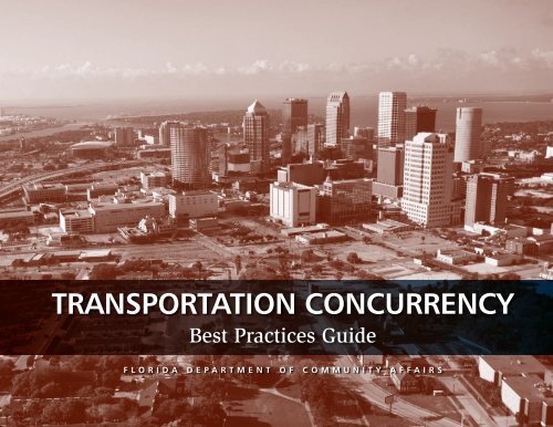
TRANSPORTATION CONCURRENCY<br />
<strong>Best</strong> <strong>Practices</strong> <strong>Guide</strong><br />
F l o r i d a D e p a r t m e n t o f C o m m u n i t y A f f a i r s
This guide was prepared by the <strong>Center</strong> <strong>for</strong> Urban <strong>Transportation</strong> Research<br />
at the University of South Florida. Funding <strong>for</strong> the guide was provided by<br />
the Florida Department of Community Affairs. The opinions, findings, and<br />
conclusions expressed in this publication are those of the authors and not<br />
necessarily those of the State of Florida Department of Community Affairs.<br />
Project contributors are as follows:<br />
Department of Community Affairs<br />
Thomas Pelham, Secretary<br />
Charles Gauthier, AICP, Director, Division of Community Planning<br />
Craig Diamond, Chief, State Planning<br />
The authors would like to extend special thanks to the<br />
Florida Department of Community Affairs and the Technical<br />
Team <strong>for</strong> their helpful comments and contributions<br />
toward the development of the guide. Special thanks also<br />
to Diane Quigley and the Florida Department of<br />
<strong>Transportation</strong> Level of Service Task Team <strong>for</strong> providing<br />
input on the technical memoranda that <strong>for</strong>med the basis<br />
<strong>for</strong> the guide.<br />
<strong>Center</strong> <strong>for</strong> Urban <strong>Transportation</strong> Research<br />
Karen Seggerman, AICP<br />
Kristine Williams, AICP<br />
Pei-Sung Lin, PhD, PE, PTOE<br />
Wendy Teague, Publication Design<br />
Kara Holland, Graphics Design<br />
Technical Team<br />
Timothy Allen, City of Tallahassee<br />
Pat Blackshear, Walton County<br />
David Hutchinson, Florida Department of <strong>Transportation</strong><br />
Onelia Lazzari, City of Gainesville<br />
David Loveland, Lee County Department of <strong>Transportation</strong><br />
Bill Oliver, Tindale-Oliver & Associates, Inc.<br />
Patricia Steed, Central Florida Regional Planning Council<br />
Brad Thoburn, City of Jacksonville<br />
Photography<br />
Florida Department of <strong>Transportation</strong>—pp. 5, 31, 32, 34, 41, 49<br />
Dan Burden, www.pedbikeimages.org—pp. 21, 45, 79<br />
This guide can be located on the Florida Department of<br />
Community Affairs website:<br />
www.dca.state.fl.us/fdcp/DCP/publications<br />
© September 2007
Table of Contents<br />
ABOUT THE GUIDE........................................................................ 3<br />
CHAPTER 1: INTRODUCTION......................................................... 5<br />
Florida’s <strong>Transportation</strong> <strong>Concurrency</strong> Requirements.................. 5<br />
Overview of a <strong>Transportation</strong> <strong>Concurrency</strong> Management .<br />
System...................................................................................... 9<br />
Issues in Current Practice......................................................... 10<br />
CHAPTER 2: PLANNING FOR CONCURRENCY............................. 13<br />
<strong>Concurrency</strong> and the Comprehensive Plan.............................. 13<br />
Establishing Level of Service Standards................................... 14<br />
Developing a <strong>Transportation</strong> <strong>Concurrency</strong> Management .<br />
System.................................................................................... 18<br />
. . Update Land Development Regulations............................. 18<br />
. . Develop <strong>Guide</strong>s and Brochures........................................... 18<br />
. . Incorporate Proportionate Fair Share................................. 20<br />
Applying <strong>Transportation</strong> <strong>Concurrency</strong> Alternatives.................. 21<br />
. . <strong>Transportation</strong> <strong>Concurrency</strong> Exception Areas..................... 21<br />
. . <strong>Transportation</strong> <strong>Concurrency</strong> Management Areas................ 24<br />
Multimodal <strong>Transportation</strong> Districts................................... 26<br />
Long Term <strong>Concurrency</strong> Management Systems.................. 27<br />
CHAPTER 3: IMPLEMENTING CONCURRENCY............................ 31<br />
Development Review and Administration................................ 31<br />
. . Administrative Review Fees................................................ 32<br />
. . In<strong>for</strong>mal and Formal Determinations.................................. 33<br />
Duration of Reservation..................................................... 33<br />
Tracking Systems <strong>for</strong> Monitoring <strong>Concurrency</strong>........................ 35<br />
Maintaining and Updating Traffic Data................................... 40<br />
. . Making “New” Capacity Available...................................... 42<br />
Thresholds and <strong>Guide</strong>lines <strong>for</strong> Impact Assessment.................. 43<br />
Monitoring De Minimis Trips................................................... 44<br />
. . Report Content and Format................................................ 45<br />
CHAPTER 4: TRANSPORTATION IMPACT ASSESSMENT.............. 49<br />
Levels of Analysis..................................................................... 49<br />
Trip Generation....................................................................... 50<br />
Trip Distribution and Assignment............................................ 52<br />
Defining Traffic Impact Area.................................................... 53<br />
Analyzing Level of Service....................................................... 62<br />
Addressing Multimodal Needs................................................ 63<br />
Mitigation and Proportionate Fair Share................................. 64<br />
. . Mitigation <strong>for</strong> <strong>Concurrency</strong> Alternatives............................. 65<br />
Attachment: Sample Application............................................. 68<br />
CHAPTER 5: MULTI-JURISDICTIONAL COORDINATION............... 73<br />
Statutory Requirements........................................................... 74<br />
Current State of the Practice................................................... 76<br />
Establishing Compatible Level of Service Standards................ 78<br />
Multi-Jurisdictional Coordination Process................................ 80<br />
. . Dispute Resolution............................................................. 81<br />
Attachment 1: Sample Multi-Jurisdictional Impact .<br />
Assessment Methodology....................................................... 82<br />
Attachment 2: Model Interlocal Coordination Agreement.<br />
<strong>for</strong> <strong>Concurrency</strong> Management................................................. 87<br />
Attachment 3: Model Interlocal Agreement .<br />
<strong>for</strong> Development of Regional Impact Exemptions.................... 89<br />
Attachment 4: Sample Application <strong>for</strong> Evaluating and .<br />
Mitigating Cross Jurisdictional Impacts................................... 91<br />
ADDITIONAL RESOURCES........................................................... 97<br />
APPENDIX: EVALUATING THE IMPACTS OF<br />
COMPREHENSIVE PLAN AMENDMENTS..................................... 99
Figures and Tables<br />
LIST OF FIGURES<br />
Figure 1 <strong>Transportation</strong> <strong>Concurrency</strong> Management .<br />
Flow Chart.................................................................. 8<br />
Figure 2 Level of Service (LOS) Standards.................................. 9<br />
Figure 3 Determining Available Capacity................................ 10<br />
Figure 4 State Highway System Demand Outpaces Supply..... 12<br />
Figure 5 Example of a Spreadsheet Tracking System............... 36<br />
Figure 6 Thresholds of <strong>Transportation</strong> Impact......................... 43<br />
Figure 7 Trip Distribution ....................................................... 52<br />
Figure 8 Rural and Urban Depiction <strong>for</strong> Approach 1............... 54<br />
Figure 9 Rural and Urban Depiction <strong>for</strong> Approach 2............... 55<br />
Figure 10 Rural and Urban Depiction <strong>for</strong> Approach 3............... 56<br />
Figure 11 Rural and Urban Depiction <strong>for</strong> Approach 4............... 57<br />
Figure 12 Rural and Urban Depiction <strong>for</strong> Approach 5............... 58<br />
Figure 13 Rural and Urban Depiction <strong>for</strong> Approach 6............... 59<br />
Figure 14 Determining Traffic Impact Areas.............................. 70<br />
Figure 15 Development of Regional Impact Exemption............ 75<br />
Figure 16 Adopted Roadway Level of Service in Two .<br />
Hypothetical Jurisdictions......................................... 91<br />
Figure 17 Traffic Impact Area and Improvement Required .<br />
<strong>for</strong> Meeting <strong>Transportation</strong> <strong>Concurrency</strong> in a .<br />
Hypothetical Example............................................... 92<br />
Figure 18 Maximum Service Volumes <strong>for</strong> State Arterials .<br />
in Hypothetical Example............................................ 93<br />
Figure 19 Trip Distributions and Background Volumes on .<br />
Hypothetical Segments Requiring Improvements...... 95<br />
LIST OF TABLES<br />
Table 1 Florida Statewide Minimum Level of Service .<br />
Standards.................................................................. 15<br />
Table 2 Fixed Route Transit System with Two .<br />
Per<strong>for</strong>mance Measures.............................................. 17<br />
Table 3 Quality of Service Framework <strong>for</strong> a .<br />
Demand Responsive System...................................... 17<br />
Table 4 Trip Generation and Standards, .<br />
City of Gainesville, FL................................................ 23<br />
Table 5 Selected Transit-Oriented Level of Service .<br />
Standards, Broward County, FL................................. 29<br />
Table 6<br />
Peak Hour Two Way Maximum Service Volumes.<br />
Broward County, FL................................................... 29<br />
Table 7 <strong>Concurrency</strong> Management System Spreadsheet .<br />
Column Headers....................................................... 37<br />
Table 8 De Minimis Trip Report Column Headers................... 46<br />
Table 9 Typical Peak Hour Traffic Flow................................... 51<br />
Table 10 Pros and Cons of Impact Area Approaches............... 60<br />
Table 11 Components Required Per Peak Hour Trips................ 64<br />
Table 12 Determination of Traffic Impact Area........................ 71<br />
Table 13 Non-Auto Impact Area.............................................. 85<br />
Table 14 Two-Way Analysis of Segments................................. 96<br />
Table 15 Development of Regional Impact Exemption .<br />
Proportionate Fair Share........................................... 96<br />
Table 16<br />
Table 17<br />
Palm Beach County Traffic Impact Area Criteria.<br />
(Comprehensive Plan Amendments)....................... 103<br />
Non-Auto Impact Area.<br />
(Comprehensive Plan Amendments)....................... 108
About the <strong>Guide</strong><br />
This guide presents practical guidance<br />
<strong>for</strong> local transportation concurrency management<br />
systems based on a sampling<br />
of current and best practices. As such, it<br />
is an important first step toward greater<br />
understanding of how to implement transportation<br />
concurrency. However, further<br />
research is needed to advance the state of<br />
the practice, including more detailed study<br />
of the evolution of concurrency management<br />
systems and how best to accomplish<br />
concurrency as a local government transitions<br />
from simple to more complex systems<br />
and multimodal options.<br />
The guide also provides technical assistance<br />
on strategies <strong>for</strong> addressing the changes<br />
to Florida’s concurrency requirements<br />
made during the 2005 and 2007 legislative<br />
sessions. These changes include Florida<br />
Statutes Sections 163.3180(5) regarding<br />
transportation concurrency exception areas,<br />
163.3180(6) regarding de minimis transportation<br />
impacts, 163.3180(10) regarding compatibility<br />
of level of service standards and<br />
coordination of methodologies, 380.06(24)<br />
regarding statutory exemptions from DRI<br />
requirements, and 163.3180(16) regarding<br />
transportation proportionate fair share.<br />
The guide will also assist local governments<br />
in the evaluation and appraisal of local<br />
comprehensive plans. In particular, Section<br />
163.3191(2)(p) requires “an assessment of<br />
the extent to which changes are needed to<br />
develop a common methodology <strong>for</strong> measuring<br />
impacts on transportation facilities<br />
<strong>for</strong> the purpose of implementing [the local<br />
government’s] concurrency management<br />
system in coordination with the municipalities<br />
and counties.” Guidance on evaluating<br />
the transportation impacts of comprehensive<br />
plan amendments is provided in the<br />
Appendix.<br />
The guide begins in Chapter 1 with an<br />
overview of concurrency management in<br />
Florida and issues in current practice. Chapter<br />
2 addresses the planning process <strong>for</strong><br />
concurrency and considerations <strong>for</strong> establishing<br />
level of service standards, applying<br />
concurrency alternatives, and developing a<br />
concurrency management system. Chapter<br />
3 includes a detailed look at the process<br />
<strong>for</strong> implementing transportation concurrency<br />
and the mechanics of a concurrency<br />
tracking system. Chapter 4 discusses<br />
transportation impact assessment, including<br />
the implications of various ways of measuring<br />
“impact area” and a suggested traffic<br />
impact assessment methodology <strong>for</strong> concurrency.<br />
The chapter concludes with a sample<br />
application of the methods presented.<br />
Recognizing that transportation concurrency<br />
is best accomplished through coordination,<br />
Chapter 5 provides strategies <strong>for</strong><br />
improved multi-jurisdictional coordination<br />
in establishing level of service standards<br />
and managing concurrency. The chapter<br />
also provides guidance on how to address<br />
the statutory exemptions from DRI requirements<br />
allowed under s. 380.06(24), Florida<br />
Statutes. The chapter concludes with a<br />
series of attachments providing guidance on<br />
implementing transportation concurrency in<br />
a multi-jurisdictional context. These include<br />
a sample methodology <strong>for</strong> evaluating and<br />
mitigating cross jurisdictional impacts, an<br />
example application illustrating the concepts<br />
discussed in the guide, and two model<br />
interlocal agreements <strong>for</strong> coordination in<br />
concurrency management.<br />
Although it addresses multi-jurisdictional<br />
coordination, the sample methodology in<br />
Attachment 1 can also serve as a guide <strong>for</strong><br />
any local government wishing to update<br />
its own concurrency management methods<br />
and procedures. A sample concurrency<br />
management spreadsheet to complement<br />
the guide is available on the Florida Department<br />
of Community Affairs website at<br />
www.dca.state.fl.us.
Chapter 1 | introduction<br />
Introduction<br />
<strong>Transportation</strong> concurrency is a growth management strategy aimed at ensuring that transportation<br />
facilities and services are available “concurrent” with the impacts of development. To carry<br />
out concurrency, local governments must define what constitutes an adequate level of service<br />
<strong>for</strong> the transportation system and measure whether the service needs of a new development exceed<br />
existing capacity and scheduled improvements <strong>for</strong> that period. If adequate capacity is not available,<br />
then the developer must provide the necessary improvements, provide a monetary contribution<br />
toward the improvements, or wait until government provides the necessary improvements.<br />
These general concepts are further defined through the rules and requirements of Florida’s<br />
growth management statutes and administrative rules.<br />
FLORIDA’S TRANSPORTATION CONCURRENCY REQUIREMENTS<br />
<strong>Concurrency</strong> in Florida is tied to provisions in the state growth management<br />
act (Chapter 163, Florida Statutes), requiring the adoption of level of<br />
service (LOS) standards, elimination of existing service deficiencies, and<br />
provision of infrastructure to accommodate new growth reflected in<br />
the comprehensive plan. Plans and development regulations must<br />
aim at achieving and maintaining the desired level of service,<br />
and comprehensive plans are reviewed by the State<br />
<strong>for</strong> consistency between the capital improvement<br />
element and the various elements of the plan,<br />
including the future land use element.<br />
Rule 9J-5.0055(3), Florida Adminstrative<br />
Code, sets <strong>for</strong>th the minimum requirements<br />
<strong>for</strong> satisfying concurrency.<br />
It also requires local governments to<br />
develop and implement a concurrency<br />
management system.
TRANSPORTATION CONCURRENCY <strong>Best</strong> <strong>Practices</strong> <strong>Guide</strong><br />
In addition to capacity that is available or<br />
provided through agreements, Rule 9J-<br />
5.0055(3), Florida Adminstrative Code,<br />
allows local governments to evaluate<br />
transportation concurrency against planned<br />
capacity in a five-year capital improvements<br />
schedule. That schedule must also reflect the<br />
metropolitan planning organization transportation<br />
improvement program in urbanized<br />
areas, per s. 163.3177(3)(a), Florida Statutes.<br />
The community must demonstrate that the<br />
necessary facilities will be available and<br />
adequate to address the impacts of the development<br />
within three years of issuing the<br />
building permit or its functional equivalent.<br />
The schedule must include the estimated<br />
date of commencement and completion of<br />
the project and this timeline may not be<br />
eliminated or delayed without a plan amendment<br />
approved by the Florida Department of<br />
Community Affairs (DCA). Changes to the<br />
schedule may be made outside of the regular<br />
comprehensive plan amendment cycle.<br />
<br />
A “pay and go” option <strong>for</strong> concurrency,<br />
known as proportionate fair share mitigation,<br />
was added to Florida’s growth management<br />
legislation in 2005. The proportionate<br />
fair share option allows developments to<br />
proceed under certain conditions, notwithstanding<br />
a failure to meet transportation<br />
concurrency, where applicants contribute<br />
their fair share of the cost of improving the<br />
transportation facility. Among the conditions<br />
was a requirement that any improvement be<br />
financially feasible at least within a 10 year<br />
period and be in or added to the local 5 year<br />
schedule of capital improvements. Developers<br />
are eligible <strong>for</strong> impact fee credits <strong>for</strong><br />
their contribution “to the extent that all or a<br />
portion of the proportionate fair share mitigation<br />
is used to address the same capital<br />
infrastructure improvements contemplated<br />
by the local impact fee ordinance.”<br />
Exceptions from concurrency are provided<br />
under certain circumstances. Public transportation<br />
facilities, certain infill or redevelopment<br />
projects, and projects whose impacts<br />
may be considered insignificant or de minimis<br />
are exempted from concurrency, where<br />
certain criteria are met.<br />
In 2007, the Florida legislature further modified<br />
concurrency requirements, in part to<br />
address issues arising from the 2005 legislation.<br />
Key changes included:<br />
• Proportionate share mitigation “shall<br />
be limited to ensure that a development<br />
meeting the requirements of this section<br />
mitigates its impact on the transportation<br />
system but is not responsible <strong>for</strong><br />
the additional cost of reducing or eliminating<br />
backlogs.”<br />
• Proportionate fair share mitigation “may<br />
be directed toward one or more specific<br />
transportation improvements reasonably<br />
related to the mobility demands created<br />
by the development and such improvements<br />
may address one or more modes<br />
of travel.” This concept is commonly<br />
referred to as “pipelining.”<br />
• A new option called <strong>Transportation</strong><br />
<strong>Concurrency</strong> Backlog Authorities was<br />
established.<br />
• Airports and af<strong>for</strong>dable housing in<br />
proximity to employment centers, (s.<br />
163.3180a (17), Florida Statutes), were<br />
exempted from transportation concurrency.<br />
• Any development of regional impact<br />
(DRI) may satisfy transportation concurrency<br />
through a proportionate fair<br />
share contribution, provided the location<br />
and mix of uses would help encourage<br />
alternative modes of travel, the applicant<br />
pays <strong>for</strong> one or more mobility improvements<br />
that benefit a regionally significant<br />
transportation facility, and meets<br />
other statutory conditions.<br />
• The DCA must be consulted, in addition<br />
to Florida Department of <strong>Transportation</strong>,<br />
prior to local designation of a<br />
transportation concurrency exception<br />
area to determine whether it would<br />
impact level of service on the Strategic<br />
Intermodal System and if so to develop<br />
a mitigation plan.<br />
• Provides <strong>for</strong> additional urban areas to<br />
qualify as transportation concurrency<br />
exception areas, provided the area is<br />
appropriate <strong>for</strong> compact contiguous<br />
urban development, must not exceed<br />
the amount of land needed to accommodate<br />
the project population growth<br />
at densities consistent with the adopted<br />
comprehensive plan within the 10-year<br />
planning period, and must be served or<br />
planned to be served with public facilities<br />
and services as provided by the<br />
capital improvement element.
INTRODUCTION<br />
<strong>Transportation</strong> <strong>Concurrency</strong> Backlog Authorities<br />
Florida’s 2007 growth management legislation created a new<br />
concept called transportation concurrency backlog authorities.<br />
Under the legislation, a county or municipality may create<br />
a transportation concurrency backlog authority to plan and<br />
finance improvements to a transportation facility with an identified<br />
concurrency backlog. A backlog is defined as an identified<br />
deficiency where existing traffic volume exceeds the adopted<br />
level of service standard <strong>for</strong> the facility. Backlog authorities may:<br />
• execute contracts and other instruments;<br />
• carry out transportation projects, including roadways,<br />
sidewalks, bikeways, and mass transit;<br />
• borrow money, accept contributions or grants, and<br />
otherwise finance transportation improvements;<br />
• invest reserve funds;<br />
• prepare or contract with a consultant to prepare a<br />
transportation concurrency backlog plan; and<br />
• appropriate funds, make expenditures, and enter agreements<br />
with other public bodies to carry out these functions.<br />
Within six months after its creation, each backlog authority<br />
must adopt a transportation concurrency backlog plan as a part<br />
of the local government comprehensive plan. Adoption of the<br />
transportation concurrency backlog plan is exempt from state<br />
requirements governing comprehensive plan amendments (s.<br />
163.3187(1), Florida Statutes). The plan must:<br />
• identify all transportation facilities that have been designated<br />
as deficient and require the expenditure of moneys to<br />
upgrade, modify, or mitigate the deficiency;<br />
• include a priority listing of all transportation facilities that<br />
have been designated as deficient and do not satisfy concurrency<br />
requirements pursuant to s. 163.3180, Florida Statutes,<br />
and the applicable local government comprehensive plan;<br />
and,<br />
• establish a schedule <strong>for</strong> financing and construction of transportation<br />
concurrency backlog projects that will eliminate<br />
transportation concurrency backlogs within the jurisdiction<br />
of the authority within 10 years after the transportation<br />
concurrency backlog plan adoption. The schedule must be<br />
adopted as part of the local government comprehensive plan.<br />
The legislation also directs backlog authorities to establish and<br />
administer a local transportation concurrency backlog trust fund.<br />
The trust fund is to be funded by proceeds of an ad valorem tax<br />
increment collected within each backlog area. The tax increment<br />
is determined annually and must be 25 percent of the difference<br />
between (a) the amount of tax levied each year by each taxing<br />
authority on taxable real property within the defined backlog<br />
area and (b) the amount of taxes that would have been produced<br />
by the rate levied each year on the total of the assessed value of<br />
the taxable real property within the transportation concurrency<br />
backlog area.<br />
Certain public bodies or taxing authorities, such as metropolitan<br />
transportation authorities, community redevelopment areas, water<br />
management districts, and neighborhood improvement districts,<br />
may be exempted from participation in the backlog authority.<br />
Upon adoption of the transportation concurrency backlog plan,<br />
all backlogs within the jurisdiction are deemed financially feasible<br />
<strong>for</strong> purposes of calculating transportation concurrency. The<br />
authority is dissolved upon completion of all backlogs.
TRANSPORTATION CONCURRENCY <strong>Best</strong> <strong>Practices</strong> <strong>Guide</strong><br />
2<br />
Planned<br />
Improvements<br />
Establish LOS Standards<br />
Service Capacity<br />
Intensity & Density<br />
of Development<br />
and Land Use<br />
Existing Traffic<br />
+ Growth<br />
+ Approved Trips<br />
Available Capacity<br />
De Minimis &<br />
Existing Volume < 110%<br />
Service Volume<br />
no<br />
Trip Rate<br />
yes<br />
1<br />
Traffic<br />
Impact Area<br />
Trip<br />
Distribution<br />
CMS Network<br />
Application <strong>for</strong><br />
<strong>Concurrency</strong><br />
Impacts of Development<br />
Capacity<br />
Exceeded?<br />
yes<br />
Operational Analysis<br />
1<br />
no<br />
Certificate of<br />
<strong>Concurrency</strong><br />
yes<br />
New Capacity<br />
Accomodate Trips?<br />
yes<br />
no<br />
Add Approval Trips<br />
to Road Segments<br />
Mitigation?<br />
yes<br />
2<br />
Local Government Process<br />
Applicant Process<br />
no<br />
Application Denied or Withdrawn<br />
Figure 1: <strong>Transportation</strong> <strong>Concurrency</strong> Management Flow Chart
INTRODUCTION<br />
OVERVIEW OF A<br />
TRANSPORTATION CONCURRENCY<br />
MANAGEMENT SYSTEM<br />
<strong>Transportation</strong> concurrency is administered<br />
through the establishment and maintenance<br />
of a concurrency management system or<br />
CMS. A CMS generally includes a concurrency<br />
tracking system and a transportation<br />
concurrency application and review<br />
process. The flow chart in Figure 1 is an<br />
overview of a typical concurrency management<br />
system and process. The left side of<br />
the flow chart illustrates the local government’s<br />
role, and the right side illustrates the<br />
application process.<br />
The process begins when a local government<br />
identifies what transportation facilities will<br />
be part of the regulated concurrency management<br />
system (CMS) network and then<br />
establishes level of service (LOS) standards<br />
<strong>for</strong> those facilities. LOS standards are a type<br />
of grading system that attempts to define<br />
user perceptions of travel conditions on a<br />
transportation facility. They may range from<br />
LOS A (least congested) to LOS F (most<br />
congested) (Figure 2). LOS standards may<br />
also be established <strong>for</strong> transit, bicycle and<br />
pedestrian facilities or services. These standards<br />
address the quality of service and are<br />
discussed further in Chapter 2.<br />
The next step involves developing service<br />
volumes <strong>for</strong> each transportation facility in<br />
the CMS network. Service volumes reflect<br />
the maximum capacity of that facility at the<br />
adopted level of service standard and may<br />
include new capacity from planned improvements<br />
in the five year capital improvement<br />
schedule. Available capacity can then be<br />
determined by subtracting existing traffic<br />
volume, traffic growth, and approved development<br />
trips from the service volume of that<br />
facility (Figure 3).<br />
During the development approval process,<br />
applicants must undergo a transportation<br />
concurrency review. The review determines<br />
if each impacted transportation facility<br />
has adequate capacity available to accommodate<br />
the traffic impacts of the proposed<br />
development. This is determined by adding<br />
estimated trips from the new development<br />
and any trips from previously approved<br />
developments to the existing traffic volume<br />
and then comparing that number to the<br />
service volume of the facility.<br />
In some cases, the local government determines<br />
the development’s impact, thereby<br />
ensuring consistency and adherence to local<br />
guidelines. In most cases, however, the<br />
impact of a proposed development is determined<br />
by the applicant and subject to local<br />
government review. Using the proposed land<br />
use, including the density and intensity of<br />
development, the applicant first determines<br />
if the proposed development trips are considered<br />
de minimis (i.e., having only minor<br />
impact) as defined in Florida law and local<br />
government regulations. If the trips qualify<br />
<strong>for</strong> a de minimis exception, then the application<br />
is processed and receives a certificate<br />
of concurrency. If not, the applicant deter-<br />
LOS A<br />
LOS B<br />
LOS C<br />
LOS D<br />
LOS E<br />
LOS F<br />
Figure 2: Level of Service (LOS) Standards
TRANSPORTATION CONCURRENCY <strong>Best</strong> <strong>Practices</strong> <strong>Guide</strong><br />
mines the impact of the development using<br />
the local government’s methodology <strong>for</strong> trip<br />
generation, defining the traffic impact area,<br />
and trip distribution.<br />
Available<br />
Capacity<br />
Maximum Service Volume<br />
Approved Development Trips<br />
Growth of Traffic Volume<br />
Existing Traffic Volume<br />
Figure 3: Determining Available Capacity<br />
cient road link in accordance with the local<br />
government’s traffic impact methodology.<br />
If the operational analysis concludes that<br />
the facility will operate at or above the<br />
adopted LOS with the proposed development<br />
trips, a certificate of concurrency may<br />
be issued. If not, the applicant may reduce<br />
the size of the development project such<br />
that the LOS standard is achieved, or the<br />
local government and the applicant may<br />
reach an agreement on improvements to<br />
mitigate the impact of the development<br />
trips. In this case a certificate of concurrency<br />
may be issued, pursuant to a binding<br />
development agreement or proportionate<br />
fair share agreement. If adequate capacity<br />
is not available and no improvements<br />
are scheduled, and no agreement can be<br />
reached on mitigation of the impact, the<br />
application <strong>for</strong> transportation concurrency<br />
would be denied. An applicant may also<br />
choose to withdraw the application.<br />
ISSUES IN CURRENT PRACTICE<br />
A variety of issues have surrounded the<br />
implementation of transportation concurrency<br />
in Florida. Key among these concerns<br />
is that many local governments have<br />
not adopted adequate policies regarding<br />
concurrency management, have not implemented<br />
a concurrency management system<br />
(CMS), or, as part of the CMS, have no<br />
systematic method <strong>for</strong> managing transportation<br />
concurrency. Attempting to implement<br />
Next, the resulting impact of development<br />
trips on facilities in the concurrency network<br />
is compared to the available capacity.<br />
If all impacted facilities have adequate<br />
capacity, then a certificate of concurrency<br />
may be issued. If there is not adequate<br />
capacity on one or more of the concurrency<br />
facilities, the applicant may be required to<br />
per<strong>for</strong>m an operational analysis on the deficoncurrency<br />
through general policies and<br />
case-by-case decisions has led to less than<br />
effective results. In addition, a transportation<br />
concurrency management system is<br />
a necessary precondition to administering<br />
proportionate fair share programs.<br />
In A Review of Local Government <strong>Concurrency</strong><br />
<strong>Practices</strong> in Florida (Chapin 2005),<br />
Timothy Chapin analyzed the methods used<br />
by local governments to implement concurrency.<br />
Chapin noted significant variations<br />
in the concurrency policies and practices<br />
established by local governments on level<br />
of service (LOS) standards and timelines <strong>for</strong><br />
providing facilities. The majority of local<br />
governments studied set LOS standards<br />
of “D” or below <strong>for</strong> interstates and major<br />
arterials in their jurisdiction. Many jurisdictions<br />
allowed the LOS standards <strong>for</strong> a<br />
road to vary by segment and time of day.<br />
Variations also existed based on road type,<br />
with at-grade arterials being assigned lower<br />
standards than limited access facilities.<br />
Chapin also noted that unlike LOS standards,<br />
few variations existed <strong>for</strong> timelines<br />
to provide transportation facilities. Generally,<br />
jurisdictions allowed the maximum<br />
time allotted by state standards to provide<br />
transportation facilities (three years). Most<br />
required road improvements to begin one to<br />
three years after construction of the development.<br />
Chapin speculates that concurrency<br />
system variations cause developer<br />
frustration, as they face different processes<br />
in each jurisdiction. In addition, Chapin<br />
believes that residents across the state<br />
10
INTRODUCTION<br />
receive “different service levels <strong>for</strong> key<br />
infrastructure systems and urban services.”<br />
These weaknesses in local concurrency<br />
management practices have become even<br />
more problematic with the added emphasis<br />
on concurrency and financially feasible<br />
plans in Florida’s 2005 growth management<br />
legislation. Many local governments<br />
have neither the staff expertise nor the<br />
funds to retain a consultant to establish<br />
and maintain a transportation concurrency<br />
management system or to review complicated<br />
traffic impact analyses <strong>for</strong> large-scale<br />
developments. As a result, many local governments<br />
are seeking technical assistance in<br />
developing or refining their transportation<br />
concurrency management systems.<br />
Local governments are also in need of better<br />
guidance on evaluating the transportation<br />
impacts of proposed amendments to their<br />
future land use plan—an advance planning<br />
activity that can make or break the concurrency<br />
management ef<strong>for</strong>t. Although Chapter<br />
163, F.S. requires local governments to demonstrate<br />
that transportation capacity will be<br />
available to support the impacts of development<br />
authorized by proposed amendments<br />
to their future land use map, limited guidance<br />
is available regarding the type of data<br />
or analysis methods necessary to demonstrate<br />
compliance with these requirements.<br />
In the absence of specific requirements or<br />
guidelines, the transportation impacts of<br />
comprehensive plan amendments may not<br />
be adequately evaluated. Typical problems<br />
have included inconsistent use of data<br />
and methodologies that do not reflect best<br />
practices or that underestimate impacts,<br />
and failure to consider the cumulative<br />
impacts of a series of concurrent land use<br />
plan amendments on the transportation<br />
system. It is not uncommon <strong>for</strong> a local government<br />
to submit several comprehensive<br />
plan amendments <strong>for</strong> compliance review<br />
in a given comprehensive planning cycle.<br />
Yet these comprehensive plan amendments<br />
tend to be evaluated individually, with<br />
transportation impact studies typically prepared<br />
separately <strong>for</strong> each land use change.<br />
As a result, the overall transportation<br />
impacts of proposed land use changes are<br />
often poorly understood. The need <strong>for</strong><br />
guidance on this issue is imperative in light<br />
of the strong emphasis in Florida’s growth<br />
management legislation on ensuring that<br />
planned future growth is financially feasible<br />
and can reasonably be accommodated by the<br />
existing and planned transportation system.<br />
Finally, the conventional approach to<br />
evaluating concurrency has raised a variety<br />
of issues and concerns. Issues related to<br />
transportation concurrency management in<br />
Florida include:<br />
• The administration of concurrency on<br />
a link-by-link basis encourages incremental<br />
planning and moves agencies<br />
away from comprehensive solutions<br />
that focus on efficient operation of the<br />
overall transportation system.<br />
• The application of traditional level of<br />
service analysis (volume to capacity<br />
ratios) results in an emphasis on road<br />
widening solutions to maintain roadway<br />
capacity and detracts from transit or<br />
multimodal solutions.<br />
• The ability of local governments to<br />
develop financially feasible capital<br />
improvement plans has been limited<br />
by the backlog of roadway projects at<br />
the state and local level, resistance to<br />
11
TRANSPORTATION CONCURRENCY <strong>Best</strong> <strong>Practices</strong> <strong>Guide</strong><br />
taxation, diminishing state funding, and<br />
the need <strong>for</strong> new revenue sources <strong>for</strong><br />
transportation.<br />
“We recognize the competition <strong>for</strong><br />
limited financial resources and the<br />
reluctance to raise taxes or to include<br />
development contributions. However,<br />
as a community we can pay the piper<br />
now or later, and we can pay in dollars<br />
or in a reduced quality of life.”<br />
—Mayor’s Growth Management Task<br />
Force Jacksonville,1997<br />
• The systems <strong>for</strong> managing concurrency<br />
allow developers to reserve existing<br />
capacity and require no developer<br />
contribution <strong>for</strong> that capacity. Those<br />
that ultimately trigger a “concurrency<br />
deficiency” must then bear the burden<br />
of improvements necessitated in part<br />
by “free riders.” This issue of the “last<br />
guy in pays,” combined with continuing<br />
improvement backlogs and inadequate<br />
state and local funding, have<br />
raised fairness and equity concerns and<br />
arguments that current developers not<br />
be held responsible <strong>for</strong> the “sins of the<br />
past,” including the lack of capacity<br />
resulting from earlier development.<br />
• Local governments have considerable<br />
flexibility in what level of service (LOS)<br />
standard they choose to apply and<br />
how they administer certain exceptions.<br />
If a community sets a low LOS<br />
standard to avoid improving a facility<br />
or does not adequately maintain the<br />
required thresholds <strong>for</strong> redevelopment<br />
or de minimis exceptions, then the<br />
concurrency management system will<br />
be largely ineffective in accomplishing<br />
adequate public facilities.<br />
Florida is also in need of more effective<br />
transportation concurrency alternatives <strong>for</strong><br />
major urban areas. Local governments are<br />
increasingly establishing large transportation<br />
concurrency exception areas to reduce<br />
barriers to infill and redevelopment, and<br />
promote alternative modes of transportation.<br />
However, the required improvement<br />
plans, funding mechanisms, and systems<br />
management strategies to offset transportation<br />
impacts are not always developed or<br />
Lane Miles (Supply) in thousands<br />
350<br />
300<br />
250<br />
200<br />
150<br />
100<br />
50<br />
0<br />
1986<br />
1988<br />
1990<br />
1992<br />
Lane Miles<br />
1994<br />
sufficient to meet transportation needs in<br />
the exception areas.<br />
Overall, these issues reflect a broader problem—many<br />
local governments in Florida<br />
have not adequately planned <strong>for</strong> or funded<br />
their transportation infrastructure needs.<br />
And despite continuing issues surrounding<br />
transportation concurrency, it remains<br />
a worthwhile growth management activity.<br />
<strong>Transportation</strong> concurrency programs<br />
help local governments make better, more<br />
in<strong>for</strong>med decisions about whether their<br />
transportation system can accommodate<br />
proposed development. The result is better<br />
comprehensive planning and more proactive<br />
attention to local and regional transportation<br />
needs.<br />
1996<br />
1998<br />
2000<br />
2002<br />
Demand<br />
2004<br />
350<br />
300<br />
250<br />
200<br />
150<br />
100<br />
Source: Florida <strong>Transportation</strong> Commission, 15th Annual Per<strong>for</strong>mance and<br />
Production Review of the Department of <strong>Transportation</strong>, Fiscal Year 2005/06.<br />
* DVMT=Daily Vehicle Miles Travelled<br />
Figure 4: State Highway System Demand Outpaces Supply<br />
50<br />
0<br />
DVMT* (Demand) in millions<br />
12
Chapter 2 | planning <strong>for</strong> INTRODUCTION<br />
concurrency<br />
Planning <strong>for</strong> <strong>Concurrency</strong><br />
Although the concept of transportation concurrency is relatively straight<strong>for</strong>ward, applying it well requires<br />
extensive planning. This chapter addresses the basic planning considerations in developing a concurrency<br />
management process <strong>for</strong> transportation. It begins with steps <strong>for</strong> including level of service standards and a<br />
concurrency management system (CMS) within the local comprehensive plan and land development regulations.<br />
Additional guidance is provided <strong>for</strong> related documents and the inclusion of proportionate fair share mitigation<br />
within the system. Local governments may choose to implement their own concurrency management system;<br />
however smaller local governments may consider a joint system. For example, a county may maintain a<br />
countywide CMS based on agreements with its municipalities.<br />
CONCURRENCY AND THE COMPREHENSIVE PLAN<br />
An effective transportation concurrency program begins with the local government comprehensive<br />
plan. Florida’s growth management requirements direct each local government to<br />
establish level of service standards <strong>for</strong> roads and (<strong>for</strong> larger local governments) public transit<br />
facilities within the local comprehensive plan, along with a concurrency management<br />
system to maintain the desired level of service.<br />
For concurrency to work properly, local governments should first consider<br />
the transportation needs implied by the future land use plan<br />
to ensure that local land use and transportation plans<br />
are coordinated. Future land use map amendments<br />
can have a substantial impact on the<br />
transportation system, ultimately affecting<br />
concurrency. There<strong>for</strong>e, it is important to<br />
measure the impacts of these amendments<br />
and determine if additional transportation<br />
improvements are needed. Guidance<br />
on evaluating the transportation impacts<br />
of proposed comprehensive plan amendments<br />
is provided in the Appendix.<br />
Local governments will also need to<br />
determine the financial feasibility of<br />
carrying out the capital improvements<br />
program and maintaining a desired<br />
13
TRANSPORTATION CONCURRENCY <strong>Best</strong> <strong>Practices</strong> <strong>Guide</strong><br />
level of service in view of competing<br />
resource demands. If the capital improvements<br />
element does not identify transportation<br />
improvements sufficient to handle<br />
the impacts of planned future growth, then<br />
concurrency will be virtually impossible<br />
to achieve. A guide <strong>for</strong> local governments<br />
entitled Preparing the Five-Year Schedule of<br />
Capital Improvements is available on the<br />
DCA website.<br />
Recognizing that transportation improvements<br />
need to be phased over time, concurrency<br />
also has a timing component.<br />
The capital improvements element should<br />
specify when, how and where improvements<br />
will be provided. The permitting<br />
of development should generally coincide<br />
with the timing of planned transportation<br />
improvements and service expansion. Without<br />
strategies <strong>for</strong> managing the rate, timing,<br />
and location of development, the concurrency<br />
technique could backfire and encourage<br />
urban sprawl.<br />
Roads, <strong>for</strong> example, typically have more<br />
capacity to accommodate new development<br />
as one moves away from the urban core.<br />
Phased development strategies, such as<br />
staged expansion of urban service areas and<br />
infill incentives, such as the concurrency<br />
alternatives discussed in this chapter, could<br />
be applied to encourage development on or<br />
adjacent to existing infrastructure. Development<br />
may then be phased outward from<br />
urban centers through a predetermined<br />
expansion plan to promote more compact<br />
growth patterns. Land use regulations could<br />
14<br />
rein<strong>for</strong>ce these strategies by restricting<br />
urban development outside the urban service<br />
area boundary and directing it in and<br />
around activity centers that can be more<br />
effectively served by roads and transit.<br />
ESTABLISHING LEVEL OF SERVICE<br />
STANDARDS<br />
PRACTICE TIP<br />
Clearly establish level of service<br />
standards <strong>for</strong> roadways on the<br />
Strategic Intermodal System (SIS),<br />
including SIS Connectors, roadways<br />
on the Florida Intrastate Highway<br />
System (FIHS), and roadway facilities<br />
funded through the <strong>Transportation</strong><br />
Regional Incentive Program (TRIP)<br />
based on Rule 14-94, F.A.C.<br />
The 2005 amendments to Florida’s growth<br />
management legislation changed the requirement<br />
<strong>for</strong> LOS standards on many state roads.<br />
Section 163.3180(10), Florida Statutes, now<br />
requires all local governments to adopt the<br />
level-of-service standard established by the<br />
Florida Department of <strong>Transportation</strong> on the<br />
Strategic Intermodal System (SIS), the Florida<br />
Intrastate Highway System (FIHS), and<br />
roadways funded under the <strong>Transportation</strong><br />
Regional Incentive Program (TRIP). Prior to<br />
these changes, local governments were only<br />
required to apply FDOT minimum acceptable<br />
LOS standards to FIHS facilities.<br />
Rule 14-94, Florida Administrative Code<br />
(F.A.C.) establishes LOS standards <strong>for</strong> state<br />
roads and has been modified to reflect<br />
the policy change and to reference the SIS<br />
and the TRIP. Table 1 shows the revised<br />
Statewide Minimum LOS Standards. To<br />
assure consistency with legislative and rule<br />
changes, it is a good idea <strong>for</strong> local governments<br />
to list and categorize roads by SIS<br />
(including SIS Connectors), FIHS, other<br />
state roads, and TRIP when establishing<br />
LOS standards. Below is model language<br />
that may be incorporated into the local<br />
comprehensive plan <strong>for</strong> generally establishing<br />
LOS standards <strong>for</strong> roads subject to<br />
Chapter 163, Florida Statutes, and subsequent<br />
revisions to Rule 14-94, F.A.C.:<br />
The level of service standard <strong>for</strong><br />
roadways on the Strategic Intermodal<br />
System (SIS), including SIS Connectors,<br />
roadways on the Florida Intrastate<br />
Highway System (FIHS), and roadway<br />
facilities per Chapter 163, Florida<br />
Statutes, funded in accordance with<br />
Section 339.2819 Florida Statutes,<br />
the <strong>Transportation</strong> Regional Incentive<br />
Program, shall be as set <strong>for</strong>th in Rule<br />
14-94, Florida Administrative Code, as<br />
amended and applied as follows:<br />
[list and categorize roads by SIS, FIHS,<br />
other state roads, and TRIP with the<br />
corresponding LOS standard]<br />
The Florida Statewide Minimum Level<br />
of Service Standards (Table 1) may be<br />
included in the comprehensive plan, as<br />
well. Note that Rule 14-94, F.A.C., as
Planning <strong>for</strong> concurrency<br />
amended in 2005, no longer contains<br />
definitions <strong>for</strong> backlogged or constrained<br />
facilities; however, such designations may<br />
be recognized through the State’s variance<br />
process. A variance to the State’s minimum<br />
level of service standards may be sought (at<br />
the FDOT District level) through the procedures<br />
outlined in Section 120.542, Florida<br />
Statutes, which require illustration of a<br />
hardship and a strategy <strong>for</strong> mitigation.<br />
PRACTICE TIP<br />
Adopt level of service standards <strong>for</strong><br />
other state and local transportation<br />
facilities that reflect the community’s<br />
vision <strong>for</strong> the future, tolerance<br />
<strong>for</strong> congestion, desire <strong>for</strong> growth,<br />
and ability to fund transportation<br />
improvements.<br />
Local governments may establish their own<br />
LOS standards <strong>for</strong> other state and local<br />
transportation facilities and services, including<br />
public transit, in their concurrency<br />
network. When establishing transportation<br />
LOS standards, the community sets its level<br />
of tolerance <strong>for</strong> congestion or the quality of<br />
service it is willing to accept, and its ability<br />
to fund transportation improvements. If a<br />
community sets a low LOS standard, such<br />
as LOS “E,” more capacity may be available<br />
<strong>for</strong> development, but a higher level of<br />
congestion or reduced quality of service will<br />
occur. Conversely, establishing a higher<br />
LOS standard such as LOS “C” may provide<br />
better mobility (or operating) conditions, but<br />
Rural Areas<br />
Transitioning Urbanized<br />
Areas, Urban Areas, or<br />
Communities<br />
Urbanized Areas Under<br />
500,000<br />
Urbanized Areas Over<br />
500,000<br />
Roadways Parallel to<br />
Exclusive Transit Facilities<br />
Inside TCMAs<br />
Inside TCEAs 2<br />
and MMTDs 2<br />
Table 1: Florida Statewide Minimum Level of Service Standards<br />
SIS AND FIHS FACILITIES<br />
Limited Access<br />
Highway 4 (Freeway)<br />
B<br />
C<br />
C(D)<br />
D(E)<br />
E<br />
D(E) 2<br />
Controlled Access<br />
Highway 4<br />
B 1 B C<br />
C C C<br />
C D D<br />
D D D<br />
E E E<br />
E 2 -- 2 -- 2<br />
-- 2 -- 2 -- 2<br />
TRIP FUNDED FACILITES<br />
AND OTHER STATE ROADS 3<br />
Other<br />
Multilane 4 Two-Lane 4<br />
Level of service standards inside of parentheses apply to general use lanes only when exclusive through lanes<br />
exist.<br />
1. For rural two-lane facilities, the standard is C.<br />
2. Means the Department must be consulted as provided by Section 163.3180(5), (7), or (15), Florida Statutes,<br />
regarding level of service standards set on SIS or TRIP facilities impacted by TCMAs, MMTDs, or TCEAs<br />
respectively.<br />
3. Means the level of service standards <strong>for</strong> non TRIP facilities may be set by local governments in accordance<br />
with Rule 9J-5.0055, F.A.C.<br />
4. It is recognized that certain roadways (i.e., constrained roadways) will not be expanded by the addition of<br />
through lanes <strong>for</strong> physical, environmental, or policy reasons. In such instances, a variance to the level of<br />
service may be sought pursuant to Section 120.542, Florida Statutes.<br />
NOTE: Level of service letter designations are defined in the Department’s 2002 Quality/Level of Service<br />
Handbook.<br />
Source: Rule 14-94, Florida Administrative Code, Statewide Minimum Level Of Service Standards For The State<br />
Highway System, Roadways On The Strategic Intermodal System (SIS), Roadways On The Florida Intrastate<br />
Highway System (FIHS) And Roadway Facilities Funded In Accordance With Section 339.2819, Florida Statutes,<br />
The <strong>Transportation</strong> Regional Incentive Program (TRIP)<br />
-- 2<br />
15
TRANSPORTATION CONCURRENCY <strong>Best</strong> <strong>Practices</strong> <strong>Guide</strong><br />
will minimize available capacity <strong>for</strong> new development and require<br />
increased revenues to maintain the higher standard. Local philosophy<br />
will, there<strong>for</strong>e, determine the appropriate LOS standard <strong>for</strong> the<br />
community.<br />
LOS “F” has sometimes been used to indicate a failed roadway;<br />
however, it is not found as a standard in the FDOT Generalized<br />
Tables. Instead, a level of service standard lower than LOS “E”<br />
should be indicated using the amount of degradation below LOS<br />
“E” that will be allowed, such as 110% of LOS “E.” This type<br />
of standard can only be adopted once, with new trips added in<br />
a cumulative fashion until the maximum service volume of the<br />
“revised” LOS standard is reached.<br />
When setting LOS standards <strong>for</strong> other state and local roadways,<br />
local governments may use a combination of functional classification<br />
and area type, such as urban service area and/or development<br />
area (e.g., urban, rural or transitioning). This approach<br />
provides flexibility to allow more development and congestion in<br />
urban areas where drivers expect it and to restrict development<br />
in outlying areas. There<strong>for</strong>e, it is in keeping with the basic intent<br />
of concurrency—to accommodate development in areas with<br />
adequate infrastructure and services and to discourage premature<br />
conversion of rural land <strong>for</strong> urban use.<br />
For example, Tallahassee/Leon County uses a combination of<br />
urban service area and functional classification (arterial, collector,<br />
local), as shown in the inset. Although Tallahassee/Leon County<br />
also applies LOS standards to local streets, it is not common practice.<br />
Typically only arterial and collector roadways are included<br />
in a concurrency network. St. Johns County uses the following<br />
simple approach <strong>for</strong> applying LOS standards to roads based on the<br />
surrounding development area:<br />
• Rural Area:<br />
• Transitioning Urbanized Area,<br />
Urban Area, or Community:<br />
• Urbanized Area:<br />
C<br />
D<br />
D<br />
Tallahassee/Leon County<br />
Level of service Standards<br />
“The peak hour roadway level of service <strong>for</strong> Tallahassee<br />
and Leon County is established as follows:<br />
• Outside the Urban Service Area:<br />
Interstate, Limited Access Parkways: B.<br />
Principal Arterials: C. .<br />
Minor Arterials: C.<br />
Major and Minor Collectors: C.<br />
Local Streets:<br />
D<br />
• Inside the Urban Service Area:<br />
Interstate, Limited Access Parkways: C.<br />
Principal Arterials:<br />
D**.<br />
Except Capital Circle NW from I-10 to SR 20 .<br />
Capital Circle NW from I-10 to SR 20: E.<br />
Minor Arterials:<br />
D / E*.<br />
Major and Minor Collectors:<br />
D / E*.<br />
Local Streets:<br />
D<br />
* For Minor Arterials, and Major and Minor Collectors<br />
located inside the Urban Service Area and south of<br />
U.S. 90, the Level of Service shall be “D” <strong>for</strong> purposes<br />
of establishing priorities <strong>for</strong> programming transportation<br />
improvements, and “E” <strong>for</strong> meeting concurrency<br />
requirements, to support the Southern Strategy. Roads<br />
north of U.S. 90 shall be LOS D <strong>for</strong> both programming<br />
improvement and concurrency purposes.<br />
** The Level of Service <strong>for</strong> Monroe Street from Gaines<br />
Street to Tennessee Street shall be “E.”<br />
Source: Tallahassee-Leon County Comprehensive Plan. Policy 1.4.1 [T],<br />
Revised Effective 7/25/03.<br />
16
Planning <strong>for</strong> concurrency<br />
Local governments may also choose to designate<br />
certain roads (those roads that cannot<br />
be widened due to physical, political, or<br />
other constraints) as constrained and adopt<br />
individual LOS standards <strong>for</strong> these unique<br />
or problem locations. St. Johns County, <strong>for</strong><br />
example, establishes a level of service standard<br />
<strong>for</strong> constrained roadways such that<br />
“level of service must be maintained.” The<br />
County’s policy requires that new development<br />
trips plus existing and approved trips<br />
must be less than or equal to 110% of the<br />
adopted LOS within the urbanized area<br />
and 105% of the adopted LOS outside the<br />
urbanized area.<br />
Regardless of the LOS standard established,<br />
both short- and long-term mitigation strategies<br />
should be developed <strong>for</strong> any existing<br />
or proposed constrained facilities to relieve<br />
congestion on the facility. Mitigation may<br />
take the <strong>for</strong>m of congestion management<br />
strategies to alleviate congested conditions<br />
through operational and small-scale physical<br />
improvements, as well as travel demand<br />
management strategies (e.g., ride-sharing,<br />
incentives <strong>for</strong> mass transit use). Roadway<br />
capacity improvement options include new<br />
reliever roadways, additional capacity on<br />
existing parallel routes, and improved connectivity<br />
through network additions. Multimodal<br />
options include new transit capital<br />
facilities (e.g., bus rapid transit corridor) or<br />
expansion of bus fleets to increase service<br />
frequency.<br />
Local governments with a population of<br />
50,000 or more are also required to establish<br />
LOS standards <strong>for</strong> public transit facilities and<br />
services where transit service is available (s.<br />
163.3180(1)(a), Florida Statutes). Specific<br />
public transit policies vary widely among<br />
local government transportation concurrency<br />
management systems. Some local governments<br />
provide only transportation disadvantaged<br />
service and, there<strong>for</strong>e, limit their public<br />
transit LOS standards to that service. For<br />
example, the St. Johns County LOS standard<br />
requires that the county be able “to provide<br />
transportation disadvantaged services sufficient<br />
to accommodate 100,000 passenger<br />
trips per year” and applies only to residential<br />
development.<br />
The Second Edition of the Transit Capacity<br />
and Quality of Service Manual (TCQSM),<br />
published by the <strong>Transportation</strong> Research<br />
Board in 2003, provides guidance to agencies<br />
that are establishing a new transit system,<br />
or evaluating or upgrading their current<br />
systems. The TCQSM recommends evaluating<br />
the transit systems by use of “Quality of<br />
Service” (QOS) measures using qualitative<br />
and quantitative per<strong>for</strong>mance measures.<br />
The TCQSM discusses evaluation of both<br />
fixed route and demand-responsive bus<br />
transit systems. Evaluation is categorized<br />
into two groups of per<strong>for</strong>mance measures:<br />
1) availability and 2) com<strong>for</strong>t and convenience.<br />
Table 2 is a matrix that combines<br />
Table 2: Fixed Route Transit System with Two Per<strong>for</strong>mance Measures<br />
Per<strong>for</strong>mance Measures<br />
Service Measures<br />
Transit Stop Route Segment System<br />
Availability Frequency Hours of Service Service Coverage<br />
Com<strong>for</strong>t & Convenience Passenger Load Reliability Transit - Auto Travel Time<br />
Source: Transit Capacity and Quality of Service Manual, 2nd Edition. <strong>Transportation</strong> Research Board. 2003.<br />
Table 3: Quality of Service Framework <strong>for</strong> a Demand Responsive System<br />
Per<strong>for</strong>mance Measures<br />
Availability Response Time Service Span<br />
Com<strong>for</strong>t & Convenience On-Time Pe<strong>for</strong>mance Trips Not Served DRT*-Auto Travel Time<br />
*Demand Responsive <strong>Transportation</strong><br />
Service Measures<br />
Source: Transit Capacity and Quality of Service Manual, 2nd Edition. <strong>Transportation</strong> Research Board. 2003.<br />
17
TRANSPORTATION CONCURRENCY <strong>Best</strong> <strong>Practices</strong> <strong>Guide</strong><br />
three elements of a fixed route transit<br />
system with these two types of per<strong>for</strong>mance<br />
measures. Table 3 shows the quality of<br />
service framework <strong>for</strong> a demand responsive<br />
system. The per<strong>for</strong>mance measures illustrated<br />
in Tables 2 and 3 represent only a<br />
few categories or types of those provided in<br />
the TCQSM.<br />
Although not required, level of service standards<br />
may also be established <strong>for</strong> bicycle<br />
and pedestrian networks. Bicycle and<br />
pedestrian networks are comprised of a system<br />
of interconnected and direct routes and<br />
can be measured by a connectivity index.<br />
Guidance on how to per<strong>for</strong>m this measure<br />
is found in the Florida Department of<br />
<strong>Transportation</strong> Multimodal <strong>Transportation</strong><br />
Districts and Areawide Quality of Service<br />
Handbook, 2004.<br />
Missing links or gaps in the bicycle and<br />
pedestrian network should be identified<br />
and eliminated where appropriate through<br />
the development process. Missing links<br />
may include locations between cul-de-sacs,<br />
through walls or fences, mid-block where<br />
block length exceeds 660 feet, or where<br />
bicycle pedestrian routes would otherwise<br />
be “excessively” circuitous. Highest priority<br />
<strong>for</strong> improvements should be given to locations<br />
with high concentrations of pedestrian<br />
activity and where connections are needed<br />
to ensure easy access between transportation<br />
modes, with particular attention to bicycle<br />
and pedestrian access to schools, transit<br />
stops and regional greenway or trail systems.<br />
DEVELOPING A<br />
TRANSPORTATION CONCURRENCY<br />
MANAGEMENT SYSTEM<br />
PRACTICE TIP<br />
Address the details of the<br />
concurrency management system in<br />
the land development regulations<br />
and easy-to-follow manuals or<br />
brochures to lead applicants through<br />
the concurrency review process.<br />
To carry out the objectives and policies <strong>for</strong><br />
establishing a concurrency management<br />
system (CMS), local governments must:<br />
“adopt land development regulations which<br />
specify and implement provisions of the<br />
concurrency management system and, as a<br />
minimum, provide a program that ensures<br />
that development orders and development<br />
permits are issued in a manner that will not<br />
result in a reduction in the levels of service<br />
below the adopted level of service standards<br />
<strong>for</strong> the affected facility.” (Rule 9J-<br />
5.0055(1)(e), F.A.C.)<br />
Update Land Development Regulations<br />
Because each concurrency management system<br />
is designed to work in conjunction with<br />
the local government’s existing development<br />
approval process, an entire chapter or article<br />
of the local land development code is generally<br />
devoted to concurrency management.<br />
A sampling of current practices in Florida<br />
suggests that this part of the code should<br />
include, but is not limited to, the items identified<br />
on page 19.<br />
Develop <strong>Guide</strong>s and Brochures<br />
Although the local comprehensive plan and<br />
land development regulations establish the<br />
legal and operational framework <strong>for</strong> a transportation<br />
concurrency management system,<br />
local governments often develop a variety<br />
of documents that provide general in<strong>for</strong>mation<br />
and guidance through the process.<br />
These documents may be given to applicants<br />
that visit the local government offices<br />
seeking in<strong>for</strong>mation or placed on the local<br />
government website <strong>for</strong> easy access.<br />
18
Planning <strong>for</strong> concurrency<br />
Incorporating <strong>Transportation</strong> <strong>Concurrency</strong> into the Land Development Code<br />
Purpose and intent. A concurrency management chapter often begins<br />
with a purpose and intent. This section states the purpose the CMS will<br />
serve “to ensure that adequate public facilities are available with the<br />
impact of development” and may reference the state legislation mandating<br />
a CMS.<br />
Geographic service area. The geographic service area of a CMS is<br />
typically defined here. If the geographic service area is different <strong>for</strong><br />
the various public facilities or utilities governed by concurrency, each<br />
service area must be defined separately. In addition, local governments<br />
may list utilities and facilities addressed by the CMS.<br />
Tracking and reporting systems. The description of and implementation<br />
process <strong>for</strong> monitoring and reporting systems are included in this<br />
section. It is recommended that local governments have separate tracking<br />
and reporting systems <strong>for</strong> transportation concurrency.<br />
De minimis exceptions. As allowed by state legislation, this section<br />
includes a definition of developments that have a de minimis impact.<br />
Furthermore, most local governments list the developments or development<br />
activities considered to be de minimis. Developments with de<br />
minimis impacts may be exempted from the transportation concurrency<br />
determination process of local governments. However, there is a<br />
limit to de minimis impact on any given road link. If a road link is at or<br />
exceeds 110% of its service capacity, no further developments are to be<br />
approved on that link under the de minimis provision until the necessary<br />
improvements are in place and the roadway is operating within<br />
110% of its service capacity.<br />
<strong>Concurrency</strong> exemptions. In addition to de minimis exceptions, some<br />
local governments exempt specific types of development from concurrency,<br />
which would be listed in this section (e.g. improvements that<br />
would not add to the density or intensity of the existing land use such<br />
as any renovation to residential structures that do not increase the overall<br />
number of units or the type of units; and renovations to non-residential<br />
buildings that do not result in an increase in gross square footage<br />
<strong>for</strong> any use).<br />
<strong>Concurrency</strong> certificates. Depending on the complexity of the CMS<br />
and the size of the local government, different types of certificates may<br />
be issued. This section establishes when a concurrency certificate is<br />
issued (usually along with other permits such as development permits,<br />
final plat approvals, or building permits), as well as the duration of the<br />
certificate and conditions <strong>for</strong> its extension.<br />
<strong>Concurrency</strong> evaluation process. A key component of the concurrency<br />
management chapter of the land development regulations (LDRs)<br />
is the explanation of the concurrency evaluation process. General<br />
procedures and conditions to be applied to every facility and utility are<br />
described along with the administrative process to be followed. The<br />
administrative process may contain the responsibilities of local government<br />
departments, as well as the data reporting and maintenance<br />
methodology. The specific process <strong>for</strong> each utility and facility type is<br />
explained separately, with the transportation concurrency evaluation<br />
process often discussed in the greatest detail.<br />
Traffic study methodology. A traffic study, typically required <strong>for</strong> large<br />
development applications, must follow specific methodology. Some local<br />
governments include traffic study methodology as a separate section in<br />
their LDRs while others provide supplementary documents <strong>for</strong> traffic<br />
study procedures and merely reference them here.<br />
Adopted level of service standards. Adopted LOS standards <strong>for</strong> utilities<br />
and facilities contained in related elements of the local government<br />
comprehensive plan are either listed here or referenced.<br />
Mitigation. If adequate public facilities are not available <strong>for</strong> a development,<br />
local governments may allow a developer to mitigate the impacts<br />
of the proposed development. Mitigation procedures including acceptable<br />
and unacceptable mitigation methods are listed here along with<br />
other options including alternatives to mitigation such as reducing the<br />
scale of the development and/or phasing the project.<br />
Vested rights. Application and determination of vested rights are<br />
contained in this section. Vested rights usually include development<br />
approvals issued prior to the adoption of concurrency. This section<br />
outlines the process a developer must follow to receive a vested rights<br />
determination and, there<strong>for</strong>e, avoid the concurrency process.<br />
Appeal process. This section explains the procedure <strong>for</strong> appealing a<br />
concurrency determination and identifies the responsible departments<br />
or officers.<br />
19
TRANSPORTATION CONCURRENCY <strong>Best</strong> <strong>Practices</strong> <strong>Guide</strong><br />
The provision of this type of additional<br />
in<strong>for</strong>mation takes many <strong>for</strong>ms. For example,<br />
the City of Lakeland website includes both<br />
“Frequently Asked Questions” and a “Memorandum”<br />
that provides a general description<br />
of the city’s concurrency and traffic<br />
review study requirements. Both documents<br />
are good practices <strong>for</strong> providing applicants<br />
with basic in<strong>for</strong>mation regarding transportation<br />
concurrency and are available on<br />
the city’s website, http://www.lakelandgov.<br />
net/commdev/planning/transportation.html.<br />
Materials provided to the public should<br />
include detailed instructions to ensure that<br />
applicants have enough in<strong>for</strong>mation to submit<br />
complete applications.<br />
Incorporate Proportionate Fair Share<br />
PRACTICE TIP<br />
Include provisions <strong>for</strong> proportionate<br />
fair share mitigation within local<br />
government comprehensive plans,<br />
land development regulations,<br />
and other documents.<br />
Florida’s 2005 growth management legislation<br />
directed local governments to enact<br />
concurrency management ordinances by<br />
December 1, 2006 that allow <strong>for</strong> proportionate<br />
fair share contributions from developers<br />
toward concurrency requirements (see<br />
s. 163.3180(16), Florida Statutes). FDOT<br />
produced a model proportionate fair share<br />
ordinance <strong>for</strong> use by local governments in<br />
enacting their ordinances (see inset).<br />
Proportionate fair share requirements do not<br />
apply until a deficiency is identified through<br />
the local concurrency management system.<br />
There<strong>for</strong>e, it is necessary <strong>for</strong> a local government<br />
to have a concurrency management<br />
system in place in order to equitably and<br />
systematically implement proportionate fair<br />
share requirements. In<strong>for</strong>mation on implementing<br />
the proportionate fair share process<br />
is provided in Chapter 4.<br />
The following language is one example <strong>for</strong><br />
generally establishing proportionate fair<br />
share mitigation in the local government<br />
comprehensive plan:<br />
OBJECTIVE: Establish a method<br />
whereby the impacts of development<br />
on transportation facilities can be<br />
mitigated by the cooperative ef<strong>for</strong>ts<br />
of the public and private sectors, to be<br />
known as the Proportionate Fair Share<br />
Program.<br />
POLICY: The [City/County] shall include<br />
within the [Land Development Code]<br />
the standards and guidelines under<br />
which the [City/County] shall permit<br />
the payment of proportionate fair<br />
share contributions to mitigate locally<br />
and regionally significant transportation<br />
impacts consistent with Chapter<br />
163.3180(16), Florida Statutes and<br />
the [Land Development Code]. Such<br />
standards and guidelines shall provide<br />
that the County shall not rely on<br />
transportation facilities in place or<br />
under actual construction more than<br />
3 years after the issuance of a building<br />
permit, except as provided in Chapter<br />
163.3180(16), Florida Statutes.<br />
FDOT Model<br />
Proportionate Fair Share<br />
Ordinance<br />
In accordance with s. 163.3180(16),<br />
Florida Statutes, the Florida Department<br />
of <strong>Transportation</strong> (FDOT)<br />
developed a model ordinance <strong>for</strong> proportionate<br />
fair share contributions <strong>for</strong><br />
use by local governments. The model<br />
proportionate fair share ordinance is<br />
available on FDOT website at http://<br />
www.dot.state.fl.us/planning/gm/<br />
pfso/.<br />
The model ordinance was crafted<br />
to tie to existing local government<br />
concurrency management systems<br />
and provides a series of options that<br />
are intended as a framework <strong>for</strong> proportionate<br />
fair share programs. The<br />
model ordinance also contains some<br />
optional features that a local government<br />
may consider depending upon<br />
their needs.<br />
20
Planning <strong>for</strong> concurrency<br />
APPLYING TRANSPORTATION<br />
CONCURRENCY ALTERNATIVES<br />
PRACTICE TIP<br />
Use alternative approaches to<br />
transportation concurrency to<br />
accomplish local planning objectives,<br />
such as encouraging urban infill and<br />
redevelopment, emphasizing use of<br />
alternative modes of transportation,<br />
or addressing constrained facilities<br />
and concurrency deficiencies.<br />
Florida’s growth management legislation<br />
offers several alternatives to strict adherence<br />
to transportation concurrency. These<br />
alternatives appear in Section 163.3180,<br />
Florida Statutes, and include the transportation<br />
concurrency exception area (TCEA),<br />
the transportation concurrency management<br />
area (TCMA), the multimodal transportation<br />
district (MMTD), and the longterm<br />
concurrency management system. The<br />
intent of providing alternatives to “standard”<br />
concurrency is to provide local governments<br />
with the opportunity to advance<br />
local planning objectives such as promoting<br />
infill development in urban areas, advancing<br />
alternative modes, or overcoming major<br />
system deficiencies while still meeting the<br />
basic intent of concurrency.<br />
The alternatives were adopted in recognition<br />
that applying concurrency only to road<br />
segments or intersections can be counterproductive<br />
to other growth management<br />
objectives <strong>for</strong> the following reasons:<br />
• results in incremental planning:<br />
when the minimum level of service<br />
is exceeded, then development activity<br />
adding traffic to that link could not<br />
be approved until the link is widened.<br />
However, widening that road or intersection<br />
may not be the appropriate<br />
long-term solution <strong>for</strong> that community.<br />
• exacerbates sprawl: may encourage<br />
development on the urban fringe where<br />
roadway capacity is typically still available,<br />
while discouraging infill development<br />
in urbanized areas where level of<br />
service deficiencies may exist.<br />
• perpetuates dependence on the automobile:<br />
prevents the concentration of activity<br />
and travel necessary <strong>for</strong> supporting<br />
mass transit and ride<br />
sharing programs.<br />
• constrains infill development:<br />
prevents infill<br />
development in cities<br />
where arterials already<br />
exceed acceptable levels<br />
of service during peak<br />
hours.<br />
Use of these alternative<br />
approaches requires a comprehensive<br />
plan amendment<br />
and the approval of<br />
DCA, as well as concurrence<br />
from FDOT if affected<br />
facilities are governed by Rule 14-94, F.A.C.<br />
Local governments with existing or proposed<br />
TCEAs, TCMAs, or MMTDs must<br />
consult with FDOT and DCA to assess<br />
potential impacts on SIS facilities and, if<br />
impacts cause the facility to fall below the<br />
level of service required by Rule 14-94,<br />
F.A.C., to develop mitigation plans <strong>for</strong> those<br />
impacts. This section discusses application<br />
of these and other concurrency alternatives.<br />
<strong>Transportation</strong> <strong>Concurrency</strong><br />
Exception Areas (TCEAs)<br />
The transportation concurrency exception<br />
area is the most widely used alternative. It<br />
allows local governments to reduce barriers<br />
to infill and redevelopment, and the incentive<br />
<strong>for</strong> urban sprawl, by allowing development<br />
to proceed within the designated area<br />
despite a deteriorating level of service on<br />
roadways. To use this option, the commu-<br />
21
TRANSPORTATION CONCURRENCY <strong>Best</strong> <strong>Practices</strong> <strong>Guide</strong><br />
Gainesville’s <strong>Transportation</strong> <strong>Concurrency</strong><br />
Exception Area<br />
nity must demonstrate a commitment to increase mobility within<br />
the area through alternative transportation modes and urban<br />
<strong>for</strong>m that will reduce single occupant vehicle trips.<br />
The 2005 growth management legislation requires local government<br />
comprehensive plans to support and fund mobility strategies<br />
that promote the purpose of the concurrency exception.<br />
These strategies must address urban design, land use mix, and<br />
network connectivity within the TCEA. Revenue sources to fund<br />
these mobility strategies must also be identified and short-term<br />
improvements must be adopted into the capital improvement<br />
schedule of the financially feasible capital improvement element.<br />
Local governments must consult with both DCA and FDOT prior<br />
to the designation of TCEAs to assess any impact a TCEA may<br />
have on the SIS, as well as to develop plans in cooperation with<br />
DCA and FDOT to mitigate any impact.<br />
DCA, in conjunction with the University of Florida, conducted a<br />
review of existing TCEAs in Florida with respect to the requirements<br />
of the 2005 growth management legislation. Model evaluation<br />
criteria <strong>for</strong> TCEAs were developed and applied in three<br />
pilot communities to test their effectiveness. Study results are<br />
published in “A <strong>Guide</strong> <strong>for</strong> the Creation and Evaluation of <strong>Transportation</strong><br />
<strong>Concurrency</strong> Exception Areas” available on the DCA<br />
website.<br />
In 2007, legislation was enacted indicating that an urban service<br />
area may be designated as a transportation concurrency exception<br />
area provided the area:<br />
• includes lands appropriate <strong>for</strong> compact, contiguous urban<br />
development;<br />
• does not exceed the amount of land needed to accommodate<br />
the projected population growth at densities consistent with<br />
the adopted comprehensive plan within the 10-year planning<br />
period; and<br />
• is served or is planned to be served with public facilities and<br />
services as provided by the capital improvements element.<br />
One example of a TCEA is in the City of Gainesville, Florida. The<br />
<strong>Concurrency</strong> Management Element of the Gainesville Comprehensive<br />
Plan advances the concepts of multimodal transportation, with<br />
a goal to “Establish a transportation concurrency exception area<br />
(TCEA), which promotes and enhances urban redevelopment, infill<br />
development [and] a variety of transportation choices and opportunities<br />
including automotive, pedestrian, bicycle and transit…”<br />
The TCEA covers a majority of the city limits and is broken into<br />
three sub-areas, Zones A, B and C. To encourage redevelopment of<br />
the eastern portion of the city and the area near the University of<br />
Florida (Zone A), development or redevelopment in Zone A must<br />
provide the following in order to meet the TCEA requirements:<br />
• sidewalk connections from the development to existing and<br />
planned public sidewalks along the development frontage;<br />
• cross-access connections/easements or joint driveways, where<br />
available and economically feasible;<br />
• deeding of land or conveyance of required easements along the<br />
property frontage to the city, as needed <strong>for</strong> the construction of<br />
public sidewalks, bus-turn out facilities and/or bus shelters;<br />
• closure of existing excessive, duplicative, or unsafe curb cuts or<br />
narrowing of overly wide curb cuts at the development site; and<br />
• provide safe and convenient on-site pedestrian circulation such<br />
as sidewalks and crosswalks connecting buildings and parking<br />
areas at the development site.<br />
Zone B must meet the same requirements as Zone A, plus additional<br />
development requirements depending upon the proportional<br />
impact of the new development on the roadway system. Those<br />
requirements will relate to the particular site and transportation<br />
conditions where the development is located. Multimodal requirements<br />
include, but are not limited to:<br />
• construction of bus shelters;<br />
• construction of bus turn-out facilities;<br />
22
Planning <strong>for</strong> concurrency<br />
• provision of bus pass programs provided<br />
to residents and/or employees of<br />
the development;<br />
• widening of existing public sidewalks to<br />
increase pedestrian mobility and safety;<br />
• deeding of land <strong>for</strong> the addition and<br />
construction of bicycle lanes;<br />
• provision of ride sharing or van pooling<br />
programs;<br />
• provision of park and ride facilities;<br />
• business operations that can prove to<br />
have limited or no peak hour roadway<br />
impact;<br />
• provision of shading through awnings<br />
or canopies over public sidewalk areas<br />
to promote pedestrian traffic and provide<br />
protection from the weather so that<br />
walking is encouraged;<br />
• enhancements to the City’s greenway<br />
system which increase its utility as a<br />
multimodal transportation route;<br />
• clustering of and design of the development<br />
<strong>for</strong> maximum density at the site<br />
which preserves open space, reduces<br />
the need <strong>for</strong> development of vacant<br />
lands, enhances multimodal opportunities,<br />
and provides transit-oriented densities<br />
or intensities; and<br />
• construction of new road facilities<br />
which provide alternate routes to<br />
reduce congestion.<br />
In Zone C, development and redevelopment<br />
must meet varying requirements based<br />
upon the transportation conditions net new<br />
average daily trip generation, as shown in<br />
Table 4:<br />
Table 4: Trip Generation and Standards<br />
Net, New Daily<br />
Average Trip<br />
Generation<br />
Less than 50<br />
50 to less<br />
than 100<br />
At least 1<br />
At least 3<br />
100 to 400 At least 4.5<br />
400 to 999<br />
Greater than<br />
1,000 trips but<br />
less than 5,000<br />
Greater than<br />
5,000 trips<br />
Number of<br />
Requirements that<br />
must be met<br />
At least 7.5<br />
At least 12<br />
At least 18 and either<br />
be on an existing<br />
transit route or<br />
provide funding <strong>for</strong><br />
a new transit route<br />
A variety of requirements are noted <strong>for</strong><br />
Zone C similar to those <strong>for</strong> Zones A and B.<br />
Zone C requirements also include:<br />
• the provision of roadway projects to<br />
provide a more interconnected transportation<br />
network in the area, provide<br />
alternate routes to reduce congestion,<br />
and reduce pressure on arterials; and<br />
• intersection and/or signalization modifications<br />
to improve level of service and<br />
safety and address congestion management.<br />
The City identifies specific roadway projects<br />
in Zone C that may be pursued, but allows<br />
<strong>for</strong> other projects including those outside<br />
the TCEA that would directly benefit the<br />
transportation system in the area of the<br />
TCEA. Developers may deed land <strong>for</strong> right<br />
of way and/or construct roadway extensions<br />
to City specifications. Prior to the<br />
donation of the right of way, the developer<br />
and the City must agree upon the fair<br />
market value of the land <strong>for</strong> the purposes of<br />
meeting this standard. In the event the parties<br />
cannot agree as to the value of the land,<br />
the developer may submit an appraisal<br />
acceptable to the City <strong>for</strong> purposes of establishing<br />
value, subject to review by the City.<br />
The Gainesville TCEA also provides <strong>for</strong><br />
additional regulation of automobile-oriented<br />
development such as drive-through facilities,<br />
surface parking lots, car washes and<br />
gas stations to minimize the impact of these<br />
land uses on the transportation system in<br />
the TCEA area. The TCEA also regulates<br />
the visual characteristics of roadways in the<br />
area through streetscaping and landscaping<br />
standards to create a more appealing environment<br />
that supports multimodal transportation<br />
opportunities.<br />
Source: City of Gainesville Comprehensive Plan,<br />
<strong>Concurrency</strong> Management Element Goals, Objectives<br />
and Policies.<br />
23
TRANSPORTATION CONCURRENCY <strong>Best</strong> <strong>Practices</strong> <strong>Guide</strong><br />
<strong>Transportation</strong> <strong>Concurrency</strong><br />
Management Areas (TCMAs)<br />
The second alternative, transportation<br />
concurrency management areas, are also<br />
designed to promote infill development and<br />
redevelopment. A TCMA “must be a compact<br />
geographic area with an existing network<br />
of roads where multiple, viable alternative<br />
travel paths or modes are available<br />
<strong>for</strong> common trips” (s. 163.3180(7), Florida<br />
Statutes). The TCMA allows an LOS standard<br />
to be applied area wide, rather than<br />
on individual road segments. The areawide<br />
LOS is determined by averaging the LOS on<br />
similar facilities within the designated area<br />
serving common origins and destinations.<br />
This alternative approach to strict concurrency<br />
should be used only where it is truly<br />
viable <strong>for</strong> trips to use alternative facilities.<br />
A TCMA must be designated within the<br />
local government’s comprehensive plan<br />
using data and analysis that support using<br />
an areawide LOS standard. The comprehensive<br />
plan must address the following:<br />
• show that the TCMA supports and promotes<br />
the other elements of the comprehensive<br />
plan;<br />
• justify the size and boundaries;<br />
• demonstrate the interconnectivity of<br />
the roadway network and provision<br />
of multiple, viable paths or modes <strong>for</strong><br />
common trips;<br />
• present justification <strong>for</strong> the TCMA and<br />
determine current and future transporta-<br />
tion service and facility requirements to<br />
maintain the areawide LOS standards;<br />
• show that the LOS standards and transportation<br />
services and facilities will<br />
support infill development and redevelopment;<br />
and<br />
• demonstrate that the planned roadway<br />
improvements and alternative transportation<br />
modes and programs will achieve<br />
mobility within and through each TCMA.<br />
For the TCMA to adhere to the established<br />
areawide LOS standard, a local government’s<br />
comprehensive plan must “adopt<br />
and maintain an integrated and internally<br />
consistent transportation, land use, and<br />
capital improvement planning program <strong>for</strong><br />
each concurrency management area” (Rule<br />
9J-5.0055(5)(c), F.A.C.). The areawide<br />
LOS standard <strong>for</strong> the TCMA must be set<br />
as a policy within the local government’s<br />
comprehensive plan. Additionally, the<br />
boundaries of the TCMA must be outlined in<br />
future conditions maps. If a TCMA crosses<br />
jurisdictional boundaries, each local government<br />
must designate the TCMA in their<br />
comprehensive plans, and those plans must<br />
comply with the requirements discussed<br />
above.<br />
TCMAs are less prevalent in Florida than<br />
TCEAs. The City of Hialeah, Pinellas<br />
County, the City of Miami Beach, and Palm<br />
Beach County (Westgate) are among those<br />
local governments with an established<br />
TCMA. In addition, the City of Orlando<br />
applies a similar concept called transportation<br />
management areas that led to the<br />
adoption of the TCMA approach in Florida<br />
(see p.25).<br />
24
Planning <strong>for</strong> concurrency<br />
Orlando’s <strong>Transportation</strong> Management Area<br />
The City of Orlando’s transportation management area approach<br />
served as the impetus <strong>for</strong> the TCMA allowed by Section<br />
163.3180(7), Florida Statute. The City adopted level of service<br />
measures that make use of traffic per<strong>for</strong>mance districts. Rather<br />
than evaluate the per<strong>for</strong>mance of individual roadway segments<br />
the district approach averages level of service <strong>for</strong> the various<br />
complementary facilities within a sizeable geographic district.<br />
<strong>Concurrency</strong> is evaluated based on the district-wide per<strong>for</strong>mance<br />
measure. Orlando’s transportation concurrency management<br />
system monitors available capacity in each of 15 <strong>Transportation</strong><br />
Per<strong>for</strong>mance Districts, (TPDs) three of which are designated as<br />
<strong>Transportation</strong> Management Areas (TMAs).<br />
Orlando City Code, Chapter 59.308 <strong>Concurrency</strong> Evaluation <strong>for</strong><br />
Roads, defines the TMAs as compact geographic areas that offer<br />
opportunities <strong>for</strong> higher-density, mixed-use development and<br />
alternative modes of transportation. Orlando’s three designated<br />
TMAs must:<br />
• further the goals, objectives, and policies of the State plan,<br />
comprehensive regional policy plan and the City’s Growth<br />
Management Plan;<br />
• encourage compact urban development, redevelopment,<br />
urban infill, and mixed use development;<br />
• contain a complete, integrated network of arterial and collector<br />
roadways and include roads that serve related purposes;<br />
• support concentrated mass transit services, and include<br />
transportation management and demand management programs;<br />
and<br />
• qualify as geographically compact areas, and be supported<br />
by traffic per<strong>for</strong>mance district descriptions.<br />
Orlando monitors LOS in the TMAs based on the percent of lane<br />
miles that meet established LOS standards. Eighty-five percent<br />
of lane miles or more must meet roadway LOS standards in each<br />
per<strong>for</strong>mance district. If a moratorium is required, it is established<br />
across that entire per<strong>for</strong>mance district until the level of<br />
service is restored through a transportation improvement. The<br />
<strong>Transportation</strong> Element of the city’s Growth Management Plan<br />
establishes that, “The City shall permit development, consistent<br />
with the Trip Allocation Program, that will support the Future<br />
Land Use Element and which will further the goals, objectives<br />
and policies of the Growth Management Plan.”<br />
A detailed description of the Trip Allocation Program is found in<br />
Chapter 59.308 of the Orlando City Code. Characteristics of this<br />
program include:<br />
• using a trip allocation model to monitor the proportion of<br />
trip ends allocated to traffic analysis zones within each per<strong>for</strong>mance<br />
district to determine available capacity;<br />
• using a <strong>Transportation</strong> Primary Impact Area approach that<br />
involves a select roadway analysis to determine which zones<br />
in the region are contributing to a roadway deficiency and<br />
then reducing trip allocations by a proportionate fair share<br />
of the city’s trips from those zones which are outside of the<br />
<strong>Transportation</strong> Primary Impact Area;<br />
• basing concurrency on three capacity thresholds that reflect<br />
whether district capacity is (1) sufficient, (2) limited,<br />
and trips must be transferred from adjacent zones, or (3)<br />
extremely limited and a capacity improvement may be necessary;<br />
and<br />
• revalidating the trip allocation model annually based on<br />
development permit data and trip allocation reservations.<br />
25
TRANSPORTATION CONCURRENCY <strong>Best</strong> <strong>Practices</strong> <strong>Guide</strong><br />
Multimodal <strong>Transportation</strong> Districts<br />
(MMTDs)<br />
The third alternative, the multimodal transportation<br />
district, is an area where primary<br />
priority is placed on “assuring a safe, com<strong>for</strong>table,<br />
and attractive pedestrian environment,<br />
with convenient interconnection to<br />
transit” (Section 163.3180(15)(a), Florida<br />
Statutes). Communities must incorporate<br />
community design features that reduce<br />
vehicular usage while supporting an integrated<br />
multimodal transportation system.<br />
Common elements include the presence of<br />
mixed-use activity centers, connectivity of<br />
streets and land uses, transit-friendly design<br />
features, and accessibility to alternative<br />
modes of transportation. Multimodal transportation<br />
districts (MMTDs) must include<br />
level of service standards <strong>for</strong> bicycles,<br />
pedestrians, and transit as well as roads.<br />
The Florida Department of <strong>Transportation</strong><br />
has developed a Multimodal <strong>Transportation</strong><br />
Districts and Areawide Quality of Service<br />
Handbook (FDOT 2004) to provide guidance<br />
on the designation and planning of MMTDs.<br />
Destin Establishes Florida’s First MMTD<br />
The City of Destin, Florida hosts an<br />
approved MMTD. The MMTD was<br />
established in 2001 through objectives in<br />
the <strong>Transportation</strong> Element of the City of<br />
Destin Comprehensive Plan. The MMTD is<br />
specifically established with the following<br />
objective:<br />
The City hereby designates …as a<br />
Multimodal <strong>Transportation</strong> District<br />
(MTD) pursuant to Florida Statutes<br />
- Chapter 163.3180(15)(a) and as designated<br />
on Map . . ., Multimodal District<br />
Boundaries of the <strong>Transportation</strong><br />
Element and Map . . . of the Future<br />
Land Use Element. A MTD allows <strong>for</strong><br />
a creative approach to concurrency by<br />
establishing per<strong>for</strong>mance measures<br />
<strong>for</strong> non-auto travel modes. In this<br />
district priority is placed on establishing<br />
a safe, convenient, and attractive<br />
pedestrian environment. Good pedestrian<br />
access and convenient connections<br />
to future transit service shall be<br />
promoted/required in this district.<br />
Policies call <strong>for</strong> the establishment of per<strong>for</strong>mance<br />
measures within the district,<br />
development of design guidelines <strong>for</strong><br />
pedestrian and transit facilities, consideration<br />
of impact fee credits as an<br />
incentive, establishment of non-auto LOS<br />
standards, and incorporation of bicycle<br />
parking standards in the land development<br />
regulations.<br />
26
Planning <strong>for</strong> concurrency<br />
The handbook provides <strong>for</strong> MMTD designation<br />
in a downtown or urban core area,<br />
regional activity center, or traditional town<br />
or village in accordance with certain criteria.<br />
In these areas, planning ef<strong>for</strong>ts would<br />
focus on enhancing multimodal elements,<br />
guiding redevelopment, and encouraging<br />
appropriate infill. An MMTD could also be<br />
applied to a new or emerging area, where<br />
adopted plans and regulations would need<br />
to ensure the internal and external connectivity,<br />
mix of uses, densities, and urban<br />
design features necessary to support alternative<br />
modes of transportation.<br />
where significant backlogs presently exist.<br />
These areas must be delineated on an<br />
adopted comprehensive plan map and be<br />
consistent with other elements of the plan.<br />
The system must establish improvement<br />
priorities and be financially feasible based<br />
on currently available revenue sources to<br />
ensure that existing deficiencies are corrected<br />
within the planning period.<br />
A long-term schedule of capital improvements<br />
must also be adopted that identifies<br />
improvements needed to correct existing<br />
deficiencies and accommodate new development.<br />
The schedule must indicate project<br />
commencement and completion dates and<br />
may be relied on as a basis <strong>for</strong> evaluating<br />
concurrency and issuing development<br />
permits. A plan amendment is required<br />
to eliminate, defer, or delay construction<br />
of any facility or service identified in<br />
the schedule and needed to maintain the<br />
adopted level of service standard.<br />
As part of a long-term concurrency management<br />
system, a local government may adopt<br />
Long Term <strong>Concurrency</strong><br />
Management Systems<br />
Many local governments have existing<br />
transportation concurrency deficiencies<br />
that require special attention and longer<br />
time frames to overcome. In such cases,<br />
local governments may adopt a longterm<br />
transportation concurrency management<br />
system with a planning period<br />
of up to 10 years (Rule 9J-5.0055(4),<br />
F.A.C). This allows local governments<br />
time to prioritize and fund projects to<br />
reduce the backlog of transportation<br />
projects. For severe backlogs and under<br />
specific conditions a local government<br />
may request approval from the Department<br />
of Community Affairs <strong>for</strong> a planning<br />
period of up to 15 years.<br />
To implement a long-term transportation<br />
concurrency management system,<br />
a local government must designate in<br />
the comprehensive plan specific areas<br />
Addressing Deficiencies on Capital Circle in Tallahassee<br />
The City of Tallahassee and Leon County adopted special LOS standards <strong>for</strong> a major arterial<br />
ring road, with the inclusion of the following policies in the comprehensive plan outlining<br />
their intent to resolve LOS issues on the affected facility:<br />
Policy 1.4.1b. It is intended that the LOS standards of “E” <strong>for</strong> Capital Circle NW from<br />
I-10 to SR 20 be a temporary LOS standard <strong>for</strong> the purposes of allowing development to<br />
proceed on an interim basis. It is also intended that all road projects necessary to increase<br />
the LOS standard on this roadway from “E” to “D” remain a high priority and be accomplished<br />
as soon as possible, within the constraints of available revenues. When construction<br />
of the road projects necessary to provide a sufficient increase in capacity along any<br />
portion of Capital Circle NW between I-10 and SR 20 is within three years from the date<br />
a development order is issued, consistent with existing concurrency management procedures,<br />
a comprehensive plan amendment to change the adopted LOS Standard of “E” to<br />
an LOS Standard of “D” <strong>for</strong> the improved portion only shall be initiated during the next<br />
possible amendment cycle.<br />
Policy 1.4.1c. The LOS Standard of “E” <strong>for</strong> Capital Circle NW from I-10 to SR 20 shall be<br />
defined <strong>for</strong> concurrency purposes as the current maximum service volume <strong>for</strong> LOS “D”<br />
as indicated by the City or County concurrency system plus 10%.<br />
27
TRANSPORTATION CONCURRENCY <strong>Best</strong> <strong>Practices</strong> <strong>Guide</strong><br />
Transit-Oriented <strong>Concurrency</strong> in Broward County<br />
policies to establish interim level of service<br />
(LOS) standards on certain facilities<br />
<strong>for</strong> the purpose of issuing development<br />
orders or permits. The interim<br />
LOS standards noted in the inset <strong>for</strong><br />
Capital Circle in Tallahassee are one<br />
example of how this might be accomplished.<br />
A schedule may be established<br />
that shows when incremental<br />
improvements to the LOS standards are<br />
expected. Additionally, a plan should<br />
be developed to monitor the progress<br />
of scheduled improvements. If the<br />
improvements are not made as scheduled,<br />
an amendment must be made to<br />
the comprehensive plan to establish a<br />
default LOS standard by which to issue<br />
development orders or permits.<br />
Transit-oriented concurrency is an alternative approach currently used by Broward County.<br />
This approach has been accepted by DCA and has merit <strong>for</strong> application by other urbanized<br />
areas. Specific justifications <strong>for</strong> the new system were that: (1) most non-vested new developments<br />
were having to mitigate <strong>for</strong> concurrency, unless within an exception area; (2) acceptable<br />
concurrency mitigation measures were becoming scarce in many areas, and (3) the<br />
standard concurrency system was not amenable to supporting transit improvements.<br />
Broward County applied two types of concurrency districts—transit-oriented concurrency<br />
districts and standard concurrency districts. These districts are defined in the Broward County<br />
Code both geographically and conceptually. A Standard <strong>Concurrency</strong> District is defined as an<br />
area where roadway improvements are anticipated to be the dominant <strong>for</strong>m of transportation<br />
enhancement. A Transit Oriented <strong>Concurrency</strong> District is a compact geographic area with an<br />
existing network of roads where multiple, viable alternative travel paths or modes are available<br />
<strong>for</strong> common trips (a <strong>Transportation</strong> <strong>Concurrency</strong> Management Area, or TCMA, under<br />
Florida Statutes).<br />
The distinction is important, because each type of concurrency district carries with it a different<br />
set of standards <strong>for</strong> adequacy determination. The LOS standards <strong>for</strong> roadways are conventional,<br />
whereas, the relevant LOS standards <strong>for</strong> transit-oriented concurrency districts address<br />
transit headways and the establishment of neighborhood transit centers and additional bus<br />
route coverage, and are broken down on the individual district level. A sampling of the Broward<br />
County standards is provided in Tables 5 and 6.<br />
The County charges an assessment, the Transit <strong>Concurrency</strong> Assessment, as a vehicle <strong>for</strong><br />
meeting concurrency requirements in Transit Oriented <strong>Concurrency</strong> Districts. The Transit<br />
<strong>Concurrency</strong> Assessment is calculated as the total peak-hour trip generation of the proposed<br />
development, multiplied by a constant annual dollar figure <strong>for</strong> each District, that represents<br />
the cost per trip of all the enhancements in that District listed in the County Transit Program.<br />
Revenues from the assessments are used to fund enhancements to the County Transit Program<br />
(established by the County Commission) located in the district where the proposed<br />
development will occur. The County also uses revenues to fund up to three years of operating<br />
costs <strong>for</strong> these enhancements.<br />
Under certain circumstances, a developer may opt not to pay some or all of the Transit<br />
<strong>Concurrency</strong> Assessment, and may instead implement or participate in implementing an<br />
alternative transit improvement. This alternative improvement must be intended to enhance<br />
transit ridership, and cannot focus predominantly on the occupants or users of the applicant’s<br />
property. The alternative improvement must be determined to be beneficial to the regional<br />
transportation system within the relevant district.<br />
28
Planning <strong>for</strong> concurrency<br />
Table 5: Selected Transit-Oriented Level of Service Standards,<br />
Broward County, FL<br />
North Central District<br />
Central District<br />
Port/Airport District<br />
Overall<br />
Achieve headways of 30 minutes or less on 90% of routes.<br />
Establish at least one neighborhood transit center.<br />
Establish at least one additional community bus route.<br />
Expand coverage area to 53 percent.<br />
Achieve headways of 30 minutes or less on 80% of routes.<br />
Establish at least one neighborhood transit center.<br />
Establish at least two additional community bus routes.<br />
Establish at least one additional community bus route.<br />
Increase number of bus stop shelters by 30 percent.<br />
Maintain the maximum service volumes on arterial<br />
roadways within each District.<br />
Table 6: Peak Hour Two-Way Maximum Service Volumes,<br />
Broward County, FL<br />
Two-lane Arterials<br />
Four-lane Arterials<br />
Six-lane Arterials<br />
Eight-lane Arterials<br />
Eastern Core District<br />
2,485<br />
5,267<br />
7,910<br />
10,342<br />
All Other Districts<br />
2,555<br />
5,442<br />
8,190<br />
10,605<br />
Source: Broward County. Code of Ordinances. Chapter 5, Article IX. Building Regulations and<br />
Land Use; adopted April 26, 2005.<br />
29
Chapter 3 | implementing concurrency<br />
Implementing <strong>Concurrency</strong><br />
A<br />
variety of considerations go into establishing a workable concurrency management<br />
system. To begin, the system must be integrated into the appropriate stage of the development<br />
review process. Many communities charge fees to assist with the administrative<br />
costs of concurrency determinations. Some individual may wish to have a concurrency<br />
“test” per<strong>for</strong>med be<strong>for</strong>e purchasing a site or moving <strong>for</strong>ward with a development application.<br />
For this reason, some communities provide both in<strong>for</strong>mal and more <strong>for</strong>mal steps in the<br />
concurrency review process, ranging from the conceptual non-binding review to a detailed<br />
and binding review. This chapter addresses these and other considerations in administering<br />
concurrency management programs.<br />
DEVELOPMENT REVIEW AND ADMINISTRATION<br />
<strong>Transportation</strong> concurrency applications should be submitted and processed along with<br />
development order applications. The growth management or planning department of a local<br />
government is typically responsible <strong>for</strong> receiving and processing all applications <strong>for</strong> development<br />
review, including concurrency. Applications are then routed through other departments<br />
responsible <strong>for</strong> part of the review (e.g., traffic engineering).<br />
31
TRANSPORTATION CONCURRENCY <strong>Best</strong> <strong>Practices</strong> <strong>Guide</strong><br />
Generally, the timeline <strong>for</strong> receiving and<br />
reviewing a transportation concurrency<br />
application should also coincide with any<br />
application <strong>for</strong> development approval. Local<br />
governments typically provide a concurrency<br />
determination anywhere from ten to<br />
30 days following receipt of a complete and<br />
sufficient application.<br />
PRACTICE TIP<br />
Incorporate transportation<br />
concurrency review into existing<br />
development review processes and<br />
charge appropriate application fees.<br />
Administrative Review Fees<br />
Because concurrency review incurs additional<br />
administrative costs, most local governments<br />
establish fees to help offset those<br />
costs. Fees charged by local governments to<br />
cover administrative costs <strong>for</strong> concurrency<br />
determinations vary widely. The fee often<br />
includes the review <strong>for</strong> each type of public<br />
facility tracked <strong>for</strong> concurrency by the local<br />
government.<br />
Following are some examples of fees and<br />
fee structures used by local governments<br />
in 2006. Indian River County charges $50<br />
<strong>for</strong> single family residences, $120 <strong>for</strong> any<br />
other type of concurrency determination,<br />
and $200 <strong>for</strong> a <strong>Concurrency</strong> Determination<br />
Appeal. The City of Tallahassee has different<br />
concurrency review fees <strong>for</strong> commercial<br />
and residential development. Review <strong>for</strong><br />
commercial properties is $173 <strong>for</strong> the first<br />
1,000 square feet plus $36 <strong>for</strong> each additional<br />
1,000 square feet. Review <strong>for</strong> residential<br />
properties is $225 <strong>for</strong> the first dwelling<br />
unit plus $20 <strong>for</strong> each additional dwelling<br />
unit.<br />
St. Johns County varies its concurrency<br />
review fees according to trip generation, as<br />
follows:<br />
• Small Project (
Implementing concurrency<br />
In<strong>for</strong>mal and Formal Determinations<br />
PRACTICE TIP<br />
Provide both in<strong>for</strong>mal and <strong>for</strong>mal<br />
concurrency determinations.<br />
Most local governments provide two “levels”<br />
of concurrency that can be described<br />
as in<strong>for</strong>mal and <strong>for</strong>mal. An in<strong>for</strong>mal<br />
concurrency determination is non-binding<br />
and may be either written or verbal. This<br />
in<strong>for</strong>mal determination merely estimates<br />
the availability of capacity <strong>for</strong> a proposed<br />
project; however, it does not guarantee that<br />
adequate capacity will be available at the<br />
time application <strong>for</strong> a <strong>for</strong>mal concurrency<br />
determination is made. A <strong>for</strong>mal concurrency<br />
review results in the issuance of a<br />
concurrency certificate concurrent with<br />
or prior to development permit approval.<br />
This concurrency certificate is binding and<br />
reserves projects trips <strong>for</strong> the applicant.<br />
A few local governments have more complex<br />
systems. In Sarasota County, transportation<br />
concurrency is reviewed at each<br />
stage of the development review process.<br />
Although trips are entered into their system<br />
throughout the review process, trips generated<br />
from a development are considered<br />
reserved <strong>for</strong> concurrency only at the time<br />
of construction plan approval. The project<br />
trips continue to be reserved after approval<br />
of the construction plan, and <strong>for</strong> as long as<br />
the project is under construction.<br />
The City of Tallahassee has a more <strong>for</strong>malized<br />
approach. A preliminary concurrency<br />
assessment must be made by the City<br />
within eight calendar days after receiving<br />
a complete and sufficient application.<br />
If a preliminary review indicates that the<br />
project meets the concurrency requirements<br />
a “Preliminary” Certificate of <strong>Concurrency</strong><br />
is issued on the project. This “Preliminary”<br />
Certificate of <strong>Concurrency</strong> is good <strong>for</strong> 28<br />
calendar days and enables the applicant to<br />
proceed with an application <strong>for</strong> development<br />
approval. A final concurrency review<br />
is conducted after final land use approval is<br />
received. If a project has been determined<br />
to meet the concurrency requirements, a<br />
“Final” Certificate of <strong>Concurrency</strong> will be<br />
issued to the applicant and capacity will be<br />
reserved <strong>for</strong> the project. The “Final” Certificate<br />
of <strong>Concurrency</strong> allows an environmental<br />
permit application and a building permit<br />
application to be accepted.<br />
Indian River County issues the following<br />
three types of concurrency certificates:<br />
• Conditional <strong>Concurrency</strong> Certificate:<br />
The purpose of this certificate is to<br />
satisfy the concurrency requirement<br />
<strong>for</strong> conceptual development orders and<br />
conceptual approval of initial development<br />
orders. This certificate does not<br />
guarantee availability of adequate facilities<br />
during the time of an initial or final<br />
development order.<br />
• Initial (or Initial/Final) <strong>Concurrency</strong><br />
Certificate: This certificate is valid <strong>for</strong><br />
one year or five years depending on the<br />
applicant’s preference. Prior to issuance<br />
of this certificate the applicant must<br />
pay all impact fees and utility capacity<br />
charges. To obtain a five year certificate,<br />
the applicant must sign a waiver<br />
of the right to receive a refund of traffic<br />
impact fees.<br />
• Final <strong>Concurrency</strong> Certificate: This<br />
certificate is valid <strong>for</strong> six months after<br />
issuance. If the applicant obtains a<br />
building permit during that time period<br />
this certificate will not expire as long as<br />
the building permit is active.<br />
Duration of Reservation<br />
PRACTICE TIP<br />
<strong>Concurrency</strong> reservations <strong>for</strong> unbuilt<br />
developments can tie up capacity<br />
indefinitely unless limits on the<br />
duration of concurrency reservations<br />
are established. Ensure that the<br />
duration of concurrency reservations<br />
meets local needs and does not distort<br />
the actual availability of capacity.<br />
<strong>Concurrency</strong> reservations <strong>for</strong> unbuilt developments<br />
can tie up capacity indefinitely<br />
unless limits on the duration of concurrency<br />
reservations are established. Without<br />
these limits, a road may be operating at an<br />
acceptable level of service while “failing”<br />
on paper. For example, a concurrency certificate<br />
could be required to expire after one<br />
year, if construction has not commenced.<br />
33
TRANSPORTATION CONCURRENCY <strong>Best</strong> <strong>Practices</strong> <strong>Guide</strong><br />
The duration of concurrency certificates in<br />
local government concurrency management<br />
systems varies widely. Common elements<br />
are that the duration is based on the type of<br />
development approval and the timeframe in<br />
which construction activity begins.<br />
In Bay County, <strong>for</strong> example, a certificate<br />
of concurrency is valid until its accompanying<br />
development order expires. If the<br />
development order has no expiration date,<br />
the certificate is valid <strong>for</strong> six months from<br />
the development order issuance date. The<br />
certificate is automatically extended with<br />
any development order extensions up to<br />
one year.<br />
Durations of concurrency certificates <strong>for</strong> the<br />
City of Ormond Beach are specific to the<br />
type of development approval, as follows:<br />
• site plan approvals: one year from the<br />
date of sign-off approval;<br />
• special exceptions: one year from the<br />
date of approval by the City Commission;<br />
• preliminary plats: 18 months from the<br />
date of approval by the City Commission;<br />
• final plats: 18 months from the date of<br />
approval by the City Commission if final<br />
plat is not recorded; (If the final plat is<br />
recorded but a development permit is<br />
not issued the certificate expires in two<br />
years from the date of recording. Time<br />
periods <strong>for</strong> expiration of certificates<br />
approved prior to the code, begin with<br />
the effective date of the code.);<br />
• subdivision construction permits: one<br />
year from the date of issuance;<br />
• planned developments: two years from<br />
the date of approval by the City Commission;<br />
and<br />
• building permits: until the accompanying<br />
building permit expires.<br />
Escambia County allocates new development<br />
trips to each impacted roadway<br />
segment during the issuance of a development<br />
order. Durations of certificates are as<br />
follows <strong>for</strong> different development types:<br />
• preliminary plat (subdivision): capacity<br />
is allocated <strong>for</strong> a period of four years<br />
provided construction plans are submitted<br />
within two years. If the construction<br />
plans are not submitted within two<br />
years the certificate will expire;<br />
• site plan (non-residential): capacity is<br />
allocated <strong>for</strong> a period of 18 months; and<br />
34
Implementing concurrency<br />
• planned unit development (PUD),<br />
phased development, long term projects<br />
or developments of regional impact<br />
(DRI) capacity is allocated <strong>for</strong> the<br />
period established in an en<strong>for</strong>ceable<br />
development agreement.<br />
In addition, the certificate can be extended<br />
three years if the applicant pays the impact<br />
fees and waives the right to a refund of<br />
impact fees prior to the expiration of the<br />
final concurrency certificate.<br />
Similarly, in Tallahassee an applicant who<br />
A few communities set duration of reservation<br />
in their development orders, rather<br />
than through the issuance of concurrency<br />
certificates. Sarasota County is one community<br />
that does not issue concurrency<br />
certificates. A land development construction<br />
plan approval is a “final development<br />
order” and can reserve trips <strong>for</strong> the time<br />
the development order is valid. Generally,<br />
construction authorization allows two years<br />
<strong>for</strong> construction activity to commence, and<br />
when construction has begun the project<br />
trips may be reserved <strong>for</strong> the duration of<br />
the project. There<strong>for</strong>e, multi-phase developments<br />
could be vested <strong>for</strong> several years, as<br />
receives a concurrency certificate reserves<br />
capacity <strong>for</strong> up to two years prior to receiving<br />
a final development order, provided all<br />
impact fees and other infrastructure costs<br />
required <strong>for</strong> the development are paid up<br />
front. A concurrency certificate is valid <strong>for</strong><br />
the term of the development order (site<br />
plan, plat, or permit) associated with the<br />
certificate or two (2) years from date of<br />
issuance if no term is specified. A request<br />
can be made to extend both the development<br />
order and the concurrency certificate<br />
up to six months unless development has<br />
not commenced or another applicant is<br />
waiting <strong>for</strong> the capacity.<br />
long as there is continuous construction<br />
activity on site.<br />
Some local governments tie concurrency<br />
duration to the payment of impact fees.<br />
This ensures that the local government<br />
has received the impact fees necessary<br />
to support transportation improvements,<br />
although a developer has not started project<br />
construction. In St. Johns County, a final<br />
concurrency certificate is valid <strong>for</strong> two years<br />
after the date it is issued. During that time,<br />
if the applicant obtains construction plan<br />
approval, final subdivision plat approval,<br />
or a building permit, then the certificate is<br />
valid as long as those documents are valid.<br />
TRACKING SYSTEMS FOR<br />
MONITORING CONCURRENCY<br />
PRACTICE TIP<br />
Establish a systematic method <strong>for</strong><br />
monitoring capacity <strong>for</strong> concurrency<br />
purposes on transportation facilities.<br />
A key element of a transportation concurrency<br />
management system is a method <strong>for</strong><br />
tracking or monitoring concurrency—that<br />
is, tracking proposed trips along with<br />
existing traffic to compare estimated future<br />
traffic volume to the minimum acceptable<br />
level-of-service volume. For concurrency<br />
this is best done <strong>for</strong> the peak hour/peak<br />
direction. This tracking system enables a<br />
local government to determine whether the<br />
impact of proposed development trips on<br />
the transportation system will cause the<br />
level of service to drop below the adopted<br />
minimum acceptable level. Both state and<br />
local roads should be included in the concurrency<br />
network.<br />
Local governments use various <strong>for</strong>ms of<br />
tracking systems ranging from simple spreadsheets<br />
to web-based intranet sites. The simplest<br />
concurrency tracking system consists of<br />
a basic spreadsheet that is updated manually<br />
by local government staff. A spreadsheet<br />
tracking system is primarily used <strong>for</strong> the<br />
road system by segment or link and provides<br />
a “snapshot” of transportation concurrency.<br />
At a glance, both local government staff and<br />
applicants can observe the availability of<br />
capacity on any given road link.<br />
The spreadsheet is set up with each link<br />
or segment of the road network as a “row”<br />
and each input variable as a “column”, as<br />
illustrated in Figure 5. Table 7 comprises<br />
the input variables that are commonly used<br />
as recommended column headers along<br />
with a description of the in<strong>for</strong>mation to<br />
be contained in the column and source <strong>for</strong><br />
the in<strong>for</strong>mation. The number of columns a<br />
local government may include in a spreadsheet<br />
tracking system is not limited; however,<br />
thought should be given to the printed<br />
appearance of the final product. Print-<br />
35
TRANSPORTATION CONCURRENCY <strong>Best</strong> <strong>Practices</strong> <strong>Guide</strong><br />
outs can be simplified by the feature that<br />
enables the user to hide certain columns,<br />
thus limiting the amount of in<strong>for</strong>mation<br />
viewed or printed.<br />
TRAFFIC<br />
COUNT<br />
AADT<br />
ANNUAL<br />
GROWTH<br />
FACTOR<br />
LINK<br />
K<br />
FACTOR<br />
2005<br />
PK HR<br />
TRAFFIC<br />
EXEMPT<br />
DEVEL<br />
TRAFFIC<br />
Use of the spreadsheet enables local governments<br />
to increase the complexity of the<br />
tracking system as needed or wanted. The<br />
Bay County Planning and Zoning Department<br />
uses a spreadsheet to track concurrency.<br />
They also in<strong>for</strong>mally track other<br />
in<strong>for</strong>mation pertinent to their spreadsheet<br />
tracking system. Separate “tabs” or worksheets<br />
are used to track concurrency on<br />
state and county road segments, development<br />
orders, intersection level of service,<br />
and future growth on state and county<br />
roads (through 2030). Worksheet entries<br />
or cells are linked to cells in other worksheets<br />
to automatically update in<strong>for</strong>mation<br />
throughout the spreadsheet and make<br />
necessary calculations. The spreadsheet is<br />
manually updated as applications <strong>for</strong> development<br />
orders are reviewed and approved.<br />
The City of Lakeland monitors transportation<br />
concurrency using a spreadsheet system<br />
in another way. Their system is based<br />
on data from the Polk County concurrency<br />
management system. Different than many<br />
basic spreadsheet tracking systems, this<br />
spreadsheet includes each road link on a<br />
separate “tab” or worksheet. Each pending<br />
or approved development is listed on<br />
the worksheet, as illustrated in the City of<br />
Lakeland CMS Summary. Trips are only<br />
encumbered on links when the development<br />
is approved.<br />
APPRVD<br />
CONC.<br />
TRAFFIC<br />
TOTAL<br />
COMMITTED<br />
PK. HR<br />
TRAFFIC<br />
PERCENT<br />
SERVICE<br />
VOLUME<br />
UTILIZED<br />
990 1.015 0.096 95 1 3 99 8.9% OK<br />
2,084 1.015 0.096 200 3 3 206 18.6% OK<br />
1,681 1.015 0.096 161 2 163 14.7% OK<br />
941 1.071 0.098 92 7 16 115 7.2% OK<br />
632 1.071 0.098 62 4 16 82 5.2% OK<br />
2,743 1.012 0.095 261 3 190 454 59.7% OK<br />
246 1.071 0.098 24 2 26 3.5% OK<br />
1,439 1.071 0.098 141 10 151 20.4%<br />
OK<br />
1,400 1.071 0.098 137 10 10 157 21.2% OK<br />
2,920 1.071 0.098 286 20 17 323 43.6% OK<br />
1,356 1.071 0.097<br />
132 9 141 12.8% OK<br />
Figure 5: Example of a Spreadsheet Tracking System<br />
LINK<br />
STATUS<br />
Indian River County’s<br />
Comprehensive <strong>Concurrency</strong><br />
Tracking System<br />
Some local governments have complex concurrency<br />
tracking systems that track concurrency<br />
<strong>for</strong> transportation and other public<br />
facilities, such as sanitary sewer, solid waste,<br />
drainage, potable water, and parks and<br />
recreation. Indian River County, which uses<br />
a computerized database called CDPLUS,<br />
is one example. Each county department<br />
has access to the concurrency management<br />
system via their desktop computer.<br />
The Planning Department “sets up” a<br />
project in the system and notifies the<br />
appropriate county departments. When all<br />
reviews are complete, the Chief of Planning<br />
issues the concurrency certificate. Upon this<br />
approval, the computer program automatically<br />
encumbers links in the transportation<br />
system with project trips. In addition, the<br />
system encumbers links with the “cumulative<br />
effect of all single-family permits” on a<br />
quarterly basis.<br />
As projects are approved, traffic analysis<br />
zone (TAZ) socioeconomic data is updated<br />
and new vested traffic volumes are generated<br />
<strong>for</strong> each segment using the FSUTMS<br />
model. The system addresses all other<br />
facilities subject to concurrency as well.<br />
The benefit of this approach over spreadsheets<br />
is the automation of project tracking<br />
which can be particularly useful when a<br />
local government processes a large number<br />
of permits.<br />
36
Implementing concurrency<br />
Table 7: <strong>Concurrency</strong> Management System Spreadsheet Column Headers<br />
Column Header Description Source<br />
Road Link #<br />
Road<br />
From / To<br />
# of Lanes<br />
Area Type<br />
Functional Classification<br />
Length<br />
Signal Spacing or Capacity<br />
Group<br />
Count Station<br />
Number assigned to a road link<br />
Name of the road<br />
Defines the start and end points of a road link<br />
Number of road lanes; often includes a “U,”<br />
“D,” or “O” to indicate undivided, divided or<br />
one-way<br />
Development area, e.g. urban, rural<br />
Functional classification of the road<br />
Length of the road link in miles<br />
Number of signals per mile or FDOT capacity<br />
group<br />
Count station number associated with the<br />
link; may be FDOT, county, or city; used as an<br />
easy reference number <strong>for</strong> the link<br />
Assigned by local government<br />
Official road name according to the agency with<br />
jurisdiction<br />
State road links are established by FDOT.<br />
County/city road links are established by the<br />
local government with jurisdiction over the road.<br />
Link limits coincide with other road links, traffic<br />
signals, and/or other notable intersections and<br />
are shorter in urban areas than rural areas.<br />
From each road link; the number of lanes should<br />
be constant <strong>for</strong> the length of the link.<br />
As established by the local government<br />
comprehensive plan<br />
FDOT <strong>for</strong> state and federal roads; as established<br />
by the agency with jurisdiction over the road<br />
Established by the link limits<br />
Signal locations or FDOT 2002 Quality/Level of<br />
Service Handbook<br />
FDOT has count stations <strong>for</strong> each link on state<br />
roads as well as other locations. The local<br />
government should establish regular count<br />
stations <strong>for</strong> roads under its jurisdiction.<br />
37
TRANSPORTATION CONCURRENCY <strong>Best</strong> <strong>Practices</strong> <strong>Guide</strong><br />
Table 7: <strong>Concurrency</strong> Management System Spreadsheet Column Headers (cont’d)<br />
Column Header Description Source<br />
Source and Date of Count<br />
Traffic Count AADT<br />
Annual Growth Factor<br />
K Factor<br />
D Factor<br />
Existing PH PD Volume<br />
Approved Trips<br />
De Minimis Trips<br />
Total Committed PH PD Traffic<br />
Date the traffic count shown was taken and<br />
agency taking the count<br />
Average annual daily traffic (AADT) count on<br />
link<br />
Factor used to estimate annual growth<br />
Factor used to convert AADT to peak hour<br />
traffic, K100 is 100th highest peak hour traffic<br />
divided by AADT and used <strong>for</strong> roadway LOS<br />
analysis<br />
Factor used to convert peak hour traffic to<br />
peak hour peak direction<br />
Annual daily traffic counts adjusted to<br />
determine the peak hour peak direction<br />
volume<br />
Development trips approved and reserved on<br />
the link through a certificate of concurrency;<br />
does not include de minimis trips.<br />
Trips generated by developments having de<br />
minimis impact as defined in the local<br />
government comprehensive plan and LDRs<br />
and s.163.3180, F.S.<br />
Existing PH PD volume plus the total number<br />
of approved trips that are anticipated on the<br />
road network<br />
As established by the agency responsible <strong>for</strong> the<br />
traffic count<br />
As established by the agency responsible <strong>for</strong> the<br />
traffic count<br />
Calculated by agency with jurisdiction based on<br />
previous growth rate<br />
Calculated by agency with jurisdiction based on<br />
previous traffic counts<br />
Calculated by agency with jurisdiction based on<br />
previous traffic counts<br />
(AADT x “K Factor” x “D Factor”)<br />
Compiled by the local government as trips are<br />
approved<br />
Compiled by the local government as building<br />
permits are issued <strong>for</strong> projects with de minimis<br />
impact<br />
(Existing PH PD Volume + Approved Trips + De<br />
Minimis Trips)<br />
38
Implementing concurrency<br />
Table 7: <strong>Concurrency</strong> Management System Spreadsheet Column Headers (cont’d)<br />
Column Header Description Source<br />
LOS Standard<br />
PH PD Service Volume<br />
Traffic Analysis Service Volume<br />
Volume/Capacity Ratio<br />
Remaining Capacity<br />
Link Status<br />
110% Service Volume<br />
Hurricane Evacuation Route<br />
Planned Improvements<br />
LOS standard adopted <strong>for</strong> the link by letters<br />
A-E<br />
Adopted service volume/capacity (min<br />
acceptable LOS) during the peak hour in the<br />
peak direction per the adopted LOS standard<br />
and the geometric characteristics of the road<br />
link<br />
New service volume <strong>for</strong> the link based on a<br />
detailed traffic analysis approved by the local<br />
government<br />
Total Committed PH PD traffic volume divided<br />
by either the PH PD Service Volume or<br />
approved Traffic Analysis Service Volume<br />
The remaining capacity available on the link<br />
Existing LOS; may also include terms such as<br />
“Critical,” “Deficient”<br />
110 % of the PH PD Service Volume or Traffic<br />
Analysis Service Volume<br />
Indicate whether or not the link is a Hurricane<br />
Evacuation Route with a “Y” or “N”<br />
Planned improvements to deficient road links<br />
State roads per §14-92, F.A.C. as amended; For<br />
all other roads, as established in the local<br />
government comprehensive plan<br />
FDOT 2002 Quality/Level of Service Handbook.<br />
2006 updates are available at<br />
http://www.dot.state.fl.us/planning/<br />
systems/sm/los/default.htm<br />
This revised service volume is adopted by the<br />
local government (and FDOT, where appropriate)<br />
and is based on an accepted detailed traffic<br />
analysis.<br />
(Total Committed PH PD Traffic) x100 (PH PD<br />
Service Volume or Traffic Analysis Service<br />
Volume)<br />
PH PD Service Volume (or Traffic Analysis Service<br />
Volume) – Total Committed PH PD Traffic Volume<br />
Determined by comparing the Total Committed<br />
PH Traffic with the PH PD Service Volume<br />
110 % x PH PD Service Volume<br />
As established in the local government<br />
comprehensive plan<br />
Capital improvement element of local<br />
government comprehensive plan<br />
39
TRANSPORTATION CONCURRENCY <strong>Best</strong> <strong>Practices</strong> <strong>Guide</strong><br />
MAINTAINING AND UPDATING<br />
TRAFFIC DATA<br />
PRACTICE TIP<br />
Identify sources of in<strong>for</strong>mation to<br />
update and maintain critical traffic<br />
data and other in<strong>for</strong>mation in the<br />
tracking system, including traffic<br />
from vested developments.<br />
Regardless of the type of concurrency tracking<br />
system used by a local government,<br />
the traffic data used as basic inputs to the<br />
system must be maintained on a regular<br />
basis. Critical traffic data includes traffic<br />
counts, service volumes, and new capacity<br />
availability that may result from planned<br />
improvements.<br />
Traffic counts are the most basic input<br />
variable to a transportation concurrency<br />
management system because they establish<br />
a basis <strong>for</strong> measuring road capacity <strong>for</strong> new<br />
development. Traffic counts <strong>for</strong> state roads<br />
are available from FDOT. Traffic counts on<br />
all other roads must be collected by the<br />
agency with jurisdiction over the road or<br />
a designee (e.g. the applicant/developer).<br />
Funding <strong>for</strong> traffic counts may be available<br />
through the local metropolitan planning<br />
organization.<br />
FDOT annually conducts traffic counts on<br />
each segment of the state’s highway system.<br />
The annual average daily traffic (AADT) is<br />
computed by multiplying the traffic by a<br />
seasonal adjustment factor that provides an<br />
adjustment <strong>for</strong> the week of the year that the<br />
count was taken. An axle correction factor<br />
is also used to adjust <strong>for</strong> the number of<br />
trucks using the road.<br />
Many local governments conduct annual<br />
traffic counts on roads within their jurisdiction<br />
to use as an input to their transportation<br />
concurrency tracking system.<br />
In locations where traffic counts are not<br />
conducted annually, alternative methods<br />
are used, such as requiring applicants to<br />
provide traffic counts <strong>for</strong> those segments<br />
their development would impact as part of<br />
their transportation impact study.<br />
In Escambia County, traffic counts are<br />
conducted only every two to three<br />
years on roads where existing and<br />
committed traffic consumes less than<br />
50% of the available capacity.<br />
Service volumes or capacities are established<br />
in the FDOT’s Level of Service Tables<br />
(FDOT Tables) according to the functional<br />
classification of the road, its geometric<br />
characteristics, and the adopted LOS standard.<br />
Versions of the FDOT Tables, based on<br />
the TRB Highway Capacity Manual, have<br />
historically been used to establish level of<br />
service volumes by road segment or link.<br />
Local governments not only use the FDOT<br />
Tables to establish service volumes <strong>for</strong> state<br />
facilities as required; they also use these<br />
Tables to establish service volumes <strong>for</strong><br />
FDOT Traffic Statistics<br />
Average Annual Daily Traffic Reports are<br />
available annually by county from the<br />
FDOT <strong>Transportation</strong> Statistics Office and<br />
on their website: http://www.dot.state<br />
.fl.us/Planning/statistics/trafficdata/.<br />
The website describes the in<strong>for</strong>mation<br />
provided in the report stating,<br />
“This report provides the Annual<br />
Average Daily Traffic . . . <strong>for</strong> every<br />
segment of Florida’s State Highway<br />
System. Annual Average Daily<br />
Traffic (AADT) is the total volume<br />
of traffic on a highway segment <strong>for</strong><br />
one year, divided by the number of<br />
days in the year. Both directions of<br />
traffic volumes are reported as well<br />
as total two-way volumes. Actual<br />
AADT, K, D, and T data are collected<br />
from permanent, continuous<br />
counters. AADT, K, D and T are estimated<br />
<strong>for</strong> all other locations using<br />
portable counters. The in<strong>for</strong>mation<br />
collected from Traffic Adjustment<br />
Data Sources are used to determine<br />
the traffic adjustment factors: Axle<br />
Correction Factors, Percent Trucks,<br />
and Seasonal Volume Factors. These<br />
adjustment factors are applied to<br />
short-term traffic counts taken by<br />
portable axle and vehicle counters<br />
to estimate AADT, K, D, and T <strong>for</strong><br />
every section break of the State<br />
Highway System.”<br />
40
Implementing concurrency<br />
county and city roads. The updated references<br />
<strong>for</strong> service volumes are:<br />
• the FDOT 2002 Quality/Level of Service<br />
Handbook, as amended, and<br />
• <strong>Transportation</strong> Research Board<br />
Highway Capacity Manual 2000.<br />
Local governments use a<br />
variety of computerized<br />
systems to track various<br />
data and processes.<br />
Data contained in these systems can be used<br />
to augment the concurrency management<br />
system. For example, a combination of systems<br />
is used to track transportation concurrency<br />
in Escambia County. The county’s<br />
database is used to monitor in<strong>for</strong>mation<br />
<strong>for</strong> each individual development project<br />
including whether a project is “pending”<br />
or “approved,” as well as the number of<br />
trips allocated to the project. <strong>Transportation</strong><br />
concurrency is tracked using a spreadsheet<br />
in combination with the in<strong>for</strong>mation found<br />
in the database.<br />
When projects are approved through<br />
Escambia County’s Development Review<br />
Committee, trips are manually placed in the<br />
spreadsheet and subtracted from the available<br />
capacity. Every six months, developments<br />
are reviewed to identify what certificates<br />
of occupancy were issued at least<br />
one year prior to the date. If new<br />
traffic counts have been taken on<br />
that facility within the year,<br />
the trips are assumed to be included in<br />
the traffic counts and “approved trips” are<br />
removed from the spreadsheet.<br />
Since December 2004, St. Johns County has<br />
been monitoring development traffic using<br />
an automated concurrency review system,<br />
a web-based intranet system called WATS<br />
(Web-based Application Tracking System).<br />
This system was initiated in 2000 with an<br />
application review system linking together<br />
all related applications. In<strong>for</strong>mation needed<br />
<strong>for</strong> concurrency tracking (e.g., approved<br />
construction plans, plats, building permits)<br />
is automatically updated in the concurrency<br />
tracking system. The system was developed<br />
by in-house programmers enabling modifications<br />
and updates as needed.<br />
Although St. Johns County currently uses<br />
a spreadsheet tracking system, they are<br />
moving closer to incorporating concurrency<br />
review into their automated development<br />
review process. The County maintains a<br />
<strong>Transportation</strong> Analysis Spreadsheet (TAS)<br />
that is manually updated with newly<br />
approved project traffic on the 2nd and 4th<br />
Thursday of each month after the <strong>Concurrency</strong><br />
Review Committee Meetings. Additionally,<br />
the TAS is updated with new traffic<br />
counts every year. When new traffic counts<br />
are received, the trips from those projects<br />
built be<strong>for</strong>e the new traffic counts were<br />
taken are released from the concurrency<br />
system. One staff member<br />
is responsible <strong>for</strong> updating the<br />
in<strong>for</strong>mation.<br />
41
TRANSPORTATION CONCURRENCY <strong>Best</strong> <strong>Practices</strong> <strong>Guide</strong><br />
Another consideration relates to properties<br />
that are exempt from concurrency because<br />
vested development rights were obtained<br />
prior to the adoption of the state’s growth<br />
management laws and local implementation<br />
of concurrency. This previously approved<br />
development can generate thousands of<br />
new trips which are often ignored in concurrency<br />
management systems. Failure to<br />
account <strong>for</strong> these trips results in an undercounting<br />
of approved trips and, ultimately,<br />
roadway deficiencies earlier than originally<br />
anticipated. Inclusion of previously vested<br />
trips is an important consideration in concurrency<br />
management.<br />
Making “New” Capacity Available<br />
The time at which “new” or planned road<br />
capacity from a programmed improvement is<br />
made available <strong>for</strong> concurrency determinations<br />
is an important consideration. Florida<br />
Statutes establish a minimum requirement<br />
that “transportation facilities needed to serve<br />
new development shall<br />
be in place or under<br />
actual construction<br />
within three years after<br />
the local government<br />
approves a building<br />
permit or its functional<br />
equivalent that results<br />
in traffic generation” (s.<br />
163.3180(2)(c), Florida<br />
Statutes).<br />
Rule 9J-5.0055(3), F.A.C. allows local governments<br />
to evaluate transportation concurrency<br />
against capacity that is available or<br />
provided through agreements and<br />
against planned capacity in a fiveyear<br />
capital improvement program<br />
(CIP). If this latter approach is<br />
used, the community must demonstrate<br />
that the necessary facilities<br />
will be available and adequate to<br />
address the impacts of the development<br />
within three years of issuing<br />
the building permit or functional<br />
equivalent. The CIP must include<br />
the estimated date of commencement<br />
and completion of the project<br />
and this timeline may not be<br />
eliminated or delayed without a<br />
plan amendment approved by the<br />
Florida Department of Community<br />
Affairs (DCA).<br />
Most local government transportation<br />
concurrency management systems<br />
follow a three-year timeframe<br />
and allocate the “new” service<br />
volume in<br />
their tracking<br />
PRACTICE TIP<br />
system when<br />
a project’s<br />
construction<br />
is scheduled<br />
within the<br />
first three<br />
years of<br />
its capital<br />
improvement<br />
schedule. Local governments<br />
can, however, establish a more<br />
conservative policy. For example,<br />
planned capacity could be excluded<br />
Determine when the “new” capacity<br />
from planned transportation<br />
improvements should be made<br />
available, recognizing that<br />
this determination can affect<br />
proportionate fair share contributions.<br />
Adding New Capacity to a CMS<br />
When a transportation facility is improved, new capacity<br />
becomes available. This new capacity becomes a<br />
free commodity <strong>for</strong> development permitting until it is<br />
ultimately consumed by the new trips from approved<br />
developments. This process creates certain inequities<br />
<strong>for</strong> the applicant and the local government. For the<br />
applicant, the timing of a development application in<br />
relation to scheduled transportation improvements<br />
affects whether or not a deficiency is triggered and<br />
mitigation payments are required. For the local government,<br />
the longer applicants are allowed to consume<br />
“free” capacity, the more public dollars must be used<br />
to cover the impacts of new development.<br />
Some communities have tightened their allowances<br />
<strong>for</strong> “free” capacity, in recognition of this issue. Sarasota<br />
County regulations allow only the added capacity<br />
from a road or intersection improvement that is<br />
under construction or in the first year of the capital<br />
improvement program to be considered available<br />
<strong>for</strong> new development trips. An economic development<br />
exception is provided that allows improvement<br />
projects in the second or third year of the CIP to be<br />
considered available capacity if the development is<br />
located in a designated Major Employment <strong>Center</strong>.<br />
Indian River County allows additional capacity <strong>for</strong> a<br />
road link to be taken into consideration:<br />
• if the facility is in place or under construction at the<br />
time the development order or permit is issued, or<br />
• transportation facilities will be under construction<br />
or in place not more than two years after a building<br />
permit <strong>for</strong> the development is issued per the<br />
county’s CIP or the FDOT 5-year Work Program, or<br />
• via a binding executed agreement or en<strong>for</strong>ceable<br />
development agreement between the county and<br />
the developer.<br />
42
Implementing concurrency<br />
from use <strong>for</strong> concurrency determinations<br />
or allowed only if the capacity improvement<br />
project is scheduled <strong>for</strong> construction<br />
within the first or second year of the capital<br />
improvement schedule, or only where a road<br />
construction contract has been executed.<br />
A more conservative policy increases the<br />
opportunity <strong>for</strong> local governments to collect<br />
proportionate fair share contributions on<br />
deficient roadways and to free up funds <strong>for</strong><br />
use elsewhere on the system. All projects<br />
shown in the five-year capital improvements<br />
schedule must be financially feasible.<br />
THRESHOLDS AND GUIDELINES<br />
FOR IMPACT ASSESSMENT<br />
PRACTICE TIP<br />
Establish a method <strong>for</strong> determining<br />
proposed development trip impacts<br />
on road segments and thresholds <strong>for</strong><br />
requiring a detailed transportation<br />
impact study.<br />
Each local government must establish what<br />
to require of applicants in order to determine<br />
the number of new trips from a proposed<br />
development that will impact road segments.<br />
Specific thresholds <strong>for</strong> review ensure that<br />
all applicants are treated equally. The traffic<br />
impacts of development may be considered<br />
de minimis, minor, or major (see Figure 6).<br />
Some development, such as a single-family<br />
home, has a de minimis impact—that is, an<br />
impact so minor it is exempt from concurrency<br />
review. Projects generating from 0 (or<br />
de minimis) to 99 trips during the peak hour<br />
generally require only a minor traffic review.<br />
Projects generating 100 or more peak hour<br />
trips generally require a detailed transportation<br />
impact study.<br />
Local government staff often prepare transportation<br />
concurrency analyses <strong>for</strong> small<br />
and mid-sized developments with minor<br />
De minimis<br />
Minor<br />
Major<br />
defined by code<br />
between de minimis<br />
and 99 trips<br />
≥ 100 peak hour trips<br />
Figure 6: Thresholds of<br />
<strong>Transportation</strong> Impact<br />
traffic impacts. Applicants <strong>for</strong> large developments<br />
are typically required to prepare traffic<br />
impact studies. A transportation impact<br />
study provides a method <strong>for</strong> determining<br />
whether a proposed development would<br />
cause a concurrency deficiency.<br />
<strong>Transportation</strong> impact studies should address<br />
peak hour/peak season traffic in compliance<br />
with Rule 9J-5.019, F.A.C. A typical threshold<br />
to trigger a transportation impact study<br />
<strong>for</strong> concurrency determinations is 100 new<br />
vehicle trips during the adjacent roadway’s<br />
peak traffic hour or the development’s peak<br />
hour. However, each local government will<br />
need to establish its own threshold based<br />
on local needs and policy. For example, a<br />
local government may base its threshold<br />
on the overall availability of transportation<br />
system capacity. Those with a great deal of<br />
available capacity may consider a higher<br />
threshold based on the system’s ability to<br />
accommodate additional traffic. If system<br />
capacity is limited, a local government<br />
may want to set a lower threshold to have<br />
greater control over impacts to the system.<br />
In St. Johns County, small projects,<br />
generating less than four average<br />
weekday peak hour trips,<br />
are considered to have negligible<br />
impact on the transportation system.<br />
For minor projects, generating four to<br />
30 average weekday peak hour trips,<br />
a minor traffic review is required.<br />
In addition to trip generation, another helpful<br />
criterion <strong>for</strong> requiring a transportation<br />
impact study <strong>for</strong> concurrency is whether the<br />
LOS on a road or intersection in the vicinity<br />
of the proposed development is near or<br />
below the adopted LOS standard. This criterion<br />
would also apply to developments with<br />
a de minimis impact in the event the 110%<br />
LOS standard has been exceeded. A detailed<br />
discussion of how to conduct a transportation<br />
impact assessment <strong>for</strong> concurrency is<br />
provided in Chapter 4.<br />
43
TRANSPORTATION CONCURRENCY <strong>Best</strong> <strong>Practices</strong> <strong>Guide</strong><br />
MONITORING DE MINIMIS TRIPS<br />
Developments with de minimis (or very<br />
minor) impacts may be exempted from<br />
transportation concurrency. However,<br />
although de minimis trips may have little<br />
or no affect on roadway networks when<br />
considered individually, their cumulative<br />
impact may contribute to congestion and<br />
operational problems where traffic counts<br />
of roadways are not taken on an annual<br />
basis or where a road link has already<br />
reached its capacity. There<strong>for</strong>e, a limit is<br />
set in Florida law as to the allowable de<br />
minimis impact on any given road link.<br />
Specifically, if a road link is at or exceeds<br />
110% of its service capacity, no further<br />
developments impacting that link should be<br />
approved, including those with de minimis<br />
impact, until the necessary<br />
improvements<br />
are in place and the<br />
roadway is operating<br />
within 110% of its<br />
service capacity.<br />
Un<strong>for</strong>tunately,<br />
many local governments<br />
have not kept<br />
accurate counts of<br />
approved de minimis<br />
impacts, even<br />
those with systematic<br />
concurrency tracking systems. In local<br />
governments where traffic counts are not<br />
per<strong>for</strong>med on an annual basis, it cannot be<br />
PRACTICE TIP<br />
To ensure accurate accounting of<br />
de minimis trips <strong>for</strong> reporting<br />
and monitoring purposes,<br />
establish a process to ensure that<br />
in<strong>for</strong>mation on de minimis trips<br />
is recorded and provided to the<br />
concurrency administrator.<br />
determined if the 110 percent provision is<br />
exceeded. To counter this problem, Florida’s<br />
2005 growth management legislation now<br />
requires an accounting of de minimis trips<br />
and annual reporting of de minimis trips,<br />
stating, “. . . Each local government shall<br />
maintain sufficient records to ensure that the<br />
110-percent criterion is not exceeded. Each<br />
local government shall submit annually, with<br />
its updated capital improvements element,<br />
a summary of the de minimis records....” (s.<br />
163.3180(6), Florida Statutes).<br />
Recording of de minimis trips might also be<br />
an issue of internal coordination between<br />
local government departments. Because<br />
they are exempt from the standard concurrency<br />
process, developments with de<br />
minimis impact might be permitted by the<br />
reviewing department without recording<br />
the trips from those<br />
developments. There<strong>for</strong>e,<br />
local governments<br />
will need to<br />
establish a process to<br />
ensure that in<strong>for</strong>mation<br />
on de minimis<br />
trips is recorded<br />
and provided to the<br />
concurrency administrator.<br />
For example,<br />
the department issuing<br />
building permits<br />
could be required to record approved de<br />
minimis trips by road link and send the<br />
necessary in<strong>for</strong>mation to the department<br />
responsible <strong>for</strong> tracking transportation<br />
concurrency. In addition, the concurrency<br />
What is a De Minimis Impact?<br />
Florida law defines de minimis impact<br />
as “an impact that would not affect more<br />
than 1 percent of the maximum volume at<br />
the adopted level of service of the transportation<br />
facility as determined by the<br />
local government” (s. 163.3180(6), Florida<br />
Statutes). In addition, if a road link is at or<br />
exceeds 110% of its service capacity, no further<br />
developments with de minimis impact<br />
are to be approved until the necessary<br />
improvements are in place and the roadway<br />
is operating within 110% of its service<br />
capacity. Single family homes on existing<br />
lots are still deemed to have de minimis<br />
impact regardless of the level of deficiency<br />
of the roadway except if the impacted road<br />
is a hurricane evacuation route. No impact,<br />
including single-family homes may be considered<br />
de minimis if it would cause any<br />
designated hurricane evacuation route to<br />
exceed its adopted level of service capacity.<br />
Jurisdictions quantify de minimis impact in<br />
a variety of ways. Most local governments<br />
use the statutory definition of de minimis<br />
impact, whereas some local governments<br />
define de minimis impact based on the type<br />
and density of development. Alternative<br />
methods include square footage of space,<br />
number of dwelling units, or the average<br />
daily trips measured. Sarasota County, <strong>for</strong><br />
example, defines single family units and<br />
non-residential units up to 1500 square<br />
feet as developments having de minimis<br />
impact. Some local governments, such as<br />
St. Johns County, only consider the impact<br />
of single family units as de minimis.<br />
44
Implementing concurrency<br />
administrator would need to in<strong>for</strong>m the<br />
department issuing building permits of road<br />
links where de minimis trips are no longer<br />
permitted.<br />
A more complex, but effective solution,<br />
would be to implement a system that<br />
automatically provides other departments<br />
with the necessary in<strong>for</strong>mation if a building<br />
permit or other related approvals are<br />
issued. Those local governments that use<br />
a database <strong>for</strong> development permitting and<br />
concurrency review will more easily be able<br />
to account <strong>for</strong> de minimis trips.<br />
Report Content and Format<br />
The sample report content and <strong>for</strong>mat in<br />
Table 8 is provided to assist local governments<br />
with de minimis trip reporting, under<br />
the new legislative requirements. De minimis<br />
records must be submitted at the time<br />
of the capital improvement element annual<br />
update (s. 163.3180(6), Florida Statutes).<br />
Records may be submitted in a descriptive<br />
report with a table summary containing<br />
appropriate elements of the tracking system<br />
including the de minimis records. Important<br />
components of the report should include:<br />
• definition and approval process of<br />
developments having de minimis<br />
impact;<br />
• existing conditions and deficient road<br />
links;<br />
• trips on all road links generated by<br />
developments having de minimis<br />
impact; and<br />
• planned improvements included in the<br />
local government’s capital improvement<br />
element that resolve existing deficiencies.<br />
Regardless of the method a local government<br />
uses <strong>for</strong> tracking concurrency, a<br />
simple table or spreadsheet may be used to<br />
summarize all the in<strong>for</strong>mation required by<br />
DCA including deficiencies on the road network<br />
and corresponding planned improvements.<br />
Records required <strong>for</strong> the report<br />
should be transferred from the concurrency<br />
tracking system. Table 8 indicates column<br />
headers <strong>for</strong> the spreadsheet.<br />
45
TRANSPORTATION CONCURRENCY <strong>Best</strong> <strong>Practices</strong> <strong>Guide</strong><br />
Table 8: De Minimis Trip Report Column Headers<br />
Column Header Description Source<br />
Road Link #<br />
Road<br />
From / To<br />
Existing PH PD Volume<br />
Approved Trips<br />
De Minimis Trips<br />
Total Committed PH PD Traffic<br />
LOS Standard<br />
Number assigned to a specific road link<br />
Name of the road<br />
Defines the start and end points of a road link<br />
Annual daily traffic counts adjusted to<br />
determine the peak hour peak direction<br />
volume<br />
Development trips approved and reserved on<br />
the link through a certificate of concurrency;<br />
does not include de minimis trips<br />
Trips generated by developments having de<br />
minimis impact as defined in the local<br />
government comprehensive plan and land<br />
development regulations in accordance with<br />
§163.3180, F.S.<br />
The existing traffic volume plus the total<br />
number of approved trips anticipated on the<br />
road link<br />
LOS standard adopted <strong>for</strong> the link by letters<br />
A-F<br />
Created and assigned by local government<br />
Official road name according to the agency with<br />
jurisdiction<br />
County/city road links are established by the<br />
local government with jurisdiction over the road.<br />
Link limits often coincide with other road links,<br />
traffic signals, and/or other notable intersections<br />
and are shorter in urban areas than rural areas.<br />
(AADT x “K Factor” x “D Factor”)<br />
Compiled by the local government as trips are<br />
approved<br />
Compiled by the local government as building<br />
permits are issued <strong>for</strong> projects with de minimis<br />
impacts<br />
(Existing PH PD Volume + Approved Trips + De<br />
Minimis Trips)<br />
State roads per Rule 14-92, F.A.C. as amended.<br />
For all other roads, as established in the local<br />
government comprehensive plan<br />
46
Implementing concurrency<br />
Table 8: De Minimis Trip Report Column Headers (cont’d.)<br />
Column Header Description Source<br />
PH PD Service Volume<br />
Traffic Analysis Service Volume<br />
110% Service Volume<br />
110% Service Volume Exceeded?<br />
Hurricane Evacuation Route<br />
Planned Improvements<br />
Service volume <strong>for</strong> the minimum acceptable<br />
LOS during the peak hour in the peak direction<br />
according to the adopted LOS standard and<br />
the geometric characteristics of the link<br />
New service volume <strong>for</strong> the link based on a<br />
traffic analysis<br />
110 % of the PH PD Service Volume or Traffic<br />
Analysis Service Volume. Indicates availability<br />
of de minimis capacity<br />
If the Total Committed PH PD Traffic is greater<br />
than or equal to 110% Service Volume,<br />
indicate “Y” or “N”<br />
Indicates if link is a Hurricane Evacuation<br />
Route with a “Y” or “N;” once Total<br />
Committed PH PD Traffic is equal to 110% of<br />
the PH PD Service Volume, no de minimis trips<br />
may be approved.<br />
Planned improvements to road links<br />
FDOT 2002 Quality/Level of Service Handbook.<br />
2006 updates are available at<br />
http://www.dot.state.fl.us/planning/<br />
systems/sm/los/default.htm<br />
This revised service volume is adopted by the<br />
local government (FDOT, where appropriate) and<br />
is based on an accepted traffic analysis.<br />
Calculation<br />
As established in the local government<br />
comprehensive plan<br />
Capital improvement element of local<br />
government comprehensive plan<br />
47
Chapter 4 | transportation impact assessment<br />
<strong>Transportation</strong> Impact Assessment<br />
A<br />
transportation impact study (TIS) provides a method <strong>for</strong> determining whether the trips<br />
generated from a proposed development would exceed the available roadway capacity at the<br />
adopted level of service, and to identify the need <strong>for</strong> any improvements. Most local governments<br />
have a written methodology <strong>for</strong> preparing a transportation impact study in their land development<br />
regulations or a separate guideline or manual.<br />
This chapter reviews the steps in evaluating the transportation impacts of developments<br />
<strong>for</strong> concurrency and best practices <strong>for</strong> developing a transportation impact study<br />
methodology. Topics include levels of analysis, trip generation, trip distribution<br />
and assignment, defining the study area or “traffic impact area” <strong>for</strong> analysis,<br />
analyzing level of service, and strategies <strong>for</strong> addressing multimodal needs.<br />
A sample application illustrating the process <strong>for</strong> assessing transportation<br />
impacts and determining mitigation needs is provided in the<br />
chapter attachment. The methodology in Chapter 5, Attachment<br />
1, incorporates these considerations and may be adapted by<br />
local governments <strong>for</strong> use in concurrency management.<br />
LEVELS OF ANALYSIS<br />
A transportation impact study can generally be<br />
divided into two levels of analysis, depending<br />
on the purpose of analysis. The first level<br />
of the analysis is a quick, initial assessment<br />
of the impact of a development on<br />
the level of service (LOS) of impacted<br />
roadway segments. The second level<br />
of analysis is more comprehensive<br />
and involves detailed analysis of<br />
impacted intersections and<br />
roadway segments.<br />
49
TRANSPORTATION CONCURRENCY <strong>Best</strong> <strong>Practices</strong> <strong>Guide</strong><br />
The first level of analysis compares the accumulated<br />
traffic volume of existing, vested<br />
and project trips on a roadway segment<br />
with the adopted maximum service volume<br />
(MSV) of the segment, using established<br />
generalized level of service tables. This<br />
comparison determines whether the development<br />
meets the transportation concurrency<br />
requirement. Because the MSV in the<br />
generalized level of service tables is based<br />
on default values, the first level of analysis<br />
may be considered preliminary and can be<br />
used to determine whether a second level<br />
of analysis may be appropriate. This level<br />
of analysis is simple, quick and cost effective.<br />
However, it provides only a reasonable<br />
estimate of LOS, not a precise analysis.<br />
The second level of analysis is generally<br />
required <strong>for</strong> medium or large-scale development.<br />
It is also needed when a development<br />
barely meets or does not meet<br />
transportation concurrency based on the<br />
first level of analysis. This level of analysis<br />
may require applicants to collect recent<br />
intersection turning movement counts,<br />
obtain vested traffic assignment at impacted<br />
intersections, obtain existing signal timings<br />
at impacted signalized intersections,<br />
and per<strong>for</strong>m detailed intersection and link<br />
analysis to determine whether the development<br />
meets the transportation concurrency<br />
requirement. The major advantage of the<br />
analysis is its level of accuracy. However,<br />
it usually requires intensive data collection<br />
and detailed analysis with assistance from<br />
transportation consultants.<br />
TRIP GENERATION<br />
Determining trip generation is the first step<br />
in analyzing the potential impact of any<br />
development. A professionally accepted<br />
practice to estimate proposed development<br />
trip generation is through the use of<br />
the latest edition of the Institute of <strong>Transportation</strong><br />
Engineers (ITE) Trip Generation<br />
(currently the 7th Edition). Trip generation<br />
is determined by applying either average<br />
trip generation rates or trip generation<br />
equations of land uses based on regression<br />
analysis. Chapter 3 of the Trip Generation<br />
Handbook, Second Edition provides detailed<br />
discussions on the proper selection of rates<br />
or equations; however, equations are generally<br />
preferable because they provide a more<br />
realistic relationship between the development<br />
unit and generated trips.<br />
Some applications may entail the use of<br />
in<strong>for</strong>mation in addition to the Trip Generation<br />
Handbook. For example, if local trip<br />
generation rates <strong>for</strong> sites comparable to<br />
the proposed development are available,<br />
local governments may require the use of<br />
that data to determine if any adjustment<br />
is needed. If there is no land use code in<br />
the Trip Generation Handbook <strong>for</strong> a specific<br />
development, a local government<br />
may require the applicant to either use the<br />
equations or rates of a similar land use<br />
or conduct trip generation studies at sites<br />
with characteristics similar to those of the<br />
proposed development.<br />
Typically, peak hour congestion during the<br />
evening commute is the major concern.<br />
There<strong>for</strong>e, the trip generation used <strong>for</strong> traffic<br />
impact studies would be the number of trips<br />
generated from a proposed development during<br />
PM peak hours of both directions of the<br />
roadway. However, trips generated during<br />
other peak hours may also be important to<br />
consider. Some areas experience more traffic<br />
problems during AM peak hours. Sometimes<br />
it is the development’s peak hour that is<br />
the period of concern, such as <strong>for</strong> land uses<br />
that cause localized impacts during off-peak<br />
hours of the roadway (e.g., Saturday noon at<br />
a regional shopping center). There<strong>for</strong>e, trips<br />
generated during these peak hours may also<br />
be considered <strong>for</strong> the purpose of analyzing<br />
that specific period. Table 9 is an example<br />
of typical peak traffic flow <strong>for</strong> different land<br />
uses.<br />
To avoid overestimating the net new trips<br />
on adjacent roadways, pass-by trips and<br />
diverted linked trips are considered in trip<br />
generation rates <strong>for</strong> specific land uses, such<br />
as retail and service uses. A pass-by trip is<br />
an intermediate stop made on the way from<br />
an origin to a primary destination. Diverted<br />
linked trips are trips traveling on a nearby<br />
roadway that are diverted via another road<br />
to the trip generator. These trip rates must<br />
be applied using the appropriate land use<br />
when calculating trip generation. Pass-by<br />
and diverted linked trips are specifically<br />
addressed in Chapter 5 of the ITE Trip<br />
Generation Handbook and should be justified<br />
within the transportation impact study.<br />
These trips should not exceed the maxi-<br />
50
TRANSPORTATION impact assessment<br />
mum allowable pass-by percentage of 10<br />
percent of the adjacent roadway volumes,<br />
as noted in the ITE Trip Generation Handbook<br />
and the FDOT Site Impact Handbook.<br />
Internal capture refers to those trips made<br />
among land uses internal to the site and is<br />
applied as a percentage reduction in trip<br />
generation. Most available trip generation<br />
rates and equation data have been developed<br />
based on single land uses and simply combining<br />
these data fails to reflect the potential<br />
<strong>for</strong> internal capture. There<strong>for</strong>e, internal trip<br />
capture estimation <strong>for</strong> mixed-use developments<br />
is typically addressed by requiring<br />
Land Use<br />
Residential<br />
Regional Shopping <strong>Center</strong><br />
Office<br />
Industrial<br />
Recreational<br />
Hospital<br />
School<br />
Table 9: Typical Peak Hour Traffic Flow<br />
Typical Peak Hours<br />
applicants to propose a methodology <strong>for</strong><br />
local review and approval.<br />
A method to compute the internal<br />
capture percentage is addressed in the<br />
ITE Trip Generation Handbook. National<br />
Cooperative Highway Research Program<br />
(NCHRP) Project 8-51 will enhance<br />
internal trip capture estimation <strong>for</strong><br />
mixed-use developments and is scheduled<br />
<strong>for</strong> completion in Fall 2007. The<br />
most accurate assessment of trip generation,<br />
internal capture, and pass-by trips<br />
may be accomplished through the use of<br />
FDOT TIPS software (see inset).<br />
7:00-9:00 AM weekday<br />
4:00-6:00 PM weekday<br />
5:00-6:00 PM weekday<br />
12:30-1:30 PM Saturday<br />
2:30-3:30 PM Saturday<br />
7:00-9:00 AM weekday<br />
4:00-6:00 PM weekday<br />
Varies<br />
Varies<br />
Varies based on shift changes<br />
Varies based on school starting and release time<br />
FDOT TIPS Software<br />
Trip Generation, Internal Capture and Pass By<br />
Software (TIPS), Version 1.3.6 was developed by<br />
the Florida Department of <strong>Transportation</strong> (FDOT)<br />
and Reynolds Smith and Hills, Inc. The program is<br />
used to calculate trip generation, internal capture,<br />
and pass by trips <strong>for</strong> given land uses. The TIPS<br />
software was developed from three sources: the<br />
Site Impact Handbook developed by FDOT in 1997,<br />
and Trip Generation, 7th Edition and the Trip Generation<br />
Handbook (2001), both published by the<br />
Institute of <strong>Transportation</strong> Engineers.<br />
The software uses a basic three-step process. The<br />
initial step is to calculate the traffic generated by<br />
the proposed development. The second step, <strong>for</strong><br />
mixed-use developments, is to adjust the traffic<br />
generation <strong>for</strong> internal capture (traffic that is<br />
internal to the development). The final step is to<br />
modify the traffic generation <strong>for</strong> pass-by traffic,<br />
which is traffic already on adjacent streets that<br />
diverts into the proposed development.<br />
One of the best features of TIPS is that it includes<br />
a graph of the raw data, along with tables containing<br />
the range in values of the data, the standard<br />
deviation, and the number of studies. This<br />
in<strong>for</strong>mation allows the user to make judgments<br />
as to whether the regression equation or average<br />
rate is appropriate <strong>for</strong> each occurrence. The<br />
program’s internal trip analysis is based on the<br />
unconstrained internal capture rates from the ITE<br />
Trip Generation Handbook (March 2001); however,<br />
FDOT recommends that maximum internal<br />
capture rates be negotiated at a methodology<br />
meeting.<br />
51
TRANSPORTATION CONCURRENCY <strong>Best</strong> <strong>Practices</strong> <strong>Guide</strong><br />
TRIP DISTRIBUTION AND<br />
ASSIGNMENT<br />
Trips expected to be generated from a proposed<br />
development must be distributed and<br />
assigned to the surrounding roadway system<br />
so that impacts on roadway links and intersections<br />
can be analyzed. Trip distribution<br />
methods estimate trip origins and destinations,<br />
whereas trip assignment estimates the<br />
number of trips that will take certain routes<br />
on the roadway network between origins<br />
and destinations.<br />
How far a trip will be tracked on the network<br />
is based on the impact area thresholds<br />
a local government applies, as discussed<br />
later in this section. Peak hour trip distribution<br />
diagrams should be prepared by an<br />
applicant and provided to the local government<br />
<strong>for</strong> review. These diagrams illustrate<br />
trip distribution and the impacted roadway<br />
segments and intersections within the traffic<br />
impact area, including existing traffic,<br />
background traffic (existing traffic plus<br />
vested traffic), and total traffic (existing<br />
plus vested plus project traffic).<br />
When determining the number of trips<br />
entering and exiting a site, it is common<br />
practice to include net new trips (also<br />
called primary trips in many guidelines and<br />
studies), diverted linked trips and pass-by<br />
trips. These trips are categorized as external<br />
trips to the development, and there<strong>for</strong>e<br />
must be evaluated in the link and intersection<br />
analysis conducted <strong>for</strong> a transportation<br />
impact study. Internal capture trips are<br />
excluded from the analysis.<br />
Most metropolitan planning organizations<br />
and state departments of transportation<br />
(DOTs) maintain trip distribution projections<br />
<strong>for</strong> a base year and future years. These data<br />
are generally adopted by local governments<br />
with some modifications and can be used <strong>for</strong><br />
trip distribution and assignment. Trip assignments<br />
can be accomplished either manually<br />
or with computer models.<br />
The preferred approach to per<strong>for</strong>ming trip<br />
distribution and assignment <strong>for</strong> concurrency<br />
reviews is to use the Florida Standard Urban<br />
Figure 7: Trip Distribution<br />
<strong>Transportation</strong> Model Structure Cube Voyager<br />
(FSUTMS/CUBE) software in conjunction<br />
with the most current socio-economic<br />
and network data maintained by the metropolitan<br />
planning organization. This data<br />
will need to be modified as necessary by<br />
transportation planning or growth management<br />
staff to incorporate new developments<br />
or planned improvements in the study area.<br />
The data must also be properly incorporated<br />
into the model to reflect the future roadway<br />
network at the time of completion of the proposed<br />
development. The trips generated by<br />
the proposed development can be properly<br />
distributed and assigned to the surrounding<br />
roadway system.<br />
52
TRANSPORTATION impact assessment<br />
Areas outside of metropolitan planning organizations<br />
can use either the gravity model<br />
or other locally acceptable trip distribution<br />
models. The gravity model is based on the<br />
principle that the number of trips between<br />
two zones is proportional to the magnitude<br />
of each zone, and inversely proportional to<br />
the distance between two zones. Another<br />
simple method is to distribute the trips based<br />
on the proportion of traffic volumes.<br />
Regardless of the method used <strong>for</strong> trip distribution,<br />
it should be analyzed <strong>for</strong> the horizon<br />
year of the proposed development. The trip<br />
distribution should be depicted as a percentage<br />
<strong>for</strong> each zone or direction of travel. If<br />
applicable, a detailed analysis should be per<strong>for</strong>med<br />
to account <strong>for</strong> pass-by and/or diverted<br />
linked trips and separate trip assignments <strong>for</strong><br />
net new trips (or primary trips).<br />
The final trip assignment <strong>for</strong> the proposed<br />
development is the summation of these separately<br />
assigned trips. When there is more than<br />
one driveway <strong>for</strong> a development site, then<br />
logical routing and multiple paths should be<br />
used to ensure realistic driveway volumes.<br />
DEFINING TRAFFIC IMPACT AREA<br />
The traffic impact area (TIA) is the boundary<br />
of the study area <strong>for</strong> a transportation<br />
impact study, also known as the area of<br />
significant impact or traffic influence area.<br />
There are two main reasons to define an<br />
adequate traffic impact area. An excessively<br />
large traffic impact area may unnecessarily<br />
increase both the cost and time needed <strong>for</strong><br />
study preparation and review. Alternatively,<br />
an inappropriately small traffic impact<br />
area may fail to include roadway segments<br />
and/or intersections that would need to be<br />
improved to accommodate the trips generated<br />
by a proposed development to maintain<br />
the adopted LOS standards.<br />
PRACTICE TIP<br />
Considering the pros and cons of<br />
various methodologies, select an<br />
appropriate approach to defining the<br />
“traffic impact area.”<br />
The traffic impact area should minimally<br />
include all site access drives, adjacent<br />
roadways and major intersections, plus the<br />
first signalized intersection in each direction<br />
from the site. Additional area may be added<br />
based on the size of the development, any<br />
site-specific or local policy issues, and sound<br />
judgment. Local governments in Florida use<br />
different approaches to determine the traffic<br />
impact area <strong>for</strong> a proposed development.<br />
Whether an area is urban or rural is one<br />
factor to consider when choosing a traffic<br />
impact area approach, because traffic<br />
characteristics differ by area type. For<br />
example, in urban areas, the LOS standards<br />
are generally LOS C or D <strong>for</strong> less congested<br />
areas and LOS D or E <strong>for</strong> more congested<br />
areas. These LOS standards reflect not only<br />
the user’s expectations of the roadways,<br />
but also the local government’s desire to<br />
accommodate higher densities and constraints<br />
such as lack of right of way or<br />
limited financial ability to maintain a higher<br />
level of service. Peak hour congestion is the<br />
major concern in urban areas.<br />
In rural areas, the LOS standard <strong>for</strong> arterials<br />
and collectors is commonly LOS C. Peak<br />
hour congestion is generally not serious and<br />
daily trips are often used <strong>for</strong> analysis rather<br />
than peak hour trips. Because rural areas do<br />
not have a dense road network, fewer facilities<br />
will be impacted, but often <strong>for</strong> greater<br />
distances.<br />
The level of service (LOS) of a roadway<br />
segment is, <strong>for</strong> the most part, measured by<br />
average arterial speed and arterial type as<br />
addressed in the Highway Capacity Manual<br />
(HCM). There<strong>for</strong>e, the vehicle capacity or<br />
maximum service volume <strong>for</strong> the adopted<br />
LOS standard of a roadway segment is mainly<br />
dependent on roadway facility type, segment<br />
length, and free flow speed of the segment.<br />
The traffic impact area <strong>for</strong> a development in<br />
an urban or rural area can vary significantly<br />
based on the approach used. Following are<br />
some of the major approaches in current<br />
practice <strong>for</strong> determining traffic impact area,<br />
along with some advantages and disadvantages<br />
of each approach. Table 10 provides<br />
an overview of the pros and cons of various<br />
impact area approaches. Some local governments<br />
are also beginning to explore the<br />
use of average trip length as a determining<br />
factor.<br />
53
TRANSPORTATION CONCURRENCY <strong>Best</strong> <strong>Practices</strong> <strong>Guide</strong><br />
Rural<br />
APPROACH 1—Net PM peak hour project trips<br />
on roadway segments greater than or equal to 5%<br />
LOS C capacity<br />
This approach is the same one used to determine if a proposed development<br />
of regional impact has a significant impact on a transportation<br />
facility. The traffic impact area is determined using a traffic volume<br />
that is greater than or equal to 5% of the LOS C PM peak hour capacity.<br />
If the number of net PM peak hour trips from a development<br />
distributed to a roadway segment is at least 5% of the segment LOS C<br />
capacity, the roadway segment is “significantly impacted” by the development<br />
and, there<strong>for</strong>e, subject to analysis <strong>for</strong> concurrency.<br />
Net Project PM peak hour<br />
Trip generation = 330 trips<br />
Net daily trips = 4,065 trips<br />
N<br />
<br />
This approach has some disadvantages. In the circumstance where<br />
the development is served by roadways with multiple lanes and,<br />
there<strong>for</strong>e more overall capacity, the facility will exhibit a large LOS<br />
C service volume. As a result, few segments and intersections will<br />
appear to be significantly impacted. One way to compensate <strong>for</strong> this<br />
would be to decrease the percentage applied, <strong>for</strong> example, from 5%<br />
to 3%.<br />
In addition, impacted roadway segments may not be continuous due<br />
to variations in LOS C capacity—<strong>for</strong> example, a segment between two<br />
impacted segments on the same roadway might be excluded due to<br />
different roadway capacities (e.g., 2-lane vs. 4-lane section of an arterial).<br />
This issue can be resolved by requiring an analysis of all road<br />
segments on a facility from the development site to the furthest significantly<br />
impacted segment. Another disadvantage of this approach<br />
is that it is based on link-by-link evaluation and there<strong>for</strong>e does not<br />
provide a systems perspective, nor does it recognize multimodal<br />
needs and options.<br />
Urban<br />
Net Project PM peak hour<br />
Trip generation = 789 trips<br />
Net daily trips = 10,929 trips<br />
N<br />
<br />
Figure 8: Rural and Urban Depiction <strong>for</strong> Approach 1<br />
54
TRANSPORTATION impact assessment<br />
APPROACH 2—Net PM peak hour directional project trips on<br />
roadway segments greater than or equal to 5% of adopted LOS<br />
capacity and 1% <strong>for</strong> critically deficient roadway segments<br />
Similar to Approach 1, this approach emphasizes PM peak directional<br />
volumes and applies a smaller impact threshold to critically deficient<br />
roads. What constitutes a critically deficient roadway segment is<br />
defined in local policy. For example, the City of Tallahassee defines<br />
critically deficient roads as those where the PM peak hour directional<br />
volume on the roadway segment exceeds the directional service<br />
volume (at the adopted LOS) based on existing traffic counts, OR<br />
the total (future) PM peak hour directional volume on the roadway<br />
segment will exceed 120% of the directional service volume (at the<br />
adopted LOS) based on projected traffic demands. The model methodology<br />
on page 61 of this guide defines this as a segment operating<br />
at more than 90% of the adopted LOS MSV.<br />
Using this approach, a significant impact occurs when the PM peak<br />
hour vehicle trips from a proposed development project are projected<br />
to consume 5% or more of the directional service volume (at the<br />
adopted LOS) of a roadway segment. In addition, a significant impact<br />
occurs on a critically deficient roadway segment when the PM peak<br />
hour vehicle trips from a proposed development project are projected<br />
to consume 1% or more of the directional service volume (at the<br />
adopted LOS) of a roadway segment.<br />
The specific advantage of this approach is that it provides <strong>for</strong> a<br />
stricter measure of potential impacts (1% versus 5%) to a critically<br />
deficient roadway segment or one that will be critically deficient<br />
based on projected traffic demand. In addition to sharing the<br />
disadvantages of Approach 1, this approach focuses only on the<br />
peak direction during the PM peak hours, thereby ignoring potential<br />
impacts of the proposed development in the non-peak direction<br />
and during the AM peak hour. The traffic impact area will also vary<br />
according to LOS standards. Because the service volume <strong>for</strong> LOS D<br />
or E is a greater number than the service volume <strong>for</strong> LOS C, a greater<br />
number of vehicles will consume capacity be<strong>for</strong>e the impact is determined<br />
significant.<br />
Rural<br />
Urban<br />
Net Project PM peak hour<br />
Trip generation = 330 trips<br />
Net daily trips = 4,065 trips<br />
Net Project PM peak hour<br />
Trip generation = 789 trips<br />
Net daily trips = 10,929 trips<br />
Figure 9: Rural and Urban Depiction <strong>for</strong> Approach 2<br />
N<br />
<br />
N<br />
<br />
55
TRANSPORTATION CONCURRENCY <strong>Best</strong> <strong>Practices</strong> <strong>Guide</strong><br />
Rural<br />
APPROACH 3—Roadway segments receiving at least 5%<br />
net project PM peak-hour trips<br />
In this approach, all roadway segments that receive 5% or more of<br />
the net development PM peak hour trips are considered significantly<br />
impacted. The focus is on the percentage of net PM peak hour trips<br />
distributed on a roadway segment relative to the total net PM peak<br />
hour trips generated by the development, rather than the actual<br />
number of trips on the roadway segment. The resulting traffic impact<br />
area is relatively large when compared to other approaches; however,<br />
it may be beneficial to use where there are many potentially deficient<br />
facilities and the local government needs to curb development. This<br />
approach has the potential to track the impact of development far<br />
beyond just a few miles.<br />
Net Project PM peak hour<br />
Trip generation = 330 trips<br />
Net daily trips = 4,065 trips<br />
N<br />
<br />
One advantage of this approach is it recognizes that large and small<br />
developments with similar types of uses may have similar traffic<br />
impact areas, regardless of the number of trips they generate. This<br />
can also be considered a disadvantage because a small office development<br />
may need to analyze the same area as a larger office development<br />
of similar type. As with most approaches currently in use, it<br />
does not provide a systems perspective, nor does it recognize multimodal<br />
needs and options.<br />
Urban<br />
Net Project PM peak hour<br />
Trip generation = 789 trips<br />
Net daily trips = 10,929 trips<br />
N<br />
<br />
Figure 10: Rural and Urban Depiction <strong>for</strong> Approach 3<br />
56
TRANSPORTATION impact assessment<br />
APPROACH 4—Roadway segments with net PM peak hour<br />
project trips accounting <strong>for</strong> at least 5% of the average daily<br />
traffic (ADT) generated by the development<br />
This approach determines the traffic impact area based on the ratio<br />
of net PM peak hour development trips to the development’s average<br />
daily traffic on roadway segments. If this ratio is greater than or<br />
equal to 5%, the segment is considered significantly impacted. As<br />
with Approach 3, a small development may have a similar traffic<br />
impact area as a large development.<br />
There are several disadvantages to this approach. The traffic impact<br />
area is generally small because most distributed PM peak link trips<br />
from a development do not reach 5% of its ADT. As a result, few<br />
segments and intersections will appear to be significantly impacted.<br />
Neither the consumption of roadway capacity, nor the number of<br />
trips distributed to roadway segments, is considered. Finally, this is<br />
also a link-by-link approach that fails to recognize multimodal needs.<br />
Rural<br />
Urban<br />
Net Project PM peak hour<br />
Trip generation = 330 trips<br />
Net daily trips = 4,065 trips<br />
Net Project PM peak hour<br />
Trip generation = 789 trips<br />
Net daily trips = 10,929 trips<br />
N<br />
<br />
N<br />
<br />
Figure 11: Rural and Urban Depiction <strong>for</strong> Approach 4<br />
57
TRANSPORTATION CONCURRENCY <strong>Best</strong> <strong>Practices</strong> <strong>Guide</strong><br />
Rural<br />
Approach 5—Daily project trips account <strong>for</strong> at least 10%<br />
of ADT in urban areas and at least 20% of ADT in rural areas<br />
In this approach, a roadway segment is included in the traffic impact<br />
area if the daily development traffic on a segment accounts <strong>for</strong> at<br />
least 10% of a segment’s average daily traffic in urban areas or 20%<br />
of a segment’s average daily traffic in rural areas. This approach<br />
determines the traffic impact area based on the ratio of daily trips<br />
from a development to the total daily traffic of a roadway segment.<br />
This approach is useful when peak-hour traffic is not a concern, such<br />
as in rural areas. However, it does not provide a systems perspective,<br />
nor does it recognize multimodal needs and options.<br />
Net Project PM peak hour<br />
Trip generation = 330 trips<br />
Net daily trips = 4,065 trips<br />
N<br />
<br />
Urban<br />
Net Project PM peak hour<br />
Trip generation = 789 trips<br />
Net daily trips = 10,929 trips<br />
N<br />
<br />
Figure 12: Rural and Urban Depiction <strong>for</strong> Approach 5<br />
58
TRANSPORTATION impact assessment<br />
Rural<br />
Approach 6—Influence area in terms of maximum radius<br />
from the project based on net development daily trip<br />
distribution<br />
This approach determines the traffic impact area based on a radius<br />
from the development; each access point is considered a center of the<br />
maximum radius. All roads segments within the radius are subject<br />
to concurrency. Intersection review must be per<strong>for</strong>med where, over<br />
the build-out period of the project, the net development trips would<br />
be greater than or equal to 10% of the Annual Average Daily Traffic<br />
(AADT) on any link that lies in whole or in part within the project’s<br />
radius of influence and connects to a major intersection.<br />
Net Project PM peak hour<br />
Trip generation = 330 trips<br />
Net daily trips = 4,065 trips<br />
N<br />
<br />
This approach provides more of a system-wide perspective because it<br />
requires every segment in the radius to be reviewed <strong>for</strong> concurrency.<br />
A disadvantage is that it limits the boundary <strong>for</strong> a transportation<br />
impact study even when development trips are mainly distributed<br />
along a major corridor possibly further than the required radius.<br />
Another disadvantage is that it may ignore a large number of corridor<br />
trips outside the maximum radius area if the influence area radii are<br />
too small.<br />
Urban<br />
Net Project PM peak hour<br />
Trip generation = 789 trips<br />
Net daily trips = 10,929 trips<br />
N<br />
<br />
Figure 13: Rural and Urban Depiction <strong>for</strong> Approach 6<br />
59
TRANSPORTATION CONCURRENCY <strong>Best</strong> <strong>Practices</strong> <strong>Guide</strong><br />
Table 10: Pros and Cons of Impact Area Approaches<br />
No. Approach Pros Cons<br />
1<br />
5% LOS C Capacity<br />
• Considers roadway capacity<br />
consumed during peak hours<br />
• Relatively easy to determine traffic<br />
impact area<br />
• May produce discontinuity in impacted roadway<br />
segments<br />
• May ignore some relatively large impacts on a major<br />
roadway<br />
2<br />
5% Adopted LOS Capacity and 1%<br />
<strong>for</strong> Critically Deficient Segments<br />
• Considers roadway capacity<br />
consumed during peak hours<br />
• Relatively easy to determine traffic<br />
impact area<br />
• Recognizes critically deficient<br />
segments<br />
• May produce discontinuity in impacted roadway<br />
segments<br />
• May ignore some relatively large impacts on a major<br />
roadway<br />
• Ignores the impact of development trips on<br />
non-peak direction<br />
3<br />
5% Development PM Peak Trips<br />
• Easy to determine traffic impact area<br />
• Produces a large impact area<br />
• Requires a small development to evaluate a relatively<br />
large impact area<br />
• Does not consider the roadway capacity consumed<br />
4<br />
5% Development ADT<br />
• Easy to determine traffic impact area<br />
• Produces small impact area<br />
• Does not consider the roadway capacity consumed<br />
5<br />
10% Roadway ADT in Urban Areas<br />
or 20% Roadway ADT in Rural<br />
Areas<br />
• Considers the portion of development<br />
daily trips relative to roadway ADT<br />
• Relatively easy to determine traffic<br />
impact area<br />
• Does not consider the roadway capacity consumed<br />
6<br />
Maximum Radius of<br />
Development’s Area of Influence<br />
based on Net Daily Trip Generation<br />
• Considers area-wide traffic impacts;<br />
more of a system perspective<br />
• Relatively easy to determine traffic<br />
impact area and intersections <strong>for</strong><br />
review<br />
• May ignore large corridor trips outside the area of<br />
influence<br />
• May produce large impact area<br />
• May require a large traffic impact study depending<br />
on the specified maximum radius<br />
60
TRANSPORTATION impact assessment<br />
Model Traffic Impact Area Criteria<br />
The detailed discussion of traffic impact area approaches provides<br />
some insight into the relative effectiveness of various approaches.<br />
Using this in<strong>for</strong>mation, the following model is suggested as an<br />
effective approach <strong>for</strong> defining traffic impact area:<br />
1. include each directly impacted collector or arterial (either<br />
directly or via a network of local or private streets) and intersections,<br />
both signalized and unsignalized, at each end;<br />
2. include each segment where the PM peak hour project trips<br />
on the segment are greater than or equal to 3% of the LOS C<br />
capacity of the segment during the peak hour or if project trips<br />
on the segment are greater than or equal to 75 vehicles in the<br />
peak hour;<br />
3. include each segment operating at more than 90% of the<br />
adopted LOS maximum service volume where the PM peak<br />
hour project trips are greater than or equal to 1% of the LOS C<br />
capacity of the segment during the peak hour or if project trips<br />
on the segment are greater than or equal to 25 vehicles in the<br />
peak hour; and<br />
4. include all segments subject to these parameters regardless of<br />
jurisdiction.<br />
There are several reasons to apply this approach. The study area<br />
parameters are comprehensive, in that they include all major<br />
roadways (freeways, arterials, and collectors) regardless of agency<br />
jurisdiction. Impacts to the Florida Strategic Intermodal System<br />
(SIS) should be noted as these are of particular interest to the Florida<br />
Department of <strong>Transportation</strong>. The PM peak hour is selected<br />
as this is when traffic congestion is most likely to occur. Of course,<br />
at a minimum the impact area would need to include the directly<br />
impacted segments, as noted in item (1). The parameters are<br />
also designed to highlight segments that would be impacted by a<br />
higher number of trips, regardless of the percent of capacity consumed.<br />
Finally, they are somewhat more conservative on already<br />
congested roadways.<br />
In today’s environment of rapid growth and rising transportation<br />
improvement costs, careful evaluation of traffic impacts is becoming<br />
increasingly important. The 5% of LOS C capacity or 5% of<br />
adopted LOS (C, D, or E) capacity commonly used in the past <strong>for</strong><br />
determining traffic impact area, overlooks many impacts that may<br />
be significant. For example, the 2007 Generalized Q/LOS Table<br />
from FDOT shows that 5% of LOS C capacity can range from 25<br />
vehicles/hour (Class III, 2-lane undivided state roadway segment)<br />
to 340 vehicles/hour (Class I, 8-lane divided state roadway segment<br />
in urban area). The ranges <strong>for</strong> LOS D and E will be even<br />
greater.<br />
A Class II (2 to 4.5 signalized intersections per mile), 4-lane<br />
divided roadway segment represents a typical roadway segment<br />
in Florida. The 5% of LOS C capacity <strong>for</strong> a Class II, 4-lane divided<br />
roadway segment is about 125 vehicles/hour. With this traffic<br />
impact area criteria, a development could add up to 125 more<br />
vehicles per hour to a segment with no further evaluation required.<br />
Using 3% of LOS C capacity <strong>for</strong> this same segment, the minimum<br />
threshold value is about 75 vehicles/hour. This is a more reasonable<br />
threshold <strong>for</strong> concurrency evaluations. Using this same logic,<br />
the value of 75 can be treated as the maximum threshold value<br />
whereby development trips on a roadway segment may be allowed<br />
without further analysis.<br />
For a segment operating near its adopted LOS maximum service<br />
volume, even closer examination of the roadway segment is necessary<br />
to avoid overloading the system. The proposed criteria would<br />
include each segment operating at more than 90% of the adopted<br />
LOS maximum service volume where the PM peak hour project<br />
trips are greater than or equal to 1% of the LOS C capacity of the<br />
segment; or if project trips on the segment are greater than or<br />
equal to 25 vehicles in the peak hour. (Note: The threshold value<br />
of 3% LOS C capacity is 75 vehicles in the peak hour, so 1% of<br />
LOS C capacity is 25 vehicles in the peak hour.)<br />
61
TRANSPORTATION CONCURRENCY <strong>Best</strong> <strong>Practices</strong> <strong>Guide</strong><br />
ANALYZING LEVEL OF SERVICE<br />
PRACTICE TIP<br />
Establish a procedure <strong>for</strong> analyzing<br />
level of service <strong>for</strong> segments<br />
and intersections.<br />
The analysis procedures of transportation<br />
impact studies are similar among the local<br />
governments evaluated <strong>for</strong> this guide. Most<br />
require analysis of both roadway segments<br />
and associated intersections within the traffic<br />
impact area, the only difference being<br />
that some have specific criteria to determine<br />
which intersections require detailed analysis.<br />
Most also determine transportation concurrency<br />
based on the LOS of each roadway<br />
segment within the traffic impact area under<br />
the “existing plus vested plus project traffic”<br />
scenario. Highway Capacity Software (HCS),<br />
SYNCHRO and ART-PLAN are commonly<br />
used <strong>for</strong> transportation impact analysis.<br />
Based on a review of current practices and<br />
ITE guidelines on transportation impact<br />
analysis <strong>for</strong> site development, the following<br />
procedure is provided to help guide the<br />
analysis <strong>for</strong> transportation impact studies.<br />
The first step is to determine the boundaries<br />
of the traffic impact area. The previous<br />
section provides criteria <strong>for</strong> this task.<br />
The second step is to conduct an initial<br />
LOS review of all roadway segments within<br />
the traffic impact area based on the local<br />
government concurrency management<br />
tracking system (via a spreadsheet, computer<br />
program, or generalized LOS table)<br />
to determine if capacity is available <strong>for</strong> the<br />
proposed development trips. If the segment’s<br />
maximum adopted service volume<br />
will be exceeded or potentially be exceeded<br />
by adding the project trips to the existing<br />
plus background traffic volume, a segment<br />
analysis must be conducted.<br />
For concurrency purposes, the existing volume<br />
typically means the peak hour volume<br />
during peak season. The background traffic<br />
volume includes previously approved development<br />
trips and any additional growth in<br />
traffic volume typically experienced in the<br />
area beyond the approved trips. For any<br />
deficient or constrained facility within the<br />
traffic impact area, a detailed analysis must<br />
be provided. Strategies must be in place<br />
to bring any deficient facility back to its<br />
adopted LOS standard.<br />
The third step of the analysis procedure is<br />
to determine which signalized intersections<br />
must be analyzed—either based on the need<br />
to support the link analysis or specific<br />
local warrants <strong>for</strong> signalized intersection<br />
analysis within the traffic impact<br />
area. Because the segment LOS is highly<br />
dependent on the signalized intersection<br />
analysis, this analysis should be required<br />
<strong>for</strong> the intersections at both ends of the<br />
impacted link. Some local governments,<br />
such as Hillsborough County, require<br />
intersection reviews <strong>for</strong> specific intersections<br />
based on local criteria in the<br />
concurrency management system.<br />
The fourth step is to per<strong>for</strong>m a detailed<br />
analysis using HCS intersection analysis <strong>for</strong><br />
the intersections at each end of the road<br />
segment and HCS arterial roadway analysis<br />
<strong>for</strong> the roadway segment. Pursuant to<br />
local government approval, other software,<br />
such as SYNCHRO and TRANPLAN, may<br />
also be used to per<strong>for</strong>m intersection and<br />
roadway segment analysis. At least two<br />
scenarios should be analyzed <strong>for</strong> a development<br />
under consideration: (1) existing plus<br />
vested traffic conditions; and, (2) existing<br />
plus vested plus project traffic conditions.<br />
Depending upon local policy, the capacity<br />
from committed roadway and/or intersection<br />
improvements could also be considered<br />
in the detailed analysis.<br />
The fifth step is to determine whether<br />
transportation concurrency can be met <strong>for</strong><br />
each roadway segment, and intersection<br />
LOS standards can be met <strong>for</strong> each intersection.<br />
This step also includes the identification<br />
of any improvement required <strong>for</strong> the<br />
proposed development to meet transporta-<br />
62
TRANSPORTATION impact assessment<br />
tion concurrency. From the transportation<br />
impact study, transportation concurrency<br />
can be determined by comparing each segment<br />
LOS from the analysis to its adopted<br />
segment LOS within the traffic impact area.<br />
Any required improvements and implementation<br />
strategy can also be identified<br />
through the transportation impact study.<br />
This suggested analysis procedure can be<br />
modified by local governments as necessary<br />
to meet local needs. It is essential to<br />
conduct an adequate transportation impact<br />
study <strong>for</strong> a proposed development to ensure<br />
that the trips generated from a proposed<br />
development do not exceed the roadway<br />
capacity at the adopted LOS standard.<br />
ADDRESSING MULTIMODAL<br />
NEEDS<br />
PRACTICE TIP<br />
Broaden the transportation impact<br />
study methodology to address<br />
multimodal needs and mitigation.<br />
The majority of transportation impact study<br />
methodologies remain focused on the impact<br />
of automobile trips on the road network.<br />
The next logical step in advancing these<br />
methodologies is the inclusion of requirements<br />
to address multimodal needs and<br />
impacts. The City of Rockville, Maryland has<br />
done just that by enacting a Comprehensive<br />
<strong>Transportation</strong> Review (CTR) Methodology<br />
in September 2004 to evaluate the impacts<br />
of new development on the transportation<br />
system. This methodology, part of the City’s<br />
concurrency management process, requires<br />
applicants to analyze site access and circulation,<br />
as well as impacts on pedestrian,<br />
bicycle, and transit facilities, in addition to<br />
the impact of automobile trips.<br />
The transportation issues facing Rockville<br />
are comparable to those of many Florida<br />
communities. Rockville is located in the<br />
Washington D.C. metropolitan area and<br />
is characterized by lower density suburban<br />
style development. Given the regional<br />
context, the city experiences a significant<br />
amount of through traffic on its major<br />
thoroughfares. The transportation plan<br />
describes the city as follows:<br />
“The suburban nature of many areas<br />
in Rockville makes people dependent<br />
on the automobile. Residential neighborhoods<br />
are separated from commercial<br />
areas. Cul-de-sacs and dead end<br />
streets divide uses that are physically<br />
proximate. Some neighborhoods have<br />
no sidewalk or walkway system. There<br />
is competition between the automobile<br />
and pedestrians at intersections.<br />
All of these factors <strong>for</strong>ce many residents<br />
to disregard walking as a viable<br />
means of transportation.”<br />
As a result, Rockville is moving away from<br />
mitigation measures related primarily<br />
to providing additional roadway capacity<br />
through physical improvements and<br />
is encouraging mitigation <strong>for</strong> alternative<br />
modes (e.g., ridesharing programs, shuttles<br />
to transit stations, installation of pedestrian<br />
and bicycle facilities, etc.). Applicants<br />
may be obligated to contribute toward the<br />
improvement of offsite transportation and<br />
safety facilities to help address identified<br />
safety hazards <strong>for</strong> all modes.<br />
Of particular interest is the city’s methodology<br />
<strong>for</strong> determining mitigation <strong>for</strong> alternative<br />
modes and corresponding “trip” credits.<br />
Under this methodology, developments that<br />
generate 30 or more total peak hour site<br />
trips must conduct an off-site analysis <strong>for</strong> all<br />
transportation modes, as they are deemed to<br />
have a measurable traffic impact (see Table<br />
11). Smaller developments must evaluate onsite<br />
multimodal access and circulation needs.<br />
Off-site analyses include an assessment of<br />
major intersections that are impacted by<br />
the development and non-auto facilities<br />
that lead to the development. The goal of<br />
the off-site analyses is to “ensure that the<br />
site can be accessed safely and efficiently<br />
through various modes and that adequate<br />
transportation facilities are in place to support<br />
the subject development without detriment<br />
to the overall transportation system.”<br />
Below is a summary of components of the<br />
Comprehensive <strong>Transportation</strong> Review:<br />
• Component A—Introduction and Existing<br />
Conditions: Project description.<br />
• Component B—Site Access & Circulation:<br />
Analysis of internal circulation,<br />
entrance configurations, vehicular<br />
access and other relevant access and<br />
on-site features; the Proposed Site<br />
63
TRANSPORTATION CONCURRENCY <strong>Best</strong> <strong>Practices</strong> <strong>Guide</strong><br />
Access and Circulation <strong>Transportation</strong> Statement;<br />
and the Proposed Conditions Site Plan.<br />
• Component C—Automobile Traffic Analysis<br />
(Off-Site): Analysis of auto traffic using the<br />
technical guidelines <strong>for</strong> traffic analysis in the<br />
traffic study area.<br />
• Component D—Non-Auto Off-Site Analysis:<br />
Analysis of access to the development from<br />
activity centers via alternative modes of transportation<br />
using the guidelines <strong>for</strong> creating an<br />
inventory of pedestrian, bicycle, and transit<br />
facilities in the non-auto study area and <strong>for</strong><br />
analyzing intersection safety ratings <strong>for</strong> these<br />
modes of transportation.<br />
• Component E—Summary, Mitigation, and<br />
Credits: Summary of the report findings and<br />
impacts; recommended mitigation plans.<br />
The Rockville procedures <strong>for</strong> on- and off-site<br />
analysis provide insight into how to evaluate<br />
multimodal needs <strong>for</strong> the purpose of determining<br />
appropriate improvements. A sample of this<br />
approach is integrated into the methodology on<br />
pages 85-86.<br />
MITIGATION AND PROPORTIONATE FAIR SHARE<br />
The final step in the concurrency evaluation is to determine what level of mitigation<br />
will be required. The analysis of transportation impacts will have uncovered deficiencies<br />
and identified potential improvement options. If previously unidentified transportation<br />
system improvements are needed as a result of the roadway or multi-modal analyses,<br />
the local government and the applicant must agree on whose responsibility it is to<br />
construct or implement the improvements. An applicant should prepare a mitigation<br />
report including what improvements are proposed, how the improvements will maintain<br />
adequate level of service, who will design and construct or implement the improvements,<br />
total project costs including right-of-way and construction, and a schedule <strong>for</strong><br />
completing the improvement.<br />
Florida’s growth management legislation requires use of the following <strong>for</strong>mula <strong>for</strong><br />
determining each applicant’s proportionate fair share mitigation:<br />
The cumulative number of trips from the proposed development expected to<br />
reach roadways during peak hours from the complete buildout of a stage or<br />
phase being approved, divided by the change in the peak hour maximum service<br />
volume of roadways resulting from construction of an improvement necessary<br />
to maintain the adopted level of service, multiplied by the construction cost, at<br />
the time of developer payment, of the improvement necessary to maintain the<br />
adopted level of service.<br />
Cumulative number of trips x Construction Cost = Proportionate Share<br />
Change in peak hour MSV<br />
Table 11: Components Required Per Peak Hour Trips<br />
Total Peak Hour Site Trips*<br />
Less than 30<br />
30 or more<br />
Required TR Components<br />
Component A - Introduction<br />
Component B - Site Access and Circulation<br />
Component E - Summary, Mitigation and Credits<br />
All Components Required<br />
Source: Comprehensive <strong>Transportation</strong> Review Methodology, Rockville, Maryland<br />
Developers may contribute toward one or more specific<br />
transportation improvements (addressing one or<br />
more modes of travel) that are reasonably related to the<br />
mobility demands created by the development. Proposed<br />
mitigation of project impacts on the SIS or TRIP-funded<br />
facilities requires the concurrence of FDOT.<br />
Many potential mitigation strategies can be considered<br />
<strong>for</strong> the required improvements. Based on the FDOT Site<br />
Impact Handbook, examples of mitigation measures<br />
include:<br />
64
TRANSPORTATION impact assessment<br />
• construction of new facilities;<br />
• addition of general-use lanes;<br />
• implementing transportation system management strategies;<br />
• access management strategies;<br />
• enhancement <strong>for</strong> the use of high occupancy vehicle (HOV)<br />
facilities and transit;<br />
• public transit improvements;<br />
• implementing travel demand management strategies; and<br />
• site plan or land use changes.<br />
All proposed mitigation of impacts to the transportation system must<br />
be financially feasible and adopted into the capital improvement<br />
element of the local government comprehensive plan. It is important<br />
<strong>for</strong> local governments to plan <strong>for</strong> the 5- and 10-year horizon and to<br />
focus infrastructure and revenue where growth is occurring or is<br />
planned. In addition, as emphasized by the 2007 legislature, new<br />
development should not be burdened with the additional cost of<br />
reducing or eliminating backlogs. Adhering to the methodology in<br />
the FDOT proportionate fair share model ordinance, which calculates<br />
proportionate fair share mitigation <strong>for</strong> only those development trips<br />
that would trigger a concurrency deficiency, is one way to ensure<br />
that the mitigation is consistent with legislative intent.<br />
The sample applications in this chapter and Chapter 5 provide a<br />
detailed look at the proportionate fair share methodology. After the<br />
applicant’s proportionate fair share contribution is determined, agencies<br />
may use a variety of approaches in applying that contribution toward<br />
mitigating transportation impacts. Some examples of proportionate fair<br />
share mitigation in action are provided in the inset on pages 66-67.<br />
Another effective approach to determining mitigation, particularly on<br />
the Strategic Intermodal System, is by developing a corridor management<br />
plan in coordination with FDOT. Such a plan should include<br />
a connected system of parallel and intersecting streets along con-<br />
trolled access highways on the Strategic Intermodal System, as well<br />
as interchange area access management plans <strong>for</strong> the limited access<br />
highway system. The resulting corridor management plans should<br />
set <strong>for</strong>th a list of improvements that are needed to achieve mobility<br />
along the corridor. This list of improvements can then be used to<br />
determine cost <strong>for</strong> proportionate fair share mitigation and to guide<br />
other developer contributions.<br />
Mitigation <strong>for</strong> <strong>Concurrency</strong> Alternatives<br />
The methodology established in statute to determine an applicant’s<br />
proportionate fair share does not address mitigation in areas with<br />
established concurrency alternatives (e.g., transportation concurrency<br />
exception areas, transportation concurrency management<br />
areas, or multimodal transportation districts). A sample proportionate<br />
fair share methodology <strong>for</strong> areas designated as concurrency<br />
alternatives is provided below:<br />
[Name or Type of Area] Proportionate Fair Share Assessments<br />
A. Within [Name or Type of Area] proportionate fair share assessments<br />
shall be based on the expected costs and transportation<br />
benefits of all the required multi-modal improvements within the<br />
[Name or Type of Area].<br />
B. The proportionate fair share assessment shall be based on the<br />
percentage of proposed development trips divided by the total<br />
number of trips projected <strong>for</strong> the [District/Area] times the cost to<br />
provide all needed mobility improvements.<br />
Proportionate Fair Share =<br />
[(Total Development Trips) / (Total [Name or Type of Area]] x Cost<br />
Where<br />
Development Trips = The total number of development trips,<br />
minus the percentage of pass-by, internal capture, and multimodal<br />
trips;<br />
Total [Name or Type of Area] Trips = The total number of projected<br />
trips <strong>for</strong> the [Name or Type of Area] based upon a reasonable<br />
build-out analysis, minus the percentage of pass-by, inter-<br />
65
TRANSPORTATION CONCURRENCY <strong>Best</strong> <strong>Practices</strong> <strong>Guide</strong><br />
Proportionate Fair Share in Action<br />
nal capture, and multimodal trips<br />
established <strong>for</strong> the [Name or Type of<br />
Area];<br />
Cost = Adjusted cost of the needed<br />
mobility improvements within the<br />
[District/Area].<br />
Mobility improvements shall include<br />
all roadway, bicycle, pedestrian,<br />
and transit improvements needed to<br />
ensure mobility. Cost shall include<br />
all improvements and associated<br />
costs, such as design, right-of-way<br />
acquisition, planning, engineering,<br />
inspection, stormwater facilities, turn<br />
lanes, traffic control devices, bicycle,<br />
pedestrian, and transit facilities, and<br />
physical development costs directly<br />
associated with construction at the<br />
anticipated cost in the year it will be<br />
incurred.<br />
US 301—Proactive Developer Partnerships<br />
US 301, which serves Sun City and Gibsonton in Hillsborough County,<br />
is congested due to substantial growth in those communities. Although<br />
much of the area between those communities is zoned <strong>for</strong> development,<br />
a substandard Level of Service (LOS) threatened to delay new construction<br />
<strong>for</strong> years, as only the design phase <strong>for</strong> widening of US 301 was<br />
funded, and not until FY 2008-09.<br />
A coalition of nine property owners along the corridor proposed contributing funds and land<br />
<strong>for</strong> the design, permitting and construction of widening US 301 to meet concurrency requirements<br />
and entered into a development agreement with Hillsborough County in early 2005.<br />
The property owners agreed to donate all land needed <strong>for</strong> right-of-way (ROW), and contribute<br />
$34 million towards construction. The County leveraged these contributions to obtain<br />
$4.9 million in County Incentive Grant Program funds and $28 million in <strong>Transportation</strong><br />
Regional Incentive Program funds from the State. The County also entered into a separate<br />
locally-funded agreement with FDOT to advance $5.7 million <strong>for</strong> design of the project into<br />
FY 2004-05. FDOT will repay the $5.7 million in FY 2008-09. These arrangements enabled<br />
FDOT to construct the $93 million project in FY 2006-07.<br />
Benefits to the developers include vesting of their development rights with concurrency<br />
approvals and increased value of their property due to the transportation facility improvements<br />
and their vested status. Further, their contributions were based on 2005 construction<br />
cost estimates, providing a hedge against inflation. Although this ef<strong>for</strong>t was underway<br />
be<strong>for</strong>e Florida’s proportionate fair share requirements were enacted in 2005, it is nonetheless<br />
an example of how proportionate fair share can help local governments maintain concurrency,<br />
meet community economic development objectives, and mitigate impacts to the<br />
Strategic Intermodal System (SIS).<br />
SR 82—Interlocal and Regional Cooperation<br />
SR 82 near I-75 serves some of the fastest growing areas of Fort Myers<br />
and Lee County and is designated an Emerging Strategic Intermodal<br />
System facility. The County’s concurrency management system ranks<br />
the LOS as failing (F). Although an outdated Project Development and<br />
Environment (PD&E) study done years ago had indicated the need <strong>for</strong><br />
widening the road to four lanes, a recent update, advanced by the City<br />
of Fort Myers as part of the design phase, determined that six lanes were<br />
needed. Until recently, the SR 82 corridor was not listed as a regional priority and no funding<br />
was programmed <strong>for</strong> major improvements. Citizen complaints about the road congestion<br />
and safety were on the rise and there seemed to be little hope <strong>for</strong> funding the $60 million<br />
construction project to widen SR 82 to six lanes between Ortiz Avenue and Lee Boulevard.<br />
66
TRANSPORTATION impact assessment<br />
Using proportionate fair share as an impetus, the City of Fort Myers<br />
worked closely with three property owners, Lee County, the Lee<br />
County Metropolitan Planning Organization and FDOT to craft an<br />
agreement. Property owners are contributing land <strong>for</strong> ROW and $15<br />
million, the City will contribute $10 million which may include funds<br />
from the County and the Lee County Metropolitan Planning Organization<br />
will prioritize and commit $15 million in future federal Urban<br />
Area (XU) funds. FDOT will program $10 million in TRIP funds and<br />
$10 million in SIS/Growth Management funds.<br />
Because the XU funds will not be available until FY 2012-13 through<br />
FY 2014-15, FDOT will execute a State Infrastructure Bank loan <strong>for</strong> $15<br />
million which will be paid back by the Metropolitan Planning Organization.<br />
Proportionate fair share and significant regional commitment<br />
to the project will enable construction of the project to begin in FY<br />
2008-09. The City of Fort Myers will be responsible <strong>for</strong> construction of<br />
the project.<br />
City of Tallahassee/Leon County—<br />
Pipelining Proportionate<br />
Fair Share Funds<br />
Numerous arterial roads and State<br />
Highway System segments throughout<br />
Leon County are experiencing failing<br />
LOS. To address concurrency requirements,<br />
the local governments have jointly proposed a “Significant<br />
Benefit” improvement project <strong>for</strong> each of 5 zones within the County.<br />
Proportionate fair share funds are to be directed toward the significant<br />
benefit project with each zone based on the location of the impacted<br />
roadway segment. Each project is anticipated to substantially improve<br />
mobility within the designated zone. The significant benefit project<br />
could be a major road capacity project, or involve an alternate efficiency<br />
project such as transit, a parallel corridor, or diverting existing<br />
traffic away from a backlogged intersection to spread capacity onto<br />
under-used facilities off the state highway system.<br />
The central zone is proposed as a future multi-modal district. There<strong>for</strong>e,<br />
the “Significant Benefit” project <strong>for</strong> this zone has been designated<br />
to be transit, bike and pedestrian improvements. For the other<br />
zones, it is proposed that a large percentage of the collected funds will<br />
be pipelined to the designated “Significant Benefit” road improvement<br />
project within the zone. A smaller percentage will be applied to transit,<br />
bike and pedestrian improvement projects within the zone.<br />
Currently, Tallahassee/Leon County does not collect impact fees on<br />
new development. It is anticipated that the proposed Proportionate<br />
Fair Share program will provide a new source of revenue <strong>for</strong> funding<br />
transportation infrastructure needs. At this time, the City/County<br />
governments are working with FDOT to reach consensus on the<br />
implementation of this proposal and the specific road improvements<br />
that are designated as “Significant Benefit” projects. Note that this<br />
proposal would apply only when there are no capacity projects in the<br />
CIP that would directly rectify the capacity deficiency of an impacted<br />
roadway segment. For impacts to road segments that do have a mitigation<br />
project in the CIP, proportionate share funds will be directed<br />
toward that project.<br />
City of Gainesville—ITS Option <strong>for</strong> Smaller Developments<br />
<strong>Transportation</strong> levels of service are failing on road corridor links<br />
throughout the City of Gainesville and the costs of traditional capacity<br />
improvements needed to meet concurrency are high. Smaller “Mom<br />
and Pop” developments may not be cost-feasible if the City requires<br />
them to bear the full cost of addressing backlogs.<br />
To address this issue, the City identified an alternate capital transportation<br />
project to address concurrency in the backlogged corridors—a<br />
system-wide Intelligent <strong>Transportation</strong> System (ITS) program to link<br />
traffic signals and provide traffic management capabilities. Implementation<br />
of ITS will “create” capacity through improved efficiency on a<br />
city-wide basis and will benefit the regional transportation network.<br />
Small-scale developers will be allowed to contribute their proportionate<br />
fair share based on the ITS capital plan, which will cost substantially<br />
less than construction of large capacity, backlog-based projects.<br />
In sum, concurrency issues of smaller developments will be addressed<br />
through an equitable mechanism that provides relief to smaller<br />
developments, and<br />
proportionate fair share<br />
revenue will be generated<br />
<strong>for</strong> the needed<br />
ITS project and transit<br />
service.<br />
Source: Florida Department of <strong>Transportation</strong>, Office of Policy Planning, 2007<br />
67
TRANSPORTATION CONCURRENCY <strong>Best</strong> <strong>Practices</strong> <strong>Guide</strong><br />
Attachment<br />
sample application<br />
Following is a step-by-step example of how<br />
to per<strong>for</strong>m two different levels of analysis<br />
in a transportation impact study <strong>for</strong> concurrency<br />
determinations. The example is<br />
accompanied by illustrations and tables that<br />
provide guidance on:<br />
1.<br />
2.<br />
3.<br />
defining the traffic impact area using<br />
the example methodology;<br />
per<strong>for</strong>ming the first level of analysis <strong>for</strong><br />
initial assessment; and<br />
per<strong>for</strong>ming the second level of analysis<br />
to determine final transportation<br />
concurrency and to identify locations<br />
requiring improvement based on the<br />
links identified in the first level of<br />
analysis.<br />
The Hypothetical Development<br />
The hypothetical development in Figure 14<br />
is assumed to generate 200 net PM peak<br />
hour trips. It is located on the south side<br />
of link 2-3, with an access point at link 2-<br />
3. The adopted link level of service (LOS)<br />
standards <strong>for</strong> both roadway segments and<br />
intersections in the hypothetical jurisdiction<br />
are D. Links 1-2, 2-3, 1-4, 2-5, 3-6, 4-5, and<br />
5-6 are roadway segments examined in this<br />
example. For each link, the existing traffic<br />
volume represented by the design hourly<br />
volume (DHV), vested or background traffic<br />
(approved trips not yet on the roadways),<br />
adopted maximum service volume (MSV),<br />
and maximum service volume <strong>for</strong> LOS C<br />
(LOS C capacity) are in Figure 14 and Table<br />
12.<br />
Defining the Traffic Impact Area<br />
Using the sample methodology provided in<br />
this guide, the threshold value <strong>for</strong> determining<br />
traffic impact is the minimum value of<br />
three percent of LOS C capacity or 75 trips.<br />
If the roadway segment is operating at or<br />
above 90% capacity of the adopted maximum<br />
service volume, the threshold value<br />
<strong>for</strong> determining traffic impact is the minimum<br />
value of one percent of LOS C capacity<br />
or 25 trips.<br />
The traffic impact area may be determined<br />
as follows:<br />
1.<br />
2.<br />
3.<br />
compute the percentage of existing<br />
traffic to adopted maximum service<br />
volume;<br />
determine trip distribution/assignment<br />
based on adopted methods in<br />
the jurisdiction, either through manual<br />
methods or models (e.g. FSUTMS, Cube<br />
Voyager); and<br />
compare the values of distributed<br />
trips on roadway segments against the<br />
threshold values <strong>for</strong> traffic impact.<br />
Based on the hypothetical traffic assignments<br />
<strong>for</strong> this development, the traffic<br />
impact area <strong>for</strong> this example includes links<br />
1-2, 2-3, and 2-5 as shown in Table 12.<br />
First Level of Analysis<br />
The first level of analysis provides an initial<br />
check of which impacted links meet transportation<br />
concurrency based on the adopted<br />
generalized LOS analysis, and which links<br />
require further detailed intersection and<br />
link analysis. In this example, links 1-2,<br />
2-3, and 2-5 are examined by comparing the<br />
total traffic (existing plus vested plus project<br />
trips) to the adopted maximum service<br />
volume. If the value of the total traffic of<br />
the impacted link is greater than or equal<br />
to the agency’s analysis threshold, in this<br />
case 90% of the adopted maximum service<br />
volume, then a detailed intersection and<br />
link analysis is required.<br />
The specific steps <strong>for</strong> the first level of analysis<br />
are as follows:<br />
1.<br />
2.<br />
3.<br />
compute the total trips of each<br />
impacted link by summarizing existing<br />
traffic, vested trips and assigned project<br />
trips on the link;<br />
compare the total trips on each<br />
impacted link with the defined threshold<br />
(90% of the adopted maximum<br />
service volume, or as otherwise defined<br />
in local policy); and<br />
determine which links require a second<br />
level of analysis (detailed analysis).<br />
If the number of total trips on the<br />
impacted link is greater than or equal to<br />
the specified threshold value in step 2.<br />
68
<strong>Transportation</strong> impact assessment<br />
Based on the comparison of total trips of<br />
links 1-2, 2-3, and 2-5 against the 90%<br />
adopted maximum service volume, links<br />
2-3 and 2-5 require the second level of<br />
analysis.<br />
Second Level of Analysis<br />
The second level of analysis provides a<br />
more detailed picture of which links and<br />
intersections require improvement to meet<br />
transportation concurrency requirements.<br />
This analysis compares the intersection LOS<br />
and link LOS under the total traffic condition<br />
with adopted LOS standards. Intersection<br />
analysis at both ends of an identified<br />
link is also required. The specific steps are<br />
follows:<br />
1.<br />
2.<br />
3.<br />
4.<br />
identify links requiring detailed analysis<br />
and the intersections to be evaluated at<br />
each end of the identified links;<br />
per<strong>for</strong>m intersection LOS analysis and<br />
arterial LOS analysis using Highway<br />
Capacity Software (HCS) or other<br />
approved software;<br />
analyze the existing condition, existing<br />
plus vested traffic condition, existing<br />
plus vested plus project traffic (total<br />
traffic) condition;<br />
compare the result of the intersection<br />
LOS under the total traffic condition to<br />
the adopted intersection LOS to determine<br />
transportation concurrency and<br />
required improvements, if any; and<br />
5.<br />
compare the result of the link LOS<br />
under total traffic conditions to the<br />
adopted link LOS, to determine transportation<br />
concurrency, and whether<br />
improvements are required.<br />
Links 2-3 and 2-5 and associated intersections<br />
2, 3, and 5 each require detailed<br />
analysis. These indicate that improvements<br />
are required at intersection 2 and at links 2-3<br />
and 2-5. Although only intersection 2 fails<br />
the intersection analysis, intersections 3 and<br />
5 may also potentially require improvement<br />
to ensure that the LOS <strong>for</strong> links 2-3 and 2-5<br />
is maintained <strong>for</strong> transportation concurrency.<br />
In other words, the link LOS can be<br />
improved through the improvement of the<br />
intersections at both ends.<br />
The detailed in<strong>for</strong>mation and analysis of<br />
this sample is summarized in Figure 14 and<br />
Table 12.<br />
69
TRANSPORTATION CONCURRENCY <strong>Best</strong> <strong>Practices</strong> <strong>Guide</strong><br />
10% (20)<br />
1520 [1900]<br />
1200/80<br />
5% (10)<br />
1520 [1900]<br />
1000/50<br />
1<br />
40% (80)<br />
3240 [3420]<br />
2740/200<br />
2<br />
100% (200)<br />
3240 [3420]<br />
2850/280<br />
3<br />
LEGEND<br />
Traffic characteristics per<br />
roadway segment:<br />
distributed % (trips)<br />
LOS C capacity [adopted MSV]<br />
existing volume / vested trips<br />
10% (20)<br />
1520 [1900]<br />
1225/120<br />
20% (40)<br />
3240 [3420]<br />
3150/290<br />
Development<br />
10% (20)<br />
1520 [1900]<br />
1100/150<br />
Total net pm peak project trips<br />
are 200 vehicles per hour.<br />
10% (20)<br />
7.5% (15)<br />
4 3240 [3420]<br />
5 3240 [3420] 6<br />
2400/120<br />
2450/80<br />
7.5% (15)<br />
1520 [1900]<br />
1200/100<br />
5% (10)<br />
3240 [3420]<br />
2950/160<br />
5% (10)<br />
1520 [1900]<br />
1050/120<br />
N<br />
Figure 14: Determining Traffic Impact Areas<br />
70
<strong>Transportation</strong> impact assessment<br />
Table 12: Determination of Traffic Impact Area<br />
Determination of Traffic Impact Area<br />
Existing Traffic (DHV)<br />
Adopted MSV<br />
Percent of adopted MSV<br />
Vested (or background) Traffic<br />
Project Trips on the segment<br />
LOS C Capacity<br />
Min (3% LOS C Capacity, 75)<br />
Min (1% LOS C Capacity, 25)<br />
Significantly Impacted?<br />
Note<br />
1 - 2<br />
2740<br />
3420<br />
80%<br />
200<br />
80<br />
3240<br />
75<br />
25<br />
Yes<br />
80>75<br />
2 - 3<br />
2850<br />
3420<br />
83%<br />
280<br />
200<br />
3240<br />
75<br />
25<br />
Yes<br />
200>75<br />
1 - 4<br />
1225<br />
1900<br />
64%<br />
120<br />
20<br />
1520<br />
46<br />
15<br />
No<br />
Roadway Segments<br />
2 - 5 3 - 6<br />
3150<br />
3420<br />
92%<br />
290<br />
40<br />
3240<br />
75<br />
25<br />
Yes<br />
40>25<br />
1100<br />
1900<br />
58%<br />
150<br />
20<br />
1520<br />
46<br />
15<br />
No<br />
4 - 5 5 - 6<br />
Adopted roadway segment LOS is D<br />
2400<br />
3420<br />
70%<br />
120<br />
20<br />
3240<br />
75<br />
25<br />
No<br />
2450<br />
3420<br />
72%<br />
80<br />
15<br />
3240<br />
75<br />
25<br />
No<br />
First Level of Analysis (Initial Analysis)<br />
Existing Traffic (DHV)<br />
Vested (or background) Traffic<br />
Project Traffic<br />
Existing + Vested + Project<br />
Adopted MSV<br />
Detailed Analysis?<br />
Note<br />
2740<br />
200<br />
80<br />
3020<br />
3420<br />
No<br />
2850<br />
280<br />
200<br />
3330<br />
3420<br />
Yes<br />
>90% MSV<br />
3150<br />
290<br />
40<br />
3480<br />
3420<br />
Yes<br />
>90%MSV<br />
(based on a local policy)<br />
Second Level of Analysis (Detailed Analysis)<br />
Link Analysis<br />
LOS <strong>for</strong> Existing<br />
LOS <strong>for</strong> Existing + Vested<br />
LOS <strong>for</strong> Existing + Vested + Project<br />
Intersection Analysis<br />
LOS <strong>for</strong> Existing<br />
LOS <strong>for</strong> Existing + Vested<br />
LOS <strong>for</strong> Existing + Vested + Project<br />
2<br />
C<br />
D<br />
E<br />
C<br />
D<br />
E<br />
3<br />
C<br />
D<br />
D<br />
C<br />
C<br />
E<br />
Adopted intersection LOS is D<br />
Improvement is required at Segment 2-3<br />
and Segment 2-5. Potential improvement<br />
is required at Intersections 2, 3, and 5.<br />
Intersection Name<br />
5<br />
C<br />
C<br />
D Improvement is required at intersection 2.<br />
71
Chapter 5 | multi-jurisdictional coordination<br />
Multi-jurisdictional Coordination<br />
Growth in Florida knows no jurisdictional boundaries and neither does traffic. Development<br />
regularly occurs near municipal and county boundaries, often impacting public facilities and<br />
services in more than one jurisdiction. These multi-jurisdictional impacts complicate the ability<br />
of individual local governments to effectively manage transportation concurrency. Local government<br />
officials, applicants <strong>for</strong> development, and area residents are often frustrated by transportation concurrency<br />
failures directly related to traffic generated by development approved in a neighboring jurisdiction.<br />
Multi-jurisdictional transportation concurrency issues are aggravated by the following factors:<br />
1. the functional classification and/or LOS standard <strong>for</strong> an individual road may change as<br />
it crosses jurisdictional boundaries;<br />
2. transportation impact assessment methodologies may differ among jurisdictions;<br />
3. few local governments have entered into interlocal agreements that address LOS<br />
standards or transportation impact methodology across jurisdictional lines;<br />
4. few local governments have <strong>for</strong>mal procedures <strong>for</strong> mitigating<br />
transportation impacts that cross jurisdictional lines; and<br />
5. most local governments apply mitigation strategies on the local<br />
transportation system, regardless of need <strong>for</strong> mitigation on the<br />
state highway system.<br />
The widespread lack of procedures <strong>for</strong> addressing crossjurisdictional<br />
impacts highlights a general lack of<br />
coordination in setting level of service standards<br />
and assessing transportation impacts among<br />
local governments in Florida. In light of<br />
these factors, Florida’s 2005 growth<br />
management legislation includes<br />
several provisions to promote<br />
improved intergovernmental<br />
coordination in establishing<br />
73
TRANSPORTATION CONCURRENCY <strong>Best</strong> <strong>Practices</strong> <strong>Guide</strong><br />
LOS standards <strong>for</strong> major roadways, and in<br />
evaluating and mitigating transportation<br />
impacts that are anticipated to cross jurisdictional<br />
boundaries.<br />
This chapter provides the following guidance<br />
to local governments on accomplishing<br />
those goals:<br />
• a process and methodology that local<br />
governments can use <strong>for</strong> evaluating and<br />
mitigating cross-jurisdictional impacts,<br />
including impacts of major developments<br />
that qualify <strong>for</strong> an exemption<br />
from the development of regional<br />
impact review process (Attachment 1);<br />
• a model interlocal agreement <strong>for</strong> multijurisdictional<br />
coordination in concurrency<br />
management (Attachment 2);<br />
• a model interlocal agreement <strong>for</strong><br />
addressing development of regional<br />
impact exemptions (Attachment 3); and<br />
• a sample application illustrating the<br />
process and methodology <strong>for</strong> evaluating<br />
and mitigating cross-jurisdictional<br />
impacts (Attachment 4).<br />
STATUTORY REQUIREMENTS<br />
Roadway LOS standards vary by local government<br />
and Florida statutes do not mandate<br />
the use of a specific methodology or specific<br />
LOS standards <strong>for</strong> state or locally maintained<br />
roadways, except <strong>for</strong> those roadways on the<br />
Strategic Intermodal System (SIS), the Flor-<br />
ida Intrastate Highway System (FIHS), and<br />
roadway facilities funded under the <strong>Transportation</strong><br />
Regional Incentive Program (TRIP).<br />
Local governments are, however, required<br />
to establish “adequate” LOS standards <strong>for</strong><br />
arterial or collector roadways that traverse<br />
multiple jurisdictions and in doing so to<br />
“consider compatibility” with the roadway<br />
facility’s adopted level of service standards<br />
in adjacent jurisdictions.<br />
This “good neighbor” provision in the 2005<br />
growth management legislation further<br />
encourages counties sharing borders and<br />
local governments within counties to<br />
coordinate on a common methodology <strong>for</strong><br />
measuring transportation impacts <strong>for</strong> the<br />
purposes of concurrency management. The<br />
legislation applies to county-county boundaries,<br />
county-city boundaries, and city-city<br />
boundaries.<br />
Evaluation and Appraisal Reports (EARs)<br />
required by s. 163.3191, Florida Statutes,<br />
are the principal process <strong>for</strong> monitoring the<br />
effectiveness of local government comprehensive<br />
plans. The 2005 growth management<br />
legislation added the following requirement<br />
<strong>for</strong> Evaluation and Appraisal Reports,<br />
“F.S. 163.3191(p) An assessment<br />
of the extent to which changes are<br />
needed to develop a common methodology<br />
<strong>for</strong> measuring impacts on<br />
transportation facilities <strong>for</strong> the purpose<br />
of implementing its concurrency<br />
management system in coordination<br />
with the municipalities and counties,<br />
as appropriate pursuant to F.S.<br />
163.3180(10).”<br />
As a result, local governments are beginning<br />
to address this issue in the preparation<br />
of their Evaluation and Appraisal Reports.<br />
Florida’s Good Neighbor Legislation<br />
“In establishing adequate level-of-service standards <strong>for</strong> any arterial roads, or collector<br />
roads as appropriate, which traverse multiple jurisdictions, local governments shall<br />
consider compatibility with the roadway facility’s adopted level-of-service standards in<br />
adjacent jurisdictions. Each local government within a county shall use a professionally<br />
accepted methodology <strong>for</strong> measuring impacts on transportation facilities <strong>for</strong> the<br />
purposes of implementing its concurrency management system. Counties are encouraged<br />
to coordinate with adjacent counties, and local governments within a county<br />
are encouraged to coordinate, <strong>for</strong> the purpose of using common methodologies <strong>for</strong><br />
measuring impacts on transportation facilities <strong>for</strong> the purpose of implementing their<br />
concurrency management systems. (s.163.3180(10), Florida Statutes)”<br />
74
MULTI-jurisdictional coordination<br />
Another provision related to multi-jurisdictional<br />
coordination in concurrency management<br />
is s. 380.06(24), Florida Statutes,<br />
which established criteria whereby a<br />
proposed development within designated<br />
urban service boundary areas, rural land<br />
stewardship areas, or urban infill and redevelopment<br />
areas that meets development<br />
of regional impact (DRI) thresholds may be<br />
exempted from undergoing the DRI review<br />
process. These exemptions may be provided<br />
only where the local government having<br />
jurisdiction has also followed the steps<br />
established by the statute:<br />
DRIs are large-scale developments that, by<br />
definition, impact the transportation system<br />
within the permitting jurisdiction and adjacent<br />
jurisdictions. There<strong>for</strong>e, applicants <strong>for</strong><br />
DRI exemptions should analyze and, more<br />
importantly, mitigate the impact of the proposed<br />
development on the transportation<br />
system <strong>for</strong> concurrency purposes regardless<br />
of jurisdictional boundaries.<br />
The statute further requires local governments<br />
to enter a binding agreement with<br />
their neighbors and FDOT. Such an agreement<br />
would likely contain a procedure <strong>for</strong><br />
intergovernmental coordination, a transportation<br />
impact methodology <strong>for</strong> assessing<br />
impacts, and a method of mitigation. A<br />
sample traffic impact methodology and a<br />
model interlocal agreement <strong>for</strong> this purpose<br />
are provided in Attachments 1 and 3 of this<br />
chapter. Below are some additional considerations<br />
<strong>for</strong> each of these elements.<br />
1.<br />
Establish one or more of the areas in<br />
accordance with the applicable Florida<br />
Statutes:<br />
• urban service boundary area<br />
(s. 163.3177(14), F.S.);<br />
• rural land stewardship area (s.<br />
163.3177 (11)(d), F.S.); and/or<br />
• urban infill and redevelopment<br />
areas (s. 163.2517, F.S.);<br />
2. Enter into a binding agreement regarding<br />
the mitigation of impacts on state<br />
and regional transportation facilities<br />
with adjacent jurisdictions and the<br />
Florida Department of <strong>Transportation</strong><br />
(FDOT); and<br />
3. Adopt a proportionate fair share<br />
methodology in accordance with<br />
s. 163.3180(16), Florida Statutes<br />
(see also Chapter 4).<br />
Agriculture<br />
Residential<br />
City Core<br />
State Non-SIS Facility<br />
DRI Exemption<br />
SIS Facility<br />
Office/Commercial<br />
Mixed Use<br />
Local Road<br />
Residential/Commercial<br />
Mixed Use<br />
County Road<br />
Figure 15: Development of Regional Impact Exemption<br />
75
TRANSPORTATION CONCURRENCY <strong>Best</strong> <strong>Practices</strong> <strong>Guide</strong><br />
CURRENT STATE OF THE PRACTICE<br />
A recent review of transportation concurrency<br />
best practices (CUTR 2006) revealed<br />
that few local governments have actively<br />
developed common LOS standards <strong>for</strong> roadways<br />
that cross jurisdictional boundaries, or<br />
common methods <strong>for</strong> assessing transportation<br />
impacts across jurisdictional boundaries<br />
(see Additional Resources). In addition,<br />
most local governments stop short of enacting<br />
a cooperative agreement or other <strong>for</strong>mal<br />
administrative mechanism or process <strong>for</strong><br />
such coordination.<br />
Local government staff instead often use<br />
in<strong>for</strong>mal communication as a courtesy<br />
to adjacent local governments to convey<br />
in<strong>for</strong>mation regarding a proposed development<br />
that is anticipated to have cross-jurisdictional<br />
impacts. Some local governments<br />
will invite the adjacent local government<br />
to participate in the transportation impact<br />
study (TIS) methodology meeting and,<br />
subsequently, to review the TIS and provide<br />
comments and recommendations. However,<br />
local governments are under no obligation<br />
to implement such recommendations and<br />
may not be inclined to do so if substantial<br />
road improvements are required of a developer.<br />
The Need <strong>for</strong> Intergovernmental Coordination in <strong>Concurrency</strong><br />
The following excerpt from the Indian River County Comprehensive Plan clarifies the state of the practice in Florida and suggests future directions<br />
<strong>for</strong> specific coordination:<br />
“Although the county has many written intergovernmental coordination<br />
agreements with municipalities and other entities, there are<br />
no <strong>for</strong>mal agreements on planning related issues such as maintaining<br />
established level of service standards, addressing extra jurisdictional<br />
development impacts, providing up front coordination on<br />
land use amendments and rezonings, and establishing a dispute<br />
resolution process.<br />
Formal intergovernmental coordination agreements could clearly<br />
identify issues, responsibilities, and important resources and<br />
facilities; define significant extra jurisdictional impacts; establish<br />
quantitative, qualitative, and locational criteria to measure significant<br />
impacts; develop measures to mitigate impacts; and establish<br />
a <strong>for</strong>mal process to resolve disputes if an issue arises. There are<br />
advantages and disadvantages to having a <strong>for</strong>mal intergovernmental<br />
coordination process.<br />
It would be easier and less time consuming if each local government<br />
could approve all development projects, rezoning requests,<br />
and land use amendments within its jurisdiction without considering<br />
extra-jurisdictional impacts and without coordination with<br />
76<br />
other jurisdictions…On the other hand, a <strong>for</strong>mal intergovernmental<br />
coordination process which clearly defines what issues should be<br />
considered; which resources and facilities must be protected; which<br />
jurisdiction has the responsibility to notify others of development<br />
projects or land use amendment requests; which jurisdiction has<br />
review responsibility; and to what extent the comments must be<br />
addressed would be more beneficial.<br />
It is inherent that this process will add to the time needed to review<br />
projects. There<strong>for</strong>e, an efficient intergovernmental coordination<br />
process must define what is considered to be a significant impact<br />
and concentrate coordination ef<strong>for</strong>ts on those projects which create<br />
significant impacts, not all projects.<br />
To complete the process, there is a need <strong>for</strong> an established way to<br />
resolve disputes. This would be a mechanism by which local governments<br />
can solve their differences. Due to anticipated future growth<br />
within the county, it would seem that issues and problems will<br />
become more complicated in nature. There<strong>for</strong>e, there is a need <strong>for</strong><br />
<strong>for</strong>mal intergovernmental coordination agreements and procedures.”<br />
Source: Indian River County 2020 Comprehensive Plan, Chapter 11: Intergovernmental<br />
Coordination Element. Indian River County, Florida, 1998, p. 23.
MULTI-jurisdictional coordination<br />
There are several reasons <strong>for</strong> the ongoing<br />
lack of <strong>for</strong>mal coordination on these matters<br />
including concerns regarding loss of<br />
local control over the timing and approval<br />
of development, variation in the capacity<br />
of local governments to plan <strong>for</strong> and fund<br />
needed transportation improvements, and<br />
intergovernmental competition <strong>for</strong> tax base<br />
in the development process. Despite such<br />
challenges, local governments<br />
are making an ef<strong>for</strong>t to improve<br />
coordination on transportation<br />
concurrency issues (see Bay<br />
County inset).<br />
Coordinating <strong>Concurrency</strong><br />
Management in Bay County<br />
Historically, some municipalities in Bay County<br />
have contacted the County if they are reviewing a<br />
proposed development that may impact a county<br />
road; however, in most cases, developments within<br />
municipalities are not required to mitigate county<br />
road impacts by the municipalities unless the developer<br />
seeks access to a county road. The FDOT access<br />
permitting office initiates meetings with the County<br />
regarding development projects in other local governments<br />
that may impact state or county roads within<br />
the county boundary.<br />
To further strengthen coordination on these matters,<br />
the Bay County <strong>Transportation</strong> Planning Organization<br />
adopted Resolution 06-20 in March 2006 asking Bay<br />
County local governments to establish a <strong>for</strong>mal Intergovernmental<br />
Coordination Committee <strong>for</strong> roadway<br />
concurrency management. The resolution was sent<br />
to each local government <strong>for</strong> review. The Technical<br />
Coordinating Committee (TCC) of the <strong>Transportation</strong><br />
Planning Organization held a workshop in May 2006<br />
at which time members agreed to work toward coordination.<br />
Staff from local governments met monthly<br />
to discuss options <strong>for</strong> the proposed draft interlocal<br />
agreement regarding transportation concurrency.<br />
Options within the draft interlocal agreement include<br />
mitigation strategies, development review of projects<br />
<strong>for</strong> concurrency, LOS standards, and related items.<br />
The County has also agreed to maintain a concurrency<br />
management system on its website that displays<br />
transportation concurrency in<strong>for</strong>mation provided<br />
from other municipalities wishing to participate<br />
in the interlocal agreement. After the adoption of<br />
the interlocal agreement, staff will continue to meet<br />
monthly to address any concerns and share any new<br />
in<strong>for</strong>mation that might affect other municipalities.<br />
77
TRANSPORTATION CONCURRENCY <strong>Best</strong> <strong>Practices</strong> <strong>Guide</strong><br />
ESTABLISHING COMPATIBLE<br />
LEVEL OF SERVICE STANDARDS<br />
Establishing compatible LOS standards<br />
on arterial and collector roads that cross<br />
jurisdictional boundaries, as well as common<br />
LOS standards on roads that straddle<br />
jurisdictional boundaries, would further<br />
the state of the practice in roadway concurrency<br />
management. Below is a sample<br />
step-by-step process local governments can<br />
use to achieve these goals:<br />
Step 1: Indicate intent<br />
Local governments may indicate their intent<br />
to coordinate on these matters through a<br />
resolution or an objective in their comprehensive<br />
plan. Using a resolution, local governments<br />
may quickly establish their intent<br />
to engage in this process with adjacent<br />
local governments and provide direction <strong>for</strong><br />
their staff. A model interlocal coordination<br />
agreement <strong>for</strong> concurrency management<br />
is provided in Attachment 2. Alternatively,<br />
local governments could incorporate the following<br />
policies into the appropriate sections<br />
of their comprehensive plan to serve this<br />
purpose:<br />
(1) The [City/County] shall coordinate<br />
with [identify the appropriate local<br />
government(s)] in the establishment<br />
of compatible LOS standards and<br />
maximum service volumes (MSVs) on<br />
arterial and collector roads that cross<br />
jurisdictional boundaries in accordance<br />
with s. 163.3180(10), Florida Statutes, to<br />
the maximum extent feasible.<br />
(2) The [City/County] shall coordinate<br />
with [identify the appropriate local<br />
government(s)] in the establishment of<br />
common LOS standards and maximum<br />
service volumes on arterial and collector<br />
roads that straddle or run along jurisdictional<br />
boundaries.<br />
Step 2: Establish a list of applicable<br />
roads<br />
Each local government should prepare a list<br />
of applicable arterial and collector roads<br />
that fall within the following parameters:<br />
(1) non-SIS, non-FIHS, and non-TRIPfunded;<br />
(2) traverses or crosses through more than<br />
one jurisdiction or straddles or travels<br />
along a jurisdictional boundary; and<br />
(3) subject to concurrency (i.e., included<br />
in the network tracked <strong>for</strong> concurrency<br />
in the local government concurrency<br />
management system).<br />
Include the following variables <strong>for</strong> each<br />
road by segment, if appropriate:<br />
(1) Facility name—the name of the road;<br />
(2) From/To—the limits of the segment;<br />
(3) Area type—urban, transitioning, or<br />
rural;<br />
(4) Functional classification—according<br />
to Federal Highway Administration<br />
(FHWA) Functional Classification<br />
<strong>Guide</strong>lines.<br />
Commentary: To avoid inconsistency<br />
across jurisdictions in definitions <strong>for</strong><br />
arterial and collector roads, it is recommended<br />
that local governments adopt<br />
the definitions <strong>for</strong> functional classification<br />
found in the FHWA Functional<br />
Classification <strong>Guide</strong>lines and the FDOT<br />
supplement entitled, “FHWA Urban<br />
Boundary and Federal Functional Classification<br />
Handbook” (FHWA 1989);<br />
(5) LOS standard and maximum service<br />
volume—the adopted LOS standard <strong>for</strong><br />
that segment of road;<br />
(6) FDOT recommended LOS standard and<br />
maximum service volume—the recommended<br />
LOS standard per the FDOT<br />
2002 Q/LOS Handbook; and<br />
(7) Jurisdiction—the local government<br />
establishing the LOS standard <strong>for</strong> the<br />
segment.<br />
Step 3: Meet with each adjacent local<br />
government<br />
Local governments should then meet with<br />
adjacent local governments to review the<br />
list of facilities, identify potential incompatibilities,<br />
and justify or seek resolution of<br />
those incompatibilities.<br />
Commentary: For the purposes of this<br />
process, compatibility may be defined as<br />
no more than one letter-grade of difference<br />
between the LOS standard and corresponding<br />
maximum service volume on a transpor-<br />
78
MULTI-jurisdictional coordination<br />
tation facility that crosses a jurisdictional<br />
boundary. Local governments may also<br />
choose to include a representative of the<br />
applicable FDOT District in this meeting.<br />
(1) Review the list to verify data.<br />
(2) Identify facilities with incompatible LOS<br />
standards.<br />
(3) Review and identify variables that may<br />
explain the differing LOS standard and<br />
resolve, if possible.<br />
(4) If LOS standards are still incompatible,<br />
negotiate compatible LOS standards<br />
and maximum service volumes, including<br />
appropriate limits or end-points <strong>for</strong><br />
the LOS standard.<br />
Step 4: Adopt and implement revised<br />
level of service standards<br />
(1) Each local government should incorporate<br />
the revised LOS standards into<br />
their comprehensive plan and concurrency<br />
management system.<br />
(2) Local governments should enter into an<br />
interlocal agreement establishing the<br />
compatible LOS standards.<br />
Commentary: An interlocal agreement<br />
between adjacent local governments is the<br />
recommended mechanism <strong>for</strong> establishing<br />
compatible LOS standards (Attachment 2).<br />
Negotiations may lead local governments to<br />
defer to either a higher or lower standard<br />
in order to establish compatible LOS standards<br />
<strong>for</strong> all roads that cross jurisdictional<br />
boundaries. However, circumstances and<br />
local preferences may make it difficult to<br />
reach an agreement. For example, conflicts<br />
over growth often occur at the boundary<br />
of urban and non-urban counties, particularly<br />
where a non-urban county desires<br />
to accommodate growth pressures at the<br />
border of a major metropolitan county that<br />
is attempting to limit growth at its boundaries.<br />
Where agreement cannot be reached on<br />
an adequate and compatible LOS standard<br />
<strong>for</strong> such facilities, local governments should<br />
pursue a dispute resolution process as discussed<br />
later in this chapter.<br />
79
TRANSPORTATION CONCURRENCY <strong>Best</strong> <strong>Practices</strong> <strong>Guide</strong><br />
MULTI-JURISDICTIONAL<br />
COORDINATION PROCESS<br />
A <strong>for</strong>mal process is needed <strong>for</strong> local governments<br />
to in<strong>for</strong>m and coordinate with<br />
their neighbors regarding the impacts of a<br />
proposed development at or near another<br />
jurisdictions border, particularly DRI<br />
exemptions. The sample process below is<br />
one means of managing the cross-jurisdictional<br />
impacts of development on arterials<br />
and collectors. To employ this method,<br />
each participating local government would<br />
first enter into an interlocal agreement to<br />
establish a transportation impact methodology<br />
that addresses multi-jurisdictional<br />
impacts, and incorporate the methodology<br />
and review procedure into their respective<br />
land development regulations.<br />
The host (permitting) local government<br />
would then use the review procedure in<br />
this section to determine whether a devel-<br />
Coordinating with a<br />
<strong>Transportation</strong> <strong>Concurrency</strong> Exception Area<br />
One issue that may give rise to the need <strong>for</strong> specific intergovernmental coordination<br />
in concurrency management is where a County roadway borders a city’s transportation<br />
concurrency exception area. To ensure appropriate coordination on mitigation in<br />
this situation, a city could enact a policy or procedure providing the County with the<br />
opportunity to review larger developments <strong>for</strong> concurrency mitigation.<br />
For example, the City of Gainesville’s <strong>Concurrency</strong> Management Element contains language<br />
about coordinating review of concurrency impacts within the City’s TCEA with<br />
Alachua County. Specifically, Policy 1.8.1 states,<br />
“For developments generating more than 100 net, new trips within ¼ mile of a<br />
County-maintained road or the unincorporated area, or <strong>for</strong> any projects within<br />
the TCEA that generate more than 1,000 net, new trips, County staff will be<br />
<strong>for</strong>warded any development plans and associated traffic studies. County staff<br />
shall have the opportunity to comment on the proposed development and its<br />
impacts on County-maintained roads or State-maintained roads and any standards<br />
proposed/required to be met under Policy 1.1.6 or 1.1.7. County staff may<br />
raise the trip threshold <strong>for</strong> review of plans at any time by in<strong>for</strong>ming the City of<br />
such change, in writing.”<br />
opment would impact the transportation<br />
system across its jurisdictional boundary. If<br />
so, other impacted jurisdictions would be<br />
offered an opportunity to evaluate the transportation<br />
impact study (TIS) of the proposed<br />
development to determine if project<br />
trips would cause any roads to exceed their<br />
adopted LOS standards. Where the proposed<br />
development would cause such an<br />
impact to a neighboring local government’s<br />
roadway, the host local government would<br />
require appropriate mitigation from the<br />
developer.<br />
The sample review procedure is as follows:<br />
(1) the developer is required to provide preliminary<br />
trip distribution to determine<br />
if impacts cross jurisdictional boundaries<br />
along with a standard methodology<br />
meeting <strong>for</strong>m;<br />
(2) the host local government schedules<br />
a joint methodology meeting among<br />
impacted jurisdictions, including FDOT,<br />
if applicable, and developers;<br />
(3) the host local government documents<br />
the transportation impact methodology<br />
agreed upon during the meeting which<br />
will be binding upon the applicant<br />
who must then analyze transportation<br />
impacts in accordance with the agreedupon<br />
methodology;<br />
(4) the host local government coordinates<br />
the transportation impact study review<br />
process, including distribution of the<br />
TIS to, and receipt of comments and<br />
80
MULTI-jurisdictional coordination<br />
recommendations from, impacted jurisdictions.<br />
Each impacted jurisdiction is<br />
then provided an opportunity to review<br />
the transportation impact study and<br />
provide comments and recommendations<br />
within the timeframe established<br />
by the host local government;<br />
(5) if mitigation is required, the host local<br />
government requires the developer to<br />
mitigate capacity deficiencies caused by<br />
the proposed development through the<br />
mechanism established in the interlocal<br />
agreement in coordination with<br />
other impacted local government(s)<br />
and FDOT (where applicable) such as a<br />
proportionate fair share agreement;<br />
(6) if the subject application is subsequently<br />
approved by the host local government,<br />
the approval would include a<br />
condition that the applicant provides,<br />
prior to the issuance of any building<br />
permit covered by that application, evidence<br />
that the obligation to the adjacent<br />
local government has been satisfied.<br />
Dispute Resolution<br />
Another element in the process is a method<br />
to help local governments resolve potential<br />
differences that may impede effective<br />
intergovernmental coordination on transportation<br />
concurrency management. Florida<br />
Statute 186.509 requires Florida’s regional<br />
planning councils (RPCs) to establish a<br />
process to reconcile differences on planning<br />
and growth management issues between<br />
local governments, regional agencies, and<br />
private interests.<br />
Toward that end, each regional<br />
planning council has established a<br />
dispute resolution process in their<br />
Strategic Regional Policy Plan. This<br />
process or some variation thereof<br />
could provide an effective <strong>for</strong>um<br />
<strong>for</strong> coordinating LOS standards<br />
and impact assessment methodologies<br />
across local governments in a<br />
region—particularly in areas that are<br />
facing significant challenges regarding<br />
cross-jurisdictional transportation<br />
impacts and that have been unable<br />
to <strong>for</strong>ge agreement on how best to<br />
coordinate their ef<strong>for</strong>ts.<br />
A typical process may begin with a<br />
pre-initiation meeting to encourage<br />
involved parties to start thinking<br />
about possible areas of consensus.<br />
This is followed by an initiation letter<br />
from the regional planning council<br />
that requires a response within<br />
a set time period. A settlement<br />
meeting may be held within 30 days<br />
of initiation. During this process, a<br />
situation assessment is conducted<br />
by a neutral party. Other activities<br />
may also be conducted, such<br />
as in<strong>for</strong>mal negotiations, bringing<br />
in a neutral expert to assess the<br />
situation, mediation and so on. If<br />
consensus cannot be achieved, then<br />
the process may proceed to more<br />
<strong>for</strong>mal mechanisms, such as a joint<br />
public meeting.<br />
Sample Dispute Resolution Process<br />
A sample dispute resolution process, adapted from<br />
a proposed conflict resolution process <strong>for</strong> the West<br />
Central Florida Metropolitan Planning Organization<br />
Chair’s Coordinating Committee, might proceed as<br />
follows:<br />
(1) One party sends a letter to the regional planning<br />
council with copies to affected parties requesting<br />
the regional planning council to initiate the<br />
conflict resolution process. The letter should<br />
outline the problem (LOS standard incompatibility/transportation<br />
impact methodology/mitigation<br />
of cross-jurisdictional impacts) and the parties<br />
involved.<br />
(2) The regional planning council convenes a pre-initiation<br />
meeting to encourage involved parties to<br />
start thinking about possible areas of consensus,<br />
followed by an initiation letter from the regional<br />
planning council requesting a settlement meeting<br />
to address the problem. The initiation letter<br />
requires local governments to respond within a<br />
set time period (i.e., 60 days).<br />
(3) Once each local government decides whether and<br />
how to consider the issue, they respond to the<br />
initiation letter stating whether they are willing<br />
to proceed with the settlement phase and sharing<br />
their views on the dispute.<br />
(4) The regional planning council will schedule a<br />
settlement meeting, where all parties will explain<br />
their interests and constraints, explore options,<br />
and seek a mutually acceptable agreement. If complete<br />
agreement is not reached, some or all parties<br />
may agree to additional settlement meetings or<br />
may go outside the regional planning council<br />
conflict resolution process and seek a situation<br />
assessment, mediation, an advisory decision, or an<br />
administrative or judicial determination.<br />
81
TRANSPORTATION CONCURRENCY <strong>Best</strong> <strong>Practices</strong> <strong>Guide</strong><br />
Attachment i<br />
Sample Multi-jurisdictional Impact Assessment methodology<br />
This methodology is provided as technical<br />
assistance <strong>for</strong> local governments that<br />
do not have specific analysis requirements<br />
<strong>for</strong> transportation impacts that cross jurisdictional<br />
boundaries within their plan,<br />
land development regulations (LDRs),<br />
ordinances, or interlocal agreements. Other<br />
methods may also be acceptable within<br />
the guidelines of professionally accepted<br />
practice, provided they are consistent with<br />
Florida statutes and rules. Note: This<br />
methodology may also be modified <strong>for</strong> use<br />
in standard local government concurrency<br />
management by removing references to cross<br />
-jurisdictional review.<br />
A. Purpose and Intent<br />
(1) The purpose of per<strong>for</strong>ming a<br />
multi-jurisdictional transportation<br />
impact assessment is to ensure that<br />
adequate transportation facilities<br />
are available to accommodate the<br />
transportation impacts of proposed<br />
development that cross jurisdictional<br />
boundaries through intergovernmental<br />
coordination and cooperation.<br />
(2) These guidelines define the requirements,<br />
procedures, and methodology<br />
<strong>for</strong> the submission of a transportation<br />
impact assessment. They<br />
provide an equitable, consistent,<br />
and systematic means of determining<br />
the transportation impacts and<br />
mitigation requirements of proposed<br />
development regardless of<br />
jurisdictional boundaries.<br />
B. Applicability<br />
(1) This transportation impact methodology<br />
shall apply to any proposed<br />
development that is projected to have<br />
a 50 or more total PM peak hour trips<br />
that cross jurisdictional boundaries,<br />
as determined by the transportation<br />
study area in Section F.<br />
C. Pre-application Meeting<br />
(1) Applicants must provide a proposed<br />
transportation impact methodology<br />
to [City/County] 14 business days<br />
prior to the pre-application meeting.<br />
(2) All applicants must attend a preapplication<br />
transportation methodology<br />
meeting with the [City/<br />
County] and potentially impacted<br />
jurisdictions prior to the preparation<br />
of the applicant’s transportation<br />
impact study (TIS) to discuss<br />
detailed transportation impact study<br />
requirements as they apply to the<br />
development site, including:<br />
a. traffic impact area;<br />
b. trip generation, trip distribution,<br />
and mode share, including internal<br />
capture and pass-by rate;<br />
c. appropriate software <strong>for</strong> detailed<br />
analysis;<br />
d. traffic counts from existing and<br />
vested developments as well<br />
as background growth rates, if<br />
applicable;<br />
e. project phases and build-out<br />
dates;<br />
f. non-auto study area to analyze<br />
transit, pedestrian, and bicycle<br />
access and facilities, including<br />
activity center locations and<br />
access routes; and<br />
g. number of copies to be<br />
submitted.<br />
(3) Following the pre-application<br />
meeting, the applicant will prepare<br />
a revised transportation impact<br />
methodology including all details<br />
agreed upon during the pre-application<br />
meeting. The revised transportation<br />
impact methodology must be<br />
returned to the [City/County] within<br />
10 days of the pre-application meeting.<br />
The [City/County] will distribute<br />
the revised methodology to the<br />
affected jurisdictions.<br />
Commentary: The local government may<br />
choose to prepare a summary of the transportation<br />
impact methodology <strong>for</strong> distribution<br />
to pre-application meeting participants.<br />
D. Trip Generation<br />
(1) Determine trip generation, both<br />
daily and peak hour (as established<br />
82
MULTI-jurisdictional coordination<br />
in the transportation impact methodology—AM,<br />
PM or peak hour<br />
of the generator), using data and<br />
procedures contained in the latest<br />
edition of the Institute of <strong>Transportation</strong><br />
Engineers (ITE) Trip Generation<br />
(7th Edition or most current).<br />
The <strong>for</strong>mulas provided in Trip<br />
Generation should be used to calculate<br />
the project trip generation with<br />
one exception—when the R 2 value<br />
(coefficient of determination) is less<br />
than 0.5, the average trip rate may<br />
be used. Identify land use codes.<br />
(2) Local or special trip generation<br />
rates based on comparable sites<br />
may be used if a substantial sample<br />
size is used and complete documentation<br />
is furnished. Guidance can<br />
be found in the ITE Trip Generation<br />
Handbook (2nd Edition or most<br />
current).<br />
(3) For redevelopment sites, trips currently<br />
generated by existing development<br />
may be deducted from total<br />
new site trips.<br />
(4) Internal trip capture rates and passby<br />
trip rates <strong>for</strong> multi-use developments<br />
may be used according to the<br />
recommendations in the ITE Trip<br />
Generation Handbook or the FDOT<br />
Site Impact Handbook and are subject<br />
to review and approval by the<br />
[city/county engineer or designee].<br />
FDOT TIPS software that replicates<br />
ITE calculations may also be used.<br />
Provide the input and output tables<br />
from the software if this method<br />
is used. Internal capture rates<br />
shall not exceed 25 percent of trip<br />
generation. Pass-by trips shall not<br />
exceed 10 percent of adjacent street<br />
volumes.<br />
(5) Where regular transit service is<br />
available, mode split may be considered.<br />
Provide documentation<br />
regarding routes and schedules as<br />
well as applicable portions of the<br />
adopted transit development plan.<br />
E. Trip Distribution and Assignment<br />
(1) Distribution and assignment of<br />
new trips to the roadway system<br />
may be accomplished by using<br />
the MPO’s Florida Standard Urban<br />
<strong>Transportation</strong> Model Structure<br />
(FSUTMS/CUBE), equivalent<br />
software, or manual methods (only<br />
allowable <strong>for</strong> less than 1,000 new<br />
daily trips). The transportation<br />
network required <strong>for</strong> distribution<br />
and assignment of project traffic<br />
are delineated in the [City/County]<br />
transportation concurrency management<br />
system(s).<br />
F. Study Area<br />
(1) Include all segments and intersections<br />
subject to the following<br />
parameters within the study area,<br />
regardless of jurisdiction:<br />
a. each directly impacted collector<br />
or arterial (either directly or<br />
via a network of local or private<br />
streets) and intersections, both<br />
signalized and unsignalized, at<br />
each end;<br />
b. each segment where the PM<br />
peak hour project trips on the<br />
segment are greater than or<br />
equal to 3% of the LOS C maximum<br />
service volume (MSV) of<br />
the segment or if project trips on<br />
the segment are greater than or<br />
equal to 75;<br />
c. each segment operating at more<br />
than 90% of the adopted LOS<br />
maximum service volume where<br />
the PM peak hour project trips<br />
are greater or equal to 1% of the<br />
LOS C maximum service volume<br />
of the segment or if project trips<br />
on the segment are greater than<br />
or equal to 25; and<br />
d. other segments, intersections,<br />
and interchange ramps as<br />
deemed necessary by the [City/<br />
County] and affected jurisdictions.<br />
Commentary: See p.61 <strong>for</strong> additional details<br />
on these study area criteria.<br />
(2) Any project trips entering a transportation<br />
concurrency exception<br />
area (TCEA), a transportation<br />
concurrency management area<br />
(TCMA), or a multimodal transportation<br />
district (MMTD) must be<br />
indicated.<br />
83
TRANSPORTATION CONCURRENCY <strong>Best</strong> <strong>Practices</strong> <strong>Guide</strong><br />
G. Impact Analysis<br />
(1) For all trip distribution methods<br />
used, provide daily and peak hour<br />
directional trip distribution diagrams<br />
illustrating the impacted<br />
roadway segments and intersections<br />
within the traffic impact area<br />
including existing traffic, background<br />
traffic (existing traffic plus<br />
vested traffic), project traffic, and<br />
total future traffic (background plus<br />
project).<br />
Commentary: If vested traffic in<strong>for</strong>mation is<br />
not available, the growth of background traffic<br />
may be based on historical trends.<br />
(2) Provide a table illustrating the peak<br />
hour impact of project trips on<br />
roadway segments that includes:<br />
a. segment number, name, and<br />
limits;<br />
b. area-type;<br />
c. functional classification;<br />
d. number of lanes;<br />
e. existing traffic volumes (both<br />
daily and peak hour two-way);<br />
f. project traffic volumes (both<br />
daily and peak hour two-way);<br />
g. vested traffic volumes (both<br />
daily and peak hour two-way);<br />
h. total future traffic volumes (both<br />
daily and peak hour two-way);<br />
i. maximum service volumes <strong>for</strong><br />
the segment at the adopted LOS<br />
standard (per the FDOT Generalized<br />
Tables); and<br />
j. v/c ratios.<br />
(3) [City/County] may require the inclusion<br />
of trips from projects pending<br />
approval that are not yet in the<br />
concurrency management system.<br />
(4) The [City/County] transportation<br />
concurrency management system<br />
contains existing and vested traffic<br />
volumes, LOS standards and<br />
corresponding maximum service<br />
volume. The transportation network<br />
and associated maximum service<br />
volumes should include the existing<br />
network plus any project committed<br />
<strong>for</strong> construction within [the first<br />
three or as defined in local concurrency<br />
management system] years<br />
of the capital improvement schedule<br />
of the [City/County] capital<br />
improvement element.<br />
H. Detailed Impact Analysis<br />
(1) A detailed analysis may be required<br />
if new project trips cause a segment<br />
to fall below the adopted<br />
LOS standard according to the<br />
maximum service volume in the<br />
[City/County] concurrency management<br />
system (or FDOT Generalized<br />
Tables, if applicable) or exacerbate<br />
an existing LOS failure. All input<br />
assumptions <strong>for</strong> the analysis must<br />
be provided to the [City/County].<br />
(2) Per<strong>for</strong>m a detailed analysis using<br />
the latest version of Highway<br />
Capacity Software (HCS) intersection<br />
analysis <strong>for</strong> the intersections at<br />
each end of the segment and HCS<br />
arterial roadway analysis <strong>for</strong> the<br />
roadway segment in accordance<br />
with the parameters established in<br />
this Section. Intersection analysis<br />
of a non-signalized location should<br />
include a peak hour volume warrant<br />
study per<strong>for</strong>med according<br />
to the procedures and specifications<br />
identified in the Manual on<br />
Uni<strong>for</strong>m Traffic Control Devices<br />
(MUTCD).<br />
(3) Pursuant to [City/County and FDOT<br />
where applicable] approval, other<br />
professionally-accepted software<br />
may also be used to per<strong>for</strong>m<br />
intersection and roadway segment<br />
analysis. Signal optimization<br />
features of the software may not be<br />
used <strong>for</strong> this analysis. At least two<br />
scenarios should be analyzed:<br />
a. existing plus vested traffic conditions;<br />
and,<br />
b. existing plus vested plus project<br />
traffic conditions.<br />
(4) traffic counts (e.g., intersection<br />
turning movement counts, etc.)<br />
used in any segment or intersection<br />
84
MULTI-jurisdictional coordination<br />
analysis (e.g., ART-TAB, ART-PLAN,<br />
etc.) shall be no older than one year<br />
and be collected on average weekdays<br />
(preferably Tuesday-Thursday,<br />
no holidays). Weekly adjustment<br />
rates published by FDOT shall be<br />
used to seasonally adjust the counts<br />
to an annual average value.<br />
(5) determine segment and intersection<br />
level of service (both directions)<br />
as part of the impact analysis and<br />
whether LOS standards can be met<br />
<strong>for</strong> each roadway segment and<br />
intersection.<br />
(6) identify specific transportation<br />
network improvements needed to<br />
address project impacts including,<br />
but not limited to through lanes,<br />
turn lanes, and/or multi-modal<br />
improvements.<br />
Commentary: Local governments commonly<br />
allow a more detailed analysis of roadway<br />
segments and intersections by project<br />
New Peak Hour Site Trips<br />
Minimum Acvitivity <strong>Center</strong><br />
Routes Evaluated<br />
Accessibility to Activity <strong>Center</strong>s<br />
Table 13: Non-Auto Impact Area<br />
0 - 350<br />
1<br />
.25 mile radius<br />
from access points<br />
applicants. However, caution must be used<br />
in these circumstances. Many “adjustments”<br />
can be made in the software to make it<br />
appear as if additional project traffic will<br />
not cause the level of service to fall below<br />
the adopted standard; however, these adjustments<br />
often do not reflect field conditions.<br />
Local governments should consider establishing<br />
parameters <strong>for</strong> use of such software<br />
and ensure that the reviewer (whether staff<br />
or consultant) has a full understanding of<br />
the software application. It is not appropriate,<br />
<strong>for</strong> example, to use the results of the<br />
LOS Plan software to establish a “new” maximum<br />
service volume. The FDOT Systems<br />
Planning Office has developed recommended<br />
parameters <strong>for</strong> LOSPLAN software to supplement<br />
the 2002 Q/LOS Handbook, which are<br />
available at http://www.dot.state.fl.us/planning/systems/sm/los/default.htm.<br />
I. Multimodal Analysis<br />
The multimodal analysis focuses on nonauto<br />
facilities that lead to the development.<br />
351 - 500<br />
.35 mile radius<br />
from access points<br />
Source: Adapted from the Rockville, Maryland Comprehensive <strong>Transportation</strong> Review Methodology,<br />
September 2004<br />
2<br />
500+<br />
3<br />
.5 mile radius<br />
from access points<br />
The goal of the multimodal analysis is to<br />
ensure that the site can be accessed safely<br />
and efficiently through various modes and<br />
that adequate transportation facilities are in<br />
place to support the subject development<br />
without detriment to the overall transportation<br />
system.<br />
(1) Analyze existing conditions and<br />
evaluate potential impacts of the<br />
proposed development <strong>for</strong> pedestrian,<br />
bicycle, and transit modes <strong>for</strong><br />
the non-auto impact area in accordance<br />
with the table below.<br />
(2) Pedestrian and bicycle facilities<br />
analysis<br />
a. Inventory and evaluate the<br />
degree of connectivity to activity<br />
centers, which are areas with<br />
destinations such as schools,<br />
shopping, recreational facilities,<br />
and other points of attraction.<br />
b. Identify all pedestrian and bicycle<br />
facilities, including sidewalks<br />
shared roadways, signed-shared<br />
roadways, bike lanes, or shareduse<br />
paths that lie within the nonauto<br />
impact area, as designated<br />
in the [City/County pedestrian/<br />
bicycle plan].<br />
c. Identify specific transportation<br />
network improvements needed<br />
to provide safe and efficient<br />
pedestrian and bicycle access<br />
85
TRANSPORTATION CONCURRENCY <strong>Best</strong> <strong>Practices</strong> <strong>Guide</strong><br />
86<br />
from the project to activity<br />
centers.<br />
(3) Transit facilities analysis<br />
a. Inventory the availability of<br />
public and private transit service<br />
along activity center routes,<br />
including the location of bus<br />
routes and frequency of service.<br />
b. List specific transit facility<br />
improvements contained in the<br />
adopted [transit development<br />
plan] that address transit access<br />
from the proposed development<br />
to activity centers.<br />
c. Identify specific transit-related<br />
facilities needed to provide<br />
access to existing or planned<br />
transit service.<br />
Commentary: When appropriate, local<br />
governments may also require applicants<br />
to assess existing transportation demand<br />
management (TDM) strategies. For in<strong>for</strong>mation,<br />
contact the National TDM and Telework<br />
Clearinghouse at http://www.nctr.usf.<br />
edu/clearinghouse or the Victoria Transport<br />
Institute at http://www.vtpi.org/tdm/.<br />
J. Mitigation Report<br />
(1) If transportation improvements,<br />
including improvements that are<br />
part of an adopted mitigation plan<br />
<strong>for</strong> a transportation concurrency<br />
exception area (TCEA), a transportation<br />
concurrency management<br />
area (TCMA), or a multimodal<br />
transportation district (MMTD),<br />
are required as a result of the roadway<br />
or multimodal analyses and<br />
the applicant or the [City/County]<br />
agrees to construct or implement<br />
the improvements, the applicant<br />
shall prepare a mitigation report<br />
that details what improvements are<br />
proposed, how the improvements<br />
will maintain adequate level of<br />
service, who will design and construct<br />
or implement the improvements,<br />
total project costs, including<br />
right-of-way and construction,<br />
and a schedule <strong>for</strong> completing the<br />
improvements.<br />
(2) Mitigation may be subject to the<br />
[City/County] proportionate fair<br />
share mitigation program where the<br />
necessary criteria <strong>for</strong> qualification<br />
are met.<br />
(3) The mitigation report will require<br />
review and approval by each<br />
affected jurisdiction including<br />
adjacent local governments and the<br />
Florida Department of <strong>Transportation</strong><br />
(FDOT) where applicable. Proposed<br />
mitigation of project impacts<br />
on the SIS or TRIP-funded facilities<br />
requires the concurrence of FDOT.<br />
(4) If the adopted level of service <strong>for</strong><br />
each impacted roadway segment<br />
cannot be maintained and appropriate<br />
mitigation is not provided,<br />
then the development will not be<br />
approved.<br />
Commentary: All proposed mitigation of<br />
impacts to the transportation system involving<br />
proportionate fair share contributions<br />
must be financially feasible and adopted<br />
into the capital improvement element of the<br />
local government comprehensive plan.
MULTI-jurisdictional coordination<br />
Attachment 2<br />
Model Interlocal Coordination<br />
Agreement <strong>for</strong> <strong>Concurrency</strong><br />
Management<br />
This sample interlocal agreement provides a framework <strong>for</strong> addressing<br />
multi-jurisdictional transportation impacts. The interlocal agreement<br />
language has been developed in a manner consistent with and<br />
as required by s. 163.3180(10), Florida Statutes. Because conditions<br />
vary throughout the state, it is not the intent that a local government<br />
would adopt the agreement verbatim as it does not address all issues<br />
that may arise within a particular context. Rather, the agreement is<br />
a technical assistance product that local governments will need to<br />
adapt to their situation. Local governments should obtain professional<br />
planning and legal assistance when adapting this agreement<br />
to fit local needs.<br />
AN INTERLOCAL AGREEMENT FOR MULTI-<br />
JURISDICTIONAL COORDINATION IN<br />
TRANPSORTATION CONCURRENCY MANAGEMENT<br />
THIS AGREEMENT is entered into effective as of the ___ day of<br />
__________, 20__, by and among [name of participating local governments<br />
(the Agencies)], all of said parties being referred to collectively<br />
herein as the “Agencies.”<br />
WITNESSETH:<br />
WHEREAS, Part II, Florida Statutes and Rule 9J-5, Florida<br />
Administrative Code requires local governments to adopt and maintain<br />
comprehensive plans and concurrency management systems to<br />
ensure that transportation facilities are available concurrent with the<br />
impact of development; and<br />
WHEREAS, Chapter 163, Florida Statutes was amended in<br />
2005 to encourage local governments to establish compatible LOS<br />
standards <strong>for</strong> roadways that traverse multiple jurisdictions and to<br />
use common transportation impact methodologies <strong>for</strong> transportation<br />
concurrency review of impacts that cross jurisdictional boundaries;<br />
and<br />
WHEREAS, intergovernmental coordination is essential to<br />
manage transportation impacts that cross jurisdictional boundaries;<br />
and<br />
WHEREAS, it is mutually beneficial <strong>for</strong> the Agencies to<br />
adopt a common transportation impact methodology and review procedures<br />
to measure impacts of new development on transportation<br />
facilities <strong>for</strong> the purpose of implementing concurrency.<br />
NOW THEREFORE, in consideration of the mutual terms, covenants<br />
and conditions contained herein, the Agencies agree as follows:<br />
The recitals above are incorporated herein by reference and made a<br />
part hereof.<br />
SECTION 1—Establishment of Compatible and/or Common<br />
LOS Standards<br />
1. Through a cooperative process, the Agencies agree to maintain<br />
the LOS standards and corresponding maximum service volumes<br />
(MSVs) as indicated below:<br />
State Roads (not SIS, FIHS, or TRIP)<br />
[Jurisdiction] [Facility name][from/to]<br />
Other Arterial and Collector Roads<br />
[LOS Standard] [MSV]<br />
[Jurisdiction] [Facility name][from/to][LOS Standard] [MSV]<br />
87
TRANSPORTATION CONCURRENCY <strong>Best</strong> <strong>Practices</strong> <strong>Guide</strong><br />
Commentary: Local governments will develop this list using the “Process<br />
<strong>for</strong> Establishing Compatible LOS Standards” described earlier.<br />
2. The Agencies shall not issue a [concurrency approval mechanism,<br />
e.g. Certificate of <strong>Concurrency</strong>] per their respective <strong>Concurrency</strong><br />
Management Systems <strong>for</strong> any project that has a Traffic Impact<br />
Area (per Section 2 of this Agreement) that crosses a shared<br />
jurisdictional boundary without obtaining concurrence from the<br />
other impacted Agency(s) that the issuance of the [concurrency<br />
approval mechanism, e.g. Certificate of <strong>Concurrency</strong>] will not<br />
cause the LOS on any transportation facility within the Traffic<br />
Impact Area to fall below the adopted LOS standard.<br />
SECTION 2—<strong>Transportation</strong> Impact Methodology<br />
1. The Agencies agree to apply the transportation impact methodology<br />
established in Appendix X to this Agreement.<br />
Commentary: Using the guidelines and methodology established in<br />
Sections 4.0 and 5.0 in this chapter, the Agencies should agree upon<br />
a common transportation impact methodology <strong>for</strong> inclusion in this<br />
Agreement.<br />
SECTION 3—Agency Roles and Responsibilities<br />
1. Upon receipt of a development application subject to a transportation<br />
concurrency determination where trips from the proposed<br />
development cross a shared jurisdictional boundary as identified<br />
in the transportation impact methodology, the permitting Agency<br />
shall notify the other impacted Agency(ies) and host a joint<br />
transportation impact study methodology meeting;<br />
2. The permitting Agency will coordinate the review and approval<br />
process, including distribution of the transportation impact study<br />
to, and receipt of comments and recommendations from, other<br />
impacted Agencies. Each Agency shall review the transportation<br />
impact study and provide comments and recommendations<br />
within [timeframe established by the permitting agency];<br />
3. If mitigation is required, the permitting Agency will require the<br />
developer to mitigate capacity deficiencies caused by the proposed<br />
development through proportionate fair share mitigation<br />
established in Appendix XX to this agreement and/or a development<br />
agreement and any such mitigation shall be approved in<br />
the <strong>for</strong>m of a binding agreement with FDOT (where applicable)<br />
and other impacted local governments;<br />
4. Any such application that is approved by the permitting Agency<br />
shall include a condition that requires the applicant to provide<br />
evidence that the obligation to the other impacted Agency(ies)<br />
has been satisfied.<br />
SECTION 4—Dispute Resolution<br />
1. The Agencies shall attempt to resolve any dispute which shall<br />
arise regarding this Agreement with the [regional planning<br />
council].<br />
IN WITNESS WHEREOF, the parties hereto, through their<br />
duly authorized representatives, have executed this Agreement on<br />
the date set <strong>for</strong>th below.<br />
This sample interlocal agreement provides a framework <strong>for</strong> addressing<br />
the multi-jurisdictional transportation impacts of large-scale<br />
88
MULTI-jurisdictional coordination<br />
Attachment 3<br />
Model Interlocal Agreement <strong>for</strong> Development<br />
of Regional Impact Exemptions<br />
developments that are exempt from development of regional impact<br />
review per s. 380.06(24), Florida Statutes, and would otherwise be<br />
considered developments of regional impact. The interlocal agreement<br />
language has been developed in a manner consistent with and<br />
as required by s. 163.3180(10), Florida Statutes. Because conditions<br />
vary throughout the state, it is not the intent that a local government<br />
would adopt the agreement verbatim as it does not address all issues<br />
that may arise within a particular context. Rather, the agreement is<br />
a technical assistance product that local governments will need to<br />
adapt to their situation. Local governments should obtain professional<br />
planning and legal assistance when adapting this agreement<br />
to fit local needs.<br />
AN INTERLOCAL AGREEMENT FOR REVIEW OF<br />
PROPOSED DEVELOPMENTS OF REGIONAL IMPACT<br />
THAT QUALIFY FOR EXEMPTION FROM THE<br />
DEVELOPMENT OF REGIONAL IMPACT PROCESS<br />
AND FOR Cross-jurisdictional MITIGATION<br />
OF IMPACTS<br />
THIS AGREEMENT is entered into effective as of the ___ day of<br />
__________, 20__, by and among [FDOT and name of participating<br />
local governments (the Agencies)], all of said parties being referred to<br />
collectively herein as the “Agencies.”<br />
WITNESSETH:<br />
WHEREAS, Part II, Florida Statutes and Rule 9J-5, Florida<br />
Administrative Code requires local governments to adopt and maintain<br />
comprehensive plans and concurrency management systems to<br />
ensure that transportation facilities are available concurrent with the<br />
impact of development; and<br />
WHEREAS, Chapter 163, Florida Statutes was amended<br />
in 2005 to allow an exemption from the Development of Regional<br />
Impact process <strong>for</strong> proposed developments that would otherwise be<br />
addressed through the DRI process and that lie within designated<br />
urban service boundary areas, rural land stewardship areas, or urban<br />
infill and redevelopment areas, provided the local government having<br />
jurisdiction has:<br />
1. entered into a binding agreement regarding the mitigation of<br />
impacts on state and regional transportation facilitates with adjacent<br />
jurisdictions and the Florida Department of <strong>Transportation</strong><br />
(FDOT), and<br />
2. adopted a proportionate fair share methodology pursuant to s.<br />
163.3180(16), Florida Statutes.<br />
WHEREAS, [name of local government] has met these<br />
requirements by adopting a proportionate fair share methodology<br />
in its concurrency management system and through this agreement<br />
with FDOT and other impacted local governments; and<br />
WHEREAS, it is necessary <strong>for</strong> the Agencies to adopt a common<br />
transportation impact methodology and review procedures to<br />
measure impacts of new development on transportation facilities <strong>for</strong><br />
the purpose of implementing concurrency in order to clearly understand<br />
the mitigation needs of proposed DRIs that are exempt from<br />
the DRI process.<br />
NOW THEREFORE, in consideration of the mutual terms, covenants<br />
and conditions contained herein, the Agencies agree as follows:<br />
The recitals above are incorporated herein by reference and made a<br />
part hereof.<br />
89
TRANSPORTATION CONCURRENCY <strong>Best</strong> <strong>Practices</strong> <strong>Guide</strong><br />
SECTION 1—<strong>Transportation</strong> Impact Methodology<br />
1. The Agencies agree to apply the transportation impact methodology<br />
established in Appendix X to this Agreement.<br />
Commentary: Agencies could use the guidelines and sample methodology<br />
in the guide to establish an agreed-upon transportation impact<br />
methodology <strong>for</strong> inclusion in this Agreement.<br />
SECTION 2—Agency Roles and Responsibilities<br />
1. Upon receipt of a development application <strong>for</strong> a DRI exemption<br />
project subject to a transportation concurrency determination<br />
where trips from the proposed development cross a shared<br />
jurisdictional boundary, as identified in the transportation impact<br />
methodology, the permitting Agency shall notify the other<br />
impacted Agency(ies) and host a joint transportation impact<br />
study methodology meeting;<br />
2. The permitting Agency will coordinate the review and approval<br />
process, including distribution of the transportation impact study<br />
to, and receipt of comments and recommendations from, other<br />
impacted Agencies. Each Agency shall review the transportation<br />
impact study and provide comments and recommendations<br />
within [timeframe established by the permitting agency];<br />
3. If mitigation is required, the permitting Agency will require the<br />
developer to mitigate capacity deficiencies caused by the proposed<br />
development through proportionate fair share mitigation<br />
established in Appendix XX to this agreement and/or a development<br />
agreement and any such mitigation shall be approved in<br />
the <strong>for</strong>m of a binding agreement with FDOT (where applicable)<br />
and other impacted local governments;<br />
4. Any such application that is approved by the permitting Agency<br />
shall include a condition that requires the applicant to provide<br />
evidence that the obligation to the other impacted Agency(ies)<br />
has been satisfied.<br />
SECTION 3—Dispute Resolution<br />
1. The Agencies shall attempt to resolve any dispute which may<br />
arise regarding this Agreement through the procedure <strong>for</strong> Dispute<br />
Resolution established by the [regional planning council] in<br />
accordance with s. 186.509, Florida Statutes.<br />
IN WITNESS WHEREOF, the parties hereto, through their duly<br />
authorized representatives, have executed this Agreement on the<br />
date set <strong>for</strong>th below.<br />
90
MULTI-jurisdictional coordination<br />
Attachment 4<br />
SAMPLE APPLICATION FOR EVALUATING AND MITIGATING<br />
CROSS JURISDICTIONAL IMPACTS<br />
This example illustrates how to evaluate the<br />
cross-jurisdictional transportation impacts<br />
of a major development and apply the<br />
proportionate fair share method and other<br />
mitigation measures, using the methodology<br />
provided in this guide. This hypothetical<br />
DRI exemption addresses the complexities<br />
of multi-jurisdictional coordination.<br />
Step 1: Location of the DRI Exemption<br />
The DRI exemption is located in a designated<br />
urban service area on State Road 2<br />
in Jurisdiction One, as shown in Figure 16.<br />
The location of the DRI is near the border<br />
with Jurisdiction Two; there<strong>for</strong>e, a significant<br />
transportation impact on Jurisdiction<br />
Two is expected. State Roads 1 and 2 are<br />
both four-lane divided highways with two<br />
lanes in each direction.<br />
Step 2: Identify Adopted Level of<br />
Service Standards<br />
The adopted LOS standard <strong>for</strong> roadway<br />
segments in Jurisdiction One is LOS C<br />
except <strong>for</strong> state roads which are LOS D.<br />
The adopted LOS standard <strong>for</strong> roadway<br />
segments in Jurisdiction Two is D, except<br />
<strong>for</strong> two segments on State Road 2 which<br />
are LOS E. A common LOS standard of D<br />
has been adopted <strong>for</strong> the road along the<br />
jurisdictional boundary. The adopted LOS<br />
<strong>for</strong> Jurisdictions One and Two are shown in<br />
Figure 16.<br />
Step 3: Determine of Traffic Impact Area<br />
The jurisdictions have agreed to use the<br />
method set <strong>for</strong>th in this guide to determine<br />
the traffic impact area as follows:<br />
• first impacted arterial or collector and<br />
intersections at each end;<br />
SR 1<br />
SR 2<br />
LEGEND<br />
Jurisdiction One<br />
Urban Service Area<br />
DRI Exemption<br />
Jurisdictional<br />
Boundary<br />
• roadway segments with distributed PM<br />
peak project trips > Min (3% LOS C<br />
Capacity, 75 trips); and<br />
• if carrying more than 90% of adopted<br />
maximum service volume, roadway segments<br />
with distributed PM peak project<br />
trips on > Min (1% LOS C Capacity, 25<br />
trips).<br />
LOS C<br />
LOS D<br />
LOS E<br />
Jurisdiction Two<br />
Figure 16: Adopted Roadway Level of Service in Two Hypothetical Jurisdictions<br />
91
TRANSPORTATION CONCURRENCY <strong>Best</strong> <strong>Practices</strong> <strong>Guide</strong><br />
The traffic impact area is determined<br />
regardless of jurisdiction and is illustrated<br />
in Figure 17. The maximum service volume<br />
used <strong>for</strong> the illustrative analysis is based<br />
on the FDOT 2002 Quality/Level of Service<br />
Handbook. Table 4-4 of the Generalized<br />
Peak Hour Two-Way Volumes <strong>for</strong> Florida’s<br />
Urbanized Areas is used to determine the<br />
maximum service volume <strong>for</strong> the roadway<br />
segments, as shown in Figure 18.<br />
Step 4: Analyze Segments and<br />
Intersections<br />
An initial LOS review of all roadway segments<br />
within the traffic impact area is<br />
per<strong>for</strong>med to determine if capacity is available<br />
<strong>for</strong> the proposed development trips. A<br />
detailed segment analysis including intersections<br />
is per<strong>for</strong>med where the addition<br />
of project traffic may cause the facility to<br />
fall below the adopted LOS standard. The<br />
results of this analysis indicate where mitigation<br />
is needed.<br />
Step 5: Identify Mitigation Strategies<br />
In this example, roadway capacity improvements<br />
are recommended <strong>for</strong> mitigating the<br />
transportation impacts of the proposed DRI<br />
exemption; however, in many cases, multimodal<br />
strategies may offer more appropriate<br />
solutions. The roadway segments requiring<br />
capacity improvement include segments 1<br />
through 10 as shown in Figure 19.<br />
To use the proportionate fair share method,<br />
the proposed improvement must either be<br />
in or added to the five-year capital improvements<br />
element. Only Segments 1 and 2 in<br />
Jurisdiction One and Segments 6 and 7 in<br />
Jurisdiction Two would qualify. The capital<br />
improvements element <strong>for</strong> these four segments<br />
includes the widening of the existing<br />
four-lane roadway to a six-lane divided<br />
arterial. For the above four roadway segments,<br />
the applicant <strong>for</strong> the proposed DRI<br />
exemption can “pay and go”, provided the<br />
capacity of the programmed improvements<br />
has not itself already been previously fully<br />
reserved by other proposed developments.<br />
SR 1<br />
SR 2<br />
LEGEND<br />
Jurisdiction One<br />
Urban Service Area<br />
DRI Exemption<br />
Jurisdictional<br />
Boundary<br />
Step 6: Apply the Proportionate Fair<br />
Share Method<br />
The methodology used to calculate an<br />
applicant’s proportionate fair share (PFS)<br />
obligation is found in Section 163.3180 (12),<br />
F. S. and the FDOT Model Proportionate<br />
Fair Share Ordinance. The three major variables<br />
in the <strong>for</strong>mula to compute the proportionate<br />
fair share mitigation required of<br />
applicants <strong>for</strong> a specific roadway segment<br />
are: 1) development trips on the segment,<br />
Traffic Impact Area<br />
Jurisdiction Two<br />
Improvements required <strong>for</strong> meeting<br />
concurrency requirement<br />
Figure 17: Traffic Impact Area and Improvement Required <strong>for</strong> Meeting<br />
<strong>Transportation</strong> <strong>Concurrency</strong> in a Hypothetical Example<br />
92
MULTI-jurisdictional coordination<br />
TABLE 4 - 4<br />
GENERALIZED PEAK HOUR TWO-WAY VOLUMES FOR FLORIDA’S<br />
URBANIZED AREAS *<br />
UNI NT E R R UPT E D FL OW H I G H W AY S<br />
FR E E W AY S<br />
L evel of Service<br />
Interchange spacing > 2 mi. apart<br />
L anes Divided A B C D E<br />
Level of Service<br />
2 Undivided 180 620 1,210 1,720 2,370 Lanes A B C D E<br />
4 Divided 1,940 3,140 4,540 5,870 6,670 4 2,310 3,840 5,350 6,510 7,240<br />
6 Divided 2,900 4,700 6,800 8,810 10,010 6 3,580 5,930 8,270 10,050 11,180<br />
STATE TWO-WAY ARTERIALS 8 4,840 8,020 11,180 13,600 15,130<br />
Class I (>0.00 to 1.99 signalized intersections per mile) 10 6,110 10,110 14,110 17,160 19,050<br />
L evel of Service<br />
12<br />
7,360 12,200 17,020 20,710 23,000<br />
Lanes Divided A B C D E<br />
2 Undivided ** 400 1,310 1,560 1,610 Interchange spacing < 2 mi. apart<br />
4 Divided 460 2,780 3,300 3,390 ***<br />
Level of Service<br />
6 Divided 700 4,240 4,950 5,080 *** Lanes A B C D E<br />
8 Divided 890 5,510 6,280 6,440 *** 4 2,050 3,350 4,840 6,250 7,110<br />
6 3,240 5,250 7,600 9,840 11,180<br />
Class II (2.00 to 4.50 signalized intersections per mile)<br />
L evel of Service<br />
8<br />
10<br />
4,420<br />
5,600<br />
7,160<br />
9,070<br />
10,360<br />
13,130<br />
13,420<br />
16,980<br />
15,240<br />
19,310<br />
Lanes Divided A B C D E 12 6,780 10,980 15,890 20,560 23,360<br />
2 Undivided ** 180 1,070 1,460 1,550<br />
4 Divided ** 390 2,470 3,110 3,270<br />
6 Divided ** 620 3,830 4,680 4,920 BICYCLE MODE<br />
8 Divided ** 800 5,060 6,060 6,360 (Note: Level of service <strong>for</strong> the bicycle mode in this table is based on roadway<br />
geometrics at 40 mph posted speed and traffic conditions, not number of bicyclists<br />
Class III (more than 4.5 signalized intersections per mile andnot using the facility.) (Multiply motorized vehicle volumes shown below by number<br />
within primary city central business district of an<br />
of directional roadway lanes to determine two-way maximum service volumes.)<br />
urbanized area over 750,000)<br />
L evel of Service<br />
Paved Shoulder<br />
B icycle L ane<br />
L evel of Service<br />
Lanes Divided A B C D E Coverage A B C D E<br />
2 Undivided ** ** 500 1,200 1,470 0-49% ** ** 310 1,310 >1,310<br />
4 Divided ** ** 1,180 2,750 3,120 50-84% ** 240 390 >390 ***<br />
6 Divided ** ** 1,850 4,240 4,690 85-100% 300 680 >680 *** ***<br />
8 Divided ** ** 2,450 5,580 6,060<br />
PEDESTRIAN MODE<br />
Class IV (more than 4.5 signalized intersections per mile and within (Note: Level of service <strong>for</strong> the pedestrian mode in this table is based on roadway<br />
primary city central business district of an urbanized area geometrics at 40 mph posted speed and traffic conditions, not numb er of pedestrians<br />
over<br />
750,000)<br />
using the facility.) (Multiply moto rized vehicle volumes shown below by number<br />
L evel of Service<br />
of directional roadway lanes to determine two-way maximum service volumes.)<br />
L anes Divided A B C D E<br />
L evel of Service<br />
2 Undivided ** ** 490 1,310 1,420 Si dewalk Coverage A B C D E<br />
4 Divided ** ** 1,170 2,880 3,010 0-49% ** ** ** 600 1,480<br />
6 Divided ** ** 1,810 4,350 4,520 50-84% ** ** ** 940 1,800<br />
8 Divided ** ** 2,460 5,690 5,910 85-100% ** 210 1,080 >1,080 ***<br />
NON-STATE ROADWAYS BUS MODE (Scheduled Fixed Route)<br />
Major City/County R oadways<br />
(B uses per hour)<br />
Level of Service<br />
L anes Divided A B C D E<br />
(Note: Buses per hour shown are only <strong>for</strong> the peak hour in thesingle direction of higher traffic flow.)<br />
L evel of Service<br />
2 Undivided ** ** 870 1,390 1,480 Sidewalk Coverage A B C D E<br />
4 Divided ** ** 2,030 2,950 3,120 0-84% ** >5 > 4 >3 >2<br />
6 Divided ** ** 3,170 4,450 4,690 85-100% >6 >4 > 3 >2 >1<br />
ARTERIAL/NON-STATE ROADWAY ADJUSTMENTS<br />
Other Signalized R oadways<br />
DIV IDE D/UNDIV IDE D<br />
(signalized intersection analysis)<br />
(alter corresponding volume by the indicated percent)<br />
L evel of Service<br />
L anes Median L eft Turns Lanes<br />
Adjustment Factors<br />
L anes Divided A B C D E 2<br />
Divided<br />
Y es<br />
+5%<br />
2 Undivided ** ** 450 950 1, 200 2<br />
Undivided<br />
No<br />
-20%<br />
4 Divided ** ** 1,050 2,070 2,400 Multi Undivided<br />
Y es<br />
-5%<br />
Source: Florida Department of <strong>Transportation</strong> 02/22/02<br />
Multi Undivided No -25%<br />
Systems Planning Office<br />
605 Suwannee Street, MS 19<br />
ONE-WAY FACILITIES<br />
Tallahassee, FL 32399-0450<br />
http://www11.myflorida.com/planni ng/systems/sm/los/default.htm<br />
Decrease corresponding two-directional volumes in this table by 40% to<br />
obtain the equivalent one directional volume <strong>for</strong> one-way facilities.<br />
*This table does not constitute a standard and should be used only <strong>for</strong> general planning applications. The computer models from which this table is derived should be used <strong>for</strong> more specific planning<br />
applications. The table and deriving computer models should not be used <strong>for</strong> corridor or intersection design, where more refined techniques exist. Values shown are hourly two-way volumes <strong>for</strong> levels of<br />
service and are <strong>for</strong> the automobile/truck modes unless specifically stated. Level of service letter grade thresholds are probably not comparable across modes and, there<strong>for</strong>e, cross modal comparisons should be<br />
made with caution. Furthermore, combining levels of service of different modes into one overall roadway level of service is not recommended. To convert to annual average daily traffic volumes, these<br />
volumes must be divided by an appropriate K factor. The table’s input value defaults and level of service criteria appear on the following page. Calculations are based on planning applications of the Highway<br />
Capacity Manual, Bicycle LOS Model, Pedestrian LOS Model and Transit Capacity and Quality of Service Manual, respectively <strong>for</strong> the automobile/truck, bicycle, pedestrian and bus modes.<br />
**Cannot be achieved using table input value defaults.<br />
***Not applicable <strong>for</strong> that level of service letter grade. For automobile/truck modes, volumes greater than level of service D become F because intersection capacities have been reached. For bicycle and<br />
pedestrian modes, the level of service letter grade (including F) is not achievable,because there is no maximum vehicle volume threshold using table input value defaults.<br />
6 Divided 2,900 4,700 6,800 8,810 10,010 6<br />
STATE TWO-WAY ARTERIALS 8<br />
Class I (>0.00 to 1.99 signalized intersections per mile) 10<br />
L evel of Service<br />
12<br />
Lanes Divided A B C D E<br />
2 Undivided ** 400 1,310 1,560 1,610 In<br />
4 Divided 460 2,780 3,300 3,390 ***<br />
6 Divided 700 4,240 4,950 5,080 *** Lanes<br />
8 Divided 890 5,510 6,280 6,440 *** 4<br />
6<br />
Class II (2.00 to 4.50 signalized intersec tions per mile) 8<br />
L evel of Service<br />
10<br />
Lanes Divided A B C D E 12<br />
2 Undivided ** 180 1,070 1,460 1,550<br />
4 Divided ** 390 2,470 3,110 3,270<br />
6 Divided ** 620 3,830 4,680 4,920<br />
8 Divided ** 800 5,060 6,060 6,360 ( Note<br />
ge<br />
Class III (more than 4.5 signalized intersections per mile andnot using<br />
within primary city central business district of an<br />
urbanized area over 750,000)<br />
6 Divided ** ** 1,810 4,350 4,520<br />
8 Divided ** ** 2,460 5,690 5,910<br />
NON-STATE ROADWAYS<br />
Major City/County R oadways<br />
Level of Service<br />
L anes Divided A B C D E<br />
2 Undivided ** ** 870 1,390 1,480<br />
4 Divided ** ** 2,030 2,950 3,120<br />
6 Divided ** ** 3,170 4,450 4,690<br />
Other Signalized R oadways<br />
(signalized intersection analysis)<br />
L evel of Service<br />
L anes Divided A B C D E<br />
2 Undivided ** ** 450 950 1, 200<br />
4 Divided ** ** 1,050 2,070 2,400<br />
Source: Florida Department of <strong>Transportation</strong> 02/22/02<br />
Systems Planning Office<br />
Figure 18: Maximum Service Volumes <strong>for</strong> State Arterials in Hypothetical Example<br />
o<br />
93
TRANSPORTATION CONCURRENCY <strong>Best</strong> <strong>Practices</strong> <strong>Guide</strong><br />
2) service volume increase from the eligible improvement on the segment, and 3) the cost of<br />
the improvement on the segment. Simply,<br />
Where<br />
Proportionate Fair Share = Σ[[(Development Trips i<br />
) / (SV Increase i<br />
)] x Cost i<br />
]<br />
Development Trips i<br />
= Those trips from the stage or phase of development under review<br />
that are assigned to roadway segment “i” and have triggered a<br />
deficiency per the concurrency management system;<br />
SV Increase i<br />
= Service volume increase provided by the eligible improvement to<br />
roadway segment “i”;<br />
Cost i<br />
= Adjusted cost of the improvement to segment “i”. Cost shall<br />
include all improvements and associated costs, such as design,<br />
right-of-way acquisition, planning, engineering, inspection, and<br />
physical development costs directly associated with construction at<br />
the anticipated cost in the year it will be incurred.<br />
The following illustrations of proportionate fair share computations will focus on the segments<br />
requiring capacity improvements that qualify <strong>for</strong> this method, Segments 1, 2, 6, and<br />
7. For illustration purposes, the trip distribution of the DRI exemption and background traffic<br />
volumes during the PM peak hour on roadway segments requiring improvements are shown<br />
in Figure 19, respectively. In this example, Segments 1, 2, 6 and 7 are Class II state arterials.<br />
Segment 1<br />
The LOS D peak-hour two-way maximum service volume <strong>for</strong> four-lane divided arterials in<br />
urbanized areas is 3,110 vehicles per hour. The maximum service volume <strong>for</strong> a six-lane<br />
divided arterial (the improvement) will be 4,680 vehicles per hour. There<strong>for</strong>e, there will<br />
be an increased capacity of 1,570 vehicles per hour. The number of new development trips<br />
during the PM peak hour on Segment 1 is 400 vehicles per hour. The estimated cost <strong>for</strong> the<br />
improvement <strong>for</strong> Segment 1 is $1.5 Million. The applicant’s proportionate fair share contribution<br />
will be $0.382 Million [=(400/1570) x 1.5].<br />
Segment 2<br />
There will be an increased capacity of 1,570 vehicles per hour, which is the same as Segment<br />
1. The number of new development trips during the PM peak hour on Segment 2 is 380<br />
vehicles per hour (=240+260-120). The estimated cost <strong>for</strong> the improvement <strong>for</strong> Segment 2<br />
is $1.4 Million. The applicant’s proportionate fair share contribution will be $0.339 Million<br />
[=(380/1570) x 1.4].<br />
Segment 6<br />
The LOS E peak-hour two-way maximum<br />
service volume <strong>for</strong> four-lane divided arterials<br />
in urbanized areas is 3,270 vehicles<br />
per hour. The maximum service volume<br />
<strong>for</strong> a six-lane divided arterial will be 4,920<br />
vehicles per hour. There<strong>for</strong>e, there will be<br />
an increased capacity of 1,650 vehicles per<br />
hour. The number of new development<br />
trips during the PM peak hour on Segment<br />
6 is 200 vehicles per hour. The estimated<br />
cost <strong>for</strong> the improvement <strong>for</strong> Segment 6 is<br />
$2.0 Million. The applicant’s proportionate<br />
fair share contribution will be $0.242 Million<br />
[=(200/1650) x 2.0].<br />
Segment 7<br />
There will be an increased capacity of 1,650<br />
vehicles per hour, which is the same as<br />
Segment 6. The new number of development<br />
trips during the PM peak hour on<br />
Segment 2 is 167 vehicles per hour. The<br />
estimated cost <strong>for</strong> the improvement <strong>for</strong><br />
Segment 7 is $1.8 Million. The proportionate<br />
fair share amount will be $0.182 Million<br />
[=(167/1650) x 1.8].<br />
94
MULTI-jurisdictional coordination<br />
Jurisdiction One<br />
Jurisdiction Two<br />
Jurisdictional<br />
Boundary<br />
SR 1<br />
260 / 1350<br />
240 / 1600<br />
200 / 894<br />
300 / 1050<br />
8<br />
40 / 980<br />
60 / 1210<br />
9<br />
160 / 1500<br />
240 / 1462<br />
80 / 1750<br />
120 / 1500<br />
SR 2<br />
1 2 3 4 5 6 7<br />
240 / 1270<br />
160 / 1580<br />
280 / 1300<br />
420 / 1450 240 / 1400<br />
360 / 1460<br />
10<br />
72 / 1100<br />
48 / 840<br />
67 / 1650<br />
100 / 1600<br />
LEGEND<br />
Urban Service Area<br />
DRI Exemption<br />
XXX<br />
XXX<br />
Trip distribution<br />
Background volume<br />
Direction of flow<br />
X<br />
Needed facilities are in, or added<br />
to 3 year schedule of CIE<br />
Road segment<br />
Figure 19: Trip Distributions and Background Volumes on Hypothetical Segments Requiring Improvements<br />
95
TRANSPORTATION CONCURRENCY <strong>Best</strong> <strong>Practices</strong> <strong>Guide</strong><br />
Table 14: Two-way Analysis of Segments<br />
Segment No. (two-way analysis)<br />
1<br />
2<br />
6<br />
7<br />
Class<br />
2002 LOS Class II<br />
Lanes (both directions)<br />
4 lane divided<br />
Adopted LOS Standard<br />
D<br />
D<br />
E<br />
E<br />
Total Development Traffic (veh/hr)<br />
400<br />
500<br />
200<br />
167<br />
Max LOS C Service Volume<br />
2,470<br />
2,470<br />
2,470<br />
2,470<br />
% of Max LOS C Service Volume<br />
16.2%<br />
20.2%<br />
8.1%<br />
6.8%<br />
Significant<br />
Yes<br />
Yes<br />
Yes<br />
Yes<br />
Pass-by Trips<br />
0<br />
120<br />
0<br />
0<br />
New Traffic from Development (veh/hr)<br />
400<br />
380<br />
200<br />
167<br />
Background Traffic (veh/hr)<br />
2,850<br />
2,950<br />
3,250<br />
3,250<br />
Total Volume (veh/hr)<br />
3,250<br />
3,330<br />
3,450<br />
3,417<br />
Max Adopted Service Volume (veh/hr)<br />
3,110<br />
3,110<br />
3,270<br />
3,270<br />
Table 15: Development of Regional Impact Exemption Proportionate Fair Share<br />
Segment No.<br />
1<br />
2<br />
6<br />
7<br />
Max Adopted Service Volume<br />
3,110<br />
3,110<br />
3,270<br />
3,270<br />
CIE Improvement<br />
Widen from 4 to 6 lanes<br />
Max Adopted Service Volume after Improvement<br />
4,680<br />
4,680<br />
4,920<br />
4,920<br />
DRI Cumulative Number of Trips<br />
400<br />
380<br />
200<br />
167<br />
Construction Cost<br />
$1,500,000<br />
$1,400,000<br />
$2,000,000<br />
$1,800,000<br />
Proportionate Fair Share PS=∑[[(Development Trips i<br />
) / (SV Increase i<br />
)] x Cost i<br />
]<br />
$0.382 M<br />
$0.339 M<br />
$0.242 M<br />
$0.182 M<br />
Total Proportionate Fair Share Obligation<br />
$1.15 M<br />
96
MULTI-jurisdictional ADDITIONAL coordination<br />
resources<br />
Additional Resources<br />
Chapin, Timothy. “A Review of Local Government <strong>Concurrency</strong> <strong>Practices</strong><br />
in Florida,” DeVoe L. Moore <strong>Center</strong>: Florida State University,<br />
2005.<br />
City of Rockville. Comprehensive <strong>Transportation</strong> Review Methodology.<br />
Maryland, September 2004.<br />
CUTR. A Model Spreadsheet Tracking System <strong>for</strong> <strong>Transportation</strong> <strong>Concurrency</strong><br />
Management. Prepared <strong>for</strong> the Florida Department of<br />
Community Affairs. September 2007. Online. Internet. Available<br />
www.dca.state.fl.us.<br />
CUTR. <strong>Transportation</strong> <strong>Concurrency</strong> Requirements and <strong>Best</strong> <strong>Practices</strong>:<br />
<strong>Guide</strong>lines <strong>for</strong> Developing and Maintaining An Effective <strong>Transportation</strong><br />
<strong>Concurrency</strong> Management System. “Appendix C: Local<br />
<strong>Concurrency</strong> <strong>Practices</strong>.” Prepared <strong>for</strong> the Florida Department of<br />
Community Affairs. September 2006. Online. Internet. Available<br />
http://www.dca.state.fl.us/GrowthManagement2005/TCBP.<strong>pdf</strong><br />
Florida Department of <strong>Transportation</strong>’s 2002 Quality/Level of Service<br />
Handbook; as amended. Online. Internet. Available http://www.<br />
dot.state.fl.us/planning/systems/sm/los/default.htm.<br />
Florida Department of <strong>Transportation</strong>, Systems Planning Office.<br />
“FSUTMS New Standards and Enhancements – A User Oriented<br />
Approach,” A Florida Model Task Force White Paper. January<br />
2006. Online. Internet. Available www.dot.state.fl.us/Planning/<br />
mtf/06docs/whitepaper.<strong>pdf</strong>.<br />
Florida Department of <strong>Transportation</strong>. Average Annual Daily Traffic<br />
Reports are available annually by county from the FDOT <strong>Transportation</strong><br />
Statistics Office and online at http://www.dot.state.<br />
fl.us/Planning/statistics/trafficdata/AADT/aadt.htm.<br />
Florida Department of <strong>Transportation</strong>. Proportionate Fair Share<br />
Model Ordinance. Online. Internet. Available http://www.dot.<br />
state.fl.us/planning/gm/pfso/.<br />
Institute of <strong>Transportation</strong> Engineers. <strong>Transportation</strong> Impact Analysis<br />
<strong>for</strong> Site Development. Washington D.C., 2005.<br />
Institute of <strong>Transportation</strong> Engineers. Trip Generation, 7th Edition.<br />
Washington D.C., 2004.<br />
Institute of <strong>Transportation</strong> Engineers. Trip Generation Handbook, 2nd<br />
Edition. Washington D.C., 2004.<br />
<strong>Transportation</strong> Research Board. Highway Capacity Manual. Committee<br />
on Highway Capacity and Quality of Service, 2000.<br />
<strong>Transportation</strong> Research Board. NCHRP Report 187. Quick Response<br />
Urban Travel Estimation Techniques and Transferable Parameters<br />
<strong>Guide</strong>, 1978.<br />
97
appendix | evaluating the impacts of comprehensive plan amendments<br />
Appendix:<br />
Evaluating the Impacts of<br />
Comprehensive Plan Amendments<br />
Amendments to the future land use map of<br />
the local government comprehensive plan<br />
typically involve an increase in the density<br />
or intensity of use. There<strong>for</strong>e, it is important<br />
to gauge the impacts of those proposed<br />
land use changes on the transportation<br />
system. This is not <strong>for</strong> the purpose of concurrency<br />
review, per se. Rather, it provides<br />
the community with an advance warning<br />
system of the potential need to improve<br />
the transportation system to accommodate<br />
future land use changes.<br />
When a transportation need is identified,<br />
improvements or mitigation options can be<br />
added to the transportation element and<br />
programmed in the capital improvements<br />
element during the amendment cycle.<br />
This will help to ensure that the necessary<br />
transportation facilities or services will be<br />
available when development authorized<br />
under the amendment is ultimately permitted.<br />
These planned improvements can also<br />
<strong>for</strong>m the basis <strong>for</strong> proportionate fair share<br />
mitigation later during later concurrency<br />
reviews of development applications.<br />
With these goals in mind, s. 163.3187, F.S.,<br />
establishes requirements <strong>for</strong> amendment<br />
of adopted comprehensive plans. Local<br />
governments are required to demonstrate<br />
that transportation capacity will be available<br />
to support the impacts of development<br />
authorized by proposed amendments to<br />
their future land use map. Such amendments<br />
must be consistent with the goals,<br />
objectives and policies of the adopted comprehensive<br />
plan and coordinated with the<br />
metropolitan planning organization (MPO)<br />
long range transportation plans.<br />
With some exceptions, local governments<br />
may amend their comprehensive plan<br />
only twice per calendar year. During each<br />
amendment cycle, local governments may<br />
submit multiple future land use and text<br />
amendments. Proposed comprehensive plan<br />
amendments directly related to developments<br />
of regional impact (DRIs) may be<br />
proposed at any time along with the DRI<br />
application <strong>for</strong> development approval.<br />
The transportation element of many local<br />
government comprehensive plans is updated<br />
as metropolitan planning organization plans<br />
are updated—approximately every five years.<br />
Because metropolitan planning organization<br />
plans are based on data available at the time<br />
the plan is prepared, changes to future land<br />
use and corresponding socio-economic data<br />
are not reflected in transportation needs until<br />
the plan is updated. <strong>Transportation</strong> impact<br />
analysis of comprehensive plan amendments,<br />
there<strong>for</strong>e, provides a mechanism to<br />
analyze the change in transportation system<br />
needs that may result from the amendment<br />
and a <strong>for</strong>ewarning that additional transportation<br />
improvements are needed, thereby<br />
giving the local government time to address<br />
the needs.<br />
Considerations in Evaluating<br />
Comprehensive Plan<br />
Amendments<br />
A 2006 review of transportation impact<br />
analysis requirements <strong>for</strong> comprehensive<br />
plan amendments conducted by the <strong>Center</strong><br />
<strong>for</strong> Urban <strong>Transportation</strong> Research revealed<br />
several key areas where requirements differed.<br />
These areas include amendment<br />
size, study area, cumulative impact, trip<br />
generation, trip distribution, and future<br />
background traffic. Sample guidelines and<br />
methodology <strong>for</strong> evaluating the potential<br />
transportation impacts of comprehensive<br />
plan amendments, building on these considerations<br />
below, are provided at the end<br />
of this Appendix.<br />
99
TRANSPORTATION CONCURRENCY <strong>Best</strong> <strong>Practices</strong> <strong>Guide</strong><br />
Amendment Size<br />
The size of a proposed comprehensive plan<br />
amendment will dictate to some extent the<br />
analysis required. Although small scale<br />
amendments are unlikely to result in a dramatic<br />
trip generation increase, these applications<br />
should still include a basic transportation<br />
impact study when applicable. Each<br />
application <strong>for</strong> a large scale amendment<br />
should also include a transportation impact<br />
study.<br />
Study Area<br />
A variety of approaches may be applied <strong>for</strong><br />
determining the study area or transportation<br />
impact area of comprehensive plan<br />
amendments. Some local governments<br />
define the study area in terms of the percent<br />
of capacity or maximum service volume<br />
of the LOS standard. Others define it in<br />
terms of a specific distance from the subject<br />
property based on trip generation.<br />
When using percent of capacity to define<br />
study area, it may be desirable to limit the<br />
extent of the study area. Trips on some<br />
facilities may be long, particularly if the<br />
property is not located within a well-developed<br />
network or is located some distance<br />
away from employment, shopping, and<br />
services. Limiting the study area in terms<br />
of distance from the access points of the<br />
subject property (e.g., up to five miles)<br />
would eliminate the tracking of trips <strong>for</strong><br />
long distances on interstate highways or<br />
similar facilities. The use of study area distance<br />
limits should be used with caution to<br />
ensure significant impacts to SIS, FIHS, and<br />
TRIP facilities are assessed.<br />
The study area method <strong>for</strong> evaluating comprehensive<br />
plan amendments need not differ<br />
substantially from that used <strong>for</strong> concurrency<br />
evaluations. Study area approaches<br />
are discussed in detail in Chapter 4 and<br />
include model traffic impact area criteria<br />
that could readily be applied to comprehensive<br />
plan amendments, as well. These study<br />
area parameters are:<br />
1. each directly impacted collector or arterial<br />
(either directly or via a network of<br />
local or private streets);<br />
2. each roadway where the PM peak hour<br />
project trips on the roadway segments<br />
are greater or equal to 3% of the LOS<br />
C maximum service volume (MSV) of<br />
the segment during the peak hour, or if<br />
project trips on the segment are greater<br />
than or equal to 75 peak hour trips;<br />
3. each segment operating at more than<br />
90% of the adopted LOS maximum<br />
service volume where the PM peak hour<br />
project trips are greater or equal to 1%<br />
of the LOS C maximum service volume<br />
of the segment during the peak hour; or<br />
if project trips on the segment are greater<br />
than or equal to 25 peak hour trips; and<br />
4. include all segments subject to these<br />
parameters regardless of jurisdiction.<br />
The above study area parameters are<br />
comprehensive, in that they include all<br />
major roadways (freeways, arterials, and<br />
collectors) regardless of agency jurisdiction.<br />
Impacts to the Florida Strategic Intermodal<br />
System should be noted as these are of<br />
particular interest to the Florida Department<br />
of <strong>Transportation</strong> in their review of comprehensive<br />
plan amendments. The parameters<br />
are also designed to highlight segments that<br />
would be impacted by a higher number of<br />
trips, regardless of the percent of capacity<br />
consumed. Finally, they are somewhat more<br />
conservative on already congested roadways<br />
and include a limit on distance from<br />
the subject site.<br />
Cumulative Impact of Amendments<br />
Local governments often submit numerous<br />
future land use map amendments in a given<br />
amendment cycle. Although each applicant<br />
may be required to provide a transportation<br />
impact analysis of the proposed land<br />
use change, the cumulative impacts of all<br />
amendments in a cycle are typically not<br />
analyzed. Failure to analyze cumulative<br />
impacts can result in inadequate planning<br />
<strong>for</strong> future transportation system needs and<br />
improvements. It is, there<strong>for</strong>e, a good idea<br />
<strong>for</strong> each local government to consider the<br />
cumulative impacts of proposed comprehensive<br />
plan amendments.<br />
A cumulative analysis is best accomplished<br />
by aggregating or grouping proposed comprehensive<br />
plan amendments into specific<br />
geographic areas, as in the Marion County<br />
example (see inset). These geographic areas<br />
may be subarea, neighborhood, sector or<br />
other planning areas, impact fee districts,<br />
transportation corridors, or specific traffic<br />
100
appendix | evaluating the impacts of comprehensive plan amendments<br />
Balancing Land Use and <strong>Transportation</strong> Plans<br />
in Marion County<br />
analysis zones. The local government must determine both the<br />
entity responsible <strong>for</strong> the analysis and the timing of analysis.<br />
Below, <strong>for</strong> example, are two possible approaches:<br />
1. Applicant per<strong>for</strong>ms cumulative study. Require each applicant<br />
to submit a transportation impact study <strong>for</strong> the proposed<br />
comprehensive plan amendment. The local government<br />
would provide traffic analysis zone (TAZ) data from<br />
all other proposed comprehensive plan amendments within<br />
the designated area <strong>for</strong> modeling trip distribution <strong>for</strong> modeling<br />
trip distribution. The advantages of this approach are<br />
that the burden of the analysis is born by each applicant<br />
and impacts to the transportation system are accumulated<br />
as each application is submitted. Disadvantages may be<br />
ensuring that each subsequent analysis includes all data<br />
from the previous analyses and difficulty in determining<br />
impacts between subareas.<br />
2. Local government per<strong>for</strong>ms cumulative study. Require<br />
each applicant to submit an application that includes a fee<br />
that the local government uses to fund a cumulative traffic<br />
study using its own technical staff or contracting with a<br />
consultant. The advantage of this approach is the ability to<br />
ensure all data from proposed comprehensive plan amendments<br />
is included in the analysis. A disadvantage would be<br />
assessing which proposal or proposals contribute to system<br />
deficiencies and how to adjust densities/intensities to<br />
eliminate deficiencies or how to allocate appropriate costs<br />
to each proposal.<br />
Each of these methods could be supplemented with some type<br />
of threshold criteria aimed at uncovering the potential <strong>for</strong> significant<br />
cumulative impacts. For example, one approach might be to<br />
require that a cumulative analysis be per<strong>for</strong>med when three or<br />
more developments impact the same transportation facilities or<br />
critical links over a three to five mile segment of a facility.<br />
In addition to the cumulative analysis <strong>for</strong> proposed comprehensive<br />
plan amendments, the local government should also<br />
A Stipulated Settlement Agreement between DCA and Marion County,<br />
executed in 2004, resulted in text amendments to the Marion County<br />
Comprehensive Plan, which established the following goal and related<br />
objective and policies: “Goal 4. Ensure coordination between Future<br />
Land Use Element and <strong>Transportation</strong> Elements.” The text amendment<br />
addressed the need <strong>for</strong> Marion County to strive <strong>for</strong> balanced growth in<br />
future development and to show the relationship between proposed future<br />
land use amendments and antiquated plats. Particularly, data and analysis<br />
must be provided to support future land use changes and illustrate their<br />
potential impact on the transportation system.<br />
One of the key elements included the designation of “specific planning<br />
communities” to assist the County in determining public facility needs<br />
and future land use balance, and in preventing urban sprawl. A policy<br />
specified requirements <strong>for</strong> the transportation impact analysis of proposed<br />
comprehensive plan amendment, as follows:<br />
Policy 12.4: Based on demonstrated need <strong>for</strong> the additional land use in<br />
the specific planning district, Marion County will assess the impact from<br />
this additional need on the transportation network. The transportation<br />
analysis shall include the following:<br />
• delineation of the area of transportation impact by the additional .<br />
land use;<br />
• existing conditions analysis;<br />
• assessment of the increase in trips generated by the additional .<br />
land use;<br />
• background traffic including committed projects, data collection<br />
and analysis;<br />
• distribution of the increased trips along with trips from existing and .<br />
committed land use;<br />
• future conditions analysis, based on a five year and ten year analysis;<br />
• mitigation analysis; and<br />
• site access analysis.<br />
Source: State of Florida Department of Community Affairs v. Marion County. .<br />
03-0613GM. (FL 2004).<br />
101
TRANSPORTATION CONCURRENCY <strong>Best</strong> <strong>Practices</strong> <strong>Guide</strong><br />
consider the land use precedent that may<br />
be established <strong>for</strong> the area. One land use<br />
change may lead to many subsequent<br />
changes, thereby impacting all public facilities.<br />
Trip Generation<br />
<strong>Transportation</strong> impact analyses <strong>for</strong> comprehensive<br />
plan amendments are based on the<br />
change in transportation impact between<br />
the existing and the proposed future land<br />
use map category. For future land use map<br />
amendments, trip generation should be<br />
based on the development potential of the<br />
proposed land use category.<br />
If the subject property has been developed,<br />
trip generation <strong>for</strong> the existing use would be<br />
used as the existing trip generation. If the<br />
land is vacant, trip generation may be based<br />
on the maximum development potential<br />
under the proposed future land use category.<br />
Trip generation <strong>for</strong> undeveloped land is generally<br />
based on dwelling units per acre <strong>for</strong><br />
residential land uses and floor area ratios<br />
(FAR) <strong>for</strong> commercial land uses. The recommended<br />
practice to estimate trip generation<br />
<strong>for</strong> future land use is in accordance with<br />
the latest edition of the Institute of <strong>Transportation</strong><br />
Engineers (ITE) Trip Generation<br />
(currently 7th Edition).<br />
Trip Distribution and Assignment<br />
The preferred approach to per<strong>for</strong>ming trip<br />
distribution and assignment in Florida is<br />
to use FSUTMS/CUBE (model) or equivalent<br />
software in conjunction with the most<br />
current socio-economic and network data<br />
maintained by the local metropolitan planning<br />
organization or FDOT. The model can<br />
distribute trips in two ways:<br />
1. A selected zone analysis may be per<strong>for</strong>med<br />
by using socio-economic data<br />
specific to the proposed future land use<br />
to determine the project trip distribution;<br />
or<br />
2. The model may be used to determine<br />
the trip distribution percentages <strong>for</strong><br />
each segment or link. The percentages<br />
are applied to proposed project trips<br />
which are then manually assigned to<br />
the network.<br />
Other acceptable trip distribution methods<br />
include either a gravity model or locally<br />
acceptable trip distribution model. Manual<br />
methods include the distribution of proposed<br />
project trips based on the proportion<br />
of traffic volumes or by using the D factor<br />
(directional factor) from FDOT counts.<br />
The transportation network and socio-economic<br />
data obtained from the local MPO<br />
will need to be reviewed and modified as<br />
necessary to include previously approved<br />
comprehensive plan amendments, DRIs,<br />
and planned transportation improvements<br />
in the study area. Internal capture and passby<br />
trip rates <strong>for</strong> multi-use developments<br />
should be used only in accordance with<br />
ITE’s Trip Generation Handbook. Under<br />
these guidelines, the internal capture rate<br />
should not exceed 25% of trip generation;<br />
the pass-by trip rate should not exceed 10%<br />
of trip generation.<br />
Future Background Traffic<br />
Most local governments require applicants<br />
to analyze the transportation impacts of the<br />
proposed future land use map amendment<br />
<strong>for</strong> two analysis periods: 1) short-term or<br />
five years, and 2) long-term or 10 years. It is<br />
also appropriate to analyze 20 years or the<br />
plan horizon year <strong>for</strong> the long-term analysis.<br />
The future background traffic (the amount<br />
of traffic anticipated on each facility in the<br />
transportation network) is a key factor in<br />
the analysis. For the short-term analysis,<br />
the future background traffic can be developed<br />
using reasonable background traffic<br />
growth based on methods found in FDOT’s<br />
Site Impact Handbook, and then adding<br />
vested traffic from approved but unbuilt<br />
development (i.e., trips in the concurrency<br />
management system and recently adopted<br />
and proposed comprehensive plan amendments<br />
and DRIs).<br />
The future background traffic <strong>for</strong> the longterm<br />
analysis should be determined using<br />
the latest adopted version of the metropolitan<br />
planning organization’s regional<br />
transportation model (if not available, use<br />
FDOT’s regional model). Previously adopted<br />
future land use amendments, DRIs, and<br />
all trips vested in the local government<br />
concurrency management system should<br />
be included in the background traffic. If a<br />
cumulative analysis is being prepared, trips<br />
generated by proposed comprehensive plan<br />
amendments in the current cycle should<br />
also be added to the background traffic.<br />
102
appendix | evaluating the impacts of comprehensive plan amendments<br />
Evaluating Comprehensive Plan Amendments<br />
in Palm Beach County<br />
Palm Beach County’s traffic data and analysis requirements <strong>for</strong> comprehensive<br />
plan amendments are contained in the application to amend the comprehensive<br />
plan. Applicants are required to use the most recent available traffic data and to<br />
conduct a traffic analysis <strong>for</strong> two scenarios—proposed density and/or floor area<br />
ratio (FAR) and maximum density and/or floor area ratio. If the applicant commits<br />
to a proposed floor area ratio/density, which will become binding in the ordinance<br />
adopting the comprehensive plan amendment, it may be used instead of the maximum<br />
floor area ratio/density. Applicants may also be required to consider other<br />
proposed amendments which affect the same roadway segments as the proposed<br />
amendment.<br />
Tables are provided to help applicants determine the maximum floor area ratio or<br />
dwelling units/acre <strong>for</strong> various zoning categories. Trip generation rates must be<br />
determined <strong>for</strong> the current future land use category and the proposed future land<br />
use. The difference between the traffic generation of current and proposed uses or<br />
maximum potential build out is deemed the traffic impact of the amendment. The<br />
net trip generation can be reduced if there is an existing, active use on the site.<br />
However, if the land is vacant, the trip generation rate <strong>for</strong> the proposed land use is<br />
considered as net trip generation.<br />
The traffic impact area is determined using the criteria in Table 16. Trips are distributed<br />
to all the impacted roadway segments which are located within the specified<br />
distance from the future development. The existing level of service is determined <strong>for</strong><br />
each impacted roadway segment using existing traffic volumes and by adding the<br />
project traffic.<br />
The County also requires both a short term (5 year) and long term (20 year, 2025)<br />
traffic analysis <strong>for</strong> proposed comprehensive plan amendments. The short term<br />
analysis requires consideration of historic growth rates. The traffic volumes <strong>for</strong> the<br />
five-year range are determined with growth rates. Project traffic is added and LOS<br />
is calculated <strong>for</strong> impacted roadway segments. The long term analysis requires traffic<br />
projections which must be acquired from the MPO with appropriate documentation.<br />
Future traffic is calculated using these traffic projections and project traffic.<br />
Table 16: Palm Beach County<br />
Traffic Impact Area Criteria<br />
Net Trip<br />
Generation**<br />
1 - 50<br />
51 - 1,000<br />
1,001 - 4,000<br />
4,001 - 8,000<br />
8,001 - 12,000<br />
12,001 - 20,000<br />
20,001 - up<br />
Distance<br />
No significant impact<br />
Only address directly<br />
accessed link on first<br />
accessed major<br />
thoroughfare*<br />
One (1) mile*<br />
Two (2) miles*<br />
Three (3) miles*<br />
Four (4) miles*<br />
Five (5) miles*<br />
* A project has significant traffic: (1) when net trips<br />
increase will cause the adopted LOS <strong>for</strong> FIHS facilities<br />
to be exceeded; and/or (2) where net trips increase<br />
impacting roads not on the FIHS is greater than one<br />
percent (1%) <strong>for</strong> volume to capacity ratio (v/c) of 1.4<br />
or more, two percent (2%) <strong>for</strong> v/c of 1.2 or more and<br />
three percent (3%) <strong>for</strong> v/c of less than 1.2 of the level<br />
of service "D" capacity on an AADT basis of the link<br />
affected up to the limits set <strong>for</strong>th in this table. The<br />
laneage shall be as shown on the MPO’s 2025 Long<br />
Range <strong>Transportation</strong> Plan dated March 18, 2002.<br />
** When calculating net trip increase, consideration<br />
will be given to alternative modes of transportation<br />
(i.e., bicycle lanes, bicycle paths, bus lanes, fixed rail,<br />
and light rail facilities) in reducing the number of net<br />
trips. These alternative modes must either be<br />
operating at the time of the change to the Future<br />
Land Use Atlas or be included in both the<br />
<strong>Transportation</strong> Element (Mass Transit) and the Capital<br />
Improvement Element of the Comprehensive Plan.<br />
Source: Palm Beach County. Planning Division, .<br />
Current Planning Section. Future Land Use Atlas<br />
Amendment Application. Palm Beach County, FL 2006<br />
103
TRANSPORTATION CONCURRENCY <strong>Best</strong> <strong>Practices</strong> <strong>Guide</strong><br />
<strong>Guide</strong>lines <strong>for</strong> Evaluating Comprehensive<br />
Plan Amendments<br />
The guidelines and methodology below are provided as technical<br />
assistance <strong>for</strong> local governments that do not have specific analysis<br />
requirements <strong>for</strong> comprehensive plan amendments within their plan<br />
or land development regulations (LDRs) or that may want to update<br />
existing requirements. Other methods may also be acceptable within<br />
the guidelines of professionally accepted practice and provided they<br />
are consistent with Florida statutes and rules.<br />
A. Purpose and Intent<br />
(1) The purpose of per<strong>for</strong>ming a transportation impact study<br />
<strong>for</strong> comprehensive plan amendments is to ensure that the<br />
proposed change in future land use can be supported by the<br />
available and planned infrastructure and the elements of<br />
the comprehensive plan, as amended, retain internal consistency.<br />
The study shall review the transportation system<br />
impacts of the change in travel demand that will result from<br />
the proposed land use change along with impacts from other<br />
proposed comprehensive plan amendments. These studies<br />
serve as a valuable tool <strong>for</strong> assessing future transportation<br />
system needs and identifying solutions that must also be<br />
addressed as an integral part of the comprehensive plan<br />
amendment.<br />
(2) These guidelines define the requirements, procedures, and<br />
methodology <strong>for</strong> the submission of a transportation impact<br />
study. They provide an equitable, consistent, and systematic<br />
means of determining the future impact of proposed comprehensive<br />
plan amendments. This, in turn, provides a necessary<br />
foundation <strong>for</strong> short- and long-range transportation<br />
planning.<br />
B. Applicability<br />
These guidelines are applicable to both small scale and large scale<br />
comprehensive plan amendments as defined in s. 163.3187, F.S.<br />
C. Pre-Application Meeting<br />
(1) All applicants must attend a pre-application meeting with<br />
[City/County and appropriate transportation agencies] prior to<br />
the preparation of a comprehensive plan amendment application.<br />
<strong>Transportation</strong> impact assessment requirements as they<br />
apply to the subject property will be addressed, including:<br />
a. traffic study area and non-auto study area;<br />
b. trip generation, trip distribution, and mode share;<br />
c. traffic count data;<br />
d. analysis years;<br />
e. programmed or planned<br />
improvements; and<br />
f. cumulative analysis determination.<br />
Commentary: If there is potential <strong>for</strong> a state road (particularly a<br />
Strategic Intermodal System facility or facilities funded through the<br />
<strong>Transportation</strong> Regional Incentive Program (TRIP)) to be impacted by<br />
the proposed comprehensive plan amendment, the local government<br />
should include the Florida Department of <strong>Transportation</strong> (FDOT) in<br />
the pre-application meeting. Mitigation plans <strong>for</strong> impacts to SIS or<br />
TRIP facilities require the concurrence of FDOT.<br />
(2) Cumulative Analysis Criteria<br />
a. A cumulative analysis must be per<strong>for</strong>med by the applicant<br />
when three or more future land use map amendments<br />
would impact the same transportation facilities or<br />
critical links over a 3- to 5-mile segment of a roadway.<br />
b. The cumulative analysis will group proposed comprehensive<br />
plan amendments into a specific geographic area<br />
(e.g. a sub-area, neighborhood, sector, or other planning<br />
area, impact fee district, transportation corridor, or specific<br />
traffic analysis zones) as agreed upon by the [City/<br />
County] and the applicant.<br />
104
appendix | evaluating the impacts of comprehensive plan amendments<br />
c. The [City/County] will provide the applicant with appropriate<br />
traffic analysis zone data (including all proposed<br />
comprehensive plan amendments in the current cycle) <strong>for</strong><br />
running the trip distribution model within the sub-area.<br />
Commentary: As an alternative, a local government may choose<br />
to prepare a cumulative analysis using its own technical staff or<br />
contracting with a consultant. In this case, the application fee will<br />
include a fee to cover the applicant’s share of the cost of a cumulative<br />
sub-area transportation study.<br />
In addition to the cumulative analysis <strong>for</strong> proposed comprehensive<br />
plan amendments, the local government should also consider the<br />
land use precedent that may be established <strong>for</strong> the area. One land use<br />
change may lead to many subsequent changes, thereby impacting all<br />
public facilities.<br />
D. Overview of Proposed Comprehensive Plan Amendment<br />
(1) Description and location:<br />
a. Include a brief description of the proposed land use<br />
change along with a detailed map illustrating the location.<br />
b. If the land use change involves a specific project,<br />
describe the project and any proposed access points in<br />
relation to the transportation system.<br />
E. Development Potential<br />
(1) Determine the potential development allowable <strong>for</strong> both the<br />
existing and proposed future land use map (FLUM) designations<br />
using the maximum density/intensity of the existing<br />
and proposed land use classification in accordance with the<br />
following:<br />
a. For residential land use designations:<br />
1) Existing Future Land Use Map designations: Multiply<br />
the maximum permitted density under the<br />
property’s current Future Land Use (FLU) designation<br />
by the size of the property in hundredths of an<br />
acre.<br />
2) Proposed Future Land Use Map designation: Multiply<br />
the maximum permitted density under the<br />
property’s proposed Future Land Use designation by<br />
the size of the property in hundredths of an acre.<br />
b. For non-residential land use designations:<br />
1) Existing Future Land Use Map designations: Provide<br />
the square footage at maximum floor area ratio by<br />
multiplying the size of the property in hundredths of<br />
an acre by the square feet in an acre (43,560) and by<br />
the maximum floor area ratio <strong>for</strong> the current Future<br />
Land Use designation.<br />
2) Proposed Future Land Use Map designation: Provide<br />
the square footage at the maximum floor area<br />
ratio by multiplying the size of the property in<br />
hundredths of an acre by the square feet in an acre<br />
(43,560) and by the maximum floor area ratio <strong>for</strong><br />
the proposed Future Land Use Map designation.<br />
c. OPTIONAL PROVISION—For all designations: If the applicant<br />
voluntarily commits to a proposed number of dwelling<br />
units or a floor area ratio through the comprehensive<br />
plan amendment ordinance, then the proposed number of<br />
dwelling units or floor area ratio may be used in place of<br />
the maximums.<br />
Commentary: This process <strong>for</strong> determining maximum development<br />
potential is adapted from the approach used in Palm Beach County.<br />
Local governments may provide applicants with tables indicating the<br />
maximum floor area ratio or dwelling units per acre <strong>for</strong> each zoning<br />
district per the local government comprehensive plan or land development<br />
regulations.<br />
105
TRANSPORTATION CONCURRENCY <strong>Best</strong> <strong>Practices</strong> <strong>Guide</strong><br />
F. Trip Generation<br />
(1) Using the potential maximum development allowable,<br />
determine the daily and peak hour (AM, PM, or peak hour<br />
of generator, whichever is applicable) trip generation <strong>for</strong><br />
both the existing and proposed future land use in accordance<br />
with data and procedures contained in the latest edition of<br />
the Institute of <strong>Transportation</strong> Engineers (ITE) Trip Generation<br />
(7th Edition or most current). The <strong>for</strong>mulas provided in<br />
Trip Generation should be used to calculate the project trip<br />
generation with one exception—when the R 2 value (standard<br />
deviation) is less than 0.5, the average trip rate may be used.<br />
Identify land use codes.<br />
(2) Local or special trip generation rates based on comparable<br />
sites may be used if a substantial sample size is used and<br />
complete documentation is furnished. Guidance can be<br />
found in the ITE Trip Generation Handbook (2nd Edition or<br />
most current).<br />
(3) Internal trip capture rates and pass-by trip rates <strong>for</strong> multi-use<br />
developments may be used according to the recommendations<br />
in the ITE Trip Generation Handbook or the FDOT Site<br />
Impact Handbook and are subject to review and approval by<br />
the [city/county engineer or designee]. FDOT TIPS software<br />
that replicates ITE calculations may also be used. Provide<br />
the input and output tables from the software if this method<br />
is used. Internal capture rates shall not exceed 25 percent of<br />
trip generation. Pass-by trips shall not exceed 10 percent of<br />
adjacent street volumes.<br />
(4) Where regular transit service is available, mode split may<br />
be considered. Provide documentation regarding routes and<br />
schedules as well as applicable portions of the adopted transit<br />
development plan.<br />
(5) Provide the difference in trip generation between the proposed<br />
land use category and the existing land use category<br />
or existing, active land use.<br />
Commentary: It is also acceptable to use the FSUTMS/CUBE model<br />
trip generation <strong>for</strong> comprehensive planning; however, if a development<br />
agreement is necessary to secure a commitment from a developer,<br />
a detailed transportation analysis should be per<strong>for</strong>med.<br />
G. Trip Distribution and Assignment<br />
(1) Distribution and assignment of new trips to the roadway<br />
system may be accomplished by using the MPO’s Florida<br />
Standard Urban <strong>Transportation</strong> Model Structure (FSUTMS/<br />
CUBE), equivalent software, or manual methods (<strong>for</strong> less<br />
than 1,000 new daily trips). The transportation network<br />
required <strong>for</strong> distribution and assignment of project traffic are<br />
delineated in the [City/County] transportation concurrency<br />
management system(s).<br />
H. Study Area<br />
(1) Include all segments subject to the following parameters<br />
within the study area, regardless of jurisdiction:<br />
a. each directly impacted collector or arterial (either directly<br />
or via a network of local or private streets);<br />
b. each roadway where the PM peak hour project trips on the<br />
roadway segments are greater than or equal to 3% of the<br />
LOS C maximum service volume (MSV) of the segment or<br />
if project trips on the segment are greater than or equal to<br />
75; and<br />
c. each segment operating at more than 90% of the adopted<br />
LOS maximum service volume where the PM peak hour<br />
project trips are greater than or equal to 1% of the LOS C<br />
maximum service volume of the segment, or if total project<br />
trips on the segment are greater than or equal to 25.<br />
Commentary: In some cases, local governments include a limit on the<br />
study area in terms of distance from the access points of the subject<br />
property (e.g., five miles). Trips may travel a long way on some facilities,<br />
particularly if the property is not located within a well-developed<br />
network or is located some distance away from employment, shopping,<br />
and services. The use of study area distance limits should be<br />
106
appendix | evaluating the impacts of comprehensive plan amendments<br />
used with caution to ensure significant impacts to SIS, FIHS, and<br />
TRIP facilities are assessed and agreed upon during the pre-application<br />
meeting.<br />
At this level, only roadway segments, not intersections, should be<br />
analyzed. The goal is to determine long-range transportation needs.<br />
Short-term needs, such as intersection improvements, will be determined<br />
at the concurrency review stage. Applicants should use LOS<br />
standards and maximum service volumes (maximum service volumes)<br />
adopted by the local governments; LOS standards and maximum<br />
service volumes <strong>for</strong> state roads must be in accordance with Rule<br />
14-94, F.A.C. maximum service volumes may be found in the FDOT<br />
2002 Quality/Level of Service Handbook.<br />
I. Roadway Analysis Scenarios<br />
(1) Provide a table illustrating existing, short-term, and longterm<br />
traffic conditions that includes:<br />
a. segment number, name, and limits;<br />
b. area-type;<br />
c. functional classification;<br />
d. number of lanes;<br />
e. volumes (both daily and peak hour two-way);<br />
f. maximum service volumes <strong>for</strong> the segment at the<br />
adopted LOS standard (per the FDOT Generalized Tables);<br />
and<br />
g. v/c ratios.<br />
(2) The [City/County] transportation concurrency management<br />
system contains existing and vested traffic volumes, LOS<br />
standards and corresponding maximum service volume. The<br />
transportation network and associated maximum service<br />
volumes should include the existing network plus any project<br />
committed <strong>for</strong> construction within the first [three or as<br />
defined in local concurrency management system] years of<br />
the capital improvement schedule of the [City/County] capital<br />
improvement element.<br />
J. Short-term analysis (Five-year)<br />
(1) Provide both daily and peak hour two-way trip distribution<br />
(on diagrams or maps) illustrating all roadway segments<br />
within the study area.<br />
(2) Develop future background traffic developed using reasonable<br />
background traffic growth (not less than two percent)<br />
based on methods found in FDOT’s Site Impact Handbook.<br />
(3) Provide the following additional in<strong>for</strong>mation in the a<strong>for</strong>ementioned<br />
table:<br />
a. project trips per segment;<br />
b. future background traffic;<br />
c. vested traffic (approved but unbuilt development including<br />
concurrency management system trips, recently<br />
adopted and proposed comprehensive plan amendments<br />
and developments of regional impact);<br />
d. if cumulative analysis, pending trips (from comprehensive<br />
plan amendments pending approval); and<br />
e. total future traffic.<br />
K. Long-term analysis (10-year)<br />
(1) Provide daily and peak hour two-way trip distribution (on<br />
diagrams or maps) illustrating all roadway segments and<br />
intersections within the study area. The transportation network<br />
should include the existing network plus any projects<br />
committed <strong>for</strong> construction in the capital improvement<br />
schedule of the financially feasible capital improvement element.<br />
(2) Develop future background traffic using the latest adopted<br />
version of the MPO’s or FDOT’s regional transportation<br />
model, if applicable, that includes all adopted future land<br />
107
TRANSPORTATION CONCURRENCY <strong>Best</strong> <strong>Practices</strong> <strong>Guide</strong><br />
use amendments, developments of regional impact (DRI),<br />
and all trips vested in the local government concurrency<br />
management system (CMS).<br />
(3) Provide the following additional in<strong>for</strong>mation in the<br />
a<strong>for</strong>ementioned table:<br />
a. project trips per segment;<br />
b. future background traffic;<br />
c. vested traffic (approved but unbuilt development including<br />
concurrency management system trips, recently<br />
adopted and proposed comprehensive plan amendments<br />
and DRIs);<br />
d. if cumulative analysis, pending trips (from comprehensive<br />
plan amendments pending approval); and<br />
e. total future traffic.<br />
Commentary: For a cumulative analyses, the FSUTMS/CUBE model<br />
will, in most cases, be the best tool <strong>for</strong> analyses, particularly if 10 or<br />
more amendments are being proposed in one cycle. When using the<br />
model, ensure that model productions and attractions are calibrated<br />
to ITE trip generation rates. The table of trip generation rates <strong>for</strong><br />
each development should be provided even when the model is used to<br />
New Peak Hour Site Trips<br />
Minimum Acvitivity <strong>Center</strong><br />
Routes Evaluated<br />
Table 17: Non-Auto Impact Area<br />
0 - 350<br />
1<br />
351 - 500<br />
2<br />
determine cumulative impacts. To calibrate, the user will enter the ITE<br />
trip rates into the productions and attractions file in the model.<br />
Raw model volumes should not be used as the sole determination of<br />
future volumes on roadway links. Because the model will begin to<br />
divert trips once it gets closer to equilibrium, the model volumes will<br />
always be lower than the trend analyses. The trend analyses should<br />
be used as a guide to determine the reasonableness of future model<br />
volumes. The appropriate Model Output Conversion Factor (provided<br />
in FDOT Traffic Data) should also be applied. A plot of the model<br />
results should be provided to identify trip distribution.<br />
L<br />
Multimodal Analysis<br />
(1) Analyze existing conditions and evaluate potential impacts<br />
of the amendment <strong>for</strong> pedestrian, bicycle, and transit modes<br />
<strong>for</strong> the non-auto impact area in accordance with Table 17.<br />
(2) Pedestrian and bicycle facilities analysis<br />
a. Inventory and evaluate the degree of connectivity to<br />
activity centers, which are areas with destinations such as<br />
schools, shopping, recreational facilities, and other points<br />
of attraction.<br />
b. Identify all pedestrian and bicycle facilities, including<br />
sidewalks shared roadways, signed-shared roadways, bike<br />
lanes, or shared-use paths that lie within the non-auto<br />
impact area, as designated in the [City/<br />
County pedestrian/bicycle plan].<br />
500+<br />
3<br />
c. Identify specific transportation network<br />
improvements needed to address pedestrian<br />
and bicycle access from the project<br />
to activity centers.<br />
Accessibility to Activity <strong>Center</strong>s<br />
.25 mile radius<br />
from access points<br />
.35 mile radius<br />
from access points<br />
.5 mile radius<br />
from access points<br />
Source: Adapted from the Rockville, Maryland Comprehensive <strong>Transportation</strong> Review Methodology,<br />
September 2004<br />
108
appendix | evaluating the impacts of comprehensive plan amendments<br />
(3) Transit facilities analysis<br />
a. Inventory the availability of public and private transit<br />
service along activity center routes including the location<br />
of bus routes and frequency of service.<br />
b. List specific transit facility improvements contained in the<br />
adopted [transit development plan] that address transit<br />
access from the proposed comprehensive plan amendment<br />
to activity centers.<br />
Commentary: When appropriate, local governments may also require<br />
applicants to assess existing transportation demand management<br />
(TDM) strategies. For in<strong>for</strong>mation, contact the National TDM and<br />
Telework Clearinghouse at http://www.nctr.usf.edu/clearinghouse or<br />
the Victoria Transport Institute at http://www.vtpi.org/tdm/.<br />
M. Mitigation Report<br />
(1) If previously unidentified transportation system improvements<br />
are needed as a result of the roadway or multi-modal<br />
analyses and the applicant or the [City/County] agrees to<br />
construct or implement the improvements, the applicant<br />
shall prepare a mitigation report including what improvements<br />
are proposed, how the improvements will maintain<br />
adequate level of service, who will design and construct or<br />
implement the improvements, total project costs, including<br />
right-of-way and construction, and a schedule <strong>for</strong> completing<br />
the improvements.<br />
(2) The mitigation report will require review and approval by<br />
each affected jurisdiction including adjacent local governments<br />
and the Florida Department of <strong>Transportation</strong> (FDOT)<br />
where applicable. Proposed mitigation of project impacts on<br />
the SIS or TRIP-funded facilities requires the concurrence of<br />
FDOT.<br />
(3) If the adopted level of service <strong>for</strong> each impacted roadway<br />
segment cannot be maintained and appropriate mitigation is<br />
not provided, then the proposed comprehensive plan amendment<br />
will not be transmitted until additional or other mitigation<br />
strategies are proposed.<br />
Commentary: All proposed mitigation of impacts to the transportation<br />
system must be financially feasible and adopted into the capital<br />
improvement element of the local government comprehensive plan.<br />
It is important <strong>for</strong> local governments to plan <strong>for</strong> the 5- and 10-year<br />
horizon and to focus infrastructure and revenue where growth is<br />
occurring or is planned.<br />
109
Thomas Pelham, Secretary<br />
Florida Department of Community Affairs<br />
2555 Shumard Oaks Boulevard<br />
Tallahassee, FL 32399-2100<br />
www.dca.state.fl.us<br />
<strong>Center</strong> <strong>for</strong> Urban <strong>Transportation</strong> Research<br />
University of South Florida<br />
4202 E. Fowler Avenue, CUT100<br />
Tampa, FL 33620-5375<br />
www.cutr.usf.edu