Old World Auctions - The best place on the web to buy antique maps!
Old World Auctions - The best place on the web to buy antique maps!
Old World Auctions - The best place on the web to buy antique maps!

Create successful ePaper yourself
Turn your PDF publications into a flip-book with our unique Google optimized e-Paper software.
<str<strong>on</strong>g>Old</str<strong>on</strong>g> <str<strong>on</strong>g>World</str<strong>on</strong>g> <str<strong>on</strong>g>Aucti<strong>on</strong>s</str<strong>on</strong>g><br />
SALE 119<br />
Wednesday, May 9, 2007<br />
Antique Maps<br />
Atlases · Globes · Reference Books<br />
His<strong>to</strong>rical & Decorative Graphics<br />
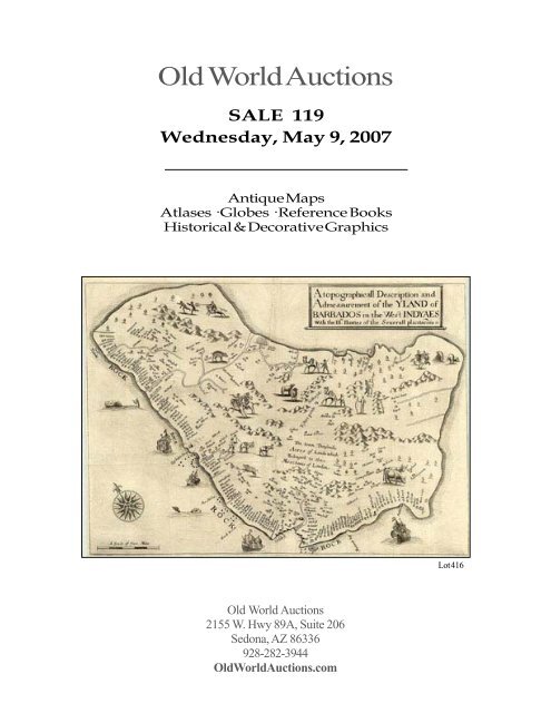
Lot 416<br />
<str<strong>on</strong>g>Old</str<strong>on</strong>g> <str<strong>on</strong>g>World</str<strong>on</strong>g> <str<strong>on</strong>g>Aucti<strong>on</strong>s</str<strong>on</strong>g><br />
2155 W. Hwy 89A, Suite 206<br />
Sed<strong>on</strong>a, AZ 86336<br />
928-282-3944<br />
<str<strong>on</strong>g>Old</str<strong>on</strong>g><str<strong>on</strong>g>World</str<strong>on</strong>g><str<strong>on</strong>g>Aucti<strong>on</strong>s</str<strong>on</strong>g>.com
OLD WORLD AUCTIONS<br />
AUCTION NO. 119<br />
Closing: Wednesday, May 9, 2007 (10 pm Eastern Time)<br />
CONDITIONS OF SALE<br />
1. All lots are offered for sale by <str<strong>on</strong>g>Old</str<strong>on</strong>g> <str<strong>on</strong>g>World</str<strong>on</strong>g> <str<strong>on</strong>g>Aucti<strong>on</strong>s</str<strong>on</strong>g>, ei<strong>the</strong>r as owner or as agent for various C<strong>on</strong>signors. <str<strong>on</strong>g>The</str<strong>on</strong>g>se CONDITIONS OF<br />
SALE, as set forth in this catalog, are <strong>the</strong> complete, and <strong>on</strong>ly, terms and c<strong>on</strong>diti<strong>on</strong>s, <strong>on</strong> which all property is offered for sale. By bidding<br />
at aucti<strong>on</strong>, <strong>the</strong> <strong>buy</strong>er agrees <strong>to</strong> be bound by <strong>the</strong>se C<strong>on</strong>diti<strong>on</strong>s of Sale.<br />
2. Mail, teleph<strong>on</strong>e and fax bids must be received by 10 pm Eastern Time of <strong>the</strong> closing date. <str<strong>on</strong>g>The</str<strong>on</strong>g> aucti<strong>on</strong> begins closing at 10 pm. All<br />
lots with no bids in <strong>the</strong> last 10 minutes will close immediately. Lots with activity will remain open until a bid has not been received<br />
for 10 minutes. Bids may be changed at any time up <strong>to</strong> <strong>the</strong> close, but cannot be cancelled after <strong>the</strong> close.<br />
3. Do not send payment with mailed bids. Successful bidders will be billed at <strong>the</strong> close of <strong>the</strong> aucti<strong>on</strong>.<br />
4. In <strong>the</strong> case of identical high bids, preference goes <strong>to</strong> <strong>the</strong> first received.<br />
5. <str<strong>on</strong>g>The</str<strong>on</strong>g> estimated price shown for each lot should be used <strong>on</strong>ly as a guide. Lots may end up selling for more or less than <strong>the</strong> estimated<br />
price, and you may bid any amount. Bids must be <str<strong>on</strong>g>place</str<strong>on</strong>g>d in bidding increments. Bids received, which are not in accordance with<br />
bidding increments, will be reduced <strong>to</strong> <strong>the</strong> next lower increment. Bidding increments are listed <strong>on</strong> <strong>the</strong> bid sheet and <strong>on</strong> <strong>the</strong> inside, back<br />
cover.<br />
6. <str<strong>on</strong>g>The</str<strong>on</strong>g>re are no reserves <strong>on</strong> lots with estimated prices of $25 or under. Lots with estimated values above $25 may have a c<strong>on</strong>fidential<br />
reserve. Where reserves are present <strong>the</strong>y will not exceed 75% of <strong>the</strong> estimated value unless specifically noted in <strong>the</strong> catalog.<br />
7. High bids will be reduced <strong>to</strong> <strong>the</strong> reserve, or <strong>to</strong> <strong>the</strong> increment above <strong>the</strong> next highest bid, which ever is greater. However, bids are not<br />
reduced in this manner below $25.<br />
8. A 12% <strong>buy</strong>ers premium will be added <strong>to</strong> all invoices.<br />
9. Invoices are sent immediately following <strong>the</strong> aucti<strong>on</strong>. Payment is due <strong>on</strong> receipt of invoice. <str<strong>on</strong>g>The</str<strong>on</strong>g> items are shipped when your payment<br />
is received. We encourage you <strong>to</strong> use a credit card, so we can ship your material immediately following <strong>the</strong> aucti<strong>on</strong>. We appreciate<br />
your prompt payment as this lets us pay our c<strong>on</strong>signors equally promplty.<br />
10. Packaging, shipping and insurance is extra and will be added <strong>to</strong> <strong>the</strong> invoice. Unless specific instructi<strong>on</strong>s are received, <str<strong>on</strong>g>Old</str<strong>on</strong>g> <str<strong>on</strong>g>World</str<strong>on</strong>g> <str<strong>on</strong>g>Aucti<strong>on</strong>s</str<strong>on</strong>g><br />
will determine <strong>the</strong> <str<strong>on</strong>g>best</str<strong>on</strong>g> method of packaging and shipment. <str<strong>on</strong>g>The</str<strong>on</strong>g> minimum charge is $7.50.<br />
11. Ariz<strong>on</strong>a residents will be charged sales tax at <strong>the</strong> rate of 9.35%, unless we are provided a copy of a reseller's permit.<br />
12. We warranty <strong>the</strong> au<strong>the</strong>nticity and c<strong>on</strong>diti<strong>on</strong> of each lot described in this catalog. Defects in lots offered for sale have been carefully<br />
noted. However, any lot differing significantly from <strong>the</strong> catalog descripti<strong>on</strong>, and <strong>the</strong>reby reducing its value, may be returned within<br />
<strong>on</strong>e week of receipt. Please call for a Return Authorizati<strong>on</strong> prior <strong>to</strong> returning. No returns will be accepted for any reas<strong>on</strong> after 30 days<br />
following <strong>the</strong> aucti<strong>on</strong> close date.<br />
13. You must open and inspect your package immediately up<strong>on</strong> receipt. Any discrepancies, damage or missing items must be reported<br />
<strong>to</strong> us within 2 business days of receipt by you. All packaging materials must be retained until <strong>the</strong> discrepancy has been resolved. Failure<br />
<strong>to</strong> notify us within <strong>the</strong> two day limit will nullify any claim by you.<br />
14. Successful overseas bidders shall provide specific shipping and cus<strong>to</strong>ms instructi<strong>on</strong>s when completing <strong>the</strong>ir invoice, including specific<br />
cus<strong>to</strong>ms declarati<strong>on</strong>s, for any deliveries outside of <strong>the</strong> United States. You are solely resp<strong>on</strong>sible for, and agree <strong>to</strong> pay all local fees<br />
including but not limited <strong>to</strong> duty and cus<strong>to</strong>ms charges, and brokerage fees. <str<strong>on</strong>g>The</str<strong>on</strong>g>se fees are not collected by <str<strong>on</strong>g>Old</str<strong>on</strong>g> <str<strong>on</strong>g>World</str<strong>on</strong>g> <str<strong>on</strong>g>Aucti<strong>on</strong>s</str<strong>on</strong>g> and<br />
are in additi<strong>on</strong> <strong>to</strong> <strong>the</strong> amounts <strong>on</strong> your invoice.<br />
15. <str<strong>on</strong>g>The</str<strong>on</strong>g>se terms and c<strong>on</strong>diti<strong>on</strong>s are binding up<strong>on</strong> you and may be amended by us at any time and with no advance notice. You will be notified<br />
of such changes in writing or via email.<br />
Checks should be made payable <strong>to</strong> <str<strong>on</strong>g>Old</str<strong>on</strong>g> <str<strong>on</strong>g>World</str<strong>on</strong>g> <str<strong>on</strong>g>Aucti<strong>on</strong>s</str<strong>on</strong>g>. For your c<strong>on</strong>venience we accept Mastercard, VISA, American Express and Discover.<br />
Overseas and Canadian <strong>buy</strong>ers should make payment in U.S. dollars by internati<strong>on</strong>al m<strong>on</strong>ey order or by an internati<strong>on</strong>al bank draft drawn <strong>on</strong> Wells<br />
Fargo Bank of Ariz<strong>on</strong>a, or by credit card as noted above.<br />
<str<strong>on</strong>g>Old</str<strong>on</strong>g> Maps, LLC<br />
dba <str<strong>on</strong>g>Old</str<strong>on</strong>g> <str<strong>on</strong>g>World</str<strong>on</strong>g> <str<strong>on</strong>g>Aucti<strong>on</strong>s</str<strong>on</strong>g><br />
2155 W. Hwy 89A, Suite 206<br />
Sed<strong>on</strong>a, AZ 86339 USA<br />
Tel: (800) 664-7757 or (928) 282-3944<br />
Fax: (928) 282-3945<br />
Email: marti@oldworldaucti<strong>on</strong>s.com<br />
Visit us <strong>on</strong>line at www.<str<strong>on</strong>g>Old</str<strong>on</strong>g><str<strong>on</strong>g>World</str<strong>on</strong>g><str<strong>on</strong>g>Aucti<strong>on</strong>s</str<strong>on</strong>g>.com
TABLE OF CONTENTS<br />
Sale 119<br />
Secti<strong>on</strong> Lot #<br />
<str<strong>on</strong>g>World</str<strong>on</strong>g> Maps, Title Pages, Celestial Charts 1-76<br />
Maps - Western Hemisphere 77-102<br />
Maps - North America 103-124<br />
Maps - Canada 121-150<br />
Maps - United States 138-380<br />
Maps - Latin America & West Indies 364-441<br />
Maps - Atlantic & Arctic 442-456<br />
Maps - Europe & Mediterrean 457-729<br />
Maps - Asia, Middle East & Holy Land 730-805<br />
Maps - Africa 806-842<br />
Maps - Pacific 843-851<br />
Decorative Prints 852-864<br />
Miscellany (Incunabula, etc.) 865-888<br />
Books & Atlases 889-951
Title Pages, <str<strong>on</strong>g>World</str<strong>on</strong>g> Maps, Globes & Miscellaneous<br />
1. Portrait ([Portrait of Jan Huyghen van Linschoten]), Bry, Petites Voyages, Frankfurt, [1599]. 4 x 5.5”. (BW) Handsome portrait of <strong>the</strong> famous explorer<br />
Linschoten (1563-1610), who worked in <strong>the</strong> service of <strong>the</strong> Portugese Archbishop of Goa. Linschoten’s mapping of Sou<strong>the</strong>ast Asia broke <strong>the</strong> stranglehold<br />
that <strong>the</strong> Portugese had <strong>on</strong> spice trade in that regi<strong>on</strong>. Printed <strong>on</strong> a full page with German text, 7.8 x 12". <str<strong>on</strong>g>The</str<strong>on</strong>g> portait is near fine with a light dampstain<br />
in <strong>the</strong> lower, blank margin. (A) $180-220<br />
2. Portrait (Francisco Pisarro), M<strong>on</strong>tanus, De Nieuwe en Onbekende Wereld, Amsterdam, [1671]. 7 x 11.5”. (BW) Striking, copper engraved portrait of<br />
<strong>the</strong> Spanish explorer who c<strong>on</strong>quered <strong>the</strong> Inca Empire. <str<strong>on</strong>g>The</str<strong>on</strong>g> portrait is enclosed in an elaborately engraved frame with a battle scene in <strong>the</strong> background. <str<strong>on</strong>g>The</str<strong>on</strong>g><br />
map has a couple of spots of foxing and an abraded area <strong>to</strong> <strong>the</strong> left of Pisarro, still a nice aexample. (B) $130-160<br />
3. Title Pages (Globus Terraqueus Ecclesiastico Politicus…), Scherer, Munich, ca. 1703. 7.3 x 9.2”. (HC) Stunning and inventive title page drawn by Johann<br />
Degler and engraved by Le<strong>on</strong>ard Heckenauer. <str<strong>on</strong>g>The</str<strong>on</strong>g> page features <strong>the</strong> hand of God suspending <strong>the</strong> world from a cross attached at <strong>the</strong> Pole. <str<strong>on</strong>g>The</str<strong>on</strong>g> surrounding<br />
heavens are filled with winsome cherubs, some of whom hold crowns and <strong>the</strong> hats of popes, cardinals and bishops, with allegorical representati<strong>on</strong>s of <strong>the</strong><br />
c<strong>on</strong>tinents of Europe, Asia, Africa and America. All of <strong>the</strong> c<strong>on</strong>tinental figures hold a map, with <strong>the</strong> <strong>on</strong>e representing <strong>the</strong> Americas featuring California as<br />
an island. Ref: McLaughlin TP #9. Sharp impressi<strong>on</strong> with attractive later color. (A) $325-400<br />
4. Title Pages (Atlas General Methodique et Elementaire pour l’Etude de la Geographie et de l’His<strong>to</strong>ire Moderne…), Desnos, Paris, 1770. 19.8 x 14.3”. (HC)<br />
A beautifully engraved title page filled with many allegorical figures including cherubic geographers with <strong>maps</strong>, globes, telescopes and o<strong>the</strong>r mapmaking aids,<br />
overseen by <strong>the</strong> figure of Europa. Apollo rides across <strong>the</strong> eastern sky in his sun-chariot, chasing off an allegorical figure of Night with her canopy of stars,<br />
and in <strong>the</strong> background rest <strong>the</strong> Pyramids and a classical Greek temple. <str<strong>on</strong>g>The</str<strong>on</strong>g> foreground is filled with well rendered flowers, books and <strong>maps</strong>. Sharp impressi<strong>on</strong><br />
with some light surface soil. (A) $200-300<br />
5. Title Pages (Atlante Novissimo Tomo l), Zatta, Venice, 1779. 17 x 12.5”. (HC) Very dramatic title page featuring many allegorical figures. Apollo drives<br />
his sun-chariot across <strong>the</strong> sky at <strong>the</strong> left, while cherubs and Urania, <strong>the</strong> muse of Astr<strong>on</strong>omy, engage in car<strong>to</strong>graphic pursuits with armillary spheres, telescopes,<br />
compasses and globes. <str<strong>on</strong>g>The</str<strong>on</strong>g> royal figure of Europa presides over <strong>the</strong> scene with <strong>the</strong> winged li<strong>on</strong> of Venice at her feet. Engraved by G. Zuliani. Sharp impressi<strong>on</strong><br />
with later color that shows a little <strong>on</strong> <strong>the</strong> verso. (A) $200-250<br />
6. <str<strong>on</strong>g>World</str<strong>on</strong>g> & C<strong>on</strong>tinents ([Lot of 5] Typus Orbis Terrarum [and] America [and] Asia [and] Africa [and] Europa), Bertius, Tabularum Geographicarum,<br />
Amsterdam, [1602-06]. 5 x 3.3”. (HC) A superb set of miniature <strong>maps</strong> from this popular pocket atlas. <str<strong>on</strong>g>The</str<strong>on</strong>g> attributi<strong>on</strong> of <strong>the</strong>se <strong>maps</strong> is c<strong>on</strong>fusing and<br />
different references attribute <strong>the</strong>m variously <strong>to</strong> Langenes, Claesz, Bertius, H<strong>on</strong>dius and Van den Keere (Kaerius); all in fact are correct. Langenes was <strong>the</strong><br />
printer, Claesz <strong>the</strong> publisher, Bertius wrote <strong>the</strong> text for <strong>the</strong> Latin editi<strong>on</strong>s, and <strong>the</strong> plates were engraved by H<strong>on</strong>dius and Van den Keere. This set is from<br />
a Latin editi<strong>on</strong> attributed <strong>to</strong> Bertius, published between 1602 and 1606.<br />
1) Typus Orbis Terrarum is an oval world map set in a strapwork surround, with car<strong>to</strong>graphy based <strong>on</strong> Ortelius. H<strong>on</strong>dius’ signature appears at <strong>the</strong> bot<strong>to</strong>m.<br />
2) <str<strong>on</strong>g>The</str<strong>on</strong>g> map of <strong>the</strong> Americas also follows Ortelius in outline and is set in a strapwork background. This is <strong>the</strong> first state without Tierra del Fuego.<br />
3) Asiae shows <strong>the</strong> Dutch attempts <strong>to</strong> find a Nor<strong>the</strong>ast Passage with <strong>the</strong> southwestern tip of Novaya Zemlya depicted off <strong>the</strong> nor<strong>the</strong>rn coastline of Tartaria.<br />
It presents a different view of <strong>the</strong> c<strong>on</strong>tinent than c<strong>on</strong>temporary <strong>maps</strong> of Asia, particularly in <strong>the</strong> nor<strong>the</strong>ast regi<strong>on</strong> where Korea is shown as a l<strong>on</strong>g peninsula.<br />
4) <str<strong>on</strong>g>The</str<strong>on</strong>g> map of Africa appears <strong>to</strong> be reduced from H<strong>on</strong>dius’ large map with <strong>the</strong> typical misc<strong>on</strong>cepti<strong>on</strong>s of <strong>the</strong> period, including <strong>the</strong> source for <strong>the</strong> Nile located<br />
in South Africa. <str<strong>on</strong>g>The</str<strong>on</strong>g> map is decorated with a strapwork car<strong>to</strong>uche and a pair of sea m<strong>on</strong>sters.<br />
5) Europa was engraved by H<strong>on</strong>dius and stretches <strong>to</strong> include Greenland, Iceland and part of <strong>the</strong> North American coast labeled Est<strong>on</strong>land with <strong>the</strong> mythical<br />
island of Frisland just offshore. Ref: <str<strong>on</strong>g>World</str<strong>on</strong>g> - Shirley #211; America - Burden #92; Asia - Yeo #18. (A+) $3000-3500<br />
7. <str<strong>on</strong>g>World</str<strong>on</strong>g> & C<strong>on</strong>tinents ([Lot of 6] Universi Orbis Descriptio [and] Universi Orbis Descriptio ad Usum Navigantium [and] America [and] Asia [and] Africa<br />
[and] Europa), Magini, Cologne, ca. 1608. 6.7 x 5”. (HC) Delicately engraved group of small <strong>maps</strong> of <strong>the</strong> c<strong>on</strong>tinents and <strong>the</strong> world, featuring two projecti<strong>on</strong>s<br />
of <strong>the</strong> world. <str<strong>on</strong>g>The</str<strong>on</strong>g>se are all from an editi<strong>on</strong> created in Cologne ra<strong>the</strong>r than Venice.<br />
1) Universi Orbis Descriptio. <str<strong>on</strong>g>The</str<strong>on</strong>g> distinguished Italian geographer Giovanni Magini published a quar<strong>to</strong> editi<strong>on</strong> of P<strong>to</strong>lemy that also included this reduced<br />
versi<strong>on</strong>. Included were four world <strong>maps</strong> all engraved by Girolamo Porro. This map used <strong>the</strong> oval projecti<strong>on</strong> popularized by Abraham Ortelius, and follows<br />
that model very closely. Most notable are <strong>the</strong> large landmasses of Terra Incognita and Terra Australis at both poles. Six wind-heads are arranged above<br />
and below <strong>the</strong> map. Sec<strong>on</strong>d state with Latin text <strong>on</strong> verso.<br />
2) Universi Orbis Descriptio ad Usum Navigantium is a small mariner’s map based <strong>on</strong> Gerard Merca<strong>to</strong>r’s large world map of 1569. Magini has added a<br />
fanciful range of mountains <strong>to</strong> <strong>the</strong> huge sou<strong>the</strong>rn c<strong>on</strong>tinent. <str<strong>on</strong>g>The</str<strong>on</strong>g> map is crisscrossed by rhumb lines and <strong>the</strong> oceans are stipple engraved in <strong>the</strong> Italian style.<br />
Sec<strong>on</strong>d state with Latin text <strong>on</strong> verso.<br />
3) America is a finely engraved map derived from Giovanni Lorenzo d’Anania’s 1582 map of <strong>the</strong> Americas and fur<strong>the</strong>r based <strong>on</strong> <strong>the</strong> geography of Ortelius.<br />
Most notable is <strong>the</strong> characteristic bulge <strong>to</strong> <strong>the</strong> west coast of South America and <strong>the</strong> huge Sou<strong>the</strong>rn C<strong>on</strong>tinent that attaches <strong>to</strong> Nova Guinea.<br />
4 ) Asia is based <strong>on</strong> Ortelius’ map of <strong>the</strong> regi<strong>on</strong>, with <strong>the</strong> same cordiform projecti<strong>on</strong> showing Asia extended <strong>to</strong>o far <strong>to</strong> <strong>the</strong> east, an error propagated with<br />
P<strong>to</strong>lemy. Japan is shown in a kite shape in <strong>the</strong> manner of Ruscelli from Jesuit sources.<br />
5) Africa is a small map of Africa and <strong>the</strong> Arabian Peninsula showing part of Brazil as well from <strong>the</strong> earlier mapping by Ortelius. <str<strong>on</strong>g>The</str<strong>on</strong>g> rivers of central and<br />
north Africa feature prominently including <strong>the</strong> P<strong>to</strong>lemaic c<strong>on</strong>cept of <strong>the</strong> origin of <strong>the</strong> Nile in twin lakes south of <strong>the</strong> Equa<strong>to</strong>r. <str<strong>on</strong>g>The</str<strong>on</strong>g> largest of <strong>the</strong>se lakes<br />
also has a river flowing sou<strong>the</strong>ast. <str<strong>on</strong>g>The</str<strong>on</strong>g> sea is stipple engraved with a tiny sea m<strong>on</strong>ster and decorative calligraphy.<br />
6) Europa shows <strong>the</strong> extent of <strong>the</strong> c<strong>on</strong>tinent reaching over in<strong>to</strong> Asia and including <strong>the</strong> nor<strong>the</strong>rn tip of Africa as well as Iceland and Greenland. <str<strong>on</strong>g>The</str<strong>on</strong>g> seas are<br />
stipple engraved. Ref: Map 1). Shirley #195; Map 2) Shirley #196; Map 3) Burden #93. All <strong>maps</strong> are good with some uneven t<strong>on</strong>ing. Map 4 with<br />
a repaired tear in <strong>the</strong> upper left margin extending just in<strong>to</strong> map. (B) $2000-2300<br />
8. <str<strong>on</strong>g>World</str<strong>on</strong>g> & C<strong>on</strong>tinents ([Lot of 6] Mapem<strong>on</strong>de Planisphere ou Carte Generale du M<strong>on</strong>de [and] l’Amerique Septentri<strong>on</strong>ale [and] L’Amerique Meridi<strong>on</strong>ale<br />
[and] Asia [and] Africa Selou les Au<strong>the</strong>urs les plus Modernes [and] Europa Sel<strong>on</strong> les Auth. les plus Modernes), La Feuille, Amsterdam, ca. 1701. 8.5 x<br />
6”. (HC) Very attractive matched set of <strong>maps</strong>. Sizes vary slightly.<br />
1) Mapem<strong>on</strong>de Planisphere ou Carte Generale du M<strong>on</strong>de - Generale Wareld Kaart presents <strong>the</strong> world as a simple double hemisphere showing <strong>the</strong> island<br />
of California, partially mapped Australia and New Zealand and still a good bit of <strong>the</strong> sou<strong>the</strong>rn c<strong>on</strong>tinent labeled Terres Antarctiques.<br />
2) L’Amerique Septentri<strong>on</strong>ale - Noord America also features California as an island, and a prominent Mississippi River with <strong>the</strong> Rio Bravo ou de Nort<br />
(Rio Grande) becoming its tributary just before emptying in<strong>to</strong> <strong>the</strong> Gulf of Mexico, much <strong>to</strong>o far west. <str<strong>on</strong>g>The</str<strong>on</strong>g> map is <strong>to</strong>pped with a pic<strong>to</strong>rial car<strong>to</strong>uche featuring<br />
natives, a serpent and a lizard.<br />
3) Zuyd America - L’Amerique Meridi<strong>on</strong>ale shows South America with two large, spurious lakes. <str<strong>on</strong>g>The</str<strong>on</strong>g> map is adorned with a car<strong>to</strong>uche featuring natives<br />
offering gifts <strong>to</strong> a European while a ra<strong>the</strong>r alarming serpent looks <strong>on</strong>.<br />
4) <str<strong>on</strong>g>The</str<strong>on</strong>g> map of Asia features a nearly circular Japan with some odd nearby islands and coasts. <str<strong>on</strong>g>The</str<strong>on</strong>g> map is <strong>to</strong>pped with a car<strong>to</strong>uche guarded by a warrior<br />
and an elephant.<br />
5) Africa Selou les Au<strong>the</strong>urs les plus Modernes shows a quite up-<strong>to</strong>-date Africa flanked with armorial shields for major nati<strong>on</strong>s. <str<strong>on</strong>g>The</str<strong>on</strong>g> decorative car<strong>to</strong>uche<br />
features natives smoking and trading.<br />
6) Europa Sel<strong>on</strong> les Auth. les plus Modernes is also flanked by armorial shields for <strong>the</strong> kingdoms. Topped with a car<strong>to</strong>uche <strong>the</strong> mythical Europa and Zeus<br />
in <strong>the</strong> form of an aquatic bull. Ref: Map 2: McLaughlin #147. Some professi<strong>on</strong>al repairs of fold separati<strong>on</strong>s. <str<strong>on</strong>g>The</str<strong>on</strong>g>re are a few spots of foxing scattered<br />
throughout <strong>the</strong> <strong>maps</strong>. Map 5 has a repaired marginal tear. (B) $1500-2000
9. <str<strong>on</strong>g>World</str<strong>on</strong>g> & C<strong>on</strong>tinents ([Lot of 5] Mappam<strong>on</strong>do [and] America Sec<strong>on</strong>do le Ultime Osservazi<strong>on</strong>i dell’Accademia Reale delle Scienze [and] Asia… [and]<br />
Africa… [and] Europa…), Buffier, Nuova Geografia, Venice, ca. 1780. 7 x 5.4”. (HC) Attractive group of small <strong>maps</strong> engraved by Giovanni Petroschi<br />
with charmingly outdated car<strong>to</strong>graphy for a later, Italian editi<strong>on</strong> of Geographie Universelle. Sizes vary slightly.<br />
1) Mappam<strong>on</strong>do is a double-hemisphere world featuring California as an island. <str<strong>on</strong>g>The</str<strong>on</strong>g>re is a hint of a large Sou<strong>the</strong>rn C<strong>on</strong>tinent.<br />
2) America Sec<strong>on</strong>do le Ultime Osservazi<strong>on</strong>i dell’Accademia Reale delle Scienze is an interesting little map showing North and South America with <strong>the</strong> island<br />
of California. A large Terra Australe underlines South America. North America is divided between Florida, Nuouo Messico, and Canada Francia with<br />
<strong>the</strong> British col<strong>on</strong>ies squeezed al<strong>on</strong>g <strong>the</strong> eastern seaboard.<br />
3) Asia Sec<strong>on</strong>do le Ultime Oservati<strong>on</strong>i dell’Accademia Reale delle Scienze shows Asia with Japan noted as an island, narrowly separated from <strong>the</strong> mainland<br />
by a tiny straight between it and Terra di Ves<strong>to</strong> with <strong>the</strong> Terra della Compagnia nearby.<br />
4) Africa Sec<strong>on</strong>do le Ultime Osservazi<strong>on</strong>e dell’Accademia Reale delle Scienze di Parigi is a delicately engraved map of <strong>the</strong> c<strong>on</strong>tinent featuring a simple but<br />
mostly accurate Africa with a representati<strong>on</strong> of what would be Lake Chad in about <strong>the</strong> right <str<strong>on</strong>g>place</str<strong>on</strong>g>ment and a very good depicti<strong>on</strong> of <strong>the</strong> route of <strong>the</strong> Nile.<br />
5) Europa Sec<strong>on</strong>do le Ultime Osservatzi<strong>on</strong>i dell Academia Reale Scienze is a simple depicti<strong>on</strong> of <strong>the</strong> c<strong>on</strong>tinent with quite a few <str<strong>on</strong>g>place</str<strong>on</strong>g> names and some<br />
<strong>to</strong>pographic notes. One point of interest is <strong>the</strong> large, fire-spewing Mount Hekla indicated <strong>on</strong> Iceland. Minor scattered foxing and light t<strong>on</strong>ing, with<br />
folds as issued. (B) $550-650<br />
10. <str<strong>on</strong>g>World</str<strong>on</strong>g> (Das erst general inhaltend die beschreibung und den circkel des gantzen erdtreichs und moere), Munster, Basel, ca. 1550. 15 x 10.4”. (HC) This<br />
is <strong>the</strong> sec<strong>on</strong>d state of this famous early, woodblock map of <strong>the</strong> “modern” world. <str<strong>on</strong>g>The</str<strong>on</strong>g> oval projecti<strong>on</strong> is surrounded by clouds and wind heads with <strong>the</strong><br />
title above <strong>the</strong> map. <str<strong>on</strong>g>The</str<strong>on</strong>g> c<strong>on</strong>tinents are shown in rough outline <strong>on</strong>ly. North America is shown with <strong>the</strong> large cleft nearly separating <strong>the</strong> east coast from<br />
<strong>the</strong> c<strong>on</strong>tinent, often referred <strong>to</strong> as <strong>the</strong> Sea of Verazano. What appears <strong>to</strong> be a large Northwest Passage stretches <strong>to</strong>wards Asia. South America has a very<br />
strange shape as well. In Africa, <strong>the</strong> Nile is prominently shown with its twin sources beginning in a range of sou<strong>the</strong>rn mountains. <str<strong>on</strong>g>The</str<strong>on</strong>g> mythical islands<br />
of Gris<strong>on</strong>um and Calensuan are <str<strong>on</strong>g>place</str<strong>on</strong>g>d in <strong>the</strong> proximity of Australia, where <strong>the</strong>re is also <strong>the</strong> label Mare Pacificum. A sailing ship and several fierce sea m<strong>on</strong>sters<br />
occupy <strong>the</strong> oceans. Initials of <strong>the</strong> engraver David Kandel in lower left-hand corner. German text and elaborate woodcut illustrati<strong>on</strong>s <strong>on</strong> verso. Ref: Shirley<br />
#92. Nice impressi<strong>on</strong> and later color. Some minor repairs and show-through of text <strong>on</strong> verso in <strong>the</strong> blank margins. (A) $2300-3000<br />
11. <str<strong>on</strong>g>World</str<strong>on</strong>g> (Typus Orbis Terrarum), Bertius, Petri Bertii Tabularum Geographicarum C<strong>on</strong>tractarum …, Amsterdam, ca. 1616. 5.3 x 3.7”. (HC) Charming<br />
miniature world map <strong>on</strong> an oval projecti<strong>on</strong> based <strong>on</strong> Ortelius. <str<strong>on</strong>g>The</str<strong>on</strong>g> map is similar <strong>to</strong> <strong>the</strong> <strong>on</strong>e Bertius supplied for Barent Langenes’ Caert-Thresoor except<br />
this plate does not c<strong>on</strong>tain <strong>the</strong> signature of Jodocus H<strong>on</strong>dius as <strong>the</strong> engraver. Strapwork designs fill <strong>the</strong> corners with <strong>the</strong> title above and <strong>the</strong> mot<strong>to</strong> “Domini<br />
Est Terra Et Plenitudo Eius” at bot<strong>to</strong>m. Ref: Shirley #290. Nice impressi<strong>on</strong>. Small worm track professi<strong>on</strong>ally repaired almost invisibly in <strong>the</strong> lower text,<br />
with a small bit of facsimile in <strong>the</strong> letter ‘E’. (A) $600-700<br />
12. <str<strong>on</strong>g>World</str<strong>on</strong>g> (Nova Totius Terrarum Orbis Geographica ac Hydrographica Tabula), Kaerius/Janss<strong>on</strong>, Amsterdam, ca. 1630. 21 x 15.7”. (HC) Petrus Kaerius’s<br />
uncomm<strong>on</strong> versi<strong>on</strong> of Blaeu’s carte-a-figure’s map of <strong>the</strong> world is a superb example of <strong>the</strong> map-maker’s art. <str<strong>on</strong>g>The</str<strong>on</strong>g> interesting and detailed border decorati<strong>on</strong>s<br />
are identical <strong>to</strong> those of Blaeu and c<strong>on</strong>sist of <strong>the</strong> seven planets across <strong>the</strong> <strong>to</strong>p, <strong>the</strong> seven w<strong>on</strong>ders of <strong>the</strong> world al<strong>on</strong>g <strong>the</strong> bot<strong>to</strong>m and <strong>the</strong> four elements and<br />
four seas<strong>on</strong>s flanking <strong>the</strong> map. Geographically <strong>the</strong> map itself is also copied from Blaeu, but includes more legends and additi<strong>on</strong>s referring <strong>to</strong> explorati<strong>on</strong>s<br />
in <strong>the</strong> Arctic. A l<strong>on</strong>g note near <strong>the</strong> car<strong>to</strong>uche discusses <strong>the</strong> <strong>the</strong>ory that <strong>the</strong> straits of Anian and Davis link <strong>to</strong> form a Northwest Passage. He also added<br />
rhumb lines radiating from compass roses arrayed across <strong>the</strong> equa<strong>to</strong>r. <str<strong>on</strong>g>The</str<strong>on</strong>g> map was first published in 1608. In 1621 Kaerius sold his plates <strong>to</strong> Jan Janss<strong>on</strong><br />
who <strong>the</strong>n issued <strong>the</strong> map with his imprint. This example is <strong>the</strong> fourth state with Janss<strong>on</strong>’s imprint and no date. German text <strong>on</strong> verso. Ref: Shirley #264.<br />
Lovely, dark impressi<strong>on</strong> and fine later color. This map has been professi<strong>on</strong>ally remargined and backed with light Japanese tissue. <str<strong>on</strong>g>The</str<strong>on</strong>g> remargining was<br />
d<strong>on</strong>e very skillfully with <strong>the</strong> leaf casting method and includes a tiny bit of facsimile in <strong>the</strong> border corners. A striking map that is now in near fine c<strong>on</strong>diti<strong>on</strong>.<br />
(A) $9000-12000<br />
13. <str<strong>on</strong>g>World</str<strong>on</strong>g> (Nova Totius Terrarum Orbis Geographica ac Hydrographica Tabula…), Merian, Frankfurt, ca. 1650. 13.8 x 9.8”. (BW) This beautifully engraved<br />
world map is presented <strong>on</strong> Merca<strong>to</strong>r’s projecti<strong>on</strong> with car<strong>to</strong>graphy closely copied from Blaeu’s world map of 1606. <str<strong>on</strong>g>The</str<strong>on</strong>g> Latin title is printed at <strong>to</strong>p, outside<br />
<strong>the</strong> neatline, with a German gothic script title and notati<strong>on</strong> c<strong>on</strong>cerning Chris<strong>to</strong>pher Columbus’ (1492) and Amerigo Vespucci’s (1499) discovery and<br />
explorati<strong>on</strong> of <strong>the</strong> Americas, covering <strong>the</strong> unknown interior of North America. <str<strong>on</strong>g>The</str<strong>on</strong>g>re is a large sou<strong>the</strong>rn c<strong>on</strong>tinent c<strong>on</strong>nected <strong>to</strong> New Guinea, California<br />
is a peninsula, and <strong>the</strong>re are plenty of open ended waterways in <strong>the</strong> eastern part of North America, leaving open <strong>the</strong> questi<strong>on</strong> of a Northwest Passage. Two<br />
polar projecti<strong>on</strong>s in lower corners partially obscure <strong>the</strong> great sou<strong>the</strong>rn landmass of Magallanica. <str<strong>on</strong>g>The</str<strong>on</strong>g> landmass is populated by <strong>on</strong>ly a few <str<strong>on</strong>g>place</str<strong>on</strong>g> names,<br />
including <strong>the</strong> regi<strong>on</strong>s of Beach and Psittacorum regio (Kingdom of <strong>the</strong> Parrots) from <strong>the</strong> travels of Marco Polo. <str<strong>on</strong>g>The</str<strong>on</strong>g> map is finely decorated with sea m<strong>on</strong>sters,<br />
galle<strong>on</strong>s and compass roses. Sec<strong>on</strong>d state without Merian’s signature in <strong>the</strong> lower right. Ref: Shirley #345. <str<strong>on</strong>g>The</str<strong>on</strong>g> map has a very nice impressi<strong>on</strong> with minor<br />
damp stains in <strong>the</strong> upper corners, just entering <strong>the</strong> map, as well as a few spots of light foxing. (B) $1800-2300<br />
14. <str<strong>on</strong>g>World</str<strong>on</strong>g> (Orbis Terrarum Typus de Integroin Plurimis Emendatus Auctus et Icunculis Illustratus), Visscher, Amsterdam, ca. 1660. 18.5 x 12.3”. (HC) This<br />
map is a direct derivative of Nicolas Visscher’s first world map designed for inclusi<strong>on</strong> in Dutch Bibles. It has been re-engraved, is nominally larger, and<br />
this example is from a German Bible. Identical engravings, including allegorical representati<strong>on</strong>s of <strong>the</strong> c<strong>on</strong>tinents as well as native inhabitants and wildlife,<br />
surround <strong>the</strong> double hemisphere world map. Two celestial spheres are displayed in <strong>the</strong> Eastern Hemisphere. In <strong>the</strong> lower part of <strong>the</strong> Western Hemisphere<br />
is text describing <strong>the</strong> discovery of America and recent voyages of discovery. Two diagrams depicting <strong>the</strong> P<strong>to</strong>lemaic and Copernican <strong>the</strong>ories of <strong>the</strong> solar<br />
system are tucked between <strong>the</strong> hemispheres. <str<strong>on</strong>g>The</str<strong>on</strong>g> northwest coast of North America is exaggerated and shows California correctly as a peninsula. Parts<br />
of Australia and Van Diemen’s Land are shown but <strong>the</strong> north coast of Australia is not depicted. This map now shows <strong>the</strong> western coastline of New Zealand<br />
reflecting Tasman’s discovery in 1642. German text <strong>on</strong> verso. Ref: Shirley #414B Corrigenda and Addenda. Light show through of text <strong>on</strong> verso. Margins<br />
are narrow but still sufficient for framing. <str<strong>on</strong>g>The</str<strong>on</strong>g> map has been professi<strong>on</strong>ally backed with tissue. (B) $1400-1800<br />
15. <str<strong>on</strong>g>World</str<strong>on</strong>g> (Orbis Terrarum Tabula Recens Emendata et in Lucem Edita per N. Visscher), Visscher, Amsterdam, ca. 1663. 18.6 x 12”. (HC) First state of<br />
this superb double hemisphere world map, surrounded by engravings including allegorical representati<strong>on</strong>s of <strong>the</strong> c<strong>on</strong>tinents as well as native inhabitants<br />
and wildlife. Visscher’s decorati<strong>on</strong>s were so popular several o<strong>the</strong>r car<strong>to</strong>graphers copied <strong>the</strong>m. Two diagrams depicting <strong>the</strong> P<strong>to</strong>lemaic and Copernican <strong>the</strong>ories<br />
of <strong>the</strong> solar system appear within <strong>the</strong> cusps of <strong>the</strong> hemispheres. <str<strong>on</strong>g>The</str<strong>on</strong>g> northwest coast of North America is greatly exaggerated with <strong>the</strong> ficti<strong>on</strong>al El Stre<strong>to</strong><br />
d’Anian while California is shown as a peninsula. In <strong>the</strong> Pacific, Western Australia, Van Diemens Landt and a bit of New Zealand are also noted. Dutch<br />
text <strong>on</strong> verso. Ref: Shirley #431; Poortman & Augusteijn #118. Nice, dark impressi<strong>on</strong>. Professi<strong>on</strong>al reinforcement of <strong>the</strong> outer folds and re<str<strong>on</strong>g>place</str<strong>on</strong>g>ment of<br />
<strong>the</strong> lower right corner margin. (A) $2100-2300<br />
16. <str<strong>on</strong>g>World</str<strong>on</strong>g> (Tabula Geographico-Hydrographica Motus Oceani, Currentes, Abyssos, M<strong>on</strong>tes Ignivomos…), Kircher, d’Onder-Aardse Weereld, Amsterdam,<br />
ca. 1665. 22 x 13.3”. (HC) <str<strong>on</strong>g>The</str<strong>on</strong>g> Jesuit scholar Athanasius Kircher was <strong>on</strong>e of <strong>the</strong> first compilers of semi-scientific knowledge about <strong>the</strong> physical features<br />
of <strong>the</strong> world. This extraordinary map depicts ocean currents, volcanoes and deep-sea chasms. <str<strong>on</strong>g>The</str<strong>on</strong>g> c<strong>on</strong>tinents are void of political detail and <strong>on</strong>ly major<br />
lakes, rivers and volcanoes are shown. <str<strong>on</strong>g>The</str<strong>on</strong>g>re are prominent Northwest and Nor<strong>the</strong>ast sea passages and a vast sou<strong>the</strong>rn c<strong>on</strong>tinent. Kircher’s <strong>the</strong>ories included<br />
<strong>the</strong> noti<strong>on</strong> that <strong>the</strong> world’s oceans were all interc<strong>on</strong>nected and subterranean tunnels are shown c<strong>on</strong>necting <strong>the</strong> oceans and seas. Published in a Dutch editi<strong>on</strong><br />
of Kircher’s famous Subterranean <str<strong>on</strong>g>World</str<strong>on</strong>g> by Johann Waesberger Ref: Shirley #436. Nice, sharp impressi<strong>on</strong>. <str<strong>on</strong>g>The</str<strong>on</strong>g> right and left margins have been professi<strong>on</strong>ally<br />
res<strong>to</strong>red using <strong>the</strong> leaf casting method with a little facsimile of <strong>the</strong> neatlines. (A) $800-900<br />
17. <str<strong>on</strong>g>World</str<strong>on</strong>g> (Mappe-M<strong>on</strong>de ou Carte Generale du Globe Terrestre Representee en deux Plan-Hemispheres…), Sans<strong>on</strong>/Mariette, Paris, 1669. 22.3 x 16”. (HC)<br />
This simple, yet elegant map is based <strong>on</strong> Nicolas Sans<strong>on</strong>’s world map of 1651. Nicolas drew this map for his 1660 atlas, and after his death in 1667, his<br />
s<strong>on</strong>s Guillaume and Adrien used it in <strong>the</strong>ir atlases of 1669 and 1678. This editi<strong>on</strong> shows Australia with a bit more definiti<strong>on</strong>, al<strong>on</strong>g with Tasmania and a<br />
small porti<strong>on</strong> of New Zealand’s coastline. This map is <strong>the</strong> first <strong>to</strong> indicate N. Danemarck west of <strong>the</strong> Huds<strong>on</strong> Bay, here named Mer Christiane. California<br />
is shown as an island, and Acoma and Santa Fe are noted in <strong>the</strong> Southwest, with Acoma shown correctly a<strong>to</strong>p a mesa. <str<strong>on</strong>g>The</str<strong>on</strong>g> coastline of Asia is shown with<br />
<strong>the</strong> discoveries of <strong>the</strong> De Vries noted, including Terre de Iesso or Ieco, and a land called Yupi. <str<strong>on</strong>g>The</str<strong>on</strong>g> Great Lakes are not updated from <strong>the</strong> 1651 versi<strong>on</strong>, and<br />
do not show all five lakes. <str<strong>on</strong>g>The</str<strong>on</strong>g> map is typical of Sans<strong>on</strong>’s “scientific” style of car<strong>to</strong>graphy with no decorative elements. It was published in c<strong>on</strong>juncti<strong>on</strong>
with Pierre Mariette (fa<strong>the</strong>r and s<strong>on</strong>), who published many of Sans<strong>on</strong>’s works after 1645. Ref: Shirley #419. Crisp impressi<strong>on</strong> and original outline color.<br />
<str<strong>on</strong>g>The</str<strong>on</strong>g> map has some light stains, t<strong>on</strong>ing and a few marginal tears, some just entering <strong>the</strong> map. Lower margin trimmed, with additi<strong>on</strong> of paper <strong>to</strong> reinforce<br />
<strong>the</strong> right corner. (B) $600-800<br />
18. <str<strong>on</strong>g>World</str<strong>on</strong>g> (Mappe-M<strong>on</strong>de ou Carte Generale du Globe Terrestre Representee en deux Plan-Hemispheres…), Luyts, [1699]. 12.2 x 8”. (HC) This double<br />
hemisphere map is beautifully decorated with clouds at <strong>the</strong> <strong>to</strong>p and allegorical representati<strong>on</strong>s at <strong>the</strong> bot<strong>to</strong>m. <str<strong>on</strong>g>The</str<strong>on</strong>g> title in <strong>the</strong> decorative, ribb<strong>on</strong> banner attributes<br />
Nicholas Sans<strong>on</strong> as <strong>the</strong> map’s origina<strong>to</strong>r. It was engraved by An<strong>to</strong>ine de Winter and first published in Jan Luyts’ Introductio Ad Geographiam in 1692.<br />
California is shown as an island, and Terre de Iesso stretches between Asia and North America. <str<strong>on</strong>g>The</str<strong>on</strong>g>re is a bit of <strong>the</strong> coastline of New Zealand nearly c<strong>on</strong>necting<br />
<strong>to</strong> a massiveTerre Magellanique, and Australia, here called Nouvelle Hollande, is <strong>on</strong>ly partly mapped. Ref: Shirley #553. With folds as issued. Couple<br />
of marginal chips, else fine. (A) $800-1200<br />
19. <str<strong>on</strong>g>World</str<strong>on</strong>g> (Repraesentatio Totius Orbis Terraquei Cuius Partes Quae Umbra Carent, Fide Catholica Imbutae Sunt, Reliquae Omnes Inumbratae, Religi<strong>on</strong>is<br />
Catholicae Expertes Sunt), Scherer, Atlas Novus, Munich, ca. 1702. 13.8 x 9”. (BW) This is a dramatic depicti<strong>on</strong> of <strong>the</strong> world presented <strong>on</strong> a polar projecti<strong>on</strong>.<br />
<str<strong>on</strong>g>The</str<strong>on</strong>g> map is shaded <strong>to</strong> indicate <strong>the</strong> spread of <strong>the</strong> Catholic religi<strong>on</strong> throughout <strong>the</strong> world, with lighter regi<strong>on</strong>s depicting those visited by Jesuit missi<strong>on</strong>aries.<br />
California is shown as an island, and above it is <strong>the</strong> Fretum Anian. <str<strong>on</strong>g>The</str<strong>on</strong>g> title is enclosed in a strapwork car<strong>to</strong>uche with a symbolic scene <strong>on</strong> <strong>the</strong> right showing<br />
<strong>the</strong> separati<strong>on</strong> of <strong>the</strong> sheep from <strong>the</strong> goats, with <strong>the</strong> sheep turning in<strong>to</strong> human souls and ascending <strong>to</strong> heaven and <strong>the</strong> goats descending <strong>to</strong> hell, depicted in<br />
<strong>the</strong> form of a fanged m<strong>on</strong>ster, per <strong>the</strong> parable of Mat<strong>the</strong>w 25. A risen Christ is shown above <strong>the</strong> scene and <strong>to</strong> <strong>the</strong> left is Magellan’s ship. Numerous sea<br />
m<strong>on</strong>sters and exotic fish occupy <strong>the</strong> oceans. Henrich Scherer, a ma<strong>the</strong>matics professor and Jesuit, produced this work <strong>to</strong> emphasize <strong>the</strong> extent of Catholic<br />
influence in <strong>the</strong> New <str<strong>on</strong>g>World</str<strong>on</strong>g>. Ref: Shirley #628. <str<strong>on</strong>g>The</str<strong>on</strong>g> map has a very sharp impressi<strong>on</strong> with folds as issued. (A) $1200-1400<br />
20. <str<strong>on</strong>g>World</str<strong>on</strong>g> (Societas Iesu Per universum mundum diffusa Praedicat Christi Evangelium), Scherer, Atlas Novus, Munich, ca. 1702. 13.9 x 9.1”. (HC) An exquisite<br />
depicti<strong>on</strong> of <strong>the</strong> world from <strong>the</strong> Jesuit ma<strong>the</strong>matician’s series of sharply engraved <strong>maps</strong>. <str<strong>on</strong>g>The</str<strong>on</strong>g> map is presented <strong>on</strong> a north polar projecti<strong>on</strong> and shows California<br />
as an island. Large shining, star-like symbols of <strong>the</strong> Jesuits mark <strong>the</strong> locati<strong>on</strong>s of Jesuit missi<strong>on</strong>s throughout <strong>the</strong> world. Each corner is richly engraved with<br />
allegorical scenes of four Jesuit saints: St. Ignatius Loyola, founder of <strong>the</strong> Jesuit order; Fa<strong>the</strong>r Joseph Anchieta, Apostle of Brazil; Andreas Oviedus, Patriarch<br />
of Ethiopia; and St. Francis Xavier, Apostle of India. <str<strong>on</strong>g>The</str<strong>on</strong>g>re are many cherubs supporting a number of Latin plaques such as <strong>the</strong> <strong>on</strong>e under St. Francis<br />
Xavier quoting Mat<strong>the</strong>w 28, “ <str<strong>on</strong>g>The</str<strong>on</strong>g>refore go and make disciples of all nati<strong>on</strong>s, baptizing <strong>the</strong>m in <strong>the</strong> name of <strong>the</strong> Fa<strong>the</strong>r and of <strong>the</strong> S<strong>on</strong> and of <strong>the</strong> Holy Spirit.”<br />
<str<strong>on</strong>g>The</str<strong>on</strong>g> map is fur<strong>the</strong>r adorned with ships and sea m<strong>on</strong>sters. Ref: Shirley #629. (A+) $1400-1600<br />
21. <str<strong>on</strong>g>World</str<strong>on</strong>g> (Plan de l’His<strong>to</strong>ire universelle, oul’<strong>on</strong> voit les quatre M<strong>on</strong>archies du M<strong>on</strong>de, et <strong>to</strong>us les Anciens Etats aussi bien que ceux qui subsistent aujourdhuy),<br />
Chatelain, Amsterdam, ca. 1705. 17.3 x 13.2”. (HC) <str<strong>on</strong>g>The</str<strong>on</strong>g> unique compositi<strong>on</strong> of this very interesting map shows <strong>the</strong> entire world but emphasizes <strong>the</strong> <str<strong>on</strong>g>Old</str<strong>on</strong>g><br />
<str<strong>on</strong>g>World</str<strong>on</strong>g>. <str<strong>on</strong>g>The</str<strong>on</strong>g> main map depicts <strong>the</strong> Eastern Hemisphere, in<strong>to</strong> which is inset a smaller Western Hemisphere with <strong>the</strong> island of California. <str<strong>on</strong>g>The</str<strong>on</strong>g> map shows<br />
<strong>the</strong> extents of <strong>the</strong> Roman Empire and Alexander <strong>the</strong> Great’s Empire. Below <strong>the</strong> map are vignettes depicting <strong>the</strong> seven w<strong>on</strong>ders of <strong>the</strong> ancient world. Tables<br />
of French text surround <strong>the</strong> entire map. Sharp impressi<strong>on</strong> and lovely color. (A+) $550-600<br />
22. <str<strong>on</strong>g>World</str<strong>on</strong>g> (A New Map of <strong>the</strong> <str<strong>on</strong>g>World</str<strong>on</strong>g> According <strong>to</strong> Wrights alias Merca<strong>to</strong>rs Projecti<strong>on</strong>…), Moll, L<strong>on</strong>d<strong>on</strong>, ca. 1705. 37 x 21.3”. (HC) This is a large, uncomm<strong>on</strong><br />
and striking chart of <strong>the</strong> world presented <strong>on</strong> Merca<strong>to</strong>r’s Projecti<strong>on</strong> with a broad band through <strong>the</strong> middle depicting <strong>the</strong> trade winds. In North America, California<br />
is shown as an island with a very unusual c<strong>on</strong>figurati<strong>on</strong>, shown with two nor<strong>the</strong>rn bays and and a very pinched central area. Bar<strong>on</strong> Lah<strong>on</strong>tan’s ficti<strong>to</strong>us<br />
Riviere L<strong>on</strong>gue is <strong>the</strong> most prominent feature in <strong>the</strong> West. While a very strange St. Lawrence River has its headwaters in Assinipovals Lake in <strong>the</strong> heart<br />
of Canada and <strong>the</strong>n flows south through Nemipig<strong>on</strong> Lake and <strong>the</strong> Great Lakes before taking its normal course. Australia’s coastline is partially shown<br />
with a suggested c<strong>on</strong>necti<strong>on</strong> <strong>to</strong> New Guinea. A little bit of <strong>the</strong> coaslines of both Tasmania and New Zealand are noted as well. In Asia, Corea is not firmly<br />
c<strong>on</strong>nected <strong>to</strong> <strong>the</strong> mainland, <strong>the</strong> Land of Iesso and <strong>the</strong> Straits of <strong>the</strong> Vries are above Japan. <str<strong>on</strong>g>The</str<strong>on</strong>g>re is a large inset of <strong>the</strong> North Pole. A couple compass roses<br />
and ships enliven <strong>the</strong> sea. Published by Mount and Page. Issued folding, now pressed. Sharp impressi<strong>on</strong> with original color and a couple light stains.<br />
<str<strong>on</strong>g>The</str<strong>on</strong>g> margins are narrow, but sufficient for framing with a couple of chips at <strong>to</strong>p. Some remnants of framer’s hinges <strong>on</strong> <strong>the</strong> verso. (B) $2500-3250<br />
23. <str<strong>on</strong>g>World</str<strong>on</strong>g> (Mappe M<strong>on</strong>de), Delisle/Schenk, Amsterdam, 1708. 23 x 17.5”. (HC) This handsome double hemisphere map is a corrected versi<strong>on</strong> of Delisle’s<br />
first world map, issued in 1700. <str<strong>on</strong>g>The</str<strong>on</strong>g> address notati<strong>on</strong> in <strong>the</strong> lower car<strong>to</strong>uche removes Delisle’s address in favor of Schenk’s imprint. In this editi<strong>on</strong>, new<br />
informati<strong>on</strong> corrects <strong>the</strong> representati<strong>on</strong> of <strong>the</strong> Great Lakes, South America, and <strong>the</strong> Niger River in Africa. In keeping with Delisle’s desire for accuracy,<br />
<strong>the</strong> northwestern porti<strong>on</strong> of North America is not illustrated here and <strong>the</strong>re is no evidence of Antarctica. Delisle used accounts from French explorers and<br />
col<strong>on</strong>izers of <strong>the</strong> Gulf of Mexico regi<strong>on</strong>. He also had access <strong>to</strong> accounts from survivors of La Salle’s expediti<strong>on</strong> in <strong>the</strong> late 1680’s. Despite his efforts <strong>to</strong><br />
produce highly accurate <strong>maps</strong>, this map still shows several car<strong>to</strong>graphic errors that were comm<strong>on</strong> during this period. It shows New Guinea c<strong>on</strong>nected <strong>to</strong><br />
Australia, and it appears that Japan is c<strong>on</strong>nected <strong>to</strong> <strong>the</strong> mainland <strong>to</strong> <strong>the</strong> north with <strong>the</strong> nearby Terre de la Campagnie from <strong>the</strong> de Vries expediti<strong>on</strong>. <str<strong>on</strong>g>The</str<strong>on</strong>g><br />
map features an elaborate car<strong>to</strong>uche that includes four exotic female pers<strong>on</strong>ificati<strong>on</strong>s of <strong>the</strong> c<strong>on</strong>tinents. <str<strong>on</strong>g>The</str<strong>on</strong>g> banner across <strong>the</strong> <strong>to</strong>p advertises Delisle’s upcoming<br />
book, Nouvelle Introducti<strong>on</strong> à la Géographie. Ref: Shirley #603. Lovely impressi<strong>on</strong> and original color that has been refreshed. A verdigris crack al<strong>on</strong>g <strong>the</strong><br />
African coast has been professi<strong>on</strong>ally reinforced <strong>on</strong> <strong>the</strong> verso. (B) $1400-1600<br />
24. <str<strong>on</strong>g>World</str<strong>on</strong>g> (Nova Delineatio Totius Orbis Terrarum per Petrum Vander Aa), Aa, Leiden, ca. 1720. 13.5 x 10.2”. (HC) Originally published by Jacob van<br />
Meurs in 1660, and reissued here by Vander Aa, this map is based <strong>on</strong> Arnold Colom’s w<strong>on</strong>derfully graphic map from <strong>the</strong> first world maritime atlas. California<br />
is an island, separated from Nova Albi<strong>on</strong>, which stretches <strong>to</strong>wards Asia and off <strong>the</strong> map. <str<strong>on</strong>g>The</str<strong>on</strong>g> western coast of New Zealand appears, as do several o<strong>the</strong>r<br />
important Pacific islands. Australia is partially mapped and <strong>on</strong>ly <strong>the</strong> sou<strong>the</strong>rn tip of Tasmania appears. Each hemisphere includes a strap work car<strong>to</strong>uche,<br />
<strong>on</strong>e with <strong>the</strong> Dutch title Niewe Werelt Caart. Superb engravings surround <strong>the</strong> map with representati<strong>on</strong>s of <strong>the</strong> gods Apollo and his sister Diana representing<br />
day and night with four female allegories of <strong>the</strong> elements of Fire, Air, Water and Earth. Ref: Shirley #417. Lovely impressi<strong>on</strong> with generous original margins.<br />
(A+) $2500-3000<br />
25. <str<strong>on</strong>g>World</str<strong>on</strong>g> (Platte Kaart van de geheele Werelt), Wetstein, Amsterdam, ca. 1730. 18 x 14.5”. (HC) This scarce and unusual map of <strong>the</strong> world is derived from<br />
Pierre Mortier’s Carte General du M<strong>on</strong>de of 1700. <str<strong>on</strong>g>The</str<strong>on</strong>g> map is <strong>on</strong> Merca<strong>to</strong>r’s projecti<strong>on</strong> and depicts California as an island. Above <strong>the</strong> island, <strong>the</strong> coastline<br />
stretches directly west ending just at <strong>the</strong> map’s border. <str<strong>on</strong>g>The</str<strong>on</strong>g> nor<strong>the</strong>ast coastline of Asia is lacking Kamchatka and Japan is depicted c<strong>on</strong>nected <strong>to</strong> ‘t Land<br />
van Yedso (Hokkaido). Australia and New Zealand are <strong>on</strong>ly partially mapped. Numerous explorati<strong>on</strong> routes are shown with <strong>the</strong>ir respective discoveries,<br />
including Tasman, Spilbergen, Columbus, Huds<strong>on</strong>, Dampier, Magellan and o<strong>the</strong>rs. Two additi<strong>on</strong>al double hemispheres, including <strong>on</strong>e <strong>on</strong> a polar projecti<strong>on</strong>,<br />
flank <strong>the</strong> decorative title car<strong>to</strong>uche that includes two angels. Engraved by J. Keyser. Ref: Shirley #622. (A) $1600-1800<br />
26. <str<strong>on</strong>g>World</str<strong>on</strong>g> (Planiglobium Terrestre Minus in hanc formam reductam), Weigel, Nuremberg, ca. 1730. 14 x 11”. (HC) This uncomm<strong>on</strong> map is based <strong>on</strong> Johann<br />
Baptist Homann’s Planiglobii Terrestris Cum Utrog Hemisphaerio Caelesti and is embellished with similar engravings of natural phenomena and <strong>the</strong> starry<br />
heavens. However, <strong>the</strong> map itself differs from Homann in that it presents an insular California and a different Terra Es<strong>on</strong>is with <strong>the</strong> Fretum Anian. <str<strong>on</strong>g>The</str<strong>on</strong>g><br />
map also retains a faint outline of <strong>the</strong> great Sou<strong>the</strong>rn C<strong>on</strong>tinent, Terra Australis Inc<strong>on</strong>gnita. Instead of celestial <strong>maps</strong> between <strong>the</strong> cusps of <strong>the</strong> double<br />
hemisphere map, Weigel has included terrestrial <strong>maps</strong> <strong>on</strong> polar projecti<strong>on</strong>s. Bit of very faint t<strong>on</strong>ing with a slightly uneven impressi<strong>on</strong>, overall still very<br />
good. (A) $1500-1700<br />
27. <str<strong>on</strong>g>World</str<strong>on</strong>g> (Werelt Caert), S<strong>to</strong>opendaal, Rotterdam, ca. 1736. 18 x 12.2”. (HC) This is <strong>the</strong> sec<strong>on</strong>d state of S<strong>to</strong>opendaal’s double hemisphere map from a Dutch<br />
Bible based <strong>on</strong> Visscher’s similar map of 1663 and surrounded by allegorical representati<strong>on</strong>s of <strong>the</strong> c<strong>on</strong>tinents. It has been updated here <strong>to</strong> show California<br />
as an island with a flat nor<strong>the</strong>rn coastline, Australia’s western and nor<strong>the</strong>rn coastlines, a revisi<strong>on</strong> in <strong>the</strong> coastline for New Guinea, and <strong>the</strong> additi<strong>on</strong> of some<br />
islands in <strong>the</strong> South Pacific. Diagrams of <strong>the</strong> Copernican and P<strong>to</strong>lemaic solar systems rest between <strong>the</strong> hemispheres. This is <strong>the</strong> smaller versi<strong>on</strong> of this<br />
world map, without <strong>the</strong> banner title. Dutch text <strong>on</strong> verso Ref: cf Shirley #498. Attractive later color. Margins slightly trimmed, but still adequate for framing.<br />
(A) $1100-1300
28. <str<strong>on</strong>g>World</str<strong>on</strong>g> (Wereld Kaart na de alderlaatste Ontdekking in’t Licht gebragt), Tiri<strong>on</strong>, Amsterdam, 1744. 16.5 x 13”. (HC) Handsome double hemisphere map<br />
with polar projecti<strong>on</strong>s tucked between <strong>the</strong> spheres at <strong>the</strong> <strong>to</strong>p and bot<strong>to</strong>m. <str<strong>on</strong>g>The</str<strong>on</strong>g> Western Hemisphere shows <strong>the</strong> entire Northwest coast of North America<br />
blank with <strong>on</strong>ly <strong>the</strong> western shore of New Zealand mapped. In <strong>the</strong> Eastern Hemisphere, Nieuw Holland is shown for Australia with <strong>on</strong>ly <strong>the</strong> nor<strong>the</strong>rn<br />
and western coastlines, which are c<strong>on</strong>nected <strong>to</strong> New Guinea. Tasmania (Van Diemens Land) is shown just below with several <str<strong>on</strong>g>place</str<strong>on</strong>g> names. <str<strong>on</strong>g>The</str<strong>on</strong>g> map is<br />
titled with a large, ribb<strong>on</strong>-style car<strong>to</strong>uche. Issued folding, now pressed. <str<strong>on</strong>g>The</str<strong>on</strong>g> map has been professi<strong>on</strong>ally c<strong>on</strong>served and backed with fine tissue. <str<strong>on</strong>g>The</str<strong>on</strong>g>re<br />
are some small areas of loss <strong>on</strong> <strong>the</strong> fold intersecti<strong>on</strong>s that are almost invisible. (A) $950-1100<br />
29. <str<strong>on</strong>g>World</str<strong>on</strong>g> (Nova Totius Terrarum Orbis Tabula), Wit, Amsterdam, ca. 1745. 22.5 x 19.8”. (HC) Stunning, large double hemisphere showing <strong>the</strong> island of<br />
California and partial shorelines of western Australia and New Zealand. An advanced depicti<strong>on</strong> of <strong>the</strong> five Great Lakes includes Superior and Hur<strong>on</strong> with<br />
open-ended western shores. <str<strong>on</strong>g>The</str<strong>on</strong>g> exquisite scenes surrounding <strong>the</strong> map are am<strong>on</strong>g <strong>the</strong> finest decorative motifs <strong>on</strong> early <strong>maps</strong>, rendered in lifelike detail. <str<strong>on</strong>g>The</str<strong>on</strong>g>y<br />
were etched (ra<strong>the</strong>r than engraved) by <strong>the</strong> important Dutch artist, Romeyn de Hooghe. <str<strong>on</strong>g>The</str<strong>on</strong>g>se lively scenes represent <strong>the</strong> four elements. Fire is shown by<br />
war and destructi<strong>on</strong>; air by <strong>the</strong> heavens; earth by harvesting and husbandry; and water by ships, a spouting whale and mermaids. <str<strong>on</strong>g>The</str<strong>on</strong>g>re are groups of figures<br />
tucked between <strong>the</strong> hemispheres with polar projecti<strong>on</strong> <strong>maps</strong> above and below. Third state with <strong>the</strong> imprint of Reiner and Josua Ottens added. Ref: Shirley<br />
#444. Narrow but adequate margins. Attractive later color. Impressi<strong>on</strong> is a little weaker in <strong>the</strong> surrounding scenes than in <strong>the</strong> map. (A) $6000-7000<br />
30. <str<strong>on</strong>g>World</str<strong>on</strong>g> (Planiglobium Terrestre ou Mappe-M<strong>on</strong>de), Sepp, Amsterdam, 1747. 4.7 x 9.3”. (HC) This rare miniature map of <strong>the</strong> world was drawn and engraved<br />
by Sepp and published by Arent van Huissteen. <str<strong>on</strong>g>The</str<strong>on</strong>g> map presents North America with a blank western coast above California. Australia and New Zealand<br />
are both <strong>on</strong>ly partially formed. A celestial sphere based <strong>on</strong> <strong>the</strong> Copernican <strong>the</strong>ory is below <strong>the</strong> double hemisphere map, balanced by a decorative title car<strong>to</strong>uche<br />
at <strong>to</strong>p. Some light soil and a couple of minor spots in <strong>the</strong> map. Ink manuscript date in <strong>to</strong>p blank margin. (B) $350-400<br />
31. <str<strong>on</strong>g>World</str<strong>on</strong>g> (De Wareld in een R<strong>on</strong>de gedaante van de Noord Pool te zien /De Wareld verbeeld in de gedaante van een Hard en geleege na de Stelling van de Hr.<br />
Guil de L’Isle), Keizer/De Lat, Atlas Portatif, Leiden, ca. 1747. 11.2 x 6.9”. (HC) This interesting compositi<strong>on</strong> c<strong>on</strong>tains three world <strong>maps</strong> <strong>on</strong> <strong>the</strong> sheet.<br />
At left is a nor<strong>the</strong>rn projecti<strong>on</strong> showing all <strong>the</strong> landmasses. At right is a cordiform projecti<strong>on</strong> (heart-shaped). At <strong>to</strong>p is a map of <strong>the</strong> world as known <strong>to</strong><br />
<strong>the</strong> ancients. Both <strong>the</strong> polar and cordiform projecti<strong>on</strong>s show California as an island. However, as this map was published at <strong>the</strong> very end of <strong>the</strong> c<strong>on</strong>troversy<br />
over <strong>the</strong> insular nature of California, <strong>the</strong> engraver has covered all his bases and shows <strong>the</strong> island <strong>to</strong>uching <strong>the</strong> mainland near <strong>the</strong> center of <strong>the</strong> eastern coast.<br />
Thus it is <strong>on</strong>e of <strong>the</strong> more interesting depicti<strong>on</strong>s of this car<strong>to</strong>graphic myth. Nice impressi<strong>on</strong> and color with minor bleed through. (A) $275-325<br />
32. <str<strong>on</strong>g>World</str<strong>on</strong>g> (Essay d’une Carte Reduite C<strong>on</strong>tenant Les Parties C<strong>on</strong>nues Du Globe Terrestre), Bellin, Paris, 1748. 27.8 x 20”. (HC) This is a very large and<br />
attractive world chart <strong>on</strong> Merca<strong>to</strong>r’s projecti<strong>on</strong>. North America is shown with a prominent River of <strong>the</strong> West c<strong>on</strong>necting through a series of rivers and<br />
lakes from Lake Superior <strong>to</strong> <strong>the</strong> Pacific - representing <strong>the</strong> elusive search for a Northwest Passage. <str<strong>on</strong>g>The</str<strong>on</strong>g> Russian discoveries in <strong>the</strong> North Pacific are shown<br />
with Alaska depicted as an island named I. Unamak. Australia is labeled Nouvelle Hollande with Terre de Diemen linked <strong>to</strong> <strong>the</strong> mainland. New Zealand<br />
is fully formed and <strong>the</strong>re are numerous islands in <strong>the</strong> Pacific. <str<strong>on</strong>g>The</str<strong>on</strong>g> large, decorative title car<strong>to</strong>uche and two fine compass roses with rhumb lines make this<br />
a very attractive chart. As Australia and New Zealand reflect <strong>the</strong> discoveries of Capt. Cook, <strong>the</strong> published date of this example would be after 1770. Issued<br />
folding, now pressed with a couple of minor professi<strong>on</strong>al repairs <strong>on</strong> folds. (A+) $1100-1400<br />
33. <str<strong>on</strong>g>World</str<strong>on</strong>g> (De la Geologie), Bri<strong>on</strong> de la Tour, Paris, ca. 1766. 18 x 11.5”. (HC) Charming, double-hemisphere map of <strong>the</strong> world flanked by text describing<br />
<strong>the</strong> geography and c<strong>on</strong>tinents of <strong>the</strong> world. <str<strong>on</strong>g>The</str<strong>on</strong>g> c<strong>on</strong>tinents are shown without much interior detail, and Australia and New Zealand are still just a partial<br />
coastline. <str<strong>on</strong>g>The</str<strong>on</strong>g>re are a profusi<strong>on</strong> of seas named al<strong>on</strong>g <strong>the</strong> coasts, including Mer de Jedso, M. de Californie, M. du Perou, Mer du Canada, and many more.<br />
Original outline color. Some spots of foxing and <strong>on</strong>e hole in <strong>the</strong> lower, unengraved porti<strong>on</strong> of <strong>the</strong> map. (B) $250-300<br />
34. <str<strong>on</strong>g>World</str<strong>on</strong>g> (Carte du Globe Terrestre ou les Terres de l’Hemisphere Meridl. S<strong>on</strong>t Supposees etre Vues a Travers celles de l”Hemisphere Septentl.), Buache/<br />
Dezauche, Paris, ca. 1780. 12.8 x 9.8”. (HC) A very unusual map with north and south poles depicted <strong>on</strong> same sphere, by superimposing <strong>on</strong>e <strong>on</strong> <strong>the</strong> o<strong>the</strong>r.<br />
<str<strong>on</strong>g>The</str<strong>on</strong>g> Sou<strong>the</strong>rn Hemisphere landmasses are stipple engraved <strong>to</strong> distinguish <strong>the</strong>m from <strong>the</strong> c<strong>on</strong>tinents of <strong>the</strong> Nor<strong>the</strong>rn Hemisphere. North America is shown<br />
with a huge Sea of <strong>the</strong> West and probable Northwest Passage. Nice impressi<strong>on</strong> and original color. Folded, as issued with faint damp stains al<strong>on</strong>g horiz<strong>on</strong>tal<br />
fold, mostly in wide margins. (A) $300-350<br />
35. <str<strong>on</strong>g>World</str<strong>on</strong>g> (Mappem<strong>on</strong>de a l’Usage du Roi), Delisle/Dezauche, Atlas Geographique des Quartes Parties du M<strong>on</strong>de, Paris, 1785. 25.5 x 17.8”. (HC) Impressive,<br />
large double hemisphere presented in Delisle’s crisp, elegant style. <str<strong>on</strong>g>The</str<strong>on</strong>g> advertisement car<strong>to</strong>uche menti<strong>on</strong>s <strong>the</strong> recent discoveries and voyages of Captain<br />
Cook, whose explorati<strong>on</strong> routes and dates are noted <strong>on</strong> <strong>the</strong> map. <str<strong>on</strong>g>The</str<strong>on</strong>g> Pacific Northwest and <strong>the</strong> coasts of Australia and New Zealand are updated with<br />
informati<strong>on</strong> from his expediti<strong>on</strong>s. <str<strong>on</strong>g>The</str<strong>on</strong>g>re is a note in <strong>the</strong> newly discovered O-Why-Hee (Hawaii) noting <strong>the</strong> date that Capt. Cook perished in 1779.<br />
<str<strong>on</strong>g>The</str<strong>on</strong>g> title car<strong>to</strong>uche is centered <strong>on</strong> <strong>the</strong> French royal coat of arms. However <strong>the</strong> royal crown and coat-of-arms has been defaced with blacked ink, indicating that<br />
this map was altered just after <strong>the</strong> French Revoluti<strong>on</strong> of 1789. After <strong>the</strong> Revoluti<strong>on</strong>, any type of aris<strong>to</strong>cratic crest or coat of arms was outlawed, particularly<br />
<strong>the</strong> royal crest. Royal furniture, rugs and decorative items sold after <strong>the</strong> Revoluti<strong>on</strong> were sold with <strong>the</strong> stipulati<strong>on</strong> that any royal symbols were removed.<br />
Any map that featured a royal insignia would have brought a violent reacti<strong>on</strong> from <strong>the</strong> new regime. <str<strong>on</strong>g>The</str<strong>on</strong>g> left margin has been partially re<str<strong>on</strong>g>place</str<strong>on</strong>g>d, repairing<br />
paper loss outside platemark. <str<strong>on</strong>g>The</str<strong>on</strong>g>re is tiny loss from oxidati<strong>on</strong> of <strong>the</strong> ink used <strong>to</strong> deface <strong>the</strong> royal insignia, with paper <strong>on</strong> verso <strong>to</strong> reinforce it. (B)<br />
$1800-2200<br />
36. <str<strong>on</strong>g>World</str<strong>on</strong>g> (Carte de l’Ancien et du Nouveau M<strong>on</strong>de, Suivant une projecti<strong>on</strong> nouvelle), Philippe De Pre<strong>to</strong>t, Paris, ca. 1787. 16 x 10.5”. (HC) A very uncomm<strong>on</strong><br />
world map designed in a crisp style and presented <strong>on</strong> Merca<strong>to</strong>r’s projecti<strong>on</strong>. <str<strong>on</strong>g>The</str<strong>on</strong>g> map is very detailed, particularly in <strong>the</strong> oceans with recent discoveries<br />
noted in Greenland, Canada, <strong>the</strong> South Pacific and North Pacific. In North America a huge River of <strong>the</strong> West (Fl. de l’Ouest) is <strong>the</strong> most prominent feature<br />
and <strong>the</strong> northwest coast is lacking any hint of <strong>the</strong> Alaskan peninsula. <str<strong>on</strong>g>The</str<strong>on</strong>g> compositi<strong>on</strong> is nicely decorated with an elaborate, French-style title car<strong>to</strong>uche<br />
and a compass rose. Beautiful impressi<strong>on</strong> and attractive color. <str<strong>on</strong>g>The</str<strong>on</strong>g>re are a couple of light, marginal stains, well away from <strong>the</strong> map. (A+)$700-800<br />
37. <str<strong>on</strong>g>World</str<strong>on</strong>g> (Mappe M<strong>on</strong>de ou Carte Reduite des Parties C<strong>on</strong>nues du Globe…), La Perouse, Paris, [1797]. 36.5 x 23”. (BW) This is <strong>the</strong> first editi<strong>on</strong> of this<br />
large, important map of <strong>the</strong> world illustrating <strong>the</strong> voyage of La Perouse. <str<strong>on</strong>g>The</str<strong>on</strong>g> track of <strong>the</strong> doomed expediti<strong>on</strong> of 1785-88 is displayed from France <strong>to</strong> Cape<br />
Horn, across <strong>to</strong> Hawaii, up <strong>to</strong> <strong>the</strong> Pacific Northwest, west <strong>to</strong> <strong>the</strong> eastern coast of Asia up <strong>to</strong> Kamchatka and south <strong>to</strong> Botany Bay, where <strong>the</strong>ir path disappears.<br />
<str<strong>on</strong>g>The</str<strong>on</strong>g> remains of <strong>the</strong>ir vessels were found in 1826, north of New Hebrides. <str<strong>on</strong>g>The</str<strong>on</strong>g> map shows up-<strong>to</strong>-date informati<strong>on</strong> gleaned not <strong>on</strong>ly from La Perouse, but<br />
also from <strong>the</strong> expediti<strong>on</strong>s of Cook and Mackenzie. Ref: Hayes, pp. 65. Printed <strong>on</strong> str<strong>on</strong>g paper with overall ligth t<strong>on</strong>ing and just a hint of offsetting. (A)<br />
$700-900<br />
38. <str<strong>on</strong>g>World</str<strong>on</strong>g> (Mappem<strong>on</strong>de His<strong>to</strong>rique), Didot, Paris, 1808. 25.3 x 19”. (HC) This is a very large, attractive double hemisphere map with numerous notati<strong>on</strong>s<br />
<strong>on</strong> explorati<strong>on</strong>s, natural his<strong>to</strong>ry, and wea<strong>the</strong>r. <str<strong>on</strong>g>The</str<strong>on</strong>g> map shows <strong>on</strong>ly <strong>the</strong> major physical features. Australia and New Zealand are correctly mapped, but<br />
Alaska is shown in an early c<strong>on</strong>figurati<strong>on</strong>, and <strong>the</strong>re is no Antarctica. <str<strong>on</strong>g>The</str<strong>on</strong>g> map has a lengthy porti<strong>on</strong> of French text <strong>on</strong> <strong>the</strong> bot<strong>to</strong>m devoted <strong>to</strong> <strong>the</strong> various<br />
explorers and <strong>the</strong> routes <strong>the</strong>y discovered. Size includes <strong>the</strong> text. Original hand coloring. Marginal t<strong>on</strong>ing and chipping with a couple of spots of foxing<br />
in <strong>the</strong> map. (B) $180-250<br />
39. <str<strong>on</strong>g>World</str<strong>on</strong>g> (Map of <strong>the</strong> <str<strong>on</strong>g>World</str<strong>on</strong>g> From <strong>the</strong> Best Authorities), Brightly & Kinnersly, [1818]. 13.8 x 7”. (HC) This double hemispheric world map incorporates<br />
<strong>the</strong> discoveries of Capt. Cook. Of interest is <strong>the</strong> depicti<strong>on</strong> of a huge New South Wales that stretches across <strong>the</strong> entire east coast of New Holland from Van<br />
Diemans Land (still attached) <strong>to</strong> <strong>the</strong> Cape York Peninsula. New Guinea’s sou<strong>the</strong>rn coastline is indistinctly drawn. Published by <strong>the</strong> seldom seen house<br />
of Brightly and Kinnersly in Suffolk. Dated 1807 but <strong>the</strong> fine machine-made paper bears two large “1818” watermarks. Near fine example less some<br />
light offsetting. Upper edge of paper with some browning, far from map image. Some genealogical informati<strong>on</strong> <strong>on</strong> verso in ink, with no show-through <strong>to</strong><br />
map. (B) $100-120
40. <str<strong>on</strong>g>World</str<strong>on</strong>g> (Mappem<strong>on</strong>de en Deux Hemispheres), Barbie du Bocage, Atlas Illustre, Paris, 1843. 12 x 9”. (HC) This delightful double hemisphere map is enclosed<br />
in a rococo border. It presents a view of <strong>the</strong> physical world with particularly good informati<strong>on</strong> <strong>on</strong> <strong>the</strong> islands throughout <strong>the</strong> world. (A)$100-150<br />
41. <str<strong>on</strong>g>World</str<strong>on</strong>g> (Planisphere), Levasseur, Paris, ca. 1845. 16 x 11”. (HC) This lovely steel engraved map is from <strong>on</strong>e of <strong>the</strong> last decorative atlases of <strong>the</strong> nineteenth<br />
century. It is presented <strong>on</strong> Merca<strong>to</strong>r’s projecti<strong>on</strong> and is surrounded by fine steel engravings including vignettes representing <strong>the</strong> four seas<strong>on</strong>s, allegorical<br />
figures of <strong>the</strong> c<strong>on</strong>tinents and several mythical figures, Adam and Eve as well as an astrological banner stretching across <strong>the</strong> night sky at <strong>the</strong> <strong>to</strong>p. In North<br />
America, a very large Oreg<strong>on</strong> Terri<strong>to</strong>ry appears <strong>on</strong> <strong>the</strong> west coast stretching from California well in<strong>to</strong> British Columbia, reflecting U.S. claims in <strong>the</strong> regi<strong>on</strong>.<br />
Texas is named but not delineated. Beautiful impressi<strong>on</strong> with fine original outline color. Lovely, later full coloring <strong>on</strong> surrounding vignettes. Full margins<br />
with minor t<strong>on</strong>ing. (A) $250-300<br />
42. <str<strong>on</strong>g>World</str<strong>on</strong>g> (Outline of <strong>the</strong> Geology of <strong>the</strong> Globe), Hitchcock, Outline of <strong>the</strong> Geology of <strong>the</strong> Globe and of <strong>the</strong> United States in Particular, Bost<strong>on</strong>, 1853. 23.3<br />
x 18.5”. (HC) This interesting <strong>the</strong>matic map illustrates <strong>the</strong> geology of <strong>the</strong> world with a color key identifying 6 different types of geologic formati<strong>on</strong>s. Al<strong>on</strong>g<br />
<strong>the</strong> bot<strong>to</strong>m is a chart of <strong>the</strong> world’s mountain ranges, also color-coded, which graphically depicts <strong>the</strong> volcanoes. An inset shows <strong>the</strong> “supposed Antarctic<br />
C<strong>on</strong>tinent,” and ano<strong>the</strong>r depicts <strong>the</strong> comparative heights of c<strong>on</strong>tinents & culminating points of mountains. Hitchcock was an eminent professor of chemistry<br />
and natural his<strong>to</strong>ry at Amherst College and was selected in 1830 <strong>to</strong> c<strong>on</strong>duct a general survey of <strong>the</strong> Comm<strong>on</strong>wealth of Massachusetts and published <strong>the</strong><br />
first major American geological work. Folding, as issued with a few unobtrusive spots, overall very good. (A) $200-300<br />
43. <str<strong>on</strong>g>World</str<strong>on</strong>g> (Tracks for Full-Powered Steam Vessels with Distances in Nautical Miles), U.S. Hydrographic Office, Washingt<strong>on</strong> D.C., 1891. 43.3 x 27.2”. (PC)<br />
Fascinating, large folding map showing <strong>the</strong> steam ship routes for <strong>the</strong> whole world. <str<strong>on</strong>g>The</str<strong>on</strong>g> routes include a number <strong>to</strong> <strong>the</strong> Hawaiian Islands, Australia and Asia.<br />
<str<strong>on</strong>g>The</str<strong>on</strong>g> bot<strong>to</strong>m of <strong>the</strong> map includes tables with mileage between points, as well as a chart comparing routes via <strong>the</strong> Strait of Magellan and <strong>the</strong> Cape of Good<br />
Hope. Folding case map dissected and mounted <strong>on</strong> linen, folding in<strong>to</strong> red quarter lea<strong>the</strong>r and morocco boards with gilt title and name of <strong>the</strong> original owner<br />
(J.M. Baker). <str<strong>on</strong>g>The</str<strong>on</strong>g> map has some fold separati<strong>on</strong>s. <str<strong>on</strong>g>The</str<strong>on</strong>g> boards are a little worn and <strong>the</strong> cover has separated completely, but is still present. (B)<br />
$150-200<br />
44. Ancient <str<strong>on</strong>g>World</str<strong>on</strong>g> (Geographia Sacra), Ortelius, Parerg<strong>on</strong>, Antwerp, ca. 1603. 19 x 15.2”. (BW) Dramatic and beautifully engraved map of <strong>the</strong> ancient Biblical<br />
world including sou<strong>the</strong>rn Europe, nor<strong>the</strong>rn Africa and <strong>the</strong> Middle East. <str<strong>on</strong>g>The</str<strong>on</strong>g> map is based <strong>on</strong> <strong>the</strong> <str<strong>on</strong>g>Old</str<strong>on</strong>g> and New Testament, following <strong>the</strong> translati<strong>on</strong> of<br />
<strong>the</strong> Septuaginta. At <strong>the</strong> bot<strong>to</strong>m of <strong>the</strong> map is small (4.2 x 2.7") inset map of <strong>the</strong> modern world <strong>on</strong> an oval projecti<strong>on</strong> surrounded with a decorative strapwork<br />
car<strong>to</strong>uche. Ref: Van den Broecke #179. Very sharp impressi<strong>on</strong>. A small hole was professi<strong>on</strong>ally repaired in an unengraved porti<strong>on</strong> of <strong>the</strong> map. <str<strong>on</strong>g>The</str<strong>on</strong>g> paper<br />
is sound with a few areas of unevenness. (B) $700-800<br />
45. Ancient <str<strong>on</strong>g>World</str<strong>on</strong>g> (Orbis Veteris Descriptio seu P<strong>to</strong>lemaei Typus.), Magini, Lasor a Varea’s Universi Terrarum Orbis…, Venice, [1713]. 7 x 5.3”. (HC)<br />
This P<strong>to</strong>lemaic map describes a landlocked Indian Ocean c<strong>on</strong>taining a huge Toprobana (present day Sri Lanka) and a virtually n<strong>on</strong>existent Indian subc<strong>on</strong>tinent.<br />
<str<strong>on</strong>g>The</str<strong>on</strong>g> source of <strong>the</strong> Nile is located in a range of mountains south of <strong>the</strong> Equa<strong>to</strong>r, known as <strong>the</strong> Mountains of <strong>the</strong> Mo<strong>on</strong>. <str<strong>on</strong>g>The</str<strong>on</strong>g> map is printed <strong>on</strong> <strong>the</strong> title page<br />
of <strong>the</strong> sec<strong>on</strong>d volume with an engraved view of a fortificati<strong>on</strong> <strong>on</strong> verso. Ref: Shirley #193. Bit of minor show through of text <strong>on</strong> verso. (A)$275-350<br />
46. Polar ([Lot of 2] Emisfero Terrestre Settentri<strong>on</strong>ale [and] Emisfero Terrestre Meridi<strong>on</strong>ale), Zatta, Venice, ca. 1779. 16 x 12.5”. (HC) Handsome pair<br />
of North and South polar projecti<strong>on</strong>s that are based <strong>on</strong> <strong>the</strong> car<strong>to</strong>graphy of Delisle. On <strong>the</strong> map of <strong>the</strong> North Pole in North America, <strong>the</strong> mythical Northwest<br />
Passage is shown c<strong>on</strong>necting through <strong>the</strong> Strait of Anian <strong>to</strong> Huds<strong>on</strong> Bay. <str<strong>on</strong>g>The</str<strong>on</strong>g> Beautiful River (R. Bella Riviera) is also shown nearly c<strong>on</strong>necting <strong>the</strong> Mississippi<br />
River with <strong>the</strong> Pacific. In <strong>the</strong> Sou<strong>the</strong>rn Hemisphere, <strong>the</strong> voyages of Bougainville and Cook (1st voyage) are noted. New Zealand is completely depicted,<br />
and <strong>the</strong> coasts of Australia are beginning <strong>to</strong> become more defined. Both with original outline color and some light damp stains at <strong>the</strong> <strong>to</strong>p and in<strong>to</strong> <strong>the</strong> centerfold<br />
and a tiny bit of worming in <strong>the</strong> bot<strong>to</strong>m blank margin. South Pole with a small stain <strong>on</strong> New Zealand. (B) $600-900<br />
47. North Pole (Polus Arcticus cum vicinis regi<strong>on</strong>ibus), H<strong>on</strong>dius/Purchas, Purchas His Pilgrimes, L<strong>on</strong>d<strong>on</strong>, [1625]. 7.3 x 5.2”. (HC) This is a reduced versi<strong>on</strong><br />
of <strong>the</strong> sec<strong>on</strong>d state of Merca<strong>to</strong>r’s famous North Pole map. It depicts <strong>the</strong> regi<strong>on</strong> between <strong>the</strong> pole and <strong>the</strong> Arctic Circle. This is <strong>on</strong>e of <strong>the</strong> most intriguing<br />
early <strong>maps</strong>, combining medieval geographic c<strong>on</strong>cepts with some of <strong>the</strong> most advanced car<strong>to</strong>graphy of its day. <str<strong>on</strong>g>The</str<strong>on</strong>g> North Pole is shown as a rocky island<br />
surrounded by ‘indrawing seas’ between four huge islands. <str<strong>on</strong>g>The</str<strong>on</strong>g> map shows an awareness of recent discoveries, including those of Frobisher and Davis,<br />
as well as <strong>the</strong> nor<strong>the</strong>rn sea passage through America <strong>to</strong> Asia. It is a striking example of baroque engraving, with <strong>the</strong> map set off by <strong>the</strong> roundel title car<strong>to</strong>uche<br />
and inset <strong>maps</strong> of <strong>the</strong> Faeroes, <strong>the</strong> Shetlands and <strong>the</strong> mythical Frislant Insula in <strong>the</strong> corners, and framed by a border of interlocking acanthus designs. <str<strong>on</strong>g>The</str<strong>on</strong>g><br />
map is printed <strong>on</strong> a full sheet of English text with “H<strong>on</strong>dius his Map of <strong>the</strong> Arctike Pole, or Nor<strong>the</strong>rne <str<strong>on</strong>g>World</str<strong>on</strong>g>” outside <strong>to</strong>p border. <str<strong>on</strong>g>The</str<strong>on</strong>g>re is an uncolored<br />
map of Prussia <strong>on</strong> verso. Ref: Burden #154; Kershaw #28. (A+) $500-600<br />
48. North Pole (Septentri<strong>on</strong>alium Terrarum descript.), Janss<strong>on</strong>, Atlas Minor, Amsterdam, [1628]. 8 x 5.6”. (HC) First state of this small map of <strong>the</strong> North<br />
Pole that was first issued in 1628. Janss<strong>on</strong>’s map does not follow Merca<strong>to</strong>r, but instead used <strong>the</strong> knowledge of <strong>the</strong> many recent explora<strong>to</strong>ry voyages that<br />
attempted <strong>to</strong> locate a nor<strong>the</strong>rn route <strong>to</strong> Asia. Several fictitious islands, including Frisland, appear in <strong>the</strong> North Atlantic. It is decorated with a strapwork<br />
title car<strong>to</strong>uche. Latin text <strong>on</strong> verso. Ref: Burden #222. Faint show-through of text <strong>on</strong> verso. (A) $275-350<br />
49. North Pole (Poli Arctici, et Circumiacentium Terrarum Descriptio Novissima), H<strong>on</strong>dius, Amsterdam, ca. 1638. 19.4 x 17”. (HC) H<strong>on</strong>dius’ important<br />
map of <strong>the</strong> polar regi<strong>on</strong> is <strong>on</strong>e of <strong>the</strong> most decorative <strong>maps</strong> of <strong>the</strong> North Pole. It re<str<strong>on</strong>g>place</str<strong>on</strong>g>d Merca<strong>to</strong>r’s map and incorporated much of <strong>the</strong> knowledge gained<br />
by <strong>the</strong> English in <strong>the</strong>ir search for a Northwest Passage <strong>to</strong> Asia. <str<strong>on</strong>g>The</str<strong>on</strong>g> car<strong>to</strong>graphy is based <strong>on</strong> Henry Briggs’ depicti<strong>on</strong> of Huds<strong>on</strong> Bay, showing a pair of<br />
bays in <strong>the</strong> bot<strong>to</strong>m of Huds<strong>on</strong> Bay named Iames his Bay and <str<strong>on</strong>g>The</str<strong>on</strong>g> Great Bay of God’s Deliverance. <str<strong>on</strong>g>The</str<strong>on</strong>g>re are more names based <strong>on</strong> Huds<strong>on</strong>’s explorati<strong>on</strong>s,<br />
including <strong>the</strong> note of Ne Ultra in an inlet at <strong>the</strong> <strong>to</strong>p if <strong>the</strong> bay indicating that <strong>the</strong>y could go no fur<strong>the</strong>r <strong>the</strong>re. <str<strong>on</strong>g>The</str<strong>on</strong>g>re are several Dutch names in Labrador,<br />
many appearing for <strong>the</strong> first time <strong>on</strong> this map. <str<strong>on</strong>g>The</str<strong>on</strong>g> fascinating whaling scenes that surround <strong>the</strong> map also depict Dutch activity in <strong>the</strong> regi<strong>on</strong>. <str<strong>on</strong>g>The</str<strong>on</strong>g>re are<br />
many types of ship and boats shown, as well as whales, seals and cormorants. Burden’s third state (Kershaw’s sec<strong>on</strong>d state), <strong>the</strong> first with <strong>the</strong> whaling<br />
scenes. Latin text <strong>on</strong> verso. Ref: Burden #246; Kershaw #99b. A structurally sound map with oxidized original color and soil and t<strong>on</strong>ing al<strong>on</strong>g centerfold<br />
that would benefit greatly from professi<strong>on</strong>al c<strong>on</strong>servati<strong>on</strong>. <str<strong>on</strong>g>The</str<strong>on</strong>g>re is a short fold separati<strong>on</strong> just <strong>to</strong>uching <strong>the</strong> bot<strong>to</strong>m of <strong>the</strong> map and some marginal short<br />
tears and chips. (C) $600-800<br />
50. North Pole (Septentri<strong>on</strong>alium Terrarum Descriptio; Juxta mentem Veterum Geographorum), Merca<strong>to</strong>r/Cloppenburgh, Atlas sive Cosmographicae,<br />
Amsterdam, ca. 1676. 9.8 x 7.2”. (HC) Sec<strong>on</strong>d state of this reduced versi<strong>on</strong> of Merca<strong>to</strong>r’s famous map of <strong>the</strong> North Pole. <str<strong>on</strong>g>The</str<strong>on</strong>g> hemisphere is surrounded<br />
by a finely engraved design with four round insets in each corner. <str<strong>on</strong>g>The</str<strong>on</strong>g>se c<strong>on</strong>tain <strong>the</strong> title, <strong>the</strong> Faeroe Isles, <strong>the</strong> Shetland Isles, and <strong>the</strong> mythical island of<br />
Frisland. <str<strong>on</strong>g>The</str<strong>on</strong>g> North Pole is shown according <strong>to</strong> legend as a large rock in a giant whirlpool surrounded by four islands that are separated by rivers. <str<strong>on</strong>g>The</str<strong>on</strong>g> magnetic<br />
pole is depicted as an island in <strong>the</strong> Strait of Anian. An elaborate river network and large bay is shown in <strong>the</strong> extreme northwest part of North America.<br />
Ref: Burden #225. Very good with some tape residue in <strong>the</strong> <strong>to</strong>p margin, well away from <strong>the</strong> map. (A) $750-850<br />
51. North Pole (Terres Arctiques dites autrement Septemtri<strong>on</strong>ales et Boreales), Duval, La Geographie Universelle, Paris, [1682]. 4.8 x 4”. (HC) Finely engraved<br />
miniature map of <strong>the</strong> North Pole detailing Huds<strong>on</strong>, Butt<strong>on</strong> and Baffin bays with fictitious islands of Spigelberg and Villoubi located just above <strong>the</strong> real island<br />
of Novaya Zemla. Nice impressi<strong>on</strong> and wide, original margins <strong>on</strong> a sturdy sheet of laid paper. (A) $200-275<br />
52. North Pole (Nova et Accurata Poli Arctici et terrarum Circum Iacentium Descriptio), Janss<strong>on</strong>/Valk & Schenk, Amsterdam, ca. 1700. 20.5 x 16”. (HC)<br />
This beautiful map, originally published in 1637, eventually re<str<strong>on</strong>g>place</str<strong>on</strong>g>d H<strong>on</strong>dius’ map of <strong>the</strong> North Pole and became <strong>the</strong> pro<strong>to</strong>type for many later <strong>maps</strong> including<br />
those of Blaeu. Rhumb lines radiate from <strong>the</strong> North Pole and several compass roses embellish <strong>the</strong> chart. A large title car<strong>to</strong>uche, with two figures and numerous<br />
wind heads, c<strong>on</strong>veniently hides <strong>the</strong> northwest coast of America. <str<strong>on</strong>g>The</str<strong>on</strong>g> map is fur<strong>the</strong>r decorated with ships and a car<strong>to</strong>uche depicting men in parkas, a polar<br />
bear and foxes. This example is <strong>the</strong> fifth state of <strong>the</strong> plate with Nova Zemla c<strong>on</strong>nected <strong>to</strong> <strong>the</strong> mainland with a land bridge, <strong>the</strong> completed coastline of Spitzbergen<br />
and Valk and Schenk’s imprint. Ref: Burden #250; Kershaw #111. This is a handsome, dark impressi<strong>on</strong> with original color. <str<strong>on</strong>g>The</str<strong>on</strong>g>re is a faint mat burn in<br />
<strong>the</strong> wide blank margin, not affecting map. (A) $800-1100
53. Car<strong>to</strong>graphic Miscellany ([Windheads]), P<strong>to</strong>lemy/Magini, Venice, ca. 1608. 6.7 x 5”. (HC) An uncomm<strong>on</strong> diagram showing twelve named windheads<br />
around a c<strong>on</strong>temporary terrestrial projecti<strong>on</strong> of <strong>the</strong> earth. This was included in Magini’s editi<strong>on</strong> of P<strong>to</strong>lemy, first published in 1597. On a sheet of Italian<br />
text (6.1 x 8') (A) $130-175<br />
54. Car<strong>to</strong>graphic Miscellany ([Volvelle]), Galluci, <str<strong>on</strong>g>The</str<strong>on</strong>g>atro del Mundo y del Tiempo, Venice, [1614]. 5.3 x 5.3”. (BW) Volvelles were used <strong>to</strong> solve problems<br />
c<strong>on</strong>cerning <strong>the</strong> calendar, tide tables, <strong>the</strong> rising and setting of <strong>the</strong> sun, mo<strong>on</strong>, stars, and <strong>the</strong> positi<strong>on</strong>s of planets. This example c<strong>on</strong>sists of three parts - an<br />
engraved circle with 31 divisi<strong>on</strong>s, in<strong>to</strong> which two separate pieces of engraved paper are attached with a red satin ribb<strong>on</strong>. <str<strong>on</strong>g>The</str<strong>on</strong>g> inner piece, with a decorative<br />
engraved center, is marked with twelve m<strong>on</strong>ths, and rotates around <strong>the</strong> circle, and <strong>the</strong> central piece, marked index, rotates as well. An extremely interesting<br />
apparatus, more amazing for <strong>the</strong> fact that it is still fully functi<strong>on</strong>al. <str<strong>on</strong>g>The</str<strong>on</strong>g> verso has related Italian text. Light foxing and damp stains in <strong>the</strong> margins. (B)<br />
$150-200<br />
55. Car<strong>to</strong>graphic Miscellany (No. I Amplissimis Nobilissimis Prudentissimisq, Viris, Inclitae Noribergensium Reipublicae se Na<strong>to</strong>ribus), Ritter, Speculum<br />
Solis…, Nuremberg, 1640. 14.3 x 11.4”. (HC) This beautiful engraving is an horological diagram, remarkable for <strong>the</strong> elaborately engraved decorative border.<br />
At <strong>the</strong> <strong>to</strong>p is a large car<strong>to</strong>uche and at bot<strong>to</strong>m is a 32-point wind rose flanked by birds and flowers in an ornate setting. A very unusual car<strong>to</strong>graphic curiosity<br />
by Franz Ritter, a German ma<strong>the</strong>matician and astr<strong>on</strong>omer whose works are extremely rare. Side margins professi<strong>on</strong>ally extended <strong>to</strong> better accommodate<br />
framing. Tiny rust spot in image, still overall very good. (A) $800-1000<br />
56. Car<strong>to</strong>graphic Miscellany ([Compass]), Cluver, Introducti<strong>on</strong>is in Universam Geographicam, [1697]. 9 x 9.2”. (HC) An interesting chart with two diagrams<br />
and two compass roses. Paper professi<strong>on</strong>ally added at lower left binding side <strong>to</strong> extend margin. (A) $110-120<br />
57. Car<strong>to</strong>graphic Miscellany (Place Attaquee dans les Formes avec les Lignes de cic<strong>on</strong>valati<strong>on</strong> et c<strong>on</strong>trevalati<strong>on</strong>), Fer, Les Forces de l’Europe, Paris, ca. 1720.<br />
10.8 x 7.5”. (HC) An uncomm<strong>on</strong> plan for an idealized fortificati<strong>on</strong> showing what would be needed <strong>to</strong> withstand a siege, with many levels of protecti<strong>on</strong>s<br />
in <str<strong>on</strong>g>place</str<strong>on</strong>g> including battlements, trenches, batteries and artillery. <str<strong>on</strong>g>The</str<strong>on</strong>g> fortificati<strong>on</strong> surrounds farms and fields as well as a small lake within <strong>the</strong> walls. <str<strong>on</strong>g>The</str<strong>on</strong>g><br />
plan is accented with putti and children as well as decorative car<strong>to</strong>uches for <strong>the</strong> title and <strong>the</strong> numbered key. Ref: Pollak #21, p. 40. Lovely, later color<br />
with some show through <strong>on</strong> verso. (A) $100-140<br />
58. Car<strong>to</strong>graphic Miscellany (Dem<strong>on</strong>strati<strong>on</strong>s Geometriques, des Spheres Droite, Paralelle, et Oblique), Bri<strong>on</strong> de la Tour/Desnos, Atlas General, civil,<br />
ecclesiastique et militaire, Paris, ca. 1790. 12.3 x 10.8”. (HC) This interesting, decorative chart centers <strong>on</strong> a wind rose surrounded by astr<strong>on</strong>omical diagrams.<br />
<str<strong>on</strong>g>The</str<strong>on</strong>g> elaborate rococo border was printed from a separate copper plate. (A+) $80-100<br />
59. Car<strong>to</strong>graphic Miscellany (Mountains & Rivers), Gray, Atlas of <strong>the</strong> United States, Philadelphia, ca. 1873. 25 x 16.3”. (HC) Colorful double-page chart<br />
showing <strong>the</strong> major rivers and mountains of <strong>the</strong> world. In <strong>the</strong> upper porti<strong>on</strong>, scores of rivers are named and drawn <strong>to</strong> indicate <strong>the</strong>ir relative lengths, with<br />
<str<strong>on</strong>g>place</str<strong>on</strong>g>s identified al<strong>on</strong>g <strong>the</strong>ir courses. <str<strong>on</strong>g>The</str<strong>on</strong>g> lower half of <strong>the</strong> sheet features stylized renderings of <strong>the</strong> mountains organized by c<strong>on</strong>tinent and drawn <strong>to</strong> indicate<br />
<strong>the</strong>ir relative heights. Significant <str<strong>on</strong>g>place</str<strong>on</strong>g>s are also located at <strong>the</strong> appropriate altitude - Po<strong>to</strong>si at 13,314 feet, St. Peter’s, Rome at 448 feet. Volcanoes are erupting<br />
<strong>to</strong> differentiate <strong>the</strong>m from mountains. Pleasant overall ivory age t<strong>on</strong>ing. <str<strong>on</strong>g>The</str<strong>on</strong>g> two lower corners have a little water staining just <strong>to</strong> neatline, and a couple<br />
marginal tears just in<strong>to</strong> map, closed <strong>on</strong> verso. (B) $100-160<br />
60. <str<strong>on</strong>g>World</str<strong>on</strong>g> Miscellany ([Lot of 4 - <str<strong>on</strong>g>World</str<strong>on</strong>g> and Europe]), Gentleman’s Magazine,, L<strong>on</strong>d<strong>on</strong>, 1758. 5 x 8.2”. (BW) Complete issue of Gentleman’s Magazine<br />
dated December 1758 with four <strong>maps</strong> included <strong>to</strong> illustrate <strong>the</strong> various articles including.<br />
1) A Map of <strong>the</strong> New C<strong>on</strong>tinent according <strong>to</strong> its greatest diametrical Length from <strong>the</strong> River la Plata <strong>to</strong> bey<strong>on</strong>d <strong>the</strong> Lake of <strong>the</strong> Assiniboils. Very interesting,<br />
somewhat twisted projecti<strong>on</strong> with a l<strong>on</strong>g Northwest Passage reaching across from <strong>the</strong> Great Lakes. Beautifully engraved by John Gibs<strong>on</strong>. (7 x 8.3")<br />
2) <str<strong>on</strong>g>Old</str<strong>on</strong>g> Map of <strong>the</strong> C<strong>on</strong>tinent according <strong>to</strong> <strong>the</strong> greatest diametrical Length from <strong>the</strong> Point of East Tartary <strong>to</strong> <strong>the</strong> Cape of Good Hope. Binder’s instructi<strong>on</strong>s<br />
note <strong>the</strong> embarrassing error in <strong>the</strong> title, which should be “A Map of <strong>the</strong> <str<strong>on</strong>g>Old</str<strong>on</strong>g> C<strong>on</strong>tinent.” <str<strong>on</strong>g>The</str<strong>on</strong>g> map shows Europe, Asia and Africa. Engraved by John<br />
Gibs<strong>on</strong> and adorned with a lovely car<strong>to</strong>uche. (7 x 8.3")<br />
3) A Complete Chart of <strong>the</strong> Coast of France, from Ostend, <strong>to</strong> Cape Finisterra, including <strong>the</strong> opposite Coast, of <strong>the</strong> British Channel. Handsome map of <strong>the</strong><br />
ports, cities and rivers surrounding <strong>the</strong> Bay of Biscay and <str<strong>on</strong>g>The</str<strong>on</strong>g> English Channel through <strong>the</strong> Dover Straits, north <strong>to</strong> <strong>the</strong> German Ocean and south <strong>to</strong> include<br />
just a bit of <strong>the</strong> Mediterranean Sea. Simple compass rose and lovely car<strong>to</strong>uche. (10 x 7.5")<br />
4) A Map of <strong>the</strong> Country Round Dresden, with <strong>the</strong> Towns and Fortresses which <strong>the</strong> several Armies have occupied during <strong>the</strong> Campaign. This map details<br />
<strong>the</strong> <strong>to</strong>wns and fortresses of Dresden, Freyberg, Pautzen (or Budissen), Zittau, Gorlitz, Meissen and Stadtleim. Nicely detailed with scores of <strong>to</strong>wns,<br />
mountains and rivers, adorned with a simple compass rose. (9 x 7.5") Ref: Jolly GENT-121, 122, 123, 124. All <strong>maps</strong> good with some light t<strong>on</strong>ing, offsetting<br />
and some minor fold separati<strong>on</strong>s. <str<strong>on</strong>g>The</str<strong>on</strong>g> magazine has some loose sheets, but all are present. (B) $300-400<br />
61. Celestial ([Untitled - Celestial Chart]), Ortelius/Vrients, Breve compendio dal <strong>the</strong>atro, Antwerp, [1602]. 4.8 x 3.4”. (HC) This, scarce tiny celestial map<br />
presents <strong>the</strong> nor<strong>the</strong>rn and sou<strong>the</strong>rn skies with mythological representati<strong>on</strong>s of <strong>the</strong> c<strong>on</strong>stellati<strong>on</strong>s set in a cloud background. After <strong>the</strong> death of Abraham<br />
Ortelius in 1598, some of <strong>the</strong> last editi<strong>on</strong>s of <strong>the</strong> folio <str<strong>on</strong>g>The</str<strong>on</strong>g>atrum Orbis Terrarum were published by Jan Baptist Vrients. He also acquired <strong>the</strong> plates of<br />
Philip Galles and <strong>the</strong> Arsenius bro<strong>the</strong>rs and published several editi<strong>on</strong>s of <strong>the</strong> pocket versi<strong>on</strong>, <strong>to</strong> which he added some of his own plates including this <strong>on</strong>e.<br />
Italian text <strong>on</strong> verso. Ref: King (1st ed.) p.77 (2nd ed. p. 88). Some water stains and damage in blank margins with some paper re<str<strong>on</strong>g>place</str<strong>on</strong>g>d in bot<strong>to</strong>m margin.<br />
(A) $400-450<br />
62. Celestial (Planisphere Celeste Meridi<strong>on</strong>al par M<strong>on</strong>sr. de la Hire…), La Hire/De Fer, Paris, 1705. 18.5 x 18.5”. (HC) This dramatic chart of <strong>the</strong> sou<strong>the</strong>rn<br />
sky is filled with <strong>the</strong> c<strong>on</strong>stellati<strong>on</strong>s of Ori<strong>on</strong>, Gemini, Centaurus, <strong>the</strong> Phoenix, <strong>the</strong> Sou<strong>the</strong>rn Cross. It includes <strong>the</strong> n<strong>on</strong>-P<strong>to</strong>lemaic c<strong>on</strong>stellati<strong>on</strong>s: La Colombe,<br />
La Cruzero and <strong>the</strong> 12 of Keyser & Houtman. <str<strong>on</strong>g>The</str<strong>on</strong>g> four corners are fille with descriptive text. <str<strong>on</strong>g>The</str<strong>on</strong>g> map was engraved by Herman van Lo<strong>on</strong>, and <strong>the</strong> astr<strong>on</strong>mical<br />
informati<strong>on</strong> was taken from <strong>the</strong> observati<strong>on</strong>s of Philippe de la Hire. Ref: Warner pp. 147-48, #4B. Still good with a couple of printer’s creases and a few<br />
spots of t<strong>on</strong>ing. (B) $1200-1600<br />
63. Celestial (Planiglobium Coeleste), Weigel, Reise Atlas, Nuremberg, ca. 1720. 8.2 x 4.8”. (HC) An uncomm<strong>on</strong> double hemisphere map of <strong>the</strong> nor<strong>the</strong>rn<br />
and sou<strong>the</strong>rn skies showing representati<strong>on</strong>s of <strong>the</strong> c<strong>on</strong>stellati<strong>on</strong>s with stars <strong>to</strong> <strong>the</strong> fourth magnitude. Outside <strong>the</strong> hemispheres are representati<strong>on</strong>s of <strong>the</strong><br />
sun, mo<strong>on</strong>, Jupiter with four mo<strong>on</strong>s, and Saturn. Ref: Warner p.264. Nice impressi<strong>on</strong> with vibrant old color. <str<strong>on</strong>g>The</str<strong>on</strong>g>re is a light damp stain in <strong>the</strong> bot<strong>to</strong>m<br />
margin, unobtrusively entering lower left corner. (B) $200-250<br />
64. Celestial - Mo<strong>on</strong> (Tabula Selenographica in qua Lunarium Macularum exacta Descriptio…), Doppelmayr/Homann, Nuremberg, ca. 1740. 22.5 x 19”.<br />
(HC) This is a magnificent double hemisphere map of <strong>the</strong> surface of <strong>the</strong> mo<strong>on</strong>. Both spheres depict <strong>the</strong> same side of <strong>the</strong> mo<strong>on</strong> and are filled with <strong>to</strong>pography,<br />
using <str<strong>on</strong>g>place</str<strong>on</strong>g> names following <strong>the</strong> nomenclature of Riccioli and Hevelius. Between <strong>the</strong> two spheres is a scheme of <strong>the</strong> phases of <strong>the</strong> mo<strong>on</strong> while different<br />
lunar phases are represented in <strong>the</strong> four corners. <str<strong>on</strong>g>The</str<strong>on</strong>g> map is decorated at <strong>to</strong>p with cherubs using a telescope and Diana, <strong>the</strong> goddess of <strong>the</strong> mo<strong>on</strong>. Text<br />
panels at bot<strong>to</strong>m. Attractive, old color with generous, clean margins. <str<strong>on</strong>g>The</str<strong>on</strong>g> map has light offsetting in title and <strong>the</strong>re are a couple of pieces of archival tape<br />
closing short marginal centerfold separati<strong>on</strong>s. (A) $1800-2200<br />
65. Celestial - Solar System (Das S<strong>on</strong>nen-System), Bode, Hamburg, [1801]. 13.5 x 8”. (HC) Interesting German chart of <strong>the</strong> Solar System with several<br />
diagrams showing <strong>the</strong> planets, <strong>the</strong> rings of Saturn, <strong>the</strong> orbit of Venus and much more. Johann Elert Bode, a self-taught astr<strong>on</strong>omer, served as direc<strong>to</strong>r of<br />
<strong>the</strong> astr<strong>on</strong>omical observa<strong>to</strong>ry of <strong>the</strong> Berlin Academy of Science for nearly 40 years. He edited <strong>the</strong> Ast<strong>on</strong>omisches Jahrbuch every year from 1774 <strong>to</strong> 1826,<br />
and published several popular astr<strong>on</strong>omy texts and atlases. This chart is from his revised atlas based <strong>on</strong> Fortin, in which he included a great many newly<br />
discovered stars. Issued folding, now flattened. (A+) $140-180
66. Celestial ([Untitled Plate XXIV]), Bode, Vorstellung der Gestirne auf vier und dreyssig Kupfertafeln, Hamburg, [1805]. 9 x 7”. (HC) Striking celestial<br />
chart centered <strong>on</strong> <strong>the</strong> c<strong>on</strong>stellati<strong>on</strong> of Ori<strong>on</strong>. Johann Elert Bode, a self-taught astr<strong>on</strong>omer, served as direc<strong>to</strong>r of <strong>the</strong> astr<strong>on</strong>omical observa<strong>to</strong>ry of <strong>the</strong> Berlin<br />
Academy of Science for nearly 40 years. He edited <strong>the</strong> Ast<strong>on</strong>omisches Jahrbuch every year from 1774 <strong>to</strong> 1826, and published several popular astr<strong>on</strong>omy<br />
texts and atlases. This chart is from his revised atlas based <strong>on</strong> Fortin, in which he included a great many newly discovered stars. Two small stains in <strong>the</strong><br />
generous margins, else fine. (A) $140-180<br />
67. Celestial ([Untitled Plate XV]), Bode, Vorstellung der Gestirne auf vier und dreyssig Kupfertafeln, Hamburg, [1805]. 9 x 7”. (HC) This nice celestial<br />
chart centers <strong>on</strong> <strong>the</strong> c<strong>on</strong>stellati<strong>on</strong>s Cancer and Gemini, with Ori<strong>on</strong> at <strong>the</strong> bot<strong>to</strong>m. Johann Elert Bode, a self-taught astr<strong>on</strong>omer, served as direc<strong>to</strong>r of <strong>the</strong><br />
astr<strong>on</strong>omical observa<strong>to</strong>ry of <strong>the</strong> Berlin Academy of Science for nearly 40 years. He edited <strong>the</strong> Ast<strong>on</strong>omisches Jahrbuch every year from 1774 <strong>to</strong> 1826,<br />
and published several popular astr<strong>on</strong>omy texts and atlases. This chart is from his revised atlas based <strong>on</strong> Fortin, in which he included a great many newly<br />
discovered stars. Couple of small damp stains in large, generous margins, still very good. (A) $140-180<br />
68. Celestial ([Untitled Plate XII]), Bode, Vorstellung der Gestirne auf vier und dreyssig Kupfertafeln, Hamburg, ca. 1805. 9 x 7”. (HC) A lovely depicti<strong>on</strong><br />
of <strong>the</strong> c<strong>on</strong>stellati<strong>on</strong>s of Pegasus, Andromeda, Cygnus and Pisces in <strong>the</strong> nor<strong>the</strong>rn sky. Johann Elert Bode, a self-taught astr<strong>on</strong>omer, served as direc<strong>to</strong>r of<br />
<strong>the</strong> astr<strong>on</strong>omical observa<strong>to</strong>ry of <strong>the</strong> Berlin Academy of Science for nearly 40 years. He edited <strong>the</strong> Ast<strong>on</strong>omisches Jahrbuch every year from 1774 <strong>to</strong> 1826,<br />
and published several popular astr<strong>on</strong>omy texts and atlases. This chart is from his revised atlas based <strong>on</strong> Fortin, in which he included a great many newly<br />
discovered stars. Light t<strong>on</strong>ing <strong>on</strong> centerfold and a couple of spots of foxing, mostly c<strong>on</strong>fined <strong>to</strong> <strong>the</strong> margin. (B) $130-160<br />
69. Celestial (Plate XXXII - Nachweisung der vornehmsten Sterne durch Linien), Bode, Vorstellung der Gestirne auf vier und dreyssig Kupfertafeln, Hamburg,<br />
[1805]. 9 x 7.2”. (HC) This small celestial chart shows <strong>the</strong> nor<strong>the</strong>rn sky with <strong>the</strong> faint nor<strong>the</strong>rn stars recently charted by Lalande and o<strong>the</strong>rs and <strong>the</strong> new<br />
c<strong>on</strong>stellati<strong>on</strong>s used in Bode’s Uranometria. <str<strong>on</strong>g>The</str<strong>on</strong>g> chart shows <strong>the</strong> Milky Way, Ori<strong>on</strong>, Big and Little Bear, Cassiopeia and many o<strong>the</strong>rs. Johann Elert Bode,<br />
a self-taught astr<strong>on</strong>omer, served as direc<strong>to</strong>r of <strong>the</strong> astr<strong>on</strong>omical observa<strong>to</strong>ry of <strong>the</strong> Berlin Academy of Science for nearly 40 years. He edited <strong>the</strong> Ast<strong>on</strong>omisches<br />
Jahrbuch every year from 1774 <strong>to</strong> 1826, and published several popular astr<strong>on</strong>omy texts and atlases. This chart is from his revised atlas based <strong>on</strong> Fortin,<br />
in which he included a great many newly discovered stars. Ref: Warner pp. 35-36, 2b. Minor damp stain in blank margins. (A) $140-180<br />
70. Celestial ([Untitled Plate IX]), Bode, Vorstellung der Gestirne auf vier und dreyssig Kupfertafeln, Hamburg, ca. 1805. 9 x 7”. (HC) Dramatic representati<strong>on</strong><br />
of <strong>the</strong> c<strong>on</strong>stellati<strong>on</strong> of Ophiuchius, or <strong>the</strong> Serpent Holder, in <strong>the</strong> sou<strong>the</strong>rn sky with <strong>the</strong> Sou<strong>the</strong>rn Cross located just <strong>to</strong> his right. Johann Elert Bode, a selftaught<br />
astr<strong>on</strong>omer, served as direc<strong>to</strong>r of <strong>the</strong> astr<strong>on</strong>omical observa<strong>to</strong>ry of <strong>the</strong> Berlin Academy of Science for nearly 40 years. He edited <strong>the</strong> Ast<strong>on</strong>omisches<br />
Jahrbuch every year from 1774 <strong>to</strong> 1826, and published several popular astr<strong>on</strong>omy texts and atlases. This chart is from his revised atlas based <strong>on</strong> Fortin,<br />
in which he included a great many newly discovered stars. A couple of light marginal stains, still very good. (A) $130-160<br />
71. Celestial (Revoluti<strong>on</strong> Annuelle de la Terre), Andriveau-Gouj<strong>on</strong>, Atlas Universel, Paris, 1837. 23.2 x 18.3”. (HC) Handsome chart illustrating <strong>the</strong> movement<br />
of <strong>the</strong> earth around <strong>the</strong> sun during each m<strong>on</strong>th of <strong>the</strong> year. <str<strong>on</strong>g>The</str<strong>on</strong>g> decorative title is flanked by two more diagrams: <strong>on</strong>e explains Kepler’s <strong>the</strong>ory of elliptical<br />
orbits, <strong>the</strong> o<strong>the</strong>r shows <strong>the</strong> movement of <strong>the</strong> sun throughout <strong>the</strong> day. Beautifully applied original color with a clean centerfold split at bot<strong>to</strong>m, extending<br />
2.5 inches in<strong>to</strong> map. Scattered foxing and a small hole in margins. (B) $300-400<br />
72. Globes (Rand, McNally New Six Inch Terrestrial Globe), Rand McNally & Co., Chicago, 1892. x ”. (PC) This small globe by Rand McNally is raised<br />
<strong>on</strong> its original twisted wire stand. Lithographed <strong>on</strong> twelve paper gores laid over pasteboard. A large analemma is located in <strong>the</strong> South Pacific. Light blue<br />
lines trace iso<strong>the</strong>rmal lines across <strong>the</strong> globe. In <strong>the</strong> last decades of <strong>the</strong> 19th Century, Chicago became <strong>the</strong> leading center for commercial car<strong>to</strong>graphic publishing<br />
in <strong>the</strong> United States. Rand McNally first began business as a printer and expanded <strong>to</strong> publishing travel and railroad <strong>maps</strong> in 1872. This example is a very<br />
early globe by Rand McNally, whose first known globe was produced just a few years earlier in 1887. <str<strong>on</strong>g>The</str<strong>on</strong>g> gores are a little darkened. <str<strong>on</strong>g>The</str<strong>on</strong>g> upper and<br />
lower polar rings have slightly depressed <strong>the</strong> globe, and <strong>the</strong>re is a slight area of depressi<strong>on</strong> north of New Zealand, else very good. (B) $300-400<br />
73. Globes (Aardglobe door C.L. Van Balen… J.B. Dordrecht), ca. 1910-1915. x ”. (PC) This small terrestrial desk globe is complete with its original tin<br />
four legged meridian base. It was produced in Holland and all <str<strong>on</strong>g>place</str<strong>on</strong>g> names are in Dutch. <str<strong>on</strong>g>The</str<strong>on</strong>g> globe is composed of twelve lithographed paper gores. <str<strong>on</strong>g>The</str<strong>on</strong>g><br />
globe rotates <strong>on</strong> an offset metal ring that is supported in <strong>the</strong> base. <str<strong>on</strong>g>The</str<strong>on</strong>g> base meridian shows degrees, m<strong>on</strong>ths and <strong>the</strong> Zodiac, and is fur<strong>the</strong>r decorated with<br />
stars and planets around <strong>the</strong> outside surface. This globe is undated, but geography and <str<strong>on</strong>g>place</str<strong>on</strong>g> names, such as Siam, dates it <strong>to</strong> circa 1900-1915. <str<strong>on</strong>g>The</str<strong>on</strong>g> globe<br />
has just a little foxing or t<strong>on</strong>ing, mostly at <strong>to</strong>p, and a couple rubbed areas, else very good <strong>to</strong> fine. <str<strong>on</strong>g>The</str<strong>on</strong>g> tin base has <strong>the</strong> expected light rust. <str<strong>on</strong>g>The</str<strong>on</strong>g> legs were<br />
brass plated but a good porti<strong>on</strong> is missing. (A) $200-300<br />
74. Globes (Cram’s Universal Terrestrial Globe 10 1/2 Inch), Cram, Indianapolis, ca. 1920-30. 10.5 x 13.5”. (PC) This w<strong>on</strong>derful terrestrial desk globe is<br />
c<strong>on</strong>structed with 12 color lithographed, coated paper gores over pasteboard. Raised <strong>on</strong> an offset central axis mounted <strong>on</strong> a single short, angled metal pillar<br />
held by a footed wood stand. <str<strong>on</strong>g>The</str<strong>on</strong>g> oceans are finished in turquoise with <strong>the</strong> locati<strong>on</strong> of <strong>the</strong> Internati<strong>on</strong>al Date Line shown. <str<strong>on</strong>g>The</str<strong>on</strong>g> names and directi<strong>on</strong> of <strong>the</strong><br />
currents of all <strong>the</strong> oceans and seas are in white. This example, with a time dial at <strong>the</strong> North Pole, shows <strong>the</strong> Sargasso Sea prominently displayed in <strong>the</strong> middle<br />
of <strong>the</strong> Atlantic Ocean. Notati<strong>on</strong>s at <strong>the</strong> north and south poles state <strong>the</strong> years and methods of travel for individuals who first explored those regi<strong>on</strong>s. This<br />
globe is catalog No. 105. Gores are beginning <strong>to</strong> pull away from each o<strong>the</strong>r at <strong>the</strong> extremities, albeit just slightly. Gores also are scratched and abraded<br />
in several areas. Some of <strong>the</strong> red ink features are sun-faded. No soft spots, a nice example. (B) $300-400<br />
75. Globes (12 Inch Standard Globe), Replogle Globes, Chicago, ca. 1939-47. 12 x 17”. (PC) This terrific example of an unusual desk globe is c<strong>on</strong>structed<br />
from twelve coated paper gores, and has a full, steel meridian with calibrati<strong>on</strong>s resting in a wooden cradle <strong>on</strong> a large rectangular wooden base that has a builtin<br />
slot for s<strong>to</strong>ring a small atlas or journal. This w<strong>on</strong>derful globe shows Chosen (Korea), French Indo China, and Manchuria (Manchoukou), and includes<br />
a time dial at <strong>the</strong> North Pole. <str<strong>on</strong>g>The</str<strong>on</strong>g>re is a legend that shows <strong>the</strong> keys for city populati<strong>on</strong>s, existing and proposed air travel routes, steamship lanes, railways,<br />
roads, canals and swamps. <str<strong>on</strong>g>The</str<strong>on</strong>g> oceans are finished in turquoise blue, and have <strong>the</strong> currents shown in white. An ornate, oval car<strong>to</strong>uche is located in <strong>the</strong><br />
North Pacific, above Hawaii. This example has <strong>on</strong>ly a couple small abrasi<strong>on</strong>s, light soil and no indented areas. <str<strong>on</strong>g>The</str<strong>on</strong>g> adhesive label that marks <strong>the</strong> Equa<strong>to</strong>r<br />
is chipped off in several <str<strong>on</strong>g>place</str<strong>on</strong>g>s. (A) $350-450<br />
76. Globes (Cram’s Universal Terrestrial Globe 9 Inch), Cram, Indianapolis, ca. 1950. 9 x 12.5”. (PC) This quaint terrestrial desk globe is c<strong>on</strong>structed with<br />
12 color lithograph, coated paper gores over pasteboard. Raised <strong>on</strong> an offset central axis mounted <strong>on</strong> a single short, angled metal pillar held by a round metal<br />
stand. <str<strong>on</strong>g>The</str<strong>on</strong>g> oceans are finished in turquoise with <strong>the</strong> locati<strong>on</strong>s of <strong>the</strong> Prime Meridian and <strong>the</strong> Internati<strong>on</strong>al Date Line shown. <str<strong>on</strong>g>The</str<strong>on</strong>g> names and directi<strong>on</strong> of<br />
<strong>the</strong> currents of all <strong>the</strong> oceans and seas are in white. This example, with a time dial at <strong>the</strong> North Pole, shows Indochina, Manchuria. <str<strong>on</strong>g>The</str<strong>on</strong>g> Sargasso Sea is<br />
prominently displayed in <strong>the</strong> middle of <strong>the</strong> Atlantic Ocean, and an analemma is located in <strong>the</strong> South Pacific. Notati<strong>on</strong>s at <strong>the</strong> north and south poles state<br />
<strong>the</strong> years and methods of travel for individuals who first explored those regi<strong>on</strong>s. <str<strong>on</strong>g>The</str<strong>on</strong>g> simple title car<strong>to</strong>uche located in <strong>the</strong> Indian Ocean indicates this globe<br />
is from catalog No. 90. <str<strong>on</strong>g>The</str<strong>on</strong>g> clear coating has yellowed, and <strong>the</strong>re is some soiling. <str<strong>on</strong>g>The</str<strong>on</strong>g> adhesive label that marks <strong>the</strong> Equa<strong>to</strong>r is chipped off in <strong>on</strong>e secti<strong>on</strong>.<br />
Several small abrasi<strong>on</strong>s and spots exist. (B) $250-350<br />
Western Hemisphere<br />
77. Western Hemisphere (Die Neuwen Inseln…), Munster, Basel, ca. 1550. 13.5 x 10”. (HC) This is <strong>on</strong>e of <strong>the</strong> most important 16th century <strong>maps</strong> of<br />
<strong>the</strong> New <str<strong>on</strong>g>World</str<strong>on</strong>g>, credited with popularizing <strong>the</strong> name America. North America is very oddly shaped with no California and ‘Zipangri’ (Japan) is shown<br />
<strong>on</strong>ly a short distance off <strong>the</strong> western coast. In <strong>the</strong> east, <strong>the</strong> land is nearly bisected by a body of water, known as <strong>the</strong> Sea of Verrazzano. <str<strong>on</strong>g>The</str<strong>on</strong>g> Yucatan is<br />
still shown as an island and <strong>the</strong> lake at Temistitan is c<strong>on</strong>nected <strong>to</strong> <strong>the</strong> Gulf of Mexico. South America has a large bulge in <strong>the</strong> northwest, <strong>the</strong> Amaz<strong>on</strong> River<br />
is very short and cannibals inhabit <strong>the</strong> c<strong>on</strong>tinent. <str<strong>on</strong>g>The</str<strong>on</strong>g> map is very decorative with Magellan’s surviving ship ‘Vic<strong>to</strong>ria’ appearing in <strong>the</strong> Pacific. <str<strong>on</strong>g>The</str<strong>on</strong>g> flags<br />
of Spain and Portugal depict <strong>the</strong>ir respective spheres of influence in <strong>the</strong> New <str<strong>on</strong>g>World</str<strong>on</strong>g>. Ref: Burden #12, state 5 Professi<strong>on</strong>ally backed with light Japanese<br />
tissue <strong>to</strong> support centerfold, with a bit of minor t<strong>on</strong>ing. (B) $5000-6000
78. Western Hemisphere (Americae sive Novi Orbis, Nova Descriptio), Munster/Petri, Cosmographia Universalis, Basel, ca. 1590. 14.3 x 12.5”. (BW) This<br />
handsome woodcut map is based <strong>on</strong> Abraham Ortelius’ classic map of 1570, with <strong>the</strong> huge bulge in <strong>the</strong> southwest coastline of South America, <strong>the</strong> extensive<br />
western coastline of North America, and <strong>the</strong> great sou<strong>the</strong>rn c<strong>on</strong>tinent, here called Meridies Terra de Fuego. However, because of <strong>the</strong> restricti<strong>on</strong>s inherent<br />
in wood block engraving, Petri’s map is somewhat generalized. A village of Quivira and <strong>the</strong> Sierra Nevada are located in present-day California. Inland,<br />
<strong>the</strong>re is <strong>the</strong> kingdom of Quivira, with those of Anian and Tolm <strong>to</strong> <strong>the</strong> north and east. Above <strong>the</strong> map are two el<strong>on</strong>gated ovals of gothic German text and<br />
above that, in <strong>the</strong> upper margin, a German title, “Die newen Inseln so hinder Hispania Gegen Orient bey dem Landt Indie Gelegen.” German text and illustrati<strong>on</strong><br />
<strong>on</strong> verso. Lightly t<strong>on</strong>ed with some show-through of text <strong>on</strong> verso. Some paper re<str<strong>on</strong>g>place</str<strong>on</strong>g>ment in upper right margin. (B) $1300-1500<br />
79. Western Hemisphere (America), Botero, Descritti<strong>on</strong>e della Geografia Universale, Florence, ca. 1598. 9.5 x 7”. (BW) Early map of <strong>the</strong> Americas based<br />
<strong>on</strong> Ortelius and D’Anian. <str<strong>on</strong>g>The</str<strong>on</strong>g> Sierra Nevadas are named and Quivira appears both as a regi<strong>on</strong> and a large city in North America. <str<strong>on</strong>g>The</str<strong>on</strong>g> <strong>to</strong>wns of Marta, Zalisco<br />
and Culuacan are noted near present-day New Mexico. Ano<strong>the</strong>r large city labeled Tot<strong>on</strong>teac is shown at <strong>the</strong> <strong>to</strong>p of <strong>the</strong> M. Vermeio (Gulf of California).<br />
A wide St. Lawrence River has its headwaters in a tiny lake in <strong>the</strong> regi<strong>on</strong> named Saguenai, and <strong>the</strong>re are no Great Lakes. <str<strong>on</strong>g>The</str<strong>on</strong>g> names Norinbega for New<br />
England, Virginia, Mocosa and Apalche are <strong>on</strong> <strong>the</strong> eastern seaboard. Off <strong>the</strong> coast, <strong>the</strong> imaginary islands of Frislant, Dos Dem<strong>on</strong>ios, Sept Cites and St.<br />
Brendain are shown. South America is shown with a bulging western coast from Ortelius, while an outsized La Plata River plunges in<strong>to</strong> <strong>the</strong> c<strong>on</strong>tinent.<br />
<str<strong>on</strong>g>The</str<strong>on</strong>g> map is filled with many <strong>to</strong>wns and <strong>to</strong>pographical details. A massive Tierra del Fuego fills <strong>the</strong> bot<strong>to</strong>m of <strong>the</strong> map and is c<strong>on</strong>nected <strong>to</strong> an even more<br />
massive Nova Guinea, which carries a notati<strong>on</strong> referring <strong>to</strong> Andrea Corsali, a 15th century Florentine explorer who described and named <strong>the</strong> Sou<strong>the</strong>rn Cross.<br />
State two with a line encircling <strong>the</strong> c<strong>on</strong>tinents, engraved by Girolamo Porro with Italian text <strong>on</strong> verso. Ref: Burden #86. Nearly fine with a sharp impressi<strong>on</strong><br />
and wide original margins. <str<strong>on</strong>g>The</str<strong>on</strong>g>re are a couple tiny binding holes in <strong>the</strong> map and a nearly invisible stain <strong>on</strong> fold, also from binding. (B) $1100-1500<br />
80. Western Hemisphere (Universale Della Parte del M<strong>on</strong>do Nuovamente Ritrovata), Gastaldi/Ramusio, Navigati<strong>on</strong>i et Viaggi, vol. III, Venice, [1606]. 11<br />
x 11.5”. (BW) Extremely important map of <strong>the</strong> Americas, which includes <strong>the</strong> first menti<strong>on</strong> of several names from <strong>the</strong> explorati<strong>on</strong>s of Cor<strong>on</strong>ado of 1540-<br />
42, including <strong>the</strong> elusive cities of Cibola and Quivera. <str<strong>on</strong>g>The</str<strong>on</strong>g> Sierra Nevadas appear for <strong>the</strong> first time, following <strong>the</strong> voyage of Juan Rodrequez Cabrillo in 1542.<br />
<str<strong>on</strong>g>The</str<strong>on</strong>g> map was originated by Gastaldi and is <strong>on</strong>e of four he did for Ramusio. It leaves open <strong>the</strong> questi<strong>on</strong> of a land bridge from North America <strong>to</strong> Asia. This<br />
is <strong>the</strong> sec<strong>on</strong>d issue from <strong>the</strong> sec<strong>on</strong>d block, published in 1606. <str<strong>on</strong>g>The</str<strong>on</strong>g> first block, with identical geography, was destroyed in a fire at <strong>the</strong> printing establishment<br />
of Thomaso Guinti shortly after its publicati<strong>on</strong> in 1556. A nice example of this important and scarce map. Ref: Burden #34; Wagner (NW) #35; Wheat<br />
(TMW) #9. Nice impressi<strong>on</strong> <strong>on</strong> very good paper. Couple of very light printer’s creases, o<strong>the</strong>rwise fine. (A) $3250-4250<br />
81. Western Hemisphere (America noviter delineata), H<strong>on</strong>dius, Amsterdam, 1631. 19.6 x 14.8”. (BW) This beautiful and popular map of <strong>the</strong> Americas<br />
was emulated by numerous car<strong>to</strong>graphers and went through various editi<strong>on</strong>s. Originally issued by Jodocus H<strong>on</strong>dius in 1618 with carte-a-figures borders,<br />
it was derived from two earlier <strong>maps</strong> by Blaeu. <str<strong>on</strong>g>The</str<strong>on</strong>g> North Pole depicts Frobisher’s <strong>the</strong>ory of <strong>the</strong> Northwest Passage and <strong>the</strong> South Pole shows <strong>the</strong> l<strong>on</strong>gheld<br />
noti<strong>on</strong> of <strong>the</strong> mythical sou<strong>the</strong>rn c<strong>on</strong>tinent. North America retains <strong>the</strong> peninsular California and <strong>the</strong> East Coast is beginning <strong>to</strong> take shape, although<br />
it still lacks detail in <strong>the</strong> mid-Atlantic regi<strong>on</strong>. In <strong>the</strong> Southwest <strong>the</strong> famous seven cities of Cibola appear <strong>on</strong> <strong>the</strong> banks of a large lake. In South America,<br />
<strong>the</strong>re is a large inland sea and two engraved scenes, <strong>on</strong>e detailing a cannibalistic feast. Two stylized insets of <strong>the</strong> two polar regi<strong>on</strong>s are enclosed in strapwork<br />
car<strong>to</strong>uches. <str<strong>on</strong>g>The</str<strong>on</strong>g> map is richly ornamented with a strapwork title car<strong>to</strong>uche, fleets of ships and sea m<strong>on</strong>sters.<br />
Shortly after Jodocus H<strong>on</strong>dius’ death in 1629 <strong>the</strong> plated passed in<strong>to</strong> <strong>the</strong> hands of his bro<strong>the</strong>r, Henricus. <str<strong>on</strong>g>The</str<strong>on</strong>g> borders were removed <strong>to</strong> facilitate <strong>the</strong> smaller format<br />
of <strong>the</strong> Atlas Novus that was published in partnership with his bro<strong>the</strong>r-in-law, Jan Janss<strong>on</strong>. This is <strong>the</strong> third state with <strong>the</strong> imprint of Henrico H<strong>on</strong>dius<br />
and a date of 1631. Ref: Burden #192; Goss #27; Tooley (America) plt. 172. <str<strong>on</strong>g>The</str<strong>on</strong>g> map has a striking impressi<strong>on</strong> <strong>on</strong> a sheet professi<strong>on</strong>ally remargined and<br />
backed with Japanese tissue. (B) $3000-3500<br />
82. Western Hemisphere (America noviter delineata), Merian, Neuwe Arch<strong>on</strong><strong>to</strong>logia Cosmica, Frankfurt, ca. 1640. 14 x 10.8”. (BW) Merian prepared<br />
this reduced versi<strong>on</strong> of his 1631 map for <strong>the</strong> German translati<strong>on</strong> of Pierre d’Avity’s Les Empires du M<strong>on</strong>de and it accompanied o<strong>the</strong>r works of <strong>the</strong> period<br />
including <str<strong>on</strong>g>The</str<strong>on</strong>g>atrum Europaeum. It is <strong>on</strong>e of <strong>the</strong> many derivatives of Jodocus H<strong>on</strong>dius’ map of 1618. North America is depicted with a prominent Virginia<br />
and an odd, indented New England coastline, here named Norumbega. <str<strong>on</strong>g>The</str<strong>on</strong>g> western coastline above California makes <strong>the</strong> c<strong>on</strong>tinent entirely <strong>to</strong>o wide. <str<strong>on</strong>g>The</str<strong>on</strong>g>re<br />
is <strong>on</strong>ly a hint of <strong>the</strong> Great Lakes. <str<strong>on</strong>g>The</str<strong>on</strong>g>re is a large inland lake in equa<strong>to</strong>rial South America, called Parime Lacus. Small inset of Greenland, obscuring <strong>the</strong> littleknown<br />
northwestern part of North America. Strapwork title car<strong>to</strong>uche, a sea m<strong>on</strong>ster and Spanish galle<strong>on</strong>s decorate <strong>the</strong> map. Merian’s signature at lower<br />
right. Ref: Burden #251. (A) $900-1100<br />
83. Western Hemisphere (L’Amerique Autrement le Nouveau M<strong>on</strong>de et Indes Occidentales...), Duval, Carte de Geographie les plus Nouvelles…, Paris,<br />
1664. 15 x 14.5”. (HC) This is an uncomm<strong>on</strong> map of <strong>the</strong> Americas based largely <strong>on</strong> <strong>the</strong> car<strong>to</strong>graphy of Nicolas Sans<strong>on</strong>, Duval’s uncle. In North America,<br />
<strong>the</strong> Great Lakes are shown open-ended in <strong>the</strong> west and California is depicted as an island. Above California is <strong>the</strong> Destroit d’ Anien and <strong>the</strong> large Terre<br />
de Iesso, or land of Jesso, that was <strong>the</strong> result of c<strong>on</strong>fusing reports by De Vries <strong>on</strong> his expediti<strong>on</strong> in <strong>the</strong> waters north of Japan. Several col<strong>on</strong>ial settlements<br />
appear <strong>on</strong> <strong>the</strong> eastern seaboard including Iames<strong>to</strong>un, Christina, L<strong>on</strong>d<strong>on</strong> al: Bost<strong>on</strong>, N. Amsterdam al: Manhate. In South America, <strong>the</strong> mythical Parime<br />
Lake is located in Guiana with its legendary Manoa-el dorado (City of Gold). <str<strong>on</strong>g>The</str<strong>on</strong>g>re is good detail of <strong>the</strong> missi<strong>on</strong>s. <str<strong>on</strong>g>The</str<strong>on</strong>g> map includes <strong>the</strong> western coasts<br />
of Europe and Africa and <strong>the</strong> Prime Meridian goes through <strong>the</strong> Isle de Fer. <str<strong>on</strong>g>The</str<strong>on</strong>g> map was originally engraved in 1655 and appeared in several states until<br />
Duval’s death in1683. Ref: Burden #311, state 4; McLaughlin #15, state 3. Nice impressi<strong>on</strong> with original outline color and wide original margins. Minor<br />
repairs in blank margins, well away from map. (A) $1500-2000<br />
84. Western Hemisphere (Americae Descriptio Nova), Seile, Cosmography, L<strong>on</strong>d<strong>on</strong>, 1666. 16.5 x 13.3”. (HC) Boldly engraved map of <strong>the</strong> Americas based<br />
<strong>on</strong> <strong>the</strong> work of Abraham Goos for John Speed. It depicts California as an island with many names and islands surrounding it, no Great Lakes and a faint<br />
allusi<strong>on</strong> <strong>to</strong> <strong>the</strong> northwest coast of North America. On <strong>the</strong> east coast, Norumbega, Maryland, No: Belgium, and L<strong>on</strong>g Ile are named. South America has<br />
<strong>the</strong> fictitious Parim and Eupana lakes, as well as dramatic river systems and many <str<strong>on</strong>g>place</str<strong>on</strong>g> names. <str<strong>on</strong>g>The</str<strong>on</strong>g> map is decorated with a title car<strong>to</strong>uche, sea m<strong>on</strong>sters,<br />
and sailing ships. This is <strong>the</strong> third state, issued by Philip Chetwind for Peter Heylin with his imprint replacing Seile’s. Ref: Burden #308; McLaughlin<br />
#13-3 & 39; Tooley (Amer) p.115, #13. Nice, sharp impressi<strong>on</strong> and attractive color. <str<strong>on</strong>g>The</str<strong>on</strong>g>re is an old repair <strong>on</strong> a 2.5" binding tear at right, and <strong>the</strong> side margins<br />
have been extended. <str<strong>on</strong>g>The</str<strong>on</strong>g>re are two very small wormholes and a fold separati<strong>on</strong> in map. <str<strong>on</strong>g>The</str<strong>on</strong>g>se flaws are not distracting, and <strong>the</strong> map would frame very<br />
nicely. (B)$700-850<br />
85. Western Hemisphere (Amerique), Duval, Le M<strong>on</strong>de ou la Geograhie Universelle, Paris, ca. 1672. 5 x 4”. (HC) This is <strong>the</strong> third state of this charming<br />
miniature map of <strong>the</strong> Americas. California is shown as an island and <strong>the</strong> D. d’Anien separates California from a huge Terre de Iesso, with a D. de Vriez<br />
separating Iesso from Asia. <str<strong>on</strong>g>The</str<strong>on</strong>g> Spanish col<strong>on</strong>y of St. Fe is identified, Quebec is shown as <strong>the</strong> capital of <strong>the</strong> French possessi<strong>on</strong>s and St. Augustine is shown<br />
in Florida. N. Suede is incorrectly shown as <strong>the</strong> Dutch <strong>to</strong>ok possessi<strong>on</strong> of that col<strong>on</strong>y in 1655. In <strong>the</strong> Pacific, <strong>the</strong> recently discovered coastline of New<br />
Zealand is depicted as a remnant of <strong>the</strong> old sou<strong>the</strong>rn c<strong>on</strong>tinent. Ref: Burden #350; McLaughlin #26. (A+) $500-600<br />
86. Western Hemisphere (Americae Descriptio), Cluver, Leiden, ca. 1676. 8 x 5.6”. (HC) Lovely, small map of <strong>the</strong> Americas prominently featuring <strong>the</strong><br />
island of California with a flat nor<strong>the</strong>rn coastline. In <strong>the</strong> Pacific Ocean <strong>on</strong>ly <strong>the</strong> western coastline of New Zealand is mapped, and Japan includes an outsized<br />
Hokkaido (Eso). Many tiny ships dot <strong>the</strong> seas while Native Americans and Europeans surround <strong>the</strong> title car<strong>to</strong>uche McLaughlin #60. (A+)$600-700<br />
87. Western Hemisphere (America Septentri<strong>on</strong>alis Novissima / America Meridi<strong>on</strong>alis Accuratissima), Schenk, Atlas C<strong>on</strong>tractus, Amsterdam, ca. 1700. 22<br />
x 19”. (HC) This is an extremely handsome map of <strong>the</strong> Americas with two large figurative title car<strong>to</strong>uches for each c<strong>on</strong>tinent. North America is based<br />
<strong>on</strong> <strong>the</strong> Sans<strong>on</strong>-Jaillot model with California as an island, open ended Great Lakes and <strong>the</strong> R. del Norte (Rio Grande) flowing westward from a large inland<br />
lake located just north of Taos. Butt<strong>on</strong>s Bay and <strong>the</strong> Great Lakes are both left open-ended in <strong>the</strong> west, leaving open <strong>the</strong> possibility of a Northwest Passage.<br />
In South America <strong>the</strong> mythical Prime Lacus stradles <strong>the</strong> equa<strong>to</strong>r, <strong>the</strong> Amaz<strong>on</strong> River is shown as an elaborate network of waterways, and <strong>the</strong> Paraguay River<br />
has it headwaters in <strong>the</strong> spurious Xarayes Lake. Quiri Regio and Insule Salm<strong>on</strong>is are prominently featured in <strong>the</strong> Pacific. Ref: McLaughlin #120; Tooley<br />
(Amer) p. 125 #56. Sharp impressi<strong>on</strong> and original color with some oxidati<strong>on</strong> that has been professi<strong>on</strong>ally reinforced <strong>on</strong> verso with light Japanese tissue.<br />
(B) $1500-1800
88. Western Hemisphere (America), Magini and Porro, Universus Terrarum Orbis Scrip<strong>to</strong>rum, Padua, [1713]. 6.8 x 5”. (HC) This finely engraved map<br />
is derived from Giovanni Lorenzo d’Anania’s 1582 map of <strong>the</strong> Americas and fur<strong>the</strong>r based <strong>on</strong> <strong>the</strong> geography of Ortelius. Most notable is <strong>the</strong> characteristic<br />
bulge <strong>to</strong> <strong>the</strong> west coast of South America and <strong>the</strong> huge Sou<strong>the</strong>rn C<strong>on</strong>tinent that attaches <strong>to</strong> Nova Guinea. Girolamo Porro engraved <strong>the</strong> map for Magini’s<br />
editi<strong>on</strong> of P<strong>to</strong>lemy’s Geography. <str<strong>on</strong>g>The</str<strong>on</strong>g> plate made its last appearance in this work published by Lasor a Varea. On a full sheet (9 x 13") with Latin text<br />
above <strong>the</strong> map and <strong>on</strong> verso. Ref: Burden #93. Somewhat light impressi<strong>on</strong>, o<strong>the</strong>rwise very good. <str<strong>on</strong>g>The</str<strong>on</strong>g> sheet has a few marginal stains, but <strong>the</strong> map is not<br />
affected. (B) $400-450<br />
89. Western Hemisphere (Nieuwe Kaart van het Westelykste Deel der Weereld…naar Westindie), Tiri<strong>on</strong>, Amsterdam, 1754. 14.2 x 13.3”. (HC) An attractive<br />
map of <strong>the</strong> Americas that also includes a good bit of western Europe and Africa. <str<strong>on</strong>g>The</str<strong>on</strong>g> map displays a speculative River of <strong>the</strong> West through North America,<br />
beginning at <strong>the</strong> Great Lakes and emptying in<strong>to</strong> <strong>the</strong> Pacific at about 50 ? N. latitude. <str<strong>on</strong>g>The</str<strong>on</strong>g> entire western part of North America is virtually blank. <str<strong>on</strong>g>The</str<strong>on</strong>g> northwest<br />
coastline is delineated by a dotted line terminating with a notati<strong>on</strong> c<strong>on</strong>cerning <strong>the</strong> Russian explorati<strong>on</strong>s in 1743 in <strong>the</strong> regi<strong>on</strong> of Alaska, with a nearby coast<br />
named as Asia. A simple title car<strong>to</strong>uche and nice compass rose adorn <strong>the</strong> map. Issued folding, now pressed. <str<strong>on</strong>g>The</str<strong>on</strong>g> map has been professi<strong>on</strong>ally backed<br />
with very fine tissue. (A) $375-425<br />
90. Western Hemisphere (De l’Amerique en general), Clouet, Geographie Moderne, Paris, ca. 1785. 21.7 x 12.3”. (HC) Unusual and attractive map of <strong>the</strong><br />
Western Hemisphere with a dramatic Sea of <strong>the</strong> West prominently shown in <strong>the</strong> Pacific Northwest, al<strong>on</strong>g with an odd and amorphous Presqu-Isle du Nord<br />
Ouest, or Near Island of <strong>the</strong> Northwest, showing a small solid coastline that is noted underneath in French as being land seen by <strong>the</strong> Russians. This map<br />
is a compendium of actual discoveries blended with fantasy based <strong>on</strong> <strong>the</strong> Buache-Denis car<strong>to</strong>graphic traditi<strong>on</strong> referring <strong>to</strong> <strong>the</strong> Northwest Passage - but not<br />
actually showing <strong>the</strong> complete passage. New Zealand is shown as a part of Terres Antarctic, but <strong>on</strong>ly <strong>the</strong> coastline as surveyed by Tasman in 1642 is shown<br />
as solid, with <strong>the</strong> rest str<strong>on</strong>gly hachured. A huge glacial sea at <strong>the</strong> pole bisects <strong>the</strong> Antarctic land mass. <str<strong>on</strong>g>The</str<strong>on</strong>g>se uncomm<strong>on</strong> car<strong>to</strong>graphical oddities were replicated<br />
<strong>on</strong> <strong>the</strong> world map by Clouet of <strong>the</strong> same year as referenced in Tooley. Flanked by panels of French text, included in <strong>the</strong> <strong>to</strong>tal measurement. Ref: Tooley<br />
[MCC-2] #80. Sharply engraved map with original hand color. Some t<strong>on</strong>ing and scattered foxing and small hole in text porti<strong>on</strong> of map. (B)$250-300<br />
91. Western Hemisphere (Carte d’Amerique dressee pour l’Usage du Roi…), Delisle/Dezauche, Atlas Geographique des Quartes Parties du M<strong>on</strong>de, Paris,<br />
1785. 23.5 x 18.5”. (HC) This important map was first issued by De l’Isle in 1722 and is <strong>on</strong>e of <strong>the</strong> most popular <strong>maps</strong> of <strong>the</strong> 18th Century. This map,<br />
in various alterati<strong>on</strong>s was published by Delisle, Buache, D’Anville, Covens & Mortier and finally Dezauche. It is an early map <strong>to</strong> name <strong>the</strong> new United<br />
States. <str<strong>on</strong>g>The</str<strong>on</strong>g> boundary of <strong>the</strong> United States is shown <strong>on</strong> <strong>the</strong> Mississippi River, but <strong>the</strong> individual state boundaries are still shown <strong>on</strong> <strong>the</strong> Appalacian Mountains.<br />
<str<strong>on</strong>g>The</str<strong>on</strong>g> map shows a number of spurious mountains ranges in <strong>the</strong> West, going east <strong>to</strong> west and north <strong>to</strong> south, and sometimes doing both within <strong>the</strong> same range.<br />
This editi<strong>on</strong> is a state not listed in Tooley, showing <strong>the</strong> inset of Cook’s explorati<strong>on</strong>s in <strong>the</strong> Pacific Northwest, but without <strong>the</strong> related key from <strong>the</strong> earlier<br />
editi<strong>on</strong>. <str<strong>on</strong>g>The</str<strong>on</strong>g> map was published in 1789, and still has <strong>the</strong> royal seal and crown <strong>on</strong> <strong>the</strong> <strong>to</strong>p of <strong>the</strong> car<strong>to</strong>uche. This was removed after <strong>the</strong> establishment of<br />
<strong>the</strong> French Republic in 1792. Ref: cf Tooley (Amer) p. 18, #26. Sharp impressi<strong>on</strong> and original outline color. Small repaired hole just south of <strong>the</strong> equa<strong>to</strong>r<br />
in <strong>the</strong> Atlantic and a couple of ink smudges, but overall very good. (A) $800-1000<br />
92. Western Hemisphere (L’Amerique Dressee pour l’Etude de la Geographie), Bri<strong>on</strong> de la Tour/Desnos, Atlas General…, Paris, 1786. 20 x 13”. (HC)<br />
Very decorative map with a landscape style title car<strong>to</strong>uche and several sailing ships. While <strong>the</strong> interior of <strong>the</strong> map c<strong>on</strong>tains little car<strong>to</strong>graphic informati<strong>on</strong>,<br />
<strong>the</strong> northwest part of North America is quite interesting. A large bay labeled, Entrée de Martin d’Aguilar en 1603, indents <strong>the</strong> coastline, while above that<br />
a river and lake system provides a complex Northwest Passage. <str<strong>on</strong>g>The</str<strong>on</strong>g>re is a notati<strong>on</strong> that <strong>the</strong> existence of a Sea of <strong>the</strong> West is questi<strong>on</strong>able just above <strong>the</strong><br />
fictitious passage. This map has added panels of French letterpress flanking it. <str<strong>on</strong>g>The</str<strong>on</strong>g> map has some t<strong>on</strong>ing <strong>on</strong> <strong>the</strong> centerfold, as well as a couple of light<br />
stains in <strong>the</strong> flanking text. <str<strong>on</strong>g>The</str<strong>on</strong>g>re is a tear just past <strong>the</strong> neat line of <strong>the</strong> map that has an old repair <strong>on</strong> <strong>the</strong> verso. (B) $200-275<br />
93. Western Hemisphere (America), Probst, Atlas Minor ex Tabulis Geographicis, Augsburg, ca. 1789. 9.3 x 6.5”. (HC) Scarce, curious small map of <strong>the</strong><br />
Americas based <strong>on</strong> <strong>the</strong> car<strong>to</strong>graphy of Johann Schreiber. This is a very late depicti<strong>on</strong> of <strong>the</strong> mythical island of California with <strong>the</strong> Terra Es<strong>on</strong>is Incognita<br />
coastline stretching <strong>to</strong>wards Asia. <str<strong>on</strong>g>The</str<strong>on</strong>g> title car<strong>to</strong>uche includes <strong>the</strong> inc<strong>on</strong>gruent appearance of an elephant and a li<strong>on</strong>. At right is a panel of German text<br />
describing <strong>the</strong> regi<strong>on</strong>s and col<strong>on</strong>ial possessi<strong>on</strong>s. Additi<strong>on</strong>al text is at <strong>the</strong> bot<strong>to</strong>m. Ref: McLaughlin #242. Good impressi<strong>on</strong> and original color. Light damp<br />
stains in margins and <strong>on</strong>e unobtrusive spot in map. (B) $500-600<br />
94. Western Hemisphere (Carte d’Amerique Divisee en ses Principaux Etats avec les Nouvelles Decouvertes…), Nolin, Paris, 1791. 29 x 20.5”. (HC) <str<strong>on</strong>g>The</str<strong>on</strong>g><br />
era of explorati<strong>on</strong> is dramatically shown <strong>on</strong> this rare map. It was first issued by Jean Baptiste Louis Clouet in 1787 with a slightly different title (Carte<br />
d’Amerique divisee en ses principaux Pays Dressee sur les Memoires les plus recents, et sur Differents Voyages). In this editi<strong>on</strong> <strong>the</strong> plate has been revised<br />
<strong>to</strong> eliminate <strong>the</strong> err<strong>on</strong>eous Sea of <strong>the</strong> West and update <strong>the</strong> inset <strong>to</strong> reveal <strong>the</strong> discoveries of Captain Cook in <strong>the</strong> Pacific Northwest and Alaska. In North<br />
America, <strong>the</strong> young United States is shown <strong>to</strong> include Florida and Nova Scotia with a huge Louisiana Terri<strong>to</strong>ry bey<strong>on</strong>d. <str<strong>on</strong>g>The</str<strong>on</strong>g> tracts of explorers are shown,<br />
including Quiros, Le Maire, Magellan, Mendana, Bougainville, Furneaux and Cook. <str<strong>on</strong>g>The</str<strong>on</strong>g> decorative title car<strong>to</strong>uche features a female pers<strong>on</strong>ificati<strong>on</strong> of America<br />
riding a particularly fierce alliga<strong>to</strong>r. Both states are extremely rare. Very good with a small stain near lower right border. <str<strong>on</strong>g>The</str<strong>on</strong>g> blank margin has a couple<br />
of filled wormholes. (A) $1600-1800<br />
95. Western Hemisphere (L’America divisa ne’ Suoi Principali Stati di Nuova Projezi<strong>on</strong>e), Zatta, Atlante Novissimo, Venice, 1796. 15.8 x 12”. (HC) This<br />
handsome map of <strong>the</strong> Americas depicts <strong>the</strong> first voyage of Capt. Cook around South America and across <strong>the</strong> Pacific <strong>to</strong> New Zealand. In North America<br />
a variety of interesting car<strong>to</strong>graphic <strong>the</strong>ories are evident. <str<strong>on</strong>g>The</str<strong>on</strong>g> mythical Northwest Passage and <strong>the</strong> supposed discoveries of Admiral de F<strong>on</strong>te are prominently<br />
depicted in <strong>the</strong> nor<strong>the</strong>rn regi<strong>on</strong>. <str<strong>on</strong>g>The</str<strong>on</strong>g> interior river systems illustrates <strong>the</strong> persistent belief in a network of navigable waterways between <strong>the</strong> Mississippi<br />
and <strong>the</strong> Pacific with Bar<strong>on</strong> Lah<strong>on</strong>tan’s L<strong>on</strong>g River (F. L<strong>on</strong>go) and Le Page du Pratz’ Beautiful River (Bella Riviera ). <str<strong>on</strong>g>The</str<strong>on</strong>g> lovely title car<strong>to</strong>uche portrays<br />
a sleeping li<strong>on</strong>. Ref: Wheat (TMW) #168. Delicate, original color and some very light t<strong>on</strong>ing <strong>on</strong> <strong>the</strong> centerfold, else fine. (A) $500-650<br />
96. Western Hemisphere (Bowles’s New One-Sheet-Map of America, Divided in<strong>to</strong> its Kingdoms, States, Governmts. and o<strong>the</strong>r Subdivisi<strong>on</strong>s…), Bowles<br />
& Carver, L<strong>on</strong>d<strong>on</strong>, ca. 1800. 22.2 x 22.5”. (HC) Handsome and very detailed map of <strong>the</strong> Americas with an extensive key <strong>to</strong> <strong>the</strong> col<strong>on</strong>ial possessi<strong>on</strong>s. In<br />
North America <strong>the</strong> United States extends <strong>to</strong> <strong>the</strong> Mississippi River and <strong>the</strong>re are 14 states listed. Spain is shown in c<strong>on</strong>trol of New Mexico, Louisiana and<br />
Florida. <str<strong>on</strong>g>The</str<strong>on</strong>g> British possessi<strong>on</strong>s in Canada extend south <strong>on</strong> <strong>the</strong> west coast <strong>to</strong> San Francisco Bay. In South America, Spain and Portugal dominate <strong>the</strong> c<strong>on</strong>tinent,<br />
but <strong>the</strong> Magallania regi<strong>on</strong> is shown <strong>to</strong> be in native hands. Good impressi<strong>on</strong> and superb original color. Two folds as issued with faint offsetting, still overall<br />
very good. (A) $850-950<br />
97. Western Hemisphere (De l’Amerique, Plan du Tableau…), Molini, Florence, 1806. 25.5 x 20”. (HC) This is an uncomm<strong>on</strong> Italian map of <strong>the</strong> Americas<br />
showing <strong>the</strong> political divisi<strong>on</strong>s and col<strong>on</strong>ial possessi<strong>on</strong>s. Surrounded by detailed his<strong>to</strong>rical text and tables of informati<strong>on</strong> including <strong>the</strong> capitals and populati<strong>on</strong>s<br />
for <strong>the</strong> United States and its terri<strong>to</strong>ries. <str<strong>on</strong>g>The</str<strong>on</strong>g> map includes a rudimentarily shaped Alaska (Alasca) and a note al<strong>on</strong>g <strong>the</strong> Northwest coast c<strong>on</strong>cerning Vancouver’s<br />
discoveries. It also includes <strong>the</strong> Sandwich Islands, with a note about Captain Cook’s discovery of <strong>the</strong>m in 1779. <str<strong>on</strong>g>The</str<strong>on</strong>g> tracks of Chris<strong>to</strong>pher Columbus,<br />
Cortez and Pizzaro are shown as well. Impressi<strong>on</strong> is a little weak at <strong>the</strong> tip of South America, else fine with bright later color. (A) $180-230<br />
98. Western Hemisphere (Laurie & Whittle’s New General Map of America Compiled from <strong>the</strong> most Au<strong>the</strong>ntic Materials), Laurie & Whittle, A New and<br />
Elegant Imperial Sheet Atlas…, L<strong>on</strong>d<strong>on</strong>, 1813. 23 x 19”. (HC) Large, handsome map of North and South America. In North America, <strong>the</strong> St<strong>on</strong>ey Mountains<br />
are <strong>the</strong> dominant <strong>to</strong>pographical feature in <strong>the</strong> West, which is mostly left blank. Nice original pastel coloring with some t<strong>on</strong>ing and minor repairs al<strong>on</strong>g<br />
bot<strong>to</strong>m centerfold. (B) $400-500<br />
99. Western Hemisphere (America), Thoms<strong>on</strong>, New General Atlas, Edinburgh, ca. 1814. 23.5 x 19.5”. (HC) In Thoms<strong>on</strong>’s style, this well engraved map<br />
shows <strong>the</strong> latest discoveries including those of Mackenzie, Hearne, and Lewis & Clark. It is a detailed copper engraved map that includes numerous <str<strong>on</strong>g>place</str<strong>on</strong>g><br />
names, watershed and <strong>to</strong>pography. Names Indian tribes including <strong>the</strong> Snake, Blackfoot, Chipaways, and many more. <str<strong>on</strong>g>The</str<strong>on</strong>g> map extends <strong>to</strong> include <strong>the</strong> coasts<br />
of Europe and West Africa, and it presents good detail of islands in <strong>the</strong> eastern porti<strong>on</strong> of <strong>the</strong> South Pacific. <str<strong>on</strong>g>The</str<strong>on</strong>g> United States is shown north of East and<br />
West Florida, and east of <strong>the</strong> Mississippi River. <str<strong>on</strong>g>The</str<strong>on</strong>g> land west of <strong>the</strong> Mississippi is called Louisiana. <str<strong>on</strong>g>The</str<strong>on</strong>g> Rocky Mountains meander across <strong>the</strong> c<strong>on</strong>tinent
from nor<strong>the</strong>rn Canada <strong>to</strong> Panama. Hawaii is here called <strong>the</strong> Sandwich Islands. Ref: Phillips (A) 731-52. Crisp, dark impressi<strong>on</strong> <strong>on</strong> thick paper with wide<br />
margins and original coloring. A hint of t<strong>on</strong>ing in blank areas. Some tape residue <strong>on</strong> verso at edge of paper. (B) $180-220<br />
100. Western Hemisphere ([Lot of 3 - America]), ca. 1845-1861. x ”. (HC) Lot of three <strong>maps</strong>, each with an early depicti<strong>on</strong> of Texas. Lot includes:<br />
1. America, an<strong>on</strong>., circa 1845, 5.5" x 8.7". Decorative border and original hand coloring in outline.<br />
2. Amerique pour la petite Geographie methodique et le Manuel de Geographie de M.M. Achille Meissas et Michelot, Achille Meissas, 1861, Paris, 8.3"<br />
x 10.3". Fine original outline hand coloring uses a wide pallet of colors. A handsome chart with fancy titling and four distance scales.<br />
3. Untitled [Americas], SDUK Society for <strong>the</strong> Diffusi<strong>on</strong> of Useful Knowledge, circa 1845, L<strong>on</strong>d<strong>on</strong>, 10.2" x 10.8". <str<strong>on</strong>g>The</str<strong>on</strong>g> largest map in <strong>the</strong> lot distinctly shows<br />
Texas at its largest extent, just after statehood with its nor<strong>the</strong>rn extent <strong>to</strong> above 40 with <strong>the</strong> l<strong>on</strong>g s<strong>to</strong>vepipe c<strong>on</strong>figurati<strong>on</strong> that includes Taos and Santa<br />
Fe. <str<strong>on</strong>g>The</str<strong>on</strong>g> map shows <strong>on</strong>ly that porti<strong>on</strong> of <strong>the</strong> Western Hemisphere between 45 north and south latitude. Original hand coloring in outline. <str<strong>on</strong>g>The</str<strong>on</strong>g> sec<strong>on</strong>d<br />
map has a little offsetting o<strong>the</strong>rwise very good. <str<strong>on</strong>g>The</str<strong>on</strong>g> o<strong>the</strong>r two are very good. Small ink spots in upper margin of third map. All with full margins.<br />
$200-250<br />
101. Western Hemisphere (America), Cruchley, L<strong>on</strong>d<strong>on</strong>, ca. 1855. 13.8 x 17.5”. (HC) This attractive mid-nineteenth century map of North and South<br />
America is colored by country and c<strong>on</strong>tains nice <strong>to</strong>pographical and hydrographical informati<strong>on</strong>. In <strong>the</strong> United States <strong>the</strong> large western terri<strong>to</strong>ries of Oreg<strong>on</strong>,<br />
Utah, and New Mexico are delineated, and <strong>the</strong> border with Mexico shows it is after <strong>the</strong> Gadsden Purchase of 1854. Just under <strong>the</strong> title is a note that <strong>the</strong><br />
Americas had a populati<strong>on</strong> of 60 milli<strong>on</strong>, with <strong>on</strong>ly four people per square mile. Original hand coloring. <str<strong>on</strong>g>The</str<strong>on</strong>g> map has archival tape repairs of short fold<br />
separati<strong>on</strong>s and some tears entering <strong>the</strong> border. (B) $130-150<br />
102. Western Hemisphere (America), Philip, Liverpool, ca. 1856. 24 x 20”. (HC) Handsome map of <strong>the</strong> Americas colored <strong>to</strong> depict <strong>the</strong> political boundaries.<br />
<str<strong>on</strong>g>The</str<strong>on</strong>g> United States is shown with a Pre-Gadsden border with Mexico. <str<strong>on</strong>g>The</str<strong>on</strong>g> states are not delineated but <strong>the</strong> western terri<strong>to</strong>ries are named, including Nebraska,<br />
Oreg<strong>on</strong>, California, Utah, New Mexico and Indian Terri<strong>to</strong>ry. Mail steamer routes between Europe, Africa and <strong>the</strong> Americas are shown. <str<strong>on</strong>g>The</str<strong>on</strong>g> map is enclosed<br />
is a bold key-board style border.<br />
Nice impressi<strong>on</strong> and attractive color. Short fold separati<strong>on</strong>s and 1" tear in<strong>to</strong> map at <strong>to</strong>p right have been repaired with<br />
archival tape <strong>on</strong> <strong>the</strong> verso. (B) $140-180<br />
North America<br />
103. North America (Amerique Septentri<strong>on</strong>ale Par N. Sans<strong>on</strong>…), Sans<strong>on</strong>/Mariette, Carte generales de <strong>to</strong>utes les parties, du m<strong>on</strong>de, Paris, 1669. 21.8 x 15.5”.<br />
(HC) Handsome and important map by Guillaume Sans<strong>on</strong>, who in partnership with Pierre Mariette, based this map <strong>on</strong> his fa<strong>the</strong>r’s scarce 1666 wallmap<br />
of North America. This depicti<strong>on</strong> re<str<strong>on</strong>g>place</str<strong>on</strong>g>d Nicolas Sans<strong>on</strong>’s landmark map of 1650 in this atlas. Car<strong>to</strong>graphically it is an amalgam of Sans<strong>on</strong>’s <strong>maps</strong><br />
of “Le Canada, ou Nouvelle France” and “Le Nouveau Mexique, et La Floride.” <str<strong>on</strong>g>The</str<strong>on</strong>g> Arctic bears <strong>the</strong> c<strong>on</strong>fused car<strong>to</strong>graphy typical of this date, with Greenland<br />
shown as three islands, and ano<strong>the</strong>r three island mass in Baffin Bay. <str<strong>on</strong>g>The</str<strong>on</strong>g> map extends <strong>to</strong> include Iceland, as well as a bit of Britain. Lake Erie is shown<br />
in a recognizable form and <strong>the</strong> entire Great Lakes network is shown in greater detail, although still with <strong>the</strong> western lakes open-ended. On <strong>the</strong> East coast,<br />
L<strong>on</strong>g Island is shown near <strong>the</strong> R. de Nort, or Huds<strong>on</strong> River, and <strong>the</strong> shape of <strong>the</strong> Outer Banks is improved. Delaware is noted as N. Suede, <strong>the</strong> first such<br />
<str<strong>on</strong>g>place</str<strong>on</strong>g> name <strong>on</strong> a printed map referring <strong>to</strong> <strong>the</strong> Swedish col<strong>on</strong>y located <strong>the</strong>re in 1638. <str<strong>on</strong>g>The</str<strong>on</strong>g> island of California is now shown with an indented nor<strong>the</strong>rn coast,<br />
in <strong>the</strong> form originating with Luke Foxe’s map of 1635, and popularized by Sans<strong>on</strong>. Several Indian tribes are identified in New Mexico where <strong>the</strong> R. del<br />
Norte (Rio Grande) mistakenly flows from an interior lake and empties in<strong>to</strong> <strong>the</strong> Mar Vermeio ou Mer Rouge (Gulf of California). First state of this map.<br />
Ref: Burden #404; Tooley (Amer), p. 114; and McLaughlin #45. Excellent impressi<strong>on</strong> with original color printed <strong>on</strong> fine paper with an elaborate watermark.<br />
A couple of small stains are all that keep this map from being perfect. (B) $3250-4250<br />
104. North America (Americque Septentri<strong>on</strong>ale Par N. Sans<strong>on</strong> d’Abberville Geographe du Roy), Sans<strong>on</strong>, Introducti<strong>on</strong> a l’his<strong>to</strong>ire de l’Asie…et de l’Amerique,<br />
Paris, ca. 1680. 6.5 x 5.8”. (HC) This map features California as an island. It is very similar <strong>to</strong> Sans<strong>on</strong>’s o<strong>the</strong>r small <strong>maps</strong> of North America, except <strong>the</strong><br />
nor<strong>the</strong>rn shore of California is more indented, but still sloping up <strong>to</strong>ward <strong>the</strong> east. All five Great Lakes are shown but still misshapen and opened <strong>to</strong> <strong>the</strong><br />
west. <str<strong>on</strong>g>The</str<strong>on</strong>g> Mississippi River has numerous tributaries, but barely rises above Spanish Florida with no obvious origin. <str<strong>on</strong>g>The</str<strong>on</strong>g>re are many <str<strong>on</strong>g>place</str<strong>on</strong>g> names within<br />
Nouveau Mexique including Santa Fe and Grenade. <str<strong>on</strong>g>The</str<strong>on</strong>g> British col<strong>on</strong>ies are shown simply as Nouvelle Angleterre and Virginie. <str<strong>on</strong>g>The</str<strong>on</strong>g> decorative title car<strong>to</strong>uche<br />
at upper right and <strong>the</strong> fleur-de-lys are adorned with gold leaf. Ref: McLaughlin #91. Very clean and bright with a crisp impressi<strong>on</strong> with some color bleed<br />
through <strong>on</strong> verso. Binding edge a bit ragged. (A) $400-600<br />
105. North America (America Borealis multis in locis Dei Matrem colit & h<strong>on</strong>orat…), Scherer, Munich, 1699. 13.8 x 9”. (HC) This richly engraved map<br />
shows <strong>the</strong> island of California with a large, central mountain range. It shows <strong>the</strong> Mississippi River originating in two large lakes in present-day Canada,<br />
and <strong>the</strong> island of California is depicted with an indented <strong>to</strong>p coast <strong>on</strong> <strong>the</strong> later Sans<strong>on</strong> model. A small part of <strong>the</strong> imaginary land of Anian is separated<br />
from <strong>the</strong> mainland by <strong>the</strong> Fretum Anian. This map of North America is from a series that was created by Scherer <strong>to</strong> show <strong>the</strong> spread of Catholicism throughout<br />
<strong>the</strong> New <str<strong>on</strong>g>World</str<strong>on</strong>g>. <str<strong>on</strong>g>The</str<strong>on</strong>g> Jesuit missi<strong>on</strong>s in Mexico and Central America are depicted with a small symbol of a star in a circle. <str<strong>on</strong>g>The</str<strong>on</strong>g> map is decorated with<br />
a pic<strong>to</strong>rial title car<strong>to</strong>uche depicting <strong>the</strong> c<strong>on</strong>versi<strong>on</strong> of Native Americans <strong>to</strong> Christianity. Ships and sea m<strong>on</strong>sters embellish <strong>the</strong> oceans Ref: McLaughlin<br />
#129. (A) $1400-1700<br />
106. North America (Repraesentatio Americae Borealis Cuius Provinciae Vera Fide Illuminatae Umbram N<strong>on</strong> Habent…), Scherer, Atlas Novus, Munich,<br />
ca. 1702. 14 x 9.5”. (BW) This is <strong>on</strong>e of <strong>the</strong> most graphic and beautifully engraved <strong>maps</strong> in Scherer’s series of North American <strong>maps</strong>. California is depicted<br />
as an island with a nearly flat nor<strong>the</strong>rn coast and <strong>on</strong>ly two <str<strong>on</strong>g>place</str<strong>on</strong>g> names in <strong>the</strong> south. <str<strong>on</strong>g>The</str<strong>on</strong>g> map is engraved with various shading <strong>to</strong> show <strong>the</strong> areas c<strong>on</strong>verted<br />
<strong>to</strong> Christianity, those exposed <strong>to</strong> <strong>the</strong> gospel, and those still hea<strong>the</strong>n. Lighter shades denote where missi<strong>on</strong>s are located and, according <strong>to</strong> <strong>the</strong> car<strong>to</strong>uche,<br />
<strong>the</strong> habitants have been illuminated in true faith. <str<strong>on</strong>g>The</str<strong>on</strong>g> map is richly decorated with car<strong>to</strong>uches held aloft by cherubs, a fabulous sea m<strong>on</strong>ster, and a large<br />
ship bearing Jesuit priests sailing in <strong>the</strong> Atlantic. <str<strong>on</strong>g>The</str<strong>on</strong>g> entire Pacific regi<strong>on</strong> c<strong>on</strong>tains a scene of Christ in a wheat field surrounded by six followers with<br />
sickles. Plaques above and below quote passages from Mat<strong>the</strong>w and John regarding spreading <strong>the</strong> gospel. An interesting map illustrating a different<br />
perspective <strong>on</strong> col<strong>on</strong>izati<strong>on</strong>. Ref: McLaughlin #162; Tooley (America) plt. #60. Very nice impressi<strong>on</strong>. <str<strong>on</strong>g>The</str<strong>on</strong>g>re is a little hinge remnant <strong>on</strong> <strong>the</strong> verso. (A)<br />
$1300-1500<br />
107. North America (America Septentri<strong>on</strong>alis Studio Guilielmi de l’Isle…), Weigel, Nuremberg, ca. 1725. 16.3 x 12.5”. (HC) This scarce decorative map<br />
is based <strong>on</strong> Delisle’s foundati<strong>on</strong> map of North America. It shows a peninsular California with C. Mendocin as <strong>the</strong> far<strong>the</strong>st nor<strong>the</strong>rn point <strong>on</strong> West Coast.<br />
<str<strong>on</strong>g>The</str<strong>on</strong>g> English settlements are c<strong>on</strong>fined east of <strong>the</strong> Alleghenies with Carolina shown as a French col<strong>on</strong>y. <str<strong>on</strong>g>The</str<strong>on</strong>g> Mississippi River valley is well developed<br />
with recent French settlements located. <str<strong>on</strong>g>The</str<strong>on</strong>g> interior is filled with <strong>the</strong> names of various Indian nati<strong>on</strong>s. At lower left is a plan of Halifax. <str<strong>on</strong>g>The</str<strong>on</strong>g> map is exquisitely<br />
adorned with two large vignette-style car<strong>to</strong>uches depicting Native Americans and exotic animals. Original color. (A+) $1400-1700<br />
108. North America (L’Amerique Septentri<strong>on</strong>ale Dressee sur les Observati<strong>on</strong>s de Mrs. de l’Academie Royale des Sciences…), Delisle/Covens & Mortier,<br />
Amsterdam, ca. 1730. 22.8 x 17.5”. (HC) This is Pierre Mortier’s re-engraved versi<strong>on</strong> of Delisle’s foundati<strong>on</strong> map of North America. It is nearly identical<br />
<strong>to</strong> <strong>the</strong> Delisle map, with California returned <strong>to</strong> its peninsular positi<strong>on</strong> ra<strong>the</strong>r than as an island. C. Mendocin is <strong>the</strong> far<strong>the</strong>st nor<strong>the</strong>rn point <strong>on</strong> California,<br />
and <strong>the</strong> north porti<strong>on</strong> of <strong>the</strong> c<strong>on</strong>tinent is left blank. <str<strong>on</strong>g>The</str<strong>on</strong>g> Great Lakes are well-defined, based <strong>on</strong> Cor<strong>on</strong>elli with French forts noted. <str<strong>on</strong>g>The</str<strong>on</strong>g> English settlements<br />
are c<strong>on</strong>fined east of <strong>the</strong> Alleghenies, and <strong>the</strong> Spanish forts are clustered around Santa Fe. <str<strong>on</strong>g>The</str<strong>on</strong>g> Mississippi River valley area is well developed with recent<br />
French settlements. <str<strong>on</strong>g>The</str<strong>on</strong>g> first menti<strong>on</strong> of what would be called <strong>the</strong> Sargasso Sea is noted in <strong>the</strong> North Atlantic. <str<strong>on</strong>g>The</str<strong>on</strong>g> map is decorated with an aquatic-<strong>the</strong>med<br />
figural car<strong>to</strong>uche and a draped scale of miles. Ref: Tooley (Amer) #33, p.19; Wheat [TMW] #137. Nearly fine with an extremely sharp impressi<strong>on</strong> and<br />
light oxidati<strong>on</strong> and offsetting of <strong>the</strong> original outline color. (B) $1500-1800<br />
109. North America (Amerique du Nord), Dufour, Geographie de Balbi, Paris, ca. 1830. 12 x 8.8”. (HC) This finely engraved map features <strong>the</strong> regi<strong>on</strong> in<br />
Texas known as <strong>the</strong> Republic of Fred<strong>on</strong>ia. <str<strong>on</strong>g>The</str<strong>on</strong>g> so-called Fred<strong>on</strong>ia Rebelli<strong>on</strong> was <strong>on</strong>e of three c<strong>on</strong>flicts leading <strong>to</strong> <strong>the</strong> independence of Texas. Fred<strong>on</strong>ia<br />
was located in nor<strong>the</strong>astern Texas, but is here depicted in <strong>the</strong> sou<strong>the</strong>rn porti<strong>on</strong>. Fred<strong>on</strong>ia is rarely seen; in fact <strong>to</strong> our knowledge it is found <strong>on</strong> <strong>on</strong>ly a few
published <strong>maps</strong>. This map locates <strong>the</strong> settlements of Nacogdoches and St. Ant<strong>on</strong>io. In <strong>the</strong> Pacific Northwest, Oreg<strong>on</strong> Terri<strong>to</strong>ry extends well in<strong>to</strong> Canada,<br />
an early indicati<strong>on</strong> of <strong>the</strong> Fifty-Four Forty or Fight dispute. Alaska is Russie Americaine. Panel of text (“Tableau Statistique”) at left. A most desirable<br />
Texas item. <str<strong>on</strong>g>The</str<strong>on</strong>g> map has full margins, original hand coloring and crisp engraved lines. <str<strong>on</strong>g>The</str<strong>on</strong>g> map is very good <strong>to</strong> fine less a small hole at bot<strong>to</strong>m center<br />
in a blank, un-engraved area near <strong>the</strong> centerfold. (B) $200-300<br />
110. North America ([Lot of 2] Nord-America [and] Amerique du Nord), ca. 1835. x ”. (HC) Interesting pair of European <strong>maps</strong> of North America published<br />
during <strong>the</strong> c<strong>on</strong>troversy between Britian and <strong>the</strong> United States c<strong>on</strong>cerning <strong>the</strong> boundary in <strong>the</strong> Pacific Northwest .<br />
1) Nord-America is an unusual, small map by J. N. Champi<strong>on</strong> depicting <strong>the</strong> British view of <strong>the</strong> Pacific Northwest with a meandering boundary dipping<br />
down <strong>to</strong> <strong>the</strong> Columbia River. <str<strong>on</strong>g>The</str<strong>on</strong>g> border between <strong>the</strong> United States and Mexico shows Texas <strong>to</strong> be a part of Neu Mexico. (9.8 x 8.1")<br />
2) Amerique du Nord is a beautifully detailed map by Vuillemin showing Oreg<strong>on</strong> terri<strong>to</strong>rial claims extending up in<strong>to</strong> Canada <strong>to</strong> North latitude 54 40', with<br />
Texas shown as part of Mexico. <str<strong>on</strong>g>The</str<strong>on</strong>g> map is enclosed in a frame-style border. (7.75 x 10") Map 2 with some light soil, o<strong>the</strong>rwise both are fine. (A)<br />
$150-200<br />
111. North America (Carte de l’Amerique Septentri<strong>on</strong>ale), Delamarche, Paris, 1838. 11.3 x 16”. (HC) Attractive map of North America featuring an interesting<br />
terri<strong>to</strong>rial c<strong>on</strong>figurati<strong>on</strong> during a very transi<strong>to</strong>ry period of <strong>the</strong> development of <strong>the</strong> United States boundaries. Oreg<strong>on</strong> Terri<strong>to</strong>ry is shown reaching high in<strong>to</strong><br />
present-day British Columbia at <strong>the</strong> latitude of 54 40'. Missouri Terri<strong>to</strong>ry extends from <strong>the</strong> shores of Lake Michigan, south <strong>to</strong> <strong>the</strong> Red River and west<br />
<strong>to</strong> <strong>the</strong> Rockies. <str<strong>on</strong>g>The</str<strong>on</strong>g> entire Southwest is part of Mexico, with Texas named as a <strong>to</strong>wn inside <strong>the</strong> state of Saint Louis de Po<strong>to</strong>si. A small inset of <strong>the</strong> Aleutian<br />
islands is included in <strong>the</strong> bot<strong>to</strong>m left corner. <str<strong>on</strong>g>The</str<strong>on</strong>g> map has original outline color and a nice, sharp impressi<strong>on</strong>. (A) $180-230<br />
112. North America ([Lot of 2 - North America]), Paris, ca. 1840. 8.5 x 10.6”. 1) Amerique Septentri<strong>on</strong>ale en 1840 Dressee sous la Directi<strong>on</strong>, 1840, An<strong>to</strong>ine<br />
Philippe Houze, Atlas His<strong>to</strong>rique et Géographique… (8.5" x 10.6"). Well engraved map showing North America with an extensive color key referring<br />
<strong>to</strong> his<strong>to</strong>rical events in American his<strong>to</strong>ry. An Independent Texas is outlined in Mexico.<br />
2) No. 4 Map of North America Engraved <strong>to</strong> Illustrate Mitchell’s School and Family Geography, 1858, Samuel Mitchell (8.3" x 10.7"). Alaska is Russian<br />
America, Canada is depicted as Canada West, Canada East and British Possessi<strong>on</strong>s. <str<strong>on</strong>g>The</str<strong>on</strong>g> states within <strong>the</strong> U.S. and Mexico are not delineated. Numerous<br />
Indian tribes located throughout. Gold Regi<strong>on</strong>s noted in Colorado and California. Both are near very good. <str<strong>on</strong>g>The</str<strong>on</strong>g> first has a short tear at binding trim<br />
just in<strong>to</strong> border, closed <strong>on</strong> verso. <str<strong>on</strong>g>The</str<strong>on</strong>g> Mitchell map is very good with no flaws. It appears <strong>the</strong> color has been refreshed. (B) $75-100<br />
113. North America (Amerique Septentri<strong>on</strong>ale), Levasseur, Atlas Universel Illustre, Paris, ca. 1845. 17 x 11”. (HC) This terrific copper engraved map shows<br />
<strong>the</strong> United States extending in<strong>to</strong> present-day Canada, with Russia in c<strong>on</strong>trol of Alaska, <strong>the</strong> Republic of Texas, and Mexico’s nor<strong>the</strong>rn border is drawn<br />
according <strong>to</strong> <strong>the</strong> Treaty of 1819 (here mis-printed as 1810). Surrounded by richly colored and beautifully engraved scenes of North and Central America<br />
including wildlife, a ship stranded in <strong>the</strong> polar sea, and a Mayan temple. Right margin has a couple small creases. Very light and scattered foxing. (A)<br />
$300-400<br />
114. North America (North America), Virtue, L<strong>on</strong>d<strong>on</strong>, ca. 1850. 10 x 13”. (HC) Similar <strong>to</strong> Tallis’ map of North America, this map has different vignettes:<br />
Capt. Perry wintering in <strong>the</strong> Arctic Regi<strong>on</strong>s; White Bears; Hunting <strong>the</strong> Buffalo; Indian Chief (after Catlin); Falls of Niagara; Geysers, Iceland; Whale Fishery;<br />
First Landing of Columbus and Remains of Ancient Temple, Mexico. <str<strong>on</strong>g>The</str<strong>on</strong>g> map features a pre-Gadsden border. In <strong>the</strong> United States <strong>the</strong> map names <strong>on</strong>ly<br />
Oreg<strong>on</strong> Terri<strong>to</strong>ry, Missouri Terri<strong>to</strong>ry, California, Texas and Florida. It has very good detail of <strong>the</strong> watershed with many rivers named. Locates many<br />
<strong>to</strong>wns and settlements, and shows an extensive railroad system in <strong>the</strong> east. New Mexico is in a small, early c<strong>on</strong>figurati<strong>on</strong> between Texas and <strong>the</strong> large<br />
regi<strong>on</strong> of California. Alaska is Russian Terri<strong>to</strong>ry and Canada is British Terri<strong>to</strong>ry. In <strong>the</strong> Caribbean <strong>the</strong> Bahamas and Antilles are well shown. Very fancy<br />
border and title car<strong>to</strong>uche. Fine, original outline color. <str<strong>on</strong>g>The</str<strong>on</strong>g> map is close trimmed al<strong>on</strong>g left margin, just in<strong>to</strong> <strong>the</strong> border. (B) $200-250<br />
115. North America (Amerique Septentri<strong>on</strong>ale), Levasseur, Atlas Universel Illustre, Paris, ca. 1850. 17 x 11”. (HC) Lovely map of North America depicting<br />
<strong>the</strong> United States extending in<strong>to</strong> present-day Canada. Russia is in c<strong>on</strong>trol of Alaska, and Mexico’s nor<strong>the</strong>rn border is shown according <strong>to</strong> <strong>the</strong> Adams-<br />
Onis Treaty of 1819 (misprinted 1810). <str<strong>on</strong>g>The</str<strong>on</strong>g> map is surrounded by beautifully engraved scenes of North and Central America including local animals,<br />
a ship stranded in <strong>the</strong> polar sea, and a Mayan Temple. Original outline color in map with delicate, later color in vignettes. (A) $250-325<br />
116. Col<strong>on</strong>ial North America and Caribbean (Regni Mexicani seu Novae Hispaniae Ludovicianae, N. Angliae, Carolinae, Virginiae, et Pensylvaniae nec<br />
n<strong>on</strong> Insularum Archipelagi Mexicani in America Septentri<strong>on</strong>ali Accurata Tabula …), Homann, Nuremberg, ca. 1720. 22.5 x 18.5”. (HC) A superb map<br />
covering <strong>the</strong> regi<strong>on</strong> from <strong>the</strong> Great Lakes and Nova Scotia through Central America, <strong>the</strong> Caribbean and Venezuela, and from New Mexico (naming Taos<br />
and Santa Fe) <strong>to</strong> <strong>the</strong> eastern seaboard. <str<strong>on</strong>g>The</str<strong>on</strong>g> map is based largely <strong>on</strong> Delisle’s map of 1703 (Carte du Mexique et de la Floride). <str<strong>on</strong>g>The</str<strong>on</strong>g> British col<strong>on</strong>ies are<br />
shown c<strong>on</strong>fined east of <strong>the</strong> Appalachians. <str<strong>on</strong>g>The</str<strong>on</strong>g> map itself is filled with settlement <str<strong>on</strong>g>place</str<strong>on</strong>g> names, Indian tribes and villages. Sea routes from Vera Cruz and<br />
Cartagena <strong>to</strong> Havana and Spain are outlined. It is richly embellished with a fine title car<strong>to</strong>uche depicting two native figures and symbols of America’s natural<br />
resources. In <strong>the</strong> Atlantic, <strong>the</strong>re is a large scene of extensive gold mining operati<strong>on</strong>s with Indians bringing <strong>the</strong>ir treasures <strong>to</strong> fill <strong>the</strong> European’s chest. Off<br />
<strong>the</strong> Pacific coast of Mexico is yet ano<strong>the</strong>r opulent engraving of a raging sea battle between many ships. Ref: Van Ermen p.42; cf Cumming (SE) #137;<br />
Manasek #72; Martin & Martin plt.17. Lovely impressi<strong>on</strong> and color with some irregular t<strong>on</strong>ing and a few minor spots. (B) $1500-2000<br />
117. Col<strong>on</strong>ial North America (Amplissimae Regi<strong>on</strong>is Mississipi seu Provinciae Ludovicianae…), Homann, Nuremberg, ca. 1730. 22.8 x 19”. (HC) This<br />
map is based <strong>on</strong> Delisle’s landmark map of 1718, but covers a slightly larger area. It focuses <strong>on</strong> <strong>the</strong> American interior and Great Lakes. Its most outstanding<br />
features are <strong>the</strong> vignettes of a buffalo and Native Americans in a car<strong>to</strong>uche filling <strong>the</strong> Atlantic and a beaver col<strong>on</strong>y at Niagara Falls under <strong>the</strong> title car<strong>to</strong>uche.<br />
Also depicted in <strong>the</strong> title car<strong>to</strong>uche is Fa<strong>the</strong>r Louis Hennepin who explored <strong>the</strong> Great Lakes regi<strong>on</strong> and claimed <strong>to</strong> have reached <strong>the</strong> mouth of <strong>the</strong> Mississippi.<br />
His purported route and those of o<strong>the</strong>r explorers are traced <strong>on</strong> <strong>the</strong> map. Ref: Goss (NA) #49; cf Cumming (SE) #170. Nice impressi<strong>on</strong> and original color.<br />
<str<strong>on</strong>g>The</str<strong>on</strong>g> map has repairs al<strong>on</strong>g <strong>the</strong> centerfold that, though sound, would benefit from re<str<strong>on</strong>g>place</str<strong>on</strong>g>ment. <str<strong>on</strong>g>The</str<strong>on</strong>g> lower corners of <strong>the</strong> margins have been re<str<strong>on</strong>g>place</str<strong>on</strong>g>d, include<br />
a bit of facsimile neatline of <strong>the</strong> bot<strong>to</strong>m right corner. (B) $1600-1800<br />
118. Col<strong>on</strong>ial North America (Mappa Geographica Regi<strong>on</strong>em Mexicanam et Floridam. Terrasque adjacentes, ut et Anteriores Americae Insulas, Cursius<br />
itidem et Reditus Navigantium versus flumen Missispi et alias Col<strong>on</strong>ias…), Seutter, Augsburg, ca. 1730. 22.7 x 18.7”. (HC) This is Mathias Seutter’s<br />
decorative and beautifully engraved versi<strong>on</strong> of Delisle’s important map of 1703 (Carte du Mexique et de la Floride). It provides a view of North America<br />
from <strong>the</strong> Great Lakes through <strong>the</strong> West Indies. <str<strong>on</strong>g>The</str<strong>on</strong>g> British col<strong>on</strong>ies are c<strong>on</strong>fined east of <strong>the</strong> Appalachian Mountains, France c<strong>on</strong>trols <strong>the</strong> Mississippi<br />
valley and Florida, and Spain possesses Mexico; political divisi<strong>on</strong>s as dictated by <strong>the</strong> Treaty of Utrecht in 1713. New Mexico is finely described with<br />
many native tribes and pueblos noted, including Acoma, Santa Clara, Isleta and more. While geographically nearly identical <strong>to</strong> Delisle’s chart, this map<br />
is very ornate with <strong>the</strong> lower left corner filled with a huge sea battle and <strong>the</strong> Atlantic filled with four inset plans of Panama, Havana, Cartagena and Vera<br />
Cruz. Ref: Martin & Martin, p. 93, plt. 18. Some spots of soil in map, with an old paper repair <strong>on</strong> bot<strong>to</strong>m centerfold and a couple of tiny, marginal tears.<br />
<str<strong>on</strong>g>The</str<strong>on</strong>g>re is a blue cray<strong>on</strong> number in upper right margin. (B) $1500-1700<br />
119. Col<strong>on</strong>ial North America (<str<strong>on</strong>g>The</str<strong>on</strong>g>atre de la Guerre en Amerique avec les Isles Antilles…), B<strong>on</strong>ne/Lattre, Atlas Moderne ou collecti<strong>on</strong> de Cartes sur <strong>to</strong>utes<br />
les Parties du Globe Terrestre, Paris, 1779. 17 x 27.3”. (HC) This interesting Revoluti<strong>on</strong>ary War period map shows <strong>the</strong> regi<strong>on</strong> embroiled in <strong>the</strong> c<strong>on</strong>flict<br />
and extends from eastern Canada and Greenland <strong>to</strong> Tobago in <strong>the</strong> West Indies. In Canada, it includes an interesting depicti<strong>on</strong> of a passage between Lake<br />
Winnipeg and Huds<strong>on</strong> Bay alluding <strong>to</strong> a possible Northwest Passage <strong>to</strong> <strong>the</strong> Pacific. French Louisiane is sandwiched between Mexique and <strong>the</strong> British<br />
Col<strong>on</strong>ies with <strong>the</strong>ir western boundary <strong>on</strong> <strong>the</strong> Mississippi River. Nice detail, particularly of <strong>the</strong> French forts and Indian villages. This map began life in<br />
1771 with <strong>the</strong> title “Partie de l’Amerique Septentri<strong>on</strong>ale, qui comprend le Canada, la Louisiane, le Labrador, le Groenland, la Nouvelle Angleterre, la Floride<br />
&c.” It went through several editi<strong>on</strong>s <strong>to</strong> 1783, with title changes <strong>to</strong> reflect <strong>the</strong> changing political climate. Printed <strong>on</strong> 3 joined sheets, as issued. Ref: McCorkle<br />
#771.2 & 779.2; Sellers & Van Ee #165. Original outline color with a bit of faint t<strong>on</strong>ing, still very good. (A) $1600-1800
120. Col<strong>on</strong>ial North America, Caribbean (Carte du Mexique et des Etats Unis d’Amerique, Partie Meridi<strong>on</strong>ale…), Delisle/Dezauche, Atlas Geographique<br />
et Universel, Paris, 1783. 25.5 x 18.8”. (HC) This is a very early map <strong>to</strong> name <strong>the</strong> United States, as 1783 is <strong>the</strong> earliest it appears <strong>on</strong> any map. This<br />
is <strong>the</strong> last issue of Delisle’s map that covers most of <strong>the</strong> current United States, Mexico, Central America and <strong>the</strong> West Indies. C<strong>on</strong>sidered a foundati<strong>on</strong><br />
map, <strong>the</strong> first edtii<strong>on</strong> was <strong>the</strong> first printed map <strong>to</strong> correctly show <strong>the</strong> course of <strong>the</strong> Mississippi, accurately <str<strong>on</strong>g>place</str<strong>on</strong>g> <strong>the</strong> Great Lakes and locate many English<br />
coastal settlements. Its l<strong>on</strong>gevity and numerous copies by o<strong>the</strong>r mapmakers attest <strong>to</strong> its importance. Dezauche was Buache’s s<strong>on</strong>-in-law and <strong>the</strong> successor<br />
<strong>to</strong> <strong>the</strong> Delisle business. Dezauche has here altered <strong>the</strong> original title <strong>to</strong> include <strong>the</strong> words “Etats Unis.” He also added a legend and color-code <strong>to</strong> show <strong>the</strong><br />
col<strong>on</strong>ial possessi<strong>on</strong>s of England, France, Spain and <strong>the</strong> extent of <strong>the</strong> United States. <str<strong>on</strong>g>The</str<strong>on</strong>g> bold, str<strong>on</strong>g engraving provides good detail of cities, watersheds,<br />
and is decorated with title and scale of miles car<strong>to</strong>uches. Ref: Tooley, (Amer) p.22 #53; cf Cumming (SE) #137; Martin (TX) p.92-3. Original outline<br />
color with a couple of faint stains in ocean, else very good. (B) $1600-2000<br />
121. Western North America (Carte Generale des Decouvertes de l’Amiral de F<strong>on</strong>te, et autres Navigateurs Espagnols, Anglois et Russes pour la recherche<br />
du Passage a la Mer du Sud), Robert de Vaug<strong>on</strong>dy/Diderot, Diderot’s Encyclopedia (Supplement), Paris, ca. 1752. 15 x 11.3”. (BW) This is <strong>on</strong>e of <strong>the</strong><br />
more remarkable combinati<strong>on</strong>s of fact and ficti<strong>on</strong> ever published. This map of <strong>the</strong> North Pacific and Northwest had as its source a 1708 article in <strong>the</strong> M<strong>on</strong>thly<br />
Miscellany that purported <strong>to</strong> be a newly discovered account of a voyage in 1640 by <strong>the</strong> Spanish Admiral, Bartholomew de F<strong>on</strong>te. <str<strong>on</strong>g>The</str<strong>on</strong>g>reafter, <strong>the</strong> newly<br />
presented informati<strong>on</strong> was changed and elaborated up<strong>on</strong>, notably by this series of <strong>maps</strong> which appeared in Diderot’s Encyclopedia. In its c<strong>on</strong>cept, it<br />
promoted <strong>the</strong> hopes of a Northwest Passage and depicts <strong>the</strong> existence of Mer de l’Ouest or <strong>the</strong> Sea of <strong>the</strong> West. <str<strong>on</strong>g>The</str<strong>on</strong>g> tracks for <strong>the</strong> Russian explorati<strong>on</strong><br />
in 1741 and o<strong>the</strong>r explorers are traced in <strong>the</strong> Pacific. Inset at upper left is a small map, “Carte dressee Sur la lettre de l’Amiral de F<strong>on</strong>te par l’Ecrivain de<br />
la Californie” detailing <strong>the</strong> purported track of Admiral de F<strong>on</strong>te. Ref: Hayes pp. 26-27; Pedley #455. Superb impressi<strong>on</strong>, <strong>on</strong> fine paper with centerfold<br />
<strong>on</strong>ly. Crease at center, still fine. (A+) $250-300<br />
122. Western North America - Pacific Northwest (Carte Generale des Decouvertes de l’Amiral de F<strong>on</strong>te Representant la Grande Probabilite d’un Passage<br />
au Nord Ouest), Robert de Vaug<strong>on</strong>dy, Diderot’s Encyclopedie (Supplement), Paris, [1772]. 14.75 x 11.25”. (BW) This is probably <strong>the</strong> most extravagant<br />
of all <strong>the</strong> Northwest Passage <strong>maps</strong>. Thomas Jefferys was an ardent believer in <strong>the</strong> nor<strong>the</strong>rn route <strong>to</strong> Asia and prepared this map <strong>to</strong> show <strong>the</strong> passage,<br />
and especially its entrance <strong>on</strong> <strong>the</strong> West Coast, as described by Juan de Fuca in 1592, and in <strong>the</strong> fictitious s<strong>to</strong>ry of Bartholomew de F<strong>on</strong>t’s discoveries in<br />
1640. Alaska is shown in an early form based <strong>on</strong> <strong>the</strong> map of Mueller. This map is from a set of <strong>maps</strong> prepared by Didier Robert de Vaug<strong>on</strong>dy <strong>to</strong> illustrate<br />
<strong>the</strong> articles written by Samuel Engel c<strong>on</strong>cerning <strong>the</strong> recent discoveries and car<strong>to</strong>graphic <strong>the</strong>ories in <strong>the</strong> nor<strong>the</strong>rn regi<strong>on</strong>s. Ref: Pedley #454; Hayes #34.<br />
(A+) $200-250<br />
123. Western North America (Carte de la Californie et des Pays Nord-Ouest separes de l’Asie par le detroit d’Anian), Robert de Vaug<strong>on</strong>dy, Diderot’s<br />
Encyclopedie (Supplement), Paris, [1772]. 12.8 x 11.8”. (BW) Two c<strong>on</strong>trasting <strong>maps</strong>, <strong>on</strong>e inset in<strong>to</strong> <strong>the</strong> o<strong>the</strong>r. <str<strong>on</strong>g>The</str<strong>on</strong>g> inset map is based <strong>on</strong> a world map<br />
by Plancius issued in 1641, while <strong>the</strong> larger map is based <strong>on</strong> Visscher’s map of 1612. O<strong>the</strong>r than a recognizable Baja California, <strong>the</strong> <strong>maps</strong> are filled with<br />
<strong>the</strong> car<strong>to</strong>graphic myths of <strong>the</strong> 17th century. <str<strong>on</strong>g>The</str<strong>on</strong>g> northwest coast bulges <strong>to</strong>o far <strong>to</strong> <strong>the</strong> west. Both <strong>maps</strong> feature <strong>the</strong> seven cities of Cibola ga<strong>the</strong>red around<br />
a spurious lake in <strong>the</strong> American Southwest. Ref: Wheat (TMW) #159; Wagner (NW) #632; Pedley #473. (A+) $275-350<br />
124. Western North America (West Coast of North America from San Francisco <strong>to</strong> Queen Charlotte Ids.), Imray, L<strong>on</strong>d<strong>on</strong>, 1883/4. 40 x 49”. (BW) Uncomm<strong>on</strong><br />
working blue-back chart showing <strong>the</strong> coastal Pacific Northwest from Forrester Island and Dix<strong>on</strong> Entrance south <strong>to</strong> San Francisco Bay, showing <strong>the</strong> Queen<br />
Charlotte archipelago in British Columbia, Vancouver Island with excellent coastal detail across Washingt<strong>on</strong>, Oreg<strong>on</strong> and nor<strong>the</strong>rn California. <str<strong>on</strong>g>The</str<strong>on</strong>g> map<br />
has a number of insets, as follows: Brooks Bay and Quatsino Sound, Esperanza Inlet & Kyuqout Sound, Nootka Sound, Clayoquot Sound with Refuge<br />
Cove, Barclay Sound, Puget Sound, Royal Bay, San Juan, Port Angells, New Dungeness, Fuca Strait, Nee-ah Harbor, Port Orford, Crescent City, Trinidad<br />
Bay, Shelter Cove and Mendocino. <str<strong>on</strong>g>The</str<strong>on</strong>g> map is copper engraved and has hand colored lighthouses al<strong>on</strong>g <strong>the</strong> coastal areas, with numerous compasses,<br />
soundings and o<strong>the</strong>r sailing informati<strong>on</strong>. <str<strong>on</strong>g>The</str<strong>on</strong>g> map fur<strong>the</strong>r refined its informati<strong>on</strong> by using a ‘?’ for markers of doubtful existence, while ‘P.D.’ signified<br />
that <strong>the</strong> positi<strong>on</strong> was doubtful. Published by Imray & S<strong>on</strong> in L<strong>on</strong>d<strong>on</strong>, who stamped it 1884 near <strong>the</strong> title in blue ink.. This firm exists <strong>to</strong>day as Imray,<br />
Laurie, Norie & Wils<strong>on</strong> Ltd, still specializing in nautical charts. Fairly good c<strong>on</strong>diti<strong>on</strong> for a working chart with a few light stains and <strong>on</strong>e area of irregular<br />
t<strong>on</strong>ing at <strong>the</strong> <strong>to</strong>p right corner. <str<strong>on</strong>g>The</str<strong>on</strong>g>re are some tears, two at <strong>the</strong> bot<strong>to</strong>m entering <strong>the</strong> map 10" and 3.5", and a l<strong>on</strong>g tear in <strong>the</strong> lower right corner that is closed<br />
with paste and tape <strong>on</strong> verso. (B) $600-900<br />
Canada<br />
125. Canada (Canada), Duval, La Geographie Universelle, Paris, [1682]. 4.8 x 3.8”. (HC) This little map is derived from Sans<strong>on</strong>’s influential Le Canada ou<br />
Nouvelle France of 1656. <str<strong>on</strong>g>The</str<strong>on</strong>g> map is centered <strong>on</strong> <strong>the</strong> French possessi<strong>on</strong>s in North America with emphasis <strong>on</strong> <strong>the</strong> Great Lakes. Lake Superior and Michigan<br />
(Lac des puants) are shown with open-ended western shores and Lake Erie (Lac du Chat) is located <strong>to</strong>o far south. In nor<strong>the</strong>rn Canada a sea route is shown<br />
through <strong>the</strong> northwest part of Huds<strong>on</strong> Bay. <str<strong>on</strong>g>The</str<strong>on</strong>g> British, Dutch and Swedish col<strong>on</strong>ies are depicted al<strong>on</strong>g <strong>the</strong> eastern seaboard from Virginia <strong>to</strong> I. de Terre<br />
Neuve. This is <strong>the</strong> third state with several additi<strong>on</strong>al names including Mer de Canada, 3 Rivieres, Manhate, B. Chesapeak and Bost<strong>on</strong>. Ref: Burden #351;<br />
Kershaw #142; McCorkle #661.1. Good impressi<strong>on</strong>. <str<strong>on</strong>g>The</str<strong>on</strong>g>re is a small paper flaw in bot<strong>to</strong>m margin, well away from <strong>the</strong> map. (A) $550-600<br />
126. Canada, Newfoundland (<str<strong>on</strong>g>The</str<strong>on</strong>g> Coast of Newfoundland from Placencia <strong>to</strong> Cape B<strong>on</strong>avista), Cutler, Atlas Maritimus & Commercialis, L<strong>on</strong>d<strong>on</strong>, ca. 1728.<br />
9.5 x 18”. (HC) Uncomm<strong>on</strong> chart of <strong>the</strong> British settlements <strong>on</strong> <strong>the</strong> east coast of <strong>the</strong> Aval<strong>on</strong> Peninsula has good coastal detail. <str<strong>on</strong>g>The</str<strong>on</strong>g> chart is centered <strong>on</strong><br />
a large compass rose. This chart has been trimmed from a folio sheet that originally included o<strong>the</strong>r <strong>maps</strong>. <str<strong>on</strong>g>The</str<strong>on</strong>g> Atlas Maritimus was published an<strong>on</strong>ymously,<br />
but it is thought <strong>to</strong> have been <strong>the</strong> work of John Senex, John Harris and Henry Wils<strong>on</strong>. Ref: Kershaw #513; Phillips (A) #3298-50. Trimmed at right with<br />
margin added and facsimile of neatline. (B) $200-240<br />
127. Canada - Arctic (A Map of Huds<strong>on</strong>s Bay and Parts adjacent, from <strong>the</strong> latest Surveys and <str<strong>on</strong>g>best</str<strong>on</strong>g> Authorities), Jefferys, L<strong>on</strong>d<strong>on</strong>, ca. 1750. 8.5 x 9.5”. (HC)<br />
Fine, small map of Baffin and Huds<strong>on</strong> bays with Cumberland Island named in Baffin Bay. <str<strong>on</strong>g>The</str<strong>on</strong>g> map names <strong>the</strong> wintering ports of explorers James in 1631<br />
and Butt<strong>on</strong>s in 1612. It also uses <strong>the</strong> name Bylot’s Bay instead of Baffin Bay. Robert Bylot was <strong>on</strong>e of <strong>the</strong> mates <strong>on</strong> <strong>the</strong> ill-fated voyage of Henry Huds<strong>on</strong><br />
in 1611, and he was <strong>on</strong>e of <strong>the</strong> eight mutineers who arrived safely in England from that voyage. Bylot returned <strong>to</strong> <strong>the</strong> Arctic with Butt<strong>on</strong> in 1613, and<br />
as captain of his own ship in 1615-16. Baffin Bay was named after <strong>the</strong> pilot of Bylot’s ship <strong>on</strong> that voyage. Captain Bylot does have Bylot Island named<br />
after him. Sec<strong>on</strong>d state, with attributi<strong>on</strong> <strong>to</strong> Owen’s Magazine of Magazines erased from <strong>to</strong>p margin. Ref: Jolly MOM-1; Kershaw #446. Sharp impressi<strong>on</strong><br />
with attractive color. Some light offsetting in map and binder’s trim in bot<strong>to</strong>m margin, well removed from map. Hinge remnants in <strong>to</strong>p, blank margin.<br />
(B) $100-180<br />
128. Canada - Huds<strong>on</strong> Bay (Carte des Parties du Nord-Ouest de l’Amerique Suivant les Voyages e Middlet<strong>on</strong> et d’Ellis en 1742 et 1746…), Bellin, His<strong>to</strong>ire<br />
General des Voyages…, Paris, 1753. 10.8 x 8.3”. (HC) Very nicely engraved, small chart covering most of Huds<strong>on</strong> Bay. Locates Fort Prince of Wales<br />
and Fort York, <strong>the</strong> Ottawa Islands (here <strong>the</strong> Bakers Dozen), <strong>the</strong> track of Henry Ellis in 1746, Repulse Bay, Butt<strong>on</strong>s Bay and more. Middlet<strong>on</strong> explored<br />
Wager Inlet , Repulse Bay and <strong>the</strong> nor<strong>the</strong>rn part of Roes Welcome in search of a Northwest Passage via Huds<strong>on</strong> Bay in 1746. Attractively colored with<br />
just a few tiny spots of foxing, mostly c<strong>on</strong>fined <strong>to</strong> blank margins. (A) $100-200<br />
129. Canada - Arctic (Carte de la Baye de Huds<strong>on</strong>), Bellin, Abrege His<strong>to</strong>ire Gen. Des Voyages, Paris, 1757. 11.8 x 8.5”. (HC) This is <strong>the</strong> sec<strong>on</strong>d state of<br />
Bellin’s handsome chart of Huds<strong>on</strong> Bay and Labrador depicting <strong>the</strong> mountains and coastal features including numerous forts. <str<strong>on</strong>g>The</str<strong>on</strong>g>re is a note in French<br />
in <strong>the</strong> far northwest corner of <strong>the</strong> map explaining that <strong>the</strong> English had searched for a Northwest Passage in that regi<strong>on</strong>, but it did not exist. Embellished<br />
with a decorative title car<strong>to</strong>uche. Published by La Harpe. Ref: Kershaw #460. Nice impressi<strong>on</strong> and attractive color. <str<strong>on</strong>g>The</str<strong>on</strong>g>re are a few short tears in <strong>the</strong><br />
left and right blank margins, o<strong>the</strong>rwise its fine. Hinge remnants at <strong>the</strong> <strong>to</strong>p margin. (A) $120-200<br />
130. Canada (Partie du Fleuve St. Laurent avec le Passage de la Traverse et les Isles Voisines), Bellin, Le Petit Atlas Maritime, Paris, [1764]. 11.8 x 8.2”. (BW)<br />
This map reveals significant detail of soundings and hazards <strong>to</strong> navigati<strong>on</strong>. It shows islands in <strong>the</strong> St. Lawrence <strong>to</strong> <strong>the</strong> east - nor<strong>the</strong>ast of Isle d’Orleans<br />
and delineates <strong>the</strong> Iberville Channel — <strong>the</strong> ancient <strong>on</strong>e and <strong>the</strong> current ship channel hugging <strong>the</strong> northwest shoreline. Rococo-style car<strong>to</strong>uche floats above
<strong>the</strong> shoreline and a fleur-de-lys lies above <strong>the</strong> intersecti<strong>on</strong> of rhumb lines. Ref: Kershaw #661. Printed <strong>on</strong> a sheet of hand laid paper with very wide margins<br />
and large circular watermark. T<strong>on</strong>ed al<strong>on</strong>g centerfold, else very good. Centerfold split at <strong>to</strong>p in wide blank margin. (B) $120-140<br />
131. Canada (Plan de la Baye de Chibouc<strong>to</strong>u nommee par les Anglois Halifax. No. 28), Bellin, Le Petit Atlas Maritime, Paris, [1764]. 13.8 x 8.7”. (HC) Attractive<br />
copper engraved chart showing <strong>the</strong> vicinity of Halifax from Chebuc<strong>to</strong> Head <strong>to</strong> <strong>the</strong> head of Bedford Basin. naming <strong>the</strong> Baye Torringt<strong>on</strong>, Cap St. Cendre,<br />
Isle Perrot Cornwallis, and more. Soundings and anchorages are noted in <strong>the</strong> harbor. <str<strong>on</strong>g>The</str<strong>on</strong>g> fleur-de-lys aligns north <strong>to</strong> <strong>the</strong> right. Fine inset plan of Halifax<br />
clearly shows <strong>the</strong> surrounding fortificati<strong>on</strong>s, locates <strong>the</strong> Governor’s Mansi<strong>on</strong> and more. A most decorative rococo-style title car<strong>to</strong>uche balances <strong>the</strong> design.<br />
Ref: Kershaw #826; Sellers and Van Ee #460. Dark, early impressi<strong>on</strong> printed <strong>on</strong> thick hand-laid paper with wide original margins. T<strong>on</strong>ed al<strong>on</strong>g centerfold,<br />
else very good. (B) $350-450<br />
132. Canada - St. Lawrence River ([Lot of 4 - St. Lawrence River]), Bellin, Le Petit Atlas Maritime, Paris, [1764]. x ”. (BW) Set of four double-page Bellin<br />
<strong>maps</strong> that detail <strong>the</strong> St. Lawrence River. Each has <strong>on</strong>e or more decorative features including car<strong>to</strong>uches, rhumb lines, compass roses, and fleur-de-lys. <str<strong>on</strong>g>The</str<strong>on</strong>g><br />
lot includes:<br />
1) Cours du Fleuve de Saint Laurent depuis la Mer jusqu’a Quebec. Extends from Quebec <strong>to</strong> <strong>the</strong> mouth of <strong>the</strong> St. Lawrence and Anticosti Island. (13.8 x<br />
8.5")<br />
2) Partie du Fleuve St. Laurent depuis Quebec jusqu’au Lac St. Laurent [above] Carte du Lac Champlain. <str<strong>on</strong>g>The</str<strong>on</strong>g> upper map extends from Quebec west <strong>to</strong> bey<strong>on</strong>d<br />
M<strong>on</strong>treal. Filled with <str<strong>on</strong>g>place</str<strong>on</strong>g> names al<strong>on</strong>g <strong>the</strong> river. <str<strong>on</strong>g>The</str<strong>on</strong>g> lower map details Lake Champlain. Locates Fort de Chambli and more. (12.3 x 8.3")<br />
3) Partie du Fleuve St. Laurent avec le Passage de la Traverse et les Isles Voisines. Shows a detailed secti<strong>on</strong> of <strong>the</strong> river just below Quebec. Extends from<br />
<strong>the</strong> eastern tip and St. Francois down river <strong>to</strong> include <strong>the</strong> islands of Madame, Rots, Grosse, Marguertie, Grues, and Oyes. This treacherous part of <strong>the</strong><br />
river features much navigati<strong>on</strong>al informati<strong>on</strong> including hazards and rocks, soundings, and two suggested tracks. (12 x 8.3")<br />
4) Partie du Fleuve de Saint Laurent avec le Bassin de Quebec et l’Isle d’Orleans. A detailed chart of <strong>the</strong> island. Locates Quebec as a fortified city at <strong>the</strong><br />
extreme left with several <str<strong>on</strong>g>place</str<strong>on</strong>g> names al<strong>on</strong>g <strong>the</strong> river and <strong>on</strong> <strong>the</strong> island. Shows hazards <strong>to</strong> navigati<strong>on</strong> and soundings in <strong>the</strong> river. (11 x 8.3") Ref: Kershaw<br />
#660, 663, 661, and 662; All <strong>on</strong> thick hand-laid paper with fine impressi<strong>on</strong> and full, wide margins. <str<strong>on</strong>g>The</str<strong>on</strong>g> first three have a few light spots, <strong>the</strong> latter is<br />
very good and clean. (B) $200-400<br />
133. Canada - Arctic (Carte qui represente les differentes c<strong>on</strong>noissances que l’<strong>on</strong> a eues des Terres Arctiques depuis 1660 jusqu ‘en 1747…), Robert de<br />
Vaug<strong>on</strong>dy, Diderot’s Encyclopedie (Supplement), Paris, [1772]. 10 x 15.5”. (BW) Fascinating group of four <strong>maps</strong> <strong>on</strong> <strong>on</strong>e sheet illustrating <strong>the</strong> car<strong>to</strong>graphy<br />
of Sans<strong>on</strong> in 1650, Delisle in 1700 and 1703 and that of <strong>the</strong> famous Arctic explorer Henry Ellis in his quest for a Northwest Passage via Huds<strong>on</strong> Bay in<br />
1746-47. All of <strong>the</strong> <strong>maps</strong> depict <strong>the</strong> Huds<strong>on</strong> and Baffin Bay regi<strong>on</strong>, showing <strong>the</strong> development of <strong>the</strong> regi<strong>on</strong>’s car<strong>to</strong>graphy between 1650 and 1747. Ref:<br />
Kershaw #477; Pedley #24. (A) $140-180<br />
134. Canada and Greenland (Partie de l’Amerique Septentri<strong>on</strong>ale, qui comprend le Canada, la Louisiane, le Labrador, le Groenland, la Nouvelle Angleterre,<br />
la Floride &c.), B<strong>on</strong>ne/Lattre, Atlas Moderne ou collecti<strong>on</strong> de Cartes sur <strong>to</strong>utes les Parties du Globe Terrestre, Paris, 1776. 17 x 11.8”. (HC) This is<br />
<strong>the</strong> <strong>to</strong>p sheet of a two-part map covering eastern Canada and Greenland from <strong>the</strong> bot<strong>to</strong>m of Huds<strong>on</strong> Bay, northward bey<strong>on</strong>d <strong>the</strong> Arctic Circle <strong>to</strong> about<br />
70 N. Latitude. <str<strong>on</strong>g>The</str<strong>on</strong>g> map has full borders and stands <strong>on</strong> its own without <strong>the</strong> o<strong>the</strong>r sheet. It includes an interesting depicti<strong>on</strong> of a passage between Lake<br />
Winnipeg and Huds<strong>on</strong> Bay alluding <strong>to</strong> a possible Northwest Passage <strong>to</strong> <strong>the</strong> Pacific. <str<strong>on</strong>g>The</str<strong>on</strong>g>re are many forts and native tribes noted. <str<strong>on</strong>g>The</str<strong>on</strong>g> map is decorated<br />
with a large title car<strong>to</strong>uche. Sec<strong>on</strong>d state of <strong>the</strong> map with <strong>the</strong> additi<strong>on</strong> of <str<strong>on</strong>g>The</str<strong>on</strong>g>atre de la Guerre en Amerique at <strong>the</strong> <strong>to</strong>p and a date of 1776. Ref: Kershaw<br />
#474. Light t<strong>on</strong>ing and foxing c<strong>on</strong>fined primarily <strong>to</strong> <strong>the</strong> blank margins. A small piece of <strong>the</strong> bot<strong>to</strong>m, blank margin is g<strong>on</strong>e, well away from map. Hinge<br />
remnants <strong>on</strong> verso. (B) $150-200<br />
135. Canada & Arctic ([Lot of 6 - Huds<strong>on</strong> Bay and Vicinity]), Vandermaelen, Atlas Universel de Geographie Physique, Politique, Statistique et Mineralogique,<br />
Brussels, [1825-7]. 22 x 18.5”. (HC) This interesting lot of <strong>maps</strong> describes <strong>the</strong> regi<strong>on</strong> of Huds<strong>on</strong> Bay, Huds<strong>on</strong> Strait, and a porti<strong>on</strong> of <strong>the</strong> surrounding<br />
areas of Quebec and Ontario. <str<strong>on</strong>g>The</str<strong>on</strong>g> Atlas Universel was <strong>the</strong> first atlas <strong>to</strong> present all <strong>the</strong> <strong>maps</strong> <strong>on</strong> <strong>the</strong> same scale (1: 1,641,836), with each map covering<br />
an area of approximately 20 degrees l<strong>on</strong>gitude (from Paris) and 6 degrees of latitude. It is also c<strong>on</strong>sidered <strong>to</strong> be <strong>the</strong> first lithographic atlas ever published.<br />
<str<strong>on</strong>g>The</str<strong>on</strong>g> <strong>maps</strong> were meant <strong>to</strong> be joined <strong>to</strong>ge<strong>the</strong>r <strong>to</strong> form a huge globe measuring 7.775 meters in diameter. <str<strong>on</strong>g>The</str<strong>on</strong>g>re was <strong>on</strong>ly <strong>on</strong>e editi<strong>on</strong> of <strong>the</strong> atlas, published<br />
in 1825-27, and <strong>the</strong> subscripti<strong>on</strong> list shows that <strong>on</strong>ly 810 copies were sold. Size is approximate for each map. <str<strong>on</strong>g>The</str<strong>on</strong>g> <strong>maps</strong> are as follows:<br />
1) Amer. Sept. Ile Southampt<strong>on</strong>. No. 17. This shows Southampt<strong>on</strong> Island and <strong>the</strong> northwest porti<strong>on</strong> of Huds<strong>on</strong> Bay.<br />
2) Amer. Sept. Detroit d’ Huds<strong>on</strong>. No. 18. Focused <strong>on</strong> Huds<strong>on</strong> Strait.<br />
3) Amer. Sept. Partie de la Nouvelle Bretagne. No. 26. Southwestern part of Huds<strong>on</strong> Bay with that porti<strong>on</strong> of Ontario nearby.<br />
4) Amer. Sept. Partie de la Nouvelle Bretagne. No. 27. Sou<strong>the</strong>rn porti<strong>on</strong> of Huds<strong>on</strong> Bay and <strong>the</strong> <strong>to</strong>p of James Bay.<br />
5) Amer. Sept. Partie de la Nouvelle Bretagne. No. 34. Porti<strong>on</strong> of Ontario just south and east of James Bay.<br />
6) Amer. Sept. Partie de la Nouvelle Bretagne. No. 35. <str<strong>on</strong>g>The</str<strong>on</strong>g> eastern porti<strong>on</strong> of Huds<strong>on</strong> Bay near Lake Mistassini Lake in Quebec. Original outline color<br />
and a few scattered spots of foxing throughout, some separati<strong>on</strong>s at centerfolds, not in<strong>to</strong> <strong>maps</strong>,. Maps 4 and 6 with marginal damp stains. (B)<br />
$400-700<br />
136. Arctic Canada and Greenland ([Lof of 2] Amer. Sep. Detroit de Davis. No. 10. [and] Amer. Sep. Partie du Groenland. No. 19.), Vandermaelen, Atlas<br />
Universel de Geographie Physique, Politique, Statistique et Mineralogique, Brussels, [1827]. 22.6 x 18.7”. (HC) This interesting pair of <strong>maps</strong> detailing<br />
<strong>the</strong> western coast of Greenland and <strong>the</strong> Davis Strait. <str<strong>on</strong>g>The</str<strong>on</strong>g>re is a note <strong>on</strong> <strong>the</strong> cus<strong>to</strong>ms of <strong>the</strong> Eskimos filling <strong>the</strong> o<strong>the</strong>rwise blank area <strong>on</strong> map 19. <str<strong>on</strong>g>The</str<strong>on</strong>g> Atlas<br />
Universel. was <strong>the</strong> first atlas <strong>to</strong> present all <strong>the</strong> <strong>maps</strong> <strong>on</strong> <strong>the</strong> same scale (1: 1,641,836), with each map covering an area of approximately 20 degrees l<strong>on</strong>gitude<br />
(from Paris) and 6 degrees of latitude. It was also c<strong>on</strong>sidered <strong>to</strong> be <strong>the</strong> first lithographic atlas ever published. <str<strong>on</strong>g>The</str<strong>on</strong>g> <strong>maps</strong> were meant <strong>to</strong> be joined <strong>to</strong>ge<strong>the</strong>r<br />
<strong>to</strong> form a huge globe measuring 7.775 meters in diameter. <str<strong>on</strong>g>The</str<strong>on</strong>g>re was <strong>on</strong>ly <strong>on</strong>e editi<strong>on</strong> of <strong>the</strong> atlas, published in 1825-27, and <strong>the</strong> subscripti<strong>on</strong> list shows<br />
that <strong>on</strong>ly 810 copies were sold With original outline color. <str<strong>on</strong>g>The</str<strong>on</strong>g>re are a couple of spots of foxing and some short tears in <strong>the</strong> blank, generous margins.<br />
(B) $200-300<br />
137. Canada (East Canada and New Brunswick), Tallis, L<strong>on</strong>d<strong>on</strong>, ca. 1850. 13.5 x 10.5”. (HC) Lovely nineteenth century map of <strong>the</strong> St. Lawrence River<br />
and New Brunswick. Locates M<strong>on</strong>treal and Quebec. With a great vignette of Quebec as seen from <strong>the</strong> river. A sec<strong>on</strong>d vignette shows a group of North<br />
American Indians in fancy dress with weap<strong>on</strong>s. <str<strong>on</strong>g>The</str<strong>on</strong>g> view of Quebec c<strong>on</strong>tains numerous sailing ships and boats in <strong>the</strong> foreground with <strong>the</strong> cliffs and settlement<br />
high above <strong>the</strong> cliffs. Fur<strong>the</strong>r embellished with <strong>the</strong> seal of Great Britain and a decorative border. Lovely color in <strong>the</strong> border, water and views distinguish<br />
this exquisite map. Vignettes drawn by H. Warren and engraved by J.B. Allen. J. Rapkin created and engraved <strong>the</strong> map. Ref: Rumsey #2531. Very nice<br />
color and impressi<strong>on</strong> printed <strong>on</strong> heavy paper with wider than normal margins. Alittle centerfold mis-folding and a hint of t<strong>on</strong>ing. (A) $100-140<br />
Canada & United States<br />
138. Col<strong>on</strong>ial United States and Canada (Canada of Niew Vrankryk Getrokken uit verscheide Fransche, Engelsche, en Hollandsche Beschryvingen enz.),<br />
Sans<strong>on</strong>, Paris, ca. 1705. 11.7 x 8.2”. (HC) Beautiful Dutch derivative of Sans<strong>on</strong>’s smaller versi<strong>on</strong> of Le Canada, ou Nouvelle France, &c…, engraved<br />
by Anth<strong>on</strong>y de Winter. <str<strong>on</strong>g>The</str<strong>on</strong>g> Great Lakes are based <strong>on</strong> Jesuit sources with Lake Superior and Lake Michigan (Lac des Puans) open-ended in <strong>the</strong> west.<br />
<str<strong>on</strong>g>The</str<strong>on</strong>g> map details <strong>the</strong> area from Virginia <strong>to</strong> Labrador with <strong>the</strong> British col<strong>on</strong>ies c<strong>on</strong>fined al<strong>on</strong>g <strong>the</strong> eastern seaboard with nice detail of <strong>the</strong> St. Lawrence River.<br />
<str<strong>on</strong>g>The</str<strong>on</strong>g> map is filled with Indian tribal names and locati<strong>on</strong>s, again based <strong>on</strong> Jesuit informati<strong>on</strong>, and graced with an elegantly designed car<strong>to</strong>uche. Ref: Kershaw<br />
#138; cf Burden #325. (A+) $750-950<br />
139. Col<strong>on</strong>ial United States and Canada (Carte du Canada ou de la Nouvelle France…), Delisle/Covens & Mortier, Atlas Nouveau, Amsterdam, ca. 1730.<br />
22.5 x 19.3”. (HC) First issued by Guillaume Delisle in 1703, this richly detailed map provides <strong>the</strong> most accurate rendering of <strong>the</strong> Great Lakes of <strong>the</strong><br />
time, with <strong>the</strong> lakes fully enclosed and properly <str<strong>on</strong>g>place</str<strong>on</strong>g>d in l<strong>on</strong>gitude and latitude. Delisle’s map of Canada and <strong>the</strong> Great Lakes is <strong>on</strong>e of <strong>the</strong> most outstanding
and influential <strong>maps</strong> of <strong>the</strong> eighteenth century. It correctly positi<strong>on</strong>s <strong>the</strong> Ohio River but c<strong>on</strong>fuses its name with <strong>the</strong> Wabash River. West of <strong>the</strong> Mississippi<br />
Lah<strong>on</strong>tan’s fictitious Riviere L<strong>on</strong>gue is prominently depicted. In Canada special attenti<strong>on</strong> is given <strong>to</strong> <strong>the</strong> rivers and lakes between Huds<strong>on</strong> Bay and <strong>the</strong><br />
St. Lawrence, and Lac de Assenipoils (Lake Winnipeg) c<strong>on</strong>nects <strong>to</strong> Huds<strong>on</strong> Bay. Sans<strong>on</strong>’s three islands of <strong>the</strong> Arctic are retained. <str<strong>on</strong>g>The</str<strong>on</strong>g> exquisite car<strong>to</strong>uche<br />
is decorated with a beaver, natives (<strong>on</strong>e of whom is bearing a scalp), Jesuit explorers and centered with <strong>the</strong> French crown and coat of arms, which was<br />
removed in editi<strong>on</strong>s that were issued after <strong>the</strong> French Revoluti<strong>on</strong>. Ref: Kershaw #318; Tooley (Amer), p. 20, #39. Lovely impressi<strong>on</strong> with original color.<br />
<str<strong>on</strong>g>Old</str<strong>on</strong>g> paper repair <strong>on</strong> verso of right, blank margin, reinforcing some loss of margin not affecting image. <str<strong>on</strong>g>The</str<strong>on</strong>g> map has some short tears, most not <strong>to</strong>uching<br />
<strong>the</strong> map. <str<strong>on</strong>g>The</str<strong>on</strong>g> bot<strong>to</strong>m centerfold separati<strong>on</strong> has been reinforced <strong>on</strong> <strong>the</strong> verso with archival tape. (B) $1100-1400<br />
140. Col<strong>on</strong>ial United States and Canada (A New Map of Part of North America from <strong>the</strong> Latitude of 40 <strong>to</strong> 68 Degrees), La France, An Account of <strong>the</strong><br />
Countries Adjoining <strong>to</strong> Huds<strong>on</strong>’s Bay in <strong>the</strong> North-West Part, L<strong>on</strong>d<strong>on</strong>, [1744]. 18.5 x 13”. (BW) A scarce and significant map illustrating <strong>the</strong> c<strong>on</strong>troversy<br />
over <strong>the</strong> l<strong>on</strong>g sought-after Northwest Passage. <str<strong>on</strong>g>The</str<strong>on</strong>g> map was commissi<strong>on</strong>ed by Arthur Dobbs, who disputed <strong>the</strong> Huds<strong>on</strong> Bay Company’s m<strong>on</strong>opoly<br />
and its failed expediti<strong>on</strong>s in search of a passage <strong>to</strong> <strong>the</strong> Pacific. <str<strong>on</strong>g>The</str<strong>on</strong>g> map was compiled from informati<strong>on</strong> supposedly ga<strong>the</strong>red by Joseph La France, a French<br />
Canadian Indian trapper, during his travels in <strong>the</strong> regi<strong>on</strong> between 1739 and 1742. <str<strong>on</strong>g>The</str<strong>on</strong>g> fascinating map depicts a severely truncated western unknown coast<br />
c<strong>on</strong>necting <strong>to</strong> Huds<strong>on</strong> Bay at Rankin’s Inlet with ano<strong>the</strong>r possible c<strong>on</strong>necti<strong>on</strong> at Lovegrove’s opening. An elaborate river system c<strong>on</strong>nects Huds<strong>on</strong> Bay<br />
with <strong>the</strong> Lake of Woods, with a short portage shown <strong>to</strong> Lah<strong>on</strong>tan’s famous L<strong>on</strong>g River. Finally <strong>the</strong> open-ended Lake Tahuglauk lies west of a mountain<br />
range in a regi<strong>on</strong> named Part of California. Ref: Verner & Stuart-Stubbs #21; Kershaw #422. Superb impressi<strong>on</strong>. <str<strong>on</strong>g>The</str<strong>on</strong>g> map has been backed <strong>to</strong> reinforce<br />
<strong>the</strong> typically fine paper, and <strong>the</strong> right binding side has professi<strong>on</strong>ally extended, not affecting <strong>the</strong> map at all. (A) $4500-6000<br />
141. Col<strong>on</strong>ial United States and Canada (North America From <strong>the</strong> French of Mr. D’Anville Improved with <strong>the</strong> Back Settlements of Virginia and Course<br />
of Ohio Illustrated with Geographical and His<strong>to</strong>rical Remarks), Jefferys, L<strong>on</strong>d<strong>on</strong>, 1755. 20 x 18”. (BW) First state of this important map details <strong>the</strong><br />
British col<strong>on</strong>ies <strong>on</strong> <strong>the</strong> eve of <strong>the</strong> French and Indian War. <str<strong>on</strong>g>The</str<strong>on</strong>g> map is extremely detailed particularly in <strong>the</strong> Back Settlements with <strong>the</strong> locati<strong>on</strong>s of forts,<br />
Indian villages, tribal terri<strong>to</strong>ry, and mines. Earl Granvilles Property is shown extending <strong>to</strong> <strong>the</strong> Mississippi River. Various treaty boundaries and charters<br />
are shown. Below <strong>the</strong> large, decorative title car<strong>to</strong>uche is a lengthy explanati<strong>on</strong> describing <strong>the</strong> “English Title <strong>to</strong> <strong>the</strong>ir Settlements <strong>on</strong> <strong>the</strong> C<strong>on</strong>tinent” and<br />
at upper left is a notati<strong>on</strong> c<strong>on</strong>cerning <strong>the</strong> “French Incroachments” [sic]. Jefferys’ imprint (near Charing Cross) at bot<strong>to</strong>m. Ref: McCorkle #755.2; Stevens<br />
& Tree #51; Sellers and Van Ee #29. Lightly t<strong>on</strong>ed with some tissue reinforcement of folds and minor border tears <strong>on</strong> verso. (B) $1300-1600<br />
142. Col<strong>on</strong>ial United States and Canada (Partie Orientale de la Nouvelle France ou du Canada…), Seutter/Lotter, Augsburg, ca. 1756. 19.3 x 22.3”. (HC)<br />
A beautiful map of Maine and nor<strong>the</strong>astern Canada, including Nova Scotia, Labrador and Newfoundland. This is <strong>the</strong> sec<strong>on</strong>d state of <strong>the</strong> map originally<br />
drawn by Seutter and engraved by Lotter, with Lotter’s imprint in <strong>the</strong> title car<strong>to</strong>uche. <str<strong>on</strong>g>The</str<strong>on</strong>g> map’s vertical format el<strong>on</strong>gates <strong>the</strong> geography and dis<strong>to</strong>rts<br />
Newfoundland and shows <strong>the</strong> St. Lawrence River running nearly north-south. It is very detailed, especially al<strong>on</strong>g <strong>the</strong> coastlines and rivers with many<br />
<str<strong>on</strong>g>place</str<strong>on</strong>g> names noted, both European and Indian. At bot<strong>to</strong>m right is a scene with several sailing ships. At <strong>to</strong>p left is a huge decorative title car<strong>to</strong>uche featuring<br />
allegorical figures, Indian chiefs, explorers, mapmakers, a fleet of ships, fishermen and wildlife. Ref: Kershaw #344; Moreland and Bannister, p. 90; Sellers<br />
& Van Ee #278. Remargined at bot<strong>to</strong>m with <strong>the</strong> neat line and a tiny bit of a ship in facsimile, and some worming in <strong>the</strong> main car<strong>to</strong>uche. <str<strong>on</strong>g>The</str<strong>on</strong>g> sharp impressi<strong>on</strong><br />
and bold original color more than make up for <strong>the</strong>se defects. (B) $1000-1300<br />
143. Col<strong>on</strong>ial United States and Canada (La Nouvelle France ou Canada), Bellin, Le Petit Atlas Maritime, Paris, ca. 1764. 13.8 x 7.8”. (BW) Bellin’s<br />
fine map of Canada which includes New England <strong>to</strong> Philadelphia, <strong>the</strong> Great Lakes and James Bay <strong>to</strong> <strong>the</strong> Atlantic. Includes Newfoundland and part of<br />
<strong>the</strong> Grand Banks. Fine engraving with ficti<strong>on</strong>al islands in Lake Superior. Covers from Newfoundland and Nova Scotia in Canada <strong>to</strong> nor<strong>the</strong>astern U.S.<br />
as far south as Philadelphia. Ref: McCorkle 764.2; Kershaw #374 A very nice example with fine impressi<strong>on</strong> <strong>on</strong> thick hand laid paper with watermark<br />
and very wide, original margins. Some light scattered marginal foxing and a few light spots in map image, else near fine. (B) $240-300<br />
144. Col<strong>on</strong>ial United States and Canada (A Map of <strong>the</strong> British Empire, in North America), Dunn, L<strong>on</strong>d<strong>on</strong>, 1776. 11.8 x 18.8”. (HC) This uncomm<strong>on</strong><br />
map is based <strong>on</strong> <strong>the</strong> surveys of Captain J<strong>on</strong>athan Carver and was issued during <strong>the</strong> Revoluti<strong>on</strong>ary War period. This particular map was issued in both<br />
<str<strong>on</strong>g>The</str<strong>on</strong>g> American Military Pocket Atlas, also known as <strong>the</strong> Holster Atlas carried by British redcoats, and Thomas Jeffrey’s American Atlas. <str<strong>on</strong>g>The</str<strong>on</strong>g> western<br />
boundaries of most of <strong>the</strong> thirteen col<strong>on</strong>ies are left open, but <strong>the</strong> col<strong>on</strong>ial claims extend <strong>to</strong> <strong>the</strong> Mississippi River. A key at <strong>the</strong> upper left lists <strong>the</strong> British<br />
terri<strong>to</strong>ries claimed in North America, including <strong>the</strong> Huds<strong>on</strong> Bay Company lands, <strong>the</strong> Reserved Lands west of Appalachia <strong>to</strong> <strong>the</strong> Ohio and Mississippi<br />
rivers, in additi<strong>on</strong> <strong>to</strong> both East and West Florida. A notati<strong>on</strong> west of Huds<strong>on</strong> Bay notes that if <strong>the</strong>re is a Northwest Passage, it would be through <strong>on</strong>e<br />
of <strong>the</strong> inlets attached <strong>to</strong> Huds<strong>on</strong> Bay. <str<strong>on</strong>g>The</str<strong>on</strong>g> decorative landscape car<strong>to</strong>uche depicts <strong>the</strong> boxes of tea from <strong>the</strong> Bost<strong>on</strong> Tea Party of 1773 as well as <strong>the</strong> paddles<br />
<strong>the</strong> Bost<strong>on</strong>ians used <strong>to</strong> push any recalcitrant floating boxes back in<strong>to</strong> <strong>the</strong> sea. A fascinating map that appears with a different title and informati<strong>on</strong> after<br />
<strong>the</strong> birth of <strong>the</strong> United States. Ref: Stevens & Tree #53 (b); Sellers & Van Ee #129; Schwartz & Ehrenberg pg. 190. Lovely impressi<strong>on</strong> and delicate original<br />
color. <str<strong>on</strong>g>The</str<strong>on</strong>g>re is a minor mat burn in <strong>the</strong> blank margins, not affecting image. T<strong>on</strong>ed <strong>on</strong> verso with tape residue from hinges at <strong>to</strong>p. <str<strong>on</strong>g>The</str<strong>on</strong>g> paper is sound and<br />
supple. (A) $1400-1700<br />
145. Col<strong>on</strong>ial United States and Canada (Carte du <str<strong>on</strong>g>The</str<strong>on</strong>g>atre de la Guerre Presente en Amerique Dressee d’apres les Nouvelles Cartes Anglaises…), Denis,<br />
Paris, 1782. 19.5 x 26.3”. (HC) This is a very scarce American Revoluti<strong>on</strong>ary War map. It covers <strong>the</strong> regi<strong>on</strong> from Newfoundland <strong>to</strong> nor<strong>the</strong>rn Florida,<br />
but <strong>on</strong>ly as far west as Lake Michigan. <str<strong>on</strong>g>The</str<strong>on</strong>g>re is a large inset of part of New England and New York, eastern Pennsylvania and all of New Jersey that features<br />
<strong>the</strong> regi<strong>on</strong> most affected by <strong>the</strong> Revoluti<strong>on</strong> in 1779 (when <strong>the</strong> map was first published). <str<strong>on</strong>g>The</str<strong>on</strong>g> map is filled with <strong>to</strong>pographical informati<strong>on</strong>, boundaries,<br />
cities, <strong>to</strong>wns, forts, Indian terri<strong>to</strong>ry and villages, battlefields, trails and roads. <str<strong>on</strong>g>The</str<strong>on</strong>g> large title car<strong>to</strong>uche includes a battle scene, <strong>the</strong> pers<strong>on</strong>ificati<strong>on</strong> of America<br />
as an Indian queen, and a scene of <strong>the</strong> British redcoats surrendering <strong>to</strong> <strong>the</strong> American militia. This editi<strong>on</strong> has been updated with an inset plan of York<strong>to</strong>wn,<br />
<strong>the</strong> site of Gen. Cornwallis’s surrender in Oc<strong>to</strong>ber 1781. <str<strong>on</strong>g>The</str<strong>on</strong>g> map was separately published by Basset. Ref: cf McCorkle #779.6; Nebenzahl (Biblio)<br />
#192; cf Sellers & van Ee #737. Nice impressi<strong>on</strong> and original outline color with t<strong>on</strong>ing in blank margins. (A) $3000-4000<br />
146. Canada & United States ([2 Sheets] General Karte v<strong>on</strong> Nord America samt den Westindischen Inseln Verfasst v<strong>on</strong> Herrn Pownall), Schraembl, Vienna,<br />
1788. 23 x 20”. (BW) <str<strong>on</strong>g>The</str<strong>on</strong>g>se two sheets (of four) make up <strong>the</strong> <strong>to</strong>p part of a scarce Austrian map of Col<strong>on</strong>ial North America. <str<strong>on</strong>g>The</str<strong>on</strong>g>y are based <strong>on</strong> <strong>the</strong> important<br />
Bowen & Gibs<strong>on</strong> map of North America and <strong>the</strong> West Indies (Sayer & Bennett 1783 editi<strong>on</strong>) updated <strong>to</strong> include <strong>the</strong> surveys of Governor Thomas Pownall.<br />
<str<strong>on</strong>g>The</str<strong>on</strong>g> <strong>maps</strong> are beautifully engraved with excellent detail of roads, trails, settlements, Indian nati<strong>on</strong>s and notati<strong>on</strong>s of various explorati<strong>on</strong>s. Sheet 20 includes<br />
<strong>the</strong> superb title car<strong>to</strong>uche that features a maiden representing America. Sheet 21 includes a large inset of Baffin & Huds<strong>on</strong> Bay with a depicti<strong>on</strong> of <strong>the</strong><br />
Northwest Passage according <strong>to</strong> Admiral de F<strong>on</strong>t. Engraved <strong>on</strong> two separate, large folio sheets (each map approximately 23 x 20") with individual borders<br />
and very wide margins. <str<strong>on</strong>g>The</str<strong>on</strong>g>re is a bit of centerfold t<strong>on</strong>ing, else very good. (B) $800-950<br />
147. Western Canada & United States (Carte Generale d’une Partie de la Cote du Nord-Ouest de l’Amerique rec<strong>on</strong>nue par les Fregates Francaises La Boussole<br />
et l’Astrolabe…), La Perouse, Paris, [1797]. 19.3 x 27”. (BW) Superb large-scale map of <strong>the</strong> West Coast from M<strong>on</strong>terey California <strong>to</strong> Mount St. Elias<br />
in Alaska depicting <strong>the</strong> route of <strong>the</strong> voyage with <strong>on</strong>ly those parts actually surveyed. Puget Sound is c<strong>on</strong>spicuously missing. Ref: Falk #1797-8; Wagner<br />
(NW) #840. Nice impressi<strong>on</strong> <strong>on</strong> a str<strong>on</strong>g, clean sheet of hand-laid paper. <str<strong>on</strong>g>The</str<strong>on</strong>g> map has some light offsetting and a light foxing. (B) $150-250<br />
148. Canada & United States & Great Lakes (Neue Karte v<strong>on</strong> Ober und Unter Canada), S<strong>to</strong>ckdale, Berlin, [1801]. 8.8 x 6.5”. (BW) A German issue of<br />
S<strong>to</strong>ckdale’s handsome map of <strong>the</strong> Great Lakes and Canada from Isaac Weld’s Travels through <strong>the</strong> States of North America published in 1802. Centered<br />
<strong>on</strong> <strong>the</strong> Great Lakes <strong>the</strong> map extends from Lake Winnipeg in <strong>the</strong> west <strong>to</strong> <strong>the</strong> mouth of <strong>the</strong> St. Lawrence and Anticosti Island. Shows <strong>the</strong> sou<strong>the</strong>rn porti<strong>on</strong><br />
of James Bay. Locates Os<strong>web</strong>o, Ft. George, Detroit, Quebec, M<strong>on</strong>treal, Green Bay, and more. Ref: Kershaw #994. Dark, early impressi<strong>on</strong> <strong>on</strong> thick<br />
hand laid paper with large watermark. Close margins, as issued. (A) $120-160<br />
149. Canada & United States (Nouvelle Carte des Etats-Unis, du Haut et Bas-Canada, de la Nouvle. Ecosse, du Nouvau. Brunswick, de Terre-Neuve &c.),<br />
Brue, Paris, 1832. 36.8 x 24.8”. (HC) This scarce map shows <strong>the</strong> United States east of <strong>the</strong> Texas panhandle and Arkansas and Missouri River valleys,<br />
which are divided in<strong>to</strong> <strong>the</strong> Ozark, Osage, Sioux, and Mandan Indian Districts. <str<strong>on</strong>g>The</str<strong>on</strong>g> map is beautifully engraved and incredibly detailed, particularly of<br />
<strong>the</strong> roads and railroads. Notati<strong>on</strong>s throughout c<strong>on</strong>cern <strong>the</strong> Indian tribes, river courses, and early western trails. Includes seven insets: Newfoundland,
Sou<strong>the</strong>rn Florida, Western United States, Philadelphia & Trent<strong>on</strong> vicinity, New York City vicinity, Bost<strong>on</strong> vicinity and Baltimore & Washingt<strong>on</strong>. All<br />
surrounded in a bold keyboard style border. Printed <strong>on</strong> thick paper with <strong>the</strong> embossed seal of <strong>the</strong> Brue firm. Some faint offsetting and two tiny wormholes<br />
near left border with a fold separati<strong>on</strong> in <strong>to</strong>p blank margin. (B) $700-800<br />
150. Central United States - Mani<strong>to</strong>ba (St. Paul, Minneapolis & Mani<strong>to</strong>ba Railway), Railroad Companies, 1884. 30.3 x 24”. (PC) An uncomm<strong>on</strong> promoti<strong>on</strong>al<br />
map used by <strong>the</strong> railroad company <strong>to</strong> sell land al<strong>on</strong>g <strong>the</strong> route. <str<strong>on</strong>g>The</str<strong>on</strong>g> St. Paul, Minneapolis & Mani<strong>to</strong>ba Railway later became part of <strong>the</strong> Great Nor<strong>the</strong>rn<br />
Railway. Railroads are shown in red overprinting, and a beautiful, Vic<strong>to</strong>rian-style title is illustrated with two lovely vignettes of <strong>the</strong> countryside. A large<br />
area around Turtle Mountain is labeled, “This regi<strong>on</strong> recently opened for settlement is unsurpassed in agricultural resources,” and an inset in <strong>the</strong> lower<br />
left corner shows a broader view of <strong>the</strong> regi<strong>on</strong>. <str<strong>on</strong>g>The</str<strong>on</strong>g> coverage extends from Bismarck ND in <strong>the</strong> west, <strong>to</strong> <strong>the</strong> edge of Lake Superior in <strong>the</strong> east, and from<br />
Winnipeg in <strong>the</strong> north, down <strong>to</strong> Minneapolis. <str<strong>on</strong>g>The</str<strong>on</strong>g>re are hundreds of lakes, rivers, major roads, <strong>to</strong>wns, forts and o<strong>the</strong>r features displayed. Map folds down<br />
<strong>to</strong> 4 x 8.3", with railroad timetables, advertisements and o<strong>the</strong>r informati<strong>on</strong> <strong>on</strong> verso. Map has a number of fold separati<strong>on</strong>s, with minor loss <strong>on</strong> a couple<br />
of folds. Covers are worn and lightly soiled. (B) $150-200<br />
United States<br />
151. United States ([Lot of 2] Map of <strong>the</strong> United States [and] U. States), U.S. Government, 25th C<strong>on</strong>gress, Washingt<strong>on</strong> D.C., [1839]. x ”. (BW) In 1838<br />
C<strong>on</strong>gress was alerted <strong>to</strong> <strong>the</strong> fact that <strong>the</strong> small size of <strong>the</strong> military forces created grave vulnerability <strong>to</strong> hostile coastal and interior threats. <str<strong>on</strong>g>The</str<strong>on</strong>g>se two <strong>maps</strong><br />
show proposed interior stati<strong>on</strong>s for troops <strong>to</strong> reinforce where <strong>the</strong>y were most likely <strong>to</strong> be needed for coastal defense. Significantly, <strong>the</strong>y reflected <strong>the</strong><br />
availability of early railway systems that could be used <strong>to</strong> quickly transport <strong>the</strong> troops and <strong>the</strong>ir supplies <strong>to</strong> coastal locati<strong>on</strong>s. A fort is shown in <strong>the</strong> vicinity<br />
of St. Louis, but no o<strong>the</strong>r lines of communicati<strong>on</strong> are shown. Both <strong>maps</strong> locate <strong>the</strong> Republic of Texas. Lot includes:<br />
1) Map of <strong>the</strong> United States. H.R. Doc. 2, 25th C<strong>on</strong>gress, 3rd Sessi<strong>on</strong> (14.5 x 11.6"), originally folded, now pressed. Map presents excellent detail of watershed.<br />
Delineates early railroads in <strong>the</strong> Nor<strong>the</strong>ast <strong>to</strong> as far south as Baltimore. Also details <strong>the</strong> railroads in <strong>the</strong> Carolinas, Georgia, and Alabama.<br />
2) U. States. Sen. Doc. 1, 25th C<strong>on</strong>gress, 3rd Sessi<strong>on</strong>, W.J. St<strong>on</strong>e (engraver) Washingt<strong>on</strong> (8.5 x 6.8"). Smaller versi<strong>on</strong> shows <strong>the</strong> same informati<strong>on</strong> as <strong>the</strong><br />
first map. <str<strong>on</strong>g>The</str<strong>on</strong>g> first has a beautiful, early impressi<strong>on</strong>. It is very good with just <strong>on</strong>e spot. <str<strong>on</strong>g>The</str<strong>on</strong>g> sec<strong>on</strong>d is good with a few foxing or t<strong>on</strong>ing spots, mostly<br />
at <strong>to</strong>p. $120-140<br />
152. United States, Texas ([United States]), Gilman, HR Doc. #1, 30th C<strong>on</strong>gress, 2nd Sessi<strong>on</strong>, Washingt<strong>on</strong> D.C., [1848]. 21.5 x 13.8”. (HC) Important<br />
and uncomm<strong>on</strong> map showing <strong>the</strong> new state of Texas with its nor<strong>the</strong>rn boundary extending <strong>to</strong> 42 N. latitude in <strong>the</strong> ‘s<strong>to</strong>vepipe’ c<strong>on</strong>figurati<strong>on</strong> of <strong>the</strong> state<br />
at its largest extent. A large California Terri<strong>to</strong>ry extends nearly <strong>to</strong> Texas with a small New Mexico sandwiched in between. Sutter’s Fort is shown incorrectly<br />
<strong>on</strong> <strong>the</strong> Plumas River. Interesting versi<strong>on</strong>s of treaty boundaries are drawn and a table of explanati<strong>on</strong>s provides treaty dates. This is sometimes referred<br />
<strong>to</strong> as <strong>the</strong> Tables Map because a table <strong>on</strong> each side of <strong>the</strong> map offers selected statistical informati<strong>on</strong> including details <strong>on</strong> <strong>the</strong> “Three Divisi<strong>on</strong>s” of Texas.<br />
<str<strong>on</strong>g>The</str<strong>on</strong>g> right side table divides states and terri<strong>to</strong>ries in<strong>to</strong> Free States and Slave States. Wheat notes <strong>the</strong> map was probably prepared for <strong>the</strong> General Land Office<br />
<strong>to</strong> show Guadeloupe-Hidalgo treaty lines. Printed by Duval in Philadelphia and drawn by E. Gilman. Ref: Koepp CIS 537; Wheat (TMW) 561; Streeter<br />
Sale 3876 Folding, as issued. One or two very small spots in map image. Overall a very clean and bright example. (A) $600-800<br />
153. United States ([Lot of 4 - Early Railroad Maps]), U.S. Government, Washingt<strong>on</strong> D.C., [1848]. x ”. (BW) <str<strong>on</strong>g>The</str<strong>on</strong>g>se four interesting and his<strong>to</strong>rically important<br />
<strong>maps</strong> were early examples of <strong>the</strong> efforts of Robert Mills and Asa Whitney <strong>to</strong> advocate for <strong>the</strong> development of railroad routes <strong>to</strong> <strong>the</strong> Pacific. <str<strong>on</strong>g>The</str<strong>on</strong>g>se men,<br />
with extraordinary visi<strong>on</strong>, recognized <strong>the</strong> importance of trade <strong>to</strong> <strong>the</strong> Far East. <str<strong>on</strong>g>The</str<strong>on</strong>g>ir Memorials <strong>to</strong> C<strong>on</strong>gress eventually led <strong>to</strong> <strong>the</strong> Pacific Railroad Surveys<br />
and ultimately <strong>to</strong> <strong>the</strong> c<strong>on</strong>structi<strong>on</strong> of our transc<strong>on</strong>tinental railroad system.<br />
1) Map of <strong>the</strong> Country between <strong>the</strong> Atlantic & Pacific Oceans… 1848 Report 145 H.R. (folded as issued, overall 31.3 x 10"). Here is <strong>the</strong> full visi<strong>on</strong> of<br />
<strong>the</strong> Mills and Whitney proposal for a transc<strong>on</strong>tinental railroad system. Composed of three images <strong>on</strong> <strong>on</strong>e sheet. <str<strong>on</strong>g>The</str<strong>on</strong>g> first map, titled as given and drawn<br />
by Mills, details <strong>the</strong> proposed route from Little Rock <strong>to</strong> San Diego and S<strong>on</strong>oma <strong>on</strong> <strong>the</strong> San Francisco Bay and its interc<strong>on</strong>necti<strong>on</strong> <strong>to</strong> existing railroads.<br />
<str<strong>on</strong>g>The</str<strong>on</strong>g> sec<strong>on</strong>d, c<strong>on</strong>structed by Whitney, is a world map with <strong>the</strong> railroad c<strong>on</strong>tinuing <strong>on</strong> <strong>to</strong> <strong>the</strong> Columbia River. Beneath both is a profile of <strong>the</strong> route.<br />
2) [Untitled - Rail Roads Finished, Unfinished, Proposed]. Senate Doc. 161, 29th C<strong>on</strong>gress, 1st Sessi<strong>on</strong> (15.8 x 9.5", tissue backed). Indian Terri<strong>to</strong>ry is<br />
here called <strong>the</strong> Western Terri<strong>to</strong>ry. Texas appears <strong>to</strong> extend <strong>to</strong> include Santa Fe.<br />
3) [Untitled - Proposed Transc<strong>on</strong>tinental Routes] Four proposed routes <strong>to</strong> <strong>the</strong> Pacific Coast; Sou<strong>the</strong>rn, Nor<strong>the</strong>rn, Galvest<strong>on</strong> and St. Louis are described.<br />
(17.8 x 14.6" tissue backed). A large table above <strong>the</strong> map details <strong>the</strong> four routes, distances and o<strong>the</strong>r notati<strong>on</strong>s.<br />
4) Mills’ Map of <strong>the</strong> Several Routes Proposed <strong>to</strong> <strong>the</strong> Pacific Ocean from <strong>the</strong> Head Waters of <strong>the</strong> Missouri, <strong>to</strong> <strong>the</strong> Isthmus of Darien. (9 x 8.3"). This map<br />
shows four major routes; Whitney’s route (c<strong>on</strong>necting New York, Chicago and As<strong>to</strong>ria), <strong>the</strong> Albuquerque-Memphis route (c<strong>on</strong>necting Memphis, Little<br />
Rock, Albuquerque and San Diego), <strong>the</strong> Vicksburg and New Orleans route (from New Orleans <strong>to</strong> Vicksburg and <strong>on</strong> <strong>to</strong> San Ant<strong>on</strong>io and Guaymas) and<br />
finally <strong>the</strong> Mills Telegraph Route (cutting across Texas and Mexico from Matagorda <strong>to</strong> an unnamed terminal in <strong>the</strong> vicinity of Los Mochis). Ref: #4:<br />
Wheat (Gold) 54; Wheat (TMW) 564. All are very good except #3 that has a little scattered foxing, mostly in margins at <strong>on</strong>e side. (A) $200-300<br />
154. United States (Carte des Etats-Unis d’Amerique, du Canada…), Lapie, Atlas Universel de Geographie Ancienne et Moderne, Paris, 1854. 21.5 x 15.3”.<br />
(HC) A great mid-nineteenth century map issued shortly after <strong>the</strong> Mexican War and reflecting incomplete knowledge of <strong>the</strong> Treaty of Guadalupe-Hidalgo.<br />
<str<strong>on</strong>g>The</str<strong>on</strong>g> Southwest still shows <strong>the</strong> Mexican states of Upper California, New Mexico and Texas, but <strong>the</strong> U.S./Mexican boundary al<strong>on</strong>g <strong>the</strong> Gila River is shown<br />
in a light wash outline. <str<strong>on</strong>g>The</str<strong>on</strong>g> map is filled with interesting detail of Indian tribes, explorati<strong>on</strong> and travel routes. <str<strong>on</strong>g>The</str<strong>on</strong>g>re are large Missouri and Arkansas terri<strong>to</strong>ries<br />
in <strong>the</strong> West and Midwest, and <strong>the</strong> entire Pacific Northwest is labeled District de Columbia. <str<strong>on</strong>g>The</str<strong>on</strong>g> map is surrounded with a bold keyboard style border.<br />
(A) $200-250<br />
155. United States ([Lot of 2] Map of <strong>the</strong> United States and Canada, Designed <strong>to</strong> Accompany Smith’s Geography for Schools [and] United States), Burgess,<br />
Smith’s Geography for Schools, New York, [1855-57]. x ”. (HC) 1) Map of <strong>the</strong> United States and Canada, Designed <strong>to</strong> Accompany Smith’s Geography<br />
for Schools, 1855, 17.5" x 10.5". This great school atlas map uses full original hand coloring <strong>to</strong> delineate <strong>the</strong> early terri<strong>to</strong>rial borders in <strong>the</strong> West. <str<strong>on</strong>g>The</str<strong>on</strong>g> terri<strong>to</strong>ries<br />
of Washingt<strong>on</strong> and Oreg<strong>on</strong> extend <strong>to</strong> <strong>the</strong> C<strong>on</strong>tinental Divide, Utah is a huge area that extends <strong>to</strong> west California and east <strong>to</strong> <strong>the</strong> newly formed Kansas and<br />
Nebraska. New Mexico Terri<strong>to</strong>ry occupies all of <strong>to</strong>day’s Ariz<strong>on</strong>a and part of Colorado. <str<strong>on</strong>g>The</str<strong>on</strong>g> huge Nebraska Terri<strong>to</strong>ry stretches between <strong>the</strong> C<strong>on</strong>tinental<br />
Divide and Minnesota, and <strong>to</strong> Canada in <strong>the</strong> north, and south <strong>to</strong> Kansas. Minnesota Terri<strong>to</strong>ry extends <strong>to</strong> <strong>the</strong> Missouri River. A large Gold Regi<strong>on</strong> is shown<br />
in north central California. Each state/terri<strong>to</strong>ry is labeled with <strong>the</strong>ir populati<strong>on</strong>. Published for Smith by Daniel Burgess.<br />
2) United States This is a fine cerographic map from Morse & Gast<strong>on</strong>’s Diam<strong>on</strong>d Atlas, 1857, 11" x 6.5". It features identical boundaries as described above.<br />
It fur<strong>the</strong>r details <strong>the</strong> country’s railroads including those proposed for <strong>the</strong> West. Printed <strong>on</strong> two joined sheets, as issued. A lovely example of this fine<br />
smaller map. 1) It is good with scattered foxing principally in <strong>the</strong> lower half. 2) Fine. $100-200<br />
156. United States (Die Vereinigten Staaten v<strong>on</strong> Nord America nebst Canada), Weimar Geographisches Institut, Weimar, 1858. 25 x 21”. (HC) Large and<br />
very detailed German map issued prior <strong>to</strong> <strong>the</strong> outbreak of <strong>the</strong> Civil War. It covers <strong>the</strong> United States with parts of Canada and Mexico. This example has<br />
a large New Mexico Terri<strong>to</strong>ry that names <strong>the</strong> Ariz<strong>on</strong>a district, and <strong>the</strong> Utah Terri<strong>to</strong>ry includes most of Nevada and some of Colorado. <str<strong>on</strong>g>The</str<strong>on</strong>g> states and<br />
terri<strong>to</strong>ries are shown with superb detail of railroads, rivers, <strong>to</strong>pography and emigrant roads. A color key at right shows <strong>the</strong> states divided in<strong>to</strong> several regi<strong>on</strong>s,<br />
including <strong>the</strong> slave states. A large and uncomm<strong>on</strong> map. A clean, bright example. Three small wormholes, <strong>on</strong>e inside image. and <strong>on</strong>ly visible when held<br />
<strong>to</strong> light. Damp stains and a few chips in margins, not reaching image. (A) $160-200<br />
157. United States ([Lot of 6] United States of North America), Ettling, Weekly Dispatch Atlas, L<strong>on</strong>d<strong>on</strong>, ca. 1858-63. 12 x 16.8”. (HC) Fascinating, complete<br />
set of six <strong>maps</strong> showing <strong>the</strong> westward growth of <strong>the</strong> emerging states and terri<strong>to</strong>ries just before and during <strong>the</strong> Civil War. <str<strong>on</strong>g>The</str<strong>on</strong>g> <strong>maps</strong> cover <strong>the</strong> regi<strong>on</strong> from<br />
<strong>the</strong> eastern seaboard <strong>to</strong> Texas and <strong>the</strong> Rocky Mountains. <str<strong>on</strong>g>The</str<strong>on</strong>g> size noted is for each map. <str<strong>on</strong>g>The</str<strong>on</strong>g> sheets are as follows:
1) North Eastern Sheet depicts <strong>the</strong> eastern porti<strong>on</strong> of <strong>the</strong> U.S. from Maine <strong>to</strong> Virginia, and including <strong>the</strong> St. Lawrence River and a porti<strong>on</strong> of Canada.<br />
2) Eastern & Central Sheet shows <strong>the</strong> Carolinas, a porti<strong>on</strong> of Georgia and most of Florida with some of <strong>the</strong> Caribbean islands noted.<br />
3) South Central Sheet describes <strong>the</strong> area from <strong>the</strong> Gulf Coast <strong>to</strong> Arkansas and Tennesee.<br />
4) North Central Sheet is focused <strong>on</strong> <strong>the</strong> Midwest regi<strong>on</strong> including Michigan, Wisc<strong>on</strong>sin, Illinois, Ohio, Iowa and a porti<strong>on</strong> of Missouri and Minnesota.<br />
5) North West Sheet is <strong>the</strong> most interesting sheet of this map. It shows <strong>the</strong> large Nebraska Terri<strong>to</strong>ry extending from Kanzas <strong>to</strong> <strong>the</strong> Canadian border, with<br />
parts of <strong>the</strong> adjacent terri<strong>to</strong>ries, including large Utah and Minnesota terri<strong>to</strong>ries. Three routes explored for <strong>the</strong> Pacific Railroads, as well as o<strong>the</strong>r expediti<strong>on</strong><br />
routes are shown. Numerous forts and Indian tribes are located.<br />
6) South West Sheet is focused <strong>on</strong> Texas and <strong>the</strong> upper part of Mexico, with a porti<strong>on</strong> of Indian Terri<strong>to</strong>ry and New Mexico Terri<strong>to</strong>ry as well. All <strong>maps</strong><br />
with original outline color and some marginal t<strong>on</strong>ing and a couple soft creases. Map 4 has a short tear just in<strong>to</strong> <strong>the</strong> map at <strong>the</strong> upper right, repaired <strong>on</strong><br />
<strong>the</strong> verso with archival tape. (A) $400-600<br />
158. United States (Map designed <strong>to</strong> accompany <strong>the</strong> Journey <strong>to</strong> Morm<strong>on</strong> Land), Remy, A Journey <strong>to</strong> Great-Salt-Lake City by Jules Remy and Julius<br />
Brenchley…, L<strong>on</strong>d<strong>on</strong>, [1861]. 17.5 x 6.8”. (BW) This rare map shows <strong>the</strong> United States nearly in its entirety <strong>to</strong> illustrate a book devoted <strong>the</strong> new American<br />
Morm<strong>on</strong> religi<strong>on</strong>. <str<strong>on</strong>g>The</str<strong>on</strong>g> map is simple, with major cities named, including Fillmore, Salt Lake City and Cedar City in Utah and Nauvoo in Illinois. Remy<br />
and Brenchley traveled from San Francisco <strong>to</strong> Salt Lake City in <strong>the</strong> summer of 1855, staying in <strong>the</strong> city for a m<strong>on</strong>th and researching <strong>the</strong> Morm<strong>on</strong> religi<strong>on</strong>.<br />
This map is from <strong>the</strong> sec<strong>on</strong>d editi<strong>on</strong> of <strong>the</strong> book, published in L<strong>on</strong>d<strong>on</strong>. Title in French, Carte dressee pour l’intelligence du voyage au Pays des Morm<strong>on</strong>s,<br />
de Mr. Jules Remy. <str<strong>on</strong>g>The</str<strong>on</strong>g> map was drawn by Vuillemin and engraved by Lemaitre. Ref: Wagner-Camp 364:2; Wheat #1014. <str<strong>on</strong>g>The</str<strong>on</strong>g> map folds as issued,<br />
and has a couple of barely noticeable foxing spots. (A) $170-250<br />
159. United States (New Military Map of <strong>the</strong> United States Showing <strong>the</strong> Forts, Military Posts, &c with Enlarged Plans of Sou<strong>the</strong>rn Harbors), Johns<strong>on</strong> &<br />
Ward, Illustrated Family Atlas of <strong>the</strong> <str<strong>on</strong>g>World</str<strong>on</strong>g>, New York, ca. 1864. 22.5 x 15.8”. (HC) This is <strong>the</strong> more desirable issue of this Civil War period map, showing<br />
<strong>the</strong> state and terri<strong>to</strong>ry borders instead of <strong>the</strong> Military Districts. It locates forts, camps and military posts throughout. This map shows <strong>the</strong> transiti<strong>on</strong>al<br />
western terri<strong>to</strong>ries as <strong>the</strong>y were during 1864, with an early c<strong>on</strong>figurati<strong>on</strong> of Ariz<strong>on</strong>a Terri<strong>to</strong>ry, a huge Idaho Terri<strong>to</strong>ry, and <strong>on</strong>ly <strong>on</strong>e Dakota. West Virginia<br />
is shown just after its 1863 divisi<strong>on</strong> from Virginia. Nine insets of sou<strong>the</strong>rn harbor <strong>to</strong>wns are arranged <strong>to</strong> <strong>the</strong> right and bot<strong>to</strong>m: Baltimore, Washingt<strong>on</strong>,<br />
Norfolk, Charlest<strong>on</strong>, Savannah, Key West, Pensacola, Mobile and New Orleans. <str<strong>on</strong>g>The</str<strong>on</strong>g> map retains <strong>the</strong> 1861 copyright date below <strong>the</strong> title. A few spots<br />
of foxing and t<strong>on</strong>ing as is typical for <strong>the</strong>se <strong>maps</strong>. (B) $140-180<br />
160. United States (<str<strong>on</strong>g>The</str<strong>on</strong>g> Hannibal & St. Joseph Rail Road Company Offer for Sale…), Railroad Companies, ca. 1867. 26.8 x 12”. (PC) A promoti<strong>on</strong>al<br />
newspaper-style broadsheet offering more than 400,000 acres of land for sale al<strong>on</strong>g <strong>the</strong> Hannibal & St. Joseph Railroad in Missouri. It is a large map that<br />
covers <strong>the</strong> nor<strong>the</strong>rn three-quarters of <strong>the</strong> United States with text below and <strong>on</strong> verso. Map detail includes <strong>the</strong> routes of <strong>the</strong> incomplete Central Pacific<br />
and Uni<strong>on</strong> Pacific Railroads. It lists <strong>the</strong> number of acres of railroad land available in each county. <str<strong>on</strong>g>The</str<strong>on</strong>g> sheet is filled with marketing ‘facts’ and informati<strong>on</strong>,<br />
including <strong>the</strong> stability of post-Civil War Missouri. <str<strong>on</strong>g>The</str<strong>on</strong>g> Hannibal & St. Joseph railroad was <strong>the</strong> first <strong>to</strong> cross Missouri, running between Hannibal and<br />
St. Joseph. It is famous for delivering <strong>the</strong> first letter <strong>to</strong> <strong>the</strong> P<strong>on</strong>y Express <strong>on</strong> April 3rd, 1860. We find no references or previous sales for this potentially<br />
unrecorded ephemeral land advertising broadside. Remarkable c<strong>on</strong>diti<strong>on</strong> for such an item. A little soiling at lower right in <strong>the</strong> text, and a little roughness<br />
al<strong>on</strong>g right edge of paper. (A) $200-300<br />
161. United States ([Lot of 10] Map of <strong>the</strong> United States of America Showing <strong>the</strong> Boundaries of <strong>the</strong> Uni<strong>on</strong> and C<strong>on</strong>federate Geographical Divisi<strong>on</strong>s and<br />
Departments [1861-1865]), U.S. Government, Atlas <strong>to</strong> Accompany <strong>the</strong> Official Records of <strong>the</strong> Uni<strong>on</strong> and C<strong>on</strong>federate Armies, Washingt<strong>on</strong> D.C., [1891-<br />
95]. 27.7 x 16.5”. (PC) This interesting and his<strong>to</strong>rical set of Civil War <strong>maps</strong> is rarely offered <strong>to</strong>ge<strong>the</strong>r. <str<strong>on</strong>g>The</str<strong>on</strong>g> first map is dated Dec. 31, 1860 and shows<br />
South Carolina as <strong>the</strong> <strong>on</strong>ly seceding state. <str<strong>on</strong>g>The</str<strong>on</strong>g> detail in <strong>the</strong> West includes <strong>the</strong> locati<strong>on</strong> of Army posts, routes of early explorers, U.S. mail routes, <strong>the</strong> Santa<br />
Fe Trail, P<strong>on</strong>y Express Route, etc. Succeeding <strong>maps</strong> reflect changes each six m<strong>on</strong>ths in Department Boundaries, status of C<strong>on</strong>federate States, terri<strong>to</strong>rial<br />
boundary changes, and notati<strong>on</strong>s regarding <strong>the</strong> operati<strong>on</strong>s of Uni<strong>on</strong> Army forces. This represents <strong>the</strong> complete collecti<strong>on</strong> of <strong>maps</strong> as published with <strong>the</strong><br />
last map dated April 9, 1865. <str<strong>on</strong>g>The</str<strong>on</strong>g> collecti<strong>on</strong> includes <strong>the</strong> dates Dec. 31, 1860; June 30, 1861; Dec. 31, 1861; June 30, 1862; Dec. 31, 1862; June 30,<br />
1863; Dec. 31, 1863; June 30, 1864; Dec. 31, 1864; and April 9, 1865. Very nice examples c<strong>on</strong>sidering <strong>the</strong>se are usually seen <strong>on</strong> poor paper that is<br />
brittle and t<strong>on</strong>ed. <str<strong>on</strong>g>The</str<strong>on</strong>g> April 1865 map has creases in blank corners at bot<strong>to</strong>m. (A+) $1000-1500<br />
162. Col<strong>on</strong>ial United States (Novissima Tabula Regi<strong>on</strong>is Ludovicianae Gallice Dictae la Louisiane), Weigel, Nuremberg, ca. 1734. 16 x 12.3”. (HC) Uncomm<strong>on</strong><br />
map based <strong>on</strong> Delisle’s seminal charting of <strong>the</strong> French possessi<strong>on</strong> of Louisiana that drew <strong>to</strong>ge<strong>the</strong>r <strong>the</strong> car<strong>to</strong>graphic work of <strong>the</strong> previous half century. <str<strong>on</strong>g>The</str<strong>on</strong>g><br />
map is important for its delineati<strong>on</strong> of <strong>the</strong> French claims c<strong>on</strong>cerning <strong>the</strong> regi<strong>on</strong> between <strong>the</strong>ir possessi<strong>on</strong>s in <strong>the</strong> Mississippi valley and <strong>the</strong> Spanish<br />
possessi<strong>on</strong>s in New Mexico. Thus Texas is shown here under French c<strong>on</strong>trol. It also presents a detailed view of <strong>the</strong> Gulf regi<strong>on</strong> and <strong>the</strong> Mississippi,<br />
and <strong>the</strong> explorati<strong>on</strong> routes of De So<strong>to</strong>, Cavelier, T<strong>on</strong>ty, Moscoso and Denis. Numerous forts are shown throughout. <str<strong>on</strong>g>The</str<strong>on</strong>g> large figurative car<strong>to</strong>uche shows<br />
two gentlemen negotiating a chest of coins for a s<strong>to</strong>ck certificate, in reference <strong>to</strong> <strong>the</strong> famous Mississippi Bubble investment scheme. <str<strong>on</strong>g>The</str<strong>on</strong>g> impetus for col<strong>on</strong>ial<br />
expansi<strong>on</strong> in <strong>the</strong> Americas came not just from governments, but also from private inves<strong>to</strong>rs willing <strong>to</strong> invest for future profits from undiscovered riches<br />
in <strong>the</strong>se new lands.<br />
John Law, a Scottish financier, established <strong>the</strong> French Compagnie de la Louisiane d’Occident, in 1717 and was granted c<strong>on</strong>trol of French Louisiana. Law<br />
developed an elaborate plan <strong>to</strong> exploit <strong>the</strong> fabulous resources of <strong>the</strong> regi<strong>on</strong>, which quickly gained popularity and people rushed <strong>to</strong> invest. <str<strong>on</strong>g>The</str<strong>on</strong>g> term milli<strong>on</strong>aire<br />
was coined during this time <strong>to</strong> describe <strong>the</strong>se newly rich folk. Share prices opened at 500 livres and rapidly rose <strong>to</strong> 18,000 livres. At this point, specula<strong>to</strong>rs<br />
cashed in, caused a run <strong>on</strong> <strong>the</strong> shares, and <strong>the</strong> company went bankrupt. As a c<strong>on</strong>sequence of <strong>the</strong> failure, c<strong>on</strong>fidence in o<strong>the</strong>r similar companies failed,<br />
such as <strong>the</strong> South Sea investment company in England and thousands of individual inves<strong>to</strong>rs across Europe were ruined. Ref: Fite & Freeman #46; Tooley<br />
(Amer) p. 21. <str<strong>on</strong>g>Old</str<strong>on</strong>g> color with slightly uneven t<strong>on</strong>ing. Side margins are trimmed, with some paper reinforcing <strong>the</strong>m <strong>on</strong> <strong>the</strong> verso, but <strong>the</strong>y are still adequate<br />
for framing. (B) $1400-1800<br />
163. Col<strong>on</strong>ial United States (Partie de l’Amerique Septentri<strong>on</strong>ale, qui Comprend le Cours de l’Ohio, la Nlle Angleterre, la Nlle York, le New Jersey, la<br />
Pensylvanie, la Maryland la Virginie, la Caroline), Robert de Vaug<strong>on</strong>dy, Atlas Universel, Paris, ca. 1768. 24.5 x 18.8”. (HC) Beautifully engraved, large<br />
map of <strong>the</strong> eastern seaboard with a large inset at upper left that c<strong>on</strong>tinues <strong>the</strong> main map from Cape Fear south through <strong>the</strong> Carolinas and Georgia <strong>to</strong> F.<br />
St. Georges. <str<strong>on</strong>g>The</str<strong>on</strong>g> map is based <strong>on</strong> <strong>the</strong> seminal map by John Mitchell, published in 1755, <strong>the</strong> same year this plate was initially engraved. <str<strong>on</strong>g>The</str<strong>on</strong>g> mapping<br />
of <strong>the</strong> trans-Allegheny and Great Lakes regi<strong>on</strong>s and in <strong>the</strong> interior of New England is of particular interest, for this shows some of <strong>the</strong> earliest accurate<br />
informati<strong>on</strong> of <strong>the</strong>se regi<strong>on</strong>s incorporating data from <strong>the</strong> Mitchell, Evans and Fry-Jeffers<strong>on</strong> <strong>maps</strong>. This is <strong>the</strong> sec<strong>on</strong>d state with <strong>the</strong> final line below <strong>the</strong><br />
title “Avec Privilege 1755” removed. <str<strong>on</strong>g>The</str<strong>on</strong>g> 1763 Treat of Paris boundary is shown as a dotted line. Pennsylvania extendes <strong>to</strong> take in most or presentday<br />
New York and in New England New-Hamp-Shire and Prov. De Sagadahock have been added. A handsome title car<strong>to</strong>uche engraved by Groux fills<br />
<strong>the</strong> Atlantic. Ref: Cumming (SE) #295; McCorkle #755-37; Pedley #469; Sellers & Van Ee #718. Very nice impressi<strong>on</strong> and original outline color printed<br />
<strong>on</strong> sturdy paper. Faint damp stain s in blank margins, well away from map. (A) $950-1100<br />
164. Col<strong>on</strong>ial United States (A Correct Map of <strong>the</strong> United States of North America, Including <strong>the</strong> British and Spanish Terri<strong>to</strong>ries, carefully laid down agreeable<br />
<strong>to</strong> <strong>the</strong> Treaty of 1784), Bowen, Banke’s New System of Universal Geography, Published by Royal Authority, L<strong>on</strong>d<strong>on</strong>, ca. 1785. 17.4 x 12.1”. (HC)<br />
An early map of <strong>the</strong> United States created at <strong>the</strong> c<strong>on</strong>clusi<strong>on</strong> of <strong>the</strong> American Revoluti<strong>on</strong>, after <strong>the</strong> Treaty of Paris. <str<strong>on</strong>g>The</str<strong>on</strong>g> western boundary is al<strong>on</strong>g <strong>the</strong><br />
Mississippi River. <str<strong>on</strong>g>The</str<strong>on</strong>g> western regi<strong>on</strong> is full of informati<strong>on</strong> up <strong>to</strong> Lake Winnipeg, with Indian names and interesting notati<strong>on</strong>s such as Extensive Meadows<br />
Full of Buffalos, north of <strong>the</strong> Missouri River, and Country Full of Mines, just north of Arkansas. Ref: McCorkle #787.1; Sellers & Van Ee #756. Map<br />
with some creasing throughout and some chipping at paper edges, well away from map. (B) $325-400<br />
165. United States - Eastern (<str<strong>on</strong>g>The</str<strong>on</strong>g> United States of America, according <strong>to</strong> <strong>the</strong> Treaty of Peace of 1784), Russell, L<strong>on</strong>d<strong>on</strong>, ca. 1795. 8 x 7”. (HC) A very<br />
early map that details <strong>the</strong> fledgling states and <strong>the</strong> Indian lands east of <strong>the</strong> Mississippi River. <str<strong>on</strong>g>The</str<strong>on</strong>g> map is particularly interesting for <strong>the</strong> depicti<strong>on</strong> of <strong>the</strong><br />
Revoluti<strong>on</strong>ary War Bounty Land Grants. Ohio is a small area labeled Ohio Company and D<strong>on</strong>ati<strong>on</strong> Lands with no sign of <strong>the</strong> o<strong>the</strong>r bounty grants named<br />
<strong>on</strong> Russell’s larger, derivative map. O<strong>the</strong>r interesting designati<strong>on</strong>s west of Ohio bear <strong>the</strong> labels Illinois Company, Wabash Company, Army Lands, and
New Jersey Company. <str<strong>on</strong>g>The</str<strong>on</strong>g> area nor<strong>the</strong>ast of <strong>the</strong> upper Mississippi River is largely unorganized with a few rivers, forts and settlements. Locates Detroit,<br />
<strong>the</strong> Lake of <strong>the</strong> Woods, and Upper and Lower Iowa in this regi<strong>on</strong>. Army Lands are located in both Kentucky (unnamed) and in <strong>the</strong> Tennessee Government.<br />
Tennessee had recently split from western North Carolina and would so<strong>on</strong> gain statehood. Georgia is listed at <strong>the</strong> fifteenth state and appears <strong>to</strong> extend<br />
<strong>to</strong> <strong>the</strong> Mississippi River. It is dissected in<strong>to</strong> three secti<strong>on</strong>s by hand coloring. Florida is divided in<strong>to</strong> east and west regi<strong>on</strong>s. Under <strong>the</strong> c<strong>on</strong>trol of Spain,<br />
Florida had been ceded by England <strong>to</strong> <strong>the</strong> Spanish in gratitude for <strong>the</strong>ir neutrality during <strong>the</strong> American Revoluti<strong>on</strong>ary War. Various Indian tribes, forts,<br />
and villages are indicated throughout. <str<strong>on</strong>g>The</str<strong>on</strong>g> Twenty Leagues Line is drawn in <strong>the</strong> Atlantic. Near <strong>the</strong> left margin is <strong>the</strong> “References <strong>to</strong> <strong>the</strong> States,” listing<br />
<strong>on</strong>ly fifteen. <str<strong>on</strong>g>The</str<strong>on</strong>g> title misdates <strong>the</strong> Treaty of Paris <strong>to</strong> 1784, instead of 1783. Ref: McCorkle #795-11. Moderate foxing in <strong>the</strong> image and some damp staining<br />
in margins. Folded as issued <strong>on</strong> fine paper with original margins. (B) $120-160<br />
166. United States - Eastern (<str<strong>on</strong>g>The</str<strong>on</strong>g>il der Vereinigten Staaten v<strong>on</strong> Nord America), Weld, Reise durch die Staaten v<strong>on</strong> Nordamerika, Berlin, ca. 1805. 18.3 x<br />
15.8”. (BW) This is a German editi<strong>on</strong> of S<strong>to</strong>ckdale’s map that extends from Maine <strong>to</strong> South Carolina and westward <strong>to</strong> include Kentucky, but not <strong>to</strong> <strong>the</strong><br />
Mississippi River. <str<strong>on</strong>g>The</str<strong>on</strong>g> map has many <str<strong>on</strong>g>place</str<strong>on</strong>g> names, and it includes small villages in <strong>the</strong> fr<strong>on</strong>tier and names Tor<strong>on</strong><strong>to</strong>, Detroit, Lees<strong>to</strong>wn, Lexingt<strong>on</strong>, and<br />
Bo<strong>on</strong>sborough. <str<strong>on</strong>g>The</str<strong>on</strong>g> his<strong>to</strong>rical settlement of Ninety Six in South Carolina, established in <strong>the</strong> early 1700’s, was named from <strong>the</strong> mistaken belief that it was<br />
96 miles from <strong>the</strong> nearest Cherokee settlement of Keowee. Ninety Six figured prominently in <strong>the</strong> Anglo-Cherokee War and also in <strong>the</strong> Sou<strong>the</strong>rn Campaign<br />
of <strong>the</strong> American Revoluti<strong>on</strong>. In fact <strong>the</strong> first land battle of <strong>the</strong> Revoluti<strong>on</strong> south of New England was fought <strong>the</strong>re in 1775. <str<strong>on</strong>g>The</str<strong>on</strong>g> map also locates <strong>the</strong> Dismal<br />
Swamp, numerous trails and roads, and more. <str<strong>on</strong>g>The</str<strong>on</strong>g> map c<strong>on</strong>tinues <strong>on</strong> <strong>the</strong> same scale in an inset of <strong>the</strong> Carolinas and Georgia, south <strong>to</strong> <strong>the</strong> St. Marys River.<br />
<str<strong>on</strong>g>The</str<strong>on</strong>g> title is c<strong>on</strong>tained in a simple oval car<strong>to</strong>uche. Ref: McCorkle #800.4. Fine impressi<strong>on</strong> printed <strong>on</strong> thick hand-laid paper with original margins and a<br />
large watermark. Close trim at right in binding trim, as issued. Numerous folds, as issued. Blue ink stamp <strong>on</strong> verso by previous owner with a tiny amount<br />
of bleed <strong>on</strong><strong>to</strong> rec<strong>to</strong>. (B) $200-300<br />
167. United States - Eastern (Nordlicher <str<strong>on</strong>g>The</str<strong>on</strong>g>il der Vereinigten Staaten), Reichard, Weimar, 1817. 13.3 x 11”. (HC) This interesting German map covers<br />
<strong>the</strong> eastern states from eastern Kentucky and Indiana <strong>to</strong> <strong>the</strong> Atlantic. In <strong>the</strong> northwest part of <strong>the</strong> map, Ohio is shown with its western border <strong>on</strong> <strong>the</strong><br />
Scio<strong>to</strong> River and Indiana extends <strong>to</strong> take up <strong>the</strong> entire Michigan peninsula. <str<strong>on</strong>g>The</str<strong>on</strong>g> nor<strong>the</strong>astern boundary of Maine is undefined. Some uneven t<strong>on</strong>ing and<br />
light foxing. (B) $250-300<br />
168. United States - Eastern (Map of <strong>the</strong> United States Published by J. Webster), Phelps, New York, 1836. 19.8 x 19”. (HC) Scarce pocket map published<br />
by James Webster from Humphrey Phelps’ plate of 1832. Phelp’s name has been erased and Webster’s has been added <strong>on</strong> <strong>the</strong> lower right. George<br />
Washingt<strong>on</strong>’s portrait decorates this map al<strong>on</strong>g with a chart of <strong>the</strong> populati<strong>on</strong> of <strong>the</strong> United States in 1830. <str<strong>on</strong>g>The</str<strong>on</strong>g> map shows a large Missouri Terri<strong>to</strong>ry<br />
reaching from Missouri and stretching <strong>to</strong> <strong>the</strong> Rocky Mountains. Wisc<strong>on</strong>sin Terri<strong>to</strong>ry is massive and includes <strong>the</strong> Upper Peninsula of Michigan and a<br />
porti<strong>on</strong> of Minnesota. Arkansas gained statehood <strong>the</strong> year this map was published, but it is still shown as a terri<strong>to</strong>ry. Texas is named as part of Mexico.<br />
Accompanied by <strong>the</strong> “Traveller’s Guide and Statistical View of <strong>the</strong> United States” (21.6 x 17.7") in original pocket boards (3.5 x 5.3") Map issued<br />
folding in<strong>to</strong> boards, now pressed and backed with heavy Japanese tissue <strong>to</strong> reinforce weak areas. Original light wash color with a couple of printer’s creases<br />
at bot<strong>to</strong>m. (B) $750-1000<br />
169. United States - Eastern (United States), Gellatly, Edinburgh, ca. 1845. 10 x 8”. (HC) A very uncomm<strong>on</strong> map of <strong>the</strong> United States featuring ei<strong>the</strong>r<br />
<strong>the</strong> Republic of Texas or <strong>the</strong> new state shown in its largest c<strong>on</strong>figurati<strong>on</strong> with a s<strong>to</strong>vepipe boundary extending northwest <strong>to</strong> include Santa Fe. Wisc<strong>on</strong>sin<br />
and Iowa terri<strong>to</strong>ries are both greatly enlarged and stretch <strong>to</strong> <strong>the</strong> Canadian border. <str<strong>on</strong>g>The</str<strong>on</strong>g> huge Western Terri<strong>to</strong>ry claims all those regi<strong>on</strong>s that would become<br />
Oklahoma, Kansas, <strong>the</strong> Dakotas, Wyoming and M<strong>on</strong>tana. J. Gellatly was active in <strong>the</strong> 1840s and 1850s. William and Robert Chambers (atlas publishers)<br />
were active between 1845 and 1895, <strong>the</strong>ir first listed atlas being 1845. Very good c<strong>on</strong>diti<strong>on</strong> with original outline color. (A) $200-250<br />
170. United States - Eastern (Dinsmore’s Complete Map of <strong>the</strong> Railroads & Canals of <strong>the</strong> United States & Canada Carefully Compiled from Au<strong>the</strong>ntic Sources),<br />
Fisher, New York, 1856. 30.5 x 25”. (HC) This scarce and brilliantly colored folding map covers <strong>the</strong> eastern half of <strong>the</strong> United States. <str<strong>on</strong>g>The</str<strong>on</strong>g> map was<br />
compiled by Fisher, who wrote <strong>the</strong> text for Colt<strong>on</strong>’s Atlas of <strong>the</strong> <str<strong>on</strong>g>World</str<strong>on</strong>g> (1855) and for many of Colt<strong>on</strong>’s gazetteers and guides. <str<strong>on</strong>g>The</str<strong>on</strong>g>re is a w<strong>on</strong>derful<br />
inset of <strong>the</strong> c<strong>on</strong>tinent of North America which is presented in <strong>the</strong> same brilliant color, and shows <strong>the</strong> c<strong>on</strong>tinent extending <strong>to</strong> include a large porti<strong>on</strong> of Greenland<br />
and a bit of South America. <str<strong>on</strong>g>The</str<strong>on</strong>g> map was issued in at least two o<strong>the</strong>r versi<strong>on</strong>s in 1856; <strong>on</strong>e without <strong>the</strong> inset, and <strong>on</strong>e with an inset of New York City.<br />
A very ornate border and very graphic title help make this map both an enjoyable and informative example. Ref: cf Modelski #30. <str<strong>on</strong>g>The</str<strong>on</strong>g> map has light,<br />
scattered foxing, a couple of small spots, <strong>the</strong> usual small fold separati<strong>on</strong>s, and a glue stain where <strong>the</strong> paper is adhered <strong>to</strong> <strong>the</strong> board. <str<strong>on</strong>g>The</str<strong>on</strong>g> covers are very<br />
good except for a small abrasi<strong>on</strong> <strong>on</strong> <strong>the</strong> fr<strong>on</strong>t cover. (B) $1000-1400<br />
171. United States - Eastern, Central (Colt<strong>on</strong>’s United States shewing <strong>the</strong> Military Stati<strong>on</strong>s Forts &c), Colt<strong>on</strong>, Vic<strong>to</strong>r’s His<strong>to</strong>ry of <strong>the</strong> Sou<strong>the</strong>rn Rebelli<strong>on</strong>,<br />
New York, 1861. 16 x 15”. (HC) Unusual, folding Civil War period map of <strong>the</strong> United States that extends <strong>to</strong> about <strong>the</strong> 103rd meridian <strong>to</strong> include Dakota<br />
and most of Texas. <str<strong>on</strong>g>The</str<strong>on</strong>g> map has great detail with <strong>the</strong> P<strong>on</strong>y Express Route, railroads, U.S. Mail routes and o<strong>the</strong>r important roads <strong>to</strong>ge<strong>the</strong>r with hundreds<br />
of forts. Four tiny ships sailing in <strong>the</strong> Atlantic and Gulf of Mexico symbolize <strong>the</strong> Uni<strong>on</strong> blockade of <strong>the</strong> C<strong>on</strong>federacy. Printed <strong>on</strong> fine banknote paper<br />
with original color. Issued flat, now pressed. Couple of minor spots and a 3" binding tear repaired with archival tape. (B) $300-350<br />
172. United States - Eastern (Map of <strong>the</strong> Atlantic Coast Line of Railways & C<strong>on</strong>necti<strong>on</strong>s), Railroad Companies, New York, 1891. 17.3 x 15.5”. (PC) Interesting<br />
railroad map with a number of <strong>maps</strong> <strong>on</strong> <strong>on</strong>e sheet. <str<strong>on</strong>g>The</str<strong>on</strong>g> main map shows <strong>the</strong> eastern part of <strong>the</strong> United States, and <strong>the</strong> western porti<strong>on</strong> of <strong>the</strong> U.S. has<br />
been shrunk <strong>to</strong> fit below a large inset of Florida. A fine map of Charlest<strong>on</strong> Harbor and Vicinity is inset <strong>to</strong> <strong>the</strong> right. Map folds in<strong>to</strong> red printed wrappers<br />
(3.7 x 8.2") with timetables for all <strong>the</strong> routes. It is titled <strong>on</strong> <strong>the</strong> fr<strong>on</strong>t, “<str<strong>on</strong>g>The</str<strong>on</strong>g> Atlantic Coast Line North and South Via Washingt<strong>on</strong>.” <str<strong>on</strong>g>The</str<strong>on</strong>g> stamp of <strong>the</strong> Passenger<br />
Agent, Waldo A. Pearce, is <strong>on</strong> <strong>the</strong> back of <strong>the</strong> folded map. (A+) $200-250<br />
173. Col<strong>on</strong>ial - New England & Mid-Atlantic (Novi Belgii Quod nunc Novi Jorck vocatur, Novae qz. Angliae & Partis Virginiae), M<strong>on</strong>tanus, Die Nieuwe<br />
en Onbekende Wereld, Amsterdam, [1671]. 14.3 x 11.3”. (HC) A finely engraved map of New England based <strong>on</strong> <strong>the</strong> influential Janss<strong>on</strong>-Visscher series.<br />
Geographically <strong>the</strong> map follows Janss<strong>on</strong> including <strong>the</strong> <str<strong>on</strong>g>place</str<strong>on</strong>g>ment of nearly every European settlement al<strong>on</strong>g <strong>the</strong> coastline and rivers. <str<strong>on</strong>g>The</str<strong>on</strong>g> land is fully<br />
engraved <strong>to</strong> show forests and mountains, and tiny animals fill <strong>the</strong> interior. <str<strong>on</strong>g>The</str<strong>on</strong>g> large pic<strong>to</strong>rial title car<strong>to</strong>uche shows Native Americans in a variety of<br />
occupati<strong>on</strong>s. Ref: Campbell (MCC-24) #21; McCorkle #671.1. Sharp impressi<strong>on</strong> <strong>on</strong> a sheet watermarked with a jester. <str<strong>on</strong>g>The</str<strong>on</strong>g> right and left margins are<br />
narrow, as is normal for this issue, and have been extended with paper <strong>to</strong> better accommodate framing. Couple of soft creases and a small separati<strong>on</strong> at<br />
<strong>the</strong> <strong>to</strong>p centerfold, just <strong>to</strong>uching <strong>the</strong> border. Hinge remnants <strong>on</strong> <strong>the</strong> verso. (B) $1600-1900<br />
174. Col<strong>on</strong>ial New England (Nova Anglia Septentri<strong>on</strong>ali Americae implantata Anglorumque col<strong>on</strong>iis florentissima), Homann, Nuremberg, ca. 1720. 23 x<br />
19.2”. (HC) This is an attractive map showing <strong>the</strong> English col<strong>on</strong>ies of Nova Anglia and New Jarsey and <strong>the</strong> Dutch col<strong>on</strong>y of Novum Belgium - Nieuw<br />
Nederland - New Jork. It covers <strong>the</strong> regi<strong>on</strong> from Delaware Bay <strong>to</strong> Eastport, Maine. Numerous soundings and navigati<strong>on</strong> hazards are noted al<strong>on</strong>g <strong>the</strong> coastlines.<br />
Oversized lakes appear in <strong>the</strong> interior of New England and New York, notably Lake Champlain (which is grossly mis<str<strong>on</strong>g>place</str<strong>on</strong>g>d) and Sennecaas Lacus. Cape<br />
Cod and Cape Ann are both depicted as islands and Bost<strong>on</strong> Harbor is exceedingly large. <str<strong>on</strong>g>The</str<strong>on</strong>g> fictitious regi<strong>on</strong> of Norumbeag is <str<strong>on</strong>g>place</str<strong>on</strong>g>d in present-day Maine<br />
at <strong>the</strong> head of Penebrock Bay. Various Indian tribe names are identified <strong>on</strong> <strong>the</strong> map, as are numerous col<strong>on</strong>ial settlements al<strong>on</strong>g <strong>the</strong> coastlines and rivers.<br />
<str<strong>on</strong>g>The</str<strong>on</strong>g> car<strong>to</strong>uche depicts a European sea captain negotiating with an Indian chief. <str<strong>on</strong>g>The</str<strong>on</strong>g>y are surrounded with trade goods, alluding <strong>to</strong> <strong>the</strong> natural wealth of<br />
<strong>the</strong> regi<strong>on</strong>. Ref: McCorkle #724.1; Portinaro & Knirsch #116; Sellers and Van Ee #806. Sharp impressi<strong>on</strong> printed <strong>on</strong> sturdy paper with str<strong>on</strong>g original<br />
color. <str<strong>on</strong>g>The</str<strong>on</strong>g>re are a couple of light, unobtrusive spots in <strong>the</strong> car<strong>to</strong>uche, else very good. (B) $2000-2300<br />
175. Col<strong>on</strong>ial New England (Recens Edita <strong>to</strong>tius Novi Belgii, in America Septentri<strong>on</strong>ali…), Seutter/Lotter, Augsburg, ca. 1757. 22.6 x 19.6”. (HC) This<br />
dramatic map is <strong>the</strong> Seutter/Lotter versi<strong>on</strong> of Allard’s map, Totius Neobelgii Nova et Accuratissima Tabula, including a faithful renditi<strong>on</strong> of <strong>the</strong> famous<br />
Restitutio View of Manhattan commemorating <strong>the</strong> Dutch short-lived recapture of New Amsterdam in 1673 - <strong>the</strong> British recaptured <strong>the</strong> city <strong>on</strong>ly a year<br />
later. <str<strong>on</strong>g>The</str<strong>on</strong>g> view depicts <strong>the</strong> <strong>to</strong>wn as seen directly from <strong>the</strong> east. On <strong>the</strong> right is a wall that eventually became Wall Street with its guardhouse and gate.<br />
Adjacent <strong>to</strong> <strong>the</strong> wall are new settlements and <strong>the</strong> Collect P<strong>on</strong>d, used <strong>to</strong> collect fresh water. Above <strong>the</strong> view is a l<strong>on</strong>g processi<strong>on</strong> of natives carrying American<br />
goods <strong>to</strong> <strong>the</strong> Holy Roman Emperor, Charles VI, who is being attended by Hermes, god of commerce, A<strong>the</strong>na, goddess of wisdom, and Hera, who is standing<br />
over a chest of gold coins.
<str<strong>on</strong>g>The</str<strong>on</strong>g> map itself is from <strong>the</strong> influential Janss<strong>on</strong>-Visscher series, which formed <strong>the</strong> basis for <strong>the</strong> mapping of <strong>the</strong> Atlantic seaboard and New England for nearly<br />
<strong>on</strong>e hundred years. <str<strong>on</strong>g>The</str<strong>on</strong>g> car<strong>to</strong>graphy follows Visscher’s modificati<strong>on</strong>s and includes much new informati<strong>on</strong> that reflects <strong>the</strong> Anglicizati<strong>on</strong> that had occurred<br />
during <strong>the</strong> period of English rule (1664-1673). Lacus Irocoisiensis (Lake Champlain) remains radically mis<str<strong>on</strong>g>place</str<strong>on</strong>g>d <strong>to</strong> <strong>the</strong> east of <strong>the</strong> C<strong>on</strong>necticut River,<br />
<strong>the</strong> St. Lawrence River and Ottawa River are intertwined, and <strong>the</strong> coast of New England is still imperfectly mapped. <str<strong>on</strong>g>The</str<strong>on</strong>g> map shows <strong>the</strong> locati<strong>on</strong>s of<br />
many native tribes, with two fortified native villages shown. A wide variety of animals are illustrated throughout <strong>the</strong> map, more than in <strong>the</strong> Allard versi<strong>on</strong>,<br />
with <strong>the</strong> additi<strong>on</strong> of domesticated cows and chickens as well as elk, bear, fox and wild turkeys. This is <strong>the</strong> fourth state with Tobias C<strong>on</strong>rad Lotter’s imprint<br />
replacing Seutter’s imprint, and with Brist<strong>on</strong> for Bost<strong>on</strong>. Ref: Tooley, (Amer): Campbell p.291-292 #26a; McCorkle 730.5; cf S<strong>to</strong>kes p. 233, plt. 16B.<br />
Good impressi<strong>on</strong> and slightly faded original color. <str<strong>on</strong>g>The</str<strong>on</strong>g>re is a professi<strong>on</strong>al repair of <strong>the</strong> centerfold <strong>on</strong> <strong>the</strong> verso and a minor worm track in <strong>the</strong> upper margin<br />
just <strong>to</strong>uching <strong>the</strong> neatline. <str<strong>on</strong>g>The</str<strong>on</strong>g>re is a bit of minor soil, still overall very good. (A) $4000-5000<br />
176. Col<strong>on</strong>ial New England (Carte de la Nouvelle Angleterre, Nouvelle York et Pensilvanie…), Bellin, His<strong>to</strong>ire Generale des Voyages, Paris, [1757]. 11.5<br />
x 7.8”. (HC) This nice French & Indian War period map portrays <strong>the</strong> English col<strong>on</strong>ies from Pennsylvania through Maine with <strong>the</strong>ir early boundaries.<br />
It is fully engraved <strong>to</strong> include <strong>to</strong>pographical features and several <str<strong>on</strong>g>place</str<strong>on</strong>g> names. <str<strong>on</strong>g>The</str<strong>on</strong>g> col<strong>on</strong>ies are shown c<strong>on</strong>fined east of <strong>the</strong> Allegheny Mountains, with<br />
<strong>the</strong> Nati<strong>on</strong>s Iroquoise, Indian villages and several French forts located west of <strong>the</strong> mountains. It is decorated with a title car<strong>to</strong>uche in <strong>the</strong> flourishing French<br />
style Ref: McCorkle #757-1; Sellers & Van Ee #721. (A) $350-450<br />
177. Col<strong>on</strong>ial New England ([Untitled - A Map of <strong>the</strong> Most Inhabited Part of New England]), Jefferys, L<strong>on</strong>d<strong>on</strong>, ca. 1777. 19 x 20”. (HC) This is <strong>on</strong>e sheet<br />
of Jefferys’ important four-sheet map of New England and New York. This lower left sheet shows all of L<strong>on</strong>g Island and from <strong>the</strong> Huds<strong>on</strong> River through<br />
<strong>the</strong> Col<strong>on</strong>y of C<strong>on</strong>necticut, <strong>to</strong> <strong>the</strong> western part of Rhode Island. It extends <strong>to</strong> include <strong>the</strong> southwestern part of Massachusetts. This map was <strong>on</strong>e of<br />
<strong>the</strong> most influential <strong>maps</strong> of this area published during <strong>the</strong> eighteenth century. It provides an excellent source of early <str<strong>on</strong>g>place</str<strong>on</strong>g> names and locates numerous<br />
land grants, <strong>to</strong>wns, roads, trails, portages, forts, farms and <strong>to</strong>pography. (A) $1000-1200<br />
178. Nor<strong>the</strong>astern United States, New York (An accurate Map of New York in North America, from a late Survey), An<strong>on</strong>., Universal Magazine, L<strong>on</strong>d<strong>on</strong>,<br />
[1780]. 10.5 x 13”. (HC) Despite <strong>the</strong> title, this map centers <strong>on</strong> New York but also covers parts of Pennsylvania, New Jersey, C<strong>on</strong>necticut Massachusetts<br />
and Verm<strong>on</strong>t. It provides an excellent view of col<strong>on</strong>ial settlements, forts and roads. Three different boundary line claims are shown between New Jersey<br />
and New York. West of <strong>the</strong> Delaware River are Endless Mountains and nor<strong>the</strong>rn New York is labeled Hunting Grounds. Ref: Jolly UNIV-187; Sellers<br />
& Van Ee #1112. Issued folding, now pressed and remargined all around. (B) $300-350<br />
179. United States - New England (Carte de la Partie Nord des Etats Unis de l’Amerique Septentri<strong>on</strong>ale), B<strong>on</strong>ne, Raynal’s Atlas de <strong>to</strong>utes les parties c<strong>on</strong>nues<br />
du globe terrestre, Geneva, ca. 1783. 12.7 x 8.4”. (BW) This very early map presents <strong>the</strong> newly-formed United States. It covers <strong>the</strong> regi<strong>on</strong> from nor<strong>the</strong>rn<br />
Virginia <strong>to</strong> Maine (Machasuzet Bay), and westward <strong>to</strong> include Lake Erie. <str<strong>on</strong>g>The</str<strong>on</strong>g> map has good <strong>to</strong>pographical detail, and it also includes numerous settlements,<br />
forts, and Indian villages. Four distance scales at upper left. Ref: McCorkle #782.1; Sellers & van Ee #744. Near fine example with dark impressi<strong>on</strong> and<br />
wide margins printed <strong>on</strong> a thick sheet of hand-laid paper. <str<strong>on</strong>g>The</str<strong>on</strong>g>re are a few very tiny (pin sized) holes and <strong>on</strong>e area of abrasi<strong>on</strong> in blank margins, well away<br />
from map image. (A) $180-200<br />
180. United States - New England (Post Route Map of <strong>the</strong> States of Massachusetts, Rhode Island & C<strong>on</strong>necticut), U.S. Government, Washingt<strong>on</strong> D.C.,<br />
1911. 44.5 x 33.5”. (PC) Fascinating wall map showing <strong>the</strong> postal routes in this regi<strong>on</strong> during <strong>the</strong> beginning of <strong>the</strong> 20th century. <str<strong>on</strong>g>The</str<strong>on</strong>g> map is filled with<br />
detail of <strong>the</strong> roads and railroads, and at <strong>the</strong> bot<strong>to</strong>m are tables for <strong>the</strong> counties in C<strong>on</strong>necticut, Massachusetts and Rhode Island as well as a separate table<br />
that lists a key for postal routes and mail service frequency, in additi<strong>on</strong> <strong>to</strong> <strong>the</strong> locati<strong>on</strong> of post offices, both current and disc<strong>on</strong>tinued. <str<strong>on</strong>g>The</str<strong>on</strong>g> map has some<br />
t<strong>on</strong>ing across <strong>the</strong> <strong>to</strong>p and bot<strong>to</strong>m from <strong>the</strong> wood rollers as well as a few spots in <strong>the</strong> map. Still good for a map of this type. (B) $150-100<br />
181. Col<strong>on</strong>ial Chesapeake Bay (Nova Virginiae Tabula), H<strong>on</strong>dius/Blaeu, Amsterdam, ca. 1640. 18.7 x 14.7”. (BW) This is <strong>on</strong>e of <strong>the</strong> most important<br />
seventeenth century <strong>maps</strong> of <strong>the</strong> Chesapeake Bay regi<strong>on</strong>. <str<strong>on</strong>g>The</str<strong>on</strong>g> map was derived from Capt. John Smith’s map of 1612, which was <strong>the</strong> first <strong>to</strong> depict <strong>the</strong><br />
bay and its tributaries with any accuracy. In <strong>the</strong> upper left corner is an engraving of <strong>the</strong> great Indian chief, Powhatan, seated <strong>on</strong> his thr<strong>on</strong>e and surrounded<br />
by his subjects. A Susquehanna chief is depicted <strong>on</strong> <strong>the</strong> right under <strong>the</strong> British coat-of-arms and a key car<strong>to</strong>uche. <str<strong>on</strong>g>The</str<strong>on</strong>g> plate was engraved by D. Grijp<br />
and originally published by Jodocus H<strong>on</strong>dius Jr. in 1618. It was purchased by Willem Blaeu shortly after H<strong>on</strong>dius’ death (1629) and Bleau’s imprint<br />
re<str<strong>on</strong>g>place</str<strong>on</strong>g>d that of H<strong>on</strong>dius. Latin text <strong>on</strong> verso with <strong>the</strong> last line, Africa D Minus, which is not recorded by Burden. Ref: Burden #193. Fine, dark impressi<strong>on</strong><br />
printed <strong>on</strong> sturdy paper with wide original margins. <str<strong>on</strong>g>The</str<strong>on</strong>g>re is light soil and an old fold repair in blank margins. (A) $3250-3750<br />
182. Col<strong>on</strong>ial Chesapeake Bay (Nova Virginiae Tabula), M<strong>on</strong>tanus, De Nieuwe En Onbekende Wereld, Amsterdam, [1671]. 13.8 x 11.3”. (BW) This is<br />
a very decorative, carefully made map based <strong>on</strong> <strong>the</strong> H<strong>on</strong>dius/Blaeu versi<strong>on</strong> of John Smith’s pro<strong>to</strong>type of Virginia and <strong>the</strong> Chesapeake Bay. It is beautifully<br />
engraved with mountains, rivers, and forests and provides a wealth of informati<strong>on</strong> c<strong>on</strong>cerning <strong>the</strong> Indian villages in <strong>the</strong> regi<strong>on</strong>. <str<strong>on</strong>g>The</str<strong>on</strong>g> title and distance scale<br />
car<strong>to</strong>uches feature putti and a scene at upper right features Native Americans with a llama, unicorn and a fat-tailed sheep. This is state <strong>on</strong>e, printed <strong>on</strong><br />
paper watermarked with a jester. Ref: Tooley (Amer) p.168-9, plt. 76; Goss (NA) #38. Sharp impressi<strong>on</strong>. Left margin professi<strong>on</strong>ally extended with<br />
some facsimile of neat line. (B) $1300-1500<br />
183. Col<strong>on</strong>ial Chesapeake Bay (A Map of Virginia and Maryland), Speed/Lamb, A Prospect of <strong>the</strong> Most Famous Parts of <strong>the</strong> <str<strong>on</strong>g>World</str<strong>on</strong>g>, L<strong>on</strong>d<strong>on</strong>, ca. 1676.<br />
19.3 x 14.8”. (BW) This famous map of <strong>the</strong> Chesapeake regi<strong>on</strong> is <strong>the</strong> last major derivative of John Smith’s map of Virginia; but it is unique in that it also<br />
draws <strong>on</strong> <strong>the</strong> influential map by Augustine Herman of 1673 - thus becoming a transiti<strong>on</strong>al map between two important pro<strong>to</strong>types. <str<strong>on</strong>g>The</str<strong>on</strong>g> delineati<strong>on</strong> of<br />
<strong>the</strong> land area follows Smith while <strong>the</strong> <strong>to</strong>p<strong>on</strong>ymic details are based <strong>on</strong> Herman. <str<strong>on</strong>g>The</str<strong>on</strong>g> plate was engraved by Francis Lamb in his vivid style with <strong>to</strong>pography<br />
artistically depicted and large title and scale car<strong>to</strong>uches. Speed’s atlas was <strong>the</strong> first world atlas produced wholly in England. It was first published in 1627<br />
without any <strong>maps</strong> of <strong>the</strong> American col<strong>on</strong>ies. It was not until <strong>the</strong> last editi<strong>on</strong> (47 years after Speed’s death), by Thomas Bassett and Richard Chiswell,<br />
that <strong>the</strong> new <strong>maps</strong> of America, engraved by Francis Lamb, were added. No text <strong>on</strong> verso. Ref: Tooley (Amer) p.170, Derivative 9, state 1. Map has<br />
been trimmed <strong>to</strong> neatline all around. <str<strong>on</strong>g>The</str<strong>on</strong>g>re are a couple of old repairs of small punctures, <strong>on</strong>e <strong>on</strong> centerfold and <strong>the</strong> o<strong>the</strong>r just inside <strong>the</strong> left border near<br />
Muske<strong>to</strong> Inlet. (B) $4500-5500<br />
184. United States - Mid-Atlantic (Chart of <strong>the</strong> Head of Navigati<strong>on</strong> of <strong>the</strong> Po<strong>to</strong>mac River Shewing <strong>the</strong> Route of <strong>the</strong> Alexandria Canal Made in Pursuance<br />
of a Resoluti<strong>on</strong> of <strong>the</strong> Alexa. Canal Company Oct. 1838…), U.S. War Department, Washingt<strong>on</strong> D.C., 1838. 36 x 19”. (BW) This is a large-scale map<br />
(4" <strong>to</strong> 1000') showing Alexandria, George<strong>to</strong>wn and Washingt<strong>on</strong>. Details are shown al<strong>on</strong>g <strong>the</strong> banks. <str<strong>on</strong>g>The</str<strong>on</strong>g> route of <strong>the</strong> canal is sketched from <strong>the</strong> Po<strong>to</strong>mac<br />
Aqueduct (site of <strong>the</strong> Key Bridge) south <strong>to</strong> Alexandria. Locates <strong>the</strong> Chesapeake and Ohio Canal, <strong>the</strong> Cann<strong>on</strong> Foundry, U.S. Arsenal, <strong>the</strong> Columbia Turnpike<br />
and Alexandria and Washingt<strong>on</strong> Turnpike, and more. This map has <strong>the</strong> most crisp image we’ve seen in a map from this period. Lithograph by W.J. St<strong>on</strong>e,<br />
Washingt<strong>on</strong>, D.C. Ref: Phillips (M) p. 724 A beautiful, crisp and clean example. With a little binder’s roughness al<strong>on</strong>g left trim just <strong>to</strong>uching neatline,<br />
else fine. (A) $200-250<br />
185. Maryland and Delaware (A New Map of Maryland and Delaware with <strong>the</strong>ir Canals, Roads & Distances), Mitchell/Cowperthwait/Desilver, New<br />
Universal Atlas, Philadelphia, [1855]. 13.3 x 10”. (HC) Attractive map with nice detail of <strong>the</strong> counties, cities, roads and railways. Table at <strong>to</strong>p lists Steam<br />
Boat Routes - Baltimore <strong>to</strong> Norfolk, Baltimore <strong>to</strong> Philadelphia and Baltimore <strong>to</strong> Washingt<strong>on</strong>, and an inset table lists <strong>the</strong> populati<strong>on</strong> according <strong>to</strong> <strong>the</strong> census<br />
of 1850 compared with earlier periods. Nice impressi<strong>on</strong> and original coloring. A little marginal t<strong>on</strong>ing and <strong>on</strong>e tiny tear, not affecting map. (A)<br />
$110-130<br />
186. Gulf Coast and Florida (A Map of <strong>the</strong> New Governments, of East & West Florida), Gibs<strong>on</strong>, Gentleman’s Magazine, L<strong>on</strong>d<strong>on</strong>, [1763]. 9.8 x 7.5”. (BW)<br />
This map was published in November 1763, just a few weeks after <strong>the</strong> British acquisiti<strong>on</strong> of Florida at <strong>the</strong> c<strong>on</strong>clusi<strong>on</strong> of <strong>the</strong> French and Indian War. <str<strong>on</strong>g>The</str<strong>on</strong>g><br />
regi<strong>on</strong> was divided in<strong>to</strong> two British provinces, East and West Florida. <str<strong>on</strong>g>The</str<strong>on</strong>g> divisi<strong>on</strong> was al<strong>on</strong>g <strong>the</strong> Apalachicola River; <strong>the</strong> boundary line for <strong>the</strong> Royal<br />
Proclamati<strong>on</strong> of 1763 that extended from <strong>the</strong> Ohio River <strong>to</strong> Florida al<strong>on</strong>g <strong>the</strong> watershed of <strong>the</strong> Appalachian and Allegheny Mountains. <str<strong>on</strong>g>The</str<strong>on</strong>g> Proclamati<strong>on</strong><br />
was designed <strong>to</strong> reduce c<strong>on</strong>fr<strong>on</strong>tati<strong>on</strong> between Indians and col<strong>on</strong>ists by outlawing English settlement west of <strong>the</strong> line. East Florida encompassed primarily<br />
<strong>the</strong> Florida peninsula; West Florida included <strong>the</strong> Gulf Coast regi<strong>on</strong> from <strong>the</strong> Apalachicola River <strong>to</strong> <strong>the</strong> Mississippi River south of <strong>the</strong> thirty-first degree
of latitude. <str<strong>on</strong>g>The</str<strong>on</strong>g> map locates many settlements, swamps, and rivers. Sou<strong>the</strong>rn Florida is split by a maze of waterways, giving <strong>the</strong> appearance that it is<br />
made up of numerous small islands. A large inset, “Plan of <strong>the</strong> Harbour and Settlement of Pensacola” provides good detail of <strong>the</strong> Bay of Sta. Maria Galres<br />
(now Pensacola Bay) complete with soundings. Ref: Jolly GENT-171; Cumming (SE) #336. Dark impressi<strong>on</strong> printed <strong>on</strong> thick hand-laid paper. Left<br />
margin has been trimmed in<strong>to</strong> border just <strong>to</strong> <strong>the</strong> inner neatline. (B) $200-250<br />
187. Gulf Coast and Florida ([Lot of 2] Pais Cedes, Sheet Ist c<strong>on</strong>taining <strong>the</strong> Coast of Louisiana and Florida [and] Pais Cedes, Sheet II d. c<strong>on</strong>taining <strong>the</strong> Peninsula<br />
& Gulf of Florida, with <strong>the</strong> Bahama Islands), Jefferys, L<strong>on</strong>d<strong>on</strong>, ca. 1768. 25 x 19.3”. (BW) This rare pair of charts was <strong>the</strong> forerunner of Jefferys’ 1775<br />
editi<strong>on</strong> titled “<str<strong>on</strong>g>The</str<strong>on</strong>g> Coast of West Florida and Louisiana” and “<str<strong>on</strong>g>The</str<strong>on</strong>g> Peninsula and Gulf of Florida…” A cursory comparis<strong>on</strong> of <strong>the</strong> two editi<strong>on</strong>s shows<br />
a couple of important differences. <str<strong>on</strong>g>The</str<strong>on</strong>g> coastline west of <strong>the</strong> Mississippi Delta is marked “A Flat Coast little known” and <strong>the</strong> Florida Peninsula is lacking<br />
solid coastlines with <strong>the</strong> interior a mass of interc<strong>on</strong>nected waterways. <str<strong>on</strong>g>The</str<strong>on</strong>g> <strong>maps</strong> are traced with manuscript rhumb lines that appear <strong>to</strong> be c<strong>on</strong>temporary<br />
with <strong>the</strong> issuance of <strong>the</strong> <strong>maps</strong>. Not listed in Steven & Tree and we can find no evidence of <strong>the</strong> charts being <strong>on</strong> <strong>the</strong> market in <strong>the</strong> last 25 years. (<str<strong>on</strong>g>The</str<strong>on</strong>g> sec<strong>on</strong>d<br />
map has been pictured first) Ref: cf Stevens & Tree #26. Professi<strong>on</strong>al repairs <strong>on</strong> minor fold separati<strong>on</strong>s, else near fine. (A) $6000-8000<br />
188. Col<strong>on</strong>ial South (Luigiana Inglese, Colla Parte Occidentale della Florida, della Giorgia, e Carolina Merid<strong>on</strong>ale), Zatta, Atlante Novissimo, Venice, ca. 1778.<br />
16.5 x 12.5”. (HC) This map shows a great regi<strong>on</strong>al descripti<strong>on</strong> of New Orleans and details <strong>the</strong> Gulf Coast <strong>to</strong> Florida, and <strong>the</strong> valley of <strong>the</strong> Mississippi<br />
River north above Akansa and Po. Ozier. It also details Mobile Bay and <strong>the</strong> course of <strong>the</strong> Albama river and tributaries. <str<strong>on</strong>g>The</str<strong>on</strong>g> prominent trading route in<br />
<strong>the</strong> north nearly reaches <strong>the</strong> Mississippi River and even marks distances between important points. <str<strong>on</strong>g>The</str<strong>on</strong>g> map extends <strong>to</strong> show <strong>the</strong> regi<strong>on</strong> of Capo S. Biagio<br />
and <strong>the</strong> course of <strong>the</strong> Apalachicola River. <str<strong>on</strong>g>The</str<strong>on</strong>g> map is sheet X from Zatta’s Le Col<strong>on</strong>ie Unite dell’ America Settentrle, which is often referred <strong>to</strong> as <strong>the</strong><br />
Italian editi<strong>on</strong> of John Mitchell’s map, <strong>on</strong> which it is based. Zatta’s <strong>maps</strong> retain Mitchell’s scale, but being smaller are more legible. Zatta also included<br />
updated legends (in Italian) with notati<strong>on</strong>s c<strong>on</strong>cerning <strong>the</strong> Revoluti<strong>on</strong>ary War, such as Burgoyne’s defeat at Sara<strong>to</strong>ga. Ref: Portinaro & Knirsch #152;<br />
Sellers and Van Ee #163. <str<strong>on</strong>g>The</str<strong>on</strong>g> map has original outline color with a bit of light t<strong>on</strong>ing <strong>on</strong> <strong>the</strong> centerfold, and a tiny bit of worming in <strong>the</strong> lower, blank margin,<br />
well away from <strong>the</strong> map. (B) $425-500<br />
189. Col<strong>on</strong>ial South (Carte de la Louisiane, et de la Floride), B<strong>on</strong>ne, Paris, ca. 1780. 8.4 x 12.6”. (HC) Handsome map of <strong>the</strong> American Sou<strong>the</strong>ast and <strong>the</strong><br />
Mississippi River Valley extends from Charlest<strong>on</strong>, South Carolina west <strong>to</strong> include New Orleans and north well in<strong>to</strong> Illinois. <str<strong>on</strong>g>The</str<strong>on</strong>g>re is good detail <strong>on</strong> <strong>the</strong><br />
course of <strong>the</strong> Mississippi and Ohio Rivers. Florida is shown with its panhandle extending west <strong>to</strong> include Mobile and Biloxi. A small inset provides details<br />
of <strong>the</strong> Missouri River. Nice impressi<strong>on</strong> with folds as issued. <str<strong>on</strong>g>The</str<strong>on</strong>g> binding side margins is approximately 1/8" with a binding tear just in<strong>to</strong> <strong>the</strong> map, repaired<br />
with archival tape. (B) $180-230<br />
190. Sou<strong>the</strong>rn United States, Georgia (Georgia, from <strong>the</strong> latest Authorities), Carey, Carey’s American Editi<strong>on</strong> of Guthrie’s Geography, Philadelphia, [1795].<br />
15.5 x 9”. (BW) This scarce and significant map covers from <strong>the</strong> Atlantic seaboard <strong>to</strong> <strong>the</strong> Mississippi River; present-day Georgia, Alabama and Mississippi.<br />
<str<strong>on</strong>g>The</str<strong>on</strong>g>re is good <strong>to</strong>pographical informati<strong>on</strong> particularly in <strong>the</strong> eastern secti<strong>on</strong>, where early counties in Georgia are named and <strong>the</strong>ir boundaries given. <str<strong>on</strong>g>The</str<strong>on</strong>g><br />
interior is labeled Country of <strong>the</strong> Creek Nati<strong>on</strong> of Indians with several o<strong>the</strong>r tribes located and <strong>the</strong> notati<strong>on</strong> <str<strong>on</strong>g>The</str<strong>on</strong>g>se parts are little known. Several Creek<br />
and Cherokee villages are located and <strong>the</strong> trading paths <strong>to</strong> <strong>the</strong> interior are shown. This is <strong>the</strong> fist state with no page number in <strong>the</strong> plate. Ref: Wheat &<br />
Brun #611. Good impressi<strong>on</strong> and wide original margins. Tissue repair <strong>on</strong> a fold separati<strong>on</strong> and 2" tear at lower right, affecting Tallassee Co. (B)<br />
$1100-1300<br />
191. Sou<strong>the</strong>rn United States - Mississippi (Mississippi Terri<strong>to</strong>ry), Arrowsmith & Lewis, New & Elegant General Atlas…, [1804]. 9.5 x 8”. (BW) This<br />
is a small, but significant map of Mississippi Terri<strong>to</strong>ry, covering <strong>the</strong> regi<strong>on</strong> of present-day Mississippi and Alabama. At <strong>the</strong> extreme northwest corner<br />
of <strong>the</strong> map is Fort Pickering <strong>on</strong> Chickasaw Bluff, near <strong>the</strong> future site of Memphis. Just below is a regi<strong>on</strong> labeled Upper Mississippi Company, and east<br />
of <strong>the</strong>re, <strong>the</strong> Tennessee Company takes in <strong>the</strong> Tennessee River watershed in nor<strong>the</strong>rn Alabama. Georgia Company occupies <strong>the</strong> middle of <strong>the</strong> map. Numerous<br />
Indian tribes and villages are located and Indian Paths, including <strong>the</strong> Natchez Trace are shown throughout. <str<strong>on</strong>g>The</str<strong>on</strong>g>re are a number of forts located including<br />
Ft. S<strong>to</strong>ddert <strong>on</strong> <strong>the</strong> Mobile River, Ft. Adams <strong>on</strong> <strong>the</strong> Mississippi, and Ft. McHenry at Walnut Hills, later <strong>the</strong> site of Vicksburg. Drawn by Samuel Lewis<br />
and engraved by D. Fairman. Ref: Phillips (A) #702-54. Nice impressi<strong>on</strong> with a few light spots. <str<strong>on</strong>g>The</str<strong>on</strong>g>re are small binding holes in <strong>the</strong> bot<strong>to</strong>m margin, <strong>on</strong>e<br />
of which affects <strong>the</strong> bot<strong>to</strong>m right corner of <strong>the</strong> map. (B) $300-400<br />
192. Mississippi River (<str<strong>on</strong>g>The</str<strong>on</strong>g> Mississippi River from Its Mouth <strong>to</strong> Cairo, Showing New Orleans, Memphis, Fort Wright, Island Number Ten, Columbus,<br />
Etc.), Harper’s Weekly, New York, 1862. 9.2 x 14”. (BW) This interesting map is presented in strip map style <strong>to</strong> chart <strong>the</strong> route of <strong>the</strong> Mississippi<br />
River as it winds its way from its c<strong>on</strong>fluences with <strong>the</strong> Ohio River <strong>to</strong> <strong>the</strong> Gulf of Mexico. <str<strong>on</strong>g>The</str<strong>on</strong>g> map opens <strong>to</strong> a double-page view showing C<strong>on</strong>federate<br />
fortificati<strong>on</strong>s near York<strong>to</strong>wn and Gloucester. <str<strong>on</strong>g>The</str<strong>on</strong>g> full sheet measures (22 x 16") (A) $90-110<br />
193. Sou<strong>the</strong>rn United States - Civil War ([Collecti<strong>on</strong> of 22 Civil War Maps]), U.S. War Department, Washingt<strong>on</strong> D.C., 1864. 7.5 x 9.6”. (BW)<br />
Collecti<strong>on</strong> of 21 manuscript Civil War <strong>maps</strong> and <strong>on</strong>e letter. This unique collecti<strong>on</strong> of <strong>maps</strong> relates <strong>to</strong> <strong>the</strong> campaigns of General Sherman and, specifically<br />
General Williams during 1864 and 1865. <str<strong>on</strong>g>The</str<strong>on</strong>g> collecti<strong>on</strong> includes three field drawn battle <strong>maps</strong> <strong>on</strong> paper, a field prepared note or letter related <strong>to</strong> Resaca,<br />
and eighteen manuscript scribed battle <strong>maps</strong>, likely created as master <strong>maps</strong> for pho<strong>to</strong>graphic reproducti<strong>on</strong> in <strong>the</strong> m<strong>on</strong>umental Atlas <strong>to</strong> Accompany <strong>the</strong><br />
Official Records of <strong>the</strong> Uni<strong>on</strong> and C<strong>on</strong>federate Armies. <str<strong>on</strong>g>The</str<strong>on</strong>g> provenance of <strong>the</strong> collecti<strong>on</strong> is uncertain, but <strong>the</strong> owner’s fa<strong>the</strong>r was friends with and lived<br />
next <strong>to</strong> Milo Quaife. Mr. Quaife edited “From <strong>the</strong> Cann<strong>on</strong>’s Mouth” a published collecti<strong>on</strong> of letters from Brigadier General Williams <strong>to</strong> his daughter<br />
during <strong>the</strong> war.<br />
<str<strong>on</strong>g>The</str<strong>on</strong>g> first three <strong>maps</strong> are drawn <strong>on</strong> thin paper and appear <strong>to</strong> be c<strong>on</strong>temporaneously field sketched during <strong>the</strong> campaign of General Williams. <str<strong>on</strong>g>The</str<strong>on</strong>g>se <strong>maps</strong><br />
include:<br />
1) An Untitled map describing <strong>the</strong> Opening of <strong>the</strong> Atlanta Campaign, May 1864 , 7.5 x 9.6". This map represents <strong>the</strong> early movements of General Williams’<br />
Divisi<strong>on</strong> <strong>on</strong> or about May 4, 1864. Drawn in ink and pencil it appears <strong>to</strong> be an early rec<strong>on</strong>naissance map and is noted “probable good route for Gen.<br />
Williams,” and “Genl Butterfield March May 4.” <str<strong>on</strong>g>The</str<strong>on</strong>g> drawing is filled with informati<strong>on</strong> and details including property owner names, physical features,<br />
distance <strong>to</strong> <str<strong>on</strong>g>place</str<strong>on</strong>g>s off <strong>the</strong> map, etc. A remarkable ‘work in progress’ with a good deal added in pencil in <strong>the</strong> same hand. West Chicamauga, Pea Vine and<br />
Chicamanga Creeks are named. On thin, fragile paper.<br />
2) “Topl. Engrs. 20th Corps June 12th 1864”, 7.7 x 6". This field drawn manuscript in pencil and colored pencils shows <strong>the</strong> positi<strong>on</strong>s of <strong>the</strong> 20th Corps<br />
1st, 2nd and 3rd Divisi<strong>on</strong>s, <strong>the</strong> 23rd Corps, and <strong>the</strong> 4th Corps. <str<strong>on</strong>g>The</str<strong>on</strong>g> drawing also locates <strong>the</strong> “H. Qrs 20th C.” as well as property owners, roads, <strong>the</strong><br />
Ala<strong>to</strong><strong>on</strong>a Creek and o<strong>the</strong>r <strong>to</strong>pographical informati<strong>on</strong>. A notati<strong>on</strong> reads “Williams” near Pine Hill and ano<strong>the</strong>r says “Train” in a box at <strong>the</strong> <strong>to</strong>p. On thin,<br />
fragile paper.<br />
3) An untitled manuscript map, May 14, 1864, 7.7 x 3.2". This small and delicately drawn field map relates <strong>to</strong> <strong>the</strong> Battle of Resaca. Executed in pencil<br />
<strong>on</strong> a small piece of lined stati<strong>on</strong>ary paper, <strong>the</strong> drawing locates Resaca <strong>on</strong> <strong>the</strong> railroad, Camp Cr., Dalt<strong>on</strong> Rd. and <strong>the</strong> positi<strong>on</strong> of four troop positi<strong>on</strong>s (1st<br />
Brig. Harrow, and three o<strong>the</strong>rs this cataloger cannot read). <str<strong>on</strong>g>The</str<strong>on</strong>g>re is also a note <strong>on</strong> Genl McPhers<strong>on</strong>’s positi<strong>on</strong>. A large creek is shown flowing from <strong>the</strong><br />
south <strong>to</strong> Resaca, but it is not labeled Snake Creek.<br />
4) “Resaca” is a Field Note or letter, unsigned, 5.3 x 8". <str<strong>on</strong>g>The</str<strong>on</strong>g> note begins “Thomas comes in from <strong>the</strong> west <strong>to</strong>ward house of Mr. Moor with Hooker opposite<br />
<strong>the</strong> house of Mr. Ruckert Schofield moves in rear of Thomas as crosses <strong>the</strong> field near <strong>the</strong> house of Mr. Wright and <strong>the</strong> meadow at head of CC. Cox ____<br />
east of Dalt<strong>on</strong> road Judah west of it.” It is unclear if this is a battle plan by, perhaps Gen. Williams, or simply a car<strong>to</strong>grapher’s note.<br />
<str<strong>on</strong>g>The</str<strong>on</strong>g> following 18 manuscript <strong>maps</strong> are scribed and drawn <strong>on</strong> oiled cloth, except <strong>on</strong>e that is <strong>on</strong> paper. <str<strong>on</strong>g>The</str<strong>on</strong>g>y are arranged chr<strong>on</strong>ologically. Those that can<br />
be identified as being from <strong>the</strong> work of car<strong>to</strong>grapher Lucius Thaddeus Stanley of <strong>the</strong> 12th and <strong>the</strong> 20th Corps are identified as such. <str<strong>on</strong>g>The</str<strong>on</strong>g> first three <strong>maps</strong><br />
may also be <strong>the</strong> work of Stanley; although that is uncertain, but <strong>the</strong> style is similar. See “Maps and Mapmakers of <strong>the</strong> Civil War” for some illustrated<br />
<strong>maps</strong> by Stanley in <strong>the</strong> Gilder Lehrman Collecti<strong>on</strong> that is currently <strong>on</strong> deposit at <strong>the</strong> Pierp<strong>on</strong>t Morgan Library in New York.
5) “May 4th 1864,” 5.7 x 6.7". Centered <strong>on</strong> Rossville with Chattanooga above and Gord<strong>on</strong>’s Mill at bot<strong>to</strong>m. After Stanley.<br />
6) “May 6th 11 a.m. & May 7th 4 p.m.,” 5.7 x 6.7". Ringoold at upper right. Locates Pea Vine, Crawfish, Middle Chickamouga, and Chickamouga Creeks.<br />
After Stanley.<br />
7) “May 9,10 & 11 <strong>to</strong> 12,” 5.7 x 7.3". Locates <strong>the</strong> <strong>to</strong>wns of Trickum, Duggap, Dalt<strong>on</strong>, and Villanow. Names Tunnel Hill Mill, Carpenter and Croxt<strong>on</strong>’s<br />
Creeks. Shows <strong>the</strong> Tenn. & GA, W & A Railroads plus a projected railroad extending south from <strong>the</strong> W&Q Railroad near Carpenter Creek. After Stanley.<br />
8) “May 12 <strong>to</strong> 15,” 5.6 x 6.5". <str<strong>on</strong>g>The</str<strong>on</strong>g> <strong>to</strong>wns of “Resacca” and Tilt<strong>on</strong> are located as is <strong>the</strong> Oustanaula River, and Clear, Mill, Snake, Rock, Lick, and John’s<br />
Creeks. Names <strong>the</strong> Snake Creek Gap. After Stanley.<br />
9) Untitled Battle of Resaca, May 14th, 10.7 x 9.5". Shows a detailed view of <strong>the</strong> vicinity around Resaca and Tilt<strong>on</strong> with individual houses identified with<br />
owners’ names. Identifies Snake Creek Gap and <strong>the</strong> “More” home menti<strong>on</strong>ed in <strong>the</strong> letter noted above.<br />
10) “May 15,” 5.7 x 6.6". A very detailed map related <strong>to</strong> <strong>the</strong> Battle of Resacca. Very close detail around Resacca, <strong>the</strong> map extends <strong>on</strong>ly <strong>to</strong> show a small<br />
porti<strong>on</strong> of Swamp Creek <strong>to</strong> <strong>the</strong> northwest. Locates <strong>the</strong> Projected railroad. After Stanley.<br />
11) “May 16 & 17.,” 5.25 x 7". Resacca is at upper left with Calhoun below. Troop positi<strong>on</strong>s are indicated for <strong>the</strong> two days. After Stanley.<br />
12) “May 18 <strong>to</strong> 23,” 5.2 x 6.8". Details troop positi<strong>on</strong>s and movements between Adairsville, Kinst<strong>on</strong> and Cassville. Locates Pine Loo, Oo<strong>the</strong>cloga, Barnsleys,<br />
Two Run, and C<strong>on</strong>nas<strong>on</strong>e Creeks and a small porti<strong>on</strong> of <strong>the</strong> E<strong>to</strong>wa River. After Stanley.<br />
13) “May 23d,” 5.3 x 6.9". Locates Kingst<strong>on</strong>, Cassville, <strong>the</strong> villages of Euharlee, Saltpetre Care, and Stilesboro, and <strong>the</strong> Mounds Foundry. Names Euharlee,<br />
Hills, Floyds, Racco<strong>on</strong>, Poths, Nancy, Richland, and Two Run Creeks. After Stanley.<br />
14) “May 24th <strong>to</strong> June 1st,” 5.3 x 6.9". <str<strong>on</strong>g>The</str<strong>on</strong>g> <strong>to</strong>wn of Dallas is at bot<strong>to</strong>m center with <strong>the</strong> terrain and watershed detailed including Floyds, Little Pumpkin,<br />
and Pumpkin Vine Creeks named. After Stanley.<br />
15) “June 1st <strong>to</strong> 20,” 5.3 x 6.8". This map is roughly centered <strong>on</strong> Pine Hill and names Big Shanty, Alla<strong>to</strong><strong>on</strong>a Church, Lost Mr. P.O. and ano<strong>the</strong>r unnamed<br />
post offices. Names <strong>the</strong> W&A, Marietta, and Dallas & Marietta Railroads. Shows many creeks and rivers, but <strong>on</strong>ly <strong>the</strong> Alla<strong>to</strong><strong>on</strong>a, Powder Springs, Mud,<br />
Moses, and Proc<strong>to</strong>rs Creeks are named. After Stanley.<br />
16) “Sketch shewing positi<strong>on</strong> of <strong>the</strong> 20th, 23rd, and 4th Corps M. June 11th 1864 Head Quarters 20th A.C.,” 7.7 x 9.8". This is a very similar <strong>to</strong> #2 above<br />
with additi<strong>on</strong>s <strong>to</strong> <strong>the</strong> legend and different troop positi<strong>on</strong>s.<br />
17) “Topl. Engrs. June 12th 1864,” 8.8 x 7". This is a scribed copy of #2 above.<br />
18) “Battlefield of Kolbs Farm. Georgia June 22nd 1864,” 5 x 6.9", drawn <strong>on</strong> paper ra<strong>the</strong>r than oiled cloth. Bisected by <strong>the</strong> Marietta Road. Also shows<br />
<strong>the</strong> Powder Springs & Marietta Road, Little Neuse Creek, and Kolb farm. Details <strong>the</strong> l<strong>on</strong>g C<strong>on</strong>federate Line of Fortificati<strong>on</strong>s.<br />
19) “June 22nd <strong>to</strong> July 17th,” 5.6 x 6.8". Marietta is at upper center with <strong>the</strong> Chattahoochee River at lower right. Notati<strong>on</strong> at <strong>to</strong>p appears <strong>to</strong> locate <strong>the</strong><br />
Kolbs house. Shows <strong>the</strong> W&A Railroad and o<strong>the</strong>r wag<strong>on</strong> roads leading <strong>to</strong> Marietta. Names Soap, Moses, Olleys, and Robbers Wood Creeks. After<br />
Stanley.<br />
20) “July 17th <strong>to</strong> Sept 2nd,” 7.5 x 7.5". <str<strong>on</strong>g>The</str<strong>on</strong>g> map has smear marks from some of <strong>the</strong> black lines, probably leading <strong>to</strong> it being aband<strong>on</strong>ed. All roads, railroads<br />
and watershed complete with Atlanta named at lower right. Also names Proc<strong>to</strong>r’s, Peach Tree, Harley, Nancy, and Trail Creeks, Buck Head, and some<br />
troop positi<strong>on</strong>s. After Stanley.<br />
21) “Map showing Battlefield of Peach Tree Cr Fought July 20, 1864. Scale 4 inch p Mile from actual survey Top Eng 20 A.C.,” 9.6 x 10.2". Beautiful<br />
map centered <strong>on</strong> Colliers Mill. Locates <strong>the</strong> Uni<strong>on</strong> and Rebel breastworks with part of <strong>the</strong> Rebel fortificati<strong>on</strong>s labeled “White House.” Names <strong>the</strong> Mt.<br />
Zi<strong>on</strong> church and a few individual homes with <strong>the</strong> owners’ names of Emery, Collier, and H. Emery. After Stanley.<br />
22) “Atlanta and its Rebel Defenses,” 13.5 x 18.1". This plan of Atlanta is a fabulous and large manuscript map <strong>on</strong> cheese cloth. <str<strong>on</strong>g>The</str<strong>on</strong>g> major streets are named,<br />
<strong>the</strong> Fair Ground, Cemetery, <strong>the</strong> Locomotive Hose of <strong>the</strong> W&A Railroad, <strong>the</strong> Atlanta Steam Tannery, White Hall and <strong>the</strong> headwaters of South River are<br />
indicated. <str<strong>on</strong>g>The</str<strong>on</strong>g> tracks for <strong>the</strong> Georgia, and <strong>the</strong> Mac<strong>on</strong> & Western Railroads are shown. After Stanley. First two a little t<strong>on</strong>ed and fragile <strong>on</strong> thin paper.<br />
<str<strong>on</strong>g>The</str<strong>on</strong>g> o<strong>the</strong>rs generally vary very good <strong>to</strong> fine. (A) $25000-35000<br />
194. United States - Sou<strong>the</strong>ast (Virginiae partis australis, et Floridae partie orientalis), M<strong>on</strong>tanus, Die Nieuwe en Onbenkende Werld, Amsterdam, [1671].<br />
14 x 11.4”. (HC) This striking map of <strong>the</strong> Sou<strong>the</strong>ast shows <strong>the</strong> French and English claims in <strong>the</strong> regi<strong>on</strong> marked with <strong>the</strong>ir respective coats of arms. <str<strong>on</strong>g>The</str<strong>on</strong>g><br />
car<strong>to</strong>graphy in <strong>the</strong> sou<strong>the</strong>rn part of <strong>the</strong> map retains Le Moyne’s three imaginary lakes, <strong>the</strong> largest draining through <strong>the</strong> Carolinas via <strong>the</strong> May River. While<br />
<strong>the</strong> map is nearly identical <strong>to</strong> <strong>the</strong> Blaeu/Janss<strong>on</strong> model <strong>on</strong> which it is based, <strong>the</strong> decorati<strong>on</strong>s are entirely original. <str<strong>on</strong>g>The</str<strong>on</strong>g> title car<strong>to</strong>uche is engraved <strong>on</strong><strong>to</strong> an<br />
buffalo hide displayed by two Native Americans and at <strong>to</strong>p is a large view that illustrates a group of natives panning for gold. Ref: Cumming (SE) #67.<br />
Sharp impressi<strong>on</strong> printed <strong>on</strong> fine paper with <strong>the</strong> jester watermark. Nice old color with pleasant t<strong>on</strong>ing. Brown paper hinge remnants <strong>on</strong> <strong>the</strong> verso. (A)<br />
$1200-1500<br />
195. United States - Sou<strong>the</strong>rn (Florida zoo als het van de Spaanschen en Franschen wordt bezeten), Sans<strong>on</strong>, Paris, ca. 1705. 9.8 x 7”. (HC) This is <strong>the</strong><br />
Dutch versi<strong>on</strong> of Sans<strong>on</strong>’s influential map showing <strong>the</strong> Spanish and French possessi<strong>on</strong>s in <strong>the</strong> sou<strong>the</strong>rn part of North America. <str<strong>on</strong>g>The</str<strong>on</strong>g> map extends from<br />
<strong>the</strong> sou<strong>the</strong>rnmost part of Virginia <strong>to</strong> <strong>the</strong> coast of what is now Texas. When first introduced by Sans<strong>on</strong> in 1657, this map was <strong>the</strong> first <strong>to</strong> use <strong>the</strong> name<br />
L. Erie in an atlas and <strong>to</strong> introduce several new rivers in Virginia. <str<strong>on</strong>g>The</str<strong>on</strong>g> French claims in <strong>the</strong> Carolinas are reasserted with <strong>the</strong> regi<strong>on</strong> named Floride Francoise,<br />
despite <strong>the</strong> regi<strong>on</strong> not having had any French presence for nearly 100 years. <str<strong>on</strong>g>The</str<strong>on</strong>g> <str<strong>on</strong>g>place</str<strong>on</strong>g> name Caroline is not related <strong>to</strong> <strong>the</strong> future English col<strong>on</strong>y of Carolina,<br />
instead it is a c<strong>on</strong>fusi<strong>on</strong> between <strong>the</strong> French Fort Caroline <strong>on</strong> <strong>the</strong> St. Johns River, and Charlefort that was located near Port Royal. <str<strong>on</strong>g>The</str<strong>on</strong>g> map is crisply<br />
engraved with a simple decorative title car<strong>to</strong>uche. Ref: cf Burden #326; Cumming (SE) #139. Excellent impressi<strong>on</strong> with large original margins. One tiny<br />
little hole in <strong>the</strong> lower right margin, not affecting map. (A) $600-700<br />
196. United States - Sou<strong>the</strong>ast (Map of North and South Carolina By J. Denis<strong>on</strong>), Morse, American Universel Geography, Bost<strong>on</strong>, [1796]. 9.3 x 7.5”.<br />
(HC) This interesting little map of <strong>the</strong> Carolinas shows South Carolina divided in<strong>to</strong> districts. In North Carolina numerous counties are named (with many<br />
misspellings), but <strong>the</strong>ir boundaries are not delineated. Details include roads, churches, and court, meeting and dwelling houses. <str<strong>on</strong>g>The</str<strong>on</strong>g>re are also several Indian<br />
villages located. <str<strong>on</strong>g>The</str<strong>on</strong>g> map was drawn by Denis<strong>on</strong>, engraved by Doolittle, and published by Thomas & Andrews for Morse’s Universal Geography. Ref:<br />
Wheat & Brun #585. <str<strong>on</strong>g>The</str<strong>on</strong>g>re is a small area of paper weakness that has been reinforced <strong>on</strong> verso with light Japanese tissue and it has been remargined <strong>on</strong><br />
binding side (left). (B) $375-450<br />
197. United States - Sou<strong>the</strong>ast (Carte de la Floride et de la Georgie), Tardieu, Paris, ca. 1798. 16.8 x 12.8”. (HC) Handsome early map covering from South<br />
Carolina <strong>to</strong> Florida and through Louisiana. <str<strong>on</strong>g>The</str<strong>on</strong>g> map depicts Florida during <strong>the</strong> period when it was c<strong>on</strong>trolled by <strong>the</strong> Spanish. However, <strong>the</strong>re are no engraved<br />
political divisi<strong>on</strong>s indicating <strong>the</strong> mapmaker’s bias <strong>to</strong>ward ei<strong>the</strong>r <strong>the</strong> terri<strong>to</strong>rial claims of Spain or <strong>the</strong> United States. Numerous Indian villages are located<br />
and roads are shown c<strong>on</strong>necting early settlements. <str<strong>on</strong>g>The</str<strong>on</strong>g>re is a large Lac du St. Esprit linked with an oversized Baie du St. Esprit and Tampa Bay in Florida.<br />
<str<strong>on</strong>g>The</str<strong>on</strong>g> Bahamas are also well delineated. Lightly faded original outline color. Generous margins with some minor mat burn and a repair <strong>to</strong> <strong>the</strong> right lower<br />
corner, with no affect <strong>to</strong> <strong>the</strong> map itself. (B) $650-750<br />
198. United States - Sou<strong>the</strong>ast (Carta delle Provincie Meridi<strong>on</strong>ali degli Stati-Uniti), Rochefoucald Liancourt, Milan, ca. 1800. 19 x 13.2”. (HC) This is<br />
a very uncomm<strong>on</strong> Italian map of <strong>the</strong> sou<strong>the</strong>astern regi<strong>on</strong>. <str<strong>on</strong>g>The</str<strong>on</strong>g> map covers <strong>the</strong> states of Kentucky, Virginia, Tennessee, North and South Carolina and<br />
part of Georgia. It provides a nice view of early settlements and roads, as well as <strong>the</strong> mountains, forests and Indian villages. Between Tennessee and Georgia<br />
is a l<strong>on</strong>g strip of land labeled Terri<strong>to</strong>rio degli Stati Uniti. This land originally bel<strong>on</strong>ged <strong>to</strong> South Carolina but was ceded back <strong>to</strong> <strong>the</strong> United States in 1787,<br />
subject <strong>to</strong> Indian occupancy. Numerous Indian villages are shown, especially in <strong>the</strong> regi<strong>on</strong> of present-day Alabama. This map is from ei<strong>the</strong>r an Italian<br />
editi<strong>on</strong> of Francois la Rochefouchauld Liancourt’s Travels through <strong>the</strong> United States of North America… or Carlo Botta’s S<strong>to</strong>ria della Guerra dell’<br />
Independenza Degli Stati Uniti d’America. Howes does not list an Italian editi<strong>on</strong> of La Rochefouchauld Liancourt’s book, but this map is a copy of his<br />
map. Ref: cf Howes #106. Issued folding, now backed with Japanese tissue <strong>to</strong> reinforce some marginal repairs. (A) $300-375<br />
199. United States - Sou<strong>the</strong>ast (Die Staaten v<strong>on</strong> N. & S. Carolina Georgia & Florida), Meyer, Geographisches Institut, Hildburghausen, ca. 1850. 8 x 10”.<br />
(HC) A very detailed map of <strong>the</strong> sou<strong>the</strong>astern United States showing roads, <strong>to</strong>wns, railroads and rivers. <str<strong>on</strong>g>The</str<strong>on</strong>g>re are four insets included <strong>on</strong> this delicately<br />
colored example. <str<strong>on</strong>g>The</str<strong>on</strong>g> first; Hafen v<strong>on</strong> St. Augustine shows Anastasia Island, St. Augustine and <strong>the</strong> locati<strong>on</strong> of Fort St. Marks. <str<strong>on</strong>g>The</str<strong>on</strong>g> o<strong>the</strong>r insets include<br />
Charlest<strong>on</strong>, Newberne and <strong>the</strong> gold regi<strong>on</strong> of North Carolina. Original coloring and str<strong>on</strong>g impressi<strong>on</strong> printed <strong>on</strong> thick paper with wide margins. Scattered<br />
foxing, mostly in margins. Ink notati<strong>on</strong> in blank right margin. (B) $100-150
200. United States - Sou<strong>the</strong>ast (Map of <strong>the</strong> Plant System of Railway, Steamer and Steamship Lines and C<strong>on</strong>necti<strong>on</strong>s), Mat<strong>the</strong>ws-Northrup Co, Buffalo,<br />
ca. 1892. 15.4 x 19.5”. (PC) This w<strong>on</strong>derful, color lithographed pocket map portrays <strong>the</strong> transportati<strong>on</strong> system built by H. B. Plant. This example shows<br />
counties outlined in green, and includes <strong>the</strong> cities, <strong>to</strong>wnships, rivers, lakes and swamps. An inset includes Sou<strong>the</strong>rn Florida, Key West, Cuba and <strong>the</strong> Bahamas.<br />
<str<strong>on</strong>g>The</str<strong>on</strong>g> Plant System is shown in red, with c<strong>on</strong>necting railroads shown in black. H.B. Plant acquired <strong>the</strong> Florida Sou<strong>the</strong>rn Railway in 1892 and renamed it<br />
<strong>the</strong> Florida Sou<strong>the</strong>rn Railroad, as shown <strong>on</strong> this map. He also incorporated <strong>the</strong> Orange Belt Railway in<strong>to</strong> his system in 1893 (but this line is shown here<br />
as an independent line). Inside <strong>the</strong> fr<strong>on</strong>t cover is a list of <strong>the</strong> names and positi<strong>on</strong>s of <strong>the</strong> Plant System officials. <str<strong>on</strong>g>The</str<strong>on</strong>g> map folds in<strong>to</strong> tiny, printed pic<strong>to</strong>rial<br />
wrappers (2.6 x 5.4") with <strong>the</strong> stamp of <strong>the</strong> passenger agent, Chas. W. Gray (Bost<strong>on</strong>). A fantastic example of an uncomm<strong>on</strong> railway pocket map. For<br />
a map that was not intended <strong>to</strong> last, this is in remarkable c<strong>on</strong>diti<strong>on</strong>. (A+) $300-350<br />
201. Col<strong>on</strong>ial Louisiana, Central United States (Carte de la Louisiane Col<strong>on</strong>ie Francaise avec le Cours du Fleuve St. Louis, les Rivieres Adjacentes, les<br />
Nati<strong>on</strong>s Naturels…), Le Page du Pratz, His<strong>to</strong>ire de la Louisiane, Paris, 1757. 13.5 x 10”. (HC) This scarce map of <strong>the</strong> heart of French Louisiana covers<br />
<strong>the</strong> Mississippi River valley and extends from Santa Fe in <strong>the</strong> West <strong>to</strong> <strong>the</strong> Appalachian Mountains in <strong>the</strong> East. <str<strong>on</strong>g>The</str<strong>on</strong>g> Great Lakes, naming Forts Detroit<br />
and Niagara, are shown with numerous portages linking <strong>the</strong>m <strong>to</strong> rivers flowing in<strong>to</strong> <strong>the</strong> Mississippi River. <str<strong>on</strong>g>The</str<strong>on</strong>g> Missouri River flows from <strong>the</strong> West<br />
unimpeded by any mountains. This representati<strong>on</strong> was c<strong>on</strong>sistent with <strong>the</strong> widely held belief that <strong>the</strong> source of <strong>the</strong> Missouri was near <strong>the</strong> source of <strong>the</strong><br />
Rio Grande (here called Rio del Nort). Numerous forts, trading posts, Indian villages and mines are located al<strong>on</strong>g <strong>the</strong> rivers. Both French and Spanish<br />
forts are located near Natchi<strong>to</strong>ches reflecting <strong>the</strong> c<strong>on</strong>flicting claims <strong>to</strong> Texas by those two nati<strong>on</strong>s. West of <strong>the</strong> Mississippi is Lah<strong>on</strong>tan’s Grande Riviere<br />
nearly c<strong>on</strong>necting with <strong>the</strong> Belle Riviere (Beautiful River) purportedly forming <strong>the</strong> l<strong>on</strong>g sought Northwest Passage. In his book, Le Page du Pratz tells<br />
of an Indian (M<strong>on</strong>cacht-ape) who discovered a route <strong>to</strong> <strong>the</strong> Pacific Ocean via <strong>the</strong> Beautiful River. <str<strong>on</strong>g>The</str<strong>on</strong>g> Indian’s path from <strong>the</strong> Missouri <strong>to</strong> <strong>the</strong> Beautiful<br />
River is shown <strong>on</strong> <strong>the</strong> map.<br />
Le Page du Pratz, a French military engineer, resided in Louisiana in <strong>the</strong> early part of <strong>the</strong> eighteenth century. During this period he made a five-m<strong>on</strong>th <strong>to</strong>ur of<br />
<strong>the</strong> interior of Louisiana. On his return <strong>to</strong> France he wrote this important his<strong>to</strong>ry of Louisiana based <strong>on</strong> his own adventures combined with informati<strong>on</strong><br />
from o<strong>the</strong>r French explorers including Bourgm<strong>on</strong>t, Charlevoix and Dum<strong>on</strong>t de M<strong>on</strong>tigny. Thomas Jeffers<strong>on</strong> owned <strong>the</strong> English editi<strong>on</strong> of Le Page du Pratz’s<br />
work and used it as a reference source for his treatise <strong>on</strong> Louisiana. Meriwe<strong>the</strong>r Lewis <strong>to</strong>ok a borrowed editi<strong>on</strong> <strong>on</strong> <strong>the</strong> expediti<strong>on</strong> <strong>to</strong> <strong>the</strong> Pacific and made<br />
several references <strong>to</strong> <strong>the</strong> work in his journal of <strong>the</strong> expediti<strong>on</strong>. Ref: Wheat [TMW] #139. Issued folding, now pressed. <str<strong>on</strong>g>The</str<strong>on</strong>g>re are a couple of faint foxing<br />
stains, but it is overall very good. (A) $800-900<br />
202. United States - Midwest (A Map of part of <strong>the</strong> N: W: Terri<strong>to</strong>ry of <strong>the</strong> United States: compiled from Actual Surveys, and <strong>the</strong> <str<strong>on</strong>g>best</str<strong>on</strong>g> Informati<strong>on</strong>), Lewis,<br />
Philadelphia, 1796. 25.5 x 18.8”. (BW) This scarce map covers <strong>the</strong> regi<strong>on</strong> of <strong>the</strong> Northwest Terri<strong>to</strong>ry from <strong>the</strong> sou<strong>the</strong>rn tip of Lake Michigan, east <strong>to</strong><br />
include most of Lake Erie, and south <strong>to</strong> Louisville and <strong>the</strong> Ohio River. Of particular note are <strong>the</strong> Revoluti<strong>on</strong>ary War Bounty Land Grants shown in <strong>the</strong><br />
regi<strong>on</strong>; <strong>the</strong> Fire Lands (here C<strong>on</strong>necticut Lands), <strong>the</strong> Seven Ranges, and several land grants. In present-day Ohio are Army Lands, Siota Grant <strong>to</strong> Sargent<br />
and o<strong>the</strong>rs, Symmes, Virginia Line, and Ohio Company. This map was issued shortly after <strong>the</strong> Treaty of Greenville in 1795, in which <strong>the</strong> Northwest<br />
Indian C<strong>on</strong>federati<strong>on</strong> ceded <strong>to</strong> <strong>the</strong> United States most of Ohio and parts of Indiana, Illinois and Michigan, including plots of land that were <strong>to</strong> become Chicago<br />
(here spelled Chickago), Ft. Defiance, Ft. Wayne and o<strong>the</strong>r prominent cities. <str<strong>on</strong>g>The</str<strong>on</strong>g> map locates many early forts and settlements including Ft. Hamilt<strong>on</strong>,<br />
Ft. Washingt<strong>on</strong> or Cincinnati, Detroit, Ft. Joseph, Ft. Ouiatan<strong>on</strong>, Greenville, Ft. Jeffers<strong>on</strong>, Ft. St. Clair, Ft. Adams, Loramier’s S<strong>to</strong>re, and an area nor<strong>the</strong>ast<br />
of Kentucky noted as To <strong>the</strong> French 24,000 A[cres]. Lewis’ map was initially separately issued and <strong>the</strong>n appeared in some copies of Carey’s atlases<br />
published in 1796, 1802 and 1814. It does not appear in all editi<strong>on</strong>s of Carey’s atlases and is <strong>the</strong>refore scarce. Printed <strong>on</strong> two joined sheets. Ref: Phillips<br />
(A) #3535-47; Wheat & Brun #678. <str<strong>on</strong>g>The</str<strong>on</strong>g>re is some light surface soil, and faint stains, minor creases and a small repair <strong>on</strong> <strong>the</strong> fold intersecti<strong>on</strong> (near Symmes).<br />
(B) $3500-4500<br />
203. United States - Midwest (Upper Terri<strong>to</strong>ries of <strong>the</strong> United States), Carey, American Pocket Atlas, Philadelphia, ca. 1814. 6 x 7.5”. (BW) This map<br />
focuses <strong>on</strong> Ohio, Michigan, Indiana, Illinois and <strong>the</strong> Northwestern Terri<strong>to</strong>ry. It shows Chicago in <strong>the</strong> Northwestern Terri<strong>to</strong>ry, as <strong>the</strong> nor<strong>the</strong>rn Illinois<br />
border is shown south of <strong>the</strong> present-day boundary. <str<strong>on</strong>g>The</str<strong>on</strong>g> spurious Phillipeaux Island still persists in Lake Superior. Excellent detail of <strong>the</strong> Mississippi<br />
River and above <strong>to</strong> <strong>the</strong> Lake of <strong>the</strong> Woods. Detroit is shown with its Canadian neighbor, Windsor named Sandwich. Moderately foxed and t<strong>on</strong>ed, but<br />
a sharp impressi<strong>on</strong>. Folded as issued. (B) $350-450<br />
204. United States - Midwest (<str<strong>on</strong>g>The</str<strong>on</strong>g> Northwestern Terri<strong>to</strong>ries of <strong>the</strong> United States), Brookes, ca. 1814. 9.8 x 7.7”. (HC) A scarce and important map covering<br />
<strong>the</strong> regi<strong>on</strong> from Michigan through Lake of <strong>the</strong> Woods and even stretching north <strong>to</strong> <strong>the</strong> sou<strong>the</strong>rn shore of Lake Winnipeg. <str<strong>on</strong>g>The</str<strong>on</strong>g> Great Lakes are slightly<br />
dis<strong>to</strong>rted and include <strong>the</strong> spurious islands in Lake Superior including P<strong>on</strong>chartrain and Phillipeaux I. <str<strong>on</strong>g>The</str<strong>on</strong>g> map names Michigan, Illinois, Indiana, Ohio,<br />
and <strong>the</strong> settlements of Detroit, Sandwich, Miami B., F. St. Claire, F. Dearborne, Chicago, and more. Illinois’ nor<strong>the</strong>rn border is here shown even with<br />
<strong>the</strong> <strong>to</strong>p of Indiana at 42 , which <str<strong>on</strong>g>place</str<strong>on</strong>g>s Chicago in <strong>the</strong> Northwestern Terri<strong>to</strong>ry. Spurious mountain ranges are shown snaking across <strong>the</strong> terri<strong>to</strong>ry and are<br />
engraved in hachure. A couple of light printer’s smudges and a little t<strong>on</strong>ing, still very good. (A) $325-400<br />
205. Central United States - Missouri, Illinois (Amer. Sep. Partie des Etats-Unis. No. 49), Vandermaelen, Atlas Universel, Brussels, [1827]. 23 x 19”.<br />
(HC) This interesting map provides an excellent view of Missouri and Illinois with very early county development. <str<strong>on</strong>g>The</str<strong>on</strong>g> map is centered <strong>on</strong> <strong>the</strong> Missouri<br />
River, extending <strong>to</strong> <strong>the</strong> Platte and Omaha regi<strong>on</strong>s. <str<strong>on</strong>g>The</str<strong>on</strong>g>re is excellent informati<strong>on</strong> <strong>on</strong> Indian Tribes and village populati<strong>on</strong>s, mineral deposits, explorers routes,<br />
etc. <str<strong>on</strong>g>The</str<strong>on</strong>g> Atlas Universel was a m<strong>on</strong>umental work and milest<strong>on</strong>e in car<strong>to</strong>graphy; particularly <strong>the</strong> car<strong>to</strong>graphy of <strong>the</strong> American West. It was <strong>the</strong> first atlas<br />
of <strong>the</strong> world with all <strong>maps</strong> <strong>on</strong> <strong>the</strong> same scale (1: 1,641,836 - about <strong>on</strong>e inch <strong>to</strong> 26 miles) and <strong>the</strong> first lithographed world atlas. <str<strong>on</strong>g>The</str<strong>on</strong>g> <strong>maps</strong> (400 in all) were<br />
intended <strong>to</strong> be joined <strong>to</strong>ge<strong>the</strong>r, thus forming a globe measuring 7.75 meters in diameter. <str<strong>on</strong>g>The</str<strong>on</strong>g>re was <strong>on</strong>ly <strong>on</strong>e editi<strong>on</strong>, published in a series of parts between<br />
1825-27, and <strong>the</strong> subscripti<strong>on</strong> list shows that <strong>on</strong>ly 810 copies were sold. Fine impressi<strong>on</strong> and original outline color printed <strong>on</strong> sturdy paper with light<br />
offsetting. (B) $375-450<br />
206. United States - Central (A Map of a Porti<strong>on</strong> of <strong>the</strong> Indian Country Lying East and West of <strong>the</strong> Mississippi River <strong>to</strong> <strong>the</strong> Forty Sixth Degree of North<br />
Latitude from Pers<strong>on</strong>al Observati<strong>on</strong> Made in <strong>the</strong> Autumn of 1835 and Recent Au<strong>the</strong>ntic Documents …), U.S. Government, Report of a geological<br />
rec<strong>on</strong>naissance…<strong>to</strong> <strong>the</strong> Coteau de Prairie, Washingt<strong>on</strong> D.C., ca. 1836. 37.9 x 26.2”. (BW) Interesting and expansive map centered primarily <strong>on</strong> Iowa,<br />
with part of Wisc<strong>on</strong>sin and nor<strong>the</strong>rn Illinois. It shows <strong>the</strong> Indian Districts, <strong>the</strong> Half-Breed Tract at <strong>the</strong> juncture of <strong>the</strong> Mississippi and Des Moines rivers,<br />
forts, and trading posts. <str<strong>on</strong>g>The</str<strong>on</strong>g> French and Indian names for many of <strong>the</strong> rivers are noted. <str<strong>on</strong>g>The</str<strong>on</strong>g> map was prepared by George William Fea<strong>the</strong>rst<strong>on</strong>haugh,<br />
<strong>the</strong> first geologist hired by <strong>the</strong> U.S. government. Two sheets joined and folding, as issued. Ref: Claussen & Friis #94. Sharp impressi<strong>on</strong> with some t<strong>on</strong>ing<br />
<strong>on</strong> paper joint. Left porti<strong>on</strong> of map has some small areas of loss al<strong>on</strong>g <strong>the</strong> fold. Left binding edge with some tears just in<strong>to</strong> <strong>the</strong> map closed with archival<br />
tape <strong>on</strong> <strong>the</strong> verso. Still good for a map of this type. (B) $450-550<br />
207. Central United States - Wisc<strong>on</strong>sin (Map of <strong>the</strong> Terri<strong>to</strong>ry of Wisc<strong>on</strong>sin), Burr, Report of <strong>the</strong> House Committee <strong>on</strong> <strong>the</strong> Public Lands…, Washingt<strong>on</strong><br />
D.C., 1836. 26.5 x 20.5”. (HC) This is a scarce, important and large map of Wisc<strong>on</strong>sin Terri<strong>to</strong>ry extending <strong>to</strong> include all of present day Minnesota, <strong>the</strong><br />
Upper Peninsula of Michigan and most of <strong>the</strong> Dakotas. <str<strong>on</strong>g>The</str<strong>on</strong>g> western extent is <strong>the</strong> Missouri River up <strong>to</strong> <strong>the</strong> White Earth River. Outline coloring shows<br />
eight districts and numerous land parcels allocated <strong>to</strong> <strong>the</strong> various Indian tribes and areas ceded by <strong>the</strong> Sioux, Sac, and Fox. Filled with detail of forts, ferries,<br />
<strong>to</strong>wns and villages including Wisc<strong>on</strong>sin City and Milwaukee. Hydrology is well developed and <strong>the</strong>re is c<strong>on</strong>siderable geographic data. Ref: Clausen &<br />
Friis #145; Karpinsky (MI) #138; Phillips (M) p.1075. Crisp impressi<strong>on</strong> with original outline color. <str<strong>on</strong>g>The</str<strong>on</strong>g> map folds as issued with faint t<strong>on</strong>ing al<strong>on</strong>g<br />
folds and a couple small intersecti<strong>on</strong> separati<strong>on</strong>s. <str<strong>on</strong>g>The</str<strong>on</strong>g>re is a binding tear entering <strong>the</strong> border at left. (B) $900-1200<br />
208. United States - South Central (Map Illustrating <strong>the</strong> plan of <strong>the</strong> defences of <strong>the</strong> Western & North-Western Fr<strong>on</strong>tier, as proposed by <strong>the</strong> H<strong>on</strong>: J.R. Poinsett,<br />
Sec. of War, in his report of Dec. 30, 1837), Poinsett, Senate Doc 65, 25th C<strong>on</strong>gress, 2nd Sessi<strong>on</strong>, Washingt<strong>on</strong> D.C., [1838]. 15.5 x 21.5”. (BW) This<br />
map was issued as part of <strong>the</strong> c<strong>on</strong>tinuing debate over <strong>the</strong> nature of <strong>the</strong> Fr<strong>on</strong>tier Defenses between <strong>the</strong> Mississippi River and <strong>the</strong> Rocky mountains in <strong>the</strong><br />
Secretary of War, J.R. Poinsett’s report of 1837. It illustrates <strong>the</strong> proximity of <strong>the</strong> hostile Indian threat that existed in <strong>the</strong> 1830s and shows <strong>the</strong> locati<strong>on</strong><br />
of Army Posts that were expected <strong>to</strong> resp<strong>on</strong>d <strong>to</strong> any hostile acti<strong>on</strong>. <str<strong>on</strong>g>The</str<strong>on</strong>g> Military troops at <strong>the</strong>se individual posts were inadequate <strong>to</strong> counter significant<br />
Indian oppositi<strong>on</strong> making it necessary for speedy reinforcement. <str<strong>on</strong>g>The</str<strong>on</strong>g> map includes <strong>the</strong> states of Missouri, Arkansas and Louisiana and <strong>the</strong> Indian nati<strong>on</strong>s
ordering <strong>the</strong>m <strong>to</strong> <strong>the</strong> west. Locates many military forts and outposts from Ft. Jessup <strong>to</strong> Ft. Snelling with notati<strong>on</strong>s throughout c<strong>on</strong>cerning <strong>the</strong> regi<strong>on</strong>s<br />
ceded by several Indian nati<strong>on</strong>s with <strong>the</strong> dates of <strong>the</strong> treaties. This is <strong>on</strong>e of a group of 3 similar <strong>maps</strong> published by <strong>the</strong> 25th C<strong>on</strong>gress, and not be c<strong>on</strong>fused<br />
with <strong>the</strong> similar, but less desirable, map published later in American State papers circa 1860. Ref: Clausen & Friis #182; Wheat (TMW) #426. Folding<br />
as issued. Very clean and bright with light t<strong>on</strong>ing in blank margins. (A) $250-350<br />
209. Missouri and Iowa (Map Showing <strong>the</strong> Disputed Boundaries of Missouri and Iowa), U.S. Government, H.R. Doc. 128, 25th C<strong>on</strong>gres, 3rd Sessi<strong>on</strong>,<br />
Washingt<strong>on</strong> D.C., [1839]. 28.8 x 17.8”. (BW) A first editi<strong>on</strong> of this most interesting map that shows <strong>the</strong> disputed boundaries between Missouri and<br />
Iowa, including a related dispute over <strong>the</strong> Half Breeds Boundary for a tract of land between <strong>the</strong> Mississippi and Des Moines Rivers. Various versi<strong>on</strong>s<br />
of <strong>the</strong> two major lines, namely Brown’s Line or Line claimed by Missouri and <str<strong>on</strong>g>Old</str<strong>on</strong>g> Indian Boundary or Sullivan’s Line, are detailed. <str<strong>on</strong>g>The</str<strong>on</strong>g> Platt District<br />
annexati<strong>on</strong> of 1836 is also delineated. Drawn by George A. Leakin and lithographed by W.J. St<strong>on</strong>e and signed in <strong>the</strong> st<strong>on</strong>e “Albert Miller Comr. for U.<br />
States.” It was originally in a letter from <strong>the</strong> Secretary of State from <strong>the</strong> December 31, 1842 report titled <strong>the</strong> “Nor<strong>the</strong>rn Boundary of Missouri.” Ref:<br />
Claussen & Friis #300. Fine impressi<strong>on</strong> printed <strong>on</strong> sound paper with full margins. Folding as issued. Fine less some light scattered foxing, most al<strong>on</strong>g<br />
right border. (B) $150-200<br />
210. Central United States - Wisc<strong>on</strong>sin, Iowa, Minnesota (Provisi<strong>on</strong>al Geological Map of Part of <strong>the</strong> Chippeway Land District of Wisc<strong>on</strong>sin with part<br />
of Iowa & of Minnesota Terra<strong>to</strong>ry), Owen, Report of a Geological Rec<strong>on</strong>naissance, Washingt<strong>on</strong> D.C., ca. 1847. 23 x 34”. (HC) An early geological survey<br />
of <strong>the</strong> area between Prairie du Chien (here Fort Crawford and Kipy Saging) and north al<strong>on</strong>g <strong>the</strong> Mississippi River <strong>to</strong> <strong>the</strong> Minneapolis area and fur<strong>the</strong>r<br />
north bey<strong>on</strong>d Duluth. Large map extends east <strong>to</strong> include <strong>the</strong> rapids al<strong>on</strong>g <strong>the</strong> nor<strong>the</strong>rn reaches of <strong>the</strong> Wisc<strong>on</strong>sin River. A legend in <strong>the</strong> lower right explains<br />
<strong>the</strong> use of color <strong>to</strong> indicate <strong>the</strong> twelve different geological formati<strong>on</strong>s. This scarce map was prepared <strong>to</strong> illustrate David D. Owen’s report <strong>on</strong> his geological<br />
rec<strong>on</strong>naissance. Owen and his staff are reported <strong>to</strong> have worked 12-15 hours every day during <strong>the</strong> summer and winter of 1847 for this notable survey.<br />
Issued folding, now pressed and backed with archival tissue. Original hand coloring. (A) $200-250<br />
211. Kansas and Nebraska (Map Showing <strong>the</strong> Progress of <strong>the</strong> Public Surveys in Kansas and Nebraska <strong>to</strong> accompany <strong>the</strong> Annual Report of <strong>the</strong> Surveyor<br />
General 1862), U.S. State Surveys, H.R. Doc. 1, 37th C<strong>on</strong>gress, 3rd Sessi<strong>on</strong>, Washingt<strong>on</strong> D.C., 1862. 19.6 x 23.3”. (BW) This is a great, early survey<br />
map covering <strong>the</strong> eastern porti<strong>on</strong> of Kansas and Nebraska <strong>to</strong> 100 l<strong>on</strong>gitude. It clearly shows <strong>the</strong> surveying baseline, standard parallels, and guide meridians,<br />
plus many <strong>to</strong>wnships. This early example shows no counties or mineral informati<strong>on</strong>, and it pre-dates <strong>the</strong> railroad land grants. Instead, <strong>the</strong> various Indian<br />
Lands are delineated in great detail; <strong>the</strong> Omaha, Pawnee, Ot<strong>to</strong>e, Kickapoo, Sac & Fox, and Pottawattamie Reserves; <strong>the</strong> trust lands of <strong>the</strong> Sac and Fox,<br />
Peoria, Ottawas, and much more. <str<strong>on</strong>g>The</str<strong>on</strong>g> Cherokee Neutral Lands are located beneath Kansas al<strong>on</strong>g <strong>the</strong> Meosho River. Details include numerous <strong>to</strong>wns,<br />
military lands, <strong>to</strong>pography, and watershed. A legend gives <strong>the</strong> status of <strong>the</strong> <strong>to</strong>wnship surveying: completed, under c<strong>on</strong>tract and being subdivided, surveying<br />
underway, not yet subdivided, plus a few o<strong>the</strong>r categories. Signed in <strong>the</strong> plate by Mark M. Delahay, Surveyor General. <str<strong>on</strong>g>The</str<strong>on</strong>g> terri<strong>to</strong>ries were created by<br />
C<strong>on</strong>gress in 1856 from an Unorganized Terri<strong>to</strong>ry. In 1861, Kansas achieved statehood; Nebraska in 1867. Issued folding, this example has been backed<br />
with archival tissue. Sound paper with full margins. T<strong>on</strong>ed al<strong>on</strong>g two folds, else very good. (B) $150-180<br />
212. United States - Central and Northwest (Johns<strong>on</strong>’s Nebraska, Dakota, Idaho and M<strong>on</strong>tana), Johns<strong>on</strong> and Ward, New Haven, ca. 1868. 23.4 x 17”.<br />
(HC) This colorful double-page map shows a very early rendering of Wyoming Terri<strong>to</strong>ry, organized in 1868. <str<strong>on</strong>g>The</str<strong>on</strong>g> terri<strong>to</strong>ry’s western boundary is not<br />
correctly formed; extending here in<strong>to</strong> present-day Idaho in <strong>the</strong> northwest, with Idaho taking up <strong>the</strong> present-day Wyoming regi<strong>on</strong> south of Jacks<strong>on</strong> Hole.<br />
It correctly shows M<strong>on</strong>tana which, al<strong>on</strong>g with Wyoming, was previously c<strong>on</strong>tained in a large Idaho terri<strong>to</strong>ry. Dakota Terri<strong>to</strong>ry, from which Wyoming<br />
was formed, remains undivided. <str<strong>on</strong>g>The</str<strong>on</strong>g>re is excellent detail throughout with scores of <str<strong>on</strong>g>place</str<strong>on</strong>g> names, roads, watershed, <strong>to</strong>pography, <strong>the</strong> Emigrant Road, forts,<br />
springs, and lots more. <str<strong>on</strong>g>The</str<strong>on</strong>g> map retains <strong>the</strong> 1865 copyright date, but was published circa 1868. Centerfold reinforced with archival tape, else fine. (A)<br />
$220-160<br />
213. United States - Upper Midwest ([Lot of 7] Rec<strong>on</strong>naissance Maps. (Six Sheets and Profile) Showing…adjacent <strong>to</strong> <strong>the</strong> 49th Parallel from <strong>the</strong> Lake of<br />
<strong>the</strong> Woods <strong>to</strong> <strong>the</strong> Rocky Mountains), Twining, U.S. Nor<strong>the</strong>rn Boundary Commissi<strong>on</strong>, Washingt<strong>on</strong> D.C., [1878]. 21.3 x 15.4”. (BW) Complete and<br />
matching set of all six <strong>maps</strong> and <strong>on</strong>e profile sheet of <strong>the</strong> Nor<strong>the</strong>rn Boundary Survey. In 1872, C<strong>on</strong>gress authorized a survey <strong>to</strong> determine and mark <strong>the</strong><br />
U.S. - Canadian Boundary line al<strong>on</strong>g <strong>the</strong> 49th parallel. <str<strong>on</strong>g>The</str<strong>on</strong>g> survey accurately determined <strong>the</strong> boundary, and added very detailed <strong>to</strong>pographical features<br />
in a 5-mile wide strip al<strong>on</strong>g <strong>the</strong> line. <str<strong>on</strong>g>The</str<strong>on</strong>g> survey was completed in 1875 and published by Archibald Campbell and William Twining in 1878. <str<strong>on</strong>g>The</str<strong>on</strong>g>se <strong>maps</strong><br />
cover <strong>the</strong> area from <strong>the</strong> Rocky Mountains in M<strong>on</strong>tana <strong>to</strong> <strong>the</strong> Lake of <strong>the</strong> Woods in Minnesota and 100 miles north <strong>to</strong> south. <str<strong>on</strong>g>The</str<strong>on</strong>g>y provide excellent detail<br />
of rivers, <strong>to</strong>wns and forts, springs, and <strong>to</strong>pographical data. Locates <strong>the</strong> Blackfoot Indian Agency, Ft. Shaw, Ft. Bent<strong>on</strong>, River Crow Indian Agency, Ft.<br />
Belknap, <str<strong>on</strong>g>Old</str<strong>on</strong>g> Fr. Browning, Ft. Turnay, Ft. Peck, Ft. Hawley, Ft. Buford, Ft. Berthold, Ft. Stevens<strong>on</strong>, Ft. Totten, Ft. Pembina, and Ft. Garry (Canada),<br />
plus numerous trading posts, Indian villages, and much more. A his<strong>to</strong>rically important set of <strong>maps</strong> published as Senate Ex Doc 41, 44th C<strong>on</strong>gress, 2nd<br />
Sessi<strong>on</strong>. Ref: Wheat (TMW) #1289. Each of <strong>the</strong>se sheets have acid-free tape reinforcement of some folds <strong>on</strong> verso. <str<strong>on</strong>g>The</str<strong>on</strong>g> <strong>maps</strong> are generally clean and<br />
bright. Some with very light t<strong>on</strong>ing al<strong>on</strong>g <strong>the</strong> horiz<strong>on</strong>tal fold line, and a few splits <strong>on</strong> folds. (B) $250-300<br />
214. United States - Western (Map of Oreg<strong>on</strong> and Upper California From <strong>the</strong> Surveys of John Charles Frem<strong>on</strong>t and O<strong>the</strong>r Authorities), Frem<strong>on</strong>t/Preuss,<br />
Geographical Memoir Up<strong>on</strong> Upper California…, Baltimore, 1848. 26.3 x 33”. (HC) This map has been accorded two-fold importance in <strong>the</strong> development<br />
of <strong>the</strong> westward expansi<strong>on</strong>. First, as a major c<strong>on</strong>tributi<strong>on</strong> <strong>to</strong> geographical and car<strong>to</strong>graphical knowledge and sec<strong>on</strong>dly, as a his<strong>to</strong>ric documentati<strong>on</strong> of<br />
Frem<strong>on</strong>t’s third expediti<strong>on</strong>. <str<strong>on</strong>g>The</str<strong>on</strong>g> map is a remarkable graphic depicti<strong>on</strong> of this expediti<strong>on</strong> and is c<strong>on</strong>sidered <strong>on</strong>e of <strong>the</strong> most important 19th century American<br />
<strong>maps</strong>. It covers all of <strong>the</strong> western terri<strong>to</strong>ries from <strong>the</strong> 105th Meridian. Am<strong>on</strong>g <strong>the</strong> most interesting features is <strong>the</strong> appearance of <strong>the</strong> term Golden Gate<br />
at <strong>the</strong> entrance <strong>to</strong> Bay of San Francisco, <strong>the</strong> markings of <strong>the</strong> El Dorado or Gold Regi<strong>on</strong> in <strong>the</strong> California Gold Fields, a hypo<strong>the</strong>tical east-west mountain<br />
range near <strong>the</strong> 42nd parallel, and a notati<strong>on</strong> identifying <strong>the</strong> locati<strong>on</strong> of Morm<strong>on</strong> settlements for <strong>the</strong> first time. Wheat illustrates <strong>the</strong> map and devotes eight<br />
pages <strong>to</strong> its descripti<strong>on</strong>.<br />
Having been court-marshaled and dismissed from <strong>the</strong> Army in 1847, Frem<strong>on</strong>t was not asked <strong>to</strong> publish <strong>the</strong> details of this last expediti<strong>on</strong> by <strong>the</strong> Corps of<br />
Topographical Engineers as would normally be required. Instead, <strong>the</strong> Geographical Memoir comprised his report. It was published n<strong>on</strong>e<strong>the</strong>less by C<strong>on</strong>gress<br />
at <strong>the</strong> behest of <strong>the</strong> powerful Sena<strong>to</strong>r Thomas Hart Bent<strong>on</strong>, Frem<strong>on</strong>t’s fa<strong>the</strong>r-in-law. <str<strong>on</strong>g>The</str<strong>on</strong>g> memoir is also knows as Misc. Doc. No. 148, 30th C<strong>on</strong>gress,<br />
1st Sessi<strong>on</strong>. This is <strong>the</strong> large, and increasingly rare, map from that report. Ref: Wheat (TMW) #559; Goss (NA) #177; Schwartz & Ehrenberg plt. 171<br />
This map is in remarkable c<strong>on</strong>diti<strong>on</strong> for such a large, folding map. <str<strong>on</strong>g>The</str<strong>on</strong>g>re is a bit of faint, unobtrusive foxing and tiny fold intersecti<strong>on</strong> splits. <str<strong>on</strong>g>The</str<strong>on</strong>g> left<br />
binding side has a tear in <strong>the</strong> margin, not entering <strong>the</strong> map. (A) $1300-1600<br />
215. United States - Western (Map of <strong>the</strong> State of California, <str<strong>on</strong>g>The</str<strong>on</strong>g> Terri<strong>to</strong>ries of Oreg<strong>on</strong> & Utah, and <strong>the</strong> chief part of New Mexico), Mitchell, Mitchell’s<br />
Universal Atlas, Philadelphia, [1850]. 13 x 15.5”. (HC) A great map of <strong>the</strong> western terri<strong>to</strong>ries and <strong>the</strong> new state of California from this superb series<br />
of <strong>maps</strong> originated by Samuel A. Mitchell in 1846. Oreg<strong>on</strong> Terri<strong>to</strong>ry takes in all of present day Washingt<strong>on</strong> and Idaho. <str<strong>on</strong>g>The</str<strong>on</strong>g> huge Utah Terri<strong>to</strong>ry (formed<br />
<strong>the</strong> previous year) covers <strong>the</strong> regi<strong>on</strong>, labeled Frem<strong>on</strong>t Basin, and stretches from <strong>the</strong> California border <strong>to</strong> just past <strong>the</strong> Rocky Mountains. New Mexico<br />
Terri<strong>to</strong>ry (also formed in 1850) encompasses parts of present-day Colorado and Ariz<strong>on</strong>a and its sou<strong>the</strong>rn boundary is <strong>on</strong> <strong>the</strong> Gila River - pre Gadsden<br />
Purchase. <str<strong>on</strong>g>The</str<strong>on</strong>g> Gold Regi<strong>on</strong> is clearly marked al<strong>on</strong>g <strong>the</strong> Sacramen<strong>to</strong> River and <strong>the</strong>re is no county development shown in <strong>the</strong> new state. <str<strong>on</strong>g>The</str<strong>on</strong>g> copyright<br />
at bot<strong>to</strong>m, by H.N. Burroughs, is dated 1845. Faint t<strong>on</strong>ing in Pacific, else fine. (A) $600-700<br />
216. United States - Western (United States, West), Allman, Penny School Series Atlas, L<strong>on</strong>d<strong>on</strong>, ca. 1850. 8 x 10”. (HC) This uncomm<strong>on</strong> map of <strong>the</strong> West<br />
has four vignettes: Indians; Mexicans; Gold Washing in California; and Santa Fe Traders Attacked by Indians. It is divided politically in<strong>to</strong> Oreg<strong>on</strong>, Upper<br />
California, Missouri Terri<strong>to</strong>ry, Indian Terri<strong>to</strong>ry, New Mexico and Texas. Texas is shown in an early, enlarged c<strong>on</strong>figurati<strong>on</strong>. <str<strong>on</strong>g>The</str<strong>on</strong>g> Great Interior Basin<br />
is blank. C<strong>on</strong>sidering <strong>the</strong> obvious period of <strong>the</strong> map, <strong>the</strong> geography is quite inaccurate because Upper California encompasses all of California, Utah and<br />
most of New Mexico in <strong>the</strong> pre-Gadsden Boundary c<strong>on</strong>figurati<strong>on</strong>. A quaint and delicate decorative border. Beneath border is “C. M<strong>on</strong>tague Lithographer<br />
- 117 Cheapside, L<strong>on</strong>d<strong>on</strong>, E.C.” A curious little map from a scarce atlas. <str<strong>on</strong>g>The</str<strong>on</strong>g> map has good original color and dark impressi<strong>on</strong>. Two short marginal<br />
tears, closed <strong>on</strong> verso. (A) $100-140
217. United States - Western (A New Map of <strong>the</strong> State of California, <str<strong>on</strong>g>The</str<strong>on</strong>g> Terri<strong>to</strong>ries of Oreg<strong>on</strong>, Washingt<strong>on</strong>, Utah & New Mexico), Desilver, Mitchell’s<br />
Universal Universal Atlas, Philadelphia, [1856]. 12.5 x 15.6”. (HC) A great map of California and <strong>the</strong> large western terri<strong>to</strong>ries from this important series<br />
of <strong>maps</strong> originating from Samuel Augustus Mitchell. <str<strong>on</strong>g>The</str<strong>on</strong>g> map is filled with early county c<strong>on</strong>figurati<strong>on</strong>s, <strong>the</strong> explorati<strong>on</strong> routes of Lewis and Clark, Frem<strong>on</strong>t,<br />
Kearney, and Cooke, and <strong>the</strong> Spanish and Oreg<strong>on</strong> Trails. Washingt<strong>on</strong> and Oreg<strong>on</strong> have <strong>the</strong>ir eastern boundaries in <strong>the</strong> Rocky Mountains adjoining Nebraska<br />
Terri<strong>to</strong>ry and county development is c<strong>on</strong>fined west of <strong>the</strong> Cascades. Utah Terri<strong>to</strong>ry extends <strong>to</strong> Middle Park and L<strong>on</strong>g’s Peak in present-day Colorado<br />
where it borders Indian Terri<strong>to</strong>ry. New Mexico Terri<strong>to</strong>ry encompasses parts of present-day Colorado and Ariz<strong>on</strong>a. <str<strong>on</strong>g>The</str<strong>on</strong>g> new Gadsden Purchase border<br />
is shown and noted Gadsden Treaty Line 1854. County development in California is well underway except in <strong>the</strong> south. <str<strong>on</strong>g>The</str<strong>on</strong>g> map retains <strong>the</strong> Thomas,<br />
Cowperthwait & Co. copyright dated 1850 at bot<strong>to</strong>m and is surrounded in <strong>the</strong>ir distinctive borders. However, Charles Desilver’s imprint has been added<br />
above <strong>the</strong> copyright. Color is a bit faded, else very good. (B) $500-600<br />
218. United States - Western (Map of <strong>the</strong> United States and <str<strong>on</strong>g>The</str<strong>on</strong>g>ir Terri<strong>to</strong>ries Between <strong>the</strong> Mississippi and <strong>the</strong> Pacific Ocean and Part of Mexico Compiled<br />
from Surveys Made Under <strong>the</strong> Order of W.H. Emory), Emory, Mexican Boundary Survey, Washingt<strong>on</strong> D.C., 1857-8. 22.8 x 20.25”. (BW) This map<br />
is <strong>the</strong> culminati<strong>on</strong> of fifty years of government explorati<strong>on</strong>s in <strong>the</strong> West and is <strong>on</strong>e of <strong>the</strong> foundati<strong>on</strong> <strong>maps</strong> of <strong>the</strong> western United States. Starting with<br />
Lewis and Clark, <strong>the</strong>re were numerous official and unofficial surveys and explorati<strong>on</strong>s, all adding <strong>to</strong> <strong>the</strong> pool of knowledge presented here. While large<br />
secti<strong>on</strong>s are still labeled “unexplored terri<strong>to</strong>ry,” Emory fitted <strong>the</strong>se fragments <strong>to</strong>ge<strong>the</strong>r in<strong>to</strong> a reas<strong>on</strong>ably correct car<strong>to</strong>graphic picture. This map shows<br />
large, transiti<strong>on</strong>al terri<strong>to</strong>ries of Nebraska, Kansas, New Mexico, Utah, Oreg<strong>on</strong>, Washingt<strong>on</strong> and Minnesota. A his<strong>to</strong>rical and desirable issue. Ref: Wheat<br />
(TMW) #916. Nice, clean example with a couple of extraneous creases. A couple smudges in <strong>the</strong> <strong>to</strong>p corner, mostly in <strong>the</strong> margin. (A) $375-425<br />
219. United States - Western ([Lot of 8] U.S. Geographical Surveys West of <strong>the</strong> One Hundredth Meridian. Topographical and Land Classificati<strong>on</strong> Atlas<br />
Sheets), Wheeler, Washingt<strong>on</strong> D.C., 1878. 20 x 15”. (PC) Wheeler’s complete set of <strong>maps</strong> in <strong>the</strong>ir original hardbound cover. Toge<strong>the</strong>r, <strong>the</strong> <strong>maps</strong> cover<br />
parts of California, Nevada, Utah, Idaho, Colorado and New Mexico. Each map is numbered <strong>on</strong> verso <strong>to</strong> match list <strong>on</strong> inside cover. This original paper<br />
label lists <strong>the</strong> <strong>maps</strong>, with <strong>the</strong> fourth map lined out in c<strong>on</strong>temporary ink, suggesting <strong>the</strong> map was not issued with this set.<br />
1) Land Classificati<strong>on</strong> Map of North-Eastern Utah and South-Eastern Idaho, Atlas Sheet No. 41 (B). Includes Bear Lake and a porti<strong>on</strong> of Bear River drainage,<br />
and lying mostly in <strong>the</strong> Great Salt Lake Basin. Locates Logan, Malad (here Malade), Hyrum and more.<br />
2) Parts of Eastern California and Western Nevada, Atlas Sheets 47 (B) & 47 (D). Two secti<strong>on</strong>s <strong>on</strong> <strong>on</strong>e large sheet. Includes porti<strong>on</strong>s of <strong>the</strong> American<br />
Fork and Yuba Rivers, Cars<strong>on</strong> and Truckee Rivers, Tahoe, Pyramid and H<strong>on</strong>ey Lakes, and a porti<strong>on</strong> of <strong>the</strong> Sierras, through which <strong>the</strong> Central Pacific<br />
Railroad passes. Locates Reno. (Double sheet, 18.8 x 30.5")<br />
3) Land Classificati<strong>on</strong> map of Part of South Western Colorado, Atlas Sheet No. 61 (C). This brightly colored map includes <strong>the</strong> basins of a number of tributaries<br />
of <strong>the</strong> Gunnis<strong>on</strong> River from <strong>the</strong> south, and <strong>the</strong> headwaters of <strong>the</strong> Rio Grande and of a number of streams flowing in<strong>to</strong> <strong>the</strong> San Juan. <str<strong>on</strong>g>The</str<strong>on</strong>g> C<strong>on</strong>tinental Divide<br />
traverses <strong>the</strong> sou<strong>the</strong>astern and eastern parts of <strong>the</strong> sheet in horseshoe form. <str<strong>on</strong>g>The</str<strong>on</strong>g> greater porti<strong>on</strong> of <strong>the</strong> San Juan Mining District is also detailed.<br />
4) Land Classificati<strong>on</strong> Map of Part of Central Colorado, Atlas Sheet No. 62 (A). Locates Pueblo and Colorado Springs. Details porti<strong>on</strong>s of <strong>the</strong> Arkansas<br />
Valley from <strong>the</strong> vicinity of Pueblo <strong>to</strong> <strong>the</strong> westward, and bordering <strong>on</strong> <strong>the</strong> Plains. Pike’s Peak appears near <strong>the</strong> nor<strong>the</strong>rn limit of <strong>the</strong> sheet, and <strong>the</strong> “F<strong>on</strong>taine<br />
qui bouille,” rising near, joins <strong>the</strong> Arkansas, in its course, at Pueblo.<br />
5) Land Classificati<strong>on</strong> Map of Part of Sou<strong>the</strong>rn Colorado, Atlas Sheet No. 62 (C). This map details <strong>the</strong> drainage of a number of creeks reaching <strong>the</strong> Arkansas<br />
from <strong>the</strong> south, <strong>the</strong> Sangre de Chris<strong>to</strong> Mountains and o<strong>the</strong>r ridges dividing <strong>the</strong> Arkansas from <strong>the</strong> San Luis Valley. Locates Veta Peak.<br />
6) Land Classificati<strong>on</strong> Map of Part of Central New Mexico, Atlas Sheet No. 69 (D), Colorful map that locates Taos and Santa Fe. Details a porti<strong>on</strong> of<br />
<strong>the</strong> Rio Grande Valley.<br />
7) Land Classificati<strong>on</strong> Map of Part of Central New Mexico, Atlas Sheet No. 77 (D). With part of New Mexico, including a porti<strong>on</strong> of <strong>the</strong> Rio Grande Valley,<br />
and mountain ridges <strong>to</strong> <strong>the</strong> eastward south of Albuquerque.<br />
8) Part of Sou<strong>the</strong>rn New Mexico, Atlas Sheet No. 84 (B). <str<strong>on</strong>g>The</str<strong>on</strong>g> map includes a part of <strong>the</strong> drainage basin of <strong>the</strong> Pecos in <strong>the</strong> eastern and of <strong>the</strong> Rio Grande<br />
in <strong>the</strong> northwestern porti<strong>on</strong>; also <strong>the</strong> nor<strong>the</strong>rn extensi<strong>on</strong> of <strong>the</strong> Jornada barren plain, a peculiarly marked lava flow west of <strong>the</strong> San Andreas Mountains,<br />
several minor mountain ranges and Fort Stant<strong>on</strong>. (In skelet<strong>on</strong>, showing hachuring in part <strong>on</strong>ly.)<br />
Most of <strong>the</strong> <strong>maps</strong> are attractively colored in green and ochre. Sizes vary slightly, but generally as given except <strong>the</strong> double sheet map as noted above. Hard<br />
covers in paper with lea<strong>the</strong>r spine with gilt stamped title. A very scarce collecti<strong>on</strong> detailing Wheeler’s survey efforts from his expediti<strong>on</strong> of 1876 & 1877.<br />
Most <strong>maps</strong> are very good or fine. Occasi<strong>on</strong>al t<strong>on</strong>ing <strong>on</strong> a fold visible <strong>on</strong> verso, but not <strong>on</strong> map side. (A) $900-1100<br />
220. United States - Western (Ec<strong>on</strong>omic Map of Porti<strong>on</strong>s of Wyoming, Idaho and Utah), Hayden, H.R. Doc. 2, 37th C<strong>on</strong>gress, 1st Sessi<strong>on</strong>, Washingt<strong>on</strong><br />
D.C., 1879. x ”. (PC) This map was <strong>on</strong>e of six included in Hayden’s 12th Annual Report published in 1883. It is a beautifully executed chromolithographed<br />
map that details <strong>the</strong> land types of <strong>the</strong> regi<strong>on</strong>. <str<strong>on</strong>g>The</str<strong>on</strong>g> map covers <strong>the</strong> area from Jacks<strong>on</strong> Lake and <strong>the</strong> Tet<strong>on</strong>s in <strong>the</strong> north and south <strong>to</strong> below Bear Lake, Logan<br />
and Robins<strong>on</strong>’s Ferry <strong>on</strong> <strong>the</strong> Green River. It extends from Blackfoot, Idaho in <strong>the</strong> west <strong>to</strong> Rawlings, Wyoming in <strong>the</strong> east. A color/style legend identifies<br />
land types including arable land, grass, sage, forest, and rock. Coal deposits are identified via red over printed lines. It is a very detailed chart drawn <strong>on</strong><br />
a scale of 1 inch per 8 miles with geology by A.C. Peale, Orestes St. John, and F.M. Endlich. Ref: Wheat (TMW) #1296. Issued folding, now pressed<br />
and backed with archival tissue. Str<strong>on</strong>g color and full, original margins. Some water stains and mildew al<strong>on</strong>g right side of map, <strong>the</strong> balance is near fine.<br />
(B) $100-140<br />
221. United States - Western (Geological Map of Porti<strong>on</strong>s of Wyoming, Idaho and Utah…), Hayden, H.R. Doc. 2, 37th C<strong>on</strong>gress, 1st Sessi<strong>on</strong>, Washingt<strong>on</strong><br />
D.C., [1883]. 36.5 x 20.5”. (PC) This map was <strong>on</strong>e of six included in Hayden’s 12th Annual Report published in 1883. It is a handsome and colorful<br />
map that largely covers part of Idaho eastward <strong>to</strong> <strong>the</strong> Sweetwater Range. Topography and Hydrology are nicely developed and an abundance of <strong>to</strong>wns<br />
and villages are shown. Bear Lake is at lower left bordering Idaho and Utah, Rawlings is at lower right with a porti<strong>on</strong> of <strong>the</strong> Uni<strong>on</strong> Pacific Railroad detailed.<br />
Locates wag<strong>on</strong> roads, trails, sand dunes, and has fine watershed details. Mining activity is clearly shown in <str<strong>on</strong>g>place</str<strong>on</strong>g> names like Miner’s Delight, Camp<br />
Stambaugh, Atlantic City, etc. It locates Blackfoot, Rose Fork Agency (Fort Hall), John Gray’s Lake, Caribou, <strong>the</strong> Wind River or Shosh<strong>on</strong>e Reservati<strong>on</strong>,<br />
and much more. Taylor’s Bridge <strong>on</strong> <strong>the</strong> Snake River pre-dates Idaho Falls. Issued folding, now pressed and backed with archival tissue. Str<strong>on</strong>g color<br />
and full, original margins. A little marginal t<strong>on</strong>ing <strong>on</strong> folds, short marginal split <strong>on</strong> <strong>on</strong>e fold, supported by tissue backing. Re-margined at left <strong>to</strong> extend<br />
narrow margin at binding trim. (A) $120-140<br />
222. United States - Western (Map of <strong>the</strong> Rocky Mountain Regi<strong>on</strong> Showing <strong>the</strong> Approximate Locati<strong>on</strong> and Extent of Forest Areas and Irrigati<strong>on</strong> Ditches<br />
in 1885), U.S.D.A., 1885. 18.8 x 31”. (PC) Uncomm<strong>on</strong> map of <strong>the</strong> Intermountain West featuring forest lands shown in green and main irrigati<strong>on</strong> canals<br />
shown with red overprinting. <str<strong>on</strong>g>The</str<strong>on</strong>g> map stretches from Canada <strong>to</strong> Mexico and includes Idaho, M<strong>on</strong>tana, Wyoming, Utah, Colorado and New Mexico with<br />
most of Ariz<strong>on</strong>a. It features remarkable detail throughout including surveyed <strong>to</strong>wnships, <strong>to</strong>wns, forts, Indian Reservati<strong>on</strong>s, and watershed plus <strong>to</strong>pography<br />
by hachure. An important map documenting <strong>the</strong> eventual full irrigati<strong>on</strong> system created in <strong>the</strong> West. Finely lithographed by <strong>the</strong> firm of A. Hoen of Baltimore.<br />
Close trim at binding side, as issued. A fine example. (A+) $160-220<br />
223. United States - Western (New Map of <strong>the</strong> Route of Lewis and Clark in 1804-5-6. Prepared by Elliott Coues for Comparis<strong>on</strong> with Clark’s Map of<br />
1814), Coues, His<strong>to</strong>ry of <strong>the</strong> Expediti<strong>on</strong> Under <strong>the</strong> Command of Lewis and Clark…, New York, [1893]. 27.5 x 12.3”. (PC) This finely engraved map<br />
covers <strong>the</strong> nor<strong>the</strong>rn two-thirds of <strong>the</strong> United States from <strong>the</strong> Great Lakes <strong>to</strong> <strong>the</strong> Pacific Ocean. <str<strong>on</strong>g>The</str<strong>on</strong>g> various routes of Lewis and Clark are detailed in red<br />
overprinting with line styles <strong>to</strong> differential travel over land vs. by water. A finely lithographed map printed in color by Julius Bien. This is <strong>on</strong>e of three<br />
large folding <strong>maps</strong> included in Volume IV of what is c<strong>on</strong>sidered <strong>on</strong>e of <strong>the</strong> <str<strong>on</strong>g>best</str<strong>on</strong>g> works <strong>on</strong> <strong>the</strong> expediti<strong>on</strong>. Published in a limited editi<strong>on</strong> of <strong>on</strong>ly 1,000 sets,<br />
this map is a scarce issue and a beautiful example. Folding, as issued. Bright color and impressi<strong>on</strong>. (A+) $250-350<br />
224. United States - Northwestern (Map of Oreg<strong>on</strong> Showing <strong>the</strong> locati<strong>on</strong> of Indian Tribes), Eastman, Schoolcraft’s Informati<strong>on</strong> Respecting <strong>the</strong> His<strong>to</strong>ry...<br />
Indian Tribes…, Philadelphia, 1852. 10.3 x 8”. (HC) This great map of Oreg<strong>on</strong> Terri<strong>to</strong>ry is filled with informati<strong>on</strong> c<strong>on</strong>cerning <strong>the</strong> Indian tribes of <strong>the</strong><br />
regi<strong>on</strong>. <str<strong>on</strong>g>The</str<strong>on</strong>g> area covered extends from <strong>the</strong> Pacific <strong>to</strong> <strong>the</strong> Rocky Mountains bey<strong>on</strong>d Fla<strong>the</strong>ad Lake. <str<strong>on</strong>g>The</str<strong>on</strong>g>re are several tribal regi<strong>on</strong>s delineated with different<br />
colors, with o<strong>the</strong>rs simply named. Villages are noted, as well as Indian Agencies, Missi<strong>on</strong>s, and Treaty Grounds. Numerous early settlements are shown<br />
including As<strong>to</strong>ria, Salem and Portland. Across <strong>the</strong> Columbia River from As<strong>to</strong>ria is a community named Bernies. Military posts include Forts Fla<strong>the</strong>ad,
Colville, Ok<strong>on</strong>agan, Nisqually, Vancouver, Walla Walla, Boisee and Hall. <str<strong>on</strong>g>The</str<strong>on</strong>g> Olympic Peninsula is completely blank except for a range of mountains,<br />
wildly <str<strong>on</strong>g>place</str<strong>on</strong>g>d in a straight line down <strong>the</strong> center of <strong>the</strong> peninsula. <str<strong>on</strong>g>The</str<strong>on</strong>g>re is good detail of major rivers. <str<strong>on</strong>g>The</str<strong>on</strong>g> Emigrant Road follows <strong>the</strong> Salm<strong>on</strong> River <strong>to</strong><br />
Fort Boise, <strong>the</strong>n veers northwest <strong>to</strong> join <strong>the</strong> Columbia River at Agency House. Engraved by W. Williams. T<strong>on</strong>ed in blank margins with lovely original<br />
outline color. (A) $200-250<br />
225. United States - Northwestern (Map No. 2 from <strong>the</strong> Nor<strong>the</strong>rn Boundary of California <strong>to</strong> <strong>the</strong> Columbia River from <strong>the</strong> explorati<strong>on</strong>s and surveys made<br />
under <strong>the</strong> directi<strong>on</strong> of H<strong>on</strong>. Jeffers<strong>on</strong> Davis, Sec. of War…), Williams<strong>on</strong> & Abbot, U.S. Pacific Railroad Surveys, Washingt<strong>on</strong> D.C., 1855. 23 x 27.3”.<br />
(BW) From <strong>the</strong> surveys of Williams<strong>on</strong> and Abbot, this map covers <strong>the</strong> regi<strong>on</strong> from <strong>the</strong> Siskoyou Range and Klamath Lakes north <strong>to</strong> above <strong>the</strong> Columbia<br />
River. Finely engraved with <strong>to</strong>pographical and watershed detail including fine hachure throughout mountainous area. Locates <strong>the</strong> Emigrant Road, unexplored<br />
regi<strong>on</strong>s, various routes of <strong>the</strong> surveying parties, <strong>the</strong> his<strong>to</strong>rical routes of Frem<strong>on</strong>t and Warner, <strong>the</strong> first settlements and much more. Ref: Wheat (TMW)<br />
#882. <str<strong>on</strong>g>The</str<strong>on</strong>g> folds are t<strong>on</strong>ed and some are separated with minor loss at intersecti<strong>on</strong>s. <str<strong>on</strong>g>The</str<strong>on</strong>g> left margin with a binding trim resulting in loss <strong>to</strong> part of <strong>the</strong> lower<br />
neatline. Still a map that would be improved greatly with some simple c<strong>on</strong>servati<strong>on</strong>. (C) $80-120<br />
226. United States - Northwestern (Washingt<strong>on</strong> and Oreg<strong>on</strong>), Colt<strong>on</strong>, New York, ca. 1859. 14 x 11”. (HC) A terrific map of <strong>the</strong> Pacific Northwest that<br />
shows Washingt<strong>on</strong> Terri<strong>to</strong>ry in its most unusual c<strong>on</strong>figurati<strong>on</strong> as it wraps around <strong>the</strong> new state of Oreg<strong>on</strong>. Of specific interest <strong>on</strong> <strong>the</strong> map is <strong>the</strong> notati<strong>on</strong><br />
of all <strong>the</strong> major explorati<strong>on</strong> routes, wag<strong>on</strong> trails and <strong>the</strong> proposed routes for <strong>the</strong> transc<strong>on</strong>tinental railways. This map was published by Johns<strong>on</strong> & Browning<br />
shortly after Oreg<strong>on</strong> became a state in 1859. <str<strong>on</strong>g>The</str<strong>on</strong>g> organized counties of both Oreg<strong>on</strong> and Washingt<strong>on</strong> are c<strong>on</strong>fined west of <strong>the</strong> mountain ranges except<br />
for Skamania and Walla Walla Counties. <str<strong>on</strong>g>The</str<strong>on</strong>g> map is surrounded by Colt<strong>on</strong>’s signature strapwork border, with <strong>the</strong> imprint of Johns<strong>on</strong> & Browning as<br />
publishers. Lovely original wash coloring. (A) $250-300<br />
227. United States - Northwestern (Map of Oreg<strong>on</strong>, Washingt<strong>on</strong> and Part of British Columbia), Mitchell, New General Atlas, Philadelphia, 1860. 13.5 x<br />
10.8”. (HC) In 1859, Oreg<strong>on</strong> became a state and in <strong>the</strong> process Washingt<strong>on</strong> Terri<strong>to</strong>ry gained land from Oreg<strong>on</strong> that eventually became Idaho and part<br />
of M<strong>on</strong>tana. Map clearly shows <strong>the</strong> Oreg<strong>on</strong> Trail, and <strong>the</strong> Emigrant Wag<strong>on</strong> Road <strong>to</strong> California. <str<strong>on</strong>g>The</str<strong>on</strong>g> entire eastern half of Oreg<strong>on</strong> is unorganized with Klamath,<br />
Curry and Wasgoren (likely an editing error for Wasco) Counties being <strong>the</strong> fur<strong>the</strong>st east. <str<strong>on</strong>g>The</str<strong>on</strong>g> eastern part of <strong>the</strong> state is labeled as unexplored. Klamath<br />
County was not organized until 1882, so its appearance here is a mystery, as <strong>the</strong> decorative floral border of this editi<strong>on</strong> was re<str<strong>on</strong>g>place</str<strong>on</strong>g>d l<strong>on</strong>g before 1882.<br />
(A) $150-200<br />
228. United States - Southwestern (Map of <strong>the</strong> Route pursued in 1849 by <strong>the</strong> U.S. Troops, under <strong>the</strong> Command of Bvt. Lieut. Col. Jno. M. Washingt<strong>on</strong>,<br />
Governor of New Mexico, in an Expediti<strong>on</strong> against <strong>the</strong> Navajos Indians), Simps<strong>on</strong>/Kern, Navajo Journal, 31st C<strong>on</strong>gress, 1st Sessi<strong>on</strong>, Senate Exec. Doc.<br />
No.64, Washingt<strong>on</strong> D.C., 1849. 27.5 x 20”. (HC) This map is <strong>the</strong> product of a punitive expediti<strong>on</strong> against marauding Navajo Indians. <str<strong>on</strong>g>The</str<strong>on</strong>g> expediti<strong>on</strong><br />
traveled from Santa Fe <strong>to</strong> Jemez Pueblo, <strong>the</strong>n <strong>on</strong> <strong>the</strong> Navaho trail <strong>to</strong> Chaco Cany<strong>on</strong>, and via Washingt<strong>on</strong> Pass <strong>to</strong> Cany<strong>on</strong> de Chelly. <str<strong>on</strong>g>The</str<strong>on</strong>g>y engaged <strong>the</strong><br />
Navajo in <strong>the</strong>ir str<strong>on</strong>gholds at Chaco Cany<strong>on</strong> and Cany<strong>on</strong> de Chelly where <strong>the</strong> tribe was soundly defeated. <str<strong>on</strong>g>The</str<strong>on</strong>g> soldiers <strong>the</strong>n explored <strong>the</strong> area and were<br />
<strong>the</strong> first white men <strong>to</strong> discover and describe <strong>the</strong> prehis<strong>to</strong>ric pueblos in <strong>the</strong> regi<strong>on</strong>. <str<strong>on</strong>g>The</str<strong>on</strong>g> return route traveled south of <strong>the</strong> Zuni Pueblos and east past Inscripti<strong>on</strong><br />
Rock and Laguna Pueblo <strong>to</strong> <strong>the</strong> Rio Grande. A seldom seen map that Wheat calls “an arresting producti<strong>on</strong>, bringing out many new details of <strong>the</strong> regi<strong>on</strong>.”<br />
Wheat used <strong>the</strong> map as <strong>the</strong> fr<strong>on</strong>tispiece <strong>to</strong> Volume III. Ref: Wheat (TMW) #641. <str<strong>on</strong>g>The</str<strong>on</strong>g> map folds as issued. Small binding side tear entering 1" in<strong>to</strong> map,<br />
repaired with archival tape. (A) $500-600<br />
229. United States - Southwestern (Topographical Map of <strong>the</strong> Road from Fort Smith, Arks. <strong>to</strong> Santa Fe, N.M. and from D<strong>on</strong>a Ana N.M. <strong>to</strong> Fort Smith),<br />
U.S. Army, HR Doc. 45, 31st C<strong>on</strong>gress, 1st Sessi<strong>on</strong>, Washingt<strong>on</strong> D.C., [1850]. 27.5 x 14.7”. (BW) Excellent <strong>to</strong>pographical map detailing, for <strong>the</strong> first<br />
time, <strong>the</strong> regi<strong>on</strong> al<strong>on</strong>g <strong>the</strong> Red River and <strong>the</strong> Canadian River. It shows two major roads from Fort Smith <strong>to</strong> Santa Fe, plus several o<strong>the</strong>r routes and Indian<br />
trails. <str<strong>on</strong>g>The</str<strong>on</strong>g> map also notes various tribal lands, <strong>to</strong>pography and hydrology as well as <strong>the</strong> locati<strong>on</strong> of daily campsites. It is filled with interesting details<br />
and notati<strong>on</strong>s including <strong>the</strong> Apache Trail and Comanche Trail - “Said <strong>to</strong> be a good route for wag<strong>on</strong>s, with water daily.” It includes a very early depicti<strong>on</strong><br />
of Dallas located al<strong>on</strong>g <strong>the</strong> Trinity River. This map was published in <strong>the</strong> report <strong>on</strong> <strong>the</strong> Explorati<strong>on</strong> of <strong>the</strong> Red River, made by order of Bvt. Brig. Gen.<br />
M. Arbuckle, by Capt. R.B. Marcy, 5th U.S. Infantry. Ref: Wheat (TMW) #681. Map is folding as issued with slightly uneven t<strong>on</strong>ing and a few short,<br />
marginal tears. One tear just enters <strong>the</strong> border at <strong>to</strong>p, closed <strong>on</strong> verso with archival tape. (B) $325-400<br />
230. United States - Southwestern (Map Showing <strong>the</strong> Different Routes Travelled over by <strong>the</strong> Detachments under <strong>the</strong> Overland Command in <strong>the</strong> Spring<br />
of 1855 from Salt Lake City, Utah <strong>to</strong> <strong>the</strong> Bay of San Francisco), U.S. Army, Se. Ex. Doc. No. 1, 1st Sessi<strong>on</strong>, 34th C<strong>on</strong>gress, Washingt<strong>on</strong> D.C., 1855. 18.5<br />
x 22”. (BW) This uncomm<strong>on</strong> map accompanied <strong>the</strong> “Report of Capt. R. Ingalls <strong>on</strong> <strong>the</strong> march of L. Col. Step<strong>to</strong>e from Ft. Leavenworth <strong>to</strong> California”<br />
in 1854 and 1855. Wheat states “it is a document of first quality ….. showing three important routes.” Step<strong>to</strong>e was looking for a new and shorter route<br />
from <strong>the</strong> Great Salt Lake <strong>to</strong> <strong>the</strong> Pacific Coast. In additi<strong>on</strong> <strong>to</strong> <strong>the</strong> route chosen by Step<strong>to</strong>e, <strong>the</strong> routes of two detachments are also traced - <strong>on</strong>e under Capt.<br />
Ingalls, <strong>the</strong> o<strong>the</strong>r by Lt. Mowry. <str<strong>on</strong>g>The</str<strong>on</strong>g> map extends <strong>to</strong> include all of California and part of Oreg<strong>on</strong> <strong>to</strong> above <strong>the</strong> Rogue River. It stretches eastward <strong>to</strong> name<br />
G.S. Lake City, <strong>the</strong> Morm<strong>on</strong> capital of Fillmore, Cedar City and Fort Yuma <strong>on</strong> <strong>the</strong> Colorado. Ref: Wheat (TMW) #868; Wagner & Camp #256. Folding,<br />
as issued. Original margins with a short tear at binding corner trim, closed <strong>on</strong> verso with archival tape. Short split <strong>on</strong> <strong>on</strong>e fold, hint of some fold t<strong>on</strong>ing.<br />
(B) $140-180<br />
231. United States - Southwestern (Terri<strong>to</strong>ries of New Mexico and Utah), Colt<strong>on</strong>, General Atlas, New York, 1855. 14.8 x 11.8”. (HC) This interesting<br />
map depicts <strong>the</strong> regi<strong>on</strong> with <strong>the</strong> largest extents of Utah and New Mexico Terri<strong>to</strong>ries. Utah Terri<strong>to</strong>ry encompasses all of <strong>to</strong>day’s Nevada and extends west<br />
<strong>to</strong> <strong>the</strong> C<strong>on</strong>tinental Divide in<strong>to</strong> present-day nor<strong>the</strong>rn Colorado with Fillmore City as its capital. Nebraska and Kanzas Terri<strong>to</strong>ries bound Utah <strong>on</strong> <strong>the</strong> east.<br />
New Mexico Terri<strong>to</strong>ry includes part of sou<strong>the</strong>rn Colorado and stretches west <strong>to</strong> include Ariz<strong>on</strong>a and <strong>the</strong> sou<strong>the</strong>rn tip of present-day Nevada . Frem<strong>on</strong>t’s<br />
routes, proposed routes for <strong>the</strong> Pacific Railroad, <strong>the</strong> Spanish Trail, and much more are located. Dated 1855 but it was published circa 1857. Some binding<br />
holes and minor tears in blank margins, map is fine. (A) $275-350<br />
232. Southwestern United States (Map of <strong>the</strong> Terri<strong>to</strong>ry of <strong>the</strong> United States From <strong>the</strong> Mississippi <strong>to</strong> <strong>the</strong> Pacific Ocean [lower half]), Warren, U.S. Pacific<br />
Railroad Surveys, Washingt<strong>on</strong> D.C., 1857. 46.2 x 21.5”. (HC) This is a scarce, colored variant of <strong>the</strong> first editi<strong>on</strong> of <strong>the</strong> sou<strong>the</strong>rn porti<strong>on</strong> of <strong>the</strong> map<br />
known as “Warren’s General Map.” Hand coloring emphasizes <strong>the</strong> Indian tribal lands and a printed color overlay notes <strong>the</strong> locati<strong>on</strong> of forts and delineates<br />
<strong>the</strong> pre-Civil War military departments. Warren’s note at bot<strong>to</strong>m, dated May 1, 1857, acknowledges <strong>the</strong> new surveys from Parkes, Whipple and L<strong>on</strong>g<br />
that were <strong>to</strong> be incorporated in<strong>to</strong> <strong>the</strong> next editi<strong>on</strong>. This editi<strong>on</strong> was engraved by Selmar Siebert.<br />
Warren’s General map is a m<strong>on</strong>umentally important map that is c<strong>on</strong>sidered <strong>to</strong> be <strong>the</strong> first accurate overall picture of <strong>the</strong> West. Wheat c<strong>on</strong>siders it so important<br />
that he dedicated eight pages <strong>to</strong> its descripti<strong>on</strong> and calls it <strong>the</strong> most important map produced by <strong>the</strong> Topographical Engineers. Drawn <strong>on</strong> <strong>the</strong> polyc<strong>on</strong>ic<br />
projecti<strong>on</strong>, <strong>the</strong> map culminated a half-century of government explorati<strong>on</strong>s beginning with Lewis & Clark. Warren was <strong>on</strong>ly 24 years old when he was<br />
assigned <strong>the</strong> task, and he used informati<strong>on</strong> from <strong>the</strong> U.S. Land Office, <strong>the</strong> Coast Survey, Topographical Engineers, <strong>the</strong> Adjutant General, <strong>the</strong> Quartermaster<br />
General, <strong>the</strong> Indian Bureau, and Smiths<strong>on</strong>ian Instituti<strong>on</strong> <strong>to</strong> obtain <strong>the</strong> latest informati<strong>on</strong> in developing this map. Ref: Wheat (TMW) #936; Cohen pp.<br />
172-5. Some t<strong>on</strong>ing <strong>on</strong> centerfold with minor loss at fold intersecti<strong>on</strong>s that has been arrested by professi<strong>on</strong>al backing with tissue. <str<strong>on</strong>g>The</str<strong>on</strong>g> map is archivally<br />
encapsulated in a removable Mylar sleeve for its protecti<strong>on</strong> and ease of handling. (B) $600-800<br />
233. Southwestern United States - Grand Cany<strong>on</strong> (Map No. 2. Rio Colorado of <strong>the</strong> West…), Ives, Report up<strong>on</strong> <strong>the</strong> Colorado River of <strong>the</strong> West, Washingt<strong>on</strong><br />
D.C., 1858. 34.7 x 14.5”. (BW) This map is <strong>the</strong> sec<strong>on</strong>d, in a series of four, that represents <strong>on</strong>e of <strong>the</strong> most important exploring efforts of <strong>the</strong> American<br />
Southwest. It details <strong>the</strong> regi<strong>on</strong> around <strong>the</strong> Grand Cany<strong>on</strong> and Little Colorado River using Eggloffstein’s unique 3-D like technique that imparts <strong>the</strong><br />
appearance of depth <strong>to</strong> <strong>the</strong> <strong>to</strong>pography that resembles an aerial pho<strong>to</strong>graph. <str<strong>on</strong>g>The</str<strong>on</strong>g> map shows <strong>the</strong> river from about Needles (Whipple’s Crossing and Mojave<br />
Cany<strong>on</strong>) north through Black Cany<strong>on</strong>, <strong>to</strong> <strong>the</strong> Little Colorado and <strong>the</strong>n north <strong>to</strong> bey<strong>on</strong>d <strong>the</strong> survey’s limit as <strong>the</strong> riverbed fades <strong>to</strong> nothing. Carl Wheat<br />
devotes several pages <strong>to</strong> this map and <strong>the</strong> process used <strong>to</strong> produce it. <str<strong>on</strong>g>The</str<strong>on</strong>g> map locates Fort Defiance, Campbell’s Pass, Zuni, Moquis (Hopi) Pueblos,<br />
San Francisco Springs (Flagstaff), Las Vegas, <strong>the</strong> Morm<strong>on</strong> Road, numerous Indian tribes, and much more. Several important explorati<strong>on</strong> routes & trails<br />
are shown including <str<strong>on</strong>g>The</str<strong>on</strong>g> <str<strong>on</strong>g>Old</str<strong>on</strong>g> Spanish Trail, Whipple’s trail 1853-4 and Beale’s trail. Ref: Wheat (TMW) #948. Folding, as issued. One fold separati<strong>on</strong><br />
repaired <strong>on</strong> verso with archival tape. Apart from some light scattered foxing, it is a very nice example. (B) $240-275
234. United States - Southwestern (Johns<strong>on</strong>’s California, also Utah, Nevada, Colorado, New Mexico and Ariz<strong>on</strong>a), Johns<strong>on</strong>, New Illustrated Family Atlas,<br />
New York, 1864. 23.5 x 15.5”. (HC) This is <strong>the</strong> later 1864 editi<strong>on</strong> and is <strong>on</strong>e of <strong>the</strong> first <strong>maps</strong> <strong>to</strong> show <strong>the</strong> original four counties of Yavapai, Mohave,<br />
Yuma and Pima in <strong>the</strong> newly organized Ariz<strong>on</strong>a Terri<strong>to</strong>ry. <str<strong>on</strong>g>The</str<strong>on</strong>g> Utah/Nevada border is now at 114 and Ariz<strong>on</strong>a has its final borders. Details <strong>the</strong> U.S.<br />
Mail routes, <strong>the</strong> Emigrant roads <strong>to</strong> California, <strong>the</strong> proposed railroad route through Utah, Nevada and California, and <strong>the</strong> P<strong>on</strong>y Express trail. Terrific details<br />
throughout. Overall even t<strong>on</strong>ing and a couple of light spots of foxing. <str<strong>on</strong>g>The</str<strong>on</strong>g>re are a couple short marginal tears at <strong>the</strong> bot<strong>to</strong>m, just in<strong>to</strong> <strong>the</strong> map and repaired<br />
with archival tape. <str<strong>on</strong>g>The</str<strong>on</strong>g> centerfold is reinforced <strong>on</strong> <strong>the</strong> verso with archival tape. (B) $220-275<br />
235. United States - Southwestern (Johns<strong>on</strong>’s California, with Terri<strong>to</strong>ries of Utah, Nevada, Colorado, New Mexico and Ariz<strong>on</strong>a), Johns<strong>on</strong> & Ward, Illustrated<br />
Family Atlas, New York, [1863-64]. 22 x 15.5”. (HC) This is <strong>the</strong> late 1863 - early 1864 editi<strong>on</strong> in this series of <strong>maps</strong>. Ariz<strong>on</strong>a still has <strong>the</strong> county<br />
c<strong>on</strong>figurati<strong>on</strong>s of <strong>the</strong> old New Mexico Terri<strong>to</strong>ry, with <strong>the</strong> additi<strong>on</strong> of Castle Dome and Ewell counties in <strong>the</strong> south. <str<strong>on</strong>g>The</str<strong>on</strong>g> Utah/Nevada border is now at<br />
115 . This is a completely new plate with much changed in watershed and mountain detail with several of <strong>the</strong> earlier notati<strong>on</strong>s removed. Details <strong>the</strong> U.S.<br />
Mail routes, <strong>the</strong> Emigrant roads <strong>to</strong> California, <strong>the</strong> proposed railroad route through Utah, Nevada and California, and <strong>the</strong> P<strong>on</strong>y Express trail. <str<strong>on</strong>g>The</str<strong>on</strong>g> map<br />
has light overall t<strong>on</strong>ing and scattered foxing. <str<strong>on</strong>g>The</str<strong>on</strong>g>re are a couple short, mostly marginal tears in <strong>the</strong> bot<strong>to</strong>m, with <strong>on</strong>e just entering <strong>the</strong> map that has been<br />
repaired with archival tape. <str<strong>on</strong>g>The</str<strong>on</strong>g> centerfold has a few small stains and has been reinforced <strong>on</strong> <strong>the</strong> verso with archival tape. (B) $250-300<br />
236. United States - Southwestern (Colt<strong>on</strong>’s Map of California, Nevada, Utah, Colorado, Ariz<strong>on</strong>a & New Mexico), Colt<strong>on</strong>, General Atlas, New York, 1865.<br />
26 x 16.7”. (HC) This is <strong>the</strong> uncomm<strong>on</strong> Colt<strong>on</strong> issue, likely published about 1867. It features <strong>the</strong> Pacific Railroad which is shown <strong>on</strong>ly partially completed<br />
through Wyoming with no work accomplished in Utah. Ariz<strong>on</strong>a Terri<strong>to</strong>ry has it first four counties, namely Mohave, Yuma, Pima and Yavapai with Prescott<br />
as <strong>the</strong> capi<strong>to</strong>l. New Mexico Terri<strong>to</strong>ry retains its original ‘strip’ counties. <str<strong>on</strong>g>The</str<strong>on</strong>g> Utah/Nevada border is correctly at 114 , its final locati<strong>on</strong>. <str<strong>on</strong>g>The</str<strong>on</strong>g> P<strong>on</strong>y Express<br />
route is shown, as is <strong>the</strong> Mail Route. <str<strong>on</strong>g>The</str<strong>on</strong>g> map has excepti<strong>on</strong>al informati<strong>on</strong> <strong>on</strong> railroads, both built and planned. It is filled with <str<strong>on</strong>g>place</str<strong>on</strong>g> names, informati<strong>on</strong><br />
<strong>on</strong> <strong>to</strong>pography and watershed, and numerous notes. For example, <strong>on</strong>e note in west central Colorado states “Elevated plain, fertile, gently rolling with<br />
fresh water, lakes and timber.” Fancy titling and decorative scroll-style border. Ref: Wheat (TMW) #1200. Fine original color and nice impressi<strong>on</strong>. Original<br />
margins that are narrow at bot<strong>to</strong>m, as issued. Lightly t<strong>on</strong>ed al<strong>on</strong>g centerfold with split in<strong>to</strong> map at bot<strong>to</strong>m, closed <strong>on</strong> verso with careful repair. Some<br />
chips al<strong>on</strong>g upper margin, also repaired <strong>on</strong> verso. (B) $180-275<br />
237. United States - Southwestern (Map of <strong>the</strong> United States and Texas Boundary Line and Adjacent Terri<strong>to</strong>ry), U.S. Geological Survey (USGS), Bulletin<br />
of <strong>the</strong> United States Geological Survey No. 194, Washingt<strong>on</strong> D.C., 1902. 40 x 26”. (BW) Large and extremely detailed chart by J.H. Clark, U.S. Commissi<strong>on</strong>er,<br />
drawn by J.E. Weyss, circa 1860. <str<strong>on</strong>g>The</str<strong>on</strong>g> map is bound in <strong>the</strong> complete 51 page report; <str<strong>on</strong>g>The</str<strong>on</strong>g> Northwest Boundary of Texas and features <strong>the</strong> survey lines<br />
between Texas and New Mexico with good <strong>to</strong>pographical detail. This fine example locates forts, Rat<strong>on</strong> Pass, <strong>the</strong> Santa Fe and Albuquerque trails, numerous<br />
explorer’s routes, Indian trails, and more. <str<strong>on</strong>g>The</str<strong>on</strong>g> map is an interesting his<strong>to</strong>rical curiosity because it was not published when <strong>the</strong> survey was finished due<br />
<strong>to</strong> <strong>the</strong> outbreak of <strong>the</strong> Civil War. In 1902 it was belatedly included in a Geological Survey Bulletin by Marcus Baker. A very nice example of this map.<br />
Text and map very good <strong>to</strong> fine with just <strong>the</strong> slightest hint of t<strong>on</strong>ing al<strong>on</strong>g <strong>the</strong> folds, and a small amount of foxing <strong>on</strong> a couple pages. Remarkable c<strong>on</strong>diti<strong>on</strong><br />
for this type of folding map. (A) $250-300<br />
238. Alaska (North Western America Showing <strong>the</strong> Terri<strong>to</strong>ry Ceded by Russia <strong>to</strong> <strong>the</strong> United States), Mitchell, Philadelphia, 1877. 14.3 x 11.5”. (HC) This<br />
interesting map of Alaska depicts <strong>the</strong> terri<strong>to</strong>ry purchased from Russia, known as Seward’s Folly. It shows Alaska with no organized areas and <strong>the</strong> interior<br />
virtually blank, save for <strong>the</strong> occasi<strong>on</strong>al river and Fort Yuk<strong>on</strong>. Just a few villages are named and <strong>the</strong>re is no sign of Mt. McKinley. Sitka is called New<br />
Archangel. This is <strong>on</strong>e of <strong>the</strong> first atlas <strong>maps</strong> of Alaska Terri<strong>to</strong>ry. A decorative grapevine border encloses <strong>the</strong> map. Narrow but adequate margins, as<br />
issued. (A) $100-140<br />
239. Alaska ([Lot of 2] Map of Alaska and Adjoining Regi<strong>on</strong>s. Compiled by Ivan Petroff, Special Agent, Tenth Census [and] Map of Alaska), U.S. Government,<br />
Washingt<strong>on</strong> D.C., 1880-98. x ”. (PC) A fine his<strong>to</strong>rical pair of <strong>maps</strong> of Alaska covering early surveying and census data with <strong>the</strong> latter extending <strong>to</strong> include<br />
<strong>the</strong> great Alaska Gold Rush and <strong>the</strong> Kl<strong>on</strong>dike Gold Fields. <str<strong>on</strong>g>The</str<strong>on</strong>g> first map is dated 1880 and was published by <strong>the</strong> Dept. of Interior for <strong>the</strong> Tenth Census.<br />
It is a fine and detailed map of Alaska with numerous <str<strong>on</strong>g>place</str<strong>on</strong>g> names <strong>on</strong> <strong>the</strong> Kenai Peninsula and al<strong>on</strong>g <strong>the</strong> coast. It c<strong>on</strong>tains an inset detailing <strong>the</strong> Bering<br />
Sea and Aleutian Islands. <str<strong>on</strong>g>The</str<strong>on</strong>g> map features dramatic and quite early <strong>to</strong>pography with notati<strong>on</strong>s crediting Russian, French and English charts. (30.3 x<br />
24.5")<br />
<str<strong>on</strong>g>The</str<strong>on</strong>g> sec<strong>on</strong>d map was published by <strong>the</strong> General Land Office in 1898. It is a large and colorful map of Alaska Terri<strong>to</strong>ry published at <strong>the</strong> beginning of <strong>the</strong> Yuk<strong>on</strong><br />
Gold Rush. It features a large inset of <strong>the</strong> gold regi<strong>on</strong> titled From Juneau <strong>to</strong> Forty-Mile Creek. A legend identifies regi<strong>on</strong>s with reported gold discoveries<br />
(highlighted in yellow), deposits of silver, copper and coal, church locati<strong>on</strong>s, and routes of <strong>the</strong> railroads, both existing and proposed. Ano<strong>the</strong>r inset details<br />
<strong>the</strong> Aleutian Islands. Large text box provides distances from <strong>the</strong> U.S. <strong>to</strong> locati<strong>on</strong>s throughout Alaska, e.g. San Francisco <strong>to</strong> Chilkoot Pass - 1186 miles.<br />
Steam ship routes are detailed from San Francisco plus internal mail routes shown in overprinted colors. Compiled and drawn by M. Herdges under <strong>the</strong><br />
directi<strong>on</strong> of Harry King, Chief of Drafting Divisi<strong>on</strong>. A remarkable record of <strong>the</strong> great Alaskan Gold Rush. (32.3 x 25") Ref: 2) #4761 (1906). Both folding,<br />
as issued, with fine coloring. (A) $200-250<br />
240. Ariz<strong>on</strong>a (Page’s Map of Ariz<strong>on</strong>a, 1886), Page, Chicago, 1886. 16 x 26.3”. (HC) This large format map is a scarce issue of <strong>the</strong> terri<strong>to</strong>ry by <strong>the</strong> little<br />
known H.R. Page & Co. firm of Chicago. Features <strong>on</strong>ly ten counties with Tucs<strong>on</strong> shown as <strong>the</strong> terri<strong>to</strong>rial capital, an obvious error. <str<strong>on</strong>g>The</str<strong>on</strong>g> capital was first<br />
established in Prescott (Fort Whipple) in 1864, moved <strong>to</strong> Tucs<strong>on</strong> in 1867, <strong>the</strong>n back <strong>to</strong> Prescott in 1877, and finally <strong>to</strong> Phoenix in 1889. This map sould<br />
properly show Prescott as <strong>the</strong> capital. It locates a large array of roads and trails, principally in <strong>the</strong> sou<strong>the</strong>rn half of <strong>the</strong> terri<strong>to</strong>ry. In <strong>the</strong> north is <strong>the</strong> Atlantic<br />
and Pacific Railroad, and <strong>the</strong> Sou<strong>the</strong>rn Pacific Railroad is shown in <strong>the</strong> south. Mining was dominate at this time and all of <strong>the</strong> mining <strong>to</strong>wns and camps<br />
are shown. Filled with interesting <str<strong>on</strong>g>place</str<strong>on</strong>g> names including Camp Verde and Camp Lincoln, shown about 30 miles apart <strong>on</strong> <strong>the</strong> Winslow <strong>to</strong> Prescott wag<strong>on</strong><br />
road. This is ano<strong>the</strong>r obvious error as Camp Lincoln and Camp Verde are <strong>on</strong>e and <strong>the</strong> same. Camp Lincoln was renamed Camp Verde in 1868 and is <strong>to</strong>day<br />
a museum in <strong>the</strong> <strong>to</strong>wn of <strong>the</strong> same name. A rarely seen map that is a worthy additi<strong>on</strong> <strong>to</strong> any serious Ariz<strong>on</strong>a collecti<strong>on</strong>. Crisp, dark impressi<strong>on</strong> with<br />
original pastel and coloring. Centerfold with tiny amount of loss in <strong>on</strong>e area and a puncture tear, all closed and supported <strong>on</strong> verso with archival tape.<br />
<str<strong>on</strong>g>The</str<strong>on</strong>g> right margin has a few short tears, all closed <strong>on</strong> verso with archival tape. (B) $200-300<br />
241. Ariz<strong>on</strong>a (Terri<strong>to</strong>ry of Ariz<strong>on</strong>a), General Land Office, 1907. 17 x 20”. (PC) A colorful map with great detail issued just five years before Ariz<strong>on</strong>a attained<br />
statehood. <str<strong>on</strong>g>The</str<strong>on</strong>g> map clearly shows Indian Reservati<strong>on</strong>s, Military Reservati<strong>on</strong>s (Fort Apache, Fort Grant, Fort Huachuca, and Fort Whipple) and Forest<br />
Reserves via different colors. A huge Grand Cany<strong>on</strong> Forest Reserve is shown and <strong>the</strong> new Petrified Forest Nati<strong>on</strong>al M<strong>on</strong>ument (established in 1906)<br />
is located east of Holbrook. Details include watershed, mountains, railroads, wag<strong>on</strong> roads, private claims, unsurveyed <strong>to</strong>wnships, etc. A spectacular example<br />
of this chart. Remarkably clean and bright. No visible imperfecti<strong>on</strong>s, and appears <strong>to</strong> be as it was when first printed. (A+) $150-200<br />
242. California (Carte de la Californie Suivant), Robert de Vaug<strong>on</strong>dy, Diderot’s Encyclopedie (Supplement), Paris, [1772]. 14.3 x 11.5”. (BW) This sheet<br />
has five depicti<strong>on</strong>s of California that present a fascinating car<strong>to</strong>graphic his<strong>to</strong>ry of <strong>the</strong> regi<strong>on</strong>. <str<strong>on</strong>g>The</str<strong>on</strong>g> first map reproduces Ner<strong>on</strong> Pecci’s map of 1604 showing<br />
<strong>the</strong> peninsula with a ragged coastline and <str<strong>on</strong>g>place</str<strong>on</strong>g> names derived from Cabrillo’s voyage of 1542-3. <str<strong>on</strong>g>The</str<strong>on</strong>g> sec<strong>on</strong>d map is a detail from Sans<strong>on</strong>’s 1656 map showing<br />
<strong>the</strong> island of California with <str<strong>on</strong>g>place</str<strong>on</strong>g> names from <strong>the</strong> voyage of Vizcaino. Map three is from Delisle’s map of America of 1700 with <strong>the</strong> questi<strong>on</strong> of California’s<br />
insularity left open <strong>to</strong> interpretati<strong>on</strong>. Map four is Kino’s important map of 1705 that finally ended that car<strong>to</strong>graphic myth. Finally, map five is a porti<strong>on</strong><br />
of a Spanish map, showing <strong>the</strong> Jesuit explorati<strong>on</strong>s, that first appeared in Miguel Venegas’ Noticia de la California in 1757, which is <strong>the</strong> first published<br />
his<strong>to</strong>ry of California. This is an important map for any California map collecti<strong>on</strong>. Ref: McLaughlin #241; Fite & Freeman #52; Heckrotte & Sweetkind<br />
#15. (A+) $550-650<br />
243. California, San Francisco (Plan of Port St. Francisco in California Point de Reyes in 37 59' of Latitude North & 124 54' L<strong>on</strong>gitude West), La Perouse,<br />
Voyage Round <strong>the</strong> <str<strong>on</strong>g>World</str<strong>on</strong>g>…, L<strong>on</strong>d<strong>on</strong>, 1798. 9.5 x 14.5”. (HC) This chart is <strong>on</strong>e of <strong>the</strong> earliest obtainable <strong>maps</strong> of San Francisco Bay. La Perouse sailed<br />
<strong>the</strong> California coast in 1786 before setting out for <strong>the</strong> Philippines <strong>on</strong> his fateful expediti<strong>on</strong>. His map was based <strong>on</strong> Dalrymple’s map of 1789 with informati<strong>on</strong><br />
derived from Spanish sources including Josef Camacho and Jose de Canizares. <str<strong>on</strong>g>The</str<strong>on</strong>g> map includes 21 <str<strong>on</strong>g>place</str<strong>on</strong>g> names, including Alcatraz and <strong>the</strong> Presidio. This<br />
is from <strong>the</strong> English editi<strong>on</strong> published by G.G. & J. Robins<strong>on</strong>. Ref: cf Harlow #15; Wagner (NW) #846. (B) $450-550
244. California ([Lot of 2 - Gold Rush Maps]), U.S. Government, HR Doc, No. 1, 30th C<strong>on</strong>gress, Sec<strong>on</strong>d Sessi<strong>on</strong>, Washingt<strong>on</strong> D.C., 1848. 6.4 x 9”. (BW)<br />
<str<strong>on</strong>g>The</str<strong>on</strong>g>se exciting Gold Rush <strong>maps</strong> were made by Lt. William T. Sherman, of later Civil War fame, who drew <strong>the</strong> <strong>maps</strong> when he was working as an adjutant<br />
<strong>to</strong> U.S. Military Gov. Mas<strong>on</strong>. Gold was first discovered in January 1848 near Coloma. John Sutter tried in vain <strong>to</strong> keep <strong>the</strong> discovery quiet and by summer<br />
<strong>the</strong> hills above <strong>the</strong> American River were filled with prospec<strong>to</strong>rs. In July, Col. Mas<strong>on</strong>, <strong>the</strong> Military Governor of California, <strong>to</strong>ured <strong>the</strong> diggings and sent<br />
a report <strong>to</strong> <strong>the</strong> President officially announcing <strong>the</strong> discovery of gold. <str<strong>on</strong>g>The</str<strong>on</strong>g>se <strong>maps</strong> were a part of this important report, and spawned <strong>the</strong> great California<br />
Gold Rush.<br />
1) Upper Mines. Nos 1 & 8 / Lower Mines or Morm<strong>on</strong> Diggings. No. 3 is <strong>on</strong>e of <strong>the</strong> earliest printed <strong>maps</strong> <strong>to</strong> actually name and locate gold discoveries in<br />
California. <str<strong>on</strong>g>The</str<strong>on</strong>g> Upper Mines are al<strong>on</strong>g <strong>the</strong> South Fork of <strong>the</strong> American River and show where James Marshall first found gold. <str<strong>on</strong>g>The</str<strong>on</strong>g> lower map depicts<br />
numerous tents surrounding a s<strong>to</strong>re with a large area of <strong>the</strong> bar marked GOLD.<br />
2) Positi<strong>on</strong>s of <strong>the</strong> Upper and Lower Gold Mines <strong>on</strong> <strong>the</strong> South Fork of <strong>the</strong> American River, California. July 20th, 1848. This map is <strong>on</strong>e of <strong>the</strong> earliest<br />
and <str<strong>on</strong>g>best</str<strong>on</strong>g> first-hand accounts of <strong>the</strong> Gold Rush. It covers <strong>the</strong> country al<strong>on</strong>g <strong>the</strong> American River from its juncti<strong>on</strong> with <strong>the</strong> Sacramen<strong>to</strong> River <strong>to</strong> just above<br />
Weber’s Creek. It shows Sutter’s Fort and numerous o<strong>the</strong>r diggings. Ref: Wheat (Gold) #51 and 52. Both backed with Japanese tissue <strong>to</strong> reinforce folds,<br />
with some scattered foxing, primarily <strong>on</strong> <strong>the</strong> sec<strong>on</strong>d map. (B) $300-350<br />
245. California, Los Angeles (Los Angeles), Koppel, U.S.P.R.R. Surveys - California, [1856]. 9.2 x 7”. (HC) This is <strong>the</strong> first published depicti<strong>on</strong> of Los<br />
Angeles. <str<strong>on</strong>g>The</str<strong>on</strong>g> plaza is <strong>on</strong> <strong>the</strong> left with <strong>the</strong> San Gabriel Mountains in <strong>the</strong> background. At right foreground <strong>on</strong> <strong>the</strong> hill is <strong>the</strong> former Mexican jail. Our Lady<br />
of <strong>the</strong> Angels church is at center. This lovely tinted lithograph was created for Robert S. Williams<strong>on</strong>’s report of his explorati<strong>on</strong>s in California for potential<br />
railroad routes. Ref: Deak #671; Reps (Urban) Fig. 29. (A) $200-250<br />
246. California (Carte de Californie d’Apres les Documents C<strong>on</strong>nus en 1862. Relati<strong>on</strong> d’Un Voyage aux Mines de Californie Par M.P. Laur Ingenieur des<br />
Mines), Annales des Mines ou Recueil…, Paris, 1862. 17.5 x 20”. (BW) Rarely-seen, first editi<strong>on</strong> of this map by French mining engineer M. P. Laur<br />
of <strong>the</strong> Gold Regi<strong>on</strong>s in California. <str<strong>on</strong>g>The</str<strong>on</strong>g> map shows <strong>the</strong> state from Crescent City <strong>to</strong> St Luis Obispo. <str<strong>on</strong>g>The</str<strong>on</strong>g> Gold Regi<strong>on</strong>s are printed in red hachure. <str<strong>on</strong>g>The</str<strong>on</strong>g><br />
car<strong>to</strong>graphy seems <strong>to</strong> come from a couple different sources, but is based primarily <strong>on</strong> Frem<strong>on</strong>t’s map of <strong>the</strong> regi<strong>on</strong>. Map bound and folded in<strong>to</strong> paper<br />
backed report Annales Des Mines ou Recueil, dated 1863, which also includes an early pho<strong>to</strong>graph of a miner and three geologic sketches. Not in Wheat<br />
or Library of C<strong>on</strong>gress. Octavo, 112 pp plus 4 folding illustrati<strong>on</strong>s and 1 folding map. Paperbacked volume with small loss <strong>on</strong> covers and scattered<br />
foxing throughout book. Some pages are uncut. Map with scattered, light foxing. (B) $550-750<br />
247. California, San Francisco (Faust’s Map and Guide of San Francisco), Faust, San Francisco, 1882. 16 x 16”. (PC) This is a very charming two t<strong>on</strong>ed,<br />
lithographed pocket map, published by H.W. Faust, showing <strong>the</strong> city’s layout before <strong>the</strong> famous earthquake of 1906. This map has two insets showing<br />
broader views of <strong>the</strong> Bay area, and a legend that explains some of <strong>the</strong> features of <strong>the</strong> map, such as ward boundaries and streetcar routes. Interestingly,<br />
<strong>the</strong> most prominent landmarks are several large cemeteries taking up much of <strong>the</strong> real estate near Golden Gate Park. In <strong>the</strong> latter part of <strong>the</strong> nineteenth<br />
century Henry W. Faust issued about fifteen editi<strong>on</strong>s of his map of San Francisco both in pocket form (and accompanied by a street direc<strong>to</strong>ry, city guide,<br />
or both, or nei<strong>the</strong>r) and as wall <strong>maps</strong>. All are extremely rare, with n<strong>on</strong>e listed in <strong>the</strong> dealer’s catalog references we have <strong>on</strong> hand. This w<strong>on</strong>derful map,<br />
noted as <strong>the</strong> ninth editi<strong>on</strong>, folds in<strong>to</strong> its accompanying guide that c<strong>on</strong>tains 64 pages of essential informati<strong>on</strong> for <strong>the</strong> visi<strong>to</strong>r, including lists of bath houses<br />
and secret societies. Several amusing advertisements appear throughout <strong>the</strong> guide. Original printed soft covers, 4 x 6.5". Covers and text good with<br />
some light soiling. Map has tiny intersecti<strong>on</strong>al fold separati<strong>on</strong>s and a mis-fold, else fine. (A) $900-1200<br />
248. California, Los Angeles (Times Map of <strong>the</strong> City of Los Angeles), Los Angeles, 1901. 15.5 x 18.3”. (BW) This scarce advertsing map was published<br />
by <strong>the</strong> Los Angeles Times. It details <strong>the</strong> fast-growing city centered at <strong>the</strong> plaza near China<strong>to</strong>wn with c<strong>on</strong>centric half-mile circles giving a scale <strong>to</strong> <strong>the</strong> map.<br />
Note at <strong>to</strong>p documents <strong>the</strong> annexati<strong>on</strong> of <strong>the</strong> <strong>to</strong>wn of Garvanza. Some interesting landmarks include <strong>the</strong> Elysian Park and Chavez Ravine, sight of <strong>to</strong>day’s<br />
Dodger Stadium. Below <strong>the</strong> map is a large advertisment for Llewellyn Ir<strong>on</strong> Works printed in red. A star <strong>on</strong> <strong>the</strong> map locates <strong>the</strong> company. With two engraved<br />
views within <strong>the</strong> map: Llewellyn Ir<strong>on</strong> Works; and New Standard C<strong>on</strong>centra<strong>to</strong>r. A curious advertser c<strong>on</strong>sidering this is in a <strong>to</strong>urist guide. With an extensive<br />
street index <strong>on</strong> verso. <str<strong>on</strong>g>The</str<strong>on</strong>g> map is bound in<strong>to</strong> <strong>the</strong> original book titled Wils<strong>on</strong>’s Illustrated and Descriptive Souvenir and Guide <strong>to</strong> Los Angeles and Nearby<br />
Towns by Benj. Rotholtz. <str<strong>on</strong>g>The</str<strong>on</strong>g> guide features tips, and references for <strong>the</strong> visi<strong>to</strong>r <strong>to</strong> Los Angeles as well as numerous pho<strong>to</strong>graphs and period<br />
advertisements. Pic<strong>to</strong>rial paper cover features Mexican cowboy and roses, all surrounded by decorative border. 12mo, 160pp. Map has a few intersecti<strong>on</strong>al<br />
fold separati<strong>on</strong>s and is partially loose from <strong>the</strong> binding. <str<strong>on</strong>g>The</str<strong>on</strong>g> cover has a little t<strong>on</strong>ing or sunning and a couple creases. <str<strong>on</strong>g>The</str<strong>on</strong>g> spine has recently been reinforced<br />
with book binding tape. (A) $250-350<br />
249. California ([Lot of 158 - California road <strong>maps</strong>]), Au<strong>to</strong>mobile Club of Sou<strong>the</strong>rn California, Los Angeles, [1917-40]. x ”. (BW) This large collecti<strong>on</strong><br />
of early California road <strong>maps</strong> c<strong>on</strong>sists of 122 single-card <strong>maps</strong> produced by <strong>the</strong> Au<strong>to</strong>mobile Club of Sou<strong>the</strong>rn California plus 36 early folding road <strong>maps</strong>.<br />
<str<strong>on</strong>g>The</str<strong>on</strong>g> single-card <strong>maps</strong> are approximately 3.8 x 10.5" and are <strong>the</strong> precursors of <strong>the</strong> AAA “Trip Tik” travel <strong>maps</strong>. Most appear <strong>to</strong> be from 1917-1920 and<br />
are regi<strong>on</strong>al <strong>maps</strong>, with some routes in<strong>to</strong> Nevada and Ariz<strong>on</strong>a. On <strong>the</strong> verso many list “Official” hotels and garages al<strong>on</strong>g <strong>the</strong> route. <str<strong>on</strong>g>The</str<strong>on</strong>g>y are individually<br />
numbered, some in sets and <strong>on</strong>e duplicate. It is unclear how many different map cards were produced and <strong>the</strong> numbering scheme employed. <str<strong>on</strong>g>The</str<strong>on</strong>g> <strong>maps</strong><br />
here include <strong>the</strong> numbers: 1-9, 13-38, 42, 43, 48-52, 55-70, 77-79, 81-91, 93-100, 107-117, 119-121, 123-128, 130-135, 200-204, 215-218, 220 and 221.<br />
<str<strong>on</strong>g>The</str<strong>on</strong>g>re is <strong>on</strong>e duplicate of #62; Los Angeles, Cal. <strong>to</strong> Phoenix, Ariz. <str<strong>on</strong>g>The</str<strong>on</strong>g>re are two <strong>maps</strong> numbered 28, but <strong>the</strong>y are different <strong>maps</strong>. Many of <strong>the</strong> cards<br />
have quaint advise <strong>to</strong> <strong>the</strong> new mo<strong>to</strong>rist: Help Prevent Fires, Keep <strong>to</strong> Right, Do Not Exceed Speed Limit, etc. <str<strong>on</strong>g>The</str<strong>on</strong>g> folding road <strong>maps</strong> are mostly of cities,<br />
counties or areas of California, dating form 1917 <strong>to</strong> 1940, with many from <strong>the</strong> earlier period. Some examples are Pasadena, and a most interesting map<br />
titled “Map Showing <strong>the</strong> 15 and 20 Mile Speed Limit Z<strong>on</strong>es in <strong>the</strong> City of Los Angeles.” Also a fine pocket map “Road Map Big Bear Lake. Vacati<strong>on</strong><br />
Land for Every One.” Most of <strong>the</strong> road <strong>maps</strong> were also produced by <strong>the</strong> Au<strong>to</strong>mobile Club of California and a few feature colorful period covers. A truly<br />
unique collecti<strong>on</strong> of early California road <strong>maps</strong>. Most of <strong>the</strong> single-card <strong>maps</strong> are very good <strong>to</strong> fine c<strong>on</strong>diti<strong>on</strong>, a couple have tears. <str<strong>on</strong>g>The</str<strong>on</strong>g> folding road <strong>maps</strong><br />
are also in very good, used c<strong>on</strong>diti<strong>on</strong> with an occasi<strong>on</strong>al tear. (A) $300-600<br />
250. Colorado (Map of Colorado Terri<strong>to</strong>ry <strong>to</strong> accompany Hollister’s ‘Mines of Colorado’ corrected from <strong>the</strong> Public Surveys of 1866), Hollister, <str<strong>on</strong>g>The</str<strong>on</strong>g> Mines<br />
of Colorado, Springfield, MA, [1867]. 21 x 16”. (HC) This scarce map of Colorado shows great detail throughout. <str<strong>on</strong>g>The</str<strong>on</strong>g> map lists sixteen counties and<br />
a large Indian Reserve. <str<strong>on</strong>g>The</str<strong>on</strong>g> reserve is divided in<strong>to</strong> Cheyenne and Arapahoe tribes. <str<strong>on</strong>g>The</str<strong>on</strong>g>re is extensive watershed informati<strong>on</strong> and mountains are shown<br />
in hachure. Locates all mining communities, forts, railroads, and more. This is a handsome map in original outline color. <str<strong>on</strong>g>The</str<strong>on</strong>g> map is still bound in <strong>the</strong><br />
rare enlarged editi<strong>on</strong> (<strong>the</strong> first <strong>to</strong> c<strong>on</strong>tain <strong>the</strong> map) of this important book <strong>on</strong> Colorado: “<str<strong>on</strong>g>The</str<strong>on</strong>g> Mines of Colorado.” It provides a view of <strong>the</strong> geography,<br />
geology, climate, and agriculture etc. Extensive informati<strong>on</strong> <strong>on</strong> over 165 mining enterprises. Hardbound in maro<strong>on</strong> cloth, gilt titling <strong>on</strong> spine, 450 pp. with<br />
11 additi<strong>on</strong>al pages of advertising at back. A scarce issue, as <strong>the</strong>se books are rarely found with <strong>the</strong> map intact. <str<strong>on</strong>g>The</str<strong>on</strong>g> folding map is near fine less a 3"<br />
tear from <strong>the</strong> binding trim that just <strong>to</strong>uches <strong>the</strong> edge of Weld County. <str<strong>on</strong>g>The</str<strong>on</strong>g> book cover is a little rubbed with some chipping <strong>on</strong> spine. <str<strong>on</strong>g>The</str<strong>on</strong>g> c<strong>on</strong>tents are<br />
near fine less <strong>the</strong> first few pages with a tiny stain at upper corner with some paper loss, well away from printing. (A) $500-700<br />
251. District of Columbia (Plan v<strong>on</strong> Washingt<strong>on</strong>), Meyer, Hand Atlas, 1845. 14.4 x 11.7”. (HC) This well engraved and detailed plan is based up<strong>on</strong> <strong>the</strong><br />
work of Tanner. While later examples (all dated 1845) list up <strong>to</strong> 85 important <str<strong>on</strong>g>place</str<strong>on</strong>g>s in <strong>the</strong> key, this early example c<strong>on</strong>tains just 76. At upper right is<br />
a large plan of <strong>the</strong> Capi<strong>to</strong>l Building locating <strong>the</strong> Senate Chamber, Representatives Hall, <strong>the</strong> Central Rotunda, Library, West Loggia, and East Portico. <str<strong>on</strong>g>The</str<strong>on</strong>g><br />
publisher’s line beneath <strong>the</strong> neatline suggests <strong>the</strong> map was published in Hildburghausen, Amsterdam, Paris, and Philadelphia. A nice example. A cleaned<br />
and pressed example with fine later coloring in outline. <str<strong>on</strong>g>The</str<strong>on</strong>g> map has a crisp impressi<strong>on</strong> and full margins. <str<strong>on</strong>g>The</str<strong>on</strong>g> tip of <strong>the</strong> lower right corner is missing and<br />
<strong>the</strong> lower left corner exhibits some creasing, both well away from <strong>the</strong> image. See image. (A) $140-180<br />
252. District of Columbia (Map of Washingt<strong>on</strong>, D. C.), Mat<strong>the</strong>ws-Northrup Co, Buffalo, NY, 1893. 11.8 x 10.5”. (PC) Map folds in<strong>to</strong> stiff printed wrappers<br />
(2.4 x 5.4") with extensive ads for Mat<strong>the</strong>ws-Northrup products. <str<strong>on</strong>g>The</str<strong>on</strong>g> map is beautifully printed in four colors. All streets and parks are named. <str<strong>on</strong>g>The</str<strong>on</strong>g><br />
key names and locates 71 important buildings. Good detail of numerous railroads and <strong>the</strong> extensive street car network. <str<strong>on</strong>g>The</str<strong>on</strong>g> index <strong>on</strong> verso lists Depots,<br />
Prominent Hotels, Places of Amusement (oddly, C<strong>on</strong>gress is not listed), all streets, and more. <str<strong>on</strong>g>The</str<strong>on</strong>g> red printed covers are titled “<str<strong>on</strong>g>The</str<strong>on</strong>g> Mat<strong>the</strong>ws’ Northrup
Up-<strong>to</strong>-Date Washingt<strong>on</strong> Indexed Vest-Pocket Series Published by W.H. Lowdermilk & Co.” Lowdermilk & Co. was a venerable Washingt<strong>on</strong> antiquarian<br />
bookseller. An fine example that appears as new. If we had a A++ c<strong>on</strong>diti<strong>on</strong>, this map would warrant it; an absolutely stunning example. (A+)<br />
$90-120<br />
253. Dakota Terri<strong>to</strong>ry (Dakota Terri<strong>to</strong>ry Showing progress of U.S. Land Survey during 1861 62 & 63 Under <strong>the</strong> Directi<strong>on</strong> of Surveyor General G.D. Hill),<br />
U.S. State Surveys, H.R. Doc. No. 1, 38th C<strong>on</strong>gress, 1st Sessi<strong>on</strong>, Washingt<strong>on</strong> D.C., [1864]. 20.8 x 23.5”. (HC) This is a very early map of Dakota Terri<strong>to</strong>ry<br />
showing a survey grid cluster in <strong>on</strong>ly <strong>the</strong> sou<strong>the</strong>astern corner. <str<strong>on</strong>g>The</str<strong>on</strong>g> regi<strong>on</strong> just west of <strong>the</strong> surveyed land is noted as Indian Title Extinguished Yankt<strong>on</strong><br />
Cessi<strong>on</strong> with a 400,000 acre Yankt<strong>on</strong> Reserve located across <strong>the</strong> Missouri River from Ft. Rendall. Close by, <strong>the</strong> P<strong>on</strong>ka Reserve lies between <strong>the</strong> Niobrara<br />
and P<strong>on</strong>ka Rivers. <str<strong>on</strong>g>The</str<strong>on</strong>g> balance of <strong>the</strong> chart is largely blank with <strong>on</strong>ly detail of <strong>the</strong> rivers and some <strong>to</strong>pography and <strong>the</strong> locati<strong>on</strong>s of a few forts and Indian<br />
villages al<strong>on</strong>g <strong>the</strong> Missouri River. Issued folding, now pressed and back with archival tissue. T<strong>on</strong>ed and minor damage repaired al<strong>on</strong>g folds. (B)<br />
$200-250<br />
254. North Dakota (United States Nor<strong>the</strong>rn Boundary Commissi<strong>on</strong>. Rec<strong>on</strong>naissance Map), U.S. Government, Washingt<strong>on</strong> D.C., [1878]. 21.3 x 15.5”. (BW)<br />
This map is number five from a series of six <strong>maps</strong> and <strong>on</strong>e profile view printed by <strong>the</strong> United States Nor<strong>the</strong>rn Boundary Commissi<strong>on</strong>. <str<strong>on</strong>g>The</str<strong>on</strong>g> <strong>maps</strong> were<br />
part of <strong>the</strong> process of separating out <strong>the</strong> terri<strong>to</strong>ries of M<strong>on</strong>tana, Dakota and Minnesota from each o<strong>the</strong>r and Canada. <str<strong>on</strong>g>The</str<strong>on</strong>g> boundaries were marked with<br />
mounds and ir<strong>on</strong> pillars that were spaced <strong>on</strong>e mile apart. This map shows trails rec<strong>on</strong>noitered by parties of Boundary Commissi<strong>on</strong>, as well as wag<strong>on</strong><br />
roads, forts and Indian reservati<strong>on</strong>s. Am<strong>on</strong>g <strong>the</strong> routes marked are those of Capt. W. J. Twining (1869/1873), Lt. F. V. Greene (1873/74), C.L. Doolittle<br />
(1874) and <strong>the</strong> Half Breed Road <strong>to</strong> Woody Mountain. This map is roughly centered <strong>on</strong> Devil’s Lake and shows a bit of <strong>the</strong> Couteau du Missouri and<br />
porti<strong>on</strong>s of <strong>the</strong> James and Cheyenne Rivers. Turtle Mountain and Ft. Totten are located. Bright example with some light fold t<strong>on</strong>ing a couple of minor<br />
fold separati<strong>on</strong>s, else very good. (B) $120-160<br />
255. North Dakota (Secti<strong>on</strong>al Land Map Showing <strong>the</strong> Lands of <strong>the</strong> Nor<strong>the</strong>rn Pacific Railroad from James<strong>to</strong>wn, North Dakota, <strong>to</strong> <strong>the</strong> Western Boundary of<br />
North Dakota), Rand McNally & Co., Chicago, 1885. 46.5 x 21”. (BW) This huge map is scaled at six miles <strong>to</strong> <strong>the</strong> inch, which translates <strong>to</strong> 264 miles<br />
of land in <strong>the</strong> Nor<strong>the</strong>rn Pacific grant in western North Dakota. This massive land grant was centered near Bismarck, and had <strong>the</strong> secti<strong>on</strong>s of land alternating<br />
between railroad and government, sold and unsold, and with some secti<strong>on</strong>s reserved for school purposes. On verso is a vast amount of informati<strong>on</strong> <strong>on</strong><br />
Dakota, and many engravings of <strong>the</strong> area’s growing cities and prosperous farms. An advertisement offers land for $1.25 <strong>to</strong> $6.00 an acre! This is printed<br />
<strong>on</strong> newsprint, and as such, is delicate. <str<strong>on</strong>g>The</str<strong>on</strong>g>re are several intersecti<strong>on</strong>al fold separati<strong>on</strong>s, and scattered foxing al<strong>on</strong>g <strong>the</strong> folds. (B) $300-400<br />
256. Florida (A View of <strong>the</strong> Town and Castle of St. Augustine, and <strong>the</strong> English Camp before it, June 20 1740 by Thos. Silver), Silver, Gentleman’s Magazine,<br />
L<strong>on</strong>d<strong>on</strong>, 1740. 6.5 x 8”. (BW) This is a depicti<strong>on</strong> of British General John Oglethorpe’s first unsuccessful expediti<strong>on</strong> against <strong>the</strong> Spanish at St. Augustine.<br />
<str<strong>on</strong>g>The</str<strong>on</strong>g> bird’s-eye view depicts <strong>the</strong> Matanza River, <strong>the</strong> North and South Channel and warships in <strong>the</strong> foreground. A lengthy key and explana<strong>to</strong>ry notes fill<br />
<strong>the</strong> bot<strong>to</strong>m third of map. General Oglethorpe was <strong>the</strong> founder of <strong>the</strong> American col<strong>on</strong>y of Georgia situated as a buffer col<strong>on</strong>y between Spanish Florida<br />
and South Carolina. Size given includes <strong>the</strong> key and text. Ref: Jolly GENT-12; Wheat & Brun #620. Early, fine impressi<strong>on</strong> <strong>on</strong> thick hand-laid paper with<br />
a large watermark. Close trim at right binding trim, as issued. Still very good. (A) $180-220<br />
257. Florida (A Chart of <strong>the</strong> Entrance in<strong>to</strong> St. Mary’s River Taken by Captn. W. Fuller in Nov. 1769 / Plan of Amelia Island in East Florida / A Chart of <strong>the</strong><br />
Mouth of Nassau River …), Jefferys, L<strong>on</strong>d<strong>on</strong>, 1770. 24 x 20”. (HC) This interesting sheet has three charts c<strong>on</strong>taining soundings and navigati<strong>on</strong>al informati<strong>on</strong><br />
<strong>on</strong> Amelia Island and <strong>the</strong> mouths of <strong>the</strong> Nassau and St. Mary’s rivers. <str<strong>on</strong>g>The</str<strong>on</strong>g> natural deep harbor <strong>on</strong> <strong>the</strong> north end of Amelia Island was an important anchorage<br />
for all kinds of sailing vessels including smugglers, pirates, and slave ships. <str<strong>on</strong>g>The</str<strong>on</strong>g> charts were made during <strong>the</strong> surveys of Captain William Fuller, who dedicated<br />
<strong>the</strong>m <strong>to</strong> John Earl of Egm<strong>on</strong>t. A prospective view of <strong>the</strong> entrance <strong>to</strong> St. Mary’s River is inset at upper right. Lightly t<strong>on</strong>ed with some minor paper<br />
edge damage that has been reinforced with tissue. <str<strong>on</strong>g>The</str<strong>on</strong>g>re is an extraneous horiz<strong>on</strong>tal fold in additi<strong>on</strong> <strong>to</strong> <strong>the</strong> normal centerfold. (B) $2100-2400<br />
258. Florida (Pensacola Harbor & Bar Surveyed in 1822…), Kearney, Hr. Ex. Doc. 8, 23rd C<strong>on</strong>gress, 2nd Sessi<strong>on</strong>, Washingt<strong>on</strong> D.C., [1835]. 23.7 x 28”. (BW)<br />
This issue was “Reduced from original and drawn by Washingt<strong>on</strong> Hood and Richard S. Smith” in 1835 after <strong>the</strong> large-scale map. It covers <strong>the</strong> area around<br />
Pensacola from <strong>the</strong> Gulf at Grand Lago<strong>on</strong> and Foster’s Island (present-day Perdido Key) and includes Cox’s and West Lago<strong>on</strong>s, now called Bayou Grande<br />
and Bayou Chico. Hundreds of soundings are recorded. Kearny credits Lieuts. Thomps<strong>on</strong>, Turnbull and Butler of <strong>the</strong> 4th Artillery in <strong>the</strong> chart’s preparati<strong>on</strong>.<br />
A very nice example of this rarely seen chart. Ref: Claussen & Friis No.35; Koepp No. I-16-2-6. Folding, as issued with full margins. Near fine example<br />
less some light scattered foxing mostly at upper right. (B) $250-350<br />
259. Florida (Map of <strong>the</strong> Seat of War in Florida Compiled By Order of Bvt. Brigr. Genl. A. Taylor…), U.S. War Dept., Washingt<strong>on</strong> D.C., 1839. 28.5 x 39.8”.<br />
(BW) This large, remarkable map of Florida at <strong>the</strong> time of <strong>the</strong> 2nd Seminole War was drawn by Capt. John Markey and Lieut. J.E. Blake. <str<strong>on</strong>g>The</str<strong>on</strong>g>re is great<br />
detail of Army forts, battlegrounds, Seminole villages, vegetati<strong>on</strong>, hydrology, and a large network of roads and trails; many labeled with <strong>the</strong> related military<br />
acti<strong>on</strong>. Crossed swords are used as an ic<strong>on</strong> <strong>to</strong> locate battles. Hand colored in outline <strong>to</strong> designate <strong>the</strong> District assigned <strong>to</strong> <strong>the</strong> Seminoles by <strong>the</strong> Arrangement<br />
of Gen. Macomb <strong>on</strong> May 18, 1839. <str<strong>on</strong>g>The</str<strong>on</strong>g> panhandle west of Tallahassee and <strong>the</strong> Ocklock<strong>on</strong>ee River is not included. Two sheets joined and folding, as<br />
issued. Ref: Claussen & Friis #316; Phillips (M) p. 284; cf. Schwartz & Ehrenberg, plt. 160. Bright, crisp impressi<strong>on</strong> with wide margins. <str<strong>on</strong>g>The</str<strong>on</strong>g> map folds<br />
as issued with some separati<strong>on</strong>s (repaired with archival tape), particularly in <strong>the</strong> lower left quadrant A repaired binding tear enters <strong>the</strong> map about 1.5".<br />
(B) $1100-1400<br />
260. Florida (<str<strong>on</strong>g>The</str<strong>on</strong>g> State of Florida Compiled in <strong>the</strong> Bureau of Topographical Engineers From <strong>the</strong> Best Authorities), U.S. War Department, 1846. 39.8 x 41.8”.<br />
(BW) A very large and comprehensive map of Florida describing <strong>the</strong> status of Public Land Surveys. <str<strong>on</strong>g>The</str<strong>on</strong>g>re is a remarkable amount of detail, showing rivers,<br />
lakes, coastal islands, <strong>to</strong>wns, army posts, trails, etc. Inset <strong>maps</strong>: “Key West as surveyed February 1829”; “Mouths of Swanee R. and Cedar Keys showing<br />
<strong>the</strong> Western terminus of a proposed railroad”; and “A General Map of part of Florida included between Cedar Keys and St. John’s River.” Drawn by<br />
J. Goldsborough Bruff and finely engraved by D. McClelland of <strong>the</strong> Topographical Engineers. An early and very desirable Florida issue. A very nice<br />
example in surprisingly good c<strong>on</strong>diti<strong>on</strong> given its size and age. A little scattered offsetting or foxing, else near fine. Folding, as issued. (B)$800-1000<br />
261. Florida (Map of <strong>the</strong> State of Florida Showing <strong>the</strong> Progress of <strong>the</strong> Surveys Accompanying Annual Report of <strong>the</strong> Surveyor General for 1859), U.S. State<br />
Surveys, Sen. Ex. Doc. No. 2, 1st Sessi<strong>on</strong>, 36th C<strong>on</strong>gress, Washingt<strong>on</strong> D.C., 1859. 24.3 x 23.5”. (BW) This state survey map is drawn <strong>on</strong> a scale of<br />
18 miles <strong>to</strong> <strong>the</strong> inch. It shows <strong>the</strong> <strong>to</strong>pography, vegetati<strong>on</strong>, <strong>to</strong>wns, cities, forts, rivers, lakes, swamps and many early trails and roads. Most of <strong>the</strong> state<br />
is shown as surveyed with a key designating <strong>the</strong> extent or <strong>the</strong> work completed. Area extends <strong>to</strong> show <strong>the</strong> keys and <strong>to</strong> Dry Tortugas Island and Ft. Jeffers<strong>on</strong>,<br />
and locates Ft. Lauderdale, Boca Rab<strong>on</strong>es, Key Biscayne, scores of smaller keys and much, much more. It is signed in <strong>the</strong> plate by Francis L. Darcy, Surveyor<br />
General. Sharp impressi<strong>on</strong> with folds as issued. <str<strong>on</strong>g>The</str<strong>on</strong>g>re is light t<strong>on</strong>ing al<strong>on</strong>g folds and a few small fold separati<strong>on</strong>s, as is comm<strong>on</strong> with <strong>the</strong>se types of<br />
<strong>maps</strong>. Left binding side and bot<strong>to</strong>m margins are close but still sufficient for framing. (B) $150-200<br />
262. Florida (“Standard Guide” Map of <strong>the</strong> State of Florida Furnished by <strong>the</strong> Courtesy of <strong>the</strong> Jacks<strong>on</strong>ville Tampa and Key West System and East Coast<br />
Line), Railroad Companies, Buffalo, 1891. 15.5 x 27.5”. (PC) Very attractive railroad map, folding in<strong>to</strong> illustrated self-covers. <str<strong>on</strong>g>The</str<strong>on</strong>g> large map of peninsular<br />
Florida with western Florida shown in an inset, with <strong>the</strong> eastern United States shown in <strong>the</strong> bot<strong>to</strong>m left corner in ano<strong>the</strong>r inset. <str<strong>on</strong>g>The</str<strong>on</strong>g> map folds in<strong>to</strong> decorative<br />
printed wrappers (4 x 8") with a view of <strong>the</strong> P<strong>on</strong>ce de Le<strong>on</strong> Hotel in St. Augustine <strong>on</strong> <strong>on</strong>e side and a view of a railroad engineer giving oranges <strong>to</strong> a baby<br />
<strong>on</strong> <strong>the</strong> o<strong>the</strong>r. Promoti<strong>on</strong>al material <strong>on</strong> verso includes words and music for “S<strong>on</strong>g of <strong>the</strong> Indian River.” <str<strong>on</strong>g>The</str<strong>on</strong>g> stamp of <strong>the</strong> Passenger Agent, Waldo A. Pearce<br />
is <strong>on</strong> an unprinted part of Florida. Very good with a couple of fold separati<strong>on</strong>s at <strong>the</strong> intersecti<strong>on</strong>s. (A) $240-300<br />
263. Florida ([Lot of 2] <str<strong>on</strong>g>The</str<strong>on</strong>g> Clyde Steamship Line Map of Florida [with] Clyde Line News…1905), Hamm<strong>on</strong>d, ca. 1903. 15.8 x 22”. (PC) <str<strong>on</strong>g>The</str<strong>on</strong>g> Clyde Steamship<br />
Line Map of Florida is a terrific map showing counties, cities and <strong>to</strong>pography of <strong>the</strong> state and illustrating <strong>the</strong> Clyde Steamship routes and railroad c<strong>on</strong>necti<strong>on</strong>s.<br />
A large inset focuses <strong>on</strong> <strong>the</strong> water and railway routes from Bost<strong>on</strong> and New York <strong>to</strong> Charlest<strong>on</strong> and Jacks<strong>on</strong>ville. Ano<strong>the</strong>r inset shows <strong>the</strong> panhandle.<br />
On verso is an “index <strong>to</strong> map of Florida.” This lot also includes a copy of <strong>the</strong> Clyde Line News, an 8-page booklet providing timetables and o<strong>the</strong>r informati<strong>on</strong>,<br />
including numerous charming and amusing advertisements and passages such as: “Last Summer a well-known professor went <strong>to</strong> a <strong>to</strong>wn <strong>on</strong> <strong>the</strong> east coast<br />
for a short rest and boarded with a farmer who was in <strong>the</strong> habit of taking a few summer guests in<strong>to</strong> his house <strong>to</strong> help pay <strong>the</strong> rent. Some time ago <strong>the</strong> professor
eceived a letter from his former landlady asking for his patr<strong>on</strong>age during <strong>the</strong> holiday m<strong>on</strong>ths. ‘<str<strong>on</strong>g>The</str<strong>on</strong>g>re are several little matters that I desire changed, should<br />
my family decide <strong>to</strong> pass <strong>the</strong> vacati<strong>on</strong> at your house,’ wrote <strong>the</strong> professor in reply. ‘We d<strong>on</strong>’t like <strong>the</strong> maid Mary. Moreover we do not think a sty so<br />
near <strong>the</strong> house is sanitary.’ And this is what he received in reply: ‘Mary has went. We hain’t hed no hogs sence you went away last September.” <str<strong>on</strong>g>The</str<strong>on</strong>g><br />
map folds in<strong>to</strong> printed pic<strong>to</strong>rial wrappers, but is no l<strong>on</strong>ger attached. (8.4 x 4.4"). Map with usual tiny intersecti<strong>on</strong>al fold separati<strong>on</strong>s, o<strong>the</strong>rwise fine.<br />
Covers are worn with damage <strong>to</strong> <strong>to</strong>p right corner. Booklet has several small separati<strong>on</strong>s, and is a bit t<strong>on</strong>ed. (B) $150-200<br />
264. Georgia (Georgia), Scott, United States Gazetteer, Philadelphia, [1795]. 7.5 x 6”. (BW) This lovely, small map of Georgia is <strong>the</strong> first state of this early<br />
American produced map. It shows Georgia’s boundary extending from <strong>the</strong> Atlantic Ocean westward <strong>to</strong> <strong>the</strong> Mississippi River, with New Orleans and<br />
Mobile shown in West Florida. <str<strong>on</strong>g>The</str<strong>on</strong>g> Okefenokee Swamp is named as <strong>the</strong> Ouaphenogaw Swamp. Ref: Wheat & Brun #612. With some offsetting and<br />
a little foxing or surface soiling. Left margin uneven and narrow <strong>on</strong> <strong>the</strong> binding side. (B) $200-250<br />
265. Hawaii (Hawaii Government Survey - Molokai), U.S. State Surveys, Washingt<strong>on</strong> D.C., 1897. 48 x 25”. (PC) First editi<strong>on</strong> of this large map produced<br />
by W.D. Alexander, <strong>the</strong> Surveyor-General. It is difficult <strong>to</strong> imagine a more detailed map of <strong>the</strong> island - <strong>to</strong>pography, watershed, villages, land grants, coastal<br />
detail, lava flows, property owners - it’s all here. At <strong>the</strong> turn of <strong>the</strong> century numerous valleys supported cattle ranches. On <strong>the</strong> nor<strong>the</strong>rn exposure can<br />
be seen an area of about six square miles dedicated <strong>to</strong> a leper col<strong>on</strong>y of about 100 souls. It was established in 1866 and was c<strong>on</strong>sidered <strong>on</strong>e of <strong>the</strong> most<br />
remarkable instituti<strong>on</strong>s of its kind in existence. Triangulati<strong>on</strong> by Alexander and M.D. M<strong>on</strong>sarrat, who also did <strong>the</strong> boundaries and <strong>to</strong>pography. <str<strong>on</strong>g>The</str<strong>on</strong>g> map<br />
was drawn by F.S. Dodge, C.J. Willis, and S.M. Kanakanui. A huge and fascinating map of this beautiful island. Folding, as issued. One or two very<br />
small fold intersecti<strong>on</strong> splits. Apart from light t<strong>on</strong>ing <strong>on</strong> folds a very clean and bright example. (B) $150-200<br />
266. Hawaii (Hawaii Terri<strong>to</strong>ry Survey - Hawaii Hawaiian Islands), U.S. State Surveys, Washingt<strong>on</strong> D.C., 1901. 31 x 36”. (PC) This large and beautifully<br />
lithographed map was surveyed by W.D. Alexander and Walter E. Wall. It provides terrific detail at a scale of about 3 miles per inch. Virtually <strong>the</strong> entire<br />
island is ringed with roughly 400 strips of land with <strong>the</strong> owner’s name recorded. <str<strong>on</strong>g>The</str<strong>on</strong>g>se lots are locally called ahupua’a and are <strong>the</strong> basic land divisi<strong>on</strong> in<br />
Hawaii. <str<strong>on</strong>g>The</str<strong>on</strong>g>y usually run from <strong>the</strong> ocean <strong>to</strong> <strong>the</strong> mountains, as can be seen here. C<strong>on</strong><strong>to</strong>ur lines are drawn in red at 300 ft. intervals . Extensive legend uses<br />
color and line <strong>to</strong> delineate <strong>the</strong> approximate area of Public Lands, Homestead Settlements Tracts, Grazing Lands, Pineapple Lands, Sugar Plantati<strong>on</strong>s, Forest<br />
Reserves, and wet lands c<strong>on</strong>sisting of rice and taro. Schools and post offices are shown by colored circles. <str<strong>on</strong>g>The</str<strong>on</strong>g> primary triangulati<strong>on</strong> was accomplished<br />
by Alexander, C.J. Ly<strong>on</strong>s, J.S. Emers<strong>on</strong>, J.M Lydgate and E.D. Baldwin. A very handsome and uncomm<strong>on</strong> chart of <strong>the</strong> island. Folding, as issued. Small<br />
marginal binding tear just <strong>to</strong>uching neatline, professi<strong>on</strong>ally closed. Apart from a little fold t<strong>on</strong>ing and <strong>on</strong>e very small intersecti<strong>on</strong> split, a fine and bright<br />
example. (A) $250-300<br />
267. Hawaii (Hawaii Terri<strong>to</strong>ry Survey - Oahu Hawaiian Islands), U.S. State Surveys, Washingt<strong>on</strong> D.C., 1902. 33 x 27”. (PC) A brilliantly colored and detailed<br />
map of Oahu with much informati<strong>on</strong> <strong>on</strong> pineapple and sugar plantati<strong>on</strong>s, homesteads, public lands, Crown lands and public buildings. <str<strong>on</strong>g>The</str<strong>on</strong>g> areas of Diam<strong>on</strong>d<br />
Head, Koko Head and Kailua Bay are described, as well as <strong>the</strong> charmingly-named Cocoa-Nut Grove <strong>on</strong> Maunaloa Bay, complete with tiny coc<strong>on</strong>ut trees.<br />
Hawaii’s m<strong>on</strong>archy was overthrown in 1893, and this map was prepared for <strong>the</strong> Governor’s Annual Report of 1906. <str<strong>on</strong>g>The</str<strong>on</strong>g> governor at this time was George<br />
R. Carter. Folding, as issued. Apart from a trace of offsetting and some very light fold t<strong>on</strong>ing, a very clean and bright example with beautiful coloring.<br />
(A) $300-400<br />
268. Hawaii (Hawaii Terri<strong>to</strong>ry Survey - Kauai Hawaiian Islands), U.S. State Surveys, Washingt<strong>on</strong> D.C., 1903. 34 x 24”. (PC) Brilliantly colored and detailed<br />
map of Kauai with much informati<strong>on</strong> <strong>on</strong> pineapple and sugar plantati<strong>on</strong>s, homesteads, public lands, swampland and unsurveyed areas. This very attractive<br />
example delineates public and private family holdings as well as rice fields, sugar plantati<strong>on</strong>s, roads, schools, forts and <strong>the</strong> locati<strong>on</strong> of a wireless telegraph<br />
pole. Hawaii’s m<strong>on</strong>archy was overthrown in 1893, and this map was prepared for <strong>the</strong> Governor’s Annual Report of 1906. <str<strong>on</strong>g>The</str<strong>on</strong>g> governor at this time<br />
was George R. Carter. Folding, as issued. Small marginal binding tear just in<strong>to</strong> border professi<strong>on</strong>ally closed. Apart from a little fold t<strong>on</strong>ing, a fine and<br />
bright example. (A) $200-250<br />
269. Hawaii (Hawaiian Government Survey - Maui Hawaiian Islands), U.S. State Surveys, Washingt<strong>on</strong> D.C., 1903. 52.3 x 43.3”. (PC) This is a large and<br />
handsome map that depicts Maui in great detail shortly after its annexati<strong>on</strong> by <strong>the</strong> United States. Maui was <strong>the</strong> main island of <strong>the</strong> “county group” with<br />
a populati<strong>on</strong> approaching 40,000. Survey work during <strong>the</strong> previous decade had resulted in preparati<strong>on</strong> of good <strong>maps</strong>, but <strong>the</strong>re remained <strong>the</strong> problem<br />
of laying out <strong>the</strong> lands for settlement under existing land laws. This map delineates those lands for sale, awarded lands, and much more. <str<strong>on</strong>g>The</str<strong>on</strong>g> map was<br />
made under <strong>the</strong> directi<strong>on</strong> of W.D. Alexander, Surveyor General. It was drawn by F.S. Dodge in 1885, with <strong>to</strong>pography by Alexander, Dodge, C.J. Ly<strong>on</strong>s,<br />
M.D. M<strong>on</strong>sarrat, S.E. Bishop, E.D. Baldwin, and W.R. Lawrence. This editi<strong>on</strong> has been updated <strong>to</strong> 1903 by John M. D<strong>on</strong>n. A lovely example with<br />
str<strong>on</strong>g coloring and fine line. Folding, as issued. Apart from a trace of t<strong>on</strong>ing <strong>on</strong> some folds at lower left this example is near fine. (A) $250-300<br />
270. Hawaii (Lanai Government Survey), U.S. State Surveys, Washingt<strong>on</strong> D.C., 1906. 25 x 20”. (PC) This map is a detailed and early survey of <strong>the</strong> island<br />
made under <strong>the</strong> directi<strong>on</strong> of W.D. Alexander, Surveyor General of Hawaii Terri<strong>to</strong>ry. Triangulati<strong>on</strong>, <strong>to</strong>pography and boundaries by J.F. Brown and M.D.<br />
M<strong>on</strong>sarrat. <str<strong>on</strong>g>The</str<strong>on</strong>g> island is divided in<strong>to</strong> at least ten regi<strong>on</strong>s, all named and shown via color, with acreages given. Locates harbors, rocks, anchorages, school<br />
houses, villages, and peaks with elevati<strong>on</strong>s. A charming and unusual map of this beautiful island. Folding, as issued. Small marginal binding tear closed<br />
<strong>on</strong> verso. Apart from a little fold t<strong>on</strong>ing, a fine and bright example. (A) $200-250<br />
271. Hawaii (Terri<strong>to</strong>ry of Hawaii), General Land Office, Washingt<strong>on</strong> D.C., 1919. 32.8 x 21.8”. (PC) This is a large and colorful map that was “compiled<br />
from data <strong>on</strong> file in <strong>the</strong> U.S. Coast and Geodetic Survey; U.S. Geological Survey; Hydrographic Office: Hawaiian Government Surveys, and o<strong>the</strong>r au<strong>the</strong>ntic<br />
sources under <strong>the</strong> directi<strong>on</strong> of I. P. Berthr<strong>on</strong>g Chief of Drafting Divisi<strong>on</strong>.” It was published under <strong>the</strong> directi<strong>on</strong> of <strong>the</strong> commissi<strong>on</strong>er Clay Tallman. With<br />
a large inset (12.5 x 7.5") at lower left providing a wider view of <strong>the</strong> entire archipelago. It notes in red <strong>the</strong> Hawaiian Islands Bird Reservati<strong>on</strong>. A table<br />
gives <strong>the</strong> distance <strong>to</strong> <strong>the</strong> principle ports in <strong>the</strong> Pacific Ocean from H<strong>on</strong>olulu. Good detail <strong>on</strong> a scale of 1 inch = 12 miles. This chart indicates that it is<br />
updated <strong>to</strong> 1919. Good color and full margins. Folding as issued with a hint of fold t<strong>on</strong>ing and a couple tiny fold intersecti<strong>on</strong> splits. (A)$120-160<br />
272. Idaho (State of Idaho), General Land Office, Washingt<strong>on</strong> D.C., 1909. 28.5 x 43.5”. (PC) This large, fantastic map has excellent details throughout. It<br />
reflects current reclamati<strong>on</strong> projects and irrigati<strong>on</strong> aspects of <strong>the</strong> Carey Act. Four Indian Reservati<strong>on</strong>s are shown in additi<strong>on</strong> <strong>to</strong> forest reserves and military<br />
reservati<strong>on</strong>s. <str<strong>on</strong>g>The</str<strong>on</strong>g>re are four insets: Boise & vicinity; Lewist<strong>on</strong> & vicinity; Wallace & vicinity; and Pocatello & vicinity. <str<strong>on</strong>g>The</str<strong>on</strong>g> importance of mining is<br />
highlighted as it locates <strong>the</strong> famous mining <strong>to</strong>wns (now ghost <strong>to</strong>wns) including Rocky Bar, Atlanta, Idaho City, Pi<strong>on</strong>eerville, Gilmore, Bay Horse, B<strong>on</strong>anza<br />
Custer, and many more. Full margins, folding as issued with a couple tiny fold intersecti<strong>on</strong> splits. (A) $100-120<br />
273. Chicago, Illinois and Indiana (Map of <strong>the</strong> Upper Part of Lake County, Indiana, and <strong>the</strong> Calumet Manufacturing District, Cook County, Ill.), Rand<br />
McNally & Co., Chicago, 1888. 33 x 25.3”. (HC) A very large and colorful map of sou<strong>the</strong>astern Chicago showing early subdivisi<strong>on</strong>s including Washingt<strong>on</strong><br />
Heights, Hyde Park and Notre Dame. This w<strong>on</strong>derful example also locates <strong>the</strong> lighthouse in Camden Harbor, as well as <strong>the</strong> railways, lakes, rivers, bridges<br />
and some of <strong>the</strong> industry in this secti<strong>on</strong> of <strong>on</strong>e of America’s most loved cities. <str<strong>on</strong>g>The</str<strong>on</strong>g> giant title is located in <strong>the</strong> upper right porti<strong>on</strong> of <strong>the</strong> map where Lake<br />
Michigan is situated. <str<strong>on</strong>g>The</str<strong>on</strong>g> map folds in<strong>to</strong> brown cloth covers (4.3 x 7") with a gilt title <strong>on</strong> fr<strong>on</strong>t. Map with some minor t<strong>on</strong>ing and <strong>the</strong> usual tiny intersecti<strong>on</strong><br />
splits, and a light stain where <strong>the</strong> paper is adhered <strong>to</strong> <strong>the</strong> back cover. Covers are lightly soiled, o<strong>the</strong>rwise fine. (B) $475-550<br />
274. Indiana (Valley of <strong>the</strong> Upper Wabash, Indiana, with hints <strong>on</strong> its Agricultural Advantages…), New York, 1838. 5.3 x 8”. (BW) This book hopes <strong>to</strong><br />
attract settlers <strong>to</strong> <strong>the</strong> Wabash Valley in Indiana and is filled with facts and figures in fur<strong>the</strong>rance <strong>to</strong> that objective. <str<strong>on</strong>g>The</str<strong>on</strong>g>re is a large, very detailed folding<br />
map: “Mitchell’s Map of <strong>the</strong> United States, Showing <strong>the</strong> Principal Traveling Turnpike and Comm<strong>on</strong> Roads…” (1838, 23.5" x 18.8", outline color). <str<strong>on</strong>g>The</str<strong>on</strong>g><br />
map, printed <strong>on</strong> fine banknote paper, is beautifully engraved and has eight insets detailing <strong>the</strong> vicinity of major <strong>to</strong>wns in America. Table beneath <strong>the</strong> l<strong>on</strong>g<br />
title gives <strong>the</strong> distances between major cities. Keyboard style border and fancy titling embellish <strong>the</strong> map. <str<strong>on</strong>g>The</str<strong>on</strong>g>re is also a foldout plan for a prairie home<br />
(8 x 12", tear repaired) and two of farm equipment. Includes <strong>the</strong> rare lithographed plate of Hussey’s Reaping Machine (10.5 x 7.5") including a four page<br />
report by <strong>the</strong> Board of Trustee of “<strong>the</strong> Maryland Agricultural Society” regarding Hussey’s Grain Cutter. This rare book, complete with <strong>the</strong> map and<br />
important plates, was c<strong>on</strong>sidered <strong>to</strong> be important <strong>to</strong> <strong>the</strong> beginning of agriculture <strong>on</strong> <strong>the</strong> prairies. It also c<strong>on</strong>tained c<strong>on</strong>siderable informati<strong>on</strong> <strong>on</strong> <strong>the</strong> various<br />
transportati<strong>on</strong> routes of <strong>the</strong> day. With annotati<strong>on</strong> <strong>on</strong> fr<strong>on</strong>t free-end paper from <strong>the</strong> author. Hardbound with green cloth and gilt <strong>on</strong> spine. Title page,
Introducti<strong>on</strong>, C<strong>on</strong>tents, text, map and plates, 175 pp. C<strong>on</strong>sidered rare, particularly in this c<strong>on</strong>diti<strong>on</strong> and more so in this complete state with <strong>the</strong> large folding<br />
map. Ref: Howes E128; Streeter III #1417. <str<strong>on</strong>g>The</str<strong>on</strong>g> map is near fine apart from a couple fold intersecti<strong>on</strong> splits and two mis-folds. Prairie home plate with<br />
a l<strong>on</strong>g, closed tear. Covers are quite nice, with just a little rubbing. Text and internal plates with some scattered foxing. (B) $1000-1200<br />
275. Indiana (A New Map of Indiana with its Roads, & Distances), Mitchell/Cowperthwait/Desilver, New Universal Atlas, Philadelphia, [1846]. 10 x 12.5”.<br />
(HC) Attractive state map with good detail throughout locating numerous <strong>to</strong>wns and villages, railroads, canals and rivers. Clearly shows <strong>the</strong> Nati<strong>on</strong>al<br />
Road cutting across <strong>the</strong> middle of <strong>the</strong> state. A table <strong>to</strong> <strong>the</strong> left gives <strong>the</strong> steamboat routes from Louisville <strong>to</strong> Pittsburgh and from Louisville <strong>to</strong> New Orleans,<br />
while <strong>the</strong> right of <strong>the</strong> map has a profile of <strong>the</strong> Wabash and Erie Canal. Surrounded in a decorative scroll border. Pleasantly t<strong>on</strong>ed throughout with original<br />
hand color. <str<strong>on</strong>g>The</str<strong>on</strong>g>re is a little marginal soil, not affecting map. (A) $100-140<br />
276. Iowa (Karte v<strong>on</strong> Iowa…), Meyer, Grosser Zeitung Atlas, 1853. 14.8 x 11.5”. (HC) This is <strong>the</strong> German editi<strong>on</strong> of Mitchell’s map of Iowa from <strong>the</strong><br />
New Universal Atlas, with a German title but English <str<strong>on</strong>g>place</str<strong>on</strong>g> names. <str<strong>on</strong>g>The</str<strong>on</strong>g> map shows good detail of <strong>the</strong> mid-19th century county development as well<br />
as <strong>the</strong> cities, <strong>to</strong>wns and <strong>to</strong>pographical details and roads, including <strong>the</strong> Morm<strong>on</strong> Trail from Polk City <strong>to</strong> Wheeling’s Ford. <str<strong>on</strong>g>The</str<strong>on</strong>g> map has some marginal<br />
damp staining, not affecting map. (A) $120-150<br />
277. Iowa (Map of Iowa Showing Principal Au<strong>to</strong> Routes), Keny<strong>on</strong> Company, 1918. 23 x 15.5”. (PC) A very colorful and detailed map of <strong>the</strong> state published<br />
by <strong>the</strong> Keny<strong>on</strong> Company as a promoti<strong>on</strong> for <strong>the</strong> “Iowa Mutual Tornado Insurance Associati<strong>on</strong>.” <str<strong>on</strong>g>The</str<strong>on</strong>g> map is surrounded by numerous highway markings,<br />
and has an exhaustive index showing populati<strong>on</strong> informati<strong>on</strong> based <strong>on</strong> <strong>the</strong> 1915 census <strong>on</strong> verso. Map folds in<strong>to</strong> printed wrappers (3.5 x8") and includes<br />
a company report for 1918. Map is very clean, bright, and free of separati<strong>on</strong>s. Covers are worn al<strong>on</strong>g <strong>the</strong> edges, and are lightly faded. Remarkable c<strong>on</strong>diti<strong>on</strong><br />
for a map not intended <strong>to</strong> last as l<strong>on</strong>g as this <strong>on</strong>e has. (A) $100-150<br />
278. Kansas & Colorado (Gunn & Mitchell’s New Map of Kansas and <strong>the</strong> Gold Mines Embracing All <strong>the</strong> Public Surveys Up <strong>to</strong> 1862…), Gunn & Mitchell,<br />
1862. 27.5 x 25.5”. (HC) This scarce pocket map is <strong>the</strong> third editi<strong>on</strong> of <strong>the</strong> map, first published in 1859. This editi<strong>on</strong> provides additi<strong>on</strong>al survey progress<br />
and county development in Kansas. A l<strong>on</strong>g notati<strong>on</strong> beneath <strong>the</strong> title by Ward B. Burnett, Surveyor General of Kansas and Nebraska, introduces <strong>the</strong> map<br />
with <strong>the</strong>se words: “I take great pleasure in commending this Map compiled by O.B. Gunn & D.T. Mitchell <strong>to</strong> <strong>the</strong> Public use as an accurate delineati<strong>on</strong><br />
of <strong>the</strong> Surveyed porti<strong>on</strong>s of <strong>the</strong> Terri<strong>to</strong>ry of Kansas <strong>to</strong> this date. I have reas<strong>on</strong> <strong>to</strong> believe also that <strong>the</strong> Towns and Roads are correctly located <strong>the</strong>re<strong>on</strong>;<br />
in as much as <strong>the</strong> Town sites where obtained by him from <strong>the</strong> entries at <strong>the</strong> various land Offices and <strong>the</strong> Roads from <strong>the</strong> proper Authorities.”<br />
<str<strong>on</strong>g>The</str<strong>on</strong>g> pocket map was originally published with its 64-page guide <strong>the</strong> “New Map and Hand-Book of Kansas & <str<strong>on</strong>g>The</str<strong>on</strong>g> Gold Mines …,” (not present in this lot).<br />
<str<strong>on</strong>g>The</str<strong>on</strong>g> guide was important for <strong>the</strong> part it played as a guide <strong>to</strong> <strong>the</strong> Pike’s Peak Gold Rush. <str<strong>on</strong>g>The</str<strong>on</strong>g> map c<strong>on</strong>tains <strong>the</strong> large inset: “Routes from <strong>the</strong> Missouri<br />
River <strong>to</strong> <strong>the</strong> Kansas Gold Mines”. <str<strong>on</strong>g>The</str<strong>on</strong>g> inset (5" x 15") locates <strong>the</strong> Gold Regi<strong>on</strong>s and shows two suggested routes <strong>to</strong> <strong>the</strong>m. <str<strong>on</strong>g>The</str<strong>on</strong>g> inset also locates <strong>the</strong> Santa<br />
Fe Trail, here called <strong>the</strong> Great Santa Fe Road. <str<strong>on</strong>g>The</str<strong>on</strong>g> large map covers <strong>the</strong> settled porti<strong>on</strong> of Kansas, that is <strong>the</strong> nor<strong>the</strong>ast quarter of <strong>to</strong>day’s Kansas. It<br />
details all of <strong>the</strong> state with all counties named and shows <strong>to</strong>wnships and survey progress. <str<strong>on</strong>g>The</str<strong>on</strong>g> map is embellished with wide, decorative border, vignette<br />
of a Native American warrior, and fancy titling. A table at upper left lists <strong>the</strong> populati<strong>on</strong> for each county according <strong>to</strong> <strong>the</strong> 1860 census.<br />
Printed in Pittsburgh by Wm. Schuchman. <str<strong>on</strong>g>The</str<strong>on</strong>g> first editi<strong>on</strong> was compiled by Gunn; Mitchell was added in 1861 and helped compile all subsequent editi<strong>on</strong>s<br />
(1862, 64, 65, 66, and 67). Holes lists <strong>the</strong> 1859 editi<strong>on</strong> as very rare while this editi<strong>on</strong> is noted as scarce. A most desirable map that will be a real star with<br />
a little professi<strong>on</strong>al attenti<strong>on</strong>. Ref: Rumsey #3632; cf Wheat (TMW) 976 and Streeter 2017; Wagner-Camp #327:2. Printed <strong>on</strong> think banknote paper.<br />
Original hand coloring and nice impressi<strong>on</strong>. Issued folding, now backed <strong>on</strong> thin Japanese tissue. A couple of small holes with little loss in inset map. <str<strong>on</strong>g>The</str<strong>on</strong>g><br />
main map has a porti<strong>on</strong> of paper missing at left center, just affecting <strong>to</strong>p of <strong>on</strong>e vignette and just entering Saline county. (C) $800-1200<br />
279. Kentucky & Tennessee ([Lot of 2] Gray’s Atlas Map of Kentucky and Tennessee [and] New County and Railroad Map of Kentucky / County and<br />
Railroad Map of Tennessee), [1873-85]. x ”. (HC) Nice pair of <strong>maps</strong> from 19th century atlases. <str<strong>on</strong>g>The</str<strong>on</strong>g> first is a hand colored wax engraved map from<br />
Gray’s 1873 “Atlas of <strong>the</strong> United States.” Ohio <strong>on</strong> verso. (16.8 x 11.8) <str<strong>on</strong>g>The</str<strong>on</strong>g> sec<strong>on</strong>d is a large Rand, McNally & Co. issue from 1885 that features a decorative<br />
border. With a city index <strong>on</strong> verso. (19.5 x 13") Both filled with political and <strong>to</strong>pographical informati<strong>on</strong>. <str<strong>on</strong>g>The</str<strong>on</strong>g> first is very good with a small scuff line<br />
just above Kentucky. <str<strong>on</strong>g>The</str<strong>on</strong>g> latter is fine. (A) $70-90<br />
280. Kentucky (Kentucky), Finley, A New General Atlas, Philadelphia, ca. 1831. 8.6 x 11”. (HC) This fine, early map of <strong>the</strong> state shows county development<br />
<strong>to</strong> approximately 1830. Hancock County, formed from Davies, Breckenridge and Ohio Counties in 1829, appears <strong>on</strong> this map. <str<strong>on</strong>g>The</str<strong>on</strong>g> modified border of<br />
1830 between Lawrence and Greenup Counties also appears, but no later changes are apparent. <str<strong>on</strong>g>The</str<strong>on</strong>g> map details <strong>the</strong> roads, <strong>to</strong>wns and settlements of <strong>the</strong><br />
day, <strong>the</strong> Cumberland Gap, and more. Beautifully engraved by Young & Delleker and colored in vivid pastel shades. Finley published his atlases between<br />
1824 <strong>to</strong> 1834, with separate issues published in <strong>the</strong> years 1824, 26, 29, 30, 31, 33 and 1834, according <strong>to</strong> Ris<strong>to</strong>w. A beautiful example of this map. Ref:<br />
Ris<strong>to</strong>w pp 268-70. A very nice example with lovely original hand coloring, full margins and crisp, early impressi<strong>on</strong>. One light spot in map outside of<br />
Kentucky in an uncolored area, else fine. (A) $160-200<br />
281. Kentucky (Survey of <strong>the</strong> Cumberland River from <strong>the</strong> Falls <strong>to</strong> Nashville with a view <strong>to</strong> <strong>the</strong> removal of <strong>the</strong> obstructi<strong>on</strong>s <strong>to</strong> Steam Boat Navigati<strong>on</strong> between<br />
those points), Stansbury, HR Doc 171, 23rd C<strong>on</strong>fress, 2nd Sessi<strong>on</strong>, Washingt<strong>on</strong> D.C., 1834. 45 x 23”. (BW) This scarce map shows <strong>the</strong> route from<br />
below Barboursville, Kentucky <strong>to</strong> <strong>the</strong> c<strong>on</strong>fluence of <strong>the</strong> Cumberland River and <strong>the</strong> Great South Fork just above Nashville. This survey was d<strong>on</strong>e <strong>to</strong> clear<br />
<strong>the</strong> Cumberland and open <strong>the</strong> route <strong>to</strong> make it more navigable for steamboats. This map includes four cross secti<strong>on</strong>s titled: Shadowen’s Shoal, White Cliff<br />
Ripple, End of Smith’s Shoals, and L<strong>on</strong>g Shoal. Decorated with an elaborate compass point and terrific lettering in <strong>the</strong> title, which exactly matches fancy<br />
lettering used <strong>on</strong> steamboats. This is an early work by Stansbury, who eighteen years later commanded an important expediti<strong>on</strong> <strong>to</strong> Utah. A large (twosheets<br />
joined) and early map that is very uncomm<strong>on</strong>. Ref: Claussen & Friis #43. Folds as issued and a couple of tiny holes at <strong>the</strong> center and some creases<br />
and t<strong>on</strong>ing at folds. (B) $250-300<br />
282. Kentucky (A New Map of Kentucky with its Roads & Distances…), Thomas, Cowperthwait & Co., New Universal Atlas, Philadelphia, [1851]. 12.3<br />
x 10”. (HC) This highly detailed map of Kentucky illustrates roads and distances from Louisville <strong>to</strong> Pittsburg and New Orleans al<strong>on</strong>g <strong>the</strong> stage and steamboat<br />
routes. In additi<strong>on</strong> canals, railroads, <strong>the</strong> state capital, county seats and leading roads are noted. Insets of Falls of Ohio, <strong>the</strong> vicinity of Clarksburg and Maysville,<br />
and <strong>the</strong> vicinity of Lexingt<strong>on</strong>. This is <strong>on</strong>e of a few 19th century <strong>maps</strong> <strong>to</strong> show Kentucky without Tennessee. (A+) $140-170<br />
283. Tennessee (Tennassee: lately <strong>the</strong> S.Wn: Terri<strong>to</strong>ry), Carey, Carey’s American Pocket Atlas, Philadelphia, ca. 1805. 7.8 x 5.8”. (HC) This is <strong>the</strong> third<br />
state of <strong>on</strong>e of <strong>the</strong> earliest <strong>maps</strong> of Tennessee published in America. Originally issued in 1796, this state was updated with important roads reflecting<br />
<strong>the</strong> rapid settlement throughout <strong>the</strong> young state — <strong>the</strong> country’s western fr<strong>on</strong>tier at <strong>the</strong> beginning of <strong>the</strong> nineteenth century. Ref: cf Wheat & Brun #652.<br />
Lightly t<strong>on</strong>ed with a narrow bot<strong>to</strong>m margin; trimmed <strong>to</strong> neatline, probably by a binder. Tissue repair <strong>on</strong> bot<strong>to</strong>m centerfold. (B) $250-300<br />
284. Tennessee (<str<strong>on</strong>g>The</str<strong>on</strong>g> State of Tennessee), Carey, General Atlas, Philadelphia, [1818]. 20.5 x 9.8”. (HC) This fine map of Tennessee shows <strong>the</strong> state at an<br />
early point in its development with <strong>on</strong>ly twelve organized counties in <strong>the</strong> Mero and Washingt<strong>on</strong> Districts. <str<strong>on</strong>g>The</str<strong>on</strong>g> majority of <strong>the</strong> state is shown <strong>to</strong> be Cherokee<br />
tribal terri<strong>to</strong>ry. <str<strong>on</strong>g>The</str<strong>on</strong>g> map depicts a few settlements, forts, trails, and roads, two of which venture out in<strong>to</strong> Cherokee country <strong>to</strong> <strong>the</strong> Tennessee River.<br />
Ma<strong>the</strong>w Carey was a seminal figure in early American publishing; establishing <strong>the</strong> first publishing firm <strong>to</strong> specialize in car<strong>to</strong>graphy and issuing <strong>the</strong> first atlas<br />
devoted exclusively <strong>to</strong> American <strong>maps</strong>. He set up an elaborate cottage system of craftsmen for compiling, engraving, printing, and coloring <strong>maps</strong>. This<br />
practice was emulated by later American car<strong>to</strong>graphic publishers such as John Melish and Henry S. Tanner. Original color and wide original margins.<br />
<str<strong>on</strong>g>The</str<strong>on</strong>g>re is a bit of light soil in <strong>the</strong> map and margins and a short bot<strong>to</strong>m fold separati<strong>on</strong> well away from map. (A) $1100-1300<br />
285. Louisiana ([Lot of 2] Cours du Fleuve Saint Louis depuis Ses Embouchures jusqu’a la Riviere d’Iberville et Costes Voisines [and] Embouchures du Fleuve<br />
St. Louis ou Mississippi), Bellin, Le Petit Atlas Maritime, Paris, ca. 1764. x ”. (BW) 1) Cours du Fleuve Saint Louis depuis Ses Embouchures jusqu’a<br />
la Riviere d’Iberville et Costes Voisines (14 x 8.5") This is an uncomm<strong>on</strong> map of <strong>the</strong> Mississippi River delta and <strong>the</strong> coastline <strong>to</strong> Mobile Bay. It is not
listed in Sellers & Van Ee. It locates New Orleans, Lake P<strong>on</strong>tchartrain, Biloxi, and more. Decorated with a fine compass rose, rhumblines with fleur-delys,<br />
and decorative title car<strong>to</strong>uche.<br />
2) Embouchures du Fleuve St. Louis ou Mississippi (7" x 8.5") This map shows <strong>the</strong> very end of <strong>the</strong> course of <strong>the</strong> Mississippi River with details for navigati<strong>on</strong><br />
including soundings and <strong>the</strong> scores of small accumulati<strong>on</strong> islands. Very early and dark impressi<strong>on</strong>s printed <strong>on</strong> full watermarked sheets with wide margins.<br />
Some marginal foxing with a few spots, else near fine. (B) $350-450<br />
286. Louisiana (Neueste Karte v<strong>on</strong> Louisiana…), Meyer, Grosser Zeitung Atlas, 1851. 14.3 x 11.5”. (HC) This attractive map is <strong>the</strong> German editi<strong>on</strong> of<br />
<strong>the</strong> Tanner/Mitchell Louisiana map from <strong>the</strong> New Universal Atlas, with a German title but English <str<strong>on</strong>g>place</str<strong>on</strong>g> names. <str<strong>on</strong>g>The</str<strong>on</strong>g> tables <strong>to</strong> <strong>the</strong> left of <strong>the</strong> map give<br />
steam boat routes and mileages from New Orleans <strong>to</strong> Pittsburg, Natchi<strong>to</strong>ches and <strong>the</strong> Balize. <str<strong>on</strong>g>The</str<strong>on</strong>g> map is inset with an excellent plan of New Orleans at<br />
<strong>the</strong> <strong>to</strong>p. Nice impressi<strong>on</strong> with original outline color. (A) $150-200<br />
287. Maine (Maine), Scott, United States Gazetteer, Philadelphia, [1795]. 6 x 7.5”. (BW) This is an American copper-plate engraved map in its first state.<br />
This example shows <strong>on</strong>ly five counties - Washingt<strong>on</strong>, Hancock, Lincoln, Cumberland, and York - without <strong>the</strong>ir boundaries. <str<strong>on</strong>g>The</str<strong>on</strong>g> nor<strong>the</strong>rn boundary is shown<br />
about 65 miles north of <strong>the</strong> St. John River, based <strong>on</strong> Samuel Lewis’ map of 1795. Also shown is Mt. Desert Island, Manhegin I, and a very prominent<br />
Pownalboro and Portland. Ref: Wheat & Brun #173. Lower binding edge uneven and close, with some soil and offsetting. (B) $120-160<br />
288. Maryland, Baltimore (Map of <strong>the</strong> City and Suburbs of Baltimore Compiled from Actual Surveys), Simm<strong>on</strong>s, Baltimore, 1853. 24.5 x 20”. (PC) An<br />
exceedingly scarce editi<strong>on</strong> of this folding map showing <strong>the</strong> layout of Baltimore in great detail. It is <strong>on</strong>e of <strong>the</strong> earliest chromolithographic <strong>maps</strong> published<br />
in <strong>the</strong> United States. This map points out <strong>the</strong> locati<strong>on</strong>s of numerous buildings, forts, hospitals, roads, railways, rivers, creeks and even locates a plot of<br />
land bel<strong>on</strong>ging <strong>to</strong> Johns Hopkins. Map folds in<strong>to</strong> brown cloth covers (3.5 x 5.8") with gilt title <strong>on</strong> fr<strong>on</strong>t. Also included is a 10-page guide <strong>to</strong> <strong>the</strong> city that<br />
lists public buildings, churches, schools, banks, etc. Nice impressi<strong>on</strong> with original color. <str<strong>on</strong>g>The</str<strong>on</strong>g>re are some minor intersecti<strong>on</strong>al fold separati<strong>on</strong>s and light<br />
t<strong>on</strong>ing al<strong>on</strong>g folds. Booklet is separated from cover. Previous owner’s name in pencil inside fr<strong>on</strong>t cover. Covers are lightly faded and have a hint of shelf<br />
wear. (B) $500-600<br />
289. Maryland, Baltimore (F. Klemm’s Map of <strong>the</strong> City of Baltimore Showing <strong>the</strong> Proposed Extensi<strong>on</strong> One Mile East and West and Two Miles North),<br />
1875. 29.5 x 29”. (HC) This colorful and highly detailed map presents <strong>the</strong> layout of <strong>the</strong> city with primary emphasis <strong>on</strong> its massive growth, but also<br />
as a popular <strong>to</strong>urist destinati<strong>on</strong>. <str<strong>on</strong>g>The</str<strong>on</strong>g> proposed annexati<strong>on</strong> of land is shown with c<strong>on</strong>centric distance circles, as are many landmarks, roads, depots, schools,<br />
hospitals and many parks. Johns Hopkins University Place and <strong>the</strong> Hopkins Hospital are am<strong>on</strong>g <strong>the</strong> notable features. An exceedingly difficult <strong>to</strong> find<br />
map that is presented in vivid color and folds in<strong>to</strong> marbled-paper covers (4.5 x 7"). A great example with bright color and crisp impressi<strong>on</strong>. Several<br />
minor fold separati<strong>on</strong>s, some of which have been repaired with archival tape <strong>on</strong> verso, and irregular printing in <strong>the</strong> <strong>to</strong>p border. Covers are shelf worn and<br />
lightly soiled. (B) $300-400<br />
290. Massachusetts, Bost<strong>on</strong> (A New Plan of Bost<strong>on</strong> Harbor, from an Actual Survey), An<strong>on</strong>., Universal Magazine, L<strong>on</strong>d<strong>on</strong>, [1774]. 7.5 x 10.8”. (HC) This<br />
plan of Bost<strong>on</strong> harbor is <strong>on</strong>e part of a two-part sheet covering Bost<strong>on</strong> and <strong>the</strong> harbor. <str<strong>on</strong>g>The</str<strong>on</strong>g> plan shows <strong>the</strong> harbor with soundings and islands, al<strong>on</strong>g with<br />
<strong>the</strong> city and several scattered settlements in <strong>the</strong> area. Ref: Jolly, UNIV-172. Lightly t<strong>on</strong>ed and trimmed <strong>to</strong> neatlines with paper added for margins all around.<br />
(B) $275-350<br />
291. Massachusetts, Bost<strong>on</strong> (A Map of 100 Miles round Bost<strong>on</strong>), An<strong>on</strong>., Gentleman’s Magazine, L<strong>on</strong>d<strong>on</strong>, 1775. 9.5 x 9”. (BW) Interesting and very early<br />
Revoluti<strong>on</strong>ary War map extending <strong>to</strong> <strong>the</strong> C<strong>on</strong>necticut River <strong>on</strong> <strong>the</strong> west and York and Fort Stephen in <strong>the</strong> north. <str<strong>on</strong>g>The</str<strong>on</strong>g> map was issued in June 1775 at<br />
<strong>the</strong> outbreak of hostilities and was intended <strong>to</strong> inform <strong>the</strong> British public of <strong>the</strong> situati<strong>on</strong>. <str<strong>on</strong>g>The</str<strong>on</strong>g> map is still bound in <strong>the</strong> Gentleman’s Magazine issue, complete<br />
with <strong>the</strong> article titled, Account of <strong>the</strong> Proceedings of <strong>the</strong> American Col<strong>on</strong>ists, since <strong>the</strong> passing of <strong>the</strong> Bost<strong>on</strong> Port-Bill. This bill prohibited trade in out<br />
of <strong>the</strong> harbor until Bost<strong>on</strong> paid <strong>the</strong> English back for <strong>the</strong> damage of <strong>the</strong> Bost<strong>on</strong> Tea Party. Ref: Jolly GENT-234. Nice map with some light t<strong>on</strong>ing and<br />
offsetting. Close margin <strong>on</strong> <strong>the</strong> right binding side, as issued. (B) $300-400<br />
292. Massachusetts, Bost<strong>on</strong> (An Accurate Map of <str<strong>on</strong>g>The</str<strong>on</strong>g> Country round Bost<strong>on</strong> in New England from <strong>the</strong> <str<strong>on</strong>g>best</str<strong>on</strong>g> Authorities. / A Plan of Bost<strong>on</strong> and Charles<strong>to</strong>wn;<br />
from a Drawing made <strong>on</strong> 1771.), An<strong>on</strong>., Town & Country Magazine,, L<strong>on</strong>d<strong>on</strong>, 1776. 16.3 x 12.3”. (HC) Very uncomm<strong>on</strong> Revoluti<strong>on</strong>ary War map made<br />
for <strong>the</strong> January 16th, 1776 editi<strong>on</strong> of Town & Country Magazine, showing two <strong>maps</strong> <strong>on</strong> <strong>on</strong>e sheet. <str<strong>on</strong>g>The</str<strong>on</strong>g> map <strong>on</strong> <strong>the</strong> left was based <strong>on</strong> a 1771 drawing<br />
of <strong>the</strong> city just after <strong>the</strong> Bost<strong>on</strong> Massacre of 1770, and it shows Bost<strong>on</strong> and Charles<strong>to</strong>wn with <strong>the</strong> major streets and buildings named, including Faneuil<br />
Hall. An encampment of Redcoats are shown right next <strong>to</strong> a small depicti<strong>on</strong> of <strong>the</strong> Liberty Tree. <str<strong>on</strong>g>The</str<strong>on</strong>g> Liberty Tree was an elm tree located at about Washingt<strong>on</strong><br />
and Essex streets and used as a meeting <str<strong>on</strong>g>place</str<strong>on</strong>g> by <strong>the</strong> S<strong>on</strong>s of Liberty, who formed after <strong>the</strong> Stamp Act if 1765. <str<strong>on</strong>g>The</str<strong>on</strong>g> tree was attacked by British Loyalists<br />
in 1775 and burned, but remained a popular symbol, encouraging o<strong>the</strong>r col<strong>on</strong>ialists <strong>to</strong> erect Liberty poles, hung with flags depicting <strong>the</strong> Liberty Tree. After<br />
<strong>the</strong> massacre, all British soldiers were moved out <strong>to</strong> a fort <strong>on</strong> Castle Island <strong>to</strong> avoid additi<strong>on</strong>al unrest. <str<strong>on</strong>g>The</str<strong>on</strong>g> sec<strong>on</strong>d map shows <strong>the</strong> surrounding countryside<br />
from Ipswich, Gloucester and Cape Ann down <strong>to</strong> Plymouth, and as far west as Providence and Grot<strong>on</strong>. A fascinating map from <strong>the</strong> birth of <strong>the</strong> United<br />
States. Ref: Jolly TOWN-2; Sellers & Van Ee #894; Nebenzahl (Biblio) #14 & 14a. Nice impressi<strong>on</strong>. <str<strong>on</strong>g>The</str<strong>on</strong>g> map has folds as issued, and it has a few spots<br />
of separati<strong>on</strong> at fold intersecti<strong>on</strong>s. <str<strong>on</strong>g>The</str<strong>on</strong>g> left binding side has a tear that is repaired <strong>on</strong> <strong>the</strong> verso with an old paper patch. (B) $1100-1500<br />
293. Massachusetts (Massachusetts), Scott, United States Gazetteer, Philadelphia, ca. 1795. 7.5 x 6”. (BW) From Scott’s first editi<strong>on</strong> of his United States<br />
Gazetteer, this early example of American car<strong>to</strong>graphy and engraving is <strong>the</strong> first state. Locates Bost<strong>on</strong>, Providence, Salem and numerous o<strong>the</strong>r <str<strong>on</strong>g>place</str<strong>on</strong>g> names,<br />
rivers, lakes, and beaches. Ref: Wheat & Brun #216. Issued folding. Some light soiling, offsetting and foxing, and left binding edge is uneven. (B)<br />
$150-200<br />
294. Massachusetts, Bost<strong>on</strong> (A New & Complete Map of <strong>the</strong> City of Bost<strong>on</strong> with Part of Charles<strong>to</strong>wn, Cambridge & Roxbury from <strong>the</strong> Best Authorities),<br />
Boynt<strong>on</strong>, Bost<strong>on</strong>, 1845. 15.5 x 18”. (HC) This charming plan of <strong>the</strong> old city is a finely engraved and very detailed example that shows <strong>the</strong> layout in<br />
a pleasant and easy <strong>to</strong> read fashi<strong>on</strong>. Railroads are prominently shown, and feature miniature vignettes of trains chugging al<strong>on</strong>g <strong>the</strong> routes. <str<strong>on</strong>g>The</str<strong>on</strong>g> locati<strong>on</strong>s<br />
of several forts are also featured, and a list of references at bot<strong>to</strong>m indicates where <strong>the</strong> visi<strong>to</strong>r will find public buildings, churches, m<strong>on</strong>uments, and taverns.<br />
Map folds in<strong>to</strong> brown embossed cloth covers (3.3 x 5") with gilt title, Dearborns Map of Bost<strong>on</strong>. Printed <strong>on</strong> banknote paper, with a couple tiny intersecti<strong>on</strong>al<br />
fold separati<strong>on</strong>s (closed with archival tape), a tiny piece missing from <strong>to</strong>p left corner, and a couple of faint stains. Covers are worn and <strong>the</strong> fr<strong>on</strong>t board<br />
is separated. Previous owner’s notati<strong>on</strong>s in pencil inside fr<strong>on</strong>t cover. (B) $100-150<br />
295. Massachusetts - Province<strong>to</strong>wn (Province<strong>to</strong>wn Harbor, Massachusetts), U.S. Coast Survey, Washingt<strong>on</strong> D.C., 1857. 17.3 x 14.6”. (BW) W<strong>on</strong>derful<br />
sea chart showing <strong>the</strong> tip of Cape Cod with soundings, sailing directi<strong>on</strong>s and <strong>the</strong> approach <strong>to</strong> anchor at Province<strong>to</strong>wn. <str<strong>on</strong>g>The</str<strong>on</strong>g> sailing directi<strong>on</strong>s describe<br />
navigati<strong>on</strong>al hazards and <strong>the</strong>re is a table beneath with a chart of <strong>the</strong> types of sea bot<strong>to</strong>m materials. An inset locates lighthouses and gives <strong>the</strong> heights of<br />
tides during <strong>the</strong> various times of year. Some t<strong>on</strong>ing al<strong>on</strong>g <strong>the</strong> folds as is <strong>the</strong> norm for <strong>maps</strong> of this type. <str<strong>on</strong>g>The</str<strong>on</strong>g> folds have some separati<strong>on</strong>s that have<br />
been repaired <strong>on</strong> <strong>the</strong> verso with archival tape. (B) $120-150<br />
296. Massachusetts, Nantucket (His<strong>to</strong>rical Map of Nantucket. Surveyed and Drawn by <str<strong>on</strong>g>The</str<strong>on</strong>g> Rev. E. C. Ewer D.D.), Railroad Companies, Bost<strong>on</strong>, 1879.<br />
13.5 x 8.5”. (BW) This ephemeral pocket map advertises “<str<strong>on</strong>g>The</str<strong>on</strong>g> <str<strong>on</strong>g>Old</str<strong>on</strong>g> Col<strong>on</strong>y Line is <strong>the</strong> Shortest, Quickest, Best, and Only Direct Route between Bost<strong>on</strong><br />
or New York, and Nantucket & Martha’s Vineyard.” <str<strong>on</strong>g>The</str<strong>on</strong>g> map is a reproducti<strong>on</strong> of <strong>the</strong> <strong>on</strong>e surveyed and drawn by <strong>the</strong> Rev. F.C. Ewer in 1869 and shows<br />
roads, villages and <strong>the</strong> boundaries of <strong>the</strong> Ancient Sachem Rights. It also includes a chr<strong>on</strong>ology of events from 1602 <strong>to</strong> 1877. It folds in<strong>to</strong> a pocket brochure<br />
with advertising for <strong>the</strong> seaside resorts of Oak Bluffs, Martha’s Vineyard, Nantucket and Cape Cod. Loss of upper left corner, just outside neatline.<br />
Light t<strong>on</strong>ing <strong>on</strong> folds with a small fold intersecti<strong>on</strong> split. (B) $150-200<br />
297. Massachusetts (Eldridge’s Chart #10 Buzzard’s Bay From <strong>the</strong> United States Coast and George Eldridge’s Survey), Eldridge, Bost<strong>on</strong>, 1882. 30 x 36”.<br />
(BW) This large sea chart covers Bussard’s Bay and <strong>the</strong> Elizabeth Islands and is filled with coastal details, extensive soundings, notes <strong>on</strong> bot<strong>to</strong>m c<strong>on</strong>diti<strong>on</strong>s<br />
and fog bells, light houses (colored in yellow and red), and major sailing lanes are noted. George Eldridge was a former captain of a fishing boat out of Cape
Cod who first began producing navigati<strong>on</strong>al charts in 1851. Most of <strong>the</strong> Eldridge charts were based <strong>on</strong> official U.S. Coastal Surveys, produced specifically<br />
for mariners and backed with linen for ease of use and s<strong>to</strong>rage. A catalogue of Eldridge’s charts, published by S. Thaxer & S<strong>on</strong>, 125 State Street, is pasted<br />
down <strong>to</strong> <strong>the</strong> verso of <strong>the</strong> linen and lists 11 charts <strong>the</strong>n offered for sale. <str<strong>on</strong>g>The</str<strong>on</strong>g>se working sea charts are quite rare <strong>on</strong> <strong>the</strong> market <strong>to</strong>day. T<strong>on</strong>ed with some<br />
minor damp stains and edge chipping. A crack extends <strong>the</strong> entire width of <strong>the</strong> map in title with some minor loss of unengraved paper; <strong>the</strong> linen backing<br />
is not <strong>to</strong>rn. Still a nice example of a 19th Century working sea chart. (C) $1400-1800<br />
298. Massachusetts, Springfield (Driving & Wheeling Chart of Springfield & Vicinity), Milt<strong>on</strong> Bradley Co., Springfield, MA, 1885. 19.8 x 18.5”. (BW)<br />
This is a scarce, if not unrecorded pocket map by <strong>the</strong> Milt<strong>on</strong> Bradley Company. <str<strong>on</strong>g>The</str<strong>on</strong>g> simple folding map shows <strong>the</strong> vicinity of Springfield extending <strong>to</strong><br />
<strong>the</strong> Springfield Reservoir in <strong>the</strong> nor<strong>the</strong>ast, Westfield <strong>to</strong> <strong>the</strong> west and Woodville in <strong>the</strong> sou<strong>the</strong>ast. Details all roads and trails, villages, railroads, <strong>to</strong>wns, and<br />
watershed. Some individual buildings are noted. Locates East Farms, Southwick P<strong>on</strong>ds, a woolen mill, Mt. Visi<strong>on</strong> and more. <str<strong>on</strong>g>The</str<strong>on</strong>g> map folds in<strong>to</strong> pic<strong>to</strong>rial<br />
wrappers with explana<strong>to</strong>ry <strong>to</strong>ur informati<strong>on</strong> <strong>on</strong> <strong>the</strong> inside. <str<strong>on</strong>g>The</str<strong>on</strong>g> cover is beautifully rendered with fancy designs and lettering. On <strong>the</strong> back cover are ads<br />
for <strong>the</strong> Charles Hall Crockery &c. Company, and W.S. Clark & Company, Hats and Men’s Furnishings, both in Springfield. <str<strong>on</strong>g>The</str<strong>on</strong>g> Milt<strong>on</strong> Bradley Company<br />
was based in Springfield so <strong>on</strong>e can image this as a very limited local project for <strong>the</strong> company. A most rare issue. <str<strong>on</strong>g>The</str<strong>on</strong>g> map has two panels with light<br />
t<strong>on</strong>ing and <strong>on</strong>e fold reinforced <strong>on</strong> verso with archival tape, else very good. <str<strong>on</strong>g>The</str<strong>on</strong>g> covers are in remarkable, nearly unused c<strong>on</strong>diti<strong>on</strong>. (B) $150-250<br />
299. Cape Cod, Massachusetts (Map of Cape Cod and Vicinity), Walker, Bost<strong>on</strong>, 1902. 27 x 30.5”. (PC) This large pocket map includes “Cycling Routes<br />
shown in Red” and folds in<strong>to</strong> pic<strong>to</strong>rial wrappers, 4 x 8". Well detailed <strong>on</strong> a scale of 2 miles <strong>to</strong> an inch, <strong>the</strong> map includes all of Cape Cod, Nantucket and<br />
Martha’s Vineyard. Extends west <strong>to</strong> show New Bedford, Mattapoisett, Mari<strong>on</strong>, East Bridgewater, and <strong>the</strong> sou<strong>the</strong>rn porti<strong>on</strong> of Whitman. Excellent details<br />
of roads, villages, harbors and ports, steam ship tracks, and much more. Cycling routes are highlighted in overprinted red. <str<strong>on</strong>g>The</str<strong>on</strong>g> legend locates railroads<br />
and stati<strong>on</strong>s, <strong>the</strong> “<str<strong>on</strong>g>best</str<strong>on</strong>g>” roads, and water depth c<strong>on</strong><strong>to</strong>ur lines. Folds in<strong>to</strong> pic<strong>to</strong>rial cover with blue printing that features a nautical image <strong>on</strong> <strong>the</strong> cover. <str<strong>on</strong>g>The</str<strong>on</strong>g><br />
inside and back cover provide a l<strong>on</strong>g list of all pocket city and railroad <strong>maps</strong> sold by Geo. H. Walker & Co. A very nice example of this uncomm<strong>on</strong> pocket<br />
map. Map is fine less a few small fold intersecti<strong>on</strong> splits. Covers are near fine less some edge t<strong>on</strong>ing and a slightly darker strip of t<strong>on</strong>ing al<strong>on</strong>g <strong>the</strong> bot<strong>to</strong>m,<br />
and a small abrasi<strong>on</strong> <strong>on</strong> back where price sticker was removed. (A) $180-220<br />
300. Michigan, Great Lakes (Michigan and <strong>the</strong> Great Lakes), Bradford, Bost<strong>on</strong>, ca. 1835. 10 x 8”. (HC) This is an interesting map of <strong>the</strong> Great Lakes regi<strong>on</strong>s<br />
during a period of rapidly changing boundaries in <strong>the</strong> old Northwest Terri<strong>to</strong>ry. Present-day Wisc<strong>on</strong>sin is shown as <strong>the</strong> District of Hur<strong>on</strong>, attached <strong>to</strong><br />
Michigan, a short-lived political divisi<strong>on</strong>. Prior <strong>to</strong> 1828, Wisc<strong>on</strong>sin was administered by Illinois and in 1836 became a separate terri<strong>to</strong>ry. <str<strong>on</strong>g>The</str<strong>on</strong>g>re is very<br />
little settlement shown in <strong>the</strong> regi<strong>on</strong> that is divided in<strong>to</strong> very large tracts, including “New York Mississippi Land Co.’s Tract”. Shows early county<br />
development in <strong>the</strong> sou<strong>the</strong>ast area of Michigan A little marginal foxing with a few spots in map image, else very good. Map has full, wide margins and<br />
original outline coloring. Right margin edge has a few short tears, close <strong>on</strong> verso and well away from map. (B) $120-150<br />
301. Michigan (A New Map of Michigan with its Canals, Roads & Distances), Thomas, Cowperthwait & Co., New Universal Atlas, Philadelphia, 1850.<br />
10.3 x 13.3”. (HC) Attractive, colorful map with county development throughout, but no settlement bey<strong>on</strong>d Saginaw, with <strong>the</strong> notable excepti<strong>on</strong> of<br />
Mackinaw Island. Railroads are shown <strong>on</strong>ly in <strong>the</strong> extreme sou<strong>the</strong>rn porti<strong>on</strong> of <strong>the</strong> state. Includes an inset of <strong>the</strong> western tip of <strong>the</strong> Upper Peninsula,<br />
showing Ont<strong>on</strong>ag<strong>on</strong> County and part of Marquette County and Hought<strong>on</strong> County. <str<strong>on</strong>g>The</str<strong>on</strong>g> table <strong>to</strong> <strong>the</strong> right gives <strong>the</strong> cities and distances al<strong>on</strong>g <strong>the</strong> steamboat<br />
routes from Detroit <strong>to</strong> Fort Gratiot and <strong>the</strong>n c<strong>on</strong>tinuing <strong>to</strong> Fort Howard. <str<strong>on</strong>g>The</str<strong>on</strong>g> map is adorned with calligraphic title and scroll borders. <str<strong>on</strong>g>The</str<strong>on</strong>g>re are a couple<br />
spots fo irregular t<strong>on</strong>ing, still very nice. (B) $140-180<br />
302. Michigan (Map of Michigan Compiled from <strong>the</strong> Latest Au<strong>the</strong>ntic Sources), Page, Chicago, 1880. 24 x 36.5”. (HC) This exceedingly scarce map is a<br />
highly detailed and richly colored map of <strong>the</strong> state printed <strong>on</strong> banknote paper. This great map shows <strong>the</strong> counties outlined in red, and alternating color<br />
for <strong>to</strong>wnships. <str<strong>on</strong>g>The</str<strong>on</strong>g> map locates hundreds of <str<strong>on</strong>g>place</str<strong>on</strong>g> names, rivers, lakes and cities. Map folds in<strong>to</strong> cloth covers (4 x 6") with gilt-stamped title, “Secti<strong>on</strong>al<br />
Michigan H.R. Page & Co. Chicago” and includes an 11-page index. Lightly t<strong>on</strong>ed <strong>on</strong> a couple of folds, else fine. Covers shelf worn with a couple of<br />
small abrasi<strong>on</strong>s. (B) $400-600<br />
303. Mississippi (A New Map of Mississippi with its Roads & Distances), Thomas, Cowperthwait & Co., Mitchell’s New Universal Atlas, Philadelphia,<br />
[1851]. 10 x 13”. (HC) A very attractive 19th century map of pre-Civil War Mississippi with good detail throughout of <strong>the</strong> numerous <strong>to</strong>wns and villages,<br />
rivers and <strong>on</strong>e railroad linking Jacks<strong>on</strong> and Vicksburg. Some distances noted between cities al<strong>on</strong>g main roads. <str<strong>on</strong>g>The</str<strong>on</strong>g> table <strong>on</strong> <strong>the</strong> left gives <strong>the</strong> steamboat<br />
routes between Natchez and New Orleans, and Natchez <strong>to</strong> Pittsburgh. <str<strong>on</strong>g>The</str<strong>on</strong>g> map is surrounded by a decorative, scroll border. Very good with a little<br />
marginal foxing. (A) $100-130<br />
304. Missouri (Missouri), Greenleaf, A New Universal Atlas, Brattleboro, VT, [1842]. 12.5 x 10.8”. (HC) This is a handsome map with full original wash<br />
color and keyboard-style border. It details <strong>the</strong> roads, <strong>to</strong>wns and villages, ports, watershed and more. This map is difficult <strong>to</strong> date due <strong>to</strong> <strong>the</strong> inaccuracies<br />
in county delineati<strong>on</strong>, particularly in <strong>the</strong> north. Very little is known about <strong>the</strong> his<strong>to</strong>ry and editi<strong>on</strong>s of Greenleaf’s atlases, but this map is reportedly from<br />
<strong>the</strong> 1842 editi<strong>on</strong>. Ref: Ris<strong>to</strong>w pp.94-96; Rumsey #956. Attractive example with very nice coloring, crisp impressi<strong>on</strong> and full margins. One small water<br />
color smudge in a blank area, else fine. (A) $250-350<br />
305. Missouri (Neueste Karte v<strong>on</strong> Missouri…), Meyer, Grosser Zeitung Atlas, 1851. 11.8 x 14.5”. (HC) This is <strong>the</strong> German editi<strong>on</strong> of <strong>the</strong> Tanner/Mitchell<br />
map of missouri from <strong>the</strong> New Universal Atlas, with a German title but English <str<strong>on</strong>g>place</str<strong>on</strong>g> names. <str<strong>on</strong>g>The</str<strong>on</strong>g> map is filled with detail of counties, cities, roads and<br />
<strong>to</strong>wns, and <strong>the</strong> table in <strong>the</strong> lower porti<strong>on</strong> of <strong>the</strong> map shows <strong>the</strong> steamboat routes from St. Louis <strong>to</strong> Shawnee, Prairie du Chien and <strong>the</strong> mouth of <strong>the</strong> Kansas<br />
River. <str<strong>on</strong>g>The</str<strong>on</strong>g>re are some marginal damp stains, not affecting map. (A) $120-150<br />
306. Missouri, St. Louis (Shewey’s Map of <strong>the</strong> City of St. Louis), St. Louis, 1890. 32 x 22”. (PC) An uncomm<strong>on</strong> cerographic plan of <strong>the</strong> city with north<br />
oriented <strong>to</strong> <strong>the</strong> right, and featuring two insets; <strong>on</strong>e of Carodelet, and <strong>the</strong> o<strong>the</strong>r showing a broader view of <strong>the</strong> area. While <strong>the</strong> main purpose of this map<br />
is <strong>to</strong> present an easy <strong>to</strong> read street layout for <strong>the</strong> visi<strong>to</strong>r, this example also includes numerous landmarks and o<strong>the</strong>r important features of <strong>the</strong> city such<br />
as steamboat landings, train depots, parks, <strong>the</strong> fairgrounds and <strong>the</strong> insane asylum. <str<strong>on</strong>g>The</str<strong>on</strong>g> guide is complete with an 8 page street index, and has a view of<br />
<strong>the</strong> New City Hall <strong>on</strong> <strong>the</strong> fr<strong>on</strong>t cover and advertising <strong>on</strong> <strong>the</strong> back cover. Clean and bright with <strong>the</strong> usual minor fold separati<strong>on</strong>s and a short binding tear.<br />
<str<strong>on</strong>g>The</str<strong>on</strong>g>re are a couple of small red ink markings from a previous user. Soft covers are <strong>on</strong>ly slightly worn, and soiled. (B) $275-350<br />
307. M<strong>on</strong>tana (M<strong>on</strong>tana Terri<strong>to</strong>ry), General Land Office, Sen. Ex. Doc. 120, 46th C<strong>on</strong>gress, Washingt<strong>on</strong> D.C., 1879. 21 x 15”. (BW) An early terri<strong>to</strong>rial<br />
map produced by <strong>the</strong> GLO <strong>to</strong> detail <strong>the</strong>ir state survey efforts. This map names <strong>on</strong>ly ten of its eventual 56 counties. Remarkable detail with four huge<br />
Indian Reservati<strong>on</strong>s taking up a large porti<strong>on</strong> of <strong>the</strong> terri<strong>to</strong>ry. Names many forts and military installati<strong>on</strong>s including Ft. Peck Agency, <str<strong>on</strong>g>Old</str<strong>on</strong>g> Ft. Charles,<br />
Ft. Maginnis, and Ft. Custe, <strong>to</strong> name a few. <str<strong>on</strong>g>The</str<strong>on</strong>g> amended track of <strong>the</strong> Nor<strong>the</strong>rn Pacific R.R. is noted, as is <strong>the</strong> original proposal of 1870. Filled with informati<strong>on</strong><br />
including mining districts, <strong>to</strong>wnship survey status, railroad limits and more. Virginia City is <strong>the</strong> terri<strong>to</strong>rial capital. Published by <strong>the</strong> Department of <strong>the</strong><br />
Interior, J.A. Williams<strong>on</strong>, Commissi<strong>on</strong>er. Compiled by C. Roeser, Principal Draughtsman. Folding as issued with original margins. One fold intersecti<strong>on</strong><br />
split and <strong>on</strong>e fold with t<strong>on</strong>ing that has split, else fine. (B) $100-120<br />
308. M<strong>on</strong>tana (Map of Mining Claims, Butte and Vicinity, M<strong>on</strong>tana, Compiled & Published by Harper, MacD<strong>on</strong>ald & Co., Butte, Silver Bow County,<br />
M<strong>on</strong>tana), New York, 1916. 47.5 x 40”. (PC) This fascinating map shows several hundred claims and presents <strong>the</strong> mining activity in Butte in an almost<br />
dizzying fashi<strong>on</strong>. This example also shows numerous o<strong>the</strong>r features of <strong>the</strong> area including <strong>to</strong>pography, railroads, a racetrack, several cemeteries, a hospital,<br />
smelters, <strong>the</strong> Butte Reducti<strong>on</strong> Works, and <strong>the</strong> Electrical Light Company. A color key at <strong>the</strong> lower left of <strong>the</strong> map shows <strong>the</strong> holdings of <strong>the</strong> larger companies<br />
like Rainbow Lode and Anac<strong>on</strong>da, while a list of claims “Too Small To Name” is located in <strong>the</strong> lower right corner. <str<strong>on</strong>g>The</str<strong>on</strong>g> map is backed with linen, and was<br />
compiled and published by Harper, MacD<strong>on</strong>ald & Co. <str<strong>on</strong>g>The</str<strong>on</strong>g>re is a damp stain in <strong>the</strong> upper left corner, and some soiling in several areas within <strong>the</strong> image.<br />
<str<strong>on</strong>g>The</str<strong>on</strong>g>re are four small holes in <strong>the</strong> margins -<strong>on</strong>e at each corner and several small fold separati<strong>on</strong>s. O<strong>the</strong>rwise, this is a very bright example with a crisp impressi<strong>on</strong>.<br />
(B) $500-600
309. Nebraska (Sketch of <strong>the</strong> Blue Water Creek embracing <strong>the</strong> field of acti<strong>on</strong> of <strong>the</strong> force under <strong>the</strong> command of Bvt. Brig. Gnl. W. S. Harney in <strong>the</strong> attack<br />
of <strong>the</strong> 3rd Sept. 1855, <strong>on</strong> <strong>the</strong> “Brule” Band of <strong>the</strong> Indian Chief Little Thunder), U.S. Government, Sen Ex Doc 76, 34th C<strong>on</strong>gress, 1st Sessi<strong>on</strong>, Washingt<strong>on</strong><br />
D.C., 1855. 5.5 x 8.8”. (BW) This lithographed map shows <strong>the</strong> regi<strong>on</strong> near present-day Ash Hollow, <strong>the</strong> site of <strong>on</strong>e of <strong>the</strong> first major battles in <strong>the</strong> Indian<br />
Wars. It shows <strong>the</strong> camp of <strong>the</strong> Brule band of <strong>the</strong> Ogalala Sioux, led by Chief Little Thunder, and <strong>the</strong>ir flight from <strong>the</strong> army of 600 soldiers led by Col.<br />
William. S. Harney. Detailed movements are shown for <strong>the</strong> infantry and cavalry. Crisply lithographed with some loss and a small tear in upper, blank<br />
margin. <str<strong>on</strong>g>The</str<strong>on</strong>g> map was issued folding and is now pressed. (A) $120-150<br />
310. New Hampshire (Township Map of New Hampshire), Dutt<strong>on</strong>, E.P. Dutt<strong>on</strong> & Co’s. Map of New Hampshire with Railroads & Townships, Bost<strong>on</strong>,<br />
1868. 15 x 26.5”. (HC) This scarce pocket map shows <strong>the</strong> <strong>to</strong>pography, counties, <strong>to</strong>wnships, railways, roads, rivers, lakes and coastline in excellent detail.<br />
<str<strong>on</strong>g>The</str<strong>on</strong>g> counties are outlined in red and <strong>to</strong>wnships are delineated and colored in alternating, pastel shades of red, yellow, green and blue. A table near <strong>the</strong> title<br />
displays <strong>the</strong> distances of several communities <strong>to</strong> C<strong>on</strong>cord and Bost<strong>on</strong>. This map folds in<strong>to</strong> blue cloth boards, 3.5 x 5.8", with gilt stamped title. A paper<br />
pastedown <strong>on</strong> <strong>the</strong> inside fr<strong>on</strong>t cover advertises o<strong>the</strong>r <strong>maps</strong> published by E.P. Dutt<strong>on</strong>. Damp stains al<strong>on</strong>g folds with several small fold separati<strong>on</strong>s. Covers<br />
are shelf worn with some damp stains. Still a nice example of a charming pocket map. (B) $150-200<br />
311. New Hampshire (Bird’s Eye View from Summit of Mt. Washingt<strong>on</strong>, White Mountains, New Hampshire), Walker, Bost<strong>on</strong>, 1902. 24.5 x 24.5”. (HC)<br />
Stunning and unique circular God’s-eye view from way above <strong>the</strong> blustery peak of Mt. Washingt<strong>on</strong> showing <strong>the</strong> landscape all <strong>the</strong> way in<strong>to</strong> Maine, New<br />
York and Verm<strong>on</strong>t. <str<strong>on</strong>g>The</str<strong>on</strong>g> map labels <strong>the</strong> important landmarks, including Lake Winnepesaukee, Sunday River, Sebago Lake, Portland and <strong>the</strong> Isle of Shoals<br />
<strong>to</strong> name just a few of <strong>the</strong> 189 <str<strong>on</strong>g>place</str<strong>on</strong>g>s noted as visible from <strong>the</strong> summit of Mount Washingt<strong>on</strong>. <str<strong>on</strong>g>The</str<strong>on</strong>g> map also shows <strong>the</strong> Summit House and <strong>the</strong> railroad<br />
leading <strong>to</strong> it, depicting how it was prior <strong>to</strong> <strong>the</strong> fire of 1908 that destroyed nearly every structure <strong>on</strong> <strong>the</strong> summit. Folds in<strong>to</strong> original pic<strong>to</strong>rial wrapper printed<br />
in blue ink (3.7 x 7"). A rare piece for which we can find no references, issued by <strong>the</strong> Passenger Department of <strong>the</strong> Bost<strong>on</strong> and Maine Railroad. Bright<br />
and clean with a tear in<strong>to</strong> <strong>the</strong> map <strong>on</strong> <strong>the</strong> binding side about 2.5". <str<strong>on</strong>g>The</str<strong>on</strong>g> paper folder is in sound with some slight creasing. (B) $250-300<br />
312. New Jersey (New Jersey), Scott, United States Gazetteer, Philadelphia, [1795]. 6 x 7.5”. (BW) This is a terrific example of an early American-produced<br />
copper engraved map in its first state from <strong>the</strong> first editi<strong>on</strong> of Scott’s United States Gazetteer. This example shows Wilmingt<strong>on</strong>, Trent<strong>on</strong>, Philadelphia,<br />
New York City and <strong>the</strong> locati<strong>on</strong> of <strong>the</strong> lighthouse at Sandy Hook, as well as thirteen counties. <str<strong>on</strong>g>The</str<strong>on</strong>g> <strong>maps</strong> published in Scott’s Gazetteer are unusual due<br />
<strong>to</strong> <strong>the</strong>ir remarkable accuracy. <str<strong>on</strong>g>The</str<strong>on</strong>g>y are some of <strong>the</strong> earliest renditi<strong>on</strong>s of <strong>the</strong> individual states, and are all presented in excellent detail with numerous <str<strong>on</strong>g>place</str<strong>on</strong>g><br />
names, rivers and landmarks. A decorative title car<strong>to</strong>uche and simple, yet elegant compass rose fur<strong>the</strong>r embellish this map. Ref: Wheat & Brun #415.<br />
With folds, as issued. Some offsetting and foxing and binding edge uneven and narrow in <strong>on</strong>e spot. (B) $140-180<br />
313. New Jersey (New Jersey), Greenleaf, A New Universal Atlas, Brattleboro, VT, [1842]. 10.5 x 12.5”. (HC) This handsome map with a keyboard-style<br />
border is Greenleaf’s atlas map of <strong>the</strong> state, detailing <strong>the</strong> roads, <strong>to</strong>wns and villages, ports, watershed and more. <str<strong>on</strong>g>The</str<strong>on</strong>g> map also locates Philadelphia and<br />
New York and shows a porti<strong>on</strong> of <strong>the</strong> Huds<strong>on</strong> River. Very little is known about <strong>the</strong> his<strong>to</strong>ry and editi<strong>on</strong>s of Greenleaf’s atlases, but this map is reportedly<br />
from a dated 1842 atlas. Maps by Greenleaf are uncomm<strong>on</strong> and are highly sought after. Ref: Ris<strong>to</strong>w pp.94-96. Full margins and original full wash coloring.<br />
With a spot in <strong>the</strong> Atlantic, else very good. (B) $160-180<br />
314. New York (A Map of <strong>the</strong> Country between Crown Point and Fort Edward), An<strong>on</strong>., Gentleman’s Magazine,, L<strong>on</strong>d<strong>on</strong>, 1759. 4.5 x 7.4”. (BW) This<br />
map details <strong>the</strong> regi<strong>on</strong> in nor<strong>the</strong>rn New York that was <strong>the</strong> <strong>the</strong>ater of much of <strong>the</strong> French and Indian War. <str<strong>on</strong>g>The</str<strong>on</strong>g> map covers from Crown Point <strong>on</strong> Lake Champlain<br />
<strong>to</strong> Fort Edward <strong>on</strong> <strong>the</strong> Huds<strong>on</strong> and Fort William Henry <strong>on</strong> Lake George. Also shown are trails in <strong>the</strong> area and a large body of Drown’d Lands al<strong>on</strong>g Wood<br />
Creek <strong>to</strong> <strong>the</strong> south of Fort Tic<strong>on</strong>deroga. One of <strong>the</strong> trails is labeled Dieskau’s Path referring <strong>to</strong> <strong>the</strong> route taken by French and Indian forces under <strong>the</strong> command<br />
of German Bar<strong>on</strong> Ludwig August Dieskau and British and Col<strong>on</strong>ial troops under Sir William Johns<strong>on</strong> that resulted in a series of skirmishes and engagements<br />
known collectively as <str<strong>on</strong>g>The</str<strong>on</strong>g> Battle of Lake George. This battle was <strong>the</strong> first significant win against <strong>the</strong> French forces by British Provincials. <str<strong>on</strong>g>The</str<strong>on</strong>g> map is<br />
still bound in with <strong>the</strong> Gentleman’s Magazine of May, 1759 with <strong>the</strong> related article: Account of a late Expediti<strong>on</strong> <strong>to</strong> Tic<strong>on</strong>gerago. Ref: Jolly GENT-129.<br />
<str<strong>on</strong>g>The</str<strong>on</strong>g> map with some uneven t<strong>on</strong>ing, else fine. <str<strong>on</strong>g>The</str<strong>on</strong>g> binding is a bit loose with some detached sheets. (B) $200-250<br />
315. New York and Verm<strong>on</strong>t (Part of <strong>the</strong> Counties of Charlotte and Albany, in <strong>the</strong> Province of New York; being <strong>the</strong> Seat of War between <strong>the</strong> King’s Forces<br />
under Lieut. Gen. Burgoyne and <strong>the</strong> Rebel Army), Kitchin, L<strong>on</strong>d<strong>on</strong> Magazine, L<strong>on</strong>d<strong>on</strong>, 1778. 7.5 x 10”. (HC) This scarce little map covers <strong>the</strong> regi<strong>on</strong><br />
from Albany <strong>to</strong> Tic<strong>on</strong>deroga and locates principal forts, settlements, roads and waterways. <str<strong>on</strong>g>The</str<strong>on</strong>g> map illustrates <strong>the</strong> area involved in <strong>the</strong> first major defeat<br />
of <strong>the</strong> British in <strong>the</strong> Revoluti<strong>on</strong>ary War. On August 16, 1777 at Battle of Benningt<strong>on</strong>, <strong>the</strong> American forces routed <strong>the</strong> British, leading <strong>to</strong> <strong>the</strong> surrender<br />
of John Burgoyne’s 6000-man force at Sara<strong>to</strong>ga <strong>on</strong> Oc<strong>to</strong>ber 17. <str<strong>on</strong>g>The</str<strong>on</strong>g> battle is seen as <strong>the</strong> turning point in <strong>the</strong> war and c<strong>on</strong>vinced <strong>the</strong> French that <strong>the</strong> Americans<br />
were worthy of military aid. <str<strong>on</strong>g>The</str<strong>on</strong>g> regi<strong>on</strong> west of Lake George is labeled Wilderness Lands and <strong>the</strong> regi<strong>on</strong> of present-day Verm<strong>on</strong>t is marked Wilderness<br />
Lands of <strong>the</strong> Crown not yet appropriated. In fact this regi<strong>on</strong> was not a part of New York, but part of <strong>the</strong> Verm<strong>on</strong>t Republic that had been created in January<br />
1777 after a dispute between New Hampshire and New York c<strong>on</strong>cerning ownership of <strong>the</strong> regi<strong>on</strong>. Ref: Jolly, LOND-320. Map was issued folding and<br />
is now pressed. <str<strong>on</strong>g>The</str<strong>on</strong>g>re is a short binding tear entering <strong>the</strong> border at right with a tissue repair <strong>on</strong> verso. (B) $475-550<br />
316. New York (New York), Scott, United States Gazetteer, Philadelphia, [1795]. 7.5 x 6”. (BW) This example is <strong>the</strong> first state, and is an early Americanproduced<br />
copper engraved map that was published in <strong>the</strong> first editi<strong>on</strong> of Scott’s United States Gazetteer. Shown here are numerous <str<strong>on</strong>g>place</str<strong>on</strong>g> names, rivers,<br />
lakes, <strong>the</strong> locati<strong>on</strong> of Niagara Falls and Forts Niagara, Schlosser and Erie. Sou<strong>the</strong>rn Canada is called “British Terri<strong>to</strong>ry”. Ref: Wheat & Brun #366. Issued<br />
folding. Some light offsetting. Left binding edge uneven and narrow, but suitable for framing. (B) $100-140<br />
317. New York (<str<strong>on</strong>g>The</str<strong>on</strong>g> Tourist’s Map of <strong>the</strong> State of New York Compiled from Latest Sources.), Williams, Utica, NY, 1828. 20.5 x 19.7”. (HC) A terrific<br />
map of <strong>the</strong> state that is increasingly difficult <strong>to</strong> find. This example shows <strong>the</strong> counties in a rich, lovely outline color, and has an additi<strong>on</strong>al secti<strong>on</strong> at right<br />
titled “Stage, Canal, and Steam-Boat Register, &c.” with distance tables and o<strong>the</strong>r informati<strong>on</strong>. <str<strong>on</strong>g>The</str<strong>on</strong>g>re are two insets; “Profile of <strong>the</strong> Grand Erie Canal”<br />
with several paragraphs of descriptive text, and “Profile of <strong>the</strong> Champlain Canal.” Map folds in<strong>to</strong> <strong>the</strong> original brown lea<strong>the</strong>r covers (3.3 x 5.4") with giltstamped<br />
title. Some t<strong>on</strong>ing and light stains, especially where <strong>the</strong> paper is adhered <strong>to</strong> <strong>the</strong> back board. Covers are scuffed and worn. Overall still sound.<br />
(B) $400-500<br />
318. New York City (Map of <strong>the</strong> City of New York with <strong>the</strong> Latest Improvements), Phelps, New York, 1831. 20.5 x 16.7”. (HC) A rare, very early issue<br />
of this map of <strong>the</strong> tip of Manhattan that extends <strong>to</strong> above Thirty-Fourth Street. <str<strong>on</strong>g>The</str<strong>on</strong>g> hand coloring ends at Fourteenth Street. <str<strong>on</strong>g>The</str<strong>on</strong>g> streets, parks, Battery,<br />
Washingt<strong>on</strong> Square, Bellevue, Huds<strong>on</strong> Square, and docks al<strong>on</strong>g <strong>the</strong> Huds<strong>on</strong> and East Rivers are am<strong>on</strong>g <strong>the</strong> voluminous informati<strong>on</strong> presented in <strong>the</strong> map.<br />
Tables at right list numerous churches by denominati<strong>on</strong>, including Protestant, Presbyterian, Baptist, Reformed Dutch, Methodist, Friends, and Roman<br />
Catholic. <str<strong>on</strong>g>The</str<strong>on</strong>g> table at left lists important buildings and <str<strong>on</strong>g>place</str<strong>on</strong>g>s, and City Hall buildings are named and keyed <strong>to</strong> <strong>the</strong> map. Printed and engraved by W. Hooker,<br />
Engraver and Copper Plate Printer <strong>on</strong> fine banknote style paper pasted in<strong>to</strong> original red cover with gilt title and beautiful marbled paper inside. A most<br />
his<strong>to</strong>rical pocket map, and <strong>the</strong> earliest of this editi<strong>on</strong> that we have seen. Good impressi<strong>on</strong> with original color. A little offsetting visible in blank areas,<br />
as well as a couple small stains. A few fold separati<strong>on</strong>s that have reinforced <strong>on</strong> <strong>the</strong> verso with archival tape. (B) $700-900<br />
319. New York City (Plan v<strong>on</strong> New-York), Meyer, Hand Atlas, 1844. 11.6 x 14.3”. (HC) This finely engraved map of New York City is based <strong>on</strong> Tanner’s<br />
map of <strong>the</strong> city from <strong>the</strong> late 1830’s. <str<strong>on</strong>g>The</str<strong>on</strong>g> map extends <strong>to</strong> include parts of Brooklyn and Williamsburg. Extensive tables at sides list public buildings, squares,<br />
markets, hotels, and churches. <str<strong>on</strong>g>The</str<strong>on</strong>g>re is excellent detail throughout with all streets named and many port features identified. A cleaned and pressed example<br />
with fine later coloring in outline. <str<strong>on</strong>g>The</str<strong>on</strong>g> map has a crisp impressi<strong>on</strong> and full margins. <str<strong>on</strong>g>The</str<strong>on</strong>g> tip of <strong>the</strong> upper left corner is missing and <strong>the</strong> lower left corner<br />
exhibits some creasing, both well away from <strong>the</strong> image. (A) $220-275<br />
320. New York City (“H<strong>on</strong>or <strong>to</strong> Whom H<strong>on</strong>or is Due.” Origin of Steam Navigati<strong>on</strong>. A View of Collect P<strong>on</strong>d and Its Vicinity in <strong>the</strong> City of New York in 1793),<br />
1846. 18 x 14”. (BW) This interesting broadsheet centers <strong>on</strong> a plan of Collect P<strong>on</strong>d, New York City and includes three vignettes of steam boats, <strong>to</strong>ge<strong>the</strong>r<br />
with text describing <strong>the</strong> his<strong>to</strong>ry of steam navigati<strong>on</strong> and experimentati<strong>on</strong>. <str<strong>on</strong>g>The</str<strong>on</strong>g> American engineer, John Fitch, was <strong>on</strong>e of <strong>the</strong> leading pi<strong>on</strong>eers in <strong>the</strong><br />
development of steam navigati<strong>on</strong>. Between 1785 and 1788 Fitch built <strong>the</strong> steamboat Perseverance <strong>on</strong> <strong>the</strong> Delaware River. He <strong>the</strong>n went <strong>on</strong> <strong>to</strong> experiment
with a vessel using paddlewheels and screw-propellers <strong>on</strong> Collect P<strong>on</strong>d, located just north of <strong>the</strong> present City Hall. <str<strong>on</strong>g>The</str<strong>on</strong>g> sheet was produced by John<br />
Hutchings, who assisted Mr. Fitch when he was a young man. A most uncomm<strong>on</strong> and desirable issue. Folding, as issued. (A+) $150-200<br />
321. New York, Buffalo ([Lot of 2] Village of Buffalo [and] Map of <strong>the</strong> City of Buffalo), ca. 1850-55. x ”. Uncomm<strong>on</strong> set of <strong>maps</strong> that feature Buffalo,<br />
New York at <strong>the</strong> middle of <strong>the</strong> 19th century.<br />
1) Village of Buffalo. Lith. of Richd. H. Pease, ca. 1850, from “Maps in <strong>the</strong> Offices of Secretary of State & Surveyor General, Albany,” uncolored, 15.8"<br />
x 20". This map is a close-in detail of <strong>the</strong> original village centered <strong>on</strong> <strong>the</strong> c<strong>on</strong>fluence of Big Buffalo Creek at Lake Erie. <str<strong>on</strong>g>The</str<strong>on</strong>g> plan shows streets, and major<br />
subdivisi<strong>on</strong>s with lot size. Locates <strong>the</strong> Public Square and New York State Reservati<strong>on</strong>. Inset with a “Map of <strong>the</strong> Village of New Amsterdam,” as it was<br />
originally surveyed and laid out for <strong>the</strong> Holland Land Company in 1804 by Joseph Ellicott. <str<strong>on</strong>g>The</str<strong>on</strong>g> plan is quite similar <strong>to</strong> <strong>the</strong> present-day down<strong>to</strong>wn area.<br />
2) Map of <strong>the</strong> City of Buffaloby Chs. Magnus, ca. 1855. It is hand colored and measures 7.8" x 4.8". This plan of Buffalo shows a slightly larger view<br />
than <strong>the</strong> first map. It extends <strong>to</strong> <strong>the</strong> north <strong>to</strong> show <strong>the</strong> beginning of <strong>the</strong> Erie Canal at Black Rock Bar, and south <strong>to</strong> name streets St. Clair, Ferry, Abbot<br />
Rd, and more. Locates <strong>the</strong> Proposed Ship Canal, <str<strong>on</strong>g>Old</str<strong>on</strong>g> Light House, <strong>the</strong> Buffalo and Niagara Falls R.R., Hydraulic Canal, and more. All streets are named.<br />
<str<strong>on</strong>g>The</str<strong>on</strong>g> map features circular distance lines from <strong>the</strong> Court House. This issues is printed <strong>on</strong> <strong>the</strong> <strong>to</strong>p half of a four-page letter sheet with <strong>the</strong> o<strong>the</strong>r pages blank,<br />
perhaps a proof printing. 1) Folding, as issued. It is very good <strong>to</strong> good with just a little foxing at sides of lower fold and a hint of text offsetting at bot<strong>to</strong>m<br />
right. 2) Fine with a little age t<strong>on</strong>ing <strong>on</strong> blank sheets. $100-140<br />
322. New York City (Map of <strong>the</strong> City of New York with <strong>the</strong> Adjacent Cities of Brooklyn, Jersey City and Williamsburg), Ensign, Bridgman & Fanning, New<br />
York, 1854. 20.8 x 16.5”. (HC) This increasingly uncomm<strong>on</strong> pocket map of New York City is a highly detailed, and richly colored representati<strong>on</strong> of<br />
<strong>on</strong>e of <strong>the</strong> world’s <str<strong>on</strong>g>best</str<strong>on</strong>g> known cities. This example extends <strong>to</strong> 32nd St., and includes insets of Jersey City and Haerlem. <str<strong>on</strong>g>The</str<strong>on</strong>g> traveler’s guide is complete<br />
with a 28-page street index and pier guide. Am<strong>on</strong>g <strong>the</strong> points of interest <strong>on</strong> this map are Fort Columbus, <strong>the</strong> Battery, City Hall and Madis<strong>on</strong> Square. Red<br />
lines denote <strong>the</strong> boundaries of <strong>the</strong> Fire Districts and numbers <strong>on</strong> <strong>the</strong> map indicate <strong>the</strong> number of “strokes of <strong>the</strong> fire bells for <strong>the</strong> district in which <strong>the</strong> fire<br />
may be.” <str<strong>on</strong>g>The</str<strong>on</strong>g> map folds in<strong>to</strong> <strong>the</strong> original brown cloth boards, and has a faint gilt-stamped title <strong>on</strong> <strong>the</strong> fr<strong>on</strong>t cover. Clean and bright with <strong>the</strong> usual tiny<br />
fold intersecti<strong>on</strong> splits. Covers are slightly worn and <strong>the</strong> spine has a small tear. (A) $400-500<br />
323. New York City (New York City), Phelps, New York, 1857. 28.3 x 16.3”. (HC) This fantastic map is dated 1857, but depicts Central Park, which opened<br />
in 1858, in its completed versi<strong>on</strong>. Street guides for New York and Brooklyn are c<strong>on</strong>tained in panels at left and bot<strong>to</strong>m. <str<strong>on</strong>g>The</str<strong>on</strong>g> map is vividly colored by<br />
ward with fire districts and public buildings located. <str<strong>on</strong>g>The</str<strong>on</strong>g> railroads and ferry routes are well documented. <str<strong>on</strong>g>The</str<strong>on</strong>g> map is enclosed in an exquisite Vic<strong>to</strong>rian<br />
border, and includes several small vignettes of ships. At <strong>the</strong> upper right porti<strong>on</strong> is an advertisement for “Tho’s Chattert<strong>on</strong> & Co. Clothing” that re<str<strong>on</strong>g>place</str<strong>on</strong>g>s<br />
<strong>the</strong> word “Map” found <strong>on</strong> ano<strong>the</strong>r versi<strong>on</strong> of Phelps’ map. This map folds down <strong>to</strong> 2.8 x 5", and was separately issued <strong>to</strong> advertise Chattert<strong>on</strong> & Co.<br />
It is much scarcer than <strong>the</strong> o<strong>the</strong>r Phelps versi<strong>on</strong>s. <str<strong>on</strong>g>The</str<strong>on</strong>g> map is printed <strong>on</strong> fine banknote paper with original hand coloring. A few spots and tiny fold<br />
intersecti<strong>on</strong> splits, a small hole in Hamilt<strong>on</strong> Square, else very good. (B) $400-500<br />
324. New York City (Map of <strong>the</strong> City & County of New-York), Hayward, D. T. Valentine’s Manual, New York, 1858. 22.5 x 28.5”. (HC) This detailed<br />
plan is in two parts; <strong>the</strong> upper map detailing lower Manhattan up <strong>to</strong> 39th Street, and <strong>the</strong> lower map c<strong>on</strong>tinuing <strong>the</strong> chart up <strong>to</strong> King’s Bridge. <str<strong>on</strong>g>The</str<strong>on</strong>g>re are<br />
soundings throughout <strong>the</strong> rivers. Outline color delineates <strong>the</strong> fire districts in red and <strong>the</strong> ward boundaries in yellow. A pic<strong>to</strong>rial car<strong>to</strong>uche shows a welldressed<br />
merchant and a Native American chief.<br />
George Hayward was a New York City lithographer <str<strong>on</strong>g>best</str<strong>on</strong>g> known for his views and <strong>maps</strong> of New York City, including those published in D.T. Valentine’s<br />
annual manuals for <strong>the</strong> city between 1842 and 1866. Many of <strong>the</strong> <strong>maps</strong> in <strong>the</strong> manuals were copies of his<strong>to</strong>rical <strong>maps</strong>; this <strong>on</strong>e however appears <strong>to</strong> be<br />
an original producti<strong>on</strong>. Faint t<strong>on</strong>ing <strong>on</strong> a few folds with some archival tape reinforcing a couple of folds and fold intersecti<strong>on</strong>s. (B) $300-350<br />
325. New York City (Map of <strong>the</strong> City of New York), Sch<strong>on</strong>berg & Co., New York, ca. 1867. 22.8 x 12.4”. (HC) A rare and unusual map of Manhattan<br />
from 70th Street south <strong>to</strong> <strong>the</strong> Battery, with wide margins filled with advertising for Halsted & Stiles, a cloth and dry goods wholesaler in New York. <str<strong>on</strong>g>The</str<strong>on</strong>g>re<br />
are insets of Central Park and lower Broadway near City Hall. <str<strong>on</strong>g>The</str<strong>on</strong>g> wards are designated by alternating blocks of hand coloring. Map folds down <strong>to</strong> 3.5<br />
x 6" and is lacking any covers - though <strong>the</strong>re is no evidence that <strong>the</strong>re were any. Very good, apart for a few minor spots. (B) $600-700<br />
326. New York City (<str<strong>on</strong>g>The</str<strong>on</strong>g> St. Denis Traveler’s Chart of New York City), ca. 1883. 12.3 x 17”. (PC) Pocket map with advertising for St. Denis Hotel that<br />
shows lower Manhattan with red overprinted c<strong>on</strong>centric circles centered <strong>on</strong> <strong>the</strong> hotel. Above <strong>the</strong> map is “St. Denis Hotel and Taylor’s Salo<strong>on</strong>, Cor. Broadway<br />
and 11th Street. On <strong>the</strong> European Plan … William Taylor, Proprie<strong>to</strong>r.” <str<strong>on</strong>g>The</str<strong>on</strong>g> map is well detailed with all major roads named, and scores of ferry routes<br />
delineated. <str<strong>on</strong>g>The</str<strong>on</strong>g> Brooklyn Bridge is <strong>the</strong> <strong>on</strong>ly bridge and is named <strong>the</strong> “Suspensi<strong>on</strong> Bridge.” Verso has listing of railroads, stage lines, steamers, and churches<br />
with <strong>the</strong> most c<strong>on</strong>venient routes from <strong>the</strong> hotel. 16mo gilt-stamped royal blue covers.<br />
<str<strong>on</strong>g>The</str<strong>on</strong>g> famous St. Denis Hotel, designed by James Renwich Jr., in 1851, was praised for its significant terra cotta ornemantati<strong>on</strong>. Renwich so<strong>on</strong> after received<br />
<strong>the</strong> commissi<strong>on</strong> <strong>to</strong> design St. Patrick’s Ca<strong>the</strong>dral. Many his<strong>to</strong>ric figures stayed in <strong>the</strong> hotel; Abraham Lincoln and P. T. Barnum <strong>to</strong> menti<strong>on</strong> two. Significantly,<br />
Alexander Graham Bell gave <strong>the</strong> first dem<strong>on</strong>strati<strong>on</strong> of <strong>the</strong> teleph<strong>on</strong>e <strong>to</strong> New Yorkers here in 1877. A rarely seen advertising map. Map is near fine<br />
with <strong>on</strong>e tiny spot and <strong>on</strong>e small fold intersecti<strong>on</strong> split. Outer covers also near fine with a little darkening <strong>to</strong> gilt titling. Inside blank covers show a little<br />
water stain al<strong>on</strong>g outer edge. (A) $100-150<br />
327. New York, Rochester (Map of <strong>the</strong> City of Rochester), Rochester, 1882. 23 x 20”. (HC) A quaint example of a late 19th century city plan that includes<br />
an Index <strong>to</strong> Streets, Fire Alarm Boxes, Blocks, Buildings, Halls, etc.. A scale at <strong>the</strong> <strong>to</strong>p of <strong>the</strong> map gives <strong>the</strong> <strong>to</strong>tal acreage of <strong>the</strong> 16 wards of <strong>the</strong> city. Numerous<br />
points of interest are located here including reservoirs, cemeteries, <strong>the</strong> University of Rochester and <strong>the</strong> Rochester Driving Park, a 1 mile oval racetrack.<br />
Map folds in<strong>to</strong> <strong>the</strong> original hardboard, green cloth covers with gilt title <strong>on</strong> fr<strong>on</strong>t cover. Several fold separati<strong>on</strong>s and light soiling. Edges just a bit ragged.<br />
Evidence of water exposure <strong>to</strong> <strong>the</strong> covers, still a nice copy with a sharp impressi<strong>on</strong>. (B) $120-220<br />
328. New York (Map of <strong>the</strong> Adir<strong>on</strong>dack Wilderness Compiled by S.R. S<strong>to</strong>ddard, Glen Falls, N.Y. Ninth (Revised) Editi<strong>on</strong>), S<strong>to</strong>ddard, New York, 1888. 25<br />
x 31.5”. (HC) Detailed and brightly colored pocket map of upstate New York. <str<strong>on</strong>g>The</str<strong>on</strong>g> map extends from <strong>the</strong> eastern edge of Lewis county all <strong>the</strong> way <strong>to</strong><br />
Lake Champlain in <strong>the</strong> east, south <strong>to</strong> show part of Sara<strong>to</strong>ga and Fult<strong>on</strong> counties, and north <strong>to</strong> include Franklin, Clint<strong>on</strong> and St. Lawrence counties. <str<strong>on</strong>g>The</str<strong>on</strong>g><br />
map has good detail throughout including political boundaries, <strong>to</strong>wns and villages, roads, railroads, lakes, watershed, and <strong>to</strong>pography. <str<strong>on</strong>g>The</str<strong>on</strong>g> map folds in<strong>to</strong><br />
4.3" x 6.8" stamped orange cloth covers. This 9th (revised) editi<strong>on</strong> was compiled by S.R. S<strong>to</strong>ddard of Glens Falls, N.Y., engraved and printed by Louis<br />
E. Neuman, & Co., of New York City. Surrounded by decorative border, blank <strong>on</strong> verso. Paste-down <strong>on</strong> inside fr<strong>on</strong>t cover lists testim<strong>on</strong>ials from o<strong>the</strong>r<br />
authors. Map has several intersecti<strong>on</strong>al fold separati<strong>on</strong>s, and a fold separati<strong>on</strong> where it is attached <strong>to</strong> <strong>the</strong> boards. Overall bright and crisp with near<br />
fine covers with minimal shelf wear. (B) $150-200<br />
329. New York (Road Map of Westchester Co. N.Y.), Kobbe, New York, ca. 1890. 28.5 x 19”. (PC) This is a scarce issue by Gustav Kobbe, <strong>on</strong>e of <strong>the</strong><br />
pi<strong>on</strong>eers of au<strong>to</strong>mobile road <strong>maps</strong>. <str<strong>on</strong>g>The</str<strong>on</strong>g> folding pocket map extends <strong>to</strong> include <strong>the</strong> entire county with parts of Fairfield County shown in similar detail.<br />
With an inset of Ridgefield, Fairfield Co. C<strong>on</strong>n. <str<strong>on</strong>g>The</str<strong>on</strong>g> map extends <strong>to</strong> include Morrisania and <strong>the</strong> upper reaches of New York City. <str<strong>on</strong>g>The</str<strong>on</strong>g> publisher has crossed<br />
out <strong>the</strong> firms street address and stamped in <strong>the</strong>ir new locati<strong>on</strong>. <str<strong>on</strong>g>The</str<strong>on</strong>g> print quality <strong>on</strong> <strong>the</strong> map is extraordinary for <strong>the</strong> period. It folds in<strong>to</strong> pic<strong>to</strong>rial wrappers<br />
showing carriages and a cycle. On <strong>the</strong> inside cover is a fine advertisement in red ink for J. Newt<strong>on</strong> Van Ness & Co.’s “Fine Horse Goods” that is a great<br />
example of Vic<strong>to</strong>rian graphics and lettering. On <strong>the</strong> back cover is an additi<strong>on</strong>al advertisement. A most desirable issue. <str<strong>on</strong>g>The</str<strong>on</strong>g> folding map has a couple<br />
of small stains, else a fine, mint example. <str<strong>on</strong>g>The</str<strong>on</strong>g> covers are near fine with just a little sunning or t<strong>on</strong>ing at <strong>on</strong>e edge. (A) $120-180<br />
330. North Carolina (North-Carolina), Scott, United States Gazetteer, Philadelphia, [1795]. 7.5 x 6”. (BW) A charming and early American-produced copper<br />
engraved map in its first state. It locates Roanoke Island, Cape Fear and two swamps; <strong>the</strong> “Gr. Alliga<strong>to</strong>r Dis. Swamp” al<strong>on</strong>g <strong>the</strong> sou<strong>the</strong>rn edge of <strong>the</strong> Albemarle<br />
Strait, and <strong>the</strong> “Gr. Dismal Swamp” al<strong>on</strong>g <strong>the</strong> nor<strong>the</strong>rn edge. <str<strong>on</strong>g>The</str<strong>on</strong>g> southwest terri<strong>to</strong>ry is located just <strong>to</strong> <strong>the</strong> west of Charlotte. Ref: Wheat & Brun #573.
Some offsetting and a little surface soiling at left. Right margin uneven and close <strong>on</strong> <strong>the</strong> binding side. (B) $200-250<br />
331. Ohio (Ohio), Finley, Philadelphia, ca. 1830. 9 x 11”. (HC) Lovely map of <strong>the</strong> state that details in pastel colors, <strong>the</strong> counties and <strong>the</strong>ir seats, major roads,<br />
waterways, <strong>to</strong>wns, forts and settlements. Engraved by Young & Delleker. Apart from a little light scattered foxing visible in blank areas, a very nice<br />
example with bright original hand coloring. Full, original margins. (B) $220-250<br />
332. Ohio (Map Showing C<strong>on</strong>diti<strong>on</strong> of Ashtabula Harbor, Ohio. December 1885), 1885. 36.5 x 9”. (BW) This plan details Ashtabula Harbor and <strong>the</strong> c<strong>on</strong>diti<strong>on</strong><br />
of breakwaters and o<strong>the</strong>r structures al<strong>on</strong>g <strong>the</strong> river with comments such as “built 16 years or more, in bad c<strong>on</strong>diti<strong>on</strong>” and “washed in<strong>to</strong> channel.” <str<strong>on</strong>g>The</str<strong>on</strong>g><br />
map details <strong>the</strong> last 3,100 feet of <strong>the</strong> river from <strong>the</strong> p<strong>on</strong><strong>to</strong><strong>on</strong> bridge at Bridge Street <strong>to</strong> its mouth <strong>on</strong> Lake Erie. It extends <strong>to</strong> show several streets plus <strong>the</strong><br />
Ashtabula River and <strong>the</strong> lines for <strong>the</strong> Ashtabula and Pittsburgh Railway. Locates <strong>the</strong> Haskell Dock, shows depths in various porti<strong>on</strong>s of <strong>the</strong> channel,<br />
etc. Printed by Ot<strong>to</strong> Krebs Lith., Pittsburg. Drawn <strong>on</strong> a scale of 100 ft. <strong>to</strong> <strong>the</strong> inch. An uncomm<strong>on</strong> chart.<br />
Just three miles inland from this map occurred <strong>the</strong> worst train disaster in U.S. his<strong>to</strong>ry. On a cold December day in 1876 <strong>the</strong> Pacific Express left Erie, Pennsylvania.<br />
As <strong>the</strong> train crossed <strong>the</strong> bridge over <strong>the</strong> Ashtabula River <strong>the</strong> bridge fractured from <strong>the</strong> cold and <strong>the</strong> weight of <strong>the</strong> train. Many cars plunged in<strong>to</strong> <strong>the</strong> frigid<br />
water while some remained above water but burned in a raging fire started by dislodged kerosene-heating s<strong>to</strong>ves. Of <strong>the</strong> 159 passengers and crew, 92 died,<br />
many from fire ra<strong>the</strong>r than by drowning. <str<strong>on</strong>g>The</str<strong>on</strong>g> bridge is famous for being <strong>the</strong> first Howe-type wrought ir<strong>on</strong> truss bridge built, and infamous for being <strong>the</strong><br />
first <strong>on</strong>e <strong>to</strong> suffer a catastrophic and tragic failure. Folding, as issued. On fine banknote style paper with a little fold t<strong>on</strong>ing, else very good. (B)<br />
$80-100<br />
333. Oklahoma (Colt<strong>on</strong>’s Indian Terri<strong>to</strong>ry), Colt<strong>on</strong>, General Atlas, New York, 1876. 15.5 x 12.8”. (HC) A most interesting and detailed map reflecting<br />
<strong>the</strong> status of lands allocated <strong>to</strong> various tribes. In 1817 <strong>the</strong> U.S. government began <strong>to</strong> relocate <strong>the</strong> principal eastern Indian tribes from <strong>the</strong>ir traditi<strong>on</strong>al home<br />
lands <strong>to</strong> Indian Terri<strong>to</strong>ry where <strong>the</strong> Five Civilized Tribes formed <strong>the</strong> nucleus of an organized government. By 1876 <strong>the</strong>re were more that twenty-five tribes<br />
settled <strong>on</strong> lands <strong>on</strong>ce promised <strong>to</strong> <strong>the</strong> original five. This map does not include <strong>the</strong> panhandle, which by this time are Public Lands. <str<strong>on</strong>g>The</str<strong>on</strong>g> attractive map<br />
is surrounded by Colt<strong>on</strong>’s signature strap work border. Lovely example with fine, original hand coloring. <str<strong>on</strong>g>The</str<strong>on</strong>g>re are a couple of short tears in <strong>the</strong> blank<br />
margins, closed with archival tape. (A) $180-250<br />
334. Oklahoma (Indian Terri<strong>to</strong>ry), General Land Office, Senate Ex. Doc 17, 48th C<strong>on</strong>gress, 2nd Sessi<strong>on</strong>, New York, 1883. 32 x 24”. (PC) This most interesting<br />
and detailed map provides a fascinating study of <strong>the</strong> progress of settlement and surveying. It reflects <strong>the</strong> status of lands allocated <strong>to</strong> ten tribe groups shown<br />
through color coding. Indian removals from <strong>the</strong>ir ‘home lands’ began as early as 1817 and in <strong>the</strong> years following, many of <strong>the</strong> principal Eastern Indian<br />
tribes were relocated <strong>to</strong> Indian Terri<strong>to</strong>ry where <strong>the</strong> Five Civilized Tribes formed <strong>the</strong> nucleus of an organized government. By 1883, however, representatives<br />
of nearly fifty tribes had settled <strong>on</strong> lands <strong>on</strong>ce promised <strong>to</strong> <strong>the</strong> original five. This map depicts many of <strong>the</strong>se allocati<strong>on</strong>s and provides some data <strong>on</strong> <strong>the</strong><br />
pertinent treaties involved. Does not include <strong>the</strong> panhandle, which by this time is Public Lands. Drawn by G. P. Strum, principle Draughtsman for <strong>the</strong><br />
G.L.O. Folding as issued with full margins and fine coloring. Hint of t<strong>on</strong>ing <strong>on</strong> a fold, still a very good example <strong>on</strong> sound paper. (A) $240-300<br />
335. Oklahoma ([Lot of 2] Map of Oklahoma Terri<strong>to</strong>ry [and] Rand McNally & Co.’s Indian Terri<strong>to</strong>ry), Washingt<strong>on</strong> D.C., ca. 1888-98. x ”. (PC) Very<br />
interesting pair of 19th century <strong>maps</strong> illustrating development in Oklahoma.<br />
1) Map of Oklahoma Terri<strong>to</strong>ry was made by <strong>the</strong> General Land Office in 1898. It is focused <strong>on</strong> <strong>the</strong> western part of Oklahoma, which at that time was separated<br />
from Indian Terri<strong>to</strong>ry. <str<strong>on</strong>g>The</str<strong>on</strong>g> map is filled with detail of <strong>the</strong> early counties, <strong>to</strong>wns, military reservati<strong>on</strong>s and <strong>to</strong>pography. It also locates U.S. Land offices,<br />
railroads c<strong>on</strong>structed and those proposed, plus roads and trails throughout <strong>the</strong> terri<strong>to</strong>ry. (22 x 14.25")<br />
2) Rand McNally & Co.’s Indian Terri<strong>to</strong>ry shows <strong>the</strong> terri<strong>to</strong>ry as it was in 1888, with <strong>the</strong> whole terri<strong>to</strong>ry given as land for <strong>the</strong> Native American tribes who<br />
had been dis<str<strong>on</strong>g>place</str<strong>on</strong>g>d. <str<strong>on</strong>g>The</str<strong>on</strong>g> nati<strong>on</strong>s shown include <strong>the</strong> Kiowa, Chickasaw, Cheyenne, Arapahoe, Cherokee and Choctaw. (19.75 x 12.75"). Both very<br />
good with a little light offsetting <strong>on</strong> map 1. (A) $140-170<br />
336. Oklahoma (Map of <strong>the</strong> Cherokee Nati<strong>on</strong>), Duncan, Tulsa, OK, 1895. 17 x 21”. (PC) This interesting map was prepared by James William Duncan,<br />
a member of <strong>the</strong> Cherokee tribe. <str<strong>on</strong>g>The</str<strong>on</strong>g> map is full of detail and names districts for <strong>the</strong> Quapaws, Peorias, Ottawas, Wyandottes and Seneca tribes as well<br />
as <strong>the</strong> Cherokee. It portrays <strong>the</strong> administrative divisi<strong>on</strong>s and boundaries, court houses, tribal capitals, <strong>to</strong>wns, railroads, ferries, salt works, prairies, schools,<br />
drainage patterns and some relief shown by hachure. It was originally compiled and printed in 1895, but this slightly smaller versi<strong>on</strong> was printed about<br />
1928 by <strong>the</strong> Guarantee Title Company of Tulsa. Ref: D<strong>on</strong>ald A. Wise, Tulsa Annals, vol. XXXI, no. 3 of 3, Summer, 1996, pp. 20-22. Blue printing<br />
<strong>on</strong> cream paper that has t<strong>on</strong>ed a bit unevenly. <str<strong>on</strong>g>The</str<strong>on</strong>g> central fold has a small hole. (B) $180-220<br />
337. Oreg<strong>on</strong> ([Lot of 2] Map of Oreg<strong>on</strong> Terri<strong>to</strong>ry West of <strong>the</strong> Cascade Mountains [and] A Diagram of Oreg<strong>on</strong>), General Land Office, Washingt<strong>on</strong> D.C.,<br />
[1859]. x ”. (BW) A great pair of <strong>maps</strong> by <strong>the</strong> Surveyor General detail Oreg<strong>on</strong> during its last year as a terri<strong>to</strong>ry and its first year as a state, with statehood<br />
granted <strong>on</strong> Feb. 14, 1859. <str<strong>on</strong>g>The</str<strong>on</strong>g> first (12 x 17") is dated Aug 30, 1858 and was issued from Salem by John S. Zieber, Surveyor General of Oreg<strong>on</strong>. It details<br />
<strong>the</strong> coastal areas <strong>to</strong> include <strong>the</strong> Cascade Range. Features include watershed, <strong>to</strong>pography in hachure and details <strong>on</strong> surveying accomplished, c<strong>on</strong>tracted<br />
and proposed. Published as Senate Doc. 1, 35th C<strong>on</strong>gress, 2nd Sessi<strong>on</strong>.<br />
<str<strong>on</strong>g>The</str<strong>on</strong>g> sec<strong>on</strong>d (22.2" x 17.3") is a detailed map of <strong>the</strong> entire state that was created at <strong>the</strong> land office in Salem. It shows <strong>to</strong>pographical informati<strong>on</strong> in hachure,<br />
watershed and <strong>the</strong> progress of surveying. Eugene City, Oreg<strong>on</strong> City, Port Orford, Roseburg, and many more are located. Trails and roads shown include<br />
<strong>the</strong> Nor<strong>the</strong>rn Emigrant Route, Trail <strong>to</strong> Powder River, Capt. Wallens Route, Mix’s Trail and <strong>the</strong> Road <strong>to</strong> Salt Lake City. Just across <strong>the</strong> Snake River is<br />
Fort Boisee. Map is signed in <strong>the</strong> plate W.W Chapman, Surveyor General of Oreg<strong>on</strong>. Published in August 1859 as Senate Doc. 2, 36th C<strong>on</strong>gress, 1st<br />
Sessi<strong>on</strong>, less than six m<strong>on</strong>ths after obtaining statehood. Both were issued folding, now pressed and backed with archival tissue. Some t<strong>on</strong>ing al<strong>on</strong>g folds.<br />
(B) $150-200<br />
338. Pennsylvania, Philadelphia (Map of Philadelphia Pho<strong>to</strong>graphically Reduced from <strong>the</strong> 25 Large Secti<strong>on</strong>al Drawings C<strong>on</strong>tained in Smedley’s Complete<br />
Atlas of Philadelphia), Smedley, Philadelphia, 1861. 15 x 19.5”. (HC) Unusual, and very scarce pocket editi<strong>on</strong> of this map. Absolutely filled with details<br />
of streets, buildings, open spaces, railroads, and more. Extends <strong>to</strong> include <strong>the</strong> communities of Darby, Haddingt<strong>on</strong>, Hest<strong>on</strong>ville, Chestnut Hill, Camden,<br />
Frankford, and more. Map folds in<strong>to</strong> black cloth covers (4 x 6") with gilt title “New Map of Philadelphia.” Several small intersecti<strong>on</strong>al fold separati<strong>on</strong>s<br />
and a short binding tear just entering map, repaired with archival tape. Covers have just a hint of wear. (B) $350-450<br />
339. Pennsylvania - Philadelphia (Map of Philadelphia), Hopkins, Philadelphia, 1875. 24 x 15.8”. (HC) W<strong>on</strong>derful folding map of Philadelphia showing<br />
<strong>the</strong> city as it was prior <strong>to</strong> <strong>the</strong> opening of <strong>the</strong> Centennial Exhibiti<strong>on</strong> of 1876. <str<strong>on</strong>g>The</str<strong>on</strong>g> site of <strong>the</strong> Internati<strong>on</strong>al Exhibiti<strong>on</strong> is clearly noted <strong>on</strong> <strong>the</strong> map near <strong>the</strong><br />
Schuylkill River. <str<strong>on</strong>g>The</str<strong>on</strong>g> map is filled with detailed informati<strong>on</strong> <strong>on</strong> <strong>the</strong> city with streets and important buildings named. Rittenhouse Square is clearly noted,<br />
as is City Hall and Washingt<strong>on</strong> Square. <str<strong>on</strong>g>The</str<strong>on</strong>g> map is extensively hand colored <strong>to</strong> show <strong>the</strong> various routes of <strong>the</strong> horse car routes with a color key at upper<br />
left. It folds in<strong>to</strong> original brown covers with gilt titling (4 x 6.5") <str<strong>on</strong>g>The</str<strong>on</strong>g> map is in excellent c<strong>on</strong>diti<strong>on</strong>; covers slightly rubbed. (A+) $400-500<br />
340. Pennsylvania - Civil War (Map of <strong>the</strong> Battlefield of Gettysburg), U.S. War Department, Washingt<strong>on</strong> D.C., 1903. 33 x 46”. (PC) This large and detailed<br />
map was produced as part of <strong>the</strong> preparati<strong>on</strong>s for <strong>the</strong> 50th anniversary of <strong>the</strong> Civil War battle. <str<strong>on</strong>g>The</str<strong>on</strong>g> map is color-coded and filled with incredible detail<br />
of m<strong>on</strong>uments, markers, railroads, st<strong>on</strong>e walls, fence types, etc. <str<strong>on</strong>g>The</str<strong>on</strong>g> names of present and past landowners are also noted. This was published under<br />
<strong>the</strong> directi<strong>on</strong> of <strong>the</strong> Gettysburg Nati<strong>on</strong>al Park Commissi<strong>on</strong> and drawn by S. A. Hamm<strong>on</strong>d. A vivid, impressi<strong>on</strong> with some t<strong>on</strong>ing and a few fold separati<strong>on</strong>s<br />
and small holes with tissue and archival tape repairs. Folding as issued. (B) $220-300<br />
341. Rhode Island (Map of <strong>the</strong> City of Providence, Rhode Island), Thomps<strong>on</strong>, Bost<strong>on</strong>, 1870. 22.5 x 26.5”. (HC) This is an uncomm<strong>on</strong>, folding plan of<br />
Providence prepared under <strong>the</strong> directi<strong>on</strong> of C.E. Paine, City Engineer, and published by Samps<strong>on</strong>, Davenport, & Co. It provides an excellent view of all<br />
<strong>the</strong> streets, turnpikes, railroads, hospitals, racetracks, cemeteries, parks, etc. Colored by ward and includes <strong>the</strong> city seal in <strong>the</strong> car<strong>to</strong>uche. Left edge partially<br />
remargined with facsimile of neatline. Some minor t<strong>on</strong>ing al<strong>on</strong>g folds with a few scattered spots. Issued folding, without covers. (B) $200-275
342. Col<strong>on</strong>ial South Carolina (Carte Particuliere de la Caroline Dressee sur les Memoires le plus Nouveaux…), Sans<strong>on</strong>/Mortier, Amsterdam, ca. 1696. 23.5<br />
x 19”. (BW) This important, scarce map of <strong>the</strong> coastal regi<strong>on</strong> around Charlest<strong>on</strong> is based <strong>on</strong> <strong>the</strong> extremely rare Thornt<strong>on</strong>-Morden chart of circa 1695,<br />
which in-turn was based <strong>on</strong> a manuscript map by Maurice Ma<strong>the</strong>ws [1685]. Centered <strong>on</strong> Charlest<strong>on</strong> and <strong>the</strong> Cooper River, <strong>the</strong> map extends from <strong>the</strong><br />
Edis<strong>to</strong> River in <strong>the</strong> south <strong>to</strong> <strong>the</strong> Santee River in <strong>the</strong> north. It provides <strong>the</strong> names and locati<strong>on</strong>s of dozens of early landowners around Charlest<strong>on</strong> and al<strong>on</strong>g<br />
<strong>the</strong> coastlines and <strong>the</strong> major rivers. It also notes a number of Indian villages and shows early roads in <strong>the</strong> interior. <str<strong>on</strong>g>The</str<strong>on</strong>g> Santee Indian Fort, Farelaunes [Fairlawn],<br />
and <strong>the</strong> homestead of Maurice Ma<strong>the</strong>ws are depicted in Collet<strong>on</strong>s Bar<strong>on</strong>y al<strong>on</strong>g <strong>the</strong> Cooper River. Sir John Collet<strong>on</strong> was <strong>on</strong>e of <strong>the</strong> eight proprie<strong>to</strong>rs<br />
of <strong>the</strong> Carolina Grant, a member of <strong>the</strong> Council for Foreign Plantati<strong>on</strong>s and of <strong>the</strong> Royal African Company, which introduced slavery in<strong>to</strong> <strong>the</strong> British<br />
possessi<strong>on</strong>s in North America. First state, lacking <strong>the</strong> plate number that was added <strong>to</strong> <strong>the</strong> sec<strong>on</strong>d state. This is a foundati<strong>on</strong> map for Carolina map collecti<strong>on</strong>s<br />
as it is generally regarded as <strong>the</strong> first obtainable map of <strong>the</strong> regi<strong>on</strong> <strong>to</strong> appear in a commercial atlas. Ref: Cumming, W.P. (SE) 121; Potter, J. p.20. Dark<br />
impressi<strong>on</strong> printed <strong>on</strong> sturdy hand-laid paper. <str<strong>on</strong>g>The</str<strong>on</strong>g>re is an old repaired tear entering map 1-1/2" at lower right with some minor abrasi<strong>on</strong>s al<strong>on</strong>g bot<strong>to</strong>m<br />
border due <strong>to</strong> binding al<strong>on</strong>g that edge. (B) $3000-4000<br />
343. Col<strong>on</strong>ial South Carolina (Plan de la Barre et du Havre de Charles-Town d’apres un Plan Anglois Leve en 1776 Redige en 1778…), Sartine, Paris, ca.<br />
1778. 23 x 16.5”. (BW) This is a French editi<strong>on</strong> of Sayer & Bennett’s important Revoluti<strong>on</strong>ary War chart of <strong>the</strong> entrance <strong>to</strong> <strong>the</strong> Charles River and Charles<strong>to</strong>wn.<br />
Oriented with north <strong>to</strong> <strong>the</strong> right, <strong>the</strong> detailed map presents soundings, currents, anchorages, shoals and banks, navigati<strong>on</strong>al hazards, and <strong>the</strong> lighthouse<br />
and beac<strong>on</strong>. Al<strong>on</strong>g <strong>the</strong> shore are pic<strong>to</strong>rial depicti<strong>on</strong>s of grand plantati<strong>on</strong> homes, Forts Sullivan and Johns<strong>on</strong>, and <strong>the</strong> village of Charlest<strong>on</strong> huddled around<br />
two churches. This French editi<strong>on</strong> was redesigned <strong>to</strong> eliminate <strong>the</strong> references <strong>to</strong> Peter Parker’s battle at Fort Sulivan and sailing directi<strong>on</strong>s were added.<br />
Published by <strong>the</strong> Depot de la Marine with <strong>the</strong>ir logo below <strong>the</strong> sailing directi<strong>on</strong>s. Ref: Sellers & Van Ee #1549. Trimmed close (1/8") at bot<strong>to</strong>m and left<br />
with some light surface soil in map. (B) $2100-2400<br />
344. South Carolina (South Carolina), Scott, United States Gazetteer, Philadelphia, [1795]. 7.5 x 6”. (BW) A sharply engraved and early American map<br />
in its first state. This example shows numerous rivers and mountains and locates Charlest<strong>on</strong>, Bull Island, Columbia, Hilt<strong>on</strong> Head and many o<strong>the</strong>rs. Ref:<br />
Wheat & Brun #602. Issued folding. With some offsetting in blank areas and little foxing at lower right. (B) $200-250<br />
345. South Carolina (Neueste Karte v<strong>on</strong> Sud Carolina), Meyer, Grosser Zeitung Atlas, 1852. 14.5 x 11.8”. (HC) This is <strong>the</strong> German editi<strong>on</strong> of <strong>the</strong> Tanner/<br />
Mitchell map from <strong>the</strong> New Universal Atlas, with a German title but English <str<strong>on</strong>g>place</str<strong>on</strong>g> names. <str<strong>on</strong>g>The</str<strong>on</strong>g> map is filled with detail and includes a chart with <strong>the</strong> routes<br />
for <strong>the</strong> steamboat’s travels from Savannah <strong>to</strong> Augusta and from Charlest<strong>on</strong> <strong>to</strong> Savannah. <str<strong>on</strong>g>The</str<strong>on</strong>g> city of Charlest<strong>on</strong> is shown in an inset. (A)$140-200<br />
346. Texas (Texas), Bradford, An Illustrated Atlas…, Bost<strong>on</strong>, [1838]. 11.3 x 14.4”. (HC) Early editi<strong>on</strong> of this Independent Republic of Texas map that<br />
was patterned <strong>on</strong> Stephen Austin’s seminal map. <str<strong>on</strong>g>The</str<strong>on</strong>g> map shows <strong>the</strong> empresario grants, lakes, rivers, creeks, <strong>to</strong>wns and Indian villages. <str<strong>on</strong>g>The</str<strong>on</strong>g> <str<strong>on</strong>g>Old</str<strong>on</strong>g> Mexican<br />
Garris<strong>on</strong> is located <strong>on</strong> <strong>the</strong> Brazos River north of Deer Creek. <str<strong>on</strong>g>The</str<strong>on</strong>g> border with Mexico is at <strong>the</strong> Rio de las Nueces ra<strong>the</strong>r than <strong>the</strong> Rio Grande and <strong>the</strong> nor<strong>the</strong>rn<br />
boundary is al<strong>on</strong>g <strong>the</strong> Red River. <str<strong>on</strong>g>The</str<strong>on</strong>g> map locates and names San Ant<strong>on</strong>io de Bexar, San Felipe de Austin, Sabine, St. Augustine, Nacogdoches, Zavala,<br />
Tivis, Houst<strong>on</strong>, M<strong>on</strong>tezuma, Waco Village, Tenoxititlan, and more. <str<strong>on</strong>g>The</str<strong>on</strong>g>re are approximately 17 grants named, including Stephen F. Austin, Woodbury<br />
& Cos, Camer<strong>on</strong>’s, (two separate parts), Zavalla’s and Whelin’s. <str<strong>on</strong>g>The</str<strong>on</strong>g> large regi<strong>on</strong> around Austin is called Austin’s Col<strong>on</strong>y. Engraved by G.W. Boynt<strong>on</strong>.<br />
Ref: Day #32; Phillips (M) p.842; cf Martin & Martin #31. Light soil in blank margins, still very fine with lovely original color. (A+) $2500-3000<br />
347. Texas (No. 13 Map of <strong>the</strong> State of Texas), Mitchell, Mitchell’s School and Family Geography, Philadelphia, 1846. 8 x 10.5”. (HC) This map features<br />
<strong>the</strong> “S<strong>to</strong>vepipe” c<strong>on</strong>figurati<strong>on</strong> showing Texas at its largest extent when first admitted <strong>to</strong> <strong>the</strong> Uni<strong>on</strong>. It shows <strong>the</strong> western boundary at <strong>the</strong> Rio Grande<br />
del Norte, putting Santa Fe in Texas. Part of Texas c<strong>on</strong>tinues <strong>to</strong> <strong>the</strong> northwest above Taos in an area labeled <strong>the</strong> Green Mountains. This editi<strong>on</strong> is <strong>the</strong><br />
first <strong>to</strong> name Dallas. <str<strong>on</strong>g>The</str<strong>on</strong>g>re are no counties formed west of about 98 , but <strong>the</strong>re is a large unorganized Bexar regi<strong>on</strong> above San Ant<strong>on</strong>io de Bexar and below<br />
a regi<strong>on</strong> labeled Wild Horses. In <strong>the</strong> western regi<strong>on</strong> a number of Indian tribes are named. This is <strong>the</strong> most desirable map of Texas from <strong>the</strong> Mitchell school<br />
geographies. A little marginal t<strong>on</strong>ing or foxing, some just entering map in<strong>to</strong> blank area at lower right corner, else very good. (B) $450-600<br />
348. Texas (Preliminary Chart of Galvest<strong>on</strong> Bay Texas), U.S. Coast Survey, Washingt<strong>on</strong> D.C., 1855. 16.8 x 20”. (HC) <str<strong>on</strong>g>The</str<strong>on</strong>g> 4th editi<strong>on</strong> of this handsome<br />
coastal chart shows <strong>the</strong> entire bay with <strong>the</strong> city located at its entrance <strong>on</strong> Galvest<strong>on</strong> Island. <str<strong>on</strong>g>The</str<strong>on</strong>g>re are insets of Clopper’s Bar and Red Fish Bar. Extensive<br />
sailing instructi<strong>on</strong>s and <strong>the</strong> seal of <strong>the</strong> U.S. Coast Survey are featured. Issued folding, now backed with sturdy Japanese tissue. Narrow (1/8") left border<br />
and minor t<strong>on</strong>ing al<strong>on</strong>g folds at bot<strong>to</strong>m. (B) $160-200<br />
349. Texas (New Map of <strong>the</strong> State of Texas Compiled from J. de Cordova’s large Map), Colt<strong>on</strong>, New York, 1855. 26 x 16.5”. (HC) This double-page map<br />
shows extensive detail throughout <strong>the</strong> settled part of <strong>the</strong> state. <str<strong>on</strong>g>The</str<strong>on</strong>g> western third is comprised of <strong>the</strong> large unsettled areas of Presidio, El Paso, Bexar and<br />
<strong>the</strong> Staked Plain. Also, a large unorganized area called Cooke extends westward from Cooke County (organized in 1849) well in<strong>to</strong> <strong>the</strong> Staked Plain. Railroads,<br />
forts, post offices, roads, springs, and <strong>to</strong>pographical detail are described. Three insets: “Plan of <strong>the</strong> Nor<strong>the</strong>rn Part of Texas,” “Plan of Galvest<strong>on</strong> Bay from<br />
<strong>the</strong> U.S. Coast Survey,” and “Plan of Sabine Lake.” This handsome sheet has fancy titling and a decorative scroll border. Some uneven t<strong>on</strong>ing, else very<br />
good. (B) $350-400<br />
350. Texas (County Map of Texas), Mitchell, New General Atlas, Philadelphia, 1860. 13.5 x 10.7”. (HC) Attractive Texas map with large inset of “Galvest<strong>on</strong><br />
Bay and Vicinity.” West Texas is made up of Young Terri<strong>to</strong>ry, Bexar Terri<strong>to</strong>ry, El Paso and Presidio Counties, and clearly shows <strong>the</strong> Llano Estacado<br />
or Staked Plain regi<strong>on</strong> with a notati<strong>on</strong> about <strong>the</strong> regi<strong>on</strong> being “destitute of both wood and water.” Trails and roads shown and limited railroads extend<br />
<strong>on</strong>ly in<strong>to</strong> Austin. Large inset details Galvest<strong>on</strong> Bay and Vicinity. Decorative floral border. Published in 1863. Nice original wash color. Tear in lower<br />
left margin, just past floral border and repaired <strong>on</strong> <strong>the</strong> verso with archival tape. (B) $220-275<br />
351. Texas ([Broadside] Ir<strong>on</strong> Mountain Route! St. Louis <strong>to</strong> Texas! Map of <strong>the</strong> Texas Short Line.), Railroad Companies, ca. 1878. 6.5 x 21”. (PC) This<br />
broadside is a great ephemera piece with a map of <strong>the</strong> route from St. Louis <strong>to</strong> Austin and Galvest<strong>on</strong> <strong>on</strong> <strong>on</strong>e side and extensive timetable and marketing<br />
text <strong>on</strong> <strong>the</strong> o<strong>the</strong>r. <str<strong>on</strong>g>The</str<strong>on</strong>g> map (5.4 x 11") shows <strong>the</strong> railroad routes printed in heavy, bold black lines with all s<strong>to</strong>ps and stati<strong>on</strong>s named. Advertising <strong>on</strong> verso<br />
is printed in bold red and black ink <strong>to</strong> promote <strong>the</strong> new route, and includes CHEAP EXCURSION TICKETS and EMIGRANT EXCURSION TICKTETS.<br />
<str<strong>on</strong>g>The</str<strong>on</strong>g> original Ir<strong>on</strong> Mountain Route c<strong>on</strong>nected St. Louis with Ir<strong>on</strong> Mountain (near present-day Ir<strong>on</strong>t<strong>on</strong>, Missouri), but <strong>the</strong>n it extended fur<strong>the</strong>r southwest<br />
until it reached and extended in<strong>to</strong> Texas. This map was issued <strong>to</strong> encourage immigrati<strong>on</strong> in<strong>to</strong> Texas al<strong>on</strong>g this line. Printed by <strong>the</strong> St. Louis Globe-Democrat.<br />
A great document of Texas and <strong>the</strong> c<strong>on</strong>tinuing westward rush during <strong>the</strong> 19th century. Paper edges uneven, else fine. (A) $400-600<br />
352. Texas (Latest and Correct Map of <strong>the</strong> State of Texas), Rand McNally & Co., Chicago, 1888. 20.8 x 16.3”. (PC) Beautiful map of <strong>the</strong> state of Texas<br />
showing <strong>the</strong> route of <strong>the</strong> Ir<strong>on</strong> Mountain Route and <strong>the</strong> Missouri Pacific Railway. This rare map is inset with a map of <strong>the</strong> Great Southwest System detailing<br />
<strong>the</strong> railroads serving <strong>the</strong> regi<strong>on</strong>. <str<strong>on</strong>g>The</str<strong>on</strong>g> reverse of <strong>the</strong> map is filled with text ex<strong>to</strong>lling <strong>the</strong> various virtues of Texas - from healing c<strong>on</strong>sumptives, <strong>to</strong> soaking<br />
in <strong>the</strong> beneficial waters of George<strong>to</strong>wn and enjoying <strong>the</strong> lovely winter sun. <str<strong>on</strong>g>The</str<strong>on</strong>g> map folds in<strong>to</strong> vivid paper self wrappers entitled, “Winter M<strong>on</strong>ths and<br />
Summer Sunshine. Resorts in Texas and <strong>the</strong> Southwest.”(3.6 x 8.8) A couple of splits at fold intersecti<strong>on</strong>s, still nice with vibrant color. (B) $200-300<br />
353. Texas (Tunis<strong>on</strong>’s Texas and Indian Terri<strong>to</strong>ry), Tunis<strong>on</strong>, Peerless Universal Atlas of <strong>the</strong> <str<strong>on</strong>g>World</str<strong>on</strong>g>, Chicago, ca. 1890. 13 x 19.6”. (HC) In Tunis<strong>on</strong>’s style,<br />
this is a finely lithographed map with original bright coloring. By this period most mapmakers had adopted printed color ra<strong>the</strong>r than <strong>the</strong> more labor intensive<br />
hand coloring employed here. <str<strong>on</strong>g>The</str<strong>on</strong>g>re is good detail of railroads with all s<strong>to</strong>ps located and named. It is decorated with a Vic<strong>to</strong>rian style border and title<br />
car<strong>to</strong>uche, which gives <strong>the</strong> populati<strong>on</strong> of Texas as 1,591,749 and no populati<strong>on</strong> reported for Indian Terri<strong>to</strong>ry. At lower left is an inset “<str<strong>on</strong>g>The</str<strong>on</strong>g> Western Part<br />
of Texas <strong>on</strong> Reduced Scale.” <str<strong>on</strong>g>The</str<strong>on</strong>g> panhandle of Oklahoma is Public Lands. Indian Terri<strong>to</strong>ry is clearly divided in<strong>to</strong> about 20 different Indian lands. Green<br />
County, originally established in 1860, is here unnamed and still part of Texas. It was abolished and awarded <strong>to</strong> Indian Terri<strong>to</strong>ry by a Supreme Court<br />
decisi<strong>on</strong> in 1896. Tunis<strong>on</strong>’s <strong>maps</strong> were printed <strong>on</strong> both sides; <strong>on</strong> <strong>the</strong> verso are single-page <strong>maps</strong> of Nebraska and Alabama. <str<strong>on</strong>g>The</str<strong>on</strong>g>re are a couple of stray<br />
spots of color, else fine. (A) $275-350
354. Texas (Map of Texas and Parts of Adjoining Terri<strong>to</strong>ries), U.S. Geological Survey (USGS), USGS Bulletin 190, Washingt<strong>on</strong> D.C., 1899. 35.5 x 31”. (PC)<br />
A large and extremely detailed map of <strong>the</strong> state that also covers most of Oklahoma and New Mexico east of <strong>the</strong> Rio Grande and south of Taos. <str<strong>on</strong>g>The</str<strong>on</strong>g> details<br />
include counties, county seats, railroads, <strong>to</strong>pographical and watershed with c<strong>on</strong><strong>to</strong>urs at 250' intervals. This map, by Robert T. Hill, a widely known scholar,<br />
teacher and geologist, brought new sophisticati<strong>on</strong> <strong>to</strong> Texas car<strong>to</strong>graphy and helped set new scientific standards for <strong>the</strong> regi<strong>on</strong>’s car<strong>to</strong>graphy. It was published<br />
in USGS Bulletin #190 - A Gazetteer of Texas and Topographical Atlas of <strong>the</strong> U.S., Physical geography of <strong>the</strong> Texas Regi<strong>on</strong>. Folding, as issued, with<br />
light t<strong>on</strong>ing <strong>on</strong> folds and a few intersecti<strong>on</strong> splits. A 4-1/2" binding tear is repaired with archival tape. (B) $300-375<br />
355. Verm<strong>on</strong>t (State of Verm<strong>on</strong>t Drawn and Engraved), Scott, United States Gazetteer, Philadelphia, [1795]. 6 x 7.5”. (BW) This is a terrific example of<br />
an American-produced copper engraved map in its first state. Shown here are many interesting landmarks and <str<strong>on</strong>g>place</str<strong>on</strong>g> names, for example, Dartmouth College,<br />
Tic<strong>on</strong>deroga and <strong>the</strong> homestead of Governor Chittenden. Also shown are Burlingt<strong>on</strong>, Mt. Independence and Lake Champlain. Ref: Wheat & Brun #196.<br />
Issued folding. With some offsetting. Upper binding edge a little ragged and close <strong>to</strong> <strong>the</strong> neatline at <strong>the</strong> upper right corner. (B) $120-160<br />
356. Verm<strong>on</strong>t (Verm<strong>on</strong>t from actual Survey), Carey, American Atlas, Philadelphia, ca. 1815. 5.7 x 7.7”. (HC) Carey’s well rendered map of Verm<strong>on</strong>t is<br />
filled with <str<strong>on</strong>g>place</str<strong>on</strong>g> names and shows <strong>the</strong> locati<strong>on</strong>s of mountains, rivers and <strong>the</strong> major roads. This example also notes <strong>the</strong> locati<strong>on</strong>s of Tic<strong>on</strong>deroga, and Dartmouth<br />
College. Al<strong>on</strong>g <strong>the</strong> C<strong>on</strong>necticut River are <strong>the</strong> locati<strong>on</strong>s of Fifteen Miles Falls and <strong>the</strong> Great Oxbow Bends. <str<strong>on</strong>g>The</str<strong>on</strong>g> current capital, M<strong>on</strong>tpelier, is not yet<br />
shown. Verm<strong>on</strong>t had existed as an independent republic since 1777, and, after paying New York State $30,000, it was admitted in<strong>to</strong> <strong>the</strong> Uni<strong>on</strong> as <strong>the</strong><br />
fourteenth state in 1791. Clean example with original hand coloring <strong>on</strong> sheet with very wide margins. Left edge of paper is deckled with a little roughness<br />
and a narrow line of t<strong>on</strong>ing at edge. (A) $120-150<br />
357. Virginia (<str<strong>on</strong>g>The</str<strong>on</strong>g> State of Virginia from <strong>the</strong> <str<strong>on</strong>g>best</str<strong>on</strong>g> Authorities), Payne, Payne’s New and Complete Universal Geography, New York, 1799. 10 x 7.5”. (BW)<br />
Early map of <strong>the</strong> state that is finely engraved and crammed with detail. It extends <strong>to</strong> show surrounding states and terri<strong>to</strong>ries. <str<strong>on</strong>g>The</str<strong>on</strong>g> map shows fine detail<br />
of watershed, many <strong>to</strong>wns and villages, wag<strong>on</strong> roads and trails, counties, courthouses, and more. <str<strong>on</strong>g>The</str<strong>on</strong>g> Northwest Terri<strong>to</strong>ry lies just across <strong>the</strong> Ohio River<br />
border. <str<strong>on</strong>g>The</str<strong>on</strong>g> map was derived from John Reid’s map for <strong>the</strong> American Atlas, which in turn was taken from Carey’s 1794 folio map. Ref: Wheat & Brun<br />
574. Printed <strong>on</strong> thin hand-laid paper with two short marginal splits at folds, closed <strong>on</strong> verso. Water stain at lower left. (B) $180-220<br />
358. Virginia ([Lot of 2] Norfolk Harbor Virginia [and Untitled Entrance <strong>to</strong> Chesapeake Bay]), 1827-57. x ”. (BW) 1) Norfolk Harbor Virginia, U.S. Coast<br />
Survey, Wash. D.C. by C.B. Graham, 1857, 15.5" x 19.3". This chart shows detailed street plans of Norfolk and Portsmouth al<strong>on</strong>g <strong>the</strong> coast. Good detail<br />
of Gosport and <strong>the</strong> Navy Yard. Notes give navigati<strong>on</strong>al informati<strong>on</strong>. <str<strong>on</strong>g>The</str<strong>on</strong>g> chart is filled with informati<strong>on</strong> for sailors including soundings, which are c<strong>on</strong>nected<br />
by lines of c<strong>on</strong>stant depth, an early use of such lines. Shows Fort Norfolk, Washingt<strong>on</strong> Point, St. Helena, and more. Signed in <strong>the</strong> plate by M.L. Smith,<br />
Capt. Topl. Engrs, Asst. in charge of Office.<br />
2) <str<strong>on</strong>g>The</str<strong>on</strong>g> sec<strong>on</strong>d map was engraved for <strong>the</strong> American Coast Pilot, New York by E. & G.W. Blunt, 1827, 8.3" x 7.5". This chart details <strong>the</strong> sou<strong>the</strong>rn porti<strong>on</strong> of<br />
Chesapeake Bay around Hampt<strong>on</strong>. It extends north <strong>to</strong> show Mob Jack Bay and <str<strong>on</strong>g>Old</str<strong>on</strong>g> Plantati<strong>on</strong> Flats. Shows Cape Charles, Cape Henry and its lighthouse,<br />
Lyn-Haven and Hampt<strong>on</strong> Roads, <strong>the</strong> York Spit, Black River and more. Locates <strong>the</strong> rivers James, Black and York. Soundings and shoals located such<br />
as <strong>the</strong> Tail of <strong>the</strong> Horse Shoe. Engraved by Hooker. <str<strong>on</strong>g>The</str<strong>on</strong>g> first is folding as issued. With a little t<strong>on</strong>ing al<strong>on</strong>g <strong>on</strong>e fold, <strong>on</strong>e marginal tear and a rust spot<br />
at left margin, else very good. <str<strong>on</strong>g>The</str<strong>on</strong>g> latter is folding, as issued and very good. (B) $90-120<br />
359. Virginia (Lloyd’s Official Map of <strong>the</strong> State of Virginia from Actual Surveys by Order of <strong>the</strong> Executive 1828 & 1859, corrected and revised by J.T. Lloyd<br />
<strong>to</strong> 1861), Lloyd, New York, 1861. 47.3 x 30.3”. (HC) Scarce, large-scale dissected folding map of Virginia during <strong>the</strong> Civil War, based <strong>on</strong> Herman Boye’s<br />
even larger nine-sheet map of 1827. <str<strong>on</strong>g>The</str<strong>on</strong>g> map is filled with detail of <strong>to</strong>wns, counties, <strong>to</strong>pography and roads, all <strong>on</strong> a scale of 1mile <strong>to</strong> 10 inches. <str<strong>on</strong>g>The</str<strong>on</strong>g> text<br />
shows promoti<strong>on</strong>al material related <strong>to</strong> this map and o<strong>the</strong>rs that <strong>the</strong> company made, as well as a nota bene under <strong>the</strong> title menti<strong>on</strong>ing that ‘This is <strong>the</strong> <strong>on</strong>ly<br />
map used <strong>to</strong> plan campaigns in Virginia by Gen. Scott.’ Scott was a renowned Uni<strong>on</strong> general, though quite elderly at <strong>the</strong> time of <strong>the</strong> Civil War. He passed<br />
command <strong>to</strong> Maj. Gen. George B. McClellan in 1861, and versi<strong>on</strong>s of this map after 1861 note General McClellan instead of Scott. <str<strong>on</strong>g>The</str<strong>on</strong>g> text also notes<br />
<strong>the</strong> variety of ways this map can be prepared, from wall <strong>maps</strong> <strong>to</strong> folding <strong>maps</strong>. Quite a fascinating document that folds down <strong>to</strong> (5.5 x 7"). Ref: Phillips<br />
(M) p. 988; Phillips (VA) p.72. Dissected and linen backed, missing its covers. <str<strong>on</strong>g>The</str<strong>on</strong>g> map has some separati<strong>on</strong>s <strong>on</strong> <strong>the</strong> folds and a few areas of flaking<br />
and loss. <str<strong>on</strong>g>The</str<strong>on</strong>g>re is some archival tape <strong>on</strong> <strong>the</strong> verso. (B) $1200-1500<br />
360. Virginia (Johns<strong>on</strong>’s Map of <strong>the</strong> Vicinity of Richm<strong>on</strong>d, and Peninsular Campaign in Virginia. Showing also <strong>the</strong> interesting localities al<strong>on</strong>g <strong>the</strong> James,<br />
Chickahominy and York Rivers, compiled from <strong>the</strong> official <strong>maps</strong> of <strong>the</strong> War Department.), Johns<strong>on</strong> and Ward, New Illustrated Family Atlas of <strong>the</strong> <str<strong>on</strong>g>World</str<strong>on</strong>g>,<br />
New York, 1862. 26.5 x 17.5”. (HC) A very interesting Civil War map that was compiled from <strong>the</strong> Official Maps of <strong>the</strong> War Department. This fully<br />
colored and well-engraved map covers <strong>the</strong> regi<strong>on</strong> of <strong>the</strong> James, Chickahominy and York Rivers, and includes <strong>the</strong> cities of Norfolk, Richm<strong>on</strong>d, and Petersburg.<br />
<str<strong>on</strong>g>The</str<strong>on</strong>g> map shows great detail of military movements, lines and fortificati<strong>on</strong>s. It notes <strong>the</strong> locati<strong>on</strong> of <strong>the</strong> “c<strong>on</strong>test” between <strong>the</strong> M<strong>on</strong>i<strong>to</strong>r and Merrimac<br />
<strong>on</strong> 9 March 1862, <strong>the</strong> C<strong>on</strong>federate evacuati<strong>on</strong> of York<strong>to</strong>wn, May 4 1862, <strong>the</strong> battle in <strong>the</strong> vicinity of Williamsburg, May 5 1862, <strong>the</strong> battle of Malvern<br />
Hill and several o<strong>the</strong>r military engagements in <strong>the</strong> vicinity of Richm<strong>on</strong>d. (B) $120-160<br />
361. Washingt<strong>on</strong> (Map of a Part of Washingt<strong>on</strong> Terri<strong>to</strong>ry <strong>to</strong> accompany <strong>the</strong> Report of <strong>the</strong> Surveyor General 1860-61), U.S. Government, Sen. Doc. 1, 36th<br />
C<strong>on</strong>gress, 2nd Sessi<strong>on</strong>, Washingt<strong>on</strong> D.C., 1860-61. 28 x 21.5”. (BW) This is an early and uncomm<strong>on</strong> map of Washingt<strong>on</strong> Terri<strong>to</strong>ry that extends south<br />
<strong>to</strong> Oreg<strong>on</strong> and east bey<strong>on</strong>d Walla Walla <strong>to</strong> about 118 . This very detailed map provides informati<strong>on</strong> <strong>on</strong> <strong>the</strong> extent and status of surveying. It shows watershed,<br />
mountains in hachure, Indian and military reservati<strong>on</strong>s, and more. This editi<strong>on</strong> pre-dates <strong>the</strong> display of gold regi<strong>on</strong>s that first appear <strong>on</strong> <strong>the</strong> 1862 issue.<br />
<str<strong>on</strong>g>The</str<strong>on</strong>g> Huds<strong>on</strong> Bay Co’s Claim is near Vancouver, Washingt<strong>on</strong>. Signed in <strong>the</strong> plate by James Wils<strong>on</strong>, Surveyor General at Olympia <strong>on</strong> Sept. 20th, 1860.<br />
Washingt<strong>on</strong> Terri<strong>to</strong>ry was created in 1853 and despite Indian hostilities (Yakima Wars 1855-56), some surveying progress was achieved west of <strong>the</strong> Cascades.<br />
C<strong>on</strong>structi<strong>on</strong> of several Army forts (shown <strong>on</strong> <strong>the</strong> map) and military roads c<strong>on</strong>tinued periodically, supporting fur<strong>the</strong>r survey efforts. <str<strong>on</strong>g>The</str<strong>on</strong>g> outbreak of<br />
<strong>the</strong> Spokane War (1858-89) did hamper surveyors and <strong>the</strong> map reflects a large part of <strong>the</strong> terri<strong>to</strong>ry as unsurveyed. Sound example that has been pressed<br />
and mounted <strong>on</strong> archival tissue. A little t<strong>on</strong>ing <strong>on</strong> some folds, else very good. (B) $140-180<br />
362. Washingt<strong>on</strong> (Washingt<strong>on</strong> Terri<strong>to</strong>ry), General Land Office, Se. Ex. Doc. 120, 46th C<strong>on</strong>gress, Washingt<strong>on</strong> D.C., 1879. 21 x 16”. (BW) This map is from<br />
<strong>the</strong> annual report of <strong>the</strong> GLO and shows <strong>the</strong> entire terri<strong>to</strong>ry. It provides informati<strong>on</strong> <strong>on</strong> <strong>the</strong> status of surveys, various Indian treaties, and <strong>the</strong> state of<br />
development and settlement. <str<strong>on</strong>g>The</str<strong>on</strong>g> <strong>maps</strong> main thrust is <strong>the</strong> delineati<strong>on</strong> of railroads throughout <strong>the</strong> terri<strong>to</strong>ry. A note uses different line types <strong>to</strong> indicate<br />
<strong>the</strong> various lines of <strong>the</strong> Nor<strong>the</strong>rn Pacific Railroad. Indicates proposed lines, c<strong>on</strong>structed lines, and branch lines, each with <strong>the</strong>ir date. <str<strong>on</strong>g>The</str<strong>on</strong>g> legend identifies<br />
<strong>to</strong>wnships subdivided, county seats, railroad limits, Indian and military reservati<strong>on</strong>s, and more. An interesting notati<strong>on</strong> west of <strong>the</strong> Colville Indian<br />
Reservati<strong>on</strong> states “Reserved for Chief Moses and his people, and such o<strong>the</strong>r friendly Indians as may elect <strong>to</strong> settle here with <strong>the</strong> C<strong>on</strong>sent of Chief Moses<br />
and <strong>the</strong> Secretary of <strong>the</strong> Interior.” An uncomm<strong>on</strong> issue. A near fine example less t<strong>on</strong>ing at <strong>on</strong>e fold with small loss. (B) $100-140<br />
363. Wyoming ([Lot of 2] Part of Central Wyoming), U.S. Geographical Survey, HR Doc. Part 2, 37th C<strong>on</strong>gres, 1st Sessi<strong>on</strong>, Washingt<strong>on</strong> D.C., ca. 1881-<br />
82. 33 x 22.5”. A nice pair of complementary <strong>maps</strong> covering <strong>the</strong> same regi<strong>on</strong>. <str<strong>on</strong>g>The</str<strong>on</strong>g> first is <strong>on</strong>e of six distinctive <strong>maps</strong> of Wyoming from this important<br />
early survey. <str<strong>on</strong>g>The</str<strong>on</strong>g> map extends from part of <strong>the</strong> Wind River Reservati<strong>on</strong> south <strong>to</strong> Rawlins. It displays <strong>the</strong> full course of <strong>the</strong> Sweetwater River, South<br />
Pass, etc. and depicts trails throughout <strong>the</strong> regi<strong>on</strong>. Remarkable detail is shown with c<strong>on</strong><strong>to</strong>ur intervals at 200 feet and a scale of 4 miles = 1 inch. <str<strong>on</strong>g>Old</str<strong>on</strong>g> wag<strong>on</strong><br />
roads, trails and <strong>the</strong> Uni<strong>on</strong> Pacific Railroad are featured. Color and pattern ic<strong>on</strong>s at <strong>the</strong> bot<strong>to</strong>m provides <strong>the</strong> key <strong>to</strong> <strong>the</strong> 32 different geological types. Wheat<br />
draws attenti<strong>on</strong> <strong>to</strong> <strong>the</strong> map’s value <strong>to</strong> students of <strong>the</strong> Fur Trade and overland immigrati<strong>on</strong> routes. <str<strong>on</strong>g>The</str<strong>on</strong>g> sec<strong>on</strong>d map is identical, but c<strong>on</strong>tains <strong>on</strong>ly geographical<br />
informati<strong>on</strong> without <strong>the</strong> geological informati<strong>on</strong>. <str<strong>on</strong>g>The</str<strong>on</strong>g> <strong>maps</strong> were published in Hayden’s 12th Annual Report, published in 1883 from surveys accomplished<br />
in 1877. With this publicati<strong>on</strong>, <strong>the</strong> <strong>maps</strong> finally adopted <strong>the</strong> c<strong>on</strong><strong>to</strong>ur system (instead of hachure). Ref: Wheat (TMW) #1296. A very fine example with<br />
bright coloring and clean paper, with just a few short marginal splits. <str<strong>on</strong>g>The</str<strong>on</strong>g> uncolored editi<strong>on</strong> is also very good. (A) $120-140
United States, Mexico & West Indies<br />
364. United States & Mexico (Le Nouveau Mexique, et la Floride…), Sans<strong>on</strong>, Paris, 1679. 21.5 x 12.3”. (HC) This is an extremely influential map; <strong>the</strong><br />
first large-scale map <strong>to</strong> focus <strong>on</strong> <strong>the</strong> American Southwest and <strong>to</strong> focus in detail <strong>on</strong> a huge island of California. <str<strong>on</strong>g>The</str<strong>on</strong>g> informati<strong>on</strong> Sans<strong>on</strong> used <strong>to</strong> develop<br />
his c<strong>on</strong>cept of <strong>the</strong> island of California is drawn from informati<strong>on</strong> taken from a map by Luke Foxe, which showed <strong>the</strong> twin indentati<strong>on</strong>s at <strong>the</strong> <strong>to</strong>p of <strong>the</strong><br />
island, here named Talaago and R. de Estiete. <str<strong>on</strong>g>The</str<strong>on</strong>g> unusual peninsula of Agubela de Ca<strong>to</strong> is of unknown origin, and in fact shows up <strong>on</strong> <strong>maps</strong> well in<strong>to</strong><br />
<strong>the</strong> 1700’s. This map was produced just as French influence in Canada and <strong>the</strong> Ohio Valley was expanding. Sans<strong>on</strong> calls <strong>the</strong> coastal area between <strong>the</strong><br />
Florida peninsula and Virginia Floride Francois, <strong>the</strong> first such designati<strong>on</strong>. In Florida, he res<strong>to</strong>red some French Huguenot settlements that had been eliminated<br />
by <strong>the</strong> Spanish in 1568, but, as Tooley notes, he also changed <str<strong>on</strong>g>place</str<strong>on</strong>g> names from French <strong>to</strong> Spanish. This is also <strong>the</strong> first applicati<strong>on</strong> of <strong>the</strong> name of Lake<br />
Erie for a recognizable lake, here called Erie Lac. Sans<strong>on</strong> drew a ring of mountains, which, al<strong>on</strong>g with his compressing <strong>the</strong> land south of Lake Erie, enabled<br />
<strong>the</strong> French claims in <strong>the</strong> regi<strong>on</strong> <strong>to</strong> be greatly expanded against <strong>the</strong> competing Spanish and English claims. <str<strong>on</strong>g>The</str<strong>on</strong>g> Mississippi empties in<strong>to</strong> a small sea called<br />
<strong>the</strong> Mar Pequeno, just above <strong>the</strong> mouth of <strong>the</strong> river, perhaps referring <strong>to</strong> Lake P<strong>on</strong>tchartrain. <str<strong>on</strong>g>The</str<strong>on</strong>g> Rio Grande, here called R. del Norte, travels from a<br />
large lake near Taos <strong>to</strong> <strong>the</strong> Mar Vermeio. This is McLaughlin’s sec<strong>on</strong>d editi<strong>on</strong>, and Burden’s fourth state with <strong>the</strong> alterati<strong>on</strong> of <strong>the</strong> date <strong>to</strong> 1679. Ref: Tooley<br />
(Amer) p. 115, #14; Burden #319; McLaughlin #17; Wheat (TMW) #50. Nice, clean example original outline color and a repaired fold separati<strong>on</strong> in <strong>the</strong><br />
lower, blank margin. <str<strong>on</strong>g>The</str<strong>on</strong>g> map has generous margins with an indistinct stain near Nueva Biscaya. (A+) $5000-7000<br />
365. Southwestern United States and Mexico (‘T Gebiedt van Guadalajara Nieu Mexico en Californie enz.), Sans<strong>on</strong>, Paris, ca. 1705. 9.3 x 8”. (HC) This<br />
is <strong>the</strong> Dutch versi<strong>on</strong> of <strong>the</strong> first regi<strong>on</strong>al map focusing <strong>on</strong> <strong>the</strong> island of California. This map was first published in 1657 and introduced <strong>the</strong> so-called sec<strong>on</strong>d<br />
Sans<strong>on</strong> model of California. This depicti<strong>on</strong> shows a small peninsula (Agubela de Ca<strong>to</strong>) above <strong>the</strong> island, two bays al<strong>on</strong>g <strong>the</strong> island’s nor<strong>the</strong>rn coast and<br />
two new <str<strong>on</strong>g>place</str<strong>on</strong>g> names, Tolaago and R. de Estiete. Sans<strong>on</strong> actually based this informati<strong>on</strong> <strong>on</strong> <strong>the</strong> less well known map by Luke Foxe, but it was Sans<strong>on</strong>’s<br />
map that influenced many o<strong>the</strong>r car<strong>to</strong>graphers throughout <strong>the</strong> rest of <strong>the</strong> century. On this versi<strong>on</strong> <strong>the</strong> name Nouvelle Albi<strong>on</strong> appears in <strong>the</strong> nor<strong>the</strong>rn part<br />
of California. On <strong>the</strong> mainland <strong>the</strong>re are new Indian tribes identified in <strong>the</strong> regi<strong>on</strong> of <strong>the</strong> R. del Norte, flowing southwest from a large inland lake and two<br />
large clusters of mountains are shown pic<strong>to</strong>rially around tree filled valleys. A Lago del Oro is named <strong>on</strong> <strong>the</strong> coast. <str<strong>on</strong>g>The</str<strong>on</strong>g> map is decorated with a striking<br />
winged car<strong>to</strong>uche. Ref: cf Burden #327; McLaughlin #16, state 5; Tooley (Amer) p. 116, #15. Excellent impressi<strong>on</strong>. (A+) $1000-1200<br />
366. United States & Mexico (Un Passaggio per Terra a California Scoper<strong>to</strong> dal P. Eusebio Francesco Kino Gesuita Fragli Anni 1698 et 1701), Kino, Saggio<br />
Delle Transagi<strong>on</strong>e Filosofiche Dell Societa Regia…, Naples, [1731]. 7.5 x 8.8”. (BW) This is an uncomm<strong>on</strong> Italian versi<strong>on</strong> of Fa<strong>the</strong>r Kino’s important<br />
map disproving <strong>the</strong> <strong>the</strong>ory of California as an island. Kino’s map was <strong>the</strong> first <strong>to</strong> accurately depict <strong>the</strong> regi<strong>on</strong>, in particular <strong>the</strong> relative positi<strong>on</strong>s of <strong>the</strong><br />
Colorado and Gila rivers and <strong>the</strong> correct localizati<strong>on</strong> of <strong>the</strong> rivers, valleys and mountains of part of S<strong>on</strong>ora and Ariz<strong>on</strong>a. Kino’s publicati<strong>on</strong>, first published<br />
in 1705, was intended <strong>to</strong> disprove <strong>the</strong> California as an island <strong>the</strong>ory, but instead actually fueled <strong>the</strong> c<strong>on</strong>troversy and thus <strong>the</strong> map was reprinted many<br />
times. This is an essential map <strong>to</strong> any collecti<strong>on</strong> of California or <strong>the</strong> American Southwest. Ref: cf Wheat [TMW] #89; Wagner #483; Schwartz & Ehrenberg<br />
plt #75. A very sharp impressi<strong>on</strong> good, str<strong>on</strong>g paper. (B) $800-1000<br />
367. United States & Mexico (Kaart van het Westelyk Gedeelte van Nieuw Mexico en van California…), Tiri<strong>on</strong>, Hedendaagsch his<strong>to</strong>rie of tegenwordige<br />
staat van Amerika, Amsterdam, 1765. 13.5 x 12.5”. (HC) Bold map of Baja and <strong>the</strong> American Southwest reflecting <strong>the</strong> recent explorati<strong>on</strong>s of <strong>the</strong> Jesuits<br />
including Fa<strong>the</strong>r Kino. <str<strong>on</strong>g>The</str<strong>on</strong>g> interior near <strong>to</strong>day’s sou<strong>the</strong>rn Ariz<strong>on</strong>a has <str<strong>on</strong>g>place</str<strong>on</strong>g>s named including Casa Grande, <strong>the</strong> Gila River and San Xavier de Bac. Al<strong>on</strong>g<br />
<strong>the</strong> Pacific are <strong>the</strong> cities of San Diego, Ensenada and Cabo San Lucas. Numerous, oversized islands are shown al<strong>on</strong>g both coasts of <strong>the</strong> Baja Peninsula.<br />
Ref: Lowery #498; Wagner #608; Wheat [TMW] #148. Slightly uneven later color with some staining al<strong>on</strong>g centerfold with some weakness that has been<br />
reinforced <strong>on</strong> <strong>the</strong> verso with tissue. A few chips in <strong>the</strong> blank margins. (B) $550-650<br />
368. United States & Mexico (Le Nouveau Mexique avec la Partie Septentri<strong>on</strong>ale de l’Ancien, ou de la Nouvelle Espagne), B<strong>on</strong>ne, Raynal’s Atlas de <strong>to</strong>utes<br />
les parties c<strong>on</strong>nues du globe terrestre, Geneva, ca. 1780. 12.6 x 8.4”. (BW) This attractive map covers <strong>the</strong> regi<strong>on</strong> from western Florida through California<br />
and nor<strong>the</strong>rn Mexico and is filled with <str<strong>on</strong>g>place</str<strong>on</strong>g> names. In Texas <strong>the</strong>re is a city named Texas and a notati<strong>on</strong> c<strong>on</strong>cerning <strong>the</strong> death of <strong>the</strong> French explorer, La<br />
Salle. <str<strong>on</strong>g>The</str<strong>on</strong>g>re is excellent detail, particularly of <strong>the</strong> Jesuit missi<strong>on</strong>s in Mexico and <strong>the</strong> Southwest. In present day Ariz<strong>on</strong>a, <strong>the</strong> Gila River is named Rio de<br />
los Apos<strong>to</strong>los. <str<strong>on</strong>g>The</str<strong>on</strong>g> Baja Peninsula is wildly mis-shapen. Four distance scales at upper left. Near fine example with dark impressi<strong>on</strong> and wide margins<br />
printed <strong>on</strong> a thick sheet of hand-laid paper. <str<strong>on</strong>g>The</str<strong>on</strong>g>re are a few very tiny (pin sized) holes in blank margins well away from map image. (A) $180-220<br />
369. Southwestern United States and Mexico (L’Ancien et Le Nouveau Mexique, avec la Floride et la Basse Louisiane. Partie Occidentale), B<strong>on</strong>ne, Paris,<br />
ca. 1780. 9.3 x 13.5”. (BW) Despite <strong>the</strong> title, this map covers <strong>the</strong> regi<strong>on</strong> of present day California , Ariz<strong>on</strong>a, New Mexico, Texas and Mexico. Excellent<br />
detail, particularly of <strong>the</strong> Jesuit missi<strong>on</strong>s in Mexico and <strong>the</strong> Southwest, and of <strong>the</strong> Indian tribes. <str<strong>on</strong>g>The</str<strong>on</strong>g> map locates Acapulco, Cabo St. Lucas and many<br />
<strong>to</strong>wns al<strong>on</strong>g <strong>the</strong> Sea of Cortez and Baja Peninsula. Sharp impressi<strong>on</strong> <strong>on</strong> good, str<strong>on</strong>g paper. <str<strong>on</strong>g>The</str<strong>on</strong>g>re are a couple of tiny spots of foxing in <strong>the</strong> map, o<strong>the</strong>rwise<br />
it is fine. (A) $150-200<br />
370. United States, Mexico and Central America (Messico ouvero Nuova Spagna che c<strong>on</strong>tiene Il Nuova Messico La California c<strong>on</strong> una Parte de Paesi<br />
Adjacenti…), Zatta, Atlante Novissimo, Venice, 1785. 15.8 x 12”. (HC) This is a decorative and detailed map of <strong>the</strong> sou<strong>the</strong>rn part of <strong>the</strong> United States,<br />
Mexico and Central America. <str<strong>on</strong>g>The</str<strong>on</strong>g> map is filled with remarkable detail throughout, particularly in Texas, New Mexico and Ariz<strong>on</strong>a with lots <strong>on</strong> informati<strong>on</strong><br />
<strong>on</strong> Native American tribes, missi<strong>on</strong>s and <strong>to</strong>pography. <str<strong>on</strong>g>The</str<strong>on</strong>g> car<strong>to</strong>uche features a lovely landscape with flowers and native dwellings. Ref: Wheat [TMW]<br />
#203. <str<strong>on</strong>g>The</str<strong>on</strong>g> map has original coloring and a nice impressi<strong>on</strong>. <str<strong>on</strong>g>The</str<strong>on</strong>g> centerfold is t<strong>on</strong>ed, and <strong>the</strong>re is a small bit of worming in <strong>the</strong> lower, blank margin near<br />
<strong>the</strong> centerfold, not affecting <strong>the</strong> map. (B) $500-600<br />
371. United States & Mexico, California (Mexico oder Neu-Spanien zu Campens EntdecKung v<strong>on</strong> America), Kitchin, L<strong>on</strong>d<strong>on</strong>, ca. 1800. 12 x 8”. (BW)<br />
This is an attractive German versi<strong>on</strong> of Kitchen’s map of Mexico and <strong>the</strong> Southwest published in a German editi<strong>on</strong> of Roberts<strong>on</strong>’s His<strong>to</strong>ry of America.<br />
<str<strong>on</strong>g>The</str<strong>on</strong>g> coastline extends from Pt. C<strong>on</strong>cepti<strong>on</strong> in <strong>the</strong> west <strong>to</strong> New Orleans in <strong>the</strong> east. <str<strong>on</strong>g>The</str<strong>on</strong>g> map is well delineated with numerous Indian villages, <strong>the</strong> locati<strong>on</strong><br />
of missi<strong>on</strong>s, watershed, and more. Texas is called Cenis. Inset at lower left shows Mexico City <strong>on</strong> <strong>the</strong> large Mexicanis Cher See. Finely engraved with<br />
a simple title car<strong>to</strong>uche and a small, but elegant compass rose. One small, light spot in Mexico. (A) $220-250<br />
372. United States & Mexico ([Lot of 2] Spanish Domini<strong>on</strong>s in North America Nor<strong>the</strong>rn Part [and] Map of Oreg<strong>on</strong> & Upper California), 1811-1849. x<br />
”. 1) Spanish Domini<strong>on</strong>s in North America Nor<strong>the</strong>rn Part, Cadell & Davies, 1811 (dated), L<strong>on</strong>d<strong>on</strong>, hand colored, 10.3" x 8.4". Drawn by Pinkert<strong>on</strong>,<br />
this is <strong>the</strong> smaller issue of this important map. Topography is shown via hachure. Filled with <str<strong>on</strong>g>place</str<strong>on</strong>g> names including <strong>to</strong>wns, forts, and Indian regi<strong>on</strong>s.<br />
Title is in a medalli<strong>on</strong>-style car<strong>to</strong>uche at upper left.<br />
2) Map of Oreg<strong>on</strong> & Upper California, an<strong>on</strong>ymous, circa 1849, uncolored, 4.6" x 7.5". This small map is after <strong>the</strong> Frem<strong>on</strong>t /Preuss map of nearly <strong>the</strong> same<br />
title (Wheat 559). <str<strong>on</strong>g>The</str<strong>on</strong>g> newly discovered Gold Regi<strong>on</strong> in California is depicted as a large regi<strong>on</strong> west of <strong>the</strong> Sierra Nevada range. <str<strong>on</strong>g>The</str<strong>on</strong>g> first is near fine<br />
less closely trimmed lower margin. <str<strong>on</strong>g>The</str<strong>on</strong>g> sec<strong>on</strong>d has some very light scattered foxing, mostly in upper and lower right corners. (B) $120-150<br />
373. United States & Mexico (Mexico & Guatemala), Findlay, L<strong>on</strong>d<strong>on</strong>, 1842. 9.8 x 7.5”. (BW) This map features <strong>the</strong> Independent Republic of Texas clearly<br />
labeled but without delineated boundaries. <str<strong>on</strong>g>The</str<strong>on</strong>g> map shows all of Upper or New California naming San Francisco, Santa Barbara, San Diego, etc. <str<strong>on</strong>g>The</str<strong>on</strong>g> Baja<br />
peninsula is Lr. or <str<strong>on</strong>g>Old</str<strong>on</strong>g> California. <str<strong>on</strong>g>The</str<strong>on</strong>g> Great Salt Lake is located as Youta or Gr. Salt L. <str<strong>on</strong>g>The</str<strong>on</strong>g> map locates many Indian tribes, forts and early settlements.<br />
Published by Thomas Kelly. This map is near fine less some marginal issues including a small bit of paper missing at left margin and at lower right corner,<br />
both well away from map image. (B) $180-250<br />
374. United States & Mexico (Mexico & Guatimala), Dower, L<strong>on</strong>d<strong>on</strong>, ca. 1846. 10 x 8”. (HC) <str<strong>on</strong>g>The</str<strong>on</strong>g> map shows all of Upper or New California naming San<br />
Francisco, San Luis Obispo, Santa Barbara, San Diego, and o<strong>the</strong>rs. <str<strong>on</strong>g>The</str<strong>on</strong>g> Baja Peninsula is labeled Lower or <str<strong>on</strong>g>Old</str<strong>on</strong>g> California. <str<strong>on</strong>g>The</str<strong>on</strong>g> spurious rivers Timpanogas<br />
and San Buenaventura run across <strong>the</strong> unnamed Great Basin <strong>to</strong> <strong>the</strong> Pacific Ocean. Texas is named but its borders are not clearly delineated. <str<strong>on</strong>g>The</str<strong>on</strong>g> map locates<br />
many Indian tribes, forts and early settlements. Fine original coloring, a nice, crisp impressi<strong>on</strong> with full margins. (A) $120-180
375. United States & Mexico, California, Texas (Mexico, California & Texas), Black, Black’s General Atlas, Edinburgh, ca. 1857. 14.8 x 10.3”. (PC) This<br />
delicately engraved map depicts Mexico and <strong>the</strong> regi<strong>on</strong> recently acquired by <strong>the</strong> United States in <strong>the</strong> Mexican/American War. <str<strong>on</strong>g>The</str<strong>on</strong>g> map features a post-<br />
Gadsden Purchase border between Mexico and <strong>the</strong> United States. Californian missi<strong>on</strong>s dot <strong>the</strong> route al<strong>on</strong>g <strong>the</strong> coast in<strong>to</strong> Baja. Detail throughout <strong>the</strong><br />
Southwest and Texas includes forts, roads, <strong>to</strong>wns. <str<strong>on</strong>g>The</str<strong>on</strong>g> huge Utah Terri<strong>to</strong>ry stretches between California and Indian Terri<strong>to</strong>ry. New Mexico Terri<strong>to</strong>ry<br />
is in its largest extent, bounded by Mexico, California, Utah and Texas. <str<strong>on</strong>g>The</str<strong>on</strong>g> inset map of Central America is titled Guatimala. This lithographed map<br />
is a nice example of <strong>the</strong> combinati<strong>on</strong> of early printed color (Mexico) and outline color applied by hand <strong>on</strong> <strong>the</strong> boundaries. Finely engraved by Sidney Hall.<br />
Good impressi<strong>on</strong> with full original margins. <str<strong>on</strong>g>The</str<strong>on</strong>g> map has a short tear in upper blank margin and a hint of t<strong>on</strong>ing mostly in left side. Ink spot at <strong>the</strong> Great<br />
Salt Lake. (B) $150-180<br />
376. United States & Mexico (Mexique, Antilles et Californie…), Dufour, Paris, 1858. 29.5 x 21.5”. (HC) This large, handsome map covers <strong>the</strong> United<br />
States, Mexico, Central America and <strong>the</strong> Caribbean. <str<strong>on</strong>g>The</str<strong>on</strong>g> interior of <strong>the</strong> c<strong>on</strong>tinent is well delineated noting mountains, rivers and many Native American<br />
tribes. In <strong>the</strong> West <strong>the</strong>re are several large terri<strong>to</strong>ries including Nebraska, Kanzas, Utah, New Mexico, Washingt<strong>on</strong> and Oreg<strong>on</strong>. Utah Terri<strong>to</strong>ry and New<br />
Mexico terri<strong>to</strong>ries are shown in very unusual c<strong>on</strong>figurati<strong>on</strong>s with <strong>the</strong> eastern border of California defined by <strong>the</strong> Sierra Nevada range ra<strong>the</strong>r than by straight<br />
boundary lines. A color key identifies European col<strong>on</strong>ial possessi<strong>on</strong>s including German and French col<strong>on</strong>ies in Texas. Castroville appears as <strong>the</strong> major<br />
<strong>to</strong>wn in <strong>the</strong> Col. Française, which extends west <strong>to</strong> <strong>the</strong> Frio River. <str<strong>on</strong>g>The</str<strong>on</strong>g> Col. Allemande shows <strong>the</strong> Adelsverein’s area between <strong>the</strong> Colorado and Llano Rivers<br />
with Fredericksburg as its primary <strong>to</strong>wn. An expansive West Texas presents a very wide Panhandle and Trans-Pecos regi<strong>on</strong>. <str<strong>on</strong>g>The</str<strong>on</strong>g> two inserts are of <strong>the</strong><br />
French Caribbean island possessi<strong>on</strong>s (Guadeloupe and Martinique), <strong>the</strong> remnants of France’s <strong>on</strong>ce extensive New <str<strong>on</strong>g>World</str<strong>on</strong>g> empire. (A+)$450-550<br />
377. United States & Mexico (Etats-Unis Regi<strong>on</strong> des Terri<strong>to</strong>ires), Dufour, Paris, ca. 1858. 10 x 12”. (HC) This is an interesting French map of <strong>the</strong> western<br />
terri<strong>to</strong>ries depicting several incorrect boundaries, suggesting an older map than we have here. Nouveau Mexique is shown with <strong>the</strong> approximate boundaries<br />
of <strong>the</strong> old Spanish terri<strong>to</strong>ry. <str<strong>on</strong>g>The</str<strong>on</strong>g> huge Utah Terri<strong>to</strong>ry encompasses all of present day Nevada, Utah, Colorado, Ariz<strong>on</strong>a and part of New Mexico. Its<br />
boundary with California lies al<strong>on</strong>g <strong>the</strong> Sierra Nevada range. A small settlement of Ariz<strong>on</strong>a lies in <strong>the</strong> sou<strong>the</strong>rn porti<strong>on</strong> near <strong>the</strong> Mexican border. Nebraska<br />
Terri<strong>to</strong>ry occupies <strong>the</strong> regi<strong>on</strong> between <strong>the</strong> Platte River and Canada, and from <strong>the</strong> Rocky Mountains <strong>to</strong> <strong>the</strong> Missouri River. Kansas Terri<strong>to</strong>ry takes in<br />
present day Kansas, Nebraska and part of Colorado. <str<strong>on</strong>g>The</str<strong>on</strong>g> map shows <strong>the</strong> Gadsden Purchase boundary between <strong>the</strong> U.S. and Mexico. This map also notes<br />
a large German col<strong>on</strong>y in <strong>the</strong> area of Fredericksburg, in central Texas. Fredericksburg was founded by German immigrants under <strong>the</strong> auspices of <strong>the</strong> Society<br />
for <strong>the</strong> Protecti<strong>on</strong> of German Immigrants in Texas. In 1846 John O. Meusebach led 120 fellow Germans in<strong>to</strong> <strong>the</strong> area between <strong>the</strong> banks of <strong>the</strong> Llano<br />
and Colorado Rivers. Meusebach named <strong>the</strong> col<strong>on</strong>y for Prince Frederick of Prussia. Beneath this col<strong>on</strong>y is located a French col<strong>on</strong>y. Both col<strong>on</strong>ies are<br />
rarely seen <strong>on</strong> <strong>maps</strong>. An unusual map with some interesting terri<strong>to</strong>rial borders. Short fold split in margin has been closed <strong>on</strong> verso. <str<strong>on</strong>g>The</str<strong>on</strong>g> map has full,<br />
original margins and original hand coloring. <str<strong>on</strong>g>The</str<strong>on</strong>g>re are some smudges in <strong>the</strong> Pacific. (B) $250-325<br />
378. United States & Mexico ([Lot of 3] Head Quarters Department of New Mexico Santa Fe, N.M. [and] La Libertad, [and] Sketch of Lobos Bay), U.S.<br />
War Department, Senate doc 1, Special Sessi<strong>on</strong> 1863, 1862-1863. x ”. (BW) Set of Civil War period <strong>maps</strong> illustrate <strong>the</strong> supply routes in New Mexico<br />
Terri<strong>to</strong>ry and vicinity <strong>to</strong> <strong>the</strong> Pacific. Each was published under <strong>the</strong> directi<strong>on</strong> of <strong>the</strong> Head Quarters in Santa Fe and are signed in <strong>the</strong> plate “Cyrus H. DeForrest,<br />
1st Lieut. & Aide-de-Camp.” Major David Ferguss<strong>on</strong> explored <strong>the</strong> terri<strong>to</strong>ry between Tucs<strong>on</strong> and Lobos Bay, Mexico <strong>to</strong> see if this would be a better supply<br />
route for Ariz<strong>on</strong>a than <strong>the</strong> currently used Texas and Kansas City route. Following <strong>the</strong> expediti<strong>on</strong>, he str<strong>on</strong>gly advocated this route as well as <strong>the</strong> purchase<br />
of parts of nor<strong>the</strong>rn S<strong>on</strong>ora as necessary <strong>to</strong> give <strong>the</strong> U.S. a port in Ariz<strong>on</strong>a.<br />
<str<strong>on</strong>g>The</str<strong>on</strong>g> first map delineates <strong>the</strong> border terri<strong>to</strong>ry extending from Los Angeles and Baja California <strong>to</strong> El Paso. Routes from Tucs<strong>on</strong> in<strong>to</strong> Mexico and several<br />
“practicable railroad routes” are identified. 1863. (14.3 x 6.5")<br />
<str<strong>on</strong>g>The</str<strong>on</strong>g> sec<strong>on</strong>d map details <strong>the</strong> area around Mexico’s Puer<strong>to</strong> de la Libertad, here called Ensenada de los Lobos, in <strong>the</strong> state of S<strong>on</strong>ora. Recently surveyed soundings<br />
in <strong>the</strong> harbor are shown in red overprinting. 1863. (28.5 x 20.3")<br />
<str<strong>on</strong>g>The</str<strong>on</strong>g> last map details Lobos Bay, naming Seal Cove and <strong>the</strong> village of Jacates. 1862. (14.5 x 9.5") Ref: 1) Wheat (TMW) #1028. All are folding and <strong>on</strong><br />
sound paper. Some very light folding t<strong>on</strong>ing and a little light foxing near title in first, else very good. (B) $150-180<br />
379. United States & Mexico ([2 sheet map] Carte Generale des Etats-Unis et du Mexique comprenant l’Amerique Centrale et Les Antilles), Andriveau-<br />
Gouj<strong>on</strong>, Paris, 1870. 18.2 x 24.5”. (HC) Attractive, late 19th century map of <strong>the</strong> United States, Mexico and <strong>the</strong> West Indies with insets of Central America,<br />
Lesser Antilles, New York, Atlantic travel and cable routes, and L<strong>on</strong>g Island. <str<strong>on</strong>g>The</str<strong>on</strong>g> large Dacotah terri<strong>to</strong>ry is shown before its divisi<strong>on</strong> in<strong>to</strong> north and south<br />
in 1889, and Oklahoma is named as Terri<strong>to</strong>ire Indien. <str<strong>on</strong>g>The</str<strong>on</strong>g> overland routes <strong>to</strong> Santa Fe, Mexico and California are noted as well as notati<strong>on</strong>s of native tribes<br />
and <strong>to</strong>pography. A color key at bot<strong>to</strong>m identifies <strong>the</strong> col<strong>on</strong>ial possessi<strong>on</strong>s. <str<strong>on</strong>g>The</str<strong>on</strong>g> map is printed <strong>on</strong> two sheets; <strong>the</strong> size shown is for each sheet. Light<br />
marginal t<strong>on</strong>ing and some short fold separati<strong>on</strong>s, repaired <strong>on</strong> verso with archival tape. (B) $275-350<br />
380. California and Baja Mexico (West Coast of North America from San Blas <strong>to</strong> San Francisco), Imray, L<strong>on</strong>d<strong>on</strong>, 1883/4. 40 x 49”. (BW) Striking bluebacked,<br />
working sea chart showing <strong>the</strong> coastal area from Point Delgado (Point Arena) near Mendocino down <strong>to</strong> Perula Bay at <strong>the</strong> tip of <strong>the</strong> Baja Peninsula.<br />
<str<strong>on</strong>g>The</str<strong>on</strong>g> map is inset with smaller charts of bays and ports al<strong>on</strong>g <strong>the</strong> route, including: Santa Barbara, Bodega Bay, M<strong>on</strong>terey, San Francisco Bay with South<br />
Farall<strong>on</strong> Island, Balena Bay, Mangles Road, Amortajada Bay, Pichilingue, Salinas Bay, Pulpi<strong>to</strong>, San Diego Bay, Guaymas, Port San Blas, San Jose del<br />
Cabo Bay, San Lucas Bay, San Pedro, Magdalena Bay, Mazatlan, Socorro Island and Tomales Bay, an estuary near San Francisco. <str<strong>on</strong>g>The</str<strong>on</strong>g> map is copper<br />
engraved and has hand colored lighthouses al<strong>on</strong>g <strong>the</strong> coastal areas, with numerous compasses, soundings and o<strong>the</strong>r sailing informati<strong>on</strong>. Published by Imray<br />
& S<strong>on</strong> in L<strong>on</strong>d<strong>on</strong>, who stamped it 1884 near <strong>the</strong> title in blue ink.. This firm exists <strong>to</strong>day as Imray, Laurie, Norie & Wils<strong>on</strong> Ltd, still specializing in nautical<br />
charts.<br />
Apart from <strong>on</strong>e light stains and <strong>on</strong>e area of irregular t<strong>on</strong>ing at <strong>the</strong> <strong>to</strong>p right corner and a 2" tear at bot<strong>to</strong>m, this map is very good <strong>to</strong> fine. (B)<br />
$700-1000<br />
Latin America & West Indies<br />
381. Mexico (Hispaniae Novae Nova Descriptio), Merca<strong>to</strong>r/Janss<strong>on</strong>, Atlas Minor, Amsterdam, [1631]. 7.5 x 5.2”. (HC) A small map of central and western<br />
Mexico based <strong>on</strong> <strong>the</strong> car<strong>to</strong>graphy of Ortelius. Mexico City is located <strong>on</strong> <strong>the</strong> banks of a large, hourglass-shaped lake and numerous gold and silver mines<br />
are scattered across <strong>the</strong> map. Engraved by Petrus Kaerius. Lovely calligraphy, decorative title car<strong>to</strong>uche and scale of miles embellish <strong>the</strong> page. Related<br />
German text <strong>on</strong> verso. (A) $130-160<br />
382. Mexico, Cuba (Pas-kaart van de Golff de Guanaios met ‘t Canaal Tusschen Yucatan en I. Cuba…), Van Keulen, De Nieuwe Groote Lichtende Zee-<br />
Fackel…, Amsterdam, [1682]. 23 x 20.3”. (HC) A superb sea chart of <strong>the</strong> Yucatan Peninsula, <strong>the</strong> eastern coast of H<strong>on</strong>duras, and <strong>the</strong> western part<br />
of Cuba. <str<strong>on</strong>g>The</str<strong>on</strong>g> map is filled with impressive detail of <strong>the</strong> soundings, currents, shoals and anchorages and embellished with rhumb lines, compass roses<br />
and a sailing ship. Putti flank <strong>the</strong> title car<strong>to</strong>uche. Str<strong>on</strong>g impressi<strong>on</strong> printed <strong>on</strong> double-thick paper. Narrow (1/16") <strong>to</strong>p margin, as issued. (A)<br />
$1300-1500<br />
383. Mexico ([Mexico]), Kircher, d’Onder-Aardse Weereld, Amsterdam, [1682]. 3.3 x 5.5”. (HC) This unusual map is from Kircher’s masterpiece, <strong>the</strong><br />
first serious effort <strong>to</strong> describe <strong>the</strong> physical makeup of <strong>the</strong> earth, proposing <strong>the</strong>ories (sometimes fantastic) in <strong>the</strong> areas of physics, geography, geology,<br />
and chemistry. <str<strong>on</strong>g>The</str<strong>on</strong>g> map is devoid of political informati<strong>on</strong>, except <strong>to</strong> show Mexico City in <strong>the</strong> middle of a large lake. Instead it focuses entirely <strong>on</strong> <strong>the</strong><br />
subterranean river c<strong>on</strong>necting two lakes with <strong>the</strong> Gulf of Mexico. Kircher’s <strong>the</strong>ories included <strong>the</strong> noti<strong>on</strong> that <strong>the</strong> world’s oceans were all interc<strong>on</strong>nected.<br />
Published in a Dutch editi<strong>on</strong> of Kircher’s famous Subterranean <str<strong>on</strong>g>World</str<strong>on</strong>g> by Johann Waesberger. On a full sheet of Dutch text. (A) $110-150<br />
384. Mexico (La Nouvelle Espagne), Aa, Atlas Soulage, Leiden, [1714]. 7.5 x 5.2”. (HC) Charming small map of central and western Mexico. Mexico City<br />
is located <strong>on</strong> <strong>the</strong> banks of a large lake, and numerous gold and silver mines are scattered across <strong>the</strong> map. This map is from a revised copper plate originally<br />
engraved by Pieter van den Keere and published in <strong>the</strong> 1628 editi<strong>on</strong> of <strong>the</strong> Merca<strong>to</strong>r Atlas Minor published by Janss<strong>on</strong>. For <strong>the</strong> Atlas Soulage <strong>the</strong> titles<br />
and scale were translated in<strong>to</strong> French, <strong>the</strong> car<strong>to</strong>uche revised and a compass rose added in <strong>the</strong> sea. <str<strong>on</strong>g>The</str<strong>on</strong>g> atlas was <strong>on</strong>ly issued <strong>on</strong>ce and <strong>the</strong>re is <strong>on</strong>ly <strong>on</strong>e<br />
known complete copy extant, in <strong>the</strong> University Library of Leiden. A few small smudges of printer’s ink, else fine. (A) $500-600
385. Mexico (Descripci<strong>on</strong> del di Stric<strong>to</strong> de la Audiencia de la Nueva Galicia), Herrera y Tordesillas, ca. 1723. 11 x 7.8”. (BW) This simple outline map of<br />
Nueva Galicia is based <strong>on</strong> Juan López de Velasco’s manuscript and covers <strong>the</strong> western part of present-day Mexico. Some of <strong>the</strong> early Spanish settlements<br />
are named including Guadalajara, San Miguel, Xeres, Compostela, Durango, and S. Martin. Locates a large Lake Chapala and p<strong>to</strong>. de la Navidad, near <strong>to</strong>day’s<br />
Barre de Navidad and just south of Puer<strong>to</strong> Vallarta. <str<strong>on</strong>g>The</str<strong>on</strong>g> map extends north al<strong>on</strong>g <strong>the</strong> coast <strong>to</strong> name <strong>the</strong> R. de Na. Senora and shows <strong>the</strong> island Guayaual,<br />
most likely a reference <strong>to</strong> <strong>the</strong> land bar creating <strong>the</strong> Laguna del Caimanero south of Mazatlan.<br />
Ant<strong>on</strong>io de Herrera Y Tordesillas was <strong>the</strong> official his<strong>to</strong>rian of Spain and <strong>the</strong> Indies. He compiled a his<strong>to</strong>ry of <strong>the</strong> Spanish c<strong>on</strong>quests and early explorati<strong>on</strong>s<br />
in <strong>the</strong> Americas, complete with several engraved <strong>maps</strong> of <strong>the</strong> regi<strong>on</strong>. His work (His<strong>to</strong>ria general de los hechos de los Castellanos) was originally published<br />
in 1601 with several editi<strong>on</strong>s and translati<strong>on</strong>s <strong>the</strong>reafter. This map appears <strong>to</strong> be from <strong>the</strong> 1723 editi<strong>on</strong> by Torquemada or <strong>the</strong> 1726 derivative by Rodriquez.<br />
Printed <strong>on</strong> fine hand laid paper with large watermark and original margins. A little printer’s ink residue at lower left in blank area of map, small stain in<br />
blank margin. (A) $400-500<br />
386. Mexico ([Lot of 2] De Stad Vera Cruz in Nieuw Spanje [<strong>to</strong>ge<strong>the</strong>r with] De Reede en Haven van Vera Cruz), Tiri<strong>on</strong>, Hedendaagsch his<strong>to</strong>rie of tegenwordige<br />
staat van Amerika, Amsterdam, [1769]. x ”. (HC) Attractive pair of plans for <strong>the</strong> important port of Veracruz in <strong>the</strong> Gulf of Mexico. Veracruz was <strong>the</strong><br />
first port established in New Spain by Hernan Cortes in 1519, and later was a scene of many battles during <strong>the</strong> ensuing years.<br />
1) De Stad Vera Cruz in Nieuw Spanje features a plan of <strong>the</strong> port with St. Juan d’Ulloa across <strong>the</strong> bay. <str<strong>on</strong>g>The</str<strong>on</strong>g> plan includes a compass and soundings for <strong>the</strong><br />
port. (8.8 x 7.2")<br />
2) De Reede en Haven van Vera Cruz shows an overview of <strong>the</strong> coastline from Punta Gorda <strong>to</strong> Punta Ant<strong>on</strong> Lizardo, showing reefs, soundings and water<br />
hazards. (10.3 x 6.8") (A+) $230-300<br />
387. Mexico, Baja (Amer. Sep. Partie de la Vielle Californie No. 58), Vandermaelen, Atlas Universel, Brussels, [1827]. 20 x 18”. (HC) This fine lithographed<br />
map covers <strong>the</strong> Baja from Isle Red<strong>on</strong>da and <strong>the</strong> Missi<strong>on</strong> de San Francisco Borja <strong>to</strong> La Paz. This was <strong>the</strong> first atlas map <strong>to</strong> provide such a fine level of<br />
detail in <strong>the</strong> Baja. <str<strong>on</strong>g>The</str<strong>on</strong>g> Atlas Universel was a m<strong>on</strong>umental work and milest<strong>on</strong>e in car<strong>to</strong>graphy; particularly <strong>the</strong> car<strong>to</strong>graphy of <strong>the</strong> American West. It was<br />
<strong>the</strong> first atlas of <strong>the</strong> world with all <strong>maps</strong> <strong>on</strong> <strong>the</strong> same scale (1: 1,641,836 - about <strong>on</strong>e inch <strong>to</strong> 26 miles) and <strong>the</strong> first lithographed world atlas. <str<strong>on</strong>g>The</str<strong>on</strong>g> <strong>maps</strong><br />
(400 in all) were intended <strong>to</strong> be joined <strong>to</strong>ge<strong>the</strong>r, thus forming a globe measuring 7.75 meters in diameter. <str<strong>on</strong>g>The</str<strong>on</strong>g>re was <strong>on</strong>ly <strong>on</strong>e editi<strong>on</strong>, published in a series<br />
of parts between 1825-27, and <strong>the</strong> subscripti<strong>on</strong> list shows that a mere 810 copies were sold. Short fold separati<strong>on</strong>s are closed <strong>on</strong> verso with archival<br />
tape. (A) $200-275<br />
388. Mexico (Sketch of <strong>the</strong> Battle of Sacramen<strong>to</strong>. Feb. 28th 1847), U.S. Government, Sen. Exec. Doc. 1, 30th C<strong>on</strong>gress, 1st Sessi<strong>on</strong>, Washingt<strong>on</strong> D.C., [1848].<br />
9.6 x 12.5”. (BW) This is a detailed and fascinating little map that depicts <strong>the</strong> battlefield at <strong>the</strong> Rio Sacramen<strong>to</strong>, south of El Paso, TX, showing <strong>the</strong> positi<strong>on</strong>s<br />
of troops and a legend detailing <strong>the</strong> acti<strong>on</strong>. <str<strong>on</strong>g>The</str<strong>on</strong>g> Rio Sacramen<strong>to</strong> is a small river just 20 miles north of Chihuahua in Mexico. <str<strong>on</strong>g>The</str<strong>on</strong>g> map notes that American<br />
forces numbered 924, Mexican troops 4223, and <strong>on</strong>e American casualty and 300 Mexicans killed. This map was included in <strong>the</strong> report <strong>to</strong> c<strong>on</strong>gress describing<br />
<strong>the</strong> progress of <strong>the</strong> Mexican-American War. Clear impressi<strong>on</strong> with a professi<strong>on</strong>ally repaired tear barely visible and a couple of spots of very light foxing.<br />
(B) $120-180<br />
389. Panama (Isthmus of Panama), Tallis, Illustrated Atlas and Modern His<strong>to</strong>ry of <strong>the</strong> <str<strong>on</strong>g>World</str<strong>on</strong>g>, L<strong>on</strong>d<strong>on</strong>, ca. 1851. 12 x 8.5”. (HC) Lovely map of <strong>the</strong> regi<strong>on</strong><br />
from Nicaragua through Panama. <str<strong>on</strong>g>The</str<strong>on</strong>g>re are three proposed canals and roads shown; two in Panama, and ano<strong>the</strong>r in Nicaragua. <str<strong>on</strong>g>The</str<strong>on</strong>g> map is ornamented<br />
with two steel-engraved vignettes: <str<strong>on</strong>g>The</str<strong>on</strong>g> Fort at Chagres and Gold Seekers <strong>on</strong> <strong>the</strong>ir way over <strong>the</strong> Cordilleras, both designed and engraved by H. Warren and<br />
J. Wrights<strong>on</strong> respectively. Ref: Kapp (MCC-73) #116. Original outline color. (A) $130-180<br />
390. Gulf of Mexico and Caribbean (Insulae Americanae in Oceano Septentri<strong>on</strong>ali, ac Regi<strong>on</strong>es Adiacentes), Visscher, Amsterdam, ca. 1680. 22 x 18”. (HC)<br />
This superb map of <strong>the</strong> Caribbean covers <strong>the</strong> regi<strong>on</strong> from <strong>the</strong> Chesapeake through <strong>the</strong> Gulf of Mexico, with Central America and <strong>the</strong> nor<strong>the</strong>rn part of South<br />
America. Two lovely car<strong>to</strong>uches with cherubs and mermaids decorate opposite corners. Eight ships sail <strong>the</strong> seas and three native canoes are depicted<br />
off <strong>the</strong> coast of North America. A number of interesting car<strong>to</strong>graphic myths appear <strong>on</strong> <strong>the</strong> map. <str<strong>on</strong>g>The</str<strong>on</strong>g>se include two large n<strong>on</strong>existent lakes in <strong>the</strong> regi<strong>on</strong><br />
of western Georgia, a n<strong>on</strong>-existent mountain range extending from <strong>the</strong> Piedm<strong>on</strong>ts right across <strong>the</strong> c<strong>on</strong>tinent, and <strong>the</strong> archetypal car<strong>to</strong>graphic myth, Manoa<br />
o’ El Dorado (<strong>the</strong> golden city), located <strong>on</strong> Lacus Parime vel Rop<strong>on</strong>owini in Guyana. Nice impressi<strong>on</strong>. Professi<strong>on</strong>al repair of tears, just right of <strong>to</strong>p centerfold,<br />
in lower right border, and in lower right corner. (B) $1200-1400<br />
391. Gulf of Mexico and Caribbean (An Accurate Map of <strong>the</strong> West Indies, Exhibiting not <strong>on</strong>ly all <strong>the</strong> Islands possess’d by <strong>the</strong> English, French Spaniards,<br />
& Dutch, but also all Towns and Settlements <strong>on</strong> <strong>the</strong> C<strong>on</strong>tinent of America adjacent <strong>the</strong>re<strong>to</strong>), Bowen, Gentleman’s Magazine, L<strong>on</strong>d<strong>on</strong>, 1740. 14.5 x 11.5”.<br />
(BW) A handsome and fully engraved map covering <strong>the</strong> Sou<strong>the</strong>rn U.S., Central America, <strong>the</strong> West Indies and nor<strong>the</strong>rn South America. It presents a fascinating<br />
c<strong>on</strong>figurati<strong>on</strong> of Florida as wedge-shaped with a flat bot<strong>to</strong>m. <str<strong>on</strong>g>The</str<strong>on</strong>g> chart is covered with interesting notati<strong>on</strong>s c<strong>on</strong>cerning <strong>the</strong> his<strong>to</strong>ry of <strong>the</strong> regi<strong>on</strong>, terri<strong>to</strong>rial<br />
claims, and <strong>the</strong> Spanish gold fleet. Extensive trade-wind arrows and a compass rose fill <strong>the</strong> seas. A l<strong>on</strong>g notati<strong>on</strong> gives sailing directi<strong>on</strong>s from Europe,<br />
Africa, Florida <strong>to</strong> Jamaica, and from Jamaica <strong>to</strong> <strong>the</strong> Windward Passage. Complete and still bound with <strong>the</strong> original Gentleman’s Magazine, January 1740.<br />
Interesting magazine with a report <strong>on</strong> <strong>the</strong> Senate of Lilliput, which are in fact a report of <strong>the</strong> debates in Parliament, which were forbidden <strong>to</strong> be published<br />
or reported. <str<strong>on</strong>g>The</str<strong>on</strong>g> writer simply twisted <strong>the</strong> names slightly and published <strong>the</strong>m under this guise. Included is an elegy <strong>to</strong> Irish who died during <strong>the</strong> first pota<strong>to</strong><br />
famine of 1739-40. Ref: Jolly GENT-6; Sellers & Van Ee #1681. Lovely impressi<strong>on</strong>. <str<strong>on</strong>g>The</str<strong>on</strong>g> binding trim is close <strong>to</strong> <strong>the</strong> neatline and <strong>the</strong>re is a short binding<br />
tear in<strong>to</strong> <strong>the</strong> border at right. (B) $300-350<br />
392. Mexico, Gulf of Mexico and Central America ([2 Sheets] Carte des Isles Antilles et du Golfe du Mexique avec la Majeure partie de la Nouvelle Espagne<br />
[2 of 3 sheets]), B<strong>on</strong>ne, Paris, 1780. 19.5 x 26”. (HC) <str<strong>on</strong>g>The</str<strong>on</strong>g>se are <strong>the</strong> two western sheets of a very scarce three-sheet map. <str<strong>on</strong>g>The</str<strong>on</strong>g>se sheets include <strong>the</strong> title<br />
and cover <strong>the</strong> regi<strong>on</strong> from Baja Mexico through <strong>the</strong> Gulf of Mexico, including Florida, <strong>the</strong> Bahamas and western Cuba, and south through Central America.<br />
<str<strong>on</strong>g>The</str<strong>on</strong>g>y do not cover <strong>the</strong> Antilles. <str<strong>on</strong>g>The</str<strong>on</strong>g> <strong>maps</strong> are beautifully engraved with detail of <strong>the</strong> provinces, <strong>to</strong>wns, and forts inland and c<strong>on</strong>siderable navigati<strong>on</strong>al<br />
informati<strong>on</strong> including trade-wind directi<strong>on</strong> in <strong>the</strong> oceans. Each chart stands <strong>on</strong> its own with complete borders (size given is for each sheet). <str<strong>on</strong>g>The</str<strong>on</strong>g>se are<br />
from <strong>the</strong> first state of <strong>the</strong> plates. Ref: Sellers & Van Ee #1703. Good impressi<strong>on</strong> with original coloring. Slight t<strong>on</strong>ing al<strong>on</strong>g folds with a light spot in Nicaragua,<br />
else very good. (B) $1000-1500<br />
393. Gulf of Mexico and Caribbean (Carte du Golphe du Mexique et des Isles Antilles Reduite de la grande Carte Angloise de Popple), Buache/Dezauche,<br />
Paris, 1780. 36 x 19.3”. (HC) This uncomm<strong>on</strong> map is focused <strong>on</strong> <strong>the</strong> Gulf of Mexico and includes <strong>the</strong> Caribbean islands, Central America and <strong>the</strong> nor<strong>the</strong>rn<br />
tip of South America. This chart is an updated versi<strong>on</strong> of Buache’s map of 1740, which itself was based <strong>on</strong> Henry Popple’s important and influential<br />
21-sheet map of 1733. <str<strong>on</strong>g>The</str<strong>on</strong>g> map shows <strong>the</strong> variati<strong>on</strong>s in <strong>the</strong> trade winds and includes several navigati<strong>on</strong> routes including <strong>the</strong> Spanish gold fleet from Vera<br />
Cruz <strong>to</strong> Havana. <str<strong>on</strong>g>The</str<strong>on</strong>g> entire coastal and interior areas are shown with excellent detail, particularly those of Florida and present-day Texas. <str<strong>on</strong>g>The</str<strong>on</strong>g> col<strong>on</strong>ial<br />
possessi<strong>on</strong>s of <strong>the</strong> regi<strong>on</strong> are shown via a color-coded key at <strong>the</strong> right, beneath a block of explana<strong>to</strong>ry French text. <str<strong>on</strong>g>The</str<strong>on</strong>g> map is printed <strong>on</strong> two joined sheets,<br />
and is <strong>to</strong>pped with a sec<strong>on</strong>d title above <strong>the</strong> neatline; Carte d’une Partie de l’Amerique pour la Navigati<strong>on</strong>… Ref: Sellers & Van Ee, #1707; Tooley (Amer)<br />
p. 29, #92. Fine impressi<strong>on</strong> printed <strong>on</strong> str<strong>on</strong>g paper with original color. <str<strong>on</strong>g>The</str<strong>on</strong>g> map has a couple near-invisible stains and <strong>the</strong>re is <strong>on</strong>e piece of archival tape<br />
<strong>on</strong> <strong>the</strong> verso supporting a marginal centerfold separati<strong>on</strong>. (A) $1800-2400<br />
394. Gulf of Mexico, Central America and Caribbean (Nouvelle Espagne, Nouvelle Mexique, Isles Antilles), Robert de Vaug<strong>on</strong>dy/Delamarche, Nouvel<br />
Atlas Portatif, Paris, ca. 1785. 12 x 9.5”. (HC) This attractive, small map was reissued by Delamarche, who was <strong>the</strong> successor <strong>to</strong> <strong>the</strong> Robert de Vaug<strong>on</strong>dy<br />
family of mapmakers. It details <strong>the</strong> sou<strong>the</strong>rn porti<strong>on</strong> of North America, Central America, <strong>the</strong> West Indies and <strong>the</strong> nor<strong>the</strong>rn tip of South America. <str<strong>on</strong>g>The</str<strong>on</strong>g><br />
Azores are represented in an inset at <strong>the</strong> <strong>to</strong>p right, and below <strong>the</strong> scales of miles is an additi<strong>on</strong>al title: “les Audiences de Guadalahara, de Mexico, et de<br />
Guatimala, forment Le Mexique ou Nouvelle Espagne.” Ref: Pedley # 481. <str<strong>on</strong>g>The</str<strong>on</strong>g> map has a little bit of light, scattered foxing with original outline color,<br />
and generous original margins. (B) $180-230
395. Gulf of Mexico and Caribbean (Golfe du Mexique, Assujetti aux Observati<strong>on</strong>s Astr<strong>on</strong>omiques), Laporte, Paris, ca. 1796. 8.8 x 7”. (BW) Charming<br />
small map covering <strong>the</strong> Gulf of Mexico and <strong>the</strong> Caribbean with a surprising amount of detail for its size. Adorned with a decorative title car<strong>to</strong>uche. Minor<br />
t<strong>on</strong>ing <strong>on</strong> centerfold and in margins. (B) $140-180<br />
396. Mexico and Caribbean (Culiacanae, Americae Regi<strong>on</strong>is, Descriptio / Hispaniolae, Cubae, Aliarumque Insularum Circumiacentium…), Ortelius, <str<strong>on</strong>g>The</str<strong>on</strong>g>atrum<br />
Orbis Terrarum, Antwerp, [1598]. 19.5 x 14”. (HC) Two early <strong>maps</strong> of important Spanish col<strong>on</strong>ial regi<strong>on</strong>s in <strong>the</strong> New <str<strong>on</strong>g>World</str<strong>on</strong>g> are featured <strong>on</strong> this folio<br />
sheet. <str<strong>on</strong>g>The</str<strong>on</strong>g> first covers <strong>the</strong> regi<strong>on</strong> of western Mexico around Culiacan and <strong>the</strong> Spanish settlement of Villa S. Michaelis, <strong>the</strong> regi<strong>on</strong> noted for its silver mines.<br />
<str<strong>on</strong>g>The</str<strong>on</strong>g> sec<strong>on</strong>d is <strong>the</strong> first map <strong>to</strong> focus <strong>on</strong> <strong>the</strong> Greater Antilles with detail in sou<strong>the</strong>rn Florida, <strong>the</strong> Bahamas, and <strong>the</strong> Caribbean that is quite remarkable for<br />
<strong>the</strong> period. This is <strong>the</strong> sec<strong>on</strong>d state of <strong>the</strong> map with <strong>the</strong> corrected Tropic of Cancer. Ortelius based <strong>the</strong> <strong>maps</strong> <strong>on</strong> a variety of sources including Merca<strong>to</strong>r’s<br />
world map (1569) and o<strong>the</strong>r <strong>maps</strong> by Gutters and Al<strong>on</strong>e De Santa Cruz. <str<strong>on</strong>g>The</str<strong>on</strong>g> <strong>maps</strong> are adorned with three strapwork car<strong>to</strong>uches and some sailing ships.<br />
French text <strong>on</strong> verso. Van den Broecke #14. Lovely old color with light t<strong>on</strong>ing <strong>on</strong> centerfold. <str<strong>on</strong>g>Old</str<strong>on</strong>g> repairs verso of <strong>on</strong> centerfold. (B) $1200-1400<br />
397. Caribbean (Les Isles Antilles, &c. Entre lesquelles s<strong>on</strong>t les Lucayes, et les Caribes), Sans<strong>on</strong>, [1699]. 12.1 x 8.1”. (HC) Attractive small map of <strong>the</strong> Caribbean<br />
with excellent detail including <strong>the</strong> Bahamas and <strong>the</strong> sou<strong>the</strong>rn tip of Florida. Decorated with a lovely title car<strong>to</strong>uche. (A+) $350-450<br />
398. Caribbean (Archipelagi Americani Delineatio Geographica), Scherer, Atlas Novus, Munich, [1700]. 13.3 x 9”. (BW) This stunning map is focused <strong>on</strong><br />
<strong>the</strong> West Indies, with a porti<strong>on</strong> of Central America and <strong>the</strong> nor<strong>the</strong>rn tip of South America. <str<strong>on</strong>g>The</str<strong>on</strong>g> map features an elaborate view <strong>on</strong> <strong>the</strong> right <strong>to</strong>pped with<br />
a Latin title that translates roughly <strong>to</strong> <str<strong>on</strong>g>The</str<strong>on</strong>g>se islands produce fruit and commodities that are transported by ship <strong>to</strong> Spain, France and England. <str<strong>on</strong>g>The</str<strong>on</strong>g> scene<br />
depicts traders and merchanmen loading <strong>the</strong>ir ships. Heinrich Scherer was a devout Jesuit and many of <strong>the</strong> <strong>maps</strong> and plates in his atlas emphasize <strong>the</strong><br />
Catholic hierarchy and <strong>the</strong> spread of Jesuit missi<strong>on</strong>s throughout <strong>the</strong> world. Clean and bright impressi<strong>on</strong> with folds as issued. (A) $275-325<br />
399. Caribbean (De Antillische Eilanden, waar <strong>on</strong>der zyn de Lucaysche en Caribesche), Sans<strong>on</strong>, Paris, ca. 1705. 12 x 8.2”. (HC) Crisply engraved, small<br />
map of <strong>the</strong> Caribbean with excellent detail, including <strong>the</strong> Bahamas and <strong>the</strong> sou<strong>the</strong>rn tip of Florida. <str<strong>on</strong>g>The</str<strong>on</strong>g> map also shows a small amount of <strong>the</strong> coasts of<br />
Central and South America. <str<strong>on</strong>g>The</str<strong>on</strong>g> map is graced with a strapwork title car<strong>to</strong>uche With folds as issued. (A+) $350-450<br />
400. Caribbean and Bermuda (Dominia Anglorum in Praecipuis Insulis Americae…), Homann Heirs, Nuremberg, ca. 1740. 22 x 19.3”. (HC) A large and<br />
striking sheet with five <strong>maps</strong> describing <strong>the</strong> islands of St. Kitts, Antigua, Bermuda, Barbados and Jamaica. All of <strong>the</strong>se <strong>maps</strong> were copied from separate<br />
<strong>maps</strong> made by Herman Moll in 1729. Each map is meticulously detailed with its own compass rose, soundings, roads, <strong>to</strong>pography and political divisi<strong>on</strong>s<br />
as well as descriptive text and keys. <str<strong>on</strong>g>The</str<strong>on</strong>g> map has a sec<strong>on</strong>d title in Dutch: Die Englische Col<strong>on</strong>ie-Laender auf den Insuln v<strong>on</strong> America.‘ Ref: Sellers &<br />
Van Ee #1723. A couple of short, marginal tears in <strong>the</strong> lower blank margin that have been repaired with archival tape, else fine. (A) $700-950<br />
401. Caribbean (Partie de la Mer du Nord, ou se trouvent les Grandes et Petites Isles Antilles et Les Isles Lucayes), Robert de Vaug<strong>on</strong>dy, Atlas Universal,<br />
Paris, 1750. 23 x 19”. (HC) Handsome and detailed map of <strong>the</strong> Caribbean extending from sou<strong>the</strong>rn Florida and <strong>the</strong> Bahamas <strong>to</strong> <strong>the</strong> Lesser Antilles and<br />
<strong>the</strong> nor<strong>the</strong>rn coast of South America. <str<strong>on</strong>g>The</str<strong>on</strong>g> large decorative title car<strong>to</strong>uche features a ship, fishing nets, shells and a trio of wind-heads. This is <strong>the</strong> sec<strong>on</strong>d<br />
state with cardinal points engraved between <strong>the</strong> neatline and <strong>the</strong> border. Ref: Pedley #476. Nice impressi<strong>on</strong> with original outline color. <str<strong>on</strong>g>The</str<strong>on</strong>g> map is trimmed<br />
close <strong>to</strong> <strong>the</strong> neatlines at <strong>the</strong> <strong>to</strong>p and bot<strong>to</strong>m margins. <str<strong>on</strong>g>The</str<strong>on</strong>g>re is some light surface soiling and a few extraneous creases. (B) $500-600<br />
402. Caribbean, Bahamas and Bermuda ([Lot of 3 - Caribbean, Bahamas and Bermuda]), Thoms<strong>on</strong>, New General Atlas, Edinburgh, ca. 1814-1816. 13.3<br />
x 19.5”. (HC) Three very attractive island <strong>maps</strong> from <strong>on</strong>e of Thoms<strong>on</strong>’s most successful atlases. Thoms<strong>on</strong>’s publishing business prospered between<br />
1813 and 1869. His <strong>maps</strong> are noted for <strong>the</strong>ir accuracy, str<strong>on</strong>g impressi<strong>on</strong> and fine engraving.<br />
1) Jamaica is a handsome, large chart of <strong>the</strong> island with two insets, <str<strong>on</strong>g>The</str<strong>on</strong>g> Harbour of Bluefields and <str<strong>on</strong>g>The</str<strong>on</strong>g> Harbours of Kingst<strong>on</strong> and Port Royal. This map<br />
was based <strong>on</strong> Jefferys’ map of 1775. <str<strong>on</strong>g>The</str<strong>on</strong>g> map is filled with detail of roads and <strong>to</strong>wns, including Trelawny Town and Accomp<strong>on</strong>g Town, both important<br />
in Jamaica’s Maro<strong>on</strong> his<strong>to</strong>ry.<br />
2) Guadaloupe / Mariegalante &c. / Antigua is a sheet with three <strong>maps</strong> of <strong>the</strong>se important islands in <strong>the</strong> Lesser Antilles. Each map is filled with excellent<br />
detail of <strong>the</strong> coasts and <strong>to</strong>wns, with some indicati<strong>on</strong> of <strong>to</strong>pography.<br />
3) Chart of <strong>the</strong> Bahama Islands / <str<strong>on</strong>g>The</str<strong>on</strong>g> Bermudas or Summer Islands / Island of Cuba is a sheet with three <strong>maps</strong>. <str<strong>on</strong>g>The</str<strong>on</strong>g>re is excellent detail of <strong>the</strong> coastal areas,<br />
roads and <strong>to</strong>wns. <str<strong>on</strong>g>The</str<strong>on</strong>g> Bahamas map includes soundings and anchorages. Ref: Map 1) Kapp, (MCC-42) #145. All <strong>maps</strong> have nice original color. 1)<br />
This map has some light t<strong>on</strong>ing at edges, a <strong>to</strong>p centerfold separati<strong>on</strong> that is repaired <strong>on</strong> <strong>the</strong> verso with archival tape, and a couple extraneous creases and<br />
marginal chips. 2) Light overall foxing and a couple of small tears in<strong>to</strong> <strong>the</strong> map, repaired <strong>on</strong> <strong>the</strong> verso with archival tape. Additi<strong>on</strong>al title at <strong>the</strong> <strong>to</strong>p of<br />
West India Islands was partially trimmed during binding. 3) Two short tears in <strong>the</strong> bot<strong>to</strong>m margin, both repaired with archival tape. Hinge remants <strong>on</strong><br />
verso. (B) $500-700<br />
403. Caribbean (West Indies), Tanner, Universal Atlas, Philadelphia, 1834. 14 x 11”. (HC) This colorful and informative map of <strong>the</strong> West Indies is coded<br />
<strong>to</strong> show “Possessi<strong>on</strong>s of <strong>the</strong> European Powers”. Color indicates <strong>the</strong> col<strong>on</strong>ial holdings of <strong>the</strong> British, French, Spanish, Dutch, Danish, and Swedish. <str<strong>on</strong>g>The</str<strong>on</strong>g><br />
map extends from Florida and <strong>the</strong> Bahamas Islands <strong>to</strong> include all of <strong>the</strong> Caribbean islands, and parts of Guatemala and South America. <str<strong>on</strong>g>The</str<strong>on</strong>g> border is blanked<br />
out <strong>to</strong> reveal <strong>the</strong> full extent of Cuba and Barbados. A nice example <strong>on</strong> thick paper with full margins and original hand coloring. Just a little t<strong>on</strong>ing visible<br />
in blank areas. (B) $140-180<br />
404. Caribbean - Greater Antilles (Cuba Insula / Hispaniola Insula / Ins. Iamaica / Ins. S Ioannis . I. S. Margareta), Merca<strong>to</strong>r/Janss<strong>on</strong>, Atlas Minor, Amsterdam,<br />
[1631]. 7 x 5.6”. (HC) This charming small sheet includes <strong>maps</strong> of several Caribbean islands. <str<strong>on</strong>g>The</str<strong>on</strong>g> map of Cuba is positi<strong>on</strong>ed above Hispaniola with<br />
smaller insets of Havana, Jamaica, Puer<strong>to</strong> Rico and Margarita Island. German text <strong>on</strong> verso. <str<strong>on</strong>g>The</str<strong>on</strong>g> map is sound, but <strong>the</strong> copper plate was missing <strong>the</strong><br />
right corner when it was printed, so <strong>the</strong> border is incomplete. <str<strong>on</strong>g>The</str<strong>on</strong>g>re are a couple small wormholes in <strong>the</strong> upper margin. (B) $300-350<br />
405. Bahamas and Greater Antilles (A New Chart of <strong>the</strong> Bahama Islands and <strong>the</strong> Windward Passage), Griers<strong>on</strong>, English Pilot, Dublin, ca. 1749. 20.5 x<br />
17”. (HC) Extremely rare sea chart of <strong>the</strong> Bahamas, including <strong>the</strong> tip of Florida, Cuba, Jamaica, <strong>the</strong> western part of Hispaniola, and Cozumel <strong>to</strong> <strong>the</strong> far<br />
west. This chart is from a pirated Irish editi<strong>on</strong> of <strong>the</strong> English Pilot by George Griers<strong>on</strong>. <str<strong>on</strong>g>The</str<strong>on</strong>g> map is a close copy of <strong>the</strong> Mount & Page 1737 editi<strong>on</strong>, and<br />
differs from it with rhumb lines crossing <strong>the</strong> land, as well as a general lower quality of engraving and paper. <str<strong>on</strong>g>The</str<strong>on</strong>g> map is decorated with a great compass<br />
rose and a handsome car<strong>to</strong>uche. Very nice, delicate color with some light soil and t<strong>on</strong>ing <strong>on</strong> centerfold. <str<strong>on</strong>g>The</str<strong>on</strong>g> sides have been trimmed close <strong>on</strong> <strong>the</strong> sides,<br />
with loss of <strong>the</strong> neatline <strong>on</strong> <strong>the</strong> right. Still a good example of a scarce map. (B) $1400-1800<br />
406. Greater Antilles, Cuba (Cuba), Lasor a Varea, Universus Terrarum Orbis…, Padua, [1713]. 6 x 4.5”. (HC) Lovely little map of Cuba based <strong>on</strong> <strong>the</strong><br />
1577 map by Porcacchi. <str<strong>on</strong>g>The</str<strong>on</strong>g> island of Cuba, Jamaica and Hispaniola are shown with mountains and coastal <str<strong>on</strong>g>place</str<strong>on</strong>g> names. This map is decorated with<br />
a title car<strong>to</strong>uche and sea m<strong>on</strong>sters, a turtle and a charming compass rose. Trimmed from a sheet of Latin text. Ref: Cue<strong>to</strong> #7. Attractive, small map with<br />
later color and some bleed-through <strong>on</strong> verso. (B) $200-275<br />
407. Cuba (Isola Cuba Nova), Ruscelli, La Geografia de Claudio Tolomeo Allessadrino…, Venice, ca. 1564. 9.5 x 7”. (BW) This is a very early, detailed map<br />
of Cuba, based <strong>on</strong> <strong>the</strong> work of Gastaldi. Cuba is correctly shown as a very mountainous island, although <strong>the</strong> overall shape and orientati<strong>on</strong> is incorrect.<br />
Trinidad (La Trinitad) appears in its correct positi<strong>on</strong> <strong>on</strong> <strong>the</strong> sou<strong>the</strong>rn coast, but <strong>the</strong> o<strong>the</strong>r cities are less identifiable. <str<strong>on</strong>g>The</str<strong>on</strong>g> map also includes Jamaica, <strong>the</strong><br />
Caymans and part of Hispaniola. This map is from <strong>on</strong>e of <strong>the</strong> early editi<strong>on</strong>s as it was printed <strong>on</strong> a shared plate with ano<strong>the</strong>r map, as attested by <strong>the</strong> fact<br />
that <strong>the</strong> <strong>to</strong>p porti<strong>on</strong> of <strong>the</strong> plate mark runs off <strong>the</strong> page. <str<strong>on</strong>g>The</str<strong>on</strong>g> plate was trimmed down for later editi<strong>on</strong>s. (A+) $500-600
408. Cuba and <strong>the</strong> Bahamas (L’Isle de Cuba), B<strong>on</strong>ne, Raynal’s Atlas de Toutes les Parties C<strong>on</strong>nues du Globe Terrestre, Geneva, ca. 1780. 12.5 x 8.3”. (HC)<br />
Attractive copperplate engraving of Cuba and <strong>the</strong> Bahamas. Geographically accurate with some overall scale dis<strong>to</strong>rti<strong>on</strong>, which is most notable in presentday<br />
Bay de Buena Vista, Golfo de Batabano, and Golfo de Guacanayabo. In <strong>the</strong> lower part of <strong>the</strong> map are <strong>the</strong> Cayman Islands. Interior and coastal informati<strong>on</strong><br />
include <strong>to</strong>wns, missi<strong>on</strong>s, hospitals and plantati<strong>on</strong>s. (A+) $200-240<br />
409. Jamaica (Carte de l’Isle de la Jamaique), Bellin, Le Petit Atlas Maritime, Paris, [1764]. 12.3 x 8”. (HC) This str<strong>on</strong>gly engraved and detailed map describes<br />
this island of <strong>the</strong> Greater Antilles. Divided in<strong>to</strong> parishes, <strong>the</strong> map shows remarkable detail with scores of <str<strong>on</strong>g>place</str<strong>on</strong>g> names al<strong>on</strong>g <strong>the</strong> coast plus mountains,<br />
pers<strong>on</strong>al estates, watershed and o<strong>the</strong>r details in <strong>the</strong> interior. At lower left is a decorative rococo-style title car<strong>to</strong>uche with compass rose and rhumb lines<br />
above. Ref: Sellers and Van Ee #1917. Printed <strong>on</strong> a full sheet of thick hand-laid paper with wide margins. Lightly t<strong>on</strong>ed al<strong>on</strong>g centerfold from backstrap,<br />
else very good. (B) $150-200<br />
410. Hispaniola (Isola Spagnola Nova), Ruscelli, Geografia di Claudio Tolomeo, Venice, [1599]. 9.5 x 7.5”. (BW) This fine early copperplate engraving of<br />
Hispaniola is based <strong>on</strong> Gastaldi’s 1548 map of <strong>the</strong> island. It is rendered in <strong>the</strong> characteristic Italian style with a stipple-engraved sea and bold border. It<br />
is decorated with an oared ship and a sea m<strong>on</strong>ster. Italian text <strong>on</strong> verso describes <strong>the</strong> island. Nice impressi<strong>on</strong> with minor show-through of text <strong>on</strong> verso.<br />
(A) $350-400<br />
411. Hispaniola (Urbs Domingo in Hispaniola), M<strong>on</strong>tanus, Die Nieuwe en Onbekende Wereld, Amsterdam, [1671]. 13.8 x 11”. (BW) A dramatic bird’seye<br />
view of old San<strong>to</strong> Domingo with its ca<strong>the</strong>dral, <strong>the</strong> Ozama fortress and o<strong>the</strong>r m<strong>on</strong>uments clearly identifiable. Numerous ships, both European and<br />
native sail in <strong>the</strong> harbor and river. Exquisite impressi<strong>on</strong> <strong>on</strong> a sheet with narrow margins as published. Some nearly invisible, professi<strong>on</strong>al reinforcement<br />
of <strong>the</strong> centerfold, else fine. (A) $150-200<br />
412. Hispaniola (Pas kaart van de Noord Kust van Espaniola met d’Eylanden daar Benoorden…), Van Keulen, Die Nieuwe Groote Lichtende Zee-Fackel…,<br />
Amsterdam, ca. 1692. 23 x 20.3”. (HC) This handsome sea chart depicts <strong>the</strong> nor<strong>the</strong>rn part of Hispaniola, <strong>the</strong> eastern end of Cuba, <strong>the</strong> adjacent Turks<br />
& Caicos Islands and <strong>the</strong> sou<strong>the</strong>rn Bahamas as far north as San Salvador. Presented <strong>on</strong> an unusual projecti<strong>on</strong>, north is oriented <strong>to</strong> <strong>the</strong> bot<strong>to</strong>m of <strong>the</strong> sheet.<br />
<str<strong>on</strong>g>The</str<strong>on</strong>g>re are two large insets providing details of Tortuga Island and Port of Guanives. <str<strong>on</strong>g>The</str<strong>on</strong>g> figurative car<strong>to</strong>uche is flanked by two swashbuckling pirates;<br />
<strong>on</strong>e of which could well have been <strong>the</strong> inspirati<strong>on</strong> for Johnny Depp’s character in Pirates of <strong>the</strong> Caribbean. Str<strong>on</strong>g impressi<strong>on</strong> and a bit of faint t<strong>on</strong>ing<br />
with narrow <strong>to</strong>p and bot<strong>to</strong>m margins, as issued. (A) $1200-1400<br />
413. Hispaniola ([Lot of 8 - Haiti Coastal Harbors]), Bellin, Le Petit Atlas Maritime, Paris, [1764]. x ”. (HC) Nice grouping of eight engraved charts includes<br />
several important ports al<strong>on</strong>g <strong>the</strong> coast of Haiti. Most have decorative car<strong>to</strong>uches, soundings, rhumblines and fleur-de-lys. Seven are double-page.<br />
1) Plan de la Baye Saint Louis dans l’Isle des St. Domingue. No. 71. Locates Fort St. Louis and <strong>the</strong> Ville de St. Louis.<br />
2) Plan du Port du Cap dans l’Isle de St. Domingue. No. 64. Features block-style city plan of Ville du Cap.<br />
3) Ville du Cap dans l’Isle de St. Domingue. No. 65. Focuses <strong>on</strong> <strong>the</strong> village with all streets shown and nine important buildings located.<br />
4) Carte des Envir<strong>on</strong>s du Cap Francois et des Paroisses Qui en Dependent. No. 63. Has much detail inland. No car<strong>to</strong>uche, but a fine compass rose.<br />
5) Baye et Ville de Bayaha ou Port-Dauphin dans l’Isle de St. Domingue. No. 66. Shows fortificati<strong>on</strong>s <strong>on</strong> Ilet des Boucaniers and a large compass rose.<br />
6) Carte des Bayes du Mesle des Flamands et de Cavaill<strong>on</strong> dans l’Isle de St. Domingue. No. 72.<br />
7) Plan de la Rade et Ville du Petit Goave dans l’Isle de St. Domingue. No. 70. Shows <strong>the</strong> village in a block-style plan and <strong>the</strong> locati<strong>on</strong> of <strong>the</strong> ancient village<br />
of Acul. Fortificati<strong>on</strong>s noted <strong>on</strong> an island and at <strong>the</strong> tip of Pointe des Mangles.<br />
8) Plan de l’Isle a Vache a la Coste du Sud de S. Domingue. No. 73. (6.4 x 8.3") Single-page map details <strong>the</strong> island, surrounding shoals, rocks, soundings<br />
and more. All have fine impressi<strong>on</strong>s <strong>on</strong> thick hand laid paper with full, original margins. Most with more or less centerfold t<strong>on</strong>ing. Several with large<br />
watermarks. (B) $350-450<br />
414. Hispaniola ([Lot of 2] Le Port au Prince dans l’Isle de St. Domingue [and] Envir<strong>on</strong>s de Leogane et du Port au Prince dans l’Isle de St. Domingue), Bellin,<br />
Le Petit Atlas Maritime, Paris, [1764]. x ”. (HC) <str<strong>on</strong>g>The</str<strong>on</strong>g> two <strong>maps</strong> show <strong>the</strong> coastal area of Port au Prince and <strong>the</strong> immediate area of <strong>the</strong> city. <str<strong>on</strong>g>The</str<strong>on</strong>g> first,<br />
No. 69, focuses <strong>on</strong> <strong>the</strong> fortress (6.8 x 8.5") and <strong>the</strong> sec<strong>on</strong>d, No. 68, expands <strong>to</strong> show <strong>the</strong> surrounding <strong>to</strong>pography (14 x 8.7"). Both embellished by lovely<br />
rococo-style title car<strong>to</strong>uches, fleur-de-lis, rhumb lines, soundings and ship anchor locati<strong>on</strong>s. Ref: Sellers & Van Ee 1892 & 1890. Both with full, wide<br />
margins. <str<strong>on</strong>g>The</str<strong>on</strong>g> first is very good, <strong>the</strong> sec<strong>on</strong>d has centerfold t<strong>on</strong>ing with some offsetting and foxing. (B) $120-140<br />
415. Puer<strong>to</strong> Rico (Port et Ville de Por<strong>to</strong>-Rico dan l’Isle de ce nom), Bellin, Le Petit Atlas Maritime, Paris, [1764]. 12.5 x 8.3”. (BW) Nice chart shows <strong>the</strong><br />
vicinity of <strong>the</strong> village of San Juan <strong>on</strong> <strong>the</strong> island of Puer<strong>to</strong> Rico, <strong>to</strong>day known as San Juan Antiquo. <str<strong>on</strong>g>The</str<strong>on</strong>g> map details <strong>the</strong> bay with soundings, navigati<strong>on</strong>al<br />
hazards, and anchorages noted. Locate <strong>the</strong> Petit Fort in <strong>the</strong> harbor <strong>on</strong> a small island. <str<strong>on</strong>g>The</str<strong>on</strong>g> village is surrounded by fortificati<strong>on</strong>s and ramparts. It is embellished<br />
by a lovely rococo-style title car<strong>to</strong>uche, fleur-de-lis, and rhumb lines. No. 76 at upper right. Not in Sellers & Van Ee. Good example with str<strong>on</strong>g impressi<strong>on</strong><br />
<strong>on</strong> thick hand laid paper with wide margins and large watermark. Some foxing marks in wide, blank margins. (A) $140-180<br />
416. Barbados (A <strong>to</strong>pographicall Descripti<strong>on</strong> and Admeasurement of <strong>the</strong> Yland of Barbados in <strong>the</strong> West Indyaes with <strong>the</strong> Mrs. Names of <strong>the</strong> Severall plantac<strong>on</strong>s),<br />
Lig<strong>on</strong>, A true & exact his<strong>to</strong>ry of <strong>the</strong> island of Barbados, L<strong>on</strong>d<strong>on</strong>, [1657]. 20.3 x 14.5”. (BW) This is <strong>the</strong> earliest printed map exclusively of <strong>the</strong> island<br />
of Barbados. Lign<strong>on</strong> based his map <strong>on</strong> informati<strong>on</strong> given him by Captain John Swan, <strong>the</strong> island’s leading surveyor of <strong>the</strong> time. <str<strong>on</strong>g>The</str<strong>on</strong>g> map depicts <strong>the</strong> island’s<br />
outline fairly accurately, but makes it about a third l<strong>on</strong>ger than its correct length. <str<strong>on</strong>g>The</str<strong>on</strong>g> map identifies 285 plantati<strong>on</strong>s by <strong>the</strong> owner’s name. <str<strong>on</strong>g>The</str<strong>on</strong>g> majority<br />
of <strong>the</strong> plantati<strong>on</strong>s are al<strong>on</strong>g <strong>the</strong> south and west coasts. Four churches are shown and <strong>the</strong>re are fortificati<strong>on</strong>s at Carlisle Bay protecting <strong>the</strong> island’s principal<br />
<strong>to</strong>wn, Bridge<strong>to</strong>wn. In <strong>the</strong> middle of <strong>the</strong> map is <strong>the</strong> notati<strong>on</strong>, “<strong>the</strong> tenn Thousande Acres of Lande which Bel<strong>on</strong>geth <strong>to</strong> <strong>the</strong> Merchants of L<strong>on</strong>d<strong>on</strong>.” This<br />
is a reference <strong>to</strong> <strong>the</strong> land leased by Lord Carlisle <strong>to</strong> a group of merchants after Charles I rescinded <strong>the</strong> original grant of <strong>the</strong> island <strong>to</strong> Sir William Courteen.<br />
Scattered throughout <strong>the</strong> interior, most of which was overgrown with primeval forest, are quaint vignettes of <strong>the</strong> island’s inhabitants and wildlife. <str<strong>on</strong>g>The</str<strong>on</strong>g>re<br />
are knights in full armor, indentured servants, and a scene of a plantati<strong>on</strong> owner chasing runaway slaves. <str<strong>on</strong>g>The</str<strong>on</strong>g> animal life is also illustrated; cattle, sheep,<br />
asses, wild hogs and even camels. Besides <strong>the</strong> hogs, which had been introduced <strong>to</strong> <strong>the</strong> islands by <strong>the</strong> Portuguese in <strong>the</strong> 16th century, <strong>the</strong> o<strong>the</strong>r animals<br />
had been brought <strong>to</strong> <strong>the</strong> island by <strong>the</strong> English settlers, including <strong>the</strong> camels that were used as beasts of burden <strong>on</strong> <strong>the</strong> plantati<strong>on</strong>s. According <strong>to</strong> Lign<strong>on</strong>,<br />
“several planters imported <strong>the</strong>se beasts and found <strong>the</strong>m useful in Barbados, but did not know how <strong>to</strong> diet <strong>the</strong>m.”<br />
Richard Lig<strong>on</strong> was a Royalist who escaped some of <strong>the</strong> troubled politics of England in <strong>the</strong> 1640s by spending three years in Barbados. In 1650 he returned<br />
<strong>to</strong> England where he was thrown in<strong>to</strong> deb<strong>to</strong>rs pris<strong>on</strong>. He wrote his account and drew this map while in pris<strong>on</strong> and it was published by Humphrey Moseley<br />
in 1657. Ref: Campbell (MCC-21) p. 9, #1. Fine impressi<strong>on</strong> printed <strong>on</strong> hand-laid paper with narrow margins, as issued. Issued folding, now pressed<br />
and ready for framing. (A+) $2750-3500<br />
417. Virgin Islands (Nieuwe en Aldereerste Afteekening van ‘t Eyland St. Thomas. Met alle desselfs Havenen, Anker Plaatse…), Keulen, De Groote Nieuwe<br />
Vermeerderde Zee Atlas ofte Water-Waereld, Amsterdam, 1719. 39 x 20.5”. (BW) This magnificent large-scale chart is <strong>on</strong>e of <strong>the</strong> earliest available <strong>maps</strong><br />
of St. Thomas. <str<strong>on</strong>g>The</str<strong>on</strong>g> primary map of <strong>the</strong> island is presented in graphic detail <strong>to</strong> show <strong>the</strong> <strong>to</strong>pography, harbors, fortificati<strong>on</strong>s, plantati<strong>on</strong>s, soundings and<br />
navigati<strong>on</strong> hazards. At right are two large plans of <strong>the</strong> principle harbors of St. Thomas and St. John with <strong>the</strong> Danish forts perched <strong>on</strong> hill<strong>to</strong>ps with flags<br />
boldly displayed. <str<strong>on</strong>g>The</str<strong>on</strong>g> map is beautifully engraved and embellished with rhumb lines, sailing ships and compass roses. A car<strong>to</strong>uche crowning <strong>the</strong> distance<br />
scales dedicates <strong>the</strong> map <strong>to</strong> Erik Bredal, governor of <strong>the</strong> Danish West India Company.<br />
Gerard Van Keulen was <strong>the</strong> s<strong>on</strong> of Johannes Van Keulen, patriarch of perhaps <strong>the</strong> most prolific of all Dutch mapmaking families. <str<strong>on</strong>g>The</str<strong>on</strong>g> family firm commenced<br />
in 1680, but it was Gerard who brought it <strong>to</strong> its full glory in <strong>the</strong> 18th century. A talented engraver and ma<strong>the</strong>matician, and later Hydrographer <strong>to</strong> <strong>the</strong> East<br />
India Company, Gerard became <strong>the</strong> mainspring of <strong>the</strong> business, issuing many important charts and books <strong>on</strong> all aspects of geography, navigati<strong>on</strong>, etc.<br />
Until <strong>the</strong> opening of <strong>the</strong> Dutch Hydrographic Office in <strong>the</strong> 19th century, <strong>the</strong> Van Keulen firm issued what were regarded as <strong>the</strong> official Dutch sea charts.<br />
<str<strong>on</strong>g>The</str<strong>on</strong>g> chart was original published with a series of coastal profiles al<strong>on</strong>g <strong>the</strong> bot<strong>to</strong>m. This example has been trimmed at bot<strong>to</strong>m leaving an ample margin.<br />
Clean, crisp impressi<strong>on</strong> printed <strong>on</strong> quality paper. (B) $4500-5500
418. Lesser Antilles (Partie des Isles Antilles I. Partie), Bellin, Le Petit Atlas Maritime, Paris, ca. 1764. 6.3 x 8.5”. (HC) This copper engraved map illustrates<br />
<strong>the</strong> coastlines of Saint Lucia, St. Vincent and Grenada in nice detail. It also shows <strong>the</strong> locati<strong>on</strong> of smaller islands. Rococo-style title car<strong>to</strong>uche, rhumb<br />
lines and fleur-de-lys decorate. Ref: Sellers & Van Ee #1963. Printed <strong>on</strong> thick hand-laid paper with wide margins. A little marginal t<strong>on</strong>ing and a couple<br />
spots, map image is very good. Tiny porti<strong>on</strong> of upper right corner tip missing. (A) $120-140<br />
419. Lesser Antilles (Suite des Isles Antilles 2. Partie), Bellin, Le Petit Atlas Maritime, Paris, [1764]. 6.7 x 8.6”. (HC) Str<strong>on</strong>gly engraved map portraying<br />
<strong>the</strong> islands of Guadeloupe, Marie Galante, Dominique and Martinique with good coastal detail. Decorative rococo-style title car<strong>to</strong>uche with distance<br />
scale, rhumb lines and fleur-de-lys enhance. Ref: Sellers & Van Ee #1965. Printed <strong>on</strong> thick hand-laid paper with wide margins and porti<strong>on</strong> of watermark.<br />
One spot in map, still very good. (A) $120-140<br />
420. Lesser Antilles (Petites Antilles ou Isles du Vent 3e. Partie.), Bellin, Le Petit Atlas Maritime, Paris, [1764]. 12.6 x 8.5”. (HC) Double-page copper<br />
engraved chart illustrates <strong>the</strong> nor<strong>the</strong>rnmost islands of <strong>the</strong> chain; <strong>the</strong> Virgin Islands, Antquilla, St. Martin, St. Bar<strong>the</strong>lemy, St. Kitts, and more. It is interesting<br />
<strong>to</strong> note <strong>the</strong> names that have changed over <strong>the</strong> years. <str<strong>on</strong>g>The</str<strong>on</strong>g> map is embellished with a rococo-style title car<strong>to</strong>uche, rhumb lines, compass rose and fleur-delys.<br />
Ref: Sellers & Van Ee #1966. Fine, early impressi<strong>on</strong> with layout lines still visible. Printed <strong>on</strong> a full sheet of thick hand-laid paper with wide margins<br />
and a large watermark. Lightly t<strong>on</strong>ed al<strong>on</strong>g centerfold from backstrap. (B) $160-200<br />
421. Lesser Antilles (Les Petites Antilles ou Les Isles du Vent.), Bellin, Le Petit Atlas Maritime, Paris, ca. 1764. 6.5 x 8.7”. (HC) A nicely engraved, copper<br />
plate map depicting <strong>the</strong> islands of <strong>the</strong> West Indies from <strong>the</strong> Virgin Islands <strong>to</strong> Grenada. <str<strong>on</strong>g>The</str<strong>on</strong>g> sheet has a decorative title car<strong>to</strong>uche, rhumb lines and fleurde-lys.<br />
Engraved for Bellin by Croisey. Ref: Sellers & Van Ee #1964. Printed <strong>on</strong> a large sheet of thick hand-laid paper with wide margins and a porti<strong>on</strong><br />
of a watermark. A couple spots, else very good. (B) $80-100<br />
422. Lesser Antilles ([Lot of 2] Carte des Havres de Kings<strong>to</strong>wn et du Port Royal [and] Plan de la Ville de Port Royal), Bellin, Le Petit Atlas Maritime, Paris,<br />
[1764]. x ”. (HC) <str<strong>on</strong>g>The</str<strong>on</strong>g>se two important <strong>maps</strong> depict Kingst<strong>on</strong>’s harbor. <str<strong>on</strong>g>The</str<strong>on</strong>g> first chart (double-page, 11.8 x 7.6") shows Kingst<strong>on</strong> and Port Royal as<br />
block city plans, <strong>the</strong> forts Passage and Rock, roads and habitati<strong>on</strong>s, numerous soundings, and more. It is embellished with rococo-style car<strong>to</strong>uche, rhumb<br />
lines and a fleur-de-lys. <str<strong>on</strong>g>The</str<strong>on</strong>g> sec<strong>on</strong>d chart (6 x 7.7") is a close-up plan of Port Royal with Ft. Charles c<strong>on</strong>trolling <strong>the</strong> entrance. Details include names of<br />
individual streets and important buildings. A rococo-style car<strong>to</strong>uche, rhumb lines, compass rose with a fleur-de-lys adorn <strong>the</strong> design. Ref: 1) Sellers &<br />
Van Ee 1952; 2) Sellers & Van Ee #1951 Both are <strong>on</strong> a full sheet of thick hand-laid paper with original margins. <str<strong>on</strong>g>The</str<strong>on</strong>g> first is lightly t<strong>on</strong>ed al<strong>on</strong>g centerfold,<br />
spot in margin; <strong>the</strong> sec<strong>on</strong>d is a very good example. (B) $140-160<br />
423. Lesser Antilles, Statia (Veduta di S. Eustachio), Gazzettiere Americano, Livorno, [1777]. 13.8 x 8”. (HC) This is a rare view of St. Eustatius (Statia)<br />
in <strong>the</strong> Dutch West Indies, which had <strong>the</strong> distincti<strong>on</strong> of being <strong>the</strong> first foreign nati<strong>on</strong> <strong>to</strong> officially recognize <strong>the</strong> newly formed United States during <strong>the</strong> American<br />
Revoluti<strong>on</strong>. For a while, Statia was <strong>the</strong> <strong>on</strong>ly link between Europe and <strong>the</strong> fledgling American col<strong>on</strong>ies and was <strong>the</strong> major supplier of arms and ammuniti<strong>on</strong><br />
<strong>to</strong> <strong>the</strong> rebellious British Col<strong>on</strong>ies. As such, it was <strong>the</strong> subject of c<strong>on</strong>flict am<strong>on</strong>g <strong>the</strong> most powerful seafaring nati<strong>on</strong>s of <strong>the</strong> time. This scene delicately<br />
depicts <strong>the</strong> capital Oranjestad, with numerous ships in <strong>the</strong> harbor. Drawn by N. Matraini and engraved by Ottauicini for this important Italian Gazateer.<br />
Issued folding, it is now pressed and ready for framing. <str<strong>on</strong>g>The</str<strong>on</strong>g>re is some faint foxing in blank margins, well away from image. (A) $750-900<br />
424. Dominica (La Dominique prise pas les Francois le 8 Septembre 1778), Perrier et Verrier, Paris, 1778. 18.5 x 23.8”. (HC) Beautiful, large-scale map<br />
of <strong>the</strong> island of Dominica showing <strong>the</strong> island following <strong>the</strong> French take over in 1778. During <strong>the</strong> 18th century, <strong>the</strong> English and French fought for ownership<br />
of this island, as it was strategically important <strong>to</strong> <strong>the</strong>ir col<strong>on</strong>ial influence in <strong>the</strong> regi<strong>on</strong>. In 1763 Dominica was officially ceded <strong>to</strong> Britain. <str<strong>on</strong>g>The</str<strong>on</strong>g> French military<br />
<strong>the</strong>n attacked <strong>the</strong> British fortificati<strong>on</strong>s in 1778, encouraged by <strong>the</strong> American War of Independence, and w<strong>on</strong>. This map is very similar <strong>to</strong> Phillipe Buache’s<br />
Carte de la Dominique Prise par les François le Septembre 1778 except it is lacking <strong>the</strong> insets showing <strong>the</strong> French military plans. <str<strong>on</strong>g>The</str<strong>on</strong>g> <strong>to</strong>pography is well<br />
presented, as is <strong>the</strong> coastal detail. <str<strong>on</strong>g>The</str<strong>on</strong>g> body of water in <strong>the</strong> lower center of Dominica that is now called <strong>the</strong> Emerald Pool is here called simply <strong>the</strong> P<strong>on</strong>d.<br />
<str<strong>on</strong>g>The</str<strong>on</strong>g> <strong>to</strong>wns of Roseau and Portsmouth are shown with <strong>the</strong>ir fortificati<strong>on</strong>s. <str<strong>on</strong>g>The</str<strong>on</strong>g> map is decorated with a striking compass rose. Handsome map with<br />
attractive, later color. <str<strong>on</strong>g>The</str<strong>on</strong>g>re are a few almost indistinguishable stains <strong>on</strong> <strong>the</strong> left of <strong>the</strong> map. (B) $350-500<br />
425. Martinique (Col<strong>on</strong>ies Francaises Martinique…), Levasseur, Atlas Nati<strong>on</strong>al Illustre, Paris, ca. 1840. 16 x 10.5”. (HC) Lovely map of <strong>the</strong> island of<br />
Martinique displayed <strong>on</strong> a banner scroll, surrounded by steel engraved vignettes featuring <strong>the</strong> riches of <strong>the</strong> col<strong>on</strong>y. Empress Josephine, <strong>the</strong> wife of <strong>the</strong><br />
Emperor Napole<strong>on</strong>, was born <strong>on</strong> this island, and is shown in a bust at <strong>the</strong> right. Original outline color in map with later color in <strong>the</strong> vignettes. <str<strong>on</strong>g>The</str<strong>on</strong>g> map<br />
has a little light t<strong>on</strong>ing at <strong>the</strong> bot<strong>to</strong>m, o<strong>the</strong>rwise it is fine. (A) $75-100<br />
426. South America (America Meridi<strong>on</strong>alis), Merca<strong>to</strong>r/Janss<strong>on</strong>, Atlas Minor, Amsterdam, [1631]. 7.5 x 5.5”. (HC) Attractive map of <strong>the</strong> c<strong>on</strong>tinent with<br />
<strong>the</strong> large mythical lake Parime in Guiana. Tierra del Fuego is shown as an island with Cape Horn and Le Maire Strait both noted; a notati<strong>on</strong> attributes<br />
<strong>the</strong>se discoveries <strong>to</strong> Jacob le Maire. It is simply decorated with a strapwork title car<strong>to</strong>uche and compass rose. Engraved by Petrus Kaerius, German text<br />
<strong>on</strong> <strong>the</strong> verso. Nice impressi<strong>on</strong> with a light show through of <strong>the</strong> text <strong>on</strong> <strong>the</strong> verso. (A) $200-250<br />
427. South America (Figura Naturalis Americae Australis Divino Artificio C<strong>on</strong>structa Geographice Delineata), Scherer, Atlas Novus, Munich, 1700. 13.8<br />
x 8.8”. (BW) Charming map illustrating <strong>the</strong> geographical features of <strong>the</strong> c<strong>on</strong>tinent. <str<strong>on</strong>g>The</str<strong>on</strong>g> huge Amaz<strong>on</strong> and Paraguay Rivers and <strong>the</strong> fictitious L. Prime<br />
dominate <strong>the</strong> <strong>to</strong>pography. <str<strong>on</strong>g>The</str<strong>on</strong>g> title car<strong>to</strong>uche is surrounded by a variety of wildlife, including an inc<strong>on</strong>gruent rhinoceros, and <strong>the</strong> sea is filled with an incredible<br />
array of sea m<strong>on</strong>sters. <str<strong>on</strong>g>The</str<strong>on</strong>g> map is in lovely c<strong>on</strong>diti<strong>on</strong> with some paper hinge remnants <strong>on</strong> <strong>the</strong> verso. (A) $375-450<br />
428. South America (Zuider America), Sans<strong>on</strong>, Paris, ca. 1705. 11 x 7.7”. (HC) Delicately engraved map of South America with a charming car<strong>to</strong>uche and<br />
a simple compass rose. Very good informati<strong>on</strong> in <strong>the</strong> interior, focusing particularly <strong>on</strong> <strong>the</strong> systems of <strong>the</strong> La Plata and Amaz<strong>on</strong> rivers. <str<strong>on</strong>g>The</str<strong>on</strong>g> rain forest<br />
in Brazil is noted by many tiny engraved trees. A remnant of <strong>the</strong> Lac de Parime with its mythical Manoa o el Dorado is still shown straddling <strong>the</strong> equa<strong>to</strong>r.<br />
(A+) $180-230<br />
429. South America (Nouvelle Carte de Geographie de la Partie Meridi<strong>on</strong>ale de L’Amerique Suivant les Plus Nouvelles Observati<strong>on</strong>s), Chatelain, Atlas<br />
His<strong>to</strong>rique, Amsterdam, ca. 1713. 23.7 x 18”. (HC) Superb large map of South America filled with informati<strong>on</strong> c<strong>on</strong>cerning various discoveries, expediti<strong>on</strong>s,<br />
and col<strong>on</strong>izati<strong>on</strong>. In <strong>the</strong> Pacific, <strong>the</strong> routes of Magellan, Schouten & Le Maire, Mendana & Gallego, Sarmien<strong>to</strong> and Drake are shown. Large keys provide<br />
informati<strong>on</strong> about <strong>the</strong> political divisi<strong>on</strong>s and <strong>the</strong> Capitanias of Brazil. Extensive notati<strong>on</strong>s exhibit <strong>the</strong> extent of explorati<strong>on</strong> in <strong>the</strong> interior. Lightly t<strong>on</strong>ed<br />
with old color. Issued folding with professi<strong>on</strong>al repair al<strong>on</strong>g fold near bot<strong>to</strong>m. (A) $550-650<br />
430. South America (Amerique Meridi<strong>on</strong>ale divisee en ses Principales parties ou s<strong>on</strong>t distingues les uns des autres Les Estats…), Sans<strong>on</strong>/Jaillot, Paris, 1719.<br />
22.3 x 18”. (HC) This is a handsome and large map of <strong>the</strong> c<strong>on</strong>tinent decorated with elaborate title and scale of miles car<strong>to</strong>uches balancing <strong>the</strong> lower porti<strong>on</strong><br />
of <strong>the</strong> map. <str<strong>on</strong>g>The</str<strong>on</strong>g> c<strong>on</strong>tinent is divided in<strong>to</strong> <strong>the</strong> French, Spanish, Portuguese and Dutch possessi<strong>on</strong>s. <str<strong>on</strong>g>The</str<strong>on</strong>g> fourteen coastal Capitaineries created by <strong>the</strong><br />
Portuguese are delineated in Brazil. <str<strong>on</strong>g>The</str<strong>on</strong>g> course of <strong>the</strong> Amaz<strong>on</strong> is delineated in a fairly accurate manner, yet it shows <strong>the</strong> river’s source in a fascinating,<br />
interlacing maze of waterways. <str<strong>on</strong>g>The</str<strong>on</strong>g> Rio Paraguay err<strong>on</strong>eously begins is a lake named Xarayes in <strong>the</strong> middle of Brazil. This map has a nice impressi<strong>on</strong><br />
and original outline color. <str<strong>on</strong>g>The</str<strong>on</strong>g> map has a small stain in <strong>the</strong> center of <strong>the</strong> map and a repaired tear just <strong>to</strong> <strong>the</strong> left of <strong>the</strong> centerfold. (B) $500-600<br />
431. South America (America das Sudliche nach der Zeichnung des Herrn Wilhelm Delisle in Verlag Johann Justin Gebauers), Gebauer, Halle, Germany, ca.<br />
1753. 16 x 12.5”. (HC) This scarce decorative map is based <strong>on</strong> Delisle’s car<strong>to</strong>graphy and is filled with notati<strong>on</strong>s showing <strong>the</strong> extent of car<strong>to</strong>graphical<br />
knowledge of <strong>the</strong> c<strong>on</strong>tinent in <strong>the</strong> mid-eighteenth century. Dorado still appears is Guiana, but <strong>the</strong> mythical Lake Parime is <strong>on</strong>ly menti<strong>on</strong>ed in a note. Strange<br />
animals adorn <strong>the</strong> two figurative car<strong>to</strong>uches. Couple of light spots and printer’s creases. Issued folding, now pressed, with a binder’s trim in left margin,<br />
well away from map border. (B) $350-425<br />
432. South America ([Lot of 2] Amerique Meridi<strong>on</strong>ale [and] Amerique Meridi<strong>on</strong>ale Par M. B<strong>on</strong>ne), ca. 1780-8. x ”. Attractive pair of 18th century <strong>maps</strong><br />
of South America.
1) Amerique Meridi<strong>on</strong>ale. Copper engraved map of <strong>the</strong> c<strong>on</strong>tinent with good detail of <strong>to</strong>pography, native tribes, and European settlements. <str<strong>on</strong>g>The</str<strong>on</strong>g> directi<strong>on</strong>s<br />
of <strong>the</strong> trade winds are shown in <strong>the</strong> oceans. Published in Raynal’s Atlas de Toutes les Parties C<strong>on</strong>nues du Globe Terrestre, c. 1780. Hand colored. (7.9<br />
x 12.3)<br />
2) Amerique Meridi<strong>on</strong>ale Par M. B<strong>on</strong>ne. Attractive map of South America, with simplified river systems for <strong>the</strong> Amaz<strong>on</strong> and La Plata Rivers and some<br />
<strong>to</strong>pographical detail. Published in Atlas Encyclopedique, Vol. I, , circa 1788. Uncolored as issued. (9.2 x 13.5) <str<strong>on</strong>g>The</str<strong>on</strong>g> first map has attractive, later color<br />
with some minor offsetting. Hinge remnants at <strong>to</strong>p and small ink stamp in <strong>the</strong> shape of a horseshoe <strong>on</strong> verso. Map 2 is bright and clean with light offsetting<br />
and abrasi<strong>on</strong>s. (A) $140-200<br />
433. South America - Nor<strong>the</strong>rn (Terra Firma et Novum Regnum Granatense et Popayan), H<strong>on</strong>dius/Janss<strong>on</strong>, Amsterdam, ca. 1633. 19.5 x 14.8”. (HC) Splendid<br />
map of <strong>the</strong> Isthmus of Panama, and northwestern South America including most of present day Columbia and part of Venezuela. <str<strong>on</strong>g>The</str<strong>on</strong>g> map is based <strong>on</strong><br />
<strong>the</strong> car<strong>to</strong>graphy of Hessel Gerritsz and formed <strong>on</strong>e of <strong>the</strong> pro<strong>to</strong>types for South American car<strong>to</strong>graphy throughout <strong>the</strong> rest of <strong>the</strong> century. <str<strong>on</strong>g>The</str<strong>on</strong>g> mountainous<br />
<strong>to</strong>pography is indicated <strong>on</strong> this map, and <strong>the</strong>re are numerous settlements and <strong>to</strong>wns noted. A lovely car<strong>to</strong>uche and pair of compass roses decorate this<br />
map. Janss<strong>on</strong>’s imprint is located below <strong>the</strong> car<strong>to</strong>uche. French text <strong>on</strong> verso. Superb impressi<strong>on</strong> and lovely color. (A+) $600-800<br />
434. Brazil (S. Salvador), An<strong>on</strong>., ca. 1650. 12.5 x 9”. (HC) Copper engraved view depicts <strong>the</strong> Dutch fleet in <strong>the</strong> Baya de Todos los Sanc<strong>to</strong>s attacking <strong>the</strong><br />
<strong>to</strong>wn of San Salvador and <strong>the</strong> Portuguese merchant fleet in 1624. Remnants <strong>on</strong> hinges <strong>on</strong> verso with some light foxing in view. (B) $250-300<br />
435. Brazil (Provincia de Brasil cum Adiacentibus Provinciis), Gerritsz/De Laet, Nieuwe Wereldt ofte Beschrijvinghe van West-Indien…, Amsterdam, ca.<br />
1630. 14 x 11”. (HC) This fine map was a collaborative effort between Hessel Gerritsz, <strong>the</strong> official car<strong>to</strong>grapher <strong>to</strong> <strong>the</strong> Dutch East India Company, and<br />
Johannes de Laet, <strong>the</strong> direc<strong>to</strong>r of <strong>the</strong> newly formed Dutch West India Company. <str<strong>on</strong>g>The</str<strong>on</strong>g>ir <strong>maps</strong> of South America laid <strong>the</strong> foundati<strong>on</strong> for many o<strong>the</strong>r<br />
car<strong>to</strong>graphers. Detail is c<strong>on</strong>fined <strong>to</strong> <strong>the</strong> coastlines and includes <strong>the</strong> Capitanias. <str<strong>on</strong>g>The</str<strong>on</strong>g> interior is filled with a large title car<strong>to</strong>uche and distance scales, and<br />
<strong>the</strong> map is fur<strong>the</strong>r embellished with a compass rose, orienting north <strong>to</strong> <strong>the</strong> right of <strong>the</strong> chart. Lovely impressi<strong>on</strong> with a couple of small spots in <strong>the</strong> map,<br />
else very good. Professi<strong>on</strong>al reinforcement and repair of some minor paper weakness in blank margins. (B) $500-600<br />
436. Brazil (Eroberung der Vestung Povac<strong>on</strong> zu Por<strong>to</strong> Calvo in Brasilia…), Merian, Frankfurt, ca. 1650. 13.8 x 10.5”. (HC) This bird’s-eye view illustrates<br />
<strong>the</strong> Dutch capture of <strong>the</strong> fort at Por<strong>to</strong> Calvo in February and March of 1637. <str<strong>on</strong>g>The</str<strong>on</strong>g> regi<strong>on</strong> was a major area of c<strong>on</strong>tenti<strong>on</strong> between <strong>the</strong> Portuguese and <strong>the</strong><br />
Dutch in <strong>the</strong>ir battle <strong>to</strong> c<strong>on</strong>trol <strong>the</strong> sugar industry in Brazil. Por<strong>to</strong> Calvo changed hands several times between 1635 and March of 1645. In this battle,<br />
Johan Maurits attacked with a force of 3000 Dutch soldiers, 1000 sailors and 1000 Amerindians <strong>to</strong> capture <strong>the</strong> plantati<strong>on</strong> col<strong>on</strong>y and hold it until 1645.<br />
<str<strong>on</strong>g>The</str<strong>on</strong>g>re is a small stain at lower left, mostly visible <strong>on</strong> verso. <str<strong>on</strong>g>The</str<strong>on</strong>g> side margins have been extended <strong>to</strong> better accommodate framing. (B) $250-350<br />
437. Brazil (Kaart van de Aller-Heiligen Baay waar aan de Hoosdstad legt van Brazil), Tiri<strong>on</strong>, Amsterdam, ca. 1769. 15.7 x 13.5”. (HC) An interesting chart<br />
of <strong>the</strong> bay at Salvador (Bahia) with inset plan of <strong>the</strong> fortified city of San Salvador. <str<strong>on</strong>g>The</str<strong>on</strong>g> bay is filled with soundings and <strong>the</strong> positi<strong>on</strong>s of sugar mills and<br />
plantati<strong>on</strong>s are noted around <strong>the</strong> bay and al<strong>on</strong>g <strong>the</strong> rivers. A large decorative car<strong>to</strong>uche and compass roses complete <strong>the</strong> map. Nice impressi<strong>on</strong>. Issued<br />
folding, now flattened. (A) $275-325<br />
438. Brazil (Carte Geographique, Statistique et His<strong>to</strong>rique du Bresil), Buch<strong>on</strong>, Paris, [1825]. 11 x 11”. (HC) This attractive copper engraved map details<br />
<strong>the</strong> extensive watershed, <strong>to</strong>pography, <strong>to</strong>wns and villages, and coastal informati<strong>on</strong>. It is surrounded <strong>on</strong> three sides with French text describing <strong>the</strong> country,<br />
its his<strong>to</strong>ry, producti<strong>on</strong> and commerce, rivers, principle settlements, etc. A table compares <strong>the</strong> imports and exports of Rio Janeiro and Bahia <strong>to</strong> various<br />
parts of <strong>the</strong> world. <str<strong>on</strong>g>The</str<strong>on</strong>g> map was originally engraved by Young & Delleker in 1822. <str<strong>on</strong>g>The</str<strong>on</strong>g> size given is for <strong>the</strong> map <strong>on</strong>ly; it is <strong>on</strong> a large folio sheet measuring<br />
26" x 20". Buch<strong>on</strong> produced <strong>the</strong> French editi<strong>on</strong> of Carey & Lea’s American Atlas. He used a better quality paper and <strong>to</strong>day his <strong>maps</strong> are generally found<br />
in better c<strong>on</strong>diti<strong>on</strong> than <strong>the</strong>ir American counterparts. Beautiful original coloring and impressi<strong>on</strong> <strong>on</strong> a full sheet with full margins. Just a trace of t<strong>on</strong>ing<br />
at centerfold, still very good. (A) $160-200<br />
439. Peru (Il Cuscho Citta Principale della Provincia del Peru), Munster, Cosmographia, Basel, ca. 1550. 17.8 x 10.5”. (HC) This is a very early view of<br />
<strong>the</strong> city of Cuzco based <strong>on</strong> an earlier <strong>on</strong>e by Braun & Hogenberg. <str<strong>on</strong>g>The</str<strong>on</strong>g> view features <strong>the</strong> surrounding countryside as well as <strong>the</strong> walled city. <str<strong>on</strong>g>The</str<strong>on</strong>g> figures<br />
of knights, peasants and nobility are seen both within and outside of <strong>the</strong> city. <str<strong>on</strong>g>The</str<strong>on</strong>g> title is shown in a banner car<strong>to</strong>uche, with a sec<strong>on</strong>d title in German<br />
(Die Statt Cusco…) above <strong>the</strong> view. German text <strong>on</strong> verso with a smaller view of Temistitan, now called Mexico City. Attractive color with some t<strong>on</strong>ing<br />
<strong>on</strong> <strong>the</strong> centerfold. <str<strong>on</strong>g>The</str<strong>on</strong>g>re are a few scattered stains and spots, most c<strong>on</strong>fined <strong>to</strong> <strong>the</strong> blank margins. (B) $250-300<br />
440. South America - Sou<strong>the</strong>rn (Freti Magellanici ac Novi Freti Vulgo le Maire exactissima delineatio), H<strong>on</strong>dius, Amsterdam, ca. 1633. 19.3 x 15”. (HC)<br />
Elaborately decorated map of <strong>the</strong> tip of South America with <strong>the</strong> Strait of Magellan and Le Maire Strait. <str<strong>on</strong>g>The</str<strong>on</strong>g> coastlines of Tierra del Fuego are incomplete.<br />
Fully engraved <strong>to</strong> shown <strong>the</strong> mountainous terrain with no o<strong>the</strong>r detail, except a depicti<strong>on</strong> of penguins, noted as Pingini Aves. Richly arrayed with rhumb<br />
lines, a compass rose, galle<strong>on</strong>s and sea m<strong>on</strong>sters in additi<strong>on</strong> <strong>to</strong> <strong>the</strong> three strapwork car<strong>to</strong>uches. German text <strong>on</strong> verso. Lovely impressi<strong>on</strong> and original<br />
color with some uneven t<strong>on</strong>ing and a few small stains. Professi<strong>on</strong>ally repaired tear just lright of bot<strong>to</strong>m centerfold. (B) $600-800<br />
441. South America - Sou<strong>the</strong>rn (Tabula Magellanica, qua Tierrae del Fuego, cum celeberrimis fretis a F. Magellano et I. Le Maire detectis), M<strong>on</strong>tanus, Die<br />
Nieuwe en Onbekende Wereld, L<strong>on</strong>d<strong>on</strong>, [1671]. 14 x 11.3”. (HC) This is <strong>on</strong>e of <strong>the</strong> most elaborately decorated <strong>maps</strong> focusing <strong>on</strong> <strong>the</strong> tip of South America<br />
with <strong>the</strong> Strait of Magellan and Le Maire Strait. Several strange creatures are shown in <strong>the</strong> interior, including rheas, which are being stalked by hunters,<br />
penguins, a giant anteater and many minutely engraves natives. Numerous ships are engaged in combat in <strong>the</strong> waters off <strong>the</strong> west coast. <str<strong>on</strong>g>The</str<strong>on</strong>g> map is fur<strong>the</strong>r<br />
adorned with a pair of compass roses, and four beautiful car<strong>to</strong>uches. <str<strong>on</strong>g>The</str<strong>on</strong>g> <strong>to</strong>p two car<strong>to</strong>uches have notes with keys <strong>to</strong> <strong>the</strong> map, and <strong>the</strong>y are surrounded<br />
by putti and drapes. <str<strong>on</strong>g>The</str<strong>on</strong>g> two bot<strong>to</strong>m car<strong>to</strong>uches are for <strong>the</strong> scale of miles, surrounded with a man and a globe, and <strong>the</strong> title car<strong>to</strong>uche, which is replete<br />
with mermaids, putti and allegorical figures. Beautiful impressi<strong>on</strong> and lovely color. Narrow margins as issued, still sufficient for framing. <str<strong>on</strong>g>The</str<strong>on</strong>g> map is<br />
professi<strong>on</strong>ally backed with Japanese tissue, repairing some worm tracks at <strong>to</strong>p and bot<strong>to</strong>m centerfold. (B) $375-450<br />
Atlantic & Arctic<br />
442. North Atlantic Ocean (Septentri<strong>on</strong>alium Partium Nova Tabula), Ruscelli, La Geografia de Claudio Tolomeo Allessadrino…, Venice, [1561]. 10 x 7.5”.<br />
(BW) This is a reduced versi<strong>on</strong> <strong>the</strong> landmark Zeno map showing <strong>the</strong> mythical islands in <strong>the</strong> North Atlantic and small coastlines of Labrador (Es<strong>to</strong>tiland)<br />
and possibly Newfoundland (Drogeo). Frisland is depicted in c<strong>on</strong>siderable detail, with many <str<strong>on</strong>g>place</str<strong>on</strong>g> names indicated. <str<strong>on</strong>g>The</str<strong>on</strong>g> <strong>on</strong>ly car<strong>to</strong>graphic difference between<br />
this and <strong>the</strong> woodcut map published by Zeno is that <strong>the</strong>re is no land bridge between Greenland and Scandinavia.<br />
In 1558, Nicolo (<strong>the</strong> Younger) Zeno claimed <strong>to</strong> have discovered a 14th century manuscript recording a voyage made by his ances<strong>to</strong>rs Nicolo and Ant<strong>on</strong>io.<br />
According <strong>to</strong> <strong>the</strong> text, in <strong>the</strong> year 1380 a s<strong>to</strong>rm swept <strong>the</strong> Zenos in<strong>to</strong> <strong>the</strong> North Atlantic where <strong>the</strong>y found a group of unknown lands named Frisland,<br />
Es<strong>to</strong>tiland, Estland, Icaria, and Drogeo. As a result, <strong>maps</strong> throughout <strong>the</strong> 16th century c<strong>on</strong>tinued <strong>to</strong> show <strong>the</strong>se ficti<strong>on</strong>al islands, especially Frisland. Italian<br />
text <strong>on</strong> verso. First editi<strong>on</strong> and state. Ref: Burden #29; Ginsberg #18; Manasek #19. Superb impressi<strong>on</strong> <strong>on</strong> sturdy sheet with light t<strong>on</strong>ing <strong>on</strong> <strong>the</strong> centerfold.<br />
(B) $700-850<br />
443. South Atlantic Ocean (Carta particolare dell mare Oceano fra la costa di Guinea e la Brasilia…), Dudley, Dell Arcano del Mare, Florence, [1660]. 29.5<br />
x 19”. (BW) Robert Dudley was <strong>the</strong> first Englishman <strong>to</strong> produce a sea atlas, Dell Arcano del Mare (Secrets of <strong>the</strong> Sea). <str<strong>on</strong>g>The</str<strong>on</strong>g> atlas was <strong>on</strong>ly issued in two<br />
editi<strong>on</strong>s and <strong>the</strong> <strong>maps</strong> are rarely seen <strong>on</strong> <strong>the</strong> market. This beautiful example is crisply engraved in <strong>the</strong> sparse Florentine style with superb calligraphy<br />
throughout. This chart covers <strong>the</strong> South Atlantic from <strong>the</strong> Guinea coast of Africa <strong>to</strong> <strong>the</strong> Brazilian coast. A sailing ship, compass rose and title car<strong>to</strong>uche<br />
embellish <strong>the</strong> chart. Two folio sheets are joined <strong>to</strong> make up this large chart, as issued. Fine impressi<strong>on</strong> printed <strong>on</strong> sturdy paper with faint t<strong>on</strong>ing al<strong>on</strong>g<br />
<strong>the</strong> joint and a small repaired tear in bot<strong>to</strong>m blank margin. (B) $750-850
444. Atlantic Ocean (Mare del Nord…), Cor<strong>on</strong>elli, Atlante Vene<strong>to</strong>…, Venice, ca. 1691. 23.5 x 17.8”. (HC) This ornate chart of <strong>the</strong> nor<strong>the</strong>rn Atlantic Ocean<br />
includes c<strong>on</strong>siderable coastline detail particularly al<strong>on</strong>g <strong>the</strong> eastern seaboard of North America, <strong>the</strong> West Indies and <strong>the</strong> nor<strong>the</strong>rn coast of South America.<br />
<str<strong>on</strong>g>The</str<strong>on</strong>g> old prime meridian is prominent, passing through Iceland, <strong>the</strong> Canary Islands and Cape Verde Islands. <str<strong>on</strong>g>The</str<strong>on</strong>g> handsome chart is crossed with rhumb<br />
lines and <strong>the</strong> large title car<strong>to</strong>uche is composed of two mermen and sugar cane. Vincenzo Cor<strong>on</strong>elli was a Franciscan priest and renowned ma<strong>the</strong>matician<br />
and car<strong>to</strong>grapher. He was appointed official Cosmographer <strong>to</strong> <strong>the</strong> Venetian Republic in 1685 and founded <strong>the</strong> world’s earliest geographic society,<br />
L’Accademia Cosmografica degli Arg<strong>on</strong>auti. A patriotic notati<strong>on</strong> in Labrador declares that Ant<strong>on</strong>io Zeno of Venice discovered <strong>the</strong> regi<strong>on</strong> in 1390. Attractive<br />
example with just a couple, short tears in <strong>the</strong> blank margins that have been repaired <strong>on</strong> <strong>the</strong> verso with archival tape. (A) $1500-1800<br />
445. Atlantic Ocean (Ocean Atl<strong>antique</strong> ou Mer du Nord…), Mortier, Le Neptune Francois, Amsterdam, ca. 1700. 23.3 x 18.4”. (HC) Scarce and striking<br />
chart of <strong>the</strong> Atlantic Ocean, covering <strong>the</strong> coastal areas of North America, Central America, <strong>the</strong> nor<strong>the</strong>rn tip of South America across <strong>to</strong> <strong>the</strong> western coasts<br />
of Africa and Europe. <str<strong>on</strong>g>The</str<strong>on</strong>g> chart shows excellent coastal detail, particularly in <strong>the</strong> Gulf of Mexico and <strong>the</strong> Caribbean. <str<strong>on</strong>g>The</str<strong>on</strong>g> major sailing routes between<br />
Europe and <strong>the</strong> West Indies are noted. Adorned with a delicate compass rose and filled with rhumb lines. Superb impressi<strong>on</strong> and original outline color.<br />
<str<strong>on</strong>g>The</str<strong>on</strong>g> bot<strong>to</strong>m has been remargined with a clean cut through <strong>the</strong> bot<strong>to</strong>m border, apparently d<strong>on</strong>e at <strong>the</strong> time of binding. (B) $900-1300<br />
446. Atlantic Ocean (Carte Physique de l’Ocean ou l’<strong>on</strong> Voit des Grandes Chaines de M<strong>on</strong>tagnes qui traversent les C<strong>on</strong>tinents d’Europe, d’Afrique et<br />
d’Amerique…), Buache, Paris, 1757. 13.8 x 11.8”. (HC) This unusual map was issued in a series by Philippe Buache <strong>to</strong> illustrate his <strong>the</strong>ory of <strong>the</strong> c<strong>on</strong>tinuity<br />
of mountain chains <strong>on</strong> land and under <strong>the</strong> sea. Detail within c<strong>on</strong>tinents is limited <strong>to</strong> watershed and mountains. <str<strong>on</strong>g>The</str<strong>on</strong>g> map centers <strong>on</strong> <strong>the</strong> Atlantic Ocean<br />
and <strong>the</strong> c<strong>on</strong>tinents draining in<strong>to</strong> that ocean. Title in a block above map. Nice impressi<strong>on</strong> and original color. Folding as issued with damp stains al<strong>on</strong>g<br />
horiz<strong>on</strong>tal fold. (B) $300-400<br />
447. Atlantic Ocean (Chart of <strong>the</strong> Atlantic Ocean), Lizars, Geographical Atlas, Edinburgh, ca. 1820. 16.5 x 19”. (HC) This uncomm<strong>on</strong> issue predates <strong>the</strong><br />
Atlantic Telegraphic Cable with no suggesti<strong>on</strong> of its pending c<strong>on</strong>structi<strong>on</strong>. With detail limited <strong>to</strong> <str<strong>on</strong>g>place</str<strong>on</strong>g> names al<strong>on</strong>g <strong>the</strong> coastlines, <strong>the</strong> map extends <strong>to</strong><br />
show <strong>the</strong> U.S. <strong>to</strong> New Orleans and in South America <strong>to</strong> Patag<strong>on</strong>ia. In <strong>the</strong> Eastern Hemisphere <strong>the</strong> map stretches <strong>to</strong> include Scandinavia and Prussia, and<br />
south <strong>to</strong> include <strong>the</strong> Cape of Good Hope. <str<strong>on</strong>g>The</str<strong>on</strong>g>re is good detail of <strong>the</strong> various islands in <strong>the</strong> Atlantic, <strong>the</strong> directi<strong>on</strong> of prevailing currents including <strong>the</strong> Gulf<br />
Stream, and more. Interestingly, <strong>the</strong> title car<strong>to</strong>uche combines elements of both Art Nouveau and Art Deco movements, decades in <strong>the</strong> future. Published<br />
and engraved by Lizars. <str<strong>on</strong>g>The</str<strong>on</strong>g> map has full margins and original coloring in outline. Short marginal split at left centerfold, and some foxing or staining<br />
al<strong>on</strong>g centerfold. (B) $100-140<br />
448. Atlantic Ocean (Carta General del Oceano Atlantico Septentri<strong>on</strong>al…), Direcci<strong>on</strong> de Hidrografia, Mexico City, 1825. 35.3 x 22.3”. (BW) This very<br />
uncomm<strong>on</strong> sea chart was created for Guadalupe Vic<strong>to</strong>ria, <strong>the</strong> first president of Mexico shortly after Mexico gained independence from Spain. <str<strong>on</strong>g>The</str<strong>on</strong>g> map<br />
is a copy or a derivative of a map created in Spain by <strong>the</strong> Direcci<strong>on</strong> de Hidrografia (Spanish Hydrographic Service) by M. Moreno. This map is <strong>on</strong>e of<br />
five or six that were issued in 1825 by <strong>the</strong> new Mexican government. <str<strong>on</strong>g>The</str<strong>on</strong>g> map details <strong>the</strong> Atlantic coastlines from Labrador <strong>to</strong> Brazil in <strong>the</strong> Americas<br />
and from Scotland <strong>to</strong> <strong>the</strong> Gulf of Guinea. <str<strong>on</strong>g>The</str<strong>on</strong>g> prime meridian is noted as being in Cadiz <strong>on</strong> this chart. Ref: cf Lowery #746. Some very old tears have<br />
been closed <strong>on</strong> <strong>the</strong> verso with old paper repairs and some archival tape. <str<strong>on</strong>g>The</str<strong>on</strong>g>re are a few small stains and some t<strong>on</strong>ing <strong>on</strong> <strong>the</strong> folds. (C) $250-350<br />
449. Azores (Tercera), Ortelius/Vrients, Breve compendio dal <strong>the</strong>atro, Antwerp, [1602]. 4.7 x 3.4”. (HC) This charming miniature map shows <strong>the</strong> island<br />
and <strong>the</strong> important port of Angra. It is decorated with strapwork title and scale car<strong>to</strong>uches, a sailing ship and two tiny sea m<strong>on</strong>sters. It was engraved by<br />
<strong>the</strong> bro<strong>the</strong>rs Ambrose and Ferdinand Arsenius who had been assistants <strong>to</strong> Frans Hogenburg and co-engravers of Ortelius’ folio <str<strong>on</strong>g>The</str<strong>on</strong>g>atrum. Italian text <strong>on</strong><br />
verso. Light damps stains in blank margins. (A) $110-150<br />
450. Canary Islands (De Canarische Eilanden), Sans<strong>on</strong>, Paris, ca. 1705. 10.5 x 7.3”. (HC) Deftly engraved map of <strong>the</strong> Canary Islands off <strong>the</strong> coast of Cape<br />
Bojador in West Africa. <str<strong>on</strong>g>The</str<strong>on</strong>g> island of Madeira is included in a small inset. Graced with an elaborate, fruit-laden car<strong>to</strong>uche. (A+) $200-250<br />
451. Bermuda (Mappa Aestivarum Insularum alias Barmudas…), M<strong>on</strong>tanus, Amsterdam, [1671]. 14 x 11.4”. (BW) This attractive map is based <strong>on</strong> Blaeu’s<br />
chart of <strong>the</strong> island (1635), which in turn was based <strong>on</strong> <strong>the</strong> famous survey by John Norwood of <strong>the</strong> Bermuda Company in 1618. <str<strong>on</strong>g>The</str<strong>on</strong>g> map shows <strong>the</strong> divisi<strong>on</strong><br />
in<strong>to</strong> <strong>the</strong> original Tribes, or shares and shows <strong>the</strong> various landowners, with <strong>the</strong>ir names in a table below <strong>the</strong> map. Bermuda was col<strong>on</strong>ized in 1612, just<br />
a little after James<strong>to</strong>wn (1606). Roanoake Col<strong>on</strong>y had already failed by this time, but it is noted <strong>on</strong> <strong>the</strong> map and in <strong>the</strong> car<strong>to</strong>uche. <str<strong>on</strong>g>The</str<strong>on</strong>g> map uses Blaeu’s<br />
previous projecti<strong>on</strong> <strong>to</strong> show Bermuda’s correct proporti<strong>on</strong> and positi<strong>on</strong> in <strong>the</strong> North Atlantic by superimposing this map over a smaller scale map of<br />
<strong>the</strong> Atlantic with <strong>the</strong> coastlines of Britain, North America and Hispaniola, with a tiny island of Bermuda appearing just beneath <strong>the</strong> title car<strong>to</strong>uche. <str<strong>on</strong>g>The</str<strong>on</strong>g><br />
map is decorated with an aquatic <strong>the</strong>med title car<strong>to</strong>uche, including Neptune riding a pair of sea m<strong>on</strong>sters, surrounded by putti. <str<strong>on</strong>g>The</str<strong>on</strong>g> scale of miles car<strong>to</strong>uche<br />
shows a vignette of natives and Englishmen surveying <strong>the</strong> land, and <strong>the</strong> coats-of-arms for England and Bermuda are displayed at <strong>to</strong>p. Ref: MCC-19 #12<br />
(Palmer). Couple very light spots of t<strong>on</strong>ing, near fine. Narrow, but adequate margins, as issued. (B) $1100-1400<br />
452. Iceland (Islandia), Ortelius, <str<strong>on</strong>g>The</str<strong>on</strong>g>atrum Orbis Terrarum, Antwerp, 1585. 19.3 x 13.3”. (BW) This is <strong>on</strong>e of <strong>the</strong> most spectacular of all decorative <strong>maps</strong>,<br />
filling <strong>the</strong> Icelandic seas with a Boschian array of sea m<strong>on</strong>sters. A lettered key <strong>on</strong> <strong>the</strong> verso gives descripti<strong>on</strong>s of <strong>the</strong> creatures al<strong>on</strong>g with an explanati<strong>on</strong><br />
of <strong>the</strong>ir various characteristics. Some of <strong>the</strong> beasts can be linked <strong>to</strong> a real sea creature, particularly whales and walruses, while o<strong>the</strong>rs are wholly fantastic,<br />
such as <strong>the</strong> aquatic hyena (D), and seagoing cows (K). A Latin note near <strong>the</strong> coast explains a group of foxes holding each o<strong>the</strong>rs tails suspended down<br />
a cliff as follows: Sly little foxes reaching for bird’s nests <strong>to</strong> rob. <str<strong>on</strong>g>The</str<strong>on</strong>g> upper right corner accurately depicts polar bears gamboling and fighting <strong>on</strong> ice flows,<br />
while below <strong>the</strong>m an expanse of driftwood makes its way <strong>to</strong> <strong>the</strong> nor<strong>the</strong>rn coast. Driftwood was and still is an important natural resource in coastal Iceland<br />
after it floats down from Siberia. Ambergris is noted as well (O), with <strong>the</strong> descripti<strong>on</strong> <strong>on</strong> <strong>the</strong> verso linking it <strong>to</strong> sperm whales. <str<strong>on</strong>g>The</str<strong>on</strong>g> interior of <strong>the</strong> island<br />
shows its mountainous <strong>to</strong>pography, including Mt. Hekla in all its volcanic fury, spewing flames and rocks. Ortelius attributed <strong>the</strong> car<strong>to</strong>graphy <strong>to</strong> Andres<br />
Sorensen Vedel, a Danish his<strong>to</strong>rian, who acquired <strong>the</strong> informati<strong>on</strong> from a now lost map by Bishop Gudbrandur Thorlakss<strong>on</strong>. <str<strong>on</strong>g>The</str<strong>on</strong>g> map was published<br />
in a 1592 Latin editi<strong>on</strong> with descriptive Latin text <strong>on</strong> <strong>the</strong> verso. Ref: Campbell, plt. 40; Van den Broecke #161. A beautiful impressi<strong>on</strong> with professi<strong>on</strong>al<br />
reinforcement of <strong>the</strong> centerfold and two upper corners of blank margin. <str<strong>on</strong>g>The</str<strong>on</strong>g> map is in very good c<strong>on</strong>diti<strong>on</strong> with <strong>the</strong> excepti<strong>on</strong> of some light t<strong>on</strong>ing and<br />
a faint stain <strong>to</strong> <strong>the</strong> left of <strong>the</strong> car<strong>to</strong>uche. (B) $6500-8000<br />
453. Iceland (Islandia), Merca<strong>to</strong>r/Janss<strong>on</strong>, Atlas Minor, Amsterdam, [1628]. 7.6 x 5.3”. (HC) Charming miniature map based <strong>on</strong> <strong>the</strong> car<strong>to</strong>graphy of Bishop<br />
Gudbrandur Thorlákss<strong>on</strong>. <str<strong>on</strong>g>The</str<strong>on</strong>g> island is depicted with its vast mountains, glaciers and fiords and includes several settlements, many <str<strong>on</strong>g>place</str<strong>on</strong>g>s of interest<br />
and a dramatic depicti<strong>on</strong> of <strong>the</strong> volcano erupting <strong>on</strong> Hekla. A small coastline of <strong>the</strong> mythical island of Frisland is shown at lower left. (A+)$325-400<br />
454. Iceland (Charte v<strong>on</strong> Island und den Faroer Inseln), Reinecke, Prague, 1808. 15.5 x 11.5”. (HC) This handsome chart of Iceland is based <strong>on</strong> <strong>the</strong> French<br />
surveys of Verdun de la Crenne, 1771-72 with <str<strong>on</strong>g>place</str<strong>on</strong>g> names and <strong>to</strong>pography for <strong>the</strong> most part from <strong>the</strong> map of Erikss<strong>on</strong> and Olavius from 1780. An inset<br />
of <strong>the</strong> Faeroe Islands provides excellent detail of this small island chain. Lightly t<strong>on</strong>ed with original color. Folds as issued. (A) $400-450<br />
455. Arctic and Nor<strong>the</strong>rn Europe (Scandia sive Regi<strong>on</strong>es Septentri<strong>on</strong>ales), Magini, Cologne, ca. 1608. 6.7 x 5”. (HC) Uncomm<strong>on</strong>, small map based <strong>on</strong> Ortelius’<br />
Septentri<strong>on</strong>alum of 1570, which in turn was based <strong>on</strong> <strong>the</strong> mapping of Nicholas Zeno in 1558. <str<strong>on</strong>g>The</str<strong>on</strong>g> map shows two Greenlands, <strong>on</strong>e just above <strong>the</strong> o<strong>the</strong>r,<br />
as well as <strong>the</strong> imaginary islands of Frisland and St. Brendain, al<strong>on</strong>g with many o<strong>the</strong>r small, phan<strong>to</strong>m islands in <strong>the</strong> North Sea. <str<strong>on</strong>g>The</str<strong>on</strong>g> North Pole carries a<br />
note of Pigmei hic habitant, indicating that pygmies live <strong>the</strong>re. <str<strong>on</strong>g>The</str<strong>on</strong>g> island of Drogeo shown off <strong>the</strong> coast of Es<strong>to</strong>tilant is thought <strong>to</strong> represent Newfoundland.<br />
Beautifully engraved by Girolamo Porro with Latin text <strong>on</strong> verso. Ref: Burden #94. A meticulous hand c<strong>on</strong>temporary <strong>to</strong> <strong>the</strong> map has added some small<br />
notes in ink, labeling a latitude line, and adding <strong>the</strong> name of Gothiland <strong>to</strong> Groelandt and changing Groenlandts name a bit. (B) $450-550<br />
456. Arctic (Partie de la Carte du Capitaine Cluny …), Robert de Vaug<strong>on</strong>dy, Diderot’s Encyclopedie (Supplement), Paris, [1772]. 19 x 11.5”. (BW) While<br />
this fascinating map covers <strong>the</strong> Arctic from Asia through Europe, <strong>the</strong> focus of <strong>the</strong> map is <strong>the</strong> Arctic regi<strong>on</strong> of North America. <str<strong>on</strong>g>The</str<strong>on</strong>g> most important feature<br />
of <strong>the</strong> map is <strong>the</strong> early depicti<strong>on</strong> of what is present-day Alaska, patterned after Muller’s epic map of 1750 that was <strong>the</strong> first <strong>to</strong> show <strong>the</strong> Russian discoveries,<br />
also noted here. A very interesting Northwest Passage is shown going from Repulse Bay in <strong>the</strong> north part of Huds<strong>on</strong>’s Bay in<strong>to</strong> <strong>the</strong> Arctic Ocean at Cape<br />
Fowler. (A) $180-230
Europe & Mediterrean<br />
457. Europe (Europa das ein Drit<strong>the</strong>il der Erden nach gelegenheit unsern zeiten), Munster, Basel, ca. 1578. 13.5 x 10”. (BW) This is <strong>on</strong>e of <strong>the</strong> earliest obtainable<br />
<strong>maps</strong> of <strong>the</strong> European c<strong>on</strong>tinent. It’s unusual orientati<strong>on</strong>, with north at <strong>the</strong> bot<strong>to</strong>m of <strong>the</strong> sheet and <strong>the</strong> Mediterranean Sea at <strong>to</strong>p, also makes it <strong>on</strong>e of<br />
<strong>the</strong> most interesting <strong>maps</strong> of Europe. Mountains, forests, rivers and <strong>to</strong>wns fill <strong>the</strong> land and in <strong>the</strong> Atlantic Ocean <strong>the</strong>re is a large sailing ship. Sebastian<br />
Munster was <strong>the</strong> first <strong>to</strong> make individual <strong>maps</strong> of each c<strong>on</strong>tinent, and this map is from that series. <str<strong>on</strong>g>The</str<strong>on</strong>g> map was issued in both Munster’s Geographia<br />
and Cosmographia. <str<strong>on</strong>g>The</str<strong>on</strong>g> verso has German text and is illustrated with an exquisite figural engraving generally attributed <strong>to</strong> Hans Holbein. Ref: Potter,<br />
p. 98 Scattered damp stains that could be easily cleaned. <str<strong>on</strong>g>The</str<strong>on</strong>g> paper is sound. (B) $600-800<br />
458. Europe ([Lot of 8 - European regi<strong>on</strong>s]), Cluver, Introducti<strong>on</strong>is in Universam Geographicam, Amsterdam, ca. 1680. x ”. (BW) Nice group of <strong>maps</strong> based<br />
<strong>on</strong> <strong>the</strong> work of <strong>the</strong> important car<strong>to</strong>graphers. All are around 8 x 6" except for <strong>the</strong> last map, which is 10 x 7.2". Each includes a decorative car<strong>to</strong>uche and<br />
is filled with <str<strong>on</strong>g>place</str<strong>on</strong>g> names.<br />
1) Belgii sive Germaniae Inferioris is a fine little map of Holland and Belgium based <strong>on</strong> H<strong>on</strong>dius’ map of <strong>the</strong> Low Countries. <str<strong>on</strong>g>The</str<strong>on</strong>g> title car<strong>to</strong>uche is engraved<br />
<strong>on</strong><strong>to</strong> a clamshell and is flanked by an allegorical woman and a li<strong>on</strong>. Engraved by Jan van den Avelen.<br />
2) Hispaniae Veteris Des is an attractive map of <strong>the</strong> Iberian Peninsula in classical times. It is based <strong>on</strong> Ortelius’ map of <strong>the</strong> same title from informati<strong>on</strong><br />
gleaned from Carolus Clusius’ map of 1571 as well as classical sources. Military title car<strong>to</strong>uche and great little sailing vessels embellish <strong>the</strong> map.<br />
3) Belgii Veteris Typus Abrahami Ortelii. A fine map of this his<strong>to</strong>ric regi<strong>on</strong> with many ancient <str<strong>on</strong>g>place</str<strong>on</strong>g> names based <strong>on</strong> <strong>the</strong> work of Ortelius.<br />
4) Germania is a map of <strong>the</strong> German Empire showing <strong>the</strong> river systems, mountains, forests and major cities. <str<strong>on</strong>g>The</str<strong>on</strong>g> map is adorned with an allegorical title<br />
car<strong>to</strong>uche and sailing ships.<br />
5) Populorum Germania inter Rheman et Albim Descrip<strong>to</strong>, ut inter Caesaris et Trajani imperia incohierunt / Populorum Germania inter Rheman et Albim<br />
Descrip<strong>to</strong>, ut circa I. Caesaris aeyum incoluerunt features two <strong>maps</strong> of his<strong>to</strong>rical Germany <strong>on</strong> a single sheet. <str<strong>on</strong>g>The</str<strong>on</strong>g> two <strong>maps</strong> appear identical at first glance,<br />
but actually are a comparis<strong>on</strong> of <strong>the</strong> regi<strong>on</strong> during <strong>the</strong> reigns of different Roman Emperors. Both with strapwork title car<strong>to</strong>uches.<br />
6) Helvetiae c<strong>on</strong>terminarumque terrarum antiqua descriptio covers ancient Switzerland and shows <strong>the</strong> mountainous <strong>to</strong>pography and classical <str<strong>on</strong>g>place</str<strong>on</strong>g> names.<br />
7) Vindeliciae et Norici C<strong>on</strong>terminarumque terrarum antiqua descriptio. This his<strong>to</strong>rical map shows an important regi<strong>on</strong> of <strong>the</strong> old Roman Empire, covering<br />
parts of Germany, Austria, Switzerland, Hungary and Italy and is centered roughly <strong>on</strong> <strong>the</strong> important Danube River. A simple strapwork title car<strong>to</strong>uche<br />
adorns <strong>the</strong> map.<br />
8) Pol<strong>on</strong>ia et Silesia is a map of Poland based <strong>on</strong> <strong>the</strong> earlier map by Gerard Merca<strong>to</strong>r. Decorated with a simple car<strong>to</strong>uche enclosing <strong>the</strong> title and distance<br />
scale. (10 x 7.2") All <strong>maps</strong> sound with scattered foxing and t<strong>on</strong>ing, close margins <strong>on</strong> some and short, marginal tears. A few scattered wormholes, not<br />
affecting map; still a nice lot. (B) $400-600<br />
459. Europe (Europa), Schreiber, Leipzig, ca. 1760. 9.7 x 6.4”. (HC) Attractive map of Europe showing <strong>the</strong> political divisi<strong>on</strong>s, which are listed in a column<br />
at right. <str<strong>on</strong>g>The</str<strong>on</strong>g> detail is minutely engraved and includes volcanoes, mountains and o<strong>the</strong>r <strong>to</strong>pographical details. <str<strong>on</strong>g>The</str<strong>on</strong>g> title car<strong>to</strong>uche features Europa with Mercury<br />
and a globe. Crisply engraved with some soil and faint foxing. (A) $200-275<br />
460. Britain (Das Under Buch Beschreibung Engellandts und Schottlandts), Munster, Cosmographia, Basel, ca. 1598. 6.7 x 9.8”. (HC) Charming woodblock<br />
map of Britain focusing primarily <strong>on</strong> England and Wales, but including most of Scotland and <strong>the</strong> eastern part of Ireland. Only major cities are located and<br />
<strong>the</strong> <strong>to</strong>pography is simplified. A small ship sails in <strong>the</strong> North Sea. German text <strong>on</strong> verso with a medalli<strong>on</strong> of Queen Mary I. (A) $350-400<br />
461. Britain (Anglia), Munster, Cosmographia, Basel, ca. 1598. 5.3 x 3.1”. (HC) Simple yet evocative miniature woodblock P<strong>to</strong>lemaic map showing <strong>the</strong><br />
major cities of England, Scotland, Wales and Ireland. <str<strong>on</strong>g>The</str<strong>on</strong>g> map is <strong>on</strong> a full sheet of German text (8.25 x 13.3") including a decorative capital with more text<br />
and decorati<strong>on</strong> <strong>on</strong> <strong>the</strong> verso. Ref: King, (2nd ed) pg.55-56. (A) $130-175<br />
462. British Isles (Regnorum Magnae Britanniae et Hiberniae Mappa Geographica…), Homann Heirs, Nuremberg, 1749. 21.3 x 18.5”. (HC) A handsome<br />
map of <strong>the</strong> British Isles with very good detail of Ireland, England, Scotland and Wales. <str<strong>on</strong>g>The</str<strong>on</strong>g> map has an inset of <strong>the</strong> Shetland Islands and includes <strong>the</strong> adjacent<br />
parts of Holland and Belgium. A key at lower left includes symbols for cities, <strong>to</strong>wns, villages, universities, forts and redoubts. <str<strong>on</strong>g>The</str<strong>on</strong>g> map is decorated with<br />
a ornate car<strong>to</strong>uche with a sea m<strong>on</strong>ster, shells, a coat of arms and <strong>the</strong> accoutrements of battle. Titled in English al<strong>on</strong>g <strong>the</strong> <strong>to</strong>p of <strong>the</strong> map. Original color<br />
that has faded a little. Marginal damp stains that do not come in<strong>to</strong> <strong>the</strong> map, but do affect a bit of <strong>the</strong> title at <strong>to</strong>p with some archival tape <strong>on</strong> <strong>the</strong> verso <strong>to</strong><br />
reinforce paper edge. (B) $300-400<br />
463. British Isles (Carte des Royaumes d’Angleterre, d’Ecosse et d’Irlande), B<strong>on</strong>ne, Atlas Portatif, Paris, 1780. 8.4 x 12.5”. (HC) Nicely detailed map of<br />
<strong>the</strong> British Isles including <strong>the</strong> Shetland Isles at <strong>the</strong> <strong>to</strong>p as well as a porti<strong>on</strong> of <strong>the</strong> coastline of France at <strong>the</strong> bot<strong>to</strong>m. Counties, <strong>to</strong>wns and <strong>to</strong>pographical<br />
features are well-illustrated for a map of this size. Printed <strong>on</strong> good, heavy paper with a small amount of marginal foxing. (A) $140-200<br />
464. England (<str<strong>on</strong>g>The</str<strong>on</strong>g> Sea Coastes betweene Dover & Oxfordnes…), Waghenaer, Mariners Mirrour, L<strong>on</strong>d<strong>on</strong>, [1588]. 19.2 x 12.2”. (HC) Handsome, very early<br />
sea chart covering <strong>the</strong> mouth of <strong>the</strong> Thames River with a wealth of detail including soundings, sandbars, <strong>to</strong>wns and coastal <strong>to</strong>pography. <str<strong>on</strong>g>The</str<strong>on</strong>g> map is from<br />
<strong>the</strong> very rare English text editi<strong>on</strong> of <strong>the</strong> Spieghel der Zeevaerdt, <strong>the</strong> first detailed atlas of charts covering <strong>the</strong> coastlines of Europe. It was translated in<strong>to</strong><br />
English by Anth<strong>on</strong>y Ashley, clerk of <strong>the</strong> Privy Council, who used <strong>the</strong> Latin editi<strong>on</strong> of 1586 as a model. <str<strong>on</strong>g>The</str<strong>on</strong>g> charts are renowned for <strong>the</strong>ir fine engraving<br />
by <strong>the</strong> <str<strong>on</strong>g>best</str<strong>on</strong>g> craftsmen of <strong>the</strong> period including <str<strong>on</strong>g>The</str<strong>on</strong>g>odore de Bry and <strong>the</strong> Doetecum bro<strong>the</strong>rs. This map is beautifully embellished with two large strapwork<br />
car<strong>to</strong>uches, a compass rose, coat of arms, sea m<strong>on</strong>sters and ships. “A Perfect Descripti<strong>on</strong> and Poutraict of <strong>the</strong> Chiefest Part of England viz. <strong>the</strong> Thames<br />
<strong>the</strong> River of L<strong>on</strong>d<strong>on</strong>…” is <strong>on</strong> <strong>the</strong> verso. Professi<strong>on</strong>ally backed with Japanese tissue <strong>to</strong> repair centerfold and streng<strong>the</strong>n paper where original color has<br />
oxidized. Minor abrasi<strong>on</strong>s al<strong>on</strong>g fold. <str<strong>on</strong>g>The</str<strong>on</strong>g> color has been professi<strong>on</strong>ally refreshed. (B) $2000-2200<br />
465. England (<str<strong>on</strong>g>The</str<strong>on</strong>g> Sea Coastes of England betweene <strong>the</strong> Ile of Wight & Dover, with <strong>the</strong> principal havens <strong>the</strong>reof according <strong>to</strong> <strong>the</strong>ir Situati<strong>on</strong> and Appearing),<br />
Waghenaer, Mariners Mirrour, L<strong>on</strong>d<strong>on</strong>, [1588]. 19.1 x 12.5”. (HC) A very early sea chart covering <strong>the</strong> sou<strong>the</strong>rn coast of England with a wealth of detail<br />
including soundings, sandbars, <strong>to</strong>wns, and coastal <strong>to</strong>pography. <str<strong>on</strong>g>The</str<strong>on</strong>g> map is from <strong>the</strong> very rare English text editi<strong>on</strong> of <strong>the</strong> Spieghel der Zeevaerdt, <strong>the</strong> first<br />
detailed atlas of charts covering <strong>the</strong> coastlines of Europe. It was translated in<strong>to</strong> English by Anth<strong>on</strong>y Ashley, clerk of <strong>the</strong> Privy Council, who used <strong>the</strong><br />
Latin editi<strong>on</strong> of 1586 as a model. <str<strong>on</strong>g>The</str<strong>on</strong>g> charts are renowned for <strong>the</strong>ir fine engraving - in this case by <str<strong>on</strong>g>The</str<strong>on</strong>g>odore de Bry. This map is elaborately embellished<br />
with two large strapwork car<strong>to</strong>uches, a large compass rose, extravagant sea m<strong>on</strong>sters and a sailing ship. Inland a charming flock of sheep graze al<strong>on</strong>g <strong>the</strong><br />
shores. “A Perfect Descripti<strong>on</strong>…” in English is <strong>on</strong> verso. Professi<strong>on</strong>ally backed with Japanese tissue <strong>to</strong> repair centerfold and streng<strong>the</strong>n paper where<br />
original color has oxidized. Minor abrasi<strong>on</strong>s al<strong>on</strong>g fold. <str<strong>on</strong>g>The</str<strong>on</strong>g> color has been professi<strong>on</strong>ally refreshed. (B) $2000-2200<br />
466. England (Warwicum, Northhamt<strong>on</strong>ia, Huntingd<strong>on</strong>ia, Cantabrigia, Suffolcia, Ox<strong>on</strong>ium, Buckinghamia, Bedfordia, Hartfordia, Essexia, Berceria,<br />
Middelsixta, Southhamt<strong>on</strong>ia, Surria, Catium, et Southsexia), Merca<strong>to</strong>r/Janss<strong>on</strong>, Atlas Minor, Amsterdam, [1628]. 8 x 5.8”. (HC) Appealing map of<br />
sou<strong>the</strong>astern England including L<strong>on</strong>d<strong>on</strong>, Salisbury, Oxford, Cambridge, Leicester and Norwich and <strong>the</strong> Isle of Wight. <str<strong>on</strong>g>The</str<strong>on</strong>g> map is filled with minutely engraved<br />
detail and is graced with an attractive title car<strong>to</strong>uche. Remargined <strong>on</strong> <strong>the</strong> lower and right margins. (B) $200-250<br />
467. England (Rutlandshire), Speed/Kaerius, L<strong>on</strong>d<strong>on</strong>, ca. 1632. 4.8 x 3.3”. (HC) Charming, miniature map of Rutlandshire from <strong>the</strong> ‘miniature Speed’ atlas<br />
engraved by Peter van der Keere. <str<strong>on</strong>g>The</str<strong>on</strong>g> map is adorned with a strapwork title car<strong>to</strong>uche and <strong>the</strong> checkerboard scale of miles typical of that issue. <str<strong>on</strong>g>The</str<strong>on</strong>g> verso<br />
has an interesting descripti<strong>on</strong> of Huntingt<strong>on</strong>shire in English. Ref: King, [2nd ed], pp 102-3. (A+) $140-180<br />
468. England - Norfolk (Norfolciae descriptio), Merca<strong>to</strong>r/Janss<strong>on</strong>, Atlas Minor, Amsterdam, ca. 1650. 8 x 6.25”. (HC) Lovely little map of Norfolk county<br />
filled with a multitude of tiny engraved cities including Norwich and Et<strong>on</strong> with simple pic<strong>to</strong>rial <strong>to</strong>pography. <str<strong>on</strong>g>The</str<strong>on</strong>g> map is decorated with two decorative<br />
car<strong>to</strong>uches enclosing <strong>the</strong> title and scale of miles. Engraved by Petrus Kaerius. German text <strong>on</strong> verso. Slightly uneven impressi<strong>on</strong> in <strong>the</strong> bot<strong>to</strong>m of <strong>the</strong><br />
map. Minor show-through of color <strong>on</strong> <strong>the</strong> verso. <str<strong>on</strong>g>The</str<strong>on</strong>g> <strong>to</strong>p two corners are clipped, not affecting <strong>the</strong> map. (B) $110-160
469. England (Afbeelding van de Stad en Revier van Rochester, Chattam…1667), S<strong>to</strong>opendaal, Rotterdam, ca. 1700. 13.5 x 9.5”. (HC) A very lively copper<br />
engraving depicting <strong>on</strong>e of <strong>the</strong> most famous battles in <strong>the</strong> war between <strong>the</strong> English and Dutch. <str<strong>on</strong>g>The</str<strong>on</strong>g> panorama covers <strong>the</strong> regi<strong>on</strong> of Rochester and <strong>the</strong> entrance<br />
<strong>to</strong> <strong>the</strong> River Thames, where <strong>the</strong> Dutch fleet destroyed and captured numerous British ships, including <strong>the</strong> Royal Charles. <str<strong>on</strong>g>The</str<strong>on</strong>g> city of Rochester is well<br />
defined with <strong>the</strong> river and bay filled with burning ships. <str<strong>on</strong>g>The</str<strong>on</strong>g> hills overlooking <strong>the</strong> battle scene show numerous <strong>on</strong>-lookers and an army rushing in<strong>to</strong> battle<br />
Lovely impressi<strong>on</strong> and color. (A) $250-325<br />
470. England (<str<strong>on</strong>g>The</str<strong>on</strong>g> C<strong>on</strong>tinuati<strong>on</strong> of <strong>the</strong> Road from L<strong>on</strong>d<strong>on</strong> <strong>to</strong> Holyhead), Gardner, A Pocket-guide <strong>to</strong> <strong>the</strong> English Traveller, L<strong>on</strong>d<strong>on</strong>, [1719]. 10.5 x 6.2”. (HC)<br />
Small, strip-style road map from this very scarce work. <str<strong>on</strong>g>The</str<strong>on</strong>g> map is very similar <strong>to</strong> Ogilby’s <strong>maps</strong> in style and decorati<strong>on</strong>, but <strong>on</strong> a reduced scale. Beginning<br />
at mile 61 from L<strong>on</strong>d<strong>on</strong>, <strong>the</strong> road winds its way through villages, woods, hills, and parks <strong>to</strong> <strong>the</strong> city of Litchfield. Includes nice plans of Coventry and<br />
Lichfield. Very decorative chart with scroll-like panels and six compass roses. Lovely impressi<strong>on</strong> printed <strong>on</strong> quality hand-laid paper. Tiny centerfold<br />
separati<strong>on</strong> repaired <strong>on</strong> verso with archival tissue. (A) $130-160<br />
471. England (<str<strong>on</strong>g>The</str<strong>on</strong>g> Roads from Exeter Com Dev<strong>on</strong> <strong>to</strong> Dorchester And from Plimouth <strong>to</strong> Dartmouth Com Dev<strong>on</strong>), Gardner, A Pocket-guide <strong>to</strong> <strong>the</strong> English<br />
Traveller, L<strong>on</strong>d<strong>on</strong>, [1719]. 10.3 x 6.5”. (HC) Small, strip-style road map from this very scarce work. <str<strong>on</strong>g>The</str<strong>on</strong>g> map is very similar <strong>to</strong> Ogilby’s <strong>maps</strong> in style<br />
and decorati<strong>on</strong>, but <strong>on</strong> a reduced scale. This charming map shows <strong>the</strong> roads from Exeter <strong>to</strong> <strong>the</strong> sea at Dorchester, and from Plymouth <strong>to</strong> Dartmouth, passing<br />
all manner of small <strong>to</strong>wns and churches al<strong>on</strong>g <strong>the</strong> way. Very decorative chart with scroll-like panels and eight compass roses. (A) $130-160<br />
472. L<strong>on</strong>d<strong>on</strong>, Architectural ([Lot of 2] <str<strong>on</strong>g>The</str<strong>on</strong>g> West Prospect of St. Paul’s Ca<strong>the</strong>dral [and] <str<strong>on</strong>g>The</str<strong>on</strong>g> East Prospect of <strong>the</strong> Abby of St. Peter & of <strong>the</strong> Parish Church<br />
of St. Margaret, Westminster), Cole, His<strong>to</strong>ry and Survey of L<strong>on</strong>d<strong>on</strong>, L<strong>on</strong>d<strong>on</strong>, [1756]. x ”. (BW) Both lovely engravings are from Maitland’s His<strong>to</strong>ry<br />
and Survey of L<strong>on</strong>d<strong>on</strong>.<br />
1) <str<strong>on</strong>g>The</str<strong>on</strong>g> West Prospect of St. Paul’s Ca<strong>the</strong>dral. This copper engraving shows <strong>the</strong> dramatic entrance elevati<strong>on</strong> of St. Paul’s Ca<strong>the</strong>dral. (14.4 x 17")<br />
2) <str<strong>on</strong>g>The</str<strong>on</strong>g> East Prospect of <strong>the</strong> Abby of St. Peter & of <strong>the</strong> Parish Church of St. Margaret, Westminster This engraving shows Westminster Ca<strong>the</strong>dral and nearby<br />
Church of St. Margaret. (16 x 11") 1. C - Offsetting and uneven t<strong>on</strong>ing. Binding trims at lower sides with tears entering image. One side with old repair.<br />
2. B - Offsetting and marginal splits. $120-180<br />
473. L<strong>on</strong>d<strong>on</strong>, Architectural ([Lot of 6 - Architectural Views]), Cole, His<strong>to</strong>ry and Survey of L<strong>on</strong>d<strong>on</strong>, L<strong>on</strong>d<strong>on</strong>, [1756]. x ”. (BW) A group of lovely, decorative<br />
copper engravings from Maitland’s His<strong>to</strong>ry and Survey of L<strong>on</strong>d<strong>on</strong>.<br />
1) A Perspective View of <strong>the</strong> Bank of England, showing <strong>the</strong> whole building as from above. (8.5 x 13.2")<br />
2) <str<strong>on</strong>g>The</str<strong>on</strong>g> Cus<strong>to</strong>m House, with many ships docked out in fr<strong>on</strong>t. (12.8 x 8")<br />
3) <str<strong>on</strong>g>The</str<strong>on</strong>g> Royal Exchange, a perspective view seen from above <strong>to</strong> show <strong>the</strong> whole building. (11.3 x 8.8")<br />
4) <str<strong>on</strong>g>The</str<strong>on</strong>g> Treasury in St. James Park / <str<strong>on</strong>g>The</str<strong>on</strong>g> Admiralty near White Hall. Two architectural views <strong>on</strong> <strong>on</strong>e sheet by B. Cole. (9.3 x 13.7")<br />
5) <str<strong>on</strong>g>The</str<strong>on</strong>g> Royal Banqueting House at White Hall. / <str<strong>on</strong>g>The</str<strong>on</strong>g> Navy Office in Broad Street. Two architectural views <strong>on</strong> <strong>on</strong>e sheet engraved by B. Cole. (9 x 13.6")<br />
6) <str<strong>on</strong>g>The</str<strong>on</strong>g> East Fr<strong>on</strong>t of <strong>the</strong> Horse and Foot Guards at Whitehall. An architectural view engraved by B. Cole. ( 12.6 x 7.4") Good with some slight offsetting<br />
and a few spots of foxing. (B) $100-200<br />
474. L<strong>on</strong>d<strong>on</strong>, Architectural ([Lot of 5 - L<strong>on</strong>d<strong>on</strong> Churches]), Cole, His<strong>to</strong>ry and Survey of L<strong>on</strong>d<strong>on</strong>, L<strong>on</strong>d<strong>on</strong>, [1756]. x ”. (BW) All of <strong>the</strong>se attractive copper<br />
engravings are from Maitland’s His<strong>to</strong>ry and Survey of L<strong>on</strong>d<strong>on</strong>.<br />
1) Bow Church. View of <strong>the</strong> famous St. Mary-le-Bow church in <strong>the</strong> City of L<strong>on</strong>d<strong>on</strong> - if you were born within <strong>the</strong> sound of <strong>the</strong> church’s bell, you were a<br />
cockney. (7.8 x 12.8")<br />
2) <str<strong>on</strong>g>The</str<strong>on</strong>g> South West View of <strong>the</strong> Parish Church of St. Clements in <strong>the</strong> Strand . This is <strong>on</strong>e of <strong>the</strong> two churches that stand in <strong>the</strong> middle of <str<strong>on</strong>g>The</str<strong>on</strong>g> Strand, with<br />
traffic flowing <strong>on</strong> both sides. (8.5 x 13.3")<br />
3) <str<strong>on</strong>g>The</str<strong>on</strong>g> South West Prospect of St. Mary’s Church in <strong>the</strong> Strand. This is <strong>the</strong> o<strong>the</strong>r church in <str<strong>on</strong>g>The</str<strong>on</strong>g> Strand, usually called St. Mary-le-Strand. (7.8 x 12")<br />
4) <str<strong>on</strong>g>The</str<strong>on</strong>g> South Prospect of St. Janes’ Westminster. <str<strong>on</strong>g>The</str<strong>on</strong>g> North Prospect of St. Anne’s Westminster. <str<strong>on</strong>g>The</str<strong>on</strong>g> first church is now known as St. James Piccadilly.<br />
Designed by Chris<strong>to</strong>pher Wren, it stands in <strong>the</strong> middle of <strong>the</strong> fashi<strong>on</strong>able club and shopping neighborhood near St. James’s Square in L<strong>on</strong>d<strong>on</strong>’s West<br />
End. Two views <strong>on</strong> <strong>on</strong>e sheet (9.5 x 13.8")<br />
5) A Perspective View of St. Martin’s Church. This is <strong>the</strong> church <strong>on</strong> Trafalgar Square that faces <strong>the</strong> Nati<strong>on</strong>al Gallery and is now referred <strong>to</strong> as St. Martin’s<br />
in <strong>the</strong> Fields. ( 7.6 x 12.2") Some slight offsetting and t<strong>on</strong>ing. (B) $230-325<br />
475. L<strong>on</strong>d<strong>on</strong>, England (Indica<strong>to</strong>r Map of L<strong>on</strong>d<strong>on</strong> Divided In<strong>to</strong> Quarter Mile Squares...), Smith & S<strong>on</strong>, L<strong>on</strong>d<strong>on</strong>, 1888. 29 x 19”. (PC) A very detailed and<br />
unusual folding pocket map with a built-in tape measure attached at left for measuring distances throughout <strong>the</strong> city in quarter mile segments. Covers<br />
from West Kensingt<strong>on</strong> <strong>to</strong> Deptford in <strong>the</strong> south and from Kilburn <strong>to</strong> Hackney in <strong>the</strong> north. This unique folding map uses a fixed numbered tape and numbers<br />
<strong>on</strong> <strong>the</strong> map edge <strong>to</strong> find locati<strong>on</strong>s using <strong>the</strong> street index. This example is Linen-backed, and folds in<strong>to</strong> embossed gray cloth covered boards with black<br />
decorative <strong>to</strong>uches and gilt title. A 55 pp. Visi<strong>to</strong>r’s Guide c<strong>on</strong>tains everything <strong>the</strong> visi<strong>to</strong>r <strong>to</strong> L<strong>on</strong>d<strong>on</strong> needed <strong>to</strong> navigate <strong>the</strong> city, including a formula for<br />
figuring cab fares Map is stained al<strong>on</strong>g <strong>the</strong> areas of c<strong>on</strong>tact with <strong>the</strong> attached ruler. Linen backing is t<strong>on</strong>ed al<strong>on</strong>g <strong>the</strong> folds. Street index with some chipping<br />
al<strong>on</strong>g <strong>the</strong> lower margins of several pages. Covers a bit shelf worn with <strong>the</strong> fr<strong>on</strong>t board separated from <strong>the</strong> binding of <strong>the</strong> index. Still in nice shape for its<br />
age. (B) $150-180<br />
476. England & Wales (Anglia regnum), Merca<strong>to</strong>r/H<strong>on</strong>dius, Amsterdam, ca. 1613. 18 x 13.8”. (HC) This attractive map of Elizabethan England is filled<br />
with names taken from Saxt<strong>on</strong>’s map of 1579. County boundaries and <strong>the</strong> Latinized names of counties are shown. <str<strong>on</strong>g>The</str<strong>on</strong>g> map is beautifully engraved in<br />
Merca<strong>to</strong>r’s characteristic style with a stipple engraved sea with a sailing ship, bold calligraphy and a handsome title car<strong>to</strong>uche. French text <strong>on</strong> verso. Ref:<br />
Shirley (BI) #181; Van der Krogt (Atlantes) #5100:1A.1. T<strong>on</strong>ed with attractive original color. A small hole in <strong>the</strong> lower right margin, well away from<br />
<strong>the</strong> map. One spot in <strong>the</strong> Irish Sea, still overall very good. (A) $800-900<br />
477. England & Wales (Cornubia, Dev<strong>on</strong>ia, Somersetus, Dorcestria, Wilt<strong>on</strong>ia, Glocestria …), Merca<strong>to</strong>r/Janss<strong>on</strong>, Atlas Minor, Amsterdam, [1628]. 8 x 5.6”.<br />
(HC) A handsome little map of southwest England with Cornwall and south Wales. It is adorned with strapwork title and scale of miles car<strong>to</strong>uches. Latin<br />
text <strong>on</strong> verso. Remargined at <strong>the</strong> right and bot<strong>to</strong>m <strong>to</strong> extend margins trimmed nearly <strong>to</strong> <strong>the</strong> neatline. (B) $130-160<br />
478. England & Wales (Magnae Britanniae Pars Meridi<strong>on</strong>alis, in qua Regnum Angliae Tam In Septem Antiqua Anglo - Sax<strong>on</strong>um Regna…), Homann, Nuremberg,<br />
ca. 1730. 19 x 22.3”. (HC) Handsome, large map of <strong>the</strong> England and Wales with a beautiful decorative car<strong>to</strong>uche surrounded by angels and <strong>the</strong> British<br />
coat of arms. Two o<strong>the</strong>r angels hold <strong>the</strong> Welsh armorial shield, and at bot<strong>to</strong>m is a large vignette of <strong>the</strong> king holding court. <str<strong>on</strong>g>The</str<strong>on</strong>g> map is densely engraved<br />
with detail including roads. Very bold impressi<strong>on</strong> and original color. T<strong>on</strong>ed <strong>on</strong> centerfold with some minor foxing. (B) $325-400<br />
479. England & Wales (A General Map of England & Wales, Divided in<strong>to</strong> its Counties, Corrected from <strong>the</strong> <str<strong>on</strong>g>best</str<strong>on</strong>g> Surveys…), Kitchin, L<strong>on</strong>d<strong>on</strong>, 1767. 20.8<br />
x 24.3”. (HC) Rare folding map showing a detailed view of England and Wales with county delineati<strong>on</strong>s and generous amounts of informati<strong>on</strong> <strong>on</strong> roads,<br />
crossroads and market <strong>to</strong>wns. An inset provides informati<strong>on</strong> <strong>on</strong> <strong>the</strong> Isles of Scilly. <str<strong>on</strong>g>The</str<strong>on</strong>g> map is graced with a lovely landscape style car<strong>to</strong>uche featuring<br />
a great ship, cann<strong>on</strong>, cornucopia and an allegorical figure. Dissected, linen-backed and folded in<strong>to</strong> <strong>the</strong> original marble-paper slipcase. <str<strong>on</strong>g>The</str<strong>on</strong>g> slipcase is dated<br />
1766, but <strong>the</strong> map is dated 1767. Nice, sharp impressi<strong>on</strong> with original outline color. <str<strong>on</strong>g>The</str<strong>on</strong>g> map is slightly cockled and <strong>the</strong> slipcase is worn with minor<br />
loss of paper. (A) $300-400<br />
480. England & Wales (L’Angleterre divisee en 5 grandes Parties…), Bri<strong>on</strong> de la Tour/Desnos, Atlas General, civil, ecclesiastique et militaire, Paris, 1786.<br />
12.3 x 10.8”. (HC) A very attractive, smaller map of England and Wales showing its 52 counties and <strong>the</strong> major cities as well as five large regi<strong>on</strong>al divisi<strong>on</strong>s.<br />
<str<strong>on</strong>g>The</str<strong>on</strong>g> map is finely embellished with a large title car<strong>to</strong>uche incorporating <strong>the</strong> royal coat of arms, and enclosed in an ornate picture-frame border. Original<br />
color. (A+) $160-200
481. England & Wales - Geographic Game (Wallis’s Tour through England and Wales, A New Geographical Pastime), Wallis, L<strong>on</strong>d<strong>on</strong>, 1794. 17.8 x 19.8”.<br />
(HC) Rare, early and very amusing map game that leads players across England and Wales, s<strong>to</strong>pping at various destinati<strong>on</strong>s al<strong>on</strong>g <strong>the</strong> numbered path<br />
and following <strong>the</strong> corresp<strong>on</strong>ding numbered instructi<strong>on</strong>s and educati<strong>on</strong>al informati<strong>on</strong> <strong>on</strong> <strong>the</strong> side panels al<strong>on</strong>g <strong>the</strong> way. One such bit of eruditi<strong>on</strong> menti<strong>on</strong>s<br />
that Dunmow (#114) is “Famous for giving a Flitch of Bac<strong>on</strong> <strong>to</strong> any married couple who will swear <strong>the</strong>y never repented being married in thought, word<br />
or deed.” Players purchased <strong>the</strong>ir playing pieces separately, and as <strong>the</strong>y traveled around <strong>the</strong> map <strong>the</strong>y had <strong>to</strong> be careful of certain destinati<strong>on</strong>s, such as<br />
landing <strong>on</strong> <str<strong>on</strong>g>The</str<strong>on</strong>g> Isle of Man (#89), where <strong>the</strong>y would be shipwrecked until <strong>the</strong> end of <strong>the</strong> game, or even Marlborough (#32), where <strong>the</strong>y had <strong>to</strong> wait <strong>on</strong>e<br />
turn as <strong>the</strong>y dined at “<strong>on</strong>e of <strong>the</strong> finest Inns in <strong>the</strong> kingdom.” Dissected map laid <strong>on</strong> original linen.<br />
Map games were a popular sideline for car<strong>to</strong>graphic publishers from about 1760 <strong>on</strong>ward in England, with John Bowles publishing <strong>the</strong> earliest geographical<br />
game in 1759. John Wallis Sr. and his s<strong>on</strong> Edward began working <strong>to</strong>ge<strong>the</strong>r as <strong>maps</strong>ellers and publishers, and by <strong>the</strong> 1790s, Wallis’ business began <strong>to</strong> focus<br />
<strong>on</strong> map games, at which point he began <strong>to</strong> dominate <strong>the</strong> L<strong>on</strong>d<strong>on</strong> market for such items. This business c<strong>on</strong>tinued up <strong>to</strong> about 1850 with John’s s<strong>on</strong> Edward<br />
succeeding his fa<strong>the</strong>r around 1818. Ref: Mapforum #10, pp 60. Original color, with some scattered foxing and small loss at bot<strong>to</strong>m edge, just past <strong>the</strong><br />
border. Linen is separating at <strong>on</strong>e fold. Overall in nice c<strong>on</strong>diti<strong>on</strong> for this type of map. Lacking any game pieces or slipcase. (B) $550-800<br />
482. Scotland (Lidalia vel Lidisdalia Regio, Lidisdail. Auct. Timo<strong>the</strong>o P<strong>on</strong>t), Blaeu, Atlas Novus, Amsterdam, ca. 1654. 20.5 x 16.3”. (BW) Excellent, castlestrewn<br />
map of <strong>the</strong> Liddell River valley <strong>on</strong> <strong>the</strong> border of Scotland and England. <str<strong>on</strong>g>The</str<strong>on</strong>g> Hermitage Castle, built in 1244, is shown in <strong>the</strong> north of <strong>the</strong> map <strong>on</strong><br />
a tributary of <strong>the</strong> Lidell River. Dutch text <strong>on</strong> verso. Nice example with some light spots in blank margin, archival tape repairs <strong>on</strong> verso of marginal fold<br />
separati<strong>on</strong>s <strong>to</strong>p and bot<strong>to</strong>m. (A) $350-450<br />
483. Scotland (Scotia Regnum divisum in Partem Septentri<strong>on</strong>alem et Meridi<strong>on</strong>alem…), Wit, Amsterdam, ca. 1690. 19.5 x 22.5”. (HC) This is a superb, classical<br />
Dutch map of Scotland showing immense detail of <strong>the</strong> cities and <strong>to</strong>wns. <str<strong>on</strong>g>The</str<strong>on</strong>g> Outer and Inner Hebrides are depicted with good detail, and <strong>the</strong> Orkney islands<br />
are shown as well. Hadrian’s Wall, noted <strong>on</strong> <strong>the</strong> map as Pictes Wall is shown running across from Solway Firth <strong>to</strong> Newcastle in England near <strong>the</strong> border<br />
with Scotland. <str<strong>on</strong>g>The</str<strong>on</strong>g> map is adorned with a coat-of-arms being carried aloft by two cherubs, and <strong>the</strong> title is enclosed by a classical pediment being attended<br />
by yet ano<strong>the</strong>r cherub. Sharp impressi<strong>on</strong> with very nice old color. <str<strong>on</strong>g>The</str<strong>on</strong>g> map has narrow, but adequate, original margins <strong>on</strong> <strong>the</strong> left, with some short<br />
tears that just enter <strong>the</strong> map and have old paper repairs <strong>on</strong> <strong>the</strong> verso. <str<strong>on</strong>g>The</str<strong>on</strong>g>re are a few spots of foxing, as well as “Schotland” written above <strong>the</strong> car<strong>to</strong>uche<br />
in brown ink, in a c<strong>on</strong>temporary hand. (B) $500-700<br />
484. Scotland (‘T K<strong>on</strong>ingryk van Schotlandt), Sans<strong>on</strong>, Paris, ca. 1705. 8 x 10.3”. (HC) Striking, smaller map of Scotland including <strong>the</strong> Orkney and Western<br />
islands. <str<strong>on</strong>g>The</str<strong>on</strong>g> map is beautifully decorated with a decorative title car<strong>to</strong>uche and a garlanded scale of miles. Narrow margin at <strong>the</strong> left as issued, but still<br />
sufficient for framing. (A) $180-230<br />
485. Scotland (Magnae Britanniae Pars Septentri<strong>on</strong>alis que Regnum Scotiae…), Homann, Nuremberg, ca. 1710. 18.5 x 22.3”. (HC) Superbly decorated map<br />
of Scotland including <strong>the</strong> Orkney and Hebrides islands. <str<strong>on</strong>g>The</str<strong>on</strong>g> map is filled with superb detail of <strong>to</strong>wns, cities, markets, universities, and meticulously rendered<br />
<strong>to</strong>pography. <str<strong>on</strong>g>The</str<strong>on</strong>g> map is decorated with title and distance scale car<strong>to</strong>uches surrounded by mythical figures, putti and <strong>the</strong> royal coats-of-arms of both Scotland<br />
and Britain. Excepti<strong>on</strong>al impressi<strong>on</strong> and nice original color printed <strong>on</strong> a sturdy sheet. (A+) $550-700<br />
486. Scotland (L’Ecosse Dressee comformement aux Observati<strong>on</strong>s Astr<strong>on</strong>omiques et aux Itineraires), Bri<strong>on</strong> de la Tour/Desnos, Atlas General, civil,<br />
ecclesiastique et militaire, Paris, 1786. 12.3 x 10.8”. (HC) A very decorative map that depicts Scotland and includes a fine title car<strong>to</strong>uche, surrounded<br />
by an elaborately engraved rococo style border that was printed from a separate copperplate. <str<strong>on</strong>g>The</str<strong>on</strong>g> map shows Scotland divided in<strong>to</strong> nor<strong>the</strong>rn and sou<strong>the</strong>rn<br />
porti<strong>on</strong>s with all <strong>the</strong> county divisi<strong>on</strong>s noted. Original color. (A+) $160-200<br />
487. Scotland ([Lot of 2] Scotland Illustrated in a Series of Views…&c. Vol. 1 [and 37 plates from Scotland Illustrated in a Series of Views…&c. Vol. 2]),<br />
L<strong>on</strong>d<strong>on</strong>, [1838-47]. 8.6 x 11”. (BW) A fabulous collecti<strong>on</strong> of steel engraved views of Scotland by three well known artists; T. Allom, W.H. Bartlett and<br />
H. McCulloch. Volume I (1838) is complete and filled with w<strong>on</strong>derful tidbits for travelers including his<strong>to</strong>rical facts, footnotes and poetry. Vol. I. 2pp.,<br />
engraved vignette <strong>on</strong> half-title, title page, dedicati<strong>on</strong>, preface, Table of C<strong>on</strong>tents, List of Illustrati<strong>on</strong>s, folding map of Scotland, 2-200 pp., and 41 plates<br />
interspersed throughout <strong>the</strong> text, including views of Edinburgh, Holyrood Chapel, Stirling Castle, and Roslyn Chapel. 8vo. Original blue cloth covers with<br />
half lea<strong>the</strong>r, ribbed spine and tips with gilt title <strong>on</strong> spine. 37 additi<strong>on</strong>al engravings from Vol. II (1847) feature both title pages and views of Loch Ness,<br />
Dunbart<strong>on</strong> Castle, St. Andrew’s and many o<strong>the</strong>rs. Volume I engravings and text very good with occasi<strong>on</strong>al scattered foxing. Covers detached and with<br />
some shelf wear. Corners scuffed and bumped. Spine cracked with some loss. Volume II engravings with some scattered foxing. (A) $300-400<br />
488. Ireland - C<strong>on</strong>naught (<str<strong>on</strong>g>The</str<strong>on</strong>g> Province of C<strong>on</strong>naugh with <strong>the</strong> Citie of Galwaye Described), Speed, <str<strong>on</strong>g>The</str<strong>on</strong>g>atre of <strong>the</strong> Empire of Great Britaine, L<strong>on</strong>d<strong>on</strong>, 1610.<br />
20 x 15”. (HC) A beautiful and detailed early map of <strong>the</strong> province of C<strong>on</strong>naught that includes <strong>the</strong> counties of Galway, Clare, Sligo, Mayo, Roscomm<strong>on</strong><br />
and many cities, <strong>to</strong>wns and <strong>to</strong>pographical details. <str<strong>on</strong>g>The</str<strong>on</strong>g> fortified city of Galway is shown in an inset with <strong>the</strong> Galway River flowing by, complete with<br />
boats and ships. <str<strong>on</strong>g>The</str<strong>on</strong>g> map is adorned with three extravagant car<strong>to</strong>uches: <strong>on</strong>e for <strong>the</strong> title, <strong>to</strong>pped with English and Irish heraldry; <strong>on</strong>e for <strong>the</strong> scale of Irish<br />
miles with a pair of cherubs; and an especially dramatic <strong>on</strong>e suspended from a compass rose with more cherubs and stapwork decorati<strong>on</strong>. <str<strong>on</strong>g>The</str<strong>on</strong>g> map has<br />
<strong>the</strong> imprint of George Humble and John Sudbury, and <strong>the</strong> verso is filled with related English text. Nice impressi<strong>on</strong> and very attractive later color. <str<strong>on</strong>g>The</str<strong>on</strong>g><br />
map has some pinprick-sized wormholes affecting <strong>the</strong> <strong>to</strong>p corners of <strong>the</strong> map, visible <strong>on</strong>ly if you hold it <strong>to</strong> str<strong>on</strong>g light. This map is printed <strong>on</strong> quality<br />
paper with good original margins with some minor matburn not affecting map. Framer’s hinge <strong>on</strong> verso. (A) $900-1100<br />
489. Ireland (Mom<strong>on</strong>ia et Lagenia), Merca<strong>to</strong>r/Janss<strong>on</strong>, Atlas Minor, Amsterdam, [1628]. 7.5 x 5.3”. (HC) Decorative little map of <strong>the</strong> sou<strong>the</strong>rn Irish provinces<br />
of Mounster and Leinster filled many <str<strong>on</strong>g>place</str<strong>on</strong>g> names. <str<strong>on</strong>g>The</str<strong>on</strong>g> map is decorated with decorative car<strong>to</strong>uches for <strong>the</strong> scale of miles and title as well as a grinning<br />
sea m<strong>on</strong>ster <strong>to</strong> <strong>the</strong> west of Galway Bay. Latin text <strong>on</strong> <strong>the</strong> verso. (A) $130-170<br />
490. Ireland (Irlandiae Regnum), Merca<strong>to</strong>r/H<strong>on</strong>dius, Amsterdam, ca. 1628. 16 x 13”. (HC) Very lovely and decorative map of Ireland oriented with north<br />
<strong>to</strong> <strong>the</strong> right. <str<strong>on</strong>g>The</str<strong>on</strong>g> map notes <strong>the</strong> four provinces of Leinster, Munster, Ulster and C<strong>on</strong>nacht, as well as many counties, cities and <strong>to</strong>wns, including Dublyn.<br />
<str<strong>on</strong>g>The</str<strong>on</strong>g> sea is stipple-engraved with Merca<strong>to</strong>r’s distinctive calligraphy, and <strong>the</strong> map is <strong>to</strong>pped with a decorative, banner-style car<strong>to</strong>uche. French text <strong>on</strong> verso.<br />
Good, sharp impressi<strong>on</strong> and original color. Light uneven t<strong>on</strong>ing with minor stains, short tears and chips in blank margins. (A) $800-1100<br />
491. Ireland (Ult<strong>on</strong>ia C<strong>on</strong>atia et Media), Merca<strong>to</strong>r/Janss<strong>on</strong>, Atlas Minor, Amsterdam, [1628]. 7.7 x 5.4”. (HC) Handsome map of <strong>the</strong> provinces of Ulster<br />
and C<strong>on</strong>naught in <strong>the</strong> nor<strong>the</strong>rn part of Ireland. <str<strong>on</strong>g>The</str<strong>on</strong>g> map is filled with detail of <strong>to</strong>wns and <strong>to</strong>pography and is adorned with decorative scale of miles and<br />
title car<strong>to</strong>uches. Latin text <strong>on</strong> verso. (A+) $130-160<br />
492. Ireland (Nouvelle Carte de l’Irlande, ou <strong>on</strong> Remarque l’Etat Present de Cette Isle…), Chatelain, Atlas His<strong>to</strong>rique, Amsterdam, ca. 1708. 18 x 13.3”. (HC)<br />
Handsome map of Ireland flanked with two smaller <strong>maps</strong> of <strong>the</strong> country showing changes from <strong>the</strong> ancient system of ecclesiastic divisi<strong>on</strong>s and how it<br />
was divided at <strong>the</strong> time of this map’s creati<strong>on</strong>. Detailed tables surround <strong>the</strong> map with extensive informati<strong>on</strong> <strong>on</strong> <strong>the</strong> ancient <strong>to</strong>wns, cities, lakes, rivers,<br />
etc. (A) $275-350<br />
493. Ireland (Nieuwe Kaart van Ierland), Tiri<strong>on</strong>, Amsterdam, ca. 1770. 10.8 x 13.3”. (HC) Attractive and simply engraved map of Ireland showing <strong>the</strong> provinces<br />
of Ulster, Munster, C<strong>on</strong>naught and Leinster with finely detailed <strong>to</strong>pography, roads, cities and <strong>to</strong>wns. Engraved by I. C<strong>on</strong>det. Issued folding, now pressed.<br />
Bit of minor soil at bot<strong>to</strong>m. (B) $300-400<br />
494. Ireland (Irlande), Vuillemin, Paris, ca. 1838. 7.5 x 10”. (HC) Charming 19th century map of Ireland just a few years before <strong>the</strong> Great Famine with detail<br />
of <strong>the</strong> four provinces of Ulster, C<strong>on</strong>naught, Leinster and Munster as well as counties, cities and <strong>to</strong>wns. <str<strong>on</strong>g>The</str<strong>on</strong>g> map is adorned with a calligraphic title and<br />
surrounded by delicately engraved border. <str<strong>on</strong>g>The</str<strong>on</strong>g> map has a few stains, mostly c<strong>on</strong>fined <strong>to</strong> <strong>the</strong> margins. (B) $110-150
495. Ireland (<str<strong>on</strong>g>The</str<strong>on</strong>g> Scenery and Antiquities of Ireland, by W.H. Bartlett.), Bartlett, L<strong>on</strong>d<strong>on</strong>, ca. 1841. 8.5 x 11”. (BW) <str<strong>on</strong>g>The</str<strong>on</strong>g>se are really delightful and charming<br />
engravings that depict interesting landscapes and views of <strong>to</strong>wns. One plate, <str<strong>on</strong>g>The</str<strong>on</strong>g> Cus<strong>to</strong>m House, Dublin,depicts <strong>the</strong> busy port teeming with ships and<br />
people with <strong>the</strong> impressive Cus<strong>to</strong>m House in <strong>the</strong> background. <str<strong>on</strong>g>The</str<strong>on</strong>g> beautifully engraved title page includes a vignette of Dangan Castle. Two title pages,<br />
27 tissue-guarded, steel engravings and a map of Ireland. After <strong>the</strong> map, is <strong>the</strong> title page for volume II, <strong>the</strong> c<strong>on</strong>tents for vol. I and binder’s directi<strong>on</strong>s. Hardbound<br />
in original embossed and gilt illustrated covers. Bartlett’s romantic pic<strong>to</strong>rial style was certainly appropriate for <strong>the</strong> haunting and mysterious landmarks<br />
of Ireland. Engravings with some foxing. Covers show light rubbing and bumping al<strong>on</strong>g edges. Spine is worn at <strong>to</strong>p and bot<strong>to</strong>m with some loose signatures<br />
separated. Needs binding repaired. (C) $275-375<br />
496. Ireland (Ireland), Tallis, Illustrated Atlas and Modern His<strong>to</strong>ry of <strong>the</strong> <str<strong>on</strong>g>World</str<strong>on</strong>g>, Edinburgh, ca. 1850. 8.5 x 11.8”. (HC) This is a delicately engraved map<br />
of Ireland showing excellent detail of <strong>the</strong> provinces, <strong>to</strong>wns and cities as well as <strong>to</strong>pography. <str<strong>on</strong>g>The</str<strong>on</strong>g> map is surrounded by lovely vignettes of St. Patrick’s<br />
Ca<strong>the</strong>dral in Dublin, Limerick Castle, <strong>on</strong>e of Ireland’s Holy Wells, Ross Castle <strong>on</strong> <strong>the</strong> Lake of Killarney, and <strong>the</strong> Round Tower in Wicklow. <str<strong>on</strong>g>The</str<strong>on</strong>g> map<br />
is surrounded with a charming border comprised of shamrocks, with a harp entwined in shamrocks in <strong>the</strong> bot<strong>to</strong>m border. Nice impressi<strong>on</strong> with original<br />
outline color. <str<strong>on</strong>g>The</str<strong>on</strong>g>re are a couple of light spots, o<strong>the</strong>rwise <strong>the</strong> map is very good. (B) $180-250<br />
497. Ireland (A Chart of St. George’s Channel and Coasts of Ireland, &c. C<strong>on</strong>structed & Drawn from <strong>the</strong> Latest Observati<strong>on</strong>s and Surveys), Hobbs, L<strong>on</strong>d<strong>on</strong>,<br />
1882. 47.5 x 49.5”. (BW) Gorgeous blue-back sea chart of <strong>the</strong> coastal waters of Ireland and <strong>the</strong> western coast of Britain from Scotland down <strong>to</strong> Dev<strong>on</strong>.<br />
<str<strong>on</strong>g>The</str<strong>on</strong>g> map c<strong>on</strong>tains a huge amount of informati<strong>on</strong>, including soundings in fathoms, notes <strong>on</strong> hazards and <strong>the</strong> compositi<strong>on</strong> of <strong>the</strong> ocean floor. <str<strong>on</strong>g>The</str<strong>on</strong>g>re are numerous<br />
notes <strong>on</strong> lighthouses and harbor lights, which are all hand colored in yellow and red. <str<strong>on</strong>g>The</str<strong>on</strong>g> map is inset with <strong>the</strong> following details: Part of Bunbeg, Gola<br />
Islands, Port Rush, <str<strong>on</strong>g>The</str<strong>on</strong>g> Maidens, Lough Strangford, Ardglass, Sligo Bay, Lough Carlingford, Killough, Dublin Bay, Kings<strong>to</strong>wn, Dunmore, Cork Harbor,<br />
Waterford, Valentia Harbor, Port Barrow and Liverpool Bay. This sea chart was published by Charles Wils<strong>on</strong>, of J. W. Norie and Wils<strong>on</strong>. This chart<br />
is in near fine c<strong>on</strong>diti<strong>on</strong> for a working sea chart of this type. It has a few stains in Liverpool Bay and St. George’s Channel, as well as a couple penciled<br />
navigati<strong>on</strong>al notes, but o<strong>the</strong>rwise it is very sound and does not have any of <strong>the</strong> marginal tearing comm<strong>on</strong> <strong>to</strong> <strong>the</strong>se <strong>maps</strong>. (A) $800-1100<br />
498. Europe - Nor<strong>the</strong>rn ([Lot of 3] Novissima Russiae Tabula [and] Dania Svecia et Norvegia [and] Lithuania), Cluver, Introducti<strong>on</strong>is in Universam<br />
Geographicam, Amsterdam, ca. 1680. x ”. (BW) Lovely group of three 17th century <strong>maps</strong> of <strong>the</strong> nor<strong>the</strong>rn parts of Europe.<br />
1) Novissima Russiae Tabula shows <strong>the</strong> regi<strong>on</strong> from Scandinavia south <strong>to</strong> <strong>the</strong> Black Sea and east <strong>to</strong> <strong>the</strong> Ural Mountains and <strong>the</strong> Caspian Sea. <str<strong>on</strong>g>The</str<strong>on</strong>g> map is<br />
decorated with a strapwork title car<strong>to</strong>uche. (10x 8.25")<br />
2) Dania Svecia et Norvegia is an attractive map of Scandinavia and <strong>the</strong> Baltic regi<strong>on</strong>. <str<strong>on</strong>g>The</str<strong>on</strong>g> map is focused <strong>on</strong> <strong>the</strong> <strong>to</strong>pography with <strong>on</strong>ly a few <str<strong>on</strong>g>place</str<strong>on</strong>g> names<br />
located. It is adorned with a strapwork title car<strong>to</strong>uche. (8.1 x 6.25")<br />
3) Lithuania is a small map covering <strong>the</strong> regi<strong>on</strong> of Lithuania and present-day Belarus. Finely engraved by Petrus Kaerius <strong>to</strong> show cities, villages, rivers and<br />
forests. (10 x 7") Some uneven t<strong>on</strong>ing and a few small wormholes, nearly all in <strong>the</strong> blank margins. Close margin <strong>on</strong> <strong>the</strong> right binding side of map 1,<br />
still sufficient for framing. (B) $120-150<br />
499. English Channel (Hydrographia Canalis Marini Inter Angliam et Galiiam de Fluentis), Scherer, Atlas Novus, Munich, [1710]. 7.3 x 9.2”. (HC) This<br />
interesting chart is from Scherer’s geographical compendium with two charts of <strong>the</strong> English Channel, each adorned with beautiful compass roses. <str<strong>on</strong>g>The</str<strong>on</strong>g><br />
lower chart is inset with a tiny map of <strong>the</strong> regi<strong>on</strong> between Angers and Paris. (A) $140-180<br />
500. Scandinavia (Norvegia et Svecia), Merca<strong>to</strong>r/Janss<strong>on</strong>, Atlas Minor, Amsterdam, [1628]. 7.8 x 5.3”. (HC) An appealing small map of Scandinavia and<br />
<strong>the</strong> Baltic regi<strong>on</strong> decorated with a strapwork title car<strong>to</strong>uche. Latin text <strong>on</strong> verso. Sharp, velvety impressi<strong>on</strong>. <str<strong>on</strong>g>The</str<strong>on</strong>g>re is a very light stain in <strong>the</strong> upper margin,<br />
well away from <strong>the</strong> map. (A) $220-300<br />
501. Scandinavia (Scandinavia Waar in leggen de Staten van Denemarken en Sweden), Sans<strong>on</strong>, Paris, ca. 1705. 9.3 x 7”. (HC) Str<strong>on</strong>gly engraved map of<br />
Scandinavia with very nice detail, centered <strong>on</strong> <strong>the</strong> Baltic Sea. <str<strong>on</strong>g>The</str<strong>on</strong>g> map shows Finland, Lithuania, Sweden, Denmark and Norway and is embellished with<br />
an ornate title car<strong>to</strong>uche. Engraved by An<strong>to</strong>ine de Winter. (A+) $170-220<br />
502. Scandinavia (Carte la plus Nouvelle de la Scandinivie ou les Cour<strong>on</strong>nes du Nord Scavoir la Suede le Dannemarc et la Norvege ou l<strong>on</strong> Trouve la Mer Baltique,<br />
et une Grande Partie de la Moscovie etc.), Ottens, Amsterdam, ca. 1730. 22.8 x 19.8”. (HC) Handsome, large map of Scandinavia that includes an inset<br />
of Iceland based <strong>on</strong> <strong>the</strong> car<strong>to</strong>graphy of Guillaume Delisle. <str<strong>on</strong>g>The</str<strong>on</strong>g> map is fully engraved <strong>to</strong> illustrate <strong>to</strong>pography and hundreds of <str<strong>on</strong>g>place</str<strong>on</strong>g>s, with two compass<br />
roses. <str<strong>on</strong>g>The</str<strong>on</strong>g> title is enclosed with a drape-style car<strong>to</strong>uche <strong>to</strong>pped with three coats of arms. Original color in map with some added color in car<strong>to</strong>uche.<br />
<str<strong>on</strong>g>Old</str<strong>on</strong>g> paper repair <strong>on</strong> bot<strong>to</strong>m centerfold and a couple of light spots. <str<strong>on</strong>g>The</str<strong>on</strong>g> sheet has a vellum atlas index tab attached <strong>to</strong> margin verso. (B) $400-450<br />
503. Scandinavia (Nieuwe Kaart van het K<strong>on</strong>inkryk Zweden, na de laatste <strong>on</strong>dekkinge int licht gebracht.), Tiri<strong>on</strong>, Nieuwe en Beknopte Hand Atlas, Amsterdam,<br />
1734. 13.5 x 11.2”. (HC) Sharply engraved map displaying most of Scandinavia, with Finland, Lapland, part of Russia and <strong>the</strong> nor<strong>the</strong>rn tip of Denmark.<br />
<str<strong>on</strong>g>The</str<strong>on</strong>g> focus is <strong>on</strong> <strong>the</strong> Kingdom of Sweden, with nice detail of <strong>to</strong>pography, cities and <strong>to</strong>wns. Embellished with a simple compass rose in <strong>the</strong> sea. <str<strong>on</strong>g>The</str<strong>on</strong>g> map<br />
was drawn by J. Keyser. Nice dark impressi<strong>on</strong>. Issued folding, now pressed. (A) $200-250<br />
504. Scandinavia (Carte des Cour<strong>on</strong>es du Nord Dediee Autres Puissant et Tres Invincible Prince Charles XII…), Elwe, Amsterdam, 1792. 23.8 x 32”. (HC)<br />
Magnificent map of Scandinavia and <strong>the</strong> Baltic States with a brilliant figurative armorial car<strong>to</strong>uche dedicating <strong>the</strong> map <strong>to</strong> Charles XII, King of Sweden.<br />
<str<strong>on</strong>g>The</str<strong>on</strong>g> map is filled with excellent detail of <strong>the</strong> <strong>to</strong>pography and <strong>the</strong> cities, <strong>to</strong>wns and villages. Engraved <strong>on</strong> two sheets, joined <strong>to</strong>ge<strong>the</strong>r. <str<strong>on</strong>g>The</str<strong>on</strong>g> map is based<br />
<strong>on</strong> <strong>the</strong> car<strong>to</strong>graphy of Guillaume Delisle. Brilliant impressi<strong>on</strong> and color with faint t<strong>on</strong>ing <strong>on</strong> a fold, still fine. (A+) $500-700<br />
505. Lithuania (Lituania), Schedel, Nuremberg Chr<strong>on</strong>icle, Nuremberg, [1493]. 8.8 x 7.5”. (HC) This is an imaginary view of a Lithuanian walled city with<br />
many medieval <strong>to</strong>wers and castles. On a full sheet (11 x 15.7") of Latin text. (A) $325-400<br />
506. Baltic (Rugia Insula ac Ducatus accuratissima descripta ab E. Lubino…), Blaeu, Atlas Mayor, o Geographia Blaviana…, Amsterdam, [1662]. 19.7 x<br />
15”. (HC) Very detailed and attractive chart of <strong>the</strong> island of Rugen in <strong>the</strong> Baltic Sea. Many <str<strong>on</strong>g>place</str<strong>on</strong>g> names are located <strong>on</strong> this informative chart. It is ornamented<br />
with a decorative strapwork car<strong>to</strong>uche <strong>to</strong>pped with a crest and li<strong>on</strong>s, an elaborate compass rose and ships in <strong>the</strong> sea. <str<strong>on</strong>g>The</str<strong>on</strong>g> map is flanked with 30 named<br />
coats-of-arms and is a beautiful example of Blaeu’s work. Spanish text <strong>on</strong> verso. A couple of spots of foxing, else fine. (A) $450-500<br />
507. Baltic (Regnum Borussiae Gloriosis auspicys Serenissimi et Potentissimi Princ Friderici III…), Homann, Maior Atlas Scholasticus Extriginta…,<br />
Nuremberg, ca. 1730. 22.5 x 19”. (HC) This is a very beautiful map due <strong>to</strong> <strong>the</strong> highly decorative title car<strong>to</strong>uche filling <strong>the</strong> Baltic Sea. It covers <strong>the</strong> nor<strong>the</strong>rn<br />
porti<strong>on</strong> of Poland (Gdansk south <strong>to</strong> Torun) and <strong>the</strong> Baltic coast, K<strong>on</strong>igsburg (Kaliningrad) in<strong>to</strong> Lithuania. Highly detailed throughout with roads, cities<br />
and <strong>to</strong>wns. <str<strong>on</strong>g>The</str<strong>on</strong>g> title car<strong>to</strong>uche features a portrait of Frederick III, King of <strong>the</strong> Prussian dynasty, surrounded by an elaborate allegorical scene of his cor<strong>on</strong>ati<strong>on</strong><br />
in 1701. Fine impressi<strong>on</strong> and original color. (A) $400-500<br />
508. Denmark (Iutia Septentri<strong>on</strong>alis), Merca<strong>to</strong>r/H<strong>on</strong>dius, Atlas Minor, Amsterdam, [1628]. 7.8 x 5.3”. (HC) Handsome map covering <strong>the</strong> regi<strong>on</strong> surrounding<br />
Alborg and <strong>the</strong> Limforden. A strapwork title car<strong>to</strong>uche also incorporates <strong>the</strong> scale of miles. Latin text <strong>on</strong> verso. Nice impressi<strong>on</strong>. A small nick in <strong>the</strong><br />
upper right margin, not affecting <strong>the</strong> map. (A) $130-160<br />
509. Denmark (Daniae Regnum), Merca<strong>to</strong>r/Janss<strong>on</strong>, Atlas Minor, Amsterdam, [1628]. 8 x 5.7”. (HC) Attractive small map of Denmark, Sleschwig-Holstein<br />
and sou<strong>the</strong>rn Sweden presented in good detail throughout. It is adorned with strapwork title and distance scales car<strong>to</strong>uches. (A) $160-190<br />
510. Denmark (Regni Dania Accuratissima Delineatio), Cluver, Introducti<strong>on</strong>is in Universam Geographicam, [1697]. 9.8 x 8”. (HC) Charming small map<br />
of all of Denmark and <strong>the</strong> tip of Sweden. <str<strong>on</strong>g>The</str<strong>on</strong>g> map is fully engraved with rivers, forests and cities and is embellished with compass rose as well as a pic<strong>to</strong>rial<br />
title car<strong>to</strong>uche featuring Hermes and a cow. <str<strong>on</strong>g>The</str<strong>on</strong>g> <strong>to</strong>p left corner was professi<strong>on</strong>ally extended with paper, not affecting map. (A) $110-140
511. Denmark (Regni Daniae in quo sunt Ducatus Holsatia et Slesvicum Insulae…), Homann, Nuremberg, ca. 1730. 22.5 x 19”. (HC) This handsome, large<br />
map of Denmark is filled with detail, including <strong>the</strong> fortified <strong>to</strong>wns of Hamburg and Slesweigh plus many o<strong>the</strong>r <strong>to</strong>wns and villages. <str<strong>on</strong>g>The</str<strong>on</strong>g> title car<strong>to</strong>uche<br />
features two ancient Danes flanking <strong>the</strong> coat of arms with farm animals in <strong>the</strong> background. Nice old color and a very good impressi<strong>on</strong> with a couple of<br />
printer’s creases. <str<strong>on</strong>g>The</str<strong>on</strong>g>re is a bit of an old paper tab adhered <strong>to</strong> <strong>the</strong> lower left border. Narrow side margins. (B) $200-250<br />
512. Denmark (Carte du Royaume de Danemarc), Delisle/Covens & Mortier, Amsterdam, ca. 1750. 23.7 x 19”. (HC) Handsome, c<strong>on</strong>cise map detailing<br />
all of Denmark and sou<strong>the</strong>rn Sweden. <str<strong>on</strong>g>The</str<strong>on</strong>g> map is filled with detail of <strong>the</strong> <strong>to</strong>wns, <strong>to</strong>pography and traveling routes. (B) $170-200<br />
513. Low Countries ([Fladern]), Munster, Cosmographia, Basel, ca. 1598. 6 x 4.6”. (HC) Beautiful woodblock map of <strong>the</strong> regi<strong>on</strong> of Flanders filled with<br />
mountains, rivers, forests and <strong>to</strong>wns. <str<strong>on</strong>g>The</str<strong>on</strong>g> map names Dunkurque (Dunkurg) Ar<strong>to</strong>is and many o<strong>the</strong>r <str<strong>on</strong>g>place</str<strong>on</strong>g>s, while a Viking l<strong>on</strong>gboat sails <strong>the</strong> sea. On<br />
a full sheet of German text (8.25 x 13.3") with text <strong>on</strong> <strong>the</strong> verso. (A+) $110-150<br />
514. Low Countries (Flandriae Pars Occidentalis c<strong>on</strong>tinens), H<strong>on</strong>dius, Amsterdam, ca. 1630. 19 x 15”. (HC) Copper engraved map of <strong>the</strong> coastline from<br />
Calais <strong>to</strong> Dunkirk <strong>to</strong> Nieuwpoort and inland <strong>to</strong> Armentiers. <str<strong>on</strong>g>The</str<strong>on</strong>g> map is fully engraved <strong>to</strong> show forests, roads and canals, and hundreds of tiny villages.<br />
Figures, farm implements and weap<strong>on</strong>ry surround <strong>the</strong> title car<strong>to</strong>uche and <strong>the</strong> sea is filled with a large fleet of sailing ships. English text <strong>on</strong> verso. Fine<br />
impressi<strong>on</strong> and original color. Margins slightly trimmed but still very ample. (A) $250-300<br />
515. Low Countries (Pars Flandriae Teut<strong>on</strong>icae Occidentalior), Blaeu, Amsterdam, ca. 1639. 19.5 x 15.4”. (HC) Fine map of Flanders covering <strong>the</strong> coast<br />
from Calais <strong>to</strong> Oostende. <str<strong>on</strong>g>The</str<strong>on</strong>g> interior is well engraved with forests, roads and <strong>to</strong>wns, and extends <strong>to</strong> <strong>the</strong> Lys River. Armed cherubs surround <strong>the</strong> title<br />
car<strong>to</strong>uche while <strong>the</strong> scale car<strong>to</strong>uche is adorned with harvest-<strong>the</strong>med putti. A compass rose and a huge fleet of ships off <strong>the</strong> coast of Dunkerque fill <strong>the</strong><br />
<strong>to</strong>p of <strong>the</strong> map. French text <strong>on</strong> verso. Even t<strong>on</strong>ing with a couple of short tears near bot<strong>to</strong>m. (B) $275-350<br />
516. Low Countries (Novus XVII. Inferioris Germaniae Procinciarum / Leo Belgicus), Strada, De Bello Belgico, ca. 1648. 5.3 x 7”. (HC) Am<strong>on</strong>g <strong>the</strong> most<br />
interesting decorative works of car<strong>to</strong>graphy is a series of arresting <strong>maps</strong> showing <str<strong>on</strong>g>The</str<strong>on</strong>g> Ne<strong>the</strong>rlands and Belgium in <strong>the</strong> shape of a li<strong>on</strong>. This versi<strong>on</strong> of<br />
<strong>the</strong> Leo Belgicus is based <strong>on</strong> <strong>the</strong> original Aitsinger form with <strong>the</strong> li<strong>on</strong> standing facing east with <strong>the</strong> right paw raised and holding a shield. De Bello Belgico,<br />
written by Famianus Strada, a Jesuit and teacher at <strong>the</strong> Collegium Romanum in Rome, was a pro-Spanish and pro-Catholic book <strong>on</strong> <strong>the</strong> Dutch war of<br />
independence. Ref: Tooley (MCC) Geographical Oddities #25. Top and left margins professi<strong>on</strong>ally extended. (A) $1100-1400<br />
517. Low Countries (Carte des Pays Bas Catholiques…), Delisle, Paris, 1702. 24.3 x 18.4”. (HC) A fine, detailed map of <strong>the</strong> regi<strong>on</strong> that includes Luxembourg<br />
and bordering parts of France and Germany. <str<strong>on</strong>g>The</str<strong>on</strong>g> map was compiled from numerous sources as noted in <strong>the</strong> decorative title car<strong>to</strong>uche. An early Delisle<br />
editi<strong>on</strong> issued from Quai de l’Horloge. Small ink stain in car<strong>to</strong>uche. Bot<strong>to</strong>m fold separati<strong>on</strong> with an old paper repair <strong>on</strong> verso. Couple of minor tears<br />
in margins. (B) $275-350<br />
518. Ne<strong>the</strong>rlands (Zelandia), Ortelius/Coignet, Epi<strong>to</strong>me <str<strong>on</strong>g>The</str<strong>on</strong>g>atri orbis Terrarum, Antwerp, [1601]. 4.8 x 3.2”. (HC) Finely engraved map showing <strong>the</strong><br />
southwestern part of <strong>the</strong> Ne<strong>the</strong>rlands, Province of Zeeland. It is from <strong>the</strong> third epi<strong>to</strong>me of Abraham Ortelius’ <str<strong>on</strong>g>The</str<strong>on</strong>g>atrum. <str<strong>on</strong>g>The</str<strong>on</strong>g> <strong>maps</strong> in this editi<strong>on</strong> were<br />
copied from Phillip Galle’s final editi<strong>on</strong> of 1598 but were drawn and engraved by Ambrose and Ferdinand Arsenius with wide borders with latitude and<br />
l<strong>on</strong>gitude shown. Italian text <strong>on</strong> verso. Light damp stains in blank margins. (A) $140-180<br />
519. Ne<strong>the</strong>rlands (Wester-Goe), Colom, De Vyerighe Colom Klaer Ver<strong>to</strong><strong>on</strong>ende in Vyftich Onderscheydene …, Amsterdam, ca. 1660. 9.3 x 6.4”. (HC)<br />
This is a very scarce little map of <strong>the</strong> Wester-goe, or western land in <strong>the</strong> province of Friesland from Colom’s <strong>on</strong>ly land atlas. <str<strong>on</strong>g>The</str<strong>on</strong>g> map is adorned with<br />
a decorative car<strong>to</strong>uche supported by two cherubs, a strapwork scale of miles and a simple compass orienting north <strong>to</strong> <strong>the</strong> right corner. Jacob Aertsz Colom<br />
started <strong>the</strong> Colom publishing company. He founded <strong>the</strong> Navigati<strong>on</strong> School in Amsterdam, and published a number of fine sea charts, coasting pilots and<br />
this small atlas of Belgium and <str<strong>on</strong>g>The</str<strong>on</strong>g> Ne<strong>the</strong>rlands. Nice, dark impressi<strong>on</strong>. <str<strong>on</strong>g>The</str<strong>on</strong>g> map has original margins with some t<strong>on</strong>ing and rounding at <strong>the</strong> corners,<br />
not affecting <strong>the</strong> map. (A) $110-120<br />
520. Ne<strong>the</strong>rlands (Bar<strong>on</strong>iam Bredanam), Colom, De Vyerighe Colom Klaer Ver<strong>to</strong><strong>on</strong>ende in Vyftich Onderscheydene …, Amsterdam, ca. 1660. 9 x 6.2”. (HC)<br />
This is a very scarce little map detailing <strong>the</strong> envir<strong>on</strong>s of Breda in North Brabant from Colom’s <strong>on</strong>ly land atlas. Jacob Aertsz Colom started <strong>the</strong> Colom<br />
publishing company. He founded <strong>the</strong> Navigati<strong>on</strong> School in Amsterdam, and published a number of fine sea charts, coasting pilots and this small atlas of<br />
Belgium and <str<strong>on</strong>g>The</str<strong>on</strong>g> Ne<strong>the</strong>rlands. Nice, sharp impressi<strong>on</strong> with <strong>on</strong>e small hole in <strong>the</strong> upper right. <str<strong>on</strong>g>The</str<strong>on</strong>g> margins have clipped corners. (B) $130-160<br />
521. Ne<strong>the</strong>rlands (De Zeeven Wolden), Colom, De Vyerighe Colom Klaer Ver<strong>to</strong><strong>on</strong>ende in Vyftich Onderscheydene …, Amsterdam, ca. 1660. 9 x 6.2”. (HC)<br />
Unusual little map of a regi<strong>on</strong> of Zevenwouden in Friesland from Colom’s <strong>on</strong>ly land atlas. Jacob Aertsz Colom started <strong>the</strong> Colom publishing company.<br />
He founded <strong>the</strong> Navigati<strong>on</strong> School in Amsterdam, and published a number of fine sea charts, coasting pilots and this small atlas of Belgium and <str<strong>on</strong>g>The</str<strong>on</strong>g><br />
Ne<strong>the</strong>rlands. Nice, sharp impressi<strong>on</strong>. <str<strong>on</strong>g>The</str<strong>on</strong>g> map has wide original margins, slightly soiled and have rounded corners from handling. (A) $110-130<br />
522. Ne<strong>the</strong>rlands (Diocesis Leodiensis Accurata Tabula), Colom, De Vyerighe Colom Klaer Ver<strong>to</strong><strong>on</strong>ende in Vyftich Onderscheydene …, Amsterdam, [1660].<br />
9.6 x 6.4”. (HC) Delicately engraved small map of <strong>the</strong> Moselle River valley centered roughly <strong>on</strong> Liege, also showing <strong>the</strong> cities of Maastricht, Hasselt,<br />
Peer and many more as well as good detail of <strong>to</strong>pography and roads. Jacob Aertsz Colom was <strong>the</strong> founder of <strong>the</strong> Colom publishing company. He founded<br />
<strong>the</strong> Navigati<strong>on</strong> School in Amsterdam, and published a number of fine sea charts, coasting pilots and this small atlas of Belgium and <str<strong>on</strong>g>The</str<strong>on</strong>g> Ne<strong>the</strong>rlands. This<br />
little map is from Colom’s <strong>on</strong>ly land atlas. Nearly fine with a few uneven spots of t<strong>on</strong>ing. <str<strong>on</strong>g>The</str<strong>on</strong>g> margins are a little narrow <strong>on</strong> <strong>the</strong> right, and <strong>the</strong> right<br />
lower corner is clipped. (B) $110-150<br />
523. Ne<strong>the</strong>rlands (Ooster-Goe), Colom, De Vyerighe Colom Klaer Ver<strong>to</strong><strong>on</strong>ende in Vyftich Onderscheydene …, Amsterdam, ca. 1660. 8.7 x 6.2”. (HC)<br />
An attractive, small map of <strong>the</strong> Ooster-goe or <strong>the</strong> eastern lands of Friesland from Colom’s <strong>on</strong>ly land atlas. Jacob Aertsz Colom started <strong>the</strong> Colom publishing<br />
company. He founded <strong>the</strong> Navigati<strong>on</strong> School in Amsterdam, and published a number of fine sea charts, coasting pilots and this small atlas of Belgium<br />
and <str<strong>on</strong>g>The</str<strong>on</strong>g> Ne<strong>the</strong>rlands. Good impressi<strong>on</strong> <strong>on</strong> str<strong>on</strong>g paper. <str<strong>on</strong>g>The</str<strong>on</strong>g> map has a light printer’s smudge and <strong>on</strong>e small stain in <strong>the</strong> map. <str<strong>on</strong>g>The</str<strong>on</strong>g> margins are generous<br />
with some light t<strong>on</strong>ing and subtle rounding of <strong>the</strong> corners. (B) $110-120<br />
524. Ne<strong>the</strong>rlands (Pars I. Frisiae Liberae quae Westfresia Post eluvi<strong>on</strong>es seculi XIII), Alting, Descriptio Frisiae, Amsterdam, ca. 1725. 16.4 x 12.4”. (HC)<br />
This uncomm<strong>on</strong> map shows part of Holland as it was in ancient times. It focuses <strong>on</strong> <strong>the</strong> regi<strong>on</strong> of West-Friesland with part of <strong>the</strong> enclosed Zu<strong>the</strong>r Zee<br />
and <strong>the</strong> marshy Heyden Zee. <str<strong>on</strong>g>The</str<strong>on</strong>g> title car<strong>to</strong>uche features Neptune riding his chariot pulled by aquatic horses, mermaids, mermen and putti. Mens<strong>on</strong>e<br />
Alting was <strong>the</strong> burgomeister of Gr<strong>on</strong>ingen and <strong>the</strong> author of ‘Descriptio Frisiae’, <strong>the</strong> first his<strong>to</strong>ry of <strong>the</strong> Ne<strong>the</strong>rlands. (B) $200-240<br />
525. Ne<strong>the</strong>rlands (Le Provincie di Frisia, Gr<strong>on</strong>inga ed Over-Yssel c<strong>on</strong> parte dell’ Ollanda Propria Di Nueva Projezi<strong>on</strong>e), Zatta, Atlante Novissimo, Venice,<br />
1778. 15.6 x 11.9”. (HC) A handsome map of <strong>the</strong> Ne<strong>the</strong>rlands, showing Holland, Gr<strong>on</strong>ingen, Frysland, Dren<strong>the</strong>, Overijssel and <strong>the</strong> Dutch islands. <str<strong>on</strong>g>The</str<strong>on</strong>g><br />
map is adorned with a pas<strong>to</strong>ral landscape car<strong>to</strong>uche. Original hand coloring. <str<strong>on</strong>g>The</str<strong>on</strong>g> centerfold is t<strong>on</strong>ed. (B) $130-180<br />
526. Belgium (Henault), Ortelius/Galle, Epi<strong>to</strong>me du <strong>the</strong>atre, Antwerp, ca. 1588. 4.3 x 3”. (HC) Attractive miniature map of <strong>the</strong> regi<strong>on</strong> of Hainault with<br />
<strong>the</strong> Schelde (Escault) and Sambre rivers. Roughly centered <strong>on</strong> C<strong>on</strong>de and includes <strong>the</strong> cities of Cambrai, M<strong>on</strong>s and Halle. French text <strong>on</strong> verso. Titled<br />
across <strong>to</strong>p: Hann<strong>on</strong>ia. King, 2nd editi<strong>on</strong> p.140. Lovely old coloring with a verdigris crack reinforced <strong>on</strong> <strong>the</strong> verso with archival tissue. (B) $75-100<br />
527. Belgium (Tiena, Brabantiae…), Braun & Hogenberg, Civitates Orbis Terrarum, Cologne, ca. 1600. 16.2 x 13.2”. (BW) Fine bird’s-eye city plan of Tienen,<br />
a municipality in Brabant. <str<strong>on</strong>g>The</str<strong>on</strong>g> engraving depicts <strong>the</strong> ca<strong>the</strong>dral, houses, churches, gardens, walls, gates and surrounding canal. <str<strong>on</strong>g>The</str<strong>on</strong>g> map is decorated by<br />
a strapwork title car<strong>to</strong>uche and shows a Tienenese couple in <strong>the</strong> foreground. Couple of minor spots and a few light printer’s creases. Margins have<br />
been slightly trimmed, but are still ample. (B) $250-300
528. Belgium (Leodiensis Episcopatus), Ortelius/Coignet, Epi<strong>to</strong>me <str<strong>on</strong>g>The</str<strong>on</strong>g>atri Obis Terrarum, Antwerp, ca. 1601. 4.8 x 3.3”. (HC) Charming miniature map<br />
of <strong>the</strong> Muese River valley including Namur and Liege, with east oriented at <strong>the</strong> <strong>to</strong>p of map. It was engraved by <strong>the</strong> bro<strong>the</strong>rs Ambrose and Ferdinand Arsenius<br />
who had been assistants <strong>to</strong> Frans Hogenburg and co-engravers of Ortelius’ folio <str<strong>on</strong>g>The</str<strong>on</strong>g>atrum. This series of <strong>maps</strong> was accompanied by text by Michel Coignet<br />
and was published by Jan B. Vrients. Italian text <strong>on</strong> verso. Ref: King (2nd ed.) p. 86-87. Lightly t<strong>on</strong>ed. (A) $80-100<br />
529. Belgium (Namurcum), Guicciardini, Descripti<strong>on</strong> de Touts les Pais-Bas, Antwerp, ca. 1612. 12 x 9”. (HC) A fine bird’s-eye plan of <strong>the</strong> <strong>to</strong>wn of Namur<br />
at <strong>the</strong> c<strong>on</strong>fluence of <strong>the</strong> Sambre and Muese rivers. <str<strong>on</strong>g>The</str<strong>on</strong>g> view is rendered in <strong>the</strong> style popularized by Braun and Hogenberg with local figures in <strong>the</strong> foreground,<br />
strapwork title car<strong>to</strong>uches and coats of arms. Published by Blaeu. Excellent impressi<strong>on</strong> with some minor marginal stains. (A) $160-200<br />
530. Belgium (Namurcum Comitatus Auc<strong>to</strong>re Iohann Surh<strong>on</strong>io), Janss<strong>on</strong>, Amsterdam, ca. 1650. 20.7 x 16.2”. (HC) A very handsome map showing <strong>the</strong><br />
regi<strong>on</strong> surrounding <strong>the</strong> city of Namur based <strong>on</strong> <strong>the</strong> <strong>on</strong>ce secret map of Jacques Surh<strong>on</strong> (1555). <str<strong>on</strong>g>The</str<strong>on</strong>g> sheet is boldly decorated with a title car<strong>to</strong>uche featuring<br />
a coat of arms and four putti, an unusual compass flanked by a surveyor, and a large scale of miles car<strong>to</strong>uche. French text <strong>on</strong> verso. Lovely original color.<br />
Small area of weakness <strong>to</strong> <strong>the</strong> left of <strong>the</strong> centerfold reinforced <strong>on</strong> <strong>the</strong> verso with archival tape. (B) $170-230<br />
531. Belgium (Le Comte de Haynault…), Colom, De Vyerighe Colom Klaer Ver<strong>to</strong><strong>on</strong>ende in Vyftich Onderscheydene …, Amsterdam, [1660]. 8.6 x 6.1”.<br />
(HC) Lovely, small map of <strong>the</strong> Hainault regi<strong>on</strong> in Belgium <str<strong>on</strong>g>The</str<strong>on</strong>g> map is roughly focused <strong>on</strong> St-Ghislain, and is bordered by <strong>the</strong> Scheldt River <strong>to</strong> <strong>the</strong> left<br />
of <strong>the</strong> map and Chimay in <strong>the</strong> bot<strong>to</strong>m. Jacob Aertsz Colom was <strong>the</strong> founder of <strong>the</strong> Colom publishing company. He founded <strong>the</strong> Navigati<strong>on</strong> School in<br />
Amsterdam, and published a number of fine sea charts, coasting pilots and this small atlas of Belgium and <str<strong>on</strong>g>The</str<strong>on</strong>g> Ne<strong>the</strong>rlands. This little map is from Colom’s<br />
<strong>on</strong>ly land atlas. Nice impressi<strong>on</strong> and attractive color. <str<strong>on</strong>g>The</str<strong>on</strong>g> map is fine, while <strong>the</strong> margins have some irregular t<strong>on</strong>ing and trimming of <strong>the</strong> right corners,<br />
well away from <strong>the</strong> image. (A) $110-150<br />
532. Belgium (De Vier Ambachten), Colom, De Vyerighe Colom Klaer Ver<strong>to</strong><strong>on</strong>ende in Vyftich Onderscheydene …, Amsterdam, ca. 1660. 9 x 6”. (HC)<br />
A uncomm<strong>on</strong> map of <strong>the</strong> Ambacht regi<strong>on</strong> centered <strong>on</strong> <strong>the</strong> <strong>to</strong>wn of Axel from Colom’s <strong>on</strong>ly land atlas. Jacob Aertsz Colom started <strong>the</strong> Colom publishing<br />
company. He founded <strong>the</strong> Navigati<strong>on</strong> School in Amsterdam, and published a number of fine sea charts, coasting pilots and this small atlas of Belgium<br />
and <str<strong>on</strong>g>The</str<strong>on</strong>g> Ne<strong>the</strong>rlands. Crisp impressi<strong>on</strong>. One light stain in <strong>the</strong> lower porti<strong>on</strong> of <strong>the</strong> map. <str<strong>on</strong>g>The</str<strong>on</strong>g> margins are generous, but slightly soiled and rounded<br />
at <strong>the</strong> corners, not affecting <strong>the</strong> map. (B) $110-130<br />
533. Belgium ([Lot of 3 Battle Plans] ] Defaitede l’Armee des Alliez dans Leurs Camp de Neerwinde [<strong>to</strong>ge<strong>the</strong>r with] Le Combat de Steenkerke [ <strong>to</strong>ge<strong>the</strong>r<br />
with] Le Combat de Leuze ou de la Ca<strong>to</strong>ire), Fer, Paris, ca. 1691. 10.8 x 7”. (HC) Interesting group of battle plans made at <strong>the</strong> time of <strong>the</strong> War of <strong>the</strong><br />
Grand Alliance. In <strong>the</strong> aftermath of <strong>the</strong> Thirty Years’ War, which had devastated large parts of Sou<strong>the</strong>rn Germany, <strong>the</strong> League of Augsburg was formed<br />
in 1686 between Leopold I, Holy Roman Emperor, and various German princes <strong>to</strong> oppose Louis XIV’s aggressi<strong>on</strong> in Germany. <str<strong>on</strong>g>The</str<strong>on</strong>g> alliance was joined<br />
by Portugal, Spain, Sweden, and <strong>the</strong> United Provinces. Later, England also declared war <strong>on</strong> France in May of 1689, and <strong>the</strong> League of Augsburg became<br />
known as <strong>the</strong> “Grand Alliance”, with England, Portugal, Spain, Sweden, <strong>the</strong> United Provinces, and most of <strong>the</strong> German states opposing France. <str<strong>on</strong>g>The</str<strong>on</strong>g> war<br />
came <strong>to</strong> an inc<strong>on</strong>clusive end in 1696.<br />
1) Defaitede L’Armee des Alliez dans Leurs Camp de Neerwinde shows <strong>the</strong> scene of <strong>the</strong> French defeat of <strong>the</strong> Allied army at Neerwinden in 1693. <str<strong>on</strong>g>The</str<strong>on</strong>g> map<br />
shows <strong>the</strong> troop movement and <str<strong>on</strong>g>place</str<strong>on</strong>g>ment as well as <strong>the</strong> surrounding coutryside. <str<strong>on</strong>g>The</str<strong>on</strong>g> plan is adorned with a title car<strong>to</strong>uche in <strong>the</strong> shape of a battlefield<br />
tent.<br />
2) Le Combat de Steenkerke is a plan of <strong>the</strong> battlefield of Steenkerke where <strong>the</strong> French again defeated <strong>the</strong> Allied forces. <str<strong>on</strong>g>The</str<strong>on</strong>g> plan shows cann<strong>on</strong> firing, and<br />
<strong>the</strong> arrangement of <strong>the</strong> troops of both sides.<br />
3) Le Combat de Leuze ou de la Ca<strong>to</strong>ire shows <strong>the</strong> scene of <strong>the</strong> battle at Leuze <strong>on</strong> September 18, 1691. <str<strong>on</strong>g>The</str<strong>on</strong>g> Allied forces were retiring for <strong>the</strong> winter, assuming<br />
<strong>the</strong> battle <strong>the</strong>re was at an end. After most of <strong>the</strong> forces had left, Marshal Luxembourg attacked <strong>the</strong> remaining forces in a battle that lasted <strong>on</strong>ly two hours,<br />
securing that regi<strong>on</strong> for Louis XIV. (A) $200-250<br />
534. Belgium, Ghent (Gand Ville des Pais Bas Capitale du Comte de Flandre…), Fer, Les Forces de l’Europe, Paris, [1705]. 8.7 x 6.5”. (HC) Handsome<br />
military plan of <strong>the</strong> city of Ghent, with north oriented <strong>to</strong> <strong>the</strong> right. Published by Nicolas de Fer, Geographer at Louis XIV’s court. He was <strong>on</strong>e of <strong>the</strong><br />
most prolific publishers of plans of European cities in <strong>the</strong> late seventeenth century. Engraved by Inselin. Ref: Pollak #21, p. 40. Faint damps stains in<br />
very wide original margins, well away from map. (A) $70-90<br />
535. Belgium (Ostende Ville forte, et Port de Mer, du Comte de Flandre…), Fer, Les Forces de l’Europe, Paris, ca. 1720. 9.5 x 7.5”. (HC) Intriguing plan<br />
of <strong>the</strong> fort in <strong>the</strong> port city of Ostende as it was before <strong>the</strong> 1604 siege by Marquis Ambrogio Spinola. <str<strong>on</strong>g>The</str<strong>on</strong>g> city was taken by him for Spain after <strong>the</strong> siege,<br />
which lasted three years and nearly destroyed <strong>the</strong> entire city. Pollak #21, p. 40. Delicate, later color with some show through. (A) $80-120<br />
536. Belgium (Ducatus Brabantiae Nova Tabula in qua Lovanii Bruxellarum March S. Impreii Sylvae Ducis et Merchliniae Dominia…), Homann, Nuremberg,<br />
ca. 1720. 19.1 x 22.8”. (HC) Fully engraved copper plate map filled with many interesting details. <str<strong>on</strong>g>The</str<strong>on</strong>g> area described covers Flanders and is centered<br />
roughly <strong>on</strong> Ascot, delineating <strong>the</strong> walled and fortified cities of Brussels, Niville, Mechelen, Sandvliet, Breda, Megen, Eyndhoven, Tilm<strong>on</strong>t and o<strong>the</strong>rs. Very<br />
decorative figurative title car<strong>to</strong>uche with coat of arms, soldiers and putti. Bold original color with a few spots of foxing. (A) $250-325<br />
537. Belgium (Plan of <strong>the</strong> City of Denderm<strong>on</strong>de, and <strong>the</strong> manner in which it was blocked by <strong>the</strong> troops of <strong>the</strong> Allies.), Tindal, Tindal’s C<strong>on</strong>tinuati<strong>on</strong> of Mr.<br />
Rapin’s His<strong>to</strong>ry of England, L<strong>on</strong>d<strong>on</strong>, ca. 1730. 18.3 x 14”. (HC) Fine battle plan showing <strong>the</strong> defenses of Denderm<strong>on</strong>de and surrounding countryside<br />
during <strong>the</strong> War of <strong>the</strong> Spanish Successi<strong>on</strong>. At <strong>the</strong> bot<strong>to</strong>m is an inset plan of <strong>the</strong> city and a key is enclosed in an elaborate car<strong>to</strong>uche. (A)$140-180<br />
538. Belgium (Husden), Priora<strong>to</strong>, Teatro del Belgio, Frankfurt, ca. 1734. 16 x 12.2”. (HC) Uncomm<strong>on</strong> bird’s-eye fortificati<strong>on</strong> plan of Heusden with delightful<br />
windmills and boats in <strong>the</strong> Meuse River. Heusden was part of <strong>the</strong> belt of defenses around Ghent. Gualdo Priora<strong>to</strong> entered military service at a very young<br />
age and served in Flanders under <strong>the</strong> Prince of Orange. During his varied military career he was knighted by <strong>the</strong> King of France and <strong>the</strong> Venetian Republic,<br />
<strong>the</strong> Pope made him a Roman noble, Christina of Sweden named him First-Gentleman, and Emperor Leopold I appointed him counselor and his<strong>to</strong>riographer.<br />
After his retirement, he authored several his<strong>to</strong>rical accounts including <strong>the</strong> Teatro del Belgio, which described <strong>the</strong> Catholic/Protestant wars in Belgium and<br />
Ne<strong>the</strong>rlands during <strong>the</strong> seventeenth century. His superb plans do not show <strong>the</strong> internal layout of <strong>the</strong> cities, except for showing <strong>the</strong> locati<strong>on</strong>s of <strong>the</strong> major<br />
churches. Instead <strong>the</strong> emphasis is <strong>on</strong> <strong>the</strong> fortificati<strong>on</strong> enclosure and <strong>the</strong> outertworks, as well as <strong>on</strong> <strong>the</strong> surrounding site, rivers and canals. Ref: Pollak #48.<br />
Bit of light surface soil <strong>on</strong> folds. Narrow margins as issued with a couple of binding holes affecting <strong>the</strong> neatline at left. (B) $140-180<br />
539. Belgium (Oudenarde), Priora<strong>to</strong>, Teatro del Belgio, Frankfurt, ca. 1734. 15.5 x 11.8”. (HC) Uncomm<strong>on</strong> and decorative bird’s-eye fortificati<strong>on</strong> plan of<br />
Oudenarde, site of <strong>on</strong>e of <strong>the</strong> most important battles in <strong>the</strong> War of <strong>the</strong> Spanish Successi<strong>on</strong>. <str<strong>on</strong>g>The</str<strong>on</strong>g> unusual plan emphasizes <strong>the</strong> military ra<strong>the</strong>r than <strong>the</strong> internal<br />
layout of <strong>the</strong> city depicting <strong>on</strong>ly <strong>the</strong> military barracks and <strong>the</strong> interior and exterior walls and canals. <str<strong>on</strong>g>The</str<strong>on</strong>g> surrounding countryside is graphically depicted<br />
with fields and marshes. A view of <strong>the</strong> city is inset at upper left.<br />
Gualdo Priora<strong>to</strong> entered military service at a very young age and served in Flanders under <strong>the</strong> Prince of Orange. During his varied military career he was<br />
knighted by <strong>the</strong> King of France and <strong>the</strong> Venetian Republic, <strong>the</strong> Pope made him a Roman noble, Christina of Sweden named him First-Gentleman, and<br />
Emperor Leopold I appointed him counselor and his<strong>to</strong>riographer. After his retirement, he authored several his<strong>to</strong>rical accounts including <strong>the</strong> Teatro del<br />
Belgio, which described <strong>the</strong> Catholic/Protestant wars in Belgium and Ne<strong>the</strong>rlands during <strong>the</strong> seventeenth century. Ref: Pollak #48. (A) $110-150<br />
540. Belgium (Tractus Inter Sabim et Mosam, Comprehendens Meridi<strong>on</strong>ales Partes Leodiensis Episcopatus et Namurcensis Comitatus…), Visscher/Schenk,<br />
Amsterdam, ca. 1740. 22.75 x 19”. (BW) Crisply detailed map showing Namur at <strong>the</strong> <strong>to</strong>p and following <strong>the</strong> Meuse River down <strong>to</strong> Reving at <strong>the</strong> bot<strong>to</strong>m.<br />
<str<strong>on</strong>g>The</str<strong>on</strong>g> Sambre River winds east from Namur and finds its way through Charleroy and Marchenne au P<strong>on</strong>t <strong>to</strong> Thuin. This map shows much informati<strong>on</strong><br />
<strong>on</strong> <strong>the</strong> <strong>to</strong>wns and <strong>to</strong>pography of <strong>the</strong> regi<strong>on</strong>. Dark impressi<strong>on</strong> with a centerfold separati<strong>on</strong> at bot<strong>to</strong>m, just entering border. <str<strong>on</strong>g>The</str<strong>on</strong>g>re are a few light stains<br />
in blank margins. (B) $200-275
541. Belgium (Die Oestereichische Niederlande), Probst, Atlas Minor ex Tabulis Geographicis, Augsburg, 1785. 9.5 x 6.3”. (HC) Scarce, small map focused<br />
<strong>on</strong> Belgium and its surroundings. <str<strong>on</strong>g>The</str<strong>on</strong>g> map c<strong>on</strong>tains good detail c<strong>on</strong>sidering its scale. It is adorned with a bold title car<strong>to</strong>uche, sailing ship and compass<br />
rose. A German text panel at right provides informati<strong>on</strong> <strong>on</strong> <strong>the</strong> political divisi<strong>on</strong>s. Engraved by Johann C<strong>on</strong>rad Probst. Good impressi<strong>on</strong> and original<br />
color. Light soil in blank margins. (A) $110-150<br />
542. Belgium (Nouvelle Carte Chorographique des Pays Bas Autrichiens…), de Bouge, Brussels, 1786. 32 x 25”. (HC) This gorgeous map of Belgium is<br />
dissected in<strong>to</strong> twenty-four segments, and is backed with linen. It features a very large decorative car<strong>to</strong>uche that is adorned with putti who are holding<br />
a map, and a suspended, drape-style legend listing <strong>the</strong> many details within <strong>the</strong> map. In <strong>the</strong> sea are nearly twenty finely engraved ships, and <strong>on</strong> land are<br />
hundreds <str<strong>on</strong>g>place</str<strong>on</strong>g> names, rivers, canals, and roads. Apart from some light surface soil <strong>the</strong> map is extremely fine. (A+) $450-550<br />
543. Luxembourg (Luxembourg - Lutzenburgum, Ducatus eiusdem Nominis, Vetus et Primaria Urbs…), Braun & Hogenberg, Civitates Orbis Terrarum,<br />
Cologne, ca. 1581. 16.5 x 13.6”. (HC) Handsome view of <strong>the</strong> fortified city of Luxembourg adorned with two coats-of-arms, strapwork car<strong>to</strong>uche and<br />
a well-dressed Luxembourg couple in <strong>the</strong> foreground. <str<strong>on</strong>g>The</str<strong>on</strong>g> city was built during <strong>the</strong> Roman era at a Roman road intersecti<strong>on</strong>. Due <strong>to</strong> its locati<strong>on</strong> and natural<br />
geography it has through his<strong>to</strong>ry been a <str<strong>on</strong>g>place</str<strong>on</strong>g> of strategic military significance. <str<strong>on</strong>g>The</str<strong>on</strong>g> first fortificati<strong>on</strong>s were built as early as <strong>the</strong> 10th century and by <strong>the</strong><br />
16th century, Luxembourg was <strong>on</strong>e of <strong>the</strong> str<strong>on</strong>gest fortificati<strong>on</strong>s in Europe. Latin text <strong>on</strong> verso. Lovely old color with some t<strong>on</strong>ing <strong>on</strong> <strong>the</strong> centerfold<br />
and a professi<strong>on</strong>al repair at bot<strong>to</strong>m. <str<strong>on</strong>g>The</str<strong>on</strong>g>re are some stain in blank margins, not affecting image. (B) $550-750<br />
544. France (Lutetia Parisiorum urbs, <strong>to</strong><strong>to</strong> orbe celeberrima notissimaque caput regni Franciae), Munster, Cosmographiae Universalis, Basel, ca. 1550. 14<br />
x 10”. (HC) Charming, woodblock view of <strong>the</strong> walled medieval city of Paris representing <strong>the</strong> capital in about 1530, complete with named streets and a<br />
lettered key identifying important <str<strong>on</strong>g>place</str<strong>on</strong>g>s, including <strong>the</strong> Sorb<strong>on</strong>ne. <str<strong>on</strong>g>The</str<strong>on</strong>g> surrounding countryside is filled with small walled estates, windmills and farmland,<br />
while in <strong>the</strong> foreground two bodies dangle from <strong>the</strong> gallows. <str<strong>on</strong>g>The</str<strong>on</strong>g> m<strong>on</strong>ogram of <strong>the</strong> engraver is shown at lower right (HRMD), followed by a horiz<strong>on</strong>tal<br />
dagger. Latin text <strong>on</strong> <strong>the</strong> verso. Very good with some minor marginal t<strong>on</strong>ing and chipping. (A) $700-900<br />
545. France (Le Vray Portraict de la Ville de Beaulne), Munster/Belleforest, Cosmographie, Paris, [1575]. 14 x 10.5”. (BW) This bird’s-eye plan of <strong>the</strong> city<br />
of Beaune is from <strong>the</strong> rare French editi<strong>on</strong> of Munster’s Cosmography. <str<strong>on</strong>g>The</str<strong>on</strong>g> city is located in <strong>the</strong> heart of <strong>the</strong> Burgundy wine regi<strong>on</strong>, and this view graphically<br />
illustrates <strong>the</strong> surrounding vineyards. <str<strong>on</strong>g>The</str<strong>on</strong>g> <strong>to</strong>wn is well protected within high walls and enclosed in a moat. A key at left lists 22 important cites including<br />
<strong>the</strong> famous Le grand Hostel Dieu, <strong>on</strong>e of <strong>the</strong> first charitable hospitals for <strong>the</strong> poor. French text <strong>on</strong> verso. Lightly t<strong>on</strong>ed al<strong>on</strong>g centerfold with some light<br />
staining in margins. (B) $400-450<br />
546. France & Switzerland (Galliae Narb<strong>on</strong>ensis ora Marittima Recenter descripta [<strong>on</strong> sheet with] Sabaudiae, et Burgundiae Comitatus descriptio; auc<strong>to</strong>re<br />
Aegidio Buli<strong>on</strong>io Belga), Ortelius, <str<strong>on</strong>g>The</str<strong>on</strong>g>atrum Orbis Terrarum, Antwerp, [1579]. 17.3 x 11.7”. (HC) Two decorative <strong>maps</strong> <strong>on</strong> a full folio sheet. <str<strong>on</strong>g>The</str<strong>on</strong>g> map<br />
of Galliae Narb<strong>on</strong>ensis is focused <strong>the</strong> coast of Provence including Marseille, Narb<strong>on</strong>ne and <strong>the</strong> Rh<strong>on</strong>e estuary, with west oriented at <strong>the</strong> <strong>to</strong>p by a compass.<br />
This map was compiled by Carolus Clusius for Ortelius. <str<strong>on</strong>g>The</str<strong>on</strong>g> map of Savoy, Burgundy and Western Switzerland is based <strong>on</strong> Boileau de Bouilli<strong>on</strong>’s map<br />
of 1556, and it is roughly centered <strong>on</strong> Lake Geneva. Both <strong>maps</strong> are adorned with strapwork car<strong>to</strong>uches. Latin text <strong>on</strong> verso. Ref: Van den Broecke #48.<br />
A few light spots, most in blank margins. (B) $275-350<br />
547. France (Poic<strong>to</strong>u), Ortelius, Antwerp, [1579]. 19.8 x 14.2”. (BW) Beautifully decorated map of <strong>the</strong> regi<strong>on</strong> of western France based <strong>on</strong> a lost original<br />
map by Pierre Rogier. <str<strong>on</strong>g>The</str<strong>on</strong>g> cities of Sainetes, La Rochelle, Poictiers, Foutenay and Lymoges are prominent. <str<strong>on</strong>g>The</str<strong>on</strong>g> map is embellished with three very large<br />
strapwork car<strong>to</strong>uches. Latin text <strong>on</strong> verso, from <strong>the</strong> editi<strong>on</strong> of 1579. Ref: Van den Broecke #38. Crisp impressi<strong>on</strong> printed <strong>on</strong> good paper. Professi<strong>on</strong>ally<br />
repaired short fold separati<strong>on</strong>s. (A) $250-300<br />
548. France (Ar<strong>to</strong>is. Atrebatum Regi<strong>on</strong>is Vera Descriptio), Ortelius, <str<strong>on</strong>g>The</str<strong>on</strong>g>atrum Orbis Terrarum, Antwerp, [1579]. 19.5 x 15”. (HC) This decorative map<br />
of Ar<strong>to</strong>is is <strong>the</strong> first of three <strong>maps</strong> of <strong>the</strong> province that Ortelius included in <strong>the</strong> <str<strong>on</strong>g>The</str<strong>on</strong>g>atrum. <str<strong>on</strong>g>The</str<strong>on</strong>g> map is based <strong>on</strong> <strong>the</strong> manuscript map Jacques Surh<strong>on</strong> made<br />
in 1554. For security reas<strong>on</strong>s it was not published until 1579, when Antwerp had been independent for a short time. <str<strong>on</strong>g>The</str<strong>on</strong>g> map is filled with extensive<br />
detail of <strong>the</strong> rivers, forests, cities, fortificati<strong>on</strong>s and villages, and is richly embellished with two large car<strong>to</strong>uches and a sailing ship. Latin text <strong>on</strong> verso.<br />
Ref: Van den Broecke #72. Professi<strong>on</strong>ally repair of a 4" tear at lower right. (B) $275-350<br />
549. France (Gasc<strong>on</strong>iae Descriptio), Ortelius/Galle, Epi<strong>to</strong>me du <strong>the</strong>atre, Antwerp, ca. 1588. 4.3 x 3”. (HC) Miniature map of <strong>the</strong> Gasc<strong>on</strong>y regi<strong>on</strong> in southwest<br />
France covering <strong>the</strong> regi<strong>on</strong> from <strong>the</strong> mouth of <strong>the</strong> Gar<strong>on</strong>ne River <strong>to</strong> <strong>the</strong> Pyrenees. <str<strong>on</strong>g>The</str<strong>on</strong>g> map names Armagnac, Languedoc, Perigord and many more <str<strong>on</strong>g>place</str<strong>on</strong>g>s.<br />
<str<strong>on</strong>g>The</str<strong>on</strong>g> river systems, <strong>to</strong>pography and major cities are minutely detailed. French text <strong>on</strong> verso. Title al<strong>on</strong>g <strong>to</strong>p: Gasc<strong>on</strong>ia. Ref: King, 2nd editi<strong>on</strong> p.140. Lovely<br />
old color. (A) $100-130<br />
550. France (Gallia), Ortelius/Galle, Epi<strong>to</strong>me du <strong>the</strong>atre, Antwerp, ca. 1588. 4.3 x 3”. (HC) A nice miniature map of France filled with tiny depicti<strong>on</strong>s of<br />
<strong>to</strong>wns, river systems and <strong>to</strong>pography. French text <strong>on</strong> verso. Ref: King, 2nd editi<strong>on</strong> p.140. Great old color. (A) $110-140<br />
551. France ([V<strong>on</strong> Gallia]), Munster, Cosmographia, Basel, ca. 1598. 5.3 x 3”. (HC) Interesting woodblock P<strong>to</strong>lemaic map showing <strong>the</strong> major cities and<br />
regi<strong>on</strong>s. <str<strong>on</strong>g>The</str<strong>on</strong>g> small map is <strong>on</strong> a full sheet of German text (8.25 x 13.3") including a decorative capital. On <strong>the</strong> verso is a very interesting woodcut illustrati<strong>on</strong><br />
of a woman kneeling in fr<strong>on</strong>t of a m<strong>on</strong>strous chimera with <strong>the</strong> heads of a li<strong>on</strong>, snake and eagle. (A) $110-150<br />
552. France (Lotharingia), Ortelius/Coignet, Epi<strong>to</strong>me <str<strong>on</strong>g>The</str<strong>on</strong>g>atri Obis Terrarum, Antwerp, ca. 1601. 4.6 x 3.3”. (HC) Attractive miniature map of northwestern<br />
France with Nancy at <strong>the</strong> center. <str<strong>on</strong>g>The</str<strong>on</strong>g> map is oriented with east at <strong>the</strong> <strong>to</strong>p, and it is adorned with a strapwork title car<strong>to</strong>uche. <str<strong>on</strong>g>The</str<strong>on</strong>g> map was engraved<br />
by <strong>the</strong> bro<strong>the</strong>rs Ambrose and Ferdinand Arsenius who had been assistants <strong>to</strong> Frans Hogenburg and co-engravers of Ortelius’ folio <str<strong>on</strong>g>The</str<strong>on</strong>g>atrum. This series<br />
of <strong>maps</strong> was accompanied by text by Michel Coignet and was published by Jan B. Vrients. Italian text <strong>on</strong> verso. Ref: King (2nd ed.) p. 86-87. Lovely<br />
impressi<strong>on</strong> and color. Some marginal t<strong>on</strong>ing and soil. (A) $90-130<br />
553. France (Burgundia Comitatus), Ortelius/Coignet, Epi<strong>to</strong>me <str<strong>on</strong>g>The</str<strong>on</strong>g>atri Orbis Terrarum, Antwerp, ca. 1601. 4.5 x 3.5”. (HC) Miniature map of <strong>the</strong> Burgundy<br />
regi<strong>on</strong> in eastern France centered <strong>on</strong> <strong>the</strong> city of Besanç<strong>on</strong>. <str<strong>on</strong>g>The</str<strong>on</strong>g> map depicts <strong>the</strong> mountains, river systems and numerous <strong>to</strong>wns. It has a strapwork title<br />
car<strong>to</strong>uche decorating <strong>the</strong> map in <strong>the</strong> lower left. <str<strong>on</strong>g>The</str<strong>on</strong>g> map was engraved by <strong>the</strong> bro<strong>the</strong>rs Ambrose and Ferdinand Arsenius who had been assistants <strong>to</strong> Frans<br />
Hogenburg and co-engravers of Ortelius’ folio <str<strong>on</strong>g>The</str<strong>on</strong>g>atrum. This series of <strong>maps</strong> was accompanied by text by Michel Coignet and was published by Jan B.<br />
Vrients. Italian text <strong>on</strong> verso. Ref: King (2nd ed.) p. 86-87. Marginal t<strong>on</strong>ing, lower left margin chipped. Not affecting map. (A) $80-120<br />
554. France (Normandia), Ortelius/Coignet, Epi<strong>to</strong>me <str<strong>on</strong>g>The</str<strong>on</strong>g>atri orbis Terrarum, Antwerp, [1601]. 4.8 x 3.2”. (HC) Handsome map of Normandy from <strong>the</strong><br />
third epi<strong>to</strong>me of Abraham Ortelius’ <str<strong>on</strong>g>The</str<strong>on</strong>g>atrum. <str<strong>on</strong>g>The</str<strong>on</strong>g> <strong>maps</strong> in this editi<strong>on</strong> were copied from Phillip Galle’s final editi<strong>on</strong> of 1598 but were drawn and engraved<br />
by Ambrose and Ferdinand Arsenius with wide borders showing latitude and l<strong>on</strong>gitude. Italian text <strong>on</strong> verso. (A) $130-180<br />
555. France (Britannia), Ortelius/Coignet, Epi<strong>to</strong>me <str<strong>on</strong>g>The</str<strong>on</strong>g>atri orbis Terrarum, Antwerp, [1601]. 4.8 x 3.2”. (HC) Charming miniature map of Brittany embellished<br />
with a stipple engraved sea, a sailing ship, a fishing boat and two strapwork car<strong>to</strong>uches. This map is from <strong>the</strong> third epi<strong>to</strong>me of Abraham Ortelius’ <str<strong>on</strong>g>The</str<strong>on</strong>g>atrum.<br />
<str<strong>on</strong>g>The</str<strong>on</strong>g> <strong>maps</strong> in this editi<strong>on</strong> were copied from Phillip Galle’s final editi<strong>on</strong> of 1598 but were drawn and engraved by Ambrose and Ferdinand Arsenius with<br />
wide borders with latitude and l<strong>on</strong>gitude shown. Italian text <strong>on</strong> verso. Lovely impressi<strong>on</strong> and color. (A) $140-180<br />
556. France (Descripti<strong>on</strong> de la Ville de Bar Faicte l’An 1617), Braun & Hogenberg, Civitates Orbis Terrarum, Cologne, 1617. 13.5 x 17.3”. (BW) Lovely<br />
city plan of Bar-le-Duc, located in <strong>the</strong> Lorraine regi<strong>on</strong> of France. This view shows w<strong>on</strong>derful details of all <strong>the</strong> buildings and <strong>the</strong> surrounding countryside<br />
with a lettered and numbered key at <strong>the</strong> bot<strong>to</strong>m left <strong>to</strong> help with identificati<strong>on</strong>. Latin text <strong>on</strong> verso. Nice, dark impressi<strong>on</strong> with some short tears in<br />
<strong>the</strong> blank margins, well away from image. Couple of professi<strong>on</strong>al repairs of tiny binding holes <strong>on</strong> centerfold. (A) $250-325<br />
557. France (Aquitania), Merca<strong>to</strong>r/Janss<strong>on</strong>, Atlas Minor, Amsterdam, [1628]. 8 x 5.5”. (HC) An attractive small map of sou<strong>the</strong>rn France from <strong>the</strong> Atlantic<br />
coast <strong>to</strong> <strong>the</strong> Rh<strong>on</strong>e River filled with detail and embellished with a strapwork title and scale car<strong>to</strong>uches. Latin text <strong>on</strong> <strong>the</strong> verso. (A) $100-140
558. France (Picardia), Merca<strong>to</strong>r/Janss<strong>on</strong>, Atlas Minor, Amsterdam, [1628]. 7.5 x 5.6”. (HC) Lovely map reduced from Janss<strong>on</strong>’s folio map of this his<strong>to</strong>ric<br />
regi<strong>on</strong> including <strong>the</strong> cities of Abbeville, Amiens, Cambrai, La<strong>on</strong>, and Compiègne. Fully engraved with cities and forests and adorned with decorative title<br />
and scale of miles car<strong>to</strong>uches. Latin text <strong>on</strong> verso. Nice impressi<strong>on</strong>. One spot of foxing just <strong>to</strong>uching <strong>the</strong> border, still very good. (B) $100-130<br />
559. France (Provincia la Provence), Merca<strong>to</strong>r/Janss<strong>on</strong>, Atlas Minor, Amsterdam, [1628]. 7.5 x 5.3”. (HC) Charming little map of Provence in sou<strong>the</strong>rn<br />
France fully engraved with hundreds of <str<strong>on</strong>g>place</str<strong>on</strong>g> names and adorned with two decorative car<strong>to</strong>uches. <str<strong>on</strong>g>The</str<strong>on</strong>g> Rh<strong>on</strong>e and Durance rivers are meticulously mapped,<br />
noting even <strong>the</strong> marshy area at <strong>the</strong> mouth of <strong>the</strong> Rh<strong>on</strong>e. Latin text <strong>on</strong> verso. Crisply engraved by Petrus Kaerius. (A+) $130-160<br />
560. France (Bol<strong>on</strong>ia et Guines com), Merca<strong>to</strong>r/Janss<strong>on</strong>, Atlas Minor, Amsterdam, [1628]. 7.1 x 5.7”. (HC) This small map is oriented with north <strong>on</strong> <strong>the</strong><br />
right. It covers <strong>the</strong> coastline from Berck <strong>to</strong> Gravelines and includes Calais and Boulogne-sur-Mer. <str<strong>on</strong>g>The</str<strong>on</strong>g> map is filled with rivers, forests and tiny villages<br />
and ornamented with a strapwork title car<strong>to</strong>uche. Latin text <strong>on</strong> verso. (A+) $70-90<br />
561. France (Le Duche d’Berry), Merca<strong>to</strong>r/Janss<strong>on</strong>, Atlas Minor, Amsterdam, [1628]. 7.1 x 5.5”. (HC) Lovely map of <strong>the</strong> heart of France naming many<br />
cities, including Bourges, Chartres and Nancy. <str<strong>on</strong>g>The</str<strong>on</strong>g> map shows w<strong>on</strong>derful pic<strong>to</strong>rial <strong>to</strong>pography of <strong>the</strong> mountains and trees. <str<strong>on</strong>g>The</str<strong>on</strong>g> map is adorned with<br />
a simple title car<strong>to</strong>uche. Latin text <strong>on</strong> <strong>the</strong> verso. Attractive color. <str<strong>on</strong>g>The</str<strong>on</strong>g> margin at <strong>the</strong> <strong>to</strong>p has a light stain, well away from <strong>the</strong> map. (A) $110-140<br />
562. France (L’Isle de France Parisiensis Agri Descriptio), Merca<strong>to</strong>r/Janss<strong>on</strong>, Atlas Minor, Amsterdam, [1628]. 7.5 x 5.3”. (HC) Charming small versi<strong>on</strong><br />
of Janss<strong>on</strong>’s mapping of <strong>the</strong> vicinity of Paris, based <strong>on</strong> a manuscript map attributed <strong>to</strong> Francois de la Guillotiere. It extends <strong>to</strong> include Pentioise, Senlis,<br />
and Meaux. Engraved by Petrus Kaerius for Janss<strong>on</strong>’s editi<strong>on</strong>s of <strong>the</strong> Atlas Minor. Latin text <strong>on</strong> verso. (B) $130-170<br />
563. France (Britannia et Normannia cum c<strong>on</strong>sinijs), Merca<strong>to</strong>r/Janss<strong>on</strong>, Atlas Minor, Amsterdam, [1628]. 8 x 5.3”. (HC) Handsome small map covering<br />
Normandy and Brittany with <strong>the</strong> Channel Islands. <str<strong>on</strong>g>The</str<strong>on</strong>g> map is filled with detail of <strong>the</strong> rivers, forests and tiny villages and is embellished with a strapwork<br />
title car<strong>to</strong>uche incorporating <strong>the</strong> distance scale. Latin text <strong>on</strong> verso. Nice color and a dark impressi<strong>on</strong>. <str<strong>on</strong>g>The</str<strong>on</strong>g>re are a couple light damp stains and an old<br />
repair in <strong>the</strong> blank margins. (A) $95-130<br />
564. France (Aniou), Merca<strong>to</strong>r/Janss<strong>on</strong>, Atlas Minor, Amsterdam, [1628]. 7.5 x 5.5”. (HC) A delicately engraved small map of Anjou and <strong>the</strong> Loire River<br />
Valley naming scores of tiny villages with charming pic<strong>to</strong>rial <strong>to</strong>pography of mountains and trees. <str<strong>on</strong>g>The</str<strong>on</strong>g> map is embellished with a simple strapwork title<br />
car<strong>to</strong>uche. Latin text <strong>on</strong> <strong>the</strong> verso. Nice impressi<strong>on</strong> with a tiny printer’s smudge. One light stain in <strong>the</strong> upper margin. (A) $90-120<br />
565. France (Alsatia superior cu Suntgoia & Brisgoia), Merca<strong>to</strong>r/Janss<strong>on</strong>, Atlas Minor, Amsterdam, [1628]. 7.5 x 5.5”. (HC) Finely engraved map of <strong>the</strong><br />
Alsace regi<strong>on</strong> and <strong>the</strong> course of <strong>the</strong> Rhine River from Basel <strong>to</strong> Strasburg. North is oriented <strong>to</strong> <strong>the</strong> right, and a simple car<strong>to</strong>uche decorates <strong>the</strong> map. Latin<br />
text <strong>on</strong> verso. (A+) $80-110<br />
566. France (La Souverainete de Dombes), Blaeu, Amsterdam, ca. 1635. 19.5 x 15”. (HC) This very attractive 17th century map depicts <strong>the</strong> Dombes regi<strong>on</strong><br />
in sou<strong>the</strong>astern France. <str<strong>on</strong>g>The</str<strong>on</strong>g> ancient city of Ly<strong>on</strong>, for centuries an important textile center, is found in <strong>the</strong> lower right corner. <str<strong>on</strong>g>The</str<strong>on</strong>g> area between Ly<strong>on</strong> and<br />
Mac<strong>on</strong>, west of <strong>the</strong> Rh<strong>on</strong>e River, is an important Beaujolais wine regi<strong>on</strong>. Most cities, <strong>to</strong>wns, forests and waterways are identified. <str<strong>on</strong>g>The</str<strong>on</strong>g> beautiful title<br />
and scale car<strong>to</strong>uches and elaborate coat-of-arms fur<strong>the</strong>r enhance <strong>the</strong> map. <str<strong>on</strong>g>The</str<strong>on</strong>g> distance scale car<strong>to</strong>uche features putti, a globe, and armillary sphere. Imprint<br />
of Willem and Johannes Blaeu at lower right. German text <strong>on</strong> verso. Fine impressi<strong>on</strong> with original color and wide original margins. <str<strong>on</strong>g>The</str<strong>on</strong>g>re is a hint of<br />
foxing in blank margins, still fine. (A+) $200-250<br />
567. France (Artesia Comitatus - Ar<strong>to</strong>is), Janss<strong>on</strong>, Amsterdam, ca. 1642. 19.5 x 15”. (HC) A very decorative map depicting <strong>the</strong> nor<strong>the</strong>rn province of Ar<strong>to</strong>is<br />
<strong>on</strong> <strong>the</strong> border with Belgium. <str<strong>on</strong>g>The</str<strong>on</strong>g> map is fully engraved with forests, rivers, bridges, cities and villages. A fishing boat, sea m<strong>on</strong>ster and compass rose grace<br />
<strong>the</strong> sea and a spectacular, garlanded title car<strong>to</strong>uche with <strong>the</strong> regi<strong>on</strong>al coat of arms completes <strong>the</strong> map. French text <strong>on</strong> verso. Fine original color. Small<br />
abrasi<strong>on</strong> in <strong>to</strong>p border and an old repair <strong>on</strong> a weak spot in map, else very good. (B) $180-240<br />
568. France (Descriptio Veromanduorum… Vermandois / Gouvernement de la Cappelle…), Blaeu, <str<strong>on</strong>g>The</str<strong>on</strong>g>atrum Orbis Terrarum, Amsterdam, ca. 1645. 20 x<br />
15.2”. (BW) Two fine decorative <strong>maps</strong> within <strong>on</strong>e border. <str<strong>on</strong>g>The</str<strong>on</strong>g> first centers <strong>on</strong> Saint Quentin with a lovely title car<strong>to</strong>uche and a scale of miles held by<br />
a Musketeer. <str<strong>on</strong>g>The</str<strong>on</strong>g> sec<strong>on</strong>d map includes Marle, Le<strong>on</strong>, Vernins and is decorated with three car<strong>to</strong>uches. A fine example of Blaeu’s work. German text <strong>on</strong><br />
verso. Fine impressi<strong>on</strong> with very wide margins, and some light t<strong>on</strong>ing and offsetting. Damp stains in corners, well away from map. (A)$180-240<br />
569. France (Borb<strong>on</strong>ium Ducatus - Bourb<strong>on</strong>nois), H<strong>on</strong>dius/Janss<strong>on</strong>, Amsterdam, ca. 1650. 19.5 x 15”. (HC) A fine map of <strong>the</strong> Bourb<strong>on</strong>nais Province in<br />
central France with nice detail of cities, villages and forests. <str<strong>on</strong>g>The</str<strong>on</strong>g> Loire River flows through <strong>the</strong> upper corner of <strong>the</strong> map, past Bourb<strong>on</strong>-Lancy, Marsigny<br />
and many o<strong>the</strong>r <strong>to</strong>wns. It is decorated with two beautiful car<strong>to</strong>uches flanked by musketeers and putti. German text <strong>on</strong> verso. Good impressi<strong>on</strong> and<br />
original color that is slightly faded. T<strong>on</strong>ed <strong>on</strong> centerfold with some minor offsetting. (B) $160-200<br />
570. France (Comitatus Artesiae), Peeters, L’Atlas en Abrege, ou Nouvelle Descripti<strong>on</strong> du M<strong>on</strong>de, Antwerp, [1692]. 7.2 x 5.6”. (HC) This small map of<br />
Nord Pas-de-Calais is filled with minute detail of even <strong>the</strong> tiniest villages. Decorated with two pic<strong>to</strong>rial car<strong>to</strong>uches, <strong>on</strong>e including Hermes delivering a message<br />
<strong>to</strong> a warrior figure. Faint damp stain, mostly in <strong>the</strong> blank margin. (A) $120-160<br />
571. France ([3 Sheets] Carte particuliere du Nouveau Canal. Fait pour la c<strong>on</strong>duitte, de la Riviere d’Eure, depuis P<strong>on</strong>tgrouin, jusques a Versailles), Fer, Les<br />
Forces de l’Europe, Paris, 1705. 10.8 x 8”. (HC) A finely engraved map <strong>on</strong> three sheets illustrating <strong>the</strong> canal that would divert water from <strong>the</strong> Eure River<br />
at P<strong>on</strong>tgouin <strong>to</strong> Versailles. This massive project was designed by <strong>the</strong> great French military engineer, <strong>the</strong> Marechal de Vauban, <strong>on</strong> <strong>the</strong> orders of Louis XIV.<br />
<str<strong>on</strong>g>The</str<strong>on</strong>g> work started in 1685, but was never finished. Ref: Pollak #21, p. 40. Small hole in <strong>on</strong>e blank margin, well away from map. (A) $200-250<br />
572. France ([Lot of 5 - Fortificati<strong>on</strong> Plans]), Fer, Les Forces de l’Europe, Paris, ca. 1720. 11 x 8”. (HC) Attractive group of plans detail French fortificati<strong>on</strong>s<br />
in <strong>the</strong> 17th century. Sizes vary slightly.<br />
1) Lentree, du Port de Marseille, et le Plan de la Citadelle, et du Fort, de St. Iean. Situee sur la Mer Mediterranee, en Provence… details <strong>the</strong> Fort Saint-Jean<br />
and <strong>the</strong> Citadel that protected <strong>the</strong> <strong>to</strong>wn in Marseille.<br />
2) Beffort Fortresse Situee au pied des m<strong>on</strong>tagnes de Vauge… shows <strong>the</strong> fortificati<strong>on</strong>s at Belfort in <strong>the</strong> Alsace-Lorraine regi<strong>on</strong> of France.<br />
3) Haguenau Ville Forte de la Basse Alsace Situee Sur la petite Riviere… descibes <strong>the</strong> fortificati<strong>on</strong>s of this <strong>to</strong>wn in Alsace and menti<strong>on</strong>s <strong>the</strong> peace treaty<br />
of 1648 that brought an end <strong>to</strong> <strong>the</strong> Thirty Years War.<br />
4) Abbeville est une Ville C<strong>on</strong>siderable Capitale du Comte de P<strong>on</strong>thieu du Gouvernem Generale de Picardie… shows <strong>the</strong> fortificati<strong>on</strong>s of <strong>the</strong> <strong>to</strong>wn of Abbeville,<br />
located <strong>on</strong> <strong>the</strong> Somme River in <strong>the</strong> Picardy regi<strong>on</strong> of nor<strong>the</strong>rn France.<br />
5) La Rochelle Ville C<strong>on</strong>siderble Port sur la Mer Oceane… notes <strong>the</strong> damaged fortificati<strong>on</strong>s of <strong>the</strong> former Huguenot str<strong>on</strong>ghold located <strong>on</strong> <strong>the</strong> Bay of Biscay.<br />
Cardinal Richelieu and Louis XIII routed <strong>the</strong> Huegenots here in 1628, as noted in <strong>the</strong> car<strong>to</strong>uche. Ref: Pollak #21, p. 40. All good with a few scattered<br />
spots of foxing. <str<strong>on</strong>g>The</str<strong>on</strong>g> left binding edges are a little ragged, but all are sufficient for framing. (B) $400-500<br />
573. France (Mappa Geographica in qua Ducatus Lotharingiae et Barr ut et Episcopatuum Metens, Tullens, Verdunens…), Seutter, Augsburg, ca. 1730. 22.6<br />
x 19.4”. (HC) This is a very decorative map of <strong>the</strong> Lorraine regi<strong>on</strong> in France. It has w<strong>on</strong>derful detail of <strong>the</strong> <strong>to</strong>wns, cities and <strong>to</strong>pography and is adorned<br />
with a car<strong>to</strong>uche showing people bringing cheese out of a cave, as well as hunting and making wine. <str<strong>on</strong>g>The</str<strong>on</strong>g> scale car<strong>to</strong>uche has a cherub busily making <strong>maps</strong>.<br />
Printed <strong>on</strong> thick paper with a couple small stains and a small printer’s smudge in <strong>the</strong> car<strong>to</strong>uche. (B) $220-275<br />
574. France (Nieuwe Kaart van Vrankryk), Tiri<strong>on</strong>, Amsterdam, ca. 1734. 14.8 x 12.9”. (HC) A very attractive map of France filled with quite a bit of informati<strong>on</strong><br />
<strong>on</strong> <strong>the</strong> regi<strong>on</strong>s, cities, <strong>to</strong>wns and <strong>to</strong>pography, including a porti<strong>on</strong> of England’s sou<strong>the</strong>rn coastline. A simple compass rose graces <strong>the</strong> sea. Issued folding,<br />
now pressed. (A) $110-150
575. France (Accuratissima Galliae Tabula Gallis Vulgo dicta le Royaume de France…), Ottens/De Wit, Amsterdam, ca. 1740. 22.5 x 19”. (HC) This is Joachim<br />
Ottens’ editi<strong>on</strong> of Frederick de Wit’s decorative map of France, Belgium and Luxembourg. It is finely detailed with cities, villages and roads and includes<br />
an uncolored title car<strong>to</strong>uche surrounded with allegorical figures and a coat of arms. Nice old color. (A+) $200-250<br />
576. France (Neueste General Karte v<strong>on</strong> Frankreich), V<strong>on</strong> Reilly, Vienna, 1790. 29.5 x 20.2”. (HC) Handsome and dramatic map of <strong>the</strong> coast of France focused<br />
<strong>on</strong> Normandy and Brittany , including <strong>the</strong> English Channel and <strong>the</strong> Channel Islands. Inset with a map of Ouessant Island, off <strong>the</strong> coast of Brittany. V<strong>on</strong><br />
Reilly was a Viennese art dealer and map publisher who assembled three atlases between 1789-99. Very attractive map with a couple damp stains in<br />
<strong>the</strong> upper, blank margin, well away from map. (A) $300-400<br />
577. France - Civil War ([Untitled - Map of <strong>the</strong> Defeat of <strong>the</strong> C<strong>on</strong>federate Ship “Alabama” by <strong>the</strong> U.S. Steamer “Kearsage” <strong>on</strong> June 19, 1864, off Cherbourg,<br />
France]), Bowen & Co., Philadelphia, [1864]. 11 x 16.5”. (BW) A rarely offered map that shows <strong>the</strong> positi<strong>on</strong> of <strong>the</strong> Kearsage when she received <strong>the</strong><br />
first broadside of <strong>the</strong> enemy, <strong>the</strong> general directi<strong>on</strong> of <strong>the</strong> ships during <strong>the</strong> battle, and <strong>the</strong> positi<strong>on</strong> of <strong>the</strong> Alabama when it sank in 45 fathoms of water. With<br />
numerous notati<strong>on</strong>s <strong>on</strong> <strong>the</strong> battle as it progressed. Also notes <strong>the</strong> track of <strong>the</strong> British yacht Deerhound. Six miles south of <strong>the</strong> sea battle is <strong>the</strong> <strong>to</strong>wn of<br />
Cherbourg from where <strong>the</strong> Alabama set sail <strong>to</strong> engage <strong>the</strong> Kearsage.<br />
<str<strong>on</strong>g>The</str<strong>on</strong>g> CSS Alabama, commanded by Captain Semmes, had enjoyed nearly two years of successful ocean raiding at <strong>the</strong> expense of U.S. commercial shipping.<br />
This sea battle resulted in <strong>the</strong> sinking of <strong>the</strong> Alabama. Most of her crew were rescued by <strong>the</strong> Kearsage and <strong>the</strong> Deerhound. Those saved by <strong>the</strong> British<br />
ship, including Semmes and most of his officers, were taken <strong>to</strong> England and thus escaped capture by <strong>the</strong> Uni<strong>on</strong>. An uncomm<strong>on</strong> issue. Ref: Stephens<strong>on</strong><br />
703. Near fine example less a hint of t<strong>on</strong>ing <strong>on</strong> <strong>on</strong>e fold line. Clean paper and original margins. (A) $100-140<br />
578. France (Carte Routiere de France de Di<strong>on</strong> Bout<strong>on</strong> Speciale pour Au<strong>to</strong>mobiles), <str<strong>on</strong>g>The</str<strong>on</strong>g>uveny, Paris, ca. 1898. 28 x 24”. (PC) This very early collecti<strong>on</strong><br />
of four dissected linen backed au<strong>to</strong>mobile <strong>maps</strong> covering <strong>the</strong> whole of France, were produced by Louis <str<strong>on</strong>g>The</str<strong>on</strong>g>uveny and <strong>the</strong> De Di<strong>on</strong>-Bout<strong>on</strong> au<strong>to</strong>mobile<br />
manufacturer at <strong>the</strong> beginning of <strong>the</strong> 20th century. Each map measures 24" x 28", and is loaded with roads, highways, canals, rivers and <str<strong>on</strong>g>place</str<strong>on</strong>g> names. Later<br />
editi<strong>on</strong>s of <strong>the</strong>se <strong>maps</strong> feature a decorative car<strong>to</strong>uche and illustrati<strong>on</strong>s of au<strong>to</strong>mobiles. De Di<strong>on</strong>-Bout<strong>on</strong> was <strong>the</strong> largest carmaker in <strong>the</strong> world at <strong>the</strong> time,<br />
and <strong>the</strong>ir road<strong>maps</strong> served as a very popular accessory <strong>to</strong> <strong>the</strong> privileged few who owned au<strong>to</strong>mobiles. Complete with original slipcase with it’s pasted<br />
down paper title sheet. Maps with some light t<strong>on</strong>ing and occasi<strong>on</strong>al peeling back al<strong>on</strong>g a couple of <strong>the</strong> dissecti<strong>on</strong>s. Slipcase is well worn and split in<br />
half down <strong>the</strong> cloth spine. Some old masking tape reinforcements <strong>on</strong> <strong>the</strong> back cover of slipcase. <str<strong>on</strong>g>The</str<strong>on</strong>g> <strong>maps</strong> are surprisingly clean and well kept for <strong>the</strong>ir<br />
age and intended usage. (A) $400-600<br />
579. Spain & Portugal (Hispaniae Regnum), Magini, Venice, ca. 1597. 6.8 x 5”. (HC) Handsome, small map of <strong>the</strong> Iberian Peninsula filled with <str<strong>on</strong>g>place</str<strong>on</strong>g> names.<br />
<str<strong>on</strong>g>The</str<strong>on</strong>g> sea is stippled with ornate calligraphy in <strong>the</strong> Italian style. Italian text <strong>on</strong> verso. (A+) $150-200<br />
580. Spain & Portugal (L’Espagne et le Portugal), Bri<strong>on</strong> de la Tour/Desnos, Atlas General, civil, ecclesiastique et militaire, Paris, 1786. 12.3 x 10.8”. (HC)<br />
This attractive map displays <strong>the</strong> Iberian Peninsula with modest detail of <strong>to</strong>pography and major cities. It is adorned with a nice title car<strong>to</strong>uche and surrounded<br />
in a rococo-style border that was printed from a separate copperplate. Original color and a nice impressi<strong>on</strong>. Couple of minor spots <strong>on</strong> centerfold, else<br />
very good. (B) $150-180<br />
581. Spain & Portugal (Regnorum Hispaniae et Portugalliae Tabula Generalis), Probst, Atlas Minor ex Tabulis Geographicis, Augsburg, ca. 1789. 8.3 x 6”.<br />
(HC) Small, scarce map of <strong>the</strong> Iberian Peninsula based <strong>on</strong> <strong>the</strong> car<strong>to</strong>graphy of Johann Schreiber. <str<strong>on</strong>g>The</str<strong>on</strong>g> map extends <strong>to</strong> include <strong>the</strong> Balearic Islands and parts<br />
of Morocco and sou<strong>the</strong>rn France. Decorated with a delicately engraved car<strong>to</strong>uche and a small compass rose. Good impressi<strong>on</strong> and original color. Light<br />
foxing in margins. (A) $140-180<br />
582. Spain & Portugal (Les Royaumes D’Espagne et de Portugal), Elwe, Amsterdam, 1792. 23 x 19.6”. (HC) This sharply engraved map of <strong>the</strong> Iberian<br />
Peninsula is filled with detail of <strong>to</strong>wns, roads, <strong>to</strong>pography. <str<strong>on</strong>g>The</str<strong>on</strong>g> islands of Ibiza, Majorca and Minorca are included as well. <str<strong>on</strong>g>The</str<strong>on</strong>g> symbols used <strong>to</strong> indicate<br />
roads, rivers, m<strong>on</strong>asteries, c<strong>on</strong>vents, Inquisiti<strong>on</strong> locati<strong>on</strong>s and o<strong>the</strong>r interesting <str<strong>on</strong>g>place</str<strong>on</strong>g>s are noted in a key <strong>to</strong> <strong>the</strong> left of <strong>the</strong> car<strong>to</strong>uche. A band of text at <strong>the</strong><br />
bot<strong>to</strong>m notes <strong>the</strong> range of <strong>the</strong> Spanish and Portugese col<strong>on</strong>ial possessi<strong>on</strong>s in <strong>the</strong> New and <str<strong>on</strong>g>Old</str<strong>on</strong>g> <str<strong>on</strong>g>World</str<strong>on</strong>g>s. (A) $350-400<br />
583. Spain (Andaluzia), Ortelius/Vrients, Breve compendio dal <strong>the</strong>atro, Antwerp, [1602]. 4.5 x 3.3”. (HC) Miniature map covering <strong>the</strong> Andalusian regi<strong>on</strong><br />
surrounding Seville decorated with a tiny ship and sea m<strong>on</strong>ster. <str<strong>on</strong>g>The</str<strong>on</strong>g> map was engraved by <strong>the</strong> bro<strong>the</strong>rs Ambrose and Ferdinand Arsenius who had been<br />
assistants <strong>to</strong> Frans Hogenburg and co-engravers of Ortelius’ folio <str<strong>on</strong>g>The</str<strong>on</strong>g>atrum. Minor damp stains in blank margins. (A) $130-180<br />
584. Spain (Palamos Ville de Catalogne en Espagne petit Port de la Mediterranee avec une Citadelle…), Fer, Les Forces de l’Europe, Paris, ca. 1720. 12 x<br />
7”. (HC) Attractive plan of <strong>the</strong> fortificati<strong>on</strong>s of <strong>the</strong> port of Palamos in Spain as <strong>the</strong>y were during <strong>the</strong> French invasi<strong>on</strong> of Catal<strong>on</strong>ia in 1694 at <strong>the</strong> time<br />
of <strong>the</strong> War of <strong>the</strong> Grand Alliance. In <strong>the</strong> aftermath of <strong>the</strong> Thirty Years’ War, devastated large parts of Sou<strong>the</strong>rn Germany, <strong>the</strong> League of Augsburg was<br />
formed in 1686 between Leopold I, Holy Roman Emperor, and various German princes <strong>to</strong> oppose Louis XIV’s increased aggressi<strong>on</strong>s in Germany. <str<strong>on</strong>g>The</str<strong>on</strong>g><br />
alliance was joined by Portugal, Spain, Sweden, and <strong>the</strong> United Provinces. Later, England also declared war <strong>on</strong> France in May of 1689, and <strong>the</strong> League<br />
of Augsburg became known as <strong>the</strong> “Grand Alliance,” with England, Portugal, Spain, Sweden, <strong>the</strong> United Provinces, and most of <strong>the</strong> German states opposing<br />
France. <str<strong>on</strong>g>The</str<strong>on</strong>g> war came <strong>to</strong> an inc<strong>on</strong>clusive end in 1696.Small hole in map professi<strong>on</strong>ally and nearly invisibly repaired. (B) $100-140<br />
585. Portugal (Portugalliae que olim Lusitania novissima et exactissima desriptio), Ortelius/Galle, Epi<strong>to</strong>me du <strong>the</strong>atre, Antwerp, ca. 1588. 4.3 x 3”. (HC)<br />
This lovely map is <strong>the</strong> miniature versi<strong>on</strong> of <strong>on</strong>e of <strong>the</strong> earliest and most beautiful <strong>maps</strong> of Portugal. It is oriented with north <strong>to</strong> <strong>the</strong> right and adorned with<br />
a strapwork title car<strong>to</strong>uche, a sailing ship and fully stipple engraved seas. <str<strong>on</strong>g>The</str<strong>on</strong>g> map is based <strong>on</strong> Ortelius’ folio map that was derived from Fernando Alvarez<br />
Secco’s map of 1560. French text <strong>on</strong> verso. Titled al<strong>on</strong>g <strong>the</strong> <strong>to</strong>p: Portugalliae. Ref: King, 2nd editi<strong>on</strong> p.140. Lovely old color. (A) $160-200<br />
586. Portugal (Portugalliae Regnum), Magini, Cologne, ca. 1608. 6.7 x 5”. (HC) This delicately rendered map describes <strong>the</strong> Kingdom of Portugal with an<br />
excellent amount of detail despite its small size. <str<strong>on</strong>g>The</str<strong>on</strong>g> map is filled with tiny named villages and <strong>to</strong>wns, as well as a good representati<strong>on</strong> of <strong>the</strong> <strong>to</strong>pography<br />
and river systems. <str<strong>on</strong>g>The</str<strong>on</strong>g> sea is stipple engraved and adorned with calligraphic lettering and a simple compass. Nice impressi<strong>on</strong> and good original margins.<br />
<str<strong>on</strong>g>The</str<strong>on</strong>g> map has ink notes in a hand c<strong>on</strong>temporary <strong>to</strong> <strong>the</strong> map with <strong>the</strong> compass points noted in <strong>the</strong> margins with <strong>on</strong>e in <strong>the</strong> map. (B) $160-200<br />
587. Portugal (Portugallia et Algarve), Merca<strong>to</strong>r/Janss<strong>on</strong>, Atlas Minor, Amsterdam, [1628]. 8 x 5.4”. (HC) Striking little map of Portugal oriented with north<br />
<strong>to</strong> <strong>the</strong> right of <strong>the</strong> map. <str<strong>on</strong>g>The</str<strong>on</strong>g> map is filled with excellent detail of <strong>the</strong> <strong>to</strong>wns and river systems. <str<strong>on</strong>g>The</str<strong>on</strong>g> map is adorned with a pair of lovely strapwork car<strong>to</strong>uches<br />
for <strong>the</strong> title and scale of miles. Latin text <strong>on</strong> verso. (A+) $180-230<br />
588. Portugal (Portugalliae et Algarbiae cum finitimis Hispaniae Regnis…), Homann, Grosser Atlas, Nuremberg, [1716]. 22.5 x 18.8”. (HC) This map has<br />
impressive detail and is highlighted by an exquisite uncolored title car<strong>to</strong>uche with Neptune, mermaids and cherubs. A large inset of Brazil plus engravings<br />
of <strong>the</strong> Portuguese fleet help <strong>to</strong> make this an outstanding map. Str<strong>on</strong>g, original hand coloring, full margins. Car<strong>to</strong>uche uncolored as issued. Str<strong>on</strong>g impressi<strong>on</strong><br />
throughout <strong>the</strong> map except for <strong>the</strong> Portuguese fleet, which is quite weak and almost appears as though <strong>the</strong> plate was being readied for reengraving in this<br />
area. Some minor staining below Portugal, else very good. (B) $180-240<br />
589. Europe - Central ([Tabula IIII Europae]), Waldseemuller/Fries, Strassburg, ca. 1535. 12.5 x 12”. (BW) A distinctive woodblock map presented <strong>on</strong><br />
a trapezoidal projecti<strong>on</strong>. <str<strong>on</strong>g>The</str<strong>on</strong>g> interior is filled with rope-like mountain ranges, river systems and tiny trees <strong>to</strong> indicate forests. <str<strong>on</strong>g>The</str<strong>on</strong>g> Latin text and title<br />
<strong>on</strong> <strong>the</strong> verso is flanked by ornate woodblock designs, presumably <strong>the</strong> work of Hans Holbein <strong>the</strong> Younger. Ref: Mickwitz & Miekkavaara (Nordenskiold<br />
Vol. 2) #209-9. Sharp impressi<strong>on</strong> and wide original margins. <str<strong>on</strong>g>The</str<strong>on</strong>g> map is foxed and has some worming and mildew <strong>on</strong> <strong>the</strong> centerfold. Though sound, it<br />
would benefit from cleaning. (C) $150-200
590. Europe - Central (Alsatia inferior), Merca<strong>to</strong>r/Janss<strong>on</strong>, Atlas Minor, Amsterdam, [1628]. 7.5 x 5.5”. (HC) Handsome, small map of <strong>the</strong> regi<strong>on</strong> around<br />
Strasbourg and <strong>the</strong> Rhine River adorned with a large, strapwork title car<strong>to</strong>uche. Engraved by Petrus Kaerius. Latin text <strong>on</strong> verso. Nice impressi<strong>on</strong> with<br />
attractive color. <str<strong>on</strong>g>The</str<strong>on</strong>g>re is a small hole in <strong>the</strong> lower, blank margin, not affecting map. (A) $110-150<br />
591. Europe - Central (Germania), Merca<strong>to</strong>r/Janss<strong>on</strong>, Atlas Minor, Amsterdam, [1628]. 7.5 x 5.5”. (HC) Nicely detailed small map of <strong>the</strong> German Empire<br />
stretching from Holland <strong>to</strong> Poland and from Switzerland <strong>to</strong> Hungary. <str<strong>on</strong>g>The</str<strong>on</strong>g> map is decorated with an elegant title car<strong>to</strong>uche as well as a compass rose and<br />
a sailing ship. <str<strong>on</strong>g>The</str<strong>on</strong>g> page number has been changed in <strong>the</strong> upper right margin in ink c<strong>on</strong>temporary <strong>to</strong> <strong>the</strong> map. (A) $80-110<br />
592. Europe - Central ([Lot of 2] Tabula Geographica qua Pars Meridi<strong>on</strong>alis sive Superior Rheni, Mosae, et Mosellae... [and] Tabula Geographica qua Pars<br />
Septentri<strong>on</strong>alis sive Inferior Rheni, Mosae, et Mosellae…), Visscher, Amsterdam, ca. 1690. 21.8 x 18.5”. (HC) Informative pair of matched <strong>maps</strong> that<br />
detail <strong>the</strong> watershed of three major rivers (<strong>the</strong> Meuse, Moselle and Rhine) and provide an excellent perspective <strong>on</strong> <strong>the</strong> complexity of <strong>the</strong> nor<strong>the</strong>rn European<br />
river systems. <str<strong>on</strong>g>The</str<strong>on</strong>g> <strong>maps</strong> are fully engraved <strong>to</strong> show mountains, rivers, lakes, streams, forests, lowlands, cities, fortificati<strong>on</strong>s, and tiny villages. Both<br />
of <strong>the</strong> <strong>maps</strong> have a simple compass rose and a key <strong>to</strong> <strong>the</strong> types of <strong>to</strong>wns <strong>on</strong> <strong>the</strong> map. Nice, sharp impressi<strong>on</strong> with original outline color and a small<br />
amount of t<strong>on</strong>ing <strong>on</strong> centerfold <strong>on</strong> map 2. (A) $450-550<br />
593. Europe - Central (Empire d Allemagne), Peeters, L’Atlas en Abrege, ou Nouvelle Descripti<strong>on</strong> du M<strong>on</strong>de, Antwerp, [1692]. 6 x 5”. (HC) Small map<br />
of Central Europe showing <strong>the</strong> German Empire with Munich in <strong>the</strong> lower porti<strong>on</strong> of <strong>the</strong> map and Berlin at <strong>the</strong> <strong>to</strong>p. Prague is roughly in <strong>the</strong> center of <strong>the</strong><br />
map, and Nancy in <strong>the</strong> Lorraine regi<strong>on</strong> is located <strong>to</strong> <strong>the</strong> left. <str<strong>on</strong>g>The</str<strong>on</strong>g> map is graced with a drape-style car<strong>to</strong>uche incorporating <strong>the</strong> distance scale and <strong>the</strong> double<br />
headed eagle of <strong>the</strong> German Empire. Minor soil and a tiny wormhole in blank margins. (A) $140-180<br />
594. Central Europe (<str<strong>on</strong>g>The</str<strong>on</strong>g>atrum Belli Rhenani), Homann, Nuremberg, ca. 1716. 19 x 22.2”. (HC) This detailed regi<strong>on</strong>al map of <strong>the</strong> Rhine and Moselle regi<strong>on</strong>s<br />
exhibits <strong>the</strong> <str<strong>on</strong>g>The</str<strong>on</strong>g>atre of War in 1702. <str<strong>on</strong>g>The</str<strong>on</strong>g> western German cities of Frankfurt, Heidelburg, Munster and Cologne are shown. <str<strong>on</strong>g>The</str<strong>on</strong>g> map extends <strong>to</strong> <strong>the</strong> Belgian<br />
coast <strong>to</strong> include Antwerp and Brussels, east <strong>to</strong> <strong>the</strong> French city of Reims, including Luxembourg and south <strong>to</strong> Swiss Zurich. <str<strong>on</strong>g>The</str<strong>on</strong>g> sheet includes two decorative<br />
car<strong>to</strong>uches, <strong>on</strong>e incorporates a battle scene outside <strong>the</strong> city of Landau; <strong>the</strong> o<strong>the</strong>r with an inset of <strong>the</strong> Rhine River valley, this <strong>on</strong>e surrounded by pers<strong>on</strong>ificati<strong>on</strong>s<br />
of <strong>the</strong> rivers and wine. Nice impressi<strong>on</strong> with original color. A little unevenness at border. (A) $200-275<br />
595. Europe - Central (Nova Totius Germaniae Descriptio), Cluver, Philippi Cluveri introducti<strong>on</strong>is in universam geographiam, Amsterdam, [1729]. 12.8<br />
x 10.3”. (HC) Detailed map of Germany, Poland, Ne<strong>the</strong>rlands, Belgium, Switzerland and Austria. <str<strong>on</strong>g>The</str<strong>on</strong>g> map is decorated with a title car<strong>to</strong>uche featuring<br />
a cherub and an eagle, symbolizing <strong>the</strong> German Empire. <str<strong>on</strong>g>Old</str<strong>on</strong>g> paper repairs <strong>on</strong> a fold and a marginal binding tear. (B) $140-180<br />
596. Europe - Central (Germaniae Inferioris sive Belgii Pars Meridi<strong>on</strong>alis exhibens X Provincias Catholic in lucem edita), Seutter, Atlas Minor, Augsburg,<br />
ca. 1740. 10 x 7.6”. (HC) This attractive map details Holland, Belgium, <strong>the</strong> nor<strong>the</strong>rn part of France and a great deal of Germany. It is packed with informati<strong>on</strong><br />
c<strong>on</strong>sidering its size and scale, and is adorned with two delicately engraved car<strong>to</strong>uches. Faint damp stain in upper margin. (A) $110-140<br />
597. Central Europe (Carte Generale de l’Allemagne Comprenant l’ensemble des Etats de l’Europe Central), Andriveau-Gouj<strong>on</strong>, Paris, 1847. 35.8 x 24.5”.<br />
(HC) Beautiful, decorative and detailed map of central Europe showing Germany, Austria, Switzerland, Poland, Holland, Denmark and Belgium with<br />
porti<strong>on</strong>s of France and Italy. <str<strong>on</strong>g>The</str<strong>on</strong>g> map is handsomely enclosed in a key-board style border with a table of <strong>the</strong> German states <strong>on</strong> <strong>the</strong> <strong>to</strong>p left. Lovely<br />
original outline color with a little light t<strong>on</strong>ing <strong>on</strong> centerfold and some very light offsetting. (A) $200-275<br />
598. Germany - Mining (Namen der Gruben im Furtelbach…), Munster, Cosmographia, Basel, ca. 1550. 6 x 8.5”. (HC) Fascinating and early woodblock<br />
view names <strong>the</strong> mines in Germany, arrayed al<strong>on</strong>g an imaginary river valley. <str<strong>on</strong>g>The</str<strong>on</strong>g> view shows simplified <strong>to</strong>pography with villages, castles and even a gallows<br />
noted. German text and a small view of men breaking rocks <strong>on</strong> <strong>the</strong> verso. Sharp impressi<strong>on</strong> printed <strong>on</strong> sound paper with a few marginal spots, not affecting<br />
<strong>the</strong> view. (A) $150-200<br />
599. Germany, Augsburg (Augusta Iuxta Figuram…), Braun & Hogenberg, Civitates Orbis Terrarum, Cologne, ca. 1572. 18.7 x 13”. (HC) This striking<br />
bird’s-eye view of <strong>the</strong> fortified city of Augsburg was probably drawn after Hans Rogel. <str<strong>on</strong>g>The</str<strong>on</strong>g> city takes its name from Caesar Augustus who established<br />
a col<strong>on</strong>y here in 14BC and named it Augusta Vendelicorum. <str<strong>on</strong>g>The</str<strong>on</strong>g> plan shows <strong>the</strong> upper and lower <strong>to</strong>wns surrounded by impressive walls and moats. <str<strong>on</strong>g>The</str<strong>on</strong>g><br />
main street (Maximilianstrasse) travels <strong>the</strong> processi<strong>on</strong>al route between a tenth century ca<strong>the</strong>dral in <strong>the</strong> east and a fifteenth century burial church at <strong>the</strong><br />
western end. Al<strong>on</strong>g this route are a series of markets and <strong>the</strong> leading families’ palaces and mansi<strong>on</strong>s. <str<strong>on</strong>g>The</str<strong>on</strong>g> view is graced with a banner title and two strapwork<br />
car<strong>to</strong>uches as well as a pair of armorial shields. A numbered key of 133 sites in Augsburg is located at <strong>the</strong> lower left. Latin text <strong>on</strong> verso. Ref: Goss (Cities)<br />
#4. Nice impressi<strong>on</strong> and lovely color. Light marginal soiling, <strong>on</strong>e short repaired tear in lower blank margin, not affecting map. (A) $750-850<br />
600. Germany (Dortmund [<strong>on</strong> sheet with] Lippe), Braun & Hogenberg, Civitates Orbis Terrarum, Cologne, ca. 1588. 17.3 x 14”. (HC) Handsome pair of<br />
views of <strong>the</strong> Westphalian <strong>to</strong>wns of Lippstadt and Dortmund <strong>to</strong>ge<strong>the</strong>r <strong>on</strong> <strong>on</strong>e sheet. <str<strong>on</strong>g>The</str<strong>on</strong>g> views represent <strong>the</strong> walled <strong>to</strong>wns and <strong>the</strong> surrounding countryside.<br />
Two figures in <strong>the</strong> foreground of Dortmund represent <strong>the</strong> attire of <strong>the</strong> local residents. <str<strong>on</strong>g>The</str<strong>on</strong>g> sheet is <strong>to</strong>pped with armorial shields and fur<strong>the</strong>r accented with<br />
strapwork car<strong>to</strong>uches. Lovely old color that has faded slightly. Marginal mat burn and a couple short tears, now backed with archival tape, not affecting<br />
<strong>the</strong> image. (A) $600-700<br />
601. Germany, Hamburg (Hamburgum), Braun & Hogenberg, Civitates Orbis Terrarum, Cologne, ca. 1588. 18.8 x 14.6”. (HC) This superb bird’s-eye view<br />
of Hamburg was probably derived from David Frese and Heinrich v<strong>on</strong> Rantzau. <str<strong>on</strong>g>The</str<strong>on</strong>g> beautiful city is situated at <strong>the</strong> c<strong>on</strong>fluence of <strong>the</strong> Elbe and Alster<br />
Rivers and protected by an extensive network of canals and fortificati<strong>on</strong> walls. <str<strong>on</strong>g>The</str<strong>on</strong>g> original settlement lay around <strong>the</strong> Domplatz <strong>to</strong> <strong>the</strong> right of center<br />
in <strong>the</strong> engraving adjacent <strong>to</strong> St. Peter’s ca<strong>the</strong>dral. <str<strong>on</strong>g>The</str<strong>on</strong>g> engraving shows <strong>the</strong> Altstadt (<str<strong>on</strong>g>Old</str<strong>on</strong>g> Town) as it was before 1600, crowded and traversed by narrow<br />
canals, or Fleeten, that are bordered by warehouses. By <strong>the</strong> late 16th century, Hamburg was an important <strong>to</strong>wn for trade, as shown by <strong>the</strong> many ships<br />
crowding <strong>the</strong> port. A pair of prosperous locals grace <strong>the</strong> foreground of <strong>the</strong> engraving. German text <strong>on</strong> verso. Ref: Goss (Cities) #24. Excellent impressi<strong>on</strong><br />
with lovely color with a couple of insignificant spots in <strong>the</strong> blank margins. (A+) $1200-1500<br />
602. Germany (Sax<strong>on</strong>iae Misniae Thuringiae Nova Exactiss Descri), Ortelius, Epi<strong>to</strong>me du <strong>the</strong>atre, Antwerp, ca. 1588. 4.3 x 3”. (HC) Attractive miniature<br />
map of Sax<strong>on</strong>y and <strong>the</strong> surrounding regi<strong>on</strong> filled with minutely engraved <str<strong>on</strong>g>place</str<strong>on</strong>g> names, each symbolized by a tiny castle and colored in red. <str<strong>on</strong>g>The</str<strong>on</strong>g> map is<br />
decorated with a figural title car<strong>to</strong>uche. French text <strong>on</strong> verso. Title across <strong>to</strong>p: Sax<strong>on</strong>ia. Ref: King, 2nd editi<strong>on</strong> p.140. Lovely old color. (A)$70-100<br />
603. Germany (M<strong>on</strong>asteriensis et Osnaburgensis Episcopatus Descriptio. Westphalia.), Ortelius/Galle, Epi<strong>to</strong>me du <strong>the</strong>atre, Antwerp, ca. 1588. 4.3 x 3”.<br />
(HC) Lovely miniature map of Westphalia, centered roughly <strong>on</strong> Osnabruck. <str<strong>on</strong>g>The</str<strong>on</strong>g> map is oriented with north <strong>to</strong> <strong>the</strong> lower right by a delicately engraved<br />
compass rose. A decorative strapwork title car<strong>to</strong>uche fur<strong>the</strong>r adorns <strong>the</strong> map. French text <strong>on</strong> verso. Titled across <strong>to</strong>p: Westphalia. Ref: King, 2nd editi<strong>on</strong><br />
p.140. Nice old color. (A) $75-100<br />
604. Germany (Thietmarsiae Holsaticae reg), Ortelius/Galle, Epi<strong>to</strong>me du <strong>the</strong>atre, Antwerp, ca. 1588. 4.3 x 3”. (HC) Charming miniature map covering <strong>the</strong><br />
Ditmarschen regi<strong>on</strong>, now part of Holstein. <str<strong>on</strong>g>The</str<strong>on</strong>g> map is adorned with a strapwork title car<strong>to</strong>uche and a sailing ship. <str<strong>on</strong>g>The</str<strong>on</strong>g> map is oriented with north <strong>to</strong><br />
<strong>the</strong> left. French text <strong>on</strong> verso. Title al<strong>on</strong>g <strong>to</strong>p: Thietmarsia. Ref: King, 2nd editi<strong>on</strong> p.140. (A) $130-160<br />
605. Germany (Holsatia ducatus), Merca<strong>to</strong>r/Janss<strong>on</strong>, Atlas Minor, Amsterdam, [1628]. 7.5 x 5.6”. (HC) A fine, small map of Holstein including <strong>the</strong> city<br />
of Hamburg (here Hamborch). <str<strong>on</strong>g>The</str<strong>on</strong>g> map is fully engraved with forests, rivers, lakes and hundreds of villages. <str<strong>on</strong>g>The</str<strong>on</strong>g> title is enclosed in a decorative car<strong>to</strong>uche.<br />
Engraved by Petrus Kaerius, Latin text <strong>on</strong> verso. Nice impressi<strong>on</strong>. Light stain in <strong>the</strong> upper margin, well away from map. (A) $160-190<br />
606. Germany (Westphaliae Tabula II), Merca<strong>to</strong>r/Janss<strong>on</strong>, Atlas Minor, Amsterdam, [1628]. 7 x 5.4”. (HC) This attractive, small map covers part of Westphalia<br />
north of <strong>the</strong> Lippe River, with sou<strong>the</strong>rn porti<strong>on</strong>s of Lower Sax<strong>on</strong>y as far as Meppen and Diepholz. <str<strong>on</strong>g>The</str<strong>on</strong>g> decorative strapwork title and scale car<strong>to</strong>uches<br />
are located at lower right. Latin text <strong>on</strong> verso. (A) $70-90
607. Germany (Sax<strong>on</strong>ia Inferior et Meklenborg), Merca<strong>to</strong>r/Janss<strong>on</strong>, Atlas Minor, Amsterdam, [1628]. 8 x 5.6”. (HC) Lower Sax<strong>on</strong>y and Mecklenburg are<br />
<strong>the</strong> central <strong>the</strong>mes of this attractive map. This reduced size map covers from Lubeck and <strong>the</strong> Baltic Sea in <strong>the</strong> north <strong>to</strong> Celle, Ra<strong>the</strong>now and Spandau in<br />
<strong>the</strong> south. <str<strong>on</strong>g>The</str<strong>on</strong>g> map is <strong>to</strong>pped with a decorative title car<strong>to</strong>uche. (A+) $110-140<br />
608. Germany (M<strong>on</strong>asteriensis Episcopatus Auc<strong>to</strong>re Ioh. Gigante Medico et Ma<strong>the</strong>matico), H<strong>on</strong>dius/Blaeu, Atlas Mayor, o Geographia Blaviana…,<br />
Amsterdam, [1662]. 19.3 x 14.6”. (HC) This fine map of <strong>the</strong> Bishopric of Münster was originally produced by Joannes Gigas (Gigante) for Jodocus<br />
H<strong>on</strong>dius shortly before his death. This plate was am<strong>on</strong>g <strong>the</strong> 39 H<strong>on</strong>dius copper plates that were purchased by Willem Blaeu in 1629. He re<str<strong>on</strong>g>place</str<strong>on</strong>g>d H<strong>on</strong>dius’<br />
imprint with his own and published <strong>the</strong>m as part of his first atlas. <str<strong>on</strong>g>The</str<strong>on</strong>g> map is filled with <str<strong>on</strong>g>place</str<strong>on</strong>g> names and tiny coats of arms of <strong>the</strong> major cities. <str<strong>on</strong>g>The</str<strong>on</strong>g> title<br />
is enclosed in a bold car<strong>to</strong>uche with small car<strong>to</strong>uches c<strong>on</strong>taining <strong>the</strong> distance scales and Blaeu imprint. Spanish text <strong>on</strong> verso. Fine impressi<strong>on</strong>, original<br />
color and wide original margins. (A) $250-300<br />
609. Germany (Col<strong>on</strong>iensis Archiepiscopatus Auc<strong>to</strong>re Ioh. Gigante Medico et Ma<strong>the</strong>matico), H<strong>on</strong>dius/Blaeu, Atlas Mayor, o Geographia Blaviana…,<br />
Amsterdam, [1662]. 19.3 x 14.8”. (HC) Striking map of <strong>the</strong> Rhine River valley in Westphalia originally produced by Joannes Gigas (Gigante) for Jodocus<br />
H<strong>on</strong>dius shortly before his death. This plate was am<strong>on</strong>g <strong>the</strong> 39 H<strong>on</strong>dius copper plates that were purchased by Willem Blaeu in 1629. He re<str<strong>on</strong>g>place</str<strong>on</strong>g>d H<strong>on</strong>dius’<br />
imprint with his own and published <strong>the</strong>m as part of his first atlas. <str<strong>on</strong>g>The</str<strong>on</strong>g> river bisects <strong>the</strong> map diag<strong>on</strong>ally with Koblentz at <strong>the</strong> bot<strong>to</strong>m left corner and Wesel<br />
in <strong>the</strong> upper right corner. <str<strong>on</strong>g>The</str<strong>on</strong>g> map is filled with many small coats-of-arms locating <strong>the</strong> gentry in <strong>the</strong> area. <str<strong>on</strong>g>The</str<strong>on</strong>g> map is decorated with two strapwork car<strong>to</strong>uches.<br />
Spanish text <strong>on</strong> verso. Attractive original color <strong>on</strong> str<strong>on</strong>g paper with faint fold t<strong>on</strong>ing in blank margins. <str<strong>on</strong>g>The</str<strong>on</strong>g> copper plate had a broken corner in <strong>the</strong><br />
lower left, that does not detract from <strong>the</strong> map. (A) $275-325<br />
610. Germany (Ducatus Luneburgensis adiacentiumq Regi<strong>on</strong>um Delineatio), Blaeu, Atlas Mayor, o Geographia Blaviana…, Amsterdam, [1662]. 19.3 x 14.6”.<br />
(HC) Superb map of <strong>the</strong> Lüneburg Heath and vicinity including Hamburg, Lüneburg, Bremen, Hannover and Magdeburg. Beautifully engraved <strong>to</strong> show<br />
<strong>to</strong>pography and cities and embellished with two car<strong>to</strong>uches. <str<strong>on</strong>g>The</str<strong>on</strong>g> map was based <strong>on</strong> <strong>the</strong> work of <strong>the</strong> 16th century German car<strong>to</strong>grapher Johann Mellinger.<br />
Spanish text <strong>on</strong> verso. Attractive original color and a nice impressi<strong>on</strong>. <str<strong>on</strong>g>The</str<strong>on</strong>g> centerfold has a couple of minor worm tracks, closed <strong>on</strong> verso with archival<br />
tape. (B) $275-325<br />
611. Germany (Mansfeldia Comitatus Auc<strong>to</strong>re Tilemanno Stella Sig.), Blaeu, Atlas Mayor, o Geographia Blaviana…, Amsterdam, [1662]. 19.5 x 15.9”. (HC)<br />
Very detailed map centered <strong>on</strong> Mansfeld and prepared by Tilemano Stella, a German car<strong>to</strong>grapher who made <strong>maps</strong> of Germany and <strong>the</strong> Holy Land. <str<strong>on</strong>g>The</str<strong>on</strong>g><br />
detail includes graphic depicti<strong>on</strong>s of <strong>the</strong> mountains, rivers, marshes, forests and cities. <str<strong>on</strong>g>The</str<strong>on</strong>g> title car<strong>to</strong>uche is flanked by two cherubs dressed as knights<br />
- <strong>on</strong>e of whom has just slain a drag<strong>on</strong>. <str<strong>on</strong>g>The</str<strong>on</strong>g> coat of arms is above <strong>the</strong> car<strong>to</strong>uche. Spanish text <strong>on</strong> verso. Nice impressi<strong>on</strong> and delicate original color with<br />
minor foxing c<strong>on</strong>fined <strong>to</strong> <strong>the</strong> margins. (A) $240-300<br />
612. Germany (Meklenburg Ducatus. Auc<strong>to</strong>re Ioanne Laurenbergio), H<strong>on</strong>dius/Blaeu, Atlas Mayor, o Geographia Blaviana…, Amsterdam, [1662]. 19.1 x<br />
14.4”. (HC) Johan Laurenberg’s attractive map of <strong>the</strong> northwestern part of Germany was originally produced by Jodocus H<strong>on</strong>dius shortly before his<br />
death. This plate was am<strong>on</strong>g <strong>the</strong> 39 H<strong>on</strong>dius copper plates that were purchased by Willem Blaeu in 1629. He re<str<strong>on</strong>g>place</str<strong>on</strong>g>d H<strong>on</strong>dius’ imprint with his own<br />
and published <strong>the</strong>m as part of his first atlas. <str<strong>on</strong>g>The</str<strong>on</strong>g> map is filled with <str<strong>on</strong>g>place</str<strong>on</strong>g> names and decorated with three car<strong>to</strong>uches, a coat of arms, two sailing ships<br />
and a compass rose. Spanish text <strong>on</strong> verso. Near fine with original color and some light t<strong>on</strong>ing <strong>on</strong> <strong>the</strong> centerfold. <str<strong>on</strong>g>The</str<strong>on</strong>g> margins have a few worm tracks<br />
that have been professi<strong>on</strong>ally filled. (A) $200-250<br />
613. Germany (Nassovia Comitatus), H<strong>on</strong>dius/Blaeu, Atlas Mayor, o Geographia Blaviana…, Amsterdam, [1662]. 19.3 x 14.8”. (HC) This is a lovely map<br />
of <strong>the</strong> county of Nassau covering <strong>the</strong> regi<strong>on</strong> between Koblenz in <strong>the</strong> west and Giessen in <strong>the</strong> east, and between Wiesbaden in <strong>the</strong> south and Olpe in <strong>the</strong><br />
north. <str<strong>on</strong>g>The</str<strong>on</strong>g> map is richly embellished with decorative title and scale car<strong>to</strong>uches and <strong>the</strong> coat of arms of Nassau nobility. This map was originally designed<br />
by Jodocus H<strong>on</strong>dius and engraved by Salom<strong>on</strong> Rogiers. After H<strong>on</strong>dius’ death in 1629, <strong>the</strong> plate was acquired by Blaeu who deleted H<strong>on</strong>dius’ name and<br />
added his own <strong>to</strong> <strong>the</strong> imprint. Spanish text <strong>on</strong> verso. Lovely original color and impressi<strong>on</strong>. Near fine with <strong>the</strong> excepti<strong>on</strong> of <strong>the</strong> bit of repaired worming<br />
in <strong>the</strong> <strong>to</strong>p border of <strong>the</strong> map. (B) $250-300<br />
614. Germany (Osnabrugensis Episcopatus. Auc<strong>to</strong>re Ioanne Gigante.), H<strong>on</strong>dius/Blaeu, Atlas Mayor, o Geographia Blaviana…, Amsterdam, [1662]. 19.1<br />
x 14.6”. (HC) This handsome map of <strong>the</strong> German province of Hanover was drawn by Joannes Gigas (Gigante) for Jodocus H<strong>on</strong>dius shortly before his<br />
death. This plate was am<strong>on</strong>g <strong>the</strong> 39 H<strong>on</strong>dius copper plates that were purchased by Willem Blaeu in 1629. He re<str<strong>on</strong>g>place</str<strong>on</strong>g>d H<strong>on</strong>dius’ imprint with his own<br />
and published <strong>the</strong>m as part of his first atlas. It is centered <strong>on</strong> Osnabrück at center and <strong>the</strong> large strapwork title car<strong>to</strong>uche incorporates a fine view of <strong>the</strong><br />
city with its many steeples dominating <strong>the</strong> sky-line, attended by a finely attired surveyor. At lower right is an inset of Reckenberg. Fur<strong>the</strong>r embellished<br />
with a coat of arms, small provincial armorials and a smaller car<strong>to</strong>uche. Spanish text <strong>on</strong> verso. Excellent impressi<strong>on</strong> with original color and wide original<br />
margins. (A) $400-450<br />
615. Germany (Paderbornensis Episcopatus Descriptio Nova Ioanne Gigante Ludensse…), H<strong>on</strong>dius/Blaeu, Atlas Mayor, o Geographia Blaviana…,<br />
Amsterdam, [1662]. 19.5 x 14.8”. (HC) This fine map of <strong>the</strong> area around Paderborn in Westphalia was produced by Joannes Gigas (Gigante). It covers<br />
<strong>the</strong> regi<strong>on</strong> from <strong>the</strong> Weser River in <strong>the</strong> east, Warburg in <strong>the</strong> south, and reaching <strong>to</strong> Lippe in <strong>the</strong> west. Small coats of arms locate <strong>the</strong> gentry of <strong>the</strong> regi<strong>on</strong><br />
and three decorative strapwork car<strong>to</strong>uches adorn <strong>the</strong> map. Blaeu obtained 39 plates up<strong>on</strong> Jodocus H<strong>on</strong>dius’ death <strong>on</strong> August 18, 1629. Blaeu deleted<br />
H<strong>on</strong>dius’ name and added his own <strong>to</strong> <strong>the</strong> imprint. Lovely original color and impressi<strong>on</strong> and wide original margins. Near fine except for a small abrasi<strong>on</strong><br />
<strong>on</strong> <strong>the</strong> lower centerfold. (B) $275-325<br />
616. Germany (Terri<strong>to</strong>rium Norimbergense), Blaeu, Atlas Mayor, o Geographia Blaviana…, Amsterdam, [1662]. 18.5 x 14.4”. (HC) Fabulous map centered<br />
<strong>on</strong> Nuremberg with <strong>the</strong> surrounding countryside. <str<strong>on</strong>g>The</str<strong>on</strong>g> map is decorated with a large title car<strong>to</strong>uche surmounted by a trumpeting angel, a coat of arms and<br />
a smaller text car<strong>to</strong>uche. At <strong>the</strong> left is a large inset plan of <strong>the</strong> city with a key <strong>to</strong> <strong>the</strong> major buildings. Spanish text <strong>on</strong> verso. This map has a lovely impressi<strong>on</strong><br />
and great original color. <str<strong>on</strong>g>The</str<strong>on</strong>g>re are a couple of small wormholes in <strong>the</strong> map that are <strong>on</strong>ly visible when held up <strong>to</strong> <strong>the</strong> light. (A) $400-450<br />
617. Germany (Westphalia Ducatus Auc<strong>to</strong>re Ioh. Gigante Medico et Ma<strong>the</strong>matico), Blaeu, Atlas Mayor, o Geographia Blaviana…, Amsterdam, [1662].<br />
19.3 x 14.8”. (HC) This elegantly engraved map of Westphalia, including Hamm and Lippstadt was produced by Joannes Gigas (Gigante). <str<strong>on</strong>g>The</str<strong>on</strong>g> mountainous<br />
<strong>to</strong>pography is graphically depicted and several small coats of arms fill <strong>the</strong> map. Beautifully decorated with strap work title and scale of miles car<strong>to</strong>uches.<br />
Spanish text <strong>on</strong> verso. Fine impressi<strong>on</strong> and original color with wide original margins. Near fine save for some very light t<strong>on</strong>ing <strong>on</strong> <strong>the</strong> centerfold. (A)<br />
$275-325<br />
618. Germany (<str<strong>on</strong>g>Old</str<strong>on</strong>g>enburg Comitatus), Blaeu, Atlas Mayor, o Geographia Blaviana…, Amsterdam, [1662]. 19.5 x 14.8”. (HC) Attractive map of <strong>the</strong> vicinity<br />
<str<strong>on</strong>g>Old</str<strong>on</strong>g>enburg and Bremen showing <strong>the</strong> Jadebusen and <strong>the</strong> estuary of <strong>the</strong> Weser. <str<strong>on</strong>g>The</str<strong>on</strong>g> <strong>to</strong>pography and <strong>to</strong>wns are beautifully detailed with nice representati<strong>on</strong>s<br />
of <strong>the</strong> forests and river system. <str<strong>on</strong>g>The</str<strong>on</strong>g> map is oriented with north <strong>to</strong> <strong>the</strong> right by a nice compass rose. It was engraved by Hamersveldt with two decorative<br />
car<strong>to</strong>uches. Spanish text <strong>on</strong> verso. Lovely impressi<strong>on</strong> and original color with a couple of spots of foxing in <strong>the</strong> map. <str<strong>on</strong>g>The</str<strong>on</strong>g>re is a little abrasi<strong>on</strong> <strong>on</strong> <strong>the</strong><br />
centerfold and in <strong>the</strong> scale of miles car<strong>to</strong>uche. (B) $275-325<br />
619. Germany and Switzerland (Sueviae Nova Tabula), H<strong>on</strong>dius/Blaeu, Atlas Mayor, o Geographia Blaviana…, Amsterdam, [1662]. 19.1 x 14.6”. (HC)<br />
This is Blaeu’s editi<strong>on</strong> of <strong>the</strong> H<strong>on</strong>dius map of Baden - Wurttemberg (Schwaben) that includes parts of Switzerland and Bavaria. It is well engraved with<br />
remarkable detail throughout. Centered <strong>on</strong> Ulm, <strong>the</strong> map details <strong>the</strong> Danube River valley and includes Augsburg, Stuttgart, Zurich, Lucerne, Basel, Heidelberg,<br />
and Lake C<strong>on</strong>stance. Blaeu obtained 39 plates up<strong>on</strong> Jodocus H<strong>on</strong>dius’ death <strong>on</strong> August 18, 1629. Blaeu deleted H<strong>on</strong>dius’ name and added his own <strong>to</strong><br />
<strong>the</strong> imprint. <str<strong>on</strong>g>The</str<strong>on</strong>g> sheet is embellished with four car<strong>to</strong>uches including a very decorative title car<strong>to</strong>uche. Spanish text <strong>on</strong> verso. Fine impressi<strong>on</strong> and original<br />
color with wide original margins. Near fine save for <strong>on</strong>e tiny worm hole and a short, repaired worm track in <strong>the</strong> map. (B) $275-325
620. Germany ([Lot of 4] Fribourg est une Ville Forte Capitale de Brisgaw, en Allemagne… [and] Saar-Louis Est une Ville forte… [and] Hailbr<strong>on</strong>, Ville Imperiale<br />
du Cercle de Souabe dans le Duce de Wirtemberg… [and] Rheinfels Petite Ville forte…), Fer, Les Forces de l’ Europe…, Paris, ca. 1696. x ”. (HC) Interesting<br />
group of <strong>to</strong>wn plans made at <strong>the</strong> time of <strong>the</strong> War of <strong>the</strong> Grand Alliance. In <strong>the</strong> aftermath of <strong>the</strong> Thirty Years’ War, which had devastated large parts of<br />
Sou<strong>the</strong>rn Germany <strong>the</strong> League of Augsburg was formed in 1686 between Leopold I, Holy Roman Emperor, and various German princes <strong>to</strong> oppose Louis<br />
XIV’s aggressi<strong>on</strong> in Germany. <str<strong>on</strong>g>The</str<strong>on</strong>g> alliance was joined by Portugal, Spain, Sweden, and <strong>the</strong> United Provinces. Later, England also declared war <strong>on</strong> France<br />
in May of 1689, and <strong>the</strong> League of Augsburg became known as <strong>the</strong> “Grand Alliance”, with England, Portugal, Spain, Sweden, <strong>the</strong> United Provinces, and<br />
most of <strong>the</strong> German states opposing France. <str<strong>on</strong>g>The</str<strong>on</strong>g> war came <strong>to</strong> an inc<strong>on</strong>clusive end in 1696.<br />
1) Fribourg est une Ville Forte Capitale de Brisgaw, en Allemagne… is a bird’s-eye plan of <strong>the</strong> extensive fortificati<strong>on</strong>s and batteries at Freiburg and <strong>the</strong><br />
surrounding countryside. Decorated with a title car<strong>to</strong>uche, compass rose and map key. Engraved by Herman van Lo<strong>on</strong>. (11.7 x 8.4")<br />
2) Saar-Louis Est une Ville forte… shows <strong>the</strong> important fort <strong>on</strong> <strong>the</strong> river Saar that was built by Louis XIV in 1680. <str<strong>on</strong>g>The</str<strong>on</strong>g> fortificati<strong>on</strong>s were designed by<br />
<strong>the</strong> famous French military engineer Mareschal Vauban. A key identifies eleven important parts of <strong>the</strong> fortificati<strong>on</strong>. (9.5 x 7.5")<br />
3) Hailbr<strong>on</strong>, Ville Imperiale du Cercle de Souabe dans le Duce de Wirtemberg… is a bird’s-eye plan of <strong>the</strong> fortress at Heilbr<strong>on</strong>n and vicinity al<strong>on</strong>g <strong>the</strong> Necker<br />
River, showing <strong>the</strong> forts at Weinsperg and Erlenbach as well. (11.8 x 8.2")<br />
4) Rheinfels Petite Ville forte… describes <strong>the</strong> fortress of Rheinfels near St. Goar, <strong>on</strong>e of <strong>the</strong> largest castles <strong>on</strong> <strong>the</strong> Rhine. It illustrates <strong>the</strong> French siege of<br />
1692 in which <strong>the</strong> Hessians, with a force of <strong>on</strong>ly 4,000 men, defended it against an army of 28,000 soldiers. (10.5 x 8") Ref: Pollak #21, p. 40. Map 1-<br />
Narrow right margin, as issued, with a bit of light foxing. Maps 3 and 4 with some light damp stains in <strong>the</strong> lower margins. (B) $275-325<br />
621. Germany (Germaniae Cisrhenanae…), Cluver, Introducti<strong>on</strong>is in Universam Geographicam, [1697]. 9.8 x 9.5”. (HC) Copper engraved map depicting<br />
<strong>the</strong> ancient tribes in <strong>the</strong> basin of <strong>the</strong> Rhine, Schelde, Mosel and Maas River valleys. <str<strong>on</strong>g>The</str<strong>on</strong>g> wreath-style title car<strong>to</strong>uche is flanked by gods representing <strong>the</strong><br />
rivers. <str<strong>on</strong>g>The</str<strong>on</strong>g> lower right corner binding side was professi<strong>on</strong>ally extended with paper, also repairing a tiny tear. One small hole in <strong>the</strong> upper border. (B)<br />
$70-100<br />
622. Germany (Svevia quae cis Coda num suit sinum), Cluver, Introducti<strong>on</strong>is in Universam Geographicam, [1697]. 9.5 x 7.6”. (HC) Densely engraved small<br />
map covering <strong>the</strong> regi<strong>on</strong> of present-day Pomerania showing <strong>the</strong> ancient Germanic tribes. It is adorned with a wreath-style title car<strong>to</strong>uche. (A+)<br />
$70-100<br />
623. Germany ([Lot of 6 - Fortificati<strong>on</strong> Plans]), Fer, Les Forces de l’Europe, Paris, ca. 1720. 10 x 7”. (HC) Interesting group of plans depicting many forts<br />
attacked by Louis XIV during <strong>the</strong> War of <strong>the</strong> Grand Alliance. In <strong>the</strong> aftermath of <strong>the</strong> Thirty Years’ War, which had devastated large parts of Sou<strong>the</strong>rn<br />
Germany, <strong>the</strong> League of Augsburg was formed in 1686 between Leopold I, Holy Roman Emperor, and various German princes <strong>to</strong> oppose Louis XIV’s<br />
incursi<strong>on</strong>s in Germany. <str<strong>on</strong>g>The</str<strong>on</strong>g> alliance was joined by Portugal, Spain, Sweden, and <strong>the</strong> United Provinces. Later, England also declared war <strong>on</strong> France in May<br />
of 1689, and <strong>the</strong> League of Augsburg became known as <strong>the</strong> “Grand Alliance,” with England, Portugal, Spain, Sweden, <strong>the</strong> United Provinces, and most of<br />
<strong>the</strong> German states opposing France. <str<strong>on</strong>g>The</str<strong>on</strong>g> war came <strong>to</strong> an inc<strong>on</strong>clusive end in 1696.<br />
1) Wismar Ville Anseatique d’Allemagne, du Duche de Meklenburg, Situee sur la Mer Baltique… describes <strong>the</strong> fortificati<strong>on</strong>s of <strong>the</strong> <strong>to</strong>wn of Wismar <strong>on</strong> <strong>the</strong><br />
Baltic Sea. <str<strong>on</strong>g>The</str<strong>on</strong>g> car<strong>to</strong>uche menti<strong>on</strong>s that Wismar was given <strong>to</strong> Sweden in 1648 by <strong>the</strong> Treaty of Westphalia. Sweden renounced its claim <strong>to</strong> Wismar in<br />
1903. <str<strong>on</strong>g>The</str<strong>on</strong>g> plan has a simple compass rose.<br />
2) Carls-Bourg, Ville Neuvellement Bastie par les Svedois, Situee en Allemagne dans le Duche de Breme sur la Riviere du Weser… describes <strong>the</strong> fortificati<strong>on</strong>s<br />
in <strong>the</strong> <strong>to</strong>wn now known as Bremerhaven <strong>on</strong> <strong>the</strong> Weser River. <str<strong>on</strong>g>The</str<strong>on</strong>g> plan shows surrounding countryside and a nice scene of war ships in <strong>the</strong> river. Engraved<br />
by H. Van Lo<strong>on</strong><br />
3) Philisbourg Ville tres Forte, Situee au de la Rhein de l’Eveche de Spire… shows <strong>the</strong> fortificati<strong>on</strong>s of Philipsburg <strong>on</strong> <strong>the</strong> Rhine River. This fort was taken<br />
by Mareschal Vauban under <strong>the</strong> command of Louis XIV in 1688.<br />
4) M<strong>on</strong>t-Royal, Est une Fortresse Nouvelle, Bastie par le Roy Sur la Moselle… describes <strong>the</strong> mountain-<strong>to</strong>p fortificati<strong>on</strong>s in <strong>the</strong> <strong>to</strong>wn of Traben-Trarbach<br />
above <strong>the</strong> Moselle River. Engraved by H. Van Lo<strong>on</strong>.<br />
5) Rheinfels, Petite Ville forte situee sur une Hauteur au bord occidental du Rhein du Comte de Catzenellenbogen gives a nice view of Rheinfels Castle and<br />
<strong>the</strong> surrounding area near <strong>the</strong> Rhine River. In 1692, Rheinfels was <strong>the</strong> <strong>on</strong>ly fortress <strong>on</strong> <strong>the</strong> left bank of <strong>the</strong> Rhine <strong>to</strong> withstand attacks from Louis XIV’s<br />
armies.<br />
6) Ebrebourg Petite ville forte du Palatinat Situee au c<strong>on</strong>flat du Ruisseau d’Alexem dans le nau prez Creutznach… details <strong>the</strong> fortificati<strong>on</strong>s and <strong>the</strong> regi<strong>on</strong><br />
near Bad Münster am Stein-Ebernburg near Bad Kreuznach in <strong>the</strong> state of Rheinland-Pfaltz. Ref: Pollak #21, p. 40. Most are near fine except for a few<br />
small spots of foxing. Lovely later color with a small amount of show through <strong>on</strong> verso. (B) $475-600<br />
624. Germany (Ducatus Luneburgici et Comitatus Dannebergensis accurata Descriptio), Homann, Nuremberg, ca. 1720. 22.5 x 19”. (HC) This detailed regi<strong>on</strong>al<br />
map includes Hamburg, Luneberg, and as far south as Hannover, Braunsweig. <str<strong>on</strong>g>The</str<strong>on</strong>g> Aller and Elbe Rivers cut across <strong>the</strong> area. Fortified cities, small <strong>to</strong>wns<br />
and m<strong>on</strong>asteries fill <strong>the</strong> landscape al<strong>on</strong>g with <strong>to</strong>pographical depicti<strong>on</strong>s of hills, mountains and forests. At <strong>the</strong> <strong>to</strong>p right is a large title car<strong>to</strong>uche fringed<br />
by mythological figures with a coat of arms and scale of miles. Later color in car<strong>to</strong>uche. (B) $250-300<br />
625. Germany (Bavariae Circulus et Elec<strong>to</strong>rat In suas quasque Diti<strong>on</strong>es tam cum Adiacentibus Quam Insertis Regi<strong>on</strong>ibus…), Homann, Nuremberg, 1728.<br />
18.8 x 22”. (HC) Decorative and detailed map with many cities and fortificati<strong>on</strong>s including Munich, Salzberg and Nuremberg. Beautiful, figurative car<strong>to</strong>uche<br />
with allegorical figures, including a river god, with putti supporting a royal coat of arms. Sharp impressi<strong>on</strong> and original color. Damp stains throughout<br />
map. Centerfold separati<strong>on</strong> repaired <strong>on</strong> verso with archival tape. (C) $160-220<br />
626. Germany (Populorum Germaniae Inter Rhenum et Albium Descriptio…), Cluver, [1729]. 10 x 8”. (HC) Two <strong>maps</strong>, <strong>on</strong> <strong>on</strong>e sheet, covering <strong>the</strong> same<br />
area (nearly all of present day Germany). <str<strong>on</strong>g>The</str<strong>on</strong>g> map shows subtle differences in <strong>the</strong> political boundaries and <str<strong>on</strong>g>place</str<strong>on</strong>g> names during <strong>the</strong> Roman period, under<br />
<strong>the</strong> administrati<strong>on</strong> of Caesar and Trajan. An interesting comparis<strong>on</strong> for <strong>the</strong> collec<strong>to</strong>r of German car<strong>to</strong>graphy. (A) $70-100<br />
627. Germany (Praefecturae Leucopetranae…), Seutter/Lotter, Augsburg, ca. 1730. 17.5 x 19”. (HC) Detailed map centered <strong>on</strong> Weissenfels in <strong>the</strong> Sachsen-<br />
Anhalt regi<strong>on</strong> of Germany, bounded by <strong>the</strong> <strong>to</strong>wn of Lutzkewitz in <strong>the</strong> east, S<strong>to</strong>hsen in <strong>the</strong> west and Droysig in <strong>the</strong> south. <str<strong>on</strong>g>The</str<strong>on</strong>g> map is illuminated by<br />
a stunning car<strong>to</strong>uche with a queen’s cor<strong>on</strong>ati<strong>on</strong> attended by a host of cupids <strong>on</strong> <strong>the</strong> <strong>to</strong>p and Fa<strong>the</strong>r Time <strong>on</strong> <strong>the</strong> bot<strong>to</strong>m. <str<strong>on</strong>g>The</str<strong>on</strong>g> explana<strong>to</strong>ry table is fes<strong>to</strong><strong>on</strong>ed<br />
with plants, shells and <strong>to</strong>ols of agriculture. <str<strong>on</strong>g>The</str<strong>on</strong>g>re is also a very beautiful compass rose in <strong>the</strong> corner. A dark impressi<strong>on</strong> with a couple of minor stains.<br />
<str<strong>on</strong>g>The</str<strong>on</strong>g> backstrap has been removed, leaving thin paper and <strong>on</strong>e tiny hole al<strong>on</strong>g <strong>the</strong> centerfold that has been reinforced with archival tape. (B)$220-275<br />
628. Germany (Delineatio Geographica Diti<strong>on</strong>is Martisburgensis), Seutter/Lotter, Augsburg, ca. 1730. 22.3 x 19”. (HC) Striking and meticulously detailed<br />
map of <strong>the</strong> area around Merseburg in eastern Germany, extending <strong>to</strong> <strong>the</strong> <strong>to</strong>wn of Halle in <strong>the</strong> north, Leipzig in <strong>the</strong> east and Lutzen in <strong>the</strong> south. <str<strong>on</strong>g>The</str<strong>on</strong>g> cities<br />
are illustrated as <strong>to</strong>wers closely surrounded by buildings - <strong>the</strong>se vary in size according <strong>to</strong> <strong>the</strong> size of <strong>the</strong> actual <strong>to</strong>wn. <str<strong>on</strong>g>The</str<strong>on</strong>g> car<strong>to</strong>uche is what is truly amazing<br />
<strong>on</strong> this map - it is a cascading, richly Baroque c<strong>on</strong>cocti<strong>on</strong> filled with angels, cherubs and <strong>the</strong> Holy Grail held by a maiden who has her foot <strong>on</strong> a grim <strong>to</strong>rso.<br />
Engraved by Tobias C<strong>on</strong>rad Lotter for Matthaeus Seutter. A nice, dark impressi<strong>on</strong> with original color. <str<strong>on</strong>g>The</str<strong>on</strong>g>re are a few spots of foxing in map and <strong>on</strong>e<br />
<strong>on</strong> <strong>the</strong> margin. Centerfold reinforced <strong>on</strong> verso with old paper. (B) $240-300<br />
629. Germany (Praefecturae Sax<strong>on</strong>icae Wurcensis, Eilenburgensis, Dubensis…), Seutter/Lotter, Augsburg, ca. 1730. 17.5 x 19”. (HC) Lovely regi<strong>on</strong>al map<br />
of Sax<strong>on</strong>y in Germany. <str<strong>on</strong>g>The</str<strong>on</strong>g> area shown is centered <strong>on</strong> Eilenburg with Bad Duben at <strong>the</strong> north and Wurtzen in <strong>the</strong> south, generally following al<strong>on</strong>g <strong>the</strong><br />
Mulde River. Excepti<strong>on</strong>al car<strong>to</strong>uches bracket two opposing corners of this map. One is an amusing beer-<strong>the</strong>med car<strong>to</strong>uche with a young, in<strong>to</strong>xicated man<br />
riding <strong>on</strong> a keg. Above him is a woman picking hops for <strong>the</strong> beer, and below <strong>the</strong>m both is ano<strong>the</strong>r man in a group holding high his stein. <str<strong>on</strong>g>The</str<strong>on</strong>g> bot<strong>to</strong>m car<strong>to</strong>uche<br />
features chubby putti draping banners of <strong>the</strong> <strong>to</strong>wns over <strong>the</strong>ir accompanying crests. Crisply engraved with a couple of damp stains in <strong>the</strong> bot<strong>to</strong>m of<br />
<strong>the</strong> map. Some thin paper al<strong>on</strong>g centerfold where <strong>the</strong> back strap has been removed. (B) $240-300
630. Germany - Bavaria (Palatinat Superior sive Bavariae Germanice…), Seutter, Augsburg, ca. 1730. 22.4 x 19.1”. (HC) Attractive map of <strong>the</strong> Oberpfaltz<br />
regi<strong>on</strong> of Germany, which is located north of <strong>the</strong> Danube. This detailed map shows <strong>the</strong> regi<strong>on</strong> with Regensburg in <strong>the</strong> south, Nurnberg in <strong>the</strong> west and<br />
Weissenstatt in <strong>the</strong> north with Bohemia <strong>to</strong> <strong>the</strong> east. Decorative car<strong>to</strong>uche with Diana, <strong>the</strong> goddess of <strong>the</strong> hunt, Demeter, goddess of <strong>the</strong> harvest and a li<strong>on</strong><br />
with a heraldic crest. A nice impressi<strong>on</strong> with a couple of minor printer’s creases and light foxing in margin. (A) $240-300<br />
631. Germany (Praefecturae Principatus Querfurtensis Dahmiana et Iuterboccensis), Seutter/Lotter, Augsburg, ca. 1730. 22.5 x 19.4”. (HC) Very decorative<br />
map of Querfurt in Germany. <str<strong>on</strong>g>The</str<strong>on</strong>g> area shown is roughly centered <strong>on</strong> Bayreuth with Potsdam in <strong>the</strong> north, Goltzen in <strong>the</strong> east, Dahme in <strong>the</strong> south and<br />
Treuenpriezen in <strong>the</strong> west. Exquisitely engraved car<strong>to</strong>uches in three corners, with <strong>the</strong> title car<strong>to</strong>uche adorned with a veiled woman and cupids, all reclining<br />
<strong>on</strong> a <strong>on</strong> a sculptural Baroque framework. Repaired marginal tears at <strong>the</strong> <strong>to</strong>p, near centerfold, just <strong>to</strong>uching map. One printer’s crease in bot<strong>to</strong>m margin,<br />
still very good. (A) $240-300<br />
632. Germany (Delkeskamp’s Panorama of <strong>the</strong> Rhine and <strong>the</strong> Adjacent Country from Cologne <strong>to</strong> Mayence), Delkeskamp, Frankfurt, ca. 1830. 7.5 x 106.5”.<br />
(HC) This is an excepti<strong>on</strong>al, panoramic, folding map. <str<strong>on</strong>g>The</str<strong>on</strong>g> remarkable bird’s-eye view follows <strong>the</strong> entire length of <strong>the</strong> river, using subtle t<strong>on</strong>al variati<strong>on</strong>s<br />
<strong>to</strong> display <strong>the</strong> <strong>to</strong>pography of <strong>the</strong> lush countryside. <str<strong>on</strong>g>The</str<strong>on</strong>g> map was prepared using <strong>the</strong> aquatint technique and <strong>the</strong> artist craftsmanship includes painstaking<br />
attenti<strong>on</strong> <strong>to</strong> detail, such as <strong>the</strong> delicate coloring of <strong>the</strong> roof<strong>to</strong>ps of hundreds of miniature buildings. A small foldout secti<strong>on</strong> allows for <strong>the</strong> inclusi<strong>on</strong> of <strong>the</strong><br />
Seven Mountains regi<strong>on</strong>. Two additi<strong>on</strong>al <strong>maps</strong>, Map Showing <strong>the</strong> Various Routes From L<strong>on</strong>d<strong>on</strong> <strong>to</strong> Cologne and Map Showing <strong>the</strong> Various Routes From<br />
Cologne <strong>to</strong> <strong>the</strong> Sources of <strong>the</strong> Rhine make this unusual view a real treasure. <str<strong>on</strong>g>The</str<strong>on</strong>g> “Steam Boat Compani<strong>on</strong>” is missing. Map folds accordi<strong>on</strong> style in<strong>to</strong><br />
green cloth boards with decorative paper pastedown title (8 x 10").<br />
Delkeskamp issued a series of plate-books and panoramas based <strong>on</strong> his <strong>to</strong>urs of Germany and Switzerland. His Rhein-Panorma was first published in 1825.<br />
<str<strong>on</strong>g>The</str<strong>on</strong>g> engraver, John Heaviside Clark, was well known for his architectural and landscape drawings, especially his aquatints. <str<strong>on</strong>g>The</str<strong>on</strong>g> map with exquisite original<br />
hand coloring. Several minor fold separati<strong>on</strong>s and some light scattered foxing. Covers are shelf worn with some loss. (B) $900-1200<br />
633. Poland (Prussia nunc Germanie Provincia), Schedel, Nuremberg Chr<strong>on</strong>icle, Nuremberg, [1493]. 9 x 9.2”. (HC) Beautiful page featuring an early, imaginary<br />
view of <strong>the</strong> Prussian countryside with several medieval villages and hill<strong>to</strong>p castles. On a full sheet (11.5 x 17") of Latin text. <str<strong>on</strong>g>The</str<strong>on</strong>g>re is a little irregular<br />
t<strong>on</strong>ing <strong>on</strong> <strong>the</strong> sheet, not affecting <strong>the</strong> view. <str<strong>on</strong>g>The</str<strong>on</strong>g> sheet has been professi<strong>on</strong>ally backed with a fine tissue. (A) $325-400<br />
634. Poland (Silesiae Typus Descriptus et editus a Martino Heilwig Neisense, et Nobili viro Nicolao Rhedinger dedicatus Anno. 1561), Ortelius/Galle, Epi<strong>to</strong>me<br />
du <strong>the</strong>atre, Antwerp, 1561. 4.3 x 3”. (HC) Charming, miniature versi<strong>on</strong> of Ortelius’ map based <strong>on</strong> <strong>the</strong> work of <strong>the</strong> Silesien car<strong>to</strong>grapher Martin Helweg<br />
in 1561. <str<strong>on</strong>g>The</str<strong>on</strong>g> map centers <strong>on</strong> Breslau (Wroclaw) and <strong>the</strong> Odra River and includes Prague. A sweet cherub with a pet bird graces <strong>the</strong> title car<strong>to</strong>uche. French<br />
text <strong>on</strong> verso. Title at <strong>the</strong> <strong>to</strong>p: Silesia. Ref: King, 2nd editi<strong>on</strong> p.140. Lovely old color with a little oxidati<strong>on</strong>. (A) $110-140<br />
635. Poland, Lithuania (Prussia), Merca<strong>to</strong>r/Janss<strong>on</strong>, Atlas Minor, Amsterdam, [1628]. 7.5 x 5.6”. (HC) Delightful small map depicting present-day Poland<br />
and Lithuania. <str<strong>on</strong>g>The</str<strong>on</strong>g> map is fully engraved with rivers, lakes, forests and mountains and is filled with <str<strong>on</strong>g>place</str<strong>on</strong>g> names. <str<strong>on</strong>g>The</str<strong>on</strong>g> Baltic Sea is filled with an ornate<br />
title car<strong>to</strong>uche, sailing ships and a sea m<strong>on</strong>ster. (A+) $130-160<br />
636. Poland - Silesia (Bar<strong>on</strong>atus Carola<strong>to</strong> Bethaniensis in Silesia Inferiore…), Blaeu, Atlas Major, Amsterdam, ca. 1660. 19.9 x 16.3”. (HC) Lovely map<br />
of Silesia showing <strong>the</strong> regi<strong>on</strong> as it was in <strong>the</strong> 17th century. Centered <strong>on</strong> <strong>the</strong> <strong>to</strong>wn of Beu<strong>the</strong>n [By<strong>to</strong>m] and <strong>the</strong> Oder River and including Glogow at <strong>the</strong><br />
lower right corner of <strong>the</strong> map. <str<strong>on</strong>g>The</str<strong>on</strong>g> map is full of detail <strong>on</strong> <strong>the</strong> <strong>to</strong>wns and <strong>to</strong>pography with forests and roads. <str<strong>on</strong>g>The</str<strong>on</strong>g> map is richly embellished with a number<br />
of putti <strong>on</strong> <strong>the</strong> three main car<strong>to</strong>uches and a blank car<strong>to</strong>uche and coat-of-arms in <strong>the</strong> upper left corner. French text <strong>on</strong> verso. Very nice impressi<strong>on</strong> with<br />
lovely old color and wide original margins. (A) $300-400<br />
637. Poland (Platte Gr<strong>on</strong>d van de Stadt Dantzik), Tiri<strong>on</strong>, Amsterdam, ca. 1734. 7.6 x 6.4”. (HC) A crisply engraved little map of Danzig, present day Gdansk,<br />
showing <strong>the</strong> extensive fortificati<strong>on</strong>s and shipping lanes. A compass rose orients <strong>the</strong> plan with north in <strong>the</strong> upper right corner, and a score of tiny ships<br />
fill <strong>the</strong> waterways. <str<strong>on</strong>g>The</str<strong>on</strong>g> title is c<strong>on</strong>tained in a banner style car<strong>to</strong>uche and a coat of arms <strong>to</strong>ps <strong>the</strong> distance scale (A+) $200-250<br />
638. Poland (Nova Mappa Geographica Totius Ducatus Silesiae…), Lotter, Augsburg, 1758. 22.5 x 19”. (HC) This is a fine map of <strong>the</strong> Polish regi<strong>on</strong> of<br />
Silesia focused <strong>on</strong> <strong>the</strong> fortified cities in <strong>the</strong> Oder River valley. At bot<strong>to</strong>m left is a large inset city plan of Breslau (Wroclaw) with a key <strong>to</strong> 38 important<br />
locati<strong>on</strong>s. An interesting title car<strong>to</strong>uche fills <strong>the</strong> opposite upper corner. Good impressi<strong>on</strong> with original color in map and added color in car<strong>to</strong>uche. <str<strong>on</strong>g>The</str<strong>on</strong>g>re<br />
is a bit of faint foxing and a couple of old repairs in <strong>the</strong> bot<strong>to</strong>m blank margin. (A) $375-450<br />
639. Poland, Warsaw (Warsaw (Warszawa)), SDUK Society for <strong>the</strong> Diffusi<strong>on</strong> of Useful Knowledge, L<strong>on</strong>d<strong>on</strong>, ca. 1836. 15 x 11.4”. (HC) Steel engraved<br />
plan of <strong>the</strong> city shows <strong>the</strong> sparsely-built Praga district across <strong>the</strong> river, with a note that <strong>the</strong> district had burned in 1794 and 1831. A red boundary in Warsaw<br />
indicates <strong>the</strong> city boundary in 1764, while bey<strong>on</strong>d it a yellow outline highlights <strong>the</strong> walled fortificati<strong>on</strong>s of <strong>the</strong> city. <str<strong>on</strong>g>The</str<strong>on</strong>g> bot<strong>to</strong>m of <strong>the</strong> map has sixteen<br />
illustrati<strong>on</strong>s of <strong>the</strong> principal cities in Warsaw . Drawn by W.B. Clarke, engraved by T.E.N. Nichols<strong>on</strong> and published by Charles Knight. Nice impressi<strong>on</strong><br />
and original color. (A) $130-160<br />
640. Czech Republic (La descripti<strong>on</strong> de Boheme sel<strong>on</strong> ses plus nobles citez, villes & bourgades), Munster, La Cosmographie Universelle, Basel, ca. 1560.<br />
14 x 10.5”. (HC) This early woodcut map of <strong>to</strong>day’s Czech Republic centers <strong>on</strong> Prague with <strong>the</strong> mountainous regi<strong>on</strong> graphically depicted. <str<strong>on</strong>g>The</str<strong>on</strong>g> map<br />
is oriented with south at <strong>the</strong> <strong>to</strong>p where <strong>the</strong> road <strong>to</strong> Vienna is shown. <str<strong>on</strong>g>The</str<strong>on</strong>g> key <strong>to</strong> <strong>the</strong> symbols used <strong>to</strong> distinguish <strong>the</strong> cities and <strong>to</strong>wns is curiously blank,<br />
but each <strong>to</strong>wn is marked with a combinati<strong>on</strong> of symbols, indicating that it is ei<strong>the</strong>r c<strong>on</strong>trolled by <strong>the</strong> Bohemian m<strong>on</strong>archy or <strong>the</strong> Turks, and also whe<strong>the</strong>r<br />
it is Hussite or Catholic. Tissue repairs <strong>on</strong> <strong>the</strong> folds affecting <strong>on</strong>ly <strong>the</strong> blank margins. (A) $400-450<br />
641. Czech Republic (Moravia), Merca<strong>to</strong>r/H<strong>on</strong>dius, Amsterdam, 1627. 16.8 x 13”. (HC) A handsome map of <strong>the</strong> his<strong>to</strong>ric Moravia regi<strong>on</strong> of <strong>the</strong> Czech<br />
Republic that includes <strong>the</strong> cities of Olomouc (Olmutz) and Brno (Brunn). Finely engraved with mountains, forests and even <strong>the</strong> smallest villages, it is<br />
decorated with strapwork title and scale car<strong>to</strong>uches. French text <strong>on</strong> verso. Lovely old color and wide original margins. (A) $220-275<br />
642. Czech Republic (Moravia), Merca<strong>to</strong>r/Cloppenburgh, Atlas Minor, Amsterdam, ca. 1632. 9.8 x 7.2”. (HC) Beautifully engraved chart from <strong>the</strong><br />
Cloppenburgh editi<strong>on</strong> of Merca<strong>to</strong>r’s small atlas. <str<strong>on</strong>g>The</str<strong>on</strong>g> new <strong>maps</strong> in this editi<strong>on</strong> were engraved in a slightly larger format by Peter van den Keere (Petrus<br />
Kaerius). <str<strong>on</strong>g>The</str<strong>on</strong>g> map details <strong>the</strong> eastern porti<strong>on</strong> of <strong>the</strong> Czech Republic and locates scores of <strong>to</strong>wns and villages while providing good detail of <strong>the</strong> rivers<br />
in <strong>the</strong> regi<strong>on</strong>. Latin text <strong>on</strong> verso. A couple of tiny wormholes in <strong>the</strong> left margin, not affecting map. (A) $110-140<br />
643. Prague, Czech Republic (Grundriss Der Kais K<strong>on</strong>igl. Hauptstadt Prag im K<strong>on</strong>igreich Bohmen), An<strong>on</strong>., ca. 1780. 19 x 21”. (BW) Very uncomm<strong>on</strong>,<br />
early folding map of Prague with a detailed key of <strong>the</strong> <strong>to</strong>wn <strong>to</strong> <strong>the</strong> left. <str<strong>on</strong>g>The</str<strong>on</strong>g> title translates, “Ground Plan of <strong>the</strong> Imperial and Royal Capital of Prag in<br />
<strong>the</strong> Kingdom of Bohemia.” <str<strong>on</strong>g>The</str<strong>on</strong>g> decorative key lists churches, m<strong>on</strong>asteries and o<strong>the</strong>r locati<strong>on</strong>s in areas of <str<strong>on</strong>g>Old</str<strong>on</strong>g> Town, New Town and Hradschin as well<br />
as surrounding fields, roads and <strong>the</strong> Moldau River. Attributi<strong>on</strong> in <strong>the</strong> lower porti<strong>on</strong> of <strong>the</strong> key <strong>to</strong> Sch<strong>on</strong>feldischen Officin. Dissected, linen backed and<br />
folded in<strong>to</strong> marbled-paper covered boards. <str<strong>on</strong>g>The</str<strong>on</strong>g> map is detached from <strong>the</strong> boards, and it has foxing, marginal loss and separati<strong>on</strong>s at <strong>the</strong> folds. Still a<br />
nice map deserving of simple c<strong>on</strong>servati<strong>on</strong> and repair. (C) $150-300<br />
644. Switzerland, Bern ([Die Statt Bern]), Munster, Cosmographiae Universalis, Basel, 1548. 12 x 8.3”. (BW) This well rendered bird’s-eye view depicts<br />
<strong>the</strong> fortified Swiss city of Bern. <str<strong>on</strong>g>The</str<strong>on</strong>g> detailed plan shows <strong>the</strong> Arola Fl or Aare River wrapping around <strong>the</strong> city with scores of individual buildings, churches,<br />
<strong>to</strong>wers, and named streets. Fields and forests spread bey<strong>on</strong>d. With German text, wood block figures and elaborate titles <strong>on</strong> verso. Light damp staining<br />
at <strong>to</strong>p, just <strong>to</strong>uching neatline. Some soil and t<strong>on</strong>ing <strong>on</strong> centerfold with minor show through of text <strong>on</strong> verso. (B) $200-250
645. Switzerland (Helvetia), Ortelius/Coignet, Epi<strong>to</strong>me <str<strong>on</strong>g>The</str<strong>on</strong>g>atri orbis Terrarum, Antwerp, [1601]. 4.8 x 3.3”. (HC) Delightful miniature map of Switzerland<br />
decorated with a strapwork title car<strong>to</strong>uche. This map is from <strong>the</strong> third epi<strong>to</strong>me of Abraham Ortelius’ <str<strong>on</strong>g>The</str<strong>on</strong>g>atrum. <str<strong>on</strong>g>The</str<strong>on</strong>g> <strong>maps</strong> in this editi<strong>on</strong> were copied<br />
from Phillip Galle’s final editi<strong>on</strong> of 1598 but were drawn and engraved by Ambrose and Ferdinand Arsenius with wide borders with latitude and l<strong>on</strong>gitude<br />
shown. Italian text <strong>on</strong> verso. Minor damp stains in blank margins. (A) $140-180<br />
646. Switzerland ([Lot of 5 - Switzerland]), H<strong>on</strong>dius/Bertius, P. Bertii Tabularum Geographicarum C<strong>on</strong>tractarum Libri Septem, Amsterdam, [1616]. 5.3<br />
x 3.7”. (HC) Complete set of delicately engraved miniature <strong>maps</strong> depicting <strong>the</strong> whole country . Each is finely colored and fully engraved with mountains,<br />
rivers forests, and cities. All have strapwork car<strong>to</strong>uches with title and scales. Latin text <strong>on</strong> verso.<br />
1) Helvetia depicts <strong>the</strong> entire country, with Lake Geneva at <strong>the</strong> lower left.<br />
2) Zurichgow shows central regi<strong>on</strong> of <strong>the</strong> country, with Basel located in <strong>the</strong> upper left of <strong>the</strong> map and Zurich near <strong>the</strong> center.<br />
3) Argow describes <strong>the</strong> nor<strong>the</strong>astern regi<strong>on</strong> showing Meiringen in <strong>the</strong> center and Bern and Lucerne in <strong>the</strong> upper porti<strong>on</strong> of <strong>the</strong> map.<br />
4) Wiflispurgergow is <strong>the</strong> northwestern regi<strong>on</strong> of <strong>the</strong> country, roughly between Geneva and Bern with Lake Geneva <strong>to</strong> <strong>the</strong> south.<br />
5 Valesia and southwestern regi<strong>on</strong> surrounding <strong>the</strong> Rh<strong>on</strong>e valley with <strong>the</strong> Alps and Italy <strong>to</strong> <strong>the</strong> south. <str<strong>on</strong>g>The</str<strong>on</strong>g> <strong>to</strong>wn of Martinach (Martigny-Ville) is located<br />
near <strong>the</strong> elbow of <strong>the</strong> Rh<strong>on</strong>e as it leaves Lake Geneva. Ref: King, [2nd ed], pp. 95-95. All fine with superb color. Map 2 having a small hole in <strong>the</strong> lower<br />
margin, not affecting map. (A+) $375-500<br />
647. Switzerland (Argow), Merca<strong>to</strong>r/Janss<strong>on</strong>, Atlas Minor, Amsterdam, [1628]. 7.5 x 5.6”. (HC) Nice small map of Cant<strong>on</strong> Aargau and parts of <strong>the</strong> Cant<strong>on</strong>s<br />
Schwyz, Zurich and Glarus including <strong>the</strong> cities of Bern and Lucerne. Fully engraved <strong>to</strong> show <strong>the</strong> mountainous terrain and ornamented with a large title<br />
car<strong>to</strong>uche. Latin text <strong>on</strong> verso. (A) $120-150<br />
648. Switzerland (Helvetiae c<strong>on</strong>terminarumque terrarum antiqua descriptio), Cluver/Janss<strong>on</strong>, Introducti<strong>on</strong>is in Universam Geographicam, Amsterdam,<br />
[1661]. 8 x 6.2”. (HC) Handsome, smaller map of ancient Switzerland showing <strong>the</strong> mountainous <strong>to</strong>pography and classical <str<strong>on</strong>g>place</str<strong>on</strong>g> names. Lake Geneva<br />
(Lacus Lemanus) is located in <strong>the</strong> lower left of <strong>the</strong> map. It is adorned with an attractive strapwork title car<strong>to</strong>uche. (A+) $110-150<br />
649. Switzerland (Nova et Accuratissima Helvetiae Foederatarumque… per de l’Isle…), Elwe, Amsterdam, ca. 1792. 23.5 x 19.5”. (HC) Large map of<br />
Switzerland detailing <strong>the</strong> land from Lake Geneva <strong>to</strong> Lake C<strong>on</strong>stance. <str<strong>on</strong>g>The</str<strong>on</strong>g> map shows <strong>the</strong> various cant<strong>on</strong>s and has excellent pic<strong>to</strong>rial representati<strong>on</strong> of<br />
<strong>the</strong> <strong>to</strong>pography. At <strong>the</strong> <strong>to</strong>p of <strong>the</strong> map is a row of armorial shields for <strong>the</strong> cant<strong>on</strong>s noting whe<strong>the</strong>r <strong>the</strong>y were Catholic, Protestant or a mixture of both.<br />
<str<strong>on</strong>g>The</str<strong>on</strong>g> lower right corner c<strong>on</strong>tains a key <strong>to</strong> <strong>the</strong> locati<strong>on</strong> of <strong>to</strong>wns of varying sizes, rivers and roads that are easy <strong>to</strong> difficult <strong>to</strong> cross, and <strong>the</strong> locati<strong>on</strong> of public<br />
baths. Titled in French: Les Cant<strong>on</strong>s Suisses, leurs Allies & pays Sujets… Slightly uneven impressi<strong>on</strong>. Faint damp staining in <strong>the</strong> upper and lower<br />
margins, not affecting <strong>the</strong> map. (B) $350-400<br />
650. Austria (Stiria), Merca<strong>to</strong>r/Janss<strong>on</strong>, Atlas Minor, Amsterdam, [1628]. 7.5 x 5.6”. (HC) Lovely map of <strong>the</strong> Steyrmarck regi<strong>on</strong> of Austria filled with many<br />
<str<strong>on</strong>g>place</str<strong>on</strong>g> names and excellent graphic representati<strong>on</strong>s of <strong>the</strong> <strong>to</strong>pography. Engraved by Petrus Kaerius with Latin text <strong>on</strong> <strong>the</strong> verso. (A) $80-110<br />
651. Austria (Austria Archiducatus auc<strong>to</strong>re Wolfgango Lazio), H<strong>on</strong>dius/Blaeu, Atlas Mayor, o Geographia Blaviana…, Amsterdam, [1662]. 21.3 x 14.2”.<br />
(HC) Striking, large map of <strong>the</strong> Danube River valley based <strong>on</strong> <strong>the</strong> car<strong>to</strong>graphy of Wolfgang Lazio. Vienna is prominently featured and <strong>the</strong> map is filled<br />
with tiny villages, cities, mountains, forests and lakes. Three decorative car<strong>to</strong>uches grace <strong>the</strong> map including a coat of arms. This was am<strong>on</strong>g <strong>the</strong> plates<br />
that were sold <strong>to</strong> Blaeu after Jodocus’ death in 1629. H<strong>on</strong>dius’ imprint has been removed and re<str<strong>on</strong>g>place</str<strong>on</strong>g>d with Blaeu’s own imprint. Spanish text <strong>on</strong> verso.<br />
Lovely old color with light t<strong>on</strong>ing <strong>on</strong> <strong>the</strong> lower margin. Couple of tiny worm holes in map, <strong>on</strong>ly visible when held up <strong>to</strong> <strong>the</strong> light. (A) $400-450<br />
652. Austria (Vienne Ville fort Capitale de l’Archiduche d Autriche Sejour ordinaire de l’Emper d’Occident…), Fer, Les Forces de l’Europe, Paris, ca. 1720.<br />
10.8 x 7.8”. (HC) Interesting plan of <strong>the</strong> fortificati<strong>on</strong>s of Vienna as <strong>the</strong>y were during <strong>the</strong> Hapsburg-Ot<strong>to</strong>man War of 1683-1699. A large Turkish-Ot<strong>to</strong>man<br />
force failed <strong>to</strong> take Vienna by siege, and was <strong>the</strong>n defeated by a smaller, combined Polish-German force in <strong>the</strong> Battle of Kahlenberg. <str<strong>on</strong>g>The</str<strong>on</strong>g> plan notes that<br />
Turkish forces laid siege <strong>to</strong> Vienna for 50 days. Ref: Pollak #21, p. 40. Lovely later color with some show through <strong>on</strong> <strong>the</strong> verso. (A) $100-140<br />
653. Austria (Prospectus Elegantiores Splendidissimae Archiepiscopalis Urbis Salisburgensis…), Homann, Nuremberg, ca. 1730. 22.3 x 19”. (HC) This<br />
interesting sheet is filled with views of <strong>the</strong> ten most important churches, castles, and o<strong>the</strong>r buildings in Saltzburg at <strong>the</strong> time. A striking bird’s-eye view<br />
of Salzburg is at <strong>the</strong> lower right, showing <strong>the</strong> Salzach River bisecting <strong>the</strong> city. Nice old color and a good, dark impressi<strong>on</strong> with just a couple of unobtrusive<br />
spot in images. <str<strong>on</strong>g>The</str<strong>on</strong>g> blank margins have some light stains a few short tears, <strong>on</strong>e that just <strong>to</strong>uches <strong>the</strong> image that has been repaired <strong>on</strong> <strong>the</strong> verso with archival<br />
tape. Hinge remanants <strong>on</strong> verso. (B) $500-700<br />
654. Eastern Europe (Pol<strong>on</strong>iae Regnum), Magini, Cologne, ca. 1608. 6.7 x 5”. (HC) A detailed map of Poland, Lithuania, Moldavia and <strong>the</strong> Ukraine stretching<br />
from <strong>the</strong> Baltic Sea in <strong>the</strong> north <strong>to</strong> <strong>the</strong> Black Sea in <strong>the</strong> south. Filled with minutely engraved <strong>to</strong>wns, forests and river systems. (A) $180-230<br />
655. Europe - Eastern (Sarmatia et Scythia Russia et Tartaria Europaea), Cluver, Introducti<strong>on</strong>is in Universam Geographicam, [1697]. 10 x 9.3”. (HC) Handsome<br />
copper engraved map portraying <strong>the</strong> regi<strong>on</strong> from Poland <strong>to</strong> <strong>the</strong> Ural Mountains and from Scandinavia <strong>to</strong> <strong>the</strong> Black and Caspian Seas. <str<strong>on</strong>g>The</str<strong>on</strong>g> map is fully<br />
engraved featuring mountains, forests, and <strong>to</strong>wns, with many ancient <str<strong>on</strong>g>place</str<strong>on</strong>g> names. A decorative title car<strong>to</strong>uche lies in <strong>the</strong> Caspian Sea. A close margin<br />
and fold separati<strong>on</strong> <strong>on</strong> <strong>the</strong> lower right binding edge has been professi<strong>on</strong>ally extended and reinforced. (B) $120-160<br />
656. Russia (Moscoviae Imperium), Magini, Cologne, ca. 1608. 6.7 x 5”. (HC) An attractive map of Russia in Europe and Central Asia, centered roughly<br />
<strong>on</strong> Moscow and including Lithuania, Ukraine, Black Sea, Georgia, and central Russian Tartary. A charming ‘modern’ depicti<strong>on</strong> of <strong>the</strong> regi<strong>on</strong> fully engraved<br />
<strong>to</strong> show <strong>the</strong> mountains, rivers, forests and major cities. <str<strong>on</strong>g>The</str<strong>on</strong>g> map is enhanced by a decorative title car<strong>to</strong>uche. Nice impressi<strong>on</strong> with a marginal hole and<br />
spot of foxing, both small and not affecting map. (A) $150-175<br />
657. Russia (Tabula Russiae… Moscovia), Merian, Frankfurt, ca. 1644. 13.5 x 11”. (HC) Attractive and unusual map including all of Scandinavia through<br />
<strong>to</strong> <strong>the</strong> Black and Caspian Seas. Based <strong>on</strong> Hessel Gerritsz’ rare and significant map of Russia, compiled from manuscripts brought back by Isaac Massa.<br />
Richly decorated with a large car<strong>to</strong>uche, three Russian gentlemen, and a view of Archangel Sckagoroda., <strong>the</strong> port of Arkhangelsk. (A) $600-800<br />
658. Russia (Russiae, Vulgo Moscovia, Pars Australis Auc<strong>to</strong>re Isaaco Massa), Blaeu, Amsterdam, ca. 1654. 20.5 x 15.3”. (HC) Fine map based <strong>on</strong> <strong>the</strong> travels<br />
of Isaac Massa who visited Moscow in 1600. It covers <strong>the</strong> sou<strong>the</strong>rn part of <strong>the</strong> empire bordering <strong>the</strong> Caucasus. <str<strong>on</strong>g>The</str<strong>on</strong>g> map is elaborately embellished with<br />
richly dressed people and wild animals flanking three car<strong>to</strong>uches. <str<strong>on</strong>g>The</str<strong>on</strong>g> imprint of Johann and Cornelius Blaeu is at bot<strong>to</strong>m, just left of centerfold. Latin<br />
text <strong>on</strong> verso. <str<strong>on</strong>g>The</str<strong>on</strong>g>re are a couple of expert repairs in right margin; <strong>on</strong>e repairing a clear tear just entering border. (A) $400-500<br />
659. Russia - Moscow ([Lot of 2] Chasteau de Cremenela [and] Moscou), Mallet, Beschreibung des ganzen welt-kreisses…, Paris, [1686]. 4 x 6”. (HC) Two<br />
detailed plans of Moscow from a German editi<strong>on</strong> of Mallet’s five-volume “Descripti<strong>on</strong> of <strong>the</strong> <str<strong>on</strong>g>World</str<strong>on</strong>g>”. <str<strong>on</strong>g>The</str<strong>on</strong>g> first is a bird’s-eye view of <strong>the</strong> Kremlin. <str<strong>on</strong>g>The</str<strong>on</strong>g><br />
sec<strong>on</strong>d is a panoramic view of <strong>the</strong> city with inset plans of <strong>the</strong> St. Nicholas and St. Michael ca<strong>the</strong>drals. (A) $250-300<br />
660. Russia (Russie Blanche ou Moscovie), Peeters, L’Atlas en Abrege, ou Nouvelle Descripti<strong>on</strong> du M<strong>on</strong>de, Antwerp, [1692]. 6 x 5”. (HC) Handsome,<br />
smaller map covering European Russia with part of Finland, showing <strong>the</strong> political divisi<strong>on</strong>s. <str<strong>on</strong>g>The</str<strong>on</strong>g> Volga River flows in <strong>the</strong> lower right corner of <strong>the</strong> map<br />
Nicely engraved with mountains, forests and <strong>to</strong>pography with major cities located. Faint damp stain in <strong>to</strong>p margin. (A) $140-180<br />
661. Russia (Estats du Grand Duc de Moscovie ou de L’Empereur de la Russie Blanche), Chiquet, Paris, 1719. 8.8 x 6.4”. (HC) This uncomm<strong>on</strong>, small map<br />
covers <strong>the</strong> European part of Russia with <strong>the</strong> Duchy of Moscow and White Russian Empire. A table at lower left lists <strong>the</strong> Grand Dukes of Moscow. It<br />
is adorned with a drape-style title car<strong>to</strong>uche. Nice impressi<strong>on</strong> and original outline color. Lightly t<strong>on</strong>ed with a bit of minor soil just entering map in lower<br />
right corner. (B) $130-170
662. Russia ([Lot of 2] La Moscovie Septentri<strong>on</strong>ale [and] La Moscovie Meridi<strong>on</strong>ale), Aa, Leiden, ca. 1729. 11.5 x 8.5”. (HC) Handsome pair of finely engraved<br />
<strong>maps</strong> covering <strong>the</strong> extent of European Russia with nice detail throughout of <strong>to</strong>pography, <strong>to</strong>wns and river systems. Each map is embellished with a figural<br />
title car<strong>to</strong>uche featuring Russian scenes of hunting and trading. Faint t<strong>on</strong>ing <strong>on</strong> centerfold, else very good. (B) $350-400<br />
663. Russia - Kalingrad (K<strong>on</strong>igsberg), Werner, Augsburg, ca. 1730. 39.3 x 12”. (BW) Extremely rare, separately issued panoramic view of <strong>the</strong> formerly<br />
Prussian <strong>to</strong>wn of K<strong>on</strong>igsberg, now known as Kalingrad, showing <strong>the</strong> walled <strong>to</strong>wn with a key below <strong>to</strong> 36 numbered locati<strong>on</strong>s. <str<strong>on</strong>g>The</str<strong>on</strong>g> view shows a close<br />
foreground representing a nearby hill, with travelers and local folks in <strong>the</strong> mid-ground making <strong>the</strong>ir way <strong>to</strong>wards <strong>to</strong>wn past a windmill and a nearby gallows<br />
with bodies hanging up<strong>on</strong> it. <str<strong>on</strong>g>The</str<strong>on</strong>g> view is <strong>to</strong>pped with flanking armorial shields and a banner title.<br />
Friedrich Bernhard Werner (1690-1776) was born in ei<strong>the</strong>r Silesia or Richenau. He specialized in panoramic views of <strong>to</strong>wns, and he traveled around Europe<br />
making sketches for various Augsburg publishers. He began <strong>to</strong> work for a group of publishers known as <strong>the</strong> Wolf Heirs, which included porti<strong>on</strong>s of a<br />
firm started by Jeremias Wolff (1663-1724) and included his s<strong>on</strong>-in-law J. B. Probst and Johann Georg Hertel (1700-1775) <str<strong>on</strong>g>The</str<strong>on</strong>g> image is bright and<br />
crisp with a couple of extraneous creases. <str<strong>on</strong>g>The</str<strong>on</strong>g> map has been professi<strong>on</strong>ally cleaned and backed with an appropriate archival tissue <strong>to</strong> reinforce and repair<br />
some short, marginal tears in <strong>the</strong> generous margins.. (A) $1100-1500<br />
664. Russia (Nieuwe Kaart van Muskovie of Rusland), Tiri<strong>on</strong>, Amsterdam, 1734. 13.7 x 11.3”. (HC) Detailed map of <strong>the</strong> European Russian Empire covering<br />
<strong>the</strong> regi<strong>on</strong> from Finland <strong>to</strong> <strong>the</strong> Ural Mountains and south <strong>to</strong> <strong>the</strong> Black and Caspian Seas. Delicate original color and wide margins. (A) $140-180<br />
665. European Russia ([Lot of 2] Carte de Moscovie [and] Partie Meridi<strong>on</strong>ale de Moscovie…), Delisle/Covens & Mortier, Amsterdam, ca. 1740. 24.5 x<br />
19”. (HC) Matched pair of <strong>the</strong> north and south sheets of Delisle’s important map of <strong>the</strong> Russian Empire. Both sheets provide great detail of <strong>the</strong> <strong>to</strong>wns,<br />
roads, forests and <strong>to</strong>pography. <str<strong>on</strong>g>The</str<strong>on</strong>g> nor<strong>the</strong>rn map is decorated with a nice title car<strong>to</strong>uche featuring a sleigh, coat of arms, animals and a hunter. <str<strong>on</strong>g>The</str<strong>on</strong>g> sou<strong>the</strong>rn<br />
sheet includes Moscow and features three distance scales. Size given is approximate for each sheet. A very attractive example of this map in original unjoined<br />
state. A superb example with sharp impressi<strong>on</strong> and original color. Top sheet has a tiny rust stain, but overall both in fine c<strong>on</strong>diti<strong>on</strong>. (A+)$450-550<br />
666. Russia ([Lot of 2] Russian Empire [and] European Russia), Thoms<strong>on</strong>, A New General Atlas, Edinburgh, 1814-15. x ”. (HC) Nice pair of 19th century<br />
<strong>maps</strong> of Russia.<br />
1) Russian Empire is a well-detailed map of <strong>the</strong> entire Russian Empire, including Siberia. <str<strong>on</strong>g>The</str<strong>on</strong>g> regi<strong>on</strong> shown stretches from <strong>the</strong> Baltic Sea <strong>to</strong> <strong>the</strong> Pacific Ocean<br />
with <strong>the</strong> Arctic Ocean at <strong>to</strong>p. Includes nor<strong>the</strong>rn China, Korea and Japan with just <strong>the</strong> northwest tip of America. (23.3 x 19.5")<br />
2) European Russia is a handsomely colored map of Russia showing <strong>the</strong> empire’s European extent in <strong>the</strong> early nineteenth century. <str<strong>on</strong>g>The</str<strong>on</strong>g> map provides excellent<br />
data <strong>on</strong> cities, <strong>to</strong>wns, roads and <strong>to</strong>pography. (19.5 x 23.4") Both with original color. Minor uneven t<strong>on</strong>ing and light foxing. (B) $200-250<br />
667. Russia ([Lot of 10 - Russia]), SDUK Society for <strong>the</strong> Diffusi<strong>on</strong> of Useful Knowledge, L<strong>on</strong>d<strong>on</strong>, 1834-40. 15.5 x 12.5”. (OC) Complete set of ten <strong>maps</strong><br />
detailing European Russia. This is perhaps <strong>the</strong> most comprehensive set of <strong>maps</strong> of <strong>the</strong> regi<strong>on</strong> published in <strong>the</strong> early nineteenth century. <str<strong>on</strong>g>The</str<strong>on</strong>g>se <strong>maps</strong> were<br />
published by Baldwin and Craddock for <strong>the</strong> Society for <strong>the</strong> Diffusi<strong>on</strong> of Useful Knowledge. Included <strong>on</strong> <strong>the</strong>se <strong>maps</strong> are a small amount of words translated<br />
from <strong>the</strong> Russian <strong>to</strong> English <strong>to</strong> help in deciphering <strong>the</strong> map. <str<strong>on</strong>g>The</str<strong>on</strong>g>re are also helpful pr<strong>on</strong>unciati<strong>on</strong> tips included <strong>on</strong> each map. All <strong>maps</strong> are surrounded<br />
in decorative keyboard border typical of SDUK.<br />
I <str<strong>on</strong>g>The</str<strong>on</strong>g> Nor<strong>the</strong>rn Provinces of Sweden and Norway with of Russia<br />
II Russia in Europe, showing Archangel <strong>to</strong> Perm.<br />
III Russia, showing from <strong>the</strong> Baltic Sea and Gulf of Finland <strong>to</strong> Vitebsk.<br />
IV Russia , showing St. Petersburg at <strong>the</strong> upper left and including Moscow at <strong>the</strong> bot<strong>to</strong>m.<br />
V Russia in Europe, showing Vilnius <strong>to</strong> Kiev.<br />
VI Russia in Europe, Including Moscow <strong>to</strong> <strong>the</strong> Ukraine.<br />
VII Russia in Europe , showing Kostroma <strong>to</strong> Astrakhan and much of <strong>the</strong> river Volga.<br />
VIII Russia in Europe, with Small Index Map. This map delineates <strong>the</strong> area from Kiev <strong>to</strong> <strong>the</strong> Crimean Peninsula, showing <strong>the</strong> Black Sea and <strong>the</strong> Sea of Azov.<br />
IX Russia in Europe and Georgia, describing <strong>the</strong> area from <strong>the</strong> Sea of Azov <strong>to</strong> <strong>the</strong> Caspian Sea south <strong>to</strong> Georgia.<br />
X Russia in Europe General Map All with light t<strong>on</strong>ing. Map VII has a red circle drawn around <strong>the</strong> city of Chatsk. All bound <strong>to</strong>ge<strong>the</strong>r with <strong>the</strong> excepti<strong>on</strong><br />
of map I. (B) $230-300<br />
668. Russia, Moscow (Moscow), SDUK Society for <strong>the</strong> Diffusi<strong>on</strong> of Useful Knowledge, L<strong>on</strong>d<strong>on</strong>, 1836. 14.1 x 12.7”. (HC) Handsome and boldly engraved<br />
plan of <strong>the</strong> city centered <strong>on</strong> <strong>the</strong> Kremlin names all major streets and many public <str<strong>on</strong>g>place</str<strong>on</strong>g>s and buildings and details many fortified areas. Beautiful vignette<br />
of <strong>the</strong> Church of <strong>the</strong> Assumpti<strong>on</strong>s in <strong>the</strong> Kremlin and ano<strong>the</strong>r large view of <strong>the</strong> city from Sparrow Hill. Drawn by W.B. Clarke, engraved by B.R. Davies<br />
and published by Charles Knight. Additi<strong>on</strong>al title in Cyrillic Russian. (A) $130-160<br />
669. Russia, St. Petersburg (St. Petersburg), SDUK Society for <strong>the</strong> Diffusi<strong>on</strong> of Useful Knowledge, L<strong>on</strong>d<strong>on</strong>, 1836. 14.1 x 12.7”. (HC) Handsome and boldly<br />
engraved plan of <strong>the</strong> city centered <strong>on</strong> <strong>the</strong> Peter and Paul Fortress, located <strong>on</strong> <strong>the</strong> Zayachii Ostrov island in <strong>the</strong> Neva River. Good detail names all major<br />
streets and many public <str<strong>on</strong>g>place</str<strong>on</strong>g>s and buildings. A large panoramic view shows <strong>the</strong> city from across <strong>the</strong> Neva River with <strong>the</strong> Isakiefskoi Bridge in <strong>the</strong> foreground<br />
and names <strong>the</strong> Winter Palace, Admiralty, War Office, Statue of Peter I, and Isaac’s Church. Drawn by W.B. Clarke, engraved by B.R. Davies and published<br />
by Charles Knight. Additi<strong>on</strong>al title in Cyrillic Russian. Very good with a little marginal stain at <strong>the</strong> <strong>to</strong>p, not affecting <strong>the</strong> map. (A) $130-160<br />
670. Ukraine and Black Sea (Taurica Chers<strong>on</strong>esus), Merca<strong>to</strong>r/Janss<strong>on</strong>, Atlas Minor, Amsterdam, [1628]. 8 x 5.8”. (HC) Finely engraved small map of<br />
<strong>the</strong> regi<strong>on</strong> north of <strong>the</strong> Black Sea encompassing <strong>the</strong> Crimea and <strong>the</strong> sou<strong>the</strong>rn steppes of Ukraine. Latin text <strong>on</strong> verso. (A+) $120-150<br />
671. Ukraine ([Lot of 2] Profil de la Forteresse de M<strong>on</strong>gast... [and] Plan de la Forteresse de M<strong>on</strong>gast…), Fer, Les Forces de l’ Europe…, Paris, 1692. 9.5<br />
x 8”. (HC) This pair of fine views present <strong>the</strong> impressive hill<strong>to</strong>p castle of Mukacheve, <strong>the</strong>n an important str<strong>on</strong>ghold of <strong>the</strong> Hungarian Empire. <str<strong>on</strong>g>The</str<strong>on</strong>g> castle<br />
is surrounded by a moat with <strong>the</strong> inner bank protected by <strong>the</strong> high wooden fence or palanok. It is sometimes now referred <strong>to</strong> as Palanok Castle. Ref: Pollak<br />
#21, p. 40. Near fine with <strong>the</strong> excepti<strong>on</strong> of a couple of light spots of foxing. (B) $150-200<br />
672. Black Sea (Mer Noire ou Mer Maievre), Sans<strong>on</strong>, [1699]. 9.4 x 7”. (HC) Small, attractive map of <strong>the</strong> lands surrounding <strong>the</strong> Black Sea showing major<br />
cities and rivers, including porti<strong>on</strong>s of present-day Turkey, Romania, Russia, Bulgaria, Ukraine and <strong>the</strong> Sea of Azov. Decorated with a strapwork title<br />
car<strong>to</strong>uche. Engraved by An<strong>to</strong>ine d’ Winter for a scarce pirated editi<strong>on</strong> of Sans<strong>on</strong>’s pocket atlas. (A) $130-180<br />
673. Romania (Transilvania), Ortelius, <str<strong>on</strong>g>The</str<strong>on</strong>g>atrum Orbis Terrarum, Antwerp, [1580]. 17.8 x 12.8”. (HC) This map of <strong>the</strong> fabled area in present-day Romania<br />
shows mountain ranges, forests and <strong>the</strong> fertile river valleys. It is decorated with three strapwork car<strong>to</strong>uches including <strong>on</strong>e that credits Sambucus’s map<br />
of 1566 as <strong>the</strong> basis of this map, and is surrounded in a boldly engraved border. This is <strong>the</strong> first state published in a German editi<strong>on</strong> with text <strong>on</strong> verso.<br />
Ref: Van den Broecke #153.1. Light surface soil in blank margins. (A) $400-475<br />
674. Sou<strong>the</strong>astern Europe (Ungariae Loca Praecipua Recens Emendata Atque Edita, Per I<strong>on</strong>nem Sambucum Pann<strong>on</strong>ium, Imp. Ms. His<strong>to</strong>ricum. 1579), Ortelius,<br />
<str<strong>on</strong>g>The</str<strong>on</strong>g>atrum Orbis Terrarum, Antwerp, 1579. 19.5 x 13.3”. (HC) This fine map covers much of sou<strong>the</strong>astern Europe, centered <strong>on</strong> present day Hungary<br />
and extending <strong>to</strong> include Wein, Budapest, Belgrade, and Transylvania. <str<strong>on</strong>g>The</str<strong>on</strong>g> map is richly embellished with mountain ranges, forests, rivers and cities.<br />
Throughout <strong>the</strong> landscape are numerous depicti<strong>on</strong>s of shepherds with <strong>the</strong>ir flocks and wild game animals. Strapwork title car<strong>to</strong>uche and scale of miles.<br />
This is <strong>the</strong> first state from a Latin editi<strong>on</strong> of 1579. Ref: Van den Broecke #151. Light soil in margins. (A) $400-450<br />
675. Sou<strong>the</strong>astern Europe (Totius Regni Hungariae, Maximaeque Partis Danubii Fluminis…), Visscher, Amsterdam, ca. 1680. 21.3 x 17”. (HC) This is<br />
a very detailed and finely engraved map covering from Bohemia through sou<strong>the</strong>rn Poland and extending south <strong>to</strong> include Austria, nor<strong>the</strong>astern Italy and
<strong>the</strong> nor<strong>the</strong>rn Balkans. <str<strong>on</strong>g>The</str<strong>on</strong>g> map focuses <strong>on</strong> <strong>the</strong> Danube River and <strong>the</strong> fortificati<strong>on</strong> throughout <strong>the</strong> regi<strong>on</strong>. <str<strong>on</strong>g>The</str<strong>on</strong>g> figurative car<strong>to</strong>uche represents <strong>the</strong> Habsburg<br />
m<strong>on</strong>archy’s dominati<strong>on</strong> of <strong>the</strong> Turcs. <str<strong>on</strong>g>The</str<strong>on</strong>g>re is a 1" repaired tear left of <strong>the</strong> centerfold at <strong>to</strong>p. (B) $400-475<br />
676. Sou<strong>the</strong>astern Europe (H<strong>on</strong>grie), Sans<strong>on</strong>, [1699]. 9.5 x 7.5”. (HC) This small map covers sou<strong>the</strong>astern Europe from Vienna <strong>to</strong> <strong>the</strong> Black Sea and from<br />
sou<strong>the</strong>rn Poland <strong>to</strong> Greece. It shows <strong>the</strong> political divisi<strong>on</strong>s, major <strong>to</strong>pography, cites and <strong>to</strong>wns. Engraved by A. d’Winter and adorned with a strapwork<br />
title car<strong>to</strong>uche. Slightly uneven impressi<strong>on</strong>, else fine. (A) $140-180<br />
677. Balkans (Slav<strong>on</strong>iae Croatiae Carniae Istria Bosniae Desc), Ortelius/Galle, Epi<strong>to</strong>me du <strong>the</strong>atre, Antwerp, ca. 1588. 4.3 x 3”. (HC) Lovely miniature map<br />
of nor<strong>the</strong>astern secti<strong>on</strong> of <strong>the</strong> Balkans - present day Slovenia and Croatia with <strong>the</strong> Adriatic Sea located at <strong>the</strong> lower left. <str<strong>on</strong>g>The</str<strong>on</strong>g> map is filled with tiny cities<br />
and good detail of <strong>the</strong> rivers systems. French text <strong>on</strong> verso. Titled across <strong>to</strong>p: Illyricum. Ref: King, 2nd editi<strong>on</strong> p.140. Nice old color that has oxidised<br />
slightly-still very good. (A) $130-160<br />
678. Balkans (Forum Iulii et Histria), Magini, Cologne, ca. 1608. 6.7 x 5”. (HC) Lovely miniature map focused <strong>on</strong> <strong>the</strong> Istrian Peninsula, but also extending<br />
down <strong>the</strong> Adriatic coast <strong>to</strong> Venice and following <strong>the</strong> Piave River <strong>to</strong> <strong>the</strong> Alps in <strong>the</strong> <strong>to</strong>p of <strong>the</strong> map. <str<strong>on</strong>g>The</str<strong>on</strong>g> map is adorned with an elaborate car<strong>to</strong>uche enclosing<br />
<strong>the</strong> title as well as stipple engraved seas and a simple compass. Latin text <strong>on</strong> verso. Some light printer’s smudges, still very good. (A) $200-250<br />
679. Balkans (Walachia Servia, Bulgaria et Romania), Merca<strong>to</strong>r/Janss<strong>on</strong>, Atlas Minor, Amsterdam, [1628]. 7.7 x 5.5”. (HC) Crisply engraved small map<br />
of <strong>the</strong> Eastern Balkans, centered <strong>on</strong> Bulgaria and including <strong>the</strong> Bosphorus and C<strong>on</strong>stantinople. It is adorned with decorative title and distance scale car<strong>to</strong>uches.<br />
Latin text <strong>on</strong> verso. (A+) $120-160<br />
680. Balkans ([Lot of 3] Pann<strong>on</strong>iae, et Illyrici Veteris Tabula [and] Daciarum Moesiarumque Vetus Descriptio [and] Thraciae Veteris Typus), Cluver,<br />
Introducti<strong>on</strong>is in Universam Geographicam, Amsterdam, ca. 1680. 8 x 6”. (BW) Nice group of small <strong>maps</strong> of <strong>the</strong> Balkan regi<strong>on</strong> based <strong>on</strong> Ortelius. Sizes<br />
vary slightly.<br />
1) Pann<strong>on</strong>iae, et Illyrici Veteris Tabula is an attractive his<strong>to</strong>rical map of <strong>the</strong> Dalmatian coast from Italy <strong>to</strong> Greece. <str<strong>on</strong>g>The</str<strong>on</strong>g> map is based <strong>on</strong> Ortelius’ map of<br />
<strong>the</strong> same title, which was based <strong>on</strong> Gastaldi’s map of South East Europe (1560) and o<strong>the</strong>r informati<strong>on</strong> from ancient sources. Decorated with a strapwork<br />
title car<strong>to</strong>uche and engraved by Petrus Kaerius.<br />
2) Daciarum Moesiarumque Vetus Descriptio is a handsome small map of <strong>the</strong> ancient regi<strong>on</strong> of Romania and Bulgaria based <strong>on</strong> Ortelius’ map of <strong>the</strong> same<br />
title. It is filled with old <str<strong>on</strong>g>place</str<strong>on</strong>g> names and embellished with a fine title car<strong>to</strong>uche.<br />
3) Thraciae Veteris Typus covers <strong>the</strong> ancient regi<strong>on</strong> of present-day European Turkey and part of Greece, with car<strong>to</strong>graphy based <strong>on</strong> Ortelius’ map of <strong>the</strong><br />
same title. Beautifully engraved by Petrus Kaerius and adorned with strapwork title and scale of miles car<strong>to</strong>uches. <str<strong>on</strong>g>The</str<strong>on</strong>g>re is a little uneven t<strong>on</strong>ing. <str<strong>on</strong>g>The</str<strong>on</strong>g>re<br />
are a few wormholes in <strong>the</strong> blank margins, and <strong>the</strong> right binding sides are a little close with some chipping. (B) $120-150<br />
681. Balkans (C<strong>on</strong>tado di Zara Parte della Dalmatia Descrit<strong>to</strong>), Cor<strong>on</strong>elli, Venice, 1688. 23.5 x 17.8”. (HC) This map is a splendid example of Cor<strong>on</strong>elli’s<br />
style with <strong>the</strong> <strong>to</strong>pographical features graphically depicted and <strong>the</strong> elaborate car<strong>to</strong>uche filling <strong>the</strong> unengraved porti<strong>on</strong> of <strong>the</strong> map. <str<strong>on</strong>g>The</str<strong>on</strong>g> map covers <strong>the</strong><br />
Dalmatian coastline and <strong>the</strong> adjacent islands that now form <strong>the</strong> Kornati Nati<strong>on</strong>al Park. <str<strong>on</strong>g>The</str<strong>on</strong>g> large fortificati<strong>on</strong> at Zara (Zadar) is prominently depicted.<br />
Cor<strong>on</strong>elli established <strong>the</strong> society of geographers “Accademia degli Arg<strong>on</strong>auta”, <strong>on</strong>e of <strong>the</strong> oldest in <strong>the</strong> world, and became <strong>the</strong> official geographer of <strong>the</strong><br />
Venetian Republic. His <strong>maps</strong> of <strong>the</strong> Adriatic Sea were of particular strategic and ec<strong>on</strong>omic importance and were also often used <strong>to</strong> glorify Venice and<br />
its vic<strong>to</strong>ries over <strong>the</strong> Turks. <str<strong>on</strong>g>The</str<strong>on</strong>g>re is a minor repair of paper weakness just left of centerfold at <strong>to</strong>p, else very good. (B) $425-475<br />
682. Balkans (Daciarum Moesiarum et Thraciae Vetus et Nova Descriptio), Cluver, Introducti<strong>on</strong>is in Universam Geographicam, [1697]. 9.4 x 8”. (HC)<br />
Appealing small map of <strong>the</strong> area of Romania and Bulgaria centered <strong>on</strong> <strong>the</strong> Danube River. An interesting car<strong>to</strong>uche features a group of putti, <strong>on</strong>e of which<br />
has just released a genie from a bottle (A+) $100-130<br />
683. Balkans (Veteris et Nova Pann<strong>on</strong>iae et Illyrici Descriptio), Cluver, Introducti<strong>on</strong>is in Universam Geographicam, [1697]. 9.5 x 8”. (HC) Attractive his<strong>to</strong>rical<br />
map of <strong>the</strong> Dalmatian coast from Italy <strong>to</strong> Greece. <str<strong>on</strong>g>The</str<strong>on</strong>g> map is based <strong>on</strong> Ortelius’ map of <strong>the</strong> same title, which was based <strong>on</strong> Gastaldi’s map of South East<br />
Europe (1560) and o<strong>the</strong>r informati<strong>on</strong> from ancient sources. Adorned with a classical title car<strong>to</strong>uche <strong>to</strong>pped with colorful fruit. (A+) $130-160<br />
684. Balkans (Turquie Europeenne), Robert de Vaug<strong>on</strong>dy, Paris, 1755. 17.6 x 18.8”. (HC) Handsome map of <strong>the</strong> Ot<strong>to</strong>man possessi<strong>on</strong>s in Greece and <strong>the</strong><br />
Balkans including Romania, Albania, Bulgaria, Bosnia, Croatia, and Serbia. <str<strong>on</strong>g>The</str<strong>on</strong>g> large, decorative title car<strong>to</strong>uche incorporates a portrait of Mahomet II and<br />
was finely engraved by Haussard. Ref: Pedley #367. Sharp impressi<strong>on</strong> and original outline color. <str<strong>on</strong>g>The</str<strong>on</strong>g> margins are very wide with a little scattered foxing<br />
not affecting map. (A) $160-220<br />
685. Greece, Corfu (Corfu), Ortelius/Coignet, Epi<strong>to</strong>me <str<strong>on</strong>g>The</str<strong>on</strong>g>atri orbis Terrarum, Antwerp, [1601]. 4.8 x 3.3”. (HC) Miniature map of this important Greek<br />
island engraved by <strong>the</strong> bro<strong>the</strong>rs Ambrose and Ferdinand Arsenius who had been assistants <strong>to</strong> Frans Hogenburg and co-engravers of Ortelius’ folio <str<strong>on</strong>g>The</str<strong>on</strong>g>atrum.<br />
This series of <strong>maps</strong> was accompanied by text by Michel Coignet. Italian text <strong>on</strong> verso. Minor damp stains in blank margins. (A) $160-200<br />
686. Greece (Maced<strong>on</strong>ia Epirus et Achaia), Merca<strong>to</strong>r, Amsterdam, ca. 1620. 17 x 14”. (HC) This finely engraved map set <strong>the</strong> standard for <strong>maps</strong> of <strong>the</strong> regi<strong>on</strong><br />
for most of <strong>the</strong> 17th century. It is based largely <strong>on</strong> <strong>the</strong> work of Jacopo Gastaldi. <str<strong>on</strong>g>The</str<strong>on</strong>g> map covers nor<strong>the</strong>rn Greece <strong>to</strong> <strong>the</strong> Gulf of Cataro, including <strong>the</strong><br />
island of Corfu. <str<strong>on</strong>g>The</str<strong>on</strong>g> title car<strong>to</strong>uche is <strong>to</strong>pped by a skull. <str<strong>on</strong>g>The</str<strong>on</strong>g>re are some extraneous creases and tissue repairs al<strong>on</strong>g <strong>the</strong> centerfold. (B) $350-400<br />
687. Greece, Crete (Candia), Merca<strong>to</strong>r/Janss<strong>on</strong>, Atlas Minor, Amsterdam, ca. 1628. 8 x 5.5”. (HC) This is a reduced versi<strong>on</strong> of Merca<strong>to</strong>r’s handsome map<br />
of Crete with small inset <strong>maps</strong> of <strong>the</strong> islands of Corfu, Zante, Milos, Naxos, San<strong>to</strong>rini and Scarpan<strong>to</strong> at <strong>the</strong> <strong>to</strong>p. It is decorated with strapwork title and<br />
scale car<strong>to</strong>uches at lower right. <str<strong>on</strong>g>The</str<strong>on</strong>g>re is a printer’s defect in <strong>the</strong> right border and <strong>the</strong> left margin has a couple of worm tracks. (B) $100-150<br />
688. Greece (Morea Olim Pelop<strong>on</strong>nesus), Merca<strong>to</strong>r/H<strong>on</strong>dius, Atlas sive Cosmographia, Amsterdam, ca. 1628. 16.3 x 13”. (HC) A beautiful and decorative<br />
map of <strong>the</strong> Pelop<strong>on</strong>nesos peninsula in sou<strong>the</strong>rn Greece. This regi<strong>on</strong> was called Morea well in<strong>to</strong> <strong>the</strong> 19th century. <str<strong>on</strong>g>The</str<strong>on</strong>g> narrow isthmus that separates<br />
<strong>the</strong> mainland from <strong>the</strong> peninsula <strong>on</strong> this map is now bisected by <strong>the</strong> Corinth Canal, built in 1893, effectively turning <strong>the</strong> Pelop<strong>on</strong>nesos peninsula in<strong>to</strong><br />
an island. <str<strong>on</strong>g>The</str<strong>on</strong>g> map is adorned with a decorative strapwork and floral car<strong>to</strong>uche. French text <strong>on</strong> verso. Lovely impressi<strong>on</strong> and original color with generous,<br />
original margins. Very faint centerfold t<strong>on</strong>ing, mostly c<strong>on</strong>fined <strong>to</strong> margins. (A) $250-350<br />
689. Greece, Crete (Creta ex delinati<strong>on</strong>e Ub<strong>on</strong>is Emmii), Cluver/Janss<strong>on</strong>, Introducti<strong>on</strong>is in Universam Geographicam, Amsterdam, [1661]. 7.8 x 5.2”. (HC)<br />
Charming his<strong>to</strong>rical map of Crete with a simple strapwork title car<strong>to</strong>uche. <str<strong>on</strong>g>The</str<strong>on</strong>g> map was engraved by Petrus Kaerius and is based <strong>on</strong> <strong>the</strong> car<strong>to</strong>graphy<br />
of Ubbo Emmius, who worked for both H<strong>on</strong>dius and Janss<strong>on</strong>. Light soil in blank margins, still very good. (A) $160-200<br />
690. Greece & Turkey (Thraciae Veteris Typus), Cluver/Janss<strong>on</strong>, Introducti<strong>on</strong>is in Universam Geographicam, Amsterdam, [1661]. 8 x 6.2”. (HC) This<br />
small map was engraved by Petrus Kaerius and is based <strong>on</strong> Ortelius’ map of <strong>the</strong> same title. It covers <strong>the</strong> ancient regi<strong>on</strong> of Thrace, present-day European<br />
Turkey and part of Greece. <str<strong>on</strong>g>The</str<strong>on</strong>g> map is graced with two attractive strapwork car<strong>to</strong>uches. (A) $130-160<br />
691. Greece, Crete (Insula Candia Ejusque Fortificatio), Wit, Amsterdam, ca. 1688. 21 x 17.8”. (HC) Dramatic map of Crete with six insets showing <strong>the</strong><br />
fortificati<strong>on</strong>s of Canea, Candia, Spina L<strong>on</strong>ga, Retimo, Thine, and Suda. It is based <strong>on</strong> <strong>the</strong> car<strong>to</strong>graphy of Sebastien de P<strong>on</strong>tault de Beaulieu, who mapped<br />
many of <strong>the</strong> Mediterranean fortificati<strong>on</strong>s in about 1674. <str<strong>on</strong>g>The</str<strong>on</strong>g> island is filled with good informati<strong>on</strong> <strong>on</strong> roads, <strong>to</strong>wns and <strong>to</strong>pography, while <strong>the</strong> insets are<br />
minutely engraved with numbered keys identifying specific sites <strong>on</strong> Cania and Candia. <str<strong>on</strong>g>The</str<strong>on</strong>g> sea is filled with many war ships, and <strong>the</strong> banner-style title<br />
is held aloft by two putti. A very attractive map that has been trimmed <strong>to</strong> <strong>the</strong> border, with some brittleness and short tears. With original color that has<br />
oxidized, causing some cracking and small areas of loss. <str<strong>on</strong>g>The</str<strong>on</strong>g> map has been professi<strong>on</strong>ally backed with tissue <strong>to</strong> reinforce <strong>the</strong>se areas. (C) $600-800
692. Greece (Hellas seu Graecia Universa), Cluver, Introducti<strong>on</strong>is in Universam Geographicam, [1697]. 10 x 9”. (HC) This attractive his<strong>to</strong>rical map covers<br />
Greece, Crete and <strong>the</strong> Aegean Sea. It is filled with detail and adorned with a large car<strong>to</strong>uche featuring dramatic scenes of war as well as a miniature map<br />
of Morea. (A+) $130-160<br />
693. Greece (Maced<strong>on</strong>iae et <str<strong>on</strong>g>The</str<strong>on</strong>g>ssaliae Regi<strong>on</strong>es), Cluver, Introducti<strong>on</strong>is in Universam Geographicam, [1697]. 9.8 x 7.7”. (HC) This colorful map of <strong>the</strong><br />
nor<strong>the</strong>rn part of Greece is adorned with a car<strong>to</strong>uche <strong>the</strong>med <strong>on</strong> <strong>the</strong> ancient military heroes of <strong>the</strong> regi<strong>on</strong>. (A+) $130-160<br />
694. Greece (Achaia quae et Hellas hodie Livadia), Cluver, Introducti<strong>on</strong>is in Universam Geographicam, [1697]. 10 x 7.7”. (HC) Crisply engraved map of<br />
part of ancient Greece with two nice insets of A<strong>the</strong>ns and ancient <str<strong>on</strong>g>The</str<strong>on</strong>g>bes. <str<strong>on</strong>g>The</str<strong>on</strong>g> large title car<strong>to</strong>uche shows a dramatic scene of Greek heroes c<strong>on</strong>quering<br />
foes in battle. (A+) $130-160<br />
695. Greece (Pelop<strong>on</strong>nesus nunc Morea), Cluver, Introducti<strong>on</strong>is in Universam Geographicam, [1697]. 10 x 8.2”. (HC) Charming map of <strong>the</strong> Pelop<strong>on</strong>nesian<br />
peninsula, <strong>the</strong> heart of ancient Greece, showing <strong>the</strong> cities of Sparta, Corinth, Argos and Olympia. An inset plan of <strong>the</strong> ancient city of Corinth balances<br />
<strong>the</strong> title car<strong>to</strong>uche featuring Neptune and his en<strong>to</strong>urage. (A+) $90-120<br />
696. Greece, Crete (Insula Creta Hodie Candia in Sue IV Terri<strong>to</strong>ria Divisa…), Homann, Nuremberg, ca. 1720. 22.5 x 19”. (HC) Handsome and decorative<br />
map of Crete and <strong>the</strong> Aegean islands as far as Ydra and Patmos, including <strong>the</strong> Cyclades and <strong>the</strong> beautiful island of San<strong>to</strong>rini, with a lengthy Latin note<br />
about <strong>the</strong> early volcanic activity that changed San<strong>to</strong>rini’s shape. <str<strong>on</strong>g>The</str<strong>on</strong>g> map is adorned with a beautifully engraved car<strong>to</strong>uche including a figure of Neptune,<br />
Mercury, an Ot<strong>to</strong>man ruler, cherubs and a veritable vineyard of grapes. Superb impressi<strong>on</strong> and original color. <str<strong>on</strong>g>The</str<strong>on</strong>g>re are a few light spots of irregular<br />
t<strong>on</strong>ing, o<strong>the</strong>rwise <strong>the</strong> map is very good. (B) $500-600<br />
697. Greece (Plan de Rhodes), An<strong>on</strong>., His<strong>to</strong>ire des chevaliers hospitaliers de S. Jean de Jérusalem, ca. 1730. 6 x 4.7”. (HC) This copper engraving shows<br />
<strong>the</strong> harbor at Rhodes, where <strong>the</strong> huge Colossus of <strong>the</strong> ancient world <strong>on</strong>ce s<strong>to</strong>od. <str<strong>on</strong>g>The</str<strong>on</strong>g> map provides an excellent view of <strong>the</strong> fortificati<strong>on</strong>s built by <strong>the</strong> Knights<br />
of St. John during <strong>the</strong> Crusades. <str<strong>on</strong>g>The</str<strong>on</strong>g> map is oriented with north <strong>to</strong> <strong>the</strong> bot<strong>to</strong>m of <strong>the</strong> map by a small compass rose, while a multitude of small ships sail<br />
<strong>the</strong> harbor. Nice impressi<strong>on</strong>. <str<strong>on</strong>g>The</str<strong>on</strong>g> map was issued folding, now flattened. (A+) $110-150<br />
698. Greece & Turkey (Carte de la Grece), Ottens, Amsterdam, ca. 1730. 22.8 x 18.6”. (HC) A striking, large map detailing Greece, <strong>the</strong> western part of<br />
Turkey and extending <strong>to</strong> show Albania, Maced<strong>on</strong>ia and part of Cyprus. Latin title at <strong>to</strong>p “Accurata Totius Archipelagi et Graeciae Universae Tabula.”<br />
Original outline color with some faint spotting. Minor defects in <strong>the</strong> blank margins. (B) $350-400<br />
699. Italy (Folio CXLII Ravenna), Schedel, Nuremberg Chr<strong>on</strong>icle, Nuremberg, [1493]. 8.8 x 8”. (HC) Handsome, imaginary view of Ravenna as a walled<br />
medieval city with a flowing river, a hill<strong>to</strong>p castle and many gothic <strong>to</strong>wers. <str<strong>on</strong>g>The</str<strong>on</strong>g> verso has uncolored portraits of some of <strong>the</strong> early popes, including<br />
Symmachus, Hormisdas, John I and Felix I, who reigned in order from 498-530 AD. On a full sheet of Latin text, ( 11 x 15.7") (A) $325-400<br />
700. Italy (Tabula Europae VI), Munster, Cosmography, Basel, ca. 1542. 13 x 10”. (HC) This is a nice P<strong>to</strong>lemaic map of Italy including Corsica and parts<br />
of Sardinia and Sicily. Typical of <strong>the</strong> period, <strong>the</strong> map shows <strong>on</strong>ly <strong>the</strong> rivers and major cities with rope-like mountain ranges. A flaming Mount Aetna<br />
is depicted in Sicily. Large car<strong>to</strong>uches with Latin text describing <strong>the</strong> regi<strong>on</strong> fill <strong>the</strong> Mediterranean and a ship sails in <strong>the</strong> Adriatic Sea. Latin text and woodcut<br />
illustrati<strong>on</strong> <strong>on</strong> verso. Worm tracks al<strong>on</strong>g centerfold have been repaired with some facsimile in <strong>the</strong> text car<strong>to</strong>uche. (B) $400-450<br />
701. Italy (Elegantissimus ad mare Tyrrhenum ex M<strong>on</strong>te Pausilipo Neapolis M<strong>on</strong>tisque Vesuvii Prospectus), Braun & Hogenberg, Civitates Orbis Terrarum,<br />
Cologne, 1578. 19 x 14.3”. (HC) This is a beautiful and dramatic bird’s-eye-view of <strong>the</strong> Bay of Naples, with Naples and <strong>the</strong> mountains of Vesuvius and<br />
Somma in <strong>the</strong> distance. <str<strong>on</strong>g>The</str<strong>on</strong>g> Castello St. Elmo is shown perched a<strong>to</strong>p <strong>the</strong> hill overlooking <strong>the</strong> bay, and in <strong>the</strong> foreground of <strong>the</strong> view, <strong>the</strong> ancient Grot<strong>to</strong><br />
of Pausilipo winds through <strong>to</strong> <strong>the</strong> <strong>to</strong>wn of Pozzuoli. <str<strong>on</strong>g>The</str<strong>on</strong>g>re are numerous figures filling <strong>the</strong> view, including travelers and a shepherd serenading his flock<br />
with a pipe. <str<strong>on</strong>g>The</str<strong>on</strong>g> lettered key <strong>to</strong> <strong>the</strong> left notes that <strong>the</strong> road in fr<strong>on</strong>t is <strong>the</strong> Camino per Roma, leading <strong>to</strong> Rome. In 1577 Abraham Ortelius and Georg Hoefnagle<br />
traveled throughout Italy resulting in Hoefnagle’s numerous depicti<strong>on</strong>s of <strong>to</strong>wns and landscapes in Braun and Hogenberg’s great <strong>to</strong>pographical work. This<br />
plate bears Hoefnagle’s imprint at lower right. German text <strong>on</strong> verso. Truly lovely old color. (A+) $800-1100<br />
702. Italy, Tivoli (Tiburtum vulgo Tivoli), Braun & Hogenberg, Civitates Orbis Terrarum, Cologne, ca. 1581. 17.8 x 13”. (HC) Interesting compositi<strong>on</strong> by<br />
George Hoefnagel portraying <strong>the</strong> city of Tivoli as seen from M<strong>on</strong>t Tiburtini, with an inset of <strong>the</strong> famous cascading waterfalls. <str<strong>on</strong>g>The</str<strong>on</strong>g> little group shown walking<br />
down <strong>to</strong> <strong>the</strong> waterfall in <strong>the</strong> foreground is often taken <strong>to</strong> be something of a self-portrait of Hoefnagel and Abraham Ortelius, who visited <strong>the</strong> <strong>to</strong>wn and<br />
studied it in 1578, as noted in <strong>the</strong> decorative car<strong>to</strong>uche. German text <strong>on</strong> verso. Beautiful old color. A few light marginal stains. (A) $650-750<br />
703. Italy, Pesaro (Pisaurum vulgo Pezaro), Braun & Hogenberg, Civitates Orbis Terrarum, Cologne, ca. 1581. 15.6 x 11”. (HC) Lovely bird’s-eye view<br />
of <strong>the</strong> seaside city of Pesaro and <strong>the</strong> surrounding countryside as well as a dramatic depicti<strong>on</strong> of <strong>the</strong> Adriatic coastline. <str<strong>on</strong>g>The</str<strong>on</strong>g> foreground is adorned with<br />
a lovely strap work car<strong>to</strong>uche and two ladies in local attire. Designed by George Hoefnagel, German text <strong>on</strong> verso. Lovely old color and impressi<strong>on</strong>.<br />
Generous margins with a few minor stains, well away from <strong>the</strong> view. (A) $750-850<br />
704. Italy (Pedem<strong>on</strong>tana Regio), Ortelius/Coignet, Epi<strong>to</strong>me <str<strong>on</strong>g>The</str<strong>on</strong>g>atri orbis Terrarum, Antwerp, [1601]. 4.8 x 3.3”. (HC) Miniature map of <strong>the</strong> Piedm<strong>on</strong>t regi<strong>on</strong><br />
centered <strong>on</strong> Turin, flanked by <strong>the</strong> Apenines <strong>on</strong> <strong>the</strong> right and Mt. Viso <strong>on</strong> <strong>the</strong> left. This map is from <strong>the</strong> third epi<strong>to</strong>me of Abraham Ortelius’ <str<strong>on</strong>g>The</str<strong>on</strong>g>atrum.<br />
<str<strong>on</strong>g>The</str<strong>on</strong>g> <strong>maps</strong> in this editi<strong>on</strong> were copied from Phillip Galle’s final editi<strong>on</strong> of 1598 but were drawn and engraved by Ambrose and Ferdinand Arsenius with<br />
wide borders with latitude and l<strong>on</strong>gitude shown. Italian text <strong>on</strong> verso. Crisp impressi<strong>on</strong>. Minor damp stains in blank margins. (A) $150-200<br />
705. Italy (Ducatus Mediolanensis, cum vicinis Regi<strong>on</strong>ibus), Ortelius/Coignet, Epi<strong>to</strong>me <str<strong>on</strong>g>The</str<strong>on</strong>g>atri orbis Terrarum, Antwerp, [1601]. 4.8 x 3.3”. (HC) Miniature<br />
map of nor<strong>the</strong>rn Italy decorated with a strapwork title car<strong>to</strong>uche. <str<strong>on</strong>g>The</str<strong>on</strong>g> map is centered roughly <strong>on</strong> Milan and Lake Como and shows <strong>the</strong> Po River system<br />
quite well. It was engraved by <strong>the</strong> bro<strong>the</strong>rs Ambrose and Ferdinand Arsenius who had been assistants <strong>to</strong> Frans Hogenburg and co-engravers of Ortelius’<br />
folio <str<strong>on</strong>g>The</str<strong>on</strong>g>atrum. This series of <strong>maps</strong> was accompanied by text by Michel Coignet. Minor damp stains in blank margins. (A) $160-200<br />
706. Italy (Bressiano), Ortelius/Coignet, Epi<strong>to</strong>me <str<strong>on</strong>g>The</str<strong>on</strong>g>atri Obis Terrarum, Antwerp, [1601]. 4.9 x 3.3”. (HC) Attractive miniature map of <strong>the</strong> Lombardy<br />
regi<strong>on</strong> between Lake Iseo and Lake Garda with Brescia near <strong>the</strong> center. It was engraved by <strong>the</strong> bro<strong>the</strong>rs Ambrose and Ferdinand Arsenius who had been<br />
assistants <strong>to</strong> Frans Hogenburg and co-engravers of Ortelius’ folio <str<strong>on</strong>g>The</str<strong>on</strong>g>atrum. This series of <strong>maps</strong> was accompanied by text by Michel Coignet and was<br />
published by Jan B. Vrients. Italian text <strong>on</strong> verso. Ref: King (2nd ed.) p. 86-87. Light marginal t<strong>on</strong>ing, else fine. (A) $110-150<br />
707. Italy (Crem<strong>on</strong>ensis Ager.), Ortelius/Coignet, Epi<strong>to</strong>me <str<strong>on</strong>g>The</str<strong>on</strong>g>atri Obis Terrarum, Antwerp, [1601]. 4.6 x 3.3”. (HC) Charming miniature map of Crem<strong>on</strong>a<br />
and its surroundings engraved by <strong>the</strong> bro<strong>the</strong>rs Ambrose and Ferdinand Arsenius who had been assistants <strong>to</strong> Frans Hogenburg and co-engravers of Ortelius’<br />
folio <str<strong>on</strong>g>The</str<strong>on</strong>g>atrum. This series of <strong>maps</strong> was accompanied by text by Michel Coignet and was published by Jan B. Vrients. Latin text <strong>on</strong> verso. Ref: King<br />
(2nd ed.) p. 86-87. Nice impressi<strong>on</strong>. Some light marginal stains, couple of chips, still fine. (A) $110-150<br />
708. Italy - Sardinia and Sicily (Sardinia et Sicilia), Magini, Cologne, ca. 1608. 6.7 x 5”. (HC) Finely engraved map of <strong>the</strong> two large Italian islands with<br />
many of <strong>the</strong> adjacent smaller islands named. A porti<strong>on</strong> of <strong>the</strong> nor<strong>the</strong>rn coast of Africa is shown at <strong>the</strong> bot<strong>to</strong>m of <strong>the</strong> map as well. <str<strong>on</strong>g>The</str<strong>on</strong>g> seas are stipple<br />
engraved and feature calligraphic lettering in <strong>the</strong> Italian style. Latin text <strong>on</strong> verso. Uneven, narrow margin at <strong>the</strong> bot<strong>to</strong>m, but still sufficient for framing.<br />
A couple of spots of light foxing, mostly c<strong>on</strong>fines <strong>to</strong> margins. (B) $200-250<br />
709. Italy (Neapolitanum Regnum), Magini and Porro, Cologne, ca. 1608. 6.7 x 5”. (HC) Charming map of <strong>the</strong> Kingdom of Naples, <strong>the</strong> ‘boot’ or sou<strong>the</strong>rn<br />
porti<strong>on</strong> of Italy. <str<strong>on</strong>g>The</str<strong>on</strong>g> map is absolutely filled with meticulously engraved <strong>to</strong>wns and <strong>to</strong>pography, while <strong>the</strong> sea is stipple engraved with calligraphic titling<br />
in <strong>the</strong> Italian style. <str<strong>on</strong>g>The</str<strong>on</strong>g> map has a delicately rendered decorative car<strong>to</strong>uche. Latin text <strong>on</strong> verso. (A) $200-250
710. Belgium (Tornacum), Guicciardini, Antwerp, ca. 1612. 12.3 x 9”. (HC) Beautiful map of <strong>the</strong> his<strong>to</strong>ric Belgian <strong>to</strong>wn of Tournai. <str<strong>on</strong>g>The</str<strong>on</strong>g> map describes<br />
<strong>the</strong> fortified city with a numbered and lettered key. (A) $140-170<br />
711. Italy (Taravisina Marchia et Tirolis Comitatus), Merca<strong>to</strong>r/Janss<strong>on</strong>, Atlas Minor, Amsterdam, [1628]. 7.5 x 5.5”. (HC) Attractive little map of <strong>the</strong><br />
nor<strong>the</strong>astern regi<strong>on</strong> of Italy centered <strong>on</strong> Lake Garda, including <strong>the</strong> cities of Ver<strong>on</strong>a, Venice and Bolzano. <str<strong>on</strong>g>The</str<strong>on</strong>g> title is enclosed in simple car<strong>to</strong>uche at <strong>the</strong><br />
upper left. Engraved by Petrus Kaerius, Latin text <strong>on</strong> verso. (A+) $100-130<br />
712. Italy (Lombardiae Alpestris pars Occidentalis cum Valesia), Merca<strong>to</strong>r/Janss<strong>on</strong>, Atlas Minor, Amsterdam, [1628]. 7.5 x 5.5”. (HC) Handsome small<br />
map of <strong>the</strong> mountainous Lombardy regi<strong>on</strong> of nor<strong>the</strong>rn Italy with <strong>the</strong> glacial lakes of Maggiore, Lugaro and Como roughly in <strong>the</strong> center and Lake Geneva<br />
<strong>to</strong> <strong>the</strong> left. <str<strong>on</strong>g>The</str<strong>on</strong>g> map is simply ornamented with a title car<strong>to</strong>uche. Latin text <strong>on</strong> <strong>the</strong> verso. (A) $130-170<br />
713. Italy (Latium Vestini, Campani), Cluver/Janss<strong>on</strong>, Introducti<strong>on</strong>is in Universam Geographicam, Amsterdam, [1661]. 8 x 6”. (HC) Nice little map of Italy’s<br />
central-west coast, including Rome and extending <strong>to</strong> include from Lake Bracciano down <strong>the</strong> coast <strong>to</strong> Gaeta. <str<strong>on</strong>g>The</str<strong>on</strong>g>re is good <strong>to</strong>pographical detail, including<br />
forested areas and scores of <strong>to</strong>wns are described by tiny castles. <str<strong>on</strong>g>The</str<strong>on</strong>g> map was engraved by Petrus Kaerius, and it is decorated with a lovely banner-style<br />
car<strong>to</strong>uche. <str<strong>on</strong>g>Old</str<strong>on</strong>g> repair in right border, overall very good. (A) $150-200<br />
714. Italy (Italia Gallica, Sive Gallia Cisalpina, Ligures, Taurini), Cluver/Janss<strong>on</strong>, Introducti<strong>on</strong>is in Universam Geographicam, Amsterdam, [1661]. 8 x 6.2”.<br />
(HC) A fine small map of nor<strong>the</strong>rn Italy based <strong>on</strong> Ortelius’ his<strong>to</strong>rical map of <strong>the</strong> regi<strong>on</strong>. Decorated with two strapwork car<strong>to</strong>uches. Engraved by Petrus<br />
Kaerius. (A+) $160-200<br />
715. Italy, Rome (Hortus seu Vinea Illmae. Familia Ciantes ad Radices M<strong>on</strong>tis Testacei Roma Cryptis Aeolys celebris), Kircher, d’Onder-Aardse Weereld,<br />
Amsterdam, [1682]. 6.8 x 7.5”. (HC) This deftly engraved view portrays a porti<strong>on</strong> of Rome with <strong>the</strong> Tiber River in <strong>the</strong> foreground and <strong>the</strong> St. Stefano<br />
Rotunda at upper left. On a full sheet of Dutch text with a menti<strong>on</strong> of <strong>the</strong> growing of wine in <strong>the</strong> banner car<strong>to</strong>uche. (A+) $130-160<br />
716. Italy (Gattinara), Blaeu, <str<strong>on</strong>g>The</str<strong>on</strong>g>atrum Statuum Regiae Celsitudinis Sabaudiae Ducis, Pedem<strong>on</strong>tii Principis .…, Amsterdam, [1682]. 23.3 x 19.5”. (BW) This<br />
is a superb bird’s-eye view of <strong>the</strong> Italian Renaissance <strong>to</strong>wn of Gattinara with its surrounding vineyards and countryside. Gattinara is known for <strong>the</strong> fine<br />
red wine it produces. Three elaborate coats-of-arms embellish <strong>the</strong> map. This plan is from <strong>on</strong>e of Blaeu’s most impressive publishing efforts. <str<strong>on</strong>g>The</str<strong>on</strong>g> <str<strong>on</strong>g>The</str<strong>on</strong>g>atrum<br />
Statuum was an ambitious project initiated by Charles Emmanuel II of Savoy in <strong>the</strong> 1660s and completed in <strong>the</strong> 1680s by <strong>the</strong> regent Marie Jeanne Baptiste<br />
of Savoy-Nemours. Its two volumes c<strong>on</strong>tained beautifully engraved plates accompanied by descripti<strong>on</strong>s of <strong>the</strong> cities, <strong>to</strong>wns and lands bel<strong>on</strong>ging <strong>to</strong> <strong>the</strong><br />
Duchy of Savoy, which at that time included varying porti<strong>on</strong>s of Piedm<strong>on</strong>t, <strong>the</strong> Aosta Valley, Savoy, Liguria and <strong>the</strong> area of Nice. <str<strong>on</strong>g>The</str<strong>on</strong>g> Duke of Savoy<br />
presented this elaborate work <strong>to</strong> o<strong>the</strong>r European courts as a unique sort of visiting card. Exquisite impressi<strong>on</strong> with a small tear and separati<strong>on</strong> just entering<br />
<strong>the</strong> map at bot<strong>to</strong>m centerfold, now repaired with archival tape. (B) $300-350<br />
717. Italy (Tabula Freti Siculi, Charybdis et Scyllae, aliorumque Aestuum rati<strong>on</strong>es explicans), Kircher, d’Onder-Aardse Weereld, Amsterdam, [1682]. 6.8<br />
x 4.5”. (HC) This interesting little map focuses <strong>on</strong> <strong>the</strong> Stret<strong>to</strong> di Messina between Calabria and <strong>the</strong> island of Sicily. It depicts an underground canal,<br />
currents, <strong>the</strong> famous Scylla and Charybdis, all evidently c<strong>on</strong>nected <strong>to</strong> Mt. Etna. This is from Kircher’s masterpiece, an immense and amazing work covering<br />
all aspects of anything that dwelled or occurred within <strong>the</strong> earth’s interior - from drag<strong>on</strong>s, <strong>to</strong> fossils, <strong>to</strong> mountain springs, earthquakes, and volcanoes.<br />
Kircher’s work was <strong>the</strong> first serious effort <strong>to</strong> describe <strong>the</strong> physical makeup of <strong>the</strong> earth, proposing <strong>the</strong>ories (sometimes fantastic) in <strong>the</strong> areas of physics,<br />
geography, geology, and chemistry. He suggested <strong>the</strong> existence of a vast network of underground springs and reservoirs, as well as <strong>the</strong> <strong>the</strong>ory that subterranean<br />
temperatures increase directly in proporti<strong>on</strong> <strong>to</strong> depth. On a full sheet of Dutch text. Published in a Dutch editi<strong>on</strong> of Kircher’s famous Subterranean <str<strong>on</strong>g>World</str<strong>on</strong>g><br />
by Johann Waesberger. (A+) $130-180<br />
718. Italy (Etruriae Latii Umbriae Piceni Sabinorum et Marsorum Vetus et Nova Descriptio), Cluver, Introducti<strong>on</strong>is in Universam Geographicam, [1697]. 10<br />
x 8.1”. (HC) Attractive little map showing central Italy, including nice detail of <strong>the</strong> Tuscan coast. <str<strong>on</strong>g>The</str<strong>on</strong>g> map is decorated with a grand title car<strong>to</strong>uche featuring<br />
a queen, a peacock and including <strong>the</strong> founders of Rome, Romulus and Remus suckling <strong>the</strong> she-wolf. (A+) $275-325<br />
719. Italy (Campaniae Samnii Apuliae Brutiorum Vetus et Nova Descriptio), Cluver, Introducti<strong>on</strong>is in Universam Geographicam, [1697]. 8.5 x 10”. (HC)<br />
This charming map of sou<strong>the</strong>rn Italy is filled with ancient <str<strong>on</strong>g>place</str<strong>on</strong>g> names and adorned with a decorative title car<strong>to</strong>uche that includes a violin. Nice impressi<strong>on</strong>.<br />
<str<strong>on</strong>g>The</str<strong>on</strong>g> map has a professi<strong>on</strong>ally repaired binding side tear (2.25 inches). <str<strong>on</strong>g>The</str<strong>on</strong>g> lower right margin is a bit narrow and has been extended. (B) $100-130<br />
720. Italy (Les Duchez de Man<strong>to</strong>ue et de la Mirandole. Avec la plus grande partie des Terri<strong>to</strong>ire de Ver<strong>on</strong>e Brescia, et de Crem<strong>on</strong>e), Fer, Paris, 1705. 13.6<br />
x 9.3”. (HC) This is an attractive map of Mantua in Lombardy, including <strong>the</strong> duchies of Brescia, Crem<strong>on</strong>a and Ver<strong>on</strong>a, based <strong>on</strong> Janss<strong>on</strong>’s earlier map<br />
of <strong>the</strong> regi<strong>on</strong>. It is centered <strong>on</strong> <strong>the</strong> city of Mantua, showing <strong>the</strong> city within <strong>the</strong> three artificial lakes that were created as a defense within <strong>the</strong> 12th century.<br />
<str<strong>on</strong>g>The</str<strong>on</strong>g> map is titled with a drape car<strong>to</strong>uche and has a decorative scale of miles at <strong>the</strong> bot<strong>to</strong>m of <strong>the</strong> map. <str<strong>on</strong>g>The</str<strong>on</strong>g> margins have been trimmed <strong>to</strong> approximately<br />
1/8" outside neatlines and laid <strong>on</strong> paper <strong>to</strong> extend <strong>the</strong> margins for inclusi<strong>on</strong> in a composite atlas. (B) $95-120<br />
721. Italy (Nieuwe Kaart van Italie na de Nieuwste waarnemingen van de l’Isle en andere), Tiri<strong>on</strong>, Amsterdam, ca. 1734. 15 x 13”. (HC) Handsome and detailed<br />
map showing Italy as well as Corsica, Sardinia, Minorca, Croatia, Albania, Dalmatia and a bit of Provence as well as <strong>the</strong> nor<strong>the</strong>rn coast of Africa. It is<br />
adorned with a simple compass rose. A small marginal centerfold separati<strong>on</strong> has been reinforced <strong>on</strong> <strong>the</strong> verso with archival tape. (A) $350-400<br />
722. Italy ([Lot of 2] Carta Postale dei quattro Laghi in Lombardia [and] Regno Lombardo - Vene<strong>to</strong>), An<strong>on</strong>., ca. 1820. x ”. (HC) Nice pair of <strong>maps</strong> detailing<br />
Italian regi<strong>on</strong>s.<br />
1) Carta Postale dei quattro Laghi in Lombardia is a scarce Italian postal map, centered roughly <strong>on</strong> Bergamo, covers <strong>the</strong> regi<strong>on</strong> from Lago Maggiore east <strong>to</strong><br />
Largo di Garda, north <strong>to</strong> <strong>the</strong> Alps, and south <strong>to</strong> below Milan. Symbols are used <strong>to</strong> indicate <strong>the</strong> frequency of postal delivery. However <strong>the</strong>re is no legend,<br />
perhaps suggesting <strong>the</strong> map has been trimmed out of a larger sheet. Below <strong>the</strong> map is a partially trimmed distance scale. (16.3 x 9.7")<br />
2) Regno Lombardo - Vene<strong>to</strong> shows <strong>the</strong> nor<strong>the</strong>rn porti<strong>on</strong> of Italy bordering Switzerland. <str<strong>on</strong>g>The</str<strong>on</strong>g> area shown includes <strong>the</strong> Adriatic coastline, and <strong>the</strong> political<br />
divisi<strong>on</strong>s are shown with a numbered key at <strong>the</strong> bot<strong>to</strong>m. (15.0 x 11.3") Map 1 is near fine, but <strong>the</strong> margins have been trimmed <strong>to</strong> just outside <strong>the</strong> neatlines.<br />
Crisp impressi<strong>on</strong> and original coloring. Archival tape reinforcing a couple of folds <strong>on</strong> verso. Map 2 has fold separati<strong>on</strong>s with a few areas of loss and a<br />
repaired tear in<strong>to</strong> <strong>the</strong> map about 1.5 inches. Trimmed margins. (C) $100-140<br />
723. Corsica, Sardinia (Corsicae Antiquae Descriptio / Sardiniae Antiquae Descriptio), Cluver, Introducti<strong>on</strong>is in Universam Geographicam, [1697]. 4.3 x<br />
10.4”. (HC) This interesting, small map of <strong>the</strong>se Mediterranean Islands is filled with ancient <str<strong>on</strong>g>place</str<strong>on</strong>g> names and <strong>to</strong>pographical informati<strong>on</strong>. It is adorned<br />
with two car<strong>to</strong>uches. (A+) $130-160<br />
724. Mediterranean - Roman Empire (Romani Imperii Imago), Ortelius, <str<strong>on</strong>g>The</str<strong>on</strong>g>atrum Orbis Terrarum - Pareg<strong>on</strong>, Antwerp, ca. 1601. 19.5 x 14”. (HC) Dramatic<br />
map of <strong>the</strong> Roman Empire centered <strong>on</strong> <strong>the</strong> Mediterranean and covering most of Europe, Nor<strong>the</strong>rn Africa, and <strong>the</strong> Near and Middle East. <str<strong>on</strong>g>The</str<strong>on</strong>g> map is richly<br />
decorated with several strapwork car<strong>to</strong>uches, two c<strong>on</strong>taining portraits. <str<strong>on</strong>g>The</str<strong>on</strong>g> car<strong>to</strong>uches in <strong>the</strong> lower secti<strong>on</strong> of <strong>the</strong> map c<strong>on</strong>tain an account of Roman his<strong>to</strong>ry<br />
including a large genealogical tree of <strong>the</strong> rulers of Rome. This is <strong>the</strong> sec<strong>on</strong>d plate with a quote from Vitruvius al<strong>on</strong>g <strong>the</strong> <strong>to</strong>p. Latin text <strong>on</strong> verso. Ref: Van<br />
den Broecke #188. Nice impressi<strong>on</strong> with slightly faded original color. Paper repair in centerfold margin, slight abrasi<strong>on</strong> of two areas <strong>on</strong> lower centerfold<br />
in map. Light mat burn in generous, original margins. (B) $800-1000<br />
725. Mediterranean (Mappa Maris Mediterranei Fluxus Currentes et Naturam Moti<strong>on</strong>um explicans), Kircher, d’Onder-Aardse Weereld, Amsterdam, [1682].<br />
22 x 13.2”. (HC) An unusual map from Kircher’s masterpiece, <strong>the</strong> first serious effort <strong>to</strong> describe <strong>the</strong> physical makeup of <strong>the</strong> earth, proposing <strong>the</strong>ories<br />
(sometimes fantastic) in <strong>the</strong> areas of physics, geography, geology, and chemistry. <str<strong>on</strong>g>The</str<strong>on</strong>g> map is devoid of political informati<strong>on</strong> and instead focuses entirely
<strong>on</strong> ocean currents in <strong>the</strong> Mediterranean Sea. <str<strong>on</strong>g>The</str<strong>on</strong>g> map extends <strong>to</strong> include <strong>the</strong> Black Sea and parts of <strong>the</strong> Caspian and Red Sea. Kircher’s <strong>the</strong>ories included<br />
<strong>the</strong> noti<strong>on</strong> that <strong>the</strong> world’s oceans were all interc<strong>on</strong>nected and subterranean tunnels are shown c<strong>on</strong>necting <strong>the</strong> oceans and seas. <str<strong>on</strong>g>The</str<strong>on</strong>g> decorative title car<strong>to</strong>uche<br />
is surmounted by two putti. Published in a Dutch editi<strong>on</strong> of Kircher’s famous Subterranean <str<strong>on</strong>g>World</str<strong>on</strong>g> by Johann Waesberger. Near invisible, professi<strong>on</strong>al<br />
repair at <strong>the</strong> left margin, with <strong>the</strong> lower porti<strong>on</strong> of <strong>the</strong> neatline in facsimile. (B) $350-450<br />
726. Mediterranean (D’Reyse Des Apostels Pauli na Roomen etc.), Wetstein/Smith, ca. 1720. 20.5 x 14.5”. (HC) Crisply engraved map of Europe (except<br />
Scandinavia) and <strong>the</strong> Mediterranean, showing <strong>the</strong> route St. Paul traveled <strong>to</strong> Rome. Crisply engraved with good detail throughout and decorated with three<br />
simple compass roses. <str<strong>on</strong>g>The</str<strong>on</strong>g> title is in a panel across <strong>the</strong> <strong>to</strong>p. This is <strong>the</strong> sec<strong>on</strong>d state without <strong>the</strong> engraver’s imprint at lower left. Ref: Poortman & Augusteijn<br />
#164. Professi<strong>on</strong>al paper res<strong>to</strong>rati<strong>on</strong> at sides including expert facsimile of part of <strong>the</strong> borders. (B) $325-400<br />
727. Eastern Mediterranean (De Beschryvingh van de Reysen Pauli, en van de Andere Apostelen), S<strong>to</strong>opendaal, Amsterdam, ca. 1682. 18 x 13.7”. (HC)<br />
First state of this richly decorative map of <strong>the</strong> eastern part of <strong>the</strong> Mediterranean. <str<strong>on</strong>g>The</str<strong>on</strong>g> map has vignettes at <strong>the</strong> <strong>to</strong>p and bot<strong>to</strong>m showing episodes from<br />
<strong>the</strong> book of Acts detailing <strong>the</strong> life of <strong>the</strong> Apostle Paul. A tiny ship in <strong>the</strong> Mediterranean traces his journey from Judea <strong>to</strong> Rome. Dutch text <strong>on</strong> verso.<br />
Ref: Poortman & Augusteijn #135. Lovely impressi<strong>on</strong>. (A) $375-450<br />
728. Eastern Mediterranean (Carte Particuliere des Pais ou les Apotres <strong>on</strong>t Preche l’Euangile…), Mortier, Amsterdam, ca. 1700. 18.5 x 15.6”. (BW) Handsome<br />
map of <strong>the</strong> regi<strong>on</strong> illustrating <strong>the</strong> travels of St. Paul as he journeyed from Jerusalem <strong>to</strong> Rome. <str<strong>on</strong>g>The</str<strong>on</strong>g> map includes more of Egypt and <strong>the</strong> Arabian Peninsula<br />
than o<strong>the</strong>r similar <strong>maps</strong>, although detail is c<strong>on</strong>fined <strong>to</strong> <strong>the</strong> coastal regi<strong>on</strong>s. (A) $200-250<br />
729. Eastern Mediterranean (Geographische Beschreibung van dem Wanderschast der Apostelen und Reysen des H. Apostels Pauli…), An<strong>on</strong>., ca. 1700.<br />
18.6 x 12.6”. (HC) Very decorative map after Visscher describing <strong>the</strong> Apostle Paul’s travels by boat from Jerusalem <strong>to</strong> Rome showing <strong>the</strong> regi<strong>on</strong> from<br />
Sicily <strong>to</strong> <strong>the</strong> Persian Gulf. Graphic panels across <strong>the</strong> <strong>to</strong>p and bot<strong>to</strong>m depict 26 events from <strong>the</strong> Book of Acts, and <strong>the</strong> sea is filled with tiny ships and<br />
a compass rose. German text <strong>on</strong> verso <str<strong>on</strong>g>The</str<strong>on</strong>g> map has been professi<strong>on</strong>ally backed with very fine tissue, reinforcing <strong>the</strong> narrow margins. <str<strong>on</strong>g>The</str<strong>on</strong>g> engraving<br />
has some uneven areas of printing. (B) $375-425<br />
Asia, Middle East, Holy Land<br />
730. Asia (Asiae Nova Descriptio), Ortelius, <str<strong>on</strong>g>The</str<strong>on</strong>g>atrum Orbis Terrarum, Antwerp, [1603]. 19 x 14.6”. (HC) Ortelius’ great map of Asia based <strong>on</strong> his wall<br />
map of 1567, which was in turn based <strong>on</strong> <strong>the</strong> work of Gastaldi and various o<strong>the</strong>r sources. This map was <strong>the</strong> standard map of Asia for more than forty<br />
years. <str<strong>on</strong>g>The</str<strong>on</strong>g> cordiform projecti<strong>on</strong> shows Asia extended <strong>to</strong>o far <strong>to</strong> <strong>the</strong> east, an error propagated with P<strong>to</strong>lemy. Japan is in a ‘kite’ form taken from Jesuit<br />
sources. Luz<strong>on</strong> is absent from <strong>the</strong> Philippines and <strong>the</strong> mythical lake Cayamay lacus is located in sou<strong>the</strong>rn China. <str<strong>on</strong>g>The</str<strong>on</strong>g>re are a great number of islands in<br />
<strong>the</strong> East Indies, but not well <str<strong>on</strong>g>place</str<strong>on</strong>g>d, due <strong>to</strong> <strong>the</strong> secrecy of voyages <strong>to</strong> <strong>the</strong> regi<strong>on</strong>. Large strapwork title car<strong>to</strong>uche. This is <strong>the</strong> sec<strong>on</strong>d, re-engraved plate<br />
that was published from 1575 <strong>on</strong>wards. Latin text <strong>on</strong> verso. Ref: Van den Broecke #7; Walter #11-C; Yeo #5. Handsome old color with a panel of offsetting<br />
at right and a few small spots of foxing. Centerfold separati<strong>on</strong> at bot<strong>to</strong>m, just <strong>to</strong> neatline, small worm track in blank margin. (B) $2000-2400<br />
731. Asia ([Lot of 2] Tartaria sive Magni Chami Imperium [and] Sophorum Regnum), Cluver, Introducti<strong>on</strong>is in Universam Geographicam, Amsterdam, ca.<br />
1680. 7.8 x 6”. (BW) A pair of lovely small <strong>maps</strong> of Asia, each adorned with a decorative car<strong>to</strong>uche.<br />
1) Tartaria sive Magni Chami Imperium is a charming map of <strong>the</strong> nor<strong>the</strong>rn porti<strong>on</strong> of Asia; Russia south <strong>to</strong> Iran and Armenia and east <strong>to</strong> China, showing<br />
<strong>the</strong> Great Wall. <str<strong>on</strong>g>The</str<strong>on</strong>g> map is decorated with a pic<strong>to</strong>rial car<strong>to</strong>uche featuring a M<strong>on</strong>gol and a pine tree.<br />
2) Sophorum Regnum is a beautifully engraved map of <strong>the</strong> Persian Empire covering <strong>the</strong> regi<strong>on</strong> from <strong>the</strong> Caucasus <strong>to</strong> India with part of <strong>the</strong> Arabian Peninsula.<br />
<str<strong>on</strong>g>The</str<strong>on</strong>g>re is nice detail of hundreds of tiny villages. A strapwork car<strong>to</strong>uche encloses <strong>the</strong> title. Some light, uneven t<strong>on</strong>ing and a few small wormholes in <strong>the</strong><br />
lower margin of each map, well away from image. (B) $100-150<br />
732. Asia (Totius Asiae C<strong>on</strong>tinens cum Praecipuis Insulis Eidem Annexis), Scherer, Geographia Politica…, Munich, ca. 1703. 13.8 x 9”. (BW) On this map<br />
of c<strong>on</strong>tinental Asia and <strong>the</strong> adjacent islands Japan is shown with an oversized Terra Iedso (Hokkaido) c<strong>on</strong>nected with H<strong>on</strong>shu via a narrow isthmus.<br />
<str<strong>on</strong>g>The</str<strong>on</strong>g> Compagnie Land of <strong>the</strong> de Vries expediti<strong>on</strong> is shown above, separated by a narrow strait named after <strong>the</strong> explorer. Nova Zembla is depicted correctly<br />
as an island, but <strong>the</strong> nor<strong>the</strong>astern part of Siberia, <strong>the</strong> Chukchi peninsula and Kamchatka are missing. A porti<strong>on</strong> of Australia is shown as Nova Hollandia<br />
with New Guinea shown separate from Terra des Papous. <str<strong>on</strong>g>The</str<strong>on</strong>g> title is surrounded with a beautifully engraved car<strong>to</strong>uche, and <strong>the</strong> scale of miles is <strong>to</strong>pped<br />
by <strong>the</strong> symbol for <strong>the</strong> Society of Jesus. Ref: Walter #116; Yeo #92. Excellent impressi<strong>on</strong> with folds as issued. (A+) $250-300<br />
733. Asia (L’Asie Dressee sur les observati<strong>on</strong>s de l’Academie Royale des Sciences), Delisle/Schenk, Amsterdam, 1708. 23 x 17.7”. (HC) This scarce map<br />
of Asia is a revisi<strong>on</strong> of Delisle’s 1700 map of <strong>the</strong> c<strong>on</strong>tinent. In this map, Schenk completes <strong>the</strong> coastline of nor<strong>the</strong>astern Siberia between <strong>the</strong> peninsula<br />
of Novaya Zemlya and Japan including Witsen’s mountainous peninsula that juts in<strong>to</strong> <strong>the</strong> sea, with a notati<strong>on</strong> stating that it is unknown how far <strong>the</strong> peninsula<br />
extends. Hokkaido (Terre d’Yeco) is still attached <strong>to</strong> Japan, but <strong>the</strong>re is now a narrow strait separating it from <strong>the</strong> mainland. Only <strong>the</strong> sou<strong>the</strong>rn shoreline<br />
of Terre de la Compagnie is shown with a reference <strong>to</strong> <strong>the</strong> alleged discoveries of Joao de Gama. <str<strong>on</strong>g>The</str<strong>on</strong>g> map is boldly engraved and decorated with a title<br />
car<strong>to</strong>uche featuring a processi<strong>on</strong> representing <strong>the</strong> silk road commerce. Ref: Yeo #106. Very dark impressi<strong>on</strong> with original color and a bit of minor foxing.<br />
Professi<strong>on</strong>al paper res<strong>to</strong>rati<strong>on</strong> in blank margins. (B) $550-650<br />
734. Asia (L’Asia Sec<strong>on</strong>do il Sig. dell’ Isle dell’ Accademia Reale delle Scienze), An<strong>on</strong>., Paris, ca. 1720. 6.3 x 5”. (BW) This small Italian map is based <strong>on</strong><br />
<strong>the</strong> car<strong>to</strong>graphy of Guillaume Delisle. Japan is shown attached <strong>to</strong> Ter di Yesso(Hokkaido) and <strong>the</strong> incomplete coastline of Terra della Compagnia stretches<br />
<strong>to</strong>wards America. Engraved by P. Redolfi. Tomo II, a Carte 7 appears above <strong>the</strong> neatline at <strong>the</strong> right. Sharp impressi<strong>on</strong>, near fine except for some faint<br />
foxing in margins. (A) $150-200<br />
735. Asia (Asia cum Omnibus Imperiis, Provinciis, Statibus et Insulis…), Seutter, Augsburg, ca. 1730. 23 x 19.5”. (HC) Beautifully engraved and extremely<br />
detailed copper plate map covering <strong>the</strong> Asian c<strong>on</strong>tinent and <strong>the</strong> East Indies. Terra Yedso (Hokkaido) is represented here as a large landmass <strong>to</strong> <strong>the</strong> north<br />
of Japan and linked by a narrow causeway. Compagnie Land is shown <strong>to</strong> <strong>the</strong> east and marked with a notati<strong>on</strong> that it was discovered by D<strong>on</strong> Juan de Gama.<br />
<str<strong>on</strong>g>The</str<strong>on</strong>g>re is no Kamchatka peninsula shown. One of <strong>the</strong> more interesting features is <strong>the</strong> representati<strong>on</strong> of Nova Zembla which, in c<strong>on</strong>trast <strong>to</strong> most c<strong>on</strong>temporary<br />
<strong>maps</strong>, is shown as a peninsula joined <strong>to</strong> <strong>the</strong> mainland. <str<strong>on</strong>g>The</str<strong>on</strong>g> large and charming title car<strong>to</strong>uche represents <strong>the</strong> exotic East with its people and animals. Ano<strong>the</strong>r<br />
large and decorative car<strong>to</strong>uche at <strong>to</strong>p right features lavishly attired people, allegorical figures, and exotic birds. Ref: Yeo #120; Tooley (Australia) #1135.<br />
Sharp impressi<strong>on</strong> with original color. <str<strong>on</strong>g>The</str<strong>on</strong>g> margins have a couple small holes and have been trimmed <strong>to</strong> just past <strong>the</strong> platemark, still adequate for framing.<br />
<str<strong>on</strong>g>The</str<strong>on</strong>g> lower right corner has a paper repair just <strong>to</strong>uching <strong>the</strong> neatline. <str<strong>on</strong>g>The</str<strong>on</strong>g> centerfold has been professi<strong>on</strong>ally reinforced. (B) $375-450<br />
736. Asia (Asia), Probst, Atlas Minor ex Tabulis Geographicis, Augsburg, ca. 1789. 9 x 6”. (HC) Scarce small map of Asia based <strong>on</strong> <strong>the</strong> car<strong>to</strong>graphy of Johann<br />
Schreiber. Japan appears as a large landmass separated by <strong>the</strong> Fretum de Vries from Compagnie Land. A string of prominent islands stretch south from<br />
Japan <strong>to</strong> Nova Britania and Nova Guinea. <str<strong>on</strong>g>The</str<strong>on</strong>g> map is embellished with a decorative title car<strong>to</strong>uche and a compass rose. A panel of German text at right<br />
describes <strong>the</strong> major regi<strong>on</strong>s and <strong>the</strong>re is additi<strong>on</strong>al text at bot<strong>to</strong>m. Good impressi<strong>on</strong> and original color. Damp stains in margins, affecting plate mark but<br />
not <strong>the</strong> map. Tiny pinhole in unengraved porti<strong>on</strong> of <strong>the</strong> map. (A) $230-300<br />
737. Asia (Asien), Schlieben, Munich, ca. 1830. 28 x 22”. (BW) This very large, finely engraved and detailed copper plate map covers all of Asia. It is segmented<br />
and mounted <strong>on</strong> original linen. It stretches from <strong>the</strong> Red Sea <strong>to</strong> <strong>the</strong> Aleutian Chain in Alaska and south <strong>to</strong> show all of <strong>the</strong> East Indies (Ind<strong>on</strong>esia) and Papua<br />
New Guinea. <str<strong>on</strong>g>The</str<strong>on</strong>g> map is remarkably detailed with much <strong>to</strong>pographical and watershed informati<strong>on</strong> presented. Also shows lakes, deserts, villages and<br />
<strong>to</strong>wns, trade routes and trails, and much more. Various island chains in <strong>the</strong> South Pacific are detailed including New Caled<strong>on</strong>ia, <strong>the</strong> Bismarck Archipelago,<br />
<strong>the</strong> Caroline Islands, etc. With many <str<strong>on</strong>g>place</str<strong>on</strong>g> names such as Batavia, Schudia, Madras, Alexandria, Tobalsk, and Peking. <str<strong>on</strong>g>The</str<strong>on</strong>g> political divisi<strong>on</strong>s are noted<br />
and identified in an index at left outside <strong>the</strong> neatline. V<strong>on</strong> Schlieben’s <strong>maps</strong> are normally seen in a much smaller size, making this issue uncomm<strong>on</strong>. Crisp,<br />
dark impressi<strong>on</strong>. Overall foxing, else no flaws. (B) $150-200
738. Asia (Asie), Levasseur, Atlas Universel Illustre, Paris, ca. 1849. 17 x 11.3”. (HC) Lovely map of <strong>the</strong> Asian c<strong>on</strong>tinent surrounded by fully colored steel<br />
engraved vignettes depicting costumes of <strong>the</strong> various peoples of Asia, Adam and Eve, and several exotic animals. This map was illustrated by Raim<strong>on</strong>d<br />
B<strong>on</strong>heur, fa<strong>the</strong>r of <strong>the</strong> famous painter Rosa B<strong>on</strong>heur. Lovely original full color in <strong>the</strong> map with later color in <strong>the</strong> surrounding vignettes. Dark impressi<strong>on</strong><br />
with just a couple of spots of foxing, mostly in <strong>the</strong> blank margins. (A) $150-200<br />
739. Near and Middle East (Alexandri Magni Maced<strong>on</strong>is Expeditio), Ortelius, Antwerp, ca. 1600. 18 x 14”. (HC) Very decorative map showing <strong>the</strong> c<strong>on</strong>quests<br />
of Alexander <strong>the</strong> Great in <strong>the</strong> Middle East and Persia, extending <strong>to</strong> <strong>the</strong> Indus. <str<strong>on</strong>g>The</str<strong>on</strong>g> large inset of Iovis Amm<strong>on</strong>is Oraculum shows <strong>the</strong> oracle of Jupiter<br />
Amman, supposedly situated in present-day Libya, where Alexander went <strong>to</strong> ask what would be <strong>the</strong> result of his expediti<strong>on</strong>. Embellished with fancy<br />
car<strong>to</strong>uches, ships, and a spouting sea m<strong>on</strong>ster and beautifully engraved with full stippled seas. Sec<strong>on</strong>d state of <strong>the</strong> map. Ref: Van den Broecke #222.2.<br />
Good impressi<strong>on</strong> and color with a few creases through <strong>the</strong> map that have been reinforced <strong>on</strong> <strong>the</strong> verso with tissue. (B) $600-800<br />
740. Near and Middle East ([Lot of 3] Na<strong>to</strong>lia, quae olim Asia Minor [and] Arabia Eudaem<strong>on</strong>… [and] Armenia Syria, Mesopotamia etc.), Cluver, Introducti<strong>on</strong>is<br />
in Universam Geographicam, Amsterdam, ca. 1680. 7.8 x 6”. (BW) Nice group of small <strong>maps</strong> of <strong>the</strong> Near and Middle East. Sizes vary slightly.<br />
1) Na<strong>to</strong>lia, quae olim Asia Minor is a decorative map of Turkey and Cyprus with detail of mountains, rivers, lakes, cities and villages. Embellished with<br />
a banner style title car<strong>to</strong>uche and architectural style distance scale.<br />
2) Arabia Eudaem<strong>on</strong> ex Plinio Lib VI Cap. 28 is a charming map of <strong>the</strong> Arabian Peninsula decorated with a strapwork title car<strong>to</strong>uche. <str<strong>on</strong>g>The</str<strong>on</strong>g> map is based<br />
<strong>on</strong> informati<strong>on</strong> from Pliny.<br />
3) Armenia Syria, Mesopotamia etc. is a very lovely map covering <strong>the</strong> regi<strong>on</strong> between <strong>the</strong> Black and Caspian Seas in <strong>the</strong> north and Egypt and <strong>the</strong> Persian<br />
Gulf in <strong>the</strong> south. It is finely engraved with good detail of mountains, rivers, lakes, cities and <strong>to</strong>wns. <str<strong>on</strong>g>The</str<strong>on</strong>g> map is adorned with a garland draped title car<strong>to</strong>uche.<br />
Overall t<strong>on</strong>ing with a few stains <strong>on</strong> map 3. Couple of small wormholes in <strong>the</strong> blank margins. (B) $150-200<br />
741. Syria (Syriae sive Soriae Descriptio), Cluver, Introducti<strong>on</strong>is in Universam Geographicam, [1697]. 9.5 x 7.8”. (HC) This charming map of ancient Syria<br />
is filled with detail of <strong>to</strong>pography and cities. <str<strong>on</strong>g>The</str<strong>on</strong>g> title car<strong>to</strong>uche is emblaz<strong>on</strong>ed <strong>on</strong> an elephant’s blanket. Lovely impressi<strong>on</strong>. Small hole in an unengraved<br />
porti<strong>on</strong> of <strong>the</strong> sea. (B) $110-130<br />
742. Middle East ([Lot of 2] Royaume de Perse, avec les Pays Limitrophes… [and] Colt<strong>on</strong>’s Persia Arabia &c), ca. 1719-1868. x ”. (HC) Interesting pair<br />
of <strong>maps</strong> of <strong>the</strong> Middle East spanning <strong>the</strong> 18th and 19th century and providing a great c<strong>on</strong>trast in style and informati<strong>on</strong>.<br />
1) Royaume de Perse, avec les Pays Limitrophes...… is a lovely, decorative map of <strong>the</strong> Persian Empire by Pierre Vander Aa. <str<strong>on</strong>g>The</str<strong>on</strong>g> cities and mountains are graphically<br />
depicted and this map features a beautiful figurative car<strong>to</strong>uche. <str<strong>on</strong>g>The</str<strong>on</strong>g> map shows <strong>the</strong> area that is now Iran, Afghanistan and Iraq with a porti<strong>on</strong> of Oman<br />
near <strong>the</strong> Persian Gulf. This was published in Leiden in 1719. (13.7 x 11")<br />
2) Colt<strong>on</strong>’s Persia Arabia &c by G.W. and C.B. Colt<strong>on</strong> & Co. is an attractive, 19th century map of <strong>the</strong> Arabian Peninsula and encompassing present-day Iraq,<br />
Iran, Afghanistan and Pakistan. <str<strong>on</strong>g>The</str<strong>on</strong>g> map is filled with detail of <strong>the</strong> <strong>to</strong>pography and <strong>to</strong>wns of <strong>the</strong> regi<strong>on</strong>. Related text <strong>on</strong> <strong>the</strong> verso. (15.7 x 12.7") Both<br />
very good with a small hole in <strong>the</strong> margin of map 2, not affecting map. (A) $250-350<br />
743. Egypt, Near and Middle East ([Lot of 2] Aegyptus Inferior sive Delta [and] Portae Ot<strong>to</strong>manicae regna & diti<strong>on</strong>es per Europam, Asiam & Africam diffusae<br />
summo studio descriptio), Weigel, Nuremberg, ca. 1720. x ”. Lovely pair of <strong>maps</strong> of <strong>the</strong> Middle East in <strong>the</strong> 18th century.<br />
1) Aegyptus Inferior sive Delta is a fine map of ancient Egypt covering <strong>the</strong> Nile Delta regi<strong>on</strong>. Major cities are shown with an extensive network of roads. <str<strong>on</strong>g>The</str<strong>on</strong>g><br />
pyramids are prominently shown. <str<strong>on</strong>g>The</str<strong>on</strong>g> title car<strong>to</strong>uche incorporates several Egyptian coins. Hand colored. (15.5 x 12.1")<br />
2) Portae Ot<strong>to</strong>manicae regna & diti<strong>on</strong>es per Europam, Asiam & Africam diffusae summo studio descriptio. is a crisply detailed map of <strong>the</strong> Ot<strong>to</strong>man Empire,<br />
illustrating <strong>the</strong> area around <strong>the</strong> eastern Mediterranean, <strong>the</strong> Black, Caspian, Red Seas and <strong>the</strong> Persian Gulf. <str<strong>on</strong>g>The</str<strong>on</strong>g> attractive car<strong>to</strong>uche features two Moorish<br />
figures, eagles and a fierce cat’s face. Uncolored. (13.1 x 10.6") Some minor uneven t<strong>on</strong>ing. First map with some color offsetting. (B) $220-275<br />
744. Syria (Veue de la Ville, et du Port de Tripoly en Syrie), Calmet, Dicti<strong>on</strong>naire His<strong>to</strong>rique Critique, Chr<strong>on</strong>ologique, Geographique de la Bible, Paris, ca.<br />
1728. 17 x 12”. (HC) Fine copper engraved view of <strong>the</strong> city of Tripoli, <strong>the</strong> important trading port built by <strong>the</strong> Phoenicians. <str<strong>on</strong>g>The</str<strong>on</strong>g> view includes a numbered<br />
key <strong>to</strong> important buildings, and <strong>the</strong> bay has many ships sailing its waters. (A) $160-180<br />
745. Near and Middle East (Imperium Turcicum in Europa, Asia et Africa), Haas/Homann Heirs, Nuremberg, ca. 1737. 22.4 x 19”. (HC) Striking map of<br />
<strong>the</strong> Turkish Empire stretching from <strong>the</strong> Balkan peninsula <strong>to</strong> <strong>the</strong> Caspian Sea and from Egypt through <strong>the</strong> Arabian peninsula. <str<strong>on</strong>g>The</str<strong>on</strong>g> elaborate title car<strong>to</strong>uche<br />
is surrounded by figures representing <strong>the</strong> c<strong>on</strong>quest and <strong>the</strong> riches of <strong>the</strong> empire. Some surface soil and paper repairs in blank margins. (A)$325-400<br />
746. Near and Middle East (Asiae, quae vulgo Minor Dicitur, et Syriae, Tabula Geographica…), Anville, Paris, 1764. 24.5 x 19.8”. (HC) Stunning, largescale<br />
map of ancient Turkey showing <strong>the</strong> Black Sea, Mediterranean Sea, Aegean Sea and islands, Crete, Cyprus, part of Armenia, and Syria with many<br />
ancient <str<strong>on</strong>g>place</str<strong>on</strong>g> names throughout <strong>the</strong> map. Inset at <strong>the</strong> <strong>to</strong>p with a map of Troy and a smaller <strong>on</strong>e of <strong>the</strong> Bosphorus. D’Annville was <strong>the</strong> Royal French<br />
car<strong>to</strong>grapher and was elected <strong>to</strong> <strong>the</strong> Academie des Sciences in 1773. His <strong>maps</strong> are noted for <strong>the</strong>ir scientific accuracy and were copied by many subsequent<br />
car<strong>to</strong>graphers. Sharp impressi<strong>on</strong> <strong>on</strong> str<strong>on</strong>g paper with huge margins. Remnant of atlas index tab in right margin. (A+) $200-275<br />
747. Turkey - Istanbul ([C<strong>on</strong>stantinople - Folio CCXLIX]), Schedel, Nuremburg Chr<strong>on</strong>icle, ca. 1493. 9 x 9.1”. (BW) This early view is a reduced versi<strong>on</strong><br />
of Schedel’s larger view of C<strong>on</strong>stantinople, showing it with <strong>the</strong> same windmills and mosques within an imaginary countryside. <str<strong>on</strong>g>The</str<strong>on</strong>g> view is shown <strong>on</strong><br />
page of Latin text. (16 x 12") with portraits and text <strong>on</strong> <strong>the</strong> verso. A professi<strong>on</strong>ally repaired 6" l<strong>on</strong>g tear, well closed and not obtrusive. (B)$475-600<br />
748. Turkey - C<strong>on</strong>stantinople (C<strong>on</strong>stantinopolis), Merian, Neuwe Arch<strong>on</strong><strong>to</strong>logia Cosmica, Frankfurt, 1635. 27.3 x 8”. (BW) Grand panorama showing<br />
<strong>the</strong> city <strong>on</strong> two joined sheets, as issued. A key at bot<strong>to</strong>m names twenty-nine major buildings identified in <strong>the</strong> view. It is beautifully engraved with quaint<br />
scenes of every-day life, including hunters with <strong>the</strong>ir dogs in <strong>the</strong> near foreground. <str<strong>on</strong>g>The</str<strong>on</strong>g> view is titled above, C<strong>on</strong>stantinopolitanae Urbis Effigies ad Vivum<br />
Expressa, quam Turcae Stampoldam Vocant. Nice impressi<strong>on</strong> with a few extraneous creases and light foxing, mostly in <strong>the</strong> margins. <str<strong>on</strong>g>The</str<strong>on</strong>g>re is a very<br />
old manuscript ‘A’ above <strong>the</strong> title and a small abrasi<strong>on</strong> <strong>on</strong> <strong>the</strong> paper joint, affecting a little of <strong>the</strong> <strong>to</strong>p title. (B) $1100-1400<br />
749. Turkey (Stre<strong>to</strong> de C<strong>on</strong>stantinopoli), Lasor a Varea, Padua, [1713]. 6.8 x 4”. (HC) This sheet c<strong>on</strong>tains two views of fortificati<strong>on</strong>s guarding <strong>the</strong> narrowest<br />
part of <strong>the</strong> strategic Dardanelles. <str<strong>on</strong>g>The</str<strong>on</strong>g> two fortresses (Kale Sultanieh and Kilitbahir) were built in 1451 by Sultan Mehmet II. On verso is an uncolored<br />
map of <strong>the</strong> Danube River. On a full sheet of Italian text 8.5 x 12.5". Bit of printer’s ink residue, else fine. (A) $200-240<br />
750. Turkey (Chers<strong>on</strong>esi quae hodie Na<strong>to</strong>lia Descriptio), Cluver, [1729]. 10 x 8”. (HC) Decorative, smaller map of Asia Minor including part of <strong>the</strong> Greek<br />
Archipelago and Cyprus. <str<strong>on</strong>g>The</str<strong>on</strong>g> drape-style title car<strong>to</strong>uche is held aloft by a cherub in a cloud background. (A+) $130-180<br />
751. Turkey (Gezigt van het Groot Serrail van K<strong>on</strong>stantinopolen), An<strong>on</strong>., Amsterdam, ca. 1734. 16.7 x 5.2”. (HC) A lovely panoramic view illustrating<br />
<strong>the</strong> grand city of C<strong>on</strong>stantinople with numerous ships and boats in <strong>the</strong> foreground. A key at <strong>the</strong> bot<strong>to</strong>m identifies 16 important locati<strong>on</strong>s. <str<strong>on</strong>g>The</str<strong>on</strong>g> engraving<br />
is based <strong>on</strong> a painting by François Boucher. (A) $325-400<br />
752. Turkey (Gezigt van de Hellesp<strong>on</strong>t en van de Zee van Marmora), Tiri<strong>on</strong>, Amsterdam, ca. 1734. 6 x 5”. (HC) Lovely little view of <strong>the</strong> Dardanelles, formerly<br />
called <strong>the</strong> Hellesp<strong>on</strong>t, a narrow strait c<strong>on</strong>necting <strong>the</strong> Aegean Sea and <strong>the</strong> Sea of Marmora. <str<strong>on</strong>g>The</str<strong>on</strong>g> ancient city of Troy was located near <strong>the</strong> western entrance<br />
of <strong>the</strong> strait, and it is a strategic port that separates Europe from Asia. <str<strong>on</strong>g>The</str<strong>on</strong>g> important points are noted <strong>on</strong> a 16-point key below. (A+)$130-180
753. Holy Land, Jerusalem (Die Heylige Statt Jerusalem…), Munster, Cosmographiae Universalis, Basel, ca. 1580. 14.8 x 6”. (BW) Bold woodcut view<br />
of Jerusalem as it appeared in <strong>the</strong> 16th century when it was under Turkish rule. <str<strong>on</strong>g>The</str<strong>on</strong>g> well-detailed view shows <strong>the</strong> city from outside <strong>the</strong> walls with numerous<br />
buildings and temples named. Printed <strong>on</strong> a sheet of German text (16 x 11.5") with related text below and <strong>on</strong> verso. Ref: Laor #1087. Map has some repairs<br />
<strong>on</strong> <strong>the</strong> verso of <strong>the</strong> centerfold, and a couple of spots of foxing in text. <str<strong>on</strong>g>The</str<strong>on</strong>g> margins have been slightly trimmed, but are still ample. (A) $350-450<br />
754. Holy Land (Palestinae sive Terrae Sanctae quae et Promissi<strong>on</strong>is Nova Tabula ad SS. Bibliorum Intelligentiam Delineata ex Christiano Adrichomio collecta),<br />
Mariette, Cologne, 1646. 21.5 x 16”. (HC) A very handsome and uncomm<strong>on</strong> map of <strong>the</strong> Holy Land, based <strong>on</strong> Christian v<strong>on</strong> Adrichem’s two-sheet map<br />
of 1590. This map shows <strong>the</strong> shoreline from Sid<strong>on</strong> <strong>to</strong> Alexandria, and includes <strong>the</strong> mouth of <strong>the</strong> Nile. <str<strong>on</strong>g>The</str<strong>on</strong>g> map shows <strong>the</strong> divisi<strong>on</strong> of <strong>the</strong> Twelve Tribes<br />
of Israel and <strong>the</strong> route of <strong>the</strong> Exodus, with tiny figures of Moses and his people exiting <strong>the</strong> Red Sea and <strong>the</strong> Pharoah’s soldiers drowning within it. <str<strong>on</strong>g>The</str<strong>on</strong>g>re<br />
are four burning cities, Adama, Sodoma, Gomorra and Seboim, in <strong>the</strong> Dead Sea. As <strong>on</strong> virtually all Holy Land <strong>maps</strong> of this period, <strong>the</strong> Sea of Galilee is<br />
shown c<strong>on</strong>nnected <strong>to</strong> <strong>the</strong> Mediterranean through <strong>the</strong> Kish<strong>on</strong> River at Haifa Bay. <str<strong>on</strong>g>The</str<strong>on</strong>g> eastern Mediterranean and Near East are shown in <strong>the</strong> inset map<br />
of Syria at <strong>the</strong> lower left, and a broken ship sails <strong>the</strong> sea. Engraved by A. Peyrounin. Ref: Laor #21. At right <strong>the</strong>re is some professi<strong>on</strong>al paper res<strong>to</strong>rati<strong>on</strong><br />
with <strong>the</strong> lower neatlines and a few lines of text in facsimile. <str<strong>on</strong>g>The</str<strong>on</strong>g> map has been trimmed <strong>to</strong> about 1/8" around <strong>the</strong> plate mark and has been mounted <strong>on</strong><br />
18th century paper, probably for inclusi<strong>on</strong> in a composite atlas. Still an attractive piece that would be stunning framed. (B) $500-700<br />
755. Holy Land, Jerusalem (Atria Templi Solom<strong>on</strong>is), Fuller, A Pisgah Sight of Palestine, L<strong>on</strong>d<strong>on</strong>, [1650]. 13 x 11.5”. (HC) Deftly engraved plan of <strong>the</strong><br />
Temple of Solom<strong>on</strong>. <str<strong>on</strong>g>The</str<strong>on</strong>g> courtyards are filled with figures engaging in prayer, and a scene of a public st<strong>on</strong>ing. <str<strong>on</strong>g>The</str<strong>on</strong>g> plan is <strong>to</strong>pped with a decorative title<br />
car<strong>to</strong>uche as well as a sumptuous heraldic crest. Dr. Thomas Fuller (1608-1661) was an English scholar, writer and preacher. He published a large book<br />
based <strong>on</strong> biblical his<strong>to</strong>ry called A Pisgah-Sight of Palestine that c<strong>on</strong>tained <strong>maps</strong> and views engraved by John Goddard, Robert Vaughan and Thomas Cross.<br />
An attractive plan with a nice impressi<strong>on</strong>. <str<strong>on</strong>g>The</str<strong>on</strong>g> delicate, later color shows through <strong>on</strong> <strong>the</strong> verso. <str<strong>on</strong>g>The</str<strong>on</strong>g> sheet is lightly t<strong>on</strong>ed with some short tears and chips<br />
in <strong>the</strong> margins. One small tear is repaired <strong>on</strong> <strong>the</strong> verso with archival tape. (B) $200-275<br />
756. Holy Land, Jerusalem (Vera Hierosolymae Veteris Imago), Hollar, Biblia Sacra polyglotta …editit Brianus Walt<strong>on</strong>us, L<strong>on</strong>d<strong>on</strong>, 1656. 17.5 x 13.75”.<br />
(BW) Very rare bird’s-eye view of Jerusalem based <strong>on</strong> Villalpando’s foundati<strong>on</strong> map of <strong>the</strong> city. This is larger than <strong>the</strong> similar, more comm<strong>on</strong> view by<br />
Francois Halma that was d<strong>on</strong>e later. <str<strong>on</strong>g>The</str<strong>on</strong>g> plan shows <strong>on</strong>ly <strong>the</strong> major religious sites, such as Solom<strong>on</strong>’s Temple and <strong>the</strong> Civitas David, Golgotha and Calvary.<br />
<str<strong>on</strong>g>The</str<strong>on</strong>g> view is uncluttered by habitati<strong>on</strong>s and beautifully engraved <strong>to</strong> show <strong>the</strong> surrounding <strong>to</strong>pography. At <strong>the</strong> bot<strong>to</strong>m is a key <strong>to</strong> <strong>the</strong> buildings noted in<br />
<strong>the</strong> map. Wenceslas Hollar (1607-1677) was an engraver, born in Prague, <str<strong>on</strong>g>best</str<strong>on</strong>g> known for his city views. Merian trained him in engraving in his workshop<br />
in Frankfurt, and Hollar later moved <strong>to</strong> L<strong>on</strong>d<strong>on</strong>, where he died in poverty despite his prolific career. Good impressi<strong>on</strong> <strong>on</strong> t<strong>on</strong>ed paper with some minor<br />
edge chipping, not affecting view. <str<strong>on</strong>g>The</str<strong>on</strong>g>re are two sets of small, worm tracks in <strong>the</strong> upper and lower porti<strong>on</strong> of <strong>the</strong> view. (B) $400-600<br />
757. Holy Land (Iudaea, seu Terra Sancta quae Hebraeorum sive Israelitarum), Sans<strong>on</strong>/Jaillot, Paris, 1681. 33.5 x 21.3”. (HC) This spectacular map of <strong>the</strong><br />
Holy Land shows <strong>the</strong> divisi<strong>on</strong> of Judea in<strong>to</strong> <strong>the</strong> Twelve Tribes of Israel. <str<strong>on</strong>g>The</str<strong>on</strong>g> map is based <strong>on</strong> <strong>the</strong> car<strong>to</strong>graphy of Guillaume and Nicholas Sans<strong>on</strong> and<br />
is from a series of greatly enlarged <strong>maps</strong> published by Jaillot in collaborati<strong>on</strong> with <strong>the</strong> heirs of Sans<strong>on</strong>. It is filled with notati<strong>on</strong>s, <strong>to</strong>pography and <str<strong>on</strong>g>place</str<strong>on</strong>g><br />
names, including <strong>the</strong> locati<strong>on</strong>s of Gomorra, Sodoma, Seboim and Adama as flaming cities in <strong>the</strong> Dead Sea. <str<strong>on</strong>g>The</str<strong>on</strong>g>re are a pair of extravagant car<strong>to</strong>uches adorning<br />
this map. <str<strong>on</strong>g>The</str<strong>on</strong>g> title car<strong>to</strong>uche is fes<strong>to</strong><strong>on</strong>ed with garlands, ribb<strong>on</strong>s and fruit, and is surmounted by <strong>the</strong> French royal coat of arms and flanked by <strong>the</strong> figures<br />
of Moses and Aar<strong>on</strong>. At bot<strong>to</strong>m is a minutely engraved medalli<strong>on</strong> featuring Moses and <strong>the</strong> brazen serpent. <str<strong>on</strong>g>The</str<strong>on</strong>g> distance scale car<strong>to</strong>uche includes <strong>the</strong> key<br />
<strong>to</strong> <strong>the</strong> royal and priestly cities and sanctuaries. It is <strong>to</strong>pped by a scene of Adam and Eve in <strong>the</strong> Garden of Eden, with <strong>the</strong> serpent and <strong>the</strong> Tree of Knowledge<br />
of Good and Evil. Printed <strong>on</strong> 2 joined sheets, as issued. Ref: Nebenzahl (HL) plt. 50; Laor #367a. Striking, dark impressi<strong>on</strong> with beautiful color. <str<strong>on</strong>g>The</str<strong>on</strong>g><br />
right and left margins have light mildew discolorati<strong>on</strong> and some fraying. (B) $1000-1300<br />
758. Holy Land - Jerusalem (Jerusalem), Bruyn, Risen van Cornelius de Bruin, door de Vermaardste Deelen van Klein Asia…, Delft, ca. 1698. 49.5 x 11”.<br />
(BW) Spectacular, panoramic view of Jerusalem as viewed from Mount of Olives with several figures in <strong>the</strong> foreground. Cornelis van Bruyn (1652-1726)<br />
was a painter who traveled through <strong>the</strong> Holy Land and o<strong>the</strong>r porti<strong>on</strong>s of Asia. De Bruyn had <strong>to</strong> disguise his activities because this was a repressive period<br />
during <strong>the</strong> Ot<strong>to</strong>man rule when foreigners were regarded with suspici<strong>on</strong> and <strong>the</strong> making of “graven images” was prohibited. De Bruyn avoided detecti<strong>on</strong><br />
by pretending <strong>to</strong> be picnicking with two Franciscan m<strong>on</strong>ks who s<strong>to</strong>od guard while he made his drawings. This gorgeous view of Jerusalem is probably<br />
<strong>the</strong> engraving for which he is <str<strong>on</strong>g>best</str<strong>on</strong>g> known. His works are particularly his<strong>to</strong>rically valuable because of <strong>the</strong>ir accuracy. Printed <strong>on</strong> two joined sheets as<br />
issued. Ref: Laor #967. Extremely dark, crisp impressi<strong>on</strong> with folds as issued. Professi<strong>on</strong>ally repaired tear in <strong>to</strong>p left of <strong>the</strong> view and a tiny damp stain<br />
in <strong>the</strong> blank margin. (B) $700-900<br />
759. Holy Land (Geographiae Sacrae Tabula, in qua Terra Promissa…), Sans<strong>on</strong>, [1699]. 10 x 7.8”. (HC) This is a reduced versi<strong>on</strong> of <strong>the</strong> elder Sans<strong>on</strong>’s map<br />
of <strong>the</strong> Promised Land showing <strong>the</strong> Twelve Tribes of Israel. It is decorated with a large figurative title car<strong>to</strong>uche, which a group of Biblical figures in fr<strong>on</strong>t<br />
of a smaller versi<strong>on</strong> of <strong>the</strong> main map. Engraved by An<strong>to</strong>ine d’ Winter for a scarce pirated editi<strong>on</strong> of Sans<strong>on</strong>’s pocket atlas. (A) $160-200<br />
760. Holy Land - Jerusalem (Jerusalem en syn Tempel), Hooghe, Amsterdam, ca. 1700. 18 x 14”. (HC) Panoramic view depicting <strong>the</strong> layout of <strong>the</strong> city<br />
surrounding <strong>the</strong> temple and filled with people, soldiers, lives<strong>to</strong>ck and a scene of Judas embracing Jesus and signaling his arrest by <strong>the</strong> Romans. Panels<br />
at <strong>the</strong> sides name <strong>the</strong> important buildings and include two full-length portraits of Aar<strong>on</strong> and King Solom<strong>on</strong>. Across <strong>the</strong> bot<strong>to</strong>m are large engravings of<br />
<strong>the</strong> Vessels of <strong>the</strong> Temple. This is <strong>the</strong> sec<strong>on</strong>d state exhibiting cracks in <strong>the</strong> center of <strong>the</strong> plate. Dutch text <strong>on</strong> verso. Ref: Poortman & Augusteijn #151.<br />
Professi<strong>on</strong>al repairs at fold intersecti<strong>on</strong>s and a bit of surface soil, mostly in margins. Light crease at <strong>to</strong>p. (B) $475-550<br />
761. Holy Land (Tabula Geographica Terrae Sanctae Auc<strong>to</strong>re J. B<strong>on</strong>frerio Societa Jesu.), Halma, Amsterdam, ca. 1709. 26 x 8.1”. (HC) This uncomm<strong>on</strong><br />
map of Israel is by <strong>the</strong> Flemish <strong>the</strong>ologian, Jacques B<strong>on</strong>frere. Oriented with north at <strong>to</strong>p left, it is divided in<strong>to</strong> <strong>the</strong> Twelve Tribes with a key at bot<strong>to</strong>m.<br />
<str<strong>on</strong>g>The</str<strong>on</strong>g> Wanderings of <strong>the</strong> Children of Israel are shown from Egypt <strong>to</strong> <strong>the</strong> Jordan River with 42 encampments represented by groups of tiny tents. <str<strong>on</strong>g>The</str<strong>on</strong>g> title<br />
car<strong>to</strong>uche includes Moses, Aar<strong>on</strong> and a Roman soldier. Two sheets joined, as issued. Ref: Poortman & Augusteijn #167. With folds, as issued and some<br />
minor t<strong>on</strong>ing. (A) $275-350<br />
762. Holy Land (Afbeeldinge van de Veertich-Iaarige Reyse der Kinderen Israels, uyt Egypten door de R<strong>on</strong>de Zee en de Woestyne <strong>to</strong>t in ‘t Beloofde Landt<br />
Canaan.), Wetstein/Smith, Amsterdam, ca. 1710. 19.8 x 13.5”. (HC) Attractive and decorative map of <strong>the</strong> Holy Land divided in<strong>to</strong> <strong>the</strong> twelve Tribes of<br />
Israel, depicting <strong>the</strong> Exodus from Egypt and <strong>the</strong> wanderings of <strong>the</strong> Children of Israel. <str<strong>on</strong>g>The</str<strong>on</strong>g> lower part of <strong>the</strong> map is elaborately engraved with a scene of<br />
<strong>the</strong> encampment of <strong>the</strong> Children of Israel and religious sacraments, including <strong>the</strong> Ark of <strong>the</strong> Covenant. <str<strong>on</strong>g>The</str<strong>on</strong>g> map is fur<strong>the</strong>r decorated with a scale depicti<strong>on</strong><br />
of a shekel and a c<strong>on</strong>voy of ships bringing cedar for <strong>the</strong> building of Solom<strong>on</strong>’s Temple, while J<strong>on</strong>ah and <strong>the</strong> whale prepare <strong>to</strong> meet. Dutch text <strong>on</strong> verso,<br />
engraved by Albert Schut. Sec<strong>on</strong>d state published by Wetstein & Smith in Amsterdam and Samuel Luchtman in Leiden. Ref: Poortman & Augusteijn<br />
#161. With folds, as issued. A small centerfold separati<strong>on</strong> just in<strong>to</strong> <strong>the</strong> bot<strong>to</strong>m of <strong>the</strong> map has been professi<strong>on</strong>ally repaired. (A) $350-450<br />
763. Holy Land (Castra metatio oder Zeichnung der Lager-Ordnung, nach welcher die XII…), Weigel, Nuremberg, ca. 1718. 15.3 x 12.6”. (HC) Uncomm<strong>on</strong><br />
view of <strong>the</strong> Twelve Tribes of Israel encamped around <strong>the</strong> enclosure surrounding <strong>the</strong> Ark of <strong>the</strong> Covenant during <strong>the</strong> Exodus. <str<strong>on</strong>g>The</str<strong>on</strong>g> plan is oriented with<br />
west at <strong>to</strong>p. <str<strong>on</strong>g>The</str<strong>on</strong>g> beautifully engraved foreground shows <strong>the</strong> Israelites collecting <strong>the</strong> miraculous manna that has fallen from Heaven. Sharp impressi<strong>on</strong><br />
and original color with a couple of marginal spots of foxing, not affecting <strong>the</strong> view. (A) $250-300<br />
764. Holy Land (Carte de la Terre Sainte Divisee Sel<strong>on</strong> les Douze Tribus d’Israel…), Covens & Mortier, Atlas Antiquus, Amsterdam, ca. 1725. 18.5 x 15.6”.<br />
(BW) Decorative and detailed map of <strong>the</strong> regi<strong>on</strong> covering present-day Israel and Jordan. <str<strong>on</strong>g>The</str<strong>on</strong>g> map shows <strong>the</strong> Holy Land divided am<strong>on</strong>g <strong>the</strong> Twelve Tribes,<br />
with <strong>the</strong> travels of Jesus Christ indicated by lightly dotted lines. <str<strong>on</strong>g>The</str<strong>on</strong>g> pic<strong>to</strong>rial title car<strong>to</strong>uche includes a scene of Jesus healing <strong>the</strong> sick and <strong>the</strong> distance<br />
scale is surmounted by two car<strong>to</strong>graphers. Just above <strong>the</strong> distance car<strong>to</strong>uche is a rendering of both sides of a shekel coin. Ref: Laor #222. Beautiful, sharp<br />
impressi<strong>on</strong> printed <strong>on</strong> fine, str<strong>on</strong>g paper with ivory t<strong>on</strong>ing. (A+) $275-350<br />
765. Holy Land (Veue de la Ville de Rama Situee a L’Occident de Jerusalem, Entree Lydda et Joppe), Calmet, Dicti<strong>on</strong>naire His<strong>to</strong>rique Critique, Chr<strong>on</strong>ologique,<br />
Geographique de la Bible, Paris, ca. 1728. 17 x 12”. (HC) Fine copper engraved view of <strong>the</strong> walled cities of Ramla and <strong>the</strong> nearby Lydda (Lod), showing<br />
<strong>the</strong> surrounding landscape as well as travelers making <strong>the</strong>ir way al<strong>on</strong>g <strong>the</strong> road. (A) $140-160
766. Holy Land (Das Gelobte Landt Canaan Durchwandelt v<strong>on</strong> unserm Seeligmacher Iesu Chris<strong>to</strong> und seinen Apostelen), Sandrart, Nuremberg, ca. 1728. 18.5<br />
x 12.5”. (HC) An uncomm<strong>on</strong> and graphic map of <strong>the</strong> Holy Land filled with biblical scenes, similar <strong>to</strong> those by Visscher and S<strong>to</strong>opendaal. A compass<br />
rose orients <strong>the</strong> map with north in <strong>the</strong> <strong>to</strong>p right corner. <str<strong>on</strong>g>The</str<strong>on</strong>g> large decorative title car<strong>to</strong>uche at bot<strong>to</strong>m is flanked with <strong>the</strong> four evangelists and vignettes<br />
depicting <strong>the</strong> life of Christ, including his birth, crucifixi<strong>on</strong> and resurrecti<strong>on</strong>. <str<strong>on</strong>g>The</str<strong>on</strong>g> sea journey of <strong>the</strong> Apostle Paul <strong>to</strong> Rome is tracked <strong>on</strong> <strong>the</strong> upper right.<br />
At <strong>the</strong> <strong>to</strong>p, putti hold banners with <strong>the</strong> key <strong>to</strong> <strong>the</strong> map and scale of miles, while tiny ships sail in <strong>the</strong> sea. Published in a German Bible by <str<strong>on</strong>g>The</str<strong>on</strong>g>odor Falkeisen.<br />
<str<strong>on</strong>g>The</str<strong>on</strong>g> right and left margins have been professi<strong>on</strong>ally extended using <strong>the</strong> leaf casting method with a little facsimile of <strong>the</strong> neatlines. (B) $275-325<br />
767. Holy Land (Het Beloofde Landt Canaan, Door-wandelt van <strong>on</strong>sen Salichmaaker Jesus Christus nessens syne Apostelen), An<strong>on</strong>., Amsterdam, ca. 1730.<br />
19.75 x 13.6”. (HC) This is a classic New Testament map of <strong>the</strong> Holy Land designed <strong>to</strong> shows <strong>the</strong> travels of Christ and <strong>the</strong> Apostles. <str<strong>on</strong>g>The</str<strong>on</strong>g> map is oriented<br />
with <strong>the</strong> Mediterranean Sea at <strong>to</strong>p. It details <strong>the</strong> coast from roughly Gaza <strong>to</strong> <strong>the</strong> Lebanese border. <str<strong>on</strong>g>The</str<strong>on</strong>g> map is decorated with an attractive compass rose<br />
as well as sailing ships. <str<strong>on</strong>g>The</str<strong>on</strong>g> Dead Sea has <strong>the</strong> cities of Siboim, Gomorra, Sodoma and Adama burning within it. This map is a different state of <strong>on</strong>e engraved<br />
by Albert Schut for Cornelis Dankerts for inclusi<strong>on</strong> in a Dutch Bible, lacking <strong>on</strong>ly <strong>the</strong> attributi<strong>on</strong>. Dutch text <strong>on</strong> verso. Ref: cf Poortman & Augusteijn<br />
#163. Nice impressi<strong>on</strong> with delicate and attractive color. <str<strong>on</strong>g>The</str<strong>on</strong>g>re are some damp stains in <strong>the</strong> border at <strong>the</strong> <strong>to</strong>p of <strong>the</strong> map. <str<strong>on</strong>g>The</str<strong>on</strong>g> centerfold and lower margin<br />
is backed with heavy paper <strong>to</strong> reinforce and repair a few tears and a fold separati<strong>on</strong>. (C) $200-250<br />
768. Holy Land (Judee ou Terre Sainte), Robert de Vaug<strong>on</strong>dy, Nouvel Atlas Portatif, Paris, ca. 1795. 8.5 x 9.6”. (HC) Nice copper engraved map of present<br />
day Israel and Jordan. Below <strong>the</strong> title car<strong>to</strong>uche are keys <strong>to</strong> <strong>the</strong> three divisi<strong>on</strong>s; tribes, provinces and Roman provinces. Engraved by E. Dussy, but a<br />
later state made during <strong>the</strong> French Republic period after <strong>the</strong> French Revoluti<strong>on</strong>. <str<strong>on</strong>g>The</str<strong>on</strong>g> car<strong>to</strong>uche menti<strong>on</strong>es that it is <strong>the</strong> third year of <strong>the</strong> French Republic,<br />
placing it about 1795. Ref: cf Pedley #395. (A) $140-180<br />
769. Arabia, Red Sea, East Africa (Carte Particuliere de la Mer Rouge &c.), Mortier, Le Neptune Francois, Amsterdam, ca. 1720. 29.6 x 20.6”. (HC) Dramatic<br />
sea chart covering <strong>the</strong> Red Sea and <strong>the</strong> Gulf of Aden with porti<strong>on</strong>s of Yemen and <strong>the</strong> east coast of Africa from modern Tanzania <strong>to</strong> Suez. <str<strong>on</strong>g>The</str<strong>on</strong>g>re are three<br />
inset <strong>maps</strong>: a colorful map of Fort Mombassa, Mombassa Island, and a small <strong>on</strong>e of <strong>the</strong> island of Socotra. Babel Mandel is prominent in <strong>the</strong> seaway between<br />
<strong>the</strong> sou<strong>the</strong>rn Red Sea and <strong>the</strong> Gulf of Aden, and Zanzibar also appears, with many names al<strong>on</strong>g <strong>the</strong> coast. <str<strong>on</strong>g>The</str<strong>on</strong>g> map is oriented with north <strong>to</strong> <strong>the</strong> right<br />
by two spectacular compass roses. Ref: Norwich #262. Excellent impressi<strong>on</strong> printed <strong>on</strong> sturdy paper. Generous margins with two small worm tracks,<br />
not affecting map. Centerfold separati<strong>on</strong> repaired <strong>on</strong> verso with archival tape. (A) $1000-1300<br />
770. Arabia (Carte de l’Arabie qui se divise en Arabie Petree, Deserte et Heureuse), B<strong>on</strong>ne/Lattre, Atlas Moderne, Paris, 1771. 18 x 12”. (HC) This attractive<br />
map of <strong>the</strong> Arabian Peninsula has simple interior detail, with many cities named al<strong>on</strong>g <strong>the</strong> coastal areas of <strong>the</strong> Red Sea and Yemen. <str<strong>on</strong>g>The</str<strong>on</strong>g> Gulf is far less<br />
accurate, with Bahrain shown as two islands, with no sign of <strong>the</strong> Qatar prom<strong>on</strong><strong>to</strong>ry. A large decorative title car<strong>to</strong>uche adorns <strong>the</strong> map. Good impressi<strong>on</strong><br />
with original outline color. <str<strong>on</strong>g>The</str<strong>on</strong>g> map has a few light spots of foxing and some light stains. (B) $300-400<br />
771. Persia - Iran (Persia), Ortelius/Coignet, Epi<strong>to</strong>me <str<strong>on</strong>g>The</str<strong>on</strong>g>atri orbis Terrarum, Antwerp, [1601]. 4.8 x 3.3”. (HC) Miniature map showing <strong>the</strong> Persian Empire.<br />
It was engraved by <strong>the</strong> bro<strong>the</strong>rs Ambrose and Ferdinand Arsenius who had been assistants <strong>to</strong> Frans Hogenburg and co-engravers of Ortelius’ folio <str<strong>on</strong>g>The</str<strong>on</strong>g>atrum.<br />
This series of <strong>maps</strong> was accompanied by text by Michel Coignet. Italian text <strong>on</strong> verso. Minor t<strong>on</strong>ing in blank margins. (A) $130-180<br />
772. Persia - Iran (Persiae Regnum sive Sophorum Imperium), Magini, Cologne, ca. 1608. 6.7 x 5”. (HC) Lovely miniature map of Iran from <strong>the</strong> Caspian<br />
Sea and extending <strong>to</strong> <strong>the</strong> Gulf of Oman filled with detail of <strong>to</strong>wns, mountains and <strong>to</strong>pography. <str<strong>on</strong>g>The</str<strong>on</strong>g> map is adorned with calligraphic titling in <strong>the</strong> Italian<br />
style, One spot of foxing in <strong>the</strong> right of <strong>the</strong> map. (B) $200-250<br />
773. Persia - Iran (Persici vel Sophorum Regni Typus), Merca<strong>to</strong>r/Janss<strong>on</strong>, Atlas Minor, Amsterdam, [1631]. 7.5 x 5.2”. (HC) This beautiful little map <strong>the</strong><br />
Persian Empire is a reduced versi<strong>on</strong> of H<strong>on</strong>dius’ fine map of <strong>the</strong> regi<strong>on</strong>. It shows <strong>the</strong> regi<strong>on</strong> from <strong>the</strong> Caspian Sea <strong>to</strong> <strong>the</strong> Persian Gulf and over <strong>to</strong> presentday<br />
Afghanistan, naming Cabul. <str<strong>on</strong>g>The</str<strong>on</strong>g> map is filled with <str<strong>on</strong>g>place</str<strong>on</strong>g> names and pic<strong>to</strong>rial <strong>to</strong>pography and is adorned with decorative car<strong>to</strong>uches for <strong>the</strong> title and<br />
scale of miles. Engraved by Petrus Kaerius for Janss<strong>on</strong>’s editi<strong>on</strong> of <strong>the</strong> Atlas Minor. Nice impressi<strong>on</strong> <strong>on</strong> str<strong>on</strong>g paper. <str<strong>on</strong>g>The</str<strong>on</strong>g> generous lower margin<br />
has a small stain and a chipped left corner, well away from <strong>the</strong> map. (A) $130-160<br />
774. Persia - Iran (Persia Sive Sophorum Regnum), M<strong>on</strong>tanus, Amsterdam, ca. 1672. 13.5 x 10.8”. (HC) Handsome map showing <strong>the</strong> Persian Empire during<br />
<strong>the</strong> time of <strong>the</strong> Safavid dynasty, based <strong>on</strong> Blaeu’s map of <strong>the</strong> regi<strong>on</strong>. It covers <strong>the</strong> regi<strong>on</strong> from <strong>the</strong> Caucasus <strong>to</strong> India with <strong>the</strong> Persian Gulf coastline of<br />
<strong>the</strong> Arabian peninsula. <str<strong>on</strong>g>The</str<strong>on</strong>g>re is good detail of hundreds of tiny villages. <str<strong>on</strong>g>The</str<strong>on</strong>g> map is beautifully decorated with two figural car<strong>to</strong>uches. Bit of faint scattered<br />
foxing, o<strong>the</strong>rwise very good. (B) $275-350<br />
775. Persia - Iran (Descripti<strong>on</strong> des Tombeaux & Autres M<strong>on</strong>umens Anciens que l’<strong>on</strong> Trouve N<strong>on</strong> Loin de Persepolis dans une M<strong>on</strong>tagne de Roche…),<br />
Chatelain, Atlas His<strong>to</strong>rique…, Amsterdam, ca. 1715. 19.5 x 14.8”. (BW) This interesting sheet c<strong>on</strong>tains views of m<strong>on</strong>uments and <strong>to</strong>mbs of Persian kings,<br />
<strong>to</strong>ge<strong>the</strong>r with descriptive French text. Faint t<strong>on</strong>ing al<strong>on</strong>g centerfold with some minor edge wear at bot<strong>to</strong>m, well away from image. (B) $150-200<br />
776. Asia - Central (Central Asia Mapped <strong>on</strong> <strong>the</strong> Basis of <strong>the</strong> Most Recent Surveys That Have Been Made by British and Russian Officers …), 1866. 38<br />
x 27”. (HC) Fascinating document created by Lt. Col. J. G. Walker for <strong>the</strong> important Great Trig<strong>on</strong>ometrical Survey of India. This process of surveying<br />
was begun in 1802, and provided a very good series of precise mapping points <strong>to</strong> assist with later <strong>to</strong>pographic and cadastral mapping. This map shows<br />
<strong>the</strong> area from <strong>the</strong> Caspian Sea and Iran <strong>to</strong> China, with Pakistan and Afghanistan in <strong>the</strong> sou<strong>the</strong>rn porti<strong>on</strong> of <strong>the</strong> map. This map was published in Dehradun,<br />
India. At <strong>the</strong> bot<strong>to</strong>m is <strong>the</strong> notati<strong>on</strong>; “<str<strong>on</strong>g>The</str<strong>on</strong>g> British Boundary Line in this map includes <strong>the</strong> terri<strong>to</strong>ries of <strong>the</strong> Maharajah of Kashmir, which are under British<br />
protecti<strong>on</strong>.” <str<strong>on</strong>g>The</str<strong>on</strong>g> British Boundary Line menti<strong>on</strong>ed is pink and includes a porti<strong>on</strong> of Pakistan as well as Kashmir. Dissected and folding in<strong>to</strong> brown linen<br />
self-backs (14 x 16"). Couple small fold separati<strong>on</strong>s and part of <strong>the</strong> line backing has been removed. (B) $400-450<br />
777. Asia - Nor<strong>the</strong>rn (Tartaria), Merca<strong>to</strong>r/Janss<strong>on</strong>, Atlas Minor, Amsterdam, [1631]. 7.3 x 5.4”. (HC) Charming small map of <strong>the</strong> nor<strong>the</strong>rn regi<strong>on</strong> of Asia<br />
fully engraved with mountains, forests, and <strong>to</strong>wns. It includes part of China and <strong>the</strong> island form of Korea. <str<strong>on</strong>g>The</str<strong>on</strong>g> Anian Fretium separates Asia from Americae<br />
Pars, <strong>the</strong> Pacific Northwest of America. <str<strong>on</strong>g>The</str<strong>on</strong>g> map is adorned with decorative title and scale of miles car<strong>to</strong>uches. Engraved by Petrus Kaerius, with German<br />
text <strong>on</strong> <strong>the</strong> verso. (A) $130-160<br />
778. Asia - Nor<strong>the</strong>rn (Tartaria sive Magni Chami Imperiorum), Merian, Frankfurt, ca. 1646. 13.7 x 10.6”. (HC) A deftly engraved map based <strong>on</strong> Blaeu’s<br />
map of Tartaria and nor<strong>the</strong>rn China with informati<strong>on</strong> that was compiled by <strong>the</strong> English and Dutch explorers as well as <strong>the</strong> reports of Marco Polo and <strong>the</strong><br />
Greek classics. Tiny devils and drag<strong>on</strong>s frolic in <strong>the</strong> desert outside <strong>the</strong> Great Wall and numerous notes fill <strong>the</strong> unexplored regi<strong>on</strong>s. <str<strong>on</strong>g>The</str<strong>on</strong>g> decorative features<br />
of <strong>the</strong> map are also similar <strong>to</strong> Blaeu’s; <strong>the</strong> title is symbolically engraved <strong>on</strong><strong>to</strong> <strong>the</strong> saddle blanket of a camel, representing <strong>the</strong> trade over <strong>the</strong> Silk Road. Sharp<br />
impressi<strong>on</strong> <strong>on</strong> sound paper. <str<strong>on</strong>g>The</str<strong>on</strong>g>re is a light crease near <strong>the</strong> centerfold. (A) $275-350<br />
779. Asia - Nor<strong>the</strong>rn (Descripti<strong>on</strong> de la Tartarie tiree en partie de plusieurs Cartes…), Sans<strong>on</strong>/Mariette, Paris, 1654. 22.5 x 14”. (HC) This is an uncomm<strong>on</strong><br />
map covering central and nor<strong>the</strong>rn Asia. Korea is shown as an island and a huge Terre de Iesso is depicted across a narrow straight from <strong>the</strong> legendary<br />
lands of Gog and Magog. <str<strong>on</strong>g>The</str<strong>on</strong>g> map is fully engraved with mountains, rivers, lakes, forests, cities, <strong>the</strong> Great Wall of China and embellished with a decorative<br />
title car<strong>to</strong>uche. Original outline color. Narrow margins at <strong>the</strong> left and right as issued, still sufficient for framing. (A) $300-375<br />
780. Asia - Nor<strong>the</strong>rn (A Generall Mapp of <strong>the</strong> Kingdome of Tartaria Designed by M<strong>on</strong>sieur Sans<strong>on</strong>…), Blome, Geographical Descripti<strong>on</strong> of <strong>the</strong> Four Parts<br />
Of <str<strong>on</strong>g>The</str<strong>on</strong>g> <str<strong>on</strong>g>World</str<strong>on</strong>g>, L<strong>on</strong>d<strong>on</strong>, ca. 1680. 15.3 x 10”. (HC) This elaborately engraved map covers nor<strong>the</strong>rn and central Asia, at <strong>the</strong> time, <strong>the</strong> Kingdom of Tartary.<br />
To <strong>the</strong> south are <strong>the</strong> empires of Persia, <str<strong>on</strong>g>The</str<strong>on</strong>g> Great Mogol, and China. <str<strong>on</strong>g>The</str<strong>on</strong>g> map is embellished with a large, heraldic car<strong>to</strong>uche including a dedicati<strong>on</strong> <strong>to</strong><br />
Roger Vaughan. This map is based <strong>on</strong> <strong>the</strong> car<strong>to</strong>graphy of Nicolas Sans<strong>on</strong> and was engraved by Thomas Burnford. Richard Blome was <strong>on</strong>e of <strong>the</strong> most<br />
interesting, and most active, publishers of illustrated books in post-Res<strong>to</strong>rati<strong>on</strong> L<strong>on</strong>d<strong>on</strong>. <str<strong>on</strong>g>The</str<strong>on</strong>g>re is an excellent biography at http://www.mapforum.com/<br />
09/9blome.htm. Minor t<strong>on</strong>ing in blank margins with close (1/8") side margins, as issued. (A) $450-500
781. Asia - Nor<strong>the</strong>rn (Grande Tartarie), Peeters, L’Atlas en Abrege, ou Nouvelle Descripti<strong>on</strong> du M<strong>on</strong>de, Antwerp, [1692]. 6.3 x 5.2”. (HC) Finely engraved<br />
little map of <strong>the</strong> nor<strong>the</strong>rn part of Asia decorated with a title car<strong>to</strong>uche incorporating a tiny armorial shield. <str<strong>on</strong>g>The</str<strong>on</strong>g> Caspian Sea is located in <strong>the</strong> lower left<br />
of <strong>the</strong> map, while just south of <strong>the</strong> Arctic Circle <strong>the</strong> <strong>to</strong>mbs of <strong>the</strong> ancient kings of Tartary are noted. <str<strong>on</strong>g>The</str<strong>on</strong>g> map is engraved <strong>to</strong> show <strong>the</strong> mountains and<br />
forests and includes <strong>the</strong> Great Wall of China. (A+) $120-160<br />
782. Asia - Nor<strong>the</strong>rn (Scythia et Tartaria Asiatica), Cluver, Introducti<strong>on</strong>is in Universam Geographicam, [1697]. 10 x 8.2”. (HC) Attractive map of nor<strong>the</strong>rn<br />
and central Asia showing ancient divisi<strong>on</strong>s and <str<strong>on</strong>g>place</str<strong>on</strong>g> names. <str<strong>on</strong>g>The</str<strong>on</strong>g> title car<strong>to</strong>uche incorporates two men, a li<strong>on</strong> and an unicorn. (A+) $160-190<br />
783. Nor<strong>the</strong>rn Asia (Nouvelle Representati<strong>on</strong> des Cotes Nord et Est de l’Asie pour servir d’eclaircissement aux Articles du Supplement de l’Encyclopedie<br />
qui c<strong>on</strong>cernent le Passage aux Indes par le Nord), Robert de Vaug<strong>on</strong>dy/Diderot, Diderot’s Encyclopedia (Supplement), Paris, 1772. 14.2 x 11.2”. (BW)<br />
Interesting map of <strong>the</strong> nor<strong>the</strong>ast coast of Asia depicting Kamchatka, Japan and Korea. It also shows part of what is present-day Alaska. <str<strong>on</strong>g>The</str<strong>on</strong>g> Tchutski<br />
(Chukotskiy) Peninsula stretches very close <strong>to</strong> <strong>the</strong> American landmass, hinting at a possible land bridge. Within <strong>the</strong> larger map are two insets (<strong>on</strong>e within<br />
<strong>the</strong> o<strong>the</strong>r); each is a different depicti<strong>on</strong> of Kamchatka. Ref: Pedley #402. (A+) $120-150<br />
784. Asia - Nor<strong>the</strong>rn (Charte das Russische Reich und die v<strong>on</strong> den Tatarn…), Gussefeld/Homann Heirs, Bequemer Hand Atlas…, Nuremberg, 1786. 23.5<br />
x 18.5”. (HC) This expansive map of Russia extends <strong>to</strong> show China, Korea (Corea), and Japan and delineates <strong>the</strong> Great Wall. <str<strong>on</strong>g>The</str<strong>on</strong>g> lovely car<strong>to</strong>uche features<br />
a three-masted ship. Scroll-like inset lists names of 24 regi<strong>on</strong>s keyed <strong>to</strong> <strong>the</strong> map. French title above <strong>to</strong>p border, “Carte de l’Empire de Russie & de la Grande<br />
Tatarie…” Ref: Phillips (A) #4289-25. Tissue repairs <strong>on</strong> centerfold and some minor marginal tears. (B) $240-300<br />
785. China ([Lot of 19 - China]), Prevost, His<strong>to</strong>ire Generale des Voyages…, Paris, [1749]. x ”. (BW) Fascinating group of <strong>maps</strong> and views of China and<br />
its people from Prevost’s massive his<strong>to</strong>ry of explorati<strong>on</strong>. Most of <strong>the</strong> map are by Jacques Nicolas Bellin.<br />
1) Carte de la Baye d’Hocsieu et des Entrees de la Riviere de Chang Situees, dans la Province de Fokyen Tirees de Manuscrits Hollandois describes <strong>the</strong><br />
mouth of <strong>the</strong> Chang River in <strong>the</strong> vicinity of Foochow in <strong>the</strong> Fokien Province. (10.8 x 8")<br />
2) Carte de l’Isle de Chei-Chan ou Isle de Chusan de la Province de Che-kiang avec les Costes et Isles Voisines Tire de Thornt<strong>on</strong> Hydrog. Anglois et Autres<br />
Navigateurs is a map of <strong>the</strong> area east of Ningbo in <strong>the</strong> Chinese province of Chekiang, located across <strong>the</strong> bay from Shanghai. A compass rose orients <strong>the</strong><br />
chart with north <strong>to</strong> <strong>the</strong> right. ( 12.4 x 8.2")<br />
3) Villes de la Province de Chensi. Si-ngan-fu Capitale / Tchouang Lan ou Chwang lan shows two plans <strong>on</strong> <strong>on</strong>e sheet of Singanfu and Tchang-Lan in <strong>the</strong><br />
province of Shanxi. (10.9 x 8")<br />
4) Lan-Tcheou ou Lan-Chew dans la Province de Chensi…/ Can Tcheou ou Kanchew…/ Tchin-Ywen-Fou ou Chin-Ywen-Fu… shows three plans of <strong>to</strong>wns<br />
in <strong>the</strong> province of Shanxi and Quey-chew. (10.9 x 8" )<br />
5) Plan de la Ville de Hang-Tcheou-Fou ou Hang-chew-Fu, Capitale de la Province de Che-Kiang. Tire du P. Du Halde describes <strong>the</strong> <strong>to</strong>wn of Hangzhou<br />
in <strong>the</strong> province of Zhejiang (6.2 x 8.2")<br />
6) Plan de L<strong>on</strong>g-men-hein… / Plan d’une Partie de la Gran de Muraille du Coste de Yung-ping-fu… is an interesting view of <strong>the</strong> fortified areas near <strong>the</strong> Great<br />
Wall of China. (6.4 x 8.4")<br />
7) Fortresse de Tyen Tsing Wey tiree de Nieuhof shows a view of <strong>the</strong> fort at Tiensing with many ships in <strong>the</strong> bay. (7 x 4.7")<br />
8) Jo Si Wo Entre Tyen Tsing Wey et Peking, tire de Nieuhof describes a waterway that leads <strong>to</strong> Peking and Tiensing. (7 x 4.6")<br />
9) Temple de Paulinchi, tire de Nieuhof is a charming view of a temple in China. (5.4 x 4.8")<br />
10) Salle Imperiale de l Audience tiree de Nieuhof is a dramatic view of <strong>the</strong> Imperial Palace, also known as <strong>the</strong> Forbidden City. (5.4 x 4.8")<br />
11) Observa<strong>to</strong>ire de Peking tire du Pere le Comte is a view of an observa<strong>to</strong>ry <strong>to</strong>pped with astr<strong>on</strong>omical instruments; an Equinoctial Sphere, a Celestial Globe,<br />
a Zodiacal Sphere, Azimuthal Horiz<strong>on</strong>, Quadrant, and a Sextant. (5.5 x 4.8")<br />
12) Village de Kya Kya, tire de Nieuhof is a picturesque view of a mountainous little coastal <strong>to</strong>wn. (2.8 x 4.6")<br />
13) M<strong>on</strong>tagne des Cinq Tetes de Cheval Pres de Chau Cheu Fu tiree de Nieuhof is a view of a dramatic range of mountains, <strong>on</strong>e with steps leading up <strong>the</strong><br />
steep side. (7 x 4.7")<br />
14) Sepulchres Chinois shows a burial processi<strong>on</strong> heading in<strong>to</strong> a mountain that is used for burials. (5.5 x 4.8")<br />
15) Vue de Peking tiree de Nieuhof is a pretty view of Peking and <strong>the</strong> surrounding countryside. (5.5 x 4.8")<br />
16) Hu Kcu Hyen, tire de Nieuhof shows a pas<strong>to</strong>ral coastal <strong>to</strong>wn in China. (5.5 x 4.8")<br />
17) Pellerinage pour Obtenir une Annee Fertile describes a parade <strong>to</strong> celebrate <strong>the</strong> New Year and promote fertility. (5.5 x 4.8")<br />
18) Dames Chinoises, tirees de du Halde is a depicti<strong>on</strong> of Chinese women in traditi<strong>on</strong>al garb. (2.8 x 4.6")<br />
19) Figures Chinoises shows various Chinese men attired according <strong>to</strong> <strong>the</strong>ir stati<strong>on</strong> in life including <strong>the</strong> Emperor, a peasant and a Buddhist priest. (2.8 x<br />
4.6") Nice impressi<strong>on</strong>s with some occasi<strong>on</strong>al light offsetting and close margins. A couple <strong>maps</strong> have small repaired tears <strong>on</strong> <strong>the</strong> binding side. All with<br />
folds as issued. (B) $350-550<br />
786. China, Korea & Japan (China Veteribus Sinarum Regio nunc Incolis Tame dicta.), Merian, Frankfurt, ca. 1640. 13.5 x 10.5”. (HC) This elegant 17th<br />
century map of China and Japan is closely modeled <strong>on</strong> Janss<strong>on</strong>’s map of 1633. <str<strong>on</strong>g>The</str<strong>on</strong>g> detail includes <strong>the</strong> eastern part of China (bounded in <strong>the</strong> west by<br />
<strong>the</strong> Great Wall), Korea as a strangely shaped island, and <strong>the</strong> three main islands of Japan. Taiwan is named Pakan al I. Formosa, although Tayoan is named<br />
<strong>on</strong> <strong>the</strong> island. <str<strong>on</strong>g>The</str<strong>on</strong>g> imaginary Chiamay Lacus is located in <strong>the</strong> sou<strong>the</strong>rn regi<strong>on</strong> with five rivers flowing south in<strong>to</strong> India and Siam. A fine title car<strong>to</strong>uche<br />
flanked by Chinese figures, flourishing calligraphy, European and Chinese ships, and a sea m<strong>on</strong>ster decorate <strong>the</strong> map. Dark impressi<strong>on</strong> with some printer’s<br />
ink smudges else very good. Centerfold reinforced <strong>on</strong> verso with archival tissue. (B) $800-1100<br />
787. China, Korea & Japan (Imperii Sinarum Nova Descriptio), Cluver, Introducti<strong>on</strong>is in Universam Geographicam, [1697]. 10 x 8”. (HC) Handsome<br />
small map based <strong>on</strong> <strong>the</strong> important Martini/Blaeu map of <strong>the</strong> Chinese Empire. It shows a fair number of provinces and cities named in <strong>the</strong> interior. <str<strong>on</strong>g>The</str<strong>on</strong>g><br />
Great Wall is depicted al<strong>on</strong>g <strong>the</strong> nor<strong>the</strong>rn border. A large, fictitious interior lake labeled Kia Lacus is <strong>the</strong> source of five large, sou<strong>the</strong>rn rivers. <str<strong>on</strong>g>The</str<strong>on</strong>g> map<br />
extends <strong>to</strong> include Formosa, Korea and parts of Japan and Laos. <str<strong>on</strong>g>The</str<strong>on</strong>g> title car<strong>to</strong>uche depicts a Jesuit with a Chinese nobleman, a woman and a large incense<br />
pot. (A+) $300-350<br />
788. China, Korea & Japan (‘T Ryk van China), Sans<strong>on</strong>, Paris, ca. 1705. 7.6 x 9.5”. (HC) Handsome map of <strong>the</strong> Kingdom of China, including <strong>the</strong> Great<br />
Wall and showing Korea as an island, <strong>the</strong> island of Luz<strong>on</strong> in <strong>the</strong> Philippines, <strong>the</strong> island of Formosa and porti<strong>on</strong>s of Japan. A finely wrought wreath forms<br />
<strong>the</strong> title car<strong>to</strong>uche. Engraved by An<strong>to</strong>ine de Winter. (A+) $350-400<br />
789. Japan and Korea (Iap<strong>on</strong>ia), H<strong>on</strong>dius, Atlas Sive Cosmographia, Amsterdam, ca. 1609. 17.6 x 13.5”. (HC) Superb map of Japan based <strong>on</strong> <strong>the</strong> Ortelius/<br />
Teixeira model with H<strong>on</strong>shu, Kyushu, and Shikoku depicted with approximately <strong>the</strong> correct proporti<strong>on</strong>s. Korea is shown as an island, although H<strong>on</strong>dius<br />
added a notati<strong>on</strong> <strong>to</strong> <strong>the</strong> effect that is was uncertain if <strong>the</strong> regi<strong>on</strong> was an island or a peninsula. <str<strong>on</strong>g>The</str<strong>on</strong>g> map is richly ornamented with two strapwork car<strong>to</strong>uches,<br />
a European and Japanese ship, and a sea m<strong>on</strong>ster. H<strong>on</strong>dius engraved this map for inclusi<strong>on</strong> in his editi<strong>on</strong> of Merca<strong>to</strong>r’s Atlas after he acquired Merca<strong>to</strong>r’s<br />
plates. It appeared in <strong>the</strong> editi<strong>on</strong>s of Atlas Sive Cosmographia from 1606 <strong>to</strong> 1636. French text <strong>on</strong> verso. Ref: Walter OAG-12. Truly beautiful impressi<strong>on</strong>.<br />
Near perfect save for a professi<strong>on</strong>ally repaired tear just in<strong>to</strong> <strong>the</strong> border at <strong>the</strong> <strong>to</strong>p. (A) $3000-4000<br />
790. Japan, Korea (Iap<strong>on</strong>ia), Merca<strong>to</strong>r/H<strong>on</strong>dius, Atlas Minor, Amsterdam, [1631]. 7.5 x 5.3”. (HC) Attractive miniature map based <strong>on</strong> Jodocus H<strong>on</strong>dius’<br />
folio map of Japan. <str<strong>on</strong>g>The</str<strong>on</strong>g> map follows <strong>the</strong> Ortelius/Teixeira type for Japan, with Korea shown as an island and an explanati<strong>on</strong> that its insularity is uncertain.<br />
This small map is adorned with two decorative car<strong>to</strong>uches for <strong>the</strong> title and <strong>the</strong> scale of miles. Engraved by Petrus Kaerius for <strong>the</strong> Janss<strong>on</strong>’s editi<strong>on</strong>s of<br />
<strong>the</strong> Atlas Minor. German text <strong>on</strong> verso. Ref: Walter OAG-16. (A) $400-450<br />
791. Japan ([Untitled - Japan]), An<strong>on</strong>., ca. 1868-1912. 80 x 13”. (PC) This woodblock print is a c<strong>on</strong>ceptual, stylistic map of Japan, most probably from<br />
<strong>the</strong> Meiji period (1868 - 1912). This period is so named for <strong>the</strong> 45-year reign of Emperor Meiji and is <strong>the</strong> period associated with Japan’s modernizati<strong>on</strong><br />
and rise <strong>to</strong> world power status. <str<strong>on</strong>g>The</str<strong>on</strong>g> name literally means “Period of Enlightened Rule.” <str<strong>on</strong>g>The</str<strong>on</strong>g> map covers <strong>the</strong> whole of Japan, representing <strong>the</strong> country
in a straight line. All names and descripti<strong>on</strong>s are in Japanese characters. <str<strong>on</strong>g>The</str<strong>on</strong>g> colorful map is printed from a woodblock and is folded accordi<strong>on</strong>-style. A<br />
beautiful example of this map that was produced for <strong>the</strong> Japanese market. Printed <strong>on</strong> fine Mulberry paper, <strong>the</strong> map has bright color, full margins and<br />
no flaws. (A+) $180-250<br />
792. India and Pakistan ([Lot of 3] Narsinga [and] Malabar [and] Cambaia), H<strong>on</strong>dius/Bertius, Tabularum geographicarum c<strong>on</strong>tractarum, Amsterdam, ca. 1616.<br />
5.2 x 3.9”. (HC) Matched set of interesting miniature <strong>maps</strong>, each decorated with a strapwork car<strong>to</strong>uche. French text <strong>on</strong> verso.<br />
1) Narsinga is oriented with north <strong>to</strong> <strong>the</strong> left. It covers <strong>the</strong> Indian subc<strong>on</strong>tinent and a little bit of Sri Lanka and has many tiny <strong>to</strong>wns noted, including Calicut,<br />
Visapor and Dabul..<br />
2) Malabar is an uncomm<strong>on</strong> map of <strong>the</strong> sou<strong>the</strong>rn tip of India showing <strong>the</strong> Malabar coast and a porti<strong>on</strong> of <strong>the</strong> Maldives with north oriented <strong>to</strong> <strong>the</strong> left.<br />
3) Cambaia encompasses <strong>the</strong> modern day border regi<strong>on</strong> between India and Pakistan and <strong>the</strong> Indus River valley, including <strong>the</strong> Kathiawar Peninsular. Lovely<br />
old color with a couple of faint damp stains in margins. <str<strong>on</strong>g>The</str<strong>on</strong>g> map of Narsinga is printed crooked <strong>on</strong> <strong>the</strong> sheet. (A) $400-500<br />
793. Sri Lanka (Insula Ceilan quae incolis Tenarisin dicitur), Merca<strong>to</strong>r/Janss<strong>on</strong>, Atlas Minor, Amsterdam, [1631]. 7 x 5.5”. (HC) Handsome small map<br />
of <strong>the</strong> island of Ceyl<strong>on</strong> (Sri Lanka) with north oriented <strong>to</strong> <strong>the</strong> left. <str<strong>on</strong>g>The</str<strong>on</strong>g> map is fully engraved <strong>to</strong> show <strong>the</strong> mountains, forests and kingdoms and a few simple<br />
roads. This map was engraved by Petrus Kaerius for Janss<strong>on</strong>’s editi<strong>on</strong> of <strong>the</strong> Atlas Minor. German text <strong>on</strong> verso (A) $150-180<br />
794. Asia - Sou<strong>the</strong>ast (India Orientalis), Magini, Cologne, ca. 1608. 6.7 x 5”. (HC) Beautifully engraved small map of <strong>the</strong> island groups based <strong>on</strong> Ortelius’<br />
classic map of <strong>the</strong> regi<strong>on</strong>, sans <strong>the</strong> decorative details. Sumatra is named as Taprobana, and Japan is shown in its kite-shaped c<strong>on</strong>figurati<strong>on</strong>. <str<strong>on</strong>g>The</str<strong>on</strong>g> western<br />
coast of North America appears in <strong>the</strong> upper right corner with <strong>the</strong> <str<strong>on</strong>g>place</str<strong>on</strong>g> names of Quivira, Cicuic and Tiguex. A massive New Guinea appears in <strong>the</strong> lower<br />
left, while a little protrusi<strong>on</strong> of <strong>the</strong> sou<strong>the</strong>rn c<strong>on</strong>tinent is named as Beach pars, from <strong>the</strong> reports of Marco Polo. <str<strong>on</strong>g>The</str<strong>on</strong>g> seas are stipple engraved with dramatic<br />
calligraphic lettering. Engraved by Girolamo Porro. Ref: Parry, <str<strong>on</strong>g>The</str<strong>on</strong>g> Car<strong>to</strong>graphy of <strong>the</strong> East Indian Islands, pp 79-80. (A) $250-300<br />
795. Asia - Sou<strong>the</strong>ast (India Orientalis), Merca<strong>to</strong>r/Janss<strong>on</strong>, Atlas Minor, Amsterdam, [1631]. 7.6 x 5.5”. (HC) Small map of <strong>the</strong> regi<strong>on</strong> from India through<br />
sou<strong>the</strong>rn China and <strong>the</strong> Philippines. It details all of <strong>the</strong> Malaysian Peninsula with parts of North Sumatra and Borneo. <str<strong>on</strong>g>The</str<strong>on</strong>g> Bay of Cambray is very<br />
exaggerated. <str<strong>on</strong>g>The</str<strong>on</strong>g> mythical Chiamai Lacus appears nor<strong>the</strong>ast of India with five large lakes emanating from it. <str<strong>on</strong>g>The</str<strong>on</strong>g> map is enhanced with decorative title<br />
and distance scale car<strong>to</strong>uches. Engraved by Petrus Kaerius. Near fine save for a small rust spot just <strong>to</strong>uching <strong>the</strong> left border. (B) $275-320<br />
796. Asia - Sou<strong>the</strong>ast (Carte des Indes Orientales…), Mayer/Homann Heirs, Nuremberg, 1748. 17 x 19.8”. (HC) Attractive and large map depicting South<br />
East Asia from Pakistan and India across <strong>to</strong> China and <strong>the</strong> Maldives <strong>to</strong> New Guinea, also including Taiwan and <strong>the</strong> Philippines. <str<strong>on</strong>g>The</str<strong>on</strong>g> map is adorned with<br />
a decorative, military-<strong>the</strong>med title car<strong>to</strong>uche <strong>to</strong>pped with a coat of arms, with a sec<strong>on</strong>d title running al<strong>on</strong>g <strong>the</strong> <strong>to</strong>p of both sheets. <str<strong>on</strong>g>The</str<strong>on</strong>g> map is printed <strong>on</strong><br />
two sheets that measure (34 x 19.8") when joined. Dark impressi<strong>on</strong> and original color. Wormholes throughout map that have been repaired with archival<br />
tape <strong>on</strong> <strong>the</strong> verso. Damp stains c<strong>on</strong>fined mostly <strong>to</strong> <strong>the</strong> margins. <str<strong>on</strong>g>The</str<strong>on</strong>g>re is some doodling <strong>on</strong> <strong>the</strong> map c<strong>on</strong>temporary <strong>to</strong> <strong>the</strong> time it was made, with a delicately<br />
drawn frog near <strong>the</strong> Philippines. (C) $500-700<br />
797. Asia - Sou<strong>the</strong>ast (Chine et Indes avec les Isles…), Bri<strong>on</strong> de la Tour/Desnos, Geographie Moderne His<strong>to</strong>rique et Politique, Paris, 1786. 10.3 x 9”. (HC)<br />
Lovely map covering <strong>the</strong> regi<strong>on</strong> from India, through China and <strong>the</strong> Philippines and south <strong>to</strong> include all of Ind<strong>on</strong>esia. It is decorated with a delicately engraved<br />
title car<strong>to</strong>uche. French text panels are pasted <strong>on</strong><strong>to</strong> ei<strong>the</strong>r side, as was cus<strong>to</strong>mary with this atlas. <str<strong>on</strong>g>The</str<strong>on</strong>g> map has a couple foxing spots. (B) $200-250<br />
798. Asia - Sou<strong>the</strong>ast ([4 Sheets] Partie de la Nouvelle Grande Carte des Indes Orientales…), Elwe, Amsterdam, 1792. 23.8 x 19.8”. (HC) Decorative and<br />
complete set of four scarce <strong>maps</strong> detailing all of Sou<strong>the</strong>ast Asia, filled with meticulous <strong>to</strong>pography and <str<strong>on</strong>g>place</str<strong>on</strong>g> names.<br />
1) Partie de la Nouvelle Grande Carte des Indes Orientales, C<strong>on</strong>tenant les Terres du Mogol… is focused <strong>on</strong> <strong>the</strong> Bay of Bengal and details <strong>the</strong> regi<strong>on</strong> from<br />
<strong>the</strong> Pakistani border across India <strong>to</strong> <strong>the</strong> Indo-Chinese peninsula with Burma, Cambodia, Vietnam and Laos, showing quite a bit of China and <strong>the</strong> nor<strong>the</strong>rn<br />
half of Sri Lanka. <str<strong>on</strong>g>The</str<strong>on</strong>g> Bengal Gulf is adorned with a large compass rose.<br />
2) Partie de la Nouvelle Grande Carte des Indes Orientales, C<strong>on</strong>tenant les Empires de la Chine & du Jap<strong>on</strong>, les Isles Philippines… details <strong>the</strong> western coast<br />
of China, with Korea and Japan as well as <strong>the</strong> Phillipines, Borneo, <strong>the</strong> Marianas<br />
3)Partie de la Nouvelle Grande Carte des Indes Orientales, C<strong>on</strong>tenant Les Isles Maldives, Ceylan, Malacca, Sumatra &c… is centered <strong>on</strong> a large compass<br />
rose. It details <strong>the</strong> Maldives, Sri Lanka, Sumatra and <strong>the</strong> Malaysian Peninsula with three inset detail <strong>maps</strong> al<strong>on</strong>g <strong>the</strong> bot<strong>to</strong>m including a part of <strong>the</strong> Malabar<br />
coastline, a part of <strong>the</strong> Sri Lankan coast including Negombo, and <strong>the</strong> Maduran Strait between Java and Madura.<br />
4)Partie de la Nouvelle Grande Carte des Indes Orientales, C<strong>on</strong>tenant Les Isles de Borneo, Iava… is focused <strong>on</strong> <strong>the</strong> island of Borneo, Celebes, Java, New<br />
Guinea, Mindanao and <strong>the</strong> Philippines. <str<strong>on</strong>g>The</str<strong>on</strong>g> bot<strong>to</strong>m of <strong>the</strong> map is inset with three <strong>maps</strong>-<strong>the</strong> island of Sumbawa, <strong>the</strong> islands of Solor and Sebira, and <strong>the</strong><br />
islands of Bout<strong>on</strong> and Pangesane. All very good with str<strong>on</strong>g impressi<strong>on</strong>s and nice old color. Map 3 with a printer’s smudge at <strong>the</strong> <strong>to</strong>p of <strong>the</strong> map.<br />
(A) $2750-3250<br />
799. Philippines (Carte du Canal des Isles Philippines Par Lequel Passe le Gali<strong>on</strong> de Manille et les Iles Voisines de ce Canal), Ans<strong>on</strong>, L<strong>on</strong>d<strong>on</strong>, ca. 1750. 16.5<br />
x 21”. (HC) A large chart of <strong>the</strong> Philippines from Ans<strong>on</strong>’s account of his circumnavigati<strong>on</strong>, <strong>on</strong>e of <strong>the</strong> last great buccaneering voyages. This map shows<br />
<strong>the</strong> route of <strong>the</strong> treasure-laden galle<strong>on</strong> from Manila <strong>to</strong> <strong>the</strong> point just past Cape Espiritu San<strong>to</strong> where she was taken by Ans<strong>on</strong>. <str<strong>on</strong>g>The</str<strong>on</strong>g> chart is centered <strong>on</strong><br />
a dramatic compass rose.<br />
In 1740 Ans<strong>on</strong> set sail in command of a squadr<strong>on</strong> sent <strong>to</strong> attack Spanish possessi<strong>on</strong>s and interests in South America. <str<strong>on</strong>g>The</str<strong>on</strong>g> expediti<strong>on</strong> was ill-equipped and failed<br />
<strong>to</strong> carry out its original ambitious missi<strong>on</strong>. By June 1741 when Ans<strong>on</strong> reached Juan Fernandes, his force had been reduced <strong>to</strong> <strong>on</strong>ly three of <strong>the</strong> original<br />
six ships, while <strong>the</strong> strength of his crews had fallen from 961 <strong>to</strong> 335. After recuperating <strong>on</strong> <strong>the</strong> island he collected <strong>the</strong> remaining survivors <strong>on</strong> his flagship,<br />
<strong>the</strong> Centuri<strong>on</strong>, and set sail in search of <strong>on</strong>e of <strong>the</strong> richly laden galle<strong>on</strong>s that c<strong>on</strong>ducted <strong>the</strong> trade between Mexico and <strong>the</strong> Philippines. <str<strong>on</strong>g>The</str<strong>on</strong>g> indomitable<br />
perseverance he had shown during <strong>on</strong>e of <strong>the</strong> most arduous voyages <strong>the</strong> his<strong>to</strong>ry of sea adventure gained <strong>the</strong> reward of <strong>the</strong> capture of an immensely rich<br />
prize, <strong>the</strong> Nuestra Señora de Covad<strong>on</strong>ga, which he encountered off Cape Espiritu San<strong>to</strong> <strong>on</strong> June 20, 1743. Sharp impressi<strong>on</strong> with folds as issued. <str<strong>on</strong>g>The</str<strong>on</strong>g><br />
map is remargined <strong>to</strong> <strong>the</strong> neatline <strong>on</strong> <strong>the</strong> lower left binding side, also repairing a small tear just in<strong>to</strong> <strong>the</strong> border. <str<strong>on</strong>g>The</str<strong>on</strong>g> right margin has a short fold separati<strong>on</strong>,<br />
just <strong>to</strong>uching <strong>the</strong> neatline. (B) $500-800<br />
800. East Indies - Ind<strong>on</strong>esia (Insulae Indiae Orientalis), Merca<strong>to</strong>r/Janss<strong>on</strong>, Atlas Minor, Amsterdam, [1631]. 7.6 x 5.6”. (HC) Charming map of <strong>the</strong> East<br />
Indies covering <strong>the</strong> coast of Indochina and Malaysia with <strong>the</strong> Philippines and Ind<strong>on</strong>esia. <str<strong>on</strong>g>The</str<strong>on</strong>g> map shows <strong>the</strong> famous Spice Islands and <strong>the</strong> important trade<br />
capitals of <strong>the</strong> regi<strong>on</strong>. <str<strong>on</strong>g>The</str<strong>on</strong>g> west coast of New Guinea is exaggerated and <strong>the</strong> sou<strong>the</strong>rn coastline of Java (Iava Maior) is shown <strong>on</strong>ly by a dotted line. Engraved<br />
by Petrus Kaerius for Janss<strong>on</strong>’s editi<strong>on</strong>s of <strong>the</strong> Atlas Minor. German text <strong>on</strong> verso (A) $275-350<br />
801. East Indies - Ind<strong>on</strong>esia (Spinhuys), Nieuhoff, Amsterdam, ca. 1682. 14 x 11.5”. (HC) Uncomm<strong>on</strong> view of <strong>the</strong> poorhouse or ‘spinhouse’ in Batavia,<br />
now Jakarta. <str<strong>on</strong>g>The</str<strong>on</strong>g> Spinhouse was for females and was a penal instituti<strong>on</strong> that held mostly beggars, orphans and prostitutes. <str<strong>on</strong>g>The</str<strong>on</strong>g>y were taught <strong>to</strong> make<br />
fabrics so <strong>the</strong>y might be ‘reformed’ and have a trade. This lively view shows new inmates <strong>on</strong> <strong>the</strong> left weeping as <strong>the</strong>y head <strong>to</strong>wards <strong>the</strong> house, while <strong>to</strong><br />
<strong>the</strong> right it seems some of <strong>the</strong> inmates are still keeping <strong>the</strong>ir old professi<strong>on</strong>. A group of inmates are seen <strong>on</strong> <strong>the</strong> quay washing linen, while <strong>the</strong> busy river<br />
teems with boats. Sharp impressi<strong>on</strong>. <str<strong>on</strong>g>The</str<strong>on</strong>g>re are just a couple small spots of foxing in <strong>the</strong> image. <str<strong>on</strong>g>The</str<strong>on</strong>g>re is some marginal weakness and fraying that has<br />
been reinforced with archival tissue. (B) $200-275<br />
802. East Indies - Ind<strong>on</strong>esia (Inkomen vande Haven van Batavia [verso] Batavia), Nieuhoff, Amsterdam, ca. 1683. 6.3 x 4.8”. (HC) Beautifully engraved<br />
view of Batavia (Jakarta), showing <strong>the</strong> busy trading port with a plethora of East India Company ships in <strong>the</strong> bay. <str<strong>on</strong>g>The</str<strong>on</strong>g> view is titled with a banner-style<br />
car<strong>to</strong>uche and is <strong>on</strong> a full sheet of Dutch text. (9 x 13.75") <str<strong>on</strong>g>The</str<strong>on</strong>g> verso has an equally lovely, although uncolored view of Jakarta showing <strong>the</strong> countryside<br />
surmounted with an angel bearing a crest. <str<strong>on</strong>g>The</str<strong>on</strong>g> view is very good; <strong>the</strong> sheet has a few light marginal stains and spots. (A) $200-250
803. East Indies - Ind<strong>on</strong>esia (Les l’Isles Molucques; Celebes, Gilolo, &c.), Sans<strong>on</strong>, ca. 1699. 9.7 x 7.4”. (HC) This is a very unusual map of <strong>the</strong> East Indies<br />
from a scarce pirated Dutch editi<strong>on</strong> that was engraved by An<strong>to</strong>ine d’Winter and first published in 1683. <str<strong>on</strong>g>The</str<strong>on</strong>g> map covers <strong>the</strong> famous Spice Islands and<br />
includes insets of Banda, Bachian and <strong>the</strong> Moluccas. Terre des Papous is rendered as an island separate from New Guinea, following an error that began<br />
in <strong>the</strong> 1590s. <str<strong>on</strong>g>The</str<strong>on</strong>g> map is beautifully engraved and decorated with a strapwork title car<strong>to</strong>uche and a compass rose. (A) $300-400<br />
804. East Indies - Ind<strong>on</strong>esia (Carte Particuliere des Isles Moluques. Byz<strong>on</strong>dere Kaart der Molukze Eylanden), Bellin/Van Schley, Harrevelt’s Hist. Gen.<br />
des Voyages, <str<strong>on</strong>g>The</str<strong>on</strong>g> Hague, ca. 1765. 6 x 8.5”. (HC) Delicately engraved map representing <strong>the</strong> western coast of Irian Jaya and <strong>the</strong> Moluccos Islands, <strong>the</strong><br />
famous Spice Islands that were <strong>the</strong> cornerst<strong>on</strong>e of <strong>the</strong> Dutch trading empire in <strong>the</strong> East Indies. <str<strong>on</strong>g>The</str<strong>on</strong>g> map locates <strong>the</strong> settlements and forts <strong>on</strong> each island.<br />
Nice impressi<strong>on</strong> and attractive color. Light damp stain and a short tear in <strong>the</strong> bot<strong>to</strong>m blank margin. (A) $110-150<br />
805. East Indies - Ind<strong>on</strong>esia (Carte des Isles de la S<strong>on</strong>de, et des Isles Moluques), B<strong>on</strong>ne, Paris, ca. 1780. 12.5 x 8.5”. (HC) Great little map focused <strong>on</strong> <strong>the</strong><br />
islands of Java, Sumatra, Celebes, Borneo, New Guinea as well as <strong>the</strong> tip of Australia’s nor<strong>the</strong>rn coast named as both Terre de Diemen and Terre d’Arnheim.<br />
Interesting notati<strong>on</strong>s depict <strong>the</strong> directi<strong>on</strong>s of <strong>the</strong> winds during <strong>the</strong> various m<strong>on</strong>ths of <strong>the</strong> year. Inset with a map of <strong>the</strong> Moluccan islands - <strong>the</strong> famous<br />
Spice Islands. (A) $120-170<br />
Africa<br />
806. Africa (Africae Tabula Nova), Ortelius, <str<strong>on</strong>g>The</str<strong>on</strong>g>atrum Orbis Terrarum, Antwerp, 1570. 19.7 x 14.7”. (HC) This striking c<strong>on</strong>tinental map was designed<br />
by Ortelius from elements of c<strong>on</strong>temporary <strong>maps</strong> by Gastaldi, Merca<strong>to</strong>r, and Forlani. It is c<strong>on</strong>sidered a cornerst<strong>on</strong>e map for African collecti<strong>on</strong>s. <str<strong>on</strong>g>The</str<strong>on</strong>g><br />
name Carneca appears for <strong>the</strong> first time, and Zanzibar is incorrectly shown <strong>on</strong> <strong>the</strong> west coast. <str<strong>on</strong>g>The</str<strong>on</strong>g> Nile is based <strong>on</strong> <strong>the</strong> P<strong>to</strong>lemaic c<strong>on</strong>cept, originating<br />
from two large lakes south of <strong>the</strong> equa<strong>to</strong>r. <str<strong>on</strong>g>The</str<strong>on</strong>g> map is decorated with a strapwork title car<strong>to</strong>uche, a grand sea battle, and sea m<strong>on</strong>sters. This is an early<br />
editi<strong>on</strong> before 1602 as <strong>the</strong> ‘ghost m<strong>on</strong>ster’ noted by Van den Broecke is still very visible in <strong>the</strong> ocean off <strong>the</strong> coast of Arabia, <strong>the</strong> date of 1570 is still present,<br />
and <strong>the</strong>re are no cracks evident in <strong>the</strong> title car<strong>to</strong>uche. Latin text <strong>on</strong> verso. Ref: Van de Broecke #8; Norwich #10 :Tooley (AF) p. 88. Near fine with lovely<br />
old color and a couple of spots <strong>on</strong> ei<strong>the</strong>r side of <strong>the</strong> lower centerfold. (B) $2750-3500<br />
807. Africa (Africa mit seinen besundern Laendern Thieren), Munster, Cosmography, Basel, [1598]. 6.3 x 5”. (HC) Str<strong>on</strong>gly engraved woodblock map of<br />
<strong>the</strong> c<strong>on</strong>tinent depicting <strong>the</strong> Nile’s origins in twin lakes originating in <strong>the</strong> Motes Lunae, or Mountains of <strong>the</strong> Mo<strong>on</strong>, based <strong>on</strong> P<strong>to</strong>lemy’s account of <strong>the</strong><br />
regi<strong>on</strong>. It excludes <strong>the</strong> Horn of Africa and <strong>the</strong> Cape of Good Hope, but many kingdoms of central and north Africa are shown. On a sheet (8.3 x 13.3")<br />
of German text. Two Gothic illustrati<strong>on</strong>s <strong>on</strong> <strong>the</strong> verso, including <strong>on</strong>e of a man being roasted <strong>on</strong> a spit. Ref: Norwich #5. (A) $160-200<br />
808. Africa (Africa), Bertius, Tabularum Geographicarum, Amsterdam, ca. 1610. 4.7 x 3.3”. (HC) This miniature map of <strong>the</strong> c<strong>on</strong>tinent appears <strong>to</strong> be a reduced<br />
versi<strong>on</strong> of H<strong>on</strong>dius folio map with <strong>the</strong> typical misc<strong>on</strong>cepti<strong>on</strong>s of <strong>the</strong> period. <str<strong>on</strong>g>The</str<strong>on</strong>g>re are sea m<strong>on</strong>sters in <strong>the</strong> oceans including a very fierce li<strong>on</strong>-headed <strong>on</strong>e<br />
just south of Madagascar. French text <strong>on</strong> verso. T<strong>on</strong>ed with a worm hole in an unengraved area and hinge remnants <strong>on</strong> verso. (B) $160-220<br />
809. Africa (L’Afrique divisee suivant l’estendue de ses principales parties…), Jaillot, Atlas Nouveau, Paris, 1692. 34.8 x 21”. (HC) This large and striking<br />
map is Jaillot’s first map of <strong>the</strong> c<strong>on</strong>tinent and is an enlarged versi<strong>on</strong> of Sans<strong>on</strong>’s earlier map. <str<strong>on</strong>g>The</str<strong>on</strong>g> source of <strong>the</strong> Nile is shown <strong>on</strong> <strong>the</strong> P<strong>to</strong>lemaic depicti<strong>on</strong><br />
originating from two lakes below <strong>the</strong> Equa<strong>to</strong>r. A large secti<strong>on</strong> of South America is shown and two St. Helena islands appear - a comm<strong>on</strong> error in <strong>maps</strong><br />
from this period. <str<strong>on</strong>g>The</str<strong>on</strong>g> large distance scale car<strong>to</strong>uche has six scales. <str<strong>on</strong>g>The</str<strong>on</strong>g> very large and decorative title car<strong>to</strong>uche is filled with symbols of Africa, including<br />
native figures, cornucopias, elephant, crocodile, li<strong>on</strong> and ostrich under <strong>the</strong> coat of arms of <strong>the</strong> Dauphin. Two sheets joined, as issued. Ref: Norwich #46,<br />
Tooley (AF) p.56, plt. #41. Attractive color and a nice, sharp impressi<strong>on</strong>. <str<strong>on</strong>g>The</str<strong>on</strong>g>re is some light offsetting and a few spots of foxing in <strong>the</strong> map. <str<strong>on</strong>g>The</str<strong>on</strong>g> margins<br />
have some short tears and some separati<strong>on</strong>s <strong>on</strong> <strong>the</strong> centerfold. <str<strong>on</strong>g>The</str<strong>on</strong>g> centerfold separati<strong>on</strong>s have been repaired <strong>on</strong> <strong>the</strong> verso. (B) $1200-1400<br />
810. Africa (Accuratissima Totius Africae Tabula in Lucem Producta), Sandrart, Nuremberg, ca. 1700. 22.5 x 19”. (HC) Large map of <strong>the</strong> c<strong>on</strong>tinent, which<br />
is a close copy of de Wit’s map of 1680, with <strong>the</strong> same small vignettes of indigenous animals (including an elephant and a rhinoceros), and <strong>the</strong> P<strong>to</strong>lemaic<br />
descripti<strong>on</strong> of <strong>the</strong> Nile basin. <str<strong>on</strong>g>The</str<strong>on</strong>g> lively car<strong>to</strong>uche though is Sandrart’s original design and includes a variety of native peoples, animals, and reptiles. <str<strong>on</strong>g>The</str<strong>on</strong>g><br />
map was engraved by J.B. Homann before he set up his own map publishing business. Ref: Norwich #61. Light overall t<strong>on</strong>ing with a lighter impressi<strong>on</strong><br />
in <strong>the</strong> car<strong>to</strong>uche. Centerfold streng<strong>the</strong>ned with Japanese tissue. Paper hinge remnants <strong>on</strong> verso. (B) $1200-1400<br />
811. Africa (L’Afrique Dressee sur les Observati<strong>on</strong>s…), Delisle/Schenk, Amsterdam, 1708. 22.5 x 17.5”. (HC) This striking map is <strong>on</strong>e of <strong>the</strong> landmarks<br />
in <strong>the</strong> his<strong>to</strong>ry of charting Africa. It was first issued by Delisle in 1700 and is distinguished by his scientific approach <strong>to</strong> car<strong>to</strong>graphy. Most of <strong>the</strong> <strong>maps</strong><br />
of Africa issued in <strong>the</strong> eighteenth century were based <strong>on</strong> this map or his revisi<strong>on</strong> in 1722. <str<strong>on</strong>g>The</str<strong>on</strong>g> Nile is correctly shown with its origins in Abyssinia. <str<strong>on</strong>g>The</str<strong>on</strong>g><br />
C<strong>on</strong>go or River Zaire, R. du Saint Esprit and <strong>the</strong> Zambeze appear in <strong>the</strong> south, al<strong>on</strong>g with <strong>the</strong> Portuguese settlements of Sean, Tete and Chicora. Several<br />
native kingdoms are named, as well as <strong>the</strong> sites of various mining districts. <str<strong>on</strong>g>The</str<strong>on</strong>g> title car<strong>to</strong>uche is beautifully decorated with three elephants, an ostrich<br />
and a native wrestling a crocodile. Ref: Norwich #59. Sharp impressi<strong>on</strong> with original color. Bit of light scattered foxing in map with some damp stains<br />
in blank margins. <str<strong>on</strong>g>The</str<strong>on</strong>g> left blank margin has a vellum atlas tab attached <strong>on</strong> <strong>the</strong> verso. (B) $600-800<br />
812. Africa (A New Map of Africa From <strong>the</strong> latest Observati<strong>on</strong>s), Senex, New General Atlas of <strong>the</strong> <str<strong>on</strong>g>World</str<strong>on</strong>g>, L<strong>on</strong>d<strong>on</strong>, [1721]. 22 x 19.3”. (HC) This is a very<br />
handsome map of Africa with <strong>the</strong> typical features of <strong>the</strong> early eighteenth century. <str<strong>on</strong>g>The</str<strong>on</strong>g> source of <strong>the</strong> Nile is shown quite well for <strong>the</strong> period. However,<br />
remnants of <strong>the</strong> P<strong>to</strong>lemaic twin lakes that were c<strong>on</strong>sidered <strong>the</strong> Nile source are present, now no l<strong>on</strong>ger attached <strong>to</strong> <strong>the</strong> Nile with <strong>the</strong> Zebee River flowing<br />
in<strong>to</strong> <strong>the</strong>m. <str<strong>on</strong>g>The</str<strong>on</strong>g> title car<strong>to</strong>uche is particularly nice with pyramids, a Moorish soldier, river god, native with elephant tusks, li<strong>on</strong>, serpent, elephant and drag<strong>on</strong>.<br />
Ref: Norwich #76. Sharp impressi<strong>on</strong> printed <strong>on</strong> paper with a nice watermark with some irregular t<strong>on</strong>ing. One tear <strong>on</strong> <strong>the</strong> left enters <strong>the</strong> map about 1.5<br />
inches, repaired <strong>on</strong> <strong>the</strong> verso with archival tissue. <str<strong>on</strong>g>The</str<strong>on</strong>g> <strong>to</strong>p margin is frayed with some short tears, not entering map. (B) $450-500<br />
813. Africa ([Lot of 3 - Africa] Carte de la Coste…), Bellin, l’His<strong>to</strong>ire Generale des Voyages, Paris, ca. 1738-40. 9 x 9.5”. (BW) Lovely trio of 18th century<br />
<strong>maps</strong> of coastal Africa, all with decorative title car<strong>to</strong>uches and compass roses.<br />
1) Carte de la Coste Orientale d’Afrique Depuis le Cap de B<strong>on</strong>ne Esperance, Jusqu’au Cap del Gada shows <strong>the</strong> eastern coastline of South Africa from Cabo<br />
Delgado <strong>to</strong> Cape Town, including <strong>the</strong> Mozambique Channel, <strong>the</strong> Comoros islands, and a porti<strong>on</strong> of <strong>the</strong> western coast of Madagascar.<br />
2) Carte de la Coste Occidentale d’Afrique… shows <strong>the</strong> western coastline of South Africa from Bengala <strong>to</strong> <strong>the</strong> Cape Town, with <strong>the</strong> island of St. Helene<br />
noted as well.<br />
3) Carte de la Coste Occidentale d’Afrique Depuis le Detroit de Gibraltar… features <strong>the</strong> western coast of North Africa from <strong>the</strong> Strait of Gibralter and <strong>the</strong><br />
Canary islands <strong>to</strong> just south of Dakar and <strong>the</strong> Cape Verde islands. Map 2 with some thinness of <strong>the</strong> paper <strong>on</strong> <strong>the</strong> centerfold, not affecting map image.<br />
(A) $250-325<br />
814. Africa ([Lot of 17 - Africa]), Prevost, His<strong>to</strong>ire Generale des Voyages…, Paris, [1749]. x ”. (BW) Sharply engraved lot of <strong>maps</strong>, views and botanicals<br />
of Africa from Prevost’s massive his<strong>to</strong>ry of explorati<strong>on</strong>. Most of <strong>the</strong> map are by Jacques Nicolas Bellin, decorated with compass roses and ornamental<br />
car<strong>to</strong>uches.<br />
1) Carte de la Coste Occidentale d’Afrique Depuis le Cap Blanc Jusqu’a Tanit details <strong>the</strong> Bay of Arguin <strong>on</strong> <strong>the</strong> Atlantic shore of Mauritania in Northwest<br />
Africa. (6 x 9")<br />
2) Carte d’Une Partie de la Coste d’Afrique Depuis Tanit Jusqu’a la Riviere du Senegalis a map of <strong>the</strong> border regi<strong>on</strong> between Senegal and Mauritania in<br />
western Africa, defined by <strong>the</strong> Senegal River. (5.5 x 9.4")<br />
3) Carte des Pays Voisins des Riv. De Sanaga et Gambra details <strong>the</strong> western coastal African regi<strong>on</strong>s of Camero<strong>on</strong> and Sierra Le<strong>on</strong>e around <strong>the</strong> Sanaga and<br />
Gambra rivers. (6.3 x 8.5")<br />
4) Carte de la Baye de Saldana ou Saldane Dressee sur les Remarques des Navigateurs is a small sea chart of Saldanha Bay, northwest of Cape<strong>to</strong>wn in South<br />
Africa. (10.8 x 8.3")
5) Plan de Portendic Appelle aussi Portudaddi ou Penia Tire de Labat is a chart of <strong>the</strong> small port of Marsa in western Africa noting <strong>the</strong> fort, as well as soundings<br />
and navigati<strong>on</strong>al hazards. (5.8 x 8.3")<br />
6) Plan de la Ville et des Forts de St. Yago is a view of a coastal area of <strong>the</strong> island of Sao Tiago in <strong>the</strong> Cape Verde Islands off <strong>the</strong> coast of western Africa.<br />
(5.8 x 8.3")<br />
7) Plan du Fort d’Arguim Pris par Mr. Perrier de Salvert le 8 Mars 1721 shows a plan and profile of <strong>the</strong> fort at Arguim in Mauritania .(5.8 x 8")<br />
8) Vue de Rufisco shows a panoramic view of <strong>the</strong> <strong>to</strong>wn of Rufisque <strong>on</strong> <strong>the</strong> coast of Senegal with a key <strong>to</strong> <strong>the</strong> <str<strong>on</strong>g>place</str<strong>on</strong>g>s of note. (7.2 x 5.3")<br />
9) Vue de Porte grande dans l’Ile de St. Vincent is a lovely little view of <strong>the</strong> port <strong>on</strong> <strong>the</strong> Cape Verdean island of Sao Vicente. (2.8 x 4.6")<br />
10) Mariage Hotten<strong>to</strong>t, tire de Kolben is a depicti<strong>on</strong> of a Hotten<strong>to</strong>t marriage cerem<strong>on</strong>y. (2.8 x 4.6")<br />
11) Poiss<strong>on</strong>s et M<strong>on</strong>stres marins describes <strong>the</strong> sea m<strong>on</strong>sters and fish <strong>to</strong> be found in African waters, including a mermaid, an aquatic li<strong>on</strong> and more c<strong>on</strong>venti<strong>on</strong>al<br />
hippos and seahorses. (2.8 x 4.6")<br />
12) Hommes a Femmes de l’Ile St. Jean dana leurs habits shows <strong>the</strong> inhabitants of St. Jean island. (2.8 x 4.6")<br />
13) Plantes du Cap is a small descripti<strong>on</strong> of two plants found near Cape<strong>to</strong>wn. (2.8 x 4.6")<br />
14) Ile de S. Philippe ou de Fuego avec s<strong>on</strong> Volcan is a view of <strong>the</strong> approach <strong>to</strong> <strong>the</strong> volcanic Fogo Island in <strong>the</strong> Cape Verde island group. (2.8 x 4.6")<br />
15) Maniere de Battre le Bled Parmi les Hotten<strong>to</strong>ts is a view of native Africans with some distinctive forked <strong>to</strong>ols and horses. (2.8 x 4.6")<br />
16) Danse et Musiquedes Hotten<strong>to</strong>ts shows a native group dancing as well as a drum and a stringed instrument. (2.8 x 4.6")<br />
17) Reptiles et Oifeaux shows some native snakes and birds, including spectacled cobras, horned vipers, flamingos and an African penguin. (2.8 x 4.6") Nice<br />
impressi<strong>on</strong>s with occasi<strong>on</strong>al light offsetting and close margins. A couple <strong>maps</strong> have small repaired tears <strong>on</strong> <strong>the</strong> binding side. All with folds, as issued.<br />
(B) $300-500<br />
815. Africa (Africa C<strong>on</strong>cinnata Secundum Observati<strong>on</strong>es …), Lotter, Augsburg, ca. 1760. 22.5 x 17.5”. (HC) This German map is based <strong>on</strong> Delisle’s 1700<br />
foundati<strong>on</strong> map of Africa. <str<strong>on</strong>g>The</str<strong>on</strong>g> Nile is correctly shown with its origins in Abyssinia and <strong>the</strong> o<strong>the</strong>r major rivers are shown fairly accurately. Several native<br />
kingdoms are named, al<strong>on</strong>g with numerous notati<strong>on</strong>s. <str<strong>on</strong>g>The</str<strong>on</strong>g> title car<strong>to</strong>uche was copied from Delisle’s map as well and includes elephants, an ostrich, natives<br />
and a man wrestling a crocodile. A few tiny pin holes in map, invisible unless you hold it <strong>to</strong> str<strong>on</strong>g light. (B) $550-600<br />
816. Nor<strong>the</strong>rn Africa (Tabula di Libya Sec<strong>on</strong>da), Berlinghieri, Septe Giornate della Geographia di Francesco Berlinghieri, Florence, [1482]. 17 x 11”. (BW)<br />
This is an extremely early, and rare engraving of <strong>the</strong> regi<strong>on</strong> of Libya and Tunisia showing Malta and a bit of Sicily and Sardinia as well. Berlinghieri’s <strong>maps</strong><br />
are <strong>the</strong> <strong>on</strong>ly <strong>on</strong>es based <strong>on</strong> P<strong>to</strong>lemy <strong>to</strong> be drawn <strong>on</strong> <strong>the</strong> original projecti<strong>on</strong>, with equidistant meridians and parallels. Berlinghieri paraphrased P<strong>to</strong>lemy<br />
in Italian terza rima (a poetic form ), making this from <strong>the</strong> first atlas in vernacular Italian. <str<strong>on</strong>g>The</str<strong>on</strong>g> map is beautifully engraved with stippled seas and a unique<br />
depicti<strong>on</strong> of <strong>the</strong> mountain ranges. It has been argued am<strong>on</strong>g map his<strong>to</strong>rians that <strong>the</strong> plates were engraved by Francesco Rosselli. Ref: Mickwitz &<br />
Miekkavaara (Nordenskiold Vol. 2) #198-14; Imago Mundi, Vol. 56, No. 2, pp. 152-169. This is a dark, crisp impressi<strong>on</strong> with some minor loss <strong>on</strong> centerfold.<br />
Hinge remnants <strong>on</strong> verso and a light printer’s crease parallel <strong>to</strong> centerfold. (B) $1800-2400<br />
817. Africa - Nor<strong>the</strong>rn (Carthaginis celeberrimi sinus typus), Ortelius/Galle, Epi<strong>to</strong>me du <strong>the</strong>atre, Antwerp, ca. 1588. 4.3 x 3”. (HC) Miniature map showing<br />
Tunis and its surroundings. <str<strong>on</strong>g>The</str<strong>on</strong>g> sea is embellished with ships engaging in a spirited battle. <str<strong>on</strong>g>The</str<strong>on</strong>g> map depicts <strong>the</strong> ancient site of Carthage with its strategic<br />
harbor that c<strong>on</strong>trolled trade in <strong>the</strong> Mediterranean. French text <strong>on</strong> verso. Title al<strong>on</strong>g <strong>the</strong> <strong>to</strong>p: Carthagin. Portus. Ref: King, 2nd editi<strong>on</strong> p.140. Lovely<br />
old color, slightly oxidised with some light marginal t<strong>on</strong>ing. (A) $110-130<br />
818. Africa - Nor<strong>the</strong>rn (Barbaria), Merca<strong>to</strong>r/Janss<strong>on</strong>, Atlas Minor, Amsterdam, [1631]. 7.4 x 5.6”. (HC) Charming map of <strong>the</strong> whole of North Africa and<br />
<strong>the</strong> famed Barbary coast. Two large insets at bot<strong>to</strong>m: Carthaginensis Sinus with <strong>the</strong> city of Tunis; and a map of <strong>the</strong> Nile Delta. <str<strong>on</strong>g>The</str<strong>on</strong>g> map is richly engraved<br />
with <str<strong>on</strong>g>place</str<strong>on</strong>g> names, mountains, and numerous spurious lakes in <strong>the</strong> Sahara Desert. <str<strong>on</strong>g>The</str<strong>on</strong>g> map is adorned with strapwork title and scale car<strong>to</strong>uches. German<br />
text <strong>on</strong> verso. Nice impressi<strong>on</strong> and attractive color with a little show through of <strong>the</strong> text <strong>on</strong> <strong>the</strong> verso. (A) $170-200<br />
819. Nor<strong>the</strong>rn Africa (Partie de Barbarie, ou est Le Royaume d’Alger divisee en ses Provinces. Part du Biledulgerid, ou s<strong>on</strong>t Tergorarin, Zeb, &c.), Sans<strong>on</strong>,<br />
ca. 1699. 10.3 x 7.5”. (HC) Attractive map covering <strong>the</strong> regi<strong>on</strong> of present-day nor<strong>the</strong>rn Algeria fully engraved with mountains and oases. <str<strong>on</strong>g>The</str<strong>on</strong>g> map is<br />
decorated with a nice title car<strong>to</strong>uche. Engraved by An<strong>to</strong>ine d’ Winter for a scarce pirated editi<strong>on</strong> of Sans<strong>on</strong>’s pocket atlas. (A) $120-150<br />
820. Africa - Nor<strong>the</strong>rn (A New Map of <strong>the</strong> North Part of Antient Africa Shewing <strong>the</strong> Chiefe People, Cities, Towns, Rivers, Mountains &c. in Mauritania,<br />
Numidia, Africa Propria, Lybia Propria, and Egypt), Wells, New Sett of Maps both Ancient and Present Geography, Oxford, ca. 1700. 19.2 x 14.3”.<br />
(HC) This is a most unusual and interesting map with an odd orientati<strong>on</strong>; <strong>the</strong> nor<strong>the</strong>rn coastline is shown <strong>to</strong>p <strong>to</strong> bot<strong>to</strong>m <strong>on</strong> <strong>the</strong> left side of <strong>the</strong> map, with<br />
<strong>the</strong> coast of Egypt and <strong>the</strong> course of <strong>the</strong> Nile shown <strong>on</strong> <strong>the</strong> right side with north oriented <strong>to</strong> <strong>to</strong>p. Dividing <strong>the</strong> two <strong>maps</strong> is a very large, title car<strong>to</strong>uche,<br />
with two odd-looking European surveyors, <strong>the</strong> coat of arms of <strong>the</strong> Duke of Gloucester, a li<strong>on</strong>, a crocodile and a cheetah. Lovely impressi<strong>on</strong> and attractive<br />
color. Bot<strong>to</strong>m corner with tear in<strong>to</strong> border of map, repaired with archival tissue. (B) $230-300<br />
821. Africa - Northwestern (Fezzae et Marocchi Regna Africae Celeberrima), Merian, Frankfurt, ca. 1646. 13 x 10”. (HC) This is a small versi<strong>on</strong> of Blaeu’s<br />
decorative map of Morocco oriented with north <strong>on</strong> <strong>the</strong> right and including <strong>the</strong> Strait of Gibraltar. It is based <strong>on</strong> <strong>the</strong> car<strong>to</strong>graphy of Abraham Ortelius who<br />
is credited in <strong>the</strong> car<strong>to</strong>uche. <str<strong>on</strong>g>The</str<strong>on</strong>g> Atlantic is filled with five sailing ships, including two engaged in battle. Two dancing satyrs brandishing <strong>the</strong>ir javelins<br />
flank <strong>the</strong> large title car<strong>to</strong>uche. Nice impressi<strong>on</strong> and attractive coloring. <str<strong>on</strong>g>The</str<strong>on</strong>g>re are a couple of light spots of irregular t<strong>on</strong>ing and a repaired centerfold separati<strong>on</strong><br />
in<strong>to</strong> <strong>the</strong> map, o<strong>the</strong>rwise it is very good. (B) $325-400<br />
822. Africa - Northwest (Mauritana et Africa Propia nunc Barbaria), Cluver, Introducti<strong>on</strong>is in Universam Geographicam, [1697]. 8.5 x 5”. (HC) Handsome<br />
map of <strong>the</strong> northwest part of Africa, including <strong>the</strong> Canary Islands, here named Fortunatae Insulae. <str<strong>on</strong>g>The</str<strong>on</strong>g> title car<strong>to</strong>uche incorporates a cherub sitting <strong>on</strong><br />
a cloud. (A) $110-120<br />
823. Africa - Northwestern (Royaume de Maroc divise en sept Provinces &c.), Sans<strong>on</strong>, ca. 1699. 10.4 x 7.4”. (HC) Lovely map of <strong>the</strong> Kingdom of Morocco<br />
featuring mountains, rivers and important cities. <str<strong>on</strong>g>The</str<strong>on</strong>g> map is <strong>to</strong>pped with a delicate title car<strong>to</strong>uche. Engraved by An<strong>to</strong>ine d’ Winter for a scarce pirated<br />
editi<strong>on</strong> of Sans<strong>on</strong>’s pocket atlas. A couple of tiny holes in <strong>the</strong> generous, blank margins, still fine. (A) $120-150<br />
824. Egypt (Aegyptus Antiqua Divisa in Nomos), Cluver/Janss<strong>on</strong>, Introducti<strong>on</strong>is in Universam Geographicam, Amsterdam, [1661]. 8.2 x 6.3”. (HC) Charming<br />
small map oriented with north <strong>on</strong> <strong>the</strong> right. It provides a detailed picture of <strong>the</strong> regi<strong>on</strong> between <strong>the</strong> fertile Nile River valley and <strong>the</strong> Red Sea. <str<strong>on</strong>g>The</str<strong>on</strong>g> map<br />
is adorned with a strapwork title car<strong>to</strong>uche surmounted by a putti. Impressi<strong>on</strong> is weak at lower left, else fine. (B) $130-160<br />
825. Egypt, Arabia (Aegypti Recentior Descriptio…), Janss<strong>on</strong>/Valk & Schenk, Amsterdam, ca. 1720. 19.5 x 15.8”. (HC) This is a w<strong>on</strong>derful, early eighteenth<br />
century editi<strong>on</strong> of Janss<strong>on</strong>’s map of Egypt oriented with north <strong>to</strong> <strong>the</strong> right. Cairo is here named Alcairo, and <strong>the</strong> area surrounding <strong>the</strong> city is replete with<br />
detail, including a menti<strong>on</strong> of <strong>the</strong> Pyramids. <str<strong>on</strong>g>The</str<strong>on</strong>g> detail becomes increasingly scarce as you go away from <strong>the</strong> city; instead <strong>the</strong>re are charming camels, goats,<br />
horses, sheep and Nile crocodiles, <strong>on</strong>e of whom is shown carrying her baby in her mouth. <str<strong>on</strong>g>The</str<strong>on</strong>g> car<strong>to</strong>uche features <strong>the</strong> Pyramids in <strong>the</strong> background and<br />
people of <strong>the</strong> regi<strong>on</strong> surrounding it. Sharp impressi<strong>on</strong> and original color with scattered foxing. <str<strong>on</strong>g>The</str<strong>on</strong>g>re are some short tears and light damps stains in <strong>the</strong><br />
large, blank margins. (B) $750-1100<br />
826. Egypt (Carte de l’Egypte Ancienne et Moderne), B<strong>on</strong>ne/Lattre, Paris, 1762. 12 x 17.3”. (HC) Handsome map of <strong>the</strong> river Nile from <strong>the</strong> Mediterranean<br />
down <strong>to</strong> Aswan and including <strong>the</strong> Red Sea. Caravan routes are shown, as well as <strong>the</strong> domains of desert tribes. <str<strong>on</strong>g>The</str<strong>on</strong>g>re is a fascinating note of a Crocodilopolis<br />
near Akmin. This is now Faiyum, but apparently <strong>the</strong> ancient inhabitants paid particular reverence <strong>to</strong> <strong>the</strong> local crocodiles. Car<strong>to</strong>uche with a waterfall and<br />
crocodile. Very good except for a faint damp stain in lower left porti<strong>on</strong> of map. (B) $140-200<br />
827. Africa - Western (Guinea), Merca<strong>to</strong>r/Janss<strong>on</strong>, Atlas Minor, Amsterdam, [1628]. 7.3 x 5.3”. (HC) Charming small map of <strong>the</strong> west coast of Africa detailing<br />
Sierra Le<strong>on</strong>e <strong>to</strong> Gab<strong>on</strong>. <str<strong>on</strong>g>The</str<strong>on</strong>g> island of Sao Tome is shown in detail in an inset map. Engraved by Petrus Kaerius for Janss<strong>on</strong>’s editi<strong>on</strong>s of this pocket atlas.<br />
Latin text <strong>on</strong> verso. (A+) $140-180
828. Africa - Western (Guinee en de omleggende e Lande, getrokken uit Marca<strong>to</strong>r. Blommert, enz.), Sans<strong>on</strong>, Paris, ca. 1705. 12 x 6.5”. (HC) Attractive copper<br />
engraved map of <strong>the</strong> Guinea coast including Guinea, Benin, and C<strong>on</strong>go with <strong>the</strong> Niger River al<strong>on</strong>g <strong>the</strong> <strong>to</strong>p of <strong>the</strong> map. <str<strong>on</strong>g>The</str<strong>on</strong>g> map is sharply engraved and<br />
full of detail with a lovely, decorative car<strong>to</strong>uche. Nice, sharp impressi<strong>on</strong>. Close margins right and left as issued. (B) $110-140<br />
829. Western Africa, Cape Verde Islands (D’Eilanden van Capo Verde, de Kust en ‘t Landt der Negeren), Sans<strong>on</strong>, Paris, ca. 1705. 11.2 x 7.6”. (HC) Lovely<br />
map of <strong>the</strong> Cape Verde Islands, including <strong>the</strong> Senegalese coast, and inland as far as Tombotu(Timbuktu) with nice detail of river systems and <strong>to</strong>pography.<br />
<str<strong>on</strong>g>The</str<strong>on</strong>g> map is adorned with a decorative car<strong>to</strong>uche. (A+) $180-230<br />
830. Africa - Western (Pascaert vande Bocht van Benin, Tary Ardra en Rio de Lagos, van Acra <strong>to</strong>t C. Formosa), Keulen, Amsterdam, ca. 1715. 34 x 19.7”.<br />
(HC) Uncomm<strong>on</strong> sea chart printed <strong>on</strong> two joined sheets showing a porti<strong>on</strong> of <strong>the</strong> African coastline from Accra <strong>to</strong> Lagos and just past Benin City <strong>to</strong> <strong>the</strong><br />
Niger Delta, inset at <strong>the</strong> bot<strong>to</strong>m with two coastal profiles. <str<strong>on</strong>g>The</str<strong>on</strong>g> left porti<strong>on</strong> of <strong>the</strong> map includes a series of profiles of islands, including St. Helena, Ascensi<strong>on</strong><br />
and Sao Tome. This very decorative map has an attractive, figurative car<strong>to</strong>uche with natives and a sleeping European, while at <strong>the</strong> bot<strong>to</strong>m of <strong>the</strong> map<br />
a group of mermen attack a sea m<strong>on</strong>ster with tridents and swords as a group of putti a<strong>to</strong>p <strong>the</strong> scale of miles car<strong>to</strong>uche look <strong>on</strong>. <str<strong>on</strong>g>The</str<strong>on</strong>g> map is fur<strong>the</strong>r adorned<br />
with a perfect compass rose and a sailing ship. Lovely color and impressi<strong>on</strong> <strong>on</strong> a double-thick sheet comm<strong>on</strong> for sea charts. <str<strong>on</strong>g>The</str<strong>on</strong>g>re are a few light spots<br />
of foxing, o<strong>the</strong>rwise <strong>the</strong> map is near fine. (B) $550-750<br />
831. Africa - Western (Pas caarte van de Bocht van Gab<strong>on</strong> Tuschen C. Formosa en C. de Lopa G<strong>on</strong>salves), Keulen, Amsterdam, ca. 1715. 34 x 19.7”. (HC)<br />
Dramatic sea chart printed <strong>on</strong> two joined sheets of <strong>the</strong> coast of equa<strong>to</strong>rial Gulf of Guinea from Limbe <strong>to</strong> Port-Gentil, including <strong>the</strong> islands of Bioko (Fernando<br />
de Poo), Sao Tome and Principe. <str<strong>on</strong>g>The</str<strong>on</strong>g> right porti<strong>on</strong> of <strong>the</strong> chart shows <strong>the</strong> coastal profiles of those islands as well as St. Helena and Ascensi<strong>on</strong> Island.<br />
<str<strong>on</strong>g>The</str<strong>on</strong>g> map is decorated with rhumb lines, a compass rose, ship, and a fabulous car<strong>to</strong>uche featuring natives, m<strong>on</strong>keys, parrots and a sea turtle. <str<strong>on</strong>g>The</str<strong>on</strong>g> scale<br />
of miles car<strong>to</strong>uche has a pair of Europeans draped over it while mermen and a seahorse frolic in <strong>the</strong> distance. Lovely color and impressi<strong>on</strong> <strong>on</strong> <strong>the</strong> doublethick<br />
sheets typical for sea charts. <str<strong>on</strong>g>The</str<strong>on</strong>g> left margin is close as issued, and <strong>the</strong>re is a light stain in <strong>the</strong> <strong>to</strong>p of <strong>the</strong> map. (B) $550-750<br />
832. Africa - Western (Carte Particuliere des Costes de l’Afrique qui comprend une Partie de C<strong>on</strong>go…), Mortier, Le Neptune Francois, Amsterdam, ca. 1720.<br />
16.7 x 22.4”. (HC) This striking sea chart of <strong>the</strong> western coast of Africa covers <strong>the</strong> regi<strong>on</strong> near <strong>the</strong> C<strong>on</strong>go River including Loanda, P<strong>on</strong>ta dos Palmeirinha,<br />
and Cabo Ledo. <str<strong>on</strong>g>The</str<strong>on</strong>g> map is adorned with a dramatic compass rose and rhumb lines. Gorgeous old color with gold leaf highlighting <strong>the</strong> compass rose.<br />
Hinge remnants <strong>on</strong> verso. (A+) $500-700<br />
833. Africa - Western (Carte Particuliere des Costes de l’Afrique Qui comprend le Royaume de Cacheo le Province de Gelofo &c. Levee par Ordre Expres<br />
des Roys de Portugal sous qui <strong>on</strong> en a Fait la Decouverte), Mortier, Le Neptune Francois, Amsterdam, ca. 1720. 30 x 21.3”. (HC) This is a dramatic,<br />
large-scale sea chart describing <strong>the</strong> Senegalese coastal kingdoms and <strong>the</strong> westernmost point in Africa, <strong>the</strong> Cap Vert Peninsula in Dakar. <str<strong>on</strong>g>The</str<strong>on</strong>g> map is inset<br />
with a small chart of <strong>the</strong> Isle de Goree. Two exquisite compass roses orient <strong>the</strong> map with north <strong>to</strong> <strong>the</strong> left. Beautiful impressi<strong>on</strong> and w<strong>on</strong>derful old<br />
color with gold leaf <strong>on</strong> <strong>the</strong> compass roses and scales of miles. (A+) $700-900<br />
834. Africa - Central (Presbiteri Iohannis, Sive Abissinorum Imperii Descriptio), Ortelius, <str<strong>on</strong>g>The</str<strong>on</strong>g>atrum Orbis Terrarum, Antwerp, [1579]. 17 x 14.5”. (HC)<br />
This famous map depicts <strong>the</strong> central African kingdom of <strong>the</strong> mythical Christian king, Prester John, who according <strong>to</strong> legend provided a str<strong>on</strong>ghold against<br />
Barbarians and was an ally <strong>to</strong> <strong>the</strong> Crusaders. Ortelius designed this map himself using geographical informati<strong>on</strong> including Gastaldi’s 1564 map of Africa.<br />
<str<strong>on</strong>g>The</str<strong>on</strong>g> mythical twin lakes of Zaire and Zaflan are shown as <strong>the</strong> origin of <strong>the</strong> Nile, with <strong>the</strong> Mountains of <strong>the</strong> Mo<strong>on</strong> located as <strong>the</strong> source of <strong>the</strong> lakes. It<br />
includes two pair of large elephants in <strong>the</strong> interior and sea m<strong>on</strong>sters and an Arabic ship (dhow) in <strong>the</strong> Atlantic with two large strapwork car<strong>to</strong>uches, <strong>on</strong>e<br />
enclosing <strong>the</strong> title and <strong>the</strong> o<strong>the</strong>r with text of <strong>the</strong> legend. <str<strong>on</strong>g>The</str<strong>on</strong>g> dedicati<strong>on</strong> is <strong>to</strong> King David, with a l<strong>on</strong>g geneology tracing Prester John’s lineage back <strong>to</strong> that<br />
of <strong>the</strong> biblical king. Latin text <strong>on</strong> verso. Ref: Norwich #11; Van den Broecke #175. Good, sharp imressi<strong>on</strong> and attractive color. <str<strong>on</strong>g>The</str<strong>on</strong>g> map has some small,<br />
repaired worm tracks <strong>on</strong> <strong>the</strong> centerfold with a little loss, as well as a few hinge remnants <strong>on</strong> <strong>the</strong> verso, o<strong>the</strong>rwise very good. (B) $1000-1400<br />
835. Africa - Central (Abissinorum Regnu), H<strong>on</strong>dius/Purchas, Purchas His Pilgrimes, L<strong>on</strong>d<strong>on</strong>, [1625]. 7 x 5.5”. (HC) Charming little map with a fair amount<br />
of detail <strong>on</strong> <strong>the</strong> eastern coast, reflecting Col<strong>on</strong>ial trading interests. Below <strong>the</strong> equa<strong>to</strong>r <strong>the</strong>re are <strong>the</strong> two large lakes where <strong>the</strong> Nile originates. <str<strong>on</strong>g>The</str<strong>on</strong>g> map is<br />
decorated with a strapwork title and scale car<strong>to</strong>uche. <str<strong>on</strong>g>The</str<strong>on</strong>g> map originally appeared in <strong>the</strong> Merca<strong>to</strong>r/H<strong>on</strong>dius Atlas Minor and was used here by Purchas<br />
with <strong>the</strong> additi<strong>on</strong>al title above <strong>the</strong> map, “<str<strong>on</strong>g>The</str<strong>on</strong>g> Voyage of Sir Francis Alvarez, a Portugall Priest, made un<strong>to</strong> <strong>the</strong> Court of Prete Ianni, <strong>the</strong> great Christian<br />
Emperour of Ethiopia,” referring <strong>to</strong> <strong>the</strong> mythical kingdom of Prester John. Printed <strong>on</strong> a full sheet of English text.. (A) $200-250<br />
836. Africa - Central (Abissinorum sive Pretiosi Ioannis Imperium), Janss<strong>on</strong>, Atlas Minor, Amsterdam, [1634]. 7.5 x 5.3”. (HC) Charming map of <strong>the</strong> legendary<br />
land of <strong>the</strong> Christian king, Prester John, with his fortified kingdom shown a<strong>to</strong>p a mountain. <str<strong>on</strong>g>The</str<strong>on</strong>g> Nile River emanates from two large lakes near <strong>the</strong> Lunae<br />
M<strong>on</strong>tes (Mountains of <strong>the</strong> Mo<strong>on</strong>). <str<strong>on</strong>g>The</str<strong>on</strong>g> map is adorned with a large strapwork title and scale car<strong>to</strong>uche. Engraved by Petrus Kaerius. Latin text <strong>on</strong> verso.<br />
A spectacular example. Fine example with dark, early impressi<strong>on</strong> and beautiful coloring, full margins. (A+) $180-220<br />
837. Africa - Central (Aethiopia Superior vel Interior; Vulgo Abissinorum sive Presbiteri I<strong>on</strong>nis Imperium), Blaeu, Amsterdam, [1635]. 19.5 x 15”. (HC)<br />
Decorative map of eastern and central Africa depicting <strong>the</strong> legendary Christian kingdom of Prester John. Prester John was c<strong>on</strong>sidered <strong>the</strong> good king who<br />
defeated <strong>the</strong> enemies of Christianity and was in part a resp<strong>on</strong>se <strong>to</strong> M<strong>on</strong>gol and Islamic pressures <strong>on</strong> Christian Europe. <str<strong>on</strong>g>The</str<strong>on</strong>g> myth first located Prester<br />
John’s kingdom in Asia, but it was later moved <strong>to</strong> Africa when explorers failed <strong>to</strong> find <strong>the</strong> kingdom in Asia.<br />
Fabled rivers and numerous exotic animals, including ostrich, elephants and a m<strong>on</strong>key fill <strong>the</strong> o<strong>the</strong>rwise empty spaces of <strong>the</strong> unexplored interior <strong>on</strong> this map.<br />
<str<strong>on</strong>g>The</str<strong>on</strong>g>re is a fair amount of detail <strong>on</strong> <strong>the</strong> eastern coast, reflecting <strong>the</strong> Portuguese and Arab trading interests. Mogadishu, Mombassa, Quiloa [Kilwa] and<br />
Mozambique are shown as major <strong>to</strong>wns. <str<strong>on</strong>g>The</str<strong>on</strong>g> west coast is shown from Benin <strong>to</strong> Angola with <strong>the</strong> major feature being <strong>the</strong> Zaire River. Two large P<strong>to</strong>lomaic<br />
lakes of Zaflan and Zaire located below <strong>the</strong> equa<strong>to</strong>r form <strong>the</strong> source of <strong>the</strong> Nile River, with <strong>the</strong> Mountains of <strong>the</strong> Mo<strong>on</strong> located just south of <strong>the</strong>m. Much<br />
else of interest in this fine decorative map with a figurative title car<strong>to</strong>uche featuring natives with chubby infants fending off <strong>the</strong> sun with umbrellas and<br />
a scale of miles. German text <strong>on</strong> verso. Ref: Goss (Blaeu) pp. 152 -53, #65. Delicate original color and a nice, sharp impressi<strong>on</strong> enliven this map. <str<strong>on</strong>g>The</str<strong>on</strong>g>re<br />
are a couple small chips in <strong>the</strong> wide, blank margins and some very light, extraneous creasing. (A) $450-550<br />
838. Africa - Sou<strong>the</strong>rn (Aethiopia Inferior vel Exterior M<strong>on</strong>omotapa), Merian, Frankfurt, ca. 1650. 14.7 x 11.2”. (HC) Handsome map of <strong>the</strong> regi<strong>on</strong> south<br />
of <strong>the</strong> C<strong>on</strong>go derived from Blaeu and based <strong>on</strong> Portuguese explorati<strong>on</strong>. <str<strong>on</strong>g>The</str<strong>on</strong>g> interior is filled with indigenous animals including m<strong>on</strong>keys and elephants,<br />
and ships sail <strong>the</strong> sea. <str<strong>on</strong>g>The</str<strong>on</strong>g> large title car<strong>to</strong>uche is drawn <strong>on</strong> a water buffalo hide held up by natives, with m<strong>on</strong>keys and turtles at <strong>the</strong>ir feet. Nice impressi<strong>on</strong><br />
<strong>on</strong> paper with an elaborate crown and crest watermark. Near fine save for a couple of spots in <strong>the</strong> map. (B) $200-250<br />
839. Africa - Sou<strong>the</strong>rn (Pascaert van de Costa de Caffres, Iusschen Cabo Negro en Cabo de B<strong>on</strong>a Esperanca), Keulen, Amsterdam, ca. 1715. 34 x 19.7”.<br />
(HC) Unusual sea chart printed <strong>on</strong> two joined sheets showing <strong>the</strong> South African coastline from Cape Negro (P<strong>on</strong>ta da Marca) down <strong>to</strong> Cape<strong>to</strong>wn. <str<strong>on</strong>g>The</str<strong>on</strong>g><br />
map is inset with a view of Saldanha Bay, complete with soundings and a compass rose. <str<strong>on</strong>g>The</str<strong>on</strong>g> right porti<strong>on</strong> of <strong>the</strong> map shows coastal profiles of Angola,<br />
<strong>the</strong> Cape of Good Hope and more. <str<strong>on</strong>g>The</str<strong>on</strong>g> map is enhanced with a decorative car<strong>to</strong>uche featuring natives of <strong>the</strong> area with <strong>the</strong> men crafting weap<strong>on</strong>s while<br />
<strong>the</strong> women care for children. <str<strong>on</strong>g>The</str<strong>on</strong>g> map is fur<strong>the</strong>r adorned with a pair of compass roses, a sailing ship and a sea m<strong>on</strong>ster Ref: Norwich #275. Lovely color<br />
and impressi<strong>on</strong> <strong>on</strong> <strong>the</strong> double-thick sheets typical for sea charts. A couple of short, marginal tears repaired <strong>on</strong> verso. (A) $550-750<br />
840. Africa - Sou<strong>the</strong>rn (Pas caert van de Custen van Angola Van Rio de Zaire <strong>to</strong>t C. Negro. alles op zyn ware coers verheyt geleyt.), Keulen, Amsterdam,<br />
ca. 1715. 34 x 19.7”. (HC) Beautiful sea chart of <strong>the</strong> South African coastal area of <strong>the</strong> C<strong>on</strong>go River inlet south <strong>to</strong> Cape Negro (P<strong>on</strong>ta da Marca). <str<strong>on</strong>g>The</str<strong>on</strong>g><br />
map is printed <strong>on</strong> two joined sheets. <str<strong>on</strong>g>The</str<strong>on</strong>g> right side of <strong>the</strong> map is filled with coastal profiles of Angola and <strong>the</strong> Cape of Good Hope. <str<strong>on</strong>g>The</str<strong>on</strong>g> decorative car<strong>to</strong>uche<br />
features a pair of native Africans about <strong>to</strong> dispatch a bull with <strong>the</strong>ir spears, while <strong>the</strong> scale of miles car<strong>to</strong>uche features ano<strong>the</strong>r native having a serious discussi<strong>on</strong><br />
with Neptune. <str<strong>on</strong>g>The</str<strong>on</strong>g> map is fur<strong>the</strong>r adorned with rhumb lines, a perfect compass rose, sailing ship and a sea m<strong>on</strong>ster. Superb impressi<strong>on</strong> and color printed<br />
<strong>on</strong> <strong>the</strong> double-thick paper typical for sea charts. <str<strong>on</strong>g>The</str<strong>on</strong>g> left margin has a repaired tear and some light soil barely affecting image. (B) $550-750
841. Africa - Sou<strong>the</strong>rn (Partie de l’Afrique, audela de l’Equateur, Compenant le C<strong>on</strong>go, La Cafrerie &c), Bri<strong>on</strong> de la Tour/Desnos, Geographie Moderne<br />
His<strong>to</strong>rique et Politique, Paris, 1786. 10.2 x 9”. (HC) Handsome map of South Africa, including Madagascar with car<strong>to</strong>graphic c<strong>on</strong>tent that is modest<br />
and moderately accurate. It is decorated with a delicately engraved title car<strong>to</strong>uche. French text panels are pasted <strong>on</strong><strong>to</strong> ei<strong>the</strong>r side, as was cus<strong>to</strong>mary with<br />
this atlas. A few spots of foxing. Hinge remnants <strong>on</strong> verso. (B) $150-200<br />
842. Madagascar (‘T Eilandt van Madagascar of van St. Laurens), Sans<strong>on</strong>, Paris, ca. 1705. 9.5 x 7.5”. (HC) Crisply engraved map portraying Madagascar<br />
and <strong>the</strong> coast of Mozambique. <str<strong>on</strong>g>The</str<strong>on</strong>g>re is great detail of <strong>the</strong> surrounding islands and navigati<strong>on</strong> hazards in <strong>the</strong> Gulf of Mozambique. <str<strong>on</strong>g>The</str<strong>on</strong>g> decorative car<strong>to</strong>uche<br />
is <strong>to</strong>pped with a colorful bunch of fruit. (A+) $130-160<br />
Pacific & Oceania<br />
843. Pacific Ocean (Mer du Sud ou Pacifique C<strong>on</strong>tenant l’Isle de Californe, les Costes de Mexique, du Perou, Chili, et le Destroit de Magellanique, &c), Covens<br />
& Mortier, Le Neptune Francois, Amsterdam, ca. 1700. 29 x 23.4”. (HC) This uncomm<strong>on</strong> and dramatic sea chart of <strong>the</strong> Pacific Ocean features an insular<br />
California using <strong>the</strong> informati<strong>on</strong> from Luke Foxe’s map of <strong>the</strong> regi<strong>on</strong> with bays <strong>on</strong> <strong>the</strong> nor<strong>the</strong>rn coast, an array of islands in <strong>the</strong> Mer Vermeio, and <strong>the</strong> large<br />
Agabela de Ga<strong>to</strong> peninsula shown in <strong>the</strong> Pacific Northwest. <str<strong>on</strong>g>The</str<strong>on</strong>g> island of Japan is shown with an amorphous Hokkaido named Terre d’Eso ou Yedso<br />
from <strong>the</strong> de Vries expediti<strong>on</strong>. Partial coastlines are mapped for New Zealand, Nor<strong>the</strong>rn Australia, Tasmania and New Guinea. According <strong>to</strong> Koeman,<br />
Le Neptune Francois was <strong>the</strong> most expensive sea atlas published in Amsterdam during <strong>the</strong> 17th century. This map is from <strong>the</strong> expanded atlas with <strong>the</strong><br />
Suite du Neptune Francois, a group of <strong>maps</strong> copied by Nicolas Frem<strong>on</strong>t d’Ablancourt from manuscript <strong>maps</strong> collected by <strong>the</strong> Portuguese crown; a rare<br />
occurrence because Portugal was no<strong>to</strong>rious for keeping <strong>the</strong>ir geographical sources secret. Printed <strong>on</strong> two joined sheets. Ref: Koeman, Vol IV, pp. 423-<br />
24 & 430; McLaughlin #137; Tooley (Amer) p. 127, #64. Sharp impressi<strong>on</strong> <strong>on</strong> str<strong>on</strong>g paper with original coloring. <str<strong>on</strong>g>The</str<strong>on</strong>g> map is t<strong>on</strong>ed, a little darker al<strong>on</strong>g<br />
<strong>the</strong> paper joint and <strong>the</strong>re is a little scattered foxing. <str<strong>on</strong>g>The</str<strong>on</strong>g> verso has an old paper repair and some tape residue and <strong>the</strong>re are a couple short marginal tears,<br />
<strong>on</strong>e just in<strong>to</strong> <strong>the</strong> map at <strong>the</strong> right. (B) $3000-4000<br />
844. North Pacific Ocean and Nor<strong>the</strong>rn Asia (Tartariae sive Magni Chami Regni Typus), Ortelius, <str<strong>on</strong>g>The</str<strong>on</strong>g>atrum Orbis Terrarum, Antwerp, [1584]. 18.5 x<br />
13.8”. (HC) This extremely decorative map is <strong>the</strong> earliest map <strong>to</strong> focus <strong>on</strong> <strong>the</strong> North Pacific and is <strong>on</strong>e of <strong>the</strong> earliest depicti<strong>on</strong>s of Northwestern America.<br />
While designed <strong>to</strong> illustrate <strong>the</strong> expansive Kingdom of <strong>the</strong> Great Khan in Asia, its main feature is <strong>the</strong> Stret<strong>to</strong> di Anian. Ortelius’ depicti<strong>on</strong> increased public<br />
awareness of Gastaldi’s <strong>the</strong>ory of a strait between <strong>the</strong> c<strong>on</strong>tinents of Asia and America. <str<strong>on</strong>g>The</str<strong>on</strong>g> map covers nor<strong>the</strong>rn Russia, China, and shows a very early<br />
depicti<strong>on</strong> of Japan, which is located just off <strong>the</strong> American shore. <str<strong>on</strong>g>The</str<strong>on</strong>g> map was beautifully engraved by Frans Hogenberg and is filled with decorati<strong>on</strong> including<br />
two encampments of Tartars, sailing ships, a flying fish and two elaborate strapwork car<strong>to</strong>uches. Latin text <strong>on</strong> verso. Ref: Burden #41; Van den Broecke<br />
#163; Wagner (NW) #81; Wheat (TMW) #16; Walter #11E. Lovely example with wide, clean margins and a crisp impressi<strong>on</strong>. (A+) $1500-2000<br />
845. North Pacific Ocean (Tartariae Imperium), P<strong>to</strong>lemy/Magini, Cologne, ca. 1608. 6.7 x 5”. (HC) Fine miniature map focused <strong>on</strong> <strong>the</strong> North Pacific, including<br />
Northwestern America and Japan. While designed <strong>to</strong> illustrate <strong>the</strong> expansive Kingdom of <strong>the</strong> Great Khan in Asia, its main feature is <strong>the</strong> Stret<strong>to</strong> di Anian<br />
and <strong>the</strong> depicti<strong>on</strong> of Northwestern America. <str<strong>on</strong>g>The</str<strong>on</strong>g> map covers nor<strong>the</strong>rn Russia, China, and has an early, large depicti<strong>on</strong> of Japan shown just off <strong>the</strong> American<br />
shore, dwarfing <strong>the</strong> ra<strong>the</strong>r misshapen California peninsula. It is decorated with two elaborate car<strong>to</strong>uches. Sec<strong>on</strong>d state of <strong>the</strong> map, Latin text <strong>on</strong> verso.<br />
Ref: Burden #95. (A) $250-300<br />
846. North Pacific Ocean (Carte des Terres Nouvellement C<strong>on</strong>nues au Nord de la Mer du Sud tant du Cote de l’Asie que du Cote de l’Amerique…), Buache,<br />
Memoires de l’Academie des Inscripti<strong>on</strong>s et Belles Lettres, Paris, ca. 1760. 10.5 x 6.3”. (BW) This small and uncomm<strong>on</strong> map shows an interesting versi<strong>on</strong><br />
of <strong>the</strong> Buache/Delisle depicti<strong>on</strong> of <strong>the</strong> Pacific Northwest, with a bulbous Alaskan peninsula, a massive Sea of <strong>the</strong> West, and an indefinite Northwest Passage<br />
via its network of outlandish waterways. <str<strong>on</strong>g>The</str<strong>on</strong>g> inland sea has a sketched c<strong>on</strong>necti<strong>on</strong> <strong>to</strong> a large inland lake named la Grande Eau. This map combines Buache’s<br />
car<strong>to</strong>graphy of <strong>the</strong> regi<strong>on</strong> with informati<strong>on</strong> from <strong>the</strong> book by Joseph de Guignes about China, wherein he menti<strong>on</strong>s <strong>the</strong> Chinese col<strong>on</strong>y of Fousang, based<br />
up<strong>on</strong> Hui Shen’s supposed voyage in <strong>the</strong> 5th century AD, whose track is shown from China. Fousang is located <strong>on</strong> this map in <strong>the</strong> vicinity of Puget Sound.<br />
Nice impressi<strong>on</strong> with folds as issued. A few minor spots of foxing, o<strong>the</strong>rwise fine. (B) $150-250<br />
847. North Pacific Ocean (Carte des Nouvelles Decouvertes dressee par Phil. Buache…), Robert de Vaug<strong>on</strong>dy, Diderot’s Encyclopedie (Supplement), Paris,<br />
[1772]. 14.6 x 11.5”. (BW) Two very c<strong>on</strong>trasting <strong>maps</strong> within a single border. Each map covers <strong>the</strong> north Pacific, including <strong>the</strong> c<strong>on</strong>tinents bordering<br />
it. <str<strong>on</strong>g>The</str<strong>on</strong>g> <strong>to</strong>p map depicts <strong>the</strong> <strong>the</strong>ories of Philip Buache c<strong>on</strong>cerning <strong>the</strong> Northwest Passage, with numerous possible routes through North America, including<br />
Lace de Valasco, Lac de F<strong>on</strong>te and Mer de l’Ouest. Alaska is shown as an el<strong>on</strong>gated island. In Asia, Kamchatka is fairly well formed but Japan is still<br />
quite misshapen. <str<strong>on</strong>g>The</str<strong>on</strong>g> bot<strong>to</strong>m chart depicts <strong>the</strong> regi<strong>on</strong> per Kaempfer, with Japan nicely detailed, but <strong>the</strong> coasts of both Asia and North America very deformed.<br />
Ref: Falk #1752-2; Wagner (NW), pp. 158-162; Pedley #452. (A+) $200-275<br />
848. Nor<strong>the</strong>rn Asia and Western North America (Carte des parties Nord et Est de l’Asie qui comprend les Cotes de la Russie Asiatique Le Kamschatka,<br />
Le Jesso, et Les Isles du Jap<strong>on</strong> dressee en 1764), Robert de Vaug<strong>on</strong>dy, Diderot’s Encyclopedie (Supplement), Paris, [1772]. 10 x 15.5”. (BW) This unusual<br />
map details <strong>the</strong> nor<strong>the</strong>rn coastline of Russia (including Finland), <strong>the</strong> eastern coast of Asia <strong>to</strong> just below Nanking, and a bit of <strong>the</strong> coast of America called<br />
Anian. Inset in<strong>to</strong> <strong>the</strong> map are four small <strong>maps</strong> of <strong>the</strong> western part of North America: I - Features <strong>the</strong> entire western coast with Japan just a short distance<br />
offshore, II - Focuses <strong>on</strong> Nova Granada showing <strong>the</strong> Mexican coast of <strong>the</strong> Gulf of California, III - Focuses <strong>on</strong> <strong>the</strong> Zubgara and Tolm Regnum of Nova<br />
Granada and <strong>the</strong> mythical seven cities of Cibola, and IV - Covers Anian Regnum, and includes Quivira Regnum and ano<strong>the</strong>r Tolm Regnum. All <strong>to</strong>ge<strong>the</strong>r<br />
a fascinating view of some of <strong>the</strong> early car<strong>to</strong>graphic <strong>the</strong>ories c<strong>on</strong>cerning <strong>the</strong> western part of North America. Ref: Pedley p. 79; Wagner (NW) #637;<br />
McLaughlin #24. (A) $200-250<br />
849. North Pacific Ocean (Der Noerdliche <str<strong>on</strong>g>The</str<strong>on</strong>g>il des Grossen Welt Meeres…), Reichard, Weimar, 1804. 26.3 x 19.8”. (HC) Expansive map of <strong>the</strong> North<br />
Pacific including Japan, Kamchatka, Alaska and Canadian west coast, Hawaii and <strong>the</strong> Mariana islands. <str<strong>on</strong>g>The</str<strong>on</strong>g> map is centered roughly <strong>on</strong> <strong>the</strong> Aleutian islands<br />
and shows excellent coastal detail in Alaska and <strong>the</strong> Pacific Northwest, with <strong>the</strong> names given <strong>to</strong> <strong>the</strong> regi<strong>on</strong> by Vancouver including New Norfolk, New<br />
Cornwall, New Hanover, New Georgia and <strong>the</strong> outdated name of New Albi<strong>on</strong> for <strong>the</strong> California coast. Sharp engraving with original outline color. Printed<br />
<strong>on</strong> a light blue paper comm<strong>on</strong> for <strong>the</strong> period. Just a couple spots of uneven t<strong>on</strong>ing keep this from being fine. (A) $300-500<br />
850. South Pacific Ocean (Chart of <strong>the</strong> Track of <strong>the</strong> Dolphin, Tamar, Swallow & Endeavor, through <strong>the</strong> South Seas; & of <strong>the</strong> Track of M. Bougainville, round<br />
<strong>the</strong> <str<strong>on</strong>g>World</str<strong>on</strong>g>.), Gentleman’s Magazine, L<strong>on</strong>d<strong>on</strong>, ca. 1773. 9 x 10.2”. (BW) This map is <strong>the</strong> sec<strong>on</strong>d of three sheets, published in c<strong>on</strong>tiguous m<strong>on</strong>ths in <strong>the</strong><br />
Gentleman’s Magazine, that detailed Cook’s first voyage. This center chart of three parts was issued in <strong>the</strong> December 1773 Supplement and carries <strong>the</strong><br />
title. Covering <strong>the</strong> Pacific, Australia, and New Zealand, <strong>the</strong> tracks of notable Pacific Ocean explorers south of <strong>the</strong> Tropic of Cancer; Capt. Wallis, Commodore<br />
Ans<strong>on</strong>, Capt. Cateret, Mr. Bougainville and Lt. Cook are illustrated. It is filled with coastal <str<strong>on</strong>g>place</str<strong>on</strong>g> names around New Zealand and al<strong>on</strong>g <strong>the</strong> east coast<br />
of New Holland. Ref: Jolly GENT-227. Good example <strong>on</strong> hand laid paper with a little offsetting. Deckled edged paper at right. (B) $100-120<br />
851. South Pacific Ocean - Oceania (Oceanie), Levasseur, Atlas Universel Illustre, Paris, ca. 1840. 16.5 x 11”. (HC) An attractive map from <strong>on</strong>e of <strong>the</strong><br />
last decorative atlases of <strong>the</strong> nineteenth century. <str<strong>on</strong>g>The</str<strong>on</strong>g> map covers <strong>the</strong> entire South Pacific, divided in<strong>to</strong> four parts. Malaisie includes <strong>the</strong> islands of Sou<strong>the</strong>ast<br />
Asia. Micr<strong>on</strong>esie includes <strong>the</strong> island groups between <strong>the</strong> Philippines and Hawaii. Melanesie includes Australia, New Guinea, <strong>the</strong> Salom<strong>on</strong> Islands and<br />
Figi. <str<strong>on</strong>g>The</str<strong>on</strong>g> largest divisi<strong>on</strong> of Polynesie incorporates New Zealand and rest of <strong>the</strong> islands in <strong>the</strong> Pacific. <str<strong>on</strong>g>The</str<strong>on</strong>g> surrounding steel engraved scenes feature <strong>the</strong><br />
natives of <strong>the</strong> regi<strong>on</strong>, portraits of French leaders, lush native foliage and a harbor vignette. Original color with vignettes in later color. (A)$150-200
Decorative Prints & His<strong>to</strong>rical Graphics<br />
852. Prints Insects ([Lot of 8 - Butterflies]), Schmetterlings-Buch, Stuttgart, [1889]. 7 x 8.8”. (PC) Beautiful and dramatic group of lithographs of <strong>the</strong><br />
Rhopalocera family of butterflies from F. Berge’s striking Schmetterlings-Buch [butterfly book]. Each plate is filled with a bouquet of flowers fes<strong>to</strong><strong>on</strong>ed<br />
with colorful butterflies, caterpillars and chrysalides. All of <strong>the</strong> plates are numbered and <strong>the</strong> lovely little beasts are lettered and numbered for identificati<strong>on</strong>.<br />
<str<strong>on</strong>g>The</str<strong>on</strong>g> related German text is included. All plates pleasantly t<strong>on</strong>ed; <strong>on</strong>e plate slightly uneven. (A) $300-500<br />
853. Prints Botanical (Bu<strong>to</strong>mus Umbellatus), Redoute, Les Liliacées, Paris, [1802-16]. 12.5 x 19”. (HC) A lovely illustrati<strong>on</strong> of <strong>the</strong> flowering rush. This<br />
was created for Redoute’s first m<strong>on</strong>umental botanical work, Les Liliacées. Only two hundred copies of Les Liliacées were engraved, appearing in eighty<br />
fascicles from 1802 <strong>to</strong> 1816. Light marginal t<strong>on</strong>ing and a couple of light spots of foxing. (B) $500-800<br />
854. Prints Botanical (Colchicum Variegatum), Redoute, Les Liliacées, Paris, [1802-16]. 12.5 x 19”. (HC) This crocus-like plant is an exotic, variegated<br />
beauty native <strong>to</strong> <strong>the</strong> rocky slopes of <strong>the</strong> Greek islands. This was created for Redoute’s first m<strong>on</strong>umental botanical work, Les Liliacées. Only two hundred<br />
copies of Les Liliacées were engraved, appearing in eighty fascicles from 1802 <strong>to</strong> 1816. (B) $500-800<br />
855. Prints Botanical (Iris Triflora), Redoute, Les Liliacées, Paris, [1802-16]. 12.5 x 19”. (HC) A beautiful example of <strong>the</strong> work of Redoute, here with a<br />
stunning depicti<strong>on</strong> of <strong>the</strong> three-flowered iris. This was included in Redoute’s first m<strong>on</strong>umental botanical work, Les Liliacées. Only two hundred copies<br />
of Les Liliacées were engraved, appearing in eighty fascicles from 1802 <strong>to</strong> 1816. Lightly t<strong>on</strong>ed paper with a few light spots of foxing. Still glorious with<br />
w<strong>on</strong>derful, glowing color. (B) $500-800<br />
856. Prints Botanical (Narcissus Gouani), Redoute, Les Liliacées, Paris, [1802-16]. 12.5 x 19”. (HC) <str<strong>on</strong>g>The</str<strong>on</strong>g> double daffodil is <strong>on</strong>e of <strong>the</strong> most beautiful plants<br />
of spring, depicted here including <strong>the</strong> bulb and roots.<br />
This was created for Redoute’s first m<strong>on</strong>umental botanical work, Les Liliacées. Only two hundred copies of Les Liliacées were engraved, appearing in eighty<br />
fascicles from 1802 <strong>to</strong> 1816. Brilliant example <strong>on</strong> ivory paper with a few spots of light foxing. (B) $500-800<br />
857. Botanicals ([Lot of 12 - Flowers]), Pratt, L<strong>on</strong>d<strong>on</strong>, ca. 1880. 5 x 8”. (PC) A colorful group of twelve chromolithographed botanical plates. This group<br />
covers a variety of flower types with most plates featuring several similar varieties. Includes Bell, Wort, Bane, Ragwort, Groundsel, Burdock, Chamomile,<br />
Yarrow, Eyebright, Rattle, Bartsia, Globe, Marigold, and Parsley flowers. One of <strong>the</strong> most successful woman botanical artists of her time, Anne Pratt<br />
wrote and illustrated twenty books <strong>on</strong> botany aimed primarily at a popular audience. Some light scattered foxing spots outside of image, a couple with<br />
light spots in image. (A) $120-160<br />
858. Religi<strong>on</strong> ([Lot of 11 - <str<strong>on</strong>g>Old</str<strong>on</strong>g> Testament]), <str<strong>on</strong>g>The</str<strong>on</strong>g> Hague, ca. 1700. 8.5 x 14”. (BW) Striking group of copper engravings from <strong>the</strong> <str<strong>on</strong>g>Old</str<strong>on</strong>g> Testament drawn<br />
by Picart and G. Hoet and published by Pierre de H<strong>on</strong>dt. Capti<strong>on</strong>s in Hebrew, Greek, English, French, German, Dutch.<br />
1) Genesis 24:9 - Abrahams servant sweareth <strong>to</strong> his Master.<br />
2) Genesis 24:64-67 - Rebecca lights off <strong>the</strong> Camel, & covers her self with a vail.<br />
3) Genesis 25:32-33 - Esau sells his birthright for pottage of Lentiles.<br />
4) Genesis 27:22-29 - Isaac blesseth his s<strong>on</strong> Jacob.<br />
5) Genesis 34:25-29 - Sime<strong>on</strong> & Levi slay <strong>the</strong> Sichemites.<br />
6) Genesis 38:14-18 - Judah giveth his signet, bracelets & staff in pledge <strong>to</strong> Tamar.<br />
7) Genesis 41:15-36 - Joseph explains Pharaoli’s dream <strong>to</strong> him.<br />
8) Genesis 45:21-23 - Joseph giveth gifts <strong>to</strong> his brethren.<br />
9) Genesis 49:1-28 - Jacob blesseth his S<strong>on</strong>s.<br />
10) Genesis 50:7-13 - Jacobs body carried in<strong>to</strong> Canaan <strong>to</strong> be buried.<br />
11) J<strong>on</strong>ah 3:4 - J<strong>on</strong>ah entereth in<strong>to</strong> Niniveh. (A) $120-150<br />
859. Religi<strong>on</strong> ([Lot of 9 - New Testament Engravings]), <str<strong>on</strong>g>The</str<strong>on</strong>g> Hague, ca. 1700. 8.5 x 13.5”. (BW) Fine group of copper engravings from <strong>the</strong> New Testament<br />
drawn by Picart and G. Hoet and published by Pierre de H<strong>on</strong>dt. Capti<strong>on</strong>s in Hebrew, Greek, English, French, German, Dutch.<br />
1) <str<strong>on</strong>g>The</str<strong>on</strong>g> Four Evangelists with <strong>the</strong>ir Ensigns.<br />
2) Mat<strong>the</strong>w 4:1- Christ being Tempted of <strong>the</strong> Devil.<br />
3) Mat<strong>the</strong>w 8:6 - <str<strong>on</strong>g>The</str<strong>on</strong>g> Centuri<strong>on</strong>’s Faith.<br />
4) Mat<strong>the</strong>w 8:25 - Christ sleeping in <strong>the</strong> ship was awakened by his Disciples.<br />
5) Mat<strong>the</strong>w 27:60 - <str<strong>on</strong>g>The</str<strong>on</strong>g> buriall of Christ.<br />
6) Mark I:23 - Jesus casteth out <strong>the</strong> unclean Spirit.<br />
7) Luke 1:11 - Zacharias in <strong>the</strong> Temple.<br />
8) Luke 24: 28-29 - Christ talketh with two Disciples going <strong>to</strong> Emmaus.<br />
9) John 8: 3-5 - <str<strong>on</strong>g>The</str<strong>on</strong>g> woman taken in Adultery. (A) $120-150<br />
860. Religi<strong>on</strong> ([Lot of 10 - <str<strong>on</strong>g>Old</str<strong>on</strong>g> Testament and Apocrypha engravings]), Lindenberg, Amsterdam, ca. 1729. 7.5 x 12.3”. (BW) Deftly engraved lot of copper<br />
engraved Bible illustrati<strong>on</strong>s with capti<strong>on</strong>s in Dutch text. <str<strong>on</strong>g>The</str<strong>on</strong>g> pictures were drawn and engraved by <strong>the</strong> famous Dutch artist Romain de Hooghe, published<br />
by Jacob Lindenberg.<br />
1) An illustrati<strong>on</strong> of Ezekiel 3-2, showing <strong>the</strong> chariot of <strong>the</strong> Lord and Ezekiel being given a scroll <strong>to</strong> eat with Ezekiel 37 and 40 illustrated below.<br />
2) Two illustrati<strong>on</strong>s from <strong>the</strong> book of Ezra.<br />
3) An illustrati<strong>on</strong> telling <strong>the</strong> s<strong>to</strong>ry of Tobit and Sarah from <strong>the</strong> book of Tobias or Tobit, from <strong>the</strong> Apocrypha. Below is an illustrati<strong>on</strong> of Judith slaying<br />
Holofernes. (Judith 13-11)<br />
4) Illustrati<strong>on</strong> from <strong>the</strong> book of Maccabee showing elephants and warfare. Maccabee is also an Apocryphal book.<br />
5) Two illustrati<strong>on</strong>s from <strong>the</strong> book of Maccabee showing scenes of <strong>to</strong>rture and war.<br />
6) <str<strong>on</strong>g>The</str<strong>on</strong>g> Book of Isaiah with two illustrati<strong>on</strong>s.<br />
7) <str<strong>on</strong>g>The</str<strong>on</strong>g> Book of Jeremiah-two scenes, <strong>on</strong>e of war and <strong>the</strong> bot<strong>to</strong>m illustrating many passages.<br />
8) Illustrati<strong>on</strong>s from <strong>the</strong> books of Amos and Obadiah.<br />
9) Two scenes from Habakuk; <strong>on</strong>e showing a battle scene while <strong>the</strong> <strong>on</strong>e below is showing prayer.<br />
10) Dramatic scenes from <strong>the</strong> books of Malachi and Zacharias. All <strong>maps</strong> are good with a little uneven t<strong>on</strong>ing & some marginal chipping. (B)$120-160<br />
861. Religi<strong>on</strong> (Bird’s-Eye View of <strong>the</strong> Life of Christ (Chr<strong>on</strong>ological, Geographical and Harm<strong>on</strong>ical.)), Wilmingt<strong>on</strong>, DE, 1894. 26.8 x 20.3”. (HC) This<br />
uncomm<strong>on</strong> biblical <strong>the</strong>matic chart was developed by Rev. G. Larkin and revised by Rev. I.N. Earle. <str<strong>on</strong>g>The</str<strong>on</strong>g> chart depicts <strong>the</strong> life of Jesus Christ color-coded<br />
for time and locati<strong>on</strong> as well as for <strong>the</strong> book of <strong>the</strong> Gospel from which <strong>the</strong> events are taken. Quite an unusual and fascinating piece, including a map of<br />
Jerusalem and Palestine <strong>to</strong> assist with referencing <strong>the</strong> chart. It folds in<strong>to</strong> hard covers (4.6 x 6.5") with gilt-stamped title, with a 16-page booklet that fur<strong>the</strong>r<br />
explains <strong>the</strong> use of <strong>the</strong> chart. Nice and sharp impressi<strong>on</strong> <strong>on</strong> a sheet with <strong>the</strong> usual small fold intersecti<strong>on</strong> separati<strong>on</strong>s. (A) $150-180<br />
862. Prints Ships (Zee-Slagh Van des Hr. Admiraal Michiel de Ruiter en den Hr. de la Zaria), S<strong>to</strong>opendaal, Rotterdam, ca. 1700. 13.7 x 10.5”. (HC) A grand<br />
sea battle scene between <strong>the</strong> famous Dutch admiral Michiel de Ruyter and <strong>the</strong> combined navies of <strong>the</strong> English and French. <str<strong>on</strong>g>The</str<strong>on</strong>g> battle takes <str<strong>on</strong>g>place</str<strong>on</strong>g> in <strong>the</strong><br />
Mediterranean, near Sicily. <str<strong>on</strong>g>The</str<strong>on</strong>g> sea is literally filled with ships; 46 are identified in <strong>the</strong> table beneath <strong>the</strong> scene. Mt. Etna is visible in <strong>the</strong> background.
Lord M. de Ruyter was a famous admiral of <strong>the</strong> Dutch navy, who spent much of his life fighting <strong>the</strong> Spanish in <strong>the</strong> 80-years war, <strong>the</strong> Barbary pirates,<br />
and finally <strong>the</strong> English and French. This was his final battle, as he was mortally wounded and died a week later. Beautifully engraved and colored. Excellent<br />
impressi<strong>on</strong>. A little light t<strong>on</strong>ing and a marginal blue smudge, still very good. (A) $275-350<br />
863. Prints Miscellaneous (Hesperthusa), Volkamer, Nurnbergische Hesperides, Nuremberg, ca. 1708. 7.8 x 12.2”. (BW) Lovely engraving featuring an<br />
architectural setting with putti and <strong>on</strong>e of <strong>the</strong> daughters of Hesperus, named Hesperthusa, from a book devoted <strong>to</strong> citrus trees. Engraved by P. Decker.<br />
Sharp impressi<strong>on</strong> with a little light foxing in margins. Left binding side slightly close, still sufficient for framing. (A) $70-100<br />
864. Astr<strong>on</strong>omy ([Lot of 2 - Scientific Instruments]), L<strong>on</strong>d<strong>on</strong>, 1755-1819. x ”. (HC) Interesting lot of two early depicti<strong>on</strong>s of scientific instruments.<br />
1) Astr<strong>on</strong>omical Instruments Plate XII. This plate features Nairne’s portable (or universal) equa<strong>to</strong>rial telescope. This would have been an exceedingly<br />
expensive instrument, most likely purchased for status ra<strong>the</strong>r than practical use. Depicted with <strong>the</strong> telescope is Doll<strong>on</strong>d’s object-glass micrometer, which<br />
was used <strong>to</strong> measure angular distances between objects such as stars. It was <str<strong>on</strong>g>place</str<strong>on</strong>g>d in fr<strong>on</strong>t of <strong>the</strong> telescope. This style was re<str<strong>on</strong>g>place</str<strong>on</strong>g>d by micrometers<br />
at <strong>the</strong> eyepiece end of <strong>the</strong> telescope. A very his<strong>to</strong>rical plate drawn by J. Farey, engraved by Lowry and published by L<strong>on</strong>gman, Hurst, Orme & Brown.<br />
Dated 1819. (7 x 9.5")<br />
2) Mr. Mungo Murray’s Armillary Trig<strong>on</strong>ometer was published in Gentlemen’s Magazine in 1755. This engraving shows an ingenious device c<strong>on</strong>sisting<br />
of five semicircles; meridian, vertical circle, horiz<strong>on</strong>, hour circle, and equa<strong>to</strong>r. It was used for resolving many problems in astr<strong>on</strong>omy and spherical<br />
trig<strong>on</strong>ometry. (4.5 x 7.4") (A) $150-200<br />
Miscellany (Incunabula, etc.)<br />
865. Medieval Manuscripts ([Illuminated Leaf]), An<strong>on</strong>., ca. 1360. 3.5 x 5”. (HC) Very early vellum leaf French Book of Hours with decorati<strong>on</strong> typical<br />
of <strong>the</strong> scrip<strong>to</strong>ria of nor<strong>the</strong>rn France in <strong>the</strong> sec<strong>on</strong>d half of <strong>the</strong> 14th century. <str<strong>on</strong>g>The</str<strong>on</strong>g> large intials are painted in red, blue, white and burnished gold with <strong>the</strong><br />
‘tails’ of trangular leaves in <strong>the</strong> same color extending in<strong>to</strong> <strong>the</strong> margins. At <strong>the</strong> bot<strong>to</strong>m of <strong>the</strong> rec<strong>to</strong> is a dramatic winged m<strong>on</strong>ster biting its own paw. <str<strong>on</strong>g>The</str<strong>on</strong>g><br />
text is from Psalm 130. Fine vellum with light soil and some abrasi<strong>on</strong> of <strong>the</strong> script, still good for a 600+ year old leaf. (B) $400-450<br />
866. Medieval Manuscripts ([Illuminated Leaf]), An<strong>on</strong>., ca. 1430. 4.3 x 6”. (HC) Spectactular vellum leaf from a French Book of Hours, written in a regular<br />
book hand in or near Rouen. <str<strong>on</strong>g>The</str<strong>on</strong>g> leaf is illuminated <strong>on</strong> both sides with numerous initials, line fillers in red, blue, white and burnished gold leaf and a marginal<br />
floral panel. A fabulous, three-line initial ‘D’ dominates <strong>the</strong> rec<strong>to</strong>. Nice vellum leaf with minor abrasi<strong>on</strong> of some text. (B) $475-550<br />
867. Medieval Manuscripts ([Illuminated Leaf]), An<strong>on</strong>., ca. 1430. 4.3 x 6”. (HC) Handsome vellum leaf from a French Book of Hours, written in a regular<br />
book hand with brown and red ink in or near Rouen. <str<strong>on</strong>g>The</str<strong>on</strong>g> leaf is illuminated <strong>on</strong> both sides with numerous initials, line fillers in red, blue, white and burnished<br />
gold leaf as well as a marginal floral panel. Nice, sound vellum with a small amount of abrasi<strong>on</strong>. (B) $200-250<br />
868. Medieval Manuscripts ([Illuminated Leaf]), An<strong>on</strong>., Paris, ca. 1450. 5.5 x 7.3”. (HC) Lovely vellum leaf created in Paris. This leaf has a magnificent<br />
initial <strong>on</strong> <strong>the</strong> rec<strong>to</strong> and <strong>the</strong> verso, in red, blue, white and burnished gold with vines and flowers within, leading <strong>to</strong> a panel border with forget-me-nots, gold<br />
ivy leaves <strong>on</strong> fine stems and lovingly rendered strawberries in brilliant colors. Both sides have a number of illuminated initials highlighted in sparkling gold.<br />
(A) $350-400<br />
869. Medieval Manuscripts ([Illuminated Leaf]), An<strong>on</strong>., ca. 1450. 4.6 x 7”. (HC) A fine vellum leaf from a French Book of Hours decorated with delicate<br />
pen work with all initials in red & blue or black & gold leaf. <str<strong>on</strong>g>The</str<strong>on</strong>g> text is in a regular gothic book hand, in brown ink with red rubrics. (A)$240-300<br />
870. Medieval Manuscripts ([Illuminated Leaf]), An<strong>on</strong>., Naples, ca. 1460. 2.3 x 3”. (HC) This is a lovely, tiny leaf from an Italian Book of Hours created<br />
in Naples around 1460. <str<strong>on</strong>g>The</str<strong>on</strong>g> book was so small, it must have been <strong>the</strong> property of a lady who carried it in her purse. <str<strong>on</strong>g>The</str<strong>on</strong>g>re is a very nice initial in gold<br />
with elaborate blue penwork in <strong>the</strong> margin. <str<strong>on</strong>g>The</str<strong>on</strong>g> delicate text has may initials in blue, red and gold leaf. <str<strong>on</strong>g>The</str<strong>on</strong>g> text is in a Humanistic bookhand in dark brown<br />
ink, with <strong>the</strong> rubrics in red. It is from <strong>the</strong> Hours of <strong>the</strong> Virgin, Compline, <strong>the</strong> Psalms 128 and 129 (129 and 130 in most Bibles). Nearly fine with a tiny<br />
bit of flaking <strong>on</strong> <strong>the</strong> verso. (B) $110-150<br />
871. Medieval Manuscripts ([Illuminated Leaf]), An<strong>on</strong>., Paris, ca. 1460. 4.7 x 6.4”. (HC) Delicately illuminated vellum leaf from a French Book of Hours,<br />
written in a regular Gothic hand. <str<strong>on</strong>g>The</str<strong>on</strong>g> leaf has a panel border <strong>on</strong> both sides with beautiful renderings of ivy leaves, flowers and fruit in brilliant colors with<br />
some highlights in gold. <str<strong>on</strong>g>The</str<strong>on</strong>g>re is a large initial with penwork and illuminated with gold <strong>on</strong> <strong>the</strong> verso. (A) $350-400<br />
872. Medieval Manuscripts ([Illuminated Leaf]), An<strong>on</strong>., ca. 1460. 3.7 x 6”. (HC) A beautiful vellum leaf from <strong>the</strong> calendar in a Book of Hours. This leaf<br />
details <strong>the</strong> m<strong>on</strong>th of March beginning with <strong>the</strong> number of days and mo<strong>on</strong>s, followed by <strong>the</strong> saint’s days (with <strong>the</strong> more important <strong>on</strong>es written in red).<br />
<str<strong>on</strong>g>The</str<strong>on</strong>g> large initials KL for kalender and <strong>the</strong> A initials (for Sundays) are beautifully illuminated in red, blue, white and burnished gold leaf. (A)$200-250<br />
873. Medieval Manuscripts ([Illuminated Leaf]), An<strong>on</strong>., ca. 1470. 4.3 x 6.6”. (HC) A very nice vellum leaf of a French Book of Hours was written around<br />
1450 in Paris or Rouen. Most striking is <strong>the</strong> elaborate penwork decorati<strong>on</strong> in red, blue and black, especially around <strong>the</strong> large initials. <str<strong>on</strong>g>The</str<strong>on</strong>g>re is quite a bit<br />
of burnished gold leaf <strong>on</strong> <strong>the</strong> initials and <strong>the</strong> line fillers. This is a passage from Psalms praising God and all creati<strong>on</strong>. Lightly smudged <strong>on</strong> <strong>the</strong> rec<strong>to</strong>, still<br />
very good. (B) $275-325<br />
874. Medieval Manuscripts ([Illuminated Leaf]), An<strong>on</strong>., ca. 1470. 4.5 x 6”. (HC) Lovely vellum leaf from a French Book of Hours created near Rouen.<br />
<str<strong>on</strong>g>The</str<strong>on</strong>g> rec<strong>to</strong> has many initials and line fillers in red, blue, white and gold, while <strong>the</strong> verso is adorned with those as well as a penwork vine graced with delicate<br />
leaves and flowers. (A) $200-275<br />
875. Medieval Manuscripts ([Illuminated Leaf]), An<strong>on</strong>., ca. 1470. 4.5 x 6”. (HC) Handsome vellum leaf from a French Book of Hours, written in a regular<br />
book hand in or near Rouen. <str<strong>on</strong>g>The</str<strong>on</strong>g> leaf is illuminated <strong>on</strong> both sides with numerous initials and line fillers in red, blue, white and burnished gold leaf. (A)<br />
$75-110<br />
876. Medieval Manuscripts ([Illuminated Leaf]), An<strong>on</strong>., Paris, ca. 1480. 4.4 x 6”. (HC) A very high quality vellum leaf from a French Book of Hours. <str<strong>on</strong>g>The</str<strong>on</strong>g><br />
rec<strong>to</strong> has an his<strong>to</strong>riated initial with with brightly colored flowers, as well as an elaborate panel of flowers, fruit and vines in blue, gold, red and green. This<br />
text is from Luke 1; 26-38. Nice, thin vellum with a coupl eo fsmal smudges and some abrasi<strong>on</strong> of <strong>the</strong> gold leaf. (B) $300-350<br />
877. Illuminated Manuscripts ([Illuminated Leaf]), An<strong>on</strong>., Paris, ca. 1570. 4.4 x 6.4”. (HC) This appealing vellum leaf is from a very late manuscript French<br />
Book of Hours, made after <strong>the</strong> reforms initiated by Pope Pius V in 1568. <str<strong>on</strong>g>The</str<strong>on</strong>g> scribe used dark brown ink and wrote in a fine rounded, Roman hand, perhaps<br />
in imitati<strong>on</strong> of printed type. <str<strong>on</strong>g>The</str<strong>on</strong>g> two large initials (<strong>on</strong>e <strong>on</strong> each side) are in bright colors of blue, red, green, pink and gold adorned with delicately painted<br />
leaves. <str<strong>on</strong>g>The</str<strong>on</strong>g>re are many line fillers, all in a variety of styles. <str<strong>on</strong>g>The</str<strong>on</strong>g> text is surrounded in a gold painted frame, and it is from Psalms 121 through <strong>the</strong> beginning<br />
of 126. (A+) $200-275<br />
878. Illuminated Manuscripts ([Manuscript Leaf]), An<strong>on</strong>., ca. 1628. 8 x 12”. (HC) This is a large vellum leaf from a Spanish manuscript, probably a legal<br />
document, made in Granada. <str<strong>on</strong>g>The</str<strong>on</strong>g> Spanish text is written in dark brown ink <strong>on</strong> lines ruled in red. <str<strong>on</strong>g>The</str<strong>on</strong>g> verso is beautifully decorated with a very large (tenline)<br />
illuminated “S” in blue and white <strong>on</strong> a rich ground of gold leaf, while <strong>the</strong> rec<strong>to</strong> has a large gilt “A” <strong>on</strong> a blue field illuminated with gold. <str<strong>on</strong>g>The</str<strong>on</strong>g> verso<br />
has a little flaking of <strong>the</strong> text. <str<strong>on</strong>g>The</str<strong>on</strong>g> rec<strong>to</strong> has some damage <strong>to</strong> <strong>the</strong> gilt ‘A’ as well as some flaking of <strong>the</strong> text. (B) $300-350
879. Illumintate Manuscripts ([Lot of 5 - Illuminated Leaves]), C<strong>on</strong>stantinople, ca. 1830. 4.7 x 7.4”. (HC) Fine lot of original manuscript leaves from an<br />
Ot<strong>to</strong>man period Koran that was used by a faith-healing sect of Sufi Islam. <str<strong>on</strong>g>The</str<strong>on</strong>g> text and marginal notati<strong>on</strong>s are in Arabic. <str<strong>on</strong>g>The</str<strong>on</strong>g> highly polished paper is<br />
characteristic of that used for sacred texts. It was made by a separate guild and is sized with albumen and polished with an agate polisher. <str<strong>on</strong>g>The</str<strong>on</strong>g> text is<br />
written in black ink, highlighted in gold and red and enclosed in gold borders. Includes nice marginalia. All sheets near fine with some marginal soil and<br />
<strong>on</strong>e page that has a little tea stain. (A) $150-250<br />
880. Illuminated Manuscripts ([Lot of 7 - Illuminated Leaves]), Hilmi, C<strong>on</strong>stantinople, ca. 1860. 4.7 x 7.4”. (HC) Fine lot of original manuscript leaves<br />
in a complete fascicle from a manuscript Koran. <str<strong>on</strong>g>The</str<strong>on</strong>g> text is in Arabic, written in clear Naskhi script by <strong>the</strong> scribe, Mehmet Hilmi. <str<strong>on</strong>g>The</str<strong>on</strong>g> highly polished<br />
paper is characteristic of that used for sacred texts. Made by a separate guild it is sized with albumen and polished with an agate polisher. <str<strong>on</strong>g>The</str<strong>on</strong>g> text is<br />
written in black ink, highlighted in several colors and enclosed in gold borders. Includes surrah (chapter) headings followed by <strong>the</strong> Bismalah and some nice<br />
marginal decorati<strong>on</strong>s. All leaves near fine with some minor marginal spots and <strong>on</strong>e insect hole, well away from <strong>the</strong> written area. (A) $130-180<br />
881. Illuminated Manuscripts ([Lot of 2 - Islamic Prayer Leaves]), ca. 1880. 3 x 6”. (HC) Fabulous pair of leaves written by <strong>the</strong> scribe Sbu Kakr Jami<br />
in Isfahan. Both have beautiful, flame-like devices at <strong>to</strong>p. <str<strong>on</strong>g>The</str<strong>on</strong>g> Arabic text c<strong>on</strong>tains prayers related <strong>to</strong> <strong>the</strong> Koran. <str<strong>on</strong>g>The</str<strong>on</strong>g> highly polished paper is characteristic<br />
of that used for sacred texts. It was made by a separate guild and is sized with albumen and polished with an agate polisher. (A) $150-200<br />
882. Incunabula ([Lot of 2 - Illustrated Leaves]), Schedel, Nuremberg Chr<strong>on</strong>icle, Nuremberg, [1493]. 11 x 16”. (BW) Lot of two fascinating sheets of text<br />
and woodcut figures from <strong>the</strong> Nuremberg Chr<strong>on</strong>icle.<br />
Folio CCX features woodcut figures of St. Clare, St. Anth<strong>on</strong>y of Padua and an unnamed saint <strong>on</strong> <strong>the</strong> rec<strong>to</strong>. <str<strong>on</strong>g>The</str<strong>on</strong>g> verso has an imaginary view of Damiata,<br />
now known as Dumyat in Egypt.<br />
Folio CLXIIII shows early popes, such as C<strong>on</strong>stantine V and Leo IV <strong>on</strong> both <strong>the</strong> rec<strong>to</strong> and verso. Both sheets good with some foxing and a few short,<br />
marginal tears. (B) $150-200<br />
883. Early Printing ([Illuminated Book of Hours Leaf]), An<strong>on</strong>., ca. 1507. 4.3 x 6.6”. (HC) This Book of Hours leaf was printed by Thielman Kerver in<br />
1507 <strong>on</strong> vellum in black and red, with many initials hand painted in red, blue and gold. Around <strong>the</strong> text are ir<strong>on</strong> engravings depicting scenes from <strong>the</strong> <str<strong>on</strong>g>Old</str<strong>on</strong>g><br />
and New Testament, with capti<strong>on</strong>s in red. <str<strong>on</strong>g>The</str<strong>on</strong>g>se pictures explained <strong>the</strong> relati<strong>on</strong>ship between <strong>the</strong> <str<strong>on</strong>g>Old</str<strong>on</strong>g> Testament and <strong>the</strong> Life of Christ, with images of<br />
Moses, Adam and Eve, <strong>the</strong> Baptism of Christ and <strong>the</strong> Temptati<strong>on</strong> of Christ. Decorative ornamental borders fur<strong>the</strong>r enhance <strong>the</strong> page. <str<strong>on</strong>g>The</str<strong>on</strong>g> text is a passage<br />
from Psalms.<br />
<str<strong>on</strong>g>The</str<strong>on</strong>g> firm of Thielman Kerver is <str<strong>on</strong>g>best</str<strong>on</strong>g> known for its lovely Books of Hours, many of which include hand-painted miniatures and initial letters. <str<strong>on</strong>g>The</str<strong>on</strong>g>ilman Kerver,<br />
who was <strong>on</strong>e of France’s most prolific printers of such books, began printing Books of Hours in 1497 and c<strong>on</strong>tinued until his death in 1522. At that time,<br />
his widow, Iolande B<strong>on</strong>homme, <strong>to</strong>ok over <strong>the</strong> firm and c<strong>on</strong>tinued <strong>to</strong> produce liturgical books of different types until 1556. Brunet notes that even though<br />
Kerver printed many different Books of Hours, his work is less comm<strong>on</strong> than that of his colleagues, Sim<strong>on</strong> Vostre and <strong>the</strong> Hardouins. Brunet suspects<br />
that this is because fewer copies <strong>on</strong> vellum were printed, and paper copies were destroyed. This may also account for <strong>the</strong> rarity of this leaf. Printed<br />
<strong>on</strong> very fine vellum with an old additi<strong>on</strong> of extra calfskin <strong>to</strong> <strong>the</strong> verso right corner, probably <strong>to</strong> facilitate binding. (A) $110-150<br />
884. Early Printing ([Illuminated Leaf]), ca. 1507. 4.3 x 6.6”. (HC) This Book of Hours leaf was printed by Thielman Kerver in 1507 <strong>on</strong> vellum in black<br />
and red, with many initials hand painted in red, blue and gold. On <strong>the</strong> verso is a full page image of <strong>the</strong> Visitati<strong>on</strong> of <strong>the</strong> Virgin Mary <strong>to</strong> Elizabeth, <strong>the</strong> mo<strong>the</strong>r<br />
of John <strong>the</strong> Baptist, while in <strong>the</strong> background is medieval Jerusalem. Around <strong>the</strong> text <strong>on</strong> <strong>the</strong> rec<strong>to</strong> are ir<strong>on</strong> engraved scenes from <strong>the</strong> <str<strong>on</strong>g>Old</str<strong>on</strong>g> and New Testament,<br />
with capti<strong>on</strong>s in red. <str<strong>on</strong>g>The</str<strong>on</strong>g>se pictures explained <strong>the</strong> relati<strong>on</strong>ship between <strong>the</strong> <str<strong>on</strong>g>Old</str<strong>on</strong>g> Testament and <strong>the</strong> Life of Christ. Additi<strong>on</strong>al ornamental borders fur<strong>the</strong>r<br />
enhance <strong>the</strong> page.<br />
<str<strong>on</strong>g>The</str<strong>on</strong>g> firm of Thielman Kerver is <str<strong>on</strong>g>best</str<strong>on</strong>g> known for its lovely Books of Hours, many of which include hand-painted miniatures and initial letters. <str<strong>on</strong>g>The</str<strong>on</strong>g>ilman Kerver,<br />
who was <strong>on</strong>e of France’s most prolific printers of such books, began printing Books of Hours in 1497 and c<strong>on</strong>tinued until his death in 1522. At that time,<br />
his widow, Iolande B<strong>on</strong>homme, <strong>to</strong>ok over <strong>the</strong> firm and c<strong>on</strong>tinued <strong>to</strong> produce liturgical books of different types until 1556. Brunet notes that even though<br />
Kerver printed many different Books of Hours, his work is less comm<strong>on</strong> than that of his colleagues, Sim<strong>on</strong> Vostre and <strong>the</strong> Hardouins. Brunet suspects<br />
that this is because fewer copies <strong>on</strong> vellum were printed, and paper copies were destroyed. This may also account for <strong>the</strong> rarity of this leaf. Lovely<br />
vellum leaf with an additi<strong>on</strong> of old vellum in <strong>the</strong> corner that was added <strong>to</strong> extend <strong>the</strong> margin when it was bound. (A) $275-350<br />
885. Early Printing ([Lot of 2 - Illuminated Leaves]), Luc Ant<strong>on</strong>io Giunta, P<strong>on</strong>tificale secundum ritus sacrosancte, Venice, [1520]. 9.5 x 13.5”. (HC) Two<br />
beautifully crafted leaves from this liturgical book that c<strong>on</strong>tain <strong>the</strong> rites for <strong>the</strong> performance of Episcopal functi<strong>on</strong>s. <str<strong>on</strong>g>The</str<strong>on</strong>g>y are printed in red and black ink,<br />
in two columns <strong>on</strong> hand-laid paper. <str<strong>on</strong>g>The</str<strong>on</strong>g>se leaves c<strong>on</strong>tain a manuscript illuminated initial with gold leaf, and <strong>the</strong> first also has woodcut illustrati<strong>on</strong>s and<br />
music <strong>on</strong> <strong>the</strong> verso. This is a superb example of <strong>the</strong> combinati<strong>on</strong> of <strong>the</strong> manuscript traditi<strong>on</strong> with early printing techniques during this period of transiti<strong>on</strong>.<br />
Patriarch Luc Ant<strong>on</strong>io, called <str<strong>on</strong>g>The</str<strong>on</strong>g> Coryphaeur, or leader of printers founded <strong>the</strong> highly regarded printing house of Giunta in 1482. After his death in 1537,<br />
<strong>the</strong> business was carried <strong>on</strong> by his descendants in Italy, France, and Spain, well in<strong>to</strong> <strong>the</strong> 17th century. (A+) $150-200<br />
886. Early Printing ([Illuminated Leaf]), ca. 1520. 5 x 8”. (HC) A w<strong>on</strong>derful leaf from a Book of Hours printed <strong>on</strong> vellum during <strong>the</strong> period of transiti<strong>on</strong><br />
between <strong>the</strong> manuscript culture and <strong>the</strong> printing culture. It was probably printed by Gilles and Germain Hardouin who worked in Paris at <strong>the</strong> beginning<br />
of <strong>the</strong> sixteenth century. This hand-illuminated printed leaf is perfect example of that c<strong>on</strong>juncti<strong>on</strong>, wherein both techniques were used <strong>to</strong>ge<strong>the</strong>r. On rec<strong>to</strong><br />
is a very large scene depicting <strong>the</strong> Crucifixi<strong>on</strong> with <strong>the</strong> Virgin Mary, Mary Magdalena and St. John <strong>the</strong> Apostle ga<strong>the</strong>red at <strong>the</strong> foot of <strong>the</strong> Cross. Although<br />
<strong>the</strong> illustrati<strong>on</strong> was initially printed, it was <strong>the</strong>n beautifully painted by hand and illuminated in gold in <strong>the</strong> traditi<strong>on</strong> of miniaturists. Around <strong>the</strong> picture<br />
and <strong>the</strong> text is an architectural border decorated with tassels. <str<strong>on</strong>g>The</str<strong>on</strong>g> verso includes printed decorative panels with printed text that is illuminated with a large<br />
hand painted initial. Small vellum repair in upper margin with some discolorati<strong>on</strong> in margins. (A) $1200-1400<br />
887. Early Printing ([Illuminated Leaf]), ca. 1520. 5 x 8”. (HC) A w<strong>on</strong>derful leaf from a Book of Hours printed <strong>on</strong> vellum during <strong>the</strong> period of transiti<strong>on</strong><br />
between <strong>the</strong> manuscript culture and <strong>the</strong> printing culture. It was probably printed by Gilles and Germain Hardouin who worked in Paris at <strong>the</strong> beginning<br />
of <strong>the</strong> sixteenth century. This hand-illuminated printed leaf is perfect example of that c<strong>on</strong>juncti<strong>on</strong>, wherein both techniques were used <strong>to</strong>ge<strong>the</strong>r. <str<strong>on</strong>g>The</str<strong>on</strong>g> rec<strong>to</strong><br />
includes printed decorative panels with printed text that is illuminated with hand painted initials. On <strong>the</strong> verso is an exquisite depicti<strong>on</strong> of <strong>the</strong> Nativity<br />
showing <strong>the</strong> Adorati<strong>on</strong> of <strong>the</strong> Magi bringing <strong>the</strong>ir gifts of gold, frankincense and myrrh <strong>to</strong> Jesus and Mary. Although <strong>the</strong> illustrati<strong>on</strong> was initially printed,<br />
it was <strong>the</strong>n beautifully painted by hand and illuminated in gold in <strong>the</strong> traditi<strong>on</strong> of miniaturists. Around <strong>the</strong> picture and <strong>the</strong> text is an architectural border<br />
decorated with tassels. Small vellum repair in upper margin. (A) $1200-1400<br />
888. Early Printing ([Illuminated Leaf]), Paris, ca. 1550. 4 x 6”. (HC) This fine example of a printed vellum leaf is from <strong>the</strong> transiti<strong>on</strong>al period between manuscript<br />
and printing. This was from a Book of Hours probably created by Henry Coipel. <str<strong>on</strong>g>The</str<strong>on</strong>g> text is in a neat letter type in black and red, and <strong>the</strong> initials are<br />
illuminated by hand with blue, gold and red. (A) $140-180
Atlases, Geography Books, Reference Books<br />
889. Atlases (Abrege du <str<strong>on</strong>g>The</str<strong>on</strong>g>atre d’Ortelius, C<strong>on</strong>tenat la Descripti<strong>on</strong> des Principales Parcies & Regi<strong>on</strong>s du M<strong>on</strong>de, Representees en Petites Cartes, & Illustrees<br />
de Sommaires Expositi<strong>on</strong>s.), Ortelius/Vrients, Antwerp, 1602. 6.5 x 5”. (HC) This rare and magnificent miniature atlas was produced by Vrients, who<br />
used <strong>the</strong> plates he acquired from Abraham Ortelius up<strong>on</strong> his death in 1598. It c<strong>on</strong>tains a <strong>to</strong>tal of 123 <strong>maps</strong> in original outline color. Each of <strong>the</strong> <strong>maps</strong><br />
has its corresp<strong>on</strong>ding descripti<strong>on</strong> in French <strong>on</strong> verso. <str<strong>on</strong>g>The</str<strong>on</strong>g> beautifully engraved title page is highlighted by a vignette of a globe, and is followed by a spectacular,<br />
full color coat of arms <strong>on</strong> its verso. Seven pages of dedicati<strong>on</strong>s are followed by engraved celestial and double world hemisphere <strong>maps</strong> and a view of <strong>the</strong><br />
Escorial Palace, which faces a poem celebrating Phillip II of Spain. Many of <strong>the</strong> <strong>maps</strong> have distance scales and lines of l<strong>on</strong>gitude and latitude drawn by<br />
hand. Approximately 18mo. Complete. Original vellum covered hardboards with a Maltese cross neatly scored in<strong>to</strong> fr<strong>on</strong>t cover, and a paper pastedown<br />
title <strong>on</strong> spine. Text and <strong>maps</strong> with occasi<strong>on</strong>al soil and light damp stains. Map of Biturgium with a small hole at center. Many pages dogeared, but not<br />
affecting images. Several old ink notati<strong>on</strong>s and signatures inside fr<strong>on</strong>t cover and <strong>on</strong> title page. Original vellum covers are cracking and have some soiling.<br />
Paper pastedowns are also cracked and peeling back. Binding and signatures still very tight, spine is sound. (A) $13000-15000<br />
890. Atlases (Atlas His<strong>to</strong>rique. Tome III), Chatelaine, Amsterdam, 1737. 11.5 x 18.5”. (BW) This remarkable French <strong>the</strong>matic atlas focuses mainly <strong>on</strong> Great<br />
Britain, but also includes informati<strong>on</strong> <strong>on</strong> Switzerland , France, Savoy, Lorraine and <strong>the</strong> Republic of Venice. <str<strong>on</strong>g>The</str<strong>on</strong>g>re are 13 copperplate engraved double<br />
page folding <strong>maps</strong> and 17 double page copperplate engravings that serve as chr<strong>on</strong>ological and genealogical tables. <str<strong>on</strong>g>The</str<strong>on</strong>g>se tables are embellished with numerous<br />
vignettes of local inhabitants and related <strong>maps</strong>. <str<strong>on</strong>g>The</str<strong>on</strong>g> <strong>maps</strong> in this atlas are decorated with numerous portraits of <strong>the</strong> British M<strong>on</strong>archy through <strong>the</strong> centuries<br />
and coats-of-arms of influential families. C<strong>on</strong>temporary brown calf covers with gilt embossed edges and spine. This complete folio atlas includes both<br />
title pages. <str<strong>on</strong>g>The</str<strong>on</strong>g> handsome engraved view is filled with allegorical figures including women, geographers, heraldry, soldiers, ships and a winged li<strong>on</strong>. It<br />
was designed by <strong>the</strong> renowned Dutch artist Romain de Hooghe and engraved by Sluyter. <str<strong>on</strong>g>The</str<strong>on</strong>g> sec<strong>on</strong>d title page is printed in red and black. Very nice original<br />
binding in brown calf with gilt and <strong>to</strong>oling al<strong>on</strong>g edges. <str<strong>on</strong>g>The</str<strong>on</strong>g> spine has raised bands with gilt title. A beautiful example. Ref: Phillips (A) #579 <str<strong>on</strong>g>The</str<strong>on</strong>g> text<br />
and <strong>maps</strong> are generally clean and bright, very good <strong>to</strong> fine. Covers are quite nice with very little scuffing and rubbing, corners bumped. <str<strong>on</strong>g>The</str<strong>on</strong>g> raised spine<br />
is near fine, all signatures tight. (A) $3000-3500<br />
891. Atlases (Recueil de Cartes Geographiques Plans, Vues, et Medailles de l’Ancienne Grece, Relatifs au Voyage du Jeune Anacharis), Barbie du Bocage,<br />
Paris, [1791]. 8 x 10.5”. (BW) This terrific and difficult <strong>to</strong> find his<strong>to</strong>rical French atlas focuses <strong>on</strong> Ancient Greece and c<strong>on</strong>tains a <strong>to</strong>tal of 31 plates that<br />
document that famous civilizati<strong>on</strong>. Of <strong>the</strong> plates, 17 are <strong>maps</strong> (11 folding), and 12 are plans (5 folding). Additi<strong>on</strong>ally, <strong>the</strong>re is a lovely, wood engraved<br />
view of Pla<strong>to</strong> and his disciples at <strong>the</strong> Temple at <strong>the</strong> Cape Suni<strong>on</strong>, and ano<strong>the</strong>r plate showing medalli<strong>on</strong>s. Of particular interest is <strong>the</strong> Plan du Combat<br />
de Salamine depicting <strong>the</strong> battle in 480 B.C. between Greece and Persia in <strong>the</strong> Aegean Sea. Ano<strong>the</strong>r plate, Essai Sur La Topographie d’Olympie shows<br />
<strong>the</strong> layout of <strong>the</strong> locati<strong>on</strong> where <strong>the</strong> first Olympic games were held. 8vo. Complete with original hardbound brown paper covered boards with quarter<br />
calf spine and tips. Text and <strong>maps</strong> very good with bright and crisp impressi<strong>on</strong>s. Several plates have small fold separati<strong>on</strong>s. Covers are sun faded and<br />
shelf worn, corners are lightly bumped. Spine is missing its calfskin cover. Hinges and binding are loosening, but still sound. (B) $250-300<br />
892. Atlases (Atlas Elemental Moderno, O Colecci<strong>on</strong> de Mapas, para Ensenar a los Nino…), Lopez de Vargas Machuca, Madrid, 1792. 6 x 8.2”. (HC) This<br />
is a scarce Spanish atlas by Lopez de Vargas Machuca (1730-1802), Geographer <strong>to</strong> <strong>the</strong> King of Spain. It is complete with 22 double page and 5 fold out<br />
copper engraved <strong>maps</strong>, all but <strong>the</strong> first two with original outline color. <str<strong>on</strong>g>The</str<strong>on</strong>g> <strong>maps</strong> include two celestial; <strong>on</strong>e world, 12 European; three Asian; three African;<br />
four American (North America, United States, Caribbean, South America), ancient Israel; and ancient Mediterranean. <str<strong>on</strong>g>The</str<strong>on</strong>g> fascinating map of North America<br />
depicts <strong>the</strong> entire northwest coast as a mostly straight line with no hint of Alaska. <str<strong>on</strong>g>The</str<strong>on</strong>g> Northwest Passage is evident with a complicated river and lake<br />
system flowing <strong>to</strong> <strong>the</strong> Pacific. At right is a table listing <strong>the</strong> states and terri<strong>to</strong>ries of Spain and <strong>the</strong> United States. A simple but elegant, engraved title page<br />
graces <strong>the</strong> fr<strong>on</strong>t of <strong>the</strong> atlas and is followed by 24 pages of text and <strong>the</strong> 27 <strong>maps</strong>. 8vo. Original hardbound in full calf with gilt title <strong>on</strong> spine and marbled<br />
endpapers inside. Ref: Phillips (A) #677 Text and <strong>maps</strong> good but with wormholes traveling from spine in<strong>to</strong> pages at <strong>to</strong>p and bot<strong>to</strong>m centerfolds. C<strong>on</strong>tents<br />
still tight and clean with <strong>on</strong>ly occasi<strong>on</strong>al minor damp staining and residual printer’s ink <strong>on</strong> several plates. Covers show minor scuffing and bumping al<strong>on</strong>g<br />
edges and corners. Still a very desirable and scarce Spanish atlas. (B) $2000-2500<br />
893. Atlases (Atlas Celeste de Flamsteed, Publie en 1776, Par J. Fortin…), Flamsteed/Fortin, Paris, 1795. 6 x 9”. (BW) This important and highly desirable<br />
celestial atlas was originally produced by John Flamsteed (1646-1719), <strong>the</strong> first Astr<strong>on</strong>omer Royal of Great Britain, and is complete with 30 of <strong>the</strong> most<br />
accurate and detailed star charts of <strong>the</strong> time. <str<strong>on</strong>g>The</str<strong>on</strong>g> original editi<strong>on</strong>, being expensive, unwieldy and not aes<strong>the</strong>tically pleasing was reprinted and reduced in<br />
size by Jean Fortin in 1795 using Flamsteed’s plates from his 1776 editi<strong>on</strong>. This smaller, more affordable issue so<strong>on</strong> became <strong>the</strong> standard as numerous<br />
improvements were made including <strong>the</strong> additi<strong>on</strong> of new c<strong>on</strong>stellati<strong>on</strong>s and more nebulae. Of <strong>the</strong> 30 plates, 26 are centered <strong>on</strong> <strong>the</strong> major c<strong>on</strong>stellati<strong>on</strong>s seen<br />
from Greenwich. <str<strong>on</strong>g>The</str<strong>on</strong>g> rest are from <strong>the</strong> Nor<strong>the</strong>rn and Sou<strong>the</strong>rn Hemispheres, and <strong>on</strong>e showing <strong>the</strong> alignment of <strong>the</strong> main nor<strong>the</strong>rn stars. 8vo. Original<br />
hardbound in quarter calf and marbled boards. Title page, ix, table of c<strong>on</strong>tents and 47 pp. of text and tables. Gilt title <strong>on</strong> spine.<br />
<str<strong>on</strong>g>The</str<strong>on</strong>g> 1776 editi<strong>on</strong> c<strong>on</strong>tained few nebulae (following <strong>the</strong> Flamsteed traditi<strong>on</strong>), but now many of <strong>the</strong> Messier objects have been added. In additi<strong>on</strong>, several new<br />
c<strong>on</strong>stellati<strong>on</strong>s were added. <str<strong>on</strong>g>The</str<strong>on</strong>g> period between 1776 and 1790 had seen <strong>the</strong> inventi<strong>on</strong> of 5 new c<strong>on</strong>stellati<strong>on</strong>s, several h<strong>on</strong>oring political patr<strong>on</strong>s, and two<br />
in h<strong>on</strong>or of William Hershcel, <strong>the</strong> discoverer of Uranus, and this editi<strong>on</strong> c<strong>on</strong>tains all of <strong>the</strong>m. If we compare <strong>the</strong> plate of <strong>the</strong> Ori<strong>on</strong>/Taurus regi<strong>on</strong> with<br />
<strong>the</strong> corresp<strong>on</strong>ding plate in <strong>the</strong> 1776 atlas, we see that <strong>the</strong> “Harp of George” has been inserted beneath Taurus, and <strong>the</strong> “Telescope of Herschel” has been<br />
added between Ori<strong>on</strong>’s head and <strong>the</strong> horns of <strong>the</strong> Bull. Text and charts good with <strong>the</strong> usual foxing. Covers with minor shelf wear. Corners bumped.<br />
Spine is slightly cracked at upper extremity and has a small wormhole. Some pencil notati<strong>on</strong>s inside fr<strong>on</strong>t cover. Binding and signatures tight. Remarkable<br />
c<strong>on</strong>diti<strong>on</strong> for it’s age. (A) $3000-3500<br />
894. Atlases (Nouvel Atlas Portatif…), Robert de Vaug<strong>on</strong>dy/Delamarche, Paris, ca. 1806. 10.3 x 12.5”. (HC) Complete with engraved title page and 53 <strong>maps</strong><br />
as per <strong>the</strong> table of c<strong>on</strong>tents. Includes four world <strong>maps</strong> (showing <strong>the</strong> tracks of explorers including Capt. Cook), five related <strong>to</strong> <strong>the</strong> Americas, three of Africa,<br />
five of Asia, four of <strong>the</strong> Holy Land and <strong>the</strong> balance of Europe. <str<strong>on</strong>g>The</str<strong>on</strong>g> North American map (L’Amerique) includes a large inset showing <strong>the</strong> Sea of <strong>the</strong> West<br />
and a great Northwest Passage. O<strong>the</strong>r <strong>maps</strong> of Americas include: Canada, Louisiane, Etats-Unis; and Nouvelle Espangne, Nouveau Mexicque, Isles Antilles.<br />
Maps are in original outline color. A beautifully engraved title page is followed by 9 preliminary pages that include a list of <strong>maps</strong> and an alphabetical index<br />
of <str<strong>on</strong>g>place</str<strong>on</strong>g> names. 4<strong>to</strong>. Complete. Rebound in marbled boards and quarter calf spine and tips. A very handsome example. Pedley, p. 230. Text and <strong>maps</strong><br />
very good, some occasi<strong>on</strong>al marginal foxing, rarely entering map, binding new. An excellent example of this much sought after atlas. (A)$1800-2400<br />
895. Atlases (A New and Elegant Atlas. Comprising all <strong>the</strong> New Discoveries <strong>to</strong> <strong>the</strong> Present Time.), Arrowsmith & Lewis, Bost<strong>on</strong>, [1812]. 9 x 10.8”. (BW)<br />
This important little American atlas is complete with 63 uncolored, copper-engraved <strong>maps</strong> of <strong>the</strong> world, c<strong>on</strong>tinents and countries, and U.S. states and<br />
regi<strong>on</strong>s; 56 that are from <strong>the</strong> 1804 editi<strong>on</strong>, plus seven additi<strong>on</strong>al <strong>maps</strong>. Of particular interest is Louisiana, which is highlighted by <strong>the</strong> “Mtns de la Roche<br />
or St<strong>on</strong>ey Mtns.” Paul Cohen describes this map in Mapping <strong>the</strong> West, that, although as equally inaccurate as <strong>the</strong> Soulard versi<strong>on</strong>, “[<strong>the</strong> Samuel Lewis<br />
map] ... was <strong>the</strong> primary map of <strong>the</strong> newly purchased terri<strong>to</strong>ry of Louisiana and its surroundings and, as such, reflected and shaped American popular<br />
geographical images of <strong>the</strong> western interior at <strong>the</strong> time of Lewis and Clark.” O<strong>the</strong>r American <strong>maps</strong> of note are early Tennessee, Ohio, Mississippi Terri<strong>to</strong>ry,<br />
British Possessi<strong>on</strong> in America, and Spanish Domini<strong>on</strong> in North America. <str<strong>on</strong>g>The</str<strong>on</strong>g> map of Australia shows an incomplete sou<strong>the</strong>rn coastline, but a completely<br />
insular Tasmania. 4<strong>to</strong>, hardbound in original paper over boards and quarter lea<strong>the</strong>r spine. Ref: Cohen, p. 80; Phillips (A) #718; Wheat (TMW) 259, 260,<br />
261 & 262. Maps are t<strong>on</strong>ed, with scattered foxing and some stains. Double Hemisphere map has a 3" tear. Boards are scuffed and worn with some loss<br />
at corners. Spine and hinges are worn with loss at <strong>the</strong> upper extremity that affects <strong>the</strong> map margins and 2 South American <strong>maps</strong> in<strong>to</strong> border. Fr<strong>on</strong>t endpaper<br />
is loosening, o<strong>the</strong>rwise, <strong>the</strong> atlas is sound. (B) $1600-2000<br />
896. Atlases (A New General Atlas of <strong>the</strong> <str<strong>on</strong>g>World</str<strong>on</strong>g>), Dower, L<strong>on</strong>d<strong>on</strong>, 1831. 10.5 x 15”. (HC) Sometimes referred <strong>to</strong> as <strong>the</strong> “Teesdale Atlas”, this excellent<br />
and very hard <strong>to</strong> find example c<strong>on</strong>tains 46 finely engraved, full colored and very detailed <strong>maps</strong> d<strong>on</strong>e by John Dower. <str<strong>on</strong>g>The</str<strong>on</strong>g> <strong>maps</strong>, with <strong>the</strong>ir graceful and<br />
elegant coloring, successfully depict <strong>the</strong> political boundaries of <strong>the</strong> world at <strong>the</strong> time. Each map is very finely engraved and has lovely original hand coloring<br />
and decorative banknote-style borders. Of particular interest is <strong>the</strong> fold out map of India which is dissected and has been backed with linen. <str<strong>on</strong>g>The</str<strong>on</strong>g> map
of <strong>the</strong> Americas features a Fifty-Four Forty or Fight border with <strong>the</strong> U.S. extending well north in<strong>to</strong> British America. In Europe, <strong>the</strong> Austro-Hungarian<br />
Empire and <strong>the</strong> Turkish Empire meet in <strong>the</strong> Balkans, and Germany and Italy, decades away from unificati<strong>on</strong>, are shown with <strong>the</strong>ir individual states. <str<strong>on</strong>g>The</str<strong>on</strong>g><br />
map of <strong>the</strong> West Indies includes a notati<strong>on</strong> of <strong>the</strong> locati<strong>on</strong> where Admiral Benbow engaged in battle with <strong>the</strong> Frenchman DuCasse near <strong>the</strong> coast of Columbia.<br />
Two of Benbow’s Captains deserted <strong>the</strong> battle allowing <strong>the</strong> French <strong>to</strong> gain access <strong>to</strong> <strong>the</strong> Spanish holdings, and were later c<strong>on</strong>victed of cowardice and executed.<br />
Benbow himself suffered a wound <strong>to</strong> his leg which had <strong>to</strong> be amputated. He so<strong>on</strong> developed an infecti<strong>on</strong>, and quickly succumbed. At <strong>the</strong> back of <strong>the</strong><br />
atlas are <strong>maps</strong> of <strong>the</strong> ancient world including <strong>the</strong> Empires of Greece, Rome and Persia, and a map of Ancient Palestine that includes an inset of Jerusalem.<br />
This w<strong>on</strong>derful atlas has been expertly rebound and res<strong>to</strong>red by Blair Jeary of Burghley House in Stamford, and c<strong>on</strong>tains a beautifully engraved double<br />
page title and a list of <strong>maps</strong>. Folio. Complete. Hardbound in original boards and res<strong>to</strong>red spine. Gilt title <strong>on</strong> spine with raised bands in gilt as well. Previous<br />
owners name and family crest <strong>on</strong> paper pastedown inside fr<strong>on</strong>t cover. Covers expertly res<strong>to</strong>red by Blair Jeary, Stamford. Maps with minor occasi<strong>on</strong>al<br />
foxing throughout, and some light marginal soiling. Several <strong>maps</strong> have archival tape repairs probably from <strong>the</strong> res<strong>to</strong>rati<strong>on</strong>. Spine, binding and signatures<br />
all very tight and solid. Certainly an excellent example of this atlas with expert (early) res<strong>to</strong>rati<strong>on</strong>. (B) $2500-3500<br />
897. Atlases (Geographical Annual or Family Cabinet Atlas), Starling, L<strong>on</strong>d<strong>on</strong>, ca. 1832. 4.8 x 6.7”. (HC) This very popular Vic<strong>to</strong>rian miniature atlas includes<br />
41 single-page <strong>maps</strong> with <strong>the</strong> key <strong>to</strong> each <strong>on</strong> a separate facing page. A beautiful steel engraved title page features a small, hand colored globe at center,<br />
and is followed by <strong>the</strong> preface, table of c<strong>on</strong>tents and 96 plates, all with original hand coloring. This example is completed by a Compendius Universal<br />
Gazeteer which lists descripti<strong>on</strong>s and interesting facts of <strong>the</strong> <str<strong>on</strong>g>place</str<strong>on</strong>g>s shown in <strong>the</strong> atlas. 18 mo. Complete. Hardbound in original green cloth with decorative<br />
embossing <strong>on</strong> fr<strong>on</strong>t and back covers. Gilt title <strong>on</strong> spine. Ref: King [2nd ed.] p. 188. Text and <strong>maps</strong> very good <strong>to</strong> fine. Fr<strong>on</strong>t cover separated with usual<br />
shelf wear <strong>to</strong> edges and bumping <strong>to</strong> corners. Binding needs minor repair, but <strong>the</strong> atlas as a whole is very good. (A) $700-800<br />
898. Atlases (Atlas <strong>to</strong> Marshall’s Life of Washingt<strong>on</strong>), Marshall, Philadelphia, 1835. 5.7 x 9”. (HC) This is a very hard <strong>to</strong> find atlas featuring ten hand colored,<br />
tipped-in <strong>maps</strong> showing <strong>the</strong> positi<strong>on</strong>s and movements of General Washingt<strong>on</strong>, and many o<strong>the</strong>r British and American Generals, during <strong>the</strong> American<br />
Revoluti<strong>on</strong>ary War. A beautifully engraved vignette of Gen. Washingt<strong>on</strong> crossing <strong>the</strong> Delaware River graces <strong>the</strong> elegant title page. Published by J. Crissy,<br />
8vo. Complete. Original hard boards with paper label <strong>on</strong> fr<strong>on</strong>t cover, with later blue cloth reinforcements <strong>to</strong> spine and corners. Some offsetting <strong>on</strong> <strong>maps</strong>.<br />
Brown ink signature <strong>on</strong> fr<strong>on</strong>tispiece, last endpaper <strong>to</strong>rn and repaired. Covers are moderately soiled and shelf worn. Binding is tight and sound. A w<strong>on</strong>derful<br />
example of an uncomm<strong>on</strong> atlas. (B) $550-700<br />
899. Celestial Atlas (Atlas, Designed <strong>to</strong> Illustrate <strong>the</strong> Geography of <strong>the</strong> Heavens), Burritt, Huntingt<strong>on</strong> and Savage, New York, 1835. 14.5 x 16”. (HC) Complete<br />
celestial atlas with eight hand colored charts of <strong>the</strong> c<strong>on</strong>stellati<strong>on</strong>s. This popular star atlas was intended for <strong>the</strong> general public, ra<strong>the</strong>r than for professi<strong>on</strong>al<br />
astr<strong>on</strong>omers. Only <strong>the</strong> brighter stars and nebulae, and <strong>the</strong>ir allegorical forms, are depicted <strong>on</strong> <strong>the</strong> charts. <str<strong>on</strong>g>The</str<strong>on</strong>g> stiff paper covers include a vignette of<br />
astr<strong>on</strong>omers using a telescope. Charts include:<br />
1) A Plan of <strong>the</strong> Solar System Exhibiting its Relative Magnitudes and Distances.<br />
2) <str<strong>on</strong>g>The</str<strong>on</strong>g> Visible Heavens in January, February, and March.<br />
3) <str<strong>on</strong>g>The</str<strong>on</strong>g> Visible Heavens in Oc<strong>to</strong>ber, November, and December.<br />
4) <str<strong>on</strong>g>The</str<strong>on</strong>g> Visible Heavens in April, May, and June.<br />
5) <str<strong>on</strong>g>The</str<strong>on</strong>g> Visible Heavens in July, August, and September.<br />
6) Sou<strong>the</strong>rn Circumpolar Map for each M<strong>on</strong>th in <strong>the</strong> Year.<br />
7) Nor<strong>the</strong>rn Circumpolar Map for each M<strong>on</strong>th in <strong>the</strong> Year.<br />
8) A Celestial Planisphere, or Map of <strong>the</strong> Heavens. Covers are stained and worn with a previous owner’s name <strong>on</strong> fr<strong>on</strong>t in ink, dated 1850. Maps with<br />
original color, t<strong>on</strong>ed with occasi<strong>on</strong>al foxing, stains and surface soil. (B) $300-400<br />
900. Atlases (Taschen-Atlas uber alle <str<strong>on</strong>g>The</str<strong>on</strong>g>ile der Erde, in 24 Karten), Berlin, 1838. 5 x 4”. (HC) This delightful miniature atlas, published by George Gropius,<br />
c<strong>on</strong>tains 24 copper engraved, single page <strong>maps</strong> of which 23 have original outline color. All <strong>the</strong> <strong>maps</strong> are present, and are greatly detailed showing numerous<br />
<str<strong>on</strong>g>place</str<strong>on</strong>g> names. Three <strong>maps</strong> were not listed <strong>on</strong> <strong>the</strong> c<strong>on</strong>tents page, but an early owner added <strong>the</strong>m <strong>to</strong> <strong>the</strong> list in a delicate hand.. 32 mo. Original hardbound<br />
in quarter calf and marbled boards with gilt title and embellishments <strong>on</strong> spine. Title page is black <strong>on</strong> green paper with a decorative border. All <strong>maps</strong><br />
very good with little <strong>to</strong> no foxing or t<strong>on</strong>ing. Binding and signatures tight and covers with <strong>on</strong>ly slight shelf wear and bumping <strong>to</strong> corners. All in all in very<br />
good c<strong>on</strong>diti<strong>on</strong>. Printers crease <strong>on</strong> Western Hemisphere map at left edge. (A) $450-550<br />
901. Atlases ([Lot of 2] Modern Atlas, Physical, Political and Statistical… [and] Mitchell’s Ancient Atlas, Classical and Sacred…), [1846-54]. x ”. (HC)<br />
1) Modern Atlas, Physical, Political and Statistical…, William C. Woodbridge, Hartford, copyright date 1843, but published circa 1846. An early school<br />
atlas with many of <strong>the</strong> <strong>maps</strong> focused <strong>on</strong> <strong>the</strong> United States. This complete atlas c<strong>on</strong>tains 19 copper-engraved <strong>maps</strong>, 5 of which are double-page, and 13<br />
are hand-colored in full or outline. <str<strong>on</strong>g>The</str<strong>on</strong>g> Political Map of <strong>the</strong> United States shows <strong>the</strong> new state of Texas in its “s<strong>to</strong>vepipe” c<strong>on</strong>figurati<strong>on</strong> just after annexati<strong>on</strong><br />
by <strong>the</strong> United States. 4<strong>to</strong> (9.7 x 12"), original soft covers with cloth spine. Text and <strong>maps</strong> generally good with occasi<strong>on</strong>al light foxing and offsetting. Most<br />
pages are dog-eared and creased <strong>to</strong> varying degrees. Soft covers are worn from use and time. Spine and binding are also loose.<br />
2) Mitchell’s Ancient Atlas, Classical and Sacred…, Cowperthwait, Desilver, & Butler, Philadelphia, 1854. A w<strong>on</strong>derful geography describing <strong>the</strong> ancient world.<br />
<str<strong>on</strong>g>The</str<strong>on</strong>g> complete atlas has its title page, and an eleven-page index followed by twelve hand colored, copper engraved <strong>maps</strong> with Europe being <strong>the</strong> l<strong>on</strong>e doublepaged<br />
example. 4<strong>to</strong> (10 x 12.5"), hardbound in original brown paper covered boards with cloth spine. Text and <strong>maps</strong> generally good with light soil and<br />
a few spots of foxing. Covers are shelf worn and scuffed with some loss at <strong>the</strong> extremities. Binding is loose. See descripti<strong>on</strong>s. (B) $200-250<br />
902. Atlases (Atlas pour Servir a l’Intelligence des Campagnes de la Revoluti<strong>on</strong> Francaise de M. Thiers), Duvotenay, Paris, ca. 1850. 17 x 11”. (BW) A very<br />
interesting and highly detailed atlas based <strong>on</strong> Adolphe Thiers’ his<strong>to</strong>ry of <strong>the</strong> French revoluti<strong>on</strong>. With 32 <strong>maps</strong> and plans designed by Duvotenay and engraved<br />
by Dy<strong>on</strong>net, each filled with informati<strong>on</strong> including <strong>to</strong>pography, roads, forts and battle lines. Some of <strong>the</strong> battle plans include Valmy, Jemmapes,<br />
H<strong>on</strong>dschoote, Wattignies, Nerwinde, Fleurus, M<strong>on</strong>tenotte and Millesimo, Castigli<strong>on</strong>e, d’Arcole, Rivoli, Pyramides, Aboukir, M<strong>on</strong>t Thabor. City plans<br />
include Zurich, Venice, Strasbourg, Toul<strong>on</strong>, Ly<strong>on</strong> and more. This is an uncomm<strong>on</strong> editi<strong>on</strong>. Folio. Complete. Original hardbound in green marbled boards<br />
with pastedown title <strong>on</strong> fr<strong>on</strong>t. <str<strong>on</strong>g>The</str<strong>on</strong>g> <strong>maps</strong> are beautifully engraved with str<strong>on</strong>g images. <str<strong>on</strong>g>The</str<strong>on</strong>g> <strong>maps</strong> vary between fine <strong>to</strong> good with occasi<strong>on</strong>al foxing. <str<strong>on</strong>g>The</str<strong>on</strong>g><br />
covers are shelf worn, scuffed, and bumped. Original spine is missing and re<str<strong>on</strong>g>place</str<strong>on</strong>g>d with tape. Fr<strong>on</strong>t end paper is loose. (B) $300-400<br />
903. Atlases (Maps of <strong>the</strong> Society for <strong>the</strong> Diffusi<strong>on</strong> of Useful Knowledge), SDUK Society for <strong>the</strong> Diffusi<strong>on</strong> of Useful Knowledge, L<strong>on</strong>d<strong>on</strong>, ca. 1851. 15<br />
x 18”. (HC) This is a partially broken atlas <strong>to</strong> be sold as a group of approximately 65 <strong>maps</strong>. Most of <strong>the</strong> remaining <strong>maps</strong> are focused <strong>on</strong> Europe, Africa<br />
and South America, although several North American <strong>maps</strong> remain. Some of <strong>the</strong> <strong>maps</strong> inlcude Italy (5 <strong>maps</strong>), Spain (5), Portugal, Scandanavia (4) Russia<br />
in Europe (9), Greece & Turkey (7), Palestine (2), Arabia, Persia (2), India (12), East Indies, Japan, North America (6), West Indies, and Principle Rivers.<br />
An interesting and quaint map of <strong>the</strong> South Pole showing just a hint of Antarctica also remains. This was originally two volumes bound in<strong>to</strong> <strong>on</strong>e, and<br />
still includes <strong>the</strong> Volume II Title page and <strong>the</strong> index. Folio. Original hardbound in quarter calf and brown cloth with gilt title <strong>on</strong> spine. A nice collecti<strong>on</strong><br />
of <strong>maps</strong> sold not subject <strong>to</strong> return. Remaining <strong>maps</strong> are with occasi<strong>on</strong>al soiling. Several <strong>maps</strong> with tears reaching in<strong>to</strong> image. Covers with shelf wear<br />
and scuffing. Fr<strong>on</strong>t cover seperated. (C) $150-200<br />
904. Atlases (<str<strong>on</strong>g>The</str<strong>on</strong>g> General School Atlas of Modern Geography…), Blair, L<strong>on</strong>d<strong>on</strong>, [1856]. 8.8 x 11”. (HC) This complete, revised editi<strong>on</strong> school atlas is<br />
illustrated with 22 copper-engraved <strong>maps</strong> in outline color, and includes a double-page, full-color map of <strong>the</strong> world in two hemispheres, <strong>the</strong> c<strong>on</strong>tinents,<br />
United States, West Indies, Australia and major regi<strong>on</strong>s in Europe. <str<strong>on</strong>g>The</str<strong>on</strong>g> North America map shows <strong>the</strong> Southwest regi<strong>on</strong>, from <strong>the</strong> sou<strong>the</strong>rn boundary<br />
of present day Oreg<strong>on</strong>, eastward <strong>to</strong> <strong>the</strong> Rockies, and southward down <strong>the</strong> Rio Puerco <strong>to</strong> <strong>the</strong> Gulf of Mexico, bel<strong>on</strong>ging <strong>to</strong> Mexico or New Spain. <str<strong>on</strong>g>The</str<strong>on</strong>g> United<br />
States map shows <strong>the</strong> large Arkansas Terri<strong>to</strong>ry with Florida in an inset, and <strong>the</strong> West largely unexplored. <str<strong>on</strong>g>The</str<strong>on</strong>g> map of Australia delineates South Australia<br />
and shows <strong>on</strong>ly detail al<strong>on</strong>g <strong>the</strong> coastlines. A fancy, engraved title page and table of c<strong>on</strong>tents grace <strong>the</strong> fr<strong>on</strong>t. 8vo, hardbound in original brown cloth and<br />
quarter calf spine and corners. Gilt title and fancy embossing <strong>on</strong> fr<strong>on</strong>t cover. A nice copy of a hard <strong>to</strong> find school atlas. Maps clean and bright, text<br />
with minimal scattered foxing and light t<strong>on</strong>ing. Covers soiled and shelf worn with bumped/chewed corners. Lea<strong>the</strong>r spine is cracked and back board is<br />
starting <strong>to</strong> separate. Binding still quite str<strong>on</strong>g. (B) $250-400
905. Atlases (Johns<strong>on</strong>’s New Illustrated Family Atlas…), Johns<strong>on</strong> and Ward, New York, 1862. 15 x 18.5”. (HC) This is <strong>the</strong> “late 1862” editi<strong>on</strong> of this desirable<br />
atlas, and is highlighted by <strong>the</strong> short-lived New Military Map of <strong>the</strong> United States. And California, Terri<strong>to</strong>ries of New Mexico and Utah where Arriz<strong>on</strong>a<br />
shows up in <strong>the</strong> sou<strong>the</strong>rn part of New Mexico Terri<strong>to</strong>ry. This is thought <strong>to</strong> represent <strong>the</strong> C<strong>on</strong>federate Terri<strong>to</strong>ry of Ariz<strong>on</strong>a that existed for nearly a year<br />
from August 1861 until July of 1862. <str<strong>on</strong>g>The</str<strong>on</strong>g> C<strong>on</strong>federate General Baylor appointed himself <strong>the</strong> terri<strong>to</strong>rial governor and claimed all of New Mexico Terri<strong>to</strong>ry<br />
south of <strong>the</strong> 34th parallel. In <strong>the</strong> sou<strong>the</strong>rn part of Ariz<strong>on</strong>a is <strong>the</strong> “Gadsden Ten Milli<strong>on</strong> Purchase of Mexico.” <str<strong>on</strong>g>The</str<strong>on</strong>g> Utah/Nevada border follows <strong>the</strong> 116th<br />
meridian. Filled with his<strong>to</strong>rical notes and two interesting notati<strong>on</strong>s. One note in <strong>the</strong> area of Quartzite, Ariz<strong>on</strong>a refers <strong>to</strong> <strong>the</strong> area as being “exceedingly<br />
fertile and abundantly timbered and well watered.” Details <strong>the</strong> U.S. Mail routes, <strong>the</strong> Emigrant road <strong>to</strong> California, <strong>the</strong> proposed railroad route through Utah,<br />
Nevada and California, and <strong>the</strong> P<strong>on</strong>y Express trail. Also featured in this atlas are George<strong>to</strong>wn and <strong>the</strong> City of Washingt<strong>on</strong>; New Map of <strong>the</strong> State of Texas<br />
and a beautifully engraved fr<strong>on</strong>tispiece. This atlas c<strong>on</strong>tains 64 <strong>maps</strong> and engravings including several <strong>the</strong>matic <strong>maps</strong> and diagrams interspersed throughout<br />
<strong>the</strong> text. Folio. Complete. Rebound in quarter lea<strong>the</strong>r and black cloth over original boards, modern marbled paper. <str<strong>on</strong>g>The</str<strong>on</strong>g> original embossed fr<strong>on</strong>t cover title<br />
remains, and is laid <strong>on</strong><strong>to</strong> <strong>the</strong> new cover. New decorative endpapers. Some damp staining edges and occasi<strong>on</strong>al scattered foxing, principally in margins.<br />
California map has a 3/4" spot over eastern New Mexico. Covers are very good with <strong>on</strong>ly minor scuffing. (A) $2200-2400<br />
906. Atlases (Johns<strong>on</strong>’s New Illustrated Family Atlas…), Johns<strong>on</strong> and Ward, New York, 1863. 15 x 18.5”. (HC) This complete transiti<strong>on</strong>al atlas c<strong>on</strong>tains<br />
66 beautifully rendered, steel engraved <strong>maps</strong> with hand color and bright, crisp impressi<strong>on</strong>s. <str<strong>on</strong>g>The</str<strong>on</strong>g>re are several <strong>the</strong>matic <strong>maps</strong> and diagrams interspersed<br />
throughout <strong>the</strong> text that display <strong>the</strong> geology, wea<strong>the</strong>r, tides, agriculture and animal kingdoms of <strong>the</strong> world. This 1863 editi<strong>on</strong> is <strong>the</strong> last year with steel<br />
engraved plates and <strong>the</strong> versi<strong>on</strong> in which many of <strong>the</strong> <strong>maps</strong> feature vignettes and two different border styles. This atlas also features <strong>the</strong> double-page Civil<br />
War map Vicinity of Richm<strong>on</strong>d and <strong>the</strong> New Military Map of <strong>the</strong> United States. <str<strong>on</strong>g>The</str<strong>on</strong>g> Southwest map is <strong>the</strong> first Johns<strong>on</strong> issue showing <strong>the</strong> newly created<br />
Ariz<strong>on</strong>a Terri<strong>to</strong>ry with its first boundaries and with <strong>the</strong> old New Mexico county divisi<strong>on</strong>s, including <strong>the</strong> county of Castle Dome in <strong>the</strong> current locati<strong>on</strong><br />
of Yuma County. This example also shows <strong>the</strong> early provisi<strong>on</strong>al boundary between Nevada and Utah which has moved eastward <strong>to</strong> <strong>the</strong> 115th Meridian.<br />
This very popular map is filled with interesting notati<strong>on</strong>s such as <strong>the</strong> descripti<strong>on</strong> of <strong>the</strong> regi<strong>on</strong> near Quartzite, Ariz<strong>on</strong>a as being “exceedingly fertile and<br />
abundantly timbered and well watered.” <str<strong>on</strong>g>The</str<strong>on</strong>g> map also shows forts, U.S. Mail routes, <strong>the</strong> P<strong>on</strong>y Express Route, <strong>the</strong> emigrant route <strong>to</strong> California and proposed<br />
R.R. routes. Folio. Original hardbound in quarter lea<strong>the</strong>r and green cloth. Gilt titles <strong>on</strong> cover and spine. Covers are scuffed and shelf worn with some<br />
loss. A small piece of <strong>the</strong> fr<strong>on</strong>t cloth is missing, and <strong>the</strong> corners are bumped. Text and <strong>maps</strong> mostly good <strong>to</strong> very good with occasi<strong>on</strong>al foxing in image,<br />
paper is supple. <str<strong>on</strong>g>The</str<strong>on</strong>g> Ohio & Indiana map is <strong>to</strong>rn in half and ragged around <strong>the</strong> edges. (B) $1600-1800<br />
907. Atlases (Johns<strong>on</strong>’s New Illustrated Family Atlas of <strong>the</strong> <str<strong>on</strong>g>World</str<strong>on</strong>g>…), Johns<strong>on</strong>, New York, 1869. 15 x 18.8”. (HC) Large folio atlas with all <strong>maps</strong> and text<br />
present including a lovely, steel engraved fr<strong>on</strong>tispiece of <strong>the</strong> U.S. Capi<strong>to</strong>l. This is a less comm<strong>on</strong> later editi<strong>on</strong> with <strong>the</strong> newly engraved <strong>maps</strong> featuring<br />
a lace-like border. C<strong>on</strong>tains three colorful <strong>the</strong>matic <strong>maps</strong> and charts including an uncomm<strong>on</strong> length of rivers and height of mountains chart, and a great<br />
double-page “New Chart of Nati<strong>on</strong>al Emblems,” and a very colorful set of nati<strong>on</strong>al flags. Also c<strong>on</strong>tains <strong>the</strong> Civil War “Map of <strong>the</strong> Vicinity of Richm<strong>on</strong>d<br />
and Peninsular Campaign in Virginia,” a nice double-page map of Texas and <strong>the</strong> large “California, also Utah, Nevada, Colorado, New Mexico and Ariz<strong>on</strong>a”<br />
map. With all called-for <strong>maps</strong> in <strong>the</strong> list including 42 double-page and 19 single-page sheets. Hardbound in cloth with embossed gilt <strong>on</strong> cover and spine.<br />
Fr<strong>on</strong>tis is loose, <strong>to</strong>rn and repaired <strong>on</strong> verso with tissue. Several pages in <strong>the</strong> fr<strong>on</strong>t are brittle. <str<strong>on</strong>g>The</str<strong>on</strong>g> first few pages are heavily t<strong>on</strong>ed, but most <strong>maps</strong> are<br />
very good <strong>to</strong> fine, with beautiful coloring <strong>on</strong> sound paper. Covers are stained and scuffed with bumped corners are bumped, Spine cracked at bot<strong>to</strong>m<br />
and fr<strong>on</strong>t cover starting. (B) $800-1000<br />
908. Atlases (Asher & Adams’ New Topographical Atlas and Gazetteer of New York…), Asher & Adams, New York, [1870]. 13 x 18”. (HC) This is a<br />
great New York county atlas with 12 double-page, and 4 single-page <strong>maps</strong>. It also c<strong>on</strong>tains a double-page map of Europe, and a charming, tipped in map<br />
of <str<strong>on</strong>g>The</str<strong>on</strong>g> Rapids of <strong>the</strong> St. Lawrence River, published by <strong>the</strong> Richelieu & Ontario Navigati<strong>on</strong> Company. Both of <strong>the</strong>se <strong>maps</strong> are unpaginated, and not menti<strong>on</strong>ed<br />
in <strong>the</strong> table of c<strong>on</strong>tents. Pages 57-59, showing sketches of Geology and Topography, are missing. Folio, hardbound in original brown cloth with quarter<br />
sheep, gilt embossed title <strong>on</strong> fr<strong>on</strong>t. Map with a few spots, generally clean and bright, good <strong>to</strong> very good. Text with scattered foxing and light soil. Covers<br />
are quite worn with some loss al<strong>on</strong>g edges of boards. Corners bumped and worn. Spine is split in several <str<strong>on</strong>g>place</str<strong>on</strong>g>s, and is separated from binding al<strong>on</strong>g with<br />
fr<strong>on</strong>t board. (B) $400-600<br />
909. Atlases (His<strong>to</strong>rical & Biographical Atlas of <strong>the</strong> New Jersey Coast), Woolman & Rose, Philadelphia, [1878]. 12 x 14”. (PC) This very desirable and<br />
hard <strong>to</strong> find atlas of New Jersey c<strong>on</strong>tains 46 tinted lithograph <strong>maps</strong> that show details such as streets, landowners, railroads, rivers, farms, parks and significant<br />
buildings. This terrific atlas is filled with dozens of st<strong>on</strong>e lithographic views of several well known homesteads, <strong>the</strong> lush countryside, many popular beaches<br />
and portraits of <strong>the</strong> state’s civic leaders and accomplished citizens. A dramatic and charming two-t<strong>on</strong>e, panoramic view of “Stafford Forge Cranberry<br />
Plantati<strong>on</strong>” stretches across two pages. Each of <strong>the</strong>se views were printed with <strong>the</strong> texture of <strong>the</strong> st<strong>on</strong>e visible, creating a grainy, hand drawn effect. Some<br />
examples of <strong>the</strong> <strong>maps</strong> are Asbury Park; Bright<strong>on</strong>; Sea Girt with Spring Lake Beach; Toms River and folding <strong>maps</strong> of Atlantic City and Coast Chart No.<br />
20: New York Bay and Harbor by <strong>the</strong> U.S. Coastal Survey. Complete. Folio, hardbound in original brown cloth with quarter calf spine. Gilt titling <strong>on</strong><br />
fr<strong>on</strong>t and spine. Ref: Phillips (A) #2141. Folding <strong>maps</strong> are quite fragile due <strong>to</strong> thinness of paper, <strong>the</strong>refore all have fold separati<strong>on</strong>s <strong>to</strong> varying degrees.<br />
Text and rest of <strong>maps</strong> and views good <strong>to</strong> fine. Both covers and spine separated from binding, which has come apart leaving several groups of signatures<br />
separated. Covers show typical wear <strong>to</strong> edges and corners with some loss. Spine is soft and has loss at lower extremity. C<strong>on</strong>tents still clean and worthy<br />
of rebinding. (B) $1600-2200<br />
910. Atlases (Cram’s Unrivaled Family Atlas of <strong>the</strong> <str<strong>on</strong>g>World</str<strong>on</strong>g>), Cram, Chicago, 1882. 12 x 14”. (HC) A complete and lovely example of this w<strong>on</strong>derful atlas<br />
that features tipped-in <strong>maps</strong>, some with fancy borders. <str<strong>on</strong>g>The</str<strong>on</strong>g> atlas is complete with approximately 68 wax engraved <strong>maps</strong>, including numerous doublepage<br />
<strong>maps</strong>. Importantly, this transiti<strong>on</strong>al atlas c<strong>on</strong>tains 24 hand colored “New Rail Road and County” <strong>maps</strong> usually seen in earlier atlases. <str<strong>on</strong>g>The</str<strong>on</strong>g> hand<br />
colored <strong>maps</strong> include New York; Pennsylvania, New Jersey, Delaware & Maryland; Virginia & West Virginia; North Carolina; Alabama, Georgia, Sth.<br />
Carolina & Nor<strong>the</strong>rn Florida; Arkansas, Louisiana & Mississippi; Indian Terri<strong>to</strong>ry, and Nor<strong>the</strong>rn Part of Texas; Sou<strong>the</strong>rn Part of Texas; Kentucky &<br />
Tennessee; Missouri; Kansas; Nebraska; Colorado; Minnesota; Dakota and Mani<strong>to</strong>ba; Wyoming; M<strong>on</strong>tana and Nor<strong>the</strong>rn Idaho; Utah; Sou<strong>the</strong>rn Part of<br />
Idaho; Oreg<strong>on</strong> and Washingt<strong>on</strong> Terri<strong>to</strong>ry; New Mexico; Nor<strong>the</strong>rn California and Nevada; Alaska; and Sou<strong>the</strong>rn California and Ariz<strong>on</strong>a. Except for <strong>the</strong><br />
map of Alaska, each of <strong>the</strong>se map’s title is in an oval car<strong>to</strong>uche with Vic<strong>to</strong>rian flourishes and begins with “New Rail Road and County Map.” All states<br />
and terri<strong>to</strong>ries are represented, with 50 <strong>maps</strong> of U.S. interest, including a terrific Indian Terri<strong>to</strong>ry. O<strong>the</strong>r charts include Flags of <strong>the</strong> <str<strong>on</strong>g>World</str<strong>on</strong>g>, five <strong>the</strong>matic<br />
charts, types of <strong>the</strong> Races of Men, several pages of portraits, and more. Title page, c<strong>on</strong>tents, list of <strong>the</strong> populati<strong>on</strong> of cities, index, 122 pp. Hardbound<br />
in original brown cloth, embossing and gilt titling <strong>on</strong> <strong>the</strong> cover and red fore edges. Dated 1882, but published circa 1884-85. This transiti<strong>on</strong>al editi<strong>on</strong> is<br />
a scarce atlas that we’ve not encountered before. Text and <strong>maps</strong> are near fine <strong>to</strong> fine, as is <strong>the</strong> gilt <strong>on</strong> <strong>the</strong> cover. <str<strong>on</strong>g>The</str<strong>on</strong>g> covers show minor shelf wear, bumping<br />
<strong>to</strong> <strong>the</strong> corners, and short split at <strong>to</strong>p of spine. Both covers with a little separati<strong>on</strong> <strong>on</strong> inside free end papers. C<strong>on</strong>tents are beautiful. (B) $500-700<br />
911. Atlases (Cram’s Unrivaled Family Atlas of <strong>the</strong> <str<strong>on</strong>g>World</str<strong>on</strong>g>), Cram, Chicago, 1885. 12 x 14”. (PC) This a complete and very nice example of this w<strong>on</strong>derful<br />
atlas that features tipped-in <strong>maps</strong> with fancy borders. Complete with 64 wax engraved <strong>maps</strong>; it includes 16 double-page <strong>maps</strong>. All states and terri<strong>to</strong>ries<br />
are represented with 39 <strong>maps</strong> of U.S. interest. O<strong>the</strong>r charts include Flags of <strong>the</strong> <str<strong>on</strong>g>World</str<strong>on</strong>g>, five <strong>the</strong>matic charts, types of <strong>the</strong> Races of Men, several pages<br />
of portraits, and more. Copyright of 1883, but dated 1885 <strong>on</strong> <strong>the</strong> cover. Title page, c<strong>on</strong>tents, list of <strong>the</strong> populati<strong>on</strong> of cities, index, 200 pp. Hardbound<br />
in original brown cloth, embossing and gilt titling <strong>on</strong> <strong>the</strong> cover. All of <strong>the</strong> <strong>maps</strong> are in fine c<strong>on</strong>diti<strong>on</strong>. <str<strong>on</strong>g>The</str<strong>on</strong>g> <strong>maps</strong> are all fine: clean and bright with no flaws.<br />
<str<strong>on</strong>g>The</str<strong>on</strong>g> covers are <strong>on</strong>ly good: both are starting with partial separati<strong>on</strong> from book, with shelf wear, abrasi<strong>on</strong>, sunning and corners bumped. (A)$200-275<br />
912. Atlases (Gaskell’s New and Complete Family Atlas of <strong>the</strong> <str<strong>on</strong>g>World</str<strong>on</strong>g>), Gaskell, Washingt<strong>on</strong> D.C., 1887. 12 x 13.5”. (PC) This atlas uses George Cram’s<br />
<strong>maps</strong> <strong>to</strong> thoroughly illustrate <strong>the</strong> world <strong>to</strong> its audience. With 225 wax engraved <strong>maps</strong> <strong>on</strong> 91 pages, and over 400 pages of text and reference tables, this<br />
atlas covers it all, from politics, finance and commerce <strong>to</strong> educati<strong>on</strong>, agriculture and mining. Comprehensive statistics and his<strong>to</strong>rical descripti<strong>on</strong>s fur<strong>the</strong>r<br />
enlighten <strong>the</strong> reader <strong>to</strong> <strong>the</strong> state of <strong>the</strong> world at <strong>the</strong> time. Also included are numerous charts, <strong>the</strong>matic <strong>maps</strong> and diagrams. Complete. Small folio. 581<br />
pp. Hardbound in original brown cloth with gilt embossed titles <strong>on</strong> fr<strong>on</strong>t and spine. Several pages with fold separati<strong>on</strong>s. A couple signatures are loosened<br />
and binding is loose, but still sound. Covers are slightly shelf worn, and corners are bumped. (B) $200-250
913. Atlases (Bradley’s Atlas of <strong>the</strong> <str<strong>on</strong>g>World</str<strong>on</strong>g> for Commercial and Library Reference), Bradley, Philadelphia, 1888. 14 x 19”. (HC) Very fine world atlas, divided<br />
in<strong>to</strong> <strong>the</strong> Eastern Hemisphere and Western Hemisphere. <str<strong>on</strong>g>The</str<strong>on</strong>g> atlas is complete with 76 hand-colored lithographed <strong>maps</strong>, mostly double-page, plus numerous<br />
insets and small <strong>maps</strong>. C<strong>on</strong>tains two double-page <strong>maps</strong> of <strong>the</strong> United States, <strong>on</strong>e of which is a great railroad map with printed red route lines. Plus 36<br />
o<strong>the</strong>r state and regi<strong>on</strong>al map of <strong>the</strong> United States including a map of L<strong>on</strong>g Island and an extra double-page map of Massachusetts, not called for in index.<br />
<str<strong>on</strong>g>The</str<strong>on</strong>g> <strong>maps</strong> are embellished with decorative borders. Bound in original quarter calf and brown pebble cloth, lettered in gilt. A fine atlas that will benefit<br />
from <strong>the</strong> attenti<strong>on</strong> of a binder. Text and <strong>maps</strong> with some light <strong>to</strong> moderate soiling <strong>on</strong> a few <strong>maps</strong>, spine missing. (B) $1000-1200<br />
914. Atlases (<str<strong>on</strong>g>The</str<strong>on</strong>g> Standard Atlas and Gazetteer of <strong>the</strong> <str<strong>on</strong>g>World</str<strong>on</strong>g>), Standard Atlas, Chicago, 1889. 12 x 13.8”. (PC) This atlas’ extensive collecti<strong>on</strong> of <strong>maps</strong>,<br />
charts, tables and text covers nearly all facets of modern, medieval and ancient his<strong>to</strong>ry and geography. Title page; preface; table of c<strong>on</strong>tents; reference index;<br />
Polar & Hemispherical <strong>maps</strong>; a 67-page dicti<strong>on</strong>ary of statistics; 18 pages of U.S. political his<strong>to</strong>ry; 110 pages of <strong>maps</strong>; 243 pages of text; 25 pages of world<br />
his<strong>to</strong>ry and a 133 page index. A terrific, bird’s-eye view of <strong>the</strong> Holy Land is included. Folio, 625 pp. Complete. Hardbound in original brown cloth with<br />
quarter calf spine and tips. Text and <strong>maps</strong> with just <strong>the</strong> usual t<strong>on</strong>ing. Covers lightly rubbed with bumped corners and much of <strong>the</strong> calfskin chipped<br />
away. Original spine is missing and covered with tape. Binding still very tight, and <strong>the</strong> book, overall is in very good c<strong>on</strong>diti<strong>on</strong>. (B) $275-350<br />
915. Atlases (<str<strong>on</strong>g>The</str<strong>on</strong>g> Century Atlas of <strong>the</strong> <str<strong>on</strong>g>World</str<strong>on</strong>g>), Century Co., New York, 1899. 10 x 13”. (PC) This atlas has 136 of 138 plates, plus 39 his<strong>to</strong>rical and astr<strong>on</strong>omical<br />
<strong>maps</strong> <strong>on</strong> 20 plates that make up <strong>the</strong> first secti<strong>on</strong>. <str<strong>on</strong>g>The</str<strong>on</strong>g> main secti<strong>on</strong> of modern geographical <strong>maps</strong> follows, and has an exhaustive 402 page index. <str<strong>on</strong>g>The</str<strong>on</strong>g> <strong>maps</strong><br />
are packed with detail, and beautifully printed with <strong>the</strong> railroads shown in red. All are printed <strong>on</strong> <strong>on</strong>e side <strong>on</strong>ly and tipped in, unusual for atlases of this<br />
period. Maps #95 Norway and #99 Crete are missing. 4<strong>to</strong>. Original lea<strong>the</strong>rbound hardboards with gilt raised bands and title <strong>on</strong> spine. A nice collecti<strong>on</strong><br />
of <strong>maps</strong>. In <strong>the</strong> first signature <strong>the</strong>re are several pages separated and lose with roughness <strong>to</strong> edges, including a few of <strong>the</strong> first <strong>the</strong>matic <strong>maps</strong>. <str<strong>on</strong>g>The</str<strong>on</strong>g> modern<br />
<strong>maps</strong> are all fine. Covers are rubbed and scuffed with fr<strong>on</strong>t edge of spine worn in<strong>to</strong> soft lea<strong>the</strong>r. (B) $150-200<br />
916. Atlases (<str<strong>on</strong>g>The</str<strong>on</strong>g> Twentieth Century Atlas of <strong>the</strong> Commercial, Geographical and His<strong>to</strong>rical <str<strong>on</strong>g>World</str<strong>on</strong>g>), Miller, Chicago, 1904. 12 x 16.5”. (PC) Nice example<br />
of a turn of <strong>the</strong> 20th century combinati<strong>on</strong> of his<strong>to</strong>ry, geographic encyclopedia, gazetteer and atlas. This example is superbly illustrated with more <strong>the</strong><br />
500 pho<strong>to</strong>graphs, and features 68 richly colored <strong>maps</strong>, 49 of which are U.S. state <strong>maps</strong>, printed <strong>on</strong> both sides. Of particular interest is <strong>the</strong> Alaska and<br />
Kl<strong>on</strong>dike Regi<strong>on</strong> map published in 1899. Ano<strong>the</strong>r, British America shows <strong>the</strong> Domini<strong>on</strong> of Canada with its terri<strong>to</strong>rial and provincial boundaries in a later,<br />
but not final, c<strong>on</strong>figurati<strong>on</strong>. Folio, complete, 388 pp. Hardbound in original embossed boards with cloth spine and corners. Text and <strong>maps</strong> with occasi<strong>on</strong>al<br />
light foxing and some minor edge tears. First 3 pages separated. Covers are shelf worn and corners are bumped with some loss. Spine, hinges and binding<br />
are loosened, o<strong>the</strong>rwise a nice example. (B) $100-150<br />
917. Atlases (Atlas of <strong>the</strong> His<strong>to</strong>rical Geography of <strong>the</strong> United States), Paullin, New York, [1932]. 11.5 x 14.5”. (PC) This is <strong>the</strong> first major his<strong>to</strong>rical atlas<br />
of <strong>the</strong> United States. An indispensable reference with good <strong>maps</strong>, including reproducti<strong>on</strong>s of early <strong>maps</strong>, statistical data, and descriptive text providing<br />
comprehensive informati<strong>on</strong> <strong>on</strong> <strong>the</strong> nati<strong>on</strong>’s development. Part I c<strong>on</strong>tains <strong>the</strong> text and index in 162 pages; Part II c<strong>on</strong>tains 688 <strong>maps</strong> in 166 plates. Published<br />
jointly by Carnegie Instituti<strong>on</strong> of Washingt<strong>on</strong> and <strong>the</strong> American Geographical Society of New York. Hardbound, green cloth, with gilt lettering <strong>on</strong> fr<strong>on</strong>t<br />
and spine. C<strong>on</strong>tents near fine with just <strong>the</strong> usual light t<strong>on</strong>ing. Covers a bit shelf worn with a couple small splits in fr<strong>on</strong>t hinge. Spine sound and binding<br />
still very tight. This copy has seen little use. (A) $200-300<br />
918. Facsimile Atlases (Cosmographia Roma 1478), P<strong>to</strong>lemy, [1966]. 12.3 x 17.8”. (BW) Cosmographia Roma 1478 is from <strong>the</strong> “<str<strong>on</strong>g>The</str<strong>on</strong>g>atrum Orbis Terrarum<br />
Series of Atlases in Facsimile Sec<strong>on</strong>d Series - Volume VI,” and is an excellent editi<strong>on</strong> both in regard <strong>to</strong> <strong>the</strong> scholarship of <strong>the</strong> text and <strong>the</strong> accuracy of <strong>the</strong><br />
<strong>maps</strong>, finely engraved after <strong>the</strong> Greek manuscript of P<strong>to</strong>lemy preserved at Vienna. 260 pages including 27 double-page <strong>maps</strong> and bibliographical note<br />
by R.A. Skelt<strong>on</strong>. Folio, hardbound in brown cloth with gilt insignia <strong>on</strong> fr<strong>on</strong>t and title <strong>on</strong> spine, with dust jacket. C<strong>on</strong>tents are near mint, covers are very<br />
good with very minor rubbed area <strong>on</strong> fr<strong>on</strong>t board. Dust jacket is worn with several tears. (A) $200-250<br />
919. Facsimile Atlases (<str<strong>on</strong>g>The</str<strong>on</strong>g> Mariners Mirrour L<strong>on</strong>d<strong>on</strong> 1588), Waghenaer, [1966]. 12.2 x 18”. (BW) Waghenaer’s “Mariners Mirrour” is widely c<strong>on</strong>sidered<br />
<strong>to</strong> be a groundbreaking achievement in hydrographic publicati<strong>on</strong> as it combines <strong>the</strong> sea-atlas with <strong>the</strong> coastal pilot, creating a marriage of two vital sources<br />
of marine navigati<strong>on</strong> in<strong>to</strong> a single, accurate and systematic guide <strong>to</strong> coastal navigati<strong>on</strong>. <str<strong>on</strong>g>The</str<strong>on</strong>g> <strong>maps</strong> featured in this book are am<strong>on</strong>g <strong>the</strong> finest examples of<br />
copperplate engraving, and are elaborately executed and embellished with ornamental car<strong>to</strong>uches, elaborate compass roses, ships, sea m<strong>on</strong>sters, etc.”<br />
Bibliographical introducti<strong>on</strong> by R.A. Skelt<strong>on</strong>. First editi<strong>on</strong>. Third Series, Volume Two of “<str<strong>on</strong>g>The</str<strong>on</strong>g>atrum Orbis Terrarum; Series of Atlases in Facsimile.”<br />
Two parts in <strong>on</strong>e volume, 232 pages, including 45 double-page engraved charts. Folio, hardbound in green linen with gilt insignia <strong>on</strong> fr<strong>on</strong>t and gilt and black<br />
title <strong>on</strong> spine, with dust jacket. Covers and c<strong>on</strong>tents like new. Dust jacket is very lightly worn. (A+) $200-250<br />
920. Facsimile Atlases ([Lot of 3] Civitates Orbis Terrarum “<str<strong>on</strong>g>The</str<strong>on</strong>g> Towns of <strong>the</strong> <str<strong>on</strong>g>World</str<strong>on</strong>g>” 1572-1618 Volume I, II and III), Braun & Hogenberg, [1966]. 12<br />
x 17.5”. (BW) This is a terrific facsimile reprint of <strong>on</strong>e of <strong>the</strong> most prestigious atlases of <strong>the</strong> sixteenth century. It was originally created <strong>to</strong> document<br />
<strong>the</strong> cities and cultures of <strong>the</strong> world and also <strong>to</strong> serve as a compliment Abraham Ortelius’ <str<strong>on</strong>g>The</str<strong>on</strong>g>atrum Orbis Terrarum. <str<strong>on</strong>g>The</str<strong>on</strong>g>re are six parts bound in<strong>to</strong> three<br />
volumes, and all have an abundance of <strong>maps</strong> and corresp<strong>on</strong>ding text. It was reproduced from <strong>the</strong> Latin editi<strong>on</strong> set in <strong>the</strong> University Library at Amsterdam.<br />
Volume I has 6 views of Cologne, Paris, S<strong>to</strong>ckholm, Amsterdam, Venice, and L<strong>on</strong>d<strong>on</strong> in full and vibrant printed color; loose as issued. This volume has<br />
<strong>the</strong> preface by R. V. Tooley, an introducti<strong>on</strong> by R.A. Skelt<strong>on</strong>, and 2 appendices showing <strong>the</strong> printing his<strong>to</strong>ry of <strong>the</strong> original and a list of <strong>maps</strong>. Foldout<br />
views of Antwerp and Krakow are featured in Volume III. Braun & Hogenberg’s <strong>to</strong>wn views are generally c<strong>on</strong>sidered <strong>to</strong> be am<strong>on</strong>g <strong>the</strong> most valuable<br />
sources for <strong>the</strong> study of Renaissance urban <strong>to</strong>pography. <str<strong>on</strong>g>The</str<strong>on</strong>g>se volumes weigh 30 pounds. Please call for a shipping quote for overseas shipments prior<br />
<strong>to</strong> bidding. Near new c<strong>on</strong>diti<strong>on</strong> with some slight wear <strong>to</strong> <strong>the</strong> dustjackets, and a couple of finger smudges <strong>on</strong> several pages. Fold out map of Antwerp<br />
has an intersecti<strong>on</strong>al fold seperati<strong>on</strong>. A 2" tear in <strong>the</strong> lower margin of <strong>the</strong> foldout map of Krakow does not affect <strong>the</strong> image. O<strong>the</strong>rwise <strong>the</strong> views and<br />
text are clean and crisp. (A) $1000-1500<br />
921. Facsimile Atlases (<str<strong>on</strong>g>The</str<strong>on</strong>g> Merca<strong>to</strong>r Atlas of Europe), Merca<strong>to</strong>r, 1998. 11.2 x 16.3”. (PC) Made for a prince and lost for centuries, Merca<strong>to</strong>r’s 1570 Atlas<br />
of Europe was discovered in 1967 and is now in <strong>the</strong> British Library. This exquisite limited editi<strong>on</strong> c<strong>on</strong>tains l7 unbound folio facsimile <strong>maps</strong> with an opulent<br />
book tucked in<strong>to</strong> a slipcase portfolio. Accompanied by an in-depth volume, 92 pp. by an internati<strong>on</strong>al team of map scholars and his<strong>to</strong>rians. <str<strong>on</strong>g>The</str<strong>on</strong>g> Por<strong>to</strong>lan<br />
described it as “magnificent, both in c<strong>on</strong>tent and form - a sumptuous work and a feast for <strong>the</strong> eye and mind.” Named Book of <strong>the</strong> Year and awarded ForeWord<br />
Magazine’s 1998 Edi<strong>to</strong>r’s Choice Prize for N<strong>on</strong>-Ficti<strong>on</strong>. C<strong>on</strong>tents in new c<strong>on</strong>diti<strong>on</strong>. Slipcase has very minor rubbing marks (A+) $150-200<br />
922. Geography Books (A New and His<strong>to</strong>rical Grammar…), Salm<strong>on</strong>, L<strong>on</strong>d<strong>on</strong>, [1751]. 5.3 x 8.3”. (BW) This is <strong>the</strong> very hard <strong>to</strong> find sec<strong>on</strong>d editi<strong>on</strong> with<br />
20 (of 23) foldout <strong>maps</strong> engraved by Thomas Jeffreys, Geographer <strong>to</strong> His Royal Highness, <strong>the</strong> Prince of Wales. It is offered as a group of <strong>maps</strong> <strong>to</strong> be<br />
sold as is, and not subject <strong>to</strong> return as much of <strong>the</strong> text is missing, as are 3 of <strong>the</strong> <strong>maps</strong>. <str<strong>on</strong>g>The</str<strong>on</strong>g> North America map identifies “<str<strong>on</strong>g>The</str<strong>on</strong>g> Great Fishing Bank”<br />
east of Newfoundland and shows <strong>the</strong> Pacific Northwest as “Parts Unknown”. Each of <strong>the</strong> <strong>maps</strong> have decorative title car<strong>to</strong>uches and measure approximately<br />
8" x 6.5". 12mo, hardbound in embossed green cloth.<br />
<str<strong>on</strong>g>The</str<strong>on</strong>g> <strong>maps</strong> included are: <str<strong>on</strong>g>The</str<strong>on</strong>g> Artificial Sphere, Poland Lithuania and Prussia, Turkey in Asia, Germany, England and Wales, North America, Ireland, Europe,<br />
Spain and Portugal, France, Italy, Russia or Muscovyin Europe, <str<strong>on</strong>g>The</str<strong>on</strong>g> Seven United Provinces…, Hungary &c with Turky [sic] in Europe, Sweden Denmark<br />
Norway and Finland, Scotland, Asia, China, Africa, West Indies, Maps are good with moderate scattered, light foxing and soiling. Several have small<br />
fold separati<strong>on</strong>s, some with old repairs. Notati<strong>on</strong>s in ink <strong>on</strong> <strong>the</strong> verso of a couple of <strong>maps</strong>. (B) $750-1000<br />
923. Geography Books (<str<strong>on</strong>g>The</str<strong>on</strong>g> American Gazetteer…Illustrated with Seven New and Neat Maps.), Morse, Bost<strong>on</strong>, 1797. 5.5 x 8.5”. (BW) This is a first<br />
editi<strong>on</strong> of this early American geography book that is c<strong>on</strong>sidered <strong>to</strong> be <strong>the</strong> country’s first gazetteer. It c<strong>on</strong>tains seven folding <strong>maps</strong>, including <strong>the</strong> Georgia<br />
Western Terri<strong>to</strong>ry map which is not present in all copies. An example of <strong>the</strong> young country’s anxious desire <strong>to</strong> expand westward can be seen <strong>on</strong> <strong>the</strong> Map<br />
of <strong>the</strong> Nor<strong>the</strong>rn Part of <strong>the</strong> United States which shows several numbered designati<strong>on</strong>s for future states in <strong>the</strong> upper Midwest. This particular map also<br />
shows nor<strong>the</strong>rn Ohio as “New C<strong>on</strong>necticut”. <str<strong>on</strong>g>The</str<strong>on</strong>g> populati<strong>on</strong>s of <strong>the</strong> states, cities and <strong>to</strong>wns are reported according <strong>to</strong> <strong>the</strong> fledgling nati<strong>on</strong>’s first official<br />
census in 1790. 8vo. Complete. Published in Bost<strong>on</strong> by S. Hall and Thomas & Andrew. Original hardbound in polished darkened calf with decorative
gilt <strong>on</strong> <strong>the</strong> spine. Text and <strong>maps</strong> good with usual t<strong>on</strong>ing, foxing and some offsetting. Several fold separati<strong>on</strong>s <strong>on</strong> some of <strong>the</strong> <strong>maps</strong> have been closed<br />
with tape. A private library stamp is pasted inside <strong>the</strong> fr<strong>on</strong>t cover with a previous owner’s name in ink <strong>on</strong> fr<strong>on</strong>t endpaper. (B) $600-700<br />
924. Geography Books (School Atlas <strong>to</strong> Cummings’ Ancient & Modern Geography.), Cummings & Hilliard, Bost<strong>on</strong>, ca. 1805. 6.5 x 9.5”. (HC) This Fourth<br />
Editi<strong>on</strong> is complete with 8 double-page <strong>maps</strong> of <strong>the</strong> world and c<strong>on</strong>tinents in original outline color. This early geography c<strong>on</strong>tains a nice early map of North<br />
America that shows <strong>the</strong> United States c<strong>on</strong>fined east <strong>to</strong> <strong>the</strong> Mississippi River, Louisiana taking in <strong>the</strong> central plains regi<strong>on</strong> and New Mexico incorporating<br />
Tecas. Several western rivers hint at possible passages from <strong>the</strong> Missouri River <strong>to</strong> <strong>the</strong> Pacific. Numerous forts and Indian tribes are also menti<strong>on</strong>ed. Original<br />
stiff paper covers. Maps t<strong>on</strong>ed with minor foxing. Covers show wear with scuffing, and fraying. Spine well worn with some loss. (B) $250-300<br />
925. Geography Books (Our Western Empire), 1881. 7.5 x 10”. (HC) By L.P. Brockett, this geography is loaded with statistics and facts about <strong>the</strong> western<br />
states and terri<strong>to</strong>ries. <str<strong>on</strong>g>The</str<strong>on</strong>g>re are 8 double page and 3 single page <strong>maps</strong> generally centered <strong>on</strong> <strong>the</strong> western and plains states. Highly detailed and finely engraved,<br />
<strong>the</strong>y include Texas and Indian Terri<strong>to</strong>ry, and County Map of Ariz<strong>on</strong>a and New Mexico. Also c<strong>on</strong>tains 16 beautiful woodcut engravings. 8vo. 1312 pp.<br />
Complete. Original Hardbound in embossed brown cloth with black decorative <strong>to</strong>uches and gilt titling <strong>on</strong> cover and spine. A very nice example of a hard<br />
<strong>to</strong> find American geography. Covers are shelf worn and spine is softening. Hinges are cracked inside, and first couple of pages are loose. Last three pages<br />
are starting <strong>to</strong> separate from binding. (B) $150-180<br />
926. Emigrant Guides (A New Guide for Emigrants <strong>to</strong> <strong>the</strong> West…), Peck, Bost<strong>on</strong>, 1836. 4 x 6”. (BW) A delightful read filled with all manner of advice<br />
<strong>to</strong> <strong>the</strong> American who wished <strong>to</strong> move out West. It offers fantastic quotes such as <strong>the</strong> following by Lyman Beecher, fa<strong>the</strong>r of Harriet Beecher S<strong>to</strong>we; “<str<strong>on</strong>g>The</str<strong>on</strong>g><br />
West is a young empire of mind, and power, and wealth, and free instituti<strong>on</strong>s, rushing up <strong>to</strong> a giant manhood, with a rapidity and power never before witnessed<br />
below <strong>the</strong> sun. And if she carries with her <strong>the</strong> elements of her preservati<strong>on</strong>, <strong>the</strong> experiment will be glorious - <strong>the</strong> joy of <strong>the</strong> nati<strong>on</strong> - <strong>the</strong> joy of <strong>the</strong> whole<br />
earth, as she rises in <strong>the</strong> majesty of her intelligence and benevolence, and enterprise, for <strong>the</strong> emancipati<strong>on</strong> of <strong>the</strong> world.” 18 mo. Complete. Rebound in<br />
brown cloth and paper hardboards with paper pastedown title <strong>on</strong> spine. First editi<strong>on</strong>. Text good with a little scattered foxing, and several notati<strong>on</strong>s<br />
in pencil first endpaper. Covers have just <strong>the</strong> slightest evidence of shelf wear. Very nice copy. (A) $350-500<br />
927. Explorati<strong>on</strong> and Surveys (<str<strong>on</strong>g>The</str<strong>on</strong>g> Bosphorus & <str<strong>on</strong>g>The</str<strong>on</strong>g> Danube Div. III. 7/6), Bartlett, Beauties of <strong>the</strong> Bosphorous, L<strong>on</strong>d<strong>on</strong>, ca. 1850. 8.7 x 11”. (BW) This<br />
volume c<strong>on</strong>tains 24 fine steel engraved plates by Bartlett, and also includes <strong>the</strong> map “<str<strong>on</strong>g>The</str<strong>on</strong>g> Danube from its Source <strong>to</strong> <strong>the</strong> Black Sea with <strong>the</strong> Adjacent Countries”<br />
(10" x 7.5") uncolored. <str<strong>on</strong>g>The</str<strong>on</strong>g>se fine engravings include such beautiful sights as Court of <strong>the</strong> Mosque of Bajazet, several engraved views of <strong>the</strong> Ca<strong>the</strong>dral<br />
in Ratisb<strong>on</strong>s, Court of <strong>the</strong> Mosque of Eyoub, Interior of <strong>the</strong> Ca<strong>the</strong>dral at Ulm, Entrance <strong>to</strong> <strong>the</strong> Seven Towers, Fourth Court of <strong>the</strong> Serai Bournou,<br />
Kraempelstein Castle, and many more. This is volume 7 of 8 and it opens with <strong>the</strong> steel engravings and <strong>the</strong> text follows, pages 87 <strong>to</strong> 134. No title page<br />
or o<strong>the</strong>r initial text pages, as <strong>the</strong>se were c<strong>on</strong>tained <strong>on</strong>ly in volume <strong>on</strong>e. Original embossed red cloth binding with gilt illustrati<strong>on</strong> <strong>on</strong> fr<strong>on</strong>t cover and gilt<br />
lettering <strong>on</strong> spine and edges. <str<strong>on</strong>g>The</str<strong>on</strong>g> text was written by Julia Pardoe and it was published by George Virture. Text and prints with light marginal foxing.<br />
Covers with just a little rubbing, corners bumped and spine sunned. Most plates with original tissue guard pages. (A) $200-250<br />
928. His<strong>to</strong>ry Books, Britain (Lives of <strong>the</strong> British Admirals: C<strong>on</strong>taining a New and Accurate Naval His<strong>to</strong>ry, from <strong>the</strong> Earliest Periods), L<strong>on</strong>d<strong>on</strong>, 1781. 5 x<br />
8”. (BW) This is <strong>the</strong> final volume from a set of four. This editi<strong>on</strong> takes <strong>the</strong> naval his<strong>to</strong>ry of Britain from <strong>the</strong> accessi<strong>on</strong> of George II <strong>to</strong> <strong>the</strong> end of <strong>the</strong> Seven<br />
Years’ War in 1763, and c<strong>on</strong>tinues <strong>to</strong> <strong>the</strong> year 1779 during <strong>the</strong> American War of Independence. <str<strong>on</strong>g>The</str<strong>on</strong>g>re are transcribed accounts of <strong>the</strong> voyages of Commodore<br />
Byr<strong>on</strong> in 1764, and Captain Cook’s in 1768. This editi<strong>on</strong> also includes <strong>the</strong> Battle of Bunker’s Hill, and <strong>the</strong> taking of New York and Philadelphia. In additi<strong>on</strong><br />
<strong>the</strong>re are numerous appendices that list <strong>the</strong> ships of <strong>the</strong> various navies, show letters of instructi<strong>on</strong> <strong>to</strong> some of <strong>the</strong> naval officers and more accounts of naval<br />
engagements. <str<strong>on</strong>g>The</str<strong>on</strong>g>re is a beautifully engravedA New Map of North America from <strong>the</strong> Best Authorities, by John Lodge, which shows <strong>the</strong> “River of <strong>the</strong><br />
West”, and a terrific engraved fr<strong>on</strong>tispiece showing Neptune handing over <strong>the</strong> reins of his chariot <strong>to</strong> Britannia. 12 mo. 521 pp. Original hardbound in brown<br />
calf with decorative gilt title <strong>on</strong> red lea<strong>the</strong>r <strong>on</strong> <strong>the</strong> spine, and gilt designs <strong>on</strong> edges of both boards. Marbled end papers. Map has some light offsetting,<br />
and a small binding tear repaired with tape. Text pages are good, but with scattered foxing. Covers have some minor shelf wear, and <strong>the</strong> corners are bumped.<br />
Fr<strong>on</strong>t hinge is cracked and appears <strong>to</strong> have been repaired some time ago. (B) $200-300<br />
929. Miscellaneous Books (Macrobii in Somnium Scipio= nis ex Cicer<strong>on</strong>is… (Comment <strong>on</strong> <strong>the</strong> Dream of Scipio by Cicero)), Macrobius, Venice, 1528. 4<br />
x 6.3”. (BW) Very scarce 1528 Aldine editi<strong>on</strong> of Expositio in Somnium Scipi<strong>on</strong>is ex Cicer<strong>on</strong>e (Commentary <strong>on</strong> <strong>the</strong> Dream of Scipio by Cicero), a Neoplat<strong>on</strong>ic<br />
work written by Ambrosius Macrobius in <strong>the</strong> 5th century. This editi<strong>on</strong> includes a rare woodcut map of <strong>the</strong> world that was prepared by Andreas Asulanus,<br />
and used <strong>on</strong>ly for this editi<strong>on</strong> of Macrobius. <str<strong>on</strong>g>The</str<strong>on</strong>g> map is characteristic of <strong>the</strong> later medieval versi<strong>on</strong>s of <strong>the</strong> Macrobian world-picture. It depicts <strong>the</strong> spherical<br />
world with wind heads in each corner. Macrobius’ geographic c<strong>on</strong>cept of <strong>the</strong> world shows <strong>the</strong> inhabited world north of <strong>the</strong> Equa<strong>to</strong>r balanced by a sou<strong>the</strong>rn<br />
c<strong>on</strong>tinent (Temperata Antipodum Nobis Incognita) and divided from it by a large ocean. Macrobius fur<strong>the</strong>r divided <strong>the</strong> earth in<strong>to</strong> climate z<strong>on</strong>es, three of<br />
which were c<strong>on</strong>sidered uninhabitable: two at <strong>the</strong> poles, which were <strong>to</strong>o cold <strong>to</strong> support life, and <strong>on</strong>e at <strong>the</strong> Equa<strong>to</strong>r, which was <strong>to</strong>o hot. It was this noti<strong>on</strong><br />
of antipodean balance and landmass equivalence that c<strong>on</strong>tinued <strong>to</strong> attract medieval minds <strong>to</strong> <strong>the</strong> o<strong>the</strong>rwise outmoded geographical ideas of Macrobius.<br />
Macrobius was a follower of <strong>the</strong> Neoplat<strong>on</strong>ists, philosophers originating in Alexandria around <strong>the</strong> third century, who believed in blending Pla<strong>to</strong>’s ideas with<br />
<strong>the</strong>osophy. His commentary <strong>on</strong> Cicero and Pla<strong>to</strong> includes several chapters dealing with his own c<strong>on</strong>cepti<strong>on</strong> of <strong>the</strong> world and <strong>the</strong> universe.<br />
Aldine Editi<strong>on</strong>s were primarily editi<strong>on</strong>s of <strong>the</strong> Greek and Latin classics, produced by <strong>the</strong> press of Aldus Manutius in Venice in <strong>the</strong> 16th century. <str<strong>on</strong>g>The</str<strong>on</strong>g>y<br />
are c<strong>on</strong>sidered remarkable for <strong>the</strong> correctness of <strong>the</strong> text and <strong>the</strong> beauty and clearness of <strong>the</strong> printing. This editi<strong>on</strong> has <strong>the</strong> Aldine anchor <strong>on</strong> both <strong>the</strong> title<br />
and end page. Ref: Moeker, Mapforum, Winter 2004 (Issue 4) <str<strong>on</strong>g>The</str<strong>on</strong>g> Maps of Macrobius, #17; Shirley #13. 18mo in excellent c<strong>on</strong>diti<strong>on</strong>, with a small<br />
worm track in <strong>the</strong> edge of <strong>the</strong> preface that affects about ten pages. This had been rebound many years ago in vellum, with <strong>the</strong> original title from <strong>the</strong> spine<br />
re-attached. All pages present, including woodcut map. 322 pp. (A) $2300-3000<br />
930. Reference Books ([Lot of 2] A Descriptive List of Maps of <strong>the</strong> Spanish Possessi<strong>on</strong>s…1502-1820 [and] <str<strong>on</strong>g>The</str<strong>on</strong>g> Kohl Collecti<strong>on</strong> Maps Relating <strong>to</strong> America),<br />
1904-1912. 7.3 x 10.3”. (BW) 1) A Descriptive List of Maps of <strong>the</strong> Spanish Possessi<strong>on</strong>s…1502-1820, Woodbury Lowery, Washingt<strong>on</strong>, 1912. This<br />
important car<strong>to</strong>-bibliography is an annotated record of approximately 700 <strong>maps</strong> important in <strong>the</strong> his<strong>to</strong>ry of <strong>the</strong> Spanish col<strong>on</strong>ies in North America. It<br />
has extensive references <strong>to</strong> source materials as well as a comprehensive index. A portrait of Mr. Lowery is <strong>on</strong> fr<strong>on</strong>tis, and a lovely, full color decorative<br />
title page grace <strong>the</strong> fr<strong>on</strong>t. 8vo, hardbound in red cloth with gilt title <strong>on</strong> spine. C<strong>on</strong>tents are very good with <strong>on</strong>ly <strong>the</strong> fr<strong>on</strong>tis and title page t<strong>on</strong>ed and lightly<br />
foxed. Covers are shelf worn and fr<strong>on</strong>t hinge has a small separati<strong>on</strong>. Binding tight. Ex-libris, with withdrawn stamp <strong>on</strong> fr<strong>on</strong>t end-paper.<br />
2) <str<strong>on</strong>g>The</str<strong>on</strong>g> Kohl Collecti<strong>on</strong> Maps Relating <strong>to</strong> America, compiled by Justin Winsor, Washingt<strong>on</strong>, 1904. This highly respected reference book fully describes this<br />
extensive American map collecti<strong>on</strong>. Also includes an author list of <strong>maps</strong> and an index <strong>to</strong> make it a much more valuable resource. 8vo, hardbound in orignial<br />
red cloth with gilt title <strong>on</strong> spine. C<strong>on</strong>tents very clean, binding tight. Covers show evidence of moisture exposure. Private embossed stamp <strong>on</strong> fr<strong>on</strong>t endpaper.<br />
See descripti<strong>on</strong>s. (B) $200-350<br />
931. Reference Books ([Lot of 2] <str<strong>on</strong>g>Old</str<strong>on</strong>g> Decorative Maps and Charts [and] Bel et Utile: <str<strong>on</strong>g>The</str<strong>on</strong>g> Work of <strong>the</strong> Robert de Vaug<strong>on</strong>dy Family of Mapmakers), 1926-<br />
92. x ”. (PC) 1) <str<strong>on</strong>g>Old</str<strong>on</strong>g> Decorative Maps and Charts by Arthur L. Humpreys, Halt<strong>on</strong> & Truscott Smith Ltd., L<strong>on</strong>d<strong>on</strong>, 1926, First Limited Editi<strong>on</strong> #128/<br />
1500. An excellent and sought after reference compiled from <strong>maps</strong> in <strong>the</strong> MacPhers<strong>on</strong> Collecti<strong>on</strong>, <strong>on</strong>e of <strong>the</strong> finest collecti<strong>on</strong>s in existence. Seventy-nine<br />
<strong>maps</strong> are reproduced, including 18 full-color (1 folding) tipped in, and a catalogue of atlases 1482-1776. 4<strong>to</strong>, hardbound in gilt embossed, red cloth board<br />
(10.3 x 12.5"). Very good <strong>to</strong> near fine c<strong>on</strong>diti<strong>on</strong> apart from a bit of fading <strong>on</strong> spine and light foxing <strong>on</strong> endpapers.<br />
2) Bel et Utile: <str<strong>on</strong>g>The</str<strong>on</strong>g> Work of <strong>the</strong> Robert de Vaug<strong>on</strong>dy Family of Mapmakers, by Mary Sp<strong>on</strong>berg Pedley, Map Collec<strong>to</strong>r Publicati<strong>on</strong>s, 1992, Limited Editi<strong>on</strong><br />
#76/750. An important and scholarly work that is <strong>the</strong> <str<strong>on</strong>g>best</str<strong>on</strong>g> published biography of <strong>the</strong> Robert de Vaug<strong>on</strong>dy family and an important resource with a<br />
complete car<strong>to</strong>-bibliography of <strong>the</strong> <strong>maps</strong> published by this important family of French car<strong>to</strong>graphers. Hardbound in green cloth with gilt stamped spine,<br />
251 pp, including 8 color and 82 b/w illustrati<strong>on</strong>s, illustrated dust jacket (9.5 x 12"). A fine example of this desirable reference. (A) $300-400
932. Reference Books ([Lot of 4] Mapping <strong>the</strong> North American Plains [with] Kansas in Maps [and] Records and Maps of <strong>the</strong> <str<strong>on</strong>g>Old</str<strong>on</strong>g> Santa Fe Trail [and] Report<br />
<strong>on</strong> <strong>the</strong> Explorati<strong>on</strong> of <strong>the</strong> Country between Lake Superior and <strong>the</strong> Red River Settlement…), 1961-87. x ”. 1) Mapping <strong>the</strong> North American Plains, edited<br />
by Frederick Luebke, Frances W. Kaye, and Gary E. Moult<strong>on</strong>, published by <strong>the</strong> University of Oklahoma Press, Norman, Oklahoma. 1987. This book<br />
c<strong>on</strong>tains eleven important essays <strong>on</strong> <strong>the</strong> car<strong>to</strong>graphic his<strong>to</strong>ry of <strong>the</strong> American heartland. Illustrated with 101 uncolored <strong>maps</strong> from <strong>the</strong> early seventeenth<br />
<strong>to</strong> <strong>the</strong> twentieth century, 239 pp. 8vo (8.8 x 11.4"), hardbound with illustrated dust jacket in protective sleeve. Minor shelf wear <strong>to</strong> edges, and some<br />
rubbing <strong>to</strong> jacket.<br />
2) Kansas in Maps, by Robert W. Baughman, Topeka, KS, 1961. This interesting work weaves his<strong>to</strong>ric <strong>maps</strong> in<strong>to</strong> a stirring tale of <strong>the</strong> Sunflower state’s<br />
turbulent, adventurous, romantic past. More than 90 <strong>maps</strong> are illustrated (16 in full color), 104 pp. Folio (10 x 14.5"), hardbound in beige cloth with<br />
decorative title <strong>on</strong> fr<strong>on</strong>t, with illustrated dust jacket in plastic cover.<br />
3) Records and Maps of <strong>the</strong> <str<strong>on</strong>g>Old</str<strong>on</strong>g> Santa Fe Trail, by Keny<strong>on</strong> Riddle, West Palm Beach FL, 1963. This work was compiled from original <strong>maps</strong> and surveys,<br />
accounts of early travelers, early military rec<strong>on</strong>naissance, and from present day traces of this important American trail. Illustrated with 10 black and white<br />
pho<strong>to</strong>graphs, and several <strong>maps</strong>, 147 pp. 8vo (6.3 x 9.5"), hardbound in original blue cloth with lettering in gilt.<br />
4) Report <strong>on</strong> <strong>the</strong> Explorati<strong>on</strong> of <strong>the</strong> Country between Lake Superior and <strong>the</strong> Red River Settlement… by S.J. Daws<strong>on</strong>, Tor<strong>on</strong><strong>to</strong>, 1968 reprint editi<strong>on</strong>. This<br />
fine book is a reprint of a report originally published in 1859 by <strong>the</strong> Legislative Assembly in Tor<strong>on</strong><strong>to</strong>, and is nicely illustrated with 8 folding <strong>maps</strong> and<br />
numerous charts, unpaginated. Small folio (10.3 x 14.3"), hardbound in brown cloth with gilt title <strong>on</strong> spine. Near new c<strong>on</strong>diti<strong>on</strong>. All four books are<br />
very good <strong>to</strong> near mint c<strong>on</strong>diti<strong>on</strong>. (A) $200-300<br />
933. Reference Books (His<strong>to</strong>ry of Car<strong>to</strong>graphy), Bagrow, Cambridge, [1964]. 7.8 x 11”. (PC) Revised and enlarged by R.A. Skelt<strong>on</strong>. In this fascinating<br />
book, <strong>the</strong> author examines <strong>the</strong> <strong>maps</strong> of various periods and cultures, from early antiquity <strong>to</strong> <strong>the</strong> 18th century, putting <strong>the</strong>m in<strong>to</strong> his<strong>to</strong>rical perspective<br />
in his clear account of <strong>the</strong>ir evoluti<strong>on</strong>. This important book includes a List of Car<strong>to</strong>graphers, c<strong>on</strong>taining 1500 names, and an extensive bibliography. 312<br />
pp, 26 color plates, 132 b/w plates, plus 76 illustrati<strong>on</strong>s in <strong>the</strong> text. Hardbound in beige cloth and gilt titling <strong>on</strong> fr<strong>on</strong>t and spine, with dust jacket. Binding<br />
and c<strong>on</strong>tent fine, two 1/2" tears and light shelf wear <strong>to</strong> <strong>the</strong> edges of <strong>the</strong> jacket. (A) $120-180<br />
934. Reference Books ([Lot of 5] A List of Maps of America [and] A List of Geographical Atlases in <strong>the</strong> Library of C<strong>on</strong>gress Volumes I-IV), Phillips, Washingt<strong>on</strong><br />
D.C., 1967-99. 6.5 x 9”. (BW) 1) A List of Maps of America “…a subject-chr<strong>on</strong>ological m<strong>on</strong>ograph relating <strong>to</strong> <strong>the</strong> <strong>maps</strong> of America in <strong>the</strong> Library of<br />
C<strong>on</strong>gress” as of November, 1897. Amsterdam, 1967, Facsimile Reprint, 1137pp. 8vo, hardbound in green cloth with silver titles <strong>on</strong> black <strong>on</strong> fr<strong>on</strong>t and<br />
spine. Almost new c<strong>on</strong>diti<strong>on</strong> with <strong>on</strong>ly minor rubbing <strong>to</strong> spine and a dark spot <strong>on</strong> fr<strong>on</strong>t cover. C<strong>on</strong>tents fine.<br />
2) A List of Geographical Atlases in <strong>the</strong> Library of C<strong>on</strong>gress Volumes I-IV This is <strong>the</strong> modern, limited reprint (100 copies), by Martino Publishing, 1999.<br />
<str<strong>on</strong>g>The</str<strong>on</strong>g> 4 volume set is as follows: Vol. I Atlases, Vol. II Author List Index, Vol. III Titles, and Vol. IV Titles. This set is largely c<strong>on</strong>sidered <strong>to</strong> be an essential<br />
reference for any collec<strong>to</strong>r. 8vo, uniformly hardbound in green cloth with gilt titles <strong>on</strong> spines. Near new c<strong>on</strong>diti<strong>on</strong>. All five books are near new c<strong>on</strong>diti<strong>on</strong>,<br />
and appear <strong>to</strong> be used little, if at all. (A+) $400-500<br />
935. Reference Books ([Lot of 3] A Book of <str<strong>on</strong>g>Old</str<strong>on</strong>g> Maps [with] Blaeu’s <str<strong>on</strong>g>The</str<strong>on</strong>g> Grand Atlas of <strong>the</strong> 17th Century <str<strong>on</strong>g>World</str<strong>on</strong>g> [and] Landmarks of Mapmaking), 1968-<br />
91. x ”. 1) A Book of <str<strong>on</strong>g>Old</str<strong>on</strong>g> Maps Delineating American His<strong>to</strong>ry From <strong>the</strong> Earliest Days Down <strong>to</strong> <strong>the</strong> Close of <strong>the</strong> Revoluti<strong>on</strong>ary War compiled and<br />
edited by Emers<strong>on</strong> D. Fite & Archibald Freeman, Dover Publicati<strong>on</strong>s 1969. Reprint of <strong>the</strong> Harvard University Press editi<strong>on</strong> of 1927. An excellent study<br />
of American car<strong>to</strong>graphic developments in 75 selected <strong>maps</strong> made between 1474 and 1825. <str<strong>on</strong>g>The</str<strong>on</strong>g>se <strong>maps</strong> provide a unique view of an important stage in<br />
<strong>the</strong> growth of America. Each map has an accompanying essay describing its background and his<strong>to</strong>rical importance. Illustrated in b/w, 299 pp. Folio (11<br />
x 14.7"), hardbound in brown cloth cover with dust jacket and plastic cover. Covers and c<strong>on</strong>tents near mint. Dust jacket with some loss at lower extremity.<br />
2) Blaeu’s <str<strong>on</strong>g>The</str<strong>on</strong>g> Grand Atlas of <strong>the</strong> 17th Century <str<strong>on</strong>g>World</str<strong>on</strong>g>, published in cooperati<strong>on</strong> with <strong>the</strong> Royal Geographical Society, 1991. <str<strong>on</strong>g>The</str<strong>on</strong>g> book, with 100 beautifully<br />
reproduced colored <strong>maps</strong>, is a c<strong>on</strong>tinuati<strong>on</strong> of <strong>the</strong> effort by <strong>the</strong> RGS <strong>to</strong> reproduce important car<strong>to</strong>graphic items for wide public access. Each map is<br />
accompanied by an extensive capti<strong>on</strong> written by Goss. A treasure trove of informati<strong>on</strong> and illustrati<strong>on</strong>s. 224 pp. Folio (11"x15"), hardbound in blue<br />
buckram with gilt spine and illustrated dust jacket. Near new c<strong>on</strong>diti<strong>on</strong> with minor wear <strong>to</strong> dust jacket.<br />
3) Landmarks of Mapmaking, by Charles Bicker is a standard reference and a beautifully produced and illustrated work covering <strong>the</strong> development of<br />
car<strong>to</strong>graphy, <strong>the</strong> explorati<strong>on</strong> and mapping of Europe, Asia, Africa, <strong>the</strong> Americas and Australia. Preface by Gerald Roe Cr<strong>on</strong>e with <strong>maps</strong> chosen by R.<br />
V. Tooley. 276 pp., over 350 illustrati<strong>on</strong>s, including <strong>maps</strong>, portraits, title pages and reproducti<strong>on</strong>s from early sources, 14 color folding <strong>maps</strong>, o<strong>the</strong>r color<br />
illustrati<strong>on</strong>s, bibliography, and index. First editi<strong>on</strong>, published by Elsevier, 1968. Folio (11 x 16"), hardbound in linen cloth, gilt lettering, gilt and white<br />
compass rose <strong>on</strong> fr<strong>on</strong>t cover, pic<strong>to</strong>rial end-papers and dust jacket with plastic cover. (A) $200-250<br />
936. Reference Books ([Lot of 3] Ortelius Atlas Maps An Illustrated Guide [with] Merca<strong>to</strong>r… [and] Antique Maps A Collec<strong>to</strong>r’s Handbook), 1969-96.<br />
x ”. 1) Ortelius Atlas Maps An Illustrated Guide, by Marcel P.R. van den Broecke, 1996. This book provides informati<strong>on</strong> <strong>on</strong> <strong>the</strong> <strong>maps</strong> which were<br />
included in <strong>the</strong> first regular atlas that ever appeared, Ortelius’ “<str<strong>on</strong>g>The</str<strong>on</strong>g>atrum Orbis Terrarum.” It is <strong>the</strong> standard reference for Ortelius’ <strong>maps</strong>. 8vo (5.5 x<br />
9.8"), hardbound in blue cloth with gilt titles <strong>on</strong> fr<strong>on</strong>t and spine, with illustrated dust jacket with plastic protecti<strong>on</strong>.<br />
2) Merca<strong>to</strong>r… by A.S. Osley, foreword by R.A. Skelt<strong>on</strong>, New York, 1969. Subtitled, “A m<strong>on</strong>ograph <strong>on</strong> <strong>the</strong> lettering of <strong>maps</strong>, etc in <strong>the</strong> 16th century<br />
Ne<strong>the</strong>rlands with a facsimile and translati<strong>on</strong> of his treatise <strong>on</strong> <strong>the</strong> italic hand and a translati<strong>on</strong> of Ghim’s Vita Merca<strong>to</strong>ris.” 4<strong>to</strong> (9 x 11.5"), hardbound<br />
in blue cloth with decorative gilt titles <strong>on</strong> fr<strong>on</strong>t and spine, with dust jacket with plastic protecti<strong>on</strong>.<br />
3) Antique Maps A Collec<strong>to</strong>r’s Handbook by Carl Moreland and David Bannister, L<strong>on</strong>d<strong>on</strong>, 1983. This exhaustive reference is illustrated with numerous<br />
images of <strong>maps</strong> in black and white, and several in full color. Signed by both authors <strong>on</strong> title page. 8vo (7.8 x 10"), hardbound in green cloth with gilt title<br />
<strong>on</strong> spine, with decorative dust jacket with plastic protecti<strong>on</strong>. (A+) $200-300<br />
937. Reference Books ([Lot of 74 - <str<strong>on</strong>g>The</str<strong>on</strong>g> Map Collec<strong>to</strong>r Magazine]), L<strong>on</strong>d<strong>on</strong>, 1977-96. 8.3 x 12”. (PC) A nearly complete set of this terrific magazine. <str<strong>on</strong>g>The</str<strong>on</strong>g><br />
lot includes volumes 1-74, spanning December 1977 <strong>to</strong> Spring 1996. <str<strong>on</strong>g>The</str<strong>on</strong>g> Map Collec<strong>to</strong>r magazine was founded by R<strong>on</strong>ald Vere Tooley in 1977. Over<br />
<strong>the</strong> next two decades, it built a reputati<strong>on</strong> as a highly respected resource <strong>on</strong> <strong>the</strong> his<strong>to</strong>ry of car<strong>to</strong>graphy and collecting <strong>antique</strong> <strong>maps</strong>. Each issue c<strong>on</strong>tains<br />
a wealth of informati<strong>on</strong> written by <strong>the</strong> most respected researchers, collec<strong>to</strong>rs and dealers. This lot also includes <strong>the</strong> annual Indexes <strong>to</strong> Issues 51 - 60 (1990-<br />
1992). <str<strong>on</strong>g>The</str<strong>on</strong>g> set weighs approximately 50 pounds - shipping cost in <strong>the</strong> U.S. varies between $35 and $65. Please c<strong>on</strong>tact us for a specific shipping quote.<br />
Some muskiness and a few with <strong>to</strong>rn covers. Complete with plastic magazine holders. (B) $550-700<br />
938. Reference Books (<str<strong>on</strong>g>The</str<strong>on</strong>g> Making of <strong>the</strong> Nuremberg Chr<strong>on</strong>icle), Wils<strong>on</strong>, Amsterdam, 1978. 10 x 13.8”. (PC) This detailed examinati<strong>on</strong> of <strong>the</strong> making of<br />
this important early illustrated book is taken from surviving page layouts, original c<strong>on</strong>tracts for <strong>the</strong> illustrati<strong>on</strong>s, c<strong>on</strong>tracts for printing, etc. Includes a his<strong>to</strong>ry<br />
of <strong>the</strong> printer, Ant<strong>on</strong> Koberger, and a list of known copies of <strong>the</strong> first Latin and German editi<strong>on</strong>s. <str<strong>on</strong>g>The</str<strong>on</strong>g> text of this study of <strong>the</strong> Chr<strong>on</strong>icle’s producti<strong>on</strong><br />
combines scholarship with wit, providing a fascinating view of <strong>the</strong> incunabula period. Introducti<strong>on</strong> by Peter Zahn and published by Nico Israel, 253 pp.,<br />
illustrated, including color plates. First editi<strong>on</strong>, sec<strong>on</strong>d printing. Hardbound in gray cloth, pic<strong>to</strong>rial dust jacket. (A+) $200-250<br />
939. Reference Books ([Lot of 2] Maps and Charts Published in America before 1800 A Bibliography [and] Maps and Charts of North America and <strong>the</strong><br />
West Indies 1750-1789), 1978-81. x ”. 1) Maps and Charts Published in America before 1800 A Bibliography, Revised editi<strong>on</strong> by James Clements<br />
Wheat and Christian F. Brun, 1978, Holland Press Car<strong>to</strong>graphia Volume 3. An extremely valuable check-list of <strong>maps</strong> and charts published separately,<br />
as well as those used in books, pamphlets, atlases, gazetteers, almanacs, and periodicals. Originally published in 1969 and revised in 1978. 8vo, hardbound<br />
in green cloth with illustrated dust jacket in protective sleeve (7.7 x 10). Very good with a hint of shelf wear <strong>to</strong> lower porti<strong>on</strong> of spine. C<strong>on</strong>tents like new.
2) Maps and Charts of North America and <strong>the</strong> West Indies 1750-1789, compiled by John R. Sellers and Patricia Molen van Ee, Washingt<strong>on</strong>, 1981. This<br />
is an important car<strong>to</strong>-bibliography of more than 2000 <strong>maps</strong>, including almost 600 original manuscript drawings of North America from <strong>the</strong> years 1750-<br />
1789. 8vo, hardbound in gray cloth with titling in black <strong>on</strong> fr<strong>on</strong>t and spine, no dust jacket (8 x 10.5"). Like new with <strong>on</strong>ly a hint of t<strong>on</strong>ing inside fr<strong>on</strong>t<br />
endpaper. (A+) $200-300<br />
940. Reference Books ([Lot of 3] Maps and Map-Makers [with] Tooley’s Dicti<strong>on</strong>ary of Mapmakers [and] Mapmakers of <strong>the</strong> Sixteenth Century and <str<strong>on</strong>g>The</str<strong>on</strong>g>ir<br />
Maps), 1979-93. x ”. (PC) 1) Maps and Map-Makers This is an important standard work for any collec<strong>to</strong>r’s library that provides informati<strong>on</strong> <strong>on</strong><br />
<strong>the</strong> principal map-makers and publishers throughout <strong>the</strong> his<strong>to</strong>ry of car<strong>to</strong>graphy. Written by R.V. Tooley, New York, 1990 (7.5 x 10") 8vo. Hardbound<br />
in original cream cloth with gilt title <strong>on</strong> spine, with illustrated dust jacket. Near new c<strong>on</strong>diti<strong>on</strong> with <strong>on</strong>ly <strong>the</strong> slightest amount of soiling <strong>on</strong> <strong>the</strong> jacket’s<br />
edges.<br />
2) Tooley’s Dicti<strong>on</strong>ary of Mapmakers This book provides informati<strong>on</strong> <strong>on</strong> about 20,000 car<strong>to</strong>graphers, engravers, and publishers active from earliest times<br />
until 1900. R.V. Tooley, New York, 1979 (7 x 10") 8vo. Soft laminated cover. Text and images generally very good. Covers have light soiling, and spine<br />
is creased from use.<br />
3) Mapmakers of <strong>the</strong> Sixteenth Century and <str<strong>on</strong>g>The</str<strong>on</strong>g>ir Maps Illustrated with twenty-three <strong>maps</strong>, this book describes <strong>the</strong> biographies of 88 of <strong>the</strong> most influential<br />
car<strong>to</strong>graphers and <strong>the</strong> bibliographies of more than two thousand <strong>maps</strong>, books etc. Written by Robert W. Karrow, Jr., Chicago, 1993 (10.5 x 7.5") 8vo,<br />
846 pp. Hardbound in original green cloth with white titling <strong>on</strong> spine, with decorative dust jacket in protective sleeve. All are in near fine c<strong>on</strong>diti<strong>on</strong>.<br />
(A+) $200-250<br />
941. Reference Books ([Lot of 3] <str<strong>on</strong>g>The</str<strong>on</strong>g> Mapping of America [with] <str<strong>on</strong>g>The</str<strong>on</strong>g> Mapping of America [and] <str<strong>on</strong>g>The</str<strong>on</strong>g> Island of California A His<strong>to</strong>ry of <strong>the</strong> Myth), 1980-<br />
91. x ”. 1) <str<strong>on</strong>g>The</str<strong>on</strong>g> Mapping of America, by Seymour Schwartz and Ralph E. Ehrenberg, New York, 1980. A significant reference book that presents a<br />
detailed, analytic his<strong>to</strong>ry of <strong>the</strong> mapping of North America, emphasizing <strong>the</strong> area that comprises <strong>the</strong> United States. Two major periods are covered; <strong>the</strong><br />
first extending from 1500 <strong>to</strong> 1800 and <strong>the</strong> sec<strong>on</strong>d from 1800 <strong>to</strong> <strong>the</strong> present. Illustrated with 354 plates, 84 in full color, 363 pp., index. Hardbound in<br />
green cloth with illustrated dust jacket (11.8 x 11"). An often quoted reference work.<br />
2) <str<strong>on</strong>g>The</str<strong>on</strong>g> Mapping of America, by R.V. Tooley, L<strong>on</strong>d<strong>on</strong>, 1988. This is an excellent reference work detailing <strong>the</strong> car<strong>to</strong>graphic his<strong>to</strong>ry of North America. It<br />
c<strong>on</strong>tains a compilati<strong>on</strong> of essays by Tooley and some of <strong>the</strong> most respected scholars of <strong>the</strong> 20th century. <str<strong>on</strong>g>The</str<strong>on</strong>g> chapters include French mapping of <strong>the</strong><br />
Americas, Comparative Car<strong>to</strong>graphy (Steven & Tree), California as an island, Smith’s Virginia and its Derivatives (Verner), <str<strong>on</strong>g>The</str<strong>on</strong>g> Marine Surveys of James<br />
Cook (Skelt<strong>on</strong> & Tooley), North American City Plans, Maps of <strong>the</strong> York<strong>to</strong>wn Campaign (Verner), Janss<strong>on</strong>-Visscher Maps of New England (Campbell),<br />
A Sequence of Maps of America, Mapping <strong>the</strong> Great Lakes, and Identificati<strong>on</strong> of <strong>the</strong> Maps of America in Ortelius’ <str<strong>on</strong>g>The</str<strong>on</strong>g>atrum. Sec<strong>on</strong>d editi<strong>on</strong>; third<br />
impressi<strong>on</strong>, 519 pp., with 179 b/w plates. 8vo, hardbound in blue cloth with gilt title <strong>on</strong> spine, with dust jacket in protective sleeve (7.3 x 10.3").<br />
3) <str<strong>on</strong>g>The</str<strong>on</strong>g> Island of California A His<strong>to</strong>ry of <strong>the</strong> Myth, by Dora Beale Polk, Spokane, 1991. This terrific book is illustrated throughout with detailed reproducti<strong>on</strong>s<br />
of his<strong>to</strong>rical <strong>maps</strong>, and combines his<strong>to</strong>ry, geography, and car<strong>to</strong>graphy with literature and fantastic mythology. 8vo, hardbound in burgundy cloth with<br />
gilt titling <strong>on</strong> spine, with dust jacket in protective sleeve (6.5 x 9.8"). All are like new. (A+) $200-300<br />
942. Reference Books (American Maps and Mapmakers Commercial Car<strong>to</strong>graphy in <strong>the</strong> Nineteenth Century), Ris<strong>to</strong>w, Detroit, [1985]. 10.3 x 9”. (BW)<br />
An essential reference book for enthusiasts of 19th century American car<strong>to</strong>graphy that uses 28 chapters and 212 illustrati<strong>on</strong>s <strong>to</strong> document <strong>the</strong> publishing<br />
his<strong>to</strong>ry, and <strong>the</strong> obstacles encountered, in mapping <strong>the</strong> fast growing country. Dr. Ris<strong>to</strong>w, former Chief of <strong>the</strong> Map Divisi<strong>on</strong> of <strong>the</strong> Library of C<strong>on</strong>gress,<br />
has c<strong>on</strong>densed an enormous amount of pers<strong>on</strong>al knowledge and informati<strong>on</strong> <strong>to</strong> present <strong>to</strong> us a wide range of American <strong>maps</strong> appearing in <strong>the</strong> post-<br />
Revoluti<strong>on</strong>ary War era. Hardbound in brown cloth with gilt title <strong>on</strong> spine, with illustrated dust jacket. C<strong>on</strong>tents and covers are as new with no sign<br />
of use. Dust jacket is sun faded <strong>on</strong> spine with <strong>on</strong>e tiny tear. (A) $200-300<br />
943. Reference Books ([Lot of 2] <str<strong>on</strong>g>The</str<strong>on</strong>g> His<strong>to</strong>ry of Car<strong>to</strong>graphy Volume One [and] Volume Two, Book One), Chicago, [1987]. 8.5 x 11.5”. (PC) <str<strong>on</strong>g>The</str<strong>on</strong>g>se two<br />
books, <strong>the</strong> first in a series of six volumes largely c<strong>on</strong>sidered <strong>to</strong> be an essential work referencing <strong>the</strong> his<strong>to</strong>ry of car<strong>to</strong>graphic refinement, are a terrific source<br />
of expert knowledge. Each <strong>on</strong>e is extensively illustrated with color and black and white reproducti<strong>on</strong>s that show examples of each discussi<strong>on</strong> in tremendous<br />
detail. Edited by J.B. Harley and David Woodward. Both are 8vo, hardbound in gray cloth with gilt titles <strong>on</strong> <strong>the</strong> spine printed within a field of red or<br />
blue, depending <strong>on</strong> <strong>the</strong> volume, with illustrated dust jackets in protective sleeves.<br />
1) Volume I - Car<strong>to</strong>graphy in Prehis<strong>to</strong>ric, Ancient, and Medieval Europe and <strong>the</strong> Mediterranean. This volume “presents a critical syn<strong>the</strong>sis of mapping<br />
in Europe and <strong>the</strong> Mediterranean basin from its earliest prehis<strong>to</strong>ric manifestati<strong>on</strong>s through <strong>the</strong> High Middle Ages.”<br />
2) Volume II, Book I - Car<strong>to</strong>graphy in <strong>the</strong> Traditi<strong>on</strong>al Islamic and South Asian Societies. “This volume focuses <strong>on</strong> mapping in n<strong>on</strong>-Western cultures, an<br />
area of study his<strong>to</strong>rically overlooked by Western scholars. Extensive original research makes this <strong>the</strong> foremost source for defining, describing, and analyzing<br />
this vast and unexplored <strong>the</strong>ater of car<strong>to</strong>graphic his<strong>to</strong>ry.” <str<strong>on</strong>g>The</str<strong>on</strong>g>se volumes are in near new c<strong>on</strong>diti<strong>on</strong>, and appear <strong>to</strong> be unused. Complete with dust jacket<br />
and including plastic protective covers. (A+) $300-450<br />
944. Reference Books (<str<strong>on</strong>g>The</str<strong>on</strong>g> Mapping of <strong>the</strong> <str<strong>on</strong>g>World</str<strong>on</strong>g> - Early Printed <str<strong>on</strong>g>World</str<strong>on</strong>g> Maps 1472 - 1700), Shirley, Holland Press, L<strong>on</strong>d<strong>on</strong>, [1987]. 10 x 13.7”. (PC)<br />
This standard reference work <strong>on</strong> world <strong>maps</strong> includes 18 color-plates and hundreds of b/w illustrati<strong>on</strong>s, each with a detailed descripti<strong>on</strong> and car<strong>to</strong>bibliography.<br />
<str<strong>on</strong>g>The</str<strong>on</strong>g> scholarship behind this work is unparalleled, providing comprehensive informati<strong>on</strong> about each map. This is <strong>the</strong> 1987 editi<strong>on</strong> with<br />
correcti<strong>on</strong>s, 669 pp., extensive index and appendices. Hard bound in red cloth with gilt and black titling at spine, with pic<strong>to</strong>rial dust jacket and protective<br />
sleeve. An absolutely essential reference work in fine c<strong>on</strong>diti<strong>on</strong>. Like new c<strong>on</strong>diti<strong>on</strong> throughout. (A+) $550-650<br />
945. Reference Books ([Lot of 2] Maps of Texas and <strong>the</strong> Southwest, 1513-1900 [and] <str<strong>on</strong>g>The</str<strong>on</strong>g> Mapping of <strong>the</strong> American Southwest), 1987-99. x ”. (PC) 1)<br />
Maps of Texas and <strong>the</strong> Southwest, 1513-1900, by James C. Martin and Robert Sidney Martin, Austin, TX, 1999. <str<strong>on</strong>g>The</str<strong>on</strong>g> fifty <strong>maps</strong> collected for this volume<br />
represent many of <strong>the</strong> his<strong>to</strong>rically significant <strong>maps</strong> of Texas and <strong>the</strong> Southwest from 1513 <strong>to</strong> 1900. Beautifully illustrated with 17 color, and 50 black<br />
and white plates, many with detailed descripti<strong>on</strong>s. (12.3 x 9.5") 174pp., 4<strong>to</strong>, hardbound in beige cloth with lea<strong>the</strong>r spine, with illustrated dust jacket in<br />
protective sleeve. Near mint c<strong>on</strong>diti<strong>on</strong>.<br />
2) <str<strong>on</strong>g>The</str<strong>on</strong>g> Mapping of <strong>the</strong> American Southwest, by Dennis Reinhartz and Charles Colley, College Stati<strong>on</strong>, TX, 1987. A very interesting documentati<strong>on</strong> of<br />
<strong>the</strong> his<strong>to</strong>ry of <strong>the</strong> different phases of Spanish and French mapmaking of <strong>the</strong> regi<strong>on</strong> with special attenti<strong>on</strong> paid <strong>to</strong> <strong>the</strong> disputes of boundaries and <strong>the</strong> various<br />
inaccuracies sometimes published as fact. W<strong>on</strong>derfully illustrated with 22 uncolored and 7 colored plates. Signed by Mr. Reinhartz. (7.4 x 10.3"). 8vo,<br />
hardbound in red paper with decorative gilt <strong>on</strong> cover and gilt title <strong>on</strong> spine, with illustrated dust jacket in protective sleeve. (A+) $150-200<br />
946. Reference Books ([Lot of 2] <str<strong>on</strong>g>The</str<strong>on</strong>g> United States in <str<strong>on</strong>g>Old</str<strong>on</strong>g> Maps and Prints [and] <str<strong>on</strong>g>The</str<strong>on</strong>g> Mapping of America), 1988-90. x ”. 1) <str<strong>on</strong>g>The</str<strong>on</strong>g> United States in <str<strong>on</strong>g>Old</str<strong>on</strong>g><br />
Maps and Prints, by Eduard van Ermen, Wilmingt<strong>on</strong>, DE, 1990. This beautifully illustrated book features 78 rich, colorful reproducti<strong>on</strong>s of <strong>maps</strong> of <strong>the</strong><br />
United States covering three centuries, from 1570 <strong>to</strong> 1870. A terrific reference for an important subject that is described by <strong>the</strong> author as follows, “Whereas<br />
in Europe <strong>the</strong> primary task of car<strong>to</strong>graphy was <strong>to</strong> visualize a densely populated and l<strong>on</strong>g-known c<strong>on</strong>tinent, in America <strong>the</strong> challenge was much greater:<br />
<strong>the</strong> growth of car<strong>to</strong>graphy went hand in hand with <strong>the</strong> explorati<strong>on</strong> and col<strong>on</strong>izati<strong>on</strong> <strong>the</strong> previously unknown c<strong>on</strong>tinent.” Folio (12 x 15.3"), hardbound<br />
in beige cloth with gilt titling <strong>on</strong> fr<strong>on</strong>t and spine, with dust jacket and plastic cover.<br />
2) <str<strong>on</strong>g>The</str<strong>on</strong>g> Mapping of America, by R.V. Tooley, L<strong>on</strong>d<strong>on</strong>, 1988. This is an excellent reference work detailing <strong>the</strong> car<strong>to</strong>graphic his<strong>to</strong>ry of North America. It<br />
c<strong>on</strong>tains a compilati<strong>on</strong> of essays by Tooley and some of <strong>the</strong> most respected scholars of <strong>the</strong> 20th century. <str<strong>on</strong>g>The</str<strong>on</strong>g> chapters include French mapping of <strong>the</strong><br />
Americas, Comparative Car<strong>to</strong>graphy (Steven& Tree), California as an island, Smith’s Virginia and its Derivatives (Verner), <str<strong>on</strong>g>The</str<strong>on</strong>g> Marine Surveys of James<br />
Cook (Skelt<strong>on</strong> & Tooley), North American City Plans, Maps of <strong>the</strong> York<strong>to</strong>wn Campaign (Verner), Janss<strong>on</strong>-Visscher Maps of New England (Campbell),<br />
A Sequence of Maps of America, Mapping <strong>the</strong> Great Lakes, and Identificati<strong>on</strong> of <strong>the</strong> Maps of America in Ortelius’ <str<strong>on</strong>g>The</str<strong>on</strong>g>atrum. Sec<strong>on</strong>d editi<strong>on</strong>; third<br />
impressi<strong>on</strong>, 519 pp., with 179 b/w plates. 8vo, hardbound in blue cloth with gilt title <strong>on</strong> spine, with dust jacket in protective sleeve (7.3 x 10.3"). As<br />
new c<strong>on</strong>diti<strong>on</strong>. (A+) $150-200
947. Reference Books ([Lot of 2] Isles of Gold Antique Maps of Japan [and] So Came <str<strong>on</strong>g>The</str<strong>on</strong>g>y South), 1988-92. x ”. (PC) 1) Isles of Gold Antique Maps<br />
of Japan, by Hugh Cortazzi, H<strong>on</strong>g K<strong>on</strong>g, 1992. This book presents a selecti<strong>on</strong> of over 90 of <strong>the</strong> most attractive, remarkable, and his<strong>to</strong>rically significant<br />
European and Japanese <strong>maps</strong> of Japan. Extensively illustrated with numerous color plates and m<strong>on</strong>ochromes, this volume includes four foldouts and<br />
<strong>on</strong>e removable insert. 4<strong>to</strong>, hardbound in rich, blue cloth with gilt decorati<strong>on</strong> <strong>on</strong> fr<strong>on</strong>t and title <strong>on</strong> spine, with illustrated dust jacket (9.3 x 12"). As new.<br />
2) So Came <str<strong>on</strong>g>The</str<strong>on</strong>g>y South, by Robert Clancy and Alan Richards<strong>on</strong>, Singapore, 1988. This interesting books presents <strong>the</strong> s<strong>to</strong>ry of <strong>the</strong> discovery and subsequent<br />
mapping by Europeans of <strong>the</strong> Australian c<strong>on</strong>tinent and New Zealand. Beautifully Illustrated with numerous color and black and white plates, 176 pages.<br />
4<strong>to</strong>, hardbound in illustrated covers with dust jacket and protective sleeve (9.5 x 13"). As new. (A+) $150-200<br />
948. Reference Books ([Lot of 2] Maps in British Periodicals Part I [and] Part II), Jolly, [1990]. 6.3 x 9.3”. (BW) Widely c<strong>on</strong>sidered <strong>to</strong> be <strong>the</strong> requisite<br />
car<strong>to</strong>-bibliography <strong>on</strong> <strong>the</strong> subject of British periodicals, Part I is devoted <strong>to</strong> “Major M<strong>on</strong>thlies Before 1800” and Part II covers “Annuals, Scientific Periodicals<br />
and Miscellaneous Magazines Mostly Before 1800.” <str<strong>on</strong>g>The</str<strong>on</strong>g>se books are a vital part of any reference library, and provide a wealth of informati<strong>on</strong> for all<br />
car<strong>to</strong>graphy and his<strong>to</strong>ry enthusiasts. With passages such as “While <strong>the</strong> c<strong>on</strong>tinental powers battered <strong>the</strong>mselves <strong>to</strong> pieces, English fleets calmly cruise<br />
<strong>the</strong> seven seas, plucking off France’s col<strong>on</strong>ies in America, Africa, and India like so many fat, juicy plums,” Jolly’s writings are always as entertaining as<br />
<strong>the</strong>y are educating. 8vo. Both are hardbound in red cloth with gilt titles <strong>on</strong> spines. Both volumes are near mint. <str<strong>on</strong>g>The</str<strong>on</strong>g> fr<strong>on</strong>t cover of Vol. I has a small,<br />
raised porti<strong>on</strong> of <strong>the</strong> cloth, o<strong>the</strong>rwise like new. (A+) $150-200<br />
949. Car<strong>to</strong>graphic Reference ([Lot of 4] Americana, Richard Fitch, Catalogs 53, 54, 55, 56), [1994-97]. 5.5 x 8.5”. This lot is Richard and Dottie Fitch’s<br />
last four catalogs. <str<strong>on</strong>g>The</str<strong>on</strong>g>se highly desirable catalogs are noted for <strong>the</strong>ir extensive research, large number of references cited, and an expansive writing style.<br />
A rare opportunity <strong>to</strong> obtain <strong>the</strong>se catalogs, as <strong>the</strong>y are seldom offered. Appear <strong>to</strong> be new, unopened and shrink-wrapped. (A+) $60-80<br />
950. Reference Books (Norwich’s Maps of Africa), Norwich, Norwich, VT, [1997]. 8.8 x 11.5”. (BW) This great reference was written by <strong>on</strong>e of <strong>the</strong> leading<br />
collec<strong>to</strong>rs of <strong>the</strong> <strong>maps</strong> of Africa. <str<strong>on</strong>g>The</str<strong>on</strong>g> book comprises an in-depth look at <strong>the</strong> c<strong>on</strong>tinent from <strong>the</strong> Age of Explorati<strong>on</strong> <strong>to</strong> modern times. Sec<strong>on</strong>d editi<strong>on</strong>,<br />
revised and edited by Jeffrey C. St<strong>on</strong>e. 408 pages filled with illustrati<strong>on</strong>s, some colored, covering 345 <strong>maps</strong>. Hardbound in red cloth with gilt title <strong>on</strong> spine,<br />
with illustrated dust jacket in protective sleeve. Near new with very minor shelf wear. (A+) $150-200<br />
951. Reference Books (Collecting <str<strong>on</strong>g>Old</str<strong>on</strong>g> Maps), Manasek, Terra Nova Press, Norwich, VT, [1998]. 8.5 x 11.5”. (PC) A major reference work for those seriously<br />
interested in starting a map collecti<strong>on</strong>. In <strong>the</strong> preface, <strong>the</strong> author states that he is writing for people who wish <strong>to</strong> acquire collectable <strong>maps</strong>, and he <strong>the</strong>refore<br />
uses <strong>maps</strong> that are available and not <strong>to</strong>o expensive as his examples. <str<strong>on</strong>g>The</str<strong>on</strong>g> practical book addresses <strong>the</strong> issues of forgeries, c<strong>on</strong>diti<strong>on</strong>, identificati<strong>on</strong>, research,<br />
purchasing and collecti<strong>on</strong> care. Valuable informati<strong>on</strong> for <strong>the</strong> novice collec<strong>to</strong>r as well as l<strong>on</strong>g-time serious collec<strong>to</strong>r. 320 pp., 250 illustrati<strong>on</strong>s in black and<br />
white and color. Hardbound with dust jacket. This most desirable reference work is now out of print and difficult <strong>to</strong> locate. (A+) $150-200<br />
End of Aucti<strong>on</strong> Catalog<br />
30 th Anniversary Aucti<strong>on</strong> & Celebrati<strong>on</strong><br />
<str<strong>on</strong>g>Old</str<strong>on</strong>g> <str<strong>on</strong>g>World</str<strong>on</strong>g> <str<strong>on</strong>g>Aucti<strong>on</strong>s</str<strong>on</strong>g> will celebrate our 30 th anniversary this summer with Aucti<strong>on</strong> 120<br />
[July 2 - 18, 2007]. To celebrate we are planning a special aucti<strong>on</strong> and a gala preview<br />
party here in Sed<strong>on</strong>a, <strong>on</strong>e of <strong>the</strong> most beautiful regi<strong>on</strong>s of <strong>the</strong> Southwest. Please mark<br />
your calendars for July 13th and 14th and plan <strong>to</strong> join us.<br />
We already have a fine selecti<strong>on</strong> of material, so <strong>the</strong> aucti<strong>on</strong> promises <strong>to</strong> be a b<strong>on</strong>anza<br />
for map collec<strong>to</strong>rs. Please c<strong>on</strong>tact Marti Griggs if you are interested in c<strong>on</strong>signing <strong>to</strong><br />
this important aucti<strong>on</strong>.