Deriving Frictional Parameters and Performing Historical Validation ...
Deriving Frictional Parameters and Performing Historical Validation ...
Deriving Frictional Parameters and Performing Historical Validation ...

Create successful ePaper yourself
Turn your PDF publications into a flip-book with our unique Google optimized e-Paper software.
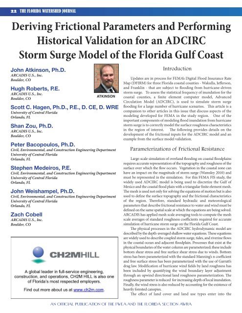
22 THE FLORIDA WATERSHED JOURNAL<br />
<strong>Deriving</strong> <strong>Frictional</strong> <strong>Parameters</strong> <strong>and</strong> <strong>Performing</strong><br />
<strong>Historical</strong> <strong>Validation</strong> for an ADCIRC<br />
Storm Surge Model of the Florida Gulf Coast<br />
John Atkinson, Ph.D.<br />
ARCADIS U.S., Inc.<br />
Boulder, CO<br />
Hugh Roberts, P.E.<br />
ARCADIS U.S., Inc.<br />
Boulder, CO<br />
Scott C. Hagen, Ph.D., P.E., D. CE, D. WRE<br />
University of Central Florida<br />
Orl<strong>and</strong>o, FL<br />
Shan Zou, Ph.D.<br />
ARCADIS U.S., Inc.<br />
Boulder, CO<br />
Peter Bacopoulos, Ph.D.<br />
Civil, Environmental, <strong>and</strong> Construction Engineering Department<br />
University of Central Florida<br />
Orl<strong>and</strong>o, FL<br />
Stephen Medeiros, P.E.<br />
Civil, Environmental, <strong>and</strong> Construction Engineering Department<br />
University of Central Florida<br />
Orl<strong>and</strong>o, FL<br />
John Weishampel, Ph.D.<br />
Civil, Environmental, <strong>and</strong> Construction Engineering Department<br />
University of Central Florida<br />
Orl<strong>and</strong>o, FL<br />
Zach Cobell<br />
ARCADIS U.S., Inc.<br />
Boulder, CO<br />
ATKINSON<br />
Introduction<br />
Updates are in process for FEMA’s Digital Flood Insurance Rate<br />
Map (DFIRM) for three Florida coastal counties - Wakulla, Jefferson,<br />
<strong>and</strong> Franklin - that are subject to flooding from hurricane-driven<br />
storm surge. To assess the statistical frequency of inundation for the<br />
coastal counties, a finite element computer model, Advanced<br />
Circulation Model (ADCIRC), is used to simulate storm surge<br />
flooding for a large number of hurricane scenarios. This article is a<br />
companion to other articles in this issue that discuss aspects of the<br />
modeling developed for FEMA in the study region. One of the<br />
important components of modeling flood inundation from hurricane<br />
storm surge is to correctly model the surface roughness characteristics<br />
in the region of interest. The following provides details on the<br />
development of the frictional inputs for the ADCIRC model <strong>and</strong> an<br />
example from the surface model validation.<br />
Parameterizations of <strong>Frictional</strong> Resistance<br />
Large-scale simulation of overl<strong>and</strong> flooding on coastal floodplains<br />
requires accurate representation of the topography <strong>and</strong> roughness of the<br />
surface over which the flow occurs. Vegetation in the coastal zone can<br />
have an impact on the magnitude of storm surge (Wamsley 2010) <strong>and</strong><br />
must be represented in the simulation. For this FEMA FIS study, the<br />
widely used ADCIRC model is being used to discretize the Gulf of<br />
Mexico <strong>and</strong> the coastal flood plain with a triangular finite element mesh.<br />
The mesh is used not only for solving the equations of motion but is also<br />
used to define the surface topography <strong>and</strong> the frictional characteristics<br />
of the region. Therefore, st<strong>and</strong>ard hydraulic <strong>and</strong> meteorological<br />
parameters that describe frictional resistance to water <strong>and</strong> wind must be<br />
defined on the same spatial scale at which the equations are being solved.<br />
ARCADIS has applied mesh scale averaging tools to compute the mesh<br />
scale averages of st<strong>and</strong>ard roughness coefficients required for accurate<br />
simulation of hurricane storm surge on the Florida Gulf Coast.<br />
The physical processes in the ADCIRC hydrodynamic model are<br />
described by the depth-averaged shallow water equations. These equations<br />
are widely used to describe coupled storm surge, tides, <strong>and</strong> riverine flows<br />
in the coastal ocean <strong>and</strong> adjacent floodplain. Processes that exist at the<br />
physical boundaries of the water column are parameterized; these include<br />
bottom shear stress <strong>and</strong> free surface shear stress due to winds. Bottom<br />
stress has been parameterized with the st<strong>and</strong>ard Manning’s n coefficient<br />
<strong>and</strong> free surface stress has been parameterized with the use of Garratt’s<br />
drag law. Modification of hurricane wind fields by l<strong>and</strong> roughness has<br />
been included by quantifying the wind boundary layer adjustment<br />
through an upwind directional l<strong>and</strong> roughness parameterization. The<br />
roughness parameter is reduced for increasing depth of local inundation.<br />
Finally, the wind stress is also reduced by accounting for the existence of<br />
heavily forested canopies.<br />
The effect of l<strong>and</strong> cover <strong>and</strong> l<strong>and</strong> use types enter into the<br />
AN OFFICIAL PUBLICATION OF THE FWEA AND THE FLORIDA SECTION AWRA
THE FLORIDA WATERSHED JOURNAL 23<br />
computations in several ways. First, the resistance to flow appears as<br />
surface <strong>and</strong> bottom stress terms in the depth averaged momentum<br />
equations in the x-direction:<br />
∂ u ∂u<br />
∂u<br />
∂ ⎛ P ⎞ τ<br />
bx<br />
τ<br />
sx<br />
+ u + v − fu = −g<br />
⎜ + ς ⎟ − + +<br />
1<br />
∂t<br />
∂x<br />
∂y<br />
∂x<br />
⎝ gρ<br />
⎠ ρH<br />
ρH<br />
H<br />
<strong>and</strong> in the y-direction:<br />
∂ v ∂v<br />
∂v<br />
∂ ⎛ P ⎞ τ<br />
by<br />
τ<br />
sy<br />
+ u + v + fv = −g<br />
⎜ + ς ⎟ − + +<br />
1<br />
∂t<br />
∂x<br />
∂y<br />
∂y<br />
⎝ gρ<br />
⎠ ρH<br />
ρH<br />
H<br />
The bottom stress terms are approximated as:<br />
( M + D − B )<br />
x<br />
( M + D − B )<br />
2 2 2<br />
τ<br />
bx<br />
n u + v<br />
− = − g<br />
u<br />
1<br />
ρH<br />
H<br />
3<br />
H<br />
in the x-direction <strong>and</strong> similarly in the y-direction where n is the<br />
Manning’s n parameter <strong>and</strong> must be specified for every ADCIRC<br />
node. The surface stress terms are approximated as,<br />
τ<br />
sx<br />
ρH<br />
C<br />
=<br />
H<br />
W 10 W<br />
+ d air<br />
10<br />
where Cd is a st<strong>and</strong>ard drag coefficient defined by Garratt’s drag formula<br />
(Garratt, 1977) for wind stress <strong>and</strong> W10 is the wind velocity at a 10-m<br />
height sampled at a 10-minute time period (Hsu, 1988). The W10 value<br />
is the wind velocity for full marine conditions as provided by an<br />
appropriate wind model (Powel et al, 1996). To account for the effect of<br />
l<strong>and</strong> roughness, the 10-m wind velocity is replaced by a reduced Wl<strong>and</strong><br />
velocity to account for surface roughness. The Wl<strong>and</strong> velocity is found by<br />
W<br />
where fd is the ratio of full marine roughness to the roughness of the<br />
l<strong>and</strong> surface <strong>and</strong> is expressed as,<br />
f<br />
d<br />
l<strong>and</strong><br />
=<br />
⎛ z<br />
=<br />
⎜<br />
⎝ z<br />
where zmarine <strong>and</strong> z0 are the marine <strong>and</strong> l<strong>and</strong> roughness length scales,<br />
respectively. The z0 length scale varies with l<strong>and</strong> cover <strong>and</strong> has been<br />
quantified by a variety of l<strong>and</strong> classifications as part of the FEMA<br />
Hazards US (HAZUS) study.<br />
Second, the influence of local l<strong>and</strong> cover enters the computations<br />
via the definition of regions of vegetative canopy. It has been shown<br />
that very little wind momentum transfers through heavily forested<br />
canopies. The effect of vegetative canopy is included by reducing Wl<strong>and</strong><br />
to zero in the presence of l<strong>and</strong> use classes that contain trees <strong>and</strong> thick<br />
shrubs. This amounts to the assumption that the branches, leaves, <strong>and</strong><br />
trunks absorb the momentum of the wind, thereby preventing that<br />
momentum from being transferred to the underlying water column.<br />
L<strong>and</strong>-Cover Data Sets<br />
The finite-element mesh being developed for Wakulla, Jefferson, <strong>and</strong><br />
Franklin counties extends well beyond their political boundaries. The<br />
model contains extensive regions on the coastal floodplain within <strong>and</strong><br />
adjacent to the study area so that inl<strong>and</strong> penetration of surge can be<br />
represented within the model. In addition to characterizing parts of coastal<br />
Florida, the model also includes all of the Gulf of Mexico, the Caribbean,<br />
<strong>and</strong> the western North Atlantic. The vast areal extent of the model domain<br />
is appropriate to capture the large-scale effects of hurricanes as the storm<br />
ρ<br />
ρ<br />
f<br />
0<br />
d<br />
marine<br />
⋅<br />
⎞<br />
⎟<br />
⎠<br />
W 10<br />
0.0706<br />
y<br />
x<br />
y<br />
x<br />
y<br />
.<br />
systems enter the Gulf of Mexico from the Atlantic <strong>and</strong> Caribbean (see<br />
Salisbury et al in this issue for more detail). The ADCIRC mesh created<br />
for the three-county region contains 855,445 computational nodes; thus<br />
there are too many nodal values to assign manually. An automated method<br />
is necessary to compute the appropriate averaging of <strong>and</strong> assignment of<br />
nodal values. Moreover, consistent <strong>and</strong> dependable data sets are required<br />
from which to derive the frictional parameters. The methodology <strong>and</strong> data<br />
sources are described in this section.<br />
The friction coefficients used in the ADCIRC model must<br />
realistically describe the three-county region of interest. To achieve this,<br />
the relevant model parameters are derived from existing data sets that<br />
accurately map the variations in l<strong>and</strong> cover for the region of interest.<br />
Several l<strong>and</strong> cover databases exist in the literature. The particular dataset<br />
used in this study was assembled by the Florida Fish <strong>and</strong> Wildlife<br />
Commission (FWC) specifically to describe the diversity <strong>and</strong> distribution<br />
of vegetation within Florida (http://research.myfwc.com/features/<br />
view_article.asp?id=29764). The dataset was derived from L<strong>and</strong>sat<br />
imagery <strong>and</strong> contains 43 separate l<strong>and</strong> cover classifications. Last updated<br />
in 2004, the FWC data set is considered to be the best available source for<br />
l<strong>and</strong> cover data in the region.<br />
Given a l<strong>and</strong> cover data set, the individual classifications of l<strong>and</strong><br />
cover type must be converted into appropriate values of the three<br />
frictional parameters. In this way a relationship is established to correlate<br />
model input with the l<strong>and</strong> cover data set. To be consistent with other<br />
FEMA studies, parameter assignments for the FWC data set were<br />
selected to match frictional values used for similar classifications in other<br />
FEMA studies. In similar surge modeling studies for FEMA Regions<br />
IV <strong>and</strong> VI in MS, LA, <strong>and</strong> TX, the USGS National L<strong>and</strong> Cover Data<br />
(NLCD) <strong>and</strong> USGS GAP data have been used. The NLCD set has a wellestablished<br />
set of values for the z0 parameter derived from the HAZUS<br />
program. Like the FWC data, the GAP data were created to document<br />
local habitat <strong>and</strong> bio-diversity <strong>and</strong> thus have been shown to have more<br />
accurate local detail <strong>and</strong> well-defined vegetation sub-divisions than the<br />
nationally uniform NLCD set. ADCIRC nodes are not assigned a l<strong>and</strong><br />
cover type; rather the classifications within the data sets must be<br />
converted to hydraulic parameters. St<strong>and</strong>ard hydraulic texts (Acrement<br />
1989, Barnes, 1967) have been consulted to establish bottom friction<br />
Manning’s n values for all the classifications in the GAP data. To<br />
promote consistency, biology experts at the University of Central Florida<br />
have been consulted to translate NLCD/GAP to the FWC classifications.<br />
Through careful comparison of the classification definitions, nearly<br />
identical friction definitions have been obtained for the FWC data set.<br />
Once the friction parameter values were established for the FWC<br />
data, the data itself were sub-divided into overlapping tiles that fully cover<br />
the inl<strong>and</strong> region of the ADCIRC mesh. The tiles provide the longitude,<br />
latitude, <strong>and</strong> classification code for each pixel within the image tiles. By<br />
sub-dividing the data <strong>and</strong> exporting to a text format, custom codes can<br />
read <strong>and</strong> manipulate the data much easier than working with the raw<br />
graphics format. Using the text-formatted data, the custom codes<br />
perform the necessary spatial averaging for computing individual nodal<br />
values of Manning’s n, z0, <strong>and</strong> canopy. Each pixel in the FWC data set<br />
has a class <strong>and</strong> each class has an associated value for the needed friction<br />
parameters. This allows the pixel coordinates to be used to spatially<br />
locate the appropriate data points that contribute to each ADCIRC node.<br />
Manning’s n<br />
Manning’s n is an isotropic scalar parameter used to approximate<br />
Continued on page 24<br />
AN OFFICIAL PUBLICATION OF THE FWEA AND THE FLORIDA SECTION AWRA
24 THE FLORIDA WATERSHED JOURNAL<br />
Continued from page 23<br />
resistance to flow from a variety of physical mechanisms, including form<br />
drag <strong>and</strong> skin friction. For the depth-averaged ADCIRC model, the<br />
Manning’s n should correlate to roughness of the l<strong>and</strong>scape at the same<br />
spatial scale as the computed flow. When the finite element mesh is<br />
highly refined, finer details of the underlying l<strong>and</strong>scape can be<br />
represented <strong>and</strong> when the finite elements are large, a larger scale average<br />
is appropriate. Thus, the nodal Manning’s n value is approximated as an<br />
arithmetic average of all the individual data points within a control<br />
volume surrounding the ADCIRC node. The control volume is sized<br />
by the mid-points of all the finite elements to which the node is attached.<br />
The Manning’s n values for all the collected pixels are averaged to<br />
generate the nodal value. An example of the Manning’s n distribution<br />
in the ADCIRC model for the study area is shown in Figure 1.<br />
Directional z0<br />
Figure 1. Manning's n values in the western portion of the study<br />
domain.<br />
Figure 2. Wind Reduction values for an Easterly wind.<br />
As described above <strong>and</strong> in the FEMA HAZUS report, the z0 value<br />
is anisotropic. The wind boundary layer depends upon conditions<br />
upwind of the node, as it can take more than 3 km to adjust to changes<br />
in ground roughness. This upwind effect is particularly important in<br />
the near-shore regions where winds are traveling either offshore or<br />
onshore <strong>and</strong> transitioning to <strong>and</strong> from open marine conditions. A<br />
l<strong>and</strong>-masking procedure that does not account for wind-directionality<br />
<strong>and</strong> upwind effects would incorrectly apply full marine force winds at<br />
all locations. Using accurate winds in the model are especially critical<br />
in the near-shore <strong>and</strong> low-lying overl<strong>and</strong> regions that experience either<br />
drawdown or flooding because the wind-stress term in the shallowwater<br />
equations is inversely proportional to total water column depth<br />
<strong>and</strong> thus the sensitivity to winds in shallow regions is the greatest.<br />
The z0 parameter has units of length <strong>and</strong> may be thought of as a<br />
roughness length scale correlated to the height of roughness elements on<br />
the surface; the larger the value, the greater the amount of “shielding”<br />
from the wind. The assignment of length scale to the FL-FWC classes<br />
is consistent with the definitions in the FEMA HAZUS report.<br />
To implement assignment of z0 nodal values, l<strong>and</strong> cover pixels are<br />
collected in a wedge-shape region on the upwind side of the node<br />
several kilometers distant from the node. To account for directionality<br />
of the upwind parameters, the compass is divided into 12 directions<br />
<strong>and</strong> an upwind z0 value is computed for each of the directions. Each<br />
node is assigned 12 values of the z0 parameter. During runtime the<br />
ADCIRC model applies the wind-reduction value appropriate to the<br />
instantaneous wind direction at each node. Two examples of the<br />
model input are provided in Figure 2 for Direction Number 7 (wind<br />
blowing east to west) <strong>and</strong> in Figure 3 for Direction Number 1 (wind<br />
blowing west to east). Note that the directionality can be most easily<br />
seen by comparing the difference between the images in the area of<br />
influence of barrier isl<strong>and</strong>s <strong>and</strong> coastal regions.<br />
Canopy<br />
Figure 3. Wind reduction parameter for a Westerly wind.<br />
The canopy parameter accounts for additional wind adjustment.<br />
While the z0 value accounts for the wind boundary layer adjustment, the<br />
canopy parameter accounts for the wind penetration of the roughness<br />
elements. There are large-scale features, such as heavily forest canopies,<br />
that can shelter the water surface from the wind stresses <strong>and</strong> in effect<br />
create two-layered systems. It has been demonstrated that minimal<br />
momentum transfer occurs from the wind to the water column in dense<br />
forest (Reid <strong>and</strong> Whitaker, 1976). Therefore, ADCIRC makes use of a<br />
canopy parameter which is a direct multiplier of the wind stress term. If<br />
the nodal canopy value equals unity, the full wind stress is applied, <strong>and</strong><br />
if canopy equals zero, no wind stress is applied in the momentum balance<br />
at that node. In this formulation of ADCIRC, fractional canopy values<br />
are not used, rather, the canopy parameter is either 0 (canopy) or 1 (no<br />
canopy). Following the control volume averaging scheme used to<br />
AN OFFICIAL PUBLICATION OF THE FWEA AND THE FLORIDA SECTION AWRA
THE FLORIDA WATERSHED JOURNAL 25<br />
average the Manning’s n values for the ADCIRC mesh, all FL-FWC l<strong>and</strong>use<br />
data points are collected for each ADCIRC control volume. All of<br />
the canopy values within a nodal control volume are averaged. In the<br />
case that the average is greater 0.75, the nodal canopy value is set to unity.<br />
Otherwise the canopy is set to zero.<br />
Tidal <strong>Validation</strong><br />
Tidal validation is performed to assess the ability of the model to<br />
replicate the low-energy hydrodynamic processes of the study area.<br />
For this study area there have been many previous published studies<br />
performed using ADCRIC to assess how well the model captures<br />
astronomical tides. The ADCIRC model used in these previous<br />
studies formed the base for the ADCIRC model in this study (Parrish<br />
<strong>and</strong> Hagen, 2007, 2009).<br />
For this study a tidal simulation was set up to simulate 45 days of<br />
tides using a 1-second time step. No normal-flow constraints (with<br />
free tangential slip) are enforced along all coastlines <strong>and</strong> floodplain<br />
margins. Tides enter the domain in the deep ocean through the<br />
boundary forcing imposed along the 60° west meridian, which<br />
consists of seven principal tidal constituents (K1, O1, M2, S2, N2, K2,<br />
<strong>and</strong> Q1) interpolated from the global ocean tide model of Le Provost<br />
et al. (1998). Tidal potential forcing associated with these same seven<br />
constituents is applied over the surface of the domain.<br />
There are four National Ocean Service (NOS) tidal gauging<br />
stations within the study area. The NOS reports 37 tidal constituents<br />
for each of the four tidal gauging stations. Model output consists of 23<br />
tidal constituents (Westerink, 1994). Figure 4 displays re-synthesized<br />
observed <strong>and</strong> simulated tidal signals for the four NOS tidal gauging<br />
stations within the focus area. The model captures the amplitude <strong>and</strong><br />
phase of the tide as well as its mixed, i.e., diurnal <strong>and</strong> semi-diurnal,<br />
character. Note that tides in the Gulf of Mexico are chiefly diurnal<br />
since the basin configuration allows for a natural period close to 12<br />
hours, though there is partially a semi-diurnal response due to direct<br />
astronomical forcing (Reid <strong>and</strong> Whitaker, 1981).<br />
<strong>Historical</strong> Storm <strong>Validation</strong><br />
To evaluate the ADCIRC model performance, several historical<br />
hurricanes were simulated <strong>and</strong> model results compared to the<br />
available historical storm surge data. For these hindcasts,<br />
meteorological inputs were supplied by Oceanweather Inc. <strong>and</strong> the<br />
effect of surface waves is included via radiation stress inputs from the<br />
SWAN nearshore wave model (see Slinn in this issue). High Water<br />
Mark (HWM) data have been supplied by FEMA <strong>and</strong> historic reports<br />
<strong>and</strong> hydrograph data have been supplied by NWFWMD <strong>and</strong> NOAA.<br />
One of the limitations of evaluating the accuracy of the ADCIRC<br />
model is that the storm history as well as the HWM data is sparse for<br />
the region of interest. In addition, data from the older storms often<br />
have an unknown datum which can make comparisons a challenge.<br />
Nevertheless, comparison of the simulated surge to the available time<br />
series hydrograph data reveals very good agreement.<br />
Another limitation when comparing model results to HWMs <strong>and</strong><br />
to tidal gauge hydrographs is the unknown amount of wave effects<br />
included in the measurements. Both gauges <strong>and</strong> HWMs can have<br />
varying amounts of wave setup included in them, depending on the<br />
geographic location. This makes comparison to the modeled storms<br />
difficult. To account for wave setup, radiation stresses are included in<br />
the ADCIRC model from the 2D wave model SWAN. The wave<br />
radiation stresses account for a majority of the wave setup component.<br />
However, wave setup may be slightly under-predicted due to<br />
components of the wave setup not included in the wave radiation<br />
stress, such as mass transfer.<br />
HWMs may also contain effects such as wave runup <strong>and</strong><br />
overtopping. These are also based on observations which can be very<br />
subjective. The HWMs were reviewed <strong>and</strong> filtered to obtain only the<br />
HWMs of the highest quality <strong>and</strong> that contain only the total storm<br />
Continued on page 26<br />
Figure 4. Measured <strong>and</strong> simulated tidal signal for (a) Apalachicola River, (b) Turkey Point, (c) Shell Point, <strong>and</strong> (d) Apalachee Bay.<br />
AN OFFICIAL PUBLICATION OF THE FWEA AND THE FLORIDA SECTION AWRA
26 THE FLORIDA WATERSHED JOURNAL<br />
Continued from page 25<br />
surge without wave runup or overtopping effects as best as can be<br />
accessed from the available data <strong>and</strong> descriptions of the HWM. There<br />
may also be datum issues with some of the older data sets.<br />
Note that this exercise was not a calibration in the sense that model<br />
parameters were not adjusted in an attempt to tune the model to force<br />
a closer match. Rather, the model parameters were derived from<br />
accepted values in the literature <strong>and</strong> fixed for the duration of the<br />
hindcasting. There are many sources of uncertainty in the hindcasting<br />
procedure such as errors in the data collection, meteorology, wave<br />
model, surge model, <strong>and</strong> topographic data. Because of the multiple<br />
sources of uncertainty, calibration <strong>and</strong> model tuning could result in<br />
compensating for one deficiency by non-physical adjustment of<br />
parameters. To avoid this, calibration was not performed.<br />
The four historical storms available for this study region are<br />
Agnes (1972), Kate (1985), Opal (1995), <strong>and</strong> Dennis (2005). Agnes<br />
passed along the western border of the study area <strong>and</strong> induced surge<br />
primarily in Wakulla <strong>and</strong> Jefferson counties. Kate also passed west of<br />
the study area, but Kate produced stronger winds, thus generating<br />
more surge than Agnes. Opal made l<strong>and</strong>fall near Alabama, which is far<br />
west of the study site. For Agnes, Kate, <strong>and</strong> Opal, there are very few<br />
measured HWMs <strong>and</strong> minimal time series hydrograph data. No<br />
gauge data are available for Kate.<br />
Since it is the most recent storm, more data exist for Hurricane<br />
Dennis than for the earlier storms. Hurricane Dennis made l<strong>and</strong>fall<br />
west of the study area on July 10, 2005 as a Category 3 storm. Dennis’<br />
maximum wind speed was 150 mph with a minimum central pressure<br />
of 930 mbar. The hindcast of Dennis produced a peak surge of 17.12<br />
feet. A contour plot of the maximum simulated surge is presented in<br />
Figure 5. A map showing the location of time-series hydrograph data<br />
is provided in Figure 6 <strong>and</strong> Figure 7 provides examples of the measured<br />
Figure 5. Simulated maximum surge for Hurricane Dennis (2005).<br />
Contours are storm surge in feet. The red dashed line is the<br />
storm center track.<br />
Figure 6. Locations of available gauge data for Hurricane Dennis.<br />
Figure 7. Measured <strong>and</strong> simulated water surface elevation at<br />
three locations for Hurricane Dennis. See Figure 8 for location<br />
map.<br />
AN OFFICIAL PUBLICATION OF THE FWEA AND THE FLORIDA SECTION AWRA
THE FLORIDA WATERSHED JOURNAL 27<br />
<strong>and</strong> simulated surge levels at gauge locations 572, 8728690, <strong>and</strong><br />
8727520. Overall the comparison between model <strong>and</strong> historic data<br />
appears reasonable. Modeled results compare very well with gauge<br />
hydrographs while maximum difference in HWMs range from 1 to 2<br />
ft with the model results biased lower which seems typical <strong>and</strong> expected<br />
based on the known physical <strong>and</strong> limitations of the modeling.<br />
Summary<br />
As part of the development of a storm surge model for use by FEMA<br />
in updating DFIRMs within Wakulla, Jefferson, <strong>and</strong> Franklin counties<br />
Florida, inputs for the ADCIRC model have been developed to<br />
account for the surface characteristics of the region. Nodal values<br />
of Manning’s-n, anisotropic wind shielding, <strong>and</strong> vegetative canopy<br />
have been derived from available l<strong>and</strong>-cover datasets. The resulting<br />
model has been used to hindcast several historic hurricanes. The<br />
validation results compare well to the available data.<br />
References<br />
• Arcement, G.J., <strong>and</strong> V.R. Schneider. 1989. “Guide for Selecting<br />
Manning's Roughness Coefficients for Natural Channels <strong>and</strong> Flood<br />
Plains”, U.S. Geological Survey Water-Supply Paper 2339, U.S.<br />
Geological Survey, Denver, Colorado.<br />
• Barnes, H.H. 1967. “Roughness Characteristics of Natural<br />
Channels,” U.S. Geological Survey Water-Supply Paper 1849, U.S.<br />
Geological Survey, Washington D.C.<br />
• Cardone, V.J., C.V. Greenwood, <strong>and</strong> J.A. Greenwood. 1992.<br />
“Unified program for the specification of hurricane boundary layer<br />
winds over surfaces of specified roughness.” Contract Report<br />
CERC-92-1, U.S. Army Corps of Engineers. Available at: ERDC<br />
Vicksburg (WES), U.S. Army Engineer Waterways Experiment<br />
Station (WES), ATTN: ERDC-ITL-K, 3909 Halls Ferry Road,<br />
Vicksburg, Mississippi, 39180-6199.<br />
• Charnock, H. 1955. “Wind stress on a water surface.” Quart. J.<br />
Royal Met. Society, 81: 639-640.<br />
• Chow, V.T. 1959. Open Channel Hydraulics, McGraw-Hill Book<br />
Company, New York.<br />
• Federal Emergency Management Agency. 2005. “HAZUS: Hazard loss<br />
estimation methodology.” http://www.fema. gov/hazus/index.shtm.<br />
• Feyen, J.C., J.H. Atkinson, <strong>and</strong> J.J. Westerink. 2000. “Issues in<br />
hurricane surge computations using a GWCE-based finite element<br />
model.” Proc., XIII Conf. on Computational Methods in Water<br />
Resources, Vol. II, L. Bentley, J. Sykes, C. Brebbia, W. Gray, <strong>and</strong> G.<br />
Pinder, Eds., 865-872.<br />
• Garratt, J.R., Review of drag coefficients over oceans <strong>and</strong> continents,<br />
Monthly Weather Review, V105, 1977, 915-929.<br />
• Hagen , S.C. , A. Zundel <strong>and</strong> S. Kojima, "Automatic, Unstructured Mesh<br />
Generation for Tidal Calculations in a Large Domain." International<br />
Journal of Computational Fluid Dynamics, 20(8), 593-608 (2006).<br />
• Hagen, S. C., Westerink, J. J., Kolar, R. L., <strong>and</strong> Horstmann, O., "Twodimensional,<br />
unstructured mesh generation for tidal models."<br />
International Journal for Numerical Methods in Fluids, 35, 669-686<br />
(2001).<br />
• Ho, F.P., <strong>and</strong> V.A. Myers. 1975. “ Joint Probability Method of Tide<br />
Frequency Analysis applied to Apalachicola Bay <strong>and</strong> St. George<br />
Sound, Florida,” NOAA Technical Report NWS 18, 43p.<br />
• Hsu, S.A., Coastal Meteorology, Academic Press, 1988.<br />
• Le Provost, C., F. Lyard, J. Molines, M. Genco, <strong>and</strong> F. Rabilloud, A<br />
hydrodynamic ocean tide model improved by assimilating a satellite<br />
altimeter-derived data set. Journal of Geophysical Research, v103,<br />
5513-5529, 1998.<br />
• Mukai, A., J.J. Westerink, R.A. Luettich, <strong>and</strong> D. Mark. 2001b. “A<br />
Tidal Constituent Database for the Western North Atlantic Ocean,<br />
Gulf of Mexico <strong>and</strong> Caribbean Sea,” Technical Report, U.S. Army<br />
Engineer Research <strong>and</strong> Development Center.<br />
• Mukai, A., J.J. Westerink, R.A. Luettich, <strong>and</strong> D. Mark. 2002. “Eastcoast<br />
2001: a tidal constituent database for the Western North Atlantic, Gulf<br />
of Mexico <strong>and</strong> Caribbean Sea,” U.S. Army Corps of Engineers Research<br />
<strong>and</strong> Development Center, Coastal <strong>and</strong> Hydraulics Laboratory,<br />
Technical Report, ERDC/CHL TR-02-24. 201p. September.<br />
• National Geodetic Survey: Vertical datums. http://www.ngs.noaa.gov/.<br />
• Parrish, D.M., <strong>and</strong> Hagen, S.C., "Incorporating Spatially Variable<br />
Bottom Stress <strong>and</strong> Coriolis Force into 2D, a posteriori, Unstructured<br />
Mesh Generation for Shallow Water Models." International Journal<br />
for Numerical Methods in Fluids, 60(3), 237-261 (30 May 2009).<br />
• Parrish, D.M., <strong>and</strong> Hagen, S.C., "2D, Unstructured Mesh Generation<br />
for Oceanic <strong>and</strong> Coastal Tidal Models from a Localized Truncation<br />
Error Analysis with Complex Derivatives." International Journal of<br />
Computational Fluid Dynamics, 21(7), 277-296 (2007).<br />
• Powell, M.D., S. Houston, <strong>and</strong> T. Reinhold, Hurricane Andrew’s<br />
l<strong>and</strong>fall in South Florida. Part I: St<strong>and</strong>ardizing measurements for<br />
documentation of surface wind fields. Weather Forecasting, v11,<br />
1996, 304-328.<br />
• Reid, R.O., <strong>and</strong> R. Whitaker. 1976. “Wind-driven flow of water<br />
influenced by a canopy.” J. Waterw., Harbors, Coastal Engr. Div.-<br />
Am. Soc. Civ. Eng., 102, WW1, 61-77.<br />
• Reid, R. O., <strong>and</strong> Whitaker, R. E. (1981). “Numerical model for<br />
astronomical tides in the Gulf of Mexico, I: Theory <strong>and</strong> application.”<br />
Technical Report, Department of Oceanography, Texas A&M<br />
University, College Station, Texas (prepared for U.S. Army Engineer<br />
Waterways Experiment Station, Vicksburg, Mississippi).<br />
• Wamsley, T.V., M. A. Cialone, J. M. Smith, J. H. Atkinson, J. D.<br />
Rosati, "The potential of wetl<strong>and</strong>s in reducing storm surge", Ocean<br />
Engineering, v37, 36-47, 2010.<br />
• Westerink, J.J., Blain, C.A., Luettich, R.A., <strong>and</strong> Scheffner, N.W.<br />
(1994). ADCIRC: An Advanced Three-Dimensional Circulation<br />
Model for Shelves, Coasts, <strong>and</strong> Estuaries Report No. 2. User’s<br />
Manual for ADCIRC-2DDI, Technical Report DRP-92-6, January<br />
1994, U.S. Army Engineer Waterways Experiment Station,<br />
Vicksburg, Mississippi.<br />
John Atkinson: john.atkinson@arcadis-us.com<br />
AN OFFICIAL PUBLICATION OF THE FWEA AND THE FLORIDA SECTION AWRA