Te Atatu Peninsula Park Reserve Management ... - Auckland Council
Te Atatu Peninsula Park Reserve Management ... - Auckland Council
Te Atatu Peninsula Park Reserve Management ... - Auckland Council

Create successful ePaper yourself
Turn your PDF publications into a flip-book with our unique Google optimized e-Paper software.
P A R T O N E :<br />
I N T R O D U C T I O N<br />
A N D B A C K G R O U N D<br />
1.0 INTRODUCTION<br />
1.1 <strong>Te</strong> <strong>Atatu</strong> <strong>Peninsula</strong> <strong>Park</strong><br />
<strong>Te</strong> <strong>Atatu</strong> <strong>Peninsula</strong> <strong>Park</strong> is located off Matipo Road,<br />
Taikaka Road and Neil Avenue on the western<br />
side of <strong>Te</strong> <strong>Atatu</strong> <strong>Peninsula</strong>. Map 1 illustrates the<br />
location of <strong>Te</strong> <strong>Atatu</strong> <strong>Peninsula</strong> <strong>Park</strong>.<br />
<strong>Te</strong> <strong>Atatu</strong> <strong>Peninsula</strong> <strong>Park</strong> is a Citywide <strong>Park</strong> and<br />
as such, benefits not only the local community<br />
but also the wider Waitakere area. The <strong>Park</strong> is<br />
extensively utilised for both summer and winter<br />
sports codes and demand on such space is<br />
increasing.<br />
<strong>Te</strong> <strong>Atatu</strong> <strong>Peninsula</strong> <strong>Park</strong> is located within an urban<br />
residential context and forms an integral<br />
component of the wider neighbourhood reserve<br />
network. The <strong>Park</strong> is also near five different<br />
schools located within <strong>Te</strong> <strong>Atatu</strong> <strong>Peninsula</strong>, these<br />
being Matipo School, <strong>Peninsula</strong> Primary School, <strong>Te</strong><br />
<strong>Atatu</strong> Intermediate, Rutherford College, and<br />
Rutherford Primary School.<br />
The <strong>Park</strong> provides a range of facilities for the<br />
community including sports fields (used by a<br />
number of codes and sports clubs including<br />
Touch Waitakere, Waitakere Cricket, and <strong>Te</strong><br />
<strong>Atatu</strong> Soccer), clubrooms, Trees for Babies, open<br />
passive space, a playground, carparking areas and<br />
public toilets.<br />
This <strong>Reserve</strong> <strong>Management</strong> Plan will set out the<br />
Objectives and Policies for the management of <strong>Te</strong><br />
<strong>Atatu</strong> <strong>Peninsula</strong> <strong>Park</strong>. The Plan has been produced<br />
within the framework of the Waitakere City <strong>Council</strong><br />
<strong>Park</strong>s and Open Space Strategy.<br />
1.2 Key Objectives and Policies<br />
The following is a summary of the key Objectives<br />
and<br />
Policies for the <strong>Te</strong> <strong>Atatu</strong> <strong>Peninsula</strong> <strong>Park</strong> Draft<br />
<strong>Management</strong> Plan. The Objectives and Policies are<br />
more fully detailed in Part Two, Section 7.<br />
Objective 1<br />
To provide for and enhance the continued use and<br />
enjoyment of the <strong>Park</strong> by a range of City wide<br />
uses.<br />
Objective 2<br />
To ensure that the management and administration<br />
of <strong>Te</strong> <strong>Atatu</strong> <strong>Peninsula</strong> <strong>Park</strong> provides maximum<br />
benefit to the sporting codes.<br />
Objective 3<br />
To maintain and improve the vegetative structure<br />
of the <strong>Park</strong> to provide a more pleasant amenity for<br />
users.<br />
Objective 4<br />
To maximise the amount of on site car parking<br />
without compromising the recreation and amenity<br />
value of the park.<br />
View of Cricket Block on <strong>Park</strong><br />
<strong>Te</strong> <strong>Atatu</strong> <strong>Peninsula</strong> <strong>Park</strong> <strong>Reserve</strong> <strong>Management</strong> Plan 4
1.3 The Purpose of the <strong>Reserve</strong><br />
<strong>Management</strong> Plan<br />
The intention of the <strong>Management</strong> Plan is to:<br />
“Provide for and ensure the use, enjoyment,<br />
protection and preservation, as the case may<br />
require, and to the extent that the administering<br />
body’s resources permit, the development as<br />
appropriate, of the reserve for the purposes of<br />
which it is classified.” <strong>Reserve</strong>s Act 1977.<br />
1.4 How to use this <strong>Reserve</strong><br />
<strong>Management</strong> Plan<br />
This <strong>Management</strong> Plan is in three parts as outlined<br />
below:<br />
Part 1 - contains the statutory nature and process<br />
involved in creating a <strong>Reserve</strong> <strong>Management</strong> Plan.<br />
Part 2 - sets out a site analysis and description<br />
of the public consultation that was undertaken<br />
and includes a summary of submissions that were<br />
received as part of the consultation process. This<br />
part of the Plan also includes its Objectives and<br />
Policies, which in part have been based upon<br />
consideration of the submissions received.<br />
Part 3 - consists of a Concept Plan that has been<br />
developed for <strong>Te</strong> <strong>Atatu</strong> <strong>Peninsula</strong> <strong>Park</strong>. The Concept<br />
Plan illustrates at a conceptual level what can<br />
be implemented and also contains a register of<br />
proposed works.<br />
1.5 The <strong>Reserve</strong> <strong>Management</strong> Plan<br />
Process<br />
Under Section 41 of the <strong>Reserve</strong>s Act 1977,<br />
there are certain criteria and steps that must be<br />
undertaken before a <strong>Management</strong> Plan is created<br />
and adopted. The steps taken for this Plan are<br />
outlined below:<br />
December 2004<br />
prepare and publicly notify <strong>Management</strong> Plan for<br />
<strong>Te</strong> <strong>Atatu</strong> <strong>Peninsula</strong> <strong>Park</strong>.<br />
February 2005<br />
Public notification of intention to prepare<br />
<strong>Management</strong> Plan. Submissions called for.<br />
January/February 2005<br />
Background research and initial discussions and<br />
contact with interest groups. Issues identified and<br />
evaluated and included in Draft Plan.<br />
March/April 2005<br />
Public Workshops/ Open Days on <strong>Management</strong><br />
Plan issues and suggestions.<br />
April 2005<br />
Preliminary public submissions close.<br />
May/July 2005<br />
Preparation of Draft <strong>Management</strong> Plan.<br />
September 2005<br />
Advisory Board meeting held to determine content<br />
of Draft Plan and discuss issues.<br />
October 2005<br />
City Development Committee approve Draft Plan to<br />
be publicly notified for submissions for a two month<br />
submission period.<br />
December 2005<br />
Public submissions on Draft Plan to close.<br />
June 2006<br />
Hearing of submissions on Draft Plan by City<br />
Development Committee and decisions on<br />
submissions.<br />
July 2006<br />
Modification of Plan according to decisions and<br />
adoption of final <strong>Management</strong> Plan on behalf of<br />
<strong>Council</strong>.<br />
2006-beyond<br />
Plan kept under continual review by Waitakere City<br />
<strong>Council</strong>.<br />
City Development Committee approve proposal to<br />
<strong>Te</strong> <strong>Atatu</strong> <strong>Peninsula</strong> <strong>Park</strong> <strong>Reserve</strong> <strong>Management</strong> Plan 5
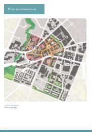
Map one location of <strong>Te</strong> <strong>Atatu</strong> <strong>Peninsula</strong> <strong>Park</strong><br />
<strong>Te</strong> <strong>Atatu</strong> <strong>Peninsula</strong> <strong>Park</strong> <strong>Reserve</strong> <strong>Management</strong> Plan 6
2.0 STATUTORY AND<br />
STRATEGIC CONTEXT<br />
2.1 The <strong>Reserve</strong>s Act 1977<br />
The <strong>Reserve</strong>s Act 1977 requires that every reserve<br />
has a <strong>Management</strong> Plan. The <strong>Council</strong> is currently<br />
undergoing a systematic programme of preparing<br />
these plans for all of its reserves. The process has<br />
been outlined in Section 1.4 of this Plan.<br />
The purpose of the <strong>Reserve</strong>s Act 1977 is set out as<br />
follows:<br />
"Providing, for the preservation and management<br />
for the benefit and enjoyment of the public, areas<br />
of New Zealand possessing:<br />
• Recreational use or potential, whether active or<br />
passive; or<br />
• Wildlife; or<br />
• Indigenous Flora or Fauna; or<br />
• Environmental and landscape amenity or interest;<br />
or<br />
• Natural, scenic, historic, cultural, archaeological,<br />
biological, geological, scientific, educational,<br />
community, or other special features or value.<br />
The development and management of the <strong>Reserve</strong><br />
should strive to achieve the purpose of the<br />
<strong>Reserve</strong>s Act 1977.<br />
2.2 Resource <strong>Management</strong> Act<br />
1991<br />
The purpose of this Act is to:<br />
“promote the sustainable management of natural<br />
and physical resources.”<br />
“Sustainable management’’ means managing the<br />
use, development and protection of natural and<br />
physical resources in a way, or at a rate, which<br />
enables people and communities to provide for<br />
their social, economic, and cultural wellbeing and<br />
for their health and safety.<br />
As is the case for freehold land, the Resource<br />
<strong>Management</strong> Act 1991 also applies to the<br />
management of reserve land. The application of<br />
this Act is generally through the requirement under<br />
the District Plan to obtain resource consents for<br />
certain works to be undertaken.<br />
2.3 Waitakere City <strong>Council</strong><br />
Operative District Plan 2003<br />
The Waitakere City <strong>Council</strong>’s District Plan (the<br />
‘District Plan’) is an instrument that is used<br />
everyday to guide and provide for development<br />
within the territorial authority’s boundaries and to<br />
implement the Resource <strong>Management</strong> Act 1991.<br />
The District Plan provides zonings for various parts<br />
of the City. <strong>Te</strong> <strong>Atatu</strong> <strong>Peninsula</strong> <strong>Park</strong> is zoned Open<br />
Space for the Human Environment and General<br />
for the Natural Environment. Within each of the<br />
zones of the District Plan, certain activities and<br />
works are permitted and are listed in the District<br />
Plan. Any activity that is not permitted under the<br />
District Plan requires resource consent from the<br />
<strong>Council</strong>. This may include additions to buildings or<br />
the creation of sports fields. The resource consent<br />
process is used to assess the adverse effects on<br />
the environment and to avoid or mitigate these<br />
where possible.<br />
2.4 Waitakere City <strong>Council</strong> draft<br />
<strong>Park</strong>s and Open Space<br />
Strategy<br />
Waitakere City <strong>Council</strong> adopted a <strong>Park</strong>s Strategy<br />
in April 1999. At the time of this <strong>Management</strong> Plan<br />
being adopted this strategy is being reviewed. The<br />
purpose of the Strategy is to provide an overall<br />
framework for the management of all parks within<br />
Waitakere. The Strategy sets out a vision for the<br />
City’s <strong>Park</strong>s, which has six elements. These are as<br />
follows:<br />
Native ecosystems extend through all parks,<br />
and often connect to provide corridors for<br />
wildlife and people.<br />
<strong>Te</strong> <strong>Atatu</strong> <strong>Peninsula</strong> <strong>Park</strong> <strong>Reserve</strong> <strong>Management</strong> Plan 7
A network of City-wide parks are located<br />
throughout the City, with each one providing<br />
a variety of attractive settings for recreation.<br />
At least one of each type of the City's<br />
different types of ecosystems are protected<br />
within the parks network.<br />
Residents have easy access to<br />
neighbourhood and local parks where they<br />
can readily experience nature and play<br />
informal sports.<br />
Local communities, Iwi and ethnic groups<br />
are actively involved in the design and<br />
management of parks.<br />
In town centres where people live much<br />
closer<br />
together, there are plenty of green spaces,<br />
tree lined streets and vibrant civic places.<br />
throughout the City.<br />
To provide in partnership with Iwi, and<br />
where relevant, the wider Maori Community,<br />
the protection of Waahi tapu and sites of<br />
significance found on parks.<br />
To improve the management and<br />
administration of parks.<br />
The Strategy identifies <strong>Te</strong> <strong>Atatu</strong> <strong>Peninsula</strong> <strong>Park</strong> as<br />
a City-wide park<br />
City-wide parks are identified as large individual<br />
reserves or groups of reserves that combine<br />
to provide significant areas of open space,<br />
and a variety of landscapes and recreational<br />
opportunities.<br />
The Strategy sets out a range of standards that a<br />
reserve is required to satisfy in order to qualify as<br />
a City-wide park. We have set out below how <strong>Te</strong><br />
<strong>Atatu</strong> <strong>Peninsula</strong> <strong>Park</strong> compares to these standards.<br />
The document sets out Objectives and Policies for<br />
achieving this vision. It identifies parks that are<br />
suitable for improvement throughout the City and<br />
looks at an array of issues.<br />
The objectives of the document as outlined below:<br />
Increase the use and enjoyment of parks.<br />
Extend and improve the City's natural<br />
ecosystems.<br />
Increase the opportunities for people to<br />
enjoy nature in parks.<br />
<strong>Park</strong>s are managed sustainably as part of<br />
the wider<br />
landscape.<br />
Improve the use, range and quality of sports<br />
facilities within the City.<br />
Protect the heritage values within parks and<br />
increase the awareness of the local area's<br />
heritage.<br />
To provide quality local and neighbourhood<br />
parks that are within walking distance<br />
Standard<br />
Includes a flat, welldrained<br />
area of at least<br />
5000m² for casual<br />
recreation.<br />
Road frontage is at least<br />
100m, on two or more<br />
roads and has bollards<br />
or other suitable<br />
barriers.<br />
Includes changing<br />
rooms and toilets where<br />
there are no club facilities.<br />
Includes play facilities<br />
for older children e.g.<br />
halfcourt, skate ramp.<br />
<strong>Te</strong> <strong>Atatu</strong> <strong>Peninsula</strong><br />
<strong>Park</strong><br />
8.3386 ha of flat land<br />
provided.<br />
Presently two road<br />
frontages at 31 and 33<br />
metres.<br />
Club facilities provided<br />
and also public toilets.<br />
None at present.<br />
<strong>Te</strong> <strong>Atatu</strong> <strong>Peninsula</strong> <strong>Park</strong> <strong>Reserve</strong> <strong>Management</strong> Plan 8
Independent offstreet<br />
carpark appropriate for<br />
type and level of usage.<br />
Comprehensive<br />
playground suitable for<br />
ages 3-12.<br />
All weather internal<br />
path network linking<br />
accessways, playground<br />
and other facilities.<br />
Buildings are designed<br />
to integrate with<br />
the surrounding<br />
environment.<br />
Neil Ave carpark.<br />
Suitable playground<br />
facilities are located at<br />
the park.<br />
Limited path network.<br />
Buildings are in<br />
keeping with present<br />
surrounding built<br />
environment.<br />
Diversify leisure services to focus and<br />
improve provision for different groups and<br />
communities.<br />
Improve natural amenity by building on the<br />
unique 'green' and 'blue' images of Waitakere<br />
City.<br />
Develop community focal points near where<br />
people live and shop, with an atmosphere of<br />
enjoyment and availability of low-cost casual<br />
leisure activities.<br />
3.0 TE ATATU PENINSULA<br />
3.1 Physical<br />
It is noted that the <strong>Park</strong>s Strategy is currently<br />
being rewritten.<br />
2.5 Draft Leisure Strategy<br />
The Waitakere City <strong>Council</strong> Draft Leisure Strategy<br />
is a companion document to the Waitakere <strong>Park</strong>s<br />
and Open Space Strategy. The Strategy focuses on<br />
leisure facilities such as playgrounds, courts, skate<br />
parks, cycle tracks, sports surfaces and larger built<br />
facilities. The focus is on how these assets are<br />
used by the community to achieve leisure<br />
objectives.<br />
The Strategy outlines the <strong>Council</strong>’s goals for improving<br />
leisure opportunities in Waitakere in the<br />
future. The <strong>Council</strong> aims to improve the happiness<br />
and health of the City’s people and communities by<br />
promoting:<br />
The enjoyment of life and leisure time that comes<br />
from taking part in fun activities which build selfconfidence,<br />
skills, physical health or fitness;<br />
Opportunities for outdoor recreation in our<br />
abundant green natural settings, and a sense of<br />
belonging, and 'community' and City identity.<br />
The Strategy offers these guidelines as a way of<br />
achieving the goals:<br />
<strong>Te</strong> <strong>Atatu</strong> <strong>Peninsula</strong> is part of the Waitakeres<br />
Henderson Ward, which covers the areas of <strong>Te</strong><br />
<strong>Atatu</strong> South, <strong>Te</strong> <strong>Atatu</strong> <strong>Peninsula</strong>, Henderson and<br />
Glendene.<br />
<strong>Te</strong> <strong>Atatu</strong> <strong>Peninsula</strong> <strong>Park</strong> is located within an<br />
urban residential area and between several other<br />
reserves on the peninsula. Taipari Strand (on<br />
the edge of Henderson Creek) and Harbour View<br />
<strong>Reserve</strong> (on the edge of Waitemata Harbour) are<br />
two larger reserves in the area.<br />
3.2 Demographic<br />
The population of the Henderson ward at the 2001<br />
Census was 40,086, with a projected population of<br />
42,700 by the year 2002. Henderson is the slowest<br />
growing of all the wards in Waitakere City, with<br />
the population growing by 16% over a 10 year period.<br />
The Henderson ward has a high percentage<br />
of young people, with over one third (36%) of its<br />
residents under the age of 24.2 The census also<br />
reveals that nearly half of all families in the ward<br />
are couples with children.<br />
Maori and Pacific Island people make up fifteen<br />
percent each of the Henderson Ward with Asian<br />
ethnicity making up twelve percent. The remaining<br />
population identifies themselves as New Zealand<br />
European.<br />
<strong>Te</strong> <strong>Atatu</strong> <strong>Peninsula</strong> <strong>Park</strong> <strong>Reserve</strong> <strong>Management</strong> Plan 9
3.3 Cultural Heritage and History<br />
Maori Heritage and Archaeological<br />
Sites<br />
The first peoples of the <strong>Auckland</strong> region were the<br />
Patupaiarehe or Turehu (the people “who arose<br />
from the Earth”, human in appearance with reddish<br />
hair, fair skin, musical voices and superhuman<br />
abilities. All tribes of the region today claim<br />
descent from the Turehu. The land between the<br />
west coast, Waitemata and Manukau Harbours and<br />
the Whau portage has seen more than a thousand<br />
years of Maori occupation and use. The <strong>Auckland</strong><br />
Isthmus experienced many waves of Polynesian<br />
migration over the millennium with each new group<br />
to the area finding existing tribes within whom they<br />
would eventually mix.<br />
The Kawerau A Maki have been a distinct tribal entity<br />
since the early 1600’s when their ancestor Maki<br />
and his people settled in the Waitakere area. However<br />
they have ancestral links with people occupying<br />
the area at least as early as the 14th century.<br />
Toi te Huatahi, an ancestor or Kawerau, was said<br />
to have visited Waitakere and some of his people<br />
settled in the area. From his niece Pare-ira comes<br />
the name Waiapeira or in full “Wai o pareira”.<br />
Ngati Whatua also have links to West <strong>Auckland</strong>.<br />
They<br />
established themselves on the <strong>Auckland</strong> Isthmus in<br />
the mid 17th century after defeating the Waiohua<br />
peoples under the leadership of Rangatira<br />
Tuperiri and <strong>Te</strong> Wahaakiaki. Due to the important<br />
marriages between themselves and <strong>Te</strong> Kawerau,<br />
the latter were left in peace in the Waitakere<br />
ranges and west <strong>Auckland</strong>.<br />
The Ngapuhi excursions in the 1820’s had a severe<br />
effect on both <strong>Te</strong> Kawerau and Ngati Whatua and<br />
much of the Isthmus was abandoned until the<br />
1830s when they returned under the protection of<br />
<strong>Te</strong> Wherowhero.<br />
Maori settlement in west <strong>Auckland</strong> was largely<br />
based around the coast and the redhills soils that<br />
were suitable for growing kumara. Fishing and<br />
resource gathering settlements were numerous<br />
along the coastal edges. The harbours and<br />
adjacent land were used extensively, particularly<br />
during the summer months, for fishing camps<br />
and the collection of resources from the forests<br />
and coasts, including timber, birds and plant<br />
fibres. The Whau Portage, Riverhead Portage, the<br />
Kaipara to Whau walking track and the <strong>Te</strong> Henga<br />
to Whau walking track formed the backbone of a<br />
comprehensive communications network through<br />
west <strong>Auckland</strong>.<br />
Archaeological evidence shows a clear pattern<br />
of site distribution, with settlement particularly<br />
focussed on headlands jutting out into the harbour<br />
and at the entrance to major estuaries or creeks.<br />
These locations provided easy access to the<br />
harbour and inland sites, easy canoe landings,<br />
fresh water and land suitable for seasonal gardens<br />
and would have been visited year after year to<br />
keep the gardens and maintain fishing rights.<br />
By the 1850’s, the Crown had purchased the<br />
Waitakere land east of the main ridge and,<br />
following the purchase of the land west of the<br />
ridge in 1854, the remaining Kawerau people were<br />
reduced to living in ‘Native <strong>Reserve</strong>s’ near the<br />
west coast.<br />
Ngati Whatua, who had occupied their<br />
Karangahape Pa at Cornwallis up until 1837,<br />
moved to their Orakei settlement as their estate<br />
was also rapidly alienated. Despite this, some<br />
traditional patterns of settlement continued well<br />
into the 20th century. There are records of local<br />
Maori who lived on campsites along the banks of<br />
the Taimata Creek (<strong>Te</strong> <strong>Atatu</strong>) and grew potatoes,<br />
kumara and other vegetables and dug kauri gum<br />
for a living. The ARC Cultural Heritage Inventory<br />
lists an archaeological site that is a shell midden,<br />
hidden and partly eroded, in Henderson Creek<br />
Esplanade <strong>Reserve</strong> below Waitakere Stadium.<br />
The following is the Heritage report as received<br />
from <strong>Te</strong> Kawarau a Maki which is included in its<br />
entirety as<br />
received.<br />
TE KAWERAU A MAKI HERITAGE ISSUES<br />
The Maori place names of the Upper Waitemata<br />
foreshore and its environs reflect the area’s<br />
thousand-year history of human occupation. This<br />
area is well known by the iwi of <strong>Te</strong> Kawerau A<br />
Maki as <strong>Te</strong> Wairoa O Kahu or ‘the long stretch<br />
of water of Kahu’. This and many other names<br />
<strong>Te</strong> <strong>Atatu</strong> <strong>Peninsula</strong> <strong>Park</strong> <strong>Reserve</strong> <strong>Management</strong> Plan 10
not only describe the topography of the land,<br />
its natural resources and their usage, but they<br />
also commemorate specific ancestors, events<br />
and traditions. To those familiar with them and<br />
their historical associations, these names are<br />
landmarks that act as a constant reminder of the<br />
past. They act as tohu or symbols providing proof<br />
of traditional ownership to <strong>Te</strong> Kawerau A Maki<br />
people today, just as they did to their ancestors<br />
before them. Landmarks and their names are<br />
central to the identity of all Maori tribal groups.<br />
This is certainly the case with <strong>Te</strong> Kawerau A<br />
Maki, who continue to use the more famous place<br />
names in whaikorero or traditional speechmaking<br />
to establish their identity and to express their<br />
emotional ties with their ancestral home. This<br />
identity is expressed in the following pepeha:<br />
Ko Puketotara te maunga<br />
Ko Waitakere te awa<br />
Ko <strong>Te</strong> Au o <strong>Te</strong> Whenua te tangata<br />
Ko <strong>Te</strong> Kawerau a Maki te iwi<br />
Puketotara is the mountain<br />
Waitakere is the river<br />
<strong>Te</strong> Au o <strong>Te</strong> Whenua is the person<br />
<strong>Te</strong> kawerau a maki is the tribe<br />
Outlined below is a list of those wahi tapu in<br />
and around <strong>Te</strong> <strong>Atatu</strong> <strong>Peninsula</strong> <strong>Park</strong> that have a<br />
significant connection with <strong>Te</strong> Kawerau A Maki.<br />
The list identifies traditional names and some of<br />
the history associated with the name, however it<br />
must be noted that traditional <strong>Te</strong> Kawerau A Maki<br />
boundaries significantly differ to how the English<br />
‘grid-system’ is viewed and used today. In this<br />
regard, some of the wahi tapu may extend beyond<br />
the boundary of the Harbourview site.<br />
ORUKUWAI<br />
Orukuwai or ‘<strong>Te</strong> Rohe O Rukuwai’ literally<br />
translated means ‘the region of Rukuwai’.<br />
Rukuwai is an ancestor of <strong>Te</strong> Kawerau A Maki. The<br />
particular area for which Rukuwai was known is at<br />
the furthest point of the <strong>Te</strong> <strong>Atatu</strong><br />
<strong>Peninsula</strong>.<br />
ORANGIHINA<br />
<strong>Te</strong> <strong>Atatu</strong> <strong>Peninsula</strong> is traditionally known to <strong>Te</strong><br />
Kawerau A Maki as Orangihina. ‘O-Rangihina’ or<br />
‘of Rangihina’ refers to the ancestress Rangihina.<br />
She is an ancestor of <strong>Te</strong> Kawerau A Maki, known<br />
moreso as the wife of the great warrior <strong>Te</strong> Au O <strong>Te</strong><br />
Whenua. <strong>Te</strong> Kawerau A Maki people moved over<br />
their tribal domain in a seasonal cycle of resource<br />
gathering. The natural resources of this area<br />
were rich and included the bounty of both the land<br />
and the sea. From the land the huge resource of<br />
the forest included fruit, medicine, birds, weaving<br />
materials, dyes and timber. The peninsula<br />
seacoast offered shellfish, fish, seaweeds such as<br />
karengo, birds, bird’s eggs, and at times seal. It<br />
was indeed a place of plenty as is illustrated by the<br />
Kawerau proverb:<br />
“He toka hapuku ki te moana, he kaihua ki uta”<br />
“A rock in the sea where hapuku abound, a tree<br />
where birds are speared on the land”<br />
TE WHAU<br />
<strong>Te</strong> Whau (the Whau River), which takes its name<br />
from the whau tree, is the Kawerau A Maki name<br />
for the tidal creek flowing into the Waitemata<br />
Harbour. It is also the name of a Kawerau A Maki<br />
headland pa off Blockhouse Bay, on the shores of<br />
the Manukau Harbour.<br />
<strong>Te</strong> Whau is part of the vast area known as <strong>Te</strong> Wao<br />
Nui O Tiriwa (The Great Forest of Tiriwa) – the ancient<br />
Kawerau name for West <strong>Auckland</strong>. Kawerau<br />
used the Whau for centuries as an important transport<br />
route between the two harbours. The Whau<br />
was rich in food resources and large trees nearby<br />
also provided the locals with all that they needed<br />
to build canoes.<br />
TE KOTUITANGA<br />
The Kawerau name of a creek at the headwaters<br />
of the Whau on the eastern side. The area was<br />
particularly significant for the building and lashing<br />
of canoes in its halcyon days. In its simplest form,<br />
it means ‘the dovetailing of canoes’.<br />
TE HERU O UREIA<br />
“Ureia’s Comb”. Ureia is known as the sacred<br />
taniwha of the upper Waitemata harbour.<br />
<strong>Te</strong> <strong>Atatu</strong> <strong>Peninsula</strong> <strong>Park</strong> <strong>Reserve</strong> <strong>Management</strong> Plan 11
TE TAIAO<br />
THE ENVIRONMENT<br />
For <strong>Te</strong> Kawerau A Maki, the physical and spiritual<br />
worlds are seen to be intimately linked. They<br />
are two sides of a coin and cannot be usefully<br />
separated. Ultimately, all elements of the physical<br />
world share the same spiritual parents, Ranginui<br />
and Papatuanuku. Therefore, in the Maori view,<br />
humanity is a part of, rather than apart from,<br />
the natural world in both a physical and spiritual<br />
sense.<br />
Ranginui and Papatuanuku are the male and female<br />
gods out of which all things are derived. Out<br />
of their union many offspring were born, including<br />
the gods of the sky, forest, sea, wind, and sun.<br />
Tane, the god of the forest, mated with several<br />
female personifications, none of whom were human,<br />
and produced many species of trees, birds,<br />
insects, rocks etc., but failed to produce human<br />
life. He asked Papatuanuku for guidance and she<br />
advised him to go to a particular beach and mould<br />
the red clay there into a figure. He did this with<br />
the help of his brothers and then breathed hau<br />
ora (life) into the figure, which came to life with<br />
a sneeze (tihe mauri ora). This first woman was<br />
named Hine-ahu-one, and the offspring of Tane<br />
and Hine were human. Thus, in the Maori worldview,<br />
humanity is linked by whakapapa (genealogy)<br />
to all other species.<br />
These metaphysical beliefs are supported by<br />
the dependence the <strong>Te</strong> Kawerau A Maki have<br />
historically had upon the land, rivers and sea for<br />
their survival. This relationship is reflected in<br />
place names found throughout this area. Two<br />
place names provide reminders of the nature<br />
of land-use in pre-European times. On the <strong>Te</strong><br />
<strong>Atatu</strong> peninsula was the settlement known as<br />
Ohapoko. In an area where cultivatible land<br />
was at a premium this fertile flat became an<br />
important settlement site. It was not only used<br />
as a gardening area, but being located in an<br />
inconspicuous and warm locality, it was used to<br />
store much of the kumera crop over winter. It is<br />
from this that its name Ohapoko, or ‘the place of<br />
the food storage pits’ originates.<br />
On the Waitemata coast is a stream known as<br />
Manutewhau, however its correct <strong>Te</strong> Kawerau A<br />
Maki name is Maanu <strong>Te</strong> Whau. Maanu means<br />
‘float’ and the name refers to the floats made from<br />
the whau tree which were tied to nets. Although<br />
the name is now given to the Manutewhau<br />
Stream which flows into Lawsons Creek, it more<br />
appropriately applies to Lawsons Creek, as this<br />
is the area where the nets were mainly set. The<br />
name generally alludes to the fact that the wider<br />
upper Waitemata area provided an abundant<br />
source of food.<br />
This knowledge of the workings of the environment<br />
and the perceptions of humanity as part of the<br />
natural and spiritual world is expressed in the<br />
concept of mauri and kaitiaki. Mauri can be<br />
described as the life force that is present in all<br />
things. Mauri generates, regenerates and upholds<br />
creation, binding physical and spiritual elements<br />
of all things together. Without mauri things cannot<br />
survive. Practices have been developed over<br />
many centuries to maintain the mauri of all parts<br />
of the world. Observing these practices involves<br />
the ethic and exercise of kaitiakitanga.<br />
RESOURCE MANAGEMENT ISSUES<br />
The following summarises matters set out in <strong>Te</strong><br />
Kawerau a Maki’s Resource <strong>Management</strong> Statement.<br />
WATER<br />
<strong>Te</strong> Kawerau a Maki concerns include the<br />
protection of the mauri of all natural waterways,<br />
and that the food producing capacity of natural<br />
waterways is protected and enhanced, as is their<br />
life supporting capacity.<br />
<strong>Te</strong> Kawerau A Maki advocates water conservation<br />
and efficient use of water, opposes the direct<br />
disposal of any waster into waterways and<br />
requires that waste pass through the soils before<br />
discharge. <strong>Te</strong> Kawerau A Maki prefers waterways<br />
to be managed to a level that ensures their use as<br />
a food source and supports active restoration programmes,<br />
including stream edge planting. Above<br />
all <strong>Te</strong> Kawerau A Maki require spiritual and cultural<br />
concepts to be recognised as key issues in water<br />
management.<br />
COASTAL MARINE AREA<br />
<strong>Te</strong> Kawerau a Maki’s insist protection of:<br />
• All heritage sites (Pakeha and Maori)<br />
<strong>Te</strong> <strong>Atatu</strong> <strong>Peninsula</strong> <strong>Park</strong> <strong>Reserve</strong> <strong>Management</strong> Plan 12
• Water quality<br />
• The quality and availability of kaimoana (seafood)<br />
To limit the disposal of wastes from boats and to<br />
manage any development and use of coastal space<br />
to avoid adverse effects on water quality and<br />
coastal character.<br />
In particular <strong>Te</strong> Kawerau a Maki has an interest in<br />
any increase in access to areas on the coast that<br />
may impact on significant heritage sites; ensuring<br />
that spiritual and cultural concepts are recognised<br />
as key issues in managing this area; supporting<br />
active programmes to enhance the coastal area,<br />
the ecology of the upper Waitemata Harbour, and<br />
the west coast area known as Nga Tai Whakatu A<br />
Kupe.<br />
WASTE MANAGEMENT<br />
As stated above, direct disposal of wastes into<br />
waterways is opposed by <strong>Te</strong> Kawerau a Maki. <strong>Te</strong><br />
Kawerau A Maki is also concerned that in the<br />
selection of sites for wastewater and solid waste<br />
treatment or disposal, cultural and spiritual values<br />
of the land water and air shall be maintained. <strong>Te</strong><br />
Kawerau A Maki opposes the generation, entry or<br />
disposal of toxic or hazardous waste within their<br />
tribal area. More particularly, <strong>Te</strong> Kawerau A Maki<br />
advocates the treatment of stormwater before it is<br />
discharged into waterways.<br />
LAND AND LANDSCAPE<br />
<strong>Te</strong> Kawerau a Maki is concerned with the<br />
promotion of sustainable land management and the<br />
protection of its productive capacity ensuring that<br />
native bush and fauna are protected and that the<br />
cultural meaning, amenity and aesthetic values of<br />
the landscape are protected.<br />
In terms of landscape, the protection of important<br />
sites and places associated with ancestors is of<br />
the utmost importance. <strong>Te</strong> Kawerau A Maki has<br />
as a pre-eminent concern, that a land-base and<br />
marae complex supporting <strong>Te</strong> Kawerau a Maki is<br />
re-established.<br />
FLORA AND FAUNA<br />
<strong>Te</strong> Kawerau a Maki’s key concerns in relation to<br />
native plants and wildlife are:<br />
• Having access to flora and fauna for cultural harvest<br />
and craft<br />
•Protecting and enhancing indigenous flora and<br />
fauna and their ecosystems<br />
•Eradicating exotic plants and animals that are<br />
damaging, destroying or competing with native<br />
species or their ecosystems<br />
Participating in decisions on the introduction of<br />
new plants and animals to the country; ensuring<br />
that property rights (patents, licenses) are not<br />
given to native species in breach of Treaty rights.<br />
<strong>Te</strong> Kawerau A Maki supports the protection of<br />
regenerating bush and regulations that limit native<br />
vegetation clearance during development to the<br />
minimum necessary for an allowed activity.<br />
HERITAGE SITES<br />
In terms of heritage, <strong>Te</strong> Kawerau A Maki wishes to:<br />
ensure protection without necessarily prohibiting<br />
all use and development in areas associated<br />
with the iwi’s heritage; ensure recognition of<br />
and provision for, cultural and spiritual values in<br />
decision-making; to have opportunities to manage,<br />
enhance and monitor heritage concerns relating to<br />
waahi tapu.<br />
Note: <strong>Te</strong> Kawerau a Maki have identified those<br />
areas on the <strong>Te</strong> <strong>Atatu</strong> peninsula that it sees as<br />
particularly significant in terms of cultural heritage<br />
and waahi tapu, and which it would wish to see<br />
acknowledged as areas that have a special<br />
significance in the iwi’s relationship with their<br />
ancestral lands and other taonga. Any land within<br />
these areas has a general significance for the<br />
iwi, but in particular, <strong>Te</strong> Kawerau A Maki requires<br />
particular protection of significant sites (waahi<br />
tapu) found in those areas identified.<br />
CONCLUSION AND RECOMMENDATIONS<br />
The information shared in this analysis is significant<br />
particularly for purposes of maintaining the<br />
recognition, protection and promotion of Maori<br />
cultural and historical values in managing the <strong>Te</strong><br />
<strong>Atatu</strong> <strong>Peninsula</strong> <strong>Park</strong> area. There is a level of<br />
expectation that this study offers some insight to<br />
the world of <strong>Te</strong> Kawerau A Maki and their historical<br />
associations with <strong>Te</strong> <strong>Atatu</strong>. This place remains<br />
a special part of the greater Wao nui a Tiriwa and<br />
although there has been many a face change to<br />
this area, there still exists today the tapu, mana,<br />
and ihi of former times. As is traditional, this dis-<br />
<strong>Te</strong> <strong>Atatu</strong> <strong>Peninsula</strong> <strong>Park</strong> <strong>Reserve</strong> <strong>Management</strong> Plan 13
cussion must end with a waiata. In this case it is a<br />
Kawerau lament pertaining to the upper Waitemata<br />
Harbour:<br />
Aue, aue,<br />
Kei nga wai karekare<br />
Taku huia kua riro e<br />
Haere ra a Mana, koutou ko o tupuna.<br />
Waiho ake au ki te tihi o Hinerangi,<br />
Kia kite au i nga tai whakatu a Kupe.<br />
Kei <strong>Te</strong> Kaiwhakaara te ipu a Pare, te toki a Nuku.<br />
Aku kuru pounamu, taku ipo kahurangi,<br />
Kua ngaro ki te po e, i.<br />
Alas, alas, my beloved chieftain has gone on beyond<br />
the waters of Waikarekare.<br />
Go on Mana, along with your ancestors.<br />
Leave me here, I will remain on the summit of Hinerangi.<br />
So that I may look out to the upraised seas of<br />
Kupe.<br />
There at Kaiwhakaara rests the sacred calabash of<br />
Pare, and the axe of Nuku.<br />
My treasured greenstone pendants, my beloved<br />
jewel, have been lost to the night.<br />
Extract from John White, in Turtons Land Deeds of<br />
the North Is, HD 1186, Turtons part one. Epitome<br />
of Official Documents 1883 micro fiche no.9 page<br />
58.<br />
“When I was travelling over the land of the Kawerau<br />
in the company of thirteen chiefs from Waikato<br />
and three of the Kawerau, we came to a waahi<br />
tapu where the bones of the Kawerau ancestors<br />
have been deposited for many generations. By<br />
permission of the Kawerau chief I went alone into<br />
the cave, in the midst of which there was built a<br />
small house of the swamp reed ornamented with<br />
flax of variegated colours, in which were the bones<br />
of ariki’s of the tribe. At the doorway of the house,<br />
which measured altogether not more than about<br />
five feet, were the bones of a child, and near them<br />
a small canoe, his play thing, have been taken with<br />
him to his long rest. This house contained mats of<br />
different degrees of proper preservation, which I<br />
did not touch, and near to an old skull was an ancient<br />
Maori shark hook. On my return to our camp<br />
I requested to be allowed to take the canoe and the<br />
fishing hook, which the ariki of the Kawerau permitted,<br />
the only condition imposed on me being that in<br />
our future progress during the journey I should be<br />
the last man in the line of march, and should carry<br />
the two curiosities myself. This was insisted on,<br />
lest the gods of the Kawerau should kill the Waikato<br />
chiefs if they followed after me with these things.<br />
Again, on the same journey, we caught an uncommonly<br />
large eel, measuring six feet nine inches<br />
long; and as we were the strangers on the Kawerau<br />
territory, I waited till the eel was cooked, to see if<br />
my friends, the Waikato chiefs, would render the<br />
tribute of mana of the land to the Kawerau chief.<br />
This, in time was done by them. It is an invariable<br />
custom amongst the hapu’s of tribes when they<br />
are on an eel fishing excursion, to give any eel of<br />
uncommon size to the principal owner of the land,<br />
and the heads of all the eels eaten. While the<br />
party is out are laid before the owners of the land,<br />
on which the eels are caught; this is their mana of<br />
the land, and in this instance, when the eel was<br />
cooked, the head was first taken off and laid before<br />
the Kawerau chief by one of the Waikato chiefs”.<br />
European History<br />
Henderson is named after Thomas Henderson,<br />
an early settler who established the timber<br />
mill industry in the area. He and partner John<br />
McFarlane also established the brickyard industry<br />
on the banks of the Whau and Henderson Creeks<br />
in Glendene as well as on <strong>Te</strong> <strong>Atatu</strong> <strong>Peninsula</strong>.4<br />
The <strong>Auckland</strong> Brick Co. was located on <strong>Te</strong> <strong>Atatu</strong><br />
<strong>Peninsula</strong> pre 1900.<br />
Early European settlers to the area included the<br />
Pauling family who purchased two blocks of land<br />
on the <strong>Peninsula</strong> between 1902 and 1904. The<br />
land was purchased for 10 pounds per acre and<br />
was used for farming. The Paulings grew a variety<br />
of crops including root vegetables, oats, tomatoes<br />
and tobacco. As the soil was prepared for planting,<br />
the kauri gum that surfaced was collected, cleaned<br />
<strong>Te</strong> <strong>Atatu</strong> <strong>Peninsula</strong> <strong>Park</strong> <strong>Reserve</strong> <strong>Management</strong> Plan 14
and sold.<br />
Henderson Creek to the West of <strong>Te</strong> <strong>Atatu</strong> <strong>Peninsula</strong><br />
<strong>Park</strong> was used to float kauri logs to where they<br />
were loaded onto barges at Taikaka. The first store<br />
in the area was opened in 1920 and was located<br />
on the corner of Taikaka and <strong>Te</strong> <strong>Atatu</strong> Road. <strong>Te</strong><br />
<strong>Atatu</strong> School was opened in 1907.<br />
There are historic gun emplacements located on<br />
Gunner Drive in the Harbour View Estate residential<br />
subdivision. These were constructed during<br />
World War II as protection against potential invasion<br />
by Japanese forces. The emplacements now<br />
form part of a reserve area.<br />
Until the construction of the motorway in 1956, travel to<br />
the <strong>Peninsula</strong> had been by motor launch to <strong>Auckland</strong> or a<br />
muddy track to Henderson or New Lynn. A muddy track<br />
provided access to the <strong>Peninsula</strong> from Glendene corner.<br />
The eastern shore area was identified as a<br />
possible deep-water port location by the <strong>Auckland</strong><br />
Port Authority in 1958 and land acquired for this<br />
purpose. The building of the <strong>Auckland</strong> Harbour<br />
Bridge voided the project, which potentially could<br />
have changed the way the peninsula developed.<br />
<strong>Te</strong> <strong>Atatu</strong> <strong>Peninsula</strong> experienced explosive growth<br />
after the new northwestern motorway was opened<br />
in 1956. The peninsula is dominated by houses<br />
built between 1945 and the 1960s, generally<br />
on lots of 600-800m². The housing style on the<br />
peninsula is associated with “Group” houses,<br />
typically built of wood with low pitched roofs.<br />
Much of the peninsula retains this character to the<br />
present time.<br />
With the construction of the motorway the<br />
population increased from barely 1,000 in 1950 to<br />
8,000 in 1961, and 15,000 in 1970.<br />
In 1962 the <strong>Te</strong> <strong>Atatu</strong> Ratepayers Association<br />
sought to align themselves with <strong>Auckland</strong> City<br />
through amalgamation as security against the<br />
scenario that the City of Waitakere would not be<br />
formed. The scheme to turn Waitakere into a city<br />
was aborted in 1964 with lack of elector support.<br />
Latterly the peninsula has come under some<br />
development pressure with new areas of more<br />
upmarket intensive housing being developed<br />
along the coastal fringe, particularly the eastern<br />
shoreline with views across the harbour to the<br />
Central Business District. Much of the shoreline is<br />
given over to <strong>Reserve</strong> with wetlands and walking<br />
paths and the implementation of the Peoples <strong>Park</strong><br />
is underway.<br />
3.4 Vegetation<br />
Historically the peninsula was covered in a variety<br />
of vegetation types with a large portion of kauri<br />
podocarp forest. The northern tip of the peninsula<br />
was a mangrove environment and remains so<br />
today. The Waitakere District Plan identifies the<br />
some vegetation types of the peninsula as Coastal<br />
glasswort-shore pimpernel herbfield and Leptocarpus<br />
rushland mangrove scrub in intertidal areas.<br />
The peninsula is located within the Tamaki<br />
Ecological District. The mangrove area at the<br />
northern end of the <strong>Peninsula</strong> is identified as being<br />
‘Outstanding Vegetation’ in the Policy section of<br />
the District Plan. <strong>Te</strong> <strong>Atatu</strong> <strong>Peninsula</strong> <strong>Park</strong> itself is<br />
not known to contain any ecologically significant<br />
vegetation.<br />
3.5 Geological<br />
The <strong>Peninsula</strong> is identified in the Policy Section<br />
of the District Plan as being of gentle slope with<br />
alluvial terraces. A strip of land to the east of the<br />
<strong>Peninsula</strong> is identified as comprising high fertility<br />
soils. The clay soils of the area were also used in<br />
pipe and brick manufacture.<br />
3.6 Fauna<br />
The Waitakere City District Plan - Policy Section<br />
identifies the <strong>Te</strong> <strong>Atatu</strong> <strong>Peninsula</strong> as containing bird<br />
habitat for estuarine swamp birds, particularly the<br />
wetland coastal areas. The mangrove area on the<br />
western side of the <strong>Peninsula</strong> is also identified in<br />
the Policy section of the District Plan as containing<br />
‘Outstanding Fauna’ including Pukeko and Fernbird.<br />
<strong>Te</strong> <strong>Atatu</strong> <strong>Peninsula</strong> <strong>Park</strong> does not fall within this<br />
area and is not known to support any significant<br />
fauna.<br />
<strong>Te</strong> <strong>Atatu</strong> <strong>Peninsula</strong> <strong>Park</strong> <strong>Reserve</strong> <strong>Management</strong> Plan 15
4.0 TE ATATU PENINSULA PARK<br />
4.1 <strong>Reserve</strong>s Act Classification<br />
Under the <strong>Reserve</strong>s Act 1977 every reserve is<br />
classified according to the primary purpose it<br />
serves. <strong>Te</strong> <strong>Atatu</strong> <strong>Peninsula</strong> <strong>Park</strong> is classified as<br />
a Recreation <strong>Reserve</strong>. The main purpose of a<br />
recreation reserve is the provision of areas for<br />
recreation and sporting activities and for the<br />
protection of the natural environment.<br />
4.2 Legal Description<br />
The <strong>Te</strong> <strong>Atatu</strong> <strong>Peninsula</strong> <strong>Park</strong> is comprised of four<br />
lots. These are as follows:<br />
Legal<br />
Description<br />
Area (ha)<br />
Certificate of Title or<br />
Gazette Reference<br />
<strong>Reserve</strong> Act Status<br />
Lot 1 DP 44347 6.8225 NZGZ 2000 p 4149<br />
Lot 2 DP 41997 0.5380 NZGZ 2000 p 4149<br />
Lot 47 DP 45411 0.5929 NZGZ 2000 p 4149<br />
Lot 89 DP 45192 0.3852 NZGZ 2000 p 4149<br />
Recreation <strong>Reserve</strong><br />
Recreation <strong>Reserve</strong><br />
Recreation <strong>Reserve</strong><br />
Recreation <strong>Reserve</strong><br />
4.3 <strong>Te</strong> <strong>Atatu</strong> <strong>Peninsula</strong> <strong>Park</strong><br />
Leases<br />
There are leases in place for the use of the<br />
grounds and facilities. These are currently issued<br />
to <strong>Te</strong> <strong>Atatu</strong> Association Football Club and to the<br />
Waitakere Cricket Club. However, it is noted that<br />
the <strong>Te</strong> <strong>Atatu</strong> Rugby League Club, the <strong>Te</strong> <strong>Atatu</strong><br />
Roosters Softball Club and TouchWaitakere also<br />
use the <strong>Park</strong> for organised sport. The <strong>Park</strong> is<br />
suitable for these more formal sports groups<br />
using the <strong>Park</strong>’s facilities. The <strong>Park</strong> is also used<br />
informally by other groups and local people.<br />
4.4 <strong>Te</strong> <strong>Atatu</strong> <strong>Peninsula</strong> <strong>Park</strong><br />
History<br />
The <strong>Park</strong> was completed in 1960 when the <strong>Park</strong><br />
was known as Holman <strong>Park</strong>. It then went on to<br />
be known as <strong>Te</strong> <strong>Atatu</strong> <strong>Park</strong> and is currently named<br />
<strong>Te</strong> <strong>Atatu</strong> <strong>Peninsula</strong> <strong>Park</strong>. More research to come<br />
regarding naming of the park.<br />
4.5 <strong>Park</strong> Users<br />
The primary function of the <strong>Park</strong> is for use as<br />
sports fields whilst also providing opportunities<br />
for family gathering, dog walking, children’s playground<br />
and other passive recreation pursuits.<br />
Often the passive users are associated with the<br />
sports clubs and the sporting activities.<br />
The predominant codes, which utilise the fields,<br />
are cricket during the summer season and soccer<br />
<strong>Te</strong> <strong>Atatu</strong> <strong>Peninsula</strong> <strong>Park</strong> <strong>Reserve</strong> <strong>Management</strong> Plan 16
and rugby league during the winter. The fields are<br />
also utilised by a number of other codes over the<br />
summer including summer soccer, softball training,<br />
frisbee associated games, kilikiti and touch rugby.<br />
There are presently four grass cricket wicket<br />
blocks and four artificial concrete cricket wickets.<br />
The northeastern corner also provides cricket<br />
training nets. The grass wicket blocks are<br />
demarcated over the winter period with perimeter<br />
fencing which precludes these areas from use over<br />
winter.<br />
The winter codes of soccer and rugby league each<br />
have a training area with night lighting. Soccer is<br />
located adjacent to the clubrooms in the southeast<br />
corner and rugby league in the northwest corner.<br />
Rugby league presently has one sand slit pitch<br />
which is less than full regulation size. The field<br />
is located in the southwest corner. There is one<br />
full size sand slit soccer pitch at the southern end<br />
of the ground and a full size soccer pitch at the<br />
northern end of the <strong>Park</strong>. The training area is also<br />
used for junior grade soccer.<br />
The Club has been utilising the <strong>Park</strong> since 1960<br />
and the clubrooms were built circa 1980.<br />
Cricket<br />
The Waitakere Cricket Club has been present on<br />
the site since 1989 when they shared the soccer<br />
club facilities. The Club has been in existence<br />
since 1971/72 when an amalgamation between <strong>Te</strong><br />
<strong>Atatu</strong> and Henderson Cricket Clubs took place.<br />
The Club has had several different names before<br />
settling on the present version.<br />
The Club’s building is located at eastern side of<br />
the <strong>Park</strong> and was opened in 1993/94 season. The<br />
Club has completed various championship victories<br />
and produced players of note including New<br />
Zealand internationals Trevor Franklin and Craig<br />
Spearman.<br />
The clubs, which have an historical association<br />
with the <strong>Park</strong>, are:<br />
• <strong>Te</strong> <strong>Atatu</strong> Rugby League (Roosters)<br />
• <strong>Te</strong> <strong>Atatu</strong> Association Football Club<br />
• Waitemata Cricket Club<br />
Whilst both soccer and cricket currently have clubrooms<br />
on the park, the historical use of the park<br />
by <strong>Te</strong> <strong>Atatu</strong> Rugby League as the original code is<br />
recognised.<br />
Rugby League<br />
The <strong>Te</strong> <strong>Atatu</strong> Rugby League Club has a history of<br />
use at the <strong>Park</strong> of 45 years. Between 1960 and<br />
1964 they shared the use of the <strong>Park</strong> with <strong>Te</strong> <strong>Atatu</strong><br />
Soccer. The Rugby League Club developed the<br />
land known as Jack Colvin <strong>Park</strong>, which became<br />
the Club’s home. The Club has recently celebrated<br />
their 50th jubilee in 2005. The Club has produced<br />
several players of note, most recently including<br />
Sam Panapa, Mark Horo and Henry Paul.<br />
Soccer<br />
<strong>Te</strong> <strong>Atatu</strong> Association Football Club have their clubrooms<br />
located in the south east corner of the <strong>Park</strong>.<br />
<strong>Te</strong> <strong>Atatu</strong> <strong>Peninsula</strong> <strong>Park</strong> <strong>Reserve</strong> <strong>Management</strong> Plan 17
4.6 <strong>Reserve</strong> Summary<br />
Context :<br />
<strong>Te</strong> <strong>Atatu</strong> <strong>Peninsula</strong> Urban / Residential<br />
Entry :<br />
Visibility - Good<br />
Legibility - Good<br />
Accessibility - Good<br />
Connectivity - Good<br />
Number - Good<br />
Signage - Good<br />
Carparks :70<br />
Boundary :<br />
Enclosed - Fences / Vegetation<br />
Paths<br />
Type - Concrete, exposed aggregate<br />
Condition - New<br />
Width - Varies<br />
Connection - Good from carpark<br />
Buildings :Clubrooms (Waitakere Cricket Assn,<br />
<strong>Te</strong> <strong>Atatu</strong> Assn Footbal<br />
Seats :No<br />
Bins :6 Stainless steel with logo<br />
Lights :Yes<br />
Playground : Ropes, climbing, overhead, Slide,<br />
hut,<br />
supernova, hammock, 3 swings<br />
Condition - New – excellent<br />
Security :<br />
Outside - Limited, some views in<br />
Inside - Good to fields<br />
Entrapment - Not likely - behind buildings possible<br />
Contour :Flat<br />
<strong>Te</strong> <strong>Atatu</strong> <strong>Peninsula</strong> <strong>Park</strong> <strong>Reserve</strong> <strong>Management</strong> Plan 18