APPENDIX A: GREENWAY PLAN - Albemarle County
APPENDIX A: GREENWAY PLAN - Albemarle County
APPENDIX A: GREENWAY PLAN - Albemarle County

You also want an ePaper? Increase the reach of your titles
YUMPU automatically turns print PDFs into web optimized ePapers that Google loves.
<strong>APPENDIX</strong> A: <strong>GREENWAY</strong> <strong>PLAN</strong><br />
201
Greenway Plan<br />
Trail Classifications<br />
The trails in the greenway system should adhere to one of the following types.<br />
Class A - these trails may be either designed as 1) an eight foot wide paved surface with a<br />
center stripe and a dual lane or, 2) an eight foot wide compacted crushed-stone trail. Both these<br />
trail types will require public access opportunity from trail to stream edge/bank and be ADA<br />
and bicycle accessible (see drawing).<br />
Class B - no surfacing, minimum clearance (4 to 5 feet wide) - thirty feet wide public access<br />
(“primitive” trail, similar to those found in places such as Ivy Creek Natural Area, Crab Tree<br />
Falls, Humpback Rock, and portions of the Appalachian Trail). This trail will require public<br />
access opportunity from the trail to the stream bank (see drawing).<br />
It is the intent of the <strong>County</strong> that the majority of the trails within the greenway system be<br />
primitive in nature (Class B), except in those areas where ADA and bicycle accessibility is<br />
desired (Class A). A “primitive” type trail is the least expensive to construct and maintain. This<br />
type of trail minimizes impervious surface, which helps reduce runoff concerns. Therefore,<br />
most trails in the greenway system will be class B in nature. Class A type trails will be located<br />
primarily in and near parks and major activity areas.<br />
See following pages for trail cross-sections.<br />
203
Class A Trail Cross-section<br />
204
Class B Trail Cross-section<br />
205
Trail Locations<br />
If possible, trails should be located near the water course within the <strong>County</strong>’s designated stream<br />
buffer areas. Stream buffers include a 100 foot buffer along all perennial streams and non-tidal<br />
wetlands which are contiguous to the perennial streams. Stream buffers are also located along<br />
intermittent streams in water supply protection areas, and include the limits of the floodplain in<br />
water supply protection areas and other rural land. All the greenway segments proposed in this<br />
section are planned to be located along water areas designated as perennial streams. There will<br />
be many locations along rivers and streams where, due to constraints such as topography, soil<br />
types, wetlands, habitats or an owner’s unwillingness to make available needed property, a trail<br />
will have to deviate away from the water body in order for a contiguous path to be provided. It<br />
is likely that most trails in the <strong>County</strong> will need to meander back and forth from the stream or<br />
river in order to avoid these constraints. In some cases, constraints may be such that a trail can<br />
not be constructed in certain sections. Trails should not be built on critical slopes (slopes 25%<br />
or greater), non-tidal wetlands, or areas identified in the Critical Resources Inventory as areas<br />
not to be disturbed.<br />
The location of many trails may not allow large buffer areas to be provided between the<br />
greenway trail and adjacent property. In these cases, plantings may be needed to provide<br />
privacy for adjacent landowners. Plantings may also be used to improve unsightly views, or<br />
protect areas under threat of erosion. Adequate barriers or buffers are an important assurance to<br />
adjacent landowners that development of the greenway will not have a negative impact or in any<br />
way endanger their properties. Site-specific barrier decisions should be made as land and<br />
easements are acquired. Existing natural barriers should be used to the greatest extent possible.<br />
Below are the recommended trail types for the various greenway segments along streams/rivers.<br />
These recommendations are conceptual in nature and the exact type and location of the trail<br />
provided will ultimately depend on the community, topography and resources available (See<br />
Maps):<br />
RIVANNA RIVER:<br />
North/East Side<br />
From Fluvanna <strong>County</strong> west to a tributary stream located just east of State Farm Boulevard<br />
(Class B trail--North side of River).<br />
From a point near Overlook Apartments to Pantops Shopping Center property (Class B trail-<br />
-North side of River).<br />
From Pantops Shopping Center north to Darden Towe Park (Class A trail--East side of<br />
River).<br />
From Darden Towe Park to Key West Subdivision (Class B trail--East side of River).<br />
From Meadow Creek Parkway/Powell Creek to the South Fork Rivanna Reservoir Dam<br />
(Class B--North side of River).<br />
South/West Side<br />
From Milton Airport west to Interstate 64 (Class B trail--South side of River).<br />
From Pen Park to Route 29 (Class B trail--West and South side of River).<br />
206
From the South Fork Rivanna Reservoir boat launch to a point 1200' south (Class A & B<br />
trails-- South side of River).<br />
From a point east of the Earlysville Road Bridge to the Ivy Creek Natural Area (Class B<br />
trail--South side of River).<br />
JACOB'S RUN/NORTH FORK RIVANNA RIVER:<br />
<br />
Jacob's Run and the North Fork Rivanna River from Chris Greene Lake to eastern boundary<br />
of the Hollymead Development Area, Pritchett Lane (Class B trail).<br />
MOORE'S CREEK:<br />
<br />
<br />
<br />
<br />
<br />
From Route 20 west to Biscuit Run (Class B trail--South side).<br />
From Biscuit Run to Old Lynchburg Road (Class A trail--South side).<br />
From Old Lynchburg Road to Sunset Avenue (Class B trail--South side).<br />
From Sunset Avenue to Stribling Avenue (Class B trail-North side-City property).<br />
From a point west of the Route 29/250 Bypass to the Ragged Mountain Reservoir (Class B<br />
trail--North side).<br />
MEADOW CREEK:<br />
From the Rivanna River (Pen Park) to Brookmill Subdivision (Class B trail--portions of trail<br />
in the City)<br />
BISCUIT RUN:<br />
From Moore's Creek to a point located near the Lake Reynovia Subdivision. (Class A trail).<br />
From the Lake Reynovia Subdivision to the southern boundary of the Neighborhood 4 and 5<br />
Development Area (Class B trail).<br />
POWELL CREEK AND TRIBUTARY (HOLLYMEAD):<br />
<br />
From the South Fork Rivanna River to Lake Hollymead and Jefferson Village (Class B<br />
trail).<br />
POWELL'S CREEK (CROZET):<br />
<br />
From Jarmans Gap Road/Orchard Acres to Crozet Avenue (Class B trail).<br />
LICKINGHOLE CREEK:<br />
<br />
From the Lickinghole sedimentation basin to Brookwood Subdivision (Class B trail).<br />
SLABTOWN BRANCH:<br />
<br />
From Crozet Avenue west to the Brownsville/Henley School complex (Class B trail).<br />
PARROT BRANCH:<br />
<br />
From Beaver Creek Reservoir west to Crozet Elementary (Class B trail).<br />
207
JAMES RIVER:<br />
<br />
From Fluvanna <strong>County</strong> west to Nelson <strong>County</strong> (Class B trail).<br />
Recommendations:<br />
Minimize the size and scale of trails in most areas (Class B trails) to reduce the impact on the<br />
natural environment, surrounding properties and contain construction and maintenance costs.<br />
Provide class A trails where ADA and bicycle accessibility is desired.<br />
Locate trails within the <strong>County</strong>’s designated stream buffer area and provide a buffer between<br />
the trail and adjacent properties when possible. Use existing natural barriers to the greatest<br />
extent possible.<br />
Provide barriers and/or buffers when necessary to delineate the edge of the right-of-way or<br />
easement, especially where natural barriers do not establish a logical separation.<br />
Do not build trails on critical slopes, wetlands or areas identified in the Critical Resources<br />
Inventory.<br />
River/Stream Crossings<br />
Due to the high costs associated with construction of pedestrian bridges, in all cases crossing of<br />
major water bodies will utilize existing bridges. Steps or ramps should be constructed to allow<br />
access from the greenway to the bridge. Bridge design (i.e. striping or pedestrian barrier) may<br />
have to be altered to facilitate safe pedestrian crossing. Use of the following bridges is<br />
recommend to facilitate the crossing of a water course (See Maps):<br />
North Fork Rivanna River - Route 29 Bridge (Seminole Trail)<br />
South Fork Rivanna River - Route 29 Bridge (Seminole Trail)<br />
Rivanna River - Route 250 East (Free Bridge) (Richmond Road)<br />
Rivanna River - Route 729 Bridge (North Milton Road)<br />
Moore's Creek – Route 742 Bridge (Avon Street Extended)<br />
Moore's Creek - Route 781 Bridge (Sunset Avenue)<br />
Moore's Creek - Route 780 Bridge (Old Lynchburg Road)<br />
Moore's Creek - Route 20 South Bridge (Scottsville Road)<br />
Small bridges to cross feeder streams may also be required, especially along the Rivanna and<br />
James Rivers. Prior to constructing a bridge over a feeder stream, alternatives to providing the<br />
bridge must be explored. This may include the routing of the trail along an existing road or<br />
sidewalk system.<br />
Recommendations:<br />
208
Use existing bridges to cross major water bodies in lieu of constructing a pedestrian/bicycle<br />
bridge.<br />
Prior to constructing a pedestrian/bicycle bridge over a feeder stream, alternatives to a bridge<br />
crossing must be thoroughly explored.<br />
Off-River Trails (Providing a Contiguous Greenway<br />
System)<br />
Because of the topography along various water courses and/or other types of constraints, it is<br />
either impossible or very costly to construct a trail. In these areas, an off-river trail system will<br />
be needed for a contiguous greenway system. Off-river trail connectors may utilize sidewalks,<br />
asphalt pathways, existing rights-of-way, easements, etc. These areas are identified as “areas for<br />
further study” on the concept map and include (See Maps ):<br />
<br />
<br />
<br />
<br />
<br />
Woolen Mills to the Thomas Jefferson Visitors Center area (Moore's Creek).<br />
Fontaine Avenue Research Park area (Moore's Creek).<br />
Crozet Avenue Area (Powell's Creek/Slabtown Branch).<br />
Lickinghole Sedimentation Basin area (Lickinghole Creek).<br />
Rivanna Reservoir/Woodburn Road area (Rivanna River).<br />
Recommendation:<br />
Work with the Greenway Advisory Committee and property owners within identified “study<br />
areas” to develop an off-river trail system that will allow for construction of a continuous<br />
greenway system.<br />
Trail Access Point Classifications<br />
Access points should follow the hierarchy presented below.<br />
G1 - public parking-facilities such as restrooms, picnic areas, etc.-possible boat access.<br />
G2 - public parking-no major facilities-possible boat access.<br />
G3 - neighborhood access-parking/other facilities possible-public or private access.<br />
Major Public Access Points (G1) are to be located at established activity centers such as parks<br />
where facilities such as parking areas, drinking fountain, rest room facilities, trash receptacles,<br />
etc. are presently provided. They provide a full range of facilities and services.<br />
Minor Public Access Points (G2) are to be located at areas where G-1 amenities such as<br />
restrooms, water fountains, picnic areas, etc. are not feasible. These access points can be located<br />
at schools, offices or at major commercial areas. They provide parking, trail access and possibly<br />
boat access opportunities.<br />
Provide Smaller Neighborhood Access Points (G3 ) at residential developments. The provision<br />
of facilities such as parking, picnic tables, etc. should be determined by the<br />
developer/neighborhood association. These access points may be either public or private. If the<br />
access is private then the <strong>County</strong> would not maintain the area. It is expected that as new<br />
neighborhoods are developed along the greenway system, additional Neighborhood Access<br />
Points beyond what is identified on the Greenway Concept Map will be provided.<br />
209
Trail Access Point Locations<br />
Distance between access points should not exceed 2 miles at any point along the trail, if<br />
possible. Public access points should be located at various intervals to allow hikes of various<br />
lengths. Future and existing residential and larger commercial developments adjacent or nearby<br />
a proposed greenway section should be encouraged to provide access to the greenway trails.<br />
Existing and planned bicycle routes, sidewalks and other off-river type trails should connect to<br />
access points when feasible. In some cases, access points will not be located adjacent to the<br />
greenway system. In these cases, an off-river trail will be utilized to access the greenway. Also,<br />
access points that serve an ADA, and bicycle-accessible trail (Class A) should have a similar<br />
type trail that provides a connection.<br />
Recommended locations for access to the greenway system include (See Maps):<br />
RIVANNA RIVER:<br />
G-1 Access Points<br />
Darden Towe Park<br />
Pen Park<br />
Ivy Creek Natural Area<br />
G-2 Access Points<br />
Pantops Shopping Center<br />
State Farm Insurance Company Office Building<br />
Peter Jefferson Place<br />
Milton Boat Landing<br />
Rivanna River Water Treatment Plant property<br />
Polo Grounds Road (Route 643 at Route 29)<br />
G-3 Access Points<br />
Glenmore<br />
Key West<br />
Riverrun<br />
Dunlora<br />
Carrsbrook/Northfields<br />
University of Virginia Airport<br />
MOORES CREEK:<br />
G-1 Access Point<br />
Azalea Park (City-will need to cross Old Lynchburg Road Bridge to access the south side of<br />
Moores Creek)<br />
G-2 Access Points<br />
Ragged Mountain Reservoir<br />
Fifth Street Office Building<br />
210
Avon Street Area<br />
Quarry Park (City-will need to cross Route 20 bridge to access the south side of Moore's Creek)<br />
Woolen Mills Area<br />
G-3 Access Point<br />
Country Green<br />
Fontaine Avenue Research Park<br />
JACOB'S RUN/NORTH FORK RIVANNA RIVER:<br />
G-1 Access Point<br />
Chris Greene Lake<br />
G-2 Access Point<br />
Towers Land Trust/Pritchett Lane<br />
G-3 Access Points<br />
North Fork Business Park/Camelot Subdivision<br />
Towers Land Trust<br />
MEADOW CREEK:<br />
G-2 Access Point<br />
Seminole Square<br />
BISCUIT RUN:<br />
G-2 Access Point<br />
Southern Parkway Bridge area<br />
G-3 Access Points<br />
Mill Creek North<br />
Lake Reynovia<br />
POWELL CREEK (HOLLYMEAD):<br />
G-2 Access Points<br />
Hollymead/Sutherland Schools<br />
Meadow Creek Parkway/ Powell Creek Bridge area<br />
G-3 Access Point<br />
Jefferson Village<br />
Lake Hollymead Dam<br />
211
POWELL'S CREEK (CROZET):<br />
G-2 Access Point<br />
Orchard Acres Park area<br />
PARROT BRANCH:<br />
G-1 Access Point<br />
Beaver Creek Reservoir<br />
G-2 Access Point<br />
Crozet Elementary<br />
SLABTOWN BRANCH:<br />
G-2 Access Point<br />
Henley/Brownsville School Complex<br />
LICKINGHOLE CREEK:<br />
G-3 Access Point<br />
Western Ridge/Brookwood Subdivisions<br />
JAMES RIVER:<br />
G-2 Access Points<br />
Town of Scottsville<br />
Howardsville<br />
Hatton Ferry<br />
Warren Ferry<br />
Recommendations:<br />
Work with existing commercial and office property owners to explore opportunities to provide<br />
major access points to the greenway. Have the commercial areas and trail promote one another.<br />
Encourage commercial property owners to provide orientation of some uses such as restaurants<br />
toward the river.<br />
Encourage larger new residential and nonresidential developments to include greenway access<br />
points in their development plans.<br />
Access points should be located at various intervals throughout the trail system to provide a<br />
variety of hiking opportunities.<br />
Trail Facilities and Standards<br />
BOAT ACCESS: Provide boat access at appropriate locations along the Rivanna and James<br />
River. Boat access may be provided at any public access point; however, the following locations<br />
should be targeted for the provision of boat access or the improvement of an existing boat<br />
access.<br />
212
Rivanna Reservoir*<br />
Darden Towe Park<br />
Route 29 at South Fork Rivanna<br />
Milton Airport<br />
Milton*<br />
Hatton Ferry*<br />
Warren*<br />
Scottsville*<br />
Howardsville*<br />
*Boat access currently provided.<br />
PARKING AREAS: Provide parking areas at public trail access points (G1 & G2;G3<br />
optional). The primary design consideration for a parking area is simplicity. The parking area<br />
should harmonize with its surroundings, be a functional space with a clearly understandable<br />
circulation system. The lot should also have clearly marked spaces and a safe entrance and exit<br />
coordinated with traffic flows from adjacent roadways. Handicapped parking spaces need to be<br />
provided. In commercial areas, parking can be provided on the existing lot if excess parking<br />
spaces exists. New parking areas should only be constructed in cases where an existing parking<br />
area can not be utilized.<br />
BENCHES: When designing or purchasing a bench, consider user comfort, simplicity of form<br />
and detail, ease of maintenance, durability of finish, and resistance to vandalism. Provide<br />
benches primarily at major accesses and scenic overlooks, rather than along the trail to<br />
minimize disturbance along the trail corridor. Site benches on an opportunistic basis.<br />
PICNIC AREAS: Site picnic areas at major access points (G1) where they can provide for the<br />
maximum comfort and enjoyment of the user. Because of their relative large size and high level<br />
of activity, picnic areas should be set back sufficiently from circulation pathways so they will<br />
not interfere with activities on the trail.<br />
SIGNAGE: The role of the trail signs is to aid and instruct users. Signs are of three types: 1)<br />
regulatory; 2) warning; and 3) guidance. Generally, regulatory signs give the operational<br />
requirements of the trail such as rules of the trail (i.e. no use after dark, no motorized vehiclesbicycle<br />
yield to pedestrians). Warning signs indicate existing or potential hazardous conditions<br />
on the trail such as significant grade change and changes in surface conditions. Guidance signs<br />
provide trailside information to orient the trail users geographically. These signs can be both<br />
directional and informational. Directional signs often point out nearby support facilities and<br />
local<br />
points of interest. Informational signs include distance markers as well as “you are here” signs<br />
which orient the user. These signs should also indicate the milepost and distance to the next<br />
access trail and estimated time and distances of various hikes. Informational signs can also<br />
serve an interpretive role, pointing out elements like historic sites, locations of historic events,<br />
and areas of ecological significance. Trails are transportation corridors, and therefore<br />
recognizable transportation signs should be adapted for trail use. Although trails should borrow<br />
the conventional highway signs, it is not necessary to erect large highway signs on the trail. The<br />
scale of the trail is much smaller, so smaller signs are appropriate.<br />
213
Recommendations:<br />
Provide facilities on an opportunistic basis and in a manner consistent with the standards in this<br />
section.<br />
Provide boat access at appropriate locations, as feasible.<br />
Provide parking as necessary and feasible at major trail access points.<br />
214
Greenway Partners<br />
Possible partners that can provide assistance in implementing the <strong>County</strong>’s greenway system<br />
include:<br />
Rivanna Trails Foundation - The Rivanna Trails Foundation is a non-profit organization that<br />
is dedicated to the development, maintenance and protection of greenway trails in the area. The<br />
<strong>County</strong> will rely heavily on this organization for the development and implementation of the<br />
greenway system.<br />
Local Development Community - Developers may increase the marketability of their homes<br />
as well as providing a valuable amenity by contributing to the greenway system through<br />
dedicating land and constructing trails.<br />
Private Landowners - Any landowner whose land (or part of it), because of its location and<br />
condition, might be included in a greenway could play an important role in contributing to the<br />
creation of the network. Landowners can protect their land through a variety of voluntary<br />
methods, the most common of which is a conservation easement. Easements may provide<br />
permanent protection and may be tailored to the landowners needs and wishes. Also, land<br />
owners may wish to donate or sell their land for the establishment of the greenway.<br />
Friends of the Trail Groups, Neighborhood Groups, Church Groups, Garden Clubs, Girl<br />
and Boy Scouts - These groups may provide many services such as: 1) physical labor<br />
performed through an “Adopt a Trail” program- (i.e. litter cleanup, brush cutting, minor bridge<br />
repair, and even construction of support facilities such as benches, picnic tables and kiosks); 2)<br />
fund raising to pay for trail construction and structures; and 3) developing maps, news letters<br />
and other publications to educate users and improve the quality of their experience on the trail.<br />
Citizens for <strong>Albemarle</strong> - Citizens for <strong>Albemarle</strong> is dedicated to protecting and enhancing the<br />
local environment and can provide assistance in the location of trails to minimize impact on<br />
environmental resources.<br />
Preservation Alliance of Virginia -The alliance is a statewide organization whose membership<br />
is composed of local organizations concerned with the protection of historic and natural<br />
resources. This group can provide the <strong>County</strong> information on areas of historic significance and<br />
possible preservation techniques.<br />
Virginia Outdoors Foundation - The Virginia Outdoors Foundation was created by the<br />
General Assembly in 1996 to focus private philanthropy on the preservation of Virginia's open<br />
space lands, including its natural, scenic, historic and recreational areas. The foundation accepts<br />
open space easements and gifts of land, money and securities, encourages development of<br />
public policies supporting conservation efforts, and provides assistance to property owners who<br />
wish to protect their land. The foundation can be used to provide technical assistance in the<br />
formation of a land trust for greenway land or land donated to the foundation may be included<br />
in the greenway system.<br />
Virginia Department of Historic Resources - The Virginia Department of Historic Resources<br />
is the state agency responsible for the identification and protection of Virginia’s historic,<br />
architectural and archaeological resources. The department administers an ongoing statewide<br />
survey to identify historic resources, encourages public participation in efforts to preserve these<br />
resources and nominates properties to the Virginia Landmarks Register and the National<br />
215
Register of Historic Places. This department can provide the <strong>County</strong> technical assistance in the<br />
identification and preservation of resources within the greenway system.<br />
Virginia Department of Forestry - The Department of Forestry manages over 50,000 acres of<br />
forest land around the commonwealth. It also prepares management plans for landowners,<br />
which include a description of timber, a map and recommendations for management, wildlife<br />
and aesthetic objectives. In addition to these components, such plans take into account possible<br />
recreational uses. The department can assist the <strong>County</strong> by suggesting the possible<br />
incorporation of greenway trails on identified properties.<br />
City of Charlottesville - The <strong>County</strong> can work with the City in preparing and applying for<br />
grants for the funding of the greenway system.<br />
U.S. Department of Labor - Summer youth employment program can provide labor.<br />
Effect on Property Values and Crime<br />
The most comprehensive study to date that refutes the negative impact of trails is “The Impacts<br />
of Rail-Trails” study. This study looked at the effects or trails in three diverse areas across the<br />
country. Overall, landowners indicated that they used the trails frequently. For example, in the<br />
East Bay region near San Francisco, 99 percent of the neighbors living along the suburban<br />
Lafayette/Morago use the trail (Source: Moore-The Impact of Rail-Trails). A study of Seattle’s<br />
Burke-Gilman Trail shows similar results with adjacent owners making frequent use of the trail.<br />
This study points out that two of the trail’s most vocal opponents now believe the trail is the<br />
best thing that ever happened to the neighborhood (Source: Seattle Engineering Department and<br />
Office for Planning, "Evaluation of the Burke-Gilman Trail’s Effect on Property Values and<br />
Crime").<br />
The Burke-Gilman study and a study of trails in Minnesota specifically addressed crime. Both<br />
studies showed that landowners' concerns about crime diminished once the trail was established.<br />
The studies also refuted the idea that trails foster crime toward trail neighbors; the incidence of<br />
crime was actually lower in homes located on the trail versus those in surrounding<br />
neighborhoods (Source: Seattle Engineering Department and Office for Planning, "Evaluation<br />
of the Burke-Gilman Trail’s Effect on Property Values and Crime and Trails for the Twenty-<br />
First Century).<br />
216
Methods of Obtaining Land<br />
The following describes in more detail the most common methods of obtaining land which<br />
could be used to implement the <strong>Albemarle</strong> <strong>County</strong> greenway network.<br />
Purchase at Full Market Value - The cost of buying land at full market value is prohibitive;<br />
however, the <strong>County</strong> or a land trust may consider buying certain critical segments that would<br />
allow the connection of the greenway system.<br />
Bargain Sale - A landowner may transfer title of land or a partial property interest, at a price<br />
below market value. Generally, a landowner obtains tax benefits as well as direct cash for this<br />
transaction. If the organization buying the property is tax-exempt, the land owner may be able<br />
to take a charitable contribution deduction for the difference between the actual sale price and<br />
the fair market value of the property.<br />
Donation - This is the easiest method of transferring land, as it requires no cash outlay on the<br />
part of the recipient land trust or <strong>County</strong>, and the property can change hands with relative speed.<br />
A donation offers the greatest tax benefits to the owner.<br />
Bequest - An individual landowner may wish to consider making a bequest of property in a<br />
will, which allows the landowner full use of the land during his or her lifetime.<br />
Conservation Easement - A conservation easement is a legal agreement a property owner<br />
makes regarding development of his or her property. Landowners who grant conservation<br />
easements make their own choice about whether to open their land to the public. Some<br />
landowners can convey certain public access rights, such as allowing fishing or hiking in<br />
specific places. Others may not convey public access rights. Some easements may simply<br />
protect a scenic view, or wildlife or plant habitats. Granting an easement may result in tax<br />
savings.<br />
Sources of Greenway Funding<br />
The following is a list of possible funding sources:<br />
<br />
<br />
<strong>County</strong>’s Capital Improvement Program - The Capital Improvements<br />
Program (CIP) serves as the major financial planning guide for <strong>County</strong><br />
expenditures towards capital facilities and equipment over a five-year<br />
period.<br />
Intermodal Surface Transportation Efficiency Act (ISTEA) - The<br />
ISTEA recognizes the transportation value of bicycling and walking and<br />
offers mechanisms to increase consideration of bicyclists’ and pedestrian<br />
needs. The ISTEA offers significant to enhance local pedestrian and<br />
bicycle programs with federal aid funding. Federal funds must be<br />
matched with 20% from local funds. The <strong>County</strong> has received an ISTEA<br />
grant for the construction of the greenway trail from Free Bridge to<br />
Darden Towe Park.<br />
217
The National Recreational Trails Fund (Symms Act) - The Symms<br />
Act establishes a program for allocating funds for recreational trails and<br />
trail related projects.<br />
Surface Transportation Program (STP) Funds - STP funds may be<br />
used for either the construction of bicycle transportation facilities and<br />
pedestrian walkways, or non-construction projects (such as brochures,<br />
public service announcements, and route maps).<br />
Virginia Environmental Endowment - Grants are available for a<br />
variety of studies, public participation, and design in the areas of land<br />
management, water resource management, local environmental<br />
improvement, and environmental law and public policy. Other Virginia<br />
lLocalities have received grants for greenway planning.<br />
Fund Raising Campaign - The <strong>County</strong> or other organization can initiate<br />
a fund raising campaigns to pay for the construction of the trail, trail<br />
structures like bridges, and amenities such as trailside rest areas.<br />
Maintenance<br />
COST ESTIMATES<br />
Construction of Proposed Trail System<br />
CLASS A TRAILS: 16,159 linear feet x $12 per linear foot=$193,908*<br />
CLASS B TRAILS: 263,208 linear feet x $3 per linear foot=$789,624*<br />
Bridges, Steps and Ramps: $15,000 x 6 bridges=$90,000*<br />
*(These costs were estimated assuming that the <strong>County</strong> would entirely fund the construction of<br />
the trail system. While it safe to assume that the <strong>County</strong> will have to contribute funds to the<br />
construction of the trail, it is expected that many of the trail segments will be funded through<br />
grants and much of the labor will be provided by volunteers/civic groups).<br />
Maintenance Costs - $511 per 1,000 linear feet of trail.<br />
Additional Costs may include: 1) Land Acquisition; 2) Landscaping; 3) Flood Damage; 4)<br />
Additional Personnel; and 5) Upgrading Access Points.<br />
218
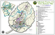
Click to view: Map 2 - 13 Greenway Plan Trail Locations<br />
219
Click to view: Map 2 - 14 Greenway Map 1: James River Greenway<br />
=<br />
221
Click to view: Map 2 - 15 Greenway Map 2: Crozet Area<br />
222
Click to view: Map 2 - 16 Greenway Map 3: Moore's Creek & Biscuit Run<br />
224
Click to view: Map 2 - 17 Greenway Map 4: Rivanna & Meadow Creek<br />
225
Click to view: Map 2 - 18 Greenway Map 5: Village of Rivanna<br />
227
Click to view: Map 2 - 19 Greenway Map 6: Hollymead & Piney Mountain<br />
228