Remote Sensing and GIS application in Precision ... - Swaziland
Remote Sensing and GIS application in Precision ... - Swaziland
Remote Sensing and GIS application in Precision ... - Swaziland

Create successful ePaper yourself
Turn your PDF publications into a flip-book with our unique Google optimized e-Paper software.
Copyright NB Spatial Solutions 2007 All rights reserved<br />
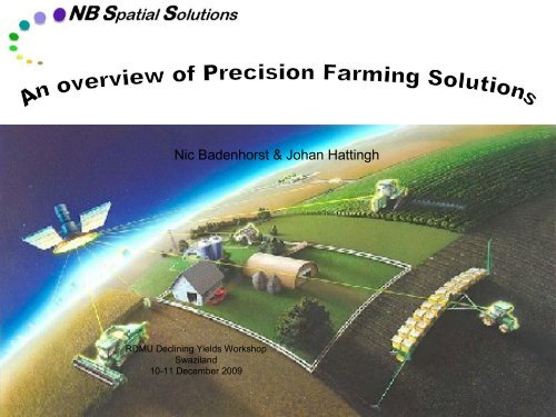
Nic Badenhorst & Johan Hatt<strong>in</strong>gh<br />
RDMU Decl<strong>in</strong><strong>in</strong>g Yields Workshop<br />
Swazil<strong>and</strong><br />
10-11 December 2009
<strong>Precision</strong> Agriculture<br />
Copyright NB Spatial Solutions 2007 All rights reserved<br />
PA Components<br />
OPTIONS<br />
DECISIONS<br />
GPS<br />
Agric. Management<br />
Enabl<strong>in</strong>g Technologies<br />
KEY<br />
UNCERTAIN-<br />
TIES<br />
RULES<br />
OF THE<br />
GAME<br />
Farm / field<br />
VRT<br />
Auto Pilot<br />
Action<br />
Management<br />
response<br />
PA<br />
Data captur<strong>in</strong>g<br />
Manipulation<br />
& Interpretation<br />
Sensor<br />
<strong>Remote</strong> sens<strong>in</strong>g<br />
Yield monitor<br />
Ground-based sensor<br />
Decision<br />
process<br />
Data<br />
management<br />
Database<br />
DSS<br />
Expert System<br />
Crop model<br />
Performance<br />
evaluation<br />
<strong>GIS</strong><br />
Data<br />
warehouse
<strong>Precision</strong> Farm<strong>in</strong>g cycle<br />
Copyright NB Spatial Solutions 2007 All rights reserved<br />
DGPS map<br />
Variable plant<br />
density<br />
Correction<br />
Potential Maps<br />
Spatial data<br />
process<strong>in</strong>g<br />
Crop model<br />
Analyses<br />
Soil chemical<br />
survey<br />
Data process<strong>in</strong>g<br />
Nutrient status<br />
maps<br />
All <strong>in</strong>formation:<br />
In digital format<br />
GPS georeferenced<br />
Prescription<br />
Maps<br />
Correction<br />
Variable fertilizer<br />
<strong>application</strong><br />
Satellite imagery<br />
Crop monitor<strong>in</strong>g<br />
Damage assessment<br />
Yield forecast<br />
Climate<br />
Soil physical<br />
factors<br />
DGPS map<br />
Yield Map<br />
Evaluation<br />
Yield Monitor<strong>in</strong>g
Copyright NB Spatial Solutions 2007 All rights reserved<br />
Differential GPS mapp<strong>in</strong>g (basemap)<br />
• Field boundaries<br />
• Sub-meter accuracy<br />
- geographic position<br />
- accurate area per field<br />
• Digital format<br />
• Attributes<br />
- Owner<br />
- Farmname<br />
- Field nr<br />
- Area <strong>in</strong> Ha
Field Sampl<strong>in</strong>g<br />
(Grid po<strong>in</strong>ts)<br />
Copyright NB Spatial Solutions 2007 All rights reserved<br />
• Physical properties<br />
• Chemistry<br />
Macro-elements (pH, P, K, Ca, Mg, Na,<br />
%Acid saturation)<br />
<br />
<br />
Total Carbon, Nitrogen & Sulphur (CNS)<br />
Micro-elements (Mn, Zn, B, Cu, Fe, Al)
Soil Survey<strong>in</strong>g<br />
(Soil Physical Properties)<br />
Copyright NB Spatial Solutions 2007 All rights reserved<br />
Physical Root Depth<br />
Clay %<br />
Profile Available Water
Copyright NB Spatial Solutions 2007 All rights reserved<br />
Poor season<br />
Yield potential maps<br />
(Modell<strong>in</strong>g)<br />
Normal season<br />
Good season
Soil Chemical Analyses<br />
(Nutrient Status Maps)<br />
Copyright NB Spatial Solutions 2007 All rights reserved<br />
Magnesium Calcium Phosphate
Copyright NB Spatial Solutions 2007 All rights reserved<br />
Ca correction<br />
Agronomic Service<br />
(Prescription Maps)<br />
P correction<br />
High potential area<br />
treatment<br />
24% of field<br />
treated (38.4 Ha)<br />
25% of field treated<br />
(41.1 Ha)<br />
46% of field treated<br />
(73.6 Ha)
Monitor crop development<br />
(Time-series of satellite images)<br />
Copyright NB Spatial Solutions 2007 All rights reserved<br />
(2002 Season)<br />
(2004 Season)
Evaluation of results<br />
(Spatial Comparison)<br />
Copyright NB Spatial Solutions 2007 All rights reserved<br />
Satellite image<br />
(21 Feb 2004)<br />
Simulated Yield<br />
Potential map<br />
Actual Yield Monitor<br />
map (May 2004)
Copyright NB Spatial Solutions 2007 All rights reserved<br />
Feb 2002<br />
Monitor change<br />
(before <strong>and</strong> after treatment)<br />
2.8 t/Ha<br />
NDVI difference map<br />
120<br />
Seasonal curves<br />
Seasonal growth curves<br />
100<br />
80<br />
NDVI<br />
60<br />
Feb 2004<br />
5.3 t/Ha<br />
40<br />
20<br />
0<br />
1 2 3 4 5<br />
Time<br />
2002 2004
Technology solutions<br />
(Multi-layer analyses)<br />
Copyright NB Spatial Solutions 2007 All rights reserved
Technological solutions<br />
(Which parameter(s) affect my yield most?)<br />
Copyright NB Spatial Solutions 2007 All rights reserved
Technological solutions<br />
(What is right norm for my field / farm?)<br />
Copyright NB Spatial Solutions 2007 All rights reserved
Crop modell<strong>in</strong>g<br />
Copyright NB Spatial Solutions 2007 All rights reserved<br />
Maize<br />
Yield goal<br />
N requirement<br />
8 t/Ha<br />
P requirement<br />
K requirement
Data Management<br />
Copyright NB Spatial Solutions 2007 All rights reserved<br />
<br />
Data management:<br />
– Unique data management <strong>and</strong><br />
<strong>in</strong>tegration service<br />
– Yield map <strong>in</strong>terpretation<br />
– Value-addition<br />
<br />
Yield mapp<strong>in</strong>g:<br />
– Harvest<strong>in</strong>g <strong>and</strong> yield<br />
mapp<strong>in</strong>g specialists
Copyright NB Spatial Solutions 2007 All rights reserved<br />
Nic Badenhorst<br />
RDMU Decl<strong>in</strong><strong>in</strong>g Yields Workshop<br />
Swazil<strong>and</strong><br />
10-11 December 2009
Why is satellite imagery important for agriculture?<br />
Copyright NB Spatial Solutions 2007 All rights reserved<br />
• Wide range of satellites cover vast areas virtually anywhere on earth’s surface (different scales)<br />
• Imagery can be acquired at regular <strong>in</strong>tervals through programm<strong>in</strong>g<br />
• Rapid process<strong>in</strong>g of imagery provides near-realtime <strong>in</strong>formation<br />
• Multi-spectral <strong>in</strong>formation yields useful value-added products to:<br />
- Show <strong>in</strong>-field variability<br />
- Detect stress factors<br />
- Monitor crop development<br />
- Establish historical reference database for benchmarks <strong>and</strong> comparisons<br />
- Evaluate management actions<br />
- Provide early yield estimates<br />
• This <strong>in</strong>formation assist growers to make better <strong>in</strong>formed decisions<br />
• Integration of satellite imagery with other digital technologies = powerful precision farm<strong>in</strong>g tool<br />
to make better <strong>in</strong>formed decisions
B<strong>and</strong> 1: Blue B<strong>and</strong> 2: Red B<strong>and</strong> 3: Near Infrared<br />
Copyright NB Spatial Solutions 2007 All rights reserved<br />
Colour composite image
Copyright NB Spatial Solutions 2007 All rights reserved<br />
Natural-colour composite<br />
SPOT image<br />
Big Bend, Swazil<strong>and</strong>
Copyright NB Spatial Solutions 2007 All rights reserved<br />
False-colour composite (NIR)<br />
SPOT image<br />
Big Bend, Swazil<strong>and</strong>
Copyright NB Spatial Solutions 2007 All rights reserved<br />
SPOT-derived<br />
Vegetation Index image<br />
Big Bend, Swazil<strong>and</strong>
Time-series analyses of fields<br />
Copyright NB Spatial Solutions 2007 All rights reserved<br />
19 Jan 30 Jan 06 Mar 07 Apr<br />
Max NDVI image<br />
Max Date image
Time-series analyses of zones<br />
(with<strong>in</strong>-field variation)<br />
Growth curves for field zones<br />
250<br />
200<br />
150<br />
NDVI<br />
poor<br />
good<br />
weeds<br />
100<br />
50<br />
0<br />
19-Jan 30-Jan 06-Mar 07-Apr<br />
Date<br />
Copyright NB Spatial Solutions 2007 All rights reserved
Integration with other <strong>GIS</strong> layers<br />
Copyright NB Spatial Solutions 2007 All rights reserved
Phenological growth curves for N30 variety<br />
Growth curves for N30<br />
250<br />
200<br />
150<br />
NDVI<br />
32<br />
42<br />
43<br />
41<br />
100<br />
50<br />
0<br />
19-Jan 30-Jan 06-Mar 07-Apr<br />
Time<br />
Copyright NB Spatial Solutions 2007 All rights reserved
Phenological growth curves for N22 variety<br />
Growth curves for N22 fields<br />
220<br />
200<br />
180<br />
NDVI<br />
160<br />
22<br />
28<br />
60B<br />
63<br />
140<br />
120<br />
100<br />
19-Jan 30-Jan 06-Mar 07-Apr<br />
Time<br />
Copyright NB Spatial Solutions 2007 All rights reserved
Comparison of sensors: Resolution<br />
SPOT4: 20m SPOT5: 10m SPOT5: 2.5m<br />
RapidEye: 5m<br />
Aerial: 1m<br />
Copyright NB NB Spatial Spatial Solutions 2007 2007 All All rights rights reserved
Some practical examples of image <strong>application</strong>s<br />
Copyright NB Spatial Solutions 2007 All rights reserved
Correction of dra<strong>in</strong>age problem<br />
Copyright NB Spatial Solutions 2007 All rights reserved<br />
11/02/2008<br />
14/10/2008<br />
12/02/2009
Correction of N deficiency<br />
Copyright NB Spatial Solutions 2007 All rights reserved<br />
Before N correction<br />
After N correction
Detect<strong>in</strong>g herbicide damage<br />
Copyright NB Spatial Solutions 2007 All rights reserved
Rectify<strong>in</strong>g pivot fertilizer <strong>application</strong> problems<br />
Copyright NB Spatial Solutions 2007 All rights reserved<br />
09/09/2008 25/10/2008<br />
Fertilizer problem<br />
Problem rectified
Identify<strong>in</strong>g irrigation nozzle problems<br />
Copyright NB Spatial Solutions 2007 All rights reserved<br />
Nozzle<br />
problems<br />
Problem rectified
Identify<strong>in</strong>g irrigation pressure problems<br />
Copyright NB Spatial Solutions 2007 All rights reserved<br />
Pressure problems
Identify<strong>in</strong>g chemical imbalances<br />
Copyright NB Spatial Solutions 2007 All rights reserved<br />
High levels of Mg <strong>and</strong> Na
Detect<strong>in</strong>g chemical problems<br />
Copyright NB Spatial Solutions 2007 All rights reserved
Correction of chemical imbalances<br />
Copyright NB Spatial Solutions 2007 All rights reserved<br />
Image shows chemical<br />
imbalances that<br />
corresponds with<br />
chemical maps.<br />
Image shows significant<br />
improvement follow<strong>in</strong>g<br />
corrective action.<br />
13 Feb 2001 (Before correction)<br />
20 Feb 2002 (After correction)
Show<strong>in</strong>g sal<strong>in</strong>ity problems<br />
Na:K Ratio<br />
Copyright NB Spatial Solutions 2007 All rights reserved
Satellite images, Yield- & Economy maps<br />
Copyright NB Spatial Solutions 2007 All rights reserved<br />
Loss (< R0)<br />
Profit (> R2000/ha)
Damage assessment<br />
Copyright NB Spatial Solutions 2007 All rights reserved<br />
Maize<br />
Water logg<strong>in</strong>g<br />
Weeds
Damage assessment<br />
Copyright NB Spatial Solutions 2007 All rights reserved<br />
W<strong>in</strong>d damage<br />
Hail damage<br />
Normal<br />
development<br />
Part of drybean field<br />
damaged by hail<br />
W<strong>in</strong>d damage
Damage assessment<br />
Flood damage<br />
Pests & Diseases<br />
23 Feb 2002<br />
Flooded areas on fields<br />
Virus <strong>in</strong>festation<br />
90% damage<br />
75%<br />
damage<br />
Copyright NB Spatial Solutions 2007 All rights reserved<br />
15 Mar 2002
Copyright NB Spatial Solutions 2007 All rights reserved<br />
Herbicide damage<br />
Damage assessment<br />
Faulty implements<br />
Estimated yield loss due to poorly calibrated<br />
planter – R2 Million<br />
Poor-calibrated planter<br />
The image series clearly show that the lower part of<br />
the field is subjected to stress (damage).<br />
Well-calibrated<br />
planter<br />
The growth curve of the damaged vs. healthy<br />
part of the field show the negative effect of the<br />
damage on crop development.
Irrigation plann<strong>in</strong>g<br />
Copyright NB Spatial Solutions 2007 All rights reserved<br />
BEFORE:<br />
No soil <strong>in</strong>fo available<br />
AFTER:<br />
With detail soil <strong>in</strong>fo on h<strong>and</strong><br />
~ 3 Ha poor soil<br />
<strong>in</strong>cluded <strong>in</strong> 1 st<br />
proposal<br />
2 smaller pivots<br />
avoid poor soils<br />
<strong>and</strong> cover more<br />
good soils<br />
LEGEND<br />
Irrigable soils<br />
Marg<strong>in</strong>al soils<br />
Poor soils<br />
Good soils not<br />
<strong>in</strong>cluded
Thank you for your attention!<br />
Copyright NB Spatial Solutions 2007 All rights reserved