(PCW) satellite system - Agence spatiale canadienne
(PCW) satellite system - Agence spatiale canadienne
(PCW) satellite system - Agence spatiale canadienne

You also want an ePaper? Increase the reach of your titles
YUMPU automatically turns print PDFs into web optimized ePapers that Google loves.
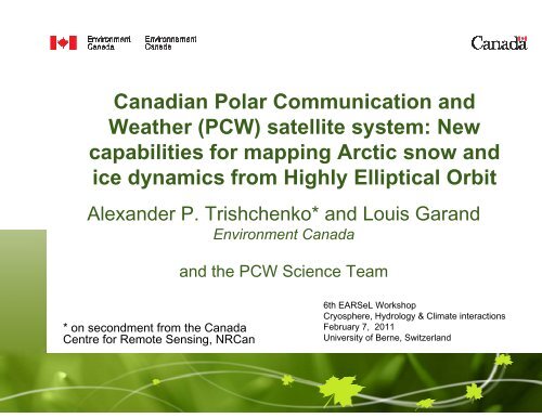
Canadian Polar Communication and<br />
Weather (<strong>PCW</strong>) <strong>satellite</strong> <strong>system</strong>: New<br />
capabilities for mapping Arctic snow and<br />
ice dynamics from Highly Elliptical Orbit<br />
Alexander P. Trishchenko* and Louis Garand<br />
Environment Canada<br />
and the <strong>PCW</strong> Science Team<br />
* on secondment from the Canada<br />
Centre for Remote Sensing, NRCan<br />
6th EARSeL Workshop<br />
Cryosphere, Hydrology & Climate interactions<br />
February 7, 2011<br />
University of Berne, Switzerland
Outline<br />
• Why <strong>satellite</strong> <strong>system</strong> on Highly Elliptical Orbit (HEO) is<br />
needed ?<br />
• Features of new Polar Communications and Weather<br />
(<strong>PCW</strong>) <strong>satellite</strong> <strong>system</strong> under development in Canada<br />
– Orbital configuration<br />
– Planned imager specs<br />
– Products and services<br />
– Status of the project<br />
• International dimension<br />
Page 2 – February 7, 2011
Why HEO <strong>system</strong>?<br />
• Polar orbiters have been a workhorse of <strong>satellite</strong> Earth Observation<br />
for decades, but their ability for repeated imagery is limited by<br />
– a) orbital period (~ 100min)<br />
– b) swath width ( ~ 100km-2500km)<br />
– c) clouds (70% cloud fraction on average) for surface applications<br />
• Geostationary <strong>satellite</strong>s (GEO) can provide nearly continuous<br />
imagery, but not over Polar Regions. Practical limit is
Ice motion from MODIS: Northwest Passage<br />
Page 4 – February 7, 2011
Ice motion from MODIS: Northwest Passage<br />
Source: Yi Luo<br />
Canadian Ice Service<br />
Page 5 – February 7, 2011
Ice motion from MODIS: Hudson Bay<br />
Page 6 – February 7, 2011
Ice motion from MODIS: Hudson Bay<br />
Source: Yi Luo<br />
Canadian Ice Service<br />
Page 7 – February 7, 2011
Refresh rate and spatial coverage are<br />
key requirements<br />
• New generation of GEO imagers (ABI/GOES-R,<br />
FCI/MTG, AHI/Himawari)<br />
– 15 min full disk<br />
– 1-5 min regional subsets<br />
• Cloud tracking => improved wind retrievals<br />
• Improved surface observations due to collecting all<br />
possible clear-sky pixels<br />
• Resolving diurnal cycle of clouds, radiation, snow/ice<br />
cover dynamics<br />
Page 8 – February 7, 2011
Improved clear-sky statistics<br />
due to high temporal frequency<br />
(1-day model data for July 1, 2008)<br />
Start: July 1, 2008 3:00UT<br />
Daily mean cloud fraction :<br />
69% (64%)<br />
Mean cloud fraction after<br />
clear-sky compositing :<br />
(every 15min over 24hrs)<br />
34% (32%)<br />
(50 0 N-90 0 N)<br />
Initial clear-sky mask<br />
Accumulated clear-sky mask after 24hrs<br />
clear<br />
cloud<br />
Page 9 – February 7, 2011
WMO vision for HEO <strong>satellite</strong> <strong>system</strong><br />
• World Meteorological Organization (WMO) in its “Vision<br />
for the Global Observing System (GOS) in 2025”<br />
adopted by the sixty-first session of the WMO Executive<br />
Council (EC-LXI) (WMO, 2009) endorsed the concept of<br />
HEO <strong>satellite</strong> <strong>system</strong> to improve Earth observations over<br />
polar latitudes;<br />
• The WMO document recommends operational<br />
implementation of visible (VIS) and infrared (IR) HEO<br />
imagers in order to monitor high latitude phenomena<br />
related to winds, clouds, volcanic ash plumes, sea ice,<br />
snow cover, vegetation properties and wild fires with<br />
sufficient temporal resolution (WMO, 2009).<br />
Page 10 – February 7, 2011
Canadian Polar Communication and Weather (<strong>PCW</strong>) <strong>system</strong><br />
• 2-sat <strong>system</strong> on HEO orbit to provide continuous Arctic<br />
coverage<br />
– Communication payload<br />
– Meteo payload – provision of multi-spectral imagery with<br />
15-min refresh rate<br />
– Space Weather payload<br />
– Additional payloads possible including atmospheric science<br />
applications<br />
• Anticipated to begin operations in 2017<br />
• Project is in Phase A to be completed at the end of<br />
March 2011. Team is working hard to get approval for<br />
phase B.<br />
Page 11 – February 7, 2011
Highly Elliptical Orbit (HEO)<br />
• HEO is not be eccentric… it is to have high eccentricity<br />
of the orbit to achieve continuous Arctic coverage<br />
Earth’s spin axis<br />
z<br />
Apogee<br />
Equatorial plane<br />
Perigee<br />
Descending node<br />
i<br />
H p =a(1-e)<br />
O<br />
ω<br />
ν<br />
l<br />
H a =a(1+e)<br />
Ω<br />
x<br />
Vernal equinox<br />
y<br />
Ascending node<br />
Satellite spends 2x more time above 45 0 with e≈0.5 relative to circular orbit (e≈0)<br />
3x more time above 45 0 with e≈0.75 relative to circular orbit (e≈0)<br />
Page 12 – February 7, 2011
12-hr Molniya orbit<br />
• Molniya (12hrs) orbit is considered as a baseline scenario for<br />
Polar Communication and Weather (<strong>PCW</strong>) <strong>satellite</strong> <strong>system</strong><br />
due to superior imaging conditions over the Arctic;<br />
• Two <strong>satellite</strong>s in 1 orbital plane (6hrs apart) with 63.4 0<br />
inclination, i.e. 4 apogee points: 95 0 W, 175 0 E, 85 0 E, 5 0 W;<br />
• Critical inclination makes apogee location stable<br />
ω&<br />
=<br />
3<br />
4<br />
J<br />
2<br />
n<br />
⎛<br />
⎜<br />
⎝<br />
2<br />
( 1 − e ) 2<br />
• Rate of change for the argument of perigee ≈0<br />
rE<br />
a<br />
⎞<br />
⎟<br />
⎠<br />
2<br />
5<br />
cos<br />
2<br />
i<br />
−<br />
1<br />
Equatorial plane<br />
Descending node<br />
Perigee<br />
Earth’s spin axis<br />
H p =a(1-e)<br />
i<br />
z<br />
O<br />
ω<br />
ν<br />
l<br />
H a =a(1+e)<br />
Ω<br />
y<br />
x<br />
Vernal equinox<br />
Apogee<br />
Ascending node<br />
Page 13 – February 7, 2011
Some feature of Molniya HEO orbit<br />
vs LEO and GEO orbits<br />
Molniya orbit<br />
MODIS<br />
Terra/Aqua<br />
GEO<br />
Satellite ground track pattern is stable (repeatable), but the Local Solar Time<br />
(LST) of apogee point is drifting. This means that VZA-SZA relationship for<br />
each particular point on the Earth surface is time dependent.<br />
Page 14 – February 7, 2011
Location of apogees and coverage for<br />
<strong>PCW</strong> <strong>system</strong><br />
85 0 E<br />
Location of apogees was<br />
selected to maximize land<br />
mass observations at small<br />
viewing zenith angles<br />
(VZA), i.e. looking close to<br />
nadir over land<br />
175 0 E<br />
5 0 W<br />
95 0 W<br />
Page 15 – February 7, 2011
Spatio-temporal coverage from Molniya<br />
Map of coverage (% of time per day)<br />
zonal mean<br />
58 0 N-90 0 N - 100%<br />
above 55 0 N - >95%<br />
Page 16 – February 7, 2011
-4hrs<br />
Temporal Sequence of Earth Views<br />
-3hrs<br />
0hrs<br />
23.7 0 x 23.7 0 19.2 0 x 19.2 0 15.7 0 x 15.7 0<br />
+4hrs<br />
+3hrs<br />
Page 17 – February 7, 2011
Animation of Arctic coverage: July 1, 2008<br />
(CMC model results at 10-km resolution)<br />
R – B6 1.6µm<br />
G – B3 0.87µm<br />
B – B2 0.64µm<br />
Page 18 – February 7, 2011
Harsh ionizing radiation is Molniya orbit<br />
biggest challenge<br />
High energy trapped protons with E>10Mev are the most dangerous<br />
Page 19 – February 7, 2011
How to optimize HEO orbit ?<br />
One needs to increase the<br />
altitude of the orbit when it<br />
crosses the equatorial<br />
plane (i.e. the altitude of<br />
semi-latus rectum), but to<br />
keep semi-major axis<br />
reasonably low to achieve<br />
better spatial resolution<br />
Optimization leads<br />
to orbit parameters<br />
T=16hr<br />
e=0.55<br />
Page 20 – February 7, 2011
Comparison of radiation conditions<br />
between Molniya, GEO and TAP orbits<br />
3-4 order of magnitude smaller flux<br />
of high energy trapped protons<br />
trapped protons flux essentially<br />
vanishes after ≈7mm AL shielding<br />
after ≈9mm AL shielding TAP orbit<br />
becomes similar to GEO<br />
Page 21 – February 7, 2011
16hrs orbit is very good alternative<br />
candidate for <strong>PCW</strong><br />
Three APogee (TAP) orbit<br />
Suggested apogees:<br />
95 0 W; 25 0 E, 145 0 E<br />
Page 22 – February 7, 2011
Zonal mean coverage: 12-hr vs 16-hr orbit<br />
Page 23 – February 7, 2011
Viewing Earth from TAP(16-hr) orbit<br />
Animation over 48hr period with 15-min steps<br />
Satellite #1 Satellite #2<br />
Page 24 – February 7, 2011
<strong>PCW</strong> Imager Specifications<br />
Band<br />
No.<br />
subgroup<br />
Wavelength<br />
(microns)<br />
Heritage<br />
Priority<br />
GSD (km)<br />
Goal Max<br />
Main applications<br />
1<br />
VNIR<br />
0.45-0.49<br />
ABI, FDHSI<br />
1<br />
0.5 1.5<br />
Surface, clouds, aerosols<br />
2<br />
0.59-0.69<br />
ABI, FDHSI<br />
1<br />
0.5 1.5<br />
Wind, clouds, ice mapping<br />
3<br />
0.704-0.714<br />
MERIS-09<br />
2<br />
0.5 1.5<br />
Water quality, chlorophyll<br />
4<br />
0.85-0.89<br />
ABI, FDHSI<br />
1<br />
0.5 1.5<br />
Wind, aerosols, vegetation<br />
5<br />
SWIR<br />
1.04 – 1.06<br />
SGLI SW1<br />
2<br />
1.0 3.0<br />
Snow grain and clouds<br />
6<br />
1.37-1.39<br />
ABI, FDHSI<br />
2<br />
1.0 3.0<br />
Cirrus detection<br />
7<br />
1.58-1.64<br />
ABI, FDHSI<br />
1<br />
0.5 1.5<br />
Snow-cloud distinction, ice cover<br />
8<br />
2.22-2.28<br />
ABI, FDHSI<br />
1<br />
1.0 3.0<br />
Aerosol, smoke, cloud phase<br />
9<br />
MWIR<br />
3.80-4.00<br />
ABI, FDHSI<br />
1<br />
2.0 3.0<br />
Fog, fires, ice/cloud separation, wind, cld.phase<br />
10<br />
5.77-6.60<br />
ABI, FDHSI<br />
1<br />
2.0 3.0<br />
Wind, high level humidity<br />
11<br />
6.75-7.15<br />
ABI, MTSAT<br />
1<br />
2.0 3.0<br />
Wind, mid level humidity<br />
12<br />
7.24-7.44<br />
ABI, FDHSI<br />
1<br />
2.0 3.0<br />
Wind, low level humidity<br />
13<br />
LWIR<br />
8.30-8.70<br />
ABI, FDHSI<br />
1<br />
2.0 3.0<br />
Total water, cloud phase<br />
14<br />
9.42-9.80<br />
ABI, FDHSI<br />
2<br />
2.0 3.0<br />
Total ozone<br />
15<br />
10.1-10.6<br />
ABI, FDHSI<br />
2<br />
2.0 3.0<br />
Cloud, surface, cirrus<br />
16<br />
10.8-11.6<br />
ABI, HIRS<br />
1<br />
2.0 3.0<br />
Cloud, SST, ash<br />
17<br />
11.8-12.8<br />
ABI, FDHSI<br />
1<br />
2.0 3.0<br />
Ash, SST<br />
18<br />
LIRCO2<br />
13.0-13.6<br />
ABI, FDHSI<br />
1<br />
2.0 3.0<br />
Cloud height<br />
19<br />
13.5-13.8<br />
MODIS,HIRS<br />
2<br />
2.0 6.0<br />
Cloud height, low level temperature<br />
20<br />
13.8-14.1<br />
MODIS,HIRS<br />
2<br />
2.0 6.0<br />
Cloud height, mid level temperature<br />
21<br />
14.1-14.4<br />
MODIS,HIRS Page 25 – February 2 7, 2011 2.0 6.0<br />
Cloud height, high level temperature
Snow grain size<br />
1.04-1.06µm channel was selected: Band 5<br />
Page 26 – February 7, 2011
Angular sampling from Molniya HEO<br />
SZA-VZA sampling VZA-RAZ sampling<br />
Orbit precession around direction to the Sun: 1.14deg/day.<br />
Complete cycle is ~ 10.5 month (360 deg)<br />
Rich angular sampling from HEO Molniya orbit => better observations of angular<br />
anisotropy of the Earth radiation field than for polar orbiters and GEO<br />
Page 27 – February 7, 2011
Preliminary list of products from <strong>PCW</strong><br />
CATEGORY<br />
PRODUCT<br />
Repeat<br />
Cycle<br />
Latency<br />
COMMENT<br />
Imagery<br />
Level 1C imagery<br />
Level 2 imagery<br />
15 min<br />
15 min<br />
15 min<br />
30 min<br />
Calibrated, mapped to standard grid (15 min<br />
refresh)<br />
Composite of 2 <strong>satellite</strong>s<br />
AMV: Atmospheric Motion<br />
Vectors<br />
1 hour<br />
1 hour<br />
Latency is w.r.t. oldest image of triplets/duos<br />
used for tracking<br />
Cloud mask<br />
15 min<br />
30 min<br />
Important for direct assimilation of radiances<br />
Priority 1 - Near Real<br />
Time Level 2<br />
products derived<br />
from Level 1C<br />
Cloud height, amount,<br />
emissivity, temperature<br />
Volcanic ash height (optical<br />
depth)<br />
15 min<br />
15 min<br />
30 min<br />
30 min<br />
Important for AMV<br />
When active. Done at Dorval volcanic ash<br />
advisory center. Could develop a SO 2<br />
product<br />
as well.<br />
Fog and surface visibility<br />
15 min<br />
30 min<br />
Forest fires. Hot spots<br />
3 hours<br />
1 hour<br />
Product elaborated either, at CFS and/or<br />
another governmental entity<br />
Page 28 – February 7, 2011
Preliminary list of products from <strong>PCW</strong><br />
CATEGORY<br />
PRODUCT<br />
Repeat<br />
Cycle<br />
Latency<br />
COMMENT<br />
Snow/ice mapping (cover<br />
and depth)<br />
6 hours<br />
6hours<br />
Derived from 15 min. Resolution 2 km. May<br />
include snow grain size.<br />
SST: sea surface<br />
temperature<br />
1 hour<br />
2 hours<br />
Resolution 4 km<br />
Priority 2 - Level 2/3<br />
(see note below)<br />
LST: land surface<br />
temperature<br />
Surface albedo<br />
1 hour<br />
6 hours<br />
2 hours<br />
6 hours<br />
Resolution 4 km<br />
Resolution 10 km. Could be done at another<br />
governmental entity<br />
Aerosol optical depth<br />
3 hours<br />
6 hours<br />
Resolution 10 km<br />
Atmospheric stability index<br />
1 hour<br />
1 hour<br />
Resolution 10 km<br />
Aircraft icing threat<br />
1 hour<br />
15 min<br />
Resolution 10 km<br />
Total ozone<br />
1 hour<br />
1 hour<br />
Resolution 10 km<br />
Page 29 – February 7, 2011
Preliminary list of climate products from <strong>PCW</strong><br />
CATEGORY<br />
Priority 2 - Level 3<br />
climate essential<br />
variables – Not<br />
elaborated at<br />
EC Dorval<br />
Archive Products<br />
PRODUCT<br />
NDVI: Normalized Difference<br />
Vegetation Index<br />
FPAR<br />
LAI: Leaf Area Index<br />
Radiative fluxes<br />
Land surface emissivity<br />
Repeat<br />
Cycle<br />
1 day<br />
1 day<br />
1 day<br />
1 hour<br />
1 day<br />
Latency<br />
Resolution 4km<br />
Levels 0, 1C and 2 are archived forever at CMC, and Level 1B for 5 years. In addition rotating archive of<br />
Level 0 at ground receiving station.<br />
Note :Level 2 products are retrievals made from Level 1C. Level 3 products defined at a coarser resolution. Surface parameters<br />
are only available in clear air (mask =0) or when the sun angle allows. In areas devoid of observations, the pixels are either<br />
left blank or replaced by a previously obtained value.<br />
1 day<br />
1 day<br />
1 day<br />
1 day<br />
1 day<br />
COMMENT<br />
Resolution 1 km<br />
Fraction of Absorbed Photosynthetically<br />
Active Radiation. Resolution 1 km<br />
Resolution 2 km<br />
Resolution 10 km (SW, LW at surface and<br />
TOA)<br />
Page 30 – February 7, 2011
<strong>PCW</strong> Mission development in Phase A<br />
Lead<br />
Canadian Space Agency<br />
Partners<br />
Environment Canada<br />
Dept National Defense<br />
User and Science Team (U&ST):<br />
Environment Canada (EC),<br />
Dept. of National Defense (DND),<br />
Natural Resources Canada,<br />
Canadian Coast Guard,<br />
Transport Canada, NavCanada,<br />
Dept. of Indian and Northern Affairs,<br />
Gov. of Nunavut<br />
And other gov. agencies<br />
International Section of U&ST<br />
URD<br />
Industrial Team:<br />
MDA (prime),<br />
Com Dev,<br />
ABB Bomem,<br />
Magellan/Bristol Aerospace,<br />
ADVANTECH,<br />
SED,<br />
TELESAT<br />
Page 31 – February 7, 2011
International Engagement<br />
• NOAA, NASA, EUMETSAT, FMI, SHMI, ESA, ECMWF<br />
participation in International section of User & Science Team<br />
• NOAA<br />
– Contributions to <strong>PCW</strong> to be explored through EC-NOAA<br />
MOU, and Canada-US Agreement on space technology.<br />
• Russia Arktika Mission<br />
– liaison through WMO Focus Group on HEO and bi-laterally<br />
– agreement in principle to coordinated missions – e.g., orbital<br />
configuration, imaging frequency, etc<br />
Page 32 – February 7, 2011
Conclusions<br />
• HEO <strong>satellite</strong> <strong>system</strong> offers unique opportunity for continuous observations<br />
of polar regions and snow/ice dynamics;<br />
• Canada is planning to launch the Polar Communication and Weather<br />
(<strong>PCW</strong>) 2-sat <strong>system</strong> with operations beginning around 2017;<br />
• Phase A has been extended until the end of March 2011. Team is working<br />
hard to move project into Phase B;<br />
• 21 channel imager with spatial resolution from 0.5km to 2km will provide<br />
continuous observations over the Arctic with refresh rate 15minutes;<br />
• The set of operational products and Essential Climate Variables (ECVs) will<br />
be produced to be compatible with NOAA GOES-R ABI + some extras;<br />
• Observations from HEO orbit provide very rich geometry that should lead to<br />
improving the quality of atmospheric and surface products;<br />
• <strong>PCW</strong> data will be included as part of Global Space-Based Inter-Calibration<br />
System (GSICS) to ensure the quality of data products.<br />
• Proxy data are available for at 35km (globally) and 10km (Arctic) and 15min<br />
time steps for July 1, 2008:<br />
– ftp server: depot.cmc.ec.gc.ca; directory: upload/cmdd/pcw/.<br />
– Login as anonymous user<br />
Page 33 – February 7, 2011
References<br />
• Kidder, S.Q. and T.H.Vonder Haar, 1990: On the use of <strong>satellite</strong>s in<br />
Molniya orbits for meteorological observation of middle and high<br />
latitudes. J. Atm. Oceanic Tech., 7, 517-522<br />
• Trishchenko, A.P., and L.Garand, 2011: Spatial and temporal<br />
sampling of Polar Regions from two-<strong>satellite</strong> <strong>system</strong> on Molniya<br />
orbit. J. Atmos. Oceanic Tech., 45pp. In press.<br />
• Trishchenko, A.P., L.Garand, L.D.Trichtchenko, 2011: Three<br />
apogee 16-h highly elliptical orbit as optimal choice for continuous<br />
meteorological imaging of polar regions . J. Atmos. Oceanic Tech.,<br />
to be submitted.<br />
• WMO, 2009: WMO vision for the GOS in 2025. WMO (CM-9)/Doc. 8<br />
(14.I.2009). Port of Spain. Trinidad and Tobago. 19pp. [Available at:<br />
http://www.wmo.int/pages/prog/sat/meetings/documents/cm9_Doc_<br />
08_GOSVision2025.pdf]<br />
Page 34 – February 7, 2011