Metropolitan Transportation Plan - Eastgate Regional Council of ...
Metropolitan Transportation Plan - Eastgate Regional Council of ...
Metropolitan Transportation Plan - Eastgate Regional Council of ...

You also want an ePaper? Increase the reach of your titles
YUMPU automatically turns print PDFs into web optimized ePapers that Google loves.
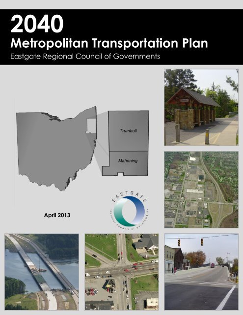
2040<br />
<strong>Metropolitan</strong> <strong>Transportation</strong> <strong>Plan</strong><br />
<strong>Eastgate</strong> <strong>Regional</strong> <strong>Council</strong> <strong>of</strong> Governments<br />
Trumbull<br />
Mahoning<br />
April 2013
EASTGATE REGIONAL COUNCIL OF GOVERNMENTS<br />
Serving Northeast Ohio since 1973<br />
The <strong>Eastgate</strong> <strong>Regional</strong> <strong>Council</strong> <strong>of</strong> Governments is a multipurpose <strong>Regional</strong> <strong>Council</strong> <strong>of</strong> Governments for Ashtabula, Mahoning<br />
and Trumbull Counties, as established by Section 167.01 <strong>of</strong> the Ohio Revised Code. <strong>Eastgate</strong> is the agency designated or<br />
recognized to perform the following functions:<br />
Serve as the <strong>Metropolitan</strong> <strong>Plan</strong>ning Organization (MPO) in Mahoning and Trumbull Counties, with responsibility for<br />
the comprehensive, coordinated and continuous planning for highways, public transit and other transportation modes<br />
as defined in Moving Ahead for Progress in the 21 st Century (MAP-21) legislation.<br />
Perform continuous water quality planning functions in cooperation with Ohio and U.S. EPA.<br />
Provide planning to meet air quality requirements under MAP-21 and the Clean Air Act Amendments <strong>of</strong> 1990.<br />
Administration <strong>of</strong> the Economic Development District Program.<br />
Administration <strong>of</strong> the Local Development District <strong>of</strong> the Appalachian <strong>Regional</strong> Commission.<br />
Administration <strong>of</strong> the State Capital Improvement Program for the District 6 Public Works Integrating Committee.<br />
Administer the area clearinghouse function, which includes providing local government with the opportunity to review<br />
a wide variety <strong>of</strong> local or state applications for federal funds.<br />
Administration <strong>of</strong> the regional Rideshare Program for Ashtabula, Mahoning and Trumbull Counties.<br />
Conduct demographic, economic and land use research.<br />
At General Policy Board direction, provide planning assistance to local governments that comprise the <strong>Eastgate</strong><br />
planning area.<br />
Administration <strong>of</strong> the Clean Ohio Conservation & Revitalization Funds.<br />
GENERAL POLICY BOARD (2013)<br />
Chairman - Glenn Holmes, Mayor, Village <strong>of</strong> McDonald<br />
1 st Vice Chairman – Commissioner Dan Claypool, Ashtabula County 2 nd Vice Chairman – Joseph Warino, City <strong>of</strong> Canfield<br />
Brian Anderson, Ashtabula County<br />
Mayor Eric Augustein, Village <strong>of</strong> Beloit<br />
Jerry Brockway, Ashtabula County<br />
Nancy Brundage, Citizens Advisory Board<br />
Peggy Carlo, Ashtabula County Commissioner<br />
Mayor John Darko, City <strong>of</strong> Hubbard<br />
David Ditzler, Mahoning County Commissioner<br />
Mayor Larry Ellis, Village <strong>of</strong> Craig Beach<br />
James Ferraro, Director, Western Reserve Transit<br />
Authority<br />
Mayor Douglas Franklin, City <strong>of</strong> Warren<br />
Frank Fuda, Trumbull County Commissioner<br />
Pat Ginnetti, Mahoning County Engineer<br />
Fred Hanley, Hubbard Township<br />
Paul E. Heltzel, Trumbull County Commissioner<br />
Mark Hess, City <strong>of</strong> Niles<br />
Mayor Arno Hill, Village <strong>of</strong> Lordstown<br />
Mayor Ralph Infante, Jr., City <strong>of</strong> Niles<br />
Mayor James Iudiciani, Village <strong>of</strong> Lowellville<br />
Mayor William Jones, Village <strong>of</strong> Washingtonville<br />
Mayor Harry Kale, Village <strong>of</strong> New Middletown<br />
Mayor William E. Kay, City <strong>of</strong> Canfield<br />
Paul Makosky, City <strong>of</strong> Warren<br />
Mayor James Melfi, City <strong>of</strong> Girard<br />
William Miller, Director, Trumbull County <strong>Plan</strong>ning Comm.<br />
Mayor Curt Moll, City <strong>of</strong> Cortland<br />
Joe Moroski, Ashtabula County Commissioner<br />
Mayor Allen Patchin, Village <strong>of</strong> West Farmington<br />
Mayor Michael Pinkerton, Village <strong>of</strong> Sebring<br />
Daniel Polivka, Trumbull County Commissioner<br />
Kurt Princic, OEPA NE District Chief<br />
Carol Rimedio-Righetti, Mahoning County Commissioner<br />
Mayor Charles Sammarone, City <strong>of</strong> Youngstown<br />
Mayor Timothy Sicafuse, Village <strong>of</strong> Poland<br />
Randy Smith, Trumbull County Engineer<br />
Mayor Terry Stocker, City <strong>of</strong> Struthers<br />
Anthony Traficanti, Mahoning County Commissioner<br />
Tony Urankar, District Deputy Director, ODOT District 4<br />
Mayor William Van Such, City <strong>of</strong> Campbell<br />
Mayor Lyle A. Waddell, City <strong>of</strong> Newton Falls<br />
Heflin Willingham, Citizens Advisory Board<br />
Representative<br />
TECHNICAL ADVISORY COMMITTEE (2013) CITIZENS ADVISORY BOARD (2013)<br />
Chairman-Rob Donham Vice Chairman-Donald J. Barzak Chairman-James J. Pirko Vice Chairman-Janet Hazlette
TABLE OF CONTENTS<br />
Chapter 1 – Introduction<br />
1. <strong>Eastgate</strong> – A <strong>Metropolitan</strong> <strong>Plan</strong>ning Organization and <strong>Transportation</strong> Management Area 1<br />
2. MPO Governing Structure 2<br />
3. Functions and Administration <strong>of</strong> Programs 4<br />
4. Provides Technical Services and Assistance 4<br />
5. Other Areas <strong>of</strong> Agency Responsibility Include 5<br />
6. Environmental <strong>Plan</strong>ning 6<br />
7. Required <strong>Transportation</strong> <strong>Plan</strong>ning Documents 7<br />
8. <strong>Metropolitan</strong> Area Overview 8<br />
9. <strong>Eastgate</strong>’s Youngstown‐Warren‐Boardman Ohio‐Pennsylvania <strong>Metropolitan</strong> Area 8<br />
10. Purpose <strong>of</strong> the <strong>Metropolitan</strong> <strong>Transportation</strong> <strong>Plan</strong> (MTP) 10<br />
11. Previous Work Completed 10<br />
12. Development <strong>of</strong> the 2040 MTP 10<br />
13. <strong>Regional</strong> Goals and Objectives 11<br />
Chapter 2 – Fulfilling Federal Requirements and Supporting Legislation<br />
1. Fulfilling Federal Requirements 15<br />
2. Federal <strong>Plan</strong>ning Requirements 16<br />
3. SAFETEA‐LU <strong>Plan</strong>ning Requirements 17<br />
4. Overview and History <strong>of</strong> Enabling Highway Acts – Past through the Present 20<br />
5. Federal Aid Highway Act <strong>of</strong> 1956 (Public Law 84‐627) 20<br />
6. The Highway Safety Act <strong>of</strong> 1966 (Public Law 89‐564) 20<br />
7. Intermodal Surface <strong>Transportation</strong> Efficiency Act <strong>of</strong> 1991 (Public Law 102‐240) 21<br />
8. <strong>Transportation</strong> Equity Act for the 21 st Century (Public Law 105‐178) 22<br />
9. Safe, Accountable, Flexible, Efficient <strong>Transportation</strong> Equity<br />
Act (SAFETEA – LU): A Legacy for Users (Public Law 109‐59) 22<br />
10. Moving Ahead for Progress in the 21 st Century Act (MAP‐21)<br />
(Public Law 112‐141) A Summary <strong>of</strong> Highway Provisions 23<br />
Chapter 3 – State <strong>of</strong> the Region<br />
1. Overview 33<br />
2. The Mahoning Valley Today 33<br />
3. Database 34<br />
4. <strong>Plan</strong>ning Area Delineation 35<br />
5. Census Data 41<br />
6. Employment Data 44<br />
7. Land Use Maps 47<br />
Chapter 4 – Social, Environmental, Economic, Energy Strategies & Environmental Justice<br />
Overview – Social, Environmental, Economic, Energy Strategies (SEEE) 51<br />
1. Energy Conservation 51<br />
2. Environmental Protection and Enhancement 52<br />
3. Land Use 53<br />
4. Environmental Justice Methodology and Documentation Filters for Highway Segments<br />
and Transit Systems for Mahoning and Trumbull Counties 54<br />
5. EJ Methodology and Documentation Filter for Highway Segments 56<br />
6. EJ Methodology and Documentation Filter for Public Transit Systems 64
Chapter 5 – <strong>Transportation</strong> Management Systems<br />
1. Overview 75<br />
2. Congestion Management Process (CMP) 76<br />
3. CMP Strategies 78<br />
4. CMP Conclusion 83<br />
5. Pavement Management System (PMS) 84<br />
6. Highway Safety Program 88<br />
7. Intelligent <strong>Transportation</strong> System (ITS) 93<br />
Chapter 6 – Multimodal Considerations<br />
6.1 ‐ Public Transit<br />
6.1.1 Public Transit Introduction 99<br />
6.1.2 System Descriptions 108<br />
6.1.3 Proposed Fixed Routes 126<br />
6.2 ‐ Transit Security – Current and Future Capital Needs<br />
6.2.1 Introduction 145<br />
6.2.2 Prevention Through Training 146<br />
6.2.3 Communication Initiatives 147<br />
6.2.4 History and Public Perception 147<br />
6.2.5 Education 148<br />
6.2.6 Current Security Expenditures 148<br />
6.2.7 Future Capital Improvements 148<br />
6.2.8 Conclusion 152<br />
6.3 ‐ Rideshare<br />
6.3.1 Introduction 153<br />
6.3.2 Park and Ride Multi – Modal Connectivity Component 154<br />
6.4 ‐ Bicycle Facilities<br />
6.4.1 Introduction 157<br />
6.4.2 Existing Bikeways 157<br />
6.4.3 <strong>Plan</strong>ned and Programmed Bikeways 161<br />
6.4.4 Conceptual Network 163<br />
6.4.5 Priority Routes 165<br />
6.5 ‐ Pedestrian Facilities<br />
6.5.1 Introduction 167<br />
6.5.2 Sidewalks 167<br />
6.5.3 Crosswalks and ADA Ramps 168<br />
6.6 ‐ Lake and River Port Facilities<br />
6.6.1 Introduction 171<br />
6.6.2 Ohio Great Lakes/Lake Erie System 172<br />
6.6.3 Ohio River System 173<br />
6.6.4 Port Ownership and Regulatory and Administrative Authority 173<br />
6.6.5 ODOT and Port Authority Funding 173<br />
6.6.6 American Recovery & Reinvestment Act Funding 174<br />
6.6.7 Creation <strong>of</strong> a Maritime Office Extends ODOT’s Multimodal Philosophy 174<br />
6.6.8 Port <strong>of</strong> Ashtabula Facilities 175<br />
6.6.9 Norfolk Southern Coal Dock 179<br />
6.6.10 Kinder Morgan Pinney Dock Transport Company 181<br />
6.6.11 R.W. Sidley’s Ashtabula Dock 182<br />
6.6.12 Ashtabula City Industrial Park 183<br />
6.6.13 Port <strong>of</strong> Conneaut Facilities 184
6.6.14 Pittsburgh &Conneaut Dock 186<br />
6.6.15 Ohio River Terminals 188<br />
6.6.16 Intermodal Park – Wellsville, Ohio – Foreign Trade Zone #181 189<br />
6.6.17 East Liverpool Terminals 191<br />
6.6.18 Columbiana County Port Authority, Little England Wharf 193<br />
6.6.19 D.W. Dickey & Son, East Liverpool Wharf 194<br />
6.6.20 Agland Co‐op, East Liverpool Grain Dock 195<br />
6.6.21 A.M. & O. Towing, Inc., East Liverpool Landing 196<br />
6.6.22 TransMontaigne Product Services, Inc., East Liverpool Terminal Wharf 197<br />
6.6.23 East Liverpool River‐Rail Terminal, Inc. 198<br />
6.6.24 Billson Towing Co., East Liverpool Repair Moorings 199<br />
6.6.25 D.W. Dickey & Son, River Road Terminal, East Liverpool Dock 200<br />
6.6.26 Parsons Coal Co., East Liverpool Upper Wharf 201<br />
6.6.27 Seaforth Mineral & Ore Co., and City <strong>of</strong> East Liverpool 202<br />
6.6.28 Parsons Coal Co., East Liverpool Lower Wharf 203<br />
6.6.29 Mississippi Lime co. 205<br />
6.6.30 Wellsville Terminals Co., Wellsville Wharves 206<br />
6.6.31 Marathon Petroleum Corp., Wellsville Wharf 207<br />
6.6.32 Columbiana County Port Authority, Wellsville Dock 208<br />
6.6.33 Quality Liquid Feeds, Wellsville Dock 209<br />
6.6.34 Acknowledgements 210<br />
6.7 ‐ Airports<br />
6.7.1 Introduction ‐ Airport Categories 212<br />
6.7.2 Commercial Service Airports 212<br />
6.7.3 History <strong>of</strong> the Youngstown‐Warren <strong>Regional</strong> Airport 216<br />
6.7.4 Youngstown‐United States Joint Air Reserve Station 217<br />
1. Location 219<br />
2. Growth Outlook 219<br />
3. Land Use On and Adjacent to the Youngstown‐Warren <strong>Regional</strong> Airport 221<br />
6.7.5 Existing Airport Facilities 223<br />
6.7.6 Highways 226<br />
6.7.7 Rail System Access to the Youngstown‐Warren <strong>Regional</strong> Airport 227<br />
6.7.8 Public <strong>Transportation</strong> – Overview 230<br />
6.7.9 Northeast Ohio’s Trade and Economic Consortium (NEOTEC) 230<br />
6.7.10 What is a Foreign Trade Zone 231<br />
6.7.11 Conclusion 233<br />
6.8 ‐ Rail<br />
6.8.1 Introduction 234<br />
6.8.2 Overview <strong>of</strong> the Ohio Rail System 235<br />
6.8.3 Passenger Rail Service 236<br />
6.8.4 Freight Rail Service 239<br />
6.8.5 Rail Addendum 246<br />
6.8.6 Immediate Needs Assessment <strong>of</strong> Railroad Infrastructure in the<br />
Youngstown‐Warren Mahoning Valley Region 248<br />
6.8.7 On‐Site and Site Access Track Improvements 249<br />
6.8.8 Ohio Junction Rail Yard Expansion 251<br />
6.8.9 CASTLO/Lally Rail Service Yard Repairs/Rehabilitation 254<br />
6.8.10 WSH Onsite Track & West Warren Track Connection 257<br />
6.8.11 Cleveland Direct Rail Corridor to Mahoning Valley (Option 2‐via Kent) 259<br />
6.8.12 Campbell‐Darlington Track and Capacity Enhancements 261<br />
6.9 ‐ <strong>Transportation</strong> System Security<br />
6.9.1 Overview 264<br />
6.9.2 About <strong>Transportation</strong> System Security 264
6.9.3 History <strong>of</strong> <strong>Transportation</strong> System Security 265<br />
6.9.4 Security Issues 265<br />
6.9.5 Mock Exercises 267<br />
Chapter 7 – <strong>Metropolitan</strong> <strong>Transportation</strong> Enhancents/<strong>Transportation</strong> Alternatives<br />
1. Overview 271<br />
2. Funding Provisions 272<br />
3. Eligibility Guidelines 272<br />
4. TA Enhancement Selection committee and Project Selection 272<br />
5. Project Administration 272<br />
6. State <strong>Transportation</strong> Improvement Program and <strong>Transportation</strong> Improvement Process 272<br />
7. <strong>Transportation</strong> Alternatives and Inclusion into the MTP 273<br />
8. <strong>Transportation</strong> Enhancement Program Criteria and Application Pre‐MAP‐21 274<br />
Chapter 8 – Federal Financial Resources Forecast<br />
1. Overview 282<br />
2. Federal Funding Synopsis 283<br />
3. Assumptions, Methodology, and Financial Resources Forecasts 283<br />
4. Conclusion and Estimated Financial Forecast Projections 289<br />
Chapter 9 – <strong>Eastgate</strong>’s 2040 Recommended <strong>Metropolitan</strong> <strong>Transportation</strong> <strong>Plan</strong><br />
1. Overview and Project Development 292<br />
2. Preservation <strong>of</strong> Existing Facilities 292<br />
3. <strong>Plan</strong> Recommendations 293<br />
4. Project Status Inventory from Previous <strong>Transportation</strong> <strong>Plan</strong>s 293<br />
Chapter 10 – Air Quality Conformity Determination<br />
1. Overview 329<br />
2. <strong>Eastgate</strong> Area Air Quality Designation 329<br />
3. Conformity Analyses Interagency Consultation Process – §93.105 329<br />
4. Latest <strong>Plan</strong>ning Assumptions – §93.110 330<br />
5. Timely Implementation <strong>of</strong> TCMs– § 93.113(b) 331<br />
6. <strong>Plan</strong> Conformity Analyses Project Networks – §93.118 331<br />
7. Conformity Analyses Tests – §93.118 331<br />
8. Public Consultation §93.105 (e) and 23 CFR 450.316 332<br />
9. 2040 MTP Air Quality Conformity Analyses Interagency Consultation Process Meeting Minutes 334<br />
10. 2040 <strong>Metropolitan</strong> <strong>Transportation</strong> <strong>Plan</strong> Air Quality Networks Submittal 338<br />
11. Air Quality Conformity Analyses Network Data: 2015, 2018, 2020, 2030, 2040 – Outputs 350<br />
Chapter 11 – Public Involvement Process<br />
1. Overview 356<br />
2. Public Participation Program 357<br />
3. Public Record Documentation 362
Appendices<br />
A ‐ Threatened and Endangered Species Consultation; Section 4(F) Mitigation; Cultural Resources Mitigation<br />
B ‐ 2010 Parking Study for Youngstown CBD, Warren CDD, the Youngstown State University Campus<br />
List <strong>of</strong> Exhibits<br />
Exhibit 4.1 – 2040 MTP Projects and Locations Needing Further Analyses 58<br />
Exhibit 4.2 ‐ Environmental Justice Filter Project Impact Analyses<br />
Matrix – Mahoning County Highways 59<br />
Exhibit 4.3 ‐ Environmental Justice Filter Project Impact Analyses<br />
Matrix – Trumbull County highways 62<br />
Exhibit 6.1.2 – Route Headway Standards 109<br />
Exhibit 6.1.3 – Productivity Standards 109<br />
Exhibit 6.1.4 – Efficiency Standards 109<br />
Exhibit 6.1.5 – WRTA Transit Fares 110<br />
Exhibit 6.1.6 – TTS Anticipated Funding Sources (1) 124<br />
Exhibit 6.1.7 – TTS Transit Fees – Participating Communities 125<br />
Exhibit 6.1.8 – TTS Transit Fees – Non‐Participating Communities 126<br />
Exhibit 6.3.1 – OhioRIDESHARE Home Page 153<br />
Exhibit 6.6.1 – Cargo Capacity Comparison 172<br />
Exhibit 6.7.1 – YNG Facility Layout 225<br />
Exhibit 6.7.2 – YNG Aerial Inventory <strong>of</strong> Existing Conditions 226<br />
Exhibit 6.8.1 – Pittsburgh‐Cleveland via Youngstown Capital Cost Summary 238<br />
Exhibit 6.8.2 – Pittsburgh‐Cleveland via Alliance Capital Cost Summary 238<br />
Exhibit 7.1 – <strong>Transportation</strong> Enhancement Program Criteria and Application Pre‐MAP‐21 274<br />
Exhibit 8.1 – <strong>Eastgate</strong> 2040 MTP <strong>Transportation</strong> Federal Funding Financial Resources Forecast October 2012 285<br />
Exhibit 10.1 – Recommended Air Quality Conformity Networks 341<br />
List <strong>of</strong> Tables<br />
Table 1.1 – Overall <strong>Transportation</strong> Work Program Description <strong>of</strong> Work Completed by Fiscal Year 11<br />
Table 3.1 – Socio‐Economic Variables and Descriptions 41<br />
Table 3.2 – County Level Populations 41<br />
Table 3.3 – Historic Census population trends for municipalities and townships Mahoning County 42<br />
Table 3.4 – Historic Census Population Trends for Municipalities and Townships Trumbull County 43<br />
Table 3.5 – Employment Categorizes 44<br />
Table 3.6 – Projected Employment Changes Between 2010 and 2040 for Mahoning<br />
and Trumbull Counties 44<br />
Table 3.7 – County Employment Data 2000 through 2040 by Area Type 45<br />
Table 3.8 – Employment Types by NAICS – Mahoning County 46<br />
Table 3.9 – Employment Types by NAICS – Trumbull County 47<br />
Table 4.1 – Environmental Justice – Transit Mahoning County Census Tracts 72<br />
Table 4.2 – Environmental Justice – Transit Trumbull County Census Tracts 73<br />
Table 4.3 – Environmental Justice – Transit Fixed Route Coverage in Mahoning and Trumbull Counties 73<br />
Table 5.1 – Congested Road Segments: Mahoning County 80<br />
Table 5.2 – Congested Road Segments: Trumbull County 81<br />
Table 5.3 – Studies Completed 83<br />
Table 5.4 – PCR Mahoning County: Very Poor to Poor 87<br />
Table 5.5 – PCR Trumbull County: Very Poor to Poor 88<br />
Table 5.6 – FHWA’s 4 E’s <strong>of</strong> Highway Safety 89<br />
Table 5.7 – Top 20 Intersections: Mahoning County 91<br />
Table 5.8 – Top 20 Segments: Mahoning County 91<br />
Table 5.9 – Top 20 Intersections: Trumbull County 92<br />
Table 5.10 – Top 17 Segments: Trumbull County 92
Table 5.11 – <strong>Eastgate</strong>’s <strong>Regional</strong> ITS Architecture ‐ Projects List 96<br />
Table 6.1.1 – WRTA Vehicle Capital Improvements 35’ Large Bus Replacement 140<br />
Table 6.1.2 – WRTA Vehicle Capital Improvements 29’ Large Bus Replacement 140<br />
Table 6.1.3 – WRTA Vehicle Capital Improvements converted Van Replacement 141<br />
Table 6.1.4 – WRTA Vehicle Capital Improvements Mini‐Van Replacement 141<br />
Table 6.1.5 – WRTA Vehicle Capital Improvements Support Vehicle Replacement 142<br />
Table 6.1.6 – Potential TTS Vehicle Capital Improvements Mini Van Replacement 142<br />
Table 6.1.7– Potential TTS Vehicle Capital Improvements Mini Van Replacement 143<br />
Table 6.2.1 – Security Equipment Replacement Schedule I 149<br />
Table 6.2.2 – Security Equipment Replacement Schedule II 150<br />
Table 6.2.3 – Security Equipment Replacement Schedule III 151<br />
Table 6.4.1 – Priority Rating 165<br />
Table 6.5.1 – Upcoming Pedestrian Improvements 168<br />
Table 6.7.1 – Complete List <strong>of</strong> Airports, Helipads and Seaplane Ports in Mahoning County Ohio 215<br />
Table 6.7.2 – Complete List <strong>of</strong> Airports, Helipads and Seaplane Ports in Trumbull County Ohio 216<br />
Table 6.7.3 – Western Reserve Port Authority Airport Projects 217<br />
Table 6.7.4 – Existing Road Network Conditions 227<br />
Table 6.8.1 – Railroad Bridge Over Highways 245<br />
Table 6.8.2 – Highway Bridge Over Highways 245<br />
Table 6.8.3 – Rail Projects Included in <strong>Eastgate</strong>’s 2040 MTP 247<br />
Table 6.9.1 – Scenarios Considered in the U.S. DOT Vulnerability Assessment 266<br />
Table 7.1 – Proposed <strong>Transportation</strong> Alternative Projects 273<br />
Table 8.1 – Non Transit 287<br />
Table 8.2 – Non Highway 288<br />
Table 8.3 – Sample 2040 Projection Matrix 291<br />
Table 9.1 – Recommended 2040 <strong>Metropolitan</strong> <strong>Transportation</strong> <strong>Plan</strong> Projects 295<br />
Table 9.2 – Project Status Inventory from Previous <strong>Transportation</strong> <strong>Plan</strong>s 321<br />
Table 10.1 – 8‐Hour Ozone MTP and TIP Air Quality Conformity Parameters for <strong>Eastgate</strong> 330<br />
Table 10.2 – Air Quality Conformity Determinations for Mahoning, Trumbull and Columbiana Counties 332<br />
Table 11.1 – Public Meeting Summary for 2040 <strong>Metropolitan</strong> <strong>Transportation</strong> <strong>Plan</strong> 362<br />
List <strong>of</strong> Figures<br />
Figure 1.1 – <strong>Eastgate</strong> Governmental and Local <strong>Transportation</strong> Partnerships as the MPO and TMA 1<br />
Figure 1.2 – <strong>Eastgate</strong>’s Governing Structure 3<br />
Figure 5.1 – Overview <strong>of</strong> Systems Performance 75<br />
Figure 5.2 – Sources <strong>of</strong> Congestion 76<br />
Figure 5.3 – ODOT’s PCR Scale 84<br />
Figure 6.1.1 – WRTA EasyGo Ridership 122<br />
Figure 6.1.2 – WRTA Annual Ridership 122<br />
Figure 6.1.3 – Nitts Annual Ridership 123<br />
Figure 6.4.1 – Existing Bikeways 159<br />
Figure 6.4.2 – The Great Ohio Lake‐to‐‐River Greenway 160<br />
Figure 6.4.3 – <strong>Plan</strong>ned and Programmed Bikeways 162<br />
Figure 6.4.4 – Conceptual Bikeway Network 164<br />
Figure 6.4.5 – Roadway Priority Routes 166<br />
Figure 6.5.1 – Sidewalk Availability in the Two‐County Area 167<br />
Figure 6.5.2 – Sidewalk Availability in the Urbanized Area 167<br />
Figure 6.5.3 – Sidewalk Availability in Mahoning and Trumbull Counties 169<br />
Figure 6.5.4 – Locations <strong>of</strong> Crosswalks and ADA Ramps in Mahoning and Trumbull Counties 170<br />
Figure 6.9.1 – Mock Chlorine Gas‐Leak Map 268<br />
Figure 6.9.2 – Interstate 80 Incident Routing 270<br />
Figure 8.1 – Projects Recommendations by Mode 282<br />
Figure 8.2 – <strong>Eastgate</strong>’s Federal Funding Projections – by Spending Authority Code (SAC) 290
List <strong>of</strong> Maps<br />
Map 1.1 – Youngstown OH‐PA 2010 Urban Area Boundary 9<br />
Map 3.1 – Mahoning and Trumbull County TAZS by Area Type 37<br />
Map 3.2 – Youngstown OH‐PA 2010 Urban Area Boundary 38<br />
Map 3.3 – Youngstown OH‐PA 2000 Urban Area Boundary 39<br />
Map 3.4 – 2000 and 2010 Youngstown OH‐PA Urban Area Boundary Comparison 40<br />
Map 3.5 – Mahoning and Trumbull Counties 2010 Generalized Land Use 48<br />
Map 3.6 – Mahoning and Trumbull Counties 2040 Generalized Future Land Use 49<br />
Map 4.1 – WRTA Fixed Route and ADA Paratransit Boundary 67<br />
Map 4.2 – Mahoning County Minority Population 68<br />
Map 4.3 – Mahoning County Low Income Population 69<br />
Map 4.4 – Trumbull County Minority Population 70<br />
Map 4.5 Trumbull County Low Income Population 71<br />
Map 5.1 – Congested Roadways: Mahoning and Trumbull Counties 79<br />
Map 5.2 – Congestion and Safety Studies –Mahoning and Trumbull Counties 82<br />
Map 5.3 – 2010 Pavement Condition Rating – Poor to Very Poor 86<br />
Map 5.4 – High Hazard Locations 90<br />
Map 6.1.1 – Youngstown OH‐PA 2010 Urban Area Boundary 100<br />
Map 6.1.2 – Youngstown OH‐PA 2000 Urban Area Boundary 101<br />
Map 6.1.3 – 2000 and 2010 Youngstown OH‐PA 2000 Urban Area Boundary Comparison 102<br />
Map 6.1.4 – Western Reserve Transit Authority Service Area 103<br />
Map 6.1.5 – Western Reserve Transit Authority Fixed Route System 104<br />
Map 6.1.6 – Western Reserve Transit Authority Night Service – Fixed Route System 104<br />
Map 6.1.7 – Trumbull Transit System Service Area 106<br />
Map 6.1.8 – Trumbull Transit System Participating Communities 107<br />
Map 6.1.9 – Western Reserve Transit Authority Service Area 111<br />
Map 6.1.10 – YSU Shuttle 117<br />
Maps 6.1.11 – Western Reserve Transit Authority Suburban Loop Service Routes 51 and 52 118<br />
Maps 6.1.12 – Western Reserve Transit Authority Suburban Loop Service Route 54 119<br />
Maps 6.1.13 – Western Reserve Transit Authority Austintown Loop Route 55 120<br />
Map 6.1.14 – Western Reserve Transit Authority Proposed Bus Routes 131<br />
Map 6.3.1 – Mahoning and Trumbull Counties Existing and Proposed Park and Ride Facilities 156<br />
Map 6.6.1 – Port <strong>of</strong> Ashtabula 178<br />
Map 6.6.2 – Port <strong>of</strong> Conneaut 185<br />
Map 6.6.3 – East Liverpool Ports 190<br />
Map 6.6.4 – Wellsville Ports 204<br />
Map 6.7.1 – Mahoning and Trumbull Counties Airport, Helipad, and Landing Strip Locations 214<br />
Map 6.7.2 – Youngstown‐Warren <strong>Regional</strong> Airport Land Use 222<br />
Map 6.7.3 – Youngstown‐Warren <strong>Regional</strong> Airport Improvements 229<br />
Map 6.8.1 – Mahoning County Railroads 240<br />
Map 6.8.2– Trumbull County Railroads 241