

Werk - Prof. Dr. Frithjof Voss Stiftung
Werk - Prof. Dr. Frithjof Voss Stiftung
Werk - Prof. Dr. Frithjof Voss Stiftung

Create successful ePaper yourself
Turn your PDF publications into a flip-book with our unique Google optimized e-Paper software.
Institut für Geographie<br />
Berlin<br />
Einleitung – 1<br />
Introduction - Introduction - Introducción<br />
Forschungsaufgaben im Bereich der 2<br />
Angewandten Fernerkundung –<br />
Research Efforts in the Area of Applied Remote<br />
Sensing - Des travaux scientifiques en la<br />
télédétection appliquée - Tareas de investigación<br />
en el área de exploración teledirigada aplicada -<br />
Schulungen und Trainingskurse – 10<br />
Instruction and Training Courses - Entrainement<br />
spécifique au projet en systèmes d´ information<br />
géographique - Cursos de capacitación y<br />
entrenamiento -<br />
Eigene Publikationsreihe – 12<br />
Institute Publication Series - Notre série des<br />
publications - Nuestra serie de publicaciones -<br />
Luftbildwesen – 2<br />
Aerial Photography - Service photo aérienne -<br />
Fotos aéreas -<br />
Seitwärtsradarerkundung – 4<br />
Side-Looking Radar Analysis - Analyse avec radar<br />
de côté - Percepción remota por radar -<br />
Satellitenerkundung – 5<br />
Satellite Data Analysis - Analyse des dates de<br />
satellite - Percepción remota satélital -<br />
Computerkartographie – 6<br />
Computer Cartography - Cartographie électronique -<br />
Cartografía computacional -<br />
Labor – 7<br />
Laboratory - Laboratoire - Laboratorio -<br />
Geowissenschaftliche Inventuren – 8<br />
Geographic Inventories - Inventaires géographiques -<br />
Universitätskooperationen – 13<br />
Cooperating Universities - Coopérations avec des<br />
universités étrangères - Cooperaciones con<br />
universidades del Exterior -<br />
Beteiligungen an Messen und Ausstellungen 14<br />
seit 1991 - Participation at Conferences and<br />
Expositions since 1991 - Participation aux foires<br />
et expositions depuis 1991 - Participaciones en<br />
ferias y exposiciones desde 1991 -<br />
Unsere wichtigsten Kooperationspartner - 16<br />
Our most important cooperative partners - Nos<br />
partenaires coopératives les plus importants -<br />
Nuestros colaboradores más importantes -<br />
Projekte im Ausland und in Übersee seit 18<br />
1992 - Projects Abroad and Overseas since 1992 -<br />
Des projets à l'étranger et en outre-mer depuis<br />
1992 - Nuestros proyectos en el exterior desde 1992 -<br />
Impressum<br />
Herausgeber:<br />
Redaktion:<br />
Mitarbeiter:<br />
o. <strong>Prof</strong>. <strong>Dr</strong>. F. <strong>Voss</strong><br />
Dipl.-Ing. H.-J. Nitschke, C. Schulz M.A.<br />
M. Wegener, Ü. Halik, C. Albers,<br />
D. Lehmann
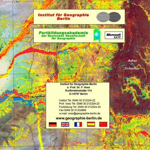
Wo finden Sie uns?<br />
How to find us<br />
Comment et où nous trouver<br />
Donde usted nos encuentra<br />
Institut für Geographie<br />
Berlin<br />
Fortbildungsakademie<br />
der Deutschen Gesellschaft<br />
für Geographie<br />
© Studio für Landkartentechnik, Norderstedt<br />
Institut für Geographie Berlin<br />
4. Etage<br />
Kurfürstentsraße 114<br />
D-10787 Berlin-Schöneberg<br />
GERMANY<br />
5 Minuten Fußweg vom U-Bhf. Wittenbergplatz<br />
Fortbildungsakademie der DGfG im<br />
Paul-Löbe-Volkshochschulhaus<br />
2. Etage, Raum 22<br />
Trautenaustraße 5, Ecke Bundesallee<br />
D-10717 Berlin-Wilmersdorf<br />
U-Bhf. Güntzelstraße
1<br />
Einleitung<br />
Geographie in Forschung und Lehre gibt es an der TU seit Ende des Ersten Weltkriegs. <strong>Prof</strong>. <strong>Dr</strong>. Rühl vertrat das Fach seit<br />
1920, gefolgt von den <strong>Prof</strong>essoren Otto Quelle (1930 -1940) und Karl Krüger (ab 1940). Nach der Unterbrechung durch den<br />
Zweiten Weltkrieg begann die Wiederaufnahme der Tätigkeit durch <strong>Prof</strong>. <strong>Dr</strong>. Fels (1950 -1958) und in Fortsetzung durch <strong>Prof</strong>.<br />
<strong>Dr</strong>. Jensch (1958 -1962). 1962 erfolgte die Institutionalisierung des Fachgebietes Geographie unter der Leitung von <strong>Prof</strong>. <strong>Dr</strong>.<br />
Valentin. Infolge der Vereinigung von Berlin und seiner nunmehr vier Universitäten erwuchsen durch die Einstellung der<br />
Studiengänge Geographie an der TU 1996-2001 neue und innovative Aufgaben, die in dieser Broschüre vorgestellt werden.<br />
Introduction<br />
Geography has been represented at the TU Berlin through research and teaching since the end of World War I. <strong>Prof</strong>. <strong>Dr</strong>. Rühl<br />
founded the discipline in 1920 and was followed by <strong>Prof</strong>essors Otto Quelle (1930 -1940) and Karl Krüger (beginning in 1940).<br />
After an hiatus brought about by World War II, the work of the discipline was resumed by <strong>Prof</strong>essor <strong>Dr</strong>. Fels (1950 -1958) and<br />
continued by <strong>Prof</strong>essor <strong>Dr</strong>. Jensch (1958 -1962). In 1962 Geography formally became a Department under the direction of<br />
<strong>Prof</strong>. <strong>Dr</strong>. Valentin. As a consequence of reunification there exist four universities with largely overlapping programs in the Berlin<br />
region. Geography, as a course of study, has been eliminated at the Technical University 1996-2001; but new and innovative<br />
ideas have emerged, many of which are briefly described in this brochure and all of which carry forward the tradition of<br />
geographical studies at the Technical University of Berlin.<br />
Introduction<br />
La géographie des recherches scientifiques et d'enseignement existe à l'Université Technique de Berlin depuis la fin de la<br />
guerre mondiale I. <strong>Prof</strong>. <strong>Dr</strong>. Rühl representa la discipline depuis 1920, suivi de <strong>Prof</strong>esseur Otto Quelle (de 1930 à 1940) et<br />
Karl Krüger (depuis 1940). Après l'interruption par suite de la guerre mondiale II <strong>Prof</strong>. Fels reprit les activités (de 1950 à 1958),<br />
suivi de <strong>Prof</strong>. <strong>Dr</strong>. Jensch (de 1958 à 1962). Après l'intégration de la discipline comme Institut de Géographie l'Université<br />
Technique nomma <strong>Prof</strong>. <strong>Dr</strong>. Valentin à la chaire en 1962. Suite à l'union nationale Berlin est en possession de quatre universités<br />
et en conséquence on supprime les études en géographie à la TU Berlin 1996-2001. Néanmoins des travaux nouveaux et<br />
innovants en resultèrent. C'est la brochure, qui présente les projets nouveaux.<br />
Introducción<br />
La geografía, como tarea de investigación y enseñanza en la Universidad Técnica de Berlin, existe desde fines de la Primera<br />
Guerra Mundial. En el año 1920 el <strong>Prof</strong>. <strong>Dr</strong>. Rühl representó esta disciplina, luego fué sucedido por los <strong>Prof</strong>s. <strong>Dr</strong>. Otto Quelle<br />
(1930 -1940) y Karl Krüger (a partir de 1940). Después de la interrupción causada por la Segunda Guerra Mundial, se reanudaron<br />
las actividades a través del <strong>Prof</strong>. <strong>Dr</strong>. Fels (1950 -1958) y luego fueron continuadas por el <strong>Prof</strong>. <strong>Dr</strong>. Jensch (1958 -1962). En<br />
el año 1962 se llevó a cabo la institucionalización de la geografía como disciplina, bajo la dirección del <strong>Prof</strong>. <strong>Dr</strong>. Valentin. Hoy<br />
en día, debido a la reunificación de Berlin y el hecho de que existen cuatro universidades, surgen a raíz del cierre de los<br />
estudios de la carrera de geografía, en el año 1996-2001 en la Universidad Técnica de Berlin, tareas nuevas, las cuales se
Forschungsaufgaben im Bereich der Angewandten<br />
Fernerkundung<br />
Research Efforts in the Area of Applied Remote<br />
Sensing<br />
Des travaux scientifiques en la télédétection<br />
appliquée<br />
Tareas de investigación en el área de exploración<br />
teledirigada aplicada<br />
2<br />
Luftbildwesen<br />
Luftbildflüge mit ein- und zweimotorigen Maschinen<br />
im In- und Ausland. Tandemflüge mit zwei Maschinen<br />
und Doppelausrüstungen über Gewässern mit<br />
Doppelsynchronauslösungen<br />
Aerial Photography<br />
Aerial photo reconaissance with single and twin<br />
engine airplanes domestically and abroad. Tandem<br />
flights over water with two airplanes and duplicate<br />
equipment, using co-synchronous exposure technology.<br />
Service photo aérienne<br />
Des vols en avions à mono et à bi moteurs. Des vols<br />
tandem avec deux machines au-dessus des eaux et<br />
l'équipement double en utilisant une technologie<br />
de déclenchement cosynchronisé.<br />
Fotos aéreas<br />
Fotografía aérea con avionetas y aviones en<br />
Alemania y en el exterior. Vuelos simultáneos<br />
(tandem) con dos aviones, sobre espejos de agua con<br />
doble equipamiento y doble sistema de<br />
exposición sincronizada.<br />
Luftbildwesen<br />
Aerial Photography<br />
Service photo aérienne<br />
Fotos aéreas<br />
Luftbildaufnahmen senkrecht und schräg mit<br />
folgenden Aufnahmegeräten<br />
1 Hasselblad 6 x 6 cm<br />
2 Linhof Aerotechnika 9 x 13 cm<br />
3 Zeiss LMK 2000 23 x 23 cm<br />
4 Videosynchronkamera Farbe und Infrarot<br />
5 Agema Thermovision<br />
Luftbildaufnahmen im panchromatischen Bereich,<br />
im Infrarotbereich, in Farbe, Falschfarbe im<br />
multispektralen und im Videobereich, qualitative und<br />
quantitative Luftbildauswertungen aller Art und aller<br />
thematischen Inhalte, Herstellung von<br />
Stereokartierungen, Luftbildplänen und Bildmosaiken.
Oblique and vertical aerial photography with the<br />
following equipment<br />
1 Hasselblad 6 x 6 cm<br />
2 Linhof Aerotechnika 9 x 13 cm<br />
3 Zeiss LMK 2000 23 x 23 cm<br />
4 Videosynchroncamera - color and infrared<br />
5 Agema Thermovision<br />
Multispectral and video aerial photography in<br />
panchromatic, infrared, rendered in color and false<br />
color, qualitative and quantitative aerial photo<br />
interpretation of all types and thematic content,<br />
creation of stereo maps, aerial photomaps<br />
and mosaics.<br />
Photographies aériennes verticales<br />
et obliques avec équipements suivants<br />
1 Hasselblad 6 x 6 cm<br />
2 Linhof Aerotechnika 9 x 13 cm<br />
3 Zeiss LMK 2000 23 x 23 cm<br />
4 Camera vidéo synchronisée en couleur etinfrarouge<br />
5 Agema Thermovision<br />
Photos aériennes en ambiance panchromatique,<br />
infrarouge, en couleur et couleurs artificielles<br />
en ambiance multi-spectrale et vidéo, exploitation<br />
de tous genres, de tous sujets et contenus<br />
thématiques, fabrication de restitutions stéréo,<br />
de plans aériens et des mosaiques d´image.<br />
Fotos aéreas verticales e inclinadas con las<br />
siguientes cámaras<br />
1 Hasselblad 6 x 6 cm<br />
2 Linhof Aerotechnika 9 x 13 cm<br />
3 Zeiss LMK 2000 23 x 23 cm<br />
4 Cámara-videosincrónica color e infrarroja<br />
5 Agema Thermovision<br />
Fotos aéreas pancromáticas, infrarrojas, en color,<br />
en colores falsos, multiespectrales y video.<br />
Procesamiento y evaluación cuantitativa como<br />
cualitativa de fotos aéreas de toda índole<br />
y contenido, cartografía estereoscópica, producción<br />
de ortofotos y fotomosaicos.<br />
3<br />
3<br />
1 2<br />
4 5
Seitwärtsradarerkundung<br />
Side-Looking Radar Analysis<br />
Analyse avec radar de côté<br />
Percepción remota por radar<br />
4<br />
Seitwärtsradarerkundung<br />
Auswertung von Seitwärtsradaraufnahmen<br />
Side-Looking Radar Analysis<br />
Interpretation of Side-Looking Radar Data.<br />
Analyse avec radar de côté<br />
Interprétation des photos faites avec radar<br />
de côté<br />
Percepción remota por radar<br />
Procesamiento y evaluación de imágenes de<br />
radar (tomas oblicuas)
Satellitenerkundung<br />
Satellite Data Analysis<br />
Analyse des dates de satellite<br />
Percepción remota satélital<br />
5<br />
Satellitenerkundung<br />
Auswertung von Fernerkundungsdaten der<br />
Satelliten LANDSAT, SPOT, ERS1,2, METEOSAT,<br />
NOAA u.a.<br />
Bangladesh<br />
Satellite Data Analysis<br />
Interpretation through remote sensing of satellite<br />
data from LANDSAT; SPOT; ERS1,2, METEOSAT,<br />
NOAA, etc.<br />
Analyse des dates de satellite<br />
Analyse des dates de télédétection des<br />
satellites LANDSAT, SPOT, ERS1,2,<br />
METEOSAT, NOAA, etc.<br />
Percepción remota satélital<br />
Procesamiento y evaluación de datos de los<br />
satélites LANDSAT, SPOT, ERS1,2, METEOSAT,<br />
NOAA, etc.<br />
Thailand
Computerkartographie<br />
Computer Cartography<br />
Cartographie électronique<br />
Cartografía computacional<br />
6<br />
3-D<br />
Computerkartographie<br />
Umsetzung aller geowissenschaftlichen<br />
Informationen in computergestützte Kartographie<br />
und in Geographische Informationssysteme (GIS)<br />
bis hin zum Format DIN A 0.<br />
Computer Cartography<br />
Production of cartographic products, up to size DIN<br />
A 0 (= plot size E), from data produced through the<br />
use of geographic information systems (GIS).<br />
Cartographie électronique<br />
Convertir des informations geoscientifiques à la<br />
cartographie électronique jusqu'au format DIN A 0<br />
et de GIS<br />
Cartografía computacional<br />
Integración de información geocientífica y<br />
cartográfica eléctronica en sistemas de información<br />
geográfica (GIS) en formato e.
Labor<br />
Laboratory<br />
Laboratoire<br />
Laboratorio<br />
7<br />
Labor<br />
Eigenbau von Technik<br />
Videosynchronkamera System<br />
Forschungsplattform für Binnengewässer<br />
Flugzeuggestützte Sensorik für Umweltmonitoring<br />
Laboratory<br />
In-house construction of equipment<br />
Videosynchroncamera system<br />
Research platform for inland waters<br />
Aircraft supported sensors for environmental<br />
monitoring<br />
Laboratoire<br />
Auto-construction de la technique<br />
Système de camera vidéo synchronisée<br />
Plate-forme de recherche pour les eaux<br />
continentales<br />
Sensorique aérienne pour la surveillance de<br />
l'environnement<br />
Laboratorio<br />
Desarrollo propio de tecnologias<br />
Sistema de cámaras video-sincrónica<br />
Plataforma de investigación para el estudio de<br />
aguas continentales<br />
Sensores en aviones para monitoreo del<br />
medio ambiente
Geowissenschaftliche Inventuren<br />
Geographic Inventories<br />
Inventaires géographiques<br />
Inventarios geocientificos<br />
Geowissenschaftliche Inventuren<br />
Inventuren natürlicher Ressourcen mit<br />
Fernerkundungsmethoden im In- und Ausland,<br />
Überwachung von Massenschädlingsplagen in Afrika<br />
mit Satelliten,<br />
Landnutzungsinventuren,<br />
Vegetationskartierungen,<br />
Biotoptypenkartierungen,<br />
Fernerkundung im Pflanzenschutz,<br />
Altlasteninventuren,<br />
Sedimentkartierungen mit Satellitentechnik,<br />
Wasserhaushaltsuntersuchungen,<br />
Befliegungen schadstoffbelasteter Gewässer.<br />
Geographic Inventories<br />
Inventories of natural resources with remote sensing<br />
methods domestically and abroad,<br />
Monitoring of migrant pests in Africa via satellite,<br />
Landuse inventories,<br />
Vegetation mapping,<br />
Biotope mapping,<br />
Remote sensing in plant protection,<br />
Inventories of waste sites,<br />
Sediment mapping through the analysis of satellite<br />
data,<br />
Water quality assessment,<br />
Aerial reconnaissance of polluted waterways.<br />
Inventaires géographiques<br />
Inventaires des ressources naturelles par<br />
télédétection à l'interieur du pays et à l'étranger,<br />
urveillance des fleaux acridiens par satellite en<br />
Afrique,<br />
Inventaires de l'utilisation de terre,<br />
Cartes de végétation,<br />
Cartes des biotopes,<br />
Télédétection de la protection végétale,<br />
Inventaires des déchets toxiques,<br />
Description des sédiments par technique satellite,<br />
Analyse hydrogéographique,<br />
Reconnaissance aérienne des eaux polluées<br />
8<br />
Inventarios geocientificos<br />
Inventarios de recursos geográficos utilizando<br />
percepción remota satélital en Alemania y el exterior,<br />
Monitoreo por medio de satélites de plagas en Africa,<br />
Inventarios de usos del suelo,<br />
Cartografía de la cobertura vegetal,<br />
Cartografía biotópica,<br />
Percepción remota para la protección<br />
de plantas,<br />
Inventarios de depósitos de desechos,<br />
Cartografía de la distribución de los sedimentos,<br />
utilizando técnicas satélitales,<br />
Análisis de bilanzas hidrográficas,<br />
Vuelos de medición sobre aguas contaminadas
Schulungen und Trainingskurse<br />
Instruction and Training Courses<br />
Entrainement spécifique au projet en systèmes<br />
d´ information géographique<br />
Cursos de capacitación y entrenamiento<br />
Schulungen und Trainingskurse<br />
Projektbezogenes Training in Geographischen<br />
Informationssystemen, Crash Kurse in<br />
Geographischen Informationssystemen (GIS),<br />
Umweltmonitoring mit Fernerkundungsmethoden,<br />
Schulungen in Digitaler Kartographie,<br />
Digitaler Photographie, etc.<br />
Instruction and Training Courses<br />
Project-specific training and crash courses in<br />
Geographic Information Systems, environmental<br />
monitoring using remote sensing methodologies,<br />
instruction in digital cartography and<br />
digital photography, etc.<br />
10<br />
Entrainement spécifique au projet en systèmes<br />
d´ information géographique<br />
Courses-crash en GIS, surveillance de l'environnement<br />
par méthodes de télédétection,<br />
entrainement en cartographie digitale,<br />
photographie digitale etc.<br />
Cursos de capacitación y entrenamiento<br />
Entrenamiento con aplicaciones en sistemas de<br />
información geográfica, cursos intensivos en<br />
sistemas de información geográfica (GIS),<br />
entrenamiento en métodologias de exploración<br />
teledirigada y monitoreo del medio ambiente,<br />
cursos de cartografía digital, fotografía dígital, etc.<br />
www.fortbildung-berlin.de
Wo finden Sie uns?<br />
How to find us<br />
Comment et où nous trouver<br />
Donde usted nos encuentra<br />
Institut für Geographie<br />
Berlin<br />
11<br />
AATP<br />
Fortbildungsakademie<br />
der Deutschen Gesellschaft<br />
für Geographie<br />
Institut für Geographie Berlin<br />
4. Etage<br />
Kurfürstentsraße 114<br />
D-10787 Berlin-Schöneberg<br />
5 Minuten Fußweg vom U-Bhf. Wittenbergplatz<br />
Fortbildungsakademie der DGfG im<br />
Paul-Löbe-Volkshochschulhaus<br />
2. Etage, Raum 22<br />
Trautenaustraße 5, Ecke Bundesallee<br />
D-10717 Berlin-Wilmersdorf<br />
U-Bhf. Güntzelstraße<br />
Luftbildwesen<br />
Aerial Photography<br />
Service photo aérienne<br />
Fotos aéreas<br />
Schulungen und Trainingskurse<br />
Instruction and Training Courses<br />
Entrainement spécifique au projet en systèmes<br />
d´ information géographique<br />
Cursos de capacitación y entrenamiento
Eigene Publikationsreihe<br />
Institute Publication Series<br />
Notre série des publications<br />
Nuestra serie de publicaciones<br />
12<br />
Berliner Geographische Studien.<br />
(1977 - 2002, 51 vol.)
Universitätskooperationen<br />
Cooperating Universities<br />
Coopérations avec des universités étrangères<br />
Cooperaciones con universidades del Exterior<br />
Universitätskooperationen<br />
Äthiopien University of Addis Abeba<br />
Bulgarien St. Kliment Ohridski Universität Sofia<br />
Chile Universidad de la Frontera, Temuco<br />
China Tongji Universität, Shanghai<br />
East China Normal University, Shanghai<br />
Nanjing Normal University<br />
Thailand Kasetsart University, Bangkok<br />
USA Salisbury State University<br />
Universitiy of Maryland System<br />
Gastprofessoren aus<br />
Argentinien, China, England, Japan, USA<br />
13<br />
États Unies Salisbury State University,<br />
University of Maryland System<br />
Visites des professeurs<br />
américains, anglais, argentins, chinois et japonais<br />
Cooperaciones con universidades del Exterior<br />
Etiopía University of Addis Abeba<br />
Bulgaria University of Sofia<br />
Chile<br />
Universidad de la Frontera, Temuco<br />
China<br />
Tongji University, Shanghai<br />
East China Normal University,<br />
Shanghai<br />
Nanjing Normal University<br />
Tailandia Kasetsart University, Bangkok<br />
Estados Unidos Salisbury State University,<br />
University of Maryland System<br />
<strong>Prof</strong>esores invitados desde<br />
Argentina, China, Estados Unidos, Inglaterra, Japón<br />
Cooperating Universities<br />
Ethiopia University of Addis Abeba<br />
Bulgaria St. Kliment Ohridski University of Sofia<br />
Chile Universidad de la Frontera, Temuco<br />
China Tongji University, Shanghai<br />
East China Normal University, Shanghai<br />
Nanjing Normal University<br />
Thailand Kasetsart University, Bangkok<br />
USA Salisbury State University,<br />
University of Maryland System<br />
Guest <strong>Prof</strong>essors from<br />
Argentina, China, Great Britain, Japan, USA<br />
Coopérations avec des universités étrangères<br />
Éthiopie University of Addis Abeba<br />
Bulgarie St. Kliment Ohridski Université Sofia<br />
Chili<br />
Universidad de la Frontera, Temuco<br />
Chine<br />
Université Tongji, Shanghai<br />
East China Normal University,<br />
Shanghai<br />
Nanjing Normal University<br />
Thailande Kasetsart University, Bangkok
Beteiligungen an Messen und Ausstellungen seit 1991<br />
Participation at Conferences and Expositions<br />
since 1991<br />
Participation aux foires et expositions<br />
depuis 1991<br />
Participaciones en ferias y exposiciones<br />
desde 1991<br />
Beteiligungen an Messen und Ausstellungen<br />
seit 1991<br />
National<br />
Deutscher Geographentag<br />
Basel 1991, Bochum 1993, Potsdam 1995, Bonn<br />
1997, Hamburg 1999<br />
ILA (Internationale Luftfahrtausstellung)<br />
Berlin 1992, 1994, 1996, 1998, 2000, 2002<br />
InnoTrans<br />
Berlin 2000<br />
Innovationsforum<br />
Leipzig 1993<br />
Intergeo<br />
Berlin 2000<br />
Deutscher Kartographentag<br />
Hamburg 1995<br />
Geotechnika<br />
Köln 1991, 1993, 1995<br />
UTECH (Umwelttechnikmesse)<br />
Berlin 1993, 1994, 1995, 1996, 1997, 1998<br />
International<br />
ISPRS (International Society of<br />
Photogrammetry and Remote Sensing)<br />
Washington, D.C., USA, 1992<br />
Industrieausstellung<br />
Posen, Polen, 1993<br />
ITEP (International Technology for<br />
Environmental Protection)<br />
Shanghai, China, 1995<br />
Participation at Conferences and Expositions<br />
since 1991<br />
National<br />
Deutscher Geographentag<br />
Basel 1991, Bochum 1993,<br />
Potsdam 1995, Bonn 1997, Hamburg 1999<br />
ILA (Internationale Luftfahrtausstellung)<br />
Berlin 1992, 1994, 1996, 1998, 2000, 2002<br />
InnoTrans<br />
Berlin 2000<br />
Innovationsforum<br />
Leipzig 1993<br />
14<br />
Intergeo<br />
Berlin 2000<br />
Deutscher Kartographentag<br />
Hamburg 1995<br />
Geotechnika<br />
Cologne 1991, 1993, 1995<br />
UTECH (Umwelttechnikmesse)<br />
Berlin 1993, 1994, 1995, 1996, 1997, 1998<br />
International<br />
ISPRS (International Society of Photogrammetry<br />
and Remote Sensing),<br />
Washington, D.C., USA, 1992<br />
Industrial Exhibition<br />
Posen, Poland, 1993<br />
ITEP (International Technology for Environmental<br />
Protection)<br />
Shanghai, China, 1995<br />
Participation aux foires et expositions depuis 1991<br />
National<br />
Deutscher Geographentag<br />
Bâle 1991, Bochum 1993,<br />
Potsdam 1995, Bonn 1997, Hambourg 1999<br />
ILA (Internationale Luftfahrtausstellung)<br />
Berlin 1992, 1994, 1996, 1998, 2000, 2002<br />
InnoTrans<br />
Berlin 2000
Innovationsforum<br />
Leipzig 1993<br />
Intergeo<br />
Berlin 2000<br />
Deutscher Kartographentag<br />
Hambourg 1995<br />
Geotechnika<br />
Cologne 1991, 1993, 1995<br />
UTECH (Umwelttechnikmesse)<br />
Berlin 1993, 1994, 1995, 1996, 1997, 1998<br />
International<br />
ISPRS (International Society of Photogrammetry<br />
and Remote Sensing)<br />
Washington, D.C., L’Etats-Unies, 1992<br />
Congrès Industriel<br />
Posen, Pologne, 1993<br />
ITEP (International Technology for<br />
Environmental Protection)<br />
Shanghai, Chine, 1995<br />
15<br />
Participaciones en ferias y exposiciones<br />
desde 1991<br />
En el ámbito nacional<br />
Deutscher Geographentag (Encuentro<br />
Nacional de Geografía)<br />
Basel 1991, Bochum 1993, Potsdam 1995,<br />
Bonn 1997, Hamburgo 1999<br />
Exposición Aeronáutica Internacional<br />
Berlín 1992, 1994, 1996, 1998, 2000, 2002<br />
InnoTrans<br />
Berlin 2000<br />
Foro de Innovaciones<br />
Leipzig 1993<br />
Intergeo<br />
Berlin 2000<br />
Deutscher Kartographentag (Encuentro<br />
Nacional de Cartografía)<br />
Hamburgo 1995<br />
Geotécnica Colonia 1991, 1993, 1995<br />
UTECH (Fuero de Tecnología Ambiental)<br />
Berlin 1993, 1994, 1995, 1996, 1997, 1998<br />
En el ámbito internacional<br />
ISPRS (International Society of Photogrammetry<br />
and Remote Sensing)<br />
Washington, D.C. 1992<br />
Feria Industrial<br />
Posen, Polonia, 1993<br />
ITEP (International Technology for<br />
Environmental Protection)<br />
Shanghai, China, 1995
Unsere wichtigsten Kooperationspartner<br />
Our most important cooperative partners<br />
Nos partenaires coopératives les plus importants<br />
Nuestros colaboradores más importantes<br />
Unsere wichtigsten Kooperationspartner<br />
National<br />
Apple GmbH, München<br />
August Reiners Bauunternehmungen, Berlin<br />
BMW AG, Berlin, München<br />
CASIO Deutschland, Hamburg<br />
Carl Zeiss, Oberkochen<br />
Carl Zeiss, Jena<br />
Ergoline Windhagen / Köln<br />
Greenpeace, Hamburg<br />
GTZ (Deutsche Gesellschaft für technische<br />
Zusammenarbeit), Eschborn<br />
Hoechst AG, Frankfurt<br />
Kayser-Threde, München<br />
Microsoft GmbH, München<br />
Schering AG, Berlin<br />
Stemme Flugzeugbau, Berlin<br />
Studio für Landkartentechnik, Norderstedt<br />
THW Technisches Hilfswerk, Bonn<br />
UVE, Berlin, Potsdam<br />
Wasser- und Schiffahrtsämter Nord- und Ostsee<br />
International<br />
DLCO Desert Locust Control Organization,<br />
East Africa, Nairobi, Kenya<br />
FAO (Food and Agricultural Organization), Rom<br />
Gemeinde Haarlemmermeer, Amsterdam<br />
Hochgeschwindigkeitseisenbahn der Niederlande<br />
Merck Sharp & Dohme, Wien<br />
Provinzregierung XI Region, Chile<br />
Risk Management Group, Rotterdam<br />
Schiphol Airport, Amsterdam<br />
Our most important cooperative partners<br />
National<br />
Apple GmbH, Munich<br />
August Reiners Bauunternehmungen, Berlin<br />
16<br />
BMW AG, Berlin, München<br />
CASIO Deutschland, Hamburg<br />
Carl Zeiss, Oberkochen<br />
Carl Zeiss, Jena<br />
Ergoline Windhagen / Köln<br />
Greenpeace, Hamburg<br />
GTZ (German Agency for Technical Cooperation),<br />
Eschborn<br />
Hoechst AG, Frankfurt<br />
Kayser-Threde, Munich<br />
Microsoft GmbH, Munich<br />
Schering AG, Berlin<br />
Stemme Flugzeugbau, Berlin<br />
Studio für Landkartentechnik, Norderstedt<br />
THW Technisches Hilfswerk, Bonn<br />
UVE, Berlin, Potsdam<br />
Wasser- und Schiffahrtsämter Nord- und Ostsee<br />
International<br />
DLCO Desert Locust Control Organization,<br />
East Africa, Nairobi, Kenya<br />
FAO (Food and Agricultural Organization), Rome<br />
Gemeinde Haarlemmermeer, Amsterdam<br />
High Speed Train of the Netherlands<br />
Merck Sharp & Dohme, Vienna<br />
Provincial Government XI Region, Chile<br />
Risk Management Group, Rotterdam<br />
Schiphol Airport, Amsterdam<br />
Nos partenaires cooperatives les plus importants<br />
En Allemagne<br />
Apple GmbH, Munich<br />
August Reiners Bauunternehmungen, Berlin<br />
BMW AG, Berlin, Munich<br />
CASIO Deutschland, Hambourg<br />
Carl Zeiss, Oberkochen<br />
Carl Zeiss, Jena<br />
Ergoline Windhagen / Cologne<br />
Greenpeace, Hambourg<br />
GTZ (Office Alemand de la Coopération<br />
Technique), Eschborn<br />
Hoechst AG, Frankfurt<br />
Kayser-Threde, Munich
Microsoft GmbH, Munich<br />
Schering AG, Berlin<br />
Stemme Flugzeugbau, Berlin<br />
Studio für Landkartentechnik, Norderstedt<br />
THW Technisches Hilfswerk, Bonn<br />
UVE, Berlin, Potsdam<br />
Wasser- und Schiffahrtsämter Nord- und Ostsee<br />
International<br />
DLCO Desert Locust Control Organization,<br />
East Africa, Nairobi, Kenya<br />
FAO (Food and Agricultural Organization), Rome<br />
Gemeinde Haarlemmermeer, Amsterdam<br />
Le TGV des Pays Bas<br />
Merck Sharp & Dohme, Vienne<br />
Gouvernement de la région XI, Chili<br />
Risk Management Group, Rotterdam<br />
Schiphol Airport, Amsterdam<br />
Nuestros colaboradores más importantes<br />
En el ámbito nacional<br />
Apple GmbH, Munich<br />
August Reiners Constructores, Berlin<br />
BMW AG, Berlin, Munich<br />
CASIO Alemania, Hamburgo<br />
Carl Zeiss, Oberkochen<br />
Carl Zeiss, Jena<br />
Ergoline Windhagen / Colonia<br />
Greenpeace, Hamburgo<br />
GTZ (Sociedad Alemana de Cooperación<br />
Técnica), Eschborn<br />
Hoechst AG, Frankfurt<br />
Kayser-Threde, München<br />
Microsoft GmbH, München<br />
Schering AG, Berlin<br />
Stemme, Construcción de avionetas, Berlin<br />
Studio für Landkartentechnik, Norderstedt<br />
THW Technisches Hilfswerk, Bonn<br />
UVE, Berlin, Potsdam<br />
Wasser- und Schiffahrtsämter Nord- und Ostsee<br />
17<br />
International<br />
DLCO Desert Locust Control Organization,<br />
East Africa, Nairobi, Kenya<br />
FAO (Food and Agricultural Organization), Roma<br />
Gemeinde Haarlemmermeer, Amsterdam<br />
Ferrocarril de alta velocidad Holandés<br />
Merck Sharp & Dohme, Viena<br />
Gobierno Regional de la XI Region de Aysén,<br />
Chile<br />
Risk Management Group, Rotterdam<br />
Schiphol Airport, Amsterdam