Master Plan for Thomastown and Lalor Shops - City of Whittlesea
Master Plan for Thomastown and Lalor Shops - City of Whittlesea
Master Plan for Thomastown and Lalor Shops - City of Whittlesea

You also want an ePaper? Increase the reach of your titles
YUMPU automatically turns print PDFs into web optimized ePapers that Google loves.
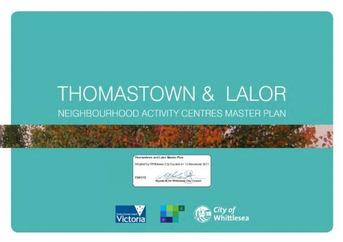
<strong>Thomastown</strong> <strong>and</strong> <strong>Lalor</strong><br />
Neighbourhood Activity Centres<br />
<strong>Master</strong> <strong>Plan</strong><br />
13 DECEMBER 2011
TABLE OF CONTENTS<br />
WHY PREPARE A MASTER PLAN? -------------------------------------------------------------------------------- 1<br />
MASTER PLAN OBJECTIVES ---------------------------------------------------------------------------------------- 1<br />
BACKGROUND -------------------------------------------------------------------------------------------------------- 2<br />
LOCALITY -------------------------------------------------------------------------------------------------------------------------2<br />
HISTORY --------------------------------------------------------------------------------------------------------------------------2<br />
ACTIVITY CENTRE HIERARCHY ---------------------------------------------------------------------------------------------3<br />
STUDY AREA SCOPE -----------------------------------------------------------------------------------------------------------3<br />
THE COMMUNITY -------------------------------------------------------------------------------------------------------------5<br />
COMMUNITY ENGAGEMENT ------------------------------------------------------------------------------------- 7<br />
METHODOLOGY ---------------------------------------------------------------------------------------------------------------7<br />
FINDINGS – WHAT DID THE COMMUNITY TELL US -------------------------------------------------------------------8<br />
SITE ANALYSIS ------------------------------------------------------------------------------------------------------ 10<br />
MASTER PLAN VISION -------------------------------------------------------------------------------------------- 11<br />
PUBLIC REALM IMPROVEMENT PLAN – THOMASTOWN ------------------------------------------------ 14<br />
RESPONSE TO KEY DIRECTIONS - THOMASTOWN ------------------------------------------------------------------ 15<br />
SCHEMATIC DESIGN -------------------------------------------------------------------------------------------------------- 16<br />
PUBLIC REALM IMPROVEMENT PLAN – LALOR ------------------------------------------------------------ 22<br />
RESPONSE TO KEY DIRECTIONS ------------------------------------------------------------------------------------------ 23<br />
SCHEMATIC DESIGN -------------------------------------------------------------------------------------------------------- 24<br />
PRIORITISATION OF PUBLIC REALM IMPROVEMENTS --------------------------------------------------- 29<br />
METHODOLOGY ------------------------------------------------------------------------------------------------------------- 29<br />
PRIORITIES -------------------------------------------------------------------------------------------------------------------- 30<br />
DESIGN DEVELOPMENT – THOMASTOWN ------------------------------------------------------------------ 32<br />
DESIGN DEVELOPMENT – LALOR ------------------------------------------------------------------------------ 44<br />
IMPLEMENTATION ------------------------------------------------------------------------------------------------ 64<br />
FUNDING ----------------------------------------------------------------------------------------------------------------------- 64<br />
COUNCIL DEPARTMENTS INVOLVED ----------------------------------------------------------------------------------- 65<br />
STAGING AND TIMING ----------------------------------------------------------------------------------------------------- 66<br />
STEPS FOR DELIVERING ‘PROJECT READY’ PUBLIC REALM IMPROVEMENTS ------------------------------- 66<br />
ONGOING MAINTENANCE ------------------------------------------------------------------------------------------------ 67<br />
OTHER RECOMMENDATIONS ----------------------------------------------------------------------------------- 68<br />
FURTHER MATTERS FOR CONSIDERATION --------------------------------------------------------------------------- 68<br />
ADDITIONAL STRATEGIC WORK TO ENHANCE THOMASTOWN AND LALOR -------------------------------- 70<br />
STAGING AND TIMING FOR ADDITIONAL STRATEGIC WORK --------------------------------------------------- 73<br />
CONCLUSION -------------------------------------------------------------------------------------------------------- 74<br />
APPENDICES --------------------------------------------------------------------------------------------------------- 75<br />
APPENDIX A ------------------------------------------------------------------------------------------------------------------- 76<br />
APPENDIX B ------------------------------------------------------------------------------------------------------------------- 76<br />
APPENDIX C ------------------------------------------------------------------------------------------------------------------- 87<br />
APPENDIX D ------------------------------------------------------------------------------------------------------------------- 89<br />
APPENDIX E ------------------------------------------------------------------------------------------------------------------- 92<br />
APPENDIX F ------------------------------------------------------------------------------------------------------------------- 94<br />
APPENDIX G ------------------------------------------------------------------------------------------------------------------- 97<br />
APPENDIX H ----------------------------------------------------------------------------------------------------------------- 102
WHY PREPARE A MASTER PLAN?<br />
<br />
<br />
Council has $2 million to undertake improvements to the streetscapes <strong>and</strong> public realm in the<br />
<strong>Thomastown</strong> High Street <strong>Shops</strong> <strong>and</strong> the <strong>Lalor</strong> <strong>Shops</strong> in Station Street <strong>and</strong> May Road<br />
A <strong>Master</strong> <strong>Plan</strong> will ensure there is an overall vision <strong>for</strong> these shopping precincts, <strong>and</strong> give<br />
Council a tool with which to apply <strong>for</strong> additional funding<br />
MASTER PLAN OBJECTIVES<br />
<br />
<br />
<br />
<br />
To provide a public realm improvements plan that conceptually demonstrates changes to each<br />
centre<br />
To provide design development <strong>for</strong> prioritised public realm improvements, given limited funds<br />
are available<br />
To provide an Implementation <strong>Plan</strong> <strong>for</strong> the works, which addresses funding constraints <strong>and</strong><br />
opportunities, <strong>and</strong> includes an action plan with staging <strong>and</strong> preferred timing<br />
To identify additional strategic work that needs to be undertaken to further enhance the<br />
<strong>Thomastown</strong> High Street <strong>Shops</strong> <strong>and</strong> the <strong>Lalor</strong> <strong>Shops</strong>, <strong>and</strong> more broadly the suburbs <strong>of</strong><br />
<strong>Thomastown</strong> <strong>and</strong> <strong>Lalor</strong><br />
1
BACKGROUND<br />
LOCALITY<br />
<strong>Thomastown</strong> <strong>and</strong> <strong>Lalor</strong> are located in the south west corner <strong>of</strong> the municipality, along the High<br />
Street corridor. Figure 1 demonstrates the location <strong>of</strong> <strong>Thomastown</strong> <strong>and</strong> <strong>Lalor</strong> in a municipal<br />
context.<br />
HISTORY<br />
The area <strong>of</strong> <strong>Thomastown</strong>, as we know it today, was initially surveyed under the direction <strong>of</strong><br />
Robert Hoddle <strong>and</strong> named as the Parish <strong>of</strong> Keelbundoora.<br />
In 1848, John <strong>and</strong> Mary Thomas <strong>and</strong> their family took up l<strong>and</strong> south <strong>of</strong> Main Street, opposite to<br />
Settlement Road <strong>and</strong> started market gardening (Payne, The Plenty, 72). They were<br />
successful, <strong>and</strong> their success encouraged others to join them, including John Bower, George<br />
Dyer, James Ollney <strong>and</strong> Benjamin Johnson. The name <strong>Thomastown</strong> is thought to either refer<br />
to John <strong>and</strong> Mary 'Thomas', or to the large number <strong>of</strong> subsequent settlers who were also<br />
called Thomas. In 1850, the Thomas' sold part <strong>of</strong> their holding to William Westgarth <strong>and</strong><br />
Captain Stanley Carr, who established the Lutheran settlement <strong>of</strong> „Westgarthtown‟ (Payne,<br />
The Plenty, 74).<br />
Following the early establishment <strong>of</strong> <strong>Thomastown</strong>, a regular coach to Melbourne was<br />
introduced <strong>and</strong> the dairy industry gradually developed. By the 1920s there were “scattered<br />
shops facing Epping Road” in <strong>Thomastown</strong>. The electrification <strong>of</strong> the railway to <strong>Thomastown</strong><br />
by 1921 resulted in a number <strong>of</strong> residential subdivisions around that station during the interwar<br />
period, but the Great Depression <strong>and</strong> availability <strong>of</strong> l<strong>and</strong> closer to Melbourne meant that<br />
few houses were built prior to World War II. Factory employment began in the area in 1927<br />
with the construction <strong>of</strong> Fowler‟s Pottery, however it wasn‟t until the 1950s that <strong>Thomastown</strong><br />
began to be absorbed into suburban Melbourne.<br />
<strong>Lalor</strong> similarly remained largely a rural area beyond the outer fringes <strong>of</strong> Melbourne until well<br />
into the twentieth century. Suburban development <strong>of</strong> <strong>Lalor</strong> began in the late 1940s as the<br />
population <strong>of</strong> Melbourne began to grow after World War II. Saxil Tuxen, a founding member <strong>of</strong><br />
the Victorian Town <strong>Plan</strong>ning Association, designed the <strong>Lalor</strong> estate in 1946 incorporating the<br />
„garden suburb‟ planning principles. In 1947, the Peter <strong>Lalor</strong> Home Building Co-operative<br />
Society was established, to develop the <strong>Lalor</strong> estate <strong>and</strong> help finance the construction <strong>of</strong><br />
homes. The <strong>Lalor</strong> <strong>Shops</strong>, located in Station Street <strong>and</strong> May Road, emerged in the 1960s.<br />
Figure 1. The location <strong>of</strong> <strong>Thomastown</strong> <strong>and</strong> <strong>Lalor</strong> in the municipality<br />
2
ACTIVITY CENTRE HIERARCHY<br />
The <strong>Thomastown</strong> High Street <strong>Shops</strong> <strong>and</strong> the <strong>Lalor</strong> <strong>Shops</strong> are defined as Neighbourhood<br />
Activity Centres in the <strong>Whittlesea</strong> <strong>Plan</strong>ning Scheme. Typically a neighbourhood level centre<br />
provides a limited mix <strong>of</strong> uses meeting local convenience needs <strong>and</strong> is highly accessible <strong>for</strong><br />
pedestrians, cyclists <strong>and</strong> public transport users. The Neighbourhood Activity Centre is an<br />
important community focal point <strong>and</strong> includes schools, libraries, child care, health services<br />
<strong>and</strong> other facilities that benefit from good public transport (Direction 1, Melbourne 2030). The<br />
hierarchy <strong>of</strong> activity centres <strong>for</strong> the <strong>City</strong> <strong>of</strong> <strong>Whittlesea</strong> is shown below in Figure 2.<br />
STUDY AREA SCOPE<br />
The extent <strong>of</strong> the public realm in the <strong>Thomastown</strong> High Street <strong>Shops</strong> <strong>and</strong> the <strong>Lalor</strong> <strong>Shops</strong> is<br />
demonstrated in Figures 3 <strong>and</strong> 4 respectively.<br />
Figure 2. The activity/ retail centre hierarchy within the <strong>City</strong> <strong>of</strong> <strong>Whittlesea</strong>.<br />
The <strong>Thomastown</strong> <strong>and</strong> <strong>Lalor</strong> <strong>Master</strong> <strong>Plan</strong> will focus on the retail cores <strong>of</strong> the <strong>Thomastown</strong> <strong>and</strong><br />
<strong>Lalor</strong> Neighbourhood Activity Centres (<strong>Thomastown</strong> High Street <strong>Shops</strong> <strong>and</strong> <strong>Lalor</strong> <strong>Shops</strong>),<br />
having regard to their suburban context.<br />
Figure 3. <strong>Thomastown</strong> High Street <strong>Shops</strong><br />
3
Peter <strong>Lalor</strong><br />
Vocational<br />
College<br />
<strong>Lalor</strong><br />
<strong>Shops</strong><br />
Figure 4. <strong>Lalor</strong> <strong>Shops</strong><br />
The Gross Leasable Floor Area (GLFA) <strong>of</strong> the <strong>Lalor</strong> <strong>Shops</strong> is 19,330m² (<strong>Whittlesea</strong> Retail<br />
Centres Strategy 2002). The <strong>Thomastown</strong> High Street <strong>Shops</strong> is approximately<br />
13,540m². As lower order centres, <strong>Thomastown</strong> High Street <strong>Shops</strong> <strong>and</strong> <strong>Lalor</strong> <strong>Shops</strong> are<br />
pivotal to the local communities <strong>of</strong> <strong>Thomastown</strong> <strong>and</strong> <strong>Lalor</strong> – communities that are the<br />
most vulnerable to economic <strong>and</strong> social disadvantage in the municipality.<br />
“Preservation <strong>of</strong> the capacity <strong>of</strong> lower order centres to serve local functions is an<br />
important consideration. Lower order centres however, will require progressive amenity<br />
improvements if they are to continue to trade successfully”. (Clause 21.02-7, MSS,<br />
<strong>Whittlesea</strong> <strong>Plan</strong>ning Scheme)<br />
A number <strong>of</strong> projects <strong>and</strong> developments are underway within the locality that influence<br />
the <strong>Master</strong> <strong>Plan</strong>. These include the South Morang Rail Extension Project, changes at<br />
Peter <strong>Lalor</strong> Secondary College, the community precinct in Main Street (<strong>Thomastown</strong><br />
Library, TRAC, Bubup Wilam Aboriginal Early Years Centre), <strong>and</strong> the Meridian Business<br />
Park. The study area <strong>for</strong> the <strong>Master</strong> <strong>Plan</strong> (Figure 5) there<strong>for</strong>e includes the shopping<br />
centres <strong>and</strong> these areas <strong>of</strong> influence.<br />
Main Street<br />
Community<br />
Precinct<br />
<strong>Thomastown</strong> High<br />
Street <strong>Shops</strong><br />
Meridian Business Park<br />
Figure 5. Study area boundary with areas <strong>of</strong> influence.<br />
4
THE COMMUNITY<br />
<strong>Thomastown</strong> has approximately 22,000 residents <strong>and</strong> <strong>Lalor</strong> has approximately 20,000<br />
residents. Over 27% <strong>of</strong> the population in the <strong>City</strong> <strong>of</strong> <strong>Whittlesea</strong> live in either <strong>Thomastown</strong> or<br />
<strong>Lalor</strong>. By 2020, the populations <strong>of</strong> <strong>Thomastown</strong> <strong>and</strong> <strong>Lalor</strong> are expected to increase to 23,284<br />
<strong>and</strong> 23,690 respectively. At this time, the population <strong>of</strong> <strong>Thomastown</strong> <strong>and</strong> <strong>Lalor</strong> as a<br />
percentage <strong>of</strong> the total population in the municipality will decrease to 20.4%. While there are<br />
infill housing developments occurring in the established areas <strong>of</strong> the municipality that will<br />
increase the population in <strong>Thomastown</strong> <strong>and</strong> <strong>Lalor</strong>, the overall decrease in population from<br />
27% to 20.4% can be attributed to the rate <strong>of</strong> subdivision, housing construction <strong>and</strong> population<br />
growth occurring in the growth areas <strong>of</strong> the municipality.<br />
The <strong>Thomastown</strong> <strong>and</strong> <strong>Lalor</strong> community is characterised by people <strong>of</strong> culturally <strong>and</strong><br />
linguistically diverse backgrounds, people <strong>of</strong> all ages <strong>and</strong> people with a wide range <strong>of</strong><br />
interests. An indicator <strong>of</strong> the cultural diversity is the percentage <strong>of</strong> residents born overseas.<br />
Over 49% <strong>of</strong> the residents <strong>of</strong> <strong>Thomastown</strong> were born overseas, <strong>and</strong> 46% <strong>of</strong> the residents <strong>of</strong><br />
<strong>Lalor</strong> were born overseas (in comparison to the percentage <strong>of</strong> <strong>City</strong> <strong>of</strong> <strong>Whittlesea</strong> residents<br />
born overseas – just under 33%). <strong>Thomastown</strong> <strong>and</strong> <strong>Lalor</strong> also have the highest level <strong>of</strong><br />
disadvantage compared to the other suburbs in the <strong>City</strong> <strong>of</strong> <strong>Whittlesea</strong> (Socio-economic Index<br />
<strong>for</strong> Areas, Australian Bureau <strong>of</strong> Statistics, 2006).<br />
There is a larger percentage <strong>of</strong> 60-84 year olds in <strong>Thomastown</strong> <strong>and</strong> <strong>Lalor</strong> compared to the<br />
overall <strong>City</strong> <strong>of</strong> <strong>Whittlesea</strong> totals. Although there are more 35-49 year olds in <strong>Thomastown</strong> <strong>and</strong><br />
<strong>Lalor</strong> than 60-84 year olds, the percentage <strong>of</strong> 35-49 years olds is still smaller than the <strong>City</strong> <strong>of</strong><br />
<strong>Whittlesea</strong>. There are also smaller percentages <strong>of</strong> younger people in <strong>Thomastown</strong> <strong>and</strong> <strong>Lalor</strong><br />
compared to the <strong>City</strong> <strong>of</strong> <strong>Whittlesea</strong>. Figures 6 <strong>and</strong> 7 demonstrate the age structures <strong>of</strong><br />
<strong>Thomastown</strong> <strong>and</strong> <strong>Lalor</strong> respectively.<br />
Figure 6. <strong>Thomastown</strong> Age Structure<br />
Figure 7. <strong>Lalor</strong> Age Structure<br />
5
By 2021 the most populous <strong>for</strong>ecast age group in <strong>Thomastown</strong> <strong>and</strong> <strong>Lalor</strong> will be 25-29 year olds.<br />
The number <strong>of</strong> people aged over 65 is expected to increase by 21.1% <strong>for</strong> <strong>Thomastown</strong> <strong>and</strong> by<br />
41.3% <strong>for</strong> <strong>Lalor</strong>. The age group which is <strong>for</strong>ecast to have the largest proportional increase in<br />
<strong>Thomastown</strong> <strong>and</strong> <strong>Lalor</strong> by 2021 is 85 <strong>and</strong> over year olds.<br />
Across the municipality, residents typically shop locally <strong>for</strong> daily <strong>and</strong> weekly needs, <strong>and</strong> shop at<br />
major shopping sites <strong>for</strong> clothing, specialty shop items <strong>and</strong> larger goods. When discussing the<br />
<strong>Thomastown</strong> High Street <strong>Shops</strong> <strong>and</strong> the <strong>Lalor</strong> <strong>Shops</strong>, it is important to look not only where the<br />
residents <strong>of</strong> <strong>Thomastown</strong> <strong>and</strong> <strong>Lalor</strong> shop, but it is also important to see where people come from to<br />
use the <strong>Thomastown</strong> High Street <strong>Shops</strong> <strong>and</strong> the <strong>Lalor</strong> <strong>Shops</strong>. In<strong>for</strong>mation relating to this has been<br />
obtained from the results <strong>of</strong> the 2009 Annual Household Survey (AHS) <strong>and</strong> is summarised further<br />
below.<br />
The <strong>Lalor</strong> <strong>Shops</strong> are popular shops <strong>for</strong> the residents <strong>of</strong> <strong>Thomastown</strong> <strong>and</strong> <strong>Lalor</strong> to obtain their daily<br />
shopping needs. 60% <strong>of</strong> <strong>Lalor</strong> residents use the <strong>Lalor</strong> <strong>Shops</strong> shops <strong>for</strong> their daily needs. This is<br />
relatively high in comparison with the use <strong>of</strong> the <strong>Thomastown</strong> High Street <strong>Shops</strong> by <strong>Thomastown</strong><br />
residents (22%) whereas 40% <strong>of</strong> <strong>Thomastown</strong> residents use the <strong>Lalor</strong> <strong>Shops</strong>. <strong>Thomastown</strong><br />
residents also use other local shops, including the shops at the corner <strong>of</strong> Edgars Road <strong>and</strong> Main<br />
Street, <strong>Thomastown</strong>, <strong>and</strong> the <strong>Lalor</strong> <strong>Shops</strong> <strong>for</strong> their daily shopping needs.<br />
The <strong>Lalor</strong> <strong>Shops</strong> <strong>and</strong> the <strong>Thomastown</strong> High Street <strong>Shops</strong> are not used widely <strong>for</strong> consumable<br />
shopping (such as clothes or gift shopping) or larger goods shopping. Residents shop <strong>for</strong><br />
consumables <strong>and</strong> larger goods at Epping Plaza or other major shopping centres within the <strong>City</strong> <strong>of</strong><br />
<strong>Whittlesea</strong> <strong>and</strong> adjoining municipalities.<br />
Where <strong>Thomastown</strong> <strong>Thomastown</strong> residents predominantly shop both locally <strong>and</strong> in<br />
residents shop<br />
<strong>Lalor</strong> <strong>for</strong> daily needs.<br />
For weekly needs, around twice as many <strong>Thomastown</strong> residents<br />
shop in <strong>Lalor</strong> compared to <strong>Thomastown</strong>.<br />
The most popular sites <strong>for</strong> daily shopping is the <strong>Lalor</strong> <strong>Shops</strong><br />
(41% <strong>of</strong> <strong>Thomastown</strong> residents use these shops).<br />
The most popular site <strong>for</strong> <strong>Thomastown</strong> residents by far <strong>for</strong><br />
clothing <strong>and</strong> consumables is Epping Plaza. Around half <strong>of</strong><br />
residents use Northl<strong>and</strong>. These are also the most popular sites<br />
<strong>for</strong> larger goods.<br />
Who uses the The majority <strong>of</strong> users <strong>of</strong> the shops <strong>for</strong> daily needs, weekly needs<br />
<strong>Thomastown</strong> High <strong>and</strong> consumables are from <strong>Thomastown</strong>. However a relatively<br />
Street <strong>Shops</strong><br />
small amount <strong>of</strong> <strong>Thomastown</strong> residents use the shops (22%).<br />
Approximately 4% <strong>of</strong> residents from the <strong>City</strong> <strong>of</strong> <strong>Whittlesea</strong> use<br />
the <strong>Thomastown</strong> High Street <strong>Shops</strong> <strong>for</strong> their daily needs. This<br />
compares to 15% <strong>of</strong> <strong>City</strong> <strong>of</strong> <strong>Whittlesea</strong> residents who use the<br />
<strong>Lalor</strong> <strong>Shops</strong>.<br />
The site ranked low <strong>for</strong> all types <strong>of</strong> shopping within the<br />
municipality.<br />
Where <strong>Lalor</strong> residents <strong>Lalor</strong> residents predominantly shop locally <strong>for</strong> daily needs, <strong>and</strong><br />
shop<br />
the most popular shopping area is the <strong>Lalor</strong> <strong>Shops</strong><br />
(approximately 60% <strong>of</strong> <strong>Lalor</strong> residents shop here)<br />
More than half <strong>of</strong> households also shop in Epping <strong>for</strong> daily<br />
needs.<br />
The proportion <strong>of</strong> <strong>Lalor</strong> residents shopping locally <strong>for</strong> weekly<br />
needs is smaller, but is still more than the proportion using<br />
shops in other suburbs <strong>for</strong> their weekly needs.<br />
The proportion <strong>of</strong> <strong>Lalor</strong> residents shopping locally <strong>for</strong> clothing or<br />
other consumables is relatively low, <strong>and</strong> the proportion shopping<br />
locally <strong>for</strong> larger goods is very low. Epping is the most popular<br />
suburb <strong>for</strong> both types <strong>of</strong> shopping.<br />
A significant proportion <strong>of</strong> <strong>Lalor</strong> residents also shop outside the<br />
municipality <strong>for</strong> larger household goods.<br />
Who uses the <strong>Lalor</strong><br />
<strong>Shops</strong><br />
Around 15% <strong>of</strong> <strong>City</strong> <strong>of</strong> <strong>Whittlesea</strong> residents use <strong>Lalor</strong> <strong>Shops</strong> <strong>for</strong><br />
daily or weekly shopping <strong>and</strong> around 5% use the site <strong>for</strong><br />
clothing <strong>and</strong> consumables.<br />
The main users are residents <strong>of</strong> <strong>Lalor</strong>, <strong>Thomastown</strong> <strong>and</strong> Epping,<br />
while a small proportion <strong>of</strong> users are residents <strong>of</strong> Mill Park.<br />
Up to 60% <strong>of</strong> <strong>Lalor</strong> residents, around 40% <strong>of</strong> <strong>Thomastown</strong><br />
residents, 25% <strong>of</strong> Epping residents <strong>and</strong> 10% <strong>of</strong> Mill Park<br />
residents use the site.<br />
In 2009, the site was the fifth most popular within the<br />
municipality <strong>for</strong> daily shopping <strong>and</strong> 4 th most popular <strong>for</strong> weekly<br />
shopping.<br />
<strong>Lalor</strong> residents are more likely to use <strong>Lalor</strong> Shopping Centre <strong>for</strong><br />
daily needs, while <strong>Thomastown</strong> residents are more likely to use<br />
the site <strong>for</strong> clothing <strong>and</strong> consumables or larger goods.<br />
Source – Annual Household Survey 2009<br />
6
COMMUNITY ENGAGEMENT<br />
Council is participating in <strong>and</strong> managing Shape Your Future – <strong>Thomastown</strong> <strong>and</strong> <strong>Lalor</strong> (SYF). This<br />
project brings together Council <strong>and</strong> a number <strong>of</strong> agencies to work alongside the community to<br />
prepare a local community action plan, to enable the community to be involved in making decisions<br />
<strong>for</strong> their future. Given the timing <strong>of</strong> SYF <strong>and</strong> this <strong>Master</strong> <strong>Plan</strong>, <strong>and</strong> the focus on <strong>Thomastown</strong> <strong>and</strong><br />
<strong>Lalor</strong>, the community engagement <strong>for</strong> both projects was, <strong>and</strong> will continue to be, undertaken at the<br />
same time where possible.<br />
The first stage <strong>of</strong> community engagement undertaken in October – December 2010 sought to<br />
determine the community‟s visions <strong>and</strong> aspirations <strong>for</strong> <strong>Thomastown</strong> <strong>and</strong> <strong>Lalor</strong> at a broader level <strong>for</strong><br />
SYF, while the community engagement <strong>for</strong> this <strong>Master</strong> <strong>Plan</strong> sought the community‟s visions <strong>and</strong><br />
aspirations <strong>for</strong> the shopping precincts. The in<strong>for</strong>mation obtained from this first stage <strong>of</strong> community<br />
engagement was used to guide the preparation <strong>of</strong> the draft <strong>Thomastown</strong> <strong>and</strong> <strong>Lalor</strong> <strong>Master</strong> <strong>Plan</strong>.<br />
The second stage <strong>of</strong> community engagement undertaken in November 2011 sought to determine<br />
the community‟s views on the draft <strong>Thomastown</strong> <strong>and</strong> <strong>Lalor</strong> <strong>Master</strong> <strong>Plan</strong>. More specifically, the<br />
engagement sought to determine the level <strong>of</strong> support <strong>for</strong> the public realm improvements included in<br />
the draft <strong>Master</strong> <strong>Plan</strong> <strong>and</strong> the level <strong>of</strong> support <strong>for</strong> the prioritisation <strong>of</strong> the improvements.<br />
Throughout the community engagement, residents, business owners, l<strong>and</strong> owners <strong>and</strong> visitors to<br />
the retail centres, had the ability to identify any issues they experience in these areas, <strong>and</strong> make<br />
suggestions <strong>for</strong> public realm improvements.<br />
Face-to-face discussions<br />
Council <strong>of</strong>ficers met with many groups <strong>and</strong> individuals in order to discuss <strong>Thomastown</strong> <strong>and</strong> <strong>Lalor</strong> in<br />
a more approachable <strong>and</strong> less threatening manner <strong>and</strong> ensure that the engagement captured the<br />
ideas <strong>and</strong> views <strong>of</strong> typically „hard to reach‟ sectors <strong>of</strong> the community, eg. CALD, working families,<br />
the aged, young people etc.<br />
In total, over 500 people across <strong>Thomastown</strong> <strong>and</strong> <strong>Lalor</strong> had input in a range <strong>of</strong> groups <strong>and</strong><br />
activities outlined below.<br />
Group<br />
discussions<br />
„Conversation<br />
cafes‟<br />
Event<br />
participation<br />
Council <strong>of</strong>ficers met with a number <strong>of</strong> community groups <strong>and</strong> provided<br />
background in<strong>for</strong>mation on the project. A group discussion was then facilitated<br />
to underst<strong>and</strong> what they like about each shopping centre, <strong>and</strong> how we can<br />
build upon the strengths <strong>and</strong> improve each centre.<br />
Council <strong>of</strong>ficers were based at a number <strong>of</strong> cafes in <strong>Thomastown</strong> <strong>and</strong> <strong>Lalor</strong>. A<br />
table was set up with a number <strong>of</strong> plans, aerial views <strong>and</strong> diagrams to show to<br />
the community. Visitors to the cafes or people walking by were given the<br />
opportunity to explain how they thought the shopping areas could be improved<br />
<strong>and</strong> explain their vision <strong>for</strong> the shops.<br />
Council <strong>of</strong>ficers either attended, or organised, a number <strong>of</strong> events <strong>and</strong><br />
discussed the project with interested community members.<br />
METHODOLOGY<br />
Two main methods were employed in engaging with the community; surveys <strong>and</strong> face-to-face<br />
discussions.<br />
Surveys<br />
Surveys were sent to all traders <strong>and</strong> l<strong>and</strong>owners in the <strong>Thomastown</strong> High Street <strong>Shops</strong> <strong>and</strong> the<br />
<strong>Lalor</strong> <strong>Shops</strong>. In addition to this, the survey was sent to a r<strong>and</strong>om sample <strong>of</strong> residents <strong>and</strong> it was<br />
accessible on the <strong>City</strong> <strong>of</strong> <strong>Whittlesea</strong> website.<br />
Out <strong>of</strong> the 756 surveys sent to residents <strong>and</strong> traders, 95 were returned, achieving a response rate<br />
<strong>of</strong> 12.6%. The ratio <strong>of</strong> men <strong>and</strong> women who completed the survey was relatively equal, as was the<br />
ratio <strong>of</strong> people from <strong>Thomastown</strong> <strong>and</strong> <strong>Lalor</strong>. There was also roughly an equal amount <strong>of</strong> people<br />
who responded to the survey in the age groups <strong>of</strong> 25-39, 40-59 <strong>and</strong> 60+.<br />
7
FINDINGS – WHAT DID THE COMMUNITY TELL US<br />
<strong>Thomastown</strong> <strong>and</strong> <strong>Lalor</strong> residents value their local shops as a place to visit <strong>and</strong> as a service in the<br />
local community. As an indication <strong>of</strong> their importance, the residents value the shops higher than<br />
public transport, libraries, parks <strong>and</strong> churches. <strong>Thomastown</strong> <strong>and</strong> <strong>Lalor</strong> residents also:<br />
• Like that there are good shopping areas close to where they live;<br />
• Think that the shopping centres give them better choices;<br />
• Go to the shops as an activity. Going to the shops is one <strong>of</strong> the top 6 activities that residents<br />
like to do in their local area. They like going to the shops because they get to socialise <strong>and</strong><br />
interact with other people;<br />
• Want improved car parking <strong>and</strong> traffic management throughout the suburbs; <strong>and</strong><br />
• Would like their suburbs to be safer, social, friendly <strong>and</strong> attractive.<br />
As a result <strong>of</strong> the first stage <strong>of</strong> targeted community engagement, there are clear areas <strong>for</strong><br />
improvement that relate to both shopping areas. In addition, improvements have also been<br />
identified <strong>for</strong> each <strong>of</strong> the shopping areas. The following community priorities have been<br />
established.<br />
Community priorities <strong>for</strong> both shopping areas<br />
High<br />
• Increase <strong>and</strong> improve car parking, including disabled car parking.<br />
• Ensure central <strong>and</strong> clean public toilets are available.<br />
• Include additional social gathering spaces (i.e. seating/ fixed picnic tables), at key<br />
nodes to enhance the atmosphere <strong>of</strong> both areas <strong>and</strong> increase the amenity <strong>of</strong> the<br />
shops.<br />
• Enhance the shopping areas to make them feel safer.<br />
• Upgrade both shopping areas to make them more attractive <strong>and</strong> less „tired‟<br />
looking.<br />
• Improve the quality <strong>and</strong> variety <strong>of</strong> the shops.<br />
Medium<br />
• Introduce better signage, including direction signs <strong>for</strong> the location <strong>and</strong> number <strong>of</strong><br />
car parking spaces <strong>and</strong> wayfinding signs <strong>for</strong> pedestrians, would assist with<br />
creating an identity <strong>for</strong> each centre, as well as assisting visitors to more easily<br />
navigate the shops.<br />
• Ensure footpath levels <strong>and</strong> paving types are consistent.<br />
• Relocate power lines underground to help improve the appearance.<br />
• Improve accessibility <strong>for</strong> people <strong>of</strong> all abilities.<br />
• Introduce public art throughout the centres.<br />
• Enhance street tree planting.<br />
• Improve weather protection (awnings/ ver<strong>and</strong>ahs).<br />
Low<br />
• Ensure street lighting along roads <strong>and</strong> in car parks is adequate. Street lights are<br />
currently positioned on power poles in many instances. If the power poles were to<br />
be removed, there would be scope to design <strong>and</strong> install street lights that are a<br />
feature <strong>of</strong> the area <strong>and</strong> not an eyesore.<br />
• Introduce bicycle racks.<br />
• Encourage sustainability measures.<br />
• Install rubbish bins at appropriate locations.<br />
• Redesign <strong>and</strong> enhance bus stops.<br />
• Increase or clearly identify taxi ranks.<br />
• Enhance pedestrian crossing points.<br />
8
Community priorities <strong>for</strong> the <strong>Thomastown</strong> High Street <strong>Shops</strong><br />
High<br />
• Prioritise High Street <strong>for</strong> pedestrians, including reducing the speed limit to 40 km<br />
p/h, upgrading the pedestrian crossing at High Street <strong>and</strong> Main Street, <strong>and</strong><br />
introducing an additional pedestrian crossing across High Street in the northern<br />
section <strong>of</strong> the centre.<br />
• Review traffic management at the intersection <strong>of</strong> Highl<strong>and</strong>s Avenue <strong>and</strong> Main<br />
Street.<br />
Medium<br />
• Improve the relationship between the east <strong>and</strong> west side <strong>of</strong> High Street (an<br />
additional pedestrian crossing across High Street in the northern section will<br />
contribute to this).<br />
• Introduce gateway treatments.<br />
Low<br />
• Encourage other banking institutions to locate in the centre.<br />
• Enhance connectivity between the Main Street community precinct <strong>and</strong> High<br />
Street.<br />
• Provide pedestrian connectivity/ walkways from the car parks to High Street.<br />
Community priorities <strong>for</strong> the <strong>Lalor</strong> <strong>Shops</strong><br />
High<br />
• Redevelop Peter <strong>Lalor</strong> Walk as a well-designed <strong>and</strong> permeable civic space, with<br />
social gathering spaces, shelter, public art <strong>and</strong> l<strong>and</strong>scaping.<br />
• Reduce traffic congestion at the David Street/ Station Street roundabout.<br />
• New/ modern toilets with family changing facilities to be constructed in a central<br />
location. If not possible, toilets on David Street to be removed <strong>and</strong> replaced with a<br />
modern structure with baby changing facilities, <strong>and</strong> wayfinding signage installed to<br />
identify the location <strong>of</strong> the toilet block.<br />
Medium<br />
• Improve the pedestrian link between Peter <strong>Lalor</strong> Walk <strong>and</strong> the <strong>Lalor</strong> Library.<br />
• Review the intersection <strong>of</strong> the Peter <strong>Lalor</strong> Walk <strong>and</strong> the rear laneway to enhance<br />
pedestrian permeability.<br />
• Ensure the centre retains its „market‟ feel.<br />
• Redesign <strong>and</strong> enhance the business identification sign on the north-east corner <strong>of</strong><br />
High Street <strong>and</strong> Manns Crossing.<br />
Low<br />
• Investigate the introduction <strong>of</strong> a community garden.<br />
• Provide a space in the centre <strong>for</strong> children.<br />
• Advocate <strong>for</strong> improved bus services to the centre.<br />
• Introduce taxi rank near the bus stop in Station Street.<br />
9
SITE ANALYSIS<br />
In addition to engaging with the community about what they like about the shopping precincts <strong>and</strong><br />
what they would like to see improved, Council also undertook specific analysis <strong>of</strong> each centre<br />
having regard to the following areas:<br />
<br />
<br />
<br />
<br />
<br />
Traffic <strong>and</strong> transport – cycling, private vehicle use <strong>and</strong> public transport<br />
Pedestrian access <strong>and</strong> permeability<br />
L<strong>and</strong>scaping<br />
L<strong>and</strong> use <strong>and</strong> built <strong>for</strong>m<br />
Public realm infrastructure<br />
The existing conditions plans <strong>and</strong> site analysis <strong>for</strong> <strong>Thomastown</strong> <strong>and</strong> <strong>Lalor</strong> are shown respectively in Appendices A <strong>and</strong> B. The summary <strong>of</strong> the site analysis is as follows:<br />
<strong>Thomastown</strong><br />
<strong>Lalor</strong><br />
<br />
<br />
<br />
<br />
<br />
<br />
<br />
<br />
<br />
<br />
<br />
<br />
<br />
<br />
<br />
<br />
<br />
<br />
<br />
<br />
<br />
<br />
<br />
Inconsistent car parking <strong>and</strong> trafficable lanes cause confusion throughout the strip.<br />
Car park behind <strong>for</strong>mer IGA, Spring Street car park <strong>and</strong> north end <strong>of</strong> the strip is<br />
underutilised.<br />
Car parking between Central Avenue <strong>and</strong> Main Street is well-utilised on the west side<br />
<strong>of</strong> High Street <strong>and</strong> the rear car parks, however not well-utilised on the east side.<br />
Parking occupancy is significantly higher on the east side <strong>of</strong> the railway line.<br />
Poor signage to car parks <strong>and</strong> number <strong>of</strong> car parking spaces.<br />
Poor visual <strong>and</strong> physical connection to community precinct in Main Street.<br />
Conflict points <strong>for</strong> different users at High Street with Main Street, Highl<strong>and</strong>s Avenue<br />
<strong>and</strong> Central Avenue.<br />
Minimal pedestrian priority provided throughout the centre, with 60km p/h speed limits.<br />
No east-west pedestrian crossings north <strong>of</strong> Main Street means that cars dominate this<br />
length <strong>of</strong> the shops <strong>and</strong> it is not a safe pedestrian environment.<br />
No wayfinding signage to assist pedestrians with navigation.<br />
Poor l<strong>and</strong>scaping around the shops east <strong>of</strong> the rail line <strong>and</strong> interface to car park.<br />
Inconsistent l<strong>and</strong>scaping west <strong>of</strong> the rail line due to l<strong>and</strong> fragmentation.<br />
West side <strong>of</strong> High Street can‟t accommodate large trees/ replanting.<br />
Range <strong>of</strong> uses is limited – opportunity to diversify uses within the centre.<br />
Poor active frontages along strip.<br />
Less pedestrian activity on the east side <strong>of</strong> High Street due to the type, number <strong>and</strong><br />
layout <strong>of</strong> businesses.<br />
Urban fabric gaps at <strong>for</strong>mer IGA building on west side <strong>of</strong> High Street, <strong>and</strong> between<br />
buildings on the east side <strong>of</strong> High Street.<br />
Insufficient gateway treatments at the southern <strong>and</strong> northern ends <strong>of</strong> the centre, <strong>and</strong> at<br />
Heyington Avenue.<br />
Role <strong>of</strong> War Memorial garden area unclear.<br />
Pavement types different throughout the centre <strong>and</strong> do not provide uni<strong>for</strong>mity.<br />
Social gathering spaces are insufficient.<br />
Inconsistent br<strong>and</strong>ing throughout the centre – poles, bins, seats.<br />
Convenient public toilets not provided.<br />
<br />
<br />
<br />
<br />
<br />
<br />
<br />
<br />
<br />
<br />
<br />
<br />
<br />
<br />
<br />
<br />
<br />
<br />
<br />
<br />
<br />
<br />
<br />
Congestion <strong>and</strong> conflict points <strong>for</strong> pedestrians <strong>and</strong> vehicles throughout the centre.<br />
Car parking in Station Street service road <strong>and</strong> May Road is reaching capacity.<br />
Parking in surrounding streets is underutilised.<br />
Car parking at the rear <strong>of</strong> shops is underutilised.<br />
Parking configurations do not maximise the number <strong>of</strong> spaces, eg. West side <strong>of</strong> the<br />
Station Street service road <strong>and</strong> the Cyprus Street car park.<br />
Footpath trading <strong>and</strong> structural elements impact on space <strong>for</strong> pedestrian movement<br />
throughout the centre.<br />
No wayfinding signage to assist pedestrians with navigation.<br />
Rest points are insufficient throughout the centre.<br />
Inconsistent or poor l<strong>and</strong>scaping throughout the centre, eg. Station Street median,<br />
May Road median.<br />
Overhead powerlines along Station Street <strong>and</strong> May Road affects the height <strong>of</strong> trees to<br />
be planted.<br />
Southern nature strip in David Street provides opportunities <strong>for</strong> l<strong>and</strong>scaping <strong>and</strong> social<br />
gathering spaces.<br />
Range <strong>of</strong> uses is limited – opportunity to diversity uses within the centre.<br />
High pedestrian/ vehicle activity during the day, minimal activity at night.<br />
Poor active frontages throughout the centre.<br />
„Run down‟ appearance <strong>for</strong> the length <strong>of</strong> the shops.<br />
Gaps in ver<strong>and</strong>ahs – inconsistent weather protection along the shops.<br />
Poor relationship between community precinct <strong>and</strong> the shopping centre.<br />
Social gathering space is generally around Peter <strong>Lalor</strong> Walk.<br />
Existing social gathering spaces not com<strong>for</strong>table spaces.<br />
Paving types <strong>and</strong> levels different throughout the centre.<br />
Insufficient gateway treatments.<br />
Inconsistent br<strong>and</strong>ing throughout the centre – structural poles, bins, seats.<br />
Poor location <strong>and</strong> cleanliness <strong>of</strong> public toilets.<br />
10
MASTER PLAN VISION<br />
To improve the <strong>Thomastown</strong> <strong>and</strong> <strong>Lalor</strong><br />
Neighbourhood Activity Centres so that they<br />
remain economically <strong>and</strong> socially sustainable<br />
in the context <strong>of</strong> growing larger retail centres<br />
in the municipality<br />
11
KEY DIRECTIONS<br />
The extensive community engagement undertaken between October <strong>and</strong> December 2010, <strong>and</strong> the review <strong>of</strong> existing strategies <strong>and</strong> policies that affect these shopping areas in<strong>for</strong>med the<br />
preparation <strong>of</strong> the following Key Directions. The Key Directions aim to achieve the <strong>Master</strong> <strong>Plan</strong> vision <strong>and</strong> have been used to design the Public Realm Improvements <strong>Plan</strong>s.<br />
1. Improve access to <strong>and</strong> around<br />
the shops<br />
For pedestrians<br />
For cyclists<br />
For public transport users<br />
For motorists<br />
2. Provide social gathering spaces<br />
throughout the centres to<br />
encourage social interaction<br />
3. Improve the overall appearance<br />
<strong>of</strong> the shops<br />
4. Improve access to parking<br />
(bicycles <strong>and</strong> vehicles)<br />
5. Increase safety, or perceptions<br />
<strong>of</strong> safety<br />
6. Encourage a better relationship<br />
between the shops <strong>and</strong> the<br />
community precincts<br />
7. Provide centrally located <strong>and</strong><br />
clean public toilets<br />
8. Improve the quality <strong>and</strong> variety<br />
<strong>of</strong> the shops/ uses<br />
12
PUBLIC REALM IMPROVEMENT PLAN –<br />
THOMASTOWN<br />
14
RESPONSE TO KEY DIRECTIONS - THOMASTOWN<br />
Below is a summary <strong>of</strong> the proposed public realm improvements on the opposite page in the context <strong>of</strong> each Key Direction.<br />
A full list <strong>of</strong> public realm improvements <strong>for</strong> <strong>Thomastown</strong> is detailed in Appendix C.<br />
1. Improve access to <strong>and</strong> around the shops<br />
<br />
<br />
<br />
<br />
<br />
<br />
<br />
<br />
<br />
Wayfinding signs, potentially with artistically designed features, at specific locations to<br />
help direct residents <strong>and</strong> visitors.<br />
Pedestrian crossing across High Street to ensure people can access the shops on the<br />
east side <strong>of</strong> High Street more easily.<br />
New level paving throughout the strip.<br />
Reduced speed limit through the centre.<br />
Review the High Street road reserve. If wide enough, introduce on-road bicycle lanes.<br />
Raised pedestrian crossings, also known as „wombat‟ crossings, across certain roads eg.<br />
Central Avenue.<br />
Different coloured pavement <strong>and</strong> textures <strong>for</strong> pedestrian movement eg. At the intersection<br />
<strong>of</strong> High Street <strong>and</strong> Main Street.<br />
New path network in the War memorial area to provide greater connectivity.<br />
Laneway adjacent to 1 Central Avenue widened to ensure cars can easily exit the car<br />
park.<br />
2. Provide social gathering spaces throughout the centres to encourage social<br />
interaction<br />
<br />
<br />
<br />
<br />
New major social gathering space in Highl<strong>and</strong>s Road, at the intersection with High Street.<br />
Redeveloped social gathering spaces throughout the strip, e.g. in front <strong>of</strong> the shops near<br />
Spring Street, <strong>and</strong> at the shops in The Boulevard <strong>and</strong> Station Street.<br />
Enhance the War Memorial area.<br />
Investigate, <strong>and</strong> advocate <strong>for</strong>, additional l<strong>and</strong> <strong>for</strong> civic space purposes.<br />
3. Improve the overall appearance <strong>of</strong> the shops<br />
<br />
<br />
<br />
<br />
<br />
<br />
<br />
<br />
<br />
New l<strong>and</strong>scaping in the social gathering spaces where necessary.<br />
Modify l<strong>and</strong>scaping on the west side <strong>of</strong> High Street, <strong>and</strong> replace missing/ damaged trees.<br />
New gateway signage with artistically designed features, <strong>and</strong> removal <strong>of</strong> trees (to ensure<br />
sight lines are maintained), at either end <strong>of</strong> the strip to clearly identify the shopping<br />
precinct.<br />
New feature paving in the major social gathering space, <strong>and</strong> new st<strong>and</strong>ard paving<br />
elsewhere, potentially with unique designed paving inserts.<br />
War Memorial area opposite the Primary School enhanced as a gateway feature.<br />
New line marking in front <strong>of</strong> the shops near Spring Street.<br />
New l<strong>and</strong>scaping in the Spring Street car park.<br />
Investigate removing power poles <strong>and</strong> relocating power lines underground.<br />
Art <strong>and</strong> design elements incorporated where possible to reflect <strong>Thomastown</strong>, its cultural<br />
heritage <strong>and</strong> its diversity.<br />
4. Improve access to parking (bicycles <strong>and</strong> vehicles)<br />
<br />
<br />
<br />
<br />
Existing car parking on the east side <strong>of</strong> High Street line marked.<br />
Bike racks installed at all designated social gathering spaces, <strong>and</strong> also as part <strong>of</strong> the new<br />
<strong>Thomastown</strong> Train Station.<br />
Car parking direction signs at specific locations, showing the number <strong>of</strong> car parking<br />
spaces <strong>and</strong> the time restrictions that apply to those areas.<br />
New time restrictions in the car park behind the <strong>for</strong>mer IGA, on the east side <strong>of</strong> High<br />
Street <strong>and</strong> in The Boulevard to allow <strong>for</strong> longer parking.<br />
5. Increase safety, or perceptions <strong>of</strong> safety<br />
<br />
<br />
<br />
<br />
<br />
New street lighting between Spring Street <strong>and</strong> Pleasant Road.<br />
New level paving throughout the strip.<br />
Reduced speed limit through the centre.<br />
New pedestrian crossing across High Street to ensure people can cross safely.<br />
In discussion with the new tenants <strong>of</strong> the <strong>for</strong>mer IGA building, investigate introducing an<br />
awning along the High Street façade.<br />
6. Encourage a better relationship between the shops <strong>and</strong> the community precincts<br />
<br />
<br />
Main Street paths to be free from clutter.<br />
Wayfinding signs, potentially with artistically designed features, will tell people where the<br />
community facilities are in Main Street, <strong>and</strong> how long it will take to get there.<br />
7. Provide centrally located <strong>and</strong> clean public toilets<br />
<br />
<br />
Toilets are to be included in the new <strong>Thomastown</strong> Train Station.<br />
Given the limited space available in <strong>Thomastown</strong>, there are limited opportunities <strong>for</strong> the<br />
provision <strong>of</strong> public toilets along High Street. Council will investigate whether public toilets<br />
can be provided in the major social gathering space at the intersection <strong>of</strong> Highl<strong>and</strong>s Road<br />
<strong>and</strong> High Street.<br />
8. Improve the quality <strong>and</strong> variety <strong>of</strong> the shops/ uses<br />
<br />
This project outlines improvements to the public realm. The shops <strong>and</strong> businesses in the<br />
High Street <strong>Shops</strong> are in private ownership, <strong>and</strong> as such, this master plan does not<br />
recommend any specific changes to private l<strong>and</strong>. However, it is envisaged that when<br />
improvements are made to the public realm as part <strong>of</strong> this master plan, businesses are<br />
more likely to upgrade the appearance <strong>of</strong> their buildings.<br />
15
SCHEMATIC DESIGN<br />
16
TT 1<br />
17
TT2<br />
18
TT3<br />
19
TT4<br />
20
TT5<br />
21
PUBLIC REALM IMPROVEMENT PLAN –<br />
LALOR<br />
22
RESPONSE TO KEY DIRECTIONS<br />
Below is a summary <strong>of</strong> the proposed public realm improvements on the opposite page in the context <strong>of</strong> each Key Direction. A full list <strong>of</strong> public realm improvements <strong>for</strong> <strong>Lalor</strong> is detailed in Appendix D.<br />
1. Improve access to <strong>and</strong> around the shops<br />
<br />
<br />
<br />
<br />
<br />
<br />
<br />
<br />
<br />
<br />
<br />
<br />
Wayfinding signs, potentially with artistically designed features, at specific locations to<br />
help direct residents <strong>and</strong> visitors.<br />
New level paving throughout the shops.<br />
Shared paths connecting the shops with the <strong>Lalor</strong> <strong>and</strong> <strong>Thomastown</strong> Train Stations, <strong>and</strong><br />
St Lukes Primary School.<br />
Raised pedestrian crossings, also known as „wombat‟ crossings, across certain roads eg.<br />
Across May Road near David Street <strong>and</strong> Messmate Street.<br />
Different coloured pavement <strong>for</strong> pedestrian movement eg.From Manns Crossing to the<br />
Station Street median.<br />
New traffic isl<strong>and</strong> with pedestrian refuge in Station Street.<br />
Better traffic light sequencing at Manns Crossing <strong>and</strong> High Street.<br />
New bus shelter, with artistically designed elements where possible, in Station Street as<br />
part <strong>of</strong> the Peter <strong>Lalor</strong> Walk redevelopment.<br />
New U-turn areas in May Road (at either end <strong>and</strong> near the Peter <strong>Lalor</strong> Walk).<br />
Investigate alternative intersection treatment at Station Street <strong>and</strong> David Street.<br />
Relocated midway vehicle entrance in the Station Street median further north.<br />
New right turn lane from David Street into May Road.<br />
2. Provide social gathering spaces throughout the centres to encourage social<br />
interaction<br />
<br />
<br />
<br />
Peter <strong>Lalor</strong> Walk redeveloped <strong>and</strong> extended as a major social gathering space.<br />
Other minor social gathering spaces redeveloped/ enhanced at the entry points.<br />
New social gathering space in David Street.<br />
3. Improve the overall appearance <strong>of</strong> the shops<br />
<br />
<br />
<br />
<br />
<br />
<br />
<br />
<br />
<br />
<br />
<br />
New l<strong>and</strong>scaping in the social gathering spaces <strong>and</strong> in other areas.<br />
New business identification sign on High Street.<br />
New entry treatment <strong>and</strong> integrated art feature as you enter Manns Crossing.<br />
Station Street median reconfigured <strong>and</strong> re-l<strong>and</strong>scaped.<br />
New gateway signage, with artistically designed elements, installed at entry points.<br />
New feature paving in the major social gathering spaces, <strong>and</strong> new st<strong>and</strong>ard paving<br />
elsewhere, potentially with unique designed paving inserts.<br />
Investigate removing power poles <strong>and</strong> relocating power lines underground.<br />
Car parking <strong>and</strong> paving reconstructed where it appears aged along Station Street.<br />
Activated walls, including shelter <strong>and</strong> integrated art, along Coles <strong>and</strong> the blank walls<br />
along Messmate Street.<br />
Investigate, <strong>and</strong> advocate <strong>for</strong>, additional l<strong>and</strong> <strong>for</strong> civic space purposes.<br />
Art <strong>and</strong> design elements incorporated where possible to reflect <strong>Lalor</strong>, its cultural heritage<br />
<strong>and</strong> its diversity.<br />
4. Improve access to parking (bicycles <strong>and</strong> vehicles)<br />
<br />
<br />
<br />
<br />
<br />
<br />
Bike racks installed at all designated social gathering spaces.<br />
Cyprus Street car park reconfigured to provide 11 additional car parking spaces.<br />
Car parking direction signs at specific locations, showing the number <strong>of</strong> car parking<br />
spaces <strong>and</strong> the time restrictions that apply to those areas.<br />
New car parking on west side <strong>of</strong> Station Street service road.<br />
New time restrictions on the east side <strong>of</strong> the Station Street service road.<br />
Investigate purchasing l<strong>and</strong> <strong>for</strong> additional car parking.<br />
5. Increase safety, or perceptions <strong>of</strong> safety<br />
<br />
<br />
New street lighting in Station Street <strong>and</strong> May Road.<br />
New level paving throughout the shopping precinct.<br />
6. Encourage a better relationship between the shops <strong>and</strong> the community precincts<br />
<br />
<br />
<br />
New paving, consistent with the rest <strong>of</strong> the centre, linking the Senior Citizens Centre to<br />
May Road.<br />
Provide better visual connection between the Senior Citizens Centre <strong>and</strong> May Road by<br />
removing the fences around the Senior Citizens Centre <strong>and</strong> rel<strong>and</strong>scaping the area.<br />
Wayfinding signs, potentially with artistically designed features, will tell people where the<br />
community facilities are in May Road <strong>and</strong> French Street, <strong>and</strong> how long it will take to get<br />
there.<br />
7. Provide centrally located <strong>and</strong> clean public toilets<br />
<br />
New toilets in the redeveloped Peter <strong>Lalor</strong> Walk. If toilets cannot be relocated to Peter<br />
<strong>Lalor</strong> Walk, new toilets to be installed in David Street with Wayfinding signs identifying<br />
their location.<br />
8. Improve the quality <strong>and</strong> variety <strong>of</strong> the shops/ uses<br />
<br />
This project outlines improvements to the public realm. The shops <strong>and</strong> businesses are in<br />
private ownership, <strong>and</strong> as such, this master plan does not recommend any specific<br />
changes to private l<strong>and</strong>. However, it is envisaged that when improvements are made to<br />
the public realm as part <strong>of</strong> this master plan, businesses are more likely to upgrade the<br />
appearance <strong>of</strong> their buildings.<br />
23
SCHEMATIC DESIGN<br />
24
<strong>Lalor</strong> 1<br />
25
<strong>Lalor</strong> 2<br />
26
<strong>Lalor</strong> 3<br />
27
<strong>Lalor</strong> 4<br />
28
PRIORITISATION OF PUBLIC REALM IMPROVEMENTS<br />
Council has limited funds to implement improvements in the <strong>Thomastown</strong> High Street <strong>Shops</strong> <strong>and</strong><br />
the <strong>Lalor</strong> <strong>Shops</strong>. The improvements shown in the Public Realm Improvements <strong>Plan</strong>s in the<br />
previous chapter (<strong>and</strong> listed in Appendices C <strong>and</strong> D) are very extensive <strong>and</strong> respond to the key<br />
directions that were established with the community‟s input.<br />
Given that there are limited funds available to undertake all <strong>of</strong> the works, the list <strong>of</strong> improvements<br />
were assessed against criteria to determine which <strong>of</strong> the improvements are priorities, <strong>and</strong> which <strong>of</strong><br />
those priorities should be implemented with the limited funds available.<br />
METHODOLOGY<br />
All improvements were assessed against the following criteria <strong>and</strong> subsequently ranked as high,<br />
medium <strong>and</strong> low priorities:<br />
Council <strong>of</strong>ficers from the following Council departments who <strong>for</strong>m part <strong>of</strong> the <strong>Master</strong> <strong>Plan</strong><br />
Working Group undertook this review:<br />
<br />
<br />
<br />
<br />
<br />
<br />
<br />
<br />
<br />
Parks <strong>and</strong> Open Space Department<br />
Established Areas <strong>Plan</strong>ning Department<br />
Economic Development Department<br />
Engineering <strong>and</strong> Transportation Services Department<br />
Strategic <strong>Plan</strong>ning <strong>and</strong> Design Department<br />
Community Cultural Development Department<br />
Infrastructure Maintenance Department<br />
Leisure <strong>and</strong> Community Inclusion Department<br />
Aged <strong>and</strong> Disability Services Department<br />
1. Will the proposed works improve the overall appearance <strong>of</strong> the public realm?<br />
2. Are the improvements an appropriate use <strong>of</strong> the funds available? i.e. value <strong>for</strong> money<br />
3. Do the proposed works have support from the community, including traders <strong>and</strong> owners?<br />
4. Can the improvements be undertaken in a timely manner? i.e. 0-2 years<br />
5. Do the proposed works positively contribute to social <strong>and</strong> environmental improvements to the<br />
centre?<br />
6. Is the risk to Council in relation to pedestrian <strong>and</strong> vehicle safety, <strong>and</strong> our liability, minimal <strong>and</strong>/<br />
or reduced if the proposed works are undertaken?<br />
7. Is there is minimal impact on surrounding properties <strong>and</strong> businesses as a result <strong>of</strong> the works<br />
being undertaken?<br />
8. Is there is minimum level <strong>of</strong> maintenance required to the improvements once the works are<br />
undertaken?<br />
It should be noted that all criteria were considered <strong>of</strong> equal significance in their consideration.<br />
29
PRIORITIES<br />
The ranked list <strong>of</strong> improvements (high, medium or low) <strong>for</strong> <strong>Thomastown</strong> is provided in Appendix<br />
E. The ranked list <strong>of</strong> improvements <strong>for</strong> <strong>Lalor</strong> is provided in Appendix F. In reviewing the ranked<br />
list <strong>of</strong> public realm improvements, priority works were chosen <strong>for</strong> design development <strong>and</strong><br />
implementation with the funding available.<br />
The following public realm improvements were identified as priorities, <strong>and</strong> have been subject to<br />
further design, as provided in the subsequent pages:<br />
<strong>Thomastown</strong><br />
Improvement number 13<br />
Install wayfinding signage throughout the centre<br />
Improvement number 31<br />
Provide toilets in the Highl<strong>and</strong>s Road social gathering<br />
space<br />
Improvement number 11<br />
Redevelop Highl<strong>and</strong>s Road, between the rear <strong>of</strong> shops<br />
<strong>and</strong> High Street, as a pedestrian friendly major social<br />
gathering space<br />
Improvement number 19<br />
Construct a signalised pedestrian crossing across High<br />
Street, close to the intersection with Central Avenue<br />
Improvement number 27<br />
Enhance the war memorial area<br />
Improvement number 6<br />
Upgrade the pedestrian crossing between <strong>Thomastown</strong><br />
Train Station <strong>and</strong> Main Street<br />
<strong>Lalor</strong><br />
Improvement number 1<br />
Install business identification sign <strong>and</strong> entry treatment on<br />
the corner <strong>of</strong> High Street <strong>and</strong> Manns Crossing<br />
Improvement number 12<br />
Provide a l<strong>and</strong>scape/ integrated art feature in the Station<br />
Street median<br />
Improvement number 17<br />
Enhance the Station Street median<br />
Improvement number 3<br />
Redevelop Peter <strong>Lalor</strong> Walk<br />
Improvement number 38<br />
Install wayfinding signage throughout the centre<br />
Improvement number 9<br />
Reconfigure Cyprus Street car park to provide additional<br />
car parking spaces<br />
Improvement number 33<br />
Create U-turn area in May Road near the intersection<br />
with David Street<br />
It is important to note that the above improvements have been chosen <strong>for</strong> further design, to ensure they are ‘development ready’ <strong>for</strong><br />
implementation <strong>and</strong> as such increase opportunities <strong>of</strong> obtaining external funding <strong>and</strong> grants to support Council’s funds.<br />
30
DESIGN DEVELOPMENT – THOMASTOWN<br />
32
Improvement number 13 – Wayfinding Signage<br />
33
Improvement number 13 – Wayfinding Signage<br />
34
Improvement numbers 11 <strong>and</strong> 31 – Major social gathering space <strong>and</strong> toilets in Highl<strong>and</strong>s Road<br />
35
Improvement numbers 11 <strong>and</strong> 31 – Major social gathering<br />
space <strong>and</strong> toilets in Highl<strong>and</strong>s Road<br />
Perspectives <strong>and</strong> description<br />
36
Improvement number 19 – Signalised pedestrian crossing over High Street<br />
37
Be<strong>for</strong>e <strong>and</strong> after <strong>of</strong> Improvement No. 19<br />
38
Be<strong>for</strong>e <strong>and</strong> after <strong>of</strong> Improvement No. 27<br />
40
Improvement number 6 (partial) – Upgrade pedestrian crossing between <strong>Thomastown</strong> Train Station <strong>and</strong> Main Street<br />
41
DESIGN DEVELOPMENT – LALOR<br />
44
Improvement number 1 – Business identification sign <strong>and</strong> entry treatment on the corner <strong>of</strong> High Street <strong>and</strong> Manns Crossing<br />
45
Be<strong>for</strong>e <strong>and</strong> after Improvement No. 1<br />
46
Improvement numbers 12 <strong>and</strong> 17 – Station Street median enhancement, including l<strong>and</strong>scape/ integrated<br />
art feature<br />
48
Improvement numbers 12 <strong>and</strong> 17 – Station Street median enhancement, including l<strong>and</strong>scape/ integrated<br />
art feature<br />
49
Improvement numbers 12 <strong>and</strong> 17 – Station Street median enhancement, including l<strong>and</strong>scape/ integrated<br />
art feature<br />
50
Improvement numbers 12 <strong>and</strong> 17 – Station Street median enhancement, including l<strong>and</strong>scape/ integrated<br />
art feature<br />
51
Be<strong>for</strong>e <strong>and</strong> after Improvement Nos. 12 & 17<br />
52
Improvement number 3 – Redevelopment <strong>of</strong> Peter <strong>Lalor</strong> Walk<br />
53
Be<strong>for</strong>e <strong>and</strong> after Coles Peter <strong>Lalor</strong> Walk<br />
54
Improvement number 3 – Redevelopment <strong>of</strong> Peter <strong>Lalor</strong> Walk<br />
55
Improvement number 3 – Redevelopment <strong>of</strong> Peter <strong>Lalor</strong> Walk<br />
56
Improvement number 3 – Redevelopment <strong>of</strong> Peter <strong>Lalor</strong> Walk<br />
57
Improvement number 3 – Redevelopment <strong>of</strong> Peter <strong>Lalor</strong> Walk<br />
Be<strong>for</strong>e <strong>and</strong> after<br />
58
Improvement number 38 – Wayfinding signage<br />
59
Improvement number 38 – Wayfinding signage<br />
60
Be<strong>for</strong>e <strong>and</strong> after Improvement. No. 33<br />
62
Improvement number 9 – Reconfigure Cyprus<br />
Street car park<br />
63
IMPLEMENTATION<br />
The success <strong>of</strong> the <strong>Thomastown</strong> <strong>and</strong> <strong>Lalor</strong> <strong>Master</strong> <strong>Plan</strong> is dependent on collaboration between the <strong>City</strong> <strong>of</strong> <strong>Whittlesea</strong>, State Government Departments, the Federal Government, agencies,<br />
organisations, traders <strong>and</strong> residents. This chapter will:<br />
<br />
<br />
<br />
<br />
discuss different funding opportunities <strong>and</strong> models <strong>for</strong> investigation;<br />
nominate Council departments that might be involved in the implementation <strong>of</strong> public realm improvements;<br />
nominate the recommended action timeframes that will be allocated to each <strong>of</strong> the public realm improvements; <strong>and</strong><br />
include the general staging <strong>and</strong> timing <strong>of</strong> actions to implement the public realm improvements.<br />
FUNDING<br />
As discussed earlier in the <strong>Master</strong> <strong>Plan</strong>, limited funds are available to implement public realm<br />
improvements in these centres. Given the limited amount <strong>of</strong> funds, it is necessary <strong>for</strong> Council<br />
to obtain funding from external Departments, agencies <strong>and</strong> organisations to implement the<br />
vision <strong>of</strong> this <strong>Master</strong> <strong>Plan</strong>. Preparing a <strong>Master</strong> <strong>Plan</strong> will provide Council with a tool to apply <strong>for</strong><br />
additional funding from the following departments <strong>and</strong> organisations.<br />
Government<br />
level<br />
Federal<br />
State<br />
Government Department Funding program Code<br />
Department <strong>of</strong> Regional Australia,<br />
Regional Development <strong>and</strong> Local<br />
Government<br />
Department <strong>of</strong> Families, Housing,<br />
Community Services <strong>and</strong><br />
Indigenous Affairs<br />
Regional Development<br />
Australia Fund<br />
Accessible Communities<br />
RDAF<br />
Department <strong>of</strong> Health <strong>and</strong> Ageing Healthy Communities HC<br />
Department <strong>of</strong> <strong>Plan</strong>ning <strong>and</strong> Changing Places<br />
CP<br />
Community Development<br />
Department <strong>of</strong> <strong>Plan</strong>ning <strong>and</strong> Community Support Grant CSG<br />
Community Development<br />
Department <strong>of</strong> <strong>Plan</strong>ning <strong>and</strong> Living Libraries<br />
LL<br />
Community Development<br />
Department <strong>of</strong> <strong>Plan</strong>ning <strong>and</strong> Restoring War Memorials RWM<br />
Community Development<br />
Victorian Multicultural Commission Cultural Precincts <strong>and</strong> CPCIF<br />
Community Infrastructure<br />
Fund<br />
VicRoads Black Spot BS<br />
AC<br />
Some <strong>of</strong> the other funding models that Council will investigate to assist in achieving the vision<br />
<strong>of</strong> the <strong>Master</strong> <strong>Plan</strong> include:<br />
<br />
<br />
<br />
<br />
<br />
Continuing the relationship with the business owners <strong>and</strong> l<strong>and</strong>owners in the shopping<br />
precincts <strong>and</strong> encouraging businesses to upgrade their buildings in accordance with the<br />
<strong>Master</strong> <strong>Plan</strong>;<br />
Developing partnerships with the business owners <strong>and</strong> l<strong>and</strong>owners to financially cocontribute<br />
to the public realm improvements, to ensure that their businesses remain<br />
viable in the context <strong>of</strong> growing regional retail precincts;<br />
Reviewing the Council Budget to commit money from our recurrent <strong>and</strong> new works<br />
budgets to assist in delivering the improvements, <strong>and</strong> reviewing that commitment<br />
annually;<br />
Review the new works initiatives process <strong>and</strong> investigate introducing public realm<br />
improvements <strong>for</strong> <strong>Thomastown</strong> <strong>and</strong> <strong>Lalor</strong> as new works initiatives;<br />
Approaching the corporate sector to sponsor public realm improvement works.<br />
The need <strong>for</strong> development <strong>of</strong> funding models is included under Additional Strategic Work to<br />
enhance <strong>Thomastown</strong> <strong>and</strong> <strong>Lalor</strong> in the following chapter.<br />
64
COUNCIL DEPARTMENTS INVOLVED<br />
A number <strong>of</strong> Council Departments will be leading the implementation <strong>of</strong> public realm<br />
improvements, or will be involved in the implementation <strong>of</strong> the projects, <strong>and</strong> are listed below.<br />
<br />
<br />
<br />
<br />
<br />
<br />
<br />
<br />
<br />
<br />
<br />
<br />
<br />
<br />
<br />
Parks <strong>and</strong> Open Space<br />
Leisure <strong>and</strong> Community Inclusion<br />
Established Areas <strong>Plan</strong>ning<br />
Infrastructure Maintenance<br />
Urban Design (Strategic <strong>Plan</strong>ning & Design)<br />
Community Cultural Development<br />
Marketing <strong>and</strong> Communications<br />
Economic Development<br />
Major Projects<br />
Facilities Management<br />
Development Engineering<br />
Sustainability <strong>and</strong> Community <strong>Plan</strong>ning<br />
Engineering <strong>and</strong> Transportation Services<br />
Property <strong>and</strong> Valuations<br />
Aged <strong>and</strong> Disability<br />
65
STAGING AND TIMING<br />
The table below demonstrates the different stages <strong>for</strong> implementing the public realm<br />
improvements in both <strong>Thomastown</strong> <strong>and</strong> <strong>Lalor</strong>. Detailed action plans <strong>for</strong> each centre are<br />
included in Appendices G (<strong>Thomastown</strong>) <strong>and</strong> H (<strong>Lalor</strong>). The action plans provide greater detail<br />
<strong>for</strong> each stage, <strong>and</strong> includes funding opportunities, responsibility <strong>for</strong> delivery <strong>and</strong><br />
recommended action timeframes<br />
STEPS FOR DELIVERING ‘PROJECT READY’ PUBLIC REALM IMPROVEMENTS<br />
While the staging <strong>and</strong> recommended action timeframes have been discussed,<br />
there are a number <strong>of</strong> different steps involved in delivering public realm<br />
improvements. The steps <strong>for</strong> delivering the public realm improvements are<br />
summarised below.<br />
Stage Description Comments Recommended<br />
Action Timeframes<br />
This includes actions that are necessary prior to<br />
implementing any public realm improvements.<br />
Undertaking br<strong>and</strong>ing guidelines – This<br />
The br<strong>and</strong>ing guidelines<br />
will ensure that there is consistent<br />
are to occur within four<br />
communication, including font, colours,<br />
months <strong>of</strong> adoption <strong>of</strong><br />
key messages <strong>and</strong> artistically designed<br />
this <strong>Master</strong> <strong>Plan</strong>. The<br />
elements, <strong>for</strong> each centre.<br />
1<br />
2<br />
3<br />
Preliminary<br />
actions<br />
„Project ready‟<br />
public realm<br />
improvements<br />
Remaining<br />
public realm<br />
improvements<br />
<br />
Preparing <strong>and</strong> submitting funding/ grants<br />
applications - It is important that<br />
applications <strong>for</strong> funds/ grants are prepared<br />
<strong>and</strong> submitted to ensure that there are<br />
greater opportunities <strong>for</strong> implementing<br />
public realm improvements in Stages 2<br />
<strong>and</strong> 3.<br />
This stage includes public realm improvements<br />
where design development has occurred (pages<br />
29 – 49) <strong>and</strong> are considered „project ready‟.<br />
Dependent upon obtaining funding from external<br />
sources, the public realm improvements<br />
nominated in Stage 2 will be progressed. The<br />
steps <strong>for</strong> delivering these works are included on<br />
the right.<br />
Stage 3 includes the balance <strong>of</strong> public realm<br />
improvements shown on the Public Realm<br />
Improvements <strong>Plan</strong> where design development<br />
has not occurred. Implementation <strong>of</strong> these<br />
improvements is dependent on funding being<br />
obtained from external sources.<br />
preparation <strong>and</strong><br />
submission <strong>of</strong> funding/<br />
grant applications is to<br />
occur on an ongoing<br />
basis.<br />
0-3 years<br />
Varies between 0-3<br />
years, 4-7 years <strong>and</strong> 8-<br />
10+ years<br />
It is important to note that the recommended action timeframes may change in the event that<br />
additional funding is received to deliver the public realm improvements. For example, if a<br />
public realm improvement has a recommended action timeframe <strong>of</strong> 4-7 years, but additional<br />
external funding is provided <strong>for</strong> that specific improvement prior to the recommended action<br />
timeframe <strong>for</strong> implementation, the public realm improvement will be implemented sooner.<br />
66
ONGOING MAINTENANCE<br />
The implementation <strong>of</strong> public realm improvements in the <strong>Thomastown</strong> High Street <strong>Shops</strong> <strong>and</strong><br />
the <strong>Lalor</strong> <strong>Shops</strong> is important to improve the economic <strong>and</strong> social viability <strong>of</strong> the precincts.<br />
However it is equally important that once delivered, the public realm improvements are wellmaintained<br />
to ensure the precincts continue to attract economic investment <strong>and</strong> encourage<br />
social interaction.<br />
During the second stage <strong>of</strong> community engagement in November 2011, many traders indicated<br />
that improving the public spaces in the shopping precincts is essential, but unless they are wellmaintained,<br />
the public spaces could become unattractive quickly <strong>and</strong> impact on the businesses<br />
in the shopping precincts.<br />
Council currently undertakes routine maintenance <strong>of</strong> the public realm infrastructure in the<br />
shopping precincts. Upon implementing any public realm improvements identified in this <strong>Master</strong><br />
<strong>Plan</strong>, Council will review maintenance regimes currently in place to incorporate necessary<br />
maintenance changes eg. Increasing the frequency or scope <strong>of</strong> maintenance. The recurrent<br />
cost <strong>of</strong> such changes, should they be required, will need to be reviewed <strong>and</strong> incorporated as<br />
part <strong>of</strong> the final construction drawing documentation <strong>and</strong> implementation <strong>of</strong> the project.<br />
67
OTHER RECOMMENDATIONS<br />
The <strong>Thomastown</strong> <strong>and</strong> <strong>Lalor</strong> <strong>Master</strong> <strong>Plan</strong> outlines public realm improvements to occur in the<br />
<strong>Thomastown</strong> High Street <strong>Shops</strong> <strong>and</strong> the <strong>Lalor</strong> <strong>Shops</strong> in Station Street <strong>and</strong> May Road. In<br />
preparing the <strong>Thomastown</strong> <strong>and</strong> <strong>Lalor</strong> <strong>Master</strong> <strong>Plan</strong>, it is evident that other projects <strong>and</strong> strategies<br />
should be undertaken to further enhance the Neighbourhood Activity Centres <strong>of</strong> <strong>Thomastown</strong><br />
<strong>and</strong> <strong>Lalor</strong>. This chapter identifies further matters <strong>for</strong> consideration that are not addressed in the<br />
Public Realm Improvements <strong>Plan</strong>. This chapter also identifies the additional strategic work that<br />
would address these further matters <strong>for</strong> consideration, <strong>and</strong> ultimately enhance <strong>Thomastown</strong> <strong>and</strong><br />
<strong>Lalor</strong>.<br />
FURTHER MATTERS FOR CONSIDERATION<br />
Some additional matters <strong>for</strong> consideration, which are not addressed in this <strong>Master</strong> <strong>Plan</strong>, are<br />
outlined below:<br />
<br />
<br />
Zoning <strong>of</strong> l<strong>and</strong> – The l<strong>and</strong> within the centres is currently zoned Business 1 Zone. The<br />
<strong>Thomastown</strong> High Street <strong>Shops</strong> <strong>and</strong> the <strong>Lalor</strong> <strong>Shops</strong> are Neighbourhood Activity<br />
Centres (NACs) in the <strong>City</strong> <strong>of</strong> <strong>Whittlesea</strong>. It is important that any future expansion <strong>of</strong><br />
business, retail or <strong>of</strong>fice uses in these NACs has regard to Epping Central (Principal<br />
Activity Centre) <strong>and</strong> South Morang (Major Activity Centre). However, it is important that<br />
the functionality <strong>and</strong> viability <strong>of</strong> the two centres is maintained <strong>and</strong> enhanced. It may<br />
there<strong>for</strong>e be necessary to consider rezoning l<strong>and</strong> within the centres <strong>and</strong> on the<br />
periphery <strong>of</strong> the centres.<br />
Minimal activity on east side <strong>of</strong> High Street, <strong>Thomastown</strong> – The economic <strong>and</strong> social<br />
viability <strong>of</strong> this l<strong>and</strong> is not as successful as the l<strong>and</strong> on the west side <strong>of</strong> High Street.<br />
Although public realm improvements in this <strong>Master</strong> <strong>Plan</strong> have been included to increase<br />
the activity on the east side, including a pedestrian crossing <strong>and</strong> clearly identifying car<br />
parking spaces, additional changes such as rezoning the l<strong>and</strong> or designating the l<strong>and</strong> <strong>for</strong><br />
specific uses may ensure greater activity.<br />
<br />
<br />
<br />
Transport – Improved public transport provision, <strong>and</strong> in particular more frequent bus<br />
services <strong>for</strong> longer hours, is required. Traffic congestion throughout the centres is also<br />
problematic.<br />
New <strong>and</strong> redeveloped community facilities – A number <strong>of</strong> community facilities in<br />
<strong>Thomastown</strong> <strong>and</strong> <strong>Lalor</strong> are ageing, <strong>and</strong> may not be appropriate to meet the needs <strong>of</strong><br />
existing <strong>and</strong> future residents. This primarily relates to the Main Street Community<br />
Precinct in <strong>Thomastown</strong>, <strong>and</strong> the May Road/ French Street Community Precinct in <strong>Lalor</strong>.<br />
Community/ education/ training facilities are also emerging on the Peter <strong>Lalor</strong> Vocational<br />
College site, <strong>Lalor</strong>, which are not directed by an overarching plan.<br />
Sustainability – Improved sustainability, including environmental initiatives (water<br />
sensitive urban design, on-site stormwater catchment <strong>and</strong> reuse, <strong>and</strong> alternative energy<br />
sources) <strong>and</strong> social initiatives (community inclusion programs <strong>and</strong> places <strong>and</strong> spaces to<br />
connect people), can be introduced throughout the suburbs.<br />
<br />
A better variety <strong>of</strong> shops <strong>and</strong> uses – The community identified that there are too many<br />
discount stores, particularly in <strong>Lalor</strong>, <strong>and</strong> other uses including banks, a Medicare <strong>of</strong>fice<br />
<strong>and</strong> cafes <strong>and</strong> restaurants (<strong>and</strong> in particular family restaurants) are needed.<br />
<br />
Design <strong>and</strong> upgrade <strong>of</strong> buildings – The overall appearance <strong>and</strong> quality <strong>of</strong> the buildings<br />
can be improved. In addition, the <strong>Whittlesea</strong> Disability Network has identified that many<br />
buildings are not accessible <strong>for</strong> many members <strong>of</strong> the community.<br />
Linking the two centres – Given the proximity between the centres (approximately 300<br />
metres), it is important that the <strong>Thomastown</strong> High Street <strong>Shops</strong> <strong>and</strong> the <strong>Lalor</strong> <strong>Shops</strong> are<br />
linked <strong>and</strong> complement each other while still retaining their own identity.<br />
<br />
Community garden – While a community garden could be provided within the public<br />
realm, it is important that a suitable site is chosen <strong>and</strong> a framework established to<br />
manage the operation <strong>of</strong> the site.<br />
<br />
Shopping precincts that are active day <strong>and</strong> night – The shops are very active <strong>and</strong> vibrant<br />
during the day, but after work hours the shops become inactive. This causes some<br />
concern <strong>for</strong> some <strong>of</strong> the community as they do not feel safe in these spaces at night.<br />
<br />
Learning <strong>for</strong> all ages – It is important that learning <strong>and</strong> education services <strong>and</strong> pathways<br />
are reviewed <strong>and</strong> improved where necessary. It is also important that the space or l<strong>and</strong><br />
required to deliver the services is available.<br />
<br />
Safety <strong>and</strong> wellbeing in the shops <strong>and</strong> surrounding areas – This relates to actual safety,<br />
<strong>and</strong> perceptions <strong>of</strong> safety. One way this can be improved is with greater levels <strong>of</strong><br />
activity at different times <strong>of</strong> the day, as discussed above.<br />
68
Intercultural connectivity – The <strong>Thomastown</strong> High Street <strong>Shops</strong> <strong>and</strong> the <strong>Lalor</strong> <strong>Shops</strong> are<br />
places where people come to shop, as well as socialise with friends <strong>and</strong> connect with<br />
people from a range <strong>of</strong> different backgrounds. There are opportunities to further increase<br />
the level <strong>of</strong> intercultural connectivity in <strong>Thomastown</strong> <strong>and</strong> <strong>Lalor</strong>.<br />
Pride in the suburbs – The public realm improvements outlined in this <strong>Master</strong> <strong>Plan</strong> will<br />
assist in encouraging greater pride in the neighbourhood, however further improvements<br />
to the broader suburbs will also enhance the sense <strong>of</strong> pride.<br />
Spaces to gather <strong>and</strong> share – In the established suburbs <strong>of</strong> the municipality, the spaces<br />
to gather <strong>and</strong> share, including the open space network, active recreation reserves <strong>and</strong><br />
shops, were allocated <strong>and</strong> developed when the suburbs were developed. There is much<br />
change occurring in the established suburbs, <strong>and</strong> as such, it is important that the spaces<br />
are reviewed <strong>and</strong> improved to meet the needs <strong>of</strong> existing <strong>and</strong> future residents.<br />
The viability <strong>of</strong> farmers markets in <strong>Thomastown</strong> <strong>and</strong> <strong>Lalor</strong>, as well as potential sites <strong>for</strong><br />
farmers markets, should be investigated.<br />
69
ADDITIONAL STRATEGIC WORK TO ENHANCE THOMASTOWN AND LALOR<br />
To address these issues, the following projects <strong>and</strong> strategies are recommended:<br />
1. An overarching strategic plan, or series <strong>of</strong> strategies, <strong>for</strong> <strong>Thomastown</strong> <strong>and</strong> <strong>Lalor</strong><br />
The following issues <strong>and</strong> gaps identified on the previous page can be addressed with a<br />
strategic plan, or a series <strong>of</strong> plans/ strategies:<br />
<br />
<br />
<br />
<br />
<br />
<br />
<br />
<br />
<br />
<br />
<br />
<br />
<br />
<br />
<br />
Zoning <strong>of</strong> l<strong>and</strong><br />
Minimal activity on the east side <strong>of</strong> High Street, <strong>Thomastown</strong><br />
A better variety <strong>of</strong> shops <strong>and</strong> uses<br />
Linking the two centres<br />
Shopping precincts that are active day <strong>and</strong> night<br />
Safety <strong>and</strong> wellbeing<br />
Transport<br />
Community facilities<br />
Sustainability<br />
Design <strong>and</strong> upgrade <strong>of</strong> buildings<br />
Community Garden<br />
Learning <strong>for</strong> all ages<br />
Intercultural connectivity<br />
Pride in the suburbs<br />
Places to gather <strong>and</strong> share<br />
There are two different methods in which the above gaps/ issues can be addressed - a.<br />
a series <strong>of</strong> projects, strategies or studies, or b. one strategic document that incorporates<br />
the in<strong>for</strong>mation from the series <strong>of</strong> projects strategies or studies.<br />
a. Separate projects, strategies or studies can be undertaken <strong>and</strong> implemented by<br />
the Established Areas <strong>Plan</strong>ning Department <strong>and</strong> ultimately be used to guide<br />
changes to the suburbs <strong>of</strong> <strong>Thomastown</strong> <strong>and</strong> <strong>Lalor</strong>. These separate projects,<br />
strategies or studies include:<br />
<br />
The Housing Diversity Project – This project is currently underway <strong>and</strong> will<br />
guide the location <strong>and</strong> design <strong>of</strong> new housing in the established suburbs <strong>of</strong><br />
the municipality. This is likely to result in changes being made to the<br />
<strong>Whittlesea</strong> <strong>Plan</strong>ning Scheme, including rezoning l<strong>and</strong> to allow <strong>for</strong><br />
increased densities, <strong>and</strong> introducing design guidelines to apply to new<br />
residential developments. This project will directly impact on residential<br />
areas immediately surrounding the <strong>Thomastown</strong> High Street <strong>Shops</strong> <strong>and</strong><br />
the <strong>Lalor</strong> <strong>Shops</strong>.<br />
<br />
<br />
<br />
CINA does not recommend changes to the <strong>Whittlesea</strong> <strong>Plan</strong>ning Scheme.<br />
However it does recommend that the following community hubs/ precincts<br />
be established <strong>and</strong>/ or strengthened:<br />
‣ May Road/ French Street Community Precinct – Community <strong>and</strong><br />
Cultural Connection<br />
‣ Main Street <strong>Thomastown</strong> Community Precinct – Learning <strong>and</strong><br />
Recreation <strong>for</strong> all Ages<br />
‣ Peter <strong>Lalor</strong> Vocational College Community Precinct – Learning <strong>for</strong><br />
Young People <strong>and</strong> Community<br />
An Urban Design Framework (UDF) – A UDF is a planning <strong>and</strong> urban<br />
design tool that ensures all development embraces <strong>and</strong> maintains the<br />
desired character, <strong>and</strong> improves the urban design <strong>and</strong> built <strong>for</strong>m. The<br />
UDF would not address the uses in the centre. A <strong>Plan</strong>ning Scheme<br />
Amendment would be required to incorporate the UDF in the <strong>Whittlesea</strong><br />
<strong>Plan</strong>ning Scheme.<br />
A Development Contributions <strong>Plan</strong> (DCP) – Similarly, a DCP has not<br />
commenced <strong>for</strong> <strong>Thomastown</strong> <strong>and</strong> <strong>Lalor</strong>. This would identify the cost <strong>of</strong><br />
improvements to each centre, including public realm improvements costs,<br />
civil infrastructure improvements costs, <strong>and</strong> community infrastructure<br />
improvements costs as recommended by the Community Infrastructure<br />
Needs Analysis. The DCP would also determine who should be<br />
responsible <strong>for</strong> contributing to the improvements, <strong>and</strong> how much the<br />
development contributions should be <strong>for</strong> each contributing party. A DCP is<br />
only en<strong>for</strong>ceable if it is included in the <strong>Whittlesea</strong> <strong>Plan</strong>ning Scheme. A<br />
<strong>Plan</strong>ning Scheme Amendment to the <strong>Whittlesea</strong> <strong>Plan</strong>ning Scheme is<br />
there<strong>for</strong>e required to use a DCP to obtain contributions towards<br />
improvements in <strong>Thomastown</strong> <strong>and</strong> <strong>Lalor</strong>.<br />
A Retail <strong>and</strong> Economic Analysis – This study would be required to assess<br />
the role <strong>of</strong> these centres in the context <strong>of</strong> other activity centres in the<br />
municipality, <strong>and</strong> determine if there should be any retail/ business growth<br />
in <strong>Thomastown</strong> <strong>and</strong> <strong>Lalor</strong>. A separate <strong>Plan</strong>ning Scheme Amendment<br />
would be required to make changes to the zoning <strong>of</strong> l<strong>and</strong> if retail/ business<br />
growth is to be supported.<br />
<br />
A Community Infrastructure Needs Analysis (CINA) – This is being<br />
coordinated by the Community Services Directorate <strong>and</strong> reviews existing<br />
community facilities <strong>and</strong> services in <strong>Thomastown</strong> <strong>and</strong> <strong>Lalor</strong>, to recommend<br />
changes to meet the needs <strong>of</strong> existing <strong>and</strong> future residents. The Draft<br />
Implementing the recommendations <strong>and</strong> actions <strong>of</strong> the above projects separately,<br />
although possible, is an uncoordinated approach that would likely cause<br />
confusion <strong>for</strong> the community <strong>and</strong> Council <strong>of</strong>ficers. Separate <strong>Plan</strong>ning Scheme<br />
Amendments would be required to implement the above changes within<br />
70
<strong>Thomastown</strong> <strong>and</strong> <strong>Lalor</strong>, resulting in unnecessary dem<strong>and</strong> on Council resources.<br />
In addition, the following gaps or issues may not be fully addressed by<br />
undertaking separate plans or strategies:<br />
<br />
<br />
<br />
<br />
<br />
<br />
<br />
<br />
<br />
A better variety <strong>of</strong> shops <strong>and</strong> uses<br />
Linking the two centres<br />
Shopping precincts that are active day <strong>and</strong> night<br />
Safety <strong>and</strong> wellbeing<br />
Transport<br />
Sustainability<br />
Community Garden<br />
Pride in the suburbs<br />
Places to gather <strong>and</strong> share<br />
b. A Structure <strong>Plan</strong> <strong>for</strong> <strong>Thomastown</strong> <strong>and</strong> <strong>Lalor</strong>, which guides the use <strong>of</strong> l<strong>and</strong> <strong>and</strong> the<br />
built <strong>for</strong>m over the next 20 years in one document, can be undertaken <strong>and</strong><br />
implemented by the Established Areas <strong>Plan</strong>ning Department.<br />
The Structure <strong>Plan</strong> would include changes recommended as part <strong>of</strong> the Housing<br />
Diversity Project, the Community Infrastructure Needs Analysis, <strong>and</strong> the Retail<br />
<strong>and</strong> Economic Analysis, <strong>and</strong> would also incorporate urban design guidelines <strong>and</strong><br />
a development contributions plan.<br />
Following completion <strong>of</strong> the Structure <strong>Plan</strong>, a single <strong>Plan</strong>ning Scheme<br />
Amendment process can commence to guide changes to l<strong>and</strong> use, development<br />
<strong>and</strong> built <strong>for</strong>m in <strong>Thomastown</strong> <strong>and</strong> <strong>Lalor</strong>.<br />
2. Peter <strong>Lalor</strong> Vocational College <strong>Master</strong> <strong>Plan</strong><br />
The following issues <strong>and</strong> gaps can be addressed with a <strong>Master</strong> <strong>Plan</strong> <strong>for</strong> the Peter <strong>Lalor</strong><br />
Vocation College Site:<br />
<br />
<br />
<br />
<br />
<br />
<br />
<br />
<br />
New <strong>and</strong> redeveloped community facilities<br />
Sustainability<br />
Design <strong>and</strong> upgrade <strong>of</strong> buildings<br />
Community garden<br />
Learning <strong>for</strong> all ages<br />
Intercultural connectivity<br />
Pride in the suburbs<br />
Spaces to gather <strong>and</strong> share<br />
There are many possible uses <strong>for</strong> this site that have been proposed as a result <strong>of</strong> other<br />
projects underway at Council. Some <strong>of</strong> these uses include a Cultural Bridges Building, a<br />
Seniors Resource Centre, <strong>and</strong> the relocation <strong>of</strong> the <strong>Lalor</strong> Tennis Club. Preparing a<br />
<strong>Master</strong> <strong>Plan</strong> <strong>for</strong> this site, in accordance with the Draft CINA recommending a „Learning<br />
<strong>for</strong> Young People <strong>and</strong> Community‟ Hub, will ensure that an integrated approach to use<br />
<strong>and</strong> development can be applied to the site in the event that the Peter <strong>Lalor</strong> Vocational<br />
College discontinues its operation.<br />
3. May Road/ French Street Community Precinct <strong>Master</strong> <strong>Plan</strong><br />
The following issues <strong>and</strong> gaps can be addressed with a <strong>Master</strong> <strong>Plan</strong> <strong>for</strong> the May Road/<br />
French Street Community Precinct:<br />
Upon review <strong>of</strong> the two different methods (undertaking a series <strong>of</strong> plans or strategies or<br />
undertaking a single Structure <strong>Plan</strong> that encompasses all <strong>of</strong> the other strategic work that<br />
affects <strong>Thomastown</strong> <strong>and</strong> <strong>Lalor</strong>), it is recommended that a Structure <strong>Plan</strong> be prepared. A<br />
Structure <strong>Plan</strong> will ensure a coordinated approach to strategic planning <strong>for</strong> these two<br />
suburbs, <strong>and</strong> ensure that all <strong>of</strong> the gaps <strong>and</strong> issues listed on the previous page can be<br />
addressed in one document.<br />
<br />
<br />
<br />
<br />
<br />
<br />
<br />
<br />
New <strong>and</strong> redeveloped community facilities<br />
Sustainability<br />
Design <strong>and</strong> upgrade <strong>of</strong> buildings<br />
Community garden<br />
Learning <strong>for</strong> all ages<br />
Intercultural connectivity<br />
Pride in the suburbs<br />
Spaces to gather <strong>and</strong> share<br />
Currently this precinct includes the <strong>Lalor</strong> Library, the <strong>Lalor</strong> Senior Citizens Centre <strong>and</strong><br />
the French Street Hall. There are a number <strong>of</strong> site specific issues with the current<br />
<strong>for</strong>mation. The Senior Citizens Centre does not have an appropriate address to the<br />
street as it is hidden behind the Library. In addition, the Senior Citizens Centre <strong>and</strong> the<br />
French Street Hall are dated <strong>and</strong> may require refurbishment, <strong>and</strong> other alternatives <strong>for</strong><br />
car parking should be explored. A <strong>Master</strong> <strong>Plan</strong> will review the current uses <strong>and</strong> facilities,<br />
<strong>and</strong> the Draft CINA which recommends a „Community <strong>and</strong> Cultural Connection‟ Hub,<br />
<strong>and</strong> outline changes to improve the precinct.<br />
71
4. Open Space Strategy<br />
The following issues <strong>and</strong> gaps identified on the previous page can be addressed with<br />
the Open Space Strategy:<br />
<br />
<br />
<br />
<br />
<br />
<br />
<br />
<br />
Linking the two centres<br />
Safety <strong>and</strong> wellbeing<br />
Transport<br />
Sustainability<br />
Community garden<br />
Intercultural connectivity<br />
Pride in the suburbs<br />
Spaces to gather <strong>and</strong> share<br />
The Open Space Strategy is to be coordinated by Council‟s Parks <strong>and</strong> Open Space<br />
Department. The Strategy will review the existing open space networks in the<br />
municipality, <strong>and</strong> provide recommendations <strong>for</strong> improvements. Continued support<br />
should be provided to the Parks <strong>and</strong> Open Space Department, where necessary, in its<br />
preparation <strong>of</strong> the Open Space Strategy.<br />
5. Shape Your Future – <strong>Thomastown</strong> <strong>and</strong> <strong>Lalor</strong> Local Community Action <strong>Plan</strong><br />
The following issues <strong>and</strong> gaps can be addressed with the Local Community Action <strong>Plan</strong><br />
prepared as part <strong>of</strong> Shape Your Future – <strong>Thomastown</strong> <strong>and</strong> <strong>Lalor</strong>:<br />
<br />
<br />
<br />
<br />
<br />
Safety <strong>and</strong> wellbeing<br />
Learning <strong>for</strong> all ages<br />
Intercultural connectivity – community facilities, community garden<br />
Pride in the suburbs<br />
Spaces to gather <strong>and</strong> share, farmers markets, community garden<br />
6. Funding Models<br />
Investigating funding models <strong>and</strong> developing funding mechanisms will ensure that<br />
necessary infrastructure can be delivered in <strong>Thomastown</strong> <strong>and</strong> <strong>Lalor</strong>, <strong>and</strong> in other<br />
established suburbs in the municipality. Input from Council‟s General Manager<br />
Advocacy will be important in this process.<br />
7. Traders Parking Permits<br />
Throughout the community engagement process, traders identified car parking <strong>for</strong><br />
business owners <strong>and</strong> employees as an issue. It was suggested that the long term<br />
parking opportunities <strong>for</strong> employees are limited. Parking Permits <strong>for</strong> traders <strong>and</strong><br />
employees <strong>of</strong> businesses in each centre should be investigated, taking into account the<br />
impact that it will have on the number <strong>of</strong> remaining car parking spaces <strong>for</strong> visitors.<br />
8. Building Upgrade Project<br />
Programs <strong>and</strong>/ or incentives to encourage l<strong>and</strong>ownders/ traders to improve the<br />
appearance <strong>of</strong> buildings facades should be investigated. This type <strong>of</strong> program has been<br />
implemented in St Albans by Brimbank <strong>City</strong> Council.<br />
9. Public Art <strong>Master</strong> <strong>Plan</strong><br />
The Public Art <strong>Master</strong> <strong>Plan</strong> is to be coordinated by Council‟s Community Cultural<br />
Development Department. The Strategy will include a strategic approach <strong>for</strong> integrated<br />
art opportunities, incorporating public art <strong>and</strong> community cultural development<br />
principles. Continued support should be provided to the Community Cultural<br />
Development Department, where necessary, in its preparation <strong>of</strong> the Public Art <strong>Master</strong><br />
<strong>Plan</strong> <strong>for</strong> the municipality.<br />
This project aims to capture the vision <strong>and</strong> aspirations <strong>of</strong> the community, <strong>and</strong> prepare a<br />
local community action plan that details actions so that the community can be involved in<br />
making decisions <strong>for</strong> its future. Continued support should be provided to the Leisure <strong>and</strong><br />
Community Inclusion Department <strong>and</strong> the Shape Your Future Partnership Group, where<br />
necessary, in its preparation <strong>of</strong> the Shape Your Future – <strong>Thomastown</strong> <strong>and</strong> <strong>Lalor</strong> Local<br />
Community Action <strong>Plan</strong>.<br />
72
STAGING AND TIMING FOR ADDITIONAL STRATEGIC WORK<br />
The table below recommends different stages <strong>and</strong> timing <strong>for</strong> the additional strategic work to enhance <strong>Thomastown</strong> <strong>and</strong> <strong>Lalor</strong>.<br />
Stage Description Comments Recommended commencement date <strong>and</strong>/ or<br />
timeframes<br />
<strong>Thomastown</strong> <strong>and</strong> <strong>Lalor</strong> Structure<br />
<strong>Plan</strong><br />
The Structure <strong>Plan</strong> will guide changes relating to l<strong>and</strong> use <strong>and</strong> built <strong>for</strong>m to occur in<br />
<strong>Thomastown</strong> <strong>and</strong> <strong>Lalor</strong> over the next 20 years.<br />
Project planning <strong>for</strong> Structure <strong>Plan</strong> to commence<br />
following adoption <strong>of</strong> the <strong>Thomastown</strong> <strong>and</strong> <strong>Lalor</strong><br />
<strong>Master</strong> <strong>Plan</strong>. It is envisaged that the Structure<br />
<strong>Plan</strong> can be completed 1-2 years given that<br />
<strong>Thomastown</strong> <strong>and</strong> <strong>Lalor</strong> are Neighbourhood<br />
Activity Centres.<br />
1<br />
Funding models<br />
The funding available to undertake the works in this <strong>Master</strong> <strong>Plan</strong> is limited. As such, it is<br />
important that other funding models to deliver additional infrastructure be investigated.<br />
Public realm improvement works are also proposed <strong>for</strong> Epping Central <strong>and</strong> <strong>Whittlesea</strong><br />
Township, <strong>and</strong> as such, the funding models are applicable to other suburbs in the<br />
municipality.<br />
It is recommended that funding models to<br />
deliver additional infrastructure in the<br />
established suburbs be investigated between<br />
October 2011 <strong>and</strong> April 2012.<br />
Open Space Strategy<br />
The Strategy will review the existing open space networks in the municipality, <strong>and</strong> provide<br />
recommendations <strong>for</strong> improvements.<br />
This project has commenced. Ongoing support<br />
to be provided as required.<br />
Shape Your Future – <strong>Thomastown</strong><br />
<strong>and</strong> <strong>Lalor</strong> Local Community Action<br />
<strong>Plan</strong><br />
Shape Your Future – <strong>Thomastown</strong> <strong>and</strong> <strong>Lalor</strong> Project aims to capture the vision <strong>and</strong><br />
aspirations <strong>of</strong> the community, <strong>and</strong> prepare a local community action plan that details<br />
actions so that the community can be involved in making decisions <strong>for</strong> its future.<br />
This project has commenced. Ongoing support<br />
to be provided as required.<br />
2<br />
Peter <strong>Lalor</strong> Vocational College<br />
<strong>Master</strong> <strong>Plan</strong><br />
It is important that Council prepare a <strong>Master</strong> <strong>Plan</strong> demonstrating preferred outcomes <strong>for</strong><br />
the site in the event that the Peter <strong>Lalor</strong> Vocational College discontinues its operation.<br />
Funding to research the feasibility <strong>of</strong> the site <strong>and</strong> the preferred outcomes, <strong>and</strong> funding <strong>for</strong><br />
the preparation <strong>of</strong> the Peter <strong>Lalor</strong> Vocational College <strong>Master</strong> <strong>Plan</strong>, will be investigated<br />
with State Government departments.<br />
Commencement <strong>of</strong> the Peter <strong>Lalor</strong> Vocational<br />
College <strong>Master</strong> <strong>Plan</strong> will be dependent upon<br />
completion <strong>of</strong> the Community Infrastructure<br />
Needs Analysis <strong>and</strong> additional funding being<br />
received to prepare the <strong>Master</strong> <strong>Plan</strong>.<br />
3<br />
May Road/ French Street<br />
Community Precinct <strong>Master</strong> <strong>Plan</strong><br />
The May Road/ French Street Community Precinct is situated on Council-owned l<strong>and</strong>,<br />
<strong>and</strong> the uses are unlikely to discontinue in the <strong>for</strong>eseeable future. Preparation <strong>of</strong> a<br />
<strong>Master</strong> <strong>Plan</strong> <strong>for</strong> this site is there<strong>for</strong>e less pressing than the Peter <strong>Lalor</strong> Vocational College<br />
<strong>Master</strong> <strong>Plan</strong>.<br />
Commencement <strong>of</strong> the May Road/ French<br />
Street Community Precinct <strong>Master</strong> <strong>Plan</strong> is<br />
dependent upon completion <strong>of</strong> the Community<br />
Infrastructure Needs Analysis <strong>and</strong>, following its<br />
completion, any recommended changes detailed<br />
in the <strong>Thomastown</strong> <strong>and</strong> <strong>Lalor</strong> Structure <strong>Plan</strong>.<br />
73
CONCLUSION<br />
This <strong>Master</strong> <strong>Plan</strong> outlines public realm improvements to occur in the <strong>Thomastown</strong> High Street<br />
<strong>Shops</strong> <strong>and</strong> the <strong>Lalor</strong> <strong>Shops</strong>. There are limited funds to undertake public realm improvements,<br />
<strong>and</strong> as such, it was important that public realm improvements were prioritised as High, Medium<br />
or Low. From the list <strong>of</strong> prioritised improvements, a number <strong>of</strong> specific public realm<br />
improvements were chosen <strong>for</strong> design development. The improvements chosen <strong>for</strong> design<br />
development were not necessarily identified as a High priority. They are however most likely to<br />
have the greatest impact on improving the public realm, <strong>and</strong> have a greater chance <strong>of</strong> receiving<br />
additional external funding to assist with their implementation.<br />
The design development <strong>of</strong> public realm improvements should not be misinterpreted as Council<br />
implementing all <strong>of</strong> those improvements. If Council is unsuccessful in applying <strong>for</strong> additional<br />
external funding, <strong>and</strong> given the limited funding currently available, only a few <strong>of</strong> the public<br />
realm improvements chosen <strong>for</strong> design development will be implemented. To give greater<br />
guidance about delivering the public realm improvements in this <strong>Master</strong> <strong>Plan</strong>, an<br />
implementation plan was prepared that outlines when the improvements should be undertaken<br />
(subject to additional external funding), what other funding opportunities are available, <strong>and</strong> who<br />
at Council is responsible <strong>for</strong> implementing the improvements.<br />
Once implemented, the public realm improvements detailed in this <strong>Master</strong> <strong>Plan</strong>, <strong>and</strong> in<br />
particular some or all <strong>of</strong> the improvements where design development has occurred, will assist<br />
in improving the <strong>Thomastown</strong> <strong>and</strong> <strong>Lalor</strong> Neighbourhood Activity Centres so that they remain<br />
economically <strong>and</strong> socially sustainable in the context <strong>of</strong> growing larger retail centres in the<br />
municipality. To further improve these centres, it is recommended that a Structure <strong>Plan</strong> be<br />
undertaken <strong>for</strong> <strong>Thomastown</strong> <strong>and</strong> <strong>Lalor</strong>, <strong>and</strong> support be provided to other Council departments<br />
preparing other strategic projects that affect these centres.<br />
74
APPENDICES<br />
75
APPENDIX A<br />
76 76
77<br />
77
78<br />
78
79 79
80 80
81<br />
81
APPENDIX B<br />
82<br />
82
83 83
85 85
86<br />
86
APPENDIX C<br />
The public realm improvements <strong>for</strong> <strong>Thomastown</strong> are described in further detail in the tables below. The numbers in the left h<strong>and</strong> column corresponds with the numbers on the Public Realm<br />
Improvement <strong>Plan</strong>s.<br />
The improvements proposed <strong>for</strong> both centres have been grouped in two ways, as st<strong>and</strong>-alone infrastructure items, <strong>and</strong> spatially. For example, car parking direction signs in <strong>Thomastown</strong> have been<br />
included as one improvement (Improvement number 14). Redevelopment <strong>of</strong> the social gathering space on the corner <strong>of</strong> High Street <strong>and</strong> Central Avenue in <strong>Thomastown</strong> (Improvement number 10),<br />
includes a number <strong>of</strong> elements such as seating <strong>and</strong> l<strong>and</strong>scaping, that should be implemented as one improvement; hence these elements have been spatially grouped together.<br />
LIST OF PUBLIC REALM IMPROVEMENTS – THOMASTOWN<br />
The following improvements have been nominated <strong>for</strong> <strong>Thomastown</strong>.<br />
Improvement<br />
number<br />
Improvement<br />
Description/ location<br />
1 Gateway signage Welcome <strong>and</strong> farewell signs with artistically designed features<br />
north <strong>of</strong> Pleasant Road <strong>and</strong> south <strong>of</strong> Spring Street<br />
2 Gateway<br />
l<strong>and</strong>scaping<br />
Review l<strong>and</strong>scaping north <strong>of</strong> Pleasant Road <strong>and</strong> South <strong>of</strong><br />
Spring Street<br />
3 Paving On the west side <strong>of</strong> High Street, wrapping around the funeral<br />
parlour, with trading zones marked <strong>and</strong> where possible, unique<br />
designed paving inserts included (possibly with historical<br />
in<strong>for</strong>mation)<br />
4 Paving On the west side <strong>of</strong> High Street between Pleasant Road <strong>and</strong><br />
Central Avenue, with paving continuing around the sides to the<br />
rear laneway, trading zones marked <strong>and</strong> where possible, unique<br />
designed paving inserts included (possibly with historical<br />
in<strong>for</strong>mation)<br />
5 Paving On the west side <strong>of</strong> High Street between Central Avenue <strong>and</strong><br />
Highl<strong>and</strong>s Road, with paving continuing around the sides to the<br />
rear laneway, trading zones marked <strong>and</strong> where possible, unique<br />
designed paving inserts included (possibly with historical<br />
in<strong>for</strong>mation)<br />
6 Paving On the west side <strong>of</strong> High Street between Highl<strong>and</strong>s Road <strong>and</strong><br />
Main Street, with paving continuing around the sides to the rear<br />
laneway, including upgrading the connection between Main<br />
Street <strong>and</strong> the <strong>Thomastown</strong> Train Station either as a „pedestrian<br />
scramble‟ intersection (preferred) or as a widened pedestrian<br />
crossing between the Commonwealth Bank <strong>and</strong> the station ,<br />
trading zones marked <strong>and</strong> where possible, unique designed<br />
paving inserts included (possibly with historical in<strong>for</strong>mation)<br />
7 Paving On the west side <strong>of</strong> High Street between Main Street <strong>and</strong> Spring<br />
Street, with paving continuing around the sides to the rear<br />
laneway, trading zones marked <strong>and</strong> where possible, unique<br />
designed paving inserts included (possibly with historical<br />
in<strong>for</strong>mation)<br />
8 Paving On the east side <strong>of</strong> High Street, from the War Memorial area to<br />
the north end <strong>of</strong> the shops<br />
Improvement<br />
number<br />
Improvement<br />
9 Minor social<br />
gathering space<br />
10 Minor social<br />
gathering spaces<br />
11 Major social<br />
gathering space<br />
12 Minor social<br />
gathering space<br />
13 Wayfinding signage<br />
<strong>and</strong> pavement<br />
markers<br />
Description/ location<br />
On the corner where the TAB is (corner <strong>of</strong> Pleasant Road <strong>and</strong><br />
High Street), including: seats, paving with trading zones<br />
marked, bins, l<strong>and</strong>scaping, bike racks (min. 8), integrated art<br />
<strong>and</strong> design features where possible (possibly with historical<br />
in<strong>for</strong>mation)<br />
On the street corners where the Hitec Electronic Store <strong>and</strong> the<br />
Melbourne Kebab Station are (corners <strong>of</strong> Central Avenue <strong>and</strong><br />
High Street), including: seats, paving with trading zones<br />
marked, bins, DDA compliant access from disabled car parking<br />
space to paving, l<strong>and</strong>scaping, integrated art <strong>and</strong> design features<br />
where possible (possibly with historical in<strong>for</strong>mation)<br />
Partial closure <strong>of</strong> Highl<strong>and</strong>s Road between High Street <strong>and</strong> the<br />
rear <strong>of</strong> the shops to create a pedestrianized civic space,<br />
including: seats, paving with trading zones marked, bins,<br />
l<strong>and</strong>scaping, drinking fountain, bike racks (min. 12), an exit only<br />
from Highl<strong>and</strong>s Road onto High Street, integrated art <strong>and</strong><br />
design features where possible (possibly with historical<br />
in<strong>for</strong>mation)<br />
In front <strong>of</strong> the Stihl Shop (corner <strong>of</strong> High Street <strong>and</strong> Spring<br />
Street), including: seats, paving with trading zones marked,<br />
bins, l<strong>and</strong>scaping, bike racks (min. 4), integrated art <strong>and</strong> design<br />
features where possible (possibly with historical in<strong>for</strong>mation)<br />
Signs <strong>and</strong> pavement markers showing the location <strong>of</strong> important<br />
places or features, at the following locations:<br />
<strong>Thomastown</strong> Train Station<br />
In the social gathering space in front <strong>of</strong> the TAB<br />
In front <strong>of</strong> the shops at the southern end near Spring Street<br />
On the east side <strong>of</strong> High Street near the intersection <strong>of</strong><br />
Central Avenue<br />
In the Highl<strong>and</strong>s Road civic space<br />
At the intersection <strong>of</strong> Station Street <strong>and</strong> The Boulevard<br />
Other locations nominated by the designer<br />
87
Improvement<br />
number<br />
Improvement<br />
Description/ location<br />
14 Directional signage Signs along High Street to show car parks locations, number <strong>of</strong><br />
spaces, <strong>and</strong> time restrictions<br />
15 Line marking Along the east side <strong>of</strong> High Street, to better show the location <strong>of</strong><br />
car parking spaces (T line marking)<br />
16 Relocate powerlines<br />
underground<br />
On east side High Street, <strong>for</strong> the extent <strong>of</strong> the shops<br />
17 Street lighting Replace existing light poles with custom designed street lighting<br />
throughout the centre<br />
18 L<strong>and</strong>scaping New l<strong>and</strong>scaping where necessary, modify l<strong>and</strong>scaping on the<br />
west side <strong>of</strong> High Street, <strong>and</strong> replace missing/ damaged trees<br />
19 Signalised<br />
pedestrian crossing<br />
Across High Street, at Central Avenue<br />
20 Walkway awning New awning with artistically designed elements along the <strong>for</strong>mer<br />
IGA building to provide better weather protection<br />
21 Pedestrian<br />
thoroughfare<br />
Purchase l<strong>and</strong> <strong>and</strong> construct pedestrian 'arcade' between the<br />
rear car parks <strong>and</strong> shops.<br />
22 Widen laneway Widen the laneway adjacent to 1 Central Avenue, to allow <strong>for</strong><br />
better vehicle permeability<br />
23 Time restrictions Change time restrictions as follows:<br />
On the east side along High Street from 1hr to 2hr<br />
In the car park behind the <strong>for</strong>mer IGA from 2hr to 4hr<br />
The on-street car parks in The Boulevard from 30 mins to<br />
1hr<br />
24 On-road bicycle<br />
lanes<br />
25 Raised „wombat‟<br />
plat<strong>for</strong>m pedestrian<br />
crossings<br />
Provide on-road bicycle lanes along High Street<br />
At the following locations:<br />
Across Pleasant Road at High Street<br />
Across Central Avenue at High Street<br />
Across Station Street adjacent to the train station<br />
Across Main Street at High Street<br />
Across Spring Street at High Street<br />
Across Fir Street at Station Street<br />
26 Speed limit New signage to reduce speed limit along High Street between<br />
Pleasant Road <strong>and</strong> Spring Street to 40kmh at designated times.<br />
Improvement<br />
number<br />
Improvement<br />
Description/ location<br />
29 New line marking In the car parking at southern end <strong>of</strong> shops near Spring Street<br />
30 Upgrade amenity <strong>of</strong><br />
Spring Street car<br />
park<br />
Better define the Council car park <strong>and</strong> private car parking with<br />
new l<strong>and</strong>scaping<br />
31 Toilets Exact location to be further investigated, but could include the<br />
Highl<strong>and</strong>s Road civic space, within a shop front along High<br />
Street, on the east side <strong>of</strong> High Street, or near the <strong>Thomastown</strong><br />
Train Station on the west side <strong>of</strong> the rail line.<br />
32 Barrier seating Construct seating with integrated art treatments/ l<strong>and</strong>scaping on<br />
the corner <strong>of</strong> Main Street <strong>and</strong> High Street, to replace the current<br />
fencing <strong>and</strong> to remove inappropriate points <strong>of</strong> pedestrian access<br />
33 Paving Along The Boulevard <strong>Shops</strong>, with trading zones marked <strong>and</strong><br />
where possible, unique designed paving inserts included<br />
(possibly with historical in<strong>for</strong>mation)<br />
34 Minor social<br />
gathering spaces<br />
35 Minor social<br />
gathering spaces<br />
36 Minor social<br />
gathering spaces<br />
37 Left turn only into<br />
Main Street<br />
38 Potential new car<br />
parking<br />
39 Rear car park<br />
lighting<br />
On the corner where the Wholesale Trailers Shop is (corner <strong>of</strong><br />
Station Street <strong>and</strong> Heath Street), including: seats, bins,<br />
l<strong>and</strong>scaping, paving with trading zones marked, integrated art<br />
<strong>and</strong> design features where possible (possibly with historical<br />
in<strong>for</strong>mation)<br />
On corners where the E-tex Shop <strong>and</strong> the East Ocean<br />
Restaurant are (corners <strong>of</strong> Station Street <strong>and</strong> Fir Street),<br />
including: seats, bins, l<strong>and</strong>scaping, paving with trading zones<br />
marked, integrated art <strong>and</strong> design features where possible<br />
(possibly with historical in<strong>for</strong>mation)<br />
On the corner where the Indian Image Boutique Shop is (corner<br />
<strong>of</strong> Station Street <strong>and</strong> The Boulevard), including: seats, bins,<br />
l<strong>and</strong>scaping, bike racks (min. 6), paving with trading zones<br />
marked, integrated art <strong>and</strong> design features where possible<br />
(possibly with historical in<strong>for</strong>mation)<br />
Revise the left northbound lane in High Street on the Main<br />
Street approach (which currently allows vehicles to turn left <strong>and</strong><br />
go straight) to be left turn only<br />
Investigate, <strong>and</strong> advocate <strong>for</strong>, additional car parking on l<strong>and</strong><br />
proximate to the <strong>Thomastown</strong> High Street <strong>Shops</strong><br />
Review lighting in the rear car park <strong>and</strong> increase lighting where<br />
necessary<br />
27 War memorial area Enhance appearance <strong>of</strong> war memorial area, including:<br />
integrated art with design features, seats, bins, paths,<br />
l<strong>and</strong>scaping, speech/ per<strong>for</strong>mance space where possible (with<br />
3-phase power)<br />
28 New civic space Investigate, <strong>and</strong> advocate <strong>for</strong>, additional l<strong>and</strong> near the<br />
<strong>Thomastown</strong> Train Station with additional seating, paving, bins<br />
<strong>and</strong> l<strong>and</strong>scaping<br />
40 Safety measures at<br />
intersections along<br />
High Street<br />
41 'At-grade' pedestrian<br />
crossing across rail<br />
line<br />
Investigate, <strong>and</strong> implement where necessary, measures to<br />
increase safety at intersections along High Street <strong>for</strong> the extent<br />
<strong>of</strong> the shops<br />
Advocate <strong>for</strong> an 'at-grade' pedestrian crossing across the rail<br />
line on l<strong>and</strong> proximate to the <strong>Thomastown</strong> Train Station<br />
88
APPENDIX D<br />
LIST OF PUBLIC REALM IMPROVEMENTS – LALOR<br />
The public realm improvements <strong>for</strong> <strong>Lalor</strong> are described in further detail in the tables below. The numbers in the left h<strong>and</strong> column corresponds with the numbers on the Public Realm Improvement<br />
<strong>Plan</strong>s.<br />
The improvements proposed <strong>for</strong> both centres have been grouped in two ways, as st<strong>and</strong>-alone infrastructure items, <strong>and</strong> spatially.<br />
Improvement<br />
number<br />
1<br />
Improvement<br />
Business Identification<br />
Sign <strong>and</strong> entry<br />
treatment<br />
2 Gateway signage<br />
3<br />
4<br />
Major social gathering<br />
space<br />
Major social gathering<br />
space<br />
5 New toilets<br />
6<br />
Minor social gathering<br />
space<br />
Description/ location<br />
New externally lit sign, with artistically designed features<br />
where possible, on the corner <strong>of</strong> High Street <strong>and</strong> Manns<br />
Crossing, <strong>and</strong> new l<strong>and</strong>scaping to ensure sight lines to the<br />
sign are maintained<br />
Welcome <strong>and</strong> Farewell signs with artistically designed<br />
features at the following locations:<br />
North <strong>of</strong> David Street on Station Street<br />
South <strong>of</strong> Messmate Street on Station Street<br />
East <strong>of</strong> May Road on David Street<br />
East <strong>of</strong> May Road on Messmate Street<br />
Redevelop Peter <strong>Lalor</strong> Walk, from the bus stop in Station<br />
Street through to the <strong>Lalor</strong> Library, including new paving with<br />
trading zones marked, seats, bins, „pedestrian crossing<br />
ahead‟ linemarking, curved mirror at the rear laneway,<br />
l<strong>and</strong>scaping, bike racks (min. 9), shelter, integrated art <strong>and</strong><br />
design features where possible (possibly with historical<br />
in<strong>for</strong>mation), lighting, speech/ per<strong>for</strong>mance space where<br />
possible (with 3-phase power), <strong>and</strong> public toilets (if space is<br />
available)<br />
Redevelop the southern nature strip in David Street between<br />
Station Street <strong>and</strong> May Road as an „interactive space‟, seats,<br />
bins, l<strong>and</strong>scaping, drinking fountain, integrated art <strong>and</strong><br />
design features reflecting indigenous cultural heritage <strong>and</strong><br />
cultural diversity where possible, paving with trading zones<br />
marked, bike racks (min. 10), <strong>and</strong> if public toilets can be<br />
located in the Peter <strong>Lalor</strong> Walk, remove the public toilets<br />
If not constructed as part <strong>of</strong> the redeveloped Peter <strong>Lalor</strong><br />
Walk (Improvement number 3), construct new toilets in the<br />
David Street major social gathering space (Improvement<br />
number 4)<br />
On the corner where the X-ray centre is (corner <strong>of</strong> Station<br />
Street service road <strong>and</strong> Messmate Street), including seats,<br />
bins, l<strong>and</strong>scaping, bike racks, paving with trading zones<br />
marked, integrated art <strong>and</strong> design features where possible<br />
(possibly with historical in<strong>for</strong>mation)<br />
Improvement<br />
number<br />
7<br />
8<br />
9<br />
10<br />
11<br />
12<br />
Improvement<br />
Minor social gathering<br />
space<br />
Minor social gathering<br />
space<br />
Reconfigure Cyprus<br />
Street car park<br />
Potential new car<br />
parking <strong>and</strong> business<br />
development<br />
New additional green<br />
space, <strong>and</strong> potential<br />
car parking<br />
L<strong>and</strong>scape/ integrated<br />
art feature<br />
Description/ location<br />
On the corner where Hair Trivia is (corner <strong>of</strong> David Street<br />
<strong>and</strong> May Road), including: seats, bins, l<strong>and</strong>scaping, bike<br />
racks (min. 4), paving with trading zones marked, integrated<br />
art <strong>and</strong> design features where possible (possibly with<br />
historical in<strong>for</strong>mation)<br />
On the corner where the new medical centre will be located<br />
(corner <strong>of</strong> Messmate Street <strong>and</strong> May Road), including seats,<br />
bins, l<strong>and</strong>scaping, bike racks (min. 3), paving with trading<br />
zones marked, integrated art <strong>and</strong> design features where<br />
possible (possibly with historical in<strong>for</strong>mation)<br />
Close <strong>of</strong>f the May Road entrance to the car park, <strong>and</strong> make<br />
other minor changes, to create additional car parking spaces<br />
Investigate, <strong>and</strong> advocate <strong>for</strong>, additional car parking <strong>and</strong><br />
business development on l<strong>and</strong> proximate to the shops<br />
Investigate, <strong>and</strong> advocate <strong>for</strong>, additional green space <strong>and</strong><br />
potential car parking on l<strong>and</strong> proximate to the <strong>Lalor</strong> <strong>Shops</strong><br />
New entry treatment in the Station Street median with „<strong>Lalor</strong><br />
<strong>Shops</strong>‟ signage, visible as you enter the shops from Manns<br />
Crossing<br />
13 Paving Manns Crossing, on either side <strong>of</strong> the railway line<br />
14 L<strong>and</strong>scaping<br />
15<br />
16<br />
17<br />
New kerb <strong>and</strong> car<br />
parking alignment<br />
New kerb <strong>and</strong> car<br />
parking alignment<br />
Station Street median<br />
redevelopment<br />
Along High Street <strong>and</strong> Station Street, to link both sets <strong>of</strong><br />
shops<br />
On the west side <strong>of</strong> Station Street between Manns Crossing<br />
<strong>and</strong> the Station Street/ David Street roundabout<br />
On the east side <strong>of</strong> Station Street between Manns Crossing<br />
<strong>and</strong> the Station Street/ David Street roundabout<br />
Redesign <strong>and</strong> redevelop the median with new trees,<br />
consistent paths, raised plat<strong>for</strong>m „wombat‟ crossings,<br />
„pedestrian crossing ahead‟ linemarking, line marked<br />
pedestrian area in front <strong>of</strong> Chemist converted to a car<br />
parking space, <strong>and</strong> removing pram crossings that are not<br />
DDA compliant<br />
89
Improvement<br />
number<br />
Improvement<br />
Description/ location<br />
Improvement<br />
number<br />
Improvement<br />
Description/ location<br />
18<br />
19<br />
20<br />
21<br />
22<br />
23 Paving<br />
24 Paving<br />
25 Paving<br />
26<br />
27 Paving<br />
28 Paving<br />
New kerb <strong>and</strong> car<br />
parking alignment<br />
New intersection<br />
treatment<br />
Improve traffic light<br />
sequencing<br />
New bus stop in<br />
Station Street<br />
Relocate vehicle<br />
entrance into the<br />
Station Street service<br />
road<br />
Activate walls along<br />
Messmate Street<br />
On the west side <strong>of</strong> the Station Street service road, by<br />
converting the two parallel car parking spaces into angled<br />
parking to match existing<br />
Investigate introducing a new intersection treatment to the<br />
Station Street/ David Street roundabout<br />
At the High Street/ Manns Crossing intersection<br />
Construct new bus shelter, incorporating artistically designed<br />
elements where possible, in Station Street<br />
Move approximately 20 metres north towards Manns<br />
Crossing, <strong>and</strong> reduce the width <strong>of</strong> the entrance <strong>for</strong> one<br />
trafficable lane moving from Station Street into the service<br />
road (i.e. traffic will not be able to exit at this point <strong>and</strong> will<br />
have to exit at the southern end <strong>of</strong> the service road), <strong>and</strong><br />
create a give way <strong>for</strong> south bound traffic in the Station Street<br />
service road<br />
On the east side <strong>of</strong> the Station Street service road between<br />
Fiorentini (corner <strong>of</strong> Station Street <strong>and</strong> David Street) <strong>and</strong><br />
Peter <strong>Lalor</strong> Walk, with trading zones marked, <strong>and</strong> where<br />
possible, unique designed paving inserts included (possibly<br />
with historical in<strong>for</strong>mation)<br />
On the east side <strong>of</strong> the Station Street service road between<br />
the Peter <strong>Lalor</strong> Walk the X-Ray Centre (corner <strong>of</strong> Station<br />
Street <strong>and</strong> Messmate Street), with trading zones marked,<br />
<strong>and</strong> where possible, unique designed paving inserts included<br />
(possibly with historical in<strong>for</strong>mation)<br />
On the north side <strong>of</strong> Messmate Street between the X-Ray<br />
Centre (corner <strong>of</strong> Station Street <strong>and</strong> Messmate Street) <strong>and</strong><br />
the new medical centre (corner <strong>of</strong> Messmate Street <strong>and</strong> May<br />
Road), with trading zones marked, <strong>and</strong> where possible,<br />
unique designed paving inserts included (possibly with<br />
historical in<strong>for</strong>mation)<br />
Introduce wall treatment with artistically designed elements<br />
along the X-Ray Centre building<br />
On the west side <strong>of</strong> May Road between the Josie‟s Goldmine<br />
(corner <strong>of</strong> David Street <strong>and</strong> May Road) <strong>and</strong> Peter <strong>Lalor</strong><br />
Walk, with trading zones marked, <strong>and</strong> where possible,<br />
unique designed paving inserts included (possibly with<br />
historical in<strong>for</strong>mation)<br />
On the west side <strong>of</strong> May Road between Peter <strong>Lalor</strong> Walk<br />
<strong>and</strong> the new medical centre (corner <strong>of</strong> May Road <strong>and</strong><br />
Messmate Street), with trading zones marked, <strong>and</strong> where<br />
possible, unique designed paving inserts included (possibly<br />
with historical in<strong>for</strong>mation)<br />
29 Paving<br />
30<br />
31 Paving<br />
32 Paving<br />
Enhance May Road<br />
median<br />
33 Create U-turn area<br />
34 Create U-turn area<br />
35<br />
36<br />
37<br />
38<br />
Provide a marked<br />
„right turn‟ lane<br />
Redevelopment <strong>of</strong> the<br />
community precinct<br />
thoroughfare<br />
New integrated art/<br />
shelter<br />
Wayfinding signage<br />
<strong>and</strong> pavement<br />
markers<br />
On the east side <strong>of</strong> May Road between Hair Trivia (corner <strong>of</strong><br />
David Street <strong>and</strong> May Road) <strong>and</strong> the extension <strong>of</strong> Peter<br />
<strong>Lalor</strong> Walk, with trading zones marked, <strong>and</strong> where possible,<br />
unique designed paving inserts included (possibly with<br />
historical in<strong>for</strong>mation)<br />
Replace missing trees in the May Road median <strong>and</strong><br />
introduce consistent granitic s<strong>and</strong> ground cover<br />
On the east side <strong>of</strong> May Road between the <strong>Lalor</strong> Library <strong>and</strong><br />
Cyprus Street, with unique designed paving inserts included<br />
where possible (possibly with historical in<strong>for</strong>mation)<br />
On the east side <strong>of</strong> May Road between Cyprus Street <strong>and</strong><br />
Messmate Street, with unique designed paving inserts<br />
included where possible (possibly with historical in<strong>for</strong>mation)<br />
At the north end <strong>of</strong> May Road, to ensure vehicles going back<br />
down May Road do not have to go onto David Street<br />
At the south end <strong>of</strong> May Road, to ensure vehicles going back<br />
up May Road do not have to go onto Messmate Street<br />
Reconstruct the kerbs along David Street, <strong>and</strong> create a „right<br />
turn‟ only lane <strong>for</strong> cars entering into May Road<br />
Improve the amenity <strong>and</strong> connection between May Road <strong>and</strong><br />
the French Street Hall, including new paving, enhancing the<br />
entrance to the Senior Citizens Centre, new l<strong>and</strong>scaping,<br />
<strong>and</strong> enhancing the entry/ exit point into the <strong>Lalor</strong> Library<br />
accessway with kerb outst<strong>and</strong>s<br />
Construct new shade or shelter structure along the Coles<br />
wall<br />
Signs <strong>and</strong> pavement markers showing the location <strong>of</strong><br />
important places or features, at the following locations:<br />
At either end <strong>of</strong> the Peter <strong>Lalor</strong> Walk<br />
On the west side <strong>of</strong> High Street, in front <strong>of</strong> Perfectan<br />
(corner <strong>of</strong> High Street <strong>and</strong> Tramoo Street)<br />
In the David Street major social gathering space, near<br />
Fiorentini<br />
On the east side <strong>of</strong> May Road, in front <strong>of</strong> Hair Trivia<br />
(corner <strong>of</strong> David Street <strong>and</strong> May Road)<br />
On the west side <strong>of</strong> May Road, in front <strong>of</strong> the new<br />
medical centre (corner <strong>of</strong> Messmate Street <strong>and</strong> May<br />
Road)<br />
On the east side <strong>of</strong> the Station Street service road, in<br />
front <strong>of</strong> the X-Ray Centre (corner <strong>of</strong> Messmate Street <strong>and</strong><br />
the Station Street service road)<br />
In the Station Street median, in line with the northern<br />
pedestrian link across Manns Crossing<br />
On the east side <strong>of</strong> May Road, in front <strong>of</strong> the library<br />
Other locations nominated by the designer<br />
90
Improvement<br />
number<br />
Improvement<br />
Description/ location<br />
Improvement<br />
number<br />
Improvement<br />
Description/ location<br />
39 Directional signage<br />
40<br />
Relocate powerlines<br />
underground<br />
41 Street lighting<br />
42 L<strong>and</strong>scaping<br />
Signs throughout the centre to show car parks locations,<br />
number <strong>of</strong> spaces, <strong>and</strong> time restrictions<br />
In Station Street median <strong>and</strong> May Road median<br />
Replace existing light poles with custom designed street<br />
lighting throughout the centre<br />
New l<strong>and</strong>scaping throughout the centre (not including<br />
l<strong>and</strong>scaping in social gathering spaces or in the Station<br />
Street median)<br />
43 Walkway awnings Construct shelter along blank walls<br />
44 Time restrictions<br />
45 Shared path<br />
46 Shared path<br />
47 Shared path<br />
48 Shared path<br />
Change time restrictions as follows:<br />
On the east side <strong>of</strong> the Station Street service road from<br />
2hr to 1hr<br />
On the east side <strong>of</strong> Station Street between the <strong>Lalor</strong> Train<br />
Station <strong>and</strong> David Street<br />
On the east side <strong>of</strong> Station Street from Messmate Street to<br />
<strong>Thomastown</strong> Train Station<br />
On the south side <strong>of</strong> David Street between Hair Trivia<br />
(corner <strong>of</strong> David Street <strong>and</strong> May Road) <strong>and</strong> St Lukes Primary<br />
School<br />
On the north side <strong>of</strong> Messmate Street between the<br />
intersections <strong>of</strong> Messmate Street/ May Road <strong>and</strong> Messmate<br />
Street/ French Street<br />
49<br />
50<br />
51 Paving<br />
52 Paving<br />
53<br />
54<br />
Raised „wombat‟<br />
plat<strong>for</strong>m pedestrian<br />
crossings<br />
Minor social gathering<br />
space<br />
Traffic isl<strong>and</strong>s with<br />
pedestrian refuge<br />
Line marking in High<br />
Street south <strong>of</strong> Manns<br />
Crossing<br />
At the following locations:<br />
Across David Street at Station Street<br />
Across Station Street at David Street<br />
Across Messmate Street at Station Street<br />
Across May Road at David Street<br />
Across May Road at Messmate Street<br />
Across Tramoo Street at High Street<br />
On the corner where Perfectan is (corner <strong>of</strong> High Street <strong>and</strong><br />
Tramoo Street), including: seats, bins, l<strong>and</strong>scaping <strong>and</strong> bike<br />
racks (min. 4), paving with trading zones marked, integrated<br />
art <strong>and</strong> design features where possible (possibly with<br />
historical in<strong>for</strong>mation)<br />
On the west side <strong>of</strong> High Street from the northern boundary<br />
<strong>of</strong> the Business 1 Zone, with paving going around to the rear<br />
<strong>of</strong> shops, trading zones marked <strong>and</strong> where possible, unique<br />
designed paving inserts included (possibly with historical<br />
in<strong>for</strong>mation)<br />
On the west side <strong>of</strong> High Street between Tramoo Street <strong>and</strong><br />
Hurtle Street (Woolworths site), with paving continuing<br />
around the sides<br />
Convert linemarked areas in Station Street, between Manns<br />
Crossing <strong>and</strong> Messmate Street, to traffic isl<strong>and</strong>s with<br />
pedestrian refuges<br />
Investigate (<strong>and</strong> discuss with VicRoads) line marking in the<br />
High Street southbound traffickable lane, south <strong>of</strong> Manns<br />
Crossing, to provide clear trafficable lanes. If not wide<br />
enough, investigate widening the High Street road reserve to<br />
allow <strong>for</strong> clear <strong>and</strong> linemarked traffickable lanes<br />
91
APPENDIX E<br />
The public realm improvements <strong>for</strong> <strong>Thomastown</strong> are ranked in the tables below. The numbers in the left h<strong>and</strong> column correspond with the numbers on the Public Realm Improvement <strong>Plan</strong>s.<br />
Improvement<br />
number<br />
Improvement Description/ location Overall<br />
Ranking<br />
18 L<strong>and</strong>scaping New l<strong>and</strong>scaping where necessary, modify<br />
l<strong>and</strong>scaping on the west side <strong>of</strong> High Street, <strong>and</strong><br />
replace missing/ damaged trees<br />
26 Speed limit New signage to reduce speed limit along High Street<br />
between Pleasant Road <strong>and</strong> Spring Street to 40kmh<br />
at designated times<br />
31 Toilets Exact location to be further investigated, but could<br />
include the Highl<strong>and</strong>s Road civic space, within a shop<br />
front along High Street, on the east side <strong>of</strong> High<br />
Street, or near the <strong>Thomastown</strong> Train Station on the<br />
west side <strong>of</strong> the rail line<br />
13 Wayfinding<br />
signage <strong>and</strong><br />
pavement<br />
markers<br />
14 Directional<br />
signage<br />
Signs <strong>and</strong> pavement markers showing the location <strong>of</strong><br />
important places or features, at the following<br />
locations:<br />
<strong>Thomastown</strong> Train Station<br />
In the social gathering space in front <strong>of</strong> the TAB<br />
In front <strong>of</strong> the shops at the southern end near<br />
Spring Street<br />
On the east side <strong>of</strong> High Street near the<br />
intersection <strong>of</strong> Central Avenue<br />
In the Highl<strong>and</strong>s Road civic space<br />
At the intersection <strong>of</strong> Station Street <strong>and</strong> The<br />
Boulevard<br />
Other locations nominated by the designer<br />
Signs along High Street to show car parks locations,<br />
number <strong>of</strong> spaces, <strong>and</strong> time restrictions<br />
1 Gateway signage Welcome <strong>and</strong> farewell signs with artistically designed<br />
features north <strong>of</strong> Pleasant Road <strong>and</strong> south <strong>of</strong> Spring<br />
Street<br />
40 Safety measures<br />
at intersections<br />
along High Street<br />
41 'At-grade'<br />
pedestrian<br />
crossing across<br />
rail line<br />
2 Gateway<br />
l<strong>and</strong>scaping<br />
Investigate, <strong>and</strong> implement where necessary,<br />
measures to increase safety at intersections along<br />
High Street <strong>for</strong> the extent <strong>of</strong> the shops<br />
Advocate <strong>for</strong> an 'at-grade' pedestrian crossing across<br />
the rail line on l<strong>and</strong> proximate to the <strong>Thomastown</strong><br />
Train Station<br />
Review l<strong>and</strong>scaping north <strong>of</strong> Pleasant Road <strong>and</strong><br />
South <strong>of</strong> Spring Street<br />
High<br />
High<br />
High<br />
High<br />
High<br />
Medium<br />
Medium<br />
Medium<br />
Medium<br />
Improvement<br />
number<br />
Improvement Description/ location Overall<br />
Ranking<br />
10 Minor social<br />
gathering spaces<br />
11 Major social<br />
gathering space<br />
On the street corners where the Hitec Electronic<br />
Store <strong>and</strong> the Melbourne Kebab Station are (corners<br />
<strong>of</strong> Central Avenue <strong>and</strong> High Street), including: seats,<br />
paving with trading zones marked, bins, DDA<br />
compliant access from disabled car parking space to<br />
paving, l<strong>and</strong>scaping, integrated art <strong>and</strong> design<br />
features where possible (possibly with historical<br />
in<strong>for</strong>mation)<br />
Partial closure <strong>of</strong> Highl<strong>and</strong>s Road between High<br />
Street <strong>and</strong> the rear <strong>of</strong> the shops to create a<br />
pedestrianized civic space, including: seats, paving<br />
with trading zones marked, bins, l<strong>and</strong>scaping,<br />
drinking fountain, bike racks (min. 12), an exit only<br />
from Highl<strong>and</strong>s Road onto High Street, integrated art<br />
<strong>and</strong> design features where possible (possibly with<br />
historical in<strong>for</strong>mation)<br />
15 Line marking Along the east side <strong>of</strong> High Street, to better show the<br />
location <strong>of</strong> car parking spaces (T line marking)<br />
37 Left turn only into<br />
Main Street<br />
9 Minor social<br />
gathering space<br />
12 Minor social<br />
gathering space<br />
19 Signalised<br />
pedestrian<br />
crossing<br />
Revise the left northbound lane in High Street on the<br />
Main Street approach (which currently allows vehicles<br />
to turn left <strong>and</strong> go straight) to be left turn only<br />
On the corner where the TAB is (corner <strong>of</strong> Pleasant<br />
Road <strong>and</strong> High Street), including: seats, paving with<br />
trading zones marked, bins, l<strong>and</strong>scaping, bike racks<br />
(min. 8), integrated art <strong>and</strong> design features where<br />
possible (possibly with historical in<strong>for</strong>mation)<br />
In front <strong>of</strong> the Stihl Shop (corner <strong>of</strong> High Street <strong>and</strong><br />
Spring Street), including: seats, paving with trading<br />
zones marked, bins, l<strong>and</strong>scaping, bike racks (min. 4),<br />
integrated art <strong>and</strong> design features where possible<br />
(possibly with historical in<strong>for</strong>mation)<br />
Across High Street, at Central Avenue<br />
20 Walkway awning New awning with artistically designed elements along<br />
the <strong>for</strong>mer IGA building to provide better weather<br />
protection<br />
24 On-road bicycle<br />
lanes<br />
Provide on-road bicycle lanes along High Street<br />
Medium<br />
Medium<br />
Medium<br />
Medium<br />
Medium<br />
Medium<br />
Medium<br />
Medium<br />
Medium<br />
92
Improvement<br />
number<br />
25 Raised „wombat‟<br />
plat<strong>for</strong>m<br />
pedestrian<br />
crossings<br />
27 War memorial<br />
area<br />
Improvement Description/ location Overall<br />
Ranking<br />
34 Minor social<br />
gathering spaces<br />
35 Minor social<br />
gathering spaces<br />
36 Minor social<br />
gathering spaces<br />
At the following locations:<br />
Across Pleasant Road at High Street<br />
Across Central Avenue at High Street<br />
Across Station Street adjacent to the train station<br />
Across Main Street at High Street<br />
Across Spring Street at High Street<br />
Across Fir Street at Station Street<br />
Enhance appearance <strong>of</strong> war memorial area,<br />
including: integrated art with design features, seats,<br />
bins, paths, l<strong>and</strong>scaping, speech/ per<strong>for</strong>mance space<br />
where possible (with 3-phase power)<br />
On the corner where the Wholesale Trailers Shop is<br />
(corner <strong>of</strong> Station Street <strong>and</strong> Heath Street), including:<br />
seats, bins, l<strong>and</strong>scaping, paving with trading zones<br />
marked, integrated art <strong>and</strong> design features where<br />
possible (possibly with historical in<strong>for</strong>mation)<br />
On corners where the E-tex Shop <strong>and</strong> the East<br />
Ocean Restaurant are (corners <strong>of</strong> Station Street <strong>and</strong><br />
Fir Street), including: seats, bins, l<strong>and</strong>scaping, paving<br />
with trading zones marked, integrated art <strong>and</strong> design<br />
features where possible (possibly with historical<br />
in<strong>for</strong>mation)<br />
On the corner where the Indian Image Boutique Shop<br />
is (corner <strong>of</strong> Station Street <strong>and</strong> The Boulevard),<br />
including: seats, bins, l<strong>and</strong>scaping, bike racks (min.<br />
6), paving with trading zones marked, integrated art<br />
<strong>and</strong> design features where possible (possibly with<br />
historical in<strong>for</strong>mation)<br />
17 Street lighting Replace existing light poles with custom designed<br />
street lighting throughout the centre<br />
23 Time restrictions Change time restrictions as follows:<br />
On the east side along High Street from 1hr to 2hr<br />
In the car park behind the <strong>for</strong>mer IGA from 2hr to<br />
4hr<br />
The on-street car parks in The Boulevard from 30<br />
mins to 1hr<br />
32 Barrier seating Construct seating with integrated art treatments/<br />
l<strong>and</strong>scaping on the corner <strong>of</strong> Main Street <strong>and</strong> High<br />
Street, to replace the current fencing <strong>and</strong> to remove<br />
inappropriate points <strong>of</strong> pedestrian access<br />
39 Rear car park Review lighting in the rear car park <strong>and</strong> increase<br />
lighting<br />
lighting where necessary<br />
3 Paving On the west side <strong>of</strong> High Street, wrapping around the<br />
funeral parlour, with trading zones marked <strong>and</strong> where<br />
possible, unique designed paving inserts included<br />
(possibly with historical in<strong>for</strong>mation)<br />
Medium<br />
Medium<br />
Medium<br />
Medium<br />
Medium<br />
Medium<br />
Medium<br />
Medium<br />
Medium<br />
Medium<br />
Improvement<br />
number<br />
Improvement Description/ location Overall<br />
Ranking<br />
4 Paving On the west side <strong>of</strong> High Street between Pleasant<br />
Road <strong>and</strong> Central Avenue, with paving continuing<br />
around the sides to the rear laneway, trading zones<br />
marked <strong>and</strong> where possible, unique designed paving<br />
inserts included (possibly with historical in<strong>for</strong>mation)<br />
5 Paving On the west side <strong>of</strong> High Street between Central<br />
Avenue <strong>and</strong> Highl<strong>and</strong>s Road, with paving continuing<br />
around the sides to the rear laneway, trading zones<br />
marked <strong>and</strong> where possible, unique designed paving<br />
inserts included (possibly with historical in<strong>for</strong>mation)<br />
6 Paving On the west side <strong>of</strong> High Street between Highl<strong>and</strong>s<br />
Road <strong>and</strong> Main Street, with paving continuing around<br />
the sides to the rear laneway, including upgrading the<br />
connection between Main Street <strong>and</strong> the<br />
<strong>Thomastown</strong> Train Station either as a „pedestrian<br />
scramble‟ intersection (preferred) or as a widened<br />
pedestrian crossing between the Commonwealth<br />
Bank <strong>and</strong> the station , trading zones marked <strong>and</strong><br />
where possible, unique designed paving inserts<br />
included (possibly with historical in<strong>for</strong>mation)<br />
7 Paving On the west side <strong>of</strong> High Street between Main Street<br />
<strong>and</strong> Spring Street, with paving continuing around the<br />
sides to the rear laneway, trading zones marked <strong>and</strong><br />
where possible, unique designed paving inserts<br />
included (possibly with historical in<strong>for</strong>mation)<br />
8 Paving On the east side <strong>of</strong> High Street, from the War<br />
Memorial area to the north end <strong>of</strong> the shops<br />
33 Paving Along The Boulevard <strong>Shops</strong>, with trading zones<br />
marked <strong>and</strong> where possible, unique designed paving<br />
inserts included (possibly with historical in<strong>for</strong>mation)<br />
29 New line marking In the car parking at southern end <strong>of</strong> shops near<br />
Spring Street<br />
38 Potential new car<br />
parking<br />
Investigate, <strong>and</strong> advocate <strong>for</strong>, additional car parking<br />
on l<strong>and</strong> proximate to the <strong>Thomastown</strong> High Street<br />
<strong>Shops</strong><br />
28 New civic space Investigate, <strong>and</strong> advocate <strong>for</strong>, additional l<strong>and</strong> near the<br />
<strong>Thomastown</strong> Train Station with additional seating,<br />
paving, bins <strong>and</strong> l<strong>and</strong>scaping<br />
30 Upgrade amenity<br />
<strong>of</strong> Spring Street<br />
car park<br />
16 Relocate<br />
powerlines<br />
underground<br />
21 Pedestrian<br />
thoroughfare<br />
Better define the Council car park <strong>and</strong> private car<br />
parking with new l<strong>and</strong>scaping<br />
On east side High Street, <strong>for</strong> the extent <strong>of</strong> the shops<br />
Purchase l<strong>and</strong> <strong>and</strong> construct pedestrian 'arcade'<br />
between the rear car parks <strong>and</strong> shops.<br />
22 Widen laneway Widen the laneway adjacent to 1 Central Avenue, to<br />
allow <strong>for</strong> better vehicle permeability<br />
Medium<br />
Medium<br />
Medium<br />
Medium<br />
Medium<br />
Medium<br />
Medium<br />
Medium<br />
Medium<br />
Medium<br />
Low<br />
Low<br />
Low<br />
93
APPENDIX F<br />
The public realm improvements <strong>for</strong> <strong>Lalor</strong> are ranked in the tables below. The numbers in the left h<strong>and</strong> column correspond with the numbers on the Public Realm Improvement <strong>Plan</strong>s.<br />
Improvement<br />
number<br />
1<br />
4<br />
12<br />
Improvement<br />
Business<br />
Identification Sign<br />
<strong>and</strong> entry treatment<br />
Major social<br />
gathering space<br />
L<strong>and</strong>scape/<br />
integrated art feature<br />
14 L<strong>and</strong>scaping<br />
17<br />
30<br />
3<br />
Station Street<br />
median<br />
redevelopment<br />
Enhance May Road<br />
median<br />
Major social<br />
gathering space<br />
5 New toilets<br />
Description/ location<br />
New externally lit sign, with artistically designed<br />
features where possible, on the corner <strong>of</strong> High<br />
Street <strong>and</strong> Manns Crossing, <strong>and</strong> new l<strong>and</strong>scaping<br />
to ensure sight lines to the sign are maintained<br />
Redevelop the southern nature strip in David<br />
Street between Station Street <strong>and</strong> May Road as<br />
an 'interactive space', seats, bins, l<strong>and</strong>scaping,<br />
drinking fountain, integrated art <strong>and</strong> design<br />
features reflecting indigenous cultural heritage <strong>and</strong><br />
cultural diversity where possible, paving with<br />
trading zones marked, bike racks (min. 10), <strong>and</strong> if<br />
public toilets can be located in the Peter <strong>Lalor</strong><br />
Walk, remove the public toilets<br />
New entry treatment in the Station Street median<br />
with „<strong>Lalor</strong> <strong>Shops</strong>‟ signage, visible as you enter the<br />
shops from Manns Crossing<br />
Along High Street <strong>and</strong> Station Street, to link both<br />
sets <strong>of</strong> shops<br />
Redesign <strong>and</strong> redevelop the median with new<br />
trees, consistent paths, raised plat<strong>for</strong>m „wombat‟<br />
crossings, „pedestrian crossing ahead‟<br />
linemarking, line marked pedestrian area in front<br />
<strong>of</strong> Chemist converted to a car parking space, <strong>and</strong><br />
removing pram crossings that are not DDA<br />
compliant<br />
Replace missing trees in the May Road median<br />
<strong>and</strong> introduce consistent granitic s<strong>and</strong> ground<br />
cover<br />
Redevelop Peter <strong>Lalor</strong> Walk, from the bus stop in<br />
Station Street through to the <strong>Lalor</strong> Library,<br />
including new paving with trading zones marked,<br />
seats, bins, „pedestrian crossing ahead‟<br />
linemarking, curved mirror at the rear laneway,<br />
l<strong>and</strong>scaping, bike racks (min. 9), shelter,<br />
integrated art <strong>and</strong> design features where possible<br />
(possibly with historical in<strong>for</strong>mation), lighting,<br />
speech/ per<strong>for</strong>mance space where possible (with<br />
3-phase power), <strong>and</strong> public toilets (if space is<br />
available)<br />
If not constructed as part <strong>of</strong> the redeveloped Peter<br />
<strong>Lalor</strong> Walk (Improvement number 3), construct<br />
new toilets in the David Street major social<br />
gathering space (Improvement number 4)<br />
Overall<br />
Ranking<br />
High<br />
High<br />
High<br />
High<br />
High<br />
High<br />
High<br />
High<br />
Improvement<br />
number<br />
Improvement<br />
42 L<strong>and</strong>scaping<br />
2 Gateway signage<br />
6<br />
7<br />
8<br />
Minor social<br />
gathering space<br />
Minor social<br />
gathering space<br />
Minor social<br />
gathering space<br />
Description/ location<br />
New l<strong>and</strong>scaping throughout the centre (not<br />
including l<strong>and</strong>scaping in social gathering spaces<br />
or in the Station Street median)<br />
Welcome <strong>and</strong> Farewell signs with artistically<br />
designed features at the following locations:<br />
North <strong>of</strong> David Street on Station Street<br />
South <strong>of</strong> Messmate Street on Station Street<br />
East <strong>of</strong> May Road on David Street<br />
East <strong>of</strong> May Road on Messmate Street<br />
On the corner where the X-ray centre is (corner <strong>of</strong><br />
Station Street service road <strong>and</strong> Messmate Street),<br />
including seats, bins, l<strong>and</strong>scaping, bike racks,<br />
paving with trading zones marked, integrated art<br />
<strong>and</strong> design features where possible (possibly with<br />
historical in<strong>for</strong>mation)<br />
On the corner where Hair Trivia is (corner <strong>of</strong> David<br />
Street <strong>and</strong> May Road), including: seats, bins,<br />
l<strong>and</strong>scaping, bike racks (min. 4), paving with<br />
trading zones marked, integrated art <strong>and</strong> design<br />
features where possible (possibly with historical<br />
in<strong>for</strong>mation)<br />
On the corner where the new medical centre will<br />
be located (corner <strong>of</strong> Messmate Street <strong>and</strong> May<br />
Road), including seats, bins, l<strong>and</strong>scaping, bike<br />
racks (min. 3), paving with trading zones marked,<br />
integrated art <strong>and</strong> design features where possible<br />
(possibly with historical in<strong>for</strong>mation)<br />
Overall<br />
Ranking<br />
High<br />
High<br />
High<br />
High<br />
High<br />
94
Improvement<br />
number<br />
38<br />
Improvement<br />
Wayfinding signage<br />
<strong>and</strong> pavement<br />
markers<br />
Description/ location<br />
Signs <strong>and</strong> pavement markers showing the location <strong>of</strong><br />
important places or features:<br />
At either end <strong>of</strong> the Peter <strong>Lalor</strong> Walk<br />
On the west side <strong>of</strong> High Street, in front <strong>of</strong><br />
Perfectan (corner <strong>of</strong> High Street <strong>and</strong> Tramoo<br />
Street)<br />
In the David Street major social gathering space,<br />
near Fiorentini<br />
On the east side <strong>of</strong> May Road, in front <strong>of</strong> Hair<br />
Trivia (corner <strong>of</strong> David Street <strong>and</strong> May Road)<br />
On the west side <strong>of</strong> May Road, in front <strong>of</strong> the new<br />
medical centre (corner <strong>of</strong> Messmate Street <strong>and</strong><br />
May Road)<br />
On the east side <strong>of</strong> the Station Street service<br />
road, in front <strong>of</strong> the X-Ray Centre (corner <strong>of</strong><br />
Messmate Street <strong>and</strong> the Station Street service<br />
road)<br />
In the Station Street median, in line with the<br />
northern pedestrian link across Manns Crossing<br />
In front <strong>of</strong> the <strong>Lalor</strong> Library<br />
Other locations nominated by the designer<br />
Overall<br />
Ranking<br />
High<br />
Improvement<br />
number<br />
15<br />
16<br />
21<br />
36<br />
Improvement<br />
New kerb <strong>and</strong> car<br />
parking alignment<br />
New kerb <strong>and</strong> car<br />
parking alignment<br />
New bus stop in<br />
Station Street<br />
Redevelopment <strong>of</strong><br />
the community<br />
precinct<br />
thoroughfare<br />
45 Shared path<br />
Description/ location<br />
On the west side <strong>of</strong> Station Street between Manns<br />
Crossing <strong>and</strong> the Station Street/ David Street<br />
roundabout<br />
On the east side <strong>of</strong> Station Street between Manns<br />
Crossing <strong>and</strong> the Station Street/ David Street<br />
roundabout<br />
Construct new bus shelter, incorporating<br />
artistically designed elements where possible, in<br />
Station Street<br />
Improve the amenity <strong>and</strong> connection between May<br />
Road <strong>and</strong> the French Street Hall, including new<br />
paving, enhancing the entrance to the Senior<br />
Citizens Centre, new l<strong>and</strong>scaping, <strong>and</strong> enhancing<br />
the entry/ exit point into the <strong>Lalor</strong> Library<br />
accessway with kerb outst<strong>and</strong>s<br />
On the east side <strong>of</strong> Station Street between the<br />
<strong>Lalor</strong> Train Station <strong>and</strong> David Street<br />
Overall<br />
Ranking<br />
Medium<br />
Medium<br />
Medium<br />
Medium<br />
Medium<br />
9<br />
Reconfigure Cyprus<br />
Street car park<br />
Close <strong>of</strong>f the May Road entrance to the car park,<br />
<strong>and</strong> make other minor changes, to create<br />
additional car parking spaces<br />
Medium<br />
46 Shared path<br />
On the east side <strong>of</strong> Station Street from Messmate<br />
Street to <strong>Thomastown</strong> Train Station<br />
Medium<br />
18<br />
New kerb <strong>and</strong> car<br />
parking alignment<br />
On the west side <strong>of</strong> the Station Street service<br />
road, by converting the two parallel car parking<br />
spaces into angled parking to match existing<br />
Medium<br />
47 Shared path<br />
On the south side <strong>of</strong> David Street between Hair<br />
Trivia (corner <strong>of</strong> David Street <strong>and</strong> May Road) <strong>and</strong><br />
St Lukes Primary School<br />
Medium<br />
20<br />
50<br />
54<br />
37<br />
Improve traffic light<br />
sequencing<br />
Minor social<br />
gathering space<br />
Line marking in High<br />
Street south <strong>of</strong><br />
Manns Crossing<br />
New integrated art/<br />
shelter<br />
At the High Street/ Manns Crossing intersection<br />
On the corner where Perfectan is (corner <strong>of</strong> High<br />
Street <strong>and</strong> Tramoo Street), including: seats, bins,<br />
l<strong>and</strong>scaping <strong>and</strong> bike racks (min. 4), paving with<br />
trading zones marked, integrated art <strong>and</strong> design<br />
features where possible (possibly with historical<br />
in<strong>for</strong>mation)<br />
Investigate (<strong>and</strong> discuss with VicRoads) line<br />
marking in the High Street southbound traffickable<br />
lane, south <strong>of</strong> Manns Crossing, to provide clear<br />
trafficable lanes. If not wide enough, investigate<br />
widening the High Street road reserve to allow <strong>for</strong><br />
clear <strong>and</strong> linemarked traffickable lanes.<br />
Construct new shade or shelter structure along the<br />
Coles wall<br />
Medium<br />
Medium<br />
Medium<br />
Medium<br />
48 Shared path<br />
49<br />
53<br />
Raised „wombat‟<br />
plat<strong>for</strong>m pedestrian<br />
crossings<br />
Traffic isl<strong>and</strong>s with<br />
pedestrian refuge<br />
On the north side <strong>of</strong> Messmate Street between the<br />
intersections <strong>of</strong> Messmate Street/ May Road <strong>and</strong><br />
Messmate Street/ French Street<br />
At the following locations:<br />
Across David Street at Station Street<br />
Across Station Street at David Street<br />
Across Messmate Street at Station Street<br />
Across May Road at David Street<br />
Across May Road at Messmate Street<br />
Across Tramoo Street at High Street<br />
Convert linemarked areas in Station Street,<br />
between Manns Crossing <strong>and</strong> Messmate Street, to<br />
traffic isl<strong>and</strong>s with pedestrian refuges<br />
Medium<br />
Medium<br />
Medium<br />
13 Paving Manns Crossing, on either side <strong>of</strong> the railway line Medium<br />
39 Directional signage<br />
Signs throughout the centre to show car parks<br />
locations, number <strong>of</strong> spaces, <strong>and</strong> time restrictions<br />
Medium<br />
26<br />
Activate walls along<br />
Messmate Street<br />
Introduce wall treatment with artistically designed<br />
elements along the X-Ray Centre building<br />
Medium<br />
95
Improvement<br />
number<br />
Improvement<br />
41 Street lighting<br />
44 Time restrictions<br />
23 Paving<br />
24 Paving<br />
25 Paving<br />
27 Paving<br />
28 Paving<br />
29 Paving<br />
31 Paving<br />
Description/ location<br />
Replace existing light poles with custom designed<br />
street lighting throughout the centre<br />
Change time restrictions as follows:<br />
On the east side <strong>of</strong> the Station Street service<br />
road from 2hr to 1hr<br />
On the east side <strong>of</strong> the Station Street service road<br />
between Fiorentini (corner <strong>of</strong> Station Street <strong>and</strong><br />
David Street) <strong>and</strong> Peter <strong>Lalor</strong> Walk, with trading<br />
zones marked, <strong>and</strong> where possible, unique<br />
designed paving inserts included (possibly with<br />
historical in<strong>for</strong>mation)<br />
On the east side <strong>of</strong> the Station Street service road<br />
between the Peter <strong>Lalor</strong> Walk the X-Ray Centre<br />
(corner <strong>of</strong> Station Street <strong>and</strong> Messmate Street),<br />
with trading zones marked, <strong>and</strong> where possible,<br />
unique designed paving inserts included (possibly<br />
with historical in<strong>for</strong>mation)<br />
On the north side <strong>of</strong> Messmate Street between the<br />
X-Ray Centre (corner <strong>of</strong> Station Street <strong>and</strong><br />
Messmate Street) <strong>and</strong> the new medical centre<br />
(corner <strong>of</strong> Messmate Street <strong>and</strong> May Road), with<br />
trading zones marked, <strong>and</strong> where possible, unique<br />
designed paving inserts included (possibly with<br />
historical in<strong>for</strong>mation)<br />
On the west side <strong>of</strong> May Road between the Josie‟s<br />
Goldmine (corner <strong>of</strong> David Street <strong>and</strong> May Road)<br />
<strong>and</strong> Peter <strong>Lalor</strong> Walk, with trading zones marked,<br />
<strong>and</strong> where possible, unique designed paving<br />
inserts included (possibly with historical<br />
in<strong>for</strong>mation)<br />
On the west side <strong>of</strong> May Road between Peter<br />
<strong>Lalor</strong> Walk <strong>and</strong> the new medical centre (corner <strong>of</strong><br />
May Road <strong>and</strong> Messmate Street), with trading<br />
zones marked, <strong>and</strong> where possible, unique<br />
designed paving inserts included (possibly with<br />
historical in<strong>for</strong>mation)<br />
On the east side <strong>of</strong> May Road between Hair Trivia<br />
(corner <strong>of</strong> David Street <strong>and</strong> May Road) <strong>and</strong> the<br />
extension <strong>of</strong> Peter <strong>Lalor</strong> Walk, with trading zones<br />
marked, <strong>and</strong> where possible, unique designed<br />
paving inserts included (possibly with historical<br />
in<strong>for</strong>mation)<br />
On the east side <strong>of</strong> May Road between the <strong>Lalor</strong><br />
Library <strong>and</strong> Cyprus Street, with unique designed<br />
paving inserts included where possible (possibly<br />
with historical in<strong>for</strong>mation)<br />
Overall<br />
Ranking<br />
Medium<br />
Medium<br />
Medium<br />
Medium<br />
Medium<br />
Medium<br />
Medium<br />
Medium<br />
Medium<br />
Improvement<br />
number<br />
32 Paving<br />
51 Paving<br />
52 Paving<br />
10<br />
11<br />
Improvement<br />
Potential new car<br />
parking <strong>and</strong><br />
business<br />
development<br />
New dditional<br />
green space, <strong>and</strong><br />
potential car parking<br />
33 Create U-turn area<br />
34 Create U-turn area<br />
19<br />
22<br />
35<br />
40<br />
New intersection<br />
treatment<br />
Relocate vehicle<br />
entrance into the<br />
Station Street<br />
service road<br />
Provide a marked<br />
„right turn‟ lane<br />
Relocate powerlines<br />
underground<br />
Description/ location<br />
On the east side <strong>of</strong> May Road between Cyprus<br />
Street <strong>and</strong> Messmate Street, with unique designed<br />
paving inserts included where possible (possibly<br />
with historical in<strong>for</strong>mation)<br />
On the west side <strong>of</strong> High Street from the northern<br />
boundary <strong>of</strong> the Business 1 Zone, with paving<br />
going around to the rear <strong>of</strong> shops, trading zones<br />
marked <strong>and</strong> where possible, unique designed<br />
paving inserts included (possibly with historical<br />
in<strong>for</strong>mation)<br />
On the west side <strong>of</strong> High Street between Tramoo<br />
Street <strong>and</strong> Hurtle Street (Woolworths site), with<br />
paving continuing around the sides<br />
Investigate, <strong>and</strong> advocate <strong>for</strong>, additional car<br />
parking <strong>and</strong> business development on l<strong>and</strong><br />
proximate to the shops<br />
Investigate, <strong>and</strong> advocate <strong>for</strong>, additional green<br />
space <strong>and</strong> potential car parking on l<strong>and</strong> proximate<br />
to the <strong>Lalor</strong> <strong>Shops</strong><br />
At the north end <strong>of</strong> May Road, to ensure vehicles<br />
going back down May Road do not have to go<br />
onto David Street<br />
At the south end <strong>of</strong> May Road, to ensure vehicles<br />
going back up May Road do not have to go onto<br />
Messmate Street<br />
Investigate introducing a new intersection<br />
treatment to the Station Street/ David Street<br />
roundabout<br />
Move approximately 20 metres north towards<br />
Manns Crossing, <strong>and</strong> reduce the width <strong>of</strong> the<br />
entrance <strong>for</strong> one trafficable lane moving from<br />
Station Street into the service road (i.e. traffic will<br />
not be able to exit at this point <strong>and</strong> will have to exit<br />
at the southern end <strong>of</strong> the service road), <strong>and</strong><br />
create a give way <strong>for</strong> south bound traffic in the<br />
Station Street service road<br />
Reconstruct the kerbs along David Street, <strong>and</strong><br />
create a „right turn‟ only lane <strong>for</strong> cars entering into<br />
May Road<br />
In Station Street median <strong>and</strong> May Road median<br />
Overall<br />
Ranking<br />
43 Walkway awnings Construct shelter along blank walls Low<br />
Medium<br />
Medium<br />
Medium<br />
Medium<br />
Medium<br />
Medium<br />
Medium<br />
Medium<br />
Medium<br />
Medium<br />
Low<br />
96
APPENDIX G<br />
<strong>Thomastown</strong> Action <strong>Plan</strong><br />
Short Term 0-3 years<br />
Medium Term 4-7 years<br />
Long Term 8-10+years<br />
Stage 1 – Preliminary Actions<br />
Stage 1 includes actions that are necessary prior to implementing any public realm improvements in the <strong>Thomastown</strong> High Street <strong>Shops</strong>. This includes preparing a Br<strong>and</strong>ing Strategy <strong>for</strong> both<br />
centres, <strong>and</strong> preparing funding applications to assist Council with implementing the projects.<br />
Action Timeframe Comments/ Actions<br />
Prepare Br<strong>and</strong>ing<br />
Guidelines<br />
Within three months <strong>of</strong><br />
adoption <strong>of</strong> this <strong>Master</strong> <strong>Plan</strong><br />
The Br<strong>and</strong>ing Guidelines are an important first step <strong>for</strong> <strong>Thomastown</strong> <strong>and</strong> <strong>Lalor</strong> <strong>and</strong> will ensure consistent communication is utilised. The br<strong>and</strong>ing <strong>for</strong> these<br />
centres will communicate clear messages about positive change, make the centres easily identifiable <strong>and</strong> assist with creating a consistent image <strong>and</strong><br />
appearance.<br />
The Br<strong>and</strong>ing Strategy will include:<br />
Fonts<br />
Colours<br />
Prepare funding/ grant<br />
applications<br />
Ongoing<br />
Key messages <strong>and</strong> vocabulary<br />
Applying <strong>for</strong> funding <strong>and</strong> grants will commence upon adoption <strong>of</strong> the <strong>Thomastown</strong> <strong>and</strong> <strong>Lalor</strong> <strong>Master</strong> <strong>Plan</strong>, <strong>and</strong> will be ongoing. This will be targeted to the<br />
funding sources that have been identified on page 40.<br />
Specifically, Council in the first instance will seek to submit applications <strong>for</strong> funding from the Regional Development Australia Fund (Department <strong>of</strong> Regional<br />
Australia, Regional Development <strong>and</strong> Local Government) <strong>and</strong> from the Community Support Grant (Department <strong>of</strong> <strong>Plan</strong>ning <strong>and</strong> Community Development) to<br />
implement the public realm improvements identified <strong>for</strong> delivery in 0-3 years. These funding programs generally support improving places to enhance social<br />
<strong>and</strong> economic viability.<br />
Some <strong>of</strong> the nominated funding sources do not have funding rounds currently open. As new funding rounds commence, or where new funding sources are<br />
identified, applications will be prepared <strong>and</strong> submitted by Council.<br />
97
Stage 2 – <strong>Thomastown</strong> – Project Ready Public Realm Improvements<br />
The following public realm improvements are priority works required to implement the vision <strong>of</strong> the <strong>Thomastown</strong> Neighbourhood Activity Centre having regard to the key directions provided earlier in<br />
this <strong>Plan</strong>. Design development has been undertaken <strong>for</strong> these public realm improvements, hence why they are considered „project ready‟. As part <strong>of</strong> Stage 1, additional funding will be sought from<br />
external sources to assist implement these improvements <strong>and</strong> achieve this vision. The success <strong>of</strong> the funding applications will determine which <strong>of</strong> the „project ready‟ projects will be implemented.<br />
Improvement<br />
number<br />
13<br />
31 Toilets<br />
11<br />
19<br />
Improvement<br />
Wayfinding signage<br />
<strong>and</strong> pavement<br />
markers<br />
Major social gathering<br />
space<br />
Signalised pedestrian<br />
crossing<br />
27 War memorial area<br />
6 Paving<br />
Description/ location<br />
Signs <strong>and</strong> pavement markers showing the location <strong>of</strong> important places or features, at the following<br />
locations:<br />
<strong>Thomastown</strong> Train Station<br />
In the social gathering space in front <strong>of</strong> the TAB<br />
In front <strong>of</strong> the shops at the southern end near Spring Street<br />
On the east side <strong>of</strong> High Street near the intersection <strong>of</strong> Central Avenue<br />
In the Highl<strong>and</strong>s Road civic space<br />
At the intersection <strong>of</strong> Station Street <strong>and</strong> The Boulevard<br />
Other locations nominated by the designer<br />
Exact location to be further investigated, but could include the Highl<strong>and</strong>s Road civic space, within a<br />
shop front along High Street, on the east side <strong>of</strong> High Street, or near the <strong>Thomastown</strong> Train Station<br />
on the west side <strong>of</strong> the rail line<br />
Partial closure <strong>of</strong> Highl<strong>and</strong>s Road between High Street <strong>and</strong> the rear <strong>of</strong> the shops to create a<br />
pedestrianized civic space, including: seats, paving with trading zones marked, bins, l<strong>and</strong>scaping,<br />
drinking fountain, bike racks (min. 12), an exit only from Highl<strong>and</strong>s Road onto High Street,<br />
integrated art <strong>and</strong> design features where possible (possibly with historical in<strong>for</strong>mation)<br />
Opinion <strong>of</strong><br />
probable cost<br />
**<br />
$80,000<br />
$312,000<br />
$364,000<br />
Across High Street, at Central Avenue $193,000<br />
Enhance appearance <strong>of</strong> war memorial area, including: integrated art with design features, seats,<br />
bins, paths, l<strong>and</strong>scaping, speech/ per<strong>for</strong>mance space where possible (with 3-phase power)<br />
On the west side <strong>of</strong> High Street between Highl<strong>and</strong>s Road <strong>and</strong> Main Street, with paving continuing<br />
around the sides to the rear laneway, including upgrading the connection between Main Street <strong>and</strong><br />
the <strong>Thomastown</strong> Train Station either as a „pedestrian scramble‟ intersection (preferred) or as a<br />
widened pedestrian crossing between the Commonwealth Bank <strong>and</strong> the station , trading zones<br />
marked <strong>and</strong> where possible, unique designed paving inserts included (possibly with historical<br />
in<strong>for</strong>mation)<br />
$311,000<br />
$330,000<br />
Funding<br />
Opportunities<br />
RDAF<br />
CP<br />
HC<br />
AC<br />
CPCIF<br />
RDAF<br />
CP<br />
AC<br />
RDAF<br />
CP<br />
AC<br />
CPCIF<br />
RDAF<br />
CP<br />
HC<br />
AC<br />
RDAF<br />
CP<br />
RWM<br />
CPCIF<br />
RDAF<br />
CP<br />
AC<br />
Overall<br />
Priority<br />
High<br />
High<br />
Medium<br />
Medium<br />
Medium<br />
Medium<br />
Recommended<br />
Action Timeframe<br />
0-3 years<br />
0-3 years<br />
0-3 years<br />
0-3 years<br />
0-3 years<br />
** The Opinion <strong>of</strong> Probable Costs (OPC) are indicative only. They were developed using Rawlinsons Construction Cost Guide 2011 <strong>and</strong> costs from projects that Council has previously implemented. The OPC allows<br />
<strong>for</strong> preliminary work, site preparation, any required demolition, materials, labour, mechanical equipment costs, installation, construction <strong>and</strong> a contingency. Tapping <strong>and</strong> metering charges <strong>for</strong> drinking fountains <strong>and</strong><br />
public toilets, <strong>and</strong> metering charges <strong>for</strong> lighting, are not included.<br />
98
Stage 3 – <strong>Thomastown</strong> – Balance <strong>of</strong> Public Realm Improvements<br />
The following public realm improvements are works that are necessary to implement the vision <strong>of</strong> the <strong>Master</strong> <strong>Plan</strong>; however design development has not been undertaken <strong>for</strong> these improvements.<br />
Given design development has not occurred, these improvements are to be implemented as part <strong>of</strong> Stage 3. Similar to Stage 2, the improvements below are to be implemented if funding is<br />
received from external sources. The success <strong>of</strong> the funding applications will determine which <strong>of</strong> the public realm improvements will progress to design development, <strong>and</strong> ultimately implementation.<br />
A Stage 3 public realm improvement may be implemented prior to a Stage 2 public realm improvement, if additional funding is obtained by Council <strong>for</strong> one <strong>of</strong> the public realm improvements<br />
nominated below.<br />
Improvement<br />
number<br />
Improvement<br />
Description/ location<br />
Opinion <strong>of</strong><br />
probable cost **<br />
Funding<br />
Opportunities<br />
Overall<br />
Priority<br />
Recommended<br />
Action Timeframe<br />
18 L<strong>and</strong>scaping<br />
New l<strong>and</strong>scaping where necessary, modify l<strong>and</strong>scaping on the west side <strong>of</strong> High Street, <strong>and</strong><br />
replace missing/ damaged trees<br />
14 Directional signage Signs along High Street to show car parks locations, number <strong>of</strong> spaces, <strong>and</strong> time restrictions $6,000<br />
1 Gateway signage<br />
Welcome <strong>and</strong> farewell signs with artistically designed features north <strong>of</strong> Pleasant Road <strong>and</strong><br />
south <strong>of</strong> Spring Street<br />
2 Gateway l<strong>and</strong>scaping Review l<strong>and</strong>scaping north <strong>of</strong> Pleasant Road <strong>and</strong> South <strong>of</strong> Spring Street $1000<br />
15 Line marking<br />
23 Time restrictions<br />
Along the east side <strong>of</strong> High Street, to better show the location <strong>of</strong> car parking spaces (T line<br />
marking)<br />
Change time restrictions as follows:<br />
On the east side along High Street from 1hr to 2hr<br />
In the car park behind the <strong>for</strong>mer IGA from 2hr to 4hr<br />
The on-street car parks in The Boulevard from 30 mins to 1hr<br />
29 New line marking In the car parking at southern end <strong>of</strong> shops near Spring Street $1000<br />
30<br />
37<br />
41<br />
26 Speed limit<br />
40<br />
10<br />
Upgrade amenity <strong>of</strong><br />
Spring Street car park<br />
Left turn only into Main<br />
Street<br />
„At-grade‟ pedestrian<br />
crossing across rail line<br />
Safety measures at<br />
intersections along<br />
High Street<br />
Minor social gathering<br />
spaces<br />
$32,000<br />
$65,000<br />
$1000<br />
$11,000<br />
Better define the Council car park <strong>and</strong> private car parking with new l<strong>and</strong>scaping $14,000<br />
Revise the left northbound lane in High Street on the Main Street approach (which currently<br />
allows vehicles to turn left <strong>and</strong> go straight) to be left turn only<br />
Advocate <strong>for</strong> an „at-grade‟ pedestrian crossing across the rail line on l<strong>and</strong> proximate to the<br />
<strong>Thomastown</strong> Train Station<br />
New signage to reduce speed limit along High Street between Pleasant Road <strong>and</strong> Spring<br />
Street to 40kmh at designated times<br />
Investigate, <strong>and</strong> implement where necessary, measures to increase safety at intersections<br />
along High Street <strong>for</strong> the extent <strong>of</strong> the shops<br />
On the street corners where the Hitec Electronic Store <strong>and</strong> the Melbourne Kebab Station are<br />
(corners <strong>of</strong> Central Avenue <strong>and</strong> High Street), including: seats, paving with trading zones<br />
marked, bins, DDA compliant access from disabled car parking space to paving, l<strong>and</strong>scaping,<br />
integrated art <strong>and</strong> design features where possible (possibly with historical in<strong>for</strong>mation)<br />
$1040<br />
RDAF<br />
CP<br />
RDAF<br />
CP<br />
RDAF<br />
CP<br />
CPCIF<br />
RDAF<br />
CP<br />
RDAF<br />
CP<br />
RDAF<br />
CP<br />
RDAF<br />
CP<br />
RDAF<br />
CP<br />
RDAF<br />
CP<br />
High<br />
High<br />
Medium<br />
Medium<br />
Medium<br />
Medium<br />
Medium<br />
Medium<br />
Medium<br />
0-3 years<br />
0-3 years<br />
0-3 years<br />
0-3 years<br />
0-3 years<br />
0-3 years<br />
0-3 years<br />
0-3 years<br />
0-3 years<br />
Nil N/A Medium 0-3 years<br />
$1,040.00<br />
Nil<br />
$66,000<br />
RDAF<br />
CP<br />
HC<br />
AC<br />
RDAF<br />
CP<br />
RDAF<br />
CP<br />
HC<br />
AC<br />
CPCIF<br />
High<br />
Medium<br />
Medium<br />
4-7 years<br />
4-7 years<br />
4-7 years<br />
** The Opinion <strong>of</strong> Probable Costs (OPC) are indicative only. They were developed using Rawlinsons Construction Cost Guide 2011 <strong>and</strong> costs from projects that Council has previously implemented. The OPC allows<br />
<strong>for</strong> preliminary work, site preparation, any required demolition, materials, labour, mechanical equipment costs, installation, construction <strong>and</strong> a contingency. Tapping <strong>and</strong> metering charges <strong>for</strong> drinking fountains <strong>and</strong><br />
public toilets, <strong>and</strong> metering charges <strong>for</strong> lighting, are not included.<br />
99
Improvement<br />
number<br />
Improvement<br />
Description/ location<br />
Opinion <strong>of</strong><br />
probable cost **<br />
Funding<br />
Opportunities<br />
Overall<br />
Priority<br />
Recommended<br />
Action Timeframe<br />
9<br />
12<br />
Minor social gathering<br />
space<br />
Minor social gathering<br />
space<br />
On the corner where the TAB is (corner <strong>of</strong> Pleasant Road <strong>and</strong> High Street), including: seats,<br />
paving with trading zones marked, bins, l<strong>and</strong>scaping, bike racks (min. 8), integrated art <strong>and</strong><br />
design features where possible (possibly with historical in<strong>for</strong>mation)<br />
In front <strong>of</strong> the Stihl Shop (corner <strong>of</strong> High Street <strong>and</strong> Spring Street), including: seats, paving<br />
with trading zones marked, bins, l<strong>and</strong>scaping, bike racks (min. 4), integrated art <strong>and</strong> design<br />
features where possible (possibly with historical in<strong>for</strong>mation)<br />
$62,000<br />
$71,000<br />
24 On-road bicycle lanes Provide on-road bicycle lanes along High Street $29,000<br />
25<br />
34<br />
35<br />
36<br />
Raised „wombat‟<br />
plat<strong>for</strong>m pedestrian<br />
crossings<br />
Minor social gathering<br />
spaces<br />
Minor social gathering<br />
spaces<br />
Minor social gathering<br />
spaces<br />
32 Barrier seating<br />
3 Paving<br />
4 Paving<br />
5 Paving<br />
7 Paving<br />
At the following locations:<br />
Across Pleasant Road at High Street<br />
Across Central Avenue at High Street<br />
Across Station Street adjacent to the train station<br />
Across Main Street at High Street<br />
Across Spring Street at High Street<br />
Across Fir Street at Station Street<br />
On the corner where the Wholesale Trailers Shop is (corner <strong>of</strong> Station Street <strong>and</strong> Heath<br />
Street), including: seats, bins, l<strong>and</strong>scaping, paving with trading zones marked, integrated art<br />
<strong>and</strong> design features where possible (possibly with historical in<strong>for</strong>mation)<br />
On corners where the E-tex Shop <strong>and</strong> the East Ocean Restaurant are (corners <strong>of</strong> Station<br />
Street <strong>and</strong> Fir Street), including: seats, bins, l<strong>and</strong>scaping, paving with trading zones marked,<br />
integrated art <strong>and</strong> design features where possible (possibly with historical in<strong>for</strong>mation)<br />
On the corner where the Indian Image Boutique Shop is (corner <strong>of</strong> Station Street <strong>and</strong> The<br />
Boulevard), including: seats, bins, l<strong>and</strong>scaping, bike racks (min. 6), paving with trading zones<br />
marked, integrated art <strong>and</strong> design features where possible (possibly with historical<br />
in<strong>for</strong>mation)<br />
Construct seating with integrated art treatments/ l<strong>and</strong>scaping on the corner <strong>of</strong> Main Street <strong>and</strong><br />
High Street, to replace the current fencing <strong>and</strong> to remove inappropriate points <strong>of</strong> pedestrian<br />
access<br />
On the west side <strong>of</strong> High Street, wrapping around the funeral parlour, with trading zones<br />
marked <strong>and</strong> where possible, unique designed paving inserts included (possibly with historical<br />
in<strong>for</strong>mation)<br />
On the west side <strong>of</strong> High Street between Pleasant Road <strong>and</strong> Central Avenue, with paving<br />
continuing around the sides to the rear laneway, trading zones marked <strong>and</strong> where possible,<br />
unique designed paving inserts included (possibly with historical in<strong>for</strong>mation)<br />
On the west side <strong>of</strong> High Street between Central Avenue <strong>and</strong> Highl<strong>and</strong>s Road, with paving<br />
continuing around the sides to the rear laneway, trading zones marked <strong>and</strong> where possible,<br />
unique designed paving inserts included (possibly with historical in<strong>for</strong>mation)<br />
On the west side <strong>of</strong> High Street between Main Street <strong>and</strong> Spring Street, with paving<br />
continuing around the sides to the rear laneway, trading zones marked <strong>and</strong> where possible,<br />
unique designed paving inserts included (possibly with historical in<strong>for</strong>mation)<br />
$64,000<br />
$37,000<br />
$37,000<br />
$61,000<br />
$55,000<br />
$32,000<br />
$138,000<br />
$139,000<br />
$326,000<br />
RDAF<br />
CP<br />
CPCIF<br />
RDAF<br />
CP<br />
CPCIF<br />
RDAF<br />
CP<br />
HC<br />
RDAF<br />
CP<br />
HC<br />
AC<br />
RDAF<br />
CP<br />
CPCIF<br />
RDAF<br />
CP<br />
CPCIF<br />
RDAF<br />
CP<br />
CPCIF<br />
RDAF<br />
CP<br />
RDAF<br />
CP<br />
AC<br />
CPCIF<br />
RDAF<br />
CP<br />
AC<br />
CPCIF<br />
RDAF<br />
CP<br />
AC<br />
CPCIF<br />
RDAF<br />
CP<br />
AC<br />
CPCIF<br />
Medium<br />
Medium<br />
Medium<br />
Medium<br />
Medium<br />
Medium<br />
Medium<br />
Medium<br />
Medium<br />
Medium<br />
Medium<br />
Medium<br />
4-7 years<br />
4-7 years<br />
4-7 years<br />
4-7 years<br />
4-7 years<br />
4-7 years<br />
4-7 years<br />
4-7 years<br />
4-7 years<br />
4-7 years<br />
4-7 years<br />
4-7 years<br />
** The Opinion <strong>of</strong> Probable Costs (OPC) are indicative only. They were developed using Rawlinsons Construction Cost Guide 2011 <strong>and</strong> costs from projects that Council has previously implemented. The OPC allows<br />
<strong>for</strong> preliminary work, site preparation, any required demolition, materials, labour, mechanical equipment costs, installation, construction <strong>and</strong> a contingency. Tapping <strong>and</strong> metering charges <strong>for</strong> drinking fountains <strong>and</strong><br />
public toilets, <strong>and</strong> metering charges <strong>for</strong> lighting, are not included.<br />
100
Improvement<br />
number<br />
Improvement<br />
Description/ location<br />
Opinion <strong>of</strong><br />
probable cost **<br />
Funding<br />
Opportunities<br />
Overall<br />
Priority<br />
Recommended<br />
Action Timeframe<br />
8 Paving On the east side <strong>of</strong> High Street, from the War Memorial area to the north end <strong>of</strong> the shops $223,000<br />
33 Paving<br />
Along The Boulevard <strong>Shops</strong>, with trading zones marked <strong>and</strong> where possible, unique designed<br />
paving inserts included (possibly with historical in<strong>for</strong>mation)<br />
$263,000<br />
22 Widen laneway Widen the laneway adjacent to 1 Central Avenue, to allow <strong>for</strong> better vehicle permeability $82,000<br />
20 Walkway awning<br />
New awning with artistically designed elements along the <strong>for</strong>mer IGA building to provide better<br />
weather protection<br />
$52,000<br />
17 Street lighting Replace existing light poles with custom designed street lighting throughout the centre $210,000<br />
38<br />
Potential new car<br />
parking<br />
28 New civic space<br />
39<br />
16<br />
21<br />
Rear car park lighting<br />
Relocate powerlines<br />
underground<br />
Pedestrian<br />
thoroughfare<br />
Investigate, <strong>and</strong> advocate <strong>for</strong>, additional car parking on l<strong>and</strong> proximate to the <strong>Thomastown</strong><br />
High Street <strong>Shops</strong><br />
Investigate, <strong>and</strong> advocate <strong>for</strong>, additional l<strong>and</strong> near the <strong>Thomastown</strong> Train Station with<br />
additional seating, paving, bins <strong>and</strong> l<strong>and</strong>scaping<br />
Review lighting in the rear car park <strong>and</strong> increase lighting where necessary<br />
$1,515,000<br />
$1,365,000<br />
$91,000<br />
RDAF<br />
CP<br />
AC<br />
CPCIF<br />
RDAF<br />
CP<br />
AC<br />
CPCIF<br />
RDAF<br />
CP<br />
RDAF<br />
CP<br />
RDAF<br />
CP<br />
RDAF<br />
CP<br />
RDAF<br />
CP<br />
RDAF<br />
CP<br />
Medium<br />
Medium<br />
Low<br />
Medium<br />
Medium<br />
Medium<br />
Medium<br />
Medium<br />
4-7 years<br />
4-7 years<br />
4-7 years<br />
8-10+years<br />
8-10+years<br />
8-10+years<br />
8-10+years<br />
8-10+years<br />
On east side High Street, <strong>for</strong> the extent <strong>of</strong> the shops $1,820,000.00 Nil Low 8-10+years<br />
Purchase l<strong>and</strong> <strong>and</strong> construct pedestrian „arcade‟ between the rear car parks <strong>and</strong> shops. $1,622,000<br />
RDAF<br />
CP<br />
CPCIF<br />
Low<br />
8-10+years<br />
** The Opinion <strong>of</strong> Probable Costs (OPC) are indicative only. They were developed using Rawlinsons Construction Cost Guide 2011 <strong>and</strong> costs from projects that Council has previously implemented. The OPC allows<br />
<strong>for</strong> preliminary work, site preparation, any required demolition, materials, labour, mechanical equipment costs, installation, construction <strong>and</strong> a contingency. Tapping <strong>and</strong> metering charges <strong>for</strong> drinking fountains <strong>and</strong><br />
public toilets, <strong>and</strong> metering charges <strong>for</strong> lighting, are not included.<br />
101
APPENDIX H<br />
<strong>Lalor</strong> Action <strong>Plan</strong><br />
Short Term 0-3 years<br />
Medium Term 4-7 years<br />
Long Term 8-10+years<br />
Stage 1 – Preliminary Actions<br />
Stage 1 includes actions that are necessary prior to implementing any public realm improvements in the <strong>Lalor</strong> <strong>Shops</strong> in Station Street <strong>and</strong> May Road. This includes preparing a Br<strong>and</strong>ing Strategy<br />
<strong>for</strong> both centres, <strong>and</strong> preparing funding applications to assist Council with implementing the projects.<br />
Action Timeframe Comments/ Actions<br />
Prepare Br<strong>and</strong>ing<br />
Guidelines<br />
Within three months <strong>of</strong><br />
adoption <strong>of</strong> this <strong>Master</strong> <strong>Plan</strong><br />
The Br<strong>and</strong>ing Guidelines are an important first step <strong>for</strong> <strong>Thomastown</strong> <strong>and</strong> <strong>Lalor</strong> <strong>and</strong> will ensure consistent communication is utilised. The br<strong>and</strong>ing <strong>for</strong> these<br />
centres will communicate clear messages about positive change, make the centres easily identifiable <strong>and</strong> assist with creating a consistent image <strong>and</strong><br />
appearance.<br />
The Br<strong>and</strong>ing Strategy will include:<br />
Fonts<br />
Colours<br />
Key messages <strong>and</strong> vocabulary<br />
Applying <strong>for</strong> funding <strong>and</strong> grants will commence upon adoption <strong>of</strong> the <strong>Thomastown</strong> <strong>and</strong> <strong>Lalor</strong> <strong>Master</strong> <strong>Plan</strong>, <strong>and</strong> will be ongoing. This will be targeted to the<br />
funding sources that have been identified on page 40.<br />
Prepare funding/ grant<br />
applications<br />
Ongoing<br />
Specifically, Council in the first instance will seek to submit applications <strong>for</strong> funding from the Regional Development Australia Fund (Department <strong>of</strong> Regional<br />
Australia, Regional Development <strong>and</strong> Local Government) <strong>and</strong> from the Community Support Grant (Department <strong>of</strong> <strong>Plan</strong>ning <strong>and</strong> Community Development) to<br />
implement the public realm improvements identified <strong>for</strong> delivery in 0-3 years. These funding programs generally support improving places to enhance social<br />
<strong>and</strong> economic viability.<br />
Some <strong>of</strong> the nominated funding sources do not have funding rounds currently open. As new funding rounds commence, or where new funding sources are<br />
identified, applications will be prepared <strong>and</strong> submitted by Council.<br />
102
Stage 2 – <strong>Lalor</strong> – Project Ready Public Realm Improvements<br />
The following public realm improvements are priority works required to implement the vision <strong>of</strong> the <strong>Lalor</strong> Neighbourhood Activity Centre having regard to the key directions provided earlier in this<br />
<strong>Plan</strong>. Design development has been undertaken <strong>for</strong> these public realm improvements, hence why they are considered „project ready‟. As part <strong>of</strong> Stage 1, additional funding will be sought from<br />
external sources to assist implement these improvements <strong>and</strong> achieve this vision. The success <strong>of</strong> the funding applications will determine which <strong>of</strong> the „project ready‟ projects will be undertaken.<br />
Improvement<br />
number<br />
Improvement<br />
Description/ location<br />
Opinion <strong>of</strong><br />
Probable Cost<br />
**<br />
Funding<br />
Opportunities<br />
Overall<br />
Priority<br />
Recommended<br />
Action Timeframe<br />
1<br />
12<br />
17<br />
3<br />
38<br />
9<br />
Business Identification<br />
Sign <strong>and</strong> entry<br />
treatment<br />
L<strong>and</strong>scape/ integrated<br />
art feature<br />
Station Street median<br />
redevelopment<br />
Major social gathering<br />
space<br />
Wayfinding signage<br />
<strong>and</strong> pavement markers<br />
Reconfigure Cyprus<br />
Street car park<br />
33 Create U-turn area<br />
New externally lit sign, with artistically designed features where possible, on the corner <strong>of</strong> High<br />
Street <strong>and</strong> Manns Crossing, <strong>and</strong> new l<strong>and</strong>scaping to ensure sight lines to the sign are<br />
maintained<br />
New entry treatment in the Station Street median with „<strong>Lalor</strong> <strong>Shops</strong>‟ signage, visible as you<br />
enter the shops from Manns Crossing<br />
Redesign <strong>and</strong> redevelop the median with new trees, consistent paths, raised plat<strong>for</strong>m „wombat‟<br />
crossings, „pedestrian crossing ahead‟ linemarking, line marked pedestrian area in front <strong>of</strong><br />
Chemist converted to a car parking space, <strong>and</strong> removing pram crossings that are not DDA<br />
compliant<br />
Redevelop Peter <strong>Lalor</strong> Walk, from the bus stop in Station Street through to the <strong>Lalor</strong> Library,<br />
including new paving with trading zones marked, seats, bins, „pedestrian crossing ahead‟<br />
linemarking, curved mirror at the rear laneway, l<strong>and</strong>scaping, bike racks (min. 9), shelter,<br />
integrated art <strong>and</strong> design features where possible (possibly with historical in<strong>for</strong>mation), lighting,<br />
speech/ per<strong>for</strong>mance space where possible (with 3-phase power), <strong>and</strong> public toilets (if space is<br />
available)<br />
Signs <strong>and</strong> pavement markers showing the location <strong>of</strong> important places or features, at the<br />
following locations:<br />
At either end <strong>of</strong> the Peter <strong>Lalor</strong> Walk<br />
On the west side <strong>of</strong> High Street, in front <strong>of</strong> Perfectan (corner <strong>of</strong> High Street <strong>and</strong> Tramoo<br />
Street)<br />
In the David Street major social gathering space, near Fiorentini<br />
On the east side <strong>of</strong> May Road, in front <strong>of</strong> Hair Trivia (corner <strong>of</strong> David Street <strong>and</strong> May Road)<br />
On the west side <strong>of</strong> May Road, in front <strong>of</strong> the new medical centre (corner <strong>of</strong> Messmate Street<br />
<strong>and</strong> May Road)<br />
On the east side <strong>of</strong> the Station Street service road, in front <strong>of</strong> the X-Ray Centre (corner <strong>of</strong><br />
Messmate Street <strong>and</strong> the Station Street service road)<br />
In the Station Street median, in line with the northern pedestrian link across Manns Crossing<br />
On the east side <strong>of</strong> May Road, in front <strong>of</strong> the library<br />
Other locations nominated by the designer<br />
Close <strong>of</strong>f the May Road entrance to the car park, <strong>and</strong> make other minor changes, to create<br />
additional car parking spaces<br />
At the north end <strong>of</strong> May Road, to ensure vehicles going back down May Road do not have to go<br />
onto David Street<br />
$77,000<br />
$39,000<br />
$379,000<br />
$1,812,000<br />
$87,000<br />
$45,000<br />
$41,000<br />
RDAF<br />
CP<br />
CPCIF<br />
RDAF<br />
CP<br />
CPCIF<br />
RDAF<br />
CP<br />
AC<br />
RDAF<br />
CP<br />
HC<br />
AC<br />
LL<br />
CPCIF<br />
RDAF<br />
CP<br />
HC<br />
AC<br />
CPCIF<br />
RDAF<br />
CP<br />
RDAF<br />
CP<br />
HC<br />
AC<br />
BS<br />
High<br />
High<br />
High<br />
High<br />
High<br />
Medium<br />
Medium<br />
0-3 years<br />
0-3 years<br />
0-3 years<br />
0-3 years<br />
0-3 years<br />
0-3 years<br />
** The Opinion <strong>of</strong> Probable Costs (OPC) are indicative only. They were developed using Rawlinsons Construction Cost Guide 2011 <strong>and</strong> costs from projects that Council has previously implemented. The OPC allows<br />
<strong>for</strong> preliminary work, site preparation, any required demolition, materials, labour, mechanical equipment costs, installation, construction <strong>and</strong> a contingency. Tapping <strong>and</strong> metering charges <strong>for</strong> drinking fountains <strong>and</strong><br />
public toilets, <strong>and</strong> metering charges <strong>for</strong> lighting, are not included.<br />
103
Stage 3 – <strong>Lalor</strong> – Balance <strong>of</strong> Public Realm Improvements<br />
The following public realm improvements are works that are necessary to implement the vision <strong>of</strong> the <strong>Master</strong> <strong>Plan</strong>; however design development has not been undertaken <strong>for</strong> these improvements.<br />
Given design development has not occurred, these improvements are to be implemented as part <strong>of</strong> Stage 3. Similar to Stage 2, the improvements below are to be implemented if funding is<br />
received from external sources. The success <strong>of</strong> the funding applications will determine which <strong>of</strong> the public realm improvements will progress to design development, <strong>and</strong> ultimately implementation.<br />
A Stage 3 public realm improvement may be implemented prior to a Stage 2 public realm improvement, if additional funding is obtained by Council <strong>for</strong> one <strong>of</strong> the public realm improvements<br />
nominated below.<br />
Improvement<br />
number<br />
Improvement<br />
Description/ location<br />
Opinion <strong>of</strong><br />
Probable Cost **<br />
Funding<br />
Opportunities<br />
Overall<br />
Priority<br />
Recommended<br />
Action Timeframe<br />
14 L<strong>and</strong>scaping Along High Street <strong>and</strong> Station Street, to link both sets <strong>of</strong> shops $16,000<br />
30 Enhance May Road median<br />
5 New toilets<br />
42 L<strong>and</strong>scaping<br />
2 Gateway signage<br />
Replace missing trees in the May Road median <strong>and</strong> introduce consistent<br />
granitic s<strong>and</strong> ground cover<br />
If not constructed as part <strong>of</strong> the redeveloped Peter <strong>Lalor</strong> Walk (Improvement<br />
number 3), construct new toilets in the David Street major social gathering<br />
space (Improvement number 4)<br />
New l<strong>and</strong>scaping throughout the centre (not including l<strong>and</strong>scaping in social<br />
gathering spaces or in the Station Street median)<br />
Welcome <strong>and</strong> Farewell signs with artistically designed features at the following<br />
locations:<br />
North <strong>of</strong> David Street on Station Street<br />
South <strong>of</strong> Messmate Street on Station Street<br />
East <strong>of</strong> May Road on David Street<br />
East <strong>of</strong> May Road on Messmate Street<br />
20 Improve traffic light sequencing At the High Street/ Manns Crossing intersection Nil Nil Medium 0-3 years<br />
39 Directional signage<br />
21 New bus stop in Station Street<br />
44 Time restrictions<br />
4 Major social gathering space<br />
6 Minor social gathering space<br />
Signs throughout the centre to show car parks locations, number <strong>of</strong> spaces,<br />
<strong>and</strong> time restrictions<br />
Construct new bus shelter, incorporating artistically designed elements where<br />
possible, in Station Street<br />
Change time restrictions as follows:<br />
On the east side <strong>of</strong> the Station Street service road from 2hr to 1hr<br />
Redevelop the southern nature strip in David Street between Station Street <strong>and</strong><br />
May Road as an „interactive space‟, seats, bins, l<strong>and</strong>scaping, drinking fountain,<br />
integrated art <strong>and</strong> design features reflecting indigenous cultural heritage <strong>and</strong><br />
cultural diversity where possible, paving with trading zones marked, bike racks<br />
(min. 10), <strong>and</strong> if public toilets can be located in the Peter <strong>Lalor</strong> Walk, remove<br />
the public toilets<br />
On the corner where the X-ray centre is (corner <strong>of</strong> Station Street service road<br />
<strong>and</strong> Messmate Street), including seats, bins, l<strong>and</strong>scaping, bike racks, paving<br />
with trading zones marked, integrated art <strong>and</strong> design features where possible<br />
(possibly with historical in<strong>for</strong>mation)<br />
$98,000<br />
$312,000<br />
$14,000<br />
$101,000<br />
$6,000<br />
$22,000<br />
$10,000<br />
$433,000<br />
$39,000<br />
RDAF<br />
CP<br />
RDAF<br />
CP<br />
HC<br />
AC<br />
RDAF<br />
CP<br />
AC<br />
RDAF<br />
CP<br />
RDAF<br />
CP<br />
CPCIF<br />
RDAF<br />
CP<br />
RDAF<br />
CP<br />
AC<br />
RDAF<br />
CP<br />
RDAF<br />
CP<br />
HC<br />
AC<br />
CPCIF<br />
RDAF<br />
CP<br />
AC<br />
CPCIF<br />
High<br />
High<br />
High<br />
High<br />
High<br />
Medium<br />
Medium<br />
Medium<br />
High<br />
High<br />
0-3 years<br />
0-3 years<br />
0-3 years<br />
0-3 years<br />
0-3 years<br />
0-3 years<br />
0-3 years<br />
0-3 years<br />
4-7 years<br />
4-7 years<br />
** The Opinion <strong>of</strong> Probable Costs (OPC) are indicative only. They were developed using Rawlinsons Construction Cost Guide 2011 <strong>and</strong> costs from projects that Council has previously implemented. The OPC allows<br />
<strong>for</strong> preliminary work, site preparation, any required demolition, materials, labour, mechanical equipment costs, installation, construction <strong>and</strong> a contingency. Tapping <strong>and</strong> metering charges <strong>for</strong> drinking fountains <strong>and</strong><br />
public toilets, <strong>and</strong> metering charges <strong>for</strong> lighting, are not included.<br />
104
Improvement<br />
number<br />
Improvement<br />
Description/ location<br />
Opinion <strong>of</strong><br />
Probable Cost **<br />
Funding<br />
Opportunities<br />
Overall<br />
Priority<br />
Recommended<br />
Action Timeframe<br />
7 Minor social gathering space<br />
8 Minor social gathering space<br />
18<br />
New kerb <strong>and</strong> car parking<br />
alignment<br />
50 Minor social gathering space<br />
54<br />
Line marking in High Street south<br />
<strong>of</strong> Manns Crossing<br />
On the corner where Hair Trivia is (corner <strong>of</strong> David Street <strong>and</strong> May Road),<br />
including: seats, bins, l<strong>and</strong>scaping, bike racks (min. 4), paving with trading<br />
zones marked, integrated art <strong>and</strong> design features where possible (possibly with<br />
historical in<strong>for</strong>mation)<br />
On the corner where the new medical centre will be located (corner <strong>of</strong><br />
Messmate Street <strong>and</strong> May Road), including seats, bins, l<strong>and</strong>scaping, bike<br />
racks (min. 3), paving with trading zones marked, integrated art <strong>and</strong> design<br />
features where possible (possibly with historical in<strong>for</strong>mation)<br />
On the west side <strong>of</strong> the Station Street service road, by converting the two<br />
parallel car parking spaces into angled parking to match existing<br />
On the corner where Perfectan is (corner <strong>of</strong> High Street <strong>and</strong> Tramoo Street),<br />
including: seats, bins, l<strong>and</strong>scaping <strong>and</strong> bike racks (min. 4), paving with trading<br />
zones marked, integrated art <strong>and</strong> design features where possible (possibly with<br />
historical in<strong>for</strong>mation)<br />
Investigate (<strong>and</strong> discuss with VicRoads) line marking in the High Street<br />
southbound traffickable lane, south <strong>of</strong> Manns Crossing, to provide clear<br />
trafficable lanes. If not wide enough, investigate widening the High Street road<br />
reserve to allow <strong>for</strong> clear <strong>and</strong> linemarked traffickable lanes.<br />
$63,000<br />
$40,000<br />
$15,000<br />
$62,000<br />
37 New integrated art/ shelter Construct new shade or shelter structure along the Coles wall $39,000<br />
15<br />
16<br />
36<br />
45 Shared path<br />
46 Shared path<br />
47 Shared path<br />
48 Shared path<br />
New kerb <strong>and</strong> car parking<br />
alignment<br />
New kerb <strong>and</strong> car parking<br />
alignment<br />
Redevelopment <strong>of</strong> the community<br />
precinct thoroughfare<br />
On the west side <strong>of</strong> Station Street between Manns Crossing <strong>and</strong> the Station<br />
Street/ David Street roundabout<br />
On the east side <strong>of</strong> Station Street between Manns Crossing <strong>and</strong> the Station<br />
Street/ David Street roundabout<br />
Improve the amenity <strong>and</strong> connection between May Road <strong>and</strong> the French Street<br />
Hall, including new paving, enhancing the entrance to the Senior Citizens<br />
Centre, new l<strong>and</strong>scaping, <strong>and</strong> enhancing the entry/ exit point into the <strong>Lalor</strong><br />
Library accessway with kerb outst<strong>and</strong>s<br />
On the east side <strong>of</strong> Station Street between the <strong>Lalor</strong> Train Station <strong>and</strong> David<br />
Street<br />
On the east side <strong>of</strong> Station Street from Messmate Street to <strong>Thomastown</strong> Train<br />
Station<br />
On the south side <strong>of</strong> David Street between Hair Trivia (corner <strong>of</strong> David Street<br />
<strong>and</strong> May Road) <strong>and</strong> St Lukes Primary School<br />
On the north side <strong>of</strong> Messmate Street between the intersections <strong>of</strong> Messmate<br />
Street/ May Road <strong>and</strong> Messmate Street/ French Street<br />
RDAF<br />
CP<br />
AC<br />
CPCIF<br />
RDAF<br />
CP<br />
AC<br />
CPCIF<br />
RDAF<br />
CP<br />
RDAF<br />
CP<br />
AC<br />
CPCIF<br />
High<br />
High<br />
Medium<br />
Medium<br />
4-7 years<br />
4-7 years<br />
4-7 years<br />
4-7 years<br />
$1000 VicRoads Medium 4-7 years<br />
$55,000<br />
$39,000<br />
$133,000<br />
$796,000<br />
$512,000<br />
$90,000<br />
$458,000<br />
RDAF<br />
CP<br />
RDAF<br />
CP<br />
RDAF<br />
CP<br />
RDAF<br />
CP<br />
AC<br />
LL<br />
CPCIF<br />
RDAF<br />
CP<br />
HC<br />
AC<br />
RDAF<br />
CP<br />
HC<br />
AC<br />
RDAF<br />
CP<br />
HC<br />
AC<br />
RDAF<br />
CP<br />
HC<br />
AC<br />
Medium<br />
Medium<br />
Medium<br />
Medium<br />
Medium<br />
Medium<br />
Medium<br />
Medium<br />
4-7 years<br />
4-7 years<br />
4-7 years<br />
4-7 years<br />
4-7 years<br />
4-7 years<br />
4-7 years<br />
4-7 years<br />
** The Opinion <strong>of</strong> Probable Costs (OPC) are indicative only. They were developed using Rawlinsons Construction Cost Guide 2011 <strong>and</strong> costs from projects that Council has previously implemented. The OPC allows<br />
<strong>for</strong> preliminary work, site preparation, any required demolition, materials, labour, mechanical equipment costs, installation, construction <strong>and</strong> a contingency. Tapping <strong>and</strong> metering charges <strong>for</strong> drinking fountains <strong>and</strong><br />
public toilets, <strong>and</strong> metering charges <strong>for</strong> lighting, are not included.<br />
105
Improvement<br />
number<br />
Improvement<br />
Description/ location<br />
Opinion <strong>of</strong><br />
Probable Cost **<br />
Funding<br />
Opportunities<br />
Overall<br />
Priority<br />
Recommended<br />
Action Timeframe<br />
49<br />
53<br />
Raised „wombat‟ plat<strong>for</strong>m<br />
pedestrian crossings<br />
Traffic isl<strong>and</strong>s with pedestrian<br />
refuge<br />
At the following locations:<br />
Across David Street at Station Street<br />
Across Station Street at David Street<br />
Across Messmate Street at Station Street<br />
Across May Road at David Street<br />
Across May Road at Messmate Street<br />
Across Tramoo Street at High Street<br />
Convert linemarked areas in Station Street, between Manns Crossing <strong>and</strong><br />
Messmate Street, to traffic isl<strong>and</strong>s with pedestrian refuges<br />
** The Opinion <strong>of</strong> Probable Costs (OPC) are indicative only. They were developed using Rawlinsons Construction Cost Guide 2011 <strong>and</strong> costs from projects that Council has previously implemented. The OPC allows<br />
<strong>for</strong> preliminary work, site preparation, any required demolition, materials, labour, mechanical equipment costs, installation, construction <strong>and</strong> a contingency. Tapping <strong>and</strong> metering charges <strong>for</strong> drinking fountains <strong>and</strong><br />
public toilets, <strong>and</strong> metering charges <strong>for</strong> lighting, are not included.<br />
$232,000<br />
$26,000<br />
13 Paving Manns Crossing, on either side <strong>of</strong> the railway line $16,000<br />
26<br />
23 Paving<br />
24 Paving<br />
25 Paving<br />
27 Paving<br />
28 Paving<br />
29 Paving<br />
31 Paving<br />
Activate walls along Messmate<br />
Street<br />
Introduce wall treatment with artistically designed elements along the X-Ray<br />
Centre building<br />
On the east side <strong>of</strong> the Station Street service road between Fiorentini (corner <strong>of</strong><br />
Station Street <strong>and</strong> David Street) <strong>and</strong> Peter <strong>Lalor</strong> Walk, with trading zones<br />
marked, <strong>and</strong> where possible, unique designed paving inserts included (possibly<br />
with historical in<strong>for</strong>mation)<br />
On the east side <strong>of</strong> the Station Street service road between the Peter <strong>Lalor</strong> Walk<br />
the X-Ray Centre (corner <strong>of</strong> Station Street <strong>and</strong> Messmate Street), with trading<br />
zones marked, <strong>and</strong> where possible, unique designed paving inserts included<br />
(possibly with historical in<strong>for</strong>mation)<br />
On the north side <strong>of</strong> Messmate Street between the X-Ray Centre (corner <strong>of</strong><br />
Station Street <strong>and</strong> Messmate Street) <strong>and</strong> the new medical centre (corner <strong>of</strong><br />
Messmate Street <strong>and</strong> May Road), with trading zones marked, <strong>and</strong> where<br />
possible, unique designed paving inserts included (possibly with historical<br />
in<strong>for</strong>mation)<br />
On the west side <strong>of</strong> May Road between the Josie‟s Goldmine (corner <strong>of</strong> David<br />
Street <strong>and</strong> May Road) <strong>and</strong> Peter <strong>Lalor</strong> Walk, with trading zones marked, <strong>and</strong><br />
where possible, unique designed paving inserts included (possibly with historical<br />
in<strong>for</strong>mation)<br />
On the west side <strong>of</strong> May Road between Peter <strong>Lalor</strong> Walk <strong>and</strong> the new medical<br />
centre (corner <strong>of</strong> May Road <strong>and</strong> Messmate Street), with trading zones marked,<br />
<strong>and</strong> where possible, unique designed paving inserts included (possibly with<br />
historical in<strong>for</strong>mation)<br />
On the east side <strong>of</strong> May Road between Hair Trivia (corner <strong>of</strong> David Street <strong>and</strong><br />
May Road) <strong>and</strong> the extension <strong>of</strong> Peter <strong>Lalor</strong> Walk, with trading zones marked,<br />
<strong>and</strong> where possible, unique designed paving inserts included (possibly with<br />
historical in<strong>for</strong>mation)<br />
On the east side <strong>of</strong> May Road between the <strong>Lalor</strong> Library <strong>and</strong> Cyprus Street, with<br />
unique designed paving inserts included where possible (possibly with historical<br />
in<strong>for</strong>mation)<br />
$26,000<br />
$116,000<br />
$159,000<br />
$97,000<br />
$113,000<br />
$113,000<br />
$90,000<br />
$24,000<br />
RDAF<br />
CP<br />
HC<br />
AC<br />
RDAF<br />
CP<br />
HC<br />
AC<br />
RDAF<br />
CP<br />
AC<br />
RDAF<br />
CP<br />
CPCIF<br />
RDAF<br />
CP<br />
AC<br />
CPCIF<br />
RDAF<br />
CP<br />
AC<br />
CPCIF<br />
RDAF<br />
CP<br />
AC<br />
CPCIF<br />
RDAF<br />
CP<br />
AC<br />
CPCIF<br />
RDAF<br />
CP<br />
AC<br />
CPCIF<br />
RDAF<br />
CP<br />
AC<br />
CPCIF<br />
RDAF<br />
CP<br />
AC<br />
CPCIF<br />
Medium<br />
Medium<br />
Medium<br />
Medium<br />
Medium<br />
Medium<br />
Medium<br />
Medium<br />
Medium<br />
Medium<br />
Medium<br />
4-7 years<br />
4-7 years<br />
4-7 years<br />
4-7 years<br />
4-7 years<br />
4-7 years<br />
4-7 years<br />
4-7 years<br />
4-7 years<br />
4-7 years<br />
4-7 years<br />
106
Improvement<br />
number<br />
Improvement<br />
Description/ location<br />
Opinion <strong>of</strong><br />
Probable Cost **<br />
Funding<br />
Opportunities<br />
Overall<br />
Priority<br />
Recommended<br />
Action Timeframe<br />
32 Paving<br />
51 Paving<br />
52 Paving<br />
34 Create U-turn area<br />
On the east side <strong>of</strong> May Road between Cyprus Street <strong>and</strong> Messmate Street,<br />
with unique designed paving inserts included where possible (possibly with<br />
historical in<strong>for</strong>mation)<br />
On the west side <strong>of</strong> High Street from the northern boundary <strong>of</strong> the Business 1<br />
Zone, with paving going around to the rear <strong>of</strong> shops, trading zones marked <strong>and</strong><br />
where possible, unique designed paving inserts included (possibly with historical<br />
in<strong>for</strong>mation)<br />
On the west side <strong>of</strong> High Street between Tramoo Street <strong>and</strong> Hurtle Street<br />
(Woolworths site), with paving continuing around the sides<br />
At the south end <strong>of</strong> May Road, to ensure vehicles going back up May Road do<br />
not have to go onto Messmate Street<br />
35 Provide a marked 'right turn' lane<br />
Reconstruct the kerbs along David Street, <strong>and</strong> create a „right turn‟ only lane <strong>for</strong><br />
cars entering into May Road<br />
$737,000 RDAF Medium 8-10+years<br />
41 Street lighting<br />
Replace existing light poles with custom designed street lighting throughout the<br />
RDAF<br />
$474,000<br />
centre<br />
CP<br />
Medium 8-10+years<br />
10<br />
Potential new car parking <strong>and</strong> Investigate, <strong>and</strong> advocate <strong>for</strong>, additional car parking <strong>and</strong> business development<br />
RDAF<br />
$1,363,000<br />
business development<br />
on l<strong>and</strong> proximate to the shops<br />
CP<br />
Medium 8-10+years<br />
11<br />
New additonal green space, <strong>and</strong> Investigate, <strong>and</strong> advocate <strong>for</strong>, additional green space <strong>and</strong> potential car parking<br />
RDAF<br />
$1,485,000<br />
potential car parking<br />
on l<strong>and</strong> proximate to the <strong>Lalor</strong> <strong>Shops</strong><br />
CP<br />
Medium 8-10+years<br />
19 New intersection treatment<br />
Investigate introducing a new intersection treatment to the Station Street/ David<br />
RDAF<br />
$495,000<br />
Street roundabout<br />
AC<br />
Medium 8-10+years<br />
Move approximately 20 metres north towards Manns Crossing, <strong>and</strong> reduce the<br />
22<br />
width <strong>of</strong> the entrance <strong>for</strong> one trafficable lane moving from Station Street into the<br />
Relocate vehicle entrance into the<br />
RDAF<br />
service road (i.e. traffic will not be able to exit at this point <strong>and</strong> will have to exit at $62,000<br />
Station Street service road<br />
CP<br />
the southern end <strong>of</strong> the service road), <strong>and</strong> create a give way <strong>for</strong> south bound<br />
Medium 8-10+years<br />
traffic in the Station Street service road<br />
40 Relocate powerlines underground In Station Street median <strong>and</strong> May Road median $1,560,000.00 Nil Low 8-10+years<br />
43 Walkway awnings Construct shelter along blank walls $52,000<br />
RDAF<br />
CP<br />
Low<br />
8-10+years<br />
$55,000<br />
$68,000<br />
$97,000<br />
$45,000<br />
RDAF<br />
CP<br />
AC<br />
CPCIF<br />
RDAF<br />
CP<br />
AC<br />
CPCIF<br />
RDAF<br />
CP<br />
AC<br />
CPCIF<br />
RDAF<br />
CP<br />
HC<br />
AC<br />
Medium<br />
Medium<br />
Medium<br />
Medium<br />
4-7 years<br />
4-7 years<br />
4-7 years<br />
4-7 years<br />
** The Opinion <strong>of</strong> Probable Costs (OPC) are indicative only. They were developed using Rawlinsons Construction Cost Guide 2011 <strong>and</strong> costs from projects that Council has previously implemented. The OPC allows<br />
<strong>for</strong> preliminary work, site preparation, any required demolition, materials, labour, mechanical equipment costs, installation, construction <strong>and</strong> a contingency. Tapping <strong>and</strong> metering charges <strong>for</strong> drinking fountains <strong>and</strong><br />
public toilets, <strong>and</strong> metering charges <strong>for</strong> lighting, are not included.<br />
107