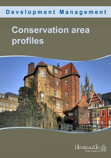
Conservation area profiles - Newcastle City Council
Conservation area profiles - Newcastle City Council
Conservation area profiles - Newcastle City Council

Create successful ePaper yourself
Turn your PDF publications into a flip-book with our unique Google optimized e-Paper software.
Contacts:<br />
Head of Development Management<br />
Tel 0191 211 5629<br />
Team Manager Urban Design and <strong>Conservation</strong><br />
Tel 0191 277 7190<br />
Write to:<br />
Development Management<br />
Environment and Regeneration Directorate<br />
Civic Centre<br />
Barras Bridge<br />
<strong>Newcastle</strong> upon Tyne<br />
NE1 8PH<br />
Email:<br />
urbandesignandconservation@newcastle.gov.uk<br />
Website:<br />
www.newcastle.gov.uk<br />
January 2011<br />
If you need this information in another format or language,<br />
please phone the conservation team on 0191 277 7191 or<br />
email urbandesignandconservation@newcastle.gov.uk
Contents<br />
02 Introduction<br />
<strong>Conservation</strong> <strong>area</strong>s in general<br />
Planning guidance<br />
Trees<br />
Article 4 Directions<br />
Archaeology<br />
Listed Buildings<br />
<strong>Conservation</strong> Team<br />
04 <strong>City</strong>-wide conservation <strong>area</strong> distribution map<br />
05 Central <strong>Conservation</strong> Area<br />
11 Brandling Village <strong>Conservation</strong> Area<br />
14 Framlington Place <strong>Conservation</strong> Area<br />
17 Gosforth <strong>Conservation</strong> Area<br />
20 Jesmond Dene <strong>Conservation</strong> Area<br />
23 Leazes <strong>Conservation</strong> Area<br />
26 Lower Ouseburn <strong>Conservation</strong> Area<br />
29 Northumberland Gardens <strong>Conservation</strong> Area<br />
32 South Jesmond <strong>Conservation</strong> Area<br />
35 St. Nicholas Hospital <strong>Conservation</strong> Area<br />
38 Summerhill <strong>Conservation</strong> Area<br />
43 Walbottle <strong>Conservation</strong> Area<br />
<strong>Conservation</strong> Area Profiles 1
<strong>Conservation</strong> <strong>area</strong>s<br />
in general<br />
<strong>Conservation</strong> <strong>area</strong>s are <strong>area</strong>s of a city,<br />
town or village of ‘special architectural<br />
or historic interest’, the character or<br />
appearance of which merits protection<br />
or enhancement.<br />
While buildings, both listed and<br />
unlisted, make a large contribution to<br />
an <strong>area</strong>’s distinctive character or<br />
appearance and usually form the basis<br />
of a conservation <strong>area</strong>, designation<br />
recognises that buildings do not stand<br />
alone but are part of a bigger picture.<br />
The historic layout of roads and paths,<br />
characteristic building and paving<br />
materials, public and private spaces,<br />
green spaces and trees and the<br />
different uses of buildings all contribute<br />
to the charm and look of an <strong>area</strong>.<br />
When the council designates a<br />
conservation <strong>area</strong> additional planning<br />
procedures are introduced to make<br />
sure that any alterations do not detract<br />
from an <strong>area</strong>’s character and<br />
appearance, and to conserve and<br />
improve those qualities that form the<br />
‘special interest’ of an <strong>area</strong>.<br />
The designation of a<br />
conservation <strong>area</strong> aims to<br />
manage, not prevent,<br />
change.<br />
Planning guidance<br />
<strong>Conservation</strong> <strong>area</strong>s benefit from some<br />
additional planning controls and<br />
planning guidance.<br />
Living in a <strong>Conservation</strong> Area is a<br />
leaflet which outlines the relevant<br />
planning controls. It also provides<br />
guidance on alterations to, and<br />
maintenance of, buildings in<br />
conservation <strong>area</strong>s.<br />
The Unitary Development Plan sets<br />
out conservation policies for the city<br />
which are applied to applications for<br />
planning permission.<br />
Character Appraisals and<br />
Management Plans provide<br />
conservation <strong>area</strong>-specific guidance<br />
and can be found on the council’s<br />
website www.newcastle.gov.uk/hes<br />
Article 4 Directions<br />
Some works to houses, such as<br />
changing windows or roof coverings,<br />
are “permitted development”, which<br />
means they do not require planning<br />
permission. An Article 4 Direction<br />
removes “permitted development<br />
rights” so that planning permission is<br />
required for works that previously did<br />
not require permission. This is to<br />
protect buildings of architectural and<br />
historic merit from inappropriate<br />
change.<br />
The council can make Article 4<br />
Directions on properties within a<br />
conservation <strong>area</strong> if it considers that<br />
the properties are of such architectural<br />
and historic merit to warrant extra<br />
protection.<br />
The maps on the following pages show<br />
which properties in conservation <strong>area</strong>s<br />
have Article 4 Directions.<br />
<strong>Conservation</strong> Area Profiles 2
Listed buildings<br />
For queries relating to all grade I and<br />
II* listed buildings contact:<br />
Peter Derham (Historic Buildings<br />
Officer) 0191 211 5626<br />
peter.derham@newcastle.gov.uk<br />
For queries about grade II listed<br />
buildings in conservation <strong>area</strong>s, please<br />
use the contact details provided in the<br />
following summaries for each <strong>area</strong>.<br />
You can check if a building is listed by<br />
visiting <strong>Newcastle</strong> Maps Online<br />
(NEMO) at<br />
http://www.newcastle.gov.uk/map and<br />
using the categories on the left hand<br />
side of the page to navigate. You can<br />
also check individual list descriptions<br />
at the Civic Centre, or online at<br />
www.heritagegateway.org.uk<br />
Archaeology<br />
Sitelines is the Tyne and Wear Historic<br />
Environment Record (HER); it contains<br />
over 10,000 records about the<br />
archaeology of Tyne and Wear,<br />
including sites and finds ranging from<br />
prehistoric rock art to World War II<br />
pillboxes, listed buildings to burial<br />
mounds. You can access the HER at:<br />
www.twsitelines.info<br />
You can also access the HER at West<br />
Chapel, Jesmond Old Cemetery.<br />
Please note that although it is open<br />
from 9.30am - 5pm visits must be prearranged<br />
with Jennifer Morrison.<br />
Trees in<br />
conservation <strong>area</strong>s<br />
All trees in conservation <strong>area</strong>s are<br />
protected and six weeks notice of all<br />
works to trees is required. Trees<br />
subject to Tree Preservation Orders<br />
remain protected under their individual<br />
order.<br />
For more information about please<br />
trees contact:<br />
Edwina Symmons (Landscape and<br />
Ecology) 0191 277 8950<br />
edwina.symmons@newcastle.gov.uk<br />
Ian Platais (Landscape and Ecology)<br />
0191 278 3211<br />
Ian.platais@newcastle.gov.uk<br />
<strong>Newcastle</strong> <strong>City</strong><br />
<strong>Council</strong><br />
<strong>Conservation</strong> Team<br />
For further information regarding the<br />
historic environment of the city in<br />
general please visit the council<br />
website:<br />
www.newcastle.gov.uk/hes<br />
or the <strong>Newcastle</strong> Heritage Partnership<br />
website:<br />
www.heritagepartnership.org.uk<br />
For any other queries relating to<br />
archaeology in this <strong>area</strong> contact:<br />
Jennifer Morrison 0191 2816117<br />
jennifer.morrison@newcastle.gov.uk<br />
<strong>Conservation</strong> Area Profiles 3
CENTRAL<br />
Date of Designation<br />
The conservation <strong>area</strong> was originally in<br />
three parts – two were designated in<br />
1968 and the third in 1970 – all three<br />
were amalgamated in 1973. Central<br />
was further extended in 2001 to<br />
include the <strong>area</strong> to the south of Central<br />
Station.<br />
Extensions to original conservation<br />
<strong>area</strong> boundary<br />
The <strong>area</strong> has been extended three<br />
times:<br />
14 May 1981 - Westgate Road, All<br />
Saints Church, Quayside Area.<br />
01 June 1987 - Bath Lane,<br />
Gallowgate, Newgate Street,<br />
Corporation Street.<br />
04 May 2001 - south of Central<br />
Station.<br />
Planning guidance<br />
‘Patterns of Experience’, the Central<br />
<strong>Conservation</strong> Area character<br />
statement, was adopted as planning<br />
guidance in October 1996. The South<br />
of Central Station character statement<br />
was adopted as planning guidance in<br />
May 2001 at the time of its<br />
designation. A management plan for<br />
the conservation <strong>area</strong> is currently<br />
under preparation.<br />
Reasons for designation<br />
The 1963 Development Plan review<br />
recognised the value of the historic<br />
core of the city and included policies<br />
for its conservation. Following the<br />
1967 Civic Amenities Act the <strong>area</strong> was<br />
designated as a conservation <strong>area</strong> to<br />
enforce these policies and safeguard<br />
the historic nature of the city.<br />
Description of the conservation<br />
<strong>area</strong><br />
The character of the conservation <strong>area</strong><br />
changes frequently, reflecting the city’s<br />
many periods of growth and<br />
development. The medieval burgage<br />
plot style development and street<br />
layout is still apparent in the markets,<br />
the residential/commercial nature of<br />
the Quayside frontage and the<br />
Georgian developments of Richard<br />
Grainger along Grey Street, Grainger<br />
Street and Clayton Street. The <strong>area</strong> is<br />
rich in historic buildings and street<br />
layout and has great character as a<br />
result. The <strong>area</strong> to the south of Central<br />
Station is noticeably different in<br />
character and appearance to much of<br />
the conservation <strong>area</strong>, as it is largely<br />
industrial and contains a number of<br />
buildings linked to Robert Stephenson<br />
and the development of rail transport –<br />
crucial to the city’s role in the Industrial<br />
Revolution.<br />
Heritage assets<br />
There are 116 grade I listed buildings,<br />
137 grade II* listed buildings and 584<br />
grade II listed buildings in Central<br />
<strong>Conservation</strong> Area. There are also 11<br />
scheduled ancient monuments,<br />
including the town walls and various<br />
towers, the Swing Bridge, the Old<br />
Tyne Bridge land arches and<br />
Blackfriars. There are 43 sites included<br />
on the local list. See map, over.<br />
<strong>Conservation</strong> Area Profiles 5
Article 4 Directions<br />
An Article 4 Direction applies to certain<br />
properties on 17 streets in Central<br />
<strong>Conservation</strong> Area. Please see<br />
attached schedule and map, over.<br />
The Grainger Town Project<br />
The Grainger Town Project covered<br />
roughly 35 hectares of the Central<br />
<strong>Conservation</strong> Area.<br />
Grainger Town is based around the<br />
Tyneside classical streets built by<br />
Richard Grainger between 1834 and<br />
1839. 40% of buildings in the <strong>area</strong> are<br />
listed as being of special architectural<br />
or historic interest.<br />
In the 1980s and early 1990s this once<br />
prosperous <strong>area</strong> of the city was<br />
overtaken by new centres of retail and<br />
commercial activity which eroded the<br />
economic base and left properties to<br />
fall into disrepair. Around one million<br />
square foot of floor space was<br />
unoccupied (mainly upper floors) and<br />
the <strong>area</strong>'s residential population was<br />
falling.<br />
The Grainger Town Project was<br />
established in 1997 in partnership with<br />
<strong>Newcastle</strong> <strong>City</strong> <strong>Council</strong>, English<br />
Partnerships and English Heritage with<br />
the aim of reversing this trend. A £120<br />
million regeneration programme was<br />
begun and continued until the end of<br />
March 2003. It was anticipated that<br />
£40 million of public sector investment<br />
would be bolstered by a further £80<br />
million from the private sector, but in<br />
fact achieved £145 million.<br />
Since the start of the project, great<br />
strides were made in regenerating the<br />
<strong>area</strong>, improving the environment and<br />
revitalising business, social and<br />
cultural life. On 31 March 2003, the<br />
project closed down, having achieved<br />
and far exceeded its objectives.<br />
Old <strong>Newcastle</strong> – Where the Story<br />
Begins<br />
The 'Old <strong>Newcastle</strong> - Where the Story<br />
Begins' Project focuses on<br />
<strong>Newcastle</strong>’s social, cultural and<br />
creative heritage using the ancient<br />
Black Gate as a new portal to the<br />
<strong>City</strong>’s rich history, culture and<br />
character.<br />
The project will create an accessible,<br />
heritage-led education and<br />
interpretation centre in the vacant and<br />
closed Black Gate, transforming its<br />
current lifeless and substantially<br />
ignored presence into a hub of<br />
heritage activity that will be open and<br />
available to the entire community and<br />
visitors from near and far. The Black<br />
Gate will combine with medieval<br />
neighbours, the Castle Keep and the<br />
Cathedral Church of St Nicholas to<br />
provide an outstanding and dynamic<br />
heritage asset that will tell the story of<br />
the remarkable history of the <strong>City</strong> and<br />
the ingenuity of countless generations<br />
of its inhabitants.<br />
The Project is being taken forward by<br />
a partnership between <strong>Newcastle</strong> <strong>City</strong><br />
<strong>Council</strong>, the Cathedral Church of St.<br />
Nicholas and the Society of<br />
Antiquaries of <strong>Newcastle</strong> upon Tyne.<br />
Contact information<br />
For further information about Central<br />
<strong>Conservation</strong> Area a useful starting<br />
point is the character statement. In<br />
addition, and for advice on<br />
development in the conservation <strong>area</strong>,<br />
contact:<br />
Fiona Cullen 0191 277 7192<br />
Fiona.Cullen@newcastle.gov.uk<br />
<strong>Conservation</strong> Area Profiles 6
Schedule for properties affected by<br />
Article 4 Directions<br />
The following properties are subject to<br />
an Article 4 Direction restricting the<br />
painting of the exterior of the buildings<br />
other than for the purpose of<br />
advertisements. The directions were<br />
made in 1971/72. Unless otherwise<br />
stated all of these buildings are also<br />
listed.<br />
B<br />
32 Bigg Market<br />
29-33 (odd) Blackett Street<br />
C<br />
1-22 (cons) Central Arcade<br />
20-34 (even) Clayton Street<br />
45-57 (odd) Clayton Street<br />
11-43 (odd) Clayton Street<br />
18 Clayton Street<br />
12A Clayton Street<br />
G<br />
68-118 (even) Grainger Street<br />
95-137 (odd) Grainger Street<br />
77-93 (odd) Grainger Street<br />
120-150 (even) Grainger Street<br />
139-159 (odd) Grainger Street<br />
1-55 (odd) Grey Street<br />
28-40 (even) Grey Street<br />
48-78 (even) Grey Street<br />
2-22 (even) Grey Street<br />
42-46 (even) Grey Street<br />
104-118 (even) Grey Street<br />
55-85 (odd) Grey Street<br />
78 (gable wall) Grey Street<br />
80-98 (even) Grey Street<br />
102 Grey Street<br />
87-109 (odd) Grey Street<br />
H<br />
24 High Bridge (not listed)<br />
51 High Bridge<br />
67-79 (odd) High Bridge (not listed)<br />
1 Hood Street<br />
3 Hood Street<br />
18 Hood Street<br />
2-16 (even) Hood Street<br />
9-13 (odd) Hood Street<br />
M<br />
19-39 (odd) Market Street<br />
1-17 (odd) Market Street<br />
2-18 (even) Market Street<br />
20-36 (even) Market Street<br />
N<br />
1-9 (odd) Nelson Street<br />
11-37 (odd including properties above<br />
archway adj. to no.11) Nelson Street<br />
2-22 (even) Nelson Street<br />
22-54 (even) Newgate Street<br />
2-20 (even) Newgate Street<br />
3-16 (cons) Nuns Lane (not listed)<br />
1 Nuns Lane (not listed)<br />
2 Nun Street (not listed)<br />
1-23a (odd) Nun Street<br />
25 Nun Street<br />
4-30 (even) Nun Street<br />
P<br />
14-28 (even) Pilgrim Street<br />
34 Pilgrim Street<br />
35 Pilgrim Street<br />
36 Pilgrim Street<br />
46 Pilgrim Street<br />
47 Pilgrim Street<br />
48 Pilgrim Street<br />
49 Pilgrim Street<br />
50 Pilgrim Street<br />
56 Pilgrim Street<br />
38-44 (even) Pilgrim Street<br />
S<br />
2-22 (even) Shakespeare Street<br />
11 Shakespeare Street<br />
13 Shakespeare Street<br />
1-9 (odd) Shakespeare Street<br />
T<br />
65 Thornton Street (not listed)<br />
W<br />
105-107 Westgate Road (not listed)<br />
<strong>Conservation</strong> Area Profiles 9
BRANDLING VILLAGE<br />
Heritage assets<br />
There are 36 grade II listed buildings in<br />
Brandling Village. St. Andrew’s<br />
Cemetery is a grade II Registered<br />
Historic Park and Garden. There are<br />
13 locally listed sites in the<br />
conservation <strong>area</strong>. See map, over.<br />
Article 4 Directions<br />
None<br />
Date of Designation<br />
04 October 1976<br />
Planning guidance<br />
Brandling Village Character Statement<br />
was adopted as Planning Guidance in<br />
December 2001. The Management<br />
Plan was adopted as a Development<br />
Guidance Note in May 2005.<br />
Contact information<br />
For further information about the<br />
Brandling Village <strong>Conservation</strong> Area a<br />
useful starting point is the character<br />
statement. In addition, and for advice<br />
on development in the conservation<br />
<strong>area</strong>, contact:<br />
Charlotte Foster<br />
0191 211 5625<br />
Charlotte.Foster@newcastle.gov.uk<br />
Reasons for designation<br />
To reinforce existing local plan policies<br />
and protect the uniformity and<br />
architectural quality of the Victorian<br />
Terraces from unsympathetic home<br />
improvements by the individual<br />
occupants.<br />
Description of the conservation<br />
<strong>area</strong><br />
Brandling Village contains some of the<br />
best examples of Victorian domestic<br />
architecture in the city. The residential<br />
terraces are set largely in a mature<br />
landscape with views over Exhibition<br />
Park and the Town Moor. The terraces<br />
range from polite Georgian buildings to<br />
later workers cottages and Arts and<br />
Crafts style housing. The design of the<br />
terraces is simple and restrained with<br />
an architectural integrity and<br />
uniformity.<br />
<strong>Conservation</strong> Area Profiles 11
FRAMLINGTON PLACE<br />
Heritage assets<br />
Framlington Place <strong>Conservation</strong> Area<br />
includes 35 grade II listed buildings<br />
See map, over.<br />
Article 4 Directions<br />
None<br />
Date of Designation<br />
31 March 1976<br />
Planning guidance<br />
Framlington Place Character<br />
Statement was adopted as planning<br />
guidance in November 2002. The<br />
Management Plan was adopted in<br />
November 2006 as Supplementary<br />
Planning Guidance.<br />
Contact information<br />
For further information about the<br />
Framlington Place <strong>Conservation</strong> Area<br />
a useful starting point is the character<br />
statement. In addition, and for advice<br />
on development in the conservation<br />
<strong>area</strong>, contact:<br />
Charlotte Foster<br />
0191 211 5625<br />
Charlotte.Foster@newcastle.gov.uk<br />
Reasons for designation<br />
The character and appearance of the<br />
<strong>area</strong> was considered to be at risk from<br />
pressures for commercial conversion,<br />
subdivision and new development.<br />
<strong>Conservation</strong> <strong>area</strong> status was<br />
perceived as a means of controlling<br />
this change in order to protect the<br />
character and appearance of the <strong>area</strong>.<br />
Description of the conservation<br />
<strong>area</strong><br />
The main character of the<br />
conservation <strong>area</strong> is a mix of 19th<br />
century terraced housing and large,<br />
detached dwellings. Historically this<br />
was an <strong>area</strong> of quality housing used by<br />
the academic staff of <strong>Newcastle</strong><br />
University. This character has changed<br />
as pressures for development have<br />
been accommodated with many<br />
terraces converted into office or flat<br />
accommodation.<br />
<strong>Conservation</strong> Area Profiles 14
GOSFORTH<br />
High Victorian, Queen Anne Revival<br />
and Edwardian. The residential suburb<br />
is complemented by a commercial<br />
centre, a “typical” traditional High<br />
Street which thrives despite its close<br />
proximity to the city centre.<br />
Date of Designation<br />
26 April 2002<br />
Planning guidance<br />
The Gosforth Character Statement<br />
was adopted as planning guidance in<br />
April 2002. The Management Plan was<br />
adopted in May 2009 as a<br />
Supplementary Planning Document.<br />
Reasons for designation<br />
Gosforth is unique to the city in the<br />
way in which it has developed. The<br />
housing stock represents a collection<br />
of types and architectural styles which<br />
are not represented in such quality<br />
elsewhere in the city. The character<br />
and appearance of the <strong>area</strong> has come<br />
under threat from development<br />
proposals to convert existing<br />
properties into smaller units or to<br />
demolish older properties to allow for<br />
higher density new build<br />
developments.<br />
Heritage assets<br />
There are 49 grade II listed buildings in<br />
Gosforth <strong>Conservation</strong> Area (see<br />
map). There are 9 sites on the local<br />
list.<br />
Article 4 Directions<br />
There are not currently any Article 4<br />
Directions in place in Gosforth<br />
<strong>Conservation</strong> Area, but it is proposed<br />
that a number of streets should be<br />
protected in this way in the future.<br />
Please see the Gosforth <strong>Conservation</strong><br />
Area Management Plan for more<br />
details.<br />
Contact information<br />
For further information about the<br />
Gosforth <strong>Conservation</strong> Area a useful<br />
starting point is the character<br />
statement. In addition, and for advice<br />
on development in the conservation<br />
<strong>area</strong>, contact:<br />
Sarah Allison<br />
0191 277 7191<br />
Sarah.Allison@newcastle.gov.uk<br />
Description of the conservation<br />
<strong>area</strong><br />
Gosforth is a residential suburb to the<br />
north of the city centre. The <strong>area</strong> was<br />
formerly developed as Coxlodge Hall<br />
and Bulman Village. It contains a<br />
number of “best examples” of housing<br />
types and architectural styles such as<br />
<strong>Conservation</strong> Area Profiles 17
JESMOND DENE<br />
Date of Designation<br />
1991<br />
Extensions to original conservation<br />
<strong>area</strong> boundary<br />
The conservation <strong>area</strong> was extended<br />
to include Towers and Mitchell<br />
Avenues in December 2001.<br />
Planning guidance<br />
Jesmond Dene Character Statement<br />
was adopted Planning Guidance in<br />
May 2003. The Management Plan was<br />
adopted as a Supplementary Planning<br />
Document in September 2006.<br />
Reasons for designation<br />
The <strong>area</strong> is of high environmental<br />
value and historic character and is<br />
subject to a continued pressure for<br />
development which, if not carefully<br />
controlled and directed would detract<br />
from these qualities.<br />
reflect its history, past land-use and<br />
varied landscape designs.<br />
Heritage assets<br />
Jesmond Dene <strong>Conservation</strong> Area<br />
includes 1 grade II* listed building and<br />
22 grade II listed buildings. It also<br />
contains two scheduled ancient<br />
monuments – St Mary’s Well and St<br />
Mary’s Chapel – and Jesmond Dene<br />
itself is a grade II Registered Historic<br />
Park and Garden. There are 15 locally<br />
listed sites within the conservation<br />
<strong>area</strong>. See map, over.<br />
Article 4 Directions<br />
None<br />
Grant Aid<br />
A recent bid to the Heritage Lottery<br />
Fund for funding to restore and<br />
regenerate the Ouseburn Parks was<br />
successful and Jesmond Dene Park is<br />
currently undergoing refurbishment<br />
works as part of the project.<br />
Contact information<br />
For further information about the<br />
Jesmond Dene <strong>Conservation</strong> Area a<br />
useful starting point is the character<br />
statement. In addition, and for advice<br />
on development in the conservation<br />
<strong>area</strong>, contact:<br />
Sarah Allison<br />
0191 277 7191<br />
Sarah.Allison@newcastle.gov.uk<br />
Description of the conservation<br />
<strong>area</strong><br />
Jesmond Dene <strong>Conservation</strong> Area has<br />
two key elements of character: low<br />
density late-Victorian and Edwardian<br />
housing set in the mature landscape of<br />
the Dene and the Dene itself. The<br />
Dene’s landscape is a mixture of a<br />
number of different influences, which<br />
<strong>Conservation</strong> Area Profiles 20
LEAZES<br />
Registered Historic Park and Garden.<br />
There are 12 sites in the conservation<br />
<strong>area</strong> that are included on the local list.<br />
See map, over.<br />
Article 4 Directions<br />
None<br />
Date of Designation<br />
03 September 1974<br />
Planning guidance<br />
Leazes Character Statement was<br />
adopted as Planning Guidance in June<br />
2000. A Management Plan was<br />
adopted as a Supplementary Planning<br />
Document in September 2006.<br />
Reasons for designation<br />
The Edwardian park and late Georgian<br />
terraces and surrounding residential<br />
developments are considered to be of<br />
outstanding interest and of national<br />
significance; designation was a means<br />
of protecting this value and<br />
significance whilst reinforcing local<br />
plan policies.<br />
Description of the conservation<br />
<strong>area</strong><br />
The conservation <strong>area</strong> is dominated by<br />
the Victorian Park and surrounding late<br />
Georgian residential developments.<br />
Leazes Terrace and Crescent, and the<br />
St Thomas estate, were built by<br />
Thomas Oliver and are reminiscent of<br />
similar architectural developments in<br />
London.<br />
Grant Aid<br />
The oldest green space in <strong>Newcastle</strong>,<br />
Leazes Park was recently restored and<br />
refurbished through a £4 million<br />
restoration scheme funded by the<br />
Heritage Lottery Fund and <strong>Newcastle</strong><br />
<strong>City</strong> <strong>Council</strong>. The project followed<br />
detailed research into the original<br />
designs and included the<br />
reintroduction of two ornate gateways<br />
into the park and cast iron boundary<br />
railings, substantial tree and shrub<br />
planting, the restoration of the lake and<br />
a new memorial garden for the<br />
15th/19th Hussars.<br />
Contact information<br />
For further information about the<br />
Leazes <strong>Conservation</strong> Area a useful<br />
starting point is the character<br />
statement. In addition, and for advice<br />
on development in the conservation<br />
<strong>area</strong>, contact:<br />
Charlotte Foster<br />
0191 211 5625<br />
Charlotte.Foster@newcastle.gov.uk<br />
Heritage assets<br />
Leazes <strong>Conservation</strong> Area contains 59<br />
grade I and 105 grade II listed<br />
buildings. Leazes Park is a grade II<br />
<strong>Conservation</strong> Area Profiles 23
LOWER OUSEBURN VALLEY<br />
Date of Designation<br />
27 October 2000<br />
Planning guidance<br />
Lower Ouseburn Valley Character<br />
Statement was adopted as Planning<br />
Guidance in October 2000. A<br />
Management Plan was adopted as<br />
Supplementary Planning Guidance in<br />
September 2004.<br />
Additional planning guidance<br />
• Regeneration of the Lower<br />
Ouseburn Valley Strategy, 2003<br />
• Urban design framework<br />
<strong>area</strong> has supported a splendid array of<br />
glass-works, lead, iron, soap,<br />
limeworks, mills and later, potteries,<br />
which by the late 19th century stood<br />
next to housing beneath the rail and<br />
road bridges. Although much has been<br />
demolished or changed there remains<br />
substantial physical evidence of the<br />
past. The landscape contributes to the<br />
diverse character of this <strong>area</strong> in two<br />
principal ways. First, as an effective<br />
backdrop and visual edge to the valley<br />
and secondly, as a network of open<br />
spaces throughout the <strong>area</strong>. The valley<br />
is also identified as being part of a<br />
wildlife corridor and is considered to be<br />
of moderate ecological value.<br />
Heritage assets<br />
Lower Ouseburn Valley <strong>Conservation</strong><br />
Area contains one grade II* listed<br />
building (Ouseburn School) and 9<br />
grade II listed buildings. The Hadrian’s<br />
Wall World Heritage Site also runs<br />
through the conservation <strong>area</strong>. There<br />
are 19 sites within the conservation<br />
<strong>area</strong> that are included on the local list.<br />
See map, over.<br />
Article 4 Directions<br />
None<br />
Reasons for designation<br />
The <strong>area</strong> is of considerable historic<br />
and industrial archaeological interest.<br />
The valley is subject to continued<br />
pressure for development and<br />
redevelopment which, if not<br />
sympathetically controlled and directed<br />
would detract from these qualities.<br />
Description of the conservation<br />
<strong>area</strong><br />
The Lower Ouseburn Valley forms one<br />
of the main cradles of the Industrial<br />
Revolution on Tyneside and<br />
subsequently is rich in industrial<br />
heritage. Since the 17th century the<br />
Contact information<br />
For further information about the<br />
Lower Ouseburn Valley <strong>Conservation</strong><br />
Area a useful starting point is the<br />
character statement. In addition, and<br />
for advice on development in the<br />
conservation <strong>area</strong>, contact:<br />
Sarah Allison<br />
0191 277 7191<br />
Sarah.Allison@newcastle.gov.uk<br />
<strong>Conservation</strong> Area Profiles 26
NORTHUMBERLAND GARDENS<br />
Date of Designation<br />
1987<br />
Extensions to original conservation<br />
<strong>area</strong> boundary<br />
None<br />
Planning guidance<br />
Northumberland Gardens Character<br />
Statement was adopted as Planning<br />
Guidance in March 2001. A<br />
Management Plan is currently under<br />
preparation.<br />
Reasons for designation<br />
This was previously designated as a<br />
green belt location and therefore new<br />
development was controlled. The draft<br />
Newburn Local Plan and Tyne and<br />
Wear Green Belt Subject Plan<br />
removed the green belt status and<br />
allocated land to the north and south<br />
for housing. As a result<br />
Northumberland Gardens became<br />
vulnerable to pressures for housing<br />
development, which without control<br />
would result in a radical change of<br />
character and the loss of the <strong>area</strong>’s<br />
special quality.<br />
Description of the conservation<br />
<strong>area</strong><br />
Northumberland Gardens is a small,<br />
planned estate of low-density semidetached<br />
housing on the western edge<br />
of the city. The estate has a distinctive<br />
and attractive character in that it<br />
contains early 20th century housing<br />
set within large mature garden plots<br />
most of which are half an acre in size.<br />
The housing is modest in scale with<br />
unifying design features apparent<br />
throughout which lend themselves to a<br />
visual coherence. The mature<br />
landscape setting and private estate<br />
roads combine to create an “Arcadian”<br />
– or idyllic rural – quality.<br />
Heritage assets<br />
There are no designated heritage<br />
assets within the conservation <strong>area</strong>.<br />
Article 4 Directions<br />
An article 4 direction was made in<br />
1997 and affects the whole of the<br />
conservation <strong>area</strong>, specifically:<br />
1-24 Northumberland Gardens (N.B.<br />
there is no number 17 or 19)<br />
2-24 (even numbers) Coronation Road<br />
2 – 12 (even numbers) North Walbottle<br />
Road<br />
See map, over.<br />
Contact information<br />
For further information about<br />
Northumberland Gardens<br />
<strong>Conservation</strong> Area a useful starting<br />
point is the character statement. In<br />
addition, and for advice on<br />
development in the conservation <strong>area</strong>,<br />
contact:<br />
Sarah Allison<br />
0191 277 7191<br />
Sarah.Allison@newcastle.gov.uk<br />
<strong>Conservation</strong> Area Profiles 29
SOUTH JESMOND<br />
County Cricket ground which<br />
contribute to the landscape setting.<br />
Heritage assets<br />
South Jesmond <strong>Conservation</strong> Area<br />
contains 1 Grade II* listed building (the<br />
entrance archway and chapel lodges<br />
at Jesmond Cemetery) and 13 grade II<br />
listed buildings. <strong>Newcastle</strong> General<br />
Cemetery (formerly known as<br />
Jesmond Old Cemetery) is a grade II<br />
Registered Historic Park and Garden.<br />
There are 8 locally listed sites. See<br />
map, over.<br />
Date of Designation<br />
22 December 1987<br />
Extensions to original conservation<br />
<strong>area</strong> boundary<br />
None<br />
Planning guidance<br />
South Jesmond Character Statement<br />
was adopted as Planning Guidance in<br />
December 2001. A Management Plan<br />
was adopted as a Development<br />
Guidance Note in May 2009.<br />
Article 4 Directions<br />
None<br />
Contact information<br />
For further information about the South<br />
Jesmond <strong>Conservation</strong> Area a useful<br />
starting point is the character<br />
statement. In addition, and for advice<br />
on development in the conservation<br />
<strong>area</strong>, contact:<br />
Charlotte Foster<br />
0191 211 5625<br />
Charlotte.Foster@newcastle.gov.uk<br />
Reasons for designation<br />
To reinforce existing local plan policies<br />
and protect the concept of the local<br />
scene. In addition, to exercise control<br />
and discipline over new development<br />
and the use of urban space to achieve<br />
a higher standard of design in<br />
alterations and new building.<br />
Description of the conservation<br />
<strong>area</strong><br />
South Jesmond is essentially made up<br />
of late Victorian residential property set<br />
in a mature landscape. There are a<br />
number of major open spaces<br />
including Jesmond Cemetery and the<br />
<strong>Conservation</strong> Area Profiles 32
ST NICHOLAS HOSPITAL<br />
the last decade following housing<br />
developments within the grounds of<br />
the hospital.<br />
Heritage assets<br />
There is one grade II listed building in<br />
the conservation <strong>area</strong> (the Hospital).<br />
See map, over.<br />
Article 4 Directions<br />
None<br />
Date of Designation<br />
02 September 1991<br />
Planning guidance<br />
St. Nicholas Hospital Character<br />
Statement was adopted as Planning<br />
Guidance in May 2003.<br />
Reasons for designation<br />
As an <strong>area</strong> of distinctive architectural,<br />
environmental and historic character,<br />
which includes a number of<br />
substantially unaltered buildings, it was<br />
considered that there was potential for<br />
enhancement and preservation and<br />
that conservation <strong>area</strong> status would<br />
help attract funding to achieve this.<br />
The character of the <strong>area</strong> was at risk<br />
from pressures for change and<br />
development and it was intended to<br />
achieve a controlled programme of<br />
change which was sympathetic and<br />
complementary to the existing fabric<br />
and landscape.<br />
Contact information<br />
For further information about St<br />
Nicholas Hospital <strong>Conservation</strong> Area a<br />
useful starting point is the character<br />
statement. In addition, and for advice<br />
on development in the conservation<br />
<strong>area</strong>, contact:<br />
Sarah Allison<br />
0191 277 7191<br />
Sarah.Allison@newcastle.gov.uk<br />
Description of the conservation<br />
<strong>area</strong><br />
This is a distinctive <strong>area</strong> which is a<br />
clear representation of the period of<br />
Victorian hospital development in the<br />
city. The buildings are set in a mature<br />
landscape setting with open spaces<br />
and planting which complements the<br />
uses of the buildings. The character of<br />
the conservation <strong>area</strong> has changed in<br />
<strong>Conservation</strong> Area Profiles 35
SUMMERHILL<br />
Date of Designation<br />
1970<br />
Extensions to original conservation<br />
<strong>area</strong> boundary<br />
There have been two extensions:<br />
21 February 1988 – Elswick Road<br />
05 October 1992 – Barber Surgeon’s<br />
Hall and Westgate Hill Cemetery.<br />
There is also a record of an extension<br />
on 15 May 1975 but there are no<br />
details of the <strong>area</strong> it refers to.<br />
Planning guidance<br />
Summerhill Character Statement was<br />
adopted as Planning Guidance in April<br />
2001. A Management Plan was<br />
adopted as Supplementary Planning<br />
Guidance in 2007.<br />
Reasons for designation<br />
Following the Rye Hill General<br />
Improvement Area Scheme local<br />
residents expressed grave concern<br />
over the deterioration of the Square. In<br />
addition, there was commercial<br />
pressure for the conversion of<br />
residential dwellings into office<br />
accommodation, which was<br />
considered to detrimentally affect the<br />
character of the residential suburb.<br />
Description of the conservation<br />
<strong>area</strong><br />
The conservation <strong>area</strong> is based<br />
around a late Georgian residential<br />
suburb which contains a number of<br />
listed terraces centred on an informal<br />
open space and garden plots. The<br />
terraces range from the very grand,<br />
which face onto the central “square”, to<br />
the very simple with precise attention<br />
to the architectural detail throughout.<br />
The <strong>area</strong> has retained much of its<br />
residential character although many of<br />
the individual houses have now been<br />
converted to flats to meet demand.<br />
There has also been a small degree of<br />
commercial conversion.<br />
Heritage assets<br />
Summerhill contains one grade II*<br />
listed building (Church of St Matthew,<br />
Summerhill Street) and 80 grade II<br />
listed buildings. Westgate Hill<br />
Cemetery is a grade II Registered<br />
Historic Park and Garden. The open<br />
space of Summerhill Square is on the<br />
local list. See map, over.<br />
Article 4 Directions<br />
Article 4 Directions apply to a number<br />
of properties in the conservation <strong>area</strong>.<br />
Please see attached map and<br />
schedule.<br />
Contact information<br />
For further information about the<br />
Summerhill <strong>Conservation</strong> Area a<br />
useful starting point is the character<br />
statement. In addition, and for advice<br />
on development in the conservation<br />
<strong>area</strong>, contact:<br />
Charlotte Foster<br />
0191 211 5625<br />
Charlotte.Foster@newcastle.gov.uk<br />
<strong>Conservation</strong> Area Profiles 38
Schedule for properties affected by<br />
Article 4 Directions<br />
An Article 4 Direction controlling all<br />
works under Parts 1 & 2 of Schedule 2<br />
of the 1988 General Development<br />
(Permitted) Order was made in 1990<br />
and affects the following addresses<br />
within the conservation <strong>area</strong>:<br />
1-6 Greenfield Place<br />
1-4 High Swinburne Place<br />
Coach House, Summerhill Grove<br />
St Anne’s Convent, Summerhill Grove<br />
1-8 Summerhill Grove<br />
1-12 Summerhill Terrace<br />
2-9 incl. 4a Swinburne Place<br />
1-10 Winchester Terrace<br />
209, 269, 271, 273, 275 Westgate<br />
Road<br />
5, 7-12 Ravensworth Terrace<br />
Harry Woods, 195 Westgate Road<br />
<strong>Conservation</strong> Area Profiles 41
WALBOTTLE VILLAGE<br />
Date of Designation<br />
The conservation <strong>area</strong> was designated<br />
in November 2009.<br />
Planning guidance<br />
Walbottle Village Character Statement<br />
and Management Plan was adopted<br />
as a Development Guidance Note in<br />
November 2009, at the same time as<br />
the conservation <strong>area</strong> was designated.<br />
Reasons for designation<br />
Walbottle Village <strong>Conservation</strong> Area<br />
lies approximately 6 miles west of the<br />
city centre. It has been suggested that<br />
the origins of Walbottle precede the<br />
Roman conquest. However, little of the<br />
village’s early development is visible<br />
today and traditional housing has been<br />
replaced by the 1960s redevelopment<br />
of the <strong>area</strong>. The retention of the<br />
original boundaries and incorporation<br />
of views of the surrounding greenbelt<br />
land, along with the use of cohesive<br />
materials and design create a unique<br />
character (with a hidden history)<br />
worthy of preservation. <strong>Conservation</strong><br />
<strong>area</strong> status was perceived as a means<br />
of controlling change, to protect the<br />
character and appearance of the <strong>area</strong>.<br />
Description of the conservation<br />
<strong>area</strong><br />
The principal focus of the conservation<br />
<strong>area</strong> is the village green, which<br />
continues to be the centre of village<br />
life. The green was central to the<br />
redevelopment of the village in the<br />
1960’s by Newburn Urban District<br />
<strong>Council</strong>. The importance of this <strong>area</strong><br />
was recognised during the early<br />
1960’s when the 10 th Duke of<br />
Northumberland gave Newburn Urban<br />
District the land surrounding the green.<br />
Heritage assets<br />
Walbottle Village <strong>Conservation</strong> Area<br />
contains three grade II listed buildings.<br />
See map, over.<br />
Article 4 Directions<br />
None.<br />
Contact information<br />
For further information about Walbottle<br />
Village <strong>Conservation</strong> Area a useful<br />
starting point is the character<br />
statement. In addition, and for advice<br />
on development in the conservation<br />
<strong>area</strong>, contact:<br />
Sarah Allison<br />
0191 277 7191<br />
Sarah.Allison@newcastle.gov.uk<br />
<strong>Conservation</strong> Area Profiles 43