

strategic flood risk assessment supplement - Hambleton District ...
strategic flood risk assessment supplement - Hambleton District ...
strategic flood risk assessment supplement - Hambleton District ...

Create successful ePaper yourself
Turn your PDF publications into a flip-book with our unique Google optimized e-Paper software.
HAMBLETON DISTRICT COUNCIL<br />
DESIGN AND MAINTENANCE - ENGINEERING<br />
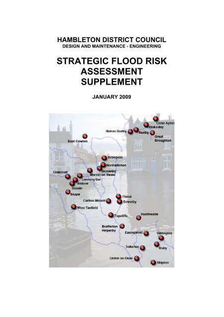
STRATEGIC FLOOD RISK<br />
ASSESSMENT<br />
SUPPLEMENT<br />
JANUARY 2009
CONTENTS<br />
INTRODUCTION Pages 3-4<br />
DISCUSSION AND PLANS<br />
STOKESLEY AREA<br />
• Stokesley Pages 5-7<br />
• Great Ayton Page 8<br />
NORTHALLERTON AREA<br />
• Northallerton Pages 9-11<br />
• Brompton Page 12<br />
THIRSK AREA<br />
• Thirsk Pages 13-14<br />
• Sowerby Page 15
INTRODUCTION<br />
1.1 In January 2006 <strong>Hambleton</strong> <strong>District</strong> Council issued its’ Stage 1 Strategic Flood Risk Assessment<br />
(SFRA) to support ‘Allocations’ in the Local Development Framework (LDF). The SFRA was<br />
prepared under Planning Policy Guidance Note 25: Development and Flood Risk (published in<br />
2001), this was replaced in December 2006 by Planning Policy Statement 25: Development and<br />
Flood Risk.<br />
1.2 The aim of PPS25 is to reinforce and strengthen planning policy in relation to <strong>flood</strong> <strong>risk</strong> and<br />
development, introduce a more <strong>strategic</strong> approach and ensure a partnership approach to decision<br />
making on planning applications and joined up thinking on <strong>flood</strong> <strong>risk</strong> management.<br />
1.3 The aims of planning policy on development and <strong>flood</strong> <strong>risk</strong> are to ensure that <strong>flood</strong> <strong>risk</strong> is taken<br />
into account at all stages in the planning process to avoid inappropriate development in areas at<br />
<strong>risk</strong> of <strong>flood</strong>ing, and to direct development away from areas at highest <strong>risk</strong>. Where new<br />
development is, exceptionally, necessary in such areas, policy aims to make it safe without<br />
increasing <strong>flood</strong> <strong>risk</strong> elsewhere and where possible, reducing <strong>flood</strong> <strong>risk</strong> overall.<br />
1.4 The PPS25 introduces the <strong>flood</strong> <strong>risk</strong> approach of; appraise, manage and reduce. The production<br />
of the SFRA supports appraising <strong>risk</strong>, by identifying land at <strong>risk</strong> and the degree of <strong>risk</strong> of <strong>flood</strong>ing<br />
from river, sea and other sources in our area.<br />
1.5 A PPS25 Development and Flood Risk practice guide was published in June 2008 to offer<br />
guidance on the implementation of PPS25.<br />
1.6 This addendum SFRA document has been produced to <strong>supplement</strong> the January 2006 SFRA and<br />
should be read in conjunction with the January 2006 document. Its purpose is to provide new<br />
<strong>flood</strong> maps and update information where there have been changes since January 2006. The<br />
addendum document follows the same format of the 2006 SFRA.<br />
1.7 The new information provided in the document includes:<br />
• Additional Flood Map<br />
o Sowerby<br />
• Revised Flood maps<br />
o Brompton<br />
o Great Ayton<br />
o Northallerton<br />
o Stokesley<br />
o Thirsk<br />
• Updated information<br />
o Brompton, Northallerton and Romanby Flood Alleviation Scheme<br />
o Thirsk Flood Alleviation Scheme<br />
o Use of <strong>flood</strong> maps<br />
1.8 Use of <strong>flood</strong> Maps<br />
The <strong>flood</strong> map information is indicative rather than specific and users will have to consult with the<br />
Environment Agency if further information is required where appropriate. The <strong>flood</strong> map<br />
3
information in the SFRA addendum is that issued in January 2009. The Environment Agency will<br />
update the data as better information becomes available e.g. changes in hydrological river<br />
response, observations following <strong>flood</strong> events or improved modelling techniques. Locations may<br />
also be at <strong>risk</strong> from other sources of <strong>flood</strong>ing that have not been surveyed here, such as high<br />
ground water levels, overland run off from heavy rain, or failure of infrastructure such as sewers or<br />
storm drains.<br />
The SFRA January 2006 does identify areas at <strong>flood</strong> <strong>risk</strong> from other sources; these have been<br />
identified through a process of consultation, though there may be <strong>flood</strong> <strong>risk</strong>s from other sources<br />
that are not identified in the SFRA.<br />
When in doubt the Environment Agency should be consulted. The limits of the Flood Zones 2 and<br />
3 are indicative of the area which could be affected by <strong>flood</strong> events and is largely based on<br />
modelled data.<br />
Where appropriate the <strong>flood</strong> maps show <strong>flood</strong> defences and for major defences the areas of<br />
benefit from them. Where present, <strong>flood</strong> defences do not remove the chance of <strong>flood</strong>ing and can<br />
be over topped or fail in extreme weather conditions or where the <strong>flood</strong> event exceeds the design<br />
standard of the defence. It does not show the effects of climate change.<br />
1.8 Key to Plans<br />
HDC requested sandbags<br />
Oct 2000 to 2006<br />
E.A. Flood Zone 2<br />
0.1% annual <strong>flood</strong>ing<br />
probability<br />
Main River<br />
E.A. Flood Zone 3<br />
1% annual <strong>flood</strong>ing<br />
probability<br />
4
DISCUSSION AND PLANS<br />
STOKESLEY AREA<br />
• Stokesley<br />
Flooding<br />
The <strong>flood</strong> map for the Stokesley area has been subject to significant revision in comparison to the<br />
<strong>flood</strong> maps included in the January 2006 SFRA. The revised <strong>flood</strong> maps follow a review by the<br />
Environment Agency of their entire <strong>flood</strong> modelling data for the Stokesley area.<br />
The new <strong>flood</strong> maps show increases in the <strong>flood</strong> zone 2 and 3 extents to the North and North West<br />
of the town and removes or reduces the <strong>flood</strong> zone 1 islands in and around the southern residential<br />
areas.<br />
The increased <strong>flood</strong> zone 2 and 3 extents have reduced the <strong>flood</strong> zone 1 areas, the land<br />
sequentially preferred for development, though there still remain significant areas of <strong>flood</strong> zone 1 to<br />
the western side of the existing residential area. It is intended that these areas will be the focus for<br />
new development.<br />
The three <strong>flood</strong> map extracts show the Town, a more detailed extract of the <strong>flood</strong> zone 1 areas on<br />
the western edge of the existing residential area and the Industrial Park area located to the south of<br />
the town.<br />
5
• Great Ayton<br />
Flooding<br />
The review of the Stokesley <strong>flood</strong> modelling data included the Great Ayton settlement as the village<br />
formed part of the Environment Agency commissioned Upper Leven Flood Risk Management<br />
Strategy study.<br />
The review has changed the <strong>flood</strong> zone 2 and 3 extents on the land in the vicinity of Cleveland<br />
Lodge, with the <strong>flood</strong> zones now aligned with the minor watercourse. The allocation for proposed<br />
development at Cleveland Lodge is now all located in <strong>flood</strong> zone 1.<br />
8
NORTHALLERTON AREA<br />
• Northallerton<br />
Flooding<br />
The proposed Brompton, Northallerton and Romanby Flood Alleviation Scheme planned to<br />
commence in spring 2006 was not constructed. Tenders submitted for the scheme exceeded the<br />
pre-tender cost estimates and it was not possible to increase the DEFRA grant aid to meet the new<br />
anticipated scheme costs.<br />
Stage one works, which were small scale relatively low cost measures which could be carried out in<br />
a short time frame to provide an immediate reduction in <strong>flood</strong> <strong>risk</strong> were completed. These measures<br />
included:<br />
• Reconstruction of wooden hill bridge in Romanby, this reduced the restriction caused by the<br />
bridge;<br />
• Meanders on Willow Beck were straightened in the vicinity of Chantry Road, Romanby to<br />
improve flows in the watercourse;<br />
• Boundary treatments to properties on Chantry Road properties that back onto the Willow Beck<br />
were reconstructed to introduce <strong>flood</strong> defence characteristics;<br />
• Flood defences were constructed around Brompton School;<br />
• The public highway and public open space areas on the southern end of Water End, Brompton<br />
were lowered to create an overflow to improve watercourse flows in <strong>flood</strong> conditions.<br />
The enmainment of ordinary watercourses associated with the proposed Flood Alleviation scheme<br />
was enacted. This process confers main river status on critical ordinary watercourses (those<br />
ordinary watercourses associated with <strong>flood</strong> <strong>risk</strong> affecting properties). The enmainment was<br />
originally planned to be enacted on scheme completion, this was to allow the Environment Agency<br />
to take over the maintenance of the Flood Alleviation scheme following its completion. The<br />
Environment Agency can only carry out works on a main river, the enmainment of the watercourses<br />
means that now only the Environment Agency under their permissive powers are able to progress a<br />
Flood Alleviation Scheme for Brompton, Northallerton and Romanby.<br />
The present position of the scheme is that the 2006 scheme is to be reviewed by the Environment<br />
Agency in light of a new system, ‘outcome measures’ for prioritising funding of <strong>flood</strong> <strong>risk</strong><br />
management schemes. The scheme review is due to start in April 2009 and should take 12 months<br />
to complete. The review is also intended to confirm the robustness of the proposed scheme and<br />
help determine the scheme priority within the National programme of <strong>flood</strong> <strong>risk</strong> management<br />
spending.<br />
The 2 <strong>flood</strong> map extracts show Northallerton and Northallerton North. There are a number of small<br />
amendments to the High Street area; these are shown for information but do not affect the<br />
allocations. The more detailed Northallerton North plan has been included to show the <strong>flood</strong> <strong>risk</strong> in<br />
the vicinity of the significant allocations proposed in this area.<br />
9
• Brompton<br />
Flooding<br />
The revised <strong>flood</strong> map is included for information; there are some amendments in the centre of the<br />
village to the <strong>flood</strong> zone 2 and 3 extents. The amendments do not affect the allocation site directly<br />
though are adjacent to the allocation site.<br />
12
THIRSK AREA<br />
• Thirsk<br />
Flooding<br />
Following the <strong>flood</strong>ing that affected Thirsk and other areas in November 2000, <strong>Hambleton</strong> <strong>District</strong><br />
Council set up a Flood Forum to bring Agencies together to consider solutions for significant areas<br />
at <strong>risk</strong> from <strong>flood</strong>ing. The Forum looked to identify the lead agency to address problems at each<br />
identified location. A number of options were considered for the <strong>flood</strong>ing in the centre of Thirsk after<br />
which the <strong>District</strong> Council commissioned Consultants JBA in 2004 to investigate the feasibility of<br />
providing a Flood Alleviation Scheme for Thirsk. The <strong>Hambleton</strong> work indicated that there was<br />
potential for an economically viable Flood Alleviation Scheme for Thirsk at that time, though further<br />
work was required.<br />
In April 2006 the responsibility for Cod Beck watercourse was transferred to the Environment<br />
Agency (EA) as part of a national programme to rationalise powers for watercourses which posed<br />
significant <strong>risk</strong> for property <strong>flood</strong>ing. This process changed the watercourses’ status from ordinary<br />
watercourse to that of having main river status. The main river status means that the EA have<br />
permissive powers to carry out works on the watercourse including Flood Alleviation works. This in<br />
effect made the EA the lead agency for <strong>flood</strong> alleviation in Thirsk.<br />
EA work on developing a scheme for Thirsk was suspended later in 2006 following cuts in the<br />
Agency’s budgets.<br />
The present position on the scheme is that the EA has gained funding to recommence work on the<br />
Thirsk investigation works in 2008. Consultants – Royal Haskoning were appointed to develop a<br />
Project Appraisal Report (PAR) and commenced work in summer 2008. A PAR is a detailed study<br />
of an area/community affected by <strong>flood</strong>ing and is used by the EA to inform the prioritisation of<br />
funding for Flood Risk Management Schemes. It is anticipated that the Thirsk PAR will be<br />
completed in October 2009.<br />
The <strong>flood</strong> map for Thirsk town has been included for information purposes and confirms changes<br />
made to the <strong>flood</strong> zone 2 and 3 extents to the north eastern area of Thirsk in the vicinity of<br />
Whitelass Beck.<br />
13
• Sowerby<br />
Flooding<br />
The <strong>flood</strong> map has been included to show the <strong>flood</strong> zones and their relationship to the allocation<br />
proposed for South West Sowerby. The existing <strong>flood</strong> zones do not extend to this allocation.<br />
Detailed development specific Flood Risk Assessment will be required demonstrate that the<br />
development can be developed safely without <strong>flood</strong> <strong>risk</strong> to the development itself or creating <strong>flood</strong><br />
<strong>risk</strong> elsewhere.<br />
15
<strong>Hambleton</strong> <strong>District</strong> Council<br />
Civic Centre, Stone Cross, Northallerton, North Yorkshire DL6 2UU<br />
Tel: 0845 1211 555 Fax: 01609 767248 Email: planning.policy@hambleton.gov.uk<br />
www.hambleton.gov.uk<br />
© HDC 2009


