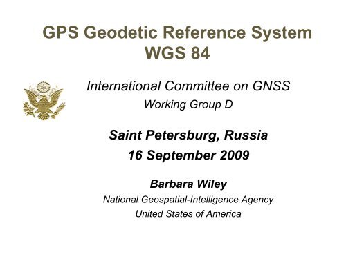
GPS Geodetic Reference System WGS 84
GPS Geodetic Reference System WGS 84
GPS Geodetic Reference System WGS 84

You also want an ePaper? Increase the reach of your titles
YUMPU automatically turns print PDFs into web optimized ePapers that Google loves.
<strong>GPS</strong> <strong>Geodetic</strong> <strong>Reference</strong> <strong>System</strong><br />
<strong>WGS</strong> <strong>84</strong><br />
International Committee on GNSS<br />
Working Group D<br />
Saint Petersburg, Russia<br />
16 September 2009<br />
Barbara Wiley<br />
National Geospatial-Intelligence Agency<br />
United States of America
<strong>GPS</strong> <strong>Reference</strong> Frame<br />
• World <strong>Geodetic</strong> <strong>System</strong> 19<strong>84</strong> (<strong>WGS</strong> <strong>84</strong>)<br />
― <strong>Reference</strong> for Positioning and Navigation<br />
― Aligned to International Terrestrial <strong>Reference</strong> Frame (ITRF)<br />
― Consistent with international standards<br />
― Supports <strong>GPS</strong> Operational Control Segment (OCS)<br />
Stations<br />
NGA<br />
<strong>GPS</strong><br />
OCS<br />
Orbit<br />
Process<br />
International<br />
GNSS Service<br />
<strong>GPS</strong><br />
Users<br />
• <strong>GPS</strong> <strong>Reference</strong>s <strong>WGS</strong> <strong>84</strong><br />
– Interoperability requires relationship between <strong>WGS</strong> <strong>84</strong> and other<br />
GNSS reference systems<br />
Approved for Public Release 09-478<br />
2
<strong>WGS</strong> <strong>84</strong> Support for<br />
Positioning and Navigation<br />
• Safety of Navigation<br />
– Maps, Charts, Grids, Publications<br />
– Inertial Navigation <strong>System</strong> support<br />
• <strong>Reference</strong> system <strong>WGS</strong> <strong>84</strong><br />
– <strong>Reference</strong> Frame<br />
• Network solution<br />
• Grids and coordinate system<br />
• Relationship to local datums<br />
– Gravity and magnetic models<br />
– Elevations and bathymetry<br />
• <strong>GPS</strong> coordinates tie <strong>WGS</strong> <strong>84</strong> to physical Earth<br />
• Key component for interoperability<br />
Approved for Public Release 09-478<br />
Prime<br />
Meridian<br />
X<br />
Z<br />
0,0,0<br />
Equator<br />
3<br />
Y
<strong>WGS</strong> <strong>84</strong> Historical Accuracy<br />
<strong>Reference</strong> Frame: Global network of control<br />
stations that binds an Earth-centered,<br />
Earth-fixed 3-D coordinate system to the earth<br />
Control Station Position Accuracy<br />
Transit (1 - 2 m) Jan 1987<br />
G730 (~10 cm) Jun 1994<br />
G873 (~5 cm) Jun 1997<br />
G1150 (~1 cm) Jan 2002<br />
NGA DGRS<br />
NGA MSN<br />
NGA MSN Test<br />
Ensure the <strong>WGS</strong> <strong>84</strong> <strong>Reference</strong> Frame errors are<br />
negligible in the <strong>GPS</strong> ephemeris error budget<br />
Approved for Public Release 09-478<br />
4
<strong>WGS</strong> <strong>84</strong> Maintenance<br />
• Ensure scientific integrity<br />
– Align to ITRF<br />
– Use International standards and conventions<br />
• <strong>GPS</strong> Monitor Station Coordinates<br />
– Next network adjustment 2011<br />
• Earth Gravitational Model<br />
– EGM08 released<br />
• World Magnetic Model<br />
– Next release Jan 2010<br />
• NIMA Technical Report 8350.2<br />
– Defines <strong>WGS</strong> <strong>84</strong> <strong>Reference</strong> <strong>System</strong><br />
– Update publication in 2011<br />
• Information available via internet<br />
Approved for Public Release 09-478<br />
5
NGA Monitor Station Coordinates<br />
•Next network adjustment 2011<br />
–Ensure <strong>Geodetic</strong> quality<br />
–Equipment changes<br />
• New antennas 2009/2010<br />
• Antenna calibration in work<br />
• New receivers 2010<br />
–Add <strong>Reference</strong> Markers<br />
• With new antennas<br />
–Align to IGS reference sites<br />
•Interim adjustments ongoing due to antenna replacement<br />
NGA Test Site<br />
•International Earth Rotation and <strong>Reference</strong> <strong>System</strong> Service (IERS)<br />
– Plan to update NGA <strong>GPS</strong> operations to 2003 conventions<br />
•Changes to NGA processes are coordinated with <strong>GPS</strong> OCS<br />
Approved for Public Release 09-478<br />
6
<strong>WGS</strong> <strong>84</strong> Aligned to ITRF<br />
ILRS<br />
SLR<br />
Obs.<br />
IGS<br />
<strong>GPS</strong>/GLONASS<br />
Obs.<br />
IVS<br />
VLBI<br />
Obs.<br />
IDS<br />
DORIS<br />
Obs.<br />
Station Positions<br />
Precise Orbits and Clock Error Estimates<br />
Earth Rotation Values<br />
Ref. Station Coords.<br />
and Velocities<br />
= ITRF(x)<br />
Standard<br />
Conventions<br />
Models<br />
Physical Constants<br />
DOD <strong>GPS</strong><br />
Station Obs.<br />
IGS <strong>GPS</strong><br />
Station Obs.<br />
Approved for Public Release 09-478<br />
DOD <strong>GPS</strong> Ref. Station Coords.<br />
= <strong>WGS</strong> <strong>84</strong>(Gz)<br />
Terrestrial Ref. Frame<br />
7
<strong>WGS</strong> <strong>84</strong> Aligned to ITRF<br />
•<strong>WGS</strong> <strong>84</strong> (G1150) aligned to ITRF2000<br />
•<strong>WGS</strong> <strong>84</strong> network solution<br />
–NGA and US Air Force site<br />
coordinates solved using NGA orbits<br />
–Solution constrained to ITRF network<br />
–Validation: Hold <strong>WGS</strong> <strong>84</strong> sites fixed<br />
and allow IGS sites to adjust<br />
–Direct comparison between NGA and<br />
IGS orbit solutions<br />
Comparison of NGA and IGS <strong>GPS</strong> orbits<br />
(~ 6 cm)<br />
•NGA contributes its <strong>GPS</strong> observational data to IGS<br />
–Supports consistency between <strong>WGS</strong> <strong>84</strong> and ITRF<br />
Approved for Public Release 09-478<br />
8
<strong>WGS</strong> <strong>84</strong> used World-wide<br />
• Practical application<br />
– <strong>Reference</strong> frame for maps, charts, and <strong>GPS</strong><br />
– International Organization for Standardization (ISO) certified process<br />
• <strong>Reference</strong>d by multiple documents<br />
– US government<br />
• Department of Defense Master Positioning, Navigation and Timing Plan<br />
• Federal Radionavigation Plan<br />
• Technical manuals and Instructions<br />
– International documents that name <strong>WGS</strong> <strong>84</strong> as the standard<br />
• North Atlantic Treaty Organization Standardization Agreement<br />
• Spatial <strong>Reference</strong> Model<br />
• International Civil Aviation Organization Adopted<br />
• International Hydrographic Organization Technical Resolution<br />
Approved for Public Release 09-478<br />
9
Discussion of Standards<br />
• ITRF as the world standard proposed in<br />
multiple venues<br />
• Points to Consider<br />
– A scientific standard is desirable<br />
• Best practices for constants, models, and methods<br />
– Practical applications have special needs<br />
• Frequent updates of constants and other values are<br />
undesirable<br />
– Interoperability requires relationships amongst<br />
reference systems<br />
Approved for Public Release 09-478<br />
10
BACKUP SLIDES<br />
Approved for Public Release 09-478<br />
11
Earth Gravitational Model 2008<br />
Earth Gravitational Model 2008<br />
(EGM08)<br />
Approved for Public Release 09-478<br />
12
Earth Gravitational Model 2008<br />
EGM96<br />
30 min x 30 min resolution<br />
50 cm RMS accuracy<br />
70 x 70 error propagation<br />
40 satellites used for long<br />
wavelengths<br />
30 million surface gravity<br />
values<br />
29 elevation codes<br />
130K coefficients<br />
EGM2008<br />
5 min x 5 min resolution<br />
15 cm RMS accuracy<br />
2160 x 2160 error prop<br />
CHAMP and GRACE used<br />
for long wavelengths<br />
54 million surface gravity<br />
values<br />
SRTM, ICESAT for elevation<br />
4.7 M coefficients<br />
Applications<br />
• More accurate geopotential surface to reference land elevations<br />
• Improved reference frame for defining position coordinates<br />
• Improved Satellite Orbits •Enhanced gravity models<br />
• Increased knowledge of ocean circulation<br />
Approved for Public Release 09-478<br />
13
World Magnetic Model<br />
US/UK World Magnetic Model -- Epoch 2005.0<br />
Main Field Declination (D)<br />
Approved for Public Release 09-478<br />
Next epoch - 2010.0<br />
Main Field Model (12) and a Crustal Model (720)<br />
14