GNSS Interoperability through International Cooperation - GPS.gov
GNSS Interoperability through International Cooperation - GPS.gov
GNSS Interoperability through International Cooperation - GPS.gov

You also want an ePaper? Increase the reach of your titles
YUMPU automatically turns print PDFs into web optimized ePapers that Google loves.
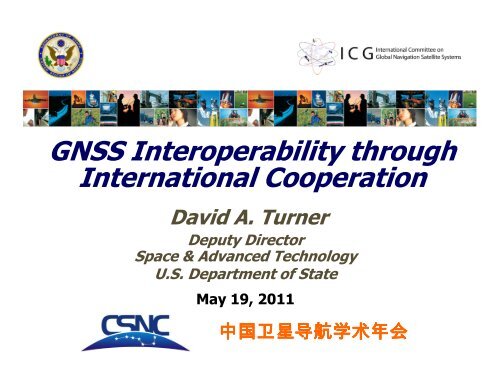
<strong>GNSS</strong> <strong>Interoperability</strong> <strong>through</strong><br />
<strong>International</strong> <strong>Cooperation</strong><br />
David A. Turner<br />
Deputy Director<br />
Space & Advanced Technology<br />
U.S. Department of State<br />
May 19, 2011<br />
中 国 卫 星 导 航 学 术 年 会<br />
Tuesday, September 21
Overview<br />
• U.S. National Space Policy<br />
• Compatibility and <strong>Interoperability</strong><br />
• Bilateral <strong>International</strong> <strong>Cooperation</strong><br />
• <strong>International</strong> Committee on <strong>GNSS</strong> (ICG)<br />
• Improving <strong>Interoperability</strong><br />
(Interchangeability?)<br />
• Summary<br />
2
U.S. National Space Policy<br />
Space-Based PNT Guideline: Maintain leadership in the<br />
service, provision, and use of <strong>GNSS</strong><br />
• Provide civil <strong>GPS</strong> services, free of direct user charges<br />
– Available on a continuous, worldwide basis<br />
– Maintain constellation consistent with published<br />
performance standards and interface specifications<br />
– Foreign PNT services may be used to augment and<br />
strengthen the resiliency of <strong>GPS</strong><br />
• Encourage global compatibility and interoperability<br />
with <strong>GPS</strong><br />
• Promote transparency in civil service provision<br />
• Enable market access to industry<br />
• Support international activities to detect and mitigate<br />
harmful interference<br />
3 2
U.S. Objectives in Working with<br />
Other <strong>GNSS</strong> Service Providers<br />
• Ensure compatibility ― ability of U.S. and non-<br />
U.S. space-based PNT services to be used<br />
separately or together without interfering with<br />
each individual service or signal<br />
– Radio frequency compatibility<br />
– Spectral separation between M-code and other signals<br />
• Achieve interoperability – ability of civil U.S. and<br />
non-U.S. space-based PNT services to be used<br />
together to provide the user better capabilities<br />
than would be achieved by relying solely on one<br />
service or signal<br />
Pursue <strong>through</strong> Bilateral and<br />
Multilateral <strong>Cooperation</strong><br />
4
GALILEO<br />
IRNSS<br />
QZSS<br />
The Goal of Civil <strong>GNSS</strong><br />
<strong>Interoperability</strong><br />
COMPASS<br />
GLONASS<br />
<strong>GPS</strong><br />
• Ideal interoperability<br />
allows navigation with<br />
one signal each<br />
from four or more<br />
systems with no<br />
additional receiver<br />
cost or complexity<br />
Interoperable = Better Together than Separate<br />
5
Bilateral <strong>Cooperation</strong><br />
• 1998 U.S.-Japan Joint Statement on <strong>GPS</strong><br />
<strong>Cooperation</strong><br />
• U.S.-EU <strong>GPS</strong>-Galileo <strong>Cooperation</strong> Agreement signed<br />
in June 2004<br />
• U.S.-Russia Joint Statement issued December 2004<br />
• U.S.-India Joint Statement on <strong>GNSS</strong> <strong>Cooperation</strong><br />
in 2007<br />
• U.S.-China operator-to-operator coordination under<br />
ITU auspices<br />
• U.S.-Australia Joint Delegation Statement on<br />
<strong>Cooperation</strong> in the Civil Use of <strong>GPS</strong> in 2007<br />
6<br />
21
<strong>International</strong> Committee on Global<br />
Navigation Satellite Systems (ICG)<br />
• Emerged from 3rd UN Conference on the Exploration<br />
and Peaceful Uses of Outer Space, July 1999<br />
– Promote the use of <strong>GNSS</strong> and its integration into<br />
infrastructures, particularly in developing countries<br />
– Encourage compatibility and interoperability among global<br />
and regional systems<br />
– First Meeting held in 2006<br />
– Next meeting – September 4-9, 2011 in Tokyo, Japan<br />
• Members include:<br />
– <strong>GNSS</strong> Providers (U.S., EU, Russia, China, India, Japan)<br />
– Other interested Member States of the United Nations<br />
– <strong>International</strong> organizations/associations<br />
http://www.unoosa.org/oosa/en/SAP/gnss/icg.html<br />
7
ICG Providers Forum<br />
• Six current space segment providers are members<br />
– Focused discussions on compatibility and<br />
interoperability, encouraging development of<br />
complimentary systems<br />
– Exchange detailed information on systems & service<br />
provision plans and views on the ICG work plan and<br />
activities<br />
• Agreement that all <strong>GNSS</strong> signals & services must be<br />
compatible and open signals & services should<br />
also be interoperable to the maximum extent<br />
possible<br />
– Working definition of compatibility includes respect for<br />
spectral separation between each system’s authorized<br />
service signals and other systems’ signals<br />
– <strong>Interoperability</strong> definition addresses signal, system<br />
time and geodetic reference frame considerations<br />
8
ICG Working Group on Compatibility<br />
and <strong>Interoperability</strong> (WG-A)<br />
• Co-Chaired by the United States and the Russian Federation<br />
• Work plan focused on assisting Providers in the pursuit of<br />
complementary systems<br />
– Compatibility and <strong>Interoperability</strong> - consider the perspective<br />
of various user applications and equipment manufacturers<br />
– Open Service Information Sharing - pursue Principle of<br />
Transparency: every <strong>GNSS</strong> provider should publish documentation<br />
that describes the signal and system information, the policies of<br />
provision and the minimum levels of performance offered for its open<br />
services<br />
– Service Performance Monitoring - potential cooperation in the<br />
development of the necessary ground infrastructure to monitor<br />
signal and service performance for open services<br />
– Spectrum Protection - Interference Detection, and<br />
Mitigation - develop a strategy for supporting mechanisms to<br />
detect and mitigate sources of electromagnetic interference<br />
9
WG-A <strong>Interoperability</strong> Questionnaire<br />
• Purpose: obtain worldwide technical input from the<br />
<strong>GNSS</strong> industry, academic institutions, and other user<br />
community representatives regarding interoperability<br />
and the combined use of signals from multiple<br />
systems<br />
– Circulated by WG-A after ICG-3, Dec 08, and discussed<br />
with user community at four meetings<br />
– Posted online by <strong>GPS</strong> World, March 2010<br />
• Results to date:<br />
– Benefits of interoperability include better availability,<br />
accuracy, and ability to support RAIM<br />
– Priorities include common carrier frequencies, common<br />
time scale & reference frames, common modulation,<br />
and collocation of reference stations<br />
10
Ideal <strong>Interoperability</strong><br />
(Interchangeability?)<br />
• Definition: Navigation with one signal each<br />
from four or more systems with no additional<br />
receiver cost or complexity<br />
• Do users and manufacturers want it?<br />
– Not clear<br />
• Is it of value?<br />
– Maybe for some users<br />
– Receivers can self-correct for most system<br />
differences with enough satellites in view<br />
• If it is desirable to improve interoperability ...<br />
11
Improving <strong>Interoperability</strong> (1)<br />
• Geodetic reference frames of individual systems<br />
appear to be converging to within centimeters<br />
− Maintaining alignment of reference frames with ITRF<br />
should ensure this trend continues<br />
• A <strong>GNSS</strong> ensemble time could be realized by the<br />
monitoring of all constellations from common sites<br />
– Individual system times could then be compared to this<br />
“<strong>GNSS</strong> time” and the resulting corrections could be made<br />
available for broadcast <strong>through</strong> multiple channels<br />
• Core global constellations, regional systems, SBAS, and the<br />
internet are all possibilities<br />
12
Improving <strong>Interoperability</strong> (2)<br />
• More Frequency commonality with common<br />
signal spectrum<br />
– Simplifies multi-constellation monitoring<br />
– Reduces cost of consumer-grade receivers<br />
– Minimizes time and frequency biases<br />
• Greater service provision transparency<br />
– Timely and widely available interface specifications and<br />
performance standards for individual constellations<br />
– Transparent operation of common monitoring stations<br />
and widely available information on obtaining<br />
corrections<br />
13
Planned <strong>GNSS</strong> Signals<br />
E5b/B2b<br />
B3<br />
E6<br />
14
Almost Ideal <strong>Interoperability</strong><br />
Ensemble Time Offsets<br />
Geodetic Alignment<br />
Greater frequency commonality with transparency<br />
GALILEO IRNSS COMPASS<br />
QZSS<br />
<strong>GPS</strong><br />
GLONASS<br />
Almost Interchangeability<br />
15
Summary<br />
• U.S. Space-Based PNT Policy encourages<br />
compatibility and interoperability with <strong>GPS</strong><br />
– Pursued <strong>through</strong> bilateral and multilateral cooperation<br />
• The U.S. supports the ICG principles of<br />
compatibility, interoperability, and transparency<br />
• Efforts to better understand industry and user views<br />
on interoperability continue <strong>through</strong> the ICG<br />
– Your input is welcome and encouraged<br />
• Ideal <strong>Interoperability</strong> or “Interchangeability” and<br />
the means to achieve it deserves further consideration<br />
– Multi-<strong>GNSS</strong> constellation monitoring will be necessary<br />
16
Thanks!<br />
David A. Turner<br />
Deputy Director<br />
Space and Advanced<br />
Technology<br />
U.S. Department of State<br />
OES/SAT, SA-23, Suite 410<br />
Washington, D.C. 20520<br />
202.663.2397 (office)<br />
202.320.1972 (mobile)<br />
TurnerDA@state.<strong>gov</strong><br />
17<br />
17
Progress in <strong>GNSS</strong> Service Provision<br />
Providers Forum<br />
Providers Forum System Report<br />
Principles of Compatibility,<br />
<strong>Interoperability</strong>, and Transparency<br />
Template for Performance Standards<br />
(and ICDs)<br />
Postulated Performance Standards<br />
for future services<br />
- Service Assurances or<br />
Commitments<br />
- Monitoring of service<br />
performance<br />
- Interference monitoring