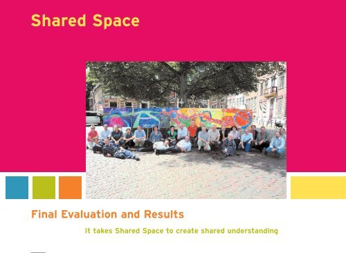
Shared Space Final Evaluation and Results It takes ... - Fietsberaad
Shared Space Final Evaluation and Results It takes ... - Fietsberaad
Shared Space Final Evaluation and Results It takes ... - Fietsberaad

You also want an ePaper? Increase the reach of your titles
YUMPU automatically turns print PDFs into web optimized ePapers that Google loves.
<strong>Shared</strong> <strong>Space</strong><br />
<strong>Final</strong> <strong>Evaluation</strong> <strong>and</strong> <strong>Results</strong><br />
<strong>It</strong> <strong>takes</strong> <strong>Shared</strong> <strong>Space</strong> to create shared underst<strong>and</strong>ing
<strong>Shared</strong> <strong>Space</strong><br />
1<br />
<strong>Final</strong> <strong>Evaluation</strong> <strong>and</strong> <strong>Results</strong><br />
<strong>It</strong> <strong>takes</strong> <strong>Shared</strong> <strong>Space</strong> to create shared underst<strong>and</strong>ing
Lead Partner<br />
<strong>Shared</strong> <strong>Space</strong><br />
Fryslân Province<br />
PO Box 20120<br />
8900 HM Leeuwarden<br />
The Netherl<strong>and</strong>s<br />
2<br />
www.shared-space.org
Contents<br />
Introduction<br />
4<br />
1 The initial working hypothesis<br />
6<br />
Key themes<br />
Analytical framework<br />
Additional findings<br />
. Speed<br />
. Influencing speeds<br />
. Risk <strong>and</strong> the promotion of safety<br />
. Integration of professional skills <strong>and</strong> expertise<br />
. Lower speeds <strong>and</strong> improved transport efficiency<br />
. Coping with change<br />
. Social interaction <strong>and</strong> liveability<br />
3<br />
2 Project outcomes<br />
12<br />
Publicity <strong>and</strong> Communication<br />
3 The regional pilot projects<br />
16<br />
. Province of Fryslân, The Netherl<strong>and</strong>s<br />
. Municipality of Bohmte, Germany<br />
. Municipality of Middelfart, Denmark<br />
. Municipality of Emmen, The Netherl<strong>and</strong>s<br />
. City of Oostende, Belgium<br />
. Suffolk County Council, United Kingdom<br />
. Municipality of Haren, The Netherl<strong>and</strong>s<br />
4 Summary <strong>and</strong> conclusions 26
The former<br />
Mayor of Haren,<br />
mr. Gerritsen<br />
shows that one<br />
extra sign may<br />
replace many<br />
other ones.<br />
Introduction<br />
4<br />
The European <strong>Shared</strong> <strong>Space</strong> research project<br />
was undertaken between 2004 <strong>and</strong> 2008 by<br />
seven project partners from five countries of<br />
the North Sea Region. The programme was<br />
supported by the European Interreg IIIB North<br />
Sea Programme <strong>and</strong> by the various local authorities<br />
involved. The five countries involved were<br />
The Netherl<strong>and</strong>s, Belgium, Denmark, Germany<br />
<strong>and</strong> the United Kingdom.<br />
The project has succeeded in adding significantly<br />
to development of knowledge <strong>and</strong> underst<strong>and</strong>ing<br />
of new approaches to reconciling traffic movement<br />
with cities, towns <strong>and</strong> villages. Largely as<br />
a result of the transnational exchanges developed<br />
through the project, the concept of <strong>Shared</strong><br />
<strong>Space</strong> is now widely accepted <strong>and</strong> used throughout<br />
the European Community <strong>and</strong> the rest of<br />
the world. The project attracted very substantial<br />
interest from the general <strong>and</strong> professional<br />
press <strong>and</strong> media through the world through<br />
both television, radio, newspapers, magazines
5<br />
<strong>and</strong> professional <strong>and</strong> specialist journals.<br />
The <strong>Shared</strong> <strong>Space</strong> Project grew out of widespread<br />
interest in measures to improve the quality,<br />
liveability, sustainability <strong>and</strong> economic vitality<br />
of the built environment. Concerns about the<br />
decline in the st<strong>and</strong>ards <strong>and</strong> use of public<br />
space, <strong>and</strong> the impact of traffic <strong>and</strong> highway<br />
measures on streets <strong>and</strong> public spaces, have<br />
been growing for many years. Such concerns<br />
have focused on policy <strong>and</strong> practice in relation<br />
to urban design <strong>and</strong> traffic engineering, as well<br />
as on the processes <strong>and</strong> decision-making<br />
structures that determine the design, management<br />
<strong>and</strong> maintenance of public space. The<br />
development of <strong>Shared</strong> <strong>Space</strong> is part of a shift<br />
away from the principle of ‘segregation’, central<br />
to conventional traffic engineering for most of<br />
the 20th century, towards the notion of integration<br />
within the public realm. This shift has been<br />
observed in progressive urban design <strong>and</strong> engineering<br />
throughout Europe for many years. The<br />
<strong>Shared</strong> <strong>Space</strong> Project provided the first opportunity<br />
to formally consider the issue <strong>and</strong> test<br />
its usefulness <strong>and</strong> suitability in a wide range of<br />
contexts.<br />
As so often happens, research into the topic<br />
pointed to wider <strong>and</strong> more far-reaching implications<br />
than was anticipated at the outset.<br />
From a starting point addressing the safety <strong>and</strong><br />
efficiency of traffic in urban areas <strong>and</strong> rural<br />
highways, the research suggested that the topic<br />
could be of relevance to a much wider range of<br />
issues. These included questions concerning<br />
economic prosperity, health, environmental<br />
sustainability, as well as opportunities for<br />
addressing diversity, social inclusion, community<br />
capacity <strong>and</strong> government structures. The<br />
<strong>Shared</strong> <strong>Space</strong> Project has stimulated a wide<br />
range of related research across a broad<br />
spectrum of interests <strong>and</strong> disciplines. This<br />
project therefore has to be viewed as a starting<br />
point rather than as a complete <strong>and</strong> finalised<br />
exercise.<br />
<strong>Shared</strong> <strong>Space</strong> is not a new concept. Informal,<br />
negotiated use of public space on the basis of<br />
conventions <strong>and</strong> social protocols was the status<br />
quo ante for streets <strong>and</strong> spaces from the earliest<br />
settlements. <strong>Space</strong>s shared by multiple users<br />
for all sorts of activities continue to be found<br />
in many circumstances such as mews courts,<br />
campsites, car-parks, market squares <strong>and</strong><br />
minor rural lanes. <strong>It</strong> is the potential to apply<br />
such time-honoured principles to more complex<br />
contemporary urban circumstances that has<br />
intrigued the participants in the <strong>Shared</strong> <strong>Space</strong><br />
Project, circumstances where we have generally<br />
relied in the past on signals, signs, barriers <strong>and</strong><br />
controls, <strong>and</strong> all the expensive <strong>and</strong> unsightly<br />
paraphernalia of regulation, separation <strong>and</strong><br />
regulation by the state. In exploring the issues,<br />
the project has suggested that there may be<br />
wider opportunities to strengthen local democratic<br />
connections with public space, <strong>and</strong> to<br />
promote wider underlying benefits associated<br />
with participation <strong>and</strong> civility.
Open minded<br />
discussions during<br />
the several project<br />
meetings.<br />
6
1<br />
The initial working hypothesis<br />
7<br />
Key themes The <strong>Shared</strong> <strong>Space</strong> Project set out<br />
to develop <strong>and</strong> test a series of pilot projects in<br />
a variety of cultural <strong>and</strong> spatial contexts. Each<br />
was intended to explore the potential for the<br />
application of <strong>Shared</strong> <strong>Space</strong> principles through<br />
transnational co-operation between a range of<br />
professional disciplines. The intention was to<br />
develop a richer underst<strong>and</strong>ing of the physical<br />
measures as well as the working processes that<br />
contribute to successful public space. The findings<br />
were intended to add to the palette of<br />
measures available to municipalities <strong>and</strong> highway<br />
authorities throughout the North Sea Region,<br />
<strong>and</strong> to enrich underst<strong>and</strong>ing <strong>and</strong> experience of<br />
alternative approaches to conventional traffic<br />
regulation <strong>and</strong> pedestrian separation.<br />
A number of interrelated themes <strong>and</strong> objectives<br />
emerged from the first transnational <strong>Shared</strong><br />
<strong>Space</strong> workshop in September 2004. These<br />
included:<br />
. Road Safety: all participating countries <strong>and</strong><br />
highway authorities placed high value on<br />
reducing numbers of deaths <strong>and</strong> serious<br />
injuries, <strong>and</strong> removing the perceptions of<br />
danger that act as barriers to walking,<br />
cycling <strong>and</strong> wider use of public space.<br />
. Community Safety: participants shared an<br />
interest in reducing crime <strong>and</strong> fear of crime,<br />
<strong>and</strong> the potential for a more animated public<br />
realm to improve confidence <strong>and</strong> cohesion<br />
as a foundation for improving perceptions<br />
of security.<br />
. Economic Regeneration: <strong>Shared</strong> <strong>Space</strong><br />
appears to offer opportunities to support<br />
efforts to renew deprived neighbourhoods,<br />
encourage local investment through greater<br />
confidence <strong>and</strong> distinctiveness in the public<br />
realm, <strong>and</strong> foster economic development.<br />
. Public Engagement: wider participation in<br />
the analysis, design <strong>and</strong> management of<br />
streets <strong>and</strong> public spaces held opportunities<br />
for greater public satisfaction <strong>and</strong> involvement<br />
with local decision making <strong>and</strong> policy development,<br />
offering the potential for enhanced<br />
social cohesion <strong>and</strong> democratic participation.<br />
. Liveability: partners saw <strong>Shared</strong> <strong>Space</strong> as a<br />
key component in promoting <strong>and</strong> enhancing<br />
the attractiveness <strong>and</strong> sustainability of town<br />
<strong>and</strong> city centres, <strong>and</strong> for improving the<br />
relationship between the built <strong>and</strong> natural<br />
environment.<br />
Not all of the individual projects were intended<br />
to test each of these aspects, <strong>and</strong> individual<br />
partners brought different priorities <strong>and</strong> interests<br />
depending on local circumstances.<br />
Analytical framework From the outset it became<br />
clear that successful regional demonstration<br />
projects could not be delivered by engagement<br />
with just one local government department or<br />
sector. The philosophy underpinning <strong>Shared</strong>
8<br />
<strong>Space</strong> requires engagement at several levels<br />
as well as across different service areas of local<br />
government. There was thus an implicit need<br />
to address organisational structures as well as<br />
design <strong>and</strong> implementation processes.<br />
The first project publication set out a framework<br />
for analysing the changes necessary in both<br />
processes as well as the levels of engagement.<br />
‘The Nine Cell’ model was developed as a<br />
method of exploring the shortcomings <strong>and</strong><br />
achievements in addressing the various players<br />
<strong>and</strong> processes implied by the introduction of<br />
<strong>Shared</strong> <strong>Space</strong> principles.<br />
The model provided a useful reference point for<br />
testing progress with the development of new<br />
methodologies <strong>and</strong> working practices amongst<br />
participating authorities, serving as a logbook<br />
for project teams <strong>and</strong> their advisors. The model<br />
is described in greater detail in the project<br />
publications <strong>Shared</strong> <strong>Space</strong>: Room for Everyone<br />
(2005) <strong>and</strong> <strong>Shared</strong> <strong>Space</strong>: From Project to<br />
Process - A Task for Everyone (2008).<br />
Additional findings During the course of the<br />
<strong>Shared</strong> <strong>Space</strong> project, a number of additional<br />
themes <strong>and</strong> issues emerged from the analysis,<br />
research <strong>and</strong> engagement of the parties involved.<br />
Each of these topics has suggested additional<br />
areas for enquiry <strong>and</strong> experimentation, <strong>and</strong> has<br />
run through much of the discussions <strong>and</strong> debate<br />
surrounding the individual projects <strong>and</strong> other<br />
examples of <strong>Shared</strong> <strong>Space</strong>. Here we summarize<br />
some of the critical themes.<br />
Vision<br />
Administration<br />
Political vision.<br />
Requires clear set of values <strong>and</strong><br />
objectives for the public realm.<br />
Design<br />
Clarification of design<br />
principles <strong>and</strong> objectives.<br />
Implementation<br />
Application of best practice,<br />
knowledge <strong>and</strong> experience.<br />
Working<br />
methods<br />
Administration aimed at<br />
empowerment of communities<br />
<strong>and</strong> maximum participation.<br />
Creativity. Observation, not<br />
assumptions.<br />
Interdisciplinary co-operation.<br />
Communication methods.<br />
Co-operation <strong>and</strong> co-ordination of<br />
multiple agencies with an impact<br />
on streetscape <strong>and</strong> the public realm.<br />
Figure 1<br />
The Nine Cell Model<br />
Tools<br />
Process skills <strong>and</strong> communication<br />
practices.<br />
Participative design methods.<br />
New professional boundaries <strong>and</strong><br />
integration.<br />
Selection <strong>and</strong> deployment of<br />
materials, use <strong>and</strong> testing of new<br />
materials, technologies <strong>and</strong> equipment.
. Speed<br />
Traffic speed, <strong>and</strong> methods to influence <strong>and</strong><br />
control it, is central to the development of<br />
<strong>Shared</strong> <strong>Space</strong>. Theoretical research combined<br />
with practical observations suggests a critical<br />
qualitative change in the use <strong>and</strong> quality of<br />
public space at speeds around 30 kph (19 mph).<br />
This qualitative change appears to be linked to<br />
the physical characteristics of the human body,<br />
<strong>and</strong> to our ability to communicate through<br />
gestures <strong>and</strong> eye-contact at velocities below<br />
the maximum human running speed. This realisation<br />
was critical to the development of the<br />
woonerf or home zone, <strong>and</strong> has important<br />
implications for the development of speed policies<br />
<strong>and</strong> engineering assumptions for traffic in<br />
mixed-use space. Whereas many streets have<br />
conventionally been developed on the basis<br />
of design speeds of around 50 kph (30 mph),<br />
there would appear to be significant spatial <strong>and</strong><br />
behavioural benefits from working to speeds<br />
closer to those within the evolutionary range of<br />
human abilities.<br />
. Influencing Speeds<br />
Research increasingly suggests that driving<br />
speeds are influenced, above all else, by the<br />
interpretation of the street context by drivers.<br />
Legislation <strong>and</strong> formal speed limits are a secondary<br />
constraint, <strong>and</strong> less effective than the<br />
design <strong>and</strong> configuration of the built environment.<br />
David Engwicht’s work on psychological<br />
measures <strong>and</strong> their potential to serve as speed<br />
constraints (Mental Speed Bumps - 2007)<br />
suggests that traffic speed is determined predominately<br />
by ‘the degree of psychological<br />
retreat from the streetscape’. A key theme to<br />
promoting <strong>Shared</strong> <strong>Space</strong> lies in finding creative<br />
ways to reduce speeds through the use of<br />
intrigue, interest <strong>and</strong> engagement of drivers<br />
with their surroundings <strong>and</strong> with fellow citizens.<br />
This theme underpins the measures developed<br />
in all of the contributing projects, especially<br />
the measures employed by the municipalities<br />
of Haren, Bohmte <strong>and</strong> Ipswich.<br />
. Risk <strong>and</strong> the promotion of safety<br />
A fresh underst<strong>and</strong>ing of the relevance of risk,<br />
<strong>and</strong> the perception of danger, has linked all of<br />
the practical <strong>and</strong> theoretical work on <strong>Shared</strong><br />
<strong>Space</strong>. Risk is a theme that is increasingly seen<br />
as relevant to the quality of public (eg. Living<br />
with Risk: the importance of risk in the public<br />
realm - CABE 2007). The paradox whereby the<br />
safest places are those that appear the most<br />
dangerous is one that has intrigued experts in<br />
this field for many years (eg. Risk - Adams, J.).<br />
<strong>It</strong> is also central to underst<strong>and</strong>ing the changes<br />
that take place in behaviour when spaces are<br />
shared, <strong>and</strong> some degree of uncertainty <strong>and</strong><br />
unpredictability is introduced. The complex<br />
relationship between perceptions of safety <strong>and</strong><br />
accident rates raises many intriguing <strong>and</strong> difficult<br />
questions for those involved in <strong>Shared</strong> <strong>Space</strong>.<br />
The discomfort <strong>and</strong> concerns expressed by many<br />
members of the public reflect the challenges in<br />
balancing feelings of safety with actual improvements<br />
in safety. This was an issue for all of the<br />
participating project teams, <strong>and</strong> especially for<br />
those in Emmen, Haren <strong>and</strong> Ipswich.<br />
9
. Integration of professional skills . Lower speeds <strong>and</strong> improved<br />
10<br />
<strong>and</strong> expertise<br />
transport efficiency<br />
<strong>Shared</strong> <strong>Space</strong> presupposes <strong>and</strong> requires a realignment<br />
A further intriguing finding emerging from after the implementation of the <strong>Shared</strong> <strong>Space</strong><br />
of the traditional roles <strong>and</strong> established<br />
boundaries of key professions. Conventional<br />
segregation of traffic from the public realm has<br />
generated a parallel separation between the<br />
typical areas of responsibility. This is especially<br />
the case for traffic engineering <strong>and</strong> urban design,<br />
but it also applies to (l<strong>and</strong>scape) architects,<br />
economic development officers, town planners,<br />
transport planners, arts officers, artists <strong>and</strong><br />
those engaged with health, welfare, education,<br />
inclusion <strong>and</strong> many more. Combining <strong>and</strong> integrating<br />
the input of a wide range of professional<br />
expertise has emerged as a key theme for all<br />
of the <strong>Shared</strong> <strong>Space</strong> pilot projects. This aspect<br />
carries important implications for organisational<br />
structures within local authorities <strong>and</strong> between<br />
professions, <strong>and</strong> has significance for national<br />
as well as regional government. All of the pilot<br />
projects involved the integration of several<br />
professional disciplines, politicians <strong>and</strong> local<br />
stakeholders, <strong>and</strong> highlighted important questions<br />
for local authority management <strong>and</strong> the decsionmaking<br />
processes.<br />
<strong>Shared</strong> <strong>Space</strong> experiments is the apparent<br />
reduction in delays <strong>and</strong> congestion, <strong>and</strong> improvements<br />
in journey times, associated with lower<br />
speeds. This has significant implications for<br />
traffic policy <strong>and</strong> for the design of streets <strong>and</strong><br />
intersections. <strong>It</strong> would appear that the reduction<br />
in dependency on signals <strong>and</strong> formal traffic<br />
controls such as pedestrian crossings can<br />
improve capacity <strong>and</strong> movement for all modes,<br />
due to greater efficiencies at intersections. This<br />
somewhat counter-intuitive finding has been<br />
observed from <strong>Shared</strong> <strong>Space</strong> schemes in Lund<br />
<strong>and</strong> Norrköping in Sweden, <strong>and</strong> in the monitoring<br />
of the performance of the redesigned<br />
Laweiplein, the busy square near the centre<br />
of Drachten in the province of Fryslân (The<br />
Netherl<strong>and</strong>s). The latter scheme saw the removal<br />
of traffic signals, formal pedestrian crossings<br />
<strong>and</strong> separate bus <strong>and</strong> bicycle lanes from<br />
the intersection in this key city square, a junction<br />
that h<strong>and</strong>les over 22,000 vehicles per day. From<br />
measurements <strong>and</strong> data collected before <strong>and</strong><br />
scheme, average delays at the intersection fell<br />
from 53 seconds per vehicle to between 26 <strong>and</strong><br />
35 seconds. Slower speeds, greater interaction<br />
<strong>and</strong> negotiations between drivers <strong>and</strong> other<br />
road users, <strong>and</strong> reduced headways appear to<br />
minimise the interruptions <strong>and</strong> delays in movement<br />
<strong>and</strong> flows associated with conventional<br />
traffic flows. There are also several empirical<br />
observations that <strong>Shared</strong> <strong>Space</strong> configurations<br />
encourage higher levels of walking <strong>and</strong> cycling<br />
(Ipswich, Province of Fryslân <strong>and</strong> Oostende),<br />
but it is too early to draw any firm conclusions<br />
from the pilot projects.
. Coping with change<br />
Streets are very permanent features of our built<br />
environment. Any changes, no matter how small,<br />
require changes in our mental maps <strong>and</strong> l<strong>and</strong>marks.<br />
Street works are also particularly disruptive<br />
<strong>and</strong> intrusive, generating noise, congestion<br />
<strong>and</strong> confusion. Changes are difficult for everyone,<br />
but especially for older people <strong>and</strong> for those<br />
with any physical sensorary impairments. This<br />
is particularly problematic for blind people <strong>and</strong><br />
those with visual impairments. One of the critical<br />
themes emerging from the pilot projects,<br />
especially in the UK, is concern from groups<br />
representing the interests of blind people,<br />
especially concerning the potential loss of<br />
familiar guidance such as high kerbs, barriers<br />
<strong>and</strong> formal crossing points. <strong>Shared</strong> <strong>Space</strong> raises<br />
important design <strong>and</strong> training issues for groups<br />
concerned with improving access <strong>and</strong> the inclusion<br />
of disabled people, <strong>and</strong> much work is<br />
still needed to develop a set of navigational <strong>and</strong><br />
guidance clues that can encourage confidence in<br />
the engagement of especially vulnerable groups,<br />
without relying on the separation <strong>and</strong> segregation<br />
associated with conventional street design.<br />
. Social interaction <strong>and</strong> liveability<br />
Streets <strong>and</strong> public spaces have always served<br />
a wide range of functions, in particular those of<br />
transport <strong>and</strong> movement alongside the provision<br />
space for human exchange, interaction, trade<br />
<strong>and</strong> social contact. One of the key aims of<br />
<strong>Shared</strong> <strong>Space</strong> is to develop new ways to reconcile<br />
these functions, <strong>and</strong> especially to increase<br />
the potential for human interaction <strong>and</strong> civility.<br />
<strong>It</strong> appears that the facility for encouraging informal,<br />
day-to-day social exchanges are, in<br />
turn, critical to the promotion of safety. They<br />
also appear to be relevant to social cohesion.<br />
There also appears to be growing evidence of<br />
the positive links between public health <strong>and</strong> the<br />
extent of social interaction <strong>and</strong> exchanges<br />
(eg. The National Heart Forum (UK), Building<br />
Health: Creating <strong>and</strong> Enhancing Places for<br />
Healthy, Active Lives, ed. Cavill, N. 2007,<br />
www.heartforum.org.uk). Although the timescales<br />
are too short in this project to test such<br />
findings in the <strong>Shared</strong> <strong>Space</strong> pilots, there is<br />
good reason to expect some degree of health<br />
benefit, especially for mental health <strong>and</strong> for<br />
reducing obesity. Economic vitality also appears<br />
to be linked closely to levels of social exchange<br />
<strong>and</strong> the quality of the streetscape (CABE, Paved<br />
with Gold. 2007). Issues of liveability <strong>and</strong> social<br />
interaction appear to have been especially critical<br />
to encouraging economic investment <strong>and</strong><br />
urban regeneration in Ipswich <strong>and</strong> in Oostende.<br />
11
World-wide attention<br />
for the <strong>Shared</strong><br />
<strong>Space</strong> philosophy.<br />
12
2<br />
Project outcomes<br />
13<br />
Seven pilot projects were substantially completed<br />
during the project timescale, bringing a range<br />
of physical changes to a variety of differing<br />
examples of urban <strong>and</strong> rural contexts. The<br />
detailed findings of each pilot are described in<br />
more detail below.<br />
At a wider level, the project has prompted a<br />
series of changes <strong>and</strong> follow-up measures<br />
within a number of the participating countries,<br />
<strong>and</strong> across Europe as a whole. The term<br />
‘<strong>Shared</strong> <strong>Space</strong>’, coined as part of the preparation<br />
for this project, is now recognized <strong>and</strong> in<br />
common usage across all five countries <strong>and</strong><br />
the rest of the world. Municipalities <strong>and</strong> local<br />
authorities are increasingly experimenting <strong>and</strong><br />
developing the concept, encouraged by the<br />
experience <strong>and</strong> information gained from the<br />
Interreg transnational exchanges.<br />
Notable government publications influenced<br />
by the project include the UK Government’s<br />
Manual for Streets (March 2007). This important<br />
guidance document for local authorities in<br />
Engl<strong>and</strong> <strong>and</strong> Wales replaced the former Design<br />
Bulletin 32, <strong>and</strong> gave recognition to the balance<br />
between streets as places as well as their role<br />
as corridors for movement. Many of the key<br />
themes from the <strong>Shared</strong> <strong>Space</strong> Project, such<br />
as speed, risk, driver psychology, community<br />
empowerment, <strong>and</strong> interdisciplinary working are<br />
given significant prominence in the new manual,<br />
which is already bringing about widespread<br />
changes in the design <strong>and</strong> management of<br />
residential streets <strong>and</strong> quiet rural roads.<br />
In The Netherl<strong>and</strong>s, the co-ordinating body for<br />
the northern three provinces (Drenthe, Fryslân<br />
<strong>and</strong> Groningen) commissioned a feasibility study,<br />
delivered in March 2008, into the potential for<br />
establishing a permanent <strong>Shared</strong> <strong>Space</strong> research<br />
institute to build on the findings from this project.<br />
In addition, the Belvedere initiative in The Netherl<strong>and</strong>s<br />
brings together four key Dutch ministries;<br />
the Ministry of Education, Culture <strong>and</strong> Science,<br />
the Ministry of Housing, the Ministry of<br />
Agriculture, Nature management <strong>and</strong> Food, <strong>and</strong><br />
the Ministry of Transport. The Belvedere structure<br />
supports measures to combine spatial<br />
planning, cultural <strong>and</strong> economic measures, <strong>and</strong><br />
has provided support for a range of additional<br />
<strong>Shared</strong> <strong>Space</strong> pilot projects in The Netherl<strong>and</strong>s.<br />
<strong>It</strong>s website is linked to the <strong>Shared</strong> <strong>Space</strong> project<br />
website. <strong>Final</strong>ly, CROW, the Dutch national<br />
research body has initiated further research into<br />
<strong>Shared</strong> <strong>Space</strong> which will be disseminated to<br />
all 433 Dutch municipalities.<br />
Publicity <strong>and</strong> Communication The project<br />
was submitted with the intention that the ideas<br />
<strong>and</strong> principles behind <strong>Shared</strong> <strong>Space</strong> should<br />
be communicated across a range of media in
14<br />
order to raise underst<strong>and</strong>ing <strong>and</strong> interest, <strong>and</strong><br />
to maximise the benefits for the European<br />
Union from the project. At the outset, this was<br />
anticipated to take the form of limited local<br />
reports <strong>and</strong> articles in the areas of the specific<br />
projects, together with some reports <strong>and</strong> papers<br />
in professional journals.<br />
In the event the publicity <strong>and</strong> national <strong>and</strong> international<br />
interest greatly exceeded all expectations.<br />
The <strong>Shared</strong> <strong>Space</strong> project <strong>and</strong> many of<br />
the individual schemes formed the basis for a<br />
vast array of printed <strong>and</strong> broadcast media<br />
across Europe <strong>and</strong> around the world. In addition,<br />
the work of the project <strong>and</strong> the development<br />
of <strong>Shared</strong> <strong>Space</strong> became (<strong>and</strong> continues)<br />
as a key theme in conference, seminars <strong>and</strong><br />
lectures across different countries.<br />
Mainstream television reports were broadcast<br />
by the BBC <strong>and</strong> Channel 4 in the UK, by ZDF<br />
in Germany, by VRT in Belgium, <strong>and</strong> by several<br />
programmes in the Netherl<strong>and</strong>s. Major programmes<br />
were also broadcast in the United States<br />
(ABC, Fox News), in Australia (Channel 7) in the<br />
Czech Republic, France, Canada <strong>and</strong> many<br />
other countries. Several further television programmes<br />
covering the project are in development.<br />
Radio reporting of the project was also widespread,<br />
<strong>and</strong> too extensive to be comprehensively<br />
listed here. Local <strong>and</strong> regional radio reported on<br />
each of the specific projects on several occasions,<br />
<strong>and</strong> there were numerous national radio<br />
interviews broadcast in European countries, in<br />
the USA <strong>and</strong> Canada, in Australia, South Africa,<br />
the Middle East, Russia <strong>and</strong> Japan. The BBC<br />
World Service <strong>and</strong> Radio 4 (Today Programme)<br />
ran several interviews with the project advisory<br />
team, especially with the late Hans Monderman<br />
<strong>and</strong> with Ben Hamilton-Baillie.<br />
Coverage in national <strong>and</strong> regional press <strong>and</strong><br />
journals, as well as in specialist publications<br />
<strong>and</strong> academic periodicals again greatly exceeded<br />
original expectations. <strong>It</strong> was too extensive<br />
to list in full here, but the most widespread<br />
coverage was initiated by articles in the New<br />
York Times <strong>and</strong> International Herald Tribune,<br />
The Times, Telegraph <strong>and</strong> Daily Mail in the UK,<br />
<strong>and</strong> NRC H<strong>and</strong>elsblad in The Netherl<strong>and</strong>s. The<br />
project appears to have caught a widespread<br />
flowering of interest in, <strong>and</strong> concern for, the<br />
quality of streets <strong>and</strong> public spaces combined<br />
with issues associated with decision making<br />
<strong>and</strong> democracy. An vast range of informal<br />
‘blogs’ <strong>and</strong> discussion websites, apparent from<br />
internet traffic to key sites associated with<br />
<strong>Shared</strong> <strong>Space</strong> of the key participants, suggests<br />
that the project continues to generate interest<br />
across public <strong>and</strong> professional fields across<br />
the world. This continues to be evident from the<br />
large numbers of visitors <strong>and</strong> study tours seeking<br />
information about the key pilot projects<br />
<strong>and</strong> their related precedents.<br />
The <strong>Shared</strong> <strong>Space</strong> expert team, together with<br />
representatives from each of the five countries,<br />
were frequently engaged in lectures, conferences<br />
<strong>and</strong> seminars across Europe <strong>and</strong> elsewhere.<br />
Hans Monderman <strong>and</strong> Ben Hamilton-Baillie<br />
between them presented to well over 200 large<br />
gatherings in the participating countries as well<br />
as in Austria, France, <strong>It</strong>aly, Pol<strong>and</strong>, The United<br />
States <strong>and</strong> Canada. Further requests have been<br />
received from Norway, Spain, Switzerl<strong>and</strong>,<br />
Japan, Brazil, Argentina, Australia <strong>and</strong> New<br />
Zeal<strong>and</strong>.<br />
Hans Monderman<br />
is interviewed by<br />
the press.
3<br />
The regional pilot projects<br />
17<br />
A full report on each of the contributing pilot<br />
projects is available from each of the participating<br />
partners. Here we summarize some of the<br />
main issues, circumstances <strong>and</strong> outcomes, <strong>and</strong><br />
draw some of the key findings <strong>and</strong> conclusions<br />
from each of the schemes. <strong>Final</strong>ly we intend<br />
to summarize a number of the critical lessons<br />
learnt, <strong>and</strong> to make recommendations for<br />
future work in this field.<br />
The contrasting contexts of each of the projects<br />
has provided the opportunity to explore<br />
different aspects of <strong>Shared</strong> <strong>Space</strong> principles<br />
in a variety of forms. The key issues relevant<br />
to each can be summarised in the following<br />
table:<br />
Figure 2<br />
Project characteristics<br />
Key issues Bohmte Ipswich Haren Emmen Ejby Oostende Fryslân<br />
Built environment xxx xxx xxx xxx xx xxx x<br />
Natural environment xx xxx<br />
Safety x xxx xxx x xx xx<br />
Traffic speed xx xx xxx x xxx<br />
Culture/history x xx xx x xxx x xxx<br />
Spatial quality xx xxx xx xx xxx x xx<br />
Social quality xxx xxx xx xxx xx xx<br />
Traffic volumes xx x xx xx<br />
L<strong>and</strong>scape qualities x x xx x x xx
18<br />
as planned<br />
before<br />
. Province of Fryslân, Stroobossertrekvaart<br />
(The Netherl<strong>and</strong>s)<br />
This project examined the potential for <strong>Shared</strong><br />
<strong>Space</strong> principles to enhance the safety <strong>and</strong><br />
community value of a rural road serving a<br />
number of small settlements. The ancient road<br />
runs alongside a canal, constructed in the 17th<br />
century, a waterway rich in historic <strong>and</strong> cultural<br />
significance for the economic <strong>and</strong> social development<br />
of the north-eastern part of the province.<br />
The canalside road is nine kilometres long,<br />
serving three small hamlets <strong>and</strong> nine nearby<br />
villages, <strong>and</strong> runs through the municipalities of<br />
Kollummerl<strong>and</strong>, Dongeradeel <strong>and</strong> Dantumadeel,<br />
forming an important link in the local highway<br />
network.<br />
The project reflected local desires to return a<br />
distinctive identity to the road, <strong>and</strong> by so doing,<br />
to reduce traffic speeds <strong>and</strong> to encourage <strong>and</strong><br />
promote the road <strong>and</strong> its surroundings for<br />
tourism <strong>and</strong> other activities such as walking<br />
<strong>and</strong> cycling. The intention focused on measures<br />
to change the perception of drivers <strong>and</strong> others<br />
using the road from a st<strong>and</strong>ard piece of ‘any<br />
place’ highway to becoming an integrated part<br />
of its l<strong>and</strong>scape <strong>and</strong> cultural history. Problems<br />
of speed <strong>and</strong> traffic are exacerbated by the lack<br />
of alterative highway infrastructure <strong>and</strong> by the<br />
unbroken straight <strong>and</strong> linear quality of the road.<br />
For some time, there had been local political<br />
pressure to create a segregated cycle path<br />
because of perceived speeds.<br />
<strong>Shared</strong> <strong>Space</strong> principles were employed to<br />
create a vocabulary of distinctive spaces at key<br />
points along the route, such as at intersections,<br />
bridges or at historic docking points. Small-scale<br />
l<strong>and</strong>scape elements, careful attention to paving<br />
details, lighting <strong>and</strong> road dimensions were used<br />
to emphasise the various places along the<br />
route, <strong>and</strong> to reflect the specific topography.<br />
Centre line markings were removed <strong>and</strong> the<br />
road was visually narrowed.<br />
The Stroobossertrekvaart is a long-term project,<br />
for which <strong>Shared</strong> <strong>Space</strong> principles have provided<br />
a strategic framework. <strong>It</strong> is too early to assess<br />
whether the project has succeeded in reducing<br />
accident rates <strong>and</strong> speeds, but initial indications<br />
are positive. The scale of the project (adapting<br />
the full nine kilometres) proved too ambitious<br />
for the timescales <strong>and</strong> resources of this initial<br />
project, highlighting the long timescales involved<br />
in adapting major roads. Despite the organisational<br />
complexities of co-ordinating various communities<br />
<strong>and</strong> municipalities, the Province of<br />
Fryslân’s approach would appear to have established<br />
a model for integrating future investment<br />
<strong>and</strong> management of such historic roads.
. Municipality of Bohmte, Bremer Straße<br />
(Germany)<br />
Bohmte is a community of 13,500, just to the<br />
east of Osnabrück. The Bremer Straße traverses<br />
the centre of the town, carrying around 12,600<br />
cars <strong>and</strong> trucks a day. A new highway bypass<br />
link provided an opportunity to review the function<br />
of the street, which is lined with a number<br />
of shops <strong>and</strong> businesses. The economy of the<br />
town depends to a large extent on trade from<br />
passing traffic, <strong>and</strong> is very linear in form. Over<br />
the years, traffic measures had severely eroded<br />
the spatial quality of Bohmte, leaving little<br />
distinctive qualities evident.<br />
the surrounding built environment. The main<br />
works were completed in June 2008.<br />
The Bohmte project demonstrated the advantages<br />
from very clear, committed <strong>and</strong> dedicated<br />
political leadership throughout the preparation<br />
<strong>and</strong> implementation process. The Mayor of<br />
Bohmte played a central role throughout, maintaining<br />
continuous involvement with local residents<br />
<strong>and</strong> particularly with traders <strong>and</strong> shopkeepers.<br />
Co-ordinating the disruptive construction<br />
works whilst maintaining access to shops<br />
was particularly critical, especially during the<br />
vital pre-Christmas trading period.<br />
before<br />
19<br />
after<br />
The Bohmte project has attracted widespread<br />
The replanning of Bremer Straße forms a first<br />
step in a broader vision for the village entitled<br />
Bohmte 2015. The municipality joined the<br />
<strong>Shared</strong> <strong>Space</strong> Project partnership relatively late,<br />
following the withdrawal of another German<br />
partner. Additional funding from local <strong>and</strong> regional<br />
sources increased the total scheme budget<br />
to over €1.54 million, making it one of the largest<br />
of the pilot projects. The Bohmte scheme focused<br />
on the redesign of a central intersection, which<br />
was transformed from a bleak <strong>and</strong> inhospitable<br />
highway intersection into a distinctive town<br />
square with high quality paving. The paving<br />
<strong>and</strong> lighting is integrated with the shop fronts<br />
<strong>and</strong> spaces between the surrounding buildings<br />
to achieve an integration of streetspace with<br />
press <strong>and</strong> media coverage from Germany <strong>and</strong><br />
the rest of the world, <strong>and</strong> has served as an<br />
important catalyst for a wider interest in, <strong>and</strong><br />
underst<strong>and</strong>ing of, <strong>Shared</strong> <strong>Space</strong> in the country.<br />
Although too early to fully assess its effect on<br />
trade <strong>and</strong> local investor confidence, the scheme<br />
appears to have been favourably received locally,<br />
<strong>and</strong> has significantly raised the national <strong>and</strong><br />
international profile of this small town.
after<br />
20<br />
before<br />
. Municipality of Middelfart, Ejby<br />
(Denmark)<br />
The small town of Ejby, in the western part of<br />
Funen, is an example of a typical railway settlement.<br />
<strong>It</strong> is centred around the intersection of a<br />
busy railway with a county road, <strong>and</strong> trade <strong>and</strong><br />
commerce built up around this important interface.<br />
The decline of railway towns in the 20th<br />
century <strong>and</strong> greater transport speeds nearly<br />
destroyed Ejby, but it survives with a population<br />
of around 2,000. The need to build a gradeseparated<br />
crossing of the railway for road traffic<br />
<strong>and</strong> for pedestrians caused major damage to<br />
the spatial quality <strong>and</strong> economic welfare of the<br />
town, resulting in an clumsily engineered road<br />
bridge <strong>and</strong> dark <strong>and</strong> unattractive pedestrian<br />
underpass.<br />
Involvement in the European <strong>Shared</strong> <strong>Space</strong><br />
Project offered Ejby the opportunity to introduce<br />
new concepts to help tackle such long-st<strong>and</strong>ing<br />
difficulties. Accident records <strong>and</strong> difficulties for<br />
pedestrians <strong>and</strong> cyclists highlighted a severe<br />
safety problem, associated with high traffic<br />
speeds. The project enabled the road crossing<br />
<strong>and</strong> space around the town square <strong>and</strong> station<br />
to be remodelled, removing intrusive highway<br />
elements, adding an appropriate central median,<br />
<strong>and</strong> adding a distinctive <strong>and</strong> coherent spatial<br />
quality to the village centre.<br />
The European funding prompted additional<br />
contributions from the public <strong>and</strong> private sectors,<br />
including investment from the Fionia Bank <strong>and</strong><br />
others. A project group was established with<br />
wide representation, <strong>and</strong> the design <strong>and</strong> implementation<br />
process involved very extensive<br />
involvement with local residents <strong>and</strong> traders.<br />
Initial surveys <strong>and</strong> assessments appear to indicate<br />
a high degree of local satisfaction with the<br />
outcomes.<br />
The Ejby project was carried out during the<br />
major reorganisation of local government in<br />
Denmark. This restructuring suited <strong>Shared</strong><br />
<strong>Space</strong> principles, allowing greater autonomy<br />
<strong>and</strong> decentralisation in local decision making,<br />
<strong>and</strong> providing opportunities to explore locallybased<br />
solutions to highway <strong>and</strong> public realm<br />
issues. The outcomes at Ejby appear to have<br />
influenced policy amongst other municipalities<br />
in Denmark <strong>and</strong> the wider civil service. The City<br />
of Odense has proposed to explore the principles<br />
further in further co-operation with <strong>Shared</strong><br />
<strong>Space</strong> partner countries. There are similar initiatives<br />
in h<strong>and</strong> by the municipality of Middlefart,<br />
drawing on both the processes <strong>and</strong> design<br />
principles established in Ejby.
. Municipality of Emmen, Hesselterbrink<br />
(The Netherl<strong>and</strong>s)<br />
The Emmen project explored the potential for<br />
reviewing typical housing layouts from the 1960’s<br />
<strong>and</strong> 1970’s <strong>and</strong> exploring the potential for improving<br />
spatial coherence as well as local participation<br />
<strong>and</strong> control. Hesselterbrink is a neighbourhood<br />
in the Bargeres area of the city, a suburban<br />
area of municipal housing based on the woonerf<br />
principles of the late 1960’s. Such layouts continue<br />
to have difficulties in integrating lively public<br />
spaces with the movement <strong>and</strong> storage of cars,<br />
<strong>and</strong> this project allowed the opportunity to equip<br />
the local community with new design principles<br />
as well as organisational processes.<br />
Hesselterbrink has been remodelled to provide<br />
much clearer spatial organisation, <strong>and</strong> to extend<br />
local ownership <strong>and</strong> control over the public<br />
realm. The process involved a comprehensive<br />
restructuring of the working methods <strong>and</strong> integration<br />
of local authority procedures, as well<br />
as developing new community structures <strong>and</strong><br />
organisations at a local level. The work on<br />
Hesselterbrink provided a testbed for tackling<br />
the large number of similar estates across The<br />
Netherl<strong>and</strong>s <strong>and</strong> the rest of Europe.<br />
negotiations. Issues such as risk compensation<br />
<strong>and</strong> safety are often counterintuitive, <strong>and</strong> not<br />
easy to explain <strong>and</strong> to comprehend. There is<br />
also inevitable reluctance amongst some residents<br />
to assume the greater responsibilities <strong>and</strong> work<br />
associated with local control <strong>and</strong> decisionmaking.<br />
However, the general outcomes <strong>and</strong><br />
public satisfaction with the pilot project at Hesselterbrink<br />
appears to provide an excellent model<br />
for the widespread regeneration programme for<br />
the city outlined in Emmen Revisited. <strong>Shared</strong><br />
<strong>Space</strong> principles are now an integral part of<br />
policy at a local, regional <strong>and</strong> increasingly national<br />
level. A visit from the Minister for Housing<br />
<strong>and</strong> Integration in 2007 helped extend the principles<br />
to a wider national framework. Further<br />
projects along similar lines will be developed<br />
through continued transnational working with<br />
German authrorities.<br />
before<br />
21<br />
after<br />
Empowerment at a very local level is a difficult<br />
process. <strong>It</strong> requires building confidence as well<br />
as underst<strong>and</strong>ing of complex processes <strong>and</strong>
after<br />
22<br />
before<br />
. City of Oostende, Konterdam<br />
Neighbourhood (Belgium)<br />
The neighbourhood of Konterdam is a relatively<br />
deprived quarter of Oostende, cut off from its<br />
adjacent area (Meiboom) <strong>and</strong> from the city centre<br />
by a major highway. Having initially concentrated<br />
on the issues concerned with crossing the highway,<br />
the <strong>Shared</strong> <strong>Space</strong> pilot project focused on<br />
the transformation <strong>and</strong> renewal of the streetscape<br />
of Konterdam. Underpinning the approach<br />
was the principle of highlighting the contrast<br />
between the ‘fast’ network of the highway, <strong>and</strong><br />
the ‘slow’ network of the neighbourhood, in<br />
such a way as to enhance community coherence<br />
<strong>and</strong> encourage the use of walking <strong>and</strong> cycling<br />
within <strong>and</strong> around the area.<br />
The contribution of Oostende to the <strong>Shared</strong><br />
<strong>Space</strong> project has been to explore the potential<br />
over a significant area of a deprived inner-city<br />
neighbourhood, <strong>and</strong> to explore whether the<br />
principles can help transform the urban environment<br />
<strong>and</strong> attract additional investment. Rather<br />
than focus on one high-profile piece of new<br />
infrastructure, this project concentrated on a<br />
series of small-scale, simple enhancements to<br />
the streetscape. In particular, the improvements<br />
focused on the upgrading of Z<strong>and</strong>voortsestraat<br />
as a lively shopping <strong>and</strong> traffic route.<br />
The resulting scheme has significantly altered<br />
public perceptions of the Konterdam. The area<br />
no longer feels isolated, <strong>and</strong> there are new connections<br />
to the adjoining Maria Hendrika Park<br />
<strong>and</strong> surrounding areas. Volumes of pedestrian<br />
<strong>and</strong> bicycle traffic have increased, <strong>and</strong> there are<br />
plenty of signs of privately funded regeneration<br />
already visible.<br />
The project highlighted many continuing problems<br />
in urban streets, such as the management of<br />
on-street parking, <strong>and</strong> the relationship between<br />
good urban design <strong>and</strong> traffic regulation.<br />
However, the changes in the quality <strong>and</strong> character<br />
of the streets have been widely acclaimed <strong>and</strong><br />
well received by the authority as well as local<br />
residents <strong>and</strong> traders. The Flemish Platform of<br />
Centre Cities intend to use Oostende as an<br />
exemplar, <strong>and</strong> to apply the shard space principles<br />
in other Belgian cities, notably the City of<br />
Aalst, where a further European partnership is<br />
in development.
. Suffolk County Council, Ipswich<br />
(United Kingdom)<br />
The UK <strong>Shared</strong> <strong>Space</strong> pilot project involved a<br />
contribution to the regeneration of ‘Ipswich<br />
Village’, a run-down neighbourhood close to<br />
Ipswich Football Club’s stadium. The project<br />
was initiated by Suffolk County Council, in<br />
partnership with Ipswich Borough Council <strong>and</strong><br />
a local partnership of residents <strong>and</strong> interested<br />
parties. The measures focused on a local distributor<br />
road, H<strong>and</strong>ford Road, <strong>and</strong> two residential<br />
cul-de-sacs, Cullingham <strong>and</strong> Alderman Roads.<br />
Reduction is traffic speeds <strong>and</strong> improvements<br />
in public perception of safety was central to the<br />
proposals for the area. <strong>Shared</strong> <strong>Space</strong> principles<br />
were adopted to transform both local <strong>and</strong> visitor<br />
perceptions of the area through a combination<br />
of measures incorporating public art, lighting,<br />
l<strong>and</strong>scape, urban design <strong>and</strong> traffic engineering.<br />
The plans for the area, worked up through<br />
extensive local discussions, centred around<br />
restoring a distinctive identity to the area through<br />
an underst<strong>and</strong>ing of its history <strong>and</strong> its future<br />
potential. Public art was of particular importance<br />
to this project.<br />
ing an appropriate relationship between streets<br />
as corridors for movement <strong>and</strong> as places in<br />
their own right. Suffolk County Council continue<br />
to act as a pioneer in this field, particular in<br />
the context of rural roads <strong>and</strong> villages.<br />
Of particular relevance to the Ipswich project<br />
were the measures adopted to overcome concerns<br />
from those representing the needs of<br />
blind people <strong>and</strong> those with visual impairments.<br />
The change from the certainties of segregation<br />
towards an integrated urban l<strong>and</strong>scape requires<br />
a new language to be developed to facilitate<br />
navigation <strong>and</strong> guidance, building on the limited<br />
language of tactile paving. The charity ‘Guide<br />
Dogs for the Blind’ were closely involved with<br />
the scheme, <strong>and</strong> additional research is now<br />
planned through the European Blind Union.<br />
The Ipswich project has succeeded in creating<br />
a distinctive gateway to the neighbourhood,<br />
<strong>and</strong> appears to have slowed traffic using<br />
H<strong>and</strong>ford Road. Access to the local park <strong>and</strong><br />
surroundings has been improved, <strong>and</strong> public<br />
perceptions of safety have been enhanced.<br />
There has not yet been sufficient time to fully<br />
assess the impact of the changes, but the<br />
project has made a major contribution to underst<strong>and</strong>ing<br />
the implications of <strong>Shared</strong> <strong>Space</strong> at<br />
both a local <strong>and</strong> a national level.<br />
The Ipswich project was implemented at a time<br />
of significant change in policy for residential<br />
streets in Britain. In 2007, the Manual for Streets<br />
was published, giving new emphasis to establishbefore<br />
23<br />
after
24<br />
after<br />
before<br />
. Municipaliy of Haren, Noordlaren <strong>and</strong><br />
Onnen (The Netherl<strong>and</strong>s)<br />
The Municipality of Haren has been at the forefront<br />
of the development of <strong>Shared</strong> <strong>Space</strong><br />
during the past ten years. The redesign of the<br />
main high street, the Rijksstraatweg, through<br />
the town centre remains one of the most notable<br />
<strong>and</strong> visited examples in Europe, helping to<br />
establish the potential for a fresh approach to<br />
reconciling traffic with civic life. Haren lies to<br />
the south of Groningen, an area of outst<strong>and</strong>ing<br />
l<strong>and</strong>scape quality under pressure to cope with<br />
rapid growth. Such growth increases pressure<br />
from traffic, especially amongst the smaller<br />
villages that characterize the area.<br />
Two villages were involved in the pilot <strong>Shared</strong><br />
<strong>Space</strong> project for the municipality of Haren,<br />
Noordlaren <strong>and</strong> Onnen. In Noordlaren, the local<br />
primary school lies alongside the main road into<br />
the village, the Zuidlaarderweg. Fears amongst<br />
teachers, parents <strong>and</strong> pupils prompted measures<br />
to address safety <strong>and</strong> fear of traffic. In contrast<br />
to the conventional response to separate <strong>and</strong><br />
shield the school from the road, the <strong>Shared</strong><br />
<strong>Space</strong> project allowed the school to emphasize<br />
the relationship between the two, <strong>and</strong> to increase<br />
the visibility <strong>and</strong> influence of the school playground.<br />
The resulting scheme allows the school playground<br />
to extend visually <strong>and</strong> psychologically
across the road. A bright <strong>and</strong> attractive ‘abacus’<br />
fence fulfils the legislative requirement for a<br />
barrier, whilst allowing for interaction between<br />
playground <strong>and</strong> passing traffic. The school has<br />
become a very distinctive l<strong>and</strong>mark <strong>and</strong> entry<br />
point for the village, with elements such as<br />
benches (guarded by wise owls!) extending into<br />
the traffic zone. As a result traffic speeds have<br />
dropped, children have a greater underst<strong>and</strong>ing<br />
of their surroundings, <strong>and</strong> the village has become<br />
more legible <strong>and</strong> distinctive.<br />
by the Noordlaren scheme, require very clear<br />
communication <strong>and</strong> widespread discussion<br />
before they can be fully understood. These pilot<br />
projects have strengthened the position of Haren<br />
as one of the leading exponents of <strong>Shared</strong><br />
<strong>Space</strong> principles, <strong>and</strong> has allowed the ideas to<br />
permeate through every str<strong>and</strong> of the local<br />
authority’s structure <strong>and</strong> service areas. Most<br />
importantly, the project has allowed <strong>Shared</strong><br />
<strong>Space</strong> principles to move beyond the boundaries<br />
of mere traffic measures <strong>and</strong> the immediate<br />
issues such as the removal of signs, barriers<br />
<strong>and</strong> markings. The adoption of <strong>Shared</strong> <strong>Space</strong> at<br />
a senior municipal level allows the principles to<br />
guide <strong>and</strong> support a range of difficult planning<br />
issues associated with economic growth <strong>and</strong><br />
development.<br />
25<br />
In Onnen, redesign along <strong>Shared</strong> <strong>Space</strong> principles<br />
have helped re-establish a heart to the village,<br />
something lost as a result of erosion from<br />
growing traffic <strong>and</strong> intrusive highway elements.<br />
The fully integrated project teams were able<br />
to draw on the special qualities of the historic<br />
l<strong>and</strong>scape <strong>and</strong> surroundings to develop a distinctive<br />
language for the streetscape <strong>and</strong> public<br />
realm.<br />
Haren’s experience with these <strong>Shared</strong> <strong>Space</strong><br />
projects illustrate the problems that can be<br />
generated if projects are phased over long<br />
periods of time. Measures such as those for the<br />
primary school have to be integrated within a<br />
broader philosophy for the design <strong>and</strong> management<br />
of villages, <strong>and</strong> can be unpopular if proposed<br />
in isolation. The counter-intuitive components<br />
of risk compensation, well illustrated<br />
Wise owls on<br />
the benches<br />
in Noordlaren
<strong>Final</strong> meeting<br />
Leeuwarden<br />
june 6th 2008.<br />
26
4<br />
Summary <strong>and</strong> conclusions<br />
27<br />
<strong>Shared</strong> <strong>Space</strong> defines a set of integrated ideas<br />
about people, movement <strong>and</strong> public space. <strong>It</strong><br />
is an idea that seems particularly relevant to its<br />
time. The role of cities, towns <strong>and</strong> villages is<br />
changing rapidly. We no longer require urban<br />
centres for obtaining goods <strong>and</strong> services, or for<br />
information <strong>and</strong> exchange. Out-of-town stores,<br />
the internet <strong>and</strong> other developments mean that<br />
town centres are no longer an essential part of<br />
life. Instead, urban <strong>and</strong> rural places fulfil deeper<br />
human needs as means to interact, to form social<br />
bonds, <strong>and</strong> to express civic values <strong>and</strong> beliefs.<br />
This change has profound implications for<br />
public space. <strong>It</strong> means it is no longer sufficient<br />
to merely rely on the functional capacity of<br />
roads <strong>and</strong> streets as a means to transport<br />
goods <strong>and</strong> people. Streets <strong>and</strong> public spaces<br />
have assumed a critical economic <strong>and</strong> social<br />
role in attracting people <strong>and</strong> investment. This<br />
change requires us to rethink the way in which<br />
we design, manage <strong>and</strong> maintain the public<br />
realm, <strong>and</strong> how to ensure wider control <strong>and</strong><br />
responsibility for the local community.<br />
The support from the Interreg IIIB North Sea<br />
programme has provided opportunities to test<br />
the principles of <strong>Shared</strong> <strong>Space</strong> in a wide range<br />
of urban <strong>and</strong> rural contexts, <strong>and</strong> to generate<br />
transnational exchange of knowledge between<br />
five countries <strong>and</strong> seven municipalities. <strong>It</strong> has<br />
also facilitated underst<strong>and</strong>ing of <strong>Shared</strong> <strong>Space</strong><br />
across the rest of Europe <strong>and</strong> much of the rest<br />
of the world through the unusually high levels of<br />
publicity generated. As a result, <strong>Shared</strong> <strong>Space</strong><br />
is now an established set of principles in many<br />
countries.<br />
The project has prompted a wide range of<br />
additional areas for research <strong>and</strong> investigation.<br />
Issues of traffic speeds, <strong>and</strong> the means to<br />
control them, lie at the heart of improving safety,<br />
enhancing urban quality, <strong>and</strong> encouraging greater<br />
participation in, <strong>and</strong> access to, the public realm.<br />
This is particularly important for children, for<br />
elderly people, <strong>and</strong> for those with physical or<br />
visual disabilities. Above all, the <strong>Shared</strong> <strong>Space</strong><br />
programme has encouraged interest in new<br />
processes <strong>and</strong> structures for public engagement<br />
<strong>and</strong> for the relationship between different<br />
areas of professional expertise.<br />
The complexities of human interaction defy<br />
simple rules <strong>and</strong> st<strong>and</strong>ardised solutions. <strong>Shared</strong><br />
<strong>Space</strong> challenges a number of long-st<strong>and</strong>ing<br />
assumptions that have defined the treatment of<br />
streets for many years. Through the development<br />
of the pilot projects, observations of the<br />
impact of new approaches can be made, <strong>and</strong><br />
new lessons learnt for future generations. The<br />
European <strong>Shared</strong> <strong>Space</strong> project has added significantly<br />
to the available body of theory, knowledge<br />
<strong>and</strong> experience of politicians, professionals<br />
<strong>and</strong> the public engaged with improving the built<br />
environment <strong>and</strong> promoting civility.
Colofon<br />
28<br />
This is a publication in the framework of<br />
the Interreg IIIB project <strong>Shared</strong> <strong>Space</strong>.<br />
www.shared-space.org<br />
Concept <strong>and</strong><br />
Text<br />
Keuninginstituut, Groningen, The Netherl<strong>and</strong>s<br />
Ben Hamilton-Baillie, Bristol, United Kingdom<br />
Senza Communicatie, Groningen, The Netherl<strong>and</strong>s<br />
Total number of copies: 500<br />
<strong>Shared</strong> <strong>Space</strong><br />
Fryslân Province<br />
PO Box 20120<br />
8900 HM Leeuwarden<br />
The Netherl<strong>and</strong>s<br />
Photography<br />
(with page<br />
references)<br />
Cartoon<br />
Project partners: (p. 9, p. 11, p. 18 - p. 23)<br />
Antoinette Heijink: (p. 24-before)<br />
Bas Meelker: (p. 10)<br />
Mas Communicatie: (cover, p. 16, p. 26)<br />
Niels Keissen : (p. 1, p. 4, p. 6, p. 12, p. 15, p. 24-after, p. 25)<br />
Paul Boston (p. 11)<br />
Design<br />
Corrie van der Wees BNO, Schipborg<br />
Printing<br />
PlantijnCasparie, Groningen<br />
October 2008
<strong>Shared</strong> <strong>Space</strong><br />
Fryslân Province<br />
PO Box 20120<br />
8900 HM Leeuwarden<br />
The Netherl<strong>and</strong>s<br />
www.shared-space.org