4. Valuing Green Infrastructure - South Yorkshire Forest Partnership
4. Valuing Green Infrastructure - South Yorkshire Forest Partnership
4. Valuing Green Infrastructure - South Yorkshire Forest Partnership

You also want an ePaper? Increase the reach of your titles
YUMPU automatically turns print PDFs into web optimized ePapers that Google loves.
THE SOUTH YORKSHIRE GREEN INFRASTRUCTURE STRATEGY<br />
20<br />
Creating & Improving Our <strong>Green</strong> Network<br />
<strong>4.</strong> <strong>Valuing</strong> <strong>Green</strong> <strong>Infrastructure</strong><br />
Quantifying Value<br />
<strong>4.</strong>8<br />
“To value” means not only to cherish<br />
or respect, but to understand and<br />
quantify. This second meaning is<br />
important to securing a central role<br />
for GI within development and change<br />
in <strong>South</strong> <strong>Yorkshire</strong>. The natural<br />
environment is so essential to human<br />
life that many aspects cannot be valued<br />
in monetary terms, and its true value<br />
overall is “priceless”. Monetary terms<br />
are however the basis for cost/benefit<br />
analysis and therefore the mechanism<br />
by which development is invested in.<br />
Indeed, if the landscape is not valued<br />
it is given a value of zero. 18<br />
<strong>4.</strong>9<br />
To avoid this stalemate and enable cost/<br />
benefit analysis of GI, so the managed<br />
environment can be recognised within<br />
the present system of values, detailed<br />
guidance is growing in volume and<br />
credibility, to support the case for GI<br />
investment.<br />
This strategy recommends the use and<br />
development of datasets which look at<br />
whole life costs and benefits of GI.<br />
© <strong>South</strong> <strong>Yorkshire</strong> <strong>Forest</strong> <strong>Partnership</strong><br />
© <strong>South</strong> <strong>Yorkshire</strong> <strong>Forest</strong> <strong>Partnership</strong><br />
Managing Flood Risk Across<br />
Local Authority Boundaries<br />
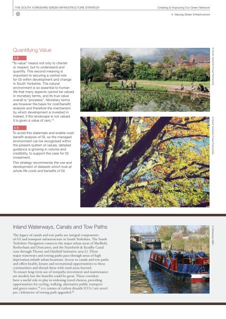
Inland Waterways, Canals and Tow Paths<br />
The legacy of canals and tow paths are integral components<br />
of GI and transport infrastructure in <strong>South</strong> <strong>Yorkshire</strong>. The <strong>South</strong><br />
<strong>Yorkshire</strong> Navigation connects the major urban areas of Sheffield,<br />
Rotherham and Doncaster, and the Stainforth & Keadby Canal<br />
runs through Thorne and Hatfield (initiative area L). These<br />
major waterways and towing paths pass through areas of high<br />
deprivation inbuilt urban locations. Access to canals and tow paths<br />
and offers health, leisure and recreational opportunities to these<br />
communities and thread these with rural areas beyond.<br />
To ensure long-term use of towpaths investment and maintenance<br />
are needed, but the benefits could be great. These corridors<br />
have a useful role to play in widening travel choices, providing<br />
opportunities for cycling, walking, alternative public transport<br />
and green routes. 19 100 tonnes of carbon dioxide (CO2 ) are saved<br />
per 1 kilometre of towing path upgraded. 20<br />
© Rotherham MBC