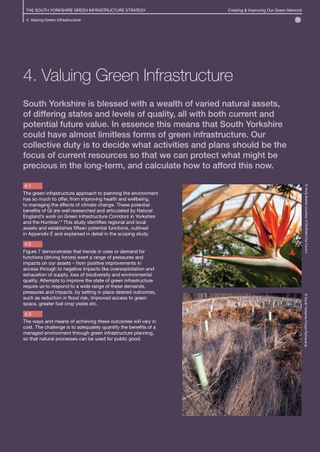
4. Valuing Green Infrastructure - South Yorkshire Forest Partnership
4. Valuing Green Infrastructure - South Yorkshire Forest Partnership
4. Valuing Green Infrastructure - South Yorkshire Forest Partnership

Create successful ePaper yourself
Turn your PDF publications into a flip-book with our unique Google optimized e-Paper software.
THE SOUTH YORKSHIRE GREEN INFRASTRUCTURE STRATEGY<br />
<strong>4.</strong> <strong>Valuing</strong> <strong>Green</strong> <strong>Infrastructure</strong><br />
Creating & Improving Our <strong>Green</strong> Network<br />
17<br />
<strong>4.</strong> <strong>Valuing</strong> <strong>Green</strong> <strong>Infrastructure</strong><br />
<strong>South</strong> <strong>Yorkshire</strong> is blessed with a wealth of varied natural assets,<br />
of differing states and levels of quality, all with both current and<br />
potential future value. In essence this means that <strong>South</strong> <strong>Yorkshire</strong><br />
could have almost limitless forms of green infrastructure. Our<br />
collective duty is to decide what activities and plans should be the<br />
focus of current resources so that we can protect what might be<br />
precious in the long-term, and calculate how to afford this now.<br />
<strong>4.</strong>1<br />
The green infrastructure approach to planning the environment<br />
has so much to offer, from improving health and wellbeing,<br />
to managing the effects of climate change. These potential<br />
benefits of GI are well researched and articulated by Natural<br />
England’s work on <strong>Green</strong> <strong>Infrastructure</strong> Corridors in <strong>Yorkshire</strong><br />
and the Humber. 14 This study identifies regional and local<br />
assets and establishes fifteen potential functions, outlined<br />
in Appendix E and explained in detail in the scoping study.<br />
<strong>4.</strong>2<br />
Figure 7 demonstrates that trends in uses or demand for<br />
functions (driving forces) exert a range of pressures and<br />
impacts on our assets – from positive improvements in<br />
access through to negative impacts like overexploitation and<br />
exhaustion of supply, loss of biodiversity and environmental<br />
quality. Attempts to improve the state of green infrastructure<br />
require us to respond to a wide range of these demands,<br />
pressures and impacts, by setting in place desired outcomes,<br />
such as reduction in flood risk, improved access to green<br />
space, greater fuel crop yields etc.<br />
<strong>4.</strong>3<br />
The ways and means of achieving these outcomes will vary in<br />
cost. The challenge is to adequately quantify the benefits of a<br />
managed environment through green infrastructure planning,<br />
so that natural processes can be used for public good.<br />
© Andy Barker courtesy of Sheffield City Counci<br />
© <strong>South</strong> <strong>Yorkshire</strong> <strong>Forest</strong> <strong>Partnership</strong>
THE SOUTH YORKSHIRE GREEN INFRASTRUCTURE STRATEGY<br />
18<br />
Creating & Improving Our <strong>Green</strong> Network<br />
<strong>4.</strong> <strong>Valuing</strong> <strong>Green</strong> <strong>Infrastructure</strong><br />
Figure 7: European Environment<br />
Agency (EEA) DPSIR framework 15<br />
Driving Forces<br />
Poor quality, blight and<br />
degradation coupled with<br />
other factors such as rising<br />
expectations for quality of<br />
life and good health.<br />
Responses<br />
Addressing pressure<br />
on communities,<br />
environment and by<br />
responding to climate<br />
change to ensure<br />
economic growth<br />
can happen.<br />
Pressures<br />
Stress caused by<br />
climate, development<br />
pressures and a host<br />
of other factors.<br />
Impact<br />
Adverse or<br />
positive effects.<br />
State<br />
The level of support<br />
and quality of services<br />
currently offered by<br />
the green network.<br />
<strong>4.</strong>4<br />
Figure 7 is based on Driving forces / Pressures / States /<br />
Impacts / Responses (DPSIR) causal framework for describing<br />
the interactions between society and the environment,<br />
developed by European Environment Agency; an extension<br />
of the Pressure / State / Response model developed by<br />
Organisation for Economic Co-operation and Development.
THE SOUTH YORKSHIRE GREEN INFRASTRUCTURE STRATEGY<br />
<strong>4.</strong> <strong>Valuing</strong> <strong>Green</strong> <strong>Infrastructure</strong><br />
Creating & Improving Our <strong>Green</strong> Network<br />
19<br />
Managing the Network<br />
<strong>4.</strong>5<br />
<strong>Green</strong> infrastructure management demands a thorough<br />
understanding of the linkages and interdependencies<br />
between different natural systems, in order to inform good<br />
decision-making as to the most efficient and effective longterm<br />
approach to using and conserving valuable resources<br />
(see Figure 2). Perhaps most important are the ideas of<br />
promoting multiple uses and functions of the same assets<br />
(e.g. areas of land) – and understanding how values drive<br />
decisions.<br />
<strong>4.</strong>7<br />
The result is a network of ecosystems of contrasting content,<br />
quality and value to people, which vary over the landscape<br />
of <strong>South</strong> <strong>Yorkshire</strong>. The green infrastructure elements might<br />
include parks, agricultural land, forests and woodlands, rivers,<br />
inland waterways, lakes and wetlands, local nature reserves,<br />
private gardens and allotments, geological features, access<br />
routes, and heath and moorlands.<br />
<strong>4.</strong>6<br />
Figure 7 helps identify the preconditions and pressures that affect<br />
the state of green infrastructure in the sub-region. Amongst other<br />
factors these include the geology of the area, its climate, previous<br />
land uses and other anthropological impacts, as well as existing<br />
infrastructure and social conditions (explored in Appendix F).<br />
Case Study 3<br />
Sub-Regional Scale GI Benefits from Investment<br />
Since 2003, the Moors for the Future <strong>Partnership</strong> has piloted<br />
work to reverse 150 years of atmospheric pollution and fires<br />
that left large areas of the uplands of the Peak District and<br />
<strong>South</strong> Pennines bare of vegetation. The partnership aims to<br />
retain the huge existing carbon reserves already held in the<br />
peat moorlands – peat is the single biggest store of carbon<br />
in the UK, storing the equivalent of 20 years of all UK CO 2<br />
emissions; 20 million tonnes of carbon are stored in the Peak<br />
District alone. 16 Damaged and eroding peat releases carbon<br />
and other greenhouse gases such as methane into<br />
the environment.<br />
Re-vegetating moorland also improves water quality and<br />
colour and reduces diffuse pollution and sediment, helping<br />
the sub-region comply with the Water Framework Directive.<br />
Improved water quality is also good for biodiversity and less<br />
energy is needed to treat water for domestic use.<br />
The Pennine uplands are also an important wildlife habitat<br />
and the <strong>Partnership</strong> has recently received a £5m grant from<br />
the EU Life+ Programme to undertake the largest conservation<br />
project in the UK to improve biodiversity within the <strong>South</strong><br />
Pennine SAC – an EU Priority Habitat.<br />
The work has been focused on restoring degraded<br />
moorland by stabilising and re-vegetating bare peat to help<br />
absorb moisture (and carbon), while more recently working to<br />
re-introduce bog-building sphagnum mosses. These practical<br />
techniques restore the natural functioning of the uplands. This<br />
work has sub-regional and regional benefits. The <strong>Partnership</strong><br />
is undertaking monitoring and modelling work to investigate the<br />
hydrology of the uplands and the impact that restoration work<br />
may have in mitigating flash flooding events further downstream<br />
where mid-catchment settlements are likely to be vulnerable to<br />
flooding while constrained by existing development.<br />
There is a need for a more holistic and spatial approach<br />
to understanding moorland processes and management,<br />
and a need to develop approaches that combine understanding<br />
of interlinked social and natural processes. 17 The work of<br />
the Moors for the Future partnership will further develop<br />
understanding of the multi-functional benefits of moorlands.<br />
© Moors for the Future <strong>Partnership</strong>
THE SOUTH YORKSHIRE GREEN INFRASTRUCTURE STRATEGY<br />
20<br />
Creating & Improving Our <strong>Green</strong> Network<br />
<strong>4.</strong> <strong>Valuing</strong> <strong>Green</strong> <strong>Infrastructure</strong><br />
Quantifying Value<br />
<strong>4.</strong>8<br />
“To value” means not only to cherish<br />
or respect, but to understand and<br />
quantify. This second meaning is<br />
important to securing a central role<br />
for GI within development and change<br />
in <strong>South</strong> <strong>Yorkshire</strong>. The natural<br />
environment is so essential to human<br />
life that many aspects cannot be valued<br />
in monetary terms, and its true value<br />
overall is “priceless”. Monetary terms<br />
are however the basis for cost/benefit<br />
analysis and therefore the mechanism<br />
by which development is invested in.<br />
Indeed, if the landscape is not valued<br />
it is given a value of zero. 18<br />
<strong>4.</strong>9<br />
To avoid this stalemate and enable cost/<br />
benefit analysis of GI, so the managed<br />
environment can be recognised within<br />
the present system of values, detailed<br />
guidance is growing in volume and<br />
credibility, to support the case for GI<br />
investment.<br />
This strategy recommends the use and<br />
development of datasets which look at<br />
whole life costs and benefits of GI.<br />
© <strong>South</strong> <strong>Yorkshire</strong> <strong>Forest</strong> <strong>Partnership</strong><br />
© <strong>South</strong> <strong>Yorkshire</strong> <strong>Forest</strong> <strong>Partnership</strong><br />
Managing Flood Risk Across<br />
Local Authority Boundaries<br />
Inland Waterways, Canals and Tow Paths<br />
The legacy of canals and tow paths are integral components<br />
of GI and transport infrastructure in <strong>South</strong> <strong>Yorkshire</strong>. The <strong>South</strong><br />
<strong>Yorkshire</strong> Navigation connects the major urban areas of Sheffield,<br />
Rotherham and Doncaster, and the Stainforth & Keadby Canal<br />
runs through Thorne and Hatfield (initiative area L). These<br />
major waterways and towing paths pass through areas of high<br />
deprivation inbuilt urban locations. Access to canals and tow paths<br />
and offers health, leisure and recreational opportunities to these<br />
communities and thread these with rural areas beyond.<br />
To ensure long-term use of towpaths investment and maintenance<br />
are needed, but the benefits could be great. These corridors<br />
have a useful role to play in widening travel choices, providing<br />
opportunities for cycling, walking, alternative public transport<br />
and green routes. 19 100 tonnes of carbon dioxide (CO2 ) are saved<br />
per 1 kilometre of towing path upgraded. 20<br />
© Rotherham MBC
THE SOUTH YORKSHIRE GREEN INFRASTRUCTURE STRATEGY<br />
<strong>4.</strong> <strong>Valuing</strong> <strong>Green</strong> <strong>Infrastructure</strong><br />
Creating & Improving Our <strong>Green</strong> Network<br />
21<br />
Evidence for the Benefits of <strong>Green</strong> <strong>Infrastructure</strong><br />
from Policy Driven Assessments<br />
<strong>4.</strong>10<br />
Policies and strategies relevant to the development of <strong>South</strong> <strong>Yorkshire</strong>’s<br />
green infrastructure will provide evidence to support the adoption of green<br />
infrastructure as an integral element of development through the planning<br />
system, at the local and cross-boundary scale:<br />
• All types of green space strategies, open space and recreation land<br />
assessment (PPG17) 21 that shows where access to green space is<br />
limited or quality is diminished<br />
• Strategic Flood Risk Assessments which show where land is<br />
vulnerable to flooding, and evidence from site by site flood risk<br />
assessment (PPS25) 22<br />
• The regional adaptation study which cites risks of climate change<br />
to wildlife and communities (Adapt YH) 23<br />
• Future evidence to create policy for mitigation: technological<br />
innovation, secure low carbon energy and green modes of transport<br />
(<strong>Infrastructure</strong> Strategy for the UK) 24<br />
• Core Strategy site allocation using evidence of the physical,<br />
social and GI needed to enable development (PPS12) 25<br />
• Spatial planning to put brownfield sites forward before greenfield,<br />
for housing (PPS1) or identify where development would bring most<br />
benefit and cause least harm, where the option to use brownfield is<br />
no longer viable 26<br />
• Local Development Framework mapping of designated sites,<br />
for biodiversity and geological conservation value to communities<br />
(PPS9) 27<br />
Examples of<br />
Current Cost<br />
Benefit Guidance<br />
for GI<br />
• Natural Economy Northwest<br />
accounting system for GI<br />
investments 28<br />
• CSI research into the value of<br />
attractive setting for business<br />
29 30<br />
investment<br />
• CABE guidance on urban<br />
park assets 31<br />
• LiFE cost benefit analysis of<br />
GI flood risk management 32<br />
• <strong>Forest</strong>ry Commission benefits<br />
of GI report to DEFRA and<br />
DCLG 33<br />
• <strong>Green</strong> Values surface water<br />
management calculator (US) 34<br />
• UN Environmental<br />
Programme work on the<br />
TEEB project (EU) 35<br />
Case Study 4<br />
A Shared Toolkit To Value GI<br />
In 2008 a consortium of Natural Economy Northwest, the Northern Way,<br />
Natural England, CABE, Design for London and Tees Valley Unlimited<br />
commissioned a “valuation framework” for assessing potential economic<br />
returns from investment in green infrastructure. 36 The <strong>Green</strong> <strong>Infrastructure</strong><br />
Valuation Toolkit is now made available online, as a prototype and free<br />
“open source” resource (www.bit.ly/givaluationtoolkit). Open Source<br />
is a term derived from software engineering, where the designer of an<br />
application would make the source code freely available to others to<br />
modify, use and develop, into the future. Its use here indicates that the<br />
designers welcome comment, criticism and new information with which to<br />
develop this tool. The consortium has established a <strong>Green</strong> <strong>Infrastructure</strong><br />
Valuation Network (GIVaN) to encourage and coordinate development.<br />
The tool is essentially a set of formulae within a spreadsheet that can<br />
assess the benefits of green assets and express this in monetary<br />
terms. Visitors to the webpage are invited to download the toolkit and<br />
experiment, and pass the link on to their network of colleagues and<br />
partners working in GI.<br />
© <strong>South</strong> <strong>Yorkshire</strong> <strong>Forest</strong> <strong>Partnership</strong>
22<br />
Case Study 5<br />
Improving Landscape<br />
Quality STRENGTHS<br />
<strong>Green</strong> infrastructure can strengthen<br />
local economies and improve the quality<br />
of life for deprived communities and<br />
neglected environments. Moston Vale<br />
was transformed during the Industrial<br />
Revolution, and uncontrolled tipping<br />
led to the flooding of Moston Brook,<br />
a tributary of the River Irk. 37 By the<br />
1960s, Moston Vale had become a<br />
landfill site, and later a neglected area of<br />
green space surrounded by a community<br />
with socio-economic problems, and<br />
offered little to benefit the surrounding<br />
area.<br />
An economic strategy for the North<br />
West region had designated the area<br />
a Strategic Regional Site, so any change<br />
would have to have wide reaching<br />
benefits. 38 The Moston Vale project<br />
set out to transform of 21 hectares<br />
of brownfield land into community<br />
woodland with managed access to<br />
the whole site, a significant contribution<br />
to regional and local Biodiversity<br />
Action Plan targets, the involvement<br />
of business, and engagement with<br />
communities. Red Rose <strong>Forest</strong>, with<br />
the Irk Valley <strong>Green</strong> Tips project, began<br />
by making small scale improvement<br />
works, working with the Moston Vale<br />
Residents Association and the wider<br />
community, which triggered further work<br />
and greater goals.<br />
The impacts of the development<br />
are demonstrated through positive<br />
economic growth. For example, there<br />
is strong evidence that the Manchester<br />
and Salford Housing Market Renewal<br />
Pathfinder and Newlands regeneration<br />
of the site resulted in a more rapid rise<br />
in house prices in the area than in other<br />
parts of Manchester (to June 2008). 39<br />
© Newlands & The <strong>Forest</strong>ry Commission<br />
Table 2: Analysis of Strengths, Weaknesses, Opportunities and Threats<br />
- capacity to deliver green infrastructure<br />
• It is clear from consultation and engagement that the capacity and will<br />
to work in partnership is already alive and kicking in the sub-region.<br />
• Several organisations have a track record in securing funding and<br />
grants from a variety of sources, including the EU and the private sector.<br />
WEAKNESSES<br />
• There is no dedicated funding stream for GI.<br />
• Redundancies within partner organisations leading to loss of expertise<br />
and resources.<br />
• Continued lack of faith in the role of GI to supply certain<br />
“environmental services” such as flood control, climate change<br />
measures and amenity.<br />
• Lack of understanding of the value and role of GI by decision makers.<br />
OPPORTUNITIES<br />
• The close connection to communities means that the third sector<br />
(NGOs, charities and membership organisations) can be expected<br />
to grow, if given the right support.<br />
• Third sector groups have greater potential to generate in-kind<br />
resources to invest in and maintain local GI projects. With sustained<br />
support, this can be better exploited to support their own actions.<br />
This must, however, be balanced against the ongoing struggle to<br />
obtain core costs and associated financial risks.<br />
• Novel approaches to fund the maintenance of landscapes. This can<br />
include establishing new community trusts or social enterprises to<br />
manage commuted sums generated through planning approvals.<br />
• Emerging policy on the Community <strong>Infrastructure</strong> Levy, with its option<br />
of funding for maintenance as well as capital expenditure (should<br />
SY planning authorities use it). A proportion of the funds will be ring<br />
fenced for local projects.<br />
• Housing development providing multi-functioning, high quality green<br />
infrastructure.<br />
THREATS<br />
• Failure to continue investing in <strong>South</strong> <strong>Yorkshire</strong>’s infrastructure will<br />
significantly reduce the impact of earlier funding, such as Growth Point.<br />
• Lack of consistency in how private sector funding is approached<br />
between the local authorities. Competition with one another and<br />
lowering standards across the sub-region.<br />
• Impact of local authority budget cuts on both directly financing activity,<br />
and on providing “match funding” to external funding.<br />
• Danger of potential partners competing instead of working together<br />
towards shared objectives.<br />
• Sale of publicly-owned parks, reserves and woodland. (e.g. sale<br />
of freehold land and property assets by <strong>Yorkshire</strong> Forward (RDA),<br />
purchased for their strategic role in regeneration.)<br />
• Increasingly poor air quality (although all four local authorities have<br />
declared a DEFRA Air Quality Management Area).<br />
• Potential threats to nature conservation sites, especially protected<br />
species and habitats within Natura 2000 sites.<br />
• Pollution in our water (e.g. Sherwood Sandstone aquifer).
THE SOUTH YORKSHIRE GREEN INFRASTRUCTURE STRATEGY<br />
Creating & Improving Our <strong>Green</strong> Network<br />
<strong>4.</strong> <strong>Valuing</strong> <strong>Green</strong> <strong>Infrastructure</strong> 23<br />
<strong>4.</strong>11<br />
The sub-region’s ability to plan and respond effectively<br />
to environmental stress is subject to its capacity to deliver<br />
improvements to green infrastructure.<br />
<strong>4.</strong>12<br />
The strategic planning process can be a trigger for actions<br />
at both the sub-regional and the local scales (see Table 3<br />
below). Above the local scale the network becomes particularly<br />
important. The variety of user groups, the pressures on land<br />
use to maintain functioning habitats for wildlife and provide<br />
space for communities to grow, and the need for connected<br />
cycle routes are all examples of pressures on green spaces.<br />
Starting work at sub-regional scale level will help to plan local<br />
and wider level cross-boundary projects.<br />
• Certain land use functions require sub-regional working,<br />
for others this is less essential.<br />
• Detailed GI planning is best undertaken at local authority<br />
level in partnership with communities.<br />
• All partners should have a consistent approach across<br />
boundaries, sharing risks as well as returns.<br />
Table 3: Appropriate scales for different green infrastructure planning concerns<br />
Neighbourhood Scale<br />
A network of local green spaces addresses<br />
many user needs, responding to localised<br />
effects of climate change, demographic<br />
change and social inclusion; helps to make<br />
first steps towards health, the biodiversity<br />
network and green transport.<br />
Borough Scale<br />
Borough scale GI contributes to an area’s<br />
distinctiveness and biodiversity, allowing a<br />
wide range of user groups to share the same<br />
space. Borough wide targets for health,<br />
society and growth are opportunities to<br />
implement GI. Pressure for land use needs<br />
a strategic focus.<br />
Sub-Regional Scale<br />
(<strong>South</strong> <strong>Yorkshire</strong>)<br />
Major transport and recreation trails, river<br />
catchment and major green spaces, as well<br />
as neighbourhood and district assets which<br />
cross boundaries and unite communities.<br />
This scale of GI provision can deliver<br />
multiple ecosystem services and public<br />
benefits, such as biodiversity, landscape<br />
enhancement, recreation, health and climate<br />
change adaptation.<br />
Localised drainage<br />
Village greens<br />
Street trees<br />
Local routes<br />
Home zones<br />
Public gardens<br />
Pocket parks<br />
Building curtilage<br />
<strong>Green</strong> roofs & roof gardens<br />
Copses and woods<br />
Local nature reserves<br />
Cemeteries<br />
Private gardens<br />
Play parks<br />
Local sports facilities<br />
Allotments<br />
<strong>Green</strong> roof<br />
Housing development<br />
City parks<br />
Urban waterways<br />
Woodland<br />
Street trees<br />
Cycle networks<br />
Gateways<br />
Large scale composting<br />
Historic gardens<br />
Key local wildlife sites<br />
Boulevards<br />
Wetlands and lakes<br />
Borough wide drainage<br />
Enclosed landscape<br />
Recycling schemes<br />
Extensive sports facilities<br />
Waste water treatment<br />
Regeneration of urban centres<br />
Strategic housing provision<br />
Waterway network management<br />
Waterway network<br />
Inter-urban trails<br />
Floodplain capacity<br />
Woodlands >100 ha<br />
<strong>Green</strong> lungs<br />
Community forest<br />
Derelict infrastructure<br />
Restored infrastructure<br />
Country parks/estates<br />
Archaeological sites<br />
Open landscape<br />
Canal networks<br />
National nature reserves<br />
Regional development<br />
Public health policies<br />
Transport corridors<br />
Cross-boundary housing needs<br />
New towns<br />
Agricultural land<br />
© Steel Valley Project © Sheffield City Council Allotment Office<br />
© Rotherham MBC
THE SOUTH YORKSHIRE GREEN INFRASTRUCTURE STRATEGY<br />
24<br />
Creating & Improving Our <strong>Green</strong> Network<br />
<strong>4.</strong> <strong>Valuing</strong> <strong>Green</strong> <strong>Infrastructure</strong><br />
Managing Flood Risk Across<br />
Local Authority Boundaries<br />
Managing Flood Risk Across Boundaries<br />
There is significant known flood risk in many areas of <strong>South</strong><br />
<strong>Yorkshire</strong>, increased run-off from additional development within<br />
the Growth Areas and threat from climate change.<br />
The river valleys of the Don and Dearne and their tributaries<br />
are the backbone of the GI network, linking the four<br />
boroughs with each other. As part of the GI network, strategic<br />
opportunities for managing riverine flood risk should be<br />
developed to help the sub-region adapt to the challenges<br />
of climate change.<br />
Using GI to manage flood risk throughout river catchments<br />
requires space and investment. 40 The role of the Internal Drainage<br />
Boards is also vitally important in the management of the<br />
multitude of drainage channels and ditches in the Doncaster area.<br />
The benefits of techniques which slow and manage flows<br />
need to be properly examined to ensure the best solution for<br />
all, over the lifetime of the investment. Additional benefits<br />
for communities (placemaking, biodiversity and resilience for<br />
example, Old Moor RSPB Wetland Centre in the Dearne Valley)<br />
should be integral. <strong>Partnership</strong>s where all parties buy-in to a<br />
shared vision of managing flood risk are essential to the process.<br />
Case Study 6<br />
Multi-Objective, Single Vision at Varying Scales of Application<br />
The Dearne Valley is a postindustrial,<br />
largely rural river<br />
corridor, which has suffered<br />
from various socio-economic<br />
problems and low relative land<br />
value. The Dearne Valley <strong>Green</strong><br />
Heart Project is an example<br />
of how a vision, if properly<br />
conceived, can be shared across<br />
local authority boundaries,<br />
through different means and<br />
partnerships, to result in a net<br />
gain for local communities.<br />
The Dearne Valley <strong>Green</strong> Heart<br />
organisation is a partnership<br />
of the RSPB, the Environment<br />
Agency, Natural England and<br />
the Local Authorities. It works to<br />
improve the green spaces of the<br />
Dearne Valley for local people<br />
and wildlife through raising<br />
awareness about flooding and<br />
climate change and improving<br />
access around the valley. 39<br />
© Ed Shaw © Dearne Valley <strong>Green</strong> Heart Project
THE SOUTH YORKSHIRE GREEN INFRASTRUCTURE STRATEGY<br />
<strong>4.</strong> <strong>Valuing</strong> <strong>Green</strong> <strong>Infrastructure</strong><br />
Creating & Improving Our <strong>Green</strong> Network<br />
25<br />
Key Messages<br />
• Cross-boundary, sub-regional planning is needed to deliver improvements to green<br />
infrastructure. A significant challenge to sub-regional working at present is that the entirety<br />
of <strong>South</strong> <strong>Yorkshire</strong>’s GI is not the sole responsibility of any single organisation. This is an<br />
opportunity to bring together a wide range of people from different backgrounds, who work<br />
and live here, to build in them the capacity to challenge, criticise and create targeted and<br />
local growth.<br />
• Delivery of the <strong>South</strong> <strong>Yorkshire</strong> green infrastructure strategy shall complement work in<br />
other areas. This strategy shall work alongside documents working at a comparable scale,<br />
such as the Leeds City Region GI Strategy, as well as seeking to build links with plans<br />
covering the East Midlands components of the Sheffield City Region. It must also support<br />
and complement a broad range of local documents such as local authority green and open<br />
space strategies.<br />
• <strong>Green</strong> infrastructure planning at the sub-region scale provides a useful framework and<br />
context for action at neighbourhood and borough scales. It does not obviate the need<br />
for local planning and action, but must seek to support and complement this work.<br />
Issues such as flood risk, risk to biodiversity, markets for agriculture and need for recreation<br />
etc. act across boundaries and require coordinated action.<br />
© <strong>South</strong> <strong>Yorkshire</strong> <strong>Forest</strong> <strong>Partnership</strong>
© <strong>South</strong> <strong>Yorkshire</strong> <strong>Forest</strong> <strong>Partnership</strong>