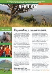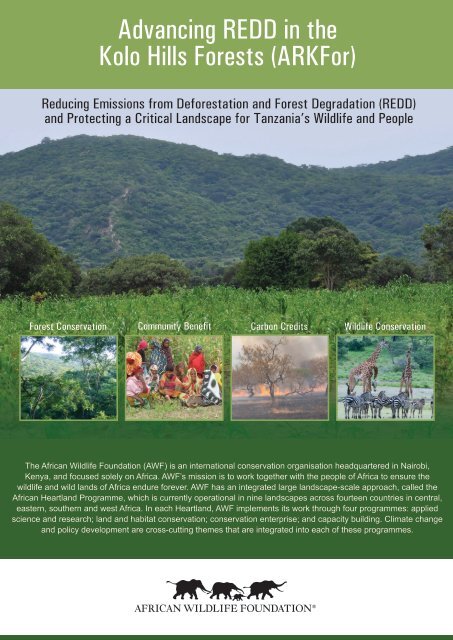
Advancing REDD in the Kolo Hills Forests (ARKFor) - African Wildlife
Advancing REDD in the Kolo Hills Forests (ARKFor) - African Wildlife
Advancing REDD in the Kolo Hills Forests (ARKFor) - African Wildlife

You also want an ePaper? Increase the reach of your titles
YUMPU automatically turns print PDFs into web optimized ePapers that Google loves.
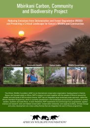
<strong>Advanc<strong>in</strong>g</strong> <strong>REDD</strong> <strong>in</strong> <strong>the</strong><br />
<strong>Kolo</strong> <strong>Hills</strong> <strong>Forests</strong> (<strong>ARKFor</strong>)<br />
Reduc<strong>in</strong>g Emissions from Deforestation and Forest Degradation (<strong>REDD</strong>)<br />
and Protect<strong>in</strong>g a Critical Landscape for Tanzania’s <strong>Wildlife</strong> and People<br />
Forest Conservation Community Benefit Carbon Credits <strong>Wildlife</strong> Conservation<br />
The <strong>African</strong> <strong>Wildlife</strong> Foundation (AWF) is an <strong>in</strong>ternational conservation organisation headquartered <strong>in</strong> Nairobi,<br />
Kenya, and focused solely on Africa. AWF’s mission is to work toge<strong>the</strong>r with <strong>the</strong> people of Africa to ensure <strong>the</strong><br />
wildlife and wild lands of Africa endure forever. AWF has an <strong>in</strong>tegrated large landscape-scale approach, called <strong>the</strong><br />
<strong>African</strong> Heartland Programme, which is currently operational <strong>in</strong> n<strong>in</strong>e landscapes across fourteen countries <strong>in</strong> central,<br />
eastern, sou<strong>the</strong>rn and west Africa. In each Heartland, AWF implements its work through four programmes: applied<br />
science and research; land and habitat conservation; conservation enterprise; and capacity build<strong>in</strong>g. Climate change<br />
and policy development are cross-cutt<strong>in</strong>g <strong>the</strong>mes that are <strong>in</strong>tegrated <strong>in</strong>to each of <strong>the</strong>se programmes.
<strong>Advanc<strong>in</strong>g</strong> <strong>REDD</strong> <strong>in</strong> <strong>the</strong> Ko<br />
AWF and Climate Change<br />
AWF recognises <strong>the</strong> threat of climate change to Africa and is work<strong>in</strong>g to implement an <strong>in</strong>tegrated climate<br />
change programme to:<br />
1. Improve understand<strong>in</strong>g of climate change through education, capacity build<strong>in</strong>g and tra<strong>in</strong><strong>in</strong>g.<br />
2. Reduce carbon emissions, forest degradation and deforestation, and generate community and<br />
conservation <strong>in</strong>come through carbon offset programmes.<br />
3. Mitigate <strong>the</strong> impacts of climate change through large-scale conservation.<br />
4. Improve monitor<strong>in</strong>g, scientific assessment and model<strong>in</strong>g of climate change.<br />
5. Help communities adapt to <strong>the</strong> impacts of climate change.<br />
Nile R.<br />
Niger R.<br />
Regional Parc W<br />
Congo<br />
Congo R.<br />
Virunga<br />
Samburu<br />
Kilimanjaro<br />
Maasai Steppe<br />
Zambezi<br />
Zambezi R.<br />
Kazungula<br />
Limpopo<br />
Orange R.<br />
Maasai Steppe Heartland<br />
The Maasai Steppe Heartland (MSHL), located <strong>in</strong><br />
nor<strong>the</strong>rn Tanzania, is approximately 35,000 km 2 .<br />
The area is predom<strong>in</strong>antly covered by lowland<br />
wooded savannah and grassland and is renowned<br />
for support<strong>in</strong>g <strong>the</strong> world’s second largest density<br />
of faunal biomass after Ngorongoro. Large<br />
population of elephant (approximately 3,500),<br />
large migratory herds of wildebeest and zebra as<br />
well as locally threatened species such as oryx,<br />
hartebeest, greater and lesser kudu, gerenuk<br />
and eland are found <strong>in</strong> <strong>the</strong> Heartland. The MSHL<br />
is also home to predators such as lion, leopard,<br />
and <strong>the</strong> endangered <strong>African</strong> hunt<strong>in</strong>g dog. Bird<br />
biodiversity is exceptionally high. The area is<br />
also known as one of <strong>the</strong> world’s last surviv<strong>in</strong>g<br />
large <strong>in</strong>tact wild landscapes comprised of<br />
national parks, controlled hunt<strong>in</strong>g areas, wildlife<br />
management areas, forest reserves, wetlands<br />
and community lands. The Lake Manyara and<br />
Tarangire National Parks are ecological anchors<br />
<strong>in</strong> <strong>the</strong> Heartland. The MSHL toge<strong>the</strong>r with <strong>the</strong><br />
Ngorongoro Conservation Area and Serengeti<br />
National Park form <strong>the</strong> nor<strong>the</strong>rn tourism circuit,<br />
which offers <strong>the</strong> greatest proportion of Tanzania’s<br />
tourism contribution (approximately 18%) to <strong>the</strong><br />
national gross domestic product. The MSHL is<br />
home to over 350,000 people, mostly pastoralists.
lo <strong>Hills</strong> <strong>Forests</strong> (<strong>ARKFor</strong>)<br />
<strong>Kolo</strong> <strong>Hills</strong> Carbon Project, TANZANIA<br />
AWF is implement<strong>in</strong>g a three-year pilot project on Reduc<strong>in</strong>g<br />
Emissions from Deforestation and Forest Degradation (<strong>REDD</strong>).<br />
The project, referred to as <strong>Advanc<strong>in</strong>g</strong> <strong>REDD</strong> <strong>in</strong> <strong>the</strong> <strong>Kolo</strong> <strong>Hills</strong><br />
<strong>Forests</strong> (<strong>ARKFor</strong>), is located <strong>in</strong> Kondoa District, north-central<br />
Tanzania. The project area covers approximately 56,291<br />
hectares and <strong>in</strong>cludes 21 villages encompass<strong>in</strong>g government and<br />
community land. Three government forest reserves are <strong>in</strong>cluded <strong>in</strong><br />
<strong>the</strong> project area: <strong>the</strong> Salanka (8,337 ha); <strong>the</strong> Isabe (4,249 ha); and<br />
<strong>the</strong> Kome (4,047 ha). These reserves fall under <strong>the</strong> jurisdiction of<br />
<strong>the</strong> Kondoa District Council, a key project partner.<br />
The hills and escarpment <strong>in</strong> <strong>the</strong> project area are dom<strong>in</strong>ated<br />
by miombo (Brachystegia spp.) woodlands. The topography is<br />
characterized by two dist<strong>in</strong>ct physical features: vast pla<strong>in</strong>s and <strong>the</strong><br />
Kondoa Irangi <strong>Hills</strong>, known as <strong>Kolo</strong> <strong>Hills</strong>. The <strong>Kolo</strong> <strong>Hills</strong> have an<br />
average altitude of 1,800m, with an average annual ra<strong>in</strong>fall rang<strong>in</strong>g<br />
between 800-900mm. The prevail<strong>in</strong>g soils are moderately fertile<br />
red sandy loams and clays that are suitable for <strong>the</strong> growth of shortcycle<br />
maize varieties, sorghum, beans and f<strong>in</strong>ger millet. The pla<strong>in</strong>s<br />
have average elevation of 1,200m and <strong>the</strong> climate is semi-arid with<br />
an unreliable grow<strong>in</strong>g season of less than two and a half months.<br />
The soils are sandy with low water storage capacities and are<br />
suitable for <strong>the</strong> growth of such hardy crops as bulrush millet and a<br />
variety of sorghum. Graz<strong>in</strong>g is <strong>the</strong> most common land use <strong>in</strong><br />
this zone.<br />
The ma<strong>in</strong> economic activities <strong>in</strong> <strong>the</strong> area are crop cultivation<br />
(nearly 70%) and agro-pastoralism (nearly 27%). The population<br />
of people <strong>in</strong> <strong>the</strong> project area is approximately 62,000 while<br />
households are about 14,000.<br />
The <strong>Kolo</strong> <strong>Hills</strong> Forest is <strong>the</strong> Headwaters for <strong>the</strong> Tarangire River,<br />
which is <strong>the</strong> ma<strong>in</strong> source of dry season water for wildlife <strong>in</strong>side<br />
Tarangire National Park. Should <strong>the</strong> river flows decrease, impacts<br />
on aquatic and riparian habitat and wildlife would be significant.<br />
Tarangire National Park is part of <strong>the</strong> larger conservation complex<br />
that forms <strong>the</strong> MSHL and <strong>the</strong> nor<strong>the</strong>rn Tanzanian tourism circuit.<br />
Threat to <strong>the</strong> Forest<br />
The communities are dependent on <strong>the</strong> forest for n variety of uses.<br />
The drivers of deforestation and forest degradation are (charcoal<br />
36%; timber 32%; build<strong>in</strong>g poles 26%; and firewood 6%). Shift<strong>in</strong>g<br />
cultivation and agricultural expansion drives most of <strong>the</strong> harvest<strong>in</strong>g.<br />
The annual rate of deforestation is 0.46% and forest degradation<br />
rate is 5.2%. This severely threatens <strong>the</strong> exist<strong>in</strong>g 1.76 million<br />
tons of Carbon (CO 2<br />
) <strong>in</strong> target forests of 22,030 ha; and 0.81 million<br />
tons of carbon (CO 2<br />
) <strong>in</strong> <strong>the</strong> 34,200 ha of <strong>the</strong> surround<strong>in</strong>g areas<br />
or leakage belt.<br />
The <strong>Kolo</strong> <strong>Hills</strong> <strong>REDD</strong> project has been set up to:<br />
• Halt deforestation and degradation on approximately 22,000 hectares<br />
of core forest through development of alternative livelihoods for<br />
forest-dependent communities.<br />
• Market and sell carbon credits to support <strong>the</strong> conservation of this<br />
critical forest and support community livelihoods.<br />
• Reduce CO 2<br />
emissions from deforestation and forest degradation<br />
through improv<strong>in</strong>g land and forest management by enforc<strong>in</strong>g land use<br />
management and participatory forest management plans.<br />
• Develop <strong>the</strong> capacity of local communities and government <strong>in</strong><br />
understand<strong>in</strong>g and address<strong>in</strong>g <strong>REDD</strong> issues, <strong>in</strong>clud<strong>in</strong>g forest<br />
carbon management and trad<strong>in</strong>g.<br />
• Share learn<strong>in</strong>g and promote network<strong>in</strong>g for better climate change<br />
for forest management and conservation policies and practice.<br />
Accomplishments:<br />
Carbon quantification completed, 2.6 million tCO 2<br />
<strong>in</strong> <strong>the</strong><br />
project area.<br />
Drivers of deforestation assessment done.<br />
PIN completed.<br />
PDD and socio-economic study are near completion<br />
Capacity build<strong>in</strong>g for <strong>REDD</strong>, <strong>in</strong>clud<strong>in</strong>g tra<strong>in</strong><strong>in</strong>g of<br />
tra<strong>in</strong>ers, completed.<br />
Farmers tra<strong>in</strong>ed on conservation farm<strong>in</strong>g. This work has<br />
demonstrated an eight-fold yield <strong>in</strong>crease.<br />
Ten villages developed and approved village land use plans, five<br />
of which were submitted and registered at <strong>the</strong> m<strong>in</strong>istry level. The<br />
approval of <strong>the</strong>se plans is <strong>the</strong> first step towards secur<strong>in</strong>g land<br />
tenure for communities.<br />
Thirteen villages formed a Jo<strong>in</strong>t Forest Management (JFM)<br />
Association and drafted a general JFM plan for two government<br />
forest reserves.<br />
Twenty one Village Forest Scouts have been tra<strong>in</strong>ed on forest<br />
law enforcement and forest management. To date, 87 men and<br />
62 women have been tra<strong>in</strong>ed on land use plann<strong>in</strong>g, <strong>REDD</strong>, JFM<br />
and forest conservation.<br />
Alternative livelihood assessments completed and some <strong>in</strong>itiated.<br />
AWF assessments <strong>in</strong>dicate that <strong>the</strong> <strong>ARKFor</strong> <strong>REDD</strong> project <strong>in</strong> <strong>the</strong><br />
<strong>Kolo</strong> <strong>Hills</strong> will lead to 2.6 million tons of carbon (CO 2<br />
) emissions<br />
saved from avoided deforestation and forest degradation. Given<br />
<strong>the</strong> current market rates for carbon credits, this could generate<br />
between $52,000 and $105,000 annually. Additional carbon<br />
mitigation activities could create more carbon s<strong>in</strong>ks and generate<br />
additional <strong>in</strong>come from enhancement of carbon stocks (<strong>in</strong>creas<strong>in</strong>g<br />
carbon stock by promot<strong>in</strong>g regeneration) <strong>in</strong> exist<strong>in</strong>g forest areas;<br />
as well as creat<strong>in</strong>g new carbon s<strong>in</strong>ks through reforestation.<br />
While payments to communities from <strong>REDD</strong> may not be sufficient<br />
to cover opportunity costs of forest conservation, <strong>in</strong>vestments<br />
associated with <strong>REDD</strong> projects, toge<strong>the</strong>r with <strong>the</strong> credits,<br />
provide communities with development paths which are reduc<strong>in</strong>g<br />
pressures on forest systems.
AWF is seek<strong>in</strong>g support for <strong>the</strong> <strong>Kolo</strong> Project and a buyer for <strong>the</strong><br />
carbon credits. For more <strong>in</strong>formation about <strong>the</strong> <strong>Advanc<strong>in</strong>g</strong> <strong>REDD</strong><br />
<strong>in</strong> <strong>the</strong> <strong>Kolo</strong> <strong>Hills</strong> <strong>Forests</strong> Project please contact:<br />
Photo Credits: Paul Lampert, Andrea Athanas, Billy Dodson and AWF.<br />
Kathleen H. Fitzgerald<br />
Director, Land Conservation<br />
Nairobi, Kenya<br />
kfitzgerald@awfke.org<br />
Tel: 253 729 406222<br />
Andrea Athanas<br />
Senior Program Design Officer, East Africa<br />
Arusha, Tanzania<br />
aathanas@awfafrica.org<br />
www.awf.org<br />
Technical implement<strong>in</strong>g partners:<br />
CAMCO, Selian Agricultural Research Institute (SARI), UDSM, and Kondoa District Council