Desk-based assessment report - Thames Valley Archaeological ...
Desk-based assessment report - Thames Valley Archaeological ...
Desk-based assessment report - Thames Valley Archaeological ...

You also want an ePaper? Increase the reach of your titles
YUMPU automatically turns print PDFs into web optimized ePapers that Google loves.
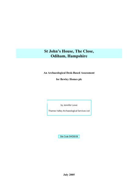
St John’s House, The Close,<br />
Odiham, Hampshire<br />
An <strong>Archaeological</strong> <strong>Desk</strong>-Based Assessment<br />
for Bewley Homes plc<br />
by Jennifer Lowe<br />
<strong>Thames</strong> <strong>Valley</strong> <strong>Archaeological</strong> Services Ltd<br />
Site Code SHO05/58<br />
July 2005
Summary<br />
Site name: St John’s House, The Close, Odiham, Hampshire<br />
Grid reference: SU 73900 50950<br />
Site activity: <strong>Desk</strong>-<strong>based</strong> <strong>assessment</strong><br />
Project manager: Steve Ford<br />
Site supervisor: Jennifer Lowe<br />
Site code: SHO 05/58<br />
Area of site: 0.45ha<br />
Summary of results: The site lies within the historic core of Odiham and therefore the<br />
potential for encountering archaeological deposits is high. The site is located within an<br />
<strong>Archaeological</strong>ly Important Area and a Conservation Area and these factors combined<br />
indicate that a course of fieldwork, such as field evaluation, should be implemented to<br />
characterize the nature and extent of any deposits present.<br />
This <strong>report</strong> may be copied for bona fide research or planning purposes without the explicit permission of the<br />
copyright holder<br />
Report edited/checked by: Steve Ford 06.07.05<br />
Steve Preston 06.07.05<br />
i
St John’s House, The Close, Odiham, Hampshire<br />
An <strong>Archaeological</strong> <strong>Desk</strong>-Based Assessment<br />
by Jennifer Lowe<br />
Report 05/58<br />
Introduction<br />
This desk-<strong>based</strong> study is an <strong>assessment</strong> of the archaeological potential of a plot of land located at St John’s<br />
House, The Close, Odiham, Hampshire (SU 7390 5095) (Fig. 1). The project was commissioned by Mr Stephen<br />
Parks of Bewley Homes plc, Bewley House, Park Road, Esher, Surrey, KT10 8NP. This <strong>report</strong> comprises the<br />
first stage of a process to determine the presence/absence, extent, character, quality and date of any<br />
archaeological remains that may be affected by redevelopment of the area.<br />
Site description, location and geology<br />
The site is a roughly L-shaped parcel of land of 0.45ha located within the historic core of Odiham, to the south of<br />
the High Street. Several brick-built residential properties currently occupy the central area of the site. To the east<br />
are a tennis court and swimming pool, and a garden area is located to the west. The site is accessed via The<br />
Close, which leads into an open courtyard area; the swimming pool area to the west is slightly higher than the<br />
courtyard area, suggesting this part of the site may have been built up at some point in the past. Similarly the<br />
tennis court is at a much lower level to the pool and may suggest that the ground level in this area has been<br />
reduced. From the courtyard area the site slopes down slightly towards the northern half of the site. The area<br />
immediately around the western range of buildings is at a much lower level again indicating possible truncation<br />
in this area. The land lies at a height of approximately 95m above Ordnance Datum and is located on the Upper<br />
Chalk close to the limit of the chalk downs and not far from the Tertiary gravels and clays of north-east<br />
Hampshire (BGS 1981).<br />
Planning background and development proposals<br />
A Planning application (05/00804/FUL) has been submitted to Hart District Council to demolish the existing<br />
properties and redevelop the site for residential purposes. The proposed development includes the construction of<br />
five houses with associated garden and parking areas situated around a central courtyard area (Fig. 2) The<br />
proposed development lies within an <strong>Archaeological</strong>ly Important Area as defined by Hampshire County Council<br />
1
in their survey of Hampshire’s Historic Towns (HCC 2002), and is shown as an Area of <strong>Archaeological</strong> Potential<br />
on the Hampshire SMR.<br />
Archaeology and Planning (PPG16 1990) provides guidance relating to archaeology within the planning<br />
process. It points out that where a desk-<strong>based</strong> <strong>assessment</strong> has shown that there is a strong possibility of<br />
significant archaeological deposits in a development area it is reasonable to provide more detailed information<br />
from a field evaluation so that an appropriate strategy to mitigate the effects of development on archaeology can<br />
be devised:<br />
Paragraph 21 states:<br />
‘Where early discussions with local planning authorities or the developer’s own research indicate<br />
that important archaeological remains may exist, it is reasonable for the planning authority to<br />
request the prospective developer to arrange for an archaeological field evaluation to be carried<br />
out...’<br />
Should the presence of archaeological deposits be confirmed further guidance is provided. Archaeology and<br />
Planning stresses preservation in situ of archaeological deposits as a first consideration as in paragraphs 8 and<br />
18.<br />
Paragraph 8 states:<br />
‘...Where nationally important archaeological remains, whether scheduled or not, and their<br />
settings, are affected by proposed development there should be a presumption in favour of their<br />
physical preservation...’<br />
Paragraph 18 states:<br />
‘The desirability of preserving an ancient monument and its setting is a material consideration in<br />
determining planning applications whether that monument is scheduled or unscheduled...’<br />
However, for archaeological deposits that are not of such significance it is appropriate for them to be ‘preserved<br />
by record’ (i.e., fully excavated and recorded by a competent archaeological contractor) prior to their destruction<br />
or damage.<br />
Paragraph 25 states:<br />
‘Where planning authorities decide that the physical preservation in situ of archaeological remains<br />
is not justified in the circumstances of the development and that development resulting in the<br />
destruction of the archaeological remains should proceed, it would be entirely reasonable for the<br />
planning authority to satisfy itself ... that the developer has made appropriate and satisfactory<br />
provision for the excavation and recording of remains.’<br />
The Hampshire County Council Structure Plan (HCC 1996) and the Hart District Replacement Local Plan 1996–<br />
2000 (HDC 1996) reiterate many of these points:<br />
Hampshire County Council, policy E13:<br />
‘Development will not be permitted where it adversely affects nationally important<br />
archaeological sites and monuments, and their settings, whether scheduled or not.’<br />
2
Hampshire County Council, policy E14:<br />
‘Where an archaeological site or monument is affected by development there will be a<br />
presumption in favour of its physical preservation in situ and continuing management where<br />
appropriate. Where physical preservation in situ is not practicable or possible, local planning<br />
authorities will seek to ensure that provision is made, in advance of development, for an<br />
appropriate level of investigation and recording. Where development might affect land of<br />
archaeological potential, the local planning authorities may also require developers to arrange for<br />
an archaeological evaluation to be carried out prior to the determination of a planning<br />
application.’<br />
Hart District, CON 15:<br />
‘Development that would adversely affect a scheduled ancient monument, other site of<br />
archaeological importance or its setting, will not normally be permitted. <strong>Archaeological</strong> remains<br />
should be protected in situ, unless there are exceptional overriding needs for development which<br />
would prevent this, in which case a detailed archaeological investigation should be carried out<br />
prior to development.’<br />
The Hampshire County Council Structure Plan also considers the historic landscape. Hampshire County<br />
Council, policy E15:<br />
‘Development will not be permitted if it adversely affects the character, integrity and importance<br />
of an ancient or designed landscape’.<br />
Hart District Local Plan policies considers the settings of listed buildings. Hart District, CON23:<br />
‘Development which would have a material adverse impact on the setting of a listed building<br />
will not normally be permitted.’<br />
Odiham is also designated as a Conservation Area, and in such areas, additional local plan policies<br />
apply:<br />
‘CON13: Proposals for development which fail to meet the objectives of conserving or<br />
enhancing the character or appearance of a designated conservation area will not be permitted.<br />
‘…It is the overall character of an area, which the designation of a conservation area seeks to<br />
preserve and enhance, rather than the individual buildings…’<br />
‘CON14: Development requiring demolition of a building or part of a building in a conservation<br />
area will not be permitted if:<br />
(i) the removal of a building or part of a building would unacceptably harm the special character<br />
and/or appearance of the area;<br />
(ii) detailed proposals for the re-use of the site, including replacement building (or part thereof)<br />
and landscaping, have not been approved.’<br />
Methodology<br />
This <strong>assessment</strong> of the site was carried out by the examination of pre-existing information from a number of<br />
sources recommended by the Institute of Field Archaeologists’ paper ‘Standards in British Archaeology’<br />
covering desk-<strong>based</strong> studies. These sources include historic and modern maps, the Hampshire Sites and<br />
Monuments Record, geological maps and any relevant publications or <strong>report</strong>s.<br />
3
Historical background<br />
Odiham is first recorded in Domesday Book (1086) and is, at this time, recorded as Odiham meaning ‘wooded<br />
homestead or enclosure’ (Mills 1998). Prior to 1086 it is thought that Odiham was a royal domain (Coates 1989).<br />
There is also suggestion that a royal residence existed at Odiham in the Saxon period, however no archaeological<br />
evidence has been found to support this (VCH 1903). All Saints’ church dates from the 13th century, and has no<br />
earlier features however it has also been suggested that it may have been a Minister church in the Saxon period<br />
(Hase 1994). An area known as ‘The Bury’, is located to the east of the church, and this name has often been<br />
associated with the presence of a Saxon royal residence (Hase 1994). By the time of Domesday Book (1086)<br />
King William held Odiham which was assessed before the Conquest and afterwards at £50. It had previously<br />
belonged to earl (King) Harold. It is recorded as having almost 80 hides and land for 56 ploughs as well as 8<br />
mills, 21 acres of meadow and woodland for 160 pigs (Williams and Martin 2000, 90). A second entry in<br />
Domesday Book records Godwine holding ‘Bartley’ in Odiham, which was worth 20s both before and after the<br />
Conquest, and had been held by King Edward (Williams and Martin 2000, 121).<br />
Judging by its entry in Domesday Book, Odiham was clearly a prosperous town. This is further highlighted<br />
by the construction of a castle at North Wanborough c 1207. The castle was expanded in the 14th century to<br />
include a chapel, a hall, service buildings, the King’s Chamber, the ledene chamber and a chamber for the Queen<br />
were all added (VCH 1903; Roberts 1995). King John was a frequent visitor to the castle which would also have<br />
added to the prosperity and economy of the town (Millard 1988). In addition a Royal park is known to have<br />
existed at Odiham which was not only used for hunting but also supplied timber and venison. The park is known<br />
to have been in existence since the late Saxon period and at this time was well stocked with deer (VCH 1903)<br />
By the 16th century the castle was in a state of disrepair, and the Manor became the royal residence in<br />
Odiham, with Queen Elizabeth visiting in 1591 (Millard 1988). The Manor house no longer exists but is thought<br />
to have been located where Palace Gate Farm is now situated. The farmhouse is a grade II listed building dating<br />
from the 16th century, and is thought to have been one of the entrances to the Manor; the house is thought to<br />
have been demolished sometime between William Godston’s survey of the town in 1739, and 1840.<br />
<strong>Archaeological</strong> background<br />
General background<br />
The town is located to the north east of Hampshire at the junction of roads from Basingstoke, Farnham, Reading<br />
and Alton. Odiham, and the surrounding area, has a large number of finds and sites recorded from all periods.<br />
4
To the south-west of All Saints’ Church excavations revealed a probable round house consisting of a<br />
circular set of post holes dating from the late Bronze Age to the early Iron Age. Cropmarks were investigated<br />
during the excavations which were revealed to be a series of linear ditches and a trapezoidal enclosure (Jenkins<br />
1991). In addition six Roman inhumation burials were recorded, dating to the 4th century. The presence of a<br />
Roman villa is also recorded to the north of the town. It is a Scheduled Ancient Monument (SAM 305) and was<br />
partially excavated in 1929 and 1930, which revealed tessellated pavements and a bath suite.<br />
Although the town is thought to have Saxon origins very little evidence for Saxon activity has been<br />
recorded. The only reference to possible Saxon activity is for several sherds of pottery retrieved during work at<br />
the cemetery close to Kings Street have been described as being similar to Anglo-Saxon ‘Portchester’ ware<br />
(Moorhouse 1972)<br />
Work carried out on the site of the castle, located to the north of the town, has revealed an octagonal keep<br />
which was constructed later than the original castle, possibly in the mid 13th century (Barton 1982; Allen 1984;<br />
Barton and Allen 1985). Further investigations to the east Palace Gate produced two sherds of medieval pottery<br />
(Saunders 1995) and work at Palace Gate itself failed to record any finds or features associated with late<br />
medieval royal residence (TWA 1988).<br />
Hampshire Sites and Monuments Record<br />
A search was made of the Sites and Monuments Record (SMR) for a radius of 0.5km around the proposal site in<br />
June 2005. A total of 51 sites and findspots including a selection of listed buildings are recorded for this area. A<br />
full catalogue of the search area comprises 156 listed buildings. The SMR information is summarized as<br />
Appendix 1 and entries are located on Figure 1. Listed buildings (some not included in the SMR) are listed in<br />
Appendix 3.<br />
Prehistoric<br />
A single findspot is listed for the prehistoric period [Fig. 1; 30].<br />
Roman<br />
Findspots of Roman material are listed in the SMR [29, 31].<br />
Saxon<br />
No entries are recorded for the Saxon period in the SMR<br />
5
Medieval<br />
The majority of entries in the SMR relate to this period and are for timber framed buildings [Fig. 1; 1–5, 7–25,<br />
39–41]. In addition fieldwork to the rear of 106 High Street revealed 13th century pits (Taylor 2002) [47]<br />
Post-Medieval<br />
A watching brief at the Forge at the east end of the High Street produced sixteenth century artefacts (Hardy,<br />
1994) [Fig.1; 32]. This canal linked Basingstoke and the River Wey at West Byfleet to provide a route to<br />
London. The canal lies to the north of the town and cut through the site of the castle. A wharf was located on the<br />
canal to the north-east of Odiham. Other entries for this period include a gate, a brick-kiln, the almshouses,<br />
stocks, Palace Gate Farm, Market House, ‘Shambles’, H King’s Brewery and Market Stalls [6, 34, 35, 38, 42,<br />
47, 48]. A major Post-medieval entry in the SMR just beyond the boundary of the study area refers to the<br />
construction of the Basingstoke Canal in 1794.<br />
Scheduled Ancient Monuments<br />
The site of Roman villa is recorded to the north of the site, close to the Priory, and is a Scheduled Ancient<br />
Monument (SAM 305). However this is located a considerable distance from the development area and the<br />
development will have no impact on the monument or its setting. There are no Scheduled Ancient Monuments<br />
located on the site itself.<br />
Cartographic evidence<br />
A range of Ordnance Survey and other historical maps of the area were consulted at Hampshire Record Office in<br />
order to ascertain what activity had been taking place through the site’s later history and whether this may have<br />
affected any possible archaeological deposits within the proposal area (see Appendix 2).<br />
The earliest map consulted was Saxton’s map of Hampshire 1575 (Fig. 3) and at this time settlement is<br />
recorded as Odiam, and is depicted as a fairly substantial settlement, with a park, presumably the Royal Park, to<br />
the north of the settlement. However due to the scale of the map, the site itself cannot be located precisely at this<br />
time. Similarly, Norden’s map of Hampshire, 1595, Van der Keere’s map of Hampshire, 1605, and Speed’s map<br />
of Hampshire, 1610 provide no further detail for the site. By 1695, according to Morden’s map of Hampshire,<br />
the town is recorded as Odiham, however there is no additional information about the development area at this<br />
time.<br />
6
A more detailed survey of the town is provided by William Godson, 1739 (Fig. 4) which shows the site in<br />
greater detail. This map illustrates All Saints Church to the south-west of the site and properties lining the route<br />
of the High Street. The site at this time is largely undeveloped, with a single building, on a north-south alignment<br />
located close to western boundary of the site and would appear to correlate with one of the structures currently<br />
located on the site. The eastern portion of the site, at this time appears to be an orchard. Both Taylor’s map of<br />
Hampshire, 1759 and Milne’s map of Hampshire 1791 highlight the expanse of the town, along the route of the<br />
High Street, but do not provide further detail for the site itself.<br />
Odiham Tithe map, 1843 (Fig. 5) again illustrates the expanse of the town largely focused around the High<br />
Street. To the south west of the site All Saint’s Church is noted and to the north both the location of the vicarage<br />
and the Rectory (Priory) are recorded. Within the 100 years from Godson’s map to the Tithe map the site has<br />
undergone further development. The site has almost taken on a similar layout to its present one, with buildings<br />
located along the perimeter next to The Close. Indeed at this time, the site appears to be more developed than the<br />
present day with the two lines of buildings extending to the edge of The Close as well as extending further to the<br />
north closer to the High Street. Also of note on this map is a rectangular feature recorded in the field to the rear<br />
of the site; its function is unknown.<br />
The First Edition Ordnance Survey map, 1871 (Fig. 6) provides a similar level of detail to the Tithe. The<br />
central area of the site is still occupied by buildings which are located around a central courtyard. To the west of<br />
the main building complex, in an area previously undeveloped, are several rectangular structures. The land to the<br />
east of the main buildings still appears to be orchard. The Third Edition Ordnance Survey map, 1910 (Fig. 7)<br />
shows several minor changes to the site. The structures identified on the previous Ordnance Survey map, to the<br />
west of the site are depicted on this map as greenhouses. The western range of buildings comprise a row which<br />
connects with the footpath (The Close) to the south of the site, the eastern range appears as it is today. An<br />
earthwork is now recorded in the area to the east of the buildings, previously in use as an orchard. A similar<br />
looking earthwork is also recorded in the field to the rear of the site, where the rectangular feature was<br />
previously noted on the Tithe map. As one of the features does not appear on any map prior to 1910 it would<br />
suggest that this is relatively modern in date, although its function remains unclear.<br />
Listed buildings<br />
As recorded in the SMR there are numerous listed buildings in Odiham, many of which date from the medieval<br />
period (Appendix 3). However there are no listed buildings on the site itself. As most of Odiham is also a<br />
7
Conservation Area, the development proposals would have to take into account design that is sympathetic to the<br />
overall character of the area.<br />
Register of Historic Parks and Gardens<br />
To the north of the site, close to the Priory, is the site of a historic deer park which is thought to have existed in<br />
the Saxon period. The park known as King John’s Hunting Lodge is included in the Register of Historic Parks<br />
and Gardens (site no 1146 stats EH 11 LB1). However it is located far enough from the development area to<br />
have no impact on the proposed development.<br />
Register of Historic Battlefields<br />
The site does not lie within an historic battlefield.<br />
Aerial Photography<br />
The site areas lies within an urban area which has been developed since before the advent of aerial photography.<br />
No photographic collections have therefore been consulted.<br />
Discussion<br />
In considering the archaeological potential of the proposal site, various factors must be taken into account,<br />
including previously recorded sites, previous land use and disturbance and future land use, including the<br />
proposed redevelopment of the site.<br />
The site lies within the historic core of the town in a designated Area of High <strong>Archaeological</strong> Potential. As<br />
a survey of the archaeological and historical sources has indicated Odiham appears to have been an important<br />
settlement from Saxon times, and throughout the medieval period. Evidence of pre-medieval activity is rare,<br />
however, prehistoric and Roman activity has been recorded to the south-west of the development area. In an<br />
historic town such a Odiham, there is a much higher probability that medieval deposits will be encountered. The<br />
site is located to the rear of the High Street and therefore deposits relating to medieval burgage plots would seem<br />
most likely. In addition the site is also located within close proximity to the 13th-century church., which may<br />
suggest this area of the town was of some significance in the medieval period.<br />
The cartographic sources indicate that the site has been moderately developed since at least the mid 19th<br />
century. It is difficult to tell how much these structures will have impacted on any below ground archaeology,<br />
8
ut the site visit did indicate that some level of truncation has occurred at various locations across the site, such<br />
as the tennis court area. This undoubtedly will have had some impact on archaeological deposits, should they<br />
exist.<br />
Despite the possible disturbance of deposits across part of the area, the site is located in an archaeologically<br />
important area and therefore does warrant further investigation, which would establish the extent of any<br />
disturbance across the site but will also ascertain the nature of any archaeological deposits should they survive.<br />
There is a high potential for medieval deposits to be encountered and there is a possibility that Saxon deposits,<br />
although rare in the Odiham, may also be present. In this instance an archaeological evaluation would be the best<br />
course of action to establish the extent, character and nature of any archaeological deposits. This could be<br />
implemented as part of an appropriately worded condition to any consent gained. A scheme for this evaluation<br />
will need to be drawn up and approved by the archaeological advisers to the District and implemented by a<br />
competent archaeological contractor, such as an organization registered with the Institute of Field<br />
Archaeologists.<br />
References<br />
Allen, D, 1984, ‘Excavations at Odiham Castle’, in M F Hughes (ed), Archaeology in Hampshire, 1983<br />
Hampshire County Council Annual Report<br />
BGS, 1981, British Geological Survey, 1:50,000, Sheet 284, Drift Edition, Keyworth<br />
Barton, K J, 1982, ‘Excavations at Odiham Castle’, in M F Hughes (ed), Archaeology in Hampshire, 1981,<br />
Hampshire County Council Annual Report<br />
Barton, K. J, and Allen, D, 1985, ‘Excavations at Odiham Castle’, in M F Hughes (ed), Archaeology in<br />
Hampshire, 1984/5 Hampshire County Council Annual Report<br />
Coates, R, 1989, Place Names of Hampshire, London<br />
HCC, 2002, Hampshire County Council and English Heritage, An extensive Urban Survey of Hampshire and Isle<br />
of Wight’s Historic Towns<br />
Hase, P H, 1994, ‘The Church in the Wessex Heartlands’, in M Aston and C Lewis (eds), The Medieval<br />
Landscape of Wessex, Oxbow Monogr 46, Oxford<br />
Hardy, a, 1994, The Forge, High Street, Odiham, Hampshire, <strong>Archaeological</strong> Watching Brief Report, Oxford<br />
<strong>Archaeological</strong> Unit<br />
HCC, 1996, Hampshire County Council Structure Plan 1996–2011<br />
HDC, 1996, Hart District Replacement Local Plan 1996–2000<br />
Jenkins, AVC, 1991, ‘An <strong>Archaeological</strong> Investigation of a Cropmark at Odiham’, Hampshire, Proc of<br />
Hampshire Field Club <strong>Archaeological</strong> Society, 46, 1990 (1991) 5-16<br />
Millard, S, 1988, ‘Siste Viotar Troja Fuit’, Odiham Society J, Spring, 21-23<br />
Mills, A, D, 1988 Dictionary of English Place Names, Oxford<br />
Moorhouse, S, 1972, ‘Early Medieval Pottery from Westbury, East Meon, Hampshire’, Proc Hampshire Fld<br />
Club Archaeol Soc, 28, 41–8<br />
PPG16, 1990, Archaeology and Planning, Dept of the Environment Planning Policy Guidance 16, HMSO<br />
Saunders M J, 1995, ‘High Street, Odiham, Hampshire, An <strong>Archaeological</strong> Watching Brief’, <strong>Thames</strong> <strong>Valley</strong><br />
<strong>Archaeological</strong> Services <strong>report</strong> 95/54, Reading<br />
Taylor, A, 2002, ‘The excavation of medieval pits at the rear of 106 High Street, Odiham, Hampshire, <strong>Thames</strong><br />
<strong>Valley</strong> <strong>Archaeological</strong> Services draft publication <strong>report</strong>, project 02/27, Reading<br />
TWA 1988, ‘An <strong>Archaeological</strong> Evaluation at Palace Gate Farm, Odiham, Hampshire’, Trust for Wessex<br />
Archaeology, Salisbury<br />
VCH, 1903, Victoria County History of Hampshire, 4, London<br />
Williams, A and Martin G H, 2000, Domesday Book: A Complete Translation, London<br />
9
APPENDIX 1: Sites and Monuments Records within 0.5km search radius of the development site<br />
No SMR no NGR (SU) Site Name Type Date<br />
1 36534 74280 51120 27-29 High Street Timber Framed Building Medieval<br />
2 36528 74060 51090 The George Hotel Timber Framed Building Medieval<br />
3 36526 73980 51080 Old Church House Timber Framed Building Medieval<br />
4 36520 73980 51080 1 and 2 Bury Villas Timber Framed Building Medieval<br />
5 36531 74250 51080 White House Cottage Timber Framed Building Medieval<br />
6 28850 74050 50860 Almshouse Post-Medieval<br />
7 38311 74210 51090 45 High Street Timber Framed Building Medieval<br />
8 38317 74130 50990 Forge Cottage, The Bury Timber Framed Building Medieval<br />
9 38319 74220 51130 Queens House Timber Framed Building Medieval<br />
10 38312 73900 51100 Cross Barn, Palace Gate Farm Barn Medieval<br />
11 38309 74010 51000 The bell, public house Timber Framed Building Medieval<br />
12 38308 74110 50990 The cottage in the Bury Timber Framed Building Medieval<br />
13 38297 74010 51050 Monks Cottage Timber Framed Building Medieval<br />
14 38307 74130 51100 Central House Timber Framed Building Medieval<br />
15 38320 74210 51120 The Old House Timber Framed Building Medieval<br />
16 38315 74260 51110 Frenchmans Timber Framed Building Medieval<br />
17 38314 74270 51150 28-30 High Street Timber Framed Building Medieval<br />
18 39070 74110 51060 no. 1 King Street Timber Framed Building Medieval<br />
19 28849 74040 50930 All Saints Church Parish church Medieval<br />
20 38304 73980 51080 Queen’s Mead Timber Framed Building Medieval<br />
21 38299 74010 51050 Old White Hart Timber Framed Building Medieval<br />
22 38298 74110 51060 no. 1 King Street Timber Framed Building Medieval<br />
23 38321 74130 51050 Kings Arms Hotel Timber Framed Building Medieval<br />
24 36530 74120 51100 76 High Street Timber Framed Building Medieval<br />
25 36535 74290 51130 19-21 High Street Timber Framed Building Medieval<br />
26 34849 74000 51000 Findspot Undated<br />
27 34847 74000 51000 Findspot Undated<br />
28 34850 74000 51000 Findspot Undated<br />
29 28859 74000 51000 Findspot Roman<br />
30 28861 74000 51000 Findspot Prehistoric<br />
31 28860 74000 51000 Findspot Roman<br />
32 42767 74044 51051 95-97 High Street, Odiham Drain and well Post-Medieval<br />
33 28393 74000 51000 Odiham Town Medieval<br />
34 34320 73900 51100 Gate Post-Medieval<br />
35 34319 73900 51100 Brick kiln Post-Medieval<br />
36 38568 73800 51000 Post hole Undated<br />
37 35728 73530 50640 Macula ?<br />
38 28878 73900 51100 Palace Gate house, Palace Gate Country House<br />
Post-Medieval<br />
farm<br />
39 28880 73860 51050 The Vicarage Building Medieval<br />
40 28879 73800 51060 The Priory Building Medieval<br />
41 28875 74030 50850 Charnel House Medieval<br />
42 28851 74020 50960 Stocks Post-Medieval<br />
43 38565 73800 51000 Well Modern<br />
44 38566 73800 51000 Air Raid Shelter Modern<br />
45 38567 73800 51000 Pit Undated<br />
46 41724 73500 50700 Salmons Field Searchlight Battery Modern<br />
47 54252 74040 51150 Rear of 106 High Street Pits Medieval/Post<br />
medieval<br />
48 54302 74055 51071 Site of Market House Post medieval<br />
48 54303 74092 51076 Site of Shambles Post medieval<br />
48 54762 74104 51034 Site of King and Palmers Brewery Post medieval<br />
49 56736 74116 51080 Site of market stalls Medieval/Post<br />
medieval<br />
10
APPENDIX 2: Historic and modern maps consulted<br />
1575 Christopher Saxton’s map of Hampshire (Fig. 3)<br />
1595 John Norden’s Map of the county of Hampshire<br />
1605 Pieter Van der Keere’s Map of Hampshire<br />
1607 John Norden’s Map of the county of Hampshire<br />
1610 John Speed’s Map of the County of Hampshire<br />
1695 Robert Morden’s Map of the County of Hampshire<br />
1739 W Godson’s Map of Odiham Park and Launds (Fig. 4)<br />
1759 Isaac Taylor’s Map of Hampshire<br />
1791 Thomas Milne’s Map of Hampshire<br />
1843 Tithe Map of Odiham, 27 inches to 1 mile (Fig. 5)<br />
1871 Ordnance Survey Sheet XIX.12, 25 inches to 1 mile (Fig. 6)<br />
1910 Third Edition Ordnance Survey Sheet XIX, 25 inches to 1 mile (Fig. 7)<br />
11
Appendix 3: Listed buildings within 0.5km search radius of the site<br />
Site ID Site Name Type Grid reference (SU) Mindate Maxdate Grade<br />
403 Church of All Saints Anglican Church 74038 50923 1200 1510 Grade I<br />
405 George Hotel Hotel 74057 51089 1400 1799 Grade II*<br />
406 Orchard House House 74137 51101 1770 1799 Grade II<br />
407 The Vicarage Hall House 73859 51046 1490 1510 Grade II<br />
407 The Vicarage Vicarage 73859 51046 1490 1510 Grade II<br />
408 Frenchmans Cottage House 74263 51114 1600 1899 Grade II<br />
409 57 High Street House 74172 51082 1800 1835 Grade II<br />
410 Forge House House 74136 50981 1600 1799 Grade II<br />
1012 La Pomme Rouge Shop 74079 51062 1600 1899 Grade II<br />
1013 Gate Piers & Flint Wall at Odiham Cemetery Chapel Gate 74219 50808 1835 1865 Grade II<br />
1023 The Bury House House 73989 50959 1700 1799 Grade II<br />
1117 76 High Street Shop 74118 51096 1400 1899 Grade II<br />
1955 The Bury Cottage House 74045 50991 1600 1799 Grade II<br />
4167 The Close Cottage House 73750 51010 1800 1835 Grade II<br />
4196 Village Stocks & Whipping Post Stocks 74029 50962 1700 1799 Grade II<br />
4197 Webb House House 74004 50993 1700 1799 Grade II<br />
4198 Webb House House 74002 50998 1700 1799 Grade II<br />
4199 Webb House House 74000 51001 1700 1799 Grade II<br />
4200 The Bell Inn Public House 74014 50991 1600 1799 Grade II<br />
4201 Wall between the Bell Inn & Bury Cottage Boundary Wall 74025 50986 1665 1699 Grade II<br />
4202 Stoney Cottage House 74061 50991 1500 1987 Grade II<br />
4203 Barn Cottage House 74093 50995 1600 1799 Grade II<br />
4204 Pear Tree Cottage House 74102 50996 1600 1799 Grade II<br />
4205 The Cottage in the Bury House 74109 50996 1600 1799 Grade II<br />
4206 The Haven House 74116 50997 1600 1799 Grade II<br />
4208 Factory Cottage House 74122 50998 1600 1799 Grade II<br />
4209 Corner Cottage House 74128 51000 1700 1799 Grade II<br />
4210 1 The Bury House 74100 50969 1800 1835 Grade II<br />
4211 Oriana Cottage House 74100 50964 1800 1835 Grade II<br />
4212 Parish Room Village Hall 74094 50984 1895 1905 Grade II<br />
4213 Almshouses Almshouse 74058 50854 1628 1628 Grade II*<br />
4214 Charnel House House 74020 50862 1500 1599 Grade II<br />
4215 Buryfield House House 74166 50818 1800 1835 Grade II<br />
4216 Kings Cottage House 74185 50789 1700 1799 Grade II<br />
4220 Bessells House 73964 50995 1700 1799 Grade II<br />
4221 Heathers House 73968 50987 1700 1799 Grade II<br />
4222 Lamb, Brooks & Bullock (former Magistrates Clerks House 73970 50979 1800 1835 Grade II<br />
Office)<br />
4223 Old Church House Hall House 73978 51000 1300 1399 Grade II<br />
4224 2 Church Street House 73981 50993 1700 1799 Grade II<br />
4225 Bury Villas House 73986 50986 1500 1899 Grade II<br />
4226 Bury Villas House 73992 50989 1500 1899 Grade II<br />
4227 Library Library 74069 50953 1800 1835 Grade II<br />
4228 Little Court House 74057 50975 1765 1799 Grade II<br />
4277 22 High Street House 74283 51158 1700 1799 Grade II<br />
4278 The Barn Barn 74263 51185 1795 1805 Grade II<br />
4279 Hellis Cottage House 74272 51151 1800 1835 Grade II<br />
4280 White House Cottage House 74258 51143 1500 1835 Grade II<br />
4281 Hellis House House 74265 51148 1800 1835 Grade II<br />
4282 The White House House 74241 51142 1812 1812 Grade II*<br />
4283 Queen Anne House House 74220 51128 1765 1799 Grade II<br />
4284 The Old House House 74211 51124 1765 1799 Grade II*<br />
4285 50 High Street House 74205 51122 1700 1799 Grade II<br />
4286 Christmas Cottage House 74199 51120 1700 1799 Grade II<br />
4287 Salamander House 74191 51119 1700 1799 Grade II<br />
4288 Berisford House 74164 51109 1700 1799 Grade II<br />
4289 The Ivied Cottage House 74156 51107 1600 1835 Grade II<br />
4290 Central House House 74132 51098 1765 1899 Grade II<br />
4291 Central House House 74129 51098 1765 1899 Grade II<br />
4292 Central House House 74125 51097 1765 1899 Grade II<br />
4293 Barclays Bank Bank (Financial) 74105 51095 1700 1799 Grade II<br />
4294 82 High Street Shop 74099 51093 1800 1835 Grade II<br />
4295 Cherry Tree Shop 74076 51090 1665 1799 Grade II<br />
4296 Cherry Tree Shop 74082 51090 1665 1799 Grade II<br />
4297 Stable Block at rear of George Hotel Stable 74044 51147 1835 1865 Grade II<br />
4298 102 High Street Shop 74042 51085 1600 1899 Grade II<br />
4299 108 High Street Shop 74029 51083 1700 1899 Grade II<br />
4300 Kingston House House 74004 51079 1700 1799 Grade II<br />
4301 Kingston House House 74004 51079 1700 1799 Grade II<br />
4302 Kingston House House 74004 51079 1700 1799 Grade II<br />
4303 Kingston House House 74004 51079 1700 1799 Grade II<br />
4304 Manchester House House 73984 51075 1765 1987 Grade II<br />
12
Site ID Site Name Type Grid reference (SU) Mindate Maxdate Grade<br />
4305 140 High Street House 73973 51071 1700 1835 Grade II<br />
4306 142 High Street House 73973 51071 1700 1835 Grade II<br />
4307 144 High Street House 73973 51071 1700 1835 Grade II<br />
4308 146 High Street House 73973 51071 1700 1835 Grade II<br />
4309 148 High Street House 73973 51071 1700 1835 Grade II<br />
4310 Greenway Cottage House 73945 51090 1800 1835 Grade II<br />
4311 Boyce Cottage House 73935 51079 1835 1865 Grade II<br />
4312 Palace Gate Farmhouse Farmhouse 73875 51167 1635 1799 Grade II<br />
4313 Granary at Palace Gate Farm Granary 73869 51185 1800 1835 Grade II<br />
4314 Barn at Palace Gate Farm to W of Farmhouse House 73851 51172 1980 2000 Grade II<br />
4314 Barn at Palace Gate Farm to W of Farmhouse Barn 73851 51172 1700 1799 Grade II<br />
4315 Barn SW of Palace Gate Farmhouse House 73856 51118 1980 2000 Grade II<br />
4315 Barn SW of Palace Gate Farmhouse Barn 73856 51118 1700 1799 Grade II<br />
4316 Barn S of Palace Gate Farmhouse Community Centre 73879 51089 1980 2000 Grade II<br />
4316 Barn S of Palace Gate Farmhouse Barn 73879 51089 1600 1635 Grade II<br />
4317 Boundary Wall of the Priory Boundary Wall 73818 51012 1700 1899 Grade II<br />
4318 The Priory Vicarage 73796 51057 1400 1899 Grade II*<br />
4319 Priory Lodge Lodge 73750 51015 1835 1865 Grade II<br />
4330 Gable Cottage House 74290 51120 1400 1835 Grade II<br />
4331 Oak Cottage House 74277 51117 1400 1835 Grade II<br />
4332 Selwood Cottage House 74269 51116 1400 1835 Grade II<br />
4333 Frenchman's House 74255 51112 1600 1899 Grade II<br />
4334 Gatepiers to No 31 & 33 Gate 74246 51111 1800 1835 Grade II<br />
4335 The Long House House 74236 51101 1700 1799 Grade II<br />
4336 Marycourt House 74221 51098 1700 1735 Grade II*<br />
4337 Odiham Antiques House 74205 51094 1700 1799 Grade II<br />
4338 The Cedars House 74192 51090 1600 1799 Grade II<br />
4339 51 High Street House 74183 51088 1600 1799 Grade II<br />
4340 Danetree House House 74161 51080 1800 1835 Grade II<br />
4341 61 High Street House 74141 51071 1700 1799 Grade II<br />
4342 63 High Street House 74141 51071 1700 1799 Grade II<br />
4343 67 High Street House 74113 51064 1600 1799 Grade II<br />
4344 Gainsborough House House 74101 51064 1600 1799 Grade II<br />
4345 71 High Street House 74095 51064 1765 1799 Grade II<br />
4346 Pennyworth Boutique House 74091 51064 1765 1799 Grade II<br />
4347 75 High Street House 74086 51061 1765 1799 Grade II<br />
4348 Laurel House Shop 74073 51060 1600 1899 Grade II<br />
13
Key to SMR entry periods:<br />
Medieval<br />
Post-Medieval<br />
Modern<br />
SITE<br />
Undated<br />
52000<br />
23,24<br />
51000<br />
45<br />
43,44<br />
40<br />
36<br />
38<br />
10,20<br />
34,35<br />
3,4,39<br />
15<br />
18<br />
7 9,16,17<br />
47<br />
1<br />
48 49<br />
32<br />
19 41,42<br />
6<br />
25<br />
8,12,14<br />
5<br />
2,11,13,<br />
21,22<br />
46<br />
SITE<br />
37<br />
SU73000 74000<br />
St John’s House, The Close, Odiham,<br />
Hampshire, 2005<br />
<strong>Archaeological</strong> <strong>Desk</strong> <strong>based</strong> Assessement<br />
SHO05/58<br />
Figure 1. Location of site within Odiham and<br />
Hampshire, showing SMR entries.<br />
Reproduced from Ordnance Survey Pathfinder 1204 SU65/75 1:12500<br />
Ordnance Survey Licence 100025880
SHO05/58<br />
St John’s House, The Close, Odiham,<br />
Hampshire, 2005<br />
<strong>Archaeological</strong> <strong>Desk</strong> <strong>based</strong> Assessment<br />
Figure 2. Plan showing proposed development.
Approximate<br />
location of<br />
site.<br />
SHO05/58<br />
St John’s House, The Close, Odiham,<br />
Hampshire, 2005<br />
<strong>Archaeological</strong> <strong>Desk</strong> <strong>based</strong> Assessment<br />
Figure 3. Saxton’s map of Hampshire, 1575.
Site<br />
SHO05/58<br />
St John’s House, The Close, Odiham,<br />
Hampshire, 2005<br />
<strong>Archaeological</strong> <strong>Desk</strong> <strong>based</strong> Assessment<br />
Figure 4. William Godson’s survey of Odiham, 1739
Site<br />
SHO05/58<br />
‘St Johns House, The Close, Odiham,<br />
Hampshire, 2005<br />
<strong>Archaeological</strong> <strong>Desk</strong> <strong>based</strong> Assessment<br />
Figure 5. Odiham Tithe map, 1841
SITE<br />
SHO05/58<br />
St John’s House, The Close Odiham,<br />
Hampshire, 2005<br />
<strong>Archaeological</strong> <strong>Desk</strong> <strong>based</strong> Assessment<br />
Figure 6. First Edition Ordnance Survey, 1871.
SITE<br />
SHO05/58<br />
St John’s House, The Close, Odiham,<br />
Hampshire, 2005<br />
<strong>Archaeological</strong> <strong>Desk</strong> <strong>based</strong> Assessment<br />
Figure 7. Third Edition Ordnance Survey, 1910.