the new generation - Argos
the new generation - Argos
the new generation - Argos

Create successful ePaper yourself
Turn your PDF publications into a flip-book with our unique Google optimized e-Paper software.
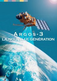
A RGOS-3<br />
THE NEW GENERATION
introduction<br />
2<br />
<strong>Argos</strong>-3: a <strong>new</strong> <strong>generation</strong> for data collection<br />
The first <strong>Argos</strong>-3 instrument is launched aboard Eumetat’s MetOp<br />
satellite. Designed to improve <strong>the</strong> overall performance of <strong>the</strong> <strong>Argos</strong><br />
system while ensuring system continuity, <strong>Argos</strong>-3 introduces:<br />
two-way communication capability<br />
greater volume of data transmitted during each satellite pass<br />
(ten times <strong>the</strong> capacity of <strong>Argos</strong>-2)<br />
more efficient data collection<br />
platform remote control and programming<br />
Governments use <strong>Argos</strong> to protect marine ecosystems<br />
and ensure responsible fishing.<br />
What is <strong>Argos</strong>?<br />
<strong>Argos</strong> is a unique worldwide location and data collection system<br />
dedicated to studying and protecting <strong>the</strong> environment by satellite.<br />
Since 1978, <strong>Argos</strong> has responded to <strong>the</strong> needs of <strong>the</strong> world’s scientific<br />
and industrial communities. <strong>Argos</strong> gives scientists a tool to<br />
enhance <strong>the</strong>ir understanding of our environment and helps industry<br />
comply with environmental protection regulations. Today, over<br />
16,000 <strong>Argos</strong> transmitters are active each month worldwide.<br />
<strong>Argos</strong> is used to observe <strong>the</strong> oceans and understand<br />
climate change.<br />
© JAMSTEC<br />
Applications of <strong>the</strong> <strong>Argos</strong> system include:<br />
locating buoys, fishing vessels, wildlife and any mobile platform<br />
carrying an <strong>Argos</strong> transmitter<br />
collecting environmental data, from ocean temperature profiles<br />
to river levels or animal heart rates<br />
observing <strong>the</strong> oceans and measuring currents, temperature<br />
and salinity<br />
monitoring public health, managing fisheries, enforcing maritime<br />
security<br />
Yacht races depend on <strong>Argos</strong> beacons to track race<br />
progress.<br />
Scientists use <strong>Argos</strong> to better monitor and understand<br />
wildlife.<br />
© Adrian Aebischer
table of contents<br />
3<br />
INTRODUCTION<br />
What is <strong>Argos</strong>? 2<br />
NEW FEATURES<br />
What’s <strong>new</strong> with <strong>Argos</strong>-3? 4-5<br />
APPLICATIONS<br />
What does <strong>Argos</strong> do? 6-9<br />
SYSTEM<br />
How does <strong>Argos</strong> two-way work? 10-12<br />
<strong>Argos</strong>-3<br />
Instrument 13-15<br />
User Platforms 16<br />
PERSPECTIVES<br />
Where we come from 17<br />
Where we’re going 18<br />
ABOUT CLS<br />
Who operates <strong>Argos</strong>? 19<br />
CONTACT US 20<br />
Publication director: Christophe Vassal<br />
Editors-in-chief: Marianna Childress, Marie-Claire Demmou<br />
Contributing editors: Christian Ortega (CLS), Michel Sarthou (CNES), Bill Woodward (CLS America), Michel Guigue (CLS), Bruno Coulon (CLS), Fabrice Planchou (CLS),<br />
Matthieu Belbeoch (JCOMMOPS)<br />
Design and layout: Ogham (N°7621) - June 2006
<strong>new</strong> features<br />
What’s <strong>new</strong> with <strong>Argos</strong>-3?<br />
4<br />
Two-way communication with platforms > 1<br />
Two-way communication with platforms<br />
<strong>Argos</strong>-3 features two-way communication via a<br />
downlink with a <strong>new</strong> <strong>generation</strong> of <strong>Argos</strong> platforms<br />
— <strong>the</strong> Platform Messaging Transceivers<br />
(PMTs). All downlink communication is managed<br />
by <strong>the</strong> Downlink Messaging Management<br />
Center (DMMC), operated by CLS for <strong>the</strong> French<br />
Space Agency, CNES, in Toulouse, France.<br />
Greater volume of data transmitted during<br />
each satellite pass<br />
<strong>Argos</strong>-3 features a high speed 4.8 kbit/s uplink,<br />
allowing ten times more data to be transferred<br />
per satellite pass than before. Combined with<br />
<strong>the</strong> downlink capability, <strong>the</strong> high data rate link<br />
increases <strong>the</strong> amount of data collected.<br />
More efficient data transfer<br />
The one-way <strong>Argos</strong> system (<strong>Argos</strong>-1, <strong>Argos</strong>-2)<br />
requires redundant messages to increase <strong>the</strong><br />
probability of data being received by satellites<br />
error-free. With <strong>Argos</strong>-3, redundant messages<br />
are no longer necessary, since <strong>the</strong> downlink<br />
allows <strong>the</strong> <strong>Argos</strong>-3 instrument to send an<br />
“Acknowledgement” signal to <strong>the</strong> PMT once<br />
data has been received error-free. Once <strong>the</strong><br />
PMT receives <strong>the</strong> “Acknowledgement,” it stops<br />
sending <strong>the</strong> message.<br />
Fur<strong>the</strong>rmore, all PMTs are equipped with<br />
satellite pass forecasting software and are able<br />
to calculate <strong>the</strong> exact time and duration of <strong>the</strong><br />
next satellite pass, thanks to information communicated<br />
by system operators via <strong>the</strong> downlink.<br />
PMTs only transmit when a satellite is in<br />
view, reducing transmission time, conserving<br />
energy and extending platform lifetime.<br />
Platform remote control and programming<br />
Users have <strong>the</strong> opportunity to send short<br />
messages to <strong>the</strong>ir platforms (up to 128 bits by<br />
8 bit increments) via <strong>the</strong> Downlink Message<br />
Management Center (DMMC). Typical applications<br />
include switching a transmitter on or off,<br />
changing time or date configurations, modifying<br />
a sensor sampling rate or any o<strong>the</strong>r possible<br />
remote command allowed by <strong>the</strong> platform. The<br />
DMMC will relay <strong>the</strong> command, allowing users<br />
to program <strong>the</strong>ir platforms remotely.<br />
System continuity<br />
The <strong>Argos</strong>-3 instrument — as well as all future<br />
two-way instruments — is completely compatible<br />
with existing platforms.
<strong>new</strong> features<br />
An example<br />
5<br />
<strong>Argos</strong>-3: improving our understanding of<br />
climate change<br />
Profiling floats are part of <strong>the</strong> international Argo<br />
program to monitor <strong>the</strong> ocean and understand<br />
climate. Over 2,500 Argo floats are deployed<br />
worldwide with a target number of 3,000 in<br />
operation by 2007. Designed to collect temperature,<br />
salinity and velocity measurements of <strong>the</strong><br />
upper 2,000 m of <strong>the</strong> world’s ocean, floats are<br />
sophisticated scientific devices. Programmed<br />
before deployment, <strong>the</strong>y drift at 1,000 m beneath<br />
<strong>the</strong> ocean’s surface for up to ten days, <strong>the</strong>n dive<br />
to a depth of 2,000 m. During <strong>the</strong>ir trip, <strong>the</strong>y<br />
record ocean profiles. They return to <strong>the</strong> surface<br />
to transmit recorded data using <strong>the</strong> <strong>Argos</strong> satellite<br />
system. Data are received on land, checked,<br />
processed and relayed to worldwide users.<br />
Today floats need between six to ten hours of<br />
surface time to transmit recorded profiles.<br />
<strong>Argos</strong>-3: enhancing float performance<br />
<strong>Argos</strong>-3 features allow floats to transfer recorded<br />
data in just a few minutes of surface time.<br />
Equipped with an <strong>Argos</strong>-3 compatible Platform<br />
Messaging Transceiver (PMT), profiling floats can :<br />
calculate <strong>the</strong> date and time of satellite<br />
pass, surfacing when a satellite is in view<br />
transmit more data per satellite pass<br />
receive acknowledgement when a<br />
message has been received error-free<br />
be programmed remotely thanks to<br />
dowlink messaging<br />
This is just one example of how <strong>Argos</strong>-3 can<br />
contribute to a better understanding of ocean and<br />
climate interactions, essential for <strong>the</strong> scientific and<br />
international community in <strong>the</strong> twenty-first century.<br />
© JCOMMOPS
argos applications<br />
What does <strong>Argos</strong> do?<br />
6<br />
<strong>Argos</strong> is used by scientists, governments, industry<br />
and international organizations. To meet <strong>the</strong> system<br />
use requirements, all programs using <strong>Argos</strong><br />
have to be related to environmental protection,<br />
awareness, study, or protecting human life.<br />
Applications for which a clear governmental<br />
interest prevails are also approved.<br />
Tracking<br />
Scientists use <strong>Argos</strong> to track animals and study <strong>the</strong>ir behavior.<br />
<strong>Argos</strong> tracks any mobile platform fitted with an<br />
<strong>Argos</strong> transmitter for scientists and governments.<br />
The positions collected can be used for<br />
many applications, including monitoring <strong>the</strong><br />
route of a fishing vessel, following large migrations<br />
of birds and o<strong>the</strong>r animals, or mapping<br />
ocean currents by tracing oceanographic buoy<br />
drifts.<br />
<strong>Argos</strong> is used to monitor freshwater resources.<br />
Monitoring<br />
<strong>Argos</strong> provides environmental monitoring from<br />
remote platforms, ei<strong>the</strong>r fixed or mobile, fitted<br />
with an <strong>Argos</strong> transmitter. Sensors on <strong>Argos</strong><br />
platforms collect data on atmospheric pressure,<br />
sea temperature, animal heart rates and<br />
water level, for example.<br />
Governments use <strong>Argos</strong> to track fishing vessels in <strong>the</strong>ir Exclusive<br />
Economic Zone.<br />
Users program <strong>the</strong>ir transmitters and choose<br />
adequate sensors for <strong>the</strong> type of observations<br />
<strong>the</strong>y need. These observations are especially<br />
important for creating comprehensive global data<br />
sets that are used by people working toge<strong>the</strong>r<br />
around <strong>the</strong> world on <strong>the</strong> same or similar topics.<br />
Health ministries use <strong>Argos</strong> terminals to relay information on<br />
epidemics from remote areas.
argos applications<br />
What does <strong>Argos</strong> do?<br />
Understanding climate change > 1<br />
Improving wea<strong>the</strong>r forecasting > 2<br />
7<br />
Understanding climate change<br />
Protecting biodiversity<br />
Thousands of buoys and floats worldwide are<br />
equipped with <strong>Argos</strong> transmitters, sending regular<br />
information via <strong>the</strong> <strong>Argos</strong> system to help<br />
scientists understand and predict climate<br />
change. Nearly 6,000 drifting buoys, deep floats,<br />
moored buoys and fixed stations fitted with<br />
<strong>Argos</strong> transmitters measure ocean currents<br />
and send millions of measurements including<br />
atmospheric pressure, wind speed and direction,<br />
sea temperature and more to follow climate<br />
evolution. These <strong>Argos</strong> transmitters are<br />
important components of <strong>the</strong> World Climate<br />
Research Program (WCRP) programs, through<br />
TOGA, WOCE and now GOOS/GCOS, CLIVAR and<br />
GODAE programs and experiments. > 1<br />
Thousands of animals, including birds, fish and<br />
marine and land animals, are fitted with miniaturized<br />
<strong>Argos</strong> transmitters and tracked worldwide.<br />
Along with data collected from sensors,<br />
position information allows biologists to better<br />
understand animals’ behaviour: feeding strategies,<br />
breeding, adaptation to <strong>the</strong>ir environment,<br />
etc. Such observations provide <strong>the</strong> basis for<br />
conservation measures aimed at helping many<br />
endangered species. In addition to its ecological<br />
value, this work allows <strong>the</strong> international community<br />
to learn more about our environment’s<br />
natural resources and interactions between<br />
humanity and wildlife. > 3<br />
Improving ocean and wea<strong>the</strong>r information<br />
and forecasting<br />
In addition to climate research, oceanographers<br />
and meteorologists also use <strong>Argos</strong> to<br />
ga<strong>the</strong>r in situ observations for operational<br />
oceanography and meteorology. <strong>Argos</strong> buoys,<br />
floats and fixed stations collect data for operational<br />
programs such as World Wea<strong>the</strong>r Watch<br />
(WWW). Over 70 percent of <strong>Argos</strong> data are<br />
exchanged on a global and voluntary basis for<br />
insertion into numerical ocean and wea<strong>the</strong>r<br />
prediction models via Global Telecommunication<br />
System (GTS). Fur<strong>the</strong>rmore, <strong>Argos</strong> offers ocean<br />
data telemetry services for a broad spectrum of<br />
applications including ocean modeling, moored<br />
buoy monitoring and more. > 2<br />
Protecting biodiversity<br />
>3
argos applications<br />
What does <strong>Argos</strong> do?<br />
8<br />
© WFP<br />
Protecting public well-being > 4<br />
Protecting public health and well-being<br />
In developing countries, <strong>the</strong> risk of food shortage<br />
and epidemic outbreak is high. Yet, <strong>the</strong>re<br />
are often no surveillance systems in place to<br />
detect early warning signs. Because <strong>the</strong>y are<br />
dependable and easy-to-use, <strong>Argos</strong> terminals<br />
are used by many humanitarian aid programs<br />
to relay crucial information from remote areas.<br />
In Africa and <strong>the</strong> Middle East, <strong>Argos</strong> terminals<br />
are used to monitor school attendance and<br />
food distribution data. <strong>Argos</strong> terminals are also<br />
used for early detection and warning of communicable<br />
disease outbreaks (such as malaria,<br />
cholera...), by relaying information about case<br />
loads and drug availability from remote areas<br />
to health ministries. Information relayed by<br />
<strong>Argos</strong> allows local, national or international<br />
organizations to better monitor and manage aid<br />
programs and prevent humanitarian crises. > 4<br />
Monitoring water resources > 5<br />
© IRD<br />
Monitoring water resources<br />
Fresh water resources and supplying enough<br />
water for <strong>the</strong> world’s growing population are<br />
increasingly important issues. Today, water in<br />
rivers, lakes and wetlands only represents<br />
0.3% of <strong>the</strong> world’s freshwater. The loss of freshwater<br />
resources has an impact on food availability,<br />
water quality, public health, climate and can<br />
even lead to environmental disasters. Major<br />
national and international programs run by<br />
national governments or <strong>the</strong> World<br />
Meteorological Organization (WMO) use <strong>Argos</strong> to<br />
relay key data: water level of a river, snow cover,<br />
state of installed equipment or dams. These<br />
<strong>Argos</strong>-based monitoring programs increasingly<br />
help <strong>the</strong> global community to better manage and<br />
distribute available water resources. > 5<br />
Managing and protecting marine ecosystems<br />
The future of our fisheries depends to a large<br />
extent on our ability to preserve stocks effectively.<br />
As a result, most coastal nations now<br />
mandate fishing vessels operating within <strong>the</strong>ir<br />
Exclusive Economic Zone (EEZ) to be equipped<br />
with a satellite-based vessel monitoring system<br />
(VMS). <strong>Argos</strong> provides a global solution,<br />
ArgoNet, which meets <strong>the</strong> requirement for<br />
monitoring fishing vessels and <strong>the</strong>ir catches.<br />
<strong>Argos</strong> has been certified by most of <strong>the</strong> leading<br />
seaboard nations around <strong>the</strong> world and is<br />
already operating on thousands of vessels<br />
worldwide.
argos applications<br />
What does <strong>Argos</strong> do?<br />
Improving maritime security > 7<br />
Tracking yacht races > 8<br />
9<br />
Improving maritime security<br />
And more...<br />
To improve <strong>the</strong> security of maritime transportation,<br />
<strong>the</strong> International Maritime Organization<br />
(IMO) has mandated all passenger and cargo<br />
ships over 500 gross tonnage to install a Ship<br />
Security Alert System (SSAS). The comprehensive<br />
ShipLoc product uses <strong>the</strong> <strong>Argos</strong> system to<br />
allow ship owners to meet IMO standards and<br />
keep constant track of <strong>the</strong>ir fleet. If intruders<br />
board a ship, ShipLoc lets <strong>the</strong> crew send an<br />
alert signal automatically and discreetly to<br />
teams ashore. ShipLoc is part of an exclusive<br />
agreement with <strong>the</strong> International Maritime<br />
Bureau’s Piracy Reporting Center and is <strong>the</strong><br />
only product on <strong>the</strong> market to be a proven antipiracy<br />
tool. > 7<br />
<strong>Argos</strong> is also an important part of programs to<br />
prevent and manage human and natural disasters.<br />
<strong>Argos</strong> buoys deployed in oil spills help scientists<br />
and governments to lead targeted cleanup<br />
efforts, by tracking <strong>the</strong> spill’s movement.<br />
Fur<strong>the</strong>rmore, <strong>Argos</strong> platforms are part of early<br />
warning systems for volcanic activity in Japan<br />
and Indonesia, alerting observatories as soon as<br />
seismic activity is detected. When it comes to<br />
managing energy resources, <strong>Argos</strong> is present as<br />
well, helping predict <strong>the</strong> amount of hydraulic<br />
energy based on snow melt rates and water levels<br />
high in <strong>the</strong> mountains. > 9<br />
Tracking adventurers and yacht races<br />
<strong>Argos</strong> has been a reference for over 25 years for<br />
adventurers and yacht racers as <strong>the</strong> unique location<br />
and data collection system fully adapted to<br />
<strong>the</strong> most extreme environments on <strong>the</strong> planet.<br />
The trustworthy <strong>Argos</strong> transmitter sends fully<br />
automatic signals at regular intervals, tracking<br />
<strong>the</strong> exact progress of expeditions and reassuring<br />
<strong>the</strong> adventurers’ family and base. Similarly, yacht<br />
racers count on <strong>the</strong> robustness of <strong>Argos</strong> to track<br />
<strong>the</strong>ir boats as <strong>the</strong>y whip around <strong>the</strong> globe through<br />
treacherous waters. The <strong>Argos</strong> processing centers<br />
are open 365 days/year, 24 hrs/day, monitoring<br />
all incoming data and location calculations,<br />
and ensuring <strong>the</strong> most accurate and up-to-date<br />
information possible. > 8<br />
Monitoring oil spills > 9
system<br />
How does <strong>Argos</strong> two-way work?<br />
10<br />
> 2<br />
Transmitters send signals to satellites<br />
Transmitters are programmed to send messages<br />
to satellites at periodic intervals. Each<br />
message lasts 360 to 920 milliseconds. With<br />
<strong>Argos</strong>-3, transmitters can be programmed to<br />
transmit only when a satellite is in view.<br />
<strong>Argos</strong>-3 signal characteristics<br />
VARIABLE REPETITION PERIOD:<br />
assigned exclusively by CLS according to<br />
application.<br />
TRANSMIT FREQUENCY:<br />
401.650 MHz +- 30 kHz plus a high data<br />
rate bandwidth.<br />
The transmitter message includes:<br />
A preliminary synchronization sequence,<br />
statement of message length, transmitter<br />
ID number, sensor data or user data<br />
(32 to 256 bits for <strong>Argos</strong>-2; 512 to 4608 bits<br />
for <strong>Argos</strong>-3) and a checksum.<br />
Since <strong>the</strong> <strong>Argos</strong> location<br />
calculation is based on<br />
measurements of <strong>the</strong> Doppler<br />
effect on <strong>the</strong> signal, <strong>the</strong><br />
frequency allocated to each<br />
transmitter within this range<br />
must remain stable.<br />
Polar-orbiting satellites collect data<br />
<strong>Argos</strong> instruments fly on board <strong>the</strong> National<br />
Oceanic and Atmospheric Administration<br />
(NOAA) Polar-Orbiting Environmental Satellites<br />
(POES). These polar-orbiting satellites fly on a<br />
sun-synchronous orbit, at 850 km altitude,<br />
picking up signals and storing <strong>the</strong>m on-board,<br />
and relaying <strong>the</strong>m instantaneously (in realtime)<br />
back to Earth.<br />
<strong>Argos</strong>-3 instruments will fly on board <strong>the</strong><br />
three MetOp satellites (planned for 2006, 2010<br />
and 2014) of <strong>the</strong> European Organization for<br />
<strong>the</strong> Exploitation of Meteorological Satellites<br />
(Eumetsat), NOAA N’ (planned for 2009), and a<br />
fifth instrument will fly aboard a satellite that is<br />
yet to be determined.<br />
Both MetOp and NOAA satellites see <strong>the</strong> North<br />
and South Poles on each orbital revolution.<br />
The orbital plane rotates around <strong>the</strong> polar axis<br />
at <strong>the</strong> same rate as <strong>the</strong> Earth around <strong>the</strong> Sun,<br />
or one complete revolution per year. Each<br />
orbital revolution transects <strong>the</strong> equatorial<br />
plane at fixed local solar times. Therefore,<br />
each satellite passes within visibility of any<br />
given transmitter at almost <strong>the</strong> same local<br />
time each day. The time taken to complete a<br />
revolution around <strong>the</strong> Earth is approximately<br />
100 minutes. > 2
system<br />
How does <strong>Argos</strong> two-way work?<br />
> 3 Upgrading <strong>the</strong> ground segment > 4<br />
11<br />
At any given time, each satellite simultaneously<br />
“sees” all transmitters within an approximate<br />
5,000 kilometer diameter “footprint”, or visibility<br />
circle. The visibility circle sweeps around <strong>the</strong><br />
Earth as <strong>the</strong> satellite proceeds in orbit. When a<br />
satellite equipped with an <strong>Argos</strong> instrument<br />
“sees” a transmitter, it receives <strong>the</strong> messages<br />
that <strong>the</strong> transmitter is sending. > 3<br />
Satellites send acknowledgement<br />
signals to transmitters<br />
Thanks to <strong>new</strong> <strong>Argos</strong>-3 two-way communication,<br />
<strong>the</strong> satellite sends a signal back to <strong>the</strong> platform<br />
when a message has been correctly<br />
received. Fur<strong>the</strong>rmore, <strong>the</strong> satellite can send<br />
messages from users to any Platform<br />
Messaging Terminal (PMT).<br />
Ground antennas relay data from satellites to<br />
processing centers<br />
Nearly 50 antennas located at all points of <strong>the</strong><br />
globe collect data from satellites in real-time<br />
and relay <strong>the</strong> data to <strong>the</strong> processing centers.<br />
This L-band antenna network, a key element of<br />
<strong>the</strong> <strong>Argos</strong> service, is disseminated all over <strong>the</strong><br />
globe to obtain worldwide coverage. This network<br />
is currently being updated to match<br />
MetOp’s <strong>new</strong> downlink technology. Twelve of <strong>the</strong><br />
network antennas belong to CLS, o<strong>the</strong>rs belong<br />
to environmental partners, such as meteorological<br />
or space agencies. A total of 15 antennas<br />
will be ready for MetOp by mid-2006: Lannion<br />
(France), Fairbanks (USA), Svalbard (Norway),<br />
Lima (Peru), Bali and Bitung (Indonesia),<br />
Hatoyama (Japan)... > 4<br />
Processing centers collect all incoming data,<br />
process <strong>the</strong>m and distribute <strong>the</strong>m to users<br />
There are two global <strong>Argos</strong> processing centers,<br />
one located just outside of Toulouse in<br />
Southwestern France, and <strong>the</strong> o<strong>the</strong>r near<br />
Washington, DC, USA. Once <strong>the</strong> data arrive at a<br />
processing center, locations are automatically calculated,<br />
all data are processed, and information is<br />
made available to users. > 5<br />
<strong>Argos</strong> users around <strong>the</strong> world receive data<br />
<strong>Argos</strong> users around <strong>the</strong> world receive data directly<br />
in <strong>the</strong>ir office or on-site depending on what<br />
<strong>the</strong>y choose (email, fax, web, cd-rom, or directly<br />
on mapping software). Once <strong>the</strong> data are<br />
received, <strong>the</strong>y may be shared with <strong>the</strong> scientific<br />
community, governments or institutions that use<br />
<strong>the</strong> data as important management tools.<br />
> 5
system<br />
How does <strong>Argos</strong> two-way work?<br />
12<br />
> 2<br />
<strong>Argos</strong>-3 downlink messaging<br />
<strong>Argos</strong>-3 makes two-way communication with<br />
all platforms equipped with a Platform<br />
Messaging Transceiver (PMT) possible. In<br />
addition to satellite acknowledgement of<br />
messages received error-free, <strong>the</strong> downlink<br />
makes it possible for users to program <strong>the</strong>ir<br />
platforms remotely.<br />
Users send messages to <strong>the</strong> Downlink<br />
Message Management Center (DMMC)<br />
<strong>Argos</strong> users send messages via a web interface.<br />
Their commands are processed by <strong>the</strong><br />
DMMC, operated by CLS in Southwestern<br />
France.<br />
DMMC relays messages to master platforms<br />
The DMMC relays messages to master platforms,<br />
located in Toulouse, Fairbanks and<br />
Svalbard. A master platform is a powerful PMT,<br />
capable of communicating with <strong>the</strong> <strong>Argos</strong>-3<br />
instruments aboard satellites. > 1<br />
Master platforms upload messages<br />
to satellite<br />
Master platforms automatically upload messages<br />
on <strong>the</strong> next satellite pass.<br />
Satellites download messages to Platform<br />
Messaging Transceivers (PMTs)<br />
When <strong>the</strong> satellite recognizes its target platform,<br />
(platform to which <strong>the</strong> message is<br />
addressed, identified by its ID number), it sends<br />
<strong>the</strong> message, via <strong>the</strong> downlink, to <strong>the</strong> PMT. The<br />
satellite also sends system information via <strong>the</strong><br />
downlink on <strong>the</strong> pass (system information<br />
includes time and orbit information, allowing<br />
<strong>the</strong> PMT to calculate <strong>the</strong> next satellite pass).<br />
PMT receives message<br />
Upon receiving <strong>the</strong> message, <strong>the</strong> PMT sends an<br />
acknowledgement that it has received <strong>the</strong><br />
message error free; <strong>the</strong>n processes <strong>the</strong> command<br />
contained in it. It uses system information<br />
to calculate <strong>the</strong> next satellite pass, <strong>the</strong>n<br />
waits for <strong>the</strong> next satellite pass in energy-saving<br />
mode. > 2<br />
Master platforms in Svalbard > 1
A RGOS-3<br />
Instrument<br />
© ESA/Silicon World<br />
The MetOp satellite. > 1<br />
13<br />
New digital technology<br />
Timeline<br />
The <strong>Argos</strong>-3 instrument aboard <strong>the</strong> MetOp satellite<br />
was built by Thales S.A. and Alcatel/Alénia<br />
Space under <strong>the</strong> supervision of <strong>the</strong> French Space<br />
Agency (CNES).<br />
The fully digital instrument enhances system<br />
performance via a unique downlink and high<br />
data rate uplink, while ensuring complete compatibility<br />
with existing platforms. Thanks to digital<br />
processing, <strong>the</strong> <strong>new</strong> instrument is lighter and<br />
more compact than its analog predecessors and<br />
can be programmed from <strong>the</strong> ground. Composed<br />
of a Receiver Processor Unit and a Transmitter<br />
Unit, <strong>the</strong> <strong>Argos</strong>-3 instrument is capable of<br />
receiving messages from over 1,000 <strong>Argos</strong> beacons<br />
transmitting simultaneously within <strong>the</strong><br />
satellite’s field of view. > 1<br />
The <strong>Argos</strong>-3 project began in 1997. Delivered in<br />
2002, <strong>the</strong> instrument received <strong>new</strong> versions of<br />
<strong>the</strong> management and processing software in<br />
2004 and was tested extensively, at satellite<br />
level by Astrium, and in conjunction with <strong>the</strong><br />
operational ground segment by Eumetsat. All<br />
integration activities and associated tests with<br />
<strong>the</strong> <strong>Argos</strong>-3 instrument are managed by <strong>the</strong><br />
CNES <strong>Argos</strong> team.<br />
Five <strong>Argos</strong>-3 flight models exist and will be<br />
launched aboard MetOp A,B,C, NOAA N’ and a<br />
fifth satellite that is yet to be confirmed.<br />
Evolution of <strong>Argos</strong> instrument<br />
capabilities<br />
<strong>Argos</strong>-3 satellites<br />
2006 MetOp A<br />
2009 NOAA N’<br />
2010 MetOp B<br />
Center<br />
Frequency:<br />
401.65 MHz<br />
Bandwidth<br />
range<br />
Processing<br />
units<br />
Uplink<br />
data rate<br />
Downlink<br />
<strong>Argos</strong>-1 <strong>Argos</strong>-2 <strong>Argos</strong>-3<br />
24 kHz 80 kHz 110 kHz<br />
4 8<br />
400 bps 400 bps<br />
9 low data rate<br />
+<br />
3 high data rate<br />
400 bps (low)<br />
+<br />
4800 bps (high)<br />
NO NO YES<br />
2014 MetOp C<br />
Downlink<br />
data rate<br />
— —<br />
400 bps (nominal)<br />
or 200 bps<br />
Satellites<br />
< NOAA K NOAA K,L,M,N<br />
MetOp A, B, C,<br />
NOAA N’<br />
Data transmitted<br />
per satellite pass<br />
500 bits 500 bits Up to 30 kbits
A RGOS-3<br />
Instrument<br />
14<br />
Receiver Processor Unit (RPU)<br />
The RPU processes received uplink signals<br />
@ 401.6 MHz, measures <strong>the</strong> incoming frequency,<br />
time-tags <strong>the</strong> message, creates and buffers mission<br />
telemetry, manages <strong>the</strong> downlink and acts<br />
as interface between <strong>the</strong> receiver, <strong>the</strong> TXU and<br />
<strong>the</strong> satellite. Featuring fully digital processing,<br />
<strong>the</strong> RPU stores messages and ei<strong>the</strong>r relays <strong>the</strong>m<br />
in real-time to <strong>the</strong> nearest regional antenna<br />
(maintained by CLS or national meteorological<br />
services) or in deferred time to a global center<br />
(maintained by NOAA, Eumetsat). A backup RPU<br />
is included as part of <strong>the</strong> device.<br />
Transmitter Unit (TXU)<br />
The TXU sends signals to platforms equipped<br />
with transceivers (PMTs) @ 466 MHz, including<br />
error-free message acknowledgement signals.<br />
The downlink will also allow users to send<br />
defined PMT instructions (TXU can selectively<br />
address one or more PMTs) and system operators<br />
to send global messages/commands such<br />
as satellite ephemeris or broadcasting time.<br />
Downlink software was specially designed for<br />
<strong>Argos</strong>-3. A backup TXU is included.<br />
Weight Height Width Length<br />
Receiver (RPU) 16 kg 195 mm 280 mm 365 mmm<br />
Weight Height Width Length<br />
Transmitter (TXU) 8 kg 100 mm 280 mm 310 mmm
A RGOS-3<br />
Instrument<br />
15<br />
RPU<br />
Radio frequency switch (RFS)<br />
7 processing boards (Viterbi<br />
decoder, digital signal processing<br />
boards, management software)<br />
2 receivers (1 cold redundant)<br />
2 power converter boards<br />
Satellite interface board<br />
TXU<br />
© Thales<br />
© Thales<br />
Connector/interface with RPU<br />
2 transmitters (1 cold redundant)
A RGOS-3<br />
User Platforms<br />
© ELTA<br />
© Kenwood<br />
16<br />
New, light-weight PMTs designed by ELTA.<br />
Height: 2.5cm - Width: 4.2cm - Length: 10cm<br />
> 2<br />
PMT designed by Kenwood. Height: 2.5cm<br />
Width: 6cm - Length: 8cm (without antenna connetor) > 1<br />
<strong>Argos</strong>-3: <strong>the</strong> Platform Messaging<br />
Transceiver (PMT)<br />
<strong>Argos</strong>-3 and all future two-way communication<br />
satellite instruments are completely compatible<br />
with existing transmitters. However, to benefit<br />
from <strong>the</strong> downlink and high data rate uplink unique<br />
to <strong>Argos</strong>-3, user platforms must be equipped with<br />
a <strong>new</strong> <strong>generation</strong> of <strong>Argos</strong>-3 compatible terminals<br />
called Platform Messaging Transceiver (PMT). The<br />
innovative and <strong>new</strong> PMT is capable of sending and<br />
receiving messages to/from satellite, as well as<br />
processing commands. Users equipped with a PMT<br />
and subscribed to <strong>the</strong> downlink service will fully<br />
benefit from <strong>the</strong> <strong>new</strong> communication capabilities<br />
made possible with <strong>Argos</strong>-3.<br />
First PMTs<br />
The first PMT prototypes were developed for <strong>the</strong><br />
ADEOS-II satellite, a Japanese satellite (JAXA)<br />
launched in 2002. Since <strong>the</strong>n, smaller prototypes<br />
have been developed, capable of transmitting<br />
larger volumes of data. Fur<strong>the</strong>rmore, PMTs are<br />
able to receive and process system information<br />
and remote commands from users.<br />
First <strong>generation</strong> PMTs (1G-PMT) will be available<br />
for <strong>the</strong> first pilot projects, beginning in 2007, several<br />
months after MetOp is launched. Along with<br />
<strong>the</strong> pilot projects planned by PMT integrators, CLS<br />
has planned pilot operations in <strong>the</strong> following<br />
fields: fishing, meteorology, geodesy, etc...<br />
Smaller, lighter, higher performance<br />
Two manufacturers have been selected to develop<br />
and manufacture industrial PMTs. The second<br />
<strong>generation</strong> PMTs (2G-PMT) will be smaller and<br />
cheaper, making <strong>the</strong>m a viable investment for<br />
government, scientists and industry. > 1 / 2<br />
Intelligent platforms<br />
PMTs COMMUNICATE INTELLIGENTLY<br />
WITH THE ARGOS-3 INSTRUMENT<br />
Once <strong>the</strong> PMT receives acknowledgement<br />
that a message has been received error-free,<br />
it stops sending this message.<br />
When <strong>the</strong> PMT receives a user command,<br />
it sends acknowledgement to <strong>the</strong> satellite,<br />
<strong>the</strong>n processes <strong>the</strong> command.<br />
When <strong>the</strong> PMT receives system information,<br />
it calculates <strong>the</strong> orbit of <strong>the</strong> different satellites,<br />
thus sending messages efficiently and<br />
intelligently, only when a satellite is in sight.<br />
These are some examples, but many o<strong>the</strong>r<br />
improvements will be revealed once <strong>the</strong> first<br />
pilot projects have yielded results…
perspectives<br />
Where we come from<br />
17<br />
Origins of <strong>Argos</strong><br />
Oceanography and marine meteorology<br />
The <strong>Argos</strong> system was created in 1978 by <strong>the</strong><br />
French Space Agency (CNES), <strong>the</strong> National<br />
Aeronautics and Space Administration (NASA)<br />
and <strong>the</strong> National Oceanic and Atmospheric<br />
Administration (NOAA), originally as a scientific<br />
tool and way of collecting and relaying meteorological<br />
and oceanographic data around <strong>the</strong> world.<br />
In 1986, CNES created a subsidiary, CLS, to operate,<br />
maintain and commercialize <strong>the</strong> <strong>Argos</strong> system.<br />
North American CLS and Service <strong>Argos</strong>,<br />
Inc., were created at <strong>the</strong> same time to serve <strong>the</strong><br />
North American user community, merging to<br />
become CLS America in 2006.<br />
International cooperation<br />
Currently, several o<strong>the</strong>r international space agencies<br />
also actively participate in <strong>the</strong> <strong>Argos</strong> system<br />
including Eumetsat (European Organization of <strong>the</strong><br />
Exploitation of Meterological Satellites). Contacts<br />
have been made with <strong>the</strong> Indian Space Research<br />
Organization (ISRO) in order to embark an <strong>Argos</strong><br />
instrument on an Indian platform in <strong>the</strong> near<br />
future.<br />
As a result, <strong>the</strong> <strong>Argos</strong> system is a operational system<br />
exploited by a number of international programs.<br />
It is <strong>the</strong> main transmission channel and<br />
processing chain for data ga<strong>the</strong>red by <strong>the</strong> following<br />
major international ocean observation programs:<br />
Data Buoy Cooperation Panel (DBCP),<br />
network of drifters and moored buoys<br />
Ship of Opportunity Program (SOOP),<br />
Expendable Bathy<strong>the</strong>rmograph (XBT) lines<br />
Argo profiling float project<br />
Implemented under <strong>the</strong> auspices of <strong>the</strong> World<br />
Meteorological Organization and International<br />
Ocean Commission (IOC) of UNESCO, <strong>the</strong>se programs<br />
collect invaluable data which are assimilated<br />
into ocean circulation models and used for climate<br />
and wea<strong>the</strong>r forecasting, marine safety,<br />
maritime transport, fishery management, offshore<br />
industry and defense. They are coordinated<br />
by <strong>the</strong> Joint Commission for Oceanography and<br />
Marine Meteorology Observing Platform Support<br />
Center (JCOMMOPS).<br />
A practical and historical relationship links JCOM-<br />
MOPS to <strong>Argos</strong>. Aside from providing guidance and<br />
support to programs that use <strong>Argos</strong>’s worldwide<br />
coverage to relay ocean observations, JCOMMOPS<br />
operates out of CLS’s corporate headquarters in<br />
Toulouse, in close proximity to where collected<br />
data are processed and disseminated. > 1<br />
© Christian Rivière<br />
Ensuring operations of <strong>the</strong> <strong>Argos</strong> system > 1
perspectives<br />
Where we’re going<br />
18<br />
<strong>Argos</strong> and GEOSS<br />
In future, <strong>Argos</strong> will be an important part of<br />
GEOSS, <strong>the</strong> Global Earth Observation System of<br />
Systems.<br />
GEOSS is an international initiative approved<br />
by over 60 governments and <strong>the</strong> European<br />
Commission and designed to improve our<br />
understanding of <strong>the</strong> Earth system. Its goal<br />
is to streamline and optimize existing systems,<br />
from preliminary observation to data<br />
processing and dissemination. GEOSS<br />
aspires to involve all countries of <strong>the</strong> world,<br />
and to cover in situ, airborne and spacebased<br />
observations.<br />
<strong>Argos</strong>: a worldwide system<br />
<strong>Argos</strong> is an existing worldwide system dedicated<br />
to Earth observation and scientific and environmental<br />
research. With over 30 years of experience<br />
in satellite-based location and environmental<br />
data collection services, <strong>the</strong> <strong>Argos</strong> system has an<br />
excellent track record for data collection, processing<br />
and dissemination to <strong>the</strong> scientific and international<br />
community. It offers a robust and proven<br />
tool for understanding environmental factors<br />
affecting human health and well-being, assessing<br />
and predicting climate variability and change,<br />
improving water cycle management, managing<br />
and protecting marine ecosystems, and more…. In<br />
many ways, <strong>the</strong> <strong>Argos</strong> system fits perfectly into<br />
<strong>the</strong> framework defined by <strong>the</strong> emerging Global<br />
Earth Observation System of Systems.<br />
Thanks to <strong>the</strong> cooperation of national and international<br />
space agencies such as Eumetsat,<br />
NOAA and CNES, <strong>Argos</strong> has offered reliable service<br />
to its users for over 30 years. With <strong>the</strong> continuing<br />
cooperation of national and international<br />
space agencies, <strong>Argos</strong>-3, <strong>the</strong> third <strong>generation</strong> of<br />
<strong>Argos</strong> technology, will guarantee system continuity<br />
and offer an even better, faster service for<br />
users in science and governments around <strong>the</strong><br />
world.<br />
Where <strong>Argos</strong> and GEOSS intersect<br />
Common data observations<br />
and data utilization<br />
Understanding, monitoring<br />
and conserving biodiversity<br />
Supporting sustainable<br />
agriculture and combating<br />
desertification<br />
Improving <strong>the</strong> management and<br />
protection of terrestrial, coastal<br />
and marine ecosystems<br />
Reducing loss of life and property<br />
from natural and human induced<br />
disasters<br />
GEOSS<br />
Objectives<br />
Improving wea<strong>the</strong>r information,<br />
forecasting and warning<br />
Understanding environmental<br />
factors affecting human health<br />
and well-being<br />
Improving management<br />
of energy resources<br />
Understanding and predicting<br />
climate variability and change<br />
Improving water resource management<br />
through better understanding<br />
of <strong>the</strong> water cycle
about cls<br />
Who operates <strong>Argos</strong>?<br />
© Christian Rivière<br />
CLS corporate headquarters in France<br />
> 1<br />
19<br />
CLS: Worldwide <strong>Argos</strong> operator<br />
CLS, a subsidiary of CNES (French Space<br />
Agency), IFREMER (French Research Institute<br />
for Exploration of <strong>the</strong> Sea) and several French<br />
financial institutions, operates <strong>the</strong> <strong>Argos</strong> system<br />
for users around <strong>the</strong> world. CLS offers satellitebased<br />
environmental data collection, location<br />
and ocean observation services to a broad range<br />
of professionals including: government, industry<br />
and <strong>the</strong> scientific community.<br />
Since its creation in 1986, CLS has grown to become<br />
an international company with 280 employees:<br />
210 at company headquarters in Southwestern<br />
France, near Toulouse, and 70 at its offices and<br />
subsidiaries around <strong>the</strong> world. > 1<br />
Data processing and receiving<br />
At CLS, more than 40 specialists operate a full<br />
set of systems, keeping ground segments, networks,<br />
data processing and storage servers, as<br />
well as databases up and running.<br />
CLS processing centers collect and process data<br />
from nearly 40 orbiting instruments. Services<br />
provided by CLS include:<br />
ensuring compliance with operating<br />
requirements<br />
corrections and modifications, tests,<br />
checks, commissioning, and qualification<br />
performance assessment and monitoring<br />
quality control and client support<br />
CLS is constantly coming up with innovative,<br />
<strong>new</strong> operations concepts thanks to its qualified<br />
and adaptable staff and resources.<br />
Data analysis<br />
Operational oceanography today relies on in-situ<br />
and satellite observation networks to supply data<br />
for customers’ numerical prediction models. CLS<br />
is actively involved in this process, collecting<br />
observations at sea through <strong>the</strong> <strong>Argos</strong> system;<br />
observing <strong>the</strong> oceans from space to derive a comprehensive<br />
range of satellite altimetry products;<br />
measuring sea-surface temperature and ocean<br />
color; and developing analysis and prediction systems<br />
through its contribution to <strong>the</strong> MERCATOR<br />
project and its European extension MERSEA<br />
(Marine Environment and Security for <strong>the</strong><br />
European Area). CLS continues to work to develop<br />
<strong>the</strong> satellite oceanography field, serving a growing<br />
portfolio of institutional and private clients.<br />
Engineering<br />
Faced with <strong>the</strong> growing complexity of satellitebased<br />
systems, offering integrated solutions<br />
has become <strong>the</strong> rule: antennas, monitoring centers,<br />
multi-system data centers, regional access<br />
and control of data, applications, specially<br />
designed platforms, software… CLS designs,<br />
supplies and implements systems to meet its<br />
clients’ requirements around <strong>the</strong> world.<br />
CLS’s team maintains operational sites remotely<br />
in close partnership with <strong>the</strong>ir clients.
contact us<br />
worldwide<br />
CNES: Centre Spatial de Toulouse<br />
18, avenue Edouard belin<br />
31401 Toulouse Cedex 09<br />
Tel. + 33 (0)5 61 27 31 31<br />
Fax + 33 (0)5 61 28 19 95<br />
www.cnes.fr<br />
<strong>Argos</strong>-3 contacts :<br />
Michel Sarthou, Project Manager<br />
e-mail: michel.sarthou@cnes.fr<br />
Mario Hucteau, Program Manager<br />
e-mail: mario.hucteau@cnes.fr<br />
Headquarters:<br />
CLS<br />
8-10, rue Hermès<br />
Parc Technologique du Canal<br />
31520 Ramonville Saint-Agne, France<br />
Tel. + 33 (0) 5 61 39 47 20<br />
Fax + 33 (0) 5 61 39 47 97<br />
e-mail: info-argos@cls.fr<br />
www.cls.fr<br />
<strong>Argos</strong>-3 contacts:<br />
Christian Ortega, Head <strong>Argos</strong> Science Team<br />
e-mail: cortega@cls.fr<br />
Michel Guigue, Engineering Manager<br />
e-mail: michel.guigue@cls.fr<br />
North America:<br />
CLS America, Inc.<br />
1441 Mc Cormick Drive, Suite 1050<br />
Largo, MD 20774, USA<br />
Tel. + 1 301 925 4411<br />
Fax + 1 301 925 8995<br />
e-mail: userservices@clsamerica.com<br />
www.clsamerica.com<br />
<strong>Argos</strong>-3 contact:<br />
Bill Woodward<br />
e-mail: bwoodward@clsamerica.com<br />
Australia and South Pacific:<br />
SIT, Satellite Information Technology<br />
PTY-Ltd<br />
Suite 706, 1 Queens Road<br />
Melbourne, VIC 3004, Australia<br />
Tel. + 61 (0) 3 9863 9650<br />
Fax + 61 (0) 3 9863 9675<br />
e-mail: guan@clsargos.com.au<br />
Japan: Cubic-I-Ltd<br />
Bluebell Building 7F<br />
2-15-9 Nishi Gotanda<br />
Shinagawa-ku<br />
Tokyo 141-0031, Japan<br />
Tel. + 81 (0)3 3779 5506<br />
Fax + 81 (0)3 3779 5783<br />
e-mail: argos@cubic-i.co.jp<br />
Peru: CLS Perú<br />
Jr. Trinidad Moran 639<br />
Lince, Lima, Peru<br />
Tel. + 51 1 440 2717<br />
Fax + 51 1 421 2433<br />
e-mail: gsirech@clsperu.com.pe<br />
Chile: Cunlogan S.A.<br />
Almirante Señoret 70 of 74<br />
Valparaiso, Chile<br />
Tel. + 56 32 25 28 43<br />
Fax + 56 32 25 72 94<br />
e-mail: cbull@cunlogan.cl<br />
Sou<strong>the</strong>ast Asia:<br />
PT CLS <strong>Argos</strong> Indonesia<br />
Adhi Graha, It 17, Suite 1701<br />
JI Jend Gatot Subroto, Kav 56<br />
Kuningan Timur, Setiabudi<br />
Jakarta Selatan, 12950, Indonesia<br />
Tel: + 62 215 264 266<br />
Fax: + 62 215 264 265<br />
e-mail: sales@clsargos.co.id<br />
Korea: KL Trading<br />
Room No. 328, Obelisk Bldg. 492-4<br />
Dapshimni-5 Dong, Dongdaemun-Gu<br />
Seoul, Korea<br />
Tel. + 82 2 2215 7134/5<br />
Fax + 82 2 2215 7136<br />
e-mail: klsckim@kornet.net<br />
Russia: ES-PAS<br />
15-73 Léningradskoe Chaussée<br />
125171 Moscow, Russia<br />
Tel. + 7 495 150 0332<br />
Fax + 7 495 150 0332<br />
e-mail: a.salman@es-pas.com