Master Plan - Village of Tuckahoe
Master Plan - Village of Tuckahoe
Master Plan - Village of Tuckahoe

You also want an ePaper? Increase the reach of your titles
YUMPU automatically turns print PDFs into web optimized ePapers that Google loves.
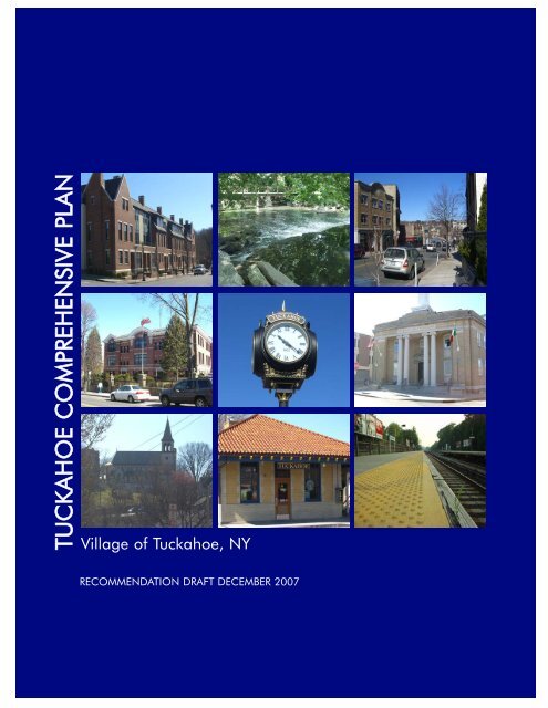
TUCKAHOE COMPREHENSIVE PLAN<br />
<strong>Village</strong> <strong>of</strong> <strong>Tuckahoe</strong>, NY<br />
RECOMMENDATION DRAFT DECEMBER 2007
RECOMMENDATION DRAFT<br />
COMPREHENSIVE PLAN<br />
<strong>Village</strong> <strong>of</strong> <strong>Tuckahoe</strong>, NY<br />
65 Main Street<br />
<strong>Tuckahoe</strong>, NY 10707<br />
Board <strong>of</strong> Trustees<br />
John Fitzpatrick, Mayor<br />
Steven A. Ecklond, Deputy Mayor<br />
Luigi V. Marcoccia<br />
Clare Gorman<br />
Ernest J. Zocchi<br />
<strong>Master</strong> <strong>Plan</strong> Revision Committee<br />
Antonio Leo, Chair<br />
Melba Caliano, Esq, UP, Former-Chair<br />
Daniel Belles<br />
Ann Marie Ciaramella, <strong>Plan</strong>ning Board Chair<br />
David Kubaska<br />
Gloria Rosell, Zoning Board Chair<br />
Philip White<br />
John D. Cavallaro, Esq – <strong>Village</strong> Counsel<br />
Bill Williams – <strong>Village</strong> Building Inspector<br />
Prepared By<br />
BFJ <strong>Plan</strong>ning<br />
115 5 th Avenue<br />
New York, NY 10003<br />
Frank Fish, FAICP, Principal<br />
Sarah K. Yackel, AICP, Project Manager<br />
Melanie Ochser, Project <strong>Plan</strong>ner<br />
This draft represents the final recommendations <strong>of</strong> the <strong>Master</strong> <strong>Plan</strong> Revision Committee to the<br />
<strong>Tuckahoe</strong> <strong>Village</strong> Board <strong>of</strong> Trustees.<br />
December 2007
<strong>Tuckahoe</strong> Comprehensive <strong>Plan</strong><br />
TABLE OF CONTENTS<br />
1.0 Introduction 1<br />
1.1 <strong>Plan</strong> Update 1<br />
1.2 Development <strong>of</strong> <strong>Plan</strong> 1<br />
1.3 Organization <strong>of</strong> <strong>Plan</strong> 2<br />
2.0 Regional and Local Setting 3<br />
2.1 Introduction 3<br />
2.2 Regional <strong>Plan</strong> 3<br />
2.3 Local Context 9<br />
3.0 History 12<br />
3.1 Historical Perspectives 12<br />
3.2 Past <strong>Plan</strong>s 15<br />
4.0 Land Use and Zoning 17<br />
4.1 Introduction 17<br />
4.2 Land Use 17<br />
4.3 Zoning<br />
5.0 People and Housing 23<br />
5.1 Introduction 23<br />
5.2 Population Density 23<br />
5.3 Population Growth 25<br />
5.4 Race and Ethnicity 26<br />
5.5 Age Pr<strong>of</strong>ile 26<br />
5.6 Housing 27<br />
5.7 Economic Characteristics 29<br />
6.0 Environment and Parks 30<br />
6.1 Soils 30<br />
6.2 Slopes 33<br />
6.3 Floodplains 33<br />
6.4 Parks 35<br />
7.0 Infrastructure 38<br />
7.1 Roads, Rail, and Bus 38<br />
7.2 Water 39<br />
7.3 Sanitary Sewer 39<br />
7.4 Solid Waste 39<br />
7.5 Electric and Gas 39<br />
7.6 Telephone 39<br />
7.7 Cable 39<br />
Page<br />
i
<strong>Tuckahoe</strong> Comprehensive <strong>Plan</strong><br />
8.0 Community Facilities 40<br />
8.1 Public Buildings 40<br />
8.2 Schools 43<br />
8.3 Religious Institutions 43<br />
9.0 <strong>Plan</strong> Goals and Recommendations 44<br />
9.1 Goals and Objectives 44<br />
9.2 Land Use and Zoning Recommendations 44<br />
9.3 Capital Budget Recommendations 47<br />
9.4 Programmatic Recommendations 48<br />
ii
<strong>Tuckahoe</strong> Comprehensive <strong>Plan</strong><br />
FIGURES<br />
2.1 Regional Location<br />
2.2 USGS Map<br />
2.3 Road Map<br />
2.4 Westchester Patterns Map – Centers and Corridors<br />
2.5 School Districts<br />
2.6 Aerial Map<br />
4.1 Generalized Land Use<br />
4.2 Zoning Map<br />
5.1 Census Tract in <strong>Tuckahoe</strong><br />
5.2 Westchester Population Density<br />
6.1 <strong>Tuckahoe</strong> Soils<br />
6.2 Slopes and Floodplain<br />
6.3 Major Parks and Open Space<br />
7.1 Bee-Line Bus Route Map<br />
8.1 Community Facilities<br />
9.1 Existing Industrial Areas<br />
TABLES<br />
4-1 Schedule <strong>of</strong> Permitted Uses<br />
4-2 Schedule <strong>of</strong> Area and Bulk Requirements<br />
5-1 Population Change since 1970<br />
5-2 Race and Ethnicity<br />
5-3 Increase in Number <strong>of</strong> Housing Units 1990-2000<br />
6-1 Soil Classification<br />
APPENDICES<br />
Appendix A<br />
Public Workshop Summary<br />
iii
<strong>Tuckahoe</strong> Comprehensive <strong>Plan</strong><br />
1.0 Introduction<br />
1.0 INTRODUCTION<br />
1.1 <strong>Plan</strong> Update<br />
It has been over ten years since the last Comprehensive <strong>Plan</strong> was adopted for the <strong>Village</strong> <strong>of</strong><br />
<strong>Tuckahoe</strong> in 1994. Since that time, the <strong>Village</strong> has grown and experienced new development. In<br />
addition, the basic land use and demographic data <strong>of</strong> the 1994 plan requires updating. As a<br />
result it has been determined that the <strong>Plan</strong> should be updated to reflect existing conditions and<br />
lay out a set <strong>of</strong> goals that will set a path for the <strong>Village</strong> to move forward over the next ten years.<br />
1.2 Development <strong>of</strong> <strong>Plan</strong><br />
New York State Law (Section 7-722), recognizes<br />
that “among the most important powers and<br />
duties granted by the legislature to a village<br />
government is the authority and responsibility to<br />
undertake village comprehensive planning and to<br />
regulate land use for the purpose <strong>of</strong> protecting the<br />
public health, safety and general welfare <strong>of</strong> its<br />
citizens.” The plan is not required under State<br />
Law, but is encouraged in order to “foster<br />
cooperation among governmental agencies<br />
planning and implementing capital projects.” The<br />
<strong>Village</strong> Trustees are the ultimate authority in<br />
adopting a Comprehensive <strong>Plan</strong>, but may<br />
designate a special board to undertake<br />
Photo from Public Workshop 1<br />
preparation <strong>of</strong> the <strong>Plan</strong>. In this case, the Mayor<br />
appointed a <strong>Master</strong> <strong>Plan</strong> Revision Committee in 2005 to prepare a draft update to the existing<br />
<strong>Village</strong> <strong>Master</strong> <strong>Plan</strong>. Assisting the Committee is the <strong>Village</strong> legal counsel, <strong>Village</strong> Building<br />
Inspector, and the <strong>Village</strong> planning consultant.<br />
The purpose <strong>of</strong> the Comprehensive <strong>Plan</strong> is to<br />
guide policy and land use decisions in the<br />
<strong>Village</strong> <strong>of</strong> <strong>Tuckahoe</strong> over the next ten years. It<br />
will provide an overview <strong>of</strong> <strong>Tuckahoe</strong> as it exists<br />
today, identify the <strong>Village</strong>’s vision for its future,<br />
and provide a roadmap for achieving that<br />
vision. For the Comprehensive <strong>Plan</strong> to be<br />
successful, it must also reflect the concerns <strong>of</strong> the<br />
many stakeholders within the <strong>Village</strong>, including<br />
residents and business owners, local<br />
organizations, and county and state<br />
governmental agencies. To that end, on May<br />
16, 2007 a public workshop was held at the<br />
<strong>Tuckahoe</strong> Community Center. At the meeting,<br />
BFJ <strong>Plan</strong>ning gave a presentation outlining the<br />
Photo from Public Workshop 1<br />
1
<strong>Tuckahoe</strong> Comprehensive <strong>Plan</strong><br />
1.0 Introduction<br />
purpose <strong>of</strong> the Comprehensive <strong>Plan</strong>, basic demographic and land use data and a draft set <strong>of</strong><br />
goals. The goals reflect broad areas <strong>of</strong> concern within the <strong>Village</strong> and are as follows:<br />
• Goal 1: Preserve Neighborhood Quality<br />
• Goal 2: Maintain a “Green” <strong>Tuckahoe</strong><br />
• Goal 3: Maintain and Improve the Economic Base<br />
• Goal 4: Foster Vital Retail Centers<br />
The attendees then sat at roundtables to discuss the following four subjects: Crestwood, Depot<br />
Square, Main Street, and Marbledale Road. They were also asked to respond to a list <strong>of</strong> prepared<br />
questions including: What is the most important asset to <strong>Tuckahoe</strong> What do you see for<br />
<strong>Tuckahoe</strong> five years from now What, if any, are problem areas for <strong>Tuckahoe</strong> They also listed<br />
the maintenance and improvement <strong>of</strong> the economic base and the preservation <strong>of</strong> neighborhood<br />
quality as two <strong>of</strong> the most important goals. Appendix A provides a complete summary <strong>of</strong> the<br />
workshop.<br />
The <strong>Master</strong> <strong>Plan</strong> Revision Committee spent the summer and fall <strong>of</strong> 2007 in a series <strong>of</strong> meetings<br />
with its planning consultants as well as representatives <strong>of</strong> various community interests. This led to<br />
a draft plan in November 2007 which was presented in <strong>Village</strong> Hall at a second public workshop<br />
on November 15, 2007. The Committee then met again on December 11 to finalize this<br />
recommendation drat <strong>of</strong> the <strong>Plan</strong>.<br />
1.3 Organization <strong>of</strong> <strong>Plan</strong><br />
This Comprehensive <strong>Plan</strong> is organized into nine chapters which set out existing conditions as well<br />
as opportunities and constraints that face the <strong>Village</strong> on a range <strong>of</strong> issues. The <strong>Plan</strong> concludes in<br />
Chapter 9.0 with a set <strong>of</strong> overall goals (outlined above) and objectives to guide the <strong>Village</strong> in the<br />
future as well as a list <strong>of</strong> <strong>Plan</strong> goals and recommendations.<br />
2
<strong>Tuckahoe</strong> Comprehensive <strong>Plan</strong><br />
2.0: Regional and Local Setting<br />
2.0 REGIONAL AND LOCAL SETTING<br />
2.1 Introduction<br />
The <strong>Village</strong> <strong>of</strong> <strong>Tuckahoe</strong> is located in Southern Westchester County, New York, and is<br />
encompassed by the Town <strong>of</strong> Eastchester (see Figure 2.1: Regional Location Map). The <strong>Village</strong> is<br />
bounded by the <strong>Village</strong> <strong>of</strong> Bronxville to the south, the Bronx River to the west, Eastchester to the<br />
north and east, and covers .6 square miles (see Figure 2.2: USGS Map). The City <strong>of</strong> White Plains,<br />
one <strong>of</strong> the Westchester County’s four major centers, is located approximately seven miles to the<br />
northeast, and mid-town Manhattan is only sixteen miles south <strong>of</strong> the <strong>Village</strong>.<br />
<strong>Tuckahoe</strong>’s strategic location is evident when examining regional transportation and the <strong>Village</strong><br />
boasts extensive accessibility by private and public transportation (see Figure 2.3: Road Map).<br />
The Bronx River Parkway and Route 22 (White Plains Road) are among many important state and<br />
county highways that serve the <strong>Village</strong>. These roads provide connections to Westchester County’s<br />
most developed areas and the region’s major airports. The <strong>Village</strong> is also situated along the<br />
Harlem Line <strong>of</strong> the Metro-North Railroad.<br />
2.2 Regional <strong>Plan</strong>s<br />
A community’s growth and development patterns are shaped most directly by the land use and<br />
planning decisions made by its local government. However, many local concerns, such as air<br />
and water quality, traffic conditions, and economic growth have impacts that reach beyond<br />
municipal boundaries. These can be most effectively addressed when the regional context is<br />
taken into consideration. This broader outlook for growth and development is provided by vision<br />
plans issued by state and county governments and sometimes inter-municipal agreements. For<br />
<strong>Tuckahoe</strong>, several plans and initiatives have been developed on the county and inter-municipal<br />
levels that are relevant to local decisions. These are:<br />
• Regional <strong>Plan</strong> Association – A Region at Risk<br />
• Westchester County’s Patterns for Westchester: The Land and the People<br />
The Region – A Region at Risk. Since 1922, the Regional <strong>Plan</strong> Association (RPA) has issued<br />
three plans that provide a regional perspective on land use issues in the 31-county New<br />
York/New Jersey/Connecticut metropolitan area. The Third Regional <strong>Plan</strong>, A Region at Risk<br />
(1996), presents a broad vision for improving regional quality <strong>of</strong> life and competitiveness within a<br />
global economy. The plan’s specific recommendations, expressed as Campaigns, include polices<br />
on green areas, the economic development <strong>of</strong> centers, improved transportation systems, the<br />
workforce and governance. Some <strong>of</strong> these recommendations are incorporated in this plan. The<br />
region also supports recent improvements such as the rail project that connects Crestwood to<br />
Fleetwood.<br />
3
VILLAGE OF TUCKAHOE<br />
COMPREHENSIVE PLAN<br />
FIGURE 2.1: REGIONAL LOCATION<br />
SOURCE:<br />
NTS
VILLAGE OF TUCKAHOE<br />
COMPREHENSIVE PLAN<br />
SOURCE: USGS TOPOGRAPHICAL SURVEY MAP MOUNT VERON QUAD<br />
FIGURE 2.2: USGS MAP<br />
0 2400 ft
VILLAGE OF TUCKAHOE<br />
FIGURE 2.3: ROAD MAP<br />
COMPREHENSIVE PLAN<br />
SOURCE:HAGSTROM MAP COMPANY, 1996.
<strong>Tuckahoe</strong> Comprehensive <strong>Plan</strong><br />
2.0: Regional and Local Setting<br />
Westchester County Patterns. In 1996, Westchester County adopted Patterns for Westchester:<br />
the Land and the People (Patterns). Patterns serves as a policy document designed to guide<br />
sustainable development that “balances economic and environmental concerns and serves the<br />
needs <strong>of</strong> a changing population.” Patterns <strong>of</strong>fers a broader vision and context for local-level<br />
planning initiatives. It supports looking at both local and cross-border issues and encourages<br />
inter-municipal communication and cooperation to strengthen individual municipalities and the<br />
County overall.<br />
Since final land use authority rests with municipalities, Patterns serves as a guide and not a<br />
mandate for local planning efforts. However, the county does have two sources <strong>of</strong> influence: 1)<br />
when considering distributing grants or funding assistance for local planning efforts, the county<br />
can look at whether these local efforts conform to the vision set forth in Patterns and 2) under<br />
Article 239-m <strong>of</strong> the State’s General Municipal Law, the county’s planning department has<br />
mandatory review over certain proposed planning and zoning actions that occur within 500 feet<br />
<strong>of</strong> a municipal boundary and state and county facilities. These actions include the adoption <strong>of</strong> a<br />
comprehensive plan, and the issuance <strong>of</strong> site plan approval, special permit, or variance for<br />
property within 500 feet <strong>of</strong> a municipal boundary, county or state park or recreation area, county<br />
or state roadway, county-owned stream or drainage channel, or county or state-owned land on<br />
which a public building or institution is situated. If the county does not approve the proposed<br />
action, it can require that the referring local board approve the action by a majority plus one vote<br />
<strong>of</strong> all board members. Westchester County has exercised its right under Article 239-m in<br />
disapproving local comprehensive plans and zoning ordinances.<br />
Patterns categorizes the County’s municipalities, transportation network, and natural environment<br />
as centers, corridors and open space respectively. The basic premise <strong>of</strong> Patterns is that existing<br />
centers, if nurtured by necessary infrastructure, can support commercial and residential growth;<br />
that existing strip development along corridors can be reshaped to capture some benefits <strong>of</strong><br />
centers; and that not all land uses are appropriate to all locations. From this perspective,<br />
hamlets and small towns function as service centers and remain the optimum locale for<br />
development investment. Downtown <strong>Tuckahoe</strong> and the Crestwood Business District are identified<br />
as local centers in Patterns (see Figure 2.4: Westchester Patterns Map- Centers and Corridors).<br />
Local centers typically have a well defined downtown business district and include, in addition to<br />
the uses found in hamlets, small scale <strong>of</strong>fices, more extensive retail stores, supermarkets,<br />
libraries, other public buildings, and residential uses “over the store” and in low-rise multi-family<br />
structures. Some parts <strong>of</strong> the identified transportation network corridors also run through<br />
<strong>Tuckahoe</strong>.<br />
The recommendations set forth in Patterns for <strong>Tuckahoe</strong> support the <strong>Village</strong>’s efforts to preserve<br />
its existing patterns <strong>of</strong> development and open space.<br />
7
<strong>Village</strong> <strong>of</strong> <strong>Tuckahoe</strong><br />
VILLAGE OF TUCKAHOE<br />
COMPREHENSIVE PLAN<br />
FIGURE 2.4: WESTCHESTER PATTERNS MAP - CENTERS AND CORRIDORS<br />
SOURCE: WESTCHESTER COUNTY DEPARTMENT OF PLANNING
<strong>Tuckahoe</strong> Comprehensive <strong>Plan</strong><br />
2.0: Regional and Local Setting<br />
2.3 Local Context<br />
<strong>Tuckahoe</strong> is an incorporated <strong>Village</strong> within the Town <strong>of</strong> Eastchester. The other incorporated<br />
<strong>Village</strong> within Eastchester is Bronxville. The Town <strong>of</strong> Eastchester is currently in the process <strong>of</strong><br />
updating its Comprehensive <strong>Plan</strong>, and the <strong>Village</strong> <strong>of</strong> Bronxville most recently updated its <strong>Master</strong><br />
<strong>Plan</strong> in 2005. The planning and development efforts in neighboring municipalities provide<br />
important additional insight into the local context <strong>of</strong> <strong>Tuckahoe</strong>.<br />
This becomes apparent when<br />
examining the structure <strong>of</strong> the school<br />
districts within the <strong>Village</strong>. <strong>Tuckahoe</strong><br />
encompasses two separate school<br />
districts - Eastchester Union Free<br />
School District and <strong>Tuckahoe</strong> Union<br />
Free School District (see Figure 2.5:<br />
School Districts). This map illustrates<br />
<strong>Tuckahoe</strong>’s unique local position.<br />
In addition, <strong>Tuckahoe</strong> is positioned<br />
extremely well in terms <strong>of</strong> local and<br />
regional transportation (See Figure<br />
2.6: Aerial Map). In terms <strong>of</strong> state<br />
roads, State Route Number 22 (White<br />
Plains Road) and Number 100 (Central<br />
Avenue) serve the <strong>Village</strong> <strong>of</strong> <strong>Tuckahoe</strong><br />
on the east and west. County roads<br />
that serve the <strong>Village</strong> include the Saw<br />
Mill River Parkway, the Hutchinson<br />
River Parkway, the Bronx River Parkway<br />
and the Sprain Brook Parkway.<br />
Figure 2.5: School Districts<br />
9
Yonkers<br />
Lincoln<br />
Avenue<br />
Fisher Avenue<br />
<strong>Tuckahoe</strong><br />
Columbus Avenue<br />
Marbledale Road<br />
Eastchester<br />
Sagamore Road<br />
Main<br />
Street<br />
Midland Avenue<br />
White Plains Road<br />
Bronxville<br />
VILLAGE OF TUCKAHOE<br />
COMPREHENSIVE PLAN<br />
SOURCE: NEW YORK STATE GIS CLEARINGHOUSE, 2004<br />
FIGURE 2.6: AERIAL MAP<br />
0 900 ft
<strong>Tuckahoe</strong> Comprehensive <strong>Plan</strong><br />
2.0: Regional and Local Setting<br />
At the local level, the major north-south<br />
thoroughfares <strong>of</strong> the <strong>Village</strong> <strong>of</strong> <strong>Tuckahoe</strong> are<br />
Columbus Avenue and Marbledale Road, while<br />
the major east-west roads are Main Street,<br />
Lincoln Avenue and Fisher Avenue. Lincoln and<br />
Fisher Avenues provide access to the adjacent<br />
Town <strong>of</strong> Eastchester. Other important local<br />
streets providing access to the <strong>Village</strong>’s<br />
downtown include Winterhill Road, Midland<br />
Avenue, Sagamore Road, which provides access<br />
to the <strong>Village</strong> <strong>of</strong> Bronxville and turns into<br />
Columbus Avenue north <strong>of</strong> Main Street, and<br />
Yonkers Avenue. Yonkers Avenue connects<br />
downtown <strong>Tuckahoe</strong> to the adjacent City <strong>of</strong><br />
Yonkers. The Main Street Corridor is a heavily<br />
trafficked area within the <strong>Village</strong>.<br />
Main Street looking West<br />
<strong>Tuckahoe</strong> is also situated along the Harlem Line<br />
<strong>of</strong> the Metro North Railroad, which runs<br />
north/south through the western portion <strong>of</strong> the<br />
<strong>Village</strong> adjacent to Columbus Avenue. There are<br />
two Metro North stops within the <strong>Village</strong>- one at<br />
<strong>Village</strong> Square/<strong>Tuckahoe</strong> Station and one at<br />
Crestwood Station. Finally, the Bee-Line bus<br />
system also serves the <strong>Village</strong>, providing<br />
multiple lines <strong>of</strong> service.<br />
Intersection <strong>of</strong> Main Street and Columbus<br />
Avenue<br />
11
<strong>Tuckahoe</strong> Comprehensive <strong>Plan</strong><br />
3.0: History<br />
3.0 HISTORY<br />
3.1 Historical Perspectives<br />
<strong>Tuckahoe</strong> has a long history dating back to the founding<br />
<strong>of</strong> the colonial town <strong>of</strong> Eastchester in 1664. Originally a<br />
Native American settlement, the name <strong>Tuckahoe</strong> referred<br />
to the root <strong>of</strong> a plant that was roasted by the Indians and<br />
eaten as bread. A one-time agriculturally based area,<br />
<strong>Tuckahoe</strong> established itself as the major center for marble<br />
quarrying in the early Nineteenth Century. Eastchester<br />
quarries represented one <strong>of</strong> the largest supplies <strong>of</strong> white<br />
marble in the United States prior to 1850. The large<br />
supply <strong>of</strong> white marble within <strong>Tuckahoe</strong> and the<br />
surrounding areas, in combination with the construction<br />
<strong>of</strong> the railroad, allowed this industry to flourish for over a<br />
century. When the New York and Harlem railroad<br />
extended the line north over 150 years ago, one <strong>of</strong> the<br />
first new stops was <strong>Tuckahoe</strong>. Consequently, quarry<br />
owners were able to conveniently ship large blocks <strong>of</strong> the<br />
marble. As a result, structures such as the New York<br />
Public Library and St. Patrick’s Cathedral and the Historic <strong>Tuckahoe</strong><br />
Washington Monument and the Capitol Building, along with many other buildings built in the<br />
1800s and 1900s, are comprised <strong>of</strong> marble from <strong>Tuckahoe</strong>.<br />
Generoso Pope Foundation<br />
The rail line and the quarrying business brought<br />
hundreds <strong>of</strong> workers to the area. This primarily<br />
included Irish men and Scottish men, along with<br />
Italians, who remained in <strong>Tuckahoe</strong> more so than the<br />
others. Roughly two thirds <strong>of</strong> the residents in<br />
<strong>Tuckahoe</strong> today are <strong>of</strong> Italian ancestry. In addition,<br />
the Generoso Pope Foundation, a charitable<br />
foundation founded by Generoso Pope in 1947, is<br />
headquartered in <strong>Tuckahoe</strong>’s old <strong>Village</strong> Hall. This<br />
foundation contributes to the <strong>Tuckahoe</strong> community in<br />
a variety <strong>of</strong> ways.<br />
In the post-war years, an upsurge in industrial development created thriving manufacturing area<br />
that produced electronics, pharmaceuticals and beverages, while the <strong>Village</strong>’s small-town<br />
character was preserved. The <strong>Village</strong> has many historical monuments and buildings that remind<br />
the residents <strong>of</strong> its rich history and contribute to the <strong>Village</strong>’s uniqueness, and a few <strong>of</strong> these will<br />
be highlighted in the following text.<br />
• The Old Stone Cotton Mill, erected in 1812 on the west bank <strong>of</strong> the Bronx River near<br />
Scarsdale Road in Yonkers, is one <strong>of</strong> the oldest cotton mills in the country, and received<br />
12
<strong>Tuckahoe</strong> Comprehensive <strong>Plan</strong><br />
3.0: History<br />
historical landmark status in 1992. The Stone Mill has been restored for its current use as<br />
a restaurant.<br />
• The Hodgeman Rubber Company constructed a large stone factory building on the<br />
northwest corner <strong>of</strong> Lake Avenue and Main Street in 1920. This building later housed<br />
Burroughs Wellcome, US Vitamin and Revlon laboratories, and today consists <strong>of</strong> luxury<br />
apartments.<br />
The Hodgman Rubber Company 1920 Rivervue Luxury Apartments 2007<br />
• The Main Street School was constructed in 1960 and is the oldest public building in<br />
<strong>Tuckahoe</strong>. It served as a public school, then the Assumption school and is now the <strong>Village</strong><br />
Hall and houses the Police Department.<br />
• The Washington Hotel, located at 101 Main Street, was built in 1883 by Samuel Fee, the<br />
Superintendent <strong>of</strong> the Eastchester Marble Quarry Company. The building served as a<br />
meeting hall and is an example <strong>of</strong> the fine <strong>Tuckahoe</strong> marble. The Hotel today serves as<br />
an apartment house with ground floor retail.<br />
Washington Hotel<br />
Washington Hotel today<br />
13
<strong>Tuckahoe</strong> Comprehensive <strong>Plan</strong><br />
3.0: History<br />
• The Ward House, located at the<br />
intersection <strong>of</strong> White Plains Road and<br />
Winterhill Road, was occupied by both<br />
British and American forces during the<br />
Revolutionary War, and was eventually<br />
burned and demolished in 1778 by the<br />
British. The house was rebuilt with the<br />
use <strong>of</strong> the original plans and served as<br />
an inn before being bought and<br />
converted into student housing by<br />
Concordia College.<br />
The Ward House<br />
• It was common for the hub <strong>of</strong> early<br />
communities to be the railroad station.<br />
<strong>Tuckahoe</strong>’s Depot Square was<br />
surrounded by rows <strong>of</strong> buildings which<br />
housed the early Town and <strong>Village</strong><br />
<strong>of</strong>fices, including the Post Office and<br />
shops. These buildings were eventually<br />
pushed back in order to enlarge the<br />
square.<br />
Depot Square circa 1910<br />
• The original <strong>Tuckahoe</strong> Railroad Station was constructed when the railroad extended its<br />
service in 1844. It was rebuilt in 1907 and in 1911, at which point the tracks were<br />
lowered and the buildings were jacked up and moved away from the tracks. Metro North<br />
recently assisted in the renovation <strong>of</strong> the station into the beautiful building it is today.<br />
<strong>Tuckahoe</strong> Station 1910<br />
<strong>Tuckahoe</strong> Metro North Station today<br />
14
<strong>Tuckahoe</strong> Comprehensive <strong>Plan</strong><br />
3.0: History<br />
• There are also many monuments scattered<br />
throughout the <strong>Village</strong>. These include the Monument<br />
area on Winterhill Road and Main Street, and the<br />
World War II, Gold Star Mother, Columbus, <strong>Village</strong><br />
Hall, Parkway Oval, Samuel Crawford and Korea-<br />
Vietnam monuments. In addition, the clock (at<br />
right), donated to the <strong>Village</strong> by the Generoso Pope<br />
Foundation, stands in the center <strong>of</strong> Depot Square<br />
and has become a symbol for the <strong>Village</strong>.<br />
Its proximity to county roads, New York City and water and its rich heritage affirmed <strong>Tuckahoe</strong> as<br />
a superior location and place to reside. As a result, <strong>Tuckahoe</strong> began to grow steadily into the<br />
attractive suburban area it is today. <strong>Tuckahoe</strong> today represents a renewed community which<br />
encompasses a mature mix <strong>of</strong> residential, industrial and business uses. A large selection <strong>of</strong><br />
quality housing options is present within the <strong>Village</strong>. In addition, many community facilities, such<br />
as the Community Center and Public Library, have been relocated in updated buildings,<br />
reinforcing the community’s ability to adapt to changing conditions.<br />
3.2 Past <strong>Plan</strong>s<br />
<strong>Tuckahoe</strong> Clock at Depot Square<br />
The notion <strong>of</strong> managed development is a long standing concept within the <strong>Village</strong> <strong>of</strong> <strong>Tuckahoe</strong><br />
as it has been planning for future growth and development for over half <strong>of</strong> a century.<br />
Incorporated <strong>of</strong>ficially in 1902, the adoption <strong>of</strong> <strong>Tuckahoe</strong>’s first Zoning Ordinance dates back to<br />
1930, and the first <strong>Master</strong> <strong>Plan</strong> was developed in 1960. The primary goal <strong>of</strong> the 1960 <strong>Master</strong><br />
<strong>Plan</strong> was to focus on the future development <strong>of</strong> the <strong>Village</strong>. Sub-standard housing was replaced<br />
and residential and commercial uses were separated in the <strong>Village</strong> center as a result <strong>of</strong> the<br />
implementation <strong>of</strong> an urban renewal plan. The urban renewal program proved to be a success in<br />
improving life for the residents <strong>of</strong> the <strong>Village</strong>.<br />
Although thirty years had passed since the completion <strong>of</strong> the 1960 <strong>Master</strong> <strong>Plan</strong>, the 1994 <strong>Master</strong><br />
<strong>Plan</strong> addressed similar issues. Generally, the goals <strong>of</strong> the 1994 <strong>Plan</strong> were:<br />
• The enhancement <strong>of</strong> aesthetics and improvement in the overall physical attractiveness <strong>of</strong> the<br />
<strong>Village</strong> as it continued to mature.<br />
• The enhancement <strong>of</strong> the quality <strong>of</strong> life for all citizens.<br />
More specifically, the 1994 <strong>Master</strong> <strong>Plan</strong> emphasized the importance <strong>of</strong> continuing to develop and<br />
refine residential, commercial and industrial areas, as well as to preserve important historical<br />
15
<strong>Tuckahoe</strong> Comprehensive <strong>Plan</strong><br />
3.0: History<br />
elements. The development <strong>of</strong> public and semi-public facilities and recommendations to<br />
remediate increased traffic flows were also components <strong>of</strong> the plan.<br />
16
<strong>Tuckahoe</strong> Comprehensive <strong>Plan</strong><br />
4.0: Land Use and Zoning<br />
4.0 LAND USE AND ZONING<br />
4.1 Introduction<br />
The built environment – the type, location and intensity <strong>of</strong> existing and future land uses – defines<br />
the character <strong>of</strong> a village. It is important to know where and how much land is presently<br />
developed for residential, business, recreation and other uses. Examining these developed areas<br />
helps residents visualize desirable and undesirable aspects <strong>of</strong> land use patterns and provides a<br />
foundation for the planning policies and objectives guiding future development <strong>of</strong> vacant, as well<br />
as underdeveloped parcels. A municipality’s zoning and subdivision regulations are the major<br />
regulatory tools by which it can regulate land uses and influence future development patterns and<br />
practices. The existing land uses, development patterns and zoning in the <strong>Village</strong> <strong>of</strong> <strong>Tuckahoe</strong><br />
are summarized below.<br />
4.2 Land Use<br />
<strong>Tuckahoe</strong> is a largely built-out residential suburban community within the New York metropolitan<br />
area. According to the United States Census Bureau, the <strong>Village</strong> contains a total land area <strong>of</strong> .6<br />
square miles. A breakdown <strong>of</strong> the major land use categories is shown in Figure 4.1: Generalized<br />
Land Use. This figure is based on Westchester County Geographic Information Systems (GIS)<br />
data (note that Westchester County GIS data combines commercial and industrial uses). The<br />
following details each land use type within the <strong>Village</strong> <strong>of</strong> <strong>Tuckahoe</strong>:<br />
Residential. Residential uses account for the vast majority <strong>of</strong> the <strong>Village</strong>’s land area. The higher<br />
density residential areas are just outside <strong>of</strong> the Main Street corridor as well as in the southern,<br />
central and northeastern parts <strong>of</strong> the <strong>Village</strong>. Single family development is generally grouped<br />
together in small neighborhoods, whereas two-family<br />
uses predominate around the <strong>Village</strong> center. Multi-family<br />
residential uses are also present in the <strong>Village</strong>.<br />
Community Services and Institutional. Community and<br />
institutional uses comprise a small portion <strong>of</strong> the land use<br />
in <strong>Tuckahoe</strong>. This use type is found primarily around the<br />
Main Street area, as well as near the Crestwood train<br />
station and in the southeastern part <strong>of</strong> the <strong>Village</strong>, and<br />
includes churches and community facilities.<br />
Commercial and Industrial. The major commercial<br />
centers are located within the downtown Main Street area<br />
<strong>of</strong> <strong>Tuckahoe</strong> in the south <strong>of</strong> the <strong>Village</strong> and within the<br />
Crestwood Business District in the north. These areas<br />
serve both residents and employees, and contain a mix <strong>of</strong><br />
retail, restaurant, and other neighborhood services. The<br />
<strong>Village</strong> has been recognized for recent aesthetic<br />
enhancements to these commercial areas (see photo at<br />
right).<br />
Crestwood Plaza<br />
17
Land Use Legend<br />
Residential Low Density<br />
Residential High Density<br />
Commercial/Industrial<br />
Community Services/Institutional<br />
Parks/Open Spaces<br />
Vacant/Undeveloped<br />
Water Body<br />
Crestwood Business<br />
District<br />
T<br />
Lincoln<br />
Avenue<br />
Yonkers<br />
Fisher Avenue<br />
Columbus Avenue<br />
Industrial<br />
Corridor<br />
Downtown<br />
<strong>Tuckahoe</strong><br />
<strong>Tuckahoe</strong><br />
Marbledale Road<br />
T<br />
Main<br />
Str et<br />
Eastchester<br />
Bronxville<br />
VILLAGE OF TUCKAHOE<br />
COMPREHENSIVE PLAN<br />
SOURCE: WESTCHESTER COUNTY GIS<br />
FIGURE 4.1: GENERALIZED LAND USE<br />
0 900 ft
<strong>Tuckahoe</strong> Comprehensive <strong>Plan</strong><br />
4.0: Land Use and Zoning<br />
The major industrial corridor is located along Marbledale Road in the eastern part <strong>of</strong> the <strong>Village</strong>.<br />
Recently, there have been discussions regarding plans for adaptive re-use <strong>of</strong> some <strong>of</strong> the<br />
buildings within this corridor.<br />
Parks and Open Spaces. <strong>Tuckahoe</strong> is home to many parks and playgrounds, located primarily<br />
along the western boundary <strong>of</strong> the <strong>Village</strong> and also scattered throughout the <strong>Village</strong>. In addition,<br />
the pedestrian pathway along the Bronx River is located along the western border <strong>of</strong> <strong>Tuckahoe</strong><br />
and extends throughout other portions <strong>of</strong> Westchester County.<br />
Vacant and Undeveloped Land. <strong>Tuckahoe</strong> contains very few parcels <strong>of</strong> vacant or undeveloped<br />
land. These parcels are located in the southern part <strong>of</strong> the <strong>Village</strong>.<br />
4.3 Zoning<br />
The <strong>Village</strong> <strong>of</strong> <strong>Tuckahoe</strong> has seven primary zoning classifications, including five single-family<br />
residential districts (Residence A-10, Residence A-5, Residence B, Apartment 3, and<br />
Business/Residential), two multi-family residential districts (Residence B and Apartment 3), two<br />
business districts (Business/Residential and Business), and one industrial district (Industry). Figure<br />
4.2 shows the complete zoning map for the <strong>Village</strong> <strong>of</strong> <strong>Tuckahoe</strong>. Please refer to Table 4.1 for the<br />
complete zoning schedule <strong>of</strong> permitted uses, which details the permitted principle and special<br />
permit uses allowed for the district and Table 4.2 for the complete zoning schedule <strong>of</strong> area and<br />
bulk requirements, which details the exact permitted size, height, and building coverage<br />
percentage for each structure by district.<br />
Residential Zones<br />
The permitted principle uses for the A-10 and A-5 districts are one-family dwellings, municipal<br />
parks and playgrounds, and places <strong>of</strong> worship (which includes parish houses and schools). In<br />
addition, these single-family residential districts allow for single family homes on a range <strong>of</strong> lot<br />
sizes from 5,000 to 10,000 square feet. Residence B allows for all <strong>of</strong> the permitted uses included<br />
in A-5 plus dwellings for two families. Apartment B allows any use permitted in Residence B<br />
Districts as well as apartment buildings for one-family residential with at least seven units,<br />
townhouses with at least two and less than eight attached one-family dwellings, and senior citizen<br />
housing. Business/Residential Districts allow for apartments for one-family residential at or above<br />
the second story.<br />
Business and Industry Districts<br />
The permitted principle uses <strong>of</strong> the Business District include retail stores and banks, personal<br />
service stores, business, pr<strong>of</strong>essional or government <strong>of</strong>fices, service establishments <strong>of</strong> a nonpersonal<br />
nature, theatres and restaurants, laundry and cleaning establishments, newspaper<br />
printing, signs (excluding billboards) and places <strong>of</strong> worship. These uses are also permitted in the<br />
Business/Residential District. There are also a variety <strong>of</strong> special permit uses acceptable within<br />
these districts. The permitted principle uses for the Industry District include <strong>of</strong>fices for pr<strong>of</strong>essional,<br />
executive or administrative purposes, scientific or research laboratories, fabrication and assembly<br />
<strong>of</strong> products, processing <strong>of</strong> materials, motor vehicle filling stations or body/repair shops, quarters<br />
for caretakers or watchmen, and facilities for furnishing meals and selling refreshments and<br />
personal convenience items to employees <strong>of</strong> uses in a particular development. In addition,<br />
outdoor storage and sports and health clubs are classified as special permit uses within this<br />
district.<br />
19
VILLAGE OF TUCHAKOE<br />
FIGURE 4.2: ZONING MAP<br />
COMPREHENSIVE PLAN<br />
SOURCE: BFJ PLANNING, 2007
<strong>Tuckahoe</strong> Today<br />
5.0: People and Housing<br />
5.0 PEOPLE AND HOUSING<br />
5.1 Introduction<br />
This chapter examines <strong>Tuckahoe</strong>’s demographic characteristics including population, race and<br />
ethnicity, housing, income, and economic characteristics, providing an overview <strong>of</strong> existing<br />
conditions and recent trends. <strong>Tuckahoe</strong> contains one census tract: number 119 (See Figure 5.1,<br />
below). Census Tract 119 encompasses the entire <strong>Village</strong>. This analysis also includes some<br />
figures for the <strong>Village</strong> <strong>of</strong> Bronxville and Town <strong>of</strong> Eastchester, Westchester County, and New York<br />
State, where comparisons are considered relevant.<br />
Figure 5.1: Census Tract in <strong>Tuckahoe</strong><br />
5.2 Population Density<br />
<strong>Tuckahoe</strong> has a very high population density for an area <strong>of</strong> only .6 total square miles. Figure 5.2<br />
shows the population density <strong>of</strong> the majority <strong>of</strong> <strong>Tuckahoe</strong> to be greater than 10,000 people per<br />
square mile, whereas the population density <strong>of</strong> parts <strong>of</strong> Eastchester is between 1,000 and 3,000<br />
people per square mile. In addition, the population density <strong>of</strong> the majority <strong>of</strong> Bronxville is<br />
between 3,000 and 10,000 people per square mile.<br />
23
Kisco<br />
OSSINING<br />
N E W C A S T L E<br />
Ossining<br />
N TY<br />
H<br />
H<br />
U<br />
D<br />
S O<br />
N<br />
Briarcl iffM anor<br />
Pleasantville<br />
N ORTH C A S T L E<br />
C N N O E<br />
M O U N T P L E A S A N T<br />
SleepyH ollow<br />
Tarrytown<br />
Elmsford<br />
GREENW ICH<br />
M<br />
Persons<br />
<<br />
5<br />
1<br />
3<br />
><br />
Y O R K<br />
R S E Y<br />
IV E R<br />
R<br />
Irvington<br />
D obbsFerry<br />
GREENBURGH<br />
Ardsley<br />
WHITEPLAINS<br />
H A R R IS O N<br />
C O N N E C T I C U T<br />
Rye<br />
RYE<br />
PortChester<br />
H astingson Hudson<br />
SCARSDA LE<br />
OUN TY<br />
2 Miles<br />
YO NK ERS<br />
<strong>Tuckahoe</strong><br />
Bronxville<br />
MOUNT<br />
VERNON<br />
Pelham<br />
C I T Y O F N E W Y O R<br />
BR ONX<br />
EA STCHESTER<br />
NEW<br />
ROCHELL<br />
Pelham M anor<br />
MAMARON ECK<br />
RYE<br />
M am aroneck<br />
Larchm ont<br />
NG<br />
LO<br />
ISLAND SO UN D<br />
RY E<br />
VILLAGE OF TUCKAHOE<br />
FIGURE 5.2: WESTCHESTER POPULATION DENSITY<br />
COMPREHENSIVE PLAN<br />
SOURCE: WESTCHESTER COUNTY GIS, 2007
<strong>Tuckahoe</strong> Today<br />
5.0: People and Housing<br />
5.3 Population Growth<br />
The US Census Bureau (2000) estimates the 2005 population for <strong>Tuckahoe</strong> at 6,256 which<br />
represents a community-wide population increase <strong>of</strong> 0.7% since the 2000 Census. <strong>Tuckahoe</strong><br />
experienced a decline in population between 1970 and 1980, similar to nearby villages (see<br />
Table 5-1) but the population increased between 1980 and 1990, while the populations <strong>of</strong><br />
adjacent Bronxville and nearby Pelham Manor continued to decline. In contrast between 1990<br />
and 2000 the population <strong>of</strong> <strong>Tuckahoe</strong> declined, while Bronxville and Pelham Manor experienced<br />
population growth for the first time since 1970. Based on the 2005 estimate, <strong>Tuckahoe</strong>’s<br />
population has now recovered beyond its 1970 peak.<br />
Year<br />
<strong>Tuckahoe</strong><br />
Total<br />
Population<br />
TABLE 5-1<br />
Population Change in <strong>Tuckahoe</strong> since 1970<br />
%age<br />
Change<br />
<strong>Tuckahoe</strong><br />
%age<br />
Change<br />
Bronxville<br />
%age<br />
Change<br />
Pelham<br />
Manor<br />
%age<br />
Change<br />
Westchester<br />
County<br />
%age<br />
Change<br />
NY State<br />
1970 6,236<br />
1980 6,076 -2.6 -6.1 -8.1 -3.1 -3.7<br />
1990 6,302 3.7 -3.8 -11.2 1.0 2.5<br />
2000 6,211 -1.4 8.5 0.4 5.6 5.5<br />
2005 (estimate) 6,256 0.7 -1.3 -1.3 1.9 1.8<br />
Source: U.S. Census Bureau, 1970 - 2004<br />
6400<br />
CHART 5-1<br />
<strong>Tuckahoe</strong> Population Change: 1970-2005<br />
Population<br />
6300<br />
6200<br />
6100<br />
6000<br />
1970 1980 1990 2000 2005 estimate<br />
Year<br />
Source: U.S. Census Bureau, 1970 - 2005<br />
25
<strong>Tuckahoe</strong> Today<br />
5.0: People and Housing<br />
5.4 Race and Ethnicity<br />
According to the U.S. Census (2000), the <strong>Village</strong> <strong>of</strong> <strong>Tuckahoe</strong> is approximately 74%White, 10<br />
percent African American, 10% Asian and 9% Hispanic. The race and ethnicity <strong>of</strong> <strong>Village</strong><br />
residents is similar to the Westchester County pr<strong>of</strong>ile as a whole. Since 1990 the racial<br />
composition <strong>of</strong> the <strong>Village</strong> has undergone change, as can be seen from Table 5-2. Between<br />
1990 and 2000 the <strong>Village</strong>’s White population remained relatively constant; however, the African<br />
American population declined from 15% to 10%, while the Hispanic population grew by 5<br />
percent.<br />
Race/Ethnicity*<br />
TABLE 5-2<br />
Race and Ethnicity<br />
Percent <strong>of</strong> Population:<br />
<strong>Tuckahoe</strong><br />
Percent <strong>of</strong><br />
Population:<br />
Westchester County<br />
1990 2000 2000<br />
White alone 73% 74% 71 %<br />
Black/African American alone 15% 10% 14 %<br />
American Indian & Alaskan Native<br />
0.2% 0.1% 0%<br />
alone<br />
Asian or Pacific Islander alone 11% 10% 5%<br />
Other 4% 6% 10%<br />
Hispanic (may be <strong>of</strong> any race) 4% 9% 16%<br />
Source: U.S. Census Bureau, 1990 (SF3, Tables P8 & P10) & 2000 (SF3 Tables P6 and P7), Westchester County<br />
<strong>Plan</strong>ning Department<br />
*Please note that the above table adds up to more than 100%; Hispanic persons can be <strong>of</strong> any race, and thus, the<br />
Hispanic count overlaps with persons counted in racial categories.<br />
5.5 Age Pr<strong>of</strong>ile<br />
An analysis <strong>of</strong> <strong>Tuckahoe</strong>’s age structure is helpful in evaluating future needs for services and<br />
facilities in the community. Approximately 25 percent <strong>of</strong> <strong>Tuckahoe</strong>’s residents are over the age <strong>of</strong><br />
50, as shown in Chart 5-2. Between 1990 and 2000, the <strong>Village</strong>’s population decreased by only<br />
1.4%; however, the number <strong>of</strong> residents aged 20 to 34 decreased sharply by more than 14<br />
percent. During this same period the population <strong>of</strong> residents aged 0 to 19 and 35 to 49<br />
increased by 8% and 21%, respectively.<br />
26
<strong>Tuckahoe</strong> Today<br />
5.0: People and Housing<br />
CHART 5-2<br />
Age Breakdown in <strong>Tuckahoe</strong>, 2000<br />
50-64<br />
13%<br />
65 and<br />
Older<br />
12%<br />
0-19<br />
27%<br />
35 to 49<br />
25%<br />
20 to 34<br />
23%<br />
Source: U.S. Census Bureau, 2000<br />
5.6 Housing<br />
According to the U.S. Census Bureau (2000), <strong>Tuckahoe</strong> contained a total <strong>of</strong> 2,729 housing units<br />
in 2000, which is a decrease <strong>of</strong> 10, or 0.4%, from 1990. As shown in Table 5-3, <strong>Tuckahoe</strong> and<br />
its neighbors all lost housing units between 1990 and 2000 in contrast to the County, which<br />
experienced a 3.8% increase in housing units. <strong>Tuckahoe</strong> experienced a 0.4% decrease in<br />
housing units (loss <strong>of</strong> 10 units), while Pelham Manor had a 4.8% decrease in its housing stock. In<br />
relation to housing tenure, 47% <strong>of</strong> <strong>Tuckahoe</strong>’s housing units were owner occupied, which is<br />
significantly lower than the average owner-occupancy rate for Westchester County <strong>of</strong> 60.1<br />
percent.<br />
TABLE 5-3<br />
Increase in Number <strong>of</strong> Housing Units from 1990-2000<br />
Municipality 1990 2000 %age Change<br />
<strong>Village</strong> <strong>of</strong> <strong>Tuckahoe</strong> 2,739 2,729 -0.4%<br />
<strong>Village</strong> <strong>of</strong> Bronxville 2391 2,387 -0.2%<br />
<strong>Village</strong> <strong>of</strong> Pelham Manor 2006 1909 -4.8%<br />
Westchester County 336,727 349,445 3.8%<br />
Source: U.S. Census Bureau, 1990 and 2000<br />
27
<strong>Tuckahoe</strong> Today<br />
5.0: People and Housing<br />
The median value <strong>of</strong> mortgage status and selected monthly owner costs for <strong>Tuckahoe</strong> is $629,<br />
which is approximately $22 less than the median value <strong>of</strong> $651 for Westchester County (U.S.<br />
Census 2000).<br />
The U.S. Census Bureau also reports that <strong>Tuckahoe</strong> contained a total <strong>of</strong> 1,387 <strong>of</strong> the 134,039<br />
renter-occupied units in Westchester County. The median rent for these units in <strong>Tuckahoe</strong> was<br />
$927, $88 greater than the median rent <strong>of</strong> $839 for these units in Westchester County.<br />
There are many different types <strong>of</strong> housing options within the <strong>Village</strong> <strong>of</strong> <strong>Tuckahoe</strong>. In addition to<br />
many single family homes that span a wide range <strong>of</strong> price levels, there is also luxury rental<br />
housing, affordable housing, and senior housing options within the <strong>Village</strong>. Two new luxury<br />
apartment buildings are renting different sized units. The Tower Club was built as a condominium<br />
in the early1990s and approximately 50 <strong>of</strong> its 200 units are rented out. Rivervue has 88 one- to<br />
three-bedroom units carved out <strong>of</strong> the Revlon Building. It is situated on a nine-acre site along<br />
Scarsdale Road, west <strong>of</strong> the Metro North train station and near the center <strong>of</strong> downtown<br />
<strong>Tuckahoe</strong>. Also located at this site is the Fountains at Rivervue, an assisted-living complex for the<br />
elderly. There are also many newly constructed luxury attached homes along the northern portion<br />
<strong>of</strong> Main Street (photo below). <strong>Tuckahoe</strong> also <strong>of</strong>fers affordable housing options. There are 15 units<br />
<strong>of</strong> affordable housing individually owned throughout the <strong>Village</strong>. For example, Washington<br />
Street contains two three-bedroom houses. The <strong>Tuckahoe</strong> Housing Authority has established 149<br />
units within two low-income public housing projects. Of this 149, Sanford Gardens contains 99<br />
units and Jefferson Gardens contains 50 units.<br />
Luxury attached homes on Main Street<br />
Single and Two-Family homes on Jefferson Place<br />
Single-family residences occupy the largest proportion <strong>of</strong> developed residential land in the<br />
<strong>Village</strong>, and in general, these residences are grouped together in small neighborhoods. Tw<strong>of</strong>amily<br />
uses are dispersed around the <strong>Village</strong> Square, and multi-family uses can be found<br />
throughout the <strong>Village</strong> but especially on Columbus Avenue and Main Street.<br />
28
<strong>Tuckahoe</strong> Today<br />
5.0: People and Housing<br />
5.7 Economic Characteristics<br />
The majority <strong>of</strong> <strong>Tuckahoe</strong>’s residents work outside <strong>of</strong> the <strong>Village</strong> but within Westchester County.<br />
Approximately 63% travel by automobile, 30% by public transportation, and the remainder<br />
bicycle, walk or work at home. Forty-five percent <strong>of</strong> <strong>Tuckahoe</strong>’s residents are employed in<br />
management and pr<strong>of</strong>essional occupations, 29% are employed in sales and <strong>of</strong>fice occupations<br />
and 12% in service occupations.<br />
The most significant employment sector within the <strong>Village</strong> itself is educational, health and social<br />
services, which accounts for 22% <strong>of</strong> <strong>Tuckahoe</strong>’s employment base, followed by finance,<br />
insurance, real estate, and rental and leasing, which account for almost 17 percent. As reported<br />
by Westchester County in 2004, <strong>Tuckahoe</strong> had ten employers employing over 50 people, three <strong>of</strong><br />
which employed more than 100 people.<br />
The median household income in 1999 in <strong>Tuckahoe</strong> was $60,744, which is $2,838 less than the<br />
median income for Westchester County. The median household income divides the total<br />
frequency distribution into two equal parts: one-half <strong>of</strong> households earn less than the median and<br />
one-half <strong>of</strong> the households earn more than the median income.<br />
29
<strong>Tuckahoe</strong> Comprehensive <strong>Plan</strong><br />
6.0: Environment and Parks<br />
6.0 ENVIRONMENT AND PARKS<br />
6.1 Soils<br />
The physical properties <strong>of</strong> soil have, to a great extent, determined land use in given areas and<br />
have important implications for future development. Consideration <strong>of</strong> the engineering properties<br />
<strong>of</strong> the soil present on a site should be an integral part <strong>of</strong> site design; misinterpreting the<br />
characteristics <strong>of</strong> soil cover or geological foundations may result in structural failures or higher<br />
construction and maintenance costs.<br />
Soils are classified by the Natural Resource Conservation Service and are illustrated in Figure 6.1:<br />
<strong>Tuckahoe</strong> Soils. Soils in <strong>Tuckahoe</strong> were identified from the Soil Survey <strong>of</strong> Putnam and<br />
Westchester County (Westchester County GIS, 2007). The soils within the <strong>Village</strong> are largely<br />
classified as Urban Land (Uf), which consists <strong>of</strong> areas covered by streets, parking lots and<br />
buildings, and Urban land-Charlton-Chatfield (UIC, UID), which consist <strong>of</strong> urban land and very<br />
deep well drained soils. The characteristics <strong>of</strong> the <strong>Village</strong>’s predominant soil types are described<br />
in Table 6-1 as follows.<br />
Table 6-1: <strong>Tuckahoe</strong>’s Soils Classification<br />
Soil Class Map Unit Name Definition<br />
Uf Urban Land Urban land consists <strong>of</strong> areas covered by streets,<br />
parking lots, buildings, and other urban structures.<br />
UIC<br />
UID<br />
Urban land Charlton-Chatfield<br />
complex<br />
Urban land Charlton-Chatfield<br />
complex<br />
Consists <strong>of</strong> urban land; very deep, well drained<br />
Charlton soils; and moderately deep, well drained to<br />
somewhat excessively drained Chatfield soils. Slopes<br />
range from 2-15 percent.<br />
Consists <strong>of</strong> urban land; very deep, well drained<br />
Charlton soils; and moderately deep, well drained to<br />
somewhat excessively drained Chatfield soils.<br />
Located on ridges and hilltops that are underlain by<br />
folded bedrock. Slopes range from 15-35 percent.<br />
CrC Charlton-Chatfield complex These soils are very deep and moderately deep, welldrained<br />
and somewhat excessively drained Chatfield<br />
soil and a well drained Charlton soil. They are<br />
generally found on hilltops and on hillsides. They are<br />
about 50 percent Charlton soil, 30 percent Chatfield<br />
soil, and 20 percent other soils and rock outcrop.<br />
Surface run<strong>of</strong>f is medium; erosion hazard is<br />
moderate; and depth to bedrock is more than 60<br />
inches.<br />
CsD Chatfield The Chatfield series consists <strong>of</strong> moderately deep, well<br />
drained, and somewhat excessively drained soils<br />
formed in till. They are nearly level to very steep soils<br />
on glaciated plains, hills, and ridges. Slope ranges<br />
from 0 to 70 percent.<br />
30
<strong>Tuckahoe</strong> Comprehensive <strong>Plan</strong><br />
6.0: Environment and Parks<br />
Table 6-1: <strong>Tuckahoe</strong>’s Soils Classification Continued<br />
Soil Class Map Unit Name Definition<br />
Ff Fluvaquents This soil consists <strong>of</strong> very deep, well drained to very<br />
poorly drained, nearly level soils that formed in<br />
recent alluvial deposits. It is subject ot frequent<br />
flooding which results in shifting <strong>of</strong> soil from place to<br />
place. They consist <strong>of</strong> 50 percent Fluvaquents, 35<br />
percent Udifluvents and 15 percent other soils.<br />
UvB, UvC Urban land Riverhead complex These soils are gently sloping, very deep and well<br />
drained. Areas <strong>of</strong> this soil occupy bench-like<br />
positions along streams and are on broad plains.<br />
They consist <strong>of</strong> about 50 percent urban land, 25<br />
percent Riverhead soils and 25 percent other soils.<br />
Ub Udorthents This soil consists <strong>of</strong> very deep, excessively drained to<br />
moderately well drained soil areas that have been<br />
altered by cutting and refilling. It is mainly in and<br />
adjacent to urban areas, highways and borrow<br />
areas. It consists <strong>of</strong> soil material in alternate layers,<br />
ranging from sand to silt loam.<br />
Uc Udorthents This soil consists <strong>of</strong> somewhat poorly drained to very<br />
poorly drained soil areas that have been altered<br />
mainly by filling. Filled areas occupy lower<br />
landscapes, such as depressions, drainageways and<br />
areas <strong>of</strong> tidal marsh. The fill material ranges in<br />
texture from sand to silt loam.<br />
UpB Urban land-Paxton complex This soil consists <strong>of</strong> areas <strong>of</strong> Urban land and very<br />
deep, well drained gently sloping Paxton soils. It is<br />
commonly found on ridges and hilltops that are<br />
underlain by folded bedrock.<br />
31
Uc<br />
Ff<br />
UvC<br />
UlC<br />
Lincoln<br />
UrB<br />
Avenue<br />
UlC<br />
Uc<br />
Fisher Avenue<br />
W<br />
UvC<br />
W<br />
Columbus Avenue<br />
UvB<br />
UlD<br />
UlC<br />
CsD<br />
CsD<br />
Marbledale Road<br />
Uf<br />
CrC<br />
Uc<br />
W<br />
UlD<br />
UlD<br />
UlD<br />
UmC<br />
Main<br />
UlD<br />
Street<br />
CsD<br />
White Plains Road<br />
UhB<br />
UwB<br />
UlD<br />
UpB<br />
UlC<br />
Ub<br />
VILLAGE OF TUCKAHOE<br />
FIGURE 6.1: TUCKAHOE SOILS<br />
COMPREHENSIVE PLAN<br />
SOURCE: WESTCHESTER COUNTY GIS, 2007<br />
0 800 ft
<strong>Tuckahoe</strong> Comprehensive <strong>Plan</strong><br />
6.0: Environment and Parks<br />
6.2 Slopes<br />
Many areas within <strong>Tuckahoe</strong> are very hilly which provides interesting terrain for construction.<br />
Figure 6.2: Slopes and Floodplains presents a generalized view <strong>of</strong> areas within <strong>Tuckahoe</strong><br />
comprised <strong>of</strong> steep slopes ranging from 15 to 25% and areas with slopes greater than 25<br />
percent. The eastern border <strong>of</strong> <strong>Tuckahoe</strong>, mainly along Marbledale Road, and certain areas<br />
between Main Street and the southern border <strong>of</strong> <strong>Tuckahoe</strong> have steep slopes between 15 and 25<br />
percent. There are also areas east <strong>of</strong> Marbledale Road and south <strong>of</strong> Fisher Avenue that contain<br />
steep slopes as well. The only area <strong>of</strong> slopes greater than 25% lies along the <strong>Village</strong>’s border with<br />
the <strong>Village</strong> <strong>of</strong> Bronxville, just south <strong>of</strong> Main Street.<br />
6.3 Floodplains<br />
The 100-year flood boundary has been determined for all waterbodies in <strong>Tuckahoe</strong> by the<br />
Federal Emergency Management Agency (FEMA). For land use planning purposes, the regulatory<br />
floodplain is usually viewed as all lands within reach <strong>of</strong> a 100-year flood, defined as a flood<br />
event that has a one percent chance <strong>of</strong> occurring in any given year. FEMA produces floodplain<br />
maps which define what land falls within the 100-year floodplain in order to implement the<br />
National Flood Insurance Program. These flood hazard areas, along with areas that fall in the<br />
500-year floodplain, are shown in Figure 6.2: Slopes and Floodplains. The land that falls within<br />
either floodplain in <strong>Tuckahoe</strong> can be found along the entire western boundary <strong>of</strong> the <strong>Village</strong>,<br />
where the Bronx River is located.<br />
33
Legend<br />
<strong>Village</strong> <strong>of</strong> <strong>Tuckahoe</strong><br />
Flood Zones<br />
100-yr Floodplain<br />
500-yr Floodplain<br />
Steep Slopes<br />
15-25% Slopes<br />
Slopes Greater than 25%<br />
Lincoln<br />
Avenue<br />
Fisher Avenue<br />
Columbus Avenue<br />
Marbledale Road<br />
Main<br />
Street<br />
White Plains Road<br />
VILLAGE OF TUCKAHOE<br />
FIGURE 6.2: SLOPES AND FLOODPLAINS<br />
COMPREHENSIVE PLAN<br />
SOURCE: WESTCHESTER COUNTY GIS, 2007<br />
0 800 ft
<strong>Tuckahoe</strong> Comprehensive <strong>Plan</strong><br />
6.0: Environment and Parks<br />
6.4 Parks and Open Space<br />
The <strong>Village</strong> <strong>of</strong> <strong>Tuckahoe</strong> is home to many parks and playgrounds. Figure 6.3: Major Parks and<br />
Open Space shows the locations <strong>of</strong> the largest parks within <strong>Tuckahoe</strong>. The main regional park,<br />
the Bronx River Pathway, runs from north to south along the entire western border <strong>of</strong> the <strong>Village</strong>.<br />
This path is located on the historic county-maintained Bronx River Parkway Reservation between<br />
Kensico Dam Plaza and New York City. The locations and descriptions <strong>of</strong> other parks within the<br />
<strong>Village</strong> are as follows:<br />
Circuit Avenue Park is located at Circuit Avenue and Pleasant Avenue, and was part <strong>of</strong> the<br />
Urban Renewal Program. The area is equipped with a swing set, slide, benches and tables and is<br />
lit. This playground was renovated and upgraded in 2007.<br />
Fisher Avenue Park is located at Fisher Avenue and Marbledale Road. The park includes<br />
basketball courts, benches and picnic tables, a playground with a slide, swings and a sand pit,<br />
and is fenced in on four sides. Fisher Avenue Park was renovated and upgraded in 2007.<br />
Union Place Park is located at Union Place and Washington Street and was built in the 1960’s.<br />
This park includes tables, benches and picnic tables. The playground contains a swing set and<br />
slide. The park and playground will be renovated and upgraded in the Spring <strong>of</strong> 2008.<br />
Main Street Park is located at Marbledale Road and Main Street. The park underwent major<br />
renovations in 1979 and is equipped with a swing set, horse shoe area, tennis court area,<br />
basketball courts, tables, benches, and separate children’s play area.<br />
Parkway Oval is located on Bronx Street and Consulate Drive and is bordered on the west by the<br />
Bronx River. This 14-acre park is jointly maintained by the Town <strong>of</strong> Eastchester and the <strong>Village</strong> <strong>of</strong><br />
<strong>Tuckahoe</strong>; it contains a baseball and s<strong>of</strong>tball field, soccer fields, all-purpose playfield and a full<br />
basketball court, and a playground area with climber and benches. This park is adjacent to a<br />
jogging and bicycle path along the scenic Bronx River. In warmer months, many people picnic in<br />
the park. This park has served the residents <strong>of</strong> <strong>Tuckahoe</strong> for many generations, and it has ranged<br />
from a recreational and boxing center in the late 19 th century to a place to take in a ball game<br />
and observe winter sporting events in the early 1900’s.<br />
Garret Street Park is located at <strong>Tuckahoe</strong> Road, Garret Street, and Armourvilla Avenue. The<br />
park has a monument dedicated to the Eastchester/<strong>Tuckahoe</strong> Lion’s Club for its beautification<br />
efforts. This park was renovated and upgraded in 2006.<br />
Depot Square Park is located in downtown <strong>Tuckahoe</strong> at the intersection <strong>of</strong> Oak Avenue,<br />
Sagamore Road and Main Street. The park contains some shrubbery and benches, and is the<br />
ending point <strong>of</strong> the annual Memorial and Columbus Day parades. A monument with a plaque<br />
listing the names <strong>of</strong> all the men who lived in the <strong>Village</strong> and served in World War II is located in<br />
this park.<br />
<strong>Tuckahoe</strong> Marble Quarry Park is located at Fisher Avenue and Young Place and is dedicated in<br />
memory <strong>of</strong> the Quarry workers. The park has a pathway and benches and overlooks the Quarry<br />
itself, which now serves as a sanctuary for birds and wild life. This park was renovated and<br />
upgraded in 2007.<br />
35
Lincoln<br />
Avenue<br />
Fisher<br />
Fisher Ave.<br />
Park<br />
Avenue<br />
Bronx River Pathway<br />
Parkway<br />
Oval<br />
Columbus Avenue<br />
Circuit<br />
Avenue Park<br />
Marbledale Road<br />
Lakeview<br />
Park<br />
Main<br />
Street<br />
Main Street<br />
Park<br />
White Plains Road<br />
COMPREHENSIVE PLAN UPDATE<br />
FIGURE 7.3: PARKS AND OPEN SPACE<br />
TUCKAHOE TODAY<br />
SOURCE: WESTCHESTER COUNTY GIS, 2007<br />
0 800 ft
<strong>Tuckahoe</strong> Comprehensive <strong>Plan</strong><br />
6.0: Environment and Parks<br />
Lake View Park is located at the intersection <strong>of</strong> Triangle Place, Lake Avenue and Armour Villa<br />
Avenue. For many years the park served as the site <strong>of</strong> the lineup for the annual Memorial Day<br />
Parade. Today is houses a gazebo and garden.<br />
Westchester Park is located at Marbledale Road and Lincoln Avenue. The park is small and<br />
contains a flagpole. It is said to serve as a means <strong>of</strong> identifying the community.<br />
Park View Heights Park is a triangular park at Dante Avenue just east <strong>of</strong> its intersection with<br />
Columbus Avenue.<br />
37
<strong>Tuckahoe</strong> Comprehensive <strong>Plan</strong><br />
7.0: Infrastructure<br />
7.0 INFRASTRUCTURE<br />
7.1 Roads, Rail, and Bus<br />
The <strong>Village</strong> <strong>of</strong> <strong>Tuckahoe</strong> is served by many roads at the local, regional, and state levels (See<br />
Chapter 2: Regional and Local Context for a discussion and figures relating to regional and local<br />
roadways). Local roads, including Main Street, Marbledale Road, Fisher Avenue, and Lincoln<br />
Avenue, are generally maintained by the <strong>Village</strong>. It was noted in the 1994 <strong>Master</strong> <strong>Plan</strong> that the<br />
<strong>Village</strong> has observed increasing amounts <strong>of</strong> traffic on the local roads, and that there is a growing<br />
need for additional parking within the <strong>Village</strong>.<br />
The Harlem Line <strong>of</strong> the Metro North Railroad has two stops within the <strong>Village</strong> <strong>of</strong> <strong>Tuckahoe</strong>, one at<br />
the <strong>Village</strong> center (<strong>Tuckahoe</strong> Station) and one in Crestwood (Crestwood Station). Recently, Metro<br />
North funded a complete renovation <strong>of</strong> the <strong>Tuckahoe</strong> Station building.<br />
The Bee-Line System provides local and regional<br />
bus service to the residents <strong>of</strong> <strong>Tuckahoe</strong>. The<br />
System’s Yonkers to <strong>Tuckahoe</strong> Route (Bus Number<br />
8) enters the <strong>Village</strong> from Yonkers at <strong>Tuckahoe</strong><br />
Road and follows Armour Villa Avenue to <strong>Village</strong><br />
Square. The other route, Number 40, operates<br />
along White Plains Road, south to Mount Vernon,<br />
and north to White Plains. Figure 7.1: Bee-Line Bus<br />
Map shows the Bee-Line Route for the greater<br />
<strong>Tuckahoe</strong> area.<br />
Figure 7.1: Bee-Line Bus Map<br />
38
<strong>Tuckahoe</strong> Comprehensive <strong>Plan</strong><br />
7.0: Infrastructure<br />
7.2 Water<br />
The <strong>Village</strong> <strong>of</strong> <strong>Tuckahoe</strong> receives its water from United Water New Rochelle. United Water New<br />
Rochelle provides water services to about 140,000 people in its franchise area, which covers a<br />
large portion <strong>of</strong> Southern Westchester County, New York. The company is a subsidiary <strong>of</strong> United<br />
Water Resources, one <strong>of</strong> the nation's largest water services companies. Water comes from the<br />
New York City watershed.<br />
7.3 Sanitary Sewer<br />
The Town <strong>of</strong> Eastchester Department <strong>of</strong> Public Works handles all sanitary sewer disposal. The<br />
local sewer system is tied into the town system and discharges at the Yonkers Joint Treatment<br />
<strong>Plan</strong>t. Treated effluent is discharged into the Hudson River at this location.<br />
7.4 Solid Waste<br />
The Department <strong>of</strong> Public Works provides residential and non-residential pick-up <strong>of</strong> solid waste.<br />
All recyclables to go the transfer station in Yonkers for processing. The rest <strong>of</strong> the municipal solid<br />
waste is sent to a facility in Peekskill.<br />
7.5 Electric and Gas<br />
Energy is provided throughout the <strong>Village</strong> by Consolidated Edison (ConEd).<br />
7.6 Telephone<br />
Telephone service is provided by Cablevision and Verizon. LightPath, a subsidiary <strong>of</strong> Cablevision,<br />
provides telephone services for all municipal buildings.<br />
7.7 Cable<br />
The residents <strong>of</strong> <strong>Tuckahoe</strong> have a choice <strong>of</strong> Verizon or Cablevision for all cable services.<br />
39
<strong>Tuckahoe</strong> Comprehensive <strong>Plan</strong><br />
8.0: Community Facilities<br />
8.0 COMMUNITY FACILITIES<br />
The <strong>Village</strong> <strong>of</strong> <strong>Tuckahoe</strong> is home to many public buildings, facilities, schools, and religious<br />
institutions available for use by its residents. Figure 8.1: Community Facilities highlights the<br />
location <strong>of</strong> many <strong>of</strong> these facilities. The location and a description <strong>of</strong> four main public buildings,<br />
along with a discussion <strong>of</strong> the schools and religious institutions located within the <strong>Village</strong>, appear<br />
in the following text.<br />
8.1 Public Buildings<br />
<strong>Village</strong> Hall. Originally located at Depot Square at the corner <strong>of</strong> Oak Street and Dusenberry<br />
Avenue, <strong>Village</strong> Hall was dedicated at 65 Main Street in 1982 by Mayor Philip A. White. The<br />
building once served as the Main Street School and the Assumption School, and now houses the<br />
Mayor’s Office, the Police Department, the Court Clerk’s Office, the <strong>Village</strong> Clerk’s Office, the<br />
Building Department, Section 8 Housing, the <strong>Village</strong> Treasurer’s Office, the <strong>Village</strong> Attorney’s<br />
Office, the Office <strong>of</strong> the Receiver <strong>of</strong> Taxes, and the Courtroom. The building is now in compliance<br />
with the American’s with Disabilities Act (ADA) requirements. The building is used for many public<br />
meetings which are also broadcasted over <strong>Tuckahoe</strong>’s Government Access Cable Channel, and<br />
there are parts <strong>of</strong> the building that are leased to private enterprises, making it an income<br />
generating facility for the <strong>Village</strong>.<br />
Original <strong>Village</strong> Hall<br />
<strong>Village</strong> Hall on Main Street<br />
40
Legend<br />
kj<br />
kj<br />
&-<br />
<strong>Village</strong> Hall and Police Dept.<br />
Public Schools<br />
Private School<br />
Fire Station<br />
kj<br />
$+ <strong>Tuckahoe</strong> Public Library<br />
<strong>Tuckahoe</strong> Post Office<br />
Community/Senior Centers<br />
Concordia College<br />
’ Religious Institutions<br />
’<br />
<strong>Village</strong> <strong>of</strong> <strong>Tuckahoe</strong><br />
Crestwood Branch<br />
Library $+<br />
Lincoln<br />
Avenue<br />
Fisher Avenue<br />
St. Luke’s Church<br />
Eastchester Public<br />
Library $+<br />
<strong>Tuckahoe</strong> Post Office<br />
<strong>Tuckahoe</strong> Public<br />
Library$+<br />
<strong>Village</strong> Hall<br />
/Police Station<br />
&-<br />
Columbus Avenue<br />
Eastchester Fire Station<br />
Emanuel AME Church<br />
Main<br />
<strong>Tuckahoe</strong> Alliance Church<br />
Street<br />
<strong>Tuckahoe</strong> Seniors<br />
Church <strong>of</strong> the<br />
Assumption<br />
kj<br />
Eastchester Fire Station<br />
&-<br />
Shiloh Baptist ChurchChurch<br />
Immaculate Conception<br />
Church/School<br />
kj<br />
Waverly Elementary<br />
Center<br />
White Plains Road<br />
VILLAGE OF TUCKAHOE<br />
Concordia College<br />
COMPREHENSIVE PLAN<br />
SOURCE: WESTCHESTER COUNTY GIS, 2007.<br />
kj<br />
Chapel School<br />
<strong>Tuckahoe</strong><br />
Middle/High School<br />
kj<br />
kj<br />
William E. Cottle<br />
Elementary School<br />
FIGURE 8.1: COMMUNITY FACILITIES<br />
0 900 ft
<strong>Tuckahoe</strong> Comprehensive <strong>Plan</strong><br />
8.0: Community Facilities<br />
<strong>Tuckahoe</strong> Public Library. The Library formally<br />
opened on July 21, 1913 according to the first Annual<br />
Report submitted by the <strong>Tuckahoe</strong> Free Library<br />
Association to the State <strong>of</strong> New York. The Library was<br />
originally located in three rooms <strong>of</strong> the former <strong>Village</strong><br />
Hall, and today is located in the Community Center<br />
complex on Columbus Avenue. The library is open<br />
seven days a week and remains open for two nights a<br />
week, and is accessible to any resident <strong>of</strong> the Town <strong>of</strong><br />
Eastchester as well as the residents <strong>of</strong> <strong>Tuckahoe</strong>. Its<br />
collection has grown significantly in recent times and<br />
in 1991 the library became a member <strong>of</strong> Westlynx, an<br />
automated library circulation system developed by the<br />
Westchester Library System that makes library<br />
resources easier to use.<br />
<strong>Tuckahoe</strong> Public Library<br />
<strong>Tuckahoe</strong> Community Center. The Shiloh Baptist Church was the home <strong>of</strong> the <strong>Tuckahoe</strong><br />
Community Center from 1930 to 1978 at which point a new center was constructed on<br />
Columbus Avenue, near the Main Street area, in 1978 as part <strong>of</strong> the Urban Renewal Community<br />
Development Program. The center was dedicated to the memory <strong>of</strong> Mayor Gibbons, who<br />
established the first Police Athletic League. The Center is available to residents <strong>of</strong> <strong>Tuckahoe</strong> and<br />
Eastchester, and is a multi-purpose facility. It provides a headquarters for meetings and a<br />
recreational area for almost 30 local organizations and community service committees. It is also<br />
used for special events and is staffed with a full-time director.<br />
Eastchester Community Action Program (ECAP). Located at 142-144 Main Street, ECAP is a<br />
component <strong>of</strong> Westchester Community Opportunity Program, Inc., which was developed in 1965<br />
to improve the living conditions <strong>of</strong> the local poor and to <strong>of</strong>fer local youths a variety <strong>of</strong> services<br />
and programs. ECAP today assists low and fixed income families residing in Bronxville,<br />
Eastchester and <strong>Tuckahoe</strong> through its programs and services which include the Home Energy<br />
Assistant Program, the Emergency Food Pantry and various summer recreation activities. ECAP is<br />
able to make a difference by working closely with local agencies such as the <strong>Tuckahoe</strong> Housing<br />
Authority, Public Health Nursing Organization, Mental Health Clinic and the Senior Citizen<br />
Centers.<br />
42
<strong>Tuckahoe</strong> Comprehensive <strong>Plan</strong><br />
8.0: Community Facilities<br />
8.2 Schools<br />
Figure 2.5: School Districts illustrates <strong>Tuckahoe</strong>’s unique<br />
local position, as there are portions <strong>of</strong> two school<br />
districts located within the <strong>Village</strong>, <strong>Tuckahoe</strong> Union Free<br />
School District and Eastchester Union Free School<br />
District; however, there are no public schools located<br />
within the <strong>Village</strong>. As illustrated by Figure 8.1:<br />
Community Facilities, the <strong>Tuckahoe</strong> Union Free School<br />
District is comprised <strong>of</strong> the William E. Cottle Elementary<br />
School, which serves grades K-6, and the Junior/Senior<br />
High School, which serves grades 7-12; both <strong>of</strong> these<br />
schools are located in the Town <strong>of</strong> Eastchester. The<br />
schools comprising the Eastchester School District are<br />
the Waverly Early Childhood Center, which serves<br />
Kindergarten and first grade, The Anne Hutchinson<br />
School, which serves grades 2-5, the Eastchester Middle <strong>Tuckahoe</strong> High school<br />
School, which serves grades 6-8, and the Eastchester<br />
High school, which serves grades 9-12. There is also one private elementary school located<br />
within the <strong>Village</strong>, the Immaculate Conception Parochial School, located on Winter Hill Road<br />
which serves grades pre-K through eighth grade.<br />
Concordia College, founded in 1881, is a four-year, co-educational liberal arts college located<br />
in just south <strong>of</strong> the <strong>Village</strong> on a 33-acre campus in the <strong>Village</strong> <strong>of</strong> Bronxville. The College is an<br />
institution <strong>of</strong> The Lutheran Church-Missouri Synod and <strong>of</strong>fers more than 20 majors and programs<br />
and <strong>of</strong>fers the BA, BS and B.Mus. degrees.<br />
8.3 Religious Institutions<br />
There are five houses <strong>of</strong> worship located within the <strong>Village</strong> <strong>of</strong> <strong>Tuckahoe</strong>. The Church <strong>of</strong> the<br />
Assumption, a Catholic Church located on Pleasant Avenue, was dedicated in 1901 as a<br />
National Parish in order to serve the Italian speaking community in the area. The Church Hall is<br />
used by the <strong>Village</strong> as a polling place. Emanuel AME Church, a Protestant Church located at Van<br />
Duzen Place, has served the residents <strong>of</strong> <strong>Tuckahoe</strong> and those <strong>of</strong> surrounding communities for<br />
many years. The Immaculate Conception Church, located at Winterhill Road, is a Catholic<br />
Church that houses the Immaculate Conception Parochial School for grades pre-K through<br />
eighth. The Shiloh Baptist Church, located at Marbledale Road, is a Protestant Church that serves<br />
both residents and non-residents. The Church, built in 1930 and later expanded with the<br />
purchase <strong>of</strong> a parking lot, is widely known throughout the community and draws a large number<br />
<strong>of</strong> worshippers. The <strong>Tuckahoe</strong> Alliance Church, also a Protestant Church, is located at the corner<br />
<strong>of</strong> Cameron Place and Underhill Street. It was the former site <strong>of</strong> the Union Congregational<br />
Church, which was established in the late 1800s. In addition, there is also a Korean Methodist<br />
Church located at Lincoln and Oakland Avenues.<br />
43
<strong>Tuckahoe</strong> Comprehensive <strong>Plan</strong><br />
9.0: <strong>Plan</strong> Goals and Recommendations<br />
9.0 PLAN GOALS AND RECOMMENDATIONS<br />
This chapter concludes the Comprehensive <strong>Plan</strong> by setting out the overall goals for the plan and<br />
recommendations for future actions. The recommendations are divided into zoning, capitol<br />
budget and programmatic suggestions.<br />
9.1 Goals and Objectives<br />
The goals and objectives as outlined in the previous <strong>Master</strong> <strong>Plan</strong> <strong>of</strong> <strong>Tuckahoe</strong> have been updated<br />
as part <strong>of</strong> this document to reflect the current context:<br />
Goal 1: Preserve Neighborhood Quality<br />
• Maintain the scale and “small village” feel in the neighborhoods.<br />
• Support zoning and design guidelines aimed at proper landscaping and storm drainage.<br />
• Encourage affordable homeownership, including existing subsidized rental properties.<br />
• Encourage the voluntary designation <strong>of</strong> historic properties.<br />
Goal 2: Maintain a “Green” <strong>Tuckahoe</strong><br />
• Maintain and upgrade parks and playgrounds and encourage community gardens.<br />
• Maintain <strong>Village</strong> services and clean streets; enhance local streets and sidewalks.<br />
• Encourage Transit Oriented Development (TOD) around train stations.<br />
• Support park and walk concepts and a pedestrian system.<br />
• Encourage “green” building design and construction.<br />
Goal 3: Maintain and Improve the Economic Base<br />
• Maintain and enhance Main Street as a business corridor.<br />
• Enhance Marbledale Road as a general business area in addition to an industrial area.<br />
Goal 4: Foster Vital Retail Centers<br />
• Encourage a mix <strong>of</strong> business uses in <strong>Tuckahoe</strong> Center and Crestwood.<br />
• Maintain strong retail uses on the ground floor.<br />
• Encourage <strong>of</strong>fice and residential uses on upper floors.<br />
• Continue the <strong>Village</strong>’s emphasis on beautification (i.e., street flowers).<br />
• Enhance a pedestrian atmosphere to promote 24-hour street life.<br />
9.2 Land Use and Zoning Recommendations<br />
<strong>Tuckahoe</strong> is an established <strong>Village</strong> whose land use patterns developed in the late 19 th and early<br />
20 th centuries around the two railroad stations <strong>of</strong> <strong>Tuckahoe</strong> and Crestwood as well as around the<br />
quarry in the eastern section <strong>of</strong> the <strong>Village</strong> (Marbledale Road). A major physical element defining<br />
the western border <strong>of</strong> the <strong>Village</strong> is the Bronx River and its related floodplain and park system.<br />
Commercial development sprung up around the railroad stations, storage and light industrial<br />
uses replaced the quarry operations and residential neighborhoods were established throughout<br />
44
<strong>Tuckahoe</strong> Comprehensive <strong>Plan</strong><br />
9.0: <strong>Plan</strong> Goals and Recommendations<br />
the rest <strong>of</strong> the <strong>Village</strong>. This plan recognizes these development patterns which have generally<br />
served the community very well. However, as economic conditions have changed there is some<br />
need for minor adjustments to land use categories and zoning regulations. These are listed<br />
below:<br />
(a) Retail Areas<br />
The retail areas around both the <strong>Tuckahoe</strong> and Crestwood train stations are the major<br />
neighborhood shopping and pr<strong>of</strong>essional service districts to meet the local needs <strong>of</strong> <strong>Village</strong><br />
residents. However, the economics <strong>of</strong> retailing have changed over time and it would be<br />
advantageous to the <strong>Village</strong> to take several steps to reinforce these areas:<br />
(1) Allow residential uses<br />
While retail and service uses should remain the major emphasis <strong>of</strong> the commercial zones,<br />
residential uses on upper floors could add to the vitality <strong>of</strong> the stores on the ground floor.<br />
Amendments should be considered to the business zones to allow residential uses by<br />
special permit on the upper floors <strong>of</strong> buildings in these zones. It is also recommended<br />
that height be limited to 38 feet (3 stories) and the floor area ratio (FAR) be reduced to<br />
1.0 to 1.2. (See Appendix C for specific recommendations).<br />
(2) Retail market study<br />
It is also recommended that a retail market study be conducted for both the <strong>Tuckahoe</strong><br />
and Crestwood Business districts.<br />
(b) Industrial Areas<br />
(1) Marbledale Road Industrial Corridor (New Zone)<br />
In the later part <strong>of</strong> the 20 th century, industry particularly in the northeastern United States<br />
has declined significantly as many businesses moved south or manufacturing moved<br />
overseas. This presents a need to examine the “Industry” zoning classification <strong>of</strong><br />
Marbledale Road (see Figure 9.1: Existing Industrial Areas – Area 1). There is still a need<br />
for a general business zone in the <strong>Village</strong> but it may be possible to reclassify this zone as<br />
a “General Business” zone to better reflect changing needs in the Marbledale Road area.<br />
As a result this plan recommends that a new zone be developed for the area to expand<br />
the allowable commercial uses. This may allow existing buffer setbacks from residential<br />
areas to be reduced.<br />
(2) Lake Avenue Industrial Area (Rezoning)<br />
This small industrial area is located between the Metro-North railroad tracks and Lake<br />
Avenue just north <strong>of</strong> Main Street (see Figure 9-1: Existing Industrial Areas – Area 2).<br />
Much <strong>of</strong> the area actually serves as commuter parking for the <strong>Tuckahoe</strong> Station. It is<br />
suggested that this area would be more appropriate as a business zone.<br />
45
4<br />
1<br />
3<br />
2<br />
VILLAGE OF TUCHAKOE<br />
FIGURE 9.1: EXISTING INDUSTRIAL AREAS<br />
COMPREHENSIVE PLAN<br />
SOURCE: BFJ PLANNING, 2007
<strong>Tuckahoe</strong> Comprehensive <strong>Plan</strong><br />
9.0: <strong>Plan</strong> Goals and Recommendations<br />
(3) Columbus Avenue Industrial Area (Rezoning)<br />
This small industrial area is located east <strong>of</strong> Columbus Avenue and south <strong>of</strong> Fulton Street<br />
(see Figure 9-1: Existing Industrial Areas – Area 3). . This area is occupied by a mix <strong>of</strong><br />
industrial uses including a gas station. It is suggested that this area would be more<br />
appropriate as a Business/Residence zone<br />
(4) Midland Avenue Industrial Area (Rezoning)<br />
This small triangular shaped industrial area is located at the intersection <strong>of</strong> Midland<br />
Avenue and Midland Place (see Figure 9-1: Existing Industrial Areas – Area 4). It is<br />
suggested that this area would be more appropriate as a Business/Residence zone.<br />
(c) Update <strong>of</strong> the Zoning Code and Map<br />
In 2000 the <strong>Village</strong> updated its zoning code to bring certain code sections into compliance with<br />
state law, to add code sections pertaining to the <strong>Village</strong> <strong>Plan</strong>ning Board, to create area and bulk<br />
schedules, and to achieve consistency between the zoning text and the zoning map. This was<br />
seen as a basic first phase update <strong>of</strong> the code. Now it is appropriate to return to this effort with a<br />
more detailed second phase effort based upon this Comprehensive <strong>Plan</strong>. Specific code<br />
recommendations to examine include the following:<br />
(1) Create a tree preservation ordinance;<br />
(2) Re-examine area and bulk requirements, especially yards and setbacks with the<br />
goal <strong>of</strong> increasing them where appropriate;<br />
(3) Limit or eliminate flag lots;<br />
(4) Decrease density in the commercial and residential zones where possible and<br />
where the existing built context can be preserved;<br />
(5) Revisit and update subdivision regulations; and<br />
(6) Review floodplain regulations to ensure development near the Bronx River is<br />
sustainable.<br />
(7) Review loading dock and outdoor storage regulations.<br />
9.3 Capital Budget Recommendations<br />
This Comprehensive <strong>Plan</strong> sets forth the following capital budget recommendations for<br />
consideration over the ten year life <strong>of</strong> the plan:<br />
(a)<br />
(b)<br />
Funding should be set aside for creating additional municipal parking in the downtown<br />
areas <strong>of</strong> <strong>Tuckahoe</strong> and Crestwood. Some type <strong>of</strong> management entity should be explored<br />
to upgrade, maintain and manage the parking areas.<br />
Monies should be kept in the budget to continue the work <strong>of</strong> the full time code<br />
enforcement <strong>of</strong>ficer. Enforcement <strong>of</strong> the building and zoning codes should remain a top<br />
priority <strong>of</strong> the <strong>Village</strong>.<br />
47
<strong>Tuckahoe</strong> Comprehensive <strong>Plan</strong><br />
9.0: <strong>Plan</strong> Goals and Recommendations<br />
9.4 Programmatic Recommendations<br />
This Comprehensive <strong>Plan</strong> lists the following programmatic recommendations:<br />
(a)<br />
(b)<br />
(c)<br />
(d)<br />
(e)<br />
(f)<br />
The <strong>Village</strong> should prioritize updating this Comprehensive <strong>Plan</strong> every ten years.<br />
Members <strong>of</strong> the land use boards (<strong>Plan</strong>ning Board and Zoning Board <strong>of</strong> Appeals) should<br />
be supported in receiving continuing education. To assist, the <strong>Village</strong> should be a<br />
member <strong>of</strong> the New York <strong>Plan</strong>ning Federation and the Regional <strong>Plan</strong> Association (RPA) as<br />
well as maintaining its membership in the Westchester Municipal <strong>Plan</strong>ning Federation<br />
(WMPF).<br />
Create a permanent exhibit in the Library or <strong>Village</strong> Hall explaining <strong>Village</strong> history as a<br />
source <strong>of</strong> marble for many government buildings on the east coast and include scale<br />
models <strong>of</strong> these buildings.<br />
Reports <strong>of</strong> United Water should be sent to the Department <strong>of</strong> Public Works and Board <strong>of</strong><br />
Trustees so that both are kept informed <strong>of</strong> the status <strong>of</strong> fire hydrant pressure, sewers and<br />
stormwater run-<strong>of</strong>f systems.<br />
A study <strong>of</strong> existing parking issues, particularly with regard to prior non-conforming<br />
buildings, should be conducted. This study should consider possible parking options such<br />
as fees-in-lieu <strong>of</strong> parking, adjusted parking ratios, and the provision <strong>of</strong> <strong>of</strong>f-site parking<br />
within 200-300 feet.<br />
An evaluation <strong>of</strong> refuse pick-up should be undertaken by the <strong>Village</strong>. The difference<br />
between residential and commercial pick-up costs should be studied. This study should<br />
explore various options for refuse handling within the <strong>Village</strong>, including whether private<br />
carter service should be instituted for commercial properties or whether there should be<br />
separate pick-up costs associated with various land use types.<br />
48
APPENDIX A<br />
PUBLIC WORKSHOP SUMMARY
UPDATE TO COMPREHENSIVE PLAN<br />
VILLAGE OF TUCKAHOE<br />
SUMMARY OF PUBLIC WORKSHOP 1<br />
BFJ <strong>Plan</strong>ning<br />
May 2007
UPDATE TO COMPREHENSIVE PLAN<br />
SUMMARY OF PUBLIC WORKSHOP 1<br />
<strong>Village</strong> <strong>of</strong> <strong>Tuckahoe</strong>, NY<br />
65 Main Street<br />
<strong>Tuckahoe</strong>, NY 10707<br />
Board <strong>of</strong> Trustees<br />
John Fitzpatrick, Mayor<br />
Steven A. Ecklond<br />
Clare Gorman<br />
Luigi V. Marcoccia<br />
Ernest J. Zocchi<br />
<strong>Master</strong> <strong>Plan</strong> Revision Committee<br />
Melba Caliano, Esq, UP, Chair<br />
Ann Marie Ciaramella, <strong>Plan</strong>ning Board Chair<br />
Tonia Gallo<br />
Gloria Rosell, Zoning Board Chair<br />
David Kubaska<br />
Philip White<br />
Daniel Belles<br />
Antonio Leo<br />
John D. Cavallaro, Esq – <strong>Village</strong> Counsel<br />
Bill Williams – <strong>Village</strong> Building Inspector<br />
Prepared By<br />
BFJ <strong>Plan</strong>ning<br />
115 5 th Avenue<br />
New York, NY 10003<br />
Frank Fish, FAICP, Principal<br />
Sarah K. Yackel, AICP, Project Manager<br />
Melanie Ochser, Project <strong>Plan</strong>ner<br />
May 21, 2007
Summary <strong>of</strong> Public Workshop 1<br />
May 16, 2007<br />
1.0 INTRODUCTION<br />
This summary report highlights the results <strong>of</strong> the first <strong>of</strong> two<br />
public workshops on the Comprehensive <strong>Plan</strong>. This first<br />
workshop was attended by approximately 20 <strong>Village</strong> residents,<br />
business representatives and <strong>of</strong>ficials. The workshop followed<br />
the agenda listed in the side bar (at right)<br />
One <strong>of</strong> the <strong>Village</strong>’s primary objectives during the planning<br />
process is to foster an inclusive public process to ensure that the<br />
<strong>Plan</strong> that is developed is one that is supported by the <strong>Village</strong>’s<br />
boards, commissions, and citizens. The <strong>Master</strong> <strong>Plan</strong> Revision<br />
Committee will solicit input from all stakeholders, including<br />
residents and business owners, local organizations, and county<br />
and state governmental agencies as part <strong>of</strong> the planning<br />
process. The <strong>Village</strong> encourages all <strong>of</strong> its residents to get<br />
involved in the development <strong>of</strong> the plan.<br />
2.0 COMPREHENSIVE PLAN<br />
The purpose <strong>of</strong> the Comprehensive <strong>Plan</strong> is to guide policy and<br />
land use decisions in the <strong>Village</strong> <strong>of</strong> <strong>Tuckahoe</strong> over the next ten<br />
years. The Comprehensive <strong>Plan</strong> will provide an overview <strong>of</strong><br />
<strong>Tuckahoe</strong> as it exists today, describe the <strong>Village</strong>’s vision for its<br />
future, and provide a roadmap for achieving that vision. The<br />
Comprehensive <strong>Plan</strong> is a document that is adopted by the<br />
<strong>Village</strong> Board <strong>of</strong> Trustees with input from a variety <strong>of</strong><br />
stakeholders, including residents and business owners, local<br />
organizations, and county and state governmental agencies. In<br />
2005, the Mayor appointed a <strong>Master</strong> <strong>Plan</strong> Revision Committee<br />
to prepare a draft update to the existing <strong>Village</strong> <strong>Master</strong> <strong>Plan</strong>.<br />
Assisting the Committee is the <strong>Village</strong> legal counsel, <strong>Village</strong><br />
Building Inspector, and the <strong>Village</strong> planning consultant.<br />
Topics that will be covered in the <strong>Plan</strong> include housing,<br />
economic development, open space, transportation, and<br />
community facilities and services, as well as areas <strong>of</strong> special<br />
interest within the <strong>Village</strong>.<br />
1
Summary <strong>of</strong> Public Workshop 1<br />
May 16, 2007<br />
3.0 WORKSHOP PRESENTATION<br />
A PowerPoint presentation by the consultants for the study, BFJ<br />
<strong>Plan</strong>ning, covered the following topics:<br />
1. What is a Comprehensive <strong>Plan</strong><br />
This outlined the legal basis for comprehensive plans in New<br />
York State.<br />
2. Why do a Comprehensive <strong>Plan</strong><br />
• Identify community resources, long range community<br />
needs, and commonly held goals<br />
• Develop community consensus on a vision for the future<br />
• Develop a blueprint for future governmental actions<br />
• Support Zoning Code Amendments<br />
• Support Capital Budget<br />
3. <strong>Tuckahoe</strong> Today<br />
This provided a brief overview <strong>of</strong> the history and current context<br />
in <strong>Tuckahoe</strong>. It outlined <strong>Tuckahoe</strong>’s regional setting and<br />
current demographic characteristics.<br />
4. <strong>Plan</strong> Goals<br />
The following draft planning goals and objectives were<br />
presented. These goals provide a starting point for discussion <strong>of</strong><br />
a vision for <strong>Tuckahoe</strong>’s future and each goal is accompanied<br />
by a series <strong>of</strong> objectives designed to assist the <strong>Village</strong> in<br />
realizing its vision for the future.<br />
Goal 1: Preserve Neighborhood Quality<br />
• Maintain the scale and “small village” feel in the<br />
neighborhoods.<br />
• Support zoning and design guidelines aimed at proper<br />
landscaping and storm drainage.<br />
Goal 2: Maintain a “Green” <strong>Tuckahoe</strong><br />
• Maintain and upgrade parks and playgrounds.<br />
• Maintain <strong>Village</strong> services and clean streets; enhance<br />
local streets and sidewalks.<br />
2
Summary <strong>of</strong> Public Workshop 1<br />
May 16, 2007<br />
• Encourage Transit Oriented Design (TOD) around train<br />
stations.<br />
• Support park and walk concepts and a pedestrian<br />
system.<br />
Goal 3: Maintain and Improve the Economic Base<br />
• Maintain and enhance Main Street as a business<br />
corridor.<br />
• Enhance the Marbledale Road as a general business<br />
area in addition to an industrial area.<br />
Goal 4: Foster Vital Retail Centers<br />
• Encourage a mix <strong>of</strong> business uses in <strong>Tuckahoe</strong> Center<br />
and Crestwood.<br />
• Maintain strong retail uses on the ground floor.<br />
• Encourage <strong>of</strong>fice and residential uses on upper floors.<br />
• Continue the <strong>Village</strong>’s emphasis on beautification (i.e.,<br />
street flowers).<br />
• Enhance a pedestrian atmosphere to promote 24-hour<br />
street life.<br />
3
Summary <strong>of</strong> Public Workshop 1<br />
May 16, 2007<br />
4.0 DISCUSSION<br />
Following the presentation and a short c<strong>of</strong>fee-break, a group<br />
discussion took place. Four roundtable discussion groups were<br />
created and each was designated with a topic as follows:<br />
• Crestwood<br />
• Depot Square<br />
• Main Street<br />
• Marbledale Road<br />
The groups were asked to respond to the following<br />
questions/issues:<br />
1. What is the most important asset to <strong>Tuckahoe</strong><br />
2. What do you see for <strong>Tuckahoe</strong> five years from now<br />
3. What, if any, are problem areas for <strong>Tuckahoe</strong><br />
4. Four goals have been suggested for the <strong>Master</strong> <strong>Plan</strong>.<br />
Please rank these goals in order <strong>of</strong> importance. Please<br />
use the back <strong>of</strong> the page to suggest other goals.<br />
Rank<br />
Preserve Neighborhood Quality<br />
Maintain a “Green” <strong>Tuckahoe</strong><br />
____<br />
____<br />
Maintain and Improve the Economic Base<br />
____<br />
Foster Vital Retail Centers<br />
____<br />
4
Summary <strong>of</strong> Public Workshop 1<br />
May 16, 2007<br />
5.0 ROUNDTABLE SUMMARIES<br />
Responses to the four questions are summarized below, with<br />
comments combined from the four roundtable groups.<br />
1. What is the most important asset to <strong>Tuckahoe</strong><br />
• Cute-village like, quaint<br />
• Train stations<br />
• Location/convenience to New York City and<br />
regional bridges<br />
• Easy place to live<br />
• Walkable<br />
• Local businesses create positive spirit<br />
• People<br />
2. What do you see for <strong>Tuckahoe</strong> five years from now<br />
• Increased need for parking<br />
• More businesses to fill empty stores<br />
• Office park along Marbledale Road<br />
• Pocket Park (across Rivervue)<br />
• Higher density living<br />
• Increased traffic<br />
• Use <strong>of</strong> green building methods<br />
• Creation <strong>of</strong> tree policy for streets and main<br />
corridors<br />
• Potential for over-building<br />
• More civic pride<br />
• Better public transportation<br />
• Improved pedestrian environment<br />
• An updated Main Street and Marbledale Road<br />
3. What, if any, are problem areas for <strong>Tuckahoe</strong><br />
• Transportation/Parking:<br />
- Need a bus up Columbus Avenue<br />
- Parking regulations are too restrictive/<br />
meters should provide more time or<br />
grace period<br />
- Traffic<br />
- Parking (especially on Main Street during<br />
daytime hours)<br />
- Idling <strong>of</strong> trucks and buses along Main<br />
Street<br />
- Lack <strong>of</strong> sidewalks<br />
5
Summary <strong>of</strong> Public Workshop 1<br />
May 16, 2007<br />
• General Land Use:<br />
- Marbledale Road, Crestwood, Depot<br />
Square areas need updating<br />
- Loss <strong>of</strong> green space<br />
- <strong>Tuckahoe</strong> Station Mall at Columbus and<br />
Main Street is an eyesore<br />
- Empty stores<br />
- Store signage should be improved and<br />
uniform<br />
• General:<br />
- Need to increase tax base<br />
- Controlling the strain on schools<br />
- Need to improve communication<br />
between the various boards and the<br />
public<br />
4. Four goals have been suggested for the <strong>Master</strong> <strong>Plan</strong>.<br />
Please rank these goals in order <strong>of</strong> importance.<br />
A total <strong>of</strong> nine pages were returned, and the results<br />
were tabulated as follows:<br />
Topic 1<br />
Important<br />
2 3 4<br />
Less<br />
Important<br />
Preserve Neighborhood Quality 2 3 3 1<br />
Maintain a “Green” <strong>Tuckahoe</strong> 1 1 3 4<br />
Maintain and Improve the<br />
5 2 2 0<br />
Economic Base<br />
Foster Vital Retail Centers 1 3 1 4<br />
Comments in regards to the specific theme <strong>of</strong> each table are<br />
also included.<br />
Crestwood:<br />
• Double parking is a problem at the Crestwood train<br />
station.<br />
• Cars speed down Columbus Avenue making it<br />
dangerous. There need to be more traffic controls.<br />
• Store owners should do a better job maintaining<br />
storefronts and with signage (as well as planters and<br />
sidewalks).<br />
• Keep development around Crestwood Station within<br />
same character that currently exists (low-rise buildings).<br />
• Respect current homeowners by limiting size <strong>of</strong><br />
potential homes.<br />
6
Summary <strong>of</strong> Public Workshop 1<br />
May 16, 2007<br />
• Noise level picks up as you move up the hill and<br />
especially at night.<br />
• Would like to see more trees along Lincoln Avenue.<br />
Depot Square:<br />
• Need to improve the pedestrian environment to allow<br />
streets to be used more safely.<br />
• Grocery store needed in this area.<br />
• Benches would be a nice addition.<br />
• Sidewalks should be maintained- they are currently<br />
bumpy.<br />
Main Street:<br />
• Traffic from Yonkers comes across Main Street making<br />
it difficult to park and shop.<br />
• High density is an issue.<br />
• Trucks and buses idle throughout the day which is<br />
unhealthy for residents and the environment.<br />
• There are many empty storefronts that should be<br />
occupied.<br />
• Existing storefronts should update their signage –<br />
need for better regulation <strong>of</strong> signage.<br />
• Need to attract the “right” mix <strong>of</strong> stores, restaurants,<br />
etc.<br />
• A bakery, drugstore and supermarket are needed<br />
additions in the downtown.<br />
Marbledale Road:<br />
• Comprised <strong>of</strong> a hodge-podge <strong>of</strong> uses and needs to<br />
be more consistent.<br />
• Need to increase tax base.<br />
• Encourage re-zoning to consider more retail/services<br />
to residents and less industrial uses.<br />
• With existing <strong>Village</strong> density, industrial uses may no<br />
longer be appropriate.<br />
• Environmental concerns- property owners do not have<br />
to submit a “clean bill <strong>of</strong> health” but there will be<br />
checks and balances for future developments.<br />
• Noisy area.<br />
7