Andrea Munoz Hernandez
Andrea Munoz Hernandez
Andrea Munoz Hernandez

You also want an ePaper? Increase the reach of your titles
YUMPU automatically turns print PDFs into web optimized ePapers that Google loves.
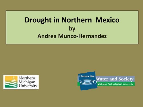
Drought in Northern Mexico<br />
by<br />
<strong>Andrea</strong> <strong>Munoz</strong>-<strong>Hernandez</strong>
Objective and Tasks<br />
The objective of this presentation is to perform a<br />
brief overview of the impacts of drought during<br />
the late twentieth century and early twenty first<br />
century in northwest Mexico, specifically in the<br />
Yaqui Basin of Sonora.<br />
Additionally, the implementation of some adaptive<br />
strategies, and future challenges faced within the<br />
basin are discussed.
Mexico<br />
The most important irrigation<br />
zones and the majority of<br />
industrial plants within the<br />
country are located in the<br />
northern states of Mexico.<br />
Mean annual precipitation from<br />
1945-2005 (INEGI, 2010)<br />
However, the states located<br />
in the southeast and along<br />
the Gulf of Mexico hold<br />
approximately 70% of the<br />
available water in Mexico<br />
(Magana and Conde, 2000).
The Yaqui Basin, Sonora<br />
The Yaqui basin is characterized by semi arid conditions<br />
with an average precipitation of 526 mm/year and a<br />
mean annual temperature above 22 C.
The Yaqui Basin<br />
The basin consists of roughly<br />
72,000 square kilometers.<br />
Water users include farmers,<br />
rural and urban municipalities,<br />
industries, and mines.<br />
The water to satisfy user needs<br />
comes from reservoirs<br />
constructed in series.<br />
The Yaqui River Basin includes one of the most important<br />
agricultural regions in Mexico, known as the Yaqui Valley.
The Yaqui Basin<br />
Reservoir<br />
Capacity*<br />
(MCM)<br />
Extractive<br />
Water Rights<br />
(MCM/yr)<br />
Primary Purpose<br />
of Extractions<br />
La Angostura 880 88 Small towns, mine<br />
El Novillo 2,799 NA<br />
El Oviachic 2,782<br />
Hydroelectric power<br />
production<br />
60 Ciudad Obregon<br />
255 Yaqui tribe<br />
2500<br />
Yaqui Valley<br />
irrigation<br />
*less dead storage<br />
Additionally, irrigated agriculture in the Yaqui Valley holds<br />
water rights of 600 MCM/yr of groundwater.
The Yaqui Basin<br />
Key<br />
Runoff from<br />
Upper Basin<br />
Flows<br />
Demand site<br />
Reservoir<br />
Copper<br />
Mine<br />
La<br />
Angostura<br />
Pueblos<br />
Riberenos<br />
Hydropower<br />
production site<br />
Aquifer<br />
Runoff from<br />
Middle Basin<br />
El Novillo<br />
Runoff from<br />
Lower Basin<br />
Distrito de Riego<br />
del Rio Yaqui<br />
El<br />
Oviachic<br />
Ciudad<br />
Obregon<br />
Yaqui Valley<br />
Aquifer<br />
System<br />
Yaqui Delta<br />
Ecological<br />
Flows<br />
Sea of Cortez
Monthly Fraction of Average Annual<br />
Runoff<br />
Runoff Distribution<br />
30%<br />
25%<br />
20%<br />
15%<br />
10%<br />
5%<br />
0%<br />
J F M A M J J A S O N D<br />
Month<br />
<strong>Munoz</strong>-<strong>Hernandez</strong> et al., 2010<br />
The monthly<br />
distribution of runoff<br />
within the basin<br />
shows three distinct<br />
runoff seasons:<br />
a) a wet summer<br />
season, when the<br />
majority of the runoff<br />
is generated,<br />
b) a wet winter<br />
season;<br />
c) a dry spring<br />
season.
Runoff (MCM)<br />
The Rio Yaqui Basin<br />
8,000<br />
6,000<br />
4,000<br />
2,000<br />
Average<br />
The annual runoff of<br />
the basin is highly<br />
variable with an<br />
average of<br />
approximately 3000<br />
MCM/year.<br />
0<br />
Year<br />
The severe drought<br />
(1994-2003) is clearly<br />
indicated in this<br />
record.<br />
<strong>Munoz</strong>-<strong>Hernandez</strong> et al., 2010
The Yaqui Valley<br />
The Yaqui Valley<br />
contains roughly of<br />
227,000 hectares of<br />
irrigated land.<br />
Map by:<br />
Distrito de Riego del Rio Yaqui.<br />
The rainfall in the<br />
Yaqui Valley is<br />
significantly lower<br />
than the rest of the<br />
basin with an<br />
average of 317<br />
mm/year.
Groundwater in the Yaqui Valley<br />
Shallow Horizon<br />
Connector Horizon (5m-80 m)<br />
Aquifer Horizon (25 m -160 m)<br />
after Addams (2004)
Policies Reforms in the 1990s.<br />
A series of reforms produced new policies aimed to<br />
increase the efficiency of the agricultural sector (Naylor<br />
et al., 2001).<br />
Some of these policies included:<br />
• Elimination of direct price supports for grains,<br />
•Privatization of the Mexican Fertilizer Company<br />
(FERTIMEX),<br />
•The operation and maintenance of irrigation<br />
districts was transferred from the government to<br />
local groups of farmers.
Drought<br />
•The policy reforms, in combination with the severe<br />
drought that affected the area, severely impacted the<br />
farmers.<br />
•In the 2003 agricultural cycle, the farmers were able to<br />
irrigate only 1/5 of the total area, using mainly<br />
groundwater.<br />
•This situation affected not only agriculture, but also a<br />
variety of businesses that depend indirectly on this<br />
activity.
Farmers Response<br />
•Traditionally, the farmers had two agricultural cycles<br />
(one in the winter and one in the summer) reaching a<br />
maximum irrigated area of 360,000 hectares.<br />
Nowadays, they only irrigate one cycle.<br />
•The Yaqui Valley increased the number of pumping<br />
wells to increase their water extractions. Water rights<br />
increased from 450 MCM/year to 600 MCM/year.<br />
•Several infrastructure upgrades went into effect, trying<br />
to improve the water distribution system.
Farmers Response<br />
•Several proposals were petitioned to organizations like<br />
the World Bank, with the objective of obtaining funding<br />
to line the distribution canals.<br />
•A set of “sustainable rules” were created to achieve<br />
sustainable water use within the basin (Minjares,<br />
2004).<br />
•Partial conversion of the Yaqui Valley to less intensive<br />
water use crops.
Modeling Tool<br />
An Integrated Water Resources Model was created to<br />
support decision makers in managing the water resources in a<br />
more efficient way (<strong>Munoz</strong>-<strong>Hernandez</strong>, 2009). The model<br />
integrates hydrologic model with economic models.<br />
This IWRM model has the capability of evaluating:<br />
a) Alternative Water Management strategies<br />
b) Climate Change (using GCMs and RCMs)<br />
c) Climate Variability (ARMA Models)<br />
d) Environmental Flow Strategies
Future Challenges<br />
•Based on the annual growth rate, the population in<br />
Ciudad Obregon is projected to double in the next 30<br />
years.<br />
•There is a desire to further develop the area. However<br />
all the water resources are completely allocated.<br />
•Water is allocated without consideration to the<br />
environment causing degradation of the local system.
Future Challenges<br />
The basin is located close to the ocean. If groundwater<br />
extractions exceeds the recharge, salt-water intrusion<br />
may occur damaging the water quality.<br />
•Currently, there is a heated debate regarding water<br />
transfers from El Novillo to Hermosillo, which is the<br />
capital of the State.<br />
•Climate model experiments indicate that Northwest<br />
Mexico will experience a progressive drying during the<br />
21 st century (Seager et al., 2007).
Thanks!