Introduction to GEO - Drought Research Initiative
Introduction to GEO - Drought Research Initiative
Introduction to GEO - Drought Research Initiative

Create successful ePaper yourself
Turn your PDF publications into a flip-book with our unique Google optimized e-Paper software.
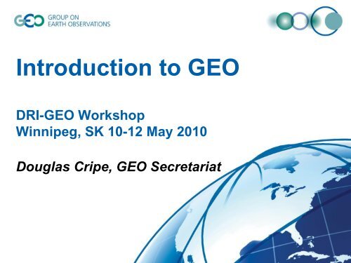
<strong>Introduction</strong> <strong>to</strong> <strong>GEO</strong>DRI-<strong>GEO</strong> WorkshopWinnipeg, SK 10-12 May 2010Douglas Cripe, <strong>GEO</strong> Secretariat
The Earth is a complex system of systems
SORCEEnvisatAura/Aqua/TerraQuikScatSageIKONOSCBERSSeaWiFSSPOT 4, 5SPIN-2SeaWindsOrbview 2, 3TRMMDMCERBSRadarsatALOSEROS A1ACRIMSATQuickBirdToms-EPGraceUARSJasonLandsat 7Space Observation Systems
The Tower of Babel problem…Need for:• Earth observationCoordination• Interoperable Architectureand Formats• Data Sharing… <strong>to</strong> benefit fully from EarthObservation Systems
<strong>GEO</strong>, the Group on Earth ObservationsAn Intergovernmental group with 81 Members and58 Participating OrganizationsU.S. Department of State, Washing<strong>to</strong>n DCJuly 31, 2003
What is <strong>GEO</strong>?• launched in response <strong>to</strong> calls for action by the 2002World Summit on Sustainable Development, EarthObservation Summits, and by the G8 (Group of Eight)leading industrialized countries• voluntary partnership of governments andinternational organizations– 80 member governments + EC– 58 Participating Organizations (PO)• provides a framework within which these partners candevelop new projects and coordinate their strategiesand investments• charged with developing <strong>GEO</strong>SS
What is <strong>GEO</strong>SS?• the Global Earth Observation System of Systems• an integrating public infrastructure, interconnecting adiverse, growing array of Earth observinginstruments and information systems for moni<strong>to</strong>ringand forecasting changes in the global environment• supports policymakers, resource managers, scienceresearchers and other experts <strong>to</strong> support informeddecision making for society• 10-year implementation plan• 2015: Global, Coordinated, Comprehensive andSustained System of Observing Systems
<strong>GEO</strong>SS Implementation Requires:Interoperability of SystemsNeed for an Interoperable Architecture and StandardFormats <strong>to</strong> benefit fully from Earth Observation Systems• Technical Specifications for Collecting,Processing, S<strong>to</strong>ring, and Disseminating Dataand Products• Based on Non-proprietary Standards• Defining System Compliance for Contribution <strong>to</strong><strong>GEO</strong>SS
<strong>GEO</strong>SS Implementation requires:Data Sharing Principles• Full and Open Exchange of Data…– Recognizing Relevant International Instrumentsand National Policies and Legislation• Data and Products at Minimum Time delay andMinimum Cost• Free of Charge or Cost of Reproduction for<strong>Research</strong> and Education
<strong>GEO</strong>SS: A Global, Coordinated, Comprehensive andSustained System of Observing Systems
WaterBefore 2015, <strong>GEO</strong> aims <strong>to</strong>:13. Produce comprehensive sets of data and informationproducts <strong>to</strong> support decision-making for efficientmanagement of the world's water resources, based oncoordinated, sustained observations of the water cycle onmultiple scales.
<strong>GEO</strong> Water Tasks• <strong>Drought</strong>s, Floods and Water Resource Management– Address decision-making challenges related <strong>to</strong> the managemen<strong>to</strong>f hydro-meteorological extremes and the sustainable use ofwater.• Capacity Building for Water Resource Management– Initiate capacity building programs in support of watermanagement, <strong>to</strong> show the value of, and develop <strong>to</strong>ols for, Earthobservation data.• Integrated Products for Water Resource Management and<strong>Research</strong>– Improvements and expansion of in-situ networks, combined withnew satellite missions and emerging assimilation and predictioncapabilities for integrated <strong>to</strong>ols in global water-cyclemanagement.
WA-06-02: <strong>Drought</strong>s, Floods and WaterResource Management• A: Forecasting for <strong>Drought</strong>s and Floods• B: Impacts from <strong>Drought</strong>• D: Pro<strong>to</strong>type Regional <strong>Drought</strong> Early WarningTest Beds
<strong>GEO</strong> Portal• Provides web-based interface for searching andaccessing the data, information, imagery,services and applications available through<strong>GEO</strong>SS.• Connects users <strong>to</strong> data bases, services andportals that provide reliable, up-<strong>to</strong>-date,integrated and user-friendly information – vital forthe work of decision-makers, managers and otherusers of Earth observations.
“The Global Earth Observation System ofSystems (<strong>GEO</strong>SS) is a coordinating andintegrating network of Earth observing andinformation systems, contributed on avoluntary basis by Members and ParticipatingOrganizations of the intergovernmentalGroup on Earth Observations (<strong>GEO</strong>).”•To support informed decision making for society,including the implementation of internationalenvironmental treaty obligations.
…we will accelerate efforts within the Global EarthObservation System of Systems (<strong>GEO</strong>SS), ... in priorityareas, inter alia, climate change and water resourcesmanagement, by strengthening observation, predictionand data sharing. ... capacity building for developingcountries … interoperability and linkage …
<strong>GEO</strong>SS: main objectives‣ Improve and Coordinate Observation Systems (avoidduplications)‣ Provide Easier & More Open Data Access‣ Foster Use (Science, Applications)‣ Building Capacity‣ Identify gaps in observations (based on user requirements)…Earth Observation Systems should becoordinated and shared internationally… <strong>to</strong> answer Society’s need for informeddecision making
"Improving water-resourcemanagement through betterunderstanding of the water cycle "<strong>GEO</strong> 10-Year Implementation Plan
Thank you!dcripe@geosec.orgearthobservations.org