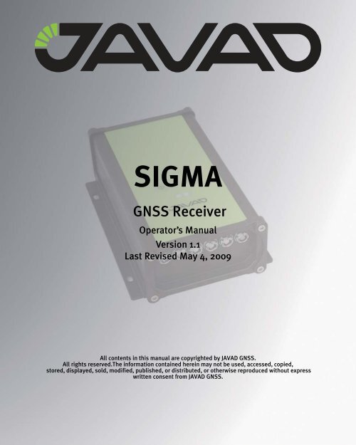
JAVAD GNSS SIGMA GNSS Receiver
JAVAD GNSS SIGMA GNSS Receiver
JAVAD GNSS SIGMA GNSS Receiver

You also want an ePaper? Increase the reach of your titles
YUMPU automatically turns print PDFs into web optimized ePapers that Google loves.
<strong>SIGMA</strong><br />
<strong>GNSS</strong> <strong>Receiver</strong><br />
Operator’s Manual<br />
Version 1.1<br />
Last Revised May 4, 2009<br />
All contents in this manual are copyrighted by <strong>JAVAD</strong> <strong>GNSS</strong>.<br />
All rights reserved.The information contained herein may not be used, accessed, copied,<br />
stored, displayed, sold, modified, published, or distributed, or otherwise reproduced without express<br />
written consent from <strong>JAVAD</strong> <strong>GNSS</strong>.
www.javad.com
TABLE OF CONTENTS<br />
Preface . . . . . . . . . . . . . . . . . . . . . . . . . . . . . . . . . . . . . . . . . . . . . . . . . . . . . . . . . . . . . . 7<br />
Terms and Conditions. . . . . . . . . . . . . . . . . . . . . . . . . . . . . . . . . . . . . . . . . . . . . . . . . . . . . . . . 7<br />
Regulatory Information . . . . . . . . . . . . . . . . . . . . . . . . . . . . . . . . . . . . . . . . . . . . . . . . . . . . . . 9<br />
FCC Class B Compliance . . . . . . . . . . . . . . . . . . . . . . . . . . . . . . . . . . . . . . . . . . . . . . . . . 9<br />
Canadian Emissions Labeling Requirements . . . . . . . . . . . . . . . . . . . . . . . . . . . . . . . . .10<br />
WEEE Directive . . . . . . . . . . . . . . . . . . . . . . . . . . . . . . . . . . . . . . . . . . . . . . . . . . . . . . . . . . . 10<br />
Manual Conventions. . . . . . . . . . . . . . . . . . . . . . . . . . . . . . . . . . . . . . . . . . . . . . . . . . . . . . . .11<br />
Screen Captures . . . . . . . . . . . . . . . . . . . . . . . . . . . . . . . . . . . . . . . . . . . . . . . . . . . . . . . . . . . 11<br />
Technical Assistance . . . . . . . . . . . . . . . . . . . . . . . . . . . . . . . . . . . . . . . . . . . . . . . . . . . . . . .12<br />
Return Material Authorization . . . . . . . . . . . . . . . . . . . . . . . . . . . . . . . . . . . . . . . . . . . . . . . . 12<br />
Chapter 1. Introduction. . . . . . . . . . . . . . . . . . . . . . . . . . . . . . . . . . . . . . . . . . . . . . . . . 13<br />
1.1. Principles of Operation . . . . . . . . . . . . . . . . . . . . . . . . . . . . . . . . . . . . . . . . . . . . . . . . . .14<br />
1.1.1. <strong>GNSS</strong> Overview . . . . . . . . . . . . . . . . . . . . . . . . . . . . . . . . . . . . . . . . . . . . . . . . . . 14<br />
1.1.2. Calculating Absolute Positions . . . . . . . . . . . . . . . . . . . . . . . . . . . . . . . . . . . . . . . 15<br />
1.1.3. Calculating Differential Positions . . . . . . . . . . . . . . . . . . . . . . . . . . . . . . . . . . . . . 15<br />
1.1.4. Essential Components for Quality Measuring. . . . . . . . . . . . . . . . . . . . . . . . . . . . 16<br />
1.2. Getting Acquainted . . . . . . . . . . . . . . . . . . . . . . . . . . . . . . . . . . . . . . . . . . . . . . . . . . . . .17<br />
1.2.1. <strong>SIGMA</strong> <strong>Receiver</strong>. . . . . . . . . . . . . . . . . . . . . . . . . . . . . . . . . . . . . . . . . . . . . . . . . . 17<br />
TriPad. . . . . . . . . . . . . . . . . . . . . . . . . . . . . . . . . . . . . . . . . . . . . . . . . . . . . . . . . . . . 18<br />
Data and Power Ports. . . . . . . . . . . . . . . . . . . . . . . . . . . . . . . . . . . . . . . . . . . . . . . . 19<br />
1.2.2. Cables . . . . . . . . . . . . . . . . . . . . . . . . . . . . . . . . . . . . . . . . . . . . . . . . . . . . . . . . . .20<br />
1.2.3. Literature . . . . . . . . . . . . . . . . . . . . . . . . . . . . . . . . . . . . . . . . . . . . . . . . . . . . . . . .21<br />
1.2.4. Storage Precautions . . . . . . . . . . . . . . . . . . . . . . . . . . . . . . . . . . . . . . . . . . . . . . . . 21<br />
1.3. Option Authorization File (OAF) . . . . . . . . . . . . . . . . . . . . . . . . . . . . . . . . . . . . . . . . . . 21<br />
Chapter 2. Pre-measuring Preparation. . . . . . . . . . . . . . . . . . . . . . . . . . . . . . . . . . . . . 23<br />
2.1. Installing <strong>JAVAD</strong> <strong>GNSS</strong> Software . . . . . . . . . . . . . . . . . . . . . . . . . . . . . . . . . . . . . . . . . 23<br />
2.1.1. Installing TriVU . . . . . . . . . . . . . . . . . . . . . . . . . . . . . . . . . . . . . . . . . . . . . . . . . . 24<br />
2.1.2. Installing ModemVU. . . . . . . . . . . . . . . . . . . . . . . . . . . . . . . . . . . . . . . . . . . . . . . 24<br />
www.javad.com<br />
3
2.2. Installing the Optional SIM Card . . . . . . . . . . . . . . . . . . . . . . . . . . . . . . . . . . . . . . . . . . 25<br />
2.3. Charging the Batteries . . . . . . . . . . . . . . . . . . . . . . . . . . . . . . . . . . . . . . . . . . . . . . . . . . 26<br />
2.3.1. Power supply requirements . . . . . . . . . . . . . . . . . . . . . . . . . . . . . . . . . . . . . . . . . 27<br />
2.4. Power Management . . . . . . . . . . . . . . . . . . . . . . . . . . . . . . . . . . . . . . . . . . . . . . . . . . . . 27<br />
2.5. Powering the <strong>Receiver</strong> . . . . . . . . . . . . . . . . . . . . . . . . . . . . . . . . . . . . . . . . . . . . . . . . . . 30<br />
2.5.1. Turning On/Off the <strong>Receiver</strong> . . . . . . . . . . . . . . . . . . . . . . . . . . . . . . . . . . . . . . . . 31<br />
2.6. Connecting the <strong>Receiver</strong> and a Computer . . . . . . . . . . . . . . . . . . . . . . . . . . . . . . . . . . . 32<br />
2.6.1. Establishing a Wireless Connection . . . . . . . . . . . . . . . . . . . . . . . . . . . . . . . . . . . 32<br />
2.6.2. Establishing an RS232 Cable Connection . . . . . . . . . . . . . . . . . . . . . . . . . . . . . . 33<br />
2.6.3. Establishing a USB Cable Connection. . . . . . . . . . . . . . . . . . . . . . . . . . . . . . . . . 33<br />
2.7. Bluetooth® Module Configuration. . . . . . . . . . . . . . . . . . . . . . . . . . . . . . . . . . . . . . . . . 34<br />
2.8. Collecting Almanacs and Ephemerides . . . . . . . . . . . . . . . . . . . . . . . . . . . . . . . . . . . . . 35<br />
Chapter 3. Configuration . . . . . . . . . . . . . . . . . . . . . . . . . . . . . . . . . . . . . . . . . . . . . . . 37<br />
3.1. Configuring the Internal/External UHF Modem/GSM Module . . . . . . . . . . . . . . . . . . . 38<br />
3.1.1. Configuring the Internal UHF modem . . . . . . . . . . . . . . . . . . . . . . . . . . . . . . . . . 40<br />
3.1.2. Configuring the GSM module for Point-to-Point radio link . . . . . . . . . . . . . . . . 41<br />
3.1.3. Configuring the GSM module for Internet access . . . . . . . . . . . . . . . . . . . . . . . . 44<br />
Settings for the RCV subtab . . . . . . . . . . . . . . . . . . . . . . . . . . . . . . . . . . . . . . . . . . 47<br />
Settings for the NTRIP subtab . . . . . . . . . . . . . . . . . . . . . . . . . . . . . . . . . . . . . . . . 47<br />
3.1.4. Configuring the External UHF Modem . . . . . . . . . . . . . . . . . . . . . . . . . . . . . . . . 49<br />
3.2. Configuring the <strong>Receiver</strong> . . . . . . . . . . . . . . . . . . . . . . . . . . . . . . . . . . . . . . . . . . . . . . . . 50<br />
3.3. <strong>SIGMA</strong>D Systems Configuration. . . . . . . . . . . . . . . . . . . . . . . . . . . . . . . . . . . . . . . . . . 59<br />
3.3.1. Hardware . . . . . . . . . . . . . . . . . . . . . . . . . . . . . . . . . . . . . . . . . . . . . . . . . . . . . . . 59<br />
3.3.2. Antennas setup . . . . . . . . . . . . . . . . . . . . . . . . . . . . . . . . . . . . . . . . . . . . . . . . . . . 60<br />
3.3.3. How to Work with <strong>SIGMA</strong>D-G2/G2D . . . . . . . . . . . . . . . . . . . . . . . . . . . . . . . . 60<br />
Heading and Pitch Angles Determination. . . . . . . . . . . . . . . . . . . . . . . . . . . . . . . . 60<br />
Standalone Setup. . . . . . . . . . . . . . . . . . . . . . . . . . . . . . . . . . . . . . . . . . . . . . . . . . . 61<br />
Differentially corrected setup . . . . . . . . . . . . . . . . . . . . . . . . . . . . . . . . . . . . . . . . . 61<br />
Unit Setup . . . . . . . . . . . . . . . . . . . . . . . . . . . . . . . . . . . . . . . . . . . . . . . . . . . . . . . . 62<br />
Angle messages. . . . . . . . . . . . . . . . . . . . . . . . . . . . . . . . . . . . . . . . . . . . . . . . . . . . 63<br />
3.4. TriPad Configuration . . . . . . . . . . . . . . . . . . . . . . . . . . . . . . . . . . . . . . . . . . . . . . . . . . . 64<br />
Chapter 4. Setup and Measuring . . . . . . . . . . . . . . . . . . . . . . . . . . . . . . . . . . . . . . . . . 69<br />
4.1. <strong>Receiver</strong> Setup . . . . . . . . . . . . . . . . . . . . . . . . . . . . . . . . . . . . . . . . . . . . . . . . . . . . . . . . 69<br />
4.1.1. Set up <strong>Receiver</strong>. . . . . . . . . . . . . . . . . . . . . . . . . . . . . . . . . . . . . . . . . . . . . . . . . . . 69<br />
4.1.2. Measure Antenna Height . . . . . . . . . . . . . . . . . . . . . . . . . . . . . . . . . . . . . . . . . . . 70<br />
4 www.javad.com
4.1.3. External Antenna Setup. . . . . . . . . . . . . . . . . . . . . . . . . . . . . . . . . . . . . . . . . . . . . 71<br />
4.1.4. External UHF Modem Setup. . . . . . . . . . . . . . . . . . . . . . . . . . . . . . . . . . . . . . . . . 71<br />
4.1.5. Collect Data. . . . . . . . . . . . . . . . . . . . . . . . . . . . . . . . . . . . . . . . . . . . . . . . . . . . . . 71<br />
4.2. TriPad Operation . . . . . . . . . . . . . . . . . . . . . . . . . . . . . . . . . . . . . . . . . . . . . . . . . . . . . . . 72<br />
4.3. Static Measuring for Base Stations . . . . . . . . . . . . . . . . . . . . . . . . . . . . . . . . . . . . . . . . . 73<br />
4.4. Kinematic (Stop & Go) Measuring for Rover Stations . . . . . . . . . . . . . . . . . . . . . . . . . . 74<br />
4.5. Real Time Kinematic Measuring. . . . . . . . . . . . . . . . . . . . . . . . . . . . . . . . . . . . . . . . . . . 75<br />
Chapter 5. <strong>Receiver</strong> and File Maintenance . . . . . . . . . . . . . . . . . . . . . . . . . . . . . . . . . . 77<br />
5.1. Downloading Files to a Computer. . . . . . . . . . . . . . . . . . . . . . . . . . . . . . . . . . . . . . . . . .77<br />
5.2. Deleting Files. . . . . . . . . . . . . . . . . . . . . . . . . . . . . . . . . . . . . . . . . . . . . . . . . . . . . . . . . . 80<br />
5.3. Managing <strong>Receiver</strong> Options . . . . . . . . . . . . . . . . . . . . . . . . . . . . . . . . . . . . . . . . . . . . . .82<br />
5.3.1. Checking an OAF . . . . . . . . . . . . . . . . . . . . . . . . . . . . . . . . . . . . . . . . . . . . . . . . . 82<br />
5.3.2. Loading OAFs . . . . . . . . . . . . . . . . . . . . . . . . . . . . . . . . . . . . . . . . . . . . . . . . . . . . 84<br />
5.4. Managing <strong>Receiver</strong> Memory . . . . . . . . . . . . . . . . . . . . . . . . . . . . . . . . . . . . . . . . . . . . . . 85<br />
5.5. Clearing the NVRAM . . . . . . . . . . . . . . . . . . . . . . . . . . . . . . . . . . . . . . . . . . . . . . . . . . . 85<br />
5.5.1. Using TriPad to Clear NVRAM . . . . . . . . . . . . . . . . . . . . . . . . . . . . . . . . . . . . . . 86<br />
5.5.2. Using TriVU to Clear NVRAM . . . . . . . . . . . . . . . . . . . . . . . . . . . . . . . . . . . . . . 86<br />
5.6. Checking Firmware Version . . . . . . . . . . . . . . . . . . . . . . . . . . . . . . . . . . . . . . . . . . . . . .87<br />
5.7. Loading New Firmware. . . . . . . . . . . . . . . . . . . . . . . . . . . . . . . . . . . . . . . . . . . . . . . . . . 89<br />
Chapter 6. Troubleshooting . . . . . . . . . . . . . . . . . . . . . . . . . . . . . . . . . . . . . . . . . . . . . 93<br />
6.1. Check This First! . . . . . . . . . . . . . . . . . . . . . . . . . . . . . . . . . . . . . . . . . . . . . . . . . . . . . . . 93<br />
6.2. Powering Problems . . . . . . . . . . . . . . . . . . . . . . . . . . . . . . . . . . . . . . . . . . . . . . . . . . . . .94<br />
6.3. <strong>Receiver</strong> Problems. . . . . . . . . . . . . . . . . . . . . . . . . . . . . . . . . . . . . . . . . . . . . . . . . . . . . .94<br />
6.4. Technical Support . . . . . . . . . . . . . . . . . . . . . . . . . . . . . . . . . . . . . . . . . . . . . . . . . . . . . . 97<br />
Appendix A. Specifications. . . . . . . . . . . . . . . . . . . . . . . . . . . . . . . . . . . . . . . . . . . . . . 99<br />
A.1. <strong>Receiver</strong> Specifications. . . . . . . . . . . . . . . . . . . . . . . . . . . . . . . . . . . . . . . . . . . . . . . . . .99<br />
A.1.1. General Details . . . . . . . . . . . . . . . . . . . . . . . . . . . . . . . . . . . . . . . . . . . . . . . . . . .99<br />
A.1.2. <strong>GNSS</strong> Board Details. . . . . . . . . . . . . . . . . . . . . . . . . . . . . . . . . . . . . . . . . . . . . .103<br />
A.1.3. Internal UHF Modem Details. . . . . . . . . . . . . . . . . . . . . . . . . . . . . . . . . . . . . . .104<br />
A.1.4. GSM Module Details . . . . . . . . . . . . . . . . . . . . . . . . . . . . . . . . . . . . . . . . . . . . .106<br />
A.2. Connector Specifications . . . . . . . . . . . . . . . . . . . . . . . . . . . . . . . . . . . . . . . . . . . . . . .107<br />
Power Connector . . . . . . . . . . . . . . . . . . . . . . . . . . . . . . . . . . . . . . . . . . . . . . . . . .107<br />
Serial RS-232C Connector. . . . . . . . . . . . . . . . . . . . . . . . . . . . . . . . . . . . . . . . . . .108<br />
www.javad.com<br />
5
USB Connector . . . . . . . . . . . . . . . . . . . . . . . . . . . . . . . . . . . . . . . . . . . . . . . . . . . 109<br />
Ethernet Connector . . . . . . . . . . . . . . . . . . . . . . . . . . . . . . . . . . . . . . . . . . . . . . . . 110<br />
RS422 and CAN Connector . . . . . . . . . . . . . . . . . . . . . . . . . . . . . . . . . . . . . . . . . 111<br />
<strong>GNSS</strong> External Antenna RF Connector . . . . . . . . . . . . . . . . . . . . . . . . . . . . . . . . 112<br />
EVENT and 1PPS Connectors (Optional) . . . . . . . . . . . . . . . . . . . . . . . . . . . . . . 112<br />
Appendix B. UHF Radio Usage . . . . . . . . . . . . . . . . . . . . . . . . . . . . . . . . . . . . . . . . . . 113<br />
Appendix C. Safety Warnings. . . . . . . . . . . . . . . . . . . . . . . . . . . . . . . . . . . . . . . . . . . 115<br />
General Warnings . . . . . . . . . . . . . . . . . . . . . . . . . . . . . . . . . . . . . . . . . . . . . . . . . . . . . . . . 116<br />
Battery Pack Warnings . . . . . . . . . . . . . . . . . . . . . . . . . . . . . . . . . . . . . . . . . . . . . . . . . . . . 116<br />
Power Supply. . . . . . . . . . . . . . . . . . . . . . . . . . . . . . . . . . . . . . . . . . . . . . . . . . . . . . . . . . . . 117<br />
Usage Warnings. . . . . . . . . . . . . . . . . . . . . . . . . . . . . . . . . . . . . . . . . . . . . . . . . . . . . . . . . . 118<br />
Appendix D. Warranty Terms . . . . . . . . . . . . . . . . . . . . . . . . . . . . . . . . . . . . . . . . . . . 119<br />
6 www.javad.com
PREFACE<br />
Thank you for purchasing this product. The materials available in this Manual (the “Manual”)<br />
have been prepared by <strong>JAVAD</strong> <strong>GNSS</strong>, Inc. (“<strong>JAVAD</strong> <strong>GNSS</strong>”) for owners of <strong>JAVAD</strong> <strong>GNSS</strong><br />
products. It is designed to assist owners with the use of The <strong>SIGMA</strong> receiver and its use is subject<br />
to these terms and conditions (the “Terms and Conditions”).<br />
Note: Please read these Terms and Conditions carefully.<br />
Terms and Conditions<br />
USE – <strong>JAVAD</strong> <strong>GNSS</strong> receivers are designed to be used by a professional. The user is expected to<br />
have a good knowledge and understanding of the user and safety instructions before operating,<br />
inspecting or adjusting. Always wear the required protectors (safety shoes, helmet, etc.) when<br />
operating the receiver.<br />
COPYRIGHT – All information contained in this Manual is the intellectual property of, and<br />
copyrighted material of <strong>JAVAD</strong> <strong>GNSS</strong>. All rights are reserved. You may not use, access, copy,<br />
store, display, create derivative works of, sell, modify, publish, distribute, or allow any third party<br />
access to, any graphics, content, information or data in this Manual without <strong>JAVAD</strong> <strong>GNSS</strong>’<br />
express written consent and may only use such information for the care and operation of your<br />
<strong>SIGMA</strong>. The information and data in this Manual are a valuable asset of <strong>JAVAD</strong> <strong>GNSS</strong> and are<br />
developed by the expenditure of considerable work, time and money, and are the result of original<br />
selection, coordination and arrangement by <strong>JAVAD</strong> <strong>GNSS</strong>.<br />
TRADEMARKS – <strong>SIGMA</strong>, <strong>JAVAD</strong> <strong>GNSS</strong> ® are trademarks or registered trademarks of<br />
<strong>JAVAD</strong> <strong>GNSS</strong>. Windows ® is a registered trademark of Microsoft Corporation; Bluetooth ® word<br />
mark is owned by the Bluetooth SIG, Inc. Product and company names mentioned herein may be<br />
trademarks of their respective owners.<br />
DISCLAIMER OF WARRANTY – EXCEPT FOR ANY WARRANTIES IN THIS MANUAL<br />
OR A WARRANTY CARD ACCOMPANYING THE PRODUCT, THIS MANUAL AND THE<br />
<strong>SIGMA</strong> RECEIVER ARE PROVIDED “AS-IS.” THERE ARE NO OTHER WARRANTIES.<br />
<strong>JAVAD</strong> <strong>GNSS</strong> DISCLAIMS ANY IMPLIED WARRANTY OF MERCHANTABILITY OR<br />
FITNESS FOR ANY PARTICULAR USE OR PURPOSE. <strong>JAVAD</strong> <strong>GNSS</strong> AND ITS<br />
DISTRIBUTORS SHALL NOT BE LIABLE FOR TECHNICAL OR EDITORIAL ERRORS OR<br />
www.javad.com<br />
7
Preface<br />
Terms and Conditions<br />
OMISSIONS CONTAINED HEREIN; NOR FOR INCIDENTAL OR CONSEQUENTIAL<br />
DAMAGES RESULTING FROM THE FURNISHING, PERFORMANCE OR USE OF THIS<br />
MATERIAL OR THE <strong>SIGMA</strong> RECEIVER. SUCH DISCLAIMED DAMAGES INCLUDE BUT<br />
ARE NOT LIMITED TO LOSS OF TIME, LOSS OR DESTRUCTION OF DATA, LOSS OF<br />
PROFIT, SAVINGS OR REVENUE, OR LOSS OF THE PRODUCT'S USE. IN ADDITION,<br />
<strong>JAVAD</strong> <strong>GNSS</strong> IS NOT RESPONSIBLE OR LIABLE FOR DAMAGES OR COSTS INCURRED<br />
IN CONNECTION WITH OBTAINING SUBSTITUTE PRODUCTS OR SOFTWARE,<br />
CLAIMS BY OTHERS, INCONVENIENCE, OR ANY OTHER COSTS. IN ANY EVENT,<br />
<strong>JAVAD</strong> <strong>GNSS</strong> SHALL HAVE NO LIABILITY FOR DAMAGES OR OTHERWISE TO YOU<br />
OR ANY OTHER PERSON OR ENTITY IN EXCESS OF THE PURCHASE PRICE FOR THE<br />
<strong>SIGMA</strong> RECEIVER.<br />
LICENSE AGREEMENT – Use of any computer programs or software supplied by <strong>JAVAD</strong><br />
<strong>GNSS</strong> or downloaded from a <strong>JAVAD</strong> <strong>GNSS</strong> website (the “Software”) in connection with the<br />
<strong>SIGMA</strong> receiver constitutes acceptance of these Terms and Conditions in this Manual and an<br />
agreement to abide by these Terms and Conditions. The user is granted a personal, non-exclusive,<br />
non-transferable license to use such Software under the terms stated herein and in any case only<br />
with a single <strong>SIGMA</strong> or single computer. You may not assign or transfer the Software or this<br />
license without the express written consent of <strong>JAVAD</strong> <strong>GNSS</strong>. This license is effective until<br />
terminated. You may terminate the license at any time by destroying the Software and Manual.<br />
<strong>JAVAD</strong> <strong>GNSS</strong> may terminate the license if you fail to comply with any of the Terms or<br />
Conditions. You agree to destroy the Software and manual upon termination of your use of the<br />
<strong>SIGMA</strong> receiver. All ownership, copyright and other intellectual property rights in and to the<br />
Software belong to <strong>JAVAD</strong> <strong>GNSS</strong>. If these license terms are not acceptable, return any unused<br />
software and manual.<br />
CONFIDENTIALITY – This Manual, its contents and the Software (collectively, the<br />
“Confidential Information”) are the confidential and proprietary information of <strong>JAVAD</strong> <strong>GNSS</strong>.<br />
You agree to treat <strong>JAVAD</strong> <strong>GNSS</strong>' Confidential Information with a degree of care no less stringent<br />
that the degree of care you would use in safeguarding your own most valuable trade secrets.<br />
Nothing in this paragraph shall restrict you from disclosing Confidential Information to your<br />
employees as may be necessary or appropriate to operate or care for the <strong>SIGMA</strong> receiver. Such<br />
employees must also keep the Confidentiality Information confidential. In the event you become<br />
legally compelled to disclose any of the Confidential Information, you shall give <strong>JAVAD</strong> <strong>GNSS</strong><br />
immediate notice so that it may seek a protective order or other appropriate remedy.<br />
WEBSITE; OTHER STATEMENTS – No statement contained at the <strong>JAVAD</strong> <strong>GNSS</strong> website (or<br />
any other website) or in any other advertisements or <strong>JAVAD</strong> <strong>GNSS</strong> literature or made by an<br />
employee or independent contractor of <strong>JAVAD</strong> <strong>GNSS</strong> modifies these Terms and Conditions<br />
(including the Software license, warranty and limitation of liability).<br />
8 www.javad.com
Preface<br />
Regulatory Information<br />
FCC Class B Compliance<br />
SAFETY – Improper use of the <strong>SIGMA</strong> receiver can lead to injury to persons or property and/or<br />
malfunction of the product. The <strong>SIGMA</strong> receiver should only be repaired by authorized <strong>JAVAD</strong><br />
<strong>GNSS</strong> warranty service centers. Users should review and heed the safety warnings in Appendix<br />
C on page 115.<br />
MISCELLANEOUS – The above Terms and Conditions may be amended, modified,<br />
superseded, or canceled, at any time by <strong>JAVAD</strong> <strong>GNSS</strong>. The above Terms and Conditions will be<br />
governed by, and construed in accordance with, the laws of the State of California, without<br />
reference to conflict of laws.<br />
Regulatory Information<br />
The following sections provide information on this product’s compliance with government<br />
regulations.<br />
FCC Class B Compliance<br />
This device complies with Part 15 of the FCC rules. Operation is subject to the following two<br />
conditions:<br />
1. This device may not cause harmful interference, and<br />
2. This device must accept any interference received, including interference that may cause<br />
undesired operation.<br />
This equipment has been tested and found to comply with the limits for a Class B digital<br />
device, pursuant to Part 15 of the FCC rules. These limits are designed to provide reasonable<br />
protection against harmful interference in residential installations. This equipment<br />
generates, uses, and can radiate radio frequency energy, and if not installed and used in<br />
accordance with the instructions, may cause harmful interference to radio communications.<br />
However, there is no guarantee that interference will not occur in a particular installation.<br />
If this equipment does cause interference to radio or television equipment reception,<br />
which can be determined by turning the equipment off and on, the user is encouraged to<br />
try to correct the interference by one or more of the following measures:<br />
• Reorient or relocate the receiving antenna.<br />
• Move the equipment away from the receiver.<br />
• Plug the equipment into an outlet on a circuit different from that to which the receiver is<br />
powered.<br />
• Consult the dealer or an experienced radio/television technician for additional<br />
suggestions.<br />
www.javad.com<br />
9
Preface<br />
WEEE Directive<br />
Canadian Emissions Labeling Requirements<br />
Note: Any changes or modifications to the equipment not expressly approved by the party responsible<br />
for compliance could void your authority to operate such equipment.<br />
Canadian Emissions Labeling Requirements<br />
This Class B digital apparatus meets all requirements of the Canadian Interference-Causing<br />
Equipment Regulations.<br />
Cet appareil numérique de la classe B respecte toutes les exigences du Réglement sur le matériel<br />
brouilleur du Canada.<br />
WEEE Directive<br />
The following information is for EU-member states only:<br />
The use of the symbol indicates that this product may not be treated as household waste. By<br />
ensuring this product is disposed of correctly, you will help prevent potential negative<br />
consequences for the environment and human health, which could otherwise be caused by<br />
inappropriate waste handling of this product. For more detailed information about the take-back<br />
and recycling of this product, please contact your supplier where you purchased the product or<br />
consult.<br />
10 www.javad.com
Preface<br />
Manual Conventions<br />
Canadian Emissions Labeling Requirements<br />
Manual Conventions<br />
This manual uses the following conventions:<br />
FileExit<br />
TriPad<br />
Temp<br />
Example<br />
Description<br />
Click the File menu and click Exit<br />
This format represents titles of dialog<br />
windows/boxes, names of menu options,<br />
identifies program interface objects, such as<br />
checkboxes, edit boxes, radio buttons, etc.<br />
This format is used to enter various string<br />
information (e.g., file and directory names) as<br />
well as operator commands.<br />
Note: Supplementary information that can have an affect on system operation, system performance,<br />
measurements, or personal safety.<br />
CAUTION: Notification that an action has the potential to adversely affect system operation, system performance,<br />
data integrity, or personal health.<br />
Warning: Notification that an action will result in system damage, loss of data, loss of warranty, or personal<br />
injury.<br />
DANGER: UNDER NO CIRCUMSTANCES SHOULD THIS ACTION BE PERFORMED.<br />
Screen Captures<br />
This manual includes sample screen captures. Your actual screen can look slightly different from<br />
the sample screen due to the receiver you have connected, operating system used and settings you<br />
have specified. This is normal and not a cause for concern.<br />
www.javad.com<br />
11
Preface<br />
echnical Assistance<br />
Canadian Emissions Labeling Requirements<br />
echnical Assistance<br />
If you have a problem and cannot find the information you need in the product documentation,<br />
contact your local dealer. Alternatively, request technical support using the QUESTIONS system<br />
at the <strong>JAVAD</strong> <strong>GNSS</strong> World Wide Web site: www.javad.com<br />
Return Material Authorization<br />
Initially, the customer contacts support to report a problem. Please refer to support: Question<br />
section on www.javad.com. If support determines the problem cannot be resolved over e-mail/<br />
internet, it will authorize the return of the unit for repair or replacement, depending on the nature<br />
of the problem.<br />
12 www.javad.com
Chapter 1<br />
INTRODUCTION<br />
Based on the TRIUMPH Chip, <strong>SIGMA</strong> is a fully integrated package ready for your demanding<br />
jobs, offering precise and automatic performance beyond anything that you have experienced so<br />
far.<br />
An elegant, rugged, light, and hermetically sealed box accommodates all <strong>GNSS</strong> and <strong>Receiver</strong><br />
electronics, antennas, and up to 15 hours of rechargeable batteries and its sophisticated power<br />
management system. The close proximity of our batteries with the electronic section helps the<br />
batteries to absorb heat and function better in cold weathers. The batteries can be charged with<br />
any power supply from 10 volts to 30 volts, which includes car, ship and airplane batteries<br />
(Figure 1-1).<br />
Figure 1-1. <strong>SIGMA</strong> <strong>Receiver</strong><br />
<strong>SIGMA</strong> can receive and processes multiple signal types (including the latest GPS L2C, GPS L5,<br />
GLONASS C/A L2, and Galileo signals) improving the accuracy and reliability of your<br />
measuring points and positions, especially under difficult jobsite conditions.<br />
The <strong>GNSS</strong> component of <strong>SIGMA</strong> receivers means you can access the GPS (Global Positioning<br />
System) satellites of the United States, the Galileo (an upcoming global positioning system<br />
maintained and operated by Galileo Industries,) and the GLONASS (Global Navigation Satellite<br />
System) satellites of the Russian Federation, increasing the number of satellites your receiver can<br />
www.javad.com<br />
13
Introduction<br />
Principles of Operation<br />
<strong>GNSS</strong> Overview<br />
detect, thus improving the accuracy of your measuring points, increasing productivity, and<br />
reducing cost.<br />
Several other features, including multipath mitigation, provide under-canopy and low signal<br />
strength reception. The <strong>SIGMA</strong> receiver provides the functionality, accuracy, availability, and<br />
integrity needed for fast and easy data collection.<br />
1.1. Principles of Operation<br />
Measuring with the right <strong>GNSS</strong> receiver can provide users accurate and precise positioning, a<br />
requirement for any measuring project. This section gives an overview of existing and proposed<br />
Global Navigation Satellite Systems (<strong>GNSS</strong>) and receiver functions to help you understand and<br />
apply basic operating principles, allowing you to get the most out of your receiver.<br />
1.1.1. <strong>GNSS</strong> Overview<br />
Currently, the following three global navigation satellite systems (<strong>GNSS</strong>) offer line-of-site radio<br />
navigation and positioning, velocity, and time services on a global, all-weather scale to any user<br />
equipped with a <strong>GNSS</strong> tracking receiver on or near the Earth’s surface:<br />
• GPS – the Global Positioning System maintained and operated by the United States<br />
Department of Defense. For information on the status of this system, visit the US Naval<br />
Observatory website (http://tycho.usno.navy.mil/) or the US Coast Guard website<br />
(http://www.navcen.uscg.gov/).<br />
• GLONASS – the Global Navigation Satellite System maintained and operated by the<br />
Russian Federation Ministry of Defense. For information on the status of this system, visit<br />
the Coordinational Scientific Information Center website (http://www.glonasscenter.ru/<br />
frame_e.html).<br />
• Galileo – an upcoming global positioning system maintained and operated by Galileo<br />
Industries, a joint venture of several European space agencies/companies working closely<br />
with the European Space Agency. Unlike GPS and GLONASS, this is a civil endeavor<br />
and is currently in the development and validation stage. For information on the status of<br />
this system, visit the Galileo Industries website (http://www.galileo-industries.net).<br />
Despite numerous technical differences in the implementation of these systems, satellite<br />
positioning systems have three essential components:<br />
• Space – GPS, GLONASS, and Galileo satellites orbit approximately 12,000 nautical miles<br />
above Earth and are equipped with a clock and radio. These satellites broadcast ranging<br />
14 www.javad.com
Introduction<br />
Principles of Operation<br />
Calculating Absolute Positions<br />
signals and various digital information (ephemerides, almanacs, time&frequency<br />
corrections, etc.).<br />
• Control – Ground stations located around the Earth that monitor the satellites and upload<br />
data, including clock corrections and new ephemerides (satellite positions as a function of<br />
time), to ensure the satellites transmit data properly.<br />
• User – The community and military that use <strong>GNSS</strong> receivers to calculate positions.<br />
1.1.2. Calculating Absolute Positions<br />
When calculating an absolute position, a stationary or moving receiver determines its threedimensional<br />
position with respect to the origin of an Earth-Center Earth-Fixed coordinate system.<br />
To calculate this position, the receiver measures the distance (called pseudoranges) between it and<br />
at least four satellites. The measured pseudoranges are corrected for clock differences (receiver<br />
and satellites) and signal propagation delays due to atmospheric effects. The positions of the<br />
satellites are computed from the ephemeris data transmitted to the receiver in navigation<br />
messages. When using a single satellite system, the minimum number of satellites needed to<br />
compute a position is four. In a mixed satellite scenario (GPS, GLONASS, Galileo), the receiver<br />
must lock onto five or more satellites to account for the different time scales used in these systems<br />
and to obtain an absolute position.<br />
1.1.3. Calculating Differential Positions<br />
DGPS, or Differential GPS, is a relative positioning technique where the measurements from two<br />
or more remote receivers are combined and processed using sophisticated algorithms to calculate<br />
the receivers’ relative coordinates with high accuracy.<br />
DGPS accommodates various implementation techniques that can be classified according to the<br />
following criteria:<br />
• The type of <strong>GNSS</strong> measurements used, either code-phase differential measurements or<br />
carrier-phase differential measurements<br />
• If real-time or post-mission results required Real-time applications can be further divided<br />
according to the source of differential data and communication link used.<br />
With DGPS in its most traditional approach, one receiver is placed at a known, measured location<br />
and is referred to as the reference receiver or base station. Another receiver is placed at an<br />
unknown location and is referred to as the remote receiver or rover. The reference station collects<br />
the code-phase and carrier-phase measurements from each <strong>GNSS</strong> satellite in view.<br />
www.javad.com<br />
15
Introduction<br />
Principles of Operation<br />
Essential Components for Quality Measuring<br />
• For real-time applications, these measurements and the reference station coordinates are<br />
then built up to the industry standard RTCM – or various proprietary standards established<br />
for transmitting differential data – and broadcast to the remote receiver(s) using a data<br />
communication link. The remote receiver applies the transmitted measurement<br />
information to its observed measurements of the same satellites.<br />
• For post-mission applications, the simultaneous measurements from reference and rover<br />
stations are normally recorded to the receiver’s internal memory (not sent over<br />
communication link). Later, the data are downloaded to computer, combined, and<br />
processed.<br />
Using this technique, the spatially correlated errors – such as satellite orbital errors, ionospheric<br />
errors, and tropospheric errors – can be significantly reduced, thus improving the position<br />
solution accuracy.<br />
A number of differential positioning implementations exist, including post-processing measuring,<br />
real-time kinematic measuring, maritime radio beacons, geostationary satellites, and satellite<br />
based augmentation systems (WAAS, EGNOS, MSAS). The real-time kinematic (RTK) method<br />
is the most precise method of real-time measuring. RTK requires at least two receivers collecting<br />
navigation data and communication data link between the receivers. One of the receivers is<br />
usually at a known location (Base) and the other is at an unknown location (Rover). The Base<br />
receiver collects carrier phase measurements, generates RTK corrections, and sends this data to<br />
the Rover receiver. The Rover processes this transmitted data with its own carrier phase<br />
observations to compute its relative position with high accuracy, achieving an RTK accuracy of<br />
up to 1 cm horizontal and 1.5 cm vertical.<br />
1.1.4. Essential Components for Quality Measuring<br />
Achieving quality position results requires the following elements:<br />
• Accuracy – The accuracy of a position primarily depends upon the satellite geometry<br />
(Geometric Dilution of Precision, or GDOP) and the measurement (ranging) errors.<br />
– Differential positioning (DGPS and RTK) strongly mitigates atmospheric and orbital<br />
errors, and counteracts Selective Availability (SA) signals the US Department of Defense<br />
transmits with GPS signals.<br />
– The more satellites in view, the stronger the signal, the lower the DOP number, the<br />
higher positioning accuracy.<br />
• Availability – The availability of satellites affects the calculation of valid positions. The<br />
more visible satellites available, the more valid and accurate the position. Natural and<br />
man-made objects can block, interrupt, and distort signals, lowering the number of<br />
available satellites and adversely affecting signal reception.<br />
16 www.javad.com
Introduction<br />
Getting Acquainted<br />
<strong>SIGMA</strong> <strong>Receiver</strong><br />
• Integrity – Fault tolerance allows a position to have greater integrity, increasing accuracy.<br />
Several factors combine to provide fault tolerance, including:<br />
– <strong>Receiver</strong> Autonomous Integrity Monitoring (RAIM) detects faulty <strong>GNSS</strong> satellites and<br />
removes them from the position calculation.<br />
– Five or more visible satellites for only GPS or only GLONASS; six or more satellites for<br />
mixed scenarios.<br />
– Satellite Based Augmentation Systems (WAAS, EGNOS, etc.) creates and transmit,<br />
along with DGPS corrections, data integrity information (for example, satellite health<br />
warnings).<br />
– Current ephemerides and almanacs.<br />
1.2. Getting Acquainted<br />
<strong>SIGMA</strong> is a 216-channel <strong>GNSS</strong> receiver with internal batteries, up to two RS232 data ports 1 , up<br />
to two RS422 ports, CAN, USB, Ethernet capability, an interface for controlling and viewing data<br />
logging (TriPad), an optional internal UHF radio modem, a Bluetooth® wireless technology<br />
module, and an optional GSM module.<br />
1.2.1. <strong>SIGMA</strong> <strong>Receiver</strong><br />
The <strong>SIGMA</strong> receiver’s advanced design reduces the number of cable required for operation,<br />
allowing you to measuring more reliably and efficiently. The casing allocates space for two<br />
rechargeable batteries, SIM card slot, a Bluetooth® wireless technology module, a multi-system<br />
receiver board, and a radio modem.<br />
<strong>SIGMA</strong> comes in one of the following configurations:<br />
• with an UHF radio modem<br />
• with a GSM module<br />
• with an UHF radio modem and a GSM module<br />
• without a radio modem and a GSM module<br />
1. Second serial port is available in case if UHF and/or GSM modem option is not selected. If<br />
there are two (UHF and GSM modems together) modems only one serial port is available.<br />
www.javad.com<br />
17
Introduction<br />
Getting Acquainted<br />
<strong>SIGMA</strong> <strong>Receiver</strong><br />
TriPad<br />
The TriPad is the receiver’s minimum interface used to display and control data input and output<br />
(Figure 1-2).<br />
On/Off<br />
button<br />
STAT<br />
LED<br />
FN<br />
button<br />
REC<br />
LED<br />
Figure 1-2. <strong>SIGMA</strong> TriPad<br />
The STAT (Status) LED displays the number of tracked satellites.<br />
• When the receiver is on and no satellites are tracked, the STAT LED will blink red.<br />
• When satellites are tracked, the STAT LED will produce one blink for each tracked<br />
satellite (green for GPS, orange for GLONASS).<br />
The On/Off (power) button turns the receiver on and off.<br />
Pressing the FN button for less than one second switches the receiver between different<br />
information modes (normal and extended information), or between static and dynamic postprocessing<br />
modes, depending on the receiver’s configuration.<br />
• During the first second of pressing the FN button, the REC LED is orange.<br />
• Pressing the FN button for more than one and less than five seconds will start/stop data<br />
recording.<br />
• During data recording the REC LED is green or orange.<br />
• If the REC LED is red, the receiver has run out of memory, has a hardware problem, or<br />
contains an improper OAF (see “Option Authorization File (OAF)” on page 21 for more<br />
information on OAFs).<br />
• The REC LED blinks green or orange each time data is written to the internal receiver's<br />
memory.<br />
• Each time you turn off or on data recording, either a new file opens or data appends to a<br />
particular file. See “Always Append to the File parameter” on page 36 and “Files Creation<br />
Mode parameter” on page 36 for information on setting this function.<br />
• Pressing the FN button for more than five and less than eight seconds will turn the baud<br />
rate of serial port A to 9600. After about five seconds of pressing the FN button, the REC<br />
18 www.javad.com
Introduction<br />
Getting Acquainted<br />
<strong>SIGMA</strong> <strong>Receiver</strong><br />
LED becomes red. Release the FN button while the REC LED is red (during the next three<br />
seconds).<br />
• Pressing the FN button for more than eight seconds has no impact.<br />
After loading new firmware or clearing the receiver’s NVRAM, the receiver checks its internal<br />
file system. During this operation, the REC LED flashes orange, and the file system is not<br />
accessible for CDU (control display unit) applications or for data recording. This operation may<br />
require from fractions of a second to several minutes, depending on the circumstances and the<br />
amount of internal memory.<br />
Data and Power Ports<br />
The <strong>SIGMA</strong> receiver can be equipped according customer’s need. The <strong>SIGMA</strong> receiver can have<br />
the following ports (Figure 1-3 on page 19):<br />
• Power – up to two ports; used to connect the receiver to an external power source. This<br />
port can also be used to charge the batteries. The body of the connector on the<br />
corresponding cable is red.<br />
• Serial – up to two; used for communication between the receiver and an external device.<br />
The body of the connector on the corresponding cable is green.<br />
• Ethernet (optional) - used to connect the receiver to local network. The body of the<br />
connector on the corresponding cable is gray.<br />
• USB (optional) – used for high-speed data transfer and communication between the<br />
receiver and an external device. The body of the connector on the corresponding cable is<br />
black.<br />
• Event Marker (optional) – up to two event marker inputs;<br />
• 1 PPS (optional) – up to two 1PPS output;<br />
• The external <strong>GNSS</strong> antenna connects to the TNC external antenna connector (optional).<br />
USB Serial<br />
Power 1<br />
Power 2<br />
Ethernet<br />
1PPS<br />
Event<br />
External Antenna Connector Marker<br />
Figure 1-3. <strong>SIGMA</strong> Ports. Front side optional configuration<br />
www.javad.com<br />
19
Introduction<br />
Getting Acquainted<br />
Cables<br />
External<br />
Frequency<br />
I/O<br />
1.2.2. Cables<br />
Event Marker<br />
1PPS<br />
Figure 1-4. <strong>SIGMA</strong> Ports. Back side optional configuration<br />
SIM card<br />
door<br />
GSM<br />
Antenna<br />
Connector<br />
The <strong>SIGMA</strong> receiver package includes standard communication and power cables for configuring<br />
the receiver and providing a power source to the receiver.<br />
<strong>Receiver</strong>-to-computer RS232 serial cable – connects<br />
the receiver’s serial port and an external device<br />
(hand-held controller or computer)<br />
p/n 14-578103-01<br />
<strong>Receiver</strong>-to-SAE power cable – connects the<br />
receiver’s power port and the power supply’s SAE<br />
connector or the extension cable’s SAE connector<br />
p/n 14-578101-01<br />
SAE-to-SAE cable extension – connects SAE<br />
connectors over longer distances<br />
p/n 14-578102-01<br />
Power supply with SAE connector<br />
p/n 22-570101-01<br />
20 www.javad.com
Introduction<br />
Option Authorization File (OAF)<br />
Literature<br />
Power/charger cable<br />
p/n 14-508052-01<br />
Power/charger cable<br />
p/n 14-508053-01<br />
1.2.3. Literature<br />
<strong>SIGMA</strong> literature, including manuals and other product information are available on the <strong>JAVAD</strong><br />
<strong>GNSS</strong> website (http://www.javad.com):<br />
• <strong>SIGMA</strong> Operator’s Manual<br />
• Functional specifications<br />
1.2.4. Storage Precautions<br />
1. Always clean the instrument after use. Wipe off dust with a cleaning brush, then wipe off<br />
dirt with a soft cloth.<br />
2. Store in a location with a temperature of -20° - +35°C, and no exposure to direct sunlight.<br />
3. Use a clean cloth, moistened with a neutral detergent or water, to clean the receiver. Never<br />
use an abrasive cleaner, ether, thinner benzene, or other solvents.<br />
4. Always make sure the instrument is completely dry before storing. Dry the receiver with a<br />
soft, clean cloth.<br />
1.3. Option Authorization File (OAF)<br />
<strong>JAVAD</strong> <strong>GNSS</strong> issues an Option Authorization File (OAF) to enable the specific options that<br />
customers purchase. An Option Authorization File allows customers to customize and configure<br />
the <strong>SIGMA</strong> receiver according to particular needs, thus only purchasing those options needed.<br />
Typically, all <strong>SIGMA</strong> receivers ship with a temporary OAF that allows the receiver to be used for<br />
a predetermined period of time. When the receiver is purchased, a new OAF activates desired,<br />
purchased options permanently. <strong>Receiver</strong> options remain intact when clearing the NVRAM or<br />
resetting the receiver.<br />
www.javad.com<br />
21
Introduction<br />
Option Authorization File (OAF)<br />
Storage Precautions<br />
The OAF enables the following kinds of functions. For a complete list of available options and<br />
details, visit the <strong>JAVAD</strong> <strong>GNSS</strong> website (http://www.javad.com) or consult your dealer.<br />
• Memory (standard 0 MB)<br />
• Update rate 1, 5, 10, 20 Hz, or 100 Hz<br />
• RTK at 1 Hz, 5 Hz, 10 Hz, 20 Hz, or 100 Hz<br />
• RTCM/CMR Input/Output<br />
• Event marker<br />
• Advanced multipath reduction<br />
• Wide Area Augmentation System (WAAS) and European Geostationary Navigation<br />
Overlay Service (EGNOS)<br />
• <strong>Receiver</strong> Autonomous Integrity Monitoring (RAIM)<br />
• 1 PPS (Pulse-Per-Second; a timing signal)<br />
22 www.javad.com
Chapter 2<br />
PRE-MEASURING<br />
PREPARATION<br />
Before beginning to measuring with the <strong>SIGMA</strong> receiver, the following software needs to be<br />
installed and configurations need to be applied:<br />
• Install receiver configuration software. See “Installing <strong>JAVAD</strong> <strong>GNSS</strong> Software” on page<br />
23.<br />
• Install the optional SIM card. See “Installing the Optional SIM Card” on page 25.<br />
• Charge the batteries. See “Charging the Batteries” on page 26.<br />
• Enable power source settings. See “Power Management” on page 27 and “Powering the<br />
<strong>Receiver</strong>” on page 30.<br />
• Collect almanacs and ephemerides. See “Collecting Almanacs and Ephemerides” on page<br />
35.<br />
2.1. Installing <strong>JAVAD</strong> <strong>GNSS</strong> Software<br />
Use the following software programs for configuring and maintaining the receiver:<br />
•TriVU<br />
•ModemVU<br />
This software is available on the <strong>JAVAD</strong> <strong>GNSS</strong> website. If downloading the program(s) from the<br />
website, extract the program’s files into a folder on your hard drive. The following sections<br />
describe installing this software, and other sections throughout the manual describe using this<br />
software with the receiver.<br />
www.javad.com<br />
23
Pre-measuring Preparation<br />
Installing <strong>JAVAD</strong> <strong>GNSS</strong> Software<br />
Installing TriVU<br />
2.1.1. Installing TriVU<br />
TriVU is a comprehensive Windows® software product designed for controlling <strong>GNSS</strong><br />
receivers developed by <strong>JAVAD</strong> <strong>GNSS</strong>.<br />
Note: Refer to the TriVU Software Manual for full details on installing and using TriVU Software.<br />
1. If downloading the program from the website, extract the program files into a folder on<br />
your hard drive.<br />
2. Navigate to the location of the TriVU program and double-click the Setup.exe icon.<br />
3. Follow the on-screen installation instructions. Click Next to continue, Back to get back to<br />
previous step, or Cancel to quit the installation.<br />
4. Keep the default installation location or select a new location.<br />
5. Click Finish to complete the installation.<br />
6. If desired, create a shortcut on the computer’s desktop for quick access to TriVU.<br />
To uninstall TriVU:<br />
1. Navigate to the location of the TriVU program and double-click the Setup.exe icon.<br />
2. Follow the on-screen installation instructions.<br />
2.1.2. Installing ModemVU<br />
ModemVU TM is a Windows® application is a configuration program for the radio modem inside<br />
the receiver. ModemVU is available from the <strong>JAVAD</strong> <strong>GNSS</strong> website.<br />
Note: Refer to the ModemVU Software Manual for full details on installing and using ModemVU<br />
Software.<br />
1. If downloading the program from the website, extract the program files into a folder on<br />
your hard drive.<br />
2. Navigate to the location of the ModemVU program and double-click the Setup.exe icon.<br />
3. Follow the on-screen installation instructions. Click Next to continue, Back to get back to<br />
previous step, or Cancel to quit the installation.<br />
4. Keep the default installation location or select a new location.<br />
5. Click Finish to complete the installation.<br />
6. If desired, create a shortcut on the computer’s desktop for quick access to ModemVU.<br />
To uninstall ModemVU use the Start menu on your computer:<br />
1. Navigate to the location of the ModemVU program and double-click the Setup.exe icon.<br />
24 www.javad.com
Pre-measuring Preparation<br />
Installing the Optional SIM Card<br />
Installing ModemVU<br />
2. Follow the on-screen installation instructions.<br />
2.2. Installing the Optional SIM Card<br />
The SIM card provides telephony communication for data transfer between two GSM-capable<br />
receivers. The SIM card can be purchased at your local cellular phone supply store. Once<br />
installed, the card generally remains installed.<br />
The SIM card must support Circuit Switched Data to communicate directly between receivers.<br />
The SIM card must have GPRS support to communicate with a GPS Network IP address.<br />
Note: Both the Base and Rover receivers must have a SIM card installed (supporting Circuit Switched<br />
Data) and have subscriptions to the same service provider for proper communication.<br />
To install the SIM card:<br />
1. Ensure the receiver is turned off.<br />
2. Open small SIM card door on the back side of the case screwing off 2 self taping screws.<br />
SIM card<br />
Figure 2-1. SIM card Installation<br />
3. Carefully insert the SIM into the SIM card holder, label side down, and push it forward to<br />
lock it well.<br />
4. Close the SIM card door.<br />
Note: Do not forget to attach the GSM antenna to GAM antenna connector!<br />
www.javad.com<br />
25
Pre-measuring Preparation<br />
Charging the Batteries<br />
Installing ModemVU<br />
2.3. Charging the Batteries<br />
CAUTION: Risk of explosion if battery is replaced by an incorrect type. Dispose of used battery according<br />
to the instructions.<br />
Before beginning to work, fully charge the batteries for maximum operating time. An<br />
approximately 6-hour charge cycle will fully charge the batteries; the batteries will charge<br />
simultaneously.<br />
The batteries can not be overcharged.<br />
Note: The batteries are shipped from the factory with 40% of power. Fully charge the batteries before<br />
measuring.<br />
The Li-Ion batteries used in the battery packs should run at no less than 80% capacity after 500<br />
charging cycles. These batteries do not need to be drained before recharging.<br />
DANGER: NEVER ATTEMPT TO OPEN THE CASING OF THE DETACHABLE BATTERIES! LITHIUM-ION<br />
BATTERIES CAN BE DANGEROUS IF MISHANDLED!<br />
DANGER: DO NOT INCINERATE OR HEAT BATTERY PACK ABOVE 212 DEGREES FAHRENHEIT (100<br />
DEGREES CELSIUS). EXCESSIVE HEAT CAN CAUSE SERIOUS DAMAGE AND POSSIBLE<br />
EXPLOSION.<br />
DANGER: THE BATTERIES (OR BATTERIES INSTALLED) SHALL NOT BE EXPOSED TO EXCESSIVE HEAT<br />
SUCH AS SUNSHINE, FIRE OR THE LIKE.<br />
Warning: Do not attempt to open the battery pack.<br />
Warning: Do not disassemble the battery pack.<br />
Warning: Do not charge in conditions different than specified.<br />
Warning: Do not use other than the specified battery charger.<br />
Warning: Do not short circuit the battery pack.<br />
Warning: Do not crush or modify the battery pack.<br />
26 www.javad.com
Pre-measuring Preparation<br />
Power Management<br />
Power supply requirements<br />
2.3.1. Power supply requirements<br />
The socket-outlet shall be installed near the equipment and shall be easily accessible.<br />
A single external power supply with 5 pin ODU connector or SAE connector is necessary to<br />
operate <strong>SIGMA</strong>. If external power supply has only SAE connector, <strong>Receiver</strong>-to-SAE power cable<br />
shall be used. The external power supply needs to be Listed for US and Certified for EU countries,<br />
it needs also to be a Limited Power Source and rated for Outdoor Use and have an output rated for<br />
10...30 V DC, 5A. This may not be the same range as other <strong>JAVAD</strong> <strong>GNSS</strong> products with which<br />
you are familiar.<br />
CAUTION: To avoid the introduction of hazards when operating and installing, before connecting of the<br />
equipment to the supply, make sure that the supply meets local and national safety ordinances<br />
and matches the equipment’s voltage and current requirements.<br />
CAUTION: Never attempt any maintenance or cleaning of the supply while plugged in. Always remove<br />
supply from AC power before attempting service or cleaning.<br />
Warning: If the voltage supplied is below the minimum specification, the receiver will suspend operation. If the<br />
voltage supplied is above the maximum specification, the receiver may be permanently damaged,<br />
voiding your warranty.<br />
Make sure cords are located so that will not be stepped on, tripped over, or otherwise subjected<br />
to damage or stress. Do not operate equipment with a damaged cord or plug –<br />
replace immediately. To reduce the risk of damage to the equipment, pull by the plug body<br />
rather than the output cord when disconnecting the equipment.<br />
Do not operate the supply if it has received a sharp blow, been dropped, or otherwise damaged.<br />
Do not disassemble the supply.<br />
Warning: Before connecting the external power source and the receiver, make sure that the power source<br />
matches the receiver’s voltage and current requirements.<br />
2.4. Power Management<br />
<strong>JAVAD</strong> <strong>GNSS</strong>’s TriVU software provides an interface for various configuration, monitoring, and<br />
management functions for the receiver.<br />
For power management of the receiver, TriVU enables the power source, enables the charging<br />
mode, and displays the current voltage for the batteries.<br />
1. Connect your receiver and computer. See “Connecting the <strong>Receiver</strong> and a Computer” on<br />
page 32 for this procedure.<br />
www.javad.com<br />
27
Pre-measuring Preparation<br />
Power Management<br />
Power supply requirements<br />
2. Start TriVU. Select the COM port and click Ok (Figure 2-2).<br />
Figure 2-2. Connection Parameters<br />
3. Once connected, click the Configuration<strong>Receiver</strong>. Open the General tab (Figure 2-3).<br />
Figure 2-3. General Tab<br />
28 www.javad.com
Pre-measuring Preparation<br />
Power Management<br />
Power supply requirements<br />
4. Select the Power Mode drop-down list to set the desired power source. Current Mode<br />
displays the current power source; if using the cradle, it will show “extbat.”<br />
Figure 2-4. Select Power mode<br />
• Auto – receiver automatically selects the power source<br />
• Mix – the batteries will discharge almost simultaneously<br />
• Battery A – both batteries will discharge in sequence: first A, then B, A, B, and so on. In<br />
this case, battery B will last 1 to 2 hours longer.<br />
• Battery B – both batteries will discharge in sequence: first B, then A, B, A, and so on. In<br />
this case, battery A will last 1 to 2 hours longer.<br />
5. Select the Charger Mode drop-down list to set the desired charger mode.<br />
• Auto – receiver will automatically detect and charge both batteries.<br />
• Off – receiver will not charge batteries.<br />
6. Select the Ports drop-down list to set power output on the serial ports.<br />
• On – the power board delivers voltage on pin one of all serial port connectors when the<br />
receiver is turned on. If the receiver is turned off, there will not be any power on the ports.<br />
• Off – the power is absent, even if the receiver is on.<br />
• Always – the power board delivers voltage on pin one of all serial port connectors, even if<br />
the receiver is off.<br />
7. Select the Slots drop-down list to set power output on internal slots.<br />
• On – all slots have power if the receiver is turned on.<br />
• Off – internal slots do not have power, even if the receiver is turned on.<br />
• Always – internal slots have power, even if the receiver is turned off.<br />
www.javad.com<br />
29
Pre-measuring Preparation<br />
Powering the <strong>Receiver</strong><br />
Power supply requirements<br />
8. View the Voltages information (Figure 2-5).<br />
Figure 2-5. View Voltages Information<br />
• External – displays the external power supply’s voltage.<br />
• On Board – displays the voltage drawn by the receiver board.<br />
• Battery A – displays the voltage of battery A.<br />
• Battery B – displays the voltage of battery B.<br />
• Charger – displays the charger’s output voltage during battery charging.<br />
• On Ports – displays the voltage output on pin one of all serial ports connectors.<br />
2.5. Powering the <strong>Receiver</strong><br />
When powered from the internal batteries, the receiver will constantly switch from one battery to<br />
the other, maintaining a difference of 0.4 V between the batteries.<br />
AC outlet<br />
Power supply-tooutlet<br />
cable<br />
To PWR marked port<br />
<strong>Receiver</strong>-to-SAE cable<br />
Power supply<br />
SAE connector<br />
Figure 2-6. Powering <strong>SIGMA</strong><br />
To check the status of the internal batteries, view the BAT LED on the receiver’s front panel.<br />
30 www.javad.com
Pre-measuring Preparation<br />
Powering the <strong>Receiver</strong><br />
Turning On/Off the <strong>Receiver</strong><br />
• Check the BAT LEDs for battery status. If the receiver is on and uses the battery power the<br />
BAT LED:<br />
– A solid green light indicates greater than 90% charge.<br />
– A solid orange light indicates an intermediate charge.<br />
– A solid red light indicates less than 15% charge.<br />
– No light receiver is off.<br />
By battery charging if the receiver is on and DC power supply is connected the BAT LED flashes<br />
every second. The LED light indicates the same as described above.<br />
If the battery is full charged and the receiver is connected to DC power supply the BAT LED is<br />
solid green.<br />
To charge the receiver internal batteries, take the following steps:<br />
• Plug the <strong>Receiver</strong>-to-SAE cable’s 5-pin connector into the power port of the receiver<br />
(labeled PWR).<br />
• Connect the opposite end of this cable with the battery charger’s SAE connector.<br />
• Plug the appropriate end of the power supply-to-outlet cable into the battery charger.<br />
• Plug the other end of this cable into an AC outlet.<br />
• Turn off the receiver by pressing and holding the power button for more than one and less<br />
than four seconds.<br />
• Leave overnight.<br />
2.5.1. Turning On/Off the <strong>Receiver</strong><br />
To turn ON the receiver, press and hold the power button until the LEDs briefly flash. To turn OFF<br />
the receiver, press and hold the power button for more than one and less than four seconds (until<br />
both the SAT and the REC LEDs are off).<br />
This delay (about 1 second) will prevent the receiver from being turned off by mistake.<br />
www.javad.com<br />
31
Pre-measuring Preparation<br />
Connecting the <strong>Receiver</strong> and a Computer<br />
Establishing a Wireless Connection<br />
2.6. Connecting the <strong>Receiver</strong> and a Computer<br />
<strong>JAVAD</strong> <strong>GNSS</strong> TriVU software provides an interface for various configuration, monitoring, and<br />
management functions for the receiver.<br />
To configure, manage files, or maintain the receiver, connect the receiver and a computer using<br />
one of the following methods and start TriVU:<br />
• a Bluetooth®-enabled external device (computer/controller)<br />
• an RS232 cable and a computer/controller<br />
• a USB cable and a computer/controller with the <strong>JAVAD</strong> <strong>GNSS</strong> USB driver installed<br />
Once you have established a connection between the receiver and the computer/controller, you<br />
will be able to configure the receiver and its components, send commands to the receiver,<br />
download files from the receiver’s memory; as well as, upload new firmware, upload an OAF, and<br />
upload configuration files to a receiver, using TriVU.<br />
2.6.1. Establishing a Wireless Connection<br />
The <strong>SIGMA</strong> receiver contains Bluetooth ® wireless technology that allows file transfer and<br />
synchronization between the receiver and any other external device that supports Bluetooth ®<br />
wireless technology; for example, an IPAQ, or a computer with USB-to-Bluetooth ® adapter or<br />
PCMCA-to-Bluetooth ® adapter installed.<br />
<strong>SIGMA</strong> and external device connection procedure varies slightly depending on the type of<br />
external device used. In general, the connection procedure is as follows:<br />
Note: Refer to your Bluetooth ® -enabled external device documentation for more detailed connection<br />
information.<br />
1. Turn on a Bluetooth ® -enabled external device and your receiver. The default external<br />
device mode is Master; the receiver’s Bluetooth ® module mode is Slave.<br />
2. Instruct the external device (Master) to search for the receiver (Slave).<br />
3. Once the Master device detects the receiver, use the procedure described in the external<br />
device’s documentation to connect it with the receiver.<br />
4. Connect to the desired configuration software (TriVU).<br />
32 www.javad.com
2.6.2. Establishing an RS232 Cable Connection<br />
Pre-measuring Preparation<br />
Connecting the <strong>Receiver</strong> and a Computer<br />
Establishing an RS232 Cable Connection<br />
1. Using the RS232 cable, connect the serial port of your computer (usually COM1) to the<br />
receiver’s serial port A.<br />
2. Press the power buttons on the receiver and computer to turn them on.<br />
3. Connect to the desired configuration software (TriVU).<br />
2.6.3. Establishing a USB Cable Connection<br />
Make sure the computer has <strong>JAVAD</strong> <strong>GNSS</strong>’s USB driver installed (available from<br />
www.javad.com) before continuing.<br />
1. Using the USB cable, connect the USB port on the receiver to a USB port on the computer.<br />
2. Press the power buttons on the receiver and computer to turn them on.<br />
3. Connect to the desired configuration software (TriVU).<br />
Figure 2-7. USB Connection<br />
www.javad.com<br />
33
Pre-measuring Preparation<br />
Bluetooth® Module Configuration<br />
Establishing a USB Cable Connection<br />
2.7. Bluetooth® Module Configuration<br />
To access the Bluetooth® wireless technology module:<br />
1. Connect computer and the receiver, as described in “Connecting the <strong>Receiver</strong> and a<br />
Computer” on page 32.<br />
2. Start TriVU. Select the COM port and click Ok (Figure 2-2).<br />
Figure 2-8. Connection Parameters<br />
3. Click Configuration<strong>Receiver</strong> (Figure 2-9).<br />
Figure 2-9. Configuration-><strong>Receiver</strong><br />
4. In the Ports tab select the BLT subtab (Figure 2-10).<br />
• Name - The name of the receiver’s Bluetooth® module. Here the user can enter an<br />
arbitrary string comprising up to 14 characters.<br />
34 www.javad.com
Pre-measuring Preparation<br />
Collecting Almanacs and Ephemerides<br />
Establishing a USB Cable Connection<br />
• PIN - Personal Identification Number (PIN) of the Bluetooth® module. The user can enter<br />
up to 16 characters.<br />
Figure 2-10. BLT subtab<br />
5. Click Apply, and then Exit.<br />
6. Click FileDisconnect, and then FileExit to quit TriVU. Disconnecting before exiting<br />
ensures proper port management.<br />
2.8. Collecting Almanacs and Ephemerides<br />
Each satellite broadcasts a navigation message that includes the ephemeris parameters of the<br />
satellite, the almanac, and various other information. The ephemeris parameters describe the<br />
orbital motion of the satellite and are used to predict its location/trajectory. The almanac gives the<br />
approximate orbit for the transmitting satellite and all other satellites in the same system only.<br />
• GPS and GLONASS satellites broadcast ephemeris data cyclically, with a period of 30<br />
seconds.<br />
• GPS satellites broadcast almanac data cyclically with a period of 12.5 minutes;<br />
GLONASS satellites broadcast almanac data cyclically with a period of 2.5 minutes.<br />
If the receiver has an almanac, you can considerably reduce the time needed to search for and lock<br />
on to satellite signals. The receiver regularly updates the almanac and ephemerides and stores the<br />
most recent versions in its Non-Volatile Random Access Memory (NVRAM).<br />
1. Set up the receiver in a location with a clear view of the sky.<br />
2. Turn on the receiver.<br />
3. Wait for about 15 minutes while the receiver collects complete almanac and ephemeris<br />
data from the satellites.<br />
You will need to collect or update the almanac and ephemerides under the following<br />
circumstances:<br />
• If the receiver has been off for a long time.<br />
• If the last known receiver position, stored in the NVRAM, is different from the present<br />
position by several hundred kilometers.<br />
• After loading a new OAF.<br />
www.javad.com<br />
35
Pre-measuring Preparation<br />
Collecting Almanacs and Ephemerides<br />
Establishing a USB Cable Connection<br />
Note: If 15 minutes have passed and the receiver does not lock on to satellites, clear the NVRAM.<br />
• After loading new firmware.<br />
• After clearing the NVRAM.<br />
• Before measuring.<br />
36 www.javad.com
Chapter 3<br />
CONFIGURATION<br />
Both Base and Rover receivers must be configured according to the desired measuring method.<br />
• In applications where real-time positioning results are required, the Base receiver provides<br />
the correction information needed to properly calculate the location of the Rover receiver.<br />
A Base station is normally set up over a known point and collects GPS/GLONASS data<br />
from satellites. As the receiver picks up satellite data, it measures the carrier and code<br />
phases to accurately compute and verify its location. Then, the receiver transmits this<br />
information via radio (UHF or GSM) to the Rover receiver.<br />
• The Rover receiver applies correction information from the Base station to its current<br />
location to accurately calculate one or more points. Rovers are mobile <strong>GNSS</strong> receivers on<br />
a measuring pole or bipod that compares the information from the Base station to the data<br />
it logs from satellites and applies correction algorithms to accurately calculate a new<br />
point.<br />
• In applications intended for post-processing, the receivers typically log code phase and/or<br />
carrier phase measurements separately from common satellites and during the same time<br />
interval. This data is then processed using post-processing software (for example, Justin).<br />
When configuring receivers for RTK measuring, use the following list to ensure the receivers are<br />
properly set up:<br />
• Perform pre-measuring preparation as described in Chapter 2.<br />
• Configure one receiver as an RTK Base station and the other receiver as an RTK Rover.<br />
See “Configuring the <strong>Receiver</strong>” on page 50.<br />
• Configure the communication data link for transmitting and receiving corrections.<br />
• For a modem, see “Configuring the Internal UHF modem” on page 40.<br />
• For a GSM module, see “Configuring the GSM module for Point-to-Point radio link” on<br />
page 41 and “Configuring the GSM module for Internet access” on page 44.<br />
• Set up the Base receiver over a known point to begin collecting static observation data and<br />
transmitting corrections. Set up the Rover receiver to begin collecting RTK data. See<br />
“<strong>Receiver</strong> Setup” on page 69 for more information.<br />
When configuring receivers for post-processing measuring, use the following list to ensure the<br />
receivers are properly set up:<br />
www.javad.com<br />
37
Configuration<br />
Configuring the Internal/External UHF Modem/GSM Module<br />
• Perform pre-measuring functions as described in Chapter 2.<br />
• Configure one receiver as a Base station and the other receiver as a Rover. See<br />
“Configuring the <strong>Receiver</strong>” on page 50.<br />
• Set up the Base receiver over a known point to begin collecting static observation data. Set<br />
up the Rover receiver to begin collecting static or kinematic observation data. See<br />
“<strong>Receiver</strong> Setup” on page 69 for more information.<br />
3.1. Configuring the Internal/External UHF Modem/GSM<br />
Module<br />
ModemVU is <strong>JAVAD</strong> <strong>GNSS</strong>’s configuration utility for modems embedded in <strong>JAVAD</strong> <strong>GNSS</strong><br />
receivers. ModemVU provides the following functions:<br />
• Connecting a computer to an integrated UHF modem via a serial port or Bluetooth®<br />
wireless technology.<br />
• Displaying information about the radio modem installed in the receiver.<br />
• Programming the radio modem’s settings.<br />
• Loading the new modem firmware.<br />
See the ModemVU Software Manual available on the <strong>JAVAD</strong> <strong>GNSS</strong> website for details on<br />
configuring the receiver with an internal UHF modem and/or GSM radio modem, or an external<br />
UHF modem.<br />
For <strong>JAVAD</strong> <strong>GNSS</strong> receiver, the integrated UHF radio modem provides TX/RX communications<br />
between a Base and Rover. To configure an UHF modem/GSM module, have the following ready:<br />
• Computer running Windows®;<br />
• ModemVU Software installed on the computer;<br />
• A serial cable;<br />
1. Connect the computer and receiver/HPT 435. Turn on the receiver/HPT 435.<br />
2. Start ModemVU.<br />
38 www.javad.com
Configuration<br />
Configuring the Internal/External UHF Modem/GSM Module<br />
3. Select the radio type your receiver has / HPT 435 (Figure 3-1), and click OK:<br />
Figure 3-1. Options window<br />
• <strong>SIGMA</strong> - for the internal UHF and/or GSM modem;<br />
• HPT 435 - for the external HPT 435 UHF modem.<br />
Note: Note that it is possible to use an external modem only if internal either UHF or GSM modem is<br />
not built in.<br />
4. Select the COM port the receiver / the HPT 435 is connected to (Figure 3-2 on page 39).<br />
Click Connect.<br />
Figure 3-2. Connect to ModemVU<br />
www.javad.com<br />
39
Configuration<br />
Configuring the Internal/External UHF Modem/GSM Module<br />
Configuring the Internal UHF modem<br />
If the <strong>SIGMA</strong> is selected...<br />
In the Connecting to device dialog window select the following:<br />
• To set up the UHF modem select ON in the Radio drop-down list box, then click Apply<br />
and Connect Radio.<br />
• To set up the GSM module select Slave, Master or GPRS in the GSM drop-down list box,<br />
then click Apply and Connect GSM.<br />
• Slave for base receiver;<br />
• Master for rover receiver;<br />
• GPRS for set up General Packet Radio Services (GPRS) and connect receiver to Internet.<br />
3.1.1. Configuring the Internal UHF modem<br />
Note: To comply with RF exposure requirements, maintain at least 20 cm between the user and the<br />
UHF modem.<br />
1. On the Radio Link tab, set the following parameters (Table 3-1) and click Apply (Figure 3-<br />
3 on page 41).<br />
Table 3-1. <strong>Receiver</strong> Parameters for the Radio Link Tab<br />
Parameter Base <strong>Receiver</strong> Rover <strong>Receiver</strong><br />
Protocol<br />
Select the Simplex Transmitter Select the Simplex receiver protocol<br />
protocol<br />
For both Base and Rover receivers the protocol type must be the same.<br />
Frequency<br />
Set the frequency in band 406.1-470 MHz with 6.25 kHz channel spacing.<br />
For both Base and Rover receivers the frequency must be the same.<br />
Output power<br />
Select the transmission power for n/a<br />
the radio modem.<br />
Modulation type Specifies a modulation scheme that will be used by your modem.<br />
DQPSK is recommended.<br />
For both Base and Rover receivers the modulation type must be the same.<br />
Link Rate<br />
The link rate is selected automatically<br />
Link Space<br />
For both Base and Rover receivers the link space must be the same.<br />
Forward Error Correction Enable<br />
Enable<br />
Scrambling Enable Enable<br />
40 www.javad.com
Configuration<br />
Configuring the Internal/External UHF Modem/GSM Module<br />
Configuring the GSM module for Point-to-Point radio link<br />
2. When finished, click FileDisconnect.<br />
Figure 3-3. Radio Link tab<br />
3.1.2. Configuring the GSM module for Point-to-Point radio link<br />
Note: To comply with RF exposure requirements, maintain at least 20 cm between the user and the<br />
GSM modem.<br />
1. On the General tab, set the following parameters (Table 3-2) and click Apply (Figure 3-4<br />
on page 42). In this tab modem and service status and possible errors are displayed.<br />
Table 3-2. <strong>Receiver</strong> Parameters for the General Tab<br />
Parameter Base <strong>Receiver</strong> Rover <strong>Receiver</strong><br />
Mode Slave Master<br />
PIN<br />
Enter a Personal Identification Number (PIN) if required.<br />
www.javad.com<br />
41
Configuration<br />
Configuring the Internal/External UHF Modem/GSM Module<br />
Configuring the GSM module for Point-to-Point radio link<br />
Figure 3-4. General tab<br />
2. On the Master/Slave tab, set the following parameters (Table 3-3) and click Apply<br />
(Figure 3-4 on page 42).<br />
Table 3-3. <strong>Receiver</strong> Parameters for the Master/Slave Tab<br />
Parameter Base <strong>Receiver</strong> Rover <strong>Receiver</strong><br />
Dial number Leave blank. Enter the phone number of the base GSM modem.<br />
Send time out<br />
Enter a period of time in seconds in which the base/rover GSM modem will send a<br />
service word to the rover/base GSM modem.<br />
• This parameter is used to maintain reliable communication between a pair of<br />
modems and avoid unnecessary modem reinitialization.<br />
• To ensure reliable and secure modem communication, this parameter must be<br />
larger then the period for transmitting differential corrections.<br />
42 www.javad.com
Configuration<br />
Configuring the Internal/External UHF Modem/GSM Module<br />
Configuring the GSM module for Point-to-Point radio link<br />
Figure 3-5. Master/Slave tab<br />
3. Click Apply, and then click FileDisconnect.<br />
4. If needed, launch TriVU and set up the receiver to run as an RTK Base station.<br />
www.javad.com<br />
43
Configuration<br />
Configuring the Internal/External UHF Modem/GSM Module<br />
Configuring the GSM module for Internet access<br />
3.1.3. Configuring the GSM module for Internet access<br />
Note: To comply with RF exposure requirements, maintain at least 20 cm between the user and the<br />
GSM modem.<br />
1. On the General tab, set the following parameters (Table 3-4) and click Apply (Figure 3-6<br />
on page 44). In this tab modem and service status and possible errors are displayed.<br />
Table 3-4. <strong>Receiver</strong> Parameters for the General Tab<br />
Parameter Base <strong>Receiver</strong> Rover <strong>Receiver</strong><br />
Mode<br />
PIN<br />
GPRS<br />
Enter a Personal Identification Number (PIN) if required.<br />
Figure 3-6. General tab<br />
2. In the GPRS tab it is necessary to set the dial number, user name and password, access<br />
point name and PDP context identifier to establish a GPRS connection. As usually, this<br />
information is given by cell provider (Figure 3-7 on page 45).<br />
PPP button opens the PPP parameters window, that allows user to set up the Point-to-Point<br />
protocol parameters. The Point-to-Point Protocol, or PPP, is commonly used to establish a<br />
direct connection between two nodes.<br />
As usually, information of PPP parameters is given by Internet service provider.<br />
44 www.javad.com
Configuration<br />
Configuring the Internal/External UHF Modem/GSM Module<br />
Configuring the GSM module for Internet access<br />
Figure 3-7. GPRS tab<br />
3. In the Service tab Main subtab specify the following parameters (Table 3-5) and click<br />
Apply (Figure 3-8 on page 46).<br />
Table 3-5. <strong>Receiver</strong> Parameters for the Service Tab Main Subtab<br />
Mode<br />
Parameter<br />
Value<br />
•OFF means service is disabled.<br />
•RCV means that modem will receive data from another (remote)<br />
<strong>JAVAD</strong> <strong>GNSS</strong> receiver configured as a base station. This base station<br />
have to be connected with Internet via Ethernet or GPRS and have<br />
static IP address.<br />
•NTRIP are useful to provide a method to establish connection to an<br />
NTRIP caster, request data from particular mount point, and then<br />
receive and use the data as RTK/DGPS corrections.<br />
www.javad.com<br />
45
Configuration<br />
Configuring the Internal/External UHF Modem/GSM Module<br />
Configuring the GSM module for Internet access<br />
TCPCL port<br />
Parameter<br />
Value<br />
Specify the type of incoming data to accept on the TCPCL receiver port:<br />
•None means that the port will ignore any incoming data.<br />
•Command - port is in command mode. Being in this mode, the<br />
receiver's port recognizes commands sent by the user.<br />
•Echo - echo mode.<br />
•RTCM 2.x - RTCM 2.x input mode.<br />
•RTCM 3.x - RTCM 3.x input mode.<br />
•CMR - CMR/CMR+ input mode. For more information on CMR<br />
format, please refer to ftp://ftp.trimble.com/pub/survey/cmr.<br />
•JPS - JPS input mode. In this mode receiver is capable to recognize<br />
both standard and non-standard JPS messages.<br />
Figure 3-8. Service tab<br />
4. Set up the GSM module making settings in the appropriate subtabs according selected<br />
mode.<br />
5. After all settings click Apply, then click FileDisconnect.<br />
6. If needed, launch TriVU and set up the receiver to run as an RTK Base station.<br />
46 www.javad.com
Configuration<br />
Configuring the Internal/External UHF Modem/GSM Module<br />
Configuring the GSM module for Internet access<br />
Settings for the RCV subtab<br />
The RCV subtab is depicted in Figure 3-9.<br />
Figure 3-9. RCV subtab<br />
• IP address - IP address of base station.<br />
• Port - base station’s port<br />
• Login - designation of base station’s TCP port (A, B, C, D, E or empty).<br />
• Password - password of base station.<br />
IP address, Port, Login, and Password are the parameters of other receiver, configured as a base<br />
station and connected with Internet via Ethernet or GPRS.<br />
The description of these parameters exceeds the scope of this document, see TriVU Software<br />
Manual, available from http:///www.javad.com, for detailed information of base station’s<br />
configuration and Ethernet and TCP port settings.<br />
Settings for the NTRIP subtab<br />
The NTRIP subtab is depicted in Figure 3-10:<br />
Figure 3-10. NTRIP subtab<br />
• IP address - The value of this field should match the IP address of the NTRIP caster to<br />
use.<br />
www.javad.com<br />
47
Configuration<br />
Configuring the Internal/External UHF Modem/GSM Module<br />
Configuring the GSM module for Internet access<br />
• Port - The value of this field should match the IP port the NTRIP caster is listening on for<br />
connections.<br />
• User - This parameter specifies user ID for the protected space of the requested mount<br />
point.Only basic authentication scheme is supported. If empty, no user or password values<br />
will be sent to the NTRIP caster.<br />
• Password - This field specifies the password for the protected space of the requested<br />
mount point. Only basic authentication scheme is supported.<br />
As usually, this information is given by NTRIP service provider.<br />
• NMEA - this box allows using appropriate parameter to receive/no receive the GGA<br />
messages for NTRIP caster:<br />
• -1 – receiver will not send NMEA GGA messages to NTRIP caster.<br />
• 0 – receiver will send NMEA GGA message to NTRIP caster only once after connection<br />
to the caster is established.<br />
• [1…86400] – receiver will send NMEA GGA messages to the NTRIP caster periodically,<br />
every specified number of seconds.<br />
Mountpoint drop-down list box allows to select the necessary mount point from the list. This<br />
drop-down list box specifies the mount point of the NTRIP caster to get data from. The detailed<br />
information about each mount point it is possible to obtain and view clicking the Source Table<br />
button.<br />
The description of these parameters exceeds the scope of this document, see ModemVU Software<br />
Manual, available from http:///www.javad.com for detailed information.<br />
48 www.javad.com
3.1.4. Configuring the External UHF Modem<br />
Configuration<br />
Configuring the Internal/External UHF Modem/GSM Module<br />
Configuring the External UHF Modem<br />
Note: To comply with RF exposure requirements, maintain at least 20 cm between the user and the<br />
UHF modem.<br />
1. On the Radio Link tab, set the following parameters (Table 3-1 on page 40) and click<br />
Apply (Figure 3-11):<br />
2. When finished, click FileDisconnect.<br />
Figure 3-11. HPT435 Radio Link tab<br />
www.javad.com<br />
49
Configuration<br />
Configuring the <strong>Receiver</strong><br />
Configuring the External UHF Modem<br />
3.2. Configuring the <strong>Receiver</strong><br />
The <strong>SIGMA</strong> receiver can be configured in several ways for collecting data for RTK or postprocessing.<br />
• A static Base station collects measurement information and saves this data to its internal<br />
memory.<br />
• An RTK Base station collects measurement information, determines differential<br />
corrections, and transmits them to the RTK Rover(s).<br />
• A static Rover collects observation data from the same satellites during the same time<br />
interval as the static Base station.<br />
• An RTK Rover collects measurement information and accepts corrections from the RTK<br />
Base station to compute its relative position.<br />
• A Rover acting as a repeater to re-transmit RTK Base station measurements to other rover<br />
receivers, extending the range of a GPS system.<br />
To configure, manage files, or maintain the receiver, connect the receiver and a computer using<br />
one of the following methods, and start TriVU:<br />
• use a Bluetooth®-enabled external device (computer)<br />
• use an RS232 cable<br />
• use a USB cable and a computer with the <strong>JAVAD</strong> <strong>GNSS</strong> USB driver installed (available on<br />
the <strong>JAVAD</strong> <strong>GNSS</strong> website)<br />
TriVU is a software used to manage the various functions of your receiver. The full range of<br />
TriVU configuration and function is outside the scope of this manual. For more information on<br />
any of the procedures in this section or on TriVU, refer to the TriVU Software Manual available<br />
on the <strong>JAVAD</strong> <strong>GNSS</strong> website.<br />
TriVU configures the various parts of the receiver, saving the settings in the receiver’s memory.<br />
These settings will be reflected when you use the TriPad.<br />
Once you have established a connection between the receiver and the computer, you will be able<br />
to:<br />
• configure the receiver and its components<br />
• send commands to the receiver<br />
• download files from the receiver’s memory<br />
• load a new OAF and other configuration files to a receiver<br />
• load new firmware<br />
50 www.javad.com
Configuration<br />
Configuring the <strong>Receiver</strong><br />
Configuring the External UHF Modem<br />
The following Base and Rover configurations are recommended for the most common<br />
applications. However, you can select configuration parameters as needed for your particular<br />
jobsite.<br />
Note: Do not make other changes without consulting the TriVU Software Manual.<br />
1. Connect the receiver and computer as described in “Connecting the <strong>Receiver</strong> and a<br />
Computer” on page 32.<br />
2. Start TriVU. Select the COM port and click Ok (Figure 3-12).<br />
3. Click Configuration<strong>Receiver</strong>.<br />
Figure 3-12. Connection Parameters<br />
Note: Click Apply after making any configuration change; otherwise, the receiver will not register the<br />
change.<br />
www.javad.com<br />
51
Configuration<br />
Configuring the <strong>Receiver</strong><br />
Configuring the External UHF Modem<br />
4. In the General tab click Set all parameters to defaults and set up the antenna parameter:<br />
Auto, Internal or External, when external antenna is used.(Figure 3-13).<br />
Figure 3-13. Set all parameters to defaults<br />
5. Click the MinPad tab and configure the following settings (Table 3-6), then click Apply<br />
(Figure 3-14 on page 53).<br />
Table 3-6. <strong>Receiver</strong> Parameters for the MinPad Tab<br />
Parameter Base <strong>Receiver</strong> Rover <strong>Receiver</strong><br />
Recording interval<br />
Elevation mask angle<br />
File name prefix<br />
Enter 15 seconds.<br />
Enter 15 degrees.<br />
Enter a unique ID, such as the last 3 digits of receiver’s serial number.<br />
52 www.javad.com
Configuration<br />
Configuring the <strong>Receiver</strong><br />
Configuring the External UHF Modem<br />
Figure 3-14. Configure <strong>Receiver</strong> Positioning – MinPad for data recording<br />
6. Click the Positioning tab and set the Elevation mask to 15 (Figure 3-15), then click Apply.<br />
Figure 3-15. Configure <strong>Receiver</strong> Positioning – Elevation Mask<br />
7. For the Base receiver, click the Base tab and set the following parameters (Figure 3-16 on<br />
page 54), then click Apply.<br />
• GPS/GLO at one time – enable<br />
www.javad.com<br />
53
Configuration<br />
Configuring the <strong>Receiver</strong><br />
Configuring the External UHF Modem<br />
• Antenna position – enter Lat, Lon, and Alt values using one of the following methods:<br />
– If known, type in the values.<br />
– Enable Averaged and enter the Averaged Span in seconds, then click Apply. Click<br />
ToolsReset receiver and wait until the specified interval (span) completes. Examine<br />
the Base coordinates on the Base tab, they should correspond to the coordinates<br />
obtained from the average. Click Refresh if the coordinates are zeros.<br />
– Click Get from receiver.<br />
Figure 3-16. Base Configuration<br />
8. For the Rover receiver, click the Rover tab and set the following parameters, then click<br />
Apply (Figure 3-17 on page 55).<br />
• Positioning Mode – For post-processed measurings, select Standalone; for RTK<br />
measurings, select RTK float or RTK fixed.<br />
• RTK Parameters, RTK mode – select either Extrapolation for RTK float (kinematic) or<br />
Delay for RTK fixed (static).<br />
– Extrapolation is for low-latency, high frequency output (>= 5 Hz) RTK applications.<br />
The Rover will extrapolate the Base station’s carrier phase measurement corrections<br />
when computing the Rover's current RTK position. This setting (extrapolation) is<br />
recommended.<br />
– Delay is for 1 Hz high precision RTK applications. The Rover RTK engine will<br />
compute either a delayed RTK position (for the epoch to which the newly received<br />
RTCM/CMR message corresponds) or the current standalone position (while waiting<br />
for new RTCM/CMR messages coming from the base).<br />
54 www.javad.com
Configuration<br />
Configuring the <strong>Receiver</strong><br />
Configuring the External UHF Modem<br />
• RTK Parameters, Dynamics – select Static or Kinematic.<br />
• RTK Parameters, Ambiguity fixing level – (not applicable to RTK Float) select either Low,<br />
Medium, or High for indicator states of 95%, 99.5%, or 99.9%, respectively. The RTK<br />
engine uses the ambiguity fix indicator when making decisions whether or not to fix<br />
ambiguities. The higher the specified confidence level, the longer the integer ambiguity<br />
search time.<br />
Figure 3-17. Rover Configuration<br />
9. For RTK measurings, click the Ports tab and set the following port parameters for the<br />
serial port (Table 3-6), then click Apply (Figure 3-18 on page 56).<br />
Note: For post-processed measurings, keep the default values for these parameters.<br />
Table 3-7. <strong>Receiver</strong> Parameters for the Ports Tab<br />
Parameter Base <strong>Receiver</strong> Rover <strong>Receiver</strong><br />
Input n/a (Leave the default.) Select the same differential<br />
correction format selected for the<br />
Base.<br />
Output<br />
Period (sec)<br />
Select the type and format of<br />
differential corrections.<br />
Enter the interval at which the<br />
receiver will transmit differential<br />
corrections.<br />
Select “None”.<br />
n/a (Leave the default.)<br />
www.javad.com<br />
55
Configuration<br />
Configuring the <strong>Receiver</strong><br />
Configuring the External UHF Modem<br />
Parameter Base <strong>Receiver</strong> Rover <strong>Receiver</strong><br />
Baud rate<br />
RTS/CTS<br />
Select a baud rate to use for transmitting differential messages from<br />
the receiver board to the modem module.<br />
The baud rate must match the modem’s serial port speed.<br />
Select to enable handshaking.<br />
Figure 3-18. Base and Rover Configuration for RTK – Ports - If Internal UHF modem is used<br />
56 www.javad.com
Configuration<br />
Configuring the <strong>Receiver</strong><br />
Configuring the External UHF Modem<br />
Figure 3-19. Base and Rover Configuration for RTK – Ports - If Internal GSM modem is used<br />
10. Click the Advanced tab and then the Multipath tab. Set the following parameters and click<br />
Apply (Figure 3-20 on page 57).<br />
• Code multipath reduction – enable<br />
• Carrier multipath reduction – enable<br />
Figure 3-20. Configure Mulitpath Parameters<br />
www.javad.com<br />
57
Configuration<br />
Configuring the <strong>Receiver</strong><br />
Configuring the External UHF Modem<br />
11. Click OK to save the settings and close the dialog box. Once the receiver is configured,<br />
the configuration will remain until you change it using TriVU or clearing the NVRAM.<br />
For more details on the settings available for configuring the Base and Rover receivers,<br />
refer to the TriVU Software Manual.<br />
12. Continue with other configuration activities or click FileDisconnect, then FileExit to<br />
quit TriVU. Disconnecting before exiting ensures proper port management.<br />
Note: Disconnect the receiver from TriVU before exiting to eliminate possible conflicts with the<br />
management of the computer’s serial ports.<br />
58 www.javad.com
Configuration<br />
<strong>SIGMA</strong>D Systems Configuration<br />
Hardware<br />
3.3. <strong>SIGMA</strong>D Systems Configuration<br />
The <strong>SIGMA</strong>D-G2 and <strong>SIGMA</strong>D-G2D provide real-time position calculations and true heading<br />
outputs at rates up to 50 Hz. The system <strong>SIGMA</strong>D-G2 is a single frequency GPS/Galileo receiver<br />
board. The system <strong>SIGMA</strong>D-G2D adds second frequency to the processing.<br />
<strong>SIGMA</strong>D-G2 and <strong>SIGMA</strong>D-G2D can also operate in the RTK or DGPS modes receiving<br />
differential corrections from an external base station to provide differentially corrected position<br />
and velocity.<br />
In what follows, we do not distinguish between the two systems, so that the manual refers to both.<br />
3.3.1. Hardware<br />
The unit has two antenna inputs ‘a’ and ‘b’ as shown in the figure below. It can be considered as<br />
two independent receivers. In this case the receivers will be denoted as ‘a’ and ‘b’ accordingly to<br />
antenna inputs.<br />
Antenna b<br />
Antenna a<br />
Figure 3-21. Back panel. Antenna connectors<br />
Any of communication ports on the front panel (serial A and C, USB, Ethernet) can be used for<br />
connection with the user. Another one can be set to receive differential corrections from the base<br />
station.<br />
www.javad.com<br />
59
Configuration<br />
<strong>SIGMA</strong>D Systems Configuration<br />
Antennas setup<br />
3.3.2. Antennas setup<br />
Antennas must be rigidly attached to the vehicle. There are no any special restrictions on their<br />
mutual location. However, antennas should not shade each other. Also, inverse proportional<br />
dependency of the error RMS on the between antennas distance should be taken into account.<br />
3.3.3. How to Work with <strong>SIGMA</strong>D-G2/G2D<br />
Although the heading system <strong>SIGMA</strong>D-G2/G2D can be used to perform any types of receiver’s<br />
measuring, the heading mode is its primary purpose.<br />
Below, a brief description of the heading determination is given.<br />
Heading and Pitch Angles Determination<br />
The local horizon frame is depicted inFigure 3-22; its axes are called ‘North’, ‘East’, and ‘Up’.<br />
Up<br />
North<br />
East<br />
Figure 3-22. Local horizon coordinate frame<br />
Two angles that define orientation between antennas base line are available as shown in the<br />
Figure 3-23.<br />
• • The heading angle is the angle between the projection of the base line onto the local<br />
horizon plane and the North direction.<br />
60 www.javad.com
Configuration<br />
<strong>SIGMA</strong>D Systems Configuration<br />
How to Work with <strong>SIGMA</strong>D-G2/G2D<br />
• • The pitch angle is the angle between the base line vector and the local horizon plane.<br />
Up<br />
Heading<br />
North<br />
Pitch<br />
East<br />
Figure 3-23. Local horizon coordinate frame<br />
Standalone Setup<br />
The standalone position of the antenna ‘a’ or ‘b’ is available along with two orientation angles.<br />
North<br />
‘a’<br />
‘b’<br />
Differentially corrected setup<br />
Figure 3-24. Standalone operation of the unit<br />
The unit receives differential corrections from the Remote base, see Fig. 6. The radio modem can<br />
be connected to any of communication ports. The position of the antenna ‘a’ is calculated in<br />
differentially corrected mode: RTK or DGPS depending on the setting of the operation mode. The<br />
position of the antenna ‘b’ is calculated differentially corrected from the position of the antenna<br />
www.javad.com<br />
61
Configuration<br />
<strong>SIGMA</strong>D Systems Configuration<br />
How to Work with <strong>SIGMA</strong>D-G2/G2D<br />
‘a’. In other words, the antenna ‘b’ is calculated as an RTK rover corrected from the ‘moving<br />
base’ ‘b’<br />
North<br />
Remote<br />
base<br />
‘a’<br />
‘b’<br />
Figure 3-25. Differentially corrected operation of the unit<br />
Unit Setup<br />
Let us suppose for example that the system should operate at 5 Hz. The 10 Hz, 20 Hz, and 50 Hz<br />
cases are considered the same way.<br />
1. Setting of the standalone setup. The following set of commands must be sent to the unit:<br />
set,rover/mode/,off<br />
set,base/mode/,off<br />
set,pos/elm,10<br />
set,raw/msint,200<br />
set,pos/msint,200<br />
set,pos/mode/cur,pd<br />
set,pos/pd/period,1<br />
set,pos/pd/mode,extrap<br />
set,pos/pd/aflevel,medium<br />
set,pos/pd/dyn,1<br />
set,pos/pd/usebasedop,off<br />
set,pos/pd/hd/mode,on<br />
Next two settings can be used or not used<br />
set,pos/pd/hd/len/,<br />
sets the known distance between antennas ‘a’ and ‘b’ to in meters.<br />
set,pos/pd/hd/uselen,on<br />
says the unit to use the known distance between antennae. If this set to off, the heading<br />
engine can estimate this value itself. To let the unit to estimate the distance between antennas<br />
use the command<br />
62 www.javad.com
Configuration<br />
<strong>SIGMA</strong>D Systems Configuration<br />
How to Work with <strong>SIGMA</strong>D-G2/G2D<br />
set,pos/pd/hd/tune,on<br />
The number of epochs used for averaging the distance is set by the setting<br />
set,pos/pd/hd/naver,<br />
where means number of measurements collected in the ‘fixed’ mode, default value is<br />
60.<br />
2. Setting of the differentially corrected setup. In addition to the listed above commands the<br />
input mode of one of the ports must be set. For example, if CMR corrections are received<br />
through the serial port ‘c’, the setting<br />
set,dev/ser/c/imode,cmr<br />
Angle messages<br />
The heading angle is available in the NMEA string message HDT which is activated by the<br />
command em,,nmea/HDT.<br />
The heading and pitch angles are available in the NMEA string message PTPSR,ATT from the<br />
rover which is activated by the command em,,nmea/P_ATT. It contains not only time, heading,<br />
and pitch, but also the solution status for the between antennas base line. The format of the<br />
message is:<br />
$PTPSR,ATT,%C,%6.2F,%.3F, %.3F,%C*%2X<br />
where fields mean:<br />
- UTC time indicator, V means valid, N means that UTC time is not valid,<br />
- UTC time,<br />
- True heading [deg],<br />
- Pitch [deg],<br />
- Base line solution status: R for fixed, F for float, empty field means ‘not available’,<br />
- Check sum.<br />
Example: $PTPSR,ATT,V,173311.00,284.548,0.240,R*39<br />
•<br />
Also the binary message jps/ha is activated by the command em,,jps/ha. The structure is described<br />
below:<br />
struct<br />
{<br />
f4 heading; // in degrees<br />
f4 pitch; // in degrees<br />
u1 type; // between antennas base line solution type<br />
u1 cs; // check sum<br />
www.javad.com<br />
63
Configuration<br />
TriPad Configuration<br />
How to Work with <strong>SIGMA</strong>D-G2/G2D<br />
}<br />
3.4. TriPad Configuration<br />
The <strong>SIGMA</strong>’s simple user interface (TriPad) consists of two buttons (Power and FN) and up to six<br />
LEDs that control and display the receiver’s operation (Figure 3-26).<br />
ON/OFF<br />
button<br />
FN<br />
button<br />
STAT LED<br />
REC LED<br />
Figure 3-26. <strong>SIGMA</strong> TriPad<br />
The TriPad performs numerous functions:<br />
• Turn the receiver on/off.<br />
• Turn data recording on or off (FN button).<br />
• Show the status of satellites being tracked (STAT LED).<br />
• Show data recording status (REC LED).<br />
• Show each time data records to internal memory (REC LED).<br />
• Show the status of post-processing mode (static or dynamic) when performing a Post-<br />
Processing Kinematic measuring with the help of FN button (REC LED).<br />
You use TriVU to configure TriPad settings. Refer to the TriVU Software Manual for all possible<br />
TriPad configurations.<br />
1. Connect your receiver and computer. See “Connecting the <strong>Receiver</strong> and a Computer” on<br />
page 32 for this procedure.<br />
64 www.javad.com
Configuration<br />
TriPad Configuration<br />
How to Work with <strong>SIGMA</strong>D-G2/G2D<br />
2. Start TriVU. Select the COM port and click Ok (Figure 3-12).<br />
Figure 3-27. Connection Parameters<br />
3. Click the Configuration<strong>Receiver</strong> and open the MinPad tab. Set the following parameters<br />
and click Apply. See the following pages for descriptions of these parameters.<br />
• Recording interval on page 66.<br />
• Elevation mask for log file on page 66.<br />
• File name prefix on page 66.<br />
• Always append to the file on page 67.<br />
• Files Creation mode on page 67.<br />
• Automatic File Rotation Mode (AFRM) on page 67.<br />
www.javad.com<br />
65
Configuration<br />
TriPad Configuration<br />
How to Work with <strong>SIGMA</strong>D-G2/G2D<br />
• Data recording auto-start on page 68.<br />
Recording Interval parameter<br />
Figure 3-28. <strong>Receiver</strong> Configuration – MinPad tab<br />
This parameter specifies the message output interval into the log file when the TriPad FN button<br />
(pressed for1-5 seconds) activates data logging. This setting is used not only when logging a<br />
single log file, but also when logging receiver data in AFRM mode. Values are 1-86400 seconds.<br />
The default value is one second.<br />
Elevation Mask for Log File parameter<br />
This parameter specifies the minimum elevation angle for the satellites whose data will be put in<br />
the receiver files logged when pressing FN.<br />
The default value is five degrees.<br />
File Name Prefix parameter<br />
This parameter specifies what prefix will be added to the names of the receiver files created when<br />
pressing FN. The prefix can be up to 20 characters long.<br />
The default value is log.<br />
Log file names have the following structure:<br />
<br />
66 www.javad.com
Configuration<br />
TriPad Configuration<br />
How to Work with <strong>SIGMA</strong>D-G2/G2D<br />
The file name depends on both the file creation time (month and day) and additional letter suffixes<br />
to avoid confusion between files created on the same day.<br />
Always Append to the File parameter<br />
If you want the new receiver data to be appended to an existing log file, enter the desired filename<br />
in this parameter. The setting can be up to 20 characters long.<br />
Files Creation Mode parameter<br />
This parameter has two possible operation modes:<br />
• Log file - If the log file radio button has been selected, pressing the FN button will result in<br />
closing the current log file. If data logging is off, pressing FN will open a new log file.<br />
• AFRM - If AFRM radio button has been selected, pressing FN will enable this mode. If<br />
AFRM has been enabled, pressing FN will disable this mode.<br />
Automatic File Rotation Mode (AFRM) parameters<br />
<strong>JAVAD</strong> <strong>GNSS</strong> receivers are capable of automatically rotating log files. During a “file rotation”<br />
event, the receiver closes the current file and opens a new one according to a user-defined<br />
schedule. The Period and Phase parameters specify this schedule. File rotation launches the<br />
moment the receiver time module Period is equal to Phase. More precisely, a new log file opens<br />
immediately before the scheduled epoch causing data tagged with this epoch to be recorded to the<br />
new log file.<br />
When opening a new log file, the receiver enables the default set of messages outputted with the<br />
default output period. Both the default set of messages and the default output period are<br />
programmable.<br />
• Period - specifies the time duration of each log file created in AFRM mode.<br />
• Values are 60 to 86400 seconds. The default value is 3600 seconds.<br />
• Phase - specifies the “phase” (constant time shift) of creating multiple log files in AFRM<br />
mode.<br />
• Values are 0 to 86400 seconds. The default value is zero seconds.<br />
• Files (total) - a counter that specifies how many multiple log files must be created in<br />
AFRM until this mode automatically turns off. This counter decrements on every file<br />
rotation until it value becomes zero, then file rotation automatically stops. The counter<br />
initializes with AFRM.<br />
Note that a log file opens immediately after turning AFRM on. This startup file is not considered<br />
a file rotation event; the AFRM counter will not decrement.<br />
www.javad.com<br />
67
Configuration<br />
TriPad Configuration<br />
How to Work with <strong>SIGMA</strong>D-G2/G2D<br />
Values are 0 to [231 -1 ]. The default value is 0 (zero). Zero means that an unlimited number of log<br />
files will be created.<br />
• Files (remain) - specifies the number of files left for the receiver to create in AFRM.<br />
• Values are 0 to [231 -1 ]. The default value is zero.<br />
• Automatically remove old files - when no free memory is available to log data,<br />
automatically removes the earliest log file. If this parameter is enabled, your receiver will<br />
erase the file with the earliest file creation time/date. AFRM must be enabled to use this<br />
FIFO (First-In, First-Out) feature.<br />
• The default value is off (disabled).<br />
Data Recording Auto-start parameter<br />
These radio buttons allow you to program your receiver's behavior in the event of a power failure.<br />
Table below gives the different scenarios available and the results after power is restored to the<br />
receiver. “Specified file” refers to the file name entered in the Always append to file parameter.<br />
Before Power Failure<br />
1<br />
<strong>Receiver</strong> data logged to<br />
file specified.<br />
2<br />
<strong>Receiver</strong> data logged<br />
to default file.<br />
3<br />
File specified; receiver<br />
data logging not started.<br />
4<br />
No file specified;<br />
receiver data logging off.<br />
Enabled Radio Button Results<br />
Off On Always<br />
Data logging will not<br />
resume when power is<br />
restored.<br />
Data logging will not<br />
resume when power is<br />
restored.<br />
No file will open with<br />
this name.<br />
Data logging will not<br />
start when power is<br />
restored.<br />
Data logging will not<br />
start when power is<br />
restored.<br />
<strong>Receiver</strong> will resume<br />
data logging to the<br />
same file when power<br />
is restored.<br />
A new log file will<br />
open when power is<br />
restored and data will<br />
log to this file.<br />
No file will open with<br />
this name.<br />
Data logging will not<br />
start when power is<br />
restored.<br />
Data logging will not<br />
start when power is<br />
restored.<br />
<strong>Receiver</strong> will resume data<br />
logging to the<br />
same file when power is<br />
restored.<br />
A new log file will open when<br />
power is restored and data will<br />
log to this file.<br />
A log file with this name will<br />
open and data logging will start<br />
after power is restored.<br />
A log file with a default name<br />
will open and data logging will<br />
start after power is restored.<br />
Also, if Always is enabled, your receiver will automatically start logging data (to a newly created or<br />
an existing file) in the following three cases:<br />
• After pressing the Power button to turn on the receiver.<br />
• After resetting the receiver (with TriVU).<br />
• After taking the receiver out of Sleep Mode.<br />
68 www.javad.com
Chapter 4<br />
SETUP AND MEASURING<br />
After configuring the receivers for measuring, each receiver needs to be setup up and the<br />
receiver’s height measured and the measuring can begin. The TriPad provides quick access for<br />
logging data, changing receiver modes, and viewing general data logging and satellite information<br />
during a measuring.<br />
4.1. <strong>Receiver</strong> Setup<br />
A typical GPS measuring system consists of a Base station set up over a known point and a Rover<br />
receiver set up to be a mobile data collector. After setting up the Base and Rover receivers, the<br />
antenna height must be measured.<br />
Before collecting data, make sure the Base and Rover receivers contain a current almanac and<br />
current ephemeris data (see “Collecting Almanacs and Ephemerides” on page 35).<br />
4.1.1. Set up <strong>Receiver</strong><br />
The Base station must be set up, logging data, and transmitting data before setting up the Rover<br />
receiver. <strong>Receiver</strong> setup for either post-process or RTK measurings is the same.<br />
To set up the Base receiver:<br />
1. Install a tripod over a known control point.<br />
2. Attach the <strong>SIGMA</strong> and external antenna receiver to the tripod.<br />
3. Carefully level the tripod and tighten the screws.<br />
4. Attach any other accessories as needed.<br />
To set up the Rover receiver:<br />
1. Attach the <strong>SIGMA</strong> receiver and external antenna to the to the bipod/range pole. Make sure<br />
the receiver locks into place.<br />
www.javad.com<br />
69
Setup and Measuring<br />
<strong>Receiver</strong> Setup<br />
Measure Antenna Height<br />
4.1.2. Measure Antenna Height<br />
The location of the antenna relative to the point being measured is very important for both<br />
measurings in which the elevation of the points is important and in measurings for horizontal<br />
location only. Horizontal measurings are often larger in area than can reliably fit on a flat plane,<br />
therefore the antenna adjustment must be done in three dimensions and then projected onto a two<br />
dimensional plane.<br />
The receiver calculates the coordinates of the antenna’s phase center. To determine the<br />
coordinates of the station marker, the user must specify the following:<br />
• Measured height of the antenna above the station marker<br />
• Method of measuring the antenna height<br />
• Model of the antenna used<br />
Antennas have two types of measurements:<br />
• Vertical – measured from the marker to the antenna reference point (ARP) located on the<br />
bottom of the receiver at the base of the mounting threads.<br />
• Slant – measured from the marker to the lower edge of the antenna slant height measure<br />
mark (SHMM) located on both end panels of the receiver.<br />
The point to which measuring with <strong>GNSS</strong> measures is called the Phase Center of the antenna.<br />
This is analogous to the point at which a distance meter measures in a prism. A user must enter the<br />
prism offset to compensate for this point not being at a physical surface of the prism. For a <strong>GNSS</strong><br />
antenna, the offset is entered depending on the type of measurement taken.<br />
• For vertical, the offset is simply added to the measured vertical height to produce a “true”<br />
vertical height.<br />
• For slant height, the vertical height must first be calculated using the radius of the antenna,<br />
then the offset can be added.<br />
The offsets are different because of the difference in location between the slant measuring point<br />
and the vertical measuring point.<br />
1. Measure the antenna height above the control point or marker, either the slant height or the<br />
vertical height (Figure).<br />
2. Record the antenna height, point name, and start time in the field notes.<br />
70 www.javad.com
Setup and Measuring<br />
<strong>Receiver</strong> Setup<br />
External Antenna Setup<br />
4.1.3. External Antenna Setup<br />
The <strong>SIGMA</strong> receiver can also be used with an external antenna. Follow the steps below to connect<br />
an external antenna to <strong>SIGMA</strong> and measure its offset.<br />
1. Attach the antenna to a tripod or bipod and center it over the point at which data will be<br />
collected.<br />
2. Measure the antenna height, as described in “Measure Antenna Height” on page 70.<br />
3. Record the antenna height, point name, and start time in the field notes.<br />
4. Attach the flexible RF cable from the external antenna to the antenna connector on the<br />
bottom panel of the receiver.<br />
The <strong>SIGMA</strong> antenna default is set to Auto, allowing the receiver to detect automatically the available<br />
antenna (whether internal or external). If you have changed this setting, or the receiver does not detect<br />
the external antenna, use the procedure described on page 52 to set the External Antenna detection<br />
option.<br />
4.1.4. External UHF Modem Setup<br />
1. Connect the external modem to the receiver’s serial port B using serial cable.<br />
2. Attach power cable to modem to power it.<br />
4.1.5. Collect Data<br />
See the remaining sections in this chapter for more information on collecting data.<br />
1. Turn on the receiver.<br />
2. Once the receiver has locked on to eight or more satellites the SAT light will green.<br />
3. A red color of POS LED indicates that the receiver has not solved a position. Four or more<br />
satellites provide optimal positioning.<br />
4. Once the red POS LED is green, the receiver has a position and measurings can begin;<br />
wait for green light before beginning data collection. This ensures that the receiver has the<br />
correct date and time, and is locked on to enough satellites to ensure good quality data.<br />
The process of locking on to satellites normally takes less than one minute. In a new area,<br />
under heavy tree canopy, or after resetting the receiver, it may take several minutes.<br />
5. To begin collecting data, press and hold the FN button (for more than one second and less<br />
than five seconds).<br />
www.javad.com<br />
71
Setup and Measuring<br />
TriPad Operation<br />
Collect Data<br />
6. Release the FN button when the REC (recording) LED turns green. This indicates that a<br />
file has opened and data collection has started. The REC LED blinks each time data is<br />
saved to the internal memory.<br />
7. When finished, press and hold the FN button until the REC LED light goes out.<br />
8. To turn off the receiver, press and hold the power button until all lights go out, then<br />
release.<br />
4.2. TriPad Operation<br />
The TriPad is the receiver’s minimum interface used to display and control data input and output.<br />
See the description of the TriPad on page 21.<br />
To turn on/off the receiver, press the On/Off button (Figure ).<br />
• When turning on, press the On/Off button until the TriPad’s LEDs briefly flash.<br />
• When turning off, press the On/Off button until the LEDs go out, then release.<br />
To start/stop logging data, press the FN button for 1–5 seconds (Figure ).<br />
• During data recording, the REC LED is green. Use TriVU to set the recording time<br />
interval. See “Recording Interval parameter” on page 61 for details.<br />
• The REC LED blinks green each time data is written to the memory.<br />
• If the REC LED is red, the receiver has run out of memory, has a hardware problem, or<br />
contains an improper OAF (see “Option Authorization File (OAF)” on page 26 for more<br />
information).<br />
Use TriVU to enable the desired FN button mode in the receiver, either “LED blink mode switch”<br />
for static measurings or “Occupation mode switch” for kinematic measurings. See “Data<br />
Recording Auto-start parameter” on page 63 for details.<br />
Each time you turn off or on data recording, either a new file opens or data appends to a particular<br />
file. See “Always Append to the File parameter” on page 62 and “Files Creation Mode parameter”<br />
on page 62 for information on setting these functions.<br />
To toggle between post-processing modes, press the FN button for less than 1 second when<br />
“Occupation mode switch” has been enabled using TriVU.<br />
To change the information mode of the receiver, press the FN button for less than 1 second when<br />
“LED blink mode switch” has been enabled using TriVU.<br />
To change the baud rate of the receiver’s serial port, press the FN button for 5–8 seconds. This is<br />
useful if the data collector does not support the rate that the receiver port is set to. After about five<br />
seconds, the REC LED becomes red. Release the FN button during the next three seconds.<br />
72 www.javad.com
Setup and Measuring<br />
Static Measuring for Base Stations<br />
Collect Data<br />
4.3. Static Measuring for Base Stations<br />
Static measuring is the classic measuring method, well suited for all kinds of baselines (short,<br />
medium, long). At least two receiver antennas, plumbed over survey marks, simultaneously<br />
collect raw data at each end of a baseline during a certain period of time. These two receivers<br />
track four or more common satellites, have a common data logging rate (5–30 seconds), and the<br />
same elevation mask angles. The length of the observation sessions can vary from a few minutes<br />
to several hours. The optimal observation session length depends on the surveyor’s experience as<br />
well as the following factors:<br />
• The length of the baseline measured<br />
• The number of satellites in view<br />
• The satellite geometry (DOP)<br />
• The antenna’s location<br />
• The ionospheric activity level<br />
• The types of receivers used<br />
• The accuracy requirements<br />
• The necessity of resolving carrier phase ambiguities<br />
Generally, single-frequency receivers are used for baselines whose lengths do not exceed 15<br />
kilometers (9.32 miles). For baselines of 15 kilometers or greater, use dual-frequency receivers.<br />
Dual-frequency receivers have two major benefits. First, dual frequency receivers can estimate<br />
and remove almost all ionospheric effect from the code and carrier phase measurements,<br />
providing much greater accuracy than single-frequency receivers over long baselines or during<br />
ionospheric storms. Secondly, dual-frequency receivers need far less observation time to reach the<br />
desired accuracy requirement.<br />
After the measuring completes, data the receivers collect can be downloaded onto a computer and<br />
processed using post-processing software (for example, <strong>JAVAD</strong> <strong>GNSS</strong> Justin).<br />
www.javad.com<br />
73
Setup and Measuring<br />
Kinematic (Stop & Go) Measuring for Rover Stations<br />
Collect Data<br />
4.4. Kinematic (Stop & Go) Measuring for Rover Stations<br />
In a kinematic, stop and go measuring, the stationary receiver (Base station) is set up at a known<br />
point such as a survey monument, or an unknown point. The receiver continually tracks satellites<br />
and logs raw data into its memory. The Rover receiver is set up at an unknown point and collects<br />
data in static mode for 2 to 10 minutes. When finished, assign the Rover to kinematic status and<br />
move to the next survey point. At this point, and each subsequent point, the receiver is changed to<br />
static mode to collect data. So, while moving, the Rover is in kinematic mode, and while<br />
collecting data, the Rover is in static mode.<br />
1. Set up the Rover at an unknown point and press power. Allow the Rover to collect static<br />
data for two to ten minutes. The REC LED will be yellow.<br />
2. Check the SAT light for satellites tracked.<br />
3. When finished, press the FN button for less than 1 second to assign the Rover to<br />
kinematic.<br />
4. Move the Rover to the next location (survey point), and press the FN button for less than a<br />
second to collect the data in static mode for two to ten minutes.<br />
5. Repeat steps five and six until all points have been measured. The occupation time for the<br />
points depends on the same factors as for the static measuring method.<br />
6. When finished, press the FN button for one to five seconds to stop logging data. Turn off<br />
the Rover if needed. This method of <strong>GNSS</strong> measuring allows the operator to reduce the<br />
point occupation time, thus permitting field crews to measuring many more points<br />
compared to the other methods available.<br />
74 www.javad.com
Setup and Measuring<br />
Real Time Kinematic Measuring<br />
Collect Data<br />
4.5. Real Time Kinematic Measuring<br />
With RTK measuring, as with kinematic measuring described above, one receiver serves as the<br />
reference station and conducts observations with its antenna affixed to a stationary tripod or some<br />
other device. The other receiver functions as a rover and conducts observations (using an antenna)<br />
affixed to a mobile pole and moved to observation points.<br />
Unlike post-processed kinematic measurings, RTK measurings utilize a communications link<br />
between the Base and Rover. Using a radio modem link, the Base receiver transmits its<br />
measurement and location data to the Rover receiver. The Rover, based on the transmitted data<br />
and its own observation data, immediately conducts a baseline analysis and outputs the results.<br />
For specific settings used in RTK measurings, see “Configuring the Internal/External UHF<br />
Modem/GSM Module” on page 38 and “Configuring the <strong>Receiver</strong>” on page 50.<br />
Usually, the receiver will start to output the coordinates of the antenna’s phase center along with<br />
the solution type within 10–30 seconds. However, UHF radios and GSM phones may take as long<br />
as 60 seconds to synchronize.<br />
The geodetic coordinates displayed on the Location tab are always computed in WGS84 and have<br />
four solution types.<br />
• Standalone – where the receiver computes 3D coordinates in autonomous mode without<br />
using differential corrections.<br />
• Code differential – where the Rover receiver computes the current relative coordinate in<br />
differential mode using only pseudo ranges.<br />
• RTK float – where the Rover receiver computes the current relative coordinates in<br />
differential mode using both pseudo ranges and phases; however, with a float solution, the<br />
phase ambiguity is not a fixed integer number and the “float” estimate is used instead.<br />
• RTK fixed – where the Rover receiver computes current relative coordinates, with<br />
ambiguity fixing, in differential mode. The LQ field reflects the status of the received<br />
differential messages and contains the following information:<br />
• Data link quality in percentage<br />
• Time (in seconds) elapsed since the last received message<br />
• Total number of received correct messages (dependent on the message type received)<br />
• Total number of received corrupt messages (dependent on the message type received)<br />
If the receiver is not (for some reason) receiving differential corrections, or if none of the ports has<br />
been configured to receive differential corrections, the LQ field will either be empty or it will look<br />
like this: 100%(999,0000,0000).<br />
www.javad.com<br />
75
Setup and Measuring<br />
Real Time Kinematic Measuring<br />
Collect Data<br />
76 www.javad.com
Chapter 5<br />
RECEIVER AND FILE<br />
MAINTENANCE<br />
If post-processing the data after completing a measuring, the data in the receiver’s memory will<br />
need to be downloaded to a computer.<br />
Downloading and deleting files will also prepare the receiver’s memory for the next measuring.<br />
Occasionally, the receiver’s NVRAM may need to be cleared to eliminate communication or<br />
tracking problems.<br />
As project expectations expand, the receiver’s OAF may need to be updated to provide expanded<br />
operation and functionality. The receiver requires firmware to properly operate and provide<br />
appropriate functionality. As <strong>JAVAD</strong> <strong>GNSS</strong> releases firmware updates, loading these updates into<br />
the receiver will ensure that the receiver operates at its full potential.<br />
5.1. Downloading Files to a Computer<br />
When your measuring finishes, you can download your measuring files to a computer for storage,<br />
post-processing, or backup. Also, the <strong>SIGMA</strong> memory holds a finite amount of files and<br />
information, so downloading the files to a computer ensures that no files are lost.<br />
You should download files as soon as possible after collecting data at the jobsite. TriVU provides<br />
a File Manager to download files to your computer and delete files from the receiver <strong>SIGMA</strong>.<br />
1. Connect your receiver and computer. See “Connecting the <strong>Receiver</strong> and a Computer” on<br />
page 32 for this procedure.<br />
www.javad.com<br />
77
<strong>Receiver</strong> and File Maintenance<br />
Downloading Files to a Computer<br />
2. Start TriVU. Select the COM port and click Ok (Figure 5-1).<br />
Figure 5-1. Connection Parameters<br />
3. Click File File Manager, then click the Download path tab on the File Manager dialog<br />
box.<br />
4. Navigate to or create (using the Create button) the folder in which to download and store<br />
files (Figure 5-2).<br />
Figure 5-2. Download path tab<br />
78 www.javad.com
<strong>Receiver</strong> and File Maintenance<br />
Downloading Files to a Computer<br />
5. Click the Download files tab and select the file(s) to download (Figure 5-3).<br />
6. To select multiple files, hold down the shift key and click on nonsequential files to select<br />
several files at once; or hold down the Ctrl key and click on individual files.<br />
Figure 5-3. Download Files<br />
7. Click the Download button. During the download, status indicators display next to each<br />
file (Figure 5-4 on page 80).<br />
• Red indicator – file currently downloading.<br />
• Green indicator – file has successfully downloaded.<br />
www.javad.com<br />
79
<strong>Receiver</strong> and File Maintenance<br />
Deleting Files<br />
Figure 5-4. Download Files – Status Indicators<br />
8. When done, click Exit on the File Manager dialog box.<br />
9. Continue with other operations. Or, click FileDisconnect, then FileExit to quit<br />
TriVU.<br />
5.2. Deleting Files<br />
Use the following steps to delete files from your receiver.<br />
1. Connect your receiver and computer. See “Connecting the <strong>Receiver</strong> and a Computer” on<br />
page 32 for this procedure.<br />
80 www.javad.com
<strong>Receiver</strong> and File Maintenance<br />
Deleting Files<br />
2. Start TriVU. Select the COM port and click Ok (Figure 5-5).<br />
Figure 5-5. Connection Parameters<br />
3. Click FileFile Manager and select the file(s) to delete on the Current log files tab<br />
(Figure 5-6).<br />
Figure 5-6. Current log files tab<br />
4. To select multiple files, hold down the shift key and click on nonsequential files to select<br />
several files at once; or hold down the Ctrl key and click on individual files.<br />
www.javad.com<br />
81
<strong>Receiver</strong> and File Maintenance<br />
Managing <strong>Receiver</strong> Options<br />
Checking an OAF<br />
5. Click Delete (Figure 5-6 on page 81).<br />
6. Click Yes at the delete files confirmation dialog box. TriVU deletes the selected files.<br />
7. Click Exit on the File Manager screen.<br />
8. Continue with other operations. Or click FileDisconnect, then FileExit to quit TriVU.<br />
5.3. Managing <strong>Receiver</strong> Options<br />
5.3.1. Checking an OAF<br />
Note: For a complete list of options and their details, visit the <strong>JAVAD</strong> <strong>GNSS</strong> website.<br />
You can check the status of your receiver's options, and load any new OAFs, using the RS232<br />
cable, a computer, and TriVU. Refer to the TriVU Software Manual for a more complete<br />
description of the TriVU software.<br />
1. Connect your receiver and computer. See “Connecting the <strong>Receiver</strong> and a Computer” on<br />
page 32 for this procedure.<br />
2. Start TriVU. Select the COM port and click Ok (Figure 5-7).<br />
Figure 5-7. Connection Parameters<br />
3. Click Tools<strong>Receiver</strong> Options. The Options Manager dialog box (Figure 5-8) contains<br />
the following information:<br />
• Option name – a name/description of the option<br />
82 www.javad.com
<strong>Receiver</strong> and File Maintenance<br />
Managing <strong>Receiver</strong> Options<br />
Checking an OAF<br />
• Current – the current status of the option<br />
• Purchased – if the option is purchased or not<br />
• Leased – if the option is leased or not<br />
• Expiration date – the date the option will be disabled, if applicable<br />
Since Options can be both purchased and leased, the “Current” status of the option displays<br />
the currently effective value. Option values can be one of the following:<br />
• -1 or “-----” – the firmware version does not support this option<br />
• 0 – the receiver option is disabled<br />
• positive integer – the option is enabled<br />
• yes or no – the option is either enabled or disabled.<br />
Figure 5-8. View Option manager<br />
www.javad.com<br />
83
<strong>Receiver</strong> and File Maintenance<br />
Managing <strong>Receiver</strong> Options<br />
Loading OAFs<br />
5.3.2. Loading OAFs<br />
<strong>JAVAD</strong> <strong>GNSS</strong> dealers provide customers with OAF files. For any OAF related questions, E-mail<br />
at support@javad.com. Please have your receiver ID number available (see “Checking Firmware<br />
Version” on page 87).<br />
1. To load a new OAF, follow steps 1-3 in “Checking an OAF” on page 82.<br />
2. Click Load (Figure 5-8 on page 83) to load a new OAF file, or Update to update the OAF<br />
file. The new receiver option loads onto the receiver and the Option Manager table<br />
updates.<br />
3. Navigate to the location of the new Option Authorization File. OAFs have .jpo extension<br />
and are unique to each receiver (Figure 5-9).<br />
Figure 5-9. Load OAF<br />
4. Select the appropriate file and click Open. The new receiver option loads onto the receiver<br />
and the Option Manager table updates.<br />
5. When finished, click FileDisconnect, then FileExit to quit TriVU.<br />
84 www.javad.com
<strong>Receiver</strong> and File Maintenance<br />
Managing <strong>Receiver</strong> Memory<br />
Loading OAFs<br />
5.4. Managing <strong>Receiver</strong> Memory<br />
When using the <strong>SIGMA</strong> receiver in static or dynamic applications, you may need to know the<br />
amount of memory the receiver's log file occupies. The specific memory size depends on the type<br />
of data being recorded. Use the formulas below to compute the approximate size of the receiver's<br />
log files.<br />
• SS – the estimated size of one epoch of raw data in the receiver's log file (expressed in<br />
bytes).<br />
• N – the number of observed satellites per epoch.<br />
When recording only L1 data: SS = 183 + 22*N<br />
When recording L1 and L2 data: SS = 230 + 44*N<br />
5.5. Clearing the NVRAM<br />
The receiver’s Non-Volatile Random Access Memory (NVRAM) holds data required for satellite<br />
tracking, such as almanac and ephemeris data, and receiver position. The NVRAM also keeps the<br />
current receiver's settings, such as active antenna input, elevation masks and recording interval,<br />
and information about the receiver's internal file system.<br />
Even though clearing the NVRAM is not a common (nor normally a recommended) operation,<br />
there are times when clearing the NVRAM can eliminate communication or tracking problems.<br />
Clearing the NVRAM in your <strong>SIGMA</strong> can be interpreted as a “soft boot” in your computer.<br />
After clearing the NVRAM, your receiver will require some time to collect new ephemerides and<br />
almanacs (around 15 minutes).<br />
Clearing the NVRAM of your receiver will not delete any files already recorded in your <strong>SIGMA</strong>’s<br />
memory. However, it will reset your receiver settings to factory default values.<br />
In addition, the NVRAM keeps information about the receiver file system.<br />
Note that after clearing the NVRAM, the receiver’s SAT LED will flash yellow for a few seconds<br />
indicating that the receiver is scanning and checking the file system.<br />
www.javad.com<br />
85
<strong>Receiver</strong> and File Maintenance<br />
Clearing the NVRAM<br />
Using TriPad to Clear NVRAM<br />
5.5.1. Using TriPad to Clear NVRAM<br />
1. Press the power button to turn off the receiver.<br />
2. Press and hold the FN button.<br />
3. Press and hold the power button for about 4 to 8 seconds. Release the power button while<br />
continuing to hold the FN button.<br />
4. Wait until the four LEDs blink yellow.<br />
5. Release the FN button.<br />
5.5.2. Using TriVU to Clear NVRAM<br />
1. Connect your receiver and computer. See “Connecting the <strong>Receiver</strong> and a Computer” on<br />
page 32 for this procedure.<br />
2. Start TriVU. Select the COM port and click Ok (Figure 5-7).<br />
Figure 5-10. Connection Parameters<br />
86 www.javad.com
<strong>Receiver</strong> and File Maintenance<br />
Checking Firmware Version<br />
Using TriVU to Clear NVRAM<br />
3. Click the ToolsClear NVRAM (Figure 5-11).<br />
Figure 5-11. Clear NVRAM<br />
4. Click OK at the clear NVRAM confirmation dialog box. The REC LED rapidly flashes<br />
green and red; the SAT LED flashes red.<br />
The receiver will automatically disconnect once the NVRAM is cleared.<br />
5.6. Checking Firmware Version<br />
Use TriVU to check the firmware version of your receiver.<br />
1. Connect your receiver and computer. See “Connecting the <strong>Receiver</strong> and a Computer” on<br />
page 32 for this procedure.<br />
2. Start TriVU. Select the COM port and click Ok (Figure 5-7).<br />
Figure 5-12. Connection Parameters<br />
www.javad.com<br />
87
<strong>Receiver</strong> and File Maintenance<br />
Checking Firmware Version<br />
Using TriVU to Clear NVRAM<br />
3. Click on HelpAbout TriVU (Figure 5-13).<br />
Figure 5-13. Help->About<br />
The About TriVU dialog box opens (Figure 5-14).<br />
Figure 5-14. About TriVU<br />
About TriVU lists important information about the different hardware accessories and software<br />
properties. This list includes the following, which you will need if you contact<br />
<strong>JAVAD</strong> <strong>GNSS</strong> or your dealer:<br />
• <strong>Receiver</strong> model<br />
• <strong>Receiver</strong> IDs<br />
• Firmware version<br />
4. When finished, click OK, then click FileDisconnect, then FileExit to quit TriVU.<br />
88 www.javad.com
<strong>Receiver</strong> and File Maintenance<br />
Loading New Firmware<br />
Using TriVU to Clear NVRAM<br />
5.7. Loading New Firmware<br />
Base and Rover receivers must be loaded with the same firmware version. Use the latest firmware<br />
version, available for download from the <strong>JAVAD</strong> <strong>GNSS</strong> website, to ensure your receiver has the<br />
most recent updates.<br />
The receiver uses Firmware Loader to load firmware onto the receiver.<br />
1. Download the Firmware Loader from www.javad.com to your computer.<br />
2. Download the new firmware package www.javad.com to your computer.<br />
3. Start Firmware Loader double clicking the icon.<br />
4. Select the COM port receiver is connected to. Click the Test button to ensure the receiver<br />
is connected. Click Next>> (Figure 5-15).<br />
Figure 5-15. Connection Parameters<br />
www.javad.com<br />
89
<strong>Receiver</strong> and File Maintenance<br />
Loading New Firmware<br />
Using TriVU to Clear NVRAM<br />
5. Select the ZIP archive, or any file from unzipped set of firmware images, or one image to<br />
load. Click Next>> (Figure 5-16).<br />
Figure 5-16. Firmware Source<br />
90 www.javad.com
<strong>Receiver</strong> and File Maintenance<br />
Loading New Firmware<br />
Using TriVU to Clear NVRAM<br />
6. Open the required firmware folder. Select the .zip file and click Open (Figure 5-17):<br />
Figure 5-17. New firmware package<br />
www.javad.com<br />
91
<strong>Receiver</strong> and File Maintenance<br />
Loading New Firmware<br />
Using TriVU to Clear NVRAM<br />
7. Click Next>> to load new firmware (Figure 5-18).<br />
Figure 5-18. Files to load<br />
8. Click Exit to quit Firmware Loader.<br />
9. Clear the receiver’s NVRAM (see “Clearing the NVRAM” on page 85) and update the<br />
almanac (“Collecting Almanacs and Ephemerides” on page 39) after loading new<br />
firmware.<br />
92 www.javad.com
Chapter 6<br />
TROUBLESHOOTING<br />
This chapter will help you diagnose and solve some common problems you may encounter with<br />
your receiver.<br />
Warning: Do not attempt to repair equipment yourself. Doing so will void your warranty and may damage the<br />
hardware.<br />
6.1. Check This First!<br />
Before contacting <strong>JAVAD</strong> <strong>GNSS</strong> support, check the following:<br />
• Check all external receiver connections carefully to ensure correct and secure connections.<br />
Double check for worn or defective cables.<br />
• Check all power sources for drained batteries or incorrectly connected cables.<br />
• Check that the most current software is downloaded onto the computer and that the most<br />
current firmware is loaded into the receiver. Check the <strong>JAVAD</strong> <strong>GNSS</strong> website for the latest<br />
updates.<br />
Then, try the following:<br />
• Reset the receiver using TriVU: ToolsReset <strong>Receiver</strong> (Figure 6-1):<br />
Figure 6-1. Tools->Reset receiver<br />
• Restore default settings using TriVU (Configuration<strong>Receiver</strong>, then click Set all<br />
parameters to defaults).<br />
• Clear the NVRAM (see “Clearing the NVRAM” on page 85).<br />
www.javad.com<br />
93
Troubleshooting<br />
Powering Problems<br />
If the problem persists, see the following sections for other solutions.<br />
6.2. Powering Problems<br />
The receiver does not power up<br />
The batteries may be discharged.<br />
• Charge the batteries overnight. See “Powering the <strong>Receiver</strong>” on page 30.<br />
The receiver may have a defective charger.<br />
If, after connecting an external power source, the receiver still does not power up, contact <strong>JAVAD</strong><br />
<strong>GNSS</strong> Support for advice.<br />
6.3. <strong>Receiver</strong> Problems<br />
The following are some of the most commonly encountered receiver problems.<br />
Cable specific problems<br />
The cable is not properly plugged in.<br />
• Check that the cable connector is attached to the correct receiver port.<br />
• Unplug the cable, then securely and properly reconnect it to the receiver.<br />
• See “<strong>SIGMA</strong> <strong>Receiver</strong>” on page 17 and “Connector Specifications” on page 107 for<br />
information on the receiver’s connectors.<br />
The cable is damaged.<br />
• Use an undamaged cable. Contact your Dealer to replace the cable.<br />
Generic problems<br />
The receiver port used for connection is not in Command mode.<br />
1. Connect your receiver and a computer using a free port (see “Connecting the <strong>Receiver</strong> and<br />
a Computer” on page 32) and start TriVU.<br />
2. Click Configuration<strong>Receiver</strong>Ports.<br />
3. Change the Input for the port used for connection to “Command”.<br />
The receiver does not lock on to satellites for a long period of time.<br />
• The receiver stores an old almanac.<br />
94 www.javad.com
Troubleshooting<br />
<strong>Receiver</strong> Problems<br />
Update the almanac. See “Collecting Almanacs and Ephemerides” on page 35 for details.<br />
The corresponding receiver options may be disabled or expired (L1/L2, GPS/GLONASS must<br />
be on to track satellites).<br />
• See “Managing <strong>Receiver</strong> Options” on page 82 for details on how to check current options.<br />
• Order a new OAF with the desired options activated to enable or extend validity of the<br />
corresponding receiver options. Contact your dealer or visit the <strong>JAVAD</strong> <strong>GNSS</strong> website for<br />
details.<br />
• Refer to the TriVU Software Manual for a detailed description of options.<br />
The receiver tracks too few satellites<br />
The elevation mask value is too high (above 15 degrees).<br />
• Lower the elevation mask. See “TriPad Configuration” on page 64 for information on<br />
setting the elevation mask.<br />
The measuring is conducted near obstructions (tree canopy, tall buildings, etc.).<br />
• Check that the Multipath Reduction boxes have been enabled.<br />
• Connect your receiver and a computer and start TriVU. See “Connecting the <strong>Receiver</strong><br />
and a Computer” on page 32.<br />
• Click ConfigurationAdvanced and the Multipath Reduction tab. Enable the two boxes<br />
and click Apply.<br />
• Move to an area free of obstructions, if applicable.<br />
The receiver cannot obtain Code Differential and/or RTK solutions.<br />
Incorrect Base coordinates entered<br />
• Specify the correct coordinates for the Base station using TriVU or another suitable field<br />
data collection software.<br />
The receiver is not configured as a Base or Rover.<br />
• If the receiver should function as a Base, ensure it has the proper configuration. See<br />
Chapter 3 for details.<br />
• If the receiver should function as a Rover, ensure it has the proper configuration. See<br />
Chapter 3 for details.<br />
The corresponding receiver options may be disabled or expired.<br />
• See “Managing <strong>Receiver</strong> Options” on page 82 for details on how to check current options.<br />
• Order a new OAF with the desired options activated to enable or extend validity of the<br />
corresponding receiver options. Contact your dealer or visit the <strong>JAVAD</strong> <strong>GNSS</strong> website for<br />
details.<br />
www.javad.com<br />
95
Troubleshooting<br />
<strong>Receiver</strong> Problems<br />
• Refer to the TriVU Software Manual for a detailed description of options.<br />
There are not enough common satellites. In order to obtain a fixed solution, the Base and Rover<br />
should track at least five common satellites.<br />
• Ensure that both the Rover and Base receivers use the same, and updated, almanac. See<br />
“Collecting Almanacs and Ephemerides” on page 35.<br />
• Check the elevation masks of the Rover and Base receivers; they should be the same. See<br />
“TriPad Configuration” on page 64 for information on setting the elevation mask.<br />
A discrepancy exists between the differential standards used at the Base and Rover receivers.<br />
Ensure the Base and Rover receivers use the same corrections input/output format:<br />
1. Connect your receiver and a computer and start TriVU. See “Connecting the <strong>Receiver</strong> and<br />
a Computer” on page 32.<br />
2. Click and the Ports tab. Use the same input/output format for both receivers.<br />
Poor satellite geometry (PDOP/GDOP values are too high).<br />
• Conduct your measuring when PDOP values are low.<br />
The elevation mask is above 15 degrees.<br />
• Lower the elevation mask.<br />
.The battery is low.<br />
• Attach an external power source to the receiver.<br />
• See “Powering the <strong>Receiver</strong>” on page 30 for details.<br />
The transmitting and/or receiving antenna may be improperly connected.<br />
• Check that the radio modem’s antenna is securely and properly connected to the antenna<br />
connector.<br />
• Check that the radio modem’s antenna is undamaged. If damaged, contact your <strong>JAVAD</strong><br />
<strong>GNSS</strong> dealer to replace the antenna.<br />
The specified baud rate is incompatible with the baud rates the receiver supports.<br />
• The baud rate is the rate at which the receiver transmits differential messages to the<br />
receiver and vice versa. Change the baud rate to that which your receiver supports.<br />
.The Base and Rover receivers use different radio link parameters.<br />
• Configure the Base and Rover radio receivers according to the procedures listed in the<br />
applicable section.<br />
The distance between the Base and Rover is too far.<br />
• Close the distance between the Base and Rover.<br />
• Use repeaters to increase radio coverage.<br />
There may be a source of radio interference that disrupts radio communications.<br />
• Change the RF channel (if possible).<br />
96 www.javad.com
Troubleshooting<br />
Technical Support<br />
• Use a spectrum analyzer to detect the radio characteristics of the interfering signal and<br />
change your system’s configuration accordingly.<br />
• Remove the source of jamming signal or relocate your radio antennas (if possible).<br />
The receiver does not start data logging<br />
The memory option is disabled or expired.<br />
• Check that the memory option is enabled. For details, see “Checking an OAF” on page 82.<br />
The receiver’s memory has no free space.<br />
• Download and/or delete data files to free up space for new files (see “Downloading Files<br />
to a Computer” on page 77 and “Deleting Files” on page 80).<br />
• Use the AFRM feature. See“TriPad Configuration” on page 64.<br />
6.4. Technical Support<br />
If the troubleshooting hints and tips in this Operator’s Manual fail to remedy the problem, contact<br />
<strong>JAVAD</strong> <strong>GNSS</strong> Support.<br />
Before contacting <strong>JAVAD</strong> <strong>GNSS</strong> Customer support about any problems with the receiver, see<br />
“Check This First!” on page 93 for some solutions that may fix the issue.<br />
The <strong>JAVAD</strong> <strong>GNSS</strong> website provides current information about our line of products. The support<br />
area of the website provides access to frequently asked questions, configuration procedures,<br />
manuals, e-mail support, etc. To access the <strong>JAVAD</strong> <strong>GNSS</strong> website, use: www.javad.com<br />
To contact <strong>JAVAD</strong> <strong>GNSS</strong> Customer Support use the QUESTIONS button available on the<br />
www.javad.com.<br />
Note: For quick and effective support, provide a detailed description of the problem.<br />
www.javad.com<br />
97
Troubleshooting<br />
Technical Support<br />
When contacting with <strong>JAVAD</strong> <strong>GNSS</strong> customer support, provide the following information for<br />
better, faster service:<br />
1. The receiver model and configuration settings.<br />
2. The system/hardware specifications for the computer running TriVU; such as, operating system<br />
and version, memory and storage capacity, processor speed, etc.<br />
3. The symptoms and/or error codes/messages that precede and follow the problem.<br />
4. The activities being tried when the problem occurs. If possible, include the exact steps being<br />
taken up to when the error message or other problem occurs.<br />
5. How regularly the problem occurs.<br />
Generally, a customer support representative will reply within 24 hours, depending on the severity<br />
of the problem.<br />
98 www.javad.com
Appendix A<br />
SPECIFICATIONS<br />
This <strong>JAVAD</strong> <strong>GNSS</strong> product is a 216-channel <strong>GNSS</strong> receiver with a Bluetooth® wireless<br />
technology module, an optional UHF modem, GMS module, an optional, removable SIM card,<br />
and a rugged magnesium housing complete with TriPad and cable connectors.<br />
Note: Performance specifications assume a minimum of 6 GPS satellites above 15 degrees in elevation<br />
and adherence to the procedures recommended in this manual.<br />
Note: In areas of high multipath, during periods of large PDOP, and during periods of increased<br />
ionospheric activity, performance may degrade.<br />
Note: Use robust checking procedures in areas of extreme multipath or under dense foliage.<br />
A.1. <strong>Receiver</strong> Specifications<br />
The following sections provide specifications for the receiver and its internal components.<br />
A.1.1. General Details<br />
Table below lists the receiver’s general specifications.<br />
Table A-1. <strong>Receiver</strong> General Specifications|<br />
Physical<br />
Enclosure<br />
Aluminum extrusion, waterproof IP67<br />
Color<br />
<strong>JAVAD</strong> <strong>GNSS</strong> Green and Gray<br />
Dimensions, mm 132 x 61 x 190<br />
Weight, g<br />
<strong>SIGMA</strong>S<br />
<strong>SIGMA</strong>D-G2<br />
<strong>SIGMA</strong>D-G2D<br />
<strong>SIGMA</strong>Q<br />
<strong>GNSS</strong> Antenna<br />
Battery<br />
1270<br />
1277<br />
1290<br />
1330<br />
External<br />
Two internal<br />
www.javad.com<br />
99
Specifications<br />
<strong>Receiver</strong> Specifications<br />
General Details<br />
Buttons<br />
LEDs<br />
Operating temperature<br />
Storage temperature<br />
Humidity<br />
Internal battery<br />
Battery size<br />
Battery weight<br />
Number of built-in batteries<br />
Operating time<br />
Input voltage<br />
External power input<br />
Input voltage<br />
Communication Ports<br />
Connectors<br />
TriPad<br />
Two buttons:<br />
Power – On/Off<br />
Function (FN) – start/stop data logging.<br />
Two LEDs:<br />
STAT – satellite and receiver status<br />
REC – record and data status<br />
BAT - battery status<br />
Environment<br />
-30° C to +55° C (with battery) / -40° C to +80° C (without battery)<br />
-20° C to +35°C, 45 to 85% RH (with battery within 1 year)<br />
-20° C to +40°C, 45 to 85% RH (with battery within 6 month)<br />
-20° C to +45°C, 45 to 85% RH (with battery within 1 month)<br />
-20° C to +50°C, 45 to 85% RH (with battery within 1 week)<br />
-45° C to +85° C (without battery)<br />
95% non-condensing<br />
Power<br />
Li-Ion, 4400 mAh, 7.4 V<br />
133 mm x 38 mm x 20 mm<br />
190 g (1 battery)<br />
2 batteries<br />
No less 15 hours<br />
+10 to +30 V DC (for work)<br />
+10 to +30 V DC (for charge battery)<br />
External power<br />
2, 1 - primary,1 - secondary port(s)<br />
+10 to +30 V DC<br />
I/O<br />
- 2x serial (RS232) up to 460.8 kbps<br />
- serial (RS422) up to 460.8 kbps<br />
- High speed USB 2.0 device port (480 Mbps)<br />
- Full-duplex 10BASE-T/100BASE-TX Ethernet port<br />
- Bluetooth® V1.2 Class 2 supporting SPP Slave and Master Profiles<br />
- External <strong>GNSS</strong> Antenna<br />
- <strong>Receiver</strong> Antenna<br />
- External power (PWR)<br />
- CAN<br />
- 1PPS output (optional)<br />
- Event Marker input (optional)<br />
- Two LEDs (STAT, REC)<br />
- Two function buttons (ON/OFF, FN)<br />
100 www.javad.com
Specifications<br />
<strong>Receiver</strong> Specifications<br />
General Details<br />
Data Features<br />
Up to 100 Hz update rate for real time position and raw data (code and carrier) 1<br />
10 cm code phase and 1 mm carrier phase precision<br />
Hardware Viterbi decoder<br />
RTCM SC104 versions 2.x and 3.x Input/Output<br />
NMEA 0183 versions 2.x and 3.0 Output<br />
Multi-Base Code Differential Rover<br />
Code Differential Base<br />
Geoid and Magnetic Variation models<br />
RAIM<br />
Different DATUMs support<br />
Output of grid coordinates<br />
Common tracking<br />
Low signal tracking<br />
Advanced Multipath mitigation<br />
KFK WAAS/EGNOS (SBAS)<br />
Adjustable PLL and DLL parameters<br />
Technology<br />
NMEA<br />
NMEA version Ver. 2.1, 2.2, 2.3, 3.0<br />
Messages<br />
GGA, GLL, GNS, GRS, GSA, GST, GSV, HDT, RMC, VTG, ZDA, ROT, GMP<br />
Output interval<br />
1, 5, 10, 20, 50, 100 Hz optional<br />
DGPS<br />
Correction format RTCM SC104 Ver 2.1, 2.2, 2.3, and 3.0<br />
RTCM 2.x message type 1, 3, 9, 31, 32, 34; user selectable<br />
RTCM 3.0 message type 1003, 1004, 1005, 1006, 1007, 1008, 1011, 1012, 1019, 1020; user selectable<br />
Process interval<br />
1, 5, 10, 20, 50, 100 Hz optional<br />
Output interval for RTCM 1, 5, 10, 20, 50, 100 Hz optional<br />
correction data<br />
Elevation mask<br />
0 to 90 deg (independent of data logging)<br />
Multi-base DGPS<br />
Differential correction select mode: Nearest, Mix, Best (optional)<br />
RTK<br />
Correction format RTCM SC104 Ver 2.2, 2.3, or 3.0<br />
RTCM 2.x message type 3, 18, 19, 20, 21, 22; user selectable<br />
RTCM 3.0 message type 1003, 1004, 1005, 1006, 1007, 1008, 1019, 1011, 1012, 1020; user selectable<br />
Ambiguity initialize<br />
OTF (L1, L1/L2)<br />
Baseline Length<br />
Up to 50 km in the morning and evening.<br />
Up to 32 km at noon.<br />
Initialize time<br />
5 seconds to 10 min depending on the base line length and multipath conditions<br />
Output interval for CMR/RTCM 1, 5, 10, 20, 50, 100 Hz optional<br />
www.javad.com<br />
101
Specifications<br />
<strong>Receiver</strong> Specifications<br />
General Details<br />
Elevation<br />
Solution mode<br />
Process interval<br />
Latency<br />
Raw Data logging<br />
Status<br />
Results<br />
Ambiguity fixing level<br />
Base or Rover<br />
0 to 90 degrees (independent of data logging)<br />
Delay (synchronization)<br />
Extrapolation (not synchronized)<br />
1, 5, 10, 20, 50, 100 Hz optional<br />
Delay mode – 20 msec to 20 sec (depends on latency which receives corrections<br />
data from base receiver)<br />
Extrapolation – 20 to 30 msec<br />
The receiver can record raw data at another interval during RTK operation<br />
Fix, Float, DOP, Data Link Status, <strong>Receiver</strong> Latency, Common satellites,<br />
Percentage of fixing<br />
RTK coordinates, HRMS, VRMS, Covariance Matrix<br />
Selectable thresholds<br />
Low: 95%;<br />
Medium: 99.5%;<br />
High: 99.9%<br />
Measuring Modes<br />
Static, Fast Static<br />
Kinematic (Stop and Go)<br />
RTK (Real-time Kinematic)<br />
DGPS (Differential GPS)<br />
SBAS DGPS<br />
Measuring Accuracy<br />
Autonomous<br />
< 2m<br />
Static, Fast Static Horizontal: 0.3 cm + 0.5 ppm * base_line_length 2<br />
Vertical: 0.5 cm + 0.5 ppm * base_line_length<br />
Kinematic, RTK<br />
Horizontal: 1 cm + 1 ppm * base_line_length<br />
Vertical: 1.5 cm + 1.5 ppm * base_line_length<br />
RTK (OTF)<br />
Horizontal: 1 cm + 1 ppm * base_line_length<br />
Vertical: 1.5 cm + 1.5 ppm * base_line_length<br />
DGPS<br />
< 0.25 m Post Processing,<br />
< 0.5 m Real Time<br />
Real time attitude accuracy (for Heading ~ 0.004/L [rad] RMS, where L is the antenna separation in [m<br />
<strong>SIGMA</strong>D and <strong>SIGMA</strong>Q only)<br />
Cold Start<br />
Warm Start<br />
Reacquisition<br />
< 35 sec<br />
< 5 sec<br />
< 1 sec<br />
1. RTK update rate means the position update rate of the rover working in the “extrapolation” mode. In the<br />
extrapolation mode you may use the base with measurements update rate = 1 Hz and run the rover at<br />
100 Hz RTK update rate.<br />
2. The accuracy estimate is applicable to base lines up to several hundreds of km. But normally RTK<br />
works predictable on base lines up to 50 km.<br />
102 www.javad.com
Specifications<br />
<strong>Receiver</strong> Specifications<br />
<strong>GNSS</strong> Board Details<br />
A.1.2. <strong>GNSS</strong> Board Details<br />
Table A-2 lists the <strong>GNSS</strong> board’s general specifications.<br />
<strong>SIGMA</strong>S<br />
<strong>SIGMA</strong>D<br />
<strong>SIGMA</strong>Q<br />
Standard channels<br />
Tracked signals<br />
Multipath reduction<br />
PLL/DLL settings<br />
WAAS/EGNOS<br />
Internal Memory<br />
Raw Data Recording<br />
Data Type<br />
Table A-2. <strong>GNSS</strong> Board Specifications<br />
<strong>Receiver</strong> type<br />
GPS L1/L2, L5<br />
GLONASS L1/L2 (G3T, G-3TAJ only)<br />
GPS L1/L2<br />
Galileo E1<br />
GPS L1/L2<br />
GLONASS L1/L2<br />
Galileo E1<br />
Tracking Specifications<br />
Total 216 channels: all-in-view (GPS L1/L2/L2C/L5,<br />
Galileo E1, GLONASS L1/L2, SBAS)<br />
L1/L2 C/A and P Code & Carrier<br />
Tracking Functions<br />
Code and Carrier<br />
Bandwidth, order, adjustable<br />
Smoothing interval Code and Carrier<br />
WAAS optional; EGNOS optional<br />
Memory<br />
Up to 2048MB of on board non-removable memory for data storage<br />
Up to 100 times per second (100Hz)<br />
Code and Carrier from GPS L1, L2, Galileo E1/E5A,<br />
GLONASS L1/L2 (G3T only)<br />
1PPS Output (optional)<br />
Number of PPS ports 1<br />
Edge<br />
Rise, Fall<br />
Period<br />
10 to 1000000000 ms<br />
Offset<br />
-500000000 to 500000000 msec<br />
Reference time<br />
GPS, GLONASS, UTC (USNO), UTC (SU)<br />
Event Marker (optional)<br />
Number of event Marker ports 1<br />
Edge<br />
Rise, Fall<br />
Reference time<br />
GPS, GLONASS, UTC (USNO), UTC (SU)<br />
www.javad.com<br />
103
Specifications<br />
<strong>Receiver</strong> Specifications<br />
Internal UHF Modem Details<br />
A.1.3. Internal UHF Modem Details<br />
Table A-3. Internal UHF Modem Specification<br />
Radio Transceiver<br />
Frequency Range<br />
Channel Spacing<br />
406 - 470 MHz (USA)<br />
406.1-430; 450-470 (Canada)<br />
25/20/12.5/6.25 kHz<br />
Carrier Frequency Stability ±1 ppm, compiles with FCC 2.1055, 90.213<br />
Modulation<br />
Communication Mode<br />
GMSK/4FSK/DBPSK/DQPSK/D8PSK/D16QAM<br />
Time Division Duplex (TDD)<br />
Time Division Multiple Access (TDMA)<br />
Radio Transmitter<br />
Transmitter Output Power<br />
Carrier Frequency Stability<br />
+15... +30 dBm in 1 dB step / 50 Ω<br />
Complies with FCC 2.1046<br />
±1.5 ppm initial stability over temp with ±3 ppm aging/year<br />
Occupied Bandwidth Complies with FCC 2.1049, 90.209<br />
Emission masks Complies with FCC 90.210<br />
Spurious Radiation Complies with FCC 2.1053, 90.210<br />
Radio Modem<br />
Modem Sensitivity for DBPSK<br />
(BER 1x 10 -4 )<br />
Modem Sensitivity for DQPSK<br />
(BER 1x 10 -4 )<br />
Modem Dynamic Range<br />
Adjacent Channel Selectivity<br />
-113 dBm for 25 kHz Channel Spacing<br />
-113 dBm for 20 kHz Channel Spacing<br />
-114 dBm for 12.5 kHz Channel Spacing<br />
-114 dBm for 6.25 kHz Channel Spacing<br />
-110 dBm for 25 kHz Channel Spacing<br />
-110 dBm for 20 kHz Channel Spacing<br />
-111 dBm for 12.5 kHz Channel Spacing<br />
-111 dBm for 6.25 kHz Channel Spacing<br />
-115 to -15 dBm<br />
70 dB for 25 kHz Channel Spacing<br />
60 dB for 12.5 kHz Channel Spacing<br />
50 dB for 6.25 kHz Channel Spacing<br />
Modem<br />
Interface<br />
DSP UART (serial port)<br />
104 www.javad.com
Specifications<br />
<strong>Receiver</strong> Specifications<br />
Internal UHF Modem Details<br />
Interface Connector<br />
Data Speed of Serial Interface<br />
Data Rate of Radio Interface<br />
(25 kHz Channel Spacing)<br />
Data Rate of Radio Interface<br />
(20kHz Channel Spacing)<br />
Data Rate of Radio Interface<br />
(12.5 kHz Channel Spacing)<br />
Data Rate of Radio Interface<br />
(6.25 kHz Channel Spacing)<br />
Forward Error Correction (FEC)<br />
Data scrambling<br />
16-lead Connector<br />
9600 - 115200 bps<br />
9600 bps – DBPSK/GMSK<br />
19200 bps – DQPSK<br />
28800 bps – D8PSK<br />
38400 bps – D16QAM<br />
7500 bps – DBPSK/GMSK<br />
15000 bps – DQPSK/4FSK<br />
22500 bps – D8PSK<br />
30000 bps – D16QAM<br />
4800 bps – DBPSK/GMSK<br />
9600 bps – DQPSK<br />
14400 bps – D8PSK<br />
19200 bps – D16QAM<br />
2400 bps – DBPSK<br />
4800 bps – DQPSK<br />
7200 bps – D8PSK<br />
9600 bps – D16QAM<br />
Reed-Solomon Error Correction<br />
Yes<br />
www.javad.com<br />
105
Specifications<br />
<strong>Receiver</strong> Specifications<br />
GSM Module Details<br />
A.1.4. GSM Module Details<br />
Table A-4 lists the internal general specifications for the internal modem connection for an<br />
optional GSM module.<br />
Table A-4. GSM Module Specifications<br />
Operating Systems<br />
Tx power<br />
Typical RX sensitivity<br />
GPRS<br />
EDGE – Model Dependent<br />
CSD<br />
SMS<br />
One serial port<br />
UART<br />
Quad band: 850/900/1800/1900 MHz<br />
850/900 MHz – Class 4 (2 Watt)<br />
1800/1900 MHz – Class 1 (1 Watt)<br />
-106dBm (4dB margin on top of spec)<br />
Multi-slot class 10 (4 down; 2 up; 5 Total)<br />
Max BR 85.6 Kbps<br />
Class B GSM 07.10 multiplexing protocol<br />
Coding scheme CS1-CS4<br />
Embedded TCP/IP and UDP/IP protocol stack<br />
Embedded FTP<br />
Embedded SMTP/POP3 – e-mail<br />
SSL – Secure Connection<br />
Multi-slot class 10 (4 Down; 2 Up; 5 Total)<br />
Max BR Downlink 236.8 Kbps (Over RS232)<br />
Coding Scheme MCS1-MCS9<br />
Max BR 14.4 Kbps<br />
MO/MT Text and PDU modes<br />
Cell broadcast<br />
Data and Command port<br />
BR from 300 bps to 460 Kbps, Auto BR<br />
SIM Card 3.0 V, STK 3.1<br />
Connectors<br />
Regulatory and Approvals<br />
RF MMCX<br />
FCC, IC, CCC<br />
FTA, PTCRB<br />
R&TTE<br />
GCF<br />
EMC<br />
QS9000 manufacturing<br />
RoHS/WEEE<br />
106 www.javad.com
Specifications<br />
Connector Specifications<br />
GSM Module Details<br />
A.2. Connector Specifications<br />
Power Connector<br />
Rimmed in red, the power connector (Figure A-1) is a sealed receptacle, 5 pin, ODU p/n G80F1C-<br />
T05QF00-0000.<br />
3<br />
4<br />
2<br />
5<br />
1<br />
Figure A-1. Power Connector<br />
Table A-5 gives power connector specifications.<br />
Table A-5. Power Connector Specifications<br />
Number Signal Name Dir Details<br />
1 Power_INP P 10 to 30 volts DC input<br />
2 Power_INP P 10 to 30 volts DC input<br />
3 Power_GND P Ground, power return<br />
4 Power_GND P Ground, power return<br />
5 Not used<br />
www.javad.com<br />
107
Specifications<br />
Connector Specifications<br />
GSM Module Details<br />
Serial RS-232C Connector<br />
Rimmed in green, the RS232 connectors (Figure A-2) are sealed receptacle, 7 pin, ODU p/n<br />
G80F1C-T07QC00-0000.<br />
3 2<br />
1<br />
7<br />
4<br />
5 6<br />
Figure A-2. RS-232C Connector<br />
Table A-6 gives the RS-232C cable connector specifications.<br />
Table A-6. RS-232C Cable Connector Specifications<br />
Number Signal Name Dir Details<br />
1 - - -<br />
2 GND - Signal ground<br />
3 CTS I Clear to send<br />
4 RTS O Request to send<br />
5 RXD I Receive data<br />
6 TXD O Transmit data<br />
7 Not used<br />
108 www.javad.com
Specifications<br />
Connector Specifications<br />
GSM Module Details<br />
USB Connector<br />
Rimmed in black, the USB connector is a sealed receptacle, 5 pin, ODU p/n G80F2C-P05QF00-<br />
0000 (Figure A-3).<br />
3<br />
4<br />
2<br />
5<br />
1<br />
Figure A-3. USB Connector<br />
Table A-7 gives the USB connector specifications.<br />
Table A-7. USB Connector Specifications<br />
Number Signal Name Dir Details<br />
1<br />
2 USB_PWR P Bus power<br />
3 GND - Ground<br />
4 USB D+ I/O Data plus<br />
5 USB D- I/O Data minus<br />
www.javad.com<br />
109
Specifications<br />
Connector Specifications<br />
GSM Module Details<br />
Ethernet Connector<br />
Rimmed in gray the Ethernet connector is a sealed receptacle, 7 pin, ODU p/n G80F2C-<br />
P07QC00-0000 (Figure A-4).<br />
3<br />
2 7<br />
1<br />
4 5<br />
6<br />
Figure A-4. Ethernet Connector<br />
Table A-8. Ethernet Connector Specifications<br />
Number Signal Name Dir Details<br />
1 Not used<br />
2 Power_GND Signal ground<br />
3 TXD+ O Transmit data plus<br />
4 TXD- O Transmit data minus<br />
5 RXD+ I Receive data plus<br />
6 RXD- I Receive data minus<br />
7 LAN LED External LAN LED anode<br />
110 www.javad.com
Specifications<br />
Connector Specifications<br />
GSM Module Details<br />
RS422 and CAN Connector<br />
The RS422/CAN connector is a sealed receptacle, M12, 8 pin Male receptacle, FM, M16x1.5,<br />
flying lead connector Binder-USA p/n 09-3481-700-08 (Figure A-5)<br />
2<br />
1<br />
3<br />
4<br />
5<br />
8<br />
6<br />
7<br />
Figure A-5. RS422 and CAN Connector<br />
Table A-9 gives the RS422/CAN connector specification.<br />
Table A-9. RS422/CAN Specification<br />
Number Signal Name Dir Details<br />
1 PWR IN P Bus power<br />
2 GND - Signal ground<br />
3 422_TX+ O Port TX+ line<br />
4 422_TX- O Port TX- line<br />
5 422_RX+ I Port RX+ line<br />
6 422_RX- I Port RX- line<br />
7 CAN_H I/O CAN_H bus line (dominant high)<br />
8 CAN_L I/O CAN_H bus line (dominant low)<br />
www.javad.com<br />
111
Specifications<br />
Connector Specifications<br />
GSM Module Details<br />
<strong>GNSS</strong> External Antenna RF Connector<br />
The external antenna connector type (Table A-10) is a TNC RF connector with an Applied<br />
Engineering Product p/n 6001-7051-003.<br />
Table A-10. <strong>GNSS</strong> External Antenna RF Connector<br />
Type Signal Name Dir Details<br />
TNC ANT_IN I RF input from LNA, 100 mA at 5.0 volts DC output<br />
EVENT and 1PPS Connectors (Optional)<br />
The EVENT and 1PPS connectors are coaxial female receptacles of BNC series, Kings<br />
Electronics part number KC-79-108. These connectors are optional.<br />
112 www.javad.com
Appendix B<br />
UHF RADIO USAGE<br />
Many countries require a license for radio users (such as the United States). Be sure you comply<br />
with all local laws while operating a UHF radio.<br />
Measuring in RTK mode has made UHF the most popular choice for communications between<br />
base and rover modems. Know the strengths and weaknesses of this technology to get the best use<br />
out of your modem.<br />
The quality and strength of the UHF signals translates into range for UHF communications.<br />
The system’s range will greatly depend on the local conditions. Topography, local<br />
communications and even meteorological conditions play a major role in the possible range of<br />
RTK communications.<br />
If needed, use a scanner to find clear channels for communication.<br />
www.javad.com<br />
113
UHF Radio Usage<br />
114 www.javad.com
Appendix C<br />
SAFETY WARNINGS<br />
• Read these instructions.<br />
• Keep these instructions.<br />
• Heed all warnings.<br />
• Follow all instructions.<br />
• Clean only with a damp cloth.<br />
• Do not block any of the ventilation openings. Install in accordance with the manufacturer's<br />
instructions.<br />
• Do not install near any heat sources such as radiators, heat registers, stoves, or other<br />
apparatus (including amplifiers) that produce heat.<br />
• Protect the power cord from being walked on or pinched particularly at plugs, convenience<br />
receptacles, and the point where they exit from the apparatus.<br />
• Only use attachments/accessories specified by the manufacturer.<br />
• Use only with a pole, cart, stand, or tripod, specified by the manufacturer, or sold with the<br />
apparatus. When a cart is used, use caution when moving the cart/apparatus combination<br />
to avoid injury from tip-over.<br />
• Unplug this apparatus during lightning storms or when unused for long periods of time.<br />
• Refer all servicing to qualified service personnel. Servicing is required when the apparatus<br />
has been damaged in any way, such as power-supply cord or plug is damaged, liquid has<br />
been spilled or objects have fallen into the apparatus, or has been dropped.<br />
• Apparatus shall not be exposed to dripping or splashing and no objects filled with liquids,<br />
shall be placed on the apparatus.<br />
www.javad.com<br />
115
Safety Warnings<br />
General Warnings<br />
General Warnings<br />
<strong>JAVAD</strong> <strong>GNSS</strong> receivers are designed for measuring and measuring related uses (that is, surveying<br />
coordinates, distances, angles and depths, and recording such measurements). This product<br />
should never be used:<br />
• Without the user thoroughly understanding operator’s manual.<br />
• After disabling safety systems or altering the product.<br />
• With unauthorized accessories.<br />
• Without proper safeguards at the measuring site.<br />
• Contrary to applicable laws, rules, and regulations.<br />
DANGER: THE <strong>SIGMA</strong> RECEIVER SHOULD NEVER BE USED IN DANGEROUS ENVIRONMENTS. USE IN<br />
RAIN OR SNOW FOR A LIMITED PERIOD IS PERMITTED.<br />
Warning: To comply with RF exposure requirements, maintain at least 20 cm between the user and the GSM<br />
module/UHF radio modem.<br />
Battery Pack Warnings<br />
CAUTION: Risk of explosion if battery is replaced by an incorrect type. Dispose of used battery according<br />
to the instructions.<br />
DANGER: NEVER ATTEMPT TO OPEN THE CASING OF THE DETACHABLE BATTERIES! LITHIUM-ION<br />
BATTERIES CAN BE DANGEROUS IF MISHANDLED!<br />
DANGER: DO NOT INCINERATE OR HEAT BATTERY PACK ABOVE 212 DEGREES FAHRENHEIT (100<br />
DEGREES CELSIUS). EXCESSIVE HEAT CAN CAUSE SERIOUS DAMAGE AND POSSIBLE<br />
EXPLOSION.<br />
DANGER: THE BATTERIES (OR BATTERIES INSTALLED) SHALL NOT BE EXPOSED TO EXCESSIVE HEAT<br />
SUCH AS SUNSHINE, FIRE OR THE LIKE.<br />
Warning: Do not attempt to open the battery pack.<br />
Warning: Do not disassemble the battery pack.<br />
Warning: Do not charge in conditions different than specified.<br />
Warning: Do not use other than the specified battery charger.<br />
Warning: Do not short circuit the battery pack.<br />
116 www.javad.com
Safety Warnings<br />
Power Supply<br />
Warning: Do not crush or modify the battery pack.<br />
Power Supply<br />
Connect the supplied adapter to the side of the unit in the slot marked “PWR”. Plug the two-prong<br />
end of the power cord to an AC100-240V outlet.<br />
If you have difficulty inserting the plug, turn it over and reinsert it. If the unit will not the used for<br />
a long time, disconnect the plug from the outlet.<br />
Note: Before plugging the power cord into an AC outlet, make sure that all the connections have been<br />
made.<br />
CAUTION: To reduce the risk of electric shock, do not perform any servicing other than that contained in<br />
the operating instructions unless you are qualified to do so.<br />
CAUTION: To avoid the introduction of hazards when operating and installing, before connecting of the<br />
equipment to the supply, make sure that the supply meets local and national safety ordinances<br />
and matches the equipment’s voltage and current requirements.<br />
CAUTION: Never attempt any maintenance or cleaning of the supply while plugged in. Always remove<br />
supply from AC power before attempting service or cleaning.<br />
Warning: If the voltage supplied is below the minimum specification, the receiver will suspend<br />
operation. If the voltage supplied is above the maximum specification, the receiver may<br />
be permanently damaged, voiding your warranty.<br />
Make sure cords are located so that will not be stepped on, tripped over, or otherwise subjected to<br />
damage or stress. Do not operate equipment with a damaged cord or plug – replace immediately.<br />
To reduce the risk of damage to the equipment, pull by the plug body rather than the output cord<br />
when disconnecting the equipment.<br />
Do not operate the supply if it has received a sharp blow, been dropped, or otherwise damaged. Do<br />
not disassemble the supply.<br />
Warning: Before connecting the external power source and the receiver, make sure that the<br />
power source matches the receiver’s voltage and current requirements.<br />
www.javad.com<br />
117
Safety Warnings<br />
Usage Warnings<br />
Usage Warnings<br />
If this product has been dropped, altered, transported or shipped without proper packaging, or<br />
otherwise treated without care, erroneous measurements may occur.<br />
Note: Do not connect or disconnect equipment with wet hands, you are at risk of electric shock if you<br />
do!<br />
Warning: To avoid the equipment serious damage, do not switch the modem to transmit mode if antenna<br />
is not connected.<br />
The owner should periodically test this product to ensure it provides accurate measurements.<br />
Inform <strong>JAVAD</strong> <strong>GNSS</strong> immediately if this product does not function properly.<br />
Only allow authorized <strong>JAVAD</strong> <strong>GNSS</strong> warranty service centers to service or repair this product.<br />
118 www.javad.com
Appendix D<br />
WARRANTY TERMS<br />
<strong>JAVAD</strong> <strong>GNSS</strong> electronic equipment are guaranteed against defective material and workmanship<br />
under normal use and application consistent with this Manual. The equipment is guaranteed for<br />
the period indicated, on the warranty card accompanying the product, starting from the date that<br />
the product is sold to the original purchaser by <strong>JAVAD</strong> <strong>GNSS</strong>’ Authorized Dealers 1 .<br />
During the warranty period, <strong>JAVAD</strong> <strong>GNSS</strong> will, at its option, repair or replace this product at no<br />
additional charge. Repair parts and replacement products will be furnished on an exchange basis<br />
and will be either reconditioned or new. This limited warranty does not include service to repair<br />
damage to the product resulting from an accident, disaster, misuses, abuse or modification of the<br />
product.<br />
Warranty service may be obtained from an authorized <strong>JAVAD</strong> <strong>GNSS</strong> warranty service dealer. If<br />
this product is delivered by mail, purchaser agrees to insure the product or assume the risk of loss<br />
or damage in transit, to prepay shipping charges to the warranty service location and to use the<br />
original shipping container or equivalent. A letter should accompany the package furnishing a<br />
description of the problem and/or defect.<br />
The purchaser's sole remedy shall be replacement as provided above. In no event shall <strong>JAVAD</strong><br />
<strong>GNSS</strong> be liable for any damages or other claim including any claim for lost profits, lost savings or<br />
other incidental or consequential damages arising out of the use of, or inability to use, the product.<br />
1. The warranty against defects in <strong>JAVAD</strong> <strong>GNSS</strong> battery, charger, or cable is 90 days.<br />
www.javad.com<br />
119
1731 Technology Drive, San Jose, CA 95110 USA<br />
Phone: +1(408)573-8100<br />
Fax: +1(408)573-9100<br />
www.javad.com<br />
Copyright © <strong>JAVAD</strong> <strong>GNSS</strong>, Inc., 2009<br />
All rights reserved. No unauthorized duplication.


![Digital Camera Interface [DCI] for UltraCam](https://img.yumpu.com/50258040/1/184x260/digital-camera-interface-dci-for-ultracam.jpg?quality=85)