
Create successful ePaper yourself
Turn your PDF publications into a flip-book with our unique Google optimized e-Paper software.
����������<br />
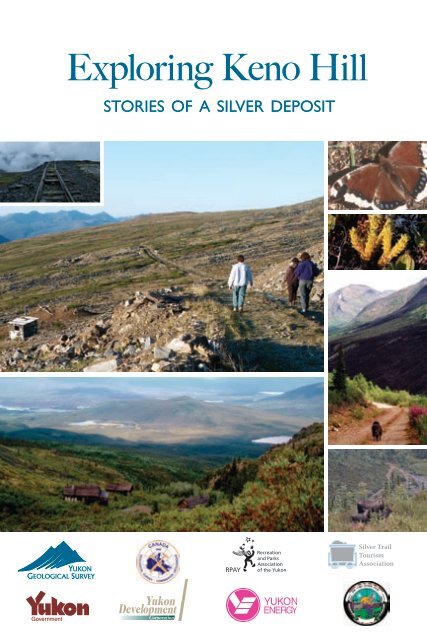
<strong>Exploring</strong> <strong>Keno</strong> <strong>Hill</strong><br />
STORIES OF A SILVER DEPOSIT
CONTENTS<br />
Welcome to <strong>Keno</strong> <strong>Hill</strong>, p.1<br />
Getting here: The Silver Trail highway, p.2<br />
<strong>Keno</strong> City, then and now, p.4<br />
Beringia and glaciation, p.6<br />
Nacho Nyak Dun: “Big River People,” p.8<br />
Hiking on top of <strong>Keno</strong> <strong>Hill</strong>, p.10<br />
Placer mining: The search for gold!, p.14<br />
A world-class silver deposit, p.16<br />
Geology, p.22<br />
Mineralization, p.23<br />
©2004, Yukon Development Corporation,<br />
(867) 393-5300<br />
Production by: K-L Services, Whitehorse, Yukon<br />
This guide is provided by Yukon Development as a<br />
community service. Every effort has been made to<br />
verify the information provided here. Any suggestions<br />
you have for inclusion in future printings are welcome.<br />
USE OF THIS AREA IS STRICTLY AT YOUR<br />
OWN RISK.<br />
One in a series of local attraction guides. Also available:<br />
Enjoying Whitehorse Trails, <strong>Exploring</strong> the Whitehorse<br />
Fishway and Viewing Whitehorse from Above: A guide to<br />
Haeckel <strong>Hill</strong>.<br />
To refer to this publication, please use the following:<br />
K-L Services, 2004. <strong>Exploring</strong> <strong>Keno</strong> <strong>Hill</strong>. Stories<br />
about a silver deposit. Yukon Development, 25 p.<br />
All photos © by the photographers.<br />
Cover photos: Insa Schultenkotter (dog on <strong>Keno</strong><br />
700 trail, cabins in Gambler Gulch), Bruce Bennett<br />
(Mourning Cloak butterfly), Peter Long (moose on<br />
Sourdough <strong>Hill</strong>, ore cart tracks at <strong>Keno</strong> 700 minesite,<br />
hikers on Silver Basin trail, Mountain Club-moss:<br />
Lycopodium selago).<br />
Thanks to…<br />
Bruce Bennett, Barbara Bergmann, Jeff Bond,<br />
Steve Buyck, Marilyn Dobbin-White, Doug Eaton,<br />
Diane Emond, Libby Gunn, Lillian Loponen,<br />
Laurie MacFeeters, Mike Mancini, Mike Phillips,<br />
Sally Robinson, Charlie Roots, Nerissa Rosetti,<br />
Insa Schultenkotter, Sonia Stangee, Sam Wallingham<br />
Active living is a way of life in which<br />
physical activity is valued and incorporated<br />
into daily life! Recreation and Parks<br />
Association of the Yukon encourages<br />
Yukoners to get active — your way — every day! For<br />
information and inspiration call 867-668-2328.<br />
Publié aussi en français et en allemand.<br />
Auch auf Französisch und Deutsch erhältlich.<br />
Trails described in this guide<br />
Signpost Road, p.5<br />
Butterfly trail, p.11<br />
Silver Basin trail, p.12<br />
Monument trail, p.13<br />
Signpost Road: 10.5-km steep drive to the top<br />
Top of <strong>Keno</strong> <strong>Hill</strong><br />
Butterfly trail: hike in a butterfly meadow<br />
Silver Basin trail: hike with views over <strong>Keno</strong>-<br />
Ladue valley and down Silver Basin Gulch<br />
Monument trail: hike on the summit<br />
overlooking old <strong>Keno</strong> 700 minesite<br />
Lightning Creek trail: hike with long option<br />
to McMillan Gulch<br />
Gambler Gulch trail: hike to Gambler claim<br />
and Wernecke townsite with full-day option<br />
to Faro Gulch<br />
<strong>Keno</strong> 700 trail: hike to old minesite with views<br />
to Gustavus Range<br />
Mount Hinton<br />
Sourdough <strong>Hill</strong> trail: hike with long option<br />
to south peak of Mount Hinton<br />
Bunker <strong>Hill</strong> trail: hike from <strong>Keno</strong> City to<br />
north peak of Mount Hinton<br />
For more information<br />
Lightning Creek trail, p.15<br />
Gambler Gulch trail, p.20<br />
<strong>Keno</strong> 700 trail, p.21<br />
Mount Hinton, p.25<br />
105M/14/quartz claims, Mayo Mining District, 2003.<br />
Energy, Mines and Resources, Yukon Government.<br />
Gaffin, Jane, 1980. Cashing In. Word Pro, Whitehorse,<br />
Yukon.<br />
Kindle, E.D., 1962. Geology, <strong>Keno</strong> <strong>Hill</strong>, Geological<br />
Survey of Canada, Map 1105A.<br />
LeBarge, W., Bond, J.D. and Hein, F.J., 2002. Placer<br />
gold deposits of the Mayo area, central Yukon. Exploration<br />
and Geological Services Division, Yukon Region,<br />
Indian and Northern Affairs Canada, Bulletin 13.<br />
Lipovsky, P., Bond, J. and LeBarge, W., 2001. Mayo<br />
area placer activity map. Exploration and Geological<br />
Services Division, Yukon Region, Indian and<br />
Northern Affairs Canada, Open File 2001-31.<br />
Mayo Historical Society, 1990. Gold & Galena.<br />
McTaggart, K.C., 1960. The geology of <strong>Keno</strong> and Galena<br />
hills, Yukon Territory. Geological Survey of Canada,<br />
Bulletin 58.<br />
Pielou, E.C., 1991. After the Ice Age. University of<br />
Chicago Press.<br />
Yukon Government, 2002. Yukon’s wildlife viewing<br />
guide.
Welcome to <strong>Keno</strong> <strong>Hill</strong><br />
Nestled in the mountains in central<br />
Yukon, the <strong>Keno</strong> <strong>Hill</strong> area was once<br />
host to one of the world’s richest<br />
silver deposits. The many tracks and trails,<br />
no longer used for mining, are here now for<br />
experienced hikers, mountain bikers and<br />
winter sports enthusiasts.<br />
High (1,848 m) and exposed, the top of<br />
<strong>Keno</strong> <strong>Hill</strong> stayed above the glaciers in the<br />
last ice age. Descendants of plants and<br />
insects (including butterflies) that were here<br />
during the ice ages remain in the meadows.<br />
Visit in late spring or early summer and take<br />
advantage of the long hours of sunlight to<br />
hike late into the evening. Listen for the<br />
birds singing after the sun disappears.<br />
RESPECT Alpine environment is very<br />
fragile and easily destroyed. Staying on the<br />
trails protects ground-nesting birds and<br />
flowers. Butterflies need flowers for food.<br />
Other people will want to enjoy them after<br />
you are gone. Keep your pets on a leash<br />
to avoid harassing wildlife—dogs are an<br />
unfamiliar enemy to slow-moving marmots.<br />
While on the trails you will encounter old<br />
buildings and artifacts. Please leave them<br />
in place. Taking artifacts is against the law.<br />
They are part of <strong>Keno</strong>’s mining heritage and<br />
should be left for the enjoyment of others.<br />
<strong>Keno</strong> City residents welcome visitors, but<br />
they ask that you pack out whatever you<br />
bring in.<br />
SAFETY Please resist from exploring mine<br />
workings. Old shafts can be hidden and<br />
very deep, and may not be closed. Timbers<br />
may have rotted internally and can collapse<br />
without warning.<br />
Approach cliff edges with respect; the rocks<br />
are loose and drop off constantly. Snow<br />
patches are icy and can be very steep and<br />
dangerous to walk on.<br />
Please be cautious on mining roads. They<br />
are not maintained and have become<br />
overgrown. Some are hard to follow; several<br />
lead through thickets of willow and alders.<br />
Watch for washouts, slides, overflows, ice,<br />
mud and rough conditions. There is no<br />
formal rescue capability in <strong>Keno</strong> City.<br />
Use common sense. Tell someone where you<br />
are going and when you expect to return.<br />
You are in wild country. Be aware, make<br />
noise and where possible, stay in open areas<br />
so as not to surprise a bear.<br />
The Mayo Renewable Resources Council<br />
is interested in hearing of any wildlife<br />
sightings, particularly of caribou.<br />
Built in the 1920s, this is the last building remaining at the Sheep Camp minesite. Insa Schultenkotter<br />
1
2<br />
Getting here: The Silver Trail highway<br />
The Silver Trail highway is 112 km<br />
from Stewart Crossing to <strong>Keno</strong> City<br />
at the base of <strong>Keno</strong> <strong>Hill</strong>. Highway 11,<br />
called the Silver Trail, is within Nacho Nyak<br />
Dun First Nation traditional territory, an<br />
area with sensational scenery, hiking, fishing,<br />
berry picking and camping.<br />
The Silver Trail starts at the north end of<br />
the Klondike Highway bridge over the<br />
Stewart River. This hard- surfaced road to<br />
Mayo has many glimpses of the Stewart<br />
River, several pullouts and views of glaciated<br />
terrain. The brochures, Yukon’s Wildlife<br />
Viewing Guide and It’s all on the Silver Trail,<br />
can be found at Yukon information centres.<br />
•<br />
The Village of Mayo, at kilometre 50, has<br />
propane and gas, motels, restaurants, a post<br />
office, liquor store, grocery store, recycling<br />
station, swimming pool, nursing station,<br />
RCMP, airport and float plane services.<br />
The Binet House Interpretive Centre<br />
(summer only) contains a collection of<br />
historic photos, interpretive information, a<br />
three-dimensional map of the region, and<br />
an extensive geology and mining display.<br />
Pick up a copy of the Mayo Historical<br />
Buildings Walking Tour.<br />
Beyond Mayo, there are no gas stations or<br />
food stores. Make sure that you have all the<br />
supplies you will need.<br />
Old<br />
Crow<br />
Y U K O N<br />
Dawson<br />
City<br />
11 <strong>Keno</strong> City<br />
Stewart Mayo<br />
Crossing<br />
Beaver<br />
Creek<br />
2<br />
Whitehorse<br />
Watson<br />
Lake<br />
to<br />
Dawson<br />
City<br />
2<br />
Klondike<br />
Highway<br />
Moose Calving<br />
Key Habitat<br />
Hard surfacing ends 5 km beyond Mayo,<br />
just after the turnoff to Yukon Energy’s<br />
five megawatt hydroelectric plant on the<br />
Mayo River. Built in 1952 to power the<br />
silver mines at <strong>Keno</strong> and Elsa, today, a<br />
transmission line connects the dam to<br />
Dawson City. (There is no room to turn<br />
around at the gate to the dam.)<br />
The Five Mile Lake Campground, with a<br />
day use area, swimming, boating, and trail<br />
around the lake, is half a kilometre past<br />
the dam turnoff. From there, the highway<br />
continues as a maintained gravel road.<br />
Near Halfway Lakes is a typical drunken<br />
forest — melting permafrost causes trees<br />
to lean in different directions, appearing<br />
“drunk.” The luxurious moss, and shrubs like<br />
labrador tea and heather, insulate the frozen<br />
ground, which melts if the cover is damaged.<br />
Mount Haldane, rising 1,200 metres to<br />
1,839 metres, is an impressive peak. To hike<br />
on the hill, take the access road on the left<br />
(west), just before the inn at the lake. Follow<br />
this gravel road for 2 km to a parking lot.<br />
The trail goes in three zigs up the east side<br />
of the mountain to the ridge saddle south<br />
of the main peak. It is 7.5 km, following a<br />
track to the ridge crest, then 1 km along the<br />
rocky, exposed crest to the summit. There<br />
are picnic tables with good views that serve<br />
as objectives for shorter hikes. (See the<br />
brochure, Climb Mount Haldane.)<br />
paved<br />
gravel<br />
McQuesten River<br />
Area<br />
11<br />
Stewart Crossing<br />
to Whitehorse<br />
Silver Trail<br />
Mt.<br />
Haldane<br />
Halfway<br />
Lakes<br />
Five Mile<br />
Lake<br />
Hanson Lake trail<br />
Mayo<br />
Mayo River<br />
0 16 32<br />
km<br />
Elsa<br />
Duncan Creek Road<br />
Stewart River<br />
<strong>Keno</strong> <strong>Hill</strong><br />
<strong>Keno</strong> City<br />
Mayo<br />
Lake<br />
W<br />
N<br />
S<br />
E
•<br />
Just before you reach Elsa, at kilometre 93,<br />
the road crosses Galena Creek on a high<br />
embankment. The first galena (a lead-silver<br />
mineral) of the district was found here at<br />
the base of Galena <strong>Hill</strong> in 1903, and an<br />
early tunnel is visible at the bottom of the<br />
canyon, upstream of the road.<br />
Elsa, the townsite for United <strong>Keno</strong> <strong>Hill</strong><br />
Mines until it shut down in 1989, is closed<br />
to the public. A small maintenance and<br />
exploration crew remain there.<br />
About 5 km past Elsa, the Hanson Lake<br />
trail branches off to the north. This is a<br />
rough, narrow road with several steep<br />
grades, best suited for pick-up trucks or<br />
four-wheel drive vehicles. Haldane Lake<br />
is visible to the west, about 9 km away. A<br />
cut-line provides easy access to the south<br />
shore. The lake is periodically stocked with<br />
rainbow trout.<br />
•<br />
A number of unmarked tracks along the<br />
highway access secluded lakes and streams.<br />
You can paddle to McQuesten Lake or the<br />
head of the Beaver River which joins the<br />
Stewart River. Outfitters and wilderness<br />
guides take horses into the back-country<br />
of the Wind, Snake and Bonnett Plume<br />
drainages. This area is commonly used by<br />
snowmobile and dogsled expeditions.<br />
•<br />
Mount Haldane<br />
Wareham Lake<br />
The Duncan Creek Road is an alternate<br />
route back to Mayo from <strong>Keno</strong> City.<br />
Check at the museum in <strong>Keno</strong> City to get<br />
conditions for this gravel road. In the early<br />
days of mining, silver ore was hauled over it<br />
by horse and wagon.<br />
Along this road, about 4.5 km from <strong>Keno</strong><br />
City, you can take a short hiking trail, with<br />
a stream crossing, to get a good view of the<br />
Duncan Creek canyon, site of the original<br />
Gustaveson gold strike.<br />
A short distance before the turn-off to Mayo<br />
Lake is a family placer mine, Duncan Creek<br />
GoldDusters. It has scheduled tours and<br />
gold panning.<br />
At the Mayo Lake junction, turn left (east)<br />
for fishing, boating and berry picking.<br />
There’s a good view of the dam across the<br />
outlet of Mayo Lake. The dam creates a<br />
reservoir for the hydro plant downstream.<br />
The Duncan Creek Road ends back at the<br />
Silver Trail.<br />
Mayo Landing was the staging ground for silver ore being shipped out by a fleet of river sternwheelers.<br />
Yukon Archives, William S. Hare Coll., Vol. 1, #6642<br />
Peter Long<br />
3
4<br />
<strong>Keno</strong> City, then and now<br />
From its beginnings in 1919 as a<br />
stopping point on a haul road, <strong>Keno</strong><br />
City quickly grew into a centre for<br />
supplies and recreation. A hotel and stables<br />
were built and even some abandoned placer<br />
miners’ cabins were retrieved from Duncan<br />
Creek. In 1922, it was officially established<br />
as a town, complete with a liquor store and<br />
post office.<br />
<strong>Keno</strong> City served as a base for miners,<br />
trappers, hunters, prospectors and First<br />
Nation people. On weekends, the miners,<br />
who worked hard then played hard,<br />
came into town from the mining camps.<br />
Moonshine, gambling, prostitution and<br />
fights were common in the 1920s, 1930s and<br />
again after World War II in the 1950s.<br />
The prosperity of <strong>Keno</strong> City rose and fell<br />
with the mines. Canadian silver prices<br />
museum<br />
declined in 1940, and the death in a plane<br />
crash in 1941 of the brilliant geologist and<br />
mine manager, Livingstone Wernecke, led<br />
to the closing of the large Treadwell Yukon<br />
operations.<br />
United <strong>Keno</strong> <strong>Hill</strong> Mines Ltd. opened in<br />
1947. By the late 1950s, these mines had<br />
become the second largest silver producers<br />
in North America and the fourth largest in<br />
the world. They continued until 1989.<br />
While the <strong>Keno</strong> and Elsa areas had over<br />
600 residents in 1980, today <strong>Keno</strong> City has<br />
a population of about 20, mostly artists and<br />
outdoor enthusiasts. It continues to serve as<br />
a base for local exploration and recreation.<br />
Pick up a copy of the brochure, <strong>Keno</strong> City<br />
Historical Buildings Walking Tour from the<br />
mining museum.<br />
Housed in a 1920s dance hall, the <strong>Keno</strong> Mining Museum has a wealth of equipment used in the early days,<br />
as well as artifacts from everyday life in the mining communities. Yukon Archives, William S. Hare Coll.,#6838
Signpost Road<br />
drive to the famous signpost at the<br />
A top of <strong>Keno</strong> <strong>Hill</strong> will reward you with<br />
a breathtaking panorama. You rise quite<br />
rapidly past changing views over the valleys.<br />
By kilometre seven, the road levels out<br />
and you are above treeline, passing alpine<br />
meadows overlooking the McQuesten<br />
Valley and the Ogilvie and Wernecke<br />
mountains.<br />
This 10.5-km gravel road is not recommended<br />
for large motorhomes or trailer<br />
rigs. There are switchbacks and no pullouts<br />
although there is turnaround room on top.<br />
Inquire at the museum for road conditions.<br />
At the top, overlooking Faro Gulch, sits the<br />
signpost. United <strong>Keno</strong> <strong>Hill</strong> Mines erected<br />
the original wooden signpost (right) in<br />
1956, when the company hosted a group<br />
of visiting scientists during International<br />
Geophysical Year. Arrows point to the cities<br />
represented by delegates. The current steel<br />
signpost dates from 1989.<br />
There’s a good chance you will see marmots<br />
in this area so be observant.<br />
LODGEPOLE PINE (Pinus contorta var. latifolia) can be distinguished from spruce by its needles,<br />
which appear in pairs, resembling tweezers. These pines in the subalpine have bark that is smooth<br />
instead of flakey and scaley like valley pines, and their needles are often found in groups of threes.<br />
Few lodgepole pines are found north of Wareham Lake, though they are continuing their slow<br />
march north. Only one pine (left) is known of on <strong>Keno</strong> <strong>Hill</strong>, at kilometre six of Signpost Road.<br />
WILD RHUBARB (Polygonum alaskanum) This shrubby plant (right), with plumes of tiny greenish<br />
white flowers, is a pioneer of disturbed sites so it is often found on roadsides and riverbanks. Its<br />
succulent young stems and leaves are edible. Wild rhubarb is widespread in unglaciated areas of<br />
Alaska and the Yukon but has not spread much farther since the glaciers retreated. You can find it<br />
5 km up Signpost Road.<br />
Joseph Moucha<br />
two photos by Peter Long<br />
5
4000<br />
00<br />
0<br />
3500<br />
2000<br />
4000<br />
2500<br />
3500<br />
3000<br />
4500<br />
3000<br />
2500<br />
3000<br />
6<br />
3000<br />
Beringia and glaciation<br />
At the signpost on top of <strong>Keno</strong><br />
<strong>Hill</strong>, you can look out over the<br />
McQuesten and <strong>Keno</strong>-Ladue valleys<br />
and see the mountains of the Yukon Plateau<br />
in the background.<br />
<strong>Keno</strong> <strong>Hill</strong> is in the Yukon Plateau-North<br />
ecoregion. This ecoregion is bounded<br />
to the south by the Tintina Trench, an<br />
ancient fault where deposits of at least seven<br />
glaciations are recognized by geologists.<br />
Large rivers, including the Pelly, Ross,<br />
Macmillan, Stewart, Hess, McQuesten and<br />
Klondike, drain the plateau, and most follow<br />
the trench for a short way before emptying<br />
into the Yukon River. Their glaciated valleys<br />
host numerous important wetlands.<br />
Life on an island<br />
When icesheets covered much of North<br />
America and Central Europe, huge amounts<br />
of water were locked up as ice. So much,<br />
that sea level was nearly 150 metres lower<br />
than today. Much of the Bering Sea became<br />
dry land. As the sea floor was exposed,<br />
a “bridge” of land up to 1,200 km wide<br />
4500<br />
4000<br />
4500<br />
3000<br />
4500<br />
3000<br />
3500<br />
4000<br />
3500<br />
3500<br />
4000<br />
4500<br />
4000<br />
3000<br />
4000<br />
2000<br />
4000<br />
Minto<br />
Lake<br />
3500<br />
3000<br />
4000<br />
3500<br />
3000<br />
4000<br />
3500<br />
3500<br />
4500<br />
3500<br />
4000<br />
3000<br />
4500<br />
3000<br />
4500<br />
4500<br />
3000<br />
2500<br />
4500<br />
2500<br />
4000<br />
3500<br />
3500<br />
4000<br />
3500<br />
4000<br />
4500<br />
4000<br />
3500<br />
3000<br />
4000<br />
3000<br />
4500<br />
C H A M B E R S H I L L<br />
M a y o<br />
Mount<br />
Haldane<br />
5000<br />
R i v e r<br />
Mayo<br />
3000<br />
2000<br />
4500<br />
2000<br />
2500<br />
2500<br />
3000<br />
4000<br />
4500<br />
3500<br />
Potato<br />
<strong>Hill</strong>s<br />
2500<br />
3500<br />
3500<br />
3500<br />
M c Q u e s t e n<br />
3500<br />
3000<br />
3000<br />
3500<br />
3500 4000<br />
2500<br />
2500<br />
3500<br />
3500<br />
4000<br />
Van Cleaves<br />
<strong>Hill</strong><br />
3000<br />
Janet Lake<br />
S T E W A R T<br />
3500<br />
connected North America to Asia. Eastern<br />
Russia, Alaska, Yukon and the NWT’s<br />
Mackenzie Valley region became a new<br />
subcontinent known as Beringia.<br />
The enormous continental ice sheets that<br />
covered much of the northern hemisphere<br />
isolated Beringia from the rest of North<br />
America and Asia.<br />
<strong>Keno</strong> <strong>Hill</strong> was just on the edge of Beringia<br />
but at the height of glaciation, the higher<br />
mountain peaks were still exposed. In a sea<br />
Green/white: Reid/McConnell glaciations; brown: unglaciated areas, generally mountain tops; grey lines and<br />
arrows show ice flow; black lines: limits of ice flow. Adapted from Lipovsky et al, 2001, OF 2001-31, Mayo area placer activity map<br />
0 km<br />
10<br />
Galena <strong>Hill</strong><br />
Indigirka R.<br />
2000<br />
R i v e r<br />
Christal<br />
D u n c a n<br />
R I V E R<br />
Kolyma R.<br />
Siberia<br />
Omolon R.<br />
3500<br />
2500<br />
5500<br />
4000<br />
3500<br />
5000<br />
4500<br />
5500<br />
5000<br />
4000<br />
5000<br />
5500<br />
3500<br />
5000<br />
6000<br />
4500<br />
5500<br />
D A V I D S O N<br />
4000<br />
R A N G E<br />
<strong>Keno</strong> <strong>Hill</strong><br />
Lightning<br />
C r e e k<br />
G U S T A V U S<br />
R A N G E<br />
4000<br />
ARCTIC<br />
OCEAN<br />
ARCTIC CIRCLE<br />
Anadyr R.<br />
PACIFIC OCEAN<br />
Ck<br />
6000<br />
5500<br />
4500<br />
3000<br />
4500<br />
0<br />
5000<br />
6000<br />
5000<br />
K e n o<br />
Chukchi Sea<br />
McConnell glaciation in Beringia. D. Hopkins et al (eds.)<br />
Paleoecology of Beringia, Academic Press, New York, 1982.<br />
5000<br />
Faith Ck<br />
5000<br />
5500<br />
5000<br />
5000<br />
5500<br />
3000<br />
4500<br />
4000<br />
4000<br />
Mount Hinton<br />
Mount Albert<br />
M A Y O<br />
Bering Strait<br />
Bering Sea<br />
4000<br />
Mount<br />
Cameron<br />
4500<br />
3000<br />
3000<br />
land exposed today<br />
Beringian shoreline, exposed seabed<br />
Late Pleistocene glaciers<br />
4500<br />
4000<br />
4000<br />
5000<br />
3500<br />
4500<br />
3500<br />
6000<br />
6000<br />
L A K E<br />
Yukon R.<br />
2500<br />
5000<br />
4500<br />
6000<br />
4000<br />
3000<br />
5000<br />
Alaska<br />
3500<br />
4000<br />
5000<br />
5500<br />
4500<br />
3500<br />
6000<br />
4500<br />
3500<br />
5500<br />
5000<br />
4000<br />
4000<br />
Yukon<br />
0 500 km<br />
5500<br />
2500<br />
3500<br />
3000<br />
4000<br />
3000<br />
6000<br />
6000<br />
5500<br />
6000<br />
5500<br />
6000<br />
P A T T E R S O N<br />
R A N G E<br />
4500<br />
3000<br />
3500<br />
55<br />
50<br />
Mount<br />
Patterson<br />
L a d u e<br />
5500<br />
5500<br />
400<br />
4500
Fritz Mueller<br />
of ice, these “nunataks” acted as islands of<br />
life.<br />
Steppes The landscape of Beringia itself<br />
was different than today in the Yukon.<br />
Because the climate was drier, much of<br />
the tussock tundra of today was steppe<br />
— consisting of short grasses, sage and<br />
a lot of bare ground. This “Asian steppe”<br />
habitat can still be found in parts of<br />
Central Asia and Siberia. Artistic sketches<br />
of Beringian landscapes show groups of<br />
woolly mammoths or herds of steppe bison.<br />
Although these large mammals are now<br />
extinct, many of the plants that they ate still<br />
grow here.<br />
Beringian flora During full glaciation<br />
many plant communities existed. Some<br />
were similar to what we see today and<br />
others were very different. Most noticeably,<br />
there is no evidence of any trees in this<br />
area, with the possible exception of paper<br />
birch (Betula neoalaskana), balsam poplar<br />
(Populus balsamifera) and some willows that<br />
reach tree size such as felt-leaf willow (Salix<br />
alaxensis). Many Beringian plants have<br />
spread far beyond the borders of Beringia<br />
while others are today only found on<br />
mountain tops growing in conditions likely<br />
very similar to those that they faced when<br />
mammoths roamed the land.<br />
Local glaciers The <strong>Keno</strong> area was mostly<br />
overlain by Reid (around 300,000 years<br />
ago), and McConnell (25,000 to 12,000<br />
years ago) glaciers. Traces of the ice ages are<br />
found on many area hillsides.<br />
During the Reid glaciation, <strong>Keno</strong> <strong>Hill</strong><br />
poked above the ice sheet. Ice surrounded<br />
<strong>Keno</strong> <strong>Hill</strong>, Galena <strong>Hill</strong> and the Gustavus<br />
Range, and was at least 760 metres thick in<br />
the <strong>Keno</strong>-Ladue valley.<br />
During the McConnell glaciation, as the<br />
weather got colder, alpine glaciers developed<br />
in north-facing cirques at the headwaters<br />
of local drainages like McNeill and<br />
McMillan gulches. At the same time, large<br />
accumulations of ice in the Selwyn and<br />
Ogilvie mountains were advancing to this<br />
area. About 18,000 years ago, at the peak of<br />
the ice flow, valley glaciers wrapped around<br />
lower parts of mountains around <strong>Keno</strong> <strong>Hill</strong>.<br />
It is thought that valley glaciers south of<br />
<strong>Keno</strong> <strong>Hill</strong> used to drain northward, via<br />
Christal Creek (named after Charles<br />
Christal, who found and staked the first<br />
gold here in 1902). During the McConnell<br />
glaciation, ice in the <strong>Keno</strong>-Ladue valley<br />
flowed south, up Christal Creek into the<br />
Duncan Creek drainage. The terminal<br />
moraine (rock debris deposited at the front<br />
of a glacier) from this lobe underlies <strong>Keno</strong><br />
City. Lightning Creek was forced south<br />
into the Duncan Creek drainage by the<br />
lingering presence of this ice mass and the<br />
terminal moraine. The rock canyon in which<br />
Lightning Creek passes through <strong>Keno</strong> City<br />
is left over from this glacial diversion.<br />
COLLARED PIKA or Rock Rabbit is<br />
genetically related to rabbits and hares. They<br />
spend all summer gathering food, forming hay<br />
piles, drying the hay and storing it in their rocky<br />
burrows for winter use. Unlike marmots they<br />
do not sleep the winter away, but remain active,<br />
feeding under the protective covering of snow.<br />
These populations survived in Beringia. Today,<br />
the collared pika has expanded its range south<br />
and east but only as far as the northwestern<br />
corner of British Columbia. In the Yukon,<br />
the collared pika is found on most Yukon<br />
mountains except in the extreme north.<br />
7
Peter Long<br />
8<br />
Nacho Nyak Dun: “Big River People”<br />
As you explore the trails in the <strong>Keno</strong><br />
<strong>Hill</strong> area, you may wonder what it<br />
was like for the early people here.<br />
When did people first start living here?<br />
People likely lived in the area, depending on<br />
the ebb and flow of the ice, during the last<br />
glaciation. Life at the edge of the ice sheet<br />
would have given them access to different<br />
resources at different times.<br />
First Nation people have a life based on the<br />
land. Their stories from the past describe<br />
a hard life, made possible in large part by<br />
sharing. Five to ten families, each including<br />
two to four children, travelled together.<br />
They likely ranged over an area about 1,000<br />
square km.<br />
Then, as today, mosquitoes and blackflies<br />
would have been intolerable at times.<br />
Crushed spruce beetles, juice from certain<br />
plants, smoke and windier camp sites were<br />
all used to deal with the insects.<br />
Some valleys were rich in moose, beaver,<br />
marten and lynx. According to a government<br />
reconnaissance report in the early 1900s,<br />
meat-drying racks were everywhere along<br />
stream banks.<br />
WILLOW (Salix pulchra) is one of many<br />
species that grows well on <strong>Keno</strong> <strong>Hill</strong>. Along<br />
Signpost Road, the nibbled tops of the<br />
branches indicate a lot of moose activity.<br />
People were smart about their use of the<br />
land and its resources. They set fires both<br />
to clear land for easier travel and to create<br />
better moose habitat.<br />
In winter, they snared sheep in the Ogilvie<br />
Mountains and around the Wind River<br />
or across the divide in the Mackenzie<br />
Mountains near the Arctic Red River. They<br />
built moose fences and caribou corrals in<br />
the mountains north of the Stewart River.<br />
In summer, they caught and dried grayling<br />
and salmon, and fished for lingcod,<br />
whitefish, pike and inconnu. Nets were set<br />
across the narrows of creeks. Berries were<br />
plentiful, particularly blueberries.<br />
The people didn’t stay in one place, but<br />
moved to where food would be best. After<br />
dense forests returned to the area, travel,<br />
where possible, would have been on the<br />
smooth ridges above treeline. To travel<br />
the bigger rivers they would build rafts, or<br />
sometimes, skin boats; this could take about<br />
a week.<br />
They would also collect food as they moved.<br />
When they caught a large animal such as<br />
a moose, they would stay for days to dry<br />
the meat. Sometimes they took the meat<br />
with them. Other times it was buried in a<br />
pit, with a fire lit on top to stop the smell<br />
attracting animals.<br />
Families in one area might be related<br />
to families living far away, based on<br />
contacts made during hunting and trading<br />
expeditions.<br />
After the arrival of the first fur traders to<br />
the north, life changed. A trading post was<br />
built at Fort Selkirk and, in exchange for<br />
beaver pelts, First Nation people received<br />
guns, shells and clothing.<br />
Fort Selkirk people also used the Stewart<br />
River area to hunt, and salmon fishing here<br />
was very good. People used to stay to dry<br />
meat and fish. About 75 people settled in
Peter Long<br />
the newly established town of McQuesten,<br />
built as the result of a nearby post.<br />
Other people from Fort Good Hope stayed<br />
at Lansing. It also was a place to trade fur.<br />
Lonny Johnny said his grandfather trapped<br />
“all over,” at the Wind, Bonnet Plume,<br />
Snake, Little Arctic and Arctic Red rivers<br />
Yukon R.<br />
since there were a lot of moose to be found.<br />
FAIRBANKS<br />
First Nation people were hardy, often<br />
travelling and hunting for days in freezing<br />
weather.<br />
At first, as miners arrived in the<br />
area, First Nation families provided<br />
fish and wild game to the camps.<br />
However, as the newcomers arrived in larger<br />
numbers, game began to disappear from the<br />
area about Galena and <strong>Keno</strong> hills.<br />
When Gene Binet built the store at Mayo<br />
Landing in 1903 and the road was put in to<br />
Duncan and Haggart creeks, people started<br />
to move from the McQuesten post to Mayo.<br />
The store in McQuesten closed down in<br />
1904. The large Peters family and others<br />
moved to the mouth of the Mayo River.<br />
Through the 1920s and 1930s, in addition<br />
to trapping, First Nation men worked<br />
as market hunters, selling meat and fish<br />
in Mayo, or cutting firewood for the<br />
steamboats. As well, they found work as<br />
camp hunters and guides, and in the silver<br />
mines at <strong>Keno</strong> <strong>Hill</strong>.<br />
Mayo Elder Helen Buyck remembers seeing<br />
thousands of caribou at the mouth of the<br />
Mayo River, and crossing the ice of the<br />
Stewart River, as late as the 1930s.<br />
OLD<br />
CROW<br />
Y U K O N<br />
DAWSON<br />
CITY<br />
McQUESTEN<br />
Yukon R.<br />
FORT<br />
SELKIRK<br />
AKLAVIK<br />
A R C T I C C I R C L E<br />
KENO<br />
CITY<br />
MAYO<br />
FORT<br />
McPHERSON<br />
LANSING<br />
N W T<br />
The South McQuesten River valley lies<br />
immediately north of the Elsa townsite.<br />
A First Nation family, the Germaines,<br />
HAINES WHITEHORSE<br />
has trapped JUNCTION and hunted in this area for<br />
generations. The valley is rich with moose,<br />
beaver, martin and lynx. The McQuesten<br />
Lakes, further SKAGWAY up the valley, have lingcod,<br />
whitefish, pike and inconnu. The family set<br />
nets in the HAINES narrows of an emptying CASSIARcreek,<br />
DEASE LAKE<br />
and Jenny Germaine reports “lots of fish there.<br />
<strong>Keno</strong>, in summer time we stayed there, picked<br />
lots of blueberries. We also had a house in <strong>Keno</strong>.<br />
We hunted gophers and whistlers; we used to<br />
walk there. There was graylings in Christal<br />
Creek.” After the prospectors started settling<br />
here, the Germaines provided fish and wild<br />
game to the mining camps.<br />
Alsek R.<br />
Stewart R.<br />
Tatshenshini R.<br />
McQuesten R.<br />
Peel R.<br />
Wind R.<br />
Macmillan R.<br />
Bonnet Plume R.<br />
Lansing R.<br />
km<br />
0 250<br />
Mackenzie R.<br />
Hess R.<br />
Pelly R.<br />
Today, their descendents are members of the<br />
Nacho Nyak Dun First Nation and many<br />
live in Mayo.<br />
WHITE MOUNTAIN HEATHER<br />
(Cassiope tetragona) is abundant<br />
on the summit of <strong>Keno</strong> <strong>Hill</strong>,<br />
especially near rock piles. Pikas eat<br />
almost all types of vegetation up to<br />
10 metres away from the safety of<br />
their rock pile homes — except for<br />
heather. The large mats, festooned<br />
with white bells, bloom in July.<br />
Keele R.<br />
FORT<br />
GOOD HOPE<br />
NORMAN<br />
WELLS<br />
FORT<br />
NORMAN<br />
South Nahan<br />
WATSON LAKE<br />
9
Gambler<br />
Faith<br />
10<br />
Gulch<br />
Hiking on top of<br />
<strong>Keno</strong> <strong>Hill</strong><br />
Sheep Camp<br />
<strong>Keno</strong> <strong>Hill</strong> is the name given to the<br />
mountain above <strong>Keno</strong> City. It actually<br />
is five summits — each a hill in its own<br />
right (shown on the map below).<br />
As you drive up Signpost Road, you will<br />
pass structures of two eras: the 1920s to<br />
1960s, and the galvanized steel of the 1970s.<br />
Most of the big open pits were mined in<br />
the 1970s, along with some very selective<br />
remining in the early 1990s.<br />
In the early days, Livingstone Wernecke<br />
noted the depth of permafrost intersected.<br />
These notes are very useful today in studies<br />
of climate change. Also, in the very stable<br />
air underground, gigantic hoar frost crystals<br />
grow, and some of these contain flakes of<br />
silver, precipitated from the cold, damp air.<br />
Gulch<br />
The plateau west of the signpost has<br />
undergone more than 300,000 years of<br />
Adapted from J.D. Bond, Geoscience Map 1998-4, Surficial Geology of <strong>Keno</strong> <strong>Hill</strong><br />
4500<br />
Gulch<br />
Faro<br />
5000<br />
V V V V V<br />
SUMMIT<br />
KENO<br />
Gulch<br />
Charity<br />
V V V VV<br />
MINTO<br />
HILL<br />
Gulch<br />
Hope<br />
McKay Gulch<br />
4000<br />
4500<br />
6065<br />
MONUMENT<br />
HILL<br />
3000<br />
5500<br />
Silver<br />
Basin<br />
Gulch<br />
V V<br />
Lightning Creek<br />
0 km<br />
v v v v v v v v v v v<br />
CARIBOU<br />
HILL<br />
McMillan<br />
Monument <strong>Hill</strong><br />
Looking eastward from the signpost, a winding<br />
track leads to Sheep Camp at the junction of the<br />
Monument and Silver Basin trails. Peter Long<br />
freeze-thaw cycles, creating an undulating<br />
field of frost-fractured rock, called a<br />
cryoplanation terrace. This hill top was not<br />
scoured by ice during this period of time.<br />
In contrast, about 20,000 years ago, Faro<br />
and Silver Basin gulches were deepened by<br />
valley glaciers which plucked rocks from<br />
the base of the headwalls, creating cirques.<br />
Mounds of sand and boulders further down<br />
these valleys, and on the south slope of<br />
<strong>Keno</strong> <strong>Hill</strong>, are called moraine, and mark the<br />
limit of the glacial advances. The height of<br />
formerly glaciated parts of the mountain can<br />
be determined by noting boulders that differ<br />
in composition from their surroundings:<br />
these are erratics, transported by the moving<br />
ice.<br />
BEAUVETTE<br />
HILL<br />
4500<br />
glacial erratics: Reid, earlier<br />
cryoplanation terrace<br />
bedrock<br />
moraine ridge<br />
cirque: McConnell<br />
glacial limit: McConnell, Reid<br />
roads, tracks<br />
2<br />
There are three marked trails at the top of<br />
<strong>Keno</strong> <strong>Hill</strong>: Butterfly trail, Silver Basin trail<br />
and Monument trail. Trails are described<br />
on the following pages. The yellow area on<br />
the map at left is blown up below.<br />
0 km<br />
5500 ft<br />
Signpost Road<br />
<strong>Keno</strong> 700 trail<br />
l c h<br />
C h a r i t y<br />
Yukon Environment Geomatics<br />
2<br />
5000 ft<br />
F a r o G u l c h<br />
Butterfly<br />
trail<br />
Silver Basin trail<br />
5500 ft<br />
5000 ft<br />
Monument<br />
trail<br />
6000 ft
Butterfly trail<br />
This marked trail starts and ends at the<br />
signpost, taking between 45 minutes<br />
and one hour to complete. You pass across<br />
the rocky alpine tundra through prime<br />
butterfly habitat. When you reach the top of<br />
the south-facing slope, follow the markers<br />
down to the right, staying on the trail to<br />
avoid disturbing any wildlife. Far below<br />
are the buildings from the <strong>Keno</strong> 700 mine.<br />
Please stay away from these old structures.<br />
The Butterfly trail joins the <strong>Keno</strong> 700 trail,<br />
turns right, and brings you back to Signpost<br />
Road. From here, turn right to return uphill<br />
to the signpost.<br />
<strong>Keno</strong> <strong>Hill</strong>’s butterflies have adapted to<br />
survive short summers and the rugged,<br />
often inhospitable, alpine climate. However,<br />
they are still sensitive to weather conditions,<br />
so timing your visit for a warm, sunny, July<br />
day will give you the best chance to see<br />
them. The butterflies are not active in strong<br />
winds or on cold, wet days. It is amazing to<br />
watch when the sun comes out — all of a<br />
sudden, the butterflies start flitting about.<br />
Some butterfly species are synchronized<br />
with each other; they all hatch from eggs in<br />
the same year and take two years to mature,<br />
so there are only adults flying every second<br />
year. Other species have some adults flying<br />
each year, even though they take two years<br />
to mature.<br />
Birds commonly seen in the tundra include<br />
Rock, Willow and White-tailed ptarmigan,<br />
American Golden Plover and American<br />
Pipit.<br />
Rock Ptarmigan eggs. Peter Long<br />
FEW-FLOWERED CORYDALIS (Corydalis<br />
pauciflora) are found in seepy areas usually fed<br />
by late snowmelt but they are easy to overlook.<br />
The Everman’s parnassia butterfly (below)<br />
needs to find this plant in order to lay its eggs<br />
and feed its young. Of the three species of<br />
Corydalis found in the Yukon, this is the only<br />
one that lived in the Yukon during full glaciation.<br />
It is now found throughout Alaska, Yukon,<br />
northern British Columbia and mountainous<br />
areas of Russia and eastern Asia.<br />
Insa Schultenkotter<br />
Bruce Bennett<br />
11
12<br />
Silver Basin trail<br />
The Silver Basin trail follows an old<br />
mining road to a spot with a view into<br />
the Ladue valley. This is a nice place to<br />
watch for wildlife in the wetlands below, so<br />
bring binoculars and a camera.<br />
As you leave the signpost area, take the<br />
gravel road towards an old cabin in the<br />
distance, staying left when the trail<br />
branches just before the cabin. The trail may<br />
be wet in places from runoff. The snow high<br />
up on your right is a permanent ice patch.<br />
As you near Silver Basin Gulch, follow<br />
markers on your right that will take you to<br />
a lookout over the gulch. Notice the bare<br />
bedrock of the McConnell-age cirque at<br />
the head of the gulch. Watch for the steep<br />
dropoff.<br />
The main trail ends at a cairn overlooking<br />
the gulch. Return from here to complete the<br />
4-km, 1½ to 2-hour return trip.<br />
You may notice a white object in the<br />
distance — it’s an old car, home to a couple<br />
of miners working in the area many years<br />
ago. The trail continues past this point for<br />
those who are really keen.<br />
View northward from an old minesite on the Silver Basin trail. Insa Schultenkotter<br />
Hanson Lakes<br />
Gambler Lake<br />
YUKON RAGWORT<br />
(Senecio yukonensis)<br />
are mostly<br />
single stemmed<br />
and covered with<br />
woolly, curly hairs.<br />
This hardy member<br />
of the sunflower<br />
family usually grows<br />
tall compared to<br />
its neighbours, sometimes reaching 35 cm.<br />
Look for it in the dry, wind-swept heath tundra<br />
habitat of the alpine zones near the mountain<br />
summits. It is widespread in the mountains of<br />
the Yukon and Alaska, but not seen anywhere<br />
else in the world.<br />
The rocky slopes along this trail provide<br />
some of the best opportunities in the area to<br />
view marmots and pikas.<br />
A 1930 mining industry report noted that<br />
while a large amount of work was done on<br />
the properties in this area, it was difficult to<br />
keep entrances to the workings open due to<br />
loose rock and the steepness of slope.<br />
Yukon Plateau<br />
Davidson Range<br />
Ladue Lake<br />
Bruce Bennett<br />
Insa Schultenkotter
Insa Schultenkotter<br />
Monument trail<br />
Follow the same mining road as the Silver<br />
Basin trail but veer off to the right just<br />
before the old Sheep Camp mine cabin.<br />
The trail is named after the rock formation<br />
at its height. From here you are looking<br />
south, towards Mount Hinton in the<br />
distance, with Bunker and Sourdough hills<br />
in the foreground. You can see old mine<br />
workings and seemingly endless roads.<br />
When you look down the side of <strong>Keno</strong> <strong>Hill</strong>,<br />
you will see the remains of the <strong>Keno</strong> 700<br />
mine. There are pieces of railway tracks, old<br />
boilers, remains of mining camps, cables,<br />
pipes and many other artifacts. Please stay<br />
clear of all of this equipment.<br />
HOARY MARMOT<br />
are named from the<br />
whitish hairs on their<br />
backs resembling<br />
hoar frost. Unlike<br />
the collared pikas,<br />
marmots are<br />
true hibernators. They go into hibernation<br />
in August, and don’t re-emerge until the<br />
following May or June. For up to nine months,<br />
marmots sleep in groups under the rock piles.<br />
The more marmots in the group, the better<br />
their chance of survival, perhaps by sharing<br />
body heat. The marmots’ motto could be<br />
“sleep with your friends and survive.”<br />
Monument rock with the cirque at the head of<br />
McNeill Gulch in the background. Peter Long<br />
You can turn around at this point to return<br />
to the signpost (a 2-km return hike), or go<br />
down the slope and join the <strong>Keno</strong> 700 trail,<br />
returning to Signpost Road. Hiking on<br />
these rocky slopes calls for good footwear.<br />
The billboard antennae on top of Galena <strong>Hill</strong>, a<br />
highly visible local landmark, were used for<br />
communications between the south and the<br />
defense systems based in the arctic. Below the<br />
towers, the slot-like hole of the Mackeno Mine is a<br />
late 1960s open pit along the vein. Peter Long<br />
Looking down on the <strong>Keno</strong> 700 mine. The rivers of rock in among the moss and lichen, called frost boils or<br />
frost polygons, result from permafrost and intense freeze-thaw cycles. Peter Long<br />
13
14<br />
Placer mining: The search for gold!<br />
In the 1890s, the first prospectors in the<br />
<strong>Keno</strong> <strong>Hill</strong> area panned the gravel bars on<br />
the Stewart and McQuesten rivers. As<br />
they learned how to thaw the permanently<br />
frozen soil, the miners began to look for<br />
the coarser gold still buried in the ground.<br />
Gold in paying quantities was soon found on<br />
Haggart Creek and Dublin Gulch.<br />
As more miners arrived, other sites were<br />
explored, with some success. Sometimes,<br />
the results of prospecting would be the<br />
equivalent of wages earned mining —<br />
usually just enough to continue the search.<br />
In the summer of 1898, the Gustavesons, a<br />
father and two sons from Sweden, found<br />
gold on what would later be called Duncan<br />
Creek. They mined for two years, recovering<br />
a rumoured $30,000 of gold, but never<br />
staked a claim. In the fall of 1901, when<br />
they left to go to town for supplies, four<br />
prospectors back-tracked them and staked<br />
claims that included the ground already<br />
worked by the Gustavesons, as well as a fork<br />
called Lightning Creek. The Swedes never<br />
returned.<br />
News of the rich gold strike spread and, in<br />
1902, Duncan Creek was staked from its<br />
headwaters to the Mayo River. Initially,<br />
the area was linked to the Stewart River at<br />
Gordon’s Landing, but the paddlewheelers<br />
Upper Duncan Creek<br />
Lightning Creek<br />
Thunder Gulch<br />
McNeill Gulch<br />
Green boxes indicate active placer mineral claims<br />
as of February 2003. Adapted from Energy, Mines and<br />
Resources, Yukon government, 105M14P<br />
PLACER GOLD in this area is concentrated<br />
in deep gravels overlying bedrock. Over<br />
millions of years, streams eroded V-shaped<br />
valleys between mountains, continuously<br />
concentrating any gold. Glaciation brought<br />
ice, scouring valley sides, burying, and<br />
in some cases, obliterating the old, deep<br />
stream channels, adding vast quantities of<br />
glacial debris to the valley floors. After the<br />
ice melted, the streams once again downcut,<br />
eroding the glacial debris. Buried “pay<br />
gravels” were re-exposed, making placer<br />
mining feasible in these deep valleys. Most<br />
of the gold mined from Duncan Creek has<br />
a well-worn or beaten appearance. This<br />
is typical of placer gold from high-energy<br />
glaciated environments.<br />
couldn’t easily reach this point. So in 1903,<br />
Mayo Landing was established further<br />
downriver, at the mouth of the Mayo River.<br />
In 1904, a 38-km wagon road was built<br />
from the Mayo River to the mines along<br />
Duncan Creek and several roadhouses were<br />
set up along the way. (The Duncan Creek<br />
Road is now the alternate route to <strong>Keno</strong><br />
City from Mayo.)<br />
The early miners used wooden sluice boxes,<br />
picks and shovels to sluice the shallow<br />
gravels. In the first year, the four original<br />
stakers took out about $45,000 of coarse<br />
gold from their Discovery Claim. The lower<br />
part of Duncan Creek may have been just<br />
as rich, but the gold lay under 30 metres of<br />
overburden and the shafts soon filled with<br />
water as the upper gravel layer was thawed.<br />
By 1915, the entire mining district had<br />
produced a conservative $685,000, about<br />
$100,000 of which was from Duncan Creek<br />
alone. By then, there were only 11 miners<br />
left working on the creek.<br />
Today, modern mining techniques have<br />
contributed to the success of recent gold<br />
mines along Duncan Creek.
Lightning Creek trail<br />
Lightning Creek is currently home to<br />
a few placer mining operations. The<br />
original wagon trail up <strong>Keno</strong> <strong>Hill</strong> started<br />
along the bouldery creek bed.<br />
Today, you can follow the old road, up the<br />
valley between <strong>Keno</strong> <strong>Hill</strong> and Sourdough<br />
<strong>Hill</strong>. It’s a quick way to get into the back<br />
country.<br />
Because placer mining continues in the<br />
creek, look out for heavy equipment. From<br />
1998 to 2002, Lightning Creek placer<br />
operations returned 2,604 ounces of gold<br />
(almost 81,000 grams).<br />
When you reach the bridge, you can turn<br />
around and return by the same road. Or,<br />
alternately, if there is no activity at the mine<br />
across the creek, cross over and bear right.<br />
You will pass the minesite, returning to<br />
town along the upper road on the other side<br />
of the creek. This route has a few short hilly<br />
stretches, none very steep; alders overgrow<br />
the road in places.<br />
From the bridge, the Lightning Creek Road<br />
continues 9.5 km up the valley to McMillan<br />
Gulch. There are beautiful alpine meadows<br />
at the headwaters of both McNeill and<br />
McMillan gulches.<br />
Placer operation on Lightning Creek. Bill LeBarge<br />
Lightning Creek and road. Insa Schultenkotter<br />
MOUNTAIN ALDER (Alnus crispa) is aptly<br />
named, often found growing in disturbed,<br />
rocky, nutrient-poor soils of the mountains.<br />
Alders add nitrogen to the soil, improving it<br />
for other species of plants. It has adapted to<br />
being buried under heavy snow, so it grows<br />
well in avalanche chutes. Even when its top<br />
is removed through fire or breakage, it will<br />
quickly resprout.<br />
Peter Long<br />
15
16<br />
A world-class silver deposit<br />
Looking around from the top of the<br />
<strong>Keno</strong> <strong>Hill</strong> today, it’s hard to picture<br />
the early days of mining. However,<br />
names on the claim map below and the map<br />
on the back cover will give you a sense of the<br />
adventures and fortunes of the early miners.<br />
In 1903, Jacob Davidson found galena, a<br />
lead-silver mineral, in the canyon of Galena<br />
Creek, and staked a claim. (The shaft<br />
opening is still visible at kilometre 93, just<br />
southwest of the Elsa townsite.)<br />
Ten years later, two miners worked through<br />
the summer at Davidson’s old claim on<br />
Galena <strong>Hill</strong>, renaming it the Silver King<br />
mine. They packed high-grade ore into<br />
oat sacks and shipped it to San Francisco<br />
for smelting. It assayed at several hundred<br />
ounces of silver to the ton (over 6,000<br />
grams/ton) and the miners made a $10,000<br />
profit. However, within a few years, the<br />
visible high-grade ore was removed, and in<br />
spite of much searching, no more ore was<br />
found in the Galena <strong>Hill</strong> area.<br />
Then, in 1918, Louis Bouvette found silverrich<br />
galena in loose rock which he traced up<br />
the side of Sheep Mountain (later named<br />
<strong>Keno</strong> <strong>Hill</strong>). The following summer, he<br />
prospected further and staked a claim he<br />
called Roulette. Assaying the ore showed a<br />
very rich 200 to 300 ounces of silver per ton.<br />
The Guggenheims’ Yukon Gold Company<br />
assayer, Alfred K. Schellinger, sent to<br />
examine the find, immediately staked the<br />
adjacent <strong>Keno</strong> claim. In the ensuing rush<br />
of the next months, over 500 claims were<br />
staked on the hilltop. Within a few years,<br />
the Guggenheims’ <strong>Keno</strong> <strong>Hill</strong> Ltd. had<br />
either staked or optioned many claims,<br />
including the rich Sadie and the Friendship.<br />
In 1919, John Kinman found a silver vein<br />
just above Lightning Creek. His cabin<br />
became a stopping point on the haul road,<br />
and the area grew to become <strong>Keno</strong> City.<br />
The barren windswept top of <strong>Keno</strong> <strong>Hill</strong><br />
became a very busy place as shafts were<br />
blasted to the rich veins of ore. Conditions<br />
were difficult. Wood for heat and mine<br />
timbers had to be hauled up the hill and<br />
water was scarce, being frozen much of the<br />
year. At the “Top of the <strong>Hill</strong>” tent camp,<br />
by the main shaft, company workers lived<br />
under abysmal conditions as lead-silica dust<br />
blew into their food, clothing and bedding.<br />
Finally, in 1921, a two-week strike by the<br />
miners led to improved conditions, shorter<br />
workdays and a framed wooden bunkhouse.<br />
<strong>Keno</strong> <strong>Hill</strong> claim map. A full claim is 457 metres or 1,500 feet along each side. Claims in black are mentioned<br />
in the text. Adapted from 105M-14, Quartz<br />
0 km<br />
2
Horse-drawn ore sleds at <strong>Keno</strong> City reloading point,<br />
1922-1923. Yukon Archives, Schellinger Coll., #5830<br />
High-grade ore was hand selected, and<br />
then hauled down the hill to <strong>Keno</strong> City by<br />
a method called “rawhiding.” When snow<br />
was deep during the winter, a dozen heavy<br />
sacks of ore would be tied up in a cow hide,<br />
hairy side out. A horse would drag a few of<br />
these at a time down the mountainside to<br />
the road. From there, two sets of four-horse<br />
teams took 18-ton wagon loads in four<br />
stages to Mayo, where the ore was stacked<br />
on the riverbank to await steamers that<br />
would arrive when the ice went out. The<br />
winter freight rate to Mayo was $20 per<br />
ton, and from there to the smelter in San<br />
Francisco, about $22 per ton. The ore had<br />
to be very rich in silver to justify the cost of<br />
mining and freight.<br />
Cordwood and mine timbers were carried<br />
on the back-haul from Mayo to the mines.<br />
GALENA is a high density<br />
mineral containing lead and<br />
sulphur. In this area, the galena<br />
has a high silver content<br />
— several thousand ounces<br />
per ton in some veins. Silver<br />
is locked in molecular form<br />
inside galena and is recovered<br />
by heating (smelting). Zinc,<br />
cadmium and sometimes gold<br />
are also<br />
present<br />
in <strong>Keno</strong><br />
ore.<br />
1 m<br />
an average ton<br />
of <strong>Keno</strong> rock<br />
1 m 35.7 cm<br />
Now, consider a 1986 estimate<br />
of 1,621,234 m 3 of ore mined in<br />
the area since the early 1900s<br />
— the volume of Toronto’s<br />
Skydome with the roof closed.<br />
The silver in the ore would<br />
have filled a sphere 11.4 m in<br />
diameter — about the size of<br />
a hot air balloon. Spheres of<br />
lead and zinc in the ore would<br />
have been 36.4 m and 38 m in<br />
diameter, respectively.<br />
Riverboats, trucks and trains<br />
were required to get the ore<br />
to Skagway for shipping to<br />
High-grading the ore by hand on the summit.<br />
Yukon Archives, Canada Geology Survey, 90/36, #79322<br />
Wood had become scarce around <strong>Keno</strong><br />
as it was being used for building, heating,<br />
shoring in the underground mines and,<br />
perhaps, to thaw the permafrost.<br />
Mining engineer Livingstone<br />
Wernecke arrived in 1921 to<br />
investigate silver prospects in the<br />
area. He liked the silver veins and invested<br />
almost $500,000 in properties, forming<br />
the Treadwell Yukon mining company to<br />
manage them.<br />
Wernecke soon had 50 to 60 miners<br />
tunnelling to both ends of the Sadie-Ladue<br />
vein. It was 120 metres long and averaged<br />
50 cm wide, assaying 295 ounces of silver<br />
per ton (over 10,000 grams/ton). With this<br />
mine a success, Wernecke bought a sawmill<br />
southern smelters before<br />
any money was made. This<br />
effort opened up the central<br />
Yukon. From the late 1920s<br />
through the 1960s, ore was<br />
the most profitable regular<br />
cargo for sternwheelers, and<br />
resulted in the building of the<br />
Klondike Highway (Mayo Road)<br />
in the early 1950s. Upkeep<br />
of these transport links and<br />
trans-shipment points (Mayo<br />
and Whitehorse) sustained<br />
the Yukon economy after the<br />
Klondike gold slumped.<br />
17
Digging through overburden (surface gravel) to<br />
test a buried vein, above the future Elsa townsite.<br />
Yukon Archives, Schellinger Coll., #5896<br />
and set it up at Mayo Lake to provide<br />
lumber for the camp.<br />
Both <strong>Keno</strong> <strong>Hill</strong> Ltd. and Treadwell Yukon<br />
invested in the sleigh trails down from <strong>Keno</strong><br />
<strong>Hill</strong>. They also petitioned the government<br />
to improve the road to Mayo. As <strong>Keno</strong><br />
City became the centre for recreation, there<br />
was a lot of traffic up and down the hill<br />
— vehicles, horses and walkers. To reduce<br />
the number of brawls between miners,<br />
the camps gave alternate days off to their<br />
workers.<br />
Mining was a tough business. Accidents<br />
resulted from blasting and falling rock,<br />
people falling down hillsides or into<br />
mining shafts, or freezing on the trail. Bear<br />
encounters were common, and though some<br />
were alarming, none were fatal.<br />
The 1923 mining season was the first<br />
pinnacle of optimism in the mining camp.<br />
There was considerable speculation about<br />
the value of the various claims. People<br />
watched with great interest as exploration<br />
progressed from initial pits, to trenches<br />
and then shafts and adits, following the ore<br />
veins underground.<br />
Most mines were small independent<br />
operations. Matt Butjer dug four tunnels to<br />
prove the worth of his claims. One tunnel,<br />
about 215 metres long, was dug through<br />
frozen ground at a rate of just under seven<br />
18<br />
metres a month. He was lucky, as the entire<br />
length of the tunnel was in ore. He dug<br />
by hand, with hand steel and a woodenwheeled<br />
wheelbarrow.<br />
Wernecke realized that to be successful,<br />
greater efficiencies were needed. He brought<br />
in two 10-ton Holt tractors to reduce the<br />
cost of hauling the ore to Mayo. No longer<br />
needing horses, stables and drivers, <strong>Keno</strong><br />
City’s population declined — there was no<br />
need to stop along the route.<br />
Believing that the Ladue, Sadie and<br />
Friendship claims had a lot of low-grade ore,<br />
Livingstone Wernecke established a 100ton-a-day<br />
milling and concentrating plant at<br />
the minesite on the northwest flank of <strong>Keno</strong><br />
<strong>Hill</strong> (#12, back cover map).<br />
Wernecke encouraged movies, dances and<br />
any form of recreation other than drinking,<br />
gambling or prostitution. His camp had<br />
bunkhouses, a machine shop, framing shed,<br />
mill buildings, residences, a recreation hall<br />
with a poolroom, bowling alley, library and<br />
radio, and an outdoor skating and curling<br />
rink. It was a family community, and wives<br />
and children were welcomed. Over the next<br />
years, production boomed.<br />
In 1924, Charlie Brefault staked the Elsa<br />
claim on Galena <strong>Hill</strong> (naming it after his<br />
sister, Elsa), and later, while grouse hunting,<br />
stumbled on his Lucky Strike claim with<br />
ore assaying 3,000 ounces of silver per ton<br />
(over 100,000 grams/ton).<br />
Miners at work. Yukon Archives, CooperCarr Coll., 99/48, #2
By 1929, the Sadie and Friendship veins<br />
appeared exhausted so Wernecke optioned<br />
the Lucky Queen Vein (#16, back cover<br />
map). He transferred operations there,<br />
building a 1,327-metre-long aerial tramway<br />
to move the ore downhill to the mill.<br />
The stock market crash of 1929 caused<br />
silver prices to drop. Wernecke worked<br />
hard to keep people employed through<br />
the depression, but by 1932, he had to<br />
shut down his mill. The only development<br />
work left was by independent prospectors,<br />
grubstaked by him and others.<br />
In 1935, silver prices began to rise.<br />
Wernecke’s company restarted operations,<br />
moving the mill from Wernecke to Elsa,<br />
where it could process the ore from the<br />
Hector and Calumet mines. A 4,328-metrelong<br />
aerial tramway was built from the<br />
Calumet vein to move the ore downhill to<br />
the mill. The Silver King and Elsa mines<br />
were also reopened.<br />
During World War II, the district was very<br />
quiet. The American government stopped<br />
buying any foreign silver, and Wernecke<br />
was instructed to sell all the properties.<br />
However, Wernecke was killed in a<br />
plane crash late in 1941 and the company<br />
dissolved in 1942.<br />
Much of the physical equipment, such<br />
as the machine shop, diesel engines and<br />
corrugated sheeting from the buildings, was<br />
dismantled and sold, some to be used in the<br />
Alaska Highway construction.<br />
In the mid-1940s, a new consortium,<br />
United <strong>Keno</strong> <strong>Hill</strong>s Mines Limited<br />
(UKHM), was formed to take over the<br />
Treadwell properties. By 1947, it was using<br />
the Elsa mill to process ore from the reopened<br />
Hector and Calumet workings.<br />
In the early 1950s, there was yet another<br />
boom. UKHM successes, and cheaper<br />
electricity from the new Mayo generation<br />
facility, inspired other companies to prospect<br />
and assess old workings once again. Also<br />
<strong>Keno</strong> <strong>Hill</strong> Ltd., spring, 1920.<br />
Yukon Archives, Schellinger Coll., 5822<br />
at this time, a road was completed to<br />
Whitehorse, allowing year-round transport<br />
at less cost. This ended ore shipping by barge<br />
on the Stewart River and, indirectly, the use<br />
of paddlewheelers on the Yukon River.<br />
By the mid-1950s, in spite of a lot of<br />
prospecting, the newly found veins and<br />
pockets of ore began to peter out, leaving<br />
UKHM as the only significant operator, and<br />
in control of even more of the mineral claims.<br />
In Elsa, UKHM’s exploration paid off when<br />
a new vein system produced almost 12<br />
million ounces of silver (370 million grams).<br />
In his searching during the late 1930s,<br />
Wernecke had missed this by 21 metres.<br />
In 1962, Falconbridge Nickel Mines<br />
assumed control of UKHM and hired<br />
Dutch Van Tassell as exploration geologist.<br />
In spite of more sophisticated search<br />
methods, an intensive survey found little<br />
that the early miners had not already<br />
discovered. Then, in 1964, with the ore<br />
shortage critical and Falconbridge about<br />
to shut down, Van Tassell discovered the<br />
Husky mine and saved the company.<br />
The Elsa community continued to grow,<br />
reaching a population of about 700 people<br />
during the 1980s. However, in 1989, as a<br />
result of low silver prices, the mine closed.<br />
Today, a small maintenance crew remains to<br />
protect the otherwise abandoned town.<br />
Since then, the assets of United <strong>Keno</strong> <strong>Hill</strong><br />
Mines have passed through several owners.<br />
None have been able to resume mining, in<br />
part due to environmental liabilities from<br />
past operations.<br />
19
20<br />
Gambler Gulch trail<br />
This hike is a steady uphill climb<br />
through the Lucky Queen mine from<br />
the abandoned 1920s town of Wernecke<br />
on the Sadie claim. There are many scenic<br />
views over the <strong>Keno</strong>-Ladue valley, with<br />
several lakes and the Ogilvie and Patterson<br />
mountain ranges in the distance.<br />
Leave <strong>Keno</strong> City going towards Signpost<br />
Road, but take the left-hand road where it<br />
forks. You will pass some houses and then<br />
be on an unserviced, rough road. Wernecke<br />
is situated down this road, on a bench<br />
created by the McConnell moraine. This<br />
is the farthest one can travel in a car with<br />
good ground clearance.<br />
Alternatively, just past 5 km, turn right at<br />
the marked intersection where the “hike<br />
only” trail begins. The trail passes an old<br />
log cabin and quickly rises above tree-line,<br />
zig-zagging under the old tramline. It<br />
leads to a tall metal building that protects<br />
a 1980s shaft of the Lucky Queen mine.<br />
Exploration in the early 1990s by Archer<br />
Cathero & Associates was prompted by the<br />
belief that there was a missed second vein.<br />
This proved false, although rich pockets of<br />
This 1,327-m tramway was built in 1928 from Lucky Queen to Wernecke.<br />
Trees are subalpine fir. Peter Long<br />
SUBALPINE FIR (Abies lasiocarpa) is the<br />
Yukon’s official tree, and its only fir. Reaching<br />
its northern range in this area, it can easily<br />
be identified by its bark: smooth, grayish<br />
and covered with resin blisters. Its needles<br />
are fragrant, flat (they don’t roll well between<br />
your fingers compared to spruce needles<br />
that are four-sided and roll easily) and make<br />
a refreshing tea. The cones grow erect on<br />
branches near the top and disintegrate when<br />
mature, leaving a spike-like axil.<br />
ore were uncovered. Crystals of silver were<br />
found in the ancient ice in the frozen rock.<br />
From here, you can walk further, to an<br />
old mining camp in Faro Gulch, or you<br />
can explore any of the other numerous<br />
trails in this alpine region, including one<br />
that descends a few hundred metres to<br />
Wernecke. This is a particularly nice stretch,<br />
overlooking the valley below and the<br />
mountain ranges in the distance.<br />
The elevation on this 16-km hike varies<br />
from 950 to 1,493 metres.<br />
3000 ft<br />
C h r i s t a l<br />
DUNCAN<br />
SILVER<br />
C r e e k<br />
TRAIL<br />
ROAD<br />
CREEK<br />
Yukon Environment Geomatics<br />
0 km<br />
Gambler Gulch trail<br />
C h r i s t a l C r e e k<br />
3000 ft<br />
<strong>Keno</strong><br />
City<br />
3500 ft<br />
Wernecke<br />
4000 ft<br />
Signpost Road<br />
Lightning Creek trail<br />
Sourdough<br />
4500 ft<br />
4500 ft<br />
<strong>Hill</strong><br />
2<br />
3500 ft<br />
4000 ft<br />
trail<br />
5000 ft<br />
G u l c h<br />
G a m b l e r<br />
Peter Long<br />
<strong>Keno</strong> 700<br />
L i g h t n i n g<br />
trail
4500 ft<br />
C r e e k<br />
Signpost Road<br />
700 trail<br />
Insa Schultenkotter<br />
To reach the <strong>Keno</strong> 700 trail, go up<br />
Summit Road until you reach the point<br />
where the road makes a sharp left and there<br />
is a sign indicating the direction to the<br />
signpost. Don’t follow that route. Instead,<br />
continue straight ahead for a very short way<br />
to the fork of the road. Take the left road<br />
going up. This road weaves its way up the<br />
south slope of the hill, joining the Butterfly<br />
trail close to the top. Along the way, you get<br />
wonderful views down Lightning Creek and<br />
over the spectacular Gustavus Range.<br />
The remains of the <strong>Keno</strong> 700 mine are<br />
visible along the way. It was worked yearround<br />
until 1978. Because of temperature<br />
inversions, winter temperatures at the mine<br />
were considerably warmer than those in<br />
<strong>Keno</strong> City, 400 metres below, sometimes by<br />
as much as 10 to 15 degrees C.<br />
If you have access to two vehicles and want<br />
to avoid having to walk all the way back to<br />
the start of the trail (22-km return), park<br />
one vehicle at the signpost to use when you<br />
reach the top.<br />
ARCTIC PRIMROSE<br />
(Primula eximia)<br />
was first reported<br />
to modern science<br />
on an island in the<br />
Bering Sea. This very<br />
showy plant is not<br />
known south or east<br />
of the mountains<br />
around <strong>Keno</strong>. Its<br />
nearest neighbours are found in the Ogilvie<br />
Mountains on the Dempster Highway. This<br />
trail plant can range between 2 and 40 cm in<br />
height, and its distribution seems to be highly<br />
dependant on the amount of nitrogen in the<br />
soil. It reaches its tallest form around seabird<br />
colonies of the Bering Sea islands where<br />
there are nitrogen-rich droppings. It evolved in<br />
Beringia to become a self-pollinator where the<br />
service of pollinating insects was unreliable.<br />
Butterfly<br />
C r e e k<br />
5000 ft<br />
Silver Basin trail<br />
Monument<br />
trail<br />
5500 ft<br />
5000 ft<br />
B u n k e r<br />
4500 ft<br />
4500 ft<br />
5500 ft<br />
6000 ft<br />
4000 ft<br />
<strong>Keno</strong> 700 trail<br />
4000 ft<br />
<strong>Keno</strong> 700 mine buildings (above) built on a terrace<br />
of waste rock extracted from underground tunnels.<br />
Ore car (below) seen from the trail. Insa Schultenkotter<br />
5000 ft<br />
0 km<br />
4500 ft<br />
Signpost Road<br />
<strong>Keno</strong> 700 trail<br />
Yukon Environment Geomatics<br />
C h a r i t y G u l c h<br />
2<br />
L i g h t n i n g<br />
<strong>Keno</strong> 7 0 trail<br />
5000 ft<br />
4500 ft<br />
Butterfly<br />
trail<br />
4000 ft<br />
C r e e k<br />
H o p e G u l c h<br />
5000 ft<br />
Monument<br />
trail<br />
5500 ft<br />
21
Geology<br />
While hiking on the <strong>Keno</strong> <strong>Hill</strong><br />
summit, you will be struck by the<br />
profusion of rock. It forms small<br />
hills, cliffs, loose slopes, and, in all directions,<br />
mountains. To understand this rock,<br />
step back in time some 600 million years.<br />
At that time, most of the earth’s dry<br />
land was a single, giant supercontinent,<br />
surrounded by ocean. Manipulated by<br />
unimaginably strong forces deep below<br />
the planet’s surface, this supercontinent<br />
began to break apart into big pieces of land<br />
called tectonic plates. These plates slowly<br />
drifted around the globe into their present<br />
locations. These supercontinent fragments<br />
are the core of many continents today.<br />
The shoreline of ancient North America lay<br />
far to the east of today’s Pacific shoreline.<br />
The Tintina Fault, which cuts diagonally<br />
through the southern Yukon, has offset<br />
some of the ancient western coastline<br />
northwesterly into central Alaska.<br />
Deep water just off the coast from 500<br />
to 380 million years ago is called the<br />
Selwyn Basin. The <strong>Keno</strong> <strong>Hill</strong> area was<br />
near the north edge of it. Run-off from<br />
rivers dumped fine sand into the basin.<br />
This became <strong>Keno</strong> <strong>Hill</strong> Quartzite, the<br />
sandstone-like bedrock of the whole area.<br />
Explosive volcanism during its deposition<br />
spread a thin layer of crystal-rich ash; zircon<br />
crystals in the volcanic ash-rock (tuff) are<br />
373 million years old.<br />
These layers were buried beneath the<br />
accumulating sediment until about<br />
180 million years ago, when the edge of<br />
ancient North America came into contact<br />
with land masses that were volcanic islands<br />
and fragments of continental crust. These<br />
were riding atop the oceanic crust that was<br />
slipping beneath the western edge of the<br />
continent. (The sea floor acts like a conveyor<br />
belt, new floor being made out at sea and old<br />
floor disappearing below continental edges.)<br />
This collision, over the next 70 million<br />
22<br />
GALENA<br />
<strong>Keno</strong><br />
City<br />
HILL<br />
Robert Service<br />
Thrust<br />
Duncan Creek<br />
Robert Service Thrust<br />
Tombstone Thrust<br />
Wernecke<br />
(site)<br />
KENO<br />
HILL<br />
SOURDOUGH<br />
HILL<br />
Gambler<br />
Lake<br />
Tombstone<br />
Thrust<br />
This<br />
block<br />
diagram<br />
shows<br />
the thrust<br />
faults (black<br />
lines with arrows<br />
showing relative<br />
movement 140 million<br />
years ago) and the quartzite rock formation<br />
(stippled) beneath <strong>Keno</strong> and Galena hills. The view<br />
is northward and the front edges are 7 x 16 km but<br />
the scale decreases to the back. Charlie Roots<br />
years, raised the rocks of Selwyn Basin, and<br />
pushed them northward and eastward up<br />
over the rocks of the continental shelf. The<br />
crumpling also pushed up mountain ranges.<br />
The <strong>Keno</strong> <strong>Hill</strong> Quartzite — a comparatively<br />
tough geological unit — remained intact<br />
but tightly folded between two major thrust<br />
faults: above the Tombstone Thrust (which<br />
lies in the valley north of <strong>Keno</strong> <strong>Hill</strong>), and<br />
below the Robert Service Thrust (which<br />
crosses Galena <strong>Hill</strong> and the valley of<br />
Duncan Creek). These thrusts brought rocks<br />
from the south over the <strong>Keno</strong> <strong>Hill</strong> area.<br />
In the upturned boulders on <strong>Keno</strong> <strong>Hill</strong>,<br />
the tightly folded layering is seen in many<br />
places. The quartzite has been so strained<br />
that the original sandstone layering has<br />
been obliterated; the black, streaky layering<br />
reflects the carbon (graphite) and iron oxide<br />
strung out along the plane of flattening,<br />
called foliation. This rock is commonly<br />
covered by green and black lichen and moss.<br />
Cross section of Monument <strong>Hill</strong> showing the<br />
geometry of quartzite layers (stippled) beneath the<br />
mountain, and projected above it. after McTaggart, 1960<br />
0 1000<br />
m<br />
Monument <strong>Hill</strong><br />
Hope Creek<br />
surface<br />
2000 m<br />
1500 m<br />
1000 m
Mineralization<br />
“...tens of millions of years ago, these rocks were<br />
arched up causing fissures which penetrated<br />
tens of miles deep, tapping a hot subcrustal<br />
crucible from which sulphur, lead, zinc, silver,<br />
gold and other elements spread upward. In<br />
the softer rocks, the fissures remained tight<br />
and discontinuous, but in the harder rocks<br />
(quartzites and greenstones), they ground<br />
against other cross fractures and branched like<br />
forked lightning. As the rocks were strained<br />
again and again, these fissures dilated<br />
repeatedly while fabulous riches continued to<br />
pour into the openings and solidify as veins<br />
containing exotic silver minerals.”<br />
Dr. Aaro Aho, unpublished manuscript<br />
Why is it so difficult to find the<br />
silver in this area? Why are<br />
people still searching for silver in<br />
the <strong>Keno</strong> area after almost a hundred years<br />
of mining? Many miners searched for years,<br />
finding nothing, yet others were lucky and<br />
found ore almost without trying.<br />
Ore is in veins and pockets in the rock,<br />
mostly buried under gravel and large<br />
boulders of barren quartzite, greenstone and<br />
schist that jut from the ground.<br />
Erosion and the continuous freeze-thaw<br />
cycles cause rock to break up and slide down<br />
the hills, covering many vein exposures. The<br />
broken-up rock is dulled by exposure to<br />
wind and rain, and covered by lichen and<br />
moss. Soon, ore and other rock chunks look<br />
alike.<br />
Prospects are found by searching in<br />
rusty zones and tracking mineral-rich<br />
boulders. Where they disappeared into<br />
the overburden, digging could uncover the<br />
source, a pocket of ore or even a rich vein.<br />
Sometimes a miner would clean out a<br />
pocket of ore, removing 70 to 80 tons of<br />
ore and, thinking there was no more ore,<br />
sell the claim. The buyer might dig a few<br />
Early mine excavations on Faro Gulch. Steep slopes<br />
and loose rock made work very dangerous. Charlie Roots<br />
feet further, finding yet another pocket of<br />
fabulously wealthy ore.<br />
There are about 70 major fracture veins<br />
containing silver in the district. Many of<br />
these veins are broken and offset, making<br />
predicting deposit locations an important<br />
skill.<br />
Mines only last until the ore is exhausted.<br />
Exploration for more mineralization has<br />
always been important. UKHM operated for<br />
40 years with rarely more than three years of<br />
known reserves. The search for the next ore<br />
body was a continuous effort.<br />
Diagramatic orientation of faults and vein structure<br />
in the Elsa-<strong>Keno</strong> <strong>Hill</strong> mining camp. Dark areas<br />
indicate mineralization.<br />
vein faults<br />
North<br />
transverse fault<br />
cross-faults<br />
23
24<br />
shist<br />
quartzite<br />
quartzite<br />
3 rd level<br />
shist<br />
1 st level<br />
4 th level<br />
5 th level<br />
quartzite<br />
The ore veins varied from one-third of a<br />
metre to 30 metres wide with a steep 70°<br />
dip. UKHM used small electric locomotives<br />
and one-half to three-ton ore cars on<br />
miniature railway tracks in its underground<br />
mines. Most of the mining required<br />
extensive use of timber for ground support.<br />
Miners who had worked at <strong>Keno</strong> <strong>Hill</strong> were<br />
always employable elsewhere because of<br />
their experience in the rotten rock and wet,<br />
mostly frozen, underground workings.<br />
Mineral claim holders have subsurface<br />
rights. They cannot refuse anyone access to<br />
the land unless they are actively working.<br />
200 level portal of the <strong>Keno</strong> 700 mine. Peter Long<br />
surface<br />
They will, however, have concerns for the<br />
security of equipment and structures, and<br />
your safety from unmarked hazards. It is a<br />
courtesy to ask permission if the owner can<br />
be found.<br />
If you are looking for relatively easy rock<br />
samples, try Old Forno, Tyee Rocket,<br />
across from Rio Plata, a quarry about 3 km<br />
before <strong>Keno</strong> City on the road from Elsa; the<br />
bulldozed area of Sadie-Ladue, Gambler<br />
Gulch trail; or the rubble near the signpost on<br />
<strong>Keno</strong> <strong>Hill</strong> (<strong>Keno</strong> #9 vein).<br />
McNeill Gulch<br />
2 nd level<br />
shist<br />
McLeod<br />
shaft<br />
Bunker <strong>Hill</strong><br />
quartzite<br />
Longitudinal section in the plane of the McLeod vein, Mackeno mine, Galena <strong>Hill</strong>. The grey areas indicate<br />
where silver ore was found in the layers of quartzite and greenstone. Adapted from R.W. Boyle, The geology and<br />
geochemistry of the silver-lead-zinc deposits of Galena <strong>Hill</strong>. Geological Survey of Canada, Paper 57-1
Hiking to Mount Hinton<br />
Sourdough <strong>Hill</strong> trail It is a fairly steep<br />
hike (over 6,700 m) to the top of Sourdough<br />
<strong>Hill</strong> which overlooks <strong>Keno</strong> City and the<br />
Ogilvie Mountains.<br />
Turn right behind the <strong>Keno</strong> City Museum<br />
and proceed past the campground, across<br />
the bridge. You can drive the first 4 km<br />
though there are some rough and steep<br />
sections. After that, the trail follows a road<br />
for 2 km, then branches to the right through<br />
a mossy area to the hilltop. The trip is<br />
14.4 km, return.<br />
From the top of Sourdough <strong>Hill</strong>, there is<br />
the option of a day-long (11 hours return),<br />
40-km trip to the south peak of Mount<br />
Hinton with views overlooking Mayo Lake<br />
and Mount Albert.<br />
Sourdough <strong>Hill</strong> has seen many mining<br />
operations. In the 1950s, the Bellekeno<br />
mine began to make news. By the time the<br />
property had been acquired by United <strong>Keno</strong><br />
in 1965, it had produced 608,000 ounces<br />
of silver (18.9 million grams). In 2003, the<br />
road back to Mount Hinton was used for<br />
gold exploration.<br />
Bunker <strong>Hill</strong> trail This 24-km (round trip)<br />
trail from <strong>Keno</strong> City to the north peak of<br />
Mount Hinton is for advanced hikers who<br />
may wish to make an overnight trip.<br />
Along the way, look back to <strong>Keno</strong> <strong>Hill</strong> and<br />
the Ogilvie and Bonnet Plume mountains<br />
and, to the west, Mount Haldane.<br />
Trail going up Sourdough <strong>Hill</strong>; <strong>Keno</strong> City in foreground. Insa Schultenkotter<br />
Mount Hinton<br />
Sourdough <strong>Hill</strong><br />
Follow the trail for Lightning Creek,<br />
crossing the bridge at the placer mine. Here,<br />
the road forks. Take the left fork up the trail<br />
that leads through Thunder Gulch. (The<br />
right fork will return you to <strong>Keno</strong> City.)<br />
Mount Hinton may be the source for gold<br />
in Duncan Creek and Thunder Gulch; small<br />
gold-bearing quartz veins are found here.<br />
Mining hazards are present on Mount<br />
Hinton so be cautious and stick to the trail.<br />
AMERICAN FALSE HELLEBORE (Veratrum<br />
viride) is the largest plant in the lily family.<br />
In the Yukon, it usually grows to about one<br />
metre. Conspicuous, large, broad leaves have<br />
deep, parallel veins giving the appearance of<br />
pleats. Commonly found in subalpine-alpine<br />
areas, it is an indicator of an underground<br />
seep. It always likes to have its roots wet.<br />
All parts of the plant are highly poisonous,<br />
and can cause paralysis of the heart. However,<br />
it has been used for generations to treat many<br />
ailments, including heart disease, and to<br />
purify clothing.<br />
Mount Hinton<br />
Insa Schultenkotter<br />
25
Pup<br />
0<br />
11<br />
Duncan<br />
Creek<br />
Road<br />
3000<br />
Christal<br />
Lake<br />
Duncan Creek<br />
<strong>Keno</strong> <strong>Hill</strong> trails<br />
<strong>Keno</strong><br />
City<br />
A. Signpost Road<br />
B. Top of <strong>Keno</strong> <strong>Hill</strong> trails<br />
C. Lightning trail<br />
D. Gambler Gulch trail<br />
E. <strong>Keno</strong> 700 trail<br />
F. Sourdough <strong>Hill</strong> trail<br />
G. Bunker <strong>Hill</strong> trail<br />
26<br />
km<br />
2<br />
trail<br />
road<br />
contour<br />
(100 feet)<br />
1<br />
11<br />
Gambler Gulch<br />
�<br />
9<br />
D<br />
12<br />
13<br />
10<br />
8<br />
Erickson Gulch<br />
7<br />
3500<br />
2<br />
F<br />
3<br />
Sourdough<br />
<strong>Hill</strong><br />
14<br />
15<br />
A<br />
5<br />
16<br />
19<br />
Faro Gulch<br />
17 18<br />
Charity Gulch<br />
C<br />
Thunder Gulch<br />
<strong>Keno</strong><br />
Summit<br />
20<br />
24<br />
27<br />
25<br />
26<br />
32<br />
Bistort Cirque on Mount Hinton<br />
6<br />
Hope Gulch<br />
4<br />
McKay Gulch<br />
23 22<br />
E<br />
Mines and mineral deposits 1 Onek<br />
2 Bellekeno<br />
3 Ram<br />
4 Homestake<br />
5 Thunderbird-Greta<br />
6 Vanguard<br />
7 Dorothy<br />
8 Croesus No. 1<br />
9 Kijo<br />
Beauvette<br />
10 Black Cap<br />
<strong>Hill</strong><br />
11 Blue Rock<br />
K e n o H i l l 12 Sadie-Friendship<br />
Monument<br />
<strong>Hill</strong><br />
Caribou<br />
<strong>Hill</strong><br />
13 Ladue<br />
14 Lake<br />
15 Highlander-Bunny<br />
16 Lucky Queen<br />
17 Stone<br />
18 Spot<br />
19 Shamrock<br />
20 Gambler<br />
21 Silver Basin<br />
22 Ladue Fraction<br />
23 Nabob<br />
24 Roulette (No. 9)<br />
25 <strong>Keno</strong> (No. 6)<br />
26 Porcupine<br />
27 Minto<br />
28 Caribou<br />
29 Divide<br />
30 Helen Fraction<br />
G Bunker<br />
<strong>Hill</strong><br />
31 Devon<br />
32 <strong>Keno</strong> 700<br />
B<br />
21<br />
30<br />
4500<br />
4000<br />
Lightning Creek<br />
Silver Basin Gulch<br />
5500<br />
29<br />
31<br />
5000<br />
McNeill Gulch<br />
28<br />
Faith Creek<br />
McMillan Gulch<br />
G u s t a v u s<br />
Mount<br />
Hinton<br />
Lichens<br />
R a n g e<br />
Granite<br />
Gulch<br />
Adapted from E.D. Kindle, Map 1105A<br />
3 photos by Peter Long