World War II Records in the Cartographic and - National Archives ...
World War II Records in the Cartographic and - National Archives ...
World War II Records in the Cartographic and - National Archives ...
You also want an ePaper? Increase the reach of your titles
YUMPU automatically turns print PDFs into web optimized ePapers that Google loves.
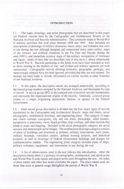
INTRODUCTION<br />
I. 1 The maps, draw<strong>in</strong>gs, <strong>and</strong> aerial photographs that are described <strong>in</strong> this paper<br />
are Federal records held by <strong>the</strong> <strong>Cartographic</strong> <strong>and</strong> Architectural Branch of <strong>the</strong><br />
<strong>National</strong> <strong>Archives</strong> <strong>and</strong> <strong>Records</strong> Adm<strong>in</strong>istration. They primarily relate to <strong>World</strong> <strong>War</strong><br />
<strong>II</strong> military activities that took place between 1939 <strong>and</strong> 1945. Also <strong>in</strong>cluded are<br />
descriptions of draw<strong>in</strong>gs of military structures, bases, ships, <strong>and</strong> ordnance that were<br />
<strong>in</strong> use dur<strong>in</strong>g <strong>the</strong> war although designed <strong>and</strong> constructed many years earlier; maps<br />
of <strong>the</strong> military <strong>and</strong> political situations <strong>in</strong> <strong>the</strong> Far East <strong>and</strong> Europe dur<strong>in</strong>g <strong>the</strong><br />
mid-1930's; <strong>and</strong> immediate postwar maps of <strong>the</strong> military occupations of Germany<br />
<strong>and</strong> Japan. Items of later date are described only if <strong>the</strong>y have a direct relationship<br />
to <strong>World</strong> <strong>War</strong> <strong>II</strong>. <strong>Records</strong> perta<strong>in</strong><strong>in</strong>g to <strong>the</strong> home front have been <strong>in</strong>cluded as well<br />
as those relat<strong>in</strong>g to <strong>the</strong> <strong>the</strong>aters of war, <strong>and</strong> civilian <strong>and</strong> military agencies are both<br />
represented. <strong>Cartographic</strong> records show<strong>in</strong>g economic, geographic, geologic, <strong>and</strong><br />
meteorologic subjects have not been ignored, provided that <strong>the</strong>y are war-related. No<br />
attempt has been made to <strong>in</strong>clude <strong>in</strong>formation on similar records <strong>in</strong> o<strong>the</strong>r branches<br />
of <strong>the</strong> <strong>National</strong> <strong>Archives</strong>.<br />
1.2 In this paper, <strong>the</strong> descriptive entries are arranged numerically, accord<strong>in</strong>g to<br />
<strong>the</strong> record group numbers assigned by <strong>the</strong> <strong>National</strong> <strong>Archives</strong>, <strong>and</strong> <strong>the</strong>reunder by type<br />
of record. A record group (RG) is <strong>the</strong> st<strong>and</strong>ard unit of archival records ma<strong>in</strong>tenance<br />
<strong>and</strong> represents <strong>the</strong> organizational orig<strong>in</strong>s of <strong>the</strong> records. Generally, a record group<br />
relates to a s<strong>in</strong>gle orig<strong>in</strong>at<strong>in</strong>g department, bureau, or agency of <strong>the</strong> Federal<br />
Government.<br />
1.3 Each record group description is divided <strong>in</strong>to <strong>the</strong> four major types of records<br />
ma<strong>in</strong>ta<strong>in</strong>ed by <strong>the</strong> <strong>Cartographic</strong> <strong>and</strong> Architectural Branch: maps <strong>and</strong> charts, aerial<br />
photographs, architectural draw<strong>in</strong>gs, <strong>and</strong> eng<strong>in</strong>eer<strong>in</strong>g plans. The category of maps<br />
<strong>and</strong> charts <strong>in</strong>cludes cartograms, city <strong>and</strong> site plans, photomaps, relief models,<br />
perspective or panoramic views, beach profiles, map overlays, <strong>and</strong> o<strong>the</strong>r records that<br />
relate to maps <strong>and</strong> mapp<strong>in</strong>g. Included <strong>in</strong> <strong>the</strong> aerial photographs category are aerial<br />
mosaics <strong>and</strong> stereoscopic aerial images. The architectural draw<strong>in</strong>gs category consists<br />
of plans of build<strong>in</strong>gs <strong>and</strong> structures at airbases, military reservations, navy yards,<br />
military hospitals, relocation centers, defense hous<strong>in</strong>g projects, <strong>and</strong> <strong>in</strong>dustrial<br />
projects, as well as draw<strong>in</strong>gs of Federal Government build<strong>in</strong>gs <strong>and</strong> designs for<br />
commemorative medals. The eng<strong>in</strong>eer<strong>in</strong>g plans category <strong>in</strong>cludes plans of ships,<br />
military ordnance, equipment, <strong>and</strong> <strong>in</strong>struments <strong>in</strong> use dur<strong>in</strong>g <strong>the</strong> war.<br />
1.4 A list of abbreviations used <strong>in</strong> <strong>the</strong> text follows this <strong>in</strong>troduction. After <strong>the</strong><br />
descriptive entries <strong>the</strong>re is a glossary of cartographic, architectural, <strong>and</strong> aerial terms<br />
<strong>and</strong> <strong>World</strong> <strong>War</strong> <strong>II</strong> code names <strong>and</strong> jargon terms used throughout <strong>the</strong> text. An <strong>in</strong>dex<br />
of place names <strong>and</strong> o<strong>the</strong>r key terms concludes <strong>the</strong> paper. The place names used are<br />
those that were <strong>in</strong> general usage throughout <strong>the</strong> period of <strong>World</strong> <strong>War</strong> <strong>II</strong>.<br />
ix


