Mapping the Vegetation of Texas - GPS.gov
Mapping the Vegetation of Texas - GPS.gov
Mapping the Vegetation of Texas - GPS.gov

You also want an ePaper? Increase the reach of your titles
YUMPU automatically turns print PDFs into web optimized ePapers that Google loves.
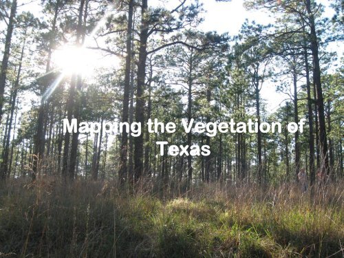
<strong>Mapping</strong> <strong>the</strong> <strong>Vegetation</strong> <strong>of</strong><br />
<strong>Texas</strong>
Background<br />
• TPWD wants better land cover for <strong>Texas</strong><br />
– More land cover classes<br />
– Better spatial resolution<br />
– Better accuracy (overall 85%)<br />
– Better ecological interpretation<br />
• Partners Required!<br />
– MoRAP, University <strong>of</strong> Missouri<br />
– TNC, <strong>Texas</strong><br />
– NatureServe, Sou<strong>the</strong>ast Region<br />
– TNRIS<br />
– NRCS, TXFS, USFWS, o<strong>the</strong>rs
Ecological<br />
<strong>Mapping</strong><br />
Systems <strong>of</strong><br />
<strong>Texas</strong><br />
Phase LPC<br />
Available Now<br />
Phase 6<br />
September<br />
2013<br />
Phase 1<br />
Available Now<br />
Phase 2<br />
Available Now<br />
Phase 5<br />
September 2012<br />
Phase 3<br />
Available Now<br />
Phase 4<br />
Available Now
3-date TM<br />
Satellite Imagery<br />
(30m resolution)<br />
Training data from<br />
air photos plus<br />
ground data<br />
Land use data (NRCS<br />
Common Land Units)<br />
Classify Land Cover<br />
(e.g. grassland)<br />
Draft <strong>Mapping</strong> Targets<br />
(NatureServe Ecological<br />
Systems)<br />
Assign Information using soils,<br />
ecoregions, geology, ecological site<br />
type, hydrology, slop, aspect, &<br />
elevation (“modeling”)<br />
Create Map with Named <strong>Mapping</strong> Units<br />
(e.g. Sou<strong>the</strong>astern Great Plains Tallgrass Prairie)<br />
Provide Interpretation <strong>of</strong> <strong>Mapping</strong> Units<br />
(booklet, summary statistics by ecoregion, etc.)<br />
Design and Execute Presentation
Ecological Systems<br />
Ecological System<br />
East-Central <strong>Texas</strong> Plains Post Oak Savanna and Woodland<br />
<strong>Mapping</strong> Targets/Subsystems<br />
Post Oak Savanna: Post Oak Motte and Woodland<br />
Post Oak Savanna: Post Oak / Redcedar Motte and Woodland<br />
Post Oak Savanna: Post Oak / Yaupon Motte and Woodland<br />
Post Oak Savanna: Oak / Hardwood Slope Forest<br />
Post Oak Savanna: Live Oak Motte and Woodland<br />
Post Oak Savanna: Savanna Grassland<br />
Post Oak Savanna: Oak / Redcedar Slope Forest<br />
Post Oak Savanna: Redcedar Slope Forest
3-date TM<br />
Satellite Imagery<br />
(30m resolution)<br />
Training data from<br />
air photos plus<br />
ground data<br />
Land use data (NRCS<br />
Common Land Units)<br />
Classify Land Cover<br />
(e.g. evergreen forest)<br />
Draft <strong>Mapping</strong> Targets<br />
(NatureServe Ecological<br />
Systems)<br />
Assign Information using soils,<br />
ecoregions, geology, ecological site<br />
type, hydrology, slope,aspect, &<br />
elevation (“modeling”)<br />
Create Map with Named <strong>Mapping</strong> Units<br />
(e.g. Bastrop )<br />
Provide Interpretation <strong>of</strong> <strong>Mapping</strong> Units<br />
(booklet, summary statistics by ecoregion, etc.)<br />
Design and Execute Presentation
Field Data Collection<br />
• Roadside survey<br />
• <strong>GPS</strong> Location (Lat/Long)<br />
• Attributes<br />
– Land Cover<br />
• i.e.: grassland, shrubland<br />
– Percent cover<br />
• Woody components<br />
– CEG , BLEG<br />
– tree, shrub<br />
• Herbaceous<br />
– Dominant Species<br />
• “top three” species<br />
– trees, shrubs, herbaceous<br />
– Ecological Systems/Subsystems
3-date TM<br />
Satellite Imagery<br />
(30m resolution)<br />
Land use data (NRCS<br />
Common Land Units)<br />
Training data from<br />
air photos plus<br />
ground data<br />
Classify Land Cover<br />
(e.g. evergreen forest)<br />
Draft <strong>Mapping</strong> Targets<br />
(NatureServe Ecological<br />
Systems)<br />
Assign Information using soils,<br />
ecoregions, geology, ecological site<br />
type, hydrology,slope, aspect,&<br />
elevation (“modeling”)<br />
Create Map with Named <strong>Mapping</strong> Units<br />
(e.g. Bastrop )<br />
Provide Interpretation <strong>of</strong> <strong>Mapping</strong> Units<br />
(booklet, summary statistics by ecoregion, etc.)<br />
Design and Execute Presentation
Initial Classification <strong>of</strong> Pixels<br />
– Create a land cover raster by coding each pixel with a value<br />
that represents <strong>the</strong> land cover type over <strong>the</strong> majority <strong>of</strong> that<br />
cell’s area<br />
– When finished, every cell will have a coded value<br />
– Average TM scene is about 34.9 x10 6 pixels<br />
W W W<br />
G<br />
G<br />
water<br />
W W W<br />
G<br />
G<br />
W W W<br />
G<br />
G<br />
grass<br />
G G G G G<br />
F<br />
G G U U<br />
forest<br />
urban<br />
F<br />
F<br />
G<br />
U<br />
U
Land Cover Class<br />
Barren<br />
CD Forest<br />
CEG Forest<br />
Grass Farm<br />
Swamp<br />
Water<br />
Barren/Impervious<br />
CD Mixed Forest<br />
Crop<br />
Grassland<br />
Urban High<br />
State Park<br />
BLEG Forest<br />
CD Shrub<br />
EG Shrub<br />
Marsh<br />
Urban Low
3-date TM<br />
Satellite Imagery<br />
(30m resolution)<br />
Training data from<br />
air photos plus<br />
ground data<br />
Land use data (NRCS<br />
Common Land Units)<br />
Classify Land Cover<br />
(e.g. cold deciduous forest)<br />
Draft <strong>Mapping</strong> Targets<br />
(NatureServe Ecological<br />
Systems)<br />
Assign Information using soils,<br />
ecoregions, geology, ecological site<br />
type, hydrology,slope,aspect,&<br />
elevation (“modeling”)<br />
Create Map with Named <strong>Mapping</strong> Units<br />
(e.g. Edwards Plateau: Deciduous Oak<br />
Slope Forest)<br />
Provide Interpretation <strong>of</strong> <strong>Mapping</strong> Units<br />
(booklet, summary statistics by ecoregion, etc.)<br />
Design and Execute Presentation
Modeling Synopsis<br />
• Examined SSURGO, GAT, Ecological Site Types (ESTs)<br />
• Modeled:<br />
– Historic vegetation to ESTs and to soils (Ecoclass)<br />
– Interpretation <strong>of</strong> current land cover to ESTs and soils (e.g.<br />
evergreen forest on site type XX is ZZ mapping system)<br />
• Rules applied: (Decision Tree)<br />
– Slope,aspect,elevation,landscape postion, hydrology,& EPA<br />
ecoregion
Remote Sensing & Training Data<br />
Classified as Cold Deciduous Forest
SSURGO Soils – EcoClass - PE36-52 Loamy Sand<br />
ESD – Historic - Post Oak Woodland<br />
SSURGO Soils - EcoClass – PE40-54 Blackland<br />
ESD – Historic – Tallgrass Prairie
<strong>Mapping</strong> Subsystem<br />
Crosstimbers: Post Oak Woodland & Forest<br />
<strong>Mapping</strong> Subsystem<br />
Native Invasive Deciduous Woodland
1984<br />
<strong>Vegetation</strong> Types <strong>of</strong> <strong>Texas</strong><br />
Bluestem Grassland<br />
Lake Granbury<br />
Oak-Mesquite-Juniper Parks/Woods<br />
Post Oak Woods, Forest, and Grassland Mosaics<br />
Silver Bluestem-<strong>Texas</strong> Wintergrass Grassland
Barren / Non-urban<br />
Barren / Urban<br />
Blackland Prairie Disturbance or Tame Grassland<br />
Crosstimbers Deciduous Slope Forest<br />
Crosstimbers Deciduous-Juniper Slope Forest<br />
Crosstimbers Live Oak Forest and Woodland<br />
Crosstimbers Post Oak Forest and Woodland<br />
Crosstimbers Post Oak-Juniper Forest and Woodland<br />
Crosstimbers Sandyland Oak Woodland<br />
Crosstimbers Savanna Grassland<br />
East-Central <strong>Texas</strong> Plains Post Oak Motte and Woodland<br />
Edwards Plateau Ashe Juniper Dry-Mesic Slope Forest and Woodland<br />
Edwards Plateau Deciduous Dry-Mesic Slope Forest and Woodland<br />
Edwards Plateau Floodplain Deciduous Forest and Woodland<br />
Edwards Plateau Limestone Ashe Juniper Motte and Forest<br />
Edwards Plateau Limestone Deciduous Motte and Woodland<br />
Edwards Plateau Limestone Deciduous-Evergreen Motte and Woodland<br />
Edwards Plateau Limestone Evergreen Shrubland and Shrub Motte<br />
Ecological Systems<br />
Edwards Plateau Limestone Evergreen Slope Shrubland<br />
Edwards Plateau Limestone Live Oak Motte and Forest<br />
Edwards Plateau Limestone Savanna Grassland<br />
Edwards Plateau Limestone Shin Oak Shrubland and Shrub Motte<br />
Edwards Plateau Limestone Shin Oak Slope Shrubland<br />
Edwards Plateau Live Oak Dry-Mesic Slope Forest and Woodland<br />
Edwards Plateau Oak-Ashe Juniper Dry-Mesic Slope Forest and Woodland<br />
Grass Farm<br />
Marsh<br />
Native Invasive: Deciduous Woodland<br />
Native Invasive: Juniper Shrubland<br />
Native Invasive: Juniper Woodland<br />
Native Invasive: Mesquite Shrubland<br />
Open Water<br />
Rowcrops<br />
Sou<strong>the</strong>astern Great Plains Floodplain Deciduous Forest and Woodland<br />
Sou<strong>the</strong>astern Great Plains Floodplain Deciduous Shrubland<br />
Sou<strong>the</strong>astern Great Plains Floodplain Evergreen Shrubland<br />
Sou<strong>the</strong>astern Great Plains Floodplain Herbaceous <strong>Vegetation</strong><br />
Sou<strong>the</strong>astern Great Plains Floodplain Juniper Forest and Woodland<br />
Sou<strong>the</strong>astern Great Plains Floodplain Live Oak Forest and Woodland<br />
Sou<strong>the</strong>astern Great Plains Floodplain Mixed Deciduous Forest and Woodland<br />
Sou<strong>the</strong>astern Great Plains Riparian Deciduous Forest and Woodland<br />
Sou<strong>the</strong>astern Great Plains Riparian Deciduous Shrubland<br />
Sou<strong>the</strong>astern Great Plains Riparian Evergreen Shrubland<br />
Sou<strong>the</strong>astern Great Plains Riparian Herbaceous <strong>Vegetation</strong><br />
Sou<strong>the</strong>astern Great Plains Riparian Juniper Forest and Woodland<br />
Sou<strong>the</strong>astern Great Plains Riparian Live Oak Forest and Woodland<br />
Sou<strong>the</strong>astern Great Plains Riparian Mixed Deciduous Forest and Woodland<br />
Sou<strong>the</strong>astern Great Plains Tallgrass Prairie<br />
Sou<strong>the</strong>astern Great Plains Wooded Cliff/Bluff<br />
Swamp<br />
Urban High Intensity<br />
Urban Low Intensity
Products/Enduring Value<br />
• Potential natural vegetation<br />
• Existing vegetation using an improved classification<br />
• Interpretive Booklet<br />
– Topo-sequences / landscape pr<strong>of</strong>iles <strong>of</strong> potential and existing vegetation<br />
– Interpretation <strong>of</strong> <strong>the</strong> current land cover (e.g. dynamics, management)<br />
– Photos<br />
• Ground truth dataset (around 10,000 points)<br />
• User will build <strong>the</strong>ir own added value:<br />
– Context (local, regional, statewide)<br />
– Management options<br />
– Conservation opportunity areas<br />
– Ecological significance and risk (riverine/aquatics as well)<br />
– Species habitat modeling<br />
– Development <strong>of</strong> educational and interpretive materials<br />
– Change detection
Interpretive Booklet
Products/Enduring Value<br />
• Potential natural vegetation<br />
• Existing vegetation using an improved classification<br />
• Interpretive Booklet<br />
– Topo-sequences / landscape pr<strong>of</strong>iles <strong>of</strong> potential and existing vegetation<br />
– Interpretation <strong>of</strong> <strong>the</strong> current land cover (e.g. dynamics, management)<br />
– Photos<br />
• Ground truth dataset (around 10,000 points)<br />
• User will build <strong>the</strong>ir own added value:<br />
– Context (local, regional, statewide)<br />
– Management options<br />
– Conservation opportunity areas<br />
– Ecological significance and risk (riverine/aquatics as well)<br />
– Species habitat modeling<br />
– Development <strong>of</strong> educational and interpretive materials<br />
– Change detection
Google Earth
Google Earth
Web Application
Web Application
Products/Enduring Value<br />
• Potential natural vegetation<br />
• Existing vegetation using an improved classification<br />
• Interpretive Booklet<br />
– Topo-sequences / landscape pr<strong>of</strong>iles <strong>of</strong> potential and existing vegetation<br />
– Interpretation <strong>of</strong> <strong>the</strong> current land cover (e.g. dynamics, management)<br />
– Photos<br />
• Ground truth dataset (around 10,000 points)<br />
• User will build <strong>the</strong>ir own added value:<br />
– Context (local, regional, statewide)<br />
– Management options<br />
– Conservation opportunity areas<br />
– Ecological significance and risk (riverine/aquatics as well)<br />
– Species habitat modeling<br />
– Development <strong>of</strong> educational and interpretive materials<br />
– Change detection
Questions