
Create successful ePaper yourself
Turn your PDF publications into a flip-book with our unique Google optimized e-Paper software.
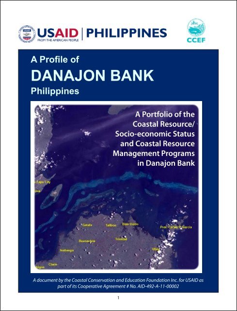
A Profile of<br />
<strong>DANAJON</strong> <strong>BANK</strong><br />
Philippines<br />
A Portfolio of the<br />
Coastal Resource/<br />
Socio-economic Status<br />
and Coastal Resource<br />
Management Programs<br />
in Danajon Bank<br />
A document by the Coastal Conservation and Education Foundation Inc. for USAID as<br />
part of its Cooperative Agreement # No. AID-492-A-11-00002<br />
1
Table of Contents<br />
This publication is available electronically on www.coast.ph.<br />
For more information about this material, full studies, and related work, contact:<br />
Coastal Conservation and Education Foundation, Inc.<br />
Room 301, PDI Condominium, Archbishop Reyes Avenue, Banilad, Cebu City 6000 Cebu, Philippines<br />
Tel: (6332) 233-6909 or (6332) 233-6947; Fax: (6332) 233-6891<br />
This material was made possible through the support provided by the United States Agency for<br />
International Development - Philippines under the terms of Cooperative Agreement<br />
No. AI-492-A-II-00002<br />
Citation: A Profile of Danajon Bank Philippines: A Portfolio of the Coastal Resource/Socio-economic<br />
Status and Coastal Resource Management Programs in Danajon Bank. 2013. Coastal Conservation<br />
and Education Foundation Inc., Cebu City, Cebu, Philippines. 48pp.<br />
Danajon Bank , Overview 4<br />
Legal and Institutional Framework, Introduction 7<br />
Coastal Management and Protected Areas in Danajon Double Barrier Reef 8<br />
The Provincial-level Policies and Initiatives 13<br />
Institutions Involved in Coastal Resource Management 15<br />
Stakeholders in Danajon Bank 17<br />
Coastal Habitats and Resources 19<br />
Methodology, Live Hard Coral 21<br />
Fish Density, Fish Diversity, Fish Biomass 22<br />
Seagrass, Mangroves 24<br />
Management Implications and Recommendations 23<br />
Socio-Economic Profile, Summary 26<br />
Background 27<br />
Demographic Profile, Socio-economic Profile 28<br />
Perceptions of MPAs 29<br />
Analysis 30<br />
Conclusions, Recommendations 32<br />
Economic Valuation Study, Summary, Key Result Findings, Estimation of<br />
Economic Value 33<br />
Fishing 34<br />
Seaweed Farming 35<br />
Tourism, Indirect Values, Total Economic Value 36<br />
Willingness to Pay, Policy Implications 37<br />
Conclusion and Recommendations 38<br />
Climate Change Vulnerability Assessment, Introduction 39<br />
The Vulnerability Assessment Framework, Exposure 41<br />
Sensitivity 43<br />
The Lack of Adaptive Capacity 45<br />
Summary of Key Findings 46<br />
Recommendations 47<br />
References 48<br />
2 3
Overview<br />
Danajon Bank<br />
The Danajon Bank is the only double barrier reef in the Philippines formed over the last<br />
6,000 years and one of only three such sites in the Indo-Pacific region. Danajon Bank<br />
covers a total area of 272 km 2 (27,200 ha) with a total coastline of 699 km including<br />
40 islands, located off northern Bohol. This unique coastal environment is of global<br />
ecological significance is a priority area for the conservation of reef fishes, corals,<br />
mangroves and mollusks because of a generally large, poor population which is highly<br />
reliant on fishery resources.<br />
Danajon Bank consists of three large reefs and clusters of small reefs. The outer barrier<br />
reefs and slopes contain the most prolific coral growth while the inner reefs and lagoons<br />
are more turbid and have less coral growth. In 2004, 211 hard coral species have been<br />
recorded by local scientists while the presence of a variety of sharks and rays as well<br />
as a large population of seahorses were also reported. There are more than 30 marine<br />
protected areas (MPAs) including seven<br />
strict nature reserves and three protected<br />
seascapes. Danajon Bank hosts significant<br />
mangrove forest cover with over 2,000 ha<br />
of Rhizophora sp. The area also serves as<br />
important feeding and roosting grounds<br />
of over 20 bird species during July to<br />
November, one of which is the IUCN-listed<br />
threatened species Chinese egret (Egretta<br />
eulophotes).<br />
The outer reef is largely outside any active<br />
management effort. The collaborative<br />
management of Danajon Bank serves<br />
three important functions: (1) supporting<br />
sustainable fisheries in Central Philippines,<br />
(2) protecting marine biodiversity for<br />
human wellbeing, and (3) creating new<br />
economic development opportunities for<br />
dive tourism.<br />
Danajon Bank is located off the northern<br />
part of Bohol, the mid-eastern part of<br />
Cebu and south-western part of Leyte<br />
within the Visayan region. It is the only<br />
double barrier reef in the Philippines<br />
(Pichon, 1977). It covers a total area of<br />
27,200 hectares with a total coastline of<br />
699 km including 40 islands, and accounts<br />
for over one percent (1%) of the total area<br />
of coral reefs of the Philippines which is<br />
estimated at 27,000 km 2 (Christie et al.<br />
2006). This unique coastal environment<br />
is of global ecological significance and is<br />
at the world’s epicenter of marine-shore<br />
fish biodiversity (Carpenter and Springer<br />
2005). It has been identified as a priority<br />
area for the conservation of reef fishes,<br />
corals, mangroves and mollusks (Green et<br />
al. 2004).<br />
4 5<br />
Danajon Bank is considered a critical<br />
resource area especially for fishing, as it<br />
sustains the livelihood of around 5,000<br />
fishers in the commercial sector and over<br />
125,000 full-time municipal fishers in its<br />
17 municipalities/cities covering four<br />
(4) provinces and two (2) administrative<br />
regions. Ten (10) municipalities (Tubigon,<br />
Clarin, Inabanga, Buenavista, Getafe,<br />
Talibon, Trinidad, Bien Unido, Ubay, and<br />
Carlos P. Garcia) are located in northern<br />
Bohol, two (2), Lapu-Lapu City and<br />
Cordova are geographically located in<br />
Cebu province, four (4), Hindang, Hilongos,<br />
Bato, and Matalom in Leyte province,<br />
and one (Maasin City) in Southern Leyte<br />
province. Fishing is not only considered<br />
as a subsistence practice for the people<br />
living near the Danajon Bank as it has been<br />
embedded within their cultural identity as<br />
individuals and as communities (Langjahr,<br />
2006).<br />
Over time, the degradation of the<br />
Danajon Bank reef system has had<br />
serious consequences for food security,<br />
conservation and economic growth<br />
because of overfishing, population<br />
pressure and degradation of habitats.<br />
Actual living coral cover is low despite<br />
high coral diversity in the area. Fish<br />
abundance and diversity in six inner reef<br />
sites surveyed were considered low by<br />
Philippine standards given that a typical<br />
reef, the maximum number of fish count<br />
is 800 per 500m 2 (Calumpong, 2005). Fish<br />
biomass was also very low suggesting that<br />
the general status of the area is degraded.<br />
A number of coastal resource management<br />
projects initiated either by local
communities or government agencies<br />
such as the Department of Environment<br />
and Natural Resources (DENR) and the<br />
Bureau of Fisheries and Aquatic Resources<br />
(BFAR) of the Department of Agriculture<br />
(DA) have been implemented within the<br />
Danajon Bank in partnership with nongovernment<br />
organizations or special<br />
programs such as the Fisheries Improved<br />
for Sustainable Harvest (FISH), and<br />
Project Seahorse Foundation. 10 National<br />
Integrated Protected Area System (NIPAS)<br />
sites have been established within these<br />
boundaries, including 7 strict nature<br />
reserves and 3 protected seascapes (Green<br />
et al., 2002).<br />
A local mangrove reforestation initiative<br />
has also been implemented within<br />
this area. In her paper, Amper (2004)<br />
argues that mangrove reforestation is an<br />
indigenous, locally-driven initiative. The<br />
487-hectare mangrove area has not only<br />
protected the island from big waves and<br />
strong winds, and provided a spawning<br />
area for fish and other marine creatures,<br />
but also brought eco-tourists from all over<br />
the world to relish the magnificent view.<br />
A number of marine protected areas have<br />
also been established by various local<br />
government units in the area supported<br />
by such projects as the Community-based<br />
Coastal Resource Management Project<br />
(CBCRMP) of the Department of Finance<br />
and the Coastal Resource Management<br />
Project of the DENR. As of 2004, 60<br />
community and municipal-based MPAs<br />
has been established within the area in<br />
various stages of implementation (CRMP,<br />
2004).<br />
In 2002, the provinces surrounding the<br />
Danajon Bank signed a Memorandum of<br />
Agreement to create a technical working<br />
group to oversee the management and<br />
conservation of Danajon Bank. This was<br />
the CeLeBoSoLe Council (or the Cebu-<br />
Leyte-Bohol-Southern Leyte Council)<br />
which had representatives from the<br />
Bureau of Fisheries and Aquatic Resources<br />
(BFAR), Philippine National Police (PNP)<br />
Maritime Group, Philippine Coast Guard<br />
(PCG), Department of Environment<br />
and natural Resources (DENR), National<br />
Economic and Development Authority<br />
(NEDA), and Department of Interior and<br />
Local Government (DILG) with the support<br />
of several projects and non-government<br />
organizations.<br />
In 2011, The Coastal Conservation and<br />
Education Foundation, Inc. (<strong>CCEF</strong>) assisted<br />
the 23 municipal local governments<br />
and the four concerned provinces to<br />
create the Danajon Double Barrier Reef<br />
Management Council (or DDBRMC) for<br />
improved collaborative management of<br />
Danajon Bank.<br />
Introduction<br />
Legal and Institutional Framework<br />
Figure 1. Administrative boundaries in the Danajon Bank area<br />
Pursuant to the constitutional policy to protect the right of the people to a balanced and<br />
healthful ecology, the local government units (LGUs) are given territorial jurisdiction<br />
to manage municipal waters, including the power to formulate ordinances, resolution,<br />
policies and programs consistent with the framework of local autonomy. One of the<br />
basic services mandated by the Local Government Code (RA 7610) is the duty to protect<br />
and manage the coastal and marine environment, to impose local fishery revenues and<br />
taxes, to delineate their municipal waters, and to allocate the use of resources within<br />
municipal waters. The national government is also required to conduct consultation<br />
with the local governments pursuant to their proposed projects to promote coastal<br />
protection. The Fisheries Code (RA 8550) also granted powers to the LGU to grant<br />
license and fishing privileges to registered fishers as well as to register motorized boats<br />
with tonnage of three tons and below. On the other hand, the Fisheries Code of the<br />
Philippines (RA 8550) granted the Bureau of Fisheries and Aquatic Resource (BFAR)<br />
general supervision over activities in waters outside municipal waters, including the<br />
grant of fishing licenses to commercial fishing boats.<br />
6 7
The following are some of the<br />
legislative frameworks related to coastal<br />
management in the Philippines:<br />
• The Local Government Code (RA<br />
7160) – provides certain autonomy<br />
to city/municipal governments in<br />
the management of their municipal<br />
waters.<br />
• The Fisheries Code of the Philippines<br />
(RA 8550) – is the primary legislation<br />
for fisheries management in the<br />
country.<br />
• The National Integrated Protected<br />
Area System Act (NIPAS ACT- RA<br />
7586) – has provided protection<br />
to biologically significant flora and<br />
fauna.<br />
• The Wildlife Conservation Act (RA<br />
9147) – provides for the management<br />
and protection of wildlife and<br />
important habitats.<br />
• The Clean Water Act (RA 9275) –<br />
provides for the management and<br />
protection of bodies of water from<br />
pollution.<br />
• Other important laws are the Forestry<br />
Code, Public Land Act, Philippine<br />
Mining Act, Marine Pollution Decree,<br />
Solid Waste Management Act, and the<br />
Clean Air Act.<br />
• International Treaties: CITES, UNCLOS,<br />
AGENDA 21, Bonn Convention,<br />
RAMSAR and Convention on<br />
Biodiversity.<br />
Coastal Management and<br />
Protected Areas in Danajon<br />
Double Barrier Reef<br />
An important devolved function of LGUs is<br />
the enforcement of fishery laws within its<br />
municipal waters. This all encompassing<br />
mandate includes the correlative duty<br />
to enact ordinances related to fishery<br />
management within their city/municipal<br />
waters. The 19 LGUs encompassing the<br />
Danajon Double Barrier Reef have enacted<br />
ordinances that are mostly prototypes of<br />
the Fisheries Code of the Philippines but,<br />
at the same time, tailored fit to respond<br />
to local issues. There are local legislation<br />
on marine protected areas (MPAs) that<br />
has enabled locally-managed sanctuaries.<br />
The Municipality of Inopacan, Leyte<br />
passed an ordinance declaring the three<br />
islands - Apid, Mahaba and Digyo - as<br />
marine sanctuaries and charges a penalty<br />
to violators, despite the fact that the<br />
three islands were declared as part of a<br />
protected seascape under Presidential<br />
Proclamation No. 270.<br />
MPAs have been the focus of most city/<br />
municipal coastal resource management<br />
programs. All the LGUs within the<br />
Danajon Double Reef have their own<br />
established MPAs. Some LGUs have also<br />
established marine parks. For instance,<br />
the Municipality of Bien Unido in Bohol,<br />
through an ordinance, declared 7,600<br />
hectares out of their municipal waters<br />
as Bien Unido Double Barrier Reef<br />
Marine Park. The City of Lapu-Lapu also<br />
established the Minantaw Marine Park<br />
covering 214.6 hectares of marine waters.<br />
Specific coastal management activities are<br />
also effectively implemented through local<br />
legislation. The City of Maasin regulated<br />
the use of payao (fish aggregating device<br />
or FAD) through a city ordinance. It also<br />
requires the registration of motorboats<br />
and charges a penalty to violators<br />
thereof. The municipality of Getafe in<br />
Bohol designated a closed season for the<br />
catching and gathering of siganids during<br />
the fourth, fifth, and sixth days after the<br />
new moon of every month.<br />
Several municipalities have also codified<br />
their fishery ordinances. All of these fishery<br />
codes cover the regulation of all fishery<br />
activities in the city/municipal waters, and<br />
business relating to use, development,<br />
conservation, and management. The<br />
codification has facilitated the review<br />
of fishery regulations within the city/<br />
municipality and has enabled better<br />
enforcement from local enforcers.<br />
The City of Maasin has passed its<br />
Environmental Code that incorporated<br />
fishery management. The Municipality of<br />
Carlos P. Garcia (CPG) in Bohol approved<br />
its Fisheries and Coastal Management<br />
Code in 2006. To effectively implement its<br />
Fisheries and Coastal Management Code,<br />
the Code mandates the local government<br />
of CPG to create the Fisheries and Coastal<br />
Resources Management (FCRM) office<br />
headed by an Environmental Management<br />
Specialist with two support personnel. The<br />
Municipal CRM Code of Clarin also created<br />
a CRM section under the Municipal<br />
Agriculture’s Office. Its functions include<br />
the development of plan and strategies<br />
for CRM implementation, enforcement<br />
8 9<br />
of fishery rules and regulations, and<br />
recommendations to the Sangguniang<br />
Bayan (SB or municipal council) and<br />
the Mayor on all other matters related<br />
to environment and natural resources,<br />
particularly in coastal and fisheries<br />
resources. A similar provision can be noted<br />
in Inabanga, Bohol. Its municipal coastal<br />
code created the CRM technical working<br />
group (CRM TWG) which is a coordinating<br />
body within the LGU that will recommend,<br />
facilitate, and catalyze coastal resource<br />
management initiatives. The CRM-TWG<br />
is headed by the mayor. The Coastal<br />
Code of Inabanga also created a resource<br />
accounting and information system. The<br />
system aims to develop a data bank for<br />
continuous accounting and assessment of<br />
the state of fishery and aquatic resources in<br />
the town. The modified and strengthened<br />
coastal resource management code of the<br />
Municipality of Tubigon institutionalized<br />
the CRM Office solely for the purpose of<br />
attending to the needs of coastal resource<br />
management of the town.<br />
In brief, some of the landmark ordinances<br />
in Leyte and Southern Leyte are:<br />
• An Ordinance Establishing and<br />
Protecting the Esperanza Fish<br />
Sanctuary in the Marine Reserve Area<br />
of Brgy. Espereanza, Inopacan, Leyte<br />
(Barangay Ordinance No. 02, s.2005<br />
• An Ordinance Regulating Fishing<br />
and/or Fisheries in the Municipality<br />
of Hindang, Leyte and Imposing<br />
Penalties Thereof (Municipal<br />
Ordinance No. 2004-02)<br />
• The Municipal Fisheries Ordinance of<br />
the Municipality of Hilongos, Leyte
(Municipal Ordinance No. 2002-08)<br />
• The Amended Municipal Basic<br />
Fisheries Ordinance of Bato, Leyte<br />
(Municipal Ordinance No. 2003-04)<br />
• An Ordinance Revising the Municipal<br />
Fishery Ordinance No. 95-03 of the<br />
Municipality of Matalom, Leyte<br />
(Municipal Ordinance No. 2003-04)<br />
• An Ordinance Establishing the City<br />
Fish Sanctuary at Sto. Rosario, Maasin<br />
City (City Ord. No. 2001-004)<br />
• Environmental Code of Maasin<br />
On the other hand, a few noteworthy<br />
ordinances in Bohol include:<br />
• Fisheries and Coastal Management<br />
Code of Pres. Carlos P. Garcia, Bohol<br />
(Municipal Ordinance C-004)<br />
• An Ordinance Declaring Portions<br />
of Municipal Waters of Bien Unido,<br />
this Province, as Bien Unido<br />
Double barrier Reef Marine Park<br />
and Establishing the Rules and<br />
Regulations of the Marine Park and<br />
Prescribing Penalties for Violation<br />
Thereof (Municipal Ordinance No.<br />
2009-04)<br />
• Fishery Code of Trinidad (Ordinance<br />
No. 01-2009)<br />
• An Ordinance Providing For<br />
the Sustainable Management,<br />
Development, and Conservation<br />
of the Municipal Waters and Its<br />
Coastal Resources, Harmonizing and<br />
Integrating All Ordinances Pertinent<br />
Thereto and For other Purposes<br />
(Municipality of Talibon, Ordinance<br />
No. C-004, 2005)<br />
• An Ordinance On Coastal Resource<br />
Management Plan of the Municipality<br />
of Getafe, Bohol from Calendar yr<br />
2001-2005 (Municipal Ordinance No.<br />
25 series of 2003)<br />
• An Ordinance Designating Closed<br />
Season for the Catching and<br />
Gathering of Siganids During the 4th,<br />
5th & 6th days after the New Moon<br />
of every Month Throughout the year<br />
in the Municipality of Getafe, Bohol<br />
(Municipal Ordinance No. 08, s. 2008)<br />
• Comprehensive Municipal Code<br />
Providing for the sustainable<br />
management, development and<br />
conservation of the Municipal<br />
Waters and its Coastal Resources,<br />
Harmonizing and Integrating all<br />
Ordinances Pertinent Thereto and<br />
for all other Purposes (Municipal<br />
Ordinance No. 007, s. 2005)<br />
• Coastal Resource Management Code,<br />
Municipality of Inabanga (Municipal<br />
Ordinance No. C-006, s. 2006)<br />
• Municipal Coastal Resource<br />
Management Code of Clarin, Bohol<br />
(Municipal Ordinance No. 04, s. 2011)<br />
• The Modified and Strengthened<br />
Coastal Resources Management Code<br />
of the Municipality of Tubigon, Bohol<br />
(Municipal Ordinance No. 2009-04-<br />
297<br />
• The Municipality of Cordova, Cebu<br />
and Lapu-Lapu City has passed<br />
various ordinances declaring and<br />
establishing marine sanctuaries and<br />
mandating the registration of fishing<br />
vessels three (3) gross tons and below,<br />
among others.<br />
Locally-managed Marine<br />
Protected Areas<br />
Utilizing locally-managed marine<br />
protected area as a tool for coastal resource<br />
management has long been adapted by<br />
local government units throughout the<br />
Philippines. Usually, nearshore waters and<br />
coastal resources are largely or wholly<br />
managed at the community level by the<br />
coastal barangays, fishers’ organizations,<br />
and/or a collaborative undertaking by<br />
different stakeholders. Community tenure<br />
is usually enshrined in an ordinance<br />
approved by the local government. Such a<br />
system ensures that benefits from marine<br />
conservation efforts accrue directly to the<br />
local community.<br />
To date, there are 120 MPAs that have been<br />
established within the Danajon Bank reef<br />
which are in various stages of protection<br />
and management. In the Province of<br />
Leyte, 11 marine protected areas were<br />
established under local legislation. The<br />
Municipality of Inopacan has five marine<br />
protected areas within its territorial<br />
waters. Of the five MPAs, the Apid, Digyo,<br />
Mahaba Marine Sanctuary has a rating of<br />
“excellent” in terms of management status<br />
although the MPA is under the process of<br />
establishment/ Level 1 in terms of level<br />
of performance, when considering the<br />
MPA-MEAT rating tool. The Tinago and<br />
Esperanza Fish Sanctuaries which, were<br />
established under Municipal Ordinance<br />
No 62, series of 2005, have a rating of<br />
“very good” together with Conalum Fish<br />
Sanctuary, when measured under the<br />
same tool.<br />
10 11<br />
The Municipality of Matalom has one MPA,<br />
the Canigao Island Fish Sanctuary. With<br />
the MPA-MEAT tool, it has a management<br />
rating of “good” with level of performance<br />
1 even if it is still in the process of<br />
establishment. The Municipality of Bato<br />
also has one MPA, the Dawahon Marine<br />
Sanctuary which is under the process of<br />
establishment, level 1.<br />
The Municipality of Hindang has two<br />
MPAs, the Himokilan Marine Sanctuary<br />
and Bontoc Fish Sanctuary, both of which<br />
are under the process of establishmentlevel<br />
1. The City of Baybay has two MPAs,<br />
the Pangasugan and Plaridel Marine<br />
Sanctuaries. Under the MPA-MEAT, both<br />
have a management status of “very good”.<br />
The City of Maasin, in Southern Leyte,<br />
has two MPAs rated at “excellent” and at<br />
level 2- MPA is effectively strengthened<br />
when measured using MPA-MEAT. These<br />
are the Sto. Rosario and Guadalupe fish<br />
sanctuaries.<br />
The Province of Bohol has the most<br />
number of MPAs in the Danajon Reef. It has<br />
16 locally managed MPAs which have been<br />
declared as no-take zones. Eight of these<br />
MPAs are under the rating “sustained”<br />
which means that management plans<br />
are enforced. These are Batasan MPA<br />
(Tubigon), Asinan MPA (Buenavesta),<br />
Jandayan Norte MPA (Buenavesta),<br />
Libaong MPA (Getafe), Cataban MPA<br />
(Talibon), Pinamgo MPA (Bien Unido),<br />
Bantigian MPA (CPG), and Sinandigan<br />
MPA (Ubay). Three are also under the<br />
rating “enforced”. These are MPAs that<br />
are legally established and have visible
oundaries with functional management<br />
bodies. These are the Jandayan Sur MPA<br />
(Buenavesta), Pandanon MPA (Getafe) and<br />
Tugas MPA (CPG). The remaining MPAs are<br />
rated “established”. Local legislation was<br />
passed establishing their existence. These<br />
are the Guindacpan MPA (Buenavista),<br />
Busilan MPA (Talibon), Lipata MPA (CPG),<br />
Gaus MPA (CPG) and Bilangbilangan MPA<br />
in Tubigon.<br />
Protected Areas under the<br />
NIPAS Act<br />
The Philippines has sufficient laws<br />
governing the protection of wildlife<br />
species and their habitats and the<br />
most important one is the Republic Act<br />
7586, otherwise known as the National<br />
Integrated Protected Areas System (NIPAS)<br />
Act which was enacted in June 1992. This<br />
law provides for the establishment of<br />
protected areas to “protect outstandingly<br />
remarkable areas and biologically<br />
Figure 2. Areas under National Integrated Protected Areas System<br />
important public lands that are habitats of<br />
rare and endangered species of plants and<br />
animals representative of biogeographic<br />
zones and related ecosystems.” Under the<br />
law, the designated key implementing<br />
body is the Protected Area Management<br />
Board (PAMB).<br />
Ten National Integrated Protected Area<br />
System sites occur within the Danajon<br />
Bank Reef (see Fig. 1). Seven of which<br />
are strict nature reserves and three are<br />
protected seascapes. These protected<br />
areas are:<br />
• Talibon Group of Islands Protected<br />
Landscape/Seascape (Presidential<br />
Proclamation No. 131) covering the<br />
four islands of Banbanon, Bansahan,<br />
Saag, and Tambu including its<br />
surrounding waters situated in the<br />
Municipality of Talibon<br />
• Cuatro Islas as Protected Landscape/<br />
Seascape (Presidential Proclamation<br />
No. 270) situated in coastal areas<br />
of the Municipalities of Inopacan,<br />
Hindang and neighboring islands<br />
comprising Digyo, Apid, Mahaba<br />
and Himukilan islands and their<br />
surrounding reefs<br />
• Banacon Island (Presidential<br />
Proclamation No. 2151) covers 425<br />
hectares of mangrove forest.<br />
• Olango Island Wildlife Sanctuary<br />
(Presidential Proclamation No. 903)<br />
covers 1,030 hectares of mangroves<br />
The Provincial-level Policies<br />
and Initiatives<br />
Provincial Environment Codes<br />
Pursuant to the powers granted to them<br />
by the Local Government Code of the<br />
Philippines, provincial governments<br />
shall adopt adequate measures to<br />
safeguard and conserve land, mineral,<br />
forest, and other resources. It shall also<br />
provide fisheries resource management<br />
services and facilities such as assistance<br />
to fishermen’s cooperatives and other<br />
collective organizations as well as the<br />
transfer of technology, enforcement of<br />
community-based (mangrove) forest<br />
management laws and other laws on the<br />
protection of the environment, and coastal<br />
tourism development and promotions.<br />
To streamline the execution of these<br />
governmental powers mandated by law,<br />
and cognizant of the need to protect the<br />
municipal waters within their province,<br />
Provincial Environment Codes in Southern<br />
Leyte, Bohol, and Cebu were created. A<br />
common feature found in these Codes<br />
is the adoption of a guide for coastal<br />
12 13<br />
municipalities in the formulation and<br />
establishment of their own coastal resource<br />
management plans and strategies through<br />
a resource management framework. In<br />
the Province of Southern Leyte, the Code<br />
enjoins the establishment of measures to<br />
promote the management of coastal and<br />
fisheries resources as well as municipal<br />
waters by local communites, supported<br />
by barangay and municipal governments<br />
and other stakeholders. For Bohol, the<br />
framework was established as a guide for<br />
coastal municipalities in undertaking the<br />
delineation, establishment, management,<br />
maintenance, and protection of municipal<br />
waters. In turn, the recently-approved Cebu<br />
Provincial Environment Code is deemed<br />
as a guide for coastal municipalities<br />
in undertaking, among others, the<br />
delineation, establishment, management,<br />
and maintenance and protection of their<br />
municipal waters within six (6) months<br />
upon the effectiveness of the Code.<br />
For the purpose of implementing the<br />
provisions of Bohol Environment Code, the<br />
Bohol Environment Management office<br />
(BEMO) under the Office of the Governor<br />
was created. The BEMO have jurisdiction<br />
and authority over all environment and<br />
natural resources in the province, subject<br />
to the provisions of the Local Government<br />
Code and all other applicable national<br />
laws, rules and regulations. Similar offices<br />
are present in other provinces like the<br />
Provincial Environment and Natural<br />
Resource Office (PENRO) in Cebu, Provincial<br />
Environment and Resource Management<br />
Office (PENRMO) in Southern Leyte, and<br />
the Office of the Provincial Agriculture,<br />
with its own CRM Section in Leyte.
Inter-Local Government Unit<br />
Clustering<br />
Inter-municipal partnerships among<br />
adjoining LGUs sharing a common<br />
ecosystem have been initiated in the<br />
Provinces around Danajon. In Cebu, nine<br />
(9) inter-LGU clusters have been created<br />
through related memoranda of agreement.<br />
One of the first active collaborations is<br />
the Southeast Cebu Coastal Resource<br />
Management Council (SCCRMC) between<br />
and among the municipalities of Sibonga,<br />
Argao, Dalaguete, Alcoy, Boljoon, Oslob,<br />
Santander, and Samboan. This group of<br />
municipalities agreed to collaborate in<br />
2005 on habitat and fisheries management,<br />
coastal law enforcement, gear and harvest<br />
regulation and water access regulation.<br />
Banking on the experiences learned<br />
from the SCCRMC, the municipalities of<br />
Southwest Cebu, having experienced the<br />
same perennial problems, also forged<br />
an agreement to implement resource<br />
management under the EBM framework<br />
in 2006. The municipalities of Barili,<br />
Dumanjug, Ronda, Alcantara, Moalboal,<br />
Badian, Alegria, Malabuyoc, and Ginatilan<br />
signed a memorandum of agreement<br />
creating the Southwest Cebu Resource<br />
Management Council (SWCCRMC) and<br />
agreed to collaborate and implement<br />
common programs on fisheries and habitat<br />
management, coastal law enforcement,<br />
and ecotourism. In this line, the Province of<br />
Cebu created the Cebu Provincial Marine<br />
Protection and Conservation Council<br />
through an Executive Order No. 2005-<br />
07 Series of 2005. One of their foremost<br />
programmed activities is the replication of<br />
the success SCCRMC has gained to other<br />
parts of the province. As a result, 8 other<br />
clusters of municipalities were organized.<br />
In the Province of Leyte, the Integrated<br />
Municipal Fisheries and Aquatic Resource<br />
Management Council (IMFARMC) has been<br />
created through an acknowledgement,<br />
commitment, and understanding (or<br />
a memorandum of understanding –<br />
MOU) document signed by the House<br />
of Congress 5th District of Leyte, LGUs,<br />
national line agencies in Region-8, and the<br />
academe. The municipalities that signed<br />
the acknowledgement are Inopacan,<br />
Hindang, Matalom, Bato, Hilongos,<br />
and the City of Baybay. The Marine<br />
Science Department of the Visayas State<br />
University is a signatory representing the<br />
academe. The DENR and BFAR represent<br />
the national government line agencies.<br />
The memorandum of understanding<br />
that binds the signatories has identified<br />
key functions of the IMFARMC, such as<br />
to assist in the preparation of municipal<br />
development plan, recommend the<br />
enactment of municipal fishery ordinances<br />
to SB/SP, assist in the enforcement of<br />
fishery laws in the municipal waters,<br />
advise the SB/SP on fishery matters, and<br />
perform such other functions assigned by<br />
SB/SP. The IMFARMC regularly conducts its<br />
meeting and has recently approved the<br />
adoption of the Unified Fishery Ordinance<br />
for the entire 5th District of Leyte.<br />
In Bohol, a memorandum of<br />
understanding (MOU) initiated the Coastal<br />
Law Enforcement Councils (CLECs) in each<br />
congressional district. Each council serves<br />
as the main planning and coordinating<br />
body for law enforcement involving all<br />
the members in terms of resource sharing<br />
and scheduling. The CLEC- 2 member<br />
municipalities are Clarin, Buenavesta,<br />
Inabanga, Getape, Talibon, Trinidad,<br />
Bien Unido, CPG, and Ubay. Regular<br />
meetings and trainings, together with IEC<br />
campaigns, are regular activities of the<br />
council.<br />
Institutions Involved in Coastal<br />
Resource Management<br />
Fisheries and Aquatic Resource<br />
Management Councils<br />
(FARMCs)<br />
The Fisheries Code mandates coastal<br />
cities and municipalities to create their<br />
own Fisheries and Aquatic Resource<br />
Management Council (FARMC). A majority<br />
of its members are fishers and they are<br />
given the power to recommend policies<br />
and programs affecting their municipal<br />
waters. In compliance with this mandate,<br />
11 out of 19 municipalities and cities in<br />
the Danajon reef have functional FARMCs.<br />
While these councils are at varying degrees<br />
of functionality, they have put the various<br />
management programs in Danajon reef<br />
within the framework of the Fisheries<br />
Code and the Local Government Code.<br />
The functionality of FARMCs is based on<br />
the its composition which must be in<br />
accordance with the Fisheries code, have<br />
regular meeting, meetings conducted have<br />
agenda and documented and have caused<br />
14 15<br />
the enactment of fishery ordinances in<br />
their cities and municipalities. The 11<br />
cities and municipalities which have<br />
shown functional FARMC are the Cities of<br />
Lapu-lapu, Maasin in So. Leyte and Baybay<br />
in Leyte Province, the Municipalities are<br />
Inopacan and Hindang in Leyte Province,<br />
Cordova in Cebu, Tubigon, Clarin,<br />
Buenavesta, Talibon and Bien Unido in<br />
Bohol. Most of the ordinances that been<br />
enacted focuses on law enforcement,<br />
fisheries management, establishment<br />
of marine sanctuaries, user’s fee and<br />
incentive to law enforcers. Based on the<br />
total number of municipalities and cities<br />
(19) adjoining Danajon, the following<br />
summary show the percentage of<br />
ordinances enacted and enforced thereat:<br />
• 7 out of 19 LGUs (37%) have codified<br />
or have comprehensive fishery<br />
ordinance<br />
• 12 out of 19 municipalities (63%) have<br />
declared some fisheries management<br />
regulation (spawning, open-close<br />
seasons, gear-boat regulation)<br />
• 10 out of 19 municipalities (52%) have<br />
declared marine sanctuaries<br />
• 4 out of 19 municipalities (21%) have<br />
ordinance on User’s fee<br />
• 7 out of 19 LGUs (37%) have<br />
clear incentive systems for law<br />
enforcement<br />
Coastal Law Enforcement<br />
Over the years, the Danajon reef has been<br />
protected by a municipal law enforcement<br />
team, which is a composite team with local<br />
fisheres (bantay-dagat or fish wardens) and
the local PNP. The focus is mainly within<br />
the territorial jurisdiction of the respective<br />
towns. While many towns in the Danajon<br />
reef have effectively protected their own<br />
municipal waters, some have been left<br />
open to illegal fishing activities due to the<br />
absence of their own enforcement teams.<br />
In other case, there are logistical problems<br />
affecting the operations of these coastal<br />
law enforcement teams.<br />
Out of 19 municipalities and cities, 10<br />
have demonstrated to have functional<br />
municipal coastal law enforcement (CLE)<br />
teams. The Municipality of Inopacan<br />
in Leyte and Maasin City have shown<br />
capability in enforcing fishery laws<br />
within their respective jurisdictions. The<br />
Municipalities of Tubigon, Inabanga,<br />
Buenavista, Getafe, Talibon, and Bien<br />
Unido are performing regular law<br />
enforcement in Bohol area. Lapu-lapu City<br />
and Cordova of Cebu Province have been<br />
capacitating their respective CLE teams.<br />
The City of Lapu-lapu has its own team,<br />
Task Force Kalikasan. The Municipality<br />
of Cordova also established its own Sea<br />
Watch team.<br />
A provincial initiative on illegal fishing is<br />
under way in Cebu through the creation<br />
of the Cebu Province Anti-illegal Fishing<br />
Task Force by virtue of Executive Order No.<br />
21, Series of 2010. This was the Province’s<br />
response to the increase in illegal fishing<br />
activities. This also supports the local CLE<br />
operations initiated by the different towns<br />
in Cebu. Primarily the task force is the lead<br />
agency in the province that conducts<br />
seaborne operations, market denials,<br />
and seizure operations, as well as seized<br />
items when confiscating illegally caught<br />
marine products. It is a multi-agency<br />
which is composed of the BFAR-7, DENR-7,<br />
78 IB-Phil. Army, NAVFORCEN, PCG, PNP-<br />
CPPO-SRU, NBI-7, PNP-MARIG, Province<br />
of Cebu, CIDG-7 and PNP-PRO-7. Further,<br />
it has adopted four operational plans to<br />
broaden the scope of its operations and<br />
effectively apprehend all aspects of illegal<br />
fishing activities in the province. These are<br />
Team Pukot that focuses on commercial<br />
fishing, and Team Eskina which focuses on<br />
market denial operations. Team Anihaw<br />
is a province-wide operation and which<br />
included CRM cluster patrolling.<br />
At the regional level, the Coastal Law<br />
Enforcement Alliance in Region – VII<br />
(CLEAR-7) has been created as a multiagency,<br />
multi-sectoral group established<br />
to develop, package, pilot, and implement<br />
an integrated coastal law enforcement<br />
strategy in Region 7. The Alliance is<br />
legally bound by a memorandum of<br />
understanding (MOU) signed amongst<br />
government and non-government entities<br />
with mandates, programs, and projects<br />
that concern the coastal and marine<br />
environment. The MOU was formally<br />
signed in July 2000 in Cebu City with<br />
the following signatories: Department<br />
of Environment and Natural Resources<br />
(DENR), the Bureau of Fisheries and<br />
Aquatic Resources (BFAR), Department of<br />
Interior and Local Government (DILG), PNP<br />
Maritime Group (PNPMG), Philippine Coast<br />
Guard-Central and Eastern Visayas (PCG-<br />
CEV), National Bureau of Investigation<br />
(NBI), International Marinelife Alliance<br />
(IMA), Environmental Legal Assistance<br />
Center (ELAC), Philippine National<br />
Association of Fishwardens (PHILNAF),<br />
League of Municipalities of the Philippines<br />
–Bohol Chapter (LMP-Bohol) and the<br />
Coastal Resource Management Project<br />
(CRMP). A decade after its inception,<br />
CLEAR-7 has continued to fulfill its mission<br />
in implementing an integrated coastal<br />
enforcement in Region-7.<br />
Non- Government<br />
Organizations<br />
Non-government organizations (NGOs)<br />
are private entities that operate to give<br />
advice to, offer technical assistance, and<br />
sometimes give logistical support to<br />
LGUs. In the context of coastal resource<br />
management (CRM), NGOs have been<br />
effective in placing CRM at the helm of<br />
public governance through collaboration<br />
and joint project implementation. While<br />
the basic services provision in the Local<br />
Government Code has included resource<br />
management among the LGUs deliveries,<br />
a gap in technical capacity has greatly<br />
impaired its implementation. However,<br />
through the project intervention by<br />
NGOs, CRM has now becoming one of<br />
the functional basic services provided by<br />
LGUs.<br />
Recognizing the importance of the<br />
Danajon Bank Double Barrier Reef, it<br />
has been the center of many project<br />
interventions by many NGOs. While<br />
these interventions vary in terms of<br />
project deliverables, its overall goals in<br />
the program are to preserve, protect, and<br />
rehabilitate this critical barrier reef. FISH<br />
Project, supported by USAID-Philippines,<br />
16 17<br />
has provided ecosystem-based coastal<br />
management, capacity building, IEC,<br />
and research from 2003 to 2010. A<br />
follow-on project, EcoFish, continues the<br />
implementation of the same programs<br />
but in different focal areas/municipalities<br />
in Danajon.<br />
Other NGOs and projects involved<br />
in Danajon include Project Seahorse<br />
Foundation, Environmental Legal<br />
Assistance Center (ELAC), PATH Philippines<br />
Foundation, Inc., and Coastal Conservation<br />
and Education Foundation, Inc.<br />
Stakeholders in Danajon Bank<br />
Resource managers agreed that the<br />
involvement of all stakeholders is crucial<br />
in any ecosystem-based management<br />
approach. While their interest in<br />
management varies, the same is anchored<br />
on the proposition of protecting and<br />
conserving the Danajon Double Barrier<br />
Reef. In a stakeholder’s analysis conducted,<br />
three major groups of stakeholders<br />
were indentified to be affiliated in the<br />
management of the Danajon Bank under<br />
different capacities:<br />
1. those directly engaged in the<br />
management of municipal waters.<br />
Although not considered to be<br />
primary stakeholders, their interest<br />
is focused primarily on good<br />
governance and their support is<br />
critical to the success of all resource<br />
mangement initiatives. They are<br />
the mayors, the Municipal Planning<br />
Officers, the Municipal Agriculture<br />
Officers and the Tourism Officers.
2. those seeking to implement CRM at<br />
the cluster or provincial level that<br />
follow a collective or joint program<br />
mostly initiated by a collaborating<br />
body. These are the CRM Councils<br />
in Southern Cebu, the IMFARMC of<br />
Leyte Province, and the Coastal Law<br />
Enforcement Council of Districts 1<br />
and 2 of Bohol. Oversight functions<br />
for these bodies are usually provided<br />
by the BEMO and secretariat or<br />
office directly managing day-to-day<br />
operations. Their interests in the<br />
project and in the Danajon Bank<br />
management are joint coastal law<br />
enforcement, joint trainings, and<br />
unified fishery policies.<br />
3. those considered as primary<br />
stakeholders. These are the fishers,<br />
the fish vendor associations, pumpboat<br />
operators, tropical aquarium<br />
fish collectors, and seaweed farmers.<br />
Their interest in the area lies mainly<br />
on livelihood opportunities, increase<br />
in production, and management<br />
conducive to the implementation of<br />
their activities.<br />
Challenges<br />
Notwithstanding project interventions on<br />
institutional development from different<br />
agencies, functionality of institutions<br />
in order to implement, monitor, and<br />
evaluate CRM programs in Danajon<br />
remains a problem. This is mainly due<br />
to the lack of budget for municipal CRM<br />
implementation. This perennial problem<br />
often results to inactive MFARMCs and<br />
Coastal Law Enforcement Teams. In most<br />
municipalities, they have created their<br />
own “bantay-dagat” groups but no regular<br />
patrolling or sufficient law enforcement<br />
activities have been implemented.<br />
Further, the lack of proper livelihood<br />
programs for fishermen is another issue.<br />
Although previous initiatives in Danajon<br />
involve livelihood development programs,<br />
further inputs for livelihood through<br />
assistance in project proposal-making to<br />
existing organizations, funds for livelihood<br />
training, and fund sourcing for income<br />
generating projects (IGPs) are some of the<br />
challenges identified.<br />
Various challenges that were identified<br />
range from municipal water delineation,<br />
proper adjudication of cases, management<br />
of NIPAS areas, varying fisheries programs<br />
and policies among municipalities, and<br />
lacking in incentives for law enforcers.<br />
Coastal Habitats and Resources<br />
As one of six double barrier reefs in the world, the Danajon Bank is an epicenter of marine<br />
biodiversity. One cannot stress enough the importance of protecting such an area<br />
in the interest of food security, environmental tourism, and basic community livelihood.<br />
This technical document aims to identify major issues and threats to coastal natural<br />
resources as well as the condition that they are in.<br />
Figure 3. The administrative boundaries in Danajon Bank and where the currents flow.<br />
A relatively protected reef, placed within between three major archipelagic islands<br />
(Cebu, Bohol, and Leyte), Danajon bank naturally flourishes with coral life and fish.<br />
However, it is also plagued by anthropogenic factors that take the form of dynamite<br />
fishing, overfishing, cyanide fishing, and commercial fishing.<br />
In 2002, the provinces surrounding the Danajon Bank signed a Memorandum of<br />
Agreement to create a technical working group to oversee the management and<br />
conservation of Danajon Bank. This was the CeLeBoSoLe Council (or the Cebu-Leyte-<br />
Bohol-Southern Leyte Council) which had representatives from the Bureau of Fisheries<br />
and Aquatic Resources (BFAR), Philippine National Police (PNP) Maritime Group,<br />
Philippine Coast Guard (PCG), Department of Environment and natural Resources<br />
(DENR), National Economic and Development Authority (NEDA), and Department of<br />
18 19
Interior and Local Government (DILG) with<br />
the support of several projects and nongovernment<br />
organizations.<br />
By 2009, the Bien Unido Double Barrier<br />
Reef Marine Park (or BUDBRMP) was<br />
established by municipal ordinance in the<br />
town of Bien Unido which protects about<br />
3,317 hectares of the bank (including two<br />
50-hectare no-take zones). In addition to<br />
this, there are also 75 community-based<br />
no-take zones in Danajon Bank’s inner reef<br />
2,506 hectares, or 9.3%, of the entire bank.<br />
In 2011, The Coastal Conservation and<br />
Education Foundation, Inc. (<strong>CCEF</strong>) assisted<br />
the 23 municipal local governments<br />
and the four concerned provinces to<br />
create the Danajon Double Barrier Reef<br />
Management Council (or DDBRMC) for<br />
improved collaborative management of<br />
Danajon Bank.<br />
In 2009, Lucas conducted an extensive<br />
biophysical survey on the outer bank and<br />
reported that both the SCUBA transects<br />
and manta tow series revealed similar<br />
percentages of live hard coral cover (Lucas<br />
2010). The overall coral condition of the<br />
surveyed outer reef sites was classified to<br />
be in “Fair” condition (34.3 ± 4.1 %) based<br />
on Reef Condition Index at 6-16m depth<br />
(range: 25-49.9% LHC) (Lucas 2010). The<br />
mean total reef fish density was 957.6<br />
± 201.7 individuals/500m², classified to<br />
be at “Moderate” abundance (677-2276<br />
individuals/1000m²). The most abundant<br />
fish species recorded were members of<br />
Figure 4. The Bien Unido Double Barrier Reef Marine Park and the 75 marine protected area no-take zones in<br />
Danajon Bank.<br />
the Labrids (wrasse; labayan), observed at<br />
234.1 ± 57.8 individuals/500m². Caesionids<br />
(fusiliers or solid) were the most abundant<br />
family (203.9 ± 87.9 individuals/500m²).<br />
Piscivores (ex. Snapper or maya-maya,<br />
grouper or lapu-lapu), commercially<br />
important species, were recorded at very<br />
low levels (0.32 ± 0.28 individuals/500m 2 ).<br />
They also reported that majority of fish<br />
were of very small size (0-10cm size<br />
class) and that no fish over 30cm were<br />
encountered during the surveys (Lucas<br />
2010).<br />
Methodology<br />
Five different scientific surveying methods<br />
were used to measure the condition of<br />
the coral reefs, fish abundance/species<br />
richness, seagrass cover, and mangrove<br />
forest cover. The manta tow survey on<br />
snorkel (for shallow extensive reefs) and<br />
the scuba survey (for deeper reefs) were<br />
used to measure/estimate hard coral cover<br />
at different depths and rated using the live<br />
coral cover index by Gomez<br />
et al. (1994). The scuba survey<br />
was also used to utilize the<br />
point-intercept transect (PIT)<br />
to collect coral cover data and<br />
the 500m 2 fish visual census<br />
to collect information on<br />
fish abundance, fish species<br />
density, and fish biomass<br />
and rated using the rating<br />
index of Hilomen et al. (2000).<br />
Seagrass surveys used the<br />
transect-quadrat method,<br />
a 50-m transect was laid<br />
perpendicular to the shore<br />
at each site and the quadrat contents<br />
were determined by the method used by<br />
Saito and Atobe (1970). Mangrove surveys<br />
utilized the transect line-plots method<br />
after English et al. (1994).<br />
Live Hard Coral<br />
Live coral cover was relatively variable<br />
between sites and ranged from 11.4%<br />
coral cover at site 9 (northeast of Pandanon<br />
Island), which is characterized by bare reef<br />
substrate due to a wide intertidal flat, to<br />
50.6% coral cover around northeast of<br />
Pandanon Island which is dominated by<br />
branching corals. The comparatively low<br />
coral cover across the bank, 29.46% ±<br />
3.6%, may be a result of extensive coral<br />
mortality caused by years and years of<br />
rampant, irresponsible fishing practices<br />
in the outer reef and the continually poor<br />
water quality near the many river mouths<br />
along that section of coastline. Percent<br />
LHC cover from the SCUBA assessment<br />
data is consistent with the manta tow<br />
Figure 5. Percent benthic cover using generalized categories: Live<br />
Hard Corals, Soft Corals, Non-Living (all abiotic substrate) and Others<br />
ponges, anemones, other animals).<br />
20 21
observations (N = 638) along with other<br />
benthic categories collected a month<br />
earlier which revealed an average of 18.33<br />
± 1.5% bank-wide. This is attributed to<br />
large stretches of sandy areas and the<br />
natural soft bottom profile in the inner<br />
reef.<br />
The most common fish found on all sites<br />
were damselfish (pomacentridae) and<br />
wrasses (labridae) (see fish species list<br />
table). Overall, the survey data suggests<br />
that intensive fishing pressure has<br />
removed most of the large apex predatory<br />
fish. Low numbers of coral health indicator<br />
species also suggest a declining reef<br />
condition or removal from the reef system<br />
for the aquarium trade.<br />
Fish Density<br />
Mean fish abundance (numerical<br />
abundance) for all reef species across<br />
the bank was estimated to be at 280.5 ±<br />
51 individuals/500m 2 of which 42.5 ± 6.1<br />
individuals/500m 2<br />
are target fishes.<br />
The sites with the<br />
highest mean<br />
fish abundance<br />
are site 12 (769.8<br />
individuals/500m 2 )<br />
and site 13 (510.8<br />
individuals/500m 2 ).<br />
Fish Diversity<br />
Bank-wide, mean species diversity<br />
(presented as species richness) was<br />
computed at 54.4 ± 2.8 spp/500m 2 from<br />
which only 21.5 ± 1.5 spp/500m 2 were<br />
considered target species. Mean diversity<br />
is consistent with mean abundance with<br />
sites 12 and 13 as the two most diverse<br />
sites with 74 spp/500m 2 and 66 spp/500m 2 ,<br />
respectively.<br />
Fish Biomass<br />
Mean fish biomass bank-wide was<br />
very low, calculated to be at 7.35 ± 1.9<br />
kg/500m 2 with only 2.84 ± 0.6 kg/500m 2<br />
coming from target fishes. As a result from<br />
being the top sites in abundance and<br />
diversity, sites 12 (20.01 kg/500m 2 ) and<br />
13 (24.10kg/500m 2 ) also has the highest<br />
biomass among all sites.<br />
Figure 7. Mean<br />
species richness<br />
(spp./500m 2 ) at each<br />
site.<br />
Figure 8. Mean fish<br />
biomass (kg./500m 2 ) for<br />
all reef species at each<br />
site.<br />
Figure 9. Means of percent<br />
coral cover, fish abundance,<br />
species richness<br />
and biomass at each site.<br />
Figure 6. Mean fish abundance (ind./500m2) for all reef species at 13<br />
surveyed sites.<br />
22 23
Seagrass<br />
Seagrass cover<br />
for Danajon bank<br />
averaged at 39.59%<br />
± 12% (range 10.0-<br />
77.21%). Buenavista<br />
has the densest<br />
seagrass community<br />
having 77.21% cover<br />
followed by Tubigon<br />
with 64.21%. Clarin had the lowest<br />
cover at only 10% cover. No seagrass<br />
surveys were conducted in Getafe due<br />
to accessibility concerns. Banacon Island<br />
has the most seagrass diversity with<br />
four species including Thalossodendron<br />
cilliatum, which was absent from all the<br />
other surveyed sites. Enhalus acoroides is<br />
the most common seagrass species which<br />
was recorded in three out of the six sites.<br />
Mangroves<br />
Danajon Bank has a relatively abundant<br />
mangrove cover averaging at 131.37 ±<br />
58.7 trees/100m 2 (range 53.63 – 412.1<br />
Figure 10. Mean of percent seagrass cover and species richness (# of species) at<br />
each site.<br />
trees/100m 2 ) of which 111.22 ± 61.6<br />
trees/100m 2 are mature. Banacon Island<br />
has the densest mangrove community<br />
averaging 412.0 trees/100m 2 , but has<br />
the least diversity. This is not surprising<br />
because the island is a known planting site<br />
monospecifically planted with Rhizophora<br />
stylosa and a beneficiary of DENR’s<br />
mangrove reforestation programs the last<br />
20 years. Tubigon had the most recruits<br />
(51.3 trees/100m 2 ) due mainly to recently<br />
planted seedlings. The least abundant area<br />
was Clarin averaging 28.12 trees/100m 2 .<br />
Mangrove diversity averaged at 5.5 ± 1.5<br />
spp/100m 2 (range 1–12 spp/100m 2 ), with<br />
Banacon Island and Buenavista as the<br />
least and most diverse sites, respectively.<br />
Management Implications and<br />
Recommendations<br />
Overall, the health of Danajon Bank’s<br />
coral reefs is declining. Many challenges<br />
still remain in the joint management<br />
of the coastal resources. Financial and<br />
human resources are limited and are<br />
disproportionate to the value of goods<br />
and services generated by coral reefs.<br />
Global climate change is an increasingly<br />
pressing threat with increasing incidences<br />
of coral bleaching, ocean acidification<br />
and the potential for stronger storms<br />
challenging even the most resilient reefs.<br />
Policy interventions must be prioritized<br />
to efficiently allocate limited financial and<br />
human resources available to coral reef<br />
managers. Site-based approaches that<br />
involve strong community participation<br />
and a coordinated network of organizations<br />
can address threats together. Further, the<br />
commitment and capacity of managers to<br />
deal with these threats must be enhanced.<br />
This means that better education for an<br />
improved understanding of reef resilience<br />
to climate change should also be shared.<br />
Figure 11. Mean mangrove abundance (# of trees/ 100m 2 ) and species richness (# of species) at each site.<br />
24 25
Summary<br />
Socio-Economic Profile<br />
This study is a major component of the Danajon Bank Marine Park Project aimed at<br />
establishing a socio-economic and demographic baseline profile of the coastal island<br />
communities surrounding the Danajon Bank. Data obtained from the survey was used<br />
to inform the management of the Danajon Bank Marine Park with special attention<br />
given to the environmental and gender issues involving women in fisheries. The<br />
respondents include 4,336 coastal residents from 834 households taken from a sample<br />
of 60 barangays in the outlying islands of the municipalities and cities of Danajon Bank.<br />
The population is almost evenly distributed among four provinces with a little over a<br />
third of the total population comes from Bohol; another third from Cebu; and about a<br />
third from Leyte and Southern Leyte combined.<br />
Figure 12. Population<br />
Distribution per<br />
Province<br />
Primary livelihood of households is fishing, mainly small-scale fishing for subsistence<br />
and income generation. Secondary sources of income, whether marine or land-based,<br />
are limited. Women participation in livelihood activities is also limited and largely<br />
unrecognized. Moreover, skills development and educational attainment of those in<br />
the productive ages are low. Fertility, although showing signs of decline in later years,<br />
remains high; and population densities and growth rates are also high. Such findings<br />
indicate an increasing population pressure on the marine and coastal environment of<br />
the Danajon Bank, which needs to be immediately addressed. Awareness of MPAs is<br />
rather high and perceptions on their benefits are favorable. Residents generally prefer<br />
to be consulted on the establishment of the Danajon Bank marine park and are likely to<br />
be in favor of charging user fees for divers.<br />
Background<br />
Danajon Bank is located off the northern<br />
part of Bohol, the mid-eastern part of<br />
Cebu and south-western part of Leyte<br />
within the Visayan region. It is the only<br />
double barrier reef in the Philippines<br />
(Pichon, 1977). It covers a total area of<br />
27,200 hectares with a total coastline of<br />
699 km including 40 islands, and accounts<br />
for over one percent (1%) of the total area<br />
of coral reefs of the Philippines which is<br />
estimated at 27,000 km 2 (Christie et al.<br />
2006). This unique coastal environment<br />
is of global ecological significance and is<br />
at the world’s epicenter of marine-shore<br />
fish biodiversity (Carpenter and Springer<br />
2005). It has been identified as a priority<br />
area for the conservation of reef fishes,<br />
corals, mangroves and mollusks (Green et<br />
al. 2004).<br />
Danajon Bank is considered a critical<br />
resource area especially for fishing, as it<br />
sustains the livelihood of around 5,000<br />
fishers in the commercial sector and<br />
over 125,000 full-time municipal fishers<br />
in its 17 municipalities/cities covering<br />
four provinces and two administrative<br />
regions. 10 municipalities (Tubigon,<br />
Clarin, Inabanga, Buenavista, Getafe,<br />
Talibon, Trinidad, Bien Unido, Ubay, and<br />
Carlos P. Garcia) are located in northern<br />
Bohol, two, Lapu-Lapu City and Cordova<br />
are geographically located in Cebu<br />
province, four, Hindang, Hilongos, Bato,<br />
and Matalom in Leyte province, and one<br />
(Maasin City) in Southern Leyte province.<br />
Fishing is not only considered as a<br />
subsistence practice for the people living<br />
near the Danajon Bank as it has been<br />
embedded within their cultural identity as<br />
individuals and as communities (Langjahr,<br />
2006).<br />
Over time, the degradation of the<br />
Danajon Bank reef system has had<br />
serious consequences for food security,<br />
conservation and economic growth<br />
because of overfishing, population<br />
pressure and degradation of habitats.<br />
Actual living coral cover is low despite<br />
high coral diversity in the area. Fish<br />
abundance and diversity in six inner reef<br />
sites surveyed were considered low by<br />
Philippine standards given that a typical<br />
reef, the maximum number of fish count<br />
is 800 per 500m2 (Calumpong, 2005). Fish<br />
biomass was also very low suggesting that<br />
the general status of the area is degraded.<br />
A number of coastal resource management<br />
projects initiated either by local<br />
communities or government agencies<br />
such as the Department of Environment<br />
and Natural Resources (DENR) and the<br />
Bureau of Fisheries and Aquatic Resources<br />
(BFAR) of the Department of Agriculture<br />
(DA) have been implemented within the<br />
Danajon Bank in partnership with nongovernment<br />
organizations or special<br />
programs such as the Fisheries Improved<br />
for Sustainable Harvest (FISH), and<br />
Project Seahorse Foundation. 10 National<br />
Integrated Protected Area System (NIPAS)<br />
sites have been established within these<br />
boundaries, including 7 strict nature<br />
reserves and 3 protected seascapes (Green<br />
et al., 2002).<br />
26 27
A local mangrove reforestation initiative<br />
has also been implemented within<br />
this area. In her paper, Amper (2004)<br />
argues that mangrove reforestation is an<br />
indigenous, locally-driven initiative. The<br />
487-hectare mangrove area has not only<br />
protected the island from big waves and<br />
strong winds, and provided a spawning<br />
area for fish and other marine creatures,<br />
but also brought eco-tourists from all over<br />
the world to relish the magnificent view.<br />
A number of marine protected areas have<br />
also been established by various local<br />
government units in the area supported<br />
by such projects as the Community-based<br />
Coastal Resource Management Project<br />
(CBCRMP) of the Department of Finance<br />
and the Coastal Resource Management<br />
Project of the DENR. As of 2004, 60<br />
community and municipal-based MPAs<br />
has been established within the area in<br />
various stages of implementation (CRMP,<br />
2004).<br />
The following are the key survey findings<br />
from the Socio-Economic Baseline Study:<br />
Demographic Profile<br />
• Population distribution is roughly<br />
equally divided between the<br />
Provinces of Bohol (35%), Cebu (32%),<br />
and Leyte, and Southern Leyte (25%<br />
and 8%).<br />
• Median age is 19; age dependency<br />
ratio is 65 with 62 in the young-age<br />
and 3 in the old-age population<br />
brackets; sex ratio is 111 males to<br />
100 females; CWR is 44; and highest<br />
population density is at 814.8<br />
per hectare.<br />
Socio-economic Profile<br />
• 47.7% of the survey sample has had<br />
some elementary education; 39.8%<br />
high school; 10.6% college; 0.2%<br />
vocational; and 1.7% no education.<br />
• Primary livelihood of 77.7% of<br />
households is fishing; and 15.6%<br />
seaweed farming. 96.6% of the<br />
households do not have any<br />
secondary livelihood.<br />
• Women participation in livelihood<br />
activities is 15.7%, with higher<br />
participation rates in land-based<br />
livelihood activities than marinebased<br />
ones.<br />
• Median years of fishing is 20; usual<br />
fishing grounds are municipal<br />
waters; catching a variety of marine<br />
organisms include crabs, shrimps and<br />
various fish species; they use various<br />
fishing gear, primarily hook and line<br />
and gill nets; fish catch is intended<br />
primarily for selling and also for<br />
consumption.<br />
• Median income is P2500 per<br />
month; average household size is 5;<br />
household expenses are primarily for<br />
food, electricity, water, education and<br />
gasoline; 90% own their house but<br />
only 31.7% have ownership of the<br />
land.<br />
• 59.3% use electricity and 37.3% use<br />
kerosene for lighting; 98.5% use<br />
firewood or charcoal for cooking;<br />
47.7% have water-sealed toilets while<br />
45% have no toilets at all; garbage is<br />
disposed either through composting<br />
(43.8%), garbage collection (19.4%),<br />
burning (20.6%) and dumping (16%).<br />
• Water sources include rainwater<br />
(35.5%), local piped-in water supply<br />
(18.3%), open-dug wells without<br />
pump (10.6%) and wells equipped<br />
with pumps (8.8%); location of water<br />
source is usually at an open space<br />
within the community (43.7%), in the<br />
household yard (29.6%), and inside<br />
the house (14.9%).<br />
Table 1. Primary Livelihood of the Sample Households<br />
Type of Livelihood % of<br />
households<br />
Municipal fishing 77.7<br />
Commercial fishing 2.3<br />
Gleaning 2.4<br />
Seaweed farming 15.6<br />
Aquaculture 0.2<br />
Diving 0.6<br />
None 1.2<br />
TOTAL 100.0<br />
Perceptions of MPAs<br />
90.2% are aware of MPAs; 84.4% see the<br />
benefits of MPAs; 82.2% view the need for<br />
management of the outer Danajon Bank;<br />
and the creation of a marine park (82.3%);<br />
59.4% prefer to be consulted regarding<br />
this matter and 67.2% see the benefit of<br />
participating in the creation of the marine<br />
park; 69.6% say that user fees should be<br />
charged to divers.<br />
28 29<br />
Table 2. Awareness and Perceptions on the Benefits<br />
of MPAs<br />
Table 3. Perceptions on Management and Creation of<br />
Marine Park in the Outer Danajon Bank<br />
Mgt of<br />
Outer<br />
Danajon<br />
Bank<br />
Creation of Marine<br />
Park<br />
Total<br />
Yes No D/K<br />
Yes 75.4 1.5 5.3 82.2<br />
No 1.1 1.4 0.1 2.6<br />
D/K 5.8 0.3 9.1 15.2<br />
TOTAL 82.3 3.2 14.5 100<br />
Table 4. Perceptions on Consultation Process in<br />
Establishing Marine Park<br />
Awareness<br />
Beneficial or Not Total<br />
Yes No D/K<br />
Yes 84.2 3.6 2.4 90.2<br />
No 0.2 1.7 7.9 9.8<br />
TOTAL 84.4 5.3 10.3 100.0<br />
Consultation<br />
Benefits of Participation<br />
Yes No D/K Depends<br />
Total<br />
Yes 53.8 0.6 2.7 2.3 59.4<br />
No 0.6 3.0 2.6 0 6.2<br />
D/K 12.8 0.9 20.5 0.2 34.4<br />
TOTAL 67.2 4.5 25.8 2.5 100
Table 5. Perceptions on Charging User Fees for Divers<br />
in Outer Danajon Bank<br />
Charge User Fees %<br />
Analysis<br />
Yes 69.6<br />
No 30.4<br />
TOTAL 100<br />
The socio-demographic and socioeconomic<br />
profile of Danajon bank speak<br />
of a population that is heavily reliant on<br />
resource extraction from marine and<br />
coastal ecosystems, mostly for subsistence.<br />
Fishing as primary livelihood of majority<br />
of the enumerated households in the<br />
Danajon does not bring in much cash but<br />
provides food for the household. Aside<br />
from this, fishing consumes much of the<br />
time of those in the productive age group.<br />
On the other hand, secondary sources of<br />
income are very limited as other types<br />
Table 7. Gender Participation in Livelihood Activities<br />
Type of Livelihood<br />
Table. 6. Purpose of Fish Catch<br />
Purpose<br />
% of households<br />
Household Consumption 0.5<br />
Selling 53.6<br />
Selling & Consumption 45.9<br />
TOTAL 100<br />
of skills are also very scanty. Alternative<br />
marine-based livelihoods, such as seaweed<br />
farming, although can bring in more cash<br />
than fishing, are engaged in only by a small<br />
percentage of the residents. Worse, landbased<br />
livelihoods are very limited as most<br />
of those in the productive age group have<br />
generally low educational attainment and<br />
lack of sufficient skills other than fishing.<br />
Women’s participation in livelihood<br />
activities is relatively low, largely due to<br />
prevailing notions on the gender division<br />
% Male<br />
Participation<br />
% Female Participation<br />
% to Total<br />
Municipal fisher 95.2 4.8 67.6<br />
Commercial fisher 85.0 15.0 2.0<br />
Gleaning 60.0 40.0 2.5<br />
Seaweed farming 82.3 17.7 15.7<br />
Aquaculture 75.0 25.0 0.4<br />
Farming 80.0 20.0 0.5<br />
Business or self employment 26.8 73.2 7.0<br />
private employment 40.9 59.1 2.2<br />
government employment 6.3 93.8 1.6<br />
Others 66.7 33.3 0.6<br />
TOTAL 84.3 15.7 100<br />
of labor, relegating women to more<br />
“reproductive work” than “productive<br />
work”. Productive work performed by<br />
women may sometimes not be considered<br />
as a means of livelihood since it usually<br />
does not bring in much cash. Women in<br />
the early part of their productive ages<br />
tend to seek work elsewhere due to lack of<br />
opportunities, while most of the men who<br />
stay opted for fishing as it is considered in<br />
Philippine society as a traditional gender<br />
role assigned to men.<br />
Population growth rates are uneven and<br />
vary from one municipality to another.<br />
However, growth rate is generally high.<br />
The Child-Woman Ratio (CWR) is still<br />
relatively high compared to national<br />
CWR figures, although there are signs<br />
that fertility levels may have declined in<br />
recent years as evidenced by the lower<br />
population of children aged 0-4 compared<br />
to those in the 5-9 and 10-14 age brackets.<br />
Out-migration is more evident than inmigration.<br />
In-migration was high in the<br />
1940s-1950s when resources were still very<br />
abundant, but this has declined in recent<br />
years. Despite this trend, population<br />
densities are still relatively high especially<br />
in the small islands.<br />
Human activity in the Danajon is not only<br />
confined to fishing as these areas are also<br />
where residences are located. Households<br />
have basic needs not only for food but also<br />
for housing, water, fuel, energy, sanitation,<br />
and garbage disposal. These are major<br />
concerns in these areas as many rely on<br />
rainwater, do not have toilets, majority still<br />
use wood or charcoal as cooking fuel, and<br />
most do not have functional solid waste<br />
30 31<br />
management systems in their barangays.<br />
These spell a number of environmental<br />
implications – first, water is scarce; second,<br />
human and solid waste could contaminate<br />
coastal and marine ecosystems as well as<br />
ground water sources; third, use of wood<br />
as cooking fuel and burning of garbage<br />
emit toxic gases to the atmosphere.<br />
Table 8. Garbage Disposal Practices<br />
Method of Garbage<br />
Disposal<br />
Collected by garbage collector<br />
%<br />
19.4<br />
Burning 20.6<br />
Composting 43.8<br />
Dumped away from house 6.7<br />
Dumped near house 0.4<br />
Dumped in river/stream/<br />
open sea<br />
8.9<br />
Others 0.1<br />
TOTAL 100<br />
The situation in the Danajon Bank calls<br />
for comprehensive solutions especially<br />
on environmental protection and<br />
livelihood enhancement among others.<br />
Given these pressing concerns which put<br />
pressure on the Danajon Bank, we turn<br />
to government for solutions especially<br />
in resource management as well as<br />
regulation. However, the Danajon Bank<br />
is a unique and complex area to manage<br />
as it is under the jurisdiction of a number<br />
of political entities from the barangay,<br />
municipal, provincial, and regional levels.<br />
Each LGU might have different programs<br />
for the Danajon Bank, and there seems<br />
to be a lack of coordination among them
in this regard. This is the challenge that<br />
needs to be faced not only by government<br />
officials but more so by the residents of<br />
the Danajon area.<br />
Conclusions<br />
1. The Danajon Bank is a complex area<br />
involving a number of barangays,<br />
municipalities, provinces, and regions.<br />
2. Primary livelihood in the Danajon<br />
revolves around small-scale municipal<br />
fishing both for subsistence and<br />
income generation. Secondary<br />
sources, both marine-based and<br />
land-based are very limited. Women<br />
participation in livelihood activities is<br />
also limited.<br />
3. Population pressure on the marine<br />
and coastal ecosystems is growing as<br />
fertility continues to be high although<br />
slowly declining. Population densities<br />
and growth rates are also high.<br />
Recommendations<br />
1. Create a regular coordinating body<br />
composed of representatives from<br />
local government units that are part<br />
of the Danajon bank to constantly<br />
plan, implement, monitor and<br />
evaluate programs in the area.<br />
2. Conduct various skills training to<br />
undertake alternative livelihood<br />
activities whether marine or landbased<br />
involving both men and<br />
women in order to generate more<br />
household income and thereby lessen<br />
extractive fishing activities.<br />
3. Disseminate more information on<br />
the need, methods, and benefits of<br />
family planning to the households<br />
in particular and the community in<br />
general, thereby easing population<br />
pressure on the environment.<br />
Summary<br />
Economic Valuation Study<br />
This study estimated the economic values marine ecosystems comprising the Danajon<br />
Bank area under present conditions and the future values of economic benefits and<br />
costs among stakeholders in the fishing and tourism industry. These values will be used<br />
as a basis to promote policies and livelihood options that reinforce establishment of<br />
the Danajon Double Barrier Reef Management Council. The results will also inform the<br />
regional, provincial and local government units and relevant government agencies on<br />
guidelines for the development of appropriate user fees that support the economic and<br />
environmental sustainability of local fishing and ecotourism industry in the provinces of<br />
Cebu, Bohol, Leyte and Southern Leyte.<br />
The objectives of this study are to (1) estimate the economic values of ecosystem services<br />
provided by the Danajon reefs; and (2) estimate an appropriate diver visitation fee<br />
based on a willingness-to-pay valuation.<br />
The benefits generated from marine resources include: (1) direct benefits from fisheries,<br />
seaweed farming, gleaning, and recreation/tourism; and (2) indirect benefits as reflected<br />
from the shoreline protection and nursery function of mangroves. The marine<br />
resources generate direct and indirect values. Mangroves and coral reef areas yield a<br />
value at PhP 273.9 mil (USD 6.4 mil) in annual benefits. This implies that in terms of management<br />
efforts, the protection and conservation of mangroves and coral reefs should<br />
be prioritized.<br />
The present value of the stream of net benefits derived from the marine resources of the<br />
Danajon bank over a 20-year period using a 10% discount rate, amounts to PhP 2.6 bil<br />
(USD 59.6 mil). This implies that the current net benefits are dependent on the quality of<br />
the coastal and marine resources for these benefits to continue into the future.<br />
If these coastal resources are not protected and destructive economic activities are<br />
allowed to continue, then present value economic losses equivalent to PhP 273.9 mil<br />
(USD 6.4 mil) on an annualized basis will be incurred.<br />
32 33
Key Result Findings<br />
Estimation of Economic Value<br />
The study determined the economic<br />
value of coastal and marine resources<br />
of Danajon reefs are based on the Total<br />
Economic Value framework (Fig.13). Use<br />
value measures the consumptive value<br />
(direct use values) of tangible natural<br />
resources such as fish and shellfish, as well<br />
as non-consumptive (indirect use values)<br />
ecological and recreational uses. Use value<br />
consists of direct, which can be classified<br />
as “goods” and indirect use values, which<br />
can be classified as “services”. Some<br />
major economic values of the important<br />
resources are considered.<br />
Fishing<br />
The local communities use the coastal<br />
resources for municipal fishing. Fishers are<br />
dependent on reefs, mangrove areas and<br />
marine waters for fish food (subsistence<br />
and commercial) and viable marine-based<br />
ventures. Majority of the fishers use the<br />
coral reefs (43%) and other marine areas,<br />
pelagic and open ocean (40%). Average<br />
fish catch ranged from 1.6 – 4.0 kg during<br />
lean months to 4.4-13.7 kg/fisher/day<br />
during peak months. 3% of the fish catch<br />
are used for family consumption while<br />
97% are for selling (Fig. 14). In general,<br />
November through April are considered<br />
peak fishing months. Lean months are<br />
from May to October.<br />
Figure 15. Location and distribution of gleaned<br />
harvest<br />
Figure 13. Total Economic Value Framework<br />
Figure 14. Location and distrbution of municipal<br />
fisheries catch<br />
Gleaning<br />
Gastropods and bivalves are major species<br />
gleaned from intertidal areas and seagrass<br />
beds. Echinoderms are harvested mainly<br />
for consumption while molluscs are sold<br />
at local market or public market. Figure<br />
3 shows the location and distribution of<br />
gleaned harvest.<br />
Seaweed Farming<br />
Bien Unido, Bohol is where majority of<br />
the seaweed farms are located. Compared<br />
to five years ago, there is an increase in<br />
seaweed farmers from 100 to 300, the<br />
34 35<br />
Figure 16. Location and distribution of seaweed<br />
products<br />
reason stated is that seaweed farming<br />
ensures more income compared to fishing<br />
and is considered a viable livelihood and<br />
a potential attraction for tourists. Most<br />
farms are one hectare and the usual<br />
farming method is the off-bottom which<br />
consists of approximately 2000 single lines<br />
per hectare. Seaweed is mostly for selling<br />
after it is dried (7:1 fresh-dry ratio). Peak<br />
months for seaweed farming are August<br />
– November. Figure 16 shows the location<br />
and distribution of seaweed products.
Tourism<br />
Tourism contributes to the local economy<br />
of many coastal communities as many<br />
tourist activities take place in the coastal<br />
areas of Mactan Island and norther Bohol.<br />
These activities are mainly SCUBA diving,<br />
swimming, snorkeling, beach combing,<br />
boating, sun bathing, some recreational<br />
fishing and visiting fishing villages. Bien<br />
Unido municipality in northern Bohol, as<br />
well as the other Cordova municipality and<br />
Mactan City in Cebu, are endowed with<br />
historical places and scenic attractions such<br />
as white beaches and underwater cultural<br />
sites. With the variety of recreational<br />
activities in the Danajon reef area, there<br />
is potential for tourism development.<br />
Tourism revenues include direct revenues<br />
(e.g., diver fees and park entrance fees)<br />
and indirect (private sector) revenues (e.g.,<br />
lodging and resort accommodation, dive<br />
operations and restaurants). Peak months<br />
for tourism are January-February and May<br />
through December.<br />
Indirect values<br />
1. Shoreline protection<br />
Indirect use values include the control<br />
of coastal erosion or damage protection<br />
from storms, wave action and wind.<br />
For shoreline protection, the cost of<br />
constructing protective seawalls or dikes<br />
is used. Using the replacement cost<br />
approach, the shoreline protection value is<br />
estimated using PhP 6.4 mil (USD 149,301).<br />
Shoreline protection value accounts for<br />
2% of the total economic value.<br />
2. Nursery function<br />
Another indirect use value is the provision<br />
of feeding, nursery and breeding areas<br />
for fish. The net value of nursery and<br />
habitat role provided by mangroves for<br />
fish is estimated at 25% of net landings for<br />
annual value of PHP 5.6 mil (USD 130, 593).<br />
Total Economic Value<br />
The economic value of the marine<br />
resources of Danajon reefs is estimated<br />
based on the total economic value<br />
framework. Use values, which measure the<br />
consumptive value or direct use values<br />
of tangible natural resources as well as<br />
non-consumptive or indirect use values<br />
of natural resources were estimated.<br />
The total economic value of the marine<br />
resources is PhP 273.9 mil/yr (USD 6.4 mil/<br />
yr). The tourism and fisheries sectors were<br />
the major economic sectors generating<br />
annual direct use values from the marine<br />
resources of PhP 130.8 mil (USD 3 mil/yr)<br />
and PhP 88.6 mil (USD 2 mil/yr), respectively<br />
(Fig. 6). Shoreline protection and habitat/<br />
nursery function were indirect use values<br />
Figure 17. Annual direct use values from various sectors<br />
in Danajon.<br />
amounting to PhP 6.4 mil (USD 149,301/yr)<br />
and PHP 5.6 mil (USD 130,593/yr). Other<br />
values are gleaning and seaweed farming<br />
which account for 9% and 7% of the total<br />
economic value, respectively (Fig. 18).<br />
Figure 18. Annual net benefits from Danajon reefs.<br />
Figure 19. Distribution of benefits by use and non-use<br />
values<br />
Willingness to Pay<br />
When asked the question, ‘If you were<br />
traveling to Danajon Bank, what is the<br />
maximum amount that you would be<br />
willing to pay as a daily, per person entrance<br />
fee to the marine park’, the entrance fee<br />
of respondents’ interviewed ranged from<br />
PHP 20 -1,500 for local tourists and USD<br />
2 – 40 for foreign tourists. The median<br />
entrance fee that tourists would be willing<br />
to pay is PhP 173 and USD 14 for local<br />
tourists and foreign tourists, respectively.<br />
This study found that diver tourists were<br />
willing to pay a positive amount to enter<br />
the Danajon reef park. This suggests that<br />
the establishment of an entrance fee to<br />
cover park maintenance and management<br />
costs is a feasible option.<br />
Policy Implications<br />
Current financing of reef management<br />
is insufficient considering the threats of<br />
land- and marine-based activities that<br />
cause irreversible damages to the reefs. In<br />
a recent study, results showed that visitors<br />
to marine managed areas were generally<br />
willing to pay more to enter the park than<br />
they were required to pay, meaning that<br />
there are opportunities for increasing<br />
management funds (Pendleton, et al.,<br />
2009).<br />
Dive tourism is a rapidly growing<br />
economic sector and the Philippines has<br />
only one substantial international dive<br />
destination with Tubbataha Marine Park<br />
which is accessible only four months of<br />
the year due to rough seas. Danajon Bank<br />
36 37
is accessible year round. With proper<br />
training, local residents could work as dive<br />
boatmen and provide services to park<br />
visitors.<br />
Danajon reefs generate revenue from<br />
more than one economic activity- fishing,<br />
tourism, seaweed farming. Efforts must<br />
be exerted to maintain the diversity and<br />
productivity of Danajon reefs to sustain<br />
the benefits. The challenge is to ensure<br />
that benefits derived from Danajon reefs<br />
sources are optimized now and in the<br />
future.<br />
Conclusion and<br />
Recommendations<br />
This study shows that the Danajon reef<br />
ecosystem supports several economic<br />
activities which are crucial for the economic<br />
development of the local community as<br />
well as the improvement in the quality of<br />
life of the coastal community. The local<br />
policy-makers and decision makers should<br />
recognize that there are huge economic<br />
benefits derived from coastal resources.<br />
Occupational-multiplicity is common for<br />
the fishermen located along the coastal<br />
areas adjacent to the Danajon reefs.<br />
The more marine-based occupations an<br />
individual or household is engaged in,<br />
the more dependent the individual or<br />
household is on the Danajon reefs. This<br />
further indicates that the marine resources<br />
of the region are very important to the<br />
community. Reducing stress on the marine<br />
resources will require recognition of other<br />
livelihood options. Finally, the local policymakers<br />
and decision makers should<br />
recognize that there are huge economic<br />
benefits derived from marine resources.<br />
More importantly, the local policymakers<br />
and decision-makers should not<br />
doubt that any economic activity which<br />
will adversely impact on reef habitats,<br />
mangroves, seagrass in particular and on<br />
the marine water quality in general, will<br />
have corresponding severe effects on<br />
the environment as well as on the socioeconomic<br />
well-being of the community.<br />
Unless unsustainable livelihood is<br />
mitigated or the Danajon reefs are<br />
managed (e.g., National marine park), the<br />
economic losses may continue to increase<br />
until such time that the coastal and marine<br />
resources will be unable to generate<br />
benefits to the community.<br />
Climate Change Vulnerability Assessment<br />
Introduction<br />
The Philippines lies at the apex of the Coral Triangle which stresses the importance of<br />
protecting this marine key biodiversity area from the impacts of climate change. Human<br />
anthropogenic activities are increasing carbon dioxide and other greenhouse gases in<br />
the atmosphere. The global concentration of carbon dioxide (CO2) in the atmosphere<br />
today far exceeds the natural range over the last 650,000 years of 180 to 300 ppmv.<br />
According to the Intergovernmental Panel on Climate Change (IPCC) Special Report on<br />
Emission Scenarios (SRES), by the end of the 21st century, carbon dioxide concentration is<br />
expected to rise from 490 to 1260 ppm (75-350% above the pre-industrial concentration).<br />
The increasing concentration of greenhouse gases is undoubtedly driving change in the<br />
physical and chemical characteristics of marine and coastal environments in the Coral<br />
Triangle (Hoegh-Guldberg et al. 2009), including the Philippines.<br />
The Philippine coastal zone is considered as one of the most vulnerable areas from the<br />
impacts of climate change. Certain direct impacts have been identified such as rising<br />
sea level, warming oceans, reduction of seawater pH levels, increase in sea surface<br />
temperature leading to extensive coral bleaching, and increase frequency and intensity<br />
of storms causing widespread coral breakage. Further, its impacts on marine ecosystems<br />
can include elimination of coral dominated reefs, decimation of mangrove systems, and<br />
elimination of seagrass beds ((CTI Interim Regional Secretariat 2011).<br />
According to the latest IPCC Reports, hydrographic surveys and modelling studies,<br />
among others, some of the climate change impacts globally are:<br />
1. Global mean sea level has been rising at an average rate of 1.7mm/year (+/-<br />
0.5mm) over the past 100 years. This is higher than the average rate of sea level<br />
rise over the last several thousand years. Depending on which greenhouse gas<br />
scenario is used (high or low) sea level rise in the next 100 years is projected to be<br />
anywhere from 0.18 (low greenhouse gas increase) to 0.59 meters for the highest<br />
greenhouse gas increase scenario. However, this increase is due mainly to thermal<br />
expansion and contributions from melting alpine glaciers, but does not take<br />
into account any potential contributions from melting ice sheets in Greenland<br />
or Antartica where larger increases are expected due to ice sheet dynamics. In<br />
the recent estimated of the global sea level rise in the next century (2100), sea<br />
level could rise up to 2.15m. For this climate change impact, coral reefs will be<br />
drastically affected because of reduction of light availability, especially for species<br />
that grow in deeper areas. With other impacts such as coral bleaching and ocean<br />
38 39
acidification, this may also further the<br />
slow down the coral growth rates.<br />
2. Global surface temperature have<br />
increased about 0.74 o C (+/- 0.18<br />
o<br />
C) since the late 19th century.<br />
Warming has not been globally<br />
uniform though, with some areas<br />
getting cooler (e.g., southeastern<br />
U.S. and parts of North Atlantic) and<br />
some areas getting warmer (North<br />
America and Eurasia). But seven of<br />
the eight warmest years on record<br />
have occurred since 2001 and the 10<br />
warmest years have all occurred since<br />
1995.<br />
3. The pH of ocean surface waters<br />
has already decreased by about<br />
0.1 units from an average of about<br />
8.21 to 8.10 since the beginning<br />
of the industrial revolution. The<br />
ocean’s uptake of carbon dioxide has<br />
resulted to negative impacts on the<br />
chemistry and biology of the oceans.<br />
Based on IPCC CO2 scenarios and<br />
coupled ocean-atmosphere models,<br />
atmospheric carbon dioxide levels by<br />
the middle of this century could reach<br />
more than 500 ppm, and near the end<br />
of the century by over 800 ppm. This<br />
would decrease additional surface<br />
water pH by approximately 0.3 pH<br />
units by 2100.<br />
4. The number of regions reporting<br />
mass coral bleaching has increased<br />
substantially in recent years. Using<br />
satellite data over the last 20 years,<br />
warming in most tropical areas is<br />
easily seen. Mass coral bleaching<br />
events occurred in 1997-1998 due<br />
to increase sea surface temperature<br />
associated with El Nino. Mass<br />
mortalities of corals occurred in<br />
many reef regions. This implies<br />
that should tropical seas like the<br />
Philippines’ continue to warm, coral<br />
reef ecosystems are likely to undergo<br />
significant changes. These changes<br />
include losses to biodiversity and<br />
coral cover as well as economic losses<br />
to fisheries and tourism sectors.<br />
Increase in intensity and frequency of<br />
storms resulting to coral reef damage.<br />
Faced with the many threats associated<br />
with global climate change, the challenge<br />
is to build capacity, not only to directly<br />
address these impacts, but to first<br />
determine the vulnerability of coastal<br />
ecosystems. Coastal managers are now<br />
tasked to assess vulnerability of the coastal<br />
environment through specific impacts of<br />
climate change in their localities.<br />
Vulnerability assessment (VA) tools have<br />
been developed through the Resilience<br />
Seas Project supported by the Department<br />
of Science and Technology. The Integrated<br />
Coastal Sensitivity, Exposure, Adaptive<br />
Capacity for Climate Change (IC-SEA-<br />
CChange) assessment tools by Licuanan, et<br />
al. (2011) allow the conduct of vulnerability<br />
assessment in a cost-effective, userfriendly,<br />
and diagnostic manner. These<br />
tools help gather critical information on<br />
the sensitivity and level of exposure of<br />
an area to climate change impacts and its<br />
capacity to minimize these impacts. The<br />
tools have become a practical first step<br />
in identifying priority area and adopting<br />
site-specific climate change adaptation<br />
measures.<br />
The Vulnerability Assessment<br />
Framework<br />
The assessment of vulnerability focuses on<br />
gaining an understanding of how climate<br />
variability and change will impact coastal<br />
communities, the goods and services<br />
provided by coastal resources, and<br />
systems in place to cope with the impacts<br />
of climate change.<br />
Figure 20. Vulnerability assessment framework for climate change of coastal areas.<br />
Vulnerability assessment for climate<br />
change in specific coastal regions<br />
considers three factors: (1) the nature<br />
and magnitude of climate variability and<br />
change (exposure); (2) the human, capital,<br />
and natural assets that will be exposed<br />
to and impacted by climate change<br />
(sensitivity); and (3) the current capacity<br />
of coastal communities and ecosystems<br />
to adapt to and cope with climate impacts<br />
40 41<br />
(adaptive capacity). Combined, these three<br />
factors define the vulnerability of people<br />
in a place to climate change (USAID 2009).<br />
Exposure<br />
Exposure quantifies the intensity or<br />
severity of the conditions (or the threat<br />
thereof) of the physical environment that<br />
drive changes in the state or condition<br />
of the bio-physical system. Exposure is<br />
quantified based on climate-driven factors<br />
in a given marine area. Data on sea surface<br />
temperature, incidence of storms, change<br />
in sea level, and rainfall trends over the<br />
year are used.<br />
(1) Storminess. A total of 29 tropical<br />
storms have been recorded since 1962<br />
to 2012 that have hit 100 km around<br />
Danajon Bank. Minimum atmospheric<br />
pressure range from 915 – 998 hPa with<br />
an average of 964 hPa. Although, storm
frequencies have remained steady through<br />
these years an indication that the intensity<br />
of these storms has increased based on<br />
minimum atmospheric pressures. Most<br />
tropical storms occur from November –<br />
January.<br />
Figure 21. Minimum atmospheric pressure of the tropical<br />
storm around Danajon in last<br />
50 years (1962 – 2012)<br />
In the climate projection provided<br />
by PAGASA (2011), Regions 7 and<br />
8 will show an increase in extreme<br />
events. Central Visayas will have<br />
increase of number of days with<br />
rainfall of more than 100mm from<br />
the current 5–15 days to 6–23<br />
days by 2050. Moreover, Eastern<br />
Visayas, already with high rainfall,<br />
will have an increase in days of<br />
above 200mm from 1–15 days to<br />
22–94 days by 2050. With increasing<br />
frequency of storms, shallow<br />
reef areas are often affected<br />
brought about by strong storm<br />
surges.<br />
(2) Sea surface temperature.<br />
SST records around the province<br />
have indicated an increasing<br />
trend. An average SST from two<br />
points (i.e. western and eastern) are at<br />
28.98˚C and 28.67˚C, respectively. This has<br />
been steadily increasing in both areas of<br />
the bank.<br />
With increasing sea surface temperature<br />
over a longer period, coral bleaching<br />
may happen in shallow coral reef areas.<br />
In 1998, the coral bleaching event which<br />
occurred in the Philippines decreased live<br />
hard coral cover to 46%. Coral reefs that<br />
are more susceptible are those that are<br />
greatly influence by wave energy, tidal<br />
fluctuations and reef morphology (Arceo<br />
et al 2001). In Danajon Bank, there has been<br />
no reported extensive coral bleaching in<br />
that same year. However, it has been noted<br />
that the 1998 coral bleaching incidence<br />
had very minimal reporting especially in<br />
the Visayas region.<br />
Figure 22. SST records from 1985 – 20003 within Danajon Bank;<br />
(above) western portion and (below) eastern portion.<br />
(3) Sea level rise. An increase in sea<br />
level is one of the significant impacts<br />
of climate change, especially in coastal<br />
and island areas. The IPCC report in 2007<br />
estimated an increase of up to 60 cm in sea<br />
level based on the current average. NOAA<br />
provided its recent estimate (2011) of an<br />
increase of up to 2 m by 2100.<br />
An initial estimate is made in Danajon Bank<br />
projecting one to two meter increases in<br />
sea level. This initial estimate was made<br />
based on the Digital Elevation Model<br />
(DEM) derived from the Shuttle Radar<br />
Topography Mission (SRTM) provided by<br />
NASA. It should be noted that this initial<br />
estimate has several limitations and other<br />
critical information is necessary to get<br />
more accurate projections. Projected<br />
areas that will be affected were then<br />
compared to the demographic data to<br />
deduce the affected population in each<br />
municipality. The results show that the<br />
areas that will be affected are the island<br />
barangays and those bordering mangrove<br />
forests, estuaries and low-lying areas in<br />
the mainland.<br />
For the vulnerability assessment, an<br />
exposure rating was provided by Resilient<br />
Sea Project for the entire country. The<br />
Regions of the country were clustered<br />
into 11 clusters based on sea surface<br />
temperature (extreme and perennial),<br />
precipitation, and sea surface height.<br />
Danajon Bank belongs to Cluster VIII, with<br />
its corresponding rating for SST (both<br />
extreme and perennial), precipitation (for<br />
extreme and long-term,) and sea surface<br />
height.<br />
42 43<br />
Table 9. Projected barangays and % of population that<br />
will be affected by the sea level rise in Danajon Bank.<br />
Province/<br />
City/ Municipality<br />
Municipal<br />
Population<br />
(NSO<br />
2010)<br />
Annual<br />
growth<br />
rate<br />
1990<br />
- 2010<br />
(NSO<br />
2010)<br />
# of possible<br />
affected barangay<br />
Coastal<br />
Island<br />
Bohol 1.41 125 31<br />
%<br />
Population<br />
of<br />
affected<br />
brgy<br />
(NSO,<br />
2010)<br />
Bien Unido 25,796 7 7 94.9<br />
Buenavista 27,031 16 46.5<br />
Clarin 20,296 7 42.1<br />
Inabanga 43,291 22 1 53.3<br />
Getafe 27,788 11 9 89.1<br />
Pres. C.P. G. 23,287 15 2 78.9<br />
Talibon 61,373 11 8 81.3<br />
Trinidad 28,828 9 50.8<br />
Tubigon 44,902 13 3 63.0<br />
Ubay 68,578 14 1 35.2<br />
Cebu 2.15 28 9<br />
Cordova 50,353 10 1 77.0<br />
Lapu-Lapu<br />
City<br />
350,467 18 8 93.7<br />
Leyte 1.22 31 3<br />
Bato 35,610 2 1 21.2<br />
Hilongos 56,803 16 41.8<br />
Hindang 20,179 7 1 61.0<br />
Inopacan 19,904 2 1 28.0<br />
Matalom 31,097 4 20.2<br />
Southern<br />
Leyte<br />
1.08 7<br />
Maasin 81,250 7 10.5<br />
TOTAL 1,016,833 191 43<br />
Sensitivity<br />
Sensitivity is the degree to which built,<br />
natural, or human systems, are directly or<br />
indirectly affected by changes in climate<br />
conditions or specific climate change<br />
impacts. If a system is likely to be affected<br />
as a result of projected climate change, it
should be considered sensitive to climate<br />
change.<br />
Sensitivity was assessed based on three<br />
factors which include: coastal habitat,<br />
fish and fisheries, and coastal integrity.<br />
Coastal habitats consider the extent and<br />
coverage of the coral reef, seagrass beds,<br />
and mangrove forest of the province.<br />
Fisheries consider the type of fisheries<br />
(demersal and/or pelagic based) as<br />
well as the dependency of the fishing<br />
community to these fisheries. Coastal<br />
integrity evaluates the susceptibility of<br />
the coastline to coastal erosion. Using<br />
the Level 1 vulnerability assessment tools<br />
developed by the Reef Resilience Project,<br />
a set of key indicators were used to assess<br />
sensitivity of a certain localities. This<br />
indicator was tested in six island barangays<br />
to initially assess the level of vulnerability<br />
of the reef and island barangay in<br />
Danajon Bank. These barangays include:<br />
Hamboangan, Cuaming, Bilang-bilangan<br />
East, Hingotanan East, Cataban and Jao<br />
Island (Busalian area).<br />
(A) Coral reefs. Coral reef area of the<br />
Danajon Bank can be categorized into<br />
three major regions i.e. outer reef, inner<br />
reef, and the fringing reef bordering<br />
the mainland provinces. In the recent<br />
survey conducted by Diaz et al in 2011,<br />
most of the outer reef of Danajon is in<br />
poor condition (0-25% Live Hard Coral<br />
cover). The broad-scale survey manta tow<br />
indicated that 75% of the reef is in poor<br />
condition with live coral cover within 0 –<br />
25%. Surveys within these reefs showed a<br />
high percentage coral cover with over 60<br />
genera of hard coral mostly dominated<br />
by massive, submassive, and encrusting<br />
colonies in the deeper areas; and tabulate<br />
and branching colonies in the shallow reef.<br />
(B) Seagrass. In a survey conducted in<br />
Danajon Bank, seagrass cover averaged at<br />
39.59% ± 12% (range 10.0-77.21%) with<br />
Buenavista showing the densest seagrass<br />
community (77.21% cover) followed by<br />
Tubigon (64.21%). Although diversity and<br />
extent of the seagrass beds are found in<br />
shallow coastal areas, there has been a<br />
continued degradation of seagrass due<br />
mostly to destructive fishing activities and<br />
sedimentation from major rivers. Seagrass<br />
community sensitivity, resiliency, and<br />
species diversity are greatly affected by<br />
the density of the community.<br />
(C) Mangroves. Mangroves in Danajon<br />
Bank are among the most diverse coastal<br />
forests in the region. This is mainly<br />
distributed within the municpalities of<br />
Getafe, Tubigon, Talibon, Buenvista and<br />
Inabanga. Mangrove forests line up the<br />
coasts, river mouths, and island areas.<br />
Most of the mangroves within Danajon<br />
are relatively abundant with over 130<br />
trees covering per 100m2 of mangrove<br />
forest. Banacon island is the densest<br />
mangrove forest in the whole bank. There<br />
is an abundance of monospecific species<br />
such as Rhizophora due to the mangrove<br />
reforestation efforts by many government,<br />
non-government and private sectors.<br />
However, a high diversity of mangrove<br />
species is exhibited. Mangrove forests<br />
are highly sensitive to the impact of sea<br />
level rise on the coastline. The type of<br />
mangrove (i.e. riverine, fringing, scrub<br />
or combination of both) determines<br />
the gravity and how the ecosystem can<br />
recuperate (resettlement and recruitment)<br />
from impacts caused by coastal flooding.<br />
(D) Fisheries. Municipal fishing is the<br />
primary source of livelihood by many<br />
communities of Danajon. Most fish<br />
within the reefs of Danajon Bank as their<br />
primary fishing grounds, while the areas<br />
surrounding it, such as the waters within<br />
Maasin, Camotes, Bohol, and Cordova,<br />
are their alternative fishing areas. Their<br />
fish catch includes demersal species,<br />
such as crabs, shrimps, squid, and fish<br />
including parrotfishes, siganids, snappers,<br />
and groupers. The most common fishing<br />
gears used are hook and line (pasol) used<br />
by 24.7% of the municipal fishers. Other<br />
common fishing gear are gill net (pukot),<br />
9.6%; spear (pana), 4.4%; and fish trap<br />
(bobo)or panggal, 3.6%, and others such<br />
as palaran, pamu, basnig, ariba-ariba,<br />
sapyaw, kitang, and bungsod. These are<br />
predominantly active gears. 74.7% of<br />
municipal fishers have their own boats.<br />
Fishing is primarily for income generation<br />
and not just for subsistence.<br />
(E) Coastal integrity. Coastal integrity<br />
refers to the susceptibility of the coastline<br />
to erosion. In Danajon Bank, the island<br />
coastline is highly susceptible to erosion<br />
brought about by strong storm surges.<br />
Most of the island community lives<br />
very close to the shoreline and most<br />
of inhabited islands are also densely<br />
populated where land area is limited. The<br />
width of the reef flat among these island<br />
also varies. In some islands the narrow<br />
reef flat are highly susceptible to shoreline<br />
erosion. Several anecdotal accounts<br />
44 45<br />
among fishers and elder community<br />
members have reflected the significant<br />
changes in their coastline.<br />
The Lack of Adaptive Capacity<br />
Adaptive capacity refers to the ability of<br />
society (e.g. local government units) to<br />
plan for, and respond to, climate change<br />
to better equip them to manage their<br />
exposure and sensitivity to climate change.<br />
Adaptive capacity depends on economic<br />
well-being, ecological well-being,<br />
the extent of dependency on natural<br />
resources, infrastructure (human-built or<br />
natural), effectiveness of institutions and<br />
governance systems, insurance, secure<br />
land tenure and mediation measures, and<br />
information and communication systems.<br />
A community with the capacity to adapt is<br />
likely to be more resistant to impacts and<br />
will able to recover from stressful events<br />
and conditions. In assessing the adaptive<br />
capacity of each municipality, the VA<br />
tool used considered the health of the<br />
coastal ecosystem (coral reef, seagrass and<br />
mangrove forest), coastal integrity, efforts<br />
made by local government units (e.g MPA,<br />
habitat restoration), type of fisheries,<br />
human settlement, land use, and level of<br />
education.<br />
Results in the assessment have indicated<br />
that most of the island barangays in<br />
Danajon Bank are at Medium Level in terms<br />
of sensitivity to the impacts of climate<br />
change. Although all of the assessed<br />
sites are at Medium Level, some of the<br />
island are still highly sensitive in terms of<br />
fisheries and coastal integrity, particularly<br />
in Hambongan and Cuaming Island.
Table 10. Results of Vulnerability Assessment of Danajon Bank<br />
Hambongan Cuaming Bilang Bilangan<br />
East<br />
Hingotanan<br />
East<br />
Cataban<br />
Busalian (Jao<br />
Is.)<br />
Municipality Inabanga Tubigon Bien Unido Bien Unido Talibon Talibon<br />
Sensitivity Score 3.67 4.00 2.80 2.67 3.00 2.80<br />
Sensitivity Level Medium Medium Medium Medium Medium Medium<br />
Coastal<br />
Habitat (Ave)<br />
3.17 3.33 3.83 3.83 2.83 3.17<br />
Fisheries (Ave) 3.8 4.6 2.8 2.2 3 2.8<br />
Coastal Integrity<br />
(Ave)<br />
Lack of Adaptive<br />
Capacity Score<br />
Lack of Adaptive<br />
Capacity Level<br />
Coastal Habitat<br />
(Ave)<br />
4.25 4.25 1.25 1.5 3.5 2.25<br />
3.29 2.75 2.21 2.42 1.75 2.17<br />
High Medium Medium Medium Low Medium<br />
3.14 2.71 2.43 2.79 1.57 1.64<br />
Fisheries (Ave) 3.8 3 1.4 1.4 2 4<br />
Coastal Integrity<br />
(Ave)<br />
Human Activity<br />
(Ave)<br />
Summary of Key Findings<br />
5 1 3 3 3 3<br />
3.25 2.5 2.5 2.5 2.25 2<br />
The impact of climate change is among<br />
one of the most pressing and inevitable<br />
issues for coastal and reef ecosystem. Its<br />
foreseen impact includes sea level rise,<br />
increased storminess, and increased sea<br />
surface temperature. This similar effect is<br />
seen to affect Danajon Bank. With the twometer<br />
increase in sea level by 2100, this<br />
can cause changes in coastal wetlands,<br />
flooding, coastal erosion, and saltwater<br />
intrusion into estuarine areas, mangroves,<br />
and wetlands. These effects will be seen<br />
in both coastal and island barangays<br />
in the towns making up Danajon Bank.<br />
The population from 10%-95% of each<br />
municipality will be affected by increasing<br />
sea levels. Indicative data has shown<br />
that there is increasing sea surface<br />
temperature in the Danajon area, which is<br />
similar to the country’s average. However,<br />
there have been very few incidences of<br />
coral bleaching within Danajon Bank<br />
due to a lack of observation and reports<br />
made within the area. There has been<br />
no significant increase of the frequency<br />
of typhoons around the Danajon Bank<br />
area, however, indicative data suggest an<br />
increasing frequency of days with higher<br />
rain volume and increasing strength<br />
among typhoons that do pass through.<br />
Several reports on extensive coral reef<br />
damage have been recorded in the Bohol<br />
Sea, southern Cebu, Siquijor, and the<br />
northern portion of Mindanao due to the<br />
strong magnitude of recent typhoons,<br />
such as Typhoon Sendong and Typhoon<br />
Pablo. Damages have been shown to have<br />
destroyed up to 80% of the live coral cover<br />
in some areas, especially in the shallow<br />
(
References<br />
Amolo, RC. R.L Eisma-Osorio, and D. Apistar. 2012. Initial vulnerability<br />
assessment to impact of climate change of Danajon Double Barrier Reef, Central<br />
Visayas. Coastal Conservation and Education Foundation, Inc., Cebu City, Cebu,<br />
Philippines. 27pp.<br />
Amper, Z.H.S. 2012. Socioeconomic Baseline Study for Danajon Bank Marine<br />
Park. Coastal Conservation and Education Foundation, Inc. , Cebu City, Cebu,<br />
Philippines.50pp.<br />
Danajon Governance Framework. 2013. Coastal Conservation and Education<br />
Foundation, Inc., Cebu City, Cebu, Philippines. 39pp.<br />
Diaz, R. 2012. Danajon Bank Profile – The Coastal Habitats and Resources.<br />
Coastal Conservation and Education Foundation, Inc., Cebu City, Cebu, Philippines.<br />
38pp.<br />
Kirit, R. 2012. Legal and Institutional Framework: Danajon Bank Project. Coastal<br />
Conservation and Education, Foundation, Inc. , Cebu city, Cebu, Philippines. 30pp.<br />
Samonte-Tan, G. 2012. Economic Valuation: Danajon Reef, Philippines. Coastal<br />
Conservation and Education Foundation, Inc., Cebu City, Cebu, Philippines. 52pp.<br />
48 49