May 07 IFR layout2.indd - AvWx Workshops
May 07 IFR layout2.indd - AvWx Workshops
May 07 IFR layout2.indd - AvWx Workshops

You also want an ePaper? Increase the reach of your titles
YUMPU automatically turns print PDFs into web optimized ePapers that Google loves.
WX SMARTS<br />
FLY THROUGH A FORECAST<br />
No matter what you fly, getting the most from<br />
your aircraft means matching your weather<br />
plan with your performance envelope.<br />
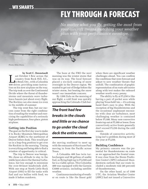
Photo: Mike Shore<br />
by Scott C. Dennstaedt<br />
Last October I flew across the<br />
country from Rock Hill, S.C.,<br />
to Bend, Ore., with a Columbia<br />
400 driver, providing some instruction<br />
on his new airplane on the way.<br />
The trip took us over the Continental<br />
Divide where the threat of thunderstorms<br />
and mountain wave turbulence<br />
haunts just about every flight.<br />
The Rockies can also mean ice even<br />
in the middle of summer<br />
The trip went fine, but our success<br />
came from the right combination<br />
of reading the weather and exercising<br />
the capabilities of a seriously<br />
high-performance, four-place, piston<br />
airplane.<br />
Getting into Position<br />
The goal on the first day was to make<br />
it to Rocky Mountain Metropolitan<br />
Airport (KBJC) to the northwest of<br />
Denver before dusk. This would put<br />
us in a leap-frog position to get over<br />
the Rockies in the morning. Timing<br />
is everything and being able to find a<br />
window of opportunity is critical.<br />
The trip to Denver was benign.<br />
We chose an altitude to stay in the<br />
stable layer above the thermal turbulence,<br />
but low enough to minimize<br />
the over-50-knot headwinds aloft.<br />
With one stop at North Little Rock<br />
Airport (1M1) to fill the tanks with<br />
fuel and our bellies with food, we<br />
made it before sundown.<br />
The front had few<br />
breaks in the clouds<br />
and little or no chance<br />
to go under the cloud<br />
deck the entire route.<br />
The buzz at the FBO the next<br />
morning was the winter storm that<br />
was on its way. The local forecast<br />
placed a six-inch coating of snow<br />
overnight in the Denver region. We<br />
wanted to get out of Dodge before the<br />
winter storm, but beating the snow<br />
wasn’t our immediate concern.<br />
By 1200 Zulu on the morning of<br />
our flight, a cold front was quickly<br />
approaching the Colorado-Utah border<br />
moving southeast to meet up<br />
with the remnants of Hurricane Paul<br />
moving in from the Pacific across<br />
Texas.<br />
A Columbia 400 has twin turbochargers<br />
and 98 gallons of usable<br />
fuel, so flying high (up to FL250) and<br />
far is a viable option. This Columbia<br />
400 was equipped with the Garmin<br />
G1000 avionics, including satellite<br />
weather.<br />
Continuous monitoring of weather<br />
en route is like the finest gold<br />
when there are significant weather<br />
challenges ahead. You can confirm<br />
the conditions that were forecast and<br />
adjust to new weather threats that<br />
unfold. The combination of graphic<br />
representation of en route advisories<br />
along with text makes the onboard<br />
weather worth every penny.<br />
The ability to fly at FL250 is like<br />
having a pair of pocket aces while<br />
playing Texas hold ’em — it’s a strong<br />
hand that’s easy to play. With the<br />
exception of big thunderstorms and<br />
the occasional unpleasant encounter<br />
with clear air turbulence, most<br />
challenging weather is contained<br />
below FL180. Many non-convective<br />
fronts top out at FL180 or lower. Even<br />
convectively active fronts generally<br />
don’t exceed FL250 during the cold<br />
season.<br />
Outside of convective activity,<br />
icing isn’t a problem during most of<br />
the year at FL250.<br />
Building Confidence<br />
My primary concern was the potential<br />
for thunderstorms en route<br />
as we approached the frontal zone.<br />
It was clear from the Storm Prediction<br />
Center’s (SPC) enhanced thunderstorm<br />
outlook that our route included<br />
a moderate risk (40 percent)<br />
of thunderstorms.<br />
On the other hand, as of 1300<br />
UTC, the Aviation Weather Center<br />
(AWC) had not issued a Convective<br />
6 <strong>IFR</strong> • <strong>May</strong> 20<strong>07</strong>