May 07 IFR layout2.indd - AvWx Workshops
May 07 IFR layout2.indd - AvWx Workshops
May 07 IFR layout2.indd - AvWx Workshops

Create successful ePaper yourself
Turn your PDF publications into a flip-book with our unique Google optimized e-Paper software.
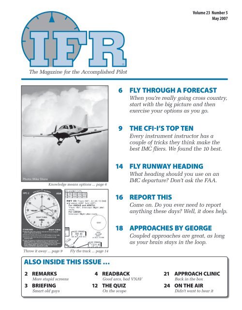
Volume 23 Number 5<br />
<strong>May</strong> 20<strong>07</strong><br />
The Magazine for the Accomplished Pilot<br />
6 FLY THROUGH A FORECAST<br />
When you’re really going cross country,<br />
start with the big picture and then<br />
exercise your options as you go.<br />
9 THE CFI-I’S TOP TEN<br />
Every instrument instructor has a<br />
couple of tricks they think make the<br />
best IMC fliers. We found the 10 best.<br />
Photo: Mike Shore<br />
Photo: Mike Shore<br />
Knowledge means options ... page 6<br />
14 FLY RUNWAY HEADING<br />
What heading should you use on an<br />
IMC departure Don’t ask the FAA.<br />
16 REPORT THIS<br />
Come on. Do you ever need to report<br />
anything these days Well, it does help.<br />
18 APPROACHES BY GEORGE<br />
Coupled approaches are great, as long<br />
as your brain stays in the loop.<br />
Throw it away ... page 9 Fly the track ... page 14<br />
ALSO INSIDE THIS ISSUE …<br />
2 REMARKS<br />
More stupid screens<br />
3 BRIEFING<br />
Smart old guys<br />
4 READBACK<br />
Good arcs, bad VNAV<br />
12 THE QUIZ<br />
On the scope<br />
21 APPROACH CLINIC<br />
Back in the box<br />
24 ON THE AIR<br />
Didn’t want to hear it
WX SMARTS<br />
FLY THROUGH A FORECAST<br />
No matter what you fly, getting the most from<br />
your aircraft means matching your weather<br />
plan with your performance envelope.<br />
Photo: Mike Shore<br />
by Scott C. Dennstaedt<br />
Last October I flew across the<br />
country from Rock Hill, S.C.,<br />
to Bend, Ore., with a Columbia<br />
400 driver, providing some instruction<br />
on his new airplane on the way.<br />
The trip took us over the Continental<br />
Divide where the threat of thunderstorms<br />
and mountain wave turbulence<br />
haunts just about every flight.<br />
The Rockies can also mean ice even<br />
in the middle of summer<br />
The trip went fine, but our success<br />
came from the right combination<br />
of reading the weather and exercising<br />
the capabilities of a seriously<br />
high-performance, four-place, piston<br />
airplane.<br />
Getting into Position<br />
The goal on the first day was to make<br />
it to Rocky Mountain Metropolitan<br />
Airport (KBJC) to the northwest of<br />
Denver before dusk. This would put<br />
us in a leap-frog position to get over<br />
the Rockies in the morning. Timing<br />
is everything and being able to find a<br />
window of opportunity is critical.<br />
The trip to Denver was benign.<br />
We chose an altitude to stay in the<br />
stable layer above the thermal turbulence,<br />
but low enough to minimize<br />
the over-50-knot headwinds aloft.<br />
With one stop at North Little Rock<br />
Airport (1M1) to fill the tanks with<br />
fuel and our bellies with food, we<br />
made it before sundown.<br />
The front had few<br />
breaks in the clouds<br />
and little or no chance<br />
to go under the cloud<br />
deck the entire route.<br />
The buzz at the FBO the next<br />
morning was the winter storm that<br />
was on its way. The local forecast<br />
placed a six-inch coating of snow<br />
overnight in the Denver region. We<br />
wanted to get out of Dodge before the<br />
winter storm, but beating the snow<br />
wasn’t our immediate concern.<br />
By 1200 Zulu on the morning of<br />
our flight, a cold front was quickly<br />
approaching the Colorado-Utah border<br />
moving southeast to meet up<br />
with the remnants of Hurricane Paul<br />
moving in from the Pacific across<br />
Texas.<br />
A Columbia 400 has twin turbochargers<br />
and 98 gallons of usable<br />
fuel, so flying high (up to FL250) and<br />
far is a viable option. This Columbia<br />
400 was equipped with the Garmin<br />
G1000 avionics, including satellite<br />
weather.<br />
Continuous monitoring of weather<br />
en route is like the finest gold<br />
when there are significant weather<br />
challenges ahead. You can confirm<br />
the conditions that were forecast and<br />
adjust to new weather threats that<br />
unfold. The combination of graphic<br />
representation of en route advisories<br />
along with text makes the onboard<br />
weather worth every penny.<br />
The ability to fly at FL250 is like<br />
having a pair of pocket aces while<br />
playing Texas hold ’em — it’s a strong<br />
hand that’s easy to play. With the<br />
exception of big thunderstorms and<br />
the occasional unpleasant encounter<br />
with clear air turbulence, most<br />
challenging weather is contained<br />
below FL180. Many non-convective<br />
fronts top out at FL180 or lower. Even<br />
convectively active fronts generally<br />
don’t exceed FL250 during the cold<br />
season.<br />
Outside of convective activity,<br />
icing isn’t a problem during most of<br />
the year at FL250.<br />
Building Confidence<br />
My primary concern was the potential<br />
for thunderstorms en route<br />
as we approached the frontal zone.<br />
It was clear from the Storm Prediction<br />
Center’s (SPC) enhanced thunderstorm<br />
outlook that our route included<br />
a moderate risk (40 percent)<br />
of thunderstorms.<br />
On the other hand, as of 1300<br />
UTC, the Aviation Weather Center<br />
(AWC) had not issued a Convective<br />
6 <strong>IFR</strong> • <strong>May</strong> 20<strong>07</strong>
Outlook along our planned route.<br />
Not yet, anyway. The Convective<br />
Outlook produced by the AWC is a<br />
six-hour forecast identifying larger<br />
areas that will likely see the issuance<br />
of one or more convective SIGMETs<br />
within the forecast period.<br />
The absence of a Convective<br />
Outlook or a Convective SIGMET,<br />
however, does not mean the absence<br />
of thunderstorms. It simply implies<br />
that any thunderstorms that have<br />
developed or will develop are not<br />
expected to reach Convective SIG-<br />
MET criteria (see “Convective SIG-<br />
METs,” April 2005 <strong>IFR</strong>). Of course,<br />
even an isolated thunderstorm can<br />
spell trouble for a four-seat piston<br />
airplane.<br />
This particular front was fairly<br />
messy — a technical term for<br />
a front that has few breaks in the<br />
clouds along the front and little or<br />
no chance to go under the cloud deck<br />
the entire route. No thunderstorms<br />
knocking down our front door, so I<br />
wasn’t as concerned about the time<br />
of onset. I needed to know where the<br />
tops of the thunderstorms would be<br />
when they developed.<br />
Every thunderstorm is eventually<br />
capped by a temperature inversion<br />
aloft. In the worst case, the tropopause<br />
is the mother of all inversions<br />
and generally defines the upper limit<br />
on all thunderstorms. Without active<br />
thunderstorms present, you must enlist<br />
the help of thermodynamic diagrams<br />
such as the Skew-T Log P diagram<br />
(see http://rucsoundings.noaa.<br />
gov) or the expertise of the weather<br />
forecasters. Based on the Enhanced<br />
Thunderstorm Outlook, forecasters<br />
at the SPC have already warned us<br />
that some instability exists.<br />
Air that is lifted by the advancing<br />
cold front will expand and cool<br />
to reach saturation in the form of<br />
cumulus clouds. Since the rising<br />
parcel of air doesn’t mix with the<br />
environment (adiabatic process),<br />
it’s a race between how quickly the<br />
rising saturated air parcel (cumulus<br />
cloud) cools with increasing altitude<br />
versus how quickly the environmental<br />
air around the parcel cools with<br />
increasing altitude.<br />
PUTTING THE PIECES TOGETHER<br />
By 1500 UTC, the frontal system was located<br />
in the middle of Utah and dropping<br />
to the southeast. This wasn’t an exceptionally<br />
strong front, but did have enough<br />
instability to provide the potential for<br />
thunderstorms ahead of the front. The Enhanced<br />
Thunderstorm Outlook from the<br />
Storm Prediction Center (SPC) provided<br />
a moderate chance that convection was<br />
possible ahead of the cold front.<br />
An AIRMET is a time-smeared product<br />
and, especially when AIRMETs are large, it<br />
is possible that only a small portion of this<br />
total area would be affected at any one<br />
time. With blue skies showing through<br />
holes in the broken layer, icing would not<br />
be an issue on our climb. The AIRMET did<br />
provide us with an important clue that the<br />
icing layer terminated at FL200. Outside<br />
of convective activity, FL200 should keep<br />
us clear of structural icing.<br />
The Current Icing Product (CIP Severity)<br />
is not a forecast of icing potential in<br />
the future and will not tell you the tops<br />
of convective activity that hasn’t formed.<br />
However, it provides a great gauge on the<br />
approximate height of the top of the icing layer outside of convective activity. The<br />
masked CIP Severity (> 50 percent) depicted a high likelihood of moderate icing at<br />
17,000 feet MSL, but little chance of icing at FL210. This agreed completely with the<br />
AIRMET and gave us confidence that we could fly over top of any icing. — S.D.<br />
The latent heat of condensation<br />
in the developing cloud keeps the<br />
parcel from cooling off as quickly as<br />
if it were unsaturated air. If the saturated<br />
parcel’s temperature remains<br />
warmer than the environmental<br />
temperature, then the atmosphere<br />
is said to be unstable with respect<br />
to the saturated parcel. The saturated<br />
parcel has positive buoyancy.<br />
Eventually, the environmental<br />
temperature will become warmer<br />
than the rising saturated air parcel.<br />
This point of crossover is called the<br />
<strong>May</strong> 20<strong>07</strong> • <strong>IFR</strong> 7
WEAVE YOUR WAY THROUGH THE TEXT AND GRAPHICS OF WX<br />
The G1000 satellite weather display not only depicts the<br />
convective SIGMET graphically, but allows the pilot to scroll<br />
over to the convective SIGMET to display the text associated<br />
with the advisory. In this image, we could see that Convective<br />
SIGMET 3W was in our direct flight path and the area<br />
of convection was moving easterly at 20 knots with tops<br />
to FL290.<br />
Turning to the north to avoid the convective SIGMET in<br />
our path wasn’t a viable option given the convection that was<br />
beginning to build in that general direction. Shortly after we<br />
passed<br />
s o u t h<br />
of this area, convective SIGMET 5W was issued for a 20-nm wide line of<br />
thunderstorms to the north of the HVE VOR as can be seen by the dashed<br />
line. Also take note of the “plus” signs that designate the location of cloudto-ground<br />
lightning strikes.<br />
When flying around or over convection<br />
using satellite weather on the<br />
G1000, I like to be displaying NEXRAD,<br />
satellite cloud tops, lightning, and SIG-<br />
METs/AIRMETs on the Weather Data<br />
Link Map page. In mountainous areas,<br />
there are plenty of “holes” in coverage<br />
for NEXRAD.<br />
Consequently, ground-based<br />
lightning may be your only indication<br />
of convection in these regions. Satellite<br />
cloud tops provide a good indication<br />
to the extent of the convection,<br />
but the image may be 30 or more<br />
minutes old.<br />
Finally, at 55 minutes past each<br />
hour, you can witness any newly issued<br />
AIRMETs and convective SIGMETs issued<br />
by the AWC.<br />
— S.D.<br />
equilibrium level and represents<br />
the upper limit of the convective<br />
updraft. Once this parcel hits the<br />
equilibrium level, it has nowhere<br />
to go, and it typically spreads out<br />
as it is sheared by the winds aloft<br />
producing the classic thunderstorm<br />
anvil. Stronger updrafts with a lot<br />
of upward momentum in the core<br />
of the thunderhead will often “overshoot”<br />
the equilibrium level and can<br />
rise above the anvil. Lower topped<br />
thunderstorms will often not contain<br />
an anvil.<br />
As I looked over the Skew-T Log<br />
P soundings for our planned route,<br />
the highest equilibrium level over<br />
the front was approximately FL200.<br />
Consequently, we filed for FL200.<br />
There wasn’t a tremendous amount<br />
of instability, so I was pretty confident<br />
that the atmospheric pot wasn’t<br />
likely to boil over along our route<br />
of flight. Even so, FL200 would give<br />
us 5000 feet of wiggle-room up to<br />
our certified ceiling of FL250 if we<br />
needed to climb above any overshooting<br />
tops.<br />
Looking for Ice<br />
Icing was the next piece of the<br />
puzzle. Even if we were able to stay<br />
outside of any convective activity,<br />
could we be reasonably sure to stay<br />
out of clouds that contained supercooled<br />
liquid water AIRMET Zulu<br />
covered most of Colorado and Utah<br />
at the time of our departure, for occasional<br />
moderate icing in clouds<br />
and precipitation from the freezing<br />
level through FL200. Freezing levels<br />
were running roughly 12,000 feet<br />
MSL over Denver.<br />
Conditions at the surface were<br />
light westerly winds with 60-mile<br />
visibility, temperature of 10 degrees<br />
Celsius, and a broken ceiling of<br />
10,000 feet. Since we were just outside<br />
the Mile-High City, this meant<br />
we wouldn’t even enter the clouds<br />
until about 15,000 feet MSL.<br />
8 <strong>IFR</strong> • <strong>May</strong> 20<strong>07</strong>
As we were driving to the airport,<br />
there were plenty of breaks<br />
in the clouds with blue sky showing<br />
through, especially to the west.<br />
Virga was visible to the east.<br />
Blue sky provides important<br />
clues. If you are looking toward<br />
the horizon and you can see blue<br />
sky, the cloud layer is likely fairly<br />
thin. Thicker layers generally will<br />
block the view to the clear sky above<br />
the clouds unless you are looking<br />
straight up.<br />
If blue sky can be seen, dryer air<br />
exists in and around the thin layer<br />
of clouds. Consequently, even if you<br />
find yourself in a cloud or two, the<br />
liquid water content in the cloud<br />
typically is low, assuming it is not<br />
a vertically-developed cloud. You<br />
can nearly always negotiate with<br />
ATC to find one of these holes and<br />
climb through it to keep you clear<br />
of supercooled liquid water.<br />
Ice Online<br />
What about the Current Icing Product<br />
(CIP) Why not just use CIP to determine<br />
the top of the icing layer<br />
Indeed we did. The new CIP Severity<br />
icing product (see “Internet Ice<br />
Gets Severe,” December 2006 <strong>IFR</strong>)<br />
at 1300 UTC was showing a good<br />
chance for moderate icing at 17,000<br />
feet just ahead of the front and noseto-nose<br />
with our route. At FL190,<br />
the area decreased in size and the<br />
likelihood for icing also decreased.<br />
Finally, by FL210 the potential icing<br />
along our route nearly diminished.<br />
Once again, I felt confident that<br />
a flight at FL200 would keep us out<br />
of ice as long as we remained clear<br />
of any convective clouds.<br />
One thing worth noting is that<br />
CIP is only a recent glimpse of the<br />
past and says nothing about the future.<br />
If convection did develop, icing<br />
levels might have been considerably<br />
higher than what CIP was showing.<br />
That’s why knowing the equilibrium<br />
level was so important for this<br />
flight.<br />
About 20 minutes before we<br />
planned to depart, a pilot of a CRJ7<br />
reported that he entered the bases<br />
(continued on page 22)<br />
By Ken Holston<br />
Much in the way Dennis<br />
Quaid (as The Right Stuff’s<br />
Gordo Cooper) grinningly<br />
asked, “Who’s the best pilot you ever<br />
saw” I’ve wanted to collect the nutshell<br />
essence of the quintessential<br />
instrument pilot. With few actual<br />
hangar flying sessions in my life<br />
these days, the only practical way<br />
to pool my mentors and aviation<br />
influences would be in a virtual hangar<br />
— a cyber bull-session of sorts.<br />
The plus side of this technique<br />
was that I could rack and stack the results.<br />
Here’s a Top 10 list of thoughts<br />
from the pilots I most respect, not<br />
so much as a Letterman-style countdown,<br />
but in a “basics first,” multicourse<br />
menu. They are tips and<br />
tricks worth reviewing for both the<br />
novice and the experienced.<br />
TRICKS O’ THE TRADE<br />
THE CFI-I’S TOP TEN<br />
If you gather a bunch of pilots and ask ’em<br />
what makes a good pilot, you can anticipate<br />
an earful. Here’s the best of the chatter.<br />
AI Flying<br />
Although the comments were<br />
phrased differently, I received more<br />
input on this topic than any other.<br />
Also known as Control and Performance<br />
instruments, the Attitude<br />
Instrument (AI) method states that<br />
the only two inputs a pilot can make<br />
are via the stick or the throttle. Stick<br />
inputs are seen on the attitude indicator<br />
and throttle inputs are seen on<br />
the power gauges. Everything else on<br />
the panel is just a snapshot of pasttense<br />
performance. (I won’t repeat<br />
the diverse slurs on the FAA’s Primary<br />
and Supporting method.)<br />
Applying the AI concept, one<br />
can construct a ballpark list of pitch<br />
and power settings for any configuration<br />
and reduce workload. Want to<br />
climb at Vy Pitch four degrees nose<br />
up. Want to make a non-precision<br />
descent Set 16 inches of manifold<br />
pressure. Settings may vary with<br />
weight or winds, but sharp pilots<br />
know at least four basic settings:<br />
climb, cruise, radar pattern/procedure<br />
turn, and final approach.<br />
The topper came from a long-time<br />
designee (DE) and NAFI CFI of the<br />
Below: Don’t think the pros fly by attitude<br />
Check out this AI that gives the<br />
pilot single degrees of pitch for superprecise<br />
flying.<br />
<strong>May</strong> 20<strong>07</strong> • <strong>IFR</strong> 9
THINKING OF BUYING OR<br />
SELLING AN AIRPLANE<br />
Let The Aviation Consumer's 10th Edition Used Aircraft Guide help you!<br />
Dreaming about your next plane Ready to take a closer look at that plane in the ad<br />
Need to know what your plane is worth<br />
Then don't consider buying or selling without The Aviation Consumer's 10th Edition Used<br />
Aircraft Guide. The Used Aircraft Guide is available for the first time on CD at just<br />
$29.95, that's over a 38% savings off the cover price and no shipping and handling charge!<br />
Let the Used Aircraft Guide help you cut through the sales hype and give you the facts with:<br />
Reviews of more than 140 popular models<br />
Specs and Comparisons<br />
Photos and charts<br />
The latest aircraft upgrades<br />
Useful ownership and technical information<br />
WHY NOT ORDER YOUR OWN COPY TODAY!<br />
2 easy ways to order your copy of The Aviation Consumer's 10th Edition Used Aircraft Guide:<br />
Call toll free: 1-800-424-7887 or<br />
Order via the web at: www.used-aircraft-guide.com<br />
UAGCD2H<br />
FLY THROUGH A FORECAST<br />
continued from page 8<br />
at 14,500 ft MSL, was on top of the<br />
overcast layer at FL180, and picked<br />
up light to moderate rime on the<br />
climb out of Aspen, Colo. Aspen is<br />
about 130 nm south of our planned<br />
route, but this pilot report gave me a<br />
good sense of where the current tops<br />
were located and that corresponded<br />
well with the AIRMET.<br />
I looked at the sum of all our<br />
information:<br />
1. Top of icing layer was FL200<br />
according to the AIRMET;<br />
2. Departure airport had a broken<br />
ceiling with blue sky to the west<br />
(in our general direction of flight);<br />
3. Thunderstorm tops not more<br />
than 20,000 feet according to the<br />
forecast soundings;<br />
4. Recent pilot report of tops to<br />
FL180 about 140 nm to the south of<br />
our route;<br />
5. Low risk of icing shown over<br />
FL190 using the masked CIP Severity<br />
product;<br />
6. Destination airport forecast<br />
clear skies and a VFR descent; and<br />
7. 5000 feet to spare if tops were<br />
higher than expected.<br />
All of these points provided me<br />
with the confidence to file our route<br />
with a final altitude of FL200.<br />
In the Hot Seat<br />
With breaks still in the clouds to<br />
the west, we departed Denver about<br />
1330 UTC and climbed to FL200 toward<br />
our next stop, Tonopah, Nev.,<br />
(KTPH). After some vectoring in the<br />
climb, we popped out on top of the<br />
broken layer obscuring the mountain<br />
peaks below. The temperature<br />
through the cloud layer was -13 degrees<br />
Celsius. We didn’t collect any<br />
ice on the climb and logging any IMC<br />
would have been in the hundredths<br />
of an hour.<br />
As we progressed further west,<br />
the thin broken layer became a much<br />
thicker overcast that slowly began<br />
to creep up to our altitude. With a<br />
few light precipitation returns on the<br />
satellite weather, I knew we were getting<br />
closer to the front.<br />
About one hour at FL200, the<br />
temperature aloft was at -18 degrees<br />
Celsius and steadily falling;<br />
this was another indication that we<br />
were pressing up against the frontal<br />
zone. With NEXRAD, cloud tops,<br />
ground-based lightning, and SIG-<br />
METs/AIRMETs displayed on the<br />
Weather Data Link Map page on the<br />
G1000 MFD, we began to keep watch<br />
for lightning strikes and newly issued<br />
convective SIGMETs.<br />
Satellite cloud tops are best used<br />
to help determine the extent of the<br />
cloud cover. The satellite image may<br />
be more than 30 minutes old. In a<br />
rapidly developing situation, the<br />
current tops may be 10,000 feet or<br />
higher than depicted.<br />
Like clockwork, at 55 minutes<br />
past the hour, Convective SIGMET<br />
3W was issued for an area of thunderstorms<br />
moving east at 20 knots<br />
22 <strong>IFR</strong> • <strong>May</strong> 20<strong>07</strong>
with tops to FL290. The MFD Weather<br />
Data Link Map Page allowed us<br />
to see our route in relation to the<br />
newly issued Convective SIGMET<br />
and our present route took us right<br />
through the northern edge. A couple<br />
of lightning strikes popped up on the<br />
southern edge as well.<br />
One knee-jerk reaction would<br />
have been asking ATC for a turn to<br />
stay north of the Convective SIGMET<br />
area. The view out the window, however,<br />
didn’t look promising in this<br />
direction. The clouds to the north<br />
were definitely in the early stages<br />
of development and appeared to<br />
already be at or above our current<br />
flight level. Additionally, lightning<br />
strikes were starting to form a line to<br />
our north. Our current route looked<br />
like our best option.<br />
Adjusting the Plan<br />
As we got closer to convective SIG-<br />
MET 3W, it became obvious that<br />
FL200 wasn’t going to be quite high<br />
enough. We asked ATC for a climb<br />
to FL220. FL220 kept us just in the<br />
wispy edge of the tops with a few<br />
overshooting tops to our north. Significant<br />
overshooting tops should be<br />
avoided as they<br />
may contain severe<br />
icing and<br />
extreme turbulence.<br />
With a temperature<br />
of -32<br />
degrees Celsius,<br />
a few bumps and<br />
about 0.1 hours<br />
of IMC, we easily<br />
cleared the convective<br />
SIGMET<br />
area.<br />
Pa s t t he<br />
worst weather,<br />
we noticed on the<br />
MFD that convective<br />
SIGMET 3W<br />
H E A R M O R E H E R E<br />
For more information on .... , log<br />
onto our sister publication, www.<br />
avweb.com and click the podcast<br />
button, then the podcast index.<br />
This month’s feature includes an<br />
interview with Pacific ferry pilot<br />
Fred Sorenson about what it’s like<br />
to fly extremely long<br />
distances and plan<br />
for winds, weather,<br />
emergencies, and<br />
anything else that<br />
might come up in a<br />
20-hour flight over<br />
inhospitable ocean.<br />
morphed into<br />
convective SIG-<br />
MET 4W and Convective SIGMET<br />
5W had been issued just to the north<br />
of our route for a line of thunderstorms<br />
with tops to FL270.<br />
By this time, about a dozen lightning<br />
strikes could be seen stretching<br />
northeast to southwest with our<br />
flight path splitting the two convective<br />
SIGMETs in two.<br />
No Guarantees<br />
Coincidently, an instrument-rated<br />
Cirrus SR22 pilot, his wife, and two<br />
children died crossing through this<br />
same frontal zone about 30 minutes<br />
later and about 200 miles further<br />
south of our flight path. They departed<br />
Lake Tahoe and were headed<br />
southeast to Grand Canyon National<br />
Park Airport in northwest Arizona<br />
when they apparently encountered<br />
icing conditions at 13,000 feet MSL.<br />
This region wasn’t under the area of<br />
AIRMET Zulu, but was convectively<br />
active including the southern edge<br />
of convective SIGMET 4W just to<br />
the north of the accident site. This<br />
accident is still under investigation<br />
by the NTSB.<br />
At some point you must make<br />
a decision to launch. Do you have<br />
enough information to make a safe<br />
flight Are you confident that you<br />
have the flexibility to avoid painting<br />
yourself into a corner If not, then<br />
you stay on the ground and wait for a<br />
better opportunity.<br />
It’s that simple.<br />
For this flight,<br />
I had several key<br />
data points that I<br />
could hang my hat<br />
on. Many flights<br />
that have weather<br />
challenges always<br />
seem to end with a<br />
sigh of relief, “We<br />
made it.” Having<br />
confidence in your<br />
preflight analysis<br />
and monitoring<br />
the weather while<br />
en route keeps<br />
your deodorant<br />
fresh throughout<br />
the entire flight.<br />
Scott C. Dennstaedt is a former NWS<br />
meteorologist and an active flight instructor.<br />
See www.chesavtraining.com.<br />
SUBSCRIPTION<br />
SERVICE<br />
TWO WAYS TO CONTACT <strong>IFR</strong><br />
1. Call (800) 786-3454<br />
2. Mail this coupon (or a<br />
photocopy) to:<br />
<strong>IFR</strong><br />
PO Box 420235<br />
Palm Coast, FL 32142-0235<br />
CHANGE YOUR ADDRESS<br />
Attach your present mailing label<br />
to this form and enter your new<br />
address here:<br />
Name<br />
Company<br />
Street<br />
City<br />
State & Zip<br />
E-mail<br />
ORDER OR EXTEND YOUR<br />
CURRENT SUBSCRIPTION<br />
Enter your name and address<br />
above and check the subscription<br />
term you prefer:<br />
One Year: $59<br />
Two Years: $99<br />
These rates are good in the U.S.<br />
only. For all other countries<br />
1 year, $69; 2 years, $138.<br />
GIVE A GIFT SUBSCRIPTION<br />
Enter your name and address<br />
above and your giftee’s name and<br />
address below. The subscription<br />
rates stated above apply to gifts.<br />
Name<br />
Company<br />
Street<br />
City<br />
State & Zip<br />
E-mail<br />
<strong>May</strong> 20<strong>07</strong> • <strong>IFR</strong> 23