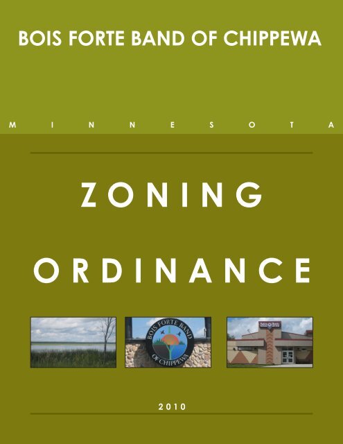
ZONING ORDINANCE - Bois Forte Reservation
ZONING ORDINANCE - Bois Forte Reservation
ZONING ORDINANCE - Bois Forte Reservation

Create successful ePaper yourself
Turn your PDF publications into a flip-book with our unique Google optimized e-Paper software.
BOIS FORTE BAND OF CHIPPEWA<br />
M I N N E S O T A<br />
<strong>ZONING</strong><br />
<strong>ORDINANCE</strong><br />
2010
CONTENTS<br />
ARTICLE I: GENERAL STANDARDS AND ADMINISTRATION.......4<br />
Section 1 Title..........................................................................................................4<br />
Section 2 Authority.................................................................................................4<br />
ARTICLE II: GENERAL PROVISIONS..............................................6<br />
Section 1 Application and Interpretation.......................................................6<br />
Section 2 Environmental Review.......................................................................6<br />
Section 3 Land Use Map.......................................................................................7<br />
Section 4 Definitions..............................................................................................7<br />
ARTICLE III: LAND USE CONTROLS.............................................20<br />
Section 1 Land Classifications...........................................................................20<br />
Section 2 Zone District Establishment...........................................................21<br />
Section 3 Land Use District Titles....................................................................21<br />
Section 4 Use Classification...............................................................................22<br />
Section 5 Light Imprint Design Standards....................................................24<br />
Section 6 LAND USE DISTRICTS........................................................................25<br />
ARTICLE IV: ARTICLE IV: PERFORMANCE AND ADMINISTRATIVE<br />
STANDARDS.................................................................................. 46<br />
Section 1 General................................................................................................. 46<br />
Section 2 Earth Tone Colors............................................................................. 46<br />
Section 3 Screening (when required as a condition)............................... 46<br />
Section 4 Residential............................................................................................47<br />
Section 5 Intensive Vegetation Removal “V”.............................................. 48<br />
Section 6 Recreational Vehicles on Lots........................................................49<br />
Section 7 Home Business...................................................................................49<br />
Section 8 Wetlands “V”........................................................................................49<br />
Section 9 Other Structures.................................................................................51<br />
Section 10 Placement and Design of Roads, Driveways,<br />
and Parking Areas in Shoreland Areas “V”...............................................52<br />
Section 11 Houseboat Standards.....................................................................53<br />
Section 12 Rural Industry and Forest Product Processing “C”................53<br />
1
ARTICLE V: ARTICLE V:DIMENSIONAL STANDARDS................ 54<br />
Section 1 Dimensional Standards and River Corridor Width..................54<br />
Section 2 Shore Setback and Shore Impact Zone Requirements.........54<br />
Section 3 Sanitary System Setbacks and Standards..................................54<br />
Section 4 Road Right-of-Way Setbacks..........................................................55<br />
Section 5 Significant Historic Sites..................................................................55<br />
Section 6 Placement and Design of Roads, Driveways,<br />
and Parking Areas.............................................................................................55<br />
Section 7 Riparian and Non-riparian Property<br />
within Shoreland Area.....................................................................................56<br />
Section 8 Storage of Structures........................................................................56<br />
ARTICLE VI: NONCONFORMITIES................................................57<br />
Section 1 General..................................................................................................57<br />
Section 2 Nonconforming Uses.......................................................................57<br />
Section 3 Nonconforming Structures............................................................57<br />
Section 4 Decks-Attached..................................................................................59<br />
Section 5 Section Natural Disaster..................................................................60<br />
ARTICLE VII: ADMINISTRATION, ENFORCEMENT AND APPLICATION<br />
REVIEW..........................................................................................61<br />
Section 1 General..................................................................................................61<br />
Section 2 Enforcement........................................................................................62<br />
Section 3 Conditional Uses...............................................................................63<br />
Section 4 Appeals From Decisions..................................................................65<br />
Section 5 Variances...............................................................................................65<br />
Section 6 Amendments......................................................................................67<br />
2
NR<br />
SF<br />
IND SF<br />
SF<br />
PWU<br />
NR<br />
AFT<br />
PWU<br />
1.<br />
2.<br />
SF<br />
N<br />
NR<br />
Section 6 Land Use Districts<br />
6.1: Single Family Residential (SF)<br />
A. Description<br />
1. Areas designated for the enjoyment of the <strong>Bois</strong> <strong>Forte</strong> Tribe and visitors.<br />
B. Objectives<br />
1. Encourage conservation design to preserve natural resources and open spaces.<br />
2. Encourage “low-impact” development.<br />
3. Where possible, in-fill development shall occur prior to the approval of new<br />
subdivisions.<br />
4. The promotion of trails shall be incorporated into new subdivisions.<br />
3.<br />
C. Primary Uses<br />
1. Single family residential lots intended by lease or home ownership for single<br />
families. This classification includes recreational, seasonal and permanent, lowdensity<br />
housing.<br />
D. Setback Requirements<br />
Table X-X Single Family Residential District Setback Requirements<br />
SETBACK STANDARDS CONDITIONS<br />
Front Yard<br />
20 feet minimum<br />
Side Yard<br />
10 feet minimum<br />
Rear Yard 25 feet minimum Accessory structures 5 feet minimum<br />
Lot Area<br />
10,000 square feet<br />
a. RESIDENTIAL<br />
Height f. 30 CIVIC feet SUPPORT<br />
25 feet within shoreland areas<br />
Accessory Dwelling P P P P P P P P C P<br />
Cemetery C C<br />
Townhouse and Duplex C PImpervious P CSurface 35 percent Clinic 25 percent within shoreland areas P<br />
Freestanding House P P P C<br />
Cultural and Ceremonial Areas P P<br />
Light Imprint Standards<br />
See Section X<br />
Group Dwelling C P C<br />
Fire Department P P P P P P P P P P<br />
Apartment P P P<br />
Law Enforcement P P P P P P P P P P<br />
Single Room Occupancy<br />
P<br />
Public Works Garage P P<br />
b. LODGING<br />
g. EDUCATION<br />
Bed & Breakfast C C P<br />
9-12/High School<br />
P<br />
Hotel C P<br />
College<br />
P<br />
Inn C P<br />
Daycare C C C P<br />
K-8 P<br />
c. OFFICE<br />
Preschool<br />
P<br />
Corner Office C C C P P C<br />
Trade School<br />
P<br />
Live-Work Building C C C C C C<br />
Office Building P C<br />
h. AUTOMOTIVE<br />
Gas/Convenience P C<br />
d. COMMERCIAL/RETAIL/SERVICE<br />
Vehicle Repair P C<br />
Box (Large)<br />
C<br />
Vehicle Sales/Rental P C<br />
Box (Medium) P C<br />
Box (Small) P C<br />
i. AGRICULTURE<br />
Corner Store C P P<br />
Community Garden P P P P P P P P<br />
Open Air Market C<br />
Rice & Grain Storage P P P<br />
Restaurant C C C P<br />
Greenhouse<br />
P<br />
Outdoor Storage C P P P P P<br />
Kennel P P P<br />
Shopping Mall P C<br />
j. INDUSTRIAL<br />
Shopping Strip P C<br />
Agribusiness<br />
P<br />
Land Use Controls<br />
e. CIVIC<br />
Industry, Open<br />
P<br />
Auditorium C P<br />
Industry, Restricted<br />
P<br />
Convention Center C P<br />
Warehousing<br />
P<br />
Golf Course C C<br />
Section Indoor & Outdoor 6 Land Recreation Use C Districts C P<br />
Library C P<br />
6.1: Single Movie Family Theater Residential P C (SF)<br />
4.<br />
Waste Transfer<br />
P<br />
Water Treatment<br />
P<br />
k. ACCESSORY USES<br />
P<br />
Drive-Through C P<br />
Museum C P<br />
Home Occupations C C C<br />
A. Description<br />
Religious Assembly C C C C C<br />
Small Wind Equipment C C C C C<br />
P = Permitted<br />
Dispersed Wind Equipment C C C C C<br />
C = Conditional<br />
Solar & Geothermal P P P P P P P P P P<br />
1. Areas designated for the enjoyment of the <strong>Bois</strong> <strong>Forte</strong> Tribe and visitors.<br />
P = Permitted<br />
C = Conditional<br />
B. Objectives<br />
25<br />
DRAFT Aug26-10<br />
1. Encourage conservation design to preserve for natural review resources only and open spaces.<br />
SINGLE FAMILY RESIDENTIAL<br />
MULTIFAMILY RESIDENTIAL<br />
ELDER HOUSING<br />
COMMERCIAL<br />
BOIS FORTE DEVELOPMENT DISTRICT<br />
INDUSTRIAL<br />
PUBLIC WORKS & UTILITIES<br />
GOVERNMENTAL & ADMINISTRATIVE<br />
NATURAL RESOURCES<br />
RECREATIONAL USES<br />
LAND CLASSIFICATIONS<br />
PWU<br />
NR<br />
GA<br />
SF<br />
SF<br />
GA<br />
Natural Resources (NR)<br />
Recreational Use (RU)<br />
Single Family Residential (SF)<br />
Multifamily Residential (MF)<br />
Commercial (COM)<br />
<strong>Bois</strong> <strong>Forte</strong> Development District (BFDD)<br />
Public Works and Utilities (PWU)<br />
Governmental and Administrative (GA)<br />
Elder Housing (EH)<br />
Industrial (IND)<br />
NR<br />
Nett lake laNd Use PlaNs | <strong>Bois</strong> <strong>Forte</strong><br />
How to use this Ordinance:<br />
SF<br />
SF<br />
SF<br />
SF<br />
1. Locate site on the zoning map.<br />
COM<br />
SF<br />
EH<br />
SF<br />
SF<br />
SF<br />
GA<br />
SF<br />
EH<br />
NR<br />
2. Determine which MF zone district the site is in.<br />
SF SF<br />
SF<br />
LAND CLASSIFICATIONS<br />
Land 25.aug.2010 Use Controls<br />
SINGLE FAMILY RESIDENTIAL<br />
MULTIFAMILY RESIDENTIAL<br />
ELDER HOUSING<br />
COMMERCIAL<br />
BOIS FORTE DEVELOPMENT DISTRICT<br />
INDUSTRIAL<br />
PUBLIC WORKS & UTILITIES<br />
GOVERNMENTAL & ADMINISTRATIVE<br />
NATURAL RESOURCES<br />
RECREATIONAL USES<br />
RU<br />
Allotment Lands<br />
3. Reference NR corresponding zone district SF<br />
(i.e. page X) to determine PWU the purpose of<br />
site’s zone district.<br />
PWU<br />
4. Reference Table X (page X): Zoning<br />
Form and Function Table to determine<br />
uses which are permitted on the site.<br />
SF<br />
Allotment Lands<br />
SF<br />
2.<br />
3.<br />
4.<br />
Encourage “low-impact” development.<br />
Where possible, in-fill development shall occur prior to the approval of new<br />
subdivisions.<br />
The promotion of trails shall be incorporated into new subdivisions.<br />
C. Primary Uses<br />
1.<br />
Single family residential lots intended by lease or home ownership for single<br />
families. This classification includes recreational, seasonal and permanent, lowdensity<br />
housing.<br />
D. Setback Requirements<br />
Table X-X Single Family Residential District Setback Requirements<br />
SETBACK STANDARDS CONDITIONS<br />
Front Yard<br />
20 feet minimum<br />
Side Yard<br />
10 feet minimum<br />
Rear Yard 25 feet minimum Accessory structures 5 feet minimum<br />
Lot Area<br />
10,000 square feet<br />
Height 30 feet 25 feet within shoreland areas<br />
5.<br />
Impervious Surface 35 percent 25 percent within shoreland areas<br />
Light Imprint Standards<br />
See Section X<br />
5. Reference zone district table (i.e. page<br />
X) to determine setbacks requirements.<br />
3
Please note that the information provided within this map estimates the total land area. Upon a land use request, additional field work and/or a survey of the area will be required in order to specifically locate natural resource areas, water features or sites of significance.<br />
Please note that the information provided within this map estimates the total land area. Upon a land use request, additional field work and/or a survey of the area will be required in order to specifically locate natural resource areas, water features or sites of significance.<br />
Please note that the information provided within this map estimates the total land area. Upon a land use request, additional field work and/or a survey of the area will be required in order to specifically locate natural resource areas, water features or sites of significance.<br />
Pike Bay<br />
Pike Bay<br />
Lake Vermilion<br />
Pike Bay<br />
Lake Vermilion<br />
0 112.5 225 450<br />
Feet<br />
approximate<br />
0 250 500 1,000<br />
Feet<br />
approximate<br />
0 350 700 1,400<br />
Feet<br />
approximate<br />
General Standards and Administration<br />
Article I: GENERAL STANDARDS AND ADMINISTRATION<br />
RU<br />
NR<br />
NR<br />
GA<br />
SF<br />
SF<br />
GA<br />
EH<br />
GA<br />
SF<br />
SF<br />
RU<br />
SF<br />
COM<br />
EH<br />
SF<br />
SF<br />
SF<br />
NR<br />
SF<br />
SF<br />
EH<br />
SF<br />
PWU<br />
SF<br />
SF<br />
MF<br />
SF<br />
PWU<br />
PWU<br />
NR<br />
Allotment Lands<br />
SF<br />
NR<br />
SF<br />
SF<br />
Allotment Lands<br />
Nett Lake Land Use Plan<br />
GA<br />
COM<br />
COM<br />
NR<br />
NR<br />
NR<br />
NR<br />
PWU<br />
BFDD<br />
NR<br />
NR<br />
NR<br />
NR<br />
BFDD<br />
NR<br />
SF<br />
GA<br />
SF<br />
BFDD<br />
Vermilion Land Use Plan<br />
NR<br />
MF<br />
GA<br />
SF<br />
NR<br />
MF<br />
BFDD<br />
SF<br />
SF<br />
PWU<br />
FUTURE ROAD<br />
NR<br />
IND<br />
SF<br />
NR<br />
FUTURE ROAD<br />
PWU<br />
Allotment Lands<br />
SF<br />
Section<br />
SF PWU 1 Title<br />
This Ordinance shall be known as the LAND USE <strong>ORDINANCE</strong> (<strong>ORDINANCE</strong>) OF THE<br />
PWU<br />
BOIS FORTE BAND OF CHIPPEWA.<br />
Allotment Lands<br />
NR<br />
Section 2 Authority<br />
The <strong>Bois</strong> <strong>Forte</strong> Band, a federally recognized Indian Tribe organized pursuant to the Indian<br />
Natural Resources (NR)<br />
Reorganization Recreational Act Use (RU) of June 18, 1934, enacts this Land Use Ordinance as an exercise of<br />
Single Family Residential (SF)<br />
Multifamily Residential (MF) N<br />
Commercial (COM)<br />
its inherent sovereign <strong>Bois</strong> <strong>Forte</strong> Development District (BFDD) powers and its authority under the Revised Constitution and Bylaws<br />
Public Works and Utilities (PWU)<br />
Governmental and Administrative (GA)<br />
Elder Housing (EH)<br />
of the Minnesota Chippewa Tribe to promote and protect the public health, safety, and<br />
general welfare of the residents of the Territory of the <strong>Bois</strong> <strong>Forte</strong> Band.<br />
Village of Nett lake laNd Use PlaNs | <strong>Bois</strong> forte<br />
September 2010<br />
NR<br />
RU<br />
NR<br />
SF<br />
SF<br />
SF<br />
NR<br />
NR<br />
NR<br />
Industrial (IND)<br />
2.1: Purpose<br />
RU<br />
SF<br />
RU<br />
NR<br />
NR<br />
An PWU ordinance establishing comprehensive land use regulations for that portion of <strong>Bois</strong><br />
RU<br />
RU<br />
GA<br />
NR<br />
EH NR<br />
<strong>Forte</strong> <strong>Reservation</strong>, Minnesota, to promote the health safety, and general welfare of the<br />
NR<br />
inhabitants<br />
NR<br />
by dividing the <strong>Bois</strong> <strong>Forte</strong> <strong>Reservation</strong> into zones and regulating therein the<br />
RU<br />
SF<br />
NR NR<br />
uses SF of land and the placement of all structures with a view to encouraging the most<br />
NR<br />
NR PA<br />
appropriate use of land in the <strong>Bois</strong> <strong>Forte</strong> <strong>Reservation</strong>, and to recognize and preserve the<br />
economic, environmental Natural Resources (NR) and cultural values of all lands within the <strong>Bois</strong> <strong>Forte</strong> <strong>Reservation</strong>.<br />
SF<br />
Recreational Use (RU)<br />
Single Family Residential (SF)<br />
Multifamily Residential (MF) N<br />
Commercial (COM)<br />
<strong>Bois</strong> <strong>Forte</strong> Development District (BFDD)<br />
Public Works and Utilities (PWU)<br />
Governmental and Administrative (GA)<br />
The purposes Elder of Housing (EH) this Ordinance are:<br />
Industrial (IND)<br />
Vermilion land Use Plans | <strong>Bois</strong> <strong>Forte</strong><br />
September 2010<br />
A. To reflect the basic land stewardship and environmental principles of the <strong>Bois</strong> <strong>Forte</strong><br />
Band.<br />
SF<br />
NR<br />
B. To develop a land use management ordinance, fair to all residents and legally<br />
enforceable on all land, regardless of ownership, within the exterior boundaries of the<br />
Nett Lake, Lake Vermilion and Deer Creek <strong>Reservation</strong>s and on all lands constituting<br />
the Indian Country over which the <strong>Bois</strong> <strong>Forte</strong> Band has jurisdiction.<br />
RU<br />
PWU<br />
Indian Point Land Use Plan<br />
NR<br />
C. To protect Natural Resources (NR) the environment and residents of the <strong>Reservation</strong> by developing regulations for:<br />
Recreational Use (RU)<br />
Single Family Residential (SF)<br />
Multifamily Residential (MF)<br />
N<br />
Commercial (COM)<br />
<strong>Bois</strong> <strong>Forte</strong> Development District (BFDD)<br />
1. Public Works Commercial and Utilities (PWU) development.<br />
Governmental and Administrative (GA)<br />
Elder Housing (EH)<br />
Industrial (IND)<br />
2. Non-residential use.<br />
IndIan PoInt Land Use PLans | BoIs <strong>Forte</strong><br />
September 2010<br />
3. Density and location of residential development.<br />
4. Preservation of sensitive areas.<br />
2.2: Scope<br />
This Ordinance is not intended to repeal, amend or otherwise interfere with any existing<br />
easements, covenants, agreements or leases, or permits previously or hereafter adopted<br />
or issued pursuant to law; provided, however, that where this Ordinance imposes a greater<br />
restriction upon the use of buildings or land, the provisions of this Ordinance shall govern.<br />
4<br />
Where the conditions imposed by any provision of this Ordinance are either more<br />
restrictive or less restrictive the comparable conditions imposed any other applicable<br />
law, ordinance, statute, resolution or administrative rule, the conditions which are more<br />
restrictive or which impose higher standards or requirements shall prevail.
General Standards and Administration<br />
2.3: Severability<br />
If any section, provision, or portion of this Ordinance is determined to be unconstitutional<br />
or invalid by a court of competent jurisdiction, the remainder of this Ordinance shall not be<br />
affected thereby.<br />
2.4: Sovereign Immunity<br />
The <strong>Bois</strong> <strong>Forte</strong> <strong>Reservation</strong> Tribal Council, by adoption of this Ordinance, does not waive<br />
or limit its sovereign immunity in any respect. Neither the <strong>Bois</strong> <strong>Forte</strong> Band, nor any of<br />
its officers, agencies or employees may be held liable for damages that may occur as a<br />
result of reliance upon or conformance with this Ordinance.<br />
5
Article II: GENERAL PROVISIONS<br />
General Provisions<br />
Section 1 Application and Interpretation<br />
1.1: Permit required<br />
No structure or part thereof shall hereafter be erected, constructed, reconstructed, moved<br />
or structurally altered (including the addition of basements) and no land shall change in use<br />
until the Band has approved and issued a land use permit.<br />
1.2: Dimensional Standards Set<br />
A. In each land use district, each structure or use hereafter erected, altered or<br />
established, shall be provided with the yards and setbacks specified, and shall not<br />
exceed the percent of maximum total building coverage of its lot as specified in this<br />
Ordinance. No open space, lot, off-street parking, or loading space required for a<br />
building or structure shall be included as part of the lot, open space, off street parking,<br />
or loading space for another building structure.<br />
B. The minimum lot width, lot area, and setback requirements established herein shall be<br />
maintained for the placement of all structures and additions unless otherwise provided.<br />
Greater lot area per unit may be required if necessary to provide for proper sewage<br />
disposal. Any structure in any land use district may have an extended roof line which<br />
encroaches upon the minimum side and rear yard (shoreline) setbacks, provided such<br />
extension does not encroach more than three feet into the required setback and does<br />
not interfere with the adjacent property’s solar access or create a drainage problem.<br />
1.3: Construction Must Commence<br />
Construction of a building or commencement of a use shall be substantially begun within l2<br />
months of the date a permit is issued, or said permit shall become void. Permit extensions<br />
may be granted by the Band, provided that the proposal meets Ordinance requirements.<br />
1.4: Transfers of Land<br />
No lot shall be created that does not meet the requirements of this Ordinance; transfers to<br />
adjoining parcels or uses of nonconforming parcels are allowed provided such a transfer<br />
do not adversely affect the conformity of the remaining lot as it relates to zoning and<br />
sanitary standards.<br />
Section 2 Environmental Review<br />
The <strong>Bois</strong> <strong>Forte</strong> DNR Commissioner (Commissioner) shall review and act upon all<br />
environmental review petitions, worksheets and impact statements that involve conditional<br />
uses, land use plats, or other development proposals. It shall be the responsibility of the<br />
applicant to supply all required information and to pay all fees. The Commissioner, on<br />
any development proposal, may require the applicant to provide information regarding<br />
the environmental affects of a proposal either through a discretionary environmental<br />
assessment (EA) or as part of the permit review process. The Commissioner shall review<br />
all EA’s and Environmental Impact Statements (EIS) for accuracy and completeness. The<br />
Commissioner, upon certification, may submit the report to the appropriate review agencies<br />
in accordance with Tribal regulations. The Commissioner may hold a public hearing on the<br />
draft environmental review. After holding a public hearing, it shall be the responsibility of the<br />
Commissioner to make the final declaration regarding the environmental review.<br />
6
General Provisions<br />
Section 3 Land Use Map<br />
3.1: District Boundaries Established<br />
Land use district boundaries are established as shown on the official land use map for the<br />
<strong>Bois</strong> <strong>Forte</strong> <strong>Reservation</strong>, which is approved and on file in the <strong>Bois</strong> <strong>Forte</strong> Leasing Coordinator<br />
office. The land use maps are attached as an addendum to this Zoning Ordinance.<br />
3.2: Map incorporated into Ordinance<br />
The map and all notations, references, and other information shown thereon shall have<br />
the same force and effect as if fully set forth herein and are hereby made a part of this<br />
Ordinance by reference and incorporated herein as fully as if set forth herein at length.<br />
3.3: District boundary locations<br />
District boundaries are intended to follow right-of-way lines, street centerline or property<br />
lines unless a boundary line is otherwise indicated. The Commissioner shall make<br />
interpretations of boundaries when the line is not clear.<br />
PRINCIPAL STRUCTURE<br />
ACCESSORY STRUCTURE<br />
Section 4 Definitions<br />
ACCESSORY USE OR STRUCTURE: A use or structure on the same lot width, and<br />
customarily incidental and subordinate to, a principal use or structure.<br />
ACCESSORY DWELLING: Living quarters within an accessory building.<br />
AGRIBUSINESS: An establishment primarily engaged in supplying agricultural services,<br />
crop services, farm labor and management services.<br />
Accessory Structure diagram<br />
AIRPORT: Any locality, either on land or water, that is regularly used or intended to be used<br />
for the landing and take-off, storage, or servicing of one or more aircraft.<br />
APARTMENT: A structure containing three or more dwelling units.<br />
AUDITORIUM: A building that consists of a theater or concert hall where an audience sits.<br />
BASEMENT: A space having over 25 percent of its floor to ceiling height below the average<br />
adjoining ground level and with a floor-to-ceiling height of not less than 7.5 feet.<br />
BED AND BREAKFAST: Overnight accommodations offering no more than six sleeping<br />
rooms offering a morning meal and operated by an on-site owner or manager.<br />
Berm Diagram<br />
BERM: A mound of earth or the act of pushing earth into a mound.<br />
TOP OF<br />
BLUFF<br />
BLUFF: A topographic feature such as a hill, cliff, or embankment.<br />
Bluff Diagram<br />
7<br />
50’<br />
18% Slope<br />
or Greater<br />
BOIS FORTE TRIBAL GOVERNMENT: The <strong>Bois</strong> <strong>Forte</strong> <strong>Reservation</strong> Tribal Council, the duly<br />
elected governing body of the <strong>Bois</strong> <strong>Forte</strong> Band of Chippewa, organized under the Revised<br />
Constitution and Bylaws of the Minnesota Chippewa Tribe, Minnesota, pursuant to Section<br />
16 of the Act of June 18, 1934 (48 Stat. 984), as amended.<br />
BOATHOUSE: A structure designed and used solely for the storage of boats or boating<br />
equipment.
General Provisions<br />
BORROW PIT: A land use involving the excavation or digging of material for use as fill at<br />
another site. Borrow pits used for the private use of a land owner and pits used to construct<br />
roads for forest management purposes shall not be considered borrow pits. Pits used for<br />
public road and other public work purposes shall be considered borrow pits.<br />
BOX (LARGE): A freestanding building with a commercial function with a floor area greater<br />
than 35,000 square feet.<br />
BOX (MEDIUM): A freestanding building with a commercial function with a floor area<br />
between 5,001 and 34,999 square feet.<br />
BOX (SMALL): A free standing building with a commercial function with a floor area not<br />
exceeding 5,000 square feet.<br />
BUFFER: The use of land topography, spaces, and screening, to separate uses or<br />
structures from other uses or structures.<br />
BUILDING LINE: A line parallel to a lot line or the ordinary high water level at the required<br />
setback beyond where a structure may not extend.<br />
CAMPGROUND: An open-air recreation area where temporary shelters, such as tents and<br />
recreational vehicles, are intended to provide short-term occupancy.<br />
BUILDING LINE<br />
LOT LINE<br />
Building Line Diagram<br />
CEMETERY: Land used or intended to be used for the burial of human or animal remains<br />
and dedicated for cemetery purposes, including crematories, mausoleums and mortuaries,<br />
if operated in connection with and within the boundaries of such cemetery for which<br />
perpetual care and maintenance is provided.<br />
CLINIC: A building or portion thereof, the principal use of which is for medical or dental<br />
study and/or treatment, and in which the services of professionals in the medical, veterinary<br />
or dental fields of practice are provided.<br />
COLLEGE: An educational institution authorized by the State of Minnesota to award<br />
associate, bachelor or higher degrees.<br />
COMMERCIAL COMMUNICATION TOWERS: A facility that transmits and/or receives<br />
electromagnetic signals. It includes antennas, microwave dishes, horns, and other types<br />
of equipment for the transmission or receipt of such signals, telecommunication towers<br />
or similar structures supporting said equipment, equipment buildings, parking areas<br />
and other accessory development. The facility provides licensed commercial wireless<br />
telecommunication services, including cellular, personal communication services (PCS),<br />
specialized mobilized radio (SMR), enhanced specialized mobilized radio (ESMR), paging,<br />
and similar services that are marketed to the general public.<br />
COMMERCIAL USE: The principal use of land or buildings used for the sale, lease, rental,<br />
or trade of products, goods, and services.<br />
8
General Provisions<br />
COMMUNITY CENTER FACILITY: A building, group of buildings, or use of land intended<br />
to serve a community’s educational, recreational, cultural, and service activities, typically<br />
containing space for a meeting hall, town garage, post office, or fire hall.<br />
COMMUNITY GARDEN: An area of land designated for small plot gardening or local<br />
food production.<br />
CONDITIONAL USE: A land use or development which would not generally be appropriate<br />
without restriction throughout the land use district but which, if controlled as to number,<br />
area, size, location, or relation to neighborhood, and as to compatibility with official <strong>Bois</strong><br />
<strong>Forte</strong> plans, would not be injurious to the public health, safety, order, comfort, appearance,<br />
prosperity or general welfare.<br />
CONTRACTOR SHOP: A small-scale building for the purpose of conducting building and<br />
grounds construction, maintenance and repair related services, typically containing areas<br />
for office, material, equipment and vehicle storage.<br />
CONVENTION CENTER: An exhibition hall or conference center that is designed to hold<br />
large public gatherings, public or private meetings or to display exhibits.<br />
CORNER OFFICE: A freestanding building with over 50 percent of the ground floor, not<br />
exceeding 1,200 square feet, serving an office function for the primary purpose of serving<br />
neighborhood residents within a quarter mile radius, typically sited on a corner lot.<br />
CORNER STORE: A freestanding building with over 50 percent of the ground floor, not<br />
exceeding 1,200 square feet, serving a retail function for the primary purpose of serving<br />
neighborhood residents within a quarter mile radius, typically sited on a corner lot. A corner<br />
store may include café and take out food services.<br />
CREMATORIUM: A mortuary where corpses are cremated.<br />
DAYCARE: A licensed establishment which is intended to provide for the care, supervision<br />
and protection of children.<br />
DECK (ATTACHED): A horizontal, unenclosed platform that is attached, or functionally<br />
related to a structure. An attached deck shall have no roof, extended soffit, nor walls, but<br />
may have railings, seats, or other related features.<br />
DECK (DETACHED): A horizontal, unenclosed platform that is freestanding, greater than<br />
18 inches in height at any point, and is not attached nor functionally related to a structure. A<br />
detached deck shall have no roof, extended soffit, nor walls, but may have railings, seats or<br />
other related features.<br />
DEPARTMENT OF NATURAL RESOURCES COMMISSIONER: The person designated by<br />
the <strong>Bois</strong> <strong>Forte</strong> Board of Commissioners to administer the Zoning Ordinance and other land<br />
use official controls, or the authorized representative of such person.<br />
DRIVE-THROUGH ESTABLISHMENT: An establishment which offers merchandise, service<br />
or entertainment to persons in motor vehicles.<br />
9
General Provisions<br />
DUPLEX, TRIPLEX, AND QUAD: A dwelling structure on a single lot, having two, three,<br />
and four units, that is attached by common walls where each unit is equipped with separate<br />
sleeping, cooking, eating, living, and sanitation facilities.<br />
DWELLING, MULTIPLE-FAMILY: A residence designed for or occupied by three or more<br />
families, including a mobile home, with separate housekeeping and cooking facilities for<br />
each with an approved sewage disposal system.<br />
DWELLING, SEASONAL (CABIN): A residence occupied on a part-time basis, not to<br />
exceed eight months of the calendar year, and not requiring public services such as school<br />
bus transportation or snow plowing of roads by a governmental unit.<br />
DWELLING, SINGLE-FAMILY: A detached residence, including a mobile home, designed<br />
for one family only and having an approved sewage disposal system.<br />
DWELLING, TWO-FAMILY: A residence designed for or occupied by two families, including<br />
a mobile home, with separate housekeeping and cooking facilities for each with an<br />
approved sewage disposal system.<br />
DWELLING UNIT: Any structure or portion of a structure, or other shelter designed as<br />
short or long-term living quarters for one or more persons, including rental or timeshare<br />
accommodations such as motel, hotel, and resort rooms and cabins.<br />
EARTH TONE: Soft, neutral or weathered colors typically associated with forest vegetation,<br />
soil, bark or rock; principally blacks, browns, greens, and greys.<br />
ELDER HOUSING: Multifamily housing designed for older people.<br />
EXTRACTIVE USE: The use of land for surface or subsurface removal of sand, gravel,<br />
rock, industrial minerals, other nonmetallic minerals, and peat.<br />
FAIRGROUNDS: Public or privately owned land used for public fairs, events, concerts and<br />
public gatherings.<br />
FARM: An area comprising 10 or more acres, which is used for the growing of the usual<br />
farm products such as vegetables, fruits and grain, and their storage on the area, as well as<br />
for the raising thereon of the usual farm poultry and farm animals, such as horses, cattle,<br />
sheep and swine.<br />
FIRE DEPARTMENT: A public or private organization that provides fire protection for a<br />
certain jurisdiction, which typically is a municipality, county or fire protection district. A fire<br />
department usually contains one or more fire stations within its boundaries and may be<br />
staffed by career firefighters, volunteers or combination thereof.<br />
FOUNDATION: Permanent footings and walls for a structure which extend to the frostline<br />
or ledgerock and is intended to carry the weight of the structure and it is made of masonry,<br />
concrete or treated wood.<br />
FOREST LAND CONVERSION: The clear cutting of forested lands to prepare for a new<br />
land use other than reestablishment of a subsequent forest stand.<br />
10
General Provisions<br />
FREESTANDING HOUSE: A one-family dwelling unit, unattached to any other dwelling unit,<br />
which is considered the principal building with either an attached or detached garage.<br />
FUNERAL HOME: A building used for the preparation of the deceased for burial and the<br />
display of the deceased and rituals connected therewith before burial or cremation.<br />
GAS/CONVENIENCE: A gasoline station and/or convenience store planned, operated and<br />
maintained for the purpose of selling gas and convenience items.<br />
GOLF COURSE: A tract of land laid out for at least nine holes for playing the game of golf<br />
that may include a clubhouse, pro shop and practice facilities.<br />
GRAVEL PIT: See Borrow pit.<br />
GRAIN STORAGE: A facility, such as a bin or silo, for the temporary storage of grain.<br />
GREENHOUSE: A building whose roof and sides are made largely of glass or other<br />
transparent or translucent material, and in which the temperature and humidity can be<br />
regulated for the cultivation of plants.<br />
GROUP DWELLING: A group home for the sheltered care of persons with special needs<br />
which, in addition to providing food and shelter, may also provide some combination of<br />
personal care, social or counseling services and transportation.<br />
HARDSHIP: The same as that term is defined in Article VII, Section 5.4, A(2) of this<br />
Ordinance.<br />
HEIGHT, OF BUILDING: The vertical distance between the highest point on the roof and<br />
the lowest at the ground level where the building foundation meets the ground.<br />
HEIGHT<br />
Building Height Diagram<br />
HISTORIC SITE, SIGNIFICANT: Any archaeological site, standing structure, or other<br />
property that meets the criteria for eligibility to the National Register of Historic Places or is<br />
listed in the <strong>Bois</strong> <strong>Forte</strong> Land Use Plan. A historic site meets these criteria if it is presently<br />
listed after review by the <strong>Bois</strong> <strong>Forte</strong> Tribal Historical Preservation Officer. All unplatted<br />
cemeteries are automatically considered to be significant historic sites.<br />
HOME BUSINESS: A commercial or minor industrial business use conducted on the<br />
same property on which the owner’s home is situated, which may employ no more than<br />
five persons who are not residents of the owner’s home, which is of a type or character<br />
consistent with rural residential lifestyle, and which is established and operated under<br />
such conditions that the use may not be a nuisance to or otherwise incompatible with the<br />
surrounding area and is not considered a planned unit development, highway commercial,<br />
neighborhood commercial, rural industry or waterfront commercial use.<br />
HOME OCCUPATION: A use of non-residential nature conducted entirely within the<br />
dwelling or accessory buildings and carried on only by the inhabitants thereof, which use<br />
is clearly incidental and secondary to the use of the dwelling for residential purposes, and<br />
which does not include an operational activity that is or may be a nuisance to or otherwise<br />
incompatible with the surrounding area.<br />
11
General Provisions<br />
HORIZONTAL DISTANCE: A distance measured along a plane which is perpendicular to an<br />
axis running through the center of the earth at the point of measurement.<br />
HOSPITAL: An institution providing primary health services and medical or surgical care<br />
to persons, primarily inpatients, suffering from illness, disease, injury and other abnormal<br />
physical or mental conditions and including, as an integral part of the institution, related<br />
facilities, such as laboratories, outpatient facilities, training facilities, medical offices and<br />
staff residences.<br />
HOTEL: A multi-story facility of more than 16 sleeping rooms providing accommodations to<br />
the general public, which may include additional facilities and services, such as restaurants,<br />
meeting rooms, swimming pools, entertainment and personal services.<br />
IMPROVED PUBLIC ROAD: Any constructed road maintained by a unit of government as<br />
an official portion of that government’s road system.<br />
INDOOR RECREATION: Recreational activities (such as bowling, roller skating, paintball,<br />
etc.) that are housed indoors.<br />
INDUSTRY (OPEN): Development consisting of large, relatively self-contained and<br />
isolated facilities whose potential nuisance or hazard generation from the processing,<br />
manufacturing, assembly, storage and distribution of materials and products is moderately<br />
high.<br />
INDUSTRY (RESTRICTED): Development consisting of facilities whose manufacturing,<br />
assembly, storage and distribution activities do not create appreciable nuisances or<br />
hazards, or that require a pleasant, hazard and nuisance-free environment. It is intended<br />
that the permitted forms and functions be compatible and not detrimental to adjacent<br />
properties.<br />
INN: A building with no more than 15 sleeping rooms, which may include a restaurant.<br />
INOPERABLE VEHICLE: An inoperable vehicle is a vehicle that is extensively damaged,<br />
with the damage including such things as broken or missing wheels, motor, drive train, or<br />
transmission.<br />
INTENSIVE VEGETATION CLEARING: The removal of trees, shrubs or plants in a<br />
contiguous patch, strip, row, or block.<br />
KENNEL: Any building or portion thereof where more than four dogs, cats, or other<br />
household domestic animals over four months of age are kept, or where more than two<br />
such animals are maintained, boarded, bred, or cared for, in return for remuneration, or are<br />
kept for the purpose of sale.<br />
LAW ENFORCEMENT: A public or private organization that provides law enforcement<br />
or police protection for a certain jurisdiction, which typically is a municipality or county.<br />
12
General Provisions<br />
The department may contain one or more departments and may be staffed by career law<br />
enforcement officers, volunteers and professional staff or a combination thereof.<br />
LIBRARY: A place in which literary and other media materials, such as books, periodicals,<br />
newspapers, pamphlets and multi-media, are kept for reference or lending.<br />
LIVESTOCK: Animals such as horses, cows, sheep, goats, poultry, dogs, cats, etc., kept<br />
for use or profit, excluding poultry and rabbits kept as pets or raised for personal use. (See<br />
Article VI, Section 15).<br />
LIVE/WORK BUILDING: A building comprised of mixed-use units consisting of residential,<br />
commercial, office or artisanal functions. Nonresidential functions may be located anywhere<br />
in the unit. It is intended that the building be occupied by a business operator who lives in<br />
the same building that contains the non-residential function.<br />
LOT: A parcel of land in contiguous ownership designated by plat, metes and bounds,<br />
registered land survey, auditors plat, or other accepted means and separated from other<br />
parcels or portions by said description for the purpose of sale, lease, or separation.<br />
LOT COVERAGE: The percentage of the lot covered by all the building area.<br />
Lot diagram<br />
LOT<br />
LOT, FRONTAGE: The front of a lot shall be the portion bordering the street or a body of<br />
water if the lot has water frontage. For the purpose of determining yard requirements on<br />
corner lots and through lots (through lots are lots running from street to street), all portions<br />
of a lot adjacent to streets shall be considered frontage, and yards shall be provided as<br />
indicated under “Yards” in this Section.<br />
LOT COVERAGE<br />
Lot coverage diagram<br />
LOT OF RECORD: A lot which is part of a subdivision recorded in the office of the <strong>Bois</strong><br />
<strong>Forte</strong> Land Leasing Department or filed with the Bureau of Indian Affairs, or a lot or parcel<br />
described by metes and bounds, the description of which has been lawfully created and<br />
recorded prior to the date of enactment of this Ordinance, or amendments thereto provided<br />
that a lot on federal, state, tax forfeited lands that have been leased out prior to the date of<br />
enactment of this Ordinance shall be considered a lot of record even though that lot has not<br />
been individually recorded in the office of the <strong>Bois</strong> <strong>Forte</strong> Land Leasing Department or the<br />
Bureau of Indian Affairs.<br />
LOT WATER FRONTAGE: Shall be the minimum distance between the points of<br />
intersection of the side lot lines and the ordinary high water level.<br />
LOT WIDTH: Shall be the distance between the side lot lines measured at the building line.<br />
The building line for parcels with shore frontage shall be the minimum principal structure<br />
setback distance as required for each river and lake classification and the location of the onsite<br />
sewage treatment system and expansion area. Lot width for parcels that do not have shore<br />
frontage shall be the location in which the building and on-site sewage system is located.<br />
LOW IMPACT DEVELOPMENT: An approach to land development that uses various land<br />
planning and design practices and technologies to simultaneously conserve and protect<br />
natural resource systems and reduce infrastructure costs.<br />
13
General Provisions<br />
MINERAL EXPLORATION: Exploratory drilling not to exceed four test borings per 40<br />
acre parcel.<br />
MOBILE HOME: A manufactured home as defined in Minn. Stat. 327.31. The definition<br />
states that it is a structure transportable in one or more sections, which in the traveling<br />
mode, is eight body feet or more in width or 40 body feet or more in length or when erected<br />
on site is 320 or more in square feet and which is built on a permanent chassis and<br />
designed to be used as a dwelling when connected to the required utilities and meets the<br />
other standards of the code.<br />
MOBILE HOME PARK: A lot which has been planned and improved for the placement<br />
of, or which contains, three or more mobile or manufactured homes as defined in<br />
Minnesota Statutes.<br />
MOVIE THEATER: A building where indoor movies are shown with incidental food and<br />
beverage service.<br />
MUSEUM: A building for collecting and displaying objects having scientific, historical or<br />
artistic value.<br />
NONCONFORMITY: Any legal use, structure or parcel of land already in existence,<br />
recorded or authorized prior to the adoption of this Ordinance or amendments hereto which<br />
would not have been permitted to become established under the terms of this Ordinance as<br />
adopted or amended, if this Ordinance had been in effect as of the date the use, structure<br />
or parcel was established, recorded or authorized.<br />
OFFICE BUILDING: A building used primarily for conducting the affairs of a business,<br />
profession, service, industry, or government or like activity; it may include subsidiary<br />
services for office workers, such as a restaurant, coffee shop, newspaper stand and childcare<br />
facilities.<br />
OPEN AIR MARKET: A public marketplace conducted outdoors where food and<br />
merchandise are sold.<br />
ORDINARY<br />
HIGH WATER<br />
AVERAGE WATER LEVEL<br />
SHORELAND<br />
AREA<br />
Ordinary High Water Mark<br />
diagram<br />
ORDINARY HIGH WATER LEVEL: The boundary of public waters and wetlands, and<br />
shall be an elevation delineating the highest water level which has been maintained for a<br />
sufficient period of time to leave evidence upon the landscape, commonly that point where<br />
the natural vegetation changes from predominantly aquatic to predominantly terrestrial.<br />
For watercourses, the ordinary high water level shall be the elevation of the top of the<br />
bank of the channel. For reservoirs and flowages, the ordinary high water level shall be the<br />
operating elevation of the normal summer pool.<br />
OUTDOOR STORAGE: The location of any goods, wares, merchandise, commodities or<br />
any other item outside of a completely enclosed building for a continuous period longer than<br />
24 hours.<br />
PLATFORM (DETACHED): A horizontal surface, without rails, seats, or other elevated<br />
features, that is no greater than 18 inches in height.<br />
14
General Provisions<br />
PRESCHOOL: A facility licensed by the State of Minnesota which is intended to provide for<br />
the education, care, supervision and protection of children.<br />
PRINCIPAL STRUCTURE<br />
ACCESSORY STRUCTURE<br />
PRINCIPAL USE OR STRUCTURE: A structure or use that is the primary or predominant<br />
focus of activity on a parcel. Principal uses include such uses as a single-family home,<br />
cabin, guest cottage, resort lodge and cabins, salvage facility storage areas, offices, and<br />
businesses.<br />
PUBLIC WORKS GARAGE: A public building used exclusively for governmental<br />
maintenance vehicles.<br />
Principal Structure diagram<br />
RECREATIONAL CAMPING VEHICLE: Means:<br />
• Any vehicular, portable structure built on a chassis, designed to be used as a<br />
temporary dwelling for travel, recreation, and vacation use.<br />
• Any structure designed to be mounted on a truck chassis for use as a temporary<br />
dwelling for travel, recreation, and vacation.<br />
• Any portable, temporary dwelling to be used for travel, recreation, and vacation<br />
constructed as an integral part of a self-propelled vehicle.<br />
• Any folding structure mounted on wheels and designed for travel, recreation, and<br />
vacation use.<br />
RELIGIOUS ASSEMBLY: A building or place in which worship, ceremonies, rituals and<br />
education pertaining to a particular system of beliefs are held.<br />
RESTAURANT: A building where food and drink are prepared, served or consumed, mostly<br />
within the principal building.<br />
RURAL INDUSTRY: Small industrial uses in low development density areas where, through<br />
site design and performance standards, a detrimental social, economic or environmental<br />
impact on the area will be reduced or eliminated. Permanent wood processing activities<br />
may be considered as a Rural Industry.<br />
SCHOOL:<br />
• K-8: a school that is licensed by the State of Minnesota and meets the State<br />
requirements for K-8 education.<br />
• 9-12: A school that is licensed by the State of Minnesota and meets the State<br />
requirements for 9-12 education.<br />
SCREENING: The use of fences, vegetation, berms, or other methods that reduce visual<br />
impact of a structure or use upon adjacent structures or uses.<br />
SEASONAL SALES/DISPLAY: A sale or display or merchandise that is temporarily<br />
displayed for a period not to exceed four months.<br />
SELF STORAGE: A private, small to medium box facility, whose function is to allow for<br />
storage of residential and household items.<br />
Screening diagram<br />
15
General Provisions<br />
SENSITIVE RESOURCE MANAGEMENT: The preservation and management of areas<br />
unsuitable for development in their natural state due to constraints such as shallow soils<br />
over groundwater or bedrock, highly erosive or expansive soils, steep slopes, susceptibility<br />
to flooding, or occurrence of flora or fauna in need of special protection.<br />
SETBACK: The minimum horizontal distance between where a structure or principal use<br />
may be placed and the ordinary high water level, road, front, side, sewage system, well,<br />
bluff or rear lot lines.<br />
SEWAGE TREATMENT SYSTEM: A septic tank and soil absorption system or other<br />
individual or cluster type sewage treatment system as described and regulated by <strong>Bois</strong><br />
<strong>Forte</strong> <strong>Reservation</strong>.<br />
ROAD<br />
PROPERTY LINE<br />
SETBACK<br />
SEWER SYSTEM: Pipelines or conduits, pumping stations, and force main, and all other<br />
construction, devices, appliances, or appurtenances used for conducting sewage or<br />
industrial waste or other wastes to a point of ultimate disposal.<br />
Setback diagram<br />
SHORE IMPACT ZONE: Land located between the ordinary high water level of a public<br />
water body, and a line parallel to it, at a setback of 50 percent of the structure setback,<br />
except on General Development Lakes where the minimum impact zone shall be 50 feet.<br />
SHORELAND: Land located within the following distances from public waters: 1,000<br />
feet from the ordinary high water level of a lake, pond, or flowage; and 300 feet from<br />
the ordinary high water level of a river or stream, or the landward extent of a flood<br />
plain designated by ordinance on a river or stream, whichever is greater. The limits of<br />
shorelands may be reduced whenever the waters involved are bounded by topographic<br />
divides that extend landward from waters for lesser distances, and when approved by the<br />
commissioner.<br />
SHORELINE: The shoreline is at the Ordinary Highwater Level.<br />
SHOPPING MALL: A building or set of buildings that contain retail units, with<br />
interconnecting walkways enabling visitors to easily walk from unit to unit.<br />
SHOPPING STRIP: A building consisting of multi-tenants typically under 25,000 square feet.<br />
SIGN: Any device designed to inform or attract the attention of persons not on the<br />
premises on which the device is located, including any structure erected primarily for use<br />
in connection with the display of such device and all lighting or other attachments used in<br />
connection therewith.<br />
SIGN, OFF-SITE: A sign other than an on-site sign.<br />
SIGN, ON-SITE: A sign where the subject matter relates only to the premises on which it is<br />
located, or to products, services, accommodations, or activities on the premises.<br />
16
General Provisions<br />
SINGLE ROOM OCCUPANCY: Multiple tenant building that houses one or two people in<br />
individual rooms or to the single room dwelling itself.<br />
SMALL WIND EQUIPMENT: Building mounted or pole-mounted small wind turbines (10<br />
kW to 100 kW) and their associated equipment required to generate and store electricity,<br />
primarily for use on-site.<br />
STRUCTURAL DIMENSIONS: Are measured as the horizontal distance between the<br />
exterior walls of a structure.<br />
STRUCTURE: Anything more than 30 inches high placed, constructed, or erected with<br />
a fixed location on the ground, including portable buildings, mobile homes, signs, earth<br />
sheltered homes, and swimming pools. Fences, utility poles, lawn lights, non-commercial<br />
communication towers not containing dish antennas, non-commercial wind generating<br />
towers and related minor equipment shall not be considered structures. Unattached decks<br />
regardless of height shall be considered a structure if within the shore setback area for<br />
principal structures.<br />
SURFACE WATER-ORIENTED COMMERCIAL USE: The use of land for commercial<br />
purposes, where access to and use of a surface water feature is an integral part of the<br />
normal conductance of business. Marinas, resorts, and restaurants with transient docking<br />
facilities are examples of such use.<br />
TOWNHOUSE: A one-family dwelling unit in a row of at least three such units in which<br />
each unit has its own front and rear access to the outside, no unit is located over another<br />
unit, and each unit is separated from any other unit by one or more vertical common fireresistant<br />
walls.<br />
TRADE/VOCATIONAL SCHOOL: Teaching and training directed toward specific vocations.<br />
TRANSFER STATION: A facility in which solid waste from collection vehicles is<br />
concentrated for subsequent transport. A transfer station may be fixed or mobile.<br />
VARIANCE: Any modification, or relief from, a <strong>Bois</strong> <strong>Forte</strong> <strong>Reservation</strong> land use ordinance<br />
where it is determined by the <strong>Bois</strong> <strong>Forte</strong> Tribal Government that, by reason of exceptional<br />
circumstances, the strict enforcement of the provisions of such ordinance would cause<br />
unnecessary hardship as defined herein.<br />
VEHICLE: Means a motor vehicle propelled or designed to be propelled by a motor which<br />
must be licensed for use on public roads or trails, including but not limited to cars, trucks,<br />
buses, all-terrain vehicles, semi trailer/tractors, and motorcycles. Farm machinery, farm<br />
equipment, farm implements, logging equipment, and utility vehicles not intended for use on<br />
public roads shall not be considered a vehicle.<br />
VEHICLE REPAIR: A building or portion thereof operated for the purpose of repairing<br />
vehicles, small trucks, motorcycles, scooters and small engines. Vehicle repair operations<br />
shall include areas for the temporary storage of vehicles awaiting repair.<br />
17
General Provisions<br />
VEHICLE SALES/RENTAL: A privately owned and operated facility used for the purpose of<br />
displaying, selling, leasing or renting vehicles (new or used, including recreational vehicles)<br />
in operable condition and where service and repair work is accessory to principal use.<br />
WATER-ORIENTED ACCESSORY STRUCTURE OR FACILITY: A small, above-ground<br />
building or other improvement, except stairways, fences, docks, and retaining walls, which,<br />
because of the relationship of its use to a surface water feature, reasonably needs to<br />
be located closer to public waters than the normal structure setback. Examples of such<br />
structures and facilities include boathouses, gazebos, screen houses, fish houses, pump<br />
houses, and detached decks.<br />
WAREHOUSING: A commercial building for storage of goods. Warehouses are used by<br />
manufacturers, importers, exporters, wholesalers, transport businesses, customs, etc.<br />
WASTE TRANSFER: Techniques primarily to reduce weight, volume and packaging which<br />
include but are not limited to:<br />
• Recycling: The process by which materials otherwise destined for disposal are<br />
retrieved and re-manufactured into new products.<br />
• Collection Center: A limited industry facility for collecting secondary materials, usually<br />
from the public, and reselling to brokers, processing centers or manufacturers.<br />
Collection centers may or may not buy material; can be permanent or mobile; do no<br />
processing of materials for resale.<br />
• Composting: The controlled decay of organic matter, producing a nutrient-rich mulch<br />
or organic soil, is utilized for yard debris, thus removing part of the waste going to<br />
landfills and incinerators.<br />
• Incineration: A process technology which provides the benefit of reducing the amount<br />
(particularly by volume) of wastes; the residues of which must then be managed and<br />
disposed of properly.<br />
• Landfill, Sanitary: An engineering project for refuse disposal in which the waste is<br />
dumped in accordance with a preconceived plan, compacted and covered during and<br />
at the end of each day.<br />
• Processing Center: An open industry facility that buys secondary material, usually<br />
from brokers, collection centers and various post consumer waste facilities, to use for<br />
the re-manufacturing of products.<br />
• Transfer Station: An intermediate facility where collected refuse is deposited for<br />
transfer to the final disposal site.<br />
WATER TREATMENT: A water supply system which is constructed, installed, maintained,<br />
operated and owned by a municipality or taxing district established for that purpose.<br />
18
General Provisions<br />
WATERFRONT COMMERCIAL USES: Those uses which by their nature customarily relate<br />
to or service recreational water activities, such as marinas, fishing and boating resorts,<br />
canoe outfitters, campgrounds, boat sales if part of a permitted marina, restaurants and<br />
supper clubs, if part of a permitted resort, which uses do not include operational activities<br />
or development characteristics that are or may be a nuisance to or otherwise incompatible<br />
with the existing or intended development pattern of the area.<br />
Wetland in Minnesota<br />
WETLAND: A site is considered a wetland when all three of the following wetland<br />
characteristics are met: 1) the presence of hydric soils (which develop under wet<br />
conditions), 2) the presence of groundwater hydrology (meaning the soil is inundated<br />
or saturated with water to within 12 inches of the surface for at least five percent of the<br />
growing season) 3) the presence of hydrophytic vegetation (plants that are capable of living<br />
in or near water where oxygen can be limited or absent in the soil for extended periods of<br />
time) as determined by the <strong>Bois</strong> <strong>Forte</strong> Department of Natural Resources.<br />
WOOD PROCESSING ACTIVITIES: A use involving mechanical equipment for the purpose<br />
of altering timber and timber by-products, such as debarking, chipping, and/or milling.<br />
YARD: A required open space unoccupied and unobstructed by any structure.<br />
FRONT YARD<br />
Front Yard diagram<br />
YARD, FRONT: A yard extending across a lot between the side yard setback lines and<br />
lying between the right-of-way line of a road and the road setback or, in the case of water<br />
frontage only, lying between the ordinary high water level and the shoreline setback.<br />
YARD, REAR: A yard extending across a lot between the inner side yard lines, and<br />
extending from the rear lot line or shoreline to the minimum rear yard or shoreline setback.<br />
YARD, SIDE: A yard extending from the front lot line to the rear lot line, and extending from<br />
the side lot line a distance equal to the minimum side yard setback for accessory structures.<br />
REAR YARD<br />
Rear Yard diagram<br />
SIDE YARD<br />
Side Yard diagram<br />
19
Article III: LAND USE CONTROLS<br />
Land Use Controls<br />
Section 1 Land Classifications<br />
The Zone Districts are guided by the following land use classifications.<br />
Land Classifications of <strong>Bois</strong> <strong>Forte</strong><br />
RU NR GA PWU IND BFDD COM EH MF SF<br />
Category Objectives Principle Uses<br />
Single Family Residential (SF)<br />
Areas for the development or<br />
redevelopment of single-family uses<br />
Multifamily Residential (MF)<br />
Higher-density housing that is<br />
located near tribal service and<br />
community centers<br />
Elder Housing (EH)<br />
Areas specifically designated for tribal<br />
Elders. Elder housing should be located<br />
in close proximity to tribal service and<br />
community centers<br />
Commercial (COM)<br />
To provide land specifically for<br />
commercial opportunities<br />
<strong>Bois</strong> <strong>Forte</strong> Development<br />
District (BFDD)<br />
The <strong>Bois</strong> <strong>Forte</strong> Development District<br />
(BFDD) is specifically designated for the<br />
Fortune Bay Resort Area<br />
Industrial (IND)<br />
To provide land specifically for<br />
industrial opportunities<br />
Public Works and Utilities (PWU)<br />
Areas designated for the long-term<br />
infrastructure needs of <strong>Bois</strong> <strong>Forte</strong><br />
Governmental and<br />
Administrative (GA)<br />
Specific uses that are owned or<br />
operated by the <strong>Bois</strong> <strong>Forte</strong> Tribe<br />
Natural Resources (NR)<br />
Development shall be limited or<br />
prohibited due to significant historical,<br />
natural or environmental issues<br />
Where development is allowed, a master<br />
plan will be required<br />
Recreational Use (RU)<br />
Areas designated for the enjoyment of<br />
the <strong>Bois</strong> <strong>Forte</strong> Tribe and visitors.<br />
• Encourage conservation design to preserve<br />
natural resources and open spaces<br />
• Encourage low-impact development<br />
• Where possible, in-fill development<br />
shall occur prior to the approval of new<br />
subdivisions<br />
• The promotion of trails shall be incorporated<br />
into new subdivisions<br />
• Concentrate Elder Housing near commercial,<br />
community and service centers<br />
• The promotion of trails shall be incorporated<br />
into new subdivisions<br />
• Locate non-residential areas adjacent to<br />
transportation corridors<br />
• Encourage “low-impact” development<br />
• Where feasible, link pedestrian trails to<br />
nearby residential areas<br />
• Examine potential design standards to<br />
improve aesthetics and vehicular and<br />
pedestrian access<br />
• Further development within the BFDD shall<br />
require a master plan<br />
• Where possible, light-imprint standards shall<br />
be incorporated<br />
• Locate non-residential areas adjacent to<br />
transportation corridors<br />
• Encourage “low-impact” development<br />
• Where feasible, link pedestrian trails to nearby<br />
residential areas<br />
• Examine potential design standards to<br />
improve aesthetics and vehicular and<br />
pedestrian access<br />
• Where possible, public works buildings<br />
should be properly screened with<br />
native landscaping<br />
• Governmental buildings should be<br />
constructed in close proximity to<br />
residential uses<br />
• “Low-impact” and light-imprint standards<br />
should be utilized<br />
• Where possible, alternative energy-sources<br />
should be utilized to reduce long-term<br />
energy costs<br />
• Preserve land within this sensitive land area<br />
• Encourage trail connections to recreational<br />
areas within <strong>Bois</strong> <strong>Forte</strong><br />
• Encourage “low-impact” development<br />
Single family residential lots<br />
intended by lease or home<br />
ownership for single families.<br />
This classification includes<br />
recreational, seasonal and<br />
permanent, low-density housing<br />
Residential uses that include tribal<br />
elder housing, duplexes, condos,<br />
single-room occupancies, and<br />
apartment complexes<br />
Multifamily housing specifically<br />
designated for tribal elders<br />
Retail, restaurants, cafes and services<br />
associated with commercial uses<br />
Resort and casino district. Mix of<br />
lodging, commercial, retail and<br />
recreational uses<br />
Production and warehousing<br />
facilities and manufacturing<br />
Pump houses, pump fields,<br />
surface water treatment fields,<br />
telecommunication tower<br />
Tribal buildings, schools, and tribalowned<br />
or operated lands.<br />
Lands that are intended to be<br />
preserved due to sensitive, historical,<br />
cultural or environmental elements<br />
Beaches, public access, picnic areas,<br />
playgrounds, ball fields and<br />
skate parks<br />
Design or Performance<br />
Standards<br />
Contextual design standards<br />
may be considered to avoid<br />
out-of-scale development<br />
Contextual design standards<br />
may be considered to avoid<br />
out-of-scale development<br />
Contextual design standards<br />
may be considered to avoid<br />
out-of-scale development<br />
Examine potential design<br />
standards to improve<br />
aesthetics and vehicular<br />
and pedestrian access<br />
Contextual design standards<br />
may be considered to avoid<br />
out-of-scale development<br />
Review and updated<br />
performance standards for<br />
environmental protection<br />
Review and updated<br />
performance standards for<br />
environmental protection<br />
Examine potential design<br />
standards to improve<br />
aesthetics and vehicular<br />
and pedestrian access<br />
Performance standards differ<br />
depending upon the specific<br />
natural resource<br />
Vegetative buffers and clearance<br />
requirements in order to preserve<br />
and enhance key areas<br />
Illustration<br />
20<br />
SF = Single Family Residential<br />
MF = Multifamily Residential<br />
EH = Elder Housing<br />
COM = Commercial<br />
BFDD = <strong>Bois</strong> Fort Development District<br />
IND = Industrial<br />
PWU = Public Works and Utilities<br />
GA = Government and Administrative<br />
NR = Natural Resources<br />
RU = Recreational Use
approximate<br />
Land Use Controls<br />
Section 2 Zone District Establishment<br />
All Zone Districts within <strong>Bois</strong> <strong>Forte</strong> <strong>Reservation</strong> shall have a Dimensional Standard from<br />
Article V and a land use district set forth in this Article. The land use and dimensional<br />
districts are based on the <strong>Bois</strong> <strong>Forte</strong> Land Use Plan and the purpose statement of each<br />
land use district. The Dimensional Standards will be identified by a number on the Zoning<br />
Map in accordance with the District number found in Article V. The Land Use District will<br />
be identified by an abbreviation.<br />
Section 3 Land Use District Titles<br />
The following shall be the titles of the Land Use Districts used within the <strong>Bois</strong> <strong>Forte</strong><br />
<strong>Reservation</strong> and the abbreviation for the District which will be found on the Zoning Map:<br />
• Single-family Residential (SF)<br />
• Multifamily Residential (MF)<br />
• Elder Housing (EH)<br />
• Commercial (COM)<br />
• <strong>Bois</strong> <strong>Forte</strong> Development District (BFDD)<br />
• Industrial (IND)<br />
• Public Works and Utilities (PWU)<br />
• Governmental and Administrative (GA)<br />
• Natural Resources (NR)<br />
• Recreational Use (RU)<br />
Please note that the information provided within this map estimates the total land area. Upon a land use request, additional field work and/or a survey of the area will be required in order to specifically locate natural resource areas, water features or sites of significance.<br />
NR<br />
NR<br />
EH<br />
SF<br />
PWU<br />
NR<br />
SF<br />
FUTURE ROAD<br />
Allotment Lands<br />
SF<br />
PWU<br />
GA<br />
RU<br />
Allotment Lands<br />
SF<br />
IND SF<br />
PWU<br />
RU<br />
SF<br />
NR<br />
SF<br />
GA<br />
SF SF<br />
COM<br />
EH<br />
SF<br />
GA<br />
SF<br />
SF<br />
SF<br />
SF<br />
SF<br />
SF<br />
EH<br />
MF<br />
SF<br />
SF<br />
SF<br />
NR<br />
SF<br />
SF<br />
PWU<br />
PWU<br />
FUTURE ROAD<br />
Allotment Lands<br />
NR<br />
NR<br />
PWU<br />
PWU<br />
SF<br />
Allotment Lands<br />
NR<br />
Natural Resources (NR)<br />
Recreational Use (RU)<br />
Single Family Residential (SF)<br />
Multifamily Residential (MF) N<br />
Commercial (COM)<br />
<strong>Bois</strong> <strong>Forte</strong> Development District (BFDD)<br />
Public Works and Utilities (PWU)<br />
Governmental and Administrative (GA)<br />
Elder Housing (EH)<br />
Industrial (IND)<br />
0 250 500 1,000<br />
Feet<br />
Village of Nett lake laNd Use PlaNs | <strong>Bois</strong> forte<br />
September 2010<br />
21
Land Use Controls<br />
Section 4 Use Classification<br />
Each land use district is divided into a description, objectives, primary uses, setback<br />
requirements, conditional uses, design standards, and development review. Each section<br />
has the following purposes:<br />
4.1: Description<br />
Provides guidance on the use of the zone district. The district shall not be used contrary<br />
to the purpose of the district or in conflict with Tribal law, regulations or adopted plans.<br />
4.2: Objectives<br />
Each land use district has a set of primary objectives as outlined within the Zoning<br />
Ordinance and Comprehensive Plan. These objectives are intended to serve as<br />
overarching goals and policies for development, redevelopment, and preservation within<br />
<strong>Bois</strong> <strong>Forte</strong>.<br />
4.3: Primary Uses<br />
These uses are allowed with a permit from the <strong>Bois</strong> <strong>Forte</strong> <strong>Reservation</strong> provided all<br />
standards found in this Ordinance are being followed. Additional uses may be permitted<br />
if similar to the listed permitted uses and consistent with the purpose statement of that<br />
district.<br />
4.4: Conditional Uses<br />
These uses require approval by the Commissioner in accordance with the criteria set forth<br />
in this Ordinance. Uses other than those listed, may be permitted through the conditional<br />
use process if similar to the uses listed under the performance standard or conditional<br />
use standard of that zone district, and consistent with the purpose of that district.<br />
4.5: Setback Requirements<br />
Within each land use classification are specific setback requirements. In most cases,<br />
setback requirements are shown as minimum requirements. In other cases, maximum<br />
setback requirements are necessary to ensure that the integrity of the existing land use is<br />
preserved.<br />
4.6: Design Standards<br />
Section 5 outlines the specific design standards for each land use. Light imprint design<br />
standards are broken down into required (mandatory) categories and encouraged<br />
categories.<br />
4.7: Development Review<br />
Section 5.1 outlines the review process for the Cultural Review. The intent of this review<br />
committee is to ensure that cultural, historical and/or environmental areas are preserved<br />
to the fullest extent possible.<br />
22
Land Use Controls<br />
a. RESIDENTIAL<br />
a. SINGLE FAMILY RESIDENTIAL<br />
SINGLE FAMILY RESIDENTIAL<br />
MULTIFAMILY RESIDENTIAL<br />
MULTIFAMILY RESIDENTIAL<br />
ELDER HOUSING<br />
ELDER HOUSING<br />
COMMERCIAL<br />
COMMERCIAL<br />
BOIS FORTE DEVELOPMENT DISTRICT<br />
BOIS FORTE DEVELOPMENT DISTRICT<br />
INDUSTRIAL<br />
INDUSTRIAL<br />
PUBLIC WORKS & UTILITIES<br />
PUBLIC WORKS & UTILITIES<br />
GOVERNMENTAL & ADMINISTRATIVE<br />
GOVERNMENTAL & ADMINISTRATIVE<br />
NATURAL RESOURCES<br />
NATURAL RESOURCES<br />
RECREATIONAL USES<br />
RECREATIONAL USES<br />
LAND CLASSIFICATIONS<br />
LAND CLASSIFICATIONS<br />
Accessory Dwelling Dwelling P P P P P P P P P P P P P P P P C C P P<br />
Townhouse and and Duplex Duplex C C P P P P C C<br />
Freestanding House House P P P P P P C C<br />
Group Group Dwelling Dwelling C C P P C C<br />
Apartment P P P P P P<br />
Single Single Room Room Occupancy<br />
P P<br />
b. LODGING b. Bed Bed & Breakfast & Breakfast C C C C P P<br />
Hotel Hotel C C P P<br />
Inn Inn C C P P<br />
c. OFFICE c. OFFICE<br />
Corner Corner Office Office C C C C C C P P P P C C<br />
Live-Work Building Building C C C C C C C C C C C C<br />
Office Office Building Building P P C C<br />
d. COMMERCIAL/RETAIL/SERVICE<br />
d. Box Box (Large) (Large)<br />
C C<br />
Box Box (Medium) P P C C<br />
Box Box (Small) (Small) P P C C<br />
Corner Corner Store Store C C P P P P<br />
Open Open Air Market Air Market C C<br />
Restaurant C C C C C C P P<br />
Outdoor Outdoor Storage Storage C C P P P P P P P P P P<br />
Shopping Mall Mall P P C C<br />
Shopping Strip Strip P P C C<br />
e. CIVIC e. CIVIC<br />
Auditorium C C P P<br />
Convention Center Center C C P P<br />
Golf Golf Course Course C C C C<br />
Indoor Indoor & Outdoor & Outdoor Recreation C C C C P P<br />
Library Library C C P P<br />
Movie Movie Theater Theater P P C C P P<br />
Museum Museum C C P P<br />
Religious Religious Assembly C C C C C C C C C C<br />
P = P Permitted = C = C Conditional = f. CIVIC f. CIVIC SUPPORT<br />
Cemetery C C C C<br />
Clinic Clinic<br />
P P<br />
Cultural Cultural and and Ceremonial Areas Areas P P P P<br />
Fire Fire Department P P P P P P P P P P P P P P P P P P P P<br />
Law Law Enforcement P P P P P P P P P P P P P P P P P P P P<br />
g. EDUCATION<br />
g. h. AUTOMOTIVE<br />
h. i. AGRICULTURE<br />
i. SINGLE FAMILY RESIDENTIAL<br />
SINGLE FAMILY RESIDENTIAL<br />
MULTIFAMILY RESIDENTIAL<br />
MULTIFAMILY RESIDENTIAL<br />
ELDER HOUSING<br />
ELDER HOUSING<br />
COMMERCIAL<br />
COMMERCIAL<br />
BOIS FORTE DEVELOPMENT DISTRICT<br />
BOIS FORTE DEVELOPMENT DISTRICT<br />
INDUSTRIAL<br />
INDUSTRIAL<br />
PUBLIC WORKS & UTILITIES<br />
PUBLIC WORKS & UTILITIES<br />
GOVERNMENTAL & ADMINISTRATIVE<br />
GOVERNMENTAL & ADMINISTRATIVE<br />
NATURAL RESOURCES<br />
NATURAL RESOURCES<br />
RECREATIONAL USES<br />
RECREATIONAL USES<br />
LAND CLASSIFICATIONS<br />
LAND CLASSIFICATIONS<br />
Public Public Works Works Garage Garage P P P P<br />
9-12/High School School<br />
P P<br />
College College<br />
P P<br />
Daycare Daycare C C C C C C P P<br />
K-8 K-8 P P<br />
Preschool<br />
P P<br />
Trade Trade School School<br />
P P<br />
Gas/Convenience P P C C<br />
Vehicle Vehicle Repair Repair P P C C<br />
Vehicle Vehicle Sales/Rental P P C C<br />
Community Garden Garden P P P P P P P P P P P P P P P P<br />
Rice Rice & Grain & Grain Storage Storage P P P P P P<br />
Greenhouse<br />
P P<br />
Kennel Kennel P P P P P P<br />
j. INDUSTRIAL j. Agribusiness<br />
P P<br />
Industry, Industry, Open Open<br />
P P<br />
Industry, Industry, Restricted<br />
P P<br />
Warehousing<br />
P P<br />
Waste Waste Transfer Transfer<br />
P P<br />
Water Water Treatment<br />
P P<br />
k. ACCESSORY k. USES USES<br />
Drive-Through C C P P<br />
Home Home Occupations C C C C C C<br />
Small Small Wind Wind Equipment C C C C C C C C C C<br />
Dispersed Wind Wind Equipment C C C C C C C C C C<br />
Solar Solar & Geothermal & P P P P P P P P P P P P P P P P P P P P<br />
P = P Permitted = C = C Conditional = 23
Section 5 Light Imprint Design Standards<br />
Land Use Controls<br />
STANDARDS SF MF EH COM BFDD IND PWU GA NR RU<br />
Cultural Review R R R R R R<br />
Sign Master Plan R R R<br />
Wayfinding Requirements R R<br />
Stormwater Management R R R R R R R R R R<br />
Trail Connections R R R R R R R<br />
Master Plan Required R R R R R<br />
Lighting Plan R R R<br />
Exterior Color Requirements R R R R R R R<br />
Cul-de-Sac Requirements<br />
*within shoreland areas only<br />
R R R<br />
Landscape Review R R R R R<br />
Steep Slope Protection R R R R R R R R R R<br />
Conservation Design R R R R R R R R R R<br />
Parking Maximum Standards R R R R R R R R<br />
Impervious Service Standards R R R R R R R R<br />
R = Required<br />
SF = Single Family Residential<br />
MF = Multifamily Residential<br />
EH = Elder Housing<br />
COM = Commercial<br />
BFDD = <strong>Bois</strong> <strong>Forte</strong> Development District<br />
IND = Industrial<br />
GA = Governmental and Administrative<br />
NR = Natural Resources<br />
RU = Recreational Use<br />
5.1: Design Standards – Definitions<br />
A. CULTURAL REVIEW AND REPORT: The purpose of this review is to ensure that<br />
the development does not impact or disturb any significant cultural, historical or<br />
environmentally significant land area. An approval process will be required prior to any<br />
construction.<br />
B. TRAIL CONNECTION: As a condition of approval, a trail easement or permit shall be<br />
required as a condition of approval.<br />
C. SIGN MASTER PLAN: As a condition of approval, a sign master plan will be required<br />
showing the specific dimensions of signs, lighting and type of signage. The type and<br />
style of all signs shall conform to the design standards of <strong>Bois</strong> <strong>Forte</strong>.<br />
D. WAYFINDING REQUIREMENT: As a condition of approval, sign kiosks and wayfinding<br />
improvements will be required.<br />
E. STORMWATER MANAGEMENT: Alternative stormwater treatments including natural<br />
swale systems, rain gardens, and soakaway trench systems will be required.<br />
F. MASTER PLAN REQUIREMENT: A formal master plan will be required. The master<br />
plan will include color renderings, site plan, landscaping plan, and photometric lighting<br />
plan.<br />
G. LIGHTING PLAN: A photometric lighting plan will be required as a condition of<br />
approval.<br />
H. EXTERIOR PAINT REQUIREMENT: Exterior paint colors must be earth tone.<br />
I. LANDSCAPING PLAN: A landscaping plan, signed by a registered landscape architect,<br />
will be a condition of approval.<br />
24
J. CUL-DE-SAC REQUIREMENTS: Cul-de-sacs will be prohibited within this development<br />
unless required because of topography. In such a case, the length of the cul-de-sac<br />
shall not exceed more than 1,000 lineal feet.<br />
K. STEEP SLOPE PROTECTION: Development will be restricted within slopes greater<br />
than 18 percent.<br />
L. OPEN SPACE REQUIREMENTS: At least 70 percent of the total development area<br />
shall be dedicated as open space.<br />
M. CONSERVATION DESIGN STANDARDS: At least 70 percent of the total development<br />
area shall be dedicated as open space. To protect natural resources, a site plan,<br />
approved by the Cultural Review Committee, will be required.<br />
N. PARKING MAXIMUM STANDARDS: To reduce the need for unused parking, the<br />
following maximum requirements will be implemented:<br />
1. Residential: No more than two stalls per unit<br />
2. Commercial: One space per 300 square feet of commercial space. No more than<br />
60 stalls.<br />
3. Industrial: One space per 400 square feet of industrial space. No more than 40 stalls.<br />
4. All other uses: No more than 40 stalls.<br />
a. Additional parking will be allowed if pervious pavement is incorporated<br />
into the site plan.<br />
O. IMPERVIOUS SURFACE STANDARDS: Impervious surface coverage shall not exceed<br />
25 percent.<br />
Section 6 LAND USE DISTRICTS<br />
6.1: Single-family Residential (SF)<br />
A. Description<br />
1. Areas designated for the enjoyment of the <strong>Bois</strong> <strong>Forte</strong> Tribe and visitors.<br />
B. Objectives<br />
1. Encourage conservation design to preserve natural resources and open spaces.<br />
2. Encourage “low-impact” development.<br />
3. Where possible, in-fill development shall occur prior to the approval of new<br />
subdivisions.<br />
4. The promotion of trails shall be incorporated into new subdivisions.<br />
C. Primary Uses<br />
Land Use Controls<br />
Single-family residential lots intended by lease or home ownership for single families. This<br />
classification includes recreational, seasonal and permanent, low-density housing.<br />
25
D. Setback Requirements<br />
Land Use Controls<br />
Table 6-1 Single-family Residential District Setback Requirements<br />
SETBACK STANDARDS CONDITIONS<br />
Front Yard<br />
20 feet minimum<br />
Side Yard<br />
10 feet minimum<br />
Rear Yard 25 feet minimum Accessory structures 5 feet minimum<br />
Lot Area<br />
10,000 square feet<br />
Height 30 feet 25 feet within shoreland areas<br />
Impervious Surface 35 percent 25 percent within shoreland areas<br />
Light Imprint Standards See Section X<br />
26
27<br />
E. Permitted and Conditional Uses<br />
a. RESIDENTIAL SF<br />
b. LODGING<br />
c. OFFICE<br />
P = Permitted<br />
C = Conditional<br />
Accessory Dwelling<br />
Townhouse and Duplex<br />
Freestanding House<br />
Group Dwelling<br />
Apartment<br />
Single Room Occupancy<br />
Bed & Breakfast<br />
Hotel<br />
Inn<br />
Corner Office<br />
Live-Work Building<br />
Office Building<br />
d. COMMERCIAL/RETAIL/SERVICE<br />
e. CIVIC<br />
Box (Large)<br />
Box (Medium)<br />
Box (Small)<br />
Corner Store<br />
Open Air Market<br />
Restaurant<br />
Outdoor Storage<br />
Shopping Mall<br />
Shopping Strip<br />
Auditorium<br />
Convention Center<br />
Golf Course<br />
Indoor & Outdoor Recreation<br />
Library<br />
Movie Theater<br />
Museum<br />
Religious Assembly<br />
Religious Assembly<br />
F. Design Standards and Development Review<br />
STANDARDS<br />
Cultural Review<br />
Sign Master Plan<br />
Wayfinding Requirements<br />
Stormwater Management<br />
Trail Connections<br />
Master Plan Required<br />
Lighting Plan<br />
Exterior Color Requirements<br />
Cul-de-Sac Requirements<br />
*within shoreland areas only<br />
Landscape Review<br />
Steep Slope Protection<br />
Conservation Design<br />
Parking Maximum Standards<br />
Impervious Service Standards R<br />
Impervious Service Standards R R = Required<br />
P<br />
C<br />
P<br />
C<br />
C<br />
C<br />
C<br />
C<br />
C<br />
C<br />
C<br />
C<br />
C<br />
C<br />
C<br />
SF<br />
R<br />
R<br />
R<br />
R<br />
R<br />
R<br />
R<br />
R<br />
f. CIVIC SUPPORT<br />
Cemetery<br />
Clinic<br />
Cultural and Ceremonial Areas<br />
g. EDUCATION<br />
h. AUTOMOTIVE<br />
i. AGRICULTURE<br />
j. INDUSTRIAL<br />
k. ACCESSORY USES<br />
Fire Department<br />
Law Enforcement<br />
Public Works Garage<br />
9-12/High School<br />
College<br />
Daycare<br />
K-8<br />
Preschool<br />
Trade School<br />
Gas/Convenience<br />
Vehicle Repair<br />
Vehicle Sales/Rental<br />
Community Garden<br />
Rice & Grain Storage<br />
Greenhouse<br />
Kennel<br />
Agribusiness<br />
Industry, Open<br />
Industry, Restricted<br />
Warehousing<br />
Waste Transfer<br />
Water Treatment<br />
Drive-Through<br />
Home Occupations<br />
Small Wind Equipment<br />
Dispersed Wind Equipment<br />
Solar & Geothermal<br />
Active Solar Equipment<br />
Home Occupations<br />
Outdoor Storage<br />
Seasonal Sales/Display<br />
Small Wind Equipment<br />
Dispersed Wind Equipment<br />
SF<br />
P<br />
P<br />
C<br />
P<br />
C<br />
P<br />
C<br />
Land Use Controls
6.2: Multifamily Residential (MF)<br />
A. Description<br />
Land Use Controls<br />
Higher-density housing that is located near Tribal service and community centers.<br />
B. Objectives<br />
1. Encourage conservation design to preserve natural resources and open spaces.<br />
2. Encourage “low-impact” development.<br />
3. Where possible, in-fill development shall occur prior to the approval of new<br />
subdivisions.<br />
4. The promotion of trails shall be incorporated into new subdivisions.<br />
C. Primary Uses<br />
Residential uses that include Tribal elder housing, duplexes, condominiums, single room<br />
occupancies and apartment complexes.<br />
D. Setback Requirements<br />
Table 6-2 Multifamily Residential District Setback Requirements<br />
SETBACK STANDARDS CONDITIONS<br />
Front Yard<br />
20 feet minimum<br />
Side Yard<br />
10 feet minimum<br />
Rear Yard 25 feet minimum Accessory structures 5 feet minimum<br />
Lot Area<br />
10,000 square feet<br />
Height 30 feet 25 feet within shoreland areas<br />
Impervious Surface 35 percent 25 percent within shoreland areas<br />
Parking<br />
1 stall per unit<br />
Light Imprint Standards See Section X<br />
28
E. Permitted and Conditional Uses<br />
a. RESIDENTIAL<br />
Accessory Dwelling<br />
b. LODGING<br />
c. OFFICE<br />
P = Permitted<br />
C = Conditional<br />
Townhouse and Duplex<br />
Freestanding House<br />
Group Dwelling<br />
Apartment<br />
Single Room Occupancy<br />
Bed & Breakfast<br />
Hotel<br />
Inn<br />
Corner Office<br />
Live-Work Building<br />
Office Building<br />
d. COMMERCIAL/RETAIL/SERVICE<br />
e. CIVIC<br />
Box (Large)<br />
Box (Medium)<br />
Box (Small)<br />
Corner Store<br />
Open Air Market<br />
Restaurant<br />
Outdoor Storage<br />
Shopping Mall<br />
Shopping Strip<br />
Auditorium<br />
Convention Center<br />
Golf Course<br />
Indoor & Outdoor Recreation<br />
Library<br />
Movie Theater<br />
Museum<br />
Religious Assembly<br />
Religious Assembly<br />
MF<br />
P<br />
P<br />
P<br />
P<br />
P<br />
C<br />
C<br />
C<br />
C<br />
C<br />
f. CIVIC SUPPORT<br />
Cemetery<br />
Clinic<br />
Cultural and Ceremonial Areas<br />
g. EDUCATION<br />
h. AUTOMOTIVE<br />
i. AGRICULTURE<br />
j. INDUSTRIAL<br />
k. ACCESSORY USES<br />
F. Design Standards and Development Review<br />
STANDARDS<br />
Cultural Review<br />
Sign Master Plan<br />
Wayfinding Requirements<br />
Stormwater Management<br />
Trail Connections<br />
Master Plan Required<br />
Lighting Plan<br />
Exterior Color Requirements<br />
Cul-de-Sac Requirements<br />
*within shoreland areas only<br />
Landscape Review<br />
Steep Slope Protection<br />
Conservation Design<br />
Parking Maximum Standards<br />
MF<br />
Impervious Service Standards R R = Required<br />
R<br />
R<br />
R<br />
R<br />
R<br />
R<br />
R<br />
R<br />
R<br />
R<br />
Fire Department<br />
Law Enforcement<br />
Public Works Garage<br />
9-12/High School<br />
College<br />
Daycare<br />
K-8<br />
Preschool<br />
Trade School<br />
Gas/Convenience<br />
Vehicle Repair<br />
Vehicle Sales/Rental<br />
Community Garden<br />
Rice & Grain Storage<br />
Greenhouse<br />
Kennel<br />
Agribusiness<br />
Industry, Open<br />
Industry, Restricted<br />
Warehousing<br />
Waste Transfer<br />
Water Treatment<br />
Drive-Through<br />
Home Occupations<br />
Small Wind Equipment<br />
Dispersed Wind Equipment<br />
Solar & Geothermal<br />
Active Solar Equipment<br />
Home Occupations<br />
Outdoor Storage<br />
Seasonal Sales/Display<br />
Small Wind Equipment<br />
Dispersed Wind Equipment<br />
MF<br />
P<br />
P<br />
C<br />
P<br />
C<br />
P<br />
C<br />
Land Use Controls<br />
29
6.3: Elder Housing (EH)<br />
A. Description<br />
Land Use Controls<br />
Areas specifically designated for Tribal elders. Elder housing should be located in close<br />
proximity to Tribal service and community centers.<br />
B. Objectives<br />
1. Concentrate Elder housing near commercial, community and service centers.<br />
2. The promotion of trails shall be incorporated into new subdivisions.<br />
C. Primary Uses<br />
Multifamily housing specifically designated for Tribal elders.<br />
D. Setback Requirements<br />
Table 6-3 Elder Housing District Setback Requirements<br />
SETBACK STANDARDS CONDITIONS<br />
Front Yard<br />
20 feet minimum<br />
Side Yard<br />
10 feet minimum<br />
Rear Yard 25 feet minimum Accessory structures 5 feet minimum<br />
Lot Area<br />
10,000 square feet<br />
Height 30 feet 25 feet within shoreland areas<br />
Impervious Surface 35 percent 25 percent within shoreland areas<br />
Parking<br />
1 stall per unit<br />
Light Imprint Standards See Section X<br />
30
E. Permitted and Conditional Uses<br />
a. RESIDENTIAL<br />
Accessory Dwelling<br />
b. LODGING<br />
c. OFFICE<br />
P = Permitted<br />
C = Conditional<br />
Townhouse and Duplex<br />
Freestanding House<br />
Group Dwelling<br />
Apartment<br />
Single Room Occupancy<br />
Bed & Breakfast<br />
Hotel<br />
Inn<br />
Corner Office<br />
Live-Work Building<br />
Office Building<br />
d. COMMERCIAL/RETAIL/SERVICE<br />
e. CIVIC<br />
Box (Large)<br />
Box (Medium)<br />
Box (Small)<br />
Corner Store<br />
Open Air Market<br />
Restaurant<br />
Outdoor Storage<br />
Shopping Mall<br />
Shopping Strip<br />
Auditorium<br />
Convention Center<br />
Golf Course<br />
Indoor & Outdoor Recreation<br />
Library<br />
Movie Theater<br />
Museum<br />
Religious Assembly<br />
Religious Assembly<br />
EH<br />
P<br />
P<br />
P<br />
P<br />
P<br />
C<br />
C<br />
C<br />
C<br />
f. CIVIC SUPPORT<br />
Cemetery<br />
Clinic<br />
Cultural and Ceremonial Areas<br />
g. EDUCATION<br />
h. AUTOMOTIVE<br />
i. AGRICULTURE<br />
j. INDUSTRIAL<br />
k. ACCESSORY USES<br />
Fire Department<br />
Law Enforcement<br />
Public Works Garage<br />
9-12/High School<br />
College<br />
Daycare<br />
K-8<br />
Preschool<br />
Trade School<br />
Gas/Convenience<br />
Vehicle Repair<br />
Vehicle Sales/Rental<br />
Community Garden<br />
Rice & Grain Storage<br />
Greenhouse<br />
Kennel<br />
Agribusiness<br />
Industry, Open<br />
Industry, Restricted<br />
Warehousing<br />
Waste Transfer<br />
Water Treatment<br />
Drive-Through<br />
Home Occupations<br />
Small Wind Equipment<br />
Dispersed Wind Equipment<br />
Solar & Geothermal<br />
Active Solar Equipment<br />
Home Occupations<br />
Outdoor Storage<br />
Seasonal Sales/Display<br />
Small Wind Equipment<br />
Dispersed Wind Equipment<br />
EH<br />
P<br />
P<br />
C<br />
P<br />
C<br />
P<br />
C<br />
Land Use Controls<br />
31<br />
F. Design Standards and Development Review<br />
STANDARDS<br />
Cultural Review<br />
Sign Master Plan<br />
Wayfinding Requirements<br />
Stormwater Management<br />
Trail Connections<br />
Master Plan Required<br />
Lighting Plan<br />
Exterior Color Requirements<br />
Cul-de-Sac Requirements<br />
*within shoreland areas only<br />
Landscape Review<br />
Steep Slope Protection<br />
Conservation Design<br />
Parking Maximum Standards<br />
EH<br />
Impervious Service Standards R<br />
Impervious Service Standards R R = Required<br />
R<br />
R<br />
R<br />
R<br />
R<br />
R<br />
R<br />
R<br />
R<br />
R
6.4: Commercial (COM)<br />
A. Description<br />
Land Use Controls<br />
To provide land specifically for commercial opportunities.<br />
B. Objectives<br />
1. Locate non-residential areas adjacent to transportation corridors.<br />
2. Encourage “low-impact” development.<br />
3. Where feasible, link pedestrian trails to nearby residential areas;<br />
4. Examine potential design standards to improve aesthetics and vehicular and<br />
pedestrian access.<br />
C. Primary Uses<br />
Retail, restaurants, cafes and services associated with commercial uses.<br />
D. Setback Requirements<br />
Table 6-4 Commercial District Setback Requirements<br />
Front Yard<br />
Side Yard<br />
SETBACK STANDARDS CONDITIONS<br />
40 feet minimum<br />
30 feet minimum<br />
Rear Yard 50 feet minimum Accessory structures 5 feet minimum<br />
Lot Area 30,000 square feet Commercial uses under 30,000 require<br />
cultural review<br />
Height<br />
Impervious Surface<br />
30 feet<br />
25 percent<br />
Parking 1 space per 200<br />
square feet<br />
Light Imprint Standards<br />
See Section X<br />
Maximum 80 stalls<br />
32
33<br />
E. Permitted and Conditional Uses<br />
a. RESIDENTIAL<br />
Accessory Dwelling<br />
b. LODGING<br />
c. OFFICE<br />
P = Permitted<br />
C = Conditional<br />
Townhouse and Duplex<br />
Freestanding House<br />
Group Dwelling<br />
Apartment<br />
Single Room Occupancy<br />
Bed & Breakfast<br />
Hotel<br />
Inn<br />
Corner Office<br />
Live-Work Building<br />
Office Building<br />
d. COMMERCIAL/RETAIL/SERVICE<br />
e. CIVIC<br />
Box (Large)<br />
Box (Medium)<br />
Box (Small)<br />
Corner Store<br />
Open Air Market<br />
Restaurant<br />
Outdoor Storage<br />
Shopping Mall<br />
Shopping Strip<br />
Auditorium<br />
Convention Center<br />
Golf Course<br />
Indoor & Outdoor Recreation<br />
Library<br />
Movie Theater<br />
Museum<br />
Religious Assembly<br />
Religious Assembly<br />
COM<br />
P<br />
C<br />
C<br />
P<br />
C<br />
P<br />
C<br />
P<br />
P<br />
P<br />
C<br />
P<br />
P<br />
P<br />
P<br />
f. CIVIC SUPPORT<br />
Cemetery<br />
Clinic<br />
Cultural and Ceremonial Areas<br />
g. EDUCATION<br />
h. AUTOMOTIVE<br />
i. AGRICULTURE<br />
j. INDUSTRIAL<br />
k. ACCESSORY USES<br />
F. Design Standards and Development Review<br />
STANDARDS<br />
Cultural Review<br />
Sign Master Plan<br />
Wayfinding Requirements<br />
Stormwater Management<br />
Trail Connections<br />
Master Plan Required<br />
Lighting Plan<br />
Exterior Color Requirements<br />
Cul-de-Sac Requirements<br />
*within shoreland areas only<br />
Landscape Review<br />
Steep Slope Protection<br />
Conservation Design<br />
Parking Maximum Standards<br />
COM<br />
Impervious Service Standards R<br />
Impervious Service Standards R R = Required<br />
R<br />
R<br />
R<br />
R<br />
R<br />
R<br />
R<br />
R<br />
R<br />
R<br />
Fire Department<br />
Law Enforcement<br />
Public Works Garage<br />
9-12/High School<br />
College<br />
Daycare<br />
K-8<br />
Preschool<br />
Trade School<br />
Gas/Convenience<br />
Vehicle Repair<br />
Vehicle Sales/Rental<br />
Community Garden<br />
Rice & Grain Storage<br />
Greenhouse<br />
Kennel<br />
Agribusiness<br />
Industry, Open<br />
Industry, Restricted<br />
Warehousing<br />
Waste Transfer<br />
Water Treatment<br />
Drive-Through<br />
Home Occupations<br />
Small Wind Equipment<br />
Dispersed Wind Equipment<br />
Solar & Geothermal<br />
Active Solar Equipment<br />
Home Occupations<br />
Outdoor Storage<br />
Seasonal Sales/Display<br />
Small Wind Equipment<br />
Dispersed Wind Equipment<br />
COM<br />
P<br />
P<br />
P<br />
P<br />
P<br />
P<br />
C<br />
C<br />
C<br />
P<br />
C<br />
C<br />
C<br />
C<br />
C<br />
Land Use Controls
6.5: <strong>Bois</strong> <strong>Forte</strong> Development District (BFDD)<br />
A. Description<br />
Land Use Controls<br />
The <strong>Bois</strong> <strong>Forte</strong> Development District is specifically designated for the Fortune Bay Resort<br />
area.<br />
B. Objectives<br />
1. Further develop within the BFDD shall require a master plan.<br />
2. Where possible, light-imprint standards shall be incorporated.<br />
C. Primary Uses<br />
Resort and casino district. Mix of lodging, commercial retail and recreational uses<br />
D. Setback Requirements<br />
Table 6-5 <strong>Bois</strong> <strong>Forte</strong> Development District Setback Requirements<br />
Front Yard<br />
Side Yard<br />
Rear Yard<br />
Lot Area<br />
SETBACK STANDARDS CONDITIONS<br />
Established through<br />
Master Plan<br />
Established through<br />
Master Plan<br />
Established through<br />
Master Plan<br />
Established through<br />
Master Plan<br />
Requires cultural review<br />
Requires cultural review<br />
Requires cultural review<br />
Requires cultural review<br />
Height 30 feet Requires cultural review<br />
Impervious Surface<br />
25 percent<br />
Parking 1 space per 400<br />
square feet<br />
Light Imprint Standards<br />
See Section X<br />
Requires cultural review<br />
34
E. Permitted and Conditional Uses<br />
Land Use Controls<br />
a. RESIDENTIAL<br />
BFDD<br />
f. CIVIC SUPPORT<br />
BFDD<br />
Accessory Dwelling<br />
P<br />
Cemetery<br />
Townhouse and Duplex<br />
C<br />
Clinic<br />
Freestanding House<br />
C<br />
Cultural and Ceremonial Areas<br />
P<br />
Group Dwelling<br />
Fire Department<br />
P<br />
Apartment<br />
Law Enforcement<br />
P<br />
Single Room Occupancy<br />
Public Works Garage<br />
b. LODGING<br />
g. EDUCATION<br />
c. OFFICE<br />
Bed & Breakfast<br />
Hotel<br />
Inn<br />
Corner Office<br />
Live-Work Building<br />
Office Building<br />
d. COMMERCIAL/RETAIL/SERVICE<br />
P<br />
P<br />
P<br />
P<br />
C<br />
C<br />
9-12/High School<br />
College<br />
Daycare<br />
K-8<br />
Preschool<br />
Trade School<br />
h. AUTOMOTIVE<br />
Gas/Convenience<br />
Vehicle Repair<br />
C<br />
C<br />
Box (Large)<br />
Vehicle Sales/Rental<br />
C<br />
e. CIVIC<br />
P = Permitted<br />
C = Conditional<br />
Box (Medium)<br />
Box (Small)<br />
Corner Store<br />
Open Air Market<br />
Restaurant<br />
Outdoor Storage<br />
Shopping Mall<br />
Shopping Strip<br />
Auditorium<br />
Convention Center<br />
Golf Course<br />
Indoor & Outdoor Recreation<br />
Library<br />
Movie Theater<br />
Museum<br />
Religious Assembly<br />
Religious Assembly<br />
C<br />
C<br />
P<br />
C<br />
P<br />
C<br />
C<br />
C<br />
C<br />
C<br />
C<br />
C<br />
C<br />
C<br />
C<br />
C<br />
i. AGRICULTURE<br />
Community Garden<br />
Rice & Grain Storage<br />
Greenhouse<br />
Kennel<br />
j. INDUSTRIAL<br />
Agribusiness<br />
Industry, Open<br />
Industry, Restricted<br />
Warehousing<br />
Waste Transfer<br />
Water Treatment<br />
k. ACCESSORY USES<br />
Drive-Through<br />
Home Occupations<br />
Small Wind Equipment<br />
Dispersed Wind Equipment<br />
Solar & Geothermal<br />
Active Solar Equipment<br />
Home Occupations<br />
P<br />
P<br />
P<br />
C<br />
C<br />
P<br />
Outdoor Storage<br />
C<br />
Seasonal Sales/Display<br />
C<br />
Small Wind Equipment<br />
C<br />
Dispersed Wind Equipment<br />
C<br />
F. Design Standards and Development Review<br />
STANDARDS<br />
Cultural Review<br />
Sign Master Plan<br />
Wayfinding Requirements<br />
Stormwater Management<br />
Trail Connections<br />
Master Plan Required<br />
Lighting Plan<br />
Exterior Color Requirements<br />
Cul-de-Sac Requirements<br />
*within shoreland areas only<br />
Landscape Review<br />
Steep Slope Protection<br />
Conservation Design<br />
Parking Maximum Standards<br />
BFDD<br />
Impervious Service Standards R R = Required<br />
R<br />
R<br />
R<br />
R<br />
R<br />
R<br />
R<br />
R<br />
R<br />
R<br />
R<br />
35
6.6: Industrial (IND)<br />
A. Description<br />
Land Use Controls<br />
To provide land specifically for industrial opportunities.<br />
B. Objectives<br />
1. Locate non-residential areas adjacent to transportation corridors.<br />
2. Encourage “low-impact” development.<br />
3. Where feasible, link pedestrian trails to nearby residential areas.<br />
4. Examine potential design standards to improve aesthetics and vehicular and<br />
pedestrian access.<br />
C. Primary Uses<br />
Production and warehousing facilities and manufacturing.<br />
D. Setback Requirements<br />
Table 6-6 Industrial District Setback Requirements<br />
Front Yard<br />
Side Yard<br />
SETBACK STANDARDS CONDITIONS<br />
40 feet minimum<br />
30 feet minimum<br />
Rear Yard 50 feet minimum Accessory structures 5 feet minimum<br />
Lot Area 30,000 square feet Requires cultural review<br />
Height<br />
Impervious Surface<br />
30 feet<br />
25 percent<br />
Parking 1 space per 400<br />
square feet<br />
Light Imprint Standards<br />
See Section X<br />
Maximum 80 stalls<br />
36
37<br />
E.Permitted and Conditional Uses<br />
a. RESIDENTIAL<br />
Accessory Dwelling<br />
b. LODGING<br />
c. OFFICE<br />
P = Permitted<br />
C = Conditional<br />
Townhouse and Duplex<br />
Freestanding House<br />
Group Dwelling<br />
Apartment<br />
Single Room Occupancy<br />
Bed & Breakfast<br />
Hotel<br />
Inn<br />
Corner Office<br />
Live-Work Building<br />
Office Building<br />
d. COMMERCIAL/RETAIL/SERVICE<br />
e. CIVIC<br />
Box (Large)<br />
Box (Medium)<br />
Box (Small)<br />
Corner Store<br />
Open Air Market<br />
Restaurant<br />
Outdoor Storage<br />
Shopping Mall<br />
Shopping Strip<br />
Auditorium<br />
Convention Center<br />
Golf Course<br />
Indoor & Outdoor Recreation<br />
Library<br />
Movie Theater<br />
Museum<br />
Religious Assembly<br />
Religious Assembly<br />
IND<br />
P<br />
P<br />
f. CIVIC SUPPORT<br />
Cemetery<br />
Clinic<br />
Cultural and Ceremonial Areas<br />
g. EDUCATION<br />
h. AUTOMOTIVE<br />
i. AGRICULTURE<br />
j. INDUSTRIAL<br />
k. ACCESSORY USES<br />
F. Design Standards and Development Review<br />
STANDARDS<br />
Cultural Review<br />
Sign Master Plan<br />
Wayfinding Requirements<br />
Stormwater Management<br />
Trail Connections<br />
Master Plan Required<br />
Lighting Plan<br />
Exterior Color Requirements<br />
Cul-de-Sac Requirements<br />
*within shoreland areas only<br />
Landscape Review<br />
Steep Slope Protection<br />
Conservation Design<br />
Parking Maximum Standards<br />
IND<br />
Impervious Service Standards R<br />
Impervious Service Standards R R = Required<br />
R<br />
R<br />
R<br />
R<br />
R<br />
R<br />
R<br />
R<br />
Fire Department<br />
Law Enforcement<br />
Public Works Garage<br />
9-12/High School<br />
College<br />
Daycare<br />
K-8<br />
Preschool<br />
Trade School<br />
Gas/Convenience<br />
Vehicle Repair<br />
Vehicle Sales/Rental<br />
Community Garden<br />
Rice & Grain Storage<br />
Greenhouse<br />
Kennel<br />
Agribusiness<br />
Industry, Open<br />
Industry, Restricted<br />
Warehousing<br />
Waste Transfer<br />
Water Treatment<br />
Drive-Through<br />
Home Occupations<br />
Small Wind Equipment<br />
Dispersed Wind Equipment<br />
Solar & Geothermal<br />
Active Solar Equipment<br />
Home Occupations<br />
Outdoor Storage<br />
Seasonal Sales/Display<br />
Small Wind Equipment<br />
Dispersed Wind Equipment<br />
IND<br />
P<br />
P<br />
P<br />
P<br />
P<br />
P<br />
P<br />
P<br />
P<br />
P<br />
P<br />
P<br />
P<br />
C<br />
C<br />
Land Use Controls
6.7: Public Works and Utilities (PWU)<br />
A. Description<br />
Land Use Controls<br />
Areas designated for the long-term infrastructure needs of <strong>Bois</strong> <strong>Forte</strong>.<br />
B. Objectives<br />
Where possible, public works buildings should be properly screened with native<br />
landscaping.<br />
C. Primary Uses<br />
Pump houses, pump fields, surface water treatment fields, telecommunication towers.<br />
D. Setback Requirements<br />
Table 6-7 Public Works and Utilities District Setback Requirements<br />
SETBACK STANDARDS CONDITIONS<br />
Front Yard 25 feet Requires cultural review<br />
Side Yard 10 feet Requires cultural review<br />
Rear Yard 30 feet Requires cultural review<br />
Lot Area<br />
Requires cultural review<br />
Height<br />
Requires cultural review<br />
Impervious Surface 25 percent<br />
Parking<br />
Requires cultural review<br />
Light Imprint Standards See Section X<br />
38
E. Permitted and Conditional Uses<br />
a. RESIDENTIAL<br />
Accessory Dwelling<br />
b. LODGING<br />
c. OFFICE<br />
P = Permitted<br />
C = Conditional<br />
Townhouse and Duplex<br />
Freestanding House<br />
Group Dwelling<br />
Apartment<br />
Single Room Occupancy<br />
Bed & Breakfast<br />
Hotel<br />
Inn<br />
Corner Office<br />
Live-Work Building<br />
Office Building<br />
d. COMMERCIAL/RETAIL/SERVICE<br />
e. CIVIC<br />
Box (Large)<br />
Box (Medium)<br />
Box (Small)<br />
Corner Store<br />
Open Air Market<br />
Restaurant<br />
Outdoor Storage<br />
Shopping Mall<br />
Shopping Strip<br />
Auditorium<br />
Convention Center<br />
Golf Course<br />
Indoor & Outdoor Recreation<br />
Library<br />
Movie Theater<br />
Museum<br />
Religious Assembly<br />
Religious Assembly<br />
PWU<br />
P<br />
P<br />
f. CIVIC SUPPORT<br />
Cemetery<br />
Clinic<br />
Cultural and Ceremonial Areas<br />
g. EDUCATION<br />
h. AUTOMOTIVE<br />
i. AGRICULTURE<br />
j. INDUSTRIAL<br />
k. ACCESSORY USES<br />
F. Design Standards and Development Review<br />
Fire Department<br />
Law Enforcement<br />
Public Works Garage<br />
9-12/High School<br />
College<br />
Daycare<br />
K-8<br />
Preschool<br />
Trade School<br />
Gas/Convenience<br />
Vehicle Repair<br />
Vehicle Sales/Rental<br />
Community Garden<br />
Rice & Grain Storage<br />
Greenhouse<br />
Kennel<br />
Agribusiness<br />
Industry, Open<br />
Industry, Restricted<br />
Warehousing<br />
Waste Transfer<br />
Water Treatment<br />
Drive-Through<br />
Home Occupations<br />
Small Wind Equipment<br />
Dispersed Wind Equipment<br />
Solar & Geothermal<br />
Active Solar Equipment<br />
Home Occupations<br />
Outdoor Storage<br />
Seasonal Sales/Display<br />
Small Wind Equipment<br />
Dispersed Wind Equipment<br />
PWU<br />
P<br />
P<br />
P<br />
C<br />
C<br />
P<br />
C<br />
C<br />
Land Use Controls<br />
STANDARDS<br />
Cultural Review<br />
Sign Master Plan<br />
Wayfinding Requirements<br />
Stormwater Management<br />
Trail Connections<br />
Master Plan Required<br />
Lighting Plan<br />
Exterior Color Requirements<br />
Cul-de-Sac Requirements<br />
*within shoreland areas only<br />
Landscape Review<br />
Steep Slope Protection<br />
Conservation Design<br />
Parking Maximum Standards<br />
Impervious Service Standards<br />
PWU<br />
R<br />
R<br />
R<br />
Impervious Service Standards E R = Required<br />
39
6.8: Governmental and Administrative (GA)<br />
A. Description<br />
Land Use Controls<br />
Specific areas that are owned or operated by the <strong>Bois</strong> <strong>Forte</strong> Band.<br />
B. Objectives<br />
1. Governmental buildings should be constructed in close proximity to residential uses.<br />
2. “Low-impact” and “light-imprint” standards should be utilized.<br />
3. Where possible, alternative energy sources should be utilized to reduce long-term<br />
energy costs.<br />
C. Primary Uses<br />
Tribal buildings, schools and Tribal-owned or operated lands.<br />
D. Setback Requirements<br />
Table 6-8 Governmental and Administrative District Setback Requirements<br />
SETBACK STANDARDS CONDITIONS<br />
Front Yard 25 feet Requires cultural review<br />
Side Yard 10 feet Requires cultural review<br />
Rear Yard 30 feet Requires cultural review<br />
Lot Area<br />
Height<br />
Impervious Surface<br />
Established through<br />
Master Plan<br />
Established through<br />
Master Plan<br />
25 percent<br />
Parking 1 space per 400<br />
square feet<br />
Light Imprint Standards<br />
See Section X<br />
Requires cultural review<br />
Requires cultural review<br />
Requires cultural review<br />
40
Land Use Controls<br />
E. Conditional Uses<br />
a. RESIDENTIAL<br />
GA<br />
f. CIVIC SUPPORT<br />
GA<br />
Accessory Dwelling<br />
P<br />
Cemetery<br />
C<br />
Townhouse and Duplex<br />
Clinic<br />
P<br />
Freestanding House<br />
Cultural and Ceremonial Areas<br />
P<br />
Group Dwelling<br />
C<br />
Fire Department<br />
P<br />
Apartment<br />
P<br />
Law Enforcement<br />
P<br />
Single Room Occupancy<br />
Public Works Garage<br />
P<br />
b. LODGING<br />
g. EDUCATION<br />
Bed & Breakfast<br />
9-12/High School<br />
P<br />
c. OFFICE<br />
Hotel<br />
Inn<br />
Corner Office<br />
Live-Work Building<br />
Office Building<br />
d. COMMERCIAL/RETAIL/SERVICE<br />
C<br />
C<br />
College P<br />
Daycare P<br />
K-8 P<br />
Preschool P<br />
Trade School P<br />
h. AUTOMOTIVE<br />
Gas/Convenience<br />
Vehicle Repair<br />
Box (Large)<br />
Vehicle Sales/Rental<br />
e. CIVIC<br />
P = Permitted<br />
C = Conditional<br />
Box (Medium)<br />
Box (Small)<br />
Corner Store<br />
Open Air Market<br />
Restaurant<br />
Outdoor Storage<br />
Shopping Mall<br />
Shopping Strip<br />
Auditorium<br />
Convention Center<br />
Golf Course<br />
Indoor & Outdoor Recreation<br />
Library<br />
Movie Theater<br />
Museum<br />
Religious Assembly<br />
Religious Assembly<br />
P<br />
P<br />
P<br />
P<br />
P<br />
P<br />
P<br />
P<br />
C<br />
C<br />
i. AGRICULTURE<br />
Community Garden<br />
Rice & Grain Storage<br />
Greenhouse<br />
Kennel<br />
j. INDUSTRIAL<br />
Agribusiness<br />
Industry, Open<br />
Industry, Restricted<br />
Warehousing<br />
Waste Transfer<br />
Water Treatment<br />
k. ACCESSORY USES<br />
Drive-Through<br />
Home Occupations<br />
Small Wind Equipment<br />
Dispersed Wind Equipment<br />
Solar & Geothermal<br />
Active Solar Equipment<br />
Home Occupations<br />
P<br />
P<br />
P<br />
P<br />
C<br />
C<br />
P<br />
Outdoor Storage<br />
Seasonal Sales/Display<br />
Small Wind Equipment<br />
C<br />
Dispersed Wind Equipment<br />
C<br />
F. Design Standards and Development Review<br />
STANDARDS<br />
Cultural Review<br />
Sign Master Plan<br />
Wayfinding Requirements<br />
Stormwater Management<br />
Trail Connections<br />
Master Plan Required<br />
Lighting Plan<br />
Exterior Color Requirements<br />
Cul-de-Sac Requirements<br />
*within shoreland areas only<br />
Landscape Review<br />
Steep Slope Protection<br />
Conservation Design<br />
Parking Maximum Standards<br />
Impervious Service Standards<br />
GA<br />
Impervious Service Standards E R = Required<br />
R<br />
R<br />
R<br />
R<br />
R<br />
41
6.9: Natural Resources (NR)<br />
A. Description<br />
Land Use Controls<br />
Development shall be limited or prohibited due to significant historical, natural or<br />
environmental issues. Where development is allowed, a master plan will be required.<br />
B. Objectives<br />
Preserve land within this sensitive land area.<br />
C. Primary Uses<br />
Lands that are intended to be preserved due to sensitive, historical, cultural or<br />
environmental elements.<br />
D. Setback Requirements<br />
Table 6-9 Natural Resources District Setback Requirements<br />
SETBACK STANDARDS CONDITIONS<br />
Front Yard 25 feet Requires cultural review<br />
Side Yard 10 feet Requires cultural review<br />
Rear Yard 30 feet Requires cultural review<br />
Lot Area<br />
Requires cultural review<br />
Height<br />
Requires cultural review<br />
Impervious Surface 25 percent<br />
Parking<br />
Requires cultural review<br />
Light Imprint Standards See Section X<br />
42
E. Conditional Uses<br />
a. RESIDENTIAL<br />
Accessory Dwelling<br />
b. LODGING<br />
c. OFFICE<br />
P = Permitted<br />
C = Conditional<br />
Townhouse and Duplex<br />
Freestanding House<br />
Group Dwelling<br />
Apartment<br />
Single Room Occupancy<br />
Bed & Breakfast<br />
Hotel<br />
Inn<br />
Corner Office<br />
Live-Work Building<br />
Office Building<br />
d. COMMERCIAL/RETAIL/SERVICE<br />
e. CIVIC<br />
Box (Large)<br />
Box (Medium)<br />
Box (Small)<br />
Corner Store<br />
Open Air Market<br />
Restaurant<br />
Outdoor Storage<br />
Shopping Mall<br />
Shopping Strip<br />
Auditorium<br />
Convention Center<br />
Golf Course<br />
Indoor & Outdoor Recreation<br />
Library<br />
Movie Theater<br />
Museum<br />
Religious Assembly<br />
Religious Assembly<br />
NR<br />
C<br />
f. CIVIC SUPPORT<br />
Cemetery<br />
Clinic<br />
Cultural and Ceremonial Areas<br />
g. EDUCATION<br />
h. AUTOMOTIVE<br />
i. AGRICULTURE<br />
j. INDUSTRIAL<br />
k. ACCESSORY USES<br />
F. Design Standards and Development Review<br />
Fire Department<br />
Law Enforcement<br />
Public Works Garage<br />
9-12/High School<br />
College<br />
Daycare<br />
K-8<br />
Preschool<br />
Trade School<br />
Gas/Convenience<br />
Vehicle Repair<br />
Vehicle Sales/Rental<br />
Community Garden<br />
Rice & Grain Storage<br />
Greenhouse<br />
Kennel<br />
Agribusiness<br />
Industry, Open<br />
Industry, Restricted<br />
Warehousing<br />
Waste Transfer<br />
Water Treatment<br />
Drive-Through<br />
Home Occupations<br />
Small Wind Equipment<br />
Dispersed Wind Equipment<br />
Solar & Geothermal<br />
Active Solar Equipment<br />
Home Occupations<br />
Outdoor Storage<br />
Seasonal Sales/Display<br />
Small Wind Equipment<br />
Dispersed Wind Equipment<br />
NR<br />
C<br />
P<br />
P<br />
P<br />
C<br />
C<br />
P<br />
C<br />
C<br />
Land Use Controls<br />
43<br />
STANDARDS<br />
Cultural Review<br />
Sign Master Plan<br />
Wayfinding Requirements<br />
Stormwater Management<br />
Trail Connections<br />
Master Plan Required<br />
Lighting Plan<br />
Exterior Color Requirements<br />
Cul-de-Sac Requirements<br />
*within shoreland areas only<br />
Landscape Review<br />
Steep Slope Protection<br />
Conservation Design<br />
Parking Maximum Standards<br />
Impervious Service Standards<br />
NR<br />
Impervious Service Standards R R = Required<br />
R<br />
R<br />
R<br />
R<br />
R<br />
R<br />
R
6.10: Recreational Use (RU)<br />
A. Description<br />
Land Use Controls<br />
Areas designated for the enjoyment of the <strong>Bois</strong> <strong>Forte</strong> Band and visitors.<br />
B. Objectives<br />
1. Encourage trail connections to recreational areas within <strong>Bois</strong> <strong>Forte</strong>.<br />
2. Encourage “low-impact” development.<br />
C. Primary Uses<br />
Beaches, public access, picnic areas, playgrounds, ball fields and skate parks.<br />
D. Setback Requirements<br />
Table 6-10 Recreational Use<br />
SETBACK STANDARDS CONDITIONS<br />
Front Yard 25 feet Requires cultural review<br />
Side Yard 10 feet Requires cultural review<br />
Rear Yard 30 feet Requires cultural review<br />
Lot Area<br />
Requires cultural review<br />
Height<br />
Requires cultural review<br />
Impervious Surface 25 percent<br />
Parking<br />
Requires cultural review<br />
Light Imprint Standards See Section X<br />
44
E. Permitted and Conditional Uses<br />
a. RESIDENTIAL<br />
Accessory Dwelling<br />
b. LODGING<br />
c. OFFICE<br />
P = Permitted<br />
C = Conditional<br />
Townhouse and Duplex<br />
Freestanding House<br />
Group Dwelling<br />
Apartment<br />
Single Room Occupancy<br />
Bed & Breakfast<br />
Hotel<br />
Inn<br />
Corner Office<br />
Live-Work Building<br />
Office Building<br />
d. COMMERCIAL/RETAIL/SERVICE<br />
e. CIVIC<br />
Box (Large)<br />
Box (Medium)<br />
Box (Small)<br />
Corner Store<br />
Open Air Market<br />
Restaurant<br />
Outdoor Storage<br />
Shopping Mall<br />
Shopping Strip<br />
Auditorium<br />
Convention Center<br />
Golf Course<br />
Indoor & Outdoor Recreation<br />
Library<br />
Movie Theater<br />
Museum<br />
Religious Assembly<br />
Religious Assembly<br />
RU<br />
P<br />
f. CIVIC SUPPORT<br />
Cemetery<br />
Clinic<br />
Cultural and Ceremonial Areas<br />
g. EDUCATION<br />
h. AUTOMOTIVE<br />
i. AGRICULTURE<br />
j. INDUSTRIAL<br />
k. ACCESSORY USES<br />
Fire Department<br />
Law Enforcement<br />
Public Works Garage<br />
9-12/High School<br />
College<br />
Daycare<br />
K-8<br />
Preschool<br />
Trade School<br />
Gas/Convenience<br />
Vehicle Repair<br />
Vehicle Sales/Rental<br />
Community Garden<br />
Rice & Grain Storage<br />
Greenhouse<br />
Kennel<br />
Agribusiness<br />
Industry, Open<br />
Industry, Restricted<br />
Warehousing<br />
Waste Transfer<br />
Water Treatment<br />
Drive-Through<br />
Home Occupations<br />
Small Wind Equipment<br />
Dispersed Wind Equipment<br />
Solar & Geothermal<br />
Active Solar Equipment<br />
Home Occupations<br />
Outdoor Storage<br />
Seasonal Sales/Display<br />
Small Wind Equipment<br />
Dispersed Wind Equipment<br />
RU<br />
P<br />
P<br />
P<br />
Land Use Controls<br />
45<br />
F. Design Standards and Development Review<br />
STANDARDS<br />
Cultural Review<br />
Sign Master Plan<br />
Wayfinding Requirements<br />
Stormwater Management<br />
Trail Connections<br />
Master Plan Required<br />
Lighting Plan<br />
Exterior Color Requirements<br />
Cul-de-Sac Requirements<br />
*within shoreland areas only<br />
Landscape Review<br />
Steep Slope Protection<br />
Conservation Design<br />
Parking Maximum Standards<br />
Impervious Service Standards<br />
RU<br />
Impervious Service Standards R R = Required<br />
R<br />
R<br />
R<br />
R<br />
R<br />
R<br />
R<br />
R<br />
R
Performance and Administrative Standards<br />
Article IV: ARTICLE IV: PERFORMANCE AND<br />
ADMINISTRATIVE STANDARDS<br />
Section 1 General<br />
1.1: The following shall apply for all standards addressed in this Article:<br />
A. If a use requiring performance standards cannot meet the standards contained in this<br />
Article, or the applicant does not wish to follow those standards, the use may then<br />
be reviewed as a conditional use or variance and subject to additional or alternative<br />
conditions, or denial, in accordance with the criteria found in this Ordinance. The<br />
Ordinance states what permit is needed by identifying, at the end of a section, a<br />
“C” or “V”. A “C” means that an applicant shall apply for a conditional use from the<br />
Commissioner, and a “V” means the applicant shall apply for a variance if a particular<br />
standard cannot be followed.<br />
B. Every land use permit issued with performance standards shall be conditioned upon<br />
the proposed development being in full compliance with the terms of the specified<br />
standards. Failure to comply with the terms shall result in the revocation of the permit.<br />
C. Uses that are listed as a conditional use in the zone district, and where standards are<br />
found in this Section, shall utilize the standards in this Section as minimum standards<br />
and the Commissioner may require additional standards as part of the review process.<br />
D. Uses that are listed as performance standards that are heard as a conditional use,<br />
as stated in “A” above, will have the standards contained in this Section as a guide<br />
to the Commissioner, and if the Commission does not specifically alter the particular<br />
performance standard, it shall be considered as a condition of the permit.<br />
E. All land use districts permit accessory structures related to the principal structure, but<br />
in designated circumstances, performance standards or a conditional use permit may<br />
be required.<br />
F. All land use districts allow mineral evaluation and exploration as a conditional use,<br />
except industrial.<br />
G. All land use districts allow other uses similar to those listed and in keeping with the<br />
intent of the district.<br />
Section 2 Earth Tone Colors<br />
Earth tone colors, where required, shall extend to window and door casings, other outside<br />
trim and roof coverings.<br />
Example of earth tone colors<br />
46<br />
Section 3 Screening (when required as a condition)<br />
The following standards for screening shall be followed when screening is required as a<br />
performance standard, conditional use or variance.<br />
3.1: General<br />
Screening may consist of walls, fences, land forms or natural or planted landscape<br />
materials, and shall effectively screen the use or structure from roads or adjacent<br />
residential parcels. Screening must be on the same parcel as the structure or use being<br />
screened, and shall be the responsibility of the owner to maintain the screening. The<br />
order of preference for screening is as follows:<br />
A. Maintaining existing vegetation and using natural topography
B. Planting native vegetation that is a minimum of four feet high at the time of planting,<br />
and is planted and maintained in accordance with accepted silvicultural practices;<br />
C. Construction of a berm, which must be seeded and have side slopes, not to exceed a<br />
2:1 ratio. The planting of vegetation shall meet applicable technical standards;<br />
D. Construction of a solid wood fence;<br />
E. Construction of a chain link fence.<br />
Performance and Administrative Standards<br />
3.2: Required Screening Plans<br />
The following uses shall submit a screening plan with the permit application:<br />
Borrow pits, salvage facilities, solid waste disposal facilities, building material storage<br />
yards, contractor yards, rural industry, and other similar uses.<br />
3.3: Established Uses without Screening<br />
Established uses listed above without effective screening from residential uses shall<br />
adhere to the following:<br />
A. Shall maintain a 50 foot setback from all property lines adjacent to residential uses;<br />
B. Maintain the parcel in a neat and orderly fashion;<br />
C. Shall not expand without a conditional use review regardless of the zone district it is in;<br />
D. Salvage facilities and borrow pits shall also follow the appropriate site design standards<br />
found in this Ordinance.<br />
Section 4 Residential<br />
4.1: Private Drives<br />
Each lot where a structure is to be erected, altered in its exterior dimensions, or moved,<br />
shall have frontage on and access to an improved public road, except as follows:<br />
A. Lots to be used for a seasonal or recreational cabin may have alternate means of<br />
access, which shall be either by a private drive, easement of record, permission to<br />
cross, or public water. “V”<br />
B. Year round occupied homes must meet the following criteria: “V”<br />
1. The lot owner or occupant shall present to the Commissioner proof that<br />
permanent access to the property from an improved public road, except for year<br />
round homes with water access only.<br />
2. The lot owner or occupant shall sign before a notary public and record with the<br />
Land/Leasing Office, an affidavit, agreeing to the following:<br />
a. The lot owner or occupant shall agree to maintain a private access to<br />
the lot, within the easement, at his or her own expense, that allows the<br />
reasonable access of emergency vehicles.<br />
47
Performance and Administrative Standards<br />
b. The lot owner or occupant will not demand public road maintenance.<br />
c. School bus service shall be made solely at the discretion of the local<br />
school district.<br />
d. The lot owner or occupant will comply with all other <strong>Bois</strong> <strong>Forte</strong><br />
<strong>Reservation</strong> Official Controls including subdivision, zoning, sanitary, and<br />
rural addressing ordinance.<br />
Section 5 Intensive Vegetation Removal “V”<br />
The following standards shall apply within the Shore and Bluff Impact Zone on all lakes<br />
and rivers.<br />
5.1: Limits to Removal of Vegetation<br />
The removal of natural vegetation (i.e. trees, shrubs, and plants) within the shore and bluff<br />
impact zones is restricted and limited to the following:<br />
A. The removal of dead, diseased, dangerous, and storm or fire damaged trees, shrubs,<br />
and plants.<br />
B. The trimming and pruning of trees, shrubs and plants.<br />
C. The removal of 25 percent of trees (greater than two inches in diameter at breast<br />
height), shrubs and plants. Note: This means that no more than 25 percent of the trees<br />
may be removed between the principal structure and the water body within the impact<br />
zone, and 25 percent vegetative removal standard throughout the shore impact zone.<br />
D. Authorized removal of trees, shrubs and plants shall be accomplished through human<br />
means (i.e. hands, ax, saw, etc.), and shall not be done by heavy equipment.<br />
5.2: Exemption to Vegetative Removal Standards<br />
Removal in excess of 25 percent of existing vegetation is allowed under the following<br />
conditions:<br />
A. The vegetation removed is replaced with trees, shrubs and plants that have similar, or<br />
more, beneficial ecological, erosion preventive, and screening values than previously<br />
existed.<br />
B. Forest Management activity where the intent is to have an ongoing timber producing<br />
area and not to convert the area to residential, commercial, recreational, or other more<br />
intensive use will use Best Management Practices as developed by the <strong>Bois</strong> <strong>Forte</strong><br />
Forestry.<br />
C. The removal of more than 25 percent of trees is permitted when the trees were planted<br />
as part of a plantation and thinning is needed to insure continued viability of the<br />
plantation.<br />
48
Performance and Administrative Standards<br />
Section 6 Recreational Vehicles on Lots<br />
Recreational vehicles and other camping is permitted on parcels without a permit<br />
provided the following standards are followed: “C”<br />
A. No more than one recreational vehicle per parcel.<br />
B. The recreational vehicle shall have a current motor vehicle license.<br />
C. All setbacks including bluff setbacks, vegetative removal, and shoreland alteration<br />
standards are observed.<br />
D. Privies shall be the only sanitary facility.<br />
E. No structures including decks shall be placed on the property.<br />
If the above standards are not met, the applicant shall apply for the appropriate permits<br />
from the <strong>Bois</strong> <strong>Forte</strong> <strong>Reservation</strong>.<br />
Section 7 Home Business<br />
Home businesses may be permitted without a conditional use permit if the following<br />
standards are met: “C”<br />
A. No outside storage of material or equipment.<br />
B. All waste be disposed of in accordance with <strong>Bois</strong> <strong>Forte</strong> <strong>Reservation</strong>.<br />
C. Local road authority whose road provides access to the parcel determines that the road<br />
may be utilized by the home business without adversely impacting the public safety or<br />
ability of the road to support the additional traffic.<br />
D. The <strong>Bois</strong> <strong>Forte</strong> <strong>Reservation</strong>’s on-site sewage treatment regulations be adhered to.<br />
E. The local fire department approve the design and placement of structures and the<br />
storage of materials. The fire department must be made aware of any hazardous, toxic,<br />
or flammable material kept on the property.<br />
F. The home business shall not be a rural industry, salvage facility, or other use that is<br />
Industrial in character.<br />
Section 8 Wetlands “V”<br />
8.1: Conformance with Federal Wetland Standards<br />
All development shall conform with Federal Wetland regulations and it shall be the<br />
responsibility of the applicant to demonstrate conformance with the appropriate<br />
regulations.<br />
8.2: <strong>Bois</strong> <strong>Forte</strong> <strong>Reservation</strong> Tribal Government to Develop Additional Policies<br />
The <strong>Bois</strong> <strong>Forte</strong> <strong>Reservation</strong> Tribal Council will develop policies which implement the <strong>Bois</strong><br />
<strong>Forte</strong> <strong>Reservation</strong>’s responsibility in wetland regulation implementation and all applicants<br />
shall conform to said policies.<br />
49
8.3: Storage Buildings and Fish Cleaning Houses “V”<br />
May be allowed at a reduced setback with the following performance standards:<br />
A. The building shall be set back a minimum of 30 feet from the ordinary high water level.<br />
B. The building shall be limited in size to 200 square feet of floor area and 12 feet in<br />
height.<br />
C. The building may not be constructed on slopes exceeding 20 percent.<br />
D. The building shall not be used for human habitation.<br />
E. The building shall not have an attached deck.<br />
Performance and Administrative Standards<br />
F. There shall be no other accessory structures or satellite dishes located within the shore<br />
impact zone.<br />
G. Waste from fish cleaning houses must be disposed of in a manner that conforms with<br />
<strong>Bois</strong> <strong>Forte</strong> <strong>Reservation</strong> regulations and policies regarding waste disposal.<br />
H. The building shall be painted or stained in unobtrusive colors.<br />
I. The building shall be substantially screened from the lake by natural means<br />
8.4: Boathouses “V”<br />
Boathouses may be allowed solely on General Development and Recreational<br />
Development classified lakes with the following performance standards:<br />
A. Boathouses shall be designed and constructed solely for the storage of boats and<br />
related equipment and shall not be used for human habitation.<br />
B. The closest point of a boathouse to the ordinary high water level shall be no less than<br />
10 feet, or more than 25 feet.<br />
C. Boathouses shall be limited in floor area to 400 square feet on lakes less than 5000<br />
acres in size, and 520 square feet in floor area on lakes greater that 5000 acres in size.<br />
D. Boathouses shall be limited to 20 feet wide on the side most parallel to the shoreline,<br />
and 26 feet deep on the side most perpendicular to the shoreline, and also shall adhere<br />
to the square foot limitations in C above.<br />
E. Boathouses shall not exceed one-story, or 14 feet in height.<br />
F. Boathouses shall not have decks on the roof, to the side, or to the front.<br />
G. Boathouses shall not be constructed on slopes greater that 20 percent.<br />
H. Boathouses shall have a garage type door, that is large enough to fit a boat, facing the<br />
water.<br />
I. There may be no other accessory structures or satellite dishes located within the shore<br />
impact zone.<br />
J. Boathouses shall be painted or stained in unobtrusive colors.<br />
50
8.5: Gazebos And Screen Houses “V”<br />
A. The building shall be limited to 150 square feet in size.<br />
B. The building shall be limited to one story and 12 feet in height.<br />
C. The building shall not have pressurized water, nor kitchen or sanitary facilities.<br />
D. The building shall be setback from the ordinary high water level a minimum of 30 feet.<br />
E. The building shall not have decks.<br />
Performance and Administrative Standards<br />
F. There may be no other accessory structures or satellite dishes located within the shore<br />
impact zone.<br />
G. The structure shall be painted or stained an unobtrusive color.<br />
H. The structure shall be substantially screened from the lake by natural means.<br />
8.6: Detached Decks “V”<br />
Detached decks are permitted with the following conditions:<br />
A. Decks shall be limited to 150 square feet in size.<br />
B. Decks shall be limited to 12 feet in height.<br />
C. Decks shall be set back from the ordinary high water level a minimum of 30 feet.<br />
D. There shall be no other accessory structures or satellite dishes located within the shore<br />
impact zone.<br />
E. The deck shall be painted or stained an unobtrusive color.<br />
F. The deck shall be substantially screened from the lake by natural means.<br />
Section 9 Other Structures<br />
9.1: Principal Structures on Riparian Lots: “V”<br />
Structure width facing (the water) shall not exceed 40 percent of lot width.<br />
9.2: Detached Garages And Pole Buildings: “V”<br />
The following shall apply to garages and pole buildings over 800 square feet in size<br />
located on riparian lake lots:<br />
A. The minimum setback from the ordinary high water level shall be the following: 125 feet<br />
on general development lakes, 150 feet on recreational development lakes, and 200<br />
feet on natural environment lakes and all river classes.<br />
B. The building setback from the side yard lot line shall be a minimum of 20 feet.<br />
C. The structure shall be painted or stained in an unobtrusive color.<br />
51
Performance and Administrative Standards<br />
9.3: Bunkhouses The following minimum standards shall apply to bunkhouses: “V”<br />
A. Bunkhouses shall be reviewed as added living and bedroom space, and the septic<br />
treatment system of the principal structure shall be sized to take into account the added<br />
water use.<br />
B. Bunkhouses located on riparian lake lots shall not exceed 260 square feet in ground<br />
floor area and 14 feet in height unless the following performance standard is met:<br />
They shall be located on lots that have two times the minimum lot area and width<br />
requirements.<br />
9.4: Detached Platforms “V”<br />
A detached platform is a deck without rails or seats and may be allowed without a building<br />
permit, and shall not be considered as a water oriented accessory structure, if the<br />
standards listed below are met: “V”<br />
A. It shall be no larger than 120 square feet in size.<br />
B. The highest point shall not exceed 18 inches.<br />
C. It shall be set back from the ordinary high water level a minimum of 10 feet.<br />
D. It shall not be located in the bluff impact zone.<br />
Section 10 Placement and Design of Roads, Driveways, and Parking Areas<br />
in Shoreland Areas “V”<br />
The following design criteria shall apply to all such facilities located in the shoreland area:<br />
A. Public and private roads, driveways, and parking areas must be designed to take<br />
advantage of natural vegetation and topography to achieve maximum screening from<br />
view from public waters. They must be designed and constructed to minimize and<br />
control erosion to public waters consistent with applicable technical standards.<br />
B. Roads, driveways, and parking areas must meet structure setbacks and must not<br />
be placed within bluff and shore impact zones, when other reasonable and feasible<br />
placement alternatives exist. If no alternatives exist, they may be placed within these<br />
areas, and must be designed to minimize adverse impacts.<br />
C. Public and private watercraft access ramps, approach roads, and access-related parking<br />
areas may be placed within shore impact zones provided the vegetative screening and<br />
erosion control conditions of this subpart are met. For private facilities, the grading and<br />
filling provisions of Article __, Section __ of this Ordinance must be met.<br />
52
Performance and Administrative Standards<br />
Section 11 Houseboat Standards<br />
All commercial houseboat operations shall meet the following standards. New houseboat<br />
operations shall be reviewed as a conditional use. “C”<br />
A. All new operations shall be reviewed as a conditional use permit. Existing operations<br />
may continue without a conditional use but may not expand over the number of existing<br />
boats and all replacement boats shall comply with these standards.<br />
B. No greywater may be discharged into the water. Existing boats that contain all<br />
greywater shall continue to contain all such waste and the Commissioner shall require,<br />
for new operations, boats that contain all greywater.<br />
C. All boats shall have up-to-date navigational information along with an explanation<br />
of such information. Maps should also designate areas where overnight parking is<br />
permitted. Platted areas around lakes should be discouraged as parking areas.<br />
D. Sufficient area shall exist on the boat for storage of solid waste, and disposal must be<br />
in accordance with <strong>Bois</strong> <strong>Forte</strong> <strong>Reservation</strong> Solid Waste Regulations.<br />
Section 12 Rural Industry and Forest Product Processing “C”<br />
12.1: Minimum Standards<br />
All new rural industries require a conditional use and, in addition to the criteria established<br />
for granting a conditional use permit, the following requirements shall apply:<br />
A. Transportation facilities shall be able to handle proposed increases.<br />
B. To the extent expressly adopted by the <strong>Bois</strong> <strong>Forte</strong> <strong>Reservation</strong> Tribal Council, current<br />
Minnesota Pollution Control Agency standards on noise shall apply.<br />
C. Lighting shall not be directed upon nearby or adjacent properties.<br />
D. All solid and hazardous waste shall be stored and disposed of in accordance with <strong>Bois</strong><br />
<strong>Forte</strong> <strong>Reservation</strong> and Federal Regulations.<br />
E. Local fire department shall receive information on all material stored on the property,<br />
particularly hazardous, highly combustible or toxic material.<br />
53
Dimensional Standards<br />
Article V: ARTICLE V:DIMENSIONAL STANDARDS<br />
Section 1 Dimensional Standards and River Corridor Width<br />
All corridor widths in effect in the <strong>Bois</strong> <strong>Forte</strong> <strong>Reservation</strong> will be determined using<br />
commonly accepted standards.<br />
Section 2 Shore Setback and Shore Impact Zone Requirements<br />
Unless indicated elsewhere in this Ordinance, the following setbacks shall apply from<br />
protected waters or waters designated through <strong>Bois</strong> <strong>Forte</strong> <strong>Reservation</strong> adopted land<br />
use plans:<br />
Table 2-1 Shore Setback and Shore Impact Zone Requirements<br />
DISTRICT NUMBER<br />
SETBACK<br />
SHORE IMPACT<br />
ZONE<br />
Natural Environment Lakes 150 feet 75 feet<br />
Recreation Development Lakes 100 feet 50 feet<br />
General Development Lakes 75 feet 50 feet<br />
Forest Rivers 150 feet 75 feet<br />
Recreation 150 feet 75 feet<br />
All Other Protected Lakes And Rivers 100 feet 75 feet<br />
Section 3 Sanitary System Setbacks and Standards<br />
3.1: 3.1 On-site System Limiting Factors<br />
The <strong>Bois</strong> <strong>Forte</strong> <strong>Reservation</strong> Individual Sewage Treatment Construction Standards relating<br />
to lot area, setback and width standards shall also be complied with. These standards<br />
may result in lot area and widths larger than required by the specific dimensional<br />
standards listed in the above table. In those situations where the sanitary system limiting<br />
factors result in a larger lot size, those standards shall be the applicable standards.<br />
3.2: Structure Setback from Sanitary System<br />
All occupied structures, including bunkhouses shall be set back 20 feet from an on-site<br />
sewage treatment system drainfield and all accessory structures shall have a minimum<br />
setback of 10 feet from the system drainfield.<br />
3.3: Sanitary Checkoff<br />
All land use permits issued within the shoreland area and parcels of less than 2.5 acres<br />
outside the shoreland area shall have the sanitary system reviewed to determine if the<br />
system is failing or if the proposed land use permit would adversely impact the existing<br />
sewage system or the expansion area for the sewage system. No land use permit will<br />
be issued if there is such an adverse impact or the system is failing unless the sanitary<br />
system is upgraded according to <strong>Bois</strong> <strong>Forte</strong> <strong>Reservation</strong> standards with approval given<br />
to the system by the <strong>Bois</strong> <strong>Forte</strong> <strong>Reservation</strong>. The <strong>Bois</strong> <strong>Forte</strong> <strong>Reservation</strong> shall develop<br />
administrative guidelines relating to the implementation of this procedure including<br />
provisions for not undertaking the checkoff when a system has been recently approved or<br />
reviewed by the <strong>Bois</strong> <strong>Forte</strong> <strong>Reservation</strong>.<br />
54
Dimensional Standards<br />
Section 4 Road Right-of-Way Setbacks<br />
Road right-of-way setbacks shall be 35 feet, or the following road centerline setbacks,<br />
whichever is greater, with the exception noted for accessory structures. Accessory<br />
structures on local roads that are privately maintained or are on publicly maintained roads<br />
that serve 10 principal uses or less shall have a setback of l5 feet from right-of-way or 48<br />
feet from road centerline, whichever is greater. This provision shall be interpreted by the<br />
potential for vehicles coming from parcels on the same road to normally travel past the<br />
parcel under consideration.<br />
The Commissioner may permit a structure located adjacent to road right-of-way where<br />
such right-of-way is not improved and it is apparent that other access is provided and that<br />
the unimproved road right-of-way will not be opened.<br />
Table 3-1 Road Right-of-Way Setbacks<br />
ROAD<br />
Principal And Major Arterial For All Buildings<br />
Major Collectors<br />
Minor Collectors And Local Roads<br />
110 feet<br />
85 feet<br />
68 feet<br />
SETBACK<br />
Section 5 Significant Historic Sites<br />
No structure or use may be established within 50 feet of a platted or unplatted cemetery<br />
unless approved by the <strong>Bois</strong> <strong>Forte</strong> Tribal Historical Preservation Officer. No structure or<br />
use may be placed on a significant historic site that affects the values of the site unless<br />
adequate information about the site has been removed and documented and such<br />
removal is approved by <strong>Bois</strong> <strong>Forte</strong> <strong>Reservation</strong> Tribal Government.<br />
Section 6 Placement and Design of Roads, Driveways, and Parking Areas<br />
All public or private roads, driveways, and parking areas must be designed to take<br />
advantage of natural vegetation to achieve maximum screening from view from public<br />
waters. They must also meet the following standards:<br />
A. Designed and constructed to minimize erosion and runoff.<br />
B. Have area available for snow storage that will not result in rapid runoff into the surface<br />
water. The snow storage area must be outside the structure setback area.<br />
C. All lots of over 100 spaces shall have a plan prepared to control runoff using Soil and<br />
Water Conservation District guidelines.<br />
D. Unless intended for a water access ramp, all roads, driveways, and parking areas<br />
shall be no closer than the principal structure setback. Water access ramps shall have<br />
vegetative screening and erosion control measures taken.<br />
E. All roads, driveways, and parking lots in bluff and steep slope areas shall be reviewed<br />
according to the land alteration standards of this Ordinance.<br />
55
Dimensional Standards<br />
Section 7 Riparian and Non-riparian Property within Shoreland Area<br />
Shoreland lot area requirements shall not be less than the standards for the lake<br />
classification as developed by the Department of Natural Resources. Non-riparian<br />
property within the Shoreland area shall be twice the lot size and width for the district<br />
designated on the official zoning map unless the zoning map designates an alternative<br />
standard or that the lot is solely used for accessory structures or for on-site sewage<br />
treatment. Riparian property is a parcel with shore frontage. Non-riparian property is a<br />
parcel without shore frontage, but is within a shoreland district.<br />
Section 8 Storage of Structures<br />
Structures that are being stored on a parcel, but are not utilized for any purpose, may be<br />
kept at that parcel without a permit, providing all setback standards, and lot conformity<br />
standards are met.<br />
56
Article VI: NONCONFORMITIES<br />
Nonconformities<br />
Section 1 General<br />
Where the districts established by this Ordinance, and amendments thereto, contain<br />
structures, uses or lots of record that were legally established or created prior to the<br />
enactment of this Ordinance, and amendments thereto, which structures, uses or lots of<br />
record would be prohibited under the provisions of this Ordinance, said structures, uses<br />
or lots of record may be continued subject to the provisions herein described.<br />
Section 2 Nonconforming Uses<br />
2.1: General Standards<br />
A nonconforming use is a use that is not permitted within the particular land use district<br />
where it is found, or a use that is permitted through the conditional use process, but has<br />
been in existence prior to the adoption of a zoning ordinance allowing it as a conditional<br />
use. The uses which would be allowed through the conditional use process may obtain<br />
a conditional use permit from the Tribal Board. Uses which are not allowed in the zone<br />
district may not receive a conditional use or a variance.<br />
2.2: Specific Standards for Nonconforming Uses<br />
Nonconforming uses shall follow these standards:<br />
A. Nonconforming uses shall not be enlarged, increased, moved or extended to occupy<br />
a greater area of land than was occupied at the effective date of this Ordinance and<br />
amendments thereto, except to bring the use into conformity with the provisions of this<br />
Ordinance.<br />
B. Nonconforming uses shall not be changed to another nonconforming use.<br />
C. Nonconforming uses shall not be re-established if voluntarily discontinued for a<br />
continuous 12 month period.<br />
D. Nonconforming uses may add an accessory structure, provided the structure does not<br />
increase the nonconformity.<br />
Section 3 Nonconforming Structures<br />
3.1: General Standards<br />
Expansion of structures that are located in a manner that does not conform with the<br />
dimensional standards of this Ordinance ordinarily requires a variance approved by the<br />
<strong>Bois</strong> <strong>Forte</strong> Tribal Government unless the expansion falls within the standards found in this<br />
Section. The general standards are as follows:<br />
A. Nonconforming principal structures may be allowed one addition in accordance with the<br />
standards found in this Article, provided it does not increase the nonconformity. This<br />
provision pertains to additions to existing structures only. Remodeling as defined in this<br />
Ordinance is exempt from these provisions.<br />
57
B. If any nonconforming structure is destroyed by fire or other peril to the extent of 50<br />
percent or more of its market value, any subsequent rebuilding or replacing of the<br />
structure shall conform to the terms of this Ordinance.<br />
C. Should a nonconforming principal structure be moved for any distance whatsoever, it<br />
shall be done in such a manner as to conform to the regulations of the district where<br />
it is relocated. However, if physical features such as wetlands or bedrock prevent<br />
full conformance, the structure shall be placed to minimize the nonconformity to the<br />
greatest extent and must meet all Health Department separation distances and under<br />
this situation a land use permit is required but no variance is required.<br />
D. Nonconforming structures may remodel as defined in this Ordinance.<br />
E. Nonconforming accessory structures in waterfront zone districts may be moved away<br />
from the shoreline, provided the structure is moved outside the bluff and shore impact<br />
zones, and provided that no replacement or additions to the structure are made. A<br />
standard land use permit is required, but no variance is required.<br />
F. No additions shall be allowed to nonconforming accessory structures except as<br />
permitted in Section 3.2 of this Article.<br />
G. Any grandfathered nonconforming structure or deck that is altered, replaced or<br />
partially replaced beyond what is allowed for remodeling shall no longer be considered<br />
grandfathered, and shall meet all standards of this Ordinance.<br />
H. Vegetative standards found in Article __, Section __ must be implemented.<br />
Nonconformities<br />
I. Land Alteration standards found in Article __, Section __ must be implemented.<br />
J. Principal structures at a nonconforming shoreline setback may square off the area<br />
of the structure closest to the shoreline going no closer to the shore than the existing<br />
structure and not exceeding 120 square feet.<br />
3.2: Nonconforming principal structures located within the shore impact zone may<br />
expand without a variance if the following standards are met:<br />
A. The principal structure meets or exceeds a ground floor area of 400 square feet.<br />
B. The existing principal structure does not encroach upon a side or local road setback.<br />
C. The existing principal structure (including deck) is setback from the shoreline a<br />
minimum of 25 feet or 25 percent of required shoreline, whichever is greater.<br />
D. The height of the proposed addition, or completed principal structure, shall not exceed<br />
the height of the existing structure by more than two feet.<br />
E. No additions (barring a deck) have been added to the principal structure since the<br />
implementation date of the appropriate setback standard, and the original structure<br />
existed before setback requirements were established. The appropriate dates are found<br />
in the Appendix.<br />
F. The addition will not encroach upon the septic treatment system or expansion area.<br />
G. The maximum allowable addition shall be determined by the following formula to be<br />
applied only once:<br />
58
Nonconformities<br />
1. Divide the existing setback by the required setback for the zone district.<br />
2. Multiply the above figure by 800 if the addition is to the rear, and 300 if the<br />
addition is to the side, 500 feet for “L” shaped additions.<br />
3. In no event shall an addition to the rear exceed 50 percent of original ground floor<br />
area, or an addition to the side exceed 25 percent of the original ground floor area.<br />
4. For “L” shaped additions, the addition shall not exceed 35 percent if the majority of<br />
the addition is to the rear, and 25 percent if the majority of the addition is to the side.<br />
Section 4 Decks-Attached<br />
4.1: Deck Additions Principal Structures Toward Shoreline<br />
Deck additions extending toward the water body may be allowed to nonconforming<br />
primary structures with the following performance standards. An evaluation of the<br />
property must reveal that no reasonable location for a deck exists except towards the<br />
shore.<br />
A. The deck shall have neither side walls, nor roof, but may contain railings for safety<br />
purposes.<br />
B. The deck shall not exceed 12 feet in depth.<br />
C. The closest point of the deck from the nearest ordinary high water level shall be no<br />
closer than 50 percent of the required setback of the zone district.<br />
D. Stairs and landings shall be included as part of the deck.<br />
4.2: Deck Additions to Side of Principal Structures Not Extending Closer<br />
to Shoreline<br />
Deck additions to the side of nonconforming principal structures, (not encroaching toward<br />
the water body), shall be permitted as per the following:<br />
A. A.Shall be limited to 12 feet in width if located within the shore impact zone.<br />
B. Shall be limited to 16 feet in width if located outside the shore impact zone.<br />
C. The design standards in Section __ shall be followed.<br />
4.3: Deck Additions to rear of principal structure:<br />
Deck additions to the rear of nonconforming principal structures shall be permitted as per<br />
the following:<br />
A. Limited to 16 feet in width if located within the shore impact zone.<br />
B. No restrictions as to width outside the shore impact zone, but may not be enclosed or<br />
have a roof.<br />
59
Nonconformities<br />
Section 5 Natural Disaster<br />
The following standards shall be in effect for the reconstruction of structures damaged in<br />
a natural disaster including floods, storms, or fires:<br />
5.1: Structures that do not meet lot area, lot width, shore, side, rear, or road<br />
setback may be replaced without a variance if the following standards are met:<br />
A. Efforts shall be made to bring the new structure into compliance with the zoning<br />
standards.<br />
B. Building does not increase the nonconformity greater than what existed prior to the<br />
natural disaster.<br />
C. Effective erosion control measures that limit runoff into adjacent waters or properties<br />
are in effect.<br />
D. A plan for re-vegetation of the shore impact zone is developed and implemented.<br />
E. Unused wells are sealed.<br />
F. On-site sewage treatment regulations are followed.<br />
G. The rebuilt structure must be in compliance with the floodplain regulations to ensure<br />
building at the appropriate elevation.<br />
H. Structures may utilize the formula for building expansion found in Section __ of Article<br />
__ if a building footprint larger than the original structure is proposed. The use of the<br />
formula shall constitute the one time standard found in Section __ of Article __.<br />
5.2: Determination of Natural Disaster<br />
This Section shall be in effect by Natural Disaster declaration by the Governor or<br />
President. The <strong>Bois</strong> <strong>Forte</strong> <strong>Reservation</strong> Tribal Council may by resolution define the<br />
geographic area.<br />
5.3: Application Process<br />
A person using this provision shall obtain a land use permit from the <strong>Bois</strong> <strong>Forte</strong><br />
<strong>Reservation</strong>; and they shall have 18 months from the date of the determination to make<br />
application for a permit. A permit issued under this provision shall be in effect for two<br />
years, during which time substantial construction must begin, with the Commissioner<br />
being permitted to grant extensions.<br />
5.4: Variance Process<br />
Nothing in this Section shall prohibit a person from making an application for a variance.<br />
60
Administration, Enforcement and Application Review<br />
Article VII: ADMINISTRATION, ENFORCEMENT AND<br />
APPLICATION REVIEW<br />
Section 1 General<br />
1.1: Division of Natural Resources Commissioner’s Responsibilities.<br />
This Ordinance shall be administered by the <strong>Bois</strong> <strong>Forte</strong> <strong>Reservation</strong> Division of Natural<br />
Resources Commissioner, who shall provide assistance to an applicant in preparing<br />
his application; advise the applicant as to the provisions of this Ordinance; and conduct<br />
an inspection program. The Commissioner shall also serve as <strong>Bois</strong> <strong>Forte</strong> <strong>Reservation</strong><br />
Wetland Coordinator and be responsible for coordinating the analysis and mitigation of<br />
wetland impacts with the federal agencies with jurisdiction.<br />
1.2: Voiding of Permits Issued in Error<br />
Any permit issued on the basis of an application which is in error, whether the error in<br />
intentional or not, shall be null and void. No such permit may be construed as permission<br />
to build or begin a land use.<br />
The Commissioner shall immediately notify the applicant upon discovery of an erroneous<br />
application.<br />
1.3: Administrative Determinations<br />
Administrative determinations are to be made by the Land/Leasing Manager as questions<br />
arise. Should a question or problem arise concerning an approved variance, conditional<br />
use permit, land use permit, or an existing use or structure, any interested person may<br />
request a review of the matter by the Land/Leasing Manager. Requests must be in writing<br />
and must provide sufficient information to identify the problem and location of the subject<br />
property, if applicable.<br />
A. The Land/Leasing Manager shall investigate the matter and report back to the party<br />
making the request within a reasonable period of time (not to exceed forty-five (45)<br />
days) and take any action required or permitted by this Ordinance.<br />
B. An interested party may appeal the Land/Leasing Manager’s determination to the<br />
Commissioner.<br />
1.4: Notification to the Division of Natural Resources<br />
The Division of Natural Resources must be notified at least thirty (30) days prior to the<br />
commencement of any construction activities, including but not limited to clearing of land,<br />
removal of trees, or surveying a building site.<br />
61
Administration, Enforcement and Application Review<br />
Section 2 Enforcement<br />
2.1: The Commissioner shall investigate all violations of this Ordinance, notify<br />
the owners or occupants of violations and direct the property owner to correct<br />
violations within a reasonable period of time, and, if compliance is not obtained<br />
within a reasonable period of time shall report such violations to the Attorney, who<br />
shall take appropriate and immediate action on the matter.<br />
The <strong>Bois</strong> <strong>Forte</strong> <strong>Reservation</strong> Tribal Council, upon notification from the Commissioner, may<br />
authorize or direct action to prevent, restrain, correct or abate violations or threatened<br />
violations.<br />
2.2: Civil Penalty<br />
Any person or entity who violates or fails to comply with any of the provisions of this<br />
Ordinance or any lawful order issued pursuant to this Ordinance, shall be subject to a<br />
civil penalty and shall be fined in an amount of up to $500.00. Each day that a violation<br />
continues to exist shall constitute a separate violation.<br />
2.3: Refusal to Comply<br />
In the event that an applicant or his authorized representative violates, neglects or refuses<br />
to comply with the conditions, performance standards or dimensional requirements<br />
imposed upon the proposed or established use or structure as a condition or granting<br />
the permit for said use or structure, he shall be notified by the Land/Leasing Manager in<br />
writing by mail or in person of those requirements that have not been complied with, in<br />
which it shall be stated that:<br />
A. He shall have no more than thirty (30) days from the date of the notice to satisfy<br />
requirements or be subject to the revocation of the permit; or<br />
B. He shall have no more than thirty (30) days from the date of the notice to seek<br />
reconsideration of the notice of non-compliance.<br />
2.4: Notice of Violation<br />
The <strong>Bois</strong> <strong>Forte</strong> Division of Natural Resources may issue Notices of Violation of this<br />
Ordinance.<br />
A. Notices shall contain the following information:<br />
1. The name and address of the person charged with a violation or the owner or<br />
person in charge of the premises at which the violation occurs.<br />
2. The date and place of the violation.<br />
3. A short description of the violation followed by the section of the Ordinance<br />
violated.<br />
62
Administration, Enforcement and Application Review<br />
4. The date and place at which the person receiving the Notice of Violation shall<br />
appear and a notice that if such person does not respond, a default judgment may<br />
be entered.<br />
B. The Notice of Violation shall be issued to the person charged with the violation, or in<br />
the case of an entity other than a natural person or a unit of government, to any officer<br />
or agent authorized to accept such issuance.<br />
2.5: Inspections<br />
All persons involved in land development activity shall allow free access to authorized<br />
representatives of the <strong>Bois</strong> <strong>Forte</strong> <strong>Reservation</strong> at any reasonable time for the purpose<br />
of making such inspections as may be necessary to determine compliance with this<br />
Ordinance. Failure of such persons to allow an inspection shall be considered a violation<br />
of this Ordinance and the Commissioner shall have the authority to take appropriate legal<br />
actions, or to suspend review of a permit, or to revoke a permit.<br />
Section 3 Conditional Uses<br />
3.1: Land-Leasing Manager/Cultural Review Must Approve<br />
Any use listed in this Ordinance as a conditional use may be permitted only after<br />
an application for a conditional use permit has been reviewed and approved by the<br />
Commissioner and the Tribal Historic Preservation Officer.<br />
3.2: Application, Hearings, Decisions, and Conditions<br />
A. Applications<br />
1. An application shall be filed with the Division of Natural Resources on a form<br />
provided for that purpose.<br />
2. The application shall be complete and shall be accompanied by detailed plans,<br />
drawn to scale, showing all details of the land area and proposed use, as well<br />
as any other information required to make clear the nature of the request and<br />
proposed use.<br />
3. The application shall be accompanied by the required fee.<br />
4. The Land/Leasing Manager shall complete an initial review for completeness<br />
within twenty (20) days of receipt of an application and shall reject any application<br />
not accompanied by the required fee or by other material and information as<br />
required by this Ordinance. Notification of rejection, along with the reason for<br />
such action, shall be given the applicant within five (5) days of the decision.<br />
3.3: Public Hearing Required<br />
A. The Division of Natural Resources shall conduct a public hearing on each application<br />
upon a determination that the proposed use will have a significant impact on Band<br />
lands, resources, or the surrounding community.<br />
63<br />
B. Such public hearings shall be conducted at a time and place and with sufficient notice<br />
that will allow members of the community an opportunity to participate.
3.4: Decisions<br />
Administration, Enforcement and Application Review<br />
A. Decisions of the Division of Natural Resources on applications shall be made according<br />
to the general requirements and criteria for such permits as listed in Section 3.6 of<br />
this Article, and to any special requirements and criteria applicable to the particular<br />
application.<br />
B. The Division of Natural Resources shall render its decisions in writing within thirty (30)<br />
days of the receipt of a complete application or the close of any public hearing.<br />
C. After a Conditional Use Permit is granted, a certified copy of the decision shall be<br />
retained in the records of the Division of Natural Resources.<br />
3.5: Conditions<br />
A. The Division of Natural Resources may impose such conditions or restrictions as it<br />
deems necessary to protect the public interest including, but not limited to, matters<br />
relating to appearance, lighting, hours or operation, and performance characteristics.<br />
B. When appropriate, conditions or restrictions may be incorporated into any lease or by<br />
an addendum to a lease.<br />
C. A Conditional Use Permit shall remain in effect for so long as the conditions agreed<br />
upon are observed. However, in the sole discretion of the Division of Natural<br />
Resources, a time limitation or review requirement may be placed as a condition on any<br />
permit, provided that the limitation or requirement is reasonably necessary to protect<br />
Band lands and natural resources.<br />
3.6: General Criteria and Requirements<br />
A. Conditional Use Permit may be approved only upon a showing by the applicant that the<br />
standards and criteria of this Section will be satisfied. Since by definition a conditional<br />
use is a special use not generally appropriate within the zone district, the applicant<br />
bears the burden of demonstrating a right to the permit by making such showing.<br />
B. A Conditional Use Permit may be granted only upon finding all of the following:<br />
1. The use conforms to the land use or comprehensive plan of the <strong>Bois</strong> <strong>Forte</strong><br />
<strong>Reservation</strong>, if any.<br />
2. The use is compatible with the existing neighborhood.<br />
3. The use will not impede the normal and orderly development and improvement in<br />
the surrounding area of uses permitted by right in the zone district.<br />
4. The location and character of the proposed use is considered to be consistent<br />
with a desirable pattern of development for the area.<br />
64
Administration, Enforcement and Application Review<br />
C. When in the opinion of the Division of Natural Resources, a Conditional Use Permit<br />
may result in a material adverse effect on the environment, the applicant may be<br />
requested by the Division of Natural Resources to demonstrate the nature and extent of<br />
the effect and the steps the applicant will take to mitigate the effects.<br />
Section 4 Appeals From Decisions<br />
4.1: Appeals from Division of Natural Resources decisions may be made as<br />
follows:<br />
A. Decisions made by the Land/Leasing Manager may be appealed to the Commissioner.<br />
Decisions of the Commissioner are not appealable, but a dissatisfied applicant may seek<br />
reconsideration by filing a petition stating with specificity how the decision violated this<br />
Ordinance or was arbitrary or capricious.<br />
B. Appeals of decisions of the Land/Leasing Manager shall be written and filed with the<br />
Commissioner within forty-five (45) days of the date of the order, requirement, decision,<br />
or determination being appealed.<br />
C. A timely appeal stays all proceedings in furtherance of the action appealed from unless<br />
the Commissioner determines in writing that a stay would cause imminent threat to life<br />
or property.<br />
Section 5 Variances<br />
5.1: Variance Applications<br />
A. An application for a variance from the terms of this Ordinance shall be filed with the<br />
Commissioner on a form provided for that purpose.<br />
B. An application shall be complete, and shall clearly specify the grounds for the<br />
requested variance. Where required by the nature of the request, the application shall<br />
be accompanied by detailed plans, drawn to scale, showing all details of the land area<br />
and the nature of the circumstances surrounding the request.<br />
C. The application shall be accompanied by the required fee.<br />
D. The Commissioner shall reject any application not accompanied by the required fee or<br />
by other materials and information as required by this Ordinance.<br />
5.2: Hearings<br />
A. The Commissioner shall conduct a public hearing on a request for a variance if granting<br />
the variance will have a significant impact on Band lands, resources, or the surrounding<br />
community.<br />
B. Such hearings shall be conducted at a time and place and with sufficient notice that will<br />
allow members of the community an opportunity to participate.<br />
65
5.3: Decisions<br />
Administration, Enforcement and Application Review<br />
A. Decisions of the Division of Natural Resources shall be made within thirty (30) days of<br />
the receipt of a complete application or the close of any public hearing.<br />
B. The Division of Natural Resources shall render its decisions in writing stating its<br />
reasons in sufficient detail so that the rationale and basis for the decision can be<br />
determined, and that it was made according to the criteria contained in this Ordinance.<br />
C. A certified copy of any order granting or denying a variance shall be retained in the<br />
records of the Division of Natural Resources.<br />
5.4: Criteria for Decisions<br />
A. Variances<br />
1. A variance from the terms of this Ordinance must not be contrary to public<br />
interest, and will be authorized where owing to special conditions a practical<br />
difficulty or particular hardship would be created by carrying out the strict letter of<br />
the Ordinance, and when the terms of the variance are consistent with the spirit<br />
and intent of this Ordinance and with the <strong>Bois</strong> <strong>Forte</strong> <strong>Reservation</strong>’s land use or<br />
comprehensive plan, if any.<br />
2. “Hardship” as used in connection with the granting of a variance means that the<br />
property in question cannot be put to a reasonable use under the conditions<br />
allowed by this Ordinance; the plight of the landowner or lessee is due to<br />
circumstances unique to his property not created by the landowner or the lessee,<br />
and the variance, if granted, will not alter the essential character of the locality.<br />
Economic considerations alone shall not constitute a hardship is a reasonable<br />
use for the property exists under the terms of this Ordinance. No variance may<br />
be granted that would allow any use that is prohibited in the zoning district in<br />
which the subject property is located.<br />
3. When in the opinion of the Division of Natural Resources a variance may result<br />
in a material adverse effect on the environment, the applicant may be required<br />
by the Division of Natural Resources to demonstrate the nature and extent of the<br />
effect.<br />
4. It shall be the burden of the applicant to demonstrate sufficient hardship to<br />
sustain the need for a variance. Absent a showing of hardship as provided in this<br />
Ordinance, the Commissioner shall not approve any variance.<br />
5. The <strong>Bois</strong> <strong>Forte</strong> Government may impose conditions in the granting of variances to<br />
insure compliance and to protect adjacent properties and the public interest.<br />
66
5.5: Appeals from <strong>Bois</strong> <strong>Forte</strong> Tribal Government Decisions<br />
All decisions by the <strong>Bois</strong> <strong>Forte</strong> Tribal Government in granting variances or in hearing<br />
appeals from any administrative order, requirement, decision or determination shall be<br />
final except that any aggrieved person or persons may appeal as provided in Section 4,<br />
above.<br />
Section 6 Amendments<br />
6.1: General<br />
Administration, Enforcement and Application Review<br />
A. This Ordinance, and the Zoning Map, may be amended whenever the public health,<br />
safety, and general welfare would best be served by such amendment, in accord with<br />
the <strong>Bois</strong> <strong>Forte</strong> <strong>Reservation</strong>’s comprehensive or land use plan, if any, by the procedures<br />
set forth in this Article.<br />
6.2: Zoning Ordinance Text<br />
A. An amendment to this Ordinance text may be initiated by any Division of <strong>Bois</strong> <strong>Forte</strong><br />
Tribal Government. Any proposed amendment shall be referred to the Division of<br />
Natural Resources for consideration and the Commissioner shall report to the <strong>Bois</strong><br />
<strong>Forte</strong> <strong>Reservation</strong> Tribal Council in writing along with the recommendation of the<br />
Division.<br />
B. The <strong>Bois</strong> <strong>Forte</strong> <strong>Reservation</strong> Tribal Council may in its discretion seek public comment of<br />
a proposed amendment.<br />
The <strong>Bois</strong> <strong>Forte</strong> <strong>Reservation</strong> Tribal Council shall determine whether to adopt the<br />
amendment or any portion thereof as it deems advisable.<br />
6.3: Zoning Ordinance or Land Use Map<br />
A. An amendment to the Zoning Map may be initiated by the Division of Natural<br />
Resources or by the owner or lawful occupant of land located within the area subject to<br />
the Map.<br />
B. The Division of Natural Resources shall give the public notice and an opportunity for<br />
comment on all proposed Zoning Map amendments. The Division shall conduct a<br />
public hearing in the event persons or entities who may be affected by the proposed<br />
change object in writing. The Division shall report to the <strong>Bois</strong> <strong>Forte</strong> <strong>Reservation</strong> Tribal<br />
Council in writing within twenty (20) days of the comment period or, if applicable, the<br />
close of the hearing.<br />
67
Administration, Enforcement and Application Review<br />
C. Upon the filing of a report by the Division of Natural Resources or upon expiration of<br />
the twenty (20) day period, the <strong>Bois</strong> <strong>Forte</strong> <strong>Reservation</strong> Tribal Council may by resolution<br />
adopt the amendment of any portion thereof as it deems advisable.<br />
D. Once an amendment has been acted upon by the <strong>Bois</strong> <strong>Forte</strong> <strong>Reservation</strong> Tribal Council,<br />
the matter shall not be reconsidered, nor shall any additional amendments involving the<br />
same parcel of property be heard or considered for at least twelve (12) months.<br />
E. Criteria for Zoning Map Amendments<br />
1. Amendments to the Zoning Map shall be recommended for approval only upon<br />
the finding by the Division of Natural Resources that all of the following conditions<br />
exist:<br />
a. a. The proposed zoning shall be consistent with the comprehensive or<br />
land use plan adopted for the <strong>Bois</strong> <strong>Forte</strong> <strong>Reservation</strong>.<br />
b. The proposed zoning shall not be “spot” zoning (which is zoning to<br />
discriminate in favor of one lot or parcel out of harmony with surrounding<br />
lots or parcels and the comprehensive or land use plan), without benefit<br />
to the community.<br />
c. There must be a clear public need for and benefit from additional<br />
zoning of the type proposed, which shall be above and beyond any<br />
benefit or convenience to the land owner or occupant.<br />
d. In addition to a public need being evident, there shall be a showing<br />
that the public interest would be best served by rezoning the property in<br />
question rather than other property in the community.<br />
e. In the case of “down” zoning (which is the changing of a zone district<br />
from a higher or more intensive use to a lower or less intensive use), the<br />
proposed zoning shall allow the property owner or occupant a reasonable<br />
use of his property under the terms of this Ordinance, as well as serve<br />
the public interest.<br />
68