OSi Annual Report 2009 English Version - Ordnance Survey Ireland
OSi Annual Report 2009 English Version - Ordnance Survey Ireland
OSi Annual Report 2009 English Version - Ordnance Survey Ireland

You also want an ePaper? Increase the reach of your titles
YUMPU automatically turns print PDFs into web optimized ePapers that Google loves.
the focus being on topics which related<br />
to geospatial sciences and research.<br />
Agent Network<br />
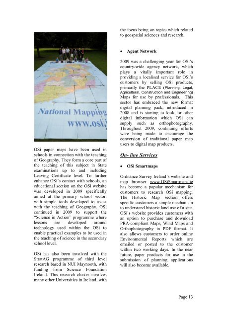
<strong>OSi</strong> paper maps have been used in<br />
schools in connection with the teaching<br />
of Geography. They form a core part of<br />
the teaching of this subject in State<br />
examinations up to and including<br />
Leaving Certificate level. To further<br />
enhance <strong>OSi</strong>‟s contact with schools, an<br />
educational section on the <strong>OSi</strong> website<br />
was developed in <strong>2009</strong> specifically<br />
aimed at the primary school sector,<br />
with simple tools developed to assist<br />
with the teaching of Geography. <strong>OSi</strong><br />
continued in <strong>2009</strong> to support the<br />
“Science in Action” programme where<br />
lessons are developed around<br />
technology used within the <strong>OSi</strong> to<br />
enable practical examples to be used in<br />
the teaching of science in the secondary<br />
school level.<br />
<strong>OSi</strong> has also been involved with the<br />
StratAG programme of third level<br />
research based in NUI Maynooth, with<br />
funding from Science Foundation<br />
<strong>Ireland</strong>. This research cluster involves<br />
many other Universities in <strong>Ireland</strong>, with<br />
<strong>2009</strong> was a challenging year for <strong>OSi</strong>‟s<br />
country-wide agency network, which<br />
plays a vitally important role in<br />
providing a localised service for <strong>OSi</strong>‟s<br />
customers by selling <strong>OSi</strong> products,<br />
primarily the PLACE (Planning, Legal,<br />
Agricultural, Construction and Engineering)<br />
Maps for use by professionals. This<br />
sector has embraced the new format<br />
digital planning pack, introduced in<br />
2008 and is starting to look for other<br />
digital information which <strong>OSi</strong> can<br />
supply such as orthophotography.<br />
Throughout <strong>2009</strong>, continuing efforts<br />
were being made to encourage the<br />
conversion of traditional paper map<br />
users to digital map products.<br />
On- line Services<br />
<strong>OSi</strong> Smartmaps<br />
<strong>Ordnance</strong> <strong>Survey</strong> <strong>Ireland</strong>‟s website and<br />
map browser www.<strong>OSi</strong>Smartmaps.ie<br />
has become a popular mechanism for<br />
customers to research <strong>OSi</strong> mapping.<br />
The Historic Map section offers<br />
specific customers a simple mechanism<br />
to understand historic land use of a site.<br />
<strong>OSi</strong>‟s website provides customers with<br />
an option to purchase and download<br />
PRA-compliant Maps, Wind Maps and<br />
Orthophotography in PDF format. It<br />
also allows customers to order online<br />
Environmental <strong>Report</strong>s which are<br />
emailed or posted to the customer<br />
within two working days. In the near<br />
future, paper products for use in the<br />
submission of planning applications<br />
will also become available.<br />
Page 13