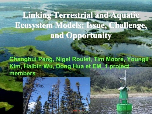
Linking Terrestrial and Aquatic Ecosystem Models ... - EM-1 Project
Linking Terrestrial and Aquatic Ecosystem Models ... - EM-1 Project
Linking Terrestrial and Aquatic Ecosystem Models ... - EM-1 Project

You also want an ePaper? Increase the reach of your titles
YUMPU automatically turns print PDFs into web optimized ePapers that Google loves.
<strong>Linking</strong> <strong>Terrestrial</strong> <strong>and</strong> <strong>Aquatic</strong><br />
<strong>Ecosystem</strong> <strong>Models</strong>: Issue, Challenge,<br />
<strong>and</strong> Opportunity<br />
Changhui Peng, Nigel Roulet, Tim Moore, Youngil<br />
Kim, Haibin Wu, Dong Hua et <strong>EM</strong>_1 project<br />
members
Estimated global fluxes of organic carbon from terrestrial<br />
to aquatic systems:<br />
25%<br />
50%<br />
(Summarized from Lal, 2003; Schimel et al., 2001)
Great Wall<br />
(Jenerette <strong>and</strong> Lal, 2005)
Remove Great Wall<br />
(Jenerette <strong>and</strong> Lal, 2005)
Uncertainty in <strong>Ecosystem</strong> Carbon Budget
Leaching<br />
leaching of dissolved organic carbon (DOC) <strong>and</strong><br />
dissolved inorganic carbon (DIC) to groundwater <strong>and</strong><br />
stream is an important avenue of carbon loss from some<br />
terrestrial ecosystems.<br />
Abut 20% of CO2 produced in artic soils, for example,<br />
leaches to groundwater <strong>and</strong> is released from lakes <strong>and</strong> streams<br />
(Kling et al. 1991, Science).<br />
Despite their importance. Leaching losses of carbon to groundwater<br />
are seldom measured <strong>and</strong> therefore frequently ignored in ecosystems<br />
carbon budgets
DOC is still missing in current<br />
ecosystem carbon budget<br />
DOC is poorly represented in most<br />
terrestrial carbon models<br />
Within forested ecosystem, DOC leaching from the forest floor<br />
<strong>and</strong> organic soil horizons ranges from 10 to 85 g m-2 yr -1<br />
(Neff <strong>and</strong> Asner, 2000)
Disturbance<br />
Disturbance is an episodic cause of carbon loss<br />
from many ecosystems<br />
Fire <strong>and</strong> harvest of plants or peat can be the dominant<br />
Avenues of carbon losses from ecosystems:<br />
Carbon losses during fires in the Canadian boreal forests<br />
= 10 to 30% of average NPP (Harden et al., 2000, GCB)
(fromY. Kim)<br />
Flooded Soil
( From Youngil. Kim)
Modelling objectives:<br />
• To simulate terrestrial <strong>and</strong> aquatic ecosystem CO2 <strong>and</strong><br />
CH4 dynamics under human activity, fire disturbance <strong>and</strong><br />
climate change<br />
• To assess the impacts of reservoirs on the GHG<br />
emission of <strong>EM</strong>_1 region
How Challenge<br />
From empirical model<br />
To process-based model
Model Framework<br />
Empirical model + Process-based model<br />
Coupled model<br />
TRIPLEX Model<br />
<strong>Terrestrial</strong><br />
carbon<br />
simulation<br />
TRIPLE-DOC Model<br />
River<br />
River Model<br />
Hanson Lake Model<br />
Lake<br />
carbon<br />
simulation<br />
Flooded soil Model
TRIPLEX1.0 Framework<br />
Pool:<br />
Process:<br />
Precipitation<br />
Atmospheric CO2<br />
Solar radiation<br />
Moisture<br />
N limitation<br />
GPP<br />
N<br />
Store<br />
C Allocation<br />
Increment<br />
Leafs<br />
C N<br />
Roots Wood<br />
C N C N<br />
Height<br />
Diameter<br />
Soil<br />
water<br />
Temperature<br />
Litter fall<br />
C N<br />
Volume<br />
Basal Area<br />
Structure<br />
Metabolic<br />
Disturbance<br />
N mineralization<br />
C N C N<br />
Mortality<br />
Active (C, N)<br />
Thinning<br />
Runoff<br />
Decomposition<br />
(C, N)<br />
Slow (C, N)<br />
Harvesting<br />
Tree number<br />
Leaching<br />
Passive (C, N)<br />
Wood<br />
production<br />
(Peng et al. 2002)
TRIPLEX Model<br />
C dynamics (monthly)<br />
TRIPLEX-Flux<br />
CO2 Flux (daily)<br />
CO2<br />
Sunlit leaf<br />
Stoma Cell<br />
O2<br />
CO2<br />
Energy<br />
Light<br />
reactions<br />
Calvin<br />
cycle<br />
H2O<br />
Sugar<br />
C<br />
N<br />
Shaded leaf<br />
Water
(Peng, Moore, Hua et al.)
Respiration<br />
Hanson’s s Lake Model<br />
Atmospheric CO 2<br />
Exchange<br />
Respiration<br />
DIC<br />
Photosynthesis<br />
GPP<br />
DOC<br />
Exudation<br />
POC L<br />
Death<br />
POC D<br />
Sedimentation<br />
C S<br />
(Hanson et al., 2004, Global Change Biology)
Lake sub-Model Functions<br />
Primary production:<br />
ln GPP = 0.883 ln TP<br />
Problem: Empirical <br />
(Hanson et al., 2004, Global Change Biology)
Phytoplankton Kinetics<br />
Si Si<br />
NO3<br />
Light<br />
NH3<br />
Phyt<br />
O C:N:P<br />
∂C<br />
∂t<br />
P<br />
= R −R −R C<br />
( )<br />
Where:<br />
G D S P<br />
C p<br />
R G<br />
R D<br />
R S<br />
= growth rate constant (per day)<br />
= death rate constant (per day)<br />
= settling rate constant (per day)<br />
PO 4 PO 4<br />
= phytoplankton carbon concentration (mg/L)<br />
W2 model<br />
(Cole &Wells, 2000)
Phytoplankton<br />
• The growth rate of a population of phytoplankton in a<br />
natural environment:<br />
– is a complicated function of the species of<br />
phytoplankton present<br />
– involves differing reactions to solar radiation,<br />
temperature, <strong>and</strong> the balance between nutrient<br />
availability <strong>and</strong> phytoplankton requirements<br />
• Due to the lack of information to specify the growth<br />
kinetics for individual algal species in a natural<br />
environment,<br />
– this model characterizes the population as a whole by<br />
the total biomass of the phytoplankton present
River sub-Model<br />
STRUCTURE OF LAND-FLUVIAL SYST<strong>EM</strong>S<br />
L<strong>and</strong> Surface Processes (Grid)<br />
River Routing <strong>and</strong> Sediment<br />
Transport Network<br />
Gas Exchange<br />
Upl<strong>and</strong><br />
Surface Water<br />
Riparian/Floodplain<br />
Deposition<br />
Erosion<br />
Floodplain<br />
mineral soil<br />
Water <strong>and</strong> dissolved<br />
Fresh OM<br />
Particulate<br />
River Routing<br />
Reservoirs<br />
Free-Flowing<br />
Estuary/Delta
Respiration<br />
Lake/Reservoir Model<br />
Atmospheric CO 2<br />
Exchange<br />
Watershed<br />
DOC, POC,<br />
DIC<br />
Inflow<br />
Reservoir<br />
Respiration<br />
Lake<br />
DOC<br />
<strong>Terrestrial</strong><br />
DIC<br />
Exudation<br />
Flooded soil<br />
DIC<br />
Photosynthesis<br />
Lake<br />
DIC<br />
GPP<br />
<strong>Terrestrial</strong><br />
DOC<br />
<strong>Terrestrial</strong><br />
POC<br />
Lake<br />
POC L<br />
Outflow<br />
Degradation<br />
Flooded soil<br />
DOC<br />
Flooded soil<br />
POC<br />
Erosion<br />
Death<br />
Lake<br />
POC D<br />
Sedimentation<br />
DOC, POC,<br />
DIC<br />
Flooded<br />
soil<br />
Passive<br />
C pool<br />
Active<br />
C pool<br />
Slow<br />
C pool<br />
Sediment<br />
C pool<br />
(from Haibin Wu, Peng et al)
Regional model: spatial <strong>and</strong> temporal<br />
heterogeneity <strong>and</strong> connectivity at<br />
multiple scales<br />
Forest<br />
DOC<br />
Lake
Flooded soil sub-Model structure<br />
(Sebastian et al., Ecological modeling, submitted)
Another GHG: methane emissions from<br />
lakes<br />
Global emission<br />
is 8-48 Tg/yr,<br />
corresponds to 6-<br />
16% of total<br />
natural methane<br />
emissions <strong>and</strong><br />
greater than<br />
oceanic emission.<br />
(Bastviken et al., 2004, Global Biogeochemical Cycles)
DSS for HQ<br />
Regional Assessments of GHG<br />
(Ongoing Efforts)<br />
Visualization<br />
ArcGIS <strong>and</strong> RS<br />
Prediction of Net GHG Emission<br />
<strong>and</strong> Their Responses to L<strong>and</strong> Use,<br />
Fire <strong>and</strong> Climate Change<br />
Sensitivity<br />
Analysis<br />
Analysis<br />
<strong>Project</strong>ed Changes<br />
Over Space <strong>and</strong> Time:<br />
CO2 <strong>and</strong> CH4<br />
Manag.<br />
Options<br />
<strong>Ecosystem</strong> <strong>Models</strong><br />
Driving<br />
( TRIPLEX, McWM, ICC )<br />
Variables<br />
GIS-Based<br />
Database<br />
Transfer<br />
Government<br />
HQ<br />
Monitoring<br />
Results<br />
Validation<br />
Parameterization<br />
GIS/Oracle<br />
Client Group<br />
Flux Tower, Field Measurements<br />
<strong>and</strong> Site Data<br />
Climate <strong>and</strong> Soil Data<br />
His. L<strong>and</strong>-Use Records<br />
Figure 1. Flowchart of a Decision -Support System (DSS) for Assessing the Effect of L<strong>and</strong> Cover<br />
Changes, Fires <strong>and</strong> Creation of Reservoirs on GHG Emission in Eastmain Region
Summary<br />
Issues:<br />
Leaching –DOC, Fire , Creation of Reservoir, Flooded<br />
Soil<br />
Challenges:<br />
- from empirical to process-based models<br />
-Coupling terrestrial with aquatic models<br />
- spatial <strong>and</strong> temporal heterogeneity <strong>and</strong> connectivity<br />
-scaling up <strong>and</strong> data-model fusion<br />
Opportunities:<br />
-Eastmain project<br />
-DSS<br />
-Others
Acknowledgement:<br />
This project has been supported by<br />
CFCAS <strong>and</strong> HydroQuebec
Model Inputs <strong>and</strong> outputs:<br />
•Inputs<br />
(st<strong>and</strong>, soil, <strong>and</strong> climate conditions)<br />
• Monthly temperature<br />
• Monthly precipitation<br />
• Monthly relative humidity<br />
• Forest age structure<br />
•Outputs<br />
(<strong>Terrestrial</strong> ecosystem: biomass, litter, G&Y,<br />
soilC&N, soil water, C release, GPP, NPP;<br />
<strong>Aquatic</strong> ecosystem: DOC, POC, DIC, CO 2 , CH4)
Lake/Reservoir Model input variables:<br />
Climate data: daily temperature, precipitation, <strong>and</strong> cloud.<br />
Diving variables: Total phosphorus (TP, unit: μg L -1 );<br />
Watershed inflow DOC, POC, <strong>and</strong> PIC (unit: g C m -2 yr -1 );<br />
Outflow DOC, POC, <strong>and</strong> DIC (unit: g C m -2 yr -1 );<br />
Acid-neutralizing capacity (ANC, unit: μEq L -1 );<br />
Watershed area (unit: m 2 );<br />
Lake area to watershed area;<br />
Mean water depth (unit: m).
Lake/Reservoir Model Validation data:<br />
Gross primary production (GPP);<br />
Respiration (R);<br />
Daily-measured NEP (Net ecosystem production of<br />
carbon) of flux;<br />
DOC, POC, <strong>and</strong> PIC in lake;<br />
Percent of DOC, POC, <strong>and</strong> PIC from the terrestrial <strong>and</strong><br />
phytoplankton carbon;<br />
Ration of fooled soil C decomposition (R d<br />
);<br />
Ration of fooled soil C erosion (R e<br />
);<br />
Conversion of POC to DIC (f pd<br />
);<br />
Conversion of DOC to DIC (f dd<br />
);<br />
Death of algae (D).
Soil DOC model Validation data:<br />
• The volumetric soil water content;<br />
• The maximum canopy water storage;<br />
• Soil water flux (vertical, downward);<br />
• DOC concentration in leaching water;<br />
• Sorption <strong>and</strong> desorption rate of DOC.<br />
(Measurements will be preferable if they can be done at soil<br />
layers with the depth of 10, 30, 60, 100 cm, respectively.)
Methane emissions from hydroelectric<br />
reservoirs in tropics<br />
But it is<br />
an empirical<br />
model!<br />
(Corinne et al., 1999, Global Biogeochemical Cycles)
Atmospheric deposition to l<strong>and</strong> surface: 0.1-0.3 Pg DOC yr -1 (Willey et al., 2000)<br />
DOC contained in soil water: 1.1Pg<br />
DOC contained in groundwater: 8.0 Pg<br />
DOC contained in streams <strong>and</strong> lake: 1.1 Pg<br />
Export to the ocean: 0.2-0.6 Pg DOC yr-1<br />
( Ludwig et al., 1996; Moore, 1998)
Model Testing for 2 Flux tower sites<br />
(Fluxnet-Canada)<br />
110 yrs black spruce 75 yrs mixedwood
Model Validation – OBS Flux Tower<br />
0.4<br />
0.3<br />
0.2<br />
0.1<br />
0.0<br />
-0.1<br />
-0.2<br />
-0.3<br />
Field data from NSA-OBS-FLXTR in Jul 1996<br />
NEP<br />
-0.4<br />
183<br />
184<br />
185<br />
186<br />
187<br />
189<br />
190<br />
191<br />
192<br />
193<br />
194<br />
195<br />
196<br />
197<br />
198<br />
199<br />
200<br />
201<br />
202<br />
203<br />
204<br />
205<br />
206<br />
207<br />
208<br />
209<br />
210<br />
211<br />
212<br />
214<br />
g C m -2 30 min -1<br />
Day of year<br />
Daily Simulation using TRIPLEX-Flux
Model Validation – Using OBS Flux Tower<br />
0.4<br />
Simulated NEP (gC /m 2 /30min)<br />
0.2<br />
0<br />
-0.2<br />
R 2 = 0.7304<br />
-0.4<br />
-0.4 -0.2 0.0 0.2 0.4<br />
Observed NEP (gC /m 2 /30min)<br />
Daily Simulation using TRIPLEX-Flux
Boreal Mixedwood Site (Ontario)<br />
0.40<br />
May<br />
0.20<br />
0.00<br />
-0.20<br />
122<br />
123<br />
125<br />
127<br />
129<br />
130<br />
132<br />
134<br />
136<br />
137<br />
139<br />
141<br />
143<br />
144<br />
146<br />
148<br />
150<br />
151<br />
0.4<br />
0.3<br />
0.2<br />
0.1<br />
0<br />
R 2 = 0.77<br />
-0.1<br />
-0.2<br />
-0.2 -0.1 0.0 0.1 0.2 0.3 0.4<br />
Observed NEE (gC m -2 30m in -1 )<br />
Ontario station in 2004<br />
EC (OM W )<br />
Sim ulated NEE<br />
Day of year<br />
NEE (g C m -2 30min -1 )<br />
Simulated NEE (gC m -2 30min -1 )
Comparing NPP Spatial Distribution at L<strong>and</strong>scape Level<br />
(a) TRIPLEX<br />
(Zhou et al, 2005)<br />
(b) Remote Sensing<br />
(Liu et al, 2002)<br />
Fig. 4 The comparison<br />
between NPP (t C ha-1 yr-<br />
1) simulations at<br />
l<strong>and</strong>scape (a) <strong>and</strong> remote<br />
sensing (b) levels for the<br />
LAMF in 1994. (a) was<br />
based on the TRIPLEX<br />
model simulation for 1994<br />
(averaged 3.28 tC ha-1 yr-<br />
1, SD=0.79), <strong>and</strong> (b) was<br />
converted using spatial<br />
data from Liu et al. (2002)<br />
for 1994 (averaged 3.08 tC<br />
ha-1 yr-1, SD=1.15). The<br />
grid size is 3x3 km.<br />
Kappa Statistic (k) = 0.55<br />
Good agreement if 0.55