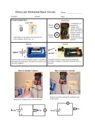
Nautical Charts Worksheet - Teach Engineering
Nautical Charts Worksheet - Teach Engineering
Nautical Charts Worksheet - Teach Engineering

You also want an ePaper? Increase the reach of your titles
YUMPU automatically turns print PDFs into web optimized ePapers that Google loves.
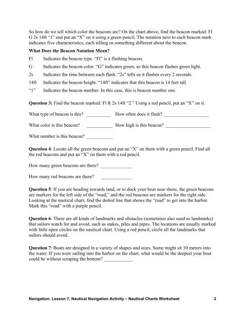
So how do we tell which color the beacons are On the chart above, find the beacon marked: Fl<br />
G 2s 14ft “1” and put an “X” on it using a green pencil. The notation next to each beacon mark<br />
indicates five characteristics, each telling us something different about the beacon.<br />
What Does the Beacon Notation Mean<br />
Fl Indicates the beacon type. “Fl” is a flashing beacon.<br />
G Indicates the beacon color. “G” indicates green, so this beacon flashes green light.<br />
2s Indicates the time between each flash. “2s” tells us it flashes every 2 seconds.<br />
14ft Indicates the beacon height. “14ft” indicates that this beacon is 14 feet tall.<br />
“1” Indicates the beacon number. In this case, this is beacon number one.<br />
Question 3: Find the beacon marked: Fl R 2s 14ft “2.” Using a red pencil, put an “X” on it.<br />
What type of beacon is this __________<br />
How often does it flash ___________________<br />
What color is this beacon<br />
___________ How high is this beacon ___________________<br />
What number is this beacon ___________<br />
Question 4: Locate all the green beacons and put an “X” on them with a green pencil. Find all<br />
the red beacons and put an “X” on them with a red pencil.<br />
How many green beacons are there _____________<br />
How many red beacons are there<br />
_____________<br />
Question 5: If you are heading towards land, or to dock your boat near shore, the green beacons<br />
are markers for the left side of the “road,” and the red beacons are markers for the right side.<br />
Looking at the nautical chart, find the dotted line that shows the “road” to get into the harbor.<br />
Mark this “road” with a purple pencil.<br />
Question 6: There are all kinds of landmarks and obstacles (sometimes also used as landmarks)<br />
that sailors watch for and avoid, such as stakes, piles and pipes. The locations are usually marked<br />
with little open circles on the nautical chart. Using a red pencil, circle all the landmarks that<br />
sailors should avoid.<br />
Question 7: Boats are designed in a variety of shapes and sizes. Some might sit 10 meters into<br />
the water. If you were sailing into the harbor on the chart, what would be the deepest your boat<br />
could be without scraping the bottom ____________<br />
Navigation: Lesson 7, <strong>Nautical</strong> Navigation Activity – <strong>Nautical</strong> <strong>Charts</strong> <strong>Worksheet</strong> 2