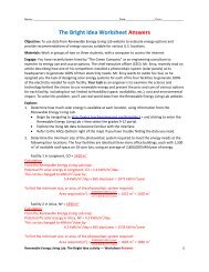
Nautical Charts Worksheet - Teach Engineering
Nautical Charts Worksheet - Teach Engineering
Nautical Charts Worksheet - Teach Engineering

You also want an ePaper? Increase the reach of your titles
YUMPU automatically turns print PDFs into web optimized ePapers that Google loves.
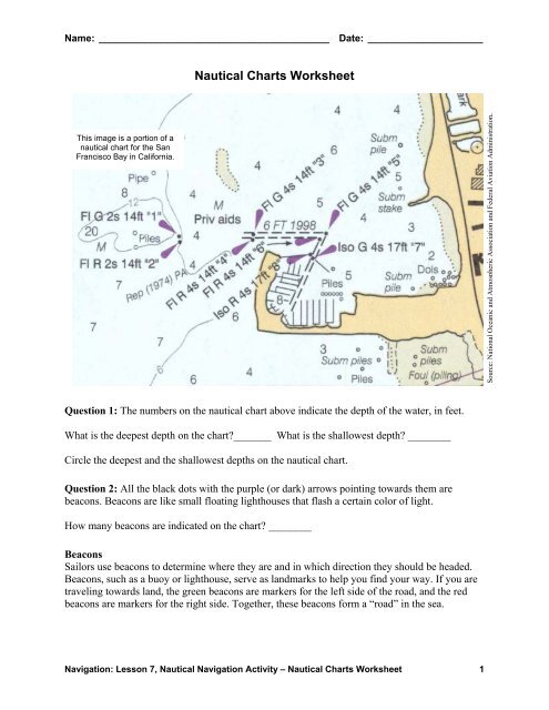
Name: __________________________________________ Date: _____________________<br />
<strong>Nautical</strong> <strong>Charts</strong> <strong>Worksheet</strong><br />
This image is a portion of a<br />
nautical chart for the San<br />
Francisco Bay in California.<br />
Source: National Oceanic and Atmospheric Association and Federal Aviation Administration,<br />
Question 1: The numbers on the nautical chart above indicate the depth of the water, in feet.<br />
What is the deepest depth on the chart_______ What is the shallowest depth ________<br />
Circle the deepest and the shallowest depths on the nautical chart.<br />
Question 2: All the black dots with the purple (or dark) arrows pointing towards them are<br />
beacons. Beacons are like small floating lighthouses that flash a certain color of light.<br />
How many beacons are indicated on the chart ________<br />
Beacons<br />
Sailors use beacons to determine where they are and in which direction they should be headed.<br />
Beacons, such as a buoy or lighthouse, serve as landmarks to help you find your way. If you are<br />
traveling towards land, the green beacons are markers for the left side of the road, and the red<br />
beacons are markers for the right side. Together, these beacons form a “road” in the sea.<br />
Navigation: Lesson 7, <strong>Nautical</strong> Navigation Activity – <strong>Nautical</strong> <strong>Charts</strong> <strong>Worksheet</strong> 1
So how do we tell which color the beacons are On the chart above, find the beacon marked: Fl<br />
G 2s 14ft “1” and put an “X” on it using a green pencil. The notation next to each beacon mark<br />
indicates five characteristics, each telling us something different about the beacon.<br />
What Does the Beacon Notation Mean<br />
Fl Indicates the beacon type. “Fl” is a flashing beacon.<br />
G Indicates the beacon color. “G” indicates green, so this beacon flashes green light.<br />
2s Indicates the time between each flash. “2s” tells us it flashes every 2 seconds.<br />
14ft Indicates the beacon height. “14ft” indicates that this beacon is 14 feet tall.<br />
“1” Indicates the beacon number. In this case, this is beacon number one.<br />
Question 3: Find the beacon marked: Fl R 2s 14ft “2.” Using a red pencil, put an “X” on it.<br />
What type of beacon is this __________<br />
How often does it flash ___________________<br />
What color is this beacon<br />
___________ How high is this beacon ___________________<br />
What number is this beacon ___________<br />
Question 4: Locate all the green beacons and put an “X” on them with a green pencil. Find all<br />
the red beacons and put an “X” on them with a red pencil.<br />
How many green beacons are there _____________<br />
How many red beacons are there<br />
_____________<br />
Question 5: If you are heading towards land, or to dock your boat near shore, the green beacons<br />
are markers for the left side of the “road,” and the red beacons are markers for the right side.<br />
Looking at the nautical chart, find the dotted line that shows the “road” to get into the harbor.<br />
Mark this “road” with a purple pencil.<br />
Question 6: There are all kinds of landmarks and obstacles (sometimes also used as landmarks)<br />
that sailors watch for and avoid, such as stakes, piles and pipes. The locations are usually marked<br />
with little open circles on the nautical chart. Using a red pencil, circle all the landmarks that<br />
sailors should avoid.<br />
Question 7: Boats are designed in a variety of shapes and sizes. Some might sit 10 meters into<br />
the water. If you were sailing into the harbor on the chart, what would be the deepest your boat<br />
could be without scraping the bottom ____________<br />
Navigation: Lesson 7, <strong>Nautical</strong> Navigation Activity – <strong>Nautical</strong> <strong>Charts</strong> <strong>Worksheet</strong> 2