Town Hall Conservation Area - Bolton Metropolitan Borough Council
Town Hall Conservation Area - Bolton Metropolitan Borough Council
Town Hall Conservation Area - Bolton Metropolitan Borough Council

Create successful ePaper yourself
Turn your PDF publications into a flip-book with our unique Google optimized e-Paper software.
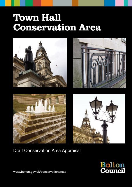
<strong>Town</strong> <strong>Hall</strong><br />
<strong>Conservation</strong> <strong>Area</strong><br />
Draft <strong>Conservation</strong> <strong>Area</strong> Appraisal<br />
www.bolton.gov.uk/conservationareas
CONTENTS<br />
Page<br />
1 Introduction 3<br />
2 Policy Background 3<br />
3 Summary of Special Interest 3<br />
4 Assessing special interest 4<br />
4.1 Location and setting 4<br />
4.2 Historic Development and Archaeology 5<br />
Early <strong>Bolton</strong><br />
<strong>Town</strong> <strong>Hall</strong> area in the 19 th century 6<br />
<strong>Town</strong> <strong>Hall</strong> area in the 20 th century<br />
4.3 Open spaces 9<br />
4.4 Views and vistas 11<br />
4.5 Character and appearance 12<br />
4.6 Character areas 13<br />
4.7 The Qualities of Buildings 15<br />
Listed Buildings<br />
Unlisted buildings 17<br />
4.8 Building materials and features 17<br />
4.9 Public realm: roads and pavements 18<br />
5 Extent of intrusion and damage 20<br />
5.1 Negative aspects 20<br />
5.2 Neutral areas 22<br />
5.3 general condition 22<br />
5.4 pressure for change 23<br />
6 Community involvement 24<br />
7 Suggested <strong>Conservation</strong> <strong>Area</strong> Boundary Changes 25<br />
8 Guidelines for development 25<br />
8.1 New development<br />
8.2 Demolition<br />
8.3 Advertisement control<br />
8.4 Street surfacing and furniture<br />
8.5 Building Materials<br />
8.6 Windows and doors<br />
8.7 Chimneys and roofs<br />
8.8 Rainwater goods<br />
8.9 Boundary walls, gates and railings<br />
8.10 Shop fronts and advertising<br />
July 2008 1
8.11 Minor fixtures and services<br />
8.12 Wheeled bins<br />
8.13 Archaeology<br />
8.14 Interpretation<br />
9.0 References 29<br />
Appendices<br />
1. UDP Policies 30<br />
2. Historic maps 33<br />
3. <strong>Conservation</strong> area appraisal maps 38<br />
Cover illustration: <strong>Bolton</strong> <strong>Town</strong> <strong>Hall</strong> in 1908, from a postcard<br />
(www.boltonrevisited.org.uk)<br />
July 2008 2
TOWN HALL CONSERVATION AREA APPRAISAL<br />
1.0 Introduction<br />
The <strong>Town</strong> <strong>Hall</strong> <strong>Conservation</strong> <strong>Area</strong> is situated in the central part of <strong>Bolton</strong> town centre.<br />
The conservation area is focused on Victoria Square, with the streets to the west.<br />
The purpose of the conservation area appraisal is to reassess the designated <strong>Town</strong> <strong>Hall</strong><br />
<strong>Conservation</strong> <strong>Area</strong>, and to evaluate and record its special interest. As part of this review,<br />
two small extensions to the conservation area are proposed. This review of the<br />
<strong>Conservation</strong> <strong>Area</strong> was undertaken in 2007 by The Architectural History Practice, on<br />
behalf of <strong>Bolton</strong> <strong>Metropolitan</strong> <strong>Borough</strong> <strong>Council</strong>. The appraisal will have an important<br />
function in development control and managing the area, and supplements the guidance<br />
within Building <strong>Bolton</strong> Supplementary Planning Document, published by the <strong>Council</strong> in<br />
2006.<br />
2.0 Policy Background<br />
A conservation area is an “area of special architectural or historic interest, the character<br />
or appearance of which it is desirable to preserve or enhance”, as set out in Section 69<br />
of the 1990 Planning (Listed Buildings and <strong>Conservation</strong> <strong>Area</strong>s) Act 1990. Local<br />
authorities have a duty to designate such areas and to review them, and to use their<br />
planning powers to safeguard and enhance the special qualities of these areas within a<br />
framework of managing change with a positive approach. Designation automatically<br />
entails control over the demolition of unlisted buildings, strengthens controls over minor<br />
development and gives special protection to trees within the area. Policies in the Unitary<br />
Development Plan also guide the <strong>Council</strong>‟s decision-making within <strong>Conservation</strong> <strong>Area</strong>s.<br />
The <strong>Town</strong> <strong>Hall</strong> <strong>Conservation</strong> <strong>Area</strong> was originally designated as part of the <strong>Town</strong> Centre<br />
<strong>Conservation</strong> <strong>Area</strong> in 1987 which was subdivided into three smaller areas in 1996. The<br />
<strong>Town</strong> <strong>Hall</strong> conservation area was last reviewed by <strong>Bolton</strong> <strong>Metropolitan</strong> <strong>Borough</strong> <strong>Council</strong><br />
in the late 1990s.<br />
3.0 Summary of special interest<br />
The focus of the <strong>Conservation</strong> <strong>Area</strong> is the <strong>Town</strong> <strong>Hall</strong> in Victoria Square. This building<br />
dominates the conservation area and the town centre due its scale, mass, architectural<br />
style and the height of the tower, a local landmark. The area also includes the civic<br />
complex on Le Mans Crescent and the partly open area space between here and Black<br />
Horse Street. The conservation area takes in buildings that line all sides of the Square.<br />
Victoria Square was first created as a formal open space for the town‟s market in the<br />
1820s. The area was an attractive location to site the market, as it was close to the<br />
existing market place on Deansgate and Churchgate, and one of the few undeveloped<br />
open spaces in the town centre. Up until the 1820s, the area was covered in orchards<br />
and fields, in an area in the south-west quadrant of the town, in the angle between<br />
Deansgate and Bradshawgate. The square was chosen as the site for the <strong>Town</strong> <strong>Hall</strong>,<br />
built following an architectural competition and opened in 1873. The <strong>Town</strong> <strong>Hall</strong> was<br />
extended in the 1930s as part of the creation of a formal group of civic buildings on Le<br />
July 2008 3
Mans Crescent. The frontages around the square were re-developed for retail or office<br />
use in the 20 th century, and original 19 th century buildings are now rare in this area.<br />
The scale of the majority of buildings in the conservation area is fairly uniform, with<br />
buildings generally no more than 3 or 4 storeys high, allowing the large volume and tall<br />
clock tower of the <strong>Town</strong> <strong>Hall</strong> to visually dominate the area, and indeed much of the<br />
central part of the town. Longer views of the <strong>Town</strong> <strong>Hall</strong> are important from points around<br />
the edge of the town centre, including from Queens Park and gateways into the town<br />
such as Tonge Road, Chorley Old Road and Bury Road.<br />
Within the town centre, the grid street pattern and openness of Victoria Square allows for<br />
a mixture of open and framed views. Views of the <strong>Town</strong> <strong>Hall</strong> across the Square are very<br />
significant, although in summer trees partly obscure the views. Views either side of the<br />
<strong>Town</strong> <strong>Hall</strong> are important towards Le Mans Crescent, and also along Queen Street and<br />
Cheadle Square of the rear of the Crescent, where the high quality of the Le Mans<br />
Crescent buildings extends to the rear elevation. Longer north-south views are possible<br />
along Oxford Street and Newport Street. Views along side streets are terminated by the<br />
mass of the <strong>Town</strong> <strong>Hall</strong>, creating some dramatic framed views of the building.<br />
Most buildings are faced in stone, reflecting the high status of the civic buildings and<br />
also the post-war use of stone cladding. A few buildings have been rendered or painted<br />
on Oxford Street. Roofs are slate or in a variety of sheet cladding materials such as<br />
copper.<br />
The fairly coarse grain of the townscape is the result of the re-development of many<br />
sites with large buildings from the early 20 th century, often occupying whole blocks in<br />
contrast to the finer grain of early 19 th century streets in <strong>Bolton</strong>. Some of this redevelopment<br />
has obscured the historic street pattern; the rear of the <strong>Town</strong> <strong>Hall</strong> was built<br />
over Howell Croft and the west end of Exchange Street was built over at first floor level<br />
by part of the Crompton Place development. Victoria Square is the town centre‟s most<br />
important open space, with a secondary open space west of Le Mans Crescent;<br />
however, this works less well and there may scope for development on part of this area.<br />
Historic street surfaces are important to the character of the conservation area,<br />
particularly on Le Mans Crescent, Howell Croft North and Queen Street, where granite<br />
setts and stone paving have been retained. Elsewhere, streets are surfaced in<br />
tarmacadam with concrete paving. Victoria Square has been re-laid with a combination<br />
of concrete setts and stone paving. with contemporary lighting and seating. There are<br />
some good examples of historic street lamp columns on Cheadle Square. Except for<br />
Black Horse Street and Ashburner Street, vehicular traffic is light due to the large<br />
pedestrianised areas, which are busy with people.<br />
4.0 Assessing Special Interest:<br />
4.1 Location and setting<br />
The <strong>Town</strong> <strong>Hall</strong> conservation area is located on the east side of the town centre, on a<br />
plateau of land defined by the River Croal to the north and east. <strong>Bolton</strong> developed at the<br />
junction of several small rivers, which are tributaries of the River Irwell. The underlying<br />
geology is Carboniferous Sandstone with coal measures, overlain by sands and gravels.<br />
July 2008 4
The conservation area is roughly 300 metres above sea level, on land that generally<br />
slopes to the south towards the railway line and beyond to the Manchester basin.<br />
The conservation area is bounded by Black Horse Street to the west and the east edge<br />
is defined by the properties fronting the west side of Victoria Square. The north side is<br />
bounded by properties fronting the north side of the Square and the south boundary runs<br />
along Ashburner Street and behind properties on the south side of the Square. To the<br />
north is the Deansgate <strong>Conservation</strong> area focused on the Market, and to the east is the<br />
Mawdsley Street conservation area, with Nelson Square. South of Victoria Square is<br />
Newport Street, re-developed along its west side in the 1950s.<br />
<strong>Town</strong> <strong>Hall</strong> <strong>Conservation</strong> <strong>Area</strong> is within the area referred to as The Civic Core in Building<br />
<strong>Bolton</strong> SPD (2006), with the core shopping area within the north, east and south edges<br />
of the conservation area and public buildings to the centre and western side.<br />
4.2 Historic Development and Archaeology<br />
Early <strong>Bolton</strong><br />
Archaeological work in <strong>Bolton</strong> has shown that there were prehistoric settlements in the<br />
area; a Bronze Age burial was found just a quarter of a mile to the south east of the<br />
Church. The church occupies a low promontory site bounded by the River Croal to the<br />
north and east which would have presented an attractive, defensible place to establish a<br />
community, on well-drained sands and gravels. The only evidence for Roman activity in<br />
<strong>Bolton</strong> comes from a fragment of Roman pottery found during recent archaeological<br />
excavations at the site of the former Boar‟s Head Inn on the north side of Churchgate.<br />
Although <strong>Bolton</strong> is not mentioned in Domesday, a settlement almost certainly existed by<br />
then, suggested by the Anglo-Saxon cross found during the construction of St Peter‟s<br />
Church in 1868. The place-name is Old English and means a dwelling or hamlet in an<br />
enclosure, first recorded in the 12 th century. The town was also known as <strong>Bolton</strong>-le-<br />
Moors, referring to its location on the edge of open moorland.<br />
Following the granting of borough status to <strong>Bolton</strong> in 1253, the town‟s burgesses had the<br />
right to build on burgage plots fronting Deansgate and Churchgate. These streets were<br />
the centre of town life from the medieval period to the 18 th century, and provided the site<br />
of the market. A market charter was first granted to William de Ferrers, the Lord of the<br />
Manor by Henry III in 1251, a market cross stood at the junction of Deansgate<br />
Bradshawgate and Churchgate from 1486 until 1786. During most of the medieval period<br />
<strong>Bolton</strong> was principally a market town, with its residents dependent on the surrounding<br />
farmland. Textiles became increasingly important to the prosperity of the town, initially<br />
woollens and later cotton and linen; by the 1530s Leland noted that the market “standeth<br />
most by cottons and coarse yarn”, with fuel coming from coal pits as well from turf. In the<br />
17 th century the town was known for fustian manufacture, a mix of cotton and linen, and<br />
trade supported a growing merchant class. Counter-panes and bed-quilts were<br />
specialities; <strong>Bolton</strong> was renowned for the fine quality of its cotton production.<br />
As there has been no archaeological work undertaken on sites within the conservation<br />
area, little is known about early settlement, medieval or post-medieval activity in the<br />
area. Opportunities for future investigation should be taken whenever sites are<br />
redeveloped in the future.<br />
July 2008 5
During the Civil War in the 1640s, <strong>Bolton</strong> supported Parliament against Charles I and the<br />
Earl of Derby; the town was staunchly protestant and had a growing merchant class. In<br />
1643, following his defeat at Preston, the Earl of Derby unsuccessfully attacked the town<br />
but a third attack in 1644 succeeded and <strong>Bolton</strong> was sacked and burned. The Earl of<br />
Derby was subsequently tried in <strong>Bolton</strong>, and beheaded at the Market Cross on<br />
Churchgate in 1651.<br />
The town grew slowly until the late 18 th century, when the rapidly expanding cotton<br />
industry brought accelerated growth and prosperity to the town. The 1793 map of <strong>Bolton</strong><br />
Appendix 2 shows a layout that was essentially that of the medieval town, with limited<br />
expansion to the south of Deansgate (the River Croal and Little <strong>Bolton</strong> limited<br />
northwards growth). Beyond the edge of the built-up area were orchards, gardens and<br />
meadows. These were developed as the town grew more quickly from the late 18th<br />
Century onwards. At this date, a series of long narrow lanes ran south from Deansgate,<br />
a pattern that reflected the layout of medieval burgage plots. These lanes included<br />
Spring Gardens, Howell Croft, Old <strong>Hall</strong> Street and Oxford Street, and they were later<br />
linked by short east-west lanes including Barn Street, Hotel Street and Ashburner Street.<br />
The old street names reflect the town's rural origins and its later industrialisation.<br />
Ashburner Street was probably so named because it originally led to a number of<br />
engineering works. Barn Street was originally the site of Barn Meadow. Spring Gardens<br />
ran south from Deansgate to Great Moor Street and was the site of gardens, which were<br />
later developed for engineering works. Old <strong>Hall</strong> Street was named after <strong>Bolton</strong>'s first<br />
poor house, The Old <strong>Hall</strong>, which was built by the overseers of Great <strong>Bolton</strong> in 1785.<br />
Howell Croft is probably named after the Howell Family who owned a croft or meadow in<br />
this area at the turn of the 19th Century when the street was first laid out.<br />
<strong>Town</strong> <strong>Hall</strong> conservation area in the 19 th century<br />
In 1810 an area of meadows between Howell Croft and New Acres was acquired as a<br />
new market place, as the medieval market on Deansgate and Churchgate had become<br />
congested. The new market opened in 1826 on a square initially known as New Market<br />
Place, shown on Baines‟ 1824 map (Appendix 2). Oxford Street was cut through from<br />
Deansgate in the early 19 th century to provide access to New Market Place from the<br />
north and Newport Street was laid out from the south, named after Viscount Newport of<br />
the Bridgeman family whose title was conferred in 1815.<br />
Once established, the area around the market became an important focus of commercial<br />
activity. The first <strong>Bolton</strong> Savings Bank opened on Oxford Street in 1818, with an<br />
assembly room, and in 1824, the Exchange Buildings were built on the south-east corner<br />
of the square, designed by Richard Lane in Greek Revival style. The east side of the<br />
square was developed with a long terrace of shops and town houses. Along the north<br />
side of the square ran an east-west street named Barrack Lane on the 1793 map, New<br />
Market Street on Baines‟ 1824 map, and shown as Hotel Street on the 1849 OS map<br />
(Appendix 2). The Victoria and the Commercial Hotels were on this street in the 19 th<br />
century. Throughout the 19 th century, the area west and east of the square was dense<br />
with narrow north-south lanes built-up with terraced workers‟ housing (Fig.2). Between<br />
Black Horse Street and Spring Gardens there was a large foundry, and the 1890s map<br />
(Appendix 2) also shows a tobacco manufacturers between Howell Croft and Old <strong>Hall</strong><br />
Street north of the Square.<br />
July 2008 6
Fig.1: Exchange Buildings, built in 1825<br />
The Square was provided with features to complement its function and civic status. At<br />
the opening of the New Market Place Benjamin Hick, an industrialist, presented a gas<br />
lamp for the centre of the square. His son later donated a circular stone horse trough,<br />
and a public drinking fountain was erected by public subscription, all these features have<br />
been removed, the latter to Queens Park. The market was re-located to the newly built<br />
covered market on Knowsley Street in 1855, although the Square continued to be used<br />
by some market traders and was also popular with travelling fairs. A large wholesale<br />
market opened on the south side of Ashburner Street in 1871.<br />
The town council ran a competition for the design of a new town hall in the 1860s, to<br />
occupy a central position in the market square. The winning design was by the Leeds<br />
architect William Hill, who provided a confident classical design, very similar to Leeds<br />
<strong>Town</strong> <strong>Hall</strong>. The new <strong>Town</strong> <strong>Hall</strong> was opened by the Prince of Wales in 1873, with its<br />
imposing east-facing entrance, and the same year the square was renamed <strong>Town</strong> <strong>Hall</strong><br />
Square. Statues of two prominent <strong>Bolton</strong>ians flank the front of the <strong>Town</strong> <strong>Hall</strong>; the statue<br />
of Dr. Chadwick, a local doctor and prominent benefactor, was unveiled in 1873 and that<br />
of Sir Benjamin Dobson, a cotton and machine manufacturer, and mayor, was unveiled<br />
in February 1900. The Square was re-named Victoria Square in 1897.<br />
Fig.2: Victoria Square, the east side before redevelopment, early 20 th (<strong>Bolton</strong> Archives)<br />
July 2008 7
In the late 19th Century a tram route ran north-south across the square and along<br />
Oxford and Newport Streets, and in later years, the Square operated as a bus terminal<br />
and was a popular starting point for charabanc outings (Fig.2). A public library was built<br />
south of the <strong>Town</strong> <strong>Hall</strong> in 1893, on the site now occupied by the Wellsprings building.<br />
<strong>Town</strong> <strong>Hall</strong> conservation area in the 20 th century<br />
<strong>Bolton</strong>‟s civic pride and the prosperity of the town as the leading cotton town in<br />
Lancashire led to a visionary scheme to create an ambitious civic quarter in the early<br />
20th century. Part of the “Beautiful <strong>Bolton</strong>” scheme promoted by Lord Leverhulme and<br />
developed as a design by the landscape architect Thomas Mawson, the design<br />
envisaged the complete re-planning of the town centre with a wide tree lined boulevard<br />
connecting the front of the <strong>Town</strong> <strong>Hall</strong> to the Parish Church, with another curving<br />
boulevard to Queens Park. This scheme was not pursued, but an alternative civic centre<br />
project was developed from 1931 by the <strong>Borough</strong>, designed by Bradshaw Gass and<br />
Hope, the leading <strong>Bolton</strong> architects. The <strong>Council</strong> acquired the site of a cleared foundry<br />
and housing in 1927. The new civic scheme extended the <strong>Town</strong> <strong>Hall</strong> to the west across<br />
the line of Howell Croft, and created a curved crescent of civic buildings on a new street<br />
to the rear. Complete by 1933 and opened by the Earl of Derby in 1939, the complex<br />
was named Le Mans Crescent in 1974 in honour of <strong>Bolton</strong>'s first twin town in France.<br />
The <strong>Bolton</strong> War Memorial on the east side of Victoria Square was unveiled in 1928; the<br />
arched memorial was designed by Robert McNaught of Bradshaw Gass and Hope. The<br />
shop on the west corner of Oxford Street and Victoria Square was built for the co-op in<br />
1928, also designed by Bradshaw Gass and Hope.<br />
Fig.3: Le Mans Crescent and the <strong>Town</strong> <strong>Hall</strong> extension under construction, early 1930s (photo<br />
from W.E.Brown, 1972)<br />
July 2008 8
Although the historic space of Victoria Square and the <strong>Town</strong> <strong>Hall</strong> remains the focus of<br />
the conservation area, the present appearance and character of the area is largely the<br />
result of re-development in the first half of the 20 th century. The west side of Newport<br />
Street was cleared for new retail development in 1957, and the terrace of former town<br />
houses lining the east side of the square was demolished to make way for retail<br />
development in 1959. The shops were completed as part of the Arndale Centre, now<br />
called Crompton Place, which opened in 1971. The section of Whitakers‟ department<br />
stored facing the Square on the north side of the <strong>Town</strong> <strong>Hall</strong> was built in 1968-69. The<br />
Octagon Theatre, on the south side of the Square, on Howell Croft South dates from<br />
1967.<br />
Fig.4: Victoria Square prior to its closure<br />
to traffic in the early 1960s<br />
(www.boltonrevisted.org.uk)<br />
The pedestrianised character of the square was established in the late 1960s, following<br />
an earlier improvement scheme on the east side of the square. In 1963 the late J.W.<br />
Wigglesworth, a Freeman of the <strong>Borough</strong>, paid for the east side of Victoria Square to be<br />
improved with tree planting, floodlighting and two fountains adjacent to the War<br />
Memorial (Fig.4). In 1969, Oxford Street, Victoria Square and Newport Street North were<br />
closed to traffic, to create <strong>Bolton</strong>'s first pedestrian precinct. The paved area was opened<br />
in 1973 and the scheme won a Civic Trust award. In 1998, extensive environmental<br />
improvements were carried out to the whole of Victoria Square, to upgrade the quality of<br />
<strong>Bolton</strong>‟s most important public space. The work included natural stone paving and<br />
quality concrete setts with new fountains and street furniture including lighting, benches,<br />
litter bins, bollards and banners. The shelter at the north end of Newport Street<br />
incorporates two elephants with castles from the <strong>Bolton</strong> Bleachworks on Chorley Street.<br />
Victoria Square now performs two key urban functions, as a civic space with public<br />
buildings on its western side, and as an important public space within the retail core.<br />
There are some signs that retail activity may not be as viable in this area as in the past,<br />
with the former co-op store, Victoria Plaza currently vacant. The impact of commercial<br />
advertising is intrusive on other premises.<br />
3 Open Spaces<br />
Victoria Square is the focus of the conservation area, the town‟s most significant public<br />
open space. This square is enclosed by the three or four-storey buildings that line the<br />
July 2008 9
sides of the square, with the <strong>Town</strong> <strong>Hall</strong> dominating the west side of the space. The<br />
square is a hard-landscaped area with concrete setts and natural stone paving, with a<br />
small area of formal garden around the War Memorial. The square has mature trees<br />
along the south side in front of the Exchange Building and along the north side. The<br />
trees now appear too close to the Exchange Building and hide this important building in<br />
views from the north and north-west.<br />
The current landscape design of Victoria Square was created in the late 1990s,<br />
providing new seating, lighting and other street furniture in a contemporary design. The<br />
square was first pedestrianised in the 1970s, along with Oxford Street and Newport<br />
Street. The landscaping of these two streets is less well defined and visually, the streets<br />
appear to “leak” out of the square, with poorer quality paving than in Victoria Square.<br />
Oxford Street was chosen as the site for a Hick Hargreaves 1886 steam engine, visible<br />
to the public in a glazed enclosure. The view south down Newport Street is partly<br />
blocked by the modern shelter.<br />
Fig.5: The north side of Victoria Square,<br />
with trees, recent paving and lighting.<br />
The partly open area between Queen Street and Black Horse Street was occupied by<br />
the buildings of the Black Horse Foundry until the end of the 19 th century. Cheadle<br />
Square was laid out in the 1930s and provides an important formal approach to Le Mans<br />
Crescent. Either side are areas of unenclosed open space used as car parks or covered<br />
with grass; these spaces are poorly defined, with scattered 20 th century buildings on the<br />
edges. There are no public facilities other than parking in the space. As the urban grain<br />
is fragmented here, this area would benefit from appropriate new development, whilst<br />
protecting Cheadle Square.<br />
July 2008 10
Fig.6: Green space and 1930s office<br />
west of Queen Street<br />
4.4 Views and vistas<br />
The wide open space of Victoria Square provides open views of the <strong>Town</strong> <strong>Hall</strong>, slightly<br />
obscured by trees, particularly in summer. The linear street pattern and fairly level<br />
topography allows for longer views along Newport Street and Oxford Street. The only<br />
views of the wider <strong>Bolton</strong> area and the West Pennine Moors are northwards from the<br />
southern end of Queen Street and Cheadle Square. There is a view from the north side<br />
of Victoria Square down Oxford Street and Knowsley Street to the towers of the Victoria<br />
<strong>Hall</strong> and the former Church of St. George. The tower of the Victoria <strong>Hall</strong> is also visible<br />
from Old <strong>Hall</strong> Street North and the tower of the Parish Church of St. Peter can be seen<br />
from parts of the Square. The <strong>Town</strong> <strong>Hall</strong> tower can be seen over the roof tops from<br />
many locations around the town centre, with tightly framed views of the building from<br />
nearby side streets such as Coronation Street.<br />
Fig.7: View of the <strong>Town</strong> <strong>Hall</strong> tower<br />
from Newport Street.<br />
The gentle curve of Le Mans Crescent creates an interesting succession of views of the<br />
enclosed townscape at the rear of the <strong>Town</strong> <strong>Hall</strong>. West of Le Mans Crescent, the open,<br />
formal views of the central archways are important from Cheadle Square. Longitudinal<br />
views north and south along Queen Street are more intimate and provide some<br />
July 2008 11
interesting oblique views of the rear of Le Mans Crescent. The openness of the land<br />
west of Le Mans Crescent means that framed views of the civic building are lacking.<br />
Fig.8: View east along Cheadle<br />
Square towards Le Mans Crescent<br />
4.5 Character and appearance<br />
The character of the conservation area is defined by Victoria Square and the imposing<br />
presence of the <strong>Town</strong> <strong>Hall</strong> and civic buildings on Le Mans Crescent. The buildings that<br />
enclose the square are either in retail or civic use, and of differing dates, resulting in<br />
buildings of contrasting appearance. The functional, rather “closed” appearance of the<br />
civic buildings contrasts with the retail premises, where shop frontages have large areas<br />
of window for displays and advertising, which create visually lively frontages.<br />
Fig.9:Crompton Place retail development<br />
on the east side of Victoria Square,<br />
opened in 1971 as the Arndale Centre.<br />
Architecturally, the two groups of buildings differ in terms of quality, with ashlar stone<br />
and fine detailing used on the civic buildings to denote their status. There are a few brick<br />
buildings such as the office on Queen Street (Fig.6) and 19 th century terraced buildings<br />
on Oxford Street, now painted or rendered. Stone cladding is used on the post-war retail<br />
stores, with Portland limestone on Newport Street. Other materials such as copper sheet<br />
are used for mansard roofs.<br />
July 2008 12
Fig.10: Le Mans Crescent in the<br />
mid 20 th century (<strong>Bolton</strong> Archives)<br />
The open public spaces around the <strong>Town</strong> <strong>Hall</strong> contrast with the narrow, enclosed spatial<br />
character of Howell Croft North and Coronation Street which are partly used as service<br />
streets for surrounding buildings. All streets within the area, apart from Queen Street are<br />
well used by pedestrians because they contain a wide variety of shops, services and<br />
leisure facilities. Cheadle Square is an important pedestrian route from the <strong>Town</strong> <strong>Hall</strong><br />
Square area to the bus station and the markets. Vehicular traffic within the conservation<br />
area is light due to the large pedestrianised spaces. Taxis and private cars use Le Mans<br />
Crescent and Ashburner Street for access to the civic buildings and offices. Car parking<br />
is visually dominant in Cheadle Square.<br />
There is no residential property within the conservation area, in contrast to over a 100<br />
years ago.<br />
4.6 Character areas<br />
The conservation area can be divided into two contrasting character areas, Victoria<br />
Square and the streets to the west of Le Mans Crescent .<br />
a) Victoria Square<br />
Victoria Square is the most important public space in <strong>Bolton</strong>, providing the setting for<br />
the <strong>Town</strong> hall. Le Mans Crescent is a fine example of 1930s town planning, the<br />
setted street lined with civic and public buildings, with a retrained, formal character.<br />
The <strong>Town</strong> <strong>Hall</strong> has a strong vertical emphasis with rich detailing in contrast to the<br />
plain architecture and horizontal lines of the retail development on the east, south<br />
and north sides of the square. The square is laid with concrete setts and natural<br />
stone paving with contemporary street furniture, and mature tress are also important.<br />
Some 19 th century buildings survive on Oxford Street, where the fine grain of the<br />
historic townscape is still evident in narrow, 3-storey frontages. This contrasts with<br />
the large 20 th century retail premises on Victoria Square; they have a fairly neutral<br />
presence in the area, due to their restrained style. The Octagon Theatre, on<br />
Ashburner Street, was designed in contrast to the historic context, in a brown brick<br />
with large areas of glazing, but is a distinctive part of the local street scene.<br />
July 2008 13
Fig.11: The Octagon Theatre<br />
b) Ashburner Street and Black Horse Street.<br />
The western part of the conservation area covers an area once densely developed<br />
with workers‟ housing and industry. It is now has a fragmentary character with thinly<br />
developed sites and unenclosed open spaces, but is strongly defined along its east<br />
side by the rear of Le Mans Crescent. The other buildings are of varied function and<br />
scale, mostly of 20 th century date. On Black Horse Street the government building<br />
used as the Job Centre has a large volume and occupies most of a block, in contrast<br />
to the single-storey retail premises on the corner to the south. Main streets are<br />
surfaced in tarmacadam with concrete paving, with stone setts retained on Cheadle<br />
Square and Queen Street.<br />
4.7 The Qualities of Buildings<br />
The <strong>Conservation</strong> <strong>Area</strong> contains two main building types and styles, with retail premises<br />
on Oxford Street and the east and north sides of Victoria Square, and public and civic<br />
buildings to the west of the area. The civic buildings provide some of the highest quality<br />
architecture in the town, using fine ashlar stone and carved decorative details in a<br />
classical style. The <strong>Town</strong> <strong>Hall</strong> was designed to be imposing and its quality, scale and<br />
form ensure that it is an important landmark in <strong>Bolton</strong>.<br />
The commercial buildings are three or four storeys high and the majority are faced in<br />
Portland limestone, glazing or other modern materials. These buildings generally have<br />
horizontal proportions with canopies, flat rooflines and long shop fronts (Fig.9). Some<br />
have been altered at ground floor level with new shop fronts and advertising. A few 19 th<br />
century buildings survive on Oxford Street, originally built as townhouses or hotels.<br />
More recent buildings are of five or six storeys, their bulk being partly disguised by false<br />
mansard roofs clad in slate, lead or copper. The quality of the later 20th Century<br />
buildings varies from the clean lines and strong vertical proportions of the Wellsprings to<br />
visually much less successful buildings of extremely bland design, for example the Job<br />
centre on Black Horse Street.<br />
July 2008 14
Listed Buildings<br />
Five buildings are listed as being of Special Architectural or Historic Interest within the<br />
<strong>Conservation</strong> <strong>Area</strong>.:<br />
<strong>Town</strong> <strong>Hall</strong>, Victoria Square, Grade II*.<br />
The <strong>Town</strong> <strong>Hall</strong> was built between 1866 and 1873 to designs by William Hill of Leeds,<br />
with George Woodhouse of <strong>Bolton</strong>. It was extended in 1938, designed by Bradshaw,<br />
Gass and Hope. The building is faced in ashlar, designed in the form of a Classical<br />
temple with a broad flight of steps up to the pedimented portico. The baroque-style clock<br />
tower gives the building height. The building has a high basement storey with two<br />
principal floors above. On plan there is a central hall lit by a clerestory with offices<br />
forming an outer ring. The relief sculpture in the pediment is by W. Calder Marshall, with<br />
a central figure representing <strong>Bolton</strong> with a crown, shield and the <strong>Borough</strong> arms, flanked<br />
by other figures representing manufacturing and commerce. The central hall was<br />
damaged by fire in 1981 and the Albert <strong>Hall</strong>s have been reconstructed with an inserted<br />
ceiling to form two public halls. The original coffered ceiling with vaulting and the plaster<br />
panelled walls have been reinstated. The 1930s extension provides office space, and<br />
was sensitively designed to match the Victorian building externally, but with plain 1930s<br />
interiors.<br />
Fig.12: 1873 statue of Dr Chadwick<br />
in front of the <strong>Town</strong> <strong>Hall</strong><br />
Nationwide Building Society, Victoria Square, Grade II (Fig.1).<br />
This property was originally built as an exchange and library between 1825-1829 and is<br />
now offices. It is constructed of ashlar with a slate roof. Designed in a Greek Revival by<br />
Richard Lane, the frontage has giant Ionic columns each side of the central bay and the<br />
central entrance has a moulded architrave with a flat entablature. The windows have<br />
fifteen pane sashes with emblems carved in panels above them. The cast-iron street<br />
sign is an important historic feature on the west gable.<br />
Le Mans Crescent, Grade II<br />
Civic buildings constructed in 1932-39, to designs by Bradshaw Gass and Hope on a<br />
formal, slightly asymmetric plan of end pavilions flanking a shallow crescent. The<br />
July 2008 15
complex provides accommodation for the museum, library, health clinics, police station<br />
and courts. The steel-framed building is faced in sandstone ashlar with continuous<br />
parapets to the slate roof. The central triple arches are on an axis with Cheadle Square<br />
to the west.<br />
Statue of Lieutenant Colonel Sir B.A. Dobson, Victoria Square, Grade II.<br />
Fig.13: Queen Street and the west front of<br />
Le Mans Crescent<br />
The statue was sculpted by John Cassidy and consists of a bronze figure standing on a<br />
polished granite plinth. B.A. Dobson (1847-1898) was a manufacturer and mayor of<br />
<strong>Bolton</strong> between 1895 and 1898, and the statue was erected by public subscription.<br />
Chadwick Statue, Victoria Square, Grade II (Fig.12).<br />
This statue of Dr Samuel Chadwick was erected in 1873 and sculpted by C.B. Birch. It<br />
consists of a bronze figure on a stone plinth which has an inset bronze low relief tablet<br />
depicting a seated woman with poor children.<br />
Fig.14: War Memorial with formal garden.<br />
July 2008 16
War Memorial, Victoria Square, Grade II<br />
The War Memorial commemorates the men of <strong>Bolton</strong> who died in the First World War<br />
and dates from 1928, with statues added in 1933. It was designed by Robert McNaught<br />
of Bradshaw Gass and Hope, with sculpture by Walter Marsden. The memorial is in the<br />
form of an arch, faced in white granite ashlar with recesses enclosing a bronze cross,<br />
with bronze figures on each side.<br />
Unlisted buildings which make a positive contribution to the character of the<br />
<strong>Conservation</strong> <strong>Area</strong>.<br />
Victoria Plaza, Victoria Square (Fig.26).<br />
This prominent building on the corner of Oxford Street, Victoria Square and Old <strong>Hall</strong><br />
Street was built as a co-op store in 1928. Its classical design has some similarities with<br />
Le Mans Crescent and it was also designed by Bradshaw Gass and Hope. Faced in<br />
dressed stone, it is three storeys high with a pitched slate roof with dormer windows,<br />
behind a balustraded parapet topped by urns. There is a continuous canopy at ground<br />
floor level, and the windows have metal frames with margin lights. The building is<br />
currently vacant.<br />
No.6 Oxford Street.<br />
This early 19th century building is three storeys high with a rendered frontage and a<br />
pitched slate roof. There are three tall Venetian windows on the first floor with painted<br />
stone surrounds and vertical sliding sash windows. This indicates that the building may<br />
once have been used for functions; assembly rooms are shown on the 1824 map close<br />
to this site. The ground and second floors have been altered.<br />
Fig.15: No. 6 Oxford Street retains early<br />
19 th century windows to first floor,<br />
although the ground floor shop front is<br />
intrusive.<br />
4.8 Building materials and features<br />
Buildings in the conservation area are built of a wide range of materials, with buffcoloured<br />
sandstone being used for the higher status buildings such as the <strong>Town</strong> <strong>Hall</strong><br />
July 2008 17
and le Mans Crescent and also 20 th century retail stores. Early 19 th century buildings on<br />
Oxford Street were built of red brick which has been rendered. Roofs are slate with<br />
modern materials on mansard including metal sheeting.<br />
Fig.16: The 1970s Wellsprings Building<br />
is faced in sandstone ashlar, to<br />
complement The <strong>Town</strong> <strong>Hall</strong>.<br />
Railings and boundary walls are not a common feature in the conservation area, as most<br />
properties are built up to the back of the footway. An exception is the rear of Le Mans<br />
Crescent where panels of good quality steel railings protect the basement area.<br />
Fig.17: 1930s railings on Queen<br />
Street<br />
4.9 Public realm: roads and pavements<br />
Carriageways on Ashburner Street and Black Horse Street are surfaced in tarmacadam,<br />
with large stone setts laid on Le Mans Crescent and north and south of the <strong>Town</strong> hall<br />
extension. These setted surfaces have the benefit of slowing traffic on the street as well<br />
as complementing the architecture and the street scene. On Victoria Square, good<br />
July 2008 18
quality concrete setts were used with natural paving, as part the 1990s enhancement<br />
work in the square.<br />
Fig.18: Granite stone setts on Howell<br />
Croft North, with stone paving and<br />
kerbs; the yellow lines are intrusive<br />
The hard surfacing on Oxford Street is of lesser quality with a mixture of concrete<br />
pavers, now in need or renewal. The footways to Ashburner Street and Black Horse<br />
Street are concrete. Standard red tactile paving has been used to mark pedestrian<br />
crossings. Steel guard railings are used on the front edge of Ashburner Street footways,<br />
probably installed in the 1930s.<br />
Fig.19: concrete paving surfaces on<br />
Oxford Street, now in need of<br />
enhancement<br />
Street furniture that contributes to the street scene includes the 1930s lighting on<br />
Cheadle Square and the Edward VII post box outside the former Exchange Building on<br />
Victoria Square.<br />
July 2008 19
Fig.20: traditional post box outside the<br />
former Exchange Building<br />
5.0 Extent of intrusion and damage<br />
5.1 Negative aspects<br />
Rear yard areas are often hidden from view, but car parking and the management of<br />
waste, particularly wheeled bin storage is increasingly intrusive in views into rear yards<br />
and on some side streets.<br />
Fig.21: The ugly side elevation of a<br />
retail property on Coronation Street,<br />
off the south side of Victoria Square,<br />
wheeled bins are also intrusive here.<br />
Some of the late 20 th century office and retail development in the conservation area has<br />
been harmful to the character of the area and the setting of the <strong>Town</strong> <strong>Hall</strong>. A mediocre<br />
standard of design is the key issue, as the scale and massing of new buildings has often<br />
been appropriate to the context. Examples of poor design for the context include the<br />
Mothercare store on the north east corner of the square and the rear of Whitakers on<br />
Old <strong>Hall</strong> Street. Poor design can be exacerbated by badly sited building services and<br />
surface parking, resulting in unattractive places for pedestrians, and the erosion of the<br />
historic townscape.<br />
July 2008 20
Fig.22: Post-war offices on the east side<br />
of Black Horse Street, with large area<br />
surface car park.<br />
Poor quality alterations to historic buildings, including the rendering of brick elevations<br />
and the installation of modern windows has harmed the character of street frontages, for<br />
example on the east side of Oxford Street. Shop fronts, advertising and security shutters<br />
in inappropriate materials and styles have been installed in a number of properties, and<br />
there is pressure for temporary advertising such as plastic banners. Alterations to<br />
ground floors for large shopfronts have been harmful to the character of the conservation<br />
area in some cases.<br />
Fig.23: Rendered gable and signage to<br />
the one surviving 19 th century terraced<br />
building on Cheapside Square, in the<br />
south–east corner of Victoria Square.<br />
The quality of hard landscaping on some streets is poor and now in need of renewal in<br />
durable, natural or appropriate high quality materials. Surfaces and lighting along Oxford<br />
Street and Ashburner Street are now in need of upgrading, to complement the high<br />
quality surfaces elsewhere in the conservation area. The use of standard double yellow<br />
lines has spoiled the appearance of good quality setts around Le Mans Crescent<br />
(Fig.18). The openness of Victoria Square and its connection to Newport Street has<br />
been eroded by the shelter on Newport Street, and by the amount of poles in the square<br />
July 2008 21
which create visual clutter; excess poles could be removed. The first floor link built over<br />
Exchange Street erodes this part of the street pattern and reduces linkages between the<br />
Victoria Square and the Mawdsley Street conservation area.<br />
Fig.24:The charity shelter at the north<br />
end of Newport Street blocks views<br />
down the street and has an unclear<br />
function<br />
5.2 Neutral areas<br />
Some late 20 th century development has had a neutral impact on the character of the<br />
conservation area due to an appropriate scale and compatible natural facing materials,<br />
although the design quality is modest. The Wellsprings offices south of the <strong>Town</strong> <strong>Hall</strong><br />
and the Job Centre on Black Horse Street are examples of this. The 1960s retail<br />
development on the east and north sides of Victoria Square are neutral in terms of their<br />
scale and form.<br />
5.3 General condition<br />
The condition of historic buildings within the conservation area is generally good, with<br />
most buildings appearing to be in active use and benefiting from regular maintenance.<br />
Exceptions to this are the 1928 former co-op, Victoria Plaza, on Victoria Square/Oxford<br />
Street, which is currently vacant, as is the retail property at No. 6 Oxford Street. This<br />
report has not recorded the extent of upper floor vacancy.<br />
The public realm is generally well maintained, although the paving on Oxford Street and<br />
Newport Street is now in need of enhancement, due to the poor condition and quality of<br />
materials. Traditional stone setts and paving on Le Mans Crescent appears in good<br />
condition, although on one side roads the setts have been covered in tarmac.<br />
July 2008 22
Fig.25: The tarmac laid over stone setts<br />
off the west side of Howell Croft<br />
North could be removed<br />
5.4 Pressure for change<br />
Commercial pressure for highly visible advertising is becoming visually intrusive in some<br />
areas, particularly on principal retail frontages. Changes in retail patterns are causing<br />
increasing vacant space on upper floors and in one notable case, an entire store.<br />
Fig.26: The prominent Victoria Plaza,<br />
built for the co-op in 1928 is currently<br />
empty.<br />
Changes to waste management standards are resulting in large wheeled bins which can<br />
be hard to conceal and intrusive in the street scene, unless easily accessible rear yards<br />
are available.<br />
Disabled access standards mean that some businesses will need to adjust entrances<br />
with steps on some historic buildings, or make other reasonable alterations. In the public<br />
realm, future enhancement schemes will need to comply with the latest standards and<br />
guidance.<br />
The 2007 ban on smoking in enclosed public places and workplaces is likely to generate<br />
a demand for smoking shelters and outdoor seating, which will require careful<br />
management to avoid intrusive new structures.<br />
July 2008 23
6.0 Community involvement.<br />
A publicity leaflet which included a tear out questionnaire was distributed to businesses<br />
and properties within all the <strong>Town</strong> Centre <strong>Conservation</strong> <strong>Area</strong>s. In addition two half day<br />
drop in sessions were held at the library foyer in Le Mans Crescent on 22 nd and 23 rd<br />
January 2008 to provide advice and respond to comments. In total approximately 600<br />
leaflets were distributed. A press release raising awareness of the drop in session was<br />
advertised in the <strong>Bolton</strong> Evening News and the <strong>Conservation</strong> <strong>Area</strong> Appraisals were made<br />
available to view online.<br />
Respondents were asked if they agreed on the boundary extensions, whether they<br />
wished to see more areas protected and to score in terms of importance eight key<br />
recommendations set out in the <strong>Conservation</strong> <strong>Area</strong> Management Plan.<br />
The response rate was low but raised no objections to the boundary extensions. The<br />
Civic Trust were one of the respondents and were generally supportive of all the<br />
<strong>Conservation</strong> <strong>Area</strong> boundary extensions. Some concern was raised regarding constraints<br />
that <strong>Conservation</strong> <strong>Area</strong> status afforded and that the extended areas could not be<br />
afforded adequate protection by the Authority given the investment pressure in some of<br />
these areas.<br />
July 2008 24
7.0 Suggested conservation area boundary changes<br />
No additional areas are recommended for inclusion in the conservation area.<br />
8.0 Guidelines for development<br />
Building <strong>Bolton</strong> provides guidelines for new development in the town centre. However,<br />
opportunities within the conservation area are limited and are most likely to be presented<br />
by small infill and gap sites, or sites where existing buildings have a negative impact on<br />
the character of the area. New development must reflect the character of existing<br />
buildings with respect to siting, scale, proportions, materials and detailing. Applications<br />
for Outline Planning Permission will not be considered unless supported by a masterplan<br />
and a high level of detail. Applications for full planning permission must include a Design<br />
and Access statement that explains the development‟s affect on the character and<br />
appearance of the conservation area, demonstrating that the scheme will be sensitive to<br />
its context, supported by visual images such as photomontages or perspective drawings.<br />
Good quality contemporary design, related to the historic context and character of the<br />
area will be encouraged.<br />
Key factors to take into account are:<br />
consistent building heights, except where punctuated by corner features;<br />
the varied skyline,<br />
the texture of frontages and the balance of windows/recessed openings to solid<br />
wall;<br />
vertical rhythm and the proportion of elevations;<br />
articulation of building elevations;<br />
tightly-developed plots and buildings providing enclosure to streets.<br />
8.2 Demolition<br />
Consent will not usually be given to demolish buildings which make a positive<br />
contribution to the character of the <strong>Conservation</strong> <strong>Area</strong>, unless it can be demonstrated<br />
that the replacement development will bring over-riding community benefits and be of a<br />
high design quality. The criteria in PPG15 and UDP policy will be referred to.<br />
8.3 Advertisement Control.<br />
The Authority will apply high standards when considering applications for Advertisement<br />
Consent in the <strong>Conservation</strong> <strong>Area</strong>. Certain categories of advertisements are not<br />
permitted in <strong>Conservation</strong> <strong>Area</strong>s and discontinuance action will be taken against existing<br />
signs where they do not conform to the guidelines given in Planning Control Policy Note<br />
No.6 - "The Display of Signs and Advertisements". Temporary advertising such as<br />
plastic banners are not acceptable in the conservation area.<br />
July 2008 25
8.4 Street surfacing and furniture<br />
The Public Realm Implementation Framework, adopted by the <strong>Council</strong> in 2007, provides<br />
guidance on design and standards for public realm enhancement, In addition, an audit of<br />
original stone flags, setts and kerbs in the conservation area should be undertaken, and<br />
significant examples retained and relaid where necessary. The potential for repairing<br />
and relaying significant examples of setted streets should be explored, for example on<br />
Oxford Street.<br />
New paving should be in reclaimed or new stone. Concrete flags incorporating an<br />
appropriate aggregate may be acceptable in some locations. Brick paving or black<br />
tarmac should not be used on footways as these materials are not in keeping with the<br />
character of the area.<br />
Historic street furniture such as cast-iron lamp standards should be retained and<br />
repaired, with appropriate light fittings.<br />
New lighting, bins and bollards, highway signage and seating should be designed to<br />
complement the character of the street. The number of separate items should be<br />
minimised to reduce visual clutter and obstacles to disabled people. High quality<br />
contemporary designs will be encouraged where appropriate, as well as more traditional<br />
designs.<br />
8.5 Building Materials<br />
.<br />
Alterations should utilise traditional materials to match those used to construct the<br />
building. These include brick, stone, terracotta, slate, stone flags and clay tiles,<br />
reclaimed local stone, new stone or reconstituted stone.<br />
Strap or ribbon pointing should be avoided since this not only harms the appearance of<br />
the building but can damage the stone or brick by preventing the evaporation of water.<br />
External brick and stone walls should not be painted, rendered or clad in modern<br />
materials.<br />
External cleaning should only be carried out to remove corrosive dirt. Cleaning should<br />
be carried out by a specialist firm under close supervision.<br />
Decorative features including plaques, mouldings and date stones should be retained.<br />
8.6 Windows and doors.<br />
Stone window cills, lintels, door surrounds and stone steps should be retained together<br />
with any original windows and doors.<br />
Any doorways or windows no longer in use should be retained and not blocked up.<br />
Historic joinery should be maintained in good condition and not replaced with modern<br />
imitations.<br />
Owners should be encouraged to use the following styles when replacing windows and<br />
doors:<br />
July 2008 26
For Eighteenth and early Nineteenth Century properties, vertical sliding sash<br />
windows with glazing bars and six-panelled doors.<br />
For late Nineteenth and early Twentieth Century properties, vertical sliding sash<br />
windows and four-panelled doors.<br />
Windows and doors should be made of timber and should be painted. Staining is not a<br />
traditional finish for timber and should not be used. P.V.C.u windows and doors are not<br />
acceptable as they are not in keeping with the character of traditional buildings.<br />
New windows and doors should be recessed to the original depth and should not be<br />
fitted flush with the face of the wall or project from it.<br />
8.7 Chimneys and Roofs.<br />
Chimney stacks should be retained. If rebuilding is necessary this should be in the<br />
same materials used to construct the remainder of the building, this may be brick or<br />
stone with clay pots. Where central heating flues are installed, these should be<br />
contained within the original chimney pot or a traditional replacement.<br />
Roof repairs or replacements should be in natural slate, stone flags or red clay tiles to<br />
match the existing materials. Where ridge tiles need replacing these should be in stone<br />
or clay.<br />
New rooflights may be acceptable but these should be flush fitting and should not be on<br />
prominent roof slopes.<br />
8.8 Rainwater Goods.<br />
Replacement rainwater goods should be in cast iron or moulded aluminium with a black<br />
coating. Plastic rainwater goods are not acceptable.<br />
8.9 Boundary Walls, Gates and Railings<br />
Brick and stone boundary walls, iron railings and gates should be retained and any<br />
repairs carried out using the same materials and methods of workmanship.<br />
8.10 Shop fronts and Advertisements.<br />
The installation of traditional-style painted timber shop fronts will be encouraged on<br />
historic buildings, incorporating the use of stall risers, pilasters and cornices to frame the<br />
shop window. Contemporary shop front designs of high quality will also be encouraged<br />
on appropriate buildings. More detailed guidance can be found in the <strong>Council</strong>‟s<br />
Shopfront Design Guide.<br />
Advertisement consent will not be given for internally illuminated box signs. External<br />
lights and concealed lighting will be encouraged in conjunction with well-designed<br />
signage. Temporary plastic signage such as banners is not appropriate in the<br />
conservation area. Hand painted fascia signs and hanging signs will be encouraged.<br />
July 2008 27
Security shutters should preferably be fixed inside the shop windows and be of a<br />
perforated grille type to allow for a view of the window display. If external shutters are<br />
unavoidable, they should be incorporated into the overall design of the shop front with<br />
the shutter box concealed behind the fascia. The shutter system should be colourcoated<br />
to match the colour of the shop front and the shutters should be perforated.<br />
Externally-fixed shutter boxes which project from the facade of the shop, galvanised<br />
finishes and solid shutters are not in keeping with the character of the <strong>Conservation</strong> <strong>Area</strong><br />
and are not acceptable.<br />
8.11 Minor Fixtures and Services.<br />
Standard external fixtures including satellite dishes, meter boxes, burglar alarms, central<br />
heating flues and security cameras should be sited in unobtrusive positions wherever<br />
possible. They should be colour-coated to match the background materials i.e. walls or<br />
roofs. Air-conditioning units should only be located on hidden, rear elevations.<br />
8.12 Wheeled Bins.<br />
The layout of traditional properties can create difficulties for storing bins. Wherever<br />
possible they should be stored out of sight and not left out on the street or footway<br />
where they can create obstacles for people with disabilities. New development should<br />
incorporate well-designed, discreet bin storage.<br />
8.13 Archaeology<br />
Where there is the potential for archaeology to be discovered on development sites,<br />
appropriate recording or investigation should take place in advance of development, with<br />
the advice of Greater Manchester Archaeological Unit.<br />
8.14 Interpretation<br />
Historic <strong>Bolton</strong> is an interesting place for people who work there, as well as visitors.<br />
Well-designed and carefully sited interpretation boards or plaques can enhance people‟s<br />
enjoyment and understanding and raise awareness of good conservation area<br />
management.<br />
Fig.27: sign boards could be used to<br />
provide interesting information about<br />
the history of the area<br />
July 2008 28
References:<br />
<strong>Bolton</strong> Vision, Building <strong>Bolton</strong>, SPG, 2006<br />
<strong>Bolton</strong> <strong>Council</strong> Environment Department, <strong>Town</strong> <strong>Hall</strong> <strong>Conservation</strong> <strong>Area</strong>, n.d.<br />
(c.1999)<br />
W.E.Brown, <strong>Bolton</strong> As It Was, 1972<br />
C.Hartwell, M.Hyde and N.Pevsner, The Buildings of England, Lancashire:<br />
Manchester and the South-East, 2004<br />
English Heritage, <strong>Conservation</strong> <strong>Area</strong> Appraisals, 2006<br />
English Heritage, Streets for All North West, 2005<br />
Greater Manchester Archaeological Unit, <strong>Bolton</strong>: <strong>Area</strong>s of Archaeological<br />
Interest, 1982 (unpublished)<br />
G. Readyhough, <strong>Bolton</strong> <strong>Town</strong> Centre, A Modern History, 1998<br />
A.Redman, <strong>Bolton</strong> Civic Centre and the Classical Revival Style, in C.Hartwell and<br />
T.Wyke, ed., Making Manchester, 2007<br />
Greater Manchester Sites and Monuments Record, University of Manchester<br />
July 2008 29
APPENDIX 1<br />
Unitary Development Plan<br />
<strong>Conservation</strong> <strong>Area</strong>s<br />
<strong>Conservation</strong> <strong>Area</strong>s represent a significant element of <strong>Bolton</strong>'s architectural and<br />
historical heritage. The council will preserve and enhance these areas through the<br />
control of development and through positive schemes of enhancement. Development<br />
which is allowed should contribute positively to the quality of the environment. The<br />
<strong>Council</strong> is empowered to designate further <strong>Conservation</strong> <strong>Area</strong>s and will consider<br />
designating them as appropriate.<br />
D7. The <strong>Council</strong> will permit development proposals that preserve or enhance the<br />
character or appearance of conservation areas. They should:<br />
(i)<br />
(ii)<br />
(iii)<br />
(iv)<br />
be of appropriate height, size, design, materials, roofscape and plot width;<br />
retain materials, features, trees and open spaces that contribute to the<br />
character or appearance of the conservation area;<br />
utilize appropriate materials for highway and footpath surfacing; and<br />
not adversely affect important views into, and across, a conservation area.<br />
The desirability of preserving or enhancing the character or appearance of <strong>Conservation</strong><br />
<strong>Area</strong>s is prescribed by the Planning (Listed Buildings and <strong>Conservation</strong> <strong>Area</strong>s) Act 1990.<br />
<strong>Conservation</strong> <strong>Area</strong>s represent a significant element of <strong>Bolton</strong>'s architectural and<br />
historical heritage and contribute to local distinctiveness. The <strong>Council</strong> will preserve or<br />
enhance these areas through the control of development and through positive schemes<br />
of enhancement. The number and extent of <strong>Conservation</strong> <strong>Area</strong>s in the <strong>Borough</strong> has<br />
been recently reviewed, with a total of 25 <strong>Conservation</strong> <strong>Area</strong>s within the plan area<br />
(Appendix 3). However, it is possible that further <strong>Conservation</strong> <strong>Area</strong>s might be proposed<br />
during the life of the plan or the boundaries of existing <strong>Conservation</strong> <strong>Area</strong>s reviewed.<br />
This policy outlines some of the elements which the <strong>Council</strong> will take into account when<br />
considering applications in <strong>Conservation</strong> <strong>Area</strong>s.<br />
D8. The <strong>Council</strong> will permit development proposals -<br />
involving the demolition of an unlisted building or feature within a conservation area that<br />
contribute to its character or appearance - provided that the applicant can demonstrate<br />
that:<br />
(i)<br />
(ii)<br />
rehabilitation is impractical and there is no viable new use for the building;<br />
and<br />
redevelopment would produce substantial benefits for the community that<br />
would outweigh the loss resulting from demolition; and<br />
July 2008 30
(iii)<br />
detailed proposals for the reuse of the site, including any replacement<br />
building or other structure, have been approved by the <strong>Council</strong> which<br />
incorporates agreements made to ensure that the replacement works will be<br />
carried out within a specified timescale.<br />
<strong>Conservation</strong> area consent procedures for the demolition of most buildings within a<br />
conservation area are dealt with under Section 74 of the Planning (Listed Buildings and<br />
<strong>Conservation</strong> <strong>Area</strong>s) Act 1990. Under the consent procedures, Engish Heritage must be<br />
notified of all proposals to demolish listed buildings, and allowed access to buildings that<br />
it wishes to record before demolition takes place. For unlisted buildings within a<br />
conservation area, in the case of a demolition proposal the <strong>Council</strong> will in specific<br />
instances condition any consent, requiring recording. There is a general presumption in<br />
favour of retaining buildings and features which make a positive contribution to the<br />
character and appearance of the <strong>Conservation</strong> <strong>Area</strong>. Applicants should refer the<br />
<strong>Conservation</strong> <strong>Area</strong> Character Assessments which identify buildings and features of<br />
particular interest and note.<br />
Demolition of buildings in <strong>Conservation</strong> <strong>Area</strong>s may lead to the creation of „gap sites‟,<br />
which can remain vacant for long periods before redevelopment takes place, damaging<br />
the appearance of the area. It is therefore important that consent should not be given for<br />
demolition unless it is clear that the site will be redeveloped in a way which will preserve<br />
or enhance the character of the area within a a reasonable timescale. Before demolition,<br />
the <strong>Council</strong> will require an assessment to establish whether the building contains a<br />
protected species, such as bats (policy N9).<br />
D9. The <strong>Council</strong> will require proposals for new or replacement shopfronts in<br />
<strong>Conservation</strong> <strong>Area</strong>s to:<br />
(i)<br />
(ii)<br />
(iii)<br />
(iv)<br />
(v)<br />
respect the period and style of the building and relate to it as a whole;<br />
be of a high standard of design, and use appropriate materials;<br />
avoid the use of large expanses of undivided glass;<br />
include historically accurate detailing; where the proposal is of traditional<br />
character; and<br />
retain any features of architectural or historic interest.<br />
Shopfronts can play an important part in establishing the unique character of town<br />
centres. The <strong>Council</strong> will endeavour, through control of development and design advice,<br />
to improve the standard of shopfronts in the <strong>Conservation</strong> <strong>Area</strong>s in particular. Where the<br />
building involved is „listed‟, the introduction of a new shopfront or changes to an existing<br />
one will almost always require Listed Building Consent. Because of the historic and<br />
architectural interest of these areas it will be essential that shopfronts should not conflict<br />
with the style or period of the building, weakening its character and its contribution to the<br />
area as a whole. Equally the quality of the design must be high: poorly proportioned<br />
shopfronts, for example, will detract from the visual quality of the area. Large expanses<br />
of undivided glass are a feature of modern shopfronts, and conflict with the historic<br />
July 2008 31
character of these areas, as well as reducing the interest of the building in order to let<br />
the displayed goods predominate. Applicants should refer to Planning<br />
Control Policy Note 4 – Shopfronts.<br />
July 2008 32
APPENDIX 2<br />
Historic Maps<br />
Fig.28: detail from 1793 map of <strong>Bolton</strong>, showing the <strong>Town</strong> <strong>Hall</strong> area (<strong>Bolton</strong> Archives)<br />
July 2008 33
Fig.29: detail from 1824 map of <strong>Bolton</strong> showing the <strong>Town</strong> <strong>Hall</strong> area (<strong>Bolton</strong> Archives)<br />
July 2008 34
Fig.30: detail from 1847 Ordnance Survey map showing the <strong>Town</strong> <strong>Hall</strong> area (<strong>Bolton</strong><br />
Archives)<br />
July 2008 35
Fig.31: detail from 1893 Ordnance Survey map, showing the <strong>Town</strong> <strong>Hall</strong> area (<strong>Bolton</strong><br />
Archives)<br />
July 2008 36
Fig.32: Detail from 1930 OS map showing <strong>Town</strong> <strong>Hall</strong> area prior to the building<br />
of Le Mans Crescent<br />
July 2008 37
Fig.32: Detail from 1930 OS map showing <strong>Town</strong> <strong>Hall</strong> area prior to the building<br />
of Le Mans Crescent<br />
July 2008 37
Fig.32: Detail from 1930 OS map showing <strong>Town</strong> <strong>Hall</strong> area prior to the building<br />
of Le Mans Crescent<br />
July 2008 37