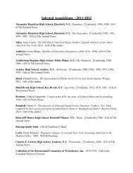
Paul Bourquin Philip.. - Westchester Historical Society
Paul Bourquin Philip.. - Westchester Historical Society
Paul Bourquin Philip.. - Westchester Historical Society

You also want an ePaper? Increase the reach of your titles
YUMPU automatically turns print PDFs into web optimized ePapers that Google loves.
<strong>Paul</strong> <strong>Bourquin</strong> <strong>Philip</strong>sburg<br />
Manor Collection<br />
<strong>Paul</strong> A. <strong>Bourquin</strong> (1921-2013) was a resident of Pleasantville, New York, and served as<br />
Treasurer of the Mount Pleasant <strong>Historical</strong> <strong>Society</strong>. Among <strong>Paul</strong>’s research interests was the<br />
history of Philispburg Manor, particularly the disposition of the tenant farms after the conclusion<br />
of the Revolutionary War. Using a variety of sources, <strong>Paul</strong> created a series of maps showing the<br />
location of the manor’s tenant farms as they relate to present-day <strong>Westchester</strong> County. He began<br />
with the 1880 map of <strong>Philip</strong>sburg Manor produced by M.K. Couzens. Using abstracts of deeds<br />
for the individual farms, <strong>Paul</strong> double-checked all of Couzens’ boundaries, which he found were<br />
generally correct, and created spreadsheets with information regarding each of the properties.<br />
He also assigned a number to each farm, which he used on the spreadsheets and the map.<br />
<strong>Paul</strong> brought his maps to the annual Pleasantville Day celebration, where visitors could<br />
identify which farm they lived on. He also gave presentations on his research to local<br />
organizations. In 2011 he permitted the <strong>Westchester</strong> County <strong>Historical</strong> <strong>Society</strong> to make copies<br />
of his material. The <strong>Westchester</strong> County Department of Information Technology scanned one of<br />
<strong>Paul</strong>’s maps and created an overlay atop an aerial photo of <strong>Westchester</strong> County.<br />
<strong>Paul</strong> died on January 1, 2013. His children donated his research material to the<br />
<strong>Westchester</strong> County <strong>Historical</strong> <strong>Society</strong> on April 3, 2013.<br />
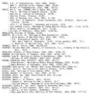
FILE BOX<br />
Folder 01 – Numerical key to tract number of farms existing in <strong>Westchester</strong> at the end of<br />
the Revolutionary War that were sold from the estate of Frederick <strong>Philip</strong>se. Arranged by<br />
map number. Contains information on each parcel of land including Grantee Purchaser, Tenant<br />
or Occupant Prior to Purchase, Purchase Date, Purchase Price, Acreage, and 1776 Manor Rent<br />
Roll Information. Prepared by <strong>Paul</strong> <strong>Bourquin</strong>.<br />
Folder 02 – Alphabetic key to tract number of farms existing in <strong>Westchester</strong> at the end of<br />
the Revolutionary War that were sold from the estate of Frederick <strong>Philip</strong>se. Arranged by<br />
Grantee Purchaser. Contains Tenant or Occupant Prior to Purchase, Purchase Date, Purchase<br />
Price, Acreage, and 1776 Manor Rent Roll Information. Prepared by <strong>Paul</strong> <strong>Bourquin</strong>.<br />
Folder 03 – Alphabetic Couzens index. Alphabetic arrangement of pre-war occupants and<br />
postwar purchasers of parcels. Prepared by <strong>Paul</strong> <strong>Bourquin</strong>.<br />
Folder 04 – Alphabetical index of occupants prior to purchase. Prepared by <strong>Paul</strong> <strong>Bourquin</strong>.
Folder 05 – Abstracts of sales by the Commissioners of Forfeitures in the Southern District<br />
of New York State. Copies of abstracts copied by Theresa Hall Bristol for the New York<br />
Genealogical and Biographical Record, 1928-1929.<br />
Folder 06 – Rent roll of Colonel Frederick <strong>Philip</strong>se’s estate. Prepared by <strong>Paul</strong> <strong>Bourquin</strong> from<br />
The Loyalist Americans by Robert A. East and Jacob Judd.<br />
Folder 07 – The disposition of Loyalist estates in <strong>Westchester</strong> County. Copies of articles by<br />
Harry B. Yoshpe that appeared in The <strong>Westchester</strong> Historian.<br />
Folder 08 – Boundaries of farms existing in <strong>Westchester</strong> at the end of the Revolutionary<br />
War in Mount Pleasant and Ossining that were sold from the estate of Frederick <strong>Philip</strong>se.<br />
Prepared by <strong>Paul</strong> <strong>Bourquin</strong>.<br />
Folder 09 – List of tenants on Upper Manor in 1779.<br />
Folder 10 – Abstracts of deeds from <strong>Westchester</strong> County land records.<br />
Folder 11 – Alphabetical list of tenants on the Manor of <strong>Philip</strong>sburg. Taken from rent rolls<br />
for 1760, 1777, 1778, 1779, 1780, 1780s.<br />
Folder 12 – Purchaser information, Commissioners of Forfeiture sales, 1783-1788. Index to<br />
journal kept by the Commissioners of Forfeiture and held by the <strong>Westchester</strong> County Archives<br />
(Series 35).<br />
Folder 13 – Photocopies of maps used by <strong>Paul</strong> <strong>Bourquin</strong> in his research.<br />
Folder 14 – Notes from presentations on <strong>Philip</strong>sburg Manor by <strong>Paul</strong> <strong>Bourquin</strong>.<br />
Folder 15 – Miscellaneous historical information regarding <strong>Philip</strong>sburg Manor.<br />
Folder 16 – Miscellaneous notes by <strong>Paul</strong> <strong>Bourquin</strong>.<br />
MAP BOX 1<br />
Map 01 – Mount Pleasant street map with overlay of <strong>Philip</strong>sburg Manor tenant farms. 13.5” x<br />
17”<br />
Map 02 – Map of the upper part of the Manor of <strong>Philip</strong>sburg showing tenant farms with numbers<br />
assigned by <strong>Paul</strong> <strong>Bourquin</strong>. 20” x 21”<br />
Map 03 – A plan of the Manor of <strong>Philip</strong>sburg in the County of <strong>Westchester</strong> in the State of New<br />
York surveyed agreeable to the order and instructions of Isaac Stowsenburg & P.H. V. Cortlandt<br />
unto John Hill, 1785. Photocopy, 12.5” x 20”
Map 04 – Mount Pleasant and Ossining street maps with overlay of <strong>Philip</strong>sburg Manor tenant<br />
farms. 20” x 28”<br />
Map 05 – Street map of southwest <strong>Westchester</strong> County with overlay of <strong>Philip</strong>sburg Manor<br />
tenant farms in the Bronx, Greenburgh and Yonkers. 20” x 30”<br />
Map 06 – Map of the upper part of the Manor of <strong>Philip</strong>sburg showing tenant farms with numbers<br />
assigned by <strong>Paul</strong> <strong>Bourquin</strong>. Rolled, two copies, 39” x 30”<br />
Map 11 – Map of the Manor of <strong>Philip</strong>sborough in the County of <strong>Westchester</strong>, N.Y. Compiled<br />
from original sources by O[tto]. Hufeland with the names of occupants in 1779. Based on John<br />
Hill’s map made for the Commissioners of Forfeiture. Rolled, 18” x 30.5”<br />
MAP BOX 2<br />
Map 07 – Map of the lower part of the Manor of <strong>Philip</strong>sburg showing tenant farms with numbers<br />
assigned by <strong>Paul</strong> <strong>Bourquin</strong>. Adapted from Map of part of the Manor of <strong>Philip</strong>sburgh in the<br />
County of <strong>Westchester</strong>, N.Y., by M.K. Couzens. Rolled, 30” x 54”<br />
Map 08 – Map of the lower part of the Manor of <strong>Philip</strong>sburg showing tenant farms with numbers<br />
assigned by <strong>Paul</strong> <strong>Bourquin</strong>. Adapted from Map of part of the Manor of <strong>Philip</strong>sburgh in the<br />
County of <strong>Westchester</strong>, N.Y., by M.K. Couzens. Rolled, 28” x 44”<br />
MAP BOX 3<br />
Map 09 – Map of the lower part of the Manor of <strong>Philip</strong>sburg overlaid on an aerial photo of<br />
<strong>Westchester</strong> County. Rolled, 36” x 44”<br />
Map 10 – Map of the lower part of the Manor of <strong>Philip</strong>sburg overlaid on an aerial photo of<br />
<strong>Westchester</strong> County. Rolled, 25” x 44”