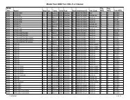
Notice of Intent - TCEQ e-Services - Texas.gov
Notice of Intent - TCEQ e-Services - Texas.gov
Notice of Intent - TCEQ e-Services - Texas.gov

Create successful ePaper yourself
Turn your PDF publications into a flip-book with our unique Google optimized e-Paper software.
Provide the name <strong>of</strong> the site as known by the public in the area where the site is located. The name you provide on this application will be<br />
used in the <strong>TCEQ</strong> Central Registry as the Regulated Entity. An RN will be assigned by Central Registry if this site is not currently<br />
regulated by <strong>TCEQ</strong>.<br />
Site/Project (RE) Physical Address<br />
Enter the complete address <strong>of</strong> where the site is located. This address must be validated through US Postal Service. If the physical address<br />
is not recognized as a USPS delivery address, you may need to validate the address with your local police (911 service) or through an<br />
online map site used to locate a site. Please confirm this to be a complete and valid address. Please do not use a rural route or post <strong>of</strong>fice<br />
box for a site location.<br />
If a site does not have an address that includes a street (or house) number and street name, enter NO ADDRESS for the street name. Then<br />
provide a complete written location access description. For example: AThe site is located 2 miles west from intersection <strong>of</strong> Hwy 290 &<br />
IH35, located on the southwest corner <strong>of</strong> the Hwy 290 South bound lane.@<br />
Provide the city and zip code <strong>of</strong> the area where the facility is located.<br />
Latitude and Longitude<br />
Enter the latitude and longitude <strong>of</strong> the site in either degrees, minutes, and seconds or decimal form. For help obtaining the latitude and<br />
longitude, go to: www.tceq.texas.<strong>gov</strong>/gis/drghelp.html#Latlong or http://msrmaps.com/advfind.aspx<br />
Description <strong>of</strong> Activity Regulated<br />
In your own words, briefly describe the primary business that you are doing that requires this authorization. Do not repeat the SIC Code<br />
description.<br />
F. GENERAL CHARACTERISTICS<br />
1. Complete the questions to determine if eligible for coverage under the general permit. If answers indicate the discharge is not eligible<br />
coverage will be denied.<br />
2. Indian Country Lands<br />
If your site is located on Indian Country Lands, the <strong>TCEQ</strong> does not have authority to process your application. You must obtain<br />
authorization through EPA, Region VI, Dallas. Do not submit this form to <strong>TCEQ</strong>.<br />
3. Standard Industrial Classification (SIC) code<br />
Provide the SIC code that best describes the activity at the site. You may determine the SIC code from the following web site:<br />
www.osha.<strong>gov</strong>/oshstats/sicser.html.<br />
4. Indicate if the NOI is being submitted due to a change in permittee(s).<br />
5. Discharge Information<br />
a. Identify the water body where the discharge or potential discharge will reach.<br />
b. Identify the classified segment number (Required). Go to the link to find the segment number <strong>of</strong> the classified water body where<br />
wastewater will flow http://www.tceq.texas.<strong>gov</strong>/compliance/monitoring/water/quality/data/wqm/viewer/viewer.html .<br />
c. Provide a complete description <strong>of</strong> the discharge route from the point(s) <strong>of</strong> discharge to the nearest classified segment.<br />
For assistance, you may call the technical staff at 512/239-4671.<br />
6. Edwards Aquifer Rule<br />
If the answer is Yes, the discharge or potential discharge is within the Recharge Zone, Contributing Zone, within the Contributing Zone<br />
within the Transition Zone <strong>of</strong> the Edwards Aquifer, or zero to 10 (0 to 10) miles upstream <strong>of</strong> the Recharge Zone <strong>of</strong> the Edwards Aquifer, a<br />
site specific authorization approved by the Executive Director under the Edwards Aquifer Protection Program (30 TAC Chapter 213) is<br />
required.<br />
See maps on the <strong>TCEQ</strong> website at http://www.tceq.texas.<strong>gov</strong>/compliance/field_ops/eapp/viewer.html to determine if the site is located<br />
within either <strong>of</strong> these zones.<br />
7. DMR Contact<br />
Provide the name and mailing address <strong>of</strong> the person responsible for receiving and submitting DMRs. The preprinted DMRs will be<br />
provided by the <strong>TCEQ</strong> Enforcement Division unless you chose to submit electronically.<br />
Submit data On Line…..<br />
Submit on line through eDMR system.<br />
Go to Sign up now at https://www6.tceq.texas.<strong>gov</strong>/steers/<br />
Establish an electronic reporting account when you get your permit number.<br />
G. CERTIFICATIONS<br />
Failure to indicate AYes@ to ALL <strong>of</strong> the certification items may result in denial <strong>of</strong> coverage under the general permit.<br />
The certification must bear an original signature <strong>of</strong> a person meeting the signatory requirements specified under 30 <strong>Texas</strong> Administrative<br />
Code (TAC) §305.44.<br />
<strong>TCEQ</strong> 20190-Instructions (revised 09/01/2010) Page 5