

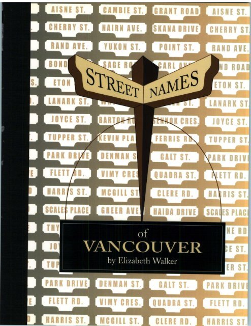
Street_Names_of_Vancouver
Street_Names_of_Vancouver
Street_Names_of_Vancouver

Create successful ePaper yourself
Turn your PDF publications into a flip-book with our unique Google optimized e-Paper software.
V A N C O U V E R<br />
by Elizabeth Walker
STREET NAMES<br />
OF<br />
VANCOUVER<br />
RY<br />
ELIZARETH WALKER<br />
©<br />
V a n c o u v e r H i s t o r i c a l S o c i e t y
Distributed by Gordon Soules Book<br />
Publishers Ltd. • 1359 Ambleside Lane,<br />
West <strong>Vancouver</strong>, BC, Canada V7T ">Y9<br />
• PMB 620, 1916 Pike Place #12<br />
Seattle, WA 98101-1097 US<br />
E-mail: books@gordonsoules.com<br />
Web site: http://www.gordonsoules.com<br />
(604) 922 6588 Fax: (604) 688 5442<br />
Copyright © 1999 by <strong>Vancouver</strong> Historical Society<br />
All rights reserved. No part <strong>of</strong> this book may be reproduced or transmitted in any form or by any<br />
means, electronic or mechanical, including photocopying, recording, or by an information storage and<br />
retrieval system, without permission in writing from the publisher. Permission is given for brief excerpts<br />
to be published with book reviews in newspapers, magazines, newsletters, and catalogs.<br />
<strong>Vancouver</strong> Historical Society<br />
PO Box 3071<br />
<strong>Vancouver</strong>, British Columbia V6B 3x6.<br />
Canadian Cataloguing in Publication Data<br />
Walker, Elizabeth<br />
<strong>Street</strong> <strong>Names</strong> <strong>of</strong> <strong>Vancouver</strong><br />
Includes bibliographic references and maps.<br />
ISBN O-9692378-7-I : (PBKS.) $24.95<br />
1. <strong>Street</strong> <strong>Names</strong>- British Columbia- <strong>Vancouver</strong><br />
2. <strong>Vancouver</strong> (BC)- History.<br />
I. <strong>Vancouver</strong> Historical Society II. Title<br />
Fc3847.67.w341999 971.133 C99-9°°358-5<br />
F1089.5V22W341999<br />
<strong>Street</strong> <strong>Names</strong> <strong>of</strong> <strong>Vancouver</strong> by Elizabeth Walker<br />
Editing and colour maps: Bruce Macdonald<br />
Production management and design: Carlyn Craig<br />
Cover design: Teresa Gustafson<br />
Copy-editing: Joanne Richardson<br />
Printing and binding by Hignell Printing Ltd.<br />
Printied and bound in Canada<br />
Published with the assistance <strong>of</strong> the Government <strong>of</strong> British Columbia through the British Columbia<br />
Gaming<br />
Commission.<br />
To order single copies <strong>of</strong> <strong>Street</strong> <strong>Names</strong> <strong>of</strong> <strong>Vancouver</strong>, mail $24.95 f° r e a c n s<strong>of</strong>tbound edition (Canadian<br />
residence add $1.61 GST) plus $5 each for shipping to: <strong>Vancouver</strong> Historical Society, PO Box 3071,<br />
<strong>Vancouver</strong>, BC, Canada V6B 3x6.<br />
Booksellers: Retail discounts are available from Gordon Soules Book Publishers Ltd.<br />
Tel: (604) 688-5466 or (604) 922-6588; Fax (604) 688-5442; Email: books@gordonsoules.com<br />
PRINTED IN CANADA<br />
First printing, April 1999. / 1
Contents<br />
Acknowledgements<br />
Abbreviations and Explanatory Notes<br />
Introduction<br />
vi<br />
viii<br />
xi<br />
<strong>Street</strong> <strong>Names</strong> <strong>of</strong> <strong>Vancouver</strong> 3<br />
The <strong>Street</strong> Numbering System 135<br />
Select Bibliography: Articles, Books, and Theses 141<br />
Directories 143<br />
Select Bibliography: Maps 145<br />
<strong>Street</strong> Name Maps<br />
<strong>Street</strong> <strong>Names</strong> 1870-1899 78-9<br />
<strong>Street</strong> <strong>Names</strong> Within 1900-1929 80-1<br />
<strong>Street</strong> <strong>Names</strong> 1930-1999 82-3<br />
Inset Maps (1930-1999) 84<br />
Index to <strong>Street</strong> <strong>Names</strong> 1930-1999 85
Acknowledgements<br />
This book, like all books, owes its existence to the help, encouragement, and work <strong>of</strong> many<br />
people.<br />
My first thanks to to the staff <strong>of</strong> the City <strong>of</strong> <strong>Vancouver</strong> Archives, who unfailingly assisted me and<br />
introduced me to the arrangement <strong>of</strong> civic records. My endless requests to see South <strong>Vancouver</strong> Voters<br />
Lists were patiently met.<br />
The staff <strong>of</strong> the <strong>Vancouver</strong> Public Library, particularly the Special Collections Division, maintained<br />
its record for good service.<br />
Confronted with the technicalities <strong>of</strong> land surveys, I turned for help to Noel Peters, <strong>Vancouver</strong> City<br />
Surveyor. He and his staff, especially Paul Neely and Jean Yamashita, explained the system and located<br />
various surveys. The staff at the Land Titles Office in New Westminster unearthed many early surveys<br />
for my perusal.<br />
Bruce Macdonald edited my text, gathered photographs, and prepared the maps. While preparing<br />
the maps he clarified ambiguities in my text and identified the location <strong>of</strong> several streets - a great<br />
contribution to this reference work.<br />
Peggy Imredy, co-author <strong>of</strong> my article on Kitsilano street names, prodded me to continue my research,<br />
as did Gordon Elliott. Helen and Philip Akrigg's work on British Columbia place names provided me<br />
with an excellent example to follow.<br />
I am grateful that the executive and members <strong>of</strong> the <strong>Vancouver</strong> Historical Society had sufficient<br />
faith in the value <strong>of</strong> my reseach to undertake its publication. Adrian Clark deserves special mention<br />
for all his work in organizing the casino night, obtaining the production manager, and chairing the<br />
publications committee. Thanks are extended to Robert McDonald and Nancy Stubbs, members <strong>of</strong><br />
this committee. I applaud Jean Barman, Chuck Davis, Yvonne Klan, Cyril Leon<strong>of</strong>f, Bruce Macdonald,<br />
Kathleen Mackinnon, Nancy Stubbs, and John Spittle who toiled long hours at the casino night granted<br />
by the British Columbia Gaming Commission. Through their efforts sufficient funds were raised to<br />
publish this book.<br />
Teresa Gustafson ably converted nebulous ideas into an attractive cover design, and Jerry Eberts<br />
patiently turned a rough draft into a preliminary manuscript.<br />
Last, but not least, Carlyn Craig, production manager and designer, brought her enthusiasm, interest,<br />
and knowledge to bear upon the task <strong>of</strong> putting my research into a publishable format.<br />
Elizabeth Walker<br />
VII
Abbreviations and<br />
Explanatory Notes<br />
BCER<br />
CPR<br />
CVA<br />
D L<br />
OGT<br />
T H S L<br />
British Columbia Electric Railway<br />
Canadian Pacific Railway<br />
City <strong>of</strong> <strong>Vancouver</strong> Archives<br />
District Lot<br />
Old Granville Townsite<br />
Townsite <strong>of</strong> Hastings Suburban Lands<br />
Plan with numbers only (e.g., Plan 3845) refers to a registered survey plan for land in Group 1, New<br />
Westminster Land District, and held in Land Registry Office, New Westminster<br />
Plan with an alphabetical prefix (e.g., Plan LE 3742B) refers to a marginally numbered working plan <strong>of</strong><br />
the <strong>Vancouver</strong> Engineering Department. Those referred to in the text are in City Surveyor's Office,<br />
<strong>Vancouver</strong> City Hall. Many are attached to individual street-naming by-laws.<br />
IX
Introduction<br />
My interest in the 773 current <strong>Vancouver</strong> street names and the 400 that have fallen into disuse<br />
was piqued by the many questions people asked me about them when I was working in the<br />
North West History collection at the <strong>Vancouver</strong> Public Library. Though not always successful,<br />
I would do my best to locate streets with unknown names or differentiate between the various<br />
"Boundary" streets or "Victoria" streets. Little did I know what byways my research would lead me<br />
into or how much I'd learn about surveys and other technical aspects <strong>of</strong> street naming. Because surveys<br />
are the basis <strong>of</strong> street patterns, one needs to know a bit <strong>of</strong> history about them.<br />
In 1858, apart from the Hudson's Bay Company post at Fort Langley, New Westminster was the only<br />
non-Native settlement in the Lower Mainland. But by December 1859 people were seeking land on<br />
Burrard Inlet. Anticipating possible development, around i860 the colonial government created a<br />
reserve for a townsite near the Second Narrows <strong>of</strong> Burrard Inlet, later known as Hastings Townsite.<br />
In 1863, under instructions from Colonel Moody, George Turner (a Royal Engineer) made the first<br />
survey on the inlet. Beginning at the Townsite reserve, he surveyed westerly along the south shore,<br />
laying out District Lots (DLs) 184,183,182,181,185, and a townsite that appears to have included the<br />
original naval reserve in the vicinity. District Lot map (Map no. 14258) <strong>of</strong> <strong>Vancouver</strong> shows the<br />
original parcels <strong>of</strong> land in the shape in which they were granted by the Crown.<br />
Between the 1860s and the arrival <strong>of</strong> the Canadian Pacific Railway (CPR) at <strong>Vancouver</strong> in 1887,<br />
speculation in these District Lots was rampant. Bruce Macdonald, author <strong>of</strong> <strong>Vancouver</strong>: An Illustrated<br />
History, indicates the wheeling and dealing that went on and the changing ownership <strong>of</strong> these various<br />
District Lots. The names <strong>of</strong> many <strong>of</strong> these property owners (such as Dunlevy and Vernon) were<br />
perpetuated when streets were surveyed and street names assigned. <strong>Street</strong>s were also named after<br />
Oppenheimer, Barnard, Dupont, Powell, Keefer, Harris, Jackson, and Prior - all shareholders <strong>of</strong> the<br />
<strong>Vancouver</strong> Improvement Company, which owned DL 196.<br />
Although he was only here two years, Lauchlan Hamilton, the CPR'S surveyor and, later, a land<br />
commissioner, is considered to be the "father" <strong>of</strong> <strong>Vancouver</strong>. His detailed plans shaped the layout <strong>of</strong><br />
much <strong>of</strong> the city, especially the downtown peninsula. He served on the city council in 1886 and 1887<br />
and proposed the creation <strong>of</strong> Stanley Park.<br />
In surveying <strong>Vancouver</strong> he faced two problems. First, he had to reconcile existing streets in the old<br />
Granville townsite and in DL 185, the future West End, with streets he'd created in DL 541. Second, he<br />
had to name a great many streets in a hurry.<br />
A Plan for the City <strong>of</strong> Liverpool, Burrard Inlet, DL 185, Group 1, New Westminster District (Plan no. 92)<br />
had been deposited in the Land Registry Office in 1882 by the owners, the so-called "Three Greenhorns"<br />
- Samuel Brighouse, William Hailstone, and John Morton. Hamilton planned to extend the eastwest<br />
streets in DL 541 into DL 185, but one <strong>of</strong> the owners, a Mr. Spratt, had had a disagreement with<br />
the other land owners and wanted no change to Plan no. 92 (Matthews Early <strong>Vancouver</strong> ^3:209).<br />
XI
XII<br />
Hamilton could not wait for a court decision, and, consequently, in the final city plan only alternate<br />
streets were through streets, with the break occurring at Burrard <strong>Street</strong>. For example, Robson and<br />
Nelson <strong>Street</strong>s are through streets but Haro and Barclay are not.<br />
The townsite <strong>of</strong> Granville, popularly known as "Gastown," established in 1870, was surveyed in 1885<br />
(Plan no. 168). A small logging settlement <strong>of</strong> a few streets, it sprawled along the waterfront. The fire<br />
insurance map published by Sanborn Map and Publishing Company in 1885 indicates the layout,<br />
although the street names differ (See Map <strong>of</strong> <strong>Street</strong> <strong>Names</strong>, 1870-99, page 78-9). Hamilton plotted the<br />
alignment <strong>of</strong> the three east-west streets - Water, Cordova, and Hastings - so that they would lead into<br />
the new Granville <strong>Street</strong>, the dominant north-south street that ended at the new CPR station.<br />
Hamilton used simple and speedy methods to solve his second problem with regard to naming the<br />
streets. For DL 185, now the West End, he applied names from an admiralty chart <strong>of</strong> the Pacific Coast.<br />
For DL 541, the CPR land grant, he used the names <strong>of</strong> men prominent in government: Dunsmuir,<br />
Richards, Smithe, and A.E.R. Davie. The streets in DLs 183 and 184, named later, commemorate<br />
other prominent people. In DL 200A and DL 302 Dr. Israel Powell, one <strong>of</strong> the owners, was likely the<br />
person who suggested the names <strong>of</strong> Canadian provinces, as he had championed British Columbia's<br />
entry into Confederation. A resurvey <strong>of</strong> DL 264A, Plan 1771 (1905) confirmed many names that had<br />
been shown earlier on Hermon and Burwell's 1902 Plan <strong>of</strong> the City <strong>of</strong> <strong>Vancouver</strong>, BC (Map 14171).<br />
In anticipation <strong>of</strong> settlement along the south shore <strong>of</strong> False Creek, Hamilton named the streets<br />
from Heather to Vine as shown in his 1887 survey, City <strong>of</strong> <strong>Vancouver</strong> Canadian Pacific town site (Map<br />
14160). On 27 April 1936, Hamilton wrote to Major Matthews: "The streets I called after trees as<br />
Alder <strong>Street</strong>, Birch <strong>Street</strong>, Cedar <strong>Street</strong>, preserving them as [sic] possible according to the arrangement<br />
<strong>of</strong> the alphabet." Matthews comments that "it is quite possible that Mr. Hamilton did intend to name<br />
the 'tree' streets in alphabetical order but that after selecting names he handed them to his draughtsman<br />
but forgot to mention their order." However, it was not until 1889 that Donald Charleson signed a<br />
contract with the CPR to clear the Fairview slopes, and the <strong>of</strong>ficial survey was registered in 1891, Plan<br />
no. 590.<br />
The city <strong>of</strong> <strong>Vancouver</strong> then covered only about one-third <strong>of</strong> the peninsula west <strong>of</strong> Boundary<br />
Road and did not include Hastings Townsite or scattered settlements in the heavily treed<br />
remainder <strong>of</strong> the peninsula. In 1861-2 Hugh McRoberts slashed a trail along the North Arm <strong>of</strong><br />
the Fraser River from New Westminster as far as the present Musqueam Indian Reserve; called the<br />
River Road, it is now known as South East and South West Marine Drive. Another trail, later known<br />
as Kingsway, developed between New Westminster and False Creek. The poet Michael Turner aptly<br />
described it as "this road, this way diagonal, in opposition to the grid."<br />
In 1890 a group <strong>of</strong> New Westminster and <strong>Vancouver</strong> businessmen - anticipating settlement - built<br />
the fourteen-mile long Westminster and <strong>Vancouver</strong> tramway. The route lay roughly parallel to the<br />
present Kingsway from New Westminster to Central Park and Cedar Cottage and then swung north<br />
along Park Drive - now Commercial Drive - to Hastings <strong>Street</strong> and west into a terminal at Carrall<br />
<strong>Street</strong>.<br />
The existence <strong>of</strong> this interurban tram - later called the Central Park line <strong>of</strong> the British Columbia<br />
Electric Railway Company - hastened the settlement <strong>of</strong> DL 37 and the formation <strong>of</strong> the new<br />
municipality <strong>of</strong> South <strong>Vancouver</strong>, incorporated in 1893. Figure 1, an advertisement for Collingwood,<br />
emphasizes the location <strong>of</strong> the tram line - only one and a half miles from the city boundary. The two<br />
stations, one being Cedar Cottage and the other being Collingwood, became the foci <strong>of</strong> rural-suburban<br />
neighbourhoods where real estate developers quoted prices by the acre rather than by the lot. Settlement<br />
was further hastened when the Westminster and <strong>Vancouver</strong> Land Bonus Act, 1894, granted the tramway<br />
company 169 acres in the adjoining DL 36 and DL 51.
XIII<br />
' Real Estate.<br />
C O L L I N G W O O D '<br />
BEma<br />
BIS. LOT 37.<br />
THE OWNERS <strong>of</strong> the above Property have arranged<br />
with the<br />
New Westminster & <strong>Vancouver</strong> Electric Railway<br />
Company to run their line on the<br />
Northern Boundary Line and<br />
Adjoining Van Ness Avenue,<br />
Which Avenue is reserved for a Boulevard, 33 feet<br />
wide, for the use <strong>of</strong> the Block adjoining said Tramway.<br />
This Boulevard will be about one mile long,<br />
making one <strong>of</strong> the finest Suburban Residential Property<br />
between <strong>Vancouver</strong> and New Westminster.<br />
And with the Government Road on the South, running the fun length<br />
<strong>of</strong> the property, a distance <strong>of</strong> one-and-a-quarter milea, maiea it Ithe most<br />
accessible property between the two cities.<br />
We claim for this Block, that. there is none on the market BO easy <strong>of</strong> access,<br />
or so near to the Oity <strong>of</strong> <strong>Vancouver</strong>, as it is only one-and-a-half miles<br />
from the City Boundary.<br />
This Property will be SOLD on HAST TERMS, and to those who contemplata<br />
building the Owners will make Special Inducements.<br />
For further particulars caUat the Office for Haps, Price Lists, fee.<br />
H. AfJONES,<br />
407 OOPXlAT/A Bipotixwn « '<br />
Figure i: Daily News Advertiser, 26 April 1891.<br />
Under the provisions <strong>of</strong> the Land Amendment<br />
Act, 1894, surveyor E.B. Hermon subdivided Crown<br />
lands in DL 36 and DL 49 into small leaseholdings<br />
<strong>of</strong> five to eight acres. In 1900 W.C. Wells, Chief<br />
Commissioner <strong>of</strong> Lands and Works, submitted a<br />
report to the Legislative Assembly regarding these<br />
TownsGLADSTONE<br />
Subdivision <strong>of</strong> Lot 393, New Westminster<br />
District<br />
Within 15 Minutes <strong>of</strong> <strong>Vancouver</strong> by Rail, or<br />
30 Minutes' Drive.<br />
This Property Has Been Divided Into<br />
BLOCKS - OF - ONE - ARE<br />
Each with a LARGE FRONTAGE on tl<br />
And is Now Offered For Sale at<br />
VERYREASONABLEPRIi : .S<br />
AND UPON<br />
We have no hesitation in <strong>of</strong>fering this property<br />
as Easy the very Terms BEST SOLID <strong>of</strong> INVESTMENT Payment to be<br />
had in the Suburbs <strong>of</strong> <strong>Vancouver</strong>. .-<br />
For further particulars apply to<br />
H. T. CEPERLEY, - I W. M^FARLANDr<br />
Plans and Price Lists from all Eeal<br />
Estate Brokers.<br />
A Largs List <strong>of</strong> Property in alf Farts <strong>of</strong> th* Oity and Country. Our List <strong>of</strong><br />
•set smd Property Beasts amrything yet Offered:<br />
holdings, known as the Burn aby and South HflBTH VANCOUYEB ACBEAGE. Some Bare Bargains.<br />
<strong>Vancouver</strong> Small Holdings. Descriptions <strong>of</strong><br />
properties showed the size <strong>of</strong> houses and barns and<br />
the acreage cleared. Settlers whose names were given<br />
to the developing road system were John Grant, J. H.<br />
Bowman, J. Wilbers, and W.J. Battison.<br />
Just south and east <strong>of</strong> DL 37, the owners <strong>of</strong> the<br />
scattered clearings had their names perpetuated in<br />
the road system <strong>of</strong> South <strong>Vancouver</strong> and now<br />
Managing Dirsotor.<br />
up<br />
B. T. OniUT, .<br />
Figure 2: Daily News Advertiser, 5 July 1892<br />
Opposite Bank <strong>of</strong> Brittah Ool-<br />
—-- - X<br />
R Q<br />
T dttWKI.<br />
•%-eawi<br />
<strong>Vancouver</strong>: Robert Knight and George Kerr through South <strong>Vancouver</strong> Road By-law 1893; Thomas<br />
and Henry Earle, George Wales, and the Doman family by South <strong>Vancouver</strong> Highway By-law 1903;<br />
Abraham Joyce and William Vivian by Highway By-law, 1905.<br />
Subdivisions proliferated as developers moved in. An 1891 advertisement for the "town" <strong>of</strong> Gladstone<br />
likely took its name from the nearby Gladstone Inn (Figure 2). The one-acre lots that fronted on the<br />
New Westminster Road - now Kingsway - were only fifteen minutes from the tram line.<br />
Many <strong>of</strong> the plans were "paper plans" drawn up and registered without the benefit <strong>of</strong> a prior ground<br />
survey. In the 1890s the province lacked available and competent surveyors, and speculation increased<br />
the pressure to subdivide. Plans for a subdivision, including paper ones, had to be submitted for approval
XIV<br />
to the council <strong>of</strong> South <strong>Vancouver</strong> municipality. After approval, the plans would be registered at the<br />
Land Registry Office in New Westminster. Consideration <strong>of</strong> these plans <strong>of</strong>ten dominated the agenda<br />
<strong>of</strong> council meetings. For instance, the South <strong>Vancouver</strong> council meeting <strong>of</strong> 21 August 1900 moved and<br />
carried that a surveyor be engaged to find the correct corner <strong>of</strong> Westminster Avenue at River Road -<br />
now Main <strong>Street</strong> at South East Marine Drive. At a meeting on 16 October 1909, the plan tor a proposed<br />
subdivision <strong>of</strong> the easterly 194 feet <strong>of</strong> Block 8, DL 657, was not approved until the owner had the roads<br />
and lanes conform to those in Block 10, presently at St. George <strong>Street</strong> and East 56th Avenue. Bv KJIO,<br />
the South <strong>Vancouver</strong> street system was chaotic: dead end roads, roads not meeting, and a proliferation<br />
<strong>of</strong> names. To rectify this situation council passed <strong>Street</strong>-Naming By-law No. 141 on 1 December KJIO,<br />
which renamed 209 streets.<br />
The task <strong>of</strong> identifying all <strong>of</strong> <strong>Vancouver</strong>'s street names proved challenging tor several reasons.<br />
One was that I had never heard <strong>of</strong> a great many <strong>of</strong> the names! Another was that I did not<br />
know what part <strong>of</strong> a street had been renamed. For example, four streets — Thvnne Road, Waters<br />
Road, Daly Road, and Ferrisdale Boulevard - became sections <strong>of</strong> Dumfries <strong>Street</strong>. Mv fir->t step was to<br />
examine plates 91 and 95 <strong>of</strong> Goad's Atlas <strong>of</strong> the City <strong>of</strong> <strong>Vancouver</strong> and Surrounding, Municipalities, published<br />
in 1912 by Chas. E. Goad Company. Charles Edward Goad (1843-1910), an English engineer, dominated<br />
fire insurance cartography in Canada. His atlas is a major source for our region's urban geography,<br />
particularly that <strong>of</strong> South <strong>Vancouver</strong>. Each plate not only indicates buildings, lot sizes, and street<br />
widths, but also former street names and survey-plan numbers that provide access to the original plans<br />
held at the Land Registry <strong>of</strong>fice in New Westminster.<br />
Thynne <strong>Street</strong> lay between the present East 21st and East 31st Avenues, but I had to identity Thvnne<br />
and establish his connection to the street bearing his name. From various South <strong>Vancouver</strong> records -<br />
voters lists, assessment rolls, and by-laws, I discovered thatThynne Road was <strong>of</strong>ficiallv rimed in i
X V<br />
are all Scottish place names. Did homesick Scots dominate the <strong>Street</strong> Naming Committee or was it<br />
influenced by the existence <strong>of</strong> Duff and Stirling <strong>Street</strong>s, both Scottish-sounding names It is dangerous<br />
to assume too much! Further research reveals that Stirling <strong>Street</strong> bears the name <strong>of</strong> an English lawyer,<br />
Archibald William Stirling, who was entrusted with the estate <strong>of</strong> T.W. Duff <strong>of</strong> London, England.<br />
Many pioneer names also vanished when South <strong>Vancouver</strong> reworked its street names in December<br />
1910. Draper <strong>Street</strong>, now part <strong>of</strong> St. George, had been named after James Draper, who had settled in<br />
Hatzic as a rancher in 1889 but had come to South <strong>Vancouver</strong> in 1906. Grimmett Avenue, now part <strong>of</strong><br />
Sophia <strong>Street</strong>, was named for John F. Grimmett, who came to South <strong>Vancouver</strong> in 1905. A Grimmett<br />
Post Office existed until 1918, and John Grimmett's son, Daniel, was a South <strong>Vancouver</strong> councillor.<br />
Creery Road, now part <strong>of</strong> East 58th Avenue, was named after the Creery family, one <strong>of</strong> whom, Andrew<br />
M. Creery, owned property in South <strong>Vancouver</strong> in 1895, was manager <strong>of</strong> the insurance department <strong>of</strong><br />
Bell-Irving and Company, and served as M L A for the Provincial Party in 1924. Paonessa Avenue, now<br />
part <strong>of</strong> East 38th Avenue, is the only Italian name in the street system. It commemorates Giuseppe<br />
Paonessa, born in Italy, who owned property in South <strong>Vancouver</strong> from 1899 until the 1930s.<br />
Obtaining information on individuals was not always possible. The owner might be listed with<br />
initials only or might just appear a few times in the voters lists before selling his/her property. <strong>Vancouver</strong><br />
city directories, until about 1914, included few listings for South <strong>Vancouver</strong> or Point Grey residents.<br />
Of these many disappeared from the <strong>Vancouver</strong> city directories after 1914, possibly because <strong>of</strong> the<br />
upheaval caused by the First World War. Reference to provincial voters lists and the 1901 Census <strong>of</strong><br />
Canada helped considerably. But most revealing was the detailed information in the death certificates,<br />
1872-1976, recently made available on micr<strong>of</strong>ilm by the British Columbia Division <strong>of</strong> Vital Statistics.<br />
South <strong>Vancouver</strong> By-law 141 also changed east- and west-running streets into numbered avenues,<br />
but the numbering did not always jibe with that in the adjoining newly created Point Grey municipality,<br />
which had seceded from South <strong>Vancouver</strong> in 1908. Hence anyone doing research in the period before<br />
1929 must remember that 33rd Avenue in Point Grey joined 34th Avenue in South <strong>Vancouver</strong>. Not<br />
until the 1929 amalgamation <strong>of</strong> the three jurisdictions — <strong>Vancouver</strong>, South <strong>Vancouver</strong>, and Point Grey<br />
— did avenue numbering become continuous.<br />
In Point Grey, the "Westerners," many <strong>of</strong> them <strong>of</strong> the pr<strong>of</strong>essional and managerial class, wanted to<br />
change the municipal tax structure in order to have a policy <strong>of</strong> land improvements that would provide<br />
adequate street and sewer facilities. Because "Easterners" wanted as little taxation as possible, many <strong>of</strong><br />
them chose to work on the roads rather than to pay taxes. As a result, South <strong>Vancouver</strong> grew in a more<br />
helter skelter manner than did Point Grey.<br />
By 1910 Point Grey electors approved the raising <strong>of</strong> $300,000 for opening up, constructing, and<br />
improving roads within the municipality. With the experience gained from seeing how inefficient the<br />
pattern <strong>of</strong> streets in South <strong>Vancouver</strong> was, the new municipality passed a Subdivision Plans Approval<br />
By-law that regulated the process <strong>of</strong> submitting plans for approval. One clause stated that "the naming<br />
<strong>of</strong> all roads, streets and public places shall rest with the municipal council, but this shall not prevent<br />
owners from making suggestions" (Point Grey By-law 34, 1912).<br />
Point Grey By-laws 17,1912, and 17,1914, changed the names <strong>of</strong> many roads running north and south<br />
to make them agree with adjoining roads in the City <strong>of</strong> <strong>Vancouver</strong>. Thus Johnston Road became part<br />
<strong>of</strong> Blenheim <strong>Street</strong> and York Road became part <strong>of</strong> Carnarvon. These same by-laws changed east-west<br />
street names into numbered avenues, extending southward <strong>Vancouver</strong>'s numbering from the Point<br />
Grey boundary at 16th Avenue. Bodwell Road became 33rd Avenue; Whitehead, 37th Avenue; and<br />
Wilson, 41st Avenue. Another group <strong>of</strong> street names that were changed included those in the Eburne<br />
Townsite: Townsend, Alberta, Saskatchewan, and Moosomin became 70th to 73rd Avenues.
XVI<br />
Meanwhile, back in <strong>Vancouver</strong>, the city had increased its area by almost 50 per cent with the<br />
1911 annexation <strong>of</strong> two parcels <strong>of</strong> land administered by the provincial government: the 2/150<br />
acres <strong>of</strong> Hastings Townsite and the 350-acre DL 301, which was described as "a squared hit<br />
<strong>of</strong> No Man's land." Henry V. Edmonds, the original owner <strong>of</strong> DL 301, had named the streets therein<br />
after members <strong>of</strong> his own family. Of these twenty-five names, only Sophia <strong>Street</strong> remains. The provincial<br />
government, which administered Hastings Townsite, had named its streets after BC mining districts<br />
such as Skeena; after BC towns such as Nanaimo; and after universities such as Yale, .VIcGill, and<br />
Cambridge.<br />
The next major change occurred with the reclamation <strong>of</strong> the shallow False Creek nda! flats east ot<br />
Main <strong>Street</strong> for the purpose ot providing space for a railway passenger station and rail v i>d-. Figure<br />
a diagram published in the <strong>Vancouver</strong> Daily Province, 4 May 1912, shows the proposed plan tor the<br />
Great Northern Railway site. The filling in <strong>of</strong> the northern shore <strong>of</strong> the creek absorbed mam >hl<br />
streets, obliterating the names: Grove Crescent, Grove and Bayview <strong>Street</strong>s, and Crahi>cc and Park<br />
Lanes.<br />
Figure 3 also shows the citv-owned land as a shipping basin (but actually tidal flat-, shallow .md<br />
smelly), but eventually the city filled it in to become part <strong>of</strong> the yards <strong>of</strong> the Canadian Northern<br />
Pacific Railway, later the Canadian National Railways. New streets with obvious name- appeared:<br />
Station and National <strong>Street</strong>s and Industrial and Terminal Avenues.<br />
PLAN BEING FOLLOWED BY GREAT NORTHERN<br />
IN DEVELOPMENT OF FALSE CREEK YARDS<br />
e/srBicr 10T \\,<br />
Figure 3: Daily Pr e, 4 May 1912.
XVII<br />
On i January 1929, the enlarged City <strong>of</strong> <strong>Vancouver</strong> came into existence when the three municipalities,<br />
South <strong>Vancouver</strong>, and <strong>Vancouver</strong>, were amalgamated. Prior to amalgamation, committees had begun<br />
to plan the incorporation <strong>of</strong> the suburban police and fire departments into the <strong>Vancouver</strong> system, but<br />
the coordination <strong>of</strong> street names was deferred. By-law 2014 (7 October 1929), By-law 2028 (2 January<br />
1930), and By-law 2082 (14 July 1930) renamed various streets in order to remove duplications and<br />
renumbered all the South <strong>Vancouver</strong> avenues south <strong>of</strong> East 33rd Avenue to the river, making them<br />
continuous with those <strong>of</strong> Point Grey.<br />
These three major street-naming by-laws were the work <strong>of</strong> the special <strong>Street</strong> Naming Committee<br />
that continued to function under the Building, Civic Planning and Parks Committee, a standing<br />
committee <strong>of</strong> the civic government. Recommendations concerning street names are recorded in the<br />
minutes <strong>of</strong> the standing committee.<br />
On 15 May 1940, the <strong>Street</strong> Naming Committee recommended that it would be advisable for the<br />
city engineer to prepare an <strong>of</strong>ficial street names map; to repeal all existing street name by-laws; and to<br />
adopt a new by-law embodying the proposed map. On 22 December 1941 - two weeks after the Pearl<br />
Harbor attack <strong>of</strong> 7 December - the chairman <strong>of</strong> the <strong>Street</strong> Naming Committee, Alderman Buscombe,<br />
reported that, although progress had been made, "owing to war conditions it would be inadvisable to<br />
make any drastic changes in the arrangement <strong>of</strong> names, and therefore requested the committee be<br />
dismissed and not re-appointed until a more opportune time." This report was tabled.<br />
Indeed it was not until April 1963 - twenty-two years later and after tremendous postwar growth in<br />
<strong>Vancouver</strong> — that By-law 4054, which repealed all sixty-four previous street naming by-laws and made<br />
Plan L 325 the <strong>of</strong>ficial street naming map, was passed.<br />
The creation <strong>of</strong> new subdivisions had added new streets. Those to the north <strong>of</strong> Queen Elizabeth<br />
Park have a literary flavor - Nigel, Peveril, Talisman, and Midlothian - all taken from the novels <strong>of</strong> Sir<br />
Walter Scott, as suggested by William B. Young <strong>of</strong> the city's engineering staff. Decisions to improve<br />
traffic flow resulted in the creation <strong>of</strong> connectors such as the Kitsilano and Boyd diversions. The old<br />
names <strong>of</strong> Scott and Burns disappeared in 1948 and 1950, respectively, to become extensions <strong>of</strong> Prince<br />
Albert and Fraser <strong>Street</strong>s. One can still see the old names stamped in the sidewalk near East 15th<br />
Avenue. Major additions since Second World War were veterans' housing subdivisions: Renfrew Heights<br />
in 1948 and Fraserview in 1950-2. The original suggestion was to name streets in Renfrew Heights<br />
after animals, but on 13 March 1948, Alderman Halford Wilson, Chairman <strong>of</strong> the <strong>Street</strong> Naming<br />
Committee and a well-known veteran <strong>of</strong> the Second World War, announced that those streets would<br />
bear the names <strong>of</strong> campaigns and battles conducted in the two world wars: Vimy, Anzio, and Normandy<br />
amongst them. Because the Fraserview subdivision is adjacent to Fraserview Golf Course, at the<br />
suggestion <strong>of</strong> James A. Walker, Secretary <strong>of</strong> the Town Planning Commission, its streets took on the<br />
names <strong>of</strong> well-known golf courses. In the late 1970s, the False Creek Development Group, responsible<br />
for the development <strong>of</strong> city-owned lands in the False Creek basin, suggested names such as Foundry<br />
Walk and Sawyers Lane, in keeping with the area's industrial and lumbering history.<br />
All <strong>of</strong> the streets so far mentioned are "dedicated roads"; that is, roads on city property for<br />
which the city is responsible. However, private roads or thoroughfares can be found on private<br />
property, such as Granville Island, where the <strong>Vancouver</strong> Harbour Commission, original<br />
administrators <strong>of</strong> the island, created a few private roads in the 1920s. It later named them Anderson,<br />
Duranleau, and Johnston after <strong>of</strong>ficials in the Department <strong>of</strong> Marine and Fisheries, under whose<br />
jurisdiction the commission fell. Present administrators <strong>of</strong> the island, the Central Mortgage and<br />
Housing Corporation, gave newer roads (such as Old Bridge Road and Railspur Alley) their names.<br />
The city's policy on the naming <strong>of</strong> private roads was stated in the Board <strong>of</strong> Administration meeting<br />
<strong>of</strong> 14 January 1957 (City Council Minutes, v. 66, p. 360). The Department <strong>of</strong> National Defence requested<br />
that four names be assigned to roads within the military housing project at 4th Avenue and Highbury
XVIII<br />
<strong>Street</strong>. The board pointed out that since the four roads were not public streets they could not be<br />
dedicated, but there would be no objection to the federal government giving them names as long as<br />
thev not be classed as citv streets, that the names not conflict with the master list ot street names tor<br />
Greater <strong>Vancouver</strong>, and that the Department <strong>of</strong> National Defence erect the necessan sign--. The streets<br />
are Antwerp and Ghent Lanes, and Ortona and Salerno Crescents.<br />
This policy for naming private thoroughfares in the many new condominium developments still<br />
exists. Developers choose names and submit them to the <strong>Street</strong> Naming Committees tor approval.<br />
This committee is comprised <strong>of</strong> the city surveyor, representatives <strong>of</strong> the Permits and Licences, Fire,<br />
Planning, and Law departments, and the city clerk (who is its chair). The committee considers whether<br />
a proposed name could be easily confused with another; whether it could sound garbled in an emergency<br />
911 call; whether it is duplicated in an adjacent municipality; and whether it fits in with the history ot<br />
the area.<br />
The area with the greatest number <strong>of</strong> private thoroughfares - eighty-seven in seventeen enclaves -<br />
is Champlain Heights, the last large piece <strong>of</strong> city-owned land to be developed. In 1970 Bv Law 4~~o<br />
deleted most <strong>of</strong> the grid system <strong>of</strong> streets between East 48th Avenue and South East .Marine Drive,<br />
and between Boundary' Road and Kerr <strong>Street</strong>, and substituted a new layout <strong>of</strong> dedu ateit oads. shewn<br />
on Plan LF 4530. Many <strong>of</strong> the old street names in south east <strong>Vancouver</strong> disappeared.<br />
There was much discussion in city council and in the planning department about how to develop<br />
Champlain Heights. New ideas about city planning favour the concept <strong>of</strong> distinct neighbourhoods<br />
linked to each other by a system <strong>of</strong> pedestrian walkways rather than the conventional grid layout <strong>of</strong> a<br />
typical subdivision. In 1978 By-law 5195 changed the road system shown in the 1970 by-law. Seventeen<br />
enclaves were formed to accommodate various types <strong>of</strong> housing — for-pr<strong>of</strong>it market housing, cooperative<br />
housing, and social housing. Within each enclave the private thoroughfares were named bv the developer<br />
or owner and approved by the <strong>Street</strong> Naming Committee.<br />
Choosing names for housing developments is a serious business because developers must consider<br />
marketing: a good catchy name can lure a potential buyer. In Champlain Heights the idea ot having a<br />
park-like setting for a home is conveyed by names such as Dartmoor, Lynmoor, and Wcvmoor - all<br />
located in the Moorpark development. Park Place thoroughfares bear names ot provincial parks, among<br />
them Appledale, Garibaldi, and Kokanee. Community Builders, the developers <strong>of</strong> Ashleigh Heights,<br />
wanted names with a "s<strong>of</strong>t, elegant sound and ... associated with history in a sophisticated manner."<br />
To this end they chose Brahms, Handel , Strauss, and Vivaldi .<br />
Sometimes requests are made to change existing street names in order to commemorate an important<br />
person or event. Examples include wanting to change Commercial Drive to Via Garibaldi; Rosemont<br />
Drive to Kopernik Drive; and Union <strong>Street</strong> to Victory <strong>Street</strong>. While it might be sympathetic to the<br />
motives behind such requests, citv council must consider the cost involved (e.g., changing all the<br />
street signs, maps, tax forms, postal addresses, stationery, and computer data) and usualK denies them.<br />
Although <strong>Vancouver</strong> is now a multicultural society, its street names do not reflect this reahtv.<br />
Most are <strong>of</strong> British origin and replicate the names <strong>of</strong> places in the "Old Countn" or important<br />
people or events in British history: all indicate the dominant, founding culture. Although<br />
Canada is, <strong>of</strong>ficially, a bilingual country, French street names are rare in <strong>Vancouver</strong>. The few that do<br />
exist (e.g., Montcalm, Champlain, and Quesnel) relate to the New France and fur-trade eras in Canadian<br />
history. A few Spanish names commemorate early Spanish explorers - Narvaez, Galiano, and Valdez.<br />
Other European names (such as Bismarck, Oppenheimer, Paonessa, and Rosenberg) have disappeared.<br />
There is one Chinese street name - Sotao Avenue, a private thoroughfare named bv the developer and<br />
approved by the city in 1996 - even though in 1996 over 24 per cent <strong>of</strong> <strong>Vancouver</strong>'s population was<br />
Chinese. Prior to that time, Canton and Shanghai Alleys in "Chinatown" acknowledged the geographic<br />
origin <strong>of</strong> most <strong>of</strong> the Chinese immigrants. An important group is almost totally ignored in the city's
XIX<br />
street names. Here long before the Europeans, First Nations peoples had given names to the area in<br />
which they lived; but, as these names were only recorded orally, they were replaced with European<br />
ones. A few streets bear Native names - Cree, Haida, and Kamloops amongst them - that were assigned<br />
by Europeans; but none <strong>of</strong> these is relevant to this region and its language. Until recently, Kitsilano, an<br />
Anglicization <strong>of</strong> Khahtsahlano, the name <strong>of</strong> a chief <strong>of</strong> the Squamish band, was the only street name<br />
drawn from the local Squamish and Halkomelem languages. In 1966, with the creation <strong>of</strong> the Musqueam<br />
Park subdivision, the city proposed that area streets be given names <strong>of</strong> well-known pr<strong>of</strong>essional golfers<br />
because the subdivision abuts Shaughnessy golf course. However, the Musqueam Band, from which<br />
the subdivision is leased, rejected this and suggested instead Halss, Semana, Sennock, and Tamath -<br />
the names <strong>of</strong> former Musqueam settlements.<br />
The origins <strong>of</strong> the seventeen existing female street names are difficult to verify. Some are family<br />
names bestowed by the property owner: Marguerite (Lord Shaughnessy's daughter) and Sophia<br />
(Edmonds). Others are <strong>of</strong> indeterminate origin: Lily, Rose, and Ruby. Alexandra, Elizabeth, and Victoria<br />
are royal family names. In a male-dominated civic government it is hardly surprising that few names<br />
<strong>of</strong> female origin have been bestowed. In 1929, Frances <strong>Street</strong> was named after Sister Frances Redmond,<br />
and, in 1996, Gaston <strong>Street</strong> was named after Sadie Gaston, a community leader in the Collingwood<br />
district.<br />
In researching the origin <strong>of</strong> street names I used three main sources: survey plans, civic documents,<br />
and social history. All survey plans are at the Land Registry Office in New Westminster, while duplicates<br />
<strong>of</strong> those in current use are also found at the City Surveyor's Office in <strong>Vancouver</strong>. The civic documents<br />
<strong>of</strong> Point Grey, South <strong>Vancouver</strong>, and <strong>Vancouver</strong> - by-laws, council minutes, voters lists - are well<br />
arranged and readily available at the City <strong>of</strong> <strong>Vancouver</strong> Archives or in various civic departments. And<br />
social and cultural history! A wealth <strong>of</strong> it exists in the holdings <strong>of</strong> the City <strong>of</strong> <strong>Vancouver</strong> Archives:<br />
manuscripts, maps, pamphlets, photographs, and city directories. Many <strong>Vancouver</strong> companies and<br />
societies have donated their records. Finding aids and inventories help to give access to the information<br />
contained in them.<br />
Much <strong>of</strong> the earlier material was collected by the indefatigable Major James Skitt Matthews, a<br />
Welshman who came to <strong>Vancouver</strong> by way <strong>of</strong> New Zealand in 1898. Around 1920 he started collecting<br />
the private papers - and recording the memories - <strong>of</strong> pioneers. He was appointed the city's first <strong>of</strong>ficial<br />
archivist from June 1933 until his death on 1 October 1970, at the age <strong>of</strong> ninety-two. He made <strong>Vancouver</strong><br />
aware <strong>of</strong> the importance <strong>of</strong> its past before it had forgotten or destroyed much <strong>of</strong> the documentary<br />
evidence. The major's extensive collection <strong>of</strong> lore about <strong>Vancouver</strong> street names, held at the City <strong>of</strong><br />
<strong>Vancouver</strong> Archives, reinforced my interest to unearth and verify their origins.<br />
From all the information gathered I had to decide what to include and what to omit. All streets<br />
named to the end <strong>of</strong> 1996 are included, however obvious the origin <strong>of</strong> the name; the date <strong>of</strong> naming is<br />
part <strong>of</strong> the history <strong>of</strong> city development. Due to space limitations the colourful details <strong>of</strong> individual<br />
lives do not appear - only sufficient information to identify them properly. The history <strong>of</strong> various<br />
streets — their physical, commercial, and residential development — is beyond the scope <strong>of</strong> this project.<br />
My hope is that the information contained in this work will lead others to wander the byways <strong>of</strong><br />
<strong>Vancouver</strong> history in order to uncover and reveal other interesting facets <strong>of</strong> its past.
<strong>Street</strong> <strong>Names</strong> <strong>of</strong> <strong>Vancouver</strong>
"A" ROAD<br />
A<br />
ADERA STREET<br />
"A" ROAD. Now West 70th Avenue between<br />
Granville and Ash <strong>Street</strong>s. A survey designation<br />
listed in B.C. Gazette, 25 January 1900, p. 198.<br />
ABBOTT STREET. Named after Harry<br />
Braithwaite Abbott (1820-1915), first general<br />
superintendent <strong>of</strong> the Pacific Division, CPR, 1886-<br />
97-<br />
Wood <strong>Street</strong>. A short street named arbitrarily<br />
on a fire insurance plan <strong>of</strong> Granville, British<br />
Columbia, August 1885, and published by<br />
Sanborn Map and Publishing Company (Map<br />
14258), it lay approximately where the present<br />
Abbott <strong>Street</strong> is, just south <strong>of</strong> the present Water<br />
<strong>Street</strong>.<br />
Harry Abbott, as portrayed in British<br />
Columbians as We See 'Em, igio and ipu,<br />
(<strong>Vancouver</strong>: Newspaper Cartoonist Association<br />
<strong>of</strong> British Columbia, 1911).<br />
Before the arrival <strong>of</strong> the<br />
CPR,<br />
"\cincouver" was a logging<br />
village one block long. The<br />
influence <strong>of</strong> the CPR is reflected<br />
in the many street<br />
names with CPR assocations:<br />
Abbott, Baillie,<br />
Beatty, Bodwell, Cambie,<br />
Hamilton,<br />
Manson,<br />
Salsbury, Shaughnessy,<br />
Stephens,<br />
Strathcona,<br />
Angus, Hosmer, Matthews<br />
Nanton, Osier, Creelman,<br />
McNicol<br />
Whyte.<br />
ABERDEEN STREET. Named 1910, South <strong>Vancouver</strong><br />
By-law 146, perhaps after Aberdeen,<br />
Scotland, or after John Campbell Gordon,<br />
seventh earl <strong>of</strong> Aberdeen and Governor-General<br />
<strong>of</strong> Canada, 1893-8. This by-law renamed<br />
Beauchoux Road and Theta <strong>Street</strong>.<br />
Beauchoux Road. Between Kingsway and<br />
Foster, named after French-born Alphonse<br />
Beauchoux (1872-1936), who owned property<br />
shown on Plan 1678 (1907). He became a storekeeper<br />
at Agassiz, where he died 3 November 1936.<br />
Theta <strong>Street</strong>. Named on Plan 1477 (1907) and<br />
shown in Goad's Atlas, Plate 113, between Dudley<br />
and Cromwell <strong>Street</strong>s south <strong>of</strong> the CPR. Theta is<br />
the eighth letter in the Greek alphabet and may<br />
refer to the eight survey posts needed for the six<br />
acreages shown on Plan 1477. Now closed.<br />
Almas <strong>Street</strong>. Named Almas Road until 1910<br />
after Alfred Ernest Almas (1862-1960), in 1907 a<br />
councillor in South <strong>Vancouver</strong>. Became Almas<br />
<strong>Street</strong>, South <strong>Vancouver</strong> By-law 141, 1910,<br />
reconfirmed by South <strong>Vancouver</strong> By-law 251,1913.<br />
Changed to Aberdeen <strong>Street</strong> between Vanness<br />
and Wellington in 1929, <strong>Vancouver</strong> By-law 2014.<br />
On 24 October 1995 the <strong>Street</strong> Naming Committee<br />
approved an extension to Aberdeen <strong>Street</strong><br />
between Euclid Avenue and<br />
Crowley Drive (Plan LF 11676).<br />
ACKERY ALLEY. The alley behind<br />
the Orpheum Theatre, 884<br />
Granville <strong>Street</strong>, named after Ivan<br />
Ackery (1899-1989), prominent<br />
<strong>Vancouver</strong> theatre manager. On 30<br />
October 1985 Mayor Michael<br />
Harcourt proclaimed the day as<br />
Ivan Ackery Day and presented<br />
him with a centennial plaque<br />
naming the alley in his honour.<br />
ADANAC STREET. Named 1930,<br />
Ogden, and<br />
By-law 2082, when Union <strong>Street</strong><br />
I between Vernon Drive and<br />
Boundary Road was renamed. An<br />
article about the death <strong>of</strong> Mrs. Mary Ann<br />
Galbraith stated that she had been active in a<br />
campaign that succeeded in changing Union<br />
<strong>Street</strong> to Adanac <strong>Street</strong> because, in those days,<br />
disreputable activities had taken place on Union<br />
<strong>Street</strong> (near Main <strong>Street</strong>) {Vancover Sun, 15<br />
October 1974, p. 58). "Adanac" is Canada spelled<br />
backwards.<br />
ADERA STREET. Named by Point Grey By-law<br />
17,1914, after an unidentified person or place. The<br />
street extended from 41st Avenue West to 57th<br />
Avenue West. Now extends to South West<br />
Marine Drive.
AEGEAN CRESCENT<br />
4 ALEXANDER STREET<br />
Howe <strong>Street</strong>. Shown on<br />
Plans 1982 (1909) and 3563<br />
(1911) between West 62nd<br />
and West 65th Avenues. A<br />
survey name after Samuel<br />
Lyness Howe (1864-1939),<br />
first reeve <strong>of</strong> Point Grey<br />
municipality in 1908. Later<br />
provincial secretary and<br />
Hon. S.L. Howe. From<br />
group photo <strong>of</strong> the<br />
minister <strong>of</strong> mines in the Reeves <strong>of</strong> Point Grey,<br />
T-. , . _ 1908-1928. CVA, Port. P.<br />
Tolmie government, 1928. i g g > R ^ %<br />
AEGEAN<br />
CRESCENT. Private thoroughfare in<br />
Champlain Heights first listed in 1982 city directory.<br />
Henriquez and Partners, architects, chose<br />
Mediterranean place names for the enclave.<br />
AGNES ROAD. Now East 22nd Avenue between<br />
Knight <strong>Street</strong> and Victoria Drive. Named by South<br />
<strong>Vancouver</strong> By-law 65,1903, after Agnes Livingstone<br />
Fowler, donor <strong>of</strong> the land on which St. Margaret's<br />
Anglican Church now stands (Hamilton 1957). First<br />
listed in 1902 South <strong>Vancouver</strong> Voters List, she died<br />
27 June 1912. Changed to East 22nd Avenue in 1910,<br />
South <strong>Vancouver</strong> By-law 141.<br />
AISNE STREET. Unnamed on Plan 3038 (1910) but<br />
named December 1914 as Aines [sic] by Point<br />
Grey By-law 17,1914. Point Grey By-law 32,1919,<br />
corrected the spelling to Aisne, which commemorates<br />
the first <strong>of</strong> three battles <strong>of</strong> the Aisne<br />
fought in the valley <strong>of</strong> the Aisne River, France, in<br />
September 1914.<br />
ALAMEIN AVENUE. Named 1946, By-law 2961,<br />
to commemorate the Battle <strong>of</strong> El Alamein,<br />
fought in 1942 near El Alamein, Egypt. This part<br />
<strong>of</strong> West 25th Avenue between Puget Drive and<br />
Trafalgar <strong>Street</strong> was renamed to avoid confusion<br />
with King Edward Avenue West, which, elsewhere,<br />
is synonymous with 25th Avenue.<br />
ALBERNI<br />
STREET. Named after the Alberni<br />
Canal, shown on the map that L.A. Hamilton<br />
used when assigning street names in DL185, now<br />
the West End <strong>of</strong> <strong>Vancouver</strong>. Alberni Canal was<br />
named after Don Pedro de Alberni, who was with<br />
the Eliza expedition to Nootka Sound in 1790.<br />
ALBERT ROAD. See Nanaimo <strong>Street</strong>.<br />
ALBERT STREET. See Franklin <strong>Street</strong>.<br />
ALBERTA AVENUE. Now West 71st Avenue between<br />
Granville and Selkirk <strong>Street</strong>s. Named on<br />
Plan 1749 (1908), a plan <strong>of</strong> Eburne Townsite,<br />
likely after the newly formed province <strong>of</strong> Alberta<br />
(created in 1905). Changed to West 71st Avenue<br />
by Point Grey By-law 14,1914.<br />
ALBERTA STREET. Named on Plan 1530 (1907),<br />
although surveyed on Plan 177 (1884), after the<br />
recently created province <strong>of</strong> Alberta. The name<br />
maintains the theme <strong>of</strong> Canadian<br />
provinces<br />
established by Dr. I.W. Powell. South <strong>Vancouver</strong><br />
By-law 141, 1910, changed Centre <strong>Street</strong> to<br />
Alberta <strong>Street</strong> between present West 59th and<br />
West 62nd Avenues (an area since absorbed by<br />
Winona Park). Named after its position in the<br />
centre <strong>of</strong> three blocks shown on Plan 1765 (1908).<br />
In 1945, By-law 3081 changed Yukon <strong>Street</strong><br />
between West 37th and West 41st Avenues to<br />
Alberta and extended it to West<br />
45th. The<br />
existing Alberta <strong>Street</strong> became Elizabeth <strong>Street</strong>.<br />
In r976, By-law 5010 extended Alberta <strong>Street</strong> 500<br />
feet south <strong>of</strong> West 49th Avenue. A short portion<br />
exists between West 58th and West 59th Avenues.<br />
ALDER BAY COURT AND ALDER BAY<br />
WALK.<br />
Private thoroughfares at Alder Bay on the south<br />
side <strong>of</strong> False Creek. <strong>Names</strong> were approved by the<br />
<strong>Street</strong> Naming Committee on 15 August 1974.<br />
ALDER CROSSING. Named 1976, By-law 5010,<br />
for the overhead crossing above the CPR right <strong>of</strong><br />
way, it connects West 6th Avenue with Lamey's<br />
Mill Road on False Creek lands and lies west <strong>of</strong><br />
Alder <strong>Street</strong>.<br />
ALDER STREET. Officially registered on Plan 590<br />
(1891) but named on an 1887 map (Map 14160)<br />
by L.A. Hamilton, who chose tree names for the<br />
large block <strong>of</strong> land between Cambie and Yew<br />
<strong>Street</strong>s.<br />
ALEXANDER STREET.<br />
Shown on Plan 196.<br />
Named by L.A. Hamilton<br />
after<br />
Richard<br />
Henry Alexander (1844-<br />
1915), one <strong>of</strong> the "Overlanders"<br />
<strong>of</strong> 1862, who<br />
started as an accountant<br />
at Hastings<br />
Sawmill<br />
and became its man-<br />
ager in 1882.<br />
R. Alexander. From group<br />
photo <strong>of</strong> Commissioners<br />
and Pilots <strong>of</strong> <strong>Vancouver</strong><br />
Pilotage District, 1879-1916.<br />
CVA Port. P. 189, N. 138.
ALEXANDRA STREET<br />
5 ANGLER'S PLACE<br />
ALEXANDRA STREET (DLs 36 and 51). See Ann<br />
<strong>Street</strong>.<br />
ALEXANDRA STREET. Named after Queen<br />
Alexandra (1894-1925), widowed consort <strong>of</strong> King<br />
Edward VII, by the CPR, which developed<br />
Shaughnessy Heights. Shown on Plan 4502<br />
(1913). Extended to Connaught Drive in 1926,<br />
Plan 6011.<br />
ALICE STREET (DL 352). Named 1913, South<br />
<strong>Vancouver</strong> By-law 251, after an unknown woman.<br />
Mills Avenue. Un<strong>of</strong>ficial name shown in Goad's<br />
Atlas, Plate 91. South <strong>Vancouver</strong> Road Loan Bylaw,<br />
1911, allocated $400 to Mills Avenue, south<br />
<strong>of</strong> 22nd Avenue. Clement and Elizabeth Mills<br />
each owned property in DL 352 from 1908 to 1913,<br />
according to South <strong>Vancouver</strong> Voters Lists.<br />
ALLAN ROAD. Now East 29th Avenue, one-half<br />
block west from Fraser <strong>Street</strong> to St. George<br />
<strong>Street</strong>. Named on Plan 1220 (1906), after owner<br />
Thomas Allan, who appears in South <strong>Vancouver</strong><br />
Voters Lists, 1908-10. Survey name only.<br />
ALMA STREET. Named Alma Road in 1907, Bylaw<br />
573, when Campbell <strong>Street</strong> was renamed after<br />
the Alma River in the Russian Ukraine, the site<br />
<strong>of</strong> the first battle <strong>of</strong> the Crimean War in 1854.<br />
One <strong>of</strong> the "battle" names suggested by Miss<br />
Doris Bulwer, when T.H. Calland, an alderman<br />
in 1907, remarked that several streets in Kitsilano<br />
should be renamed. Other battle names chosen<br />
were Balaclava, Blenheim, Trafalgar, and<br />
Waterloo.<br />
Campbell <strong>Street</strong> (DL 540). Named on "Plan <strong>of</strong><br />
Provincial Government Property to Be Sold at<br />
Victoria by Public Auction, Monday, January 18,<br />
1886" (Map CVA 743). Origin <strong>of</strong> name unknown.<br />
ALMAS STREET. See Aberdeen <strong>Street</strong>.<br />
ALVES ROAD. Now East 28th Avenue between<br />
Welwyn and Commercial <strong>Street</strong>s. Unnamed on<br />
Plan 1540 (1907). Hector Alves, joiner, listed in<br />
<strong>Vancouver</strong> city directory, 1911-4, on Alves Road<br />
(an un<strong>of</strong>ficial name).<br />
ALVIN NAROD<br />
MEWS. Private thoroughfare<br />
near Pacific Boulevard (Plan LF 11478 [1991]).<br />
Named after Alvin Jackson Narod (1921-83),<br />
founder <strong>of</strong> Narod Construction Company, which<br />
built large projects such as Langara Gardens,<br />
Arbutus Village, and the George Massey Tunnel.<br />
AMBERLEY PLACE. Private thoroughfare between<br />
South East Marine Drive and Marine Way<br />
(Plan LF 11464 [1991]). Named by Redekop<br />
Properties Limited. Origin <strong>of</strong> name unknown.<br />
AMBREY ROAD. Now East 24th Avenue between<br />
Gladstone and Brant <strong>Street</strong>s. A survey name<br />
only, origin unknown, shown on Plan 4492 (1913),<br />
owner Mary Hanbury. Also known as Hanbury<br />
Avenue. Shown in Goad's Atlas, Plate 92.<br />
ANACONDA AVENUE. Now East 34th Avenue<br />
between Culloden and Commercial <strong>Street</strong>s.<br />
Named on Plan 1522 (1907), after Anaconda,<br />
Montana. Dr. S.E. Flemings, care <strong>of</strong> Panton and<br />
Hutchison, owned property in DL 700 in 1907.<br />
Samuel Panton connected with the Montana<br />
Company, a real estate firm, hence the street name.<br />
Changed to East 35th Avenue, South<br />
<strong>Vancouver</strong> By-law 141, 1910, and to East 34th<br />
Avenue in 1929, By-law 2028.<br />
AN CASTER CRESCENT. Named 1952, By-law<br />
3330. J. Alexander Walker, secretary, <strong>Vancouver</strong><br />
Town Planning Commission, suggested that<br />
streets in the Fraserview development, adjacent<br />
to the Fraserview Golf Course, bear names <strong>of</strong><br />
well-known golf courses. Hamilton Golf and<br />
Country Club is located at Ancaster, Ontario.<br />
ANDERSON STREET consists <strong>of</strong> a private thoroughfare<br />
on Granville Island and a dedicated<br />
street between Granville <strong>Street</strong> and the boundary<br />
<strong>of</strong> Granville Island.<br />
In 1923 the <strong>Vancouver</strong> Harbour Commission<br />
decided to replace the plank roads on Granville<br />
Island with permanent roads. Anderson <strong>Street</strong><br />
was probably named after Frederick Anderson,<br />
chief hydrographer, Department <strong>of</strong> Marine and<br />
Fisheries, 1926-31, to which the Harbour Commission<br />
reported.<br />
The dedicated roadway between Granville<br />
<strong>Street</strong> and the boundary <strong>of</strong> Granville Island was<br />
named Anderson <strong>Street</strong> in 1984, By-law 5741<br />
(Plan LF 9615). In 1996, By-law 7590 (LF 11681)<br />
renamed the part <strong>of</strong> Granville <strong>Street</strong> under the<br />
Granville Bridge north <strong>of</strong> West 3rd Avenue<br />
Anderson <strong>Street</strong> to remove confusion (Administrative<br />
report to city council, 30 April 1996).<br />
ANGLER'S PLACE. Private thoroughfare on the<br />
Angus Lands (Plan LF 11138). The name, approved<br />
by the <strong>Street</strong> Naming Committee on 27
ANGUS DRIVE 6 ARBUTUS STREET<br />
August 1987, suggests the marine activity on the<br />
nearby Fraser River.<br />
ANGUS DRIVE. Originally named Angus <strong>Street</strong><br />
by Point Grey By-law 18, 1910, after Richard<br />
Bladworth Angus (1831-1922), a director <strong>of</strong> the<br />
CPR who had extensive holding in DL 526 (the<br />
CPR land grant). It went south from King Edward<br />
Avenue to Marine Drive. Point Grey By-law 17,<br />
1912, confirmed Angus <strong>Street</strong> as being, at that<br />
time, between King Edward Avenue and West<br />
27th Avenue and between West 41st and 49th<br />
Avenues.<br />
In 1913, the CPR developed Shaughnessy<br />
Heights and named one <strong>of</strong> the streets therein<br />
Angus Avenue (Plan 4502), which joined Angus<br />
<strong>Street</strong> at King Edward Avenue.<br />
Inconsistencies had appeared and some parts<br />
<strong>of</strong> Angus <strong>Street</strong> were called Angus Avenue. Point<br />
Grey By-law 585, 1925, stated that the street in<br />
its entirety was to be known as Angus Drive.<br />
Evidently inconsistencies still appeared because<br />
in 1950 <strong>Vancouver</strong> By-law 3195 reiterated that<br />
Angus Avenue, Angus Drive, and Angus <strong>Street</strong><br />
were to be known as Angus Drive.<br />
ANGUS ROAD. Now the Grandview Highway<br />
between Skeena <strong>Street</strong> and Boundary Road. A<br />
survey name, <strong>of</strong> unknown origin, shown on Plans<br />
1377 and 1616 (1907), it became East 13th Avenue.<br />
In 1946 By-law 2961 changed this part <strong>of</strong> East<br />
13th Avenue to Grandview Highway.<br />
ANGUS ROAD. Now East and West 45th Avenue.<br />
Named by South <strong>Vancouver</strong> Highway By-law,<br />
1905, after Richard Bladworth Angus (1831-1922),<br />
a director <strong>of</strong> the CPR, who had extensive holdings<br />
in DL 526 (the CPR land grant). It lay between the<br />
present Granville <strong>Street</strong> and Angus Drive and<br />
gradually extended east and west. When Point<br />
Grey and South <strong>Vancouver</strong> municipality separated<br />
in 1908, Angus Road lay in two jurisdictions.<br />
Point Grey By-law 17, 1912, changed its part<br />
<strong>of</strong> Angus Road to 45th Avenue. South <strong>Vancouver</strong><br />
By-law 141,1910, changed its part to 47th Avenue<br />
East and West. With amalgamation in 1929, 47th<br />
Avenue became 45th Avenue, <strong>Vancouver</strong> By-law<br />
2028,1929.<br />
ANN STREET. Named as "Anne" <strong>Street</strong> in South<br />
<strong>Vancouver</strong> By-law 252,1913. Origin <strong>of</strong> name unknown.<br />
Changed {torn Alexander <strong>Street</strong> [sic], an<br />
incorrect spelling <strong>of</strong> Alexandra <strong>Street</strong>, named on<br />
Plans 3159 and 3262, (1910), after Queen<br />
Alexandra (1844-1929), consort <strong>of</strong> Edward VII.<br />
ANTWERP LANE. Private thoroughfare in the<br />
Canadian Forces Base near Jericho Park, first<br />
listed in the 1958 <strong>Vancouver</strong> directory. Named<br />
after Antwerp, Belgium, captured and occupied<br />
by German troops in two world wars and<br />
liberated by Allied troops.<br />
ANZIO DRIVE. In Renfrew Heights subdivision,<br />
developed by Central Mortgage and Housing<br />
Corporation as low rental housing for Second<br />
World War veterans. On 23 March 1948, <strong>Vancouver</strong><br />
City Council approved the recommendations<br />
<strong>of</strong> the <strong>Vancouver</strong> Town Planning<br />
Commission that the streets in Renfrew Heights<br />
be named after personalities, battles, and events<br />
<strong>of</strong> the two world wars. Anzio, Italv, was the scene<br />
<strong>of</strong> a fierce battle in January 1944.<br />
APPLEDALE PLACE. Private thoroughfare in<br />
Champlain Heights named after Appledale<br />
Provincial Park on Slocan Lake. Developers <strong>of</strong><br />
Park Place named thoroughfares after provincial<br />
parks. Name approved by the <strong>Street</strong> Naming<br />
Committee on 21 June 1978.<br />
AQUA DRIVE. Private thoroughfare in the Marin<br />
Vista development. Name approved bv the <strong>Street</strong><br />
Naming Committee on 21 January 1985.<br />
ARBOR AVENUE. Named 1970, By-law 4770,<br />
Plan LF 4530, after adjacent Arbor <strong>Street</strong> in<br />
Burnaby, named 1917, Burnabv BvTaw 218. In<br />
1978, By-law 5195, Plan LP] 3742B, retained the<br />
name but changed the alignment.<br />
ARBUTUS DIVERSION. Named 1948, By-law<br />
3081. The diagonal connection between West 53rd<br />
and West 54th Avenues made to facilitate traffic<br />
along Arbutus <strong>Street</strong> and West Boulevard to<br />
South West Marine Drive.<br />
ARBUTUS STREET. Officially registered on Plan<br />
590 (1891) but named on an 1887 map (Map 14160)<br />
by L.A. Hamilton, who chose tree names. Point<br />
Grey By-law 6,1912, extended it from West 16th<br />
Avenue to West 37th Avenue. Point Grev Bylaw<br />
17,1914, further extended it from West 49th<br />
Avenue to the Fraser River and also renamed<br />
Stewart Road from West 53rd Avenue to the<br />
Fraser River.
ARCHIMEDES STREET<br />
ARTHUR STREET<br />
Stewart<br />
Road. Named by Point Grey By-law<br />
35, 1911, after William Francis Stewart (1853-<br />
1926), operator <strong>of</strong> a steamboat on the Fraser<br />
River. In 1908, Stewart was elected to the first<br />
council for the newly formed Point Grey<br />
municipality and served two years; became police<br />
magistrate for Point Grey in 1912. Married Jane<br />
McCleery, widow <strong>of</strong> Samuel McCleery.<br />
See also Boulevard,<br />
East and West.<br />
ARCHIMEDES STREET. First named on Plan<br />
2362 (1908) as Archimedes Avenue. Probably<br />
named because <strong>of</strong> its proximity to Euclid Avenue.<br />
Archimedes was a Syracusan mathematician<br />
famous for his discoveries in applied mechanics.<br />
ARGYLE DRIVE. Named 1952, By-law3330, Plan<br />
Ga 49, when the Fraserview subdivision was<br />
developing. Branching northeast from Argyle<br />
<strong>Street</strong> at East 58th Avenue, it perpetuates an old<br />
South <strong>Vancouver</strong> street name.<br />
ARGYLE PLACE. Now East 46th Avenue between<br />
Argyle and Bruce <strong>Street</strong>s. Named by South<br />
<strong>Vancouver</strong> By-law 251, 1913, after its location<br />
adjacent to Argyle <strong>Street</strong>. South <strong>Vancouver</strong> Bylaw<br />
1956,1928, changed it to 47th Place, but this<br />
name was probably not used because <strong>of</strong> the<br />
impending 1929 amalgamation with <strong>Vancouver</strong>.<br />
Listed as Argyle Place until 1950, when By-law<br />
3195 changed it to East 46th Avenue.<br />
ARGYLE STREET. Named by South <strong>Vancouver</strong><br />
By-law 141,1910, probably after Argyle, Scotland.<br />
The same by-law also renamed Earl, Herbert,<br />
Rugby, McFarlane, and McRae <strong>Street</strong>s.<br />
Earl<br />
<strong>Street</strong>. Between East 33rd and East 37th<br />
Avenues, shown on Plans 3889 and 4197 (1912) as<br />
Earls. Origin <strong>of</strong> name unknown.<br />
Herbert Road. One-third <strong>of</strong> the way between<br />
East 47th and East 49th Avenues. Named on<br />
Plan 3161 (1909) after one <strong>of</strong> the owners, George<br />
Herbert Dawson (1866-1940), a surveyor in<br />
<strong>Vancouver</strong> and later, in 1911, surveyor-general <strong>of</strong><br />
British Columbia.<br />
Rugby Avenue. Between East 45th and East<br />
49th Avenues, named on Plan 1966 (1909).<br />
Origin <strong>of</strong> name unknown.<br />
McFarlane Road. Not named on any map. A<br />
1910 map <strong>of</strong> South <strong>Vancouver</strong> (Map 14083) shows<br />
an unnamed street in District Lot 728 between<br />
the present East 56th and East 58th Avenues. The<br />
name was in use in 1909 when South <strong>Vancouver</strong><br />
council minutes, on 18 September 1909,<br />
instructed the road foreman for Ward I to clear<br />
boulevard on McFarlane Road on north side for<br />
laying sidewalk.<br />
McRae Road. Between South East Marine<br />
Drive and the Fraser River. George Wallace<br />
McRae (1852-1913) cosigned Plan 1660 (1907), as<br />
one <strong>of</strong> the trustees for the Mary Rowling estate.<br />
Principal <strong>of</strong> Fairview School for twelve years<br />
before going into real estate, at his death on 20<br />
April 1913 in North <strong>Vancouver</strong>, he was secretarytreasurer<br />
<strong>of</strong> United Western Property Company,<br />
<strong>Vancouver</strong>, and an alderman in North <strong>Vancouver</strong>.<br />
ARLINGTON STREET. Named 1930, By-law<br />
2082, when it was changed from Minto <strong>Street</strong> to<br />
remove duplication with Minto Crescent in<br />
Shaughnessy. Origin <strong>of</strong> name unknown. It lay<br />
between East 45th and East 65th Avenues. When<br />
Champlain Heights was replotted, By-law 4470,<br />
1970, Plan LF 4530, changed its alignment below<br />
East 48th Avenue.<br />
Minto <strong>Street</strong>. Named by South <strong>Vancouver</strong> Bylaw<br />
251, 1913, probably after 4th Earl <strong>of</strong> Minto,<br />
Governor-General <strong>of</strong> Canada, 1898-1904.<br />
ARMSTRONG STREET. See Sophia <strong>Street</strong>.<br />
ARMYTAGE ROAD. See Stirling <strong>Street</strong>.<br />
ARNOLD AVENUE. Now East 23rd Avenue between<br />
Rupert and Cassiar <strong>Street</strong>s. After Albert<br />
Frederick Arnold (1877-1965), signature shown<br />
on Plan 1769 (1907), associated with Canadian<br />
Financiers Limited from 1908 to 1931.<br />
ARNOLD AVENUE. Now East 33rd Avenue<br />
between Victoria Drive and Slocan <strong>Street</strong>.<br />
Named on Plan 1955 (1909), probably after Albert<br />
Frederick Arnold (1877-1965), owner <strong>of</strong> property<br />
in the vicinity and associated with Canadian<br />
Financiers Limited, 1908-31. Changed to East<br />
34th Avenue in 1910, South <strong>Vancouver</strong> By-law<br />
141, and to East 33rd Avenue in 1929, By-law<br />
2028. A survey name.<br />
ARTHUR STREET. Now East 23rd Avenue between<br />
Main and Knight <strong>Street</strong>s. Shown on Plan<br />
187 (1885) and named by the owner <strong>of</strong> DL 301,<br />
H.V Edmonds, after a family member, Arthur<br />
Black. When <strong>Vancouver</strong> absorbed DL 301 in 1911,<br />
the street became part <strong>of</strong> East 23rd Avenue.
ASCOT PLACE 8 ATLANTIC STREET<br />
ASCOT PLACE. Private thoroughfare shown on<br />
Plan LF 11504 (1992). The developer, <strong>Vancouver</strong><br />
Land Corporation, arbitrarily chose the English<br />
place name <strong>of</strong> Ascot, site <strong>of</strong> the fashionable twomile<br />
racetrack.<br />
ASH CRESCENT. Private thoroughfare between<br />
West 54th and West 57th Avenues in Langara<br />
Gardens development. First listed in 1969 city<br />
directory, it derives its name from nearby Ash<br />
<strong>Street</strong>.<br />
ASH STREET (DL 540). See Simpson Avenue.<br />
ASH STREET. Officially registered on Plan 590<br />
last year a resident was listed on Asquith Avenue<br />
was 1968.<br />
ATHLONE STREET. Named 1950, By-law 3195,<br />
after the Earl <strong>of</strong> Athlone (1874-1957), Governor-<br />
General <strong>of</strong> Canada, 1940-6.<br />
Willingdon Place. Named by Point Grey Bylaw<br />
294, 1928, after the Marquis <strong>of</strong> Willingdon<br />
(1866-1941), Governor-General <strong>of</strong> Canada, 1926-<br />
31, who visited the Municipality <strong>of</strong> Point Grey<br />
on 13 April 1927. Changed to Athlone <strong>Street</strong> in<br />
1950 to remove duplication with Willingdon<br />
Avenue in Burnaby.<br />
(1891) but named on an 1887 map (Map 14160)<br />
by L.A. Hamilton, who chose tree names. Bylaws<br />
that extended it to its present length were<br />
Point Grey By-law 17, 1912, and <strong>Vancouver</strong> Bylaws<br />
3250 (1951) and 3731 (1958).<br />
Martin <strong>Street</strong> (DL 311). Name proposed in a<br />
motion from South <strong>Vancouver</strong> Board <strong>of</strong> Works,<br />
19 November 1915, to rename portion <strong>of</strong> Ash<br />
<strong>Street</strong> from Marine Drive to the Fraser River.<br />
No action was taken, however. George Martin<br />
(1853-1929), property owner in DL 311 according<br />
to South <strong>Vancouver</strong> Voters List, 1910, was a<br />
partner in the real estate firm <strong>of</strong> Martin and<br />
Shannon.<br />
"B"Road. Now Ash <strong>Street</strong> between West 59th<br />
Avenue and the Fraser River. A survey designation<br />
only, described in B. C. Gazette, 25 January<br />
1900, p. 198.<br />
ASHBURN STREET. Named 1961, By-law 3937,<br />
follows the golf course theme established in the<br />
Fraserview development. Ashburn Golf Club is<br />
at Armdale, Nova Scotia, near Halifax.<br />
ASPEN AVENUE. Named by Point Grey By-law<br />
483, 1926, to continue the pattern <strong>of</strong> naming<br />
streets after trees.<br />
ASQUITH AVENUE (Deleted). Changed from<br />
the former East 61st Avenue <strong>of</strong> South <strong>Vancouver</strong><br />
between Nanaimo and Vivian <strong>Street</strong>s and<br />
between Kerr <strong>Street</strong> and Boundary Road in 1929,<br />
<strong>Vancouver</strong> By-law 2028. Named after Herbert<br />
Henry Asquith (1852-1928), prime minister <strong>of</strong><br />
Great Britain, 1908-16. Asquith Avenue<br />
disappeared with the replotting <strong>of</strong> Fraserview<br />
(By-law 3330,1952, Plan Ga 49) and Champlain<br />
Heights (By-law 4470,1970, Plan LF 4530). The<br />
Rt. Hon. The Earl <strong>of</strong> Athlone Governor General, CVA Port.<br />
P. 1427, N. 748.<br />
ATLANTIC STREET. Named after the Atlantic<br />
Ocean in 1916, By-law 1278. Filling in the easterly<br />
part <strong>of</strong> False Creek altered the pattern <strong>of</strong> streets
ATLIN STREET<br />
9 AVI SON WAY<br />
to the north; Grove Avenue and Bayview became<br />
part <strong>of</strong> Atlantic <strong>Street</strong>.<br />
Bayview <strong>Street</strong>. Shown on "Plan <strong>of</strong> the city <strong>of</strong><br />
<strong>Vancouver</strong>, British Columbia," compiled in 1886<br />
by H.B. Smith, and in Goad's Atlas, Plates 72 and<br />
75. Name descriptive <strong>of</strong> its location on an arm <strong>of</strong><br />
False Creek.<br />
Grove Crescent and Grove Avenue. Shown on<br />
Plan 196, Grove Crescent was a crescent that lay<br />
at the end <strong>of</strong> a point <strong>of</strong> land extending south<br />
into False Creek between Heatley and Jackson<br />
Avenues. When False Creek was filled in, Grove<br />
Crescent disappeared. Grove Avenue lay south<br />
<strong>of</strong> Prior <strong>Street</strong> between Heatley and Jackson<br />
Avenues and became part <strong>of</strong> Atlantic <strong>Street</strong>, Bylaw<br />
1278. Name probably descriptive <strong>of</strong> a grove<br />
<strong>of</strong> trees in the locality.<br />
ATLIN STREET. Named after Atlin Mining<br />
Division in 1915, By-law 1230, which renamed<br />
Cedar <strong>Street</strong>. Atlin is derived from aTlingit word<br />
"aht-lah," meaning "big lake" (Akrigg 1997).<br />
Cedar <strong>Street</strong> (THSL). Shown on Plan 1259<br />
(1906). Changed to Atlin <strong>Street</strong> to remove<br />
duplication with Cedar <strong>Street</strong> (DL 526), now part<br />
<strong>of</strong> Burrard <strong>Street</strong>.<br />
AUSTREY AVENUE. Surveyed but not named on<br />
Plans 1889 (1909), 2177 (1909), and 2741 (1910).<br />
First listed in 1914 city directory. Origin <strong>of</strong> name<br />
unknown.<br />
AVERY AVENUE. Changed from Robinson Avenue<br />
in 1929, By-law 2014. Origin <strong>of</strong> name unknown.<br />
Robinson Avenue/Place (DL 318). Named by<br />
Point Grey By-law 32,1919, as Robinson Avenue.<br />
However, Point Grey By-law 232, 1924, named<br />
the same street Robinson Place. South <strong>Vancouver</strong><br />
Voters List, 1906, shows Richard Robinson<br />
owning property in DL 318. Plan 2978 (1910)<br />
shows R. Robinson subdividing Block F, DL 318,<br />
where present Avery <strong>Street</strong> lies.<br />
AVISON WAY. Private thoroughfare in Stanley<br />
Park, Plan LF 11621. Named by <strong>Vancouver</strong> Board<br />
<strong>of</strong> Parks and Recreation, 4 July 1994, after the<br />
first employee <strong>of</strong> the Parks Board, Henry Avison<br />
(1855-1924), who cut the first trails and roadways<br />
in the park. He became a constable at Prince<br />
George, British Columbia, where he died 2 April<br />
AUBREY PLACE. Changed from 29th Place in<br />
1929, By-law 2014. See page 135. According to<br />
Spencer Robinson, former South <strong>Vancouver</strong><br />
municipal <strong>of</strong>ficial, named after George Aubrey<br />
(1859-1943), bookkeeper and accountant who<br />
came to <strong>Vancouver</strong> around 1890 and, according<br />
to South <strong>Vancouver</strong> Voters List, owned acreage<br />
in 1905. He died 4 March 1943, when he was<br />
trapped by a running fire on his property on<br />
Capilano Road, North <strong>Vancouver</strong>.<br />
29th Place. Named after its location between<br />
East 29th and East 30th Avenues. Unnamed on<br />
Plans 2558 (1910) and 3493 (1911). First listed in<br />
1917 city directory.<br />
AUGUSTA AVENUE. Now East 37th Avenue, between<br />
Culloden and Commercial <strong>Street</strong>s. Named<br />
on Plan 1522 (1907), after Augusta, Montana. Dr.<br />
S.E. Fleming, care <strong>of</strong> Panton and Hutchison,<br />
owned property in DL 700 in 1907. Samuel<br />
Panton was connected with the Montana<br />
Company, a real estate firm, hence the street<br />
name. Changed to East 38th Avenue by South<br />
<strong>Vancouver</strong> By-law 141, 1910, and to East 37th<br />
Avenue in 1929, By-law 2028.<br />
Henry Stanley Avison, first white child born in Stanley<br />
Park after it was opened in September 1888 and son <strong>of</strong><br />
Henry Avison, first "Park Ranger," 1888-1898; was present<br />
with other family members at the formal naming <strong>of</strong> "Avison<br />
Trail," 8 December 1947. CVA Port. P. 200, N. 61.
"B" ROAD 10 BARNARD STREET<br />
1924. Its naming came in response to a request<br />
from the <strong>Vancouver</strong> Public Aquarium, which<br />
needed an <strong>of</strong>ficially recognized address for postal<br />
delivery.<br />
AVON DALE AVENUE. Named by Point Grey<br />
By-law 232,1924, and reconfirmed by Point Grey<br />
By-law 483, 1926. Shown on Plan 5552 (1926).<br />
Origin <strong>of</strong> name unknown.<br />
6<br />
"B" ROAD. See Ash <strong>Street</strong>.<br />
BAILLIE STREET. Named 1951, By-law3250, after<br />
George Henry Baillie, vice-president for operations<br />
for CPR in <strong>Vancouver</strong>.<br />
BALACLAVA STREET. Named by By-law 573,<br />
1907, after the Battle <strong>of</strong> Balaclava, 1854, scene <strong>of</strong><br />
the famous charge <strong>of</strong> the Light Brigade, as suggested<br />
by Miss Dora Bulwer (see Alma <strong>Street</strong>).<br />
Formerly Richards <strong>Street</strong>, from English Bay to<br />
West r6th Avenue, shown on Plan 229 (1887), and<br />
named after the Honourable Albert Norton<br />
Richards (1822-97), lieutenant-governor <strong>of</strong> British<br />
Columbia, 1876-81. Renamed to remove duplication<br />
with Richards <strong>Street</strong> in downtown <strong>Vancouver</strong>.<br />
Point Grey By-law 17,1912, extended Balaclava<br />
south from West 16th Avenue to the Fraser River<br />
and changed Stirling Road between West 53rd<br />
and West 55th Avenues to Balaclava. Named on<br />
Plans 2213 and 2242 (1909), probably after Stirling,<br />
Scotland, in association with other British street<br />
names in the area.<br />
BALDWIN STREET. Named 1950, By-law 3195,<br />
after Robert Baldwin (1804-58), who twice served<br />
as joint premier <strong>of</strong> the United Provinces <strong>of</strong> Upper<br />
and Lower Canada and was an advocate <strong>of</strong><br />
responsible government. Formerly Buller <strong>Street</strong>.<br />
Named 1913, South <strong>Vancouver</strong> By-law 251, after<br />
Edmund Ridley Buller (1846-1918), property<br />
owner shown on Plan 3086 (1910). In 1967, Bylaw<br />
4311, Plan LF 2839, extended the street from<br />
Gait to Brock.<br />
BALFOURAVENUE. Named on Plan 4502 (1913),<br />
after Arthur James Balfour (1848-1930), prime<br />
minister <strong>of</strong> Great Britain, 1902-5.<br />
BALKAN STREET. Named 1913, South <strong>Vancouver</strong><br />
By-law 251. Probably to commemorate the Balkan<br />
Wars <strong>of</strong> 1912 and 1913. Unverified.<br />
BALMORAL ROAD. See Wales <strong>Street</strong>.<br />
BALMORAL STREET. Named on Plan 4049<br />
(1912), probably in association with Victoria Drive<br />
and Queen Victoria's Balmoral Castle in Scotland.<br />
It lay between the present East 53rd and East<br />
55th Avenues. When Fraserview area was developed,<br />
the street was extended to Argyle Drive,<br />
By-law 3330, 1952 (Plan 8393).<br />
BALSAM LANE. See Joyce <strong>Street</strong>.<br />
BALSAM STREET. Named on Plans 848 (1902)<br />
and 1058 (1905), which continued the pattern <strong>of</strong><br />
tree names established by L.A. Hamilton. Point<br />
Grey By-law 17, 1912, and By-law 17, 1914, extended<br />
it between West 37th and West 41st<br />
Avenues and from West 49th Avenue to South<br />
West Marine Drive.<br />
BALSAM PLACE. Cul-de-sac north <strong>of</strong> West 49th<br />
Avenue and east <strong>of</strong> Vine <strong>Street</strong>. Named by Bylaw<br />
7474,1995, Plan LF 11650.<br />
BANKS STREET. See Beatrice <strong>Street</strong>.<br />
BARCLAY STREET. Named after Barkley Sound,<br />
shown on the map used by L.A. Hamilton.<br />
Spelling changed when name transferred to street<br />
map. In 1787 Barkley Sound named by Captain<br />
Charles Barkley (1759-1832), <strong>of</strong> the trading ship<br />
Imperial Eagle, after himself.<br />
BARNARD STREET. See Union <strong>Street</strong>.<br />
BARNARD STREET (DL 318). Named 1947, Bylaw<br />
3002, after Sir Francis Stillman Barnard<br />
(1856-1936). The BCER, owners <strong>of</strong> the property,<br />
suggested the name because Barnard was early<br />
and actively engaged in the organization and<br />
construction <strong>of</strong> street railways and other public<br />
utilities on the mainland. He served as lieutenantgovernor<br />
<strong>of</strong> British Columbia, 1914-9.
BART LETT ROAD II BEATTY STREET<br />
BARTLETT ROAD. Now East 32nd Avenue between<br />
Fraser and St. Catherines <strong>Street</strong>s. Changed<br />
to East 32nd by South <strong>Vancouver</strong> By-law 141,1910.<br />
Not shown in Goad's Atlas or on other contemporary<br />
maps. According to South <strong>Vancouver</strong> Voters<br />
Lists, 1907-9 inclusive, F. Bartlett owned property<br />
in DL 391-2, wherein lies East 32nd Avenue.<br />
BARTON ROAD. See Yew <strong>Street</strong>.<br />
BATH ROAD. Now West 30th Avenue between<br />
Blenheim and Carnarvon <strong>Street</strong>s. Survey name<br />
only on Plan 2213 (1909), probably after Bath,<br />
England, but not verified.<br />
BATTISON STREET. Named by South <strong>Vancouver</strong><br />
By-law 251, 1913, after William John<br />
Battison (1853-1942), one <strong>of</strong> the settlers in Burnaby<br />
Small Holdings, owning seven acres in DL 36-<br />
49. Born in Quebec, he came to British Columbia<br />
in 1886. The street lay between present East 45th<br />
Avenue and Kingsway and later extended to East<br />
47th Avenue.<br />
In 1921 South <strong>Vancouver</strong> By-law 558 changed<br />
Stuart <strong>Street</strong> (East 49th to East 54th Avenues)<br />
and Cromwell <strong>Street</strong> (East 54th Avenue to Fraser<br />
River) to Battison <strong>Street</strong>, but maps <strong>of</strong> 1930 still<br />
show Stuart and Cromwell <strong>Street</strong>s.<br />
BAUER STREET. Named after William Alfred<br />
Bauer (1867-1932), original surveyor <strong>of</strong> Block 146,<br />
DL 264 A, in 1894, Plan 722. Born in Australia,<br />
he came to <strong>Vancouver</strong> in 1891 and received his<br />
commission as a BC land surveyor in 1892. After<br />
a sojourn in the Klondike he returned to <strong>Vancouver</strong><br />
in 1899, where he practised as a surveyor<br />
until 1910.<br />
When McSpadden Park was created, an access<br />
road was needed to the west side <strong>of</strong> the park, so<br />
Bauer <strong>Street</strong> was surveyed (Plan 14827 [1972]).<br />
BAY STREET. See Parker <strong>Street</strong>.<br />
BAYSHORE DRIVE. Named 1995, By-law 7474,<br />
Plan LF 11648, because <strong>of</strong> its proximity to the<br />
Bayshore Hotel.<br />
BAYSWATER STREET. Named on Plan 851 (1902).<br />
Probably named for the nearby streams that<br />
entered English Bay on either side <strong>of</strong> the present<br />
Bayswater <strong>Street</strong> (Proctor 1978,7-9). It may<br />
have been named after Bayswater <strong>Street</strong> in<br />
London, England, which is a corruption <strong>of</strong> Bayard's<br />
Water.<br />
BAYVIEW STREET. See Atlantic <strong>Street</strong>.<br />
BEACH AVENUE. Descriptive name given by<br />
L.A. Hamilton when he named the streets in DL<br />
185. It is the only designated avenue in the West<br />
End.<br />
BEADNELL COURT. A private thoroughfare in<br />
Earl Adams Village, Champlain Heights, a project<br />
<strong>of</strong> the Greater <strong>Vancouver</strong> Housing Corporation<br />
(Development Permit 78705), first listed in 1979<br />
city directory. <strong>Street</strong>s in this project were named<br />
after places in Northumberland County,<br />
England. Beadnell is a fishing village and resort<br />
on the North Sea.<br />
BEAGLE COURT. A private thoroughfare in<br />
Champlain Heights, named by the developers<br />
<strong>of</strong> "Huntingwood," who chose names to fit the<br />
theme <strong>of</strong> hunting with the hounds (beagles<br />
among them). Name approved by the <strong>Street</strong><br />
Naming Committee on 27 May 1983.<br />
BEAMISH COURT. A private thoroughfare in<br />
Earl Adams Village, Champlain Heights. Named<br />
after William "Ran" Beamish (1911-68), reeve <strong>of</strong><br />
Burnaby, who also served on Greater <strong>Vancouver</strong><br />
Water Board and Greater <strong>Vancouver</strong> Metropolitan<br />
Industrial Commission.<br />
BEATRICE STREET. Named by South <strong>Vancouver</strong><br />
By-law 141,1910, after an unknown woman. This<br />
by-law also renamed Banks Avenue and Suffolk<br />
Road.<br />
Banks Avenue. Between East 22nd and East<br />
32nd Avenues, probably named after George E.<br />
and H. Muriel Banks, who, according to South<br />
<strong>Vancouver</strong> Voters Lists, 1909 and 1910, owned<br />
property in DL 352.<br />
Suffolk Road. Between East 48th and East 49th<br />
Avenues, was named on Plan 2199 (1909),<br />
probably after Suffolk County, England, in association<br />
with Norfolk County on the same plan.<br />
In 1952, Fraserview development absorbed the<br />
section <strong>of</strong> Beatrice <strong>Street</strong> between East 54th<br />
Avenue and South East Marine Drive. In 1954,<br />
By-law 3487 changed the section <strong>of</strong> Victoria<br />
Drive lying between the former BCER Central<br />
Park line and Stainsbury Avenue to Beatrice <strong>Street</strong>.<br />
BEATTY STREET. Named by L.A. Hamilton<br />
when surveying and naming the streets in DL<br />
541. Henry Beatty (1834-1914) was in charge <strong>of</strong>
BEAUCHOUX STREET 12 BELMONT AVENUE<br />
the Great Lakes steamer line, organized by the<br />
CPR, until his retirement in 1892.<br />
BEAUCHOUX STREET. See Aberdeen <strong>Street</strong>.<br />
BEAVER STREET (DL 339) (Deleted). Short<br />
street between Tyne and Toderick <strong>Street</strong>s and<br />
between East 49th and East 54th Avenues.<br />
Changed from Stuart <strong>Street</strong> in 1930 by By-law<br />
2082 to remove duplication with Stewart <strong>Street</strong><br />
on the <strong>Vancouver</strong> waterfront. Last listed in 1968<br />
city directory, By-law 4470,1970, deleted it from<br />
the <strong>of</strong>ficial <strong>Vancouver</strong> street plan when Champlain<br />
Heights was developed. It is not known if the<br />
street was named after the animal or the Hudson's<br />
Bay Company steamship, SS Beaver.<br />
Stuart <strong>Street</strong>. Named by South <strong>Vancouver</strong> Bylaw<br />
251, 1913, possibly after Duncan W. Stuart,<br />
Central Park Post Office, listed in 1915 South<br />
<strong>Vancouver</strong> Voters List as a property owner in DL<br />
339. Although South <strong>Vancouver</strong> By-law558,1921,<br />
renamed it Battison <strong>Street</strong>, the change did not<br />
take, as it was still called Stuart <strong>Street</strong> when<br />
changed to Beaver <strong>Street</strong>.<br />
BEECH STREET. See Beechwood <strong>Street</strong>.<br />
BEECHIE STREET. Now East 20th Avenue between<br />
Main and Knight <strong>Street</strong>s. Shown on Plan<br />
187 (1885), named by H.V. Edmonds, the owner<br />
<strong>of</strong> DL 301, after his daughter Beatrice Elvina<br />
"Beechie" (1874-1961), who married W.A. Munro<br />
and lived in Winfield, British Columbia. When<br />
DL 301 was absorbed by <strong>Vancouver</strong> in 1911,<br />
Beechie became part <strong>of</strong> East 20th Avenue.<br />
BEECHWOOD STREET. Named 1929, By-law<br />
2014, which renamed Beech <strong>Street</strong> because it<br />
sounded just like Beach Avenue (in <strong>Vancouver</strong>'s<br />
West End).<br />
Beech <strong>Street</strong>. Named by Point Grey By-law 17,<br />
1914, retained the pattern <strong>of</strong> tree names. Point<br />
Grey By-law 232,1924, extended the street north<br />
from West 33rd Avenue to its intersection with<br />
Valley Drive, shown on the map accompanying<br />
the by-law. This latter portion not in use when<br />
By-law 2014 changed the name.<br />
BEGBIE STREET. See Charles <strong>Street</strong>.<br />
BEGG STREET. Named 1947, By-law 3002, Plan<br />
LF 579, when Canadian National Railways<br />
suggested the name after Begg Brothers, who had<br />
a plant at 845 Terminal Avenue. F.R. and F.B.<br />
Begg were the first automobile distributors in<br />
<strong>Vancouver</strong> in 1905.<br />
BELL ROAD. See Tanner <strong>Street</strong>.<br />
BELLA VISTA STREET. Named in South <strong>Vancouver</strong><br />
Voters List, 1911, which shows Mrs. E.E.<br />
Vosper, Bella Vista,<br />
Some streets were<br />
named after the homes<br />
on them: Bella Vista<br />
Cedar Cottage, DL<br />
750. The name <strong>of</strong> her<br />
house means "beautiful<br />
<strong>Street</strong>, Cedar Cottage view." South <strong>Vancouver</strong><br />
Road,<br />
Place,<br />
Glendalough<br />
Kerrisdale<br />
Road Loan By<br />
law 151,1911, allocated<br />
Avenue,<br />
Place<br />
Southlands<br />
$300 to Buena Vista<br />
[sic].<br />
BELLEVUE CRESCENT (DL 320) (Deleted).<br />
Shown on the map attached to Point Grey Bylaw<br />
17,1914, it ran west from Crown <strong>Street</strong> below<br />
South West Marine Drive to Georgia Drive (now<br />
deleted). The land was never developed, and in<br />
1922 Blocks 10 and 11, DL 320, were acquired by<br />
the municipality for Georgia Park, now included<br />
in the larger Musqueam Park. Bellevue means<br />
"beautiful view."<br />
BELLEVUE DRIVE. Surveyed in 1927, Plan 5755,<br />
for Westmount Lands Limited, it had been<br />
named earlier by Point Grey By-law 483, 1926.<br />
Point Grey By-law 763,1927, Plan 5825, extended<br />
it southeast from West 2nd to West 3rd Avenues.<br />
The provincial government developed Westmount<br />
Park and commissioned J. Alexander Walker to<br />
prepare plans, but the government designated the<br />
street names. Bellevue Drive, the only new name<br />
in the two-block development, was probably<br />
named after Bellevue Avenue in Westmount,<br />
Quebec.<br />
BELMONT AVENUE. Lies in DL 140 and DL<br />
540. DL 540, surveyed in 1887, Plan 229, showed<br />
Salisbury Avenue, between present Blanca and<br />
Discovery <strong>Street</strong>s. Named after the Marquis <strong>of</strong><br />
Salisbury (1830-1903), prime minister <strong>of</strong> Great<br />
Britain, 1885-6. When the part <strong>of</strong> Langara subdivision<br />
in DL 140 was surveyed in 1911, Plan<br />
6583, Salisbury Avenue was extended west from<br />
Blanca <strong>Street</strong> to the eastern boundary <strong>of</strong> the<br />
University Endowment Lands. Point Grey Bylaw<br />
17, 1912, changed Salisbury Avenue in DL<br />
540 to Belmont Avenue, probably after Belmont<br />
<strong>Street</strong> in Montreal and Westmount. Point Grey
BELMONT CRESCENT !3 BLENHEIM STREET<br />
By-law 232, 1924, changed Salisbury Avenue in<br />
DL 140 to Belmont.<br />
In<br />
1941, By-law 2699 closed the portion <strong>of</strong><br />
Belmont <strong>Street</strong> east <strong>of</strong> Trimble <strong>Street</strong> for the<br />
RCAF Jericho military station. It is now part <strong>of</strong><br />
Jericho Park.<br />
BELMONT CRESCENT (Proposed). See Fannin<br />
Avenue.<br />
BENNINGTON AVENUE. See Elgin <strong>Street</strong>.<br />
BENTALL STREET. Named 1954, By-law 3415,<br />
after Charles Bentall (1882-1974), prominent contractor,<br />
whose firm, Dominion Construction<br />
Company, built such buildings as the Sun Tower<br />
on Pender <strong>Street</strong>, the Yorkshire Trust Building,<br />
and the <strong>Vancouver</strong> Block.<br />
BENTLEY STREET. In 1954, By-law3486 changed<br />
Milton <strong>Street</strong> between West 75th Avenue and<br />
the Fraser River to Bentley <strong>Street</strong>. Leopold<br />
Bentley (1905-86), vice-president and managing<br />
director <strong>of</strong> Eburne Sawmills, Canadian Forest<br />
Products, had this unused portion <strong>of</strong> Milton<br />
<strong>Street</strong> opened to gain access to his sawmill. He<br />
changed his family name <strong>of</strong> Block-Bauer to<br />
Bentley, after the Bentley automobile.<br />
BERING AVENUE. Named 1978, By-law 5150,<br />
after Vitus Bering (1680-1741), a Danish navigator<br />
who proved that Asia and North America<br />
were separated by the waters <strong>of</strong> Bering Strait and<br />
the Bering Sea. On 26 January and 16 February<br />
1978, the <strong>Street</strong> Naming Committee decided that<br />
Enclave I, Champlain Heights, should have its<br />
streets named after explorers.<br />
BERKELEY STREET. First named on Plan 2327<br />
(1909), it lay between the present East 54th and<br />
East 59th Avenues. The portion between the<br />
present East 41st and East 45th Avenues had been<br />
surveyed earlier in 1909, Plan 2208, but had not<br />
been named. Plan 3784 (1912) extended the street<br />
from East 59th to East 65th Avenues. With the<br />
replotting for the Fraserview housing project, the<br />
portion between East 57th and East 65th Avenues<br />
disappeared. Origin <strong>of</strong> name unknown.<br />
BEVERLY CRESCENT. Named on Plan 6011 (1921),<br />
although not listed in the city directory until<br />
1928. Origin <strong>of</strong> name given by the CPR not known.<br />
BIDWELL STREET. L.A. Hamilton took the<br />
name <strong>of</strong> Bedwell Bay from the map he used when<br />
assigning street names in DL 185, but the name<br />
was incorrectly spelled "Bidwell." Edward Parker<br />
Bedwell was second master <strong>of</strong> the surveying<br />
vessel HMS Plumper, 1857-60.<br />
BIRCH STREET. Officially registered on Plan 590<br />
(1891) but named on an 1887 map (Map 14160)<br />
by L. A. Hamilton, who chose tree names. Point<br />
Grey By-law 17, 1914, named the short portion<br />
in the Marpole area.<br />
BIRCH WALK. Private thoroughfare in False<br />
Creek, lying northwest from Birch <strong>Street</strong>. Approved<br />
by the <strong>Street</strong> Naming Committee on 15<br />
August 1979.<br />
BISMARK STREET. See Kitchener <strong>Street</strong>.<br />
BLAIR AVENUE. See Mannering Avenue.<br />
BLAKE STREET. Named after an unidentified<br />
person by South <strong>Vancouver</strong> By-law 251, 1913, it<br />
lay between present East 49th and East 54th<br />
Avenues. When Champlain Heights area was replotted<br />
in 1970, By-law 4470, Plan LF 4530,<br />
changed the alignment <strong>of</strong> Blake <strong>Street</strong>. In 1978,<br />
Plan 3742B amended this alignment, and in 1988<br />
By-law 6376, Plan LF 11231, removed a portion<br />
and renamed it Hurst Place.<br />
BLANCA STREET. Named Blanca Avenue by<br />
Point Grey By-law 17, 1912, but by 1925, maps<br />
show it as Blanca <strong>Street</strong>. Lieutenant Francisco<br />
Eliza, first White man to see Burrard Inlet in<br />
1791, called it Boca de Florida blanca after Jose<br />
M<strong>of</strong>iino, Conde de Floridablanca (1728-1808),<br />
Spanish secretary <strong>of</strong> state from 1776 until 1792.<br />
BLANCHE STREET. Private thoroughfare shown<br />
on Plan LF 11449 (1991). Architects Weber and<br />
Associates, building for the Red Door Housing<br />
Society, submitted the name (which has no significance).<br />
BLAYDON COURT. Private thoroughfare in Earl<br />
Adams Village, Champlain Heights, first listed<br />
in 1979 city directory. <strong>Street</strong>s in this project were<br />
named after places in Northumberland County,<br />
England. Blaydon is a town on the River Tyne.<br />
BLENHEIM STREET. Named 1907, <strong>Vancouver</strong><br />
By-law 273, after the Battle <strong>of</strong> Blenheim, 1704, as<br />
suggested by Miss Dora Bulwer (see Alma <strong>Street</strong>).<br />
Formerly Cornwall <strong>Street</strong> (DL 540) between<br />
English Bay and West 16th Avenue on Plan 229
BLOOD ALLEY SQUARE 14 BOULEVARD, EAST AND WEST<br />
(1887). Named after<br />
Clement Francis<br />
Cornwall (1836-<br />
1910), lieutenantgovernor<br />
<strong>of</strong> British<br />
Columbia, 1881-7.<br />
Renamed to remove<br />
duplication with<br />
Cornwall Avenue<br />
(DL526).<br />
The adjoining<br />
street in Point Grey<br />
municipality was C.F.Cornwall, BCARS,Photo*<br />
called Johnson Road ° 2^9 -<br />
F 8<br />
after Richard Byron Johnson (1867-1957), who<br />
owned property in DL 321, where the present<br />
Cr<strong>of</strong>ton House School stands. South <strong>Vancouver</strong><br />
Highway By-law, 1903, named Johnson Road and<br />
extended it by South <strong>Vancouver</strong> Highway Bylaw,<br />
1905. Renamed Blenheim by Point Grey Bylaw<br />
17,1912.<br />
Point Grey By-law 284, 1928, diverted<br />
Blenheim south <strong>of</strong> Celtic Avenue to give access<br />
to the BC Fishing and Packing Company plant.<br />
BLOOD ALLEY SQUARE. Named 1972, By-law<br />
4636, Plan LF 5892, and created during the renovation<br />
<strong>of</strong> Gastown. It lies just south <strong>of</strong> Trounce<br />
Alley, in early days the scene <strong>of</strong> many bloodspilling<br />
fights among drunken patrons <strong>of</strong> the<br />
nearby hotels and saloons.<br />
BLUE JAY CRESCENT. One <strong>of</strong> nine private thoroughfares<br />
in Enclaves 8, 9, and 10, Champlain<br />
Heights, bearing bird names submitted by<br />
Matheson Heights Co-operative and approved<br />
by the <strong>Street</strong> Naming Committee on 25 March 1981.<br />
BOATLIFT LANE. Private thoroughfare on<br />
Granville Island, Plan LF 11465. Name, approved<br />
by the <strong>Street</strong> Naming Committee in January<br />
1992, indicates the boating activity centred in<br />
False Creek.<br />
BOBOLINKAVENUE. Named 1952, By-law 3330,<br />
after Bob O' Link Golf Course, Highland Park,<br />
Illinois, by J. Alexander Walker, secretary,<br />
<strong>Vancouver</strong> Town Planning Commission. When<br />
Bobolink Park was created, the portion between<br />
Nanaimo <strong>Street</strong> and Muirfield Drive was closed.<br />
Extended east from Muirfield Drive to Vivian<br />
Drive in 1961, By-law 3937.<br />
BODWELL ROAD. Now East and West 33rd<br />
Avenue. Named by South <strong>Vancouver</strong> Highway<br />
By-law, 1905, after Ebenezer Vining Bodwell<br />
(1827-89), who came to British Columbia in 1879<br />
as accountant for the Dominion government in<br />
connection with the construction <strong>of</strong> the CPR. He<br />
moved to <strong>Vancouver</strong> and is listed in first <strong>Vancouver</strong><br />
Voters List, 1886.<br />
South <strong>Vancouver</strong> By-law 141, 1910, changed<br />
Bodwell Road between Cambie <strong>Street</strong> and<br />
Victoria Drive to East and West 34th Avenues and<br />
between Victoria Drive and Wales Road to East<br />
35th Avenue. Point Grey By-law 17,1912, changed<br />
its portion <strong>of</strong> Bodwell Road to West 33rd Avenue.<br />
Although not mentioned in By-law 2028, East<br />
34th Avenue between Victoria Drive and present<br />
Slocan <strong>Street</strong> also became East 33rd Avenue. Not<br />
until 1929 did By-law 2028 change 34th Avenue<br />
in South <strong>Vancouver</strong> to 33rd Avenue.<br />
BONACCORD DRIVE. Named 1952, By-law<br />
3330, after Bonaccord Golf Course, an eighteenhole<br />
seaside course near Aberdeen, Scotland.<br />
BOND ROAD. See Gladstone <strong>Street</strong>.<br />
BONNYVALE AVENUE. Named 1952, By-law<br />
3330, after an as-yet-unidentified golf course,<br />
Bonnyvale.<br />
BORDEN AVENUE. See Foster Avenue.<br />
BORDEN STREET (DL 328). Named 1913, South<br />
<strong>Vancouver</strong> By-law 251, probably after Sir Robert<br />
Laird Borden (1854-1937), then prime minister<br />
<strong>of</strong> Canada.<br />
BORHAM CRESCENT. Private thoroughfare in<br />
Champlain Heights, shown on Plan LE 5032.<br />
First listed in 1979 city directory. Origin <strong>of</strong> name<br />
unknown.<br />
BOULEVARD, EAST AND WEST. First listed in<br />
1914 city directory with no residents shown. East<br />
Boulevard, on the east side <strong>of</strong> <strong>Vancouver</strong> and<br />
Lulu Island Railway, lies between West 16th and<br />
King Edward Avenues, between West 35th and<br />
West 57th Avenues, and between West 69th and<br />
West 70th Avenues. The part between West King<br />
Edward and West 33rd Avenues was changed to<br />
Maple Crescent in 1973, By-law 4688. West<br />
Boulevard lies between West 37th and West 49th<br />
Avenues, and between West 51st and West 61st<br />
Avenues.
BOUNDARY AVENUE<br />
IS<br />
BRISTOL STREET<br />
Although no <strong>of</strong>ficial by-law named East and<br />
West Boulevard, the name, appearing on a 1910<br />
map <strong>of</strong> Point Grey municipality (Map 13875),<br />
describes the wide street, or boulevard, formed<br />
by the road on either side <strong>of</strong> and parallel to the<br />
interurban railway.<br />
BOUNDARY AVENUE (DL 181). See Glen Drive.<br />
BOUNDARY AVENUE. Now East 15th Avenue<br />
between Knight <strong>Street</strong> and Commercial Drive.<br />
Shown on Plate 91, Goad's Atlas, 1913, as 15th<br />
Avenue (late Boundary Avenue). An un<strong>of</strong>ficial<br />
name that refers to its being the boundary between<br />
the City <strong>of</strong> <strong>Vancouver</strong> and the Municipality<br />
<strong>of</strong> South <strong>Vancouver</strong>.<br />
BOUNDARY<br />
DRIVE. See Nanaimo <strong>Street</strong>.<br />
BOUNDARY ROAD. Named from its position<br />
as the boundary between the Municipality <strong>of</strong><br />
South <strong>Vancouver</strong>, the Townsite <strong>of</strong> Hastings, and<br />
the Municipality <strong>of</strong> Burnaby. South <strong>Vancouver</strong><br />
By-law 141, 1910, renamed the portion between<br />
East 29th Avenue and the Fraser River Park<br />
<strong>Street</strong>, after its location adjacent to Central Park.<br />
At amalgamation with <strong>Vancouver</strong> in 1929, Bylaw<br />
2014 changed it back to Boundary Road.<br />
In 1950, By-law 3195 designated the portion<br />
north <strong>of</strong> Dundas <strong>Street</strong> as Boundary Road North.<br />
BOUNDARY STREET (DL 540). See Trafalgar <strong>Street</strong>.<br />
BOWMAN<br />
STREET. See Ormidale <strong>Street</strong>.<br />
BOYD DIVERSION. Named 1947, By-law 3002,<br />
Plan LF 582, after Thomas Henry Boyd (1857-<br />
1938), a pioneer property owner in the district who<br />
came to <strong>Vancouver</strong> in 1885. A general contractor<br />
and partner in the firm Boyd and Clandening,<br />
which cleared Granville <strong>Street</strong> in 1886, Stanley<br />
Park Road in 1888, and Brockton Oval in 1891,<br />
he served as licence commissioner in 1906.<br />
BRAEBURN STREET. In Fraserview, named on<br />
Plan 8393 (1950), continues the theme <strong>of</strong> golf<br />
course names: Brae Burn Country Club, West<br />
Newton, Massachusetts, near Boston.<br />
BRAHMS AVENUE. Private thoroughfare in<br />
Champlain Heights, named after the German<br />
composer Johannes Brahms (1833-97). The name<br />
submitted by Community Builders, developers<br />
<strong>of</strong> Ashleigh Heights, was approved by the <strong>Street</strong><br />
Naming Committee on 25 March 1984.<br />
BRAKENRIDGE STREET. Named 18 February<br />
1954 by a resolution attached to By-law 3415 and<br />
confirmed 5 July 1954 by By-law 3457. After<br />
Charles Brakenridge (1885-1968), <strong>Vancouver</strong> city<br />
engineer, 1924-46.<br />
BRANDYWINE PLACE. Private thoroughfare in<br />
Champlain Heights named after Brandywine<br />
Falls Park near Alta Lake and Whistler Mountain<br />
by Community Builders, developers <strong>of</strong> Park<br />
Place. Approved by the <strong>Street</strong> Naming Committee<br />
on 21 June 1978.<br />
BRANT STREET. Surveyed 1909, Plan 2240, and<br />
named by South <strong>Vancouver</strong> By-law 251, 1913,<br />
probably after Joseph Brant (1742-1807), chief <strong>of</strong><br />
the Six Nations. By-law 251 commemorated<br />
people prominent in Canadian history (e.g.,<br />
Brock, Tecumseh, and Wolfe).<br />
BRATTLEBORO<br />
AVENUE. See Ross <strong>Street</strong>.<br />
BRIAR AVENUE. Private thoroughfare in Arbutus<br />
Village. The name, <strong>of</strong> unknown origin, was<br />
submitted by Narod Developments Limited and<br />
approved by the <strong>Street</strong> Naming Committee on<br />
21 June 1978.<br />
BRIDGE<br />
STREET. See Cambie <strong>Street</strong>.<br />
BRIDGE WAY. Named on Plan 5461 (1924), when<br />
part <strong>of</strong> Hastings Townsite was resurveyed to<br />
provide access to the area adjacent to the first<br />
Second Narrows Bridge, completed in 1925.<br />
BRIGADOON AVENUE. Named 1952, By-law<br />
3330, after Brigadoon Golf Course, location<br />
unknown. J. Alexander Walker, <strong>Vancouver</strong> Town<br />
Planning Commission, suggested that names in<br />
the Fraserview development bear the names <strong>of</strong><br />
well-known golf courses.<br />
BRIGHTWOOD PLACE. Named 1961, By-law<br />
3937, after Brightwood Golf and Country Club,<br />
Dartmouth, Nova Scotia, to continue the theme<br />
<strong>of</strong> golf course street names established in 1952<br />
for Fraserview development.<br />
BRISTOL STREET (Deleted). Probably named<br />
arbitrarily after Bristol, England, but not verified.<br />
In January 1941 the city surveyor, in a report to<br />
the special committee on designation <strong>of</strong> street<br />
names, proposed the name "Bristol" for an<br />
existing unnamed street west <strong>of</strong> Tyne, south from<br />
East 54th to East 65th Avenues. Shown on a 1948
BRITANNIA STREET 16 BUCKIAND ROAD<br />
map (CVA map 956) and on the <strong>of</strong>ficial street name<br />
map, Plan L325 (1963), attached to By-law 4054.<br />
Deleted with development <strong>of</strong> Champlain Heights.<br />
BRITANNIA STREET (Deleted). Unnamed on<br />
Plan 4000 (1910) and named 1913, South <strong>Vancouver</strong><br />
By-law 251, it lay between present Killarney and<br />
Kerr <strong>Street</strong>s from East 54th to East 58th Avenues.<br />
Listed in 1917-22 directories with no residents<br />
shown. With the replotting <strong>of</strong> the area north <strong>of</strong><br />
Fraserview Golf Course the street disappeared.<br />
A common name in the days <strong>of</strong> the British Empire.<br />
BRITTANY STREET. See Spencer <strong>Street</strong>.<br />
BROADWAY. Changed from 9th Avenue in 1909,<br />
By-law 676. During a real estate boom the name<br />
was changed in anticipation <strong>of</strong> the area becoming<br />
the centre <strong>of</strong> a great metropolis a la Broadway,<br />
New York. By-law 2014,1929, changed the designation<br />
to Broadway East and West from Ontario<br />
<strong>Street</strong>. By-law 2082,1930, stated that 9th Avenue<br />
from Courtenay to Blanca <strong>Street</strong>s would continue<br />
to be known as West 9th Avenue.<br />
BROCK STREET. Named 1913, South <strong>Vancouver</strong><br />
By-law 251, after Sir Isaac Brock (1769-1812),<br />
defender <strong>of</strong> Upper Canada in War <strong>of</strong> 1812; he<br />
died at Battle <strong>of</strong> Queenston Heights. Surveyed<br />
on Plan 1388 (1907).<br />
BROOKS STREET. Named by South <strong>Vancouver</strong><br />
By-law 251, 1913. Origin <strong>of</strong> name unknown. In<br />
1970, By-law 4770, Plan LF 4530, added a portion<br />
between East 60th and East 52nd Avenues. In<br />
1978, By-law 5195, Plan LE 3742B, renamed this<br />
portion as part <strong>of</strong> Sparbrook Crescent.<br />
BROUGHTON STREET. Named after Broughton<br />
Strait, shown on the map that<br />
L.A. Hamilton used when<br />
naming the streets in DL 185,<br />
now the West End. In 1792,<br />
Captain George <strong>Vancouver</strong><br />
named the strait after<br />
Lieutenant Commander<br />
William Robert Broughton<br />
(1762-1821).<br />
Hargrave Road between present East 45th and<br />
East 49th Avenues. By-law 141 assigned many<br />
Scottish names to adjacent streets, so it may have<br />
been after Robert the Bruce, a Scottish hero. Mrs.<br />
Arthur Cheshire, who lived on Bruce <strong>Street</strong>, told<br />
Major J.S. Matthews it was named after Bruce<br />
County, Ontario. He comments that it used to<br />
be a joke in the early days that if a man came<br />
from Ontario there was but one place he could<br />
have come from - Bruce County!<br />
Hargrave Road. Named on Plan 3161 (1909),<br />
after owner William H. Hargrave, manager <strong>of</strong><br />
Eastern Townships Bank, 1908-n.<br />
BRUNSWICK STREET. Shown on Plan 197 (1885).<br />
Dr. Israel Wood Powell, owner <strong>of</strong> DL 200A,<br />
probably named it after the Province <strong>of</strong> New<br />
Brunswick.<br />
BUCKBERRY ROAD. See Park Drive.<br />
BUCKET/WHEEL. Named 1976, By-law5010, Plan<br />
LF 7386. The name is evocative <strong>of</strong> the industrial<br />
activity along False Creek from the 1920s to the<br />
1950s, where bucketwheels were used to raise<br />
water (or other liquids) to the top <strong>of</strong> the wheels<br />
and then pour it out.<br />
BUCKLAND ROAD. Now West 29th Avenue<br />
between Camosun and Trafalgar <strong>Street</strong>s.<br />
Surveyed 1912, Plan 3827. Owners <strong>of</strong> the east<br />
portion <strong>of</strong> Lot 6, DL 2027, were Gertrude and<br />
Charles Channing Buckland. First listed in 1906<br />
South <strong>Vancouver</strong> Voters List, C.C. Buckland<br />
(1873-1936) was later president <strong>of</strong> <strong>Vancouver</strong><br />
Milling and Grain Company. Changed to West<br />
29th Avenue by Point Grey By-law 17,1912.<br />
BRUCE STREET. >ee<br />
Wallace <strong>Street</strong>.<br />
Old Buckland Road, looking west from Alma Road. The building on the right is the<br />
BRUCE STREET. Named by<br />
Convent <strong>of</strong> the Sacred Heart, 3851 West 29th Avenue, under construction at the time<br />
South <strong>Vancouver</strong> By law 141, this photo was taken. Wallace and Crown <strong>Street</strong>s cross in mid-distance, with the<br />
1910, which renamed forest on the University Endowment Lands in the far-distance, CVA Str. R 17, N. 323.
BULLER STREET<br />
7 BYWELL COURT<br />
BULLER STREET. See Baldwin <strong>Street</strong>.<br />
BURKHOLDER DRIVE. Private thoroughfare in<br />
Champlain Heights named by the Plumbers and<br />
Pipefitters Union, who sponsored a cooperative<br />
housing project there and named the three thoroughfares<br />
- Burkholder, Mclntyre, and Werks -<br />
after founding members <strong>of</strong> the union. Francis<br />
H. Burkholder, plumber, was listed in Victoria<br />
directory, 1898-1901. Name approved by the <strong>Street</strong><br />
Naming Committee on 12 January 1984.<br />
BURNABY STREET. Named after Burnaby Lake,<br />
shown on the map used by L.A. Hamilton when<br />
naming streets in DL 185. Burnaby Lake named<br />
after Robert Burnaby (1828-78), private secretary<br />
to Colonel Moody, and associated with surveys<br />
made by the Royal Engineers <strong>of</strong> land<br />
around New Westminster and Burnaby<br />
Lake.<br />
BURSILL STREET (DL 37). Shown unnamed on<br />
Plan 4126 (1909) and Plan 2542 (1910). South<br />
<strong>Vancouver</strong> By-law 251,1913, named it after John<br />
Francis Bursill (1848-1928), who settled in South<br />
<strong>Vancouver</strong> in 1908, where he founded the Bursill<br />
Library and Collingwood Institute. He wrote for<br />
<strong>Vancouver</strong> newspapers under the pseudonym <strong>of</strong><br />
Felix Penne.<br />
BUSCOMBE STREET. Named 1951, By-law3250,<br />
after Frederick Buscombe (1862-1938) and his<br />
brother George (1875-1958), who established the<br />
wholesale firm <strong>of</strong> Buscombe and Company.<br />
Frederick served as mayor <strong>of</strong> <strong>Vancouver</strong> from<br />
1905-6 and George was an alderman from 1940-<br />
5-<br />
BURNS STREET. See Prince Albert <strong>Street</strong>.<br />
BURQUITLAM DRIVE. Named 1952,<br />
By-law 3330, after the Burquitlam Golf<br />
Course, popular name for the <strong>Vancouver</strong><br />
Golf Club, located in Burquitlam (a<br />
compound <strong>of</strong> Burnaby and Coquitlam).<br />
BURRARD STREET. Named after<br />
Burrard Inlet by L.A. Hamilton when<br />
naming streets in DL 185. Captain<br />
George <strong>Vancouver</strong> had named Burrard<br />
Inlet in 1792 after his friend, Sir Harry<br />
Burrard, RN (1765-1840). The opening<br />
<strong>of</strong> the Burrard Bridge linked Burrard <strong>Street</strong> to<br />
Cedar <strong>Street</strong>, which was renamed by By-law 2534,<br />
1938.<br />
Officially registered on Plan 590 (1891), Cedar<br />
<strong>Street</strong> was on an 1887 map (Map 14160) used by<br />
L.A. Hamilton, who chose tree names.<br />
Bugler George Buscombe. First military bugler in <strong>Vancouver</strong>, he was<br />
enrolled in No. 5 Co., British Columbia Brigade <strong>of</strong> Garrison Artillery,<br />
old Drill Shed, Pender <strong>Street</strong>, 17 January 1894 (the second night <strong>of</strong> organization<br />
<strong>of</strong> first volunteer unit in <strong>Vancouver</strong>), CVA Port. P. 180, N. 295.<br />
BUTE STREET. Named after Bute Inlet, shown<br />
on the map that L.A. Hamilton used when<br />
naming the streets in DL 185. Bute Inlet was<br />
named by Captain George <strong>Vancouver</strong> in 1792<br />
after John Stuart, 3rd Earl <strong>of</strong> Bute (1713-92).<br />
BURROWS ROAD. Now East 31st Avenue<br />
between Fraser and Knight <strong>Street</strong>s. Shown on<br />
"Plan <strong>of</strong> the Municipality <strong>of</strong> South <strong>Vancouver</strong>,<br />
BC," compiled by George H. Dawson, 1908<br />
(Map 14083). Changed to East 31st Avenue in<br />
1910, South <strong>Vancouver</strong> By-law 141.<br />
South <strong>Vancouver</strong> Voters Lists, 1903-10, show<br />
James Burrows, <strong>of</strong> Burrows Road, as owner <strong>of</strong><br />
Block 3, DL 391-2.<br />
BURSILL ROAD (DLs 36 and 51). See Moscrop<br />
<strong>Street</strong>.<br />
BUTLER STREET. Named by South <strong>Vancouver</strong><br />
By-law 251,1913, it lay between present East 46th<br />
and East 57th Avenues, but most <strong>of</strong> the street<br />
was not surveyed until the 1940s. Origin <strong>of</strong> name<br />
unknown.<br />
BYWELL COURT. Private thoroughfare in Earl<br />
Adams Village, Champlain Heights, first listed<br />
in 1979 directory. <strong>Street</strong>s in this project were<br />
named after places in Northumberland County,<br />
England. Bywell is a hamlet on the north bank<br />
<strong>of</strong> the Tyne River.
"C" ROAD 18 CAMERON AVENUE<br />
c<br />
"C" ROAD. Now West 64th Avenue between<br />
Granville and Ash <strong>Street</strong>s. A survey designation<br />
only, shown in B. C. Gazette, 25 January 1900, p. 198.<br />
CAMANO STREET. A private thoroughfare in<br />
Enclave 2, Champlain Heights, named by the <strong>Street</strong><br />
Naming Committee in 1979, after Lieutenant<br />
Commander Jacinto Caamano <strong>of</strong> the Spanish<br />
corvette Aranzaza, which was on the northwest<br />
coast in 1790. Camano is a misspelling <strong>of</strong> his name.<br />
CAMBIE<br />
STREET.<br />
Named in 1886 after<br />
Henry John Cambie<br />
(1836-1908), first divisional<br />
engineer <strong>of</strong> the<br />
CPR, in <strong>Vancouver</strong>.<br />
In July 1891a bridge<br />
built across False<br />
Creek from the south<br />
end <strong>of</strong> Cambie <strong>Street</strong><br />
connected with Bridge<br />
<strong>Street</strong>, shown on Plan<br />
Henry J. Cambie, from group<br />
photo, CVA Port. P. 450, N. 767.<br />
590 (1891). In 1912, with the opening <strong>of</strong> the second<br />
Cambie <strong>Street</strong> Bridge (<strong>of</strong>ficially called the<br />
Connaught Bridge), Bridge <strong>Street</strong> was renamed<br />
by <strong>Vancouver</strong> By-law 975,1912; South <strong>Vancouver</strong><br />
By-law 1216,1913; and Point Grey By-law 42,1912.<br />
The last extension to Cambie <strong>Street</strong> was from<br />
West 71st Avenue to Kent Avenue North, Bylaw<br />
3731, 1958.<br />
CAMBRIDGE STREET. Named after Cambridge<br />
University, England. Shown on Plan 100, a<br />
resurvey <strong>of</strong> Hastings Townsite, in 1906, and first<br />
listed in the 1908 city directory.<br />
CAMERON AVENUE. Named by By-law 842,<br />
1911, which renamed Front <strong>Street</strong>. Likely named<br />
after William S. Cameron, born 1876 in Ontario.<br />
An alderman for Ward 6, <strong>Vancouver</strong>, in 1911, he<br />
had come to <strong>Vancouver</strong> in 1907 and established<br />
a hardware store. From 1910-3 he was managing<br />
director <strong>of</strong> Federal Investments Limited. Last<br />
listed in 1914 city directory.<br />
Strathcona Park, 1909, now the site <strong>of</strong> <strong>Vancouver</strong> City Hall. Mr. A.M. Forbes, pioneer, who arrived in <strong>Vancouver</strong> on the 22<br />
April 1888, driving his hourse and cutter up 12th Avenue. The cutter is a short distance east from the intersection <strong>of</strong> West<br />
12th Avenue and Cambie <strong>Street</strong>. The house at the horse's nose is on southeast corner <strong>of</strong> 10th and Yukon <strong>Street</strong>. The road<br />
appears to be planked. Also, notice the two sets <strong>of</strong> sleigh bells on the horse, CVA Str. P. 240, N. 148.
CAMOSUN STREET<br />
E<br />
9 CARNARVON STREET<br />
The obituary for John Angus Cameron (1871-<br />
1951) in the Daily Province, 30 April 1951, stated<br />
that Cameron Avenue was named after him.<br />
However, Major J.S. Matthews, former city<br />
archivist, believed that this was not so because<br />
Cameron's niece, who had given the information<br />
to the press, actually did not know.<br />
Front <strong>Street</strong>. Named after its position fronting<br />
on English Bay. Plan 229 (1887).<br />
CAMOSUN STREET. Named by Point Grey Bylaw<br />
17, 1912, after Camosun, the Lekwammen<br />
name for the site <strong>of</strong> Fort Victoria (later Victoria).<br />
According to Akrigg (1997), Camosun means<br />
either "the rush <strong>of</strong> waters" (in reference to a race<br />
<strong>of</strong> the tide) or "place where the camas plant<br />
grows." Although Point Grey By-law 17, 1914,<br />
extended it from the present South West Marine<br />
Drive to the northern boundary <strong>of</strong> the Musqueam<br />
Band Reserve, the street was not opened.<br />
CAMPBELL AVENUE (DL 196). Shown on Plan<br />
196 and named after George Campbell, co-owner<br />
with Edward Heatley <strong>of</strong> the Hastings Sawmill.<br />
CAMPBELL ROAD (DL 258) (Deleted). Unnamed<br />
on Plan 2502 (1910) and named by South<br />
<strong>Vancouver</strong> By-law 251, 1913, it lay between the<br />
present East 67th Avenue and South East Marine<br />
Drive. It disappeared with the replotting <strong>of</strong><br />
Fraserview.<br />
Origin <strong>of</strong> the name has not been established,<br />
but the 1910 South <strong>Vancouver</strong> Voters List shows<br />
R. Campbell owning property in DL 258.<br />
CAMPBELL ROAD (DL 327). See Crompton<br />
<strong>Street</strong>.<br />
CAMPBELL STREET (DL 540). See Alma <strong>Street</strong>.<br />
CANADA PLACE. Named 1986, By-law 5959.<br />
Canada Harbour Place Corporation, which<br />
owned the private road in 1984, suggested the<br />
name. Since then it has become a dedicated<br />
roadway.<br />
CANTON ALLEY. First listed in 1906 city directory<br />
as a short street in the heart <strong>of</strong> Chinatown, its<br />
name commemorates Canton Province, China,<br />
from where many <strong>of</strong> the residents had come. It<br />
is shown in Goad's Atlas, 1913, Plate 14. By 1938 it<br />
had become a private roadway owned by the city<br />
and leased to Ming Yip. The alley disappeared<br />
in 1954.<br />
CAPRI CRESCENT. Private thoroughfare in<br />
Champlain Heights, first listed in 1982 city directory.<br />
Henriquez and Partners, architects, chose<br />
Mediterranean place names for the enclave.<br />
CAPTAINS COVE. Private thoroughfare in the<br />
Angus Lands near the Fraser River. The name,<br />
submitted by owner Wayne Hartshorne to the<br />
<strong>Street</strong> Naming Committee, was approved 22 June<br />
1987. It continues the maritime and nautical<br />
theme for the area.<br />
CARDERO STREET. Named after Cordero<br />
Channel, shown on the map used by L.A.<br />
Hamilton when naming the streets in DL 185.<br />
Captain John Walbran states that the name <strong>of</strong><br />
the channel is evidently derived from Josef<br />
Cordero, the draughtsman on Galiano's 1792<br />
expedition. The name on the chart was spelled<br />
Cardero.<br />
CARIBOO STREET. Named after the Cariboo<br />
Mining Division. Now a short street running<br />
southwest one block from East 29th Avenue, this<br />
is all that remains <strong>of</strong> the original Cariboo <strong>Street</strong>,<br />
which ran the length <strong>of</strong> Hastings Townsite and<br />
became Skeena <strong>Street</strong> in 1950, By-law 3195.<br />
<strong>Vancouver</strong> Sun, 31 May i960, reported that<br />
Cariboo <strong>Street</strong> between Moscrop <strong>Street</strong> and East<br />
29th Avenue would be renamed Gavin <strong>Street</strong>,<br />
but the change did not occur. John Joseph Gavin<br />
(1850-1924) was an alderman for Ward 5, <strong>Vancouver</strong>,<br />
in 1892 and 1893. Later a bridge tender for the<br />
BCER, he died 1 June 1924.<br />
CARL AVENUE. See Princess Avenue.<br />
CARLISLE STREET. Named 1930, By-law 2082,<br />
after John Howe Carlisle (1857-1941), appointed<br />
fire chief <strong>of</strong> the City <strong>of</strong> <strong>Vancouver</strong> in 1889 when<br />
a pr<strong>of</strong>essional fire department was established.<br />
Previously he had been the third chief <strong>of</strong> the<br />
volunteer fire department.<br />
Originally named as Park Avenue on Plan 2398<br />
(1909), probably after its proximity to Hastings<br />
Park. Renamed to remove duplication with Park<br />
Drive in Point Grey.<br />
CARLTON STREET. See Killarney <strong>Street</strong>.<br />
CARNARVON STREET. Named on Plan 1003<br />
(1905), after Henry Herbert, 4th Earl <strong>of</strong> Carnarvon<br />
(1831-90). As secretary <strong>of</strong> state for the colonies<br />
he supervised the drafting <strong>of</strong> the British North
CAROLINA STREET 20 CASSIAR-RUPERT DIVERSION<br />
America Act and steered it through the British<br />
Parliament.<br />
The adjoining street in Point Grey, known as<br />
York Road (probably after York, England), was<br />
changed to Carnarvon <strong>Street</strong> by Point Grey Bylaw<br />
17,1912. Shown in Goad's Atlas, Plates 24,30-<br />
2, and 37, lying between West 16th and West 51st<br />
Avenues. Named on Plan 2213 (1909).<br />
CAROLINA STREET, lies in three district lots -<br />
DLs 264A, 301, and 313. When DL 264A was resurveyed<br />
in 1905, Carolina <strong>Street</strong> was so named<br />
on Plan 1771, although shown on a 1902 map<br />
(Map 14171). Origin <strong>of</strong> name unknown.<br />
Frederick <strong>Street</strong> (DL 301). Shown on Plan 187<br />
(1885), was named by the owner, H. V. Edmonds,<br />
after Frederick Edmonds. It was changed to part<br />
<strong>of</strong> Carolina <strong>Street</strong> between East 15th and East<br />
King Edward Avenues in 1911, By-law 842, when<br />
DL 301 was absorbed into <strong>Vancouver</strong>. However,<br />
the name continues in the present Frederick<br />
<strong>Street</strong> (DL 650), lying directly south, although<br />
separated by the Mountain View Cemetery.<br />
In DL 313 South <strong>Vancouver</strong> By-law 141, 1910,<br />
changed McGeer Avenue to Carolina <strong>Street</strong><br />
between South East Marine Drive and the CPR<br />
line from Marpole to New<br />
Westminster. However,<br />
the change never occurred,<br />
as Plan 3207 (1910), deposited<br />
in the Land<br />
Registry Office in 1911 by<br />
James McGeer and Jacob<br />
Grauer, was cancelled by<br />
an Order <strong>of</strong> Court.<br />
James McGeer (1855-<br />
1913), an Irishman and reporter<br />
for the Manchester<br />
Guardian before coming to<br />
<strong>Vancouver</strong> in 1887, established<br />
a dairy and later<br />
became a milk and dairy<br />
inspector. His son, Gerald,<br />
became mayor <strong>of</strong> <strong>Vancouver</strong><br />
in 1935.<br />
James McGeer, as portrayed<br />
in British<br />
Columbians as We See<br />
'Em, igio and ign,<br />
(<strong>Vancouver</strong>: Newspaper<br />
Cartoonist Association<br />
<strong>of</strong> British<br />
Columbia, 1911).<br />
CARR ROAD (Deleted).<br />
Named by Point Grey By-law 1, 1910, which<br />
allocated $3,000 to it. No trace <strong>of</strong> this road has<br />
been found on any surveys or maps. Point Grey<br />
Assessment Roll, 1910, shows Stanley Carr and<br />
Thomas Carr owning properties in DL 2027.<br />
CARRALL STREET. Named after Dr. Robert<br />
William Weir Carrall (1837-79), doctor, politician,<br />
and delegate to Ottawa in 1870 to discuss the<br />
terms <strong>of</strong> British Columbia's union with Canada.<br />
Water <strong>Street</strong>. Named arbitrarily on a fire insurance<br />
plan <strong>of</strong> Granville, British Columbia,<br />
August 1885, and published by Sanborn Map and<br />
Publishing Company Limited (Map 14258), it lav<br />
where the present Carrall <strong>Street</strong> is, north <strong>of</strong><br />
Hastings <strong>Street</strong>.<br />
CARRINGTON STREET. Named 1930, Bylaw<br />
2082, when Collingwood <strong>Street</strong> between West<br />
49th Avenue and the Fraser River was renamed.<br />
Origin <strong>of</strong> name unknown.<br />
CARTIER PLACE. So named in 1952, By-law 3325,<br />
because it is adjacent to Cartier <strong>Street</strong>.<br />
CARTIER STREET. Named by Point Grey By-Law<br />
17, 1912, after Jacques Cartier, French navigator<br />
and discoverer <strong>of</strong> the St. Lawrence River. Named<br />
on Plan 4502 (1913), a survey <strong>of</strong> Shaughnessy<br />
Heights, as Cartier Avenue; changed by Point<br />
Grey By-law 232,1924, to Cartier <strong>Street</strong>.<br />
Second <strong>Street</strong>, Eburne Townsite, shown an<br />
Plan 1749 (1908), lay between present West 73rd<br />
and West 70th Avenues, later extended to Park<br />
Drive. Point Grey By-law 17, 1914, changed it to<br />
Cartier <strong>Street</strong>.<br />
CARTWRIGHT STREET. Private thoroughfare on<br />
Granville Island, which was under the jurisdiction<br />
<strong>of</strong> the <strong>Vancouver</strong> Harbour Commission.<br />
Probably named after Conway Edward Cartwright<br />
(1864-1938), a consulting engineer (with the<br />
engineering firm Cartwright, Matheson, and<br />
Company) for the <strong>Vancouver</strong> Harbour Board.<br />
CASPER CRESCENT (Proposed). See Semana<br />
Crescent.<br />
CASSIAR STREET. Named by the provincial government<br />
after the Cassiar Mining District in<br />
1906, Plan 100. In 1950, By-law 3195 designated<br />
the portion north <strong>of</strong> Dundas <strong>Street</strong> as Cassiar<br />
<strong>Street</strong> North.<br />
CASSIAR-RUPERT DIVERSION. Named 1956,<br />
By-law 3558, when Cassiar <strong>Street</strong> was diverted<br />
southwest from Charles <strong>Street</strong> to join Rupert<br />
<strong>Street</strong> at East 1st Avenue.
THE CASTINGS 21 CENTRE ROAD<br />
THE CASTINGS. Named 1976, By-law5010, Plan<br />
LF 7386. The name is evocative <strong>of</strong> the ironworks<br />
located in the former industrial basin <strong>of</strong> False<br />
Creek, where castings or moulds were produced.<br />
CASTLE STREET. Now East 27th Avenue between<br />
Windermere and Skeena <strong>Street</strong>s. A survey<br />
name <strong>of</strong> unknown origin, shown on Plan 1705<br />
(1906) and Plan 1932 (1908).<br />
CAVERSHAM COURT. Private thoroughfare in<br />
the Angus Lands. Named by D.L. Helliwell and<br />
Associates and approved by the <strong>Street</strong> Naming<br />
Committee on 15 June 1988. In conversation with<br />
the compiler, Elizabeth Walker, D.L. Helliwell<br />
stated that his firm wanted an English name to<br />
go with the English style <strong>of</strong> architecture in the<br />
neighbourhood. As he knew <strong>of</strong> Caversham<br />
Properties on the Thames River, England, whose<br />
location resembled that <strong>of</strong> his property on the<br />
Fraser River, this is the name he chose.<br />
CECIL ROAD. Now West 35th Avenue between<br />
Blenheim and Collingwood <strong>Street</strong>s. Name<br />
stamped over on Plan 3685 (1909) and West 35th<br />
Avenue substituted. Origin <strong>of</strong> name unknown.<br />
CECIL STREET. Named by South <strong>Vancouver</strong> Bylaw<br />
251,1913, probably after Cecil Rhodes (1835-<br />
1902), South African businessman who established<br />
the Rhodes scholarships. Surveyed but<br />
not named on Plans 2053 (1908), 3205 (1911), and<br />
3941 (1912). Rhodes <strong>Street</strong> named in same bylaw.<br />
CEDAR CRESCENT. Named on Plan 4502 (1913),<br />
plan <strong>of</strong> Shaughnessy Heights, after the adjoining<br />
Cedar <strong>Street</strong> (now Burrard <strong>Street</strong>). Point Grey<br />
By-law 585, 1925, renamed a part <strong>of</strong> West 17th<br />
Avenue (between the present Burrard <strong>Street</strong> east<br />
to the intersection <strong>of</strong> Fir <strong>Street</strong> and West 16th<br />
Avenue) Cedar Crescent.<br />
CEDAR LANE (DL 50). See Wales <strong>Street</strong>.<br />
CEDAR STREET (DL 526). See Burrard <strong>Street</strong>.<br />
CEDAR STREET (THSL). See Atlin <strong>Street</strong>.<br />
CEDAR COTTAGE ROAD. See Commercial <strong>Street</strong>.<br />
CEDARHURST STREET. Named by Point Grey<br />
By-law 294,1928, to indicate the many cedar trees<br />
in the area. Hurst is an Old English word for a<br />
grove <strong>of</strong> trees, or copse.<br />
CELISTA DRIVE. Private thoroughfare in<br />
Champlain Heights named after Celista<br />
Provincial Park, as indicated in <strong>Vancouver</strong> City<br />
Council Minutes (v. 132, p. 26) and approved by<br />
council on 29 May 1979. Celista Creek was<br />
probably named after Celesta, paramount chief<br />
<strong>of</strong> the Okanagan people.<br />
CELTIC AVENUE. Named by Point Grey By-law<br />
32, 1919, after the Celtic Cannery, built in 1897<br />
and in operation until the end <strong>of</strong> 1917.<br />
Fraser Avenue. Named by Point Grey By-law<br />
17, 1914, after its location parallel to the North<br />
Arm <strong>of</strong> the Fraser River. Renamed Celtic in 1919.<br />
Hutchison <strong>Street</strong>. Origin <strong>of</strong> name <strong>of</strong> this un<strong>of</strong>ficial<br />
street unknown. First listed in 1927 city<br />
directory at foot <strong>of</strong> Blenheim <strong>Street</strong> (with Celtic<br />
Cannery) at 9074 Hutchison. Last listed in 1945<br />
directory. The city surveyor has no record <strong>of</strong> this<br />
name. It lay at an angle from the south foot <strong>of</strong><br />
Blenheim <strong>Street</strong> to the intersection <strong>of</strong> Celtic<br />
Avenue and Balaclava <strong>Street</strong>, as shown on 1945<br />
"Dial Map <strong>of</strong> Greater <strong>Vancouver</strong> and Suburbs"<br />
(CVA map 822).<br />
CEMETERY ROAD. See Fraser <strong>Street</strong>.<br />
CENTENNIAL ROAD. Private thoroughfare on<br />
Port <strong>of</strong> <strong>Vancouver</strong> property from north foot <strong>of</strong><br />
Heatley <strong>Street</strong> onto Centennial Pier. Named to<br />
commemorate the 1958 centennial <strong>of</strong> the<br />
establishment <strong>of</strong> the Colony <strong>of</strong> British Columbia<br />
in 1858. First listed in 1972 city directory.<br />
CENTRAL STREET. First listed in 1927 city directory<br />
and named after its position in Parcel A,<br />
DL 2037 (Plan 5703 [1926]). Created when the<br />
eastern part <strong>of</strong> False Creek was filled in and the<br />
Canadian Northern Pacific Railway (later<br />
Canadian National Railways) built its station and<br />
railway yards there. It originally lay between<br />
Station and Main <strong>Street</strong>s (By-law 1556,1922) but<br />
was shortened to its present length between<br />
Station and Western <strong>Street</strong>s by By-law 1803,1926<br />
(City Engineer Plan Mcio).<br />
CENTRAL ARTERIAL HIGHWAY. See Lougheed<br />
Highway.<br />
CENTRE ROAD. Now West 36th Avenue between<br />
East Boulevard and Marguerite <strong>Street</strong>.<br />
Named after its position as the centre road in<br />
Plan 2975 (1909), when the CPR opened Block 21,
CENTRE STREET 22 CHARLESON ROAD<br />
DL 526, for sale once the nearby <strong>Vancouver</strong> and<br />
Lulu Island railway was built. The name is shown<br />
in a real estate advertisement in <strong>Vancouver</strong> Daily<br />
Province, 16 May 1912, which shows lots <strong>of</strong> 50 by<br />
120 feet advertised for $1,350 and up.<br />
CENTRE<br />
CENTRE<br />
STREET. See Granville <strong>Street</strong>.<br />
STREET (DL 323). See Alberta <strong>Street</strong>.<br />
CHALDECOTT ROAD (DL 2027, Blocks 79-88).<br />
See King Edward Avenue.<br />
CHALDECOTT STREET (DL 2027, Block 77).<br />
Named by resolution <strong>of</strong> council on 18 June 1945<br />
and confirmed by By-law 3250, 1951, after its<br />
proximity to Chaldecott Park. Former Point Grey<br />
reeve W.H Lembke, in a conversation with Major<br />
J.S. Matthews in 1941, stated that F.M.<br />
Chaldecott ceded twelve acres for non-payment<br />
<strong>of</strong> taxes, which the municipality set aside for a<br />
park (afterwards named Chaldecott Park).<br />
Francis Miller Chaldecott (1863-1949), born in<br />
England and admitted to the BC bar in 1891, had<br />
extensive property holdings in the west part <strong>of</strong><br />
South <strong>Vancouver</strong> (later Point Grey).<br />
CHAMBERS STREET. Surveyed in 1910, Plan 2911,<br />
and named by South <strong>Vancouver</strong> By-law 251,1913,<br />
after Albert Chambers (1873-1941), who came to<br />
the Collingwood district in 1913. A graduate <strong>of</strong><br />
the Ontario College <strong>of</strong> Pharmacy, he was<br />
proprietor <strong>of</strong> Chambers Drug Company on Joyce<br />
<strong>Street</strong>. He served as postmaster for Collingwood<br />
East Post Office (later <strong>Vancouver</strong> Sub Office 26)<br />
from 1921 until his death on n January 1941.<br />
CHAMBORD PLACE. Private thoroughfare in<br />
Champlain Heights named after Chambord,<br />
France. Graham Crockart, architect, stated that<br />
he chose a French name just because the road<br />
was located in Champlain Heights. Name approved<br />
by the <strong>Street</strong> Naming Committee on 16<br />
January 1989.<br />
CHAMPLAIN AVENUE (Deleted). Named by<br />
South <strong>Vancouver</strong> By-law 141,1910, after Samuel<br />
de Champlain (i57o-i635), French explorer who<br />
founded the City <strong>of</strong> Quebec and helped colonize<br />
New France. It lay between Kerr and Tyne<br />
<strong>Street</strong>s. By 1929 it extended to Boundary Road,<br />
when By-law 2028 changed it to a portion <strong>of</strong> East<br />
58th Avenue. The street disappeared with the<br />
replotting <strong>of</strong> Champlain Heights.<br />
CHAMPLAIN CRESCENT. Named 1978, By-law<br />
5195, Plan LE 3742B, after Samuel de Champlain<br />
(i57o-i635), French explorer. The portion <strong>of</strong><br />
Tyne <strong>Street</strong> south <strong>of</strong> East 54th Avenue was<br />
changed with the replotting <strong>of</strong> Champlain<br />
Heights. Dissatisfaction with this change is<br />
mentioned in the entry for Tyne <strong>Street</strong>.<br />
CHANDLERY PLACE. Private thoroughfare<br />
shown on Plan LF 11587 (1994). The developer,<br />
PCI Realty, <strong>Vancouver</strong>, chose a name in keeping<br />
with the nautical and marine theme already<br />
established. A chandlery is a place where<br />
commodities (such as those made by a ship's<br />
chandler) are sold.<br />
CHAPLIN<br />
ROAD. Now East 38th Avenue between<br />
Fraser and Ross <strong>Street</strong>s. South <strong>Vancouver</strong><br />
By-law 141,1910, changed it to East 39th Avenue<br />
(now East 38th Avenue). On Plan 1797 (1908),<br />
W.J.<br />
Chaplin and J.D. Chaplin are shown as<br />
executors <strong>of</strong> the will <strong>of</strong> William Chaplin,<br />
deceased, who owned property in DL 667,1895-<br />
1907.<br />
CHARLES STREET. Named on Map 14267, "Plan<br />
<strong>of</strong> the City <strong>of</strong> <strong>Vancouver</strong>, western terminus <strong>of</strong><br />
the Canadian Pacific Railway," complied by H.B.<br />
Smith in 1886. It lay east <strong>of</strong> an arm <strong>of</strong> False Creek<br />
to McLean Drive in DL 182. Gradually extended<br />
to Boundary Road and into Burnaby. Origin <strong>of</strong><br />
name unknown. Plan 2343 (1909) shows Begbie<br />
<strong>Street</strong>, between LeRoi and Lillooet <strong>Street</strong>s, with<br />
the words Charles <strong>Street</strong> in parentheses. A survey<br />
name only, likely after Sir Matthew Baillie<br />
Begbie (1819-94), chief justice <strong>of</strong> British<br />
Columbia.<br />
CHARLESON ROAD. A dedicated road between<br />
Lamey's Mill and Moberly Roads. Named 1976,<br />
By-law 5010, after<br />
Donald Brims Charleson<br />
(1842-1928) who, in<br />
March 1889, entered into<br />
a contract with Donald<br />
A. Smith <strong>of</strong> the CPR to<br />
clear the area from False<br />
Creek south to 9th<br />
Avenue (now Broadway).<br />
He is shown in the first<br />
<strong>Vancouver</strong> Voters List, Donald Brims Charleson.<br />
1886. CVA Port. P. 369, N. 167.
CHARLOTTE STREET 23 CHURCHILL STREET<br />
CHARLOTTE STREET. See St. George <strong>Street</strong>.<br />
CHATEAU PLACE. Private thoroughfare in the<br />
Angus Lands, shown on Plan LF 11569 (1993).<br />
Origin <strong>of</strong> name unknown, but it is not in keeping<br />
with the marine theme <strong>of</strong> other street names in<br />
the area.<br />
CHATHAM<br />
STREET. Named by South <strong>Vancouver</strong><br />
By-law 251, 1913, although it had been<br />
surveyed on Plans 1911 and 2108 (1909) and Plan<br />
3628 (1911). Origin <strong>of</strong> name unknown.<br />
CHATHAM<br />
Avenue.<br />
STREET (DL 540). See Langara<br />
CHATWIN STREET. See Fremlin <strong>Street</strong>.<br />
CHEAM PLACE. Private thoroughfare named<br />
1972, By-law 4636. United Cooperative Housing<br />
Society named its streets after BC geographical<br />
features, such as Cheam Peak near Chilliwack.<br />
CHERRY STREET (DL 526). See Pine <strong>Street</strong>.<br />
CHERRY STREET (DL 37). Named 1913, South<br />
<strong>Vancouver</strong> By-law 251.<br />
CHESS STREET. Named 1951, By-law 3232, after<br />
Chess Brothers Limited, a firm <strong>of</strong> wholesale fruit<br />
merchants in the False Creek industrial lands,<br />
where the streets were named after companies<br />
located there.<br />
CHESTER STREET. Perhaps a contraction <strong>of</strong><br />
Chesterfield <strong>Street</strong> or after the city <strong>of</strong> Chester,<br />
England. South <strong>Vancouver</strong> By-law 141, 1910,<br />
renamed Chesterfield <strong>Street</strong> (between the present<br />
East 33rd and East 37th Avenues) and First <strong>Street</strong><br />
(between the present East 45th and East<br />
49th<br />
Avenues). In 1954 By-law3487 extended Chester<br />
<strong>Street</strong> from South East Marine Drive to North<br />
Kent Avenue.<br />
Chesterfield<br />
<strong>Street</strong>. Named on<br />
Plan 1209 (1906)<br />
and Plan 1369<br />
(1907), it lay<br />
within Kensington<br />
subdivision, which<br />
bore British place<br />
names.<br />
First<br />
<strong>Street</strong>.<br />
Named on Plans<br />
1390 and 1900<br />
Other streets named after<br />
English place names in the<br />
Kensington subdivision:<br />
Dorchester, Elgin, Kensington,<br />
Roslyn, Sherbrooke,<br />
Sommerville, Winchester,<br />
Windsor. <strong>Street</strong>s not in the<br />
Kensington subdivision, but<br />
which also bore British place<br />
names: Lancaster, Northumberland,<br />
Petersham,<br />
Somerset, and Tyne.<br />
(1907), after its location in the plans as the first<br />
street east <strong>of</strong> Fraser <strong>Street</strong>.<br />
CHESTERFIELD STREET. See Chester <strong>Street</strong>.<br />
CHESTNUT STREET. Named on Plan 2301<br />
(1909), when the CPR company subdivided its<br />
property at Kitsilano Point. First listed in 1913<br />
city directory, the name continues the pattern <strong>of</strong><br />
"tree" names.<br />
CHEYENNE AVENUE. First shown as a half-road<br />
allowance, unnamed, on Plan 1376 (1907). By 1911<br />
it appears as Cheynne Avenue on Plan 3811.<br />
Goad's Atlas, Plate 96, shows Cheyenne Avenue.<br />
From 1914 to 1922 there are various spellings in<br />
city directories: Cheyne Walk, Cheynne Walk,<br />
and Cheynne Avenue. By 1923 the spelling is<br />
established as Cheyenne Avenue. There is no<br />
South <strong>Vancouver</strong> By-law listing Cheyenne, but<br />
South <strong>Vancouver</strong> By-law 251,1913, assigned names<br />
<strong>of</strong> Native peoples - Cree and Mohawk - to new<br />
streets, so the name may have been adopted at<br />
the same time, after the Cheyenne people.<br />
CHICKADEE PLACE. One <strong>of</strong> nine private thoroughfares<br />
in Enclaves 8, 9, and 10, Champlain<br />
Heights, bearing bird names submitted by<br />
Matheson Heights Co-operative and approved<br />
by the <strong>Street</strong> Naming Committee on 25 March<br />
1981.<br />
CHILCO STREET. Named by L.A. Hamilton,<br />
after Chilco Lake. "Tsilhqo" is aTsilhqot'in word<br />
meaning "young man's river" (Coull 1996).<br />
CHURCH STREET. Named 1913, South<br />
<strong>Vancouver</strong> By-law 251. A South <strong>Vancouver</strong><br />
building permit was granted in 1912 for an<br />
addition to the Collingwood Methodist Church<br />
in Block39, DL37, so it is probable that the street<br />
was named after that association.<br />
CHURCHILL STREET. This street has a complicated<br />
history. The original Churchill <strong>Street</strong><br />
in DL 325, named by Point Grey By-law 32,1919,<br />
lay between West 68th and West 70th Avenues,<br />
east <strong>of</strong> Adera <strong>Street</strong>. Point Grey By-law 232,1924,<br />
changed it to Cornish <strong>Street</strong>, and the name<br />
"Churchill" was transferred to another street in<br />
DL 526 between West 52nd and West<br />
54th<br />
Avenues, east <strong>of</strong> Adera <strong>Street</strong>. It was extended<br />
to join Connaught Drive in 1926 (Plan 5552).
CHURCHILL STREET 24 CLINTON STREET<br />
Named after<br />
Samuel<br />
Gibbons Churchill (1867-<br />
1947), postmaster at<br />
Eburne Post Office, 1894-<br />
1903, and a director <strong>of</strong><br />
Greenwood Canning<br />
Company. He became a<br />
councillor in Point Grey,<br />
1909-n, and reeve in 1913<br />
and 1914.<br />
CHURCHILL<br />
STREET<br />
(DL 50). See Rupert<br />
<strong>Street</strong>.<br />
S.G. Churchill. From<br />
group photo <strong>of</strong> the<br />
Reeves <strong>of</strong> Point Grey,<br />
1908-1928. CVA Port. P.<br />
188, N. 306 #3.<br />
CITY EDGE PLACE. Private thoroughfare whose<br />
name, descriptive <strong>of</strong> its location at the southeastern<br />
edge <strong>of</strong> the city, was approved by the<br />
<strong>Street</strong> Naming Committee in January 1992.<br />
CLANCY LORANGER WAY. Private thoroughfare<br />
between Hillcrest Park and Capilano<br />
Stadium named after Clancy Loranger, a<br />
<strong>Vancouver</strong> sports reporter who retired in 1986.<br />
On Plan 6430 (1932) and Plan 6539 (1936) shown<br />
as Melrose Avenue, one <strong>of</strong> the names chosen by<br />
William B. Young, city engineering staff, who<br />
admired the work <strong>of</strong> Sir Walter Scott. The ruins<br />
<strong>of</strong> Melrose Abbey were close to Scott's home.<br />
By 1986 Melrose Avenue had been removed from<br />
the city's street system, as it was no longer a<br />
dedicated road. Although now on Parks Board<br />
property, the <strong>Street</strong> Naming Committee advised<br />
the Parks Board that it had the responsibility to<br />
oversee any changes to street names, even though<br />
this road was only an access road to a parking<br />
lot (<strong>Street</strong> Naming Committee minutes, 12<br />
November 1986).<br />
CLARENDON STREET. First known as<br />
Clarendon Road, it was renamed Clarendon<br />
<strong>Street</strong> by South <strong>Vancouver</strong> By-law 141,1910. This<br />
by-law also renamed Gilbert Avenue and<br />
Gothard <strong>Street</strong>. Origin <strong>of</strong> the name "Clarendon"<br />
is unknown.<br />
Gilbert Avenue. Named on Reference Plan 274<br />
(1911), it lay between the present East 42nd and<br />
East 45th Avenues. Origin <strong>of</strong> name unknown.<br />
Gothard <strong>Street</strong>. Between East 29th Avenue and<br />
Kingsway, it was named after Ambrose Gothard,<br />
a realtor who owned property in the area. He<br />
died in <strong>Vancouver</strong>, 23 June 1914, aged seventythree.<br />
The portion <strong>of</strong> Clarendon south <strong>of</strong> South<br />
East Marine Drive was shown on Plan 1653A<br />
(1907) and in Goad's Atlas, Plate 112, as Philip<br />
Road - a survey name <strong>of</strong> unknown origin. In 1961<br />
this portion was renamed Elliot <strong>Street</strong>, By-Law<br />
3937-<br />
CLARK DRIVE. Named after Ephraim James<br />
Clark (1858-1942), a realtor who donated several<br />
acres to the city for a park in 1889. He owned a<br />
portion <strong>of</strong> DL 264A, shown on Plan 222 (1887).<br />
The drive originally lay between Powell <strong>Street</strong><br />
and East 15th Avenue. In 1911, By-law 842 renamed<br />
Percival <strong>Street</strong>, between East 15th and<br />
East King Edward Avenues, Clark Drive when<br />
DL 301 was absorbed into the city. Shown on<br />
Plan 187 (1885), Percival <strong>Street</strong> was named by<br />
H.V. Edmonds after Reverend Percival Jenns<br />
(1835-1915), rector <strong>of</strong> St. John's Church, Victoria.<br />
His son, Eustace Jenns, married a niece <strong>of</strong><br />
Edmonds.<br />
CLEADON COURT. A private thoroughfare in<br />
Earl Adams Village, Champlain Heights, first<br />
listed in the 1979 city directory. <strong>Street</strong>s in this<br />
project were named after places in<br />
Northumberland County, England. Cleadon is<br />
a location in the south Tyneside district, three<br />
miles south <strong>of</strong> South Shields.<br />
CLERE ROAD. See Dunbar <strong>Street</strong>.<br />
CLEVELAND ROAD. See Killarney <strong>Street</strong>.<br />
CLIFFORD STREET (DL 301). Now East 14th<br />
Avenue between Main and Prince Edward<br />
<strong>Street</strong>s. Shown on Plan 187 (1885), the owner,<br />
H.V. Edmonds, named it after his daughter,<br />
Mary Gifford Edmonds, who married C M .<br />
Marpole. It was entered in the Land Registry<br />
Office as Clifford rather than Gifford. When DL<br />
301 was absorbed by <strong>Vancouver</strong> in 1911, it became<br />
part <strong>of</strong> East 14th Avenue.<br />
CLINTON<br />
Penticton <strong>Street</strong>.<br />
STREET (Hastings Townsite). See<br />
CLINTON STREET. Now West 76th Avenue<br />
from Hudson <strong>Street</strong> east one block. Named on<br />
Plan 3069 (1910). With C.A. Griggs having<br />
power <strong>of</strong> attorney for owners Mary L. and F.T.<br />
Griggs, it was changed to West 76th Avenue by<br />
Point Grey By-law 17, 1914. Clinton Alonzo<br />
Griggs and Forest Truman Griggs (1862-1909)
CLIVE AVENUE<br />
25 COLLINGWOOD STREET<br />
were storekeepers at Eburne. West 75th Avenue<br />
was called Griggs <strong>Street</strong>.<br />
CLIVE AVENUE (DL 37). First listed in 1916 city<br />
directory, although surveyed earlier on Plans<br />
1296, 2741, and 3524 (1909-n). Origin <strong>of</strong> name<br />
unknown.<br />
Redmond Avenue. Shown in the 1913 and 1914<br />
city directories as running east from 364 Spencer<br />
<strong>Street</strong> to Joyce <strong>Street</strong>, with McHardy <strong>Street</strong><br />
intersecting. Now Clive Avenue. Probably a local<br />
name. South <strong>Vancouver</strong> Voters Lists, 1909 and<br />
1910, show John Redmond as property owner in<br />
DL 37. Provincial Voters List, 1908, shows J.N.<br />
Redmond, farmer, at Central Park.<br />
CLOUGH<br />
AVENUE. Now East 59th Avenue<br />
between Ontario and Main <strong>Street</strong>s. One <strong>of</strong> the<br />
owners on Plan 3065 (1910) was Edward Clough<br />
<strong>of</strong> the real estate firm <strong>of</strong> Lalande and Clough,<br />
1908-27. Born in England, he died in Richmond,<br />
British Columbia, 1 January 1955, aged eightysix.<br />
South <strong>Vancouver</strong> By-law 141, 1910, changed<br />
it to a portion <strong>of</strong> East 61st Avenue (now East<br />
59th Avenue).<br />
COAL HARBOUR CLOSE. (Deleted). Private<br />
thoroughfare on CPR property (Plan LE 5032-3).<br />
Marathon Realty proposed the name, descriptive<br />
<strong>of</strong> its location, which was approved by the <strong>Street</strong><br />
Naming Committee on 9 August 1978.<br />
COAL HARBOUR QUAY. Named by By-law 7474,<br />
1995 (Plan LF 11648), it is a block-long street between<br />
Nicola and Cardero <strong>Street</strong>s. Descriptive<br />
name.<br />
COAL HARBOUR ROAD (Deleted). Private<br />
thoroughfare on CPR property connecting<br />
Cardero <strong>Street</strong> with north end <strong>of</strong> Burrard <strong>Street</strong>.<br />
Name submitted by Marathon Realty and approved<br />
by the <strong>Street</strong> Naming Committee in April<br />
1980. Shown on Plan LE 5032 and in city directories<br />
1974-94. Disappeared with redevelopment.<br />
COAL HARBOUR<br />
SEAWALK. Descriptive name<br />
for public walkway named by By-law 7474, 1995<br />
(Plan LF 11648).<br />
COBBLESTONE AVENUE. Private thoroughfare,<br />
shown on Plan LF 11558 (1993) and named<br />
arbitrarily by Marine Woods Developments<br />
Limited in association with Cornerstone,<br />
Fieldstone, Keystone, and Millstone.<br />
COLERIDGE AVENUE. Probably named after<br />
the English poet Samuel Taylor Coleridge (1772-<br />
1834) in 1929, By-law 2014, which renamed Rice<br />
Avenue. In 1970 By-law 4470 extended it west<br />
from Raleigh <strong>Street</strong> into a cul-de-sac. Coleridge<br />
falls between East 47th and East 48th Avenues.<br />
See page 135.<br />
Formerly Rice Avenue, named 1913, South<br />
<strong>Vancouver</strong> By-law 251, after George W. Rice<br />
(1856-1937), one <strong>of</strong> the property owners shown<br />
on Plan 3221 (1911) and in South <strong>Vancouver</strong><br />
Voters Lists, 1910-4.<br />
COLFAX CRESCENT. Private thoroughfare in<br />
Champlain Heights, whose name was proposed<br />
by the Three Links Care Society, sponsors <strong>of</strong> a<br />
residential complex funded by the Oddfellows<br />
and Rebekah Orders, and approved by the <strong>Street</strong><br />
Naming Committee on 7 March 1983.<br />
Schuyler Colfax (1823-85) wrote most <strong>of</strong> the<br />
ritual for the Rebekah Order, which was adopted<br />
by the Grand Lodge <strong>of</strong> the Independent Order<br />
<strong>of</strong> Oddfellows in 1851. He was vice-president <strong>of</strong><br />
the United States, 1869-73.<br />
COLK CRESCENT (Proposed). See Kullahun<br />
Crescent.<br />
COLLEGE STREET. Probably named in<br />
association with the nearby School Avenue.<br />
Partially surveyed but not named on Plan 3224<br />
(1910). South <strong>Vancouver</strong> By-law 6,1911, allocated<br />
$550 for a road (now College <strong>Street</strong>) in Block 12-<br />
13, DL 50. It was first listed in 1917 city directory.<br />
COLLINGWOOD PLACE. Named by By-law<br />
3486, 1954. At the Board <strong>of</strong> Administration<br />
meeting 14 January 1957 (<strong>Vancouver</strong> City Council<br />
Minutes, v. 66, p. 359), the <strong>Street</strong> Naming<br />
Committee reported that the postmaster drew<br />
attention to the confusion caused by there being<br />
a 6000 block in both Collingwood Place and<br />
Collingwood <strong>Street</strong>. The committee advised the<br />
property owners that a name change was possible<br />
if they were concerned about any confusion. Evidently<br />
the owners were not, as the name is still<br />
in use.<br />
COLLINGWOOD ROAD. See Rupert <strong>Street</strong>.<br />
COLLINGWOOD STREET. Named on "Plan <strong>of</strong><br />
Provincial Government Property to Be Sold at<br />
Victoria by Public Auction, Monday, January 18,
COLUMBIA STREET 26 COMMERCIAL STREET<br />
1886" (CVA map 743). This paper survey was<br />
superseded by Plan 229 (1887), which showed<br />
Collingwood <strong>Street</strong> between West 16th Avenue<br />
and Point Grey Road.<br />
Origin <strong>of</strong> the name "Collingwood" is unknown.<br />
Major J.S. Matthews speculates that<br />
several <strong>of</strong> the men associated with the CPR and<br />
the development <strong>of</strong> <strong>Vancouver</strong> - L. Hamilton,<br />
Sanford Fleming, Henry Beatty - had connections<br />
to Collingwood, Ontario.<br />
In the adjoining municipality Point Grey Bylaw<br />
17, 1912, named Collingwood <strong>Street</strong>. Point<br />
Grey By-law 17, 1914, extended it south from<br />
West 49th Avenue to the Fraser River. Part <strong>of</strong><br />
this extension has been absorbed by the Point<br />
Grey Golf and Country Club. In 1930 <strong>Vancouver</strong><br />
By-law 2082 changed the portion below West<br />
53rd Avenue to Carrington <strong>Street</strong>.<br />
COLUMBIA STREET (DL 196). Named<br />
Columbia Avenue, after the Province <strong>of</strong> British<br />
Columbia on "Plan <strong>of</strong> the City <strong>of</strong> <strong>Vancouver</strong>,<br />
British Columbia," compiled by H.B. Smith, 1886<br />
(Map 14267), it lay between Alexander and the<br />
present Pender <strong>Street</strong>. By 1924 it extended to<br />
Keefer <strong>Street</strong>. Changed to Columbia <strong>Street</strong> in<br />
1950, By-law 3195, to conform with the existing<br />
Columbia <strong>Street</strong> across False Creek (although<br />
not in alignment with it).<br />
COLUMBIA STREET (DL 200A, DL 302).<br />
Named by Dr. I.W. Powell, owner <strong>of</strong> DL 200A,<br />
after the Province <strong>of</strong> British Columbia. Shown<br />
on an 1887 map surveyed by L.A. Hamilton (Map<br />
14160) and on an 1893 map <strong>of</strong> <strong>Vancouver</strong> drawn<br />
by Allan Stuart (Map. 14270).<br />
In 1910 South <strong>Vancouver</strong> By-law 141 changed<br />
Eburne <strong>Street</strong> (DL 322) to Columbia <strong>Street</strong><br />
between West 59th Avenue and South West<br />
Marine Drive. Eburne <strong>Street</strong> probably named<br />
after Henry Eburne, who owned property in DL<br />
322, according to South <strong>Vancouver</strong> Voters List,<br />
1906. Surveyed but not named on Plan 1765 (1908).<br />
COMMERCIAL DRIVE. Named after adjoining<br />
Commercial <strong>Street</strong> in 1911, By-law 651, which<br />
renamed Park Drive, so called because it led to<br />
Clark Park at the southern boundary <strong>of</strong> the City<br />
<strong>of</strong> <strong>Vancouver</strong>. Park Drive was named on a 1902<br />
map (Map 14276) and on Plan 1771, 1905, a<br />
resurvey <strong>of</strong> DL 264A.<br />
In 1930-1 the engineering department improved<br />
the traffic flow on Commercial Drive by<br />
creating linkages between various jogs. By-law<br />
2181,1931, named the diversion between Adanac<br />
and Venables <strong>Street</strong>s Commercial Drive Diversion<br />
North, and the one between East 16th and East<br />
18th Avenues Commercial Drive Diversion South.<br />
In 1954, after the former Central Park line <strong>of</strong> the<br />
BCER interurban railway ceased operation, Bylaw<br />
3487 abolished Commercial Drive Diversion<br />
South and renamed it Commercial Drive.<br />
In June 1982, the Garibaldi Centennial<br />
Celebration Committee asked that Commercial<br />
Drive, where many Italian immigrants had<br />
settled, be changed to Via Garibaldi in honour<br />
<strong>of</strong> the Italian patriot Giuseppe Garibaldi (1807-<br />
82). Merchants on the "Drive" were against the<br />
change because <strong>of</strong> the expense. The <strong>Street</strong> Naming<br />
Committee pointed out that there was already a<br />
Garibaldi Drive in Champlain Heights, so no<br />
change was made.<br />
COMMERCIAL STREET. Lies entirely within the<br />
former municipality <strong>of</strong> South <strong>Vancouver</strong>, slightly<br />
to the east <strong>of</strong> Commercial Drive. In 1910, South<br />
<strong>Vancouver</strong> By-law 141 changed Cedar Cottage<br />
Road, Edmund <strong>Street</strong>, and Norfolk Road to<br />
Commercial <strong>Street</strong>,-probably named in expectation<br />
<strong>of</strong> commercial growth due to a real estate boom.<br />
Cedar Cottage Road. Named by South <strong>Vancouver</strong><br />
Highway By-law, 1903, it lay between the<br />
present East 18th and East 20th Avenues. South<br />
<strong>Vancouver</strong> Highway By-law, 1905, extended it<br />
south from East 20th Avenue to present Kingsway.<br />
According to an article in BC Electric Employees<br />
Magazine, v. 7, June 1924, a wealthy Englishman<br />
named Wilson bought considerable acreage<br />
south <strong>of</strong> Kingsway in 1887, started a floral nursery,<br />
and built a bungalow that he called Cedar Cottage.<br />
The interurban railway to New Westminster, built<br />
in 1891, named a station after his nearby home.<br />
Edmund <strong>Street</strong>. Named on Plan 2900 (1910)<br />
as "Edmond" <strong>Street</strong> and on Plan 4025 (1910) as<br />
Edmund <strong>Street</strong>. Goad's Atlas, Plates 95 and 99,<br />
shows that Edmund <strong>Street</strong> lay between East 40th<br />
and East 41st Avenues, and East 33rd and East<br />
35th Avenues. Origin <strong>of</strong> name unknown.<br />
Norfolk Road. Shown on Plan 2199 (1909),<br />
between East 48th and East 49th Avenues.<br />
Probably named after Norfolk, England, as the<br />
adjacent street in the same plan is Suffolk.
COMMISSIONER STREET 27 CORDOVA STREET<br />
COMMISSIONER STREET. Named after the<br />
commissioners <strong>of</strong> the <strong>Vancouver</strong> Harbour<br />
Commission, in existence between 1920-9. A<br />
private thoroughfare along Burrard Inlet now<br />
under the jurisdiction <strong>of</strong> the <strong>Vancouver</strong> Port<br />
Corporation, its construction began in 1928 under<br />
the <strong>Vancouver</strong> Harbour Commission. First listed<br />
in 1937 city directory, it now extends from Victoria<br />
Drive to Renfrew <strong>Street</strong>.<br />
COMMODORE ROAD. Named 1984, By-law<br />
5756, Plan LF 10627. Imperial Ventures Limited<br />
chose a nautical theme for its condominium development<br />
at False Creek. Other names in the<br />
complex are Spyglass Place, Starboard Square,<br />
and Wheelhouse Square.<br />
COMOX STREET. Named after Comox, shown<br />
on the map that L.A. Hamilton used when assigning<br />
street names in DL 185. Comox, "abundance"<br />
in Kwakwala, has long been treasured for<br />
its wealth <strong>of</strong> resources (Coull 1996).<br />
CONNAUGHT DRIVE. Named on Plan 6011<br />
(1921) by the CPR after the Duke <strong>of</strong> Connaught<br />
and Strathearn (1850-1942), third son <strong>of</strong> Queen<br />
Victoria and Governor-General <strong>of</strong> Canada, 1911-6.<br />
Extended southeast from West 37th Avenue<br />
to Granville <strong>Street</strong> by Point Grey By-law 483,<br />
1926 (Plan 5552, [1926]). The portion <strong>of</strong> Connaught<br />
Drive lying east <strong>of</strong> Oak <strong>Street</strong> between West<br />
32nd and West 41st Avenues was changed in 1951<br />
to a portion <strong>of</strong> Willow <strong>Street</strong> by By-law 3232.<br />
COOK STREET. Surveyed and named on Plan<br />
5832 (1925), a special survey <strong>of</strong> part <strong>of</strong> DL 302.<br />
Previously it had been considered as part <strong>of</strong><br />
Columbia <strong>Street</strong>. First listed in 1931 city directory<br />
with no occupants. Three <strong>of</strong> the streets in this<br />
special survey were named after early <strong>Vancouver</strong><br />
aldermen.<br />
Edward Beaton Cook (1853-1940) served as an<br />
alderman from 1901 through 1905. Born in<br />
Ontario, he came to <strong>Vancouver</strong> in 1886 and was<br />
shown in the first <strong>Vancouver</strong> Voters List. A<br />
contractor and stonemason, he built Engelsea<br />
Lodge, now gone, and Douglas Lodge, at 1507<br />
West 12th Avenue.<br />
COOPERATIVE WAY. A private thoroughfare, the<br />
name chosen by Still Creek Housing Cooperative,<br />
Plan LF 11473, and approved by City Engineering<br />
Department in 1991.<br />
COPELAND AVENUE. Private thoroughfare in<br />
Champlain Heights, named after Copeland<br />
Islands Marine Park and approved by the <strong>Street</strong><br />
Naming Committee on 17 April 1979.<br />
The Manager's Report to City Council, 27<br />
April 1979, regarding street names (<strong>Vancouver</strong><br />
City Council Minutes, v. 132, p. 26), stated that<br />
Abacus Cities, developers <strong>of</strong> Enclave 15, chose<br />
names <strong>of</strong> provincial parks. Copeland Islands were<br />
named in 1945 after Joe Copeland, a hand logger<br />
and trapper in Theodosia Arm circa 1900. He is<br />
mentioned in Spilsbury's Coast as "old Joe Copeland<br />
who used to meet the steamboat dressed in a full<br />
Confederate Army uniform, complete with the<br />
little cap" (White 1987, 51).<br />
COPLEY STREET. Changed from Copley Drive<br />
by South <strong>Vancouver</strong> By-law 141, 1910. Probably<br />
named after Richard Theophilus Copley (1851-<br />
1917), who came to <strong>Vancouver</strong> in 1903 from<br />
England, where he had been a leather merchant.<br />
He owned property in DL 195.<br />
In 1954 By-law 3415 changed the angled arm<br />
<strong>of</strong> Copley <strong>Street</strong> to part <strong>of</strong> East 15th Avenue.<br />
Kamloops <strong>Street</strong> between Grandview Highway<br />
and East 15th Avenue was renamed Copley.<br />
COQUIHALLA DRIVE. Private thoroughfare<br />
named 1972, By-law 4636, after the Coquihalla<br />
River by the United Cooperative Housing<br />
Society, which named its streets after BC geographical<br />
features. According to Akrigg (1997),<br />
Coquihalla means "greedy or hungry waters."<br />
CORAL REEF PLACE. Private thoroughfare,<br />
name approved by the <strong>Street</strong> Naming Committee<br />
on 3 June 1985. Riverside Landing Housing<br />
Cooperative suggested names based on marine<br />
features.<br />
CORDIALE DRIVE. Private thoroughfare in<br />
Champlain Heights, named by the Le Coeur<br />
Housing Cooperative after the French adjective<br />
meaning "cordial," or "sincere." Approved by the<br />
<strong>Street</strong> Naming Committee on 25 March 1981.<br />
CORDOVA STREET. Shown on "Plan <strong>of</strong> the City<br />
<strong>of</strong> <strong>Vancouver</strong>, British Columbia" compiled by<br />
H.B. Smith, 1886 (Map 14267). Named by L.A.<br />
Hamilton, CPR land commissioner, who took the<br />
name <strong>of</strong> Cordova Channel from a map. In 1790,<br />
Sub-Lieutenant Manuel Quimper <strong>of</strong> the Spanish<br />
navy called the present Esquimalt Harbour
CORDOVA STREET 28 CORNISH STREET<br />
Puerto de Cordova after Don Antonio Bucareli<br />
y Cordova, 46th Viceroy <strong>of</strong> Mexico.<br />
Willow <strong>Street</strong>. Named arbitrarily on a fire<br />
insurance plan <strong>of</strong> Granville, British Columbia,<br />
August 1885, and published by the Sanborn Map<br />
and Publishing Company Limited (Map 14258),<br />
it lay where the present Cordova <strong>Street</strong> is,<br />
between the present Carrall and Cambie <strong>Street</strong>s.<br />
In 1897 By-law 187 changed Oppenheimer<br />
<strong>Street</strong> to East Cordova <strong>Street</strong> east from Carrall<br />
<strong>Street</strong>. The Cordova Diversion was created in<br />
1970 (Plan 14042) to link Cordova <strong>Street</strong> with<br />
Powell <strong>Street</strong> at Campbell Avenue.<br />
Oppenheimer <strong>Street</strong>. Shown on "Plan <strong>of</strong> the<br />
City <strong>of</strong> <strong>Vancouver</strong>, British Columbia," compiled<br />
by H.B. Smith, 1886 (Map 14267). Named after<br />
David Oppenheimer (1834-97), one <strong>of</strong> the<br />
shareholders in the <strong>Vancouver</strong> Improvement<br />
Company, which owned most <strong>of</strong> DL 196. He<br />
became second mayor <strong>of</strong> <strong>Vancouver</strong>. In 1897 ^ylaw<br />
187 changed Oppenheimer <strong>Street</strong> to East<br />
Cordova <strong>Street</strong>, then transferred the name<br />
"Oppenheimer" to Carl Avenue, which ran north<br />
and south. Evidently the mistake was realized<br />
because in 1898 By-law 314 changed<br />
Oppenheimer back to Carl Avenue and the name<br />
"Oppenheimer" disappeared.<br />
CORNERSTONE STREET. Private thoroughfare<br />
shown on Plan LF 11558 (1993) and named<br />
arbitrarily by Marine Woods Developments<br />
Limited in association with Cobblestone,<br />
Fieldstone, Keystone, and Millstone.<br />
CORNETT ROAD. Named 1954, By-law 3486,<br />
after Jonathan Webster Cornett (1882-1973),<br />
mayor <strong>of</strong> <strong>Vancouver</strong> 1941-6. He also served as a<br />
councillor and reeve in South <strong>Vancouver</strong> prior<br />
to its amalgamation with <strong>Vancouver</strong> in 1929.<br />
CORNISH STREET. Formerly Churchill <strong>Street</strong>.<br />
Named by Point Grey By-law 232,1924, after the<br />
Cornish family, who owned property in DL 325.<br />
The 1916 Provincial Voters List shows Charles<br />
Cornish, DL 325, Point Grey, blacksmith, and<br />
Charles Wallace Cornish, DL 325, Point Grey,<br />
teamster. Charles Cornish, born in England, died<br />
16 March 1939, aged seventy-six.<br />
Mr. and Mrs. Cornish and their eight sons and two daughters. In the back row are Royal, Frederick, Wilfred, Albert (or<br />
"Robin"), Gordon, and George. In the front row are Charles, Muriel, Mr. Cornish, Mrs. Cornish, Eva, and Hebert. CVA<br />
Port P. 645.
2 9
CORONATION STREET 30 CORSICA WAY<br />
Visit <strong>of</strong> the Duke and Dutchess <strong>of</strong> Cornwall and York, 30 September igoi. This is not an actual photo, but was painstakingly<br />
built-up by John White, photographer, Carrall <strong>Street</strong>. In the front row are CM. Beecher, one <strong>of</strong> the owners and managers;<br />
T.R.H. The Duke and Duchess <strong>of</strong> Cornwall and York (later George V and Queen Mary); John Hendry, general manager,<br />
B.C. Mills, T. & T. Co.; lady in waiting; R.H. Alexander, local manager, Hastings Sawmill; Mrs. John Hendry; Miss<br />
Hendry (later Mrs. Eric W. Hamber); and Henry Chambers, mill employee. In the second row are Lt. Col. His Worship<br />
TO. Townley, mayor <strong>of</strong> <strong>Vancouver</strong>; Mrs. R.H. Alexander; RL. Beecher, mill <strong>of</strong>fice staff; Geo. R. Maxwell, MP for <strong>Vancouver</strong>;<br />
Sir Wilfrid Laurier, prime minister <strong>of</strong> Canada; Arthur J. Hendry, Supt. <strong>of</strong> Hastings Sawmill; E.C. Mahoney, local sales and<br />
yards; and Campbell Sweeny, manager, Bank <strong>of</strong> Montreal. The axeman is Jim McDonald; the sawmen Asa Dunning and<br />
Jim Andrews; and the constable is Donald D. Mcintosh, CVA Duke <strong>of</strong> C & Y, P 1 Port. N. 18.<br />
CORONATION STREET (Proposed). See<br />
Discovery <strong>Street</strong>.<br />
CORNWALL AVENUE (DL 526). Named to commemorate<br />
the visit <strong>of</strong> the Duke and Duchess <strong>of</strong><br />
Cornwall and York to <strong>Vancouver</strong> on 30 September<br />
1901. Shown as Cornwall <strong>Street</strong> on Plan 848<br />
(1902). Extended by Plan 2301 (1909), from Yew<br />
<strong>Street</strong> to Chestnut <strong>Street</strong>. In 1958, By-law 3731<br />
belatedly confirmed the name and changed the<br />
designation to Cornwall Avenue to conform to<br />
the pattern <strong>of</strong> avenues running east and west.<br />
CORNWALL STREET (DL 540). See Blenheim<br />
<strong>Street</strong>.<br />
CORSICA WAY. Private thoroughfare in<br />
Champlain Heights first listed in 1982 city 1941),
COTTON DRIVE 31 CROMPTON STREET<br />
directory. Henriquez and Partners, architects,<br />
chose Mediterranean names for the enclave.<br />
COTTON DRIVE. Named after Francis Lovett<br />
Carter Cotton (1874-1919), founder and owner <strong>of</strong><br />
the Daily News Advertiser. He was an MLA (1890-<br />
1903), minister <strong>of</strong> finance (1893-1900), and first<br />
chancellor <strong>of</strong> the University <strong>of</strong> British Columbia.<br />
He died 20 November 1919. Shown on a 1902 map<br />
surveyed by Hermon and Burwell (Map 14171)<br />
and on Plan 1771 (1905), a resurvey <strong>of</strong> DL 264A.<br />
COTTRELL STREET. Named Cottrell Avenue in<br />
1947, By-law 3002, Plan LF 579, after the Cottrell<br />
Forwarding Company, which leased property in<br />
DL 2037, Parcel G. In 1901, George Henry Cottrell<br />
(1856-1951) opened <strong>Vancouver</strong>'s first storage<br />
warehouses on Water <strong>Street</strong>. Elected an alderman<br />
in 1912, he served on the Parks Board, 1921-5.<br />
Cottrell Forwarding Company moved its operations<br />
east to Thornton Avenue and requested<br />
the city to exchange street names. By-law 5267,<br />
1979, changed Cottrell Avenue to Thornton<br />
Avenue and Thornton Avenue to Cottrell<br />
Avenue. Later that year Cottrell Avenue became<br />
Cottrell <strong>Street</strong> (By-law 5299) to conform to the<br />
pattern <strong>of</strong> streets running north and south.<br />
COURTENAY STREET. Named by Point Grey Bylaw<br />
17,1912, probably after the town <strong>of</strong> Courtenay,<br />
British Columbia. It lay between West 10th and<br />
West 16th Avenues. Extended to West 8th<br />
Avenue in 1927 (Plans 5817 and 5867), when<br />
Jericho Heights Estates was developed.<br />
COY STREET (Deleted). Named on Plan 1358<br />
(1907) and first listed in 1915 city directory. In 1945,<br />
when a road was built between East 14th and East<br />
15th Avenues to connect Clark Drive and Knight<br />
<strong>Street</strong>, Coy <strong>Street</strong> disappeared and the name was<br />
cancelled by a resolution attached to By-law 3415,<br />
1945. Origin <strong>of</strong> name has not been verified, but the<br />
city directory listed several Coys from 1907 on.<br />
CRABTREE LANE (Deleted). A descriptive name,<br />
shown on "Plan <strong>of</strong> the City <strong>of</strong> <strong>Vancouver</strong>, British<br />
Columbia," compiled by H.B. Smith, 1886 (Plan<br />
14267). It lay at a southeasterly angle from the<br />
south end <strong>of</strong> Raymur <strong>Street</strong>. When False Creek<br />
was filled, and the nearby streets replotted, the<br />
lane disappeared.<br />
CRADDOCK STREET. See Duchess <strong>Street</strong>.<br />
CREE STREET. Named 1913, South <strong>Vancouver</strong> Bylaw<br />
251, probably after the Cree people; another<br />
street in the same by-law is called Mohawk.<br />
Surveyed in 1908, Plan 1777.<br />
Previously known as Peacey Road, after John<br />
Peacey (1853-1936), who owned property nearby.<br />
Born in England, he spent thirty years in <strong>Vancouver</strong>.<br />
CREEKS IDE DRIVE. A descriptive name for a<br />
street near False Creek named 1978, By-law 5199.<br />
When the area was developed, the BC Central<br />
Credit Union — whose new building would be in<br />
the vicinity - asked the <strong>Street</strong> Naming Committee<br />
on 15 January 1978 to call the road Credit Union<br />
Way. The 9 August meeting <strong>of</strong> the committee,<br />
however, confirmed the name "Creekside" because<br />
the planning department advised that the<br />
road could be continued farther along False Creek.<br />
CREELMAN AVENUE. Named after Adam<br />
Rutherford Creelman (1849-1916), general counsel<br />
for the CPR. Shown on Plan 2301 (1909) and first<br />
listed in the 1913 city directory. The city belatedly<br />
confirmed the name in 1958, By-law 3731.<br />
CREERY ROAD. Now East 58th Avenue between<br />
Prince Edward and Fraser <strong>Street</strong>s. South <strong>Vancouver</strong><br />
assessment roll, 1895, shows Alexander<br />
McCreight Creery (1863-1942) owning Block 3-<br />
7 inclusive, DL 657. Irish born manager <strong>of</strong> the<br />
insurance department <strong>of</strong> H. Bell-Irving<br />
Company, he became an MLA for the Provincial<br />
Party in 1924. The property, subdivided in 1908,<br />
Plan 1790, shows owners Leslie and Bernard Tate<br />
Creery. Shown in Goad's Atlas, Plate 106, as 60th<br />
Avenue East (late Discovery Road and Creery<br />
Road). Changed to East 60th Avenue (now East<br />
58th Avenue) by South <strong>Vancouver</strong> By-law 141,<br />
1910. See also Discovery Road.<br />
THE CRESCENT. Descriptive name for a "circle"<br />
street in Shaughnessy Heights, developed by the<br />
CPR and shown on Plan 4502 (1913).<br />
CRESSWELL COURT. Private thoroughfare in<br />
Earl Adams Village, Champlain Heights, and<br />
first listed in 1979 city directory. <strong>Street</strong>s in this<br />
project were named after places in<br />
Northumberland County, England. Cresswell is<br />
a village on the North Sea coast.<br />
CROMPTON STREET. Named 1929, By-law<br />
2014, probably after Arthur Crompton (1864-
CROMWELL STREET 32 CULLODEN STREET<br />
1941), councillor in South <strong>Vancouver</strong>, 1922. He<br />
was a printer for the <strong>Vancouver</strong> Sun until 1924 and<br />
a member <strong>of</strong> the Typographical Union, Local 226.<br />
Formerly Campbell<br />
Road, un<strong>of</strong>ficially named after<br />
Charles Stuart Campbell (1870-1969), property<br />
owner in DL 327, who came to British Columbia<br />
in 1889 as an import lacrosse player for the New<br />
Westminster Salmonbellies. A <strong>Vancouver</strong><br />
Province<br />
Daily<br />
printer until his retirement in 1952, he<br />
served as president <strong>of</strong> the Typographical Union,<br />
Local 226, in 1901,1902, and 1925-33. Served as a<br />
South <strong>Vancouver</strong> councillor in 1910 and 1911.<br />
Although South <strong>Vancouver</strong> By-law 141, 1910,<br />
renamed it Inverness <strong>Street</strong>, it continued to be<br />
known as Campbell Road until <strong>Vancouver</strong> Bylaw<br />
2014,1929, renamed it Crompton.<br />
CROMWELL STREET. Named by South <strong>Vancouver</strong><br />
By-law 251,1913, it lay between the Fraser<br />
River and present East 54th Avenue. In 1921,<br />
South <strong>Vancouver</strong> By-law 558 renamed it Battison<br />
<strong>Street</strong>, but this change did not occur; maps <strong>of</strong><br />
the 1930s still show "Cromwell." With the<br />
Champlain Heights development in the 1970s<br />
and the construction <strong>of</strong> Marine Way in the 1980s,<br />
only a small portion <strong>of</strong> Cromwell <strong>Street</strong> between<br />
Marine Way and Kent <strong>Street</strong> South remains.<br />
Origin <strong>of</strong> name unknown, but possibly after<br />
Oliver Cromwell (1599-1658), English soldier and<br />
statesman.<br />
CROWE<br />
STREET.<br />
Named on Plan 5832<br />
(1925), a special survey<br />
<strong>of</strong> part <strong>of</strong> DL 302.<br />
Previously considered<br />
part <strong>of</strong> Alberta <strong>Street</strong>,<br />
first listed in 1929 city<br />
directory. Three <strong>of</strong> the<br />
streets in this special<br />
survey were<br />
named<br />
after early <strong>Vancouver</strong><br />
aldermen.<br />
Sanford Johnston<br />
Crowe (1868-1931)<br />
came to <strong>Vancouver</strong> in<br />
1888 and founded the<br />
firm Crowe and<br />
Wilson, contractors.<br />
An alderman from<br />
1909 to 1915, he was<br />
Senator S.J. Crowe, CVA Port<br />
P. 141, N. 328.<br />
elected to the House <strong>of</strong> Commons in 1917 and<br />
appointed to the Senate in 1921.<br />
CROWLEY DRIVE. Named 1994, By-law 7282,<br />
after Everett Crowley (1909-84), South <strong>Vancouver</strong><br />
pioneer who operated the Avalon Dairy, founded<br />
by his father in 1906. On 24 October 1995, the<br />
<strong>Street</strong> Naming Committee extended the street<br />
to include the 3500 block between Aberdeen and<br />
Tyne <strong>Street</strong>s.<br />
CROWN ROAD (Hastings Townsite). See<br />
Glendale <strong>Street</strong>.<br />
CROWN CRESCENT. Named on Plan 5817<br />
(1927), surveyed by J. Alexander Walker. The plan<br />
covered the area between West 10th and West<br />
8th Avenues from Discovery to Crown. An<br />
article in Journal <strong>of</strong> the Town Planning Institute,<br />
Volume 4, December 1925, stated that the municipal<br />
authorities <strong>of</strong> Point Grey requested the<br />
provincial government, in its survey, to contour<br />
the streets to this sloping ground rather than to<br />
continue the rectangular grid. Other streets so<br />
contoured were the north end <strong>of</strong> Courtenay<br />
<strong>Street</strong> and Wallace Crescent. Plan 5867 (1927)<br />
further subdivided part <strong>of</strong> the area for Jericho<br />
Heights Estates.<br />
CROWN STREET. Named by Point Grey By-law<br />
17,1912, probably, according to Arthur G. Smith<br />
(former land registrar for <strong>Vancouver</strong>), because<br />
<strong>of</strong> its proximity to the nearby naval reserve, DL<br />
176, a Crown reserve. It lay between present West<br />
10th and West 37th Avenues. Point Grey By-law<br />
17, 1914, extended it from South West Marine<br />
Drive to the north boundary <strong>of</strong> the Musqueam<br />
Band Reserve.<br />
Moncton<br />
Road. Shown on Plan 2439 (1909) and<br />
Plan 3720 (1911) between West 35th and West 37th<br />
Avenues and on Plan 3720 (1911) between South<br />
West Marine Drive and the north boundary <strong>of</strong><br />
the Musqueam Band Reserve. Probably named<br />
after Moncton, New Brunswick, as an adjacent<br />
street in Plan 2439 shows St. John's. Changed to<br />
Crown <strong>Street</strong> by Point Grey By-law 17,1914.<br />
By-law 5010, 1976, plan LF 7356, extended<br />
Crown <strong>Street</strong> into the Musqueam Band Reserve.<br />
CULLODEN STREET. Named by South<br />
<strong>Vancouver</strong> By-law 141, 1910, which renamed<br />
Culloden Avenue. Shown on Plan 1645 (1908)<br />
and probably named after Culloden<br />
Moor,
CURATE WYND 33 DEAL AVENUE<br />
Scotland. This same by-law also changed Montana<br />
and O'Connor <strong>Street</strong>s.<br />
Montana <strong>Street</strong>. Named after the state <strong>of</strong><br />
Montana, on Plan 1522 (1907), it lay between East<br />
33rd and East 37th Avenues. Dr. S.E. Fleming,<br />
care <strong>of</strong> Panton and Hutchison, owned property<br />
in DL 700 in 1907. Samuel Panton was connected<br />
with the Montana Company, a real estate firm,<br />
hence the street name.<br />
O'Connor <strong>Street</strong>. Named on Plan 1383 (1907),<br />
it lay between the present East 37th and East<br />
41st Avenues. Origin <strong>of</strong> name unknown.<br />
CURATE WYND. Private thoroughfare in<br />
Champlain Heights named by the Kinross Creek<br />
Housing Cooperative, which took the name from<br />
a street in the Scottish town <strong>of</strong> Kinross.<br />
Approved by the <strong>Street</strong> Naming Committee on<br />
8 July 1982.<br />
CYPRESS CRESCENT. Named on Plan 6032<br />
(1928), it abuts Cypress <strong>Street</strong>.<br />
CYPRESS STREET. Officially registered on Plan<br />
590 (1891) but named on an 1887 map (Map 14160)<br />
by L.A. Hamilton, who chose tree names. Extended<br />
by Point Grey By-laws 17,1912; 232,1924;<br />
and 483,1926.<br />
CYPRESS LANE. See Killarney <strong>Street</strong>.<br />
D<br />
"D" ROAD (DL 319/DL 526). See Park Drive.<br />
DALY ROAD. See Dumfries <strong>Street</strong>.<br />
DARTMOOR PLACE. Private thoroughfare in<br />
Champlain Heights, named by Intrawest<br />
Properties Limited, whose development,<br />
Moorpark, bears names <strong>of</strong> moors - Dartmoor,<br />
Lynmoor, and Weymoor. Approved by the <strong>Street</strong><br />
Naming Committee on 25 March 1981.<br />
DAVID ROAD. Now part <strong>of</strong> East 60th Avenue.<br />
Changed to a portion <strong>of</strong> East 62nd Avenue by<br />
South <strong>Vancouver</strong> By-law 141, 1910. Its location<br />
has not been ascertained, nor has any information<br />
about its name.<br />
DAVID STREET. See McKinnon <strong>Street</strong>.<br />
DAVIE STREET. Named by L.A. Hamilton after<br />
Alexander Edmund Davie (1847-89), attorney<br />
general <strong>of</strong> British Columbia, 1883-7, a n d premier,<br />
1887-9.<br />
DAVIES ROAD (Deleted). Shown on Plans 2202<br />
and 2327 (1909), it lay between Victoria Drive<br />
and Elliott <strong>Street</strong>. South <strong>Vancouver</strong> By-law 141,<br />
1910, changed it to East 61st Avenue, later East<br />
59th Avenue, which disappeared with the<br />
replotting for Fraserview.<br />
South <strong>Vancouver</strong> Voters List, 1910, shows the<br />
owner <strong>of</strong> DL 727 as the estate <strong>of</strong> T.W. Duff, care<br />
<strong>of</strong> Maddison, Stirling and Company, Old Drury,<br />
London, England. The 1910 edition <strong>of</strong> Kelly's Post<br />
Office Directory for London, England, shows the<br />
firm Maddison, Stirling, Humm and Davies,<br />
Solicitors, 33 Old Jewry, London. Frederick Farley<br />
Davies, admitted to practise as a solicitor in June<br />
1905, joined the firm around 1909.<br />
DAWSON ROAD (DL 195). Now East 17th<br />
Avenue from east boundary <strong>of</strong> John Hendry Park<br />
to Nanaimo <strong>Street</strong>. Shown unnamed on Plan<br />
1224 (1906), surveyed by George Herbert Dawson<br />
(1866-1940), who was assistant city engineer,<br />
1889-90. In private practice in <strong>Vancouver</strong>, 1890-<br />
1911, he became surveyor general for British<br />
Columbia from 1911-7. An un<strong>of</strong>ficial name, South<br />
<strong>Vancouver</strong> By-law 141, 1910, changed it to East<br />
17th Avenue.<br />
DAWSON STREET (DL 337). First listed in the<br />
1917 city directory but partially surveyed (though<br />
not named) on Plan 2347 (1909). The name<br />
appears on Plan 4189 (1912). Although this plan<br />
was cancelled in 1916, the name, whose origin is<br />
not known, was retained.<br />
DEAL AVENUE (Deleted). Shown on Plan Ga<br />
49, attached to By-law 3330, 1952, this part <strong>of</strong><br />
Fraserview was replotted, and Deal Avenue,<br />
named after Royal Cinque Ports Golf Club at<br />
Deal, England, disappeared.
DEASE LANE 34<br />
DOMINION ROAD<br />
DEASE LANE. Private thoroughfare, named 1972,<br />
By-law 4636, after Dease Lake, which was named<br />
after fur trader Peter Warren Dease (1788-1863).<br />
DEERING ISLAND PLACE. Named 1991, By-law<br />
6808, Plan LF 11267, from its location on Deering<br />
Island, which was named on Plan L145 (May<br />
1930). Origin <strong>of</strong> name unknown.<br />
DENMAN STREET. Named after Denman<br />
Island, shown on the map that L.A. Hamilton<br />
used when naming the streets in DL 185.<br />
Denman Island commemorates Rear Admiral,<br />
the Honourable Joseph Denman (1810-74),<br />
commander-in-chief, Pacific Station, 1864-6.<br />
DEVON ROAD. Now West 31st Avenue between<br />
Blenheim and Balaclava <strong>Street</strong>s. A survey name<br />
only, shown on Plan 2213 (1909), it probably was<br />
named after Devon, England.<br />
DEVONSHIRE CRESCENT. Surveyed 1921, Plan<br />
6011, and named by the CPR, developers <strong>of</strong><br />
Shaughnessy Heights, after the Duke <strong>of</strong><br />
Devonshire (1868-1938), Governor-General <strong>of</strong><br />
Canada, 1916-21.<br />
Point Grey By-law 232, 1924, confirmed the<br />
name between Cartier and Selkirk <strong>Street</strong>s and<br />
extended the Crescent from Granville to Oak<br />
<strong>Street</strong>s by Point Grey By-law 483,1926.<br />
DIEPPE DRIVE AND DIEPPE PLACE. In<br />
Renfrew Heights subdivision, developed by<br />
Central Mortgage and Housing Corporation as<br />
low-rental housing for Second World War<br />
veterans and named after the Dieppe raid <strong>of</strong> 19<br />
August 1942, in which nearly 5,000 Canadian<br />
soldiers participated. Name approved by<br />
<strong>Vancouver</strong> City Council on 23 March 1948.<br />
DINMONT AVENUE. Shown on Plan 6430<br />
(1932) and Plan 6539 (1936), and first listed in 1942<br />
city directory. According to S.J. Montgomery,<br />
secretary <strong>of</strong> board <strong>of</strong> works, William B. Young,<br />
City Engineering Department, chose the name<br />
from Sir Walter Scott's novel, Guy Mannering,<br />
in which Dandie Dinmont owned a special breed<br />
<strong>of</strong> terrier.<br />
DISCOVERY ROAD (DL 657). Now East 58th<br />
Avenue between Prince Edward and Fraser<br />
<strong>Street</strong>s. Shown on a 1910 map <strong>of</strong> South <strong>Vancouver</strong><br />
(Map 14272) as Discovery Road (60th Avenue).<br />
Changed to East 60th Avenue by South <strong>Vancouver</strong><br />
By-Law 141, 1910. Shown in Goad's Atlas, Plate<br />
106, as 60th Avenue East (late Discovery and<br />
Creery Roads). See also Creery Road.<br />
DISCOVERY STREET (DL 540). Named 1951,<br />
By-law 3250, after Captain George <strong>Vancouver</strong>'s<br />
ship Discovery, when Imperial <strong>Street</strong> was renamed<br />
to remove duplication with Imperial <strong>Street</strong> in<br />
Burnaby. Residents turned down the suggestion<br />
that Imperial <strong>Street</strong> become Coronation <strong>Street</strong><br />
to commemorate the impending coronation <strong>of</strong><br />
Elizabeth II (News Herald, 8 May 1951).<br />
Imperial <strong>Street</strong>. Named on Plan 229 (1887),<br />
after Imperial Naval Reserve, DL 176, according<br />
to E.B. Hermon, pioneer surveyor. It lay between<br />
present Belmont and West 6th Avenues. Point<br />
Grey By-law 17, 1912, extended it to West 16th<br />
Avenue, and Point Grey By-law 2 52,1924, further<br />
extended it to West 25th Avenue. In 1
DONARD STREET 35 DUDLEY STREET<br />
probably an arbitrary choice, as the other name<br />
on the plan was Government Road.<br />
DONARD STREET. Now East 40th Avenue between<br />
St. Catherines and Ross <strong>Street</strong>s. Named<br />
on Plan 1378 (1907). Changed to East 41st Avenue<br />
(now East 40th Avenue) in 1910, South<br />
<strong>Vancouver</strong> By-law 141. Origin <strong>of</strong> name unknown.<br />
DONCASTERWAY. An arbitrary choice <strong>of</strong> name,<br />
first listed in the 1971 directory. In 1969 University<br />
Endowment Lands administration created a subdivision.<br />
In 1970 an amendment to the <strong>Vancouver</strong><br />
Charter transferred this land to the city. In 1974<br />
the <strong>Street</strong> Naming Committee approved the<br />
name, which was already in use.<br />
DONNELLY STREET. Now East 24th Avenue<br />
between Rupert and Cassiar <strong>Street</strong>s. Named on<br />
Plan 1769 (1907) after the owner <strong>of</strong> the property,<br />
Patrick Donnelly, born 1875, a real estate agent<br />
and financial broker with Canadian Financiers<br />
Limited.<br />
DORCHESTER STREET. See Inverness <strong>Street</strong>.<br />
DOUGLAS CRESCENT. Named as Douglas Avenue<br />
on Plan 4502 (1913), when the CPR developed<br />
Shaughnessy Heights subdivision. Changed to<br />
Douglas Crescent in 1930, By-law 2082. After<br />
Thomas Douglas, fifth Earl <strong>of</strong> Selkirk (1771-<br />
1820), who founded the Red River settlement in<br />
1812.<br />
DOUGLAS ROAD. One <strong>of</strong> the earliest roads in<br />
the Lower Mainland, Douglas Road ran from<br />
Douglas <strong>Street</strong> (now 8th <strong>Street</strong>) in New Westminster<br />
through dense forest along Burnaby<br />
Lake to Burrard Inlet, where it ended at the New<br />
Brighton Hotel. Completed in 1865, the road was<br />
named after Sir James Douglas (1803-77), then<br />
governor <strong>of</strong> the mainland colony <strong>of</strong> British<br />
Columbia. Only a small remnant <strong>of</strong> this historic<br />
road exists in <strong>Vancouver</strong> (within New Brighton<br />
Park).<br />
DOVER STREET. See Duff <strong>Street</strong>.<br />
DRAKE STREET. Named by L.A. Hamilton, CPR<br />
land commissioner, after Montague William<br />
Tyrwhitt-Drake (1830-1908), an MPP for Victoria,<br />
1883-6. A lawyer and QC, be became a member<br />
<strong>of</strong> the BC Supreme Court in 1889. Shown on<br />
Plan 210 (1886).<br />
DRUMMOND DRIVE. Named by Point Grey<br />
By-law 17,1912, probably after Drummond <strong>Street</strong><br />
in Montreal, where George Stephen, first<br />
president <strong>of</strong> the CPR, had a mansion. Formerly<br />
Dufferin Avenue, after the Marquess <strong>of</strong> Dufferin<br />
(1826-1902), Canada's third Governor-General.<br />
Named on Plan 6583 (1911), a survey <strong>of</strong> part <strong>of</strong><br />
Langara subdivision in DL 140. Point Grey Bylaw<br />
483, 1926, extended Drummond southeast<br />
from Blanca <strong>Street</strong> to West 2nd Avenue.<br />
DUBLIN ROAD. Now East 48th Avenue<br />
between Elliott and Vivian <strong>Street</strong>s. Named on<br />
Plan 2484 (1910), probably after Dublin, Ireland.<br />
DUBLIN STREET (DL 301). Now East 13th<br />
Avenue between Main and Prince Edward<br />
<strong>Street</strong>s. Shown on Plan 187 (1885) and named by<br />
the owner, H.V. Edmonds, after his birthplace<br />
<strong>of</strong> Dublin, Ireland. It became part <strong>of</strong> East 13th<br />
Avenue when <strong>Vancouver</strong> absorbed DL 301 in<br />
1911.<br />
DUBOIS AVENUE (Deleted). Named after<br />
Dubois <strong>Street</strong>, Burnaby, which it adjoined, and<br />
indirectly after Peter Dubois, a stonecutter from<br />
Quebec, who owned 7.9 acres in Burnaby Small<br />
Holdings (DL 36-49) in 1900. Shown on Plan<br />
LF 4530, By-law 4770,1970 and deleted on plan<br />
LE 3742, By-law 5195,1978.<br />
DUCHESS STREET. Unnamed on Plan 2380<br />
(1909). First listed in the 1917 city directory and<br />
likely named in association with nearby Earles<br />
and Princess <strong>Street</strong>s. By-law 3045,1948, extended<br />
it when Craddock <strong>Street</strong> was renamed (<strong>Vancouver</strong><br />
City Council Minutes, v. 54, p. 259).<br />
Craddock <strong>Street</strong>. Unnamed on Plan 2970 (1909)<br />
and named on a City Engineer's map, 1930, as<br />
Haddock <strong>Street</strong> [sic] (Map 14317). Craddock<br />
<strong>Street</strong> only listed as such in 1930 and 1931 city<br />
directories. The 1932 directory shows "now called<br />
Duchess <strong>Street</strong>," but it was not changed <strong>of</strong>ficially<br />
until 1948, By-law 3045. In a 1948 letter to J.S.<br />
Matthews, John Tyrrwhit Cradock (spelled with<br />
one "d") states: "I was engaged by the<br />
Municipality <strong>of</strong> South <strong>Vancouver</strong> and became<br />
assistant engineer 1912-1914." He is listed in 1913<br />
city directory.<br />
DUDLEY STREET. Shown as Dudley Road on<br />
Plan 1477 (1907) and renamed Dudley <strong>Street</strong> in
DUFF STREET 36 DUMFRIES STREET<br />
1910, South <strong>Vancouver</strong> By-law 141. Origin <strong>of</strong><br />
name unknown.<br />
DUFF STREET. Named as Duff Road on Plan<br />
2202 (1909), it became Duff <strong>Street</strong> by South<br />
<strong>Vancouver</strong> By-law 141,1910. Ellen Harriet Duff<br />
is shown as co-owner, with H.J. Humm, <strong>of</strong> DL<br />
727 on Plan 2202 (1909). However, South <strong>Vancouver</strong><br />
assessment rolls <strong>of</strong> 1893 and 1895 showT.W. Duff<br />
as owner <strong>of</strong> 53.5 acres, DL 727. South <strong>Vancouver</strong><br />
Voters List, 1910, shows "Duff, T.W., Estate <strong>of</strong>,<br />
care <strong>of</strong> Madison, Stirling and Co., London,<br />
England." In 1913, South <strong>Vancouver</strong> By-law 252<br />
changed Duff <strong>Street</strong> between the present East<br />
66th Avenue and South East Marine Drive to<br />
Elm <strong>Street</strong> (later Ivy <strong>Street</strong>).<br />
In 1950 By-law 3195 changed Dover <strong>Street</strong><br />
between South East Marine Drive and Kent<br />
<strong>Street</strong> North to Duff <strong>Street</strong>. Probably named<br />
after Dover, England, by South <strong>Vancouver</strong> Bylaw<br />
251, 1913, although surveyed earlier on Plan<br />
2917 (1910) and Plan 3470 (1911).<br />
DUFFERIN AVENUE (DL 140). See Drummond<br />
Drive.<br />
DUFFERIN STREET. Now 2nd Avenue between<br />
Cambie and Prince Edward <strong>Street</strong>s. Named on<br />
Plan 197 (1885), after the Marquess <strong>of</strong> Dufferin<br />
(1826-1902), Governor-General <strong>of</strong> Canada, 1872-<br />
8, by Dr. Israel W. Powell, owner <strong>of</strong> DL 200A.<br />
Renamed by By-law 1803,1926.<br />
DUKE STREET. Named in association with the<br />
existing aristocratic names <strong>of</strong> adjoining Duchess<br />
and Earles <strong>Street</strong>s when By-law 2014, 1929, renamed<br />
Princess <strong>Street</strong> (DL 37) because <strong>of</strong> duplication<br />
<strong>of</strong> the name in DL 196. Princess <strong>Street</strong>,<br />
unnamed on Plan 2421 (1909), and first listed in<br />
the 1914 city directory, probably named in<br />
association with nearby Earles <strong>Street</strong>.<br />
DUMFRIES STREET. Named by South <strong>Vancouver</strong><br />
By-law 141,1910, probably after Dumfries,<br />
Scotland, as many <strong>of</strong> the streets named in this<br />
by-law had Scottish place names. This by-law<br />
also renamed the following streets: Waters Road<br />
between East 15th and East 20th Avenues; Thynne<br />
Road between East 27th and East 31st Avenues;<br />
Daly <strong>Street</strong> between East 31st and East 33rd<br />
Avenues; and Ferrisdale Boulevard between East<br />
45th and East 49th Avenues.<br />
Harold Mayne<br />
Member <strong>Vancouver</strong> Stock Exchange<br />
Stocks, Loans &<br />
Daly<br />
Insurance<br />
DALY INVESTMENT COMPANY LIMITED<br />
Harold Mayne Daly, Managing Director<br />
Representing<br />
BRITISH AMERICAN BANK NOTE COMPANY<br />
<strong>of</strong><br />
Ottawa<br />
STEEL PLATE ENGRAVERS<br />
103 Grown Building, 615 Pender St., W. Phone 4111<br />
Henderson's <strong>Vancouver</strong> Directory, iqog. p. 40.<br />
Painting <strong>of</strong> His Excellency, the Earl <strong>of</strong> Dufferin. CVA<br />
Port. P. 304, N. 152 #1.<br />
Daly Road. Unnamed on Plan 2318 (1909). The<br />
owner, E.A.C. Studd, was in the investment firm<br />
Studd and Daly.<br />
Several <strong>Vancouver</strong> streets were<br />
named after Governors-General:<br />
Marquess <strong>of</strong> Dufferin (1872-8),<br />
Marquess <strong>of</strong> Lome (1878-83),<br />
Marquess <strong>of</strong> Lansdowne<br />
(1883-8), Baron Stanley <strong>of</strong><br />
Preston (1888-93), Earl <strong>of</strong><br />
Aberdeen (1893-8), Earl <strong>of</strong><br />
Minto (1898-04), Duke <strong>of</strong><br />
Connaught (1911-6), Duke <strong>of</strong><br />
Devonshire (1916-21), Viscount<br />
Willingdon (1926-31), Earl <strong>of</strong><br />
Athlone (1940-6).<br />
Harold Mayne Daly,<br />
previously in the<br />
law firm <strong>of</strong> Burns<br />
and Daly, was last<br />
listed in the 1914<br />
city directory. However,<br />
South <strong>Vancouver</strong><br />
By-law 141<br />
was incorrect in renaming<br />
Daly <strong>Street</strong><br />
as part <strong>of</strong> Dumfries<br />
because Daly paralleled<br />
Dumfries and
DUNBAR STREET<br />
37 DUNSMUIR STREET<br />
should have been renamed as part <strong>of</strong> Fleming<br />
<strong>Street</strong>.<br />
Ferrisdale Boulevard. The name does not<br />
appear on any surveys, but Plan 2551 (1910) shows<br />
a subdivision, Lauderdale Park, for the east half<br />
<strong>of</strong> DL 731, with an unnamed street between<br />
present East 45th and East 49th Avenues. Owned<br />
by Herbert W. Ferris. There may have been a<br />
partial transfer <strong>of</strong> name between Ferris and<br />
Lauderdale, or it may have been so called because<br />
<strong>of</strong> its location near Ferris Road (now East 49th<br />
Avenue).<br />
Thynne Road. Named by South <strong>Vancouver</strong> Bylaw<br />
65, 1903. William T. [sic] Granville Thynne<br />
was shown in 1894 Provincial Voters List as a<br />
nurseryman at Cedar Cottage Nursery. South<br />
<strong>Vancouver</strong> Assessment Roll, 1895, shows W.F.G.<br />
Thynne owning Blocks 32 and 45 in DL 352.<br />
Waters Road. Named on Plan 3142 (1910). Jno.,<br />
or J.R., Waters, shown in South <strong>Vancouver</strong><br />
Voters Lists, 1908-15, owned property in DL 755<br />
and DL 756, which abutted the property shown<br />
in Plan 3142, so the road was probably named<br />
after him.<br />
DUNBAR STREET. Named on "Plan <strong>of</strong> Provincial<br />
Government Property to Be Sold at Victoria by<br />
Public Auction, Monday, January 18,1886" (CVA<br />
Map<br />
743). This paper survey was superseded by<br />
Plan 229 (1887), which showed Dunbar <strong>Street</strong><br />
between the present Cameron and West 16th<br />
Avenues. Origin <strong>of</strong> the name is unknown, but it<br />
is not named after Charles Trott Dunbar, realtor,<br />
who came to <strong>Vancouver</strong> in 1889.<br />
In the adjoining municipality, Point Grey Bylaw<br />
17,1912, changed Clere Road to Dunbar <strong>Street</strong><br />
between West 16th Avenue and South West<br />
Marine Drive. Point Grey By-law 17,1914, further<br />
extended it to the Fraser River. The portion <strong>of</strong><br />
the street south <strong>of</strong> West 51st Avenue has been<br />
absorbed by Point Grey Golf Club.<br />
Clere Road. Named on Plans 3151, 3268, 3284,<br />
and many others, 1910-1. Probably after James<br />
E. St. Clere - <strong>of</strong> the real estate firm St. Clere,<br />
Norris and Company — who served as a Point<br />
Grey councillor in 1908 and 1909. Listed in <strong>Vancouver</strong><br />
city directory, 1904-10.<br />
DUNBAR DIVERSION. Named 1928, By-law<br />
1932. Surveyed in 1924, Plan 5534, owner the BCER.<br />
A notation on Plan 5534 reads: "to be designated<br />
as a public highway." The BCER built a street car<br />
line up the side <strong>of</strong> the Dunbar hill and started<br />
service on 3 November 1923 from Alma and 10th<br />
Avenue directly to Dunbar <strong>Street</strong> and 16th Avenue.<br />
DUN DAS STREET. Origin <strong>of</strong> name unknown.<br />
Surveyed but unnamed on Plan 178 (1884) for DL<br />
184. Named on a 1905 map (CVA map 59-B) between<br />
Semlin and Nanaimo <strong>Street</strong>s. Named on<br />
Plan 100 (1906), a resurvey <strong>of</strong> Hastings Townsite.<br />
Changed to Powell <strong>Street</strong> in 1911, By-Law 842,<br />
but changed back to Dundas in 1918, By-law 1337.<br />
DUNDEE STREET. Probably named after Dundee,<br />
Scotland, when South <strong>Vancouver</strong> By-law 252,<br />
1913, renamed part <strong>of</strong> Maple <strong>Street</strong> (DL-50)<br />
south <strong>of</strong> Kingsway to East 41st Avenue. The other<br />
portion <strong>of</strong> Maple became Moss <strong>Street</strong> in 1929.<br />
DUNELM AVENUE. A private thoroughfare in<br />
Champlain Heights, first listed in the 1979 city<br />
directory. Named by the Greater <strong>Vancouver</strong><br />
Housing Corporation in association with nearby<br />
Tyne <strong>Street</strong> and the Tyne River in England,<br />
which bisects the counties <strong>of</strong> Durham and<br />
Northumberland. As there is a Durham <strong>Street</strong><br />
in Burnaby, the name "Dunelm" was chosen - a<br />
former name for Durham.<br />
DUNKIRK STREET. Named by Point Grey Bylaw<br />
17, 1914, although it had been surveyed in<br />
1907, Plan 1384. Origin <strong>of</strong> name unknown. There<br />
is a Dunkirk in Kent and one in Gloucester,<br />
England. Not listed in the city directory until<br />
1949, when many assumed it had been named<br />
after Dunkirk, France, where a dramatic evacuation<br />
<strong>of</strong> Allied troops took place in May-June<br />
1940.<br />
DUNLEVY AVENUE. Named after Peter Curran<br />
Dunlevy (1834-1904), who owned a ranch and<br />
hotel at Soda Creek in the Cariboo. One <strong>of</strong> the<br />
original stockholders <strong>of</strong> the Coal Harbour Land<br />
Syndicate {Port Moody Gazette, 16 May 1885).<br />
DUNSMUIR STREET. Named after Robert<br />
Dunsmuir (1825-89), prominent colliery owner<br />
at Nanaimo, who built the Esquimalt and Nanaimo<br />
Railway in 1884-6. He owned property in DL<br />
540, as shown in <strong>Vancouver</strong> Voters List, 1886.<br />
On 24 May 1973, the Dunsmuir-Melville<br />
Connector opened to extend the one-way flow<br />
<strong>of</strong> traffic from Dunsmuir <strong>Street</strong> to Pender <strong>Street</strong>.
DUNSMUIR VIADUCT 38<br />
EDDINGTON DRIVF<br />
DUNSMUIR VIADUCT. Named as a dedicated<br />
street in 1993, By-law 7237 (Plan LF 11554), so<br />
that police, firefighters, and ambulance drivers<br />
could give a location in emergencies.<br />
DUPONT STREET. See Pender <strong>Street</strong>.<br />
DURANLEAU STREET. A private thoroughfare<br />
on Granville Island, probably named after the<br />
Honourable Alfred Duranleau (1871-1951),<br />
minister <strong>of</strong> marine and fisheries, 1930-5, under<br />
whose jurisdiction Granville Island fell. First<br />
listed as a street in 1951 city directory.<br />
DURWARD AVENUE. Named after the title<br />
character in Sir Walter Scott's novel Quentin<br />
Durward when By-law 2028,1929, renamed East<br />
33rd Avenue between Fraser and Windsor <strong>Street</strong>s<br />
because it falls between East 32nd and East 33rd<br />
Avenues. See page 135.<br />
Formerly Stretch Road. Unnamed on Plan 344<br />
(1889), 436 (1890), and 1985 (1909). Mrs. Catherine<br />
D. Stretch, shown in 1903 South <strong>Vancouver</strong><br />
Voters List, owned property in DL 391-2. BC<br />
Provincial Voters Lists 1903 and 1907 show<br />
Thomas Pinnington Stretch, farmer, on North<br />
Arm Road (now Fraser <strong>Street</strong>) across from the<br />
cemetery. He is also listed in the 1901 Canada<br />
Census along with his wife, Cathrine D.<br />
Changed to East 33rd Avenue in 1910, South<br />
<strong>Vancouver</strong> By-law 141.<br />
E<br />
'E" ROAD. Now West 76th Avenue between<br />
Hudson and Selkirk <strong>Street</strong>s. A survey designation<br />
only, described in B. C. Gazette,<br />
1900, p. 198.<br />
EARL STREET. See Argyle <strong>Street</strong>.<br />
15 January<br />
EARLES STREET. Named Earles Road by South<br />
<strong>Vancouver</strong> By-law 65, 1903, after English-born<br />
Henry Earle (1842-1929), who came to British<br />
Columbia in 1889 and bought land in South <strong>Vancouver</strong>,<br />
where he is shown in South <strong>Vancouver</strong><br />
Voters Lists, 1893-4. The 1908 Provincial Voters<br />
List shows him as a carpenter at Central Park.<br />
The road lay between the present Kingsway to<br />
the BCER tramline. South <strong>Vancouver</strong> Highway<br />
By-law, 1905, extended it north to the present<br />
East 29th Avenue. It eventually extended as far<br />
south as East 45th Avenue. A portion <strong>of</strong> Earles<br />
<strong>Street</strong> between East 67th Avenue and South East<br />
Marine Drive was absorbed by the Fraserview<br />
Golf Course. In 1910 South <strong>Vancouver</strong> By-law<br />
141 changed Earles Road and Winters Road to<br />
Earles <strong>Street</strong>.<br />
Winters Road (DL 50). Not shown on any plans<br />
or maps, a local name for the road on which lived<br />
Thomas Francis Winters (1867-1954). He was<br />
born in Ireland and came to the <strong>Vancouver</strong> area<br />
in 1899, where he served on the South <strong>Vancouver</strong><br />
police force and, later, with the National<br />
Harbours Board police.<br />
EAST STREET. See Edinburgh <strong>Street</strong>.<br />
EBURNE<br />
Marine Drive.<br />
AVENUE (DL 318). Sec South West<br />
EBURNE STREET (DL322). See Columbia <strong>Street</strong>.<br />
ECHO PLACE. Private thoroughfare in<br />
Champlain Heights, the name was approved bv<br />
the <strong>Street</strong> Naming Committee on 21 June 1978.<br />
Community Builders called its project in Enclave<br />
16 Park Place and named its thoroughfares after<br />
parks. Echo Lake Park is near Lumby, British<br />
Columbia.<br />
EDDINGTON DRIVE. First listed in 1954 city<br />
directory. William B. Young, then assistant citv<br />
engineer, suggested the name atter the famous<br />
British astronomer Sir Arthur Eddington (1882-<br />
1944). According to J.S. Matthews, the (TR proposed<br />
to subdivide the vacant lands adjoining the<br />
Quilchena Golf Course. A sewer for drainage<br />
was necessary, and, as a street for it to pass along<br />
was lacking, one was created. A map produced<br />
by the City Engineers Office in December 1930<br />
(Map 14317) shows a dotted line where<br />
Eddington Drive now lies.
EDGAR CRESCENT 39 ELLIS AVENUE<br />
EDGAR CRESCENT. Named 1954, By-law 3457,<br />
after Robert McBeth Edgar (1876-1953), who<br />
served twenty-seven years on the zoning board<br />
for the City <strong>of</strong> <strong>Vancouver</strong>. Shown on Plan LC 132.<br />
EDINBURGH ROAD. See Waverly Avenue.<br />
EDINBURGH STREET. Named after the adjacent<br />
Edinburgh <strong>Street</strong> in Burnaby. Changed<br />
from East <strong>Street</strong> on 15 October 1962, when the<br />
<strong>Street</strong> Naming 1<br />
Committee received<br />
a petition from all<br />
Other streets named after<br />
Scottish place names:<br />
<strong>of</strong> the property Dumphries, Elgin, Lanark,<br />
owners requesting<br />
that the name be<br />
changed to Scenic<br />
Tolbooth, Kinross, Glencoe,<br />
Montrose, and Swansacre.<br />
Highway or Edinburgh <strong>Street</strong>, as there was confusion<br />
arising through incorrect mail delivery.<br />
East <strong>Street</strong> (THSL). Named on Plan 4537 (1913).<br />
A note on this plan states: "Official plan <strong>of</strong> lots<br />
sold at auction 20 May, 1913." It lay north <strong>of</strong> Yale<br />
<strong>Street</strong> from Boundary Road to just west <strong>of</strong><br />
Kootenay <strong>Street</strong>. When Bridgeway was surveyed<br />
in 1924, Plan 5461, a portion <strong>of</strong> East <strong>Street</strong><br />
disappeared. Listed in <strong>Vancouver</strong> city directories<br />
from 1924 to 1963, its name indicated its position<br />
on the eastern edge <strong>of</strong> the city.<br />
EDMONDS STREET (DL 301). Now East 24th<br />
Avenue between Main and Knight <strong>Street</strong>s.<br />
Named by the owner, Henry Valentine Edmonds,<br />
who acquired DL 301 in 1870 and subdivided it<br />
in 1885, Plan 187, to form part <strong>of</strong> the suburb later<br />
known as Mount Pleasant. The name disappeared<br />
when DL 301 was absorbed into <strong>Vancouver</strong><br />
in 1911.<br />
EDMUND STREET. See Commercial <strong>Street</strong>.<br />
EDWARD ROAD. See Elliott <strong>Street</strong>.<br />
ELECTRIC AVENUE. (DL 264A, Block 146). Now<br />
East 4th Avenue between Commercial Drive and<br />
Bauer <strong>Street</strong>. Shown on Plan 722 (1894) and<br />
probably named after its proximity to the new<br />
electric tram line, the Westminster and <strong>Vancouver</strong><br />
Tramway, which ran from <strong>Vancouver</strong><br />
south on Park Drive (now Commercial Drive)<br />
to the city limits and on to New Westminster.<br />
ELGIN STREET. Named on Plan 1369 (1907),<br />
probably after the city and shire <strong>of</strong> Elgin, Scotland.<br />
It lay between the present East 33rd and East<br />
37th Avenues. Its name was in use when, on 1<br />
December 1909, South <strong>Vancouver</strong> Council<br />
decided that Elgin <strong>Street</strong> should be completed<br />
by day labour (not municiple staff). In 1910 South<br />
<strong>Vancouver</strong> By-law 141 changed Bennington<br />
Avenue (between East 31st and East 32nd<br />
Avenues) and 5th <strong>Street</strong> in DL 662-663 (between<br />
East 45th and East 49th Avenues) to Elgin <strong>Street</strong>.<br />
Bennington Avenue. Named on Plan 1635<br />
(1907), likely after Bennington, Vermont, near<br />
the birthplace <strong>of</strong> Simon Fraser, discoverer <strong>of</strong> the<br />
Fraser River.<br />
Fifth <strong>Street</strong> was the fifth street east <strong>of</strong> the<br />
present Fraser <strong>Street</strong> on Plans 1390 and 1900<br />
(1907).<br />
ELIZABETH STREET. Named after its proximity<br />
to Queen Elizabeth Park. In 1948, By-law 3081<br />
renamed Alberta <strong>Street</strong> between West 37th and<br />
West 41st Avenues.<br />
ELK VALLEY PLACE. Named for Elk Valley Park,<br />
near Fernie. Private thoroughfare in Champlain<br />
Heights, the name was approved by the <strong>Street</strong><br />
Naming Committee on 21 June 1978. Community<br />
Builders called its project Park Place and named<br />
the thoroughfares after BC parks.<br />
ELLERSLIE STREET (Deleted). Named on Plan<br />
3049 (1910). Origin <strong>of</strong> name unknown. Shown<br />
on Plate 108, Goad's Atlas, as 61st Avenue East<br />
(late Ellerslie <strong>Street</strong>), it lay between Elliott and<br />
Dawson <strong>Street</strong>s. Upon amalgamation in 1929,<br />
East 61st Avenue became East 59th Avenue.<br />
With the replotting <strong>of</strong> Fraserview the street disappeared.<br />
ELLIOTT STREET. Named by South <strong>Vancouver</strong><br />
By-law 141,1910, when Edward Road, in broken<br />
lengths between East 45th and East 65th Avenues,<br />
was renamed. Named on Plan 2327 (1909) and<br />
Plans 2484, 2580, and 3505 (all 1910). Origin <strong>of</strong><br />
the name Edward is unknown, as is that <strong>of</strong> Elliott.<br />
The replotting <strong>of</strong> Fraserview in 1952 changed<br />
the street pattern south <strong>of</strong> East 56th Avenue. In<br />
1961 By-law 3937 gave the name "Elliott" to the<br />
street between East 56th Avenue and South East<br />
Marine Drive. This by-law also changed the<br />
portion <strong>of</strong> Clarendon <strong>Street</strong> south <strong>of</strong> South East<br />
Marine Drive to Elliott.<br />
ELLIS AVENUE (Deleted). Named on Plan 1477<br />
(1907), it lay south <strong>of</strong> and parallel to South East
ELM STREET 40 EXPO BOULEVARD<br />
Marine Drive between Cromwell <strong>Street</strong> and<br />
Boundary Road. Origin <strong>of</strong> name unknown. South<br />
<strong>Vancouver</strong> By-law 141,1910, renamed it East 71st<br />
Avenue, but various maps between 1919 and 1930<br />
showed it as Ellis Avenue or East 71st Avenue.<br />
The <strong>Street</strong> Naming Committee, at its meeting<br />
<strong>of</strong> 6 February 1951, stated that the correct<br />
designation was Ellis Avenue. When Marine<br />
Way was developed south ot South East Marine<br />
Drive in the 1980s, Ellis Avenue disappeared.<br />
Last listed in 1991 city directory as Ellis Avenue,<br />
with no residents shown.<br />
ELM STREET (DL 328). See Ivy <strong>Street</strong> and Duff<br />
<strong>Street</strong>.<br />
ELM STREET. Named by Point Grey By-law 17,<br />
1912, and gradually extended to its present length<br />
between West 41st and West 45th Avenues. The<br />
name continues the pattern <strong>of</strong> "tree" names, as it<br />
lies west <strong>of</strong> Larch <strong>Street</strong>.<br />
ELMHURST DRIVE. First listed in the 1964 city<br />
directory; named after the Elmhurst Golf and<br />
Country Club, near Winnipeg, to maintain the<br />
golf course theme for street names in Fraserview.<br />
ELTHAM ROAD. See Queens Avenue.<br />
ENDACOTT ROAD (Proposed). See Point Grey<br />
Road.<br />
ENGLEWOOD DRIVE (Proposed). Named after<br />
the Englewood Golf Club, Englewood, New<br />
Jersey. According to an article in the <strong>Vancouver</strong><br />
Sun, 5 March 1949, one <strong>of</strong> the streets to be in the<br />
new Fraserview development. However, the<br />
name was not in By-law 3330, 1952, nor was it<br />
shown on Plan Ga 49.<br />
EPWORTH STREET. See Hull <strong>Street</strong>.<br />
ESSEX STREET. Now West 59th Avenue between<br />
Fremlin and Heather <strong>Street</strong>s. Unnamed on Plan<br />
2081 (1909). Named in Goad's Atlas, 1913, Plate<br />
46, and in an advertisement in the Daily News<br />
Advertiser,<br />
1 May 1912. Origin <strong>of</strong> name unknown.<br />
ETON STREET.<br />
Named on Plan Other streets named after<br />
r universities: Cambridge,<br />
100, a resurvey ot ,, ^ „ , ^. .<br />
J<br />
McGill, Oxford, Trinity,<br />
Yale.<br />
Hastings Townsite, 1906, after Eton College, largest<br />
and most famous <strong>of</strong> English public schools.<br />
EUCLID AVENUE. Named on Plan 630A (1892),<br />
probably in association with the already established<br />
School Avenue. Euclid was a geometer <strong>of</strong><br />
Alexandria, circa 300 BC, whose works and<br />
axioms, Elements, were taught in schools in the<br />
1890s. It lay between the present Duchess and<br />
Tyne <strong>Street</strong>s. South <strong>Vancouver</strong> Highway By-law<br />
3,1903, confirmed the name. By-Law 3937 (1961)<br />
extended it east from Tyne <strong>Street</strong> to Aberdeen<br />
<strong>Street</strong>.<br />
EVANS AVENUE. Named 1948, By-law 3081,<br />
which renamed Johnson Avenue to remove duplication<br />
with Johnston <strong>Street</strong> on (jranvillc Island.<br />
Probably named after Evans, Coleman and<br />
Evans, a building supplies firm, which had its<br />
yards in the locality.<br />
Johnson <strong>Street</strong>. Named 1947, By-law 3002, Plan<br />
LF 579, when Canadian National Railways<br />
suggested the name for a new street created in<br />
the subdivision <strong>of</strong> its property in DL 2037, Parcel<br />
G. Probably named after John Y . Johnson, joint<br />
manager <strong>of</strong> Evans, Coleman and Johnson in<br />
Victoria, which had a warehouse and dock<br />
adjacent to the Canadian National Steamship<br />
dock.<br />
EVELE1GH STREET. Shown on the first <strong>of</strong>ficial<br />
map <strong>of</strong> <strong>Vancouver</strong>, 1886 (Map 14267), it lay between<br />
Burrard andThurlow <strong>Street</strong>s. Most <strong>of</strong> the<br />
street has been absorbed by the Bentall Centre<br />
(Explanatory Plan 10888 [1971 ]). Writing to<br />
Major J.S. Matthews on 27 April 1936, L.A.<br />
Hamilton said he could not remember the reason<br />
for adopting the name "Eveleigh."<br />
EXPLORERS WALK. Private thoroughfare in<br />
Champlain Heights, the name was approved by<br />
the <strong>Street</strong> Naming Committee on 8 November<br />
1979. It is adjacent to Marquette and Champlain<br />
Crescents, named after explorers.<br />
EXPO BOULEVARD. Changed from Pacific-<br />
Boulevard North in 1994, By-law 7334, to<br />
commemorate the world fair, Expo '86, held<br />
nearby on the north shore <strong>of</strong> False Creek.
FAIRCHILD<br />
ROAD<br />
41 FERRY ROW<br />
F<br />
FAIRCHILD ROAD. Private thoroughfare<br />
named by developer Fairchild Developments<br />
Limited, Plan LF 11456, approved 5 March 1991.<br />
FAIRMONT STREET. First listed in 1914 city<br />
directory. Unnamed on Plans 2376, 4126, and<br />
2793, (1909 and 1910). Its name likely came from<br />
Fairmont Park, a subdivision advertised in the<br />
<strong>Vancouver</strong> Daily Province, 3 August 1912, which<br />
Major J.S. Matthews fortunately copied, as it is<br />
not available on micr<strong>of</strong>ilm. The advertisement<br />
states that Fairmont Park, an attractive<br />
residential section <strong>of</strong> South <strong>Vancouver</strong>, is a<br />
subdivision <strong>of</strong> Blocks 8, 9, and 10, DL 37, only 3<br />
blocks from the city boundary.<br />
FALAISE AVENUE AND FALAISE PLACE. On 23<br />
March 1948, <strong>Vancouver</strong> City Council approved<br />
the recommendation<br />
Other Renfrew streets<br />
<strong>of</strong> the <strong>Vancouver</strong><br />
named after WWI and<br />
WWII personalities and Town Planning<br />
battles: Anzio, Dieppe,<br />
Haida, Malta, Matapan,<br />
Commission that the<br />
streets in Renfrew<br />
Mons, Normandy, Heights be named<br />
Seaforth, Vimy, and after personalities,<br />
Worthington.<br />
battles, and events <strong>of</strong><br />
the two world wars.<br />
In the battle <strong>of</strong> the "Falaise pocket," northwestern<br />
France, 12-22 August 1944, Canadian<br />
troops participated in the encirclement <strong>of</strong><br />
German troops.<br />
FALCONER ROAD. Now 48th Avenue between<br />
Alberta and Prince Edward <strong>Street</strong>s. Named on<br />
Plans 1748 (1907) and 2063 (1909), it was a survey<br />
name only. Who Falconer was has not been<br />
ascertained. Also known as Taylor Road.<br />
FALSE CREEK ROAD. See Taylor <strong>Street</strong>.<br />
FALSE CREEK TRAIL. See Kingsway.<br />
FANNIN AVENUE. Named on Plan 6583 (1911),<br />
after John Fannin (1837-1904). One <strong>of</strong> the<br />
"Overlanders" <strong>of</strong> 1862, he later became first<br />
curator <strong>of</strong> the provincial museum. Shown in 1882<br />
Provincial Voters List as a shoemaker at<br />
Hastings, Burrard Inlet.<br />
On 17 May 1946, council considered a request<br />
from several property owners on Fannin Avenue<br />
that the name be changed to Belmont Crescent,<br />
but no change was made (<strong>Vancouver</strong> City Council<br />
Minutes, v. 50, p. 805) .<br />
FELLOWES STREET. Named<br />
1961, By-law 3937, after<br />
Frederick Lyon Fellowes<br />
(1860-1941), city engineer,<br />
1911-24.<br />
FERGUSON ROAD. See<br />
Slocan <strong>Street</strong>.<br />
F.L. Fellows, trom<br />
FERN DALE AVENUE group photo <strong>of</strong> Board<br />
/ C M<br />
, TT • 1 \ c <strong>of</strong> Works Committee,<br />
(bnaugnnessy rieignts). bee , r<br />
^ 1 A <strong>Vancouver</strong>, 1915. CVA<br />
Marpole Avenue. C.I. Dept. P.<br />
3 4, N. 24.<br />
FERNDALE STREET (DL<br />
184). A descriptive name. This short street, which<br />
jogs a half-block south <strong>of</strong> Pender <strong>Street</strong>, is the<br />
southern boundary <strong>of</strong> DL 184. Named 1929, Bylaw<br />
2014, when Keefer <strong>Street</strong> between Victoria<br />
Drive and Nanaimo <strong>Street</strong> was renamed.<br />
FERRIS ROAD. Now East and West 49th Avenue,<br />
east <strong>of</strong> Granville <strong>Street</strong>. Named by South<br />
<strong>Vancouver</strong> Highway By-law, 1905, after William<br />
Douglas Ferris Junior, a farmer on the North<br />
Arm <strong>of</strong> the Fraser River. The road extended from<br />
Ontario <strong>Street</strong> west to Granville <strong>Street</strong>. When<br />
Point Grey Municipality was established in 1908,<br />
the name was kept and so designated by Point<br />
Grey By-law 22,1910. Ferris Road, lying east <strong>of</strong><br />
Cambie <strong>Street</strong> in the municipality <strong>of</strong> South<br />
<strong>Vancouver</strong>, was renamed 51st Avenue by South<br />
<strong>Vancouver</strong> By-law 141, 1910. Point Grey By-law<br />
17,1912, changed Ferris Road to 49th Avenue.<br />
From 1912 to 1929 the same road had two<br />
numbers - 49th Avenue west <strong>of</strong> Cambie <strong>Street</strong><br />
and 51st Avenue east <strong>of</strong> Cambie <strong>Street</strong>. By-law<br />
2028,1929, changed 51st Avenue to 49th Avenue.<br />
FERRISDALE BOULEVARD. See Dumfries <strong>Street</strong>.<br />
FERRY ROW. Named 1976, By-law 5010, Plan<br />
LF 7386, it evokes the marine activity in False<br />
Creek.
FIELDSTONE AVENUE 42<br />
FORGE<br />
WALK<br />
FIELDSTONE AVENUE. Private<br />
thoroughfare<br />
shown on Plan LF 11558 (1993) and named arbitrarily<br />
by Marine Woods Developments Limited<br />
in association with Cornerstone, Cobblestone,<br />
Keystone, and Millstone.<br />
FINCH PLACE. One <strong>of</strong> nine private thoroughfares<br />
in enclaves 8, 9, and 10 in Champlain Heights<br />
bearing bird names, submitted by the Matheson<br />
Heights Cooperative and approved by the <strong>Street</strong><br />
Naming Committee on 25 March 1981.<br />
FINDLAY STREET. Named 1932, By-law 2209,<br />
when it was changed from a portion <strong>of</strong> Commercial<br />
Drive and so named to differentiate it from the<br />
adjacent Commercial <strong>Street</strong> to the south. George<br />
Preston Findlay owned Lot 41, Block 169, DL<br />
264A between East 15th and East 16th Avenues.<br />
A retired building contractor, he died 29 May<br />
1964, aged eighty-two.<br />
In South <strong>Vancouver</strong> Past and Present, Alfred<br />
Lewis (1920, 43), states: "No man has done more<br />
for the district than Mr. George P. Findlay.<br />
Before Main <strong>Street</strong> was widened and paved, and<br />
before the cars ran further than 16th and Main<br />
the Findlay Bros, were there in business conducting<br />
a grocery and post <strong>of</strong>fice. He was elected<br />
president <strong>of</strong> the Main <strong>Street</strong> Improvement<br />
Association."<br />
FIR STREET. Named by L.A. Hamilton on an<br />
1887 map (Map 14160) and <strong>of</strong>ficially named on<br />
plan 590 (1891). From 1913 to 1987 inclusive, city<br />
directories showed Fir Crescent (an un<strong>of</strong>ficial<br />
name) from West 16th to Marpole Avenues.<br />
FISHER ROAD. See Monmouth Avenue.<br />
FLAGSTAFF PLACE. Private thoroughfare in<br />
Champlain Heights named by United Properties.<br />
Its project, Compass Point, used nautical terms<br />
such as Flagstaff Place. Approved by the <strong>Street</strong><br />
Naming Committee on 27 May 1983.<br />
FLEMING STREET. Named by South <strong>Vancouver</strong><br />
Highway By-law, 1905, as Fleming Road, after<br />
John Fleming (1865-1931), a plasterer and<br />
contractor whose family first owned property in<br />
DL 754 in 1904.<br />
South <strong>Vancouver</strong> By-law 141, 1910, changed<br />
Fleming Road between East 15th and East 18th<br />
Avenues to Fleming <strong>Street</strong> and also renamed the<br />
following streets: Maxwell Road (between East<br />
20th and East 22nd Avenues), Stewart <strong>Street</strong><br />
(between East 18th and East 20th Avenues), and<br />
Selkirk <strong>Street</strong> (between East 49th and East 54th<br />
Avenues). Short <strong>Street</strong> between East 55th and<br />
East 57th Avenues was renamed Fleming in 1952,<br />
By-law 3294.<br />
Maxwell Road. Named on Plan 1990 (1909),<br />
probably after the Maxwell fannlv, who lived on<br />
that part <strong>of</strong> Fleming <strong>Street</strong>.<br />
Selkirk Avenue (DL 737). Named on Plan 2373<br />
(1908), with owners Christian Albertsen and John<br />
H. Selkirk. The latter, in real estate, was listed<br />
in <strong>Vancouver</strong> city directories, 19U9-14 inclusive.<br />
Stewart<br />
<strong>Street</strong>. Named on Plan 1292 (1906) and<br />
Plan 3142 (1910). Person not identified.<br />
Short <strong>Street</strong> (DL 200). Named by South <strong>Vancouver</strong><br />
By-law 251,1913. Origin <strong>of</strong> name unknown<br />
but perhaps descriptive <strong>of</strong> its length.<br />
FLETT ROAD. Now East r8th Avenue between<br />
Knight and Commercial <strong>Street</strong>s. Unnamed on<br />
Plan 832 (1900), with one <strong>of</strong> the owners shown<br />
as John Arthur Flett. Named by South <strong>Vancouver</strong><br />
Highway By-law, 1905. Changed to East 18th<br />
Avenue in 1910, South <strong>Vancouver</strong> By-law 141.<br />
John Arthur Flett (1856-1921) was first listed in<br />
1893 <strong>Vancouver</strong> directory as a contractor. Bv 1901<br />
he had established a stove and house furnishings<br />
business (later known as J.A. Flett Limited).<br />
FORBES AVENUE. See Lanark <strong>Street</strong>.<br />
FORBES STREET (DL 182) (Deleted). Named on<br />
Plan 786 (1899), between Rogers <strong>Street</strong> and<br />
present Glen Drive north <strong>of</strong> Powell <strong>Street</strong>,<br />
although shown unnamed on Plan 176 (1884).<br />
Named after Forbes George Vernon (1843-1911),<br />
chief commissioner <strong>of</strong> lands and works, who, in<br />
1883, was one <strong>of</strong> the original owners <strong>of</strong> DL 182.<br />
George <strong>Street</strong> and Vernon Drive were also<br />
named after him. <strong>Vancouver</strong> Bv-law 328, 1899,<br />
closed Forbes <strong>Street</strong> when rhe BC Sugar<br />
Refinery built its plant.<br />
FORESHORE<br />
WALK. Private thoroughfare on<br />
Granville Island, developed by Foreshore<br />
Projects Limited. Name approved by the <strong>Street</strong><br />
Naming Committee in Januarv 1992 (Plan LF<br />
11465 [1991]).<br />
FORGE WALK. Named 1976, By-law 5010, Plan<br />
LF 7386, to commemorate the former ironworks<br />
located in False Creek.
FORTUNE STREET<br />
43 FRASER STREET<br />
FORTUNE STREET (DL 301). Now East 16th<br />
Avenue between Main and Knight <strong>Street</strong>s.<br />
Shown on Plan 187 (1885) and named by the<br />
owner, H.V. Edmonds, after his wife, Jane<br />
Fortune (nee Kemp) (ca. 1840-1906). When<br />
<strong>Vancouver</strong> absorbed DL 301 in 1911, Fortune<br />
<strong>Street</strong> became part <strong>of</strong> East 16th Avenue.<br />
FOSTER AVENUE. Named by South <strong>Vancouver</strong><br />
By-law 251, 1913, and on Plans 1678 (1907), 2587<br />
(1909), and 3442 (1911). Likely after James Foster,<br />
who subdivided DL 37, known as Collingwood<br />
district, in 1892, Plan 630A.<br />
Borden Avenue. Survey name on Plan 4317<br />
(1912), now part <strong>of</strong> Foster Avenue from Aberdeen<br />
<strong>Street</strong> east to the first lane. Probably named after<br />
Sir Robert Laird Borden, prime minister <strong>of</strong><br />
Canada, 1911-20.<br />
FOUNDRY QUAY. Named 1976, By-law 5010,<br />
Plan LF 7386, to commemorate the former<br />
ironworks located on False Creek.<br />
FOUNTAIN WAY AND FOUNTAIN WAY<br />
COURT. Private thoroughfares in False Creek<br />
area, so named because <strong>of</strong> a nearby fountain.<br />
Name approved by <strong>Street</strong> Naming Committee<br />
on 15 August 1979.<br />
FOXHOUND MEWS. Private thoroughfare in<br />
Champlain Heights, named by United Properties<br />
Limited, who chose the name to fit the theme <strong>of</strong><br />
hunting with the hounds for its project<br />
"Huntingwood." Name approved by the <strong>Street</strong><br />
Naming Committee on 17 May 1983.<br />
FRANCES STREET. Named 1929,<br />
By-law 2014, when Keefer <strong>Street</strong><br />
between Vernon and Victoria<br />
Drives was renamed in honour <strong>of</strong><br />
Sister Frances, Fanny Dalrymple<br />
Redmond (i85i-i932), <strong>Vancouver</strong>'s<br />
first public health nurse. In 1888<br />
she and the Reverend H.G.<br />
Fienness Clinton, rector <strong>of</strong> St.<br />
James Church, established one <strong>of</strong><br />
the city's first hospitals, St.<br />
Luke's, on Cordova <strong>Street</strong>. Here<br />
she directed British Columbia's<br />
original training school for nurses<br />
and <strong>Vancouver</strong>'s first social<br />
service centre.<br />
FRANKLIN STREET. Named 1929, By-law 2014,<br />
when Albert <strong>Street</strong> was renamed to remove<br />
confusion with Alberta <strong>Street</strong>. According to J.<br />
Alexander Walker, secretary <strong>of</strong> the <strong>Vancouver</strong><br />
Town Planning Commission, it was named after<br />
the nearby Franklin School, which had been<br />
named after the Arctic explorer Sir John Franklin<br />
(1786-1847).<br />
Albert <strong>Street</strong>. Shown on "Plan <strong>of</strong> the City <strong>of</strong><br />
<strong>Vancouver</strong>, British Columbia," compiled by H.B.<br />
Smith, 1886 (Map 14267). Origin <strong>of</strong> name<br />
unknown.<br />
FRASER AVENUE (DL 194). See Celtic Avenue.<br />
FRASER STREET. Named after the Fraser River<br />
and, indirectly, after Simon Fraser (1776-1862),<br />
fur trader, who reached the mouth <strong>of</strong> the river<br />
in 1808, by South <strong>Vancouver</strong> By-law 141, 1910,<br />
which renamed North Arm Road. <strong>Vancouver</strong> Bylaw<br />
3081, 1948, standardized the variants <strong>of</strong> Fraser<br />
<strong>Street</strong> and Fraser Avenue to Fraser <strong>Street</strong>.<br />
North Arm Road. Named from its location as<br />
"the road from North Arm or rather Richmond,<br />
to Granville," as mentioned in the Mainland<br />
Guardian, 9 June 1875. Named on map <strong>of</strong><br />
Granville-Burrard Peninsula drawn by F.G.<br />
Richards in 1876 (Map 13905) and mentioned in<br />
annual reports <strong>of</strong> BC Department <strong>of</strong> Public<br />
Works, 1892-1901.<br />
Cemetery Road. A colloquial name for the<br />
North Arm Road, between present Kingsway and<br />
East 31st Avenue, leading to Mountain View<br />
Cemetery (established in 1886). Frank W. Hart<br />
A number <strong>of</strong> <strong>Vancouver</strong><br />
streets have been named<br />
after women,<br />
although<br />
many <strong>of</strong> them are no longer<br />
in use: Agnes, Alexandra,<br />
Alice, Ann, Carolina,<br />
Elizabeth,<br />
Frances,<br />
Gaston, Guelph, Harriet,<br />
Helena, Juanita, Kathleen,<br />
Kemp, Lee, Marguerite,<br />
Martha, Marshall, Mary,<br />
St. Margaret,<br />
Sophia,<br />
Wenonah, Winnifred, and<br />
Victoria.<br />
Sister Frances, CVA
FRASERVIEW DRIVE 44 FRONTENAC STREET<br />
recounted an incident when one <strong>of</strong> his horses fell<br />
between the corduroy, and the front wheel <strong>of</strong> the<br />
hearse went down into the mud (Matthews 1931).<br />
Scott <strong>Street</strong>. Probably after the novelist, Sir<br />
Walter Scott, in association with the poet, Robert<br />
Burns. Shown on a 1902 map (Map 14171) and<br />
on Plan 1771 (1905). By-Law 3195,1950, renamed<br />
it when Scott was joined to Fraser for improved<br />
traffic flow.<br />
FRASERVIEW DRIVE. Named 1952, By-law3330,<br />
after the adjacent Fraserview Golf Course. A<br />
descriptive name.<br />
FREDERICK STREET (DL 301). See Carolina<br />
<strong>Street</strong>.<br />
FREDERICK STREET. (DL 650). Unnamed on<br />
Plan 2742 (1909) and Plan 3116 (1910). Named<br />
on a map <strong>of</strong> South <strong>Vancouver</strong>, circa 1910,<br />
published by Coast Map and Blueprint Company<br />
(Map 14066). First listed in 1917 city directory.<br />
Probably so named because it lies directly south<br />
<strong>of</strong> the present Cardina <strong>Street</strong>, formerly Frederick<br />
<strong>Street</strong> (after Frederick Edmonds), until 1911.<br />
FREDERICK STREET (Deleted). Named on Plan<br />
1377 (1907), after the co-owner <strong>of</strong> NE 1/4, section<br />
40, THSL, Frederick Thomas Andrews (1861-1941),<br />
financier. Later part <strong>of</strong> East 15th Avenue between<br />
Kootenay <strong>Street</strong> and Boundary Road, it<br />
disappeared in the replotting <strong>of</strong> Renfrew<br />
Heights, 1948. A survey name only.<br />
FREMLIN STREET. Unnamed on Plan 1870<br />
(1909), it lay between South West Marine Drive<br />
and present West 70th Avenue, three blocks west<br />
<strong>of</strong> Heather <strong>Street</strong>. Co-owners on this plan were<br />
A.E. Fremlin and Samuel Chatwin. Goad's Atlas,<br />
1913, Plates 46 and 48, shows Fremlin <strong>Street</strong><br />
extending to the present West 59th Avenue.<br />
Point Grey By-law 17, 1914, changed Fremlin<br />
to Chatwin <strong>Street</strong>. Evidently this by-law caused<br />
confusion because Point Grey By-law 17, 1915,<br />
changed it back to Fremlin.<br />
By-laws 3294 (1952), 3731 (1958), and 3937 (1961)<br />
have extended the street.<br />
Arthur Edward Fremlin, first listed in 1908<br />
<strong>Vancouver</strong> directory, later became a salesman at<br />
Spencer's Store until his death on 20 September<br />
1931, aged seventy-three.<br />
Samuel Chatwin (1866-1942), a real estate agent<br />
from 1913 to 1925, died 6 May 1942, aged seventy-six.<br />
FRENCH STREET.<br />
Named by Point Grey<br />
By-law 17, 1914, after Sir i j j f l<br />
John French (1852-1925),<br />
commander-in-chief <strong>of</strong> A - f<br />
the British army, First<br />
i K ^ f l<br />
World War. Plan <strong>of</strong><br />
Eburne Townsite (Plan<br />
I<br />
1749 [1908]) showed First<br />
<strong>Street</strong>, which became<br />
French <strong>Street</strong> between<br />
I d l<br />
West 72nd and Park Field Marshal Sir John<br />
Drive through Point French, CVA Port. P. 931.<br />
Grey By-Law 17,1914.<br />
FRETH STREET (DL 301). Now East 12th<br />
Avenue between Main and Prince Edward<br />
<strong>Street</strong>s. Shown on Plan 187 (1885) and named by<br />
the owner <strong>of</strong> DL 301, H.V. Edmonds, after his<br />
son Walter Freth Edmonds (1877-1951). Became<br />
part <strong>of</strong> East 12th Avenue when <strong>Vancouver</strong><br />
absorbed DL 301 in 1911.<br />
FRONT STREET (DL540). See Cameron Avenue.<br />
FRONT STREET (DL 200A, DL 302). Now First<br />
Avenue between Cambie and Prince Edward<br />
<strong>Street</strong>s. Unnamed on Plan 177 (1884) and named<br />
on Plan 197 (1885). It fronted on the south shore<br />
<strong>of</strong> False Creek, hence its name. It became part<br />
<strong>of</strong> First Avenue in 1926, By-law 1803.<br />
FRONT STREET (OGT). See Water St.<br />
FRONTENAC STREET. Named by South<br />
<strong>Vancouver</strong> By-law 251,1913, after Louis de Baude,<br />
Comte de Frontenac (1620-98), governor <strong>of</strong> New<br />
France. It lay between the present East 49th and<br />
East 54th Avenues and, by 1920, extended north<br />
to East 46th Avenue. The replotting for<br />
Champlain Heights changed the alignment<br />
south <strong>of</strong> East 49th Avenue in 1970, By-law 4470,<br />
Plan LF 4530. In 1978, By-law 5195, Plan LE<br />
3742B, shortened it to end at Hurst Avenue.
GAL IAN O STREET 45 GEORGIA DRIVE<br />
G<br />
GAL IAN O STREET. Named by Point Grey Bylaw<br />
483, 1926, after Dionisio Alcala Galiano,<br />
captain <strong>of</strong> the Spanish vessel Sutil, who explored<br />
a portion <strong>of</strong> the northwest coast in 1792. The<br />
Native Sons <strong>of</strong> British Columbia, Post No. 2,<br />
suggested this name for one <strong>of</strong> the six new roads<br />
created by the replotting <strong>of</strong> DL 139.<br />
GALE STREET. (Proposed) see Rupert <strong>Street</strong>.<br />
GALT STREET. Named after John Gait (1779-1839),<br />
commissioner <strong>of</strong> the Canada Land Company in<br />
Upper Canada, who lived in Canada between<br />
1826 and 1829. By-law 2014,1929, renamed Wolfe<br />
<strong>Street</strong> to remove duplication with Wolfe Avenue<br />
in Shaughnessy Heights.<br />
Wolfe <strong>Street</strong> (DL 393). Named by South <strong>Vancouver</strong><br />
By-law 251, 1913, after General James<br />
Wolfe, commander <strong>of</strong> the British expedition,<br />
who died on the Plains <strong>of</strong> Abraham while capturing<br />
Quebec on 13 September 1759.<br />
GAOLERS MEWS. Private thoroughfare in Old<br />
Granville Townsite, named 1972 By-law 4636,<br />
Plan LF 5892. The mews are near the site <strong>of</strong> the<br />
original jail, shown on Plan 168 (1885).<br />
GARDEN<br />
DRIVE. Named after James Ford<br />
Garden (1847-1914), a surveyor who opened an<br />
<strong>of</strong>fice with partner E.B. Hermon in <strong>Vancouver</strong><br />
in 1886. The firm surveyed much <strong>of</strong> the original<br />
layout <strong>of</strong> the city. Garden was Mayor <strong>of</strong> <strong>Vancouver</strong><br />
(1898-1900) and MLA (1900-9).<br />
South <strong>Vancouver</strong> By-law 141, 1910, changed<br />
Garden Drive between East 15th and East 19th<br />
Avenues to Gladstone <strong>Street</strong>, but in 1929 it<br />
reverted to Garden Drive (By-law 2082). In 1950,<br />
By-Law 3195 designated the portion north <strong>of</strong><br />
Dundas <strong>Street</strong> as Garden Drive North.<br />
GARIBALDI<br />
DRIVE. Private thorougfare in<br />
Champlain Heights named by Community Builders,<br />
whose project, Park Place, bears the names <strong>of</strong><br />
BC parks. Named after Mount Garibaldi, which<br />
commemorates the Italian patriot Giuseppe<br />
Garibaldi (1807-82). Name approved by the<br />
<strong>Street</strong> Naming Committee 21 June 1978.<br />
GARIBALDI, VIA (Proposed), see Commercial Drive.<br />
GARTLEY ROAD. See Welwyn <strong>Street</strong>.<br />
GASTON STREET. Named 1994, By-law 7282, to<br />
honour Sadie Gaston, Collingwood district<br />
pioneer and active community leader.<br />
GATINEAU PLACE. Named 1961, By-law 3937,<br />
after the Gatineau Golf Club, Aylmer, Quebec,<br />
to continue the theme <strong>of</strong> golf course names.<br />
GAVIN STREET (Proposed). See Cariboo <strong>Street</strong>.<br />
GEORGE AVENUE(DL 393). Now East<br />
30th<br />
Avenue between Nanaimo and Baldwin <strong>Street</strong>s.<br />
Named on Plan 3086 (1910), a survey name only,<br />
<strong>of</strong> unknown origin.<br />
GEORGE ROAD. Now part <strong>of</strong> East 47th Avenue<br />
between Argyle and Bruce <strong>Street</strong>s and Elliott<br />
and Vivian <strong>Street</strong>s. George Road, between Argyle<br />
and Bruce, shown on Plan 3161 (1909), probably<br />
named after one <strong>of</strong> the owners, George Herbert<br />
Dawson (1866-1940), a surveyor in <strong>Vancouver</strong> who<br />
became surveyor general <strong>of</strong> British Columbia in<br />
1911. Plan 2484 (1910) shows George Road between<br />
Elliott and Vivian <strong>Street</strong>s. Origin <strong>of</strong> name unknown.<br />
South <strong>Vancouver</strong> By-law 141,1910, changed<br />
both parts to East 48th Avenue (now East 47th).<br />
GEORGE STREET. See Saint George <strong>Street</strong>.<br />
GEORGE STREET (DL 182). Named after Forbes<br />
George Vernon (1843-1911), chief commissioner<br />
<strong>of</strong> lands and works who, in 1883, was one <strong>of</strong> the<br />
original owners <strong>of</strong> DL 182. Forbes <strong>Street</strong> and<br />
Vernon Drive were also named after him.<br />
GEORGE<br />
STREET (DL 301). Now East 15th<br />
Avenue between Main and Knight <strong>Street</strong>s. Shown<br />
on Plan 187 (1885) and named by the owner, H.V<br />
Edmonds, after an unknown family member. When<br />
DL 301 was absorbed into <strong>Vancouver</strong> in 1911,<br />
George <strong>Street</strong> became part <strong>of</strong> East 15th Avenue.<br />
GEORGIA DRIVE (DL 320) (Deleted). Named<br />
by Point Grey By-law 17, 1914, probably in<br />
association with the Strait <strong>of</strong> Georgia. The map<br />
accompanying this by-law showed Georgia Drive<br />
curving southeast from Camosun <strong>Street</strong> below<br />
Marine Drive to the northern boundary <strong>of</strong> the<br />
Musqueam Band Reserve. The land was never
GEORGIA STREET 46 GILFORD STREET<br />
developed, and, in 1922, the municipality acquired<br />
blocks 10 and n, DL 320, for Georgia Park (now<br />
part <strong>of</strong> the larger Musqueam Park).<br />
GEORGIA STREET. Named in 1886 after the Strait<br />
<strong>of</strong> Georgia, shown on the map used by L.A.<br />
Hamilton. The street lay between Chilco and<br />
Beatty <strong>Street</strong>s. By-Law 1231,1915, extended it east<br />
to Boundary Road and renamed Harris <strong>Street</strong>.<br />
Harris <strong>Street</strong>. Named after Dennis Reginald<br />
Harris (1851-1932), a shareholder in the <strong>Vancouver</strong><br />
Improvement Company and appearing in the<br />
first <strong>Vancouver</strong> Voters List, 1886. A civil engineer<br />
for the CPR, he later became city engineer for<br />
Victoria, 1884-6, and was involved in real estate.<br />
By-law 643,1908, changed Harris <strong>Street</strong>, between<br />
an arm <strong>of</strong> False Creek and present Main <strong>Street</strong>,<br />
to Shore <strong>Street</strong>.<br />
Shore <strong>Street</strong>. This descriptive name lasted from<br />
1908 to 1915 but was not in general use. Shown<br />
in Goad's Atlas, 1913, Plate 69. The 1909 city<br />
directory still listed the 100 block Harris <strong>Street</strong><br />
as having several women as residents. Named in<br />
response to a petition from residents "praying<br />
that the name west <strong>of</strong> Westminster Avenue be<br />
changed so that the evil shade that hangs over<br />
the association <strong>of</strong> the street name with 'restricted<br />
district' may not extend to the sections where<br />
reputable residents are dwelling"<br />
Province, 17 November 1906).<br />
(<strong>Vancouver</strong><br />
GEORGIA VIADUCT. Named as a dedicated<br />
street in 1993, By-law 7237, Plan LF 11554, in order<br />
that police, firefighters, and ambulance drivers<br />
could give the location in emergencies and on<br />
reports.<br />
GHENT LANE. Private thoroughfare in Canadian<br />
Forces Base near Jericho Park, first listed in 1958<br />
city directory and named after the Belgian city<br />
<strong>of</strong> Ghent, occupied by German forces in both<br />
world wars.<br />
GIBSON ROAD. Now East 20th Avenue between<br />
Knight and Commercial <strong>Street</strong>s. Named<br />
on Plan 3142 (April 1910) after the owner, Moses<br />
Gibson, who came to <strong>Vancouver</strong> in 1886. He<br />
bought property in South <strong>Vancouver</strong>, where he<br />
served as a councillor in 1893, and as a school<br />
trustee and secretary for South <strong>Vancouver</strong> School,<br />
1894-5. He died 23 July 1937, aged eighty-six.<br />
Changed to East 20th Avenue by South <strong>Vancouver</strong><br />
By-law 141, December 1910.<br />
GILBERT AVENUE. See Clarendon <strong>Street</strong>.<br />
GILFORD STREET. Named after Gilford Island,<br />
shown on the map <strong>of</strong> the Pacific coast that L.A.
GILLNET PLACE<br />
47 GLENCOE AVENUE<br />
Hamilton used to name the streets in DL 185.<br />
Gilford Island commemorates Viscount Gilford,<br />
captain <strong>of</strong> HMS Tribune, which served on the<br />
Pacific coast, 1862-4.<br />
GILLNET PLACE. Private thoroughfare in the<br />
Angus Lands, named by the developers,<br />
Riverfront Properties Limited, who chose a name<br />
evocative <strong>of</strong> the fishing industry along the Fraser<br />
River. Name approved by the <strong>Street</strong> Naming<br />
Committee on 17 February 1987.<br />
GLADSTONE STREET. Originally called<br />
Gladstone Road by South <strong>Vancouver</strong> Highway<br />
By-law 65,1903. This by-law stated that the road<br />
commenced "west <strong>of</strong> Lot 1, Block 8, DL 393,<br />
known as the Gladstone Hotel, and due north to<br />
the tramway line." The Gladstone Hotel, or Inn,<br />
probably named after William Ewart Gladstone<br />
(1809-98), British prime minister, was one <strong>of</strong> a<br />
number <strong>of</strong> stagecoach roadhouses along the road<br />
between Granville and New Westminster. In 1891<br />
settlers first met there to discuss organizing the<br />
surrounding area into a municipality (MacDonald<br />
1992,17).<br />
South <strong>Vancouver</strong> By-law 141, 1910, changed<br />
Gladstone Road to Gladstone <strong>Street</strong> and also<br />
renamed the following streets: Garden Drive,<br />
Maddison Road, Upland <strong>Street</strong>, and Bond Road.<br />
Garden Drive. Named after James Ford<br />
Garden (1847-1914), it extended as far south as<br />
the present East 19th Avenue. However, South<br />
<strong>Vancouver</strong> By-law 141,1910, renamed it Gladstone<br />
<strong>Street</strong> because the portion between East 15th and<br />
East 19th Avenues actually lay in South <strong>Vancouver</strong>.<br />
Maddison Road (DL 727). Named on Plan 2202<br />
(1909) between present East 54th and East 59th<br />
Avenues. The owner <strong>of</strong> DL 727 in 1910 South<br />
<strong>Vancouver</strong> Voters List was estate <strong>of</strong> T.W. Duff,<br />
care <strong>of</strong> Maddison, Stirling and Company, Old<br />
Drury, London, England. Frederick Brunning<br />
Maddison matriculated from Brasenose College,<br />
Oxford, in 1869, aged nineteen. He gained his BA<br />
in 1874 and was called to the bar at Lincoln's Inn in<br />
1876. He was debarred at his own request in 1884 in<br />
order to become a solicitor. His active involvement<br />
with the company appears to have ended around<br />
1904, although the name "Maddison" continued to<br />
appear in the company's name until the 1950s.<br />
Upland Drive (DL 329). A descriptive name<br />
shown on Plan 1826 (1908) between present East<br />
59th and East 65th Avenues, in Rowling Heights<br />
addition, and on Plan 2330 (1909). Absorbed by<br />
Fraserview development.<br />
Bond Road. Named on Plan 2564 (1910), between<br />
present East 65th Avenue and South East<br />
Marine Drive, after the owner, Lambert John<br />
Blair Bond (1864-1915) <strong>of</strong> the law firm Bond and<br />
Sweet. Born in Ireland and educated as a lawyer,<br />
he came to <strong>Vancouver</strong> in 1901, where he died 13<br />
October 1915. Director <strong>of</strong> Burrard Inlet Tunnel<br />
and Bridge Company.<br />
Ross Road (DL 741). Shown on Plan 1295<br />
(1907), it lay south from Vanness Avenue to halfway<br />
between East 24th and East 25th Avenues.<br />
Origin <strong>of</strong> this survey name unknown.<br />
With the development <strong>of</strong> Fraserview in the<br />
1950s, the portion <strong>of</strong> Gladstone below East 61st<br />
Avenue disappeared.<br />
GLEN DRIVE. Named on Plan 1771 (1905), after<br />
a deep glen in the vicinity, since filled. In 1911,<br />
when Boundary Avenue was renamed, By-law<br />
820 extended Glen Drive from Powell <strong>Street</strong><br />
south to the north shore <strong>of</strong> False Creek. By-law<br />
842, 1911, further extended it when James <strong>Street</strong><br />
in DL 301 was renamed. When the eastern part<br />
<strong>of</strong> False Creek was filled in, the two parts <strong>of</strong> Glen<br />
Drive were joined.<br />
Boundary Avenue (DL 181). Formed the boundary<br />
between DL 181 and DL 182 and was so<br />
named on "Plan <strong>of</strong> the City <strong>of</strong> <strong>Vancouver</strong>, British<br />
Columbia," compiled by H.B. Smith, 1886 (Map<br />
14267). It lay between Burrard Inlet and the north<br />
shore <strong>of</strong> False Creek. In 1899 By-law 328 closed<br />
the section north <strong>of</strong> Powell <strong>Street</strong> when the BC<br />
Sugar Refinery built its plant. In 1911 certain<br />
property owners and residents <strong>of</strong> the city requested<br />
that council change the name to Glen<br />
Drive, which was effected by By-law 820.<br />
James <strong>Street</strong> (DL 301). Shown on Plan 187<br />
(1885) and named by the owner, H.V. Edmonds,<br />
after his cousin, James A. Webster. When <strong>Vancouver</strong><br />
absorbed DL 301 in 1911, James <strong>Street</strong><br />
became Glen Drive from East 15th Avenue to<br />
East King Edward <strong>Street</strong>, By-law 842.<br />
GLENCOE AVENUE (DL300 and 331) (Deleted).<br />
Unnamed on Plan 3091 (1910) and named by<br />
South <strong>Vancouver</strong> By-law 251,1913, probably after<br />
Glencoe, Scotland. Parallel to and south <strong>of</strong> the<br />
present South East Marine Drive between
GLENCOE STREET 48 GRANDVI EW AVENUE<br />
Kinross and Hartley <strong>Street</strong>s, it disappeared with<br />
the replotting for Marine Way in the 1980s.<br />
GLENCOE STREET (DL 333 and 334). Now East<br />
56th Avenue between Elliott and Vivian <strong>Street</strong>s.<br />
Named on Plan 3049 (1910), likely after Glencoe,<br />
Scotland, and renamed by South <strong>Vancouver</strong> Bylaw<br />
141 to East 58th Avenue (now East 56th<br />
Avenue) between Elliott and Dawson <strong>Street</strong>s.<br />
Since shortened with the replotting <strong>of</strong> Fraserview.<br />
GLENDALE STREET. Named 1929, By-law 2014,<br />
when Crown Road was renamed to remove<br />
duplication with Crown <strong>Street</strong> in the former<br />
Point Grey municipality. By-law 3558, 1956, extended<br />
it into a cul-de-sac. A descriptive name.<br />
Crown Road (THSL). Unnamed on Plan 1722<br />
(1907) and first listed in <strong>Vancouver</strong> city directory,<br />
1922. Origin <strong>of</strong> name unknown.<br />
GLENDALOUGH<br />
PLACE. Named 1956, By-law<br />
3558, after "Glendalough," the former home <strong>of</strong><br />
prominent businesswoman<br />
and alderwoman,<br />
Anna Sprott, located on this site prior to its subdivision.<br />
Anna Sprott (1879-1961), <strong>of</strong> Irish ancestry,<br />
probably named the house after Glendalough, a<br />
valley in County Wicklow, Eire.<br />
GLENGYLE<br />
STREET. Originally called Smith<br />
<strong>Street</strong>, then renamed Glengyle <strong>Street</strong> in 1929,<br />
By-law 2014. Mentioned in Sir Walter Scott's<br />
poem Lady <strong>of</strong> the Lake, Canto II, verse 16, line 5:<br />
"And, bearing downwards from Glengyle," which<br />
is near Loch Katrine, Scotland.<br />
Smith <strong>Street</strong>. Unnamed on Plan 1496 (1907) and<br />
named on Plan 4281 (1912). Origin unknown, but<br />
Plan 1344 (1907) shows a James A. Smith owning<br />
property in the adjoining DL 352, Block 16, which<br />
lies south <strong>of</strong> the present East 22nd Avenue and<br />
near Alice <strong>Street</strong>.<br />
GODFREY ROAD. See Saint George <strong>Street</strong>.<br />
GOLDEN LINK CRESCENT. Private thoroughfare<br />
in Champlain Heights, named by Three<br />
Links Care Society, sponsors <strong>of</strong> a residential<br />
complex funded by the Oddfellows and Rebekah<br />
Orders. Three golden links, the symbol <strong>of</strong> the<br />
Independent Order <strong>of</strong> Oddfellows, represent<br />
friendship, love, and truth. Name approved by<br />
the <strong>Street</strong> Naming Committee on 7 March 1983.<br />
GOODMURPHY ROAD. Now West 77th Avenue<br />
between Hudson and Oak <strong>Street</strong>s. Named<br />
by South <strong>Vancouver</strong> Highway By-law, 1905, after<br />
William Davis Goodmurphy (1830-1916), cannery<br />
proprietor, who owned part <strong>of</strong> DL 318. Point<br />
Grey By-law 39,1912, closed Goodmurphv Road<br />
east <strong>of</strong> Oak <strong>Street</strong>, and Point Grev By-law 17,<br />
1914, renamed the remaining part West 77th<br />
Avenue.<br />
GORE AVENUE. Named by L.A. Hamilton after<br />
William Sinclair Gore (1842-1419), surveyor<br />
general <strong>of</strong> British Columbia in 1878. Henry S.<br />
Rowling in a letter to Major J.S. Matthews, 16<br />
May 1932, mentions that there was a skid road<br />
from False Creek to Burrard Inlet near the<br />
present Gore Avenue. The existence <strong>of</strong> this road<br />
probably influenced the survevm to run Gore<br />
Avenue at an angle in relation to the other northsouth<br />
roads in DL 196.<br />
GOTHARD STREET. After Ambrose Gothard,<br />
who was born in England, owned property in DL<br />
52, and was in real estate. He died in <strong>Vancouver</strong><br />
on 23 June 1914, aged seventy-three. The street<br />
has had a varied history because DL 52 has had<br />
several surveys. Originally there was a Gothard<br />
Road, which became Clarendon <strong>Street</strong> between<br />
Kingsway and East<br />
29th Avenue by South<br />
<strong>Vancouver</strong> By-law 141, 1910. When DL 52 was<br />
further subdivided by Plan 1752 d'/o8),the name<br />
"Gothard" was transferred to the short -treet<br />
between Clarendon and Slocan <strong>Street</strong>s.<br />
GOVERNMENT ROAD. Now East 29th Avenue<br />
between Nanaimo <strong>Street</strong> and Boundary Road.<br />
It was the southern boundary <strong>of</strong> the government<br />
reserve, called Hastings Townsite, established<br />
circa i860 or 1861. South <strong>Vancouver</strong> Bv-law 141,<br />
1910, named it East 29th Avenue, and Bv-law<br />
2014, 1929, confirmed the name.<br />
GOVERNMENT<br />
ROAD (DL 650). Now East<br />
49th Avenue between Prince Edward and Fraser<br />
<strong>Street</strong>s. A survey name on Plan 72" (1894), named<br />
arbitrarily in association with Dominion Road.<br />
GOWAN STREET. See Lanark <strong>Street</strong>.<br />
GRAHAM AVENUE. See Nanaimo <strong>Street</strong>.<br />
GRANDVIEW AVENUE (Deleted). Descriptive<br />
name for a street shown in Plans 1826 (1908), 2894<br />
(1910), and 3505 (1910). A survey name only, it<br />
became East 65th Avenue and later East<br />
63rd<br />
Avenue between Victoria Drive and Vivian <strong>Street</strong>.
GRANDVIEW HIGHWAY<br />
49 GRANVILLE STREET<br />
Disappeared in the replotting for Fraserview<br />
Golf Course and Fraserview development.<br />
GRANDVIEW HIGHWAY. Named after the<br />
Grandview district through which it passed,<br />
when the city engineer, in his report to the board<br />
<strong>of</strong> works, i November 1921, presented the list <strong>of</strong><br />
suggested names for the new road, which lay<br />
along the north side <strong>of</strong> the Great Northern<br />
Railway from Clark Drive to a point just east <strong>of</strong><br />
Nanaimo <strong>Street</strong>.<br />
In 1928, By-law 1932, Plan L 103, named the<br />
Grandview Diversion, a road along the south side<br />
<strong>of</strong> the same railway from Lakewood Drive to east<br />
<strong>of</strong> Slocan <strong>Street</strong>, where it entered 13th Avenue.<br />
There was confusion between 12th Avenue,<br />
13th Avenue, the Grandview Diversion, and<br />
Grandview Highway. Consequently, in 1946, Bylaw<br />
2961, Plan LD 197, named the following<br />
streets: Grandview Highway from Slocan <strong>Street</strong><br />
to Boundary Road (formerly part <strong>of</strong> East 13th<br />
Avenue); Grandview Highway South from<br />
Lakewood Drive to Slocan <strong>Street</strong> (i.e., the<br />
former Grandview Diversion); and<br />
Grandview Highway North (from Slocan <strong>Street</strong><br />
northwest to Clark Drive near East 5th Avenue).<br />
This same by-law changed East 13th Avenue<br />
between Nanaimo and Slocan <strong>Street</strong>s to part <strong>of</strong><br />
Grandview Highway North.<br />
GRANT ROAD. See Tyne <strong>Street</strong>.<br />
GRANT STREET. Named on Plan 1771 (1905),<br />
after John Grant (i842-i9i9), mayor <strong>of</strong> Victoria<br />
for four terms in the 1890s and also mpp for<br />
Victoria for two.<br />
GRANVILLE ROAD. See Kingsway.<br />
GRANVILLE STREET. Named by L.A. Hamilton<br />
after Granville Townsite, which was established<br />
in 1870 and named in honour <strong>of</strong> the second Earl<br />
Granville, then British secretary <strong>of</strong> state for the<br />
North Arm Rd., now Granville St., circa 1895, near the "Summit," now 37th Ave. (North Arm was probably a colloquial<br />
name, as there is no legal record <strong>of</strong> Granville being called North Arm.) The road passed through the CPR clearing, now<br />
Fairview, and entered the forest at Sixteenth Ave., the boundary between the City <strong>of</strong> <strong>Vancouver</strong> and the Municipality <strong>of</strong><br />
South <strong>Vancouver</strong>. The first habitation reached was William Shannon's farm, now 57th Ave., where the CPR land grant<br />
ended. Shannon's had the only telephone between False Creek and Eburne's. The construction <strong>of</strong> this road in 1889 by the<br />
CPR saved farmers <strong>of</strong> Sea Island, Lulu Island, and the lower North Arm driving horse-drawn vehicles eastwards along River<br />
Rd., now Marine Dr., to old North Arm Rd., now Fraser St. This forest was famed for the excellence <strong>of</strong> the spars for sailing<br />
ships it produced. It was logged <strong>of</strong>f with oxen, CVA Str. P. 238, N 396.
GRANVILLE STREET 5° GRAVELEY STREET<br />
colonies. The<br />
street lay between<br />
Burrard Inlet and<br />
the north shore <strong>of</strong><br />
False Creek.<br />
From the<br />
south shore <strong>of</strong><br />
False Creek to<br />
the city limits at<br />
West 16th Avenue<br />
lay Centre<br />
<strong>Street</strong>, named on<br />
an 1887 map<br />
Earl Granville, CVA Port. P. 644, N ( M a p<br />
C y<br />
2 6 1<br />
* 3 ' L.A. Hamilton,<br />
perhaps after its position in the centre <strong>of</strong> the CPR<br />
land grant, DL 526. Centre <strong>Street</strong> was first listed<br />
in the 1900 <strong>Vancouver</strong> directory as "continuation<br />
<strong>of</strong> Granville over False Creek." Plans 590 (1891)<br />
and 991 (1905) show Granville <strong>Street</strong>. In 1907, Bylaw<br />
598 changed the name to South Granville<br />
<strong>Street</strong> as far as the city limits at 16th Avenue.<br />
South <strong>Vancouver</strong> Highway by-laws in 1893 and<br />
1905, respectively, mention Centre <strong>Street</strong> or Lulu<br />
Island Road (Centre Road) in connection with<br />
the legal description <strong>of</strong> other roads. When Point<br />
Grey Municipality was established in 1908, Centre<br />
<strong>Street</strong> fell within its jurisdiction. Point Grey Bylaw<br />
31, 1911, defined Granville <strong>Street</strong> South<br />
through the municipality.<br />
In 1996 By-law 7590, Plan LF 11681, changed<br />
the portion <strong>of</strong> Granville <strong>Street</strong> under the<br />
Granville <strong>Street</strong> Bridge north <strong>of</strong> West 3rd Avenue<br />
to Anderson <strong>Street</strong>.<br />
GRANVILLE SEAWALK NORTH. Named 1989,<br />
By-law 6541, Plan LF 11324, after its location<br />
between the north end <strong>of</strong> the Granville <strong>Street</strong><br />
Bridge to the Burrard <strong>Street</strong> Bridge and north<br />
<strong>of</strong> Granville Island.<br />
GRAUER ROAD (Deleted). Shown on Plan<br />
3207, deposited in the Land Registry Office by<br />
James McGeer on behalf <strong>of</strong> himself and Jacob<br />
Grauer in 1911, although surveyed in 1910. South<br />
<strong>Vancouver</strong> By-law 141,1910, changed it to East<br />
68th Avenue (presently East 69th Avenue)<br />
between St. George and Fraser <strong>Street</strong>s. But the<br />
change never occurred, as Plan 3207 was<br />
cancelled by Court Order.<br />
Jacob Grauer and his wife, Marie, came to<br />
Sea Island in 1886 from Germany.<br />
GRAVELEY STREET. Named after Walter<br />
Edward Graveley (1854-1939), who came to<br />
<strong>Vancouver</strong> in 1885 and was in real estate, insurance,<br />
and loan businesses. First commodore<br />
<strong>of</strong> the Royal <strong>Vancouver</strong> Yacht Club. Shown on<br />
Same location as photo on page 49 (Granville St. at 37th Ave.), April 1919, just fourteen years later, CVA Str. P. 373, N 332.
GRAY ROAD<br />
51 GWILLIM CRESCENT<br />
a 1902 map by Hermon and Burwell (Map 14171)<br />
and on Plan 1771 (1905), a resurvey <strong>of</strong> DL 264A.<br />
GRAY ROAD. See Windsor <strong>Street</strong>.<br />
GREAT NORTHERN WAY. Named after the<br />
Great Northern Railway Company, which provided<br />
most <strong>of</strong> the land for a new street from<br />
Prince Edward <strong>Street</strong> to Glen Drive, north <strong>of</strong><br />
East 5th Avenue, as reported in the <strong>Vancouver</strong><br />
Sun, 31 May i960. It now extends to Clark Drive.<br />
GREEN ROAD. See Killarney <strong>Street</strong>.<br />
GREENCHAIN. Named 1976, By-law 5010, Plan<br />
LF 7386, to commemorate the former lumber industry<br />
along False Creek. A green chain is a<br />
moving chain from which green lumber is sorted<br />
(Sorden and Vallier 1986).<br />
GREENSBORO PLACE. Private thoroughfare in<br />
Langara Estates, adjacent to Langara Golf<br />
Course. Named by Daon Development Company<br />
after the Greater Greensboro Open golf tournament<br />
held annually at Greensboro, North<br />
Carolina. Approved by the <strong>Street</strong> Naming<br />
Committee on 16 February 1978.<br />
GREERAVENUE. Named 1929, By-law 2014, as<br />
Greer <strong>Street</strong>, after Samuel Greer, (1844-1925), who<br />
claimed property at Greer's Beach (later Kitsilano<br />
Beach). The CPR disputed his claim, Greer<br />
refused to be evicted, and a confrontation resulted<br />
(see Matthews 1931). In 1958, By-law 3731<br />
changed it to Greer Avenue to conform to the<br />
pattern <strong>of</strong> avenues running east and west.<br />
Formerly Short <strong>Street</strong>, a descriptive name for<br />
the one-block-long street named by the CPR in<br />
1909, Plan 2301, a survey <strong>of</strong> Kitsilano Point.<br />
GRIFFITHS WAY. Formerly Stadium Road East,<br />
renamed September 1994, By-law 7334, to honour<br />
Frank Armathwaite Griffiths, owner <strong>of</strong> the <strong>Vancouver</strong><br />
Canucks hockey team from 1974 until his<br />
death on 7 April 1994.<br />
Stadium Road East. Named 1991, By-law 6781,<br />
as part <strong>of</strong> the ring road system around BC Place<br />
Stadium.<br />
GRIGGS STREET. Now West 75th Avenue from<br />
Hudson <strong>Street</strong> east to the Canadian Pacific<br />
Railway terminal. Named on Plan 3069 (1910),<br />
with owners Mary L. and F.T. Griggs, and<br />
changed to West 75th Avenue by Point Grey Bylaw<br />
17, 1914. Forest Truman Griggs (1862-1909)<br />
and Clinton Alonzo Griggs were storekeepers<br />
at Eburne. West 76th Avenue was called Clinton<br />
<strong>Street</strong>.<br />
GRIMMETT AVENUE. See Sophia <strong>Street</strong>.<br />
GROUSE WALK. Private thoroughfare in the<br />
Little Mountain housing project. Named by <strong>Vancouver</strong><br />
Housing Authority in 1954, without approval<br />
<strong>of</strong> city council. <strong>Street</strong> Naming Committee<br />
minutes, 15 November 1954, recorded that the<br />
deputy director <strong>of</strong> planning stated that these<br />
walks (i.e., Grouse, James, and Oriole) should<br />
not be given <strong>of</strong>ficial street names, as they were<br />
not public streets. Named after the bird or after<br />
Grouse Mountain, which is in view.<br />
GROVE AVENUE and CRESCENT. See Atlantic<br />
<strong>Street</strong>.<br />
GUELPH STREET. Named 1912, By-law 980, after<br />
the family name <strong>of</strong> Queen Victoria. First named<br />
as Victoria <strong>Street</strong> on Plan 830 (1901), probably<br />
after the late Queen Victoria. Changed to Laurier<br />
<strong>Street</strong> in 1911, By-law 842, after Sir Wilfred Laurier<br />
(1841-1919), prime minister <strong>of</strong> Canada, 1896-1911.<br />
Renamed Guelph in 1912 to remove duplication<br />
with Laurier Avenue in Shaughnessy Heights.<br />
GWILLIM CRESCENT. Private thoroughfare in<br />
Champlain Heights, named after Gwillim Lake<br />
Provincial Park, as indicated in city manager's<br />
report to council, 27 April 1979 (<strong>Vancouver</strong> City<br />
Council Minutes, v. 132, p. 26). Council approved<br />
the name 29 May 1979.<br />
Gwillim Lake named in 1921 after John Cole<br />
Gwillim (1868-1921), pr<strong>of</strong>essor <strong>of</strong> mining at<br />
Queen's University, Kingston, Ontario. He did<br />
field work for the BC government in 1919 in the<br />
Peace River country and wrote Report <strong>of</strong> Oil<br />
Survey in Peace River District, ipip.
HADDEN AVENUE 52<br />
HANBURY AVENUE<br />
HADDEN AVENUE. See Marine Drive.<br />
HADDOCK STREET. Now East 46th Avenue between<br />
Ontario and Prince Edward <strong>Street</strong>s. The<br />
western half <strong>of</strong> DL 647, surveyed but not named<br />
on Plan 1504 (1907), owned by William John<br />
Haddock (1878-1928), who came to <strong>Vancouver</strong><br />
in 1903 and formed a partnership with John R.<br />
Parsons in the wholesale produce firm <strong>of</strong><br />
Parsons-Haddock Company Limited.<br />
South <strong>Vancouver</strong> By-law 141, 1910, changed<br />
Haddock <strong>Street</strong> to East 48th Avenue, now East<br />
46th Avenue.<br />
HAGGART STREET. Named 1954, By-law 3457,<br />
and extended southeast to West 32nd Avenue in<br />
1957, By-law 3618. Andrew Weemys Haggart entered<br />
<strong>Vancouver</strong>'s civil service as assistant building<br />
inspector in 1920 and rose to be chief building<br />
inspector when he retired in 1952.<br />
HAIDA DRIVE. In Renfrew Heights subdivision,<br />
was named after HMCS Haida,<br />
a "tribal class"<br />
destroyer named after the Haida people. The<br />
destroyer was present at the Normandy invasion,<br />
6 June 1944.<br />
HAIG STREET. Named 1929, By-law 2014, after<br />
Field Marshal Earl Haig (1861-1928), commanderin-chief<br />
<strong>of</strong> the British forces on the Western<br />
Front in the First World War. Renamed to<br />
remove duplication with Kitchener <strong>Street</strong> in East<br />
<strong>Vancouver</strong>.<br />
Kitchener <strong>Street</strong>. Point Grey Municipality, first<br />
listed in 1917 <strong>Vancouver</strong> city directory and<br />
probably named after Horatio Herbert Kitchener,<br />
Lord Kitchener (1850-1916), distinguished British<br />
soldier.<br />
HALTON ROAD. See Ross <strong>Street</strong>.<br />
HALSS CRESCENT. In Musqueam Park subdivision,<br />
leased from the Musqueam Band, was<br />
named by By-law 4266, 1966. Halss, meaning<br />
"magic people," was the name <strong>of</strong> an old settlement<br />
(City Clerks Correspondence Outgoing,<br />
13 October 1966, p. 502). The city originally suggested<br />
the name "Demaret Crescent," after wellknown<br />
American golfer James Newton "Jimmy"<br />
Demaret (1910-83), because Musqueam Park subdivision<br />
abuts Shaughnessy Golf Course.<br />
HAMILTON STREET.<br />
Named by Lauchlan<br />
Alexander Hamilton<br />
(1852-1944), land commissioner<br />
for the CPR,<br />
after himself, when he<br />
laid out the streets in<br />
DL 541.<br />
—<br />
L.A. Hamilton, cva Port.<br />
P. 147, N. 80 #2.<br />
Lachlan Hamilton had probably the most individual<br />
influence over the naming <strong>of</strong> \kncouver<br />
streets. In 1885, he named the following streets in<br />
District Lot 541: Abbott, Beatty,<br />
Cambie,<br />
Hamilton, Homer, Richards, Seymour, Granville,<br />
Howe, Hornby, Burrard, Cordova,<br />
Pender, Dunsmuir, Georgia, Robson,<br />
Hastings,<br />
Smithe,<br />
Nelson, Helmcken, Davie, Drake, and Pacific. In<br />
the same year, he also decided to use Pacific Coast<br />
place names for streets in District Lot 185 (the<br />
"West End"): Alberni, Bidwell,<br />
Broughton,<br />
Burnaby, Bute, Cardero, Gilford, Haro, Harwood,<br />
Hornby, Howe, Jervis, Pacific, Pender, Pendrell,<br />
and Thurlow. He also decided to name a group <strong>of</strong><br />
streets in District Lot 526 after trees (Alder,<br />
Arbutus, Balsam, Cedar, Cypress Fir, Hemlock,<br />
Maple, Oak, Pine, Spruce, Vine, Willow, and<br />
Yew). According to Major J.S. Matthews, former<br />
city archivist, Hamilton, who was going out <strong>of</strong><br />
town, instructed his draftsman to alphabetize his<br />
list <strong>of</strong> trees before they were added to the new<br />
drawing laying out <strong>Vancouver</strong> street names. To his<br />
dismay, he discovered upon his return that the<br />
draftsman had failed to alphabetize the tree names,<br />
and it was too late to change the drawing.<br />
HANBURY AVENUE. An un<strong>of</strong>ficial name for East<br />
24th Avenue between Gladstone and Brant<br />
<strong>Street</strong>s. Unnamed on Plan 1295 (1907) but named<br />
in South <strong>Vancouver</strong> Road Loan By-law 6, 1911,<br />
as receiving an appropriation <strong>of</strong> $650. Mrs. Mary<br />
Hanbury is shown in South <strong>Vancouver</strong> Voters<br />
1908-10 and 1916-8 as a property owner in DL<br />
741. Also known as Ambrey Road.
HANCEROAD 53 HARVIE STREET<br />
HANCE ROAD. Now East 63rd Avenue between<br />
Prince Edward and Prince Albert <strong>Street</strong>s. Unnamed<br />
on Plan 2212 (1909). The owner <strong>of</strong> part<br />
<strong>of</strong> DL 326, Block A, was T.A.W. Hance, shown<br />
in South <strong>Vancouver</strong> Voters Lists, 1907—16. Plan<br />
3986 (1912) shows Hance Road between Fraser<br />
and Prince Albert <strong>Street</strong>s.<br />
HANDEL AVENUE. Private thoroughfare in<br />
Champlain Heights, named by Community<br />
Builders, developers <strong>of</strong> Ashley Heights, after the<br />
composer George Frederic Handel (1685-1759).<br />
Approved by the <strong>Street</strong> Naming Committee on<br />
25 March 1981.<br />
HANLEY STREET. Now East 25th Avenue between<br />
Rupert and Cassiar <strong>Street</strong>s. Named on<br />
Plan 1769 (1907). When Hastings Townsite was<br />
absorbed by <strong>Vancouver</strong> in 1911, Hanley <strong>Street</strong><br />
became part <strong>of</strong> East 25th Avenue. Origin <strong>of</strong> name<br />
unknown.<br />
HARCOURT ROAD. Now West 43rd Avenue<br />
between Balaclava and Macdonald <strong>Street</strong>s. Origin<br />
<strong>of</strong> name unknown. Unnamed on Plan 1987 (1909)<br />
and named on Plans 2493 and 2521 (1909). Shown<br />
in Goad's Atlas, Plates 37 and 38, between<br />
Balaclava and Macdonald <strong>Street</strong>s. Point Grey<br />
By-law 17,1912, changed Harcourt Road to West<br />
43rd Avenue.<br />
HARGRAVE ROAD. See Bruce <strong>Street</strong>.<br />
HARO STREET. Takes its name from Haro Strait,<br />
shown on the map that L.A. Hamilton used<br />
when naming the streets in DL 185. Haro Strait<br />
was named in 1790 by Sub-Lieutenant Manuel<br />
Quimper <strong>of</strong> the Spanish navy, after his first mate,<br />
Gonzales Lopez de Haro.<br />
HAROLD STREET. Named after Harold II (1022-<br />
1066), last Anglo-Saxon king <strong>of</strong> England, killed<br />
at the Battle <strong>of</strong> Hastings. Named by South<br />
<strong>Vancouver</strong> By-law 251,1913. Adjoining streets are<br />
called Senlac and Wessex. Unnamed on Plan 1820<br />
(1908) and Plan 2426 (1909).<br />
HARRIET STREET. Named by South <strong>Vancouver</strong><br />
By-law 251, 1913, but origin <strong>of</strong> name unknown.<br />
Unnamed on Plan 1738 (1908), and named as<br />
Heath <strong>Street</strong> on Plan 1750 (1908). A survey name<br />
only, probably after a "Heath" (initials indecipherable),<br />
one <strong>of</strong> three owners shown on<br />
Plan 1750.<br />
HARRIS STREET. See Georgia <strong>Street</strong>.<br />
HARRISON DRIVE. Located in the Fraserview<br />
development and named by J. Alexander Walker,<br />
<strong>Vancouver</strong> Town Planning Commission, after<br />
Harrison Lake Hotel Golf Course, By-law 3330,<br />
1952. Harrison Lake was named after Benjamin<br />
Harrison, a director and, later (1838-9), deputy<br />
governor <strong>of</strong> the Hudson's Bay Company.<br />
HARTLEY STREET. Probably named after Francis<br />
William Hartley (1866-1940), who owned fiftysix<br />
acres in DL 330-331, according to South<br />
<strong>Vancouver</strong> Assessment rolls, 1893 and 1895. From<br />
1895 to 1901 he was a clerk in the Land Registry<br />
Office, <strong>Vancouver</strong>. Later associated with the<br />
Royal Trust Company, he died in Victoria on 10<br />
August 1940. Unnamed on Plan 3091 (1910), and<br />
first listed in the 1917 city directory, the street<br />
lay between East 65th Avenue and the Fraser<br />
River, one street east <strong>of</strong> Kerr <strong>Street</strong>. With<br />
the<br />
development <strong>of</strong> Champlain Heights, By-law<br />
4470, Plan LF 4530 (1970), deleted the portion<br />
between East 65th Avenue and South East<br />
Marine Drive, and named a section between East<br />
61st and East 62nd Avenues. In 1978, By-law 5195,<br />
Plan LE 3742, renamed this latter section Munroe<br />
Crescent. The portion between South East<br />
Marine Drive and East Kent Avenue North<br />
disappeared with the resurvey for Marine Way<br />
in 1984. Only a short portion still exists in 1998<br />
south <strong>of</strong> East Kent Avenue South.<br />
HARVIE STREET (Deleted). Named by South<br />
<strong>Vancouver</strong> By-law 251,1913, after Eben N. Harvie,<br />
municipal engineer for South <strong>Vancouver</strong> in 1910.<br />
Associated with Harvie and Simmonds, general<br />
contractors, from 1936-41, he was last shown in<br />
1974 <strong>Vancouver</strong> directory as retired.<br />
Harvie <strong>Street</strong> lay between present East 49th<br />
and East 56th Avenues. Extended northward to<br />
present East 46th Avenue by South <strong>Vancouver</strong><br />
By-law 557, 1921, which changed Kirkland to<br />
Harvey [sic].<br />
For the next decade considerable confusion existed<br />
on maps and in directories between "Harvey,"<br />
"Harvie," and "Kirkland." By 1931 the block <strong>of</strong><br />
land between East 47th and East 49th Avenues<br />
remained unopened, so the two streets - Harvie<br />
and Kirkland - remained distinct.<br />
The initial plotting <strong>of</strong> Champlain Heights in<br />
1970, By-law 4470, Plan LF 4530, showed a portion
HARWOOD STREET 54 HAZELTON STREET<br />
<strong>of</strong> Harvie between Watling and Irmin <strong>Street</strong>s west<br />
<strong>of</strong> Boundary Road, but this portion was deleted<br />
in 1978, By-law 5195, Plan LE 3742B. A short portion<br />
existed south <strong>of</strong> East 49th Avenue until 1997.<br />
HARWOOD STREET. Named after Harwood<br />
Island, shown on the map that L.A. Hamilton<br />
used when naming the streets in DL 185. Captain<br />
George <strong>Vancouver</strong> named Harwood Island in<br />
1792 after Dr. Edward Harwood, naval surgeon.<br />
HASTINGS STREET. Perpetuates the name <strong>of</strong><br />
Hastings Townsite, named by the provincial government<br />
in the 1860s<br />
after Rear-Admiral, the<br />
Honourable George<br />
Fowler Hastings (1814-<br />
76), commander-inchief,<br />
Pacific Station,<br />
1866-9.<br />
By the time L.A.<br />
Hamilton named the<br />
street in 1886, Hastings<br />
was a well-developed<br />
road between Granville<br />
In 1914, By-law 1169 changed Seaton <strong>Street</strong> to<br />
Hastings <strong>Street</strong> between Burrard and Jervis<br />
<strong>Street</strong>s.<br />
Seaton <strong>Street</strong>. Appeared on the first <strong>of</strong>ficial map<br />
<strong>of</strong> <strong>Vancouver</strong>, compiled by H.B. Smith, 1886<br />
(Map 14267). L.A. Hamilton, in a letter to Major<br />
J.S. Matthews, former city archivist, 27 April<br />
1936, stated he did not remember why the name<br />
was chosen but that he might have wandered <strong>of</strong>f<br />
the map he was using and chosen names <strong>of</strong> lakes.<br />
Seaton Lake (now spelled Seton) was named after<br />
Colonel Alexander Seton, who commanded the<br />
soldiers on the ship Birkenhead, which sank in<br />
and Hastings Town-<br />
Rear-Admiral George F.<br />
- Hastings, CVA Port. P. 35, N. 72.<br />
S l t e S<br />
1853-<br />
HAWKS AVENUE. Named by L.A. Hamilton<br />
after John Francis Hawks <strong>of</strong> Soda Creek, shown<br />
in Port Moody<br />
Gazette, 16 May 1885, as one <strong>of</strong> the<br />
original stockholders <strong>of</strong> the Coal Harbour land<br />
syndicate.<br />
HAY ROAD. See Quebec <strong>Street</strong>.<br />
HAYWOOD TERRACE. See Marshall <strong>Street</strong>.<br />
HAZELTON STREET. After Hazelton to continue<br />
the pattern <strong>of</strong> streets in Hastings Townsite<br />
being named after BC towns. Named 1927, Bylaw<br />
1832, although surveyed in 1911, Plan 3191.<br />
Granville at Hastings <strong>Street</strong>, September 1921. Note the left hand "rule <strong>of</strong> the road," changed i January 1922. CVA Str. P. 106, N. 351.
HEATHER STREET<br />
55 HENRY STREET<br />
HEATHER STREET. Named on Plan 228 (1887),<br />
a subdivision <strong>of</strong> DL 472, it lay between present<br />
West 15th and West King Edward Avenues. DL<br />
472 was pre-empted in 1874 by William Mackie,<br />
who was believed to have named the street used<br />
by him as access to his isolated tract <strong>of</strong> land. He<br />
sold the land to G.E. Corbould, who subdivided<br />
it in 1887. L.A. Hamilton adopted the name when<br />
he surveyed part <strong>of</strong> DL 526 in 1887 (Map 14160).<br />
Registered on Plan 590 (i89r).<br />
South <strong>Vancouver</strong> Highway By-law 1,1893, gave<br />
the legal description <strong>of</strong> the road between West<br />
King Edward and West 16th Avenues but did<br />
not name it. Point Grey By-law 1,1910, allocated<br />
$5,500 for the improvement <strong>of</strong> Heather <strong>Street</strong>.<br />
Point Grey By-law 17,1912, extended it from the<br />
present West King Edward Avenue to present<br />
West 37th Avenue. Point Grey By-law 232,1924,<br />
changed Dixon <strong>Street</strong> to Heather <strong>Street</strong> from<br />
West 59th Avenue south to the Fraser River.<br />
Dixon Road. Described in South <strong>Vancouver</strong><br />
Highway By-law, 1905, was named after Alfred<br />
Black Dixon, a fisher and farmer at Terra Nova,<br />
Lulu Island. In 1894 he became a clerk and assessor<br />
for Richmond for eleven years. He moved to Eburne,<br />
where he died 17 June 1936, aged eighty-four.<br />
HEATLEY<br />
AVENUE.<br />
Shown on Plan 196<br />
and named after<br />
Edward Davis Heatley,<br />
co-owner, with George<br />
Campbell, <strong>of</strong> the<br />
Hastings Sawmill.<br />
HEBB<br />
AVENUE.<br />
After Alfred Howard<br />
Hebb (1886-1971),<br />
general agent for the<br />
Great<br />
Northern<br />
Railway from 1932 to<br />
1956. Named 1951, By-law 3232, as Hebb <strong>Street</strong><br />
and renamed Hebb Avenue in 1954, By-law 3415.<br />
HECATE<br />
E.D. Heatley. CVA Port. P. 205,<br />
N. 1109.<br />
PLACE. Private thoroughfare in<br />
Champlain Heights, first listed in 1981 city directory,<br />
commemorates the surveying vessel HMS Hecate<br />
which, under Captain George Richards, surveyed<br />
the coast <strong>of</strong> British Columbia in 1861-2.<br />
HELENA AVENUE. Now East 34th Avenue between<br />
Culloden and Commercial <strong>Street</strong>s. Named<br />
on Plan 1522 (1907), after Helena, Montana. Dr.<br />
S.E. Fleming, care <strong>of</strong> Panton and Hutchison,<br />
owned property in DL 700 in 1907. Samuel<br />
Panton was connected with the Montana Company,<br />
a real estate firm, hence the street name. Changed<br />
to East 35th Avenue by South <strong>Vancouver</strong> By-law<br />
141,1910, and then to East 34th Avenue in 1929,<br />
By-law 2028.<br />
HELMCKEN STREET. Named by L.A. Hamilton<br />
after Dr. John Sebastian Helmcken (1825-1920),<br />
surgeon for the Hudson's Bay Company, son-inlaw<br />
<strong>of</strong> Sir James Douglas, and member <strong>of</strong> the first<br />
Legislative Assembly <strong>of</strong> <strong>Vancouver</strong> Island in 1855.<br />
HEMLOCK COURT. Private thoroughfare in<br />
False Creek, adjacent to the northern end <strong>of</strong><br />
Hemlock <strong>Street</strong>, whose name was approved by<br />
the <strong>Street</strong> Naming Committee on 15 August 1979.<br />
HEMLOCK STREET. Officially registered on Plan<br />
590 (1891) but named on an 1887 map (Map 14160)<br />
by L.A. Hamilton, who chose tree names for the<br />
large block <strong>of</strong> land between Cambie and Yew <strong>Street</strong>s.<br />
HENNEPIN AVENUE. Named 1978, By-law5150,<br />
after Louis Hennepin (i626-i705), who was with<br />
the La Salle expedition on the upper Mississippi<br />
River in 1680. The <strong>Street</strong> Naming Committee,<br />
at its meetings <strong>of</strong> 26 January and 16 February 1978,<br />
decided that the streets in Enclave 1, Champlain<br />
Heights, were to be named after explorers.<br />
HENRY ROAD (DL 329) (Deleted). Named on<br />
Plan 2664 (1910). One block long, it lay immediately<br />
east <strong>of</strong> the present Elliott <strong>Street</strong> and was<br />
the second street north <strong>of</strong> South East Marine<br />
Drive. Survey name only, it became part <strong>of</strong> East<br />
66th Avenue and disappeared when Fraserview<br />
Golf Course developed. Origin <strong>of</strong> name unknown.<br />
HENRY<br />
STREET (DL 391-392). Unnamed on<br />
Plan 2534 (1910) and named in 1913 by South<br />
<strong>Vancouver</strong> By-law 251, after the owner, M.J.<br />
Henry, who had a nursery on the Westminster<br />
Road (now Kingsway) in 1895.<br />
HENRY STREET (DL 301). Now East 22nd Avenue<br />
between Main <strong>Street</strong> and Clark Drive. Shown<br />
on Plan 187 (1885) and named by Henry V.<br />
Edmonds after his son Henry Lovekin Edmonds<br />
(1871-1952). When <strong>Vancouver</strong> absorbed DL 301<br />
in 1911, Henry <strong>Street</strong> became part <strong>of</strong> East 22nd<br />
Avenue.
HERBERT ROAD 56 HOGAN'S ALLEY<br />
Hogan's Alley, April 1958. CVA BU. P. 508-53.<br />
HERBERT ROAD. See Argyle <strong>Street</strong>.<br />
HERMON DRIVE. Named 1962, By-law 3977,<br />
after Ernest Bolton Hermon (1863-1937), pioneer<br />
surveyor whose firm, Hermon and Burwell,<br />
surveyed much <strong>of</strong> early <strong>Vancouver</strong>. See Cotton<br />
(1995) for a depiction <strong>of</strong> the firm's history.<br />
HERON<br />
PLACE. One <strong>of</strong> nine private thoroughfares<br />
in Enclaves 8, 9, and 10, Champlain<br />
Heights, bearing bird names submitted by<br />
Matheson Heights Co-operative and approved<br />
by the <strong>Street</strong> Naming Committee on 25 March 1981.<br />
HIGH ROAD. Dedicated but unopened road east<br />
<strong>of</strong> Kootenay <strong>Street</strong> and north <strong>of</strong> Edinburgh <strong>Street</strong>,<br />
on Plan 5461 (1924). Probably named after its<br />
location high above the 1958 Second Narrows<br />
Bridge and the<br />
CPR<br />
HIGHBURY STREET. Named by Point Grey Bylaw<br />
17, 1912, probably after the Highbury Park<br />
subdivision in DL 320, Plan 1847 (1908), and<br />
advertised in <strong>Vancouver</strong> Daily Province, 28 April<br />
1910. There is a Highbury Park and Highbury<br />
Place in London, England. Point Grey By-law<br />
17, 1914, extended it from West 8th Avenue to<br />
English Bay and south from West 55th Avenue<br />
to the Fraser River.<br />
HIGHGATE STREET. Unnamed on Plan 2911 (1910)<br />
and named by South <strong>Vancouver</strong> By-law 251,1913,<br />
probably after Highgate Hill, London, England.<br />
HIGHLAND AVENUE (Deleted). Descriptive<br />
name. Unnamed on Plan 2330 (1909) but named<br />
on Plan 2894 (1910). Became East 64th Avenue<br />
(later East 62nd Avenue) between Victoria Drive<br />
and Nanaimo <strong>Street</strong>. Disappeared with the<br />
replotting <strong>of</strong> Fraserview.<br />
HILL STREET. See Victoria Drive.<br />
HINKLY STREET. Now East 47th Avenue between<br />
Fleming and Argyle <strong>Street</strong>s. Shown on<br />
Plan 1966 (1909) and in Goad's Atlas, Plate 103,<br />
as East 49th Avenue (Hinkly). Origin <strong>of</strong> name<br />
unknown.<br />
HOBSON<br />
HOGAN'S<br />
STREET. See Yew <strong>Street</strong>.<br />
ALLEY.<br />
Origin <strong>of</strong> this un<strong>of</strong>ficial<br />
name not ascertained.<br />
The 1921<br />
city directory lists<br />
Harry Hogan, singer,<br />
at 406 Union <strong>Street</strong><br />
- the only listing for<br />
him. The alley<br />
"started right at Park<br />
Lane (later Station<br />
<strong>Street</strong>) and ran right<br />
straight up between<br />
Park and<br />
Union,<br />
A century ago, some<br />
downtown alleys (more<br />
like private streets) were<br />
named: Blood<br />
Alley,<br />
Canton Alley, False<br />
Creek Alley, Hogan's<br />
Alley, Lafonde's Alley,<br />
Market Alley, Shanghai<br />
Alley, and Trounce Alley.<br />
Recently named alleys<br />
ar_ Ackery, Blood Alley<br />
Square, and Railspur.<br />
ended around Jackson Avenue - that's when you
HOLLAND STREET<br />
57 HUDSON STREET<br />
were out <strong>of</strong> Hogan's Alley," according to Austin<br />
Phillips, who came to the area in 1925 (Marlatt<br />
and Itter 1979,140).<br />
The un<strong>of</strong>ficial name appeared frequently in<br />
newspaper reports. However, reports <strong>of</strong> the<br />
Environmental Health Inspection Division <strong>of</strong><br />
the city's Health Department made no mention<br />
<strong>of</strong> the name in its detailed reports <strong>of</strong> conditions<br />
in the Union <strong>Street</strong> area. The <strong>Vancouver</strong> Daily<br />
Province, 21 April 1939, stated that "to the average<br />
citizen Hogan's Alley stands for squalor, immorality<br />
and crime" and asked: "Is Hogan's Alley<br />
the blemish or just the focal point <strong>of</strong> the area<br />
around it"<br />
The alley disappeared with the building <strong>of</strong> the<br />
present Georgia Viaduct in 1972.<br />
HOLLAND STREET. After William Sowden<br />
Holland (1863-1939), who established a real estate<br />
and insurance business in the early 1900s in<br />
<strong>Vancouver</strong>, was managing director <strong>of</strong> the<br />
<strong>Vancouver</strong> Horse Show, and one <strong>of</strong> the original<br />
directors <strong>of</strong> the Exhibition Association.<br />
Unnamed on Plan 2442 (1909) but named on<br />
Plan 3720 (1911). Point Grey By-law 17, 1912,<br />
named Holland Drive between South West<br />
Marine Drive and West 39th Avenue. Point Grey<br />
By-law 17,1914, extended it south to the northern<br />
boundary <strong>of</strong> the Musqueam Band Reserve.<br />
HOLLYHOCK LANE. Private thoroughfare in<br />
Champlain Heights, named by the Kinross<br />
Creek Housing Cooperative after Hollyhock<br />
Lane in Kinross, Scotland. Name approved by<br />
the <strong>Street</strong> Naming Committee on 8 July 1982.<br />
HOMER<br />
STREET.<br />
Named by L.A.<br />
Hamilton after Joshua<br />
Attwood Reynolds<br />
Homer (1827-86), a New<br />
Westminster merchant<br />
and MP for New Westminster,<br />
1882-6.<br />
HORLEY STREET. JA.R. Homer, cva Port.<br />
o 1 u r> J P. 228, N. 483.<br />
South <strong>Vancouver</strong> Road<br />
Loan By-law 6,1911, allocated $1,300 to Horley<br />
<strong>Street</strong>, DL 37, between Rupert and Earles<br />
<strong>Street</strong>s. Origin <strong>of</strong> name unknown.<br />
HORNBY STREET. Named after Hornby Island<br />
by L.A. Hamilton. The island named for Rear-<br />
Admiral Phipps Hornby, commander-in-chief <strong>of</strong><br />
the Pacific Station, 1847-51.<br />
HORNE ROAD. Named after James Welton<br />
Home (1854-1922), a pioneer <strong>Vancouver</strong> realtor<br />
who served on <strong>Vancouver</strong> City Council 1888-90,<br />
chaired the Parks Board 1888-94, and was an MLA,<br />
1890-4. Welton (now Sophia) and James <strong>Street</strong>s<br />
also named after him. Changed to East 28th<br />
Avenue between Main and Knight <strong>Street</strong>s by<br />
South <strong>Vancouver</strong> By-law 141, 1910. First named<br />
on Plan 960 (1904).<br />
HOSMERAVENUE. Shown on Plan 4502 (1913),<br />
Shaughnessy Heights, and named by the CPR<br />
after Charles Rudolph Hosmer (1851-1927), a<br />
director <strong>of</strong> the company and at one time manager<br />
<strong>of</strong> the CPR telegraph system.<br />
HOWARD STREET (DL 37). See Ward <strong>Street</strong>.<br />
HOWARD STREET (DL302). See Watson <strong>Street</strong>.<br />
HOWE STREET. Named after Howe Sound by<br />
L.A. Hamilton when naming the streets in DL<br />
541. Captain George <strong>Vancouver</strong> named Howe<br />
Sound in 1792 after Earl Howe, First Lord <strong>of</strong> the<br />
Admiralty, 1783-8.<br />
HOWE STREET (DL 325). See Adera <strong>Street</strong>.<br />
HOY STREET. Probably named after Charles Hoy<br />
(1874-1936). South <strong>Vancouver</strong> Voters Lists, 1907<br />
and 1908, show Eliza L. Hoy and Charles Hoy<br />
owning property in DL 51-36. The 1908 Provincial<br />
Voters List shows Charles Hoy, baker, Collingwood.<br />
Unnamed on Plans 2537 and 2393 (1909). South<br />
<strong>Vancouver</strong> By-law 151,1911, allocated $400 to Hoy<br />
<strong>Street</strong> from Wellington Avenue to BCER right<strong>of</strong>-way.<br />
Plan 1918 (1909), showed Hoy <strong>Street</strong> between<br />
Moscrop <strong>Street</strong> and East 29th Avenue as Weeks<br />
Road. Origin <strong>of</strong> this survey name unknown.<br />
HOYLAKE AVENUE. Named by By-law 3330,<br />
1952, after the Royal Liverpool Golf Club's course<br />
at Hoylake, Cheshire, as suggested by J.<br />
Alexander Walker. In 1961, By-law 3937 extended<br />
the avenue to Muirfield Drive.<br />
HUDSON STREET. Named Hudson Avenue, between<br />
present West 37th and West 57th Avenues,<br />
after the explorer Henry Hudson, by Point Grey<br />
By-law 32, 1911. Point Grey By-law 17, 1912,<br />
named Hudson <strong>Street</strong> between West 25th and
HULL STREET 58 HUMBLECROFT ROAD<br />
J.W. Home, "Real Estate Office in Big Tree." Mr. Home is the individual in the centre, pointing to a map or city plan, CVA<br />
Tr. P. 2, N. 6.<br />
West 27th Avenues to join Hudson <strong>Street</strong> in<br />
Shaughnessy Heights, Plan 4502 (1913). Point<br />
Grey By-law 232,1924, changed Hudson Avenue<br />
to Hudson <strong>Street</strong>.<br />
Plan <strong>of</strong> Eburne Townsite (Plan 1749 [1908])<br />
showed Fourth <strong>Street</strong> between present South<br />
West Marine Drive and West 70th Avenue, later<br />
extended to West 59th Avenue. Became Hudson<br />
<strong>Street</strong> by Point Grey By-law 17,1914.<br />
HULL STREET. First listed in the 1917 city directory.<br />
Not known how or when named. Originally<br />
called Lakevieio Road, and so named by<br />
South <strong>Vancouver</strong> By-law 65,1903, probably after<br />
Lakeview Station on the <strong>Vancouver</strong>-New<br />
Westminster Tramway (later Central Park Line<br />
<strong>of</strong> the<br />
BCER).<br />
Goad's Atlas, Plate 92, 1913, shows Epworth<br />
<strong>Street</strong> (late Lakeview Avenue [sic]). In an in-<br />
terview with William Fleming in 1935, Major J.S.<br />
Matthews recorded that "Epworth was named<br />
by Frank L. Vosper whose home was nearby at<br />
Bella Vista <strong>Street</strong>. He wanted the district called<br />
Epworth after Epworth, Kent, where the Epworth<br />
League started."<br />
HUMBLECROFT<br />
ROAD. Now East 29th Avenue<br />
between Fraser and Prince Albert <strong>Street</strong>s. Plan 1727<br />
(1908) showed the owner as G.A. Humblecr<strong>of</strong>t.<br />
Granville Alfred Humble-Cr<strong>of</strong>t (hyphenated<br />
form) was first listed in 1907 city directory with<br />
the real estate and business brokerage firm <strong>of</strong><br />
Keller and Humble-Cr<strong>of</strong>t. Shown in South<br />
<strong>Vancouver</strong> Voters List, 1908, owning property in<br />
DL 391-2 and living on the North Arm Road<br />
(now Fraser <strong>Street</strong>).<br />
Humblecr<strong>of</strong>t Road changed to East 29th<br />
Avenue in 1910, South <strong>Vancouver</strong> By-law 141.
HUMLU SUM DRIVE 59 INVERNESS STREET<br />
HUM-LU-SUM DRIVE. Named on Plan LF 10811<br />
(1985). This street name on land leased from the<br />
Musqueam Band means "fresh water splash in the<br />
face."<br />
Musqueam Elder Dominic Point tells the story<br />
about the Traveller, Haals, coming across the<br />
continent to teach people what to eat, what not<br />
to eat, and what herbs were safe. People warned<br />
that he was a jealous god and not to hurt his<br />
feelings. A man at Hum-lu-sum, although so<br />
warned, said he did not believe it. "No one tells<br />
me!" One day, while at a stream, he leaned down<br />
to splash fresh water on his face. Haals came and<br />
turned him into stone. One can see him there, a<br />
big rock, and nearby is his pot, which was turned<br />
into a small rock. (Letter from Wanona Scott,<br />
executive secretary, Musqueam Band, 17 July 1996.)<br />
HUMM STREET. After Henry Josiah Humm, coowner<br />
with Ellen Harriet Duff <strong>of</strong> DL 727, shown<br />
on Plan 2202. He continued to own property in<br />
DL 727 until 1940, as shown in <strong>Vancouver</strong> assessment<br />
rolls.<br />
South <strong>Vancouver</strong> Voters List, 1910, lists the<br />
estate <strong>of</strong>T.W. Duff, care <strong>of</strong> Maddison, Stirling<br />
and Company, Old Drury, London, England, as<br />
owners <strong>of</strong> DL 727. The 1910 edition <strong>of</strong> Kelly's<br />
Post Office Directory for London, England,<br />
shows Maddison, Stirling, Humm and Davies,<br />
solicitors, 33 Old Jewry. Humm was admitted to<br />
practice in 1899, joined the firm about 1904, and<br />
was a partner as late as 1951.<br />
Shown as Humm Road on Plan 2202 (1909) and<br />
renamed Humm <strong>Street</strong> by South <strong>Vancouver</strong> Bylaw<br />
141, 1910. It then lay between East 54th and<br />
East 59th Avenues but has been shortened by<br />
the replotting for the Fraserview development.<br />
HUMMINGBIRD PLACE. One <strong>of</strong> nine private<br />
thoroughfares in Enclaves 8,9, and 10, Champlain<br />
Heights, bearing bird names submitted by<br />
Matheson Heights Cooperative and approved by<br />
the <strong>Street</strong> Naming Committee on 25 March 1981.<br />
HURST AVENUE. Named 1970, By-law 4770,<br />
Plan LF 4530, after Hurst <strong>Street</strong> in Burnaby,<br />
which lies directly east. In 1978, By-law 5195, Plan<br />
LE 3742B, reconfirmed the name.<br />
HURST PLACE. Private thoroughfare in Champlain<br />
Heights, named 1988, By-law 6376, Plan LF 11231,<br />
which changed part <strong>of</strong> Blake <strong>Street</strong>.<br />
HUTCHISON<br />
STREET. See Celtic Avenue.<br />
HYACK DRIVE. Private thoroughfare in Champlain<br />
Heights named after Hyack, one <strong>of</strong> the orcas<br />
(killer whales) in the <strong>Vancouver</strong> Aquarium.<br />
Alexander Laidlaw Cooperative submitted the<br />
name to the <strong>Street</strong> Naming Committee. Approved<br />
on 25 March 1981. See also Skana andTuaq Drives.<br />
I<br />
IMPERIAL STREET. See Discovery <strong>Street</strong>.<br />
INDUSTRIAL AVENUE. Named after its location<br />
on the industrial land created when the eastern<br />
part <strong>of</strong> False Creek was filled in by 1918. Originally<br />
named Industrial <strong>Street</strong> by By-law 1556,<br />
1922, and repealed by By-law 1803, 1926, which<br />
gave a more exact legal description. In 1950, Bylaw<br />
3195 renamed it Industrial Avenue.<br />
INVERNESS STREET. Named by South <strong>Vancouver</strong><br />
By-law 141,1910, probably after Inverness, Scotland,<br />
as many adjacent streets bore Scottish names. This<br />
same by-law also renamed Thomas <strong>Street</strong>, Campbell<br />
Road, Winnifred Avenue, and Dorchester <strong>Street</strong>.<br />
Thomas <strong>Street</strong> (DL 301). Between East 16th<br />
and East 25th Avenues. Shown on Plan 187 (1885)<br />
and named by H.V. Edmonds, owner <strong>of</strong> DL 301,<br />
after some member <strong>of</strong> his family. In 1911 DL 301<br />
was absorbed into the City <strong>of</strong> <strong>Vancouver</strong>, but the<br />
South <strong>Vancouver</strong> name <strong>of</strong> Inverness was retained.<br />
Campbell Road (DL327). Between South East<br />
Marine Drive and the Fraser River. Although<br />
mentioned in South <strong>Vancouver</strong> By-law 141,1910,<br />
the road was not changed. See Crompton <strong>Street</strong>.<br />
Winnifred Avenue (DL 740). Between East<br />
49th and East 57th Avenues. Named Winifred<br />
on Plan 3254 (1911). Origin <strong>of</strong> name unknown.
IRMIN AVENUE 60 JAMES WALK<br />
Dorchester <strong>Street</strong>. Between East 33rd and East<br />
37th Avenues. Shown on Plan 1369 (1907) as a<br />
street in Kensington Place subdivision, which<br />
bore English place names.<br />
Morton Road. Described in South <strong>Vancouver</strong><br />
Highway By-law, 1905, as lying between the<br />
present East 28th and East King Edward Avenues.<br />
South <strong>Vancouver</strong> Council minutes, 20<br />
November 1909, authorize the clearing <strong>of</strong> the<br />
boulevard on Morton Road. Although the name<br />
is not mentioned in South <strong>Vancouver</strong> By-law 141,<br />
1910, it became part <strong>of</strong> Inverness. R.B. Morton<br />
is listed in 1894 and 1901 South <strong>Vancouver</strong> Voters<br />
Lists as owning property in DL 391.<br />
IRMIN AVENUE (Deleted). Named by By-law<br />
4470,1970, Plan LF 4530, it lay directly west <strong>of</strong><br />
Irmin <strong>Street</strong> in Burnaby, from whence it took its<br />
name. With the replotting <strong>of</strong> the Champlain<br />
Heights area, By-law 5195,1978, Plan LE 3742B,<br />
deleted it.<br />
IRONWORK PASSAGE. Named 1976, By-law<br />
5010, Plan LF 3786, to commemorate the former<br />
ironworks located along False Creek.<br />
ISLAND AVENUE. Probably named after its position<br />
looking across the Fraser River to Mitchell<br />
Island. Unnamed on Plan 2122 (1909) and named<br />
by South <strong>Vancouver</strong> By-law 251,1913.<br />
ISLAND<br />
PARK WALK. Private thoroughfare<br />
through a park named by the <strong>Street</strong> Naming<br />
Committee on 15 August 1979 after its location<br />
near Granville Island. The extension west from<br />
Anderson <strong>Street</strong> is a dedicated road, named by<br />
By-law 5741,1984, Plan LF 9615.<br />
IVAN HOE STREET. Named 1930, By-law 2082,<br />
after Ivanhoe, the hero in Sir Walter Scott's novel,<br />
Ivanhoe. Changed from part <strong>of</strong> the former East<br />
41st Avenue in South <strong>Vancouver</strong>. See page 135.<br />
IVY STREET (DL 328) (Deleted). A short street<br />
that ran from East 66th Avenue to South East<br />
Marine Drive, one block east <strong>of</strong> Victoria Drive.<br />
Originally called Duff <strong>Street</strong>. South <strong>Vancouver</strong><br />
By-law 252 renamed it Elm <strong>Street</strong> in 1913. In 1929,<br />
<strong>Vancouver</strong> By-law 2014 renamed it Ivy <strong>Street</strong> to<br />
remove duplication with Elm <strong>Street</strong> in Kerrisdale.<br />
Ivy <strong>Street</strong> disappeared in the replotting for<br />
Fraserview subdivision.<br />
J<br />
JACKSON AVENUE. Named after Robert Edwin<br />
Jackson (1826-1909) <strong>of</strong> the law firm Drake, Jackson<br />
and Helmcken in Victoria. In 1950, By-law 3195<br />
changed the part <strong>of</strong> Jackson Avenue between<br />
Prior and Atlantic <strong>Street</strong>s to Malkin Avenue.<br />
JADE TREE COURT. Private thoroughfare in<br />
Champlain Heights first listed in 1980 city<br />
directory and named after the jade tree.<br />
JAMES STREET (DL 301). See Glen Drive.<br />
JAMES STREET (DL 337). See Raleigh <strong>Street</strong>.<br />
JAMES STREET. Originally it lay between East<br />
18th and East 20th Avenues in DL 628. Named<br />
after James Welton Home (1854-1922), a pioneer<br />
<strong>Vancouver</strong> realtor who served on <strong>Vancouver</strong> City<br />
Council 1888-90, was chairman <strong>of</strong> the Parks<br />
Board 1888-94, and an MLA, 1890-4.<br />
South <strong>Vancouver</strong> Highway<br />
By-law, 1905, renamed this<br />
street Quebec <strong>Street</strong> and<br />
transferred the name "James"<br />
to a short broken street<br />
immediately to the west<br />
and from just north <strong>of</strong><br />
East 28th Avenue to the<br />
present East 35th Avenue.<br />
It was first listed in the<br />
1914 city directory. Now<br />
ends at East 33rd Avenue.<br />
JAMES WALK. Private<br />
thoroughfare in the Little<br />
Mountain housing project<br />
J.W. Home, as portrayed<br />
in British Columbians as<br />
We See 'Em, 1910 andign,<br />
(<strong>Vancouver</strong>: Newspaper<br />
Cartoonist Association<br />
<strong>of</strong> British Columbia,<br />
1911).<br />
in Riley Park, which absorbed James <strong>Street</strong> south<br />
<strong>of</strong> East 33rd Avenue but perpetuated the name.<br />
First listed in the 1954 city directory.
JANE STREET 61 JOHNS AVENUE<br />
JANE STREET. Now East 17th Avenue between<br />
Main and Knight <strong>Street</strong>s. Shown on Plan 187<br />
(1885) and named by H.V. Edmonds, after his<br />
wife, Jane Fortune (nee Kemp, ca. 1840-1906).<br />
DL 301 was absorbed into <strong>Vancouver</strong> in 1911, and<br />
Jane <strong>Street</strong> became part <strong>of</strong> East 17th Avenue.<br />
JANES ROAD. Now East 41st Avenue between<br />
Victoria Drive and Rupert <strong>Street</strong>. Named by<br />
South <strong>Vancouver</strong> By-law 65, 1903, the road lay<br />
between Victoria Drive and Wales <strong>Street</strong>. By 1910<br />
it extended to Kerr <strong>Street</strong>, when South<br />
<strong>Vancouver</strong> By-law 141 changed it, incorrectly, to<br />
East 43rd Avenue instead <strong>of</strong> East 42nd Avenue;<br />
became East 41st Avenue by <strong>Vancouver</strong> By-law<br />
2028,1929.<br />
Named after Thomas John Janes (1855-1926),<br />
an early settler in South <strong>Vancouver</strong>. Born in<br />
Cornwall, England, he came to British Columbia<br />
in 1883 and worked as a butcher for George Black<br />
in Granville. Later, he ran a stage between<br />
<strong>Vancouver</strong> and New Westminster.<br />
JASPER CRESCENT. Named 1952, By-law 3330,<br />
after the Jasper Park Lodge Golf Course in<br />
Jasper, Alberta, in keeping with the golf course<br />
theme suggested by J. Alexander Walker,<br />
<strong>Vancouver</strong> Town Planning Commission.<br />
JENSEN ROAD. Now East 62nd Avenue between<br />
Main and Fraser <strong>Street</strong>s. Named on Plan 1798<br />
(1908) after owners Soren and Margarethe Jensen.<br />
Soren Jensen is shown in South <strong>Vancouver</strong> Voters<br />
Lists, 1903-10 inclusive. South <strong>Vancouver</strong> By-law<br />
141,1910, changed the street to East 64th Avenue,<br />
now East 62nd Avenue (<strong>Vancouver</strong> By-law 2028,<br />
1929).<br />
JERICHO CIRCLE. Shown on Plan 5970 (1928)<br />
and first listed in 1930 city directory, it was<br />
probably named after its proximity to the Jericho<br />
Country Club. Jericho, an area <strong>of</strong> <strong>Vancouver</strong>,<br />
takes its name from the logging camp Jerry Rogers<br />
established at Jerry's Cove ("Jericho") in 1865.<br />
JERSEY ROAD. Now East 46th Avenue between<br />
Prince Edward and Fraser <strong>Street</strong>s. Origin <strong>of</strong><br />
name unknown. In 1910, South <strong>Vancouver</strong> Bylaw<br />
141 changed the street to East 48th Avenue.<br />
Upon amalgamation in 1929, <strong>Vancouver</strong> By-law<br />
2028 changed East 48th Avenue to East 46th<br />
Avenue between Manitoba and Fraser <strong>Street</strong>s.<br />
The portion between Ontario and Prince<br />
Edward had been called Haddock <strong>Street</strong>. The<br />
name is mentioned in South <strong>Vancouver</strong> council<br />
minutes, 18 September 1909, when tenders were<br />
called for two-foot-wide sidewalks.<br />
JELLICOE STREET. Probably<br />
named after Sir John Jellicoe<br />
(1859-1935), British naval <strong>of</strong>ficer<br />
who commanded the British<br />
Grand Fleet at the Battle <strong>of</strong><br />
Jutland, May 1916. First listed<br />
in 1917 city directory, running<br />
from East 65th to East 67th<br />
Avenues between Vivan and<br />
present Killarney <strong>Street</strong>s. This<br />
portion disappeared with the<br />
development <strong>of</strong> the Fraserview<br />
Golf Course. By 1953 Jellicoe<br />
<strong>Street</strong> extended from South<br />
East Marine Drive to the<br />
Fraser River.<br />
H<br />
Sir John Jellicoe. CVA Port. P. 21, N. 1131.<br />
JERVIS STREET. Named after<br />
Jervis Inlet, shown on the map<br />
used by L.A. Hamilton when<br />
naming the streets in DL 185.<br />
Captain George <strong>Vancouver</strong><br />
named the inlet in 1792 after<br />
Rear-Admiral John Jervis<br />
(1735-1823).<br />
JOHN STREET See Prince<br />
Edward <strong>Street</strong>.<br />
JOHN STREET. Origin <strong>of</strong><br />
name unknown. Named on<br />
Plan 2634 (1910) by owner<br />
James W. Home. Unnamed<br />
on Plans 1338 and 1365 (1907).<br />
Besides the streets in Renfrew named after WWI<br />
and WWII personalities and battles (see Falaise<br />
Avenue), there are a number <strong>of</strong> other street<br />
names derived from these two historic wars:<br />
French, Haig, Jellicoe, Seaforth, YVbrthington,<br />
Aisne, Alamein, Ghent, and Malta.<br />
JOHNS AVENUE. Now East 32nd Avenue east<br />
<strong>of</strong> Victoria Drive to its intersection with East<br />
30th Avenue and Baldwin <strong>Street</strong>. Origin <strong>of</strong> name<br />
unknown. Named on Plan 1955 (1909). Changed<br />
to East 32nd Avenue by South <strong>Vancouver</strong> Bylaw<br />
141,1910.
JOHNSON AVENUE 62 KAMLOOPS STREET<br />
JOHNSON AVENUE (DL 2037). See Evans<br />
Avenue.<br />
JOHNSON ROAD. See Blenheim <strong>Street</strong>.<br />
JOHNSON ROAD (DL 743). Now East 23rd<br />
Avenue between Victoria Drive and Sidney<br />
<strong>Street</strong>. Listed in the index to Volume 2 <strong>of</strong> Goad's<br />
Atlas, 1913, as Johnson Road (now East 23rd<br />
Avenue), South <strong>Vancouver</strong>. Also known as<br />
Springridge Avenue. Unnamed on Plan 1552<br />
(1907). Johnson has not been identified.<br />
JOHNSON STREET (DL 196) (Deleted). Also<br />
spelled Johnston <strong>Street</strong>. On 15 July 1887 the<br />
minutes <strong>of</strong> <strong>Vancouver</strong> Board <strong>of</strong> Works recommended<br />
that Park Avenue and Johnston <strong>Street</strong><br />
be provided with five-foot-wide sidewalks.<br />
The 1887 <strong>Vancouver</strong><br />
Voters List<br />
shows Charles G.<br />
Johnson as a tenant<br />
<strong>of</strong> lot 2, Block<br />
23, DL 196, which<br />
lies just south <strong>of</strong><br />
Prior <strong>Street</strong> and<br />
west <strong>of</strong> Main <strong>Street</strong>.<br />
Goad's Atlas, 1897-<br />
1903, Plate 12<br />
(Map 14053), shows<br />
a roadway, since<br />
gone, south <strong>of</strong> Lot<br />
2, probably the one<br />
mentioned in the<br />
1887 minutes.<br />
Charles Gardiner<br />
C.G.Johnson. From group photo<br />
<strong>of</strong> Commissioners and Pilots <strong>of</strong><br />
<strong>Vancouver</strong> Pilotage District, 1879-<br />
1916. CVA Port. P. 189, N. 138.<br />
Johnson (1857-1926), in his reminiscences <strong>of</strong> the<br />
1886 fire that destroyed most <strong>of</strong> <strong>Vancouver</strong><br />
{<strong>Vancouver</strong> Sun, 18 April 18 1936, supplement),<br />
stated that he lived in a cottage close to False Creek<br />
near the Westminster Bridge. He became<br />
managing director <strong>of</strong> Johnson Wharf and head<br />
<strong>of</strong> C. Gardiner Johnson and Company, shipping.<br />
JOHNSTON STREET. Private thoroughfare on<br />
Granville Island, probably named after<br />
Alexander Johnston (1867-1951), deputy minister<br />
<strong>of</strong> marine and fisheries, 1910-31. Granville Island<br />
was under the jurisdiction <strong>of</strong> this ministry<br />
through the <strong>Vancouver</strong> Harbour Commission.<br />
JOYCE STREET. Named as Joyce Road by South<br />
<strong>Vancouver</strong> Highway By-law, 1905, it lay between<br />
the present East 45th and School Avenues and<br />
then northeast to the present East 29th Avenue.<br />
South <strong>Vancouver</strong> By-law 141, 1910, renamed it<br />
Joyce <strong>Street</strong>, and also changed Balsam Lane,<br />
named on Plan 243 (1888) by owner George<br />
Wales, to Joyce between East 45th Avenue and<br />
School Avenue.<br />
South <strong>Vancouver</strong> Assessment Roll, 1893,<br />
showed Joyce and Dinmore owning ten acres in<br />
DL 338, abutting East 45th Avenue, where they<br />
operated a market garden. Abraham Joyce served<br />
as a school trustee for East <strong>Vancouver</strong> (now<br />
Carleton) School, 1897-8. He died 21 May 1931,<br />
aged eighty-two.<br />
JUANITA DRIVE. An un<strong>of</strong>ficial street name <strong>of</strong><br />
unknown origin, first listed in 1974 city directory<br />
"from 3100 East 45th Avenue North"; that is,<br />
between Kerr and Doman <strong>Street</strong>s, with only two<br />
residents shown. In 1978 there was one resident<br />
on the street, the last year any were listed. It may<br />
have been a postal address. City surveyor has no<br />
record <strong>of</strong> surveys.<br />
KAMLOOPS STREET. Named by the provincial<br />
government after the Kamloops Mining Division.<br />
Shown on Plan 100, a resurvey <strong>of</strong> Hastings<br />
Townsite, 1906, it extended from Princess <strong>Street</strong><br />
(now East Pender <strong>Street</strong>) to Barnard <strong>Street</strong> (now<br />
Adanac). A note on this plan states Kamloops<br />
<strong>Street</strong> had not been previously surveyed.<br />
By-law 3195,1950, renamed the street north <strong>of</strong><br />
Dundas <strong>Street</strong> as Kamloops <strong>Street</strong> North,<br />
although the designation was in use in 1916. The<br />
portion between Grandview Highway South and<br />
East 15th Avenue became part <strong>of</strong> Copley <strong>Street</strong><br />
in 1954, By-law 3415.
KASLO STREET 63 KENT AVENUE<br />
KASLO STREET. Shown on Plan 100, a resurvey<br />
<strong>of</strong> Hastings Townsite, 1906, and named by the<br />
provincial government after the City <strong>of</strong> Kaslo.<br />
According to Akrigg (1997), the city and river<br />
were named after John Kasleau, a prospector. Bylaw<br />
3195 renamed the portion <strong>of</strong> Kaslo <strong>Street</strong><br />
north <strong>of</strong> Dundas as Kaslo <strong>Street</strong> North in 1950,<br />
although the designation had been in use since<br />
1913.<br />
KATHLEEN STREET. See Windsor <strong>Street</strong>.<br />
KAYE ROAD. See Macdonald <strong>Street</strong> and Trafalgar<br />
<strong>Street</strong>.<br />
KEEFER STREET. Named after George Alexander<br />
Keefer (1836-1912), property owner in DL 196 and<br />
shareholder in the <strong>Vancouver</strong> Improvement<br />
Company. He came to British Columbia in 1871<br />
to survey a route for the CPR and to handle its<br />
construction from Boston Bar to Lytton, 1876-<br />
85. He opened a private engineering practice in<br />
<strong>Vancouver</strong> in 1886.<br />
In 1929, By-law 2014 changed the part between<br />
Vernon Drive and Victoria Drive to Frances<br />
<strong>Street</strong>, and that between Victoria Drive and<br />
Nanaimo <strong>Street</strong> to Ferndale <strong>Street</strong>.<br />
In 1984, By-law 5741, Plan LF 9511, extended<br />
Keefer west to Taylor <strong>Street</strong>; and in 1992, Bylaw<br />
7001, Plan LF 11491, further extended it to a<br />
cul-de-sac beyond Abbott <strong>Street</strong> and changed<br />
the entire section west <strong>of</strong> Carrall to Keefer Place.<br />
KEITH<br />
DRIVE.<br />
Named after James<br />
Cooper Keith (1852-<br />
1914), first manager <strong>of</strong><br />
the Bank <strong>of</strong> British<br />
Columbia in <strong>Vancouver</strong>,<br />
as many <strong>of</strong> the<br />
streets in DL<br />
264A<br />
were named after<br />
prominent BC businessmen.<br />
He became<br />
reeve <strong>of</strong> North <strong>Vancouver</strong><br />
municipality,<br />
which named Keith<br />
Road after him. Shown<br />
on a 1902 map surveyed<br />
by Hermon and<br />
Burwell (Map 14171)<br />
J.W. Home, as portrayed in<br />
British Columbians as We See<br />
'Em, ipio andipii, (<strong>Vancouver</strong>:<br />
Newspaper Cartoonist Association<br />
<strong>of</strong> British Columbia,<br />
1911).<br />
and on Plan 1771 (1905), a resurvey <strong>of</strong> DL 264A.<br />
KE-KAIT PLACE. Private thoroughfare in Musqueam<br />
Band Reserve No. 2, shown on Plan LF 10811<br />
(1985). Ke-Kait is just the name <strong>of</strong> a place (letter<br />
from Wanona Scott, executive secretary, Musqueam<br />
Band, 17 July 1996).<br />
KELOWNA STREET. After the city <strong>of</strong> Kelowna,<br />
whose name comes from the Okanogan village<br />
that elders remember as Skela'-unina, "grizzly<br />
bear" (Coull 1996). Unnamed on plans 2048 and<br />
2628,1909, and named 1915, By-law 1230.<br />
KEMBALL ROAD. Now East 56th Avenue<br />
between Main and Fraser <strong>Street</strong>s. Origin <strong>of</strong> name<br />
unknown. Named on Plan 1751 (1908). On Plan<br />
2980 (1910), shown as Kimby Road. South<br />
<strong>Vancouver</strong> By-law 141, 1910, changed it to East<br />
58th Avenue (now East 56th Avenue).<br />
KEMP ROAD (DL 329) (Deleted). Perhaps<br />
named after George Kemp, Cedar Cottage,<br />
owning property in DL 329, according to South<br />
<strong>Vancouver</strong> Voters Lists, 1910 and 1914-5. A short<br />
road between Victoria Drive and Nanaimo<br />
<strong>Street</strong>, which South <strong>Vancouver</strong> By-law 141,1910,<br />
changed to East 62nd Avenue (later East 60th<br />
Avenue), it has since disappeared in the replotting<br />
for Fraserview.<br />
KEMP STREET. Now East nth Avenue between<br />
Main and Prince Edward <strong>Street</strong>s. Shown on Plan<br />
187 (1885) and named by the owner, H.V.<br />
Edmonds, after his wife, Jane Fortune (nee<br />
Kemp, ca. 1840-1906). Became part <strong>of</strong> East nth<br />
Avenue in 1911, when <strong>Vancouver</strong> absorbed DL<br />
301.<br />
KEMPTON PLACE. Named 1961, By-law 3937,<br />
after an unidentified golf course (<strong>Vancouver</strong> City<br />
Council Minutes, v. 77, p. 606.)<br />
KENSINGTON AVENUE. Now East 35th<br />
Avenue between Fraser and Culloden <strong>Street</strong>s.<br />
Kensington Avenue, after the borough <strong>of</strong><br />
Kensington, London, was the centre street in the<br />
subdivision Kensington Place, shown on Plan<br />
1369 (1907). South <strong>Vancouver</strong> By-law 141, 1910,<br />
changed it to East 36th Avenue (now East 35th<br />
Avenue).<br />
KENT AVENUE. Named arbitrarily, perhaps after<br />
Kent, England. First shown in the 1922 city<br />
directory as: "From Main <strong>Street</strong> east, used by<br />
BCER, Eburne-Westminster." It gradually grew,
KERR STREET 64 KING EDWARD AVENUE<br />
in varying lengths, along with industry on both<br />
sides <strong>of</strong> the tracks (which it paralleled). The only<br />
avenue in the city with a North and South designation.<br />
KERR STREET. South <strong>Vancouver</strong> Highway Bylaw<br />
1, 1893, established Kerr Road, named after<br />
George Kerr (1826-1912), owner <strong>of</strong> five acres in<br />
DL 337, as shown in South <strong>Vancouver</strong> assessment<br />
rolls, 1893. South <strong>Vancouver</strong> By-law 141, 1910,<br />
changed Kerr Road and Spruce Lane to Kerr<br />
<strong>Street</strong>.<br />
Spruce Lane. Named on plan 243, 1888, by<br />
George Wales, lay between the present East 45th<br />
and School Avenues.<br />
In i960 the Rupert-Kerr Diversion linked the<br />
two streets to create a north-south highway from<br />
South East Marine Drive to the Second Narrows<br />
Bridge.<br />
The southern part <strong>of</strong> Kerr <strong>Street</strong> became an<br />
access road to the Kerr Road garbage dump, in<br />
existence from the 1940s until 1967.<br />
KERR1SDALE AVENUE. See Mackenzie <strong>Street</strong>.<br />
KERSLAND DRIVE. Named to honour Newton<br />
J. Ker (1866-1946), CPR land agent in <strong>Vancouver</strong>,<br />
1887-1936, after Kersland Barony, Ayrshire, old<br />
home <strong>of</strong> the Ker clan. Named on Plan 8324 (1950)<br />
and first listed in the 1951 city directory.<br />
KEVIN PLACE. An arbitrary choice <strong>of</strong> name, first<br />
listed in the 1971 city directory. In 1969 the<br />
University Endowment Lands administration<br />
created a subdivision. In T970 an amendment to<br />
the <strong>Vancouver</strong> Charter transferred it to the citv.<br />
In 1974, the <strong>Street</strong> Naming Committee approved<br />
the name, already in use.<br />
KEYSTONE STREET. Private thoroughfare shown<br />
on Plan LF 11558 (1993) and named arbitrarily<br />
by Marine Woods Developments Limited in<br />
association with Cobblestone, Cornerstone,<br />
Fieldstone, and Millstone.<br />
Kl ELDER COURT. Private thoroughfare in Earl<br />
Adams Village, a project <strong>of</strong> the Greater <strong>Vancouver</strong><br />
Housing Corporation, which named streets after<br />
places in Northumberland Countv, England.<br />
Kielder is a village near Kielder forest. First listed<br />
in 1979 city directorv.<br />
KILLARNEY STREET. Named 1951, By-law 3255,<br />
after nearby Killarney Park. Changed<br />
from<br />
Carlton <strong>Street</strong> to remove duplication with Carlton<br />
<strong>Street</strong> in Burnaby. Because <strong>of</strong> opposition to the<br />
change, the <strong>Street</strong> Naming Committee held five<br />
meetings with residents <strong>of</strong> the street. Angrv letters<br />
appeared in the <strong>Vancouver</strong> Sun and <strong>Vancouver</strong><br />
Daily Province on 16, 18, 2], 27, 28, and 31 July<br />
1951, but to no avail.<br />
Carlton <strong>Street</strong>. Origin ot name unknown.<br />
Named by South <strong>Vancouver</strong> B\ law 141, 1910.<br />
This by-law, in addition to changing Carlton<br />
Avenue, renamed Green <strong>Street</strong> between East<br />
54th and Vanness Avenues) and Cypress Lane<br />
(between East 45th Avenue and the present<br />
Kingsway). The spelling ot Carlton <strong>Street</strong><br />
gradually changed un<strong>of</strong>ficially to "Carleton," as<br />
it was near Carleton School, which hat! been<br />
named in 1911 after Sir Guv Carleton (1724-1808).<br />
Green Road. Probably named after the Green<br />
family. South <strong>Vancouver</strong> assessment roll, 1893,<br />
shows Lila A. Green owning twenty acres in DL<br />
50. South <strong>Vancouver</strong> Highway Bv-law, 1905,<br />
extended it from East 45th to East 54th Avenues.<br />
Cypress Lane. Named on Plat 243 (1888), by<br />
the owner, George Wales.<br />
Cleveland Road. Shown in Goad'< Atlas, Plate<br />
104, as Carleton <strong>Street</strong> (late Cleveland Road),<br />
between East 45th and East 54th Avenues. An<br />
un<strong>of</strong>ficial name after propertv owners John<br />
Ballentorn Cleveland, storekeeper, and Eugene<br />
Wyman Cleveland (1857-1934), contractor.<br />
KILLDEER PLACE. One <strong>of</strong> nine private thoroughfares<br />
in Enclaves 8, 9, and 10, Champlain<br />
Heights, bearing bird names that were submitted<br />
by the Matheson Heights Cooperative and<br />
approved by the <strong>Street</strong> Naming Committee on<br />
25 March 1981.<br />
KILMARNOCK STREET. See Rupert <strong>Street</strong>.<br />
KIMBY ROAD. See Kemball Road<br />
KING STREET. See Kings Avenue.<br />
KING EDWARD AVENUE. Named after King<br />
Edward VII, who reigned 1901-10, by Point Grev<br />
By-law 17,1912, but first listed in Point Grey Bylaw<br />
1,1910, which allocated sro.ooo to it tor road<br />
work. The 1912 by-law also renamed Chaldecott<br />
Road between Camosun and Macdonald <strong>Street</strong>s,<br />
named by South <strong>Vancouver</strong> Highway BvTaw,<br />
1905. Frederick Miller Chaldecott (1863-1949),<br />
solicitor, owned propertv in Point Grey.
KINGS AVENUE 65 KINGSWAY<br />
The opening <strong>of</strong> Kingsway, 30 September 1913, at Boundary Road by the Hon. Thomas Taylor, MLA, Minister <strong>of</strong> Public Works,<br />
Victoria. The open top automobile did not become unfashionable for several years. Speed limits must not exceed 25 miles<br />
per hour. A civic holiday in Burnaby, six hundred automobiles made the trip between New Westminister and <strong>Vancouver</strong> on<br />
the day the road was opened, CVA Str. P. 288. N. 338.<br />
In 1929 <strong>Vancouver</strong> By-law 2014 changed 25th<br />
Avenue in South <strong>Vancouver</strong> municipality to King<br />
Edward Avenue. The next year By-law 2082<br />
changed the designation to East and West King<br />
Edward, with Ontario <strong>Street</strong> being the division<br />
point, except for West 25th Avenue between Puget<br />
Drive and Trafalgar <strong>Street</strong>, now called Alamein.<br />
In 1950 By-law 3195 renamed East and West<br />
King Edward to King Edward Avenue East and<br />
West, and King Edward East beyond Kingsway<br />
was changed back to East 25th Avenue.<br />
In 1952 By-law 3312 renamed West 23rd<br />
Avenue, between Arbutus and Yew <strong>Street</strong>s, King<br />
Edward Avenue West.<br />
A private thoroughfare known as King Edward<br />
Avenue exists in the Arbutus Village subdivision.<br />
KINGS AVENUE. Renamed by South <strong>Vancouver</strong><br />
By-law 251,1913, to harmonize with the adjacent<br />
Queens Avenue, named at the same time. Previously<br />
called King <strong>Street</strong> on Plan 2197 (1909).<br />
Origin <strong>of</strong> name unknown.<br />
KINGS LYNN STREET. Named 1996, By-law<br />
7590, Plan LF 11680, after Kings Lynn, Norfolk,<br />
the birthplace <strong>of</strong> Captain George <strong>Vancouver</strong><br />
(Administrative report to <strong>Vancouver</strong> City Council,<br />
30 April 1996).<br />
KINGSWAY (DL 538). Now West 4th Avenue<br />
between present Discovery and Alma <strong>Street</strong>s.<br />
Probably named after Kingsway, a thoroughfare<br />
in London, England, named in honour <strong>of</strong> King<br />
Edward VII. Not verified. Named on the map<br />
accompanying Point Grey By-law 17, 1912, but<br />
not used. In a letter to the editor, <strong>Vancouver</strong> Daily<br />
Province, 16 May 1910, a reader had proposed that<br />
4th Avenue be renamed Kingsway in memory <strong>of</strong><br />
the late King and to give "a distinctiveness" to<br />
an important thoroughfare.<br />
KINGSWAY. After Kingsway, a thoroughfare in<br />
London, England. Completed in 1906 and named<br />
in honour <strong>of</strong> King Edward VII. <strong>Vancouver</strong> Bylaw<br />
1114, 1913 (covering the distance between<br />
Main and Knight <strong>Street</strong>s), and South <strong>Vancouver</strong><br />
By-law 197, 1913 (covering the distance from<br />
Knight <strong>Street</strong> to Boundary Road), changed<br />
Westminster Road to Kingsway.<br />
In 1911, <strong>Vancouver</strong> By-law 842 changed New<br />
Westminster Road to Westminster Road. There<br />
was no comparable South <strong>Vancouver</strong> By-law. The<br />
Granville and New Westminster Road, shown<br />
on Plan 187 (1885), was the popular name for the<br />
trail slashed between New Westminster and the<br />
Granville Townsite. This trail was also known<br />
as the False Creek Trail, constructed in i860 on
KINROSS STREET 66 KITSILANO DIVERSION<br />
the recommendation <strong>of</strong> Colonel Moody, to link<br />
New Westminster with the government reserve<br />
on English Bay.<br />
KINROSS STREET. Named, although not verified,<br />
after nearby Kinross Creek and, indirectly,<br />
after Kinross, Scotland. South <strong>Vancouver</strong> By-law<br />
141,1910, changed Doman Road to Kinross <strong>Street</strong>.<br />
Surveyed but unnamed on Plan 3704 (1909) and<br />
Plan 2593 (1910), it lay between the present East<br />
54th Avenue and the Fraser River.<br />
Confusion arose between the location <strong>of</strong> Doman<br />
and Kinross, but by 1930 Kinross was established<br />
as lying south <strong>of</strong> East 65th Avenue and slightly<br />
to the east <strong>of</strong> Doman, which ended at East 65th<br />
Avenue.<br />
The development <strong>of</strong> Champlain Heights, Bylaw<br />
4770, 1970, Plan LF 4530, changed Kinross<br />
to a one-block-long street north <strong>of</strong> East 62nd<br />
Avenue. A short portion also exists south <strong>of</strong><br />
Marine Way.<br />
1931, the problem had been resolved, as the block<br />
<strong>of</strong> land between East 47th and East 49 th Avenues<br />
remained unopened and thus separated the two<br />
streets.<br />
KITCHENER STREET (DL 319). See Haig <strong>Street</strong>.<br />
KITCHENER STREET. Named 1915, By-law 1234,<br />
after Horatio Herbert Kitchener, Lord Kitchener<br />
(1850-1916), secretary <strong>of</strong> state for war in the British<br />
Cabinet, 1914. Changed from Bismark because <strong>of</strong><br />
anti-German sentiments during the First World War.<br />
Bismark <strong>Street</strong>. Named after Otto von Bismarck<br />
(1815-98), Prussian statesman who united the<br />
German states into one country. Named on Plan<br />
1771 (1905), a resurvey <strong>of</strong> DL 264A, but first listed<br />
in the 1904 city directory.<br />
KITSILANO DIVERSION. Named after the<br />
Kitsilano district through which it passes. Kitsilano<br />
is a modified form <strong>of</strong> Khahtsahlano, name <strong>of</strong> a<br />
KIRKLAND STREET. First<br />
listed in 1917 <strong>Vancouver</strong> city<br />
directory, between present East<br />
46th and East 47th Avenues,<br />
and probably named after<br />
William Kirkland, an area<br />
resident and secretary <strong>of</strong> the<br />
South <strong>Vancouver</strong> School<br />
Board in 1913.<br />
In 1921 South <strong>Vancouver</strong><br />
By-law 557 renamed it Harvey<br />
[sic], with the intent <strong>of</strong> connecting<br />
it to Harvie <strong>Street</strong>,<br />
which lay immediately south<br />
between the present East<br />
49th and East 54th Avenues.<br />
For the next decade there<br />
was considerable confusion<br />
on maps and in directories<br />
between "Harvey," "Harvie,"<br />
and "Kirkland" <strong>Street</strong>s. By<br />
A portrait <strong>of</strong> August Jack Khatsahlano unveiled by his wife at Kitsilano High School,<br />
27 October 1943. CVA Port. P. 658, N. 271.<br />
Many street names in <strong>Vancouver</strong> are derived from Native names: Atlin, Brant, Camosun, Canada, Celista,<br />
Cheam, Comox, Coquihalla, Cree, Cheyenne, Haida, Kelowna, Kokanee, Kootenay, Lillooet, Maquinna,<br />
Moosomin, Mohawk, Nicola, Nootka, Penticton, Qualicum, Ouilchena, Sasamat, Shawnee, Skana, Skeena,<br />
Slocan, Stikine, Tecumseh, Toba, Tuam, Tuaq, Qualicum, Quatsino, Quilchena, Waneta, Wenonah, Yuculta,<br />
and Yukon. However, the only Native named relevant to this area and its language are: Halss, Hum-lu-sum, Kekait,<br />
Kitsilano, Kullahum, Musqueam, Salish, Semana, Sennok, Si-lu, Staulo, Tamath, Thellarwhaltun, and<br />
Tytahum.
KNIGHT STREET 67 LAKEVIEW AVENUE OR DRIVE<br />
chief <strong>of</strong> the Squamish Band. Named 1928, Bylaw<br />
1932, when the linking <strong>of</strong> West 10th and West<br />
12th Avenues between Stephens and Mackenzie<br />
<strong>Street</strong>s was completed.<br />
KNIGHT STREET. Originally called Knight<br />
Road after Robert Knight (1829-1913), who<br />
owned property in South <strong>Vancouver</strong>, 1893-1904,<br />
by South <strong>Vancouver</strong><br />
Highway By-law 1,<br />
1893. It ran north<br />
from the present<br />
East 31st Avenue to<br />
the present Kingsway.<br />
In 1910 South<br />
<strong>Vancouver</strong> By-law<br />
141 renamed it<br />
Knight <strong>Street</strong>, as<br />
did <strong>Vancouver</strong> Bylaw<br />
842, 1911. In<br />
J<br />
954 By-law 3457<br />
extended Knight<br />
<strong>Street</strong> at a northwest<br />
angle between<br />
East 14th and East<br />
15th Avenues to<br />
join Clark Drive. R. Knight, CVA Port. P. 660, N.<br />
2<br />
This diversion im- 73-<br />
proved traffic flow from the Fraser River north<br />
to important east-west connecting roads. The<br />
opening <strong>of</strong> the Knight <strong>Street</strong> Bridge on 15<br />
January 1974 made the street an arterial highway.<br />
KOKANEE PLACE. Private thoroughfare in<br />
Champlain Heights, named by Community<br />
Builders, developers <strong>of</strong> Park Place, after Kokanee<br />
Glacier Provincial Park. The Okanagan people<br />
called the land-locked salmon "kokanee," meaning<br />
"little salmon." Name approved by the <strong>Street</strong><br />
Naming Committee on 21 June 1978.<br />
KOOTENAY STREET. Named by the provincial<br />
government after the Kootenay Mining District<br />
and indirectly after the Ktunaxa people, and shown<br />
on Plan 100, a resurvey <strong>of</strong> Hastings Townsite,<br />
1906. It lay between the present Yale and Adanac<br />
<strong>Street</strong>s. Gradually extended, its north-south<br />
delineation has been altered by the Trans-Canada<br />
Highway angling across the townsite. In 1950,<br />
By-law 3195 named the portion north <strong>of</strong> Dundas<br />
<strong>Street</strong> Kootenay <strong>Street</strong> North, although the<br />
name had been in use since 1918.<br />
KOPERNIK<br />
Drive.<br />
DRIVE (Proposed). See Rosemont<br />
KULLAHUN DRIVE. In Musqueam Park subdivision,<br />
leased from the Musqueam Band and<br />
named by By-law 4266,1966. Kullahun, meaning<br />
"fence or barricade," was the name <strong>of</strong> an old settlement<br />
(CVA, <strong>Vancouver</strong> City Clerk, Series 29, loc.<br />
MCR 30-181, p. 502). The city originally suggested<br />
Colk Crescent after Benjamin Colk, then pr<strong>of</strong>essional<br />
golfer at Langara golf course, because<br />
Musqueam Park subdivision abuts Shaughnessy<br />
Golf Course.<br />
LABURNUM STREET. Named on Plan 2301<br />
(1909) by the CPR, after the tree. Point Grey Bylaw<br />
17,1914, extended it between West 47th and<br />
West 49th Avenues and West 57th and West 59th<br />
Avenues. Point Grey By-law 232, 1924, further<br />
extended it between West 37th and West 41st<br />
Avenues and West 60th Avenue to Angus Drive.<br />
LAFONDS ALLEY. An un<strong>of</strong>ficial name, only listed<br />
in the 1909 city directory, after Alfred Lafond, proprietor<br />
<strong>of</strong> Lafonds Pool Rooms, 909 Westminster<br />
Avenue, who lived in Lafonds Alley, which lay<br />
between Prior <strong>Street</strong> and False Creek on the west<br />
side <strong>of</strong> the present Main <strong>Street</strong>.<br />
LAGOON DRIVE. Named 1929, By-law 2014,<br />
after its location close to Lost Lagoon in Stanley<br />
Park. Formerly known as Park Drive and shown<br />
on an 1887 map surveyed by L.A. Hamilton (Map<br />
14160).<br />
LAKEVIEW AVENUE or DRIVE. Now East 19th<br />
Avenue between Porter and Copley <strong>Street</strong>s. Name<br />
descriptive <strong>of</strong> its location near Trout Lake. Unnamed<br />
on Plan 745 (1895), the name appears as<br />
Lakeview Drive in an advertisement for Lakeview<br />
subdivision in the <strong>Vancouver</strong> Daily Province, 24<br />
November 1906.
LAKEVIEW ROAD 68 LANCASTER STREET<br />
South <strong>Vancouver</strong> By-law 141, 1910, changed<br />
Lakeview Drive to East 18th Avenue, but the name<br />
was not used. Goad's Atlas, 1913, Plate 92, shows it<br />
as 19th Avenue East (late Lakeview Drive). City<br />
directories continued to list it as Lakeview Drive<br />
until 1927. In 1930, By-law 2082 changed Lakeview<br />
Avenue to East 19th Avenue.<br />
LAKEVIEW ROAD. See Hull <strong>Street</strong>.<br />
LAKEWOOD DRIVE. A descriptive name for the<br />
long street extending south from Oxford <strong>Street</strong><br />
to what was the city boundary at East 15th Avenue<br />
near Trout Lake. Named on Plan 607 (1891) and<br />
on a 1902 map compiled by Hermon and Burwell,<br />
surveyors (CVA map 133).<br />
Stainsbury Avenue (DL 195, blocks 19-20).<br />
Named after Elizabeth Stainsby Frost, spelt<br />
incorrectly as "Stainsbury." Changed to Lakewood<br />
Drive, south <strong>of</strong> Trout Lake, by South <strong>Vancouver</strong><br />
By-law 141,1910. See also entry under Stainsbury<br />
Avenue (DL 195, Blocks 6, 7, and 8).<br />
In 1950 By-law 3195 designated the portion<br />
north <strong>of</strong> Dundas <strong>Street</strong> as Lakewood Drive<br />
North, although the designation had been in use<br />
in 1918.<br />
LALANDE AVENUE (DL 652) (Deleted). An un<strong>of</strong>ficial<br />
street name shown on a 1910 map <strong>of</strong> South<br />
<strong>Vancouver</strong> (Map 14272), it became part <strong>of</strong> East<br />
52nd Avenue between Main and Prince Edwards<br />
<strong>Street</strong>s.<br />
Abraham Lalande (1854-1948), an alderman in<br />
Dawson City, Yukon, in 1904-5, came to <strong>Vancouver</strong><br />
in 1906 where, for many years, he was a real estate<br />
agent. In 1910, he owned property in DL 652,<br />
which eventually reverted to the municipality <strong>of</strong><br />
South <strong>Vancouver</strong> and is now part <strong>of</strong> Sunset Park.<br />
LAMBERT STREET (DL 331) (Deleted). Named<br />
1913, South <strong>Vancouver</strong> By-law 251, after Lambert<br />
John Blair Bond, property owner in DL 330-331.<br />
Born in Ireland and educated as a lawyer, in 1901<br />
he came to <strong>Vancouver</strong>, where he established the<br />
firm <strong>of</strong> Bond and Sweet. Director <strong>of</strong> Burrard<br />
Inlet Tunnel and Bridge Company, he died 13<br />
October 1915, aged fifty-one. The street, one block<br />
west <strong>of</strong> Boundary Road between East 65th Avenue<br />
and South East Marine Drive, disappeared with<br />
the replotting <strong>of</strong> Champlain Heights.<br />
LAMEY'S MILL ROAD. Named 1976, By-law<br />
5010, Plan LF 7386. The False Creek Development<br />
Group, in its report to the <strong>Street</strong> Naming Committee<br />
on 12 March 1976, proposed Lameys Mill<br />
Road after Lameys Sawmill, which operated in<br />
the 1880s. The name probably was transposed<br />
from Leamy, as Leamy and Kyle operated a sawmill<br />
on False Creek. <strong>Vancouver</strong> Voters List, 1887,<br />
shows James Leamy owning Lot 1, Block 1, DL<br />
302, just east <strong>of</strong> the former Connaught (Cambie)<br />
Bridge. James Leamy came to New Westminster<br />
in 1885. In 1895 he became a Crown timber agent<br />
for the Dominion government, a position he held<br />
until his death on 8 May 1911, aged sixty-three.<br />
LANARK STREET. Named by South <strong>Vancouver</strong><br />
By-law 141,1910, probably after Lanark, Scotland,<br />
in association with other Scottish place names<br />
in the area. This by-law also renamed Studd Road,<br />
Forbes Avenue, Gowan <strong>Street</strong>, and Sheldrick<br />
<strong>Street</strong>.<br />
Studd Road (DL 705). Between East 3lst and<br />
East 33rd Avenues. Named on Plan 2571 (1910)<br />
after owner, Edward Arthur Chichester Studd.<br />
Born in England in 1880 and educated at Eton, he<br />
was a partner in Studd and Daly, financial brokers,<br />
in 1913 and 1914. By 1920 he was associated with<br />
the Foundation Company <strong>of</strong> British Columbia,<br />
Engineering and General Contractors. Last listed<br />
in 1957 city directory.<br />
Forbes Avenue. Between East 4lst and East<br />
49th Avenues. Probably named after Horace<br />
Forbes, property owner in DL 715, from 1911 to<br />
1918, South <strong>Vancouver</strong> Voters Lists. Unnamed<br />
on Plans 2551 and 2780, 1910. South <strong>Vancouver</strong><br />
Board <strong>of</strong> Works Report, 9 November 1911, requested<br />
that a sidewalk be laid on Forbes Avenue<br />
from Wilson Road to Ferris Road (now East 41st<br />
to East 49th Avenues).<br />
Gowan <strong>Street</strong>. The name does not appear on<br />
any surveys or in any South <strong>Vancouver</strong> Voters Lists.<br />
Sheldrick <strong>Street</strong>. Between East 37th and East<br />
41st Avenues, although not mentioned in By-law<br />
141. Named on Plan 1787 (1907) and shown in<br />
Goad's Atlas, Plates 99 and 103, as Lanark <strong>Street</strong><br />
(late Sheldrick). Origin <strong>of</strong> this survey name<br />
unknown.<br />
LANCASTER PLACE. Named in association with<br />
Lancaster <strong>Street</strong> to the north and first listed in<br />
the 1964 directory.<br />
LANCASTER STREET. Probably named arbitrarily<br />
after Lancaster, England. First listed in
LANGARA AVENUE 69 LAVAL PLACE<br />
1916 city directory between School Avenue and<br />
the present East 54th Avenue, with no residents<br />
shown between East 46th and East 54th Avenues.<br />
LANGARA AVENUE. Langara Avenue, named by<br />
Point Grey By-law 32, 1919, after the Langara<br />
district shown on a map issued by the provincial<br />
government in 1909 for an auction <strong>of</strong> lands in<br />
District Lots 139, 140, 540, and 2027. Don Juan<br />
de Langara, died 1806, was a Spanish admiral.<br />
Formerly Chatham Avenue, named by Point Grey<br />
By-law 17, 1912, after HMS Chatham, one <strong>of</strong><br />
Captain George <strong>Vancouver</strong>'s ships. With the<br />
creation <strong>of</strong> Locarno Park circa 1930, and the<br />
closure <strong>of</strong> Langara Avenue between Trimble and<br />
Discovery <strong>Street</strong>s for RCAF Jericho Station (Bylaw<br />
2698,1941), the avenue is now one block long.<br />
LANGARA STREET. Named by Point Grey Bylaw<br />
483, 1926, when Langara Avenue between<br />
Blanca andTolmie <strong>Street</strong>s was resurveyed for the<br />
Westmount Park subdivision (Plan 5755).<br />
Langara <strong>Street</strong> runs at a southeasterly angle from<br />
Belmont Avenue to Langara Avenue.<br />
LANGFORD AVENUE. Private thoroughfare in<br />
Enclave 15, Champlain Heights, after Langford<br />
Park, near Langford Lake, <strong>Vancouver</strong> Island.<br />
Named after Captain Edward E. Langford<br />
(1809-95), manager <strong>of</strong> the Esquimalt farm operated<br />
by the Hudons's Bay Company's subsidiary,<br />
Puget Sound Agricultural Company.<br />
The name, submitted by the developer, Abacus<br />
Cities, was approved by the <strong>Street</strong> Naming Committee<br />
on 17 April 1979. The manager's report,<br />
27 April 1979, to city council concerning street<br />
names stated that the developers <strong>of</strong> Enclave 15<br />
had chosen names <strong>of</strong> provincial parks (<strong>Vancouver</strong><br />
City Council Minutes, v. 132, p. 26.)<br />
LANS DOWN E STREET. See Waterloo <strong>Street</strong>.<br />
LANSDOWNE STREET (DL 200A). NOW 4th<br />
Avenue between Yukon and Scotia <strong>Street</strong>s.<br />
Named on Plan 197 (1885), amended 13 May, 1886,<br />
after the Marquess <strong>of</strong> Lansdowne, Governor-<br />
General <strong>of</strong> Canada, 1883-8, by Dr. Israel W.<br />
Powell, owner <strong>of</strong> DL 200A. Changed to part <strong>of</strong><br />
4th Avenue in 1926, By-law 1803.<br />
LARCH<br />
STREET. Shown on Plan 848 (1902), its<br />
name continues the pattern <strong>of</strong> tree names<br />
established by L.A. Hamilton. Point Grey Bylaw<br />
17, 1912, named the portion between West<br />
33rd and West 45th Avenues.<br />
LASALLE<br />
STREET.<br />
Other streets named after<br />
Named 1978, Bylaw<br />
5150, after the<br />
French explorers and fur<br />
traders are Cartier,<br />
French explorer<br />
Champlain, Hennepin,<br />
Rene-Robert<br />
Marquette, Ouesnell, and<br />
Cavelier, Sieur de<br />
Radisson. <strong>Street</strong>s named<br />
La Salle (1643-87), after important people <strong>of</strong><br />
in accordance with the French colonial<br />
the <strong>Street</strong> Naming pariod are Frontenac,<br />
Committee's decision<br />
<strong>of</strong> 26 January '<br />
Laval, and Talon.<br />
'<br />
1978 to name the streets in Enclave 1, Champlain<br />
Heights, after explorers.<br />
LATIMER STREET. Now East 39th Avenue between<br />
Victoria Drive and Clarendon <strong>Street</strong>.<br />
Lawrence Bruce Latimer (1867-1941), active in<br />
real estate until the 1930s, owned property in DL<br />
394 in 1910. Unnamed on Plans 1600,1694, and<br />
2164 (1908-9). South <strong>Vancouver</strong> By-law 141,1910,<br />
changed Latimer to East 38th Avenue. However,<br />
Goad's Atlas, 1913, Plate 100, corrected it to East<br />
40th Avenue (later Latimer Road), and it was<br />
known as such until <strong>Vancouver</strong> By-law 2028,<br />
1929, changed it to East 39th Avenue.<br />
LATTA STREET. Probably named in 1913 by South<br />
<strong>Vancouver</strong> By-law 251, after Ralph Latta (1880-<br />
1971), who, according to South <strong>Vancouver</strong> Voters<br />
List, 1910, owned property in DL 337. Associated<br />
with the Collingwood Land Company, 1910-4<br />
inclusive.<br />
LAUREL STREET. Officially registered on Plan<br />
590 (1891) but named by L.A. Hamilton on an<br />
1887 Map (14160). Some <strong>of</strong> the by-laws extending<br />
the street were Point Grey By-law 17, 1912, and<br />
<strong>Vancouver</strong> By-laws 3250,3294,3558,3731, and 3937,<br />
between 1951 and 1961.<br />
LAURIER AVENUE (DL 526). Named on Plan<br />
4502 (1913) by the CPR, developers <strong>of</strong> Shaughnessy<br />
Heights, after Sir Wilfrid Laurier (1841-1919),<br />
prime minister <strong>of</strong> Canada, 1886-1911.<br />
LAURIER<br />
<strong>Street</strong>.<br />
STREET (DL 264 A). See Guelph<br />
LAVAL PLACE. Private thoroughfare in<br />
Champlain Heights named after Francois Xavier<br />
de Laval-Montmorency (1623-1708), first Roman
LAWRENCE STREET 70 LINDEN STREET<br />
Catholic bishop <strong>of</strong> Quebec City and founder <strong>of</strong><br />
a seminary, now Laval University. Approved by<br />
the <strong>Street</strong> Naming Committee on 8 November<br />
I979.<br />
LAWRENCE STREET. Now part <strong>of</strong> East and West<br />
62nd Avenue. South <strong>Vancouver</strong> By-law 141,1910,<br />
made Lawrence <strong>Street</strong> part <strong>of</strong> 64th Avenue East<br />
and West (now East and West 62nd Avenue).<br />
Limits are not known, but it probably straddled<br />
Ontario <strong>Street</strong>. No information about origin <strong>of</strong><br />
name.<br />
LAWSON ROAD. See St. George <strong>Street</strong>.<br />
LEAS IDE STREET. Named 1952, By-law 3330,<br />
after the Leaside Golf Course near Toronto.<br />
LEE ROAD. Changed to East 30th Avenue between<br />
Prince Edward and Fraser <strong>Street</strong>s by<br />
South <strong>Vancouver</strong> By-law 141, 1910. South <strong>Vancouver</strong><br />
Assessment Roll, 1895, lists Martha Lee,<br />
Mount Pleasant, owning blocks 10 to 13 inclusive,<br />
DL 391-2.<br />
This un<strong>of</strong>ficial name does not appear on any<br />
plans and is not mentioned in any South <strong>Vancouver</strong><br />
reports.<br />
LEG-IN-BOOT SQUARE. Named 1976, By-law<br />
5010, Plan LF 7386, after the 1887 finding <strong>of</strong> a<br />
leg in a boot, minus the body, in the forest at<br />
False Creek. The boot was hung up at the police<br />
station for two weeks but no one claimed it. The<br />
incident is mentioned in The Queens Highway<br />
Stuart Cumberland (1887).<br />
LEMA CRESCENT (Proposed). See Sennock<br />
Crescent.<br />
LEONARD ROAD. Now West 35th Avenue between<br />
Crown and Dunbar <strong>Street</strong>s. Named on<br />
Plan 2439 (1909). The map accompanying Point<br />
Grey By-law 17, 1912, shows Leonard Road as<br />
changed to West 35th Avenue. Origin <strong>of</strong> name<br />
unknown.<br />
LEROI STREET. Named 1915, By-law 1230, after the<br />
Le Roi mine at Rossland, where Frank Woodside,<br />
first alderman for the Hastings area after its<br />
amalgamation with <strong>Vancouver</strong> in 1911, had worked<br />
between 1896 and 1902.<br />
LIARD PLACE. Private thoroughfare in<br />
Champlain Heights named after Liard River Hot<br />
Springs Park, as indicated in the <strong>Vancouver</strong> City<br />
by<br />
Council Minutes (v. 132, p. 26). Name approved<br />
by council on 29 May 1979. According to Akrigg<br />
(1997), tne Liard River was earlier known as "Riviere<br />
aux Liards," "liard" being a cottonwood tree.<br />
LIGHTHOUSE WAY. Private thoroughfare shown<br />
on Plan LF 11623, approved 28 October 1994. The<br />
Fraser Lands development uses a maritime theme.<br />
L1LLOOET STREET. Shown on Plan 100, a resurvey<br />
<strong>of</strong> Hastings Townsite, 1906, and named<br />
by the provincial government after the Lillooet<br />
Mining Division. The portion between Broadway<br />
and the Great Northern Railway was not named<br />
until 195I, By-law 3232.<br />
Lillooet is derived from the name <strong>of</strong> the<br />
Lil'wat people (Coull 1996).<br />
LILY STPvEET. Probably an arbitrary choice <strong>of</strong><br />
name, either after the flower or a girl. Unnamed<br />
on Plan 725 (1894), and first listed in the 1913 city<br />
directory. Shown in Goad's Atlas, 1913, Plate 80.<br />
LIME STREET. Named by Point Grey By-law 17,<br />
1914, to continue the pattern <strong>of</strong> tree names. First<br />
listed in 1927 city directory.<br />
LIMEWOOD<br />
PLACE. Private thoroughfare in<br />
Champlain Heights named after the wood <strong>of</strong> the<br />
lime tree. Name approved by the <strong>Street</strong> Naming<br />
Committee on 8 November I979. See also Raintree,<br />
Marchwood, Teakwood.<br />
LINCOLN STREET. Not known if name is <strong>of</strong><br />
personal or geographical origin. Shown in Goad's<br />
Atlas, Plate 101, lying between present East 45th<br />
Avenue and Kingsway on the west side <strong>of</strong> Block<br />
13, DL 36-49. Plate 101 also shows an unnamed<br />
street, sometimes called Ormidale, between the<br />
present Kingsway and Vanness Avenue on the<br />
west side <strong>of</strong> Block 5, DL 36-49. This section<br />
<strong>of</strong>ficially named Lincoln <strong>Street</strong> in 1917, By-law<br />
463.<br />
LINDEN ROAD. Named by Point Gray By-law<br />
483,1926, to continue the pattern <strong>of</strong> tree names.<br />
LIN DEN STREET. Now East 53rd Avenue between<br />
Inverness and Argyle <strong>Street</strong>s. A tree name first<br />
shown on Plan 1645 (1908) and extended by Plans<br />
1673,1681, 2373, and 3085 from 1909 to 1910. Plan<br />
I673 shows Indian <strong>Street</strong> - a misprint. South<br />
<strong>Vancouver</strong> By-law 141,1910, renamed it East 55th<br />
Avenue (now East 53rd Avenue).
LITTLE STREET 7 1 LYNMOOR PLACE<br />
LITTLE STREET. Named on Plan 1955 (1909) as<br />
Little Avenue and changed to Little <strong>Street</strong> in<br />
1910 by South <strong>Vancouver</strong> By-law 141. Origin <strong>of</strong><br />
name unknown, but it may be descriptive <strong>of</strong> the<br />
little street, which is one block long.<br />
LOCARNO CRESCENT. Named on Plan 5970<br />
(1928) and first listed in the 1930 city directory.<br />
Probably named after its proximity to Locarno<br />
Park, established in 1925 and so named to<br />
commemorate the Locarno treaties <strong>of</strong> 1925,<br />
which were designed to guarantee international<br />
stability and peace.<br />
LOCKE CRESCENT (Proposed). See Tamath<br />
Crescent.<br />
LOCKIN STREET. Now East 10th Avenue<br />
between Main and Prince Edward <strong>Street</strong>s.<br />
Shown on Plan 187 (1885) and named by the<br />
owner, H.V. Edmonds, after his son, Henry<br />
Lovekin Edmonds (1871-1952), and incorrectly<br />
entered in Land Registry records as Lockin.<br />
When <strong>Vancouver</strong> absorbed DL 301 in 1911,<br />
Lockin <strong>Street</strong> became part <strong>of</strong> East 10th Avenue.<br />
LOGAN STREET. Unnamed on Plan 1870 (1909)<br />
but named by Point Grey By-law 17,1914. Origin<br />
<strong>of</strong> name unknown.<br />
LONG LIFE PLACE. Private thoroughfare between<br />
Cambie and Ash <strong>Street</strong>s and south <strong>of</strong> West<br />
10th Avenue. Plan LF 11550 approved 6 July 1993.<br />
LORD STREET. Named 1952, By-law 3294, after<br />
Judge Arthur Edward Lord (1897-1982), who<br />
joined the city's legal department in 1923 and rose<br />
to be corporation counsel. In 1951 he became a<br />
County Court judge and, in 1955, a BC Supreme<br />
Court judge.<br />
LORNE ROAD. Changed to East 71st Avenue<br />
(later East 69th Avenue) by South <strong>Vancouver</strong> Bylaw<br />
141, 1910. The road's location and origin <strong>of</strong><br />
name unknown.<br />
LORNE STREET (DL 200A). Named on Plan 197<br />
(1885), after the Marquess <strong>of</strong> Lome, governorgeneral<br />
<strong>of</strong> Canada, 1878-83, by owner Dr. I.W.<br />
Powell.<br />
Lome <strong>Street</strong> between Alberta and Main <strong>Street</strong>s<br />
became 3rd Avenue in 1926, By-law 1803.<br />
LOUGHEED HIGHWAY. Named in 1931 by<br />
provincial government after Nelson Seymour<br />
Lougheed (1882-1944), minister <strong>of</strong> public works<br />
for British Columbia in 1928. The section within<br />
<strong>Vancouver</strong>, originally known as the Central<br />
Arterial Highway from 1941 to 1950, was a<br />
continuation <strong>of</strong> East Broadway between Rupert<br />
<strong>Street</strong> and Boundary Road and ran at a northeast<br />
angle into Burnaby. By-law 3195,1950, renamed<br />
it Lougheed Highway.<br />
LYNBROOK DRIVE. Named 1952, By-law 3330,<br />
Plan Ga 49, after Lynbrook Golf Course, Moose<br />
Jaw. Later extended from the lane east <strong>of</strong><br />
Muirfield Drive to Vivian Drive in 1961, By-law<br />
3937-<br />
By-law 3330 named a number <strong>of</strong> streets after golf<br />
courses, and later additions have added to this<br />
group. <strong>Street</strong>s named after golf courses include:<br />
Ancaster, Ashburn, Bobolink, Bonaccord,<br />
Bonnyvale, Brigadoon, Burquitlam, Deal,<br />
Englewood, Fraserview, Greensboro,<br />
Harrison,<br />
Hoylake, Jasper, Kempton, Leaside, Lynbrook,<br />
Muirfield, Newport, Pinehurst,<br />
Prestwick,<br />
Qualicum, Ouinte, Rosedale, Rosemont,<br />
Scarboro, Seigniory, Thornhill, and Turnberry.<br />
LYNMOOR PLACE. Private thoroughfare in<br />
Champlain Heights, named by Intrawest<br />
Properties Limited, whose development,<br />
Moorpark, bears names <strong>of</strong> moors - Dartmoor,<br />
Lynmoor, and Weymoor. Approved by the <strong>Street</strong><br />
Naming Committee on 25 March I981.<br />
the
MCALPINE ROAD 72 MCFARLANE ROAD<br />
M<br />
MCALPINE ROAD (Proposed). See Point Grey<br />
Road.<br />
MCARTHUR ROAD. Now East 38th Avenue between<br />
Gladstone and Nanaimo <strong>Street</strong>s. Unnamed<br />
on Plan 1700 (1907) but named on Plan 3350<br />
(1911). Changed to East 39th Avenue (now East<br />
38th) by South <strong>Vancouver</strong> By-law 141,1910.<br />
According to William Williamson, ward foreman,<br />
Ward 2, South <strong>Vancouver</strong>, it was named<br />
after John C. McArthur, who was born in Ontario<br />
and came to British Columbia in 1891 and to<br />
South <strong>Vancouver</strong> in 1908, where he was police<br />
magistrate for three years. In August 1913 he<br />
became police magistrate for Point Grey. Last<br />
shown in the 1917 city directory.<br />
MCBAIN AVENUE. Named 1954, By-law 3457,<br />
at the suggestion <strong>of</strong> the CPR, after Clark W.<br />
McBain, land agent for the company, who retired<br />
in 1957. McBain Avenue east <strong>of</strong> Valley Drive is a<br />
private thoroughfare in Arbutus Village development.<br />
MCCLEERY STREET. Named by Point Grey Bylaw<br />
17, 1914, after the pioneer McCleery family,<br />
who preempted land in the Point Grey area in<br />
1862. In 1961 By-law 3937 extended the street from<br />
Celtic Avenue south to the river.<br />
MACDONALD STREET. Shown on Plan 774 (1898)<br />
and named after Sir John Alexander Macdonald<br />
(1815-91), first prime minister <strong>of</strong> Canada.<br />
In the adjoining municipality, Point Grey Bylaw<br />
17,1912, extended Macdonald <strong>Street</strong>, spelled<br />
"McDonald," from West 16th to West 37th<br />
Avenues. This inconsistency in spelling was not<br />
standardized as "Macdonald" until 1938, By-law<br />
2537. ^<br />
Point Grey By-law 6,1921, changed Kaye Road<br />
from West 49th Avenue to the Fraser River to<br />
McDonald <strong>Street</strong>.<br />
Kaye Road. First mentioned in Point Grey Bylaw<br />
1, 1910, which allocated $5,500 for road<br />
clearing. Point Grey By-law 5,1910, extended the<br />
road to the Fraser River.<br />
Kaye Road between West 16th and West 41st<br />
Avenues was changed to Trafalgar <strong>Street</strong> by Point<br />
Grey By-law 17,1912.<br />
Alexander Kaye (1873-1951) was first listed in<br />
the 1905 South <strong>Vancouver</strong> Voters List as owning<br />
property in DL 321. Educated at Repton College<br />
and Caius College, Cambridge University, he was<br />
an assayer in Atlin, British Columbia, at the Le<br />
Roi mine in Rossland, and later with the<br />
Canadian government assay <strong>of</strong>fice in <strong>Vancouver</strong>.<br />
MCFARLANE ROAD. See Argyle <strong>Street</strong>.<br />
McCleery farmhouse, built by Fitzgerald McCleery. The front was built in 1873 and the back in 1882. In 1936, it was the<br />
oldest building in <strong>Vancouver</strong>, CVA BU. P. 1, N. 25.
MCGARRIGLE STREET<br />
73 MCKINNON STREET<br />
MCGARRIGLE STREET. Now East 39th Avenue<br />
between Fraser and Commercial <strong>Street</strong>s. Named<br />
on Plans 1383 and 1787 (1907), and 3747 (1910).<br />
Changed to East 40th Avenue (now East 39th<br />
Avenue) by South <strong>Vancouver</strong> By-law 141, 1910.<br />
Origin <strong>of</strong> name unknown.<br />
MCGEER AVENUE. See Carolina <strong>Street</strong>.<br />
MCGEER STREET. Named 1992, By-Law 7047,<br />
after Gerald Grattan McGeer (1888-1947), lawyer,<br />
politician, mayor <strong>of</strong> <strong>Vancouver</strong> 1935-6,1947. He<br />
was made a senator in 1947, the year <strong>of</strong> his death.<br />
MCGILL STREET. Named after McGill University,<br />
Montreal, on Plan 100, a 1906 resurvey <strong>of</strong> Hastings<br />
Townsite, and first listed in the 1908 city directory.<br />
MCGUIGAN AVENUE.<br />
Named 1951, By-law 3250,<br />
after William Joseph<br />
McGuigan (1853-1908),<br />
mayor <strong>of</strong> <strong>Vancouver</strong> in<br />
1904. Dr. McGuigan was<br />
medical superintendent<br />
for the CPR in <strong>Vancouver</strong>.<br />
MCHARDY<br />
STREET.<br />
Named after James<br />
McHardy (1862-1927),<br />
born in Ontario, who<br />
W. J. McGuigan. From<br />
a group photo <strong>of</strong> the<br />
Capilano Water Works<br />
Dam, circa 1903. CVA<br />
C.I. Dept. P. 33, N. 5.<br />
owned property in DL 36-51 from 1906 to 1918.<br />
Originally McHardy Road, and renamed<br />
McHardy <strong>Street</strong> in 1910 by South <strong>Vancouver</strong> Bylaw<br />
141. First named on Plan 3448 (1910).<br />
MCINTYRE DRIVE. Private thoroughfare in<br />
Champlain Heights named by the Plumbers and<br />
Pipefitters Union, Local 170, which named three<br />
streets in its cooperative housing project after<br />
founding members <strong>of</strong> the local.<br />
Samuel James Mclntyre (1871-1968) was a<br />
charter member <strong>of</strong> Local 170, established on 18<br />
November 1898. Born in Ontario <strong>of</strong> Irish parents,<br />
he came to British Columbia in 1889 and worked<br />
as a plumber until his retirement in 1931. He died<br />
in West <strong>Vancouver</strong> on 24 September 1968.<br />
Name approved by the <strong>Street</strong> Naming Committee<br />
on 12 January 1984.<br />
MCKENDRY ROAD. Now East 27th Avenue between<br />
Gladstone and Penticton <strong>Street</strong>s. Named<br />
after Edward McKendry, who was born in Ireland<br />
and died on 23 October 1902, aged seventy-six.<br />
Shown in South <strong>Vancouver</strong> Voters Lists, 1893-<br />
1902 inclusive. Named in B. C. Gazette, 8 December<br />
1898, the road lay between the present Gladstone<br />
<strong>Street</strong> and the BCER right <strong>of</strong> way. South <strong>Vancouver</strong><br />
By-law 141,1910, changed it to a portion<br />
<strong>of</strong> East 27th Avenue.<br />
MACKENZIE PLACE. Named 1954, By-law 3457,<br />
after its proximity to Mackenzie <strong>Street</strong>.<br />
MACKENZIE STREET. Named on Plan 1003<br />
(1905), after Alexander Mackenzie (1822-92),<br />
second prime minister <strong>of</strong> Canada, 1875-8. Point<br />
Grey By-law 17, 1912, changed the adjoining<br />
<strong>Street</strong>, Kerrisdale Avenue, to McKenzie [sic].<br />
Kerrisdale Avenue. Unnamed on Plan 1682,<br />
property owner Helen Mackinnon. Goad's Atlas,<br />
Plates 30, 32, and 38, shows Kerrisdale Avenue<br />
lying between West 23rd and West 25th Avenues,<br />
and West 27th and West 41st Avenues. The<br />
Mackinnon home was called "Kerrisdale" after<br />
Mrs. Mackinnon's great-grandfather's home,<br />
"Kerrysdale House," near Gairloch, Scotland.<br />
Point Grey By-law 821, 1927, called the<br />
McKenzie <strong>Street</strong> Diversion By-law, improved<br />
the traffic flow between West 16th and West 18th<br />
Avenues.<br />
By-law 2537,1938, standardized the spelling as<br />
Mackenzie.<br />
MCKINNON STREET. Named by South<br />
<strong>Vancouver</strong> By-law 252, 1913, which renamed a<br />
portion <strong>of</strong> David <strong>Street</strong> from Kingsway south to<br />
School Avenue. The by-law also named David<br />
<strong>Street</strong> as running northeast from Kingsway to<br />
Euclid Avenue. However, the name "David"<br />
seems to have been in popular use for the whole<br />
section between School and Euclid Avenues, and<br />
is so shown on maps until 1949.<br />
In 1950 By-law 3195 changed David to<br />
McKinnon to remove duplication with David<br />
Avenue in Burnaby, and McKinnon then lay between<br />
Euclid and East 54th Avenue. Origin <strong>of</strong><br />
the name "David" is unknown. The initial<br />
plotting <strong>of</strong> Champlain Heights in 1970, By-law<br />
4470, Plan LF 4530, showed a new portion <strong>of</strong><br />
McKinnon between 61st and 63rd Avenues, but<br />
in 1978 By-law 5195, Plan LE 3742, renamed it<br />
Munroe Crescent.<br />
Spencer Robinson, former South <strong>Vancouver</strong><br />
councillor, told Major J. S. Matthews that a Mr.
MCLEAN DRIVE 74 MAIN STREET<br />
McKinnon owned acreage on McKinnon <strong>Street</strong>.<br />
The 1913 South <strong>Vancouver</strong> Voters List shows<br />
three McKinnons owning property in DL 37.<br />
MCLEAN DRIVE. Named after Malcolm<br />
Alexander MacLean (1842-1895), <strong>Vancouver</strong>'s<br />
first mayor, 1886-7. Note the difference<br />
spelling.<br />
MCMULLEN AVENUE. Named after James E.<br />
McMullen (1872-1955), for forty-eight years a<br />
solicitor with the CPRs legal department. Named<br />
on Plan 2913 (1910), it lay between the present<br />
Ontario and Cambie <strong>Street</strong>s in the municipality<br />
<strong>of</strong> South <strong>Vancouver</strong>. Upon amalgamation with<br />
<strong>Vancouver</strong> in 1929, McMullen Avenue, a survey<br />
name, became a part <strong>of</strong> West 26th Avenue, Bylaw<br />
2028. However, the CPR reused the name<br />
when it developed its property west <strong>of</strong> Arbutus<br />
<strong>Street</strong> and south <strong>of</strong> West King Edward Avenue<br />
in 1954, By-law 3457, Plan 9119. McMullen<br />
Avenue east <strong>of</strong> Valley Drive is a private thoroughfare<br />
in Arbutus Village.<br />
MCNICOLL AVENUE. Named after David<br />
McNicoll (1852-1916), a vice-president <strong>of</strong> the CPR<br />
and also general manager. Named on Plan 2301<br />
(1909), when the CPR opened a subdivision at<br />
Kitsilano Point. First listed in 1913 city directory.<br />
The city belatedly confirmed the name in 1958,<br />
By-law 3731.<br />
MCRAE AVENUE. Shaughnessy Heights, shown<br />
on Plan 4502 (1913), was named by the CPR after<br />
Alexander Duncan McRae (1874-1946), prominent<br />
in the lumbering and fishing industries and,<br />
later, a senator. His mansion, Hycr<strong>of</strong>t, was nearby.<br />
MCRAE ROAD (DL 328). See Argyle <strong>Street</strong>.<br />
MCSPADDEN AVENUE. Named after Lieutenant<br />
Colonel George McSpadden (1865-1920), city<br />
building inspector 1900-6<br />
and, later, alderman 1907-9,<br />
1912-3. Commanding Officer<br />
<strong>of</strong> the nth Irish Fusiliers <strong>of</strong><br />
Canada. First listed in 1930<br />
city directory. Surveyed in<br />
1894, Plan 722, and called<br />
Tramway Avenue -<br />
G<br />
shortened to Tram Avenue ' McSpadden. From<br />
a group photo or the<br />
in Goad s Atlas, Plate 83 - C a p i l a n o W a t e r W o r k s<br />
after its proximity to the Dam, circa 1903. CVA<br />
C.I. Dept. P. 33, N. 5.<br />
in<br />
newly opened tramline operated by the<br />
Westminster and <strong>Vancouver</strong> Tramway Company.<br />
MACKIE STREET. Named on Plan 6942 (1941),<br />
after William Mackie, pioneer logger in the<br />
Fairview and Shaughnessy Heights districts, who<br />
preempted 160 acres in DL 472 in 1871. C.W.<br />
McBain, land agent for the CPR, owners <strong>of</strong> the<br />
property, probably suggested the name. Extended<br />
on Plan 7106 (1944). First listed in 1945 city<br />
directory.<br />
MADDAMS STREET. Named after Charles<br />
Cleaver Maddams (1852-1925), owner <strong>of</strong> the<br />
property. Formerly a steward with Lieutenant-<br />
Governor Clement Cornwall, he came to<br />
<strong>Vancouver</strong> in 1887. Shown as Maddams Avenue<br />
on Plan 2335 (1909) and first listed as such in 1914<br />
city directory.<br />
MADDISON ROAD. See Gladstone <strong>Street</strong>.<br />
MADRONA STREET. Now East 51st Avenue<br />
between Inverness and Argyle <strong>Street</strong>s. Named<br />
after the madrona, or arbutus, tree. Named on<br />
Plan 1645 ( I 9° 8 ) a n d extended by Plans 1673,1681,<br />
2373, and 3085 between 1908 and 1910. South<br />
<strong>Vancouver</strong> By-law 141, 1910, changed it to part<br />
<strong>of</strong> East 53rd Avenue (now East 51st Avenue).<br />
MAGEE ROAD. Now part <strong>of</strong> West 49th Avenue.<br />
Named after Hugh McGee (1821-1909), one <strong>of</strong><br />
the pioneers <strong>of</strong> the <strong>Vancouver</strong> peninsula, who<br />
preempted DL 194 in 1867 and DL 321 in 1873.<br />
Named by South <strong>Vancouver</strong> Highway By-law 1,<br />
1893, Magee Road lay between present Carnarvon<br />
and Granville <strong>Street</strong>s. Renamed 49th Avenue by<br />
Point Grey By-law 17,1912.<br />
MAGEE STREET (Proposed). See Wiltshire <strong>Street</strong>.<br />
MAGNOLIA STREET. Named after the magnolia<br />
tree. Shown on Plan 11644 (1963), first listed in<br />
1965 city directory.<br />
MAIN STREET. Formerly Westminster Avenue,<br />
<strong>Vancouver</strong> By-law 739,1910, and South <strong>Vancouver</strong><br />
By-law 141,1910, renamed it Main <strong>Street</strong>.<br />
Nelson (1927) says that the Main <strong>Street</strong><br />
Improvement Association was instrumental in<br />
having Westminster Avenue in South <strong>Vancouver</strong><br />
widened from sixty to eighty feet and in changing<br />
the name to Main <strong>Street</strong>. The belief was that<br />
9th Avenue and Westminster Avenue (now
MAINLAND STREET 75 MAPLE STREET<br />
Broadway and Main) would become the centre<br />
<strong>of</strong> a grand metropolis.<br />
Later came attempts to rename it. On 30<br />
December 1940, city council recommended that<br />
the Special Committee on <strong>Street</strong> <strong>Names</strong>, when<br />
preparing the <strong>of</strong>ficial street name map, give<br />
consideration to the proposal that the name <strong>of</strong><br />
Main <strong>Street</strong> be changed to Westminster (<strong>Vancouver</strong><br />
City Council Minutes, v. 42, p 129). However,<br />
because <strong>of</strong> the exigencies <strong>of</strong> the war, the<br />
map was not prepared.<br />
The <strong>Street</strong> Naming Committee, on n March<br />
1948, requested that the chairman, Alderman<br />
Halford Wilson, approach Mount Pleasant<br />
Chamber <strong>of</strong> Commerce and ask it to canvass<br />
merchants on that street for a suggestion about<br />
a name change. There is no record <strong>of</strong> any action<br />
being taken.<br />
Westminster Avenue. Named on "Plan <strong>of</strong> the<br />
City <strong>of</strong> <strong>Vancouver</strong>, British Columbia," compiled<br />
by H.B. Smith, 1886 (Map 14267). It extended<br />
south from Alexander <strong>Street</strong> to the city limits<br />
and into South <strong>Vancouver</strong>. Likely so named<br />
because it met the New Westminster Road (now<br />
Kingsway) at Broadway, and, indirectly, after<br />
Westminster, England, the seat <strong>of</strong> colonial power.<br />
MAINLAND STREET. Lies in the part <strong>of</strong> DL 541<br />
first owned by the CPR, whose yards were in the<br />
vicinity. Between 1911 and 1913 a portion <strong>of</strong> False<br />
Creek (where the Mainland Transfer Company<br />
had its dock) was filled in, as shown in Goad's<br />
Atlas, Plates 13 and 14. The unnamed street on<br />
Plan 3469 (1911) was named after the company<br />
by the CPR and first listed in the 1913 city directory.<br />
The Mainland Transfer Company, first<br />
listed in 1904 city directory, merged in i960 with<br />
other companies to form Transco Services<br />
Limited.<br />
MALKIN AVENUE. Named after William Harold<br />
Malkin (1868-1959), prominent businessman and<br />
mayor <strong>of</strong> <strong>Vancouver</strong>, 1929-30. In 1950 By-law 3195<br />
renamed Jackson <strong>Street</strong> between Prior and<br />
Atlantic <strong>Street</strong>s, and the new street, which ran<br />
southeast from the intersection <strong>of</strong> Jackson and<br />
Atlantic <strong>Street</strong>s as far as Glen Drive, became<br />
Malkin Avenue.<br />
MALTA AVENUE AND MALTA PLACE. Named<br />
to commemorate the bravery <strong>of</strong> the citizens <strong>of</strong><br />
the island <strong>of</strong> Malta, who were bombarded by<br />
German and Italian bombers in the Second<br />
World War. Named 23 March 1948 by city council.<br />
MANITOBA STREET. Named by Dr. Israel Wood<br />
Powell, who owned DL 200A, after the province<br />
<strong>of</strong> Manitoba.<br />
MANNERING AVENUE. Originally Blair Avenue,<br />
named on Plan 1955 (1909) after an unidentified<br />
person. Changed to East 33rd Avenue by South<br />
<strong>Vancouver</strong> By-law 141,1910. Upon amalgamation<br />
with <strong>Vancouver</strong> in 1929, By-law 2028 changed<br />
East 33rd Avenue to Mannering Avenue, after<br />
the novel Guy Mannering, by Sir Walter Scott,<br />
because the avenue falls between East 32nd and<br />
East 33rd Avenues. See page 135.<br />
MANOR ROAD. Now West 42nd Avenue from<br />
Balaclava <strong>Street</strong> to east <strong>of</strong> Mackenzie <strong>Street</strong>.<br />
Manor Road was a short road that led to the<br />
MacKinnon home, Kerrisdale, perhaps also called<br />
"the manor." Unnamed on Plans 1730 (1908) and<br />
1987 (1909), and named on Plans 2493 and 2521<br />
(1909). By 1913, Goad's Atlas shows 42nd Avenue<br />
(late Manor Road) in Plates 37 and 38. A survey<br />
name only, as it is not shown on the map accompanying<br />
Point Grey By-law 17, 1912, which<br />
renamed many streets.<br />
MANROSS AVENUE. First listed in the 1970 city<br />
directory with two residents. From 1971 to 1990<br />
it was still listed, with no residents shown, as<br />
"From 1900 Block E22nd Ave. north." City survey<br />
<strong>of</strong>fice has no record <strong>of</strong> the name.<br />
MANSON STREET. Named 1951, By-law 3250,<br />
after William Manson, vice-president, CPR, Pacific<br />
region, in 1951. Manson lived in <strong>Vancouver</strong> until<br />
1957-<br />
MAPLE CRESCENT. Named 1973, By-law 4688,<br />
which renamed Maple <strong>Street</strong> from Hosmer<br />
Avenue to East Boulevard, and from East<br />
Boulevard at its intersection with West King<br />
Edward Avenue south to West 32nd Avenue.<br />
MAPLE STREET. Now East 26th Avenue between<br />
Windermere and Skeena <strong>Street</strong>s. A survey name<br />
only, shown on Plans 1705 (1906) and 1932 (1908).<br />
MAPLE STREET (DL 37). See Moss <strong>Street</strong>.<br />
MAPLE STREET (DL 50). See Dundee <strong>Street</strong>.
MAPLE STREET 76 MARGUERITE STREET<br />
MAPLE STREET. Officially named on Plan 590<br />
(1891) but named on an 1887 map (Map 14160)<br />
by L.A. Hamilton, who chose tree names.<br />
Plan 2975 (1909) labelled the street between<br />
the <strong>Vancouver</strong> and Lulu Island branch <strong>of</strong> the CPR<br />
and West 37th Avenue De Banco Road, after an<br />
unidentified person. Changed to Maple <strong>Street</strong><br />
by Point Grey By-law 17,1912, and extended from<br />
West 37th to West 41st Avenues by Point Grey<br />
By-law 232,1924.<br />
MAQUINNA DRIVE. Named 1984, By-law 5741,<br />
after Maquinna, a chief <strong>of</strong> the "Nootka" (now<br />
Nuu-chah-nulth) in 1788.<br />
On 11 April 1980, the <strong>Street</strong> Naming<br />
Committee suggested that this dedicated road<br />
be called St. Roch Avenue, but the Champlain<br />
Heights Advisory Committee opposed that name.<br />
So the <strong>Street</strong> Naming Committee later proposed<br />
Maquinna.<br />
MARCHWOOD PLACE. A private thoroughfare<br />
in Champlain Heights whose name, origin unknown,<br />
was approved by the <strong>Street</strong> Naming<br />
Committee on 8 November 1979, in association<br />
with Limewood, Teakwood, and Raintree.<br />
MARGATE STREET. See St. Margaret's <strong>Street</strong>.<br />
MARGUERITE<br />
STREET.<br />
Named 1913, Plan 4502,<br />
by the CPR, developers <strong>of</strong><br />
Shaughnessy Heights,<br />
after the Honourable<br />
Marguerite Kathleen<br />
Shaughnessy (1891-1958),<br />
daughter <strong>of</strong> Lord<br />
Shaughnessy.<br />
Marguerite <strong>Street</strong><br />
originally lay within<br />
Shaughnessy Heights<br />
and as far south as West<br />
29th Avenue. Point Grey<br />
By-law 17, 1914, named<br />
the adjoining street<br />
between West 29th and<br />
West 37th Avenues<br />
Markham <strong>Street</strong>, and<br />
Point Grey By-law 232,<br />
1924, extended it between<br />
West 52nd and West 57th<br />
Avenues.<br />
Point Grey By-law 385,1925, renamed the portion<br />
<strong>of</strong> Markham between West 29th and West<br />
37th Avenues Marguerite <strong>Street</strong>.<br />
When the land between West 37th and West<br />
41st Avenues was opened, Point Grey By-law 483,<br />
1926, named the street Markham. However, a<br />
group <strong>of</strong> residents in October 1926 asked that<br />
the street be changed to Marguerite because <strong>of</strong><br />
the confusion <strong>of</strong> having one street with two<br />
names. Accordingly, Point Grey By-law 913,1926,<br />
made the change. Point Grey Council, aware that<br />
there was still a Markham <strong>Street</strong> south <strong>of</strong> West<br />
41st Avenue, initiated a postcard ballot to determine<br />
the residents' preference. The results were<br />
thirty-nine for Marguerite and eight for Markham.<br />
Point Grey By-law 275,1927, changed the street<br />
south <strong>of</strong> West 41st to Marguerite.<br />
Among those favouring the retention <strong>of</strong><br />
Markham was Newton Ker, representing the CPR,<br />
which had suggested the name after one <strong>of</strong> its<br />
employees, Colonel Alfred Markham (1841-1935).<br />
Markham came to <strong>Vancouver</strong> in 1906 after having<br />
been managing director <strong>of</strong> the Saint John Sun<br />
from the 1880s until its sale in 1906. He was in<br />
charge <strong>of</strong> clearing Shaughnessy Heights <strong>of</strong><br />
timber, then became manager <strong>of</strong> the CPR gardens<br />
and, later, <strong>of</strong> the gardens at Shaughnessy Military<br />
Hospital.<br />
"Germany surrenders," 11 November 1918, at 12:42 a.m. <strong>Vancouver</strong> was awakened by the<br />
noise <strong>of</strong> factory whistles. That afternoon, a jubilant population held a great impromtu<br />
procession on downtown streets. These are "returned soldiers" passing up Granville <strong>Street</strong><br />
at Hudson's Bay corner, Georgia <strong>Street</strong>. The man in the dark uniform is Col. A. Markham.<br />
CVA Mil. P. 90, N. 156.
77<br />
In compliment to all pioneers resident in <strong>Vancouver</strong> prior to the arrival <strong>of</strong> the first passenger train on 23 May 1886, the<br />
Board <strong>of</strong> Park Commissioners invited them to be their honored guests at a banquet in the Pavilion, Stanley Park, on<br />
Monday, 6 April 1953, the sixty-seventh anniversary <strong>of</strong> the incorperation <strong>of</strong> the City <strong>of</strong> <strong>Vancouver</strong>. During the course <strong>of</strong> the<br />
evening, the bronze commemorative panel in tribute to Lauchlan Alexander Hamilton was unveiled by his only child, Miss<br />
Isobel Ogilvie Hamilton, <strong>of</strong> Toronto. It was later affixed to the street wall <strong>of</strong> the former Canadian Bank <strong>of</strong> Commerce,<br />
Victory Square branch, on the south west corner <strong>of</strong> Hamilton and Hastings <strong>Street</strong>, directly above the exact place where the<br />
historic survey stake was driven in the winter <strong>of</strong> 1885-1886. The panel was the work <strong>of</strong> sculptor Sydney March <strong>of</strong> Farnborough,<br />
Kent, and was completed in 1952. Photograph by Carlyn Craig.<br />
"Lauchlan Alexander Hamilton [Hamilton <strong>Street</strong>, p. 52] was the CPR civil engineer who hiked through dense woods in<br />
1885 marking out <strong>Vancouver</strong>'s future street system and naming the streets. He later became the CPR'S land commissioner. As<br />
senior councillor on the first city council in 1886, he proposed the creation <strong>of</strong> Stanley Park. He laid out the path around<br />
Stanley Park's perimeter, gave the neighbourhood "Fairview" its name and created the city's coat <strong>of</strong> arms, which was used<br />
until 1903" (Bruce Macdonald, 1992).
STREET NAMES<br />
1870 - 1899<br />
developed<br />
greenspace/<br />
undeveloped<br />
park<br />
1/<br />
N<br />
'iiimiii<br />
city boundary<br />
creek<br />
district lot border<br />
streetcar line<br />
Note: All place names and landowners' names shown are those<br />
that are also street names. <strong>Street</strong> names shown in [square<br />
brackets] are the locations <strong>of</strong> modern streets.<br />
STREET INDEX<br />
I Av N6<br />
2Av N6<br />
3Av N6<br />
4Av N6<br />
5Av N6<br />
6Av N7<br />
7Av N7<br />
8Av N7<br />
9Av N7<br />
10AvQ7<br />
II Av Q8<br />
12AvQ8<br />
13AvRB<br />
14AVR8<br />
15AvR8<br />
16AvR8<br />
Abbott St Q3<br />
Alberni St N2<br />
Alder St 07<br />
Alexander St R3<br />
Arthur St R9<br />
Ash St P7<br />
Barnard St R4<br />
Beach Av N4<br />
Beatty St N2<br />
Beechie St R9<br />
Bidwell St N7<br />
Birch St 04<br />
Bodwell Rd S12<br />
Boundary St T4<br />
Bridge St P7<br />
Broughton St N3<br />
Brunswick St R7<br />
Burnaby St N4<br />
Burns St S8<br />
Burrard St 04<br />
Bute St N4<br />
Cambie St Q4<br />
Campbell St S4<br />
Cardero St N3<br />
Carl St S4<br />
Carolina St S8<br />
Carrall St Q3<br />
Cedar St M7<br />
Centre St N8<br />
Charlotte St S8<br />
Chilco St N2<br />
Columbia St R3&6<br />
Comox St N3<br />
Cordova St Q3<br />
Crabtree Ln T5<br />
Cypress St M7<br />
Davie St 04<br />
Denman St N2<br />
Dock St T8<br />
Douglas Rd Y4<br />
Drake St 04<br />
Dufferin Av Q6<br />
Dunlevy St R4<br />
Dunsmuir St P3<br />
Dupont St R4<br />
Eveleigh St P2<br />
Fir St N7<br />
Fortune St S9<br />
Front St Q6<br />
George St S8<br />
Georgia St 02<br />
Gilford St N2<br />
Granville St P3<br />
Grove Av & Cr S5<br />
Hamilton St Q3<br />
Harris St R4<br />
Harwood St N4<br />
Hastings Sf S3<br />
Hawks St S4<br />
Heather St P7<br />
Heatley St S4<br />
Helmcken St 04<br />
Hemlock SI N7<br />
Homer St P4<br />
Hornby St P3<br />
Howe St P3<br />
Jackson St S4<br />
Jane St R9<br />
Jorvis St N3<br />
John St R8<br />
Keefer St R4<br />
Kerr Rd X15<br />
Lansdowne Av Q6<br />
Laurel St 07<br />
Lome Av Q6<br />
Manitoba St Q7<br />
Magee Rd L14<br />
Maple St M7<br />
Mary St R9<br />
Melville St P3<br />
Nelson St N2<br />
NorthArmRdN16<br />
North Arm Rd S13<br />
Nicola St N3<br />
Oak St 07<br />
Ontario St R7<br />
Oppenheimer St R3<br />
Pacific St N4<br />
Pender St P3<br />
Pendrell St N3<br />
Pine St M7<br />
Powell St W2<br />
Powell St S3<br />
Prince Edward St R7<br />
Princess St S4<br />
Prior St R4<br />
Quebec St R7<br />
Railway St S3<br />
Raymur St T4<br />
Richards St P3<br />
River Rd V18<br />
Robson St 02<br />
St Catherines St S8<br />
Scott St S8<br />
Scotia St R7<br />
Seaton St P2<br />
Seymour St P3<br />
Smithe St P4<br />
Sophy St R8<br />
Spruce St 07<br />
Thurlow St 04<br />
Tronce Alley Q3<br />
Victoria RdV18<br />
Victoria St S8<br />
Walter St R9<br />
Water St Q3<br />
Westminster Av R7<br />
Westminster Rd W12<br />
Willow St P7
STREET INDEX<br />
"A" Rd N18<br />
"B" Rd P17<br />
"C" Rd N17<br />
"D" Rd N16<br />
1stStS14<br />
2ndStS14<br />
3rd SI S14<br />
4th SI S14<br />
5th St T14<br />
9AvN7<br />
25AvQ10<br />
29PIR11<br />
38AVSI12<br />
Agnes Rd U9<br />
Albert Rd V16<br />
Albert St V3<br />
Alberta Av 018<br />
Alberta SI P13.Q6<br />
Alexander Y12<br />
Allan Rd S11<br />
Almas St Y12<br />
Alves Rd U11<br />
Anaconda Av U12<br />
Angus Rd K13,T14,Y8<br />
Angus St M10&14<br />
Arbutus Lane X13<br />
Argyle PI U14<br />
Armstrong St R14<br />
ArmytageRdV17<br />
Arnold AvT8Y10,V12<br />
Arthur St R9 , /<br />
Asquith Av W8.Y1*"<br />
Augusta Av U1^"<br />
Balmoral RdW16<br />
Balsam Lane X13<br />
Banks St U11<br />
Barnard St S4<br />
Bartlett Rd S11<br />
Barton Rd N L15<br />
Barton Rd L16<br />
Bath Rd J11<br />
Bay St T5<br />
Bayview St S5<br />
Beauchoux St Y13<br />
Beaver St Y15<br />
Beech St L15<br />
Beechie St R9<br />
Begbie St X5<br />
Bell Rd Y11<br />
Bellevue CrG13<br />
Bennington Av T11<br />
Bismarck St U5<br />
Blair Av V1\<br />
Bodwell Rd I&N11<br />
Bodwell Rd U«V12<br />
BondRdV17 \<br />
Borden St Y13 \<br />
Boundary Av -i I1M<br />
EburneStQ17<br />
Martha St S9<br />
Edinburgh W14<br />
Martin St P18<br />
EdmondStU13<br />
Mary St R9.Y8<br />
Edmonds St R10 Maxwell StU10<br />
Edward Dr W7<br />
Miles Rd R14<br />
Edward St W14<br />
Mills AvU10<br />
Electric Av U6<br />
Milton Rd M8017.N19<br />
EllerslieStV16<br />
Milton StY17<br />
Ellis AvY18<br />
Minto St Y14<br />
Eltham Rd Y11<br />
Missoula Av U12<br />
Epworth St V9<br />
Montague Rd U9<br />
Essex St 016<br />
Montana St T12<br />
Falconer Rd R14 Montcalm Rd H12<br />
False Ck AI=(1)Q4 Montcalm St 08<br />
False Ck Rd Q4<br />
Montcalm V11<br />
False Ck Trail U10 Montrose AvV18<br />
Ferguson Rd W11 Moosomin Av 019<br />
Ferndale Av N8<br />
MoreStY12<br />
Ferris Rd N8T14 Morrison St Z17<br />
Ferrisdale Blvd U14 Morton Rd T10<br />
Fifth St N18<br />
MountJoyRdVt<br />
First St N18<br />
Mount Joy Rd W8X17<br />
Fisher St Y11<br />
Mountain View W16<br />
Flett U9<br />
Murray Rd Y17<br />
Forbes Av 116<br />
Murton Rd 111<br />
Forbes St T3<br />
Myrtle St T15<br />
Fortune St S8<br />
Nathan Av V12<br />
Fourth St N18<br />
NewcombeStZ18819<br />
FraserJ16<br />
Newman St R11<br />
Frederick St S9.Y8 Newton St R11<br />
Freth St R8<br />
No1 RdV14<br />
Front St I5.Q386 No 2 Rd Z15<br />
Gartley Rd U10<br />
Norfolk U14<br />
George St S8.T5 North Arm Rd S9&13<br />
George Rd U&W14 North Blvd F6<br />
George Av V11<br />
North Rd M12<br />
Gibson Rd U9<br />
O'Connor T13<br />
Gilbert AvV13<br />
Orchard St Y10<br />
Gladstone Rd V9 OrmidaleStZ13<br />
Glencoe St W16.Y18 PageRdTSV16<br />
Godfrey Rd R10<br />
Paget Rd X17<br />
GoodmurphyRd019 Paonessa Av U13<br />
Gothard St W11&12 Park Av X4<br />
Government Rd R14.X11 Park Dr N1 ,U6<br />
Graham Av V3<br />
Park Ln R5<br />
Grand ViewAvV17 Park Rd N16T13<br />
Grandview Div V8 ParkStZ10&17<br />
GrantRdY12S15 Parker RdU11<br />
Grauer Rd S17818 PaulAvY16<br />
Gray Rd T11<br />
Pauls S12<br />
Green Rd X14<br />
Peacey Rd R13<br />
Griggs St 019<br />
Percival St T9<br />
GrimmettAvR17 Peter AvY16<br />
Grove Cr/Av R5<br />
Peters Rd 017<br />
Haddock St R14 Phillips Rd R&S15<br />
Half Av K5<br />
Point St T5<br />
HaltonStT15<br />
Pound St W18<br />
Hanbury Rd V10 Powell St V2.W&Y3<br />
Hance Rd 817<br />
Princess St S4.W12<br />
G I H I I J I K*<br />
OLD STREET NAMES<br />
WITHIN 1900 - 1929<br />
NO STREET NAMES IN USE IN 1999 APPEAR ON THIS MAP<br />
developed<br />
greenspace/<br />
undeveloped<br />
park/golf<br />
4<br />
N<br />
-v ' creek<br />
city boundary<br />
Bam Rd survey street name<br />
Front st old street name<br />
Note: All place names and park names shown are those that are also street names.<br />
10<br />
12<br />
14<br />
17<br />
19<br />
Boundary Dr V7 \<br />
Boundary St K7 \<br />
Bowman St Z13 %<br />
BrattleboroAvTU V<br />
Bridge StOt3,P7 \<br />
Britannia St X16<br />
Brittany St X12<br />
Bruce St H8&10<br />
BuckberryRd016<br />
Buckland Rdl10&11<br />
BullerSt V11<br />
Burns Rd S8<br />
Burrows Rd St 1<br />
Burst! Rd Y11<br />
Campbell Rd T18<br />
Campbell St I7.W18<br />
Canton Alley 04<br />
Cariboo St Y4&10<br />
Carl Av S3 \<br />
Carlton St X12 \<br />
Castle St Y10 \<br />
Cecil Rd 112<br />
Cedar Cottage Rd U9<br />
Cedar LaneW13<br />
Cedar St M8.W108.11<br />
Cemetery Rd S10<br />
Centre Rd M12<br />
Centre St N8S12<br />
Centre St N&P16<br />
Chaldecott Rd 110<br />
Champlain Av Y16<br />
Chaplin Rd S12<br />
Chatham Av F5<br />
Chatwin N 18<br />
Cherry St M10<br />
Chester St S12<br />
Churchill St N17.X13<br />
Clere Rd I9&12&13<br />
Cleveland Rd X15<br />
Clifford St R8<br />
Clinton St O19.W4&10<br />
Clough Av R16<br />
Collingwood Rd X12<br />
Columbia St Q6<br />
Connaught Dr 012<br />
Cornwall St J7<br />
Coy St T8<br />
Crabtree Lane T5<br />
Craddock St W12<br />
Creery Rd R16<br />
Crown Rd Z10<br />
Cypress Lane X13<br />
Daly Rd U11<br />
David St X12813.Y13<br />
Davies Rd V16<br />
Dawson Rd V9<br />
De Banco Rd L12<br />
Devon Rd J11<br />
Discovery Rd R16<br />
Dixon Rd 017<br />
Dock St S8<br />
Doman Rd Y16<br />
Dominion Rd R15<br />
Donald St S13<br />
Donnelly St Y10<br />
Dorchester S1T12<br />
Dover StV18<br />
Draper Rd R13<br />
Dublin St R8<br />
Dublin RdW14<br />
Dubois AvZ15<br />
Dufferin Av F5<br />
Dufferin St 06<br />
Dupont St Q&R4<br />
E 13X8<br />
E49Y14.V14<br />
Earl St U13<br />
East St Y2<br />
Eburne Av N19<br />
HanleyStYlO<br />
Harcourt Rd J13<br />
Hargrave Rd U14<br />
Harris St U8.S4<br />
Harvie St Z15<br />
HayRdQU<br />
Haywood Ter V9<br />
Heath St S11<br />
Helena AvU12<br />
HenryRdW17<br />
Henry StR9<br />
Herbert Rd U14<br />
High Rd Y1<br />
Highland AvV17<br />
Hill St U9<br />
HinklyU14<br />
HobsonStL13<br />
Hogan's Alley R4<br />
Home Rd S11<br />
Howard St R9<br />
Howe St M17<br />
Humblecr<strong>of</strong>t=(2)S11<br />
Humphries St R9<br />
Imperial St G7<br />
lrminAvY16<br />
JamesSIRST9,W15<br />
Jane St R8<br />
Janes Rd V13<br />
JellicoeStW17&18<br />
Jensen Rd R17<br />
Jersey Rd R14 \<br />
John St R8 \<br />
JohnsAvV11,S12<br />
Johnson Rd J 12.V10<br />
Kathleen St T9<br />
KayeRd K9&12S16<br />
Keefer St U&V4<br />
Kemball Rd R16<br />
Kemp RdV16<br />
Kemp St R7<br />
Kensington Av S12<br />
Kerrisdale Av J12<br />
Kilmarnock St X13<br />
King Edward E W10<br />
Kingsway F6<br />
Kitchener SIN17<br />
Lafonde's Alley R5<br />
Lakeview Rd=(3)V9<br />
Lakeview Av U9<br />
Lalande Av R15<br />
Lambert St Z17<br />
LansdowneStQ6,l7<br />
Latimer S1V13<br />
Lawrence St R16<br />
Lawson Rd S17<br />
Lee Rd S11<br />
Leonard Rd 112<br />
Linden St T15<br />
Lockin St R7<br />
Lome St Q6<br />
McArthur Rd V12<br />
McFarlane Rd U16<br />
McGarrigleStS13<br />
McGeer Rd St 8<br />
McKendry Rd V10<br />
McMullenAvQIO<br />
McRae RdU17&18<br />
Maddison RdV16<br />
Madrona StT15<br />
Magee Rd K&M14<br />
Manor RdJ13<br />
Maple St M10.W13<br />
Maple St X11&12,Y10<br />
Margate St V12<br />
Market Alley R4<br />
Markham St M11&15<br />
Marlborough St Y17<br />
Marloy Rd W12<br />
Marmion Av Y13<br />
S<br />
Queen Av F5<br />
Queens Av W11<br />
Railway Av U6<br />
Redmond AvY12<br />
Reilly Av V9<br />
ReithRdR15<br />
RiceAvX14<br />
Richard St Y9<br />
Richards St J7<br />
Richmond St X15<br />
Ringmore St T11<br />
RiverRdP18,S17,X18<br />
River SideAvV17<br />
Robinson PI M18<br />
Robinson W12<br />
RodgersStY12<br />
Roger St Y14<br />
Rosenberg RdS&X16<br />
Roslyn St T12<br />
Ross RdV1u"v<br />
Rowling RdW17N»<br />
RugbyAvU14 \ .<br />
St Andrews Rd S12<br />
St Davids RdS12<br />
St Georges St S12<br />
St Johns Rd H12<br />
St Patricks Rd R12<br />
Sage Rd S10<br />
Salisbury Av E&F5<br />
Saskatchewan Av N18<br />
Scott Rd S8Y8<br />
Seacome Rd R13<br />
Seaport Rd W3<br />
Seaton St P2<br />
Second St N18<br />
Selby St T9<br />
Selkirk Av U15<br />
Shanghai Alley Q4<br />
Shannon Rd N16<br />
SheldrickS!T13<br />
Shore St R4<br />
Short St M5,U16,V9<br />
Simon AvY16<br />
Sophy St R8<br />
South View RdW17<br />
Sperling St M14<br />
Springridge=(4) V10<br />
Spruce Lane X13<br />
Stainsbury Av V9<br />
Station St R5<br />
Stephens Rd W14<br />
Sterling Rd J15<br />
Sterling St J15<br />
Stewart Rd L17<br />
Stewart St U9<br />
StovellRdR16<br />
Strathcona Rd X9<br />
Stretch Rd S11<br />
Stuart StY15<br />
Studd Rd T11<br />
Suffolk St U14<br />
Summit AvQtO<br />
Sweet Rd V17<br />
Taber Rdl12<br />
Tattenhall Rd V12<br />
Taylor Rd P13.R14<br />
Taylor RdR16,U9<br />
Tecumseh Av V11<br />
Temperley St 15<br />
Theta St Y19<br />
Third St N18<br />
Thistle St L5<br />
Thomas St T9&11<br />
Thomas Rd V17<br />
Threadneedle St R12<br />
Throgmorten St R12<br />
Thyme Rd U11<br />
TilleyRd V17<br />
ToderickStY15<br />
Townsend Rd N18<br />
Tracy Rd R11<br />
Tram Av U6<br />
Trounce Alley Q3<br />
Tyson Rd R12<br />
UnionAvZ12<br />
Union St T4.X4<br />
Upland StV17<br />
Usona Av R15<br />
valentine StS10<br />
Victoria St J5.R7<br />
ViewStP16<br />
Walden RdV12<br />
Wales Rd W13<br />
Walker Rd R11<br />
Walter St R9<br />
Water St Q3<br />
Waters Rd U9<br />
WatlingAvY16<br />
Weeks Rd Y11<br />
Wells Rd W13<br />
Welton St R10<br />
West St P16<br />
Westminster R15<br />
Westminster Av R7&13<br />
Westminster Rd V11<br />
Whirtehead Rd 112<br />
Whitehead Rd N12<br />
WilbersStZ13<br />
William St R9810<br />
Willingdon PIN13<br />
Willow St Q3<br />
Wilson RdG8K8013<br />
Wilson St S13<br />
Winchester S12<br />
Windsor St V16<br />
Winnifred Av T15<br />
Winters RdW13<br />
Winter St V9<br />
Wolfe St V11<br />
Wood St Q3<br />
Worcester St Y17<br />
York Rd J9<br />
Yukon St P6.Q13<br />
RICHMOND<br />
B<br />
D
8<br />
201
STREET NAMES<br />
1930 - 1999<br />
developed<br />
greenspace/<br />
park<br />
street index see following<br />
& inset maps pages<br />
N<br />
Juanita Dr<br />
Broadway<br />
city boundary<br />
creek<br />
un<strong>of</strong>ficial street name<br />
current street name<br />
Note: All place names and park names shown are those that are also street names.<br />
Hadden<br />
reblman<br />
RICHMOND
PRIVATE THOROUGHFARES INDEX (to March 1996)<br />
Contains only private thoroughfares not included in main 1999 index<br />
Aegean CrZ18<br />
Alder Bay Walk/Court N6<br />
Alvin Narod Mews P5<br />
Amberly PI Y18<br />
Anderson St N5<br />
Anglers PI L17<br />
AppledalePI Z16<br />
Aqua Dr V18<br />
Aquarius Mews P4<br />
Beadnell Ct=(6) Z16<br />
Beagle CtY16<br />
Beamish CtZ17<br />
Birch Walk N6<br />
Blanche St W18<br />
BlaydonCtZ17<br />
Blue JayCtZ17<br />
Boatlift Lane N4<br />
BorhamCrZ16<br />
Brahms AvZ18<br />
Brandywine PI Z16<br />
Briar Av L10<br />
Bucketwheel P5<br />
Burkholder Dr Y16<br />
BywellCourt=(7)Z17<br />
Camano St Z16<br />
Capri CrZ18<br />
Captains Cove L17<br />
Caversham Ct L17<br />
Celista DrZ16<br />
ChambordPI Z15<br />
Chandlery PI W18<br />
Chateau PI L17<br />
Cheam PI Z15<br />
Chickadee Pl=(2) Z17<br />
City Edge PI Z18<br />
CleadonCtZ17<br />
Cobblestone Av Y18<br />
Colfax Ct Y16<br />
Commodore Rd P5<br />
Copeland Av Z17<br />
Riverview<br />
Coquihalla DrZ15<br />
Coral Reef PI V18<br />
Cordiale Dr Z18<br />
Cornerstone St Y18<br />
Corsica Way Z18<br />
Cresswell Ct Z16<br />
Curate WyndZI 7<br />
Dartmoor PI Z18<br />
Dease Lane Z15<br />
Dunelm Av=(5)Z17<br />
Echo PI Z16<br />
Elk Valley Pl=(10) Z16<br />
Explorers Walk Z17<br />
Ferry Row P5<br />
Fieldstone AvY18<br />
Finch PI Z17<br />
Flagstaff PI Z17<br />
Foreshore Walk=(13) N6<br />
Forge Walk 05<br />
Fountain Way Court N5<br />
Foxhound Mews Y16<br />
Garibaldi DrZ16<br />
Gillnet PI L17<br />
Golden Link CrY16<br />
Gwillim DrZ16<br />
Handel AvZ18<br />
Hecate St Z16<br />
Hemlock Court N5<br />
Heron PI Z17<br />
Hollyhock Lane=(1)Z17<br />
Hummingbird Pl=(4) Z17<br />
Hyack DrZ18<br />
Ironwork Passage 05<br />
Island Park Walk N5<br />
Jadetree Ct=(12) Z17<br />
Keystone St Y18<br />
Kielder Ct=(8) Z17<br />
Killdeer PI Z17<br />
King Edward Av L10<br />
Kokanee PI Z16<br />
Langford AvZ17<br />
Laval PI Z17<br />
Leg-in-Boot Square P5<br />
LiardPI Z16<br />
Lighthouse Way X19<br />
Limewood Pl=(12) Z17<br />
Lynmoor PI Z18<br />
Mclntyre Dr Y16<br />
McMullen Av L10<br />
Marchwood PI Z17<br />
Markethill P5<br />
Maritime Mews N6<br />
Martin Quay V18<br />
Mast Tower Rd N5<br />
McBain Av L10<br />
Meadowland PI Z16<br />
Millyard P5<br />
Millstone Y18<br />
Moberly P5<br />
Momingstar Cr W18<br />
Nairn Av Z17<br />
Naples Way Z18<br />
Newcastle CtZ16<br />
Northumberland=(9) Z17<br />
Old Bridge St/Court N5<br />
Parkway Dr L10<br />
Pennyfarthing Dr M5<br />
Pinnacle Ct Z16<br />
PortsideCtV18<br />
Quatsino DrZ16<br />
Quayside Ct V18<br />
Rainier PI Z18<br />
Raintree CtZ17<br />
Rebekah Dr Y16<br />
Riel PI Z17<br />
Riverwood Way W18<br />
Roundhouse Mews P4<br />
Saddle LaneY16<br />
Salmon CtX18<br />
Sawcut P5<br />
INSET MAPS<br />
Sawyers Lane P5<br />
Scantlings 05<br />
Seagull PI Z17<br />
Shorepine Walk N5<br />
Sitka Square 05<br />
Skana DrZ18<br />
Skipper PI V18<br />
South Shore Ct=(11) W18<br />
Sparrow PI Z17<br />
Spinnaker PI Y17<br />
Springtree Dr L10<br />
Stamps Landing P5<br />
Starboard Sq P5<br />
Strauss DrZ18<br />
Swallow PI Z17<br />
Swansacre Z17<br />
TalonSqZ16<br />
Tamarind DrZ16<br />
Tantalus Lane Z15<br />
Teakwood PIZ17<br />
The Castings 05<br />
Three Cedars DrZ17 :<br />
Thrush Pl=(3) Z17<br />
Tidewater PI L17<br />
Toba PI Z16<br />
Tolbooth Z17<br />
Tuam PI Z15<br />
Tuaq DrZ18<br />
Tugboat PI L17<br />
VineStLIO<br />
Vivaldi PI Z18<br />
Waterside AvV18<br />
Weaver CtZ16<br />
Werks Dr Y16<br />
Westbank PI Z16<br />
Weymoor PI Z18<br />
Wheelhouse Sq P5<br />
WhitehornZ16<br />
Whitney PI Z18<br />
YewStLIO<br />
^<br />
15<br />
16<br />
19<br />
w
<strong>Street</strong> Index, 1930-1999 Map, page 82-3<br />
85<br />
1 Av Q6<br />
2 Av Q6<br />
2 Av Q6<br />
3Av Q6<br />
4 Av Q6<br />
5 Av Q6<br />
6 Av Q7<br />
7 Av Q7<br />
8 Av Q7<br />
9 Av F7<br />
10 Av Q7<br />
11 Av Q7<br />
12 Av Q8<br />
13 Av Q8<br />
14 Av Q8<br />
15 Av Q8<br />
16 Av Q8<br />
17 Av Q9<br />
18 Av Q9<br />
19 Av Q9<br />
20 Av Q9<br />
21 Av Q9<br />
22 Av Q9<br />
23 Av Q10<br />
24 Av R10<br />
25 Av R10<br />
26 Av R10<br />
27 Av R10<br />
28 Av R10<br />
29 Av R11<br />
30 Av R11<br />
31 Av S11<br />
32 Av R11<br />
33 Av S12<br />
34 Av R12<br />
35 Av R12<br />
36 Av R12<br />
37 Av R12<br />
38 Av R12<br />
39 Av R13<br />
40 Av R13<br />
41 Av T13<br />
42 Av R13<br />
43 Av R13<br />
44 Av R14<br />
45 Av R14<br />
46 Av R14<br />
47 Av R14<br />
48 Av R14<br />
49 Av R15<br />
50 Av R15<br />
51 Av R15<br />
52 Av R15<br />
53 Av R15<br />
54 Av R16<br />
55 Av R16<br />
56 Av R16<br />
57 Av R16<br />
58 Av R16<br />
59 Av R16<br />
60 Av R16<br />
61 Av R17<br />
62 Av R17<br />
63 Av R17<br />
64 Av R17<br />
65 Av R17<br />
66 Av T18<br />
67 Av T18<br />
68 Av Q18<br />
69 Av Q18<br />
70 Av N18<br />
71 Av Q18<br />
72 Av N18<br />
73 Av 019<br />
74 Av 019<br />
75 Av 019<br />
76 Av O20<br />
77 Av O20<br />
Abbott St 0.3<br />
Aberdeen St Z12813<br />
Acadia Rd C6<br />
Ackery Alley P4<br />
Adanac St W4<br />
Adelaide E6<br />
Adera St M14<br />
Agricultural B7<br />
Agronomy Rd B8.C7<br />
Aisne St P18<br />
Alamein Av K10<br />
Alberni St 02<br />
Alberta St Q8&14<br />
Alder St 08<br />
Alexander St S3<br />
Alexandra St N10<br />
Alice St V10<br />
Allison Rd C6<br />
Alma St I8&118.13<br />
AncasterCr WT7<br />
Anderson St N6<br />
Angus Dr M11&18<br />
Angus St M14<br />
Ann St Z12<br />
Antwerp Lane H6<br />
Anzio Dr Z9<br />
Arbor Av Z16<br />
Arbutus St L6817<br />
Archimedes St Y13<br />
Argyle St U15<br />
Argyle Dr U16<br />
Arlington St Z14.Y16<br />
Ash Or P16<br />
Ash SI t P8&12818<br />
Ashburn St W16<br />
Aspen Av M11<br />
Athlone St N13<br />
Atlantic St S5<br />
Atlin St X11<br />
Aubrey PI S11<br />
Austrey Av Y12<br />
Avery Av N18<br />
Avondale Av M12<br />
Baillie St P13<br />
Balaclava St J6812<br />
Baldwin St V11<br />
Balfour Av N9<br />
Balkan St S10<br />
Balmoral St U15<br />
Balsam PI K14<br />
Balsam St L6.K13<br />
Barclay St N2<br />
Barnard St M18<br />
Battison St Y14<br />
Bauer St U7<br />
Bayswater St J6<br />
Beach Av N4<br />
Beatrice St V10&14<br />
Beatty St Q4<br />
BeechwoodSt L15&16<br />
Begg St S5<br />
Bella Vista St U9<br />
Bellevue Dr F5<br />
Belmont Av E5.F5<br />
Bentall St Y8<br />
Bentley St M19<br />
Bering Av Z15<br />
Berkeley St W13&15<br />
Beverly Cr M11<br />
Bidwell St N2<br />
Birch St N8&17<br />
Blake St Z16<br />
Blanca St F6<br />
Blanche St W18<br />
Blenheim St J6&12<br />
Bobolink Av W17<br />
Bonaccord Dr V17<br />
Bonnyvale Av V16<br />
Borden St U17<br />
Boundary Rd Z6&18<br />
Boyd Diversion X10<br />
Braeburn St U16<br />
Brakenridge St L11<br />
Brant St V10<br />
Briar Av L10<br />
Bridgeway Y2<br />
Brigadoon Av V16<br />
Brightwood PI X17<br />
Broadway K7.S7<br />
Brock St W11<br />
Brooks St Y15<br />
Broughton St N3<br />
Bruce St U13&14<br />
Brunswick St R7<br />
Burnaby St N3<br />
Burquitlam Dr V18<br />
Burrard PI P2<br />
Burrard St N5.03<br />
BursillSt X12<br />
Buscombe St S17<br />
Bute St 03<br />
Butler St Y15&17<br />
Cambie St P4&8813<br />
Cambridge St W2<br />
Cameron Av 15<br />
Camosun St H8&12<br />
Campbell Av S4<br />
Canada PI P2<br />
Cardero St N3<br />
Cariboo St Z11<br />
Carlisle St X4<br />
Carnarvon St J8&12<br />
Carolina St S9<br />
Carrall St Q4<br />
Carrington St 116<br />
Cartier PI N18<br />
Cartier St N10,15,17<br />
Cartwright St N6<br />
Cassiar St Y4&10<br />
Cassiar-Rupert Div Y5<br />
Cecil St Y13<br />
Cedar Cr M9<br />
Cedar St M8<br />
CedarhurtSt J14<br />
Celtic Av J16<br />
Centennial Rd S2<br />
Central Art Hwy Y7<br />
Central St R6<br />
Chaldecott St H11<br />
Chambers St W13<br />
Champlain Cr Z17<br />
Chancellor Blvd D6<br />
Chandlery PI W18<br />
Charles St W5<br />
Charleson St 07<br />
Chatham St X12<br />
Cherry St Y13<br />
Chess St S5<br />
Chester St S14&18<br />
Chestnut St M5<br />
Cheyenne Av X11<br />
Chilco St M2<br />
Church St Y13<br />
Churchill St N14<br />
Clancey Loranger Way<br />
=(1) Q11<br />
Clarendon St W13,15,16<br />
Clark Dr T6<br />
Clive Av Y12<br />
Coal Harbour Qy 02<br />
Coleridge Av X8Y14<br />
College Highroad E7<br />
College Rd C6<br />
College St X13<br />
Collingwood PI 113,111<br />
Collingwood St 16<br />
Columbia St R4,Q8,Q17<br />
Commecial Dr U6<br />
Commercial St U13<br />
Commissioner St W1<br />
Comox St 03<br />
Connaught Dr N11<br />
Cook St Q6<br />
Copley St V&W9<br />
Cordova St Q8T3<br />
Cornett Rd Z7<br />
Cornish St N18<br />
Cornwall Av L5<br />
Cotton Dr U6<br />
Cottrell St T6<br />
Courtenay St G8<br />
Cranberry Dr L7<br />
Cree St R13<br />
Creelman Av M5<br />
Crescent Rd A6<br />
Crescent, The N9<br />
Crompton St T18<br />
Cromwell St Z19<br />
Crowe St Q6<br />
Crowley Dr Y12<br />
Crown Cr H7<br />
Crown St H8,12,14<br />
Culloden St T15<br />
Cypress St M6&10.14<br />
Dalhousie Rd C7<br />
Davie St N3<br />
Dawson St X15<br />
Deering Is PI 116<br />
Denman St N2<br />
Devonshire Cr N10<br />
Dieppe Dr Z9<br />
Dieppe PI Z8<br />
Dinmont Av Q11<br />
Discovery St G8<br />
Dogwood Av N15<br />
Doman St Y15<br />
Doncaste r Way G10<br />
Douglas Cr 09<br />
Douglas Rd Y2<br />
Drake St 05<br />
Drummond Dr E6,F5<br />
Duchess St W12<br />
Dudley St Z19<br />
Duff St V16&18<br />
Duke St W12<br />
Dumfries St U9&15<br />
Dunbar Div 18<br />
Dunbar St 112<br />
Dundas St V3<br />
Dundee St X13<br />
Dunkirk St 110<br />
Dunlevy Av R4<br />
Dunsmuir St P3<br />
Dunsmuir Viad't Q4<br />
Duranleau St N5<br />
Durward Av S11<br />
Earles St W13.X11<br />
East Blvd L13<br />
East Mall B6.C9<br />
Eddington Dr K11<br />
Edinburgh St Z1<br />
Elgin St T14<br />
Elizabeth St Q13<br />
Elliott St W15&18<br />
Elm St K11&14<br />
Elmhurst Dr =(2) X16<br />
Eton St W2<br />
Euclid Av Y12<br />
Evans Av S5<br />
Eveleigh St P2<br />
Expo Blvd Q4<br />
Fairmont St X12<br />
Fairview Av C7<br />
Falaise Av Z8<br />
Fannin Av E5<br />
Fellowes St Z2<br />
Ferndale St V4<br />
Findlay St U9<br />
FirSt N6<br />
Fleming St U9&15<br />
Foster Av Z13<br />
Franklin St W3<br />
Fraser St S15<br />
Fraserview Dr V17<br />
Frederick St S15<br />
Fremlin St 018<br />
French St N17<br />
Frontenac St Z15<br />
Gale St X14<br />
Galiano St J9<br />
Gait St W11<br />
Garden Dr V6<br />
Gaston St =(3) Y12<br />
Gatineau PI W17<br />
George St T5<br />
Georgia P3,S4,W4<br />
Georgia Viaduct Q4<br />
Ghent Ln 17<br />
Gilford St N2<br />
Gladstone V10815<br />
Glen Dr T4&8<br />
Glendale St Z10<br />
Glendalough PI 114<br />
Glengyle St V10<br />
Gore Av R3<br />
Gothard St W11<br />
Grandview Hwy N U7<br />
Grandview Hwy S V8<br />
Grandview Hwy X8<br />
Grant St X5<br />
Granville St N7.05<br />
Graveley St X6<br />
Gr Northern Way S6<br />
Greer Av M5<br />
Griffiths Way Q5<br />
Grouse Walk R12<br />
Haida Dr Z9<br />
HaigSt N17<br />
HalssCr G13<br />
Hamilton St P4<br />
Haro St N2<br />
Harold St Y13<br />
Harriet St S11<br />
Harrison Dr V18<br />
Hartley St Y19<br />
Harwood St N4<br />
Hastings St Q3.V3<br />
Hawks Av S4<br />
Hazelton St Y5<br />
Health Sc Mall B7<br />
Heather St 016.P8<br />
Heatley Av S4<br />
Hebb Av X8<br />
Helmcken St 04<br />
Hemlock St N8<br />
Hennepin Av Z15<br />
Henry St T11<br />
Hermon Dr Y7<br />
Highbury St 18813<br />
Highgate St W12<br />
Holland St H13<br />
Homer St P4<br />
HorleySt X12<br />
Hornby St 04<br />
Hosmer Av M9<br />
Howe St 04<br />
Hoy St Z12<br />
HoylakeAv W16<br />
Hudson St N10&18<br />
Hull St V9<br />
Hum-lu-sum H15<br />
Humm St V16<br />
Hurst PI Z16<br />
Industrial Av S6<br />
Inverness St T15<br />
lona Dr B6<br />
Island Av U18<br />
Ivanhoe St X13<br />
Jackson Av S4<br />
James St R11<br />
James Walk R12<br />
Jasper Cr U17<br />
Jellicoe St X19<br />
Jericho Circle G6<br />
Jervis St 02<br />
John St R10<br />
Johnston St N6<br />
Johnston St T6<br />
Joyce St Y12<br />
Juanita Dr Y14<br />
Kamloops St W7<br />
Kaslo St X5<br />
Keefer St R4<br />
Keith Dr T7<br />
Ke-Kait PI =(8) H15<br />
Kelowna St X5<br />
Kempton PI W16<br />
KentAvN Z19<br />
KentAvS X18<br />
Kerr St X15<br />
Kersland Dr Q12<br />
Kevin PI G10<br />
KillarneySt X15<br />
King Edward Av G-T10<br />
Kings Av X11<br />
Kings Lynn St Z14<br />
Kingston Rd B5<br />
Kingsway S9.W12<br />
Kinross St Y17&19<br />
Kirkland St Z15<br />
Kitchener St W5<br />
Kitsilano Div K7<br />
Knight St T17.U10<br />
Knox Rd C6<br />
Kootenay St Z4&5810<br />
Kullahun Dr G13<br />
Laburnum St L5.M15<br />
&17<br />
Lagoon Dr N1<br />
Lakewood Dr V6&9<br />
Lamey's Mill Rd N6<br />
Lanark St U15<br />
Lancaster St X13&15<br />
Lancaster PI =(4) X16<br />
Langara St F5<br />
Larch St K6&13<br />
LaSalle St Z16<br />
LattaSt Y14<br />
Laurel St 08818<br />
LaurierAv N10<br />
LeasideSt U17<br />
Leroi St X5<br />
LillooetSt X6<br />
Lily St V5<br />
Lime St L15<br />
Lincoln St Z13<br />
Linden Rd M12<br />
Littlest V11<br />
Locarno Cr G6<br />
Logan St 018<br />
Lord St P17<br />
Lome St R6<br />
Lougheed Hwy Z7<br />
Lower Mall B8<br />
Lynbrook Dr W16<br />
McBain Av L10<br />
McCleery St K14<br />
Macdonald St K6-16<br />
McGeerAv Y12<br />
McGill St W2&X2<br />
McGuigan Av P12<br />
McHardy St Y11<br />
Mackenzie St J8-12<br />
Mackenzie PI K14<br />
MackieSt Q13<br />
McKinnon St Y13&15<br />
McLean Dr U5<br />
McMaster Rd C6<br />
McMullen Av L10<br />
McNicoil Av M5<br />
McRae Av N8<br />
McSpadden Av U6<br />
Maddams St U8<br />
Magnolia St M11<br />
Main St R4-18<br />
Mainland St P5<br />
Malkin Av S5<br />
Malta PI Z9<br />
Manitoba Q8814817<br />
Mannering Av V12<br />
Manor St X12<br />
Manross Av V9<br />
Manson St P13<br />
Maple St L13.M6<br />
Maquinna Y16<br />
Marguerite M10&14<br />
Marinaside Cr P5<br />
Marine Cr K15<br />
Marine Way Y18<br />
Marmion Av Y13<br />
Marpole Av N9<br />
Marquette Cr Z17<br />
Marshall St V9<br />
Marstrand Av L7<br />
Matapan Cr Y8<br />
Matheson Cr Z17<br />
Matthews Av N9<br />
Mayfair Av 113<br />
Meares Av =(5) Z15<br />
Melbourne St Y13<br />
Melville St 02<br />
Memorial A7<br />
Midlothian Av Q11<br />
MillerSt U11<br />
Milton St N19<br />
Minto Cr N11<br />
Mohawk St T11<br />
Monmouth Av Z12<br />
Mons Dr Y9<br />
Montcalm St N17<br />
Montgomery St 015<br />
Morningstar Cr W18<br />
Morton Av N2<br />
Moscrop St Z11<br />
Moss St X11<br />
Muirfield Dr W17<br />
Munroe Cr Y17<br />
Musqueam Dr G14<br />
Nanaimo St V12.W6<br />
Nanton Av L10.O10<br />
Napier St W5<br />
Narvaez Dr L11<br />
Nassau Dr U16<br />
National Av R5<br />
Neal St P15<br />
Nelson St N2<br />
Newport Av V17<br />
Newton Wynd B5<br />
Nicola St N3<br />
Nigel Av Q10<br />
Nootka St X6&10<br />
Normandy Dr Z9<br />
Norquay St W11<br />
Northern St R5<br />
NW Marine Dr D4<br />
Oak St 08-18<br />
Oben St Z13<br />
Odium Dr U5<br />
Oliver Cr K10<br />
Olympic St H13<br />
Ontario PI R13<br />
Ontario St Q7-18<br />
OrmidaleSt Z13<br />
Oriole Walk R12<br />
Ortona Cr H7<br />
Osier St 09&18<br />
Osoyoos Way C8<br />
Oxford St W3<br />
Pacific Blvd P5<br />
Pacific St N4<br />
Pandora St W3<br />
Park Dr 017<br />
Parker St W4<br />
Parkway Av L10<br />
Paton St L11<br />
Payne St Y12<br />
Pender St Q3.R4.W4<br />
Pendrell St N3<br />
Penticton St W7<br />
Perry St U11<br />
Petersham Av Z14<br />
Peveril Av Q10<br />
Picton St X11<br />
Pine Cr M10<br />
Pine St M6<br />
Poplar St S17<br />
Porter St V9<br />
PortsideCr V19<br />
Powell St T3<br />
Prescott St J15<br />
Preston Av Z18<br />
Prestwick Dr U16<br />
Price St Z11<br />
Pr Albert St S9814<br />
Pr Edward St R9&14<br />
Pr Edward St R18<br />
Princess Av S4<br />
Prior St S4<br />
PugetDr J9.K10<br />
Quadra St J9<br />
Qualicum Dr V17<br />
Quebec PI R9<br />
Quebec St R7&118i15<br />
Queens Av Y11<br />
Queensland E7<br />
Quesnel Dr J10<br />
QuilchenaCr M12<br />
Radisson St Z16<br />
RaeAv Z12<br />
Railspur Alley N6<br />
Railway St R3<br />
Raleigh St X15<br />
RandAv N19<br />
Ravine St X11<br />
Raymur St T4<br />
Raid St Y11<br />
Renfrew St X6<br />
Rhodes St W13<br />
Richards St P4<br />
Ringwood Av T11<br />
Robson St 02<br />
Rockpoole Dr Q17<br />
Rogers St T3<br />
Rose St V5<br />
Rosedale Dr W18<br />
Rosemont Dr X16<br />
Ross St T15&18<br />
Rossland St X5<br />
Roxburgh Cr M12<br />
Ruby St Z12<br />
Rumble Av Z17<br />
Rupert St X12-16<br />
Rupert St Y5<br />
St Catherines St S18-14<br />
St George St S9815818<br />
St Clair PI H14<br />
St Lawrence =(6) W11<br />
St Margarets W13<br />
Salal Dr L7<br />
Salerno St H7<br />
Salish Dr G13.H13<br />
Salsbury Dr U5<br />
Sasamat PI G6<br />
Sasamat St F8<br />
Scales PI Z11<br />
Scarboro Av V17<br />
School Av X13<br />
Scotia St R7<br />
Seaforth Dr Y9<br />
Selkirk St 018<br />
SemanaCr G13<br />
Semlin Dr V6<br />
Senlac St Y13<br />
SennokCr G13<br />
Seymour St 05<br />
Shaughnessy St 018<br />
Shawnee PI X16<br />
Sherbrooke St T14<br />
Short St U16<br />
Sidney St V10<br />
Si-Lu Dr H14<br />
Simpson Av F5<br />
Skeena St Z4S.10<br />
Slocan St W6&11813<br />
Smithe St P4<br />
SomrsetAv N13<br />
Somerville St T12<br />
Sophia St R9811814<br />
SotaoAv X18<br />
SE Marine Dr V18<br />
Southern St R6<br />
Southlands PI J14<br />
Southside Dr V18<br />
Spring Tree Dr L10.P18<br />
SW Marine F12.K15,<br />
M17.P18<br />
Sparbrook Cr Y17<br />
Spencer St Y12<br />
Spruce St 08<br />
Spyglass PI P6<br />
Stadium Rd B9<br />
Stainsbury Av V9<br />
Stamford St Y13<br />
Stanley Park Dr M1<br />
Station St R5<br />
Staulo Cr G14<br />
StautloAv H14<br />
Stephens St K6<br />
Stewart St T3<br />
StikinePI Z17<br />
Stirling St V148.16<br />
Talisman Av Q10<br />
Tanner St Z11<br />
Tasmania D7<br />
Taunton St Y12<br />
Taylor St Q4<br />
Templeton Dr V6<br />
Terminal Av S5<br />
Terry Fox Way Q5<br />
The Crescent N9<br />
Thellaiwhaltun =(7) H14<br />
Thornhill Dr V17<br />
Thornton St S5<br />
Thunderbird Bl B8<br />
Thurlow St 03<br />
Tisdall St P14<br />
Todd St X11<br />
TodrickSt Y15.Z14<br />
Tolmie St F8<br />
Toronto Rd C7<br />
Townley St L11<br />
Trafalgar St K6812<br />
Trans-Canada Hwy Z6<br />
Trimble St G8<br />
Trinity St W2<br />
Triumph St W3<br />
Trolley PI W10<br />
Trutch St J 6<br />
Tupper St P9<br />
Turnberry Cr P15<br />
Turner St W4<br />
Tyne St Y13815<br />
Tytahun Cr H13<br />
Union St S4<br />
University Blvd D7<br />
Upland Dr V16<br />
Valdez Rd J9<br />
Valley Dr L9.M11<br />
VannessAv V10.Y11,<br />
Z13<br />
Venables St W4<br />
Vernon Dr T5<br />
Victoria Dr V4&13<br />
Vimy Cr Z8<br />
Vine St L6&12&15<br />
Vivian St W15&17<br />
Walden Rd R12<br />
Wales St W14<br />
Walker St V9<br />
Wall St V2.X1<br />
Wallace Cr H7<br />
Wallace PI H13<br />
Wallace St H8&12& 15<br />
Walnut St M5<br />
Waneta PI X9<br />
Ward St W12<br />
Water St Q3<br />
Waterford Dr Q17<br />
Waterfront Rd Q3<br />
Waterleigh Dr Q17<br />
Waterloo St 16<br />
Watson St R8810<br />
WaverleyAv T&V8Y14<br />
Webber Av R10<br />
Wellington Av Y11<br />
Welwyn St U11<br />
WenonahSt V11<br />
Wesbrook Mall C7<br />
Wessex St Y13<br />
West Blvd L13<br />
West Mall B7<br />
Western Parkway B6<br />
Western St R5<br />
Wethersfield Dr Q15<br />
Whitespray Dr Q17<br />
Whyte Av M5<br />
William St W5<br />
Willow St 013.P8<br />
Wiltshire St M14<br />
Windermere St Y6<br />
Windsor St T8&14<br />
Wlnlaw PI X9<br />
Wolfe Av 09<br />
Woodland Dr U7<br />
Woodstock Av R13<br />
Worthington PI Y9<br />
Worthington Dr Z9<br />
Wycliffe Rd C5<br />
Wylie St Q6<br />
Yale St W2<br />
Yew St L6&11&12&<br />
15&17<br />
YorkAv L5<br />
Yuculta Cr G14<br />
Yukon St P14&18.Q8<br />
813
MARINAS IDE CRESCENT 86 MARINE DRIVE<br />
MARINASIDE CRESCENT. Named 1993, By-law<br />
7226. The name, proposed by the developers <strong>of</strong> the<br />
former Expo lands, Concord Pacific Development,<br />
describes its location near a marina on the north<br />
side <strong>of</strong> False Creek.<br />
MARINE CRESCENT. Named by Point Grey Bylaw<br />
232, 1924, after its position abutting South<br />
West Marine Drive. At the city council meeting<br />
<strong>of</strong> 18 July 1950, a delegation presented a petition<br />
objecting to a proposal to change the name to<br />
Larch <strong>Street</strong>. Consequently, no change was made.<br />
MARINE DRIVE. Descriptive name for the road<br />
paralleling the coast on the north and south sides<br />
<strong>of</strong> the <strong>Vancouver</strong> peninsula. Within various jurisdictions<br />
it has had a series <strong>of</strong> names. In 1861-2,<br />
Hugh McRoberts had slashed a trail along the<br />
north arm <strong>of</strong> the Fraser River from New<br />
Westminster to the Musqueam Band Reserve,<br />
which, for many years, was called simply River<br />
Road.<br />
South <strong>Vancouver</strong> Highway By-law 1, 1893,<br />
legally described but did not name "River Road"<br />
between present Granville <strong>Street</strong> along the north<br />
side <strong>of</strong> the river to Boundary Road. In 1910 South<br />
<strong>Vancouver</strong> By-law 141 changed River Road to<br />
River Avenue West between Ontario and Main<br />
<strong>Street</strong>s, and to River Avenue East from Main<br />
<strong>Street</strong> to Boundary Road. In 1915 River Road<br />
[sic] was changed to Marine Drive by South<br />
<strong>Vancouver</strong> By-law 421.<br />
No Point Grey by-laws designated River Road<br />
as Marine Drive. However, the name was used<br />
in the preamble to By-law 17,1915, which states:<br />
"Whereas it is advisable that the streets connecting<br />
with the Marine Drive ... and extending<br />
from eastern end <strong>of</strong> said Marine Drive to eastern<br />
boundary <strong>of</strong> the municipality bear the same name."<br />
Point Grey By-law 23,1910, extended Marine<br />
Drive, so called, across DLs 316, 317, and 325A.<br />
The following are other Point Grey by-laws<br />
concerned with Marine Drive:<br />
By-law 6,1921, established Marine Drive through<br />
the northeast part <strong>of</strong> DL 315, from West 49th<br />
Avenue southeast to West 53rd Avenue between<br />
Carnarvon and Marine Crescent.<br />
By-law 232,1924:<br />
• Extended Marine Drive northwest from<br />
Marine Crescent at West 49th Avenue to<br />
Cedarhurst;<br />
• Changed West 46th Avenue between Blenheim<br />
and Dunbar <strong>Street</strong>s to Marine Drive;<br />
• Changed Queen Avenue between Blanca<br />
and present Discovery to Marine Drive;<br />
• Changed West 74th Avenue (formerly<br />
Eburne Avenue) between Granville and<br />
Hudson <strong>Street</strong>s to Marine Drive.<br />
Upon amalgamation in 1929, <strong>Vancouver</strong> Bylaw<br />
2014 differentiated Marine Drive by location:<br />
• South East Marine Drive from Ontario<br />
<strong>Street</strong> east to Boundary Road;<br />
• South West Marine Drive from Ontario<br />
<strong>Street</strong> west to Canadian government wireless<br />
station at tip <strong>of</strong> Point Grey;<br />
• North West Marine Drive from Canadian<br />
government wireless station at Point Grey<br />
to Sasamat <strong>Street</strong>.<br />
River Road, now Marine Drive, circa 1900. The woman in<br />
the picture is Miss M. E. McCleery "near their farm." CVA<br />
Str. P. 133, N. 91 #1.
MARINE WAY<br />
87 MARSHALL STREET<br />
after William Henry Eburne (1856-1924), developer<br />
<strong>of</strong> Eburne Townsite. Changed to West<br />
74th Avenue by Point Grey By-law 17,1914, and<br />
then to Marine Drive between Granville and<br />
Hudson <strong>Street</strong>s.<br />
Hadden Avenue. Originally a two-block-long<br />
street between Sasamat and Imperial <strong>Street</strong>s,<br />
named 1929, By-law 2014, after Harvey Haddon,<br />
an English investor in <strong>Vancouver</strong> real estate. In<br />
1928 he donated land for a park, now Hadden<br />
Park, and upon his death in 1931, he left to the<br />
city a bequest <strong>of</strong> $500,000, to be used for parks.<br />
The by-law spelled his name incorrectly. By 1939<br />
Hadden between Trimble and Imperial <strong>Street</strong>s<br />
was taken over by RCAF Station Jericho and is<br />
now part <strong>of</strong> Jericho Park. In 1984, By-law 5765<br />
changed the remnant between Sasamat and<br />
Trimble <strong>Street</strong>s to North West Marine Drive.<br />
Queen Avenue. Named on Plan 229 (1887),<br />
probably after Queen Victoria, it lay between<br />
Blanca and Imperial (later Discovery) <strong>Street</strong>s.<br />
Changed to Marine Drive by Point Grey Bylaw<br />
232, 1924, and later designated North West<br />
Marine Drive in 1929, By-law 2014.<br />
MARINE WAY. Named 1984, By-law 5741,<br />
although the <strong>Street</strong> Naming Committee had assigned<br />
the name on 11 April 1980, to the new<br />
road south <strong>of</strong> South East Marine Drive.<br />
MARINER WALK. Private thoroughfare in False<br />
Creek named after Mariner Point condominium<br />
development. First listed in 1986 city directory,<br />
although shown on Plan LE 5873 (1982).<br />
MARITIME MEWS. Private thoroughfare on<br />
Granville Island, shown on Plans LE 5873 (1982)<br />
and LF 11465 (1991). Name approved by the <strong>Street</strong><br />
Naming Committee in January 1992.<br />
MARKET ALLEY. Named after the adjacent city<br />
market, it lay in the lane between Hastings and<br />
Pender <strong>Street</strong>s from the first lane west <strong>of</strong> Main<br />
<strong>Street</strong> to Carrall <strong>Street</strong>, as shown in Goad's Atlas,<br />
Plate 69. Listed in city directories from 1900 to<br />
1973 and now unnamed.<br />
MARKET HILL. Named 1976, By-law 5010, Plan<br />
LF 7386, after the sloping street or hill that holds<br />
the major commercial or market square in the<br />
False Creek development.<br />
MARKHAM STREET. See Marguerite <strong>Street</strong>.<br />
MARLBOROUGH STREET (Deleted). Named<br />
1913 by South <strong>Vancouver</strong> By-law 251, it lay between<br />
East 65th Avenue and East 61st Avenue<br />
(later Asquith Avenue), two blocks west <strong>of</strong> Tyne<br />
<strong>Street</strong>. In the first replotting <strong>of</strong> Champlain<br />
Heights, the street was realigned to run at an<br />
angle, as shown on Plan LF 4530, attached to<br />
By-law 4770, 1970. In the final replotting <strong>of</strong><br />
Champlain Heights, Marlborough <strong>Street</strong> was<br />
deleted by By-law 5195, 1978. Origin <strong>of</strong> name<br />
unknown, but probably British.<br />
MARLEY ROAD. Now East 37th Avenue between<br />
Nanaimo and Wales <strong>Street</strong>s. An un<strong>of</strong>ficial name<br />
shown on Goad's Atlas, Plate 100. George Marley<br />
and Amy Agnes Marley are shown in South<br />
<strong>Vancouver</strong> Voters Lists, 1911-5, owning property<br />
in DL 394.<br />
MARLIN QUAY. Private thoroughfare named<br />
after large game fish, the name approved by the<br />
<strong>Street</strong> Naming Committee on 3 June 1985. The<br />
Riverside Landing Housing Cooperative suggested<br />
the name based on a nautical theme.<br />
MARMION AVENUE. Named after MarmiomA<br />
Tale <strong>of</strong> Flodden Field, a novel by Sir Walter Scott.<br />
Changed from East 43rd Avenue between Joyce<br />
and Latta <strong>Street</strong>s in 1929, By-law 2028. It falls<br />
between East 42nd Avenue (if extended) and<br />
East 43rd Avenue. See page 135.<br />
MARPOLE AVENUE. Named on Plan 4502 (1913),<br />
after Richard Marpole (1850-1920), former<br />
general superintendent and executive assistant<br />
<strong>of</strong> the Pacific Division, CPR. Shown as Ferndale<br />
Avenue on 1910 and 1911 map (Map 13875 and<br />
14398). An un<strong>of</strong>ficial descriptive name.<br />
MARQUETTE CRESCENT. Named by By-law<br />
5741, 1984, after the French missionary and explorer<br />
<strong>of</strong> the Mississippi River, Jacques Marquette<br />
(1637-75).<br />
MARSHALL STREET. Originally Marshall<br />
Avenue, shown on Plan 2002 (1909), owner<br />
Sarah Marshall.<br />
Goad's Atlas, Plate 92, shows Haywood Terrace<br />
(late), but the name is not shown elsewhere.<br />
Probably named for a real estate development;<br />
1910 and 1911 city directories show Vicker<br />
Wallace Haywood and William Haywood in real<br />
estate.
MARSTRAND AVENUE 88 MELBOURNE STREET<br />
Wallace Haywood and William Haywood in real<br />
estate.<br />
MARSTRAND AVENUE. After Otto Marstrand,<br />
partner in the pioneer brewing firm, Doering and<br />
Marstrand. Its successor, BC Breweries Limited,<br />
built a new brewery in 1912 at 12th Avenue and<br />
Yew <strong>Street</strong>, now demolished and replaced by apartments.<br />
Named 1997 By-law 7741, Plan LF 11692.<br />
MARTHA STREET. See St. Catherines <strong>Street</strong>.<br />
MARTIN<br />
STREET (Proposed). See Ash <strong>Street</strong>.<br />
MARY STREET (Deleted) (THSL). Named on Plan<br />
1377 (1907), after the co-owner, Mary Jean<br />
Andrews (1860-1946). Later part <strong>of</strong> East 16th<br />
Avenue between Kootenay <strong>Street</strong> and Boundary<br />
Road; disappeared in the replotting <strong>of</strong> Renfrew<br />
Heights, 1947. Survey name only in association<br />
with Frederick <strong>Street</strong> (Deleted) (THSL).<br />
MARY STREET (DL 301). Now East 18th Avenue<br />
between Main and Knight <strong>Street</strong>s. Shown on<br />
Plan 187 (1885) and named by H.V. Edmonds<br />
after his daughter, Mary Gifford Edmonds, who<br />
married CM. Marpole. When <strong>Vancouver</strong> absorbed<br />
DL 301 in 1911, it became part <strong>of</strong> East<br />
18th Avenue.<br />
MAST TOWER ROAD. Private thoroughfare on<br />
Granville Island, shown on Plan LF 11405. Its<br />
name, approved by the <strong>Street</strong> Naming Committee<br />
in January 1992, is indicative <strong>of</strong> the many<br />
sailboats at moorage in False Creek.<br />
MATAPAN CRESCENT. Name suggested in 1948<br />
by the <strong>Vancouver</strong> Town Planning Commission<br />
after the naval battle near Cape Matapan in the<br />
Greek Peloponnesus on 28 March 1941. Approved<br />
by city council 23 March 1948 (<strong>Vancouver</strong> City<br />
Council Minutes, v. 54, p. 259.)<br />
MATHESON<br />
CRESCENT. Named 1978, By-law<br />
5195, Plan LE 3742B. Origin <strong>of</strong> name unknown.<br />
MATTHEWS AVENUE. Shown on Plan 4502<br />
(1913) and named by the CPR, developers <strong>of</strong><br />
Shaughnessy Heights, after Wilmot Delouir<br />
Matthews (1850-1919), a director <strong>of</strong> the company.<br />
MAXWELL STREET. Originally called Maxwell<br />
Road, it became part <strong>of</strong> Fleming <strong>Street</strong> between<br />
East 20th and East 22nd Avenues by South<br />
<strong>Vancouver</strong> By-law 141,1910. Surveyed and named<br />
on Plan 1990 (1909).<br />
The name "Maxwell" was transferred to the<br />
street immediately east <strong>of</strong> Fleming <strong>Street</strong>, which<br />
had been surveyed but not named on Plan 331<br />
(1889). <strong>Vancouver</strong> city directory, 1917, shows<br />
Maxwell <strong>Street</strong> between Fleming and Welwyn<br />
<strong>Street</strong>s. Reuben Hamilton told Major J.S.<br />
Matthews on 5 June 1953 that the Maxwell family<br />
had lived on that part <strong>of</strong> Fleming <strong>Street</strong>. The 1908<br />
Provincial Voters List, Richmond riding, shows<br />
Robert E. Maxwell, carpenter, at Cedar Cottage.<br />
MAYFAIR AVENUE. Named by <strong>Vancouver</strong> Bylaw<br />
2082, 1930, probably after the exclusive<br />
Mayfair district in London, England.<br />
Originally called 38th Avenue South to differentiate<br />
it from 38th Avenue, ana so named bv<br />
Point Grey By-law 17, 1914. Pour Grev conned<br />
minutes 29 August 1927 reported that a postcard<br />
vote on a name for 38th Avenue South was to be<br />
laid over for a week for further returns. There<br />
was no report <strong>of</strong> results in the minutes, but on 1<br />
November 1927 Point Grev By-law 763, 1927,<br />
changed the name to Lower 38th Avenue.<br />
This change does not seem to have occurred,<br />
as <strong>Vancouver</strong> By-law 2082,1930, still called it 38th<br />
Avenue South when it was renamed Mavfair. See<br />
page 135.<br />
MEADOWLAND PLACE. Private thoroughfare<br />
in Champlain Heights, the name was approved<br />
by the <strong>Street</strong> Naming Committee on 21 June 1978.<br />
Community Builders Limited, developers <strong>of</strong><br />
Park Place, named its thoroughfares after provincial<br />
parks.<br />
Meadowland Park, on Trans Canada Highway<br />
east <strong>of</strong> Chilliwack (NW 1/4, Section 30, New<br />
Westminster District, Group 2), was created in<br />
1958 but cancelled as a provincial park in 1978.<br />
Its name is descriptive name <strong>of</strong> its location.<br />
MEARES AVENUE. Named 1978, By-law 5150,<br />
after John Meares (1756-1809), a British navigator<br />
who made two voyages to the northwest coast<br />
<strong>of</strong> North America, where he built a ship at<br />
Nootka Sound in 1788. Its seizure by the Spanish<br />
precipitated the Nootka crisis.<br />
MELBOURNE STREET. Named on Plan 2587<br />
(1909). On 24 October 1995 the <strong>Street</strong> Naming<br />
Committee approved its extension between Crowley<br />
Drive and Vanness Avenue (Plan LF 11676).<br />
Origin <strong>of</strong> name unknown, but probably British.
MELROSE AVENUE 89 MILTON ROAD<br />
map <strong>of</strong> <strong>Vancouver</strong>, 1886. Writing to Major J.S.<br />
Matthews, 27 April 1936, L.A. Hamilton stated<br />
that he could not remember the reason for<br />
adopting the name.<br />
On 24 May 1973 the Dunsmuir-Melville<br />
connector opened to extend the one-way flow <strong>of</strong><br />
traffic from Dunsmuir to Pender <strong>Street</strong>s.<br />
MIDLOTHIAN AVENUE. Named on Plan 6430<br />
(1932) and extended on Plan 6539 (1936). First<br />
listed in 1944 city directory.<br />
According to S.M. Montgomery, secretary <strong>of</strong><br />
the board <strong>of</strong> works, William B. Young <strong>of</strong> the city<br />
engineering department took the name from one<br />
<strong>of</strong> Sir Walter Scott's Waverley novels, The Heart<br />
<strong>of</strong> Midlothian. Midlothian is a district near<br />
Edinburgh, Scotland.<br />
MILES ROAD. Now East 47th Avenue between<br />
Ontario and Prince Edward <strong>Street</strong>s. Among the<br />
HEART OF MIDLOTHIAN<br />
Ml: WAI.TKI: SCOTT, IUI.T.<br />
owners' signatures shown on Plan 1748 (1907) was<br />
that <strong>of</strong> Leonard C. Miles, born in 1882, a machinist<br />
by trade, secretary (or manager) <strong>of</strong> Equity Brokerage<br />
Company, and in real estate from 1908-14. He<br />
later became the proprietor <strong>of</strong> Albion Iron Works.<br />
Became East 49th Avenue (now East<br />
47th<br />
Avenue) in 1910 by South <strong>Vancouver</strong> By-law 141.<br />
MILLBANK, Named 1976, By-law5010, the name<br />
recalling the former sawmills along the banks <strong>of</strong><br />
False Creek.<br />
MILLER STREET. Originally<br />
called Miller Road,<br />
after Jonathan<br />
Miller<br />
(1836-1914), a constable,<br />
government agent, collector<br />
for the Burrard<br />
Inlet area, and participant<br />
in the drafting <strong>of</strong><br />
the <strong>Vancouver</strong> charter.<br />
<strong>Vancouver</strong> postmaster<br />
from 1886 to September<br />
1908. Renamed Miller<br />
<strong>Street</strong> in 1910 by South<br />
Jonothan Miller, CVA Port<br />
P. 94, N. 75.<br />
<strong>Vancouver</strong> By-law 141. Named on Plans 1458 and<br />
1536 (1907). South <strong>Vancouver</strong> Voters List, 1899,<br />
shows Jonathan Miller owning property in Block<br />
14, DL 352. In 1902-3 he owned property in Block<br />
16, DL 352.<br />
MILLS AVENUE. See Alice <strong>Street</strong>.<br />
MILLSTONE STREET. A private thoroughfare<br />
shown on Plan LF 11558 (1993) and named<br />
arbitrarily by Marine Woods Developments<br />
Limited in association with Cobblestone,<br />
Cornerstone, Fieldstone, and Keystone.<br />
A. & C. BLACK, LTD.<br />
A suprising number <strong>of</strong> <strong>Vancouver</strong> street names were<br />
derived from Sir Walter Scott's novels: Dinmont,<br />
Durward, Ivanhoe, Marmion, Midlothian, Nigel,<br />
Glengyle, Peveril, Robsart, Talisman, Wiverley, and<br />
Woodstock. In addition, Melrose Avenue takes its<br />
name from Melrose Abbey, close to the home <strong>of</strong><br />
Sir Walter Scott, and Scott <strong>Street</strong> was probably<br />
named after him.<br />
MILLYARD. Named 1976, By-law 5010, to<br />
commemorate the former millyards along False<br />
Creek in its industrial heyday.<br />
MILTON ROAD (DL 325). Now West 66th<br />
Avenue between East Boulevard and Granville<br />
<strong>Street</strong> and West 67th Avenue between Granville<br />
and Heather <strong>Street</strong>s. Point Grey By-law 1,1910,<br />
allocated $3,100 to clearing and grading Milton<br />
Road between Granville <strong>Street</strong> and Dixon Road<br />
(now Heather <strong>Street</strong>). Point Grey By-law 17,1914,<br />
changed the name to West 66th and West 67th<br />
Avenues. Probably named after Albert Milton<br />
(1860-1932), owner <strong>of</strong> property in DL 325 in 1905.
MILTON STREET 90 MONTGOMERY STREET<br />
MILTON STREET (DL 318). Originally it extended<br />
south from the intersection <strong>of</strong> Granville<br />
<strong>Street</strong> and South West Marine Drive to the<br />
Fraser River, as shown on a 1925 plan <strong>of</strong> Point<br />
Grey Municipality (Map 14376). The name was<br />
probably transferred from the former Milton<br />
Road, which was changed in 1914 to West 66th<br />
and West 67th Avenues. Albert Milton (1860-<br />
1932) owned property in the vicinity.<br />
Point Grey By-law 265,1928, diverted portions<br />
<strong>of</strong> Milton <strong>Street</strong> and West 75th Avenue, so Milton<br />
<strong>Street</strong> zigzagged to the river. In 1954, By-law 3486<br />
renamed the unused portion <strong>of</strong> Milton <strong>Street</strong>,<br />
between West 75th Avenue and the river, Bentley<br />
<strong>Street</strong>.<br />
MILTON STREET (DL 334) (Deleted). Named<br />
by South <strong>Vancouver</strong> By-law 251, 1913, after an<br />
unidentified person. This first street west <strong>of</strong> Tyne<br />
lay between the later Asquith and East 65th<br />
Avenues. Listed in city directories from 1911 to<br />
1924 with no residents. Last shown on a 1947 map<br />
(Map 14404). Deleted by an unidentified resurvey<br />
<strong>of</strong> the area. Now within Champlain Heights area.<br />
MINTO CRESCENT. Shown on Plan 6011 (1921)<br />
and named by Point Grey By-law 232,1924, after<br />
the 4th Earl <strong>of</strong> Minto, Governor-General <strong>of</strong><br />
Canada, 1898-1904.<br />
MINTO STREET. See Arlington <strong>Street</strong>.<br />
MISSOULA AVENUE. Now East 36th Avenue<br />
between Culloden and Commercial <strong>Street</strong>s.<br />
Named on Plan 1522 (1907) after Missoula,<br />
Montana. Dr. S.E Fleming, care <strong>of</strong> Panton and<br />
Hutchinson, owned property in DL 700 in 1907.<br />
Samuel Panton was connected with the Montana<br />
Company, a real estate firm, hence the street name.<br />
Changed to East 37th Avenue by South<br />
<strong>Vancouver</strong> By-law 141,1910, and to East 36th in<br />
1929 by By-law 2028.<br />
MOBERLY ROAD. Named 1976, By-law 5010.<br />
According to the report submitted by the False<br />
Creek Development Group to the <strong>Street</strong> Naming<br />
Committee on 12 March 1976, the name honours<br />
Walter Moberly (1832-1915), a former assistant<br />
surveyor general <strong>of</strong> British Columbia and a<br />
Dominion government engineer in charge <strong>of</strong> exploratory<br />
surveys <strong>of</strong> the Rocky Mountain district<br />
<strong>of</strong> the CPR.<br />
MOHAWK STREET. Surveyed in 1910, Plan 2534,<br />
but not named until 1913 by South <strong>Vancouver</strong><br />
By-law 251, probably after the Mohawk people.<br />
MONCTON ROAD. See Crown <strong>Street</strong>.<br />
MONMOUTH AVENUE. Named by South <strong>Vancouver</strong><br />
By-law 251,1913, probably after Monmouth,<br />
Wales. Surveyed 1909-12.<br />
Fisher <strong>Street</strong>. Named on plan 3521,1910, likely<br />
after Edward Fisher, a farmer in the area. An<br />
un<strong>of</strong>ficial name, now part <strong>of</strong> Monmouth, onehalf<br />
block west <strong>of</strong> Joyce <strong>Street</strong>.<br />
MONS DRIVE. On 23 March 1948 <strong>Vancouver</strong> City<br />
Council approved the <strong>Vancouver</strong> Town Planning<br />
Commission's recommendation that the streets<br />
in Renfrew Heights be named after personalities,<br />
battles, and events <strong>of</strong> the two world wars (<strong>Vancouver</strong><br />
City Council Minutes, v. 54, p. 259). Mons,<br />
Belgium, was occupied by German troops in both<br />
world wars.<br />
MONTAGUE ROAD. Now East 21st Avenue between<br />
Knight and Fleming <strong>Street</strong>s. A survey<br />
name <strong>of</strong> unknown origin on Plan 1990 (1909).<br />
MONTANA STREET. See Culloden <strong>Street</strong>.<br />
MONTCALM STREET. (DL 393). See St.<br />
Lawrence <strong>Street</strong>.<br />
MONTCALM STREET. (Shaughnessy Heights).<br />
See Richelieu Avenue.<br />
MONTCALM STREET. Within the original city<br />
limits <strong>of</strong> <strong>Vancouver</strong>, named on Plan 3015 (1910),<br />
after the Marquis de Montcalm (1712-59), commander<br />
<strong>of</strong> the French forces in North America<br />
until his death in 1759 on the Plains <strong>of</strong> Abraham,<br />
Quebec city.<br />
Extended to Shaughnessy Heights, Point Grey,<br />
on Plan 4502 (1913), southeast from West 16th<br />
Avenue to Oak <strong>Street</strong>. At amalgamation this part<br />
became Richelieu Avenue, By-law 2014,1929.<br />
Point Grey By-law 17,1914, named Montcalm<br />
<strong>Street</strong> between West 59th Avenue and South<br />
West Marine Drive. This same by-law changed<br />
Third <strong>Street</strong> in Eburne Townsite (Plan 1749<br />
[1908]) to Montcalm and extended it north to<br />
West 59th Avenue.<br />
MONTGOMERY STREET. Named by the CPR<br />
after Samuel James Montgomery (1878-1976),
MONTJOY ROAD<br />
91 MUNROE CRESCENT<br />
who was secretary to the <strong>Vancouver</strong> Board <strong>of</strong><br />
Works, 1907-44.<br />
First named on Plan 6339<br />
PI<br />
(1931) and extended by Plans<br />
7421 (1946) and 7908 (1948).<br />
MONTJOY ROAD (Deleted).<br />
Origin <strong>of</strong> name unknown.<br />
Named on Plans 1733, 2061,<br />
3025, and 3505; surveyed I %t<br />
1908-10. Goad's Atlas, Plates T^T^r<br />
. . _ , b.J. Montgomery.<br />
108 and 109, shows East 64th F r o m a g r o u p p h o t o<br />
Avenue (late Montjoy Road) 0f the <strong>Vancouver</strong><br />
in broken lengths between Board <strong>of</strong> Works,<br />
cva C L<br />
Nanaimo and Kinross <strong>Street</strong>s. ^\ T<br />
Changed to East 64th<br />
Avenue in 1910 by South<br />
<strong>Vancouver</strong> By-law 141 and, in 1929, to East 62nd<br />
Avenue by By-law 2028. This part <strong>of</strong> East 62nd<br />
Avenue disappeared with the replotting <strong>of</strong> the<br />
Fraserview Golf Course and the Fraserview<br />
development.<br />
MONTROSE AVENUE (Deleted). Named by<br />
South <strong>Vancouver</strong> By-law 251,1913, probably after<br />
Montrose, Scotland. It lay between the present<br />
Duff and Nanaimo <strong>Street</strong>s, south <strong>of</strong> South East<br />
Marine Drive. The street disappeared when DL<br />
329, Lots 37-44, was replotted about 1984.<br />
MOOSOMIN AVENUE. Now West 73rd Avenue<br />
between Granville and Selkirk <strong>Street</strong>s. Named<br />
after Moosomin, Saskatchewan, which bears the<br />
name <strong>of</strong> a Cree chief. Named on Plan 1749 (1908),<br />
the plan <strong>of</strong> Eburne Townsite. Changed to West<br />
De<br />
P t<br />
73rd Avenue by Point Grey By-law 17,1914.<br />
MORE STREET. See Payne <strong>Street</strong>.<br />
MORNING<br />
STAR CRESCENT. A private thoroughfare<br />
shown on Plan LS 11431 (1990) and<br />
named arbitrarily by Abbey Woods, the developer.<br />
MORRISON STREET (Deleted). Named after an<br />
unknown person by South <strong>Vancouver</strong> By-law 251,<br />
1913; it lay one block west <strong>of</strong> Boundary Road between<br />
East 61st (later Asquith) and East 65th<br />
Avenues. Deleted from the <strong>of</strong>ficial street plan by<br />
By-law 4770,1970, when Champlain Heights was<br />
replotted.<br />
The last listing in the city directory, 1936,<br />
shows "Trail in from 7200 Boundary Road" and<br />
indicates that William H. Kierstead, fur breeder,<br />
R<br />
lived at 7754 Morrison <strong>Street</strong>.<br />
MORTON AVENUE. First listed in the 1909 city<br />
directory, probably named after John Morton<br />
(1834-1912), one <strong>of</strong> the "three greenhorns," who,<br />
in 1862, preempted DL 185, now the West End<br />
<strong>of</strong> <strong>Vancouver</strong>. Mrs. Ruth Morton is shown in<br />
1904 <strong>Vancouver</strong> Voters List as owning Lot 6,<br />
Block 71, DL 185.<br />
Surveyed but unnamed on Plan 92 (1882). Goad's<br />
Atlas, Plate 8, shows the street or lane as unnamed<br />
but with a rooming house, "The Morton,"<br />
on the north side and the Imperial skating rink<br />
on the south side.<br />
MORTON ROAD. See Inverness <strong>Street</strong>.<br />
MOSCROP STREET. Partially surveyed but not<br />
named on Plan 1689 (1908). In 1909, Plan 1918<br />
showed Bursill Road between Boundary Road<br />
and the present Hoy <strong>Street</strong>, with owner Margaret<br />
E.D. Bursill listed in South <strong>Vancouver</strong> Voters<br />
Lists, 1907-13 inclusive. A survey name only.<br />
Goad's Atlas, Plate 97,1913, shows the street as<br />
East 30th Avenue. Moscrop <strong>Street</strong> was first listed<br />
in 1917 city directory. Origin <strong>of</strong> name unknown<br />
but perhaps connected with nearby Moscrop<br />
<strong>Street</strong> in Burnaby.<br />
MOSS STREET. Origin <strong>of</strong> name unknown. In<br />
1929, By-law 2014 renamed Maple <strong>Street</strong> (DL<br />
37) to remove duplication with existing Maple<br />
<strong>Street</strong> in DL 526.<br />
Maple <strong>Street</strong> (DL 37). Probably an arbitrary<br />
name. Unnamed on Plan 2376,1909, but named<br />
by 1913. See Goad's Atlas, Plate 100.<br />
MOUNTAIN VIEW ROAD (Deleted). A descriptive<br />
name used on Plans 1733,2061,3025, and<br />
3505, surveyed 1908-10. Shown in Goad's Atlas,<br />
Plates 108 and 109, in broken lengths from<br />
Nanaimo <strong>Street</strong> to beyond Kerr <strong>Street</strong>. Changed<br />
to East 62nd Avenue in 1910 by South <strong>Vancouver</strong><br />
By-law 141 and, in 1929, to East 60th Avenue by<br />
By-law 2028. The road disappeared with the<br />
replotting <strong>of</strong> the Fraserview Golf Course and the<br />
Fraserview development.<br />
MUIRFIELD DRIVE. Named 1952, By-law 3330,<br />
after Muirfield Golf Links, owned by the<br />
Honourable Company <strong>of</strong> Edinburgh Golfers.<br />
MUNROE CRESCENT. After Lawrence (Larry)<br />
Robertson Munroe (1922-70), a member <strong>of</strong> the
MURRAY ROAD 92 NANAIMO STREET<br />
<strong>Vancouver</strong> Planning Department who had been<br />
involved with the planning <strong>of</strong> Champlain Heights<br />
(<strong>Street</strong> Naming Committee, 1 October 1971).<br />
Named 1978, By-law5195, Plan LE 3742B. Formerly<br />
the three sides <strong>of</strong> the crescent were Hartley<br />
<strong>Street</strong>, East 61st Avenue, and McKinnon <strong>Street</strong>,<br />
shown on Plan LF 4530, attached to By-law 4770,<br />
1970. They were renamed Munroe Crescent.<br />
MURRAY ROAD (Deleted). Named by South<br />
<strong>Vancouver</strong> By-law 251,1913, it lay between East 69th<br />
Avenue (later East 67th Avenue) and South East<br />
Marine Drive, the second street west <strong>of</strong> Boundary<br />
Road. On Plan 2713 (1910) the name Ruxton Road,<br />
origin unknown, was crossed out and Murray was<br />
substituted. Murray <strong>Street</strong> disappeared with the<br />
replotting <strong>of</strong> Champlain Heights. Origin <strong>of</strong> name<br />
unknown, but there are several Murrays listed in<br />
South <strong>Vancouver</strong> Voters Lists at that time.<br />
MURTON ROAD. Now West 34th Avenue between<br />
Collingwood and Blenheim <strong>Street</strong>s.<br />
Shown on Plan 3685 (1909), with the name<br />
stamped over and 34th Avenue substituted.<br />
Origin <strong>of</strong> name unknown.<br />
MUSQUEAM DRIVE AND CLOSE. The name<br />
"Musqueam" means "place always to get [the<br />
root] iris-like plant" (Akrigg 1997). By-law 5010,<br />
1976, Plan LF 7356, established the name, which<br />
had been used for many years on the Musqueam<br />
Band Reserve. See also Salish Drive.<br />
MYRTLE STREET. Now East 54th Avenue between<br />
Inverness and Argyle <strong>Street</strong>s. First named<br />
on Plan 1645 (1908) and later extended by Plans<br />
1673,1681, 2373, and 3085 between 1908 and 1910.<br />
South <strong>Vancouver</strong> By-law 141,1910, changed the<br />
name to East 56th Avenue (now East 54th<br />
Avenue). All the new streets on Plan 1645 b° r<br />
tree names, thus "myrtle."<br />
e<br />
N<br />
NAIRN AVENUE. Private thoroughfare in<br />
Enclave 15, Champlain Heights. The name, submitted<br />
by the developer, Abacus Cities, was approved<br />
by the <strong>Street</strong> Naming Committee on 17<br />
April 1979. The manager's report to city council,<br />
27 April 1979 (<strong>Vancouver</strong> City Council Minutes,<br />
v. 132, p. 26), stated that the developers <strong>of</strong> Enclave<br />
15 chose names <strong>of</strong> provincial parks. Nairn Falls<br />
Park is between Whistler and Pemberton. Origin<br />
<strong>of</strong> name unknown.<br />
NANAIMO STREET. Shown on Plan 100, a resurvey<br />
<strong>of</strong> Hastings Townsite in 1906, and named<br />
by the provincial government after the Nanaimo<br />
Mining Division.<br />
Boundary Drive. Shown in Goad's Atlas, Plates<br />
78, 80, 84, and 88, formed the boundary between<br />
the city <strong>of</strong> <strong>Vancouver</strong> and Hastings Townsite and<br />
became part <strong>of</strong> Nanaimo <strong>Street</strong> when the townsite<br />
joined <strong>Vancouver</strong> in 1911.<br />
In 1950, By-law 3195 designated the portion<br />
north <strong>of</strong> Dundas <strong>Street</strong> as Nanaimo <strong>Street</strong><br />
North, although the name had been in use since<br />
the early 1920s.<br />
Graham Avenue. Shown on Plan 178 (1884),<br />
now part <strong>of</strong> Nanaimo <strong>Street</strong> north <strong>of</strong> Ferndale<br />
Avenue. This survey name, the eastern boundary<br />
<strong>of</strong> DL 184, was after the original owner <strong>of</strong> DL<br />
184, John Graham (1826-1908), in charge <strong>of</strong> the<br />
treasury department <strong>of</strong> the Colony <strong>of</strong> British<br />
Columbia, who later conveyed his grant to C T<br />
Dupont and PC. Dunlevy.<br />
In 1910, South <strong>Vancouver</strong> By-law 141 changed<br />
the following roads to Nanaimo <strong>Street</strong>: Albert,<br />
Nanaimo, andTilley.<br />
Albert Road. Named on Plan 2202 (1909), lay<br />
between the present East 54th and East 59th<br />
Avenues. Probably named after Albert, Prince<br />
Consort <strong>of</strong> Queen Victoria, in association with<br />
Victoria Road, shown on the same plan.<br />
Tilley Road. Named by South <strong>Vancouver</strong><br />
Highway By-law, 1905, lay between the present<br />
East 49th and East 54th Avenues. By 1910 it<br />
extended south from East 65th Avenue to the<br />
BCER (Eburne to New Westminster line). Frank<br />
E. Tilley is shown in 1893 South <strong>Vancouver</strong><br />
Assessment Roll owning 19.56 acres in DL 336.
NANTON AVENUE 93 NEWCOMBE STREET<br />
NANTON AVENUE. Surveyed 1921, Plan 6011,<br />
and named by the CPR after Sir Augustus<br />
Meredith Nanton (1860-1925), a director <strong>of</strong> the<br />
company. Name confirmed by Point Grey By-law<br />
483,1926. In 1961, By-law 3937 extended Nanton<br />
Avenue west from East Boulevard to Arbutus<br />
<strong>Street</strong>. It now extends to Yew <strong>Street</strong>.<br />
NAPIER STREET. Named on Map 14267, "Plan<br />
<strong>of</strong> the City <strong>of</strong> <strong>Vancouver</strong>, Western Terminus <strong>of</strong><br />
the Canadian Pacific Railway," compiled by H.B.<br />
Smith, 1886. It lay between the present Glen and<br />
McLean Drives in DL 182 and gradually extended<br />
to Boundary Road. Origin <strong>of</strong> name unknown.<br />
NAPLES WAY. Private thoroughfare in Champlain<br />
Heights, first listed in 1982 city directory. Henriquez<br />
and Partners, architects, chose Mediterranean<br />
names for the enclave.<br />
NARVAEZ DRIVE. Named by a resolution <strong>of</strong> city<br />
council, 6 March 1941 (<strong>Vancouver</strong> City Council<br />
Minutes, v. 42, p. 329, 333) and shown on Plan<br />
6897 (1941). The name commemorates Jose Maria<br />
Narvaez, in 1791 commander <strong>of</strong> the Spanish naval<br />
schooner Saturnina, which made an exploratory<br />
voyage from Nootka as far as Cape Lazo and<br />
ventured into English Bay - the first European<br />
vessel to do so.<br />
NASSAU DRIVE. Named after the Nassau Golf<br />
Club in the Bahama Islands by a resolution <strong>of</strong><br />
city council, 18 July 1950 (<strong>Vancouver</strong> City Council<br />
Minutes, v. 57, p. 643), which renamed part <strong>of</strong><br />
East 56th Avenue.<br />
NATHAN AVENUE. Now East 36th Avenue between<br />
Victoria Drive and Gladstone <strong>Street</strong>. Unnamed<br />
on a 1910 map <strong>of</strong> South <strong>Vancouver</strong> (Map<br />
14212). Listed once only in 1913 city directory, as<br />
follows: "From Victoria Road, 1700 block,<br />
Gladstone intersects." Amongst the seven residents<br />
shown is Mrs. Ellen Sherwood, society<br />
editor <strong>of</strong> BC Saturday magazine Sunset, which<br />
may account for the social item listed under<br />
adjacent Tattenhall <strong>Street</strong>. Nathan probably a<br />
local name. City surveyor's <strong>of</strong>fice has no record<br />
<strong>of</strong> the name.<br />
NATIONAL AVENUE. Named by By-law 1803,<br />
1926, after its location near the Canadian National<br />
Railways passenger station. It lay east from Main<br />
<strong>Street</strong> to Station <strong>Street</strong> and between two parts<br />
<strong>of</strong> Thornton Park (City Engineer Plan MC10).<br />
In 1992 the existing National Avenue was<br />
closed to become part <strong>of</strong> Thornton Park. The<br />
part <strong>of</strong> Station <strong>Street</strong> immediately north <strong>of</strong> the<br />
northern boundary <strong>of</strong> Thornton Park was renamed<br />
National Avenue and extended westward<br />
between Main and Quebec <strong>Street</strong>s (By-law 7001,<br />
Plan LF 11492).<br />
NAUTILUS CLOSE. Name suggested by United<br />
Properties for its development, Discovery Point,<br />
and approved by the <strong>Street</strong> Naming Committee<br />
on 28 February 1984. Nautilus derived from the<br />
Greek word for sailor.<br />
NEAL STREET. Named 1958, By-law 3731, Plan<br />
LA 17A, after William Merton Neal (1886-1961),<br />
former chairman and president <strong>of</strong> the CPR, who<br />
became a freeman <strong>of</strong> the City <strong>of</strong> <strong>Vancouver</strong> on<br />
16 June 1947. Neal <strong>Street</strong> between West 54th and<br />
West 57th Avenues is a private thoroughfare in<br />
Langara Garden Apartments.<br />
NELSON STREET.<br />
Named by L.A.<br />
Hamilton after the<br />
Honourable Hugh<br />
Nelson (1830-93),<br />
who served as<br />
lieutenant-governor<br />
<strong>of</strong> British Columbia,<br />
1887-92. First MP for<br />
New Westminster, he<br />
entered the Senate in<br />
1879. H. Nelson. From a group<br />
photo <strong>of</strong> Commissioners and<br />
Pilots <strong>of</strong> <strong>Vancouver</strong> Pilotage<br />
District, 1879-1916. CVA Port.<br />
P. 189, N. 138.<br />
NEW WESTMINSTER ROAD. See Kingsway.<br />
NEWCASTLE COURT. Private thoroughfare in<br />
Champlain Heights, the name approved by the<br />
<strong>Street</strong> Naming Committee on 21 June 1978.<br />
Community Builders Limited, developers <strong>of</strong><br />
Park Place, called its thoroughfares after BC<br />
provincial parks. Newcastle Island Marine Park<br />
near Nanaimo, British Columbia, was named<br />
after Newcastle-upon-Tyne, England.<br />
NEWCOMBE STREET (Deleted). Unnamed on<br />
Plan 2552 (1910) and named by South <strong>Vancouver</strong>
NEWMAN STREET 94 NORTHUMBERLAND AVENUE<br />
By-law 251, 1913, it lay immediately west <strong>of</strong> and<br />
parallel to Boundary Road between Ellis Avenue<br />
and the BCER line to New Westminster, which<br />
began service in November 1909. The road disappeared<br />
in the replotting <strong>of</strong> Marine Way in the<br />
late 1970s. Origin <strong>of</strong> name unknown.<br />
NEWMAN STREET. Now East 32nd Avenue<br />
between Main and Prince Edward <strong>Street</strong>s.<br />
Probably named after Arthur G. Newman, owner<br />
<strong>of</strong> property in DL 634 from 1902-15, according<br />
to South <strong>Vancouver</strong> Voters Lists. Unnamed on<br />
Plan 1225 (1906). Changed to East 32nd Avenue<br />
in 1910 by South <strong>Vancouver</strong> By-law 141.<br />
NEWPORT AVENUE. Named 1952, By-law 3330,<br />
after the Newport Golf Club, Newport, Rhode<br />
Island.<br />
NEWTON ROAD. See Sophia <strong>Street</strong>.<br />
NICOLA STREET. Named by L.A. Hamilton,<br />
who wrote Major J.S. Matthews, 27 April 1936,<br />
that he couldn't recall why he gave the name but<br />
he may have wandered <strong>of</strong>f the map he was using<br />
and chosen names <strong>of</strong> lakes. Akrigg (1997) says<br />
that Nicola Lake was named after a famous<br />
Thompson First Nations head chief, who was<br />
given the name "Nicholas" by early fur traders.<br />
NIGEL AVENUE. Named on Plan 6430 (1932) and<br />
extended on Plan 6539 (1936). First listed in the<br />
1944 city directory.<br />
According to S.M. Montgomery, secretary <strong>of</strong><br />
the board <strong>of</strong> works, William B. Young <strong>of</strong> the city<br />
engineering department chose the name from<br />
one <strong>of</strong> Sir Walter Scott's Waverley novels, The<br />
Fortunes <strong>of</strong> Nigel.<br />
NOOTKA STREET. Shown on Plan 100, a resurvey<br />
<strong>of</strong> Hastings Townsite, 1906, and named<br />
by the provincial government, probably after<br />
Nootka Sound. First listed in the 1915 city directory.<br />
The part between Broadway and Hebb<br />
Avenue was not named until 1951, By-law 3232.<br />
NORFOLK STREET. See Commercial <strong>Street</strong>.<br />
NORMANDY DRIVE. On 23 March 1948 <strong>Vancouver</strong><br />
City Council approved the recommendation<br />
<strong>of</strong> the <strong>Vancouver</strong> Town Planning<br />
Commission that streets in Renfrew Heights be<br />
named after personalities, battles, and events <strong>of</strong><br />
the two world wars (<strong>Vancouver</strong> City Council<br />
Minutes, v. 54, p. 299). Normandy Drive commemorates<br />
the Normandy invasion in northwestern<br />
France in 1944.<br />
NORQUAY STREET. Named after the nearby<br />
John Norquay School, which was named after<br />
John Norquay (1841-89), premier <strong>of</strong> Manitoba,<br />
1878-87. First listed in 1930 city directory, although<br />
surveyed on Plans 1507 and 2372 (1907).<br />
NORTH BOULEVARD. Now West 4th Avenue<br />
between Blanca <strong>Street</strong> and the eastern boundary<br />
<strong>of</strong> the University Endowment Lands. Unnamed<br />
on Plan 6583 (1911) and named in Goad's<br />
Atlas,<br />
Plate 49. Point Grey By-law 31, 1913, named it<br />
University Boulevard, but this name was not used.<br />
NORTH ROAD. Now West 35th Avenue between<br />
East Boulevard and Marguerite <strong>Street</strong>. Shown<br />
on Plans 2975 (1909) and 3536 (1911), the name<br />
refers to its position as the northernmost street<br />
<strong>of</strong> three. A survey name only, it was used in a<br />
real estate advertisement in the <strong>Vancouver</strong> Daily<br />
Province, 16 May 1912, when lots were sold at<br />
$1,350 and up.<br />
NORTH ARM ROAD. See Fraser <strong>Street</strong>.<br />
NORTHERN STREET. Named unimaginatively<br />
after its position in Parcel A, DL 2037, Plan 5703.<br />
Laid out when the eastern part <strong>of</strong> False Creek<br />
was filled in and the Canadian Northern Pacific<br />
Railway (later Canadian National Railways) built<br />
its station and yards there. Originally between<br />
Station and Main <strong>Street</strong>s (By-law 1556, 1922), it<br />
was shortened to its present length between<br />
Station and Western <strong>Street</strong>s in 1926, By-law 1803.<br />
First listed in 1927 city directory.<br />
NORTHUMBERLAND AVENUE. Private<br />
thoroughfare in Champlain Heights. Named by<br />
the Greater <strong>Vancouver</strong> Housing Corporation in<br />
association with the nearby Tyne <strong>Street</strong> and the<br />
Tyne River, which bisects the English counties<br />
<strong>of</strong> Durham and Northumberland.
OAK STREET 95 ORCHARD STREET<br />
0<br />
OAK STREET. Officially registered on Plan 590<br />
(1891) but named on an 1887 map (Map 14160)<br />
by L.A. Hamilton, who chose tree names.<br />
Extended south by Point Grey By-law 6,1910<br />
(from 16th Avenue south to present Park <strong>Street</strong>);<br />
Point Grey By-law 17, 1912 (from 16th Avenue<br />
south to present Marine Drive); and Point Grey<br />
By-law 39,1912 (from BCER to Fraser River).<br />
OBEN STREET. Named after Philip Oben (1856-<br />
I<br />
933)> who came to the <strong>Vancouver</strong> area in 1887<br />
and helped clear the West End. He eventually<br />
moved to Central Park, where he acquired 7.93<br />
acres in DL 36-49<br />
<strong>of</strong> Burnaby and<br />
South <strong>Vancouver</strong><br />
Small Holdings<br />
and had a small<br />
grocery store. Oben<br />
<strong>Street</strong> is shown on<br />
a 1919 map <strong>of</strong> South<br />
<strong>Vancouver</strong> (Map<br />
14372) lying between<br />
Kingsway<br />
and Vanness Avenue.<br />
Resurveyed<br />
in 1967, Plan<br />
12672, the street is<br />
now shorter.<br />
Mr. & Mrs. P. Oben. CVA Port. P.<br />
no, N. 60 #1.<br />
O'CONNOR STREET. See Culloden <strong>Street</strong>.<br />
ODLUM DRIVE. Named after Pr<strong>of</strong>essor Edward<br />
Odium (1850-1935). A large property owner in<br />
Grandview, he initiated the formation <strong>of</strong> the<br />
Grandview Ratepayers Association and served<br />
as an alderman in 1892 and 1904.<br />
OGDEN AVENUE. Named after Isaac Gouverneur<br />
Ogden (1844-1928), vice-president <strong>of</strong> the CPR, in<br />
charge <strong>of</strong> finances. Named on Plan 2301 (1909),<br />
when the CPR opened a subdivision at Kitsilano<br />
Point. First listed in 1913 city directory. The city<br />
belatedly confirmed the name in 1958, By-law<br />
373i-<br />
OLD BRIDGE COURT. Named 1984, By-law5741;<br />
a dedicated road leading from Lamey's Mill Road.<br />
OLD BRIDGE STREET. Private thoroughfare on<br />
Granville Island. Central Mortgage and Housing<br />
Corporation suggested the name because the street<br />
follows the alignment <strong>of</strong> the now-demolished<br />
second Granville <strong>Street</strong> Bridge. Name approved<br />
by the <strong>Street</strong> Naming Committee on 9 August<br />
1978.<br />
OLD BRIDGE WALK. A private thoroughfare.<br />
Name approved on 15 August 1979.<br />
OLIVER CRESCENT. Named by Point Grey Bylaw<br />
294, 1928, after John Oliver (1856-1927),<br />
premier <strong>of</strong> British Columbia, 1918-27. By-law<br />
3232, 1951, extended the crescent to include the<br />
portion <strong>of</strong> West 26th Avenue between Macdonald<br />
and Trafalgar <strong>Street</strong>s, and eastward to the intersection<br />
<strong>of</strong> West 23rd Avenue and Vine <strong>Street</strong>.<br />
OLYMPIC STREET. Probably named after the<br />
Olympic Mountains in Washington State,<br />
according to Point Grey alderman W.H. Lembke.<br />
Shown on Plan 2182 (1909) and named by Point<br />
Grey By-law 17, 1914, the street originally lay<br />
between West 39th and West 48th Avenues.<br />
Musqueam Park absorbed the street between<br />
West 46th and West 48th Avenues.<br />
ONTARIO PLACE. Adjacent to Ontario <strong>Street</strong>,<br />
named by South <strong>Vancouver</strong> By-law 251,1913.<br />
ONTARIO STREET. Named by the owner <strong>of</strong> DL<br />
200A, Dr. I.W. Powell, after the province <strong>of</strong><br />
Ontario.<br />
South <strong>Vancouver</strong> Highway By-law 65, 1903,<br />
extended the street from the city limits at 16th<br />
Avenue south to the Fraser River. The eastern<br />
boundary <strong>of</strong> the huge CPR land grant <strong>of</strong> DL 526<br />
was Ontario <strong>Street</strong>, which created the boundary<br />
between the east and west sides <strong>of</strong> <strong>Vancouver</strong>'s<br />
street-numbering system.<br />
OPPENHEIMER STREET. See Cordova <strong>Street</strong>.<br />
ORCHARD STREET. Now East 28th Avenue<br />
between Windermere and Skeena <strong>Street</strong>s. Origin<br />
<strong>of</strong> this survey name, shown on Plan 1705 (1906)<br />
and Plan 1932 (1908), unknown but perhaps descriptive.
ORIOLE WALK 96 PACIFIC BOULEVARD<br />
ORIOLE WALK. Named after the bird, perhaps<br />
in association with Grouse Walk. Private thoroughfare<br />
in the Little Mountain Housing Project.<br />
Named by <strong>Vancouver</strong> Housing Authority in 1954<br />
without approval <strong>of</strong> city council. <strong>Street</strong> Naming<br />
Committee minutes, 15 November 1954, recorded<br />
that the deputy director <strong>of</strong> planning stated that<br />
these walks (i.e., Grouse, James, and Oriole)<br />
should not be given <strong>of</strong>ficial street names since<br />
they were not public streets.<br />
ORMIDALE STREET. Origin <strong>of</strong> name unknown;<br />
possibly named by Alex McDonald after the estate<br />
<strong>of</strong> Ormidale in Kilmodan parish, Argylleshire,<br />
Scotland. One <strong>of</strong> its lairds, Robert McFarlane<br />
(1802-80), became a well-known judge (Lord<br />
Ormidale). There was much confusion between<br />
the names <strong>of</strong> Bowman, Wilbers, and Ormidale<br />
<strong>Street</strong>s because three men - Joseph Bowman,<br />
John Wilbers, and Alex McDonald - owned<br />
blocks 5, 6, and 14, respectively, in DL 36-49,<br />
known as the Burnaby and South <strong>Vancouver</strong> Small<br />
Holdings. As was customary, names <strong>of</strong> owners<br />
were applied to the roads near their property.<br />
Bowman <strong>Street</strong>. An un<strong>of</strong>ficial name for a street<br />
that lay between the present East 45th and Vanness<br />
Avenues. Unnamed on Plan 3442 (1911), owner<br />
Joseph Henry Bowman (1864-1943) owned 6.63<br />
acres in DL 36-49, Block 5. He came to <strong>Vancouver</strong><br />
in 1888 from London, England, where he<br />
studied draughting and architecture. He was the<br />
architect for several South <strong>Vancouver</strong> schools and<br />
Point Grey municipal hall.<br />
In 1913 South <strong>Vancouver</strong> By-law 252 changed<br />
Bowman <strong>Street</strong> between present Kingsway and<br />
Vanness Avenue to Wilbers <strong>Street</strong>, after John<br />
Joseph Wilbers (1861-1923), who owned 5.4 acres<br />
in Burnaby Small Holdings (DL 36-49, Block<br />
6), was steward <strong>of</strong> the CPR hotel in <strong>Vancouver</strong><br />
from 1890 until 1908, and was a councillor in<br />
South <strong>Vancouver</strong> in 1913.<br />
There seems to have been some confusion<br />
about the name "Bowman." On 20 October 1915<br />
property owners on the street called Bowman,<br />
between present East 45th Avenue and Kingsway,<br />
petitioned the South <strong>Vancouver</strong> Board <strong>of</strong> Works<br />
about changing the name. At the South <strong>Vancouver</strong><br />
Board <strong>of</strong> Works meeting <strong>of</strong> 17 March 1916, "the<br />
communications between A. Macdonald re [sic]<br />
changing the name <strong>of</strong> Bowman Road to the former<br />
name <strong>of</strong> Ormidale Avenue" was received and<br />
filed. A. McDonald owned 7.9 acres in DL 36-<br />
49, Block 14. When South <strong>Vancouver</strong> By-law 463,<br />
1917, changed Bowman and Wilbers <strong>Street</strong>s to<br />
Ormidale <strong>Street</strong>, the names <strong>of</strong> two South <strong>Vancouver</strong><br />
pioneers disappeared. The street (un<strong>of</strong>ficially<br />
called Ormidale), between present<br />
Kingsway and Vanness Avenue (on west side <strong>of</strong><br />
Block 5, DL 36-49), became part <strong>of</strong> Lincoln<br />
<strong>Street</strong> by this same by-law.<br />
ORTONA CRESCENT. Private thoroughfare in<br />
the Canadian Forces Base near Jericho Park,<br />
named after the Battle <strong>of</strong> Ortona, Italy, in<br />
December 1943, in which the Canadian First<br />
Division participated. First listed in the 1958 city<br />
directory.<br />
OSLER STREET. Shown as Osier Avenue on Plan<br />
4502 (1913) and named by the CPR, developers <strong>of</strong><br />
Shaughnessy Heights, after Sir Edmund Boyd<br />
O'sler (1845-1924), a director <strong>of</strong> the company.<br />
Point Grey By-law 232, 1924, changed Osier<br />
Avenue to agree with Osier <strong>Street</strong>, the extension<br />
in Point Grey.<br />
Goad's Atlas, 1913, Plates 43 and 45, shows 6th<br />
<strong>Street</strong> between present West 73rd Avenue and<br />
Park Drive. Point Grey By-law 17,1914, renamed<br />
it Osier <strong>Street</strong>.<br />
OXFORD STREET. Named on Plan 100, a resurvey<br />
<strong>of</strong> Hastings Townsite, 1906, after Oxford<br />
University, the oldest university in England.<br />
P<br />
PACIFIC BOULEVARD. A northeast contin- South were so designated by the <strong>Street</strong> Naming<br />
uation <strong>of</strong> Pacific <strong>Street</strong>, named 1983, By-law 5689, Committee on 3 July 1985, when Pacific Boulevard<br />
Plan LF 10462. Pacific Boulevard North and was split to go around the new BC Place
PACIFIC STREET 97 PATON STREET<br />
Stadium; By-law 6781, 1991, Plan LE 11432,<br />
confirmed the designations.<br />
In 1994, By-law 7734, Plan LF 11638, renamed<br />
Pacific Boulevard North "Expo Boulevard," and<br />
Pacific Boulevard South reverted to Pacific<br />
Boulevard.<br />
PACIFIC STREET. Named by L.A. Hamilton in<br />
1886, when he took the name <strong>of</strong> the Pacific Ocean<br />
from a map.<br />
PAGE ROAD. Now East 57th Avenue between<br />
Prince Albert and Fleming <strong>Street</strong>s. Named by<br />
South <strong>Vancouver</strong> Highway By-law, 1905,<br />
probably after William Page, who owned property<br />
in DL 658 from 1893 to 1907, as shown in<br />
South <strong>Vancouver</strong> Voters Lists. Plan 3049 (1910)<br />
shows Page Road between present Elliott and<br />
Vivian <strong>Street</strong>s, since changed by the Fraserview<br />
development. South <strong>Vancouver</strong> By-law 141,1910,<br />
changed Page Road to East 59th Avenue (now<br />
East 57th Avenue).<br />
PAGET ROAD (Deleted). Origin <strong>of</strong> name unknown.<br />
Named on Plans 2061 and 3025 (1909),<br />
and Plan 3815 (1911), it lay between Kerr <strong>Street</strong><br />
and Boundary Road. Also shown in Goad's Atlas,<br />
Plate 109.<br />
South <strong>Vancouver</strong> By-law 141, 1910, changed it<br />
to East 65th Avenue (later East 63rd Avenue).<br />
Disappeared in the replotting for Champlain<br />
Heights.<br />
PANDORA STREET. Named on 1902 map <strong>of</strong><br />
<strong>Vancouver</strong> (Map 14171). Origin <strong>of</strong> name not<br />
verified but perhaps in association with adjacent<br />
Triumph <strong>Street</strong>, shown on same map. HMS<br />
Pandora surveyed the coast, 1846-8.<br />
PAONESSA AVENUE (DL 707). Now East 38th<br />
Avenue between Commercial <strong>Street</strong> and Victoria<br />
Drive. Plan 3105 (1910) shows Guiseppe Paonessa<br />
as the owner <strong>of</strong> the centre three acres on north<br />
half <strong>of</strong> DL 707. Born in Italy, he died in <strong>Vancouver</strong><br />
on 22 June 1942, aged seventy-eight. First<br />
listed in 1901 South <strong>Vancouver</strong> Voters List.<br />
South <strong>Vancouver</strong> By-law 141,1910, incorrectly<br />
changed Paonessa to 31st Avenue East.<br />
PARK DRIVE (DL 185). See Lagoon Drive.<br />
PARK DRIVE. See Commercial Drive.<br />
PARK DRIVE (THSL). See Carlisle <strong>Street</strong>.<br />
PARK DRIVE. Surveyed as "D" Road and listed<br />
in B.C. Gazette, 25 January 1900. South <strong>Vancouver</strong><br />
Highway By-law, 1905, named Buckberry<br />
Road after Ed Buckberry, who owned property<br />
in DL 324A from 1905 to 1907. The city directory,<br />
1910, lists him as a section man in Eburne.<br />
Point Grey By-law 17,1914, changed Buckberry<br />
Road to Park Drive when that name was transferred<br />
from Park Road (now West 59th Avenue)<br />
to the former Buckberry Road. The names <strong>of</strong><br />
Park Road and Park Drive came from their<br />
proximity to Oak Park.<br />
PARK LANE. See Station <strong>Street</strong>.<br />
PARK ROAD. Now West 59th Avenue between<br />
Fremlin and Granville <strong>Street</strong>s. Named on Plan<br />
4251 (1912), Point Grey By-law 17,1914, made it a<br />
part <strong>of</strong> West 59th Avenue. Named after its<br />
proximity to Oak Park.<br />
PARK ROAD (DL 712). See Sherbrooke <strong>Street</strong>.<br />
PARK STREET. See Boundary Road.<br />
PARKER ROAD. Changed to East 32nd Avenue<br />
between Argyle <strong>Street</strong> and Victoria Drive by<br />
South <strong>Vancouver</strong> By-law 141, 1910. Shown in<br />
Goad's Atlas, Plate 96. Probably named after<br />
W.H. Parker and Mrs. Hannah Parker, who both<br />
owned property in DL 706, according to South<br />
<strong>Vancouver</strong> Voters List, 1909.<br />
PARKER STREET. Named on Map 14267, "Plan<br />
<strong>of</strong> the City <strong>of</strong> <strong>Vancouver</strong>, Western Terminus <strong>of</strong><br />
the Canadian Pacific Railway," compiled by H.B.<br />
Smith, 1886, it lay between the present Glen and<br />
McLean Drives in DL 182. Origin <strong>of</strong> name unknown.<br />
The aforementioned map shows Bay <strong>Street</strong>, a<br />
descriptive name, lying from Parker <strong>Street</strong> west<br />
to an arm <strong>of</strong> False Creek. Around 1912, when the<br />
eastern part <strong>of</strong> the creek was filled in, Bay <strong>Street</strong><br />
became part <strong>of</strong> Parker <strong>Street</strong>.<br />
PARKWAY AVENUE. Private thoroughfare in<br />
Arbutus Village leading into a small city-owned<br />
park - Arbutus Village Park. The name,<br />
suggested by Narod Developments Limited, was<br />
approved by the <strong>Street</strong> Naming Committee on<br />
21 June 1978.<br />
PATON STREET. Named 1958, By-law 3731, to<br />
recognize James Alexander Paton (1884-1946),
PAUL AVENUE 98 PETERAVENUE<br />
who served Point Grey municipality<br />
as school trustee,<br />
councillor, and reeve. Upon<br />
Point Grey's amalgamation<br />
with <strong>Vancouver</strong>, he became<br />
an alderman and served on<br />
the <strong>Vancouver</strong> Town Planning<br />
Commission, 1929-35. Elected<br />
to the BC Legislative<br />
Assembly in 1931, re-elected<br />
in 1941 and 1945 (<strong>Vancouver</strong><br />
City Council Minutes, v. 66,<br />
p. 360).<br />
J.A. Paton. From<br />
group photo <strong>of</strong> the<br />
Reeves <strong>of</strong> Point Grey,<br />
1908-1928. CVA Port.<br />
P. 188, N. 306 #3.<br />
PAUL AVENUE (Deleted). Named 1970, By-law<br />
4770, Plan LF 4530. A short street going east to<br />
Boundary Road and lying halfway between Peter<br />
and Victory <strong>Street</strong>s in Burnaby, deleted in 1978,<br />
By-law 5195. Origin <strong>of</strong> name unknown but<br />
perhaps named in association with the adjacent<br />
Peter <strong>Street</strong>.<br />
PAYNE STREET. Named 1913, South <strong>Vancouver</strong><br />
By-law 251, after Henry Thomas Payne (1862-<br />
1945), section hand for the BCER, and his wife,<br />
Mary Elizabeth (1867-1940), who owned property<br />
on the street in 1906. The part north <strong>of</strong><br />
Wellington <strong>Street</strong> was called More <strong>Street</strong> on<br />
Plans 1975 and 1977 (1909); the name, <strong>of</strong> unknown<br />
origin, was never used.<br />
PEACEY ROAD. See Cree <strong>Street</strong>.<br />
PENDER STREET. Named after Pender Island,<br />
shown on the map used by L.A. Hamilton when<br />
naming streets. Pender Island commemorates<br />
Daniel Pender, RN, staff commander (later<br />
captain) <strong>of</strong> HMS Plumper, which surveyed the BC<br />
coast, 1857-70. By-law 573,1907, extended Pender<br />
<strong>Street</strong> when Dupont and Princess <strong>Street</strong>s were<br />
renamed.<br />
Dupont <strong>Street</strong>. Named in 1886 after Major<br />
Charles Thomas Dupont (1837-1923), one <strong>of</strong> the<br />
shareholders in the <strong>Vancouver</strong> Improvement<br />
Company.<br />
Princess <strong>Street</strong>. Named 1888, By-law 72, which<br />
renamed the portion <strong>of</strong> Dupont between Main<br />
<strong>Street</strong> and Vernon Drive because <strong>of</strong> the unsavoury<br />
reputation <strong>of</strong> Dupont between Carrall<br />
and Main <strong>Street</strong>s. On 20 September 1937 Major<br />
J.S. Mathews recorded a conversation with Mrs.<br />
Stephen Ramage (nee Annie Sanders, daughter<br />
<strong>of</strong> alderman Edwin Sanders [1887]), who stated<br />
that Princess <strong>Street</strong> was named after her nickname.<br />
PENDER-KEEFER DIVERSION (Deleted).<br />
Named 1958, By-law 3731, the diversion linked<br />
Pender <strong>Street</strong>, at Carrall, to Keefer <strong>Street</strong>, at<br />
Columbia, to improve traffic flow. The diversion<br />
disappeared prior to the completion <strong>of</strong> the Sun<br />
Yat-Sen Classical Chinese Garden, which opened<br />
in 1986.<br />
PENDRELL STREET. Named after Pendrell<br />
Sound, shown on the map that L.A. Hamilton<br />
used when naming streets in the West End;<br />
Pendrell Sound named after Alfred Pendrell<br />
Waddington (1796-1872), who established a mule<br />
trail from the head <strong>of</strong> Bute Inlet up the Homathko<br />
River into the Chilcotin.<br />
PENNYFARTHING DRIVE. Private thoroughfare<br />
near Granville Island named by and after the<br />
Pennyfarthing Development Corporation.<br />
Approved by the <strong>Street</strong> Naming Committee on<br />
10 June 1982.<br />
PENTICTON STREET. Named after the City <strong>of</strong><br />
Penticton in 1950, when By-law 3195 renamed<br />
Clinton <strong>Street</strong> to remove duplication with Clinton<br />
<strong>Street</strong> in Burnaby. This same by-law also designated<br />
the part north <strong>of</strong> Dundas <strong>Street</strong> as Penticton<br />
<strong>Street</strong> North. Penticton is an Okanagan First<br />
Nations word meaning "the always place" (i.e.,<br />
permanent abode) (Akrigg 1997).<br />
Clinton <strong>Street</strong>. Shown on Plan 100, a resurvey<br />
<strong>of</strong> Hastings Townsite, 1906, named by the<br />
provincial government after the Clinton mining<br />
district, according to Frank Woodside, a pioneer<br />
in the area. Indirectly takes its name from Clinton,<br />
British Columbia, named in honour <strong>of</strong> Henry<br />
Pelham Clinton, colonial secretary, 1855-64.<br />
PERCIVAL STREET. See Clark Drive.<br />
PERRY STREET. Surveyed but not named on<br />
Plan 2332 (1909). Owner Arthur Perry listed in<br />
South <strong>Vancouver</strong> Voters Lists, 1909-12 inclusive.<br />
PETERAVENUE (Deleted). Shown on Plan LF<br />
4530, attached to By-law 4770,1970; a short street<br />
crossing Boundary Road to connect with Peter<br />
<strong>Street</strong> in Burnaby. In 1978, By-law 5195 deleted<br />
the street from the <strong>of</strong>ficial street name map.
PETERS ROAD<br />
99 POINT GREY ROAD<br />
Peter <strong>Street</strong> in Burnaby named after pioneer<br />
settler Peter Dubois, a stonecutter by trade who<br />
owned 7.9 acres in Burnaby Small Holdings. His<br />
wife was a sister <strong>of</strong> Philip Oben.<br />
PETERS ROAD. Now West 64th Avenue between<br />
Granville and Heather <strong>Street</strong>s. Named on Plans<br />
2277, 2526A, and 2203 (1909), after owner Thomas<br />
Richard Peters (1859-1920), first listed in 1906<br />
South <strong>Vancouver</strong> Voters List. He spent the last<br />
ten years <strong>of</strong> his life at Cloverdale as a farmer. Point<br />
Grey By-law 17,1914, changed the road to West<br />
64th Avenue.<br />
PETERS HAM AVENUE. Named after Petersham,<br />
Surrey, England, where Captain George <strong>Vancouver</strong><br />
is buried, By-law 7590, 1996, Plan LF<br />
11680 (Administrative Report to City Council,<br />
30 April 1996).<br />
PEVERIL AVENUE. Named on Plan 6430 (1932),<br />
after Sir Walter Scott's novel Peveril <strong>of</strong> the Peak,<br />
whose main character is Sir Ge<strong>of</strong>frey Peveril <strong>of</strong><br />
Derbyshire. Extended on Plan 6539 (1936) and<br />
first listed in 1942 city directory.<br />
PHILIP ROAD. See Clarendon <strong>Street</strong>.<br />
PHILLIPS ROAD. Now East 51st Avenue between<br />
St. George and Fraser <strong>Street</strong>s. Named on<br />
Plan 1755 (1907), with one <strong>of</strong> the co-owners,<br />
George F. Phillips, carpenter for Cornish and<br />
Cooper, builders and woodworkers. Changed in<br />
1910 by South <strong>Vancouver</strong> By-law 141 to East 53rd<br />
Avenue (now East 51st Avenue).<br />
PICTON STREET. Named 1913 by South <strong>Vancouver</strong><br />
By-law 251. Origin <strong>of</strong> name unknown but<br />
probably after Picton, Ontario.<br />
PIERCE STREET (Proposed). A name suggested<br />
by the Native Sons <strong>of</strong> British Columbia, Post<br />
No. 2, for one <strong>of</strong> the new roads created by the<br />
replotting <strong>of</strong> DL 139, but it was not adopted.<br />
Those accepted were Puget and Quesnel Drives,<br />
Galiano and Quadra <strong>Street</strong>s, and Valdez Road.<br />
Lieutenant Thomas Pierce <strong>of</strong> the Royal Marines<br />
represented the British when the British flag was<br />
hoisted at Nootka Sound on 28 March 1795.<br />
PINE<br />
STREET AND PINE CRESCENT. Pine<br />
<strong>Street</strong> <strong>of</strong>ficially registered on Plan 590 (1891) but<br />
named by L.A. Hamilton on an 1887 map (Map<br />
14160). In 1911, By-law 974 changed it to Cherry<br />
<strong>Street</strong>, in response to a petition by property owner<br />
and residents. However, that name only lasted<br />
until 1920, when By-law 1448 changed it back to<br />
Pine <strong>Street</strong>.<br />
In the neighbouring Shaughnessy Heights,<br />
Plan 4502 (1913) showed Pine Crescent, which<br />
eventually extended to 33rd Avenue. The portion<br />
south <strong>of</strong> West 33rd Avenue was called Pine <strong>Street</strong><br />
until Point Grey By-law 763,1927, changed it to<br />
Pine Crescent at the request <strong>of</strong> several residents.<br />
PINEHURST DRIVE. Private thoroughfare in<br />
Langara Estates, adjacent to the Langara Golf<br />
Course, named by Daon Development Company<br />
after Pinehurst, North Carolina, home to thirtyfour<br />
golf courses and the Golf Hall <strong>of</strong> Fame.<br />
Name approved by the <strong>Street</strong> Naming Committee<br />
on 16 February 1978.<br />
PINNACLE COURT. Private thoroughfare in<br />
Champlain Heights named by Community<br />
Builders, developers <strong>of</strong> Park Place, after Pinnacle<br />
Park near Quesnel, British Columbia. Name approved<br />
on 21 June 1978.<br />
PLAYER CRESCENT (Proposed). See Tytahun<br />
Crescent.<br />
POINT STREET. See William <strong>Street</strong>.<br />
POINT GREY ROAD. Named after its location<br />
by By-law 573,1907, although named on Plan 851<br />
(1902). By-law 573 also renamed the two parts <strong>of</strong><br />
Victoria <strong>Street</strong>: that between the present Alma<br />
and Balaclava <strong>Street</strong>s named on Plan 229 (1887),<br />
probably after Queen Victoria or the City <strong>of</strong><br />
Victoria, and that between Macdonald and<br />
Balsam <strong>Street</strong>s, named on Plan 774 (1898) and<br />
Plan 848 (1902).<br />
West <strong>of</strong> the present Alma <strong>Street</strong>, Point Grey<br />
Road lay in the Municipality <strong>of</strong> Point Grey,<br />
which extended the road by Point Grey By-law<br />
17,1914, and Point Grey By-law 232,1924.<br />
On 4 February 1955, the <strong>Vancouver</strong> Sun reported<br />
that the Kitsilano Ratepayers Association had<br />
asked the city to rename the 2400-2500 block <strong>of</strong><br />
Point Grey Road because <strong>of</strong> the confusion caused<br />
by its location. It suggested Endacott Road after<br />
pioneer resident Colonel George Marshall<br />
Endacott (1884-1959). Later the <strong>Street</strong> Naming<br />
Committee countered with the name "McAlpine,"<br />
after Dr. John Alexander McAlpine (1869-1934),<br />
a resident since 1913 at 2531 Point Grey Road.
POPLAR STREET IOO PRICE STREET<br />
On 14 January 1957 the board <strong>of</strong> administration<br />
recommended that no change be made, as sixteen<br />
<strong>of</strong> twenty-five property owners canvassed favoured<br />
retention <strong>of</strong> Point Grey Road. Council approved<br />
this recommendation on 16 January 1957 (<strong>Vancouver</strong><br />
City Council Minutes, v. 66, p. 359).<br />
POPLAR STREET. Unnamed on Plan 3021 (1909)<br />
and named in 1913 by South <strong>Vancouver</strong> By-law<br />
251. Probably arbitrary choice <strong>of</strong> name.<br />
PORT BAY AVENUE. Listed in city directories<br />
from 1976 to 1982 inclusive, "from Jericho Avenue<br />
west," which would have put it in the former RCAF<br />
station. Two companies - Innotech Aviation and<br />
Texaco Sky Service - were occupants. An un<strong>of</strong>ficial<br />
name that may have been used for postal<br />
and delivery service. The city surveyor has no<br />
record <strong>of</strong> this name.<br />
PORTER STREET. Named after Charles and<br />
Francis Porter, who owned property in DLs 195,<br />
753, and 754. Originally Porter Road, surveyed but<br />
not named on Plan 811 (1900). Changed to Porter<br />
<strong>Street</strong> in 1910 by South <strong>Vancouver</strong> By-law 141.<br />
PORTSIDE COURT, adjacent to Portside Drive,<br />
had its name assigned by the <strong>Street</strong> Naming<br />
Committee on 9 June 1986.<br />
PORTSIDE DRIVE. Named 1984, By-law 5845.<br />
A name descriptive <strong>of</strong> its location to the port<br />
(left) side <strong>of</strong> Southside Drive in the Riverside<br />
neighbourhood.<br />
POUND STREET (Deleted). Named by South<br />
<strong>Vancouver</strong> By-law 251,1913, after William Alfred<br />
Pound, who came to <strong>Vancouver</strong> in 1889 as a<br />
linotype operator for the<br />
Daily News Advertiser<br />
and, later, for the<br />
<strong>Vancouver</strong> Daily<br />
Province.<br />
Served as a councillor in<br />
South <strong>Vancouver</strong> and as<br />
reeve, 1909-11. He died<br />
in Bellingham on 10<br />
May 1938.<br />
The street lay between<br />
Wales and Vivian<br />
<strong>Street</strong>s from 69th<br />
Avenue (later East 67th<br />
Avenue) south to River<br />
W.A. Pound, as portrayed<br />
in British Columbians as We<br />
See 'Em, igio and ign,<br />
(<strong>Vancouver</strong>: Newspaper<br />
Cartoonist Association <strong>of</strong><br />
Road (later South East British Columbia, 1911).<br />
Marine Drive). It disappeared in the replotting<br />
<strong>of</strong> the Fraserview subdivision.<br />
POWELL STREET. Shown on Map 11427, "Plan<br />
<strong>of</strong> the City <strong>of</strong> <strong>Vancouver</strong>, Western Terminus <strong>of</strong><br />
the Canadian Pacific<br />
Railway," compiled by<br />
H.B. Smith, 1886.<br />
Named after Dr. Israel<br />
Wood Powell (1836-<br />
1915), who had extensive<br />
land holdings<br />
in DL 200A and DL<br />
196, was a shareholder<br />
in the <strong>Vancouver</strong> Improvement<br />
Company,<br />
the first president <strong>of</strong><br />
the Medical Council <strong>of</strong><br />
Israel Powell, BCARS, F-<br />
British Columbia, and<br />
03704.<br />
the first superintendent <strong>of</strong> Indian Affairs for<br />
British Columbia.<br />
It lay between Carrall <strong>Street</strong> and the present<br />
Glen Drive. By 1910 it extended northeast from<br />
Semlin Drive to Renfrew <strong>Street</strong>. In 1911 By-law<br />
842 renamed this northeast portion Wall <strong>Street</strong>.<br />
This same by-law extended Powell <strong>Street</strong> east<br />
from Semlin Drive to Boundary Road by<br />
changing Dundas <strong>Street</strong> to Powell <strong>Street</strong>. However,<br />
this part was changed back to Dundas <strong>Street</strong><br />
in 1918 by By-law 1337.<br />
PRESCOTT STREET. Named 1930, By-law 2082,<br />
probably after John William Prescott, JP (1867-<br />
1937), an alderman for Ward 1,1908-9, and owner<br />
<strong>of</strong> a real estate and insurance firm.<br />
Formerly Stirling <strong>Street</strong>, named by Point Grey<br />
By-law 17,1914, and renamed Prescott in 1930 to<br />
remove duplication with Stirling <strong>Street</strong> in South<br />
<strong>Vancouver</strong>.<br />
PRESTON AVENUE. Unnamed on Plan 4118<br />
(1912) and named by South <strong>Vancouver</strong> By-law 251,<br />
1913. Origin <strong>of</strong> name unknown.<br />
PRESTWICK DRIVE. Named 1952, By-law 3330,<br />
after the Prestwick Golf Club, Prestwick,<br />
Scotland.<br />
PRICE STREET. Shown as Price Road on Plans<br />
1570 and 1577 (1907), it lay between Boundary<br />
Road and Joyce <strong>Street</strong>. Extended to Rupert <strong>Street</strong>,<br />
when South <strong>Vancouver</strong> Road Loan By-law 6,<br />
1911, allocated $4,000 to it.
PRINCE ALBERT STREET IOI PRINCE EDWARD STREET<br />
Mount Pleasant pioneer's shack in stump. It was built by a Mr. Berkman, and was on the east side <strong>of</strong> Seacombe Road, now<br />
Prince Edward <strong>Street</strong>, between 26th and 27th Ave. It was reached by a short forest trail from Horne Road, now 28th<br />
Avenue. The lower stump on the right was the kitchen, and the lower part <strong>of</strong> the higher stump on the left was the livingroom.<br />
The bedroom, doorless, was in the top <strong>of</strong> the higher stump and was reached by a ladder removed in daytime to the kitchen.<br />
According to Major J.S. Matthews, this photo was taken before 1910 by W.J. Moore, who lived nearby, and who also<br />
provided the particulars, CVA Bu. P. 6, N. 31 #1.<br />
According to Spencer Robinson, councillor in<br />
1909 for Ward 1, South <strong>Vancouver</strong>, this street was<br />
named after Mr. Price, who owned acreage there<br />
and was a janitor at Carleton School. Frank Price<br />
is listed in South <strong>Vancouver</strong> Voters List, 1908,<br />
in DL 36-51. <strong>Vancouver</strong> city directories, 1919-33<br />
inclusive, show him as a school janitor.<br />
PRINCE ALBERT STREET. Named 1910 by South<br />
<strong>Vancouver</strong> By-law 141, although the name appeared<br />
earlier on Plan 1369 (1907) and Plan 1797<br />
(1908). Probably named after Prince Albert,<br />
consort <strong>of</strong> Queen Victoria.<br />
Over the years the street had a variety <strong>of</strong> names<br />
because it lay within three jurisdictions: <strong>Vancouver</strong>,<br />
DL 301, and South <strong>Vancouver</strong>.<br />
Burns <strong>Street</strong> (DL 264A). Named after the<br />
Scottish poet, Robert Burns. Shown on a 1902<br />
map (Map 14171) and on Plan 1771 (1905) between<br />
East 6th and East 15th Avenues. By-law 3195,<br />
1950, renamed it Prince Albert.<br />
Valentine <strong>Street</strong> (DL 301). Named after its<br />
owner, Henry Valentine Edmonds (1837-97).<br />
South <strong>Vancouver</strong> By-law 141,1910, changed it to<br />
Prince Albert. However, in 1911, <strong>Vancouver</strong><br />
absorbed DL 301, and By-law 842 renamed that<br />
part between East 15th and East 25th Avenues<br />
Burns <strong>Street</strong>. It bore this name until 1950, when<br />
By-law 3195 changed it back to Prince Albert.<br />
Second <strong>Street</strong>. Named on Plan 1390 (1907) and<br />
Plan 1900 (1908), between the present East 45th<br />
and East 49th Avenues. South <strong>Vancouver</strong> Bylaw<br />
141,1910, changed it to Prince Albert.<br />
PRINCE EDWARD STREET. Named by the<br />
owner <strong>of</strong> DL 200A, Dr. Israel W. Powell, after<br />
the Canadian province <strong>of</strong> Prince Edward Island.<br />
John <strong>Street</strong> (DL 301). Named by H.V.<br />
Edmonds, after his brother-in-law, John Alfred<br />
Webster (1838-1903), one <strong>of</strong> the first purchasers<br />
<strong>of</strong> land in Granville Townsite around 1870. He<br />
received a Crown grant <strong>of</strong> 174 acres in the Mount<br />
Pleasant area in 1877. In 1911, By-law 842
PRINCESS AVENUE I02 QUAYSIDE COURT<br />
changed the street to Prince Edward between<br />
East Broadway and East King Edward Avenue.<br />
Seacome Road. Named by South <strong>Vancouver</strong><br />
Highway By-law, 1905, after Edward Seacome<br />
(1864-1902), a farmer who settled in the area in<br />
1894. He cut a trail, later Seacome Road, to bring<br />
out shingle bolts. Served on the South <strong>Vancouver</strong><br />
Council, 1898-1901. South <strong>Vancouver</strong> By-law 141,<br />
1910, renamed the road Prince Edward <strong>Street</strong><br />
between the present East King Edward Avenue<br />
and South East Marine Drive.<br />
In 1954, By-law 3486 extended Prince Edward<br />
<strong>Street</strong> between South East Marine Drive and<br />
East Kent <strong>Street</strong>.<br />
PRINCESS AVENUE (DL 196). Named when Bylaw<br />
851, 1911, changed Carl Avenue. Reason for<br />
the change has not been ascertained, nor has its<br />
origin. It may have been a re-use <strong>of</strong> the name <strong>of</strong><br />
Princess <strong>Street</strong>, which was in use until 1907, when<br />
it was changed to Pender.<br />
Carl Avenue was on Map 14267, "Plan <strong>of</strong> the<br />
City <strong>of</strong> <strong>Vancouver</strong>, Western Terminus <strong>of</strong> the<br />
Canadian Pacific Railway," compiled by H.B.<br />
Smith, 1886. In 1897, By-law 197 renamed the<br />
street Oppenheimer Avenue, but By-law 314,1898,<br />
changed it back. According to Gomery (1936), it<br />
was named after Carl Strouse, a wholesale merchant<br />
in Victoria and a shareholder in Hastings Mill.<br />
PRINCESS STREET (DL 196, DL 181). See Pender<br />
<strong>Street</strong>.<br />
PRINCESS<br />
PRIOR STREET. Shown<br />
on Plan 196 and named<br />
after Edward Gawler<br />
Prior (1853-1920), a<br />
shareholder in the <strong>Vancouver</strong><br />
Improvement<br />
Company and an MLA.<br />
In 1902 he became the<br />
fifteenth premier <strong>of</strong><br />
British Columbia, and<br />
in 1919-20 he was<br />
lieutenant-governor<br />
British Columbia.<br />
STREET (DL 37). See Duke <strong>Street</strong>.<br />
<strong>of</strong><br />
PROMENADE MEWS. E.G. Prior, CVA Port.TP. 22.<br />
Private thoroughfare<br />
within the Pacifica development at 3005 Cambie<br />
<strong>Street</strong>. Shown on Plan LF 11439<br />
( I 99o).<br />
PUGET DRIVE. Named by Point Grey By-law<br />
483,1926, after Peter Puget, RN, a 2nd lieutenant<br />
on Captain George <strong>Vancouver</strong>'s ship Discovery<br />
on the northwest coast in 1792. The Native Sons<br />
<strong>of</strong> British Columbia, Post No. 2, suggested this<br />
name for one <strong>of</strong> the six new roads created by the<br />
replotting <strong>of</strong> DL 139.<br />
0<br />
QUADRA STREET. Named by Point Grey Bylaw<br />
483, 1926, after Don Juan Francisco de la<br />
Bodega y Quadra (ca. 1744-94), Spanish naval<br />
<strong>of</strong>ficer exploring the northwest coast for Spain<br />
in 1775 and 1779. In 1792 he met with Captain<br />
George <strong>Vancouver</strong> at Nootka. The Native Sons<br />
<strong>of</strong> British Columbia, Post No. 2, suggested this<br />
name for one <strong>of</strong> six new roads created by the replotting<br />
<strong>of</strong> DL 139.<br />
The Native Sons <strong>of</strong> British Columbia also suggested<br />
the following names derived from early<br />
explorers: Galiano, Pierce, Puget, Ouesnel, Valdez,<br />
and Cayetano.<br />
QUALICUM DRIVE. Named 1952, By-law 3330,<br />
after the Qualicum Hotel Golf Course. Qualicum<br />
is derived from "squal-li," meaning "chum<br />
salmon" in the Halkomelem language (Coull<br />
1996; Akrigg 1997).<br />
QUATSINO DRIVE. A private thoroughfare in<br />
Champlain Heights, named after Quatsino Sound,<br />
a Kwakwala word with various translations (Akrigg<br />
1997). Named by the <strong>Street</strong> Naming Committee<br />
in 1979 and first listed in 1981 city directory.<br />
QUAYSIDE COURT. A private thoroughfare near<br />
the Fraser River. A descriptive name submitted to<br />
the <strong>Street</strong> Naming Committee by Buron<br />
Construction Limited and approved 5 October 1987.
QUEBEC PLACE QUEEN'S AVENUE<br />
Native Sons <strong>of</strong> British Columbia at reunion <strong>of</strong> pioneers <strong>of</strong> BC, May 1925. CVA Port. P. 185.<br />
QUEBEC PLACE. Surveyed in 1906, Plan 1167,<br />
and first listed in 1916 city directory, it lies immediately<br />
west <strong>of</strong> Quebec <strong>Street</strong>.<br />
QUEBEC STREET. Named by the owner <strong>of</strong> DL<br />
200A, Dr. I.W. Powell, after the province <strong>of</strong><br />
Quebec and later extended south from East 9th<br />
Avenue to city boundary at East 16th Avenue.<br />
South <strong>Vancouver</strong> Highway By-law, 1905,<br />
extended Quebec <strong>Street</strong> south from the boundary<br />
at East 16th to East 22nd Avenues. Between East<br />
18th and East 20th Avenues, originally called<br />
James <strong>Street</strong> (see entry).<br />
In 1910, South <strong>Vancouver</strong> By-law 141 extended<br />
Quebec <strong>Street</strong> south and renamed Hay Road<br />
from just north <strong>of</strong> East 28th to East 32nd Avenues.<br />
Hay Road, shown in Goad's Atlas, Plate 94, was<br />
likely named after James and William Hay, property<br />
owners in DL 632 according to South<br />
<strong>Vancouver</strong> Voters Lists, 1908-13 inclusive. <strong>Vancouver</strong><br />
directories, 1908 and 1909, show them as<br />
builders.<br />
For many years the northern end <strong>of</strong> Quebec<br />
<strong>Street</strong> was at East 1st Avenue. In 1976 the Quebec-<br />
Columbia Connector was built (By-law 5010,<br />
Plan LF 6373) west <strong>of</strong> Main <strong>Street</strong> to facilitate<br />
the movement <strong>of</strong> traffic into the downtown core.<br />
This connector became Quebec <strong>Street</strong> in 1978,<br />
by By-law 5161.<br />
QUEEN AVENUE (DL 540). See Marine Drive,<br />
North West.<br />
QUEENS AVENUE. Named 1913 by South <strong>Vancouver</strong><br />
By-law 251, probably to harmonize with<br />
the adjacent Kings Avenue, named at the same<br />
time. Unnamed on Plans 1735 (1907) and 3333 (1911).<br />
South <strong>Vancouver</strong> By-law 151,1911, allocated $450<br />
to Road Blocks 28-41, DL 37 {Eltham Road),<br />
from Rupert to McHardy <strong>Street</strong>s. This un<strong>of</strong>ficial<br />
name, origin unknown, became part <strong>of</strong> Queens<br />
Avenue in 1913.<br />
QUEEN'S AVENUE.<br />
Now East 29th Avenue<br />
between Nanaimo and Slocan <strong>Street</strong>s. Named
QUESNEL DRIVE 104 RAND AVENUE<br />
on Plan 2440 (1909) in Beaconsfield Heights<br />
subdivision. Became part <strong>of</strong> East 29th Avenue<br />
when Hastings Townsite joined <strong>Vancouver</strong> in<br />
1911. Origin <strong>of</strong> name unknown.<br />
QUESNEL DRIVE. Named by Point Grey Bylaw<br />
483,1926, after Jules Maurice Quesnel (1786-<br />
1842), who accompanied Simon Fraser to the<br />
mouth <strong>of</strong> the Fraser River in 1808. The by-law<br />
spelled it "Quesnelle," the form used by the<br />
Native Sons <strong>of</strong> British Columbia, Post No. 2, who<br />
suggested the name for one <strong>of</strong> the six new roads<br />
created by the replotting <strong>of</strong> DL 139. This variation<br />
was in use until 1951, when the city adopted the<br />
standard spelling <strong>of</strong> "Quesnel," in spite <strong>of</strong> a<br />
protest from a resident, Mrs. E.M. Allsop, who<br />
wrote the city clerk on 28 February 1952. As <strong>of</strong><br />
1998 four sidewalks, including one at Quesnel<br />
and West King Edwards, still have the old name<br />
<strong>of</strong> Quesnelle stamped in the concrete.<br />
QUILCHENA CRESCENT AND PLACE. Named<br />
by Point Grey By-law 483,1926. The CPR opened<br />
the Quilchena subdivision in 1926, adjacent to<br />
the Quilchena Golf Club, named after Quilchena<br />
in the Nicola Valley. In the Nlaka'pamux language<br />
Quilchena means "red bluffs," the name<br />
<strong>of</strong> a former nearby village (Coull 1996,125).<br />
QUINTE AVENUE (Deleted). Shown on Plan GA<br />
49, attached to By-law 3330, 1952. This part <strong>of</strong><br />
Fraserview was replotted, and Quinte Avenue,<br />
named after the Bay <strong>of</strong> Quinte Golf Club near<br />
Belleville, Ontario, disappeared.<br />
RADISSON STREET. Named 1978, By-law 5150,<br />
after Pierre Esprit Radisson (i64o-i7io), a French<br />
explorer and fur trader, probably among the first<br />
Europeans to explore north and west <strong>of</strong> the Great<br />
Lakes. On 26 January and 16 February 1978 the <strong>Street</strong><br />
Naming Committee decided to name the streets in<br />
Enclave 1, Champlain Heights, after explorers.<br />
RAE AVENUE. Named by South <strong>Vancouver</strong> Bylaw<br />
251, 1913, after George Rae, reeve <strong>of</strong> South<br />
<strong>Vancouver</strong> in 1898, according to Mrs. Philip<br />
Oben's article in Carleton News, 23 July 1936.<br />
Goad's Atlas, Plate 101, shows the street as Union<br />
Avenue, but there is no indication on Plan 3566<br />
(1911) <strong>of</strong> this name, which is <strong>of</strong> unknown origin.<br />
RAILS PUR ALLEY. Named after the existing but<br />
discontinued spur line <strong>of</strong> the CPR on Granville<br />
Island, laid in the 1920s. The name <strong>of</strong> this private<br />
thoroughfare, submitted by the Central Mortgage<br />
and Housing Corporation, was approved by the<br />
<strong>Street</strong> Naming Committee on 9 August 1978.<br />
RAILWAY AVENUE. Now East 5th Avenue between<br />
Commercial Drive and Bauer <strong>Street</strong>. Shown<br />
on Plan 722 (1894), and probably named after its<br />
proximity to the new tramline, Westminster and<br />
<strong>Vancouver</strong> Tramway, which ran from <strong>Vancouver</strong><br />
via Park Drive (now Commercial) to the city<br />
limits and on to New Westminster.<br />
RAILWAY STREET. Named by L.A. Hamilton<br />
after its proximity to the CPR.<br />
RMNIERPLACE. Private thoroughfare shown on<br />
Plan LF 11622 (1994). Probably named after<br />
Mount Rainier in Washington State.<br />
R\INTREE COURT. Private thoroughfare in<br />
Champlain Heights, named after the rain tree<br />
from tropical South America, in association with<br />
Limewood, Marchwood, and Teakwood. Name<br />
approved by the <strong>Street</strong> Naming Committee on 8<br />
November 1979.<br />
RALEIGH STREET. Named by South <strong>Vancouver</strong><br />
By-law 252, 1913, which renamed James <strong>Street</strong>,<br />
shown as James Road on Plan 4189 (1912) (cancelled<br />
by a court order on October 1916). James<br />
Road lay between the present East 49th and East<br />
51st Avenues. Origin <strong>of</strong> name unknown.<br />
Raleigh <strong>Street</strong> was described in By-law 252 as<br />
being between present East 49th and East 57th<br />
Avenues, but since 1913 it has extended north to<br />
East 46th Avenue and the part south <strong>of</strong> East 54th<br />
has disappeared. Origin <strong>of</strong> name unknown.<br />
RAND AVENUE. Named 1952, By-law 3325, in<br />
joint honour <strong>of</strong> William Rand, immediate past<br />
president <strong>of</strong> Monsato Chemical Company, which
RAVINE STREET RICHELIEU AVENUE<br />
had a branch on the street, and the pioneer real<br />
estate firm Rand Brothers, as recommended in<br />
report <strong>of</strong> the Building and Town Planning<br />
Committee, 10 June 1952 (<strong>Vancouver</strong> City<br />
Council Minutes, v. 60, p. 343).<br />
RAVINE STREET. First listed in the 1914 city directory<br />
but shown unnamed on Plan 2970 (1909).<br />
A descriptive name alluding to a deep ravine<br />
nearby.<br />
RAYMUR<br />
AVENUE.<br />
Named by L.A. Hamilton<br />
after Captain James A.<br />
Raymur, who died 3 July<br />
1882. He was a one-time<br />
owner <strong>of</strong> the Hastings<br />
Sawmill.<br />
A number <strong>of</strong> streets<br />
were named after the<br />
owners <strong>of</strong> the <strong>Vancouver</strong><br />
Improvement<br />
Company: Alexander,<br />
Barnard, Campbell,<br />
Carl, Dunlevy, Dupont,<br />
Gore, Harris, Hawks,<br />
Heatley,<br />
dackson,<br />
Keefer, Oppenheimer,<br />
Powell, Prior, and<br />
Raymur.<br />
J.A. Raymur. From<br />
group photo <strong>of</strong> Commissioners<br />
and Pilots <strong>of</strong> <strong>Vancouver</strong><br />
Pilotage District,<br />
1879-1916. CVA Port. P.<br />
189, N. 138.<br />
REBEKAH DRIVE. Private thoroughfare in<br />
Champlain Heights, named after the Rebekah<br />
Lodge, a female secret society, which helped fund<br />
a residential complex sponsored by the Three<br />
Links Care Society. Approved by the <strong>Street</strong><br />
Naming Committee on 7 March 1983.<br />
REDMOND AVENUE. See Clive Avenue.<br />
REID STREET. Named on Plan 2197 (1909), and<br />
<strong>of</strong>ficially named in 1913 by South <strong>Vancouver</strong> Bylaw<br />
251. Origin not verified but perhaps after<br />
Charles Gordon L. Reid (1862-1935), who is listed<br />
in South <strong>Vancouver</strong> Voters List in 1913 as owning<br />
property in DL 37.<br />
RE ILLY AVENUE. Now East 20th Avenue between<br />
Lakewood Drive and Marshall <strong>Street</strong>.<br />
Named in 1913 by South <strong>Vancouver</strong> By-law 251.<br />
Plan 2573 (1910) shows E.B. Reilly (formerly E.B.<br />
Brough) as the owner, and she is so listed in<br />
South <strong>Vancouver</strong> Voters List, 1910-24. Elisa Blanche<br />
Reilly died at Gibson's Landing, British<br />
Columbia, in 1939, aged seventy-eight.<br />
In 1949, Mrs. L.M. Watson asked that Reilly<br />
<strong>Street</strong> be renamed in view <strong>of</strong> the difficulties postal<br />
workers and others were having in locating this<br />
short street. The change was made in 1951, by<br />
By-law 3250.<br />
REITH ROAD. Now East 55th Avenue between<br />
Main and Prince Edward <strong>Street</strong>s. Shown as Reith<br />
<strong>Street</strong> on Plan 1751 (1908) and Plan 2553 (1909).<br />
Changed to East 57th Avenue (now East 55th)<br />
by South <strong>Vancouver</strong> By-law 141,1910. Origin <strong>of</strong><br />
name unknown.<br />
RENFREW STREET. Shown on Plan 100, a<br />
resurvey <strong>of</strong> Hastings Townsite, 1906, and named<br />
by the provincial government after the Renfrew<br />
Mining Division, named after Port Renfrew. The<br />
portion north <strong>of</strong> Dundas <strong>Street</strong> was designated<br />
Renfrew <strong>Street</strong> North by By-law 3195, 1950,<br />
although in use since 1924.<br />
RHODES STREET. Named 1913, South <strong>Vancouver</strong><br />
By-law 251. According to Thomas<br />
Winters, a police <strong>of</strong>ficer in South <strong>Vancouver</strong> from<br />
1906 to 1923 who was interviewed by Major J. S.<br />
Matthews in 1938, it was named "after that South<br />
African fellow" (i.e., Cecil Rhodes [1835-1902],<br />
a British businessman prominent in South<br />
African diamond mining). See also Cecil <strong>Street</strong>.<br />
RICE STREET. See Coleridge <strong>Street</strong>.<br />
RICHARD STREET (Deleted). Shown on Plan<br />
1377 (1907). Lay between Kootenay <strong>Street</strong> and<br />
Boundary Road. A survey name only, it was later<br />
part <strong>of</strong> East 17th Avenue, which disappeared in<br />
the replotting <strong>of</strong> Renfrew Heights.<br />
Plan 1377 shows R.J. Scott, a co-owner <strong>of</strong> the<br />
property. Scott <strong>Street</strong>, three blocks north, was<br />
also named after him.<br />
RICHARDS<br />
<strong>Street</strong>.<br />
STREET (DL 540). See Balaclava<br />
RICHARDS STREET (DL 541). Named by L.A.<br />
Hamilton, after the Honourable Albert Norton<br />
Richards (1822-97), lieutenant-governor <strong>of</strong><br />
British Columbia, 1876-81.<br />
RICHELIEU AVENUE. Originally part <strong>of</strong><br />
Montcalm <strong>Street</strong> and renamed in 1929 by By-
RIEL PLACE 106 ROSEMONT DRIVE<br />
law 2014, probably after the Richelieu River,<br />
which played a prominent part in the historical<br />
development <strong>of</strong> Quebec. Adjoining streets in<br />
Shaughnessy Heights bear names significant in<br />
Canadian history.<br />
RIEL PLACE. Private thoroughfare in Champlain<br />
Heights named after Louis Riel (1844-85), Metis<br />
leader, founder <strong>of</strong> Manitoba, and a central figure<br />
in the two Northwest Rebellions. Name, submitted<br />
by Cartier Place development, approved<br />
by the <strong>Street</strong> Naming Committee on 8 November<br />
1979.<br />
RINGMORE STREET. Now East 29th Avenue<br />
between St. Catherines and Knight <strong>Street</strong>s.<br />
Shown in Goad's Atlas, Plate 95, as 29th Avenue<br />
East (late Ringmore). Unnamed on Plan 1546<br />
(1907) and Plan 1983 (1909). Ringwood <strong>Street</strong><br />
(now Ringwood Avenue) is the next street south.<br />
Origin <strong>of</strong> name unknown.<br />
RINGWOOD AVENUE. Named as Ringwood<br />
<strong>Street</strong> by South <strong>Vancouver</strong> By-law 251,1913. Unnamed<br />
on Plan 1983 (1909). A one-block-long<br />
avenue between East 29th and East 30th<br />
Avenues. See page 135. Origin <strong>of</strong> name unknown.<br />
RIVER ROAD. See Marine Drive.<br />
RIVERSIDE AVENUE (Deleted). Descriptive<br />
name given to a street on Plan 1826 (1908).<br />
Changed to East 66th Avenue (later East 64th)<br />
by South <strong>Vancouver</strong> By-law 141,1910; lay between<br />
Victoria Drive and Nanaimo <strong>Street</strong>. Disappeared<br />
in the replotting for Fraserview.<br />
RIVERWOOD WAY. A descriptive name, proposed<br />
by Block Brothers Realty Limited, for a<br />
private thoroughfare near the Fraser River. Approved<br />
by the <strong>Street</strong> Naming Committee on 28<br />
July 1986 (Plan LF 11002).<br />
ROBINSON AVENUE (DL 318). See Avery<br />
Avenue.<br />
ROBINSON STREET (DL 394). See Slocan <strong>Street</strong>.<br />
ROBSART AVENUE (Deleted). Named on Plan<br />
6430 (1932), after Amy Robsart, a character in<br />
Sir Walter Scott's novel, Kenilworth. Absorbed<br />
by the Capilano Stadium, which opened in 1951.<br />
ROBSON STREET. Named by L.A. Hamilton,<br />
after the Honourable John Robson (1824-92),<br />
provincial secretary and<br />
minister <strong>of</strong> finance in 1883<br />
and premier <strong>of</strong> British<br />
Columbia, 1889-92. Editor<br />
<strong>of</strong> the British Columbian,<br />
which he founded in New<br />
Westminster in 1861.<br />
A handful <strong>of</strong> <strong>Vancouver</strong><br />
streets are named after<br />
British Columbian Premiers:<br />
Davie, Robson,<br />
Semlin, Smithe,<br />
and Prior.<br />
Turner,<br />
The Honourable John<br />
Robson. BCARS A-<br />
06540.<br />
ROCKPOOLE DRIVE. Private thoroughfare shown<br />
on Plan LF 11099, approved May 1987. One <strong>of</strong> four<br />
streets within the Langara Springs development,<br />
its name is associated with the development's<br />
lagoon and waterfall. The other thoroughfares are<br />
Waterford, Waterleigh, and Whitespray.<br />
RODGERS STREET. See Ruby <strong>Street</strong>.<br />
ROGER STREET. See Toderick <strong>Street</strong>.<br />
ROGERS STREET. Shown on Plan 786 (May 1899)<br />
and named July 1899, By-law 335, after the owner<br />
<strong>of</strong> the British Columbia Sugar Refining Company,<br />
Benjamin Tingley Rogers (1865-1918).<br />
ROSE STREET. Unnamed on Plan 725 (1894) and<br />
first listed in the 1913 city directory. Shown in<br />
Goad's Atlas, 1913, Plate 80. Probably an arbitrary<br />
choice <strong>of</strong> name, either after the flower or a girl.<br />
ROSEDALE DRIVE. Named 1952, By-law 3330,<br />
after the Rosedale Golf Club, Toronto.<br />
ROSEMONT DRIVE. Shown on Plans 11415 and<br />
11490 (1963) and first listed in the 1964 city directory.<br />
By-law 4770, 1970, extended it east to<br />
the present Champlain Crescent. Probably named<br />
after Rosemount Golf Course, Blairgowrie,<br />
Scotland.<br />
On 21 November 1972 <strong>Vancouver</strong> City Council<br />
received a request from the Canadian Polish<br />
Congress to change Rosemont Drive to Kopernik<br />
Drive in honour <strong>of</strong> the 500th anniversary <strong>of</strong> the<br />
birth <strong>of</strong> Nikolaj Kopernik (1473-1543), famous<br />
Polish astronomer who is considered to be the<br />
father <strong>of</strong> modern astronomy. The request was not<br />
granted.
ROSENBERG ROAD<br />
RUMBLE AVENUE<br />
ROSENBERG ROAD. Now East 6ist Avenue<br />
between Main and Borden <strong>Street</strong>s. Initially described<br />
but not named by South <strong>Vancouver</strong><br />
Highway By-law i, 1893, it lay between the present<br />
Main and Fraser <strong>Street</strong>s. South <strong>Vancouver</strong><br />
By-law 65,1903, and South <strong>Vancouver</strong> Highway<br />
By-law, 1905, named and extended Rosenberg<br />
Road between Fraser <strong>Street</strong> and the present<br />
Borden <strong>Street</strong>. Renamed 63rd Avenue by South<br />
<strong>Vancouver</strong> By-law 141, 1910. It is now East 61st<br />
Avenue.<br />
Alfred Rosenberg, first listed in 1894 South <strong>Vancouver</strong><br />
Voters List, carpenter. Born in Germany<br />
and emigrated to Canada in 1890 (Census <strong>of</strong><br />
Canada, 1901).<br />
ROSLYN STREET. See Ross <strong>Street</strong>.<br />
ROSS ROAD. See Gladstone <strong>Street</strong>.<br />
ROSS STREET. Named 1910, South <strong>Vancouver</strong><br />
By-law 141. Origin <strong>of</strong> name unknown but perhaps<br />
after Rosshire, Scotland (many streets in the<br />
vicinity were given Scottish names), or after an<br />
unidentified person. Brattleboro Avenue, Halton<br />
<strong>Street</strong>, and Roslyn <strong>Street</strong> were renamed Ross by<br />
the same by-law.<br />
Brattleboro Avenue. Lay halfway between East<br />
31st and East 33rd Avenues. Likely named after<br />
Brattleboro, Vermont, in association with Bennington<br />
Avenue, both shown on Plan 1635 ( I Q °7)-<br />
Halton <strong>Street</strong>. Named on Plan 2735 (1910) and<br />
Plan 3958 (1912), it lay between present East 49th<br />
and East 51st Avenues, and East 54th and East<br />
55th Avenues. Origin <strong>of</strong> name unknown.<br />
Roslyn <strong>Street</strong>. Named on Plan 1369 (1907), it<br />
lay between present East 33rd and East 37th<br />
Avenues. Likely named after Roslyn, near<br />
Edinburgh, Scotland, because streets in Kensington<br />
subdivision, Plan 1369, bore British place names.<br />
ROSSLAND STREET. Unnamed on Plan 4819<br />
(1914) and named 1915, By-law 1230, after Rossland,<br />
British Columbia, as streets in Hastings Townsite<br />
were named after BC mining districts and cities.<br />
ROUNDHOUSE MEWS. Private thoroughfare<br />
on the north side <strong>of</strong> False Creek named after its<br />
proximity to the Roundhouse Community<br />
Centre, housed in the former CPR roundhouse,<br />
built in 1888. Name approved by the <strong>Street</strong><br />
Naming Committee on 3 December 1996.<br />
ROWLING ROAD (Deleted). Named and<br />
described in South <strong>Vancouver</strong> Highway By-law,<br />
1905, it lay between present Elliott and Kerr<br />
<strong>Street</strong>s. When South <strong>Vancouver</strong> By-law 141,1910,<br />
changed the name to East 67th Avenue (later<br />
East 65th Avenue), the road extended to<br />
Boundary Road. With the development <strong>of</strong><br />
Fraserview, the Fraserview Golf Course, and<br />
Champlain Heights, the street disappeared.<br />
William Henry Rowling (1826-1905), a<br />
corporal in the Royal Engineers, received Crown<br />
grants for DL 330 and DL 258. He also bought<br />
other lots, giving him two and one-half miles <strong>of</strong><br />
river frontage. In 1868 he moved to his farm,<br />
becoming the first settler in South <strong>Vancouver</strong>.<br />
ROXBURGH CRESCENT. Shown on Plan 6011<br />
(1921) and named by Point Grey By-law 232,1924.<br />
Origin <strong>of</strong> the name, given by the CPR, is not<br />
known but it may have been after Roxburgh, a<br />
shire in Scotland.<br />
ROYAL DRIVE. Private thoroughfare in Queen<br />
Elizabeth Park and named by the Parks Board<br />
at its 12 and 26 April 1940 meetings to commemorate<br />
the visit <strong>of</strong> King George VI and Queen<br />
Elizabeth to <strong>Vancouver</strong> in 1939. The name for the<br />
driveway around the park is not in general use.<br />
RUBY STREET. Changed from Rodgers <strong>Street</strong><br />
in 1929, By-law 2014, to remove duplication with<br />
Rogers <strong>Street</strong> in DL 182. Probably an arbitrary<br />
choice <strong>of</strong> name.<br />
Rodgers <strong>Street</strong>. Shown with that spelling in city<br />
directories from 1917-30. City directories <strong>of</strong> 1916<br />
and 1914 (first listing) show it as Rogers. Plans<br />
2736 (1909) and 3262 (1910) show Rogers <strong>Street</strong>.<br />
South <strong>Vancouver</strong> Loan By-law 6,1911, allocated<br />
$1,200 to Rogers Road. According to South<br />
<strong>Vancouver</strong> Voters Lists, Henry Rogers owned<br />
property in DL 36-51 in 1906 and 1907.<br />
RUGBY AVENUE. See Argyle <strong>Street</strong>.<br />
RUMBLE AVENUE. Named on Plan LF 4530, Bylaw<br />
4770,1970, after Rumble <strong>Street</strong> in Burnaby,<br />
which honours John Rumble, a Burnaby councillor<br />
1903-8, 1910. It was a long curving street<br />
from Blake <strong>Street</strong> southeast to Rumble <strong>Street</strong> in<br />
Burnaby. In 1978, By-law 5195, Plan LE 3742B,<br />
shortened it to a one-block street west from<br />
Boundary Road to Matheson Crescent.
RUPERT STREET 108 ST. CLAIR PLACE<br />
RUPERT STREET. Shown on Plan 100, a resurvey<br />
<strong>of</strong> Hastings Townsite, 1906, and named by the<br />
provincial government after the Rupert Mining<br />
District.<br />
Rupert <strong>Street</strong> in the adjoining South <strong>Vancouver</strong><br />
Municipality had a confusing history. In 1910,<br />
South <strong>Vancouver</strong> By-law 141 changed Collingwood<br />
Road (between Kingsway and East 29th Avenue)<br />
and Kilmarnock <strong>Street</strong> (between School Road<br />
and East 43rd Avenue) to Rupert <strong>Street</strong>.<br />
Collingwood Road. Named by South<br />
<strong>Vancouver</strong> Highway By-law, 1905. It lay entirely<br />
within the bounds <strong>of</strong> DL 37, known as<br />
Collingwood District. The lots therein were<br />
advertised for sale 26 April 1891 in the Daily News<br />
Advertiser. Origin <strong>of</strong> name unknown.<br />
Kilmarnock <strong>Street</strong>. Unnamed on Plans 1758,<br />
1998, 2370, 2963,3081, and 3324 (1907 to 1910) but<br />
named on Plan 4116 (1912). Origin <strong>of</strong> name unknown<br />
but probably after Kilmarnock, Scotland.<br />
Rupert <strong>Street</strong> was gradually extended. In 1913<br />
South <strong>Vancouver</strong> By-law 252 changed Rupert<br />
<strong>Street</strong> between Kingsway and the present East<br />
42nd Avenue to Churchill <strong>Street</strong>, whose name is<br />
<strong>of</strong> unknown origin. The name lasted until 1927<br />
when South <strong>Vancouver</strong> By-law 1388 changed it<br />
back to Rupert.<br />
By-law 252, 1913, also changed the portion <strong>of</strong><br />
Rupert <strong>Street</strong> between present East 49th and<br />
East 54th Avenues to Richmond <strong>Street</strong>. Only<br />
listed from 1917-24 in city directories, although<br />
shown on some maps as recently as 1945. Once<br />
again known as Rupert <strong>Street</strong>, although no bylaw<br />
made the change. Origin <strong>of</strong> name unknown.<br />
In 1956, By-law 3558 created the Cassiar-<br />
Rupert Diversion, allowing traffic to go onto<br />
Cassiar <strong>Street</strong>, but Rupert <strong>Street</strong> still exists as<br />
far north as East Hastings <strong>Street</strong>.<br />
In i960 the Rupert-Kerr Diversion was created<br />
to make a north-south highway between South<br />
East Marine Drive and the Second Narrows<br />
Bridge.<br />
Gale <strong>Street</strong> (DL 337). <strong>Vancouver</strong> Sun, 31 May<br />
i960, reported that Rupert <strong>Street</strong> between East<br />
49th and East 54th Avenues would be changed<br />
to Gale <strong>Street</strong> after R. Harry Gale, who served<br />
four terms as mayor <strong>of</strong> <strong>Vancouver</strong>, 1918-21, and<br />
died in 1950. He owned the real estate firm <strong>of</strong><br />
R.H. Gale and Company. However, the change<br />
was not made.<br />
s<br />
ST. ANDREWS ROAD. Now East 34th Avenue<br />
between Prince Edward and St. George <strong>Street</strong>s.<br />
Shown on Plan 1902 (1909), James W. Home,<br />
the owner, named it after St. Andrew, the patron<br />
saint <strong>of</strong> Scotland. South <strong>Vancouver</strong> By-law 141,<br />
1910, changed it to part <strong>of</strong> East 35th Avenue (now<br />
East 34th).<br />
ST. CATHERINES STREET. It lay in two jurisdictions.<br />
The original street in <strong>Vancouver</strong>, named<br />
on Plan 899 (1903) and on Plan 1771 (1905),<br />
extended from East 6th to East 15th Avenues.<br />
Origin <strong>of</strong> name unknown.<br />
In 1910, South <strong>Vancouver</strong> By-law 141 changed<br />
Martha, Third and Winchester <strong>Street</strong>s to St.<br />
Catherines.<br />
Martha <strong>Street</strong> (DL 301). Shown on Plan 187<br />
(1885), named by the owner, H.V. Edmonds, after<br />
his sister-in-law, Martha Wilhemina Webster<br />
(ca. 1840-1902). Now part <strong>of</strong> St. Catherines <strong>Street</strong><br />
between East 15th and East King Edward<br />
Avenues.<br />
Third <strong>Street</strong>. The third street east <strong>of</strong> the<br />
present Fraser <strong>Street</strong> on Plans 1390 and 1900<br />
(1907), and now part <strong>of</strong> St. Catherines <strong>Street</strong><br />
between East 45th and East 49th Avenues.<br />
Winchester <strong>Street</strong>. Named on Plan 1211 (1906)<br />
and Plan 1369 (1907), likely after Winchester,<br />
England; the streets in Kensington Place subdivision<br />
bore British place names. Now part <strong>of</strong><br />
St. Catherines <strong>Street</strong> between East 33rd and East<br />
37th Avenues.<br />
On 26 November 1945 a resolution <strong>of</strong> council<br />
extended St. Catherines <strong>Street</strong> between East<br />
40th and East 41st Avenues.<br />
ST. CLAIR PLACE. Unnamed on Plan 12453 to 66 )<br />
but named 1967, By-law 4311. The Buscombe
ST. DAVID'S ROAD<br />
ST MARGARETS STREET<br />
family owned the property. Origin <strong>of</strong> name unknown.<br />
ST. DAVID'S ROAD. Now East 35th<br />
Avenue<br />
between Prince Edward and St. George <strong>Street</strong>s.<br />
Named on Plan 1902 (1909) by James W. Home,<br />
the owner, after St. David, patron saint <strong>of</strong> Wales.<br />
South <strong>Vancouver</strong> By-law 141,1910, changed it to<br />
part <strong>of</strong> East 36th Avenue (now East 35th).<br />
ST. GEORGE<br />
STREET. Originally known as<br />
George <strong>Street</strong> in both <strong>Vancouver</strong> and South <strong>Vancouver</strong>.<br />
In <strong>Vancouver</strong>, Plan 616 (1892) showed Charlotte<br />
<strong>Street</strong> from East 5th to East 15th Avenues.<br />
Probably named after Charlotte, queen consort<br />
<strong>of</strong> King George III. Renamed George <strong>Street</strong> in<br />
the resurvey <strong>of</strong> DL 264A, 1905, Plan 1771. Also<br />
shown as George on a 1902 map (Map 14171).<br />
However, authorities soon realized that a George<br />
<strong>Street</strong> already existed in DL 182; George <strong>Street</strong><br />
in DL 264A became known as St. George and<br />
was so listed in city directories from 1908 onwards.<br />
In 1911, when DL 301 joined <strong>Vancouver</strong>,<br />
Humphries<br />
<strong>Street</strong> became part <strong>of</strong> St. George<br />
<strong>Street</strong> between East 15th and East King Edward<br />
Avenues. Shown on Plan 187 (1885) and named<br />
by the owner, H.V. Edmonds, after his son, William<br />
Humphries Edmonds (1869-1912), registrar <strong>of</strong><br />
titles in Kamloops from 1899 to 1912.<br />
In the adjoining municipality, South <strong>Vancouver</strong><br />
By-law 141, 1910, named George <strong>Street</strong><br />
and renamed Godfrey Road, St. Patrick's Road,<br />
Draper <strong>Street</strong>, and Lawson Road.<br />
Godfrey Road. Named by South <strong>Vancouver</strong> Bylaw<br />
65, 1903, and extended by South <strong>Vancouver</strong><br />
Highway By-law, 1905. According to an undated<br />
clipping in <strong>Vancouver</strong> City Archives, "George<br />
Godfrey cut a narrow trail to his lone claim<br />
beside the fresh water stream near the present<br />
30th Avenue and it became Godfrey Road."<br />
Shown on Plans 2149, 2462, and 3154, 1909 and<br />
1910, between East 25th and East 31st Avenues.<br />
George Godfrey was listed in South <strong>Vancouver</strong><br />
Voters Lists, 1894-1901.<br />
St. Patricks<br />
Road (DL 636). Named by the<br />
owner, J.W. Home, after Patrick, patron saint <strong>of</strong><br />
Ireland. Shown on Plan 1902 (1909) between present<br />
East 34th and East 36th Avenues.<br />
Draper <strong>Street</strong>/Road. First named on Plan 1521<br />
(1907), with J.H. Draper, one <strong>of</strong> the owners. It<br />
eventually lay between the present East 41st and<br />
East 47th Avenues. James Harrington Draper<br />
(1845-1920) settled as a rancher at Hatzic in 1889<br />
and came to South <strong>Vancouver</strong> in 1906, where he<br />
died on 14 January 1920.<br />
Lawson Road (DL 313). Named on Plan 3021<br />
(1909), probably after James W. Lawson, who<br />
owned DL 313 in 1888. A rancher and farmer, he<br />
served as the second reeve <strong>of</strong> the Municipality<br />
<strong>of</strong> South <strong>Vancouver</strong> in 1894. The road lay between<br />
the present East 63rd Avenue and South<br />
East Marine Drive.<br />
Usona Avenue. It lay between the present East<br />
50th and East 51st Avenues. It also became part<br />
<strong>of</strong> George <strong>Street</strong>, as shown in Goad's Atlas, 1913,<br />
Plate 102. Origin <strong>of</strong> this survey name, shown on<br />
Plan 2106 (1909), unknown.<br />
In 1930, By-law 2082 changed George <strong>Street</strong><br />
between East King Edward Avenue and Kent<br />
Avenue to part <strong>of</strong> St. George <strong>Street</strong>.<br />
ST. GEORGE'S ROAD. Now East 36th Avenue<br />
between Prince Edward and St. George <strong>Street</strong>s.<br />
Shown on Plan 1902 (1909) and named by the<br />
owner, James W. Home, after St. George, patron<br />
saint <strong>of</strong> England. South <strong>Vancouver</strong> By-law 141,<br />
1910, changed it to part <strong>of</strong> East 37th Avenue (now<br />
East 36th Avenue).<br />
ST. JOHN'S ROAD. Now East 37th Avenue between<br />
Prince Edward and St. George <strong>Street</strong>s.<br />
Shown on Plan 1902 (1909), it was named by the<br />
owner, James W. Home, after St. John. South<br />
<strong>Vancouver</strong> By-law 141, 1910, changed it to part<br />
<strong>of</strong> East 38th Avenue (now East 37th Avenue).<br />
ST. LAWRENCE STREET. Named after the St.<br />
Lawrence River in 1929, By-law 2014, when<br />
Montcalm <strong>Street</strong> (DL 393) was renamed. Unnamed<br />
on Plan 1388 (1907) but named 1913, South<br />
<strong>Vancouver</strong> By-law 251, after the Marquis de<br />
Montcalm (1712-59), commander <strong>of</strong> the French<br />
forces during the Seven Years War and until his<br />
death on the Plains <strong>of</strong> Abraham, Quebec, in 1759.<br />
ST. MARGARET'S STREET. Shown on Plan 2737<br />
(1909) as St. Margaret's Avenue, it lay between<br />
the present East 41st and East 45th Avenues.<br />
Became St. Margaret's <strong>Street</strong> in 1910 by South<br />
<strong>Vancouver</strong> By-law 141. Probably after St.<br />
Margaret.
ST. PATRICK'S ROAD no SCARBORO AVENUE<br />
In 1929, By-law 2014 changed Margate <strong>Street</strong><br />
to St. Margaret's <strong>Street</strong> between the present East<br />
34th and East 37th Avenues.<br />
Margate <strong>Street</strong>. Unnamed on Plan 2911 (1910)<br />
but named by South <strong>Vancouver</strong> By-law 251,1913,<br />
probably after Margate, Kent, England.<br />
ST. PATRICK'S ROAD. See St. George.<br />
ST. PAUL'S ROAD. Now East 38th Avenue between<br />
Prince Edward <strong>Street</strong> and the western<br />
boundary <strong>of</strong> Mountain View Cemetery. Shown<br />
on Plan 1902 (1909) and named by the owner,<br />
James W. Home, after St. Paul. South <strong>Vancouver</strong><br />
By-law 141,1910, changed it to part <strong>of</strong> East 39th<br />
Avenue (now East 38th Avenue).<br />
ST. ROCH AVENUE (Proposed). See Maquinna<br />
Drive.<br />
SADDLE LANE. Private thoroughfare in<br />
Champlain Heights. Name approved by the<br />
<strong>Street</strong> Naming Committee on 27 May 1983.<br />
United Properties Limited called its project<br />
Huntingwood and chose names to fit the theme<br />
<strong>of</strong> hunting.<br />
SAGE ROAD. Now East 26th Avenue between<br />
St. George and Fraser <strong>Street</strong>s. Named by South<br />
<strong>Vancouver</strong> By-law 65,1903, and changed to East<br />
26th Avenue in 1910 by South <strong>Vancouver</strong> By-law<br />
141.<br />
Mrs. Eliza Sage listed in 1903 South <strong>Vancouver</strong><br />
Voters List as owning property in DL 391-2; last<br />
shown in 1939 city directory.<br />
SALAL DRIVE. Named 1996, By-law 7626, Plan<br />
LF 11684, after the salal shrub, <strong>of</strong>ten found under<br />
arbutus trees.<br />
SALERNO STREET. Private thoroughfare in the<br />
Canadian Forces Base in DL 176, first listed in<br />
the 1958 city directory. The name commemorates<br />
Salerno, Italy, where an Allied assault took place<br />
in the autumn <strong>of</strong> 1943, during the Second World<br />
War.<br />
SALISBURY AVENUE (DL 540). See Belmont<br />
Avenue.<br />
SALISH DRIVE. Named by By-law 4287, 1967,<br />
after the Coast Salish language group, to which<br />
the Musqueam Band belongs. Originally named<br />
Musqueam Drive, By-law 4266, 1966. Postal<br />
authorities notified the city that a Musqueam<br />
Drive already existed, so By-law 4266 was repealed<br />
and the new street renamed Salish.<br />
SALMON COURT. See Sotao Avenue.<br />
SALSBURY DRIVE. Named after William<br />
Ferriman Salsbury (1847-1938), who arrived in<br />
British Columbia on the first overland train.<br />
Treasurer for the<br />
CPR in <strong>Vancouver</strong>, where he<br />
served as an alderman in 1893 and 1894.<br />
SASAMAT PLACE. Shown on Plan 6258 (1930)<br />
but not listed in city directory until 1954. Named<br />
after the adjacent Sasamat <strong>Street</strong>.<br />
SASAMAT STREET. Named by Point Grey Bylaw<br />
17, 1912, although the name had been bestowed<br />
by the provincial government in 1887,<br />
Plan 229. According to Akrigg (1997), it may have<br />
been the Halkomelem name <strong>of</strong> an early First<br />
Nations low-class village on the site <strong>of</strong> loco, near<br />
Port Moody. Sasamat can be translated as "lazy<br />
people," but it is not known why the inhabitants<br />
were so named.<br />
SASKATCHEWAN AVENUE. Now West 72nd<br />
Avenue between Granville and Selkirk <strong>Street</strong>s.<br />
Named on Plan 1749 (1908) as one <strong>of</strong> the streets<br />
in Eburne Townsite; became part <strong>of</strong> West 72nd<br />
Avenue by Point Grey By-law 17,1914. Probably<br />
named after the newly named province <strong>of</strong><br />
Saskatchewan, as was the adjoining Alberta<br />
<strong>Street</strong>.<br />
SAWCUT. A street in False Creek development,<br />
named 1976, By-law 5010 (Plan LF 7386), to recall<br />
the sawmills along False Creek in its industrial era.<br />
SAWYERS LANE. Named 1976, By-law 5010 (Plan<br />
LF 7386), to recall the sawyers working in the<br />
sawmills along False Creek.<br />
SCALES PLACE. Named 1988, By-law 6436, after<br />
John Henry Scales (1854-1948), whose father, John<br />
Scales, Royal Engineer, first settled in <strong>Vancouver</strong><br />
in 1869.<br />
SCANTLINGS. Named 1976, by By-law 5010, Plan<br />
LF 7386, after the scantlings, or small beams and<br />
pieces <strong>of</strong> wood, produced in lumber mills along<br />
False Creek.<br />
SCARBORO AVENUE. Named 1952, by By-law<br />
3330, after the Scarboro Golf and Country Club<br />
near Toronto.
SCHOOL AVENUE in SEMLIN DRIVE<br />
SCHOOL AVENUE. Surveyed 1888, Plan 243, and<br />
named Arbutus Lane by the owner, George<br />
Wales. It lay between the present College and<br />
Harold <strong>Street</strong>s. South <strong>Vancouver</strong> Highway Bylaw,<br />
1905, renamed it School Road, which gradually<br />
extended to Tyne <strong>Street</strong>. Probably so named<br />
because <strong>of</strong> its proximity to East <strong>Vancouver</strong><br />
School (now Sir Guy Carleton), built in 1896-7.<br />
School Road became School Avenue in 1950, Bylaw<br />
3195.<br />
SCHOOL GREEN. Named 1976, By-law 5010,<br />
Plan LF 7386, because <strong>of</strong> its location near the<br />
planned False Creek elementary school.<br />
SCOTIA STREET. Unnamed on Plan 197 (1885)<br />
and named by the owner, Dr. I.W. Powell, after<br />
Nova Scotia.<br />
In 1885, Israel Powell named streets in District<br />
Lot 200A after Canadian provinces: Columbia,<br />
Manitoba, Ontario, Quebec, Scotia, Brunswick,<br />
and Prince Edward. Alberta <strong>Street</strong> was added in<br />
1907. Saskatchewan Avenue in Eburne Townsite<br />
has disappeared.<br />
SCOTT STREET. See Fraser <strong>Street</strong>.<br />
SCOTT STREET. (Deleted). Named on Plan 1377<br />
(1907), after the co-owner, R.J. Scott, as was<br />
nearby Richard <strong>Street</strong>, shown on the same plan.<br />
A survey name only, it became part <strong>of</strong> East 14th<br />
Avenue between Kootenay <strong>Street</strong> and Boundary<br />
Road, now absorbed by the Renfrew Heights<br />
development.<br />
SEABREEZE WALK. The name is evocative <strong>of</strong> sea<br />
breezes coming in from English Bay. Named<br />
1993, By-law 7251.<br />
SEACOME ROAD. See Prince Edward <strong>Street</strong>.<br />
SEAFORTH DRIVE. Named on 23 March 1948<br />
(<strong>Vancouver</strong> City Council Minutes, v. 54, p. 259),<br />
after the <strong>Vancouver</strong> city regiment, the Seaforth<br />
Highlanders (formed in 1911), which participated<br />
in both world wars, winning many battle honours.<br />
SEAGULL PLACE. One <strong>of</strong> the nine private thoroughfares<br />
in Enclaves 8, 9, and 10, Champlain<br />
Heights, bearing bird names submitted by<br />
Matheson Heights Co-operative and approved<br />
by the <strong>Street</strong> Naming Committee on 25 March<br />
1981.<br />
SEAPORT ROAD. An un<strong>of</strong>ficial name listed in<br />
the city directory from 1938 to 1943 inclusive for<br />
a street that lay east from the northern foot <strong>of</strong><br />
Victoria Drive. The city surveyor has no record<br />
<strong>of</strong> this name. Likely a name assigned by the post<br />
<strong>of</strong>fice for mail delivery to Seaport Agencies<br />
Limited, insurance agents connected with British<br />
Empire Dock, owned by Empire Dock Limited.<br />
President <strong>of</strong> both firms was Charles F. Millar.<br />
SEATON STREET. See Hastings <strong>Street</strong>.<br />
SEIGNIORY DRIVE (Deleted). Named 1952, Bylaw<br />
3330. Shown on Plan 8514 (1954), it lay northeast<br />
<strong>of</strong> Lynbrook Drive to East 54th Avenue, west<br />
<strong>of</strong> Vivian Drive. When this portion <strong>of</strong> Fraserview<br />
was replotted, Seigniory Drive disappeared.<br />
Named after the Seigniory Golf Club on the<br />
Ottawa River at Montebello, Quebec.<br />
SELBY STREET. See Woodland Drive.<br />
SELKIRK AVENUE. See Fleming <strong>Street</strong>.<br />
SELKIRK STREET. Shown as Selkirk Avenue on<br />
Plan 4502 (1913) and named by the CPR after<br />
Thomas Douglas, 5th Earl <strong>of</strong> Selkirk, who founded<br />
the Red River settlement in 1812.<br />
Point Grey By-law 17, 1912, extended Selkirk<br />
<strong>Street</strong> from King Edward Avenue to West 27th<br />
Avenue. Point Grey By-law 232, 1924, changed<br />
Selkirk Avenue in Shaughnessy Heights to Selkirk<br />
<strong>Street</strong>. The last extension to Selkirk was in 1984,<br />
By-law 5741, from West 54th to West 55th Avenues.<br />
Plan <strong>of</strong> Eburne Townsite (Plan 1749 [1908])<br />
showed Fifth <strong>Street</strong> between West 73rd and West<br />
70th Avenues, later extended to Park Drive.<br />
Became Selkirk <strong>Street</strong> by Point Grey By-law 17,<br />
1914.<br />
SEMANA CRESCENT. In Musqueam Park<br />
subdivision, leased from the Musqueam Band,<br />
named 1966, By-law 4266, after a Halkomelem<br />
word meaning "far up the river." It was the name<br />
<strong>of</strong> an old settlement (CVA, <strong>Vancouver</strong> City Clerk,<br />
Series 29 [loc. MCR 30-181, p. 502]). The name<br />
originally suggested by the city was "Casper<br />
Crescent," after well-known American golfer,<br />
William Earl "Billy" Casper, born 1931, because<br />
Musqueam Park subdivision abuts Shaughnessy<br />
Golf Course.<br />
SEMLIN DRIVE. Named on Plan 1771, a resurvey<br />
<strong>of</strong> DL<br />
264A (1906), after Charles Augustus
SENLAC STREET 112 SIMON AVENUE<br />
Semlin (1836-1927), premier <strong>of</strong> British Columbia,<br />
1898-1900, who represented the Yale constituency.<br />
SENLAC STREET. Unnamed on Plan 2426 (1909)<br />
but named 1913, South <strong>Vancouver</strong> By-law 251.<br />
Senlac Hill is near the site <strong>of</strong> the Battle <strong>of</strong><br />
Hastings, 1066. Harold and Wessex <strong>Street</strong>s also<br />
relate to this battle.<br />
SENNOK CRESCENT. In Musqueam Park subdivision,<br />
leased from the Musqueam Band,<br />
named 1966, By-law 4266. Sennok, meaning<br />
"entering inland," was the name <strong>of</strong> an old<br />
settlement (CVA, <strong>Vancouver</strong> City Clerk, Series 29<br />
[loc. MCR 30-181, p. 502]). Some commercial maps<br />
spell the name incorrectly as Sennock Drive. The<br />
name originally suggested by the city was Lema<br />
Crescent, after well-known American golfer,<br />
Anthony David "Tony" Lema (1934-66), because<br />
Musqueam Park subdivision abuts Shaughnessy<br />
Golf Course.<br />
SEYMOUR STREET. Named after Frederick<br />
Seymour, governor <strong>of</strong> the Crown Colony <strong>of</strong><br />
British Columbia, 1864-9.<br />
SHANGHAI ALLEY. First listed in the 1906 city<br />
directory and shown in Goad's Atlas, Plate 14. In<br />
the heart <strong>of</strong> <strong>Vancouver</strong>'s Chinatown, it was<br />
named after Shanghai, China.<br />
In December 1995,<br />
the alley was extended Despite the early<br />
westward at a right<br />
angle from the end <strong>of</strong><br />
Asian presence here,<br />
there are only three<br />
Shanghai Alley to <strong>Vancouver</strong> streets<br />
meet Taylor <strong>Street</strong><br />
(Plan LF 11675), in<br />
spite <strong>of</strong> the objections<br />
with names <strong>of</strong> Asian<br />
derivation: Canton,<br />
Shanghai, and Sotao.<br />
<strong>of</strong> the Shanghai Alley<br />
Residents' Association {<strong>Vancouver</strong> Sun, 20 May<br />
1995). The name <strong>of</strong> the extension was approved by<br />
the <strong>Street</strong> Naming Committee on 24 October 1995.<br />
SHANNON ROAD. Now West 57th Avenue from<br />
Cambie <strong>Street</strong> west to its intersection with South<br />
West Marine Drive. First mentioned in Point<br />
Grey By-law 1,1910, which allocated $17,500 for<br />
clearing and grading. Point Grey By-law 33,1911,<br />
established and defined Shannon Road. Point<br />
Grey By-law 17, 1912, changed it to West 57th<br />
Avenue.<br />
William Shannon (i839-i928) was the owner<br />
<strong>of</strong> DL 325A, Plan 711 (1893), in which Shannon<br />
Road partially lay. A pioneer in British Columbia,<br />
he explored the Big Bend country before settling<br />
in <strong>Vancouver</strong> in 1887, where he was involved in<br />
the real estate and commission business.<br />
SHAUGHNESSY STREET. Unnamed on Plan<br />
3038 (1910) but named by Point Grey By-law 17,<br />
1914, after Thomas George Shaughnessy, first<br />
Baron Shaughnessy (1853-1923), president <strong>of</strong> the<br />
CPR, 1898-1918.<br />
SHAWNEE PLACE. First listed in 1964 city directory.<br />
Surveyed in 1963, Plan 11490. Origin <strong>of</strong><br />
this name not verified but probably after the<br />
Shawnee people.<br />
SHERBROOKE STREET. Named on Plan 1369<br />
(1907), it lay between the present East 33rd and<br />
East 37th Avenues in Kensington Place subdivision,<br />
the streets <strong>of</strong> which bore English and<br />
Scottish place names. Plan 3040 (1910) shows Park<br />
Road between East 37th and East 41st Avenues.<br />
Origin <strong>of</strong> name unknown.<br />
SHORE STREET. See Georgia <strong>Street</strong>.<br />
SHORE PINE WALK. Private thoroughfare<br />
south side <strong>of</strong> False Creek. A descriptive name<br />
approved by the <strong>Street</strong> Naming Committee on<br />
15 August 1979.<br />
SHORT STREET (DL 200). See Fleming <strong>Street</strong>.<br />
SHORT STREET (DL 526, Block 187). See Greer<br />
Avenue.<br />
SIDNEY STREET. Origin <strong>of</strong> name unknown.<br />
Named 1913, South <strong>Vancouver</strong> By-law 251. Unnamed<br />
on Plan 1552 (1907) and Plan 2707 (1910).<br />
South <strong>Vancouver</strong> Board <strong>of</strong> Works report, 4 July<br />
1913, shows that a plank sidewalk was to be laid<br />
on Sydney [sic] <strong>Street</strong> between 27th and 29th<br />
Avenues.<br />
SI-LU DRIVE. Private thoroughfare on Musqueam<br />
Band Reserve No. 2. According to Glen Guerin,<br />
housing <strong>of</strong>ficer, Musqueam Band, who submitted<br />
the name to the <strong>Street</strong> Naming Committee on<br />
25 March 1985, "Si-lu is how you would say<br />
grandparents in our language. Some <strong>of</strong> our immediate<br />
ancestors are buried in a small cemetery<br />
adjacent to this subdivision."<br />
SIMON AVENUE (Deleted). Shown on Plan LF<br />
4530, attached to By-law 4770, 1970. A short<br />
street going east to Boundary Road, lying halfway<br />
on
SIMPSON AVENUE "3 SOPHIA STREET<br />
between Victory and Arbor <strong>Street</strong>s in Burnaby.<br />
In 1978, By-law 5195 deleted the street from the<br />
<strong>of</strong>ficial street name map.<br />
Origin <strong>of</strong> name unknown but perhaps named<br />
in association with the adjacent Peter and Paul<br />
Avenues.<br />
SIMPSON AVENUE. Probably named after John<br />
Simpson (1847-1915), who owned property in DL<br />
540, Block 128. Listed in 1901 directory at Beach<br />
Avenue, where Simpson Brothers (his nephews,<br />
William and Zachariah) were boat builders. By<br />
1910 he retired to Point Grey, where he died 7<br />
January 1915, aged sixty-eight. Named by Point<br />
Grey By-law 17, 1912, which also renamed Ash<br />
<strong>Street</strong>, an arbitrary choice <strong>of</strong> name, shown on Plan<br />
229 (1887).<br />
SITKA SQUARE. Named 1976, By-law 5010 (Plan<br />
LF 7386), after the Sitka spruce sawn in the mills<br />
along False Creek and used in aircraft construction<br />
during the Second World War.<br />
SKANA DRIVE. Private thoroughfare in<br />
Champlain Heights, named after one <strong>of</strong> the killer<br />
whales at the <strong>Vancouver</strong> Aquarium ("Skana" is<br />
the Haida word for killer whale). Submitted by<br />
the Alexander Laidlaw Cooperative, the name was<br />
approved by the <strong>Street</strong> Naming Committee on<br />
25 March 1981. See also Hyack and Tuaq Drives.<br />
SKEENA STREET. Named in 1950 when By-law<br />
3195 renamed Cariboo <strong>Street</strong> (except southwest<br />
from East 29th Avenue to Moscrop <strong>Street</strong>) to remove<br />
duplication with Cariboo Road in Burnaby.<br />
This same by-law designated the part <strong>of</strong> Skeena<br />
north <strong>of</strong> Dundas <strong>Street</strong> Skeena <strong>Street</strong> North.<br />
The name retains the pattern, established in<br />
1906, <strong>of</strong> mining district names.<br />
SKIPPER PLACE. Private thoroughfare; name approved<br />
by the <strong>Street</strong> Naming Committee on 3<br />
June 1985. The Riverside Landing Housing Cooperative<br />
suggested names based on a nautical<br />
theme, hence Skipper.<br />
SLOCAN<br />
STREET. Named on Plan 100, a resurvey<br />
<strong>of</strong> Hastings Townsite, 1906, after the<br />
Slocan Mining District. Slocan is an Okanagan<br />
First Nations word meaning "pierce, strike on the<br />
head, in reference to the First Nations practice<br />
<strong>of</strong> spearing or harpooning the salmon" (Akrigg<br />
I997)-<br />
In South <strong>Vancouver</strong>, Ferguson Road and<br />
Robinson <strong>Street</strong> became part <strong>of</strong> Slocan <strong>Street</strong> in<br />
1910 and 1929, respectively.<br />
Ferguson Road. Named by South <strong>Vancouver</strong><br />
Highway By-law, 1905, after J.F. and J.O. Ferguson,<br />
preemptors <strong>of</strong> DL 52 in 1889, as shown on a map<br />
in McDonald (1992, 23). In 1910 South <strong>Vancouver</strong><br />
By-law 141 changed it to Slocan <strong>Street</strong> between<br />
the present East 29th Avenue and Kingsway.<br />
Robinson <strong>Street</strong>. Named 1913, South <strong>Vancouver</strong><br />
By-law 251. <strong>Vancouver</strong> city directory, 1913, shows<br />
James Robinson, labourer for the CPR, living at<br />
East 35th Avenue on the corner <strong>of</strong> Robinson<br />
<strong>Street</strong> and, later, at 5026 Robinson. He is last listed<br />
in 1941 city directory.<br />
Shortly after it was named, a petition was<br />
presented to South <strong>Vancouver</strong> Board <strong>of</strong> Works,<br />
3 March 1914, requesting that Robinson and<br />
Clarendon <strong>Street</strong>s be changed to Slocan. However,<br />
no action was taken until 1929, when Bylaw<br />
2028 changed Robinson <strong>Street</strong> to Slocan<br />
<strong>Street</strong> between East 35th and East 39th Avenues.<br />
By-law 3045, 1948, named Slocan <strong>Street</strong> between<br />
Kingsway and East 34th Avenue. In 1950,<br />
By-law 3195 renamed the part north <strong>of</strong> Dundas<br />
<strong>Street</strong> as Slocan <strong>Street</strong> North, although this form<br />
had been in use much earlier.<br />
SMITH STREET (DL 743). See Glengyle <strong>Street</strong>.<br />
SMITHE STREET. Named by L.A. Hamilton in<br />
1886, after William Smithe (1842-87), then premier<br />
<strong>of</strong> British Columbia and who served as such until<br />
his death in 1887. His name <strong>of</strong>ten spelt incorrectly<br />
as Smythe. Richard Allen (ca. 1982) asserts that<br />
Smythe is the correct form. However, William<br />
Smithe is the signature shown on the documents<br />
and surveys he signed.<br />
SOMERSET CRESCENT. Named by Point Grey<br />
By-law 232,1924, probably after Somerset, England.<br />
Reconfirmed by Point Grey By-law 483, 1926.<br />
Shown on Plan 5552 (1926).<br />
SOMERVILLE STREET. Shown on Plan 1211 (1906)<br />
between East 33rd and East 35th Avenues, and<br />
on Plan 1369 (1907) between East 33rd and East<br />
37th Avenues. Origin <strong>of</strong> name unknown but probably<br />
an English name, as all names in the<br />
Kensington subdivision (Plan 1369) are British.<br />
SOPHIA STREET. Shown as Sophy <strong>Street</strong> on<br />
Plan 187 (1885) and named by the owner <strong>of</strong> DL
SOPHIA STREET 114 SOUTHERN STREET<br />
301, H.V. Edmonds, after his sister, Sophia G.<br />
Edmonds. Listed as Sophie in 1894 and 1895 citydirectories,<br />
but by 1898 shown as Sophia.<br />
In 1910, South <strong>Vancouver</strong> By-law 141 changed<br />
Welton, Newton, and Armstrong <strong>Street</strong>s and<br />
Grimmett Avenue to Sophia <strong>Street</strong>.<br />
Welton <strong>Street</strong>. Named by South <strong>Vancouver</strong><br />
Highway By-law, 1905, after the owner, James<br />
Welton Home (1854-1922), a pioneer <strong>Vancouver</strong><br />
realtor who served on <strong>Vancouver</strong> City Council,<br />
1888-90; chaired the Parks Board, 1888-94; and<br />
was an MLA, 1890-4. First named on Plan 960<br />
(1904), it lay between present East King Edward<br />
and East 28th Avenues.<br />
Newton <strong>Street</strong>. Between East 28th and East<br />
29th Avenues, named on Plan 1329 (1907). Origin<br />
<strong>of</strong> name unknown.<br />
Armstrong <strong>Street</strong>. Between present East 36th<br />
and East 41st Avenues, and between East 43rd<br />
and East 51st Avenues. Named on Plans 1634,<br />
1748, 2101, and 2583 (1907-9). John Armstrong was<br />
listed as owner on Plan 1634. John Charles<br />
Armstrong is listed in the 1908 Provincial Voters<br />
List as a paperhanger living on Home Road (now<br />
East 28th Avenue).<br />
Grimmett Avenue. Between East 63rd Avenue<br />
and South East Marine Drive, it was un<strong>of</strong>ficially<br />
named after a nearby property owner, John Fletcher<br />
Grimmett (1861-1938). Plan 4013 (1910) lists him<br />
as one <strong>of</strong> the owners, but the street is called Sophia.<br />
SOTAO AVENUE. Private thoroughfare named by<br />
the developer and approved by the <strong>Street</strong> Naming<br />
Committee in 1996. Shown on Plan LF 11683<br />
(1996). It is immediately south <strong>of</strong> South East<br />
Marine Drive and west <strong>of</strong> Jellicoe <strong>Street</strong>. Previously<br />
named as Salmon Court, Plan LF 11480<br />
(1992).<br />
SOUTH SHORE CRESCENT. Descriptive name<br />
for a private thoroughfare, proposed by Block<br />
Brothers Realty Limited and approved by the<br />
<strong>Street</strong> Naming Committee on 28 July 1986 (Plan<br />
LF 11002).<br />
SOUTH VIEW ROAD (Deleted). Shown in Goad's<br />
Atlas, Plates 108 and 109. Named on Plans 1733,<br />
2061, 2429, 3025, 3505, and 3451 (1908-11). A descriptive<br />
name changed in 1910 by South <strong>Vancouver</strong><br />
By-law 141 to East 66th Avenue (later<br />
East 64th Avenue). It lay in broken lengths<br />
between Vivian and Aberdeen <strong>Street</strong>s. Deleted<br />
with the Fraserview and Champlain Heights<br />
developments.<br />
SOUTHERN STREET. Named unimaginatively<br />
after its position in Parcel A, DL 2037, Plan 5703.<br />
It originally lay between Station and Main (Plan<br />
Photo <strong>of</strong> Mrs. J.F. Grimmett, her son Jack, and daughter Grace, standing on old 66th Ave., now 64th, about 100 yards east<br />
<strong>of</strong> Main St. Behind them is their own large white residence, standing out in the clearing littered with stumps, roots, and<br />
boulders. Mr. Grimmett owned all this property, CVA Str. P. 119, N. 272.
SOUTHLANDS PLACE "5 STANLEY PARK DRIVE<br />
<strong>Street</strong>s (By-law 1556,1922) but was shortened to<br />
its present length between Station and Western<br />
<strong>Street</strong>s in 1926 by By-law 1803. First listed in 1927<br />
directory.<br />
SOUTHLANDS PLACE. Named 1961, By-law<br />
3910, after Southlands (the home <strong>of</strong> W.H. Malkin,<br />
mayor <strong>of</strong> <strong>Vancouver</strong>, 1929-30), which occupied<br />
the large property subdivided in i960, Plan 10621.<br />
The name described the location on the south<br />
slope.<br />
SOUTHSIDE DRIVE. On the south side <strong>of</strong> South<br />
East Marine Drive, named 1984, By-law 5845.<br />
SPARBROOK CRESCENT. Named 1978, By-law<br />
5195, Plan LE 3742B. Origin <strong>of</strong> name unknown.<br />
SPARROW PLACE. One <strong>of</strong> nine private thoroughfares<br />
in Enclaves 8, 9, and 10, Champlain<br />
Heights, bearing bird names submitted by<br />
Matheson Heights Cooperative and approved by<br />
the <strong>Street</strong> Naming Committee on 25 March 1981.<br />
SPENCER STREET. Named 1913, South <strong>Vancouver</strong><br />
By-law 251, after Spencer Robinson, in<br />
1909 a councillor for Ward I. A chartered accountant,<br />
he died on 10 November 1953, aged<br />
seventy-nine.<br />
In the 1914 city directory Brittany <strong>Street</strong> listed,<br />
but the 1916 directory shows "Brittany (Collingwood)<br />
now called Spencer." Origin <strong>of</strong> name unknown.<br />
SPINNAKER PLACE. Private thoroughfare in<br />
Champlain Heights, named by United Properties,<br />
developers <strong>of</strong> the Compass Point project, which<br />
used nautical terms. A spinnaker is a three-cornered<br />
sail. Name approved by the <strong>Street</strong> Naming Committee<br />
on 27 May 1983.<br />
SPR1NGRIDGE AVENUE. Now East 23rd Avenue<br />
between Victoria Drive and Sidney <strong>Street</strong>. Surveyed<br />
in 1907, Plan 1552, and mentioned in South<br />
<strong>Vancouver</strong> Road Loan By-law 6,1911, when $450<br />
was allocated to 23rd Avenue (Springridge) from<br />
Victoria Drive to Sidney <strong>Street</strong>. Listed in the<br />
index to Volume 2 <strong>of</strong> Goad's Atlas, 1913, as Johnson<br />
Road (now East 23rd Avenue). See also Johnson<br />
Road (DL 743).<br />
Changed to East 23rd Avenue in 1910 by South<br />
<strong>Vancouver</strong> By-law 141. Origin <strong>of</strong> name unknown.<br />
SPRINGTREE DRIVE. Private thoroughfare in<br />
Arbutus Village; name, suggested by Narod<br />
Developments Limited and approved by the <strong>Street</strong><br />
Naming Committee on 21 June 1978. Origin <strong>of</strong><br />
name unknown.<br />
SPRUCE STREET. Officially registered on Plan<br />
590 (1891) but named on an 1887 map (Map 14160)<br />
by L.A. Hamilton, who chose tree names.<br />
SPYGLASS PLACE. Named 1984, By-law 5756,<br />
Plan 10627. Imperial Ventures Limited, 28<br />
February 1984, submitted the name to the <strong>Street</strong><br />
Naming Committee for its condominium<br />
development at False Creek. See also<br />
Commodore Road, Starboard Square, and<br />
Wheelhouse Square.<br />
STADIUM<br />
STADIUM<br />
ROAD, EAST. See Griffiths Way.<br />
ROAD, WEST. See Terry Fox Way.<br />
STAINSBURY AVENUE (DL 195 Blocks 19-20).<br />
See Lakewood Drive.<br />
STAINSBURY AVENUE (DL 195, Blocks 6, 7 and<br />
8). Named by the owner, Richard Frost (1840-<br />
1912), postmaster at Epworth Post Office from<br />
1903-9, after his wife, nee Elizabeth Stainsby.<br />
Shown on Plan 1976 (1909).<br />
The name appeared as Stainsbury in South<br />
<strong>Vancouver</strong> By-law 141,1910, when it was changed<br />
to East 20th Avenue. However, this part <strong>of</strong> East<br />
20th Avenue, lying at quite an angle and joining<br />
East 21st Avenue to the east, soon reverted to its<br />
original name.<br />
Another Stainsbury Avenue in DL 195 was<br />
renamed Lakewood Drive by the same by-law<br />
in 1910.<br />
92.<br />
Both avenues are shown in Goad's Atlas,<br />
Plate<br />
STAMFORD STREET. Unnamed on Plan 2639<br />
(1910) but named in 1913 by South <strong>Vancouver</strong> Bylaw<br />
251 in association with Harold, Senlac,<br />
Wessex, and the Battle <strong>of</strong> Hastings (1066). Harold<br />
II, killed at this battle, was making a forced march<br />
from Yorkshire, where he had defeated his brother<br />
in the battle <strong>of</strong> Stamford Springs.<br />
STAMPS LANDING. Named by By-law 5010,<br />
1976, Plan LF 7386, after the pioneer lumberman,<br />
Edward Stamp (1814-72), who built a mill on<br />
Burrard Inlet (later Hastings Mill) and began<br />
production in 1867.<br />
STANLEY PARK DRIVE. Private thoroughfare in<br />
Stanley Park, federal property leased to the city
STARBOARD SQUARE 116 STIRLING STREET<br />
(Plan LF 11508 [1992]). Stanley Park Drive, one<br />
<strong>of</strong> the oldest drives in the city, was designated so<br />
that postal service could be provided to businesses<br />
in the park. An 1891 pamphlet, <strong>Vancouver</strong><br />
City: Its Wonderful History and Future Prospects<br />
(CVA pamphlet 1891-10), states: "A carriage drive<br />
extends around the park and along the water's<br />
edge 9 miles in length."<br />
STARBOARD SQUARE. Originally called<br />
Wheelhouse Square and renamed on 9 June 1993,<br />
Plan LF 11546, when Wheelhouse Square was<br />
relocated. The name retains the nautical flavour<br />
<strong>of</strong> Spyglass Place and Commodore Road.<br />
STATION STREET. Named after its location in<br />
front <strong>of</strong> the Great Northern and Canadian National<br />
Railways passenger stations in 1926. By-law 1556<br />
renamed it Park Lane. By-law 1803, 1926, repealed<br />
By-law 1556 because <strong>of</strong> a resurvey. The<br />
street lay between Prior <strong>Street</strong> and Terminal<br />
Avenue, with a short arm extending west to Main<br />
<strong>Street</strong> on the northern boundary <strong>of</strong> Thornton<br />
Park. In 1992 By-law 7001, Plan LF 11492, renamed<br />
this short arm National Avenue.<br />
Park Lane. A short street between Prior <strong>Street</strong><br />
and the north shore <strong>of</strong> False Creek, parallel to<br />
and east <strong>of</strong> Main <strong>Street</strong>. <strong>Vancouver</strong> Board <strong>of</strong><br />
Works minutes, 9 February 1887, approved the<br />
calling <strong>of</strong> tenders to grub (i.e., clear) part <strong>of</strong> Park<br />
Avenue. It is shown in Goad's Atlas, i8pj, Plate<br />
12. According to J.S. Matthews, Park Lane was a<br />
rather fashionable residential district near a beautiful<br />
beach on False Creek, hence Park Lane (a<br />
la Park Lane in Mayfair, London).<br />
STAULO CRESCENT. Named 1976, By-law 5010,<br />
Plan LF 7356. Extended in 1996 when By-law<br />
7590, Plan LF 11682, changed West 51st Avenue<br />
between Staulo Crescent and Salish Drive to<br />
Staulo Crescent. Staulo means "small river" (letter<br />
from Wanona Scott, executive secretary, Musqueam<br />
Band, 17 July 1996).<br />
STAUTLO AVENUE. Named 1976, By-law 5010,<br />
Plan LF 7356. Stautlo means "slough" (letter from<br />
Wanona Scott, executive secretary, Musqueam<br />
Band, 17 July 1996).<br />
STEPHENS STREET. So named on Plan 774 (1898);<br />
should have been called Stephen <strong>Street</strong> because it<br />
was named after George Stephen, 1st Baron Mount<br />
Stephen, (1829-1921), first president <strong>of</strong> the CPR.<br />
STEPHENS ROAD. Now East 46th Avenue between<br />
Elliott and Vivian <strong>Street</strong>s. Origin <strong>of</strong> this<br />
un<strong>of</strong>ficial name, shown on Plan 2484 (1910), unknown.<br />
STEWART ROAD. See Arbutus <strong>Street</strong>.<br />
STEWART STREET. Named after William James<br />
Stewart (1863-1925), the first chief hydrographic<br />
surveyor for Canada. In 1891 he<br />
resurveyed<br />
Burrard Inlet and installed the first Pacific tide<br />
gauges on the CPR wharf. The street lies on land<br />
belonging to the <strong>Vancouver</strong> Port Corporation.<br />
STEWART STREET. See Fleming <strong>Street</strong>.<br />
STIKINE PLACE. Named 1984, By-law5741, after<br />
the Stikine River, as suggested by the developer,<br />
Moodie Consultants. Stikine is a Tlingit word<br />
meaning "the river" (in the sense <strong>of</strong> "the great<br />
river") (Akrigg 1997).<br />
STIRLING ROAD (DL 194, between Blocks 8<br />
and 9). See Balaclava <strong>Street</strong>.<br />
STIRLING STREET (DL 194, within Block 8).<br />
See Prescott <strong>Street</strong>.<br />
STIRLING STREET. Shown as Stirling Road on<br />
Plan 2202 (1909), DL 727, it lay between present<br />
East 54th and East 59th Avenues. Named after<br />
Archibald William Stirling, MA, BCL (Bachelor<br />
<strong>of</strong> Civil Law), who matriculated from Lincoln<br />
College, Oxford, in 1875, aged eighteen, and began<br />
to practise as a solicitor in 1893 with Maddison,<br />
Stirling, Humm and Davies, the law firm entrusted<br />
with the estate <strong>of</strong> T.W. Duff, former<br />
owner <strong>of</strong> DL 727, shown in South <strong>Vancouver</strong><br />
Voters List, 1910. In 1910, South <strong>Vancouver</strong> Bylaw<br />
141 changed it to Stirling <strong>Street</strong> and also renamed<br />
Armytage Road between East 65th and<br />
East 67th Avenues.<br />
Armytage Road. Named on Plan 2415 (1909),<br />
probably after Henry Dodson Green-Armytage<br />
(1848-1938), first listed in 1908 South <strong>Vancouver</strong><br />
Voters List. Previously postmaster at Coutlee,<br />
British Columbia, 1898-1907, as well as a merchant<br />
and rancher there. Later moved to North <strong>Vancouver</strong>,<br />
where he was president <strong>of</strong> the wholesale<br />
dry goods firm, McKay, Smith and Blair, until 1930.<br />
When Fraserview was replotted in the early<br />
1950s, most <strong>of</strong> Stirling <strong>Street</strong> disappeared. In<br />
1961, By-law 3937 extended the street between<br />
East 41st and East 42nd Avenues.
STOVE LL ROAD 117 TAMATH CRESCENT<br />
STOVELL ROAD. Now East 58th Avenue<br />
between Ontario and Quebec <strong>Street</strong>s. South<br />
<strong>Vancouver</strong> By-law 6, 1911, allocated $2,600 to<br />
East 60th Avenue (including Stovell Road). Plan<br />
2452 (1909) shows Emily Augusta Stovell (Mrs.<br />
John Stovell) as the owner <strong>of</strong> Block 3, DL 656.<br />
An un<strong>of</strong>ficial name.<br />
STRATHCONA ROAD. Now East 22nd Avenue<br />
between Nanaimo <strong>Street</strong> and Boundary Road.<br />
Named on Plans 1381,1503,1745, and 1769, all <strong>of</strong><br />
which were surveyed in 1907. When Hastings<br />
Townsite joined <strong>Vancouver</strong> in 1911, it became<br />
East 22nd Avenue.<br />
Probably named after Donald A. Smith, Lord<br />
Strathcona and Mount Royal (1820-1914), one <strong>of</strong><br />
the men chiefly responsible for the building <strong>of</strong><br />
the CPR.<br />
STRAUSS DRIVE. Private thoroughfare in<br />
Champlain Heights, named after the Strauss<br />
family <strong>of</strong> composers, by Community Builders,<br />
developers <strong>of</strong> Ashleigh Heights, and approved by<br />
the <strong>Street</strong> Naming Committee on 25 March 1981.<br />
STRETCH ROAD. See Durward Avenue.<br />
STUART STREET. See Beaver <strong>Street</strong>.<br />
STUDD ROAD. See Lanark <strong>Street</strong>.<br />
SUFFOLK STREET. See Beatrice <strong>Street</strong>.<br />
SUMMIT AVENUE. Now East 28th Avenue between<br />
Ontario and Main <strong>Street</strong>s. A survey name<br />
only. Shown on Plan 632 (1890), probably descriptive<br />
<strong>of</strong> its location near the summit <strong>of</strong> a small<br />
hill northeast <strong>of</strong> Little Mountain.<br />
SWALLOW PLACE. One <strong>of</strong> nine private thoroughfares<br />
in Enclaves 8, 9, and 10, Champlain<br />
Heights, bearing bird names submitted by<br />
Matheson Heights Cooperative and approved by<br />
the <strong>Street</strong> Naming Committee on 25 March 1981.<br />
SWAN SAC RE. Private thoroughfare in Champlain<br />
Heights, named by the Kinross Creek Housing<br />
Cooperative after a street so named in the<br />
Scottish town <strong>of</strong> Kinross. Approved by the <strong>Street</strong><br />
Naming Committee on 8 July 1982.<br />
SWEET ROAD (Deleted). Named on Plan 2415<br />
(1909) and unnamed on Plan 2564 (1910). South<br />
<strong>Vancouver</strong> By-law 141,1910, changed the road to<br />
East 69th Avenue (later East 67th Avenue)<br />
between Gladstone and Nanaimo <strong>Street</strong>s. Since<br />
absorbed by the Fraserview development.<br />
Probably named after John Hales Sweet, b. 1878.<br />
A graduate <strong>of</strong> the University <strong>of</strong> New Brunswick,<br />
1899, and called to the bar in 1902, he joined the<br />
firm <strong>of</strong> Bodwell and Duff in Victoria and later<br />
moved to <strong>Vancouver</strong>, where he was in a partnership<br />
with Lambert Bond from 1907 to 1916.<br />
After that he is listed as "on active service."<br />
T<br />
TABER ROAD. Now West 36th Avenue between<br />
Crown and Dunbar <strong>Street</strong>s. Named on Plan 2439<br />
(1909). The map accompanying Point Grey Bylaw<br />
17, 1912, shows Taber Road between Crown<br />
and Dunbar <strong>Street</strong>s changed to West 36th Avenue.<br />
Origin <strong>of</strong> name unknown.<br />
TALISMAN AVENUE. Shown on Plan 6430 (1932)<br />
and Plan 6539 (1936) and first listed in the 1942<br />
city directory. According to S.M. Montgomery,<br />
secretary <strong>of</strong> the board <strong>of</strong> works, William B. Young,<br />
who was with the City Engineering Department,<br />
took the name from Sir Walter Scott's novel, The<br />
Talisman.<br />
TALON SQUARE. Private thoroughfare in<br />
Champlain Heights, first listed in 1979 city<br />
directory. Named after Jean Baptiste Talon (1625-<br />
94), first intendant <strong>of</strong> justice and finance in the<br />
colony <strong>of</strong> New France, 1665-72.<br />
TAMARIND DRIVE. Private thoroughfare in<br />
Champlain Heights, first listed in 1979 city<br />
directory. Named after the large tree Tamarindus<br />
indica, derived from an Arabic word tamr-hindi<br />
(i.e., the date <strong>of</strong> India).<br />
TAMATH CRESCENT. In Musqueam Park subdivision,<br />
leased from the Musqueam Band, named
TANNER STREET 118 TAYLOR ROAD<br />
1966, By-law 4266. Tamath means "painted" (CVA,<br />
<strong>Vancouver</strong> City Clerk, Series 29 [loc. MCR 30-<br />
181, p. 502]). The city originally suggested the<br />
name Locke Crescent, after the well-known South<br />
African golfer, Arthur D'Arcy "Bobby" Locke<br />
(1917-84) because Musqueam Park subdivision<br />
abuts Shaughnessy Golf Course.<br />
TANNER<br />
STREET (DL 36 and 51). Probably<br />
named after Charles Marsh Tanner (1866-1933),<br />
who owned several blocks in DL 36 and 51,<br />
according to plans 1570 and 1577 (1907). Born in<br />
England, he was a tea merchant.<br />
Goad's Atlas, Plate 97, 1913, shows Bell Road,<br />
but the name was not adopted. Likely named<br />
after Henry Allyrdice Bell (1840-1925), who first<br />
owned property in DL 52 in 1906. He came to<br />
<strong>Vancouver</strong> in 1885 and was on the first <strong>Vancouver</strong><br />
Voters List, 1886. He built the Dun-Miller block<br />
(the first one built after the fire <strong>of</strong> 1886) as well<br />
as the Fairfield and McKinnon blocks. In 1908<br />
he served as a councillor in South <strong>Vancouver</strong>,<br />
where he built a fine home.<br />
TANTALUS LANE. Private thoroughfare, named<br />
1972, By-law 4636. The United Cooperative<br />
Housing Society named it after the Tantalus<br />
Range. Early mountaineers, tantalized by the<br />
views <strong>of</strong> the range across the Squamish River,<br />
named it after Tantalus, a king in Greek mythology.<br />
TATTENHALL ROAD. Changed to East 36th<br />
Avenue (now East 35th Avenue), between Gladstone<br />
and Nanaimo <strong>Street</strong>s, in 1910 by South <strong>Vancouver</strong><br />
By-law 141. Shown on a 1910 map <strong>of</strong> South<br />
<strong>Vancouver</strong> (Map 14272) as Tettenhall. Tattenhall<br />
is a town southeast <strong>of</strong> Chester, England. An item<br />
in B. C. Saturday Sunset, 22 July 1911, page 7, states:<br />
"A pleasant reception was held on Wednesday<br />
evening last week at Mrs. E.E. Bell's home,<br />
Tetenhall [sic] Road, South <strong>Vancouver</strong>."<br />
TAUNTON STREET. Named 1913, South <strong>Vancouver</strong><br />
By-law 251. Unnamed on Plan 2220 (1909).<br />
Origin unknown, but probably after Taunton,<br />
England.<br />
TAYLOR ROAD. See Welwyn.<br />
House built by Mr. Tanner, at 2634 Tanner <strong>Street</strong>, CVA 192-6.<br />
TAYLOR ROAD (DL 648-649). Now East 48th<br />
Avenue between Ontario and Fraser <strong>Street</strong>s.<br />
Changed in 1910 to East 50th Avenue (now East<br />
48th Avenue) by South <strong>Vancouver</strong> By-law 141.<br />
Plan 1748 (1907) named it Falconer Road and<br />
Plans 2696 and 2946 (1910) named it Taylor Road.<br />
It lay between Ontario and Prince Edward<br />
<strong>Street</strong>s.<br />
South <strong>Vancouver</strong> Council minutes, 17 January<br />
1910, authorized the opening <strong>of</strong> the road, known<br />
as Taylor Road, from present Fraser <strong>Street</strong> to<br />
present St. George <strong>Street</strong>.<br />
Among the owners on Plan 1748 was William<br />
Taylor, not yet identified.<br />
Residence and estate <strong>of</strong> H.A. Bell, CVA Pan N. 26.
TAYLOR ROAD 119 THELLIAWHALTUN AVENUE<br />
TAYLOR ROAD (DL 326A). Now East<br />
60th<br />
Avenue between Prince Edward and Fraser<br />
<strong>Street</strong>s. Shown on a 1910 map <strong>of</strong> South <strong>Vancouver</strong><br />
(Map 14272) as Taylor Road (62nd Avenue),<br />
which became East 60th Avenue in 1929 (Bylaw<br />
2029). Whether it was a survey name or one<br />
<strong>of</strong> local usage has not been ascertained, nor has<br />
Taylor been identified.<br />
TAYLOR STREET. Probably named after Louis<br />
Denison Taylor (1857-1946), a former mayor <strong>of</strong><br />
<strong>Vancouver</strong>. According<br />
to Major J.S. Matthews s<br />
files,Thomas E. Price <strong>of</strong><br />
the CPR Engineering<br />
Department stated that<br />
there had been negotiations<br />
between the city<br />
and the CPR over the<br />
road, known locally as<br />
False Creek Road, and<br />
the city engineer named L.D. Taylor, as portrayed in<br />
it after Mayor Taylor. British Columbians as We<br />
The 1930 city directory<br />
first listed it as<br />
lying south from Pender<br />
<strong>Street</strong> and beyond the<br />
Georgia Viaduct. Shown on a 1930 map produced<br />
by Dominion Map and Blueprint Company (CVA<br />
map 903).<br />
In 1984 By-law 5741, Plan LF 9511, extended it<br />
from Keefer to Pender. With the redevelopment<br />
<strong>of</strong> the north side <strong>of</strong> False Creek little remains <strong>of</strong><br />
Taylor - only the sections between Pacific and<br />
Expo Boulevards (soon to be deleted), and Keefer<br />
Place and Pender <strong>Street</strong>.<br />
False Creek Road. Named un<strong>of</strong>ficially after its<br />
location on the north side <strong>of</strong> the creek within<br />
and alongside the CPR yards. Not to be confused<br />
with the False Creek Trail from New Westminster<br />
in the 1870s and 1880s.<br />
See 'Em, 1910 and ign,<br />
(<strong>Vancouver</strong>: Newspaper<br />
Cartoonist Association <strong>of</strong><br />
British Columbia, 1911).<br />
TEAKWOOD PLACE. Private thoroughfare in<br />
Champlain Heights. Name approved by the<br />
<strong>Street</strong> Naming Committee on 8 November 1979.<br />
Associated with Limewood, Marchwood, and<br />
Raintree.<br />
TECUMSEH AVENUE. Shown on Plan 4502 (1913)<br />
and named by the CPR, developers <strong>of</strong> Shaughnessy<br />
Heights, after Tecumseh, a Shawnee First Nations<br />
chief who allied his forces with those <strong>of</strong> the<br />
British and Canadians in the War <strong>of</strong> 1812.<br />
TECUMSEH<br />
<strong>Street</strong>.<br />
STREET (DL 393). See Wenonah<br />
TEMPERLEY STREET (Deleted). Named on "Plan<br />
<strong>of</strong> provincial government property to be sold at<br />
Victoria by public auction, Monday, January 18,<br />
1886, J.P. Davies and Co., auctioneers" (CVA Map<br />
743). The street lay between present Point Grey<br />
Road and West 1st Avenue from Collingwood<br />
to Alma <strong>Street</strong>s. However, it is not shown on<br />
Plan 229 (1887), the <strong>of</strong>ficial survey <strong>of</strong> this part <strong>of</strong><br />
DL 540. Origin <strong>of</strong> this paper survey name is<br />
unknown.<br />
TEMPLETON DRIVE. Named after William<br />
Templeton (1853-98), mayor <strong>of</strong> <strong>Vancouver</strong> from<br />
1897 u n t l n i s<br />
l death in 1898, on Plan 1771 (1905),<br />
a resurvey <strong>of</strong> DL 264A. Shown on Hermon and<br />
Burwell's 1902 "Plan <strong>of</strong> the City <strong>of</strong> <strong>Vancouver</strong>,<br />
British Columbia" (Map 14171).<br />
TERMINAL AVENUE. Named after its location<br />
near the terminus <strong>of</strong> the Great Northern and<br />
Canadian National Railways. Named in 1922 by<br />
By-law 1556 and repealed in 1926 by By-law 1803<br />
in order to give a more exact legal description.<br />
By-law 2526,1938, extended it east as far as Glen<br />
Drive, and in 1976 By-law 5010 extended it one<br />
block west to Quebec <strong>Street</strong>.<br />
TERRA VITA PLACE. Private thoroughfare <strong>of</strong>f<br />
Cassiar <strong>Street</strong>, near Adanac <strong>Street</strong>, shown on<br />
Plan LF 11674 (1995). Located on the site <strong>of</strong> the<br />
former Girls Industrial School, built in 1914, now<br />
used as part <strong>of</strong> a condominium complex.<br />
Terra Vita is Latin for "living earth."<br />
TERRY FOX WAY. Named 1995, By-law 7474, Plan<br />
LF 11638, after Terrance Fox (1958-81), who initiated<br />
the Marathon <strong>of</strong> Hope run to raise funds<br />
for cancer research. The Terry Fox Memorial,<br />
built in 1984 to honour him, is nearby.<br />
Formerly Stadium Road West, named 1991, Bylaw<br />
6781, as part <strong>of</strong> the ring road around BC Place<br />
Stadium.<br />
THELLAIWHALTUN AVENUE. Named 1976,<br />
By-law 5010, Plan LF 7356, after the First<br />
Nations name Thellaiwhaltun, given to Willard<br />
Sparrow (1927-67), former chief and Musqueam
THETA STREET 120 TODERICK STREET<br />
Band agent (letter from Wanona Scott, executive<br />
secretary, Musqueam Band, 17 July 1996). Originally,<br />
the name "Willard Sparrow Avenue" had<br />
been proposed.<br />
THETA STREET. See Aberdeen <strong>Street</strong>.<br />
THISTLE STREET (Deleted). Named by the CPR<br />
in 1909, Plan 2301. It ran north from the present<br />
Cornwall Avenue between Arbutus and Yew<br />
<strong>Street</strong>s to the then existing street car tracks.<br />
Never opened, it is now part <strong>of</strong> Kitsilano Park.<br />
THOMAS ROAD (Deleted). Named after Owen<br />
W.Thomas, first listed in 1909 South <strong>Vancouver</strong><br />
Voters List; he owned Block 29 and 30, DL 329.<br />
Named on Plan 2745 (1910), the street lay between<br />
South East Marine Drive and East 65th Avenue,<br />
two blocks east <strong>of</strong> Victoria Drive. It disappeared<br />
with the replotting <strong>of</strong> Fraserview.<br />
THOMAS STREET (DL 301). See Inverness <strong>Street</strong>.<br />
THORNHILL DRIVE. Named 1952, By-law3330,<br />
after the Thornhill Golf Club, near Toronto.<br />
THORNTON STREET. Named 1954, By-law3486,<br />
as Thornton Avenue, after Sir Henry Worth<br />
Thornton (1871-1933), president <strong>of</strong> Canadian<br />
National Railways, 1922-32.<br />
In 1979, By-law 5267 exchanged the location<br />
<strong>of</strong> Thornton Avenue with that <strong>of</strong> Cottrell <strong>Street</strong><br />
at the request <strong>of</strong> the Cottrell Forwarding Company,<br />
which had moved its warehouse there. Later that<br />
year Thornton Avenue was renamed Thornton<br />
<strong>Street</strong> by By-law 5299 to conform to the pattern<br />
<strong>of</strong> streets running north and south.<br />
THREADNEEDLE STREET. Now East 34th<br />
Avenue one-half block west <strong>of</strong> Prince Edward<br />
<strong>Street</strong>. Named on Plan 1719 (1908), probably after<br />
Threadneedle <strong>Street</strong>,<br />
London, England,<br />
Among the many indications<br />
<strong>of</strong> the British<br />
site <strong>of</strong> the Bank <strong>of</strong><br />
England. Named in influence on <strong>Vancouver</strong><br />
association with street names are those<br />
Throgmorton <strong>Street</strong>, named after London<br />
site <strong>of</strong> the stock exchange.<br />
South Van<br />
Highbury, Highgate,<br />
streets: Bayswater,<br />
couver By-law 141, Kingsway, Mayfair, Park<br />
1910, changed it to Lane, Threadneedle,<br />
East 35th Avenue<br />
Throgmorton, and<br />
^Vatling.<br />
(now East 34th<br />
Avenue).<br />
THREE CEDARS DRIVE. Private thoroughfare<br />
in Champlain Heights, a descriptive name chosen<br />
by the Cedar Mill Housing Cooperative and first<br />
listed in the 1987 city directory.<br />
THROGMORTON STREET. Now East 35th<br />
Avenue between Sophia and Prince Edward<br />
<strong>Street</strong>s. Named on Plan 1719 (1908), probably<br />
after Throgmorton <strong>Street</strong>, London, England.<br />
South <strong>Vancouver</strong> By-law 141,1910, changed it to<br />
East 36th Avenue (now East 35th Avenue).<br />
THRUSH PLACE. One <strong>of</strong> nine private thoroughfares<br />
in Enclaves 8, 9, and 10, Champlain<br />
Heights, bearing bird names submitted by<br />
Matheson Heights Cooperative and approved by<br />
the <strong>Street</strong> Naming Committee on 25 March 1981.<br />
THURLOW STREET. Named after the Thurlow<br />
Islands, shown on the map that L.A. Hamilton<br />
used when naming the streets in DL 185. Captain<br />
George <strong>Vancouver</strong> named the islands in 1792 after<br />
Lord Chancellor Edward Thurlow (1732-1806).<br />
THYNNE ROAD. See Dumfries <strong>Street</strong>.<br />
TIDEWATER PLACE. Private thoroughfare; the<br />
name, chosen by Riverfront Properties Limited,<br />
reflects the tidal nature <strong>of</strong> the nearby Fraser River.<br />
Approved by the <strong>Street</strong> Naming Committee on<br />
17 February 1987.<br />
TILLEY ROAD. See Nanaimo <strong>Street</strong>.<br />
TISDALL STREET. Named by By-law 3731,1958,<br />
Plan LA 17A, after Charles Edward Tisdall (1867-<br />
1936), former alderman and mayor <strong>of</strong> <strong>Vancouver</strong>,<br />
1922-3.<br />
Tisdall <strong>Street</strong> south <strong>of</strong> West 54th Avenue is a private<br />
thoroughfare in Langara Gardens Apartments.<br />
TOBA PLACE. Private thoroughfare in Champlain<br />
Heights, named by the <strong>Street</strong> Naming Committee<br />
in 1979, after Toba Inlet, which was explored and<br />
named by Spanish naval explorers in 1792. These<br />
men found a strange table (tabla) <strong>of</strong> planks that<br />
had been carved by the Native people. An<br />
engraver's error changed the word to Toba.<br />
TODD STREET. Named 1954, By-law 3415, after<br />
Eric Dundas Todd (1881-1927), South <strong>Vancouver</strong><br />
engineer and building inspector, 1923-7. By-law<br />
3558,1956, extended it south to Euclid Avenue.<br />
TODERICK STREET. Named by South <strong>Vancouver</strong><br />
By-law 251,1913, as Todrick, after James
TOLBOOTH 121 TRAFALGAR STREET<br />
Banks Todrick (1858-1936), who came to <strong>Vancouver</strong><br />
in 1905, where he was in the real estate<br />
and insurance business. Served as a councillor<br />
in South <strong>Vancouver</strong>, 1910 and 1911. Misspelled as<br />
Toderick since the first directory listing in 1917.<br />
In 1913 the street lay between the present East<br />
49th and East 54th Avenues, but that section was<br />
altered by the Champlain Heights replotting and<br />
now consists <strong>of</strong> two short sections.<br />
Another section <strong>of</strong>Toderick <strong>Street</strong> lies between<br />
East 43rd and East 45th Avenues. Plan 3373 (1911)<br />
shows it as Roger <strong>Street</strong>, but this survey name, <strong>of</strong><br />
unknown origin, was not used.<br />
TOLBOOTH. Private thoroughfare in Champlain<br />
Heights, named by the Kinross Creek Housing<br />
Cooperative after Tolbooth, a street in the Scottish<br />
town <strong>of</strong> Kinross. Approved by the <strong>Street</strong> Naming<br />
Committee on 8 July 1982.<br />
TOLMIE STREET. After Dr. William Fraser<br />
Tolmie (1812-1886). A surgeon for the Hudson's<br />
Bay Company, he served five years as a member<br />
<strong>of</strong> the Legislative Assembly in Victoria. Named<br />
by Point Grey By-law 17,1912, although the name<br />
was bestowed by the provincial government in<br />
1887, Plan 229, according to E.B. Hermon,<br />
pioneer land surveyor, in correspondence with<br />
Major J.S. Matthews, 24 August 1934.<br />
TOWNLEY<br />
STREET.<br />
Named 1954, By-law 3457,<br />
after Thomas Owen<br />
Townley (1862-1935),<br />
mayor <strong>of</strong> <strong>Vancouver</strong> in<br />
1901. After being registrar<br />
<strong>of</strong> land titles for the<br />
<strong>Vancouver</strong> district, 1901-<br />
10, he resumed his law<br />
practice.<br />
TOWNSEND<br />
ROAD.<br />
Now West 70th Avenue T.O. Townley, first commanding<br />
<strong>of</strong>ficer <strong>of</strong> militia<br />
between Heather and<br />
Granville <strong>Street</strong>s. Named<br />
in <strong>Vancouver</strong>, 1894. CVA<br />
Port. P. 15, N. 79 #1.<br />
by South <strong>Vancouver</strong><br />
Highway By-law, 1905, after Willis Noah<br />
Townsend (1862-1935), who owned property in<br />
DL 325 in 1901. Councillor in South <strong>Vancouver</strong><br />
in 1901 and school trustee and secretary for<br />
Eburne School in 1903, he spent the last fifteen<br />
years <strong>of</strong> his life in Delta, where he died 1 April<br />
1935. His name was usually listed as William N.<br />
Townsend. Changed to West 70th Avenue by<br />
Point Grey By-law 17,1914.<br />
TRACY ROAD. Now<br />
East 30th Avenue between<br />
St. George and<br />
Fraser <strong>Street</strong>s. Named<br />
on Plan 1220 (1906),<br />
after the surveyor <strong>of</strong><br />
the plan, Lieutenant-<br />
Colonel Thomas Henry<br />
Tracy (1843-1925), who<br />
served as <strong>Vancouver</strong><br />
city engineer from 1891<br />
until 1905, when he<br />
entered private practice<br />
as a land surveyor and<br />
consulting engineer.<br />
Survey name only.<br />
T.H. Tracey. CVA Port. P.<br />
146, N. 245.<br />
A handful <strong>of</strong> Vmcouver street were named after<br />
city surveyors: Dawson, Garden,<br />
George,<br />
Hamilton, Hermon, Herbert, Stewart, and Tracy.<br />
TRAFALGAR STREET. Named by By-law 573,<br />
1907, after the British naval battle at Trafalgar<br />
in 1805, as suggested by Miss Dora Bulwer (see<br />
Alma <strong>Street</strong>). Previously called Boundary <strong>Street</strong>,<br />
being on the western boundary <strong>of</strong> DL 526, the<br />
huge CPR land grant.<br />
Kaye Rd., 1912, nowTrafalgar St., looking south from 18th<br />
Ave. west. This area was so wet that it was better and<br />
cheaper to plank the muskeg rather than gravel it, as the<br />
gravel would sink out <strong>of</strong> site, CVA Str. P. 207, N. 149.
TRAM WAY AVENUE 122 TURN BERRY CRESCENT<br />
Point Grey By-law 17, 1912, changed the adjoining<br />
street, Kaye Road, between West 16th<br />
Avenue and Wilson Road (now West 41st Avenue),<br />
to Trafalgar <strong>Street</strong>. Named after Alexander Kaye<br />
(1873-1951), an assayer at Atlin and Rossland<br />
before joining the Canadian government assay<br />
<strong>of</strong>fice in <strong>Vancouver</strong>. See also MacDonald <strong>Street</strong>.<br />
TRAMWAY AVENUE. See McSpadden Avenue.<br />
TRIMBLE STREET. After Dr. James Trimble, a<br />
surgeon in the Royal Navy who took up practice<br />
in Victoria in 1858. He became mayor <strong>of</strong> Victoria,<br />
and was speaker <strong>of</strong> the provincial legislature,<br />
1872-8. He died 1 January 1885. Named by Point<br />
Grey By-law 17, 1912, although the name had<br />
been bestowed by the provincial government in<br />
1887, Plan 229, according to E.B. Hermon, pioneer<br />
land surveyor, in correspondence with Major J. S.<br />
Matthews, 24 August 1934.<br />
In 1984 By-law 5765, Plan LF 10605, changed the<br />
portion <strong>of</strong> Trimble north <strong>of</strong> its junction with North<br />
West Marine Drive to North West Marine Drive.<br />
TRINITY STREET. Named on Plan 100, a resurvey<br />
<strong>of</strong> Hastings Townsite, 1906, after Trinity<br />
College, Dublin, Ireland.<br />
TRIUMPH STREET. Named on a 1902 map <strong>of</strong><br />
<strong>Vancouver</strong> (Map 14171). Origin <strong>of</strong> name not verified<br />
but perhaps after HMS Triumph, which visited<br />
<strong>Vancouver</strong> for the first Dominion Day celebrations,<br />
1 July 1887.<br />
TROLLEY PLACE. Named 1992, By-law 7047, after<br />
its location near the former Central Park trolley<br />
line, now the right-<strong>of</strong>-way for the SkyTrain.<br />
TROUNCE ALLEY. Named <strong>of</strong>ficially 1972, By-law<br />
4636, Plan LF 5892, when a Gastown beautification<br />
project was developed, although the<br />
alley had been shown in the 1896 city directory<br />
and in Goad's Atlas, 1913, Plate 3.<br />
Why Trounce Alley was named after Trounce<br />
Alley in Victoria is told in the correspondence<br />
between FrankW. Hart and Major J.S. Matthews,<br />
4 September 1933. As a young man, Hart visited<br />
Victoria, where Weiler Brothers entertained him<br />
so royally in Trounce Alley that, on returning to<br />
<strong>Vancouver</strong>, he talked about it so much that he<br />
acquired the nickname "Hart <strong>of</strong> Trounce Alley."<br />
His store and undertaking establishment on<br />
Cordova <strong>Street</strong> backed onto an alley.<br />
Thomas Trounce was a Victoria businessman,<br />
and he built the Weiler furniture factory on<br />
Trounce Alley.<br />
TRUTCH STREET. Named on "Plan <strong>of</strong> provincial<br />
government property to be sold at Victoria by<br />
public auction, Monday, January 18,1886" (Map<br />
CVA 743). This preliminary plan was superseded<br />
by Plan 229 (1887), which showed Trutch <strong>Street</strong><br />
between the present Point Grey Road and West<br />
16th Avenue.<br />
Point Grey By-law 483,1926, extended the street<br />
from West 16th Avenue to West 19th Avenue,<br />
but in 1951 <strong>Vancouver</strong> By-law 3250 shortened it<br />
to West 18th Avenue.<br />
Named after Sir Joseph William Trutch (1826-<br />
1904), first lieutenant-governor <strong>of</strong> British<br />
Columbia, 1871-6.<br />
TUAM PLACE. Private thoroughfare named 1972,<br />
By-law 4636, at the suggestion <strong>of</strong> the United<br />
Cooperative Housing Society, after Tuam<br />
Mountain on Salt Spring Island. Tuam means<br />
"flanked by the sea" or "facing the sea" (Akrigg<br />
1997)-<br />
TUAQ_ DRIVE. Private thoroughfare in<br />
Champlain Heights, named after one <strong>of</strong> the<br />
killer whales in the <strong>Vancouver</strong> Aquarium. The<br />
name "Tuaq," an Inuktitut word meaning "the first<br />
one, the only one," was submitted by Alexander<br />
Laidlaw Cooperative and approved by the<br />
<strong>Street</strong> Naming Committee on 25 March 1981.<br />
See also Hyack and Skana Drive.<br />
TUGBOAT PLACE. Private thoroughfare. The<br />
name, submitted by Riverfront Properties Limited<br />
and approved by the <strong>Street</strong> Naming Committee<br />
on 17 February 1981, is indicative <strong>of</strong> the tugboats<br />
plying the nearby Fraser River.<br />
TUPPER STREET. Named by South <strong>Vancouver</strong><br />
Highway By-law, 1905, probably after Mrs. Mary<br />
Tapper, property owner in DL 472 from 1893 to<br />
1897. Mountain View Cemetery Register shows<br />
that MaryTupper, a widow, born in Ireland, had<br />
died 27 January 1897. The street lay between West<br />
18th and West 22nd Avenues. Point Grey Bylaw<br />
17,1912, extended it to West 24th Avenue.<br />
TURN BERRY CRESCENT. Private thoroughfare<br />
in Langara Estates, adjacent to the Langara Golf<br />
Course. Daon Development Company chose golf<br />
course names. Turnberry, Scotland, has two golf
TURNER STREET 123 UPLAND STREET<br />
course names. Turnberry, Scotland, has two golf<br />
courses at the Turnberry Hotel. Name approved<br />
by the <strong>Street</strong> Naming Committee on 16 February<br />
1978.<br />
TURNER STREET. Named on Plan 1771, a resurvey<br />
<strong>of</strong> DL 264A (1905), after John Herbert<br />
Turner (1834-1923), premier <strong>of</strong> British Columbia,<br />
1895-8.<br />
TYNE STREET. Named after the Tyne River,<br />
England, in 1910 by South <strong>Vancouver</strong> By-law 141,<br />
which renamed Grant Road, from Vanness Avenue<br />
south to the present East 65th Avenue, Tyne.<br />
Grant Road. Named by South <strong>Vancouver</strong><br />
Highway By-law, 1903, lay between the present<br />
Kingsway and Vanness Avenue. Named after<br />
John Grant, owner <strong>of</strong> 5.84 acres in DL 36-49,<br />
the Burnaby Small Holdings. Provincial Voters<br />
List, 1898, shows him as a gardener.<br />
By-law 5195, 1978, deleted Tyne south <strong>of</strong> East<br />
54th Avenue when Champlain Heights was<br />
replotted. A new road connection with Tyne was<br />
surveyed and named Champlain Crescent.<br />
Some people were dissatisfied with this name<br />
because they felt two names for one length <strong>of</strong> road<br />
was confusing. At a meeting <strong>of</strong> the Champlain<br />
Heights Planning Advisory Committee, 14 April<br />
1980, a motion was passed requesting that city<br />
council change the name <strong>of</strong> Champlain Crescent<br />
back to Tyne <strong>Street</strong>. At its next meeting on 27<br />
May 1980, the chairman observed a lack <strong>of</strong> support<br />
for the change and no further action was<br />
taken.<br />
On 24 October 1995 the <strong>Street</strong> Naming<br />
Committee approved the extension <strong>of</strong> Tyne<br />
<strong>Street</strong> between Euclid Avenue and Crowley<br />
Drive (Plan LF 11676).<br />
TYTAHUN CRESCENT. In Musqueam Park subdivision,<br />
leased from the Musqueam Band, it was<br />
named by By-law 4266,1966. Tytahun, meaning<br />
"upper end," was the name <strong>of</strong> an old settlement<br />
(CVA, <strong>Vancouver</strong> City Clerk, Series 29 [loc. MCR<br />
30-181, p. 502]). The city originally suggested<br />
Player Crescent, after a then well-known South<br />
African golfer, Gary Player, because Musqueam<br />
Park abuts Shaughnessy Golf Course.<br />
UNION STREET. Named 1911, when By-law 806<br />
renamed Barnard <strong>Street</strong> because it sounded too<br />
much like Burrard <strong>Street</strong>. Origin <strong>of</strong> name unknown.<br />
Barnard <strong>Street</strong>. Shown on "Plan <strong>of</strong> the City <strong>of</strong><br />
<strong>Vancouver</strong>, British Columbia," compiled by H.B.<br />
Smith, 1886 (Map 14267), named after Francis<br />
Stillman Barnard (1856-1936), MP for the<br />
Cariboo in 1880. He was shown in the first <strong>Vancouver</strong><br />
Voters List, 1886 and was a shareholder<br />
in the <strong>Vancouver</strong> Improvement Company, the<br />
largest landowner in the city next to the CPR.<br />
On 20 November 1918, Alderman Joseph<br />
Hoskins gave notice <strong>of</strong> a by-law to change the<br />
name <strong>of</strong> Union <strong>Street</strong> to Victory <strong>Street</strong>. At the<br />
council meeting <strong>of</strong> 2 December 1918, a letter from<br />
C.C. Delbridge and J.D. McNeill protesting the<br />
change was read. The matter was referred to the<br />
By-laws Committee, but no change was made.<br />
In 1930, By-law 2082 changed Union between<br />
Vernon Drive and Boundary Road to Adanac<br />
<strong>Street</strong>.<br />
UPLAND DRIVE. Named 1952, By-law3330, after<br />
Uplands Golf Course in Oak Bay, near Victoria,<br />
British Columbia.<br />
UPLAND STREET see Gladstone <strong>Street</strong>.
VALDEZ ROAD 124 VICTORIA DRIVE<br />
V<br />
VALDEZ ROAD. Named by Point Grey By-law 483,<br />
1926, after Cayetano Valdes, a Spanish naval <strong>of</strong>ficer<br />
with Galiano while<br />
exploring the area<br />
between <strong>Vancouver</strong><br />
There are a number <strong>of</strong> <strong>Vancouver</strong><br />
street names derived<br />
Island and the<br />
from Spanish names<br />
Mainland in 1792.<br />
(some <strong>of</strong> which were suggested<br />
by the Native Sons<br />
The Native Sons <strong>of</strong><br />
<strong>of</strong> British Columbia):<br />
British Columbia,<br />
Blanca, Camano, Cardero,<br />
Post No. 2, suggested<br />
this name<br />
Cordova, Galiano, Haro,<br />
Langara, Narvaez, Quadra,<br />
for one <strong>of</strong> the six<br />
Toba, and Valdez.<br />
new roads created<br />
in the replotting <strong>of</strong><br />
DL 139.<br />
VALENTINE STREET. See Prince Albert <strong>Street</strong>.<br />
VALLEY DRIVE. Named by Point Grey By-law<br />
232,1924, after its location in a valley. When the<br />
Quilchena Golf Course closed in 1953, Valley<br />
Drive east <strong>of</strong> Arbutus <strong>Street</strong> was developed, with<br />
Arbutus Gardens complex opening in 1967. Bruce<br />
Macdonald (1992) mentions that the diagonal<br />
route <strong>of</strong> a former logging railway became the<br />
location <strong>of</strong> Valley Drive.<br />
VANNESS AVENUE. Origin <strong>of</strong> name unknown.<br />
Named and delineated by South <strong>Vancouver</strong><br />
Highway By-law, 1905, as Van Ness Avenue, it<br />
lay the length <strong>of</strong> the north side <strong>of</strong> DL 37.<br />
By-law 3325,1952, and By-law 3937,1961, created<br />
slight extensions to the street.<br />
The name was in use before 1905, as shown by<br />
a large advertisement in the Daily News<br />
26 April 1891.<br />
Advertiser,<br />
VENABLES STREET. Named after Captain<br />
Cavendish Venables, 74th Highlanders, who, around<br />
1861, secured a military grant to the land in Venables<br />
Valley west <strong>of</strong> the Thompson River between<br />
Aschr<strong>of</strong>t and Spences Bridge. He probably knew<br />
some <strong>of</strong> the early land owners in DL 182, who<br />
were also prominent businessmen in the Cariboo<br />
- Peter Dunlevy and Francis Barnard. Named<br />
on "Plan <strong>of</strong> City <strong>of</strong> <strong>Vancouver</strong>, British Columbia,"<br />
compiled by H.B. Smith, 1886 (Map 14267), it<br />
lay between the present Glen and Odium Drives.<br />
In 1957 By-law 3618 linked Venables to Prior<br />
<strong>Street</strong> between Raymur and Campbell <strong>Street</strong>s.<br />
VERNON DRIVE. Named after Forbes George<br />
Vernon (1843-1911), chief commissioner <strong>of</strong> lands<br />
and works, who, in 1883, was one <strong>of</strong> the original<br />
owners <strong>of</strong> DL 182. Forbes and George <strong>Street</strong>s<br />
also named after him. Vernon Drive later extended<br />
to East 4th Avenue when False Creek<br />
was filled in.<br />
VIA GARIBALDI (Proposed), see Commercial<br />
Drive.<br />
VICTORIA DRIVE originally lay in two jurisdictions:<br />
the Municipality <strong>of</strong> South <strong>Vancouver</strong><br />
and the City <strong>of</strong> <strong>Vancouver</strong>. Probably named after<br />
the City <strong>of</strong> Victoria<br />
and, indirectly, after<br />
Queen Victoria.<br />
South <strong>Vancouver</strong><br />
Highway By-law 1,<br />
1893, established a<br />
road north from the<br />
present East 59th<br />
Avenue to the City <strong>of</strong><br />
<strong>Vancouver</strong>'s southern<br />
boundary. Although<br />
not named in clause 8<br />
<strong>of</strong> this by-law, other<br />
clauses mention<br />
Victoria Road.<br />
In 1910, South <strong>Vancouver</strong><br />
By-law 141<br />
changed Victoria Road<br />
Statue <strong>of</strong> Queen Victoria in<br />
front <strong>of</strong> the Legislature<br />
Building, Victoria, BCARS I-<br />
20956.<br />
to Victoria Drive south from the BCER right-<strong>of</strong>way<br />
to East 59th Avenue.<br />
Hill <strong>Street</strong>. Named by South <strong>Vancouver</strong> By-<br />
Law 141, 1910, for a section <strong>of</strong> the street that<br />
jogged west between Stainsbury and the BCER<br />
A large number <strong>of</strong> street names in <strong>Vancouver</strong> were<br />
derived from royalty: Albert,<br />
Alexandra,<br />
Balmoral, Beatrice, Elizabeth, Guelph, King<br />
Edward, Kingsway, Prince Albert, Prince Edward,<br />
Kings, Queen and Queens, Royal, Rupert, and<br />
Victoria.
VICTORIA STREET 125 VIVIAN STREET<br />
Hastings St. East, at Victoria Rd., circa 1900. At this point there was only forest beyond Victoria Rd. The road was<br />
planked. The logs were hauled by teams <strong>of</strong> ten horses from the forest to the south, and then rolled into a salt water just west<br />
<strong>of</strong> Cedar Cove. The fine large logs had been taken out 20 or 30 years earlier, CVA Str. P. 227, N. 292 #2.<br />
right-<strong>of</strong>-way. Although shown in Goad's Atlas,<br />
Plate 92, 1913, and on a 1930 <strong>Vancouver</strong> Town<br />
Planning Commission map (Map 14337), tne<br />
name,<br />
<strong>of</strong> unknown origin, was not in common use.<br />
Deleted with the replotting <strong>of</strong> the Victoria Diversion<br />
in 1954.<br />
In 1948, By-law 3081 standardized the use <strong>of</strong><br />
Victoria Drive throughout the city at the request<br />
<strong>of</strong> the Victoria Drive Ratepayers Association.<br />
In 1953, the Central Park line <strong>of</strong> the BCER closed,<br />
and there was a change in the street pattern as<br />
the right-<strong>of</strong>-way became accessible. By-law 3487,<br />
1954, made the following changes:<br />
(a) Section running southeast from the northern<br />
end <strong>of</strong> Commercial <strong>Street</strong> to Victoria Drive<br />
was designated Victoria Diversion;<br />
(b) Section between the BCER and Stainsbury<br />
Avenue was changed to part <strong>of</strong> Beatrice<br />
<strong>Street</strong>.<br />
VICTORIA STREET (DL 264A). See Guelph <strong>Street</strong>.<br />
VICTORIA STREET (DL 540). See Point Grey Road.<br />
VICTORY STREET (Proposed). See Union <strong>Street</strong>.<br />
VIEW STREET. Now East 62nd Avenue between<br />
Cambie and Columbia <strong>Street</strong>s. A descriptive name<br />
shown on Plan 1765 (1908), it became East 64th<br />
Avenue (now East 62nd Avenue) in 1910, South<br />
<strong>Vancouver</strong> By-law 141.<br />
VIMY CRESCENT. Named after the Battle <strong>of</strong><br />
Vimy Ridge, France, April 1917. Canadian forces<br />
played a major role in its capture.<br />
VINE STREET. Named on an 1887 map surveyed<br />
by L.A. Hamilton (Map 14160) and registered<br />
on Plan 590 (1891). Point Grey By-law 17, 1912,<br />
named the part between West 33rd and West 45th<br />
Avenues. The part extending south from King<br />
Edward Avenue into the Arbutus Village complex<br />
is a private thoroughfare. Name suggested<br />
by the <strong>Vancouver</strong> Town Planning Commission<br />
and approved by city council on 23 March 1948<br />
(<strong>Vancouver</strong> City Council Minutes, v. 54, p. 259).<br />
VIVALDI<br />
PLACE. Private thoroughfare in<br />
Champlain Heights, named by Community<br />
Builders, developers <strong>of</strong> Ashleigh Heights, after<br />
the Italian composer, Antonio Vivaldi (1678-<br />
1741), and approved by the <strong>Street</strong> Naming<br />
Committee on 25 March 1981.<br />
VIVIAN STREET. Named Vivian Road after<br />
William Thomas Vivian (1856-1947), shown in<br />
1893 South <strong>Vancouver</strong> Assessment Roll as owner<br />
<strong>of</strong> SE 1/4, DL 336 (39.25 acres), as well as lots in<br />
DL 338, by South <strong>Vancouver</strong> Highway By-law,<br />
1905. Changed to Vivian <strong>Street</strong> in 1910 by South<br />
<strong>Vancouver</strong> By-law 141.
WALDEN ROAD 126 WALLACE STREET<br />
w<br />
WALDEN ROAD. Now East 37th Avenue between<br />
Victoria Drive and Nanaimo <strong>Street</strong>. Surveyed<br />
but not named on Plan 1700 (1907), with<br />
owners Henry Wright Walden and Robert<br />
Walden. Changed to East 37th Avenue by South<br />
<strong>Vancouver</strong> By-law 141,1910.<br />
WALDEN STREET. Named by South <strong>Vancouver</strong><br />
By-law 141,1910. First named on Plan 1329 (1907),<br />
with one <strong>of</strong> the owners, Henry Wright Walden,<br />
having extensive holdings in the area. Several<br />
other Waldens also owned property in the area.<br />
Tyson Road. Changed in 1910 by South <strong>Vancouver</strong><br />
By-law 141 to Walden <strong>Street</strong> between East<br />
33rd and East 36th Avenues. Unnamed on Plan<br />
1192 (1906), with owner T.M. Tyson. Named on<br />
Plan 1438 (1907). Thomas Mann Tyson (1867-<br />
1923), born in Scotland, was a moulder with firms<br />
such as Letson and Burpee, Wilson Brass Foundry,<br />
and Wallace Shipyards.<br />
WALES STREET. Originally called Wales Road<br />
by South <strong>Vancouver</strong> By-law 65, 1903, after<br />
George Wales (1847-1919), born in Ontario <strong>of</strong> Irish<br />
parentage. He preempted DL 50 in 1878 and subdivided<br />
it in 1888, Plan 243. Renamed Wales<br />
<strong>Street</strong> in 1910 by South <strong>Vancouver</strong> By-law 141.<br />
Cedar Lane. Shown on Plan 243 as the western<br />
boundary <strong>of</strong> DL 50; a survey name only.<br />
Balmoral Road. Shown in Goad's Atlas, 1913,<br />
Plate 108, as Wales Road (late Balmoral Road),<br />
south from the present East 54th Avenue to East<br />
59th Avenue. Named on Plan 3049 (1910), it was<br />
a survey name only - a Scottish one - probably<br />
named in association with Glencoe <strong>Street</strong>, shown<br />
on the same plan.<br />
The replotting <strong>of</strong> Fraserview deleted Wales<br />
<strong>Street</strong> below East 56th Avenue.<br />
WALKER ROAD. Now East 31st Avenue between<br />
St. George and Fraser <strong>Street</strong>s. Named on Plan<br />
1220 (1906), with owner Thomas Allan. South<br />
<strong>Vancouver</strong> Voters Lists show a Mrs. CK. Walker<br />
as property owner in DL 391-2. The 1909 listing<br />
shows Mrs. CK. Walker, care <strong>of</strong> Allan Brothers.<br />
A survey name only.<br />
WALKER STREET. Named 1913, South <strong>Vancouver</strong><br />
By-law 251. Mr. Pleming, long-time resident <strong>of</strong><br />
Cedar Cottage, told Major J.S. Matthews, former<br />
city archivist, he thought it was named after<br />
William George Walker, who served as municipal<br />
clerk for South <strong>Vancouver</strong> from May 1901 to<br />
March 1908.<br />
WALL STREET. Named 1911, By-law 842, which<br />
renamed the portion <strong>of</strong> Powell <strong>Street</strong> angling<br />
northeast between Semlin Drive and Renfrew<br />
<strong>Street</strong>. In 1954, By-law 3415, Plan LA 42, extended<br />
it to Eton <strong>Street</strong>. Origin <strong>of</strong> name unknown.<br />
WALLACE CRESCENT. Named 1934, By-law<br />
2326, which renamed Wallace <strong>Street</strong> between 8th<br />
and 10th Avenues. Surveyed on Plan 6188 (1929),<br />
an addition to Jericho Heights Estates, in accordance<br />
with a request from Point Grey municipality<br />
that the provincial government, in its<br />
survey, contour the streets to the slope rather<br />
than set them up according to a rectangular grid.<br />
See also Crown Crescent.<br />
WALLACE PLACE. A cul-de-sac at the southern<br />
end <strong>of</strong> Wallace <strong>Street</strong> named 1979, By-law 5275,<br />
Plan LF 9221.<br />
WALLACE STREET. Named by Point Grey Bylaw<br />
32,1919, probably after Sir William Wallace<br />
(ca. 1272-1305), Scottish patriot and compatriot<br />
<strong>of</strong> Robert Bruce. The map attached to this bylaw<br />
shows the name "Wallace" superimposed in<br />
red over the name "Bruce." Point Grey By-law<br />
232,1924, confirmed Wallace <strong>Street</strong> between West<br />
48th and West 51st Avenues and extended it from<br />
West 42nd Avenue to Point Grey Road.<br />
Bruce <strong>Street</strong>, named by Point Grey By-law 17,<br />
1912, probably after Robert Bruce (1274-1329),<br />
king <strong>of</strong> Scotland and a champion <strong>of</strong> Scottish independence.<br />
Point Grey By-law 17, 1914, extended<br />
it to the Fraser River.<br />
Plan 2439 (1909) shows St. John's between<br />
West 35th and West 37th Avenues, a survey name<br />
only. Origin <strong>of</strong> name unknown but it may have<br />
been after St. John, New Brunswick or St. John's,<br />
Newfoundland, as an adjacent street in the same<br />
plan was named Moncton.
WALNUT STREET 127 WATERFRONT AVENUE<br />
"The Birth <strong>of</strong> Water <strong>Street</strong>." According to Major J.S. Matthews, this photo was taken circa May 1886. However, judging<br />
from the photo on the following page, also <strong>of</strong> Water <strong>Street</strong> and also dated May 1886, but clearly taken at a later date, this<br />
photo must have been taken some time in 1885. It is hard to make out, but in the distance on the right one can just see the<br />
same Maple tree in the foreground <strong>of</strong> the photo on the next page, CVA Str. P. 8, N. 29.<br />
WALNUT STREET. Shown on Plan 2301 (1909),<br />
the name continued the pattern <strong>of</strong> tree names.<br />
WALTER STREET. Now East 19th Avenue between<br />
Main and Knight <strong>Street</strong>s. Shown on Plan<br />
187 (1885) and named by the owner, H. V. Edmonds,<br />
after his son Walter Freth Edmonds (1877-1951).<br />
When DL 301 joined <strong>Vancouver</strong>, the street became<br />
part <strong>of</strong> East 19th Avenue.<br />
WANETA PLACE. Surveyed in 1970, Plan 14122,<br />
but not shown in city directories until 1974. Probably<br />
named after Waneta, British Columbia, to<br />
continue the pattern <strong>of</strong> streets named after BC<br />
towns and places. An Okanagan First Nations<br />
word, possibly meaning "burned area" (Akrigg<br />
1997)-<br />
WARD STREET. Named 1929, By-law 2104, it is<br />
a contraction <strong>of</strong> Howard <strong>Street</strong>, which was named<br />
in 1913 by South <strong>Vancouver</strong> By-law 251. South<br />
<strong>Vancouver</strong> Voters Lists, 1897-1906, show H.<br />
Howard as owner <strong>of</strong> Block 6, DL 50. Henry<br />
Howard, born in England, was a rancher until his<br />
death on 29 March 1906 at age thirty-nine. He<br />
served as a school trustee for East <strong>Vancouver</strong><br />
School, 1897-8.<br />
WATER STREET (OGT). see Carrall <strong>Street</strong>.<br />
WATER STREET. Named after its location and<br />
shown, unnamed, on Plan 168 (1885), it lay within<br />
Old Granville Townsite between the present<br />
Carrall and Cambie <strong>Street</strong>s. It now extends west<br />
to Homer <strong>Street</strong>.<br />
Front <strong>Street</strong>. Named arbitrarily on a fire insurance<br />
plan <strong>of</strong> Granville, British Columbia,<br />
August 1885, published by Sanborn Map and<br />
Publishing Company Limited (Map 14258), it lay<br />
where the present Water <strong>Street</strong> is.<br />
WATERFORD DRIVE. A private thoroughfare<br />
shown on Plan LF 11099, approved May 1987.<br />
One <strong>of</strong> four streets within the Langara Springs<br />
development, its name is associated with the<br />
development's lagoon and waterfall, as are<br />
Rockpoole, Waterleigh, and Whitespray.<br />
WATERERONT ROAD. A private thoroughfare<br />
on land belonging to the <strong>Vancouver</strong> Port<br />
Corporation, shown on Plan LF 11501, approved<br />
7 August 1992. The name describes its location<br />
paralleling the waterfront <strong>of</strong> Burrard Inlet, east<br />
from the SeaBus terminal to Dunlevy <strong>Street</strong>.
128<br />
The new "City <strong>of</strong> <strong>Vancouver</strong>," May r886. The "Maple Tree," at the corner <strong>of</strong> Carrall and Water <strong>Street</strong>, where pioneers<br />
sheltered from sun and shower, held meetings or impromptu concerts in the evening, tied horses... Here, "Gassy Jack"<br />
squatted in 1867 and candidates spoke to the few <strong>of</strong> "Gastown" in the first civic election, 3 May. It was also used as a notice<br />
board, note the white proclamation posted. The tree was destroyed six weeks after this picture was taken in the great Fire,<br />
13 June. Note the dirt roads and wooden planked sidewalks, CVA Str. P. 83, N. 107.<br />
Water <strong>Street</strong> looking east from Richards and Cordova, July 1886, four weeks after the great Fire. Note the wooden planked<br />
roads and sidewalks, CVA Str. P. 129, N. 89.
WATERLEIGH STREET 129 WENONAH STREET<br />
WATERLEIGH STREET. A private thoroughfare<br />
on Plan LF 11099, approved May 1987. One <strong>of</strong> four<br />
streets within the Langara Springs development,<br />
its name is associated with the development's<br />
lagoon and waterfall, as are Rockpoole,Waterford,<br />
and Whitespray.<br />
WATERLOO STREET. Named 1907, By-law 573,<br />
after the Battle <strong>of</strong> Waterloo, 18 June 1815, as suggested<br />
by Miss Dora Bulwer (see Alma <strong>Street</strong>).<br />
Originally called Lansdowne <strong>Street</strong>, after the 5th<br />
Marquess <strong>of</strong> Lansdowne (1845-1927), who was<br />
Governor-General <strong>of</strong> Canada at the time. Shown<br />
on Plan 229 (1887).<br />
WATERS ROAD. See Dumfries <strong>Street</strong>.<br />
WATERSIDE AVENUE. A descriptive name for<br />
a private thoroughfare near the Fraser River, submitted<br />
by the Marin Vista development and<br />
approved by the <strong>Street</strong> Naming Committee on<br />
21 January 1985.<br />
WATLING AVENUE (Deleted). Shown on Plan<br />
LF 4530, attached to By-law 4770,1970. A short<br />
street running east to Boundary Road and connecting<br />
with Watling <strong>Street</strong> in Burnaby. By-law<br />
5195, 1978, deleted the street and plan from the<br />
<strong>of</strong>ficial street name map. Watling <strong>Street</strong> in<br />
Burnaby was probably named after Watling<br />
<strong>Street</strong> in London, England.<br />
WATSON<br />
STREET (DL 301, DL 302). Named<br />
1950, By-law 3195, when Howard <strong>Street</strong> renamed<br />
to remove duplication with Howard Avenue in<br />
Burnaby. Origin <strong>of</strong> name <strong>of</strong> Howard <strong>Street</strong>, first<br />
listed in 19 01 city directory, is unknown, as is that<br />
<strong>of</strong> Watson.<br />
WAVERLEY AVENUE. After Waverley, a novel by<br />
Sir Walter Scott, at the suggestion <strong>of</strong> William<br />
B. Young <strong>of</strong> the city's engineering department.<br />
Named 1929, By-law 2028, which changed East<br />
49th Avenue between Victoria and Nanaimo,<br />
Elliott and Killarney, Kerr and Doman <strong>Street</strong>s<br />
to Waverly because the avenue falls between East<br />
47th and East 48th Avenues. See page 135.<br />
East 49th Avenue between Elliott and Wales<br />
<strong>Street</strong>s had been named Edinburgh Road on Plan<br />
2484 (1910), but this survey name, probably after<br />
the Scottish city, was not adopted.<br />
WEAVER COURT. A private thoroughfare in<br />
Champlain Heights, named by Community<br />
Builders, developers <strong>of</strong> Park Place, after Weaver<br />
Creek Park near Harrison Lake. Name approved<br />
21 June 1978.<br />
WEBBER AVENUE. Unnamed on Plan 2193<br />
(1909) and named on Plan 3300 (1911), probably<br />
after George H. Webber, first listed in 1912 South<br />
<strong>Vancouver</strong> Voters List. In 1916 he is listed at 40<br />
Webber <strong>Street</strong>. Last listed in 1922.<br />
WEEKS ROAD. See Hoy <strong>Street</strong>.<br />
WELLINGTON AVENUE. Origin <strong>of</strong> name unknown,<br />
but perhaps after the Duke <strong>of</strong> Wellington.<br />
Named by South <strong>Vancouver</strong> Highway By-law 65,<br />
1903, it lay between the present Boundary Road<br />
and Manor <strong>Street</strong>. Extended from Manor <strong>Street</strong><br />
northwest to East 29th Avenue by South<br />
<strong>Vancouver</strong> Highway By-law, 1905.<br />
WELLS ROAD. Listed only in 1913 city directory<br />
as running east from Earle Road, with Carlton<br />
(now Killarney) intersecting. A further check <strong>of</strong><br />
the nine residents listed shows most were living<br />
on the present East 42nd Avenue. Probably an<br />
un<strong>of</strong>ficial name used for postal or delivery<br />
services. City survey <strong>of</strong>fice has no record <strong>of</strong> this<br />
name.<br />
WELTON STREET. See Sophia <strong>Street</strong>.<br />
WELWYN STREET. Named by South <strong>Vancouver</strong><br />
By-law 141, 1910, probably after Welwyn,<br />
Hertfordshire, England, although this has not<br />
been verified. This same by-law renamed Gartley<br />
Road and Taylor Road.<br />
Gartley Road. Named on Plans 2044, 2170, and<br />
2332 (1909), it lay in short sections from Kingsway<br />
south to East 30th Avenue. South <strong>Vancouver</strong><br />
Voters Lists 1908-10 show Mrs. Margaret Jane<br />
Gartley owning property in DL 352.<br />
Taylor Road. Unnamed on Plan 1201 (1906) and<br />
named on Plan 4369 (1912), the road lay between<br />
East 18th and East 22nd Avenues. Origin <strong>of</strong> name<br />
unknown.<br />
WENONAH STREET. Named 1929, By-law 2014,<br />
when Tecumseh <strong>Street</strong> renamed to remove duplication<br />
with Tecumseh <strong>Street</strong> in Shaughnessy<br />
Heights.<br />
Although some sources state that it was named<br />
after Jonathan Cornett's daughter, Winona,<br />
Major J. S. Matthews questioned that assumption.<br />
According to W. L. Woodford, former municipal
WERKS DRIVE 130 WHITESPRAY DRIVE<br />
clerk <strong>of</strong> South <strong>Vancouver</strong>, Winona Park was<br />
named after Reeve Cornett's daughter, but the<br />
street was named after "some eastern Indian <strong>of</strong><br />
historic fame ... which occurs in some poem."<br />
Winona, Ontario, was named after Tecumseh's<br />
oldest daughter. We-non-ah is a Dacotah word<br />
meaning "first-born daughter." "Wenona'was the<br />
mother <strong>of</strong> Hiawatha in Henry Longfellow's poem.<br />
Tecumseh <strong>Street</strong> (DL 393). Named in D13,<br />
South <strong>Vancouver</strong> By-law 251, after Tecumseh, a<br />
Shawnee chief who allied his forces with those<br />
<strong>of</strong> the British and Canadians in the War <strong>of</strong> 1812.<br />
WERKS DRIVE. A private thoroughfare in<br />
Champlain Heights named by the Plumbers and<br />
Pipefitters Union, sponsors <strong>of</strong> a cooperative<br />
housing project there, after a founding member<br />
<strong>of</strong> Local 170, C. Werks, about whom nothing is<br />
known. Approved by the <strong>Street</strong> Naming Committee<br />
on 12 January 1984.<br />
WESSEX STREET. Named 1913, South <strong>Vancouver</strong><br />
By-law 251, after the ancient Anglo-Saxon<br />
kingdom <strong>of</strong> Wessex in southern England at the<br />
time <strong>of</strong> the Norman Conquest <strong>of</strong> 1066. Adjacent<br />
streets are Senlac and Harold.<br />
WESTBANK PLACE. A private thoroughfare in<br />
Champlain Heights named by Community<br />
Builders, developers <strong>of</strong> Park Place, after Westbank<br />
Park on Okanagan Lake.<br />
WESTERN STREET. An unimaginative name referring<br />
to the position <strong>of</strong> the street in Parcel A,<br />
DL 2037, Plan 5703. Named 1926, By-law 1803.<br />
WEST BOULEVARD. See Boulevard, East and<br />
West.<br />
WEST STREET, see Yukon <strong>Street</strong>.<br />
WEST POINT PLACE. Private thoroughfare named<br />
after its location in the west Point Grey area <strong>of</strong><br />
<strong>Vancouver</strong>. Approved by the <strong>Street</strong> Naming<br />
Committee on 3 July 1985.<br />
WETHERSFIELD DRIVE. Private thoroughfare<br />
in Langara Estate, adjacent to Langara Golf<br />
Course, named by Daon Development Company<br />
after Wethersfield Country Club, near Hartford,<br />
Connecticut. Approved by the <strong>Street</strong> Naming<br />
Committee on 16 February 1978.<br />
WEYMOOR PLACE. Private thoroughfare in<br />
Champlain Heights named by Intrawest Properties<br />
Limited, whose development, Moorpark, bears<br />
names <strong>of</strong> moors - Dartmoor, Lynmoor, and<br />
Weymoor. Approved by the <strong>Street</strong> Naming<br />
Committee on 25 March 1981.<br />
WHEELHOUSE SQUARE. Named 1984, By-law<br />
5756. Imperial Ventures Limited chose a nautical<br />
theme for its condominium project on False<br />
Creek - Commodore Road, Spyglass Place, and<br />
Starboard Square.<br />
Wheelhouse Square was originally where<br />
Starboard Square is now. Because residents had<br />
difficulty gaining access to their building from<br />
Wheelhouse Square, an access lane from Spyglass<br />
Place was named Wheelhouse Square (Plan LF<br />
11547, 9 June 1993).<br />
WHITEHEAD ROAD. Now West 37th Avenue<br />
between Cambie and Camosun <strong>Street</strong>s. Mentioned<br />
in Point Grey By-law 1,1910, which allocated<br />
$23,700 for clearing, grading, and macadamizing<br />
it from Camosun <strong>Street</strong> to Granville <strong>Street</strong>. Point<br />
Grey By-law 20, 1910, extended the road from<br />
Cambie to Trafalgar <strong>Street</strong>. Point Grey By-law<br />
17,1912, renamed the road West 37th Avenue.<br />
In a conversation in 1936 with J.S. Matthews,<br />
assessment commissioner J.W. Allan said that<br />
Whitehead was a New Zealand miner living in a<br />
cabin at the corner <strong>of</strong> West 37th Avenue and<br />
Wallace <strong>Street</strong> (i.e., in DL 2027) around 1907.<br />
South <strong>Vancouver</strong> Voters Lists 1906 and 1907<br />
show George Whitehead, Fairview, owning property<br />
in DL 2027. According to his death<br />
certificate, George Whitehead (1842-1919), born<br />
in England and having spent thirty years in<br />
<strong>Vancouver</strong>, retired in 1910. He had been a miner.<br />
WHITESIDE STREET (Proposed). <strong>Vancouver</strong><br />
Sun,<br />
31 May i960, reported that a section <strong>of</strong> Macdonald<br />
<strong>Street</strong> between 16th and 18th Avenues would be<br />
named Whiteside. Macdonald <strong>Street</strong> angles<br />
slightly here to create a small triangle with a short<br />
one-block-long street on the east side. The name<br />
was not adopted although, in 1997, the street still<br />
existed.<br />
Thomas J. Whiteside (1861-1935), a building<br />
contractor, served as an alderman in <strong>Vancouver</strong>,<br />
1909-10.<br />
WHITESPRAY DRIVE. A private thoroughfare on<br />
Plan LF 11099, approved May 1987. One <strong>of</strong> four<br />
streets within the Langara Springs development,
WHITHORN COURT 131 WILTSHIRE STREET<br />
its name is associated with the development's<br />
lagoon and waterfall, as are Rockpoole, Waterford,<br />
and Waterleigh.<br />
WHITHORN COURT. Located in Champlain<br />
Heights, named 1984, By-law 5741, Plan LF 5741.<br />
John Northey, property developer with Polygon<br />
Group, said it was named after Whithorn<br />
Properties, one <strong>of</strong> the companies in the group.<br />
WHITNEY PLACE. A private thoroughfare in<br />
DL 331, Lot 187, shown on Plan LF 11622 (1994),<br />
probably named after Mount Whitney in the<br />
Sierra Nevada range, California.<br />
WHYTE AVENUE. Named after William Mehven<br />
Whyte (1843-1914), superintendent <strong>of</strong> the CPR's<br />
western division in 1886 and a vice-president by<br />
1910. Shown on Plan 2301 (1909) and first listed<br />
in the 1913 city directory. The city belatedly<br />
confirmed the name in 1958, By-law 3731.<br />
WILBERS STREET. See Ormidale <strong>Street</strong>.<br />
WILLIAM STREET (DL 301). Now East 23rd<br />
Avenue between Main and Knight <strong>Street</strong>s. Shown<br />
on Plan 187 (1885) and named by H. V. Edmonds,<br />
after his son, William Humphries Edmonds<br />
(1869-1912), registrar <strong>of</strong> titles in Kamloops, 1899-<br />
1912. Became part <strong>of</strong> East 23rd Avenue when DL<br />
301 joined <strong>Vancouver</strong> in 1911.<br />
WILLIAM STREET. Named on Map 14267, "Plan<br />
<strong>of</strong> the City <strong>of</strong> <strong>Vancouver</strong>, Western Terminus <strong>of</strong><br />
the Canadian Pacific Railway," compiled by H.B.<br />
Smith, 1886. Origin <strong>of</strong> name unknown.<br />
Around 1913, when the eastern portion <strong>of</strong> False<br />
Creek was filled in, Point <strong>Street</strong> became part <strong>of</strong><br />
William <strong>Street</strong> west <strong>of</strong> Glen Drive, as shown in<br />
Goad's Atlas, Plate 83.<br />
Point <strong>Street</strong>, also shown on the aforementioned<br />
1886 plan, was probably named after its location<br />
looking due west to a point <strong>of</strong> land extending to<br />
False Creek.<br />
An article in the <strong>Vancouver</strong> Sun, 7 July 1964,<br />
reported that sign painters made William the<br />
street <strong>of</strong> indecision: twenty-one signs bore the<br />
correct form <strong>of</strong> William, twenty-two spelled it<br />
"Williams," and eight said Williams East.<br />
WILLINGDON PLACE. See Athlone <strong>Street</strong>.<br />
WILLOW STREET (OGT). See Cordova <strong>Street</strong>.<br />
WILLOW STREET. Officially registered on Plan<br />
590 (1891) but named on an 1887 map (Map 14160)<br />
by L.A. Hamilton, who chose tree names. Point<br />
Grey By-law 17,1912, extended it from West 16th<br />
Avenue to West 26th Avenue. In 1951 By-law 3232<br />
changed Connaught Drive between West 32nd<br />
and West 41st Avenues to Willow <strong>Street</strong>.<br />
WILSON ROAD. Now East<br />
41st and West 41st Avenue.<br />
Named by South <strong>Vancouver</strong><br />
Highway By-law, 1905, after<br />
Charles Henry Wilson<br />
(1854-1947), who came to<br />
<strong>Vancouver</strong> in 1886 and<br />
became an important contractor<br />
with the firm Crowe<br />
and Wilson. The road extended<br />
from the present<br />
Blenheim <strong>Street</strong> to the<br />
present Granville <strong>Street</strong>.<br />
Point Grey By-law 21,<br />
1910, extended Wilson<br />
C.H. Wilson. From a<br />
group photo <strong>of</strong> the<br />
Capilano Water<br />
Works Dam, circa<br />
1903, Annual <strong>of</strong>ficial<br />
visit, CVA C.I. Dept. P.<br />
33, N. 5.<br />
Road from Granville to the eastern boundary <strong>of</strong><br />
the municipality at Cambie <strong>Street</strong>. Soon, Point<br />
Grey By-law 17,1912, renamed it 41st Avenue.<br />
In 1910 South <strong>Vancouver</strong> By-law 141 renamed<br />
Wilson Road (from Cambie <strong>Street</strong> to Victoria<br />
Drive) East and West 43rd Avenues. Not until<br />
the amalgamation <strong>of</strong> Point Grey, South<br />
<strong>Vancouver</strong>, and <strong>Vancouver</strong> in 1929, By-law 2028,<br />
did that length <strong>of</strong> road become East and West<br />
41st Avenue.<br />
WILTSHIRE STREET. Named arbitrarily after<br />
Wiltshire, England, in 1950, By-law 3199, which<br />
renamed Sperling <strong>Street</strong> to remove duplication<br />
with Sperling Avenue in Burnaby.<br />
Sperling <strong>Street</strong>. Named by Point Grey By-law<br />
17, 1914, after Rochfort Henry Sperling (1876-<br />
1956), general manager <strong>of</strong> the BCER and<br />
subsidiary companies, 1897-1914. Reconfirmed by<br />
Point Grey By-law 232,1924, it lay between West<br />
41st and West 57th Avenues.<br />
"Magee <strong>Street</strong>" had been proposed to replace<br />
Sperling <strong>Street</strong> but residents were opposed to<br />
this name, thinking it would be called "Maggie."<br />
There had been a Magee Road in Point Grey<br />
from 1893 to 1912, when it was renamed West 49th<br />
Avenue (Point Grey By-law 17, 1912). Hugh<br />
Magee (1821-1909), one <strong>of</strong> the pioneers <strong>of</strong> the
WINDERMERE STREET 132 WOODLAND DRIVE<br />
area, preempted DL 194 in 1867 and DL 321 in<br />
1873-<br />
WINDERMERE STREET. Shown on Plan 100, a<br />
resurvey <strong>of</strong> Hastings Townsite, 1906, named after<br />
the Windermere Mining Division, British<br />
Columbia, and indirectly after Windermere<br />
Lake, England.<br />
WINDSOR STREET. Originally lay in South<br />
<strong>Vancouver</strong> municipality. Plan 1369 (1907), a plan<br />
<strong>of</strong> Kensington subdivision, showed this English<br />
place name between East 35th and East 39th<br />
Avenues. South <strong>Vancouver</strong> By-law 141, 1910,<br />
established this name and also changed Gray<br />
Road between East 26th and East 33rd Avenues,<br />
as well as Fourth <strong>Street</strong> between East 45th and<br />
East 49th Avenues, to Windsor <strong>Street</strong>.<br />
Gray Road. Named by South <strong>Vancouver</strong> Bylaw<br />
65,1903, after David George Gray (ca. 1858-<br />
1935), who came to Granville in 1882 and appears<br />
in the first <strong>Vancouver</strong> Voters List, 1886. First listed<br />
in South <strong>Vancouver</strong> in 1901. In 1916 he donated<br />
land to South <strong>Vancouver</strong> for a park (South<br />
<strong>Vancouver</strong> Council Minutes, 7 April 1916).<br />
Fourth <strong>Street</strong>. Named on Plans 1390 and 1900<br />
(1907) because it was the fourth street east <strong>of</strong><br />
Fraser <strong>Street</strong>.<br />
In the City <strong>of</strong> <strong>Vancouver</strong> Kathleen and Dock<br />
<strong>Street</strong>s lay north <strong>of</strong> Windsor <strong>Street</strong>.<br />
Kathleen <strong>Street</strong> (DL 301). Shown on Plan 187<br />
(1885) a n d named by the owner, H.V. Edmonds,<br />
after his sister-in-law, Elizabeth Kathleen Black<br />
(nee Kemp) (ca. 1843-1912). When <strong>Vancouver</strong> absorbed<br />
DL 301 in 1911, <strong>Vancouver</strong> By-law 842<br />
changed Windsor <strong>Street</strong> to Dock <strong>Street</strong>, so perhaps<br />
Kathleen <strong>Street</strong> between East 15th Avenue<br />
and East King Edward <strong>Street</strong> had been known<br />
as Windsor.<br />
Dock <strong>Street</strong>. It ran south from an arm <strong>of</strong> False<br />
Creek to East 15th Avenue, the city boundary, as<br />
shown in Goad's Atlas, 1913, Plates 86-7 and 90-<br />
1. Shown on a 1902 Map (Map 14171). Probably<br />
in the early days there would have been small<br />
docks or piers along False Creek. Changed to<br />
Windsor <strong>Street</strong> in 1914, By-law 1168. In 1997 the<br />
north end <strong>of</strong> Windsor <strong>Street</strong> was at Glen Park on<br />
a bluff high above where False Creek used to lie.<br />
WINDSOR STREET (Deleted). A popular name<br />
reflecting the British background <strong>of</strong> most settlers.<br />
Shown in Goad's Atlas, 1913, Plate 108. It lay, in<br />
broken lengths, between Elliott and Rupert<br />
<strong>Street</strong>s. Surveyed in 1909-10, Plans 2274 and 3049.<br />
Changed to East 60th Avenue (later East 58th<br />
Avenue) by South <strong>Vancouver</strong> By-law 141, 1910.<br />
Disappeared with the replotting <strong>of</strong> Fraserview.<br />
A survey name.<br />
WINLAW PLACE. Named 1969, By-law 4417, after<br />
the settlement <strong>of</strong> Winlaw on the Slocan River,<br />
which commemorates John Winlaw, sawmill operator<br />
and first postmaster (1903) (Akrigg 1997).<br />
WINNIFRED AVENUE. See Inverness <strong>Street</strong>.<br />
WINTER STREET (Deleted). Named 1913, South<br />
<strong>Vancouver</strong> By-law 251, it was never developed and<br />
is now a lane between Lakewood and Garden<br />
Drives and between Blocks 21 and 22, DL 195.<br />
Shown on Plan 5027 (1921) spelled as "Winters."<br />
Thomas Winters told Major J.S. Matthews, city<br />
archivist, that "a street was named after me down<br />
by the interurban at Gladstone" but that the "s"<br />
in his name had been dropped.<br />
Thomas Francis Winters (1864-1954), born in<br />
Ireland, came to <strong>Vancouver</strong> in 1899. He served<br />
on the South <strong>Vancouver</strong> police force and, later,<br />
with the National Harbour Board police. He died<br />
20 February 1954.<br />
WINTERS ROAD (DL 50). See Earles <strong>Street</strong>.<br />
WOLFE AVENUE. Named by the CPR, developers<br />
<strong>of</strong> Shaughnessy Heights, after General James<br />
V/olfe, commander <strong>of</strong> the British expedition, who<br />
died on the Plains <strong>of</strong> Abraham while capturing<br />
Quebec on 13 September 1759. Surveyed 1913,<br />
Plan 4502.<br />
WOLFE STREET. See Gait <strong>Street</strong>.<br />
WOOD STREET (OGT). see Abbott <strong>Street</strong>.<br />
WOODLAND DRIVE. Shown on a 1902 map surveyed<br />
by Hermon and Burwell (Map 14171) and<br />
on Plan 1771 (1905), a resurvey <strong>of</strong> DL 264A. A<br />
descriptive name.<br />
Selby <strong>Street</strong>. An un<strong>of</strong>ficial name for a very short<br />
portion <strong>of</strong> Woodland Drive south <strong>of</strong> East 15th<br />
Avenue, shown unnamed on Reference Plan 135<br />
(1911). Named in Goad's Atlas, 1913, Plate 91.<br />
Listed in 1922 and 1924 city directories: "From<br />
1238 East 16th Ave., runs 1 block south." Probably<br />
named after Albert Edward Selby (1870-1948),<br />
conductor for the BCER, who lived nearby at 1336<br />
East 17th Avenue.
WOODSTOCK AVENUE 133 YEW STREET<br />
WOODSTOCK AVENUE. Named 1929, By-law<br />
2028, after Woodstock, a novel by Sir Walter Scott.<br />
Formerly East and West 42nd Avenue in the<br />
Municipality <strong>of</strong> South <strong>Vancouver</strong>. Named<br />
Woodstock to differentiate it from West 40th and<br />
West 41st Avenues, between which it falls. See<br />
page 135.<br />
WORCESTER STREET (DL 330) (Deleted).<br />
Named by South <strong>Vancouver</strong> By-law 251, 1913,<br />
probably after Worcester, England. The fourth<br />
street west <strong>of</strong> Boundary Road, it lay between<br />
present East 65th Avenue and South East Marine<br />
Drive. Only listed in city directories from 1917<br />
to 1922. Shown on maps until 1945 (CVA map 822).<br />
Deleted by an unidentified resurvey <strong>of</strong> the area.<br />
Now within Champlain Heights area.<br />
WORTH 1NGTON DRIVE/PLACE. Named to<br />
honour the two sons <strong>of</strong> former alderman Dr.<br />
G.H. Worthington, who both died near Falaise,<br />
Normandy: Lieutenant-Colonel Douglas Grant<br />
Worthington was killed 19 August 1944, and his<br />
brother, Major John Robert Worthington was<br />
wounded and later died. They served in the 28th<br />
Armoured Regiment, British Columbia<br />
Regiment. Name recommended by the<br />
<strong>Vancouver</strong> Town Planning Commission and<br />
approved by <strong>Vancouver</strong> City Council, 23 March<br />
1948 (<strong>Vancouver</strong> City Council Minutes, v. 54, p.<br />
259)-<br />
WYLIE STREET. Named on<br />
Plan 5832 (1925), a special<br />
survey <strong>of</strong> part <strong>of</strong> DL 302.<br />
Previously known as part <strong>of</strong><br />
Yukon <strong>Street</strong>. Three <strong>of</strong> the<br />
streets in this special survey<br />
were named after early aldermen.<br />
Peter Wylie served<br />
as an alderman for Ward 5 in P. Wylie. From a<br />
1902. g r o u P photo <strong>of</strong> the<br />
Capilano Water<br />
Works Dam, circa<br />
1903. CVA C.I. Dept.<br />
P. 33, N. 5.<br />
I<br />
YALE STREET. Named on Plan 100, a resurvey<br />
<strong>of</strong> Hastings Townsite, 1906, after Yale University,<br />
New Haven, Connecticut. First listed in 1913 city<br />
directory. In 1958 By-law 3731 changed part <strong>of</strong><br />
Wall <strong>Street</strong> to Yale.<br />
YARD LEY PLACE. A private thoroughfare shown<br />
on Plan LF 504 (1992), named by <strong>Vancouver</strong> Land<br />
Corporation after Yardley, near Birmingham,<br />
England.<br />
YEW STREET. Officially registered on Plan 590<br />
(1891) but named on an 1887 map (Map 14160)<br />
by L.A. Hamilton, who chose tree names.<br />
Point Grey By-law 17, 1912, extended it from<br />
West 41st and West 45th Avenues, and Point<br />
Grey By-law 232, 1924, extended it from West<br />
16th to West 23rd Avenues.<br />
Point Grey By-law 32, 1919, changed Barton<br />
Road to Yew <strong>Street</strong>.<br />
Barton Road and Barton Road North, named<br />
after Eveline Barton, shown on Plan 3856 (1912)<br />
as one <strong>of</strong> the owners <strong>of</strong> part <strong>of</strong> DL 316. A daughter<br />
<strong>of</strong> Samuel McCleery, she married Heber Beriam<br />
Barton (1871-1934), a school teacher at Eburne,<br />
who became secretary <strong>of</strong> Eburne Cannery, 1901-<br />
2 and was associated with the Greenwood<br />
Cannery. Point Grey By-law 37,1911, established<br />
Barton Road North from present West 49th<br />
Avenue south to the intersection <strong>of</strong> South West<br />
Marine Drive and West 54th Avenue. Barton<br />
Road extended from the intersection <strong>of</strong> West 57th<br />
Avenue and South West Marine Drive into<br />
Marine Drive Golf Course.<br />
Hobson <strong>Street</strong>. Named by Point Grey By-law<br />
17,1914, after Edward Hobson, who ceded a halfroad<br />
allowance, shown on Plan 3898 (1911). A<br />
builder, contractor, and realtor, he died 26 January<br />
1917, aged sixty-one. Changed to Yew <strong>Street</strong>
YEWBROOK PLACE 134 YUKON STREET<br />
between West 40th and West 41st Avenues by<br />
By-law 2082,1930.<br />
YEWBROOK PLACE. A private thoroughfare,<br />
first listed in 1981 city directory, abuts Yew <strong>Street</strong>.<br />
There is a brook nearby.<br />
YORK AVENUE. Named by the CPR to commemorate<br />
the 1901 visit to <strong>Vancouver</strong> <strong>of</strong> the<br />
Duke and Duchess <strong>of</strong> York (later King George<br />
V and Queen Mary). Named as York <strong>Street</strong><br />
between Yew and Balsam on Plan 848 (1902). By<br />
1909 it lay between Chestnut and Trafalgar<br />
<strong>Street</strong>s. In 1958, By-law 3731 changed York <strong>Street</strong><br />
to York Avenue to conform with the pattern <strong>of</strong><br />
avenues running east and west.<br />
Half Avenue. In 1913, a one-block-long street<br />
between Trafalgar and Stephens - half the width<br />
<strong>of</strong> the property on Plan 774 (1898) - became part<br />
<strong>of</strong> York <strong>Street</strong>, By-law 1070.<br />
YORK ROAD. See Carnarvon <strong>Street</strong>.<br />
YUCULTA CRESCENT. Named 1976, By-law 5010,<br />
Plan LF 7356. Description <strong>of</strong> what is referred to<br />
as a "fiery surface in the water," especially at the<br />
entrance at Seymour Narrows (letter from Wanona<br />
Scott, executive secretary, Musqueam Band, 17<br />
July 1996).<br />
YUKON STREET. Named after Yukon Territory,<br />
which entered Confederation in 1898. Originally<br />
surveyed but not named on Plan 177 (1884), (DL<br />
200 A), it lay between the present West 2nd<br />
Avenue and Broadway. In 1907 it was named on<br />
Plan 1530 between Broadway and West 16th<br />
Avenue and was first listed in Henderson's 1907<br />
<strong>Vancouver</strong> directory. In 1945 By-law 3081 changed<br />
Yukon <strong>Street</strong> to Alberta <strong>Street</strong> between West<br />
37th and West 41st Avenues.<br />
West <strong>Street</strong>. So named on Plan 1765 (1908) due<br />
to its westernmost position on the plan. South <strong>Vancouver</strong><br />
By-law 141,1910, changed it to Yukon <strong>Street</strong><br />
between West 59th and West 62nd Avenues.
The <strong>Street</strong> Numbering System<br />
The use <strong>of</strong> numbers to designate the roads running east and west in the original City <strong>of</strong> <strong>Vancouver</strong><br />
was first shown on Plan 197, amended 1885 - a plan <strong>of</strong> parts <strong>of</strong> DL 200A, which showed 5th<br />
Avenue to 9th Avenue. Smith's 1886 "Plan <strong>of</strong> the City <strong>of</strong> <strong>Vancouver</strong>, Western Terminus <strong>of</strong> the<br />
Canadian Pacific Railway" (Map 14267) shows avenues numbered from 1st to 9th in DL 200A and DL<br />
540. In the resurvey <strong>of</strong> DL 264A (Plan 1771 [1905]) the east-west avenues were numbered 1st Avenue to<br />
15th Avenue, the southern boundary <strong>of</strong> the city. Further west the southern boundary was 16th Avenue.<br />
Bruce Macdonald, in <strong>Vancouver</strong>: A Visual History, gives a clear explanation <strong>of</strong> the street numbering<br />
system:<br />
The origin <strong>of</strong> the hundred block system used for <strong>Vancouver</strong>'s street address system lies in the<br />
original settlement <strong>of</strong> Gastown.The north-south zero axis runs along Carrall <strong>Street</strong> and through<br />
the site <strong>of</strong> the first small business, Gassy Jack's saloon, where a statue <strong>of</strong> Gassy Jack now stands in<br />
Maple Tree Square. From here <strong>Vancouver</strong> streets run 49 blocks west and 38 blocks east. Thus an<br />
address such as 3800 East Hastings is a location 38 blocks east <strong>of</strong> Maple Tree Square. The eastwest<br />
zero axis is on the waterfront a few hundred feet north <strong>of</strong> Maple Tree Square. The hundred<br />
blocks run south from here 93 blocks to the 9300 block (93 times 100) in the southern tip <strong>of</strong><br />
<strong>Vancouver</strong>. However, further south on the False Creek waterfront, the intersection <strong>of</strong> First Avenue<br />
and Main <strong>Street</strong> lies not in the 100 block <strong>of</strong> Main but in the (100 plus 1600) 1700 block <strong>of</strong> Main...<br />
The eastern boundary <strong>of</strong> DL 526, the land grant to the CPR, is today's Ontario <strong>Street</strong>, created the<br />
boundary between <strong>Vancouver</strong>'s east side and west side that exists today. Ontario <strong>Street</strong> is a southward<br />
extension <strong>of</strong> Gastown's Carrall <strong>Street</strong>, and it continues the zero hundred block for east-west streets<br />
that started by Gassy Jack's saloon. (MacDonald 1992, 23)<br />
In 1911, after Hastings Townsite joined the city, there were many streets that lay north <strong>of</strong> the abovementioned<br />
east-west zero axis that had been established on the waterfront. It was not until 1950 that<br />
By-law 3195 gave the designation "North" to all streets north <strong>of</strong> Dundas <strong>Street</strong> between Lakeview<br />
Drive and Boundary Road (although in city directories these streets had been so called un<strong>of</strong>ficially as<br />
early as 1913).<br />
The adjoining municipalities <strong>of</strong> Point Grey and South <strong>Vancouver</strong> had their own systems <strong>of</strong> naming<br />
and numbering their streets. Point Grey By-law 17,1912, adopted <strong>Vancouver</strong>'s avenue numbering system<br />
south <strong>of</strong> West 16th Avenue and renamed its roads (e.g., Bodwell Road became 33rd Avenue, Whitehead<br />
Road became 37th Avenue, and Wilson Road became 41st Avenue).<br />
South <strong>Vancouver</strong>'s street system was chaotic due to scattered development and inaccurate surveys.<br />
In 1910 South <strong>Vancouver</strong> By-law 141 changed more than 200 street names in order to bring conformity<br />
to its system. All roads running east and west were designated as avenues. However, its numbering did<br />
not jibe with that <strong>of</strong> adjoining Point Grey from 33rd Avenue south. What was called 33rd Avenue in
i 3<br />
6<br />
Point Grey was called 34th Avenue in South <strong>Vancouver</strong>. It was not until the 1929 amalgamation <strong>of</strong><br />
Point Grey, South <strong>Vancouver</strong>, and <strong>Vancouver</strong>, through <strong>Vancouver</strong> By-law 2028, that avenue numbering<br />
became continuous.<br />
Changing all east-west roads to numbered avenues was not possible because <strong>of</strong> irregular surveys and<br />
jogs in the two municipalities. The following are "named" avenues lying among the "numbered" avenues:<br />
Aubrey, Coleridge, Dogwood, Durward, Ivanhoe, Mannering, Marmion, Mayfair, Ringwood, Waverley,<br />
and Woodstock. Over the years portions <strong>of</strong> the numbered avenues have had various names, as is<br />
shown below. For information about the changes sec the alphabetical section.<br />
PRESENT NUMBERED AVENUE FORMER NAMES<br />
1st Avenue<br />
2nd Avenue<br />
Front St. (Cambie-St. George)<br />
Dufferin St. (Cambie-St. Edward)<br />
3rd Avenue<br />
Lome St.<br />
(Alberta-Main)<br />
4th Avenue<br />
5th Avenue<br />
9th Avenue<br />
10th Avenue<br />
nth Avenue<br />
12th Avenue<br />
13th Avenue<br />
14th Avenue<br />
15th Avenue<br />
16th Avenue<br />
17th Avenue<br />
18th Avenue<br />
19th Avenue<br />
20th Avenue<br />
North Boulevard (Blanca-UEL)<br />
Kingsway (Alma-Discovery)<br />
Lansdowne St. (Yukon-Scotia)<br />
Electric Ave. (Commercial-Bauer)<br />
Railway Ave. (Commercial-Bauer)<br />
Still exists between Courtenay and Blanca,<br />
Remainder now called Broadwa\<br />
Lockin St. (Main-Prince Edward)<br />
Kemp St. (Main-Prince Edward)<br />
Freth St. (Main-Prince Edward)<br />
Dublin St. (Main-Prince Edward)<br />
Clifford St. (Main-Prince Edward)<br />
Scott St. (Kootenay-Boundary)<br />
George St. (Main-Knight)<br />
Boundary Ave. (Knight-Commercial)<br />
Frederick St. (Kootenay-Boundary)<br />
Fortune St. (Main-Knight)<br />
Mary St. (Kootenay-Boundary)<br />
Jane St. (Main-Knight)<br />
Dawson Road (John Hendry Park-Nanaimo)<br />
Richard St. (Kootenay-Boundary)<br />
Mary St. (Main-Knight)<br />
Flett Rd. (Knight-Commercial)<br />
Walter St. (Main-Knight)<br />
Beechie St. (Main-Knight)<br />
Gibson Rd. (Knight-Commercial)<br />
Re illy Ave. (Marshall-Lakewood)
i37<br />
PRESENT NUMBERED AVENUE<br />
FORMER<br />
NAMES<br />
21st Avenue<br />
22nd Avenue<br />
23rd Avenue<br />
24th Avenue<br />
25th Avenue<br />
26th Avenue<br />
27th Avenue<br />
28th Avenue<br />
29th Avenue<br />
30th Avenue<br />
31st Avenue<br />
32nd Avenue<br />
33rd Avenue<br />
Arthur St. (Main-Knight)<br />
Montague Rd. (Knight-Fleming)<br />
Henry St. (Main-Clark)<br />
Agnes Rd. (Knight-Victoria)<br />
Strathcona Rd. (Nanaimo-Boundary)<br />
William St. (Main-Knight)<br />
Johnson Rd. (Victoria-Sidney)<br />
Springridge Ave. (Victoria-Sidney)<br />
Arnold St. (Rupert-Cassiar)<br />
Edmonds St. (Main-Knight)<br />
Ambrey Rd. (Gladstone-Brant)<br />
Hanbury Ave. (Gladstone-Brant)<br />
Donnelly St. (Rupert-Cassiar)<br />
Hanley St. (Rupert-Cassiar)<br />
McMullen Ave. (Cambie-Ontario)<br />
Sage Rd. (St. George-Fraser)<br />
Maple St. (Windermere-Skeena)<br />
McKendry Rd. (Victoria-Penticton)<br />
Castle St. (Windermere-Skeena)<br />
Summit Ave. (Ontario-Main)<br />
Home Rd. (Main-Knight)<br />
Alves Rd. (Welwyn-Commercial)<br />
Orchard St. (Windermere-Skeena)<br />
Buckland Rd. (Camosun-Trafalgar)<br />
Allan Rd. (St. George-Fraser)<br />
Humblecr<strong>of</strong>t Rd. (Fraser-Prince Albert)<br />
Ringmore St. (St. Catherines-Knight)<br />
Queen's Ave (Nanaimo-Slocan)<br />
Government Rd. (Nanaimo-Boundary)<br />
Bath Rd. (Blenheim-Carnarvon)<br />
Tracy Rd. (St. George-Fraser)<br />
Lee Rd. (Prince Edward-Fraser)<br />
George Ave. (Nanaimo-Baldwin)<br />
Devon Rd. (Blenheim-Balaclava)<br />
Walker Rd. (St. George-Fraser)<br />
Burrows Rd. (Fraser-Knight)<br />
Newman St. (Main-Prince Edward)<br />
Bartlett Rd. (Fraser-St. Catherines)<br />
Johns Ave. (Victoria-E. 30th Ave.)<br />
Parker Rd. (Argyle-Victoria)<br />
Bodwell Rd. (Camosun-Victoria)<br />
Arnold Ave. (Victoria-Slocan)
i 3<br />
8<br />
PRESENT NUMBERED<br />
AVENUE<br />
FORMER<br />
NAMES<br />
34th Avenue<br />
35th Avenue<br />
36th Avenue<br />
37th Avenue<br />
38th Avenue<br />
39th Avenue<br />
40th Avenue<br />
41st Avenue<br />
42nd Avenue<br />
43rd Avenue<br />
45th Avenue<br />
46th Avenue<br />
47th Avenue<br />
Murton Rd. (Collingwood-Blenheim)<br />
Threadneedle St. (Walden-Prince Edward)<br />
St. Andrews Rd. (Prince Edward-St. George)<br />
Helena Ave. (Culloden-Commercial)<br />
Bodwell Rd. (Victoria-Wales)<br />
Leonard Rd. (Crown-Dunbar)<br />
Cecil Rd. (Blenheim-Collingwood)<br />
North Rd. (East Blvd.-Marguerite)<br />
Throgmorton St. (Sophia-Prince Edward<br />
St. Davids Rd. (Prince Edward-St. George)<br />
Kensington Ave. (Fraser-Culloden)<br />
Anaconda Ave. (Culloden-Commercial)<br />
Tattenhall Rd. (Gladstone-Nanaimo)<br />
Taber Rd. (Crown-Dunbar)<br />
Centre Rd. (East Blvd.-Marguerite)<br />
St. Georges Rd. (Prince Edward-St. George)<br />
Missoula St. (Cullodden-Commercial)<br />
Nathan Avenue (Victoria-Gladstone)<br />
Whitehead Rd. (Camosun-Cambie)<br />
St. Johns Rd. (Prince Edward-St. George!<br />
Augusta Ave. (Culloden-Commercial)<br />
Walden Rd. (Victoria-Nanaimo)<br />
Marley Rd. (Nanaimo-Wales)<br />
St. Paul's Rd. (Prince Edward-Fraser)<br />
Chaplin Rd. (Fraser-Ross)<br />
Paonessa Ave. (Commercial-Victoria)<br />
McArthur Rd. (Gladstone-Nanaimo)<br />
McGarrigle St. (Fraser-Commercial' 1<br />
Latimer Rd. (Victoria-Clarendon;<br />
Donard St. (St. Catherines-Ross)<br />
Wilson Rd. (Camosun-Victoria)<br />
Janes Rd. (Victoria-Kerr)<br />
Manor Rd. (Balaclava-Mackenzie)<br />
Harcourt Rd. (Balaclava-Macdonald)<br />
Angus Rd. (Macdonald-Victoria)<br />
No. 1 Rd. (Victoria-Boundary)<br />
Haddock St. (Ontario-Prince Edward)<br />
Jersey Rd. (Prince Edward-Fraser!<br />
Argyle Place (Argyle-Bruce)<br />
Stephens Rd. (Elliot-Vivian)<br />
Miles Road (Ontario-Prince Edward)<br />
Hinkley St. (Fleming-Argyle)<br />
George Rd. (Argyle-Bruce, Elliot-Vivian
139<br />
PRESENT NUMBERED AVENUE<br />
FORMER<br />
NAMES<br />
48th Avenue<br />
49th Avenue<br />
51st Avenue<br />
53rd Avenue<br />
54th Avenue<br />
55th Avenue<br />
56th Avenue<br />
57th Avenue<br />
58th Avenue<br />
59th Avenue<br />
60th Avenue<br />
61st Avenue<br />
62nd Avenue<br />
63rd Avenue<br />
Falconer Rd. (Alberta-Prince Edward)<br />
Taylor Rd. (Alberta-Prince Edward)<br />
Dublin Rd. (Elliott-Vivian)<br />
Magee Rd. (Carnarvon-Granville)<br />
Ferris Rd. (Granville-Boundary)<br />
Government Rd. (Prince Edward-Fraser)<br />
Dominion Rd. (Prince Edward-Fraser)<br />
Phillips Rd. (St. George-Fraser)<br />
Madrona St. (Inverness-Argyle)<br />
Linden St. (Inverness-Argyle)<br />
Myrtle St. (Inverness-Argyle)<br />
No. 2 Rd. (Victoria-Boundary)<br />
Reith Rd. (Main-Prince Edward)<br />
Kemball Rd. (Main-Fraser)<br />
Glencoe St. (Elliot-Dawson)<br />
Shannon Rd. (SW Marine Drive-Cambie)<br />
Page Rd. (Prince Albert-Fleming, Elliot-Vivian)<br />
Stovell Rd. (Ontario-Quebec)<br />
Creery Rd. (Prince Edward-Fraser)<br />
Discovery Rd. (Prince Edward-Fraser)<br />
Windsor St. (Elliot-Rupert)<br />
Champlain Ave. (Kerr-Boundary)<br />
Park Rd. (Granville-Fremlin)<br />
Essex St. (Fremlin-Heather)<br />
Clough Ave. (Ontario-Main)<br />
Davies Rd. (Victoria-Elliot)<br />
Ellerslie St. (Elliot-Dawson)<br />
David Rd. (location unknown)<br />
Taylor Road (Prince Edward-Fraser)<br />
Kemp Rd. (Victoria-Nanaimo)<br />
Mountain View Rd. (Nanaimo-Aberdeen)<br />
Rosenberg Rd. (Main-Borden)<br />
Lawrence St. (location unknown)<br />
View St. (Cambie-Columbia)<br />
Jensen Rd. (Ontario-Fraser)<br />
Highland Ave. (Victoria-Nanaimo)<br />
Montjoy Rd. (Nanaimo-Kinross)<br />
Hance Rd. (Prince Edward-Prince Albert)<br />
Grandview Ave. (Victoria-Vivian)<br />
Paget Rd. (Kerr-Boundary)
140<br />
PRESENT NUMBERED AVENUE<br />
FORMER<br />
NAMES<br />
64th Avenue<br />
65th Avenue<br />
66th Avenue<br />
67th Avenue<br />
69th Avenue<br />
70th Avenue<br />
71st Avenue<br />
72nd Avenue<br />
73rd Avenue<br />
75th Avenue<br />
76th Avenue<br />
77th Avenue<br />
C Road (Granvdle-Ash)<br />
Peters Rd. (Granville-Heather)<br />
Riverside Ave. (Victoria-Nanaimo)<br />
South View Rd. (Vivian-Aberdeen)<br />
Grauer Road (St. George-Fraser)<br />
Rowling Rd. (Kerr-Boundary)<br />
Milton Rd. (East Blvd.-Granville)<br />
Henry Rd. (Elliot St.-east one block)<br />
Milton Rd. (Granville-Heather)<br />
Sweet Rd. (Gladstone-Nanaimo)<br />
Lome Rd. (location unknown)<br />
A <strong>Street</strong> (Granville-Ash)<br />
Townsend Rd. (Granville-Heather)<br />
Alberta Ave. (Granville-Selkirk)<br />
Ellis Ave. (Cromwell-Boundarv)<br />
Saskatchewan Ave. (Granville-Selkirk)<br />
Moosomin Ave. (Granville-Selkirk)<br />
Griggs St. (Hudson St. East-Railwav)<br />
E Road (Hudson-Selkirk)<br />
Clinton St. (Hudson St. East-Railwav)<br />
Goodmurphy Rd. (Hudson-Oak)<br />
NUMBERED<br />
STREETS<br />
The few numbered streets that ran north and south were shown on survey plans am<br />
general use. They were:<br />
were not in<br />
All in DL 662-663, changed 1910 by South <strong>Vancouver</strong> By-law 141<br />
1st <strong>Street</strong> now Chester (E. 45th-E. 49th Ave.)<br />
2nd <strong>Street</strong> now Prince Albert (E. 45th-E. 49th Ave.)<br />
3rd <strong>Street</strong> now St. Catherines (E. 45th-E. 49th Ave.)<br />
4th <strong>Street</strong> now Windsor (E. 45th-E. 49th Ave.)<br />
5th <strong>Street</strong> now Elgin (E. 45th-E. 49th Ave.)<br />
6th <strong>Street</strong> now Ross (E. 45th-E. 49th Ave.)<br />
All in DL 318-319 (Eburne Townsite) and DL 318<br />
1st <strong>Street</strong> now French St. (W. 72nd Ave.-Park Dr.)<br />
2nd <strong>Street</strong> now Cartier St. (W. 73rd Ave.-Park Dr.)<br />
3rd <strong>Street</strong> now Montcalm St. (W. 73rd Ave.-Park Dr.)<br />
4th <strong>Street</strong> now Hudson St. (SW Marine Drive-Park Dr.)<br />
5th <strong>Street</strong> now Selkirk (W. 73rd Ave.-Park Dr.)<br />
6th <strong>Street</strong> now Osier St. (SW Marine Drive-Park Dr.)
Hi<br />
Select Articles, Books,<br />
and Theses<br />
Akrigg, G.P.V., and Helen B. 1997. British Columbia Place <strong>Names</strong>. 3rd ed. <strong>Vancouver</strong>: UBC Press.<br />
Allen, Richard Edward. 1982. Origin<br />
<strong>of</strong> <strong>Street</strong> and Place <strong>Names</strong>. Winnipeg: Josten's.<br />
Barford, Jeremy C. 1966. "<strong>Vancouver</strong>'s Interurban Settlements: Their Early Growth and Functions -<br />
The Changes and Legacy Today." BA essay, University <strong>of</strong> British Columbia.<br />
Bartley, George. 1938. An Outline History <strong>of</strong> Typographical Union No. 226, <strong>Vancouver</strong>, BC, 1887-1938.<br />
<strong>Vancouver</strong>: Typographical Union.<br />
British Columbia. 1997. British Columbia Death Index, 1872-1976. British Columbia Archives and Records<br />
Service, (Micr<strong>of</strong>orms). Victoria: Micro Com Systems.<br />
British Columbia Lands and Works Department. 1890. "Return to an order <strong>of</strong> the House for a return<br />
showing the last <strong>of</strong>ficial report on the Condition <strong>of</strong> the Burnaby Small Holdings." Victoria: BC<br />
Legislative Assembly, Sessional Papers.<br />
Burkinshaw, Robert K. 1984. False Creek: History, Images and Research Sources. <strong>Vancouver</strong>: City <strong>of</strong><br />
<strong>Vancouver</strong> Archives.<br />
Cail, Robert E. 1974. Land, Man and the Law: The Disposal <strong>of</strong> Crown Lands in British Columbia, 1871-<br />
1913. <strong>Vancouver</strong>: UBC Press.<br />
Claydon, Peter S.N. 1994. <strong>Vancouver</strong> Voters, 1886: A Biographical Dictionary. Richmond, BC: British<br />
Columbia Genealogical Society.<br />
Cotton, H. Barry. 1995. First in the Field: The Pioneer Years <strong>of</strong> Garden, Hermon, and Burwell. Saltspring<br />
Island, BC: Cranberry Eclectics.<br />
Coull, Cheryl. 1996.^ Travellers Guide to Aboriginal BC. <strong>Vancouver</strong>: Whitecap.<br />
Cumberland, Stuart. 1887. The Queens Highway: From Ocean to Ocean. London, England: Sampson<br />
Low, Martson, Searle, and Rivington.<br />
Davis, Chuck, ed., 1997. The Greater <strong>Vancouver</strong> Book: An Urban Encyclopedia. Surrey, BC: Linkman.<br />
Ewert, Henry. 1986. Story <strong>of</strong> the BC Electric Railway Company. North <strong>Vancouver</strong>: Whitecap.<br />
Fountain, G.F. 1961. The History <strong>of</strong> Land Surveying in <strong>Vancouver</strong>. <strong>Vancouver</strong>: Self-published.<br />
Gibson, E.M.W. 1972. "The Impact <strong>of</strong> Social Belief on Landscape Change: A Geographical Study <strong>of</strong><br />
<strong>Vancouver</strong>." PhD diss., University <strong>of</strong> British Columbia.<br />
Gomery, Darrell. 1936. "A History <strong>of</strong> Early <strong>Vancouver</strong>." BA Essay, University <strong>of</strong> British Columbia.<br />
Green, George. 1947. History <strong>of</strong> Burnaby and Vicinity. North <strong>Vancouver</strong>, BC: Shoemaker, McLean, and<br />
Veitch.<br />
Hale, Linda Louise. 1986. <strong>Vancouver</strong> Centennial Bibliography. <strong>Vancouver</strong>: <strong>Vancouver</strong> Historical Society.
142<br />
Hamilton, Reuben. 1957. Mount Pleasant Early Days: Memories <strong>of</strong> Reuben Hamilton, Pioneer, 1890.<br />
<strong>Vancouver</strong>: City <strong>of</strong> <strong>Vancouver</strong> Archives.<br />
Howay, F.W. 1937. "Early Settlement on Burrard Inlet." British Columbia Historical Quarterly 1 (April):<br />
3-20.<br />
Imredy, Peggy, and Elizabeth Walker. 1986. "Kitsilano <strong>Street</strong> <strong>Names</strong>." British Columbia Historical News<br />
14 (Fall): 17-8.<br />
Kerr, J.B. 1890. Biographical Dictionary <strong>of</strong> Well-Known British Columbians. <strong>Vancouver</strong>: Kerr and Begg.<br />
Lewis, Alfred Henry. 1920. South <strong>Vancouver</strong>: Past and Present. <strong>Vancouver</strong>: Western.<br />
McCririck, Donna. 1981. "Opportunity and the Working Man: A Study <strong>of</strong> Land Accessibility and the<br />
Growth <strong>of</strong> the Blue Collar Suburbs in Early <strong>Vancouver</strong>." MA thesis, University <strong>of</strong> British Columbia.<br />
Macdonald, Bruce. 1992. <strong>Vancouver</strong>: A Visual History.<br />
<strong>Vancouver</strong>: Talon.<br />
MacDonald, Norbert. 1977. "The Canadian Pacific Railway and <strong>Vancouver</strong>'s Development to 1900."<br />
BC Studies 35 (Autumn): 3-36.<br />
. 1973. "A Critical Growth Cycle for <strong>Vancouver</strong>, 1900-1914." BC Studies 17 (Spring): 26-42.<br />
Marlatt, Daphne, and Carole Itter. 1979. Opening Doors: <strong>Vancouver</strong>'s East End. Victoria: Provincial<br />
Archives <strong>of</strong> British Columbia.<br />
Matthews, J.S. 1931. The Fight for Kitsilano Beach: The Celebrated Greer Case. <strong>Vancouver</strong>: City <strong>of</strong><br />
<strong>Vancouver</strong> Archives.<br />
. 1956 Early <strong>Vancouver</strong>: Narratives <strong>of</strong> Pioneers <strong>of</strong> <strong>Vancouver</strong>, BC, 1932-56. <strong>Vancouver</strong>: City <strong>of</strong><br />
<strong>Vancouver</strong> Archives.<br />
Melvin, George H. 1972. The Post Offices <strong>of</strong> British Columbia, 1858-1970, Vernon, BC: self-published.<br />
Nelson, Denys, 1927. Place <strong>Names</strong> <strong>of</strong> the Delta <strong>of</strong> the Fraser, British Columbia. <strong>Vancouver</strong>: Self-published.<br />
Parker, C.W., ed. 1912. Who's Who and Why: a Biographical Dictionary <strong>of</strong> Notable Men and Women <strong>of</strong><br />
Western Canada.<br />
Western Canada.<br />
<strong>Vancouver</strong>: Canadian Press.<br />
. 1911. Who's Who in Western Canada: A Biographical Dictionary <strong>of</strong> Notable Men and Women <strong>of</strong><br />
<strong>Vancouver</strong>: Canadian Press.<br />
Paton, J.A. 1911. "The Story <strong>of</strong> Point Grey, <strong>Vancouver</strong>": British Columbia Magazine 7 (7): 734-7.<br />
Picken, M., ed. 1887. City <strong>of</strong> <strong>Vancouver</strong>, Terminus <strong>of</strong> the Canadian Pacific Railway: British Columbia<br />
Handbook, <strong>Vancouver</strong>: Daily News Office.<br />
Proctor, Sharon, ed. 1978. <strong>Vancouver</strong>'s Old Streams. <strong>Vancouver</strong>: <strong>Vancouver</strong> Public Aquarium Association.<br />
Roy, Patricia E. 1980. <strong>Vancouver</strong>: An Illustrated History. Toronto: James Lorimer.<br />
Scholefield, E.O.S., and F.W. Howay. 1914. British Columbia: From the Earliest Times to the Present.<br />
Vols. 3 and 4. <strong>Vancouver</strong>: S.J. Clarke.<br />
Sorden, Leyland George, and Jacques Vallier. 1986. Lumberjack Lingo. Madison, WI: NorthWord.<br />
Turner, Michael, Kingsway. <strong>Vancouver</strong>: Arsenal Pulp Press, 1995.<br />
<strong>Vancouver</strong> Harbour Commissioners. 1920-9. Annual Reports <strong>of</strong> the Harbour Commissioners.<br />
<strong>Vancouver</strong>: <strong>Vancouver</strong> Harbour Commission.<br />
<strong>Vancouver</strong>. 1914. <strong>Vancouver</strong> Social Register and Club Directory. <strong>Vancouver</strong>: Welch and Gibbs.<br />
Walbran, John T. 1909. British Columbia Coast <strong>Names</strong>, 1592-1906: Their Origin and History. Ottawa:<br />
Government Printing Bureau.<br />
White, Howard. 1987. Spilsbury's<br />
Coast: Pioneer Years in the Wet West. Madeira Park, BC: Harbour.<br />
Whittaker, John, ed. 1990. Early Land Surveyors <strong>of</strong> British Columbia (PL.S. Group). Victoria: Corporation<br />
<strong>of</strong> Land Surveyors <strong>of</strong> the Province <strong>of</strong> British Columbia.
Directories<br />
BC Directories, <strong>Vancouver</strong> City Directory, 1930-<br />
Henderson's, British Columbia Gazetteer and Directory, 1899-1910.<br />
Henderson's, <strong>Vancouver</strong> Directory, 1903-1923.<br />
Sun Directories Ltd., British Columbia Directory, 1934-1948.<br />
Sun Directories Ltd., Greater <strong>Vancouver</strong> and New Westminster City Directory, 1949.<br />
Williams, R.T., ed., British Columbia Directory 1882/83, 1884/83-1899.<br />
Wrigley Directories Ltd., British Columbia Directory, 1918-1933.
Select Bibliography: Maps<br />
Entry number refers to entry in <strong>Vancouver</strong> Centennial Bibliography (Hale 1986).<br />
If stated as CVA, map found in City <strong>of</strong> <strong>Vancouver</strong> Archives.<br />
7159. CVA 209. A Student Today: A Citizen Tomorrow<br />
[<strong>Vancouver</strong>, BC]: Town Planning Commission, 1931. -1 folded sheet: col. map; 61 x 48 cm. folded to 24<br />
x 15 cm. Includes map "City <strong>of</strong> <strong>Vancouver</strong>, British Columbia, Zoning Diagram".<br />
13875. CVA 144. Archibald Moir cif Co.<br />
Point Grey municipality - Scale [1:6 000] - <strong>Vancouver</strong>, BC: Archibald Moir & co., [1910]. -1 plan:<br />
photocopy.<br />
13905. British Columbia. Department <strong>of</strong> Lands and Works<br />
[Granville-Burrard Peninsula] / F.G. Richards, draughtsman, Lands & Works Dept.; Victoria Steam<br />
Lith. - Scale [1:12 672]. -Victoria, BC: Lands 8c Works Department, [1875]. -1 plan: photocopy.<br />
13907. CVA 2. British Columbia. Department <strong>of</strong> Lands and Works<br />
Map <strong>of</strong> New Westminster district, BC, 1876 / drawn by F.G. Richards Jnr. -Scale [1:126 720]. -Victoria,<br />
BC: Lands and Works Dept., [1877]. -1 map.<br />
13914. British Columbia. Department <strong>of</strong> Lands and Works<br />
Plan <strong>of</strong> Hastings, Burrard Inlet, showing lots to be sold at auction at Victoria, BC -Scale [1:3 168]. -<br />
Victoria, BC: The Department, [1884]. -1 plan: part. col.<br />
CVA 956. Challenger Cartographers<br />
Ltd.<br />
<strong>Street</strong> map <strong>of</strong> Greater <strong>Vancouver</strong>, BC / [prepared by] Challenger Cartographers Ltd. - Scale [1:49<br />
420]. [n.p.] Shell [1948]. Cover Title: Shell Map <strong>of</strong> <strong>Vancouver</strong>, BC and Victoria, BC.<br />
14039. CVA A342. Chas. E. Goad Co.<br />
Goad's atlas <strong>of</strong> the city <strong>of</strong> <strong>Vancouver</strong>, British Columbia and surrounding municipalities in 4 volumes,<br />
volume one / surveyed July 1912. -Scale [1:600]. -<strong>Vancouver</strong>, BC: Chas. E. Goad Col, 1912. -1 map in<br />
49 sheets: col. (Insurance plan <strong>of</strong> <strong>Vancouver</strong>; 2).<br />
14040. CVA A342. Chas. E. Goad Co.<br />
Goad's atlas <strong>of</strong> the city <strong>of</strong> <strong>Vancouver</strong>, British Columbia and surrounding municipalities in 4 volumes,<br />
volume two / surveyed Dec. 1912. -Scale [1:600]. -<strong>Vancouver</strong>, BC: Chas.E.Goad Col, 1912. -1 map in<br />
49 sheets: col. (Insurance plan <strong>of</strong> <strong>Vancouver</strong>; 1).
146<br />
14053 C V A 384. Chas. E. Goad Co.<br />
<strong>Vancouver</strong>, BC / surveyed July 1897, revised to June 1903 - Scale [1:1 200] and [1:600]. [Toronto, Ont.:<br />
The Company, 1897-1903]. -1 plan in 61 sheets.<br />
14066. CVA 131. Coast Map and Blue Print Co.<br />
South <strong>Vancouver</strong> municipality. -Scale [1:4 800]. -<strong>Vancouver</strong>, BC: The Company, [ca. 1913]. -1 plan:<br />
photocopy.<br />
14083. CVA 941 Dawson, George Herbert.<br />
Plan <strong>of</strong> the municipality <strong>of</strong> South <strong>Vancouver</strong>, BC, - Scale 1:12 000. -<strong>Vancouver</strong>, BC: Mahon, McFarland<br />
8c Procter Limited Liability, 1910. -1 plan.<br />
CVA 822. Dominion Map and Blue Print Company<br />
Dial map <strong>of</strong> Greater <strong>Vancouver</strong> and suburbs / [compiled by] Dominion Map 8c Blue Print Co, -Scale<br />
[1:42 240]. -[<strong>Vancouver</strong>, BC: Sectional Map 8c <strong>Street</strong> Directory Co. [1945].<br />
14116. CVA 35. Garden, Hermon and Burwell.<br />
Tourist guide map <strong>of</strong> <strong>Vancouver</strong> city and park. [1:14 400]. -<strong>Vancouver</strong>, BC: Thomson Stationery Co.<br />
Ltd., [1898]. -1 plan.<br />
14160. Hamilton, Lauchlan Alexander.<br />
City <strong>of</strong> <strong>Vancouver</strong> Canadian Pacific town site/ [surveyed by] L.A. Hamilton, Asst. Land Commsr.<br />
24th Feb. 1887; -Scale [1:7 200]. -<strong>Vancouver</strong>, BC: Ross and Ceperley, [1889]. -1 map.<br />
14171. CVA 133. Hermon £sf Burwell.<br />
Plan <strong>of</strong> the city <strong>of</strong> <strong>Vancouver</strong>, British Columbia. -Scale [1:9 600]. -<strong>Vancouver</strong>, BC.,:Thomson Stationery<br />
Co. Ltd., 1902. -iplan.<br />
14173. CVA 190; 191. Hermon & Burwell.<br />
Plan <strong>of</strong> the city <strong>of</strong> <strong>Vancouver</strong>, British Columbia. -Scale [1:9 600]. -<strong>Vancouver</strong>, BC.,: Thomson Stationery<br />
Co. Ltd., 1907. -1 plan.<br />
14194. CVA 749. McHenry, George J.<br />
Map <strong>of</strong> Greater <strong>Vancouver</strong>. -Scale [1:47 520]. -[<strong>Vancouver</strong>, BC: The Author, ca. 1915]. -1 map.<br />
14229. CVA 937. Point Grey, BC Office <strong>of</strong> the Municipal Engineer.<br />
The municipality <strong>of</strong> Point Grey / Municipal engineer's Office, Kerrisdale, Sept. 1912. - Scale [1:21120].<br />
-[Point Grey, BC]: the Office, 1912. -1 map in 2 sheets: photocopy.<br />
CVA 1052. Rawson, Charles H.<br />
Standard pocket map <strong>of</strong> <strong>Vancouver</strong> city, BC, including DL 301. -Scale not given. <strong>Vancouver</strong>, BC: The<br />
Author [1911].<br />
CVA 743. Richards, EG.<br />
Plan <strong>of</strong> provincial government property to be sold at Victoria, by public auction, Monday, January 18,<br />
1856, J.P. Davies 8c Co., auctioneers / F.G. Richards, draughtsman, Lands 8c Works Dept. Higgins<br />
Lith., Victoria -Scale [1:792]. -<strong>Vancouver</strong>, BC: Department <strong>of</strong> Lands and Works, 1886.<br />
14258. CVA 553. Sanborn Map and Publishing Co. Ltd.<br />
Granville, BC, Aug 1885 / Lloyd 10/8/85. -Scale [1:600]. -New York, NY:The Company, 1885. -1 aperture<br />
card: b8cw; 3 x 2.3 cm. on card 8 x 18.6 cm.<br />
14267. CVA I. Smith, H.B.<br />
Plan <strong>of</strong> the city <strong>of</strong> <strong>Vancouver</strong>, western terminus <strong>of</strong> the Canadian Pacific Railway, -Scale [1:4 800]. -<br />
London, Ont. : Free Press Lith., 1886. -1 plan.
H7<br />
14270. CVA 13. Stuart, Allan Kilbee.<br />
City <strong>of</strong> <strong>Vancouver</strong>, 1893. -Scale [1:180 080]. -<strong>Vancouver</strong>, BC: printed by Evans & Hastings, [1893-<br />
ca.1935]. -1 plan : photocopy.<br />
14272. CVA Map 13. Thomson Stationery Co.<br />
South <strong>Vancouver</strong> / published by G.O.S. Stores, Thomson Stationery Co., Ltd. Liability (Gaskell 8c<br />
Odium, props.). -Scale not given. -<strong>Vancouver</strong>, BC: G.O.S. Stores, [1910].<br />
14276. CVA 59. Thomson Stationery Co.<br />
Vest pocket map <strong>of</strong> <strong>Vancouver</strong>. -Scale not given. -<strong>Vancouver</strong>, BC. : Business Development Co., 1902.<br />
-1 plan in 2 sheets.<br />
14317. CVA 38. <strong>Vancouver</strong>, BC City Engineer.<br />
<strong>Vancouver</strong>, British Columbia. -Scale [1: 15 840]. -<strong>Vancouver</strong>, BC : City Engineer's Office, [1930]. -1<br />
plan: photocopy; 89 x 115 cm.<br />
14321. <strong>Vancouver</strong>, BC City Engineering Department.<br />
[Sectional maps]. -Scale [1:7 800]. -[<strong>Vancouver</strong>, BC: City Engineering Department, 1945. -1 map in<br />
64 sheets. Map in atlas format.<br />
14322 CVA atlas G3514 V3 1962. <strong>Vancouver</strong>, BC City Engineering Department.<br />
Sectional maps. -Scale [1:4 800]. -[<strong>Vancouver</strong>, BC.:The Department, 1962. -1 map in 90 sheets. Map<br />
in atlas format.<br />
14337. C V A Z 34- <strong>Vancouver</strong>, BC Town Planning commission.<br />
<strong>Vancouver</strong>, British Columbia, south easterly portion formerly South <strong>Vancouver</strong>, zoning plan. -Scale<br />
[1:4 800]. -<strong>Vancouver</strong>, BC. : <strong>Vancouver</strong> Town Planning Commission, 1930. -1 plan.<br />
14372. CVA 569. <strong>Vancouver</strong> Map and Blue Print Company Limited.<br />
Municipality <strong>of</strong> South <strong>Vancouver</strong>. -Scale [1:14 400]. -<strong>Vancouver</strong>, BC: <strong>Vancouver</strong> Map and Blueprint<br />
Co., [1919]. -1 map.<br />
14376. CVA 145. <strong>Vancouver</strong> Map and Blue Print Company Limited.<br />
Plan <strong>of</strong> Point Grey municipality. -Scale [1:7 200]. -<strong>Vancouver</strong>, BC: the Company, [ca. 1925]. -1 plan.<br />
14398. Williams andMurd<strong>of</strong>f Limited.<br />
[Point Grey municipality]. -Scale [1:21120]. -<strong>Vancouver</strong>, BC: Williams and Murd<strong>of</strong>f Ltd., [1911]. -1<br />
plan.<br />
14404. CVA 695. Wrigley, Roy.<br />
Wrigley's new revised map <strong>of</strong> <strong>Vancouver</strong> including New Westminster, Burnaby, city 8c district <strong>of</strong><br />
North <strong>Vancouver</strong>, West <strong>Vancouver</strong>, Richmond, university area. -Scale [1:24 000]. -<strong>Vancouver</strong>, BC:<br />
Roy Wrigley Ltd., 1947. -1 map.
Additions, Omissions and Revisions
New <strong>Street</strong> <strong>Names</strong> from 1997 - 2008<br />
ALGONQUIN MEWS. Private<br />
thoroughfare in Champlain Mall<br />
redevelopment named in honour <strong>of</strong> the<br />
Algonquin People, allies <strong>of</strong> Samuel de<br />
Champlain. Approved by the <strong>Street</strong><br />
Naming Committee, May 18, 2001.<br />
AQUARIUS MEWS. Private<br />
thoroughfare whose name, submitted by<br />
Eng Wright Buckner Partners, architects,<br />
was approved by the <strong>Street</strong> Naming<br />
Committee, April 15, 1997.<br />
AQUITANIA PLACE. Private<br />
thoroughfare named after the<br />
Transatlantic liner RMS Aquitania in<br />
service from 1913 to 1949. Name<br />
suggested by Polygon 77 Development<br />
Ltd. for its development with "a<br />
maritime character" and approved by the<br />
<strong>Street</strong> Naming Committee, January 13,<br />
1998.<br />
ATHLETES WAY. Named 2006, Bylaw<br />
9378. The name honours not only<br />
the athletes competing in the 2010<br />
Olympic Winter Games but all athletes.<br />
BEACH CRESCENT. Named 2001,<br />
By-law 8333 which renamed a portion <strong>of</strong><br />
Beach Avenue.<br />
BEATTY WALK. Private<br />
thoroughfare, an extension <strong>of</strong> Beatty<br />
<strong>Street</strong>. Name approved by the <strong>Street</strong><br />
Naming Committee, September 7, 2000.<br />
BOATHOUSE MEWS. Private<br />
thoroughfare whose name was approved<br />
by the <strong>Street</strong> Naming Committee,<br />
December 17, 1998, who noted the<br />
proximity <strong>of</strong> the site to the old boathouse<br />
and Sweeney Cooperage.<br />
BRULE MEWS. Private thoroughfare<br />
in Champlain Mall redevelopment<br />
named in honour <strong>of</strong> Etienne Brule, a<br />
contemporary <strong>of</strong> Samuel de Champlain<br />
and an explorer <strong>of</strong> New France.<br />
Approved by the <strong>Street</strong> Naming<br />
Committee, May 18,2001.<br />
CEDAR COTTAGE MEWS. Named<br />
2004, By-law 8876. The name,<br />
suggested by the Kensington-Cedar<br />
Cottage City Plan Committee,<br />
perpetuates the name <strong>of</strong> the former<br />
Cedar Cottage Road (now part <strong>of</strong><br />
Commercial <strong>Street</strong>), and the old<br />
interurban railway station.<br />
CITADEL PARADE. Name approved<br />
by the <strong>Street</strong> Naming Committee on<br />
January 31, 2003, at the request <strong>of</strong> the<br />
B.C. Regiment. A citadel is a fortress or<br />
stronghold, an apt synonym for the<br />
regiment's nearby Beatty <strong>Street</strong><br />
armouries.<br />
CLERMONT MEWS. Private<br />
thoroughfare in Champlain Mall<br />
redevelopment named in honour <strong>of</strong><br />
Aymar de Clermont who sent Samuel de<br />
Champlain on his first exploring voyage<br />
to New France in 1603. Approved by the<br />
<strong>Street</strong> Naming Committee, May 18,<br />
2001.<br />
COOPERAGE WAY. Named 2004,<br />
By-law 8930, Plan LF11801, to<br />
commemorate the Sweeney Cooperage<br />
which was at this site from 1889 to<br />
1980.
COOPERS MEWS. Private<br />
thoroughfare whose name, submitted by<br />
Eng Wright Buckner Partners, architects,<br />
was approved by the <strong>Street</strong> Naming<br />
Committee, December 17, 1998. The<br />
mews lead into Coopers Park, which was<br />
named in 1997 for the coopers or barrel<br />
makers who once occupied the area,<br />
many employed at nearby Sweeney<br />
Cooperage.<br />
COUILLARD MEWS. Private<br />
thoroughfare in Champlain Mall<br />
redevelopment named in honour <strong>of</strong><br />
Marguerite Couillard, wife <strong>of</strong> Jean<br />
Nicolet, a contemporary <strong>of</strong> Samuel de<br />
Champlain and an explorer <strong>of</strong> New<br />
France. Approved by the <strong>Street</strong> Naming<br />
Committee, May 18,2001.<br />
CRANBERRY DRIVE. Named by Bylaw<br />
7839, January 20, 1998, follows<br />
neighbourhood pattern <strong>of</strong> tree and bush<br />
names. It includes a segment formerly<br />
part <strong>of</strong> Salal Drive.<br />
EARL FINNING WAY. Named 2002,<br />
by-law 8495 in honour <strong>of</strong> Earl B.<br />
Finning (1896-1965), founder <strong>of</strong> the<br />
Finning Company and a major figure in<br />
the industrial history <strong>of</strong> <strong>Vancouver</strong>.<br />
FOLEY STREET. Named 2002, Bylaw<br />
8495 in honour <strong>of</strong> the four Foley<br />
brothers - John, Michael, Timothy and<br />
Thomas - important contractors in<br />
<strong>Vancouver</strong>'s history as a rail centre.<br />
HOMER MEWS.<br />
Private<br />
thoroughfare, an extension <strong>of</strong> Homer<br />
<strong>Street</strong>, whose name was approved by the<br />
<strong>Street</strong> Naming Committee, September 7,<br />
2000.<br />
HURON MEWS.<br />
Private<br />
thoroughfare in Champlain Mall<br />
redevelopment named in honour <strong>of</strong> the<br />
Hurons, allies <strong>of</strong> Samuel de Champlain.<br />
Approved by the <strong>Street</strong> Naming<br />
Committee, May 18, 2001.<br />
ISABEL PLACE.<br />
Private<br />
thoroughfare named after Isabel Weston,<br />
whose family has owned the property for<br />
many decades. Name approved by the<br />
<strong>Street</strong> Naming Committee, July 5,2007.<br />
JERVIS MEWS. Private thoroughfare,<br />
an extension <strong>of</strong> Jervis <strong>Street</strong>, whose<br />
name was approved by the <strong>Street</strong><br />
Naming Committee, May 17,2002.<br />
KINGHORNE MEWS. Private<br />
thoroughfare named in association with<br />
Strathmore Mews to commemorate the<br />
hundredth birthday <strong>of</strong> Elizabeth, the<br />
Queen Mother, whose father was the<br />
Earl <strong>of</strong> Strathmore and Kinghorne.<br />
Name approved by the <strong>Street</strong> Naming<br />
Committee, January 18, 2002.<br />
MACLURE MEWS. Private<br />
thoroughfare named after Samuel<br />
Maclure (1860-1929), prominent B.C.<br />
architect. Name proposed by Polygon<br />
(Arbutus Gardens Holding 4 Ltd.) and<br />
approved by the <strong>Street</strong> Naming<br />
Committee, June 20, 2003.<br />
MENCHIONS MEWS. Named 2003,<br />
By-law 8712, to commemorate William<br />
Robert Menchions (1871-1946), pioneer<br />
boat and launch builder located at 1705<br />
West Georgia <strong>Street</strong>.<br />
MILROSS AVENUE. Named 2001,<br />
By-law 8304, after W.T. Milross, one <strong>of</strong><br />
the signers <strong>of</strong> the petition <strong>of</strong> 15<br />
February, 1886, seeking to incorporate<br />
the city <strong>of</strong> <strong>Vancouver</strong>.
MONT ROYAL SQUARE. <strong>Street</strong><br />
entering Champlain Mall redevelopment<br />
named in honour <strong>of</strong> the trading post,<br />
Mont Royal, established by Samuel de<br />
Champlain in 1611. Approved by the<br />
<strong>Street</strong> Naming Committee, May 18,<br />
2001.<br />
NATAL STREET. Named in 2005,<br />
By-law 8998, after the mining town <strong>of</strong><br />
Natal, B.C. to complement other streets<br />
in the area with a mining connection.<br />
The town <strong>of</strong> Natal was named at the time<br />
<strong>of</strong> the Boer War in honour <strong>of</strong> the British<br />
crown colony <strong>of</strong> Natal, South Africa.<br />
NEW BRIGHTON ROAD. Named<br />
2002, By-law 8495, it abuts New<br />
Brighton on Park named in 1936. It's<br />
name commemorates the site <strong>of</strong> the long<br />
vanished resort <strong>of</strong> New Brighton<br />
established in the 1860's.<br />
PERROT MEWS. Private<br />
thoroughfare in Champlain Mall<br />
redevelopment named in honour <strong>of</strong><br />
Nicolas Perrot, a contemporary <strong>of</strong><br />
Samuel de Champlain and an explorer <strong>of</strong><br />
New France. Approved by the <strong>Street</strong><br />
Naming Committee, May 18,2001.<br />
REDBUD LANE. Private thoroughfare<br />
whose name, approved by the <strong>Street</strong><br />
Naming Committee, April 15, 1997,<br />
follows neighbourhood pattern <strong>of</strong> tree<br />
and bush names.<br />
REGIMENT SQUARE. Named by the<br />
<strong>Street</strong> Naming Committee, January 31,<br />
2003. This private cul-de-sac adjoins<br />
Citadel Place and adjacent Beatty <strong>Street</strong><br />
armouries <strong>of</strong> the B.C. Regiment.<br />
ROLSTON CRESCENT. Named 2002,<br />
By-law 8531, to honour Tilly Jean<br />
Cameron Rolston (1887-1953) who was<br />
appointed B.C.'s Minister <strong>of</strong> Education<br />
in 1952 and thereby the first female<br />
cabinet minister in Canada with a<br />
portfolio.<br />
ROSEBURY LANE. Private<br />
thoroughfare whose name, approved by<br />
the <strong>Street</strong> Naming Committee, July 31,<br />
1997, was suggested by developers <strong>of</strong><br />
Oakcrest Project. Later extended into<br />
ROSEBURY WALK.<br />
ST. JULIEN MEWS. Private<br />
thoroughfare named after the warship,<br />
Saint Julien, which Samuel de<br />
Champlain commanded in defence <strong>of</strong><br />
Puerto Rico in 1598 while he was in<br />
service to the Spanish crown. Approved<br />
by the <strong>Street</strong> Naming Committee, June<br />
21,2002.<br />
ST. REGIS LANE. Named after its<br />
locations adjacent to St. Regis Hotel, a<br />
heritage hotel. Lanes are not normally<br />
named but a name was requested in<br />
order to permit the installation and<br />
proper enforcement <strong>of</strong> traffic control<br />
devices. Approved by the <strong>Street</strong> Naming<br />
Committee, June 20, 2003.<br />
SALT STREET. Named in 2006, Bylaw<br />
9378 to recognize the strong<br />
historical significance and former use <strong>of</strong><br />
the heritage building - (Salt building) at<br />
85 West First Avenue.<br />
SEYMOUR MEWS. Private<br />
thoroughfare, an extension <strong>of</strong> Seymour<br />
<strong>Street</strong>, whose name was approved by the<br />
<strong>Street</strong> Naming Committee, September 7,<br />
2000.<br />
SMITHE MEWS. Private thoroughfare<br />
south <strong>of</strong> Smithe <strong>Street</strong> whose name was<br />
approved by the <strong>Street</strong> Naming<br />
Committee, June 18, 2004.
STRATHMORE MEWS. Private<br />
thoroughfare named to commemorate<br />
the hundredth birthday <strong>of</strong> Elizabeth, the<br />
Queen Mother, whose father was the<br />
Earl <strong>of</strong> Strathmore and Kinghorne.<br />
Name approved by the <strong>Street</strong> Naming<br />
Committee, September 7, 2000.<br />
SUZHOU ALLEY. Named 2002, Bylaw<br />
8495 (Plan LF 11743). Name<br />
requested by Block 17 Commemoration<br />
Committee for an unnamed alley which<br />
leads towards the Dr. Sun Yat-Sen<br />
Chinese Gardens, a formal copy <strong>of</strong><br />
gardens in the Chinese city <strong>of</strong> Suchow.<br />
Suzhou is the most widely accepted form<br />
<strong>of</strong> transliteration and is to be preferred to<br />
the older form "Suchow." Name<br />
accepted by the <strong>Street</strong> Naming<br />
Committee, 12 January, 2002.<br />
VIRTUAL WAY. Private thoroughfare<br />
whose name approved by the <strong>Street</strong><br />
Naming Committee, August 23, 2000,<br />
after a suggestion by Bentall<br />
Development Services.<br />
WALTER HARDWICK AVENUE.<br />
Named in 2006, By-law 9378 in<br />
recognition <strong>of</strong> Walter Hardwick (1932-<br />
2005) a prominent urban planner and<br />
visionary for <strong>Vancouver</strong> as well as a<br />
driving force for the restoration and<br />
redevelopment <strong>of</strong> the south shore <strong>of</strong><br />
False Creek.<br />
WESTBURY LANE. Private<br />
thoroughfare whose name, approved by<br />
the <strong>Street</strong> Naming Committee, July 31,<br />
1997, was suggested by developers <strong>of</strong><br />
Oakcrest Project. Later extended<br />
westward by WESTBURY WALK and<br />
approved by the <strong>Street</strong> Naming<br />
Committee June 21,2002.
Omissions from the Original Text<br />
MANOR STREET. Changed from<br />
Manor Road in 1910, South <strong>Vancouver</strong><br />
By-law 141. Various portions <strong>of</strong> the<br />
street are shown on plans 2108 and 2197<br />
(1909) and plan 333 (1911). Origin <strong>of</strong><br />
name unknown.<br />
VIVIAN DRIVE. Named 1952, By-law<br />
3330, which shows Vivian Drive curving<br />
southwest from Vivian <strong>Street</strong> at E. 57<br />
Avenue on Plan GA49 for the<br />
Fraserview Housing Project.
Amendments/Revisions to the Original Text<br />
ELECTRIC AVENUE.<br />
Amend entry to read:<br />
ELECTRIC AVENUE (DL264A, Block<br />
146) Now part <strong>of</strong> East 4 th Avenue it<br />
originally lay between Commercial and<br />
Victoria Drives, but has been shortened.<br />
LANGARA STREET. Changed to part <strong>of</strong><br />
Langara Avenue for the sake <strong>of</strong> uniformity<br />
by the <strong>Street</strong> Naming Committee, 24 June,<br />
2005.<br />
MARINE DRIVE.<br />
Add to entry at top left hand column<br />
on page 87:<br />
EBURNE AVENUE. Named on plan 1749<br />
(1908)...<br />
MELROSE AVENUE.<br />
Add new entry at lower right hand<br />
column on page 88 to read:<br />
MELROSE AVENUE. See Clancy<br />
Loranger Way<br />
MELVILLE STREET.<br />
Add missing phrase at top left hand<br />
column on page 89 to read:<br />
MELVILLE STREET. Shown on the first<br />
<strong>of</strong>ficial...<br />
RAILWAY AVENUE.<br />
Amend entry to read:<br />
RAILWAY AVENUE. Now East 5 th<br />
Avenue between Commercial Drive and<br />
Bauer <strong>Street</strong>, it originally lay between<br />
Commercial and Victoria Drives.
About the Author<br />
Elizabeth Walker is a long-time member and past president<br />
<strong>of</strong> the <strong>Vancouver</strong> Historical Society. A retired librarian,<br />
formerly in charge <strong>of</strong> the local history collection at the<br />
<strong>Vancouver</strong> Public Library, she decided to research the origins<br />
<strong>of</strong> <strong>Vancouver</strong> street names, many <strong>of</strong> them unrecorded,<br />
in response to many inquiries.<br />
Elizabeth Walker<br />
About the Editor<br />
Bruce Macdonald became knowledgeable about the streets <strong>of</strong><br />
<strong>Vancouver</strong> while producing his award-winning history <strong>of</strong><br />
the city, <strong>Vancouver</strong>: A Visual History. He continues to do<br />
research, writing and cartography, as well as teaching and<br />
public speaking, on the history <strong>of</strong> this fascinating city.