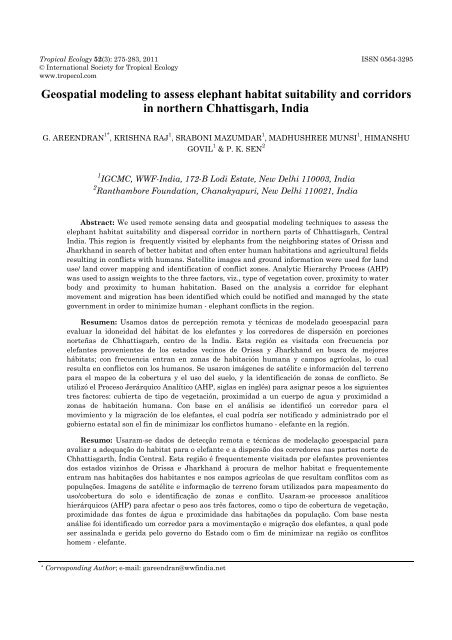
Geospatial modeling to assess elephant habitat suitability and ...
Geospatial modeling to assess elephant habitat suitability and ...
Geospatial modeling to assess elephant habitat suitability and ...

You also want an ePaper? Increase the reach of your titles
YUMPU automatically turns print PDFs into web optimized ePapers that Google loves.
Tropical Ecology 52(3): 275-283, 2011 ISSN 0564-3295<br />
© International Society for Tropical Ecology<br />
www.tropecol.com<br />
<strong>Geospatial</strong> <strong>modeling</strong> <strong>to</strong> <strong>assess</strong> <strong>elephant</strong> <strong>habitat</strong> <strong>suitability</strong> <strong>and</strong> corridors<br />
in northern Chhattisgarh, India<br />
G. AREENDRAN 1* , KRISHNA RAJ 1 , SRABONI MAZUMDAR 1 , MADHUSHREE MUNSI 1 , HIMANSHU<br />
GOVIL 1 & P. K. SEN 2<br />
1 IGCMC, WWF-India, 172-B Lodi Estate, New Delhi 110003, India<br />
2 Ranthambore Foundation, Chanakyapuri, New Delhi 110021, India<br />
Abstract: We used remote sensing data <strong>and</strong> geospatial <strong>modeling</strong> techniques <strong>to</strong> <strong>assess</strong> the<br />
<strong>elephant</strong> <strong>habitat</strong> <strong>suitability</strong> <strong>and</strong> dispersal corridor in northern parts of Chhattisgarh, Central<br />
India. This region is frequently visited by <strong>elephant</strong>s from the neighboring states of Orissa <strong>and</strong><br />
Jharkh<strong>and</strong> in search of better <strong>habitat</strong> <strong>and</strong> often enter human <strong>habitat</strong>ions <strong>and</strong> agricultural fields<br />
resulting in conflicts with humans. Satellite images <strong>and</strong> ground information were used for l<strong>and</strong><br />
use/ l<strong>and</strong> cover mapping <strong>and</strong> identification of conflict zones. Analytic Hierarchy Process (AHP)<br />
was used <strong>to</strong> assign weights <strong>to</strong> the three fac<strong>to</strong>rs, viz., type of vegetation cover, proximity <strong>to</strong> water<br />
body <strong>and</strong> proximity <strong>to</strong> human <strong>habitat</strong>ion. Based on the analysis a corridor for <strong>elephant</strong><br />
movement <strong>and</strong> migration has been identified which could be notified <strong>and</strong> managed by the state<br />
government in order <strong>to</strong> minimize human - <strong>elephant</strong> conflicts in the region.<br />
Resumen: Usamos da<strong>to</strong>s de percepción remota y técnicas de modelado geoespacial para<br />
evaluar la idoneidad del hábitat de los elefantes y los corredores de dispersión en porciones<br />
norteñas de Chhattisgarh, centro de la India. Esta región es visitada con frecuencia por<br />
elefantes provenientes de los estados vecinos de Orissa y Jharkh<strong>and</strong> en busca de mejores<br />
hábitats; con frecuencia entran en zonas de habitación humana y campos agrícolas, lo cual<br />
resulta en conflic<strong>to</strong>s con los humanos. Se usaron imágenes de satélite e información del terreno<br />
para el mapeo de la cobertura y el uso del suelo, y la identificación de zonas de conflic<strong>to</strong>. Se<br />
utilizó el Proceso Jerárquico Analítico (AHP, siglas en inglés) para asignar pesos a los siguientes<br />
tres fac<strong>to</strong>res: cubierta de tipo de vegetación, proximidad a un cuerpo de agua y proximidad a<br />
zonas de habitación humana. Con base en el análisis se identificó un corredor para el<br />
movimien<strong>to</strong> y la migración de los elefantes, el cual podría ser notificado y administrado por el<br />
gobierno estatal son el fin de minimizar los conflic<strong>to</strong>s humano - elefante en la región.<br />
Resumo: Usaram-se dados de detecção remota e técnicas de modelação geoespacial para<br />
avaliar a adequação do <strong>habitat</strong> para o elefante e a dispersão dos corredores nas partes norte de<br />
Chhattisgarth, Índia Central. Esta região é frequentemente visitada por elefantes provenientes<br />
dos estados vizinhos de Orissa e Jharkh<strong>and</strong> à procura de melhor <strong>habitat</strong> e frequentemente<br />
entram nas habitações dos habitantes e nos campos agrícolas de que resultam confli<strong>to</strong>s com as<br />
populações. Imagens de satélite e informação de terreno foram utilizados para mapeamen<strong>to</strong> do<br />
uso/cobertura do solo e identificação de zonas e confli<strong>to</strong>. Usaram-se processos analíticos<br />
hierárquicos (AHP) para afectar o peso aos três fac<strong>to</strong>res, como o tipo de cobertura de vegetação,<br />
proximidade das fontes de água e proximidade das habitações da população. Com base nesta<br />
análise foi identificado um corredor para a movimentação e migração dos elefantes, a qual pode<br />
ser assinalada e gerida pelo governo do Estado com o fim de minimizar na região os confli<strong>to</strong>s<br />
homem - elefante.<br />
N<br />
* Corresponding Author; e-mail: gareendran@wwfindia.net
276 GEOSPATIAL MODELING<br />
Key words: Analytic Hierarchy Process (AHP), corridor, <strong>habitat</strong> <strong>suitability</strong> analysis,<br />
human - <strong>elephant</strong> conflict, Project Elephant.<br />
Introduction<br />
Human - Elephant conflict (HEC) has emerged<br />
as a major issue in the field of wildlife<br />
management in India (Easa 2002; Kushwaha &<br />
Hazarika 2004; Singh et al. 2002; Sukumar 1994).<br />
Asian Elephant (Elephas maximus), once widely<br />
distributed in Indian sub-continent, has now been<br />
categorized as “endangered” species as per IUCN<br />
red list. Conversion of forested l<strong>and</strong> in<strong>to</strong><br />
settlements, agriculture, other infrastructure such<br />
as dams has led <strong>to</strong> fragmentation, shrinkage <strong>and</strong><br />
degradation of <strong>elephant</strong> <strong>habitat</strong> as well as loss of<br />
traditional movement paths resulting in increased<br />
HEC (Singh 2002; Sukumar 1994; Singh et al.<br />
2002). Elephants, in search of food <strong>and</strong> water tend<br />
<strong>to</strong> enter human <strong>habitat</strong>ions <strong>and</strong> in the process,<br />
often come in<strong>to</strong> direct conflicts humans by<br />
destroying crops, live-s<strong>to</strong>ck or property <strong>and</strong><br />
sometimes by even killing people (Kushwaha &<br />
Hazarika 2004; Sukumar 1994). In retaliation, the<br />
<strong>elephant</strong>s also get killed by the local communities.<br />
Preservation <strong>and</strong> res<strong>to</strong>ration of corridors are an<br />
important means of reducing the adverse effects of<br />
<strong>habitat</strong> fragmentation (Khanna et al. 2001; N<strong>and</strong>y<br />
et al. 2007; Venkataraman 2002). Corridors are<br />
narrow strips of forests connecting two larger<br />
forest areas <strong>and</strong> thereby facilitating movement<br />
<strong>and</strong> dispersal of animals between these patches<br />
(Beier & Noss 1998).<br />
Preservation of wildlife requires a complete<br />
knowledge of their <strong>habitat</strong> requirements. It also<br />
requires knowledge of past <strong>and</strong> current area under<br />
different l<strong>and</strong> use practices such as agriculture,<br />
forestry <strong>and</strong> human <strong>habitat</strong>ions that alter vegetation<br />
cover, l<strong>and</strong> surface, biogeochemistry, hydrology<br />
<strong>and</strong> biodiversity (Ellis 2007). Vegetation forms<br />
an integral component of terrestrial ecosystem <strong>and</strong><br />
wildlife <strong>habitat</strong> (Khanna et al. 2001). Information<br />
on the nature <strong>and</strong> extent of vegetation, therefore,<br />
greatly helps in <strong>assess</strong>ment of wildlife <strong>habitat</strong> <strong>and</strong><br />
identification of dispersal corridors. The advent of<br />
geospatial <strong>to</strong>ols, viz., Geographical Information<br />
System (GIS) <strong>and</strong> remote sensing have facilitated<br />
such studies as these techniques allow <strong>assess</strong>ment<br />
of temporal variations in the spatial data <strong>and</strong><br />
provide relevant <strong>and</strong> reliable information needed<br />
for conservation planning <strong>and</strong> wildlife management<br />
(Kushwaha et al. 2000; Kushwaha & Roy<br />
2002). Various studies have highlighted the role of<br />
geospatial <strong>to</strong>ols in <strong>habitat</strong> evaluation <strong>and</strong> also in<br />
identification <strong>and</strong> management of wildlife corridors<br />
(Khanna et al. 2001; Kushwaha & Hazarika 2004;<br />
Kushwaha et al. 2000; N<strong>and</strong>y et al. 2007).<br />
Northern Chhattisgarh in Central India has<br />
been home of Asian <strong>elephant</strong>s since his<strong>to</strong>rical<br />
times. However, in the early part of the 20th<br />
century they became locally extinct (Singh 2002).<br />
In 1988 <strong>elephant</strong>s migrated from the prime<br />
<strong>elephant</strong> <strong>habitat</strong> of Jharkh<strong>and</strong> (erstwhile Bihar)<br />
in<strong>to</strong> Chhattisgarh (erstwhile Madhya Pradesh)<br />
<strong>and</strong> caused extensive damage <strong>to</strong> life <strong>and</strong> property.<br />
Since then, HEC cases have been increasing due <strong>to</strong><br />
straying of migra<strong>to</strong>ry <strong>elephant</strong>s in the state (Singh<br />
2002). The number of wild <strong>elephant</strong>s in the year<br />
2007-08 in the state estimated <strong>to</strong> be 122 (MoEF<br />
2008 www. envfor.nic.in/pe/pe.html). Major reason<br />
for prolonged stay of <strong>elephant</strong>s in the state could<br />
be better (44 %) forest cover, heavy mining, <strong>habitat</strong><br />
degradation <strong>and</strong> deforestation in the states of<br />
Jharkh<strong>and</strong> <strong>and</strong> Orissa (Singh 2002; Earth Matters<br />
Foundation 2008). Even the state of Chhattisgarh<br />
is primarily inhabited by tribal communities<br />
dependent largely on agriculture <strong>and</strong> minor forest<br />
produce. Increasing human pressure on forested<br />
areas is resulting in increased incidences of<br />
human-<strong>elephant</strong> conflicts. This necessitated a<br />
detailed <strong>assess</strong>ment of <strong>habitat</strong> <strong>suitability</strong> <strong>and</strong> dispersal<br />
corridor for <strong>elephant</strong>s in the area. We used<br />
remote sensing <strong>and</strong> GIS based <strong>modeling</strong> approach<br />
following Analytic Hierarchy Process (AHP) <strong>to</strong><br />
<strong>assess</strong> these parameters in the above mentioned<br />
area. In this paper, we present the results of this<br />
study along with management implications.<br />
Study area<br />
The state of Chhattisgarh, located in Central<br />
India, was carved out of the erstwhile state of<br />
Madhya Pradesh in 2000. The state lies between<br />
latitudes 17° 47' <strong>and</strong> 24° 06' N <strong>and</strong> longitudes 80°<br />
15' <strong>and</strong> 84° 24' E. Forming a part of Deccan biogeographic<br />
province, the state harbors rich <strong>and</strong><br />
unique biological diversity. The state has a <strong>to</strong>tal<br />
geographic area of 135191 km 2 , which constitutes<br />
4.1 % of the <strong>to</strong>tal l<strong>and</strong> area of the country (FSI<br />
2005; Government of Chhattisgarh 2008b http://<br />
cgforest.nic.in / forest_resources.htm).
AREENDRAN et al. 277<br />
Fig. 1. Location map of northern part of Chhattisgarh.<br />
The study area is bordered by Uttar Pradesh<br />
in the north, Jharkh<strong>and</strong> in the north-east, Orissa<br />
in the east <strong>and</strong> Madhya Pradesh in the west. Five<br />
districts in the region were selected for the present<br />
study viz., Korba, Koriya, Jashpur, Sarguja, <strong>and</strong><br />
Raigarh, with high HEC cases (Fig. 1). Northern<br />
Chhattisgarh experiences tropical monsoon type of<br />
climate with maximum rainfall during June <strong>to</strong><br />
Oc<strong>to</strong>ber. Remaining months witness very short<br />
spells of rain. Summer months are extremely hot<br />
with temperature ranging from 35 °C <strong>to</strong> 45 °C.<br />
Geologically all the five districts have common<br />
attributes as they lie on the Satpura Range. Rocks<br />
are from Archean <strong>to</strong> recent era. The region lies on<br />
the edge of the great Indo-Gangetic plain <strong>and</strong> is<br />
drained by Rih<strong>and</strong> River, a tributary of the<br />
Ganges. The whole region thus forms part of the<br />
Mahanadi River drainage basin. Its average height<br />
is below 300 m. Part of the study area also falls<br />
under Baghelkh<strong>and</strong> Plateau. Peneplains – the flat<br />
subsurface table l<strong>and</strong> (Mesa), are also found in this<br />
region. The soil is mainly basaltic (red) <strong>and</strong> in<br />
some parts black cot<strong>to</strong>n soil is prevalent. Paddy is<br />
the main crop in the area. Rich mineral reserves of<br />
coal, bauxite, dolomite, gold <strong>and</strong> diamond also<br />
occur in the northern region of the state (Earth<br />
Matters Foundation 2008; Government of<br />
Chhattisgarh 2008a http://cgforest.nic.in/ About<br />
CG.htm).<br />
The human population is unevenly distributed<br />
in the study area. The local communities belong <strong>to</strong><br />
various tribes such as Kanwars, Kamar, Baiga,<br />
Halba, P<strong>and</strong>o, Paharikoraba <strong>and</strong> many others.<br />
Agricultural sec<strong>to</strong>r followed by mining <strong>and</strong> allied<br />
industries provide employment <strong>to</strong> majority of the<br />
local population (Earth Matters Foundation 2008).<br />
The recorded forest area of the state is 59,772<br />
km 2 , which is 44.2 % of the <strong>to</strong>tal geographic area of<br />
the state <strong>and</strong> 7.77 % of the forest area of the<br />
country. The forests of the state fall under two<br />
major classes as per classification by Champion &<br />
Seth (1968), viz., Tropical Moist Deciduous <strong>and</strong><br />
Tropical Dry Deciduous which are further divisible<br />
in<strong>to</strong> 22 sub-groups. Most of the state forest is<br />
concentrated in the northern <strong>and</strong> southern parts of<br />
the state. In terms of species dominance four cate-
278 GEOSPATIAL MODELING<br />
gories of forests can be identified in the state, viz.,<br />
Teak (Tec<strong>to</strong>na gr<strong>and</strong>is), Sal (Shorea robusta),<br />
Bamboo <strong>and</strong> Miscellaneous forests. Northern<br />
Chhattisgarh covers an area of 41858 km 2 (31 % of<br />
the <strong>to</strong>tal geographic area of the state) with <strong>to</strong>tal<br />
forested area of 19406 km 2 , which is 46.3 % of the<br />
<strong>to</strong>tal area of the region. The rich forest cover<br />
support a wide variety of faunal species including<br />
tiger (Panthera tigris), leopard (Panthera pardus),<br />
gaur (Bos gaurus), sambar (Cervus unicolor), chital<br />
(Axis axis), nilgai (Boselaphus tragocamelus) <strong>and</strong><br />
many others (FSI 2005; Government of<br />
Chhattisgarh 2008b http://cgforest.nic.in/forest<br />
_resources.htm).<br />
Materials <strong>and</strong> methods<br />
Creation of spatial database<br />
Twelve Survey of India <strong>to</strong>posheets of 1:250,000<br />
scale were required <strong>to</strong> cover the entire area of<br />
study. IRS-P6 LISS III satellite imageries with<br />
spatial resolution of 23.5 m were procured from<br />
NRSC, Hyderabad for the study area. The list of<br />
the input data used is provided in Table 1.<br />
Table 1. List of input data.<br />
Input Data Scale<br />
Satellite images<br />
(IRS-P6 LISS III)<br />
Survey of India<br />
<strong>to</strong>posheets<br />
102-55, 102-56, 103-<br />
55, 103-56 <strong>and</strong> 104-<br />
56 (November, 2007)<br />
63H, 63L, 63P, 64E,<br />
64I, 64J, 64K, 64M,<br />
64N, 64O, 73A <strong>and</strong><br />
73B<br />
23.5 m<br />
1:250,000<br />
The <strong>to</strong>posheets were geo-referenced based on<br />
the coordinate information given in the maps.<br />
Using Au<strong>to</strong>cad 2000i, ArcMap 9.2 <strong>and</strong> ArcView 3.2<br />
the thematic layers (boundaries, roads, railway<br />
lines, drainage, water bodies, reserve forest boundaries<br />
<strong>and</strong> con<strong>to</strong>ur lines) were digitized from the<br />
<strong>to</strong>posheets <strong>to</strong> create spatial database for the<br />
concerned area. The satellite imageries were geometrically<br />
corrected on the basis of the referenced<br />
<strong>to</strong>posheets using map <strong>to</strong> image geo-rectification<br />
process. The rectified scenes were mosaiced <strong>and</strong><br />
subsequently the study area was clipped from the<br />
mosaiced image on the basis of the district<br />
boundaries using AOI <strong>to</strong>ol in ERDAS (version 9.0).<br />
L<strong>and</strong> use/L<strong>and</strong> cover classification<br />
L<strong>and</strong> cover refers <strong>to</strong> the physical <strong>and</strong> biological<br />
cover over the surface of l<strong>and</strong>, including water,<br />
vegetation, bare soil <strong>and</strong> man made structures.<br />
The satellite data was processed <strong>to</strong> extract l<strong>and</strong><br />
use/l<strong>and</strong> cover (LULC) of the study area for 2007<br />
on the basis of visual interpretation technique <strong>and</strong><br />
field survey using ERDAS (version 9.0). The mosaiced<br />
image was first classified using unsupervised<br />
classification technique. The classified output<br />
was compared with the respective satellite image<br />
<strong>and</strong> was cleaned using recode process. Settlements,<br />
water body <strong>and</strong> rivers were captured separately<br />
using AOI <strong>to</strong>ols <strong>and</strong> subsequently recoded.<br />
The LULC map was verified in the field. The five<br />
districts under study were surveyed <strong>to</strong> collect<br />
information on LULC <strong>and</strong> major centers of HEC.<br />
Field survey was carried out in the post monsoon<br />
season from 1st September <strong>to</strong> 9th September,<br />
2008. R<strong>and</strong>om points were selected <strong>and</strong> at each<br />
location the existing l<strong>and</strong> use pattern <strong>and</strong> the<br />
coordinate information was noted down with the<br />
help of Global Position System (GPS). The information<br />
on LULC were used for accuracy <strong>assess</strong>ment.<br />
In addition, different sites of <strong>elephant</strong><br />
movement in the region <strong>and</strong> sites of HEC were<br />
visited <strong>to</strong> get relevant information on <strong>habitat</strong><br />
conditions, forage <strong>and</strong> water availability. The<br />
information collected from the field were incorporated<br />
in<strong>to</strong> GIS domain <strong>and</strong> overlaid on LULC map<br />
for better analysis.<br />
Habitat <strong>suitability</strong> analysis<br />
The <strong>habitat</strong> requirements of the <strong>elephant</strong>s <strong>and</strong><br />
the variables related <strong>to</strong> these requirements were<br />
established based on the existing information<br />
available on the species, especially with reference<br />
<strong>to</strong> the study area. Three fac<strong>to</strong>rs (Table 2) were<br />
identified as being the most important in<br />
determining the <strong>suitability</strong> of an <strong>elephant</strong> <strong>habitat</strong>.<br />
Each fac<strong>to</strong>r was then subdivided in<strong>to</strong> three levels<br />
of <strong>suitability</strong>.<br />
Each of the fac<strong>to</strong>rs was assigned weights based<br />
on Saaty’s multi-criterion evaluation Analytic<br />
Hierarchy Process (AHP). The AHP uses a nine<br />
point measurement scale where 1 represents equal<br />
importance, 3 represents weak importance, 5<br />
represents strong importance, 7 represents<br />
demonstrated importance, <strong>and</strong> 9 represents<br />
absolute importance (Kushwaha & Roy 2002). The<br />
other values of 2, 4, 6 <strong>and</strong> 8 constitute<br />
intermediate values between two adjacent judgments.<br />
This AHP is based on the assumption that<br />
some fac<strong>to</strong>rs are more important than others in a<br />
particular circumstance. Each variable was given a
AREENDRAN et al. 279<br />
Table 2. Habitat <strong>suitability</strong> fac<strong>to</strong>rs <strong>and</strong> variables with levels of <strong>suitability</strong>.<br />
Vegetation type<br />
Proximity <strong>to</strong><br />
water body<br />
Proximity <strong>to</strong> human<br />
<strong>habitat</strong>ion<br />
Suitability<br />
Dense Forest Within 1 km More than 3 km 3 (highly suitable)<br />
Open Forest 1 - 1.5 km 2 - 3 km 2 (moderately suitable)<br />
Non-Forest More than 1.5 km Less than 2 km 1 (not suitable)<br />
Table 3. Fac<strong>to</strong>rs weighting using Analytic Hierarchy Procedure.<br />
Vegetation<br />
Proximity <strong>to</strong><br />
water body<br />
Proximity <strong>to</strong><br />
human <strong>habitat</strong>ion<br />
GP<br />
Relative<br />
weights<br />
Vegetation 1 1 4 1.59 0.46<br />
Proximity <strong>to</strong> water<br />
body<br />
1 1 3 1.44 0.42<br />
Proximity <strong>to</strong><br />
human <strong>habitat</strong>ion<br />
0.25 0.33 1 0.44 0.13<br />
TOTAL 3.46<br />
value in comparison with another. After the<br />
matrix was filled by values of relative importance,<br />
the geometric progression (GP) values for each row<br />
were calculated. Then each fac<strong>to</strong>r was assigned a<br />
relative weight (Table 3). Thematic layers depicting<br />
each of the three fac<strong>to</strong>rs were also generated.<br />
Multiple ring buffers generated at a distance of 0.5<br />
km <strong>and</strong> 1 km were used <strong>to</strong> represent the two<br />
variables i.e. proximity <strong>to</strong> water body <strong>and</strong> human<br />
<strong>habitat</strong>ion respectively. Vegetation layer was prepared<br />
as a part of the LULC classification.<br />
The set of input layers were run on ArcMap 9.3<br />
using weighted sum spatial analyst. Input set of<br />
fac<strong>to</strong>rs in the raster format were run using<br />
weighted sum approach. As such, the vec<strong>to</strong>r layers<br />
converted in<strong>to</strong> raster format. In this module each<br />
of the input raster is multiplied with a corresponding<br />
fac<strong>to</strong>r weight, derived from AHP <strong>and</strong> then<br />
summed <strong>to</strong> arrive at a final <strong>suitability</strong> map. The<br />
comparisons are made using a scale <strong>to</strong> represent<br />
how much more one element dominates another<br />
with respect <strong>to</strong> a given attribute. The derived priority<br />
scales are synthesized by multiplying them by<br />
the priority of their parent nodes <strong>and</strong> adding for<br />
all such nodes (Saaty 2008). Based on the <strong>habitat</strong><br />
<strong>suitability</strong>, a corridor <strong>and</strong> migra<strong>to</strong>ry route was<br />
proposed for further notification <strong>and</strong> management<br />
of stray <strong>elephant</strong>s.<br />
Results <strong>and</strong> discussion<br />
L<strong>and</strong> use/L<strong>and</strong> cover mapping<br />
Eight LULC classes were derived from satellite<br />
data interpretation for the area of study, viz.,<br />
Dense forest, Open forest, Scrub, Agricultural<br />
l<strong>and</strong>, Built up area, Industrial area, Open l<strong>and</strong>/<br />
Barren l<strong>and</strong> <strong>and</strong> Water body (Fig. 2).<br />
Dense forests are characterized by > 40 %<br />
canopy density, while forests with canopy density<br />
between 10 % <strong>and</strong> 40 % are defined as Open forests.<br />
Scrub areas represent forests with less than 10 %<br />
canopy density (FSI 2005). Forest cover was<br />
largely confined <strong>to</strong> the hilly tracts of the region<br />
while the relatively flat areas were occupied by<br />
agricultural l<strong>and</strong>. Agricultural area includes area<br />
under crop cultivation <strong>and</strong> plantation as well<br />
Table 4. Area under different l<strong>and</strong> use/l<strong>and</strong> cover<br />
classes in northern Chhattisgarh.<br />
L<strong>and</strong> use/ L<strong>and</strong> cover Area (km 2 ) Area (%)<br />
Dense forest 11773.54 32.33<br />
Open forest 4926.2 14.25<br />
Scrub l<strong>and</strong> 2305.89 6.67<br />
Agriculture 11440.95 33.09<br />
Built up area 490.62 1.42<br />
Industrial area 89.54 0.26<br />
Open/Barren l<strong>and</strong> 4926.2 14.25<br />
Water body 467.38 1.35<br />
Total area 36420.32 100<br />
as those l<strong>and</strong>s which have been left fallow for<br />
regeneration. Industrial areas <strong>and</strong> built up areas<br />
comprise human settlements, confined <strong>to</strong> plain<br />
areas. Human <strong>habitat</strong>ions in the hilly <strong>and</strong> forested<br />
tracts were more dispersed <strong>and</strong> occurred as small<br />
hamlets. Open or barren l<strong>and</strong> denotes areas devoid of
280 GEOSPATIAL MODELING<br />
Fig. 2. L<strong>and</strong> use/L<strong>and</strong> cover map of northern Chhattisgarh region.<br />
Agriculture<br />
Open<br />
Builtup<br />
Open Forest<br />
Dense Forest<br />
Scrub Forest<br />
Industrial<br />
Water<br />
any particular l<strong>and</strong> use, which are usually referred<br />
as wastel<strong>and</strong>s. This form of l<strong>and</strong> was found at the<br />
edges of forests, primarily because of deforestation<br />
for various purposes. Open/Barren l<strong>and</strong> was also<br />
recorded in <strong>and</strong> around the built up <strong>and</strong> industrial<br />
areas suggesting degradation of l<strong>and</strong> due <strong>to</strong> over<br />
exploitation (Table 4).<br />
The field data were then used <strong>to</strong> calculate the<br />
accuracy of the LULC map generated using satellite<br />
image. The overall accuracy of the map was<br />
78.89 %. The detailed error matrix <strong>and</strong> kappa statistics<br />
calculated are given in Table 5.<br />
As per the details obtained from field survey<br />
regarding the HEC zones, it can be said that most<br />
of these conflicts occur at sites along the forest<br />
edges. These are the areas where human encroachments<br />
have been taking place in terms of<br />
extension of cropl<strong>and</strong> <strong>and</strong> built up area. Elephants<br />
often deviate from their original route of movement<br />
<strong>and</strong> enter these hamlets leading <strong>to</strong> conflict<br />
situations.<br />
Habitat <strong>suitability</strong> <strong>and</strong> corridor identification<br />
Three levels of <strong>suitability</strong> were depicted in the<br />
map showing levels of <strong>suitability</strong> with reference <strong>to</strong><br />
<strong>elephant</strong> <strong>habitat</strong> (Fig. 3). Areas away from main<br />
centers of human <strong>habitat</strong>ions with good vegetation<br />
cover <strong>and</strong> in close proximity <strong>to</strong> water bodies were<br />
categorized as highly suitable while areas with<br />
very less vegetation cover, away from major water<br />
bodies <strong>and</strong> in proximity <strong>to</strong> human <strong>habitat</strong>ions were<br />
depicted as least suitable for <strong>elephant</strong> <strong>habitat</strong>.
AREENDRAN et al. 281<br />
Fig. 3. Map depicting <strong>elephant</strong> Habitat Suitability in northern Chhattisgarh.<br />
Thus suitable sites for <strong>elephant</strong> <strong>habitat</strong> should be<br />
endowed with abundant water <strong>and</strong> food source so<br />
that it can be sustainable home for these large<br />
bodied mammals; a large area <strong>to</strong> roam, less populated<br />
area so that there is less displacement (Earth<br />
Matters Foundation 2008).<br />
Table 5. Accuracy <strong>assess</strong>ment of LULC map.<br />
Class name<br />
Producer's<br />
accuracy (%)<br />
Error Matrix<br />
User's<br />
accuracy (%)<br />
Kappa<br />
statistics<br />
Dense forest 95.45 77.78 0.71<br />
Water 82 79.30 0.69<br />
Agricultural 85 86.05 0.76<br />
Open forest 40 66.67 0.65<br />
Industrial 100 100 0.00<br />
Open 88.89 72.73 0.70<br />
Scrub forest 66.67 50 0.48<br />
Built up 50 50 0.49<br />
OVERALL 78.81 0.70<br />
Based on the <strong>habitat</strong> <strong>suitability</strong> analysis, a<br />
migra<strong>to</strong>ry route (the path used by <strong>elephant</strong>s for<br />
migration) <strong>and</strong> a corridor (providing connectivity<br />
between forest patches) was proposed (Fig. 4)<br />
which would ensure free movement without causing<br />
much disturbance <strong>to</strong> human population residing<br />
in the region. The corridor was proposed on<br />
the basis of the fact that the vegetation cover<br />
within the corridor had good connectivity, which is<br />
an important fac<strong>to</strong>r in securing wildlife corridors<br />
<strong>and</strong> the water bodies present that are naturally<br />
replenishable which can sustain large <strong>elephant</strong><br />
herds for all seasons. Besides, the slope varying<br />
between 0° - 30° <strong>and</strong> elevation of about 500 m were<br />
considered <strong>to</strong> be suitable for <strong>elephant</strong> movement.<br />
About 90 villages were identified <strong>to</strong> be present<br />
along the proposed <strong>elephant</strong> migra<strong>to</strong>ry route.<br />
Temporary fencing or relocation of these villages<br />
can be done for securing the corridor. There are<br />
plans of building artificial water s<strong>to</strong>rage tanks (on<br />
the basis of elevation <strong>and</strong> sited of river confluence)<br />
<strong>to</strong> cater <strong>to</strong> the need of the <strong>elephant</strong>s. Suggestions<br />
have also been made <strong>to</strong> set up “Elephant Villages”
282 GEOSPATIAL MODELING<br />
Fig. 4. Corridor proposed for <strong>elephant</strong>s based on Habitat Suitability Analysis.<br />
"/<br />
Villages Affected<br />
Dense Forest<br />
!m Proposed Waterbody/Waterholes<br />
Route of Elephant Movement<br />
Open Forest<br />
Scrub Forest<br />
Buffer Region<br />
Proposed Elephant Corridor<br />
Study Area<br />
in the proposed corridor area (Times of India 2009<br />
http://timesofindia. indiatimes.com/home/environment/flora-fauna/Wild-<strong>elephant</strong>s-attack-C).<br />
If the<br />
corridors are notified <strong>and</strong> properly managed (by<br />
creating <strong>elephant</strong> - proof fences at strategic locations),<br />
the number of HEC cases can be reduced.<br />
This would also require cooperation from the local<br />
communities in terms of reducing biomass<br />
extraction from the <strong>elephant</strong> <strong>habitat</strong>s <strong>and</strong> corridors<br />
(Earth Matters Foundation 2008). Improvement of<br />
<strong>habitat</strong> conditions in such areas would certainly<br />
reduce frequency of crop <strong>and</strong> house raiding. Thus,<br />
a combination of traditional methods <strong>and</strong> modern<br />
technological methods such as satellite tracking of<br />
<strong>elephant</strong>s <strong>and</strong> moni<strong>to</strong>ring their <strong>habitat</strong>s would go<br />
a long way in combating HEC in the state.<br />
Conclusions<br />
Integration of GIS, Remote sensing <strong>and</strong> GPS<br />
technologies have proved <strong>to</strong> be effective in <strong>assess</strong>ment<br />
of <strong>habitat</strong> quality <strong>and</strong> dispersal corridors for<br />
wide ranging species such as Asian <strong>elephant</strong>.<br />
Using geospatial <strong>modeling</strong> the entire area of<br />
northern Chhattisgarh was divided in<strong>to</strong> three<br />
levels of <strong>suitability</strong>. It can be concluded from the<br />
study that there is a strong relationship between<br />
density of vegetation cover, availability of permanent<br />
sources of water, presence of human settlements<br />
<strong>and</strong> distribution of <strong>elephant</strong>s. Effective<br />
management of corridors would go a long way in<br />
ensuring symbiotic relationship between <strong>elephant</strong>s<br />
<strong>and</strong> human in the state.
AREENDRAN et al. 283<br />
Acknowledgements<br />
The authors are grateful <strong>to</strong> Ravi Singh, Secretary<br />
General <strong>and</strong> CEO WWF-India, <strong>and</strong> Sejal<br />
Worah, Programme Direc<strong>to</strong>r WWF-India, for their<br />
support <strong>to</strong> the project. Thanks <strong>to</strong> Mike P<strong>and</strong>ey,<br />
Tariq Aziz, Nipur Kumar Meh<strong>to</strong>, Debobrata Sarkar<br />
<strong>and</strong> all the staff members of Earth Matters<br />
Foundation for the support <strong>to</strong> this study. The<br />
authors would also like <strong>to</strong> thank the two anonymous<br />
reviewers for their encouraging comments.<br />
References<br />
Beier, P. & R. F. Noss. 1998. Do <strong>habitat</strong> corridors provide<br />
connectivity. Conservation Biology 12: 1241-1252.<br />
Champion, H. G. & S. K. Seth. 1968. A Revised Survey of<br />
Forest Types of India. Manager of Publications,<br />
Govt. of India, New Delhi.<br />
Earth Matters Foundation. 2008. A Home for Elephants,<br />
People <strong>and</strong> Tribal Communities: Managing Human<br />
Elephant Conflict in Chhattisgarh. Detailed Project<br />
Report. Earth Matters Foundation, New Delhi.<br />
Easa, P. S. 2002. Asian <strong>elephant</strong>s in India: A review. pp.<br />
14-22. In: V. Menon, S. K. Tiwari, P. S. Easa & R.<br />
Sukumar (eds.) Right of Passage: Elephant Corridors<br />
of India. Conservation Reference Series No. 3.<br />
Wildlife Trust of India, New Delhi.<br />
Ellis, E. 2007. L<strong>and</strong> - use <strong>and</strong> L<strong>and</strong> - cover change. In: C.<br />
J. Clevel<strong>and</strong> (ed.) Encyclopedia of Earth. [Online]<br />
Available at: http://www.eoearth.org/article/L<strong>and</strong>-use_<br />
<strong>and</strong>_l<strong>and</strong>-cover_change (Accessed on 10.11.2009).<br />
Forest Survey of India (FSI). 2005. State of Forest Report.<br />
Forest Survey of India, Ministry of Environment<br />
<strong>and</strong> Forests, Dehradun.<br />
Government of Chhattisgarh. 2008a. About Chhattisgarh.<br />
[Online] Available at: http://cgforest.nic.in/AboutCG.<br />
htm (Accessed on 6.11.2009).<br />
Government of Chhattisgarh. 2008b. Forest Resources.<br />
[Online] Available at: http://cgforest.nic.in/forest_re<br />
sources.htm (Accessed on 6.11.2009).<br />
Khanna, V., M. S. Ravich<strong>and</strong>ran & S. P. S. Kushwaha.<br />
2001. Corridor analysis in Rajaji-Corbett Elephant<br />
Reserve: A Remote sensing <strong>and</strong> GIS approach. Journal<br />
of the Indian Society of Remote Sensing 29: 41-<br />
46.<br />
Kushwaha, S. P. S., S. Munkhtuya & P. S. Roy. 2000.<br />
<strong>Geospatial</strong> modelling for Goral <strong>habitat</strong> evaluation.<br />
Journal of the Indian Society of Remote Sensing 28:<br />
293-303.<br />
Kushwaha, S. P. S. & P. S. Roy. 2002. <strong>Geospatial</strong> technology<br />
for wildlife <strong>habitat</strong> evaluation. Tropical Ecology<br />
43: 137-150.<br />
Kushwaha, S. P. S. & R. Hazarika. 2004. Assessment of<br />
<strong>habitat</strong> loss in Kameng <strong>and</strong> Sonitpur Elephant<br />
reserves. Current Science 87: 1447-1453.<br />
N<strong>and</strong>y, S., S. P. S. Kushwaha & S. Mukhopadhyay.<br />
2007. Moni<strong>to</strong>ring the Chilla-Motichur wildlife corridor<br />
using geospatial <strong>to</strong>ols. Journal for Nature<br />
Conservation 15: 237-244.<br />
MoEF. 2008. Estimation of Wild Elephant Population in<br />
the Year 2007-08. [Online] Available at: www.envfor.<br />
nic.in/pe/pe.html (Accessed on 10.11.2009).<br />
Saaty, T. L. 2008. Decision making with the analytical<br />
hierarchy process. International Journal of Services<br />
Sciences 1 : 83-98.<br />
Singh, R. K. 2002. Elephants in exile: A rapid <strong>assess</strong>ment<br />
of the Human-Elephant conflict in Chhattisgarh.<br />
An Occasional Report of a Rapid Action<br />
Project as part of the Elephant Conservation Project.<br />
Occasional Report No. 5, Wildlife Trust of India,<br />
New Delhi.<br />
Singh, A. K., R. R. Singh & S. Chowdhury. 2002. Human -<br />
Elephant conflicts in changed l<strong>and</strong>scapes of south<br />
West Bengal, India. Indian Forester 128: 1119-1132.<br />
Sukumar, R. 1994. Wildlife-human conflict in India: An<br />
ecological <strong>and</strong> social perspective. pp. 303-317. In: R.<br />
Guha (ed.) Social Ecology. Oxford University Press,<br />
New Delhi.<br />
Times of India. 2009. Wild Elephants Attack<br />
Chhattisgarh Village, Tribals Flee. Nov 15, 2009.<br />
[Online] Available at: http://timesofindia.indiatimes.<br />
com/ home / environment/flora-fauna/Wild-<strong>elephant</strong>s<br />
attack-C (Accessed on 16.7.2010).<br />
Venkataraman, A. 2002. What is an Asian <strong>elephant</strong><br />
(Elephas maximus) corridor. pp. 24-31. In: V.<br />
Menon, S. K. Tiwari, P. S. Easa & R. Sukumar<br />
(eds.) Right of Passage: Elephant Corridors of India.<br />
Conservation Reference Series No. 3, Wildlife Trust<br />
of India, New Delhi.<br />
(Received on 25.03.2010 <strong>and</strong> accepted after revisions, on 11.08.2010)