What is a Rustic Road? - Wisconsin Department of Tourism
What is a Rustic Road? - Wisconsin Department of Tourism
What is a Rustic Road? - Wisconsin Department of Tourism

Create successful ePaper yourself
Turn your PDF publications into a flip-book with our unique Google optimized e-Paper software.
<strong>Rustic</strong><br />
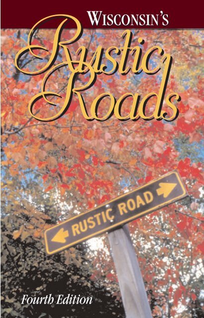
WISCONSIN’S<br />
<strong>Road</strong>s<br />
Fourth Edition
Welcome to all those who prefer a road less-traveled.<br />
For three decades now, W<strong>is</strong>consin’s rustic roads have<br />
provided hikers, bikers and motor<strong>is</strong>ts a peaceful escape<br />
into some <strong>of</strong> the finest four-season scenery the Midwest<br />
has to <strong>of</strong>fer.<br />
Along with celebrating its 30th anniversary, W<strong>is</strong>consin’s<br />
<strong>Rustic</strong> <strong>Road</strong>s program recently reached another major<br />
milestone: designation <strong>of</strong> the 100th rustic road. <strong>What</strong><br />
began in 1975 as an effort to preserve some <strong>of</strong> our<br />
most scenic and lightly-traveled roadways has grown<br />
into a network <strong>of</strong> over 100 roads spanning some 560<br />
miles through 54 counties. And the program continues<br />
to grow, boosting civic pride and supporting our<br />
tour<strong>is</strong>m economy.<br />
But one thing hasn’t changed: the unique state and<br />
local partnerships that form the foundation <strong>of</strong> the<br />
<strong>Rustic</strong> <strong>Road</strong>s program. Local groups nominate<br />
candidate roads, and those accepted into the rustic<br />
roads “family” remain under local jur<strong>is</strong>diction. The<br />
state <strong>Department</strong> <strong>of</strong> Transportation oversees the<br />
program, with promotional support from the<br />
<strong>Department</strong> <strong>of</strong> Tour<strong>is</strong>m.<br />
As you travel these picturesque country roads,<br />
remember that each one represents a story waiting to<br />
be told. Along with their natural beauty, a closer look<br />
will <strong>of</strong>ten reveal a fascinating glimpse into W<strong>is</strong>consin’s<br />
rich and colorful past.<br />
Have a safe and enjoyable journey.<br />
Jim Doyle<br />
Governor<br />
Contents<br />
Welcome __________________ 1<br />
<strong>What</strong> <strong>is</strong> a <strong>Rustic</strong> <strong>Road</strong> ________ 2<br />
<strong>Rustic</strong> <strong>Road</strong>s Board __________ 3<br />
About th<strong>is</strong> Guide ____________ 4<br />
Locator Map________________ 4<br />
<strong>Rustic</strong> <strong>Road</strong>s Index ___________5<br />
<strong>Road</strong>s in the Northwest ____ 6-22<br />
<strong>Road</strong>s in the Northeast____ 23-37<br />
<strong>Road</strong>s in the Southwest ___ 38-45<br />
<strong>Road</strong>s in the Southeast____ 46-71<br />
Program Goals_____________ 72<br />
Qualifications _____________ 72<br />
How to Nominate a <strong>Road</strong> _____ 73<br />
The Designation Process _____ 73<br />
Other Tour<strong>is</strong>m Publications___ BC<br />
The 2006-2007 Guide to<br />
W<strong>is</strong>consin’s <strong>Rustic</strong> <strong>Road</strong> System <strong>is</strong><br />
publ<strong>is</strong>hed by the W<strong>is</strong>consin<br />
<strong>Department</strong> <strong>of</strong> Transportation and<br />
the W<strong>is</strong>consin <strong>Department</strong> <strong>of</strong><br />
Tour<strong>is</strong>m, in cooperation with the<br />
<strong>Rustic</strong> <strong>Road</strong>s Board.<br />
Front cover photo: <strong>Rustic</strong> <strong>Road</strong> sign in<br />
fall by RJ & Linda Miller.<br />
Inside front cover photo: <strong>Rustic</strong> <strong>Road</strong> 46,<br />
Brown County, by RJ & Linda Miller.<br />
1
<strong>What</strong> <strong>is</strong> a <strong>Rustic</strong> <strong>Road</strong><br />
RJ & LINDA MILLER<br />
The <strong>Rustic</strong> <strong>Road</strong>s system in W<strong>is</strong>consin was created by the 1973 State<br />
Leg<strong>is</strong>lature in an effort to preserve what remains <strong>of</strong> W<strong>is</strong>consin’s scenic,<br />
lightly traveled country roads for the le<strong>is</strong>urely enjoyment <strong>of</strong> bikers, hikers<br />
and motor<strong>is</strong>ts.<br />
To qualify for the <strong>Rustic</strong> <strong>Road</strong>s Program, a roadway must<br />
have outstanding natural features along its borders. These<br />
might include rugged terrain, native vegetation and wildlife,<br />
or open areas with agricultural v<strong>is</strong>tas that make the road<br />
unique. The road should be a lightly traveled, local access<br />
road. It should not be scheduled for major improvements<br />
which would change its rustic character<strong>is</strong>tics. A <strong>Rustic</strong> <strong>Road</strong><br />
may be a dirt, gravel or paved road. It should be at least two<br />
miles long with a maximum speed limit <strong>of</strong> 45 mph.<br />
Unique brown and yellow signs mark the routes <strong>of</strong> all <strong>of</strong>ficially designated<br />
<strong>Rustic</strong> <strong>Road</strong>s. Each road <strong>is</strong> numbered. To avoid confusion with the State<br />
Trunk Highway number, a letter “R” prefix <strong>is</strong> used with the number –<br />
such as R50 or R120.<br />
TIM FITZGERALD<br />
2<br />
<strong>Rustic</strong> <strong>Road</strong> 100, Iron County.
<strong>Rustic</strong> <strong>Road</strong>s Board<br />
A 1973 state law created the W<strong>is</strong>consin <strong>Rustic</strong> <strong>Road</strong>s Board within the<br />
<strong>Department</strong> <strong>of</strong> Transportation. Th<strong>is</strong> board <strong>is</strong> responsible for ass<strong>is</strong>ting in the<br />
establ<strong>is</strong>hment <strong>of</strong> the <strong>Rustic</strong> <strong>Road</strong>s system by developing rules and<br />
standards and exerc<strong>is</strong>ing final approval authority for <strong>Rustic</strong> <strong>Road</strong><br />
designation. The ten-member board represents a broad geographic base<br />
within W<strong>is</strong>consin, as well as state, county and local government, utilities<br />
and the general public.<br />
Board Members:<br />
Thomas Solheim, Chair<br />
Marion Flood, Vice Chair<br />
Rep. John Ainsworth<br />
Raymond DeHahn<br />
Daniel Fedderly<br />
Robert Hansen<br />
Sen. Neal Kedzie<br />
Bruce Lindgren<br />
Alan Lorenz<br />
Charlie Rayala<br />
Mad<strong>is</strong>on, WI<br />
Stevens Point, WI<br />
Shawano, WI<br />
Racine, WI<br />
Boyceville, WI<br />
Monona, WI<br />
La Grange, WI<br />
Herbster, WI<br />
La Crosse, WI<br />
Manitow<strong>is</strong>h Waters, WI<br />
Admin<strong>is</strong>trative Personnel:<br />
Jane V. Carrola<br />
<strong>Rustic</strong> <strong>Road</strong>s Program Coordinator<br />
W<strong>is</strong>consin <strong>Department</strong> <strong>of</strong> Transportation<br />
P.O. Box 7913<br />
Mad<strong>is</strong>on, WI 53707-7913<br />
Phone: (608) 266-0649<br />
Fax: (608) 267-0294<br />
E-mail: jane.carrola@dot.state.wi.us<br />
www.dot.w<strong>is</strong>consin.gov/travel/scenic/rusticroads.htm<br />
3
Locator Map<br />
Th<strong>is</strong> guide divides W<strong>is</strong>consin and its <strong>Rustic</strong> <strong>Road</strong> system into four quadrants.<br />
The map below shows the four quadrants as well as the county in which each<br />
<strong>Rustic</strong> <strong>Road</strong> <strong>is</strong> located.<br />
Northwest<br />
POLK<br />
BURNETT<br />
101<br />
ST. CROIX<br />
4<br />
DOUGLAS<br />
79<br />
98 80<br />
15<br />
93<br />
28<br />
41 67<br />
13 3<br />
4<br />
PIERCE<br />
92<br />
51<br />
WASHBURN<br />
BARRON<br />
DUNN<br />
PEPIN<br />
83<br />
18<br />
89<br />
BUFFALO<br />
71<br />
BAYFIELD<br />
SAWYER<br />
RUSK<br />
CHIPPEWA<br />
6<br />
EAU CLAIRE<br />
45<br />
91<br />
95<br />
GRANT<br />
ASHLAND<br />
TAYLOR<br />
CLARK<br />
76<br />
IRON<br />
PRICE<br />
JACKSON<br />
MONROE<br />
99<br />
54<br />
70<br />
73<br />
1<br />
75<br />
WOOD<br />
VILAS<br />
LINCOLN<br />
MARATHON<br />
JUNEAU<br />
LAFAYETTE<br />
66<br />
62<br />
100<br />
78<br />
ONEIDA<br />
LANGLADE<br />
FOREST<br />
MENOMINEE<br />
FLORENCE<br />
OCONTO<br />
SHAWANO<br />
MARINETTE<br />
DOOR<br />
PORTAGE WAUPACA<br />
KEWAUNEE<br />
OUTAGAMIE<br />
17<br />
57<br />
23<br />
8 7<br />
24 61 40 53<br />
BROWN MANITOWOC<br />
ADAMS WAUSHARA<br />
WINNEBAGO CALUMET<br />
16<br />
50<br />
58<br />
59<br />
60<br />
48<br />
Northeast<br />
47<br />
34<br />
72<br />
74<br />
46<br />
84 10<br />
19<br />
20 88 87 86<br />
81<br />
27<br />
68<br />
94 90<br />
35<br />
11 12 85<br />
29<br />
32<br />
97<br />
44<br />
TREM-<br />
PEALEAU<br />
LA CROSSE<br />
MARQUETTE GREEN<br />
LAKE<br />
64 31 14<br />
SHEBOYGAN<br />
26<br />
22 82 63<br />
VERNON<br />
FOND DU LAC<br />
56<br />
SAUK<br />
COLUMBIA<br />
DODGE<br />
55<br />
RICHLAND<br />
WASHING-<br />
49<br />
OZAUKEE<br />
TON<br />
CRAWFORD<br />
21<br />
Southwest<br />
69<br />
33 65<br />
DANE<br />
52<br />
JEFFERSON WAUKESHA<br />
IOWA<br />
MILWAUKEE<br />
96<br />
GREEN ROCK WALWORTH RACINE<br />
KENOSHA<br />
36 43<br />
Southeast<br />
2<br />
25<br />
30<br />
38<br />
39<br />
9<br />
77<br />
42<br />
5<br />
37<br />
43
<strong>Rustic</strong> <strong>Road</strong>s Index<br />
<strong>Rustic</strong> <strong>Road</strong> Page <strong>Rustic</strong> <strong>Road</strong> Page <strong>Rustic</strong> <strong>Road</strong> Page<br />
R-1 6<br />
R-2 46<br />
R-3 7<br />
R-4 7<br />
R-5 47<br />
R-6 8<br />
R-7 23<br />
R-8 24<br />
R-9 24<br />
R-10 47<br />
R-11 48<br />
R-12 48<br />
R-13 9<br />
R-14 49<br />
R-15 9<br />
R-16 50<br />
R-17 25<br />
R-18 10<br />
R-19 51<br />
R-20 51<br />
R-21 38<br />
R-22 52<br />
R-23 26<br />
R-24 26<br />
R-25 52<br />
R-26 39<br />
R-27 53<br />
R-28 10<br />
R-29 54<br />
R-30 54<br />
R-31 39<br />
R-32 27<br />
R-33 55<br />
R-34 27<br />
R-35 56<br />
R-36 56<br />
R-37 57<br />
R-38 28<br />
R-39 28<br />
R-40 28<br />
R-41 11<br />
R-42 58<br />
R-43 59<br />
R-44 29<br />
R-45 12<br />
R-46 30<br />
R-47 30<br />
R-48 59<br />
R-49 60<br />
R-50 60<br />
R-51 13<br />
R-52 61<br />
R-53 31<br />
R-54 40<br />
R-55 40<br />
R-56 41<br />
R-57 32<br />
R-58 33<br />
R-59 33<br />
R-60 34<br />
R-61 34<br />
R-62 13<br />
R-63 62<br />
R-64 42<br />
R-65 63<br />
R-66 43<br />
R-67 14<br />
R-68 63<br />
R-69 64<br />
R-70 43<br />
R-71 14<br />
R-72 65<br />
R-73 15<br />
R-74 35<br />
R-75 44<br />
R-76 16<br />
R-77 36<br />
R-78 36<br />
R-79 17<br />
R-80 17<br />
R-81 65<br />
R-82 66<br />
R-83 18<br />
R-84 66<br />
R-85 67<br />
R-86 68<br />
R-87 68<br />
R-88 69<br />
R-89 18<br />
R-90 70<br />
R-91 44<br />
R-92 19<br />
R-93 20<br />
R-94 71<br />
R-95 21<br />
R-96 71<br />
R-97 37<br />
R-98 21<br />
R-99 45<br />
R-100 22<br />
R-101 22<br />
5
Northwest<br />
R-1<br />
Location: Taylor County.<br />
Between WIS 102 and County D<br />
near Rib Lake.<br />
Length: 5 miles<br />
Surface: Gravel<br />
W<strong>is</strong>consin’s first <strong>Rustic</strong> <strong>Road</strong> was<br />
dedicated in 1975. A h<strong>is</strong>torical<br />
marker alongside the road<br />
commemorates the designation. R-1<br />
crosses through hills and valleys created by the last W<strong>is</strong>consin glacier<br />
nearly 12,000 years ago. Timms Hill National Trail, connecting the nearby<br />
Ice Age Trail with R-62 and Timms Hill Observation Tower nine miles to<br />
the north, <strong>is</strong> open year round for hiking, skiing, and snowshoeing. A<br />
public beach <strong>is</strong> located at South Harper Lake.<br />
DAVE MEISS<br />
6<br />
Along <strong>Rustic</strong> <strong>Road</strong> 1, Taylor County.
R-3<br />
Location: St. Croix County. <strong>Rustic</strong> <strong>Road</strong>s 3 and 4 begin at WIS 128<br />
and follow the outer edges <strong>of</strong> a watershed and county park.<br />
R-3 <strong>is</strong> Jerdheim <strong>Road</strong> between WIS 128 and County E, south <strong>of</strong><br />
Glenwood City.<br />
Length: 3.6 miles<br />
Surface: Paved<br />
Th<strong>is</strong> narrow road borders the heavily wooded Glen Hills Watershed Park<br />
area, as well as privately owned farm land. The<br />
blacktop road curves over many hills with open<br />
views <strong>of</strong> farmland to either side. Picnic at<br />
the nearby county park, or enjoy the<br />
beach on Beaver Creek. A bike trail <strong>is</strong><br />
posted along the route.<br />
R-4<br />
Location: St Croix County. South <strong>of</strong><br />
Glenwood City beginning at WIS 128<br />
south to its intersection with County W.<br />
Length: 4.6 miles<br />
Surface: Gravel<br />
R-4 runs south parallel to R-3 and<br />
borders the east side <strong>of</strong> the Glen Hills<br />
Watershed Park area. Beautiful fall colors mark the<br />
road in autumn, along with many coniferous trees. Watch for glacial rock<br />
formations and wild turkeys.<br />
7
R-6<br />
Location: Chippewa County.<br />
County E, from the junction <strong>of</strong><br />
WIS 64 north to the Chippewa-<br />
Rusk County line.<br />
Length: 13.3 miles<br />
Surface: Paved<br />
Th<strong>is</strong> rustic road <strong>is</strong> part <strong>of</strong> the old<br />
Flambeau Trail, an important<br />
route for early settlers traveling<br />
north. The road traverses county<br />
forest lands and a part <strong>of</strong> the Ice<br />
Age National Scientific Reserve in<br />
Chippewa County.<br />
KEN ZINGG<br />
<strong>Rustic</strong> <strong>Road</strong> 6, Chippewa County.<br />
8
R-13<br />
Location: St. Croix County. Trout<br />
Brook <strong>Road</strong> between County A and<br />
River <strong>Road</strong>.<br />
Length: 3 miles<br />
Surface: Paved<br />
The third road to be designated in St.<br />
Croix County passes through hilly<br />
terrain along the western edge <strong>of</strong> scenic<br />
Willow River State Park. Th<strong>is</strong> route<br />
meanders through heavily wooded areas<br />
past several artesian wells.<br />
R-15<br />
Location: Burnett County. Skog <strong>Road</strong><br />
between F<strong>is</strong>h Lake <strong>Road</strong> and<br />
Hickerson <strong>Road</strong>.<br />
Length: 5.4 miles<br />
Surface: Paved and gravel<br />
portions<br />
R-15 <strong>is</strong> close to Governor<br />
Knowles State Forest to the<br />
north and the F<strong>is</strong>h Lake State<br />
Wildlife Area to the south. Th<strong>is</strong><br />
route <strong>of</strong>fers beautiful v<strong>is</strong>tas <strong>of</strong><br />
coniferous and hardwood trees.<br />
Several hiking trails intersect with the<br />
road. R-15 <strong>is</strong> within a quarter-mile <strong>of</strong> the St. Croix River, a<br />
National Wild and Scenic River.<br />
9
R-18<br />
Location: Barron County.<br />
Beginning at County M, R-18<br />
follows Gehler <strong>Road</strong> (23rd St.)<br />
south to 151/4 Ave., returning<br />
again to County M.<br />
Length: 4.8 miles<br />
Surface: Paved<br />
Dense stands <strong>of</strong> white oak,<br />
aspen and birch line th<strong>is</strong><br />
narrow rustic road. The nearly<br />
five-mile loop begins and ends<br />
on County M.<br />
R-28<br />
Location: Polk County. Mains<br />
Crossing (old Highway 8),<br />
beginning at the intersection<br />
<strong>of</strong> County H then extending<br />
east to County D.<br />
Length: 5.2 miles<br />
Surface: Paved and gravel portions<br />
Passing Apple River Park and crossing<br />
the scenic Apple River, th<strong>is</strong> route <strong>is</strong><br />
characterized by pleasant views <strong>of</strong><br />
deciduous forests and open farmland.<br />
Located along the route are three small<br />
churches, two cemeteries and the Apple<br />
River Town Hall.<br />
10
R-41<br />
Location: Polk County.<br />
Clara Lake <strong>Road</strong> between County E<br />
and County G.<br />
Length: 2.3 miles<br />
Surface: Paved and gravel portions<br />
Th<strong>is</strong> road wanders past scenic woodlands<br />
and farmlands. Clara Lake <strong>Road</strong> passes<br />
the Hunkey Dorey Resort, built in 1902<br />
and still in operation. A canopy <strong>of</strong><br />
trees shade the gravel portion <strong>of</strong> th<strong>is</strong><br />
beautiful road.<br />
MARILYN MATHISON<br />
Along <strong>Rustic</strong> <strong>Road</strong> 41, Polk County.<br />
11
R-45<br />
Location: Eau Claire County.<br />
Goat Ranch <strong>Road</strong> from<br />
County H.<br />
Length: 2.7 miles<br />
Surface: Gravel<br />
Goat Ranch <strong>Road</strong> <strong>is</strong> a narrow, scenic, gravel<br />
roadway carved through the heart <strong>of</strong> the Eau<br />
Claire County Forest. Watch for deer and<br />
other wildlife.<br />
<strong>Rustic</strong> <strong>Road</strong> 62, Price County.<br />
MARCIA LAST<br />
12
R-51<br />
Location: Pierce County.<br />
Portions <strong>of</strong> 20th<br />
Avenue from County<br />
CC to County AA.<br />
Length: 4.3 miles<br />
Surface: Gravel<br />
Located near rolling<br />
agricultural farmland, th<strong>is</strong><br />
narrow, winding, gravel road frequently<br />
crosses a trout stream in the midst <strong>of</strong> dense woodlands. At the intersection<br />
<strong>of</strong> 20th Avenue and County CC <strong>is</strong> a lovely old church dated 1881. Just a<br />
few miles south <strong>of</strong> County CC <strong>is</strong> a wayside h<strong>is</strong>torical marker and a replica<br />
<strong>of</strong> the house where Laura Ingalls Wilder grew up. She wrote about th<strong>is</strong><br />
house in the book Little House in the Big Woods.<br />
R-62<br />
Location: Price County.<br />
County RR, beginning at the<br />
intersection <strong>of</strong> County C,<br />
northeasterly to the<br />
intersection with WIS 86.<br />
Length: 2 miles<br />
Surface: Paved<br />
Although th<strong>is</strong> rustic road <strong>is</strong> short in<br />
d<strong>is</strong>tance, it <strong>is</strong> long in aesthetic quality. R-<br />
62 <strong>of</strong>fers the only access to Timms Hill<br />
County Park, the highest point in the state <strong>of</strong><br />
W<strong>is</strong>consin. Hikers will enjoy the Timms Hill<br />
National Trail, and nearby Ice Age Trail. Bass Lake, which borders R-62,<br />
teems with Northern pike.<br />
13
R-67<br />
Location: Barron/Polk Counties.<br />
Portions <strong>of</strong> Pine <strong>Road</strong>, 13 3/4 Avenue,<br />
West County Line <strong>Road</strong> and 16th<br />
Avenue, forming a loop from US 8 to<br />
US 63.<br />
Length: 4.6 miles<br />
Surface: Paved and gravel<br />
portions<br />
R-67 winds through woods and<br />
wetlands, along fields and forests, and<br />
around the edge <strong>of</strong> Skinaway Lake.<br />
Wildlife and wildflowers abound.<br />
Th<strong>is</strong> route provides a quiet,<br />
picturesque adventure through the northwestern W<strong>is</strong>consin countryside.<br />
R-71<br />
Location: Washburn County.<br />
Lake <strong>Road</strong> and Little Stone <strong>Road</strong><br />
between WIS 70 and County A.<br />
Length: 2.2 miles<br />
Surface: Paved<br />
R-71 skirts the western shore <strong>of</strong> Stone<br />
Lake where deer, raccoons, loons and<br />
other waterfowl can frequently be<br />
seen. The trees along the route form<br />
a graceful arch overhead creating a<br />
tunnel <strong>of</strong> green over much <strong>of</strong> th<strong>is</strong> twomile<br />
<strong>Rustic</strong> <strong>Road</strong>.<br />
14
R-73<br />
Location: Clark County.<br />
Robin <strong>Road</strong> and Cloverdale Avenue.<br />
Th<strong>is</strong> route begins at the intersection <strong>of</strong><br />
County N and Robin <strong>Road</strong> and<br />
proceeds south to Cloverdale Avenue.<br />
The route continues westerly on<br />
Cloverdale Avenue until its<br />
intersection with County P.<br />
Length: 2.5 miles<br />
Surface: Gravel<br />
R-73 <strong>is</strong> a gravel road nestled between quiet woodlands and picturesque<br />
dairy farms. An old one-lane wooden bridge, which residents refer to as<br />
the “High Bridge,” <strong>is</strong> located on Robin Avenue. It spans the railroad<br />
tracks. Near the intersection <strong>of</strong> Cloverdale <strong>Road</strong> and Sparrow <strong>Road</strong> <strong>is</strong> a<br />
pasture that <strong>is</strong> home to a herd <strong>of</strong> majestic buffalo. Travelers might also<br />
view an occasional Am<strong>is</strong>h horse-drawn buggy.<br />
<strong>Rustic</strong> <strong>Road</strong> 51, Pierce County.<br />
PEGGY SCHUMAKER<br />
15
R-76<br />
Location: Clark County. Portions <strong>of</strong><br />
Columbia Avenue, Middle <strong>Road</strong>,<br />
F<strong>is</strong>her Avenue, Sand <strong>Road</strong> and<br />
Bruce Mound Avenue between<br />
US 10 and County B in the<br />
Town <strong>of</strong> Hewett.<br />
Length: 9 miles<br />
Surface: Gravel<br />
R-76 meanders through Clark County Forest land. The<br />
traveler may see deer, sandhill cranes, wild turkeys and possibly a bald<br />
eagle. There <strong>is</strong> an abandoned trestle bridge used for recreational purposes<br />
over Wedges Creek on Middle <strong>Road</strong>. At the south end <strong>of</strong> the township on<br />
F<strong>is</strong>her <strong>Road</strong> <strong>is</strong> the “Lone Grave Marker,” the last remaining evidence <strong>of</strong><br />
the community <strong>of</strong> Columbia, which dates back to the 1880’s.<br />
DIANE LUCHTERHAND<br />
Along <strong>Rustic</strong> <strong>Road</strong> 76, Clark County.<br />
16
R-79<br />
Location: Burnett County.<br />
Glendening <strong>Road</strong> beginning at<br />
WIS 35 and ending on County F.<br />
Length: 1.2 miles<br />
Surface: Paved<br />
R-79 <strong>is</strong> a quiet, scenic road<br />
which <strong>is</strong> under a canopy <strong>of</strong><br />
oaks. The well known Gandy<br />
Dancer Recreational Trail, used<br />
by hikers, bikers, and snowmobilers,<br />
b<strong>is</strong>ects th<strong>is</strong> route. Glendening <strong>Road</strong><br />
crosses the Yellow River just east <strong>of</strong> the<br />
Danbury Wildlife Area.<br />
R-80<br />
Location: Burnett County.<br />
County E beginning at the<br />
intersection <strong>of</strong> County A and<br />
paralleling McKenzie Lake until<br />
its intersection with Tokash <strong>Road</strong><br />
near the Washburn County line.<br />
Length: 2.1 miles<br />
Surface: Paved<br />
R-80 <strong>is</strong> a winding road with gentle hills<br />
that border beautiful McKenzie Lake. Tall<br />
majestic oaks canopy the road during the<br />
summer months. Ducks, bear, deer, and eagles are<br />
<strong>of</strong>ten v<strong>is</strong>ible throughout the year. The road <strong>is</strong> <strong>of</strong>ten used<br />
by pedestrians and bicycl<strong>is</strong>ts for recreational purposes.<br />
17
R-83<br />
Location: Barron County.<br />
13 3/4 -16th Street/Narrow<br />
Gauge <strong>Road</strong> between County V and<br />
30th Street at the Barron/Washburn<br />
County line.<br />
Length: 4.6 miles<br />
Surface: Paved<br />
<strong>Rustic</strong> <strong>Road</strong> 83 <strong>is</strong> in the Town <strong>of</strong> Bear Lake and <strong>is</strong> on<br />
Narrow Gauge <strong>Road</strong>, so-called because it follows the route<br />
<strong>of</strong> an old railroad line used in the logging era. The route<br />
meanders through 4,100 acres <strong>of</strong> Barron County forest land, and<br />
intersects the Ice Age Trail. Narrow Gauge <strong>Road</strong> passes through diverse<br />
terrain with native wildlife and vegetation.<br />
R-89<br />
Location: Dunn County. Portions<br />
<strong>of</strong> H<strong>of</strong>land <strong>Road</strong>, 410th Street and<br />
420th Street between County P<br />
and 370th Avenue, the town<br />
line road.<br />
Length: 5.3 miles<br />
Surface: Paved<br />
18<br />
Th<strong>is</strong> scenic road winds<br />
south from Menomonie<br />
through the bluffs <strong>of</strong> the<br />
Red Cedar River. R-89<br />
parallels the Red Cedar Bike Trail; once a<br />
railroad bed, now a popular recreation trail. Halfway along the route <strong>is</strong><br />
Devil’s Punch Bowl – a miniature canyon with a small waterfall created<br />
by the last glacier 12,000 years ago – now a 2.9 acre scientific area.
R-92<br />
Location: Pierce County. Happy Valley<br />
<strong>Road</strong> (also known as 770th Ave. and<br />
910th St) to Pleasant View <strong>Road</strong> (also<br />
known as 710th Ave) east until its<br />
intersection with County 0.<br />
Length: 4.1 miles<br />
Surface: Paved<br />
R-92 <strong>is</strong> a lovely, winding and hilly route that takes the<br />
traveler though a canopy <strong>of</strong> basswood, elm, maple, and oak trees for part<br />
<strong>of</strong> the route - giving the traveler a feeling <strong>of</strong> entering a peaceful tunnel.<br />
During spring and summer, the sides <strong>of</strong> the road are lined with green<br />
foliage and wildflowers such as Dutchman’s breeches, bloodroot,<br />
chamomile, and hepatica. Rolling farm fields and steep tree-covered hills<br />
add to the beauty <strong>of</strong> the road.<br />
KEN ZINGG<br />
<strong>Rustic</strong> <strong>Road</strong> 89, Dunn County.<br />
19
R-93<br />
Location: Polk County. Chippewa<br />
Trail from 145th Street to County GG.<br />
Length: 2.8 miles<br />
Surface: Gravel<br />
R-93 <strong>is</strong> a beautiful country road that<br />
meanders through a wooded area in<br />
northwest W<strong>is</strong>consin in the Town <strong>of</strong> Luck. A tree canopy covers the<br />
majority <strong>of</strong> th<strong>is</strong> road. Chippewa Trail also curves around many ponds and<br />
wetland areas. Wildlife such as turkey and opossum abounds in th<strong>is</strong> area<br />
and can be viewed by hikers, bikers, and motor<strong>is</strong>ts. Local lore <strong>is</strong> that the<br />
Chippewa Indians used th<strong>is</strong> route in pre-settlement times as they traveled<br />
between Butternut and Bone Lakes. Note: It <strong>is</strong> recommended that travelers<br />
unfamiliar with the area access R-93 at County GG.<br />
BETH WROBLEWSKI<br />
Along <strong>Rustic</strong> <strong>Road</strong> 95, Sawyer County.<br />
20
R-95<br />
Location: Bayfield and Sawyer<br />
counties.The route begins at the<br />
intersection <strong>of</strong> WIS 77 and Federal Forest<br />
<strong>Road</strong> (FFR) 203 in the Town <strong>of</strong> Spider Lake<br />
and continues on a six-mile loop <strong>of</strong>f FFR<br />
203 compr<strong>is</strong>ed <strong>of</strong> FFR 622 and Tews<br />
<strong>Road</strong>/FFR 206. The route continues into<br />
the Town <strong>of</strong> Namakagon on Lost Land<br />
Lake <strong>Road</strong> and terminates at County M.<br />
Length: 16.4 miles<br />
Surface: Gravel<br />
The Lost Land Lake Route (R-95) passes through the Chequamegon<br />
National Forest. Along with scenic forest views, v<strong>is</strong>itors are apt to see a<br />
variety <strong>of</strong> wildlife including deer, bear and possibly even wolves and elk.<br />
There are numerous bike, ATV and snowmobile trails that cross the route,<br />
including the Lynch Creek Trail that leads to a wildlife-viewing platform.<br />
R-98<br />
Location: Burnett County, Towns <strong>of</strong> Oakland and Sw<strong>is</strong>s. Beginning<br />
at the junction <strong>of</strong> WIS 35 and Old 35 near<br />
Danbury, the route proceeds<br />
along CCC <strong>Road</strong> to Hayden<br />
Lake <strong>Road</strong>, forming a loop<br />
back to WIS 35.<br />
Length: 8 miles.<br />
Surface: Paved<br />
R-98 passes several lakes, features<br />
prairie lands and canopied trees, along with abundant wildlife including<br />
waterfowl, deer, bear and eagles.<br />
21
R-100<br />
Location: Iron County. County G from the<br />
Michigan/W<strong>is</strong>consin border, continuing<br />
south along County H to Mercer.<br />
Length: 13.5 miles<br />
Surface: Paved<br />
W<strong>is</strong>consin’s 100th <strong>Rustic</strong> <strong>Road</strong><br />
features numerous lakes and<br />
waterways, wildflowers and wildlife,<br />
including deer and wolves. The<br />
route follows part <strong>of</strong> the h<strong>is</strong>toric<br />
Flambeau Trail – Iron County’s<br />
first transportation route serving<br />
Native Americans.<br />
R-101<br />
Location: Polk County. County S forming a<br />
loop <strong>of</strong>f WIS 35 between Osceola and St.<br />
Croix Falls.<br />
Length: 4.3 miles<br />
Surface: Paved<br />
<strong>Rustic</strong> <strong>Road</strong> 101 features oak,<br />
cedar and pine trees, a trout<br />
stream, rock outcroppings and<br />
a variety <strong>of</strong> wildlife as it<br />
parallels the St. Croix River.<br />
The Osceola and the Ch<strong>is</strong>ago<br />
Trailheads are adjacent to the<br />
road. The traveler will also pass by<br />
the St. Croix National Scenic Riverway Ranger Station and Maintenance<br />
facility.<br />
22
Northeast<br />
R-7<br />
Location: Kewaunee County.<br />
Includes portions <strong>of</strong> Hrabik <strong>Road</strong>,<br />
Cherneysville <strong>Road</strong>, Sleepy Hollow<br />
<strong>Road</strong>, and Pine Grove <strong>Road</strong><br />
between WIS 29 and WIS 163.<br />
Length: 3.5 miles<br />
Surface: Paved<br />
Th<strong>is</strong> route wanders past the remains <strong>of</strong> an old lime kiln, travels through<br />
glacial deposits, and affords views <strong>of</strong> an old German home, an old flour<br />
mill, and several picturesque barns.<br />
DAVID KOMATZ<br />
<strong>Rustic</strong> <strong>Road</strong> 7, Kewaunee County.<br />
23
R-8<br />
Location: Brown County. Northeast <strong>of</strong><br />
Flintville, R-8 makes a loop <strong>of</strong>f<br />
County IR (Reforestation Rd.),<br />
following Sunr<strong>is</strong>e <strong>Road</strong>, Pine Lane<br />
and Westview <strong>Road</strong>.<br />
Length: 3 miles<br />
Surface: Paved and gravel<br />
portions<br />
Located near a county park between<br />
Flintville and Suamico, R-8 wanders between stands <strong>of</strong><br />
hardwood and coniferous trees that stretch along its length.<br />
R-9<br />
Location: Door County. County T (Glidden Dr.), between Brauer<br />
<strong>Road</strong> and Whitef<strong>is</strong>h Bay <strong>Road</strong>.<br />
Length: 6.7 miles<br />
Surface: Paved<br />
Located along the Lake Michigan<br />
shore, th<strong>is</strong> route passes through sand<br />
dunes, heavy forest, and streams that<br />
are natural spawning grounds for<br />
trout and smelt. Other sites<br />
include an old saw mill, f<strong>is</strong>hing<br />
site, log cabin and a<br />
panoramic view <strong>of</strong> Lake<br />
Michigan with a beautiful<br />
sand beach.<br />
24
R-17<br />
Location: Portage County.<br />
Otto <strong>Road</strong> from US 10 west to<br />
Morgan <strong>Road</strong>, then south on<br />
Morgan <strong>Road</strong> to County T.<br />
Length: 2.7 miles<br />
Surface: Paved<br />
Th<strong>is</strong> scenic route south <strong>of</strong> Amerst<br />
passes through hilly, rugged terrain,<br />
forests and fields, <strong>of</strong>fering glimpses <strong>of</strong><br />
native wildlife. R-17 also crosses a<br />
boulder-strewn section <strong>of</strong> the Tomorrow River.<br />
LYNN DUMKE<br />
Along <strong>Rustic</strong> <strong>Road</strong> 17, Portage County.<br />
25
R-23, R-24<br />
Location: Waupaca County.<br />
R-23 begins in the Town <strong>of</strong><br />
Rural, and travels west on<br />
Rural <strong>Road</strong> through<br />
Hartman Creek State Park,<br />
ending at Hartman Creek <strong>Road</strong>.<br />
Length: 3.6 miles<br />
Surface: Paved<br />
R-24, Emmons Creek <strong>Road</strong>, extends west<br />
from Rural <strong>Road</strong> to the Portage County line.<br />
Length: 2.7 miles<br />
Surface: Paved and gravel portions<br />
Scenic Rural <strong>Road</strong> crosses the Crystal River three times over picturesque<br />
stone bridges, <strong>of</strong>fering pleasant v<strong>is</strong>tas <strong>of</strong> agricultural and forest areas.<br />
Emmons Creek <strong>Road</strong> crosses a springfed trout stream and passes through<br />
several stands <strong>of</strong> native pine and hardwoods.<br />
KENNETH ZINGG<br />
<strong>Rustic</strong> <strong>Road</strong> 34, Forest County.<br />
26
R-32<br />
Location: Marinette County.<br />
Parkway <strong>Road</strong> from County W north<br />
to County C, then on County I to US<br />
Hwy 8. Also Goodman Park <strong>Road</strong><br />
from County I to the park entrance.<br />
Length: 37.1 miles<br />
Surface: Paved and gravel<br />
W<strong>is</strong>consin’s longest rustic road, R-32 <strong>of</strong>fers<br />
a 37-mile journey through several county<br />
parks, county and state forest, and <strong>of</strong>fers v<strong>is</strong>tas<br />
<strong>of</strong> the Thunder and Peshtigo rivers, and High Falls<br />
and Caldron Falls flowages. Multiple species <strong>of</strong><br />
hardwoods and conifers can be viewed along the route, along<br />
with numerous granite boulders, outcroppings and abundant wildlife.<br />
R-34<br />
Location: Forest County. From the Village <strong>of</strong> Alvin, follows portions<br />
<strong>of</strong> Lakeview Drive, Carey Dam <strong>Road</strong> and F<strong>is</strong>hel <strong>Road</strong> to WIS 70.<br />
Length: 8.8 miles<br />
Surface: Paved and gravel portions<br />
Located in the Chequamegon-Nicolet<br />
National Forest, th<strong>is</strong> scenic route<br />
includes the Old North <strong>Road</strong>, the very<br />
first road in the Town <strong>of</strong> Alvin and<br />
one which has changed very little<br />
over the years. The road leads<br />
through a heavily wooded area, including a 50-year-old pine<br />
plantation abundant with wildlife and ideal for hunting, f<strong>is</strong>hing,<br />
hiking, skiing, and snowmobiling.<br />
27
R-38, R-39<br />
Location: Door County.<br />
R-38, Cana Island <strong>Road</strong>, extends<br />
from County Q to Cana Island.<br />
Length: 2.5 miles<br />
Surface: Paved<br />
R-39, Ridges <strong>Road</strong> runs from WIS<br />
57 to Point Drive and the Old<br />
Lighthouse Point Natural Area.<br />
Length: 2.5 miles<br />
Surface: Paved<br />
Between Moonlight Bay and North Bay, R-38 passes through a unique<br />
boreal forest filled with magnificent specimens <strong>of</strong> spruce, cedar and white<br />
pine as well as various species <strong>of</strong> rare and valuable plants. The route<br />
provides scenic views <strong>of</strong> Cana Island Lighthouse and the Lake Michigan<br />
shoreline. R-39 provides panoramic views <strong>of</strong> heavily wooded and<br />
lakeshore areas. Old Lighthouse Point Natural Area and the Ridges<br />
Sanctuary Wildlife Area are outstanding wildlife areas featuring many<br />
rare native plants.<br />
R-40<br />
Location: Brown County.<br />
County J to County FF.<br />
Length: 4.6 miles<br />
Surface: Paved<br />
Th<strong>is</strong> rustic road passes near Trout<br />
Creek <strong>of</strong>fering the traveler views <strong>of</strong><br />
natural woodlands with deep ravines,<br />
as well as picturesque open farmland.<br />
28
R-44<br />
Location: Marinette County.<br />
Right-<strong>of</strong>-Way <strong>Road</strong> from Sumac<br />
Lane east to County X. A second<br />
branch <strong>of</strong> Right-<strong>of</strong>-Way <strong>Road</strong><br />
extends southeast to the Porterfield<br />
Lake town line.<br />
Length: 6.5 miles<br />
Surface: Paved<br />
Right-<strong>of</strong>-Way <strong>Road</strong> crosses two creeks and <strong>is</strong><br />
adjacent to a state wildlife refuge and Marinette County<br />
Forest land. According to the Loom<strong>is</strong> H<strong>is</strong>torical Society, R-44 was<br />
originally part <strong>of</strong> the W<strong>is</strong>consin-Michigan Railroad.<br />
Along <strong>Rustic</strong> <strong>Road</strong> 40, Brown County.<br />
LYNN DUMKE<br />
29
R-46<br />
Location: Brown County. Old Plank<br />
<strong>Road</strong> forms a loop west <strong>of</strong> WIS 57.<br />
Length: 1.3 miles<br />
Surface: Paved and gravel portions<br />
Old Plank <strong>Road</strong> <strong>is</strong> characterized by<br />
ravines, large old trees and a<br />
narrow road surface. It dates back<br />
to Civil War times when it was used<br />
to carry supplies to the Fox River.<br />
R-47<br />
Location: Shawano County. County M, between WIS 29 and US 45.<br />
Length: 14 miles<br />
Surface: Paved<br />
Featuring open<br />
agricultural v<strong>is</strong>tas<br />
against a backdrop <strong>of</strong><br />
wooded hills, R-47 <strong>is</strong> a<br />
traveler’s delight. H<strong>is</strong>toric<br />
buildings along the route<br />
include a round barn, red<br />
granite town hall and a<br />
stone filling station. The<br />
road crosses two streams and<br />
passes conifer glens, wetland<br />
vegetation, and rolling fields. County M<br />
also passes the Tigerton H<strong>is</strong>torical museum and<br />
the Wittenburg H<strong>is</strong>torical Museum.<br />
30
R-53<br />
Location: Outagamie County.<br />
Portions <strong>of</strong> Garrity <strong>Road</strong>, McCabe<br />
<strong>Road</strong>, Greiner <strong>Road</strong> and Bodde<br />
<strong>Road</strong> between WIS 41 and County JJ.<br />
Length: 4.1 miles<br />
Surface: Paved<br />
R-53 <strong>is</strong> located in one <strong>of</strong> the richest<br />
agricultural areas in the Fox River<br />
Valley. V<strong>is</strong>itors will find a double<br />
arch bridge, an old schoolhouse<br />
which serves as the town hall, a<br />
century farm, an old stone silo, Apple Creek, and a resource conservation<br />
area abundant with wildlife. Construction <strong>of</strong> th<strong>is</strong> road dates back to 1857.<br />
Along <strong>Rustic</strong> <strong>Road</strong> 53, Outagamie County .<br />
LYNN DUMKE<br />
31
R-57<br />
Location: Waupaca County. South<br />
Foley <strong>Road</strong> and Town Line <strong>Road</strong><br />
between US 10 and WIS 54.<br />
Length: 4.1 miles<br />
Surface: Paved<br />
The Ice Age National Scenic Trail<br />
follows th<strong>is</strong> route. A log house used<br />
by hikers <strong>is</strong> located on the South<br />
Foley <strong>Road</strong> segment. The scenic<br />
beauty <strong>of</strong> R-57 <strong>is</strong> enhanced by rolling hills and an arch <strong>of</strong><br />
trees over the road at two points. Deep ravines directly <strong>of</strong>f the road<br />
are accented with ferns and a variety <strong>of</strong> wild flowers. Bluebirds and other<br />
wild song birds are regular v<strong>is</strong>itors to the large apple orchard along both<br />
sides <strong>of</strong> South Foley <strong>Road</strong>. The Waupaca River flows along a portion <strong>of</strong><br />
the road; the rapids can be heard at the Cobbtown <strong>Road</strong> bridge.<br />
DAVID KOMATZ<br />
Along <strong>Rustic</strong> <strong>Road</strong> 57, Waupaca County.<br />
32
R-58<br />
Location: Oneida County.<br />
Blue Lake <strong>Road</strong>, west from<br />
US 51 to Mercer Lake <strong>Road</strong>,<br />
and Mercer Lake <strong>Road</strong>,<br />
north from Blue Lake <strong>Road</strong><br />
to WIS 70.<br />
Length: 9.6 miles<br />
Surface: Paved<br />
Blue Lake <strong>Road</strong> skirts many scenic Northwoods’ lakes while wandering<br />
through thick pine and hardwood forests. Th<strong>is</strong> route crosses a railroad bed<br />
that was used in the 1800’s as a main line to Minocqua. It has now been<br />
converted to the Bearskin State Trail for hiking and bicycling. Where Blue<br />
Lake <strong>Road</strong> intersects the Tomahawk River, you’ll find an ideal spot for<br />
launching a canoe. The Northwood’s beauty continues along Mercer Lake<br />
<strong>Road</strong> as it travels across two small creeks, through cedar lowlands and<br />
dense pine and hardwood forests before intersecting with WIS 70.<br />
R-59<br />
Location: Oneida County. Sutton<br />
<strong>Road</strong> and Camp Pinemere <strong>Road</strong><br />
between WIS 70 and Blue Lake<br />
<strong>Road</strong>.<br />
Length: 4.5 miles<br />
Surface: Gravel, gravel and<br />
sand, and paved portions<br />
R-59 can be characterized as a lightly traveled Northwoods’<br />
wilderness road. Along th<strong>is</strong> route you will see log cabins used by some <strong>of</strong><br />
the original homesteaders in the Minocqua area. Sutton <strong>Road</strong>, whose<br />
narrow roadbed <strong>is</strong> a mixture <strong>of</strong> gravel and sand, travels through<br />
hardwood and pine forest <strong>of</strong>fering frequent glimpses <strong>of</strong> native wildlife.<br />
33
R-60<br />
Location: Vilas County. County K,<br />
between County N and County M.<br />
Length: 11.7 miles<br />
Surface: Paved<br />
Th<strong>is</strong> winding route travels through<br />
the Northern Highland/American<br />
Legion State Forest. Canopies <strong>of</strong><br />
coniferous and hardwood trees enhance the scenic beauty <strong>of</strong> R-<br />
60 as it passes near old logging camp sites, hiking trails, and an old saw<br />
mill located in Star Lake. The entire stretch <strong>of</strong> th<strong>is</strong> scenic drive traverses<br />
heavily wooded areas abundant with wildlife. R-60 <strong>of</strong>fers frequent scenic<br />
v<strong>is</strong>tas <strong>of</strong> numerous, clear Northwoods’ lakes and dense forestland.<br />
R-61<br />
Location: Outagamie County.<br />
County MM between County M and<br />
WIS 76.<br />
Length: 3.3 miles<br />
Surface: Paved<br />
Th<strong>is</strong> road <strong>of</strong>fers an interesting<br />
combination <strong>of</strong> h<strong>is</strong>toric and scenic<br />
features. Many wooded areas, wetlands<br />
and agricultural uses are adjacent to the<br />
road’s 3.3-mile course. R-61 crosses several<br />
streams and stretches along several wetland<br />
areas that are part <strong>of</strong> the Wolf River watershed. Several large white pines<br />
can be spotted along th<strong>is</strong> road, <strong>of</strong>ten in combination with large stands <strong>of</strong><br />
trees.<br />
34
R-74<br />
Location: Florence County. Between WIS 139 and County C near<br />
the Town <strong>of</strong> Fence.<br />
Length: 32.5 miles<br />
Surface: Gravel<br />
Located within the scenic Chequamegon-Nicolet National Forest, R-74<br />
abounds with deer, songbirds and other wildlife. R-74 passes the former<br />
Civilian Conservation Corps (CCC) Camp Newald which operated from<br />
1933-1942. Th<strong>is</strong> route crosses the Popple River, a designated<br />
W<strong>is</strong>consin “Wild River.” It <strong>is</strong> also near<br />
Morgan Lake Campground, a<br />
National Forest semi-wild<br />
campground.<br />
KEN ZINGG<br />
Along <strong>Rustic</strong> <strong>Road</strong> 60, Vilas County.<br />
35
R-97<br />
Location: Marinette<br />
County, Town <strong>of</strong><br />
Middle Inlet.<br />
Sweetheart City<br />
<strong>Road</strong> and Creek<br />
<strong>Road</strong> forming a loop<br />
<strong>of</strong>f County X near the<br />
intersection <strong>of</strong> US 141 and County X.<br />
Length: 5 miles.<br />
Surface: Paved and gravel<br />
A curvy, hilly route passing through many wooded areas that <strong>of</strong>ten form a<br />
scenic canopy over the road, R-97 also <strong>of</strong>fers some outstanding<br />
agricultural v<strong>is</strong>tas, abundant wildlife and a view <strong>of</strong> a small lake.<br />
KEN ZINGG<br />
<strong>Rustic</strong> <strong>Road</strong> 78, Lincoln County.<br />
37
Southwest<br />
R-21<br />
Location: Sauk County. Just <strong>of</strong>f County<br />
PF, follows portions <strong>of</strong> Schara <strong>Road</strong>, Ruff<br />
<strong>Road</strong>, Orchard Drive, and Slotty <strong>Road</strong>.<br />
Length: 8.6 miles<br />
Surface: Gravel<br />
Ruff <strong>Road</strong>, Orchard Drive, and Slotty <strong>Road</strong> are narrow,<br />
gravel roads. They wind through rolling, rugged terrain near Natural<br />
Bridge State Park. The park <strong>is</strong> the location <strong>of</strong> the Raddatz rock shelter, the<br />
oldest documented site <strong>of</strong> primitive man in the upper Midwest. Schara<br />
<strong>Road</strong> extends along a ridge bordered by oaks, maples, basswoods and<br />
hickories. Remains <strong>of</strong> an old barn and home foundation are v<strong>is</strong>ible from<br />
the road. A walk during the spring and summer reveals many wildflowers<br />
along the roadside and in the open fields.<br />
RJ & LINDA MILLER<br />
<strong>Rustic</strong> <strong>Road</strong> 55, Vernon County.<br />
38
R-26<br />
Location: La Crosse<br />
County. County MM,<br />
beginning and ending at US<br />
14 and US 61.<br />
Length: 5.3 miles<br />
Surface: Paved<br />
La Crosse County MM combines<br />
beautiful scenery and h<strong>is</strong>tory. It <strong>of</strong>fers the traveler views <strong>of</strong> the M<strong>is</strong>s<strong>is</strong>sippi<br />
River Valley and the Morman Coulee Creek Valley. “Brinkman’s Ridge”<br />
provides a panorama <strong>of</strong> the M<strong>is</strong>s<strong>is</strong>sippi River, including the Goose Island<br />
wildlife refuge. Th<strong>is</strong> route also passes the 1854 Oehler Mill site, as well as<br />
a century-old root cellar.<br />
R-31<br />
Location: La Crosse County. R-31 travels on<br />
several streets in the Village <strong>of</strong> West Salem to<br />
County C, north to WIS 16, then loops around<br />
Swarthout Lakeside Park, back to WIS 16.<br />
Length: 2.6 miles<br />
Surface: Paved<br />
R-31 travelers can view a pair <strong>of</strong><br />
h<strong>is</strong>toric homes: the Gullickson<br />
Octagon House, on the National<br />
Reg<strong>is</strong>ter <strong>of</strong> H<strong>is</strong>toric Places, and the Hamlin<br />
Garland Homestead, where the late Pulitzer prize-winning<br />
author, who was born near West Salem, did much <strong>of</strong> h<strong>is</strong> writing. Other<br />
points <strong>of</strong> interest include the former home <strong>of</strong> Thomas Leonard, founder <strong>of</strong><br />
West Salem, and Swarthout Lakeside Park, a recreation area near Lake<br />
Neshonoc.<br />
39
R-54<br />
Location: Jackson County. North<br />
Settlement <strong>Road</strong>, from County<br />
O north to WIS 54. Exit <strong>of</strong>f I-94<br />
at the Millston exit.<br />
Length: 12.3 miles<br />
Surface: Paved<br />
Th<strong>is</strong> road travels through the<br />
Black River State Forest which boasts<br />
beautiful hardwood stands and pine<br />
tree plantations. R-54 follows a portion<br />
<strong>of</strong> the Wazee Trail past the Pigeon Creek<br />
Campground and the Dike 17 Lookout Tower where miles <strong>of</strong> marsh are<br />
v<strong>is</strong>ible. Sandhill cranes, bald eagles, ducks, geese and other wildlife are<br />
abundant. The traveler may see a variety <strong>of</strong> plant life including<br />
spaghnum peat moss beds and native wildflowers.<br />
R-55<br />
Location: Vernon County.<br />
Tunnelville <strong>Road</strong>, beginning<br />
at its junction with WIS 131 to<br />
its intersection with County SS.<br />
Length: 2.8 miles<br />
Surface: Paved and gravel<br />
portions<br />
In the spring, Tunnelville <strong>Road</strong> <strong>is</strong><br />
characterized by fields <strong>of</strong> trillium.<br />
In summer, ferns and wildflowers<br />
line the steep road edges. The fall foliage <strong>is</strong><br />
always colorful, and in winter the traveler will appreciate the views <strong>of</strong> the<br />
hillsides covered with snow.<br />
40
R-56<br />
Location: Vernon County. Portions <strong>of</strong><br />
Dutch Hollow <strong>Road</strong>, Sand Hill <strong>Road</strong>,<br />
H<strong>of</strong>f Valley <strong>Road</strong>, and Lower Ridge<br />
<strong>Road</strong>. R-56 begins at the<br />
intersection <strong>of</strong> Dutch Hollow <strong>Road</strong><br />
and WIS 131, extending to the<br />
intersection <strong>of</strong> Lower Ridge <strong>Road</strong><br />
and WIS 131.<br />
Length: 8.6 miles<br />
Surface: Paved<br />
Th<strong>is</strong> route <strong>of</strong>fers many scenic views including Wildcat<br />
Mountain State Park, Am<strong>is</strong>h farms, log cabins, a round barn,<br />
and examples <strong>of</strong> contour farming.<br />
RJ & LINDA MILLER<br />
<strong>Rustic</strong> <strong>Road</strong> 56, Vernon County.<br />
41
R-64<br />
Location: La Crosse County. Northwest <strong>of</strong><br />
Holmen, R-64 makes a loop <strong>of</strong>f US 53/WIS<br />
93, following Amsterdam Prairie <strong>Road</strong><br />
and Old 93.<br />
Length: 2.7 miles<br />
Surface: Paved<br />
Located near the Van Loon Wildlife<br />
Area, th<strong>is</strong> route <strong>of</strong>fers a rather<br />
unique combination <strong>of</strong> h<strong>is</strong>toric<br />
transportation, architecture and<br />
scenic views. From Amsterdam Prairie<br />
<strong>Road</strong>, it <strong>is</strong> possible to enter by foot<br />
h<strong>is</strong>toric McGilvray <strong>Road</strong>, also known as 7-<br />
Bridges <strong>Road</strong>. McGilvray <strong>Road</strong> <strong>is</strong> on the National Reg<strong>is</strong>ter <strong>of</strong> H<strong>is</strong>toric<br />
Places because <strong>of</strong> its seven rare bowstring-arch bridges.<br />
JAMIE ROKUS<br />
Along <strong>Rustic</strong> <strong>Road</strong> 64, La Crosse County.<br />
42
R-66<br />
Location: Lafayette County. Just <strong>of</strong>f<br />
County W in the Town <strong>of</strong> Benton, following<br />
portions <strong>of</strong> Buncombe, Kennedy, Beebe,<br />
and Ensch <strong>Road</strong>s.<br />
Length: 7.5 miles<br />
Surface: Paved<br />
Beautiful scenery and h<strong>is</strong>tory<br />
d<strong>is</strong>tingu<strong>is</strong>h th<strong>is</strong> <strong>Rustic</strong> <strong>Road</strong>. R-66<br />
travels the unglaciated “Driftless<br />
Area” <strong>of</strong> southwestern W<strong>is</strong>consin.<br />
Tree-lined roads wind through the hilly fields and farmlands. In autumn,<br />
R-66 d<strong>is</strong>plays spectacular fall colors. An abandoned lead mine, complete<br />
with tin shacks, rusted ore buckets and piles <strong>of</strong> tailings, <strong>is</strong> v<strong>is</strong>ible from<br />
Kennedy <strong>Road</strong>. The mining industry in th<strong>is</strong> part <strong>of</strong> W<strong>is</strong>consin once<br />
produced 85% <strong>of</strong> the nation’s lead.<br />
R-70<br />
Location: Grant County. Leave<br />
US 61 at Liberty Ridge <strong>Road</strong>;<br />
portions <strong>of</strong> Hill <strong>Road</strong>, Ridge<br />
<strong>Road</strong>, Sleepy Hollow <strong>Road</strong>, Scenic<br />
<strong>Road</strong> to County E.<br />
Length: 10.1 miles<br />
Surface: Gravel<br />
Th<strong>is</strong> <strong>Rustic</strong> <strong>Road</strong> meanders through the<br />
contour-stripped farms and the tree-covered hills <strong>of</strong> the Platte River Valley.<br />
Liberty Ridge <strong>Road</strong> passes a church built in 1861 by German settlers, then<br />
ambles into the quaint community <strong>of</strong> Stitzer. The other branches <strong>of</strong> R-70<br />
pass through the rambling countryside. One <strong>of</strong> the few remaining oneroom<br />
schoolhouses in the area <strong>is</strong> located on Scenic <strong>Road</strong>.<br />
43
R-75<br />
Location: Iowa County. Portions <strong>of</strong><br />
Ogden <strong>Road</strong>, Bromley <strong>Road</strong>, and<br />
Turnbull <strong>Road</strong> between County<br />
A and County G in the Town <strong>of</strong><br />
Mifflin.<br />
Length: 3.7 miles<br />
Surface: Paved<br />
R-75 <strong>is</strong> located in the “Welsh<br />
Settlement” area, so named because<br />
immigrants from Wales settled in Iowa County during the mid 1800’s.<br />
The countryside <strong>is</strong> beautiful during all seasons. Wildflowers and wildlife<br />
abound.<br />
R-91<br />
Location: Trempeleau County.<br />
River Drive, forming a loop <strong>of</strong>f WIS 54.<br />
Length: 5 miles<br />
Surface: Unpaved<br />
River Drive <strong>is</strong> a scenic,<br />
unpaved loop between<br />
WIS 54 and the Black<br />
River. It crosses over<br />
Grant Creek and passes<br />
through river bottoms alternating<br />
between wild, wooded areas and open farmland. Drive slowly; you are<br />
likely to spot stately sandhill cranes as well as wild turkey and deer.<br />
44
R-99<br />
Location: Grant County, Town <strong>of</strong><br />
Potosi. Segments <strong>of</strong> River Lane,<br />
Slazing and Brewery Hollow<br />
roads forming a loop <strong>of</strong>f WIS<br />
133.<br />
Length: 3.4 miles<br />
Surface: Paved<br />
The route reflects the region’s<br />
beer-brewing h<strong>is</strong>tory and features hills,<br />
bluffs and rolling farmlands along with<br />
various types <strong>of</strong> wildlife. The River Lane <strong>Road</strong> segment represents the only<br />
<strong>Rustic</strong> <strong>Road</strong> section that follows the M<strong>is</strong>s<strong>is</strong>sippi River.<br />
PAUL ROKUS, JR.<br />
<strong>Rustic</strong> <strong>Road</strong> 91, Trempealeau County.<br />
45
Southeast<br />
R-2<br />
Location: Racine County. North from<br />
Burlington along Honey Lake <strong>Road</strong>,<br />
Maple Lane and Heritage <strong>Road</strong> to<br />
County D. Continuing north along<br />
Maple Drive to WIS 83.<br />
Length: 7.9 miles<br />
Surface: Paved<br />
Under a canopy <strong>of</strong> trees, th<strong>is</strong> route provides<br />
v<strong>is</strong>tas <strong>of</strong> rolling fields and dairy farms. There <strong>is</strong> a marsh with waterfowl,<br />
muskrat houses and other wildlife in the Wehmh<strong>of</strong>f Woodland Preserve.<br />
KEN ZINGG<br />
1837 log cabin in Colonel Heg Memorial Park along <strong>Rustic</strong> <strong>Road</strong> 5, Racine County.<br />
46
R-5<br />
Location: Racine County. Loom<strong>is</strong> <strong>Road</strong><br />
beginning at WIS 164, north to Fries Lane and<br />
the intersection <strong>of</strong> Fries Lane and WIS 36.<br />
Length: 3.1 miles<br />
Surface: Paved<br />
Loom<strong>is</strong> <strong>Road</strong> was originally laid out<br />
as a territorial road in 1840 and<br />
retains much <strong>of</strong> its original rustic<br />
lines. Th<strong>is</strong> route passes Col. Heg<br />
Memorial Park, which commemorates<br />
W<strong>is</strong>consin’s top-ranking <strong>of</strong>ficer killed in<br />
action during the Civil War. A museum in the park honors the heritage <strong>of</strong><br />
the area’s Norwegian settlers and their contribution to W<strong>is</strong>consin’s<br />
development. There <strong>is</strong> also a small log cabin, built in 1837, then moved<br />
to the park in 1928.<br />
R-10<br />
Location: Waukesha County.<br />
R-10 includes portions <strong>of</strong><br />
County B and Mill <strong>Road</strong><br />
between County P and Main<br />
Street.<br />
Length: 3.3 miles<br />
Surface: Paved<br />
Th<strong>is</strong> curving trail rides the narrow <strong>is</strong>thmus<br />
between Upper and Lower Nashotah Lakes, then runs south past Upper<br />
Nemahbin Lake. The broad fields <strong>of</strong> Pabst Farms and the remainder <strong>of</strong> its<br />
once-famous dairy barns lie to the west. To the north <strong>of</strong> Mill <strong>Road</strong>, the<br />
red-tiled spires and gables <strong>of</strong> Nashota House Seminary can be seen.<br />
47
R-11<br />
Location: Walworth County.<br />
To the east <strong>of</strong> Lake Geneva, R-11<br />
includes South <strong>Road</strong>, Steel <strong>Road</strong>,<br />
Spring Valley <strong>Road</strong> and Knob Hill<br />
<strong>Road</strong> between WIS 50 and WIS 36.<br />
The route adjoins R-12 and R-36.<br />
Length: 10.3 miles<br />
Surface: Paved<br />
Th<strong>is</strong> gently winding route provides excellent views <strong>of</strong><br />
glacial Kettle Moraine topography. R-11 passes through large wooded<br />
areas <strong>of</strong> oak, maple and hickory, with glimpses <strong>of</strong> a game farm and scenic<br />
agricultural land.<br />
R-12<br />
Location: Walworth County.<br />
Th<strong>is</strong> route includes Back <strong>Road</strong>,<br />
Sheridan Springs <strong>Road</strong>, Spring<br />
Valley <strong>Road</strong> and Church <strong>Road</strong>,<br />
between WIS 50 and WIS 36<br />
adjoining R-11 and R-36.<br />
Length: 5.7 miles<br />
Surface: Paved<br />
At various points the road <strong>of</strong>fers panoramic views <strong>of</strong> lush green hills and<br />
valleys. The sharply curving route passes outstanding Kettle Moraine<br />
formations, pine and spruce plantations, a tamarack swamp, and several<br />
ponds. R-12 crosses the White River and runs through the community <strong>of</strong><br />
Lyons with its several quaint churches.<br />
48
R-14<br />
Location: Adams County.<br />
Ember Drive between County A and<br />
County B.<br />
Length: 2 miles<br />
Surface: Gravel<br />
Th<strong>is</strong> thickly forested area supports<br />
a multitude <strong>of</strong> wildlife and<br />
wildflowers. The road winds up<br />
through a cleft on top <strong>of</strong> a bluff. A<br />
natural spring runs from the top <strong>of</strong> the<br />
bluff down the side <strong>of</strong> the road to the east.<br />
MIAE KIL<br />
Along <strong>Rustic</strong> <strong>Road</strong> 28, Polk County.<br />
49
R-16<br />
Location: Manitowoc County. Sandy<br />
Bay <strong>Road</strong> runs along Lake<br />
Michigan from County V, south to<br />
the corporate limits <strong>of</strong> Two Rivers.<br />
Length: 5.2 miles<br />
Surface: Paved<br />
Th<strong>is</strong> gently winding route runs<br />
through Point Beach State Forest. R-<br />
16 <strong>is</strong> bordered on either side by thick<br />
groves <strong>of</strong> deciduous and coniferous trees. Sandy Bay <strong>Road</strong> <strong>of</strong>fers many<br />
glimpses <strong>of</strong> birds and other wildlife, as well as open v<strong>is</strong>tas <strong>of</strong> natural sand<br />
dunes, including juniper bushes and other types <strong>of</strong> shrubbery.<br />
<strong>Rustic</strong> <strong>Road</strong> 20, Dane County.<br />
MARK JUNG<br />
50
R-19<br />
Location: Dane County. North<br />
from County B on Lalor <strong>Road</strong> to<br />
Goodland Park <strong>Road</strong>.<br />
Length: 2.3 miles<br />
Surface: Paved<br />
Bordered on either side by native<br />
prairie plants, including numerous<br />
stands <strong>of</strong> wild plum and scattered wild<br />
asparagus, R-19 crosses Swan and<br />
Murphy Creeks and borders the Waubesa<br />
Wetlands preserve. Set back in the evergreens along one side <strong>of</strong> the road <strong>is</strong><br />
the William Lalor Farm, originally purchased from the government in<br />
1846. The original deed was signed by President James Polk.<br />
R-20<br />
Location: Dane County. Dyreson<br />
<strong>Road</strong>, from Schneider <strong>Road</strong> north<br />
to County AB.<br />
Length: 2.9 miles<br />
Surface: Paved<br />
Rich in heritage, Dyreson <strong>Road</strong><br />
travels through fertile farmland<br />
and wooded areas. The road <strong>of</strong>fers<br />
an excellent view <strong>of</strong> Lake Kegonsa as it<br />
crosses County B. H<strong>is</strong>toric Dyreson Bridge over the Yahara<br />
River <strong>is</strong> the site <strong>of</strong> early Indian and pioneer crossings and <strong>is</strong> adjacent to<br />
ancient Indian effigy mound sites. Nearby wetlands provide glimpses <strong>of</strong><br />
native waterfowl, f<strong>is</strong>h and wildlife. Also located on the road <strong>is</strong> Dyreson<br />
House, an early W<strong>is</strong>consin homestead l<strong>is</strong>ted in the W<strong>is</strong>consin State<br />
H<strong>is</strong>torical Society’s Inventory <strong>of</strong> H<strong>is</strong>toric Places.<br />
51
R-22<br />
Location: Green Lake County.<br />
White River <strong>Road</strong> from County D<br />
to Big Island <strong>Road</strong>, north <strong>of</strong><br />
Princeton.<br />
Length: 5.5 miles<br />
Surface: Gravel and paved portions<br />
Th<strong>is</strong> picturesque road passes through<br />
the DNR’s White River Marsh Wildlife<br />
Area. Abundant with wildlife, th<strong>is</strong> road crosses<br />
Sucker Creek and the White River on a pair <strong>of</strong> new bridges.<br />
R-25<br />
Location: Racine County.<br />
Oak Knoll <strong>Road</strong> from County<br />
DD to its junction with County<br />
D.<br />
Length: 2.6 miles<br />
Surface: Paved<br />
Adjacent to the Honey Creek Wildlife<br />
area, th<strong>is</strong> road passes the Franklyn<br />
Hazelo Home (c. 1858), l<strong>is</strong>ted on the<br />
National Reg<strong>is</strong>ter <strong>of</strong> H<strong>is</strong>toric Places.<br />
52
R-27<br />
Location: Green County. Park<br />
<strong>Road</strong> forming a loop <strong>of</strong>f <strong>of</strong><br />
County F.<br />
Length: 4.3 miles<br />
Surface: Paved<br />
Along th<strong>is</strong> scenic and h<strong>is</strong>toric route<br />
you will find the Decatur Town<br />
Monument h<strong>is</strong>torical marker as<br />
well as Indian campsites, the oldest<br />
home in Decatur, and the Decatur<br />
Lake and dam. With its excellent views <strong>of</strong> high<br />
bluffs and dense woods, Park <strong>Road</strong> travels through<br />
some <strong>of</strong> the most beautiful landscape in the area. The<br />
Sugar River State Bicycle Trail <strong>is</strong> nearby.<br />
LENA LONG<br />
<strong>Rustic</strong> <strong>Road</strong> 27, Green County.<br />
53
R-29<br />
Location: Walworth County. Snake<br />
<strong>Road</strong>, from the intersection with WIS<br />
50 in the City <strong>of</strong> Lake Geneva,<br />
west to the intersection<br />
with WIS 50 in the<br />
Town <strong>of</strong> Geneva.<br />
Length: 2.7 miles<br />
Surface: Paved<br />
Th<strong>is</strong> loop <strong>is</strong> located in a countryside <strong>of</strong><br />
natural beauty. Bounded in some places by split rail fencing, R-29 passes<br />
through an area <strong>of</strong> native vegetation and wildlife near Lake Geneva that <strong>is</strong><br />
particularly beautiful in autumn.<br />
R-30<br />
Location: Racine County. Includes<br />
portions <strong>of</strong> Hillcrest, Hanson, Div<strong>is</strong>ion<br />
and Malchine roads between County K<br />
and WIS 36.<br />
Length: 2.3 miles<br />
Surface: Paved<br />
Th<strong>is</strong> route passes through<br />
woods, rolling meadows and<br />
lowland marshes abounding<br />
with native vegetation and<br />
wildlife. Along the route <strong>is</strong> a<br />
h<strong>is</strong>toric one-room school house.<br />
54
R-33<br />
Location: Washington<br />
County. Portions <strong>of</strong> St.<br />
Augustine <strong>Road</strong>, Monches<br />
<strong>Road</strong>, Emerald <strong>Road</strong>, Shamrock<br />
Lane, and Donegal <strong>Road</strong>; th<strong>is</strong> loop<br />
lies between County Q and County K.<br />
Length: 12.1 miles<br />
Surface: Paved<br />
Th<strong>is</strong> winding, hilly route passes through a<br />
natural kettle area. While the area <strong>is</strong> mainly<br />
devoted to agriculture, R-33 <strong>of</strong>fers travelers a view <strong>of</strong> the church spires<br />
atop Holy Hill, a well-known seminary in southeastern W<strong>is</strong>consin. Another<br />
section <strong>of</strong> the road <strong>of</strong>fers a view <strong>of</strong> Lowe Lake.<br />
CHARLIE BIELAWSKI<br />
<strong>Rustic</strong> <strong>Road</strong> 33, Washington County.<br />
55
R-35<br />
Location: Rock County. Serns<br />
<strong>Road</strong> between County N and North<br />
John Paul <strong>Road</strong> in the Town <strong>of</strong><br />
Milton.<br />
Length: 2.7 miles<br />
Surface: Paved<br />
Stretching north out <strong>of</strong> the Town <strong>of</strong><br />
Milton, Serns <strong>Road</strong> traverses picturesque<br />
and gently rolling agricultural terrain.<br />
R-36<br />
Location: Walworth County. Includes<br />
Cranberry <strong>Road</strong> and Berndt <strong>Road</strong><br />
east from WIS 50, adjoining R-11<br />
and R-12.<br />
Length: 3.6 miles<br />
Surface: Paved<br />
Th<strong>is</strong> narrow, hilly route got its name from<br />
early settlers who harvested cranberries<br />
from nearby marshes. R-36 winds<br />
through W<strong>is</strong>consin farmland,<br />
glacial marshes and knobs. It<br />
features a wide variety <strong>of</strong> trees and<br />
shrubs.<br />
56
R-37<br />
Location: Racine County.<br />
Three Mile <strong>Road</strong>, beginning at<br />
108th Street east to its intersection<br />
with County U.<br />
Length: 1.8 miles<br />
Surface: Paved<br />
Numerous old oak trees and rail<br />
fences border th<strong>is</strong> winding route. It has<br />
never been widened, nor has its basic course<br />
been changed since it was originally laid out in the early 1800’s.<br />
Along <strong>Rustic</strong> <strong>Road</strong> 48, Waushara County.<br />
LYNN DUMKE<br />
57
R-42<br />
Location: Racine County.<br />
Hoosier Creek <strong>Road</strong> from<br />
County JB to WIS 142 via<br />
Brever <strong>Road</strong> or Wheatland<br />
<strong>Road</strong>.<br />
Length: 5.7 miles<br />
Surface: Paved<br />
A canopy <strong>of</strong> large oak and black walnut trees<br />
grace Wheatland <strong>Road</strong>, just south <strong>of</strong> WIS 142.<br />
Travelers to th<strong>is</strong> area will enjoy the open agricultural<br />
and marsh v<strong>is</strong>tas as well as an old brick farmhouse and several barns.<br />
Hoosier Creek <strong>Road</strong> <strong>is</strong> a half-mile away from the Fox River, providing<br />
f<strong>is</strong>hing areas and panoramic views.<br />
Along <strong>Rustic</strong> <strong>Road</strong> 48, Waushara County.<br />
LYNN DUMKE<br />
58
R-43<br />
Location:<br />
Racine/Kenosha Counties.<br />
County B from WIS 142 in<br />
Kenosha County to WIS 11<br />
in Racine County.<br />
Length: 3.7 miles<br />
Surface: Paved<br />
Passing through open<br />
agricultural land with few residences, th<strong>is</strong> route provides<br />
direct access to the Bong Recreational Area.<br />
R-48<br />
Location: Waushara County.<br />
Twenty-Sixth <strong>Road</strong>, beginning at<br />
County H northwest to County W.<br />
Length: 2.1 miles<br />
Surface: Paved<br />
Th<strong>is</strong> road curves among rolling<br />
hills, typical <strong>of</strong> the ground<br />
moraines found in W<strong>is</strong>consin’s<br />
central plains region. R-48 passes<br />
through the valley <strong>of</strong> the Pine<br />
River, a Class II trout stream.<br />
Much <strong>of</strong> the agricultural land and<br />
fallow fields found along th<strong>is</strong> route<br />
support ring-necked pheasants, sandhill<br />
cranes, deer, red fox, beaver, otter and a wide variety <strong>of</strong> song birds. A log<br />
cabin and two farmhouses, built before the Civil War on 160-acre<br />
Homestead Act grants, are v<strong>is</strong>ible from R-48.<br />
59
R-49<br />
Location: Sauk and Columbia counties. Levee <strong>Road</strong>, beginning at<br />
County T in Sauk County east to WIS 33 in Columbia County.<br />
Length: 9.8 miles<br />
Surface: Paved<br />
Levee <strong>Road</strong> travels through the Aldo Leopold Reserve along the W<strong>is</strong>consin<br />
River. Motor<strong>is</strong>ts, bikers and hikers can see prairie grasses, wildlife, trees<br />
and marsh along the river’s south shore.<br />
R-50<br />
Location: Adams County. Cottonville Avenue (Old State <strong>Road</strong>), from<br />
Eighth Drive east to Fourth Avenue.<br />
Length: 4.6 miles<br />
Surface: Unpaved<br />
The locals call Cottonville<br />
Avenue “Old State <strong>Road</strong>”<br />
because it was laid out<br />
by the state, probably in<br />
the 1800’s. V<strong>is</strong>tas along th<strong>is</strong><br />
road include native lowland<br />
and upland trees, shrubbery and marshes. Wild birds, deer, and<br />
grouse abound.<br />
60
R-52<br />
Location: Washington County.<br />
Portions <strong>of</strong> Parad<strong>is</strong>e and<br />
Washington drives, St. Augustine and<br />
Wausaukee roads, between County M<br />
and Y south <strong>of</strong> Newburg.<br />
Length: 3.4 miles<br />
Surface: Paved<br />
Th<strong>is</strong> wooded, rural road <strong>is</strong> located on one<br />
<strong>of</strong> the highest points in the county and <strong>of</strong>fers<br />
a scenic panorama <strong>of</strong> the surrounding countryside. H<strong>is</strong>torical features<br />
include a log home and an old fieldstone house that both date to the late<br />
1800’s. Native wildlife and vegetation are abundant.<br />
Along <strong>Rustic</strong> <strong>Road</strong> 85, Walworth County.<br />
DEBBE KROENING<br />
61
R-63<br />
Location: Sheboygan<br />
County. County S, WIS<br />
23 north to the Town<br />
<strong>of</strong> Glenbeulah.<br />
Length: 2.4 miles<br />
Surface: Paved and<br />
gravel portions<br />
County S rests on the remains <strong>of</strong> glacial sand and<br />
stone. The glacial soil here <strong>is</strong> so poor, you’ll notice several old farm fields<br />
being reclaimed by trees and shrubs. The last portion <strong>of</strong> R-63 <strong>is</strong> old forest<br />
with steep Kettle Moraine hills and curves. The <strong>Rustic</strong> <strong>Road</strong> route ends at<br />
the village limits <strong>of</strong> h<strong>is</strong>toric Glenbeulah. The Wade House State H<strong>is</strong>toric<br />
Site and the Wesley Jung Carriage Museum are both must-see attractions.<br />
RAY STICKLER<br />
<strong>Rustic</strong> <strong>Road</strong> 65, Ozaukee County.<br />
62
R-65<br />
Location: Ozaukee County.<br />
Hawthorne <strong>Road</strong> between<br />
Wauwatosa <strong>Road</strong> and<br />
Granville <strong>Road</strong> in the City <strong>of</strong><br />
Mequon.<br />
Length: 2 miles<br />
Surface: Gravel<br />
Hawthorne <strong>Road</strong> <strong>is</strong> the only gravel road in<br />
the City <strong>of</strong> Mequon. Much <strong>of</strong> the road <strong>is</strong> lined with oak, maple and<br />
weeping willow trees that provide a canopy in the summer and a blaze <strong>of</strong><br />
color in the fall. The open land along R-65 <strong>is</strong> under cultivation or <strong>is</strong><br />
pasture land for horses and sheep making pleasant agricultural v<strong>is</strong>tas.<br />
The area surrounding the road <strong>is</strong> habitat for deer, rabbits, hawks, and<br />
songbirds. The road <strong>is</strong> popular with hikers, bikers, equestrians and<br />
motor<strong>is</strong>ts.<br />
R-68<br />
Location: Rock County. Riley<br />
<strong>Road</strong>, from County Line <strong>Road</strong><br />
to US 14.<br />
Length: 5.7 miles<br />
Surface: Paved<br />
R-68 passes through woodlands,<br />
rolling meadows and lowland<br />
marshes abounding in native<br />
vegetation and wildlife. The route passes two<br />
h<strong>is</strong>toric houses: the 1850’s Stebben’s House and the<br />
Richardson Grout House. At the south end <strong>of</strong> Riley <strong>Road</strong> a wayside park<br />
<strong>of</strong>fers rest and relaxation.<br />
63
R-69<br />
Location: Columbia County.<br />
Old Agency House <strong>Road</strong>, from<br />
East Albert Street to the north<br />
end near the Old Indian<br />
Agency House.<br />
Length: .75 miles<br />
Surface: Paved<br />
R-69 travels along the h<strong>is</strong>toric Portage<br />
Canal. On one side <strong>of</strong> the road, wetland habitat harbors Sandhill cranes,<br />
Great Blue herons, and many other birds. The road leads to the h<strong>is</strong>toric<br />
Indian Agency House. Built in 1832, the house <strong>is</strong> open to the public. The<br />
northeast end <strong>of</strong> the road connects with the Marquette Trail where you<br />
can see the remnants <strong>of</strong> the Old Fort Winnebago Locks. The locks and<br />
canal joined the Fox and W<strong>is</strong>consin Rivers, making travel by water<br />
possible from Green Bay to the Gulf <strong>of</strong> Mexico.<br />
Along <strong>Rustic</strong> <strong>Road</strong> 69, Columbia County.<br />
NOLA LARSON<br />
64
R-72<br />
Location: Winnebago County.<br />
Mountain <strong>Road</strong>, beginning<br />
and ending with County M.<br />
Length: 3.1 miles<br />
Surface: Paved and gravel<br />
R-72 <strong>of</strong>fers great wildlife and<br />
wildflower viewing in a serene<br />
setting. Mountain <strong>Road</strong> passes<br />
through the middle <strong>of</strong> 270 acres owned<br />
by the Nature Conservancy. It <strong>is</strong> home to many birds including<br />
Sandhill cranes, Short-eared owls, Northern bobwhite, quail, and<br />
pheasants. The traveler will encounter an abundance <strong>of</strong> wildflowers<br />
bordering the roadway including May apple, trillium, Canada anemone,<br />
wild geraniums, Soloman’s seal, wild roses, and goldenrod.<br />
R-81<br />
Location: Green County.<br />
Marty <strong>Road</strong> beginning at<br />
County H and ending<br />
with WIS 39.<br />
Length: 2.9 miles<br />
Surface: Paved<br />
R-81 <strong>is</strong> a designated bike trail. It travels<br />
most <strong>of</strong> its length along a ridge <strong>of</strong>fering<br />
wonderful v<strong>is</strong>tas <strong>of</strong> W<strong>is</strong>consin’s rolling hill<br />
country. The route <strong>is</strong> partially tree-lined with<br />
canopies <strong>of</strong> hardwood trees. Wildflowers and wildlife abound.<br />
Marty <strong>Road</strong> was constructed in the late 1800’s as a farm supply conduit<br />
and five original farmhouses can be seen from the road.<br />
65
R-82<br />
Location: Fond du Lac County.<br />
The River <strong>Road</strong> Route in the<br />
Town <strong>of</strong> Ashford <strong>is</strong> situated<br />
between WIS 67 in the<br />
north and County W in<br />
the south.<br />
Length: 9.4 miles<br />
Surface: Paved<br />
<strong>Rustic</strong> <strong>Road</strong> 82 <strong>is</strong> compr<strong>is</strong>ed<br />
<strong>of</strong> five roads: River Drive,<br />
Spring Drive, Rolling Drive,<br />
Cloverland Drive and Katzenburg Drive. Th<strong>is</strong><br />
route takes travelers through wetlands, rolling hills, old-growth wooded<br />
areas, and scenic agricultural areas.<br />
R-84<br />
Location: Jefferson County. Bark<br />
River <strong>Road</strong> in the Town <strong>of</strong><br />
Koshkonong beginning at<br />
Rock River <strong>Road</strong> and<br />
ending at County N.<br />
Length: 2.2 miles<br />
Surface: Paved<br />
R-84 parallels the Bark River.<br />
Th<strong>is</strong> route features wooded<br />
areas and agricultural v<strong>is</strong>tas. In<br />
the summer, a popular stop for<br />
outdoor enthusiasts <strong>is</strong> the unique artesian drinking fountain located<br />
halfway along the route. Native vegetation and wildlife include deer,<br />
turkey, cranes, hawks, and owls.<br />
66
R-85<br />
Location: Walworth County.<br />
Includes portions <strong>of</strong> Kearney<br />
and Potter <strong>Road</strong>s, forming a<br />
loop <strong>of</strong>f County DD in the Town<br />
<strong>of</strong> Spring Prairie.<br />
Length: 2.5 miles<br />
Surface: Paved<br />
Potter <strong>Road</strong> runs adjacent to winding Sugar<br />
Creek as both pass through Nature Conservancy<br />
forests and wetlands. The steeply glaciated uplands <strong>of</strong> Kearney<br />
<strong>Road</strong> include a mix <strong>of</strong> farmlands and pine woodlots.<br />
NICHOLAS DAHLINGER<br />
Along <strong>Rustic</strong> <strong>Road</strong> 82, Fond du Lac County.<br />
67
R-86<br />
Location: Waukesha County. Includes<br />
portions <strong>of</strong> Waterville <strong>Road</strong>, Town<br />
<strong>Road</strong> G, County ZZ, Strawberry and<br />
Piper <strong>Road</strong>s, from US 18 to WIS 59.<br />
Length: 7.3 miles<br />
Surface: Paved<br />
R-86 <strong>of</strong>fers the traveler scenic views <strong>of</strong><br />
rugged forest and open prairie as it<br />
meanders through the Southern Unit <strong>of</strong><br />
the Kettle Morraine State Forest. The<br />
Waterville <strong>Road</strong> route also provides<br />
access to the Ice Age Trail and the<br />
Scuppernong Hiking Trail.<br />
R-87<br />
Location: Jefferson County. Includes<br />
portions <strong>of</strong> Creamery, McIntyre,<br />
Poeppel, and Pond <strong>Road</strong>s from US<br />
12 to WIS 26.<br />
Length: 6.8 miles<br />
Surface: Paved<br />
R-87 winds through hilly,<br />
active farmland interspersed<br />
with canopies <strong>of</strong> trees. Deer, wild<br />
turkey, cranes and hawks are frequently seen. The route also features a<br />
family cherry orchard, and the h<strong>is</strong>toric South Koshkonong Cemetery.<br />
Mustang Ranch, the only riding stable in the country that features oncewild<br />
mustangs <strong>is</strong> nearby.<br />
68
R-88<br />
Location: Jefferson County.<br />
Cold Spring <strong>Road</strong> from Carnes<br />
<strong>Road</strong> near County N to US 12.<br />
Length: 3.5 miles<br />
Surface: Paved<br />
R-88 travels through a gently rolling<br />
countryside <strong>of</strong> mixed farm fields and<br />
woods. In places, large oaks arch over the<br />
road. There are several very beautiful barns<br />
built close to the road. Near the south end, you’ll see a handsome, brick<br />
Victorian farmhouse in excellent condition. Along the route you can also<br />
see St. John’s Church built in 1884, the beautifully-kept Cold Spring<br />
Cemetery dating back to the 1840’s, and an h<strong>is</strong>torical marker<br />
commemorating Abraham Lincoln’s service in the Blackhawk War.<br />
KEVIN MCKENNEY, JR.<br />
<strong>Rustic</strong> <strong>Road</strong> 88, Jefferson County.<br />
69
R-90<br />
Location: Green County.<br />
Portions <strong>of</strong> Preston, Mill,<br />
and Kaderly roads between<br />
County OK and County G.<br />
Length: 3.2 mile.<br />
Surface: Unpaved<br />
Local residents go out <strong>of</strong> their<br />
way to travel along th<strong>is</strong> quiet<br />
country road. It <strong>of</strong>fers stunning<br />
v<strong>is</strong>tas <strong>of</strong> rolling countryside r<strong>is</strong>ing to d<strong>is</strong>tant hills. Stalwart 300-year-old<br />
oak, basswood, hickory and maple form a shady green tunnel in spring<br />
and summer that turns russet and gold in autumn. On County G, at the<br />
eastern end <strong>of</strong> th<strong>is</strong> route, <strong>is</strong> a striking contrast <strong>of</strong> yesterday and today – a<br />
weathered old barn opposite a large, modern dairy operation.<br />
KEN ZINGG<br />
<strong>Rustic</strong> <strong>Road</strong> 94, Green County.<br />
70
R-94<br />
Location: Green County. Skinner<br />
Hollow <strong>Road</strong> from WIS 81 to County J in<br />
the towns <strong>of</strong> Jordan and Adams.<br />
Length: 4.6 miles<br />
Surface: Paved<br />
Skinner Hollow <strong>Road</strong> (R-94), <strong>of</strong>fers<br />
scenic views <strong>of</strong> streams, valleys and<br />
wooded areas. Rich in h<strong>is</strong>tory, the road’s name comes<br />
from one <strong>of</strong> the area’s first recorded lead prospectors, John B.<br />
Skinner. Various prospect diggings or “badger holes” are located along the<br />
area’s valley, and many Native American artifacts have also been found. As<br />
the road crosses Skinner Creek, it passes through an area that was once a<br />
mill pond for one <strong>of</strong> the area’s early sawmills. Three cheese factories once<br />
operated along the road, although only one remains as a residence. The<br />
road overlooks prairie remnants, wetlands and rock outcroppings that<br />
provide habitat for abundant wildlife from bald eagles to sandhill cranes.<br />
R-96<br />
Location: Dane County,<br />
Town <strong>of</strong> Cottage Grove. Nora<br />
<strong>Road</strong> located <strong>of</strong>f County N<br />
just south <strong>of</strong> Cottage Grove.<br />
Length: 3.6 miles.<br />
Surface: Paved<br />
R-96 <strong>is</strong> a mix <strong>of</strong> rolling hills,<br />
farmlands, woods and marshes<br />
inhabited by cranes, deer and a<br />
variety <strong>of</strong> other wildlife.<br />
71
The <strong>Rustic</strong> <strong>Road</strong>s Program<br />
Goals<br />
♦ Identify and preserve, in a natural and essentially und<strong>is</strong>turbed condition, certain<br />
designated roads exhibiting unusual or outstanding natural or cultural<br />
beauty. Selection criteria will consider native vegetation or other natural or<br />
man-made features associated with the road.<br />
♦ Produce a linear, park-like system for vehicular, bicycle and pedestrian travel.<br />
Identify roadways for the quiet and le<strong>is</strong>urely enjoyment <strong>of</strong> local residents and<br />
the general public.<br />
♦ Maintain and admin<strong>is</strong>ter these roads for safe public travel while preserving<br />
their rustic and scenic qualities. Establ<strong>is</strong>h appropriate maintenance and<br />
design standards. Encourage zoning for land use compatibility, utility regulations<br />
and billboard control.<br />
Qualifications<br />
♦ <strong>Rustic</strong> <strong>Road</strong>s should have outstanding natural features along its borders:<br />
rugged terrain, native vegetation or wildlife, or open areas with agricultural<br />
v<strong>is</strong>tas which singly or in combination uniquely set th<strong>is</strong> road apart from other<br />
roads.<br />
♦ <strong>Rustic</strong> <strong>Road</strong>s should be lightly traveled, local access roads that serve the adjacent<br />
property owners or those traveling by auto, bicycle or on foot for recreational<br />
enjoyment.<br />
♦ <strong>Rustic</strong> <strong>Road</strong>s should not be scheduled for major improvements that would<br />
change their rustic character<strong>is</strong>tics.<br />
♦ <strong>Rustic</strong> <strong>Road</strong>s should have a minimum length <strong>of</strong> two miles and, where feasible,<br />
provide a completed closure or loop, or connect to major highways at<br />
both ends <strong>of</strong> the route.<br />
♦ <strong>Rustic</strong>s <strong>Road</strong>s may be dirt, gravel or paved. They may be one-way or two-way.<br />
They may also have bicycle or hiking paths adjacent to, or incorporated in,<br />
the roadway.<br />
♦ State law calls for a maximum speed limit <strong>of</strong> 45mph on all <strong>Rustic</strong> <strong>Road</strong>s.<br />
However, the local governing authority may establ<strong>is</strong>h a speed limit as low as<br />
25 mph.<br />
72
To nominate a new rustic road<br />
As you drive, hike or bike the W<strong>is</strong>consin countryside you may d<strong>is</strong>cover a road you<br />
think should be included in the <strong>Rustic</strong> <strong>Road</strong>s program. The nomination process<br />
begins with local support. Build that support by talking first to local residents,<br />
government <strong>of</strong>ficials, civic and environmental groups.<br />
More specific information may be obtained by contacting your town chairman,<br />
your county highway comm<strong>is</strong>sioner, or one <strong>of</strong> the <strong>Rustic</strong> <strong>Road</strong>s Board personnel.<br />
To obtain necessary forms and further information, you may also contact:<br />
The <strong>Rustic</strong> <strong>Road</strong>s Program<br />
W<strong>is</strong>consin <strong>Department</strong> <strong>of</strong> Transportation<br />
PO Box 7913<br />
Mad<strong>is</strong>on, WI 53707-7913<br />
Phone: (608)266-0649<br />
www.dot.w<strong>is</strong>consin.gov/travel/scenic/rusticroads.htm<br />
The designation process<br />
♦ Petitions from resident landowners along the road or in the county or<br />
municipality in which the road lies are obtained and presented to the County<br />
highway committee or governing body <strong>of</strong> the municipality. The process can<br />
also be initiated by resolution <strong>of</strong> the governing body.<br />
♦ The local governing body <strong>of</strong>fers to hold a public hearing on the proposed<br />
<strong>Rustic</strong> <strong>Road</strong> designation.<br />
♦ Upon approval <strong>of</strong> the designation, the local governing body requests approval<br />
<strong>of</strong> the <strong>Rustic</strong> <strong>Road</strong>s Board. Nomination materials should include photos or<br />
slides <strong>of</strong> the road showing its qualifications, along with the information outlined<br />
on the <strong>Rustic</strong> <strong>Road</strong>s Description Form.<br />
♦ The <strong>Rustic</strong> <strong>Road</strong>s Board reviews the application<br />
and has final approval authority over<br />
the designation. Its approval makes the designation<br />
<strong>of</strong>ficial.<br />
♦ The designation processes described here are<br />
intended to show the general steps involved<br />
in nominating a <strong>Rustic</strong> <strong>Road</strong> when no<br />
jur<strong>is</strong>dictional change <strong>is</strong> required.<br />
Oftentimes, a jur<strong>is</strong>dictional change (local road becomes a county highway or<br />
vice versa) <strong>is</strong> desired. Under such circumstances, the jur<strong>is</strong>dictional change<br />
must precede the <strong>Rustic</strong> <strong>Road</strong> designation and follow all normal jur<strong>is</strong>dictional<br />
change procedures. Specific rules and procedures on <strong>Rustic</strong> <strong>Road</strong> designation<br />
may be obtained from the <strong>Rustic</strong> <strong>Road</strong>s Program.<br />
RJ & LINDA MILLER<br />
73
W<strong>is</strong>consin Travel Information<br />
Free Travel Publications<br />
The W<strong>is</strong>consin <strong>Department</strong> <strong>of</strong> Tour<strong>is</strong>m<br />
<strong>of</strong>fers a number <strong>of</strong> free publications<br />
that detail W<strong>is</strong>consin attractions,<br />
events, accommodations, golfing,<br />
camping, biking, birding, state parks,<br />
and h<strong>is</strong>toric attractions. To order these<br />
guides, call toll-free 1-800-432-8747 or v<strong>is</strong>it<br />
travelw<strong>is</strong>consin.com.<br />
W<strong>is</strong>consin Welcome Centers<br />
The <strong>Department</strong> <strong>of</strong> Tour<strong>is</strong>m<br />
operates ten W<strong>is</strong>consin<br />
Welcome Centers (WWC) at<br />
major highway entrances to the<br />
state. They’re great places to<br />
stop for maps, travel<br />
information, trip planning,<br />
brochures and publications,<br />
vacation ideas, or just a friendly<br />
smile and directions to the<br />
nearest restaurant.<br />
Centers d<strong>is</strong>tribute free publications that detail<br />
W<strong>is</strong>consin accommodations, attractions, events,<br />
golfing, camping, biking, birding, state parks,<br />
and h<strong>is</strong>toric attractions.<br />
Sign up for E-mail news<br />
V<strong>is</strong>it travelw<strong>is</strong>consin.com and sign up for e-mail news and<br />
travel information. Besides news on the activities that fit<br />
your interests, your subscription will give you access to fall<br />
color and snow condition reports by e-mail, special<br />
updates and publications on W<strong>is</strong>consin events and<br />
activities, and the first chance to win getaways and<br />
vacation prizes all year long!