Remnants Of The Early Dutch in Guyana 1616 ... - Guyanese Online
Remnants Of The Early Dutch in Guyana 1616 ... - Guyanese Online
Remnants Of The Early Dutch in Guyana 1616 ... - Guyanese Online

You also want an ePaper? Increase the reach of your titles
YUMPU automatically turns print PDFs into web optimized ePapers that Google loves.
<strong>Remnants</strong> <strong>Of</strong> <strong>The</strong> <strong>Early</strong> <strong>Dutch</strong> <strong>in</strong> <strong>Guyana</strong><br />
<strong>1616</strong>-1815<br />
By Dmitri Allicock<br />
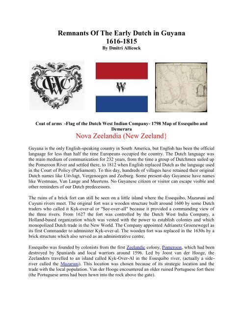
Coat of arms -Flag of the <strong>Dutch</strong> West Indian Company- 1798 Map of Essequibo and<br />
Demerara<br />
Nova Zeelandia (New Zeeland}<br />
<strong>Guyana</strong> is the only English-speak<strong>in</strong>g country <strong>in</strong> South America, but English has been the official<br />
language for less than half the time Europeans occupied the country. <strong>The</strong> <strong>Dutch</strong> language was<br />
the ma<strong>in</strong> medium of communication for 232 years, from the time a group of <strong>Dutch</strong>men sailed up<br />
the Pomeroon River and settled there, to 1812 when English replaced <strong>Dutch</strong> as the language used<br />
<strong>in</strong> the Court of Policy (Parliament). To this day, hundreds of villages have reta<strong>in</strong>ed their orig<strong>in</strong>al<br />
<strong>Dutch</strong> names like Uitvlugt, Vergenoegen and Zeeburg. Some present-day <strong>Guyanese</strong> have names<br />
like Westmaas, Van Lange and Meertens. No <strong>Guyanese</strong> citizen or visitor can escape visible and<br />
other rem<strong>in</strong>ders of our <strong>Dutch</strong> predecessors.<br />
<strong>The</strong> ru<strong>in</strong>s of a brick fort can still be seen on a little island where the Essequibo, Mazaruni and<br />
Cuyuni rivers meet. <strong>The</strong> orig<strong>in</strong>al fort was a wooden structure built around 1600 by some <strong>Dutch</strong><br />
traders who called it Kyk-over-al or "See-over-all" because it provided a command<strong>in</strong>g view of<br />
the three rivers. From 1627 the fort was controlled by the <strong>Dutch</strong> West India Company, a<br />
Holland-based organization which was vested with the power to establish colonies and which<br />
monopolized <strong>Dutch</strong> trade <strong>in</strong> the New World. <strong>The</strong> Company appo<strong>in</strong>ted Adrianetz Groenewegel as<br />
its first Commander to adm<strong>in</strong>ister Kyk-over-al. <strong>The</strong> wooden fort was replaced <strong>in</strong> the 1630s by a<br />
brick structure which also served as an adm<strong>in</strong>istrative centre.<br />
Essequibo was founded by colonists from the first Zeelandic colony, Pomeroon, which had been<br />
destroyed by Spaniards and local warriors around 1596. Led by Joost van der Hooge, the<br />
Zeelanders travelled to an island called Kyk-Over-Al <strong>in</strong> the Essequibo river, (actually a sideriver<br />
called the Mazaruni). This location was chosen because of its strategic location and the<br />
trade with the local population. Van der Hooge encountered an older ru<strong>in</strong>ed Portuguese fort there<br />
(the Portuguese arms had been hewn <strong>in</strong>to the rock above the gate).
Us<strong>in</strong>g funds of the West Indian Company, van der Hooge built a new fort called 'Fort Ter<br />
Hoogen' from <strong>1616</strong> to 1621, though the fort quickly became known amongst the <strong>in</strong>habitants as<br />
Fort Kyk-Over-Al (English: Fort See-everywhere). <strong>The</strong> adm<strong>in</strong>istration of the West Indian<br />
Company as well as the governor of the entire colony settled here <strong>in</strong> 1621.<br />
Initially the colony was named Nova Zeelandia (New Zeeland), and <strong>in</strong>cidentally the first New<br />
Zealand, but the usage of the name Essequibo soon became common. On the southern shore of<br />
the river the hamlet Cartabo was built, conta<strong>in</strong><strong>in</strong>g 12 to 15 houses. Around the river, plantations<br />
were created where slaves cultivated cotton, <strong>in</strong>digo and cacao. Somewhat further downstream,<br />
on Forteiland or 'Great Flag Island', Fort Zeelandia was built. From 1624 the area was<br />
permanently <strong>in</strong>habited and from 1632, together with Pomeroon, it was put under the jurisdiction<br />
of the Zeelandic Chamber of the WIC (West Indian Company). In 1657 the region was<br />
transferred by the Chamber to the cities of Middelburg, Veere and Flush<strong>in</strong>g, who established the<br />
'Direction of the New Colony on Isekepe' there. From then on Pomeroon was called 'Nova<br />
Zeelandia'.<br />
In 1658 cartographer Cornelis Goliath created a map of the colony and made plans to build a city<br />
there called 'New Middelburg', but the Second Anglo-<strong>Dutch</strong> War (1665–1667) put an end to<br />
these plans. Essequibo was occupied by the British <strong>in</strong> 1665 (along with all other <strong>Dutch</strong> colonies<br />
<strong>in</strong> the Guianas), and then plundered by the French. <strong>The</strong> follow<strong>in</strong>g years the Zeelanders sent a<br />
squardron of ships to retake the area. While the Sur<strong>in</strong>ame colony was captured from the British<br />
by Abraham Crijnssen, the by then abandoned Essequibo was occupied by Matthys Bergenaar.<br />
In 1670 the Chamber of the WIC <strong>in</strong> Zeeland took over control of the colonies aga<strong>in</strong>. <strong>The</strong> <strong>Dutch</strong><br />
colonies <strong>in</strong> the region endured much suffer<strong>in</strong>g as a result of the N<strong>in</strong>e Years' War (1688–1697)<br />
and the Spanish Succession War (1701–1714), which brought pirates <strong>in</strong>to the region. In 1689<br />
Pomeroon was destroyed by French pirates, and abandoned.<br />
<strong>The</strong> Chamber of the WIC <strong>in</strong> Zeeland kept control over the colonies, which sometimes led to<br />
criticism from <strong>The</strong> Chamber of the WIC <strong>in</strong> Amsterdam, who also wanted to start plantation<br />
there. <strong>The</strong> Zeelanders however, had established the colony by themselves, and after they retook<br />
possession of Essequibo under command of the commander of Fort Nassau Bergen <strong>in</strong> 1666, they<br />
considered themselves as rightful rulers of the region. Under governor Laurens Storm van 's<br />
Gravesande, English planters started com<strong>in</strong>g to the colony after 1740.<br />
After 1745 the number of plantations along the Demerara and her side-rivers rapidly <strong>in</strong>creased.<br />
Particularly, British colonists from Barbados began settl<strong>in</strong>g here. After 1750 a commander of the<br />
British population was assigned, giv<strong>in</strong>g them their own representation. Around 1780 a small<br />
central settlement was established at the mouth of the Demerara, which received the name<br />
Stabroek <strong>in</strong> 1784, named after one of the directors of the West Indian Company. From 27<br />
February 1781 to February 1782 the colony was occupied by the French. In 1796 it was<br />
permanently occupied by the British.<br />
In 1800 Essequibo and Demerara collectively held around 380 sugarcane plantations.
At the Peace of Amiens, the Netherlands received the Essequibo colony for a short time, from<br />
1802 to 1803, but after that the British aga<strong>in</strong> occupied it. In 1812 Stabroek was renamed by the<br />
British as Georgetown.<br />
Essequibo became an official British territory on 13 August 1814 as part of the Treaty of<br />
London, and was merged with the colony of Demerara. On 21 July 1831, Demerara-Essequibo<br />
was united with Berbice to create British Guiana, now <strong>Guyana</strong>.<br />
In 1838, Essequibo was made one of the three counties of Guiana, the other two be<strong>in</strong>g Berbice<br />
and Demerara. In 1958, the county was abolished when Guiana was subdivided <strong>in</strong>to districts.<br />
Currently, historical Essequibo is part of a number of <strong>Guyanese</strong> adm<strong>in</strong>istrative regions and the<br />
name is preserved <strong>in</strong> the regions of Essequibo Islands-West Demerara and Upper Takutu-Upper<br />
Essequibo.<br />
<strong>Dutch</strong> Hall<br />
This is the great <strong>Dutch</strong> hall on Flag Island <strong>in</strong> the Essequibo River, established <strong>in</strong> 1744. It has<br />
tall, shuttered w<strong>in</strong>dows, the bell-tower of a church and the body of a warehouse. Aside from<br />
forts, it's probably the oldest build<strong>in</strong>g <strong>in</strong> <strong>Guyana</strong>. Inside there's a large expanse of flagstones, a<br />
cluster of well-laureled tombs, and a colony of bats. In its day, the hall had been a church, an<br />
office, a college, a slave market, and, most importantly, the Court of Policy. From here, the<br />
<strong>Dutch</strong> planters had declared dom<strong>in</strong>ion over an estate five times the size of Holland. Now all that<br />
rema<strong>in</strong>ed of them were a few colored pictures, each look<strong>in</strong>g splendid <strong>in</strong> a breastplate and wig.
Historical <strong>Dutch</strong> Church – Leguan, <strong>Guyana</strong><br />
Leguan, one of the few <strong>in</strong>habited islands of the Essequibo, sits squarely <strong>in</strong> the mouth of the river,<br />
a relatively short speedboat ride from Parika. Leguan Island is situated <strong>in</strong> the delta of the<br />
Essequibo River on the coast of <strong>Guyana</strong>, South America. <strong>The</strong> island is shaped like a gull w<strong>in</strong>g<br />
and is n<strong>in</strong>e miles (14 km) long and 2 miles (3.2 km) wide at its widest mak<strong>in</strong>g it roughly twelve<br />
square miles <strong>in</strong> area.<br />
Historical Hand-blown w<strong>in</strong>e bottles and<br />
decanters left by the early <strong>Dutch</strong>.<br />
<strong>The</strong> <strong>Dutch</strong> were <strong>in</strong> what's now <strong>Guyana</strong><br />
from 1595, and they rema<strong>in</strong>ed <strong>in</strong> Sur<strong>in</strong>ame<br />
until 1975. A po<strong>in</strong>t worth not<strong>in</strong>g, many<br />
<strong>Dutch</strong> never left the Colonies and are the<br />
ancestors of many <strong>Guyanese</strong>. Throughout<br />
the creeks there are flagons, demijohns,<br />
hand-blown w<strong>in</strong>e bottles, decanters, crocks,<br />
pots and flasks. But mostly it's g<strong>in</strong>. If it’s<br />
possible to read history from the rubbish,<br />
then a curious picture emerges.
the smallest fort ever built by the <strong>Dutch</strong> overseas.<br />
Fort Kyk-Over-Al was a <strong>Dutch</strong><br />
fort <strong>in</strong> the colony of Essequibo.<br />
It was constructed <strong>in</strong> <strong>1616</strong> on<br />
an islet <strong>in</strong> the mouth of the<br />
Mazaruni River. It once served<br />
as the centre for the <strong>Dutch</strong><br />
adm<strong>in</strong>istration of the county,<br />
but now only ru<strong>in</strong>s are left. <strong>The</strong><br />
name Kyk-Over-Al derives from<br />
the <strong>Dutch</strong> for "See over all", a<br />
reference to the command<strong>in</strong>g<br />
view of the river from the fort.<br />
Fort Kyk- Over- Al is located on<br />
a small island, which is<br />
approximately 1.5 acres <strong>in</strong> size.<br />
<strong>The</strong> island was once the seat of<br />
government for the colony of<br />
Essequibo under the period of<br />
<strong>Dutch</strong> occupation <strong>in</strong> the 17th<br />
century. It is said to have been<br />
<strong>The</strong> <strong>Dutch</strong> faced their first serious attacks <strong>in</strong> 1665 when Major John Scott was sent by the<br />
Governor of Barbados, Lord Willoughby, to <strong>in</strong>vade the settlements <strong>in</strong> the Pomeroon. By that<br />
time, prosperous sugar plantations were already established <strong>in</strong> that area. Scott, <strong>in</strong> alliance with<br />
Caribs, seized Nova Zeelandia, and after leav<strong>in</strong>g 50 men to hold it, he proceeded up the<br />
Essequibo and occupied Kyk-Over-Al with 20 men.<br />
<strong>The</strong> occupation of Kyk-Over-Al by the English did not last long, for the <strong>Dutch</strong> Commandeur of<br />
Berbice, Matthys Bergenaar, was able to march overland with a group of soldiers and recapture<br />
it. At the same time, a French expedition arrived <strong>in</strong> the Pomeroon area to help the <strong>Dutch</strong> who<br />
were their allies. <strong>The</strong>y besieged the English at the fort at Nova Zeelandia and starved the men<br />
<strong>in</strong>to surrender<strong>in</strong>g. <strong>The</strong> prisoners were shortly after massacred by the Arawaks who were allies of<br />
the French.<br />
Thus, Essequibo reverted to the <strong>Dutch</strong>, and Admiral Crynssen, who had earlier captured<br />
Sur<strong>in</strong>ame from the English, arrived as Commandeur. He concentrated his attention on<br />
redevelop<strong>in</strong>g Kyk-Over-Al and the surround<strong>in</strong>g areas. Pomeroon was not regarded as a priority.<br />
In 1676 the <strong>Dutch</strong> established a trad<strong>in</strong>g post on the Pomeroon River. Ten years later, they<br />
decided to appo<strong>in</strong>t a separate Commandeur to control affairs on that river while ma<strong>in</strong>ta<strong>in</strong><strong>in</strong>g a<br />
Commandeur at Kyk-Over-Al. This caused some difficulty because the Commandeur of Kyk-<br />
Over-Al refused to render assistance to his counterpart <strong>in</strong> Pomeroon. Nevertheless, with<strong>in</strong> two<br />
years, settlements sprang up and sugar cultivation was established aga<strong>in</strong>.
Fort Nassau on the Berbice River<br />
This is all that rema<strong>in</strong>s of Fort Nassau, on the Berbice River, <strong>Guyana</strong>. Fort Nassau was the<br />
capital of the colony of Berbice. It was situated approximately 88 kilometers upstream the<br />
Berbice River from New Amsterdam.<br />
<strong>The</strong> orig<strong>in</strong>al fort was burnt by the French when they attacked Berbice <strong>in</strong> 1712. A new fort was<br />
subsequently built, which was burned <strong>in</strong> 1763 by Berbice governor Van Hoogenheim to prevent<br />
it from fall<strong>in</strong>g <strong>in</strong> the hands of revolt<strong>in</strong>g slaves.<br />
<strong>The</strong> rema<strong>in</strong>s of Fort Nassau were declared a National Monument by the <strong>Guyanese</strong> government <strong>in</strong><br />
1999. Recently, efforts have been started to preserve the fort.<br />
Only one 18th century description of these build<strong>in</strong>g rema<strong>in</strong>s, from a <strong>Dutch</strong> traveler called<br />
Harts<strong>in</strong>ck. In "Beschrijv<strong>in</strong>g van Guiana of de Wilde Kust", he’d described a structure 100 feet<br />
long and 50 feet wide, which had served as a church, a storehouse, the government, and the<br />
home of the ‘corp de guarde’.<br />
On 8 March 1763, the <strong>Dutch</strong> - faced by a massive slave revolt - spiked the guns, and the fort was<br />
set on fire. Now all that rema<strong>in</strong>s are a few outl<strong>in</strong>es (the hall, and some stables, accord<strong>in</strong>g to<br />
Harts<strong>in</strong>ck, two smithies and some barracks). But, <strong>in</strong>side the forest, it's cathedral-cool, and, on the<br />
day I visited, we also found the old ramparts, a small brick bridge, some glazed tiles, and a stash<br />
of hand-blown bottles.<br />
In 1733, a village which had sprung up around Fort Nassau was named New Amsterdam (<strong>Dutch</strong>:<br />
Nieuw Amsterdam). <strong>The</strong> fort and the village were abandoned <strong>in</strong> 1785 <strong>in</strong> favor of Fort S<strong>in</strong>t<br />
Andries, situated more downstream, at the confluence of the Canje River. <strong>The</strong> new village was<br />
aga<strong>in</strong> named New Amsterdam, and is still known by that name <strong>in</strong> contemporary <strong>Guyana</strong>.
One of the most significant <strong>Dutch</strong> legacies <strong>in</strong> <strong>Guyana</strong> was<br />
the method of land management. Settlement and<br />
agriculture <strong>in</strong>itially were limited to a belt of land<br />
extend<strong>in</strong>g 50 to 150 kilometers upriver. <strong>The</strong> marshy coast<br />
flooded at high tide and did not appear conducive to<br />
European settlement.<br />
<strong>The</strong> prospect of large profits for tropical agricultural<br />
products, especially sugar, led to the reclamation of<br />
coastal lands <strong>in</strong> the second half of the 1700s. In the<br />
1740s, when <strong>Dutch</strong> sugar planters moved their estates<br />
from Kyk-over-al to other locations towards the coastal<br />
belt, they had to spend large sums of money and organize<br />
an army of manpower on sea defense, dra<strong>in</strong>age and<br />
irrigation.<br />
<strong>The</strong> <strong>Guyana</strong> coastland is six feet below high-tide level<br />
and is vulnerable to flood-water from the sea. In addition,<br />
the planters had to combat water dra<strong>in</strong><strong>in</strong>g down from the<br />
highlands beh<strong>in</strong>d their estates and were threatened with<br />
flood<strong>in</strong>g every ra<strong>in</strong>y season. Faced with this dual agony, the <strong>Dutch</strong> planters devised a system of<br />
water control that is used up to this day.<br />
<strong>The</strong> <strong>Dutch</strong> were em<strong>in</strong>ently suited to this task, hav<strong>in</strong>g orig<strong>in</strong>ated the polder system, a technique<br />
by which a tract of usable land is created by damm<strong>in</strong>g and then dra<strong>in</strong><strong>in</strong>g a water-covered area.<br />
Us<strong>in</strong>g this system, the <strong>Dutch</strong> created a coastal pla<strong>in</strong> that rema<strong>in</strong>s one of <strong>Guyana</strong>'s most<br />
productive plantation areas.<br />
<strong>The</strong> polder system entailed the use of a front dam, or facade, along the shorefront. This dam was<br />
supported by a back dam of the same length and two connect<strong>in</strong>g side dams, which formed a<br />
rectangular tract of land known as a polder. <strong>The</strong> dams kept the salt water out, and fresh water<br />
was managed by a network of canals that provided dra<strong>in</strong>age, irrigation, and a system of<br />
transportation. <strong>The</strong> labor for the ""polderization"" of <strong>Guyana</strong>'s coast was provided by the <strong>Dutch</strong><br />
colony's African slaves.<br />
History is the witness that testifies to the pass<strong>in</strong>g of time; it illum<strong>in</strong>ates reality, vitalizes memory,<br />
provides guidance <strong>in</strong> daily life, and br<strong>in</strong>gs us tid<strong>in</strong>gs of antiquity. In life and <strong>in</strong> death, <strong>in</strong> the past<br />
and the present, our <strong>Dutch</strong> pioneers attempted and tamed the wild of early <strong>Guyana</strong> and left an<br />
<strong>in</strong>delible impression, worthy of preservation.